STETSON ENGINEERS INC. HANSON ENVIRONMENTAL,INC. IBIS ENVIRONMENTAL SERVICES. February 2004 Revised
|
|
|
- Melinda Jones
- 6 years ago
- Views:
Transcription

1 FINAL DRAFT ARROYO GRANDE CREEK HABITAT CONSERVATION PLAN (HCP) AND ENVIRONMENTAL ASSESSMENT/INITIAL STUDY (EA/IS) FOR THE PROTECTION OF STEELHEAD AND CALIFORNIA RED-LEGGED FROGS February 2004 Revised STETSON ENGINEERS INC. San Rafael and West Covina, California Mesa, Arizona HANSON ENVIRONMENTAL,INC. Walnut Creek, California IBIS ENVIRONMENTAL SERVICES San Rafael, California
2 EXECUTIVE SUMMARY San Luis Obispo County Flood Control and Water Conservation District Zone 3 (District) operates and maintains Lopez Reservoir, in the Arroyo Grande Creek watershed, for municipal and agricultural water supplies. The Arroyo Grande Creek watershed downstream of Lopez Dam also provides habitat for a variety of fish and wildlife species including southern anadromous steelhead (Oncorhynchus mykiss) inhabiting the South- Central California Coast Evolutionary Significant Unit (ESA) and California red-legged frogs (Rana aurora draytonii). Both steelhead and red-legged frogs are threatened species under the Federal Endangered Species Act. Operation of the reservoir and associated releases into Arroyo Grande Creek, in addition to other operations and maintenance activities performed by the District associated with the project, affect the quality and availability of habitat for steelhead and red-legged frogs, and may result in direct or indirect incidental take of these protected species. To comply with the Endangered Species Act, and provide incidental take authorization for steelhead and red-legged frogs resulting from District operations and maintenance activities affecting Arroyo Grande Creek, there is a need for incidental take authorization for covered activities while providing enhanced habitat conditions and protection for both red-legged frogs and southern steelhead. Section 10(a)(1)(B) of the Endangered Species Act permits a non-federal entity to obtain incidental take authorization for protected species as a result of covered activities through development of a Habitat Conservation Plan (HCP). The District has developed the following HCP, describing commitments and assurances associated with implementation of measures to avoid, minimize, and mitigate impacts of District activities on steelhead and redlegged frogs within Arroyo Grande Creek downstream of Lopez Dam, and to obtain an incidental take permit under the Federal Endangered Species Act for authorized and covered activities. The HCP would also serve as the basis for compliance with the California Endangered Species Act (California Fish and Game Code ) in the event that either covered species is subsequently listed by the state. The purpose of the HCP is to authorize the District for incidental take from current and anticipated operations of the Lopez project, while providing protection for steelhead and California red-legged frogs. The HCP documents the technical and scientific basis for the proposed conservation actions, based on the best scientific and commercial data available for Arroyo Grande Creek. Operations, maintenance, habitat improvements, and protective measures identified as part of this HCP will be the sole responsibility of the District. The HCP boundaries include Arroyo Grande Creek downstream from Lopez Dam to the flood control channel (Fair Oaks Boulevard), a distance of approximately 10 miles. The HCP boundaries extend laterally from the Arroyo Grande Creek channel to encompass riparian land along the creek supporting ecological processes associated with habitat for steelhead and red-legged frogs. The designated HCP boundaries encompass land and facilities owned by the District, as well as lands owned by others. Habitat enhancement or conservation measures within the designated HCP boundaries on lands not owned or managed by the District are not, however, precluded from consideration under this HCP. With the concurrence of willing landowners, the District will secure environmental County of San Luis Obispo, Draft Arroyo Grande Creek HCP ES-1
3 easements and access on private lands to develop non-flow habitat improvement projects along the creek corridor. The District requests authorization for incidental take of steelhead and red-legged frogs within the HCP boundaries associated with the following covered activities: Reservoir storage; Uncontrolled spills and managed instream flow releases; Municipal water treatment and supply, including backwash water disposal and water sampling activities; Water releases for irrigated agriculture; Rainfall and stream gaging; Dam and stream channel by the District in Arroyo Grande Creek; Lopez Dam and Reservoir operations; Arroyo Grande stream gage removal and replacement and other habitat enhancement actions implemented as part of this HCP; Instream flow releases exceeding flows established by this HCP; and Channel and facility maintenance by the District in Arroyo Grande Creek. The proposed duration of this HCP, and the associated incidental take permit, is 20 years, from 2005 through The actual initiation date for the HCP will be based on final approval of the plan and authorization of the associated incidental take permit. Objectives of the HCP are to (1) reduce mortality and enhance habitat for steelhead and red-legged frogs within Arroyo Grande Creek; and (2) promote recovery of steelhead and red-legged frogs. The HCP proposes a conservation strategy, which will: Minimize and avoid adverse impacts that would jeopardize the species; Provide habitat enhancements to compensate for unavoidable losses; and Implement actions to protect covered species and promote their recovery. Specific objectives of the HCP are: Follow instream flow schedule in Arroyo Grande Creek, using managed releases from Lopez Reservoir to (1) enhance instream habitat for steelhead; (2) reduce or avoid adverse impacts from dewatering steelhead habitat; and (3) reduce or avoid adverse impacts of instream flows on red-legged frog habitat; Implement habitat improvement and actions to reduce or avoid impacts and enhance habitat conditions to benefit steelhead and/or red-legged frogs; Avoid, minimize, and mitigate adverse impacts on covered species, from facility operations and maintenance activities under the direct authority of the District; County of San Luis Obispo, Draft Arroyo Grande Creek HCP ES-2
4 Releases from Lopez Reservoir to Arroyo Grande Creek, varying with interand intra-annual hydrologic conditions, to protect and enhance habitat for various lifestages of steelhead; Provide for improvements in steelhead migration; Provide opportunities for habitat enhancement for covered species; Provide assurances to the District consistent with the USFWS No Surprises Rule ; and Provide incidental take authorization for the District impacts to covered species included as part of this HCP. To accomplish the goals and objectives outlined above, the HCP evaluated alternative conservation strategies. A proposed (preferred) alternative was selected and is comprised of: Releases from Lopez Dam to improve habitat quality and availability for various lifestages of steelhead, including: o Spawning and egg incubation flows between January 1 April 30: release 6 cubic feet per second (cfs) if December 31 reservoir storage is greater than 30,000 AF. If reservoir storage is less than 30,000 AF, but greater than 25,000 AF, release 3 cfs or the average inflow over the previous 14 days, whichever is less. If reservoir storage is less than 25,000 AF, the Technical Committee would be consulted to establish instream flow releases; o Steelhead passage and attraction flows between February 1 through April 30: consecutive five (5) day release of 20 cfs each month if reservoir storage is greater than 30,000 AF. If possible, passage flow releases would coincide with increased streamflow from runoff within the watershed. To the extent that naturally occurring streamflow at Lopez Dam (e.g., reservoir spill) meets the 20 cfs passage criteria, no additional releases would be required from Lopez Reservoir to meet requirements of an individual passage event. Releases from Lopez Reservoir may be required to supplement naturally occurring flows, both in magnitude and duration, to achieve the passage criteria; o Juvenile steelhead rearing flows between May 1 to June 30 and September 1 to December 31: release 3 cfs if April 30 reservoir storage is greater than 30,000 AF. If reservoir storage is less than 30,000 AF, but greater than 25,000 AF, release 3 cfs or a flow equal to average inflow over the previous 14 days, whichever is less. If reservoir storage is less than 25,000 AF, the Technical Committee would be consulted to establish instream flow releases; o Juvenile steelhead rearing flows between July 1 to August 31: release reservoir inflow or 3 cfs, whichever is greater. Manage reductions in reservoir releases below 100 cfs in accordance with an established ramping rate schedule; Manage increases in reservoir releases, to the extent practical, at a ramping rate not to exceed 10 cfs per hour to protect red-legged frogs; County of San Luis Obispo, Draft Arroyo Grande Creek HCP ES-3
5 Remove the existing Arroyo Grande stream gage, which has been identified as a significant passage impediment, to facilitate steelhead migration; Fund the Arroyo Grande HCP Conservation Account with a total contribution over the 20-year duration of the HCP of $1,000,000. Allocations to the Conservation Account would be $50,000 per year. Habitat improvement projects funded by the Conservation Account would be recommended by the HCP Technical Committee, representing the USFWS, NOAA Fisheries, California Department of Fish and Game (CDFG), and the District. Funding for habitat enhancement actions provided through the HCP Conservation Account may be augmented with grant funds from state, federal, private, or other sources. Non-flow habitat enhancement projects funded through the Conservation Account may include: o Steelhead spawning gravel augmentation and/or gravel cleaning; o Improvements in fish passage at the low-flow road crossing located within the flood control reach and culverts at the Cecchetti Road crossing; o In-channel habitat improvement projects to improve summer rearing habitat and cover for juvenile steelhead, and steelhead spawning areas; o Solicit and secure environmental easements and right-of-way agreements from willing private landowners along the Arroyo Grande Creek to improve channel bank stability and reduce erosion, and for riparian vegetation planting; o Design and construct in-channel backwater areas and/or off-channel ponds to provide shelter, rearing, and breeding habitat for red-legged frogs. Develop and implement Best Management Practices (BMPs) for stream maintenance and vegetation control; and Develop and implement a public education/awareness program. Monitoring performance of project elements implemented under this HCP, and overall performance of the HCP in enhancing habitat for steelhead and red-legged frogs, is an integral part of the program. As part of this HCP, the District will commit $50,000 per year, or equivalent in-kind services, over the 20-year duration of the HCP, for monitoring and performance evaluation in Arroyo Grande Creek. The financial commitment to the monitoring account will support (1) water quality/temperature and hydrologic monitoring in Arroyo Grande Creek; (2) monitoring of species abundance, geographic distribution, habitat use, habitat condition, and sources of mortality to steelhead and red-legged frogs; (3) monitoring of incidental take for covered species; (4) monitoring and performance evaluations for habitat enhancement actions implemented under this HCP; and (5) compilation of monitoring results from other watersheds in the region useful for evaluating the status and trends of covered species. Monitoring performed as part of the HCP will also support an adaptive management decision-making process and provide scientific information for use by the Interagency Technical Committee in identifying priority actions for implementation as part of the HCP, in addition to modifying and refining actions based on the monitoring results and evaluation of performance of the HCP program. Analysis of the proposed (preferred) alternative shows that these actions would improve the quality and availability of habitat within Arroyo Grande Creek for steelhead and red-legged frogs. These activities would also reduce incidental take to steelhead and red- County of San Luis Obispo, Draft Arroyo Grande Creek HCP ES-4
6 legged frogs from operation and maintenance of the Lopez project, and releases to Arroyo Grande Creek. The proposed alternative would, however, contribute to other adverse environmental consequences including reductions in reservoir storage and water surface elevation within Lake Lopez that would (1) impact water supply availability; (2) impact recreation within the lake, including boating, water skiing, and angling; (3) potentially impact spawning success and habitat availability for warm water fish species inhabiting the reservoir. Implementation of the HCP would not result in an increase in water supply availability for municipal or other use (i.e., would not contribute to growth inducement within the region), but would reduce reservoir storage and water supply availability in some years. Construction activity associated with fish passage facility improvements (e.g., removal of the existing stream gage) and installation of non-flow habitat enhancement projects would also result in temporary, localized, increases in turbidity and suspended sediment concentrations. The proposed (preferred) alternative would also increase water rates charged by the District to fund activities identified in the HCP. Habitat enhancement and protective measures identified within the HCP are within the direct control and authority of the District. The effectiveness and biological benefits resulting from these actions, however, may be influenced or modified by non-district actions that affect habitat conditions for steelhead and red-legged frogs within and along the Arroyo Grande Creek corridor. Activities such as riparian water diversions, changes in land use, accelerated channel erosion, limitations and constraints on access by the District for performing non-flow habitat enhancement actions, and other natural and human-induced changes may all affect the biological success of the proposed HCP program, but are outside the control and authority of the District. Despite the identified and potential adverse environmental consequences and constraints, it was concluded that the preferred alternative is feasible and can be implemented by the District. It was further concluded that the preferred alternative would provide environmental benefits, enhanced protection, and improvements in habitat quality and availability within Arroyo Grande Creek for steelhead and red-legged frogs. Covered activities by the District, however, would result in potential incidental take of steelhead and/or red-legged frogs, identified in this HCP and addressed through incidental take authorization by USFWS and NOAA Fisheries in compliance with Sections 9 and 10 of the Endangered Species Act. County of San Luis Obispo, Draft Arroyo Grande Creek HCP ES-5
7 TABLE OF CONTENTS SECTION PAGE Executive Summary...ES Introduction Overview/Background Plan Area - Delineation of HCP Boundaries Prioritization of HCP Actions Species and Activities Covered by Permit Duration of the HCP Organization of the HCP Purpose and Need for Action Description of Affected Environment/Environmental Baseline/Biological Resources Existing Land Use San Luis Obispo Flood Control and Water Conservation District Water Supply Storage and Delivery Facilities, Operation and Maintenance Storage and Delivery Facilities Operations for Flood Control and Water Supply Flood Control Municipal Water Supply Water Releases for Irrigated Agriculture Maintenance Surface Water Hydrology Historical Streamflow Pre-Dam and Post-Dam Hydrology Lopez Reservoir Data Storage Municipal Use / Pipeline Diversion Downstream Release Spills Reservoir Evaporation and Precipitation Reservoir Inflow Unregulated Flow at Arroyo Grande Comparison of Unregulated and Historical Flows for Various Hydrologic Conditions Hydrologic Year Type Classification Flow Comparison for Wet, Above Average, Below Average and Dry Conditions Reservoir Operation Model County of San Luis Obispo, Draft Arroyo Grande Creek HCP i
8 Reservoir Inflow Future Urban Water Needs Instream Flow Releases for Aquatic Habitat Reservoir Net Loss Spill and Outlet Release Tributary Inflow Below Lopez Dam Baseline Modeling Condition Hydrologic Database Physical Constraints Agricultural Uses/Downstream Release Municipal Diversion Fishery Flow Requirements Release Priority and Conjunctive Use Flow Recession and Ramping Rates Air Temperature and Water Quality Monitoring Air Temperature Water Temperature Reservoir Temperature and Dissolved Oxygen Diel Dissolved Oxygen and Water Quality Monitoring Other Water Quality Constituents Arroyo Grande Creek Streamflow and Habitat Conditions Vegetation, Channel Form, and General Land Use Survey Methods Review of Existing Information Field Reconnaissance Survey Habitat Mapping Survey Results Habitat Descriptions by Reach Reach 1 (R-1) Reach 2 (R-2) Reach 3 (R-3) Reach 4 (R-4) Reach 5 (R-5) Reach 6 (R-6) Reach 7 (R-7) Reach 8 (R-8) Reach 9 (R-9) Reach 10 (R-10) Rare Plants Wildlife Fish Life History of Steelhead and Red-Legged Frog Steelhead (Oncorhynchus mykiss) Steelhead Ecology Migration County of San Luis Obispo, Draft Arroyo Grande Creek HCP ii
9 Spawning Rearing Habitat Overwintering Habitat California Red-Legged Frog (Rana aurora draytonii) Status and Distribution Habitat Requirements and Life History Foraging Ecology Dispersal, Use of Upland Habitats, and Activity Patterns Mortality California Red-Legged Frog Occurrence and Reproduction in Coastal Creeks Existing Environment by Reach Reach Reach Reach Reaches 4 thru Reach Reach Reach Known Red-Legged Frog Occurrence in Arroyo Grande Creek Habitat Potential Along Arroyo Grande Creek Effects of Flow Changes and Flow Regimes on California Red-Legged Frog Survival Flow Changes Flow Regimes - Pre-Dam and Post-Dam Cultural Resources Record and Literature Search Native American Heritage Commission Consultation Survey Methods and Results Ethnographic and Prehistoric Background Alternatives, Including Proposed Action Alternative 1: Proposed (Preferred) Action Instream Flow Schedule for Steelhead Passage Improvements at Arroyo Grande Gage Conservation Account Best Management Practices (BMP) for Stream Maintenance and Vegetation Control Public Education/Awareness Priorities and Schedule of Implementation Alternative 2 - Instream Flow Alternative 3 - Non-Flow Physical Actions Channel Modification in Upper Reach Spawning Gravel Enhancement Juvenile Rearing Habitat Enhancement County of San Luis Obispo, Draft Arroyo Grande Creek HCP iii
10 4.3.4 Passage Facilities Priorities and Implementation Schedule Alternative 4 - Steelhead Hatchery Alternative 5 - Passage Upstream of Lopez Dam Fish Ladder Trap and Truck Priorities and Schedule for Implementation Alternative 6 - Participate in Regional 10(a)(1)(B) Permit Alternative 7 - No Action Alternative Effectiveness and Feasibility, Environmental Consequences, and Incidental Take Assessment for HCP Alternatives Alternative 1 - Proposed (preferred) Action Effectiveness and Feasibility Environmental Consequences Incidental Take Assessment Alternative 2 - Instream Flow Alternative 3 - Non-Flow Physical Actions Alternative 4 - Steelhead Hatchery Alternative 5 - Passage Upstream of Lopez Dam Alternative 6 - Participate in Regional 10(a)(1)(B) Permit Alternative 7 - No Action Alternative Habitat Conservation Plan/Measures to Avoid, Minimize and Mitigate for Impacts Implementation of the Five Point Policy Biological Goals and Objectives Adaptive Management and the Technical Committee Adaptive Management Technical Committee General Responsibility/Composition Dispute Resolution Specific Tasks/Review Process Monitoring and Reports Monitoring and Acquisition of Scientific Information California Red-Legged Frog Monitoring Program and Adaptive Management Reports Permit Duration Public Participation Funding Monitoring Account Conservation Account Changed Circumstances Account Source of Funds Operation and Maintenance County of San Luis Obispo, Draft Arroyo Grande Creek HCP iv
11 7.6 Insurance Coverage Administration of Accounts by San Luis Obispo County Plan Implementation, Unforeseen Circumstances Plan Implementation - Incidental Take Permit Authorization Unforeseen & Changed Circumstances - Assurances (No Surprises) Introduction and Summary Non-Triggering Events Normal Variability Changed Circumstances Triggering Events Failure to Comply with Operational Procedures or Best Management Practices Regional Events Natural Events Disease/Parasites Introduced Species/Increased Competition Sharp and Unexpected Declines or Increases in Populations Responses Unforeseen Circumstances Definition Response Report Preparation and Agency Consultation References.10-1 APPENDICES Appendix A: Arroyo Grande Creek Water Quality and Air and Water Temperature Monitoring Appendix B: Implementing Agreement Appendix C: County of San Luis Obispo Draft Initial Study Summary - Environmental Checklist County of San Luis Obispo, Draft Arroyo Grande Creek HCP v
12 LIST OF TABLES Table 3-1 Table 3-2 Table 3-3 Table 3-4 Table 3-5 Table 3-6 Table 3-7 Table 3-8 Table 3-9 Table 3-10 Table 3-11 Table 3-12 Table 3-13 Table 3-14 Table 4-1 Table 4-2 Table 5-1 Streamflow Data for Arroyo Grande Creek Basin Estimated Inflow to Lopez Reservoir Arroyo Grande Creek at Arroyo Grande Historical and Unregulated Monthly Flows Hydrologic Year Type Classification for Arroyo Grande Creek Basin Hydrologic Year Type Classification for Arroyo Grande Creek Basin Existing and Projected Water Demand Average monthly flows for Tar Spring and Arroyo Grande Creeks Average monthly flows for Los Berros and Arroyo Grande Creeks Flow Recession Rates Summary of Habitat Survey Information, By Reach, for Arroyo Grande Creek Summary of Habitat Quality Ratings for Juvenile Steelhead, By Reach, Within Arroyo Grande Creek Special Status plants known to occur or with potential to occur in the vicinity of Arroyo Grande Creek HCP Project Area Juvenile Steelhead Densities Observed within Arroyo Grande Creek during Electrofishing Surveys Conducted in 1996 Summary of Archaeological Database Search for Arroyo Grande Creek Ramping Rate Schedule Ramping Rate Schedule Summary of Potential Impacts and Incidental Take to Steelhead and Red-Legged Frogs Associated with Covered Activities County of San Luis Obispo, Draft Arroyo Grande Creek HCP i
13 LIST OF FIGURES Figure 1-1 Figure 3-1 Figure 3-2 Arroyo Grande Creek and Lopez Lake Municipal water supply facilities, Arroyo Grande Creek location Stream gauging stations (operating and discontinued) within the Arroyo Grande Creek watershed Figure 3-3 Historical flow hydrograph at Arroyo Grande Gage (USGS Gage # ) Figure 3-4 Figure 3-5 Figure 3-6 Figure 3-7 Figure 3-8 Pre-Dam flow variability at Arroyo Grande Gage Post-Dam flow variability at Arroyo Grande Gage Daily maximum flows for pre- and post-dam periods at Arroyo Grande Gage Daily median flows for pre- and post-dam periods at Arroyo Grande Gage Daily minimum flows for pre- and post-dam periods at Arroyo Grande Gage Figure 3-9 Historical Lopez Reservoir storage (1969 through 1997) Figure 3-10 Figure 3-11 Figure 3-12 Figure 3-13 Figure 3-14 Figure 3-15 Figure 3-16 Historical diversion from Lopez Reservoir for municipal use Historical downstream release from Lopez Reservoir Monthly average historical and unregulated flows at Arroyo Grande Creek Lopez Reservoir inflow duration curve and flow ranges for defining hydrologic year types Historical and unregulated monthly average flows at Arroyo Grande gage for wet years Historical and unregulated monthly average flows at Arroyo Grande gage for above average years Historical and unregulated monthly average flows at Arroyo Grande gage for below average years County of San Luis Obispo, Draft Arroyo Grande Creek HCP ii
14 Figure 3-17 Figure 3-18 Figure 3-19 Figure 3-20 Figure 3-21 Figure 3-22 Figure 3-23 Figure 3-24 Figure 3-25 Figure 3-26 Figure 3-27 Figure 3-28 Figure 3-29 Figure 3-30 Figure 4-1 Historical and unregulated monthly average flows at Arroyo Grande gage for dry years Air and water temperature monitoring locations within Arroyo Creek Water quality monitoring locations within Arroyo Grande Creek Results of streamflow measurements within Arroyo Grande Creek during September 1996 Results of transect measurements comparing channel width during experimental streamflow releases from Lopez Dam, September-October 1999 Results of transect measurements comparing average channel depth (feet) during experimental streamflow releases from Lopez Dam, September-October 1999 Results of streamflow measurements within Arroyo Grande Creek during October 1999 Stream reaches used in summaries of Arroyo Grande Creek fish habitat survey information Wildlife/Vegetation survey reaches Results of the California Natural Diversity Database search for reported species occurrence within 5 and 10 miles of Arroyo Grande Creek Summary of major habitat types, by reach, observed within Arroyo Grande Creek Seasonal distribution of adult steelhead passage opportunities (assuming a flow of 20 cfs or more) under pre- and post-dam hydrologic conditions Duration of adult steelhead passage opportunities (assuming a flow of 20 cfs or more) under pre- and post-dam conditions Percentage of passage opportunities, by month, for adult steelhead passage (assuming a flow of 20 cfs or more) under pre-and post-dam hydrologic conditions Plan view of steelhead habitat enhancement (non-flow) actions designed to improve summer pool habitat and winter spawning glides within Arroyo Grande Creek County of San Luis Obispo, Draft Arroyo Grande Creek HCP iii
15 Figure 4-2 Figure 4-3 Figure 5-1 Figure 5-2 Figure 5-3 Cross-section view of steelhead habitat enhancement (non-flow) actions designed to improve summer pool habitat and winter spawning glides within Arroyo Grande Creek Priority reach for obtaining environmental easements and habitat enhancement actions for steelhead and red-legged frogs Results of reservoir operation model simulation of proposed alternative and baseline conditions Comparison of average monthly flow in Arroyo Grande Creek under the proposed alternative and historical flows Flow duration exceedence analysis comparing the proposed alternative and historical baseline flows in Arroyo Grande Creek Figure 5-4 Results of reservoir operation model simulation of the instream flow Alternative 2 and baseline conditions County of San Luis Obispo, Draft Arroyo Grande Creek HCP iv
16 1.0 INTRODUCTION The San Luis Obispo County Flood Control and Water Conservation District Zone 3 (District) operates Lopez Reservoir, in the Arroyo Grande Creek watershed (Figure 1-1), for municipal and agricultural water supplies. Lopez Reservoir provides recreational opportunities including boating, water-skiing, and recreational fishing. The Arroyo Grande Creek watershed provides habitat for fish and wildlife species including anadromous steelhead (Oncorhynchus mykiss) and California red-legged frogs (Rana aurora draytonii). Both are listed for protection under the Federal Endangered Species Act. Lopez Dam is an impassable barrier to steelhead migration. Steelhead habitat is restricted to the reach of Arroyo Grande Creek from Lopez Dam to the Pacific Ocean (Figure 1-1), a distance of about 13 miles. Lopez Project operations include: Seasonally varying water releases to Arroyo Grande Creek for agricultural water supply; Operation of a municipal water treatment plant, including filter backwash water disposal and water sampling activities; Operation of the Arroyo Grande Creek stream gaging station; and Maintenance activities at Lopez Dam, debris removal and maintenance of channel road crossings, and sediment removal. These activities under the authority and control of the District affect availability and quality of steelhead and red-legged frog habitat, and may result in direct or indirect incidental take of these protected species. In addition to construction, operation, and maintenance activities by the District, several other factors affect habitat quality and availability in Arroyo Grande Creek. Section 10(a)(1)(B) of the Endangered Species Act of 1973 authorizes the U.S. Fish and Wildlife Service (USFWS) and National Marine Fisheries Service (NOAA Fisheries) to issue permits for the take of listed species incidental to otherwise lawful activities. An incidental take permit application must be supported by a habitat conservation plan that identifies conservation measures that the permittee agrees to implement for the species to minimize and mitigate the impacts of the permitted incidental take. The District developed the following Habitat Conservation Plan (HCP) to comply with Section 10(a)(2)(A) of the Endangered Species Act and the Code of Federal Regulations [50 CFR 17.22(b)(1), 17.32(b)(1) and ]. The HCP describes commitments and assurances associated with implementation of measures designed to avoid, minimize, and mitigate impacts of District activities on steelhead and red-legged frogs in Arroyo Grande Creek downstream of Lopez Dam, in order to obtain an incidental take permit under the Federal Endangered Species Act for authorized and covered activities. Operations, maintenance activities, habitat improvements, and protective measures identified for implementation as part of this HCP will be the sole responsibility of the District. County of San Luis Obispo, Draft Arroyo Grande Creek HCP 1-1
17 Figure 1-1 County of San Luis Obispo, Draft Arroyo Grande Creek HCP 1-2
18 This HCP documents the technical and scientific basis for proposed management actions, based on the best scientific and commercial data available for Arroyo Grande Creek. Information from these scientific and technical analyses was used to characterize existing habitat conditions in Arroyo Grande Creek and identify factors affecting habitat quality and availability. The resulting information was then used to identify and evaluate project alternatives. Available information was compiled with the assistance of NOAA Fisheries, USFWS, California Department of Fish and Game (CDFG), and District staff. In accordance with the guidelines for Habitat Conservation Plans (USFWS and NMFS 1996, and subsequent amendments and revisions), this document has been developed as a joint HCP and Environmental Assessment/Initial Study (EA/IS). The joint HCP and EA/IS, based on the environmental checklist analysis presented in Appendix C, provides the environmental documentation necessary for compliance with the California Environmental Quality Act (CEQA), and National Environmental Policy Act (NEPA). The document complies with provisions of the California and Federal Endangered Species Acts and environmental documentation requirements of NEPA and CEQA. In compliance with the requirements of NEPA and CEQA, Appendix C provides a CEQA environmental checklist and lists the NEPA environmental consequences for the proposed (preferred) alternative. The environmental checklist discusses land use and planning; population, employment, and housing; geology, soils, and seismicity; hydrology and water quality, including agricultural return flows an storm drain returns; biological resources; cultural and historical resources; traffic and transportation; visual quality and esthetics; air quality; noise and vibration; utilities and infrastructure; public services; energy; hazardous materials; recreation; socioeconomic effects; and mandatory findings of significance. The preferred alternative in the HCP is consistent with flood plains and sites in the National Trails and National Inventory of Rivers (Presidential directive, August 2, 1979), the Advisory Council on Historic Preservation (36 CFR800), National Marine Fisheries Service Habitat Conservation Policies, the Environmental and Health Impact on Low-Income and Minority Populations, the American Indian Religious Freedom Act, and the California and Federal Endangered Species Acts. The preferred alternative would have no adverse effects under National Marine Sanctuaries or Coastal Zone Management Plans. The HCP appendix addresses Indian Trust Assets, Environmental Justice, and socioeconomic impact of the proposed (preferred) alternative project. The District is the State Lead Agency for CEQA compliance. The U.S. Fish and Wildlife Service and National Marine Fisheries Service are the Federal Co- Lead Agencies for NEPA compliance. 1.1 OVERVIEW/BACKGROUND The Arroyo Grande Creek watershed is on the Central California Coast in an arid region with highly variable rainfall, precipitation and stormwater runoff. Anadromous steelhead occur in Arroyo Grande Creek. The watershed also supports permanent agricultural crops (e.g., citrus orchards and wine grapes) and seasonal row crops. The permanent populations of nearby Central Coast communities, including Arroyo Grande, Pismo Beach, Avila Beach, Grover Beach and Oceano, have increased substantially over the past decades, and the area has become a tourist destination. The District completed construction of Lopez Dam in May 1968, to provide a reliable water supply for agricultural and municipal needs. Lopez Reservoir stores stormwater runoff during the winter and early spring, and provides managed releases throughout the year to County of San Luis Obispo, Draft Arroyo Grande Creek HCP 1-3
19 meet downstream demand, as well as diversions from the reservoir through a three-mile pipeline to a water treatment plant which provides treated water to the municipalities listed above. Lopez Reservoir operations affect the seasonal timing and magnitude of streamflows in Arroyo Grande Creek and thereby affect habitat quality and availability for steelhead. Modifications to reservoir operations to improve instream flow or habitat conditions for steelhead could adversely affect habitat quality and availability for red-legged frogs that also inhabit the watershed. Concerns about adverse effects of Lopez Reservoir operations on steelhead resulted in a water right complaint against the District by the California Sportfishing Protection Alliance (CalSPA) in The water right complaint claims District operation and maintenance of the Lopez Project adversely impacts aquatic habitat in Arroyo Grande Creek. For example, reduced releases from Lopez Reservoir in winter 1996 dewatered part of Arroyo Grande Creek. And, in the winter of , two adult steelhead were found stranded in a dry portion of the creek. To address these fishery issues, the District commissioned investigations of steelhead and redlegged frogs and their habitat in the lower reaches of Arroyo Grande Creek (Alley 1996, 1997). The District initially agreed to maintain an interim minimum release from Lopez Reservoir of 7.7 cfs (5 mgd). Subsequently, after completion of a series of stream studies and discussions with CDFG and NOAA Fisheries, the release rate was adjusted to 6.2 cfs (4 mgd) to protect the steelhead habitat and to support the scientific data collection for this HCP. During , several studies were performed on the District's behalf to provide information for the HCP. Habitat surveys were conducted as part of an experimental streamflow study to evaluate changes in habitat conditions as a function of streamflow during the juvenile steelhead summer rearing period. Water and air temperatures were monitored along Arroyo Grande Creek downstream of Lopez Reservoir. Water quality surveys documented diel (within a day: daytime vs. night) variation in water quality parameters such as dissolved oxygen concentrations, and concentrations of various chemical constituents. Hydrologic data from the Arroyo Grande gaging station was used to determine streamflow before and after construction of Lopez Dam. Seasonal and interannual (between years) changes in Lopez Reservoir storage, reservoir inflow, and reservoir evaporation losses were determined. A computer simulation model was developed, using a monthly time-step, to evaluate changes in Lopez Reservoir storage under alternative reservoir release schedules to provide steelhead habitat, while meeting downstream agricultural and municipal water supply commitments. Habitat surveys characterized vegetation along the stream corridor and habitat conditions for red-legged frogs. During , additional field studies were undertaken to evaluate reservoir storage capacity and the potential to adversely affect red-legged frogs or other protected species as a result of fluctuations in the elevation of Lopez Reservoir as a consequence of actions implemented in this HCP. Results of the wildlife and habitat surveys conducted around the periphery of Lopez Reservoir were used to assess and evaluate the potential effects of changes in reservoir storage operations on species and their habitat. Bathymetric surveys were conducted as part of these investigations to determine changes in reservoir storage capacity that may have resulted from siltation and sediment deposition. Results of the reservoir survey documented a reduction in storage capacity that was subsequently used in the HCP hydrologic modeling to refine estimates of the effects of instream flow releases on reservoir storage and water supply availability. Results of these investigations were used to further analyze and evaluate alternative operational strategies and environmental consequences as part of the development of this HCP. County of San Luis Obispo, Draft Arroyo Grande Creek HCP 1-4
20 Information from these investigations, and from previous studies, is the best scientific and commercial data available for use in developing this HCP. Investigation, design and evaluation of factors affecting habitat quality and availability for steelhead and red-legged frogs in Arroyo Grande Creek were facilitated by a Technical Committee (TC) with representation and technical assistance from USFWS, NOAA Fisheries, CDFG, and the District. Based on information from these surveys and analyses, the District evaluated alternative strategies for habitat protection and enhancement as part of this HCP. Accordingly, the District developed a conservation strategy that includes the following commitments: Modifications to operations and maintenance of Lopez Dam involving an instream flow schedule for steelhead and red-legged frogs; Removal of the Arroyo Grande streamflow gage that has been identified as a significant passage impediment to steelhead migration; and Funding for habitat protection and improvements, such as removal of fish passage impediments; improvements to instream habitat structures for steelhead spawning and juvenile rearing; development of habitat for red-legged frogs; and protection and improvement of wetland and riparian areas along the stream corridor. In connection with this HCP, the District requests authorization for incidental take of steelhead and red-legged frogs (Section 5) under the Federal Endangered Species Act, and (in the event these species are listed) under the California Endangered Species Act (California Fish and Game Code ), resulting from activities covered under this HCP. This HCP addresses issues raised by the CalSPA complaint and environmental review requirements of the Lopez Project water rights permit amendment process. The District is committed to an adaptive management process for identifying and evaluating potential management actions as part of this HCP (Section 6). Management actions will be considered in context with other activities influencing steelhead and red-legged frog populations and their habitat in the Arroyo Grande Creek watershed. As a result of 1) uncertainties associated with future management actions, 2) identification of actions that provide adaptive or synergistic benefit with other habitat enhancement programs, and 3) the availability of State and federal funding allocations to augment the financial commitments in this HCP, the proposed adaptive management process is appropriate for implementing the habitat enhancement elements of this HCP. The HCP provides the necessary framework, and commitment to funding required to identify, implement, and monitor performance of these habitat enhancement actions. State and federal resource agencies will continue to play an active role in working with the District to help ensure that the HCP meets these objectives. 1.2 PLAN AREA -DELINEATION OF HCP BOUNDARIES The HCP boundaries include Arroyo Grande Creek downstream from Lopez Dam to the flood control channel (Figure 1-1). The HCP boundaries extend laterally from the Arroyo Grande Creek channel to encompass riparian land along the creek (Section 3.6) supporting ecological processes associated with habitat for steelhead and red-legged frogs. The designated HCP boundaries include land and facilities under the ownership and responsibility of the District. County of San Luis Obispo, Draft Arroyo Grande Creek HCP 1-5
21 Habitat enhancement or conservation measures within the designated HCP boundaries on lands not owned or managed by the District are not, however, precluded from consideration under this HCP provided that access is granted by the landowners. With the concurrence of landowners, such measures will be considered if the Interagency Technical Committee established by the HCP, believes habitat protection or enhancement in these areas is consistent with avoiding, minimizing, or mitigating adverse impacts identified for habitat improvements funded under the HCP. 1.3 PRIORITIZATION OF HCP ACTIONS Priorities for management actions under this HCP are as follows. First, modify the instream flow schedule for Arroyo Grande Creek using managed releases from Lopez Reservoir to: Enhance instream habitat for various lifestages of steelhead and red-legged frogs; Reduce or avoid adverse impacts from stranding or dewatering steelhead habitat; and Reduce or avoid adverse impacts of instream flow releases on red-legged frog habitat. Second, implement habitat improvement or other actions to reduce or avoid impacts and enhance environmental conditions to benefit steelhead and/or red-legged frogs, as associated with land and facilities owned and operated by the District within the Arroyo Grande Creek designated HCP boundaries. Third, implement habitat improvements or other actions to reduce or avoid impacts and enhance environmental conditions to benefit steelhead and/or red-legged frogs, as associated with land or facilities within the designated HCP boundaries, which are not owned or managed by the District, with concurrence and approval of willing private landowners and other responsible parties. The HCP includes a proposed education and outreach element to provide information to local landowners and other interested parties on opportunities for enhancing and protecting habitat for sensitive species within the Arroyo Grande Creek watershed. A variety of habitat enhancement measures can be considered under this HCP, but first priority will be given to projects directly benefiting the covered species, and addressing impacts of operations or maintenance activities on Arroyo Grande Creek and the adjacent watershed under the direct authority of the District. Decisions about future actions funded under this HCP will be evaluated under the Adaptive Management Program (Section 6.2). Consideration will be given to maximizing benefits for covered species within the designated HCP boundaries. Although the HCP commits the District to fund the identified conservation actions, consideration will also be given to opportunities for funding augmentation through State, federal, or other fishery restoration programs. 1.4 SPECIES AND ACTIVITIES COVERED BY PERMIT A wide variety of native fish, wildlife, and plant species inhabit the Arroyo Grande Creek watershed, but species covered by the incidental take permit associated with this HCP are limited to anadromous southern steelhead (Oncorhynchus mykiss), and California red-legged frog (Rana aurora draytonii). Steelhead and California red-legged frog are listed as threatened species County of San Luis Obispo, Draft Arroyo Grande Creek HCP 1-6
22 under the Federal Endangered Species Act. The District requests authorization for incidental take of these two species within the HCP boundaries associated with: Reservoir storage; Uncontrolled spills and managed instream flow releases; Municipal water treatment and supply, including backwash water disposal and water sampling activities; Water releases for irrigated agriculture; Rainfall and stream gaging; Dam and stream channel maintenance by the District in Arroyo Grande Creek.; Lopez Dam and Reservoir operations; Arroyo Grande stream gage removal and replacement and other habitat enhancement actions implemented as part of this HCP; Instream flow releases exceeding flows established by this HCP; and Channel and facility maintenance by the District in Arroyo Grande Creek. Neither steelhead nor California red-legged frogs are currently listed for protection under the California Endangered Species Act. However, these species are identified as species of special concern and may be listed in the future. For this HCP, both steelhead and California redlegged frogs have been identified as covered species, and the District has requested incidental take authorization under the California Endangered Species Act. Incidental take authorization requested under this HCP, and the associated implementation agreement, would provide authorization by appropriate state and federal agencies for incidental take for currently listed steelhead and red-legged frog. The HCP would also provide the conservation framework for authorizing incidental take of future listed species under each agency s respective authority under California or Federal Endangered Species Acts. 1.5 DURATION OF THE HCP The proposed duration of this HCP and the associated incidental take permit is 20 years from HCP approval which is expected to start in 2005 and last through The actual initiation of the HCP will be based on final approvals of the plan and authorization of the incidental take permit. 1.6 ORGANIZATION OF THE HCP The HCP is based on the best scientific and commercial data currently available, in accordance with guidelines in the Endangered Species Habitat Conservation Planning Handbook (USFWS and NMFS 1996). The guidelines allow preparation of a joint HCP and Environmental Assessment/Initial Study to facilitate review and approval of proposed projects. The following document has been prepared as a joint HCP and Environmental Assessment/Initial Study to comply with provisions of NEPA and CEQA. County of San Luis Obispo, Draft Arroyo Grande Creek HCP 1-7
23 The purpose and need for the HCP are discussed in Section 2. The HCP describes the affected environment and environmental baseline conditions including existing land-use, Lopez Reservoir storage and operations, and District water delivery facilities. It includes a description of the environmental setting, and selected fish and wildlife resources within the HCP boundaries (Section 3). Alternatives considered in developing the HCP are discussed in Section 4. Section 4 also describes the proposed project and activities covered by the permit. Section 5 discusses environmental consequences and presents a take assessment of Lopez Reservoir and Arroyo Grande Creek operations and maintenance. Conservation strategies and measures in the HCP to avoid, minimize, and mitigate for impacts, adaptive management, monitoring and reporting are discussed in Section 6. Section 7 discusses funding for the HCP. Section 8 describes the implementation plan; including incidental take permit authorization and a process for addressing changed and unforeseen circumstances. Individuals participating or consulted during preparation of this document are presented in Section 9. Literature cited in the HCP is documented in Section 10. Appendices to the HCP include the results of temperature and water quality monitoring (Appendix A) and the draft Implementation Agreement for the HCP (Appendix B). Appendix C presents the environmental checklist and findings of the Environmental Assessment/Initial Study in compliance with NEPA and CEQA requirements. County of San Luis Obispo, Draft Arroyo Grande Creek HCP 1-8

24
25 2.0 PURPOSE AND NEED FOR ACTION Operations of Lopez Reservoir and resulting changes in instream flows downstream in Arroyo Grande Creek have contributed to both beneficial and detrimental effects on instream habitat for steelhead and red-legged frogs. Dam and reservoir operations may result in direct losses of juvenile or adult steelhead from stranding or dewatering redds (incubating steelhead eggs) by flow reductions, and may also affect availability and quality of instream habitat. In addition, facilities owned or managed by the District, such as the Arroyo Grande stream gage, are impediments to steelhead migration. Lopez Dam was completed in May Historical flow records from the Arroyo Grande gage for 1940 through 1996 (Section 3) show that, before completion of Lopez Dam ( ), streamflow would sometimes cease. After completion of Lopez Dam ( ), streamflow was generally maintained above 1 cubic foot per second (cfs). During below average and dry years, streamflow at Arroyo Grande is reduced by reservoir operation and diversion in winter and spring, but augmented by releases from reservoir storage in summer. The flow alteration is most prominent in dry years. During dry years, streamflow at Arroyo Grande would diminish to near zero between June and August if Lopez Dam had not been constructed. With the Lopez Project in place, flow augmentation by releases from reservoir storage allows summer flow to be maintained at a higher and more stable rate than if the dam was not present. On average, total flow augmentation is about 500 acre-feet in a below average year and about 800 acre-feet in a dry year. Reservoir operations affect spawning gravel recruitment to the lower reaches of Arroyo Grande Creek, and flow regulation affects channel conditions and geomorphic processes influencing habitat diversity and characteristics including sediment deposition and erosion, extent of pools and riffles, and other instream habitat features. Changes in instream flows and other operations and maintenance practices may also affect availability and quality of habitat for California red-legged frogs. Red-legged frogs have been observed within Arroyo Grande Creek downstream of Lopez Reservoir by Alley (1996) within the vicinity of the gravel pit pool, the spillway pool, and downstream of the Ceccheti Road crossing. Essex Environmental conducted surveys in the vicinity of Rodriguez Bridge during January 1998 where a red-legged frog was observed. SAIC conducted surveys in 1999, as part of the Lopez Dam seismic remediation program, in the area downstream of the reservoir, including the spillway pool, outlet works pool and channel, and the abandoned trout farm ponds, however, no red-legged frogs were observed during these surveys. SAIC reported observing two red-legged frogs in October 2000 within the Arroyo Grande Creek channel immediately downstream of the Dam outlet structure while conducting snorkel surveys for juvenile steelhead trout. Fishery monitoring has shown that adult and juvenile steelhead inhabit the creek. Juvenile steelhead have been observed and/or collected within Arroyo Grande Creek during fishery surveys conducted by Alley (1997), CDFandG (2000), and Hanson Environmental, Inc. (unpublished data). Adult steelhead are also known to have occurred within Arroyo Grande Creek where they were vulnerable to stranding as a result of fluctuations in instream flow levels. To comply with the Endangered Species Act, and provide incidental take authorization for protected species for impacts resulting from District operations and maintenance activities County of San Luis Obispo, Draft Arroyo Grande Creek HCP 2-1
26 affecting Arroyo Grande Creek, there is a need for additional protection of steelhead and California red-legged frogs and incidental take authorization for covered activities. The purpose of the HCP is to authorize the District for incidental take from current and anticipated operations of the Lopez project, while providing protection for steelhead and California red-legged frogs. Specific objectives of the HCP include: Provide releases from Lopez Reservoir to Arroyo Grande Creek, varying with inter- and intra-annual (seasonal and between year) hydrologic conditions, to protect and enhance habitat for various lifestages of steelhead and red-legged frogs; Avoid, minimize, and mitigate adverse impacts on covered species, from facility operations and maintenance; Provide for improvements in steelhead migration; Provide opportunities for habitat protection, maintenance, and enhancement for covered species; Provide assurances to the District consistent with the USFWS No Surprises Rule ; and Provide incidental take authorization for the District for impacts to covered species included as part of this HCP. County of San Luis Obispo, Draft Arroyo Grande Creek HCP 2-2
27 1.0 DESCRIPTION OF AFFECTED ENVIRONMENT/ENVIRONMENTAL BASELINE/BIOLOGICAL RESOURCES Arroyo Grande Creek is located in the southern portion of San Luis Obispo County (Figure 1-1). Arroyo Grande Creek flows from the coastal range into Lopez Reservoir. Upstream of Lopez Reservoir, the Arroyo Grande Creek watershed is predominantly undeveloped land. In addition to Arroyo Grande Creek, Lopez Reservoir is also fed by several other creeks (e.g., Wittenberg, Vasquez, Little Falls, and Huff s Hole creeks). Land use downstream of Lopez Reservoir is primarily agriculture, rural residences, parks and recreational facilities, and urban development. Arroyo Grande Creek from Lopez Dam downstream to approximately Fair Oaks Boulevard, a distance of 10 miles, has a naturally incised channel. Riparian vegetation along the creek channel varies intermittently from a dense canopy and riparian buffer zone to open areas with little or no riparian canopy. The lower reach of Arroyo Grande Creek, downstream of Fair Oaks Boulevard to the Arroyo Grande creek lagoon, a distance of approximately three miles, has been channelized for flood control protection which is now under the jurisdiction of the Department of Water Resources (DWR). The flood control reach of Arroyo Grande Creek, which is not the responsibility of the District, is not included within the area covered under this HCP Lopez Dam is an earth-fill dam, constructed in , with a spill crest elevation of feet (1986 datum). Lopez Reservoir serves as the primary municipal water supply source for the communities of Arroyo Grande, Grover Beach, Oceano, Pismo Beach, Avila Beach, Avila Service Area, and County Service Area 12. Water from Lopez Reservoir is released directly into Arroyo Grande Creek, as well as bypassed through a pipeline to a terminal reservoir and water treatment plant. Release from the dam through the outlet structure into Arroyo Grande Creek (non-spill events) generally occurs at a rate of 100 cfs or less. By agreement, an average of 2,330 AF of water has been released from the reservoir into Arroyo Grande Creek each year, between April and October, to meet downstream demands for agricultural irrigation supplies. 1.1 EXISTING LAND USE Terrain near Arroyo Grande Creek varies from hilly to level, ranging in elevation from feet at Lopez Dam to sea level where the creek enters the ocean at Pismo Dunes State Preserve. After construction of Lopez Dam, Arroyo Grande Creek has become a semi-perennial creek with riparian woodland corridors dominated by willows and freshwater marsh. Vegetation includes live oak woodland, valley oak savannah, oak forest, coastal sage shrub (primarily coyote bush), and non-native grassland. Patches of cottonwood trees and dense tangles of vine and poison oak line undeveloped sections of Arroyo Grande Creek. Cultivated fields and open farmland are on either side of Arroyo Grande Creek from Lopez Dam to Huasna Road. Lopez Drive comes close to the creek at Biddle Park, the Filtration Plant and the point where Lopez Drive intersects Huasna Road. From Huasna Road to Strother Park in the town of Arroyo Grande, Arroyo Grande Creek continues through cultivated fields and enters developed residential neighborhoods as it nears Strother Park. Downstream of Strother Park, Arroyo Grande Creek travels through residential neighborhoods and the downtown business section of Arroyo Grande. At the intersection of Highway 101 and Arroyo Grande Creek, the creek passes through cultivated fields and residential neighborhoods until it reaches a channelized section (bounded by levees) beginning about 2.6 miles from the ocean.
28 Except for the final 2 miles through Pismo Dunes State Preserve, the channelized portion of the creek passes through agriculture land and varies in width from feet, with levees approximately feet high. 1.2 SAN LUIS OBISPO FLOOD CONTROL AND WATER CONSERVATION DISTRICT WATER SUPPLY STORAGE AND DELIVERY FACILITIES,OPERATION AND MAINTENANCE Activities covered under this HCP involve all activities associated with operation and maintenance of the Lopez Project, including: Reservoir storage; Uncontrolled spills and managed instream flow releases; Municipal water treatment and supply, including backwash water disposal and water sampling activities; Water releases for irrigated agriculture; Rainfall and stream gaging; Dam and stream channel maintenance by the District in Arroyo Grande Creek; Lopez Dam and Reservoir operations; Arroyo Grande stream gage removal and replacement and other habitat enhancement actions implemented as part of this HCP; Instream flow releases exceeding flows established by this HCP; and Channel and facility maintenance by the District in Arroyo Grande Creek Storage and Delivery Facilities Lopez Reservoir has 22 miles of shoreline, a full pool surface area of 974 acres, a maximum depth of about 120 feet and a storage capacity of about 49,400 acre-feet (AF) based on results of the 2001 reservoir survey (Stetson, unpublished data). The Lopez Dam outlet structure has seven gates at 15-foot depth intervals, allowing water to be taken from the reservoir at elevations between 415 and 505 feet. The main spillway at Lopez Dam is sized to pass the probable maximum flood. Downstream, the Terminal Reservoir and water treatment plant (used for municipal water supply: Figure 3-1) are above the 100-year floodplain. Water for Lopez Project municipal use is carried in a 17,000-foot, 20-inch diameter gravity pipeline running along Lopez Drive from Lopez Dam to the Terminal Reservoir adjacent to the Lopez water treatment plant three miles downstream. The line is encased in concrete for 204 feet where it crosses under Arroyo Grande Creek, at an elevation of about 345 feet. County of San Luis Obispo, Draft Arroyo Grande Creek HCP 1-2
29 Figure 3-1 (see attachment on WEB site) County of San Luis Obispo, Draft Arroyo Grande Creek HCP 1-3
30 Downstream, the pipeline empties into the Terminal Reservoir and water treatment plant (used for municipal water supply, see Figure 3-1), located above the 100-year flood plain at an elevation of 330 feet. An 18-inch diameter pipe branches off the main 20-inch line at Lopez Drive, at an elevation of about 295 feet. This 18-inch line follows Lopez Drive to the water treatment plant, and can be used to bypass the Terminal Reservoir and deliver water directly to the water treatment plant. The Terminal Reservoir provides about 34 days of retention time at a maximum water treatment plant flow rate of 6 mgd, although some degradation of water quality is observed within the Terminal Reservoir. This complies with California Health and Safety code requirements for 30 days non-body contact retention time before water from a body contact recreation reservoir (such as Lopez Reservoir) enters a municipal water treatment plant. The Terminal Reservoir has a capacity of about 844 acre-feet, a surface area of about 37 acres, and a maximum depth of about 30 feet. The runoff from 316 acres of the 424-acre Terminal Reservoir watershed is diverted away from the reservoir by an 8 to 10-foot wide diversion channel, but runoff from a 24-acre undeveloped hillside flows into the reservoir. The main water inflows to the Terminal Reservoir are from the inlet line from Lopez Dam. Orcutt Road divides the Terminal Reservoir into two sections connected by culverts under the road. A reach of the Coastal Branch of the State Water Project was constructed along Orcutt Road and adjacent to the northern perimeter of the Terminal Reservoir. The Terminal Reservoir outlet works have four outlet gates at 6-foot intervals below the full reservoir level. The outlet works are located about 1,500 feet south of the reservoir inlet. Excess runoff into the Terminal Reservoir is passed downstream by a spillway that directs flow into Arroyo Grande Creek Operations for Flood Control and Water Supply Flood Control Lopez Dam is not operated for flood control, and there is no storage reservation for flood control purposes, although the reservoir does provide some incidental flood control benefits. However, the DWR maintained downstream-channelized reach of Arroyo Grande is managed for flood control. This requires levee construction, repair and maintenance, periodic dredging and vegetation removal. Municipal Water Supply The Lopez water treatment plant uses full conventional treatment and free chlorine/ chloramine disinfection. The plant is staffed seven days a week. Treated water is discharged to a 2.25-million gallon underground concrete clearwell reservoir, and then fed by gravity into a distribution system with 6- to 33-inch diameter transmission mains delivering water at pressures of psi. Water Releases for Irrigated Agriculture Water is released from Lopez Reservoir into Arroyo Grande Creek to recharge groundwater supplies used for local agricultural irrigation. These releases for agricultural irrigation ground water recharge typically occur between April and October. The rate and volume of County of San Luis Obispo, Draft Arroyo Grande Creek HCP 1-4
31 releases varies depending on winter rainfall and downstream irrigation demands. Releases from Lopez Reservoir have averaged 2,330 acre-feet annually to recharge groundwater for downstream agricultural use. The rate of releases from Lopez Reservoir into Arroyo Grande Creek to meet agricultural demands varies from approximately 1 to 11 cfs Maintenance As part of the water supply facilities and their operations, the District performs maintenance on the Lopez Dam outlet works and control valves, is responsible for Dam safety inspections that may require short-term modification to reservoir operations and streamflow releases, performs maintenance activities within the Arroyo Grande stream channel, and performs maintenance activity at stream crossings such as debris removal. The frequency and types of maintenance activity vary in response to the conditions occurring within Arroyo Grande Creek and the need for maintenance or repair to maintain reliable operations of the stream channel and associated facilities. These maintenance activities, however, may result in modifications to habitat conditions along the creek, such as short-term reductions in streamflow during outlet work inspections and repair, vegetation removal and control, removal of large woody debris that may obstruct stream crossing that have the potential to adversely affect steelhead and red-legged frogs. These maintenance activities are included as covered activities within this HCP and would be performed in accordance with Best Management Practices (BMPs) to minimize or avoid adverse impacts to steelhead and red-legged frogs, and their habitat. 1.3 SURFACE WATER HYDROLOGY The hydrologic basis for the Arroyo Grande Creek HCP involves: Historical streamflow in Arroyo Grande Creek; Pre- and post-dam hydrology; Lopez Reservoir data; Reservoir inflow; Unregulated Arroyo Grande Creek flow; Comparison of unregulated and historical flows; Classification of hydrologic water year types; Comparison of flows for various hydrologic year types; and The Lopez Reservoir operation model Historical Streamflow The USGS and the District have operated several streamflow gages in the Arroyo Grande Creek basin (Figure 3-2). Most of the gages were discontinued and only two gages are currently County of San Luis Obispo, Draft Arroyo Grande Creek HCP 1-5
32 Figure 3-2 (see attachment on WEB site) County of San Luis Obispo, Draft Arroyo Grande Creek HCP 1-6
33 active. The USGS publishes average daily flows at these gages at the end of each water year (September 30). Table 3-1 summarizes streamflow records in the Arroyo Grande Creek basin, from gage locations shown in Figure 3-2. The Arroyo Grande gage (# : Figure 3-2) has the longest period of record (1940-present) and is particularly important because it covers the periods before and after completion of Lopez Dam. Table 1-1 STREAMFLOW DATA FOR ARROYO GRANDE CREEK BASIN Gage Period of Record USGS Station ID Number Arroyo Grande above Phoenix Creek (Discontinued) Wittenberg Creek near Arroyo Grande (Discontinued) Lopez Creek near Arroyo Grande 1968-present Arroyo Grande near Arroyo Grande (Discontinued) Tar Spring Creek near Arroyo Grande (Discontinued) Arroyo Grande at Arroyo Grande 1940-present 1) Los Berros Creek near Nipomo (Discontinued) ) San Luis Obispo County took over flow measurement and maintenance in Pre-Dam and Post-Dam Hydrology Lopez Dam was completed in May Figure 3-3 shows historical flow at the Arroyo Grande gage for 1940 through The data show that, before completion of Lopez Dam ( ), streamflow would sometimes cease. After completion of Lopez Dam ( ), streamflow was generally maintained above one cubic foot per second (cfs). Figures 3-4 and 3-5 show flow variability for pre- and post-dam periods. Flow variability is characterized by the spread of maximum, median, and minimum flows for the water year (October 1 through September 30). Minimum streamflow from mid-july to mid-november was often near zero in the pre-dam period, whereas minimum streamflow fluctuated between 0.3 and 3.0 cfs in the postdam period. Figures 3-6 through 3-8 show daily maximum, median, and minimum flows for the water year for both pre- and post-dam periods. Maximum and minimum values are the upper and lower limits of the flow variation. The median is the mid-point of the flow distribution. The median is used instead of the mean (average) value because the mean value can be skewed by extreme events. In contrast, the median expresses the central value of the flow distribution undistorted by the magnitude of extreme events. Figure 3-6 shows no significant difference in daily maximum flow during pre- and post-dam periods. Figure 3-7 shows that, after completion of Lopez Dam, median flows are lower between December and June and higher between July and October than in the pre-dam period. This typically occurs downstream from reservoirs, because winter high flows are stored for release in the summer. Figure 3-8 shows that, after completion of Lopez Dam, minimum flows were maintained at a higher and more stable level in summer and fall (June through November) whereas minimum flows prior to the Lopez Project were often zero. County of San Luis Obispo, Draft Arroyo Grande Creek HCP 1-7


34 Figure 3-3 County of San Luis Obispo, Draft Arroyo Grande Creek HCP 1-8
35 Figure 3-4 County of San Luis Obispo, Draft Arroyo Grande Creek HCP 1-9


36 Figure 3-5 County of San Luis Obispo, Draft Arroyo Grande Creek HCP 1-10
37 Figure 3-6 County of San Luis Obispo, Draft Arroyo Grande Creek HCP 1-11
38 Figure 3-7 County of San Luis Obispo, Draft Arroyo Grande Creek HCP 1-12
39 Figure 3-8 County of San Luis Obispo, Draft Arroyo Grande Creek HCP 1-13
40 All flow comparisons discussed above were between pre- and post-dam periods. This could be misleading if hydrologic conditions during the periods compared are not similar (e.g., if one period were wetter or drier than the other). One way to check for differences in hydrologic conditions in two different periods is to compare historical flows with flows for the same period assuming Lopez Dam is absent. Flows determined by assuming Lopez Dam is absent are called unregulated flows. Analyzing flows in the absence of Lopez Dam eliminates the impact of project operation on streamflow. So, comparing historical and unregulated flows isolates effects of operation of the Lopez Project. Estimates of unregulated flow in Arroyo Grande Creek are discussed below Lopez Reservoir Data Lopez Dam is operated for municipal water supply and downstream irrigation water supply. Water can be withdrawn from various depths within the reservoir to obtain the best quality water for treatment and municipal use. Water can be released from the reservoir directly into Arroyo Grande Creek at rates up to 200 cfs through the 42-inch outlet works bypass, but discharge is usually held at or below 100 cfs to avoid damage to the outlet works. Releases from Lopez Reservoir averaging 2,330 acre-feet of water annually (at rates of about 1-11 cfs) have occurred from April to October to recharge ground water for downstream agricultural use. Historical reservoir operation records, such as reservoir storage, municipal diversion, downstream release, reservoir evaporation loss, and spill were used to calculate inflow to Lopez Reservoir. Storage Based on the 2001 reservoir survey results, the present storage capacity of Lopez Reservoir at the spillway crest is about 49,400 acre-feet. Usable storage is about 47,650 acrefeet, with a dead storage of 1,750 acre-feet. A minimum storage volume of 4,000 AF is currently maintained as required by conditions of a Davis-Grunsky contract between the state and District. Impounded water is used for municipal water supply, ground-water recharge, and instream uses. Average annual inflow to the reservoir is about 16,000 acre-feet. Historical municipal diversion and downstream release for ground-water recharge is about 7,500 acre-feet. Reservoir evaporation loss is about 3,200 acre-feet annually. So, on average, there is sufficient inflow to meet present demand. As a result, in an average hydrologic year, the reservoir can be filled to near its full capacity. During wet periods, the reservoir is likely to be filled to capacity and spill excess water. Reservoir drawdown only occurs in below average and dry periods, when inflow is insufficient to meet all demands. Figure 3-9 shows historical reservoir storage in 1969 through Over the 28-year period, there were three significant drawdowns, corresponding to three droughts in the Arroyo Grande Creek basin. The first drawdown, in , lowered storage to 37,500 acre-feet. The second drawdown, in , lowered storage to 32,400 acre-feet. The biggest drawdown was in , when seven consecutive below average and dry years reduced reservoir storage to 16,500 acre-feet (about 30 percent of total storage capacity). County of San Luis Obispo, Draft Arroyo Grande Creek HCP 1-14
41 Figure 3-9 County of San Luis Obispo, Draft Arroyo Grande Creek HCP 1-15
42 Municipal Use / Pipeline Diversion Water for municipal use is diverted through the reservoir outlet and a pipeline to Lopez Terminal Reservoir about three miles downstream. Figure 3-10 shows pipeline diversions for 1969 through Diversions started at about 1,860 acre-feet/year in They steadily increased to a maximum of 6,340 acre-feet in Average annual diversion in 1969 through 1996 was about 4,630 acre-feet. Downstream Release Water is released from the reservoir to recharge ground water for irrigated agriculture. The release from Lopez Reservoir is normally made between April and October (SAIC, 1998). Figure 3-11 shows annual downstream releases for 1969 through Average annual downstream release is about 2,330 acre-feet. Additional water was released in 1995 and 1996 to comply with dam safety requirements. Construction for seismic remediation at Lopez Dam has been completed and the storage restriction has been lifted. Spills Spills occur when the reservoir level reaches the spillway crest. Normally, spills only occur between January and May in wet and above average years. Historically, there have been about 10 spills greater than 1,000 acre-feet. The largest spill (79,100 acre-feet) was in 1983 (January through March 1983). Reservoir Evaporation and Precipitation The large water surface behind Lopez Dam increases water loss to evaporation compared to evaporation loss from a stream. Precipitation on the reservoir surface contributes to reservoir storage. Reservoir evaporation loss is estimated from pan measurements, and evaporation/ precipitation measurements are made by the District near Lopez Reservoir. Reservoir evaporation loss was estimated by multiplying pan evaporation measurements (in inches) and reservoir surface area, adjusted by a pan coefficient of 0.7 to account for the difference in water surface between the reservoir and the evaporation pan. The water contribution from precipitation on the reservoir was estimated by multiplying measured precipitation by reservoir surface area. Reservoir Inflow Streamflow in Arroyo Grande Creek at Lopez Dam represents the available water supply from the watershed above Lopez Dam. It is the limiting factor for any water management plan. County of San Luis Obispo, Draft Arroyo Grande Creek HCP 1-16


43 Figure 3-10 County of San Luis Obispo, Draft Arroyo Grande Creek HCP 1-17
44 Figure 3-11 County of San Luis Obispo, Draft Arroyo Grande Creek HCP 1-18
45 Inflow to a reservoir is usually not measured directly. Mass conservation is used to estimate reservoir inflow from the equation: Total Inflow - Total Outflow = Change in Storage Total inflow is stream inflow plus precipitation on the reservoir. Total outflow includes pipeline diversions, downstream releases, spills, and reservoir evaporation. Since the only unknown in the above equation is stream inflow, the equation can be rewritten as: Stream Inflow = Change in Storage + Pipeline Diversion + Downstream Release + Spill + Evaporation - Precipitation Table 3-2 shows monthly reservoir inflow calculated from this equation. For 1969 through 1996, average annual inflow to Lopez Reservoir was about 16,000 acre-feet, with a maximum of 91,400 acre-feet in 1983 and a minimum of 2,550 acre-feet in Table 3-2. Estimated Inflow to Lopez Reservoir Water Year Inflow to Lopez Reservoir (AF) Water Year Inflow to Lopez Reservoir (AF) , , , , , , , , , , , , , , , , , , , , , , , , , , , , , Unregulated Flow at Arroyo Grande Unregulated flow is the streamflow in Arroyo Grande Creek that would occur if Lopez Dam were not in place. Determining unregulated flow helps assess the impact of Lopez Project operation on Arroyo Grande Creek. In addition, comparing historical and unregulated flows for the same period helps resolve any inconsistency possibly introduced by comparing streamflows County of San Luis Obispo, Draft Arroyo Grande Creek HCP 1-19
46 for pre- and post-dam periods. Unregulated flow is estimated by replacing historical downstream releases and spills from Lopez Reservoir by reservoir inflow, using the equation: Unregulated Flow = Historical Gaged Flow - Reservoir Release - Spill + Reservoir Inflow Unregulated flow was calculated for Arroyo Grande Creek at the Arroyo Grande gage for 1969 through Monthly average historical and unregulated flows are summarized in Table 3-3 and monthly averages are compared in Figure Table 3-3 and Figure 3-12 show that unregulated flow is greater than historically measured flow at Arroyo Grande except in July through September. The change in flow pattern is typical below a storage reservoir; reducing winter high flows and increasing summer lower flows. The annual difference between unregulated and historical flows is about 8,000 acre-feet, approximately equal to annual pipeline diversion (4,630 acre-feet) plus reservoir evaporation loss (3,200 acre-feet). Table 1-3 Arroyo Grande Creek at Arroyo Grande Historical and Unregulated Monthly Flows Unregulated Flow (acre-feet) Difference (Unregulated Historical) Historical Flow Month (acre-feet) January 1,440 3,420 1,980 February 2,300 4,660 2,360 March 3,470 5,680 2,210 April 1,380 1, May June July August September October November December Annual 11,500 19,500 8, Comparison of Unregulated and Historical Flows for Various Hydrologic Conditions Since water supply and demand depends on hydrologic conditions in a given year, it is helpful to examine effects of reservoir operation on streamflow under various hydrologic conditions. A method to classify hydrologic year-type for Arroyo Grande Creek was developed to compare historical and unregulated flows for each hydrologic year type. Hydrologic Year Type Classification This analysis categorizes hydrologic conditions for each year in the Arroyo Grande Creek hydrologic record into four types: wet, above average, below average, and dry. To classify hydrologic conditions for a drainage basin, a representative hydrologic variable to reflect hydrologic conditions in the basin must be selected. The hydrologic variable used in this analysis is inflow to Lopez Reservoir. Inflow to Lopez Reservoir is relatively unimpaired when County of San Luis Obispo, Draft Arroyo Grande Creek HCP 1-20
47 Figure 3-12 County of San Luis Obispo, Draft Arroyo Grande Creek HCP 1-21
48 compared to streamflow downstream of Lopez Dam, because the drainage area above the reservoir is undeveloped. So, streamflow reaching Lopez Reservoir is a representative hydrologic variable for hydrologic year type classification. Flow ranges for each year type classification were determined by flow duration analysis. The flow duration curve was developed from reservoir inflow for 1969 through Figure 3-13 shows the duration curve and flow ranges used to define hydrologic year types. Flow ranges were selected at specific frequency exceedences on the duration curve. The flow duration curve is linear when plotted in a semi-logarithmic scale. Frequency exceedence was partitioned into four equal ranges corresponding to the four designated hydrologic year types. The frequency exceedence (percent of time flow is less than or equal to a given number) and the associated flow ranges selected are: Criteria for Hydrologic Year Type Classification Hydrologic Year Type Inflow to Lopez Reservoir (AF) Frequency Exceedence Wet Greater than 25,000 >75% Above Average Less than 25,000 and Greater than 10, % Below Average Less than 10,100 and Greater than 4, % Dry Less than 4,500 <25% Using these flow ranges, the hydrologic year type for 1969 through 1997 is shown in Tables 3-4 and 3-5. Table 3-4 gives hydrologic year type in chronological sequence, and Table 3-5 shows the years sorted by hydrologic year type. Over the 29-year period, there were six wet years, seven above average years, nine below average years, and seven dry years. The hydrologic year type classification shows that the prolonged dry period in (six years) had three below average and three consecutive dry years. The six-year period ( ) and the three consecutive dry years ( ) are important in analyzing water supply availability and selecting reservoir operation alternatives to meet demand during a prolonged drought. Flow Comparison for Wet, Above Average, Below Average and Dry Conditions The impact of Lopez project operations on downstream streamflow was further analyzed by comparing historical and unregulated flows at the Arroyo Grande Gage (Figure 3-2) under various hydrologic conditions. Average monthly flows for all years in each hydrologic year type are compared in Figures 3-14 through In wet years, historical flow at Arroyo Grande is lower than unregulated flow. A decrease in streamflow is expected downstream of a reservoir because of storage of high flows and diversion. Figure 3-14 shows that flow reduction is greatest during the winter high flow season (January through March). On an average annual basis, total flow reduction is about 26,000 acre-feet in wet years. Above average years are similar to wet years: reservoir storage and diversion decrease downstream flow but not by as much as in wet years. Average annual flow reduction is about 7,500 acre-feet. Figure 3-14 shows that May to September historical flow is about the same as unregulated flow. In other words, reservoir operation has little impact on streamflow at Arroyo Grande in above average hydrologic years. In drier years, reservoir operation alters flow distribution in a different manner. County of San Luis Obispo, Draft Arroyo Grande Creek HCP 1-22
49 Figure 3-13 County of San Luis Obispo, Draft Arroyo Grande Creek HCP 1-23
50 Table 3-4 County of San Luis Obispo, Draft Arroyo Grande Creek HCP 1-24

51 Table 3-5 County of San Luis Obispo, Draft Arroyo Grande Creek HCP 1-25
52 Figure 3-14 County of San Luis Obispo, Draft Arroyo Grande Creek HCP 1-26
53 Figure 3-15 County of San Luis Obispo, Draft Arroyo Grande Creek HCP 1-27
54 Figure 3-16 County of San Luis Obispo, Draft Arroyo Grande Creek HCP 1-28
55 Figure 3-17 County of San Luis Obispo, Draft Arroyo Grande Creek HCP 1-29
56 Figures 3-16 and 3-17 show that during below average and dry years, streamflow at Arroyo Grande is reduced by reservoir operation and diversion in winter and spring, but augmented by releases from reservoir storage in summer. The flow alteration is most prominent in dry years. Figure 3-17 shows that, during dry years, streamflow at Arroyo Grande would diminish to near zero between June and August if Lopez Dam had not been constructed. With the Lopez Project in place, flow augmentation by releases from reservoir storage allows summer flow to be maintained at a higher and more stable rate than if the dam was not present. On average, total flow augmentation is about 500 acre-feet in a below average year and about 800 acre-feet in a dry year Reservoir Operation Model The engineering and hydrologic evaluation for the HCP examined long-term water availability and water quality in the Arroyo Grande Creek watershed and impacts on water uses and water quality resulting from alternative conservation strategies proposed in the HCP. The evaluation was based on a Lopez Reservoir operation model developed for the project. The computer program comprising the reservoir operation model is based on a monthly water balance using historical inflow, outflow, water level, and evaporation measurements. It was verified by comparing simulated results with actual historical measurements. Hydrologic monitoring data were obtained from the gauging station on Arroyo Grande Creek at Arroyo Grande and gauging stations upstream from Lopez Dam (Figure 3-2). The reservoir operation model incorporated hydrologic and operational constraints to formulate Lopez Reservoir operation alternatives to meet the demands of urban and agricultural users and aquatic habitat (instream flow) needs. Alternative instream flow regimes that would benefit steelhead were developed to evaluate water availability under varying hydrological cycles, based on annual precipitation, streamflow, or reservoir storage. The model was used to test the adequacy of the alternatives in meeting demand, to identify tradeoffs, and to formulate mitigation measures for the HCP. Hydrologic components of the computer spreadsheet model developed to simulate operation of the Lopez Project, and assess effects of changes in demand, reservoir operation, and instream use, are described below. Reservoir Inflow Calculated reservoir inflow, the water available for storage, diversion, and release from 1969 through 1996 (28 years), is a basic input to the model. The 28-year period may be slightly drier than average, because it has more below average and dry years in this selected period (16 below average and dry years). Thus, estimates based on these inflow data are conservative. In addition, the simulation period contains a prolonged dry period that can be used as a critical period for water supply availability analysis. Future Urban Water Needs The current Water Supply Agreements commit to a total of 4,530 acre-feet per year (AFY) municipal deliveries. No amendments to the current Agreements are being considered at this time; however, it is foreseeable that additional deliveries from Lopez will be sought to meet increasing urban water needs. Implementation of the HCP would not result in increased water County of San Luis Obispo, Draft Arroyo Grande Creek HCP 1-30
57 supplies for municipal or other uses and would result in reduced reservoir storage and supplies in some years. The 1998 Master Water Plan Update prepared for San Luis Obispo County Flood Control and Water Conservation District (by EDAW, Inc. and Boyle Engineering Corp.) examined 1995 urban water demand, as well as build-out demand. Build-out conditions for Arroyo Grande, Grover Beach, and Pismo Beach are projected to be met by 2020 (Table 3-6). For the Five Cities area alone (Water Planning Area No. 5), urban water demand is expected to increase from 7,057 AFY in 1995 to 12,356 AFY at build-out (Table 3-6). Note that this approximately 5,300 AFY increase in water demand excludes the Avila Service Area and County Service Area 12. Table 1-6 Existing and Projected Water Demand (AFY) Build-out Condition Incorporated Communities Arroyo Grande 2,628 3,540 3,540 Grover Beach 1,794 2,547 2,547 Pismo Beach 1,742 2,887 2,887 Unincorporated Communities Avila Beach Oceano 834 1,238 3,025 Total 7,057 10,289 12,356 There are three major water supply sources serving the Five Cities area: State Water Project supplies, groundwater, and Lopez Reservoir. State Water entitlement totals 2,392 AFY. Actual deliveries in recent years have ranged from 1,800 to 1,990, leaving little entitlement available to meet increasing urban demand. Further, there is no excess capacity in the Coastal Branch of the State Water Project to deliver additional supplies to the Five Cities area. With regard to groundwater, recent investigations conducted by the Department of Water Resources (DWR, Bulletin 118 draft, 2002) indicate that the sustained yield of the San Luis Obispo Valley groundwater basin is estimated at 5,900 acre-feet per year. Note that agricultural water demand is expected to range from 12,400 to 16,500 AFY. It is conceivable that agricultural water needs could fully utilize available groundwater yield. Thus, it can be concluded from this overview of water needs in the Five Cities area that Lopez Reservoir may play a major role in meeting the predicted 4,950 AFY increase in urban water needs. Agricultural Water Demand Projection. Water is released from Lopez Reservoir during the irrigation season (April-October) to recharge the ground-water basin below the dam and mitigate for interception of recharge by the dam. The recharged water is then pumped to irrigate adjacent lands. Releases are managed by observation of surface flows downstream of the agricultural users. Any water not released downstream for recharge has been historically available for use by the municipalities as surplus water. No historical cropping pattern data are available from the San Luis Obispo County Agricultural Commissioner, but current crop data was obtained in GIS format for the county. Information on historical conditions was obtained from the Agricultural Commissioner s office (Robert Hopkins), who had worked for San Luis Obispo County for almost twenty years. County of San Luis Obispo, Draft Arroyo Grande Creek HCP 1-31
58 Mr. Hopkins indicated that irrigated acreage increased slightly in the last twenty years. He noted that citrus and wine grapes were not grown in the area twenty years ago. With this information and GIS data from the county, it is estimated that 163 acres (80 citrus acres + 83 wine grape acres) currently irrigated were not irrigated 20 years ago. Mr. Hopkins estimated total irrigated acreage at about 3,500 acres. So, the percent increase in irrigated acreage over the last twenty years is roughly 5 percent. However, it is estimated that future agricultural demand will not substantially increase or decrease from now until Historically, downstream release for ground-water recharge and irrigation use has been about 2,330 acre-feet annually. Assuming future irrigation practices and cropping patterns are similar to historical patterns, this historical downstream release can be used as an estimate of future releases. Instream Flow Releases for Aquatic Habitat Prior to 1998, no release was made for instream aquatic habitat. In recent years, releases of 4 million gallons per day (mgd) have been made to support instream aquatic habitat. During January 1999, a reduction in releases from Lopez Reservoir resulted in a portion of Arroyo Grande Creek being dewatered and two adult steelhead were stranded. As a consequence, the District agreed with CDFG to maintain a minimum instream flow release from Lopez Reservoir, on an interim basis, pending results of field data collection and analysis as part of the preparation of this HCP. Additional releases to increase flow for steelhead and/or red-legged frogs are considered in Section 4 of this HCP. Reservoir Net Loss Reservoir net loss is the difference between reservoir evaporation loss and precipitation on the reservoir. Historical monthly evaporation and precipitation near the dam were used to estimate these quantities. To convert measured evaporation and precipitation into volume of water, reservoir surface area must be estimated as a function of reservoir level or storage. Curves relating storage area and elevation were obtained from the District and incorporated into the model. Spill and Outlet Release Reservoir storage and outlet capacity are two physical constraints on the reservoir operation model. When reservoir storage exceeds storage capacity, spills occur. Outlet capacity constrains the size of downstream releases. Maximum discharge capacity of the outlet works is about 120 cfs. County of San Luis Obispo, Draft Arroyo Grande Creek HCP 1-32
59 Tributary Inflow Below Lopez Dam There are several small tributaries to Arroyo Grande Creek downstream of Lopez Dam. Tar Spring Creek and Los Berros Creek are the only tributaries where stream gage data are available (Figure 3-2). Tar Spring Creek flows into Arroyo Grande Creek about 2 miles northeast of Arroyo Grande, upstream of the USGS-County Arroyo Grande stream gage (Figure 3-2). Los Berros Creek joins Arroyo Grande Creek about 4 miles below the USGS-County Arroyo Grande gage. Daily flow data for 1968 through 1979 (12 years) are available for Tar Spring Creek, and daily flows for 1968 through 1978 (11 years) are available for Los Berros Creek. Drainage areas for Tar Spring and Los Berros Creeks are 17.8 and 15.0 square miles, respectively. Flows of the two tributaries are compared to Arroyo Grande Creek flow at Arroyo Grande for the overlapping period 1968 through 1978 (11 years) in Tables 3-7 and 3-8. During these years, Tar Spring Creek flow was about 25 percent of the total Arroyo Grande Creek flow on an annual basis. During high flow season, Tar Spring Creek flow contributed as much as 44 percent of the total flow in Arroyo Grande Creek. During low flow season (April through November), Tar Spring Creek contributed very little flow to Arroyo Grande Creek. Tar Spring Creek flows were as low as 0.2 cfs in August. Table 1-7 AVERAGE MONTHLY FLOWS FOR TAR SPRING AND ARROYO GRANDE CREEKS Month Tar Spring Creek (cfs) Arroyo Grande Creek (cfs) Percent January February March April May June July August September October November December County of San Luis Obispo, Draft Arroyo Grande Creek HCP 1-33
60 Table 1-8 AVERAGE MONTHLY FLOWS FOR LOS BERROS AND ARROYO GRANDE CREEKS Month Los Berros Creek (cfs) Arroyo Grande Creek (cfs) Percent January February March April May June July August September October November December Total Based on the flow data for the period, Los Berros Creek flow was about 16.9 percent of Arroyo Grande Creek flow on a total annual basis (Table 3-8). The majority of the flow contribution to Arroyo Grande Creek flow occurred between January and April. During the dry summer months, Los Berros Creek contributed only 3 to 4 percent of Arroyo Grande Creek flow. However, due to residential and agricultural development in the basin, the Los Berros Creek flow pattern has changed. Recent data indicate that the summer flows have been diminished. Little or no flow can be expected to flow into Arroyo Grande Creek from Los Berros Creek during summer months Baseline Modeling Condition A baseline condition is needed to evaluate relative impacts of fishery flow alternatives on water supply conditions. Hydrologic assumptions for the baseline condition are briefly described below. Hydrologic Database The hydrologic database includes historical reservoir operation data (reservoir storage, releases, precipitation on reservoir, and evaporation) for 1969 through These reservoir data were used to calculate historical inflow to the reservoir. Hydrologic data held constant for all modeled alternatives included historical reservoir inflow, precipitation on reservoir, and evaporation. Physical Constraints Reservoir storage capacity and minimum pool are the two physical constraints of the reservoir. In the model, reservoir capacity at the crest of spillway is set at 49,400 acre-feet and County of San Luis Obispo, Draft Arroyo Grande Creek HCP 1-34
61 minimum pool is set at 4,000 acre-feet as required by conditions of a Davis-Grunsky contract between the state and the District, so useable storage is 45,400 acre-feet. These physical constraints determine reservoir spill and available water supply in the reservoir in the model. Reservoir spill occurs when calculated storage exceeds reservoir storage capacity. No release can be made when reservoir storage is at or below minimum pool. Agricultural Uses/Downstream Release The San Luis Obispo County Agricultural Commissioner s office and local growers indicate that there has been little change in cropping pattern, irrigation practice and total irrigated acreage in the Arroyo Grande Creek basin over the last two decades. Thus, agricultural water demand for the baseline condition and all of the modeled alternatives is assumed to remain constant at the present level. Municipal Diversion At the direction of District staff, future municipal water use in the model is limited to the current contract amount of 4,530 acre-feet per year for all modeled alternatives. All future increases in water demand in the Zone 3 area is expected to be met by Lopez Reservoir surplus water deliveries, reclaimed water, ground water, or State Water Project water imported in newly constructed facilities as the existing state water pipeline does not have excess capacity for additional deliveries. Fishery Flow Requirements Historically, there have been no fishery flow releases from Lopez Reservoir. Accordingly, the only required baseline release is for downstream agricultural demand. Alternative flow regimes and schedules have been developed for fishery flows (Section 4), and incorporated in the model. Release Priority and Conjunctive Use Priorities for instream flow releases from Lopez Reservoir were developed as part of this HCP based on providing protection for species listed under the federal Endangered Species Act, contractual demands, water right agreements, and other considerations. Lopez Reservoir release priorities in the model are as follows: (1) fishery flow requirement, (2) municipal release, and (3) downstream agricultural release. The model releases water to meet fishery flow requirements first, then for municipal use, and finally for downstream agricultural use. If reservoir supply is insufficient for all demands, downstream release for agricultural use is curtailed first, then municipal use, and then fishery flow requirement. Since the fishery flow release is an instream release, it can be made conjunctively with other instream releases. The model has an option to make dual-purpose releases for irrigation and instream uses. When the dual use option is selected, no additional release is made if the fishery release meets downstream agricultural demand. When the fishery release is insufficient to meet the agricultural demand, additional water is released. County of San Luis Obispo, Draft Arroyo Grande Creek HCP 1-35
62 1.3.8 Flow Recession and Ramping Rates The rate of streamflow recession, prior to construction of Lopez Dam, was evaluated for use in establishing ramping rate criteria for releases from Lopez Reservoir into Arroyo Grande Creek. Average daily flow data from the Arroyo Grande Creek stream gage during the 10-year period from 1940 through 1950 were used for analysis. Flow data from the period were selected for use in the recession analysis because they reflect pre-lopez Reservoir hydrology (flow recession rates) within the Arroyo Grande Creek watershed and channel. Accurate flow gage data for the period are available for determining daily flow and the change in flow (recessions). Although the period included a number of dry water-years, these data were considered to be representative for the purpose of estimating pre-lopez Reservoir (unimpaired) flow recession rates. Daily flow estimates during the winter and early spring (January 1 through May 1) each year were examined to identify periods of natural flow recession in the streamflow hydrographs. Data used in these analyses were limited to periods when streamflow at the Arroyo Grande gage was 100 cfs or less, which coincides with the flow range for greatest flow management at the existing Lopez Reservoir outlet structure. The change (reduction) in flow from one day to another for each flow event was compiled and used as an indicator of the ramping rate for flow recession prior to construction and operation of Lopez Dam (reduction in flow (cfs) per day). Data from all observations were then segregated into flow classes based on the initial flow rate for each daily estimate. Flow classes used in the analysis were based on initial flow rates of cfs, cfs, cfs, cfs, cfs, 5-9 cfs, and flows less than 5 cfs. Estimates of flow recession within each of these classes were then averaged to determine a recession rate expressed as a change in flow per day. Results of the analysis of flow recession rates (Table 3-9) are summarized below: Table 1-9 FLOW RECESSION RATES Average Ramping Initial Reservoir Release Rate (cfs) Rate Change (cfs) in Flow/Day < AIR TEMPERATURE AND WATER QUALITY MONITORING Reconnaissance-level monitoring was performed within Arroyo Grande Creek to provide baseline information characterizing water quality conditions that may affect the quality of habitat available for steelhead and red-legged frogs. Monitoring included measurement of water temperature at nine locations between the Lopez Reservoir outlet and the Arroyo Grande Creek lagoon (Figure 3-18). Water temperature, particularly during the spring, summer, and fall is an important factor influencing habitat quality and availability for steelhead in many stream and river systems in California. Air temperature is a significant factor affecting water temperatures, and hence air County of San Luis Obispo, Draft Arroyo Grande Creek HCP 1-36
63 Temperature was also monitored at three locations (Figure 3-18) as part of the baseline survey conducted within Arroyo Grande Creek. Additional water quality measurements were made within the creek on a periodic basis to characterize diel changes in dissolved oxygen concentrations, water temperature, electrical conductivity, and ph. Water quality samples were also collected periodically at several locations within the creek for a more detailed analytical analysis of chemical constituents that would potentially affect habitat quality for steelhead, redlegged frogs, and other aquatic organisms inhabiting Arroyo Grande Creek. Results of these reconnaissance-level baseline surveys are briefly described below Air Temperature Air temperatures were measured at three locations along the Arroyo Grande Creek corridor (Figure 3-18) between April 1999 and January Air temperatures were measured at hourly intervals using Onset Optic Stowaway recorders. Results of air temperature monitoring, presented in Appendix A (Figures A-1 to A-3), showed a characteristic seasonal pattern in temperatures, with peak daily temperatures occurring during late summer. Air temperature monitoring also showed the influence of the marine climate and coastal fog, with air temperatures near the coast in the lower reaches of Arroyo Grande Creek being lower during summer months compared to air temperatures further upstream near Lopez Dam Water Temperature Water temperature was monitored at nine locations along Arroyo Grande Creek between Lopez Dam and the ocean lagoon (Figure 3-18). Water temperatures were measured at hourly intervals from April 1999 to early January 2001, using Onset Stowaway temperature recorders. Results of water temperature monitoring, presented in Appendix A (Figures A-4 and A-12), showed a characteristic seasonal pattern, with the greatest temperatures occurring during late summer. A variety of factors influence the effects of temperature on habitat quality for steelhead spawning and egg incubation, and juvenile rearing. For example, the growth rate of juvenile steelhead during the summer rearing period is influenced by the combined effects of average daily water temperature, the magnitude and duration of peak daily temperature (e.g., diel fluctuations in temperature), food availability, water velocity, and a variety of other factors. County of San Luis Obispo, Draft Arroyo Grande Creek HCP 1-37
64 Figure 3-18 (see attachment on WEB site) County of San Luis Obispo, Draft Arroyo Grande Creek HCP 1-38
65 Based on the available scientific literature, general temperature criteria have been selected in this HCP to evaluate effects of temperature on habitat conditions for steelhead. For this assessment it is assumed that suitable water temperatures for steelhead spawning and egg incubation during the period from January through April would be 56 F (13.3 C), or less. Suitability of habitat conditions for juvenile rearing steelhead from May through December was assumed to be 68 F (20 C; average daily temperature) or less. Water temperature monitoring at the reservoir outlet structure (Figure A-4) showed increasing temperatures during the late summer and early fall, followed by declining water temperatures during the late fall and winter. Diel variation in water temperatures released from the reservoir was substantially lower than locations further downstream. Peak summer water temperatures (August-September) exceeded the 20 C habitat guideline. Although exposure to elevated temperatures during the summer months under these conditions could result in sub-lethal stress and reduced growth rates for steelhead immediately downstream of the reservoir, release temperatures observed during this study would not prohibit steelhead use of habitat immediately downstream of the dam. Water temperatures observed at the dam access road (Rodriguez Bridge: Figure A-5) were characterized by substantially greater diel variability than temperatures in water released from the reservoir. The increase in water temperatures at the dam access road is influenced by water passage through the gravel pit pool complex, and the relatively shallow, exposed pools upstream of the access road bridge. Water temperature observed during the summer and early fall (late June - early October) would result in potentially stressful conditions for juvenile steelhead, and substantially reduced habitat suitability. Water temperature in Arroyo Grande Creek further downstream (Figure A-6) showed average daily and peak daily temperatures lower than upstream at the dam access road. The reduction in water temperatures reflects shading by riparian vegetation, increased channel width near Biddle Park and Cecchetti Road and flow accretion (See Section 3.5). Habitat conditions based on seasonal water temperatures would be suitable for juvenile steelhead rearing within the reach. Water temperature in Tar Springs Creek (Figure A-8) is suitable for juvenile steelhead rearing throughout the summer months. Water temperatures in Arroyo Grande Creek near Fair Oaks Boulevard (Figure A-10), also reflect the trend of water temperature decline as a function of distance downstream within Arroyo Grande Creek. Water temperature in the Fair Oaks reach would be suitable for juvenile steelhead rearing during spring, summer, and early fall months. Water temperatures during the winter would also generally be suitable for steelhead spawning and egg incubation. Water temperature in Los Berros Creek (Figure A-11) show summer temperatures potentially stressful for steelhead. Depending on macroinvertebrate prey availability, growth rates for juvenile steelhead during summer months at temperatures observed within Los Berros Creek would be expected to be reduced. Summer water temperatures in the vicinity of the lagoon (Figure A-12) would be within the range of potential stress for juvenile steelhead. Stress to juvenile steelhead that potentially rear in the lagoon area during summer would be compounded by seasonally depressed dissolved oxygen in the lower flood control reach and lagoon during summer and early fall months (Table A-1). Water temperature monitoring in showed a general pattern of declining water temperatures within Arroyo Grande Creek, with generally suitable temperature conditions from County of San Luis Obispo, Draft Arroyo Grande Creek HCP 1-39
66 Biddle Park - Cecchetti Road to the area downstream of Fair Oaks Boulevard. The distribution of seasonal water temperatures observed within Arroyo Grande Creek during these surveys is consistent with the distribution of juvenile steelhead observed in electrofishing within Arroyo Grande Creek (Alley 1997), as discussed in Section 3.8. The surveys indicate that water temperatures in Arroyo Grande Creek are suitable for juvenile steelhead summer rearing, and for steelhead spawning and egg incubation. Water temperatures in several of the reaches (e.g., the reach between Lopez Dam and the dam access road where the gravel pits are located, and downstream in the lower flood control channel and lagoon) would result in potentially unsuitable habitat conditions for steelhead rearing. Water temperatures monitored during this study reflect temperatures in Lopez Reservoir, instream flow releases, and atmospheric conditions during , and may not represent water temperature conditions or habitat suitability for steelhead under low-flow drought conditions Reservoir Temperature and Dissolved Oxygen The District periodically monitors water quality within Lopez Reservoir as part of routine water supply operations. Vertical profile measurements are made of water temperature and dissolved oxygen at the outlet works. Results of water temperature and dissolved oxygen monitoring are presented in Appendix A. Figure A-13 shows water quality monitoring results from September 1998 and August These measurements show reservoir stratification during the late spring, summer, and early fall months, with a pronounced thermocline. During the late fall, as air and water temperatures within the reservoir decline, the reservoir destratifies (turnover) resulting in relatively uniform temperature throughout the water column. The seasonal patterns in stratification and destratification in Lopez Reservoir are typical of limnological conditions in reservoirs in California Diel Dissolved Oxygen and Water Quality Monitoring Dissolved oxygen concentrations within Arroyo Grande Creek were analyzed to assess habitat suitability for steelhead. Extensive algal growth in shallow slow-moving water can cause substantial daily (diel) variation in dissolved oxygen (DO) concentrations. High DO in late afternoon and early evening hours results from algal photosynthesis. Low DO in late night and early morning hours results from algal metabolism. Daily minimum dissolved oxygen below 6 mg/l causes physiological stress and/or unacceptable habitat conditions for steelhead and other aquatic organisms. Algal growth is affected by water velocities and instream flows, shading, pool habitat, and nutrient input from local land-use practices. Dissolved oxygen was monitored periodically between July 1999 and July 2000, during early morning and late evening hours, at eight selected locations in Arroyo Grande Creek (Figure 3-19). Dissolved oxygen concentrations were measured with a portable dissolved oxygen meter (WTW MultiLine P4 water quality meter). In addition to dissolved oxygen, water temperature, ph, and electrical conductivity were measured during each diel survey using the multi-probe water quality meter. County of San Luis Obispo, Draft Arroyo Grande Creek HCP 1-40
67 Figure 3-19 (see attachment on WEB site) County of San Luis Obispo, Draft Arroyo Grande Creek HCP 1-41
68 Results of diel water quality monitoring are summarized in Appendix A (Table A-1). To assess dissolved oxygen concentrations, it was assumed that habitat would be suitable for juvenile steelhead rearing when dissolved oxygen concentrations were 6 mg/l or greater. Water quality monitoring showed that dissolved oxygen concentrations from Lopez Dam downstream to the Highway 1 Bridge would provide suitable habitat for juvenile rearing steelhead. Although diel variation in dissolved oxygen concentrations were observed within this reach, minimum measured oxygen concentrations were above 6 mg/l, with the exception of two morning surveys where dissolved oxygen levels were 5.6 and 5.8 mg/l within the beaver pond during the April and July 2000 surveys. The beaver pond upstream of the dam access (Rodriguez) bridge, has low water velocities within a large pool habitat surrounded by emergent wetland vegetation and increasing abundance of submerged and floating algae, particularly during the spring and summer months. Although not quantified as part of this study, it is expected that the beaver ponds contribute to greater stream temperatures as a result of reduced velocities and increased residence time and increased surface area exposed to sunlight. The greatest depression in diel dissolved oxygen concentrations was consistently observed within the downstream flood control reach of Arroyo Grande Creek, at 22 nd Street and the ocean lagoon. Minimum diel dissolved oxygen concentrations within this reach were 3 mg/l or less in surveys during July and September 1999, and again in July The flood control section of Arroyo Grande Creek has extensive growth of watercress and other aquatic vegetation, in addition to low water velocities and deposits of fine silt and organic matter. The depression in diel dissolved oxygen in the flood control reach was most apparent during summer and early fall surveys (July and September). The diel depression in dissolved oxygen concentrations limits habitat quality and availability for juvenile steelhead rearing during summer months within the flood control channel downstream from the Highway 1 Bridge. Dissolved oxygen concentrations throughout the entire reach of Arroyo Grande Creek in winter and early spring provide suitable conditions for both up- and downstream steelhead migration. Electrical conductivity measurements made during diel water quality surveys are summarized in Table A-1. Electrical conductivity increased from s/cm at the dam outlet works to s/cm at Arroyo Grande, and further increased to s/cm at the Arroyo Grande Creek lagoon. Water temperature monitoring during the diel water quality surveys is summarized in Table A-1. Water temperature showed a characteristic seasonal and diel pattern similar to that observed in the more intensive water temperature monitoring program described in Section ph measurements made during diel water quality monitoring are summarized in Table A- 1. ph measurements ranged from approximately 7.8 to 8.3, and were not substantially different between morning and evening surveys Other Water Quality Constituents A variety of water quality constituents affect habitat conditions within Arroyo Grande Creek. Some of these constituents are associated with naturally occurring mineral deposits, and some are associated with agricultural spraying and fertilization, stormwater runoff from roadways, urbanization, recreational activities, and other land-use practices. To provide reconnaissance-level baseline information on water quality constituents within Arroyo Grande Creek, grab samples were collected for chemical analysis by a certified analytical chemistry laboratory (Chromalab, Inc.). During the first survey on July 29, 1999, water samples were collected from four locations along Arroyo Grande Creek: the concrete raceway immediately County of San Luis Obispo, Draft Arroyo Grande Creek HCP 1-42
69 downstream of Lopez Dam (AGC-1), Cecchetti Road Bridge (AGC-2), Arroyo Grande (AGC-3), and Arroyo Grande Creek Lagoon (AGC-4; Figure 3-19). The four sampling locations were selected to provide information on changes in water quality constituents within different reaches of Arroyo Grande Creek that may be affected by local land-use practices. Each grab sample was analyzed, following EPA protocols, for specific conductance, ph, arsenic, cadmium, chromium, copper, lead, nickel, silver, zinc, mercury, total hardness, total dissolved solids, total phosphorous, total nitrogen, ammonia, screening for pesticides and herbicides, and oil and grease. After the July 1999 survey, the sampling design was modified for subsequent surveys with collections at two locations, Arroyo Grande (AGC-3) and the Arroyo Grande Creek lagoon (AGC-4), on October 20, 1999, April 29, 2000, and August 9, Results of water quality surveys are summarized in Appendix A (Tables A-2 through A-5). Water quality analyses indicated most constituents were below analytical detection limits. No consistent pattern was observed in water quality constituents between up- and downstream locations. These reconnaissance-level baseline surveys indicate that water quality conditions within Arroyo Grande Creek provide suitable habitat for steelhead, red-legged frogs, and other aquatic resources. 1.5 ARROYO GRANDE CREEK STREAMFLOW AND HABITAT CONDITIONS Habitat mapping surveys were initially conducted within Arroyo Grande Creek by D.W. Alley and Associates (1997). Habitat surveys were conducted in nine stream reaches during September The initial habitat surveys indicated that steelhead spawning habitat was scarce due to the lack of stable hydraulic control and absence of cobble-strewn riffles. The streambed was dominated by fine sediment, which further impacted spawning gravel quality. Scarcity of pool rearing habitat was also identified as a habitat feature affecting juvenile steelhead rearing within Arroyo Grande Creek. Streamflow measurements during the habitat surveys conducted by Alley (1996) showed a rapid loss of surface flow between the Lopez Dam outlet and the downstream reach through the existing gravel pits (Figure 3-20). Streamflow further downstream at Biddle Park increased above levels observed in the reach immediately upstream. The increased surface area and retention of water within the gravel pits increase localized percolation, reducing surface water flows. Sub-surface flow from the upper reach contributes to a subsequent increase in surface water flow in the Biddle Park reach (Figure 3-20). Habitat surveys were also conducted as part of baseline surveys for this HCP to assess changes in instream habitat conditions at three flows. The original design of these surveys included habitat mapping within seven reaches, which included the dam access road, Biddle Park, Cecchetti Road, Arroyo Grande Gauging Station, Fair Oaks Boulevard, flood control channel, and Oceano Lagoon. County of San Luis Obispo, Draft Arroyo Grande Creek HCP 1-43
70 Figure 3-20 County of San Luis Obispo, Draft Arroyo Grande Creek HCP 1-44
71 Habitat surveys were conducted within a 0.25-mile segment within each of the seven reaches. Habitat surveys were to be conducted at three reservoir release rates, which included 7.7 cfs (5 mgd), 6.2 cfs (4 mgd), and 5.4 cfs (3.5 mgd). Habitat surveys were completed at two of the three flow conditions (7.7 cfs and 6.2 cfs) in September and October Habitat surveys were not conducted at the third planned flow of 5.4 cfs as a result of concerns about dewatering a reach of the creek between the dam access road and Biddle Park. Observations of the creek as dam releases were reduced indicated that surface flow would become intermittent within the critical reach between the dam access road and Biddle Park reach as flows were reduced for purposes of this experiment. Results of these habitat surveys have been combined with survey results from October 2000 for purposes of discussion in this HCP. In addition to conducting habitat surveys, transects were established at various locations along the longitudinal gradient of Arroyo Grande Creek for purposes of measuring changes in channel width and depth at reservoir release rates of 7.7 cfs (5 mgd), and 6.2 cfs (4 mgd). A total of 15 transects were selected for measurement. Transects were typically located at the tail of a pool, within a run, or within riffle habitats, with the exception of the large pool habitat characteristic of the lagoon area. Results of transect measurements are summarized in Figure 3-21 (showing changes in channel width), and Figure 3-22 (showing changes in average channel depth) under the two reservoir release rates. Results of these measurements showed that there was relatively little change in channel width between reservoir release rates of 7.7 and 6.2 cfs. Average channel depth, however, changed substantially with reduced flows at two of the transect locations (Dam 2 and DWR mitigation site), which were both located downstream of the large gravel borrow pits and upstream of Biddle Park. The area where changes in channel depth were most pronounced coincided with the location where greatest surface water flow depletions were observed during the September 1996 surveys conducted by Alley (Figure 3-20). Additional information was collected on habitat conditions and changes in streamflow along the longitudinal gradient of Arroyo Grande Creek as part of habitat surveys conducted by the California Department of Fish and Game (CDFG 2000) during October During a coordinated and cooperative habitat survey effort CDFG conducted habitat surveys in four reaches of Arroyo Grande Creek (each approximately 0.25 miles in length) downstream of the dam access road, Biddle Park, Cecchetti Road, and Strother Park. During these surveys CDFG measured channel cross-sectional area and water velocities, which were used in estimating streamflow at each habitat survey location. Streamflow measurements in Figure 3-23 show the pattern of flow accretions and depletions within Arroyo Grande Creek. During the October surveys, releases from Lopez Dam were approximately 6.2 cfs. After passing through the gravel pit reach, flow at the dam access road (0.6 miles downstream of the dam) was 2.6 cfs, representing depletion in surface flows within the reach of 3.6 cfs (a 58 percent depletion). Flow at Biddle Park, one mile downstream of the dam access road, had increased to 4.3 cfs, representing an accretion of surface flow between the dam access road and Biddle Park of 1.7 cfs. Flow increased to 5.7 cfs at Cecchetti Road, and was similar (5.5 cfs) further downstream at Strother Park. County of San Luis Obispo, Draft Arroyo Grande Creek HCP 1-45
72 Figure 3-21 County of San Luis Obispo, Draft Arroyo Grande Creek HCP 1-46
73 Figure 3-22 County of San Luis Obispo, Draft Arroyo Grande Creek HCP 1-47
74 Figure 3-23 County of San Luis Obispo, Draft Arroyo Grande Creek HCP 1-48
75 As part of the September-October 1999 habitat surveys, channel cross-sectional measurements of water depth were made to compare stage-discharge measurements at Lopez Reservoir release rates of 7.7 and 6.2 cfs. Comparative stage-discharge measurements (Figure 3-22) showed the largest change in stage-discharge occurred at the DWR mitigation site, in the reach of Arroyo Grande Creek between the dam access road and Biddle Park. Stage-discharge measurements are consistent with other habitat surveys in showing that the reach of Arroyo Grande Creek from the gravel pit downstream to approximately Biddle Park is a zone of surface water flow depletion. It is within this zone that reductions in low streamflows result in the greatest risk of stream dewatering and steelhead stranding. During October 2000, additional fish habitat surveys within Arroyo Grande Creek, which complemented surveys performed in 1999, provided more extensive and thorough coverage of the creek. The 1999 and 2000 fish habitat mapping included the entire length of the creek between Lopez Dam and the Arroyo Grande Creek lagoon, with the exception of a 3.5-mile segment between Huasna Road and Cecchetti Road that was not mapped as a result of access limitations and logistic constraints. Fish habitat-mapping data were summarized for five reaches of Arroyo Grand Creek (Figure 3-24), which included: Ocean to Highway 1 = flood control reach (2.84 miles); Highway 1 to Highway 101 = Fair Oaks reach (1.45 miles); Highway 101 to Strother Park = urban reach (1.87 miles); Strother Park to Rodriguez (dam access) Bridge = agricultural reach (3.11 miles); and Rodriguez Bridge to Lopez Dam = dam access reach (0.62 miles). A total of 606 fish habitat units were mapped within 9.98 miles of the creek channel. Results of Arroyo Grande Creek fish habitat mapping, by reach, are summarized in Table These habitat surveys showed that under conditions of a 6-7 cfs release from Lopez Dam, Arroyo Grande Creek varied substantially in width and depth, with the greatest variation in the gravel borrow pit within the dam access reach, and the lagoon within the flood control reach. The availability of suitable spawning gravels within the creek was low, ranging from 1.7 percent of the area within the flood control reach to 22.8 percent within the Fair Oaks reach. Approximately 60,000 square feet of spawning gravels occurred within the reaches of Arroyo Grande Creek surveyed, representing approximately 6 percent of the total area surveyed. Of the spawning gravels present within the creek, the majority were moderately to highly embedded by silt and sand. Spawning gravel quality and availability, therefore, is a potential limiting factor affecting steelhead abundance and reproductive success within Arroyo Grande Creek. During habitat surveys, habitat quality for juvenile steelhead rearing was rated as poor, fair, good, or excellent, as summarized in Table Although good and excellent habitat was present within various areas of the creek, overall habitat conditions for juvenile steelhead rearing were only fair (Table 3-10). County of San Luis Obispo, Draft Arroyo Grande Creek HCP 1-49
76 Figure 3-24 (see attachment on WEB site) County of San Luis Obispo, Draft Arroyo Grande Creek HCP 1-50
77 Table 3-10 County of San Luis Obispo, Draft Arroyo Grande Creek HCP 1-51
78 Table Summary of habitat quality ratings for juvenile steelhead, by reach, within Arroyo Grande Creek. Quality for Area Percentage of Reach Name Salmonids (in square feet) Total Area Flood Control Poor Fair Good Excellent Fair Oaks Poor Fair Good Excellent Urban Poor Fair Good Excellent Agricultural Poor Fair Good Excellent Dam Access None Poor Fair Good Excellent Distribution of habitat types, by reach, shows that the largest proportion of habitat was either runs or pools. Within the lower reaches of Arroyo Grande Creek, including the flood control channel, Fair Oaks, and urban reaches, run habitat was approximately percent of the total stream area. County of San Luis Obispo, Draft Arroyo Grande Creek HCP 1-52
79 Within the two uppermost reaches, the agricultural and dam access reach, pool habitat was the dominant type representing 60 and 79 percent of the area within the two reaches, respectively. Riffle habitat was relatively low within all reaches, ranging from 0 percent of the total area within the flood control reach to approximately 25 percent of the total area within the urban reach. The Arroyo Grande Creek channel has been incised through the majority of its length upstream of Highway 1. Many of the creek banks show evidence of scour and erosion. Observations during winter rainstorms showed marked increases in turbidity, resulting from stormwater runoff. Riparian vegetation along the creek corridor was variable, from areas with little or no riparian vegetation, such as those areas within the flood control reach, to areas with moderate riparian canopy cover, exposed root wads, and large woody debris within the creek. Activity by beavers was evident within both the agricultural and dam access reaches. Habitat surveys conducted during 1999 and 2000 are consistent with the preliminary findings of habitat surveys conducted by D.W. Alley in 1996, showing that the quality and availability of spawning and juvenile rearing habitat are potentially limiting steelhead production within Arroyo Grande Creek. 1.6 VEGETATION,CHANNEL FORM, AND GENERAL LAND USE Reconnaissance-level wildlife habitat and rare plant species surveys were conducted along Arroyo Grande Creek as part of the preparation of this HCP. Survey results provide a basis for impact analyses for rare plant species occurring, or potentially occurring in the study area, focusing on those that might be affected by changes in streamflow within the creek implemented as part of the proposed HCP. Survey results also identify potential areas for riparian habitat restoration along the creek corridor. Vegetation surveys included the Arroyo Grande Creek corridor from the dam to the ocean, extending one-half-mile to either side of the creek. The upper 10 miles of the creek corridor crosses fairly steep terrain. The creek has a generally narrow, incised channel with little, if any, floodplain immediately adjacent to the creek, and dense riparian forest on the upper channel banks. The creek is bordered by a restricted 100-year floodplain, most of which has been converted to agriculture. The surrounding hills support a mixed assemblage of coast live oak woodland and forest, central coastal scrub, and annual grassland habitats. Along the lower three miles of the creek corridor (from about Highway 101 (100-foot elevation) to the ocean), the terrain flattens out. The creek is less deeply incised and the historical floodplain is much broader. Along this section of the creek, most riparian vegetation has been removed and the creek is bordered by flood control levees. The broad 100-year floodplains bordering the creek are converted to agriculture or dense urban/suburban development. The surrounding hills have mostly been converted to suburban development. The last half-mile of the creek traverses coastal dune habitat and is bordered, especially on the south, by a large active dune complex. There are also remnant and man-made dune ponds surrounded by freshwater marsh and arroyo willow riparian forest. Most areas north of the creek have been converted to residential and industrial developments Survey Methods Vegetation survey information was developed from existing information and a three-day reconnaissance survey in the spring of 2000 to map existing habitats and identify potential habitat for rare plants. After the field survey, hand-drawn maps showing vegetation types and County of San Luis Obispo, Draft Arroyo Grande Creek HCP 1-53
80 the creek corridor were digitized. The methods used to develop information on local vegetation are summarized below. Review of Existing Information Existing information on habitat types and known rare species occurrences along Arroyo Grande Creek were reviewed prior to the reconnaissance survey. The habitat types are from Holland (1986). Holland habitat types corresponded closely to nearly all of the habitat types identified along Arroyo Grande Creek. The Lopez Dam Seismic Remediation Project EIR provided another source of habitat information and a list of plant species observed in the vicinity of Lopez Dam. A list of rare plants with potential to occur in the vicinity of Arroyo Grande Creek was developed prior to conducting the field survey (Table 3-12). All scientific plant names correspond to Hickman (1993). Rare plants include plant species listed, proposed for listing, or candidates for listing by the federal government (USFWS) or state government (CDFG) as endangered, threatened or rare. Rare plants also included USFWS and CDFG species of concern and plants listed as rare or endangered by the California Native Plant Society (CNPS). Information on rare plants (Table 3-12) was developed by reviewing the California Natural Diversity Data Base (CNDDB 1999) and California Native Plant Society Electronic Inventory of Rare and Endangered Vascular Plants of California (Skinner and Pavlik 1994; electronic update 1999). For CNDDB, all plant species recorded within 10 miles of Arroyo Grande Creek that were known to occur below 600 feet in elevation were included on the target list. The resulting CNDDB map showed the distribution of known rare plant occurrences in the general vicinity of Arroyo Grande Creek. The CNPS search focused on USGS topographic quads including Lopez Mtn., Pismo Beach, Arroyo Grande NE, Tar Springs Ridge, Oceano, and Nipomo. Field Reconnaissance Survey A field reconnaissance survey was conducted along the creek corridor May 22-24, During the surveys, the project botanist drove roads in the project area that either paralleled or crossed Arroyo Grande Creek, stopping at numerous locations to note site conditions, map habitat polygons, record plant species present within each habitat type, and identify potential habitat for rare plant species. Mapping of remote hillside areas was conducted by stopping at vantage points and using binoculars to determine specific habitat types and polygon boundaries. Some inaccessible areas that could not be viewed from roads were mapped remotely by comparing habitat features on the base maps with those directly observed. Habitat mapping was conducted for all areas within a half-mile of the creek channel. County of San Luis Obispo, Draft Arroyo Grande Creek HCP 1-54
")


81 Table 3-12 (3 pages) County of San Luis Obispo, Draft Arroyo Grande Creek HCP 1-55
")


82 Table 3-12 (page 2) County of San Luis Obispo, Draft Arroyo Grande Creek HCP 1-56
")


83 Table 3-12 (page 3) County of San Luis Obispo, Draft Arroyo Grande Creek HCP 1-57
84 Field information was also collected on ten reaches (R-1 through R-10) identified along the creek corridor. Unique or changing habitat conditions were noted within the individual reaches. No intensive rare plant surveys or floristic inventories were conducted as part of the field survey. Instead, common plant species within each habitat type were noted for inclusion in descriptions of the habitat types. Potential habitat for rare plant species was identified by noting field conditions during the survey and identifying areas where there was potential habitat for any of the rare plants included in the target list (Table 3-12). In one case, these field surveys resulted in incidentally finding a rare plant, crisp monardella (Monardella crispa), in sand dunes within the study area, although not within the HCP boundaries. Habitat Mapping Following completion of the field survey, mapped habitat polygons were drawn on a set of aerial photo base maps. Each polygon was identified using a two- to four-letter acronym (i.e., ACD = Active Coastal Dunes). A total of twenty different habitat types were mapped as discussed below. The hand-drawn vegetation maps were then digitized Survey Results Results of the reconnaissance-level vegetation surveys are summarized below. Information compiled through these surveys included a general description of vegetation habitat types along the creek corridor, habitat and land-use characteristics within each of the 10 stream reaches included in the vegetation surveys, and a discussion of the potential occurrence and distribution of rare plant species occurring in the general vicinity of Arroyo Grande Creek. Habitat Descriptions by Reach For vegetation surveys, the creek corridor was divided into ten (10) reaches identified as R-1 through R-10 (Figure 3-25). The boundaries of these reaches generally correlate with changes in vegetation, topography, or land use along the study corridor. A brief description of each reach including creek characteristics, slope, associated plant communities, and land use conditions is provided below. Reach 1 (R-1). Reach 1 is approximately 1,000 feet (0.19 miles) long, from the edge of the coastline eastward. This portion of Arroyo Grande Creek traverses dune and beach habitat. The creek channel is flat and broad with a total elevation drop along this reach of less than 4 feet (<4 feet per 1,000 feet). Average channel width is 50 to 60 feet (high water mark). The channel is bordered by a levee along the north side. Within this area, there is a straight to slightly meandering stream channel 30 to 40 feet wide with an average depth of one to two feet in summer. Channel substrate consists of sand and deposited silt and mud. The small floodplain terraces bordering the channel support stands of freshwater marsh and occasional small arroyo willows. The limited development of riparian and freshwater marsh habitat may be due to the combination of sand substrate and tidal fluctuations that occasionally flood this section of the creek. County of San Luis Obispo, Draft Arroyo Grande Creek HCP 1-58
85 Figure 3-25 County of San Luis Obispo, Draft Arroyo Grande Creek HCP 1-59
86 Surrounding lands consist of dune habitats with intermixed urban development. The area south of the creek corridor supports central foredunes (near the coast) and central dune scrub (away from the coast). There is a low-lying area adjacent to the creek that supports marginal freshwater marsh vegetation. To the north of the creek are open water dune ponds with pockets of freshwater marsh. The upland areas around the ponds support arroyo willow riparian forest and central foredunes. There are residential housing developments east and west of the dune ponds. Reach 2 (R-2). Reach 2 is approximately 6,000 feet (1.14 miles) long, from Reach 1 to a road crossing (22 nd Street Bridge) just east of the Southern Pacific Railroad line. Total elevation drop is about 25 feet (about 4 feet per 1,000 feet). The creek channel along most of this reach is bordered by levees on both sides. Channel morphology is similar to Reach 1 except that the stream channel is narrower (20 to 25 feet wide) with more meandering. Average depth in summer is less than one foot. Channel substrate consists of a mix of sand, gravel, and mud. Riparian vegetation has been cleared along this reach except for the western end which supports dense to intermittent stands of arroyo willow riparian forest along both banks (especially the southern bank). The floodplain terraces bordering the stream channel support a fringe of freshwater marsh along the water s edge and more marginal wetland species and ruderal weeds along the upper terrace. Marsh vegetation occurs in dense to intermittent stands intermixed with unvegetated to sparsely vegetated sand and gravel bars. Most surrounding lands have been converted from natural habitat to developed areas (including a small airport and sewage treatment plant north of the creek), and agricultural lands (cropped fields and horse pastures). The western end of the reach, south of the creek, remains as natural habitat. Dense arroyo willow riparian forest occurs immediately adjacent to the creek, behind which is a tall dune complex with active dunes fringed by mixed central foredune and central dune scrub habitats. A small, tributary creek (original channel of Los Berros Creek) flows down Cienega Valley and joins Arroyo Grande Creek along this reach. It flows through the arroyo willow riparian forest and is also bordered by a small stand of Bishop pine/monterey cypress forest. Two small, open water ponds along the course of this drainage appear to be remnant dune ponds. Reach 3 (R-3). Reach 3 is approximately 8,000 feet (1.52 miles) long and extends from Reach 2 to approximately 1,000 feet north of the confluence of Los Berros Creek and Arroyo Grande Creek. Total elevation drop is about 35 feet (4.4 feet per 1,000 feet). Riparian vegetation is cleared along the entire reach. Channel morphology, substrate, and vegetation are similar to the upper portion of Reach 2. Surrounding lands have been almost entirely converted to croplands and residential housing developments. The steep slopes of the bluffs bordering the 100-year floodplain of Arroyo Grande Creek to the southeast support central coastal scrub, coast live oak forest, and stands of eucalyptus forest. Los Berros Creek, which flows into Arroyo Grande Creek from the southeast, has similar channel morphology and vegetation as Arroyo Grande Creek though total channel width (high water mark) is somewhat smaller (average 30 to 40 feet wide). Reach 4 (R-4). Reach 4 is approximately 6,000 feet (1.14 miles) long, from Reach 3 to the Traffic Way crossing of Arroyo Grande Creek 600 feet east of Highway 101. Total elevation drop is about 35 feet (5.8 feet per 1000 feet). Channel morphology begins transitioning from this reach upstream to a steeper, more deeply cut channel with steep banks and a narrower total channel width. This transition is reflected in the change in channel slope and a distinct change in vegetation. Beginning with this reach and continuing nearly all the way to the base of Lopez County of San Luis Obispo, Draft Arroyo Grande Creek HCP 1-60
87 Dam, the creek supports dense central coast riparian forest. There is limited floodplain development immediately adjacent to the creek with little or no freshwater marsh along the creek edge. Understory vegetation is a dense mix of riparian-associated shrubs and herbs. Surrounding habitat along this reach is agricultural croplands (southeast of the creek) and residential housing developments (northwest of the creek) along the bottomlands (100-year floodplain) of Arroyo Grande Valley. Hillsides to the northwest support dense residential development. Hillsides to the southeast support primarily non-native annual grasslands with pockets of coast live oak woodland. There are scattered residential housing developments within the grasslands. Highway 101 with associated commercial developments crosses this reach. Reach 5 (R-5). Reach 5 is approximately 6,750 feet (1.28 miles) long, from Traffic Way to approximately 2,750 feet northeast of the junction of Huasna Road and Route 227. Total elevation drop is about 40 feet (5.9 feet per 1,000 feet). Channel morphology and associated riparian vegetation is similar to Reach 4. As with Reach 4, the flat terraces of the 100-year floodplain have mostly been converted to agriculture and urban/suburban development. Hillsides to the north support dense residential development while hillsides to the southeast are mostly undeveloped and support non-native annual grassland with pockets of coast live oak forest and woodland. Reach 6 (R-6). Reach 6 is approximately 7,250 feet (1.37 miles) long, from Reach 5 to approximately 1,000 feet northeast of the Huasna Road crossing over Arroyo Grande Creek. Total elevation drop is about 40 feet (5.5 feet per 1,000 feet). The creek channel along this reach is deeply incised with many meanders. The upper banks support a dense, narrow corridor of riparian forest. Surrounding land use begins to change along this reach. The 100-year floodplain is converted mostly to agriculture with little residential development. Hillsides to the northwest are less intensively developed with scattered rural properties instead of dense residential developments. The hillsides to the southeast are undeveloped grasslands, central coast scrub, and live woodland and forest communities. Reach 7 (R-7). Reach 7 is approximately 16,750 feet (3.17 miles) long, from Reach 6 to a couple hundred feet east of the Orcutt Road junction. Total elevation drop is about 120 feet (7.2 feet per 1,000 feet). The creek channel is deeply incised and meandering with a dense, narrow corridor of riparian forest. While the 100-year floodplain is converted to agriculture (mostly row crops), surrounding hillsides have only scattered rural developments and a few pockets of more intensive development. Most native habitat is intact or only partially fragmented. Dominant habitats include central coast scrub, coast live oak woodland and forest, and annual grasslands. The Lopez Terminal reservoir is located at the eastern end of the reach near the intersection of Lopez Drive and Orcutt Road. Reach 8 (R-8). Reach 8 is approximately 6,000 feet (1.14 miles) long, from Reach 7 to just past Biddle Regional Park. Total elevation drop is about 40 feet (6.7 feet per 1,000 feet). The terrain becomes much more rugged and remote along this reach. While the creek channel has a similar slope and morphology, the adjacent 100-year floodplains are more restricted and less developed. Most of the floodplain is undeveloped native riparian habitat, especially within Biddle Regional Park. Where native floodplain vegetation remains, the riparian corridor is much broader, with dense growth along the immediate creek banks and increasingly open vegetation further out on the floodplains. County of San Luis Obispo, Draft Arroyo Grande Creek HCP 1-61
88 Surrounding hillsides, north and south of the floodplain, are largely undeveloped. The predominant habitat is non-native annual grassland with pockets of central coastal scrub and coast live oak woodland. Some hillside areas north of the floodplain have been developed as vineyards. Reach 9 (R-9). Reach 9 is approximately 4,250 feet (0.80 miles) long, from Reach 8 to just past the cutoff to Lopez Dam Road. Total elevation drop is about 30 feet (7.1 feet per 1000 feet). As with Reach 8, this reach has a deeply incised creek channel with a restricted floodplain. Since it is not protected within a park, the floodplain has been converted to agriculture. Surrounding hillsides are undeveloped with similar habitats as Reach 8. Reach 10 (R-10). Reach 10 is approximately 3,000 feet (0.57 miles) long, from Reach 9 to the base of Lopez Dam. Total elevation drop is about 40 feet (13.3 feet per 1000 feet). The slope along this reach becomes much steeper. The creek channel is in a fairly deep canyon with restricted floodplain and adjacent steep slopes supporting mixed woodland habitat. The reach ends at the base of Lopez Dam. This area, including the dam face and adjacent creek bottom, supports disturbed, ruderal habitats with many weedy plant species. Surrounding hillsides are dominated by central coastal scrub habitat with interspersed pockets of coast live oak forest and woodland, and non-native annual grassland. The scrub habitat also begins transitioning to a more interior coastal chaparral with manzanita, toyon, and buckbrush shrubs. Rare Plants Searches of CNDDB (1999) and CNPS rare plant database (Skinner and Pavlik 1994; electronic update 1999) identified numerous rare plant species with potential to occur in the vicinity of Arroyo Grande Creek (Figure 3-26). This is due to the many specialized habitats in the region, most of which are associated with unique soils or geologic formations. In addition, many of the rare plants have very limited ranges, often restricted to San Luis Obispo County or even the ten-mile radius around Arroyo Grande Creek. Again, this is due to the restricted extent of the unique soils and geologic formations supporting the rare plants. The open dunes and dune scrub habitats (active coastal dunes - ACD), central foredunes (CFD), and central dune scrub (CDS)) along the immediate coast provide potential habitat for several rare plants including surf thistle, branching beach aster, dune larkspur, beach spectaclepod, Blochman s leafy daisy, Nipomo Mesa lupine, crisp monardella, San Luis Obispo monardella, and black-flowered figwort (see Table 3-12 for scientific names of these and other rare plants discussed below). These species have potential to occur in the dune complexes and dune scrub habitat in the westernmost portion of the study area. During the reconnaissance field survey, crisp monardella was observed on a dune ridge in the study area approximately 500 feet south of Arroyo Grande Creek and approximately 0.75 miles inland from the coast. In some back dune areas, there are dune lakes (also called dune slack ponds). These unique and rare wetland habitats provide potential habitat for several rare plants including marsh sandwort, La Grasiosa thistle, and Gambel s watercress. Most recorded occurrences for these species in the region are around the dune lakes a few miles south of Arroyo Grande Creek such as Jack Lake, Lettuce Lake, Oso Flako Lake, Black Lake, and others. The dune ponds and lakes immediately north and south of Arroyo Grande Creek appear to be artificially created or enhanced by levees, but provide low to moderate potential habitat for these rare plants. Within the study corridor, a recorded population of La Grasiosa thistle is along the eastern shore of the large lake at Oceano Memorial Park. County of San Luis Obispo, Draft Arroyo Grande Creek HCP 1-62
89 Inland from the coast, are ancient dune formations, old sand hills, and consolidated sandstone and shale outcrops providing potential habitat for several rare plants including Santa Margarita manzanita, sand mesa manzanita, Well s manzanita, Pismo clarkia, Indian Knob mountainbalm, mesa horkelia, Kellogg s horkelia, and San Luis Obispo County lupine. These unique soil types and rock outcrops extend from near the coast to beyond Lopez Lake. Sand mesa manzanita, Well s manzanita, Pismo clarkia, and Kellogg s horkelia occur near the coast around Arroyo Grande. Indian Knob mountainbalm, Mesa horkelia and San Luis Obispo County lupine occur farther inland. Santa Margarita manzanita, associated with shale outcrops, has CNDDB occurrences near the coast and farther inland just east of Lopez Lake. Of these species, Well s manzanita and Pismo clarkia have recorded CNDDB occurrences in or adjacent to the study corridor and numerous additional occurrences north and south of the study corridor. Potential habitat in the study area for all the species listed above occurs on hillsides bordering the Arroyo Grande Creek Valley where sandstone outcrops and sandy soils exist. These species would not occur on the 100-year floodplain terraces bordering Arroyo Grande Creek since these are alluvial soils deposited from upstream rather than sandy soils deposited along the coast and uplifted through time. Scattered serpentine outcrops and areas with serpentine-derived or heavy clay soils near Arroyo Grande Creek provide potential habitat for several rare plants including San Luis mariposa lily, Brewer s spineflower, Chorro Creek bog thistle, San Luis Obispo dudleya, Blochman s dudleya, Jones layia, and adobe sanicle. Only San Luis mariposa lily and Brewer s spineflower have CDNNB occurrence records in the vicinity, both concentrated north of the project area. Potential habitat for these species in the study area occurs on hillsides bordering Arroyo Grande Creek Valley where serpentine outcrops exist. These species would not occur on the 100-year floodplain terraces bordering Arroyo Grande Creek since these are non-serpentine alluvial soils. The non-native annual grasslands provide potential habitat for one rare plant species, Obispo Indian paintbrush. This species is restricted to San Luis Obispo County between Arroyo Grande and San Luis Obispo across an elevation range of 30 to 1,200 feet. There are no CNDDB occurrence records for this species but the annual grassland habitats on hillsides in the project vicinity, especially those north of Arroyo Grande Creek, provide potential habitat for this species. 1.7 WILDLIFE Lopez Reservoir and Arroyo Grande Creek support a diverse assemblage of wildlife species (SAIC 2000). Wildlife species in the area, particularly in the less developed upper watershed, include mule deer, coyote, gray fox, striped skunk, raccoon, and bobcat, cottontail rabbit, dusky-footed wood rat, deer mouse, and California pocket mouse. Other species in upland areas near Lopez Reservoir include California quail, California towhee, California thrasher, and wren tit, western toad, coastal western whiptail, California horned lizard, and California legless lizard. Oak woodlands in the area provide habitat for salamanders, Pacific tree frogs, acorn woodpecker, western scrub jay, house wren, red-tailed hawk, red-shouldered hawk, Cooper s hawk, and American kestrel. Pocket gophers and ground squirrels are common in surrounding grasslands. Lopez Reservoir provides habitat for wintering waterbirds such as the common loon, eared grebe, Western grebe, double-crested cormorant, mallard, gadwall, pied-billed grebe, American coot, green-winged teal, bufflehead, ruddy duck, great blue heron, green heron, black- County of San Luis Obispo, Draft Arroyo Grande Creek HCP 1-63
90 crowned night heron, snowy egret, and great egret (SAIC 2000). Several of these species breed on the lake as well, including pied-billed grebes, American coot, mallards, and ruddy ducks. The osprey and bald eagle are also regular winter visitors to the lake but their numbers are low. Riparian woodlands and other habitats along Arroyo Grande Creek downstream of Lopez Dam (see Section 3.6) provide habitat for many of the same species observed in the upland habitat including mule deer, coyote, bobcat, cottontail rabbit, raccoon, gray squirrel, deer mouse, muskrat and California pocket mouse. Arroyo Grande Creek, particularly the reach from Biddle Park upstream to Lopez Dam, supports a population of beaver. The Arroyo Grande Creek corridor also provides habitat for a variety of songbirds and raptors. Further downstream near the lagoon, wading birds (e.g., herons and egrets), shorebirds (black-necked stilts and American avocets), and gulls have been observed. Reptiles and amphibians in the Arroyo Grande Creek corridor include the Southwestern pond turtle, gopher snake, western terrestrial garter snake, Pacific tree frog, western toad, California red-legged frog and bullfrogs. A search of the California Natural Diversity Database within a five and 10-mile radius of Arroyo Grande Creek showed the presence of a variety of sensitive plant and wildlife species within the area (Figure 3-26). Both the California red-legged frog, listed for protection under the Federal Endangered Species Act as a threatened species, and steelhead trout, listed as a threatened species under the Federal Endangered Species Act, were identified in the database search and have been documented within Arroyo Grande Creek. Surveys of Arroyo Grande Creek in 1996 documented California red-legged frogs near Lopez Dam and at Cecchetti Road (Alley 1996). Surveys of Arroyo Grande Creek in 1996, however, found no suitable habitat for the Arroyo toad. 1.8 FISH A variety of resident fish species inhabit Lopez Reservoir and Arroyo Grande Creek, in addition to migratory steelhead which spawn and rear within the creek downstream of Lopez Dam. Lopez Reservoir provides habitat for channel and white catfish, brown bullhead, smallmouth and largemouth bass, black crappie, bluegill, red ear and green sunfish. CDFG stocks Lopez Reservoir each winter with catchable trout from the CDFG Fillmore Hatchery, and the reservoir supports an active recreational fishery. Fishery studies conducted within Arroyo Grande Creek downstream of Lopez Dam include electrofishing surveys by Alley (1997), and the California Department of Fish and Game (2000). These electrofishing surveys showed that steelhead, speckled dace, prickly sculpin, stickleback, California roach, brown bullhead, largemouth bass, and bluegill inhabit Arroyo Grande Creek. County of San Luis Obispo, Draft Arroyo Grande Creek HCP 1-64
91 Figure 3-26 County of San Luis Obispo, Draft Arroyo Grande Creek HCP 1-65
92 Additional fishery surveys, using direct observation by snorkeling, were conducted during the fall 2000 as part of the Lopez Dam Seismic Remediation Project (SAIC 2000). The snorkeling surveys (SAIC 2000) showed that both young-of-the-year and yearling steelhead were inhabiting the creek, although the estimated density varied substantially among reaches and habitat units surveyed. Steelhead densities observed during the snorkel surveys were substantially greater in several habitats surveyed between the gravel pit pool and dam, than further downstream within Arroyo Grande Creek. Electrofishing surveys within the creek found young-of-the-year (less than 75 mm) and older (greater than 75 mm) steelhead. The presence of young-of-the-year steelhead demonstrates that successful spawning and reproduction has occurred within the creek in recent years. Adult steelhead have also been observed within Arroyo Grande Creek, and have been caught within the creek in recent years by recreational anglers. CDFG recovered two steelhead in Arroyo Grande Creek in early 1999 when portions of the stream were dewatered after downstream releases were terminated (per the historical release protocol). The intensive electrofishing survey in September 1996 by Alley (1997) provided information on juvenile steelhead densities within various reaches of the creek, as summarized in Table The density of steelhead smolts (greater than 75 mm), during the September 1996 surveys, ranged from 0 to 8.3 steelhead per 100 feet of creek. Table Juvenile steelhead densities observed within Arroyo Grande Creek during electrofishing surveys conducted in (Source: Alley 1997). Reach Description Density (number of steelhead per 100 feet) of Reach <75 mm >75 mm Both Sizes 2 Adjacent to Airport Above Highway 1 Bridge Above Henry Grieb Bridge Above Downtown Park Above Diversion Dam Above Strothers Park Ben about Huasna Road Above Cecchetti Road Below Treatment Plant Biddle Park below Road a Above Biddle in Forest b Treeless Pennington b Upper Pennington Property Above Gravel Pit Pool County of San Luis Obispo, Draft Arroyo Grande Creek HCP 1-66
93 Based upon observations of steelhead densities in other creek systems (e.g., Pajaro, Soquel, and San Lorenzo creeks and smaller coastal streams in Santa Cruz County), Smith (1982) as reported by Alley (1997) identified the following criteria for classifying steelhead smolt densities: CRITERIA USED TO CLASSIFY JUVENILE STEELHEAD DENSITIES OBSERVED WITHIN ARROYO GRANDE CREEK Density (No/100 ft) of Smolt-Size (>75 mm) Classification Steelhead Very Poor <2 Poor 2-4 Below Average 4-8 Fair 8-16 Good Very Good Excellent >64 Source: Smith 1982, cited in Alley 1997 Based on these criteria and the smolt-sized steelhead densities observed during September 1996, steelhead abundance for fish less than 75 mm within Arroyo Grande Creek ranges from very poor to good. Densities of yearling size juvenile steelhead (> 75 mm) ranged from very poor to fair. Of the sites within the creek where yearling-sized and larger steelhead were collected, the average density per site was 4.8 fish per 100 feet (below average), ranging from 0.6 (Reach 10) to 8.3 (Reach 6) steelhead per 100 feet. These electrofishing surveys are consistent with habitat quality ratings and with the observation that quality and availability of suitable habitat for steelhead spawning and juvenile rearing limit abundance of steelhead within Arroyo Grande Creek. These observations are also consistent with the finding that adult steelhead migrate into Arroyo Grande Creek and successfully spawn, although hatching success and juvenile survival of steelhead have not been determined for the creek. Tidewater goby, an endangered species under the Federal Endangered Species Act, occur in a number of lagoons along the Central California coast. Tidewater goby were not identified in the California Natural Diversity Database within Arroyo Grande Creek. Tidewater goby have been collected in Pismo Creek and in the past from San Luis Obispo Creek. Tidewater goby were not collected from Arroyo Grande Creek in September 1996 by Alley (1997). 1.9 LIFE HISTORY OF STEELHEAD AND RED-LEGGED FROG Steelhead (Oncorhynchus mykiss) In August 1997, steelhead were listed as a threatened species in Arroyo Grande Creek under the Federal Endangered Species Act (ESA). NOAA Fisheries identified 10 geographic Evolutionary Significant Units (ESUs) within the steelhead s range, six of which are in California. Steelhead populations were grouped into ESUs based on genetic similarity and similarity in life history brought on by rainfall patterns and topography. The Arroyo Grande Creek steelhead population was included in one of the four ESUs with threatened status, the County of San Luis Obispo, Draft Arroyo Grande Creek HCP 1-67
94 South-Central California Coastal ESU. The threatened listing means steelhead in the ESU will likely become endangered in the foreseeable future without improved conditions. The South- Central California Coastal ESU includes watersheds from the Pajaro River in the north to (but not including) the Santa Maria River in the south. The ESU includes the Salinas, Carmel, Big Sur and Little Sur rivers as well as significant creeks such as Arroyo de la Cruz and Santa Rosa creeks near Cambria. According to NOAA Fisheries, abundance of adult steelhead in the South-Central California Coast ESU declined from a historical high abundance of 25,000 returning adults to fewer than 500 fish currently. However, neither the historical estimate nor the present status of the steelhead population within the ESU has been substantiated through comprehensive field surveys. To the north of the South-Central California Coast ESU is the Central California Coast ESU where steelhead were also listed as threatened. This ESU extends from the Russian River in the north to Aptos Creek in the south, and includes the Napa River, other San Francisco Bay streams, the San Lorenzo River and Soquel Creek. The ESU south of the South-Central Coast unit is the Southern California ESU, where steelhead were listed as endangered. This ESU extends from the Santa Maria River in the north to Malibu Creek, north of Los Angeles, in the south, and includes the Santa Ynez, Ventura, and Santa Clara rivers. Endangered status indicates the species is at risk of extinction in the foreseeable future if conditions do not improve. In August 2000, NOAA Fisheries issued protective regulations under Section 4(d) of the ESA. The 4(d) regulations apply only to steelhead ESUs with threatened status. Under the threatened listing, NOAA Fisheries has legal flexibility to work with state and local governments to allow activities, which may result in incidental take of the protected species, an option not available for a species with endangered status. NOAA Fisheries had previously designated critical habitat for steelhead including Arroyo Grande Creek downstream of Lopez Dam. In September 2003, in compliance with a federal court order NOAA Fisheries withdrew the critical habitat designation for Central California Coast steelhead. Steelhead Ecology Adult steelhead enter creeks in the winter, usually after the first substantial rainfall, and move upstream to suitable spawning areas. Spawning can occur in winter or spring, generally in riffle areas with clean coarse gravel. During spawning, the female steelhead clears and cleans a depression in the gravel (redd) where eggs are deposited, fertilized, and incubate until hatching. After the eggs hatch, fry emerge from the gravel and disperse through the creek, typically occupying shallow low-velocity areas along stream margins. Juvenile steelhead often move to deeper pools and higher velocity areas as they grow, and remain in freshwater for one to two years before migrating to the ocean. Downstream movement of adults after spawning and juveniles migrating to the ocean usually occurs from March through May, depending on stream flow conditions. Adults can spawn more than once, although most do not spawn more than twice. Optimal habitat for steelhead trout throughout its range on the Pacific Coast is characterized by clear, cold water, abundant instream cover, well-vegetated stream banks, County of San Luis Obispo, Draft Arroyo Grande Creek HCP 1-68
95 relatively stable water flow, and a 50:50 pool to riffle ratio. Pool-to-riffle ratios between 40:60 and 60:40 provide the most productive habitat for steelhead. Although suitable water temperatures for steelhead in California are considered to range from 10 to 20 C, southern steelhead have been observed in streams with water temperatures up to approximately 25.5 C during summer and early fall. The distribution of habitat types (pool, riffle, run) in Arroyo Grande Creek during 1999 and 2000 is shown in Figure A well-developed riparian corridor is considered an essential component in southern steelhead streams. This plant community inhibits erosion of stream banks during high flows, maintains lower stream temperatures, and provides organic input to the stream. Suitable spawning gravels are 0.5 to 3 inches in diameter, 8 inches in depth or more, not heavily compacted, and have low amounts of sand or silt; however, steelhead can successfully spawn in gravels not meeting these characteristics. Good rearing habitat contains low current velocities (such as behind boulders or other velocity barriers) and good cover (e.g., undercut banks, logs or brush, surface turbulence). Cobble embeddedness (amount of sediment surrounding rocky substrate) is a measure of shelter availability for aquatic insects (food for fish) and young fish. At an embeddedness above 35 percent, rearing habitat quality decreases substantially. Embeddedness also indirectly evaluates habitat suitability for incubation of fish eggs and for salmonid overwintering. Streamflow within the southern extent of steelhead range varies seasonally and annually. In central and southern California coastal drainages, droughts of one or more years can cause intermittent flow in late summer and fall with reductions in pool depths, reducing the quality and quantity of available habitat. Although southern steelhead can withstand substantial seasonal and annual fluctuations in stream flow and other physical conditions, prolonged drought can result in substantial mortality to juvenile fish. Migration. Adult steelhead in small coastal streams tend to migrate upstream from the ocean after several prolonged storms when the sand bar at the creek mouth has been breached. The migration seldom begins earlier than December and may extend into May if late spring storms develop. Most adult migration and spawning likely occurs during the wettest months, January through March. Many of the earliest migrants are smaller than those entering the stream later in the season. Adult fish may be blocked in their upstream migration by bedrock falls, shallow riffles and, rarely, major logjams. Man-made objects such as culverts, gauging stations, bridge abutments and dams are often significant migration impediments and/or barriers. Some barriers may completely block upstream migration, but many barriers in coastal streams are passable at higher streamflows (impediments). If the barrier is not absolute, some adult steelhead are able to pass in most years, since they can time upstream movements to match peak flow conditions. As part of habitat surveys within Arroyo Grande Creek, information was gathered on barriers and impediments to steelhead migration. Fish passage impediments include the lowflow road crossing adjacent to the airport within the flood control reach, the Arroyo Grande stream gage, and road crossing/culverts at both Cecchetti Road and Biddle Park. County of San Luis Obispo, Draft Arroyo Grande Creek HCP 1-69


96 Figure 3-27 County of San Luis Obispo, Draft Arroyo Grande Creek HCP 1-70
97 Lopez Dam is an impassable barrier to steelhead migration. Surveys at the low-flow road crossing showed, based on channel cross-sectional geometry, that steelhead migration criteria of a depth of 0.6 feet or more, for 25 percent of the wetted channel width, and a continuous section with depth greater than or equal to 0.6 feet for 10 percent of the wetted width would be met at a flow of approximately 30 cfs. The low-flow road crossing is located downstream within the flood control channel and, therefore, steelhead passage would benefit not only from releases at Lopez Dam but also from a significant contribution of tributary inflow to Arroyo Grande Creek (e.g., Tar Spring Creek) that would benefit steelhead migration and improve passage. In addition, the low-flow road crossing is approximately 20 feet wide, and could be modified to accommodate steelhead passage at flows lower than those under current conditions. Additional surveys at seven transect locations within the creek channel evaluated changes in stage-discharge relationships to estimate steelhead passage flows. These measurements indicated that steelhead passage criteria would be met at flows from 10 to 20 cfs. The frequency of occurrence and duration of passage opportunities that met or exceeded 20 cfs at the Arroyo Grande gage (Figure 3-2), before and after construction of Lopez Dam, were compared (Figures 3-28 through 3-30). Pre-dam hydrology steelhead passage opportunities were greatest during December and February, while under post-dam hydrologic conditions the greatest frequency of passage opportunities occurred in January and March. Passage opportunities occurred in eight out of 28 years under pre-dam hydrologic conditions, and in 17 out of 28 years under post-dam hydrologic conditions. Passage conditions were not met in 10 years under pre-dam, and 11 years under post-dam hydrologic conditions. When passage opportunities did exist the duration of passage events (days) showed a trend of greater frequency of migration events from 7-29 days, and days under post-dam conditions, with a greater frequency of longer migration opportunities (60 days or more) under pre-dam hydrologic conditions. Operation of Lopez Reservoir affects the seasonal occurrence and duration of steelhead passage events. However, these analyses must be viewed with caution since hydrologic conditions within the Arroyo Grande Creek watershed during the pre- and post-dam periods used in these comparisons are not directly comparable. Additional observations were made as part of the habitat surveys within Arroyo Grande Creek to characterize the passage impediment caused by the Arroyo Grande stream gage. Observations and measurements were made at the stream gage at flows of 14 to 37 cfs. At 14 cfs, the pool downstream of the gage was 5-6 feet deep, and 1.1 times the 4.8-foot jump height at the gage. At 37 cfs the pool depth was increased about 0.25 feet, and was 1.2 times the height of the 4.6 jump. Average velocity on the weir crest was 2.7 ft/sec at 14 cfs, and 3.8 ft/sec at 37 cfs. Water velocities were within the swimming ability of adult steelhead for passage. The pool depth was close to, but did not meet, the criteria (1.25 times the height of the jump) commonly used for steelhead passage. Presently, NOAA Fisheries recommends a criterion of 1.5 times the jump height for passage impediments such as that caused by the Arroyo Grande stream gage. Under current conditions, it appears adult steelhead migration would be impeded by the stream gage. However, upstream passage would be possible under current conditions at higher flow rates (37 cfs or greater based upon these observations). As streamflow increases substantially (e.g., cfs) water velocities across the weir crest may also impede upstream adult migration. Figure 3-28 County of San Luis Obispo, Draft Arroyo Grande Creek HCP 1-71

98 County of San Luis Obispo, Draft Arroyo Grande Creek HCP 1-72

99 Figure 3-29 County of San Luis Obispo, Draft Arroyo Grande Creek HCP 1-73

100 Figure 3-30 County of San Luis Obispo, Draft Arroyo Grande Creek HCP 1-74
101 Culverts at the Cecchetti Road crossing are a passage impediment for steelhead migration. The road crossing has a single six-foot diameter corrugated steel culvert. On April 14, 2000, the culvert carried approximately 15 cfs. Tail water elevation was approximately 1.5 feet above the downstream culvert, with a water depth of approximately 1.4 feet at the upstream end of the culvert. Mean velocity at the culvert outlet was approximately 2.5 ft/sec. It was concluded that the culvert would be passable at a flow of 15 cfs, and may be passable at flows as low as 5 cfs. The culvert grade is fairly steep and streambed material has accumulated at the upper end of the culvert. Under high streamflow conditions, velocities in the culvert may be a passage impediment for migrating steelhead, and the hydraulic capacity of the culvert may be impeded by bed-load transported material and debris accumulations. Corrugated metal pipe culverts have also been installed at the Arroyo Grande Creek road crossing at Biddle Park. Five 5.5-foot diameter, 50-foot long culverts have been installed at the road crossing. They have been slightly compressed horizontally and have maximum widths from 6.2 to 6.4 feet, with maximum depths from 4.5 to 4.7 feet. The central culvert has the lowest invert elevation and the outer two culverts have the highest invert elevations. None of the culverts are embedded in the streambed. The center culvert would provide the best passage conditions over the greatest range of flows. During field measurements at a flow of approximately 5 cfs, maximum water depth at the center culvert was 0.36 feet at the lower end, and 0.76 feet at the upper end. Generally accepted minimum depth for upstream migration of steelhead is approximately 0.6 feet, although current NOAA Fisheries criterion for nonembedded culverts is 12 inches for adult steelhead. It was estimated that a flow of cfs would meet the 0.6-foot depth criterion within the center culvert. Water velocity was not found to be a significant factor affecting steelhead passage at the Biddle Park culverts. Smolts (young steelhead physiologically transformed in preparation for ocean life) in local coastal streams tend to migrate downstream to the lagoon and ocean in March through June. In streams with lagoons, young-of-the-year fish may migrate downstream in late spring and early summer to spend several months in highly productive lagoon habitat and grow rapidly. In some small coastal streams, downstream migration can occasionally be blocked or restricted by low flows, due primarily to heavy streambed percolation near wells or early seasonal stream diversions. Early closure of lagoons by sandbars may adversely affect out-migration of smolts. Spawning. Steelhead require spawning gravels (from 0.5 to 3-inch diameter) having a minimum of fine material (sand and silt) mixed with them and with good flows of clean water moving over and through them. Increases in fine materials from sedimentation, or cementing of gravels with fine materials, restrict water and oxygen flow through the redd (nest) to the fertilized eggs. These restrictions increase egg mortality. In many local streams, steelhead utilize substrates for spawning with high percentages of coarse sand, which probably reduces hatching success. Large woody debris forms depositional sites for gravel and spawning habitat. Steelhead that spawn earlier in the winter than others in the population are more likely to have their redds scoured out or buried by sediment deposited during winter storms. Steelhead spawning success during much of the winter may be limited by scour from winter storms in some coastal streams. Unless hatching success has been severely reduced, survival of eggs and larvae is usually sufficient to saturate the limited available rearing habitat in most small coastal streams. Production of young-of-the year fish is related to spawning success, which depends on the quality of spawning conditions and ease of spawning access to upper stream reaches, where spawning conditions are generally better. County of San Luis Obispo, Draft Arroyo Grande Creek HCP 1-75
102 Rearing Habitat. Except in streams with high summer streamflow and/or high food production (greater than 0.2 to 0.4 cubic feet per second per foot of stream width), most juvenile steelhead require two summers of residence before reaching smolt size. In productive systems with suitable water temperature and food availability, a high proportion of steelhead require only one summer of residence before reaching smolt size. Juvenile steelhead are identified as youngof-the-year (first year) and yearlings (second year). The slow growth and often two-year residence time of many juvenile steelhead indicate that the year class can be adversely affected by low streamflows or other problems during either of the two years of freshwater residence. Young-of-the-year steelhead growth and survival appears to be regulated by available insect food and water temperatures. Escape cover (hiding areas provided by undercut banks, large rocks not buried or embedded in finer substrate, surface turbulence, etc.) and water depth in pools, step-runs and riffles are also important, especially for larger fish. Pool and step-run habitats are the primary rearing areas for steelhead in summer, with pools most important to larger fish. The deeper a pool is and the more cover it has, the more habitat value it has. Higher streamflow enhances food availability, surface turbulence and habitat depth, all factors that increase steelhead densities and growth rates. Densities of yearling steelhead are frequently regulated by water depth and the amount of escape cover that exists during low-flow periods of the year (June-October). In most small coastal streams, a maintenance habitat provided by depth and cover appears to determine the number of steelhead smolts produced. Large woody debris (downed trees and rootwads) is one of the most important sources of cover and habitat enhancement for coastal steelhead. Woody debris increases habitat complexity over a wide range of flows, forming local scour points, which create pools and deeper water for larger juvenile steelhead. Large woody debris also provides storage and retention sites for leaves, twigs and small woody debris, which provide energy and material to the aquatic food web. The abundance of food (aquatic larval insects and terrestrial insects that fall into the stream) and fast-water feeding positions for capture of drifting insects in a growth habitat determine the size and growth of juvenile steelhead. Aquatic insect production is maximized in unshaded, high gradient riffles dominated by relatively unembedded substrate larger than about four inches in diameter. However, if streams become too unshaded, water temperature is elevated and steelhead food and oxygen requirements increase. Growth rates of yearling steelhead usually show a large incremental increase from March through May. As smolts mature physiologically they emigrate downstream to the ocean. For steelhead, which continue to rear in the creek over a second summer, summer growth is very low (or even negative in terms of weight) as flow reductions eliminate fast-water feeding areas and reduce insect production. A growth period may also occur in fall and early winter after leaf-drop of riparian trees, after increased streamflow from early storms, and before water temperatures decline or water clarity becomes too turbid for feeding. The growth habitat provided by higher flows in spring and fall is important, since ocean survival and rate of return as spawning adults increase exponentially with the size of smolts the stream produces. Of the three size-class categories of juvenile steelhead captured during fall sampling, the smallest (Size Class 1) includes juveniles less than (<) 75 mm (3 inches) Standard Length (SL) because these juveniles will likely require another growing season before smolting. Juveniles 75 mm SL or greater (>) in length up to 150 mm SL constitute fish in Size Class 2 and are called smolt size because they will out-migrate the following spring. This size class includes fast growing young-of-the-year steelhead in productive lower reaches of streams and lagoons, County of San Luis Obispo, Draft Arroyo Grande Creek HCP 1-76
103 combined with yearlings and older fish in more shaded upper reaches having less streamflow. The largest size group, Size Class 3, are fish > 150 mm SL that include the fastest growing yearlings and older steelhead that will smolt in spring and have the greatest probability of returning as adult spawners. Overwintering Habitat. Deeper pools, undercut banks, side channels, and especially large, unembedded rocks provide shelter for steelhead against the high flows of winter. In some years, such as 1995, extreme floods may make overwintering habitat the critical factor in steelhead production. In most years, if pools have sufficient larger boulders or undercut banks to provide summer rearing habitat for yearling steelhead, these elements are sufficient to protect juvenile steelhead against winter flows. Initial evaluation of steelhead biology in Arroyo Grande Creek indicated that: There is evidence of steelhead spawning and juvenile rearing in Arroyo Grande Creek; There has been no quantitative monitoring of trends in adult steelhead returns to Arroyo Grande Creek. Anecdotal information suggests adult returns fluctuate substantially from year to year, with greatest adult returns during high-flow wetyear conditions. Anecdotal data suggest adult returns to Arroyo Grande Creek declined from 500-5,000 annually during the 1930's and early 1940's to during the 1950's. No regular monitoring of adult returns has been performed to quantify historical conditions or current trends in escapement; Historically, steelhead spawning and juvenile rearing occurred up- and downstream from Lopez Dam; but since 1968, Lopez Dam has been an impassable barrier to steelhead migration; Spawning gravel is present, although in relatively low quantities, at several locations in Arroyo Grande Creek and the presence of young-of-the-year and yearling steelhead (Alley 1997) demonstrates that successful reproduction occurs in the creek. Detailed studies of the quality and availability of spawning gravel, and its influence as a limiting factor, have not been conducted; Spawning gravel quality has probably been adversely impacted by disruption of gravel recruitment by Lopez Dam and accumulation and deposition of fine sediment; Land-use practices and local erosion contribute to sediment load in the creek; Changes in hydrologic conditions resulting from reservoir storage affect sediment deposition and erosion patterns; Mechanical gravel placement and maintenance cleaning could improve conditions for steelhead spawning; Arroyo Grande Creek provides fair habitat for juvenile steelhead rearing. Water depth is low in summer, and limited deep pool holding areas and instream cover adversely affect rearing habitat quality and availability. Juvenile rearing habitat quality and the characteristics and occurrence of pools would benefit from physical habitat enhancement; Warm-water predatory fish in the creek, such as largemouth bass and bluegill, would prey on juvenile steelhead during rearing and migration. The influence of predation on mortality of juvenile steelhead is unknown; Spawning and reproductive success of predatory fish in the lower creek is unknown. Warm-water predatory fish are probably carried downstream from Lopez Reservoir during spills, to colonize the lower creek; County of San Luis Obispo, Draft Arroyo Grande Creek HCP 1-77
104 In addition to steelhead, Arroyo Grande Creek supports California native fish (Alley 1997) such as California roach, prickly sculpin, stickleback, and speckled dace; There are impediments to upstream migration in the lower creek, including a lowflow road crossing, Arroyo Grande gauging station, and culverts at road crossings. However, successful passage occurs at high flows; Fish passage would be improved by removing the Arroyo Grande stream gage from the creek; Closure of the sandbar at the mouth of Arroyo Grande Creek creates an impassable barrier to up- and downstream steelhead migration; Arroyo Grande Creek does not have a lagoon system supporting extensive juvenile steelhead rearing. Anecdotal information indicates the lagoon was larger in the past and supported juvenile steelhead rearing habitat where fish were susceptible to recreational angler harvest; and Instream habitat conditions in Arroyo Grande Creek immediately downstream of the dam have been degraded by past gravel removal activities. Local agricultural activities also affect instream physical habitat conditions, riparian canopy, and erosion and deposition of fine sediments California Red-Legged Frog (Rana aurora draytonii) California red-legged frogs are known to occur in the Arroyo Grande Creek watershed (Alley 1996). As part of the development of the HCP information on the occurrence and distribution of red-legged frogs within the area, availability of suitable habitat for various lifestages, and identification of factors affecting the population and their habitat within the Arroyo Grande Creek watershed were compiled. Scientific information used as the foundation for developing conservation strategies for red-legged frog as part of this HCP was developed through a review relevant studies and contacts with species experts regarding the occurrence and natural history of special-status species in the vicinity of Arroyo Grande Creek. Experts consulted included: M. Jennings, Biological Resources Division, USGS, San Simeon; N. Scott, Biological Resources Division, USGS, San Simeon; S. Sweet, UC Santa Barbara; S. Christopher, UC Santa Barbara; D. Alley, Alley and Associates; and J. Smith, San Jose State University. We also conducted a search of the CNDDB for occurrence records of red-legged frog and other special-status species within a 5- and 10-mile radius of Arroyo Grande Creek. Information developed through this review, and used as part of the scientific foundation for developing the conservation strategy for red-legged frogs presented in this HCP, is briefly summarized below. Status and Distribution The California red-legged frog (CRLF) was federally listed by USFWS as threatened species on May 23, 1996 (61 FR 25813). A draft recovery plan has been developed for the California red-legged frog (USFWS 2000a). The proposed designation of critical habitat (USFWS 2000b) for red-legged frog has recently been suspended in response to litigation pending review by the courts. The California red-legged frog has been extirpated or nearly extirpated from 70 percent of its former range. Historically, this species was found throughout the Central Valley, the central coast, and the Sierra Nevada foothills. Red-legged frogs are believed to have been extirpated from the floor of the Central Valley but a few populations still occur in the Sierra County of San Luis Obispo, Draft Arroyo Grande Creek HCP 1-78
105 foothills (Gary Fellers pers. comm.). California red-legged frogs are now known to occur in 248 streams or drainages from 23 counties, primarily in central coastal California (USFWS 2000a). Monterey, San Luis Obispo, and Santa Barbara counties are thought to have the highest number of currently occupied drainages. San Luis Obispo County contains the third highest number of drainages (30) known to support California red-legged frogs. Arroyo Grande Creek is listed as one of the core areas for focused recovery efforts in the Draft California Red-Legged Frog Recovery Plan (USWFS 2000a). Core areas were chosen because they represent viable populations or because the locations will contribute to connectivity between habitats and populations. Habitat Requirements and Life History California red-legged frogs occur primarily in isolated ponds or pools of intermittent or perennial stream courses where water remains long enough for breeding and development of young (Jennings and Hayes 1994). There is much variation in how red-legged frogs use their environments, with some individuals completing their entire life cycle in one habitat, while others may use multiple habitat types. Important stream habitat requirements for red-legged frogs include deep pools, slow water velocity, and ample cover. Habitats with the highest densities of frogs have dense emergent or overhanging riparian vegetation associated with deep (>2.3 feet) still or slow-moving water (Jennings and Hayes 1994). The riparian vegetation that structurally seems most suitable is provided by willows (Salix sp.), cattails (Typha sp.), and bulrushes (Scirpus sp.) (Jennings and Hayes 1994). Juvenile frogs are commonly found in warm, open, shallow-water habitats with floating or submersed vegetation (Jennings and Hayes 1994). All life stages of California red-legged frogs can also be found in stock ponds or pools completely devoid of vegetation as well as coastal lagoons, canals, dune ponds, and large reservoirs. Although red-legged frogs occur in either ephemeral or permanent streams or ponds, populations probably do not experience long-term survival in ephemeral streams where all surface water disappears (Jennings and Hayes 1994). The most secure aggregations of California red-legged frogs are in aquatic sites with substantial riparian and aquatic vegetation and no non-native predators (see mortality section below). Along the central coast, most egg laying occurs early, from approximately February 1 to April 1 (Alley 1996), although the more general breeding season throughout California is November through April (USFWS 2000a). Females lay eggs in ponds or backwater pools of creeks, attaching them to emergent vegetation such as Typha and Scirpus (Jennings and Hayes 1994). Eggs hatch in 6 to 14 days and metamorphosis occurs 3.5 to 7 months after hatching (Storer, 1925: Wright and Wright, 1949; Jennings, 1988, Jennings and Hayes, 1990). Most tadpoles undergo transformation by mid-august. On the central coast of California, recently metamorphosed red-legged frogs have been observed from June through September (Alley 1996). Sexual maturity is reached at 3 to 4 years of age (Storer, 1925; Jennings and Hayes, 1985), and frogs may live 8 to 10 years (Jennings et al. 1992). Foraging Ecology The diet of California red-legged frogs is highly variable. Hayes and Tennant (1985) found invertebrates to be the most common food items. Vertebrates, such as Pacific tree frogs (Hyla regilla) and California mice (Peromyscus californicus), represented over half of the prey County of San Luis Obispo, Draft Arroyo Grande Creek HCP 1-79
106 mass eaten by larger frogs (Hayes and Tennant, 1985). Feeding activity probably occurs along the shoreline and on the surface of the water (Hayes and Tennant, 1985). Larvae likely eat algae (Jennings et al. 1992). Dispersal, Use of Upland Habitats, and Activity Patterns California red-legged frogs may disperse upstream, downstream, or upslope from their breeding habitat to forage and seek sheltering habitat. Sheltering habitat includes mammal burrows, damp leaf litter, water troughs, downed wood, other natural and manmade cover objects and dense shrubbery (USFWS 2000a). During dry periods, red-legged frogs are rarely encountered far from water and spend considerable time resting, estivating, and feeding in adjacent riparian habitat when it is present. In wet periods, however, adult red-legged frogs can move long distances between aquatic habitats, traversing upland habitats or ephemeral drainages more than a mile from the nearest known frog populations. After metamorphosis, juveniles generally do not travel far from aquatic habitats. Seeps and springs in open grasslands can function as foraging habitat or refugia for wandering frogs (USFWS 1997). The survival rate of frogs that disperse overland would be low if no suitable habitat is present. Access to sheltering habitat is essential for survival of California red-legged frogs within a watershed, and can limit frog population numbers and survival (USFWS 1996). California red-legged frogs found in coastal drainages are active year-round (Jennings et al. 1992), whereas those in interior sites may be more seasonally inactive. Mortality Of the various life stages, larvae experience the highest mortality rates, with less than one percent of eggs laid reaching metamorphosis (Jennings et al. 1992). Larvae are particularly vulnerable to fish predation, especially immediately after hatching, when the nonfeeding larvae are relatively immobile (USFWS 2000a). Larvae are also most vulnerable to high flows, since they are not adapted for swimming in fast currents and cannot move onto stream banks during high flows as can the adults. The period from February through April is the most vulnerable seasonal period for early lifestages (USFWS 1996). Egg predation is believed to be infrequent, possibly due to the physical nature of the egg mass jelly (USFWS 2000a). Introduced predators can be a significant threat to red-legged frog populations. These include bullfrogs (Rana catesbeiana), crayfish, and predatory fishes such as bass (Micropterus spp.), catfish (Ictalurus spp.), mosquitofish (Gambusia affinis), and sunfish (Lepomis spp.), which may feed on the larvae at higher levels than naturally co-evolved predatory species do (Hayes and Jennings 1988). Unlike red-legged frog larvae, bullfrog larvae are unpalatable to predatory fish. With suitable cover habitat red-legged frogs can persist in the presence of either bullfrogs or non-native predatory fish, but the combined effects of both bullfrogs and non-native fish often leads to extirpation (USFWS 2000a). Emergent vegetation, undercut banks, and semisubmerged rootwads afford shelter from these predators (USFWS 1997). Native predators of red-legged frogs include raccoons, hawks, garter snakes, and wading birds, such as black-crowned night herons and great blue herons. Wading birds have difficultly maneuvering as water depth increases, which diminishes their ability to capture frogs. County of San Luis Obispo, Draft Arroyo Grande Creek HCP 1-80
107 California Red-Legged Frog Occurrence and Reproduction in Coastal Creeks Five factors could affect red-legged frogs occurrence and reproduction in coastal creeks such as Arroyo Grande Creek. First, in coastal lagoons, salinity plays an important role in reproductive success and survival. Although red-legged frogs can tolerate slightly brackish habitats, juvenile and adult frogs avoid salinities over 9 parts per thousand, larvae usually die when exposed to salinities over 7 parts per thousand, and egg masses do not survive in salinity greater than 4.5 parts per thousand (Jennings and Hayes, 1990). In coastal lagoons, the most significant mortality factor in the pre-hatching stage appears to be salinity (Jennings et al. 1992). Drought conditions exacerbate this by increasing salinity to lethal levels (USFWS 1996). Increased salinities also result from periodic overtopping of the beach bar during high tides or storm events. A recent study at Pescadero Marsh showed that, if reproduction occurs early in the season, eggs hatch and tadpoles transform before salinities reach lethal levels and large tadpoles survived in salinities of 9 parts per thousand (J. Smith pers. comm.). Regardless, most coastal lagoons supporting stable populations of red-legged frogs have additional water sources that reduce salinity, or nearby aquatic areas such as seeps and springs that provide alternative nonsaline habitats (M. Jennings pers. comm.). Second, both high and low flows and certain flow regimes affect red-legged frog reproductive success, especially during critical periods (M. Jennings pers. comm.; N. Scott pers. comm.). The flashy winter and spring flows in coastal creeks often produce risky environments for eggs and tadpoles, which can be washed away by swift water. Although red-legged frogs breed along many coastal creeks in central California, early life stages (egg and larvae) are mostly found in lagoons, side channels, sloughs, or adjacent ponds outside the main stem (J. Smith pers. comm.; Rathbun et al. 1993). When egg masses or larvae are in the mainstem of creeks, they are typically in deep pools with dense vegetation affording protection from swift flows (S. Sweet pers. comm.). Even with deep pools, eggs and tadpoles are often washed away during peak flows (M. Jennings pers. comm.). High flows also can cause increased siltation, asphyxiating eggs and small larvae. Because red-legged frogs breed earlier along the central coast, they may be more subject to late winter rains when tadpoles are at the more vulnerable stage. Adult red-legged frogs are also susceptible to high flows. Adults are rarely observed during high water flow, and may move to higher ground or use crevasses or burrows in undercut stream banks or the edge of streams for protection (Jennings and Hayes 1994). The magnitude, timing, and duration of water releases from reservoirs on the central California coast are important to red-legged frog reproductive success. High releases during the critical breeding period (February to April) can render a stream unsuitable for reproduction (M. Jennings, in lit. 1993) and year-round flows can maintain populations of exotic predators in downstream areas that would normally be dry in summer (S. Sweet, in lit. 1993). Low flow in the early summer can also diminish red-legged frog reproduction by drying up pools containing larvae or causing salinity in lagoons to reach lethal levels. Natural flow regimes and coastal climates may be selectively beneficial to native species, such as red-legged frogs, adapted to the seasonal fluctuations of stream flow, salinity, and weather (Rathbun et al. 1993). Introduced bullfrogs need perennial aquatic habitats for successful reproduction (Bury and Whelan 1984), which natural flow regimes often do not provide. Recent studies suggest bullfrogs are more susceptible than red-legged frogs to high salinities associated with fluctuations of natural flows and cold waters in coastal lagoons (J. Smith pers. comm.; Rathbun et al. 1993). In addition, modeling studies indicate that scouring flows, common in natural flow regimes, drastically decrease survival of bullfrogs while still County of San Luis Obispo, Draft Arroyo Grande Creek HCP 1-81
108 allowing red-legged frogs to survive (R. Doubletree pers. comm.). This may be because high flows in winter wash out bullfrog tadpoles, which need to overwinter as tadpoles. Although natural water regimes may limit introduced predators or prevent their establishment, such predators will likely quickly invade the system again if there are nearby source populations in ponds or reservoirs (M. Jennings pers. comm.). The third factor that could affect red-legged frog occurrence and reproduction in coastal creeks is water extraction. Water extraction may exceed input and significantly reduce the amount and quality of riparian habitat, increase salinity in coastal drainages, or dry out pools prematurely (USFWS 1996). Drought accentuates this effect, and, if not carefully considered in water planning, over-allocation of stream flows and overdraft of ground-water resources combined with long-term drought could eliminate California red-legged frogs from all or a large part of the drainage. A fourth factor is that reservoirs, such as Lopez Lake, usually contain large populations of non-native predatory fish, some of which can survive in downstream drainages. Hayes and Jennings (1988) found that red-legged frogs generally were extirpated from downstream portions of a drainage a few years after filling of a reservoir. In addition, regulated water flows often eliminate high flows needed to maintain moderately deep pools in stream channels. These pools, a critical component of red-legged frog reproduction, are formed by larger cobble and boulders depositing along the creek creating hydrologic conditions that create pools and riffles. On the other hand, in some reservoirs, plunge pools and seepage pools at the base of dams provide good red-legged frog habitat where viable populations have persisted (USFWS 2000a). Finally, co-occurrence of steelhead and red-legged frogs in Arroyo Grande and other coastal creeks does not seem to limit red-legged frog reproduction. Steelhead typically do not feed on red-legged frog eggs or larvae (D. Alley pers. comm.; S. Sweet pers. comm.). Steelhead typically migrate quickly upstream and do not feed extensively during upstream migrations. Moreover, steelhead feed by waiting for drifting materials in fast flowing water, which is not where red-legged frog eggs or larvae occur. According to the California Red-Legged Frog Draft Recovery Plan (USFWS 2000a), removal of threats to red-legged frogs in coastal streams will improve habitat conditions for steelhead as well. The recovery plan states that restoring natural, seasonal flow cycles should maintain optimal habitat for protection and recovery of both red-legged frogs and steelhead. Existing Environment by Reach A reconnaissance-level survey was conducted along Arroyo Grande Creek from Lopez Dam to the ocean to evaluate habitat conditions for red-legged frogs on August 12 and 13, All accessible portions of creek were photographed and a habitat evaluation form was completed for each visited site. At least one site within each of 10 designated reaches (Figure 3-25) was evaluated, following the delineation of reaches developed by Alley (1996). We also visited and evaluated a number of adjacent ponds and tributaries to the creek, where access was possible. Streamflow (dam release) at the time of the survey was 7.5 cfs. The ground-water basin was high and many lower areas normally dry in summer still had water at the time of our visit. This was likely due to the heavy rains in 1999, and the year-round water releases from Lopez Dam, in effect since winter These factors may account for the differences, discussed County of San Luis Obispo, Draft Arroyo Grande Creek HCP 1-82
109 below, in our 1999 assessments of red-legged frog habitat quality compared to the previous assessments during the 1996 surveys (Alley 1996). Reach 1. Reach 1 (Arroyo Grande Creek lagoon; Figure 3-25) is a wide stretch of meandering shallow water with ample emergent and overhanging vegetation interspersed with sand bars and side channels. Most of the water was covered with algae, and watercress lined the banks. This marshy wetland habitat had good cover but no deeper pools. The large Oceano Lagoon to the north is separated by a levee and drains into the lagoon via a floodgate. The floodgate regulates water from the adjacent Oceano Lagoon and was built before the dam was constructed. The Oceano Lagoon still receives freshwater input from Meadow Creek and appeared to have good red-legged frog habitat with ample cover and some deeper pools. Bullfrogs and largemouth bass, however, have been observed here (Alley 1996 a, b). The Arroyo Grande Creek lagoon and Oceano Lagoon are mostly surrounded by dunes, with some urban development to the north. Reach 2. Reach 2 (Figure 3-25) is mostly shallow water habitat with some deeper pools and a sandy and gravelly substrate. The creek had some emergent and overhanging vegetation with abundant watercress lining the banks. The creek channel, from 5 to 30 feet wide, was bordered by a narrow strip of vegetation about 5 to 10 feet wide comprised mostly of disturbed herbaceous vegetation with some small willows. Most of the reach was surrounded by agriculture and urban development except the lower segment on the south, which is bordered by dunes. A tributary along the edge of the dunes, feeds into the creek on the south side. This tributary was historically the lower end of Los Berros Creek, before Los Berros Creek was diverted to enter Arroyo Grande farther upstream in Reach 3. A few ponds occur along this tributary within 3 mile of the creek. A juvenile red-legged frog was observed near this tributary in 1997 (D. Alley pers. comm.). Portions of Reaches 1 and 2 could have potential breeding, tadpole, and juvenile rearing habitat for red-legged frog if water levels were sufficient and remained long enough. Due to heavy rains in 1999 and year-round water releases, water levels at the time of the August 1999 survey were unusually high. Under more typical summertime releases, nearly all of Reaches 1 and 2 would be dry by late summer (Alley 1996). There is usually permanent surface water at the 22nd street crossing dividing Reach 2 and 3, but areas below Highway 1 usually go dry. Alley (1996) speculated that these areas could provide red-legged frog tadpole habitat, if the tributary pool in Reach 2 was fed by the underflow of the tributary, if the slough in Reach 1 was fed by a water source, or if the side channels in the lagoon area remained watered. Depending on the water year, however, salinity in these two reaches could attain lethal levels. Reach 3. Reach 3 (Figure 3-25) is a narrow channel, maximum width of 5 feet, with shallow water and a gravel and sand substrate. No pools were evident. There was some emergent vegetation in sections and a considerable amount of watercress lined the creek. The creek is bordered by a narrow strip of vegetation, about 5 to 10 feet wide, comprising mostly disturbed herbaceous vegetation with some small willows. The creek corridor is surrounded by agriculture, roads, and urban development. This reach was considered to provide no habitat value in 1996 (Alley 1996). At the time of our visit in 1999 it provided potential juvenile habitat, with shallow slackwater areas and basking sites in close proximity to cover. This difference in assessment of habitat value was likely due to the heavier rainfall in 1999 and yearround water releases providing more water later in the season. Los Berros Creek enters Arroyo Grande within Reach 3 above Highway 1 and typically still has flowing water through the early summer (T. Runels pers. comm.). The last segment of Los Berros Creek before it enters Arroyo Grande is channelized but still has vegetation along its banks. The upper reaches of Los Berros County of San Luis Obispo, Draft Arroyo Grande Creek HCP 1-83
110 Creek could provide potential breeding habitat for red-legged frogs. Recent sightings have been documented along this creek and its tributaries, east of Highway 101 (Figure 3-25). Reaches 4 thru 7. These reaches (Figure 3-25) have mostly deeply incised channels with gravel and rock substrates and little pool habitat. Two small pools were identified, both about 2 feet deep in August 1999, one at Cecchetti Road and one near Huasna Road. The riparian corridor was narrow, varying from 10 to 50 feet wide on each bank, and then abruptly transitioned into agricultural fields, residential development, or an urban park. The majority of these reaches had little to no emergent or submersed vegetation but there were overhanging willows in some areas, particularly near Cecchetti (Reach 7), Huasna (Reach 6), and Mason (Reach 5) roads. There were also some undercut banks in Reaches 6 and 7. None of the reaches had adequate slow water or sheltered areas for tadpole habitat and high flows would make breeding unlikely (Alley 1996). These reaches would likely be suitable for dispersal habitat only. Tar Springs Creek feeds into the south side of Arroyo Grande Creek in Reach 6. This tributary had ample cover and some pool habitat. It could provide potential breeding habitat for red-legged frogs. Reach 8. Reach 8 (Figure 3-25) is primarily within Biddle Park and has a dense riparian border 50 to 100 feet wide. The creek had some emergent and submersed vegetation with an abundance of overhanging willows. The substrate was primarily embedded gravel and the banks varied from shallow to moderately steep. Since most of the creek is inaccessible, it was difficult to determine if there were any deeper pools. The areas that were visible had a maximum depth of about 1 foot. During the 1996 surveys, Reach 8 at Biddle Park was said to have some good pool habitat for adults and some shallow slow-moving water at the margins that could provide marginally suitable tadpole habitat (Alley 1996). High flows in winter, however, would make successful breeding unlikely (Alley 1996). A pond, approximately 200 feet north of Reach 8 on private property, had excellent cover habitat for red-legged frogs. However, it also had an abundance of bullfrogs. Reach 9. Reach 9 (Figure 3-25) is highly variable in its shoreline vegetative cover. The area above Pennington Road to Rodriguez Bridge (dam access road) had dense riparian cover bordering the creek, from 5 to 30 feet wide, with abundant overhanging willows. The area below Pennington Road, encompassing the majority of Reach 9, had its shoreline vegetation removed a few years ago by the landowner. The vegetation has started to regenerate with some cattails and young willows growing along the shore. The remainder of the adjacent vegetation was low herbaceous cover. Throughout the reach, the substrate was primarily gravel and the banks were relatively shallow. Although there was no apparent emergent vegetation or undercut banks, there was some submersed vegetation. At the time of our visit, water depth ranged from 1 to 2 feet deep, with one 3-foot-deep pool at Rodriguez Bridge. This reach is bordered by agricultural fields to the south and Lopez Road to the north. The channel is narrow and high flows in winter would make successful breeding unlikely. During the 1996 surveys, Reach 9 had cattails and substantial slow-water habitat, which was thought to provide good adult cover but was not deep enough for tadpole rearing (Alley 1996). Reach 10. At the base of Lopez Dam is a complex of several interconnected ponds fed by reservoir outflow. These ponds averaged about 50 feet in diameter and were about 3 feet deep in August All of the ponds had emergent and submersed vegetation, and shallow, well-vegetated banks with some overhanging cover. The ponds are surrounded by open woodland and dense herbaceous cover. Most of these ponds have excellent cover habitat and provide opportunities for red-legged frog breeding and tadpole rearing. The ponds are deep County of San Luis Obispo, Draft Arroyo Grande Creek HCP 1-84
111 enough to protect against winter flows. Several bullfrogs, however, were observed in these ponds and some predatory fish are known to occur there. The gravel pit area, downstream of the dam, is comprised of two large, open-water areas connected along the creek. These large pools are more than 50 feet wide in places and more than 4 feet deep. The ponds have abundant emergent, submersed, and overhanging vegetation, with a mud substrate and mostly shallow banks. The area is surrounded by woodland with a dense understory. Under previous water-release regimes, the ponds at the base of the dam and the gravel pit area typically would be dry in the late summer and fall (D. Alley pers. comm.; T. Runels pers. comm.). The gravel pit pond likely has more predatory fish, such as largemouth bass (Micropterus salmoides), bluegill (Lepomis macrochirus), and green sunfish (Lepomis cyanellus), than the ponds at the base of the dam. Although bullfrogs and fish occur in the gravel pit pool as well, this is probably the best red-legged frog-breeding habitat along the creek because of the ample cover and depth. Known Red-Legged Frog Occurrence in Arroyo Grande Creek Surveys conducted in Arroyo Grande Creek in 1996 documented one red-legged frog at the gravel pit near the dam (Reach 10) and one at Cecchetti Road (Reach 7), approximately 4.8 miles downstream of the dam (Alley 1996; Figure 3-25). During these surveys, no tadpoles were found in several days trapping at the lagoon and the pools in Reach 10. In a 1997 fishery survey, a juvenile red-legged frog was found in Arroyo Grande Creek near the tributary in Reach 2 (D. Alley pers. comm.; Figure 3-25). During surveys conducted in January 1998, one redlegged frog was found near Rodriguez Bridge (Reach 10) on the access road to the dam (SAIC 2000). No red-legged frogs were found in the gravel pit pool or near the dam during two nights of surveys in February 1999 for the Lopez Dam seismic remediation project (SAIC 2000). Numerous bullfrogs were observed in the ponds below the dam during our reconnaissance surveys, and bullfrogs also have been observed in Reaches 1, 2, 3, 5, and 8 (Alley 1996). No tadpoles of either red-legged frog or bullfrog have been observed or trapped during any surveys. There are several other documented red-legged frog occurrences within 5 miles of Arroyo Grande Creek (CNDDB 1999; Figure 3-26). Five sightings have been reported along Los Berros Creek and its tributaries. These sightings were all on the east side of Highway 101, with the closest over two miles from Arroyo Grande Creek. Another sighting of juvenile redlegged frogs has been reported at an agricultural pond near Branch Mill and Huasna Roads, less than 2 miles southeast of Arroyo Grande Creek. This pond, which is likely a breeding site, is located near the Cecchetti Road observations mentioned above (Alley 1996). Habitat Potential Along Arroyo Grande Creek Based on existing habitat conditions, red-legged frog reproduction has probably been low to nonexistent within Arroyo Grande Creek. It is likely that the few red-legged frogs that have been found along Arroyo Grande Creek in recent years were dispersing individuals that bred in adjacent areas. The segments along the creek that provide the greatest potential for red-legged frog reproduction are areas that are outside the mainstem of the creek; these include the slough in Reach 1, the tributary in Reach 2, and the pools in Reach 10 (Figure 3-25). Although Arroyo Grande Creek has sufficient vegetative structure and cover habitat, deep pools are currently absent along most of the creek. Pool habitat is thought to be important for reproduction especially along creeks where deeper pools provide protection from high flows. County of San Luis Obispo, Draft Arroyo Grande Creek HCP 1-85
112 Pools probably have not been present for several red-legged frog generations (Alley 1996). Consequently, peak flows in late winter and spring most likely severely limit breeding activity, inhibit egg mass attachment, and reduce tadpole survival. Larvae are probably the lifestage most affected by high flows. The success of reproduction each year would be highly dependent on the nature of the flows. Arroyo Grande Creek typically has fast, flashy flows in the winter, probably more than other coastal creeks due to the incised channels that funnel water quickly through the reaches (S. Sweet pers. comm.). Introduced predators in Arroyo Grande Creek, such as bullfrogs and predatory fish, reduce red-legged frog habitat value. Red-legged frogs can co-occur with these introduced species, but predation mortality inhibits or eliminates red-legged frog populations over time (USFWS 2000a). Drainages that have been dammed, like Arroyo Grande Creek, create permanent water sources providing habitat for introduced species. Some lagoon systems along the central California coast support large populations of redlegged frogs, but the Arroyo Grande Creek lagoon does not provide good quality habitat. As with many coastal creeks, the lagoon systems often go dry or have high salinity levels by summer that inhibit red-legged frog reproduction in most years (M. Jennings pers. comm.). The Oceano Lagoon north of Reach 1, which probably has a lower salinity than the creek, may have better potential to support red-legged frogs. This lagoon likely has year-round water in most years (T. Runels, pers. com.), from underground springs and freshwater input from Meadow Creek. The Oceano Lagoon drains into Arroyo Grande Creek and is not regulated by water levels in Arroyo Grande Creek, but it contains predatory fish and bullfrogs. Effects of Flow Changes and Flow Regimes on Red-Legged Frog Survival Flow Changes. Alley (1996) analyzed adverse effects from increased water releases on habitat conditions for red-legged frog in Arroyo Grande Creek. The PHABSIM hydraulic model was used to simulate water depth and velocities at flows ranging from 7 to 100 cfs. Increased flows afforded more slow water habitat along several portions of the creek and thus likely increased habitat suitability for red-legged frog. Specifically, in reaches 1, 2, 8, 9, and 10, slackwater habitat at the margins of the creek was predicted to increase with increased flows up to 100 cfs (Alley 1996). Alley speculated that tadpoles might survive flows up to 100 cfs in these reaches by finding shelter along channel margins having slower water velocity. Adult frogs could escape higher flows in the dense understory cover along the banks of most of these reaches. Increased velocity in the deeper water, however, could displace frogs and tadpoles downstream. The effects of higher flows on egg masses is uncertain. In reaches 3 through 7, increased flows would substantially increase water velocities in the narrow main channel while only slightly increasing slackwater areas. Since there was little red-legged frog habitat in these reaches, increased flow would have little effect on habitat quality or availability for red-legged frog (Alley 1996). Flow Regimes - Pre-Dam and Post-Dam. Under unregulated (pre-dam) and regulated (post-dam) flow regimes, red-legged frog reproductive success in Arroyo Grande Creek each year primarily depends on the magnitude and timing of peak flows, and the amount of water remaining in the lagoon and lower reaches in the summer. Under either condition, occasional peak flows in the winter could wash away egg masses and tadpoles, and low-flow conditions in summer could diminish reproductive success. County of San Luis Obispo, Draft Arroyo Grande Creek HCP 1-86
113 It is unknown whether pre-dam flow conditions (i.e., 1940 to 1969) favored red-legged frog reproductive success. It is difficult to compare unregulated flows to regulated conditions because of all the post-dam changes that have occurred within and along the creek. Pre-dam flows were generally higher in the winter and early spring, and lower in the late spring and summer than post-dam flows (Section 3.3.5). Minimum stream flow before the dam would often be zero in the summer and fall (Figure 3-17). Under post-dam conditions, year-round flow in most reaches has been maintained by natural flows and dam releases. There are positive and negative effects of both regulated and unregulated systems on redlegged frog, but overall, natural water regimes in coastal creeks are typically more compatible with red-legged frog reproduction. Under natural flow regimes, deeper pools are created that offer protection against higher flows. Winter flushing flows and late-summer creek drying may control introduced bullfrogs and fishes that require year-round water. These hydrologic events typically occur outside the critical egg laying to metamorphoses stages of red-legged frog reproduction; therefore overwintering bullfrog tadpoles are typically most affected. In general, under natural conditions there are higher winter flows, but more deep pool habitat that protects against higher flows and fewer predators. In stable, regulated flow regimes, peak flows are lower in the winter, but pool habitat is scarce (allowing egg masses and tadpoles to be washed away), and year-round water in creeks and reservoirs sustains red-legged frog predators. The lagoon system and lower reaches of Arroyo Grande Creek are the most vulnerable to low flows and drought conditions under either unregulated or regulated regimes. Models of unregulated flow suggest that, in most years, the lagoon would probably go dry by early summer. Under regulated flows, the lagoon would typically contain some water into early summer. Even with increased regulated summer flows, the lower reaches of Arroyo Grande Creek and the lagoon would probably lack sufficient water in most years to support full red-legged frog tadpole metamorphosis. Under typical regulated summer conditions, tadpole habitat in late summer in the lower reaches would likely be limited and inhospitable because of rising salinity over the summer. Before human-caused changes of the system, Arroyo Grande lagoon was probably a large, perennial marsh fed by several tributaries. The majority of inflow probably came from tributaries other than Arroyo Grande Creek. Since flows from these tributaries were diverted, the lagoon dries most summers. Historically, most coastal creeks in California had wider channels, higher year-round flows from tributaries, and less ground water extraction (M. Jennings pers. comm.). Red-legged frog reproductive success in the Arroyo Grande Creek watershed can be indicated by the number of years when flow conditions would likely inhibit reproductive success; i.e., when flows >200 cfs occurred in the critical breeding period (February to April) or when rainfall was so low that habitat dried up before tadpoles could metamorphose. Comparing post-dam years and pre-dam years , flows exceeded 200 cfs at least once between February and April in 46 percent (13 of 28) of post-dam years compared to 34 percent (10 of 29) of pre-dam years. Although daily mean pre-dam flows in winter and early spring were usually higher than daily mean post-dam flows for the same period, the number of years in which peak flow events occurred within the critical breeding period was actually lower during pre-dam years. For dry years, pre-dam and post-dam years were comparable: 24 percent (7 out of 29 years) of pre-dam years were dry years compared to 25 percent (7 of 28) of post-dam years. However, dry years in the pre-dam period may have more seriously affected reproductive County of San Luis Obispo, Draft Arroyo Grande Creek HCP 1-87
114 success; pre-dam summer flows in a dry year were generally lower than post-dam summer flows in a dry year, possibly limiting reproduction. These data suggest that, in post-dam years, red-legged frog reproductive success would have been inhibited in approximately 7 out of 10 years through peak flows during the critical breeding period or through lack of sufficient water during summer months. Conditions during pre-dam years may have been similar, with 6 out of 10 years being reproductively limiting. Comparisons between unregulated and regulated conditions must be viewed with caution since rainfall patterns from 1940 to 1968 (pre-dam) differed from rainfall patterns from 1969 to 1996 (post-dam) CULTURAL RESOURCES Actions associated with this HCP have the potential to affect sensitive cultural or archeological resources. Actions that could disrupt historical resources include removal or modification of fish passage impediments, construction of instream habitat improvement projects, placement of gravels, channel bank modification or stabilization, or changes in flow conditions and lake levels that would inundate or dewater areas having sensitive archeological resources. To address impacts associated with implementation of the HCP on cultural resources, a cultural resource survey was performed along the Arroyo Grande Creek corridor. Results of the survey are briefly documented below Record and Literature Search In July 1999 a record search at the California Historical Resources Information System (CHRIS), Central Coastal Information Center at the University of California, Santa Barbara (UCSB) was conducted to identify known cultural resource sites and previous archaeological surveys undertaken within one mile of Arroyo Grande Creek downstream from Lopez Dam and the Lopez Lake area. Eighty-four previous cultural resource surveys had been conducted within the area of the record search. Thirty-two known archaeological sites are one-half mile or less from Arroyo Grande Creek. Six of the archaeological sites are found north of the dam in the immediate vicinity of Lopez Lake. Twelve sites are in developed residential neighborhoods approximately 1,000 feet from the channelized portion of the creek and would not be impacted by the project. Of the remaining 14 archaeological sites, only three were relocated during the survey conducted for this project (see below). No resources currently listed on the National Register of Historic Places occur in the project area Native American Heritage Commission Consultation The Native American Heritage Commission (NAHC) in Sacramento was contacted by letter with a description of the proposed HCP and a request for a list of local, interested Native American Representatives, and information on traditional or sacred lands in the project area. Gail McNulty from the Native American Heritage Commission responded to the request, noting that a search of the sacred lands file failed to indicate the presence of Native American cultural resources in the immediate project area. The County is currently coordinating with local, interested Native American groups to obtain their input and any concerns regarding cultural sites potentially affected by the proposed project. County of San Luis Obispo, Draft Arroyo Grande Creek HCP 1-88
115 Survey Methods and Results In accordance with CEQA Sections and , the length of Arroyo Grande Creek from Lopez Dam to the Pacific Ocean was assessed to evaluate project impacts on cultural resources. A field survey of portions of this area was conducted on March 28-30, In those areas subject to pedestrian survey, a maximum survey interval of 100 feet or less was used. The field survey involved intensive surveys in sensitive areas known to contain sites, and cursory surveys in developed/residential areas, cultivated fields, farmland, and densely overgrown/poison oak covered terrain. Steep hillsides and overgrown creek bottoms were not surveyed. Areas of steep terrain or dense vegetation/poison oak along Arroyo Grande Creek were visually inspected, as conditions permitted. Information regarding sites buried under or found around the perimeter of Lopez Lake was obtained by reviewing Robert Gibson s Inventory of Archaeological Values, Lopez Lake Recreation Area (1983). One site, CA-SLO-373/1050, was re-surveyed and mapped by County staff in An updated site record form was also completed. Ground visibility was fair to poor due to marsh, thick vegetation, and weed or riparian plant growth. Trowel or foot clearing was used to displace vegetation at regular intervals to improve ground visibility. All visible ground surfaces, gopher burrows, and other exposed soil were examined for the presence of historic or prehistoric site indicators. Indicators of prehistoric activity include charcoal, obsidian or chert flakes, grinding bowls, shell fragments, bone, and pockets of dark, friable soils. Historic resources include glass, metal, ceramics, brick, wood and similar debris. Archaeological Resources above Lopez Dam Six archaeological sites have been recorded in the Lopez Lake area during five surveys and/or subsurface testing activities conducted between 1949 and 1983 (Osborne 1949, Desautels 1967, and Gibson 1983). Of these six sites, three were destroyed during dam construction, one is located under the lake, one is located partially below the lake, and one is located above the lake level. CA-SLO-234 was destroyed during dam construction. The site was recorded by Wallace in 1958 as a large campsite on a crescent-shaped knoll overlooking Lopez Canyon and Arroyo Grande Creeks. The site was rich with artifacts including mortar and metate fragments, chert cores and tools, and hammerstones. The site was minimally excavated in 1967 by auguring six holes using three and eight-inch augers. CA-SLO-235 was also destroyed during dam construction and was recorded by Wallace in It was a large sandstone outcrop about 6 meters above Lopez Canyon Creek, 200 meters northwest of Santa Manuela School, and 500 meters west of the Lopez Canyon Creek/Arroyo Grande Creek junction. The outcrop contained nine bedrock mortars and was possibly associated with site SLO-234. CA-SLO-236 was the third site destroyed by the construction of the Lopez Dam. It was described as a small campsite containing a mano fragment, two hammerstones, and chipping detritus by Wallace in The site was in close proximity to sites SLO-234 and SLO-235. County of San Luis Obispo, Draft Arroyo Grande Creek HCP 1-89
116 CA-SLO-82/372/1051 (Madonna #2) has been recorded numerous times under different site numbers. There has been substantial confusion about where the site is located and none of the site record maps match the official map at UCSB. SAIC (1998) has prepared a thorough discussion about this site and that information will not be repeated here. Most importantly, this large site is located under the lake and will not be impacted by the proposed release schedule. CA-SLO-373/1050 (Madonna #1) was first recorded by Desautels in 1967 as Madonna #1. It is located in the vicinity of the Wittenberg arm of the lake. Again, multiple site records were filled out for this site using different identifiers and documenting different artifacts found. Artifacts listed by Golder of Cabrillo College in 1981 include projectile points, a steatite pipe fragment, a basalt scraper, hammerstones, chert scrapers, metate and pestle fragments, chipping debris, tubular shell beads, an Olivella shell bead, polished pebbles, fire affected rock, and a chert drill. At that time, the site was also described as being under water. Robert Gibson revisited the site in the late 1970 s when it was reported that wave action (the site was partially above water at this time) had caused erosion uncovering some fragments of human bone. At that time, under direction of the Central Coast Indian Council of Paso Robles, the bones were removed for subsequent reburial. Gibson found that the site was consistent with the description made by Desautels: the size being 100 meters east/west by 400 meters north/south with a cultural constituent of shell, bone, stone tools and fragments, flakes, and charcoal. Gibson goes further to describe the shell species on site including mussel, black turban, barnacle, Pismo clam, littleneck clam, and moon snail. He also hypothesizes that, based on the leaf shaped projectile points recovered from the site, it was likely occupied circa 500 to 2000 years ago. Because this site may be impacted by the rise and fall of lake levels over time, this site was re-visited by the County staff archaeologist and a survey crew in October The site was found to be located on a promontory of land with three hilltops. In high lake level years, these hilltops become islands and are separated from surrounding dry land. In low lake level years, such as 2003, the site is nearly completely exposed and the promontory can be accessed from dry land. Surface indications of the site were skewed due to presence of lake-deposited gravel and freshwater clam shells at all the lower-lying elevations, and especially in the saddles between hilltops. The mapped site based on 2003 data measures approximately 130 meters north-south by 100 meters east-west. Artifacts noted corresponded with Gibson s site description; however, one sandstone bowl mortar fragment was observed at the 512 foot elevation (no groundstone had been previously reported). CAMP FRENCH SITE 1 was described during Gibson s inventory of Lopez resources. He completed a site record form in 1983 but the site did not appear in SAIC s site record search in 1998 of the Lopez Lake area. The site is located at the northern end of the Wittenberg arm of Lopez Lake, above the lake high water level. It is bisected by Lopez Canyon Road and consists of fire affected rock and flaked stone. This site would not be affected by the proposed flow release program. Archaeological Resources downstream of Lopez Dam One known historic/prehistoric site and two known prehistoric sites were relocated during the survey (Table 3-14). The Schulenburg site, CA-San Luis Obispo-1675, a ranch complex County of San Luis Obispo, Draft Arroyo Grande Creek HCP 1-90
117 containing historic trash deposits, also includes parts of a prehistoric midden complex with a light lithic scatter. The site is on a secondary river terrace approximately 200 feet east of the creek. The Arroyo Grande Creek drainage channel is approximately feet deep near the site vicinity. Impacts to this site from changes in stream flow are not anticipated. Field information was also collected on ten reaches (R-1 through R-10) identified along the creek corridor. Unique or changing habitat conditions were noted within the individual reaches. No intensive rare plant surveys or floristic inventories were conducted as part of the field survey. Instead, common plant species within each habitat type were noted for inclusion in descriptions of the habitat types. Potential habitat for rare plant species was identified by noting field conditions during the survey and identifying areas where there was potential habitat for any of the rare plants included in the target list (Table 3-12). In one case, these field surveys resulted in incidentally finding a rare plant, crisp monardella (Monardella crispa), in sand dunes within the study area, although not within the HCP boundaries. County of San Luis Obispo, Draft Arroyo Grande Creek HCP 1-91
 County")


118 Table 3-14 (2 pages) County of San Luis Obispo, Draft Arroyo Grande Creek HCP 1-92
119 Table 3-14 (page 2) County of San Luis Obispo, Draft Arroyo Grande Creek HCP 1-93
120 Site CA- San Luis Obispo-393 was relocated on a rise, approximately 100 feet west of Arroyo Grande Creek. Situated next to a residential neighborhood, the area is now a public park with a large surficial expression of shell fragments. Recorded in 1958, this prehistoric site is described as a large village on rise overlooking Arroyo Grande Creek. At this point the creek s drainage channel is approximately 40 feet deep and 50 feet wide. Impacts to this site from changes in stream flow are not anticipated. None of the remaining eleven known archaeological sites in the Arroyo Grande drainage could be relocated during this assessment. Descriptive data on each site is provided below. CA-San Luis Obispo-236 was reported destroyed during dam construction (Applied EarthWorks 1998). The site was originally recorded by Wallace in 1958 as a small campsite approximately, 100 x 150 feet in size, at the mouth of Lopez Canyon and Arroyo Grande Creek about 330 feet southwest of the old Santa Manuela School. The school has been moved and is now located near the marina (Applied EarthWorks 1998). CA-San Luis Obispo-410 is 1.6 miles from Lopez Dam in the Biddle Park section of Arroyo Grande Creek. Recorded in 1958 as a large workshop and campsite approximately 300 feet W of the creek, this site was not relocated during these surveys. In this area, the creek is overgrown with dense vegetation and thick poison oak and could not be thoroughly inspected along the southeastern edge of the site. The site area includes a privately owned knoll that was not inspected. This property presently has a modern house on top of it with a wide entrance driveway. The western end of the site is bisected by Lopez Road and surrounded by cultivated fields. It is doubtful that cultural resources at this location, should they exist, would be impacted by stream flow fluctuation in Arroyo Grande Creek. Garcia and Associates recorded CA-San Luis Obispo-1796 in 1996 prior to construction of a road at the intersection of Lopez Road and Talley Farms Road adjacent to Arroyo Grande Creek. The majority of the site is paved and extends to the intersection of Lopez Road and Orcutt Road. The drainage channel of the creek is approximately feet deep at this point. Access to the creek bank at Strother Park allowed approximately 200 feet of creek area to be surveyed in an area subject to seasonal flooding. There is a sign approximately 300 feet from the creek designating this area as a Chumash Historical Site, although the UCSB clearinghouse provided no information on this resource during the record search. No cultural materials were observed. CA-San Luis Obispo-408 was recorded in 1958 as a light scatter of shell and chert, approximately 300 feet west of the creek. The site is in a cultivated field southwest of the intersection of Highway 101 and Arroyo Grande Creek and was not relocated during these surveys. CA-San Luis Obispo-846 was recorded in 1978 as a prehistoric food-processing site approximately 500 feet from Arroyo Grande Creek. It was not relocated during these surveys and was probably destroyed during construction of the sewage treatment plant. CA-San Luis Obispo-454 was recorded in 1958 as a prehistoric campsite littered with shell and chert fragments. It is situated approximately 300 feet south of the mouth of Arroyo Grande Creek and 450 feet east of the shoreline and was not relocated during these surveys. CA-San Luis Obispo-189, CA-San Luis Obispo-190, CA-San Luis Obispo-191, CA- San Luis Obispo-192, and CA-San Luis Obispo-193 were recorded by Hoover in 1977 as County of San Luis Obispo, Draft Arroyo Grande Creek HCP 1-94
121 middens located on sand dunes approximately 350-1,500 feet south of the creek and were not relocated. This area is now part of Pismo Dunes Natural Preserve. No other recorded sites were relocated and no new archaeological sites were observed during the field survey. Construction activity associated with implementing non-flow elements of the HCP (e.g., riparian planting, vegetation control, construction of instream habitat, etc.) would potentially expose archaeological sites. In the event that an archaeological site is discovered, specific mitigation actions and protocols have been developed as outlined in Appendix C to avoid and mitigate potential damage and disruption to the site. Water level fluctuations in Lopez Lake may potentially impact site SLO-CA-373 by causing increased erosion and/or exposing more of the site for longer periods of time for collection of artifacts by pothunters. However, the effect of the lake operation (lake itself as well as recreation impacts) since 1969 has likely been causing an adverse effect on the site. The proposed project may be adding to the effect already occurring to the site. Mitigation has been proposed to offset the proposed project s impact to a level of insignificance. These avoidance and mitigation actions are included as part of the HCP program Ethnographic and Prehistoric Background This section summarizes the cultural history of the Arroyo Grande Creek watershed based on Applied EarthWorks (1998), Greenwood (1978), and Moratto (1984). The San Luis Obispo area and the Arroyo Grande Creek watershed are the northernmost parts of the south central coast region of California historically occupied by the Chumash. The prehistory of the region can be divided into four periods based on changes in economy and technology, social organization, and population size (King 1990; Rogers 1929; Wallace 1953; Warren 1966). The earliest documented remains are associated with Paleoindians (12,000-9,000 years ago). Paleoindian sites in coastal California contain flaked stone tools but lack the milling stones common in later periods. Dates of 9,000 years before present (B.P.) have been obtained from several sites in San Luis Obispo County. CA-SL0-2 at Diablo Canyon also contains a paleocoastal component (Greenwood 1978; Morratto 1984). Later period sites are more common, reflecting better preservation and increasing population size. Milling stone sites (9,000-5,000 years ago) indicate more reliance on gathered resources, such as seeds and shellfish than on fishing and hunting. Mortars and pestles, projectile points, and diverse land and sea-animal remains became prevalent in sites of 5,000-2,000 years ago. About 2,500 years ago, sites gradually began to reflect the sophisticated and fully maritime culture of the coastal Chumash (Erlandson 1993). The Chumash of this period lived in well-organized towns of up to 1,000 people. Their culture featured hierarchical social organization, occupational specialization, a money-based economy, extensive trade, use of plank boats, and many kinds of material goods (Applied EarthWorks 1998). The proposed HCP area is in territory historically occupied by Obispeño Chumash, the northernmost speakers of seven related Chumash languages (Gibson 1991, 1997; Greenwood 1978; Kroeber 1953). Chumash and Obispeño material culture, social organization, traditions and rituals, and cosmology are described in Blackburn (1975), Greenwood (1978), Gibson (1983), Grant (1966), Hudson and Blackburn (1982), Hudson and Underhay (1978), Hudson et al. (1978), King (1982), and Johnson (1988). Chumash contact with Europeans began with Spanish exploration in 1542 (Landberg 1956). In 1769, the Portolá expedition traveled overland from San Diego to Monterey, County of San Luis Obispo, Draft Arroyo Grande Creek HCP 1-95
122 journeying inland to Morro Bay, and passed through the project area again on their return in Mission San Luis Obispo de Tolosa was founded in 1772, the first Spanish establishment in Chumash territory (King 1984). Most Obispeño were living at the mission or its outposts by By the time of secularization in 1834, missionization and disease had virtually eliminated the Chumash and their culture (Applied EarthWorks 1998), although there has been resurgence in cultural tradition by remaining Chumash in recent decades. County of San Luis Obispo, Draft Arroyo Grande Creek HCP 1-96

123

124

125
126

127

128
129 4.0 ALTERNATIVES,INCLUDING PROPOSED ACTION In developing the HCP, a variety of potential alternatives were identified and evaluated. The Proposed (Preferred) Alternative includes an instream flow schedule for ensuring steelhead passage, spawning and egg incubation, and juvenile rearing. The proposed alternative also includes removal of the Arroyo Grande stream gage to improve steelhead passage. The proposed alternative would establish a Conservation Account to fund habitat enhancement measures within Arroyo Grande Creek including such things as improvements in spawning gravel quality and availability, juvenile rearing habitat, passage improvements, environmental easements, and habitat enhancement to benefit red-legged frog. The proposed alternative also includes a public education/awareness program regarding opportunities to enhance habitat conditions and protect steelhead and red-legged frogs within the Arroyo Grande Creek watershed. Other alternatives evaluated included the potential for improving steelhead and redlegged frog habitat and protection exclusively through increased instream flows (Alternative 2), and providing improved habitat and steelhead and red-legged frog protection exclusively through non-flow physical habitat enhancement actions (Alternative 3). Construction of a steelhead hatchery at Lopez Dam was evaluated as an alternative. Providing passage for steelhead to access habitat upstream of Lopez Dam (e.g., fish ladder at the dam or trap-and-truck) was considered as an alternative. Consideration was given to a regional 10(A)(1)(B) Habitat Conservation Plan (HCP) developed by a variety of local agencies as part of a more comprehensive HCP for watersheds and protected species within San Luis Obispo County. The No Action Alternative was also considered, continuing operation of Lopez Reservoir and instream flows within Arroyo Grande Creek, with no additional consideration of modifications to habitat conditions within the creek to enhance aquatic habitat and provide protection for either steelhead or red-legged frogs. The following sections briefly describe the alternatives. 4.1 ALTERNATIVE 1: PROPOSED (PREFERRED)ACTION The proposed (preferred) HCP action includes an instream flow schedule to support steelhead habitat (passage, spawning and egg incubation, juvenile rearing, emigration, and ramping rates) based on inter-annual variability in precipitation and runoff within the watershed and reservoir storage. The instream flow schedule for steelhead would be operated conjunctively with storage and releases from Lopez Reservoir to meet municipal and agricultural water demands (Section 3.2). The Proposed Alternative includes removal of the Arroyo Grande Creek stream gage to facilitate and improve adult and juvenile steelhead migration. Non-flow actions include habitat enhancement for steelhead spawning, egg incubation, and juvenile rearing, improved fish passage at low-flow road crossings, and road-crossings equipped with culverts. Habitat improvements have also been identified to benefit red-legged frogs including the potential to dedicate and manage the District s 37-acre terminal reservoir (Section 3.2) as a wetland habitat. Conservation actions may include securing environmental easements along the stream corridor to benefit steelhead, red-legged frogs, and aquatic resources in Arroyo Grande Creek. Non-flow habitat enhancement would be managed under an adaptive management program funded by a Conservation Account established as part of this HCP. Best Management Practices (BMP s) will be the basis for vegetation control and maintenance performed by the District as part of operations and maintenance within Arroyo Grande Creek. A public education/awareness program will be implemented to inform local landowners and other interested stakeholders about habitat enhancement and protection measures for both steelhead and red-legged frogs and facilitate similar habitat enhancement and protection by other parties. County of San Luis Obispo, Draft Arroyo Grande Creek HCP 4-1
130 Since many of the potential passage improvement and habitat sites for steelhead and red-legged frogs occur on private property, the District will need to secure conservation easements and access in order to conduct many, if not all, of these projects. These activities are briefly described below Instream Flow Schedule for Steelhead Analyses of historical hydrologic conditions within the Arroyo Grande Creek watershed, Lopez Reservoir operations and storage, contractual delivery requirements, and operations for conjunctive water use were performed to develop an instream flow schedule for steelhead as part of this HCP (Section 3.3). Field studies were evaluated to estimate streamflow requirements for adult steelhead passage and habitat conditions for steelhead spawning and juvenile rearing. The resulting instream flow schedule balances water supply and availability, given the variable hydrologic conditions within the area and competing water demands. The instream flow schedule also balances flow releases from Lopez Reservoir for steelhead passage during the winter and spring, and year-round baseflows to support steelhead spawning, egg incubation, and juvenile rearing. The Lopez Reservoir - Arroyo Grande Creek hydrologic model was used to evaluate impacts of the instream flow schedule on reservoir storage, assuming hydrologic conditions within the watershed between 1969 and 2000 represent future hydrologic conditions. The operational criterion used to establish instream flow was to maintain a minimum 9,000 AF within Lopez Reservoir (minimum pool of 4,000 AF, and reserve storage of 5,000 AF) throughout the hydrologic sequence. The 9000 AF minimum storage criterion used in these analyses reflects the current minimum storage requirement contained in the Davis-Grunsky contract between the State and District (Section 3.3.3). In addition, since storage within Lopez Reservoir is also required to meet municipal contractual requirements and downstream agricultural needs (Section 3.3.3), prudent water supply operational planning supported the inclusion of a minimum reservoir storage, above minimum pool, as a partial buffer against the likelihood that future hydrologic patterns within the Arroyo Grande Creek watershed could experience more severe or prolonged drought than recent historic hydrologic conditions ( ; Section 3.3.7) used to model HCP alternatives. Based on these considerations, a 9000 AF minimum reservoir stage criterion was established for evaluating the effects of various HCP alternatives on reservoir operations. If results of the hydrologic modeling showed that an HCP alternative reduced reservoir storage below the 9000 AF minimum criterion, the HCP alternative was concluded to be infeasible. The same operational criterion and hydrologic sequence was used in the hydrologic modeling to compare and evaluate each of the alternatives. The Lopez Dam release schedule for steelhead contained in the Proposed Alternative includes the following components: Spawning and egg incubation flows between January 1 April 30: release 6 cubic feet per second (cfs) if December 31 reservoir storage is greater than 30,000 AF. If reservoir storage is less than 30,000 AF, but greater than 25,000 AF, release 3 cfs or the average inflow over the previous 14 days, whichever is less. If reservoir storage is less than 25,000 AF, the Technical Committee would be consulted to establish instream flow releases. Spawning and egg incubation flows were derived using information on instream habitat conditions observed during habitat typing (Section 3.5), and constraints on water supply availability through iterations of the hydrologic model and results of reservoir storage. County of San Luis Obispo, Draft Arroyo Grande Creek HCP 4-2
131 Steelhead passage and attraction flows between February 1 through April 30: consecutive five (5) day release of 20 cfs each month if reservoir storage is greater than 30,000 AF. If possible, passage flow releases would coincide with increased streamflow from runoff within the watershed. To the extent that naturally occurring streamflow at Lopez Dam (e.g., reservoir spill) meets the 20 cfs passage criteria, no additional releases would be required from Lopez Reservoir to meet requirements of an individual passage event. Releases from Lopez Reservoir may be required to supplement naturally occurring flows, both in magnitude and duration, to achieve the passage criteria. The 20 cfs passage flow for adult steelhead migration was developed based on field surveys conducted within the creek (Section 3.9.1). Results of these surveys showed that passage flows typically ranged from cfs at various locations. The Arroyo Grande stream gage and low-flow road crossing within the flood control reach were identified as impediments (the estimated passage flow at the road crossing was 30 cfs). The proposed (preferred) alternative includes removal of the stream gage to facilitate steelhead passage (Section 4.1.2). Passage at the low-flow road crossing would be facilitated by the combined release from Lopez Reservoir for attraction and passage (20 cfs) and the contribution of downstream tributary flow to suitable migration conditions within the flood control reach. In addition, the low-flow road crossing could be modified, if needed, as part of the HCP actions to facilitate passage at lower streamflows (Section 4.1.3). Juvenile steelhead rearing flows between May 1 to June 30 and September 1 to December 31: release 3 cfs if April 30 reservoir storage is greater than 30,000 AF. If reservoir storage is less than 30,000 AF, but greater than 25,000 AF, release 3 cfs or a flow equal to average inflow over the previous 14 days, whichever is less. If reservoir storage is less than 25,000 AF, the Technical Committee would be consulted to establish instream flow releases. Summer rearing flows were derived using information on conjunctive water operations for fishery habitat and releases for downstream agricultural demand, in combination with iterations of the hydrologic model to evaluate water supply availability constraints. Juvenile steelhead rearing flows between July 1 to August 31: release reservoir inflow or 3 cfs, whichever is greater. Summer flows between July 1 and August 31 were derived based on Lopez Reservoir water right permit conditions and opportunities for conjunction operations to meet fishery and downstream water deliveries. Manage reductions in reservoir releases below 100 cfs in accordance with an established ramping rate schedule shown in Table 4-1; and Manage increases in reservoir releases, to the extent practical, at a ramping rate not to exceed 10 cfs/hr to protect red-legged frogs. Ramping rates for managed flows less than 100 cfs were developed from the observed flow recession within the creek prior to construction of Lopez Dam. Daily flow records were compiled for the Arroyo Grande stream gage for to represent conditions within Arroyo Grande Creek prior to construction of Lopez Dam and major urban development and associated changes in land use practices within the region. Daily streamflow records were examined for January 1 through April 30 each year representing the period of greatest flow County of San Luis Obispo, Draft Arroyo Grande Creek HCP 4-3
132 fluctuations within the creek associated with precipitation and storm water runoff. Based on this analysis the following ramping rate schedule (Table 4-1) was developed for this HCP: Table 4-1 RAMPING RATE SCHEDULE Initial Reservoir Release Rate (cfs) Maximum Ramping Rate Change in flow/day Oct 1 9-May 1 < Passage Improvements at Arroyo Grande Gage The stream gage at Arroyo Grande (Figure 3-2), owned and operated by the District, is approximately 7.5 miles downstream of dam. The gage impedes steelhead passage at low and moderate stream flow, although the presence of spawning steelhead upstream from the gage clearly demonstrates that the gage is not impassible to migrating fish under present conditions. Improving passage at the gage for migrating adult steelhead would improve access to suitable spawning and juvenile rearing areas over a wider range of flow conditions than currently possible. Passage improvements would reduce vulnerability of adult steelhead to illegal harvest (poaching) within the pool immediately downstream of the existing gage weir. Modifications to the site to facilitate adult and juvenile downstream migration would reduce stress and mortality during passage over the existing weir and plunge pool. Based on the physical characteristics of the Arroyo Grande Creek stream gage it was determined that the structure would impede the up- and downstream migration of steelhead under moderately high-flow conditions, and may serve as a complete migration barrier under low-flow conditions. Consideration was given to the design and construction of a fish ladder as part of this HCP that would provide improved steelhead passage at the stream gage over a wider range of flow conditions. Based on a preliminary analysis of the cost and maintenance requirements for a fish ladder at the stream gage site, it was decided that the preferred alternative should include complete removal of the stream gage structure and rehabilitation of the stream channel to facilitate unimpeded up- and downstream migration of steelhead. Although removal of the stream gage provides the best biological benefit for improving steelhead migration, removal of the stream gage will adversely affect the ability to monitor streamflows within Arroyo Grande Creek. Alternative streamflow measurement techniques would need to be developed to provide information on instream flows within the creek to help support continued measurement of hydrologic conditions occurring within the stream that would supplement streamflow measurements at the release structure from Lopez Dam. Removal of the Arroyo Grande streamflow gage would require construction and demolition within the stream channel, and would be conducted during low-flow summer months. The incised channel and limited access at the site are elements that need to be factored into the permitting and planning for stream gage removal. Removal of the stream gage, however, represents a significant improvement in habitat conditions and migration opportunities for County of San Luis Obispo, Draft Arroyo Grande Creek HCP 4-4
133 steelhead within Arroyo Grande Creek, and will substantially improve migration opportunities as part of the HCP, when compared to existing conditions Conservation Account The proposed alternative would establish a Conservation Account to fund non-flow habitat enhancement within the Arroyo Grande Creek channel and watershed to benefit steelhead and red-legged frogs. Lopez Dam adversely impacted the quantity and quality of habitat within Arroyo Grande Creek for steelhead spawning and juvenile rearing by blocking access for adult steelhead to upstream spawning and rearing habitat. Lopez Dam has also affected hydrologic conditions within the creek (e.g., flushing flows), and recruitment of gravel suitable for steelhead spawning from the upper watershed. The dam, reservoir operations, flow releases, and channel maintenance activities have also affected habitat for red-legged frogs. To address these impacts of reservoir operations on steelhead and red-legged frog habitat within Arroyo Grande Creek, the proposed project would establish a Conservation Account dedicated to habitat enhancement within the creek, and along channel margins. The Conservation Account would commit $50,000 per year over the 20-year duration of the HCP for a total contribution of $1,000,000. Disbursements from the Conservation Account would be limited to projects benefiting steelhead and/or red-legged frog habitat within Arroyo Grande Creek watershed including staff time and other direct costs associated with managing projects implemented as part of this HCP and the fund itself. A Technical Committee, including representation by the District, U.S. Fish and Wildlife Service, National Marine Fisheries Service, and California Department of Fish and Game, would review proposed habitat enhancement projects each year, and recommend allocation of funds from the Conservation Account. The District would administer and manage contracts for habitat enhancement as part of the HCP. Projects would be evaluated based on anticipated cost, biological benefit for steelhead and/or red-legged frogs, and opportunities for cost sharing and participation by local stakeholders. Management and administration of the Conservation Account funds are discussed in detail in Section 7. Non-flow habitat enhancement projects could include: Improved spawning gravel quality and availability through placing cleaned gravels within spawning areas, mechanical cleaning to reduce fine sediment accumulations within existing gravels, or placement of instream structures such as boulders and large woody debris to stabilize and enhance spawning gravels. Spawning gravel used as part of habitat enhancement would be sized from approximately 0.5 to 3-inch diameter, and would be washed and cleaned prior to placement within the creek. Gravel would be placed at approximately five locations within the creek, depending on access. Gravel would be placed within the creek to form spawning riffles approximately 20 feet wide, having gravel depths of feet. Approximately 50 cubic yards of gravel would be placed at each site each year for a total spawning gravel augmentation of approximately 250 cubic yards per year. Gravel would be monitored as part of the adaptive management process to determine the proper placement and frequency of gravel augmentation within the creek; Improve quality and availability of juvenile steelhead rearing habitat through instream structures such as boulders and large woody debris (Figures 4-1 and 4-2) that promote development of additional pool and riffle areas and provide cover for rearing juveniles. Habitat improvement to create a higher frequency of holding pools within Arroyo Grande Creek would be constructed with a combination of timbers and County of San Luis Obispo, Draft Arroyo Grande Creek HCP 4-5
134 large woody debris, anchored within the creek to reduce the risk of debris accumulation at downstream road crossings and other structures, in combination with boulder placement. Creation of holding pools would benefit both steelhead and redlegged frog. Holding pools would be accompanied by increased instream cover and gravel deposits. One or two holding pool structures would be constructed each year during the first five years of implementation of the HCP, at an average estimated cost of approximately $10,000, or more, per pool. Structures would subsequently be monitored to ensure adequate water depths, pool and habitat complexity, and ensure that instream structures did not result in an impediment to either up- or downstream migration of steelhead; Improve fish passage facilities within the creek, including modifications to the lowflow road crossing within the flood control section of the creek, modifications to culverts and/or construction of step pools to improve passage at Cecchetti Road; and consideration, if needed, to the replacement of existing culverts at Cecchetti Road with an arched road crossing and natural substrate grade; Environmental easements and right-of-way agreements for access to the stream along privately held lands to install and maintain habitat improvement projects, and to protect and improve stream corridor habitat; Improve stream corridor riparian vegetation through planting of native trees and under-story vegetation to provide greater stream shading, cover habitat, and stream bank erosion; and Improve stream corridor erosion control (e.g., maintenance of vegetated buffer zones, revegetation and plantings, etc.), to reduce point and non-point input of fine sediments that adversely impact steelhead spawning and juvenile rearing habitat. In addition to habitat enhancement described above which focused on improving instream conditions for steelhead, allocations from the Conservation Account would be used to improve habitat conditions along Arroyo Grande Creek for red-legged frogs. Habitat improvement for red-legged frogs could include: The District currently operates a 37-acre terminal reservoir adjacent to the water treatment plant (Section 3.2) that receives water supplies from Lopez Reservoir. To improve water quality at the treatment plant, the District is considering bypassing the terminal reservoir and conveying water directly from Lopez Reservoir to the water treatment facility. Bypassing the terminal reservoir would require approvals from various agencies including the Department of Health Services. County of San Luis Obispo, Draft Arroyo Grande Creek HCP 4-6
135 Figure 4-1 County of San Luis Obispo, Draft Arroyo Grande Creek HCP 4-7
136 Figure 4-2 County of San Luis Obispo, Draft Arroyo Grande Creek HCP 4-8
137 If the District were to receive approvals for the direct diversion of water from Lopez Reservoir to the treatment plant, the terminal reservoir may not be required as part of the water supply facilities to meet service area demand. Under these conditions a commitment would be made as part of the HCP to operate and manage the terminal reservoir as a wetland to benefit red-legged frogs and other wildlife. Management of the Terminal Reservoir as wetland habitat, particularly to benefit red-legged frog, would require development and maintenance of suitable habitat areas for frogs, and consideration of predator (e.g., fish and bullfrog) control and management; Existing ponds at the base of the dam could be managed to improve habitat quality for red-legged frogs. These ponds provide excellent habitat except for the occurrence of bullfrogs and predatory fishes. As part of the seismic remediation project, predator control is being done in three of the ponds. Activities under the HCP would augment to existing efforts and provide long-term improvements in habitat conditions for redlegged frogs through habitat improvements and management including, but not limited to, predator management and control; At least two deep, backwater pools could be created along Arroyo Grande Creek. Deep pools in creeks, including those formed by beaver dams, provide red-legged frog breeding habitat and protect early life stages from high winter flows. This may be most beneficial in the reach between Talley Road and the dam access road with abundant overhanging cover, wider riparian borders, shallower banks, and close to known red-legged frog occurrences. If possible, pool habitat may also be created along Tar Springs Creek and other tributaries. Pools should be at least 3 to 4 feet deep and designed so they will not quickly fill with sediment. A biological monitor will be needed to oversee the construction of these pools to minimize the chances of red-legged frog being injured or killed; Riparian and emergent vegetation could be planted along the shoreline of the creek, and in areas adjacent to new ponds. This would enhance red-legged frog cover habitat and improve the reproductive potential for red-legged frogs along the creek. Upland habitat adjacent to the creek could also be improved by widening the riparian borders as much as possible; Arundo, tamarisk, cape ivy, and other nonnative plant species could be monitored and removed if they threaten habitat suitability. These plants can out-compete and ultimately replace native plants resulting in the loss of species diversity and wildlife habitat; The public program could encourage private landowners to develop and implement California Rangeland Water Quality Management Plans. The public education program could inform residents along the creek of the importance of avoiding chemical herbicides and pesticides, and of not removing riparian vegetation; Flow regimes in Arroyo Grande Creek could, to the extent possible, be regulated to mimic natural, seasonal flows. Management actions may include seasonally drawing down water levels in the late summer and fall to suppress nonnative aquatic predators, and basing real-time changes to flow releases on current environmental conditions (e.g., if it is raining, release more water); When increasing managed flows from the reservoir, especially peak flows, flows should be ramped up gradually (as specified in Section 4.1). When possible, ramping rates associated with increasing flow rates should not exceed 10 cfs/hour. At least in some years, water releases during red-legged frog breeding season (February to County of San Luis Obispo, Draft Arroyo Grande Creek HCP 4-9
138 April) should be timed to minimize scouring and stranding mortality (Kupferberg 1996). At least two new ponds adjacent to Arroyo Grande Creek to maximize habitat quality and availability for various red-legged frog lifestages, with: A) Pond water depth at least three feet in at least one part of each pool or pond with pond water lasting until mid-august; B) No more than 50 percent of the pond perimeter supporting woody plant species (e.g., willows); C) At least 10 percent of the pond shoreline maintained as open habitat free of emergent vegetation; D) Predatory species, including bullfrogs and crayfish, collected at the managed ponds will be permanently removed. An expert in wetland ecology should oversee the creation of the new ponds. Although ponds can provide the highest-quality red-legged frog breeding habitat, they may be detrimental to frog populations if precautions are not taken to suppress predation. Ponds that attract redlegged frogs may also attract nonnative predators such as bullfrogs, crayfishes, and predatory fishes. If ponds dry too early in the season, red-legged frog eggs or tadpoles may desiccate. If water persists over the winter, nonnative predators may thrive. Man-made ponds mimicking the natural seasonal water cycle are most beneficial. Redlegged frogs evolved in California s Mediterranean climate with wet winters and springs, and dry summers and falls, but most nonnative predators have not. Ponds should contain water for tadpole development at least until mid-august. Then, for predator control, ponds could be drained in late September or early October before the winter rains and remain dry for at least three days. The need for draining ponds each fall depends on whether nonnative predators are found during pond monitoring that year. Draining will reduce survival of red-legged frog predators requiring year-round water. Bullfrog eggs are laid in early summer and the majority of tadpoles do not transform until the following year. Draining will destroy bullfrog tadpoles, but adults will return once ponds refill (S. Sweet, pers. comm.). Large adult bullfrogs are major predators on red-legged frogs, and could be captured and dispatched when the ponds are being drained (S. Sweet pers. comm.). Bullfrogs are typically associated with large, deep ponds and small ponds a few meters across with considerable shallow, marshy areas would favor redlegged frogs. New ponds should be less than 500 feet from Arroyo Grande Creek, so the creek is accessible for sheltering and dispersal. Intervening habitat could be well vegetated, preferably with riparian species, and contain no barrier to movement. Ponds should be as far as possible from predator source-areas. Resident bullfrogs quickly invade new habitats as far as 1,000 feet away. It would take longer to build up damaging numbers of bullfrogs within an area if the ponds were separated by 2 miles or more. Because raccoons are serious red-legged frog predators in many places, ponds should also be well away from urban areas and campgrounds, where there is usually a good supply of garbage or food. The ideal pond has two main components: deep water for escape cover and shallow tadpole and juvenile rearing habitat. Deep-water escape areas should be more than three feet deep. Tadpole and juvenile rearing areas should be unshaded and shallow enough to warm quickly in the winter sun. Emergent vegetation should be established, and ponds should be planted with a combination of cattails, bulrush, spikerush, and willows. Clogging of deep habitats with vegetation would still support escape. County of San Luis Obispo, Draft Arroyo Grande Creek HCP 4-10
139 While grazing is consistent with pond management for red-legged frogs, special precautions could be taken for ponds sited in grazed areas. To prevent excessive trampling, the deepest portion of the pond could be fenced to keep cattle out without compromising the water source for livestock. Grazing can be an important tool in keeping shallow tadpole-rearing areas free of excessive vegetation that shades water and keeps it from heating up Best Management Practices (BMP) for Stream Maintenance and Vegetation Control The proposed alternative includes implementation of Best Management Practices (BMPs) for stream corridor maintenance, sediment removal from the flood control channel, and vegetation control. Modification to vegetation control and maintenance would include provisions for mowing, application of aquatic herbicides, burning, and application of non-aquatic herbicides. Maintenance activities would also include consideration of retaining large woody debris within the creek channel to provide steelhead and red-legged frog cover habitat, if it does not impede flood control. Vegetation control and maintenance would be modified to minimize adverse impacts to red-legged frog and/or steelhead habitat, and to improve habitat quality and availability when possible Public Education/Awareness A public education/awareness program would be implemented as part of the proposed alternative using funds allocated from the Conservation Fund. The public education/awareness program would highlight habitat enhancement developed as part of the HCP, and provide information to local landowners and other stakeholders about improving instream habitat and environmental conditions for steelhead and red-legged frogs along Arroyo Grande Creek. Information would be presented on life history and identification for steelhead and red-legged frogs. A major purpose of the program would be to develop support among local landowners to provide access to the stream corridor to facilitate non-flow habitat enhancement environmental easements and activities to enhance habitat. Public education programs would include materials for use in the science curriculum within local elementary, intermediate, and high schools. Public awareness programs would also include periodic tours of the creek to demonstrate habitat enhancement and solicit volunteer help from local sportsmen s organizations and interested stakeholder groups. The District would prepare slides and make speakers available for presentations to local groups describing the HCP, benefits of habitat enhancement, methods for enhancing steelhead and red-legged frog habitat, and opportunities for stakeholder involvement. A short orientation will be prepared describing the HCP, identification of steelhead and red-legged frog habitat, and measures to minimize and avoid adverse effects for routine training and orientation of the District staff involved in Lopez Reservoir operations and Arroyo Grande Creek maintenance Priorities and Schedule of Implementation The priorities and schedule of implementation of flow and non-flow conservation actions include: Implementation of the flow schedule 30 days after final approval of the HCP, to remain in effect throughout the HCP; Design and permitting for removal of the Arroyo Grande stream gage completed within two years of approval of the HCP. Removal of the stream gage would occur during the low-flow summer period in year three; County of San Luis Obispo, Draft Arroyo Grande Creek HCP 4-11
140 Financial contribution ($50,000) to the conservation account within eighteen months after approval of the final HCP. Subsequent contributions of $50,000 would be made to the conservation account once per year; Financial contribution ($50,000) to the monitoring account within eighteen months after approval of the final HCP. Subsequent contributions of $50,000 would be made to the monitoring account once per year. Funding provided to the monitoring account would support field data collection and analyses designed to evaluate performance of the HCP actions, provide input to adaptive management decisions, monitor incidental take, and provide information in support of the design, construction, and operation of various actions implemented as part of the HCP to improve and enhance habitat conditions for steelhead and/or red-legged frogs; Non-flow habitat enhancement and conservation adaptively managed throughout the period of the HCP, based on performance monitoring. Priorities for the first five years of the HCP include: A) Construction of fish passage improvements at the low-flow road crossing within the flood control section, and the culverts and road crossing at Cecchetti Road; B) Solicit and where acceptable to willing landowners secure five environmental easements for access to private lands adjacent to the creek between Highway 101 and Biddle Park (Figure 4-3) to construct instream habitat improvement (Figures 4-1 and 4-2) and place/clean spawning gravels; C) Spawning gravel placement within upstream reaches, with approximately 250 cubic yards per year dispersed among five sites between Biddle Park and Highway 101; D) Construct two ponds for red-legged frog habitat; E) In the first year after approval of the HCP, written protocols (Best Management Practices BMPs) for stream maintenance/vegetation control by the District along Arroyo Grande Creek will be developed using funds allocated from the Conservation Account and provided to CDFG, USFWS, and NOAA Fisheries for review and approval. Following approval of the BMPs the District would develop right-ofway easements for conducting work on private property within one year. No easements are required for implementing BMPs immediately after approval within the flood control channel. Best management practices for stream maintenance/ vegetation control will be implemented for District operations immediately after approval of the protocols and securing right-of-way easements; County of San Luis Obispo, Draft Arroyo Grande Creek HCP 4-12
141 Figure 4-3 County of San Luis Obispo, Draft Arroyo Grande Creek HCP 4-13
142 F) A public education/awareness program will be developed as funding becomes available within the Conservation Account after approval of the HCP. CDFG, USFWS, and NOAA Fisheries will be provided a draft copy of written material for the public awareness/education program, for review and comment; G) Solicit, and where acceptable to willing landowners, secure environmental easements to private lands along the creek channel to allow riparian planting and improve stream corridor erosion control during the decade of the HCP. Following the initial phase of the HCP, conservation actions to be funded as financial resources become available within the Conservation Account will focus on: Solicit, and where acceptable to willing landowners secure additional environmental easements and right-of-way agreements with private property owners; Construction of additional instream habitat improvements; Continuation of spawning gravel replacement; Develop additional fishery habitat features within Lopez Reservoir, if water levels are low, to provide fishery habitat over a range of reservoir storage volumes to mitigate for increased reservoir elevation fluctuations attributable to implementation of the HCP; Contingent upon the necessary approvals and funding for a direct water diversion from Lopez Reservoir to the water treatment plant that allows the District to bypass the terminal reservoir, and upon funding for maintenance of the reservoir through the HCP Conservation Account, the District shall protect and maintain the 37-acre terminal reservoir as a managed wetland for the benefit of red-legged frogs and other wildlife. Management of the terminal reservoir as a wetland may require vegetation control and/or riparian planting, cover habitat, water level control, and other actions. Within two years of obtaining all necessary approvals and initiating direct diversion from Lopez Reservoir to the water treatment plant the District, as part of this HCP, would develop a proposed wetland management plan for the terminal reservoir for review and comment by the Technical Committee; Additional riparian planting and erosion control; and Maintenance of existing instream habitat improvement projects and fish passage facilities. 4.2 ALTERNATIVE 2: INSTREAM FLOW An alternative was developed that exclusively used releases from Lopez Reservoir to provide greater instream flows in all water-year-types for spawning, egg incubation, and juvenile rearing, and provide increased passage opportunities for adult and juvenile steelhead migration between January and April. Benefits to red-legged frog habitat, if they occur, would be incidental to the flow schedule for steelhead. Increased minimum flows and periodic increased flows to benefit steelhead passage (e.g., 20 cfs) between January and April are not expected to adversely affect red-legged frog reproduction and would increase availability of slackwater habitat along the creek. Increased flows and associated habitat may, however, also increase survival of bullfrogs and predatory fish abundance within the creek. County of San Luis Obispo, Draft Arroyo Grande Creek HCP 4-14
143 The instream flow schedule would be managed independently of inflow or storage within Lopez Reservoir. Fishery releases would be managed conjunctively with reservoir releases to meet agricultural and municipal water demands. The alternative was not constrained by requirements to meet minimum storage within Lopez Reservoir, other than the 4,000 AF minimum pool dictated as a condition of the Davis-Grunsky contract between the State and District. The hydrologic operations model was used to evaluate the feasibility of operating Lopez Reservoir in accordance with the instream flow alternative using results of historic hydrologic patterns. Results of the feasibility analysis of the instream flow alternative, and the effects of the alternative on reservoir storage and operations, are documented in Section 5.2. The instream flow schedule for steelhead contained in the alternative includes: Continuous instream flow release (baseflow) of 7 cfs from Lopez Reservoir yearround, to support instream habitat for steelhead spawning, egg incubation, and juvenile rearing; Increased frequency and duration of passage opportunities for adult and juvenile steelhead by releases from Lopez Reservoir of 20 cfs or greater during seven consecutive days in January, February, March, and April. If possible, passage flow releases would coincide with increased streamflow from runoff within the watershed. To the extent that naturally occurring streamflow meets the 20 cfs passage criteria, no additional releases would be required from Lopez Reservoir to meet requirements of an individual passage event. Releases from Lopez Reservoir would be required to supplement naturally occurring flows, both in magnitude and duration, to achieve the passage criteria; A 500 AF Fish Reserve Account would be maintained in Lopez Reservoir and used upon demand each year to supplement fisheries benefits; and Managed flow ramping rate (year-round; Table 4-2) would follow the ramping schedule described below: Table 4-2 RAMPING RATE SCHEDULE Initial Reservoir Release Rate (cfs) Maximum Ramping Rate Change in Flow/Day <5 1 The instream flow alternative would provide habitat benefits to steelhead through increased minimum streamflows in the absence of any additional non-flow conservation actions. The flow schedule identified in Alternative 2 would be implemented 30 days after approval of the final HCP, to remain in effect throughout the HCP. 4.3 ALTERNATIVE 3: NON-FLOW PHYSICAL ACTIONS An alternative was developed that would provide habitat benefits for steelhead and redlegged frog exclusively through non-flow physical actions, using a Conservation Account to fund non-flow habitat enhancement or provide the local cost-share, with additional funds from County of San Luis Obispo, Draft Arroyo Grande Creek HCP 4-15
144 state, federal, or private grants, to implement a wider range of improvement actions. The Conservation Account would be funded at $200,000 per year over the 20-year duration of the plan, for a total local contribution of $4,000,000. Allocation of funds would be limited to nonflow habitat enhancement to benefit steelhead and/or red-legged frogs within Arroyo Grande Creek and watershed. Proposals for habitat enhancement would be solicited from state, federal, and local parties, including the District. A Technical Committee, with representatives from National Marine Fisheries Service, U.S. Fish and Wildlife Service, California Department of Fish and Game, and the District, would recommend allocation of funds from the Conservation Account. The District would be responsible for administration and contract management. A wide range of non-flow habitat enhancement measures would be evaluated under this alternative. Selection of projects for funding would be based primarily on the costs and biological benefits for steelhead and/or red-legged frogs. Non-flow habitat enhancement evaluated as part of this alternative include modifications to the Arroyo Grande Creek channel between Lopez Reservoir and Rodriguez Bridge, improvements in spawning gravel quality and availability, improvements in juvenile rearing habitat, and improvements in fish passage at various locations within the creek. Potential nonflow habitat enhancements are briefly discussed below Channel Modification in Upper Reach Habitat within Arroyo Grande Creek immediately downstream of Lopez Dam was modified by borrow pits and changes in channel alignment during construction of Lopez Dam. The borrow pits are large, relatively deep pools (lacustrine habitat) with low water velocities and do not provide high-quality habitat for steelhead spawning or juvenile rearing. The borrow pits do provide habitat for predatory fish (e.g., largemouth bass), birds and bullfrogs (which prey on red-legged frogs). Modifications to Arroyo Grande Creek within the upper reach at the abandoned trout hatchery also reduced habitat quality and availability for steelhead and/or red-legged frogs. Further downstream, at the DWR mitigation site, percolation of streamflow dewaters a portion of Arroyo Grande Creek at reservoir release rates less than approximately 5 cfs (Section 3.5). The Lopez Dam Remedial Project includes the addition of two new pools for red-legged frogs as well as stream gravel enhancements for steelhead, both to occur on District property downstream of the dam. Physical modifications within the upper reach of Arroyo Grande Creek can improve habitat quality and availability for steelhead and red-legged frogs. Physical modifications could include a separate stream channel to provide habitat suitable for steelhead spawning and juvenile rearing between the dam outlet and the DWR mitigation site. The stream channel could be equipped with flow control structures to allow some of the streamflow to stay within the channel, and some of the flow to pass into the borrow pits and remnants of the existing channel. Controlled releases from the stream to the borrow pits would continue to support wetlands and wildlife habitat within the pools and provide local ground-water recharge. The separate channel would parallel the existing Arroyo Grande Creek channel for 1,000-1,500 feet. Creating pool habitat along this section could also create potential breeding habitat for red-legged frogs. Creation of the channel would require environmental easements and right-of-way agreements along privately held lands, and would represent a major construction project. Development of a separate stream channel to provide habitat benefits to steelhead and red-legged frogs, would require detailed geologic, geomorphic, and hydraulic analyses to be compatible with baseflow County of San Luis Obispo, Draft Arroyo Grande Creek HCP 4-16
145 and peak flood flow events. Channel maintenance affected by sediment deposition and erosion and periodic inundation of the floodplain areas would need to be considered to insure long-term habitat benefits. An alternative to a bypass channel would be an impassable barrier to upstream steelhead migration near the DWR mitigation site or Biddle Park. The passage barrier would prohibit steelhead access to the borrow pits, where there is poor spawning and juvenile rearing habitat. The passage barrier would restrict adults to downstream spawning areas where additional habitat enhancement to increase availability and quality of spawning and juvenile rearing habitat would be constructed. The steelhead passage barrier would eliminate access to approximately 6,500 feet of creek channel and borrow pit areas. Passage barriers to restrict steelhead access to existing habitat is counter to NOAA Fisheries policy guidance. Channel modifications may be developed for the DWR mitigation site to reduce the frequency of stream dewatering at lower flows. These modifications may include changes to the width of the creek in the low-flow section and modifications to change local gravel permeability (e.g., installation of a clay layer beneath the existing gravel substrate). Surface flows within the area and localized percolation rates are also influenced by local ground-water pumping to meet irrigation demands. Non-flow alternatives to reduce ground-water pumping in the area may include a separate water supply pipeline from Lopez Reservoir to meet irrigation demand within the area downstream to approximately Biddle Park Spawning Gravel Enhancement The quality and availability of spawning gravel within Arroyo Grande Creek would be improved and enhanced by placing cleaned gravels within spawning areas, mechanical cleaning to reduce fine sediment accumulations within existing gravels, or placement of instream structures such as boulders and large woody debris to stabilize and enhance spawning gravel areas. Habitat surveys within the creek showed that spawning gravel availability was low (Section 3.5). In many areas, spawning gravel has been impaired by deposition and accumulation of fine sediments. Additional non-flow actions to benefit spawning gravel quality include expansion of vegetated riparian buffer zones and actions to reduce erosion Juvenile Rearing Habitat Enhancement Non-flow habitat actions to improve the quality and availability of juvenile steelhead rearing habitat include instream structures such as boulders and large woody debris to promote development of additional pool and riffle areas and provide additional cover for rearing juveniles Passage Facilities A number of passage impediments have been identified within Arroyo Grande Creek, affecting migration of steelhead. These passage impediments include the low-flow road crossing within the flood control section, culverts associated with the road crossing at Cecchetti Road and the Arroyo Grande Creek stream gage. Passage improvements at the Arroyo Grande Creek stream gage, implemented as part of this alternative, would include construction and operation of a fish ladder or similar passage facility. Improvements to fish passage at Cecchetti Road may include step pools downstream of existing culverts, modification to culverts to improve passage, or replacement of existing road crossings with an arched bridge and natural substrate grade. County of San Luis Obispo, Draft Arroyo Grande Creek HCP 4-17
146 Modifications to the low-flow road crossing can be made to improve steelhead passage at lower streamflows than under existing conditions Priorities and Implementation Schedule The priorities and implementation schedule for non-flow conservation actions as part of Alternative 3 would include: A feasibility study in the two years after final approval of the HCP evaluating engineering design, construction requirements, environmental easements and rightof-way agreements, environmental constraints, potential adverse environmental impacts, and requirements for environmental documentation/permitting for channel modifications within the upper reach of Arroyo Grande Creek. The feasibility study would include cost estimates for final design, permitting, and construction of channel modifications. Depending on the feasibility analysis, the cost, and the time required to complete design, permitting, and construction, channel modifications may take 3-5 years to complete; Spawning gravel and juvenile rearing habitat enhancement projects would be similar to those described for Alternative 1. These non-flow enhancement projects would require environmental easements and right-of-way agreements for access to Arroyo Grande Creek, and would be preferentially located in areas upstream of the Highway 101 Bridge. If a modified stream channel is constructed, non-flow habitat improvement projects would occur within the modified channel upstream of Rodriguez Bridge. The non-flow habitat improvement would include a minimum of 5 sites (depending upon environmental easements and access) where habitat enhancement projects similar to those shown in Figures 4-1 and 4-2 would be installed, in addition to spawning gravel placement in the creek; Passage improvement projects under this alternative would not be initiated until year five of the HCP. Selection of passage improvement projects would be based, in large part, on the cost of channel modifications within the upper reach and the non-flow habitat improvement projects implemented within the first five years. Remaining funds within the conservation account would be allocated for expenditure over years 5-20 of the HCP for: A) Repair and maintenance of the modified channel, spawning gravel enhancement, and juvenile rearing habitat enhancement; B) Construction of a fish passage facility at the Arroyo Grande stream gage; and C) Improvements to fish passage at the low-flow road crossing within the flood control reach and road-crossing culverts at Cecchetti Road. 4.4 ALTERNATIVE 4: STEELHEAD HATCHERY In the past, a trout hatchery had been operated at Lopez Dam, where releases from Lopez Reservoir pass through a series of raceways used for rearing. The trout hatchery was removed as part of the Lopez Dam seismic remediation project. As an alternative for supporting steelhead within Arroyo Grande Creek, a steelhead hatchery could be re-established at the dam. The steelhead hatchery would use broodstock from the South-Central California Coast Steelhead Evolutionarily Significant Unit (ESU) to rebuild the steelhead population within Arroyo Grande Creek. The hatchery would operate as a supplementation to enhance recovery of wild (in-river) spawning steelhead within the creek, in accordance with genetic principles designed to maintain County of San Luis Obispo, Draft Arroyo Grande Creek HCP 4-18
147 genetic integrity and life history diversity of steelhead within the ESU. Juvenile steelhead produced within the hatchery could be released into Arroyo Grande Creek as fry or fingerlings, using the creek as rearing areas, or could be reared in the hatchery to yearling smolt stage and released into the creek for emigration to the ocean. Water for the hatchery would be provided from Lopez Reservoir. The hatchery would be managed to support runs of returning adult steelhead of approximately fish. The capital, operating, and maintenance costs for the steelhead hatchery would be provided as part of this HCP. Design of the hatchery would be initiated within 18 months following approval of the final HCP, and provided to CDFG, USFWS, and NOAA Fisheries for review and approval prior to initiating construction. An operations plan for the hatchery would be provided to resource agencies for review, covering brood stock selection, genetic testing, disease control, and juvenile out-planting strategies for hatchery operations. The total cost for the hatchery, including design, construction, operations, and maintenance will not exceed four million dollars over the 20-year duration of the HCP. Following final approval of the engineering design and operating plan for the steelhead hatchery, environmental documentation, permitting, and solicitation of construction bids would occur. Construction of the hatchery would require approximately 1-2 years. Based on planning, design, and construction it is estimated that the hatchery would be operational within 5-7 years of approval of the final HCP. The steelhead hatchery would remain in service throughout the remainder of the HCP period. 4.5 ALTERNATIVE 5: PASSAGE UPSTREAM OF LOPEZ DAM Lopez Dam is an impassable barrier to upstream migration of adult steelhead, which eliminated access to upstream spawning and juvenile rearing habitat. As an alternative, opportunities were evaluated for re-establishing steelhead passage and access to these upstream habitats. Options include a fish ladder at Lopez Dam or a trapping facility and trucking operation to release steelhead upstream of the reservoir. The total cost for upstream passage facilities, including capital, operating, and maintenance costs would be expected to exceed $4,000,000 over the period of the HCP Fish Ladder Construction of a fish ladder is an alternative for steelhead passage at Lopez Dam. The fish ladder would need to accommodate a vertical rise of approximately 166 feet from the existing stream surface to the crest of the dam and operate over a wide range of flows within Arroyo Grande Creek during the winter and spring steelhead passage period. The fish ladder would be designed in consultation with CDFG and NOAA Fisheries to meet passage design criteria. The fish ladder at Lopez Dam would be substantially higher than any existing ladder facility in California. As a result of the height and subsequent length of the passage facility, a number of resting pools would be required to accommodate upstream passage. Assuming a 10 percent slope for the fish ladder, the facility would be approximately 1,700 feet or more in length. Because of the size and length of the fish ladder, and the range of flows to be accommodated, detailed engineering and seismic analyses would be required to ensure the facility is compatible with seismic stability requirements, integrity, and operations of Lopez Dam. The fish ladder operates to provide for steelhead passage only during the January- April period. The frequency of operation and the resulting passage flows through the fish ladder would be determined based upon reservoir storage elevation. County of San Luis Obispo, Draft Arroyo Grande Creek HCP 4-19
148 4.5.2 Trap and Truck The trap and truck operation would include construction of an adult steelhead capture facility within Arroyo Grande Creek. The adult capture facility would include a weir, fyke net, and live car adult steelhead holding area. Adult steelhead collection would occur near the DWR mitigation site or other suitable location where access to the creek and adult collection facility is possible for a transport truck. Adult steelhead collected in the trap would be transported upstream for release at the boat ramp within Lopez Reservoir. The adult steelhead trap and truck operation would operate each year between January and April. Two options exist within the trap and truck strategy for the downstream migration of juvenile and/or adult steelhead. The first option is to allow the downstream migrants to pass through Lopez Reservoir and over the existing spillway or through the Dam outlet structure. Passage over the spillway would occur only in high flow years. The alternative would be to construct a second trapping location within the dominant tributary upstream of Lopez Reservoir. The trapping facility would include a weir, fyke net, and live car holding area for juveniles and adult steelhead collected during downstream migration. The downstream migrant trap would operate from February through May. Juvenile and adult steelhead collected at the downstream migrant trap would be transported to the downstream access location (e.g., immediately downstream of the adult trapping facility near the DWR mitigation site or other suitable location) Priorities and Schedule for Implementation Priorities and schedule for implementation of Alternative 5 would include: An engineering feasibility study would be conducted in the two years after final approval of the HCP to evaluate the potential for a fish ladder at Lopez Dam. The feasibility study would consider design and construction of a fish ladder, structural support, flow requirements, preliminary construction costs, and an analysis of effects on seismic stability and operations of the existing dam and reservoir. The feasibility study would be performed in consultation with fish passage engineers from CDFG, USFWS, and NOAA Fisheries. The feasibility assessment would also consider constraints and potential success of the fish ladder in providing upstream and downstream steelhead passage; Based on the initial feasibility study, a decision would be made in year three regarding further engineering design and analysis of the fish passage option at Lopez Dam. If the feasibility study shows fish passage would be successful at the dam, a more detailed engineering design and analysis would be initiated. Prior to soliciting construction bids, the final engineering design for the fish passage facility would be provided to CDFG, USFWS, and NOAA Fisheries for review and approval. Construction of the fish passage facility would occur during the low-flow summer period and would require 1-2 years to complete. Initial operation of a fish ladder would be expected 5-7 years after HCP final approval, depending on reservoir storage and hydrology; The design of trap and truck operations including the trapping facility for upstream migrant steelhead, a decision regarding trapping of downstream migrant steelhead, and operating protocols and procedures for the trap and truck operation would be developed in the two years following approval of the HCP. Trapping facilities would be installed during the third year of the HCP and would operate throughout the HCP. County of San Luis Obispo, Draft Arroyo Grande Creek HCP 4-20
149 The trap and truck operation would be discontinued in the event that a fish ladder or passage facility is constructed at Lopez Dam. 4.6 ALTERNATIVE 6: PARTICIPATE IN REGIONAL 10(A)(1)(B) PERMIT As part of the proposed (preferred) alternative, the District developed an HCP including only steelhead and red-legged frogs within Arroyo Grande Creek downstream of Lopez Dam. An alternative would involve District participation within a comprehensive regional HCP, including a variety of watersheds within the County, and potentially throughout the South- Central California Coast ESU. Such a planning effort would consider fish passage barriers, instream flow schedules, modifications to enhance aquatic and terrestrial habitat, and modifications to routine maintenance activities to protect fish and wildlife species and their habitat. Since such a planning effort would be a large, complex, multi-faceted, multi-species effort, concern has been expressed regarding the schedule for completing a regional HCP and implementing comprehensive protective measures. There is also uncertainty about the success of developing such a comprehensive HCP and the necessary coordination and cooperation required among a diverse group of stakeholders and participants. Based upon concerns about the long-term planning required to develop a comprehensive regional HCP, and the uncertainty associated with its implementation, participation in a regional 10(a)(1)(B) permit process was not identified as the preferred alternative. The elements within the proposed alternative, however, are compatible with, and complementary to, a more comprehensive regional HCP effort to promote steelhead and red-legged frog recovery along the Central Coast, should such a regional effort be implemented in the future. Discussions would be initiated with parties and stakeholders involved in preparation of a regional HCP within one year following final approval of this HCP. Depending on the geographic scope, species, and complexity of covered activities in a regional HCP, the time required to complete a draft and final regional HCP is uncertain. Based on the anticipated complexity of such a planning process and document it is assumed that preparation, review, and final approval of a regional HCP may take five or more years to complete. 4.7 ALTERNATIVE 7: NO ACTION ALTERNATIVE The No Action Alternative would involve continued operations of Lopez Reservoir and instream flow releases to Arroyo Grande Creek as in the past. During below average and dry years, streamflow at Arroyo Grande is reduced by reservoir operation and diversion in winter and spring, but augmented by releases from reservoir storage in summer. Figure 3-17 shows that, during dry years, streamflow at Arroyo Grande would diminish to near zero between June and August if Lopez Dam had not been constructed. With the Lopez Project in place, flow augmentation by releases from reservoir storage allows summer flow to be maintained at a higher and more stable rate than if the dam was not present. On average, total flow augmentation is about 500 acre-feet in a below average year and about 800 acre-feet in a dry year. The No Action Alternative would result in continued passage impediment at the Arroyo Grande stream gage and incidental take of steelhead and red-legged frogs from flow fluctuations, lack of minimum baseflow, and loss of habitat quality and availability. The No Action Alternative would not provide financial support as a local cost share for modifying current operations to reduce fishery losses or opportunities for instream and red-legged frog habitat enhancement. The No Action Alternative would continue to result in losses and incidental take County of San Luis Obispo, Draft Arroyo Grande Creek HCP 4-21
150 of steelhead and/or red-legged frogs. Under the No Action Alternative red-legged frogs may benefit by keeping the creek less perennial, which should decrease the predator population in some areas. However, there would be no opportunity for non-flow habitat enhancements. Since the No Action Alternative would not require changes in of Lopez Reservoir operations or releases to Arroyo Grande Creek or any further financial requirements for nonflow habitat enhancement, the No Action Alternative would be implemented immediately upon final approval of this HCP. County of San Luis Obispo, Draft Arroyo Grande Creek HCP 4-22

151

152
153
154 1.0 FAKE LINE 2.0 FAKE LINE 3.0 FAKE LINE 4.0 FAKE LINE County of San Luis Obispo, Draft Arroyo Grande Creek HCP 1
155 5.0 EFFECTIVENESS AND FEASIBILITY,ENVIRONMENTAL CONSEQUENCES, AND INCIDENTAL TAKE ASSESSMENT FOR HCP ALTERNATIVES 5.1 ALTERNATIVE 1: PROPOSED (PREFERRED)ACTION The preferred alternative for the HCP includes instream flows and non-flow habitat enhancement to benefit steelhead and red-legged frogs. The alternative, presented in Section 4.1, includes the following instream flow schedule for steelhead: Spawning and egg incubation flows between January 1 April 30: release 6 cubic feet per second (cfs) if December 31 reservoir storage is greater than 30,000 AF. If reservoir storage is less than 30,000 AF, but greater than 25,000 AF, release 3 cfs or the average inflow over the previous 14 days, whichever is less. If reservoir storage is less than 25,000 AF, the Technical Committee would be consulted to establish instream flow releases; Steelhead passage and attraction flows between February 1 through April 30: consecutive five (5) day release of 20 cfs each month if reservoir storage is greater than 30,000 AF. If possible, passage flow releases would coincide with increased streamflow from runoff within the watershed. To the extent that naturally occurring streamflow at Lopez Dam (e.g., reservoir spill) meets the 20 cfs passage criteria, no additional releases would be required from Lopez Reservoir to meet requirements of an individual passage event. Releases from Lopez Reservoir may be required to supplement naturally occurring flows, both in magnitude and duration, to achieve the passage criteria; Juvenile steelhead rearing flows between May 1 to June 30 and September 1 to December 31: release 3 cfs if April 30 reservoir storage is greater than 30,000 AF. If reservoir storage is less than 30,000 AF, but greater than 25,000 AF, release 3 cfs or a flow equal to average inflow over the previous 14 days, whichever is less. If reservoir storage is less than 25,000 AF, the Technical Committee would be consulted to establish instream flow releases; Juvenile steelhead rearing flows between July 1 to August 31: release reservoir inflow or 3 cfs, whichever is greater. Manage reductions in reservoir releases below 100 cfs in accordance with an established ramping rate schedule; Manage increases in reservoir releases, to the extent practical, at a ramping rate not to exceed 10 cfs/hr to protect red-legged frogs. The alternative also includes removal of the Arroyo Grande stream gage to improve adult and juvenile steelhead passage. In addition, a Conservation Account would be established to allocate funds each year to non-flow habitat enhancement projects, including improvements in passage at the low-flow road crossing and/or culvert road crossing at Cecchetti Road, spawning gravel augmentation and/or cleaning, construction of instream structures to improve habitat quality and availability for juvenile steelhead rearing and adult spawning, and securing environmental easements and right-of-way agreements along the Arroyo Grande Creek for channel maintenance in accordance with BMPs and habitat improvements. The Conservation County of San Luis Obispo, Draft Arroyo Grande Creek HCP 5-1
156 Account would also provide allocations to improve habitat quality and availability for red-legged frogs, including construction and operation of several instream and/or offstream pools, and the potential for dedicated management of the 37-acre terminal reservoir as wetland habitat. Stream maintenance and vegetation control along Arroyo Grande Creek by the District would be performed in accordance with Best Management Practices (BMPs) implemented through the HCP. A public education/awareness program would be implemented to provide information on habitat enhancement and opportunities for local landowners, public and private agencies and interested parties to contribute to habitat protection and improvement within Arroyo Grande Creek and watershed for red-legged frogs and steelhead Effectiveness and Feasibility The instream flow component of the proposed alternative was evaluated using the reservoir storage and hydrologic model developed as part of this HCP (Section 3.3). The model uses hydrologic data over the period 1969 through 2000 to simulate instream flow releases and resulting storage within Lopez Reservoir under baseline operating conditions and under the instream flow schedule in the proposed alternative. Baseline conditions assume no increase in agricultural demand (downstream releases). The baseline conditions further assume that municipal water delivery from Lopez Reservoir will remain at the contracted amount of 4,530 AF per year. Furthermore, baseline conditions assume no instream flow release requirements for fisheries. Hydrologic modeling (Figure 5-1) of the instream flow schedule in the proposed alternative identified impacts to reservoir storage and water supplies. Under the assumed instream flow schedule, operated conjunctively with other downstream water demands from the Lopez Project, minimum storage levels within Lopez Reservoir would be approximately 12,600 AF under the HCP, therefore (1) Lopez Reservoir can meet municipal, agricultural, and environmental demands outlined in the proposed alternative throughout the hydrologic period used in these analyses; (2) implementation of the proposed alternative instream flow schedule would impact reservoir storage and delay reservoir recharge to maximum levels, as compared to baseline conditions; and (3) minimum storage levels (12,600 AF) meet the operating criterion used in this HCP of a minimum 9,000 AF reservoir storage level (4,000 AF minimum pool, and 5,000 AF reserve storage). Therefore, implementation of the proposed instream flow schedule is feasible. Although the alternative met the minimum reservoir storage criterion, and therefore was determined to be operationally feasible, results of the hydrologic model (Figure 5-1) showed that the HCP alternative would result in lower reservoir storage in many years when compared to current operations. The reduced storage would contribute to potential effects including (1) a reduction in the frequency and magnitude of reservoir spill; (2) reductions in water supply and supply reliability during drought; (3) adverse impacts on recreational boating on Lopez Reservoir (e.g., adverse affects on launch ramps and marina facilities resulting from lower lake levels, potential exposure of snags and other obstacles, reduced surface area and water depths, etc.); County of San Luis Obispo, Draft Arroyo Grande Creek HCP 5-2
157 Figure 5-1 County of San Luis Obispo, Draft Arroyo Grande Creek HCP 5-3
158 (4) reduced habitat for warm-water fish species that support recreational angling within the reservoir; and (5) effects (both beneficial and adverse) on wildlife habitat and vegetation around the reservoir. Additional discussion of these potential adverse effects and identification of potential mitigation actions are presented in Appendix C. Removal of the existing Arroyo Grande Creek stream gage is feasible. Access to the site would be difficult, adding to the cost of the facility removal and channel rehabilitation, but would not make it infeasible. Removal of the stream gage would eliminate an existing passage impediment and would provide better benefit to steelhead passage than other alternatives (e.g., a fish ladder). Funding for the HCP Conservation Account by the District would be accomplished through incremental charges on Lopez Project water rates. The District would administer Conservation Account funds, with allocation recommendations by the Technical Committee, as discussed in Section 6. Funding of the account and allocation of funds for non-flow habitat enhancement is feasible for inclusion as part of the proposed alternative. The feasibility of specific non-flow habitat enhancement projects has not been determined. In many cases habitat enhancement would be constructed in areas currently under private ownership. The District would need to secure environmental easements and right-of-way to selected project sites to construct and maintain habitat enhancement features. In addition, project-specific environmental documentation, permitting, and other approvals would be required before individual habitat enhancement projects may be implemented. The feasibility of individual habitat enhancement projects to improve conditions for steelhead or red-legged frogs would need to be determined on a project-specific basis. Implementation of BMPs for stream maintenance and vegetation control is feasible. BMPs would be provided to state and federal resource agencies for review and comment prior to implementation as part of this HCP. Implementation of BMPs can be accomplished immediately after approval within the flood control channel, but would require right-of-way agreements for access to private lands. Implementation of the public education/awareness program is feasible. The District would develop information and administer the public education/awareness program. Similar programs developed in other watersheds can serve as models for the Arroyo Grande Creek HCP education program. The public education/awareness program offers opportunities for the District and other interested parties (e.g., Salmon Enhancement Program) to work in partnership and forms a basis for securing additional funding for habitat enhancement projects that benefit fish and wildlife within the County. Although various elements of the proposed alternative conservation strategy would result in impacts associated with reduced reservoir storage and water supply availability, temporary impacts associated with construction and maintenance of non-flow instream habitat enhancement projects and impacts to water rates charged by the District for water deliveries, the elements of the proposed alternative are considered to be feasible for implementation as part of this HCP. County of San Luis Obispo, Draft Arroyo Grande Creek HCP 5-4
159 5.1.2 Environmental Consequences The proposed alternative was designed to provide environmental benefits and enhanced habitat conditions for steelhead and red-legged frogs within Arroyo Grande Creek and watershed above recent historical baseline conditions (beginning in 1969 with completion and operation of Lopez Dam). The proposed instream flow schedule will improve habitat quality and availability for migration of adult and juvenile steelhead, steelhead spawning and egg incubation, and juvenile rearing. A comparison of simulated baseline instream flows, and the instream flows estimated under the proposed alternative (Figure 5-2), shows the magnitude of flow augmentation within the creek. Increased instream flows, as shown in Figure 5-2, would improve habitat quality and availability for various lifestages of steelhead inhabiting Arroyo Grande Creek. Frequency exceedence analyses for historical flows within Arroyo Grande Creek (as measured at the Arroyo Grande Creek stream gage), and corresponding instream flows under the proposed alternative (Figure 5-3) show the frequency and magnitude of flow augmentation resulting under this proposal. Reservoir releases under the proposed alternative would increase in instream flows over historical conditions over the range of flows from approximately 1-15 cfs. The frequency of exceedence of higher flows (greater than 20 cfs) would be similar under the proposed alternative and historical conditions (Figure 5-3). The increase in instream flows providing habitat for steelhead spawning, egg incubation, and juvenile rearing and increased flows for steelhead passage, would improve habitat conditions within Arroyo Grande Creek and be consistent with the objective of promoting recovery of steelhead. Although not modeled, the change in Lopez Reservoir operations to include a ramping rate schedule for flow reductions below 100 cfs as part of the proposed alternative would reduce the risk of stranding steelhead within the creek. Habitat mapping within Arroyo Grande Creek identified several passage impediments, including the Arroyo Grande stream gage (Figure 3-3). Removal of the stream gage and other passage improvements will facilitate adult steelhead migration upstream over a wider range of instream flows than under current conditions. Improving migration within the creek corridor is an environmental benefit of the proposed alternative. Surveys also identified existing habitat conditions (e.g., spawning gravel quality and availability, availability of deeper pool habitat and cover for juvenile rearing), as factors affecting population abundance of steelhead within the creek. Non-flow habitat enhancement features have been identified to improve habitat quality and availability for steelhead and redlegged frogs. Construction of non-flow habitat enhancement projects would cause temporary (localized) environmental consequences from increased turbidity and suspended sediment. Timing of construction to coincide with low-flow summer periods combined with construction practices to reduce disruption of habitat and water quality impacts will minimize environmental consequences. The BMPs would minimize adverse environmental consequences from stream maintenance and vegetation control by the District for the Lopez Project within Arroyo Grande Creek excluding the downstream flood control channel. Measures to improve habitat quality County of San Luis Obispo, Draft Arroyo Grande Creek HCP 5-5
160 Figure 5-2 County of San Luis Obispo, Draft Arroyo Grande Creek HCP 5-6
161 Figure 5-3 County of San Luis Obispo, Draft Arroyo Grande Creek HCP 5-7
162 within the creek (e.g., preservation of large woody debris, boulders, rootwads, etc.) can be integrated into creek maintenance to meet the District objectives for water supply conveyance and flood channel capacity, while also improving instream habitats that provide cover for juvenile steelhead and red-legged frogs. Education of local landowners about enhancing habitat along the creek for steelhead and red-legged frogs will provide environmental benefits on privately held land and help the District secure environmental easements and right-of-way agreements to implement non-flow project elements as part of the HCP. Public education and awareness will broaden support for habitat enhancement along Arroyo Grande Creek and watershed among various stakeholders and interest groups (e.g., CDFG, NOAA Fisheries, USFWS, and Salmon Enhancement Project, etc.), and provide a collaborative foundation for developing applications for grants. Results of recent surveys, conducted as part of this HCP, provide a basis for evaluating specific impacts to sensitive species and habitat areas around the periphery of Lopez Reservoir as a consequence of increased water level fluctuations and storage resulting from HCP actions. The effects of reservoir water level fluctuations, that occur with and without implementation of HCP actions (Figure 5-1), vary in magnitude based on hydrologic conditions affecting reservoir storage. Potential impacts and/or benefits to sensitive species habitat associated with water level fluctuations would vary depending on the magnitude and duration of reduced reservoir storage, site-specific topography, existing habitat conditions, and other factors. Results of the reservoir survey suggested that fluctuations in storage would likely benefit red-legged frog habitat at some sites, but may have little or no beneficial effect at other locations. Changes in habitat conditions around the reservoir periphery, as a function of various reservoir fluctuation conditions, were not quantitatively modeled. Actual effects on habitat quality and availability for red-legged frog and other species will vary based on future hydrologic conditions within the watershed over the period encompassed by the HCP. No long-term adverse environmental consequences to sensitive or protected plant or other wildlife species would be expected to result from implementation of instream flow or nonflow project elements. As part of the planning and design of non-flow actions, site-specific surveys would be required to identify potential impacts to sensitive species and habitats within and immediately adjacent to Arroyo Grande Creek, and to develop appropriate avoidance and mitigation actions. Short-term, construction-related impacts may occur (e.g., disturbance and increased turbidity resulting from removal of the Arroyo Creek stream gage, etc.) that would need to be identified and avoidance/mitigation measures implemented on a project specific basis. None of the known cultural resource sites along Arroyo Grande Creek would be adversely affected by increased flows identified in the proposed alternative (Section 3.10). Many of the known cultural resource and archeological sites along the drainage have been impacted or destroyed altogether by development in the area. Historic (pre-lopez Dam) streamflows and floods would have damaged cultural resources in or near the floodplain along the creek corridor. Anticipated flows and fluctuations as part of the proposed alternative would have a less than significant impact on cultural resources (See Appendix C). Site-specific cultural resource surveys may be required for environmental documentation and permitting for non-flow projects implemented as part of this HCP. If cultural resources are encountered, activities will be halted or modified to allow an archeologist to assess the resource. County of San Luis Obispo, Draft Arroyo Grande Creek HCP 5-8
163 Prehistoric archeological site indicators include chert and obsidian tools, tool manufacturer waste flakes, grinding implements such as mortars and pestles, and darkened soil containing aboriginal dietary debris such as bone fragments and shellfish remains. Historic site indicators include ceramics, glass, wood, bone, and metal remains. If human remains are found in locations other than a dedicated cemetery, disturbance of the site or any nearby area suspected to overlie adjacent remains, would be halted until the San Luis Obispo County Coroner is notified and an appropriate course of action is determined. The County Coroner, upon recognizing remains of Native American origin, must contact the Native American Heritage Commission within 24 hours. To avoid adverse impacts of construction or maintenance activities associated with non-flow elements of this HCP, construction personnel would be instructed on the potential for discovery of cultural or human remains, and the need for timely reporting of such finds. Additional environmental consequences associated with the proposed alternative include impacts to environmental conditions within Lopez Lake. As shown in Figure 5-1, the proposed alternative instream flow schedule will affect water storage within the reservoir and beneficial uses of the reservoir and water supplies. For example, lowered reservoir elevations could impact recreational boating and water skiing within the reservoir. Reduced reservoir surface elevation may affect spawning by warm water fish supporting local recreational angling (e.g., by dewatering nests) or adversely impact habitat for fish species within the reservoir. Extending boat ramps to accommodate lower water surface elevations or increasing availability of structural habitat in the reservoir at lower elevations for warm water fish may be required to mitigate environmental consequences associated with the proposed HCP alternative Incidental Take Assessment Operation of Lopez Dam flow releases to Arroyo Grande Creek, and non-flow habitat enhancement implemented by this HCP may cause incidental take of steelhead and/or red-legged frogs. The District operations and maintenance practices for the Lopez Project and the conservation strategy outlined in this HCP are identified as covered activities for incidental take of either steelhead or red-legged frogs. The Endangered Species Act includes Section 9 prohibitions against unauthorized incidental take of protected species. As part of this HCP, incidental take authorization would be issued by NOAA Fisheries and USFWS for covered activities. The estimated frequency and magnitude of incidental take of steelhead and red-legged frogs, associated with covered activities under this HCP, are summarized in Table ALTERNATIVE 2: INSTREAM FLOW Alternative 2 considered enhancing instream habitat within Arroyo Grande Creek exclusively through instream flows (Alternative 2; Section 4.2). The instream flow alternative assumed future agricultural demand would be the same as historical demand (e.g., no increase in County of San Luis Obispo, Draft Arroyo Grande Creek HCP 5-9
164 Table 5-1 (5 pages) County of San Luis Obispo, Draft Arroyo Grande Creek HCP 5-10
165 Table 5-1 page 2 County of San Luis Obispo, Draft Arroyo Grande Creek HCP 5-11
166 Table 5-1 (page 3) County of San Luis Obispo, Draft Arroyo Grande Creek HCP 5-12
167 Table 5-1 (page 4) County of San Luis Obispo, Draft Arroyo Grande Creek HCP 5-13
168 Table 5-1 (page 5) County of San Luis Obispo, Draft Arroyo Grande Creek HCP 5-14
169 releases from Lopez Reservoir to meet downstream agricultural demand above recent historical baseline conditions). It was also assumed that municipal water delivery in the future would remain at a constant amount of 4,530 acre-feet per year. The instream flows to support steelhead habitat within Arroyo Grande Creek under this alternative were: Continuous releases from Lopez Dam of 7 cfs year-round independent of water-year type or inflows to Lake Lopez; Between January 1 and April 30, releases from Lopez Dam for steelhead passage 20 cfs or greater for seven consecutive days in January, February, March, and April; and 500 AF held in storage within Lopez Reservoir, used for steelhead migration between January 1 and April 30 (adaptive management) each year when reservoir storage on December 31 is greater than 35,000 AF. The alternative instream flow schedule was evaluated to determine operational feasibility based on Lopez Reservoir storage. Operational modeling compared reservoir storage under simulated operational conditions (between 1969 and 2000) for the baseline operational strategy (see Section 3.3) and for the instream flow alternative. Figure 5-4 shows that the instream flow alternative caused the reservoir to reach minimum pool (depleting all water within the reservoir available for release) in two of the years simulated. It was concluded that the instream flow alternative would not be feasible. As discussed in Section 4.1, the criterion used to evaluate operational feasibility of instream flow alternatives for the HCP was to not deplete reservoir storage below 9,000 AF (4,000 AF minimum pool, and 5,000 AF reserve storage), over the hydrologic period. As discussed in Section 4.1, the minimum reservoir storage criterion (9000 AF) represents both the minimum storage required under the current Davis- Grunsky contract between the State and District, and a minimum reservation to meet municipal and agricultural demand under prolonged drought conditions that may be more severe than those represented in the hydrologic record used in these analyses. The reduction in reservoir storage to minimum pool under the alternative would result in the District not meeting contractual demand for municipal water supplies and agreements for agricultural supplies, but would also result in curtailment of instream flow releases from the reservoir and associated impacts (e.g., dewatering part or all of Arroyo Grande Creek downstream of the dam) to steelhead, red-legged frogs, and other fish and wildlife. These severe conditions would not meet the goals and objectives of this HCP. Based on these results, it was concluded that the alternative is not feasible. Because the instream flow alternative did not meet the operational criterion for reservoir storage or water supply and biological objectives of the HCP, no further consideration was given to the instream flow alternative. 5.3 ALTERNATIVE 3: NON-FLOW PHYSICAL ACTIONS The non-flow alternative (Alternative 3: Section 4.3) was developed to provide habitat benefits to steelhead and red-legged frog exclusively through non-flow physical actions. The alternative would enhance habitat within Arroyo Grande Creek and watershed through physical County of San Luis Obispo, Draft Arroyo Grande Creek HCP 5-15
170 Figure 5-4 County of San Luis Obispo, Draft Arroyo Grande Creek HCP 5-16
171 habitat enhancement measures, including channel modifications within the upper reach of Arroyo Grande Creek (creating a separate channel bypassing the gravel pit area and extending downstream to the vicinity of the dam access road). An alternative physical solution to exclude steelhead access to the gravel pits would be to install a passage barrier near the DWR mitigation site. In addition, a variety of non-flow habitat enhancement measures would be implemented within Arroyo Grande Creek, including spawning gravel augmentation and/or cleaning, physical structures to improve habitat for juvenile rearing steelhead, construction of backwater pools and off-channel ponds to provide habitat for red-legged frogs and riparian planting along environmental easements. Passage improvements at the Arroyo Grande stream gage (e.g., construction of a fish ladder) and at other passage impediments within the creek (e.g., low-flow road crossing, culverts at Cecchetti Road and Biddle Park), would also be included in the nonflow measures. The non-flow alternative would not modify reservoir operations or instream flow releases to Arroyo Grande Creek. The feasibility of the full array of non-flow habitat enhancement measures would depend on obtaining environmental easements and right-of-way agreements for access to private lands. For example, construction of a bypass channel to convey creek flow around the gravel pits would require an extensive environmental easement and right of way on private lands and disruption of existing wetland habitat. Access would be required on a long-term basis since the bypass channel could be altered, requiring maintenance and repair, by high flood flows and spill at the dam. The willingness of private landowners to enter into long-term environmental easements and right-of-way agreements with the District to provide access for habitat enhancement projects within Arroyo Grande Creek, and costs of obtaining the environmental easements, has not been determined. Construction of a fish passage barrier near the DWR mitigation site (between Biddle Park and the dam access road) to exclude steelhead from areas of less suitable habitat (e.g., large pools in the gravel pit area, and the area near the DWR mitigation site where flow depletions increase the risk of redd dewatering and/or steelhead stranding), would eliminate approximately 6,500 feet of Arroyo Grande Creek corridor from use by steelhead. The area upstream of the exclusion barrier could, however, be further developed and managed as habitat for red-legged frogs and other wildlife. Construction maintenance of non-flow habitat enhancement projects would result in localized temporary increases in turbidity and suspended sediment load within the creek. Adverse environmental consequences associated with construction and maintenance would be minimized by construction during low-flow summer periods, use of pre-washed gravels for spawning gravel enhancement projects, and other construction methods (e.g., temporary flow bypasses, bank erosion protection, etc.) applicable for habitat improvement projects. Financing for the non-flow alternative would be provided through incremental rate increases for the District water supply deliveries. The District would administer the Conservation Account, with recommendations for allocations provided by the Technical Committee. Funding and administration of the non-flow alternative is considered to be feasible. The non-flow alternative would avoid adverse environmental consequences from changes in reservoir storage elevations that would be comparable, under this alternative, with historical County of San Luis Obispo, Draft Arroyo Grande Creek HCP 5-17
172 baseline conditions. By avoiding additional releases from the reservoir for instream flow for steelhead, reservoir storage elevations would be maintained at higher levels (Figure 5-1), minimizing adverse consequences on water supply availability, recreational use of Lopez Lake for boating, water skiing, and recreational angling. The non-flow alternative is technically feasible but benefits to steelhead are not as great as those associated with the combined instream flow and non-flow actions in the proposed alternative (Section 5.1). By providing increased instream flows under the proposed alternative, combined with non-flow habitat enhancement, the total area of improved steelhead habitat under the proposed alternative would be greater than the habitat provided under the non-flow alternative. Since the benefits to red-legged frogs primarily result from non-flow actions (e.g., development of off-stream ponds), environmental benefits to red-legged frogs would be generally comparable between the proposed alternative and the non-flow alternative. 5.4 ALTERNATIVE 4: STEELHEAD HATCHERY Alternative 4 includes a steelhead hatchery at Lopez Dam (Alternative 4; Section 4.4). Historically, a trout hatchery was operated at the dam, using water from Lopez Reservoir. Under Alternative 4, a steelhead hatchery would be constructed, including adult holding ponds, egg taking facilities, egg incubation facilities, and raceways for juvenile rearing. Adult steelhead returning to Arroyo Grande Creek would be collected in the hatchery for spawning and subsequent juvenile rearing. Steelhead fry and/or smolts would be released from the hatchery into Arroyo Grande Creek, and allowed to migrate downstream to the ocean. Design, construction, and operation of a steelhead hatchery downstream of Lopez Dam is technically feasible. Although operation of the steelhead hatchery would produce juvenile steelhead, and presumably support a returning population of adult steelhead, the hatchery operation would not result in environmental benefit or habitat enhancement within Arroyo Grande Creek. The steelhead hatchery would provide no benefit to red-legged frogs or their habitat, or benefits for steelhead and other fish species spawning and rearing within the creek. Steelhead spawning and rearing within Arroyo Grande Creek would continue to be susceptible to incidental take as a result of the District water supply operations and releases from Lopez Reservoir. No additional protections or habitat enhancement would be provided to red-legged frogs. There are genetic implications of salmonid hatchery operations, particularly within watersheds such as Arroyo Grande Creek where selection of adult brood stock would be extremely limited, and hatchery propagation practices have a greater effect on genetic selection. Furthermore, insufficient numbers of adult steelhead may return to Arroyo Grande Creek in a number of years to support hatchery operations, so broodstock and/or eggs would need to be imported to the hatchery from other watersheds. A steelhead hatchery would not improve habitat within Arroyo Grande Creek or minimize adverse impacts to wild populations of steelhead or red-legged frogs. In addition, artificial propagation of protected fish and wildlife species is generally inconsistent with policies and directives of state and federal resource agencies. As a result of these concerns, a steelhead hatchery was not recommended as the preferred alternative for this HCP. The steelhead hatchery would not provide environmental benefits greater than those for the proposed alternative. County of San Luis Obispo, Draft Arroyo Grande Creek HCP 5-18
173 5.5 ALTERNATIVE 5: PASSAGE UPSTREAM OF LOPEZ DAM Providing for up- and downstream passage of steelhead at Lopez Dam was considered as an alternative (Alternative 5; Section 4.5) through either (1) construction of a fish ladder; or (2) operation of a steelhead trap-and-truck operation. Lopez Dam is 166 feet high (dam crest to downstream toe height). This is approximately twice the height of the highest operating fish ladder in California, an 85-foot elevation ladder at San Clemente Dam on the Carmel River that has encountered operating difficulties. Assuming a 10 percent slope to the fish ladder, the facility would be approximately 1,660 feet (0.3 miles) in length. No fish ladder of comparable size has been identified, and there are concerns regarding the performance of such a ladder in successfully providing passage for adult and juvenile steelhead. In the unlikely event that a ladder at Lopez Dam could provide upstream passage for adult steelhead, concern exists regarding the lack of suitable habitat for juvenile rearing in upstream portions of the watershed, and expected high levels of mortality for juvenile steelhead emigrating downstream through Lopez Lake. Warm water predatory fish species in Lopez Lake, such as large- and small-mouth bass, would prey on emigrating steelhead. Because of the lack of proven success in operating a fish ladder of a size comparable to that required at Lopez Dam, and anticipated high levels of predation on juvenile steelhead emigrating through the reservoir, a fish ladder at Lopez Dam would not provide environmental benefits to steelhead greater than those identified for the proposed alternative. Furthermore, a fish ladder at Lopez Dam would provide no benefit to red-legged frogs, and may result in adverse impacts due to increased movement of warm water predatory fish species from the reservoir downstream into Arroyo Grande Creek, providing potential habitat for red-legged frogs. As a result, construction and operation of a fish ladder at Lopez Dam is not recommended for inclusion in this HCP. A trap-and-truck operation for steelhead involves collection of adult steelhead within Arroyo Grande Creek for transport upstream and release into the watershed above Lopez Lake. Trapping and trucking of adult steelhead results in stress, increased susceptibility to disease, and trapping- or handling-related mortality. As with the fish ladder alternative, concerns exist regarding habitat for steelhead spawning and juvenile rearing within the upper portions of the Arroyo Grande Creek watershed, and the subsequent mortality of juvenile steelhead during downstream migration through the reservoir. Adult and juvenile emigrating steelhead would have to be trapped prior to entering Lake Lopez during their downstream migration, and subsequently trucked to a release location downstream in Arroyo Grande Creek, or would have to rely on reservoir spill events for downstream migration. Trapping and trucking of juvenile and adult downstream migrating steelhead would contribute to additional stress, increased susceptibility to disease, and handling and transport mortality. Allowing adult and juvenile steelhead to migrate downstream over the dam spillway during spill events would also result in substantial stress and potentially significant mortality to emigrating steelhead as a result of the height of the dam, and the configuration of the existing spillway. In addition, a trap-and-truck operation would provide no habitat benefits within Arroyo Grande Creek for steelhead, redlegged frogs, or other fish and wildlife species. As a result of these biological concerns the trapand-truck operation has not been recommended as a conservation action in this HCP. County of San Luis Obispo, Draft Arroyo Grande Creek HCP 5-19
174 5.6 ALTERNATIVE 6: PARTICIPATE IN REGIONAL 10(A)(1)(B) PERMIT Participation in a regional habitat conservation planning effort was considered as an alternative (Alternative 6; Section 4.6). Participation by the District in a regional HCP would require a substantially longer time to implement and would not achieve short-term benefits of the proposed alternative. Modifications to instream flow for migration, spawning and egg incubation, and juvenile rearing of steelhead would be delayed for an undetermined period until the regional HCP was implemented. Habitat enhancement activities for steelhead and red-legged frogs would be delayed, resulting in an incremental increase in environmental impacts when compared with the proposed alternative. Implementation of the preferred alternative presented in this HCP would be expected to be compatible and complementary to actions undertaken s part of a broader regional HCP planning effort. 5.7 ALTERNATIVE 7: NO ACTION ALTERNATIVE The No-Action Alternative (Alternative 7; Section 4.7) would avoid temporary, localized impacts associated with removal of the Arroyo Grande stream gage and construction activity at other locations and modifications to instream habitat to benefit steelhead and red-legged frogs. The No-Action Alternative would continue to threaten incidental take of steelhead and redlegged frogs as a result of District operations and maintenance of Lopez Dam and the Arroyo Grande flood control channel and releases to Arroyo Grande Creek, resulting in exposure of District and staff to significant civil and criminal penalties. Environmental conditions under the No-Action Alternative would detract from species recovery efforts and would not achieve the basic project goal of providing improved environmental conditions. Avoiding the risk of incidental take for non-authorized (covered) activities by the District would result in additional operating constraints limiting the availability and reliability of water supplies within the service area. Impacts to steelhead, red-legged frogs and other fish and wildlife resources under the No- Action Alternative would be greater than under the proposed alternative. The primary benefits to red-legged frogs of maintaining the existing conditions (No Action Alternative) would be inhibiting the reproductive success of bullfrogs by drying out the lower portions of the creek. Other alternatives that sustain year-round flows would promote bullfrog populations. It is uncertain whether mitigation measures to offset this favorable condition for bullfrogs would be effective. County of San Luis Obispo, Draft Arroyo Grande Creek HCP 5-20
175
176
177
178
179 6.0 HABITAT CONSERVATION PLAN/MEASURES TO AVOID,MINIMIZE AND MITIGATE IMPACTS 6.1 IMPLEMENTATION OF THE FIVE POINT POLICY The U.S. Fish and Wildlife Service and National Marine Fisheries Service have a fivepoint policy for HCPs. The five-point policy addresses (1) biological goals for species covered by an HCP, (2) adaptive management, (3) monitoring, (4) permit duration, and (5) public participation. These elements of the five-point policy were used in developing this HCP, as discussed below. 6.2 BIOLOGICAL GOALS AND OBJECTIVES The biological goals and objectives of this HCP are to minimize and mitigate authorized incidental take from activities included in the HCP on covered species. The HCP includes a conservation program to avoid, minimize, and mitigate adverse effects on covered species. The HCP includes biological goals and objectives based on conservation needs of the covered species and their habitat. The objectives of the HCP are to (1) reduce mortality and enhance habitat for steelhead and red-legged frogs, identified for protection under the Endangered Species Act, and (2) promote recovery of steelhead and red-legged frogs. The HCP identifies management actions to: Minimize and avoid adverse impacts that would jeopardize species; Minimize and avoid indirect impacts on species from increased predation, and impacts to wetland/riparian vegetation and instream habitat; Provide habitat enhancement to compensate for unavoidable losses; and Implement actions to protect covered species and promote their recovery. Specific objectives of the HCP are: Use managed releases from Lopez Reservoir to (1) enhance instream habitat for steelhead, (2) reduce or avoid adverse impacts from dewatering steelhead habitat, and (3) reduce or avoid adverse impacts of instream flows on red-legged frog habitat; Implement habitat improvement and actions to reduce or avoid impacts and enhance environmental conditions to benefit steelhead and/or red-legged frogs; Reduce or avoid adverse impacts of operations and maintenance under the direct authority of the District. Conservation strategies to enhance red-legged frog habitat while allowing increased flows for steelhead include: Creation of deep pools in Arroyo Grande Creek to allow red-legged frog refuge from fast flows; County of San Luis Obispo, Draft Arroyo Grande Creek HCP 6-1
180 Creation of side pools and ponds adjacent to the main channel that are unaffected by diminished late season flows; and Protection of existing red-legged frog breeding ponds. 6.3 ADAPTIVE MANAGEMENT AND THE TECHNICAL COMMITTEE Adaptive management provides flexibility to modify conservation actions as new information becomes available. The HCP uses adaptive management to account for new information from biological monitoring conducted under the HCP and information collected in the region by other investigators. The adaptive management strategy includes priorities and program adjustments to respond to new information on risk of adverse effects on covered species, uncertainty, and alternative methods to avoid, minimize, or mitigate adverse effects on covered species. A Technical Committee will provide scientific guidance in evaluating monitoring, reviewing and revising priorities, identifying actions to protect covered species and improve and enhance habitat conditions in Arroyo Grande Creek and the adjacent watershed, and provide recommendations to the District regarding funding of management actions under the HCP. This will allow the program to respond to new scientific information over the 20-year duration of the HCP; allow flexibility in implementing measures to protect covered species; avoid, minimize, and mitigate adverse impacts; and address uncertainty and changing conditions in Arroyo Grande Creek. The role of adaptive management and the Technical Committee in the Arroyo Grande Creek HCP is described below Adaptive Management The HCP will be adaptively managed to reflect new scientific, engineering and technical information that becomes available over the 20-year period of this HCP. The HCP can also be adaptively managed to reflect changing priorities for State and federal funding and availability of funds to augment financial resources committed by the District under this plan (Section 7). The proposed actions in this HCP were designed to be flexible for modification as new information becomes available. In addition, the program incorporates an annual review of priorities and activities to reflect new information from scientific investigations by CDFG, USFWS, NOAA Fisheries, or others Technical Committee General Responsibility/Composition The HCP Technical Committee (TC) will address implementation and performance evaluations of actions developed through this HCP. Participants in the Technical Committee will include representatives of the U.S. Fish and Wildlife Service, National Marine Fisheries Service (Southwest Region), California Department of Fish and Game, and the District. The Technical Committee will evaluate, on an annual basis, performance in achieving biological goals and objectives of the HCP. The District will prepare an annual technical report (Section 6.4) to provide input to the Technical Committee for performance evaluation and recommended modifications to the HCP program, including identification of priority actions for County of San Luis Obispo, Draft Arroyo Grande Creek HCP 6-2
181 funding. The Technical Committee will provide technical review of pertinent information and identification and evaluation of environmental restoration activities. The Technical Committee will review scientific information from monitoring programs, recommend actions to be implemented under the HCP, recommend funding priorities, and assist in securing additional State and federal funds for habitat enhancement. At the discretion of the Technical Committee, reports, data, or recommendations for actions may be provided to technical experts in State and federal agencies, academia, or private industry for independent peer review and comment. Recommendations for specific HCP actions will be based on the best available scientific information at the time, and will be by consensus among Technical Committee participants. In evaluating alternative actions the Technical Committee must consider the biological benefits, capital, operating and maintenance costs, and schedule for implementing specific projects. Dispute Resolution The Technical Committee will consider projects implemented under the HCP based on engineering feasibility, operational reliability, cost, biological benefit, and potential adverse impacts to District facilities and their safe and reliable operations. If disagreements among Technical Committee members on projects to be implemented or funding allocations cannot be resolved at the technical level, Technical Committee members may request review of recommendations at a policy-level (Regional Manager/Director) by each participating agency. Each resource agency shall retain authority for recommendations regarding those species the agency is charged with protecting. Implementation of recommendations will be at the discretion of the District, as described below. Specific Tasks/Review Process The Technical Committee will meet yearly to review HCP implementation and new scientific information, and consider actions to be funded by the program. The Technical Committee will also meet, as needed, to address concerns such as take of a covered or noncovered species, changed or unforeseen circumstances or other events warranting immediate attention. The District will implement Technical Committee recommendations provided (1) the modification does not adversely impact operations or water deliveries; (2) the cost of improvements, operation, and maintenance does not exceed the cumulative total of $1,000,000 over the life of the HCP; and (3) the cost does not exceed the District's annual conservation funding obligation described in Section 7.2 below. The Technical Committee will also review refinements to the HCP in response to (1) listing of new species in the geographic area of the HCP that are vulnerable to incidental take from activities covered under the HCP, (2) formal recovery plans adopted for covered species, or (3) substantial population declines (related to activities covered under this HCP) by a species not covered by the HCP. The Technical Committee will use the best available scientific and commercial information to evaluate alternatives, refinements, and recommended amendments to the HCP. The Technical Committee shall, based on the best available scientific and commercial information, recommend measures to accomplish conservation and enhancement objectives of County of San Luis Obispo, Draft Arroyo Grande Creek HCP 6-3
182 the HCP. Consideration of actions recommended by the Technical Committee would be based on new scientific information that becomes available during the period of the HCP, results of monitoring and evaluation of the effectiveness of various actions, response to changed and unforeseen circumstances, and consistency with established engineering practices and safe, reliable operation of District facilities. Selection of actions for implementation will be based on: (1) impacts of modifications to Lopez Project operations and maintenance, (2) biological benefits to covered species, and (3) availability of state, federal, and local funds. Identification, evaluation, and funding of actions to be implemented will be a cooperative effort involving State and federal agencies and the District. Priorities for actions will be evaluated annually based on current funding, advancements in technology and biological knowledge, coordination with other actions, and HCP priorities. Under adaptive management, mitigation activities under this HCP will be monitored to determine if they are producing the desired results. If monitoring results suggest changes or modifications to the conservation strategy are required, the modifications can be implemented as part of the HCP. In addition, uncertainty currently exists regarding design and implementation of several actions considered as part of this HCP, including design and location of habitat enhancement sites. Results of monitoring and additional engineering and biological analyses regarding elements of the conservation strategy will be evaluated as part of the adaptive management of this HCP. The adaptive management process in the conservation strategy for the HCP is consistent with guidelines in the Endangered Species Habitat Conservation Planning Handbook (USFWS and NMFS 1996). 6.4 MONITORING AND REPORTS Monitoring is essential to an HCP, providing information on achieving biological goals and objectives, and information for adaptive management to adjust and refine conservation measures. Monitoring will be performed throughout the HCP, to document compliance with operating constraints included in the conservation measures. If deemed appropriate by the Technical Committee, funds in the Conservation Account may be used for specific monitoring projects associated with this HCP. The information will support adaptive management of conservation measures implemented under the HCP and assessment of the relative contribution of the measures in achieving HCP biological goals and objectives Monitoring and Acquisition of Scientific Information Monitoring will provide information on performance of management actions and scientific information to identify future management actions. Monitoring will also evaluate performance of the HCP in meeting overall biological goals and objectives. Fish and wildlife surveys have been conducted in San Luis Obispo County and surrounding areas by California Department of Fish and Game, U.S. Fish and Wildlife Service, National Marine Fisheries Service, and other private and public entities. Data from these studies provide information on regional status of the covered species, for use in developing recovery plans. County of San Luis Obispo, Draft Arroyo Grande Creek HCP 6-4
183 Monitoring in Arroyo Grande Creek for this HCP will provide data on environmental conditions in the creek, and the status of covered species and their habitat. HCP monitoring will include (1) baseline monitoring of the creek, and (2) project-specific monitoring of flow and non-flow actions implemented under the HCP. Baseline monitoring includes continued collection of data on releases from Lopez Reservoir, and information on water quality (e.g., temperature) in Lopez Reservoir and Arroyo Grande Creek. Project-specific performance monitoring will be based on objectives and characteristics of each individual project. This might involve evaluating the performance of instream structures to improve juvenile steelhead cover habitat and provide additional pools, and quality and use of spawning gravel enhancements. Site-specific monitoring will be identified for individual HCP activities, specifying biological objectives and design characteristics of each individual project, data collection methods, experimental design and statistical analysis to evaluate project performance, and permitting requirements for data collection. A brief example of elements of monitoring for red-legged frog and performance of habitat enhancement projects is presented in Section Information from regional monitoring programs and monitoring conducted specifically for the HCP will be used by the Technical Committee to evaluate priorities for actions under the adaptive management element of the HCP, and overall performance of the HCP. Monitoring in Arroyo Grande Creek will provide information on incidental take and the performance of the program for avoiding and minimizing adverse effects on steelhead and red-legged frogs. Monitoring results will be used by the Technical Committee to modify the HCP in response to changed or unforeseen circumstances California Red-Legged Frog Monitoring Program and Adaptive Management This monitoring program was designed 1) to evaluate the effectiveness of the HCP actions in improving and perpetuating red-legged frog populations within the HCP area; and 2) to identify changes to the HCP program that may be needed. An analysis of the effectiveness of the habitat enhancement measures will be conducted throughout HCP implementation, in consultation with the USFWS and other participants in the Technical Committee. The red-legged frog monitoring program has been designed to: Determine red-legged frog occurrence, relative abundance, and habitat conditions within the HCP area, Identify relationships that may exist between habitat conditions and population status, and Determine occupancy of nonnative red-legged frog predators and efficacy of predator control measures. Focused field surveys should include the following actions: Conduct red-legged frog breeding assessments at all newly created and modified pools and ponds. These assessments should consist of field surveys in late February to early March for breeding adults at night and egg masses during the day, and field County of San Luis Obispo, Draft Arroyo Grande Creek HCP 6-5
184 surveys in May for larvae. Timing of the surveys should be adjusted to reflect rainfall patterns; Record water levels at new or modified pools and ponds during the field surveys, and periodically during June, July, and August. This would provide a record of water depth in breeding ponds to evaluate the potential for reproductive success; Collect occurrence and abundance data on bullfrogs and other nonnative predators at all newly created and modified pools and ponds; Conduct surveys at existing ponds to establish baseline conditions prior to modifications; Monitor water velocity in pools developed as red-legged frog habitat within Arroyo Grande Creek; and Monitor the composition and abundance of riparian and aquatic vegetation at each new and modified site. The effectiveness of the conservation measures would be evaluated against the performance criteria. Results would be evaluated as part of the adaptive management process. One of the overall goals of this HCP is to enhance, restore, and create habitat for redlegged frog to ensure that self-sustaining populations are maintained. Performance criteria provide a benchmark for measuring compliance with and effectiveness of approved habitat conservation plans. In general, performance criteria may include elements such as: Ponded water depth should be at least 3 feet in at least one part of each pool or pond; ponded water should remain until mid-august; No more than 50 percent of the pond perimeter should support woody plant species (e.g., willows); At least 10 percent of the pond shoreline should be maintained as open habitat and free of emergent vegetation; and Predatory species, including bullfrogs and crayfish, collected at the managed ponds will be permanently removed Reports The District will prepare an annual letter report documenting the annual review and recommendations by the Technical Committee on funding priorities and allocations from the HCP account, and the current status of HCP account contributions and expenditures (Section 7.0). The annual report, submitted to each participating State and federal resource agency, will include: Biological monitoring results obtained as part of this HCP and relevant results from other organizations describing changes in population abundance or geographic distribution of covered species, or other scientific information relevant to adaptive management of the HCP; County of San Luis Obispo, Draft Arroyo Grande Creek HCP 6-6
185 A summary of key issues, conclusions, and recommendations of the Technical Committee on funding allocations, including discussion of agreement and disagreement on funding priorities among Technical Committee members; Status of design, construction, and performance monitoring of projects implemented under the HCP; Recommended modifications or refinements to the HCP based on performance monitoring, compliance with operational criteria, incidental take, or changed or unforeseen circumstances; Summary of District contributions to the HCP account and expenditures including allocations for approved projects, services-in-kind, commitments and expenditures of grant funds secured from cost-sharing programs, and annual and cumulative contributions and expenditures; and A status report on grant applications and proposals for funding augmentation. A draft annual report will be submitted to the Technical Committee for review and comment by February 15 each year. The Technical Committee will have three weeks to review the draft and provide written comments. The District will distribute the final annual report to State and federal resource agencies, and other interested parties, by March 15 of each year. 6.5 PERMIT DURATION A variety of factors affect the permit duration, including the duration of proposed activities, and expected effects on covered species and their habitat. Additional considerations include the extent of scientific and commercial data available for developing the HCP; the time needed to implement and achieve benefits of the conservation program; the extent that the HCP incorporates adaptive management; and the uncertainty about the ability of the conservation program to achieve biological goals and objectives. Adaptive management of the HCP allows flexibility to refine the program to respond to new information and circumstances arising during the program. Based on these factors, a permit duration of 20 years was selected for this HCP. The 20- year permit period will not begin until final approval of the HCP, but it is anticipated that the period would extend from approximately 2005 to PUBLIC PARTICIPATION Public participation in review and comment on the draft HCP, and associated environmental documentation prepared in compliance with NEPA and CEQA, is necessary. Public review provides valuable input for revision of the HCP prior to formal approval. In developing the HCP, technical assistance was provided by federal resource agencies (USFWS and NOAA Fisheries) and by the California Department of Fish and Game (a non-federal resource agency). The draft HCP has been made available for public review and comment. Local landowners and other interested parties in the geographic area of the HCP have been contacted with an announcement of availability of the draft HCP for review. In compliance with NEPA and CEQA, draft environmental documentation was also made available for public review and comment. All public and agency comments on the HCP must be submitted in writing. County of San Luis Obispo, Draft Arroyo Grande Creek HCP 6-7
186 7.0 FUNDING Implementation of the HCP provides direct funding for habitat improvement for steelhead and red-legged frogs. The District also commits to working with State and federal agencies to secure additional funding. The District will provide technical information on engineering and operations, and capital and maintenance cost data, for proposals and applications for additional funding. Financial commitments by the District under this HCP include funding of a Monitoring Account, HCP Conservation Account, and Changed Circumstances Account, as described below. 7.1 MONITORING ACCOUNT Monitoring the performance of project elements implemented under this HCP, and overall performance of the HCP in enhancing habitat for steelhead and red-legged frogs, is an integral part of the program. As part of this HCP, the District will commit $50,000 per year, or equivalent in-kind services, over the 20-year duration of the HCP, for monitoring and performance evaluation in Arroyo Grande Creek. The financial commitment to the Monitoring Account will support (1) water quality/temperature and hydrologic monitoring in Arroyo Grande Creek, (2) monitoring of species abundance, geographic distribution, habitat use, habitat condition, and sources of mortality to steelhead and red-legged frogs, (3) monitoring of incidental take for covered species, (4) monitoring and performance evaluations for habitat enhancement actions implemented under this HCP, and (5) compilation of monitoring results from other watersheds in the region useful for evaluating the status and trends of covered species. The HCP monitoring will be reviewed by the Technical Committee on an annual basis, and summarized in an annual monitoring report to the Technical Committee for use in evaluating priorities and refinements to the program. 7.2 CONSERVATION ACCOUNT Conservation Account funds will be placed in an interest-bearing account specifically designated for implementation of the HCP. Cumulative total financial commitment by the District to the Conservation Account would not exceed $1,000,000. Funds allocated to the Conservation Account by the District will be $50,000 per year for 20 years, less the District s services in-kind. In-kind services, such as compilation and analysis of Lopez Project operational data or engineering support in feasibility analysis of alternatives, would be charged against the Conservation Account at the District s cost. In-kind services shall not include services provided by the District in its representative capacity to the Technical Committee. In-kind services would be performed only after prior authorization by the Technical Committee in accordance with a specific request for services and a not-to-exceed budget for allocation of funds from the Conservation Account. The $50,000 per year Conservation Account funding allocation included as part of the HCP, representing a cumulative total of $1,000,000 over 20 years, was considered adequate to County of San Luis Obispo, Draft Arroyo Grande Creek HCP 7-1
187 provide habitat improvement and protection of steelhead and red-legged frogs in Arroyo Grande Creek. Funding contributed by the District to the Conservation Account would be allocated as part of this HCP in the following priorities: Habitat improvements or actions to reduce and avoid impacts and enhance environmental conditions to benefit steelhead and red-legged frogs inside the HCP boundaries; and Off-site habitat improvements in cooperation with other water users, interest groups, State and federal agencies that would benefit the covered species. The Technical Committee will identify and evaluate protective measures and habitat enhancement as part of this HCP. The HCP does not preclude allocation of Conservation Account funds for monitoring and scientific investigation. The scope of activities allowed by this HCP is broadly defined to provide flexibility for the Technical Committee in evaluating future alternatives. In addition to the general priorities for evaluating actions under the HCP, the Technical Committee should consider biological benefits of a proposed action relative to its cost. Priority should be given to activities producing the greatest net positive environmental benefit for available funding from the local cost-share allocated by the District, in combination with funding augmentation through State and/or federal sources. Technical Committee members will help develop grant applications and proposals and provide letters of support to assist the District in securing additional funding for activities conducted under the HCP. Any grant funds received would be used to augment the District s financial commitment to the HCP and would not reduce or modify the responsibility of the District to the actions outlined in this HCP. Funds from the HCP Conservation Account may be used as the local cost-share and matching funds for grant funds. The Conservation Account principal of $1,000,000 and all interest accrued by the account will be available for allocation to conservation measures under this HCP. If funds are not fully appropriated for conservation measures at completion of the 20-year HCP, the funds will be allocated towards future conservation projects by consent of the parties, or the HCP will be amended to extend the termination date. A primary benefit of the HCP is a secure and reliable funding source for habitat enhancement in Arroyo Grande Creek. Availability of money from the Conservation Account should accelerate projects to protect and conserve covered species and other fish and wildlife resources. 7.3 CHANGED CIRCUMSTANCES ACCOUNT Habitat conditions and/or the status and distribution of red-legged frogs or steelhead are vulnerable to changed circumstances, as described in Section 8. Circumstances assumed during development of the HCP may change over the 20-year duration of the HCP, affecting performance of individual elements of the HCP, the status of covered species, or the importance of various habitat enhancements and protective actions. For example, an extreme high flow event may damage pool structures important to steelhead or red-legged frog or create a passage barrier. Creation of a passage barrier would be a changed circumstance requiring immediate action to return the stream channel to full operation. To accommodate such changed County of San Luis Obispo, Draft Arroyo Grande Creek HCP 7-2
188 circumstances, the HCP establishes a Changed Circumstance Account. The funding obligation for changed circumstances by the District would be limited to a maximum of $100,000 per event. The $100,000 ceiling on the District s commitment to fund modifications or repairs to structures or facilities in response to changed circumstances adversely affecting biological protection provided under this HCP is based on the likely maximum cost for emergency repairs and maintenance to fish passage facilities and habitat enhancement projects implemented under the HCP. If money is allocated from the account to address changed circumstances adversely affecting biological performance of the HCP, the District will replenish the revolving Changed Circumstance Account to the $100,000 limit. The $100,000 Changed Circumstance Account will be maintained throughout the duration of the HCP. At the completion of the HCP period, the principal and all accrued interest from the Changed Circumstance Account will revert to the District. Costs for repairs to Lopez Dam or any element of this HCP resulting from catastrophic damage exceeding the $100,000 limit are considered unforeseen circumstances, as discussed in Section SOURCE OF FUNDS Funds committed by the District would be generated through increased charges for water deliveries to customers. The increased charges will provide a reliable and secure source of funding for the Monitoring Account, the Conservation Account, and the Changed Circumstances Account to meet District obligations for financial support of the HCP. 7.5 OPERATION AND MAINTENANCE Costs associated with operation and maintenance of Lopez Reservoir, the replacement of Arroyo Grande Stream gage with alternative flow monitoring technology, or other District facilities in Arroyo Grande Creek, will be the responsibility of the District. The cost for operation and maintenance of District facilities is not included as part of this HCP. The cost for operation and maintenance of habitat improvements implemented under the HCP is part of the allocation of funds from the HCP Conservation Account. 7.6 INSURANCE COVERAGE In addition to the HCP accounts, the District will maintain insurance for repair and replacement of major facilities, such as those associated with Lopez Reservoir and the outlet structure, in the event of major damage or catastrophe. Major damage to the dam, reservoir, or other District facilities from catastrophic events (e.g., major earthquakes, floods, fires, etc.) impairing the ability to achieve biological goals of the HCP and exceeding the $100,000 limit of the Changed Circumstance Account are considered unforeseen circumstances. 7.7 ADMINISTRATION OF ACCOUNTS BY SAN LUIS OBISPO DISTRICT The District will administer the Monitoring, Conservation and Changed Circumstances accounts in a manner consistent with the administration of other Lopez Project accounts. County of San Luis Obispo, Draft Arroyo Grande Creek HCP 7-3
189 Allocations from the Conservation Account will be made by the District based on recommendations of the Technical Committee. The District will deposit the $50,000 per year annual contribution to the Conservation Account each year over the 20-year duration of the HCP. The District will also administer the Changed Circumstances Account. If disbursements are made from the Changed Circumstances Account under this HCP, the District will deposit sufficient funds in the Changed Circumstances Account in the year of withdrawal to maintain a minimum account balance of $100,000. The Technical Committee will be provided with an accounting of deposits (including services-in-kind) and withdrawals from all three HCP accounts once per year. Funds in the HCP Conservation Account will not be available for District activities not directly related to obligations and requirements of the HCP. Conservation Account funds are for design, implementation, and maintenance of habitat enhancement projects identified by the Technical Committee. The Technical Committee may also allocate Conservation Account funds to supplement the Monitoring Account in amounts not exceeding $20,000 in any year. Funds from Conservation or Changed Circumstances accounts will not be used for Lopez Project operations, maintenance or repair, unless specifically authorized and allocated by the Technical Committee. County of San Luis Obispo, Draft Arroyo Grande Creek HCP 7-4
190 8.0 PLAN IMPLEMENTATION,UNFORESEEN CIRCUMSTANCES Implementation of the HCP will be in accordance with terms and conditions in the Implementation Agreement in Appendix B. The HCP will include incidental take permit authorization for the covered species (steelhead and red-legged frogs). The HCP may be amended if additional species are listed under State or federal Endangered Species Acts that occur in Arroyo Grande Creek and would be affected by Lopez Reservoir operations. This HCP was developed with technical assistance from the U.S. Fish and Wildlife Service and National Marine Fisheries Service regarding compliance with the Federal Endangered Species Act, and the California Department of Fish and Game regarding compliance with the California Endangered Species Act. Incidental take authorizations issued under this HCP and associated Implementation Agreement will be under the authority of State and federal resource agencies responsible for each covered species. Commitments by the District and assurances by State and federal resource agencies are included in the Implementation Agreement. Assurances incorporated in the HCP are consistent with the No Surprises Rule, and will be in effect for the 20-year period covered by this HCP. 8.1 PLAN IMPLEMENTATION -INCIDENTAL TAKE PERMIT AUTHORIZATION Implementation of the HCP includes authorization of incidental take associated with Lopez Project operations and maintenance. Estimates of incidental take are summarized in Table 5-1. The actual magnitude of take may vary within and among years in response to changes in population abundance over the duration of the HCP. For example, species recovery will lead to greater densities and greater estimates of the absolute number of an individual species. The proportion of the available population taken will vary in response to changes in operations among years and other biological parameters. As a result, there is no way to establish specific numerical incidental take estimates without expensive biological monitoring of regional population abundance and dynamics of each species each year, extensive field monitoring of annual indices of population abundance or reproductive success, and detailed monitoring in Arroyo Grande Creek of the numbers of each species actually taken. The HCP includes guidelines for best management practices to avoid, minimize, and mitigate adverse impacts to covered species and their habitat. Thus, as part of the HCP it is proposed that incidental take of species protected under State and federal Endangered Species Acts be authorized under the following conditions: Instream flow releases from Lopez Reservoir will comply with the flow schedule and operational criteria in Section 4.1 for the proposed (preferred) action; The Arroyo Grande Stream gage will be removed and the channel grade restored to provide up- and downstream passage for steelhead; Activities authorized under this HCP do not result in levels of incidental take above those in Table 5-1; Operations and maintenance in Arroyo Grande Creek are consistent with best management practices, as outlined in this HCP, to avoid, minimize, and mitigate adverse impacts to steelhead and red-legged frogs and their habitat; County of San Luis Obispo, Draft Arroyo Grande Creek HCP 8-1
191 Monitoring, Conservation, and Changed Circumstances accounts are fully funded by the District as identified in this HCP, and allocations from the accounts are consistent with providing protection and habitat enhancement for covered species based on recommendations of the Technical Committee. If Lopez Reservoir operations, streamflows, habitat enhancement and protection actions, and maintenance activities in Arroyo Grande Creek conform with conditions outlined above, incidental take of covered species (steelhead and red-legged frogs) will be authorized in compliance with the terms and conditions of this HCP and the associated incidental take permit. 8.2 UNFORESEEN &CHANGED CIRCUMSTANCES ASSURANCES (NO SURPRISES) Introduction and Summary Effective Period. This HCP is intended to be in effect for a period of 20 years. The parties recognize that changes can and will occur during that period and wish to describe the means for addressing those changes. Adaptive Management. The discussion of changed circumstances in this section reflects present scientific knowledge. The parties anticipate that, as they gain greater insight into the needs of species inhabiting the area covered by this HCP, they will modify the ways in which they implement this HCP. The process of incorporating new information into management actions through the duration of the HCP is called adaptive management and is a cornerstone of the HCP. Non-Triggering Events. The HCP identifies events and/or changes in populations (nontriggering events) that do not constitute changed circumstances. As described below, these events are anticipated by the HCP and do not require action by the parties. Changed Circumstances. This HCP identifies two types of changed circumstances: (1) local events, which are reasonably foreseeable events in the Lopez Project service area affecting the ability to comply with HCP assumptions about District activities; and (2) regional events, which are reasonably foreseeable events affecting the viability of a covered species in the wild and generally reflecting population-wide conditions. Local Events. In the case of local events, the District will take certain steps immediately to respond to the changed circumstance. After taking those steps, the District will report its actions to the Technical Committee. Regional Events. In the case of regional events, the District will promptly convene the Technical Committee to determine the most appropriate response to the changed circumstance. Implementation of the response will occur as quickly as possible, given the availability of funding. Any response to changed circumstances involving modification of Lopez Project operations will only be implemented with the consent of the District. Unforeseen Events. The HCP treats all other significant changes in physical or biological conditions as unforeseen circumstances, as defined by the ESA and implementing regulations. Unforeseen circumstances will generally be treated in the same way as changed County of San Luis Obispo, Draft Arroyo Grande Creek HCP 8-2
192 circumstances for regional events, except that responsibility for additional mitigation actions will lie with federal or state governments Non-Triggering Events Distinction from Changed Circumstances. The parties recognize that many different circumstances may occur during the term of the HCP. The parties designed the HCP to manage much of that variability within the range of normal operations. It is only when variability exceeds certain levels (defined as changed circumstances) that the parties will be required to take actions out of the ordinary. Normal Variability Variability in District Operations. There are a number of sources of variability associated with Lopez Project operations, including, but not limited to, varying water demands based on water year type, prolonged drought, cropping patterns, changes in urban and agricultural development and use, etc. Variability in Covered Species Populations. The populations of covered species normally vary from year to year within certain ranges. It is not always possible to define the limits of normal variability for a specified population. Analysis of population data over time, however, will permit the Technical Committee to identify sharp declines or increases in a population in a short time or sustained population trends over a long period. In either case, biological data can be used to indicate that a population may be experiencing circumstances outside the normal range of variability. Envelope of Normal Conditions. The HCP is based on a number of assumptions regarding District operations and status of populations of covered species. As long as District operations and populations of covered species remain within the range of normal variability (e.g., District operations remain within the envelope of previous operations described in the HCP and populations of covered species do not show noticeable trends), normal implementation of the HCP can proceed. Normal Implementation. Normal implementation of the HCP involves normal operation and maintenance of the Lopez Project and implementation of the HCP adaptive management program using the $1,000,000 fund for habitat improvements in the HCP Conservation Account Changed Circumstances Triggering Events Local Events. Events may occur that interfere with the District's ability to satisfy assumptions upon which the HCP is based. Examples include natural disasters like fire, earthquakes, or flooding, or inadequate implementation of operation and maintenance procedures or best management practices. County of San Luis Obispo, Draft Arroyo Grande Creek HCP 8-3
193 Earthquake. Any earthquake causing $100,000 or less in damages to projects implemented under the HCP will be treated as a changed circumstance. Flooding. Any flooding causing $100,000 or less in damages to projects implemented under the HCP will be treated as a changed circumstance Failure to Comply with Operational Procedures or Best Management Practices A major portion of the implementation of this HCP is the requirement that the District comply with instream flows and reservoir releases and best management maintenance practices in Arroyo Grande Creek. Since the District will train personnel on appropriate management techniques to implement this HCP and protect covered species, it is not anticipated that District personnel will inadvertently undertake actions leading to take of listed species. Regional Events A major category of changed circumstances involves population changes resulting from changes in geographic distribution of the species (e.g., increase or decrease in distributional range), changes in abundance (e.g., dramatic increases in population abundance and delisting, or substantial reductions in population abundance, which may or may not be reflected in a new listing or a change in listing status from threatened to endangered), or changes in factors affecting survival (e.g., epidemic disease, parasitic infestation, toxicity, substantial reduction in habitat quality and availability). Many of these changes in population status are outside the direct control of the District. A change in the status of a population affects the fundamental assumptions used to develop and evaluate appropriate levels of incidental take protection in this HCP and so is considered a changed circumstance. Determination of Changed Circumstances. If one or more parties believe certain phenomena constitute a changed circumstance, those parties will provide the Technical Committee with results of monitoring and analyses that clearly demonstrate significant change in abundance, geographical distribution, or other population-level characteristic of a covered species. The Technical Committee shall meet promptly to consider the analyses (and any contrary data in the scientific literature) and determine, based on the best available scientific and commercial data and a scientific consensus, whether or not a changed circumstance exists. The Technical Committee shall not act without data and analyses clearly demonstrating a changed circumstance. Classes of Regional Events. Potential regional events include natural events, diseaseparasite epidemics, introduced species, and unexpected increases or decreases in species abundance. Natural Events (e.g., fire, flooding, drought) Damage from fire adversely impacting conservation measures implemented under this HCP would be a changed circumstance within the $100,000 limit established for the Changed Circumstances Account (see Section 7). Flood damage within the $100,000 limit would be a changed circumstance. Drought conditions are a changed circumstance within the limits County of San Luis Obispo, Draft Arroyo Grande Creek HCP 8-4
194 established by the Changed Circumstance Account. Water diversions shall occur at the levels permitted under the District's water right permits, licenses, and contracts, unless otherwise agreed by the District. Disease/Parasites Fish and wildlife populations are susceptible to epidemic disease and parasite infestation that may result in increased mortality, reduced health and condition, or reduced reproductive success. Epidemic disease, for example, may substantially impact a regional population reducing its ability to compensate for incremental mortality associated with Lopez Project operations and reduce resilience to cumulative adverse impacts affecting the species directly or indirectly through changes in prey availability or habitat conditions. Changes in population dynamics of a covered species as a consequence of disease or parasite infestation are a changed circumstance. Introduced Species/Increased Competition Effects of species introduced in the future are a regional changed circumstance. Sharp and Unexpected Declines or Increases in Populations The geographic distribution and abundance of covered species may change over the course of the HCP, as compared to conditions used for evaluating incidental take under the HCP. If covered species increase in abundance substantially over the period of the HCP, their population would be more able to withstand incremental mortality associated with Lopez Project operations. In addition, if a population increases in abundance, more incidental take may occur, although the population consequences of the resulting take may be reduced. In contrast, a substantial decline in abundance of a covered species on a regional basis will contribute to greater adverse impacts from incidental take. At reduced population levels a species may be less able to withstand incremental mortality, and population consequences of incidental take may be greater. Changes in distribution of a covered species can also increase or decrease their vulnerability as compared to the conditions used to estimate incidental take. Regional changes in population abundance or distribution of the covered species included in this HCP are a changed circumstance. Responses Local Events Disruption in Streamflow. Disruption of releases from Lopez Reservoir may result from planned and unplanned activities, and represent a changed circumstance. Planned activities resulting in flow disruption include scheduled repairs, inspections, or maintenance of valves and other components of the Lopez Reservoir outlet structure. Under these planned conditions, the District will notify the Technical Committee at least 60 days in advance of the outage, and provide information describing the schedule for the planned outage, County of San Luis Obispo, Draft Arroyo Grande Creek HCP 8-5
195 duration of the outage, anticipated magnitude of streamflow reduction, and mitigation actions such as (1) installation of temporary facilities to provide water from Lopez Reservoir to Arroyo Grande Creek, and (2) fish rescue operations to reduce impacts to steelhead from stranding and dewatering. The Technical Committee will have 14 days to review and comment on the proposed plan and provide recommendations to the District for modifications to the proposed activity or mitigation measures. Disruption of releases by unplanned activities may result from blockage of valves or outlet works by debris. Throughout the HCP period, the District will conduct inspections and maintenance to reduce the risk of unplanned outages. If unplanned outages disrupt releases to Arroyo Grande Creek, the District will immediately implement emergency response measures including removal of debris, maintenance or repair of facilities, or other actions necessary to resume reservoir releases. The District will also implement a fish rescue operation in Arroyo Grande Creek to relocate steelhead vulnerable to stranding and dewatering by the unplanned outage. As part of the HCP, the District will provide a draft protocol for fish rescue operations to the Technical Committee for review and comment within six months of final approval of the HCP. The District will provide equipment and train staff in procedures to respond to disruptions in releases. Damage to Fish Passage Facilities. Changed circumstances, associated with debris loading or high flows, may damage or block fish passage facilities. As part of the HCP, the District would perform inspections and remove accumulated debris from fish passage facilities such as the culverts at Cecchetti Road. Scheduled maintenance or repairs to fish passage facilities would be planned for non-migratory summer months (e.g., June - September). In the event of unscheduled disruption or impairment of fish passage operations, such as blockage by large woody debris, the District will remove the blockage and make necessary emergency repairs. Maintenance or repair of passage facilities would not occur if they resulted in jeopardy to the safety of District personnel or equipment. In the event of unplanned emergency repairs and response to changed circumstances, the District would notify the Technical Committee within five days after identification and resolution of the problem Fire. Fire damage along Arroyo Grande Creek that removes riparian vegetation and increases the risk of channel erosion is a changed circumstance. Under such conditions, the District will contribute to emergency stabilization of the channel area, deploying hay bales or taking other actions to reduce erosion and sediment deposition in the creek. The District will also contribute to revegetation of the fire-damaged area by hydroseeding or planting native grasses, shrubs, and trees. The ability of the District to respond to changed circumstances affecting Arroyo Grande Creek depends on the willingness of private landowners to provide access to the creek corridor. If a changed circumstance results from fire, the Technical Committee will be consulted about actions to be implemented as part of changed circumstances. Flood. Floods may cause local changed circumstances, affecting debris load, damaging outlet structures, valves, and fish passage facilities, and altering habitat in the creek. If floods damage habitat enhancement constructed in Arroyo Grande Creek under this HCP (e.g., spawning gravels, new pools, additional cover habitat) flood damage to these structural elements of the HCP would be considered part of routine operations and maintenance. Therefore, repairs of flood damage would be accomplished with funds from the Conservation Account. County of San Luis Obispo, Draft Arroyo Grande Creek HCP 8-6
196 Earthquake/Landslide. Earthquake and/or landslides within the Arroyo Grande Creek watershed may cause local changed circumstances, affecting instream flows within the creek. If an earthquake damaged the Lopez Dam outlet works or a landslide obstructed flows within the creek, it would impact the ability to successfully implement actions under this HCP. If a changed ($100,000 or less) or unforeseen circumstance results from either an earthquake or landslide, the Technical Committee will be consulted about appropriate actions in response to these events. Reporting. The District will report to the Technical Committee within 10 business days of a local triggering event. The report will include a brief description of the event, actions implemented by the District, and recommendations for additional actions requiring consideration by the Technical Committee. Regional Events. In response to a regional event the District will convene the Technical Committee within 5 business days of being notified of (or recognizing) a triggering event. Using the best available scientific and commercial data, the Technical Committee will determine, on a consensus basis, the most appropriate response to the triggering event and develop an implementation strategy. If there is no consensus on the approach, the parties shall use the dispute resolution process established in the HCP. An appropriate response is one benefiting covered species in the HCP area. The parties will attempt to implement the following agreedupon response at the earliest possible date: The parties will jointly seek funding from federal and State sources; The $100,000 Changed Circumstances Account will be made available to the Technical Committee for use in responding to the trigger events; To facilitate a prompt response, and upon appropriation of matching federal and State funds under then-existing programs, the District will advance the Conservation Account up to $100,000 toward the costs of implementation if funds are available, over and above the $50,000 contribution for that year. In this way, the District's Conservation Account funding for one year could total a maximum of $150,000; These advances shall count towards the District's obligation to provide $1,000,000 over the life of the HCP. This contribution shall be in addition to any insurance proceeds; The increase in funding can be used by the Technical Committee to accelerate implementation of restoration actions including, but not limited to, an accelerated schedule for implementing habitat improvement, purchase or lease of lands for increasing availability of specific types of habitat, an increase in the rate of installation of vegetation plantings, or other modifications to improve availability and quality of specific types of habitat; and The District shall have the option of reducing annual contributions to the Conservation Account by up to $50,000 per year for up to two years after advancing funds for a response to changed circumstances. Any response to changed circumstances involving modification of Lopez Project operations will only be implemented if (1) there is Technical Committee consensus that such County of San Luis Obispo, Draft Arroyo Grande Creek HCP 8-7
197 modification is necessary to respond to the changed circumstance and (2) the District consents to the proposed response Unforeseen Circumstances Definition All significant changes in physical or biological conditions that are not changed circumstances are unforeseen circumstances, as defined by the ESA and implementing regulations. Unforeseen circumstances include, but are not limited to fire, earthquake, flooding, civil disorder or other act of God causing damage in excess of $100,000 to projects and facilities integral to the HCP Conservation Strategy. Response Notification of Technical Committee. The District will convene the Technical Committee within five business days of being notified of (or recognizing) an unforeseen circumstance. In the event that one or more resource agency participants in the Technical Committee are unable to meet within the five-day period (e.g., as a result of catastrophe, emergency actions, or other causes), the District and responding agencies will have unilateral authority to identify and implement actions under this HCP. Filing for Insurance Coverage. If possible, the District will file for insurance to cover damage from the unforeseen circumstance within 20 days of being notified of (or recognizing) an unforeseen circumstance. Determination of Response. Using the best available scientific and commercial data, the Technical Committee will determine, by consensus, the appropriate response to the unforeseen circumstance and will develop an implementation strategy. If there is no consensus on the approach, the parties shall use the dispute resolution process established in the HCP. An appropriate response is one benefiting covered species within the HCP geographic boundaries. Implementation. The parties will attempt to implement the following agreed-upon response at the earliest possible date: The parties will jointly seek funding from appropriate federal and State sources; To facilitate a prompt response, and upon appropriation of matching federal and State funds under then-existing programs, the District will advance up to $100,000 toward the costs of implementation if funds are available, over and above the $50,000 Conservation Account contribution for that year. In this way, the District's funding amount for one year could total $150,000; These advances shall count towards the District's obligation to provide $1,000,000 over the life of the HCP. This contribution shall be in addition to any insurance proceeds; The increase in funding can be used by the Technical Committee to accelerate implementation of restoration actions including, but not limited to, an accelerated schedule for implementing habitat improvements, purchase or lease of lands for County of San Luis Obispo, Draft Arroyo Grande Creek HCP 8-8
198 increasing availability of specific types of habitat, an increase in the rate of installation of vegetation plantings or other modifications to improve availability and quality of specific types of habitat; and The District shall have the option to reduce annual contributions to the Conservation Account by up to $50,000 per year for up to two years after advancing funds for a response to unforeseen circumstances. No Surprises. The Technical Committee will have broad discretion in recommending funding allocation under this HCP to address unforeseen circumstances affecting covered species, including allocating funds to projects outside the designated HCP geographic area, as long as the fund allocation is consistent with the best available scientific information, provides biological benefits to covered species, and does not modify or increase District responsibility or obligations under this HCP. Specifically, any response to an unforeseen circumstance involving modification of Lopez Project operations will only be implemented if: There is Technical Committee consensus that such modification is necessary to respond to the unforeseen circumstance; The District consents to the proposed response, and The Technical Committee determines that additional land, water or financial compensation or restrictions on the use of land, water, or other natural resources are needed to respond to the unforeseen circumstance, and it will be the responsibility of the State or federal governments to provide such land, water, financial compensation, or other natural resources. The response to an unforeseen circumstance shall not include any limitations on water use without the express consent of the District. County of San Luis Obispo, Draft Arroyo Grande Creek HCP 8-9
199 9.0 REPORT PREPARATION AND AGENCY CONSULTATION Communication and consultation with interested parties and stakeholders associated with the project included: Local landowners; Agricultural interests using groundwater for irrigation; Municipal water users; California Sportfishing Protection Alliance (CalSPA); California Native Plant Society; Cal Trout; Urban Creeks Council; Audubon Society; Natural Heritage Institute; Recreational businesses (e.g., sport fishing, water-skiing, boating within the reservoir); and Those affected by flood control operations influenced by actions considered or evaluated as part of the HCP. County of San Luis Obispo, Draft Arroyo Grande Creek HCP 9-1
200 10.0 REFERENCES Alley, D.W Management Concerns Regarding Streamflow Releases from Lopez Reservoir on Arroyo Grande Creek, San Luis Obispo County, California, as They Relate to California Red-legged Frog and Southwestern Arroyo Toad. Prepared for San Luis Obispo County Engineering Department. Alley, D.W Assessment of Juvenile Steelhead Habitat and Fish Densities in Arroyo Grande Creek, San Luis Obispo County, California, Prepared for Kronick, Moskovitz, Tiedemann and Girard. April Alley, D.W., B.M. Mori, and A. Assuegued Biotic Assessment and Identification of Areas Subject to U.S. Army Corps of Engineers Jurisdiction fro Bank Stabilization of the Lopez Dam Outlet Channel and Installation of Stream Gages in the Outlet Channel and at Cecchetti Road Crossing of Arroyo Grande Creek, San Luis Obispo County, California. Prepared for San Luis Obispo County Engineering Department. Applied EarthWorks, Inc Appendix B. Results of a Limited Phase-1 Cultural Resources Study Proposed Lopez Dam Remediation Project San Luis Obispo County, California. Prepared for Science Applications International, Inc. On file with San Luis Obispo County. Blackburn, Thomas C December's Child: A Book of Chumash Oral Narratives. University of California Press, Berkeley. Bury, R.B. and J. A. Whelan Ecology and management of the bullfrog. U.S. Fish and Wildlife Service Resource Publication pp. California Department of Fish and Game (CDFG) Stream Survey, Arroyo Grande Creek, October 12-22, California Natural Diversity Database (CNDDB) CDFG s California Natural Diversity Data Base records for Arroyo Grande Creek HCP project vicinity (10 miles radius). California Sportfishing Protection Alliance (CalSPA). February Complaint regarding Arroyo Grande Creek; Lopez Dam; San Luis Obispo County Flood Control and Water Conservation District; Permit (Application 18375); Complaint by William L Hommedieu; Comments by California Sportfishing Protection Alliance. Desautels, R Lopez Dam Report. On file, Central Coast Information Center, California Historical Resources File System, University of California, Santa Barbara. County of San Luis Obispo, Draft Arroyo Grande Creek HCP 10-1
201 EDAW, Inc. San Francisco and Boyle Engineering Corp. August Master Water Plan. Prepared for San Luis Obispo County Flood Control and Water Conservation District Water Resources Advisory Committee. Erlandson, Jon M Cultural Setting. In Archaeological Investigations at CA-SBA-1731: A Transitional Middle-to-Late Period Site on the Santa Barbara Channel, pp Dames and Moore, Santa Barbara, California. Prepared for Exxon. Gibson, Robert O Inventory of Archaeological Values, Lopez Lake Recreation Area, San Luis Obispo County, CA. Prepared for Operations Coordinator, Lopez Lake Park. Gibson, Robert O The Chumash Indians of North America. Chelsea House, New York. Gibson, Robert O Results of Archival records Search and Phase One Surface Survey fro the San Luis Obispo Arroyo Grande Creek Bank Stabilization and Improvements, San Luis Obispo County, California. Prepared for San Luis Obispo Engineering Department. Grant, C The Rock Paintings of the Chumash. University of California Press. Greenwood, Roberta S Obisipeño and Prizemen Chumash. In California, edited by R.F. Heizer, pp Handbook of North American Indians, Vol. 8, W.C. Sturtevant general editor, Smithsonian Institution, Washington, D.C. Hanson Environmental, Inc., Walnut Creek, California: unpublished data. Hayes and Jennings "Habitat correlates of distribution of California Red-Legged Frog (Rana aurora draytonii) and the foothill yellow-legged frog (Rana boylii): implications for management, " pages in Proceedings of the Symposium on the Management of Amphibians, Reptiles and Small Mammals in North America, USDA Forest Service General Technical Report RM-166. Hayes and Krempels "Vocal sac variation among frogs of the genus Rana from western North America" Copiea 1986(4): Hayes and Tennant "Diet and feeding behavior of the California Red-Legged Frog Rana aurora draytonii (Ranidae)" The Southwestern Naturalist 30(4): Hayes and Miyamoto, 1984 "Biochemical, behavioral and body size differences between Rana aurora aurora and R. a. draytonii" Copiea 1984(4): Hickman, J.C The Jepson Manual: Higher Plants of California. University of California Press, Berkeley, California p. Holland, R.F Preliminary Descriptions of the Terrestrial Natural Communities of California. Non-Game Heritage Division, The Resource Agency, Department of Fish and Game. Sacramento, CA. County of San Luis Obispo, Draft Arroyo Grande Creek HCP 10-2
202 Hoover, R. L Ethnohistoric Salinan Acculturation. Ethnohistory 24: Hudson, Travis, and Thomas C. Blackburn The Material Culture of the Chumash Interaction Sphere, Vol. 1: Food Procurement and Transportation. Ballena Press Anthropological Papers No. 25. Ballena Press, Los Altos, California. Hudson, Travis, Janice Timbrook, and Melissa Rempe Tomol: Chumash Watercraft as Described in the Ethnographic Notes of John P. Harrington. Ballena Press Anthropological Papers No.9, Los Altos. Hudson, D.T., and E. Underhay Crystals in the Sky: An Intellectual Odyssey Involving Chumash Astronomy, Cosmology, and Rock Art. Ballena Press Anthropological Papers 10. Socorro. Jennings et al "A Petition to the USFWS to place the California Red-Legged Frog (Rana aurora draytonii) and the western pond turtle (Clemmys marmorata) on the list of endangered and threatened wildlife and plants" Jennings and Hayes "Status of the California Red-Legged Frog Rana aurora draytonii in the Pescadero Marsh Preserve" Report prepared for the California Department of Parks and Recreation Jennings "Natural history and decline of native ranids in California" in Proceedings of the conference on California herpetology, Southwestern Herpetologists Society Special Publication (4):1-143, pg. 61 Jennings and Hayes "Pre-1900 over harvest of California Red-Legged Frog (Rana aurora draytonii): The inducement for bullfrog (Rana catesbeiana) introduction," Herpetologica 41 (1): Jennings, M.R., M.P. Hayes, and D.C. Holland A petition to the U.S. Fish and Wildlife Service to place the California red-legged frog (Rana aurora draytonii) and the western pond turtle (Clemmys marmoratea) on the list of endangered and threatened wildlife and plants. 21 pp. Jennings, M.R. and M.P. Hayes Decline of native ranids in the desert southwest. In P.R. Brown and J.W. Wright, eds. Proceedings of the Conference on the Herpetology of the North American Deserts. Southwestern Association of Herpetologists Special Publ. 5. Los Angeles, CA. In press. Johnson, John Chumash social Organization: An Ethnohistoric Perspective. Ph.D. dissertation, Department of Anthropology, University of California. County of San Luis Obispo, Draft Arroyo Grande Creek HCP 10-3
203 King, Chester The Evolution of Chumash Society: A Comparative Study of Artifacts Used in Social System Maintenance in the Santa Barbara Channel Before A.D Ph.D dissertation, University of California, Davis. King, Chester Ethnohistoric Background. In Archaeological Investigations on the San Antonio Terrace, Vandenberg Air Force Base, California, in Connection with MX Facilities. Appendix I. Chambers Consultants and Planners, Stanton, California. King, Chester Evolution of Chumash Society. Garland, New York. Kroeber, A.L Handbook of the Indians of California. California Book Company, Berkeley. Kupferberg, S Hydrologic and Geomorphic Factors Affecting Conservation of a River- Breeding Frog. Ecological Applications 6(No. 4): pp Landberg, Leif The Chumash Indians of Southern California. Southwest Museum Papers No. 19. Los Angeles. Moratto, Michael J California Archaeology. Academic Press, New York. National Trails and National Inventory of Rivers. Presidential directive, August 2, 1979 Pilling, A Relationships of Prehistoric Cultures of Coastal Monterey County, California. Kroeber Anthropological Society Papers 12: Rathbun et al "Status of declining aquatic reptiles, amphibians, and fishes in the lower Santa Rosa Creek, Cambria, CA" Rathbun, G.B., M.R. Jennings, T.G. Murphey, and N.R. Siepel Status and ecology of sensitive aquatic vertebrates in lower San Simeon and Pico Creeks, San Luis Obispo County, California. Final Report prepared for California Department of Parks and Recreation, San Simeon Region, by U.S. Fish and Wildlife Service, San Simeon, Calif. 103 pp. Rogers, David Banks Prehistoric Man of the Santa Barbara Coast. Santa Barbara Museum of Natural History, Santa Barbara. Science Applications International Corporation (SAIC) Lopez Dam Remediation Project Environmental Constraints Analysis. Consultants Report prepared for San Luis Obispo County Environmental Coordinators Office. Santa Barbara, CA. Science Applications International Corporation (SAIC) Biological Assessment for Lopez Dam Remediation Project Effects on Steelhead. Consultants Report prepared for County of San Luis Obispo. County of San Luis Obispo, Draft Arroyo Grande Creek HCP 10-4
204 Science Applications International Corporation (SAIC) Lopez Dam Seismic Remediation EIR. Prepared for County of San Luis Obispo, Department of Planning & Building, Environmental Division. SCH # :ED95-007, C940006E. Scott, N. Biological Resources Division, USGS, San Simeon, CA. pers comm. Skinner and Pavlik California Native Plant Society s Inventory of Rare and Endangered Vascular Plants of California Electronic Version. CNPS Special Publication No. 5., Sacramento, CA. Smith, Hobart M. and Edmund D. Brodie 1982 REPTILES OF NORTH AMERICA: A Guide to Field Identification. Golden Press, New York. 240 pp. Cited in Alley Stebbins "A field guide to western reptiles and amphibians" Houghton Mifflin, Boston, MA. Stetson Engineers Inc., San Rafael, California: unpublished data. Storer "A synopsis of the amphibia of California" University of California Publications in Zoology 27:1-342 Sweet, S.S Second report on the biology and status of the arroyo toad (Bufo microscaphus californicus) in the Los Padres National Forest of Southern California. University of California, Santa Barbara. 73 pp. U.S. Fish and Wildlife Service (USFWS) Draft Recovery Plan for the California red-legged frog (Rana aurora draytonii). U.S. Fish and Wildlife Service, Portland, Oregon. 258 pp. U.S. Fish and Wildlife Service. May Endangered and Threatened Wildlife and Plants; Proposed Endangered Status for the California Red-Legged Frog; Final Rule. Federal Register 61(101): U.S. Fish and Wildlife Service. February 18, Guidance on site assessment and field surveys for California Red-Legged Frog. Appendix. California Red Legged-Frog ecology and distribution, p. 2. U.S. Fish and Wildlife Service and National Marine Fisheries Service. November Habitat Conservation Planning and Incidental Take Permit Processing Handbook. Wallace, William A Suggested Chronology for Southern California Coastal Archaeology. Southwest Journal of Anthropology 11: Wallace, W. and E. Taylor Archaeological Investigations in the Arroyo Grande Creek Watershed, San Luis Obispo County. Prepared for the U.S.D.I. National Park Service, Contract No County of San Luis Obispo, Draft Arroyo Grande Creek HCP 10-5
205 Warren, Claude N Cultural Tradition and Ecological Adaptation on the Southern California Coast. In Archaic Prehistory in the Western United States, edited by C. Irwin-Williams, pp Eastern New Mexico University Contributions in Anthropology 1(3). Wright and Wright "Handbook of frogs and toads of the United States and Canada" Comstock Publishing Company, Inc. Ithaca NY. County of San Luis Obispo, Draft Arroyo Grande Creek HCP 10-6
206 Appendix A Arroyo Grande Creek Water Quality and Air and Water Temperature Monitoring


207


208


209

210


211


212
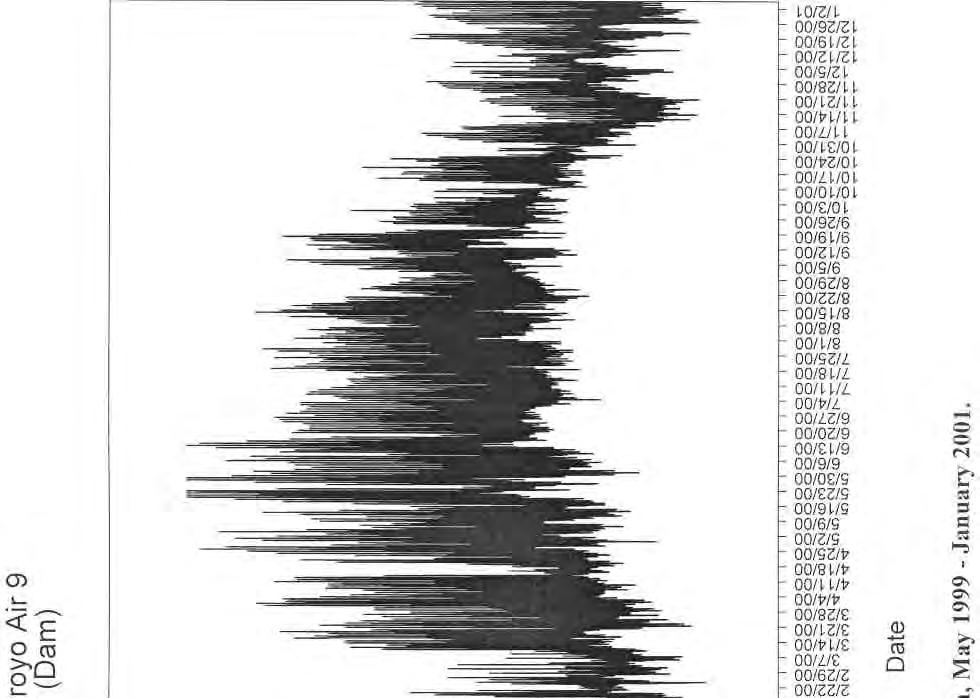

213
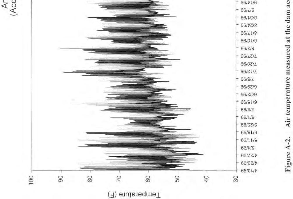
214
ARROYO GRANDE CREEK HABITAT CONSERVATION PLAN FREQUENTLY ASKED QUESTIONS September 27, 2011
 WHAT IS THE ENDANGERED SPECIES ACT? The Endangered Species Act (Act) protects endangered and threatened species of wildlife and plants. When Congress passed the Act in 1973, it recognized that our rich
Lagunitas Creek Stewardship Plan Marin Municipal Water District Final June 2011 TABLES
 Lagunitas Creek Stewardship Plan Marin Municipal Water District Final June 2011 TABLES Lagunitas Creek Stewardship Plan Final June 2011 Table 1: Chronology of events for the Marin Municipal Water District
Pacheco Reservoir Expansion
 California Water Commission Pacheco Reservoir Expansion Unique Opportunity for Fisheries Recovery, Flood Risk Reduction and Emergency Water Supply December 13, 2017 1 of 33 Project Partners Pacheco Pass
JUVENILE SALMON MIGRATION SECTION 5. blank page
 blank page FISH AND WILDLIFE PROGRAM 5-16 September 13, 1995 SECTION 5 JUVENILE SALMON MIGRATION temperature improvement measures contained in this program will have a substantial impact on the operations
Notice of Preparation of Environmental Impact Report
 Notice of Preparation of Environmental Impact Report September 29, 2010 TO: State Clearinghouse Responsible and Trustee Agencies Interested Agencies and Parties FROM: Sonoma County Water Agency 404 Aviation
Scope of Work Lower Arroyo Grande Creek Flooding Analysis
 Scope of Work Lower Arroyo Grande Creek Flooding Analysis Overview Please note that the limits of work for the hydrologic and hydraulic analysis include the following: Detailed topographic surveys: flood
~ate: d~o/~o/h. h ~~~ Date:,;z//o/a?0/6. Managing Water in the West. Upper Sacramento River Anadromous Fish Habitat Restoration Project
 M Managing Water in the West Finding of No Significant Impact Upper Sacramento River Anadromous Fish Habitat Restoration Project Recommended by: ~~ Ben Nelson Natural Resources Specialist Bay-Delta Office
Chehalis Basin Strategy Programmatic SEPA Draft EIS
 Chehalis Basin Strategy Programmatic SEPA Draft EIS History of Flooding I-5 closed in 1990, 1996, 2007, 2009 Five largest flood events occurred since 1986 2 History of Habitat Degradation Harvest has been
COASTAL CONSERVANCY. Staff Recommendation September 22, 2011 GREEN VALLEY CREEK COHO HABITAT ENHANCEMENT DESIGN
 COASTAL CONSERVANCY Staff Recommendation September 22, 2011 GREEN VALLEY CREEK COHO HABITAT ENHANCEMENT DESIGN Project No. 07-106-02 Project Manager: Lisa Ames RECOMMENDED ACTION: Authorization to disburse
DECISION MEMO FOR CATEGORICAL EXCLUSION HOLY JIM CREEK CROSSING REPLACEMENT
 DECISION MEMO FOR CATEGORICAL EXCLUSION HOLY JIM CREEK CROSSING REPLACEMENT U.S.D.A. Forest Service Cleveland National Forest Trabuco Ranger District Orange County, California Background The current configuration
The F.O.R.C.E. The Future Of Redwood Creek Environment
 The F.O.R.C.E. The Future Of Redwood Creek Environment Robert Andersen Katelyn Csatari Achyuth Madabhushi Julie Swanson Overview Mission Statement Watershed Characterization Land and Water Use History
Wood Canyon Emergent Wetland Project. City of Aliso Viejo 12 Journey, Suite 100 Aliso Viejo, CA 92656
 Wood Canyon Emergent Wetland Project City of Aliso Viejo 12 Journey, Suite 100 Aliso Viejo, CA 92656 Introduction Wood Canyon is located within Aliso and Wood Canyon Regional Park in southwest Orange County,
Salinas Valley Water Project Flow Prescription for Steelhead Trout in the Salinas River
 Salinas Valley Water Project Flow Prescription for Steelhead Trout in the Salinas River Monterey County Water Resources Agency 893 Blanco Circle Salinas, CA 93901 October 11, 2005 Salinas Valley Water
Department of the Army Permit Application
 Department of the Army Permit Application DA File Number U.S. Army Corps of Engineers Honolulu District Date Received by CEPOH-RO Send Completed Application to: Honolulu District, U.S. Army Corps of Engineers
Battle Creek Salmon and Steelhead Restoration Project January 2017
 Battle Creek Salmon and Steelhead Restoration Project January 2017 Battle Creek has the unique geology, hydrology, and habitat suitability to support threatened and endangered Chinook salmon and Central
4C.11 Off-Channel Reservoir near Lake Corpus Christi (N-11)
") 4C.11 Off-Channel Reservoir near Lake Corpus Christi (N-11) 4C.11.1 Description of Strategy Choke Canyon Reservoir (CCR) has a storage capacity of approximately 695,000 acft and a contributing drainage
4C.11 Off-Channel Reservoir near Lake Corpus Christi (N-11) 4C.11.1 Description of Strategy Choke Canyon Reservoir (CCR) has a storage capacity of approximately 695,000 acft and a contributing drainage
Carmel River Reroute & San Clemente Dam Removal Project (PLN110373) Monterey County Planning Commission Workshop July 25, 2012
 Monterey County Planning Commission Workshop July 25, 2012") Carmel River Reroute & San Clemente Dam Removal Project (PLN110373) Monterey County Planning Commission Workshop July 25, 2012 URS1 Workshop Agenda 1. Background 2. Project Overview 3. Tree Removals/Mitigation
Carmel River Reroute & San Clemente Dam Removal Project (PLN110373) Monterey County Planning Commission Workshop July 25, 2012 URS1 Workshop Agenda 1. Background 2. Project Overview 3. Tree Removals/Mitigation
Biological Opinion. Morse Brothers Habitat Restoration Project. Endangered Species Act - Section 7 Consultation
 Endangered Species Act - Section 7 Consultation Biological Opinion Morse Brothers Habitat Restoration Project Agency: Army Corps of Engineers, Portland District Consultation Conducted By: National Marine
Oregon Administrative Rules Oregon Department of Fish and Wildlife
 DIVISION 400 INSTREAM WATER RIGHTS 635-400-0000 Purpose (1) These rules set the policy, procedures, criteria, standards, including flow methodologies, and definitions for instream water right applications
Farmington Dam Repurpose Project
 Farmington Dam Repurpose Project 2017 $158,100,000 to re-purpose the Farmington Dam from flood protection only to a long-term water storage facility that increases water supply reliability to the region.
4. Present Activities and Roles
 4. Present Activities and Roles The present missions, authorities, activities and roles of the various agencies involved with flood protection, floodplain management and flood-damage reduction are identified
Proposal for Plumas Watershed Forum. 1. Project Name: Feather River Irrigated Lands Water Quality Improvement Program.
 Proposal for Plumas Watershed Forum 1. Project Name: Feather River Irrigated Lands Water Quality Improvement Program. 2. County: The project area encompasses Plumas County and parts of Sierra and Lassen
EXECUTIVE SUMMARY ES.1 BACKGROUND
 EXECUTIVE SUMMARY ES.1 BACKGROUND The San Francisco Bay/Sacramento-San Joaquin Delta Estuary (Bay/Delta Estuary) is a critically important part of California s natural environment and economy. In recognition
Fish Passage EXEMPTION Application
 OREGON DEPARTMENT OF FISH AND WILDLIFE Fish Passage EXEMPTION Application Use this form if a waiver has already been granted for the artificial obstruction for which an Exemption is being requested, fish
(2) A discussion of the geographic scope of the area affected by the cumulative effect;
 A discussion of the geographic scope of the area affected by the cumulative effect;") CHAPTER 5.0 Cumulative Analysis 5.1 CEQA Analysis Requirements The CEQA Guidelines require that EIRs discuss the cumulative impacts of a project when the project s incremental effect is cumulatively considerable,
CHAPTER 5.0 Cumulative Analysis 5.1 CEQA Analysis Requirements The CEQA Guidelines require that EIRs discuss the cumulative impacts of a project when the project s incremental effect is cumulatively considerable,
GLEN CANYON DAM LTEMP EIS
 GLEN CANYON DAM LTEMP EIS Alternative Concept: A proposal by Glen Canyon Institute April 5, 2012 Glen Canyon Dam LTEMP EIS Purpose! To identify dam operations, management actions, and experimental options
VII - WATER CONTROL PLAN
 VII - WATER CONTROL PLAN 7-01. General Objectives. Regulation of Saylorville Lake in conjunction with Lake Red Rock provides flood control benefits along both the Des Moines and Mississippi Rivers. Additionally,
Subject: Notice of Preparation of a Draft Environmental Impact Report
 NOTICE OF PREPARATION From: Santa Clara Valley Water District 5750 Almaden Expressway San Jose, CA 95118 Subject: Notice of Preparation of a Draft Environmental Impact Report Project Title: Guadalupe Dam
DRAFT FINDING OF NO SIGNIFICANT IMPACT DWORSHAK LONG-TERM NUTRIENT SUPPLEMENTATION PROGRAM AHSAHKA, IDAHO JANUARY 2017
 DRAFT FINDING OF NO SIGNIFICANT IMPACT DWORSHAK LONG-TERM NUTRIENT SUPPLEMENTATION PROGRAM AHSAHKA, IDAHO JANUARY 2017 1. INTRODUCTION/PROPOSED ACTION The U.S. Army Corps of Engineers, Walla Walla District
Public Notice. Public Notice No. Date: April 8, 2016 CENAP-PL-E Comment Period Closes: May 9, 2016
 Public Notice Public Notice No. Date: April 8, 2016 CENAP-PL-E-16-02 Comment Period Closes: May 9, 2016 USACE Philadelphia District: http://www.nap.usace.army.mil COBBS CREEK FISH PASSAGE PROJECT SECTION
CUMULATIVE IMPACT ANALYSIS: A SIMPLE MODEL FOR LOCAL GOVERNMENT RESERVOIRS AND WITHDRAWALS IN GEORGIA
 CUMULATIVE IMPACT ANALYSIS: A SIMPLE MODEL FOR LOCAL GOVERNMENT RESERVOIRS AND WITHDRAWALS IN GEORGIA Nolton G. Johnson AUTHOR: Chief, Water Resources Branch, Georgia Environmental Protection Division,
APPENDIX N Guidance for Preparing/Reviewing CEQA Initial Studies and Environmental Impact Reports
 APPENDIX N N.1 Guidance for Preparing and Reviewing CEQA Initial Studies Step 1: Consider the Project Characteristics as Provided by the Project Applicant Review the project application and draft plan
CHAPTER 3 Environmental Guidelines for WATERCOURSE CROSSINGS GOVERNMENT OF NEWFOUNDLAND AND LABRADOR DEPARTMENT OF ENVIRONMENT AND LABOUR
 GOVERNMENT OF NEWFOUNDLAND AND LABRADOR DEPARTMENT OF ENVIRONMENT AND LABOUR CHAPTER 3 Environmental Guidelines for WATERCOURSE CROSSINGS WATER RESOURCES MANAGEMENT DIVISION Water Investigations Section
Agency Organization Organization Address Information. Name United States Department of Agriculture
 Logo Department Name United States Department of Agriculture Agency Organization Organization Address Information Forest Service Pacific Northwest Region 1220 SW Third Avenue (97204) P.O. Box 3623 Portland,
Compensatory Mitigation Plan Requirements For Permittee Responsible Mitigation Projects St. Louis District, Corps of Engineers May 2010
 Compensatory Mitigation Plan Requirements For Permittee Responsible Mitigation Projects St. Louis District, Corps of Engineers May 2010 The U.S. Army Corps of Engineers (Corps) and U.S. Environmental Protection
7.0 SUMMARY AND CONCLUSIONS
 7.0 SUMMARY AND CONCLUSIONS 7.1 SUMMARY This report results from a Washington State Legislature grant to study the feasibility of storing additional water in Lake Wenatchee. The Legislature acted upon
COMMONWEALTH OF PENNSYLVANIA DEPARTMENT OF ENVIRONMENTAL PROTECTION
 COMMONWEALTH OF PENNSYLVANIA DEPARTMENT OF ENVIRONMENTAL PROTECTION PERMIT GUIDELINES FOR PHASED NPDES STORMWATER DISCHARGES ASSOCIATED WITH CONSTRUCTION ACTIVITY PERMITS, CHAPTER 102 EROSION AND SEDIMENT
CALFED Ecosystem Restoration Program (ERP)
") CALFED Ecosystem Restoration Program (ERP) The goal of the Ecosystem Restoration Program is to improve and increase aquatic and terrestrial habitats and improve ecological functions in the Bay-Delta to
CALFED Ecosystem Restoration Program (ERP) The goal of the Ecosystem Restoration Program is to improve and increase aquatic and terrestrial habitats and improve ecological functions in the Bay-Delta to
LIST OF TECHNICAL APPENDICES
 Idaho Power Company List of Technical Appendices LIST OF TECHNICAL APPENDICES Sediment and Geomorphology E.1-1 Sediment Transport, Supply, and Stability in the Hells Canyon Reach of the Snake River This
MONTEREY PENINSULA WATER MANAGEMENT DISTRICT PROJECT DESCRIPTION FOR SELECTIVE VEGETATION MANAGEMENT AND BANK RESTORATION (RANCHO SAN CARLOS AREA)
") MONTEREY PENINSULA WATER MANAGEMENT DISTRICT PROJECT DESCRIPTION FOR SELECTIVE VEGETATION MANAGEMENT AND BANK RESTORATION (RANCHO SAN CARLOS AREA) IN THE CARMEL RIVER CHANNEL, SUMMER AND FALL 2014 SELECTIVE
MONTEREY PENINSULA WATER MANAGEMENT DISTRICT PROJECT DESCRIPTION FOR SELECTIVE VEGETATION MANAGEMENT AND BANK RESTORATION (RANCHO SAN CARLOS AREA) IN THE CARMEL RIVER CHANNEL, SUMMER AND FALL 2014 SELECTIVE
APPENDIX H Guidance for Preparing/Reviewing CEQA Initial Studies and Environmental Impact Reports
 APPENDIX H H.1 Guidance for Preparing and Reviewing CEQA Initial Studies Step 1: Consider the Project Characteristics as Provided by the Project Applicant Review the project application and draft plan
4C.10 Pipeline between Choke Canyon Reservoir and Lake Corpus Christi (N-10)
") 4C.10 Pipeline between Choke Canyon Reservoir and Lake Corpus Christi (N-10) 4C.10.1 Description of Strategy Channel losses in streams that deliver water from Choke Canyon Reservoir (CCR) to Lake Corpus
4C.10 Pipeline between Choke Canyon Reservoir and Lake Corpus Christi (N-10) 4C.10.1 Description of Strategy Channel losses in streams that deliver water from Choke Canyon Reservoir (CCR) to Lake Corpus
Ongoing and Completed Studies
 Attachment 2 Ongoing and Completed Studies 2014 Monitoring and Analysis Plan November 2013 Attachment 2 Ongoing and Completed Studies 1 Introduction In 2013, the small interdisciplinary study groups for
Glades Reservoir Draft Environmental Impact Statement
 Glades Reservoir Draft Environmental Impact Statement Chapter 4 Environmental Consequences October 2015 4 ENVIRONMENTAL CONSEQUENCES 4.1 INTRODUCTION 4-1 4.1.1 Types and Definitions of Impacts 4-1 4.1.2
Subject: Notice of Preparation of a Draft Environmental Impact Report
 NOTICE OF PREPARATION From: Santa Clara Valley Water District 5750 Almaden Expressway San Jose, CA 95118 Subject: Notice of Preparation of a Draft Environmental Impact Report Project Title: Calero Dam
Yakima River Basin Environmental & Salmon Restoration Act
 Yakima River Basin Environmental & Salmon Restoration Act Table of Contents SECTION 1. PURPOSE...Page 3 SECTION 2. DEFINITIONS...Page 3 TITLE I. BLACK ROCK WATER EXCHANGE PROJECT...Page 4 SECTION 101.
Appendix I: Fixed-400,000 af Flood Storage Operation
 Appendix I: Fixed-400,000 af Flood Storage Operation 1.0 FIXED-400,000 AF FLOOD STORAGE OPERATION This operation set provides a comparison of operations before the SAFCA/Reclamation interim agreement in
ENVIRONMENT ACT TERMS OF REFERENCE NOVA SCOTIA DEPARTMENT OF TRANSPORTATION AND PUBLIC WORKS. Beaver Bank Bypass
 ENVIRONMENT ACT TERMS OF REFERENCE NOVA SCOTIA DEPARTMENT OF TRANSPORTATION AND PUBLIC WORKS Beaver Bank Bypass Highway 101 to the Beaver Bank Road Halifax County, NS NOVA SCOTIA DEPARTMENT OF THE ENVIRONMENT
Water and Environment. Monterey Peninsula, Carmel Bay and South Monterey Bay Integrated Regional Water Management Draft Plan
 Water and Environment Monterey Peninsula, Carmel Bay and South Monterey Bay Integrated Regional Water Management Draft Plan December 11, 2006 Presentation Outline Purpose of IRWM Planning Status of Plan
Definitions. Final Major Amendment to the CVMSHCP August 2016
 Definitions Acceptable Biologist Acquisition and Funding Coordinating Committee Adaptive Management Additional Conservation Lands A biologist whose name is on a list maintained by CVCC of biologists who
Keefer Pasture Drift Fence Project. Challis-Yankee Fork Ranger District Salmon-Challis National Forest
 Keefer Pasture Drift Fence Project Challis-Yankee Fork Ranger District Salmon-Challis National Forest PROPOSED ACTION The Challis-Yankee Fork Ranger District proposes construction of approximately.11 miles
APPENDIX M CEQA Initial Study Checklist
 APPENDIX M CEQA Initial Study Checklist Appendix G ENVIRONMENTAL CHECKLIST FORM (To be Completed by Applicant) 1. Project title: 2. Lead agency name and address: 3. Contact person and phone number: 4.
5.4 Alternative 2: Structural Flood Protection Without Flood Retention Facility
 5.4 Alternative 2: Structural Flood Protection Without Flood Retention Facility Structural Flood Protection Without Flood Retention Facility (Alternative 2) would reduce flood damage during a major flood
1. PURPOSE OF AND NEED FOR ACTION
 1. PURPOSE OF AND NEED FOR ACTION INTRODUCTION The Bureau of Reclamation (Reclamation) and the San Joaquin River Group Authority (Authority) are jointly preparing this Environmental Impact Statement/Environmental
F7 Stream Reach Summary
 F7 Stream Reach Summary Study Reach: F7, Fraser River - Ranch Creek confluence downstream to Canyon below Strawberry Road. Reach Description: Approximate channel length: 1 ½ miles, approximate channel
RE: Fishery evaluation for South, Old Cow Creek Hydroelectric Facilities
 April 29th, 2008 Richard Ely, Davis Hydro 27264 Meadowbrook Drive Davis CA 95618 RE: Fishery evaluation for South, Old Cow Creek Hydroelectric Facilities On January 29 th, 2008 Cramer biologists Joseph
APPENDIX A. 2-Gates Fish Protection Demonstration Project Background and Regulatory Constraints
 APPENDIX A 2-Gates Fish Protection Demonstration Project Background and Regulatory Constraints Project Background The Delta serves many functions and has many competing uses. It is a vital diversion point
Outcomes. Kelly Karll-SEMCOG Margaret Barondess - MDOT
 Eco-Logical: I-75 Corridor I-75 Conservation Transportation Action Planning in to Monroe Achieve County: Multiple Stormwater Environmental Considerations Outcomes Kelly Karll-SEMCOG Karll@semcog.org Margaret
Appendix J. Existing Efforts for Identifying Multi-Benefit Projects
 Appendix J Existing Efforts for Identifying Multi-Benefit Projects Water Purveyor Projects Existing Efforts for Identifying Multi Benefits Projects In-lieu groundwater recharge under RWA planning efforts
Projects must fall under one of the nine categories listed in Table 1.
 UNITED STATES DEPARTMENT OF COMMERCE National Oceanic and Atmospheric Administration NATIONAL MARINE FISHERIES SERVICE West Coast Region Snake Basin Office 800 Park Boulevard, Plaza IV, Suite 220 Boise,
WATER SHORTAGE RESPONSE PLAN. Tacoma Water
 WATER SHORTAGE RESPONSE PLAN Tacoma Water March 2005 TACOMA WATER WATER SHORTAGE RESPONSE PLAN TABLE OF CONTENTS PAGE Purpose of the Water Shortage Response Plan 1 Droughts and System Emergencies 2 Previous
ENVIRONMENTAL IMPACT STATEMENT CLEVELAND HARBOR, CUYAHOGA COUNTY, OHIO DREDGED MATERIAL MANAGEMENT PLAN PUBLIC SCOPING INFORMATION PACKET
 ENVIRONMENTAL IMPACT STATEMENT CLEVELAND HARBOR, CUYAHOGA COUNTY, OHIO DREDGED MATERIAL MANAGEMENT PLAN PUBLIC SCOPING INFORMATION PACKET March 16, 2006 ANNOUNCEMENT OF PUBLIC SCOPING MEETINGS The U.S.
3.4 AQUATIC ECOSYSTEMS AND FISH SPECIES
 3.4 AQUATIC ECOSYSTEMS AND FISH SPECIES The following section supplements the analysis found in Chapter Three, Section 3.4 - Aquatic Ecosystems and Fish Species of the Draft EIS on page 3.59, Impacts Related
Chelan County Natural Resource Program. Lake Wenatchee Water Storage Feasibility Study June Executive Summary Why is this study being done?
 Executive Summary The focus on reviewing all potential solutions to shortfalls in instream flow and water supply was sharpened in the drought year of 2001, when streamflows dropped to historic lows in
EVALUATION - SECTION 404 OF THE CLEAN WATER ACT DISCHARGE OF SEDIMENTS FROM OR THROUGH A DAM
 EVALUATION - SECTION 404 OF THE CLEAN WATER ACT DISCHARGE OF SEDIMENTS FROM OR THROUGH A DAM U.S. ARMY CORPS OF ENGINEERS, NEW ENGLAND DISTRICT CONCORD, MA PROJECT: Northfield Brook Dam, Naugatuck River
INTRODUCTION BACKGROUND
 Explanatory Statement In Support of the Offer of Settlement, Southern California Edison Company, Lundy Hydroelectric Project (FERC No. 1390) January 2005 INTRODUCTION Pursuant to 18 CFR 385.602, this document
VEGETATIVE, WATER, FISH AND WILDLIFE RESOURCES POLICIES
 VEGETATIVE, WATER, FISH AND WILDLIFE RESOURCES POLICIES The County will: GOALS AND OBJECTIVES 1.1 Conserve, Enhance, Protect, Maintain and Manage Vegetative, Water, Fish and Wildlife Resources Promote
SOAP LAKE FLOODPLAIN PRESERVATION PROJECT
 SOAP LAKE FLOODPLAIN PRESERVATION PROJECT Draft Initial Study and Negative Declaration Prepared for: Pajaro River Watershed Flood Prevention Authority A joint powers authority with representation from:
Draft Environmental Impact Report
 Revised Draft Environmental Impact Report San Francisquito Creek Flood Protection, Ecosystem Restoration, and Recreation Project Upstream of Highway 101 This notice announces that a Draft Environmental
Spring Forecast Based Operations, Folsom Dam, California
 Spring Forecast Based Operations, Folsom Dam, California Paul E. Pugner, P.E. Chief, Water Management Section Sacramento District U.S. Army 1325 J Street, Room 1126 Sacramento, CA 95814-2922 Tel: (916)
CHAPTER 7. San Dieguito River Flooding Adaptation
 CHAPTER 7 San Dieguito River Flooding Adaptation This chapter includes a range of adaptation measures to address vulnerabilities from flooding along the San Dieguito River, including the river valley,
Natural Community Conservation Planning Act California Fish and Game Code Section
 Natural Community Conservation Planning Act California Fish and Game Code Section 2800-2835 2800. This chapter shall be known, and may be cited, as the Natural Community Conservation Planning Act. 2801.
DRAINAGE AND NATURAL AQUIFER GROUNDWATER RECHARGE ELEMENT
 Goal 7.0. To optimize integrated stormwater management in order to reduce damage and impacts from sea level rise and flooding, promotes recharge to the Surficial Aquifer System (SAS), improve and protect
E. Other Federal Requirements and CEQA Considerations
 E. Other Federal Requirements and CEQA Considerations Section E.1 includes discussions of various topics required by NEPA and/or CEQA, including a description of the long-term implications of the Project,
There is a reliable, clean water supply for current and future generations.
 E2 There is a reliable, clean water supply for current and future generations. E2.1. Current and future water supply for municipalities, industries, agriculture, and the environment is reliable. 2.1.1.
City of Bishop. Environmental Checklist Form
 City of Bishop Environmental Checklist Form 1. Project title: Environmental Review / 2007 California Building Codes 2. Lead agency name and address: City of Bishop 377 W. Line Street Bishop, Ca 93514 3.
Navarro River Instream Flow Study Plan Development Project Description
 Navarro River Instream Flow Study Plan Development Project Description Prepared for: North Coast Regional Water Quality Control Board Prepared by: R2 Resource Consultants, Inc. 15250 NE 95 th Street Redmond,
Environmental Information Worksheet
 Environmental Information Worksheet Water System Owner (Attach additional sheets if necessary) Needs and Alternatives Provide a brief narrative that describes: Current drinking water system needs. Project
Report. Environmental Water Demands. Butte County Department of Water and Resource Conservation Integrated Water Resources Plan.
 Report Butte County Department of Water and Resource Conservation Integrated Water Resources Plan s June 2004 s Section 1 - Introduction 1.1 Project Description This project is a preliminary investigation
COON CREEK WATERSHED DISTRICT PERMIT REVIEW
 16-054 Woodland Creek Wetland Banking Restoration Project, Page 1 of 6 COON CREEK WATERSHED DISTRICT PERMIT REVIEW MEETING DATE: August 22, 2016 AGENDA NUMBER: 11 FILE NUMBER: 16-054 ITEM: Woodland Creek
Pajaro River Watershed Integrated Regional Water Management Plan Update Project Solicitation Form
 PROJECT OVERVIEW General Project Information Project Title: College Lake Project Location: Santa Cruz County, City of Watsonville Estimated Cost: $ Brief Project Description (1 to 2 sentences): College
Water Rights And Summer Stream Conditions
 Water Rights And Summer Stream Conditions Background Instream Water Rights 1 When most Oregonians talk about water rights they usually mean rights to remove water from a river or lake for home, industrial
Public Notice. Navigation Section Notice Date: May 23, 2018 PO Box 3755 Expiration Date: June 21, 2018
 Public Notice Navigation Section Notice Date: May 23, 2018 PO Box 3755 Expiration Date: June 21, 2018 Seattle, WA 98124-3755 Reference: PMP-18-15 ATTN: John Pell (OD-TS-NS) or Joanne Gardiner (PMP-E) US
CHAPTER 4. IMPACT ASSESSMENT AND ESTIMATED LEVEL OF TAKE
 0 0 0 CHAPTER. IMPACT ASSESSMENT AND ESTIMATED LEVEL OF TAKE. INTRODUCTION The Butte Regional Conservation Plan (BRCP) impact assessment describes the adverse impacts of implementing the covered activities
MANZANITA LAKE PLANNING UNIT Willow Creek Watershed
 Existing Conditions & Uses Overview Area surrounding a small afterbay and creeks with ethnobotanical resources and valuable habitat 472 acres in Madera County; 337 acres outside the FERC boundary and 135
Air and Water Temperature Monitoring Within Alameda Creek:
 Air and Water Temperature Monitoring Within Alameda Creek: 2001-2002 Hanson Environmental, Inc. 132 Cottage Lane Walnut Creek CA 94595 (925) 937-4606 (office) (925) 937-4608 (fax) October 1, 2002 Revised
3 Baseline and Existing Conditions
 1 2 3 4 5 6 7 8 9 10 11 12 13 14 3 Baseline and Existing Conditions The effective date of the VSP legislation is July 22, 2011. This is also the date chosen by the legislature as the applicable baseline
16.1 Significant and Unavoidable Impacts
 Chapter 16 NEPA requires an EIS and CEQA requires an EIR to evaluate a number of other types of environmental impacts in addition to those already addressed in the resource chapters. The analysis required
Conceptual Design and Feasibility of a Natural Fishway at the Fremont BART Weir, Alameda Creek, California
 Conceptual Design and Feasibility of a Natural Fishway at the Fremont BART Weir, Alameda Creek, California Final Report September 2005 Prepared by Center for Ecosystem Management and Restoration, Oakland,
Public Notice PUBLIC NOTICE 30 DAY PUBLIC NOTICE
 PUBLIC NOTICE Date: January 30, 2015 Comment Period Ends: February 28, 2015 Reply by Mail to: Kirk Bargerhuff; or by email to: Kirk.E.Bargerhuff@usace.army.mil Engineering/Planning 696 Virginia Road Concord,
DECISION MEMO. West Fork Blacktail Deer Creek Hardened Crossing
 Page 1 of 6 Background DECISION MEMO USDA Forest Service Madison Ranger District Madison County T12S, R4W, Section 30 The project is in the Gravelly Landscape, Snowcrest Recommended Wilderness Management
Assessing Habitat in Watersheds. Sabrina Drill UC Cooperative Extension Los Angeles and Ventura
 Assessing Habitat in Watersheds Sabrina Drill UC Cooperative Extension Los Angeles and Ventura sldrill@ucdavis.edu 323-260 260-3404 What is Habitat? The environment in which a plant and animal lives, and
Charlotte Harbor SWIM Plan Update Proposed Quantifiable Objectives and Management Actions, January 2019
 Management Actions One of the goals of this SWIM plan is to identify strategic initiatives that will address the major issues and drivers and provide management actions that will improve and maintain the
IV. ENVIRONMENTAL IMPACT ANALYSIS G. HYDROLOGY/WATER QUALITY
 IV. ENVIRONMENTAL IMPACT ANALYSIS G. HYDROLOGY/WATER QUALITY ENVIRONMENTAL SETTING The project site is located in the Wilshire community of the City of Los Angeles and is bound by S. Wetherly Drive to
NEPA Effects: The effects of NPB would not be adverse because it is intended to improve migration survival.
 Alternative A Fish and Aquatic Resources 0 0 0 0 NEPA Effects: The effects of NPB would not be adverse because it is intended to improve migration survival. CEQA Conclusion: As discussed above, the NPB
PUBLIC NOTICE PROJECT: Crescent City Outer Harbor Tsunami Related Maintenance Dredging
 Regulatory Division 1455 Market Street, 16 th Floor San Francisco, CA 94103-1398 SAN FRANCISCO DISTRICT PUBLIC NOTICE PROJECT: Crescent City Outer Harbor Tsunami Related Maintenance Dredging PUBLIC NOTICE
Instructions for the South Pacific Division Nationwide Permit Pre- Construction Notification (PCN):
:") This PCN integrates the requirements of the U.S. Army Corps of Engineers (Corps) Nationwide Permit Program within the South Pacific Division (SPD), including the Albuquerque, Los Angeles, San Francisco,
This PCN integrates the requirements of the U.S. Army Corps of Engineers (Corps) Nationwide Permit Program within the South Pacific Division (SPD), including the Albuquerque, Los Angeles, San Francisco,
Appendix M. Criteria, Measures and Indicators for Effects Assessment
 Appendix M Criteria, Measures and Indicators for Effects Assessment Appendix M. Criteria, Measures and Indicators for Effects Assessment Objective 1: Naturalization Changes to Aquatic Habitat Disruption,
An Introduction to Environmental Flows
 An Introduction to Environmental Flows The natural flow regime Flow alteration Environmental flows defined Scaling up Eloise Kendy, Ph.D. IUCN workshop Kathmandu, Nepal 5 August 2011 Jefferson River, Montana
CHAPTER 7. San Dieguito River Flooding Adaptation
 CHAPTER 7 San Dieguito River Flooding Adaptation This chapter includes a range of adaptation measures to address vulnerabilities from flooding along the San Dieguito River, including the river valley,