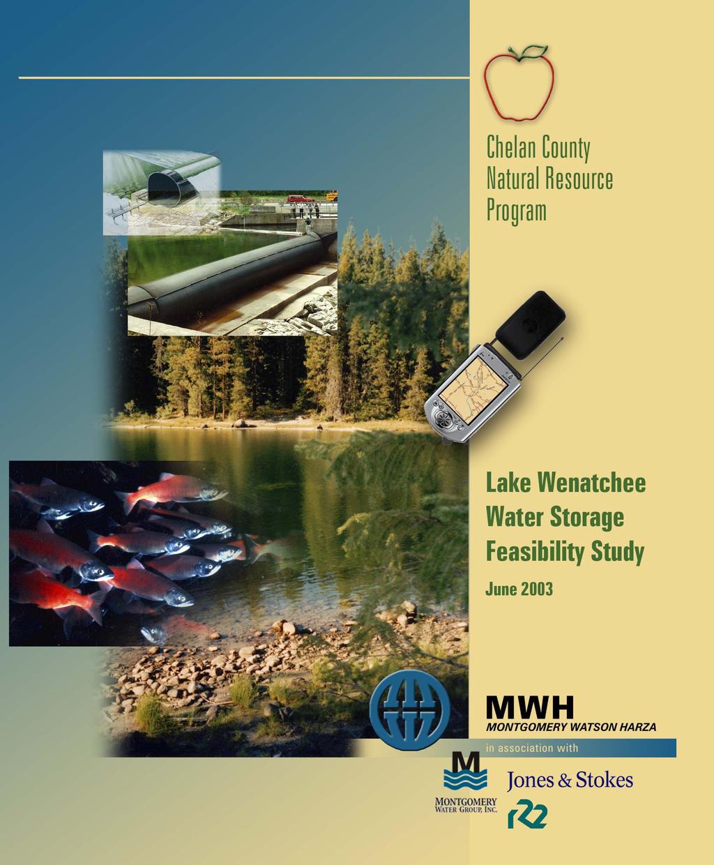
Chelan County Natural Resource Program. Lake Wenatchee Water Storage Feasibility Study June Executive Summary Why is this study being done?
|
|
|
- Andrea Perkins
- 6 years ago
- Views:
Transcription
1
2 Executive Summary
3 The focus on reviewing all potential solutions to shortfalls in instream flow and water supply was sharpened in the drought year of 2001, when streamflows dropped to historic lows in late summer and many water users across the state had their water supply interrupted as a result. The Wenatchee River Watershed is listed as one of the State s sixteen critical basins because of the presence of Endangered Species Act (ESA) listed species, development pressures and the potential for future water shortages. Chelan County Natural Resources Department is leading the Wenatchee Watershed Planning effort, which is to identify and study solutions to watershed problems such as instream flow, water quantity, water quality and fish and wildlife habitat. The County is also the recipient of the water storage grant from the State and is administering the process of completing this feasibility study. A project team consisting of a diverse group of public, local agency (city and county), irrigation, conservation, state, federal and tribal interests was assembled to direct the content of this study. Meetings were held in to prepare a scope of study, select a consultant and review study products. Chelan County Natural Resource Program Lake Wenatchee Water Storage Feasibility Study June 2003 Executive Summary Why is this study being done? This study results from a Washington State Legislature grant to study the feasibility of storing additional water in Lake Wenatchee. The Legislature acted upon recommendations of the State s Water Storage Task Force to study the issue of water storage across the State. Many other Watersheds throughout the State are also performing studies of the potential for increased water storage to meet the increasing competitive needs of fish, farms and people. The Legislature appropriated funds for this study because of its location within the Wenatchee River Watershed, the history of past water storage studies and permits on Lake Wenatchee and ongoing efforts in Watershed Planning undertaken by the Wenatchee Watershed Planning Unit. Previous studies and planning on water storage in Lake Wenatchee were performed by the Wenatchee Reclamation District and Chelan County PUD. The Wenatchee Reclamation District initiated a water storage project in 1930 in response to drought conditions in the Wenatchee River Watershed. They obtained permits to construct a low dam near the mouth of the Lake which would impound water to the normal high water elevation. The project was not completed and Chelan County PUD acquired the permits from the District. The PUD envisioned a water storage project that was a component of a larger hydroelectric project. That project was dropped in the 1970 s and the rights reassigned back to the District. Five broad study areas were selected by the project team to cover the scope of the feasibility study. They are noted below as well as the objective they are intended to address: Water Needs. Determine the water needs of the Wenatchee River watershed and how additional water supplies should be apportioned between fish and community interests. Technical Feasibility. Evaluate the technical feasibility of constructing a dam on Lake Wenatchee that complies with current fish passage standards and provides storage to Ordinary High Water and other levels. Analyze wind-caused wave erosion and prepare construction and permitting cost estimates. Legal Feasibility. Evaluate the legal feasibility of constructing the dam taking into account federal, state, and local laws, and Tribal Nations rights. A further objective is to establish the permitting requirements and the status of the existing storage permit. Socioeconomic Impacts. Evaluate the impacts of the project on private lake front property and other private landowners, and state and federal lands. Assessment of impacts would include recreation, cultural resources, tourism, fishing, rafting, and other uses of the river. The assessment would include costs and benefits. Environmental Impact. Determine the impacts of storing additional water on flood water levels, lands inundated for longer periods around the lake (including wetlands), and on the fishery resources of the lake and river with particular emphasis on endangered species. The beneficial impacts of releasing stored water later in the year would also be evaluated. During the feasibility study, project team meetings were held on December 11, 2002; February 26; April 30 and June 4, Presentations of interim work products by the MWH team were made to the project team during those meetings and discussions held on a number of issues.


4 Water demands will increase with expected population growth in the Wenatchee Watershed. The increase in water demands for municipal and domestic purposes is predicted to be 7.3 cfs on a peak basis and 1,868 acrefeet annually. Chelan County Natural Resource Program Lake Wenatchee Water Storage Feasibility Study June 2003 Executive Summary Water Needs Assessment Industrial water demands outside of municipalities are not expected to increase as minimum instream flows limit the ability to obtain new water rights. An estimated 12,836 acres of irrigated agriculture exist in the Wenatchee Watershed. Most of the agricultural land is in orchards. The agricultural land base has been stable and water use for irrigation will likely not decline on a peak daily basis. Instream flows set by WAC are not met on an average of 87 days per year. Water rights issued after 1984 are conditioned on those instream flows being met. The average shortfall in instream flow in the Wenatchee River is 17,500 acre-feet per year. In 2001, the shortfall was over 50,000 acre-feet. Water use to meet future municipal and domestic use is predicted to reduce streamflow by 5 cfs in summertime. Approval of current water right applications for irrigation would reduce streamflow an additional 5.6 cfs in summertime. The water stored in Lake Wenatchee could be used for several purposes: instream flow augmentation, water supply for future surface water users in the Wenatchee River Basin Watershed or as mitigation for future groundwater use either in the aquifers supplying the Wenatchee River or in tributaries to the Wenatchee River. The Water Needs assessment portion of this study summarizes the current and potential future use of water in the Wenatchee River Watershed (also referred to as Water Resources Inventory Area [WRIA] 45) for municipal, residential, commercial, industrial and agricultural needs and environmental uses. A review of potential population growth and growth in municipal, domestic, industrial and agricultural water needs was made. Chelan County is forecast to grow from 66,616 people to 101,860 people by Of that growth, an increase of 26,500 is forecast for the Wenatchee Watershed. The City of Wenatchee receives its water from wells located alongside the Columbia River and its future water use is not addressed in this study. The estimated increase in municipal and domestic water demands over the next 20 years is 7.3 cfs on a peak daily basis and 1,868 acre-feet annually. No growth in self-supplied industrial and commercial water use is forecast unless additional water is made available that would not be subject to interruption by minimum instream flows set by Chapter WAC. The area of irrigated agriculture is estimated to be 12,863 acres and appears to be stable and not declining. There is a substantial area of land that is currently zoned for residential use that can be converted from agricultural use. Although annual water use may decline if that land is developed, peak water use may not change. The peak water demands are important as they have the most immediate effect on streamflow, especially during summer low flow periods. Pending water right applications are requesting use of an additional 43 cfs from surface water and 10.9 cfs from ground water. The type of use requested on the applications is primarily municipal and domestic for surface water and irrigation for ground water. Most of the applications, if approved, would be subject to minimum instream flows and therefore interruptible during low streamflow periods. Some of the applications, such as those contained in the Peshastin Creek basin, would not likely be approved as the basin is closed for further appropriation from June 15 to October 15. It was estimated the increase in irrigation demand from approval of those applications to be 8 cfs; the estimated effect on streamflow is a reduction of 5.6 cfs. The estimated increase in municipal and domestic demand is 7.3 cfs and the estimated effect on streamflow is a reduction of about 5 cfs. The total estimated reduction in streamflow is estimated to be 10.6 cfs. That reduction would occur in the Wenatchee River. The largest potential water need is for instream flow. Chapter WAC has set minimum flows for the Wenatchee River and some tributaries. Hydrologic analyses have determined the average shortfall between Wenatchee River streamflow (measured at Plain) and the minimum flows is 17,500 acre-feet per year. In 2001, the shortfall was 50,400 acre-feet for the time period of July to October.
.")
 The estimated costs to construct a rubber dam to impound water to 1870.")
5 Ordinary High Water (OHW) is the most important water level evaluated because it is the demarcation between private property and State-owned shorelands, except those second-class shorelands sold to property owners. The OHW elevation is 1,870.3 ft. A low rubber dam was studied that would impound water to two elevations: 1,872.4 ft. or 1,870.3 ft. (OHW). The rubber dam and concrete supports would be submerged and mostly hidden from view The estimated costs of designing, permitting and constructing a rubber dam to impound water to ft are $5.8M (excluding indirect costs such as financing, legal, interest, project mitigation, land purchase or easement, etc.) The estimated costs to construct a rubber dam to impound water to ft are $5.4M (excluding indirect costs). Wind analysis shows a large potential increase in wave energy (and erosion) if water levels are maintained at ft and a much smaller or no increase if water levels are maintained at ft. Chelan County Natural Resource Program Lake Wenatchee Water Storage Feasibility Study June 2003 Executive Summary Technical Feasibility To enable seasonal storage and release of water from Lake Wenatchee, an inflatable rubber dam was identified as the most suitable type of structure for the site. The dam would be located on the Wenatchee River approximately 1,600 feet downstream of the mouth of the lake where the river is narrowest. The flow stored and released would increase instream flow in the Wenatchee River in late summer, during the lowest flow period. Two operating water levels were analyzed: 1) the Ordinary High Water (OHW), field surveyed and estimated to be ft., and 2) the spring high water level, estimated at feet, which occurs nine out of ten years. Five potential operating alternatives were analyzed with the model: Alternative 1. Maximum lake level controlled by the rubber dam = ft. The dam would start storing water July 1 and releasing water August 23. Lake outflow would ramp up to 100 cfs in excess of historic outflows on September 1 and water released until storage is exhausted. Alternative 2. Maximum lake level controlled by the rubber dam = ft. The dam would start storing water July 1 and releasing water August 23. Lake outflow would ramp up to 200 cfs in excess of historic outflows on September 1 and water released until storage is exhausted. Alternative 3. Maximum lake level controlled by the rubber dam = ft. The dam would start storing water June 1 and releasing water July 1. Pulse flows would be released at a rate of 100 cfs for 4 hours per day until August 15. Lake outflow would be augmented by 100 cfs in excess of historic outflows starting August 16 and water released until storage is exhausted. Alternative 4. Maximum lake level controlled by the rubber dam = ft. The dam would start storing water July 1 and releasing water August 23. Lake outflow would ramp up to 50 cfs in excess of historic outflows on September 1 and water released until storage is exhausted. Alternative 5. Maximum lake level controlled by the rubber dam = ft. The dam would start storing water July 1 and releasing water August 23. Lake outflow would ramp up to 100 cfs in excess of historic outflows on September 1 and water released until storage is exhausted. Alternative 2 provides the greatest flow augmentation, but for a shorter time period than Alternative 1, which can augment flow through much of October if needed. Alternative 3 has less water to store and release because it has different storage and release seasons in comparison to Alternatives 1 and 2. Alternatives 1 and 2 were found to provide a maximum storage of 12,300 af. The maximum increase in lake levels from historic levels is about 2.7 feet in July, 3.9 feet in August and 2.6 feet in September from Alternatives 1-3. Alternative 5 can reliably provide a flow augmentation of 75 cfs in September. Alternative 4 can provide 50 cfs in September and for about one-half of October. Alternatives 4 and 5 would provide a maximum storage of 6,750 af. The increase in lake levels from historic for the two alternatives is about 0.6 feet in July, 2.0 feet in August and 1.0 feet in September.
6 The Wenatchee Reclamation District purchased an easement from the State of Washington in 1944 to overflow 2 nd class shorelines in Lake Wenatchee. There exists 20,380 feet of 2 nd class shoreline that is not subject to the easement. An easement to inundate those 2 nd class shorelines would need to be acquired from adjacent property owners if a storage project was to be constructed to hold water to the Ordinary High Water level ( ft). If a storage project were to hold water to a level higher than the OHW, easements to inundate 70,000 lineal feet of shoreline on private property would be required. A number of permits that are required from Federal, State and local Agencies would be required. An EIS under SEPA or EA under NEPA would be required for the project. Because of the presence of endangered species, consultation with the U.S. Fish and Wildlife Service and NOAA Fisheries would be required. The permitting timeframe could stretch out over 3 years. Although no entity has proposed the project, a number of Federal, State and local agencies could construct and operate the project. The project would need to be operated with multiple objectives including instream flow augmentation, water supply and recreation. Chelan County Natural Resource Program Lake Wenatchee Water Storage Feasibility Study June 2003 Executive Summary Legal and Permitting Requirements An assessment of legal and permitting requirements was made for construction and operation of a low dam at the outlet of Lake Wenatchee. The review covered existing permits to operate a reservoir and the requirements for acquiring new permits. A reservoir permit was issued by the State of Washington in 1934 to the Wenatchee Reclamation District (WRD), which would have allowed the district to construct a dam at that time. The permit was transferred in 1963 to Chelan County PUD for their use in a potential water storage project. The PUD project did not proceed and the State cancelled the reservoir permit in In addition to the reservoir permit, the WRD obtained an easement in 1944 to overflow 2 nd class shorelines around Lake Wenatchee. The easement is subject to the rights of previous purchasers of 2 nd class shorelines around the lake. Second-class shorelands extend up to the line of Ordinary High Water (OHW). It was found that private property owners with a total of 10,950 feet and Washington State Parks and Recreation with 9,430 feet of waterfront own 2 nd class shorelands that were purchased prior to the issuance of the overflow easement. An easement would need to be purchased or leased from those property owners to maintain water levels at the OHW level. A total of 70,000 feet of shoreline exists around Lake Wenatchee and overflow easements from all property owners on the lake would need to be obtained to maintain water levels at any water level higher than OHW, such as ft. A review of the potential impact on Tribal fisheries was performed and the conclusion reached the project would have a negligible effect on Tribal fisheries in the Wenatchee River Watershed. A review of permitting issues was performed and the types of permits that would be required from Federal, State and local agencies described. The typical timeframe for acquisition of those permits was also described. The project would likely be subject to the NEPA process and would require a Corps of Engineers permit, bringing in the need for consultation under ESA. Approaches to permitting and additional information needed for the permitting process are provided. Because of the nature of the water storage project, it would be operated by a public entity. Although no entity has proposed the project, potential operators include the US Bureau of Reclamation, Washington State Department of Ecology, Chelan County PUD, and Wenatchee Reclamation District. The project would need to operate with multiple objectives including instream flow augmentation, water supply, recreation and other objectives.

7 Increase in water elevations could affect shoreline property values and potentially slow the rate of increase of property values, affect shoreline access, and affect shore facilities and improvements. Chelan County Natural Resource Program Lake Wenatchee Water Storage Feasibility Study June 2003 Executive Summary Socioeconomic Impact Assessment Purchase of easements would be necessary for all alternatives and would range in cost from $1.4 to $3.5 million under Alts 4 and 5, to $6.1 to $15.3 million under Alts 1, 2, and 3. Impacts to lakebased recreation could include loss of shoreline access, and inundation of boat ramps and beaches. Estimated cost to retrofit the boat ramp at the State Park and to construct a new launch facility downstream of the dam would be approximately $171,000. More detailed socioeconomic and parcel studies will be necessary if the project proceeds. Those studies could include shoreline topographic surveys, property-by-property appraisals, property-byproperty survey of facilities and improvements, and a study of decision factors when buying shoreline property. The socioeconomic impact analysis of the Lake Wenatchee Water Storage Feasibility Study included a broad evaluation of property values, property improvements, lake-related recreation, river-related recreation, and potential effects on cultural resources. The analysis included a review of existing studies, acquisition and review of property assessments from the Chelan County Assessors Office, and field measurements and observations. Land ownership on the lake includes U.S. Forest Service (45.3 percent), Washington State Parks and Recreation Commission (12.2 percent), County (0.5 percent) and private lands (42 percent). A review of Chelan County Assessor s records for 2002 indicates that there are 153 single-family residential parcels along the North Shore and 134 single-family residential parcels on the South Shore. Recreation on the lake includes boating, fishing, wind surfing, camping and related activities, and beach recreation. Public access to the lake is provided at Lake Wenatchee State Park and from USFS land on the north and south sides of the lake. River-related recreation activities include whitewater rafting, kayaking, fishing, and access along the Wenatchee River. Two recorded archaeological sites occur on the north shore of the headwaters of the Wenatchee River; there are no recorded historic structures. Increases in water elevations from the project could affect property values through 1) potentially slowing the rate of increase in property values, 2) perceived or real loss of property values, 3) affecting shoreline access or use, and 4) affecting shore facilities and improvements. The purchase of shoreline easements would be necessary and could range from a cost of $1.4 to $3.5 million under the OHW alternative (Alts. 4 and 5) to $6.1 to $15.3 million for elevation 1,872.4 ft. (Alts. 1,2, and 3). The impacts to shoreline improvements would be greatest under Alts.1, 2, and 3 and would vary on a parcel-by-parcel basis. Higher water elevations under Alts.1, 2, and 3 and wind-driven waves, could erode shorelines and lead to damage. These potential impacts were not quantified in this study and more detailed studies will be necessary in the future if the project proceeds. Impacts to lake-based recreation would include the loss of shoreline access at various locations on the lake, particularly under Alts. 1, 2, and 3. Boat ramps at Lake Wenatchee State Park and at the Glacier View campground would be inundated, thereby making access more difficult. The dock at the State Park boat ramp would need to be modified (i.e., extended or rebuilt) to allow access from shore. That cost is $6,000. Beach recreation would be significantly affected by Alts.1-3 for all but the Lake Wenatchee State Park beach. River-based recreation would not be adversely affected by changes in river flows by the proposed project, but construction and operation of the dam would disrupt boating access from the lake to the river. To ensure access to the river is maintained, a new launch facility would need to be constructed downstream of the dam. Construction costs for such a facility were estimated to be $165,000. Cultural resources could be affected by the project by prolonging the saturation of artifact-bearing sediments and increasing the risk of erosion as a result of wave action. The magnitude of the impact would be greatest under Alts. 1, 2, and 3. A systematic survey of the dam site and other project elements should be conducted if future project studies are undertaken.

8 The sockeye salmon population in Lake Wenatchee is one of only two runs still existing in the Columbia River Basin. A popular recreational fishery exists for sockeye and kokanee. Spring chinook salmon and steelhead in the Wenatchee River system are listed as endangered under the Endangered Species Act. Bull trout are listed as threatened. Different life-stages of these fish can be found in the river or lake throughout the year. Low instream flows in the Wenatchee River may result in summer water temperatures that stress bull trout and other salmonid fish. Low instream flows can also delay upstream migration of adult salmonids and reduce the summer carrying capacity of juvenile fish. During low water years, the release of increased flows from Lake Wenatchee in late-summer and earlyfall may improve fisheries habitat in the mainstem Wenatchee River. Alts. 1 and 2 would provide the greatest opportunity for benefit; Alts. 4 and 5 would provide some benefit, especially under extreme low flow conditions. Alt. 3 would benefit adult upstream passage during low flow conditions. The extended storage of high water in Lake Wenatchee may result in some alteration of the wetland community along the shoreline of the lake and in the backwatered areas of the White and Little Wenatchee rivers. Alts. 1 3 have a high probability of altering the communities; Alts. 4 and 5 a moderate probability. Construction and operation of the dam will need to consider and accommodate both upstream and downstream passage of anadromous salmonids and bull trout into and from Lake Wenatchee. Chelan County Natural Resource Program Lake Wenatchee Water Storage Feasibility Study June 2003 Executive Summary Environmental Impact Assessment The storage of water in Lake Wenatchee and its release in late-summer and early-fall could have direct and indirect effects on the aquatic habitat and fish populations in the Wenatchee River system. This includes potential beneficial and negative effects on three fish species listed under the federal Endangered Species Act: spring chinook salmon, steelhead, and bull trout. Lake Wenatchee is a cold, deep lake that is fed principally by the Little Wenatchee River and the White River. Extensive wetlands exist at the western end of the lake at the deltas of these two rivers. The lake drains to the Wenatchee River, which eventually empties into the Columbia River. Several populations of economically and culturally important fish species are found in the Wenatchee River system including chinook and sockeye salmon, kokanee, steelhead, bull trout, rainbow trout, westslope cutthroat trout, and Pacific lamprey. Coho salmon have recently been reintroduced to the basin. The Wenatchee River is an important migration corridor for many of these fish. In particular chinook, sockeye, steelhead, and Pacific lamprey mature in the ocean and then swim back upstream to spawn in the river, the smaller streams or along the shoreline of the lake. Bull trout are known to have a complex life history, where adult fish can spawn in the Chiwawa River and then return six miles upstream to feed in Lake Wenatchee. Their progeny may also migrate upstream as juveniles to rear in the lake. During the summer, low instream flow and associated warm water temperatures in the Wenatchee River have been identified as water quality concerns that can negatively affect many of these fish species. The operation of the Lake Wenatchee Water Storage Project during low-flow water years could benefit anadromous salmonids in the Wenatchee River downstream of the lake outlet by providing added flows of cool water during the late-summer and early fall. This release of water could improve the quantity and quality of pool habitat used by adult fish for holding and passage conditions during their upstream migration, as well as result in more suitable areas to support spawning. Because of the greater volume of water that would be available for release, Alts.1 and 2 would have the greatest potential instream flow benefit for salmonids. Some instream flow benefits would also be provided by Alts.4 and 5 but these would be of lower magnitude and duration compared to Alts.1 and 2. Alt. 3 could benefit early passage of sockeye and spring Chinook into the upper watershed. Potential negative impacts identified during this analysis include the potential stranding of juvenile fish and the possibility of dewatering of incubating eggs if river flows are rapidly reduced (as the amount of stored water becomes depleted) prior to Fall rains. However, these potential impacts can be avoided or minimized if ramping rates are used and flows are adjusted to consider egg incubation. The extended storage of water in Lake Wenatchee may result in some alteration of the wetland community along the shoreline of the lake and in the backwatered areas of the White and Little Wenatchee Rivers. Alts.1 3 have a high probability of altering the communities; Alts.4 and 5 a moderate probability. In addition, the location of a dam at the lake outlet could affect the overall connectivity of the lake with the lower Wenatchee River. Construction and operation of the dam will need to consider and accommodate both upstream and downstream passage of anadromous salmonids and bull trout into and from Lake Wenatchee.
9 TABLE OF CONTENTS 1.0 INTRODUCTION WATER NEEDS CURRENT AND PROJECTED WATER USE Municipal and Domestic Water Use Self-Supplied Commercial/ Industrial Water Use Agricultural Water Use INSTREAM FLOW NEEDS WATER CONSERVATION OPPORTUNITIES Municipal and Domestic Agricultural Water Conservation WATER RIGHTS Surface Water Rights Summary Ground Water Rights Summary Summary of All Water Rights in WRIA ALLOCATION OF NEW WATER RIGHTS SUMMARY OF WATER NEEDS USE OF STORED WATER TECHNICAL FEASIBILITY INTRODUCTION DELINEATION OF ORDINARY HIGH WATER Definition of Ordinary High Water Fieldwork Performed to Interpret OHW HYDROLOGY Lake Wenatchee Historic Water Levels Storage Operation Model Operating Scenarios Flood Operation WIND AND WAVE EROSION ASSESSMENT Wind Data Wind Analysis Wave-Height Analysis Wave-Energy Analysis IMPOUNDMENT STRUCTURE Background Field Reconnaissance Rubber Dam Impoundment Structure ADDITIONAL STUDY NEEDS Page i
10 4.0 LEGAL AND PERMITTING REQUIREMENTS STATUS OF PREVIOUS PERMIT AND EASEMENTS Status of Reservoir Permit Status of Overflow Easement COMPLIANCE WITH TRIBAL NATION RIGHTS Tribal Fishing Rights Government-to-Government Consultation PROJECT Effects on tribal fisheries Recommendations REGULATORY AUTHORITY PERMITTING REQUIREMENTS List of Permits POTENTIAL ISSUES, APPROACHES AND MITIGATION REQUIREMENTS Legal and Permitting Issues Socioeconomic Impacts Environmental Impacts Mitigation Requirements REQUIRED EASEMENTS ADDITIONAL STUDY NEEDS SOCIOECONOMIC IMPACT STUDY METHODOLOGY AND EXISTING CONDITIONS Land Use Lake-related Recreation River-related Recreation Cultural Resources EFFECTS OF PROPOSED PROJECT OPERATIONS Land Use Lake-related Recreation River-related Recreation Cultural Resources CONCLUSIONS AND RECOMMENDATIONS Land Use Lake-related Recreation River-related recreation Cultural Resources ENVIRONMENTAL IMPACT WATER AVAILABILITY OPERATIONAL ALTERNATIVES ENVIRONMENTAL BASELINE OF THE AQUATIC RESOURCES Areas Influenced by Lake Wenatchee Rubber Dam Aquatic Species Page ii
11 6.3.3 Wetlands Water Quality Sediment Quality ENVIRONMENTAL IMPACTS AND BENEFITS OF RUBBER DAM OPERATIONS Effects of Rubber Dam Operations on Fish Habitat and Fish Use Effects f Rubber Dam Operations On Riverine And Lacustrine Ecosystem Processes Effects Of Rubber Dam Operations On Water Quality Conditions CONCLUSIONS REGARDING POTENTIAL ENVIRONMENTAL IMPACTS AND BENEFITS POTENTIAL ADDITIONAL STUDIES SUMMARY AND CONCLUSIONS SUMMARY Summary of Water Needs Summary of Technical Feasibility Summary of Legal and Permitting Issues Summary of Environmental Effects and Recommended Additional Studies Summary of Socioeconomic Impacts CONCLUSIONS If Water Is Stored To El Ft If Water is Stored To El Ft REFERENCES PUBLIC COMMENTS Page iii
12 TABLES Table Estimate of Current Population and Municipal/Domestic Water Use, by Water Use Category Table Forecasted Population Growth in Chelan County Table Forecasted Population Growth in Wenatchee River Watershed Table Wenatchee River Watershed Projected Municipal and Domestic Water Use in Table Estimate of Current Self-Supplied Commercial/Industrial Water Use Table Pattern and Quantity of Diversions for Wenatchee Reclamation District, Table Monthly Diversions Icicle and Peshastin Irrigation Districts - Average of 1990 and Table Average Crop Irrigation Requirements Table Expected Field Application Efficiencies in Washington Table Summary of Potentially Irrigated Lands Based Upon 1992 Land Cover Database (acres) Table Estimated Irrigation Water Demand for Consumptive Use Based Upon 1992 Land Cover Data (acre-feet) Table Tree Fruit Acreage in Wenatchee Fruit Reporting District Table Irrigated Farmland in Chelan County Table Estimates of Land Area and Zoning within Wenatchee River Watershed Table WAC Stream Management Units in Wenatchee River Watershed Table WAC Instream Flow Requirements in Wenatchee River Watershed Table Surface Water Rights by Subbasin Table Ground Water Rights by Subbasin Table Surface and Ground Water Rights by Subbasin Table Ordinary High Water Marks Interpreted and Surveyed Table Frequency data for historic Lake Wenatchee level (feet NGVD29) Table Lake Wenatchee annual instantaneous peak lake level data for USGS Gage Table Historic flow (cfs) at USGS Gage , Wenatchee River below Lake Wenatchee Table Historic flow (cfs) Frequency at USGS Gage , Wenatchee River below Lake Wenatchee Table Historic flow (cfs) at USGS Gage , Wenatchee River at Plain Table Historic flow (cfs) Frequency at USGS Gage , Wenatchee River at Plain Table Historic flow (cfs) at USGS Gage , Wenatchee River at Peshastin Table Historic flow (cfs) Frequency at USGS Gage , Wenatchee River at Peshastin Table Lake Wenatchee elevation-area-storage Table Simulated Lake Wenatchee level (feet NGVD29) frequency data Historic Operation Table Simulated flow (cfs) frequency at USGS Gage , Wenatchee River below Lake Wenatchee Historic Operation Table Instream flows (cfs) for the Wenatchee River (Ref: WAC , last update 6/9/88) Table Number of days with flow less than instream flow requirement at USGS Gage , Wenatchee River at Plain Historic Operation Page iv
13 Table Number of days with flow less than instream flow requirement at USGS Gage , Wenatchee River at Peshastin Historic Operation Table Number of days with flow less than instream flow requirement at the Peshastin or Plain USGS Gages Historic Operation Table Storage (acre-feet) necessary to be impounded by the rubber dam to meet instream flow requirements at Plain or at Plain and Peshastin Table Lake Wenatchee inflow (acre-feet) potentially available for storage with rubber dam Table Comparison of lake levels to potential storage Table Alternative 1 Lake Wenatchee Elevation-Frequency Difference (feet) from Historic Table Alternative 2 Lake Wenatchee elevation-frequency difference (feet) from historic Table Alternative 3 Lake Wenatchee elevation-frequency difference (feet) from historic Table Alternative 4 Lake Wenatchee elevation-frequency difference (feet) from historic Table Alternative 5 Lake Wenatchee elevation-frequency difference (feet) from historic Table Alternative 1 Lake Wenatchee outflow-frequency difference (cfs) from historic Table Alternative 2 Lake Wenatchee outflow-frequency difference (cfs) from historic Table Alternative 3 Lake Wenatchee outflow-frequency difference (feet) from historic Table Alternative 4 Lake Wenatchee outflow-frequency difference (cfs) from historic Table Alternative 5 Lake Wenatchee outflow-frequency difference (cfs) from historic Table Average number of days with flow less than instream flow requirement at USGS Gage , Wenatchee River at Plain Historic and Alternative Operation Table Lake Wenatchee Impoundment Structure - Feasibility Cost Estimate* Table Comparison of Assessed Value of Single-Family Parcels on Lake Wenatchee, 1997 & Table Representative Improvements on Lands Adjacent to Lake Wenatchee Table Assumed Easement Costs, Sample Scenario Table Description of five alternatives and their resource targets considered in the environmental impact analysis of the Lake Wenatchee Water Storage Feasibility Study Table USEPA recommended temperature water quality guidelines for Pacific Northwest salmonid fish Table Lake Wenatchee depth profiles of temperature, dissolved oxygen and ph (from Sylvester and Ruggles 1957) Table Aquatic and fisheries impact evaluation matrix for three segments of the Wenatchee Watershed potentially influenced by project operations under Alternative 1 of the Lake Wenatchee Water Storage Feasibility Study Page v
14 Table Aquatic and fisheries impact evaluation matrix for three segments of the Wenatchee Watershed potentially influenced by project operations under Alternative 2 of the Lake Wenatchee Water Storage Feasibility Study Table Aquatic and fisheries impact evaluation matrix for three segments of the Wenatchee Watershed potentially influenced by project operations under Alternative 3 of the Lake Wenatchee Water Storage Feasibility Study Table Aquatic and fisheries impact evaluation matrix for three segments of the Wenatchee Watershed potentially influenced by project operations under Alternative 4 of the Lake Wenatchee Water Storage Feasibility Study Table Aquatic and fisheries impact evaluation matrix for three segments of the Wenatchee Watershed potentially influenced by project operations under Alternative 5 of the Lake Wenatchee Water Storage Feasibility Study Table Predicted change in hydroperiod components as a result of five alternative rubber dam scenarios, Lake Wenatchee, WA Page vi
15 FIGURES Figure Census County Divisions in Wenatchee Watershed Figure Forecasted Population Growth in Chelan County Figure Wenatchee Reclamation District Diversions Figure Sub-basins in Wenatchee River Watershed Figure Comparison of Wenatchee River at Plain Flow to IRPP Flows Figure Comparison of Wenatchee River at Monitor Flow to IRPP Flows Figure Comparison of Wenatchee River at Plain Flow to IRPP Flows for 2001 and Figure Comparison of Wenatchee River at Monitor Flow to IRPP Flows for 2001 and Figure Representative wet, dry, and average year lake levels Figure Lake Wenatchee level duration curve Figure Lake Wenatchee monthly lake level frequency curves Figure Peak annual flows at USGS Gage , Wenatchee River at Plain Figure Annual average flow (cfs) at USGS Gage , Wenatchee River at Plain Figure Monthly average flow (cfs) at USGS Gage , Wenatchee River at Plain Figure Lake Wenatchee outflow rating curve Figure Rating curve for USGS Gage , Wenatchee River at Plain Figure Rating curve for USGS Gage , Wenatchee River at Peshastin Figure Illustration of Water Levels at Kane Boathouse Figure Alternatives 1, 2, and 3, and historic lake levels for an average water year Figure Alternatives 4 and 5, and historic lake levels for an average water year Figure Alternatives 1, 2, and 3, and historic lake levels for a dry water year Figure Alternatives 4 and 5, and historic lake levels for a dry water year Figure Alternatives 1, 2, and 3, and historic lake outflows for an average water year Figure Alternatives 1, 2, and 3, and historic lake outflows for the 1949 augmentation season Figure Alternatives 4, and 5, and historic lake outflows for an average water year Figure Alternatives 4, and 5, and historic lake outflows for the 1949 augmentation season Figure Alternatives 1, 2, and 3, and historic lake outflows for a dry water year Figure Alternatives 1, 2, and 3, and historic lake outflows for the 1941 augmentation season Figure Alternatives 4 and 5, and historic lake outflows for a dry water year Figure Alternatives 4 and 5, and historic lake outflows for the 1941 augmentation season Figure Alternatives 1, 2, and 3, and historic flows at Plain for the 1949 augmentation season Figure Alternatives 4 and 5, and historic flows at Plain for the 1949 augmentation season Figure Alternatives 1, 2, and 3, and historic flows at Plain for the 1941 augmentation season Page vii
16 Figure Alternatives 4 and 5, and historic flows at Plain for the 1941 augmentation season Figure Lake levels during maximum floods having continuous records Figure Prevailing Wind Velocity Occurance, RAWS Dry Creek Station, July-October, Figure Monthly Average Wind Speed Figure Wave Height Contours for 25 mph Wind Speed from WNW Direction Figure Comparison of Wave Energy at Site on South Shore Drive between Existing Conditions and the Operational Scenario that Impounds Water at El Figure Comparison of Wave Energy at Site on South Shore Drive between Existing Conditions and the Operational Scenario Which Impounds Water at El Figure Lake Wenatchee Impoundment Structure Construction Schedule Figure Second Class Shorelands, Lake Wenatchee, WA Figure Land ownership, Lake Wenatchee Figure Temporal distribution of adult and juvenile salmonid habitat utilization in the Wenatchee River basin, Washington. Darker areas indicate times of peak occurrence at the mouth of the Wenatchee River. Data adapted from NMFS et al. 1998, Beery and Kelly 1982 and USFWS Figure WRIA 45 Sockeye distribution map Figure WRIA 45 steelhead distribution map Figure WRIA 45 map of bull trout Figure WRIA 45 bull trout distribution map Figure Map of the Wenatchee River basin indicating stream reaches that were included on the (d) list of impaired waters (from NPPC 2002) Figure Average lake level elevations under different rubber dam operational models, Lake Wenatchee Water Storage Feasibility Study Page viii
17 PHOTOGRAPHS Photograph Approximately 300 yards south of YMCA Camp, El Photograph Approximately 300 yards south of YMCA Camp, El Photograph Approximately 300 yards south of YMCA Camp, El Photograph Halfway between YMCA Camp and State Park, El Photograph Near USGS BM at State Park, El Photograph Kane beach, El Photograph Hoyt beach, El Photograph Aspiri beach, El Photograph South of Aspiri beach, El Photograph Starr beach, El Photograph Wenatchee River, looking upstream (westward), immediately downstream of Lake Wenatchee and upstream of the State Highway 207 Bridge Photograph Potential location of impoundment structure on Wenatchee River, looking upstream Photograph North shore overbank Photograph South shore overbank Photograph Week Falls rubber dam; inflated with water over crest Photograph Weeks Falls rubber dam; deflated Photograph Typical Portadam river crossing. (Photo courtesy Portadam, Inc.) Photograph Portadam at MWH Wynoochee Hydro Project on the Wynoochee River near Montesano, WA Photograph Shows septic tank that is located very close to the shoreline and could be impacted by any of the five alternatives Photograph Site 45CH208 upstream from proposed impoundment structure Photograph View south of abandoned Wenatchee River Bridge pilings from the north bank of the Wenatchee River Photograph Estimated ft. Water Elevation a the Glacier View Campground Boat Launch Photograph Estimated ft. Water Elevation at the Lake Wenatchee State Park Campground Boat Launch Photograph Water line at Camp Zanika Beach approximates OHW Alternative while base of survey rod depicts approximate El Photograph Base of survey rod depicts approximate water elevation for the Alternative at Lake Wenatchee State Park Beach Photograph Little Wenatchee River near upper extent of lake backwater effect; the river contains extensive amounts of spawning gravel. Photos taken during November 2002 field reconnaissance Photograph White River at FS Road 6500, looking downstream (left photo) and White River above lake influence zone. Photos taken during November 2002 field reconnaissance Photograph Lake Wenatchee looking upstream within outlet channel near proposed site of rubber weir (upper photo) and upstream view of Wenatchee River just below lake outlet at control riffle, from Highway 207 bridge (right photo). Photos taken during November 2002 field reconnaissance Page ix
18 Photograph Wenatchee River at Plain, looking downstream of Highway 209, and within Tumwater Canyon section above Leavenworth, Washington. Photos taken during November 2002 field reconnaissance Photograph Upstream (left photo) and downstream (right photo) views of Wenatchee River near Peshastin, Washington. Photos taken during November 2002 field reconnaissance Page x
19 APPENDICES Appendix A Project Team Members / Scope of Work Page xi
7.0 SUMMARY AND CONCLUSIONS
 7.0 SUMMARY AND CONCLUSIONS 7.1 SUMMARY This report results from a Washington State Legislature grant to study the feasibility of storing additional water in Lake Wenatchee. The Legislature acted upon
Chehalis Basin Strategy Programmatic SEPA Draft EIS
 Chehalis Basin Strategy Programmatic SEPA Draft EIS History of Flooding I-5 closed in 1990, 1996, 2007, 2009 Five largest flood events occurred since 1986 2 History of Habitat Degradation Harvest has been
STETSON ENGINEERS INC. HANSON ENVIRONMENTAL,INC. IBIS ENVIRONMENTAL SERVICES. February 2004 Revised
 FINAL DRAFT ARROYO GRANDE CREEK HABITAT CONSERVATION PLAN (HCP) AND ENVIRONMENTAL ASSESSMENT/INITIAL STUDY (EA/IS) FOR THE PROTECTION OF STEELHEAD AND CALIFORNIA RED-LEGGED FROGS February 2004 Revised
What Are Environmental (Instream) Flows?
 Flows?") 1 What Are Environmental (Instream) Flows? Sustainable water management requires that both human needs and the needs of aquatic and riparian ecosystems be fulfilled. Dams and diversion of water for municipal
1 What Are Environmental (Instream) Flows? Sustainable water management requires that both human needs and the needs of aquatic and riparian ecosystems be fulfilled. Dams and diversion of water for municipal
Wenatchee and Icicle Efforts. AWRA Seattle September 26, 2013
 Wenatchee and Icicle Efforts AWRA Seattle September 26, 2013 Watersheds in WA Yakima/Kittitas Wenatchee Skagit Walla Walla Dungeness Wenatchee Basin 1,370 square miles 85% USFS-managed ~30,000 residents
Blanche Park Reservoir Decision Notice and Finding of No Significant Impact
 Blanche Park Reservoir Decision Notice and Finding of No Significant Impact U.S. Forest Service Grand Mesa, Uncompahgre, and Gunnison National Forests Delta County, Colorado INTRODUCTION The Grand Mesa
Avista Dam Relicensing Factsheet Commenting on the Draft License Application
 Avista Dam Relicensing Factsheet Commenting on the Draft License Application Please Note: This is intended for informational purposes only and does not constitute legal advice. The life of every river
Mark Twain Lake Water Control Manual Update
 Mark Twain Lake Water Control Manual Update Joan Stemler St. Louis District Water Control US Army Corps of Engineers WATER CONTOL PLAN Overall Objectives Project Purposes Flood Control Hydroelectric Power
CALFED Ecosystem Restoration Program (ERP)
") CALFED Ecosystem Restoration Program (ERP) The goal of the Ecosystem Restoration Program is to improve and increase aquatic and terrestrial habitats and improve ecological functions in the Bay-Delta to
CALFED Ecosystem Restoration Program (ERP) The goal of the Ecosystem Restoration Program is to improve and increase aquatic and terrestrial habitats and improve ecological functions in the Bay-Delta to
Spring Forecast Based Operations, Folsom Dam, California
 Spring Forecast Based Operations, Folsom Dam, California Paul E. Pugner, P.E. Chief, Water Management Section Sacramento District U.S. Army 1325 J Street, Room 1126 Sacramento, CA 95814-2922 Tel: (916)
ANNUAL PROGRESS REPORT FOR 2014 ROGUE RIVER SPRING CHINOOK SALMON CONSERVATION PLAN ROGUE WATERSHED DISTRICT OREGON DEPARTMENT OF FISH AND WILDLIFE
 ANNUAL PROGRESS REPORT FOR 2014 ROGUE RIVER SPRING CHINOOK SALMON CONSERVATION PLAN ROGUE WATERSHED DISTRICT OREGON DEPARTMENT OF FISH AND WILDLIFE INTRODUCTION In September of 2007, the Oregon Fish and
Flow-ecology relationships. Flow-ecology relationships Susitna case study
 Flow-ecology relationships Flow-ecology relationships Susitna case study Flow regime Ecologically-Relevant Flow Regime Characteristics Seasonal or typical conditions Annual extreme conditions High and
RRS Project Review. BPA Grand Total $4,358,784 FY16 $ 496,743
 RRS Project Review Project ID: 2003-039-00 1 Title: Monitor and Evaluate (M&E) Reproductive Success and Survival in Wenatchee River Short Description: This project aims to quantitatively evaluate the relative
Air and Water Temperature Monitoring Within Alameda Creek:
 Air and Water Temperature Monitoring Within Alameda Creek: 2001-2002 Hanson Environmental, Inc. 132 Cottage Lane Walnut Creek CA 94595 (925) 937-4606 (office) (925) 937-4608 (fax) October 1, 2002 Revised
Highlights of South Platte Protection Plan
 Summer, 2001 Highlights of South Platte Protection Plan The South Platte Protection Plan has been developed by local communities and interested parties to protect and enhance natural and recreational values
Reorienting the Bureau of Reclamation
 Reorienting the Bureau of Reclamation Eric Meyer When considering restoration programs, The United States Bureau of Reclamation (USBR) is not a typical restoration agency. The USBR has existed for nearly
EFFECT OF UPSTREAM DEVELOPMENT ON THE CLEAR CREEK AREA
 EFFECT OF UPSTREAM DEVELOPMENT ON THE CLEAR CREEK AREA Technical Memorandum Farming in the Floodplain Project Prepared for May 2017 PCC Farmland Trust Photo credit: Google Earth TABLE OF CONTENTS Page
Northwest Hydropower and Columbia Basin River Benefits Fast Facts
 Northwest Hydropower and Columbia Basin River Benefits Fast Facts 2013-14 Northwest RiverPartners is an alliance of farmers, utilities, ports and businesses that promotes: the economic and environmental
BIG ROCHE A CRI LAKE CHARACTERISTICS
 BIG ROCHE A CRI LAKE CHARACTERISTICS Lake Description Big Roche Cri Lake is located in north central Adams County and has a surface area of 205 acres, a shoreline length of 6.1 mile, a volume of 6,993
Appendix B. Operations on the Columbia River - Relationship between Columbia River Treaty, Non Treaty Storage Agreement, and Water Use Plans
 Appendix B Operations on the Columbia River - Relationship between Columbia River Treaty, Non Treaty Storage Agreement, and Water Use Plans The actual physical operations on the Columbia River are a result
Wenatchee River Basin Watershed Assessment
 Wenatchee River Basin Watershed Assessment Prepared for: Wenatchee Watershed Planning Unit and Chelan County Natural Resource Program 411 Washington Street Wenatchee, WA 98801 Prepared by: Montgomery Water
PREFACE PREFACE. Red Rock. Project. Master Plan Project. Master Plan 2015
 PREFACE The Lake is a vital tool for the responsible stewardship of resources to benefit present and future generations. The provides guidance and includes direction for appropriate management, use, development,
Environmental Information Worksheet
 Environmental Information Worksheet Water System Owner (Attach additional sheets if necessary) Needs and Alternatives Provide a brief narrative that describes: Current drinking water system needs. Project
Planning and Combination (Planning and Acquisition) Project Proposal
 Project Proposal") Planning and Combination (Planning and Acquisition) Project Proposal Project Number 15-1308 Project Name Asotin County Geomorphic/Watershed Assessment Sponsor Asotin County Conservation District List all
Planning and Combination (Planning and Acquisition) Project Proposal Project Number 15-1308 Project Name Asotin County Geomorphic/Watershed Assessment Sponsor Asotin County Conservation District List all
Shoreland Rules Revision Project Using GIS in North-Central Minnesota
 Shoreland Rules Revision Project Using GIS in North-Central Minnesota Andrew J. Williquett Department of Resource Analysis, Saint Mary s University of Minnesota, Minneapolis, MN 55404 Keywords: GIS, docks,
DES MOINES RIVER RESERVOIRS WATER CONTROL PLAN UPDATES IOWA ASCE WATER RESOURCES DESIGN CONFERENCE
 DES MOINES RIVER RESERVOIRS WATER CONTROL PLAN UPDATES 237 237 237 217 217 217 200 200 200 0 0 0 163 163 163 131 132 122 80 119 27 252 174.59 110 135 120 112 92 56 IOWA ASCE WATER RESOURCES DESIGN CONFERENCE
Crow s Foot Conservation Area Feasibility Study
 Crow s Foot Conservation Area Feasibility Study Site Opportunities Presentation Trust For Public Land PRESENTED BY SmithGroup JJR August, 2002 McHenry County Conservation District Boone County Conservation
United States Department of the Interior
 United States Department of the Interior FISH AND WILDLIFE SERVICE Red Bluff Fish & Wildlife Office 10950 Tyler Road, Red Bluff, California 96080 (530) 527-3043, FAX (530) 529-0292 July 20, 2015 To: Guy
FINDINGS: Olsson used a three-step analysis strategy to develop a benefit cost ratio that would indicate the relative feasibility of this project.
 EXECUTIVE SUMMARY FINDINGS: Based on the results of this feasibility study, the Platte Republican Diversion Project would be cost-effective. With minimal improvements to the channel, and the existing bridge
SOUTH FORK AMERICAN RIVER (CHILI BAR), CALIFORNIA
, CALIFORNIA") Hydropower Project Summary SOUTH FORK AMERICAN RIVER (CHILI BAR), CALIFORNIA CHILI BAR HYDROELECTRIC PROJECT (P-2155) Photo Credit: PG&E This summary was produced by the Hydropower Reform Coalition and
Hydropower Project Summary SOUTH FORK AMERICAN RIVER (CHILI BAR), CALIFORNIA CHILI BAR HYDROELECTRIC PROJECT (P-2155) Photo Credit: PG&E This summary was produced by the Hydropower Reform Coalition and
The status of aquatic ecosystems in the Basin
 AQUATIC SPECIES AND HABITATS The status of aquatic ecosystems in the Basin is influenced by both natural and human processes. The geologic and geomorphic processes described earlier formed and continue
July 1, Jim Ruff -- Manager, Mainstem Passage and River Operations
 Bruce A. Measure Chair Montana Rhonda Whiting Montana W. Bill Booth Idaho James A. Yost Idaho Dick Wallace Vice-Chair Washington Tom Karier Washington Melinda S. Eden Oregon Joan M. Dukes Oregon July 1,
This is a digital document from the collections of the Wyoming Water Resources Data System (WRDS) Library.
 Library.") This is a digital document from the collections of the Wyoming Water Resources Data System (WRDS) Library. For additional information about this document and the document conversion process please contact
This is a digital document from the collections of the Wyoming Water Resources Data System (WRDS) Library. For additional information about this document and the document conversion process please contact
APPENDIX H Guidance for Preparing/Reviewing CEQA Initial Studies and Environmental Impact Reports
 APPENDIX H H.1 Guidance for Preparing and Reviewing CEQA Initial Studies Step 1: Consider the Project Characteristics as Provided by the Project Applicant Review the project application and draft plan
Department of the Army Permit Application
 Department of the Army Permit Application DA File Number U.S. Army Corps of Engineers Honolulu District Date Received by CEPOH-RO Send Completed Application to: Honolulu District, U.S. Army Corps of Engineers
WRIA 1 Long Term Monitoring Program Strategy for Implementation
 1 2 3 4 5 6 7 8 9 10 11 12 13 14 15 16 17 18 19 20 21 22 23 24 25 26 27 28 29 30 31 32 33 34 35 36 WRIA 1 Long Term Monitoring Program Strategy for Implementation Section 1- Introduction The June 2005
Phase II Report on Hydrology, Hydraulics, and Low Water Dams
 Phase II Report on Hydrology, Hydraulics, and Low Water Dams Arkansas River Corridor Tulsa, OK May 2005 Submitted To: U. S. Army Corps of Engineers Tulsa District Prepared by: The GUERNSEY Team 5555 N.
Overview of the Instream Flow/Fish Habitat Element of the WRIA 1 Watershed Management Project. By Jeremy Freimund, P.H.
 Overview of the Instream Flow/Fish Habitat Element of the WRIA 1 Watershed Management Project By Jeremy Freimund, P.H. January 31, 2006 1 Presentation Outline General Overview Instream Flow and Fish Habitat
Tim Hayden, Yurok Tribe Natural Resources Division Mat Millenbach, Western Rivers Conservancy Sarah Beesley, Yurok Tribal Fisheries Program
 BLUE CREEK FOREST SANCTUARY: RESTORING OLD GROWTH FOREST ECOSYSTEM FUNCTION, PROTECTING SALMON, WILDLIFE, AND TRADITIONAL- LIFE WAYS AND CULTURE IN THE FACE OF CLIMATE CHANGE Tim Hayden, Yurok Tribe Natural
LAWSUIT TO PROTECT SALMON FROM PESTICIDES UNDER THE ENDANGERED SPECIES ACT
 LAWSUIT TO PROTECT SALMON FROM PESTICIDES UNDER THE ENDANGERED SPECIES ACT Background Information on Pesticides and Salmon Pesticides have profound effects on Northwest salmon and may be a serious factor
JHI Sweetheart Lake: Spawning Habitat Assessment & Maintenance
 Technical Memorandum JHI Sweetheart Lake: Spawning Habitat Assessment & Maintenance Date: April 4, 2014 To: Duff Mitchell Company: JHI From: Dan Miller, Lon Mikkelsen, Inter Fluve, Inc. Introduction Juneau
Aspinall Unit Overview
 Aspinall Unit Overview Dan Crabtree Erik Knight Sandi Caskey Jennifer Hamilton US Bureau of Reclamation Western Colorado Area Office Grand Junction, Colorado Reclamation Service of 1902 In Early 1900 s
Cedar River Watershed Habitat Conservation Plan
 Cedar River Watershed Habitat Conservation Plan Briefing for the WRIA 8 Salmon Recovery Council November 21, 2013 Cyndy Holtz Seattle Public Utilities cyndy.holtz@seattle.gov What is an HCP? Habitat Conservation
Biodiversity Debate. To evaluate the biological, aesthetic, ethical, social and economic arguments with regard to maintaining biodiversity.
 Purpose: Summary: To evaluate the biological, aesthetic, ethical, social and economic arguments with regard to maintaining biodiversity. In this exercise, students will hold a debate about the construction
DECISION MEMO. West Fork Blacktail Deer Creek Hardened Crossing
 Page 1 of 6 Background DECISION MEMO USDA Forest Service Madison Ranger District Madison County T12S, R4W, Section 30 The project is in the Gravelly Landscape, Snowcrest Recommended Wilderness Management
Appendix I: ESA Section 7 Letters of Concurrence
 Appendix I: ESA Section 7 Letters of Concurrence I1: NMFS/USFWS Letter of Concurrence dated June 25, 2008 I2: USFWS Letter of Concurrence dated May 18, 2010 I3: NMFS Letter of Concurrence dated March 28,
CHAPTER 3 Environmental Guidelines for WATERCOURSE CROSSINGS GOVERNMENT OF NEWFOUNDLAND AND LABRADOR DEPARTMENT OF ENVIRONMENT AND LABOUR
 GOVERNMENT OF NEWFOUNDLAND AND LABRADOR DEPARTMENT OF ENVIRONMENT AND LABOUR CHAPTER 3 Environmental Guidelines for WATERCOURSE CROSSINGS WATER RESOURCES MANAGEMENT DIVISION Water Investigations Section
U.S. Army Corps of Engineers Reservoir Operations Maria Placht, Institute for Water Resources, USACE 49
 U.S. Army Corps of Engineers Reservoir Operations Maria Placht, Institute for Water Resources, USACE 49 Context The U.S. Army Corps of Engineers (the Corps) is responsible for a variety of water resourcerelated
SKAGIT COUNTY PLANNING AND DEVELOPMENT SERVICES FINDINGS OF FACT. APPLICATION NUMBER: Shoreline Substantial Development Application PL
 SKAGIT COUNTY PLANNING AND DEVELOPMENT SERVICES FINDINGS OF FACT HEARING AUTHORITY: Skagit County Hearing Examiner HEARING DATE: April 24, 2013 APPLICATION NUMBER: Shoreline Substantial Development Application
Instream Flow Study for the Proposed Lower Bois d Arc Creek Reservoir, Texas
 450,000 400,000 350,000 300,000 250,000 200,000 150,000 Instream Flow Study for the Proposed Lower Bois d Arc Creek Reservoir, Texas 100,000 50,000 0 Jan-48 Jan-51 Jan-54 Jan-57 Jan-60 Jan-63 Jan-66 Jan-69
Project sponsors provided a brief presentation on their project(s), followed by comments from the Committee.
, followed by comments from the Committee.") WRIA 14 Salmon Habitat Recovery Committee Meeting April 17, 2014 Summary notes Project sponsors provided a brief presentation on their project(s), followed by comments from the Committee. Allyn Shoreline
WRIA 14 Salmon Habitat Recovery Committee Meeting April 17, 2014 Summary notes Project sponsors provided a brief presentation on their project(s), followed by comments from the Committee. Allyn Shoreline
APPENDIX A NOTICE OF PREPARATION/ NOTICE OF INTENT. Proposed Lower Yuba River Accord June 2007 Draft EIR/EIS
 APPENDIX A NOTICE OF PREPARATION/ NOTICE OF INTENT Proposed Lower Yuba River Accord June 2007 Draft EIR/EIS Proposed Lower Yuba River Accord June 2007 Draft EIR/EIS Interested Parties NOTICE OF PREPARATION
2017 WATER MANAGEMENT PLAN
 2017 WATER MANAGEMENT PLAN Libby Dam Libby, Montana Bonneville Power Administration U.S. Bureau of Reclamation U.S. Army Corps of Engineers Table of Contents 1. Introduction... 1 2. Governing Documents...
Municipal Stadium Wetland
 W A T E R S H E D F A C T S Total watershed area 140 mi 2 Average annual rainfall 38 in Average annual temperature 58 F Elevation Max 1321 ft Min 899 ft C. J. Brown Reservoir controls flow from 83 mi 2
Welcome to the Boulevard Lake Dam Class Environmental Assessment. Public Information Session #1. June 14, 2016
 Welcome to the Boulevard Lake Dam Class Environmental Assessment Public Information Session #1 June 14, 2016 Boulevard Dam - Overview Built approximately 100 years ago Owned and operated by the City of
Hood River Water Conservation Strategy: achieving long-term water resource reliability for agriculture & local fish populations
 Hood River Water Conservation Strategy: achieving long-term water resource reliability for agriculture & local fish populations Cindy Thieman Hood River Watershed Group Ed Salminen & Niklas Christensen
Hydrology and Water Management. Dr. Mujahid Khan, UET Peshawar
 Hydrology and Water Management Dr. Mujahid Khan, UET Peshawar Course Outline Hydrologic Cycle and its Processes Water Balance Approach Estimation and Analysis of Precipitation Data Infiltration and Runoff
Considerations for Modeling a Water Bank at the Aspinall Unit with Current Environmental Flows
 Considerations for Modeling a Water Bank at the Aspinall Unit with Current Environmental Flows Blue Mesa Reservoir and Dam Draft Report Prepared for the Colorado River Program of The Nature Conservancy
Chapter 3 Affected Environment and Environmental Consequences
 Sterling Highway MP 45 60 Draft SEIS and Draft Section 4(f) Evaluation Chapter 3 Affected Environment and Environmental Consequences Prepared for: Alaska Department of Transportation and Public Facilities
SW-74 SERENOVA PRESERVE SITES 2, 3, 4, 8 MITIGATION PLAN
 SW-74 SERENOVA PRESERVE SITES 2, 3, 4, 8 MITIGATION PLAN BACKGROUND INFORMATION Project SWIM? Aquatic Control? Exotic Control? Mitigation Bank? Type No No No No Mitigation Restoration and enhancement Type
Executive Summary. Tennessee Valley Authority Reservoir Operations Study Final Programmatic EIS
 Executive Summary Operations Study Final Programmatic EIS This page intentionally left blank. Executive Summary ES.1 Introduction The (TVA) has conducted a comprehensive Operations Study (ROS) to determine
Does Water Resources Management in the Snake River Basin Matter for the Lower Columbia River? Or Is the Snake River Part of Another Watershed?
 Does Water Resources Management in the Snake River Basin Matter for the Lower Columbia River? Or Is the Snake River Part of Another Watershed? John C. Tracy, Director Idaho Water Resources Research Institute
Criteria for Identifying and Prioritizing Habitat Protection and Restoration Projects on the Lower Columbia River and Estuary*
 Criteria for Identifying and Prioritizing Habitat Protection and Restoration Projects on the Lower Columbia River and Estuary* Ecosystem Criteria 1) Habitat Connectivity (0-10 points) This criterion recognizes
Trails Permitting Process
 Appendix H: Trail Permitting Process A PPENDIX H: T RAIL P ERMITTING P ROCESS Trails Permitting Process The permitting process is a critical component in the successful development of a trail network.
WATERSHED. Maitland Valley. Report Card 201
 Maitland Valley WATERSHED Report Card 201 The Maitland Valley Conservation Authority has prepared this report card as a summary on the state of our forests, wetlands, surface water, and ground water resources.
Models Quantify the Relationship Between Water Flows/Levels and Ecological Endpoints
 National Conference on Ecosystem Restoration Los Angeles, CA July 20-24, 2009 Models Quantify the Relationship Between Water Flows/Levels and Ecological Endpoints Joseph V. DePinto, Todd M. Redder, Scott
Columbia River Basin Reservoir Operations
 Columbia River Basin Reservoir Operations Future of Our Salmon Conference Portland, OR October 18, 2016 Pete Dickerson, P.E. USACE Northwestern Division US Army Corps of Engineers 2 Columbia River Basin!
LAW OFFICE OF BRETT VANDENHEUVEL 620 SW MAIN ST., STE 615, PORTLAND, OR OFFICE: , CELL:
 Attorneys At L LAW OFFICE OF BRETT VANDENHEUVEL 620 SW MAIN ST., STE 615, PORTLAND, OR 97205 OFFICE: 503 224 3240, CELL: 503 348 2436 Mr. James D. Green U.S. Army Corps of Engineers Regulatory Branch P.O.
CDFW Compliance Guidance
 CDFW Compliance Guidance David Manthorne Environmental Scien9st, CDFW Contact: Phone: 707-441- 5900 Email: david.manthorne@wildlife.ca.gov CDFW Compliance Guidance Outline 1. Cri9cal Species that Require
Appendix VI: Illustrative example
 Central Valley Hydrology Study (CVHS) Appendix VI: Illustrative example November 5, 2009 US Army Corps of Engineers, Sacramento District Prepared by: David Ford Consulting Engineers, Inc. Table of contents
V* AS AN INDEX OF SEDIMENT IMPAIRMENT TO STREAM HABITAT IN THE ARROYO CORTE MADERA DEL PRESIDIO WATERSHED MARIN COUNTY, CALIFORNIA SEPTEMBER 2005
 KRIS edition V* AS AN INDEX OF SEDIMENT IMPAIRMENT TO STREAM HABITAT IN THE ARROYO CORTE MADERA DEL PRESIDIO WATERSHED MARIN COUNTY, CALIFORNIA SEPTEMBER 2005 PREPARED FOR MILL VALLEY STREAMKEEPERS PO
DRAFT GREATER MOOSES TOOTH TWO (GMT2) DEVELOPMENT PROJECT PERMITTEE RESPONSIBLE WETLANDS MITIGATION PLAN NATIONAL PETROLEUM RESERVE-ALASKA
 DEVELOPMENT PROJECT PERMITTEE RESPONSIBLE WETLANDS MITIGATION PLAN NATIONAL PETROLEUM RESERVE-ALASKA") DRAFT GREATER MOOSES TOOTH TWO (GMT2) DEVELOPMENT PROJECT PERMITTEE RESPONSIBLE WETLANDS MITIGATION PLAN NATIONAL PETROLEUM RESERVE-ALASKA Prepared for: ConocoPhillips Alaska, Inc. Anchorage, AK March
DRAFT GREATER MOOSES TOOTH TWO (GMT2) DEVELOPMENT PROJECT PERMITTEE RESPONSIBLE WETLANDS MITIGATION PLAN NATIONAL PETROLEUM RESERVE-ALASKA Prepared for: ConocoPhillips Alaska, Inc. Anchorage, AK March
Habitat Grant Projects Clinton River Watershed
 Habitat Grant Projects Clinton River Watershed L Y N N E S E Y M O U R E N V I R O N M E N T A L E N G I N E E R O F F I C E O F T H E M A C O M B C O U N T Y P U B L I C W O R K S C O M M I S S I O N
WATER RESOURCE PROGRAM
 SOUTH PLATTE WATER RESOURCE PROGRAM Establishing a lasting legacy of abundant clean water for waterfowl, wildlife and people Water is an essential resource for life and good health. It is vitally important
Feasibility Study for Groundwater Availability for Spring Creek Creation at Squalicum Creek Park
 Feasibility Study for Groundwater Availability for Spring Creek Creation at Squalicum Creek Park Prepared for: City of Bellingham Public Works Department Environmental Resource Division 210 Lottie St.
Relicensing Study 3.5.1
 Relicensing Study 3.5.1 BASELINE INVENTORY OF WETLAND, RIPARIAN AND LITTORAL HABITAT IN THE TURNERS FALLS IMPOUNDMENT, AND ASSESSMENT OF OPERATIONAL IMPACTS ON SPECIAL-STATUS SPECIES Initial Study Report
THE WYOMING FRAMEWORK WATER PLAN
 THE WYOMING FRAMEWORK WATER PLAN A SUMMARY OCTOBER 2007 WYOMING WATER DEVELOPMENT COMMISSION This report was prepared by: WWC Engineering Hinckley Consulting Collins Planning Associates Greenwood Mapping,
Eska Creek Preliminary Feasibility Analysis
 Introduction Eska Creek Preliminary Feasibility Analysis This report examines the feasibility issues of energy and economics for a 1.8 MW hydroelectric project on Eska Creek (project). The Project is located
Programmatic Environmental Impact Statement (EIS) for Lower Green River Corridor Plan Request for Proposals:
 for Lower Green River Corridor Plan Request for Proposals:") Programmatic Environmental Impact Statement (EIS) for Lower Green River Corridor Plan Request for Proposals: The King County Flood District (District) is seeking proposals from firms to prepare a programmatic
Programmatic Environmental Impact Statement (EIS) for Lower Green River Corridor Plan Request for Proposals: The King County Flood District (District) is seeking proposals from firms to prepare a programmatic
THE FALLACY OF UPPER SNAKE FLOW AUGMENTATION THERE IS NO NEED TO DRAIN IDAHO FOR SALMON
 APPENDIX 1 THE FALLACY OF UPPER SNAKE FLOW AUGMENTATION THERE IS NO NEED TO DRAIN IDAHO FOR SALMON PREPARED BY IDAHO WATER USERS THE IDAHO WATER USERS ARE COMPOSED OF: THE COMMITTEE OF NINE AND THE IDAHO
Sovereign Lands and Great Salt Lake
 Sovereign Lands and Great Salt Lake The Living Lake - Charles Uibel Laura Ault Sovereign Lands Program Manager Division of Forestry, Fire and State Lands What are Sovereign Lands? Lakebeds and riverbeds
CATEGORICAL EXCLUSION REVIEW - NEPA COMPLIANCE RECORD
 U.S. DEPARTMENT OF THE INTERIOR BUREAU OF LAND MANAGEMENT SALEM DISTRICT OFFICE Marys Peak Resource Area Lincoln County, Oregon CATEGORICAL EXCLUSION REVIEW - NEPA COMPLIANCE RECORD Project: Miami Corporation
Bridge River Power Development Water Use Plan. Revised for Acceptance for the Comptroller of Water Rights
 Bridge River Power Development Water Use Plan Revised for Acceptance for the Comptroller of Water Rights March 17, 2011 Bridge River WUP March 17, 2011 Page i Bridge River Power Development Water Use Plan
Franklin County Shoreline Master Program Update
 February 2014 PREPARED FOR: FRANKLIN COUNTY Franklin County Shoreline Master Program Update Draft Shoreline Inventory, Analysis, and Characterization Report Prepared by Anchor QEA, LLC 8033 W. Grandridge
TORCH LAKE TOWNSHIP WATER QUALITY ACTION PLAN
 TORCH LAKE TOWNSHIP WATER QUALITY ACTION PLAN Elk-River-Chain-of-Lakes Gaps Analysis Project The Watershed Center Grand Traverse Bay Tip of the Mitt Watershed Council Michigan Department of Natural Resources
BUDGET AND RESOURCES
 BUDGET AND RESOURCES Introduction NRDs administer multiple programs that focus on the management of water quantity and the improvement of water quality. While NRDs have taxing authorities they use to support
New Castle County, DE. Floodplain Regulations
 New Castle County, DE Floodplain Regulations John J. Gysling, PE CFM Department of Land Use New Castle County, DE February 26, 2009 Today s Presentation Floodplain Protection and Uses Terms and Definitions
Project # Protect and Restore the Crooked and American River Watersheds. Response to December 9, 2010 ISRP Comments
 Nez Perce Tribe Department of Fisheries Resource Management Administration Enforcement Habitat/Watershed Harvest Production Research Resident Fish WATERSHED DIVISION P.O. Box 365 Lapwai, Idaho 83540 Phone:
Environmental Effects of Additional Flood Control on the Baker River
 Environmental Effects of Additional Flood Control on the Baker River Prepared for Skagit County Public Works August 2004 Prepared by Steward and Associates 120 Avenue A, Suite D Snohomish, Washington 98290
PUBLIC NOTICE. Section 404 of the Clean Water Act (33 U.S.C. 1344) Section 10 of the Rivers and Harbors Act of 1899 (33 U.S.C.
 Section 10 of the Rivers and Harbors Act of 1899 (33 U.S.C.") US Army Corps Of Engineers Wilmington District PUBLIC NOTICE Issue Date: June 17, 2014 Comment Deadline: July 17, 2014 Corps Action ID#: SAW-2009-00655 NC DOT TIP: R-4903 The Wilmington District, Corps
US Army Corps Of Engineers Wilmington District PUBLIC NOTICE Issue Date: June 17, 2014 Comment Deadline: July 17, 2014 Corps Action ID#: SAW-2009-00655 NC DOT TIP: R-4903 The Wilmington District, Corps
The Status of Rainbow Trout (Oncorhynchus mykiss) in the Stanislaus River Summary report of 2015 snorkel surveys
 in the Stanislaus River Summary report of 2015 snorkel surveys") The Status of Rainbow Trout (Oncorhynchus mykiss) in the Stanislaus River Summary report of 2015 snorkel surveys Prepared By: Matt Peterson Jason Guignard Andrea Fuller Doug Demko FISHBIO 1617 S. Yosemite
The Status of Rainbow Trout (Oncorhynchus mykiss) in the Stanislaus River Summary report of 2015 snorkel surveys Prepared By: Matt Peterson Jason Guignard Andrea Fuller Doug Demko FISHBIO 1617 S. Yosemite
Freight Street Development Strategy
 Freight Street Development Strategy Appendix B: Naugatuck River Floodplain Analysis Freight Street Development Strategy DECEMBER 2017 Page B-1 1.0 NAUGATUCK RIVER FLOODPLAIN AT FREIGHT STREET 1.1 Watershed
City of Tacoma Regional Stormwater Facility Plan: ATTACHMENT 1: FLETT CREEK WATERSHED
 City of Tacoma Regional Stormwater Facility Plan: ATTACHMENT 1: FLETT CREEK WATERSHED Aerial Photo of Flett Holding Ponds and Flett Wetlands Gravel Pit Stormwater Regional Facility and Outlet Structure
Lake Britton Planning Unit. Fish, Plant, and Wildlife Habitat LAKE BRITTON PLANNING UNIT
 LAKE BRITTON PLANNING UNIT Pit-McCloud River Watershed Lake Britton Planning Unit Fish, Plant, and Wildlife Habitat Conduct surveys of lands outside the FERC boundary to identify biological resources and
Municipal Class Environmental Assessment for Pottersburg Creek Slope Stability Study South of Hamilton Road, Schedule B
 Municipal Class Environmental Assessment for Pottersburg Creek Slope Stability Study South of Hamilton Road, Schedule B February 13, 2013 Municipal Class EA Process We are here Purpose and Objective of
Are Juvenile Chinook Salmon Entrained at Unscreened Diversions in Direct Proportion to the Volume of Water Diverted?
 Are Juvenile Chinook Salmon Entrained at Unscreened Diversions in Direct Proportion to the Volume of Water Diverted? Charles H. Hanson Abstract Mark-recapture experiments were used to test the null hypothesis
COON CREEK WATERSHED DISTRICT PERMIT REVIEW. Spring Lake Park Schools Westwood Middle School st Avenue NE, Spring Lake Park, MN 55432
 PAN 16-112, Westwood Middle School, Page 1 of 6 COON CREEK WATERSHED DISTRICT PERMIT REVIEW MEETING DATE: August 22, 2016 AGENDA NUMBER: 10 FILE NUMBER: 16-112 ITEM: Westwood Middle School RECOMMENDATION:
ADMINISTRATIVE UNIT: Shasta Trinity National Forest, Trinity River Management Unit (TRMU)
") SHASTA-TRINITY NATIONAL FOREST Fisheries Specialist Report for the Misery Hill Trail Trinity River Management Unit PROJECT NAME: MISERY HILL TRAIL PROJECT ADMINISTRATIVE UNIT: Shasta Trinity National Forest,
SHASTA-TRINITY NATIONAL FOREST Fisheries Specialist Report for the Misery Hill Trail Trinity River Management Unit PROJECT NAME: MISERY HILL TRAIL PROJECT ADMINISTRATIVE UNIT: Shasta Trinity National Forest,
Prioritization Framework For Management Strategies in the Entiat Subbasin Plan
 Prioritization Framework For Management Strategies in the Entiat Subbasin Plan November, 2004 Co-Planners: Chelan County Yakama Nation Prepared by Introduction The purpose of this report is to provide
Facts About Pesticides, Salmon, and the Endangered Species Act
 Facts About Pesticides, Salmon, and the Endangered Species Act Background Information on Pesticides and Salmon Pesticides have profound effects on Northwest salmon and may be a serious factor in their