Page 1 Town of LeRoy. Comprehensive Plan. Town of LeRoy - 48 Main Street - LeRoy, New York 14482
|
|
|
- Jack Hancock
- 6 years ago
- Views:
Transcription

1 Page 1 Town of LeRoy Comprehensive Plan T o w n o f L e R o y Town of LeRoy - 48 Main Street - LeRoy, New York Revised January 2017
2 Page 2 Table of Contents Introduction 3 Our Revision Process 7 Land Use 8 Demographic/Resource/Community Data 17 Our Community Plan 31 Our Community Vision 32 Policy Areas (Policies, Objectives, & Implementation Items) Residential Living 34 Local Commerce 38 Agriculture 42 Community Resources 46 Leisure and Culture 49 Natural Resources 53 Regional Cooperation 58 Conclusion 62
3 Page 3 T o w n o f L e R o y Introduction Executive Summary A good Comprehensive Plan builds upon a community s strengths, addresses its weaknesses, capitalizes on its opportunities, and identifies threats to its quality of life. Prior to reading this plan, take a minute to review the Town s strengths, weaknesses, opportunities and threats on the following page. This information highlights viewpoints of LeRoy s existing assets and future opportunities and was used to guide the planning process toward realistic community improvements. The plan utilizes this information to formulate policies and objectives in seven key improvement areas: Residential Living Agriculture Natural Resources Local Commerce Leisure and Culture Community Resources Regional Cooperation As you read this document, it will become apparent that the strengths, weaknesses, opportunities and threats are addressed in more than one policy area. The overlap is the result of weaving the assets and opportunities into one collective vision and is essential to the success of LeRoy s Plan. It will also become apparent that not all of the predictions made in the original 2001 document came to fruition. That s not a fault, just an area to adjust / revise in moving forward. Plan Background The original document was the culmination of a community planning effort that began in At that time, the Town and Village of LeRoy set out to develop a joint Comprehensive Plan for the entire community. Due to a variety of circumstances, the plan was not completed until the Town decided to bring their process to a close in As a result, that Comprehensive Plan combined the community participation conducted in 1991 as well as information obtained in It should be noted that that plan s appearance, its recommendations, and the information on which the recommendations were based was consistent with the Village s Comprehensive Plan. That consistency was intentional because the Town and Village are a single community and their individual plans should reflect this. This document represents an updated revision from the original. It reflects both the successes and failures of that first plan. Lessons learned are incorporated into this next stage.
4 Page 4 Introduction Strengths Weaknesses Opportunities Threats Strong educational program County water project completion & water district formation Strong sense of community Good agricultural base Great people Beautiful natural resources Large amounts of open space contributes to rural character Good quality of life Lack of tax base Lack of interest or apathy of local residents in community affairs Loss of jobs/commercial base Urban sprawl High cost of living Aging infrastructure Lack of retail businesses Rising costs of municipal services Tourism development marketing small town appeal Expand access to technology Better development practices Streamline permitting process Learn from other successful communities Consolidate Town and Village government/ services Deflating residential property values Loss of the division between the Village and the countryside Youth departure Excessive taxes Loss of rural character Increasing state regulations Poor development practices Over-extension of government control Lack of senior oriented services
5 Page 5 T o w n o f L e R o y Introduction What is a Comprehensive Plan? A Comprehensive Plan provides an overall framework for future public and private investment in our community. This investment can take many forms, including, but not limited to, a community s financial, civic, and creative resources. In LeRoy, it is this collective investment by our residents, businesses, churches, and our local government that will shape our physical, social, and economic character. This Comprehensive Plan articulates an overall vision for the community and the means to achieve that vision. It is important to note that this plan is consistent with New York State Municipal Law. According to NYS Town Law 272-A, a Comprehensive Plan is defined as the materials, written and/or graphic, including but not limited to maps, charts, studies, resolutions, reports and other descriptive material that identify the goals, objectives, principles, guidelines, policies, standards, devices and instruments for the immediate and long-range protection, enhancement, growth and development of the village. The village comprehensive plan shall... serve as a basis for land use regulation, infrastructure development and public and private investment, and any plans which may detail one or more topics of a village comprehensive plan." The vision and policies within this document should be perceived as flexible. It is reasonable to assume that as the conditions on which they are based change, their relevance to the community may change as well. Therefore, this plan should be reviewed on a continuous basis by the community and its leaders. A more formal review and update should occur as necessary or once the planning horizon approaches. Comprehensive Plan VS. Master Plan? Historically, the terms Comprehensive Plan and Master Plan have been used interchangeably. Each were used to describe a document whose primary purpose was to address the physical development of a community. However, over the past decade the two terms have diverged in their meanings. The modern Comprehensive Plan s scope has broadened to include areas of interest that go far beyond the physical characteristics of an area. Policies and recommendations that address community resources and regional collaboration are examples of topics covered by a Comprehensive Plan. Modern Master Plans continue to emphasize the physical development of it, such as the downtown area or a re-development site.
6 Page 6 Introduction Planning Horizon The planning horizon represents a combination of two considerations: 1. The duration of time for which the plan is considered relevant and representative of the community; 2. The length of time necessary to implement a majority of the plan s recommendations It is common for Comprehensive Plans to have a planning horizon of 10 to 20 years. These time frames are often arbitrary and have no real meaning to the community. However, the planning horizon associated with this plan is not arbitrary. The Town of LeRoy has chosen a 12+ year planning horizon or the year This plan s implementation will build upon LeRoy s strengths, address the weaknesses, develop its opportunities, and mitigate potential threats.
7 Page 7 T o w n o f L e R o y Our Revision Process Participants, Process, & Products Understanding that there is no need to recreate the wheel, the original 2001 Comprehensive Plan document was viewed as a solid foundation from which to build upon. As such, the LeRoy Town Board committed several meeting agendas to its review and designed a revised 2014 version to submit to the Village Board, County / Town Planning Boards, LeRoy Business Council, and various community groups for review. Commentary was sent back to the Town Board for final review and adoption. * Refer to the 2001 Comprehensive Plan for historical background of the original Planning Process.
8 Page 8 Land Use Land use patterns in a community have strong influences over the current and future economic base, the cost of providing services, and the location of future development. ~ M. Lapping
9 Page 9 T o w n o f L e R o y Land Use Introduction The dominant land uses in the Town and Village are agriculture and residential uses, respectively. The economic health of each government can be traced back to these two land uses. As described on page 13, agricultural uses require the least amount of public services and as a result, contribute positively to the local tax base, causing taxes to be relatively low. Also described on page 13, residential uses require the most public services, are a drain on the local tax base, and are responsible for the higher tax burden associated with Village living. As residential growth occurs in the Town, it will need to be balanced with non-residential growth to keep the cost of living in LeRoy affordable for all residents. Land Use Plan The land use plan will function as the legal basis for decisions concerning growth and development in the Town of LeRoy. The land use plan is not designed to represent clear regulatory boundaries. However, it does provide guidance as to where particular land uses are most appropriate as based on existing land uses, growth trends, environmental and regulatory constraints and the desire to avoid adverse impacts Agriculture: Agriculture, and the open space it provides, is essential to the rural character and local economy of the Town of LeRoy. In order to maintain the character that agriculture affords, the Town has designated areas best suited exclusively for agricultural purposes. The goal is to conserve tracts of contiguous farmland while limiting potential nuisance issues. To further strengthen the Town s commitment to farmers and the conservation of a viable agriculture economy, an area allocation method should be used to allow landowners to subdivide lots for income while limiting the potential for conflicts. As an example, if a farmer owns a 100 acre parcel, he/she can subdivide five twenty acre lots under the recommended allotment. The area allocation method goes a step further and requires the landowner to subdivide up to five two acre lots and locate them in a cluster fashion so as to minimize potential conflicts. This will conserve 90 acres of farmland while still allowing for the benefits of land sale as a source of income. Most important, when considering any development or zoning change proposals, Right to Farm legislation must be taken into consideration.
10 Page 10 Land Use Residential: The Town of LeRoy recognizes the importance of providing desirable residential neighborhoods consisting of diverse housing opportunities. The Town envisions two primary residential growth allocation areas as seen on the future Land Use Map. Future development within 2,000 feet of the Village border will be required to respect the scale and organization of a traditional village neighborhood. The Town views the Village as the center of the community and believes it is essential for residents to have the opportunity to walk to the Village core. The Town supports traditional neighborhood design elements. In general, neighborhood developments within the 2,000 feet border should plan for sidewalks, deciduous street tree species represented in the Village, pedestrian-scaled streetlights and ample public open space preferably in the form of parks or community greens. Residential units should provide a diverse mix of single-family and multi-family units that have maximum front setbacks of 15 feet from the sidewalk edge. Garages should be set to the back of the house or detached and located to the rear of the yard. Traditional Village lots ranging from.20 to.60 acres are recommended. Streets should be laid out in a modified street grid providing opportunities for future street connections and utilizing traditional street widths (maximum of 24 feet for residential streets). In rare circumstances, cul-de-sacs will be allowed within the 2,000 feet border. Areas designated for residential growth outside of the 2,000-foot border are viewed as rural transitional areas. The Town is committed to limiting adverse impacts associated with residential encroachment on farmland and will require developers to utilize cluster strategies as well as farm to subdivision green buffers. Commercial: The Town of LeRoy envisions the continued growth of its primary commercial area to the west of the Village. However, rather than continuing the inefficient strip commercial development pattern, LeRoy supports the development of a commercial node that extends beyond the road frontage parcels to the north and south. The Town desires an attractive and contained commercial area with smaller out parcels fronting on Route 5 and larger commercial uses to the rear. Internal street networks should be organized so as to minimize curb-cuts and maximize traffic flow and efficiency. Common parking lots should be located in the front of larger set back commercial areas and to the rear of frontage parcels. Streetscape and design elements will include tree lined sidewalks on Route 5, shared signage kiosks, pedestrian street lights along Route 5 and low spillage parking lot fixtures, clearly defined pedestrian crosswalks and elevated planters. Building materials should be consistent and reflect the traditional Village in façade scale and organization. Parcels fronting on Route 5 should be two stories minimum with front and rear entrances. Larger rear parcel uses should not exceed three stories in height.
11 Page 11 T o w n o f L e R o y Land Use Recreational: The Town of LeRoy will continue to provide public recreational outlets as well as explore opportunities for local and regional recreational improvements. In addition, the Town supports private recreational facilities and recommends continued public/private partnership in developing local and regional awareness programs. The Town recommends the integration of open space and recreational opportunities in the form of parks and trails into future residential areas. LeRoy will research the feasibility of a reservation of parkland in-lieu of funds approach to ensure public parks and green space are properly allocated to future development. Additionally, the NYS Open Space Conservation Plan identifies the Genesee River Corridor (including Oatka Creek) and Onondaga Escarpment (including the Fossil Corral Reef ) as Regional Priority Conservation Projects. The Town of LeRoy fully supports conservation efforts for these important sites. Community Resources: The Town views the Village as the center of the community. Therefore, future community resources should locate in the Village, where possible, to strengthen its role as the civic node for the community. Future desired residential development should be integrated in the vicinity of the new (early 2000) school south of the Village to serve as the civic focal point of the neighborhood. Riparian Buffer Zone: The purpose of designating a Riparian Buffer Zone on the LeRoy Land Use Map is to define areas where special environmental constraints to land development exist along Oatka Creek. For the purpose of this plan, the buffer zone was defined by the existing floodplain along the creek. However, a riparian zone is defined by the floodplain boundaries, wetlands, and vegetation associated with a creek or river system. The riparian zone functions as an absorptive sponge taking harmful pollutants out of the water and storing them in trees, plants and animal life. Maintaining or restoring the riparian zone will reduce the harmful impacts of nutrient loading from surrounding farmland or failing septic systems, mitigate point and non-point storm water runoff and reduce the influx of contaminants carried through ground water chemicals.
12 Page 12 Land Use Industrial: LeRoy supports existing, and desires additional, industrial uses. Industry provides jobs for local and regional employees an d functions as an important component of LeRoy s economy, often balancing the high cost of services provided to residential uses. Any future industrial uses are expected to primarily locate in the Interchange zone and the Genesee County EDC site just north of the Village on Route 19. Interchange Area: In order to determine appropriate uses within this area, the Town should consider land uses that serve the following populations: LOCAL - uses that are intended to serve the residents of the Town, Village and neighboring Bergen (i.e. self-storage) REGIONAL - uses that serve the greater Rochester/Buffalo region and beyond (i.e. distribution center) COMBINATION - uses that are regional in nature and compliment the existing uses located elsewhere in the community (i.e. visitor s center); this is the preferred scenario as it represents the chance for staying power.
13 Page 13 T o w n o f L e R o y Land Use Comparison Cost of Community Services (COCS) studies is an approach used to determine the fiscal contribution of existing land uses. These are used to evaluate working and open lands on equal ground with residential, commercial, and industrial land uses. They are a snapshot in time of costs versus revenues for each type of land use. They do not predict future costs or revenues nor the impact of future growth. They do provide a baseline of current information to help local officials and citizens make informed land use and policy decisions. Historically, COCS studies generally show that residential development is a net fiscal loss for communities and recommend commercial and industrial development as a strategy to increase the tax base. It is, therefore, a misperception that residential development (especially at the expense of open lands or farmland) will lower property taxes by increasing the tax base. On average, because residential land uses do not cover their costs, they must be subsidized by other community land uses. Converting open/agricultural land to residential land use should not be seen as a way to balance local budgets. COCS studies are consistent with other fiscal impact analyses, which document the high cost of residential development and recommend commercial and industrial development to help balance local budgets. Because of this data, it appears that the focus for village efforts should be on revitalization of its Main Street commercial zone; traditional industrial sites; and upgrading existing residential property, and the focus for the town be on development of the Genesee County Economic Development sites along Rt. 19 north. With a decline in population (see Demographic/Resource/Community Data) and a need to increase the tax base without additional expenditures for services, there should be little interest in expanding new residential property. Land Use Comparison The Value of Various Land Uses FOR EVERY TAX DOLLAR Residential uses require $1.30 in services $1.00 taxes -$1.30 services LOSS Commercial/Industrial uses require $0.77 in services $1.00 taxes -$0.77 services +$0.23 GAIN Agriculture/Open Space uses require $0.49 in services $1.00 taxes -$0.49 services +$0.51 GAIN SOURCE: 2001 Genesee County Agricultural Plan and 2010 Farmland Information Center / USDA

14 Page 14 Land Use & Genesee County Smart Growth Plan In order to preserve farmland and mitigate the potential growth impacts associated with the development of a County drinking water supply system, the County Legislature has adopted the Genesee County Smart Growth Plan. The plan identifies areas to be targeted for future growth and those areas that should be preserved for farming or open space. The mechanism by which the plan will achieve this is to limit the connections to the County Water System outside of the designated growth areas (shown in blue) to existing or agricultural uses. However, within the growth areas, proposed developments can access the system without restriction. The targeted development areas will be reviewed every three years to determine if modifications are necessary due to changes in land use policy. Requests for hook-ups outside of the designated growth areas will be reviewed on a case-by-case basis by the County Legislature or its designee. These requests will be reviewed and evaluated based upon the following criteria: Impacts on viability of agriculture Consistency with County economic goals Consistency with other available infrastructure Consistency with local plans, zoning and other development objectives Impact on Village / City revitalization programs Does the proposal meet a pressing public health or other community need? The plan was adopted on May 9, Updates / reviews are conducted by the County every three years.

15 Page 15 T o w n o f L e R o y Existing Land Use

16 Future Land Use Page 16
17 Page 17 T o w n o f L e R o y Demographic/Resource/Community Data This section of LeRoy s Comprehensive plan provides the foundation for the entire planning process. Putting the pieces together and understanding the economic, social, and environmental consequences of future actions can provide local leaders with the tools necessary to make informed decisions. The types of information included in this section were based upon community input, previous Town planning documents, and current trends. Reliable resources, including the United States Census, New York State Department of Environmental Conservation, New York State Department of Transportation, Genesee County Offices, the Genesee-Finger Lakes Regional Planning Commission, and official Town reports, were used to compile an accurate representation of LeRoy and the surrounding region.
18 Page 18 Demographic/Resource/Community Data Population Previous prediction (2001 Plan) was that the population of Genesee County was to experience small growth (about 1.5%) from 2000 to In fact, there was actually a (about 2.5%) decrease in overall population. Additionally, it was forecasted that LeRoy would lead the county population increase with 10% growth. As it turned out, LeRoy s (village and town) population decreased about 2%. Between the 2000 and 2010 census, there were 291 fewer people in the County, 71 fewer in the Village of LeRoy, and 78 fewer in the Town of LeRoy (outside the village). Census County 53,994 58,772 59,400 60,060 60,370 60,079 Town 2,117 2,873 3,119 3,202 3,328 3,250 Village 4,662 5,118 4,900 4,974 4,462 4,391 At the time of the 2001 Comprehensive Plan, due to the advancement of Monroe County Water within much of the township, and its location to the Route 90/490/19 interchange, LeRoy was perceived to be the next Victor. Precisely the opposite has occurred. Town population is just slightly (1.5%) greater than 1990, while Village population has decreased significantly (nearly 12%) from twenty years ago. Therefore, it is logical to conclude, efforts should be channeled into developing LeRoy s existing commercial and industrial base (see land Use Comparison) and not expanding residential property.
19 Page 19 T o w n o f L e R o y Demographic/Resource/Community Data Housing Reflecting state and national trends, LeRoy s average household size has decreased over the last two decades (fewer children). Additionally, most likely exacerbated by the recession, the housing vacancy rate was 7.1% in LeRoy in 2010 (8.5% village and 7.3% county average). Both the highest household vacancy rate and loss of total households (since 1990) rests within the village. However, sprawl without population growth continues to be observed in Genesee County and LeRoy (i.e., more housing units with fewer people). In LeRoy, rental property (which comprises nearly one-third of the entire community s households) continues to be more predominant than new owner-occupied units. Both the Village and Town might consider addressing this issue. (see Land Use Comparison and Population) Housing Data for the Community of LeRoy Town of LeRoy (with Village) Persons 8,019 8,176 7,790 7,641 Households 2,738 3,002 3,027 3,108 Avg. Household Size 2.85 N/A Village of LeRoy Persons 4,900 4,974 4,462 4,391 Households 1,777 1,928 1,845 1,849 Avg. Household Size
20 Page 20 Demographic/Resource/Community Data Age Distribution Similar to the national trend, the median age in Genesee County s population has risen over the last decade to reach 41.5 years (28.8 in 1970!). The median age of the Town mirrored that of 41.0 years, while the Village (only) was slightly younger at In LeRoy, the year old age group represents the largest segment of the population. This is the group that typically consumes the greatest amount of goods and services in a community.
21 Page 21 T o w n o f L e R o y Demographic/Resource/Community Data Place of Work Like most small communities, the movement towards a global market has decreased the ability to maintain a stable jobs-to-worker ratio. However, according to 2010 Census figures, the Town of LeRoy provides enough jobs to retain 31% of its labor force within the Town. Another 22% of the Town s labor force worked within Genesee County while the remaining 47% (a slight decrease from the past most likely due to Kodak s demise) work outside the County.
, reflecting a state and national trend. Finally, the third largest employment sector remains wholesale and retail trade.")
22 Page 22 Demographic/Resource/Community Data Employment by Industry* A majority of people residing in the Town of LeRoy are employed by the service sector. This has replaced the manufacturing sector (still second), reflecting a state and national trend. Finally, the third largest employment sector remains wholesale and retail trade. *This graph is an indication of what type of industry Village and Town residents are employed in. This should not be confused with where they are employed. The jobs indicated in the graph may or may NOT be located in the Village or Town.

23 Page 23 T o w n o f L e R o y Demographic/Resource/Community Data Educational Attainment The LeRoy Central School district is consistently identified as one of the top schools in Western New York State according to a variety of sources. Its success may be partially attributed to a very low pupil to teacher ratio. Its current enrollment is approximately 1,260 students (a decrease of about 250 students since 2000). A new High School (Grades Seventh through Twelfth) was built in the Town of LeRoy. The new school facility added approximately 124,000 square feet to the existing 215,000 square feet of educational space in the community. The educational attainment is an important factor when considering potential industry and job development. Certain businesses require a more highly educated work force and would therefore locate in an area where that need could be met. As the graph below indicates, approximately 90% of the Town s residents have a high-school or equivalent degree or higher while over one-third of the Town s residents have completed a higher education degree. This is comparable to Genesee County and is consistent with the large proportion of blue-collar workers within these communities. Educational Attainment Community Comparison Total Population aged 25+ Genesee County Town of LeRoy Village of LeRoy
24 Page 24 Demographic/Resource/Community Data Community Resources The presence of responsive public safety providers, convenient health care, good educational facilities, and quality recreation opportunities are a prerequisite of any good community. The Town and Village of LeRoy are fortunate to have all of these community resources to serve its residents. Public Safety: The Town and Village have law enforcement, fire protection, and ambulance services that provide a very safe community for visitors, residents, and businesses. The Village has a police force that consists of a Chief, several officers, and one (1) detective. The County Sheriff and State Police patrol the Town on a regular basis with the Village Police responding to emergency calls in the Town as necessary. The community has a very active volunteer fire department and paid ambulance service that provide a local response to public health and safety concerns. Health Care: At the time this plan was revised, LeRoy had six (6) physicians, and one (l) urgent care facility. In addition, two dentists have practices in the community. As we get older, senior living and assisted living facilities are necessary to enable residents to continue to enjoy living in their community. LeRoy has one nursing home, The Village Green, and three senior living facilities, The Greens of LeRoy, LeRoy Meadows, and the LeRoy Partnership Senior Living Center. Recreational Facilities: The community has an active recreational program which includes five (5) parks, five (5) playgrounds, and five (5) recreational areas that provide leisure time activities for residents of all ages. These include a public swimming pool, numerous tennis and basketball courts, baseball and softball diamonds, a golf course, and a waterfront area adjacent to Oatka Creek. In addition, the community sponsors annual events such as the Oatka Festival, Winterfest, and First Night. Community Organizations: LeRoy has always benefitted from the civic and religious institutions within the community. The community currently has ten (10) churches that represent a variety of religious denominations. Many of these churches worship in prominent buildings that are architecturally grand and add to the historic nature of the entire community. Residents also enjoy a variety of service organizations that operate in LeRoy, such as LeRoy Historical Society, LeRoy Rotary, American Legion, Masonic Community Center, and Knights of Columbus.
25 Page 25 T o w n o f L e R o y Demographic/Resource/Community Data Assessed Value The chart outlines the changes in assessed value for the Village, Town (outside), and Total Town This data provides some fascinating facts since the 2001 Plan. First, in constant dollars, total village assessed value increased about 2% per year from Town (outside) values increased about 3% per year from , but then shot up around 5% per year over the last decade, where for the first time town (outside) assessed values eclipsed village values. Then, when adjusted for inflation, two additional patterns emerge. While residential values in the Town (outside) have increased over 10% in the last ten years, they have decreased in the Village by nearly 10%. Agricultural / open land values have exploded in both the Village (30+%) and Town (nearly 50%) since This data would seem to coincide with the population and land use sections of this Plan in pointing to a focus on growing commercial enterprises in traditional Village business sections and Genesee County EDC project areas in the Town, maintaining agricultural and open space land in both the Village and Town, and dis-incentivizing new residential construction while incentivizing existing housing stock renovation Village $130,400,331 $154,830,926 $188,833,635 Town $102,957,451 $132,892,973 $205,763,068 Total Town $233,357,782 $289,723,899 $394,596,703
26 Page 26 Demographic/Resource/Community Data Property Value The map to the right shows the Town s property values, which are based on information provided by Genesee County Real Property System. When looking at the Village, it s obvious there is a property value pattern. Most are residential properties valued at $50,001 to $100,000 and are located in close proximity to one another. However, when looking at the surrounding Town, there doesn t seem to be any discernable property value pattern. However, a pattern of increasing property values is likely to occur in two areas over the next 5 to 10 years. Two areas may experience significant changes in property values. Property in and around the I-490 and the Thruway Interchange areas as well as property in the vicinity of the new High School building are likely to increase over the next 5 to 10 years. A large percentage of the property is agriculture and/or open space land. Historically speaking, this type of land has relatively low property costs (though rising) and is undeveloped. These two factors alone have made it a prime target for development. Add to that Leroy Assessed Parcels the current water / sewer project in TotalAsses LeRoy and the likelihood of developers wanting to target these properties increases significantly Considering these factors, measures should be taken to ensure the Town controls the type and amount of development that takes place over the course of the next decade.
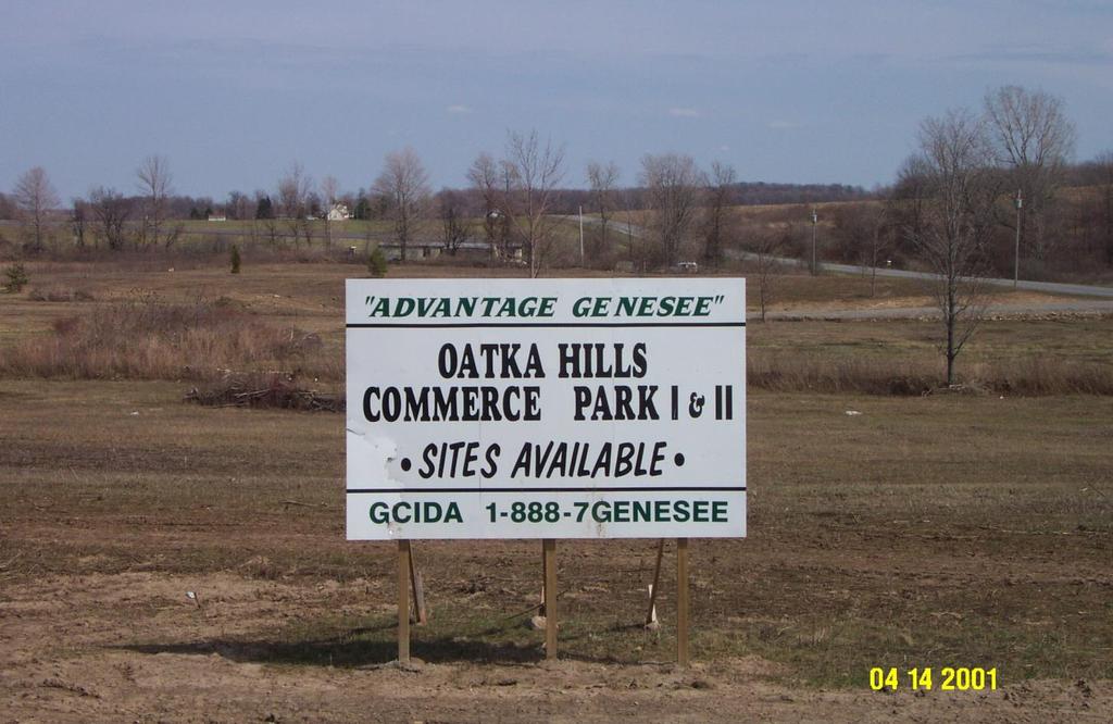
27 Page 27 T o w n o f L e R o y Demographic/Resource/Community Data Development Activity In the Town of LeRoy, it is still hoped the NYS Thruway and I-490 Interchange area will result in expanded commercial and industrial development in this area that are consistent with the County s Smart Growth Plan. The presence of Monroe County Water, its proximity to the NYS Thruway, Interstate 490, and NYS Route 19 can make this area attractive to businesses. However, the lack of sewer infrastructure and natural gas supply is seen as an impediment to potential development. The Genesee County Economic Development Center, in partnership with the Town and Village, is looking to develop 75 acres at the intersection of West Bergen Road and Rt. 19, just outside of the Village, where there are similar commercial enterprises and few residences. The availability of municipal sewer, along with established water, makes this an attractive site for development. However, again, the lack of natural gas supply is an obstacle.
28 Page 28 Demographic/Resource/Community Data Natural Resources The defining natural feature in the Town of LeRoy is the Oatka Creek. The creek bisects the Town and is a fourth order creek, draining approximately 221+ square miles of terrain. Ultimately, the Oatka Creek connects with the Genesee River which terminates in Lake Ontario. There are several stream habitat types within the village including: Pooling areas, with slow moving water, inhabited by aquatic vegetation that provides protection for insects and food resources necessary in fish rearing; Riffles north of the main street dam that aid in the breakdown of plant materials; and Runs between the Main Street and Munson Street Dam that provide slow, open water habitats for fish and migrating birds. The Town of LeRoy shares two areas of State designated wetlands (shown in dark blue on the map to the right) with the Village. While only a portion of each wetland lies within the Town, the community realizes their importance for flood control, natural wildlife habitat, and aesthetic value. The Village and the Town of LeRoy should work together to protect these natural assets and their function. The remaining wetlands are scattered throughout the Town. The floodplains (shown in cross hatch) are primarily associated with the Oatka and Mud Creeks. These floodplains should be protected from future development through a variety of land use and regulatory mechanisms. LeRoy Floodplains Rivers & Streams State Wetlands Federal Wetlands
29 Page 29 T o w n o f L e R o y Demographic/Resource/Community Data Transportation The main transportation corridors in the Town are Main Street (State Route 5) and Lake Road (State Route 19). The more prominent collector streets include North and South Streets. The Village of LeRoy experiences most of its traffic during peak rush-hour times between 7 to 9 am and 4 to 6 pm. However, there is an extended period of congestion around school facilities. The truck by-pass from Circular Hill Road to Route 19 north proposed in the previous plan has been constructed through private funds (Dolomite). This provides trucks that service the quarrying operations to the east of the village with convenient access to NYS Route 19 and, eventually, the Thruway and Interstate 490. An important by-product of this project is the reduction of trucks passing through the downtown area. This reduction in heavy vehicles could have a positive impact on the upcoming reconstruction of Main Street. However, the heavy truck traffic in close proximity to Buttermilk Falls may reduce its value as a local and regional attraction.
30 Page 30 Demographic/Resource/Community Data Agriculture According to the County s Agricultural Protection Plan, The Agricultural District Law set forth the concept of agricultural districts as an effective and politically viable way to protect farmland. In exchange for designation, agricultural district farmland owners benefit from reduction in tax liability, protection from local regulations that might impinge on necessary farming practices, and limited protection for nuisance suits under rightto-farm legislation. These districts assist communities in planning for future land use by providing an indication of land that should be considered for future agriculture uses. LeRoy has portions of two agricultural districts within its borders, totaling nearly 16,000 acres. Therefore, the Town of LeRoy, in tune with recommendations made by its Farmland Protection Plan, supports: 1. Maintaining a high percentage of current farmer and non-farmer owned farmland in the Town over the next decade. 2. Identifying and adopting land use regulations that create a supportive environment for agricultural businesses. 3. Working with the Village to strengthen land use planning efforts. 4. Promoting the benefits of a viable agricultural and food industry to the Town.
31 Page 31 T o w n o f L e R o y Our Community Plan Policy Framework Good public policy is developed and implemented on multiple levels. It must address the short and long term needs of a community as well as provide varying levels of detail. In an effort to accomplish this, this plan has five key elements. 1. Vision: A general statement of a future condition which is considered desirable for the entire community; it is an end towards which all actions are aimed. Think in terms of what you want the community to have or be. The Vision should not dramatically change over time but rather be consistent throughout the planning horizon. Ideally, the Vision contained in this plan should be useful for the 12-year planning horizon. 2. Policy: Similar to a vision in that it is a general statement of a future condition towards which actions are aimed. However, the scope of a policy is much more narrow. It should support the vision by addressing a particular area or issue facing a community. Policies should not dramatically change over time but rather be consistent throughout the planning horizon. 3. Policy Objective: A statement of a measurable activity to be accomplished in pursuit of the policy; it refers to some specific aspiration which is reasonably attainable. Think in terms of actions such as increase, develop, or preserve. The general lifespan of a policy objective is 6 to 12 years. 4. Implementation Items: A specific proposal to do something that relates directly to accomplishing an objective; it can take the form of a plan, project, or program. The lifespan of an implementation item can vary from one to 12 years depending on the item.

32 Page 32 Our Community Vision Image City Photography Gallery (Google Images)
33 Page 33 T o w n o f L e R o y Our Community Vision It is the vision of the Town to be an attractive place to live, work, and play. It will be a place known for its Safe & attractive residential living areas Strong local economy Healthy agricultural businesses Quality community resources Diverse leisure & cultural assets Scenic natural resources Cooperative spirit...the Town will strive to achieve this vision while maintaining its rural character and small town charm. The Town also recognizes that the Village is part of its appeal, enhances the quality of life of its residents, and should be enhanced.

34 Policy Area: Residential Living Page 34
35 Page 35 T o w n o f L e R o y Policy Area: Residential Living Policy It is the policy of the Town to locate future residential development in accordance with the County s Smart Growth Plan so as to efficiently use existing infrastructure capacity, while avoiding high quality farmland and ensuring attractive rural neighborhoods. LeRoy desires to have a combination of housing types ranging from traditional Village neighborhoods to rural living opportunities available to residents of all ages, incomes, and family structures. Policy Objectives 1. Extend existing village neighborhoods, maintaining the character of those existing neighborhoods. 2. Preserve existing housing values 3. Utilize approaches to residential development that protect farmland, open space, & environmental features 4. Provide non-vehicular connections to adjacent neighborhoods (i.e., trails or sidewalks) 5. Limit the use of cul-de-sacs 6. Maintain clear edge between the Village & the countryside

36 Policy Area: Residential Living Page 36
37 Page 37 T o w n o f L e R o y Policy Area: Residential Living Implementation Items 1. Construct additional single family homes that are similar in quality and character to the existing housing stock. 2. Modify the zoning code or offer incentives to cluster residential developments in rural areas. Clustering may be utilized to preserve farmland, open space, or to avoid natural features while reducing the amount of land needed for development. 3. Modify the zoning and site development guidelines to prohibit the construction of cul-de-sacs. A provision should be added to allow cul-desacs by variance in cases of undue hardship on the developer. New neighborhood blocks should be developed by expanding the existing grid street pattern. For example, West Avenue to West Bergen Road and continue Poplar Lane to Asbury Road. 4. Locate elderly housing in close proximity to services and transportation. 5. Require a visual impact assessment (i.e. photo simulations, sketches, etc) for new residential subdivisions over eight units in designated areas to ensure its compatibility with the existing man made or natural landscape. 6. Ensure water and sewer service keeps pace with new residential development. In areas where sewers are not practical, large lot or agricultural zoning should be utilized. In areas near the Village, where denser development is likely to occur, steps should be taken to facilitate connections to the existing or future sewer and water system. 7. Discuss offering property tax incentives for enhancements to existing residences.

38 Policy Area: Local Commerce Page 38
39 Page 39 T o w n o f L e R o y Policy Area: Local Commerce Policy It is the policy of the Town of LeRoy that the Village s downtown area will continue to serve as the cultural, social and economic center of the entire community. The Town recognizes that the vitality of the downtown area depends upon the purchasing power of the community and the diversity and appeal of merchandise and services. Additional economic development opportunities that arise in and around the Thruway and I-490 Interchange area will be consistent with the County s Smart Growth Plan and coordinated to ensure that direct competition with existing Town and Village businesses is avoided. Policy Objectives 1. Define areas best suited for future commercial uses 2. Ensure the Village remains the center for retail and service related businesses 3. Encourage additional commercial development that will not compete directly with existing businesses in the Village and Town 4. Incorporate the agricultural community in economic planning 5. Limit development of businesses in areas with prime agricultural soils outside of the County s designated growth areas 6. Work within the boundaries of the Smart Growth Plan to maximize future business opportunities and ensure that only compatible, environmentally friendly uses are permitted 7. Define quarry limits to existing quarry operations and develop restoration plans 8. Create commercial / industrial nodes in lieu of strip development 9. Recognize that commercial interests are the best means for growing a tax base

40 Policy Area: Local Commerce Page 40
41 Page 41 T o w n o f L e R o y Policy Area: Local Commerce Implementation Items 1. Develop a master plan for the Interchange and W. Bergen Rd / Rt. 19 Zones that portray the ideal location of future buildings, roads, and landscaping to ensure the best use of the site, once necessary utility services have been brought to the area. 2. Identify a preferred list of businesses for these zones and modify the zoning code accordingly, taking area residential concerns into consideration. 3. Tap into the tourism potential of the Town and Village by capitalizing on the presence of Oatka creek and the community s history. 4. Utilize the resources of Genesee County Economic Development Center to assist with the above.

42 Policy Area: Agriculture Page 42
43 Page 43 T o w n o f L e R o y Policy Area: Agriculture Policy It is the policy of the Town to continue to have vibrant agricultural businesses that contribute to the community s rural character and economic health. The Town acknowledges that farming and farmland contribute to the local economic base and provide public service in the form of open space. The Town will support land use regulations that are consistent with the objectives of the County s Smart Growth Plan to protect agricultural land from residential and commercial encroachment and work towards expanding its agricultural base. Policy Objectives 1. Ensure agriculture remains a viable and profitable industry in the Town 2. Identify niche farming opportunities 3. Reduce potential for future conflict between farming and non-farm residential uses 4. Provide similar considerations to agriculture as those provided to other industries 5. Ensure that the quality of the Town s land, air, and water resources continue to support farming operations 6. Promote agricultural tourism opportunities including bed and breakfasts, festivals, and other opportunities unique to the agriculture industry 7. Protect the Town s rural character and prime agricultural soils 8. Enable new farmers to begin farming 9. Recognize that agricultural land requires few expenditures for municipal services 10. Understand issues from Right to Farm legislation
44 Policy Area: Agriculture Page 44
45 Page 45 T o w n o f L e R o y Policy Area: Agriculture Implementation Items 1. Implement the recommendations in the County s Farmland Protection Plan. 2. Focus on the four recommendations of the LeRoy Agriculture and Farmland Protection Plan (2010): A. Maintaining a high percentage of current farmer and non-farmer owned farmland in the town over the next decade. B. Identify and adopt land use regulations that protect farmland and create a supportive environment for agricultural businesses. C. Continue to build the established partnership between the town and village to strengthen land use planning efforts. D. Promote the benefits of a viable agricultural and food industry to the town. 3. As development pressure increases, the Town may want to utilize land preservation techniques such as, A. Conservation Easements A conservation easement is a voluntary restriction placed upon a property that restricts additional development of the land beyond its current use. Easements are typically held by the municipality or by a local land trust. Some municipalities offer reduced tax assessments for lands preserved with conservation easements. B. Purchase of Development Rights The sale of the right to develop your land for non-farming uses. This technique enables the property owner to realize a portion of the financial gain he or she would typically receive from selling their land for non-farming development (i.e. residential subdivision, etc.) while continuing to farm the property. The money received from the sale of the development rights is often used to purchase needed equipment, expand the farming operations, or to fund retirement. 4. Educate residents as to the benefits of farming to the community, such as reduced tax burden as compared to other types of development, fresher food sources, and rural character. 5. Farm related tourist opportunities within the Town. 6. Modify existing codes to allow accessory farm businesses such as farm stands. 7. The most successful farms in today s economy are either the low cost producer (i.e. large volume producer) or niche farming operations (i.e. specialty farming). The Town s agricultural community should take steps to ensure local farmers are successful achieving one of these two types of operations.
46 Policy Area: Community Resources Page 46
47 Page 47 T o w n o f L e R o y Policy Area: Community Resources Policy It is the policy of the Town to have community resources (public services, civic organizations, and business groups) that meet the needs of residents and support local businesses. The Town enjoys the health and safety benefits provided by the State and County law enforcement units, its local fire department and ambulance services, as well as the public water and sewer service (in certain areas). The welfare of residents is ensured by the LeRoy Central School District, the local park system, public library, and the faith community. The collective efforts of these public and not-for-profit groups are an invaluable asset to the community, and it is essential that the level of service provided to the Town is maintained or increased based on future need. Policy Objectives 1. Continue delivery of services (utilities, educational, etc.) necessary to ensure the health, safety and welfare of residents 2. Locate community (Town, Village, educational, etc.) facilities that compliment existing activity within the Village limits 3. Continue to meet the existing and future recreation needs of the community 4. Create opportunities for increased public involvement in building a better community 5. Maintain or increase the amount of park and open space accessible to residents 6. Preserve areas of open space that are important to the community 7. Ensure new development contributes to the development of expanded services (i.e. recreation needs, etc)
48 Page 48 Policy Area: Community Resources Implementation Items 1. Continually evaluate the adequacy of the level of protection provided by law enforcement, fire, and ambulance services available within the community. 2. Develop a long range plan for the Community s recreation facilities. 3. As residential development occurs in conjunction with the future land use map (to south and northwest of the Village) new park facilities should be considered to service the neighborhoods. In addition, a connective network of trails, sidewalks, or streets should be developed to provide pedestrian and bicycle connections between new and existing neighborhoods, the central business district, parks, and educational facilities. 4. Identify the areas of the Town to be preserved as open space and pursue the protection of those areas. This process should start with the development of an Open Space Protection Plan. 5. Coordinate with the faith community in providing local teen and senior recreational opportunities. 6. Administer regular community surveys on the quality of service delivery in the community. 7. Sponsor public health programs (such as elderly health evaluations, youth inoculation services, and rabies vaccinations). 8. The school facilities should be a central part of the community.

49 Page 49 T o w n o f L e R o y Policy Area: Leisure and Culture
50 Page 50 Policy Area: Leisure and Culture Policy It is the policy of Town to ensure that a wide variety of leisure and cultural opportunities exist within the community. The golf course, Oatka Creek, Oatka Fest, Winterfest, First Night, LeRoy House / Jell-O Museum are attractions that residents of the Town, Village, and neighboring municipalities frequently enjoy. The Town will support these types of activities as it seeks to increase the quality and quantity of activities provided to its residents and visitors. Policy Objectives 1. Increase the number of activities available to the community s youth outside of school hours 2. Expand recreational opportunities related to Oatka Creek 3. Continue to meet the recreational needs of the growing senior population 4. Promote the events and attractions available within the community to the region, state, and country 5. Capitalize on the growing tourism market using the community s farming operations, history, and cultural assets

51 Page 51 T o w n o f L e R o y Policy Area: Leisure and Culture
52 Page 52 Policy Area: Leisure and Culture Implementation Items 1. Utilize abandoned railroad beds within the Town as multi-use trails that connect the Town to adjacent Towns. 2. Create a single community (Town, Village, and School) web site that highlights local businesses and attractions. 3. Advertise various community activities (fishing, Oatka Fest, bicycling, ice skating, etc.) in publications around the region. The most successful advertising offers more than a single day worth of activities. For example, a weekend package in LeRoy may include a round of golf, dinner, and overnight stay at a local bed and breakfast or hotel, fishing or a stroll along Oatka Creek, and then lunch. The key is to offer enough activities to get visitors to stay overnight. The level of spending associated with an overnight stay is significantly greater than a day-trip. 4. Continue to develop life-long learning opportunities within the community for adults of all ages.

53 Page 53 T o w n o f L e R o y Policy Area: Natural Resources
54 Page 54 Policy Area: Natural Resources Policy It is the policy of the Town to be a community that preserves and enhances the quality of its natural resources (air, land, and water) through the combined efforts of its residents, businesses, and government. The degradation of these resources should be reduced or eliminated through sound development practices, proper zoning guidelines and community stewardship. In particular, special attention should be given to the protection of Oatka Creek due to its environmental, aesthetic, and recreational value. Policy Objectives 1. Avoid placement of activities (recreational, industrial, etc) in or near environmentally sensitive areas 2. Reduce sources of non-point run off 3. Reduce and mitigate air and noise impacts 4. Maintain the integrity of the Oatka Creek shoreline 5. Reduce, reuse, and recycle appropriate materials 6. Ensure that environmental protection efforts focus on natural boundaries rather than political ones

55 Page 55 T o w n o f L e R o y Policy Area: Natural Resources
56 Page 56 Policy Area: Natural Resources Implementation Items 1. Apply for stream restoration funding to stabilize the shoreline of Oatka Creek as outlined in the report by the Oatka Creek Watershed Committee. 2. Consider zoning ordinance revisions, together with ancillary regulatory changes, that reflect the need for environmental protection in connection with industrial, commercial, and residential development. 3. Control site lighting, assuring that it does not intrude on adjoining or other properties. 4. Control noise levels at the perimeter of the property. 5. Management of site storm water in a fashion to assure appropriate rates and quality of discharge at the property boundaries, and making use of state-of-the-art constructed wetlands or such on-site wetlands as may exist, subject to New York State Department of Environmental Conservation and local government approval, and federal wetland regulation as may be relevant. 6. Maintain the suitability of air quality, including odor and other emissions, assuring that there be no degradation caused by site operations, either during construction or in operation of the facility under consideration. 7. The management of industrial waste, such that it be collected and suitably treated on site, expeditiously removed from the community without recourse to surface or subsurface disposal, incineration or other burning. That discharge to public owned treatment works be in accordance with permit parameters. 8. Ensure that planning and zoning boards are well educated on the New York State Environmental Quality Review Act and how other communities have applied it to development proposals within their community. 9. Implement a volunteer stream watch group with guidance of local biology teachers and the participation of students. 10. Take into serious consideration the impact of development near any natural asset core areas, ecological network areas, or natural cover areas as outlined in the Green Genesee Road Map.

57 Page 57 T o w n o f L e R o y

58 Policy Area: Regional Cooperation Page 58
59 Page 59 T o w n o f L e R o y Policy Area: Regional Cooperation Policy It is the policy of the Town to have inter-municipal relationships that strengthen the regional economy, protect sensitive environmental areas, preserve local character, support the County s Smart Growth Plan and enhance the quality of life for residents. The Town recognizes that its well being is directly linked to that of the Village s and the County as a whole, and it understands that the success of these relationships is critical to the future of the Town. Policy Objectives 1. Continue to develop a partnership with the Village of LeRoy to: - Capitalize on opportunities for shared services to reduce the cost of government - Preserve the traditional character of the Village and maintain its role as the commercial, civic, and social center of the community - Preserve the Town s rural character 2. Pursue strategies that advance regional cooperation to attract new businesses to the region 3. Increase awareness of regional heritage and cultural resources 4. Reduce land use and border conflicts with the Village 5. Strive to view and protect the environment using natural boundaries (watersheds, prime soil areas, etc.) rather than municipal boundaries

60 Policy Area: Regional Cooperation Page 60
61 Page 61 T o w n o f L e R o y Policy Area: Regional Cooperation Implementation Items 1. Identify the costs and benefits associated with the dissolution of the Village and its impact on the Town. 2. The Town and Village should work together to consider: a. Planning the future transportation network for the community and adopt an Official Map that indicates potential street extensions and major system improvements. b. Adopting a common land use map for both communities. c. Adopting a shared Code for the entire community. d. Marketing the area to potential businesses and visitors. e. Developing a joint five-year capital improvement program. 3. Coordinate with regional municipalities to avoid overlapping festival times. Events should be organized to closely follow each other to attract overnight and multi-day trips. 4. Pursue state and federal funding opportunities (grants, etc.) with neighboring municipalities. A greater emphasis is being placed on funding projects and programs that benefit more than one municipality. Therefore, the community s chances of getting funding is improved when it files joint applications with one or more local governments. 5. Promote regional cultural & heritage awareness through effective planning, marketing, and funding strategies. 6. Actively participate in the review (every 3 years) of the County s Smart Growth Plan to ensure that the Town s targeted development areas are appropriate.
62 Conclusion Page 62
63 Page 63 T o w n o f L e R o y Conclusion If we accept these facts known today 1. We have a declining population. 2. We have a 7+% housing vacancy rate. 3. We have declining values for residential property within the Village and increasing values for open/agricultural properties within the entire Town. 4. We have urban sprawl (population decrease but increased housing construction) within the County. 5. Residential land uses require more expenditures for services (and even more for rental property) than commercial or agricultural (or open space) land uses, therefore placing a burden on the tax base. 6. Communities with higher assessments and lower tax rates tend to thrive more than communities with lower assessments and higher tax rates. Then we should focus on these questions. 1. Should Town / Village prioritize (strongly) attracting commercial interests to appropriate commercial areas (i.e. not in areas that might further devalue residential property)? 2. Should Town / Village modify its existing code to incentivize attracting such commercial ventures? 3. Should Town/Village modify its existing code and/or permit fees to incentivize improvements to existing residential property and to disincentive-ize new residential construction (particularly multi-family rental units)? 4. Should Town / Village modify its existing code and/or enforcement process to become more restrictive as a means to increase assessment values in order to correspondingly decrease tax rates? 5. Should ZBA severely limit exceptions (variances) to existing zoning code to discourage lowering property values?
64 Page 64 Conclusion Acknowledgements We would like to thank the following people and organizations for their assistance in developing and promoting this plan: LeRoy Town Board Steve Barbeau, Supervisor Thomas Stella Kelly Lathan John Armitage Dave Paddock John Duyssen Town of LeRoy Planning Board Robert Dawley, Chair Gerry Calmes David MacKenzie Thomas McGinnis Bill Mowry Corrine Sprague Jack Hempfling Genesee County Department of Planning Felipe Oltramari, Director Genesee County Legislator Shelley Stein Clark Patterson Lee (formerly Clark Patterson Associates) Town of LeRoy Staff Patricia Canfield Jeff Steinbrenner Eric Stauffer We would also like to thank all of the people involved in the 1991 and 2001 Community Planning Processes!
65 Page 65 T o w n o f L e R o y Conclusion Acknowledgements The following sources were utilized in the development of this plan: Town of LeRoy Comprehensive Plan Village of LeRoy Master Plan Village of LeRoy Comprehensive Plan Community of LeRoy Resident Survey LeRoy Agriculture and Farmland Protection Plan Oatka Creek Watershed Report 7. Best Development Practices by Reid Ewing 8. Rural By Design by Randall Arendt 9. Small Town Planning Handbook by Thomas Daniels 10. Visions for a New American Dream by Anton Nelessen 11. United States Census Bureau 12. Genesee County Planning and Real Property Tax Departments

66 Prepared By: 186 North Water Street Rochester, New York Phone:
Land Use INTRODUCTION
 Land Use INTRODUCTION The Land Use Element provides the policy context for the Centre Region to achieve its goals for the preservation and future development of rural, suburban, and urban land uses. This
G E N E S E E C O U N T Y S M A RT G ROW T H P L A N 2016 R E V I E W R E P O RT
 G E N E S E E C O U N T Y S M A RT G ROW T H P L A N 2016 R E V I E W R E P O RT PREPARED FOR THE GENESEE COUNTY LEGISLATURE by Genesee County Department of Planning County Building II 3837 West Main Street
CHAPTER V LAND USE DEVELOPMENT POLICIES
 CHAPTER V LAND USE DEVELOPMENT POLICIES The purpose of this chapter is to outline land use development policies, short and long term, by land use type and identify changes needed in documents such as the
PERMITTED USES: Within the MX Mixed Use District the following uses are permitted:
 6.24 - MX - MIXED USE DISTRICT 6.24.1 INTENT: The purpose of the MX Mixed Use District is to accommodate the development of a wide-range of residential and compatible non-residential uses (including major
2016 MAJOR GENERAL PLAN AMENDMENT
 2016 MAJOR GENERAL PLAN AMENDMENT GROWTH AREAS ELEMENT GROWTH AREAS ELEMENT 4.0 GOALS 1. Encourage orderly development within Growth Areas. 2. Encourage balanced, mixed use and multi-modal development
STAFF REPORT. Permit Number: Tallman. Kitsap County Board of Commissioners; Kitsap County Planning Commission
 STAFF REPORT Permit Number: 15 00742 Tallman DATE: November 9, 2015 TO: FROM: RE: Kitsap County Board of Commissioners; Kitsap County Planning Commission Katrina Knutson, AICP, Senior Planner, DCD and
Policy NR Maintain the natural and functional characteristics of Portsmouth s soils. (Related Policies: AG 1.1, LU 6.2)
") PORTSMOUTH DRAFT COMPREHENSIVE COMMUNITY PLAN POLICY STATEMENTS SUMMARY 1 NATURAL RESOURCES Policy NR - 1.1 - Ensure that new development and redevelopment in Portsmouth takes place in a manner which protects
PORTSMOUTH DRAFT COMPREHENSIVE COMMUNITY PLAN POLICY STATEMENTS SUMMARY 1 NATURAL RESOURCES Policy NR - 1.1 - Ensure that new development and redevelopment in Portsmouth takes place in a manner which protects
FERRY COUNTY COUNTY-WIDE PLANNING POLICIES
 FERRY COUNTY COUNTY-WIDE PLANNING POLICIES This memorandum of understanding lays out the framework upon which the comprehensive planning process for Ferry County and the City of Republic will be built.
Lincoln - OFFICIAL PLAN PART 1 INTRODUCTION 1.1. THE COMMUNITY VISION
 Lincoln - OFFICIAL PLAN PART 1 INTRODUCTION 1.1. THE COMMUNITY VISION The vision for Lincoln is to be a Centre of Excellence for Agriculture; an inclusive community that values diversity, partnerships,
Model Riparian Buffer Ordinance.
 Model Riparian Buffer Ordinance. This is a sample riparian buffer ordinance written as an amendment to an existing zoning ordinance. This ordinance complies with the state minimum standards for river corridor
Town of Alabama Agricultural and Farmland Protection Plan
 SECTION I INTRODUCTION The Town of Alabama has a rich agricultural heritage, and farming is the Town s primary economic activity. The Town s Comprehensive Plan, prepared jointly with the Town and Village
CHAPTER 13 R-5 MANUFACTURED MOBILE HOME PARK RESIDENTIAL DISTRICT
 15.1300 CHAPTER 13 R-5 MANUFACTURED MOBILE HOME PARK RESIDENTIAL DISTRICT 15.1301 SECTION 13.01 STATEMENT OF PURPOSE To provide for manufactured home park development, of long-term duration of stay, in
US Forest Service Open Space Conservation Strategy
 US Forest Service Open Space Conservation Strategy Transportation Research Board September 3, 2008 Atlanta, Georgia Photo Credit: Regents at the University of Minnesota. All rights reserved. Used with
Technical Assistance for Sustainable Communities: Building Blocks
 Technical Assistance for Sustainable Communities: Building Blocks Technical Assistance Tool: Fiscal and Economic Health City of Fairfax, Virginia To: Brooke Hardin, City of Fairfax Department of Community
Objective A: Transportation facilities and services should be designed to conform with other policies contained herein.
 CHAPTER ONE GOALS & OBJECTIVES INTRODUCTION KRS 100.193 mandates that a Planning Commission adopt statements of goals and objectives that will act as guides to the preparation of the plan. The update has
Goals and Objectives. (Updated in 2011)
") Goals and Objectives (Updated in 2011) Introduction The following goals and objectives are based on the focal points described in the Vision Statement of this Master Plan. The Goals and Objectives will
Goals and Objectives (Updated in 2011) Introduction The following goals and objectives are based on the focal points described in the Vision Statement of this Master Plan. The Goals and Objectives will
Independence is a growing community. Growth is placing new demands on City transportation facilities and City services
 6.0 LAND USE GUIDE PLAN 6.1 INTRODUCTION The Independence Land Use Guide Plan is a result of four decades of municipal planning activity, citizen s involvement and reasonable decision-making. This plan
Town of Saratoga. Agriculture and Farmland Protection Plan
 Town of Saratoga Agriculture and Farmland Protection Plan EXECUTIVE SUMMARY Town of Saratoga Saratoga County, New York September 2018 Executive Summary Dramatic Changes in the Agricultural Landscape In
Town of Hartford. Comprehensive Planning Visioning Workshop. Results. November 17, 2006
 Town of Hartford Comprehensive Planning Visioning Workshop Results November 17, 2006 Workshop Conducted: September 19, 2006 Hartford Town Hall 37 Participants Station # Station Title 2 Mapping Future Residential
A Platform for Loudoun s Future
 A Platform for Loudoun s Future Restoring the Public s Place in Planning for our Community We citizens of Loudoun County are passionate in defense of our communities and our environment. The current quality
Charter Township of Garfield Grand Traverse County
 Charter Township of Garfield Grand Traverse County 3848 VETERANS DRIVE TRAVERSE CITY, MICHIGAN 49684 PH: (231) 941-1620 FAX: (231) 941-1588 SPECIAL USE PERMIT APPLICATION APPLICANT INFORMATION Name: Address:
SECTION 5: ALTERNATIVES TO THE PROPOSED PROJECT
 SECTION 5: ALTERNATIVES TO THE PROPOSED PROJECT 5.1 - Introduction In accordance with CEQA Guidelines Section 15126.6, this Draft Subsequent Environmental Impact Report (DSEIR) contains a comparative impact
County of Wetaskiwin Pigeon Lake Watershed Area Concept Plan February 6, 2014
 County of Wetaskiwin Pigeon Lake Watershed Area Concept Plan February 6, 2014 1 Introduction 1.1 Background The Pigeon Lake area continues to attract significant attention from landowners wanting to pursue
REGIONAL GROWTH STRATEGY
 THOMPSON-NICOLA REGIONAL DISTRICT REGIONAL GROWTH STRATEGY Bylaw 2409, 2013 Source: Picture BC Thompson-Nicola Regional District 300-465 Victoria Street Kamloops, BC V2C 2A9 Telephone: 1-250-377-8673 Toll
Community Vision and Core Values DRAFT SEPTEMBER 2013
 Community Vision and Core Values DRAFT SEPTEMBER 2013 Introduction Plan Rapid City is the effort to update the Rapid City Comprehensive Plan, a long-range planning strategy that will provide a blueprint
CONTAINER PORT GOALS 10-2
 ten CONTAINER PORT CONTAINER PORT GOALS GOAL CP 1 Identify the core port and port-related container industrial area and protect the long-term function and viability of this area (see Figure 41, Core Area).
CHAPTER 8: INTERGOVERNMENTAL COOPERATION
 CHAPTER 8: INTERGOVERNMENTAL COOPERATION Photos above by Randy Uhl 8.1 Introduction Intergovernmental cooperation involves working with neighboring communities, school districts and agencies to understand
Town of Saratoga. Agriculture and Farmland Protection Plan. Town of Saratoga
 Town of Saratoga Agriculture and Farmland Protection Plan Town of Saratoga Saratoga County, New York December 2018 Executive Summary Dramatic Changes in the Agricultural Landscape The face of agriculture
Chapter III - Issues and Opportunities
 Chapter III - Issues and Opportunities POPULATION In 1960 the Town of Vernon's population was 2,037. This represented approximately 26% of the total population in the south-central portion of Waukesha
COUNTY COMPREHENSIVE PLAN
 86 : Policy Statement Lewis County has an abundance of natural resources, including water, wind, soils, and wildlife. Together with our citizens, they form a unique ecosystem that must be preserved and
11. Prioritizing Farmlands for Future Protection
 11. Prioritizing Farmlands for Future Protection Identification of Important Farmlands in Putnam County I n order to implement this Plan successfully, Putnam County decision-makers will have to take advantage
IX. STRATEGIC PLAN ELEMENT
 IX. STRATEGIC PLAN ELEMENT The Strategic Plan Element provides the action and implementation plan for the New Brunswick Master Plan. New Brunswick is a fully developed, older urban area in central New
Recolour Grey Policy Consideration Workshop Handout
 Recolour Grey Policy Consideration Workshop Handout Grey County 595 9 th Avenue East Owen Sound, ON N4K 3E3 1-800-567-4739 www.grey.ca Policy Considerations: Recolour Grey Please note that the policy considerations
Strategic Plan
 Corporation of the Township of Esquimalt 2008 Strategic Plan Focussing on community priorities, the Township of Esquimalt provides quality municipal services through open and innovative leadership MESSAGE
Once known as warehousing and distribution, the process
 Map III-2.3 Proposed Agile Port Industrial Area AGILE PORT INDUSTRIAL AREA PLAN Once known as warehousing and distribution, the process of moving goods to market has evolved dramatically. No longer is
Tools for Taming Exurban Sprawl at the County Level. 8:30 9:40 a.m. Friday, April 22, 2005 Sturm College of Law
 THE ROCKY MOUNTAIN LAND USE INSTITUTE CONCURRENT SESSION Tools for Taming Exurban Sprawl at the County Level 8:30 9:40 a.m. Friday, April 22, 2005 Sturm College of Law Moderator: Rich McClintock Program
Consequences of Sprawl
 Loss of farmland Land conversion and stormwater runoff Water quality and quantity Loss of wildlife habitat Larger carbon footprint Lack of roadway connectivity and access Public health and safety Road
Capital Facilities Element
 Capital Facilities Element Purpose The Growth Management Act requires cities to prepare a capital facilities element consisting of: 1. An inventory of current capital facilities owned by public entities,
Hillsborough County Future Land Use 160
 RURAL-AGRICULTURE LAND USE CLASSIFICATION Agricultural/Mining -1/20 (AM-1/20) RESIDENTIAL GROSS DENSITY TYPICAL USES MAXIMUM FLOOR AREA RATIO OR Up to 1 dwelling unit per 20 gross acres. Alternative methods
The Municipal Land Use Law, at N.J.S.A. 40:55D-89, includes the following statement relative to the periodic examination of a municipal Master Plan:
 2002 Periodic Reexamination Report of the Master Plan and Development Regulations for Lebanon Township, Hunterdon County, New Jersey May 16, 2002 (Adopted as revised on May 21, 2002) The Municipal Land
STAFF REPORT. Permit Number: Ryan. Kitsap County Board of Commissioners; Kitsap County Planning Commission
 STAFF REPORT Permit Number: 15 00380 Ryan DATE: November 9, 2015 TO: FROM: Kitsap County Board of Commissioners; Kitsap County Planning Commission Katrina Knutson, AICP, Senior Planner, DCD and Jeff Arango,
Chapter 6 PLAN IMPLEMENTATION & INTERJURISDICTIONAL COORDINATION
 Chapter 6 PLAN IMPLEMENTATION & INTERJURISDICTIONAL COORDINATION INTRODUCTION As important a benchmark as this Master Plan represents, the initiatives proposed in this Plan will not implement themselves.
Article 6 District Intensity Standards
 Sec. 6.1 District Intensity in General 6.1.1 Purpose The district development standards of this Ordinance establish lot sizes and certain restrictions for all residential and nonresidential development.
April 12, 2006 Planning Commission Meeting. Landfill Energy Systems
 DATE: April 04, 2006 TO: FROM: RE: Salt Lake City Planning Commission Marilynn Lewis, Principal Planner April 12, 2006 Planning Commission Meeting CASE#: 410-06-03 COUNCIL DISTRICT: APPLICANT: STATUS OF
a. The following regulations shall apply to all guest ranches:
 SECTION 15 GENERAL DEVELOPMENT STANDARDS 15.1 Guest Ranches. a. The following regulations shall apply to all guest ranches: (1) Individual guest ranch quarters shall not contain Kitchen or cooking facilities.
The working rural landscapes of farms and forests, and the livelihoods of those who depend upon them, should be preserved and enhanced.
 Rural Economy PRINCIPLE The working rural landscapes of farms and forests, and the livelihoods of those who depend upon them, should be preserved and enhanced. 24 T OMPKINS C OUNTY C OMPREHENSIVE P LAN
S e c t i o n S u b d i vision
 S e c t i o n 2. 6 - S u b d i vision Subdivision is a process of defining and redefining land parcel boundaries and can provide a framework for future land use and development. Integrated, well planned
Corridor Planning Standards + Potential Performance Measures
 Corridor Planning Standards + Potential Performance Measures January 17, 2007 1. Transportation improvements should connect people with potential places of employment and regional activity centers, particularly
Hardee County Comprehensive Plan
 Hardee County 2030 Comprehensive Plan Amended through November 2014 Hardee County 2030 Comprehensive Plan Amended through November 2014 Updated August 2014 HARDEE COUNTY 2030 COMPREHENSIVE PLAN TABLE OF
Corridor Residential Traditional District Regulations City of St. Petersburg City Code Chapter 16, Land Development Regulations
 Section 16.20.060 - Corridor Residential Traditional Districts ( CRT ) Typical Buildings in the CRT District Sections: 16.20.060.1 Composition of Traditional Residential Corridors 16.20.060.2 Purpose and
- FACT SHEET - THE GUIDING PRINCIPLES
 THE GUIDING PRINCIPLES The General Plan begins with seven ideas that together create a vision for the City s future. When the City approved the General Plan in 1994, these idea were dubbed the Seven Guiding
ADDITIONAL GENERAL PLAN EDITS TO CONSIDER
 ADDITIONAL GENERAL PLAN EDITS TO CONSIDER OVERVIEW During the circulation period for the Draft Environmental Impact Report, additional changes, edits, and clarifications to the Draft General Plan have
3.12 LAND USE AND PLANNING
 3.12 LAND USE AND PLANNING 3.12.1 INTRODUCTION This section describes the existing land uses in the project vicinity that could be affected by implementation of the Proposed Action and the alternatives.
LAND USE POLICIES BY COMMUNITY DESIGNATION
 137 2040 138 Land Use Policies by Community Designation As discussed earlier in Thrive MSP 2040, the Council assigns a community designation to each city and township. This designation indicates the overall
LUNDY S LANE COMMUNITY IMPROVEMENT PLAN STUDY
 PUBLIC INFORMATION MEETING # October, 0 LUNDY S LANE COMMUNITY IMPROVEMENT PLAN STUDY AGENDA :00 to :0pm: Open House :0 to :pm: Presentation : to :00pm: Individual paced workshop with the Study Team PUBLIC
ELEMENT M GROWTH MANAGEMENT
 Growth Management ELEMENT M GROWTH MANAGEMENT GOAL: To ensure that growth and development are integrally planned with, and phased concurrently with, the City of Irvine s ability to provide an adequate
Municipal Service Review
 Redway Community Services District Municipal Service Review July 2008 Prepared by: For the District Sphere of Influence Report TABLE OF CONTENTS Page Local Agency Formation Commission Authority... 1 Agency
Corridor Residential Suburban District Regulations City of St. Petersburg City Code Chapter 16, Land Development Regulations
 Section 16.20.070 - Corridor Residential Suburban Districts ( CRS ) Sections: Typical Buildings in the CRS District 16.20.070.1 Composition of Suburban Residential Corridors 16.20.070.2 Purpose and Intent
XI. Thornton Planning Area
 XI. A. OVERVIEW The covers 120 square miles in the northwest corner of San Joaquin County. It consists primarily of low-lying Delta islands, sloughs, and large farms. The town of Thornton, a small agriculturally-based
TRANSPORTATION RELATIONSHIP TO OTHER ELEMENTS OF THE PLAN AND COUNTY REGULATIONS VISION FOR TRANSPORTATION PLANNING ROAD NETWORK SECTION 7
 TRANSPORTATION Like many growing western counties, Douglas County focuses on one of the most integral elements in land-use planning: transportation. The primary purpose of a transportation network is to
GOOD NEIGHBOR POLICY
 Regional Open Space MIDPENINSULA REGIONAL OPEN SPACE DISTRICT GOOD NEIGHBOR POLICY Adopted by the Board of Directors October 26, 1988 Amended August 14, 1996 Amended September 26, 2007 Introduction The
Land Use Vision and Transportation Strategy
 Phase 1: Land Use and Transportation Strategy June 3, 2015 ing Workshop #2 Phase 1: Land Use and Transportation Strategy Welcome March 12 Workshop Summary Discussion Strategies to Implement the Next Steps
City of Surrey Agricultural Plan Summary
 City of Surrey Agricultural Plan Summary City of Surrey Statistics 1 : Population (2006) 364,976 Jurisdictional Area: Land Water Total Total Area Farmed (2006) 31,837 ha 4,610 ha 36,447 ha 9,307 ha % of
524 Arctic Court Property Development Feasibility Study
 Attachment D 524 Arctic Court Property Development Feasibility Study Prepared for the Redevelopment Agency of Salt Lake City November 2015 Prepared by VODA Landscape + Planning www.vodaplan.com TABLE OF
Corridor Residential Suburban District Regulations City of St. Petersburg City Code Chapter 16, Land Development Regulations
 16.20.070 - Corridor Residential Suburban District ( CRS ) Figure REFERENCE Typical Buildings in the CRS District Sections: 16.20.070.1 Composition of Suburban Residential Corridors 16.20.070.2 Purpose
LAND USE INTRODUCTION EXISTING CONDITIONS
 1 2 3 4 5 6 7 8 9 10 11 12 13 14 15 16 17 18 INTRODUCTION This chapter describes land use in the Lemon Creek area using maps and data that show designations of all properties by the 2013 Comprehensive
NOTICE OF DECISION. LD , TP and ADJ , ADJ , SDM (Hall Boulevard 15-Lot Preliminary Subdivision).
.") NOTICE OF DECISION HEARING DATE: Wednesday, June 22, 2016 TO: FROM: PROPOSAL: LOCATION: SUMMARY: APPLICANT- PROPERTY OWNER: APPLICANT: APPLICABLE CRITERIA: All Interested Parties Jason T., Assistant Planner
NOTICE OF DECISION HEARING DATE: Wednesday, June 22, 2016 TO: FROM: PROPOSAL: LOCATION: SUMMARY: APPLICANT- PROPERTY OWNER: APPLICANT: APPLICABLE CRITERIA: All Interested Parties Jason T., Assistant Planner
SUBURBAN EDGE COMMUNITY ROLE COUNCIL ROLE ALL COMMUNITIES SUBURBAN EDGE
 Orderly and Efficient Land Use Align land use, development patterns, and infrastructure to make the best use of public and private investment. Plan and stage development for forecasted growth through 2040
Corridor Residential Traditional District Regulations City of St. Petersburg City Code Chapter 16, Land Development Regulations
 16.20.060 - Corridor Residential Traditional District ( CRT ) Figure REFERENCE Typical Buildings in the CRT District Sections: 16.20.060.1 Composition of Traditional Residential Corridors 16.20.060.2 Purpose
Residential Zoning Rules
 Residential Zoning Rules Applications for building permits must contain plans and information that show that the proposal meets the requirements of the International and Washington State building codes,
Neighborhood Suburban Single-Family District Regulations City of St. Petersburg City Code Chapter 16, Land Development Regulations
 Section 16.20.020 - Neighborhood Suburban Single-Family Districts ( NS ) Sections: Typical Block in a Neighborhood Suburban District 16.20.020.1 History and Composition of Suburban Neighborhoods 16.20.020.2
COMPREHENSIVE PLAN GOALS / POLICIES
 COMPREHENSIVE PLAN GOALS / POLICIES This document consolidates the Goals and Policies from the seven Framework Topics from Chapter Four - Framework for the Future. Managing Growth Goals Goal MG1: Support
Neighborhood Traditional Single-Family District Regulations City of St. Petersburg City Code Chapter 16, Land Development Regulations
 Section 16.20.010 - Neighborhood Traditional Single-Family Districts ( NT ) Typical Houses in a Neighborhood Traditional District Typical Block in a Neighborhood Traditional District Common Features of
Farming at the Urban Edge
 Farming at the Urban Edge Preservation of farmland despite pressure from development and making farming profitable are not the only challenges facing farmers today. The location of the Prince George s
SDC 2.0 Working Group: Goals, Actions and Targets Nature + Water
 1 SDC 2.0 Working Group: Goals, Actions and Targets Nature + Water *KEY: Yellow highlights are proposed new text. NATURE 1 Goal 1: Protect, restore, and expand aquatic ecosystems. Target 1: CURRENT: By
Business and Industrial Areas Queenstown, Frankton, Arrowtown and Wanaka 11.1 Issues, Objectives and Policies
 . Business and Industrial Areas Queenstown, Frankton, Arrowtown and Wanaka.1 Issues, Objectives and.1.1 Resources, Activities and Values Business activities occur throughout the commercial, service and
STAFF REPORT WASHINGTON STATE PARKS AND RECREATION COMMISSION COVERED SHELTERS AND BIKE RACKS
 STAFF REPORT WASHINGTON STATE PARKS AND RECREATION COMMISSION COVERED SHELTERS AND BIKE RACKS TO: Douglas County Hearing Examiner FROM: Douglas County Land Services Staff RE: SP-2019-02 DATE: April 8,
ATTACHMENT 2A- Issues Tentatively Resolved Decisions from the Board of Supervisors Hearing on September 11, 2007
 1. Introduction (on pg 1-15) Add the following goal: A Community safe from climate change. Marin will be a leader in averting and adapting to aspects of climate change. 2. Biological Resources 2.A. Richardson
# Mercyhealth Hospital Project Review for Planning and Zoning Commission
 #2017-38 Mercyhealth Hospital Project Review for Planning and Zoning Commission Meeting Dates: December 6, 2017 and January 3, 2018 Requests: 1. Preliminary Planned Unit Development and 2. Special Use
 Page 1 of 5 Chapter 17.72 R-H HILLSIDE SINGLE-FAMILY RESIDENTIAL DEVELOPMENT DISTRICT Sections: 17.72.010 Purpose. 17.72.020 Permitted uses. 17.72.030 Uses subject to a conditional use permit. 17.72.040
Shaping Private Development/ Growth Management
 Shaping Private Development/ Growth Management What are the social consequences of sprawl? Can private development be controlled to manage growth on the regional scale? What is gained by trying to manage
U n i v e r s i t i e s & M e d i c a l D i s t r i c t. Off-campus Neighborhood Development
 U n i v e r s i t i e s & M e d i c a l D i s t r i c t Off-campus Neighborhood Development 7 Housing 8 Parking Lot The off-campus neighborhood includes an established residential community and commercial
2.4 Description of the No Action and Action Alternatives
 2.4 Description of the No Action and Action Alternatives The alternatives described below represent a range of scenarios that could be implemented at Eufaula Lake to revise shoreline allocations and MP
HAMLET OF ROUND HILL AREA STRUCTURE PLAN
 HAMLET OF ROUND HILL AREA STRUCTURE PLAN With Amendment December 11, 2012 to Map 4 Land Use Concept Map Prepared by: Austrom Consulting Ltd. Area Structure Plan, Page 1 of 21 Table of Contents TABLE OF
Figure 9: US Geological Survey 7.5 minute topographic survey map of project area
 Figure 9: US Geological Survey 7.5 minute topographic survey map of project area NORTH SMITHFIELD, RI GLOCESTER, RI Environ L W A S t Figure 11 Soil Constraints to Development Bronco Highway (Route 102)
Corridor Commercial Traditional District Regulations City of St. Petersburg City Code Chapter 16, Land Development Regulations
 16.20.080 - Corridor Commercial Traditional District ( CCT ) CCT-1 Figure REFERENCE Typical Buildings in the CCT District CCT-2 Sections: 16.20.080.1 Composition of Corridor Commercial Traditional 16.20.080.2
Woodlake General Plan Draft Environmental Impact Report
 5.0 UNAVOIDABLE ADVERSE ENVIRONMENTAL EFFECTS The following potential adverse environmental effects appear to be unavoidable if the Woodlake General Plan is implemented, even if certain mitigation measures
DOUGLAS COUNTY ZONING RESOLUTION Section 17 Wildfire Hazard - Overlay District 3/10/99. -Section Contents-
 SECTION 17 WILDFIRE HAZARD - OVERLAY DISTRICT -Section Contents- 1701 Intent... 17-2 1702 Definitions... 17-2 1703 Applicability... 17-5 1704 Wildfire Hazard Overlay District Map... 17-6 1705 Wildfire
MOBILITY 2045: A FOCUS ON TRANSPORTATION CHOICE:
 Mobility 2045: The Metropolitan Transportation Plan for North Central Texas is the defining vision for the multimodal transportation system in the Dallas- Fort Worth Metropolitan Planning Area. The plan,
Municipal Service Review
 Willow Creek Community Services District Municipal Service Review May 2008 Prepared by: For the District Sphere of Influence Report TABLE OF CONTENTS Page Local Agency Formation Commission Authority...
The following County planning and policy documents relate to or implement the Circulation, Infrastructure, and Services Element.
 Mariposa General Plan 9 CIRCULATION, INFRASTRUCTURE, AND SERVICES T his element identifies circulation and infrastructure needs in the County. The Element provides guidance for transportation and capital
Board Policy on Construction of Transmission and Distribution Projects
 Board Policy: Policy Type: Monitored by: Construction of Transmission and Distribution Projects Operating Policies Oversight and REV Committee Board Resolution: Resolution #1383, approved September 27,
Vero Beach Vision Plan
 Vero Beach Vision Plan City of Vero Beach, Florida Prepared in cooperation with: The Vero Beach Vision Team and The Citizens of Vero Beach Prepared by: Gould Evans Associates 4041 Mill Street Kansas City,
Introduction. Comprehensive Plan
 Comprehensive Plan 2010-2030 1 The City of Elwood Comprehensive Plan establishes a development strategy and policies to guide the future growth and development of the community for the next two decades.
Traffic Impact Analysis Guidelines. Town of Queen Creek
 Traffic Impact Analysis Guidelines Town of Queen Creek January 2016 1. INTRODUCTION The purpose of this document is to outline the procedures and requirements for preparing a Transportation Impact Analysis
Community Meeting Barnardsville Resource Center - January 17, 2006 Needs/Issues. Group 1
 Community Meeting Barnardsville Resource Center - January 17, 2006 Needs/Issues Group 1 Encouraging Local Economy Community Development Air & Water Quality Cultural Preservation Roads/Safety Natural Preservation
FYI FOR HELP DURING THE WEBCAST:
 FYI FOR HELP DURING THE WEBCAST: Type a question in the question box on your Gotowebinar menu or call 1-800-263-6317 (please write this number down for later use if necessary) FUTURE WEBCASTS: APRIL 10
(1) The proposed commercial solar energy generation facility is either
 The proposed commercial solar energy generation facility is either") (2) The design and siting of these facilities shall avoid the placement of turbines on or immediately adjacent to the upwind side of ridge crests; (3) The design may include other design features to minimize
(2) The design and siting of these facilities shall avoid the placement of turbines on or immediately adjacent to the upwind side of ridge crests; (3) The design may include other design features to minimize
Plan Review Background Paper Background Paper Number: 19 Planning & Development Department Date: September 2015
 Plan Review Background Paper Background Paper Number: 19 Planning & Development Department Date: September 2015 Environment Background East Hants is fortunate to enjoy the benefits of many natural resources
RURAL CENTER COMMUNITY ROLE COUNCIL ROLE RURAL CENTER ALL COMMUNITIES
 Orderly and Efficient Land Use Align land use, development patterns, and infrastructure to make the best use of public and private investment. Plan for forecasted population and household growth at overall