IDC, UNIQUELY POSITIONED FOR DIVERSE APPLICATIONS
|
|
|
- Theresa Cummings
- 6 years ago
- Views:
Transcription
1 IDC, UNIQUELY POSITIONED FOR DIVERSE APPLICATIONS Prepared for CWEMF Annual Meeting 2011 Prepared by Reza Namvar, Mesut Cayar, Jon Traum, Elias Tijerina, Saquib Najmus and Ali Taghavi RMC WRIME, Inc. March 2, 2011
2 Outline IDC Background Why IDC for Demand Analysis Application to a MODFLOW Model Application to Regional Demand Analysis
3 IDC Background IDC (IWFM Demand Calculator) is a standalone model that computes: Root zone processes, Deep percolation rates, and Irrigation water requirements.


4 Selected Root Zone Flow Processes Simulated by IDC


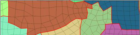


5 Computational Grids of IDC Subregions Finite Element Grid Finite Difference Grid
6 Linking IDC to Other Models IDC can be used as a stand alone model for estimation of agricultural demand and/or urban demand, as well as estimation of infiltration and deep percolation through a soil moisture accounting routine IDC may be linked to groundwater models such as MODFLOW, MicroFEM or for calculation of GW pumping and recharge data Hydrologic models use the water demand data to estimate GW pumping and/or SW deliveries required to meet the demand
7 Why IDC for Demand Analysis Stand alone water demand model. Incorporates major agricultural and urban water demand parameters. Calculates water demand and deep percolation rates that could be imported into other models. May be linked to groundwater models such as MODFLOW
8 IDC Application to MODFLOW Calculation of Agricultural Pumping and Deep Percolation for Riverside Arlington Basin GW Model

9 Model Area
10 MODFLOW Model Simulated Basins Arlington, Riverside, southern parts of Rialto Colton Basins in Riverside and San Bernardino Counties Model Grid 95 square miles Uniform cell size (50 m x 50 m)

11

12 MODFLOW Model Grid 182,700 cells per layer

13 Active Model Cells 14,000 in Layer 1 72,000 in Layer 2 45,000 in Layer 3 131,000 Total

14 Hydrologic Soil Groups
15 29 Small Watersheds

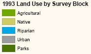
16 1993 Land Use

17 2008 Urban Areas

18 IDC Subregions 20 SRs in Arlington 60 SRs in Riverside 4 SRs in Rialto Colton 113 Total SRs
19 Calculation of Deep Percolation/Recharge Rates using IDC IDC calculates daily deep percolation / groundwater recharge from: Rainfall Applied water IDC calculation are performed for subregions (areas with similar land use and soil type) 84 subregions 29 small watersheds Simulation Period:
20 Transferring Deep Percolation Rates to MODFLOW Model Calculate Deep Percolation Rates for Each Subregion Using IDC Using GIS, Apply Deep Percolation Rates to MODFLOW model cells Used a FORTRAN utility program to Build MODFLOW Recharge File
21 Consistency of IDC and MODFLOW Ag GW pumping & DP Estimates IDC Deep Percolation Calculation MODFLOW Calibration Soil K & IE Adjustment
22 Summary IDC: A great & easy to use tool for estimation of ag water demand, gw pumping, and deep percolation IDC: A useful and robust tool for pre processor to MODFLOW & other similar models An iterative solution to the IDC recharge estimation and GW simulation is required to ensure a robust modeling process
23 IDC Application to Regional Demand Analysis Treasure Valley, ID

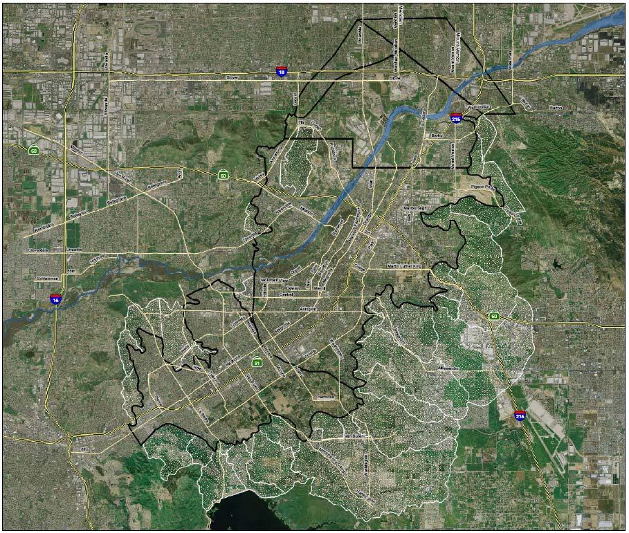
24 Map of Treasure Valley with Subregions

25 Scope of Work for TV Demand Study Task 1 Estimate Future Urban Water Demand Task 2 Estimate Agricultural Water Demand Qualitative Estimate of Environmental and Water Quality Demand/Needs
26 Agricultural Water Demand Previous methodology was based on water deliveries, ET and precipitation data for a single year IDC Model was used for estimating agricultural demand 28 years for calibration 50 years for prediction
27 IDC Data Land use distribution Crop Acreage Hydrologic data (28 yrs) Irrigation efficiency/practices


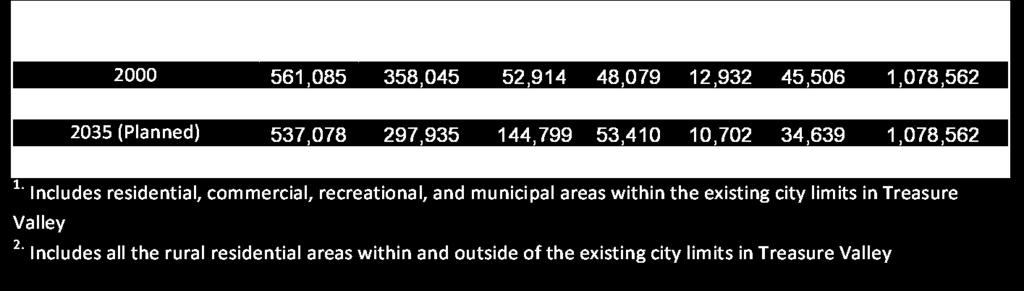
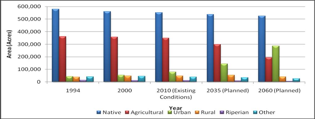
28 2000 Land Use 2% 3% 1% 1% 1% 1% 6% 52% 33% Native Urban Rural Water SemiAg Agricultural Idle Riperian UrbanLandscape
29 Land Use

30 Crop Type Acreages for Treasure Valley

31 Average Annual Precipitation for Boise WSFO Airport Station

32 Average Annual Crop ET
33 Typical Irrigation System Application Efficiencies for Surface and Sprinkler Systems Irrigation System Method Application Eff (%) Surface Systems Sprinkler Systems Micro irrigation systems Furrow Corrugate Border, level Border, graded Flood, wild Surge Cablegation Stationary lateral Solid set lateral Traveling big gun Stationary big gun Center pivot lateral Moving lateral Surface drip Subsurface drip Micro spray or mist 85 90
34 IDC Calibration Comparison of Irrigation Efficiencies Project Year Water Demand (af/year) Ag Area (acres) Applied Water (af/acre/year) Crop Irrigation Eff = 80% 1,083, , IDC Crop Irrigation Eff = 60% 1,438, , Crop Irrigation Eff = 50% 1,668, , Crop Irrigation Eff = 40% 2,085, , Crop Irrigation Eff = 80% 1,038, , IDC Crop Irrigation Eff = 60% 1,384, , Crop Irrigation Eff = 50% 1,604, , Crop Irrigation Eff = 40% 2,005, , TVHP (gravity irrigated land only) ,155, , ,209, , DP (gravity irrigated land only) Average ,154, ,
35 IDC Scenarios for Future Water Demand Analysis Scenario # Hydrology Crop Irrigation Efficiency 1 Wet 50% 2 Ave 50% 3 Dry 50% IDC Results Agricultural Applied Water Rates (ft/yr) Agricultural Water Demand (af/yr) Year Crop Irrigation Efficiency = 50% Dry Ave Wet Year Crop Irrigation Efficiency = 50% Dry Ave Wet ,555,491 1,487,412 1,389, ,481,409 1,413,773 1,320, ,440,712 1,375,116 1,283, ,235,332 1,171,831 1,096, ,039, , , , , ,937


36 Estimated Agricultural Applied Water Rates (ft/yr) and Agricultural Water Demand (af/yr)
37 Summary IDC: A good stand alone tool for estimation of Ag demand IDC: A robust tool for spatial and temporal estimates of Ag GW pumping
38 Recommendations Backward Compatibility of IDC Spatial and Temporal Resolution Development of consistent Post Processing Tools for Common Model Linkages IDC: Integrated Demand Calculator IDC: Uniquely Positioned for Diverse Applications
New Investments in Water Portfolios
 California Water Plan Update 2010 New Investments in Water Portfolios California Water and Environmental Water Forum Annual Meeting February 27, 2007 Todd Hillaire hillaire@water.ca.gov California Department
Technical Memorandum. Butte County Department of Water and Resource Conservation
 Butte County Department of Water and Resource Conservation Base Case and Water Management Scenario Simulations April 2008 Technical Memorandum Contents Section 1 Introduction Section 2 Base Case... 2-1
Water Application and Irrigation Efficiencies in Selected Fields in the Arkansas River Valley (CO)
") Hydrology Days 2005 Water Application and Irrigation Efficiencies in Selected Fields in the Arkansas River Valley (CO) Andres Jaramillo 1 Ph.D. Student. Civil Engineering Department, Colorado State University.
Hydrology Days 2005 Water Application and Irrigation Efficiencies in Selected Fields in the Arkansas River Valley (CO) Andres Jaramillo 1 Ph.D. Student. Civil Engineering Department, Colorado State University.
Technical Memorandum
 Specialists in Agricultural Water Management Serving Stewards of Western Water since 1993 To: From: Technical Memorandum Butte County Department of Water and Resource Conservation Davids Engineering Date:
Numerical Groundwater Model for the Kaweah Delta Water Conservation District
 Numerical Groundwater Model for the Kaweah Delta Water Conservation District Nels Ruud and Peter Leffler Fugro West, Inc. Larry Dotson Kaweah Delta Water Conservation District Presentation Outline Background
 5. MODEL DESCRIPTION Several models were used in combination to estimate the impacts of the proposed 100,000 acre-ft dryyear yield program. MODFLOW and MODPATH were used to estimate the groundwater and
CALSIM II Sacramento River Basin Hydrology Enhancements
 CALSIM II Sacramento River Basin Hydrology Enhancements Andy Draper Walter Bourez - Montgomery Watson Harza - MBK Engineers February 26, 2004 Current representation Problems Solutions Work completed Possible
Documentation of Groundwater Model
 Documentation of Groundwater Model Groundwater Model The primary tool used to evaluate potential impacts on groundwater was a groundwater flow and solute transport model developed by San Benito County
Stormwater as a Local Resource
 Stormwater as a Local Resource LADWP s Stormwater Capture Master Plan Mark Hanna, PhD, PE May 6, 2016 2 Context Water imports under pressure and water scarcity becoming the new normal Local resource development,
An Integrated Catchment Model Applied to Chile, IIV Region : Bridging scales in irrigation efficiency
 An Integrated Catchment Model Applied to Chile, IIV Region : Bridging scales in irrigation efficiency Thorsten Arnold (University of Hohenheim, Germany) Outline Objectives Contents Motivation: Research
Part A Whole Farm Evaluation
 Part A Whole Farm Evaluation Member Name: Coalition Member ID#: 1. Pesticide Application Practices (check all that apply) County Permit Followed Follow Label Restrictions Sensitive Areas Mapped Attend
THE CALIFORNIA DROUGHT
 THE CALIFORNIA DROUGHT Helen Dahlke Assistant Professor in Integrated Hydrologic Sciences, LAWR, UC Davis DECEMBER 13, 2015 EMAIL: hdahlke@ucdavis.edu Signs of a 4-year drought NOAA drought index THE DILEMMA
Overall Instructions
 Farm Evaluation Survey Overall Instructions This Farm Evaluation Survey is prepopulated with member information you provide to the Coalition. If any information is incorrect, please indicate the correct
Appendix I. Groundwater Modeling
 Appendix I. Groundwater Modeling This appendix describes current and future groundwater modeling efforts associated with the. 0 I. Current Objectives of Groundwater Modeling Efforts The objectives of groundwater
Improving Flood Irrigation Management in Alfalfa
 Improving Flood Irrigation Management in Alfalfa Khaled M. Bali, Blain Hanson, and Blake Sanden UCCE-Imperial, UC Davis, UCCE-Kern kmbali@ucdavis.edu University of California Cooperative Extension 2010
Update on Collaborative Efforts to Enhance Groundwater Recharge in the Pajaro Valley
 Update on Collaborative Efforts to Enhance Groundwater Recharge in the Pajaro Valley A. T. Fisher 1, C. Coburn 2, S. Beganskas 1, E. Teo 1, K. Young 1, W. Weir 1, K. Camara 2, S. Lozano 2, M. Kiparsky
4.0 Water Budgets for Existing and Future Groundwater Conditions in the Natomas Basin
 4.0 Water Budgets for Existing and Future Groundwater Conditions in the Natomas Basin 4.1 IGSM Models In order to evaluate the cumulative effects of SAFCA s proposed construction activities on groundwater
Evaluating Net Groundwater Use from Remotely Sensed Evapotranspiration and Water Delivery Information
 Evaluating Net Groundwater Use from Remotely Sensed Evapotranspiration and Water Delivery Information Daniel J. Howes, Ph.D., P.E. Assistant Professor, Irrigation Training and Research Center, BioResource
For the Irrigation Association Annual Technical Conference Phoenix, AZ. November, 1995
 FERTIGATION TECHNIQUES FOR DIFFERENT IRRIGATION METHODS For the Irrigation Association Annual Technical Conference Phoenix, AZ. November, 1995 by Dr. Charles M. Burt, Director Irrigation Training and Research
Comparative analysis of SWAT model with Coupled SWAT-MODFLOW model for Gibbs Farm Watershed in Georgia
 2018 SWAT INTERNATIONAL CONFERENCE, JAN 10-12, CHENNAI 1 Comparative analysis of SWAT model with Coupled SWAT-MODFLOW model for Gibbs Farm Watershed in Georgia Presented By K.Sangeetha B.Narasimhan D.D.Bosch
Basic Types of Irrigation Systems. Surface irrigation Subsurface irrigation Sprinkler irrigation Drip/trickle irrigation
 Irrigation systems Basic Types of Irrigation Systems Surface irrigation Subsurface irrigation Sprinkler irrigation Drip/trickle irrigation Subsurface Irrigation Also call subirrigation Artificial regulation
Lift irrigation Using man or Animal power Using Mechanical or Electrical Power Flow irrigation a)inundation Irrigation b) Perennial Irrigation Direct
inundation Irrigation b) Perennial Irrigation Direct") Lift irrigation Using man or Animal power Using Mechanical or Electrical Power Flow irrigation a)inundation Irrigation b) Perennial Irrigation Direct irrigation Storage irrigation a)flow irrigation system:
Lift irrigation Using man or Animal power Using Mechanical or Electrical Power Flow irrigation a)inundation Irrigation b) Perennial Irrigation Direct irrigation Storage irrigation a)flow irrigation system:
The California Central Valley Groundwater-Surface Water Simulation Model. C2VSim Overview
 The California Central Valley Groundwater-Surface Water Simulation Model C2VSim Overview CWEMF C2VSim Workshop Charles Brush Modeling Support Branch, Bay-Delta Office California Department of Water Resources,
Overall Instructions
 Farm Evaluation Survey Overall Instructions There are four, one page parts of the Farm Evaluation Survey to complete, and Farm Map that will help you identify parcel numbers, field IDs, and where you will
Demonstrated Water Conservation Technologies
 Demonstrated Water Conservation Technologies Texas Alliance for Water Conservation Rick Kellison, Project Director Funded by: Ogallala Aquifer Aquifer covers 174,000 square miles across 8 states in the
Groundwater and Stream Interaction in California's Central Valley: Insights for Sustainable Groundwater Management
 Groundwater and Stream Interaction in California's Central Valley: Insights for Sustainable Groundwater Management Completed June 2014 Updated and Released February 2016 Prepared by: Prepared for: Funded
BIG HORN BASIN IRRIGATION WATER MANAGEMENT P ROGRAM
 BIG HORN BASIN IRRIGATION WATER MANAGEMENT P ROGRAM Lateral Move Sprinkler System B I G H O R N B A S I N I R R I G A T I O N W A T E R M A N A G E M E N T P R O G R A M Looking at a New System: The Systems
Daniel H. Putnam. University of California, Davis
 Promises and Pitfalls of Adapting New Technology Studies on Subsurface Drip Irrigation (SDI) in Alfalfa What we ve learned to date. Daniel H. Putnam (Collaborators: Ali Montazar, Khaled Bali, James Radawich,
Draft Fact Sheet Butte County Stable Isotope Recharge Study
 Agenda Item #4 Draft Fact Sheet Butte County Stable Isotope Recharge Study Purpose of the Study: To develop a better understanding of how various water sources contribute to recharge of Butte County groundwater.
CVSIM: Linking C2VSIM with CVP-SWP Reservoir Operations
 CVSIM: Linking C2VSIM with CVP-SWP Reservoir Operations Tariq N. Kadir, Ph.D., P.E. California Department of Water Resources CWEMF 2018 Annual Meeting April 2, 2018 Acknowledgements Jay Lund UC Davis Department
THE SUSTAINABLE GROUNDWATER MANAGEMENT ACT OF 2014 SGMA
 THE SUSTAINABLE GROUNDWATER MANAGEMENT ACT OF 2014 SGMA . CHOWCHILLA SUBBASIN FOUR LOCAL AGENCIES FORMED GSAs Chowchilla Water District Madera County Merced County Triangle T Water District CHOWCHILLA
Water Budgets. 1. Recap of Groundwater What is required for a water budget? 3. How will water budgets be used in GSPs? 4. Factors to consider
 Water Budgets 1 Water Budgets 1. Recap of Groundwater 1.0 2. What is required for a water budget? 3. How will water budgets be used in GSPs? 4. Factors to consider 5. Practice! 2 Conceptual Water Budget
Operating, Calibrating, and Maintaining Irrigation Systems
 Lesson A7 4 Operating, Calibrating, and Maintaining Irrigation Systems Unit A. Mechanical Systems and Technology Problem Area 7. Agricultural Equipment Systems Lesson 4. Operating, Calibrating, and Maintaining
Regional Aquifer Recharge to Support San Pedro River Baseflows, Flood Flows and Groundwater
 Regional Aquifer Recharge to Support San Pedro River Baseflows, Flood Flows and Groundwater Brooke Bushman & Holly Richter, AZ Water Projects November 7, 2017 San Pedro River Tributary of the Colorado
SAN MATEO PLAIN GROUNDWATER BASIN ASSESSMENT STAKEHOLDER WORKSHOP#2 SEPTEMBER 7, 2016
 SAN MATEO PLAIN GROUNDWATER BASIN ASSESSMENT STAKEHOLDER WORKSHOP#2 SEPTEMBER 7, 2016 PRESENTATION OVERVIEW Introductions Project Overview Summary of Stakeholder Meeting #1 Feedback Snapshot of Results
1 THE USGS MODULAR MODELING SYSTEM MODEL OF THE UPPER COSUMNES RIVER
 1 THE USGS MODULAR MODELING SYSTEM MODEL OF THE UPPER COSUMNES RIVER 1.1 Introduction The Hydrologic Model of the Upper Cosumnes River Basin (HMCRB) under the USGS Modular Modeling System (MMS) uses a
Agricultural Irrigation Using Municipal Effluent
 Agricultural Irrigation Using Municipal Effluent Charles M. Burt, Ph.D., P.E., CID, CAIS Chairman, Irrigation Training and Research Center (ITRC). California Polytechnic State University (Cal Poly). San
The Future of Irrigated Agriculture: Where's the Water?
 The Future of Irrigated Agriculture: Where's the Water? California Colloquium on Water UC Berkley February 9 th 2010 David F. Zoldoske, Director Center for Irrigation Technology California State University,
Characterizing Groundwater and Surface- Water Interactions in Selected Northeast Twin Cities Lakes
 Characterizing Groundwater and Surface- Water Interactions in Selected Northeast Twin Cities Lakes Chapter A: Statistical Analysis and Field Study Chapter B: Groundwater-Flow Simulation Perry M. Jones,
Effect of Conjunctive Use of Water for Paddy Field Irrigation on Groundwater Budget in an Alluvial Fan ABSTRACT
 1 Effect of Conjunctive Use of Water for Paddy Field Irrigation on Groundwater Budget in an Alluvial Fan Ali M. Elhassan (1), A. Goto (2), M. Mizutani (2) (1) New Mexico Interstate Stream Commission, P.
Integrated Water Management Modeling Framework in Nebraska
 Integrated Water Management Modeling Framework in Nebraska Association of Western State Engineers Spring Workshop Salt Lake City, Utah June 9, 2015 Mahesh Pun, EIT Integrated Water Management Analyst Nebraska
Getting Ready for the Rain
 Getting Ready for the Rain Stormwater as a Water Supply Southern California Water Dialogue Mark Hanna, PhD, PE October 28, 2015 Alluvial Groundwater Basins and Subbasins within the South Coast Hydrologic
Lower Tuscan Aquifer. General Description PowerPoint
 Lower Tuscan Aquifer Monitoring, Recharge & Data Management Project General Description PowerPoint General Description Overview Project Purpose Project Overview Outreach Next Steps 2 Project Purpose Field
EFFECTS OF IRRIGATION WITHDRAWAL AND CLIMATE CHANGE ON GROUNDWATER DYNAMICS IN A SEMI-ARID INDIAN WATERSHED
 EFFECTS OF IRRIGATION WITHDRAWAL AND CLIMATE CHANGE ON GROUNDWATER DYNAMICS IN A SEMI-ARID INDIAN WATERSHED Rajendra Sishodia Sanjay Shukla, UF Suhas Wani, ICRISAT Jim Jones, UF Wendy Graham, UF GROUNDWATER
Memorandum of Understanding to Implement the Cooperative Agreement. Accepted: Wednesday, January 14, 2009
 Memorandum of Understanding to Implement the Cooperative Agreement Accepted: Wednesday, January 14, 2009 The Cooperative Agreement to Protect Water Quality and Encourage the Conjunctive Uses of Imported
Entering a New Era of Water Management
 Entering a New Era of Water Management Building Livable Communities: Innovative Solutions for Changing Communities Local Government Commission March 22, 2015 Martha Davis Executive Manager/Assistant General
Time Series Evapotranspiration and Applied Water Estimates from Remote Sensing
 Applied Water Estimates from Remote Sensing Prepared By March 213 Contents Kaweah Delta Water Conservation District Time Series Evapotranspiration and Applied Water Estimates from Remote Sensing Contents
Santa Ana River Watershed. SAWPA Celeste Cantú April 17, 2012
 Santa Ana River Watershed SAWPA Celeste Cantú April 17, 2012 What is SAWPA? SAWPA Member Agencies & Other Stakeholders Other Stakeholders 97 Water-related Agencies 4 Counties 59 Cities State water, environmental,
Groundwater in the Santa Rosa Plain
 . Groundwater in the Santa Rosa Plain Marcus Trotta, PG, CHg Principal Hydrogeologist Sonoma County Water Agency Santa Rosa Plain Groundwater Sustainability Agency October 12, 2017 www.sonomacountywater.org
Eliminating Runoff Water from Your Farm
 SUSTAINABLE AGRICULTURE TECHNIQUES Ext/CrS 142 August 2012 SUSTAINABLE AGRICULTURE TECHNIQUES Eliminating Runoff Water from Your Farm J.L. Harden, K.M. Foley, C.C. Shock, and T.K. Welch Figure 1. Runoff
Agricultural Water Use Efficiency: How Much Water Really Can Be Saved? CGS-West Conference
 Agricultural Water Use Efficiency: How Much Water Really Can Be Saved? CGS-West Conference David Zoldoske, Director (CIT) California State University, Fresno Key Definitions a) Recoverable fractions b)
Santa Ana River Wasteload Allocation Model Update
 Santa Ana River Wasteload Allocation Model Update BASIN MONITORING PROGRAM TASK FORCE April 16, 2018 4/16/2018 1 Overview Review of Project Schedule Overview of Revised Draft TM No. 2 Status of Task 3
GROUND WATER/STJRFACE WATER INTERACTIONS JULY 1-5 AWRA SUMMER SPECIALTY CONFERENCE
 1997) GROUND WATER/STJRFACE WATER INTERACTIONS JULY 1-5 AWRA SUMMER SPECIALTY CONFERENCE 2002 Surface Water - Groundwater Interaction Represented in the Rio Grande Water Resources Planning Model I 2 Edward
Agricultural Irrigation Assessment Form
 900 East Quincy, San Antonio, Texas 78215 Agricultural Irrigation Assessment Form All Irrigation Permit Holders must demonstrate their irrigation efficiency by completing an Agricultural Irrigation Assessment
system that supports soil and crop water management.
 NEWS ON IRRIGATING THE SOIL TO MAXIMIZE THE CROP AN APPROACH FOR WHEAT TO EFFICIENT AND ENVIRONMENTALLY SUSTAINABLE IRRIGATION WATER MANAGEMENT IN KENTUCKY Ole Wendroth, Javier Reyes, Xi Zhang, and Chad
A Peer Review of IWFM and MODFLOW-Farm Process
 A Peer Review of IWFM and MODFLOW-Farm Process California Water and Environmental Modeling Forum Asilomar Conference Center, California February 22-24, 2010 Tariq Kadir (California Department of Water
GROUND WATER/SURFACE WATER INTERACTIONS AWRA SUMMER SPECIALTY CONFERENCE Judith Schenk'
 July 1-3 GROUND WATER/SURFACE WATER INTERACTIONS AWRA SUMMER SPECIALTY CONFERENCE 2002 326x6 pjf= INTEGRATION OF DATA USING GIS AND STATEPP TO ESTIMATE GROUNDWATER MODEL INPUT PARAMETERS Judith Schenk'
Irrigation can increase the production of
 B-6150 5/04 Irrigation of Forage Crops Juan Enciso, Dana Porter, Guy Fipps and Paul Colaizzi* Irrigation can increase the production of forages where rainfall is limited. In planning an irrigation system
7. DRY-YEAR YIELD PROGRAM IMPACTS
 7. DRY-YEAR YIELD PROGRAM IMPACTS 7.1 Dry-Year Yield Evaluation Criteria The calibrated 2003 Watermaster Model was used to evaluate the magnitude of groundwater level and storage changes throughout Chino
Identification and Quantification of Efficiency and Uniformity Components
 Identification and Quantification of Efficiency and Uniformity Components C.M. Burt 1, Member, ASCE, A.J. Clemmens 2, Member, ASCE, and K.H. Solomon 3 Abstract Proper usage of irrigation performance indicators
San Mateo Plain Groundwater Basin Assessment Stakeholder Workshop #8 17 APRIL 2018
 San Mateo Plain Groundwater Basin Assessment Stakeholder Workshop #8 17 APRIL 2018 PRESENTATION OVERVIEW Introductions Project Overview Summary of Analysis Supporting Model Development Model Development
Tools an NRCS Field Office Could Use to Help an Irrigator
 Tools an NRCS Field Office Could Use to Help an Irrigator By: Jon Whan, Zone Civil Engineer, USDA NRCS Corpus Christi, Texas Introduction There are several models that engineers and conservation planners
TABLE OF CONTENTS...i. List of Figures...iv List of Tables... viii. ACKNOWLEDGEMENTS... x SECTION 2. MODEL AREA...2-1
 TABLE OF CONTENTS TABLE OF CONTENTS...i List of Figures...iv List of Tables... viii ACKNOWLEDGEMENTS... x SECTION 1. INTRODUCTION...1-1 1.1 Purpose...1-1 1.2 Project Background...1-2 1.2.1 Kings Basin...1-2
Modeling Shallow Groundwater for Support of Riparian Areas in the Colorado River Delta
 Modeling Shallow Groundwater for Support of Riparian Areas in the Colorado River Delta Matthew R. Grabau, PhD, Karen J. Schlatter, Eliana Rodríguez Burgueño, Jorge Ramírez Hernández, PhD, Jeff Milliken,
Texas A & M University and U.S. Bureau of Reclamation Hydrologic Modeling Inventory Model Description Form
 Texas A & M University and U.S. Bureau of Reclamation Hydrologic Modeling Inventory Model Description Form JUNE 18, 1999 Name of Model: MIKE 11 RR (Rainfall Runoff) Model Type: The MIKE 11 RR model is
2010 Urban Water Management Plan. July 1, 2011 Board of Public Utilities
 2010 Urban Water Management Plan July 1, 2011 Board of Public Utilities 2010 Urban Water Management Plan UWMPs are a requirement of the State for retail and wholesale water suppliers The purpose of these
Comparing Consumptive Agricultural Water Use in the Sacramento-San Joaquin Delta
 Center for Watershed Sciences University of California, Davis Comparing Consumptive Agricultural Water Use in the Sacramento-San Joaquin Delta A Proof of Concept Using Remote Sensing Josué Medellín-Azuara
EVALUATING CENTER PIVOT, NOZZLE-PACKAGE PERFORMANCE
 Proceedings of the 23rd Annual Central Plains Irrigation Conference, Burlington, CO., February 22-23, 2011 Available from CPIA, 760 N. Thompson, Colby, Kansas EVALUATING CENTER PIVOT, NOZZLE-PACKAGE PERFORMANCE
Use of Irrigation in East Texas - Pastures and Forages
 Use of Irrigation in East Texas - Pastures and Forages Pineywoods Cattle Congress April 13, 2012 Guy Fipps, P.E. Professor and Extension Agricultural Engineer Charles Swanson Extension Program Specialist
5. Basin Evaluation Salt and Nitrate Balance
 SNMP Attachment B, Section B.2.1.3 (originally Section 5 in CV-SALTS Phase 2 Conceptual Model Task 5 deliverables) 5. As part of the evaluation of water quality the SNMP requires loading estimates and
CENTRAL PLATTE NATURAL RESOURCES DISTRICT NITROGEN MANAGEMENT CERTIFICATION TEST
 CENTRAL PLATTE NATURAL RESOURCES DISTRICT NITROGEN MANAGEMENT CERTIFICATION TEST NAME: CERT #: ADDRESS: CITY: Section A: The Nitrate Contamination Concern 1) The U.S. Environmental Protection Agency s
Irrigating for Maximum Economic Return with Limited Water
 DigitalCommons@ Historical Materials from University of Nebraska- Lincoln Extension Extension 1-1-1 Irrigating for Maximum Economic Return with Limited Water Richard T. Clark, rclark3@unl.edu Norman L.
Irrigation Impact and Trends in Kansas Agricultural 1
 Irrigation Impact and Trends in Kansas Agricultural 1 D.H. Rogers, G. A. Clark and M. Alam 2 Abstract: Total irrigated acreage in Kansas remains at approximately 3 million acres, which is about 15 percent
Unit F: Soil Fertility and Moisture Management. Lesson 3: Using Irrigation
 Unit F: Soil Fertility and Moisture Management Lesson 3: Using Irrigation 1 Terms Border strip irrigation Center-pivot irrigation Chemigation Ground truthing Irrigation scheduling Moisture sensor Remote
Verde River Flow Restoration Initiative Arizona, Colorado River Basin J UNE 19 TH, 2014
 Verde River Flow Restoration Initiative Arizona, Colorado River Basin K IMBERLY SCHONEK J UNE 19 TH, 2014 THE NATURE CONSERVANCY C O L O R A D O R I V E R P R O G R A M The Nature Conservancy is the largest,
Report. Environmental Water Demands. Butte County Department of Water and Resource Conservation Integrated Water Resources Plan.
 Report Butte County Department of Water and Resource Conservation Integrated Water Resources Plan s June 2004 s Section 1 - Introduction 1.1 Project Description This project is a preliminary investigation
SALINAS VALLEY GROUNDWATER BASIN SETTING INITIAL REVIEW FOR DEVELOPMENT OF GROUNDWATER SUSTAINABILITY PLAN
 1 SALINAS VALLEY GROUNDWATER BASIN SETTING INITIAL REVIEW FOR DEVELOPMENT OF GROUNDWATER SUSTAINABILITY PLAN May 10, 2018 Prepared for Salinas Valley Basin Groundwater Sustainability Agency Outline Purpose
Modeling Nutrient and Sediment Losses from Cropland D. J. Mulla Dept. Soil, Water, & Climate University of Minnesota
 Modeling Nutrient and Sediment Losses from Cropland D. J. Mulla Dept. Soil, Water, & Climate University of Minnesota Watershed Management Framework Identify the problems and their extent Monitor water
LID PLANTER BOX MODELING
 LID PLANTER BOX MODELING Clear Creek Solutions, Inc., 2010 Low Impact Development (LID) planter boxes are small, urban stormwater mitigation facilities. They are rain gardens in a box. WWHM4 provides the
Water Primer: Part 8 Irrigation Water
 Water Primer: Part 8 Irrigation Water The earliest known irrigation in Kansas began around 165 in a Taos Indian village in what is now Scott County State Park. The modern era of irrigation, however, began
Overarching Goals of the No Chico Brush Project
 Overarching Goals of the No Chico Brush Project Support the reduction of the agricultural supply gap [~90,000 AF/year] and regional supply/demand imbalance while increasing productivity and economic viability;
GSP Coordinating Committee
 GSP Coordinating Committee Coordinating Committee Meeting August 27, 2018 Merced Irrigation-Urban GSA Merced Subbasin GSA Turner Island Water District GSA-1 Agenda 1. Call to Order 2. Approval of Minutes
System dynamics based model for conjunctive management of water: Jaffna Peninsula in Sri Lanka. K.D.W. Nandalal University of Peradeniya Sri Lanka
 System dynamics based model for conjunctive management of water: Jaffna Peninsula in Sri Lanka K.D.W. Nandalal University of Peradeniya Sri Lanka GWSP international conference 'Sustainability in the Water-Energy-Food
Montana Bureau of Mines and Geology Kevin Chandler Jon Reiten. AWRA October 6 th,2011
 Montana Bureau of Mines and Geology Kevin Chandler Jon Reiten AWRA October 6 th,2011 Funding for this modeling effort came from the RRG project Modeling Aquifer Response to Urban Sprawl, West Billings
6.0 USGS MODEL. 6.1 Background
 6.0 USGS MODEL 6.1 Background A groundwater flow model is a simplification of a real groundwater flow system. Real groundwater flow systems are complex, and they are often simplified with a model for the
Agricultural groundwater banking: surface water availability & on-farm research
 Agricultural groundwater banking: surface water availability & on-farm research Helen Dahlke, Tiffany Kocis, Andrew Brown, Toby O Geen, Steve Orloff, Dan Putnam, Astrid Volder, Ken Shackel FEBRUARY 22,
Recomputation of Ambient Water Quality in the Santa Ana River Watershed
 Recomputation of Ambient Water Quality in the Santa Ana River Watershed 1993-2012 July 9, 2013 Prepared for: Basin Monitoring Program Task Force Basin Monitoring Program Task Force Project Director Mark
Cadiz Inc. CORPORATE OVERVIEW
 Cadiz Inc. CORPORATE OVERVIEW March 2017 2 SAFE HARBOR AGREEMENT December 2016 During the course of this presentation, we will make forward-looking statements. Any statement that is not a historical fact
CHANGES ON FLOOD CHARACTERISTICS DUE TO LAND USE CHANGES IN A RIVER BASIN
 U.S.- Italy Research Workshop on the Hydrometeorology, Impacts, and Management of Extreme Floods Perugia (Italy), November 1995 CHANGES ON FLOOD CHARACTERISTICS DUE TO LAND USE CHANGES IN A RIVER BASIN
Application of a spreadsheet model to groundwater use in the Mississippi Delta April 2016 David R. Johnson USACE-Vicksburg
 Application of a spreadsheet model to groundwater use in the Mississippi Delta April 2016 David R. Johnson USACE-Vicksburg Issues How much water is being used for irrigation today? How much will be needed
Michael Winchell, Raghavan Srinivasan, Tammara Estes, Susan Alexander 2005 International SWAT Conference, Zurich Switzerland 7/15/05
 Development of Complex Hydrologic Response Unit (HRU) Schemes and Management Scenarios to Assess Environmental Concentrations of Agricultural Pesticides Michael Winchell, Raghavan Srinivasan, Tammara Estes,
Distance from inlet end (ft)
") Advance Movement of water from the inlet end to the downstream end Curve of Time vs. Distance is NOT linear Rule-of-Thumb: 1/3 of the total advance time is needed to reach midpoint of the furrow length
Advance Movement of water from the inlet end to the downstream end Curve of Time vs. Distance is NOT linear Rule-of-Thumb: 1/3 of the total advance time is needed to reach midpoint of the furrow length
NITROGEN AND WATER USE EFFICIENCY IN ONION PRODUCTION UNDER DRIP AND FURROW IRRIGATION
 NITROGEN AND WATER USE EFFICIENCY IN ONION PRODUCTION UNDER DRIP AND FURROW IRRIGATION S. J. Reddy 1, J. Neufeld 2, and J. Klauzer 3 1 University of Idaho Extension, Washington County 2 University of Idaho
Goodyear Applies GIS Technology to Plan Water Resources Development
 Goodyear Applies GIS Technology to Plan Water Resources Development Richard Humpherys, Carollo Engineers Mark Holmes, City of Goodyear Water Resources GIS is THE tool to Plan Water Resources Development
M. Tech Irrigation & Drainage Engineering
 M. Tech Irrigation & Drainage Engineering Basic Supporting Courses S. No. Course Code Course Title L-T-P Credits 1. MAS 701 Advanced Engineering Mathematics 3-1-0 4 2. MAS 711 Statistics I 2-0-1 3 3. COMP
Feasibility of Agricultural Groundwater Banking and its impact on groundwater storage
 Feasibility of Agricultural Groundwater Banking and its impact on groundwater storage Helen Dahlke, Tiffany Kocis, Andrew Brown, Toby O Geen, Steve Orloff, Dan Putnam, Astrid Volder, Ken Shackel, Thomas
Controlling Water in Nitrogen Management
 Controlling Water in Nitrogen Management Larry Schwankl Irrigation Specialist, UC Cooperative Extension 559-646-6569 ljschwankl@ucanr.edu Presentation will be available at: http://ucanr.edu/schwankl Irrigation
Participating States A.P. Chhattisgarh. M.P. Maharashtra Karnataka Kerala Orissa Tamil Nadu
 for Integrated Water Resources Development & Management Workshop Integrated Water Resources Management Applications Defining i Scope Under Hydrology Project, Phase-III June 18, 2014 Participating Central
Interlake Tunnel Project 10/22/14
 Interlake Tunnel Project 10/22/14 1 Contents 1. Background current facilities 2. Project description and function 3. Baseline and tunnel scenario modeling 4. Project benefits / opportunities 5. Project
Update on Cuyama Basin Groundwater Modeling
 Cuyama Basin Groundwater Sustainability Agency Update on Cuyama Basin Groundwater Modeling December 3, 2018 Approach for Cuyama Basin Model Development Develop a Robust and Defensible Integrated Water