PHASE I ENVIRONMENTAL SITE ASSESSMENT REPORT
|
|
|
- Lee Martin
- 6 years ago
- Views:
Transcription
1
2
 383-0486 (802) 383-0490 fax info@kas-consulting.")
3 PHASE I ENVIRONMENTAL SITE ASSESSMENT REPORT AIP #74 Various Properties South Burlington, Vermont October 14, 2011 Prepared for: Stantec Consulting Inc. 55 Green Mountain Drive South Burlington, Vermont Prepared by: P.O. Box Avenue D, Suite 15 Williston, VT (802) (802) fax info@kas-consulting.com KAS Proj. #
4 Phase I Environmental Site Assessment Report AIP 74, South Burlington, Vermont Table of Contents Section Page 1.0 EXECUTIVE SUMMARY ii 2.0 INTRODUCTION SITE DESCRIPTION USER SUPPLIED INFORMATION RECORDS REVIEW SITE RECONAISSANCE INTERVIEWS FINDINGS OPINION CONCLUSIONS DEVIATIONS ADDITIONAL SERVICES REFERENCES SIGNATURES OF ENVIRONMENTAL PROFESSIONALS QUALIFICATIONS OF ENVIRONMENTAL PROFESSIONALS APPENDICIES 26 October 14, 2011 i KAS Project #
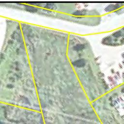
5 Phase I Environmental Site Assessment Report AIP 74, South Burlington, Vermont 1.0 EXECUTIVE SUMMARY KAS, Inc. of Williston, Vermont conducted a Phase I Environmental Site Assessment (ESA) of land and premises at ten residential properties located in the City of South Burlington, Vermont (collectively referred to as AIP # 74). The ESA was conducted pursuant to the American Society of Testing and Materials (ASTM) Standard Practice for Environmental Site Assessments: Phase I Environmental Site Assessment Process (ASTM E ). This assessment was conducted for Stantec Consulting Inc. herein referred to as client. The owner of record of the property as of the date of this report is the City of Burlington, herein referred to as owner. 1 The user of this document is the Burlington International Airport. AIP #74 consists of ten individual residential properties located at the following addresses: Airport Parkway; 4, 6, 8, 10, and 12 Picard Circle; 61 and 76 Dumont Avenue, 400 White Street; and, 7 Shamrock Road (see Appendix A: Site Location Map and Appendix B: Site Plans). All of the properties are single family residential on acre or less lots except Airport Parkway which is multi-family residential. The properties are located in a predominantly suburban residential portion of the City of South Burlington. The character of the area is fully developed with residential structures on suburban lots. Neighboring properties are also residential. East or south of the residential neighborhoods is the Burlington International Airport. To the north of the residential area is a commercial zone including retail stores, public works facility, and interstate 89. To the south is Williston Road and commercial uses associated with that area. The ten properties within AIP group #74 have been assessed and it has been determined that the historic and current uses have been for residential housing. Prior to the development of the properties the general area was determined to be used for agricultural purposes. One recognized environmental condition (REC) was identified during this assessment: the presence of three corroded and damaged drums immediately outside a garage that appeared to be used for automobile repair at the 400 White Street property. Although the drums were empty and no staining was noted around the drums visual observations of the garage near the drums suggested automobiles were repaired inside the garage. A mark was observed on the concrete floor inside the garage. The markings were representative of an above ground lift. Additionally, the garage was constructed with a high ceiling immediately above the marks on the concrete. The presence of the empty and damaged drums outside this area suggests that there was a potential release of hazardous materials at one time. The drums were unlabeled and thus the previous contents of the drums could not be determined. A recognized environmental condition is defined in ASTM E 1527 as the presence or likely presence of any hazardous substances or petroleum products on a property under conditions that indicate an existing release, a past release, or a material threat of a release of any hazardous substances or petroleum products into structures on the property or into the ground, groundwater 1 City of South Burlington Land Records, various books, pages. October 14, KAS Project #
6 Phase I Environmental Site Assessment Report AIP 74, South Burlington, Vermont or surface water of the property. The term includes hazardous substances or petroleum products even under conditions in compliance with laws. The term is not intended to include de minimis conditions that generally do not present a threat to human health or the environment and that generally would not be the subject of an enforcement action if brought to the attention of appropriate governmental agencies. Conditions determined to be de minimis are not recognized environmental conditions. Evidence of three of the properties previously using fuel oil to heat the structures was noted during the site reconnaissance. These three properties are 400 White Street, 61 Dumont Street, and Airport Parkway. Additionally, the potential presence of an underground storage tank was noted at the 76 Dumont Street property. The remaining properties did not supply visual evidence suggesting oil was stored on these properties. Typical of Chittenden County urban areas, natural gas was installed in the 1960 s and many of the tanks and oil burners were removed or left in place. There was no evidence of fuel oil contamination encountered during the reconnaissance except at the 400 White Street property where some staining was noted under the AST in the basement. There were no indications of foundation wall penetrations by oil lines which could be indicative of USTs outside the buildings. The staining noted under the above ground storage tank inside the basement of the 400 White Street property and on the concrete floor within the garage at 61 Dumont Avenue is considered a de minimis condition as defined by ASTM and as outlined in Sections 9.0 and None of the properties are included in regulatory database listings for environmental concerns. A few properties in the vicinity appear in the regulatory database report but none appear to present tangible environmental risk to the subject properties. An additional investigation is deemed necessary to ascertain the presence or absence of a REC at the 76 Dumont Avenue property and the 4, 6, 8, 10, and 12 Picard Circle properties. The steel pipe protruding from the ground near the garage at the 76 Dumont Avenue property needs additional investigation to determine if this pipe is associated with an underground storage tank. An interview with the former owner of an adjacent property of land to the Picard Circle properties indicated a dump used to be present near the properties. Additional investigation is needed to ascertain whether or not this is a REC. As part of the Phase I ESA, KAS also provided an opinion regarding asbestos-containing building materials (ACBMs) and lead-based paint (LBP) in accordance with List of Additional Issues in the ASTM E Standard. In accordance with National Emissions Standard for Hazardous Air Pollutants (NESHAPS) Asbestos and 18 VSA Chapter 26, a Pre- Demolition Asbestos Inspection shall be performed and NESHAPS notification submitted 10 business days prior to commencement of demolition of all buildings. Based on the ages of the buildings (pre-1978), LBP may be present in all buildings except 4, 6, 8, 10, and 12 Picard Circle. KAS recommends that paints present in the AIP 74 buildings except 4, 6, 8, 10, and 12 Picard Circle be assumed to be lead based and that appropriate pre-disposal characterization testing be performed. The demolition contractor should be required to comply with applicable local, state and federal safety and disposal requirements. October 14, KAS Project #
7 Phase I Environmental Site Assessment Report AIP 74, South Burlington, Vermont The following table is a summary of the environmental issues associated with each property: Property Environmental Issues Recommendations Airport Parkway ~275 gallon fuel oil AST in basement at each unit Suspect ACBM Remove ASTs and waste in accordance with applicable regulations Pre-Demolition Asbestos Inspection Suspect LBP 4 Picard Circle Suspect ACBM Possible historic dump adjacent to subject property 6 Picard Circle Suspect ACBM Possible historic dump adjacent to subject property 8 Picard Circle Deminimus quantities of Kodak plate developer Suspect ACBM Possible historic dump adjacent to subject property 10 Picard Circle 12 Picard Circle 61 Dumont Avenue 76 Dumont Avenue 400 White Street 7 Shamrock Road Deminimus quantities of Kodak plate developer Suspect ACBM Possible historic dump adjacent to subject property Deminimus quantities of spray paint Suspect ACBM Possible historic dump adjacent to subject property Minor staining on concrete floor in garage Former AST fill pipe remains present without connection to tank Suspect ACBM Suspect LBP Pipe of unknown origin observed outside garage Suspect ACBM Suspect LBP ~275 gallon fuel oil AST in basement Minor staining noted under AST in basement Three empty drums noted on exterior of property near garage Suspect ACBM Suspect LBP Suspect ACBM Suspect LBP Assume LBP is present Pre-Demolition Asbestos Inspection Conduct additional investigation to determine if historic dump is present Pre-Demolition Asbestos Inspection Conduct additional investigation to determine if historic dump is present Properly remove and dispose of liquid Pre-Demolition Asbestos Inspection Conduct additional investigation to determine if historic dump is present Properly remove and dispose of liquid Pre-Demolition Asbestos Inspection Conduct additional investigation to determine if historic dump is present Properly remove and dispose of paint Pre-Demolition Asbestos Inspection Conduct additional investigation to determine if historic dump is present Dispose of concrete in accordance with solid waste regulations Remove fill pipe to prevent inadvertent fuel delivery and spill Pre-Demolition Asbestos Inspection Assume LBP is present Investigate pipe to determine if it is connected to an underground storage tank Pre-Demolition Asbestos Inspection Assume LBP is present Remove AST and waste in accordance with applicable regulations Confirm spill is cleaned up and dispose of clean up materials in accordance with VTDEC regulations. Remove drums and test soils around the drums to determine if a release occurred Pre-Demolition Asbestos Inspection Assume LBP is present Pre-Demolition Asbestos Inspection Assume LBP is present October 14, KAS Project #
8 Phase I Environmental Site Assessment Report AIP 74, South Burlington, Vermont 2.0 INTRODUCTION KAS, Inc. of Williston, Vermont (KAS) conducted a Phase I Environmental Site Assessment (ESA) of land and premises at ten residential properties located in the City of South Burlington, Vermont (collectively referred to as AIP # 74; see Appendix A: Site Location Map 2 and Appendix B: Site Plans). The ESA was conducted pursuant to the American Society of Testing and Materials (ASTM) Standard Practice for Environmental Site Assessments: Phase I Environmental Site Assessment Process (ASTM E ). This assessment was conducted for Stantec Consulting Inc. herein referred to as client. The owner of record of the property as of the date of this report is the City of Burlington, herein referred to as owner. 3 The user of this document is the Burlington International Airport Purpose The purpose of this ESA was to identify recognized environmental conditions (RECs), historic RECs and de minimis conditions in association with the property as defined and described in the ASTM standard Detailed Scope-of-Services KAS was engaged by client to conduct a Phase I ESA as defined in ASTM E The Phase I ESA work scope included the following elements: A general description of the site and vicinity, current property and adjoining property uses, description of improvements. An evaluation of user supplied information including land records, liens, limitations, specialized knowledge, and valuation information. A review of practically reviewable regulatory and historic records in connection with the property. A site reconnaissance including general site setting, interior and exterior observations. Interviews with owner, site manager, occupants, local government officials and others as available. Presentation of Findings, Opinion, Conclusions, Deviations and the results of any out of scope contract obligations between client and KAS. Unless otherwise stated in Section 12.0 of this document, no invasive environmental testing was conducted, and no assessment or testing of asbestos, lead paint, radon or other structural environmental hazards was conducted. If any of these tasks were contracted between KAS and client, the methodology, limitations and results of such tasks may be presented in Section 12.0 of this document. 2 USGS, 1987 and Acquired Land Location Plan 3 City of South Burlington Land Records, various books, pages October 14, KAS Project #
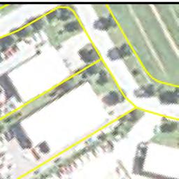
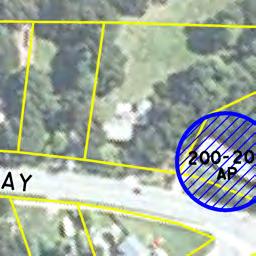
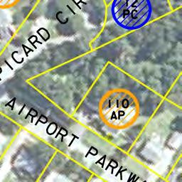
9 Phase I Environmental Site Assessment Report AIP 74, South Burlington, Vermont 3.0 SITE DESCRIPTION 3.1. Location AIP #74 consists of ten individual residential properties located at the following addresses: Airport Parkway; 4, 6, 8, 10, and 12 Picard Circle; 61 and 76 Dumont Avenue, 400 White Street; and, 7 Shamrock Road (see Appendix A Site Location Map and Appendix B Site Plans). All of the properties are single family residential on acre or less lots except Airport Parkway which is multi-family residential Site and Vicinity General Characteristics The properties are located in a predominantly suburban residential portion of the City of South Burlington, Vermont (see Site Location Map in Appendix A). The character of the area is fully developed with residential structures on suburban lots. Neighboring properties are also residential. East or south of the residential neighborhoods is the Burlington International Airport. To the north of the residential area is a commercial zone including retail stores, public works facility, and interstate 89. To the south is Williston Road and commercial uses associated with that area. The general topography in the area is flat. Depth to groundwater is likely to be more than 10 below grade. The groundwater flow direction beneath the property is most likely toward the north based on the location of the Winooski River. The depth to groundwater and predicted flow direction were not confirmed during this Phase I ESA Current Use of the Property As of September 21, 2011 (site reconnaissance date) the properties were unoccupied and were not in use Descriptions of On-Site Structures, Roads and Other Improvements As of September 21, 2011 the properties were developed as follows: Airport Parkway Property The property consists of 0.47 acres and hosted one approximately 2,000 square foot Description: residential duplex building with a full basement. The on site building was a one story wood framed building with a concrete block foundation and a concrete slab in the basement. The structure was reportedly built in The basement space was partially finished. The residential building was unoccupied on the date of the reconnaissance. A gravel drive was located on the southern portion of the property, and a grassy area was noted on the eastern, western, and northern portions of the property. No other improvements were noted on the subject property. The subject property was serviced by municipal water and sewer. Electric power and telephone utilities were noted overhead on the subject property. October 14, KAS Project #
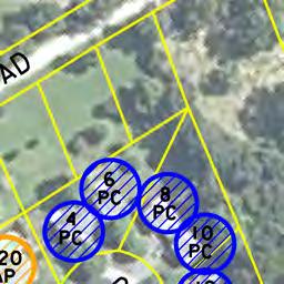
10 Phase I Environmental Site Assessment Report AIP 74, South Burlington, Vermont 4 & 6, and 10 Picard Circle Property These properties consist of 0.35 acres each. Each property hosted one approximately 1,500 Description: square foot residential single family building with a partial basement and one car attached garage. The on site buildings were two story wood framed structures with a concrete block foundation and a concrete slab in the basement. The structures were reportedly built in The basement spaces were partially finished. The residential buildings were unoccupied on the date of the reconnaissance. A paved driveway was located on the southern portion of each property, and a grassy area was noted on the remaining portions of the properties. No other improvements were noted on the subject properties. The subject properties were serviced by municipal water and sewer. Electric power and telephone utilities were noted overhead on the each property. 8 & 12 Picard Circle Property Description: 61 Dumont Avenue Property Description: 76 Dumont Avenue Property Description: These properties consist of 0.35 acres each. Each property hosted one approximately 1,500 square foot residential single family building with a partial basement and one car attached garage. The on site buildings were two story wood framed structures with a concrete block foundation and a concrete slab in the basement. The structures were reportedly built in The basement spaces were unfinished. The residential buildings were unoccupied on the date of the reconnaissance. A paved driveway was located on the southern portion of each property, and a grassy area was noted on the remaining portions of the properties. Two sheds were noted on the rear of the 12 Picard Parkway property; one approximate 6 x10 wooden shed and one approximate 6 x10 aluminum. The sheds were noted to be empty. No other improvements were noted on the subject properties. The subject properties were serviced by municipal water and sewer. Electric power and telephone utilities were noted overhead on the each property. The property consists of 0.33 acres and hosted one approximately 1,260 square foot residential single family building with a full basement. The on site building was a one story wood framed building with a concrete block foundation and a concrete slab in the basement. The structure was reportedly built in An addition was added at some time on the northern side of the original structure. The basement space was partially finished. The residential building was unoccupied on the date of the reconnaissance. A paved driveway was located on the western portion of the property, and a grassy area was noted on the remaining portions of the property. An approximately 800 square foot detached garage was present to the west of the residential building. An approximate 6 x6 partially damaged aluminum shed was observed on the northern side of the property. The shed and garage were noted to be empty. No other improvements were noted on the subject property. The subject property was serviced by municipal water and sewer. Electric power and telephone utilities were noted overhead on the subject property. The property consists of 0.27 acres and hosted one approximately 1,300 square foot residential single family building with a full basement. The on site building was a two story wood framed building with a concrete block foundation and a concrete slab in the basement. The structure was reportedly built in The basement space was partially finished. The residential building was unoccupied on the date of the reconnaissance. A paved driveway was located on the western portion of the property, and a grassy area was noted on the remaining portions of the property. An approximately 400 square foot detached garage was present to the west of the residential building. An approximate 10 x6 wooden shed was observed on October 14, KAS Project #
11 Phase I Environmental Site Assessment Report AIP 74, South Burlington, Vermont the northern side of the property. The shed and garage were noted to be empty except for the presence of a few wooden crates inside the shed. No other improvements were noted on the subject property. The subject property was serviced by municipal water and sewer. Electric power and telephone utilities were noted overhead on the subject property. 400 White Street Property Description: 7 Shamrock Road Property Description: The property consists of 0.75 acres and hosted one approximately 1,300 square foot residential single family building with a full basement. The on site building was a two story wood framed building with a concrete block foundation and a concrete slab in the basement. The structure was reportedly built in the 1950 s. The basement space was partially finished. The residential building was unoccupied on the date of the reconnaissance. A paved driveway was located on the western portion of the property, and a grassy area was noted on the remaining portions of the property. An approximately 400 square foot detached garage was present to the west of the residential building. Two wooden sheds were noted on the rear of the property; one being approximately 10 x12 and one being approximately 10 x20 in size. The sheds and garage were noted to be empty except. No other improvements were noted on the subject property. The subject property was serviced by municipal water and sewer. Electric power and telephone utilities were noted overhead on the subject property. The property consists of 0.46 acres and hosted one approximately 960 square foot residential single family building with a full basement. The on site building was a one story wood framed building with a concrete block foundation and a concrete slab in the basement. The structure was reportedly built in The basement space was unfinished. The residential building was unoccupied on the date of the reconnaissance. A gravel driveway was located on the western portion of the property, and a grassy area was noted on the remaining portions of the property. No other improvements were noted on the subject property. The subject property was serviced by municipal water and sewer. Electric power and telephone utilities were noted overhead on the subject property Current Uses of Adjoining Properties Land uses adjacent to the properties as of the date of this assessment were generally suburban residential except as follows Airport Parkway is immediately abutted by the Burlington International Airport runway. 4.0 USER SUPPLIED INFORMATION 4.1. Title Records KAS reviewed chain of title information for the properties at the City of South Burlington Clerk s office. Records were reviewed to the apparent first development of the properties. No recorded environmental liens or other items of interest were found during the land record review. A summary of the land record research for each property is included in Appendix C. October 14, KAS Project #
12 Phase I Environmental Site Assessment Report AIP 74, South Burlington, Vermont 4.2. Environmental Liens or Activity and Use Limitations No environmental liens or activity and use limitations were discovered during review of land records. User did not provide positive information of the existence of environmental liens or activity and use limitations in connection with the property Specialized Knowledge User provided the following specialized knowledge regarding the property: see Section Commonly Known or Reasonably Ascertainable Information User provided the following commonly known or reasonable ascertainable information regarding the property: see Section Valuation Reduction for Environmental Issues User indicated that the transaction was executed at fair market value with no valuation reduction for environmental issues. KAS reviewed portions of the appraisal conducted at each property prior to its purchase. No valuation reduction for environmental issues was noted in the appraisals Owner, Property Manager, and Occupant Information User identified the properties owner and manager as the Burlington International Airport. The properties are currently vacant Reasons for Performing Phase I User indicated that this Phase I ESA was being performed in advance of demolition of the properties as part of the owner s noise impact reduction program Other User Supplied Information and Documentation User provided the following other information and documentation: The Appraisal Report prepared for each property by Navin O Grady Appraisal Services and an Acquired Land Location Map showing the locations of each subject property. October 14, KAS Project #
13 Phase I Environmental Site Assessment Report AIP 74, South Burlington, Vermont 5.0 RECORDS REVIEW 5.1. Standard Environmental Record Sources Regulatory Database Search KAS contracted with Environmental FirstSearch Technology Corporation to perform a review of state and federal regulatory records during this Phase I ESA. A copy of the FirstSearch Search Report is included in Appendix F. A summary of the pertinent data contained in the First Search report is presented below. Property The subject properties were not listed on the FirstSearch Report except for Airport Parkway which is listed as being a spill site. According to the FirstSearch Report 5 gallons of #2 fuel oil spilled within the basement space on July 5, The spill occurred from the above ground storage tank (AST) located within the 200 unit basement space. The spill was cleaned up by Agway and the tenants. No additional work was conducted and no odors remained in the building space. The spill was issued a closed status by the Vermont Department of Environmental Conservation (VTDEC). Immediately Adjacent Sites One immediately adjacent Site to one or more of the subject properties (The Burlington International Airport) was listed on the FirstSearch Report as being a RCRA generator (RCRAGN) site, an underground storage tank (UST) site, and a leaking UST site. Other Sites All of the subject properties are in close proximity to the Burlington International Airport which was listed on the FirstSearch Report as being a RCRA generator (RCRAGN) site, an underground storage tank (UST) site, and a leaking UST site. Based on the FirstSearch Report various quantities of ignitable waste, corrosive waste, reactive waste, and petroleum products are stored at the Burlington International Airport. The storage of these materials classifies the site property as a RCRA generator site. The airport also has USTs present on the property. It is unclear from reading the FirstSearch Report exactly how many USTs are located on the property; however, the report does list fuel oil and aviation fuel as being present in some of the USTs. The FirstSearch report also indicates that several USTs have been removed from the Airport property. The FirstSearch Report indicates no contamination or contamination below state standards was found beneath several of the removed USTs; however, the report states that contamination was encountered above state standards at some of the removed UST locations. It appears the presence of contamination was reported to the Vermont Department of Environmental Conservation (VTDEC); however, no additional information is given on the extent of contamination. October 14, KAS Project #
14 Phase I Environmental Site Assessment Report AIP 74, South Burlington, Vermont The Hertz Rental Corp, located at the Burlington International Airport, was also listed on the FirstSearch Report has being a RCRA generator site, a UST site, and a state listed site. Based on the FirstSearch report one 10,000-gallon gasoline UST is currently present on the property and one was removed in The UST removed in 1992 appears to have leaked which resulted in contamination present on the property. The contamination has been monitored since 1992 and groundwater enforcement standards are currently exceeded in several wells. According to the FirstSearch Report there are no sensitive receptor impacts. The North/South hanger at the Burlington International Airport is a state listed site according to the FirstSearch Report. Based on the report it appears a dry well was removed and contamination was encountered. However, the report indicates that the site was closed as of November 1999 and it does not appear additional work is necessary as a result of this contamination. The Vermont Air National Guard located at the Burlington International Airport is a state listed site according to the FirstSearch Report. Based on the report remedial activities were conducted at this property in the summer 2004 to clean up petroleum contamination from above ground tanks and spills. According to the report sensitive receptors are impacted and the site is listed as a high priority clean up site by the VTDEC. Several other sites are included in the FirstSearch report within ½ mile of the subject property. None of these properties appear to pose an environmental threat to the subject property. The listed properties are located downgradient from or at a significant distance away from the property so as to not pose a tangible environmental threat to the subject property Additional Environmental Record Sources The following reports/documents pertaining to environmental investigations conducted on adjacent properties were reviewed on line at the VTDEC Waste Management Interactive Database ( during this Phase I ESA: o Subsurface Investigation Report Hertz Rent-A-Car, Burlington International Airport dated May 20, 1993 and prepared by Groundwater Technology, Inc; o Site Investigation Report - Burlington International Airport Innotech Fuel Farm dated September 21, 1994 and prepared by Groundwater of Vermont; o Vermont Department of Environmental Conservation Site Management Activity Completed Letter for the Ethan Allen Air Force Base, dated June 30, 1997; o Vermont Department of Environmental Conservation Site Management Activity Completed Letter for the North/South Hanger Burlington International Airport, dated November 23, 1999; and, o Site Status Letter, Vermont Air National Guard Base, May October 14, KAS Project #
15 Phase I Environmental Site Assessment Report AIP 74, South Burlington, Vermont These five documents pertain to the reported contamination at properties located at the Burlington International Airport. It appears that two of the properties, Ethan Allen Air Force Base (VTDEC Site # ) and the North/South Hanger (VTDEC Site # ) have received site closure status from the VTDEC. According to the Subsurface Investigation Report dated June 4, 1993 prepared for the Hertz Car Rental property groundwater was documented to flow towards the northeast and contamination was determined to be limited to the immediate area of the site property. According to the Site Investigation Report dated September 21, 1994 prepared for the Burlington International Airport Innotech Fuel Farm property groundwater was documented to flow towards the southwest. Contamination was determined to be extensive and the full extent of the plume was not defined. According to the Site Status letter for the Vermont Air National Guard Base dated May 2002 contamination is present on this property from multiple sources including an former landfill dump areas, former dry wells, former underground storage tanks, and former fuel pits. Both petroleum and chlorinated contamination is present on this property which reportedly extends off the base property towards Poor Farm Road and Country Club Estates property. A copy of these reports/documents are included in Appendix J Physical Setting Sources USGS Topographic Maps The most recent USGS topographic quadrangle map was reviewed during this assessment. No buildings are identified on the map due to the housing density of the area State Geological Maps Bedrock in the vicinity of the property consists of Ordovician-aged Cutting Dolomite and/or Bascom formation. 5 Both bedrock units are carbonate rocks with varying amounts of sandstone. The overburden deposits in the area of the property are mapped as pebbly marine sand Other Physical Setting Sources KAS reviewed the current City of South Burlington Comprehensive Land Use Plan for information about the subject properties. According to this plan, land use of all the subject properties is currently residential. Future land uses are also indicated as residential. 7 4 USGS, Doll et. al Doll et. al October 14, KAS Project #
16 Phase I Environmental Site Assessment Report AIP 74, South Burlington, Vermont 5.4. Historical Use Information on the Property and Adjoining Properties Standard Historical Sources Aerial Photographs KAS reviewed aerial photographs dated May 1962, 8 April and April The aerial photograph dated May 1962 depicts the subject properties and the surrounding properties in a similar configuration to that observed in September 2011 with the following exceptions; the Picard Circle properties and 7 Shamrock Road property are not shown on the 1962 map. An April 1999 and April 2004 aerial photo of the subject property was reviewed on line at the KAS office. The photo shows the subject properties and the surrounding properties consistent with how they were observed in September Copies of the aerial photographs are included in Appendix E. Fire Insurance Maps KAS has determined that there is no available Sanborn Fire Insurance Map coverage for the subject properties. 11 Historic USGS Topographic Maps Two historic USGS topographic quadrangle maps were reviewed during this assessment. These included the 1906 and the 1948 USGS topographic quadrangle maps for Burlington, Vermont. 12 Based on review of these maps, in 1906 the area was largely undeveloped except for scattered buildings along the main roads. The Burlington Airport was not present in By 1948, the southeastern part of the airport had been developed and there were more structures along the roads. The northern part of the airport had not yet been developed. The resolution of these maps is not sufficient to determine the identity of individual homes included in this assessment. 6.0 SITE RECONAISSANCE 6.1. Methodology and Limiting Conditions On September 21, 2011, Jeremy Roberts of KAS conducted a site reconnaissance to inspect the individual properties for indications of environmental risks or hazardous conditions. A completed site inspection checklist is included in Appendix H. KAS was accompanied by Mr. 7 South Burlington Comprehensive Plan, Maps 1 and 6. 8 VT 62-L Vermont Law Library 9 MSR Aerial Photo 10 Google Earth Image. 11 FirstSearch No Coverage Letter. 12 University of New Hampshire Collections. October 14, KAS Project #
17 Phase I Environmental Site Assessment Report AIP 74, South Burlington, Vermont Kurt Miller, employee and designated representative of the Burlington International Airport, during the site reconnaissance. Photographs of the property are included in Appendix D General Site Setting Current Uses All properties were single family residential housing except for Airport Parkway which was a multi family housing/duplex unit. All properties were not being used except for Airport Parkway and 6, 4, 8, 10, and 12 Picard Parkway which were being used seasonally as Halloween scare houses Past Uses Past uses appear to be as a single or multi family residential housing Current and Past Uses of the Adjoining Properties Current uses of adjacent properties are included in section 3.5. Past uses appear to be similar to current uses Current and Past Uses in the Surrounding Area Surrounding area is predominately residential with the airport near by. Past uses appear to be similar to current uses Geologic, Hydrogeologic and Topographic Conditions All properties are generally flat. No bedrock was observed General Description of Structures The on-site residential structures consisted of a wood framed building with a full basement and concrete foundation. The buildings contained 2 to 4 bedrooms. All properties contained a garage which was either attached or detached from the residential building except at 7 Shamrock Road. No other structures were noted on the subject properties except at 12 Picard Circle which housed two approximate 6 x6 sheds; 400 White Street which housed one approximate 10 x12 wooden shed; 76 Dumont Avenue which housed one approximate 6 x10 wooden shed; and, 61 Dumont Avenue which housed one approximate 6 x6 aluminum shed. October 14, KAS Project #
18 Phase I Environmental Site Assessment Report AIP 74, South Burlington, Vermont Roads Airport Parkway is located immediately west of Airport Parkway, and 4, 6, 8, 10, and 12 Picard Circle. White Street is located south of the 400 White Street property. Dumont Avenue is located north of 61 Dumont Street and south of 76 Dumont Avenue. Shamrock Road is located east of the 7 Shamrock Road property Potable Water Supply Potable water supply is most likely municipal based on the proximity of fire hydrants near the subject properties. A water meter was noted to be present inside the basement at each property Sewage Disposal System Sewage disposal system is most likely municipal based on the presence of sewer manholes in the vicinity of the subject properties Exterior Observations Current Usage The exterior of the subject properties is primarily used as a driveway and parking area. A lawn area is located behind the on site buildings Hazardous Substances and Petroleum Products No evidence of hazardous substance and/or petroleum products were noted on the subject properties except at 400 White Street where three empty drums were observed (see Section 6.3.6). Above ground storage tank (AST) fill pipes were noted at Airport Parkway, 400 White Street, and 61 Dumont Street (see Section 6.4.3) and a possible underground storage tank (UST) fill pipe was noted at 76 Dumont Street Storage Tanks No evidence of storage tanks were noted on the exterior of the subject properties. A hollow steel pipe was observed protruding out of the ground near the garage on the 76 Dumont Street property. The purpose of the pipe was not clear from the site reconnaissance Odors No unusual odors were noted on the subject properties. October 14, KAS Project #
19 Phase I Environmental Site Assessment Report AIP 74, South Burlington, Vermont Pools of Liquid No pools of liquid were noted on the subject properties Drums No drums were noted on the subject properties except at 400 White Street which contained three empty drums located next to the red garage on the northern end of the property. The drums were unlabeled and were heavily corroded. They were tipped over on their side. No staining was noted around the drums PCBs No evidence of PCB containing materials or products was noted on the subject properties except at 7 Shamrock Road where an electric transformer was noted to be present on a utility pole located on the eastern end of the property near Shamrock Road. The transformer was noted to be in good condition and no adverse environmental conditions were noted. Some of the buildings were noted to be built pre 1970 therefore it is possible the paint and/or caulk within these buildings could contain PCBs Pits, Ponds and Lagoons No pits, ponds, or lagoons were noted on the subject properties Stained Soil or Pavement No stained soil or pavement was noted on the subject properties Stressed Vegetation No evidence of stressed vegetation was noted on the subject properties Solid Waste No evidence of solid waste was noted on the properties Drains and Waste Water No evidence of waste water was noted on the subject property Wells No wells were noted on the subject property. October 14, KAS Project #
20 Phase I Environmental Site Assessment Report AIP 74, South Burlington, Vermont Septic Systems No evidence of septic systems were noted on the subject property Interior Observations Current Usage The interior spaces of the on site buildings were not being used except at Airport Parkway and 6, 4, 8, 10, and 12 Picard Circle which were being used seasonally as Halloween scare houses Hazardous Substances and Petroleum Products No hazardous substances or petroleum products were noted on the interior of the properties except at 12 Picard Circle where deminimus quantities of spray paint were observed and at 8 and 10 Picard Circle where deminimus quantities of Kodak plate developer were noted. An inactive fuel oil above ground storage tank (AST) was noted in the basement space at Airport Parkway and 400 White Street during the site reconnaissance Storage Tanks No above ground storage tanks were noted in the on site buildings during the site reconnaissance except at Airport Parkway and 400 White Street. The ASTs appeared to be in good condition. No spillage or staining was noted near the ASTs except at 400 White Street where an area of staining was noted under the tank and a pool of liquid was observed. The liquid appeared to be water; however, this was not verified during the site reconnaissance. Evidence of a former AST was noted at the 61 Dumont property where a fill pipe was observed protruding from the building structure and pipes were noted in the basement Odors No odors were noted during the site reconnaissance except at 7 Shamrock Road, 400 White Street, 61 Dumont Avenue, and 76 Dumont Avenue where a strong to moderate mold/mildew odor was noted inside the residential space Pools of Liquid No pools of liquid were noted during the site reconnaissance except at 7 Shamrock Road where approximately 6 of standing water was noted across the basement floor and at 400 White Street where a small pool of liquid was noted under the above ground storage October 14, KAS Project #
21 Phase I Environmental Site Assessment Report AIP 74, South Burlington, Vermont tank. The liquid appeared to be water; however, this was not verified during the site reconnaissance Drums No drums were noted during the site reconnaissance except at 8 Picard Circle where two 55-gallon drums were noted in the living room area. One drum was black and made of steel and the other was blue and made of plastic. Both drums were in good condition and appeared to be empty. No labeling was noted on the drums. No adverse environmental conditions were noted in association with drums PCBs No PCBs were noted during the site reconnaissance. Some of the buildings were noted to be built pre 1970 therefore it is possible the paint and/or caulk within these buildings could contain PCBs Heating and Cooling Evidence suggesting the on-site buildings were heated via natural gas was noted at all of the properties except at Airport Parkway where it appeared the building was heated by fuel oil. Two ASTs were observed at this location. Also, historical evidence of the buildings being heated by fuel oil was found at 61 Dumont Street, 400 White Street, and possibly 76 Dumont Street Stains and Corrosion No stains or corrosion was noted during the site reconnaissance except at 400 White Street where staining was noted under the above ground storage tank in the basement space and at 61 Dumont Avenue where some minor staining was noted no the concrete floor inside the garage Drains and Sumps No drains or sumps were noted during the site reconnaissance except at 76 Dumont Avenue where a floor drain and sump was noted in the basement space and where a floor drain was noted inside the detached garage and 7 Shamrock Road which contained a sump inside the basement space. October 14, KAS Project #
22 Phase I Environmental Site Assessment Report AIP 74, South Burlington, Vermont 7.0 INTERVIEWS 7.1. Interview with Property Owner The current property owner is the City of Burlington (see Section 7.5). KAS attempted to contact the past owners of the site properties to complete an interview questionnaire. Failed attempts were made for the subject properties except for 12 Picard Circle and 7 Shamrock Road. Mr. James Kirk, previous owner of 12 Picard Circle, and Mr. Jack Russell, previous owner of 7 Shamrock Road, completed an interview questionnaire on October 5, A copy of the interview questionnaire is provided in Appendix G. Important points brought up during the interview included the following. The subject properties have always been used as a residential property to their knowledge. Mr. Kirk lived at the property since its construction in The on site buildings were always heated by natural gas. No hazardous substances were stored on the properties to their knowledge Interview with Site Manager See Section Interview with Occupants None; all units were unoccupied Interview with Local Government Officials KAS interviewed Chief Douglas Brent and Captain Gary Rounds of the City of South Burlington Fire Department in person at the South Burlington Fire Department on September 26, Chief Brent and Captain Rounds have been with the department for more than 40 years. Neither Chief Brent nor Captain Rounds recall having responded to a hazardous materials incident at any of the properties in this AIP group or the surrounding properties during their tenure at the department Interview with Others The user of this document (client) completed an interview form on October 14, The interview form was completed by Ms. Heather Kendrew, Director of Maintenance, Engineering, and Environmental. A copy of the interview questionnaire is provided in Appendix G. Important information noted in the interview included the following. October 14, KAS Project #
23 Phase I Environmental Site Assessment Report AIP 74, South Burlington, Vermont No environmental cleanups liens or activity and use limitations are known to exist for the properties. No environmental cleanups are known to have occurred at the properties. Mr. Mike Franco, previous owner of 120 Airport Parkway, completed an interview questionnaire on October 11, This property lies adjacent to the Picard Circle properties. Mr. Franco stated that he previously heard there used to be a dump in the location of the culde-sac near the Picard Circle properties and that it was used for cars. The cars were reportedly dug up and removed prior to the construction of the development. 8.0 FINDINGS One REC was identified during this Phase I ESA as defined by ASTM and as outlined in Sections 9.0 and 10.0: the presence of three corroded and damaged drums immediately outside a garage that appeared to be used for automobile repair at the 400 White Street property. 9.0 OPINION The properties have been adequately assessed and it has been determined that the historic and current uses have been for residential housing. One REC was identified during this assessment: the presence of three corroded and damaged drums immediately outside a garage that appeared to be used for automobile repair at the 400 White Street property. Although the drums were empty and no staining was noted around the drums visual observations of the garage near the drums suggested automobiles were repaired inside the garage. A mark was observed on the concrete floor inside the garage. The markings were representative of an above ground lift. Additionally, the garage was constructed with a high ceiling immediately above the marks on the concrete. The presence of the empty and damaged drums outside this area suggests that there was a potential release of hazardous materials at one time. The drums were unlabeled and thus the previous contents of the drums could not be determined. Evidence of three of the properties previously using fuel oil to heat the structures was noted during the site reconnaissance. These three properties are 400 White Street, 61 Dumont Street, and Airport Parkway. Additionally, the potential presence of an underground storage tank was noted at the 76 Dumont Street property. The remaining properties did not supply visual evidence suggesting oil was stored on these properties. Typical of Chittenden County urban areas, natural gas was installed in the 1960 s and many of the tanks and oil burners were removed or left in place. There was no evidence of fuel oil contamination encountered during the reconnaissance except at the 400 White Street property where some staining was noted under October 14, KAS Project #
24 Phase I Environmental Site Assessment Report AIP 74, South Burlington, Vermont the AST in the basement. There were no indications of foundation wall penetrations by oil lines which could be indicative of USTs outside the buildings. Some staining was noted on the concrete floor within the garage located at 61 Dumont Avenue. No floor drain was noted to be present in the garage and the staining appeared to be from a spill of oil or lubricant for an automobile. The staining noted under the above ground storage tank inside the basement of the 400 White Street property and on the concrete floor within the garage at 61 Dumont Avenue is considered a de minimis condition as defined by ASTM and as outlined in Sections 9.0 and There are no nearby properties on record of environmental concern that present tangible environmental risk. The nearest properties are either located some distance away or in locations that do not appear to jeopardize the environmental status of these properties based on documented groundwater flow directions and/or contamination levels. 9.1 Additional Investigation An additional investigation is deemed necessary to ascertain the presence or absence of a REC at the 76 Dumont Avenue property and the 4, 6, 8, 10, and 12 Picard Circle properties. The steel pipe protruding from the ground near the garage at the 76 Dumont Avenue property needs additional investigation to determine if this pipe is associated with an underground storage tank. An interview with the former owner of an adjacent property of land to the Picard Circle properties indicated a dump used to be present near the properties. Additional investigation is needed to ascertain whether or not this is a REC. No other investigations are deemed necessary to ascertain the presence or absence of RECs. Per ASTM E , this opinion regarding additional investigations is only intended to convey those additional investigations that may be necessary to ascertain the presence or absence of a REC. It does not convey any recommendation relative to the need to evaluate identified RECs at the property CONCLUSIONS We have performed a Phase I Environmental Site Assessment in conformance with the scope and limitations of ASTM Practice E 1527 of land and premises at ten residential properties located in the City of South Burlington, Vermont (collectively referred to as AIP # 74). Any exceptions to, or deletions from, this practice are described in Section 11.0 of this report. This assessment has revealed evidence of one recognized environmental condition in connection with the 400 White Street property: the presence of three corroded and damaged drums immediately outside a garage that appeared to be used for automobile repair at the 400 White Street property. October 14, KAS Project #
25 Phase I Environmental Site Assessment Report AIP 74, South Burlington, Vermont The staining noted under the above ground storage tank inside the basement of the 400 White Street property and on the concrete floor within the garage at 61 Dumont Avenue is considered a de minimis condition as defined by ASTM and as outlined in Sections 9.0 and A recognized environmental condition is defined in ASTM E 1527 as the presence or likely presence of any hazardous substances or petroleum products on a property under conditions that indicate an existing release, a past release, or a material threat of a release of any hazardous substances or petroleum products into structures on the property or into the ground, groundwater or surface water of the property. The term includes hazardous substances or petroleum products even under conditions in compliance with laws. The term is not intended to include de minimis conditions that generally do not present a threat to human health or the environment and that generally would not be the subject of an enforcement action if brought to the attention of appropriate governmental agencies. Conditions determined to be de minimis are not recognized environmental conditions DEVIATIONS Deviations/Data Gaps Noted deviations to the ASTM Standard Practice for Environmental Site Assessments: Phase I Environmental Site Assessment Process (ASTM E ) included: inability to contact past owner of all the properties within AIP # 74 except 12 Picard Circle and 7 Shamrock Road. A relatively complete historical record was presented for the property from 1906 to present. There are several intervals where documentation gaps exceed the 5-year period specified in ASTM E at ; however, in light of the continuous property usage (residential), it is KAS opinion that the data gaps are not of significance Significant Assumptions KAS undertook performance of this Phase I ESA according to the following assumptions: None Limitations and Exclusions KAS has prepared this Phase I ESA report in accord with ASTM E using the best efforts of Environmental Professionals and information available at the time of preparation. This report is intended to convey a point-in-time environmental evaluation of the property, as well as relevant information on past uses. The user of this document must recognize the limitations inherent in conducting a Phase I ESA, as stated in ASTM E , which include but are not necessarily limited to: October 14, KAS Project #
26 Phase I Environmental Site Assessment Report AIP 74, South Burlington, Vermont This document does not address regulatory compliance issues and KAS makes no assurances relative to the federal, state or local regulatory compliance of the property (ref. Section 1.4). All appropriate inquiry as defined by ASTM E is not an exhaustive assessment of a clean property (ref. Section 4.5.2). A variable level of inquiry may be conducted depending on the specific characteristics and features of the property and the information developed during the course of the assessment (ref. Section 4.5.3). An assessment meeting or exceeding the requirements of ASTM E and completed less than 180 days prior to the date of acquisition or intended transaction is presumed to be valid (ref. Section 4.6). All appropriate inquiry as defined by ASTM E is not exhaustive and does not require assessment of historic uses more frequently than every five years (ref. Section ) Special Contractual Conditions None User Reliance This report is for the use and benefit of client as defined herein. Affiliates of client, and third parties authorized in writing by KAS and client, may rely upon this report to the extent that client is entitled to do so, provided said parties agree to abide by the limitations and exclusions as stated herein ADDITIONAL SERVICES At Client request, KAS conducted a preliminary visual assessment of the potential for asbestoscontaining building materials (ACBM) and lead-based paint (LBP) in each of the assessed homes. This work did not include inspections as defined by relevant ACBM/LBP regulations, and no sampling was conducted. The purpose of performing this work was to provide a preliminary indication of the need to conduct ACBM/LBP inspections in the future. This work was performed pursuant to List of Additional Issues contained in ASTM E Based on the preliminary visual assessment, the residential structures on the properties have the potential to contain asbestos-containing building materials (ACBM). In accordance with National Emissions Standard for Hazardous Air Pollutants (NESHAPS) Asbestos and 18 VSA Chapter 26, a Pre-Demolition Asbestos Inspection must be performed and NESHAPS notification submitted 10 business days prior to commencement of demolition for all properties. Based on the ages of the buildings (pre-1978), LBP may be present in all buildings except 4, 6, 8, 10, and 12 Picard Circle. KAS recommends that paints present in the AIP 74 buildings except October 14, KAS Project #
27 Phase I Environmental Site Assessment Report AIP 74, South Burlington, Vermont 4, 6, 8, 10, and 12 Picard Circle be assumed to be lead based and that appropriate pre-disposal characterization testing be performed. The demolition contractor should be required to comply with applicable local, state and federal safety and disposal requirements REFERENCES 1. United States Geological Survey (USGS), Topographic Map of South Burlington, Vermont, 1987, viewed on line at 2. City of South Burlington Land Records viewed in person at the South Burlington City Clerk s office, 575 Dorset Street, South Burlington, Vermont. 3. Environmental FirstSearch Technology Corporation, Norwood, MA, FirstSearch Database Report for South Burlington, Vermont, acquired by KAS on September 20, Subsurface Investigation Report Hertz Rent-A-Car, Burlington International Airport, May 20, 1993, prepared by Groundwater Technology, Inc viewed on line at the Vermont DEC Waste Management Interactive Database 5. Site Investigation Report - Burlington International Airport Innotech Fuel Farm, September 21, 1994, prepared by Groundwater of Vermont viewed on line at the Vermont DEC Waste Management Interactive Database 6. Vermont Department of Environmental Conservation Site Management Activity Completed Letter for the Ethan Allen Air Force Base, June 30, 1997 viewed on line at the Vermont DEC Waste Management Interactive Database 7. Vermont Department of Environmental Conservation Site Management Activity Completed Letter for the North/South Hanger Burlington International Airport, November 23, 1999 viewed on line at the Vermont DEC Waste Management Interactive Database 8. Site Status Letter, Vermont Air National Guard Base, May 2002 viewed on line at the Vermont DEC Waste Management Interactive Database 9. Doll, Charles G., ed., 1961, Centennial Geologic Map of Vermont, State of Vermont, on file at KAS offices, Williston, Vermont. 10. Doll, Charles G., ed., 1970, Surficial Geologic Map of Vermont, State of Vermont, on file at KAS offices, Williston, Vermont. 11. City of South Burlington Comprehensive Land-Use Plan, March 2011, viewed on line at Vermont Law Library, State St. Montpelier, Vermont, 1962 low altitude aerial photograph collection. 13. USGS, Aerial Photograph of South Burlington, Vermont, April 1999, viewed on line at Google Earth Image, South Burlington, Vermont April Historic USGS Topographic Maps of South Burlington, Vermont acquired from the University of New Hampshire on line at KAS, Inc. telephone interview with Mr. James Kirk and Mr. Jack Russell on October 5, October 14, KAS Project #
28 Phase I Environmental Site Assessment Report AIP 74, South Burlington, Vermont 17. KAS, Inc. personal interview with Chief Douglas Brent and Captain Gary Rounds of the City of South Burlington Fire Department on September 26, 2011; (802) KAS, Inc. standard user questionnaire for ASTM E completed by Heather Kendrew, Director of Maintenance, Engineering, and Environmental. October 14, KAS Project #
29
30 Phase I Environmental Site Assessment Report AIP 74, South Burlington, Vermont 16.0 APPENDICIES A. Site Location Maps B. Site Plan C. Land Record Research D. Site Photographs E. Historical Research Documentation F. Regulatory Records Documentation G. Interview Documentation H. Site Reconnaissance Checklist I. Qualifications of Environmental Professionals J. Additional Environmental Records October 14, KAS Project #
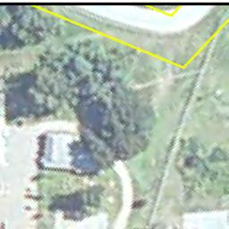
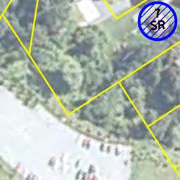
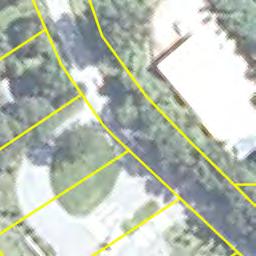
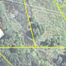
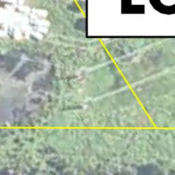
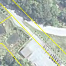
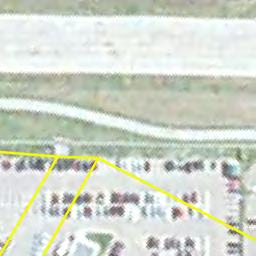
31 Phase I Environmental Site Assessment Report AIP 74, South Burlington, Vermont APPENDIX A SITE LOCATION MAPS October 14, KAS Project #

32 N O R T H Subject Property Area KAS Job Number Source: Burlington International Airport AIP 74, South Burlington, VT Site Location map July 1987 USGS Map Date: 09/29/11 Drawing No. 0 Scale: 1:24,000 By: JR


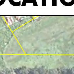


33 SITE LOCATION PLAN ACQUIRED BY STANTEC CONSULTING SERVICES, INC Page 18 of 18
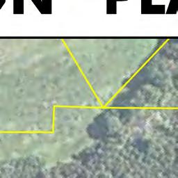
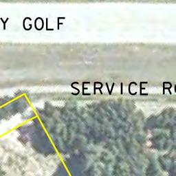
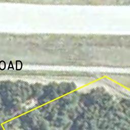
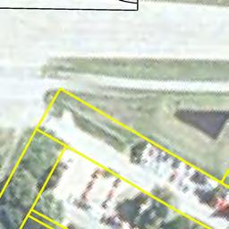
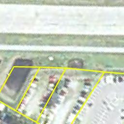
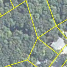
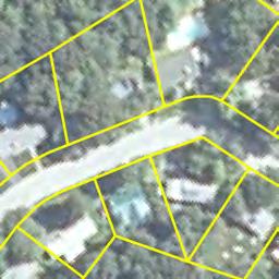
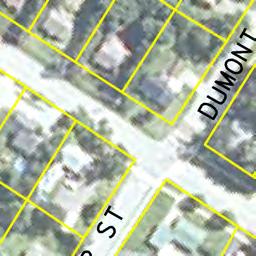
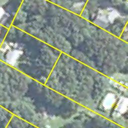
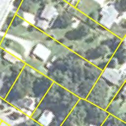
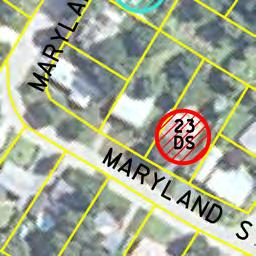
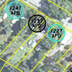
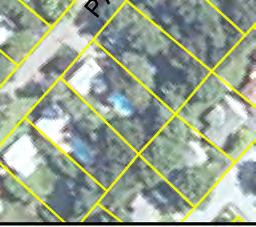
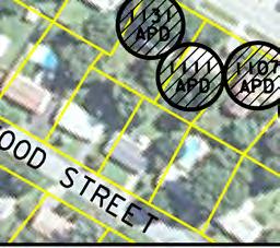
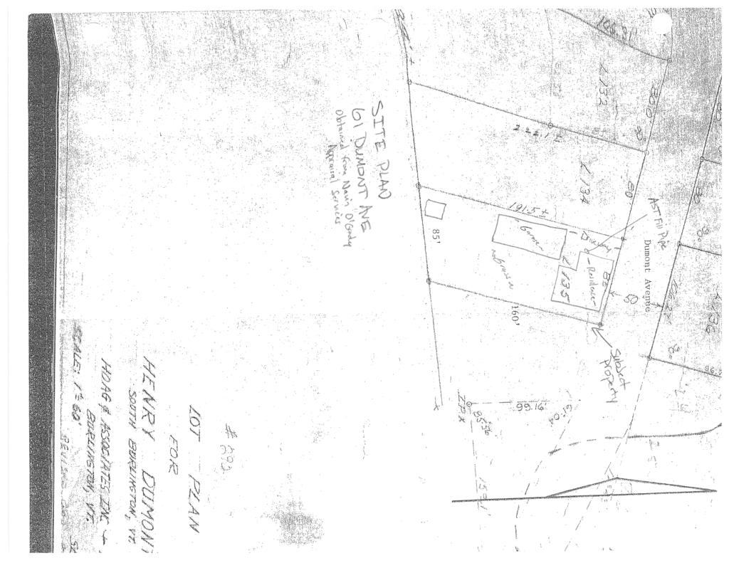
34 Phase I Environmental Site Assessment Report AIP 74, South Burlington, Vermont APPENDIX B SITE PLAN October 14, KAS Project #
35
36
37
38
39
40
41
42 Phase I Environmental Site Assessment Report AIP 74, South Burlington, Vermont APPENDIX C LAND RECORD RESEARCH October 14, KAS Project #
43 Phase I Environmental Site Assessment Report AIP 74, South Burlington, Vermont Table 4-1 Property Ownership Summary ( Airport Parkway) Grantor Grantee Book Page Date Demetrios, Alexandra, Paul & City of Burlington /23/2009 Maria Michaelides George B. & Anna L. Thabault Demetrios, Paul & Maria /24/74 Michaelides Hildred E. Dumas George B. & Anna L. Thabault /11/73 Joseph R. & Lois J. Mailloux Hildred E. Dumas, Pauline D /13/71 O Brien, and Shirley K. Debarge John & Bertha May Trono Joseph & Lois Mailloux /31/65 Archie J. Muir John & Bertha May Trono /3/58 Archie J. and Rachel Muir John & Bertha May Trono /3/58 Table 4-1 Property Ownership Summary (4 Picard Circle) Grantor Grantee Book Page Date Michael P. & Michelle I. Henry City of Burlington /29/2008 Zhong Q. Wang & Xian H. Zhan Michael P. & Michelle I. Henry /18/2003 Banglove & Preethie Zhong Q. Wang & Xian H /29/99 Vijayraghavan Zhan A.C.M. Associates Banglove & Preethie /18/89 Vijayraghavan Mary E. Franco A.C.M Associates /2/88 Vito Franco Vito Franco & Mary E. Franco /29/87 Henry & Mary Dumont Vito Franco /14/39 Benjamin F. White Mary Dumont /4/27 Robert A. & Eugene T. White Benjamin F. White /13/26 Benjamin F. White Robert and Eugene T. White /14/25 Irene V. And Guy G. Iby Benjamin F. White /14/25 Nelson E. & Minney Kingsley I&G Iby /1/21 John P. McKenzie Charles Martin Sr. 3 /468 2/23/04 Table 4-1 Property Ownership Summary (6 Picard Circle) Grantor Grantee Book Page Date Charles & Claudette Thibault City of Burlington /13/2009 Guy L. Rosenthal & Kyle M. Charles & Claudette Thibault /10/96 Roggenbuck A.C.M. Associates Guy Rosenthal /16/89 Mary E. Franco A.C.M Associates /2/88 Vito Franco Vito Franco & Mary E. Franco /29/87 Henry & Mary Dumont Vito Franco /14/39 Benjamin F. White Mary Dumont /4/27 Robert A. & Eugene T. White Benjamin F. White /13/26 Benjamin F. White Robert and Eugene T. White /14/25 Irene V. And Guy G. Iby Benjamin F. White /14/25 Nelson E. & Minney Kingsley I&G Iby /1/21 John P. McKenzie Charles Martin Sr. 3 /468 2/23/04 October 14, KAS Project #
44 Phase I Environmental Site Assessment Report AIP 74, South Burlington, Vermont Table 4-1 Property Ownership Summary (8 Picard Circle) Grantor Grantee Book Page Date Gordon J. & Susan S. Lamay City of Burlington /15/2009 Brian S. & Christine R. Wall Gordon J. & Susan S. Lamay /6/93 A.C.M. Associates Brian S. & Christine R. Wall /6/89 Mary E. Franco A.C.M Associates /2/88 Vito Franco Vito Franco & Mary E. Franco /29/87 Henry & Mary Dumont Vito Franco /14/39 Benjamin F. White Mary Dumont /4/27 Robert A. & Eugene T. White Benjamin F. White /13/26 Benjamin F. White Robert and Eugene T. White /14/25 Irene V. And Guy G. Iby Benjamin F. White /14/25 Nelson E. & Minney Kingsley I&G Iby /1/21 John P. McKenzie Charles Martin Sr. 3 /468 2/23/04 Table 4-1 Property Ownership Summary (10 Picard Circle) Grantor Grantee Book Page Date Jody & Chantel Davis City of Burlington /14/2008 Ora Emily Wall & Brian Stephen Jody & Chantel Davis /28/2003 Wall A.C.M Associates Ora Emily Wall & Brian /13/89 Stephen Wall Mary E. Franco A.C.M Associates /2/88 Vito Franco Vito Franco & Mary E. Franco /29/87 Henry & Mary Dumont Vito Franco /14/39 Benjamin F. White Mary Dumont /4/27 Robert A. & Eugene T. White Benjamin F. White /13/26 Benjamin F. White Robert and Eugene T. White /14/25 Irene V. And Guy G. Iby Benjamin F. White /14/25 Nelson E. & Minney Kingsley I&G Iby /1/21 John P. McKenzie Charles Martin Sr. 3 /468 2/23/04 Table 4-1 Property Ownership Summary (12 Picard Circle) Grantor Grantee Book Page Date James D. & Lucy Kirk City of Burlington /4/2008 A.C.M Associates James D. Kirk /16/89 Mary E. Franco A.C.M Associates /2/88 Vito Franco Vito Franco & Mary E. Franco /29/87 Henry & Mary Dumont Vito Franco /14/39 Benjamin F. White Mary Dumont /4/27 Robert A. & Eugene T. White Benjamin F. White /13/26 Benjamin F. White Robert and Eugene T. White /14/25 Irene V. And Guy G. Iby Benjamin F. White /14/25 Nelson E. & Minney Kingsley I&G Iby /1/21 John P. McKenzie Charles Martin Sr. 3 /468 2/23/04 October 14, KAS Project #
45 Phase I Environmental Site Assessment Report AIP 74, South Burlington, Vermont Table 4-1 Property Ownership Summary (61 Dumont Avenue) Grantor Grantee Book Page Date William S. & Madeline H. Grady City of Burlington /8/09 William S. Grady William S. & Madeline H /8/92 Grady Kenneth P. & Melissa A. William S. Grady /27/88 Desantels Loren E. & Loren C. Shepard Kenneth P. & Melissa A /3/83 Desantels Emilien O. & Mildred E. Rich Loren E & Loren C Shepard /30/72 Leo H. Dumont Emilien O. & Mildred E. Rich /9/56 Henry & Mary Dumont Leo H. Dumont /25/56 Hiram F. Tilley Henry & Mary Dumont /30/42 Table 4-1 Property Ownership Summary (76 Dumont Avenue) Grantor Grantee Book Page Date Laurie & Michael Willette City of Burlington /29/2009 Eric & Gretchen Robbins Laurie & Michael Willette /31/2000 Donald J. Choiniere Eric & Gretchen Robbins /30/98 Duane R. & Antoinette D. Austin Donald J. Choiniere /28/1978 Donald J. Choiniere Donald L. and Mary P. Dumont Duane R. & Antoinette D /12/65 Austin Leo H. Dumont Donald L. and Mary P. Dumont /11/56 Henry and Mary Dumont Leo Dumont /17/56 Hiram F. Tilley Henry & Mary Dumont /30/42 Henry and Mary Dumont Hiram F. Tilley /30/42 Benjamin F. White Henry & Mary Dumont /4/27 Robert E. and Eugene T. White Benjamin F. White /13/26 Guy and Irene Iby Benjamin White /18/25 Nelson E. & Minny Kingsley Guy and Irene Iby /1/21 Chad Martin Sr. and Louise Martin Nelson E. & Minny Kingsley /1/10 John P. McKenzie Charles Martin Sr /23/04 Table 4-1 Property Ownership Summary (400 White Street) Grantor Grantee Book Page Date Dave & Roberta Dupont City of Burlington /13/2009 Nancy Dupont Dave & Roberta Dupont /4/2003 Beverly A. McSherry Nancy Dupont /23/2003 Peter Terry Beverly A. McSherry /21/91 William Terry Peter & Verna Mae Terry /15/55 Archie J. & Priscilla M. Cota William Terry /11/48 George J. & Gladys F. Myers Archie J. & Priscilla M. Cota /29/42 Henry & Mary Dumont George J. & Gladys F. Myers /30/42 Benjamin F. White Mary Dumont /4/27 Robert A. & Eugene T. White Benjamin F. White /13/26 Benjamin F. White Robert and Eugene T. White /14/25 Irene V. And Guy G. Iby Benjamin F. White /14/25 Nelson E. & Minney Kingsley I&G Iby /1/21 John P. McKenzie Charles Martin Sr. 3 /468 2/23/04 October 14, KAS Project #
46 Phase I Environmental Site Assessment Report AIP 74, South Burlington, Vermont Table 4-1 Property Ownership Summary (7 Shamrock Road) Grantor Grantee Book Page Date Jack & John A. Russell City of Burlington /29/2009 Fairdale Farms, Inc. John A. Russell /12/90 Rene J. and June A. Berard Norman J. and Arlene I. Barrett /31/67 Parcel One Ethan Allen Farms, Inc. Rene J. and June A. Berard /1/61 Dumas J. Weston, Allen C. and Ethan Allen Farms, Inc /31/58 Mary A. Alfred Mose & Hildred Dumas Allen C. & Mary H. Alfred /6/47 Phineas Loomis Mose & Hildred Dumas Matilda M.Tobey Louis Dumas /10/17 Parcel Two Duprey Farm, Allen Alfred Free Press Association, Trustee /28/61 Vina, Ernest, Leo, and Alice Allen Alfred /26/39 Duprey Albert A. and Julia Larrow Vina, Ernest, Leo, and Alice Duprey /16/19 October 14, KAS Project #
47 Phase I Environmental Site Assessment Report AIP 74, South Burlington, Vermont APPENDIX D SITE PHOTOGRAPHS October 14, KAS Project #


48 Photograph ID: Sep-11 Location: Airport Parkway Photographic Documentation Phase I Environmental Site Assessment Burlington International Airport AIP 74, South Burlington, VT KAS Job # Direction: East Comments: Front of duplex family housing structure Photograph ID: Sep-11 Location: 200 Airport Parkway Direction: North Comments: View of AST in basement space


49 Photograph ID: Sep-11 Location: 202 Airport Parkway Photographic Documentation Phase I Environmental Site Assessment Burlington International Airport AIP 74, South Burlington, VT KAS Job # Direction: South Comments: View of AST in basement space Photograph ID: Sep-11 Location: Airport Parkway Direction: South Comments: View of the interior living space


50 Photograph ID: Sep-11 Location: 4 Picard Circle Photographic Documentation Phase I Environmental Site Assessment Burlington International Airport AIP 74, South Burlington, VT KAS Job # Direction: Northeast Comments: Front of single family housing structure Photograph ID: Sep-11 Location: 4 Picard Circle Direction: Northeast Comments: View of the interior living space


51 Photograph ID: Sep-11 Location: 6 Picard Circle Photographic Documentation Phase I Environmental Site Assessment Burlington International Airport AIP 74, South Burlington, VT KAS Job # Direction: Northeast Comments: Front of single family housing structure Photograph ID: Sep-11 Location: 6 Picard Circle Direction: Northeast Comments: View of the interior living space


52 Photograph ID: Sep-11 Location: 8 Picard Circle Photographic Documentation Phase I Environmental Site Assessment Burlington International Airport AIP 74, South Burlington, VT KAS Job # Direction: East Comments: Front of single family housing structure Photograph ID: Sep-11 Location: 8 Picard Circle Direction: North Comments: View of interior living space and two empty drums


53 Photograph ID: Sep-11 Location: 10 Picard Circle Photographic Documentation Phase I Environmental Site Assessment Burlington International Airport AIP 74, South Burlington, VT KAS Job # Direction: East Comments: Front of single family housing structure Photograph ID: Sep-11 Location: 10 Picard Circle Direction: East Comments: View of interior living space


54 Photograph ID: Sep-11 Location: 12 Picard Circle Photographic Documentation Phase I Environmental Site Assessment Burlington International Airport AIP 74, South Burlington, VT KAS Job # Direction: Southeast Comments: Front of single family housing structure Photograph ID: Sep-11 Location: 12 Picard Circle Direction: Southeast Comments: View of interior living space


55 Photograph ID: Sep-11 Location: 61 Dumont Street Photographic Documentation Phase I Environmental Site Assessment Burlington International Airport AIP 74, South Burlington, VT KAS Job # Direction: South Comments: Front of single family housing structure Photograph ID: Sep-11 Location: 61 Dumont Street Direction: South Comments: View of former AST fill pipes in basement space


56 Photograph ID: Sep-11 Location: 61 Dumont Street Photographic Documentation Phase I Environmental Site Assessment Burlington International Airport AIP 74, South Burlington, VT KAS Job # Direction: East Comments: View of AST fill pipe on the exterior of the house Photograph ID: Sep-11 Location: 61 Dumont Street Direction: South Comments: View of some staining on the concrete floor in the garage


57 Photograph ID: Sep-11 Location: 76 Dumont Street Photographic Documentation Phase I Environmental Site Assessment Burlington International Airport AIP 74, South Burlington, VT KAS Job # Direction: North Comments: Front of single family housing structure Photograph ID: Sep-11 Location: 76 Dumont Street Direction: Northeast Comments: View of steel pipe protruding from the ground near the garage


58 Photograph ID: Sep-11 Location: 61 Dumont Street Photographic Documentation Phase I Environmental Site Assessment Burlington International Airport AIP 74, South Burlington, VT KAS Job # Direction: East Comments: View of the floor drain inside the garage Photograph ID: Sep-11 Location: 400 White Street Direction: North Comments: Front of single family housing structure


59 Photograph ID: Sep-11 Location: 400 White Street Photographic Documentation Phase I Environmental Site Assessment Burlington International Airport AIP 74, South Burlington, VT KAS Job # Direction: West Comments: View of the AST in the basement space Photograph ID: Sep-11 Location: 400 White Street Direction: South Comments: View of the staining under the AST


60 Photograph ID: Sep-11 Location: 400 White Street Photographic Documentation Phase I Environmental Site Assessment Burlington International Airport AIP 74, South Burlington, VT KAS Job # Direction: West Comments: View of the three drums noted on the exterior of the property Photograph ID: Sep-11 Location: 7 Shamrock Road Direction: West Comments: Front of single family housing structure

61 Photograph ID: Sep-11 Location: 7 Shamrock Road Photographic Documentation Phase I Environmental Site Assessment Burlington International Airport AIP 74, South Burlington, VT KAS Job # Direction: East Comments: View of the interior living space
62 Phase I Environmental Site Assessment Report AIP 74, South Burlington, Vermont APPENDIX E HISTORICAL RESEARCH DOCUMENTATION October 14, KAS Project #

63 N O R T H Subject Property Area KAS Job Number Source: University of New Hampshire on line map collection, Burlington International Airport AIP 74, South Burlington, VT 1906 USGS Topographic Map Date: 09/29/11 Drawing No. 0 Scale: 1:62,500 By: JR

64 N O R T H Subject Property Area KAS Job Number Source: University of New Hampshire on line map collection, Burlington International Airport AIP 74, South Burlington, VT 1948 USGS Topographic Map Date: 09/29/11 Drawing No. 0 Scale: 1:62,500 By: JR
65 N O R T H KAS Job Number Source: Vermont Law Library Burlington International Airport AIP 74, South Burlington, VT Aerial Photography May 1962 Aerial photo Date: 09/29/11 Drawing No. 0 Scale: 1:24,000 By: ARL
66 N O R T H KAS Job Number Source: Vermont Law Library Burlington International Airport AIP 74, South Burlington, VT Aerial Photography May 1962 Aerial photo Date: 09/29/11 Drawing No. 0 Scale: 1:24,000 By: ARL

67 N O R T H KAS Job Number Source: Burlington International Airport AIP 74, South Burlington, VT Aerial Photography April 1999 USGS Image Date: 09/29/11 Drawing No. 0 Scale: 1:24,000 By: ARL

68 N O R T H KAS Job Number Source: Burlington International Airport AIP 74, South Burlington, VT Aerial Photography April 1999 USGS Image Date: 09/29/11 Drawing No. 0 Scale: 1:24,000 By: ARL


69 N O R T H KAS Job Number Source: Google Earth Burlington International Airport AIP 74, South Burlington, VT Aerial Photography April 2004 Google Earth Image Date: 09/29/11 Drawing No. 0 Scale: 1:24,000 By: ARL

70 N O R T H KAS Job Number Source: Google Earth Burlington International Airport AIP 74, South Burlington, VT Aerial Photography April 2004 Google Earth Image Date: 09/29/11 Drawing No. 0 Scale: 1:24,000 By: ARL
71 HISTORICAL FIRE INSURANCE MAPS NO MAPS AVAILABLE FirstSearch Technology Corporation 10 Cottage Street, Norwood, MA Tel: Fax:
72 Phase I Environmental Site Assessment Report AIP 74, South Burlington, Vermont APPENDIX F REGULATORY RECORDS DOCUMENTATION October 14, KAS Project #
73 FirstSearch Technology Corporation TM Environmental FirstSearch Report Target Property: 200 AIRPORT PKWY Job Number: PREPARED FOR: KAS, Inc. 368 Avenue D, Suite 15 Williston, VT Tel: (781) Fax: (781) Environmental FirstSearch is a registered trademark of FirstSearch Technology Corporation. All rights reserved.
74 Environmental FirstSearch Search Summary Report Target Site: 200 AIRPORT PKWY FirstSearch Summary Database Sel Updated Radius Site 1/8 1/4 1/2 1/2> ZIP TOTALS NPL Y NPL Delisted Y CERCLIS Y NFRAP Y RCRA COR ACT Y RCRA TSD Y RCRA GEN Y Federal Brownfield Y ERNS Y Tribal Lands Y State/Tribal Sites Y State Spills 90 Y State/Tribal SWL Y State/Tribal LUST Y State/Tribal UST/AST Y State/Tribal EC Y NA State/Tribal IC Y NA State/Tribal VCP Y NA State/Tribal Brownfields Y Federal IC/EC Y TOTALS Notice of Disclaimer Due to the limitations, constraints, and inaccuracies and incompleteness of government information and computer mapping data currently available to FirstSearch Technology Corp., certain conventions have been utilized in preparing the locations of all federal, state and local agency sites residing in FirstSearch Technology Corp.'s databases. All EPA NPL and state landfill sites are depicted by a rectangle approximating their location and size. The boundaries of the rectangles represent the eastern and western most longitudes; the northern and southern most latitudes. As such, the mapped areas may exceed the actual areas and do not represent the actual boundaries of these properties. All other sites are depicted by a point representing their approximate address location and make no attempt to represent the actual areas of the associated property. Actual boundaries and locations of individual properties can be found in the files residing at the agency responsible for such information. Waiver of Liability Although FirstSearch Technology Corp. uses its best efforts to research the actual location of each site, FirstSearch Technology Corp. does not and can not warrant the accuracy of these sites with regard to exact location and size. All authorized users of FirstSearch Technology Corp.'s services proceeding are signifying an understanding of FirstSeaarch Technology Corp.'s searching and mapping conventions, and agree to waive any and all liability claims associated with search and map results showing incomplete and or inaccurate site locations.
75 Environmental FirstSearch Site Information Report Request Date: Search Type: AREA Requestor Name: ALAN LIPTAK 0.07 sq mile(s) Standard: ASTM-05 Job Number: Filtered Report Target Site: 200 AIRPORT PKWY Demographics Sites: 97 Non-Geocoded: 21 Population: NA Radon: PCI/L Fire Insurance Map Coverage: No Site Location Degrees (Decimal) Degrees (Min/Sec) UTMs Longitude: :9:55 Easting: Latitude: :28:35 Northing: Elevation: 326 Zone: 18 Comment: Comment Additional Requests/Services Adjacent ZIP Codes: Services: ZIP Code City Name ST Dist/Dir Sel Requested? Date Fire Insurance Maps Yes Aerial Photographs No Historical Topos No City Directories No Title Search No Municipal Reports No Liens No Historic Map Works No Online Topos No
76 Environmental FirstSearch Target Site Summary Report Target Property: 200 AIRPORT PKWY JOB: TOTAL: 97 GEOCODED: 76 NON GEOCODED: 21 SELECTED: 0 Map ID DB Type Site Name/ID/Status Address Dist/Dir ElevDiff Page No. No sites found for target address
77 Environmental FirstSearch Sites Summary Report Target Property: 200 AIRPORT PKWY JOB: TOTAL: 97 GEOCODED: 76 NON GEOCODED: 21 SELECTED: 0 Map ID DB Type Site Name/ID/Status Address Dist/Dir ElevDiff Page No. 1 RCRAGN F A A SSC-86EB 1250 AIRPORT DR 0.03 SE VTR /VGN 2 UST BURLINGTON INTERNATIONAL FUEL 1160 AIRPORT DR 0.04 SE /INSTITUTIONAL 2 UST MORTAIR RAMP 1160 AIRPORT DR 0.04 SE /INSTITUTIONAL 2 LUST BURLINGTON INTERNATIONAL FUEL 1160 AIRPORT DR 0.04 SE /PULLED UST DATABASE 2 LUST BURLINGTON INTL AIRPORT AIRPORT DR 0.04 SE /PULLED UST DATABASE SOUTH BURLINGTON VT LUST MORTAIR RAMP 1160 AIRPORT DR 0.04 SE /PULLED UST DATABASE SOUTH BURLINGTON VT UST INNOTECH/BURLINGTON AIRPORT AIRPORT DR 0.11 SE / 3 LUST INNOTECH/BURLINGTON AIRPORT AIRPORT DR 0.11 SE /PULLED UST DATABASE 4 LUST GAMACHE RESIDENCE 82 SUBURBAN SQ 0.11 SW /PULLED UST DATABASE SOUTH BURLINGTON VT 5 LUST CHAMBERLIN SCHOOL 262 WHITE ST 0.12 NW /PULLED UST DATABASE SOUTH BURLINGTON VT RCRAGN HERTZ RENTAL CORP BURLINGTON INTERNATIONAL A 0.13 NE VTR /VGN 6 STATE HERTZ RENT A CAR/NATIONAL CAR 0 BURLINGTON INTRNTNL AIRPO 0.13 NE /ACTIVE SOUTH BURLINGTON VT 6 UST HERTZ BURLINGTON AIRPORT 0.13 NE /ACTIVE 7 RCRAGN ATLANTIC AVIATION SERVICES BURLINGTON INTERNATIONAL A 0.15 SE VTR /SGN 7 RCRAGN BURLINGTON INTL AIRPORT 1200 AIRPORT 1 DR 0.15 SE VTD /VGN 7 RCRAGN F B O AVCENTER 1200 AIRPORT DR 0.15 SE VTR /SGN 7 RCRAGN US T S A BURLINGTON INTL AIRPORT 1200 AIRPORT DR 0.15 SE VTR /VGN 7 UST ATLANTIC AVIATION - EAST HANGER BURLINGTON INTERNATIONAL A 0.15 SE /ACTIVE 7 UST BURLINGTON INTERNATIONAL AIRPORT 1200 AIRPORT DR 0.15 SE /ACTIVE 7 UST BURLINGTON INTERNATIONAL AIRPORT 0 NATIONAL WEATHER SERVICE 0.15 SE /INSTITUTIONAL
78 Environmental FirstSearch Sites Summary Report Target Property: 200 AIRPORT PKWY JOB: TOTAL: 97 GEOCODED: 76 NON GEOCODED: 21 SELECTED: 0 Map ID DB Type Site Name/ID/Status Address Dist/Dir ElevDiff Page No. 7 UST FAA ASR BURLINGTON INTERNATIONAL A 0.15 SE /ACTIVE 7 UST NATIONAL ALAMOENTERPRISE CAR RENTA BURLINGTON INTERNATIONAL A 0.15 SE /ACTIVE 7 LUST BROCKWAY AIRCRAFT HANGER BURLINGTON INTERNATIONAL A 0.15 SE /PULLED UST DATABASE SOUTH BURLINGTON VT LUST BURLINGTON INTERNATIONAL AIRPORT NATIONAL WEATHER SERVICE 0.15 SE /PULLED UST DATABASE 7 LUST FAA ASR BURLINGTON INTERNATIONAL A 0.15 SE /PULLED UST DATABASE 8 LUST POWER RESIDENCE 4 MILLS AVE 0.15 SE /PULLED UST DATABASE SOUTH BURLINGTON VT 8 LUST POWER RESIDENCE 4 MILLS AVE 0.15 SE / 9 LUST THRIFTY CAR RENTAL 1700 WILLISTON RD 0.19 SE /PULLED UST DATABASE SOUTH BURLINGTON VT RCRAGN INNOTECH AVIATION INC 1130 AIRPORT DR 0.20 SE VTD /VGN 10 LUST FBO AVCENTER NEW HANGER 1130 AIRPORT DR 0.20 SE /PULLED UST DATABASE 11 STATE NORTH/SOUTH HANGER B I A 0 AIRPORT DR 0.21 SE /CLOSED SOUTH BURLINGTON VT 12 RCRAGN DR JOHN L WOLFF DDS 1683 WILLISTON RD 0.22 SE VTR /VGN 13 RCRAGN WESCO INC AIRPORT EXXON 1800 WILLISTON RD 0.23 SE VTR /VGN 13 STATE AIRPORT EXXON 1800 WILLISTON RD 0.23 SE /CLOSED SOUTH BURLINGTON VT 13 UST AIRPORT SHELL B WILLISTON RD 0.23 SE /ACTIVE 14 RCRAGN KINNEY DRUGS # WILLISTON RD 0.24 SE 0 44 VTR /VGN 15 LUST MERRIAM-GRAVES COMPANY 1550 WILLISTON RD 0.24 SW /PULLED UST DATABASE SOUTH BURLINGTON VT LUST MAYNARD AUTO 1725 WILLISTON RD 0.25 SE /PULLED UST DATABASE SOUTH BURLINGTON VT 17 STATE AIRPORT MOBIL 1801 WILLISTON RD 0.32 SE /ACTIVE SOUTH BURLINGTON VT 18 STATE BUDGET RENT A CAR 700 AIRPORT PKWY 0.38 NW /CLOSED SOUTH BURLINGTON VT
79 Environmental FirstSearch Sites Summary Report Target Property: 200 AIRPORT PKWY JOB: TOTAL: 97 GEOCODED: 76 NON GEOCODED: 21 SELECTED: 0 Map ID DB Type Site Name/ID/Status Address Dist/Dir ElevDiff Page No. 18 LUST BUDGET RENT A CAR 700 AIRPORT PKWY 0.38 NW /PULLED UST DATABASE 19 STATE NORTHERN RENT A CAR 1890 WILLISTON RD 0.40 SE /CLOSED SOUTH BURLINGTON VT 20 STATE HOWARD BANK-WILLISTON RD. 0 WILLISTON RD 0.40 SE /CLOSED SOUTH BURLINGTON VT 21 STATE CRW CORP 1879 WILLISTON RD 0.42 SE /CLOSED SOUTH BURLINGTON VT 21 LUST CRW CORPORATION 1879 WILLISTON RD 0.42 SE /PULLED UST DATABASE SOUTH BURLINGTON VT 22 LUST VERMONT AIR NATIONAL GUARD 105 NCO DRIVE/BURLINGTON AI 0.46 NE /PULLED UST DATABASE 23 LUST KNEELAND FLIGHT FACILITY 0 BLDG 890 BURLINGTON AIRPO 0.47 SE /PULLED UST DATABASE SOUTH BURLINGTON VT STATE NORTH COUNTRY RESTAURANT SERVICES 1891 WILLISTON RD 0.47 SE /CLOSED SOUTH BURLINGTON VT 24 LUST ZACHERY S 1891 WILLISTON RD 0.47 SE /PULLED UST DATABASE 25 STATE LOGAN EQUIPMENT 1901 WILLISTON RD 0.47 SE /ACTIVE SOUTH BURLINGTON VT 26 LUST LAKE CHAMPLAIN SUBARU 1907 WILLISTON RD 0.50 SE /PULLED UST DATABASE SOUTH BURLINGTON VT 27 STATE U S POST OFFICE 60 WHITE ST 0.53 SW /CLOSED SOUTH BURLINGTON VT 28 STATE GRACEY S STORE 0 WILLISTON RD 0.54 SW /ACTIVE SOUTH BURLINGTON VT 29 STATE WILLISTON ROAD MOBIL 1314 WILLISTON RD 0.54 SW /ACTIVE SOUTH BURLINGTON VT 30 STATE U-SAVE BEVERAGE 0 WILLISTON RD 0.55 SW /ACTIVE SOUTH BURLINGTON VT 31 STATE BURLINGTON INTERNATIONAL AIRPORT 0 AIRPORT RD 0.58 NE /ACTIVE SOUTH BURLINGTON VT 32 STATE VERMONT AIR NATIONAL GUARD 0 AIRPORT RD 0.58 NE /ACTIVE SOUTH BURLINGTON VT 33 STATE KELCO FACILITY 73 ETHAN ALLEN DR 0.60 NE /CLOSED SOUTH BURLINGTON VT 34 STATE OFFSET HOUSE UNKNOWN 0.66 NW /CLOSED SOUTH BURLINGTON VT 34 STATE OFFSET HOUSE PROPERTY UNKNOWN 0.66 NW /CLOSED SOUTH BURLINGTON VT
80 Environmental FirstSearch Sites Summary Report Target Property: 200 AIRPORT PKWY JOB: TOTAL: 97 GEOCODED: 76 NON GEOCODED: 21 SELECTED: 0 Map ID DB Type Site Name/ID/Status Address Dist/Dir ElevDiff Page No. 35 STATE WILLISTON ROAD CITGO - DAVE S CITG 1241 WILLISTON RD 0.66 SW /ACTIVE SOUTH BURLINGTON VT 36 STATE ETHAN ALLEN AIR FORCE BASE 0 AIRPORT DR 0.67 SE /CLOSED SOUTH BURLINGTON VT 37 STATE SOUTH BURLINGTON STREET DEPT PATCHEN RD 0.68 NW /ACTIVE SOUTH BURLINGTON VT 38 STATE BURLINGTON AIRPORT 0 AIRPORT PKWY 0.70 NE /CLOSED SOUTH BURLINGTON VT 39 STATE P J S AUTOMOTIVE 2073 WILLISTON RD 0.71 SE /CLOSED SOUTH BURLINGTON VT 40 STATE SOUTH BURLINGTON CENTRAL SCHOOL 1181 WILLISTON RD 0.71 SW /CLOSED SOUTH BURLINGTON VT 41 STATE DOLANS VARIETY 1160 WILLISTON RD 0.74 SW /ACTIVE SOUTH BURLINGTON VT 42 STATE SARVAK RESIDENCE 290 HINESBURG RD 0.77 SW /CLOSED SOUTH BURLINGTON VT 43 STATE CHAMPLAIN VALLEY SUNOCO 1143 WILLISTON RD 0.78 SW /ACTIVE SOUTH BURLINGTON VT 44 STATE UNIVERSITY GULF 0 WILLISTON RD 0.80 SW /ACTIVE SOUTH BURLINGTON VT 45 STATE GREERS DRY CLEANING DORSET STREET UNKNOWN 0.91 SW /ACTIVE SOUTH BURLINGTON VT 46 STATE REILLY TIRE UNKNOWN 0.91 SW /CLOSED SOUTH BURLINGTON VT 47 STATE KENNEDY DRIVE MOBIL 110 KENNEDY DR 0.93 SW /CLOSED SOUTH BURLINGTON VT 48 STATE FORMER GOODRICH BUILDING 625 HINESBURG RD 0.96 SW /ACTIVE SOUTH BURLINGTON VT 49 STATE UNIVERSITY INN 5 DORSET ST 0.96 SW /CLOSED SOUTH BURLINGTON VT 50 STATE ACTION EQUIPMENT UNKNOWN 1.00 SE /CLOSED SOUTH BURLINGTON VT
81 Environmental FirstSearch Sites Summary Report Target Property: 200 AIRPORT PKWY JOB: TOTAL: 97 GEOCODED: 76 NON GEOCODED: 21 SELECTED: 0 Map ID DB Type Site Name/ID/Status Address Dist/Dir ElevDiff Page No. STATE GADUE DRY CLEANER DORSET STREET UNKNOWN NON GC N/A N/A /ACTIVE SOUTH BURLINGTON VT STATE GORDIES TEXACO UNKNOWN NON GC N/A N/A /CLOSED SOUTH BURLINGTON VT SPILLS AIR GUARD BURLINGTON INTNL AIRPORT NON GC N/A N/A 09-WMD239/CLOSED SOUTH BURLINGTON VT SPILLS JAMES KNEELAND FLIGHT FACILITY AIRPORT RD NON GC N/A N/A 06-WMD192/CLOSED SOUTH BURLINGTON VT SPILLS MAINTENANCE BUILDING B 1 A AIRPORT RD NON GC N/A N/A 02-WMD239/CLOSED SOUTH BURLINGTON VT SPILLS N/A AIRPORT PKWY NON GC N/A N/A 95-WMD116/CLOSED SOUTH BURLINGTON VT SPILLS VT AIR NATIONAL GUARD AIRPORT DR NON GC N/A N/A 10-WMD167/CLOSED BURLINGTON VT SPILLS VT ANG AIRPORT DR NON GC N/A N/A 11-WMD316/CLOSED SOUTH BURLINGTON VT SWL A. MARCELINO AND COMPANY, INC. UNKNOWN NON GC N/A N/A CH772/RECYCLING SOUTH BURLINGTON VT SWL CHITTENDEN SWM DISTRICT DROP-OFF C PATCHEN ROAD NON GC N/A N/A CH771/DROP OFF CENTER SOUTH BURLINGTON VT SWL CHITTENDEN SWMD TRANS STATION PATCHEN ROAD NON GC N/A N/A 11/A SWL CHITTENDEN SWMD TRANS STATION PATCHEN ROAD NON GC N/A N/A 011/A SWL CSWD ENVIRONMENTAL DEPOT UNKNOWN NON GC N/A N/A CH080/HHW/CESQG SOUTH BURLINGTON VT SWL ENGINEERS CONSTRUCTION DISPOSAL SI UNKNOWN NON GC N/A N/A CH980/LANDFILL SOUTH BURLINGTON VT UST KNEELAND FLIGHT FACILITY AIRPORT BIAP RD NON GC N/A N/A 1037/ACTIVE SOUTH BURLINGTON VT LUST AIRPORT PARKWAY SEWER PUMP STATION HINESBURGH RD NON GC N/A N/A 2736/PULLED UST DATABASE SOUTH BURLINGTON VT LUST MUNT RESIDENCE 85 SOUTH ST NON GC N/A N/A /PULLED UST DATABASE BURLINGTON VT LUST NEW ENGLAND TELEPHONE CENTRAL OFFI FARRELL ST NON GC N/A N/A 895/PULLED UST DATABASE SOUTH BURLINGTON VT LUST STRATTON CORP GOLF MAINTENANCE ORCUTT MEADOW RD NON GC N/A N/A 517/PULLED UST DATABASE WINHALL VT LUST VERMONT TIRE WILLISTON RD NON GC N/A N/A /PULLED UST DATABASE SOUTH BURLINGTON VT
82 Environmental FirstSearch Sites Summary Report Target Property: 200 AIRPORT PKWY JOB: TOTAL: 97 GEOCODED: 76 NON GEOCODED: 21 SELECTED: 0 Map ID DB Type Site Name/ID/Status Address Dist/Dir ElevDiff Page No. TRIBALLA BUREAU OF INDIAN AFFAIRS CONTACT I UNKNOWN NON GC N/A N/A BIA-05403/ VT 05403
83 Environmental FirstSearch Site Detail Report Target Property: 200 AIRPORT PKWY JOB: No sites were found!
84 Environmental FirstSearch Site Detail Report Target Property: 200 AIRPORT PKWY JOB: RCRAGN SEARCH ID: 4 DIST/DIR: 0.03 SE ELEVATION: 338 MAP ID: 1 NAME: F A A SSC-86EB REV: 7/11/11 ADDRESS: 1250 AIRPORT DR ID1: VTR ID2: CHITTENDEN STATUS: VGN CONTACT: PHONE: SOURCE: EPA SITE INFORMATION CONTACT INFORMATION: JEFF LOLLER 1250 AIRPORT DR PHONE: CONTACT INFORMATION: MARTIN ROOTS 1250 AIRPORT DR PHONE: UNIVERSE INFORMATION: NAIC INFORMATION ENFORCEMENT INFORMATION: VIOLATION INFORMATION: VIOLATION NUMBER: 0001 RESPONSIBLE: S - STATE DETERMINED: 11/13/1997 DETERMINED BY: S - STATE CITATION: 7-303(3)(a)(iii) RESOLVED: 11/17/1997 TYPE: HAZARDOUS WASTE DETERMINATIONS HAZARDOUS WASTE INFORMATION: Ignitable waste VT08 VT02 Benzene Site Details Page - 2
85 Environmental FirstSearch Site Detail Report Target Property: 200 AIRPORT PKWY JOB: SEARCH ID: 40 DIST/DIR: 0.04 SE ELEVATION: 336 MAP ID: 2 UST NAME: BURLINGTON INTERNATIONAL FUEL REV: ADDRESS: 1160 AIRPORT DR ID1: 966 ID2: CHITTENDEN STATUS: INSTITUTIONAL CONTACT: PHONE: SOURCE: VTDEC Tanks Installed Capacity CURRENT: 0 REMOVED: 0 PERMANENT: 0 UNKNOWN: 0 TEMP: 0 CLOSED: 0 PRODUCTS: TANK MATERIAL: PIPE MATERIAL: Site Details Page - 3
86 Environmental FirstSearch Site Detail Report Target Property: 200 AIRPORT PKWY JOB: SEARCH ID: 44 DIST/DIR: 0.04 SE ELEVATION: 336 MAP ID: 2 UST NAME: MORTAIR RAMP REV: ADDRESS: 1160 AIRPORT DR ID1: 965 ID2: CHITTENDEN STATUS: INSTITUTIONAL CONTACT: PHONE: SOURCE: VTDEC Tanks Installed Capacity CURRENT: 0 REMOVED: 0 PERMANENT: 0 UNKNOWN: 0 TEMP: 0 CLOSED: 1??? PRODUCTS: #2&4 FUEL OIL TANK MATERIAL: UNPROTECTED PIPE MATERIAL: Site Details Page - 4
87 Environmental FirstSearch Site Detail Report Target Property: 200 AIRPORT PKWY JOB: LUST SEARCH ID: 70 DIST/DIR: 0.04 SE ELEVATION: 336 MAP ID: 2 NAME: BURLINGTON INTERNATIONAL FUEL REV: 7/8/11 ADDRESS: 1160 AIRPORT DR ID1: 966 ID2: CHITTENDEN STATUS: PULLED UST DATABASE CONTACT: MONTAIR FLIGHT SERVICE INC PHONE: SOURCE: VT DEC This site comes from the Vermont Department of Environmental Conservation Pulled Underground Storage Tanks database and may or may not be considered a leaking underground storage tank, please review the data below for further indications of contamination. SITE FINDINGS: CONTAMINATION FOUND ABOVE STATE STANDARD. REFERRED TO SITE MANAGEMENT FACILITY AND OWNER INFORMATION TYPE OF FACILITY: INDUSTRIAL/COMMERCIAL OWNER NAME: MONTAIR FLIGHT SERVICE INC CONTACT: OWNER ADDRESS: 1160 AIRPORT DRIVE SOUTH BURLINGTON, VT LAND OWNER: ** UNKNOWN *** PERMITTED TO: NUM OF PULLED TANKS: 2 NUM OF REMOVED TANKS: 2 NUM OF GROUNDWATER MONITORING WELLS: NUM OF VAPOR MONITORING WELLS: TANK INFORMATION TOTAL NUMBER OF TANKS: 2 TANK ID: 844 TANK STATUS: PULLED SUBSTANCE STORED: TANK CAPACITY IN GAL.: 1000 TANK PROTECTION: UNPROTECTED STEEL YEAR REMOVED: 1995 TANK MONITORING: / SPILL/OVERFILL PROT.: PUMP TYPE: PIPE PROTECTION: TESTED DATE: PIPE MONITORING: TANK LABEL: TANK ID: 843 TANK STATUS: PULLED SUBSTANCE STORED: TANK CAPACITY IN GAL.: 2000 TANK PROTECTION: UNPROTECTED STEEL YEAR REMOVED: 1995 TANK MONITORING: / SPILL/OVERFILL PROT.: PUMP TYPE: PIPE PROTECTION: TESTED DATE: PIPE MONITORING: TANK LABEL: -1-2 Site Details Page - 5
88 Environmental FirstSearch Site Detail Report Target Property: 200 AIRPORT PKWY JOB: LUST SEARCH ID: 71 DIST/DIR: 0.04 SE ELEVATION: 336 MAP ID: 2 NAME: BURLINGTON INTL AIRPORT REV: 7/8/11 ADDRESS: AIRPORT DR ID1: SOUTH BURLINGTON VT ID2: CHITTENDEN STATUS: PULLED UST DATABASE CONTACT: US ARMY CORPS OF ENGINEERS PHONE: SOURCE: VT DEC This site comes from the Vermont Department of Environmental Conservation Pulled Underground Storage Tanks database and may or may not be considered a leaking underground storage tank, please review the data below for further indications of contamination. SITE FINDINGS: CONTAMINATION FOUND ABOVE STATE STANDARD. REFERRED TO SITE MANAGEMENT FACILITY AND OWNER INFORMATION TYPE OF FACILITY: INDUSTRIAL/COMMERCIAL OWNER NAME: US ARMY CORPS OF ENGINEERS CONTACT: AL LARAWAY OWNER ADDRESS: 505 RECALL AVENUE CHICOPEE, MA LAND OWNER: ** UNKNOWN *** PERMITTED TO: NUM OF PULLED TANKS: 3 NUM OF REMOVED TANKS: 3 NUM OF GROUNDWATER MONITORING WELLS: NUM OF VAPOR MONITORING WELLS: TANK INFORMATION TOTAL NUMBER OF TANKS: 3 TANK ID: 6458 TANK STATUS: PULLED SUBSTANCE STORED: TANK CAPACITY IN GAL.: 1000 TANK PROTECTION: YEAR REMOVED: 1994 TANK MONITORING: / SPILL/OVERFILL PROT.: PUMP TYPE: PIPE PROTECTION: TESTED DATE: PIPE MONITORING: TANK LABEL: -1-2 TANK ID: 6459 TANK STATUS: PULLED SUBSTANCE STORED: TANK CAPACITY IN GAL.: 3000 TANK PROTECTION: YEAR REMOVED: 1994 TANK MONITORING: / SPILL/OVERFILL PROT.: PUMP TYPE: PIPE PROTECTION: TESTED DATE: PIPE MONITORING: TANK LABEL: -1-3 TANK ID: 6457 TANK STATUS: PULLED SUBSTANCE STORED: TANK CAPACITY IN GAL.: 500 TANK PROTECTION: YEAR REMOVED: 1994 TANK MONITORING: / SPILL/OVERFILL PROT.: PUMP TYPE: PIPE PROTECTION: TESTED DATE: PIPE MONITORING: TANK LABEL: -1-1 Site Details Page - 6
89 Environmental FirstSearch Site Detail Report Target Property: 200 AIRPORT PKWY JOB: LUST SEARCH ID: 77 DIST/DIR: 0.04 SE ELEVATION: 336 MAP ID: 2 NAME: MORTAIR RAMP REV: 7/8/11 ADDRESS: 1160 AIRPORT DR ID1: 965 SOUTH BURLINGTON VT ID2: CHITTENDEN STATUS: PULLED UST DATABASE CONTACT: CITY OF BURLINGTON PHONE: SOURCE: VT DEC This site comes from the Vermont Department of Environmental Conservation Pulled Underground Storage Tanks database and may or may not be considered a leaking underground storage tank, please review the data below for further indications of contamination. SITE FINDINGS: CONTAMINATION FOUND ABOVE STATE STANDARD. REFERRED TO SITE MANAGEMENT FACILITY AND OWNER INFORMATION TYPE OF FACILITY: TOWN OWNER NAME: CITY OF BURLINGTON CONTACT: BURLINGTON INTERNATIONAL AIRPORT OWNER ADDRESS: 1200 BURLINGTON, VT LAND OWNER: ** UNKNOWN *** PERMITTED TO: NUM OF PULLED TANKS: 1 NUM OF REMOVED TANKS: 1 NUM OF GROUNDWATER MONITORING WELLS: NUM OF VAPOR MONITORING WELLS: TANK INFORMATION TOTAL NUMBER OF TANKS: 1 TANK ID: 842 TANK STATUS: PULLED SUBSTANCE STORED: TANK CAPACITY IN GAL.: 7500 TANK PROTECTION: UNPROTECTED STEEL YEAR REMOVED: 1994 TANK MONITORING: / SPILL/OVERFILL PROT.: PUMP TYPE: PIPE PROTECTION: TESTED DATE: PIPE MONITORING: TANK LABEL: Site Details Page - 7
90 Environmental FirstSearch Site Detail Report Target Property: 200 AIRPORT PKWY JOB: SEARCH ID: 43 DIST/DIR: 0.11 SE ELEVATION: 330 MAP ID: 3 UST NAME: INNOTECH/BURLINGTON AIRPORT REV: 10/23/98 ADDRESS: AIRPORT DR ID1: 1604 ID2: CHITTENDEN STATUS: CONTACT: PHONE: SOURCE: VTDEC TOTAL NUMBER OF TANKS: 4 TANK ID: 1 INSTALLED: 1963 SUBSTANCE STORED: AVIATION FUEL TANK CAP. (gallons): TYPE OF OPERATION: INDUSTRIAL/COMMERCIAL TANK PROTECTION: UNPROTECTED TANK MONITORING: MY97 PERMIT CANCELLED OR REVOKED?: Y TANK ID: 2 INSTALLED: 1963 SUBSTANCE STORED: AVIATION FUEL TANK CAP. (gallons): TYPE OF OPERATION: INDUSTRIAL/COMMERCIAL TANK PROTECTION: UNPROTECTED TANK MONITORING: MY97 PERMIT CANCELLED OR REVOKED?: Y TANK ID: 3 INSTALLED: 1983 SUBSTANCE STORED: AVIATION FUEL TANK CAP. (gallons): TYPE OF OPERATION: INDUSTRIAL/COMMERCIAL TANK PROTECTION: UNPROTECTED TANK MONITORING: MY96 PERMIT CANCELLED OR REVOKED?: Y TANK ID: 4 INSTALLED: 1983 SUBSTANCE STORED: AVIATION FUEL TANK CAP. (gallons): TYPE OF OPERATION: INDUSTRIAL/COMMERCIAL TANK PROTECTION: UNPROTECTED TANK MONITORING: MY96 PERMIT CANCELLED OR REVOKED?: Y Site Details Page - 8
91 Environmental FirstSearch Site Detail Report Target Property: 200 AIRPORT PKWY JOB: LUST SEARCH ID: 72 DIST/DIR: 0.11 SE ELEVATION: 330 MAP ID: 3 NAME: INNOTECH/BURLINGTON AIRPORT REV: 7/8/11 ADDRESS: AIRPORT DR ID1: 1604 ID2: STATUS: PULLED UST DATABASE CONTACT: CITY OF BURLINGTON NEW OWNER PHONE: SOURCE: VT DEC This site comes from the Vermont Department of Environmental Conservation Pulled Underground Storage Tanks database and may or may not be considered a leaking underground storage tank, please review the data below for further indications of contamination. SITE FINDINGS: CONTAMINATION FOUND ABOVE STATE STANDARD. REFERRED TO SITE MANAGEMENT FACILITY AND OWNER INFORMATION TYPE OF FACILITY: INDUSTRIAL/COMMERCIAL OWNER NAME: CITY OF BURLINGTON NEW OWNER CONTACT: JAY HAMILTON OWNER ADDRESS: AIRPORT ROAD SOUTH BURLINGTON, VT LAND OWNER: ** UNKNOWN *** PERMITTED TO: NUM OF PULLED TANKS: 4 NUM OF REMOVED TANKS: 4 NUM OF GROUNDWATER MONITORING WELLS: NUM OF VAPOR MONITORING WELLS: TANK INFORMATION TOTAL NUMBER OF TANKS: 4 TANK ID: 1490 TANK STATUS: PULLED SUBSTANCE STORED: TANK CAPACITY IN GAL.: TANK PROTECTION: UNPROTECTED STEEL YEAR REMOVED: 1998 TANK MONITORING: / SPILL/OVERFILL PROT.: PUMP TYPE: PIPE PROTECTION: TESTED DATE: PIPE MONITORING: TT TANK LABEL: TANK ID: 1491 TANK STATUS: PULLED SUBSTANCE STORED: TANK CAPACITY IN GAL.: TANK PROTECTION: UNPROTECTED STEEL YEAR REMOVED: 1998 TANK MONITORING: / SPILL/OVERFILL PROT.: PUMP TYPE: PIPE PROTECTION: TESTED DATE: PIPE MONITORING: TT TANK LABEL: TANK ID: 1492 TANK STATUS: PULLED SUBSTANCE STORED: TANK CAPACITY IN GAL.: TANK PROTECTION: UNPROTECTED STEEL YEAR REMOVED: 1998 TANK MONITORING: / SPILL/OVERFILL PROT.: PUMP TYPE: PIPE PROTECTION: TESTED DATE: PIPE MONITORING: TT TANK LABEL: TANK ID: 1493 TANK STATUS: PULLED SUBSTANCE STORED: TANK CAPACITY IN GAL.: TANK PROTECTION: UNPROTECTED STEEL YEAR REMOVED: 1998 TANK MONITORING: / - Continued on next page - Site Details Page - 9
92 Environmental FirstSearch Site Detail Report Target Property: 200 AIRPORT PKWY JOB: LUST SEARCH ID: 72 DIST/DIR: 0.11 SE ELEVATION: 330 MAP ID: 3 NAME: INNOTECH/BURLINGTON AIRPORT REV: 7/8/11 ADDRESS: AIRPORT DR ID1: 1604 ID2: STATUS: PULLED UST DATABASE CONTACT: CITY OF BURLINGTON NEW OWNER PHONE: SOURCE: VT DEC PIPE PROTECTION: TESTED DATE: PIPE MONITORING: TT TANK LABEL: Site Details Page - 10
93 Environmental FirstSearch Site Detail Report Target Property: 200 AIRPORT PKWY JOB: LUST SEARCH ID: 50 DIST/DIR: 0.11 SW ELEVATION: 350 MAP ID: 4 NAME: GAMACHE RESIDENCE REV: 7/8/11 ADDRESS: 82 SUBURBAN SQ ID1: SOUTH BURLINGTON VT ID2: CHITTENDEN STATUS: PULLED UST DATABASE CONTACT: CLEMENT GAMACHE PHONE: SOURCE: VT DEC This site comes from the Vermont Department of Environmental Conservation Pulled Underground Storage Tanks database and may or may not be considered a leaking underground storage tank, please review the data below for further indications of contamination. SITE FINDINGS: NO CONTAMINATION FOUND FACILITY AND OWNER INFORMATION TYPE OF FACILITY: RESIDENTIAL OWNER NAME: CLEMENT GAMACHE CONTACT: OWNER ADDRESS: 82 SUBURBAN SQUARE SOUTH BURLINGTON, VT LAND OWNER: ** UNKNOWN *** PERMITTED TO: NUM OF PULLED TANKS: 1 NUM OF REMOVED TANKS: 1 NUM OF GROUNDWATER MONITORING WELLS: NUM OF VAPOR MONITORING WELLS: TANK INFORMATION TOTAL NUMBER OF TANKS: 1 TANK ID: 2659 TANK STATUS: PULLED SUBSTANCE STORED: TANK CAPACITY IN GAL.: 2000 TANK PROTECTION: YEAR REMOVED: 2001 TANK MONITORING: / SPILL/OVERFILL PROT.: PUMP TYPE: PIPE PROTECTION: TESTED DATE: PIPE MONITORING: TANK LABEL: -1-1-R Site Details Page - 11
94 Environmental FirstSearch Site Detail Report Target Property: 200 AIRPORT PKWY JOB: LUST SEARCH ID: 46 DIST/DIR: 0.12 NW ELEVATION: 334 MAP ID: 5 NAME: CHAMBERLIN SCHOOL REV: 7/8/11 ADDRESS: 262 WHITE ST ID1: 628 SOUTH BURLINGTON VT ID2: CHITTENDEN STATUS: PULLED UST DATABASE CONTACT: SOUTH BURLINGTON SCHOOL DISTRICT PHONE: SOURCE: VT DEC This site comes from the Vermont Department of Environmental Conservation Pulled Underground Storage Tanks database and may or may not be considered a leaking underground storage tank, please review the data below for further indications of contamination. SITE FINDINGS: NO CONTAMINATION FOUND FACILITY AND OWNER INFORMATION TYPE OF FACILITY: TOWN OWNER NAME: SOUTH BURLINGTON SCHOOL DISTRICT CONTACT: OWNER ADDRESS: 550 DORSET STREET SOUTH BURLINGTON, VT LAND OWNER: ** UNKNOWN *** PERMITTED TO: NUM OF PULLED TANKS: 1 NUM OF REMOVED TANKS: 1 NUM OF GROUNDWATER MONITORING WELLS: NUM OF VAPOR MONITORING WELLS: TANK INFORMATION TOTAL NUMBER OF TANKS: 1 TANK ID: 538 TANK STATUS: PULLED SUBSTANCE STORED: TANK CAPACITY IN GAL.: TANK PROTECTION: UNPROTECTED STEEL YEAR REMOVED: 1992 TANK MONITORING: / SPILL/OVERFILL PROT.: PUMP TYPE: PIPE PROTECTION: TESTED DATE: PIPE MONITORING: TANK LABEL: Site Details Page - 12
95 Environmental FirstSearch Site Detail Report Target Property: 200 AIRPORT PKWY JOB: RCRAGN SEARCH ID: 6 DIST/DIR: 0.13 NE ELEVATION: 342 MAP ID: 6 NAME: HERTZ RENTAL CORP REV: 7/11/11 ADDRESS: BURLINGTON INTERNATIONAL ARPT ID1: VTR ID2: STATUS: VGN CONTACT: PHONE: SOURCE: EPA SITE INFORMATION CONTACT INFORMATION: KEVIN DESOTEL BURLINGTON INTERNATIONAL ARPT PHONE: UNIVERSE INFORMATION: NAIC INFORMATION ENFORCEMENT INFORMATION: VIOLATION INFORMATION: HAZARDOUS WASTE INFORMATION: Benzene Cadmium Ignitable waste Tetrachloroethylene Trichloroethylene Site Details Page - 13
96 Environmental FirstSearch Site Detail Report Target Property: 200 AIRPORT PKWY JOB: STATE SEARCH ID: 24 DIST/DIR: 0.13 NE ELEVATION: 342 MAP ID: 6 NAME: HERTZ RENT A CAR/NATIONAL CAR REV: 7/8/11 ADDRESS: 0 BURLINGTON INTRNTNL AIRPORT ID1: SOUTH BURLINGTON VT ID2: STATUS: ACTIVE CONTACT: PHONE: SOURCE: VT DEC 6900 SITE INFORMATION PRIORITY: NO SENSITIVE RECEPTOR IMPACT (VT SITE PRIORITY SCORE<30) PROJECT STATUS: ANNUAL GROUNDWATER MONITORING TO TRACK 1992 GASOLINE RELEASE FROM BOTH HERTZ AND NATIONAL CAR RENTAL TANKS. MONITORING CONTINUES TO REVEAL GROUNDWATER ENFORCEMENT STANDARD EXCEEDANCES IN SEVERAL WELLS. NEXT ROUND SCHEDULED FOR OCTOBER DATE OF SITE DISCOVERY: DATE OF SITE CLOSURE: SOURCE: 6900 UST-GASOLINE, 6900 OWNER INFORMATION: OWNER: THE HERTZ CORP OWNER ADDRESS: 225 BRAE BLVD. PARK RIDGE NJ Site Details Page - 14
97 Environmental FirstSearch Site Detail Report Target Property: 200 AIRPORT PKWY JOB: SEARCH ID: 42 DIST/DIR: 0.13 NE ELEVATION: 342 MAP ID: 6 UST NAME: HERTZ REV: 7/8/11 ADDRESS: BURLINGTON AIRPORT ID1: 1182 ID2: CHITTENDEN STATUS: ACTIVE CONTACT: HERTZ CORPORATION PHONE: SOURCE: VT DEC FACILITY AND OWNER INFORMATION TYPE OF FACILITY: INDUSTRIAL/COMMERCIAL OWNER NAME: HERTZ CORPORATION CONTACT: AREA MANAGER OWNER ADDRESS: 1200 AIRPORT DRIVE S BURLINGTON, VT TANK INFORMATION TOTAL NUMBER OF TANKS: 2 TANK ID: TANK STATUS: PULLED SUBSTANCE STORED: TANK CAPACITY IN GAL.: TANK PROTECTION: YEAR REMOVED: 1992 TANK MONITORING: / SPILL/OVERFILL PROT.: PUMP TYPE: PIPE PROTECTION: TESTED DATE: PIPE MONITORING: TANK LABEL: R TANK ID: TANK STATUS: ACTIVE SUBSTANCE STORED: TANK CAPACITY IN GAL.: TANK PROTECTION: FIBERGLASS REINFORCED PLASTIC YEAR REMOVED: TANK MONITORING: / SPILL/OVERFILL PROT.: PUMP TYPE: PIPE PROTECTION: TESTED DATE: PIPE MONITORING: INTERSTITIAL ELECTRONIC TANK LABEL: Site Details Page - 15
98 Environmental FirstSearch Site Detail Report Target Property: 200 AIRPORT PKWY JOB: RCRAGN SEARCH ID: 1 DIST/DIR: 0.15 SE ELEVATION: 347 MAP ID: 7 NAME: ATLANTIC AVIATION SERVICES REV: 7/11/11 ADDRESS: BURLINGTON INTERNATIONAL ARPT ID1: VTR ID2: CHITTENDEN STATUS: SGN CONTACT: PHONE: SOURCE: EPA SITE INFORMATION CONTACT INFORMATION: GEORGE BACIGALUPO BURLINGTON INTERNATIONAL ARPT SOUTH BURLINGTON VT PHONE: UNIVERSE INFORMATION: NAIC INFORMATION ENFORCEMENT INFORMATION: VIOLATION INFORMATION: VIOLATION NUMBER: 0001 RESPONSIBLE: S - STATE DETERMINED: 11/25/1997 DETERMINED BY: S - STATE CITATION: 7-303(3)(a) RESOLVED: 12/4/1997 TYPE: GENERATOR-GENERAL REQUIREMENTS HAZARDOUS WASTE INFORMATION: VT08 VT02 Benzene Ignitable waste Site Details Page - 16
99 Environmental FirstSearch Site Detail Report Target Property: 200 AIRPORT PKWY JOB: RCRAGN SEARCH ID: 2 DIST/DIR: 0.15 SE ELEVATION: 347 MAP ID: 7 NAME: BURLINGTON INTL AIRPORT REV: 7/11/11 ADDRESS: 1200 AIRPORT 1 DR ID1: VTD ID2: CHITTENDEN STATUS: VGN CONTACT: PHONE: SOURCE: EPA CT MANIFEST INFORMATION MANIFEST ID SHIPPED TSD ID TRANS ID QTY MATERIAL CTF /11/1992 CTD ILD G RQ HAZARDOUS WASTE LIQUID NOS Site Details Page - 17
100 Environmental FirstSearch Site Detail Report Target Property: 200 AIRPORT PKWY JOB: RCRAGN SEARCH ID: 5 DIST/DIR: 0.15 SE ELEVATION: 347 MAP ID: 7 NAME: F B O AVCENTER REV: 2/16/10 ADDRESS: 1200 AIRPORT DR ID1: VTR ID2: CHITTENDEN STATUS: SGN CONTACT: PHONE: SOURCE: EPA SITE INFORMATION CONTACT INFORMATION: GEORGE BACIGALUPO AIRPORT DR PHONE: CONTACT INFORMATION: CHRIS HILL 1200 AIRPORT DR PHONE: UNIVERSE INFORMATION: NAIC INFORMATION OTHER SUPPORT ACTIVITIES FOR AIR TRANSPORTATION ENFORCEMENT INFORMATION: VIOLATION INFORMATION: HAZARDOUS WASTE INFORMATION: VT02 Ignitable waste Benzene VT08 Site Details Page - 18
101 Environmental FirstSearch Site Detail Report Target Property: 200 AIRPORT PKWY JOB: RCRAGN SEARCH ID: 9 DIST/DIR: 0.15 SE ELEVATION: 347 MAP ID: 7 NAME: US T S A BURLINGTON INTL AIRPORT REV: 7/11/11 ADDRESS: 1200 AIRPORT DR ID1: VTR ID2: CHITTENDEN STATUS: VGN CONTACT: PHONE: SOURCE: EPA SITE INFORMATION CONTACT INFORMATION: DEBBIE NIETO KIMBALL AVE STE 100 PHONE: UNIVERSE INFORMATION: NAIC INFORMATION OTHER AIRPORT OPERATIONS ENFORCEMENT INFORMATION: VIOLATION INFORMATION: HAZARDOUS WASTE INFORMATION: Ignitable waste Corrosive waste Reactive waste Site Details Page - 19
102 Environmental FirstSearch Site Detail Report Target Property: 200 AIRPORT PKWY JOB: SEARCH ID: 65 DIST/DIR: 0.15 SE ELEVATION: 347 MAP ID: 7 UST NAME: ATLANTIC AVIATION - EAST HANGER REV: 7/8/11 ADDRESS: BURLINGTON INTERNATIONAL AIRPORT ID1: ID2: CHITTENDEN STATUS: ACTIVE CONTACT: BTV AVCENTER INC DBA ATLANTIC AVIATI PHONE: SOURCE: VT DEC FACILITY AND OWNER INFORMATION TYPE OF FACILITY: INDUSTRIAL/COMMERCIAL OWNER NAME: BTV AVCENTER INC DBA ATLANTIC AVIATI CONTACT: GEORGE BACIGALUPO OWNER ADDRESS: 1130 AIRPORT DRIVE SOUTH BURLINGTON, VT TANK INFORMATION TOTAL NUMBER OF TANKS: 2 TANK ID: TANK STATUS: PULLED SUBSTANCE STORED: TANK CAPACITY IN GAL.: TANK PROTECTION: Ps YEAR REMOVED: 2009 TANK MONITORING: / SPILL/OVERFILL PROT.: PUMP TYPE: PIPE PROTECTION: TESTED DATE: PIPE MONITORING: IN TANK MONITOR TANK LABEL: TANK ID: TANK STATUS: ACTIVE SUBSTANCE STORED: TANK CAPACITY IN GAL.: TANK PROTECTION: Ps YEAR REMOVED: TANK MONITORING: / SPILL/OVERFILL PROT.: PUMP TYPE: PIPE PROTECTION: TESTED DATE: PIPE MONITORING: IN TANK MONITOR TANK LABEL: Site Details Page - 20
103 Environmental FirstSearch Site Detail Report Target Property: 200 AIRPORT PKWY JOB: SEARCH ID: 66 DIST/DIR: 0.15 SE ELEVATION: 347 MAP ID: 7 UST NAME: BURLINGTON INTERNATIONAL AIRPORT REV: 7/8/11 ADDRESS: 1200 AIRPORT DR ID1: 460 ID2: CHITTENDEN STATUS: ACTIVE CONTACT: CITY OF BURLINGTON BTV AIRPORT PHONE: SOURCE: VT DEC FACILITY AND OWNER INFORMATION TYPE OF FACILITY: TOWN OWNER NAME: CITY OF BURLINGTON CONTACT: BTV BRIAN SEARLES DIR OF AVIATION OWNER ADDRESS: 1200 AIRPORT DRIVE SUITE 1 SOUTH BURLINGTON, VT TANK INFORMATION TOTAL NUMBER OF TANKS: 13 TANK ID: 8628 TANK STATUS: PULLED SUBSTANCE STORED: TANK CAPACITY IN GAL.: 275 TANK PROTECTION: YEAR REMOVED: 1989 TANK MONITORING: / SPILL/OVERFILL PROT.: PUMP TYPE: PIPE PROTECTION: TESTED DATE: PIPE MONITORING: TANK LABEL: -1-1-R TANK ID: 8629 TANK STATUS: PULLED SUBSTANCE STORED: TANK CAPACITY IN GAL.: 550 TANK PROTECTION: YEAR REMOVED: 1989 TANK MONITORING: / SPILL/OVERFILL PROT.: PUMP TYPE: PIPE PROTECTION: TESTED DATE: PIPE MONITORING: TANK LABEL: -1-2-R TANK ID: 8630 TANK STATUS: PULLED SUBSTANCE STORED: TANK CAPACITY IN GAL.: 1000 TANK PROTECTION: YEAR REMOVED: 1989 TANK MONITORING: / SPILL/OVERFILL PROT.: PUMP TYPE: PIPE PROTECTION: TESTED DATE: PIPE MONITORING: TANK LABEL: -1-3-R TANK ID: 8631 TANK STATUS: PULLED SUBSTANCE STORED: TANK CAPACITY IN GAL.: 100 TANK PROTECTION: YEAR REMOVED: 1989 TANK MONITORING: / SPILL/OVERFILL PROT.: PUMP TYPE: PIPE PROTECTION: TESTED DATE: PIPE MONITORING: TANK LABEL: -1-8-R TANK ID: 8632 TANK STATUS: PULLED SUBSTANCE STORED: TANK CAPACITY IN GAL.: TANK PROTECTION: YEAR REMOVED: 1989 TANK MONITORING: / SPILL/OVERFILL PROT.: PUMP TYPE: PIPE PROTECTION: TESTED DATE: - Continued on next page - Site Details Page - 21
104 Environmental FirstSearch Site Detail Report Target Property: 200 AIRPORT PKWY JOB: SEARCH ID: 66 DIST/DIR: 0.15 SE ELEVATION: 347 MAP ID: 7 UST NAME: BURLINGTON INTERNATIONAL AIRPORT REV: 7/8/11 ADDRESS: 1200 AIRPORT DR ID1: 460 ID2: CHITTENDEN STATUS: ACTIVE CONTACT: CITY OF BURLINGTON BTV AIRPORT PHONE: SOURCE: VT DEC PIPE MONITORING: TANK LABEL: R TANK ID: 8633 TANK STATUS: PULLED SUBSTANCE STORED: TANK CAPACITY IN GAL.: 4000 TANK PROTECTION: YEAR REMOVED: 1989 TANK MONITORING: / SPILL/OVERFILL PROT.: PUMP TYPE: PIPE PROTECTION: TESTED DATE: PIPE MONITORING: TANK LABEL: R TANK ID: 8634 TANK STATUS: PULLED SUBSTANCE STORED: TANK CAPACITY IN GAL.: TANK PROTECTION: YEAR REMOVED: 1997 TANK MONITORING: / SPILL/OVERFILL PROT.: PUMP TYPE: PIPE PROTECTION: TESTED DATE: PIPE MONITORING: TANK LABEL: R TANK ID: 8635 TANK STATUS: PULLED SUBSTANCE STORED: TANK CAPACITY IN GAL.: TANK PROTECTION: YEAR REMOVED: 1989 TANK MONITORING: / SPILL/OVERFILL PROT.: PUMP TYPE: PIPE PROTECTION: TESTED DATE: PIPE MONITORING: TANK LABEL: R TANK ID: 8636 TANK STATUS: PULLED SUBSTANCE STORED: TANK CAPACITY IN GAL.: TANK PROTECTION: YEAR REMOVED: 1989 TANK MONITORING: / SPILL/OVERFILL PROT.: PUMP TYPE: PIPE PROTECTION: TESTED DATE: PIPE MONITORING: TANK LABEL: R TANK ID: 8637 TANK STATUS: PULLED SUBSTANCE STORED: TANK CAPACITY IN GAL.: TANK PROTECTION: YEAR REMOVED: 1997 TANK MONITORING: / SPILL/OVERFILL PROT.: PUMP TYPE: PIPE PROTECTION: TESTED DATE: PIPE MONITORING: TANK LABEL: R TANK ID: 8638 TANK STATUS: ACTIVE SUBSTANCE STORED: TANK CAPACITY IN GAL.: 550 TANK PROTECTION: FIBERGLASS REINFORCED PLASTIC YEAR REMOVED: TANK MONITORING: / - Continued on next page - Site Details Page - 22
105 Environmental FirstSearch Site Detail Report Target Property: 200 AIRPORT PKWY JOB: SEARCH ID: 66 DIST/DIR: 0.15 SE ELEVATION: 347 MAP ID: 7 UST NAME: BURLINGTON INTERNATIONAL AIRPORT REV: 7/8/11 ADDRESS: 1200 AIRPORT DR ID1: 460 ID2: CHITTENDEN STATUS: ACTIVE CONTACT: CITY OF BURLINGTON BTV AIRPORT PHONE: SOURCE: VT DEC SPILL/OVERFILL PROT.: PUMP TYPE: PIPE PROTECTION: TESTED DATE: PIPE MONITORING: INTERSTITIAL ELECTRONIC TANK LABEL: TANK ID: 8639 TANK STATUS: ACTIVE SUBSTANCE STORED: TANK CAPACITY IN GAL.: TANK PROTECTION: POLYETHYLENE JACKETED STEEL TANK YEAR REMOVED: TANK MONITORING: / SPILL/OVERFILL PROT.: PUMP TYPE: PIPE PROTECTION: TESTED DATE: PIPE MONITORING: INTERSTITIAL ELECTRONIC TANK LABEL: TANK ID: 8640 TANK STATUS: PULLED SUBSTANCE STORED: TANK CAPACITY IN GAL.: TANK PROTECTION: UNPROTECTED STEEL YEAR REMOVED: 2005 TANK MONITORING: / SPILL/OVERFILL PROT.: PUMP TYPE: PIPE PROTECTION: TESTED DATE: PIPE MONITORING: TANK LABEL: -1-9-R Site Details Page - 23
106 Environmental FirstSearch Site Detail Report Target Property: 200 AIRPORT PKWY JOB: SEARCH ID: 39 DIST/DIR: 0.15 SE ELEVATION: 347 MAP ID: 7 UST NAME: BURLINGTON INTERNATIONAL AIRPORT REV: ADDRESS: 0 NATIONAL WEATHER SERVICE ID1: ID2: CHITTENDEN STATUS: INSTITUTIONAL CONTACT: US DEPT OF COMM NAT PHONE: SOURCE: VTDEC Tanks Installed Capacity CURRENT: 1??? REMOVED: 0 PERMANENT: 0 UNKNOWN: 0 TEMP: 0 CLOSED: 0 PRODUCTS: DIESEL TANK MATERIAL: UNPROTECTED PIPE MATERIAL: Site Details Page - 24
107 Environmental FirstSearch Site Detail Report Target Property: 200 AIRPORT PKWY JOB: SEARCH ID: 41 DIST/DIR: 0.15 SE ELEVATION: 347 MAP ID: 7 UST NAME: FAA ASR REV: 3/8/10 ADDRESS: BURLINGTON INTERNATIONAL AIRPORT ID1: 1663 ID2: CHITTENDEN STATUS: ACTIVE CONTACT: FAA PHONE: SOURCE: VT DEC FACILITY AND OWNER INFORMATION TYPE OF FACILITY: FEDERAL OWNER NAME: FAA SSC-86EB CONTACT: MICHAEL DAVIS MANAGER OWNER ADDRESS: 1250 AIRPORT DRIVE SOUTH BURLINGTON, VT TANK INFORMATION TOTAL NUMBER OF TANKS: 4 TANK ID: TANK STATUS: PULLED SUBSTANCE STORED: DIESEL TANK CAPACITY IN GAL.: 500 TANK PROTECTION: YEAR REMOVED: 1998 TANK MONITORING: / SPILL/OVERFILL PROT.: PUMP TYPE: PIPE PROTECTION: TESTED DATE: PIPE MONITORING: TANK LABEL: R TANK ID: TANK STATUS: PULLED SUBSTANCE STORED: DIESEL TANK CAPACITY IN GAL.: 2000 TANK PROTECTION: YEAR REMOVED: 1997 TANK MONITORING: / SPILL/OVERFILL PROT.: PUMP TYPE: PIPE PROTECTION: TESTED DATE: PIPE MONITORING: TANK LABEL: R TANK ID: TANK STATUS: PULLED SUBSTANCE STORED: DIESEL TANK CAPACITY IN GAL.: 2500 TANK PROTECTION: FIBERGLASS REINFORCED PLASTIC YEAR REMOVED: 2002 TANK MONITORING: / SPILL/OVERFILL PROT.: OVERFILL PUMP TYPE: PIPE PROTECTION: TESTED DATE: PIPE MONITORING: INTERSTITIAL TANK LABEL: R TANK ID: TANK STATUS: ACTIVE SUBSTANCE STORED: DIESEL TANK CAPACITY IN GAL.: 1000 TANK PROTECTION: FIBERGLASS REINFORCED PLASTIC YEAR REMOVED: TANK MONITORING: / SPILL/OVERFILL PROT.: SPILL & OVERFILL ALARM PUMP TYPE: PIPE PROTECTION: TESTED DATE: PIPE MONITORING: INTERSTITIAL TANK LABEL: Site Details Page - 25
108 Environmental FirstSearch Site Detail Report Target Property: 200 AIRPORT PKWY JOB: SEARCH ID: 45 DIST/DIR: 0.15 SE ELEVATION: 347 MAP ID: 7 UST NAME: NATIONAL ALAMOENTERPRISE CAR RENTAL REV: 7/8/11 ADDRESS: BURLINGTON INTERNATIONAL AIRPORT ID1: 1453 ID2: CHITTENDEN STATUS: ACTIVE CONTACT: ENTERPRISE CAR RENTALS PHONE: SOURCE: VT DEC FACILITY AND OWNER INFORMATION TYPE OF FACILITY: INDUSTRIAL/COMMERCIAL OWNER NAME: DESARNO ENTERPRISES INC CONTACT: STEVE DESARNO OWNER ADDRESS: PO BOX 1644 WILLISTON, VT TANK INFORMATION TOTAL NUMBER OF TANKS: 2 TANK ID: TANK STATUS: PULLED SUBSTANCE STORED: TANK CAPACITY IN GAL.: TANK PROTECTION: YEAR REMOVED: 1996 TANK MONITORING: / SPILL/OVERFILL PROT.: PUMP TYPE: PIPE PROTECTION: TESTED DATE: PIPE MONITORING: TANK LABEL: R TANK ID: TANK STATUS: ACTIVE SUBSTANCE STORED: TANK CAPACITY IN GAL.: TANK PROTECTION: FIBERGLASS JACKETED STEEL TANK YEAR REMOVED: TANK MONITORING: / SPILL/OVERFILL PROT.: PUMP TYPE: PIPE PROTECTION: TESTED DATE: PIPE MONITORING: INTERSTITIAL ELECTRONIC TANK LABEL: Site Details Page - 26
109 Environmental FirstSearch Site Detail Report Target Property: 200 AIRPORT PKWY JOB: LUST SEARCH ID: 67 DIST/DIR: 0.15 SE ELEVATION: 347 MAP ID: 7 NAME: BROCKWAY AIRCRAFT HANGER REV: 7/8/11 ADDRESS: BURLINGTON INTERNATIONAL AIRPORT ID1: SOUTH BURLINGTON VT ID2: CHITTENDEN STATUS: PULLED UST DATABASE CONTACT: BROCKWAY AIR INC PHONE: SOURCE: VT DEC This site comes from the Vermont Department of Environmental Conservation Pulled Underground Storage Tanks database and may or may not be considered a leaking underground storage tank, please review the data below for further indications of contamination. SITE FINDINGS: NO CONTAMINATION FOUND FACILITY AND OWNER INFORMATION TYPE OF FACILITY: INDUSTRIAL/COMMERCIAL OWNER NAME: BROCKWAY AIR INC CONTACT: OWNER ADDRESS: 1 CALKINS COURT SOUTH BURLINGTON, VT LAND OWNER: ** UNKNOWN *** PERMITTED TO: NUM OF PULLED TANKS: 1 NUM OF REMOVED TANKS: 1 NUM OF GROUNDWATER MONITORING WELLS: NUM OF VAPOR MONITORING WELLS: TANK INFORMATION TOTAL NUMBER OF TANKS: 1 TANK ID: 4762 TANK STATUS: PULLED SUBSTANCE STORED: TANK CAPACITY IN GAL.: 500 TANK PROTECTION: UNPROTECTED STEEL YEAR REMOVED: 1988 TANK MONITORING: / SPILL/OVERFILL PROT.: PUMP TYPE: PIPE PROTECTION: TESTED DATE: PIPE MONITORING: TANK LABEL: Site Details Page - 27
110 Environmental FirstSearch Site Detail Report Target Property: 200 AIRPORT PKWY JOB: LUST SEARCH ID: 69 DIST/DIR: 0.15 SE ELEVATION: 347 MAP ID: 7 NAME: BURLINGTON INTERNATIONAL AIRPORT REV: 7/8/11 ADDRESS: NATIONAL WEATHER SERVICE ID1: ID2: CHITTENDEN STATUS: PULLED UST DATABASE CONTACT: US DEPT OF COMM NAT WEATHER PHONE: SOURCE: VT DEC This site comes from the Vermont Department of Environmental Conservation Pulled Underground Storage Tanks database and may or may not be considered a leaking underground storage tank, please review the data below for further indications of contamination. SITE FINDINGS: NO CONTAMINATION FOUND FACILITY AND OWNER INFORMATION TYPE OF FACILITY: FEDERAL OWNER NAME: US DEPT OF COMM NAT WEATHER CONTACT: ROBERT E BELL OWNER ADDRESS: BURLINGTON INTERNATIONAL AIRPORT SOUTH BURLINGTON, VT LAND OWNER: ** UNKNOWN *** PERMITTED TO: TANK OWNER NUM OF PULLED TANKS: 1 NUM OF REMOVED TANKS: 1 NUM OF GROUNDWATER MONITORING WELLS: NUM OF VAPOR MONITORING WELLS: TANK INFORMATION TOTAL NUMBER OF TANKS: 1 TANK ID: 2293 TANK STATUS: PULLED SUBSTANCE STORED: TANK CAPACITY IN GAL.: 2000 TANK PROTECTION: UNPROTECTED STEEL YEAR REMOVED: 1996 TANK MONITORING: / SPILL/OVERFILL PROT.: PUMP TYPE: PIPE PROTECTION: TESTED DATE: PIPE MONITORING: TANK LABEL: Site Details Page - 28
111 Environmental FirstSearch Site Detail Report Target Property: 200 AIRPORT PKWY JOB: LUST SEARCH ID: 48 DIST/DIR: 0.15 SE ELEVATION: 347 MAP ID: 7 NAME: FAA ASR REV: 7/8/11 ADDRESS: BURLINGTON INTERNATIONAL AIRPORT ID1: 1663 ID2: CHITTENDEN STATUS: PULLED UST DATABASE CONTACT: FAA PHONE: SOURCE: VT DEC This site comes from the Vermont Department of Environmental Conservation Pulled Underground Storage Tanks database and may or may not be considered a leaking underground storage tank, please review the data below for further indications of contamination. SITE FINDINGS: FACILITY AND OWNER INFORMATION TYPE OF FACILITY: FEDERAL OWNER NAME: FAA SSC-86EB CONTACT: MICHAEL DAVIS MANAGER OWNER ADDRESS: 1250 AIRPORT DRIVE SOUTH BURLINGTON, VT LAND OWNER: CITY OF BURLINGTON PERMITTED TO: TANK OWNER NUM OF PULLED TANKS: NUM OF REMOVED TANKS: NUM OF GROUNDWATER MONITORING WELLS: NUM OF VAPOR MONITORING WELLS: TANK INFORMATION TOTAL NUMBER OF TANKS: 4 TANK ID: TANK STATUS: PULLED SUBSTANCE STORED: TANK CAPACITY IN GAL.: 2500 TANK PROTECTION: FIBERGLASS REINFORCED PLASTIC YEAR REMOVED: 2002 TANK MONITORING: / SPILL/OVERFILL PROT.: PUMP TYPE: PIPE PROTECTION: TESTED DATE: PIPE MONITORING: INTERSTITIAL TANK LABEL: R TANK ID: TANK STATUS: PULLED SUBSTANCE STORED: TANK CAPACITY IN GAL.: 2000 TANK PROTECTION: YEAR REMOVED: 1997 TANK MONITORING: / SPILL/OVERFILL PROT.: PUMP TYPE: PIPE PROTECTION: TESTED DATE: PIPE MONITORING: TANK LABEL: R TANK ID: TANK STATUS: PULLED SUBSTANCE STORED: TANK CAPACITY IN GAL.: 500 TANK PROTECTION: YEAR REMOVED: 1998 TANK MONITORING: / SPILL/OVERFILL PROT.: PUMP TYPE: PIPE PROTECTION: TESTED DATE: PIPE MONITORING: TANK LABEL: R TANK ID: TANK STATUS: PULLED SUBSTANCE STORED: TANK CAPACITY IN GAL.: 1000 TANK PROTECTION: FIBERGLASS REINFORCED PLASTIC YEAR REMOVED: 2010 TANK MONITORING: / - Continued on next page - Site Details Page - 29
112 Environmental FirstSearch Site Detail Report Target Property: 200 AIRPORT PKWY JOB: LUST SEARCH ID: 48 DIST/DIR: 0.15 SE ELEVATION: 347 MAP ID: 7 NAME: FAA ASR REV: 7/8/11 ADDRESS: BURLINGTON INTERNATIONAL AIRPORT ID1: 1663 ID2: CHITTENDEN STATUS: PULLED UST DATABASE CONTACT: FAA PHONE: SOURCE: VT DEC PIPE PROTECTION: TESTED DATE: PIPE MONITORING: INTERSTITIAL ELECTRONIC TANK LABEL: r Site Details Page - 30
113 Environmental FirstSearch Site Detail Report Target Property: 200 AIRPORT PKWY JOB: LUST SEARCH ID: 51 DIST/DIR: 0.15 SE ELEVATION: 344 MAP ID: 8 NAME: POWER RESIDENCE REV: 7/8/11 ADDRESS: 4 MILLS AVE ID1: SOUTH BURLINGTON VT ID2: CHITTENDEN STATUS: PULLED UST DATABASE CONTACT: JENNIFER POWER PHONE: SOURCE: VT DEC This site comes from the Vermont Department of Environmental Conservation Pulled Underground Storage Tanks database and may or may not be considered a leaking underground storage tank, please review the data below for further indications of contamination. SITE FINDINGS: NO CONTAMINATION FOUND FACILITY AND OWNER INFORMATION TYPE OF FACILITY: RESIDENTIAL OWNER NAME: JENNIFER POWER CONTACT: OWNER ADDRESS: 4912 PARK AVE SOUTH MINNEAPOLIS, MN LAND OWNER: ** UNKNOWN *** PERMITTED TO: NUM OF PULLED TANKS: 1 NUM OF REMOVED TANKS: 1 NUM OF GROUNDWATER MONITORING WELLS: NUM OF VAPOR MONITORING WELLS: TANK INFORMATION TOTAL NUMBER OF TANKS: 1 TANK ID: 3006 TANK STATUS: PULLED SUBSTANCE STORED: TANK CAPACITY IN GAL.: 275 TANK PROTECTION: YEAR REMOVED: 2004 TANK MONITORING: / SPILL/OVERFILL PROT.: PUMP TYPE: PIPE PROTECTION: TESTED DATE: PIPE MONITORING: TANK LABEL: -1-1-R Site Details Page - 31
114 Environmental FirstSearch Site Detail Report Target Property: 200 AIRPORT PKWY JOB: LUST SEARCH ID: 52 DIST/DIR: 0.15 SE ELEVATION: 344 MAP ID: 8 NAME: POWER RESIDENCE REV: 3/16/05 ADDRESS: 4 MILLS AVE ID1: ID2: CHITTENDEN STATUS: CONTACT: PHONE: SOURCE: VTDEC OWNER AND OPERATOR INFORMATION OWNER NAME: JENNIFER POWER OWNER PERSON: 4 MILLS AVENUE BURLINGTON VT, OPERATOR NAME: JENNIFER POWER OPERATOR PERSON:, LANDOWNER: FACILITY TYPE: RESIDENTIAL PERMITTED TO: SITE FINDINGS: NO CONTAMINATION FOUND NUMBER OF TANKS PULLED: 1 NUMBER OF GROUNDWATER MONITORING WELLS: NUMBER OF VAPOR MONITORING WELLS: COMMENTS: 2004 TANK INFORMATION TANK ID: -1-1-R YEAR REMOVED: 2004 DATE OUT OF SERVICE: TANK CAPACITY IN GALL.: 275 SUBSTANCE STORED: #2 OR #4 FUEL OIL TANK PROTECTION: Site Details Page - 32
115 Environmental FirstSearch Site Detail Report Target Property: 200 AIRPORT PKWY JOB: LUST SEARCH ID: 53 DIST/DIR: 0.19 SE ELEVATION: 334 MAP ID: 9 NAME: THRIFTY CAR RENTAL REV: 7/8/11 ADDRESS: 1700 WILLISTON RD ID1: 236 SOUTH BURLINGTON VT ID2: CHITTENDEN STATUS: PULLED UST DATABASE CONTACT: PECOR/NORDIC LEASING/SPILLANE PHONE: SOURCE: VT DEC This site comes from the Vermont Department of Environmental Conservation Pulled Underground Storage Tanks database and may or may not be considered a leaking underground storage tank, please review the data below for further indications of contamination. SITE FINDINGS: NO CONTAMINATION FOUND FACILITY AND OWNER INFORMATION TYPE OF FACILITY: RETAIL OWNER NAME: PECOR/NORDIC LEASING/SPILLANE CONTACT: OWNER ADDRESS: KING STREET DOCK BURLINGTON, VT LAND OWNER: RAY PECOR PERMITTED TO: NUM OF PULLED TANKS: 3 NUM OF REMOVED TANKS: 3 NUM OF GROUNDWATER MONITORING WELLS: NUM OF VAPOR MONITORING WELLS: TANK INFORMATION TOTAL NUMBER OF TANKS: 3 TANK ID: 244 TANK STATUS: PULLED SUBSTANCE STORED: TANK CAPACITY IN GAL.: 4000 TANK PROTECTION: UNPROTECTED STEEL YEAR REMOVED: 2002 TANK MONITORING: / SPILL/OVERFILL PROT.: PUMP TYPE: PIPE PROTECTION: TESTED DATE: PIPE MONITORING: TANK LABEL: -1-1-R TANK ID: 246 TANK STATUS: PULLED SUBSTANCE STORED: TANK CAPACITY IN GAL.: 3000 TANK PROTECTION: YEAR REMOVED: 2002 TANK MONITORING: / SPILL/OVERFILL PROT.: PUMP TYPE: PIPE PROTECTION: TESTED DATE: PIPE MONITORING: TANK LABEL: -1-3-R TANK ID: 245 TANK STATUS: PULLED SUBSTANCE STORED: TANK CAPACITY IN GAL.: 4000 TANK PROTECTION: UNPROTECTED STEEL YEAR REMOVED: 2002 TANK MONITORING: / SPILL/OVERFILL PROT.: PUMP TYPE: PIPE PROTECTION: TESTED DATE: PIPE MONITORING: TANK LABEL: -1-2-R Site Details Page - 33
116 Environmental FirstSearch Site Detail Report Target Property: 200 AIRPORT PKWY JOB: RCRAGN SEARCH ID: 7 DIST/DIR: 0.20 SE ELEVATION: 337 MAP ID: 10 NAME: INNOTECH AVIATION INC REV: 7/11/11 ADDRESS: 1130 AIRPORT DR ID1: VTD ID2: CHITTENDEN STATUS: VGN CONTACT: PHONE: SOURCE: EPA SITE INFORMATION CONTACT INFORMATION: CRAIG BACON PO BOX PHONE: UNIVERSE INFORMATION: NAIC INFORMATION ENFORCEMENT INFORMATION: AGENCY: S - STATE DATE: 12/29/1986 TYPE: WRITTEN INFORMAL AGENCY: S - STATE DATE: 12/29/1986 TYPE: WRITTEN INFORMAL AGENCY: S - STATE DATE: 4/20/1989 TYPE: WRITTEN INFORMAL AGENCY: S - STATE DATE: 4/20/1989 TYPE: WRITTEN INFORMAL VIOLATION INFORMATION: VIOLATION NUMBER: 0001 RESPONSIBLE: S - STATE DETERMINED: 12/10/1986 DETERMINED BY: S - STATE CITATION: RESOLVED: 3/7/1987 TYPE: GENERATOR-ALL REQUIREMENTS (OVERSIGHT) VIOLATION NUMBER: 0002 RESPONSIBLE: S - STATE DETERMINED: 2/17/1989 DETERMINED BY: S - STATE CITATION: RESOLVED: 7/20/1989 TYPE: GENERATOR-ALL REQUIREMENTS (OVERSIGHT) VIOLATION NUMBER: 0003 RESPONSIBLE: S - STATE DETERMINED: 2/17/1989 DETERMINED BY: S - STATE CITATION: RESOLVED: 2/12/1997 TYPE: GENERATOR-ALL REQUIREMENTS (OVERSIGHT) HAZARDOUS WASTE INFORMATION: VT02 NH01 - Continued on next page - Site Details Page - 34
117 Environmental FirstSearch Site Detail Report Target Property: 200 AIRPORT PKWY JOB: RCRAGN SEARCH ID: 7 DIST/DIR: 0.20 SE ELEVATION: 337 MAP ID: 10 NAME: INNOTECH AVIATION INC REV: 7/11/11 ADDRESS: 1130 AIRPORT DR ID1: VTD ID2: CHITTENDEN STATUS: VGN CONTACT: PHONE: SOURCE: EPA waste VT08 Benzene Site Details Page - 35
118 Environmental FirstSearch Site Detail Report Target Property: 200 AIRPORT PKWY JOB: LUST SEARCH ID: 49 DIST/DIR: 0.20 SE ELEVATION: 337 MAP ID: 10 NAME: FBO AVCENTER NEW HANGER REV: 7/8/11 ADDRESS: 1130 AIRPORT DR ID1: ID2: CHITTENDEN STATUS: PULLED UST DATABASE CONTACT: UNKNOWN PHONE: SOURCE: VT DEC This site comes from the Vermont Department of Environmental Conservation Pulled Underground Storage Tanks database and may or may not be considered a leaking underground storage tank, please review the data below for further indications of contamination. SITE FINDINGS: CONTAMINATION FOUND BELOW STATE STANDARD, <20 PPM GAS OR 10 PPM DIESEL/HEATING OIL #2 FACILITY AND OWNER INFORMATION TYPE OF FACILITY: TOWN OWNER NAME: CITY OF BURLINGTON CONTACT: BTV BRIAN SEARLES DIR OF AVIATION OWNER ADDRESS: 1200 AIRPORT DRIVE SUITE 1 SOUTH BURLINGTON, VT LAND OWNER: CITY OF BURLINGTON PERMITTED TO: NUM OF PULLED TANKS: 1 NUM OF REMOVED TANKS: 1 NUM OF GROUNDWATER MONITORING WELLS: NUM OF VAPOR MONITORING WELLS: TANK INFORMATION TOTAL NUMBER OF TANKS: 1 TANK ID: TANK STATUS: PULLED SUBSTANCE STORED: TANK CAPACITY IN GAL.: 1000 TANK PROTECTION: UNPROTECTED STEEL YEAR REMOVED: 2004 TANK MONITORING: / SPILL/OVERFILL PROT.: PUMP TYPE: PIPE PROTECTION: TESTED DATE: PIPE MONITORING: TANK LABEL: -1-1-R Site Details Page - 36
119 Environmental FirstSearch Site Detail Report Target Property: 200 AIRPORT PKWY JOB: STATE SEARCH ID: 30 DIST/DIR: 0.21 SE ELEVATION: 339 MAP ID: 11 NAME: NORTH/SOUTH HANGER B I A REV: 12/3/09 ADDRESS: 0 AIRPORT DR ID1: SOUTH BURLINGTON VT ID2: CHITTENDEN STATUS: CLOSED CONTACT: PHONE: SOURCE: VT DEC 6900 SITE INFORMATION PRIORITY: SITES MANAGEMENT ACTIVITY COMPLETED PROJECT STATUS: SMAC ED DATE OF SITE DISCOVERY: DATE OF SITE CLOSURE: 11/23/1999 0:00:00 SOURCE: 6900 OTHER, 6900 DRY WELL, 6900 OWNER INFORMATION: OWNER: BURLINGTON INTERNATIONAL AIRPORT OWNER ADDRESS: 1200 AIRPORT DRIVE Site Details Page - 37
120 Environmental FirstSearch Site Detail Report Target Property: 200 AIRPORT PKWY JOB: RCRAGN SEARCH ID: 3 DIST/DIR: 0.22 SE ELEVATION: 335 MAP ID: 12 NAME: DR JOHN L WOLFF DDS REV: 7/11/11 ADDRESS: 1683 WILLISTON RD ID1: VTR ID2: CHITTENDEN STATUS: VGN CONTACT: PHONE: SOURCE: EPA SITE INFORMATION CONTACT INFORMATION: KAREN WOLFF WILLISTON RD STE 1 PHONE: UNIVERSE INFORMATION: NAIC INFORMATION OFFICES OF DENTISTS ENFORCEMENT INFORMATION: VIOLATION INFORMATION: HAZARDOUS WASTE INFORMATION: Lead Mercury Silver Site Details Page - 38
121 Environmental FirstSearch Site Detail Report Target Property: 200 AIRPORT PKWY JOB: RCRAGN SEARCH ID: 10 DIST/DIR: 0.23 SE ELEVATION: 322 MAP ID: 13 NAME: WESCO INC AIRPORT EXXON REV: 7/11/11 ADDRESS: 1800 WILLISTON RD ID1: VTR ID2: CHITTENDEN STATUS: VGN CONTACT: PHONE: SOURCE: EPA SITE INFORMATION CONTACT INFORMATION: DAVID SIMENDINGER PO BOX 2287 SOUTH BURLINGTON VT PHONE: CONTACT INFORMATION: DAVID SIMENDINGER SAN REMO DR PHONE: UNIVERSE INFORMATION: NAIC INFORMATION ENFORCEMENT INFORMATION: AGENCY: S - STATE DATE: 9/4/2000 TYPE: WRITTEN INFORMAL AGENCY: S - STATE DATE: 9/4/2000 TYPE: WRITTEN INFORMAL AGENCY: S - STATE DATE: 8/7/2002 TYPE: INITIAL 3008(A) COMPLIANCE ORDER AGENCY: S - STATE DATE: 8/7/2002 TYPE: INITIAL 3008(A) COMPLIANCE ORDER VIOLATION INFORMATION: VIOLATION NUMBER: 0001 RESPONSIBLE: S - STATE DETERMINED: 9/4/2000 DETERMINED BY: S - STATE CITATION: 7-306(c)(1)(D), 7-311(a)(2) RESOLVED: TYPE: CONTAINER MGT=SAT LITE ACCUMS/CONTAINER HAZARDOUS WASTE INFORMATION: VT02 VT09 Ignitable waste Site Details Page - 39
122 Environmental FirstSearch Site Detail Report Target Property: 200 AIRPORT PKWY JOB: STATE SEARCH ID: 12 DIST/DIR: 0.23 SE ELEVATION: 322 MAP ID: 13 NAME: AIRPORT EXXON REV: 12/3/09 ADDRESS: 1800 WILLISTON RD ID1: SOUTH BURLINGTON VT ID2: CHITTENDEN STATUS: CLOSED CONTACT: PHONE: SOURCE: VT DEC 6900 SITE INFORMATION PRIORITY: SITES MANAGEMENT ACTIVITY COMPLETED PROJECT STATUS: CONTAMINATION FOUND BENEATH FORMER UST DISPENSER ISLAND DURING PIPING REPLACEMENT. PCS DISPOSED BY CLEANUP CONTRACTOR, SITE INVESTIGATION COMPLETED.NO GW IMPACT. SMAC. DATE OF SITE DISCOVERY: 1/1/1997 0:00:00 DATE OF SITE CLOSURE: 8/12/2003 0:00:00 SOURCE: 6900 UST-GASOLINE, 6900 OWNER INFORMATION: OWNER: WESCO, INC OWNER ADDRESS: 32 SAN REMO DRIVE Site Details Page - 40
123 Environmental FirstSearch Site Detail Report Target Property: 200 AIRPORT PKWY JOB: SEARCH ID: 64 DIST/DIR: 0.23 SE ELEVATION: 322 MAP ID: 13 UST NAME: AIRPORT SHELL B8 REV: 7/8/11 ADDRESS: 1800 WILLISTON RD ID1: 1679 ID2: CHITTENDEN STATUS: ACTIVE CONTACT: WESCO INC PHONE: SOURCE: VT DEC FACILITY AND OWNER INFORMATION TYPE OF FACILITY: RETAIL OWNER NAME: WESCO INC CONTACT: DAVE MCQUADE COMPLIANCE MGR OWNER ADDRESS: 32 SAN REMO DRIVE SOUTH BURLINGTON, VT TANK INFORMATION TOTAL NUMBER OF TANKS: 14 TANK ID: TANK STATUS: PULLED SUBSTANCE STORED: TANK CAPACITY IN GAL.: 500 TANK PROTECTION: YEAR REMOVED: 1989 TANK MONITORING: / SPILL/OVERFILL PROT.: PUMP TYPE: PIPE PROTECTION: TESTED DATE: PIPE MONITORING: TANK LABEL: R TANK ID: TANK STATUS: PULLED SUBSTANCE STORED: TANK CAPACITY IN GAL.: 2000 TANK PROTECTION: YEAR REMOVED: 1989 TANK MONITORING: / SPILL/OVERFILL PROT.: PUMP TYPE: PIPE PROTECTION: TESTED DATE: PIPE MONITORING: TANK LABEL: R TANK ID: TANK STATUS: PULLED SUBSTANCE STORED: TANK CAPACITY IN GAL.: 2000 TANK PROTECTION: YEAR REMOVED: 1989 TANK MONITORING: / SPILL/OVERFILL PROT.: PUMP TYPE: PIPE PROTECTION: TESTED DATE: PIPE MONITORING: TANK LABEL: R TANK ID: TANK STATUS: PULLED SUBSTANCE STORED: TANK CAPACITY IN GAL.: 4000 TANK PROTECTION: YEAR REMOVED: 1989 TANK MONITORING: / SPILL/OVERFILL PROT.: PUMP TYPE: PIPE PROTECTION: TESTED DATE: PIPE MONITORING: TANK LABEL: R TANK ID: TANK STATUS: PULLED SUBSTANCE STORED: TANK CAPACITY IN GAL.: 4000 TANK PROTECTION: YEAR REMOVED: 1989 TANK MONITORING: / SPILL/OVERFILL PROT.: PUMP TYPE: PIPE PROTECTION: TESTED DATE: - Continued on next page - Site Details Page - 41
124 Environmental FirstSearch Site Detail Report Target Property: 200 AIRPORT PKWY JOB: SEARCH ID: 64 DIST/DIR: 0.23 SE ELEVATION: 322 MAP ID: 13 UST NAME: AIRPORT SHELL B8 REV: 7/8/11 ADDRESS: 1800 WILLISTON RD ID1: 1679 ID2: CHITTENDEN STATUS: ACTIVE CONTACT: WESCO INC PHONE: SOURCE: VT DEC PIPE MONITORING: TANK LABEL: R TANK ID: TANK STATUS: PULLED SUBSTANCE STORED: TANK CAPACITY IN GAL.: 500 TANK PROTECTION: YEAR REMOVED: 1989 TANK MONITORING: / SPILL/OVERFILL PROT.: PUMP TYPE: PIPE PROTECTION: TESTED DATE: PIPE MONITORING: TANK LABEL: R TANK ID: TANK STATUS: PULLED SUBSTANCE STORED: TANK CAPACITY IN GAL.: 8000 TANK PROTECTION: YEAR REMOVED: 1996 TANK MONITORING: / SPILL/OVERFILL PROT.: PUMP TYPE: PIPE PROTECTION: TESTED DATE: PIPE MONITORING: TANK LABEL: R TANK ID: TANK STATUS: PULLED SUBSTANCE STORED: TANK CAPACITY IN GAL.: 6000 TANK PROTECTION: YEAR REMOVED: 1996 TANK MONITORING: / SPILL/OVERFILL PROT.: PUMP TYPE: PIPE PROTECTION: TESTED DATE: PIPE MONITORING: TANK LABEL: R TANK ID: TANK STATUS: PULLED SUBSTANCE STORED: TANK CAPACITY IN GAL.: 6000 TANK PROTECTION: YEAR REMOVED: 1996 TANK MONITORING: / SPILL/OVERFILL PROT.: PUMP TYPE: PIPE PROTECTION: TESTED DATE: PIPE MONITORING: TANK LABEL: R TANK ID: TANK STATUS: PULLED SUBSTANCE STORED: TANK CAPACITY IN GAL.: 4000 TANK PROTECTION: YEAR REMOVED: 1996 TANK MONITORING: / SPILL/OVERFILL PROT.: PUMP TYPE: PIPE PROTECTION: TESTED DATE: PIPE MONITORING: TANK LABEL: R TANK ID: TANK STATUS: ACTIVE SUBSTANCE STORED: TANK CAPACITY IN GAL.: 4000 TANK PROTECTION: PROTECTED STEEL YEAR REMOVED: TANK MONITORING: / - Continued on next page - Site Details Page - 42
125 Environmental FirstSearch Site Detail Report Target Property: 200 AIRPORT PKWY JOB: SEARCH ID: 64 DIST/DIR: 0.23 SE ELEVATION: 322 MAP ID: 13 UST NAME: AIRPORT SHELL B8 REV: 7/8/11 ADDRESS: 1800 WILLISTON RD ID1: 1679 ID2: CHITTENDEN STATUS: ACTIVE CONTACT: WESCO INC PHONE: SOURCE: VT DEC SPILL/OVERFILL PROT.: PUMP TYPE: PIPE PROTECTION: TESTED DATE: PIPE MONITORING: INTERSTITIAL ELECTRONIC TANK LABEL: TANK ID: TANK STATUS: ACTIVE SUBSTANCE STORED: TANK CAPACITY IN GAL.: 8000 TANK PROTECTION: PROTECTED STEEL YEAR REMOVED: TANK MONITORING: / SPILL/OVERFILL PROT.: PUMP TYPE: PIPE PROTECTION: TESTED DATE: PIPE MONITORING: INTERSTITIAL ELECTRONIC TANK LABEL: M TANK ID: TANK STATUS: ACTIVE SUBSTANCE STORED: TANK CAPACITY IN GAL.: 6000 TANK PROTECTION: PROTECTED STEEL YEAR REMOVED: TANK MONITORING: / SPILL/OVERFILL PROT.: PUMP TYPE: PIPE PROTECTION: TESTED DATE: PIPE MONITORING: INTERSTITIAL ELECTRONIC TANK LABEL: M TANK ID: TANK STATUS: ACTIVE SUBSTANCE STORED: TANK CAPACITY IN GAL.: 6000 TANK PROTECTION: PROTECTED STEEL YEAR REMOVED: TANK MONITORING: / SPILL/OVERFILL PROT.: PUMP TYPE: PIPE PROTECTION: TESTED DATE: PIPE MONITORING: INTERSTITIAL ELECTRONIC TANK LABEL: Site Details Page - 43
126 Environmental FirstSearch Site Detail Report Target Property: 200 AIRPORT PKWY JOB: RCRAGN SEARCH ID: 8 DIST/DIR: 0.24 SE ELEVATION: 326 MAP ID: 14 NAME: KINNEY DRUGS #55 REV: 7/11/11 ADDRESS: 1653 WILLISTON RD ID1: VTR ID2: CHITTENDEN STATUS: VGN CONTACT: PHONE: SOURCE: EPA SITE INFORMATION CONTACT INFORMATION: DAVID SIMPSON 1653 WILLISTON RD SOUTH BURLINGTON VT 5403 PHONE: (802) NAIC INFORMATION HAZARDOUS WASTE D011 - Silver Site Details Page - 44
127 Environmental FirstSearch Site Detail Report Target Property: 200 AIRPORT PKWY JOB: LUST SEARCH ID: 76 DIST/DIR: 0.24 SW ELEVATION: 338 MAP ID: 15 NAME: MERRIAM-GRAVES COMPANY REV: 7/8/11 ADDRESS: 1550 WILLISTON RD ID1: SOUTH BURLINGTON VT ID2: CHITTENDEN STATUS: PULLED UST DATABASE CONTACT: MERRIAM-GRAVES CORPORATION PHONE: SOURCE: VT DEC This site comes from the Vermont Department of Environmental Conservation Pulled Underground Storage Tanks database and may or may not be considered a leaking underground storage tank, please review the data below for further indications of contamination. SITE FINDINGS: NO STATE INSPECTION OR SITE ASSESMENT FACILITY AND OWNER INFORMATION TYPE OF FACILITY: INDUSTRIAL/COMMERCIAL OWNER NAME: MERRIAM-GRAVES CORPORATION CONTACT: OWNER ADDRESS: 1550 WILLISTON ROAD SOUTH BURLINGTON, VT LAND OWNER: ** UNKNOWN *** PERMITTED TO: NUM OF PULLED TANKS: 3 NUM OF REMOVED TANKS: 3 NUM OF GROUNDWATER MONITORING WELLS: NUM OF VAPOR MONITORING WELLS: TANK INFORMATION TOTAL NUMBER OF TANKS: 3 TANK ID: 5090 TANK STATUS: PULLED SUBSTANCE STORED: TANK CAPACITY IN GAL.: 3000 TANK PROTECTION: UNPROTECTED STEEL YEAR REMOVED: 1987 TANK MONITORING: / SPILL/OVERFILL PROT.: PUMP TYPE: PIPE PROTECTION: TESTED DATE: PIPE MONITORING: TANK LABEL: TANK ID: 5091 TANK STATUS: PULLED SUBSTANCE STORED: TANK CAPACITY IN GAL.: TANK PROTECTION: UNPROTECTED STEEL YEAR REMOVED: 1987 TANK MONITORING: / SPILL/OVERFILL PROT.: PUMP TYPE: PIPE PROTECTION: TESTED DATE: PIPE MONITORING: TANK LABEL: TANK ID: 5092 TANK STATUS: PULLED SUBSTANCE STORED: TANK CAPACITY IN GAL.: 550 TANK PROTECTION: UNPROTECTED STEEL YEAR REMOVED: 1987 TANK MONITORING: / SPILL/OVERFILL PROT.: PUMP TYPE: PIPE PROTECTION: TESTED DATE: PIPE MONITORING: TANK LABEL: Site Details Page - 45
128 Environmental FirstSearch Site Detail Report Target Property: 200 AIRPORT PKWY JOB: LUST SEARCH ID: 75 DIST/DIR: 0.25 SE ELEVATION: 327 MAP ID: 16 NAME: MAYNARD AUTO REV: 7/8/11 ADDRESS: 1725 WILLISTON RD ID1: SOUTH BURLINGTON VT ID2: CHITTENDEN STATUS: PULLED UST DATABASE CONTACT: TONY SOCINSKI PHONE: SOURCE: VT DEC This site comes from the Vermont Department of Environmental Conservation Pulled Underground Storage Tanks database and may or may not be considered a leaking underground storage tank, please review the data below for further indications of contamination. SITE FINDINGS: CONTAMINATION FOUND BELOW STATE STANDARD, <20 PPM GAS OR 10 PPM DIESEL/HEATING OIL #2 FACILITY AND OWNER INFORMATION TYPE OF FACILITY: INDUSTRIAL/COMMERCIAL OWNER NAME: TONY SOCINSKI CONTACT: OWNER ADDRESS: 1459 SHELBURNE ROAD SOUTH BURLINGTON, VT LAND OWNER: ** UNKNOWN *** PERMITTED TO: NUM OF PULLED TANKS: 1 NUM OF REMOVED TANKS: 1 NUM OF GROUNDWATER MONITORING WELLS: NUM OF VAPOR MONITORING WELLS: TANK INFORMATION TOTAL NUMBER OF TANKS: 1 TANK ID: 5705 TANK STATUS: PULLED SUBSTANCE STORED: TANK CAPACITY IN GAL.: 1000 TANK PROTECTION: UNPROTECTED STEEL YEAR REMOVED: 1991 TANK MONITORING: / SPILL/OVERFILL PROT.: PUMP TYPE: PIPE PROTECTION: TESTED DATE: PIPE MONITORING: TANK LABEL: -1-1 Site Details Page - 46
129 Environmental FirstSearch Site Detail Report Target Property: 200 AIRPORT PKWY JOB: STATE SEARCH ID: 13 DIST/DIR: 0.32 SE ELEVATION: 306 MAP ID: 17 NAME: AIRPORT MOBIL REV: 7/8/11 ADDRESS: 1801 WILLISTON RD ID1: SOUTH BURLINGTON VT ID2: CHITTENDEN STATUS: ACTIVE CONTACT: PHONE: SOURCE: VT DEC 6900 SITE INFORMATION PRIORITY: NO SENSITIVE RECEPTOR IMPACT (VT SITE PRIORITY SCORE<30) PROJECT STATUS: MONITORING ONGOING FOLLOWING UST REMOVAL AND ASSESSMENT. DURING 2008 PIPING REPLACEMENT, PCSS REMOVED AND DISPOSED AND SVE PIPING OPERATED TO RECOVER VOCS. SYSTEM DISCONTINUED IN 1/2011. DATE OF SITE DISCOVERY: 1/1/1990 0:00:00 DATE OF SITE CLOSURE: SOURCE: 6900 UST-GASOLINE, 6900 OWNER INFORMATION: OWNER: MOBIL OIL CORP OWNER ADDRESS: 187 WOLF RD ALBANY NY Site Details Page - 47
130 Environmental FirstSearch Site Detail Report Target Property: 200 AIRPORT PKWY JOB: STATE SEARCH ID: 14 DIST/DIR: 0.38 NW ELEVATION: 307 MAP ID: 18 NAME: BUDGET RENT A CAR REV: 12/3/09 ADDRESS: 700 AIRPORT PKWY ID1: SOUTH BURLINGTON VT ID2: CHITTENDEN STATUS: CLOSED CONTACT: PHONE: SOURCE: VT DEC 6900 SITE INFORMATION PRIORITY: NO FURTHER ACTION PLANNED PROJECT STATUS: DETERMINE DEGREE AND EXTENT OF CONTAMINATION DATE OF SITE DISCOVERY: 12/1/1993 0:00:00 DATE OF SITE CLOSURE: 5/1/1994 0:00:00 SOURCE: 6900 UST-GASOLINE, 6900 OWNER INFORMATION: OWNER: VAL PREDA LEASING INC OWNER ADDRESS: 700 AIRPORT PKWY Site Details Page - 48
131 Environmental FirstSearch Site Detail Report Target Property: 200 AIRPORT PKWY JOB: LUST SEARCH ID: 68 DIST/DIR: 0.38 NW ELEVATION: 307 MAP ID: 18 NAME: BUDGET RENT A CAR REV: 7/8/11 ADDRESS: 700 AIRPORT PKWY ID1: 621 ID2: CHITTENDEN STATUS: PULLED UST DATABASE CONTACT: VAL PREDA LEASING INC PHONE: SOURCE: VT DEC This site comes from the Vermont Department of Environmental Conservation Pulled Underground Storage Tanks database and may or may not be considered a leaking underground storage tank, please review the data below for further indications of contamination. SITE FINDINGS: CONTAMINATION FOUND ABOVE STATE STANDARD. REFERRED TO SITE MANAGEMENT FACILITY AND OWNER INFORMATION TYPE OF FACILITY: INDUSTRIAL/COMMERCIAL OWNER NAME: VAL PREDA LEASING INC CONTACT: PETER VAL PREDA, PRESIDENT OWNER ADDRESS: 700 AIRPORT PARKWAY SOUTH BURLINGTON, VT LAND OWNER: ** UNKNOWN *** PERMITTED TO: TANK OWNER NUM OF PULLED TANKS: 2 NUM OF REMOVED TANKS: 2 NUM OF GROUNDWATER MONITORING WELLS: NUM OF VAPOR MONITORING WELLS: TANK INFORMATION TOTAL NUMBER OF TANKS: 2 TANK ID: 529 TANK STATUS: PULLED SUBSTANCE STORED: TANK CAPACITY IN GAL.: 4000 TANK PROTECTION: UNPROTECTED STEEL YEAR REMOVED: 1993 TANK MONITORING: / SPILL/OVERFILL PROT.: PUMP TYPE: PIPE PROTECTION: TESTED DATE: PIPE MONITORING: TANK LABEL: TANK ID: 530 TANK STATUS: PULLED SUBSTANCE STORED: TANK CAPACITY IN GAL.: 500 TANK PROTECTION: UNPROTECTED STEEL YEAR REMOVED: UNK TANK MONITORING: / SPILL/OVERFILL PROT.: PUMP TYPE: PIPE PROTECTION: TESTED DATE: PIPE MONITORING: TANK LABEL: Site Details Page - 49
132 Environmental FirstSearch Site Detail Report Target Property: 200 AIRPORT PKWY JOB: STATE SEARCH ID: 31 DIST/DIR: 0.40 SE ELEVATION: 292 MAP ID: 19 NAME: NORTHERN RENT A CAR REV: 12/3/09 ADDRESS: 1890 WILLISTON RD ID1: SOUTH BURLINGTON VT ID2: CHITTENDEN STATUS: CLOSED CONTACT: PHONE: SOURCE: VT DEC 6900 SITE INFORMATION PRIORITY: NO FURTHER ACTION PLANNED PROJECT STATUS: SITE INVEST COMPLETE, SITE CLOSED DATE OF SITE DISCOVERY: DATE OF SITE CLOSURE: 7/1/1994 0:00:00 SOURCE: 6900 UST-GASOLINE, 6900 OWNER INFORMATION: OWNER: NORTHERN RENT A CAR OWNER ADDRESS: 1890 WILLISTON RD Site Details Page - 50
133 Environmental FirstSearch Site Detail Report Target Property: 200 AIRPORT PKWY JOB: STATE SEARCH ID: 25 DIST/DIR: 0.40 SE ELEVATION: 297 MAP ID: 20 NAME: HOWARD BANK-WILLISTON RD. REV: 12/3/09 ADDRESS: 0 WILLISTON RD ID1: SOUTH BURLINGTON VT ID2: STATUS: CLOSED CONTACT: PHONE: SOURCE: VT DEC 6900 SITE INFORMATION PRIORITY: NO FURTHER ACTION PLANNED PROJECT STATUS: SITE ASSESSMENT FOUND CONTAMINATION. MONITORING TO CONTINUE. DATE OF SITE DISCOVERY: DATE OF SITE CLOSURE: 7/6/1992 0:00:00 SOURCE: 6900 OWNER INFORMATION: OWNER: OWNER ADDRESS: Site Details Page - 51
134 Environmental FirstSearch Site Detail Report Target Property: 200 AIRPORT PKWY JOB: STATE SEARCH ID: 18 DIST/DIR: 0.42 SE ELEVATION: 300 MAP ID: 21 NAME: CRW CORP REV: 12/3/09 ADDRESS: 1879 WILLISTON RD ID1: SOUTH BURLINGTON VT ID2: CHITTENDEN STATUS: CLOSED CONTACT: PHONE: SOURCE: VT DEC 6900 SITE INFORMATION PRIORITY: SITES MANAGEMENT ACTIVITY COMPLETED PROJECT STATUS: 2800 GALLON WASTE OIL TANK REMOVED 8/14/03. 4 MONITORING WELLS INSTALLED; ONE WELL CONTAINS 124TMB AND 135TMB IN EXCESS OF STANDARDS. A NOTICE WAS PLACED IN THE LAND RECORD. ALL ONSITE MONITORING WELLS WERE PROPERLY CLOSED.. DATE OF SITE DISCOVERY: 8/20/2003 0:00:00 DATE OF SITE CLOSURE: 3/30/2004 0:00:00 SOURCE: 6900 UST-WASTE OIL, 6900 OWNER INFORMATION: OWNER: BOB WOODS OWNER ADDRESS: P.O. BOX 1099 WILLISTON VT Site Details Page - 52
135 Environmental FirstSearch Site Detail Report Target Property: 200 AIRPORT PKWY JOB: LUST SEARCH ID: 47 DIST/DIR: 0.42 SE ELEVATION: 300 MAP ID: 21 NAME: CRW CORPORATION REV: 7/8/11 ADDRESS: 1879 WILLISTON RD ID1: SOUTH BURLINGTON VT ID2: CHITTENDEN STATUS: PULLED UST DATABASE CONTACT: CRW CORPORATION PHONE: SOURCE: VT DEC This site comes from the Vermont Department of Environmental Conservation Pulled Underground Storage Tanks database and may or may not be considered a leaking underground storage tank, please review the data below for further indications of contamination. SITE FINDINGS: CONTAMINATION FOUND ABOVE STATE STANDARD. REFERRED TO SITE MANAGEMENT FACILITY AND OWNER INFORMATION TYPE OF FACILITY: INDUSTRIAL/COMMERICAL OWNER NAME: CRW CORPORATION CONTACT: BOB WOOD OWNER ADDRESS: 795 MARSHALL AVENUE WILLISTON, VT LAND OWNER: ** UNKNOWN *** PERMITTED TO: NUM OF PULLED TANKS: 1 NUM OF REMOVED TANKS: 1 NUM OF GROUNDWATER MONITORING WELLS: NUM OF VAPOR MONITORING WELLS: TANK INFORMATION TOTAL NUMBER OF TANKS: 1 TANK ID: 4258 TANK STATUS: PULLED SUBSTANCE STORED: TANK CAPACITY IN GAL.: 2800 TANK PROTECTION: YEAR REMOVED: 2003 TANK MONITORING: / SPILL/OVERFILL PROT.: PUMP TYPE: PIPE PROTECTION: TESTED DATE: PIPE MONITORING: TANK LABEL: -1-1-R Site Details Page - 53
136 Environmental FirstSearch Site Detail Report Target Property: 200 AIRPORT PKWY JOB: LUST SEARCH ID: 54 DIST/DIR: 0.46 NE ELEVATION: 308 MAP ID: 22 NAME: VERMONT AIR NATIONAL GUARD REV: 7/8/11 ADDRESS: 105 NCO DRIVE/BURLINGTON AIRPORT ID1: 1995 ID2: STATUS: PULLED UST DATABASE CONTACT: VERMONT AIR NATIONAL GUARD PHONE: SOURCE: VT DEC This site comes from the Vermont Department of Environmental Conservation Pulled Underground Storage Tanks database and may or may not be considered a leaking underground storage tank, please review the data below for further indications of contamination. SITE FINDINGS: CONTAMINATION FOUND ABOVE STATE STANDARD. REFERRED TO SITE MANAGEMENT FACILITY AND OWNER INFORMATION TYPE OF FACILITY: STATE OWNER NAME: VERMONT AIR NATIONAL GUARD CONTACT: MATTHEW R COTE MAJOR OWNER ADDRESS: 105 NCO DRIVE SOUTH BURLINGTON, VT LAND OWNER: ** UNKNOWN *** PERMITTED TO: TANK OWNER NUM OF PULLED TANKS: 61 NUM OF REMOVED TANKS: 61 NUM OF GROUNDWATER MONITORING WELLS: NUM OF VAPOR MONITORING WELLS: TANK INFORMATION TOTAL NUMBER OF TANKS: 61 TANK ID: 1936 TANK STATUS: PULLED SUBSTANCE STORED: TANK CAPACITY IN GAL.: 550 TANK PROTECTION: YEAR REMOVED: 1997 TANK MONITORING: / SPILL/OVERFILL PROT.: PUMP TYPE: PIPE PROTECTION: TESTED DATE: PIPE MONITORING: TANK LABEL: TANK ID: 1935 TANK STATUS: PULLED SUBSTANCE STORED: TANK CAPACITY IN GAL.: 1000 TANK PROTECTION: YEAR REMOVED: 1995 TANK MONITORING: / SPILL/OVERFILL PROT.: PUMP TYPE: PIPE PROTECTION: TESTED DATE: PIPE MONITORING: TANK LABEL: TANK ID: 1934 TANK STATUS: PULLED SUBSTANCE STORED: TANK CAPACITY IN GAL.: 1000 TANK PROTECTION: YEAR REMOVED: 1995 TANK MONITORING: / SPILL/OVERFILL PROT.: PUMP TYPE: PIPE PROTECTION: TESTED DATE: PIPE MONITORING: TANK LABEL: TANK ID: 1917 TANK STATUS: PULLED SUBSTANCE STORED: TANK CAPACITY IN GAL.: 2000 TANK PROTECTION: YEAR REMOVED: 1994 TANK MONITORING: / - Continued on next page - Site Details Page - 54
137 Environmental FirstSearch Site Detail Report Target Property: 200 AIRPORT PKWY JOB: LUST SEARCH ID: 54 DIST/DIR: 0.46 NE ELEVATION: 308 MAP ID: 22 NAME: VERMONT AIR NATIONAL GUARD REV: 7/8/11 ADDRESS: 105 NCO DRIVE/BURLINGTON AIRPORT ID1: 1995 ID2: STATUS: PULLED UST DATABASE CONTACT: VERMONT AIR NATIONAL GUARD PHONE: SOURCE: VT DEC PIPE PROTECTION: TESTED DATE: PIPE MONITORING: TANK LABEL: TANK ID: 1937 TANK STATUS: PULLED SUBSTANCE STORED: TANK CAPACITY IN GAL.: 3000 TANK PROTECTION: YEAR REMOVED: 1997 TANK MONITORING: / SPILL/OVERFILL PROT.: PUMP TYPE: PIPE PROTECTION: TESTED DATE: PIPE MONITORING: TANK LABEL: TANK ID: 1916 TANK STATUS: PULLED SUBSTANCE STORED: TANK CAPACITY IN GAL.: 4000 TANK PROTECTION: YEAR REMOVED: 1994 TANK MONITORING: / SPILL/OVERFILL PROT.: PUMP TYPE: PIPE PROTECTION: TESTED DATE: PIPE MONITORING: TANK LABEL: TANK ID: 1933 TANK STATUS: PULLED SUBSTANCE STORED: TANK CAPACITY IN GAL.: 2000 TANK PROTECTION: YEAR REMOVED: 1994 TANK MONITORING: / SPILL/OVERFILL PROT.: PUMP TYPE: PIPE PROTECTION: TESTED DATE: PIPE MONITORING: TANK LABEL: TANK ID: 1915 TANK STATUS: PULLED SUBSTANCE STORED: TANK CAPACITY IN GAL.: 275 TANK PROTECTION: YEAR REMOVED: 1994 TANK MONITORING: / SPILL/OVERFILL PROT.: PUMP TYPE: PIPE PROTECTION: TESTED DATE: PIPE MONITORING: TANK LABEL: TANK ID: 1914 TANK STATUS: PULLED SUBSTANCE STORED: TANK CAPACITY IN GAL.: 1000 TANK PROTECTION: YEAR REMOVED: 1994 TANK MONITORING: / SPILL/OVERFILL PROT.: PUMP TYPE: PIPE PROTECTION: TESTED DATE: PIPE MONITORING: TANK LABEL: TANK ID: 1913 TANK STATUS: PULLED SUBSTANCE STORED: TANK CAPACITY IN GAL.: TANK PROTECTION: YEAR REMOVED: Continued on next page - Site Details Page - 55
138 Environmental FirstSearch Site Detail Report Target Property: 200 AIRPORT PKWY JOB: LUST SEARCH ID: 54 DIST/DIR: 0.46 NE ELEVATION: 308 MAP ID: 22 NAME: VERMONT AIR NATIONAL GUARD REV: 7/8/11 ADDRESS: 105 NCO DRIVE/BURLINGTON AIRPORT ID1: 1995 ID2: STATUS: PULLED UST DATABASE CONTACT: VERMONT AIR NATIONAL GUARD PHONE: SOURCE: VT DEC TANK MONITORING: / SPILL/OVERFILL PROT.: PUMP TYPE: PIPE PROTECTION: TESTED DATE: PIPE MONITORING: TANK LABEL: TANK ID: 1938 TANK STATUS: PULLED SUBSTANCE STORED: TANK CAPACITY IN GAL.: 500 TANK PROTECTION: YEAR REMOVED: 1997 TANK MONITORING: / SPILL/OVERFILL PROT.: PUMP TYPE: PIPE PROTECTION: TESTED DATE: PIPE MONITORING: TANK LABEL: TANK ID: 1911 TANK STATUS: PULLED SUBSTANCE STORED: TANK CAPACITY IN GAL.: 5000 TANK PROTECTION: YEAR REMOVED: 1994 TANK MONITORING: / SPILL/OVERFILL PROT.: PUMP TYPE: PIPE PROTECTION: TESTED DATE: PIPE MONITORING: TANK LABEL: TANK ID: 1929 TANK STATUS: PULLED SUBSTANCE STORED: TANK CAPACITY IN GAL.: TANK PROTECTION: YEAR REMOVED: UNK TANK MONITORING: / SPILL/OVERFILL PROT.: PUMP TYPE: PIPE PROTECTION: TESTED DATE: PIPE MONITORING: TANK LABEL: TANK ID: 1912 TANK STATUS: PULLED SUBSTANCE STORED: TANK CAPACITY IN GAL.: 5000 TANK PROTECTION: YEAR REMOVED: 1994 TANK MONITORING: / SPILL/OVERFILL PROT.: PUMP TYPE: PIPE PROTECTION: TESTED DATE: PIPE MONITORING: TANK LABEL: TANK ID: 1924 TANK STATUS: PULLED SUBSTANCE STORED: TANK CAPACITY IN GAL.: TANK PROTECTION: YEAR REMOVED: 1991 TANK MONITORING: / SPILL/OVERFILL PROT.: PUMP TYPE: PIPE PROTECTION: TESTED DATE: PIPE MONITORING: TANK LABEL: TANK ID: 1925 TANK STATUS: PULLED - More Details Exist For This Site; Max Page Limit Reached - Site Details Page - 56
139 Environmental FirstSearch Site Detail Report Target Property: 200 AIRPORT PKWY JOB: LUST SEARCH ID: 73 DIST/DIR: 0.47 SE ELEVATION: 341 MAP ID: 23 NAME: KNEELAND FLIGHT FACILITY REV: 7/8/11 ADDRESS: 0 BLDG 890 BURLINGTON AIRPORT ID1: 1037 SOUTH BURLINGTON VT ID2: CHITTENDEN STATUS: PULLED UST DATABASE CONTACT: VERMONT MILITARY DEPARTMENT PHONE: SOURCE: VT DEC This site comes from the Vermont Department of Environmental Conservation Pulled Underground Storage Tanks database and may or may not be considered a leaking underground storage tank, please review the data below for further indications of contamination. SITE FINDINGS: CONTAMINATION FOUND BELOW STATE STANDARD, <20 PPM GAS OR 10 PPM DIESEL/HEATING OIL #2 FACILITY AND OWNER INFORMATION TYPE OF FACILITY: STATE OWNER NAME: VERMONT MILITARY DEPARTMENT CONTACT: LTC ROBERT J. GINGRAS OWNER ADDRESS: BUILDING 14 CAMP JOHNSON COLCHESTER, VT LAND OWNER: VERMONT MILITARY DEPARTMENT PERMITTED TO: NUM OF PULLED TANKS: 2/1/1 NUM OF REMOVED TANKS: 4 NUM OF GROUNDWATER MONITORING WELLS: NUM OF VAPOR MONITORING WELLS: TANK INFORMATION TOTAL NUMBER OF TANKS: 4 TANK ID: 9900 TANK STATUS: PULLED SUBSTANCE STORED: TANK CAPACITY IN GAL.: 4450 TANK PROTECTION: YEAR REMOVED: 1992 TANK MONITORING: / SPILL/OVERFILL PROT.: PUMP TYPE: PIPE PROTECTION: TESTED DATE: PIPE MONITORING: TANK LABEL: R TANK ID: 9903 TANK STATUS: PULLED SUBSTANCE STORED: TANK CAPACITY IN GAL.: TANK PROTECTION: PROTECTED STEEL YEAR REMOVED: 2008 TANK MONITORING: / SPILL/OVERFILL PROT.: PUMP TYPE: PIPE PROTECTION: TESTED DATE: PIPE MONITORING: INTERSTITIAL TANK LABEL: TANK ID: 9902 TANK STATUS: PULLED SUBSTANCE STORED: TANK CAPACITY IN GAL.: TANK PROTECTION: YEAR REMOVED: 1996 TANK MONITORING: / SPILL/OVERFILL PROT.: PUMP TYPE: PIPE PROTECTION: TESTED DATE: PIPE MONITORING: TANK LABEL: R TANK ID: 9901 TANK STATUS: PULLED SUBSTANCE STORED: TANK CAPACITY IN GAL.: 4450 TANK PROTECTION: YEAR REMOVED: 1992 TANK MONITORING: / - Continued on next page - Site Details Page - 57
140 Environmental FirstSearch Site Detail Report Target Property: 200 AIRPORT PKWY JOB: LUST SEARCH ID: 73 DIST/DIR: 0.47 SE ELEVATION: 341 MAP ID: 23 NAME: KNEELAND FLIGHT FACILITY REV: 7/8/11 ADDRESS: 0 BLDG 890 BURLINGTON AIRPORT ID1: 1037 SOUTH BURLINGTON VT ID2: CHITTENDEN STATUS: PULLED UST DATABASE CONTACT: VERMONT MILITARY DEPARTMENT PHONE: SOURCE: VT DEC PIPE PROTECTION: TESTED DATE: PIPE MONITORING: TANK LABEL: R Site Details Page - 58
141 Environmental FirstSearch Site Detail Report Target Property: 200 AIRPORT PKWY JOB: STATE SEARCH ID: 29 DIST/DIR: 0.47 SE ELEVATION: 302 MAP ID: 24 NAME: NORTH COUNTRY RESTAURANT SERVICES PROPER REV: 12/3/09 ADDRESS: 1891 WILLISTON RD ID1: SOUTH BURLINGTON VT ID2: CHITTENDEN STATUS: CLOSED CONTACT: PHONE: SOURCE: VT DEC 6900 SITE INFORMATION PRIORITY: SITES MANAGEMENT ACTIVITY COMPLETED PROJECT STATUS: CONTAMINATION DISCOVERED DURING THE REMOVAL OF A GASOLINE UST. FOUR MONITORING WELLS SAMPLED ON ADJACENT, DOWNGRADIENT PROPERTY THE MONTH BEFORE TANK WAS REMOVED, AND HAD NO SIGNIFICANT CONCENTRATIONS OF PETROLEUM CONTAMINATION. WATER AND SEWER SUPPLIED BY THE MUNICIPAL SYSTEM. DATE OF SITE DISCOVERY: 11/20/2003 0:00:00 DATE OF SITE CLOSURE: 3/17/2010 0:00:00 SOURCE: 6900 UST-GASOLINE, 6900 OWNER INFORMATION: OWNER: LEE ZACHERY OWNER ADDRESS: 1891 WILLISTON RD Site Details Page - 59
142 Environmental FirstSearch Site Detail Report Target Property: 200 AIRPORT PKWY JOB: LUST SEARCH ID: 78 DIST/DIR: 0.47 SE ELEVATION: 302 MAP ID: 24 NAME: ZACHERY S REV: 7/8/11 ADDRESS: 1891 WILLISTON RD ID1: ID2: CHITTENDEN STATUS: PULLED UST DATABASE CONTACT: NORTH COUNTRY RESTAURANT SERVICE PHONE: SOURCE: VT DEC This site comes from the Vermont Department of Environmental Conservation Pulled Underground Storage Tanks database and may or may not be considered a leaking underground storage tank, please review the data below for further indications of contamination. SITE FINDINGS: CONTAMINATION FOUND ABOVE STATE STANDARD. REFERRED TO SITE MANAGEMENT FACILITY AND OWNER INFORMATION TYPE OF FACILITY: INDUSTRIAL/COMMERICAL OWNER NAME: NORTH COUNTRY RESTAURANT SERVICE CONTACT: LEE ZACHERY OWNER ADDRESS: 1891 WILLISTON ROAD SOUTH BURLINGTON, VT LAND OWNER: ** UNKNOWN *** PERMITTED TO: NUM OF PULLED TANKS: 1 NUM OF REMOVED TANKS: 1 NUM OF GROUNDWATER MONITORING WELLS: NUM OF VAPOR MONITORING WELLS: TANK INFORMATION TOTAL NUMBER OF TANKS: 1 TANK ID: 4583 TANK STATUS: PULLED SUBSTANCE STORED: TANK CAPACITY IN GAL.: 2000 TANK PROTECTION: YEAR REMOVED: 2003 TANK MONITORING: / SPILL/OVERFILL PROT.: PUMP TYPE: PIPE PROTECTION: TESTED DATE: PIPE MONITORING: TANK LABEL: -1-1-R Site Details Page - 60
143 Environmental FirstSearch Site Detail Report Target Property: 200 AIRPORT PKWY JOB: STATE SEARCH ID: 28 DIST/DIR: 0.47 SE ELEVATION: 299 MAP ID: 25 NAME: LOGAN EQUIPMENT REV: 7/8/11 ADDRESS: 1901 WILLISTON RD ID1: SOUTH BURLINGTON VT ID2: CHITTENDEN STATUS: ACTIVE CONTACT: PHONE: SOURCE: VT DEC 6900 SITE INFORMATION PRIORITY: NO SENSITIVE RECEPTOR IMPACT (VT SITE PRIORITY SCORE<30) PROJECT STATUS: CONTAM FOUND DURING PROPERTY ESA ISI DONE. 1/18/00, 3/23/00 CONTAMINATION ABOVE VGES IN 2 MWS. ANNUAL MONITOR OR SMAC W/NOTICE TO LAND RECORDS. CONTAM PRE-DATES TENANT, TENANT HAS LEFT SITE. 7/5/2000 OWNER UNRESPONSIVE/UNKNOWN. DATE OF SITE DISCOVERY: 6/23/1999 0:00:00 DATE OF SITE CLOSURE: SOURCE: 6900 FLOOR DRAIN/DRY WELL, 6900 OWNER INFORMATION: OWNER: LOGAN EQUIPMENT CO OWNER ADDRESS: 1901 WILLISTON RD Site Details Page - 61
144 Environmental FirstSearch Site Detail Report Target Property: 200 AIRPORT PKWY JOB: LUST SEARCH ID: 74 DIST/DIR: 0.50 SE ELEVATION: 304 MAP ID: 26 NAME: LAKE CHAMPLAIN SUBARU REV: 7/8/11 ADDRESS: 1907 WILLISTON RD ID1: SOUTH BURLINGTON VT ID2: CHITTENDEN STATUS: PULLED UST DATABASE CONTACT: DOROTHY MAYO PHONE: SOURCE: VT DEC This site comes from the Vermont Department of Environmental Conservation Pulled Underground Storage Tanks database and may or may not be considered a leaking underground storage tank, please review the data below for further indications of contamination. SITE FINDINGS: CONTAMINATION FOUND BELOW STATE STANDARD, <20 PPM GAS OR 10 PPM DIESEL/HEATING OIL #2 FACILITY AND OWNER INFORMATION TYPE OF FACILITY: INDUSTRIAL/COMMERCIAL OWNER NAME: DOROTHY MAYO CONTACT: OWNER ADDRESS: 1977 WILLISTON ROAD SOUTH BURLINGTON, VT LAND OWNER: ** UNKNOWN *** PERMITTED TO: NUM OF PULLED TANKS: 1 NUM OF REMOVED TANKS: 1 NUM OF GROUNDWATER MONITORING WELLS: NUM OF VAPOR MONITORING WELLS: TANK INFORMATION TOTAL NUMBER OF TANKS: 1 TANK ID: 5704 TANK STATUS: PULLED SUBSTANCE STORED: TANK CAPACITY IN GAL.: 500 TANK PROTECTION: UNPROTECTED STEEL YEAR REMOVED: 1991 TANK MONITORING: / SPILL/OVERFILL PROT.: PUMP TYPE: PIPE PROTECTION: TESTED DATE: PIPE MONITORING: TANK LABEL: -1-1 Site Details Page - 62
145 Environmental FirstSearch Site Detail Report Target Property: 200 AIRPORT PKWY JOB: STATE SEARCH ID: 57 DIST/DIR: 0.53 SW ELEVATION: 315 MAP ID: 27 NAME: U S POST OFFICE REV: 12/3/09 ADDRESS: 60 WHITE ST ID1: SOUTH BURLINGTON VT ID2: CHITTENDEN STATUS: CLOSED CONTACT: PHONE: SOURCE: VT DEC 6900 SITE INFORMATION PRIORITY: SITES MANAGEMENT ACTIVITY COMPLETED PROJECT STATUS: UST REMOVED. CONTAMINATION FOUND. INVESTIGATION PERFORMED AND PCS EXCAVATED/DISPOSED OF AT ESMI. MWS HAVE BEEN PROPERLY ABANDONED. RONALD ROBBINS OF USPS IS OFFICIAL CONTACT. DATE OF SITE DISCOVERY: 11/1/1997 0:00:00 DATE OF SITE CLOSURE: 1/12/2006 0:00:00 SOURCE: 6900 UST-HEATING OIL, 6900 OWNER INFORMATION: OWNER: M A PARSONS AND SONS OWNER ADDRESS: P O BOX 450 YORK ME Site Details Page - 63
146 Environmental FirstSearch Site Detail Report Target Property: 200 AIRPORT PKWY JOB: STATE SEARCH ID: 22 DIST/DIR: 0.54 SW ELEVATION: 333 MAP ID: 28 NAME: GRACEY S STORE REV: 7/8/11 ADDRESS: 0 WILLISTON RD ID1: SOUTH BURLINGTON VT ID2: CHITTENDEN STATUS: ACTIVE CONTACT: PHONE: SOURCE: VT DEC 6900 SITE INFORMATION PRIORITY: NO SENSITIVE RECEPTOR IMPACT (VT SITE PRIORITY SCORE<30) PROJECT STATUS: SEVERAL REQUESTS FOR WORK MADE BETWEEN 1996 AND VERTERRE WP APPROVED 8/05. ISI FOUND SIGNIFICANT LEVELS OF CONTAMIATION AT THIS SSITE UST LEAK FOUND IN OCTOBER, ,500 GALLONS OF CONTAMINATED WATER REMOVED FROM SUBSURFACE. PID READINGS IN ONSITE STORM SEWER UP TO 1,100 PARTS PER MILLION. LARGE SCALE SOIL REMOVAL COMPLETED AND TANK DEFICIENCIES CORRECTED. ONGOING GROUNDWATER MONITORING IS BEING CONDUCTED AT THIS SITE. GROUNDWATER CONTAMINATION APPEARS TO BE SUBSIDING. NO SIGNIFICANT VAPORS PRESENT IN ONSITE STORM SEWER ACCESS POINTS. DATE OF SITE DISCOVERY: 2/1/1996 0:00:00 DATE OF SITE CLOSURE: SOURCE: 6900 UST-GASOLINE, 6900 OWNER INFORMATION: OWNER: SALAMIN HANDY OWNER ADDRESS: 75 WINOOSKI AVE BURLINGTON VT Site Details Page - 64
147 Environmental FirstSearch Site Detail Report Target Property: 200 AIRPORT PKWY JOB: STATE SEARCH ID: 63 DIST/DIR: 0.54 SW ELEVATION: 329 MAP ID: 29 NAME: WILLISTON ROAD MOBIL REV: 7/8/11 ADDRESS: 1314 WILLISTON RD ID1: SOUTH BURLINGTON VT ID2: CHITTENDEN STATUS: ACTIVE CONTACT: PHONE: SOURCE: VT DEC 6900 SITE INFORMATION PRIORITY: NO SENSITIVE RECEPTOR IMPACT (VT SITE PRIORITY SCORE<30) PROJECT STATUS: GW IMPACTED FROM UST. INVEST NEEDED; 01/ RECEVIED EXPRESSWAY NOTIFICATION - SI TO OCCUR JAN/FEB. 2006; VGES EXCEEDENCES REPORTED; MOST LIKELY OFFSITE CONTAMINATION - FURTHER INVESTIGATION TO OCCUR. OFFSITE MIGRATION CONFIRMED IN JUNE STILL NOT DEFINED, FURTHER DOWNGRADIENT WELLS PLANNED FOR FALL VTGES EXCEEDENCES IN ADDITIONAL DOWNGRADIENT WELLS. MORE SITE CHARACTERIZATION PLANNED FOR SPRING LOW LEVELS; NO SENSITIVE RECEPTORS. CURRENT RECOMMENDATION IS FOR NEIGHBORING GAS STATION SMS SITE # TO DO FURTHER CHARACTERIZATION TO DETERMINE IF DOWNGRADIENT PLUMES ARE COMBINED. QUARTERLY GW SAMPLING ONGOING. 1/20/ REDUCED TO SEMIANNUAL IN 2009, WILL CONTINUE THRU MAY DECREASE TO ANNUAL AFTER THAT. NO CORRECTIVE ACTION PLANNED. DATE OF SITE DISCOVERY: 12/8/1992 0:00:00 DATE OF SITE CLOSURE: SOURCE: 6900 UST-GASOLINE, 6900 OWNER INFORMATION: OWNER: S.B. COLLINS, INC. OWNER ADDRESS: P O BOX 671 ST. ALBANS VT Site Details Page - 65
148 Environmental FirstSearch Site Detail Report Target Property: 200 AIRPORT PKWY JOB: STATE SEARCH ID: 58 DIST/DIR: 0.55 SW ELEVATION: 320 MAP ID: 30 NAME: U-SAVE BEVERAGE REV: 7/8/11 ADDRESS: 0 WILLISTON RD ID1: SOUTH BURLINGTON VT ID2: CHITTENDEN STATUS: ACTIVE CONTACT: PHONE: SOURCE: VT DEC 6900 SITE INFORMATION PRIORITY: NO SENSITIVE RECEPTOR IMPACT (VT SITE PRIORITY SCORE<30) PROJECT STATUS: UST CONTAMINATION FOUND. 5/ OF 6 MWS ABOVE VGES. ANNUAL MONITORING DATE OF SITE DISCOVERY: 4/4/1990 0:00:00 DATE OF SITE CLOSURE: SOURCE: 6900 UST-GASOLINE, 6900 OWNER INFORMATION: OWNER: CHAMPLAIN OIL CO OWNER ADDRESS: P O BOX 2126 SOUTH BURLINGTON VT Site Details Page - 66
149 Environmental FirstSearch Site Detail Report Target Property: 200 AIRPORT PKWY JOB: STATE SEARCH ID: 16 DIST/DIR: 0.58 NE ELEVATION: 328 MAP ID: 31 NAME: BURLINGTON INTERNATIONAL AIRPORT REV: 7/8/11 ADDRESS: 0 AIRPORT RD ID1: SOUTH BURLINGTON VT ID2: CHITTENDEN STATUS: ACTIVE CONTACT: PHONE: SOURCE: VT DEC 6900 SITE INFORMATION PRIORITY: NO SENSITIVE RECEPTOR IMPACT (VT SITE PRIORITY SCORE<30) PROJECT STATUS: ANNUAL GROUNDWATER MONITORING ONGOING AND FREE PRODUCT MONITORING. DATE OF SITE DISCOVERY: DATE OF SITE CLOSURE: SOURCE: 6900 ABOVE GROUND STORAGE TANK, 6900 UST-HEATING OIL, 6900 OWNER INFORMATION: OWNER: BURLINGTON INTERNATIONAL AIRPORT OWNER ADDRESS: 1200 AIRPORT DRIVE Site Details Page - 67
150 Environmental FirstSearch Site Detail Report Target Property: 200 AIRPORT PKWY JOB: STATE SEARCH ID: 61 DIST/DIR: 0.58 NE ELEVATION: 307 MAP ID: 32 NAME: VERMONT AIR NATIONAL GUARD REV: 7/8/11 ADDRESS: 0 AIRPORT RD ID1: SOUTH BURLINGTON VT ID2: STATUS: ACTIVE CONTACT: PHONE: SOURCE: VT DEC 6900 SITE INFORMATION PRIORITY: DIRECTLY IMPACTED SENSITIVE RECEPTOR (VT SITE PRIORITY SCORE>60) PROJECT STATUS: BASEWIDE SUPPLEMENTAL REMEDIAL INVESTIGATION UNDERWAY SUMMER 04; REPORT BY EARLY 05. SITE 1 GROUNDWATER INTERCEPTION TRENCH OPERATING AS DESIGNED. SITE 3 FREE PRODUCT RECOVERY SYSTEMS OPERATING AS DESIGNED. DATE OF SITE DISCOVERY: DATE OF SITE CLOSURE: SOURCE: 6900 ABOVE GROUND STORAGE TANK, 6900 UST-KEROSENE, 6900 SPILL, 6900 OTHER, 6900 OWNER INFORMATION: OWNER: VERMONT AIR NATIONAL GUARD OWNER ADDRESS: AIRPORT ROAD Site Details Page - 68
151 Environmental FirstSearch Site Detail Report Target Property: 200 AIRPORT PKWY JOB: STATE SEARCH ID: 26 DIST/DIR: 0.60 NE ELEVATION: 225 MAP ID: 33 NAME: KELCO FACILITY REV: 12/3/09 ADDRESS: 73 ETHAN ALLEN DR ID1: SOUTH BURLINGTON VT ID2: CHITTENDEN STATUS: CLOSED CONTACT: PHONE: SOURCE: VT DEC 6900 SITE INFORMATION PRIORITY: SITES MANAGEMENT ACTIVITY COMPLETED PROJECT STATUS: THREE USTS REMOVED JUNE 2000, LIMITED CONTAMINATION REMAINS IN THE VICINITY OF THE FORMER DIESEL UST. ETHYLBENZENE, 1,2,4- AND 1,3,5-TRIMETHYLBENZENE REMAIN, AT LEVELS BELOW VGES, IN THE DIESEL SOURCE AREA WELL. NO SENSITIVE RECEPTOS AFFECTED, RESIDUAL CONTAMINATION CONFINED TO BETWEEN 6 AND 9 FT BGS. DATE OF SITE DISCOVERY: 6/5/2000 0:00:00 DATE OF SITE CLOSURE: 4/9/2009 0:00:00 SOURCE: 6900 UST-WASTE OIL, 6900 OTHER, 6900 UST-DIESEL, 6900 OWNER INFORMATION: OWNER: JEFF MYERS & MICHAEL CRETE OWNER ADDRESS: 73 ETHAN ALLEN DRIVE Site Details Page - 69
152 Environmental FirstSearch Site Detail Report Target Property: 200 AIRPORT PKWY JOB: STATE SEARCH ID: 32 DIST/DIR: 0.66 NW ELEVATION: 298 MAP ID: 34 NAME: OFFSET HOUSE REV: 12/3/09 ADDRESS: UNKNOWN ID1: SOUTH BURLINGTON VT ID2: CHITTENDEN STATUS: CLOSED CONTACT: PHONE: SOURCE: VT DEC 6900 SITE INFORMATION PRIORITY: NO FURTHER ACTION PLANNED PROJECT STATUS: SITE CLOSED DATE OF SITE DISCOVERY: DATE OF SITE CLOSURE: SOURCE: 6900 OWNER INFORMATION: OWNER: OWNER ADDRESS: Site Details Page - 70
153 Environmental FirstSearch Site Detail Report Target Property: 200 AIRPORT PKWY JOB: STATE SEARCH ID: 33 DIST/DIR: 0.66 NW ELEVATION: 298 MAP ID: 34 NAME: OFFSET HOUSE PROPERTY REV: 12/3/09 ADDRESS: UNKNOWN ID1: SOUTH BURLINGTON VT ID2: CHITTENDEN STATUS: CLOSED CONTACT: PHONE: SOURCE: VT DEC 6900 SITE INFORMATION PRIORITY: NO FURTHER ACTION PLANNED PROJECT STATUS: CONTAMINATION BELOW ACTION LEVELS, SITE CLOSED DATE OF SITE DISCOVERY: DATE OF SITE CLOSURE: SOURCE: 6900 OWNER INFORMATION: OWNER: OWNER ADDRESS: Site Details Page - 71
154 Environmental FirstSearch Site Detail Report Target Property: 200 AIRPORT PKWY JOB: STATE SEARCH ID: 62 DIST/DIR: 0.66 SW ELEVATION: 322 MAP ID: 35 NAME: WILLISTON ROAD CITGO - DAVE S CITGO REV: 7/8/11 ADDRESS: 1241 WILLISTON RD ID1: SOUTH BURLINGTON VT ID2: CHITTENDEN STATUS: ACTIVE CONTACT: PHONE: SOURCE: VT DEC 6900 SITE INFORMATION PRIORITY: THREATENED SENSITIVE RECEPTOR (30 >= VT SITE PRIORITY SCORE <= 60) PROJECT STATUS: VAPOR IMPACTS IN ADJACENT BUILDING. SVE REMEDIAL SYSTEM INSTALLED 11/00. REMEDIATION COMPLETED, REMEDIATION SYSTEM HAS BEEN SHUT OFF, MONITORING ONGOING. NO INDOOR AIR IMPACTS. 11/ SEMI ANNUAL GW MONITORING ONGOING. DATE OF SITE DISCOVERY: 9/1/1996 0:00:00 DATE OF SITE CLOSURE: SOURCE: 6900 UST-GASOLINE, 6900 OWNER INFORMATION: OWNER: CHAMPLAIN OIL CO OWNER ADDRESS: P O BOX 2126 SOUTH BURLINGTON VT Site Details Page - 72
155 Environmental FirstSearch Site Detail Report Target Property: 200 AIRPORT PKWY JOB: STATE SEARCH ID: 20 DIST/DIR: 0.67 SE ELEVATION: 315 MAP ID: 36 NAME: ETHAN ALLEN AIR FORCE BASE REV: 12/3/09 ADDRESS: 0 AIRPORT DR ID1: SOUTH BURLINGTON VT ID2: STATUS: CLOSED CONTACT: PHONE: SOURCE: VT DEC 6900 SITE INFORMATION PRIORITY: SITES MANAGEMENT ACTIVITY COMPLETED PROJECT STATUS: ALL CONTAMINATED SOIL FROM FUEL OIL UST REMOVED & DISPOSED DATE OF SITE DISCOVERY: 8/1/1994 0:00:00 DATE OF SITE CLOSURE: 6/1/1997 0:00:00 SOURCE: 6900 UST-HEATING OIL, 6900 OWNER INFORMATION: OWNER: CARL LAROE OWNER ADDRESS: Site Details Page - 73
156 Environmental FirstSearch Site Detail Report Target Property: 200 AIRPORT PKWY JOB: STATE SEARCH ID: 38 DIST/DIR: 0.68 NW ELEVATION: 280 MAP ID: 37 NAME: SOUTH BURLINGTON STREET DEPT REV: 7/8/11 ADDRESS: PATCHEN RD ID1: SOUTH BURLINGTON VT ID2: CHITTENDEN STATUS: ACTIVE CONTACT: PHONE: SOURCE: VT DEC 6900 SITE INFORMATION PRIORITY: NO SENSITIVE RECEPTOR IMPACT (VT SITE PRIORITY SCORE<30) PROJECT STATUS: ANNUAL GW MONITORING OF GASOLINE UST RELEASE. NEXT ROUND MAY EVALUATING WAYS TO BETTER DEFINE DOWNGRADIENT EXTENT OF CONTAMINATION, E.G., USE LANDFILL WELLS. DATE OF SITE DISCOVERY: DATE OF SITE CLOSURE: SOURCE: 6900 UST-GASOLINE, 6900 OWNER INFORMATION: OWNER: CITY OF BURLINGTON OWNER ADDRESS: 53 LAVALLEY LANE BURLINGTON VT Site Details Page - 74
157 Environmental FirstSearch Site Detail Report Target Property: 200 AIRPORT PKWY JOB: STATE SEARCH ID: 15 DIST/DIR: 0.70 NE ELEVATION: 340 MAP ID: 38 NAME: BURLINGTON AIRPORT REV: 12/3/09 ADDRESS: 0 AIRPORT PKWY ID1: SOUTH BURLINGTON VT ID2: CHITTENDEN STATUS: CLOSED CONTACT: PHONE: SOURCE: VT DEC 6900 SITE INFORMATION PRIORITY: NO FURTHER ACTION PLANNED PROJECT STATUS: SITE ASSESS COMPLETE, NO IMPACT TO SENSITIVE RECEPTORS DATE OF SITE DISCOVERY: DATE OF SITE CLOSURE: 8/18/1993 0:00:00 SOURCE: 6900 OTHER, 6900 OWNER INFORMATION: OWNER: AIR B P OWNER ADDRESS: CLEVELAND HOPKINS INTNL AIRPOR CLEVELAND OH Site Details Page - 75
158 Environmental FirstSearch Site Detail Report Target Property: 200 AIRPORT PKWY JOB: STATE SEARCH ID: 34 DIST/DIR: 0.71 SE ELEVATION: 329 MAP ID: 39 NAME: P J S AUTOMOTIVE REV: 12/3/09 ADDRESS: 2073 WILLISTON RD ID1: SOUTH BURLINGTON VT ID2: CHITTENDEN STATUS: CLOSED CONTACT: PHONE: SOURCE: VT DEC 6900 SITE INFORMATION PRIORITY: SITES MANAGEMENT ACTIVITY COMPLETED PROJECT STATUS: UNDRGROUND STORAGE TANK REMOVED. CONTAMINATION FOUND. INVESTIGATION COMPLETED. SITE CLOSED. DATE OF SITE DISCOVERY: 5/19/1998 0:00:00 DATE OF SITE CLOSURE: 5/5/1999 0:00:00 SOURCE: 6900 WASTE OIL, 6900 OWNER INFORMATION: OWNER: PAUL CHOINIERE OWNER ADDRESS: 2073 ILLISTON RD Site Details Page - 76
159 Environmental FirstSearch Site Detail Report Target Property: 200 AIRPORT PKWY JOB: STATE SEARCH ID: 37 DIST/DIR: 0.71 SW ELEVATION: 319 MAP ID: 40 NAME: SOUTH BURLINGTON CENTRAL SCHOOL REV: 12/3/09 ADDRESS: 1181 WILLISTON RD ID1: SOUTH BURLINGTON VT ID2: CHITTENDEN STATUS: CLOSED CONTACT: PHONE: SOURCE: VT DEC 6900 SITE INFORMATION PRIORITY: NO FURTHER ACTION PLANNED PROJECT STATUS: UST REMOVED. IDENTIFIED CONTAMINATION. FURTHER WORK PENDING. DATE OF SITE DISCOVERY: DATE OF SITE CLOSURE: 5/27/1993 0:00:00 SOURCE: 6900 UST-GASOLINE, 6900 OWNER INFORMATION: OWNER: BURLINGTON SCHOOL DISTRICT OWNER ADDRESS: 287 SHELBURNE RD BURLINGTON VT Site Details Page - 77
160 Environmental FirstSearch Site Detail Report Target Property: 200 AIRPORT PKWY JOB: STATE SEARCH ID: 19 DIST/DIR: 0.74 SW ELEVATION: 318 MAP ID: 41 NAME: DOLANS VARIETY REV: 7/8/11 ADDRESS: 1160 WILLISTON RD ID1: SOUTH BURLINGTON VT ID2: CHITTENDEN STATUS: ACTIVE CONTACT: PHONE: SOURCE: VT DEC 6900 SITE INFORMATION PRIORITY: NO SENSITIVE RECEPTOR IMPACT (VT SITE PRIORITY SCORE<30) PROJECT STATUS: 03/11: CONTAMINANT CONCENTRATIONS DECLINING OVER TIME. MONITORING ONCE EVERY OTHER YEAR. NEXT MONITORING ROUND SCHEDULED FOR SPRING DATE OF SITE DISCOVERY: 2/1/1996 0:00:00 DATE OF SITE CLOSURE: SOURCE: 6900 UST-GASOLINE, 6900 OWNER INFORMATION: OWNER: PRECOURT INVESTMENT CO OWNER ADDRESS: 21 MAPLE LEAF LANE SHELBURNE VT Site Details Page - 78
161 Environmental FirstSearch Site Detail Report Target Property: 200 AIRPORT PKWY JOB: STATE SEARCH ID: 36 DIST/DIR: 0.77 SW ELEVATION: 324 MAP ID: 42 NAME: SARVAK RESIDENCE REV: 12/3/09 ADDRESS: 290 HINESBURG RD ID1: SOUTH BURLINGTON VT ID2: CHITTENDEN STATUS: CLOSED CONTACT: PHONE: SOURCE: VT DEC 6900 SITE INFORMATION PRIORITY: SITES MANAGEMENT ACTIVITY COMPLETED PROJECT STATUS: UNDERGROUND STORAGE TANK REMOVED. CONTAMINATION FOUND. EPS VT REMOVED 6 TONS OF PETROLEUM CONTAMINATED SOIL FROM THE TANK AREA. CONFIRMATORY SOIL SAMPLES INDICATED THAT THE AREA HAS BEEN ADEQUATELY REMEDIATED. NO FURTHER INVESTIGATION REQUIRED. DATE OF SITE DISCOVERY: 4/10/2006 0:00:00 DATE OF SITE CLOSURE: 10/9/2006 0:00:00 SOURCE: 6900 UST-HEATING OIL, 6900 OWNER INFORMATION: OWNER: CHRIS SARVAK OWNER ADDRESS: 290 HINESBURG RD Site Details Page - 79
162 Environmental FirstSearch Site Detail Report Target Property: 200 AIRPORT PKWY JOB: STATE SEARCH ID: 17 DIST/DIR: 0.78 SW ELEVATION: 312 MAP ID: 43 NAME: CHAMPLAIN VALLEY SUNOCO REV: 7/8/11 ADDRESS: 1143 WILLISTON RD ID1: SOUTH BURLINGTON VT ID2: CHITTENDEN STATUS: ACTIVE CONTACT: PHONE: SOURCE: VT DEC 6900 SITE INFORMATION PRIORITY: NO SENSITIVE RECEPTOR IMPACT (VT SITE PRIORITY SCORE<30) PROJECT STATUS: CONTAM SOIL AND GW. INVESTIGATION COMPLETED. 12/16/99 2 OF 4 MWS ABOVE VGES. 3/21, 9/5/00, 3/30, 9/19/01, 3/15/02, 3/18/03 3 OF 4 MWS, 3/24/04 2 OF 3MWS ABOVE VGES, 9/09 2 OF 9 MWS ABOVE VGES, SITE REDEVELOPED AS NSB BANK, BIENNIAL MONITOR DATE OF SITE DISCOVERY: 9/21/1998 0:00:00 DATE OF SITE CLOSURE: SOURCE: 6900 UST-GASOLINE, 6900 OWNER INFORMATION: OWNER: NSB SAVINGS BANK OWNER ADDRESS: PO BOX 347 NORTHFIELD VT Site Details Page - 80
163 Environmental FirstSearch Site Detail Report Target Property: 200 AIRPORT PKWY JOB: STATE SEARCH ID: 59 DIST/DIR: 0.80 SW ELEVATION: 313 MAP ID: 44 NAME: UNIVERSITY GULF REV: 7/8/11 ADDRESS: 0 WILLISTON RD ID1: SOUTH BURLINGTON VT ID2: STATUS: ACTIVE CONTACT: PHONE: SOURCE: VT DEC 6900 SITE INFORMATION PRIORITY: THREATENED SENSITIVE RECEPTOR (30 >= VT SITE PRIORITY SCORE <= 60) PROJECT STATUS: MONITORING ONGOING FOLLOWING UST REMOVAL. DATE OF SITE DISCOVERY: DATE OF SITE CLOSURE: SOURCE: 6900 UST-GASOLINE, 6900 OWNER INFORMATION: OWNER: OWNER ADDRESS: Site Details Page - 81
164 Environmental FirstSearch Site Detail Report Target Property: 200 AIRPORT PKWY JOB: STATE SEARCH ID: 23 DIST/DIR: 0.91 SW ELEVATION: 320 MAP ID: 45 NAME: GREERS DRY CLEANING DORSET STREET REV: 7/8/11 ADDRESS: UNKNOWN ID1: SOUTH BURLINGTON VT ID2: CHITTENDEN STATUS: ACTIVE CONTACT: PHONE: SOURCE: VT DEC 6900 SITE INFORMATION PRIORITY: THREATENED SENSITIVE RECEPTOR (30 >= VT SITE PRIORITY SCORE <= 60) PROJECT STATUS: DATE OF SITE DISCOVERY: 7/1/2005 0:00:00 DATE OF SITE CLOSURE: SOURCE: 6900 OWNER INFORMATION: OWNER: OWNER ADDRESS: Site Details Page - 82
165 Environmental FirstSearch Site Detail Report Target Property: 200 AIRPORT PKWY JOB: STATE SEARCH ID: 35 DIST/DIR: 0.91 SW ELEVATION: 329 MAP ID: 46 NAME: REILLY TIRE REV: 12/3/09 ADDRESS: UNKNOWN ID1: SOUTH BURLINGTON VT ID2: CHITTENDEN STATUS: CLOSED CONTACT: PHONE: SOURCE: VT DEC 6900 SITE INFORMATION PRIORITY: NO FURTHER ACTION PLANNED PROJECT STATUS: SITE CLOSED DATE OF SITE DISCOVERY: DATE OF SITE CLOSURE: SOURCE: 6900 UST-GASOLINE, 6900 OWNER INFORMATION: OWNER: OWNER ADDRESS: Site Details Page - 83
166 Environmental FirstSearch Site Detail Report Target Property: 200 AIRPORT PKWY JOB: STATE SEARCH ID: 27 DIST/DIR: 0.93 SW ELEVATION: 327 MAP ID: 47 NAME: KENNEDY DRIVE MOBIL REV: 12/3/09 ADDRESS: 110 KENNEDY DR ID1: SOUTH BURLINGTON VT ID2: CHITTENDEN STATUS: CLOSED CONTACT: PHONE: SOURCE: VT DEC 6900 SITE INFORMATION PRIORITY: SITES MANAGEMENT ACTIVITY COMPLETED PROJECT STATUS: LOW LEVEL GROUNDWATER CONTAMINATION IDENTIFIED DURING PROPERTY DIVESTMENT. QUARTERLY MONITORING OF FIVE MWS FOR ONE YEAR BEFORE ADDITIONAL RECOMMENDATIONS. GWESS MET ON ENTIRE SITE. MWS CLOSED. DATE OF SITE DISCOVERY: 4/28/2003 0:00:00 DATE OF SITE CLOSURE: 7/22/2009 0:00:00 SOURCE: 6900 UST-GASOLINE, 6900 OWNER INFORMATION: OWNER: EXXONMOBIL OIL CORP OWNER ADDRESS: 52 BEACHAM STREET EVERETT MA Site Details Page - 84
167 Environmental FirstSearch Site Detail Report Target Property: 200 AIRPORT PKWY JOB: STATE SEARCH ID: 21 DIST/DIR: 0.96 SW ELEVATION: 326 MAP ID: 48 NAME: FORMER GOODRICH BUILDING REV: 7/8/11 ADDRESS: 625 HINESBURG RD ID1: SOUTH BURLINGTON VT ID2: CHITTENDEN STATUS: ACTIVE CONTACT: PHONE: SOURCE: VT DEC 6900 SITE INFORMATION PRIORITY: THREATENED SENSITIVE RECEPTOR (30 >= VT SITE PRIORITY SCORE <= 60) PROJECT STATUS: HIENDEL AND NOYES NOTIFIED THE SMS AFTER REPORTABLE LEVELS OF CONTAMINATION (TCE) WAS DISCOVERED IN THE FLOOR DRAINS OF THE GARAGE BUILDING LOCATED ONSITE. A PHASE 1 HAS BEEN COMPLETED AS WELL AS A PHASE 2. NAPTHELENE WAS ALSO NOTED IN THE GROUNDWATER, LIKELY IN RELATION TO A FORMER GASOLINE UST. REQUESTING THAT CHLONATED BE DEALT WITH ACCORDINGLY AND MONITORING WELL ARRAY BE INSTALLED NEAR FORMER UST LOCATION. DATE OF SITE DISCOVERY: 11/1/2010 0:00:00 DATE OF SITE CLOSURE: SOURCE: 6900 FLOOR DRAIN/DRY WELL, 6900 UST-GASOLINE, 6900 ABOVE GROUND STORAGE TANK, 6900 OWNER INFORMATION: OWNER: SCOTT RIELEY OWNER ADDRESS: 1184 WILLISTON ROAD SOUTH BURLINGTON VT Site Details Page - 85
168 Environmental FirstSearch Site Detail Report Target Property: 200 AIRPORT PKWY JOB: STATE SEARCH ID: 60 DIST/DIR: 0.96 SW ELEVATION: 312 MAP ID: 49 NAME: UNIVERSITY INN REV: 12/3/09 ADDRESS: 5 DORSET ST ID1: SOUTH BURLINGTON VT ID2: CHITTENDEN STATUS: CLOSED CONTACT: PHONE: SOURCE: VT DEC 6900 SITE INFORMATION PRIORITY: SITES MANAGEMENT ACTIVITY COMPLETED PROJECT STATUS: 2 FUEL OIL USTS CLOSED IN PLACE. CONTAM FOUND. 6/00, 3/01 4 OF 5 MWS, 7/03 2 OF 5 MWS ABOVE VGES, 1 FP, 5/04 3 OF 5 ABOVE VGES. DATE OF SITE DISCOVERY: 2/29/2000 0:00:00 DATE OF SITE CLOSURE: 1/27/2010 0:00:00 SOURCE: 6900 UST-HEATING OIL, 6900 UST-GASOLINE, 6900 FREE PRODUCT PRESENT, 6900 OWNER INFORMATION: OWNER: UNIVERSITY INN OWNER ADDRESS: P O BOX 993 SOUTH BURLINGTON VT Site Details Page - 86
169 Environmental FirstSearch Site Detail Report Target Property: 200 AIRPORT PKWY JOB: STATE SEARCH ID: 11 DIST/DIR: 1.00 SE ELEVATION: 346 MAP ID: 50 NAME: ACTION EQUIPMENT REV: 12/3/09 ADDRESS: UNKNOWN ID1: SOUTH BURLINGTON VT ID2: CHITTENDEN STATUS: CLOSED CONTACT: PHONE: SOURCE: VT DEC 6900 SITE INFORMATION PRIORITY: NO FURTHER ACTION PLANNED PROJECT STATUS: SITE INVESTIGATED, NO CONTAMINATION DETECTED, SITE CLOSED DATE OF SITE DISCOVERY: DATE OF SITE CLOSURE: SOURCE: 6900 OWNER INFORMATION: OWNER: OWNER ADDRESS: Site Details Page - 87
170 Environmental FirstSearch Descriptions NPL: EPA NATIONAL PRIORITY LIST - The National Priorities List is a list of the worst hazardous waste sites that have been identified by Superfund. Sites are only put on the list after they have been scored using the Hazard Ranking System (HRS), and have been subjected to public comment. Any site on the NPL is eligible for cleanup using Superfund Trust money. A Superfund site is any land in the United States that has been contaminated by hazardous waste and identified by the Environmental Protection Agency (EPA) as a candidate for cleanup because it poses a risk to human health and/or the environment.final - Currently on the Final NPLPROPOSED - Proposed for NPL NPL DELISTED: EPA NATIONAL PRIORITY LIST Subset - Database of delisted NPL sites. The National Oil and Hazardous Substances Pollution Contingency Plan (NCP) establishes the criteria that the EPA uses to delete sites from the NPL. In accordance with 40 CFR (e), sites may be deleted from the NPL where no further response is appropriate.delisted - Deleted from the Final NPL CERCLIS: EPA COMPREHENSIVE ENVIRONMENTAL RESPONSE COMPENSATION AND LIABILITY INFORMATION SYSTEM (CERCLIS)- CERCLIS is a database of potential and confirmed hazardous waste sites at which the EPA Superfund program has some involvement. It contains sites that are either proposed to be or are on the National Priorities List (NPL) as well as sites that are in the screening and assessment phase for possible inclusion on the NPL.PART OF NPL- Site is part of NPL sitedeleted - Deleted from the Final NPLFINAL - Currently on the Final NPLNOT PROPOSED - Not on the NPLNOT VALID - Not Valid Site or IncidentPROPOSED - Proposed for NPLREMOVED - Removed from Proposed NPLSCAN PLAN - Pre-proposal SiteWITHDRAWN - Withdrawn NFRAP: EPA COMPREHENSIVE ENVIRONMENTAL RESPONSE COMPENSATION AND LIABILITY INFORMATION SYSTEM ARCHIVED SITES - database of Archive designated CERCLA sites that, to the best of EPA's knowledge, assessment has been completed and has determined no further steps will be taken to list this site on the National Priorities List (NPL). This decision does not necessarily mean that there is no hazard associated with a given site; it only means that, based upon available information, the location is not judged to be a potential NPL site.nfrap No Further Remedial Action PlanP - Site is part of NPL sited - Deleted from the Final NPLF - Currently on the Final NPLN - Not on the NPLO - Not Valid Site or IncidentP - Proposed for NPLR - Removed from Proposed NPLS - Pre-proposal SiteW Withdrawn RCRA COR ACT: EPA RESOURCE CONSERVATION AND RECOVERY INFORMATION SYSTEM SITES - Database of hazardous waste information contained in the Resource Conservation and Recovery Act Information (RCRAInfo), a national program management and inventory system about hazardous waste handlers. In general, all generators, transporters, treaters, storers, and disposers of hazardous waste are required to provide information about their activities to state environmental agencies. These agencies, in turn pass on the information to regional and national EPA offices. This regulation is governed by the Resource Conservation and Recovery Act (RCRA), as amended by the Hazardous and Solid Waste Amendments of 1984.RCRAInfo facilities that have reported violations and subject to corrective actions. RCRA TSD: EPA RESOURCE CONSERVATION AND RECOVERY INFORMATION SYSTEM TREATMENT, STORAGE, and DISPOSAL FACILITIES. - Database of hazardous waste information contained in the Resource Conservation and Recovery Act Information (RCRAInfo), a national program management and inventory system about hazardous waste handlers. In general, all generators, transporters, treaters, storers, and disposers of hazardous waste are
171 required to provide information about their activities to state environmental agencies. These agencies, in turn pass on the information to regional and national EPA offices. This regulation is governed by the Resource Conservation and Recovery Act (RCRA), as amended by the Hazardous and Solid Waste Amendments of 1984.Facilities that treat, store, dispose, or incinerate hazardous waste. RCRA GEN: EPA/MA DEP/CT DEP RESOURCE CONSERVATION AND RECOVERY INFORMATION SYSTEM GENERATORS - Database of hazardous waste information contained in the Resource Conservation and Recovery Act Information (RCRAInfo), a national program management and inventory system about hazardous waste handlers. In general, all generators, transporters, treaters, storers, and disposers of hazardous waste are required to provide information about their activities to state environmental agencies. These agencies, in turn pass on the information to regional and national EPA offices. This regulation is governed by the Resource Conservation and Recovery Act (RCRA), as amended by the Hazardous and Solid Waste Amendments of 1984.Facilities that generate or transport hazardous waste or meet other RCRA requirements.lgn - Large Quantity GeneratorsSGN - Small Quantity GeneratorsVGN Conditionally Exempt Generator.Included are RAATS (RCRA Administrative Action Tracking System) and CMEL (Compliance Monitoring & Enforcement List) facilities. CONNECTICUT HAZARDOUS WASTE MANIFEST Database of all shipments of hazardous waste within, into or from Connecticut. The data includes date of shipment, transporter and TSD info, and material shipped and quantity. This data is appended to the details of existing generator records. MASSACHUSETTES HAZARDOUS WASTE GENERATOR database of generators that are regulated under the MA DEP. VQN-MA = generates less than 220 pounds or 27 gallons per month of hazardous waste or waste oil.sqn-ma = generates 220 to 2,200 pounds or 27 to 270 gallons per month of waste oil.lqg-ma = generates greater than 2,200 lbs of hazardous waste or waste oil per month. Fed Brownfield: EPA BROWNFIELD MANAGEMENT SYSTEM (BMS) - database designed to assist EPA in collecting, tracking, and updating information, as well as reporting on the major activities and accomplishments of the various Brownfield grant Programs./n CLEANUPS IN MY COMMUNITY (subset) - Sites, facilities and properties that have been contaminated by hazardous materials and are being, or have been, cleaned up under EPA's brownfield s program. ERNS: EPA/NRC EMERGENCY RESPONSE NOTIFICATION SYSTEM (ERNS) - Database of incidents reported to the National Response Center. These incidents include chemical spills, accidents involving chemicals (such as fires or explosions), oil spills, transportation accidents that involve oil or chemicals, releases of radioactive materials, sightings of oil sheens on bodies of water, terrorist incidents involving chemicals, incidents where illegally dumped chemicals have been found, and drills intended to prepare responders to handle these kinds of incidents. Data since January 2001 has been received from the National Response System database as the EPA no longer maintains this data. Tribal Lands: DOI/BIA INDIAN LANDS OF THE UNITED STATES - Database of areas with boundaries established by treaty, statute, and (or) executive or court order, recognized by the Federal Government as territory in which American Indian tribes have primary governmental authority. The Indian Lands of the United States map layer shows areas of 640 acres or more, administered by the Bureau of Indian Affairs. Included are Federally-administered lands within a reservation which may or may not be considered part of the reservation.bureau OF INDIAN AFFIARS CONTACT - Regional contact information for the Bureau of Indian Affairs offices. State/Tribal Sites: VT DEC ACTIVE AND CLOSED HAZARDOUS SITES LIST - database of active and closed hazardous waste sites. The data includes priority, project status, source, date of site discovery, date of site closure, and
172 owner information. State Spills 90: VT DEC VERMONT SPILLS DATABASE - database of spills reported to the Vermont Department of Environmental Conservation. The data includes information regarding incident date, type of incident, reporter, responsible party, and action taken. State/Tribal SWL: VT DEC SOLID WASTE MANAGEMENT FACILITIES LIST - database of both landfills and transfer stations for the state of Vermont. The list includes contact information for each site. State/Tribal LUST: VT DEC PULLED UNDERGROUND STORAGE TANKS LIST - database of tanks that have been pulled/removed due to a leak. Under state law any tank that has reported a leak must be pulled/removed. The data includes owner and operator name, facility type, and tank information. State/Tribal UST/AST: VT DEC REGISTERED UNDERGROUND STORAGE TANKS LIST - database of underground storage tanks registered with the Vermont Department of Environmental Conservation. The data includes facility type, owner contact information, and tank substance, protection, and capacity. State/Tribal Brownfields: VT ANR BROWNFIELD SITE LIST SUBSET- database of sites that have been classified as Brownfields and have Institutional Controls. Information regarding size, response action, cleanup type, and project manager is included. Management System (BMS) - database designed to assist EPA in collecting, tracking, and updating information, as well as reporting on the major activities and accomplishments of the various brownfield grant programs. State/Tribal Brownfields: VT ANR BROWNFIELD SITE LIST - database of sites that have been classified as Brownfields and/or have Institutional Controls. Information regarding size, response action, cleanup type, and project manager is included. Management System (BMS) - database designed to assist EPA in collecting, tracking, and updating information, as well as reporting on the major activities and accomplishments of the various brownfield grant programs. Federal IC / EC: EPA FEDERAL ENGINEERING AND INSTITUTIONAL CONTROLS- Superfund sites that have either engineering or an institutional control. The data includes the control and the media contaminated. RESOURCE CONSERVATION AND RECOVERY INFORMATION SYSTEM SITES (RCRA) RCRA site that have institutional controls.
173 Environmental FirstSearch Database Sources NPL: EPA Environmental Protection Agency Updated quarterly NPL DELISTED: EPA Environmental Protection Agency Updated quarterly CERCLIS: EPA Environmental Protection Agency Updated quarterly NFRAP: EPA Environmental Protection Agency. Updated quarterly RCRA COR ACT: EPA Environmental Protection Agency. Updated quarterly RCRA TSD: EPA Environmental Protection Agency. Updated quarterly RCRA GEN: EPA/MA DEP/CT DEP Environmental Protection Agency, Massachusetts Department of Environmental Protection, Connecticut Department of Environmental Protection Updated quarterly Fed Brownfield: EPA Environmental Protection Agency Updated quarterly ERNS: EPA/NRC Environmental Protection AgencyNational Response Center. Updated annually Tribal Lands: DOI/BIA United States Department of the InteriorBureau of Indian Affairs Updated annually
174 State/Tribal Sites: VT DEC Vermont Department of Environmental Conservation Updated quarterly State Spills 90: VT DEC Vermont Department of Environmental Conservation Updated quarterly State/Tribal SWL: VT DEC Vermont Department of Environmental Conservation, Solid Waste Management Division Updated annually State/Tribal LUST: VT DEC Vermont Department of Environmental Conservation, Hazardous Materials Management Division Updated quarterly State/Tribal UST/AST: VT DEC Vermont Department of Environmental Conservation, Hazardous Materials Management Division Updated quarterly State/Tribal Brownfields: VT ANR Vermont Agency of Natural Resources, Waste Management Division of Brownfields Program Updated quarterly State/Tribal Brownfields: VT ANR Vermont Agency of Natural Resources, Waste Management Division of Brownfields Program Updated quarterly Federal IC / EC: EPA Environmental Protection Agency Updated quarterly
175 Environmental FirstSearch Street Name Report for Streets within.25 Mile(s) of Target Property Target Property: 200 AIRPORT PKWY JOB: Street Name Dist/Dir Street Name Dist/Dir Airport Cir 0.01 SE Airport Dr 0.01 SE Airport Drive Ext 0.05 NE AIRPORT PKWY Airport Rd 0.15 SE Airport Ter 0.12 NW Barber Ter 0.05 SW Berkeley St 0.18 NW Berkley St 0.18 NW Clover St 0.15 NW Delaware St Dumont Ave Duval St 0.07 NW Elizabeth St Forest St 0.01 SE Hanover St 0.02 NW Helen Ave 0.19 SW Kirby Rd 0.1 NW Ledoux Ter Logwood St Lynn Ave 0.05 SW Maryland St Mills Ave 0.07 SW Myers Ct 0.2 SW N Henry Ct Patrick St Peterson Ter Picard Cir 0.04 NW Pine Tree Ter 0.23 SW Pinetree Ter 0.23 SW Pump Ln Richard Ter 0.2 NW S Henry Ct Suburban Sq 0.13 SW US Hwy SW Victoria Dr 0.23 SW Victory Dr 0.18 SW White St Williston Rd 0.19 SW
176 HISTORICAL FIRE INSURANCE MAPS NO MAPS AVAILABLE AIRPORT PKWY A search of FirstSearch Technology Corporation's proprietary database of historical fire insurance map availability confirmed that there are NO MAPS AVAILABLE for the Subject Location as shown above. FirstSearch Technology Corporation's proprietary database of historical fire insurance map availability represents abstracted information from the Sanborn Map Company obtained through online access to the U.S. Library of Congress via local libraries. Copyright Policy & Disclaimer Certain Sanborn Fire Insurance Maps are copyrighted material and may not be reproduced without the expressed permission of the Sanborn Map Company. FirstSearch Technology Corporation warrants that it will employ its best efforts to maintain and deliver its information in an efficient and timely manner. Customer acknowledges that it understands that FirstSearch Technology Corporation obtains the above information from sources FirstSearch Technology Corporation considers reliable. However, THE WARRANTIES EXPRESSED HEREIN ARE IN LIEU OF ALL OTHER WARRANTIES, either expressed or implied, including without limitation any implied warranty of merchantability or fitness or suitability for a particular purpose (whether or not FirstSearch Technology Corporation may know, have reason to know, or have been advised of such purpose), whether arising by law or by reason of industry custom or usage. ALL SUCH OTHER WARRANTIES ARE HEREBY EXPRESSLY DISCLAIMED.
, Hazardous Waste Triballand.")
177 Environmental FirstSearch 1 Mile Radius from Area ASTM Map: NPL, RCRACOR, STATE Sites 200 AIRPORT PKWY, Source: Tele Atlas Area Polygon... Identified Site, Multiple Sites, Receptor... NPL, DELNPL, Brownfield, Solid Waste Landfill (SWL), Hazardous Waste Triballand... Black Rings Represent 1/4 Mile Radius; Red Ring Represents 500 ft. Radius
, Hazardous Waste Triballand.")
178 Environmental FirstSearch.5 Mile Radius from Area ASTM Map: CERCLIS, RCRATSD, LUST, SWL 200 AIRPORT PKWY, Source: Tele Atlas Area Polygon... Identified Site, Multiple Sites, Receptor... NPL, DELNPL, Brownfield, Solid Waste Landfill (SWL), Hazardous Waste Triballand... Black Rings Represent 1/4 Mile Radius; Red Ring Represents 500 ft. Radius
, Hazardous Waste Triballand.")
179 Environmental FirstSearch.25 Mile Radius from Area ASTM Map: RCRAGEN, ERNS, UST, FED IC/EC, METH LABS 200 AIRPORT PKWY, Source: Tele Atlas Area Polygon... Identified Site, Multiple Sites, Receptor... NPL, DELNPL, Brownfield, Solid Waste Landfill (SWL), Hazardous Waste Triballand... Black Rings Represent 1/4 Mile Radius; Red Ring Represents 500 ft. Radius
, Hazardous Waste Triballand... National Historic Sites and Landmark Sites.")
180 Environmental FirstSearch.12 Mile Radius from Area Non-ASTM Map: Spills AIRPORT PKWY, Source: Tele Atlas Area Polygon... Identified Site, Multiple Sites, Receptor... NPL, DELNPL, Brownfield, Solid Waste Landfill (SWL), Hazardous Waste Triballand... National Historic Sites and Landmark Sites... Black Rings Represent 1/4 Mile Radius; Red Ring Represents 500 ft. Radius
181 FirstSearch Technology Corporation TM Environmental FirstSearch Report Target Property: 200 AIRPORT PKWY Job Number: PREPARED FOR: KAS, Inc. 368 Avenue D, Suite 15 Williston, VT Tel: (781) Fax: (781) Environmental FirstSearch is a registered trademark of FirstSearch Technology Corporation. All rights reserved.
182 Environmental FirstSearch Search Summary Report Target Site: 200 AIRPORT PKWY FirstSearch Summary Database Sel Updated Radius Site 1/8 1/4 1/2 1/2> ZIP TOTALS NPL Y NPL Delisted Y CERCLIS Y NFRAP Y RCRA COR ACT Y RCRA TSD Y RCRA GEN Y Federal Brownfield Y ERNS Y Tribal Lands Y State/Tribal Sites Y State Spills 90 Y State/Tribal SWL Y State/Tribal LUST Y State/Tribal UST/AST Y State/Tribal EC Y NA State/Tribal IC Y NA State/Tribal VCP Y NA State/Tribal Brownfields Y Federal IC/EC Y TOTALS Notice of Disclaimer Due to the limitations, constraints, and inaccuracies and incompleteness of government information and computer mapping data currently available to FirstSearch Technology Corp., certain conventions have been utilized in preparing the locations of all federal, state and local agency sites residing in FirstSearch Technology Corp.'s databases. All EPA NPL and state landfill sites are depicted by a rectangle approximating their location and size. The boundaries of the rectangles represent the eastern and western most longitudes; the northern and southern most latitudes. As such, the mapped areas may exceed the actual areas and do not represent the actual boundaries of these properties. All other sites are depicted by a point representing their approximate address location and make no attempt to represent the actual areas of the associated property. Actual boundaries and locations of individual properties can be found in the files residing at the agency responsible for such information. Waiver of Liability Although FirstSearch Technology Corp. uses its best efforts to research the actual location of each site, FirstSearch Technology Corp. does not and can not warrant the accuracy of these sites with regard to exact location and size. All authorized users of FirstSearch Technology Corp.'s services proceeding are signifying an understanding of FirstSeaarch Technology Corp.'s searching and mapping conventions, and agree to waive any and all liability claims associated with search and map results showing incomplete and or inaccurate site locations.
183 Environmental FirstSearch Site Information Report Request Date: Search Type: COORD Requestor Name: ALAN LIPTAK Job Number: Standard: ASTM-05 Filtered Report Target Site: 200 AIRPORT PKWY Demographics Sites: 47 Non-Geocoded: 21 Population: NA Radon: PCI/L Site Location Degrees (Decimal) Degrees (Min/Sec) UTMs Longitude: :9:55 Easting: Latitude: :28:35 Northing: Elevation: 326 Zone: 18 Comment: Comment Additional Requests/Services Adjacent ZIP Codes: Services: ZIP Code City Name ST Dist/Dir Sel Requested? Date Fire Insurance Maps Aerial Photographs Historical Topos City Directories Title Search Municipal Reports Liens Historic Map Works Online Topos No No No No No No No No No
184 Environmental FirstSearch Target Site Summary Report Target Property: 200 AIRPORT PKWY JOB: TOTAL: 47 GEOCODED: 26 NON GEOCODED: 21 SELECTED: 0 Map ID DB Type Site Name/ID/Status Address Dist/Dir ElevDiff Page No. 1 SPILLS DEMETRIOUS MICHAELIDES PROPERTY 200 AIRPORT PKWY WMD250/CLOSED SOUTH BURLINGTON VT
185 Environmental FirstSearch Sites Summary Report Target Property: 200 AIRPORT PKWY JOB: TOTAL: 47 GEOCODED: 26 NON GEOCODED: 21 SELECTED: 0 Map ID DB Type Site Name/ID/Status Address Dist/Dir ElevDiff Page No. 1 SPILLS DEMETRIOUS MICHAELIDES PROPERTY 200 AIRPORT PKWY WMD250/CLOSED SOUTH BURLINGTON VT 2 RCRAGN EUROTECH SALES & SERVICE 615 AIRPORT PKWY 0.16 NW VTD /VGN 3 STATE BUDGET RENT A CAR 700 AIRPORT PKWY 0.26 NW /CLOSED SOUTH BURLINGTON VT 3 LUST BUDGET RENT A CAR 700 AIRPORT PKWY 0.26 NW /PULLED UST DATABASE 4 LUST CHAMBERLIN SCHOOL 262 WHITE ST 0.36 SE /PULLED UST DATABASE SOUTH BURLINGTON VT LUST GAMACHE RESIDENCE 82 SUBURBAN SQ 0.43 SE /PULLED UST DATABASE SOUTH BURLINGTON VT 6 LUST HARRINGTON BROTHERS 400 PATCHEN RD 0.46 NW /PULLED UST DATABASE SOUTH BURLINGTON VT 7 LUST SCHOOL DISTRICT BUS GARAGE PATCHEN RD 0.49 NW /PULLED UST DATABASE SOUTH BURLINGTON VT STATE OFFSET HOUSE UNKNOWN 0.53 NW /CLOSED SOUTH BURLINGTON VT 8 STATE OFFSET HOUSE PROPERTY UNKNOWN 0.53 NW /CLOSED SOUTH BURLINGTON VT 9 STATE KELCO FACILITY 73 ETHAN ALLEN DR 0.56 NE /CLOSED SOUTH BURLINGTON VT 10 STATE SOUTH BURLINGTON STREET DEPT PATCHEN RD 0.60 NW /ACTIVE SOUTH BURLINGTON VT 11 STATE HERTZ RENT A CAR/NATIONAL CAR 0 BURLINGTON INTRNTNL AIRPO 0.62 SE /ACTIVE SOUTH BURLINGTON VT 12 STATE U S POST OFFICE 60 WHITE ST 0.66 SW /CLOSED SOUTH BURLINGTON VT 13 STATE WILLISTON ROAD MOBIL 1314 WILLISTON RD 0.70 SW /ACTIVE SOUTH BURLINGTON VT 14 STATE U-SAVE BEVERAGE 0 WILLISTON RD 0.71 SW /ACTIVE SOUTH BURLINGTON VT 15 STATE GRACEY S STORE 0 WILLISTON RD 0.73 SW /ACTIVE SOUTH BURLINGTON VT 16 STATE VERMONT AIR NATIONAL GUARD 0 AIRPORT RD 0.75 NE /ACTIVE SOUTH BURLINGTON VT 17 STATE WILLISTON ROAD CITGO - DAVE S CITG 1241 WILLISTON RD 0.77 SW /ACTIVE SOUTH BURLINGTON VT 18 STATE DOLANS VARIETY 1160 WILLISTON RD 0.80 SW /ACTIVE SOUTH BURLINGTON VT
186 Environmental FirstSearch Sites Summary Report Target Property: 200 AIRPORT PKWY JOB: TOTAL: 47 GEOCODED: 26 NON GEOCODED: 21 SELECTED: 0 Map ID DB Type Site Name/ID/Status Address Dist/Dir ElevDiff Page No. 19 STATE SOUTH BURLINGTON CENTRAL SCHOOL 1181 WILLISTON RD 0.80 SW /CLOSED SOUTH BURLINGTON VT 20 STATE UNIVERSITY GULF 0 WILLISTON RD 0.84 SW /ACTIVE SOUTH BURLINGTON VT 21 STATE CHAMPLAIN VALLEY SUNOCO 1143 WILLISTON RD 0.85 SW /ACTIVE SOUTH BURLINGTON VT 22 STATE BURLINGTON INTERNATIONAL AIRPORT 0 AIRPORT RD 0.93 SE /ACTIVE SOUTH BURLINGTON VT 23 STATE GREERS DRY CLEANING DORSET STREET UNKNOWN 0.95 SW /ACTIVE SOUTH BURLINGTON VT 24 STATE UNIVERSITY INN 5 DORSET ST 1.00 SW /CLOSED SOUTH BURLINGTON VT
187 Environmental FirstSearch Sites Summary Report Target Property: 200 AIRPORT PKWY JOB: TOTAL: 47 GEOCODED: 26 NON GEOCODED: 21 SELECTED: 0 Map ID DB Type Site Name/ID/Status Address Dist/Dir ElevDiff Page No. STATE GADUE DRY CLEANER DORSET STREET UNKNOWN NON GC N/A N/A /ACTIVE SOUTH BURLINGTON VT STATE GORDIES TEXACO UNKNOWN NON GC N/A N/A /CLOSED SOUTH BURLINGTON VT SPILLS AIR GUARD BURLINGTON INTNL AIRPORT NON GC N/A N/A 09-WMD239/CLOSED SOUTH BURLINGTON VT SPILLS JAMES KNEELAND FLIGHT FACILITY AIRPORT RD NON GC N/A N/A 06-WMD192/CLOSED SOUTH BURLINGTON VT SPILLS MAINTENANCE BUILDING B 1 A AIRPORT RD NON GC N/A N/A 02-WMD239/CLOSED SOUTH BURLINGTON VT SPILLS N/A AIRPORT PKWY NON GC N/A N/A 95-WMD116/CLOSED SOUTH BURLINGTON VT SPILLS VT AIR NATIONAL GUARD AIRPORT DR NON GC N/A N/A 10-WMD167/CLOSED BURLINGTON VT SPILLS VT ANG AIRPORT DR NON GC N/A N/A 11-WMD316/CLOSED SOUTH BURLINGTON VT SWL A. MARCELINO AND COMPANY, INC. UNKNOWN NON GC N/A N/A CH772/RECYCLING SOUTH BURLINGTON VT SWL CHITTENDEN SWM DISTRICT DROP-OFF C PATCHEN ROAD NON GC N/A N/A CH771/DROP OFF CENTER SOUTH BURLINGTON VT SWL CHITTENDEN SWMD TRANS STATION PATCHEN ROAD NON GC N/A N/A 11/A SWL CHITTENDEN SWMD TRANS STATION PATCHEN ROAD NON GC N/A N/A 011/A SWL CSWD ENVIRONMENTAL DEPOT UNKNOWN NON GC N/A N/A CH080/HHW/CESQG SOUTH BURLINGTON VT SWL ENGINEERS CONSTRUCTION DISPOSAL SI UNKNOWN NON GC N/A N/A CH980/LANDFILL SOUTH BURLINGTON VT UST KNEELAND FLIGHT FACILITY AIRPORT BIAP RD NON GC N/A N/A 1037/ACTIVE SOUTH BURLINGTON VT LUST AIRPORT PARKWAY SEWER PUMP STATION HINESBURGH RD NON GC N/A N/A 2736/PULLED UST DATABASE SOUTH BURLINGTON VT LUST MUNT RESIDENCE 85 SOUTH ST NON GC N/A N/A /PULLED UST DATABASE BURLINGTON VT LUST NEW ENGLAND TELEPHONE CENTRAL OFFI FARRELL ST NON GC N/A N/A 895/PULLED UST DATABASE SOUTH BURLINGTON VT LUST STRATTON CORP GOLF MAINTENANCE ORCUTT MEADOW RD NON GC N/A N/A 517/PULLED UST DATABASE WINHALL VT LUST VERMONT TIRE WILLISTON RD NON GC N/A N/A /PULLED UST DATABASE SOUTH BURLINGTON VT
188 Environmental FirstSearch Sites Summary Report Target Property: 200 AIRPORT PKWY JOB: TOTAL: 47 GEOCODED: 26 NON GEOCODED: 21 SELECTED: 0 Map ID DB Type Site Name/ID/Status Address Dist/Dir ElevDiff Page No. TRIBALLA BUREAU OF INDIAN AFFAIRS CONTACT I UNKNOWN NON GC N/A N/A BIA-05403/ VT 05403
189 Environmental FirstSearch Site Detail Report Target Property: 200 AIRPORT PKWY JOB: SPILLS SEARCH ID: 21 DIST/DIR: ELEVATION: 326 MAP ID: 1 NAME: DEMETRIOUS MICHAELIDES PROPERTY REV: 7/8/11 ADDRESS: 200 AIRPORT PKWY ID1: 01-WMD250 SOUTH BURLINGTON VT ID2: CHITTENDEN STATUS: CLOSED CONTACT: PHONE: SOURCE: VT DEC 6900 DATE OF INCIDENT: 7/5/2001 0:00:00 TIME OF INCIDENT: 0 DATE CLOSED: 9/4/2001 0:00:00 UST FACILITY ID: DUTY OFFICER: REPORTED BY: MOE FORCIER REPORTER S ORGANIZATION: EM MGMNT REPORTER S WORK PHONE: TYPE OF INCIDENT: ABOVE GROUND TANK RELEASE PRODUCT: #2 QUANTITY: 5 UNIT OF MEASURE: G RESPONSIBLE PARTY: DEMETRIOUS MICHAELIDES ADDRESS: RESPONSIBLE PARTY S PHONE: SURFACE WATER AFFECTED: CASE ASSIGNED TO: SPILLS ACTIONS TAKEN: AGWAY RESPONSE. TENANTS TO CALL IF ODORS HAVEN T IMPROVED. 9/4/01 - CALLED TENANTS. AGWAY HAD RETURNED AND DID ADDITIONAL CLEANING OF BASEMENT. TENANTS DISPOSED OIL SOAKED RUG. NO SIGNIFICANT ODORS REMAIN. COMMENTS: Site Details Page - 1
190 Environmental FirstSearch Site Detail Report Target Property: 200 AIRPORT PKWY JOB: RCRAGN SEARCH ID: 1 DIST/DIR: 0.16 NW ELEVATION: 313 MAP ID: 2 NAME: EUROTECH SALES & SERVICE REV: 7/11/11 ADDRESS: 615 AIRPORT PKWY ID1: VTD ID2: CHITTENDEN STATUS: VGN CONTACT: PHONE: SOURCE: EPA SITE INFORMATION CONTACT INFORMATION: FISHER BOB 615 AIRPORT PKY PHONE: CONTACT INFORMATION: RUSSELL BERGER 615 AIRPORT PKY PHONE: UNIVERSE INFORMATION: NAIC INFORMATION ENFORCEMENT INFORMATION: VIOLATION INFORMATION: HAZARDOUS WASTE INFORMATION: The following spent non-halogenated solvents: toluene, methyl ethyl ketone, carbon disulfide, isobutanol, pyridine, benzene, 2-ethoxyethanol, and 2-nitropropane; all spent solvent mixtures/blends containing, before use, a total of ten percent or more (by Tetrachloroethylene Methyl ethyl ketone Ignitable waste Benzene The following spent non-halogenated solvents: Xylene, acetone, ethyl acetate, ethyl benzene, ethyl ether, methyl isobutyl ketone, n-butyl alcohol, cyclohexanone, and methanol; all spent solvent mixtures/ blends containing, before use, only the above spent Site Details Page - 2
191 Environmental FirstSearch Site Detail Report Target Property: 200 AIRPORT PKWY JOB: STATE SEARCH ID: 2 DIST/DIR: 0.26 NW ELEVATION: 307 MAP ID: 3 NAME: BUDGET RENT A CAR REV: 12/3/09 ADDRESS: 700 AIRPORT PKWY ID1: SOUTH BURLINGTON VT ID2: CHITTENDEN STATUS: CLOSED CONTACT: PHONE: SOURCE: VT DEC 6900 SITE INFORMATION PRIORITY: NO FURTHER ACTION PLANNED PROJECT STATUS: DETERMINE DEGREE AND EXTENT OF CONTAMINATION DATE OF SITE DISCOVERY: 12/1/1993 0:00:00 DATE OF SITE CLOSURE: 5/1/1994 0:00:00 SOURCE: 6900 UST-GASOLINE, 6900 OWNER INFORMATION: OWNER: VAL PREDA LEASING INC OWNER ADDRESS: 700 AIRPORT PKWY Site Details Page - 3
192 Environmental FirstSearch Site Detail Report Target Property: 200 AIRPORT PKWY JOB: LUST SEARCH ID: 22 DIST/DIR: 0.26 NW ELEVATION: 307 MAP ID: 3 NAME: BUDGET RENT A CAR REV: 7/8/11 ADDRESS: 700 AIRPORT PKWY ID1: 621 ID2: CHITTENDEN STATUS: PULLED UST DATABASE CONTACT: VAL PREDA LEASING INC PHONE: SOURCE: VT DEC This site comes from the Vermont Department of Environmental Conservation Pulled Underground Storage Tanks database and may or may not be considered a leaking underground storage tank, please review the data below for further indications of contamination. SITE FINDINGS: CONTAMINATION FOUND ABOVE STATE STANDARD. REFERRED TO SITE MANAGEMENT FACILITY AND OWNER INFORMATION TYPE OF FACILITY: INDUSTRIAL/COMMERCIAL OWNER NAME: VAL PREDA LEASING INC CONTACT: PETER VAL PREDA, PRESIDENT OWNER ADDRESS: 700 AIRPORT PARKWAY SOUTH BURLINGTON, VT LAND OWNER: ** UNKNOWN *** PERMITTED TO: TANK OWNER NUM OF PULLED TANKS: 2 NUM OF REMOVED TANKS: 2 NUM OF GROUNDWATER MONITORING WELLS: NUM OF VAPOR MONITORING WELLS: TANK INFORMATION TOTAL NUMBER OF TANKS: 2 TANK ID: 529 TANK STATUS: PULLED SUBSTANCE STORED: TANK CAPACITY IN GAL.: 4000 TANK PROTECTION: UNPROTECTED STEEL YEAR REMOVED: 1993 TANK MONITORING: / SPILL/OVERFILL PROT.: PUMP TYPE: PIPE PROTECTION: TESTED DATE: PIPE MONITORING: TANK LABEL: TANK ID: 530 TANK STATUS: PULLED SUBSTANCE STORED: TANK CAPACITY IN GAL.: 500 TANK PROTECTION: UNPROTECTED STEEL YEAR REMOVED: UNK TANK MONITORING: / SPILL/OVERFILL PROT.: PUMP TYPE: PIPE PROTECTION: TESTED DATE: PIPE MONITORING: TANK LABEL: Site Details Page - 4
193 Environmental FirstSearch Site Detail Report Target Property: 200 AIRPORT PKWY JOB: LUST SEARCH ID: 23 DIST/DIR: 0.36 SE ELEVATION: 334 MAP ID: 4 NAME: CHAMBERLIN SCHOOL REV: 7/8/11 ADDRESS: 262 WHITE ST ID1: 628 SOUTH BURLINGTON VT ID2: CHITTENDEN STATUS: PULLED UST DATABASE CONTACT: SOUTH BURLINGTON SCHOOL DISTRICT PHONE: SOURCE: VT DEC This site comes from the Vermont Department of Environmental Conservation Pulled Underground Storage Tanks database and may or may not be considered a leaking underground storage tank, please review the data below for further indications of contamination. SITE FINDINGS: NO CONTAMINATION FOUND FACILITY AND OWNER INFORMATION TYPE OF FACILITY: TOWN OWNER NAME: SOUTH BURLINGTON SCHOOL DISTRICT CONTACT: OWNER ADDRESS: 550 DORSET STREET SOUTH BURLINGTON, VT LAND OWNER: ** UNKNOWN *** PERMITTED TO: NUM OF PULLED TANKS: 1 NUM OF REMOVED TANKS: 1 NUM OF GROUNDWATER MONITORING WELLS: NUM OF VAPOR MONITORING WELLS: TANK INFORMATION TOTAL NUMBER OF TANKS: 1 TANK ID: 538 TANK STATUS: PULLED SUBSTANCE STORED: TANK CAPACITY IN GAL.: TANK PROTECTION: UNPROTECTED STEEL YEAR REMOVED: 1992 TANK MONITORING: / SPILL/OVERFILL PROT.: PUMP TYPE: PIPE PROTECTION: TESTED DATE: PIPE MONITORING: TANK LABEL: Site Details Page - 5
194 Environmental FirstSearch Site Detail Report Target Property: 200 AIRPORT PKWY JOB: LUST SEARCH ID: 24 DIST/DIR: 0.43 SE ELEVATION: 350 MAP ID: 5 NAME: GAMACHE RESIDENCE REV: 7/8/11 ADDRESS: 82 SUBURBAN SQ ID1: SOUTH BURLINGTON VT ID2: CHITTENDEN STATUS: PULLED UST DATABASE CONTACT: CLEMENT GAMACHE PHONE: SOURCE: VT DEC This site comes from the Vermont Department of Environmental Conservation Pulled Underground Storage Tanks database and may or may not be considered a leaking underground storage tank, please review the data below for further indications of contamination. SITE FINDINGS: NO CONTAMINATION FOUND FACILITY AND OWNER INFORMATION TYPE OF FACILITY: RESIDENTIAL OWNER NAME: CLEMENT GAMACHE CONTACT: OWNER ADDRESS: 82 SUBURBAN SQUARE SOUTH BURLINGTON, VT LAND OWNER: ** UNKNOWN *** PERMITTED TO: NUM OF PULLED TANKS: 1 NUM OF REMOVED TANKS: 1 NUM OF GROUNDWATER MONITORING WELLS: NUM OF VAPOR MONITORING WELLS: TANK INFORMATION TOTAL NUMBER OF TANKS: 1 TANK ID: 2659 TANK STATUS: PULLED SUBSTANCE STORED: TANK CAPACITY IN GAL.: 2000 TANK PROTECTION: YEAR REMOVED: 2001 TANK MONITORING: / SPILL/OVERFILL PROT.: PUMP TYPE: PIPE PROTECTION: TESTED DATE: PIPE MONITORING: TANK LABEL: -1-1-R Site Details Page - 6
195 Environmental FirstSearch Site Detail Report Target Property: 200 AIRPORT PKWY JOB: LUST SEARCH ID: 25 DIST/DIR: 0.46 NW ELEVATION: 309 MAP ID: 6 NAME: HARRINGTON BROTHERS REV: 7/8/11 ADDRESS: 400 PATCHEN RD ID1: SOUTH BURLINGTON VT ID2: CHITTENDEN STATUS: PULLED UST DATABASE CONTACT: HARRINGTON BROTHERS PHONE: SOURCE: VT DEC This site comes from the Vermont Department of Environmental Conservation Pulled Underground Storage Tanks database and may or may not be considered a leaking underground storage tank, please review the data below for further indications of contamination. SITE FINDINGS: NO CONTAMINATION FOUND FACILITY AND OWNER INFORMATION TYPE OF FACILITY: INDUSTRIAL/COMMERCIAL OWNER NAME: HARRINGTON BROTHERS CONTACT: OWNER ADDRESS:, LAND OWNER: ** UNKNOWN *** PERMITTED TO: NUM OF PULLED TANKS: 1 NUM OF REMOVED TANKS: 1 NUM OF GROUNDWATER MONITORING WELLS: NUM OF VAPOR MONITORING WELLS: TANK INFORMATION TOTAL NUMBER OF TANKS: 1 TANK ID: 5702 TANK STATUS: PULLED SUBSTANCE STORED: TANK CAPACITY IN GAL.: 2000 TANK PROTECTION: UNPROTECTED STEEL YEAR REMOVED: 1989 TANK MONITORING: / SPILL/OVERFILL PROT.: PUMP TYPE: PIPE PROTECTION: TESTED DATE: PIPE MONITORING: TANK LABEL: -1-1 Site Details Page - 7
196 Environmental FirstSearch Site Detail Report Target Property: 200 AIRPORT PKWY JOB: LUST SEARCH ID: 26 DIST/DIR: 0.49 NW ELEVATION: 303 MAP ID: 7 NAME: SCHOOL DISTRICT BUS GARAGE REV: 7/8/11 ADDRESS: PATCHEN RD ID1: 627 SOUTH BURLINGTON VT ID2: STATUS: PULLED UST DATABASE CONTACT: SOUTH BURLINGTON SCHOOL DISTRICT PHONE: SOURCE: VT DEC This site comes from the Vermont Department of Environmental Conservation Pulled Underground Storage Tanks database and may or may not be considered a leaking underground storage tank, please review the data below for further indications of contamination. SITE FINDINGS: NO CONTAMINATION FOUND FACILITY AND OWNER INFORMATION TYPE OF FACILITY: TOWN OWNER NAME: SOUTH BURLINGTON SCHOOL DISTRICT CONTACT: OWNER ADDRESS: 550 DORSET STREET SOUTH BURLINGTON, VT LAND OWNER: ** UNKNOWN *** PERMITTED TO: NUM OF PULLED TANKS: 1 NUM OF REMOVED TANKS: 1 NUM OF GROUNDWATER MONITORING WELLS: NUM OF VAPOR MONITORING WELLS: TANK INFORMATION TOTAL NUMBER OF TANKS: 1 TANK ID: 537 TANK STATUS: PULLED SUBSTANCE STORED: TANK CAPACITY IN GAL.: 4000 TANK PROTECTION: UNPROTECTED STEEL YEAR REMOVED: 1989 TANK MONITORING: / SPILL/OVERFILL PROT.: PUMP TYPE: PIPE PROTECTION: TESTED DATE: PIPE MONITORING: TANK LABEL: Site Details Page - 8
197 Environmental FirstSearch Site Detail Report Target Property: 200 AIRPORT PKWY JOB: STATE SEARCH ID: 10 DIST/DIR: 0.53 NW ELEVATION: 298 MAP ID: 8 NAME: OFFSET HOUSE REV: 12/3/09 ADDRESS: UNKNOWN ID1: SOUTH BURLINGTON VT ID2: CHITTENDEN STATUS: CLOSED CONTACT: PHONE: SOURCE: VT DEC 6900 SITE INFORMATION PRIORITY: NO FURTHER ACTION PLANNED PROJECT STATUS: SITE CLOSED DATE OF SITE DISCOVERY: DATE OF SITE CLOSURE: SOURCE: 6900 OWNER INFORMATION: OWNER: OWNER ADDRESS: Site Details Page - 9
198 Environmental FirstSearch Site Detail Report Target Property: 200 AIRPORT PKWY JOB: STATE SEARCH ID: 11 DIST/DIR: 0.53 NW ELEVATION: 298 MAP ID: 8 NAME: OFFSET HOUSE PROPERTY REV: 12/3/09 ADDRESS: UNKNOWN ID1: SOUTH BURLINGTON VT ID2: CHITTENDEN STATUS: CLOSED CONTACT: PHONE: SOURCE: VT DEC 6900 SITE INFORMATION PRIORITY: NO FURTHER ACTION PLANNED PROJECT STATUS: CONTAMINATION BELOW ACTION LEVELS, SITE CLOSED DATE OF SITE DISCOVERY: DATE OF SITE CLOSURE: SOURCE: 6900 OWNER INFORMATION: OWNER: OWNER ADDRESS: Site Details Page - 10
199 Environmental FirstSearch Site Detail Report Target Property: 200 AIRPORT PKWY JOB: STATE SEARCH ID: 9 DIST/DIR: 0.56 NE ELEVATION: 225 MAP ID: 9 NAME: KELCO FACILITY REV: 12/3/09 ADDRESS: 73 ETHAN ALLEN DR ID1: SOUTH BURLINGTON VT ID2: CHITTENDEN STATUS: CLOSED CONTACT: PHONE: SOURCE: VT DEC 6900 SITE INFORMATION PRIORITY: SITES MANAGEMENT ACTIVITY COMPLETED PROJECT STATUS: THREE USTS REMOVED JUNE 2000, LIMITED CONTAMINATION REMAINS IN THE VICINITY OF THE FORMER DIESEL UST. ETHYLBENZENE, 1,2,4- AND 1,3,5-TRIMETHYLBENZENE REMAIN, AT LEVELS BELOW VGES, IN THE DIESEL SOURCE AREA WELL. NO SENSITIVE RECEPTOS AFFECTED, RESIDUAL CONTAMINATION CONFINED TO BETWEEN 6 AND 9 FT BGS. DATE OF SITE DISCOVERY: 6/5/2000 0:00:00 DATE OF SITE CLOSURE: 4/9/2009 0:00:00 SOURCE: 6900 UST-WASTE OIL, 6900 OTHER, 6900 UST-DIESEL, 6900 OWNER INFORMATION: OWNER: JEFF MYERS & MICHAEL CRETE OWNER ADDRESS: 73 ETHAN ALLEN DRIVE Site Details Page - 11
200 Environmental FirstSearch Site Detail Report Target Property: 200 AIRPORT PKWY JOB: STATE SEARCH ID: 13 DIST/DIR: 0.60 NW ELEVATION: 280 MAP ID: 10 NAME: SOUTH BURLINGTON STREET DEPT REV: 7/8/11 ADDRESS: PATCHEN RD ID1: SOUTH BURLINGTON VT ID2: CHITTENDEN STATUS: ACTIVE CONTACT: PHONE: SOURCE: VT DEC 6900 SITE INFORMATION PRIORITY: NO SENSITIVE RECEPTOR IMPACT (VT SITE PRIORITY SCORE<30) PROJECT STATUS: ANNUAL GW MONITORING OF GASOLINE UST RELEASE. NEXT ROUND MAY EVALUATING WAYS TO BETTER DEFINE DOWNGRADIENT EXTENT OF CONTAMINATION, E.G., USE LANDFILL WELLS. DATE OF SITE DISCOVERY: DATE OF SITE CLOSURE: SOURCE: 6900 UST-GASOLINE, 6900 OWNER INFORMATION: OWNER: CITY OF BURLINGTON OWNER ADDRESS: 53 LAVALLEY LANE BURLINGTON VT Site Details Page - 12
201 Environmental FirstSearch Site Detail Report Target Property: 200 AIRPORT PKWY JOB: STATE SEARCH ID: 8 DIST/DIR: 0.62 SE ELEVATION: 342 MAP ID: 11 NAME: HERTZ RENT A CAR/NATIONAL CAR REV: 7/8/11 ADDRESS: 0 BURLINGTON INTRNTNL AIRPORT ID1: SOUTH BURLINGTON VT ID2: STATUS: ACTIVE CONTACT: PHONE: SOURCE: VT DEC 6900 SITE INFORMATION PRIORITY: NO SENSITIVE RECEPTOR IMPACT (VT SITE PRIORITY SCORE<30) PROJECT STATUS: ANNUAL GROUNDWATER MONITORING TO TRACK 1992 GASOLINE RELEASE FROM BOTH HERTZ AND NATIONAL CAR RENTAL TANKS. MONITORING CONTINUES TO REVEAL GROUNDWATER ENFORCEMENT STANDARD EXCEEDANCES IN SEVERAL WELLS. NEXT ROUND SCHEDULED FOR OCTOBER DATE OF SITE DISCOVERY: DATE OF SITE CLOSURE: SOURCE: 6900 UST-GASOLINE, 6900 OWNER INFORMATION: OWNER: THE HERTZ CORP OWNER ADDRESS: 225 BRAE BLVD. PARK RIDGE NJ Site Details Page - 13
202 Environmental FirstSearch Site Detail Report Target Property: 200 AIRPORT PKWY JOB: STATE SEARCH ID: 14 DIST/DIR: 0.66 SW ELEVATION: 315 MAP ID: 12 NAME: U S POST OFFICE REV: 12/3/09 ADDRESS: 60 WHITE ST ID1: SOUTH BURLINGTON VT ID2: CHITTENDEN STATUS: CLOSED CONTACT: PHONE: SOURCE: VT DEC 6900 SITE INFORMATION PRIORITY: SITES MANAGEMENT ACTIVITY COMPLETED PROJECT STATUS: UST REMOVED. CONTAMINATION FOUND. INVESTIGATION PERFORMED AND PCS EXCAVATED/DISPOSED OF AT ESMI. MWS HAVE BEEN PROPERLY ABANDONED. RONALD ROBBINS OF USPS IS OFFICIAL CONTACT. DATE OF SITE DISCOVERY: 11/1/1997 0:00:00 DATE OF SITE CLOSURE: 1/12/2006 0:00:00 SOURCE: 6900 UST-HEATING OIL, 6900 OWNER INFORMATION: OWNER: M A PARSONS AND SONS OWNER ADDRESS: P O BOX 450 YORK ME Site Details Page - 14
203 Environmental FirstSearch Site Detail Report Target Property: 200 AIRPORT PKWY JOB: STATE SEARCH ID: 20 DIST/DIR: 0.70 SW ELEVATION: 329 MAP ID: 13 NAME: WILLISTON ROAD MOBIL REV: 7/8/11 ADDRESS: 1314 WILLISTON RD ID1: SOUTH BURLINGTON VT ID2: CHITTENDEN STATUS: ACTIVE CONTACT: PHONE: SOURCE: VT DEC 6900 SITE INFORMATION PRIORITY: NO SENSITIVE RECEPTOR IMPACT (VT SITE PRIORITY SCORE<30) PROJECT STATUS: GW IMPACTED FROM UST. INVEST NEEDED; 01/ RECEVIED EXPRESSWAY NOTIFICATION - SI TO OCCUR JAN/FEB. 2006; VGES EXCEEDENCES REPORTED; MOST LIKELY OFFSITE CONTAMINATION - FURTHER INVESTIGATION TO OCCUR. OFFSITE MIGRATION CONFIRMED IN JUNE STILL NOT DEFINED, FURTHER DOWNGRADIENT WELLS PLANNED FOR FALL VTGES EXCEEDENCES IN ADDITIONAL DOWNGRADIENT WELLS. MORE SITE CHARACTERIZATION PLANNED FOR SPRING LOW LEVELS; NO SENSITIVE RECEPTORS. CURRENT RECOMMENDATION IS FOR NEIGHBORING GAS STATION SMS SITE # TO DO FURTHER CHARACTERIZATION TO DETERMINE IF DOWNGRADIENT PLUMES ARE COMBINED. QUARTERLY GW SAMPLING ONGOING. 1/20/ REDUCED TO SEMIANNUAL IN 2009, WILL CONTINUE THRU MAY DECREASE TO ANNUAL AFTER THAT. NO CORRECTIVE ACTION PLANNED. DATE OF SITE DISCOVERY: 12/8/1992 0:00:00 DATE OF SITE CLOSURE: SOURCE: 6900 UST-GASOLINE, 6900 OWNER INFORMATION: OWNER: S.B. COLLINS, INC. OWNER ADDRESS: P O BOX 671 ST. ALBANS VT Site Details Page - 15
204 Environmental FirstSearch Site Detail Report Target Property: 200 AIRPORT PKWY JOB: STATE SEARCH ID: 15 DIST/DIR: 0.71 SW ELEVATION: 320 MAP ID: 14 NAME: U-SAVE BEVERAGE REV: 7/8/11 ADDRESS: 0 WILLISTON RD ID1: SOUTH BURLINGTON VT ID2: CHITTENDEN STATUS: ACTIVE CONTACT: PHONE: SOURCE: VT DEC 6900 SITE INFORMATION PRIORITY: NO SENSITIVE RECEPTOR IMPACT (VT SITE PRIORITY SCORE<30) PROJECT STATUS: UST CONTAMINATION FOUND. 5/ OF 6 MWS ABOVE VGES. ANNUAL MONITORING DATE OF SITE DISCOVERY: 4/4/1990 0:00:00 DATE OF SITE CLOSURE: SOURCE: 6900 UST-GASOLINE, 6900 OWNER INFORMATION: OWNER: CHAMPLAIN OIL CO OWNER ADDRESS: P O BOX 2126 SOUTH BURLINGTON VT Site Details Page - 16
205 Environmental FirstSearch Site Detail Report Target Property: 200 AIRPORT PKWY JOB: STATE SEARCH ID: 6 DIST/DIR: 0.73 SW ELEVATION: 333 MAP ID: 15 NAME: GRACEY S STORE REV: 7/8/11 ADDRESS: 0 WILLISTON RD ID1: SOUTH BURLINGTON VT ID2: CHITTENDEN STATUS: ACTIVE CONTACT: PHONE: SOURCE: VT DEC 6900 SITE INFORMATION PRIORITY: NO SENSITIVE RECEPTOR IMPACT (VT SITE PRIORITY SCORE<30) PROJECT STATUS: SEVERAL REQUESTS FOR WORK MADE BETWEEN 1996 AND VERTERRE WP APPROVED 8/05. ISI FOUND SIGNIFICANT LEVELS OF CONTAMIATION AT THIS SSITE UST LEAK FOUND IN OCTOBER, ,500 GALLONS OF CONTAMINATED WATER REMOVED FROM SUBSURFACE. PID READINGS IN ONSITE STORM SEWER UP TO 1,100 PARTS PER MILLION. LARGE SCALE SOIL REMOVAL COMPLETED AND TANK DEFICIENCIES CORRECTED. ONGOING GROUNDWATER MONITORING IS BEING CONDUCTED AT THIS SITE. GROUNDWATER CONTAMINATION APPEARS TO BE SUBSIDING. NO SIGNIFICANT VAPORS PRESENT IN ONSITE STORM SEWER ACCESS POINTS. DATE OF SITE DISCOVERY: 2/1/1996 0:00:00 DATE OF SITE CLOSURE: SOURCE: 6900 UST-GASOLINE, 6900 OWNER INFORMATION: OWNER: SALAMIN HANDY OWNER ADDRESS: 75 WINOOSKI AVE BURLINGTON VT Site Details Page - 17
206 Environmental FirstSearch Site Detail Report Target Property: 200 AIRPORT PKWY JOB: STATE SEARCH ID: 18 DIST/DIR: 0.75 NE ELEVATION: 307 MAP ID: 16 NAME: VERMONT AIR NATIONAL GUARD REV: 7/8/11 ADDRESS: 0 AIRPORT RD ID1: SOUTH BURLINGTON VT ID2: STATUS: ACTIVE CONTACT: PHONE: SOURCE: VT DEC 6900 SITE INFORMATION PRIORITY: DIRECTLY IMPACTED SENSITIVE RECEPTOR (VT SITE PRIORITY SCORE>60) PROJECT STATUS: BASEWIDE SUPPLEMENTAL REMEDIAL INVESTIGATION UNDERWAY SUMMER 04; REPORT BY EARLY 05. SITE 1 GROUNDWATER INTERCEPTION TRENCH OPERATING AS DESIGNED. SITE 3 FREE PRODUCT RECOVERY SYSTEMS OPERATING AS DESIGNED. DATE OF SITE DISCOVERY: DATE OF SITE CLOSURE: SOURCE: 6900 ABOVE GROUND STORAGE TANK, 6900 UST-KEROSENE, 6900 SPILL, 6900 OTHER, 6900 OWNER INFORMATION: OWNER: VERMONT AIR NATIONAL GUARD OWNER ADDRESS: AIRPORT ROAD Site Details Page - 18
207 Environmental FirstSearch Site Detail Report Target Property: 200 AIRPORT PKWY JOB: STATE SEARCH ID: 19 DIST/DIR: 0.77 SW ELEVATION: 322 MAP ID: 17 NAME: WILLISTON ROAD CITGO - DAVE S CITGO REV: 7/8/11 ADDRESS: 1241 WILLISTON RD ID1: SOUTH BURLINGTON VT ID2: CHITTENDEN STATUS: ACTIVE CONTACT: PHONE: SOURCE: VT DEC 6900 SITE INFORMATION PRIORITY: THREATENED SENSITIVE RECEPTOR (30 >= VT SITE PRIORITY SCORE <= 60) PROJECT STATUS: VAPOR IMPACTS IN ADJACENT BUILDING. SVE REMEDIAL SYSTEM INSTALLED 11/00. REMEDIATION COMPLETED, REMEDIATION SYSTEM HAS BEEN SHUT OFF, MONITORING ONGOING. NO INDOOR AIR IMPACTS. 11/ SEMI ANNUAL GW MONITORING ONGOING. DATE OF SITE DISCOVERY: 9/1/1996 0:00:00 DATE OF SITE CLOSURE: SOURCE: 6900 UST-GASOLINE, 6900 OWNER INFORMATION: OWNER: CHAMPLAIN OIL CO OWNER ADDRESS: P O BOX 2126 SOUTH BURLINGTON VT Site Details Page - 19
208 Environmental FirstSearch Site Detail Report Target Property: 200 AIRPORT PKWY JOB: STATE SEARCH ID: 5 DIST/DIR: 0.80 SW ELEVATION: 318 MAP ID: 18 NAME: DOLANS VARIETY REV: 7/8/11 ADDRESS: 1160 WILLISTON RD ID1: SOUTH BURLINGTON VT ID2: CHITTENDEN STATUS: ACTIVE CONTACT: PHONE: SOURCE: VT DEC 6900 SITE INFORMATION PRIORITY: NO SENSITIVE RECEPTOR IMPACT (VT SITE PRIORITY SCORE<30) PROJECT STATUS: 03/11: CONTAMINANT CONCENTRATIONS DECLINING OVER TIME. MONITORING ONCE EVERY OTHER YEAR. NEXT MONITORING ROUND SCHEDULED FOR SPRING DATE OF SITE DISCOVERY: 2/1/1996 0:00:00 DATE OF SITE CLOSURE: SOURCE: 6900 UST-GASOLINE, 6900 OWNER INFORMATION: OWNER: PRECOURT INVESTMENT CO OWNER ADDRESS: 21 MAPLE LEAF LANE SHELBURNE VT Site Details Page - 20
209 Environmental FirstSearch Site Detail Report Target Property: 200 AIRPORT PKWY JOB: STATE SEARCH ID: 12 DIST/DIR: 0.80 SW ELEVATION: 319 MAP ID: 19 NAME: SOUTH BURLINGTON CENTRAL SCHOOL REV: 12/3/09 ADDRESS: 1181 WILLISTON RD ID1: SOUTH BURLINGTON VT ID2: CHITTENDEN STATUS: CLOSED CONTACT: PHONE: SOURCE: VT DEC 6900 SITE INFORMATION PRIORITY: NO FURTHER ACTION PLANNED PROJECT STATUS: UST REMOVED. IDENTIFIED CONTAMINATION. FURTHER WORK PENDING. DATE OF SITE DISCOVERY: DATE OF SITE CLOSURE: 5/27/1993 0:00:00 SOURCE: 6900 UST-GASOLINE, 6900 OWNER INFORMATION: OWNER: BURLINGTON SCHOOL DISTRICT OWNER ADDRESS: 287 SHELBURNE RD BURLINGTON VT Site Details Page - 21
210 Environmental FirstSearch Site Detail Report Target Property: 200 AIRPORT PKWY JOB: STATE SEARCH ID: 16 DIST/DIR: 0.84 SW ELEVATION: 313 MAP ID: 20 NAME: UNIVERSITY GULF REV: 7/8/11 ADDRESS: 0 WILLISTON RD ID1: SOUTH BURLINGTON VT ID2: STATUS: ACTIVE CONTACT: PHONE: SOURCE: VT DEC 6900 SITE INFORMATION PRIORITY: THREATENED SENSITIVE RECEPTOR (30 >= VT SITE PRIORITY SCORE <= 60) PROJECT STATUS: MONITORING ONGOING FOLLOWING UST REMOVAL. DATE OF SITE DISCOVERY: DATE OF SITE CLOSURE: SOURCE: 6900 UST-GASOLINE, 6900 OWNER INFORMATION: OWNER: OWNER ADDRESS: Site Details Page - 22
211 Environmental FirstSearch Site Detail Report Target Property: 200 AIRPORT PKWY JOB: STATE SEARCH ID: 4 DIST/DIR: 0.85 SW ELEVATION: 312 MAP ID: 21 NAME: CHAMPLAIN VALLEY SUNOCO REV: 7/8/11 ADDRESS: 1143 WILLISTON RD ID1: SOUTH BURLINGTON VT ID2: CHITTENDEN STATUS: ACTIVE CONTACT: PHONE: SOURCE: VT DEC 6900 SITE INFORMATION PRIORITY: NO SENSITIVE RECEPTOR IMPACT (VT SITE PRIORITY SCORE<30) PROJECT STATUS: CONTAM SOIL AND GW. INVESTIGATION COMPLETED. 12/16/99 2 OF 4 MWS ABOVE VGES. 3/21, 9/5/00, 3/30, 9/19/01, 3/15/02, 3/18/03 3 OF 4 MWS, 3/24/04 2 OF 3MWS ABOVE VGES, 9/09 2 OF 9 MWS ABOVE VGES, SITE REDEVELOPED AS NSB BANK, BIENNIAL MONITOR DATE OF SITE DISCOVERY: 9/21/1998 0:00:00 DATE OF SITE CLOSURE: SOURCE: 6900 UST-GASOLINE, 6900 OWNER INFORMATION: OWNER: NSB SAVINGS BANK OWNER ADDRESS: PO BOX 347 NORTHFIELD VT Site Details Page - 23
212 Environmental FirstSearch Site Detail Report Target Property: 200 AIRPORT PKWY JOB: STATE SEARCH ID: 3 DIST/DIR: 0.93 SE ELEVATION: 328 MAP ID: 22 NAME: BURLINGTON INTERNATIONAL AIRPORT REV: 7/8/11 ADDRESS: 0 AIRPORT RD ID1: SOUTH BURLINGTON VT ID2: CHITTENDEN STATUS: ACTIVE CONTACT: PHONE: SOURCE: VT DEC 6900 SITE INFORMATION PRIORITY: NO SENSITIVE RECEPTOR IMPACT (VT SITE PRIORITY SCORE<30) PROJECT STATUS: ANNUAL GROUNDWATER MONITORING ONGOING AND FREE PRODUCT MONITORING. DATE OF SITE DISCOVERY: DATE OF SITE CLOSURE: SOURCE: 6900 ABOVE GROUND STORAGE TANK, 6900 UST-HEATING OIL, 6900 OWNER INFORMATION: OWNER: BURLINGTON INTERNATIONAL AIRPORT OWNER ADDRESS: 1200 AIRPORT DRIVE Site Details Page - 24
213 Environmental FirstSearch Site Detail Report Target Property: 200 AIRPORT PKWY JOB: STATE SEARCH ID: 7 DIST/DIR: 0.95 SW ELEVATION: 320 MAP ID: 23 NAME: GREERS DRY CLEANING DORSET STREET REV: 7/8/11 ADDRESS: UNKNOWN ID1: SOUTH BURLINGTON VT ID2: CHITTENDEN STATUS: ACTIVE CONTACT: PHONE: SOURCE: VT DEC 6900 SITE INFORMATION PRIORITY: THREATENED SENSITIVE RECEPTOR (30 >= VT SITE PRIORITY SCORE <= 60) PROJECT STATUS: DATE OF SITE DISCOVERY: 7/1/2005 0:00:00 DATE OF SITE CLOSURE: SOURCE: 6900 OWNER INFORMATION: OWNER: OWNER ADDRESS: Site Details Page - 25
214 Environmental FirstSearch Site Detail Report Target Property: 200 AIRPORT PKWY JOB: STATE SEARCH ID: 17 DIST/DIR: 1.00 SW ELEVATION: 312 MAP ID: 24 NAME: UNIVERSITY INN REV: 12/3/09 ADDRESS: 5 DORSET ST ID1: SOUTH BURLINGTON VT ID2: CHITTENDEN STATUS: CLOSED CONTACT: PHONE: SOURCE: VT DEC 6900 SITE INFORMATION PRIORITY: SITES MANAGEMENT ACTIVITY COMPLETED PROJECT STATUS: 2 FUEL OIL USTS CLOSED IN PLACE. CONTAM FOUND. 6/00, 3/01 4 OF 5 MWS, 7/03 2 OF 5 MWS ABOVE VGES, 1 FP, 5/04 3 OF 5 ABOVE VGES. DATE OF SITE DISCOVERY: 2/29/2000 0:00:00 DATE OF SITE CLOSURE: 1/27/2010 0:00:00 SOURCE: 6900 UST-HEATING OIL, 6900 UST-GASOLINE, 6900 FREE PRODUCT PRESENT, 6900 OWNER INFORMATION: OWNER: UNIVERSITY INN OWNER ADDRESS: P O BOX 993 SOUTH BURLINGTON VT Site Details Page - 26
215 Environmental FirstSearch Descriptions NPL: EPA NATIONAL PRIORITY LIST - The National Priorities List is a list of the worst hazardous waste sites that have been identified by Superfund. Sites are only put on the list after they have been scored using the Hazard Ranking System (HRS), and have been subjected to public comment. Any site on the NPL is eligible for cleanup using Superfund Trust money. A Superfund site is any land in the United States that has been contaminated by hazardous waste and identified by the Environmental Protection Agency (EPA) as a candidate for cleanup because it poses a risk to human health and/or the environment.final - Currently on the Final NPLPROPOSED - Proposed for NPL NPL DELISTED: EPA NATIONAL PRIORITY LIST Subset - Database of delisted NPL sites. The National Oil and Hazardous Substances Pollution Contingency Plan (NCP) establishes the criteria that the EPA uses to delete sites from the NPL. In accordance with 40 CFR (e), sites may be deleted from the NPL where no further response is appropriate.delisted - Deleted from the Final NPL CERCLIS: EPA COMPREHENSIVE ENVIRONMENTAL RESPONSE COMPENSATION AND LIABILITY INFORMATION SYSTEM (CERCLIS)- CERCLIS is a database of potential and confirmed hazardous waste sites at which the EPA Superfund program has some involvement. It contains sites that are either proposed to be or are on the National Priorities List (NPL) as well as sites that are in the screening and assessment phase for possible inclusion on the NPL.PART OF NPL- Site is part of NPL sitedeleted - Deleted from the Final NPLFINAL - Currently on the Final NPLNOT PROPOSED - Not on the NPLNOT VALID - Not Valid Site or IncidentPROPOSED - Proposed for NPLREMOVED - Removed from Proposed NPLSCAN PLAN - Pre-proposal SiteWITHDRAWN - Withdrawn NFRAP: EPA COMPREHENSIVE ENVIRONMENTAL RESPONSE COMPENSATION AND LIABILITY INFORMATION SYSTEM ARCHIVED SITES - database of Archive designated CERCLA sites that, to the best of EPA's knowledge, assessment has been completed and has determined no further steps will be taken to list this site on the National Priorities List (NPL). This decision does not necessarily mean that there is no hazard associated with a given site; it only means that, based upon available information, the location is not judged to be a potential NPL site.nfrap No Further Remedial Action PlanP - Site is part of NPL sited - Deleted from the Final NPLF - Currently on the Final NPLN - Not on the NPLO - Not Valid Site or IncidentP - Proposed for NPLR - Removed from Proposed NPLS - Pre-proposal SiteW Withdrawn RCRA COR ACT: EPA RESOURCE CONSERVATION AND RECOVERY INFORMATION SYSTEM SITES - Database of hazardous waste information contained in the Resource Conservation and Recovery Act Information (RCRAInfo), a national program management and inventory system about hazardous waste handlers. In general, all generators, transporters, treaters, storers, and disposers of hazardous waste are required to provide information about their activities to state environmental agencies. These agencies, in turn pass on the information to regional and national EPA offices. This regulation is governed by the Resource Conservation and Recovery Act (RCRA), as amended by the Hazardous and Solid Waste Amendments of 1984.RCRAInfo facilities that have reported violations and subject to corrective actions. RCRA TSD: EPA RESOURCE CONSERVATION AND RECOVERY INFORMATION SYSTEM TREATMENT, STORAGE, and DISPOSAL FACILITIES. - Database of hazardous waste information contained in the Resource Conservation and Recovery Act Information (RCRAInfo), a national program management and inventory system about hazardous waste handlers. In general, all generators, transporters, treaters, storers, and disposers of hazardous waste are
216 required to provide information about their activities to state environmental agencies. These agencies, in turn pass on the information to regional and national EPA offices. This regulation is governed by the Resource Conservation and Recovery Act (RCRA), as amended by the Hazardous and Solid Waste Amendments of 1984.Facilities that treat, store, dispose, or incinerate hazardous waste. RCRA GEN: EPA/MA DEP/CT DEP RESOURCE CONSERVATION AND RECOVERY INFORMATION SYSTEM GENERATORS - Database of hazardous waste information contained in the Resource Conservation and Recovery Act Information (RCRAInfo), a national program management and inventory system about hazardous waste handlers. In general, all generators, transporters, treaters, storers, and disposers of hazardous waste are required to provide information about their activities to state environmental agencies. These agencies, in turn pass on the information to regional and national EPA offices. This regulation is governed by the Resource Conservation and Recovery Act (RCRA), as amended by the Hazardous and Solid Waste Amendments of 1984.Facilities that generate or transport hazardous waste or meet other RCRA requirements.lgn - Large Quantity GeneratorsSGN - Small Quantity GeneratorsVGN Conditionally Exempt Generator.Included are RAATS (RCRA Administrative Action Tracking System) and CMEL (Compliance Monitoring & Enforcement List) facilities. CONNECTICUT HAZARDOUS WASTE MANIFEST Database of all shipments of hazardous waste within, into or from Connecticut. The data includes date of shipment, transporter and TSD info, and material shipped and quantity. This data is appended to the details of existing generator records. MASSACHUSETTES HAZARDOUS WASTE GENERATOR database of generators that are regulated under the MA DEP. VQN-MA = generates less than 220 pounds or 27 gallons per month of hazardous waste or waste oil.sqn-ma = generates 220 to 2,200 pounds or 27 to 270 gallons per month of waste oil.lqg-ma = generates greater than 2,200 lbs of hazardous waste or waste oil per month. Fed Brownfield: EPA BROWNFIELD MANAGEMENT SYSTEM (BMS) - database designed to assist EPA in collecting, tracking, and updating information, as well as reporting on the major activities and accomplishments of the various Brownfield grant Programs./n CLEANUPS IN MY COMMUNITY (subset) - Sites, facilities and properties that have been contaminated by hazardous materials and are being, or have been, cleaned up under EPA's brownfield s program. ERNS: EPA/NRC EMERGENCY RESPONSE NOTIFICATION SYSTEM (ERNS) - Database of incidents reported to the National Response Center. These incidents include chemical spills, accidents involving chemicals (such as fires or explosions), oil spills, transportation accidents that involve oil or chemicals, releases of radioactive materials, sightings of oil sheens on bodies of water, terrorist incidents involving chemicals, incidents where illegally dumped chemicals have been found, and drills intended to prepare responders to handle these kinds of incidents. Data since January 2001 has been received from the National Response System database as the EPA no longer maintains this data. Tribal Lands: DOI/BIA INDIAN LANDS OF THE UNITED STATES - Database of areas with boundaries established by treaty, statute, and (or) executive or court order, recognized by the Federal Government as territory in which American Indian tribes have primary governmental authority. The Indian Lands of the United States map layer shows areas of 640 acres or more, administered by the Bureau of Indian Affairs. Included are Federally-administered lands within a reservation which may or may not be considered part of the reservation.bureau OF INDIAN AFFIARS CONTACT - Regional contact information for the Bureau of Indian Affairs offices. State/Tribal Sites: VT DEC ACTIVE AND CLOSED HAZARDOUS SITES LIST - database of active and closed hazardous waste sites. The data includes priority, project status, source, date of site discovery, date of site closure, and
217 owner information. State Spills 90: VT DEC VERMONT SPILLS DATABASE - database of spills reported to the Vermont Department of Environmental Conservation. The data includes information regarding incident date, type of incident, reporter, responsible party, and action taken. State/Tribal SWL: VT DEC SOLID WASTE MANAGEMENT FACILITIES LIST - database of both landfills and transfer stations for the state of Vermont. The list includes contact information for each site. State/Tribal LUST: VT DEC PULLED UNDERGROUND STORAGE TANKS LIST - database of tanks that have been pulled/removed due to a leak. Under state law any tank that has reported a leak must be pulled/removed. The data includes owner and operator name, facility type, and tank information. State/Tribal UST/AST: VT DEC REGISTERED UNDERGROUND STORAGE TANKS LIST - database of underground storage tanks registered with the Vermont Department of Environmental Conservation. The data includes facility type, owner contact information, and tank substance, protection, and capacity. State/Tribal Brownfields: VT ANR BROWNFIELD SITE LIST SUBSET- database of sites that have been classified as Brownfields and have Institutional Controls. Information regarding size, response action, cleanup type, and project manager is included. Management System (BMS) - database designed to assist EPA in collecting, tracking, and updating information, as well as reporting on the major activities and accomplishments of the various brownfield grant programs. State/Tribal Brownfields: VT ANR BROWNFIELD SITE LIST - database of sites that have been classified as Brownfields and/or have Institutional Controls. Information regarding size, response action, cleanup type, and project manager is included. Management System (BMS) - database designed to assist EPA in collecting, tracking, and updating information, as well as reporting on the major activities and accomplishments of the various brownfield grant programs. Federal IC / EC: EPA FEDERAL ENGINEERING AND INSTITUTIONAL CONTROLS- Superfund sites that have either engineering or an institutional control. The data includes the control and the media contaminated. RESOURCE CONSERVATION AND RECOVERY INFORMATION SYSTEM SITES (RCRA) RCRA site that have institutional controls.
218 Environmental FirstSearch Database Sources NPL: EPA Environmental Protection Agency Updated quarterly NPL DELISTED: EPA Environmental Protection Agency Updated quarterly CERCLIS: EPA Environmental Protection Agency Updated quarterly NFRAP: EPA Environmental Protection Agency. Updated quarterly RCRA COR ACT: EPA Environmental Protection Agency. Updated quarterly RCRA TSD: EPA Environmental Protection Agency. Updated quarterly RCRA GEN: EPA/MA DEP/CT DEP Environmental Protection Agency, Massachusetts Department of Environmental Protection, Connecticut Department of Environmental Protection Updated quarterly Fed Brownfield: EPA Environmental Protection Agency Updated quarterly ERNS: EPA/NRC Environmental Protection AgencyNational Response Center. Updated annually Tribal Lands: DOI/BIA United States Department of the InteriorBureau of Indian Affairs Updated annually
219 State/Tribal Sites: VT DEC Vermont Department of Environmental Conservation Updated quarterly State Spills 90: VT DEC Vermont Department of Environmental Conservation Updated quarterly State/Tribal SWL: VT DEC Vermont Department of Environmental Conservation, Solid Waste Management Division Updated annually State/Tribal LUST: VT DEC Vermont Department of Environmental Conservation, Hazardous Materials Management Division Updated quarterly State/Tribal UST/AST: VT DEC Vermont Department of Environmental Conservation, Hazardous Materials Management Division Updated quarterly State/Tribal Brownfields: VT ANR Vermont Agency of Natural Resources, Waste Management Division of Brownfields Program Updated quarterly State/Tribal Brownfields: VT ANR Vermont Agency of Natural Resources, Waste Management Division of Brownfields Program Updated quarterly Federal IC / EC: EPA Environmental Protection Agency Updated quarterly
220 Environmental FirstSearch Street Name Report for Streets within.25 Mile(s) of Target Property Target Property: 200 AIRPORT PKWY JOB: Street Name Dist/Dir Street Name Dist/Dir AIRPORT PKWY Airport Ter 0.02 NW Berkeley St 0.24 SW Berkley St 0.24 SW Clover St 0.22 SW Dumont Ave 0.21 SE Duval St 0.13 SW Hanover St 0.21 SW Kirby Rd 0.02 SW N Henry Ct 0.17 SE Picard Cir 0.08 SE Queensbury Rd 0.22 SW S Henry Ct 0.22 SE
, Hazardous Waste Triballand.")
221 Environmental FirstSearch 1 Mile Radius ASTM Map: NPL, RCRACOR, STATE Sites 200 AIRPORT PKWY, Source: Tele Atlas Target Site (Latitude: Longitude: )... Identified Site, Multiple Sites, Receptor... NPL, DELNPL, Brownfield, Solid Waste Landfill (SWL), Hazardous Waste Triballand... Black Rings Represent 1/4 Mile Radius; Red Ring Represents 500 ft. Radius
, Hazardous Waste Triballand.")
222 Environmental FirstSearch.5 Mile Radius ASTM Map: CERCLIS, RCRATSD, LUST, SWL 200 AIRPORT PKWY, Source: Tele Atlas Target Site (Latitude: Longitude: )... Identified Site, Multiple Sites, Receptor... NPL, DELNPL, Brownfield, Solid Waste Landfill (SWL), Hazardous Waste Triballand... Black Rings Represent 1/4 Mile Radius; Red Ring Represents 500 ft. Radius
223 Environmental FirstSearch.25 Mile Radius ASTM Map: RCRAGEN, ERNS, UST, FED IC/EC, METH LABS 200 AIRPORT PKWY, Source: Tele Atlas Target Site (Latitude: Longitude: )... Identified Site, Multiple Sites, Receptor... NPL, DELNPL, Brownfield, Solid Waste Landfill (SWL), Hazardous Waste Triballand... Black Rings Represent 1/4 Mile Radius; Red Ring Represents 500 ft. Radius
, Hazardous Waste Triballand... National Historic Sites and Landmark Sites.")
224 Environmental FirstSearch.12 Mile Radius Non-ASTM Map: Spills AIRPORT PKWY, Source: Tele Atlas Target Site (Latitude: Longitude: )... Identified Site, Multiple Sites, Receptor... NPL, DELNPL, Brownfield, Solid Waste Landfill (SWL), Hazardous Waste Triballand... National Historic Sites and Landmark Sites... Black Rings Represent 1/4 Mile Radius; Red Ring Represents 500 ft. Radius
 551-0470 Fax: (781) 551-0471 Environmental FirstSearch is a registered trademark of FirstSearch Technology")
225 FirstSearch Technology Corporation TM Environmental FirstSearch Report Target Property: 7 SHAMROCK RD Job Number: PREPARED FOR: KAS, Inc. 368 Avenue D, Suite 15 Williston, VT Tel: (781) Fax: (781) Environmental FirstSearch is a registered trademark of FirstSearch Technology Corporation. All rights reserved.
226 Environmental FirstSearch Search Summary Report Target Site: 7 SHAMROCK RD FirstSearch Summary Database Sel Updated Radius Site 1/8 1/4 1/2 1/2> ZIP TOTALS NPL Y NPL Delisted Y CERCLIS Y NFRAP Y RCRA COR ACT Y RCRA TSD Y RCRA GEN Y Federal Brownfield Y ERNS Y Tribal Lands Y State/Tribal Sites Y State Spills 90 Y State/Tribal SWL Y State/Tribal LUST Y State/Tribal UST/AST Y State/Tribal EC Y NA State/Tribal IC Y NA State/Tribal VCP Y NA State/Tribal Brownfields Y Federal IC/EC Y TOTALS Notice of Disclaimer Due to the limitations, constraints, and inaccuracies and incompleteness of government information and computer mapping data currently available to FirstSearch Technology Corp., certain conventions have been utilized in preparing the locations of all federal, state and local agency sites residing in FirstSearch Technology Corp.'s databases. All EPA NPL and state landfill sites are depicted by a rectangle approximating their location and size. The boundaries of the rectangles represent the eastern and western most longitudes; the northern and southern most latitudes. As such, the mapped areas may exceed the actual areas and do not represent the actual boundaries of these properties. All other sites are depicted by a point representing their approximate address location and make no attempt to represent the actual areas of the associated property. Actual boundaries and locations of individual properties can be found in the files residing at the agency responsible for such information. Waiver of Liability Although FirstSearch Technology Corp. uses its best efforts to research the actual location of each site, FirstSearch Technology Corp. does not and can not warrant the accuracy of these sites with regard to exact location and size. All authorized users of FirstSearch Technology Corp.'s services proceeding are signifying an understanding of FirstSeaarch Technology Corp.'s searching and mapping conventions, and agree to waive any and all liability claims associated with search and map results showing incomplete and or inaccurate site locations.
227 Environmental FirstSearch Site Information Report Request Date: Search Type: COORD Requestor Name: ALAN LIPTAK Job Number: Standard: ASTM-05 Filtered Report Target Site: 7 SHAMROCK RD Demographics Sites: 55 Non-Geocoded: 23 Population: NA Radon: PCI/L Site Location Degrees (Decimal) Degrees (Min/Sec) UTMs Longitude: :9:46 Easting: Latitude: :29:5 Northing: Elevation: 247 Zone: 18 Comment: Comment Additional Requests/Services Adjacent ZIP Codes: Services: ZIP Code City Name ST Dist/Dir Sel Requested? Date Fire Insurance Maps Aerial Photographs Historical Topos City Directories Title Search Municipal Reports Liens Historic Map Works Online Topos No No No No No No No No No
228 Environmental FirstSearch Target Site Summary Report Target Property: 7 SHAMROCK RD JOB: TOTAL: 55 GEOCODED: 32 NON GEOCODED: 23 SELECTED: 0 Map ID DB Type Site Name/ID/Status Address Dist/Dir ElevDiff Page No. No sites found for target address
229 Environmental FirstSearch Sites Summary Report Target Property: 7 SHAMROCK RD JOB: TOTAL: 55 GEOCODED: 32 NON GEOCODED: 23 SELECTED: 0 Map ID DB Type Site Name/ID/Status Address Dist/Dir ElevDiff Page No. 1 RCRAGN MODERN IMAGE AUTO WORKS 1910 AIRPORT PKWY 0.06 NE VTR /VGN 2 RCRAGN FOURNIER AUTOMOTIVE SVC 9 ETHAN ALLEN DR 0.09 SE VTR /VGN 3 SPILLS CARL LEBERGE RESIDENCE 464 LIME KILN RD 0.11 NE WMD126/CLOSED SOUTH BURLINGTON VT 4 RCRAGN 4 X 4 CENTER THE 63 ETHAN ALLEN DR 0.15 SE VTR /VGN 5 RCRAGN RIVERSIDE AUTO BODY INC 3 COMMERCE AVE 0.15 SE VTR /VGN 6 UST CHASTENAY FUELS 10 LIME ROCK RD 0.15 SE /ACTIVE 7 LUST CANTEEN CORP AIRPORT PKWY 0.16 NW /PULLED UST DATABASE 8 RCRAGN VT ARMY NATL GUARD AASF 141 SHAMROCK RD 0.21 SW VTR /SGN 9 STATE KELCO FACILITY 73 ETHAN ALLEN DR 0.23 SE /CLOSED SOUTH BURLINGTON VT 9 UST KELCO DISPOSAL INC 73 ETHAN ALLEN DR 0.23 SE / 9 LUST KELCO DISPOSAL INC ROUTE SE /PULLED UST DATABASE 10 NFRAP OFFSET HOUSE PROPERTY AIRPORT PKWY 0.24 SW VTD /NFRAP-N SOUTH BURLINGTON VT STATE OFFSET HOUSE UNKNOWN 0.24 SW /CLOSED SOUTH BURLINGTON VT 10 STATE OFFSET HOUSE PROPERTY UNKNOWN 0.24 SW /CLOSED SOUTH BURLINGTON VT 11 LUST BERARD CONSTRUCTION 75 ETHAN ALLEN DR 0.25 SE /PULLED UST DATABASE SOUTH BURLINGTON VT 12 STATE BUDGET RENT A CAR 700 AIRPORT PKWY 0.50 SW /CLOSED SOUTH BURLINGTON VT 12 LUST BUDGET RENT A CAR 700 AIRPORT PKWY 0.50 SW /PULLED UST DATABASE 13 LUST FATHER SALMON HALL VT RT NW /PULLED UST DATABASE COLCHESTER VT STATE ST MICHAELS COLLEGE - RESCUE GARAG LIME KILN RD 0.52 NW /CLOSED COLCHESTER VT 15 STATE GMP PLANT #16, GORGE RD, COLCHESTE 154 GORGE RD 0.64 NW /ACTIVE COLCHESTER VT
230 Environmental FirstSearch Sites Summary Report Target Property: 7 SHAMROCK RD JOB: TOTAL: 55 GEOCODED: 32 NON GEOCODED: 23 SELECTED: 0 Map ID DB Type Site Name/ID/Status Address Dist/Dir ElevDiff Page No. 16 STATE FANNY ALLEN STATE HWY NW /CLOSED ESSEX VT 17 STATE FANNY ALLEN HOSPITAL 101 COLLEGE PKWY 0.66 NW /CLOSED COLCHESTER VT 18 STATE ST MICHAELS COLLEGE COLLEGE PKWY 0.68 NW /CLOSED COLCHESTER VT 18 STATE ST MICHAELS COLLEGE 56 COLLEGE PKWY 0.68 NW /CLOSED COLCHESTER VT 18 STATE ST MICHAELS COLLEGE - SENIOR HALL COLLEGE PKWY 0.68 NW /ACTIVE COLCHESTER VT 19 STATE ST MICHAELS COLLEGE - JOYCE HALL MAIN CAMPUS 0.74 NW /ACTIVE COLCHESTER VT 20 STATE VERMONT AIR NATIONAL GUARD 0 AIRPORT RD 0.74 SE /ACTIVE SOUTH BURLINGTON VT 21 STATE SOUTH BURLINGTON STREET DEPT PATCHEN RD 0.81 SW /ACTIVE SOUTH BURLINGTON VT 22 STATE CHUCKS MOBIL 298 E ALLEN ST 0.83 NW /ACTIVE WINOOSKI VT 23 STATE FANNY ALLEN CONVENT 786 COLLEGE PKWY 0.84 NE /CLOSED COLCHESTER VT 24 STATE SEGUIN RESIDENCE 299 E ALLEN ST 0.84 NW /ACTIVE WINOOSKI VT 25 STATE WINOOSKI EXXON 280 E ALLEN ST 0.85 NW /ACTIVE WINOOSKI VT
231 Environmental FirstSearch Sites Summary Report Target Property: 7 SHAMROCK RD JOB: TOTAL: 55 GEOCODED: 32 NON GEOCODED: 23 SELECTED: 0 Map ID DB Type Site Name/ID/Status Address Dist/Dir ElevDiff Page No. RCRAGN CHASTENAY FUELS 10 LIME ROCK ROAD NON GC N/A N/A VTR /VGN STATE GADUE DRY CLEANER DORSET STREET UNKNOWN NON GC N/A N/A /ACTIVE SOUTH BURLINGTON VT STATE GORDIES TEXACO UNKNOWN NON GC N/A N/A /CLOSED SOUTH BURLINGTON VT SPILLS AIR GUARD BURLINGTON INTNL AIRPORT NON GC N/A N/A 09-WMD239/CLOSED SOUTH BURLINGTON VT SPILLS JAMES KNEELAND FLIGHT FACILITY AIRPORT RD NON GC N/A N/A 06-WMD192/CLOSED SOUTH BURLINGTON VT SPILLS MAINTENANCE BUILDING B 1 A AIRPORT RD NON GC N/A N/A 02-WMD239/CLOSED SOUTH BURLINGTON VT SPILLS N/A ETHAN ALLEN DR NON GC N/A N/A /CLOSED SOUTH BURLINGTON VT SPILLS N/A AIRPORT PKWY NON GC N/A N/A 95-WMD116/CLOSED SOUTH BURLINGTON VT SPILLS VT AIR NATIONAL GUARD AIRPORT DR NON GC N/A N/A 10-WMD167/CLOSED BURLINGTON VT SPILLS VT ANG AIRPORT DR NON GC N/A N/A 11-WMD316/CLOSED SOUTH BURLINGTON VT SWL A. MARCELINO AND COMPANY, INC. UNKNOWN NON GC N/A N/A CH772/RECYCLING SOUTH BURLINGTON VT SWL CHITTENDEN SWM DISTRICT DROP-OFF C PATCHEN ROAD NON GC N/A N/A CH771/DROP OFF CENTER SOUTH BURLINGTON VT SWL CHITTENDEN SWMD TRANS STATION PATCHEN ROAD NON GC N/A N/A 11/A SWL CHITTENDEN SWMD TRANS STATION PATCHEN ROAD NON GC N/A N/A 011/A SWL CSWD ENVIRONMENTAL DEPOT UNKNOWN NON GC N/A N/A CH080/HHW/CESQG SOUTH BURLINGTON VT SWL ENGINEERS CONSTRUCTION DISPOSAL SI UNKNOWN NON GC N/A N/A CH980/LANDFILL SOUTH BURLINGTON VT UST KNEELAND FLIGHT FACILITY AIRPORT BIAP RD NON GC N/A N/A 1037/ACTIVE SOUTH BURLINGTON VT LUST AIRPORT PARKWAY SEWER PUMP STATION HINESBURGH RD NON GC N/A N/A 2736/PULLED UST DATABASE SOUTH BURLINGTON VT LUST MUNT RESIDENCE 85 SOUTH ST NON GC N/A N/A /PULLED UST DATABASE BURLINGTON VT LUST NEW ENGLAND TELEPHONE CENTRAL OFFI FARRELL ST NON GC N/A N/A 895/PULLED UST DATABASE SOUTH BURLINGTON VT 05401
232 Environmental FirstSearch Sites Summary Report Target Property: 7 SHAMROCK RD JOB: TOTAL: 55 GEOCODED: 32 NON GEOCODED: 23 SELECTED: 0 Map ID DB Type Site Name/ID/Status Address Dist/Dir ElevDiff Page No. LUST STRATTON CORP GOLF MAINTENANCE ORCUTT MEADOW RD NON GC N/A N/A 517/PULLED UST DATABASE WINHALL VT LUST VERMONT TIRE WILLISTON RD NON GC N/A N/A /PULLED UST DATABASE SOUTH BURLINGTON VT TRIBALLA BUREAU OF INDIAN AFFAIRS CONTACT I UNKNOWN NON GC N/A N/A BIA-05403/ VT 05403
233 Environmental FirstSearch Site Detail Report Target Property: 7 SHAMROCK RD JOB: RCRAGN SEARCH ID: 4 DIST/DIR: 0.06 NE ELEVATION: 237 MAP ID: 1 NAME: MODERN IMAGE AUTO WORKS REV: 7/11/11 ADDRESS: 1910 AIRPORT PKWY ID1: VTR ID2: CHITTENDEN STATUS: VGN CONTACT: PHONE: SOURCE: EPA SITE INFORMATION CONTACT INFORMATION: JOE MAYNARD 1910 AIRPORT PKY PHONE: UNIVERSE INFORMATION: NAIC INFORMATION ENFORCEMENT INFORMATION: VIOLATION INFORMATION: HAZARDOUS WASTE INFORMATION: The following spent non-halogenated solvents: toluene, methyl ethyl ketone, carbon disulfide, isobutanol, pyridine, benzene, 2-ethoxyethanol, and 2-nitropropane; all spent solvent mixtures/blends containing, before use, a total of ten percent or more (by The following spent non-halogenated solvents: Xylene, acetone, ethyl acetate, ethyl benzene, ethyl ether, methyl isobutyl ketone, n-butyl alcohol, cyclohexanone, and methanol; all spent solvent mixtures/ blends containing, before use, only the above spent Site Details Page - 1
234 Environmental FirstSearch Site Detail Report Target Property: 7 SHAMROCK RD JOB: RCRAGN SEARCH ID: 3 DIST/DIR: 0.09 SE ELEVATION: 216 MAP ID: 2 NAME: FOURNIER AUTOMOTIVE SVC REV: 7/11/11 ADDRESS: 9 ETHAN ALLEN DR ID1: VTR ID2: CHITTENDEN STATUS: VGN CONTACT: PHONE: SOURCE: EPA SITE INFORMATION CONTACT INFORMATION: SHAWN FOURNIER ETHAN ALLEN DR PHONE: UNIVERSE INFORMATION: NAIC INFORMATION GENERAL AUTOMOTIVE REPAIR ENFORCEMENT INFORMATION: VIOLATION INFORMATION: HAZARDOUS WASTE INFORMATION: VT02 Site Details Page - 2
235 Environmental FirstSearch Site Detail Report Target Property: 7 SHAMROCK RD JOB: SPILLS SEARCH ID: 25 DIST/DIR: 0.11 NE ELEVATION: 258 MAP ID: 3 NAME: CARL LEBERGE RESIDENCE REV: 7/8/11 ADDRESS: 464 LIME KILN RD ID1: 05-WMD126 SOUTH BURLINGTON VT ID2: CHITTENDEN STATUS: CLOSED CONTACT: PHONE: SOURCE: VT DEC 6900 DATE OF INCIDENT: 4/11/2005 0:00:00 TIME OF INCIDENT: 1900 DATE CLOSED: 4/12/2005 0:00:00 UST FACILITY ID: DUTY OFFICER: REPORTED BY: CARL LEBERGE REPORTER S ORGANIZATION: REPORTER S WORK PHONE: TYPE OF INCIDENT: MARINE BATTERY SPILL PRODUCT: BATTERY ACID QUANTITY: UNIT OF MEASURE: RESPONSIBLE PARTY: N/A ADDRESS: RESPONSIBLE PARTY S PHONE: 6900 SURFACE WATER AFFECTED: CASE ASSIGNED TO: ACTIONS TAKEN: APPLIED BAKING SODA THEN FLUSHED. COMMENTS: BOAT BATTERY DROPPED ON KITCHEN FLOOR. CLEANUP BY HOMEOWNER. Site Details Page - 3
236 Environmental FirstSearch Site Detail Report Target Property: 7 SHAMROCK RD JOB: RCRAGN SEARCH ID: 2 DIST/DIR: 0.15 SE ELEVATION: 209 MAP ID: 4 NAME: 4 X 4 CENTER THE REV: 7/11/11 ADDRESS: 63 ETHAN ALLEN DR ID1: VTR ID2: CHITTENDEN STATUS: VGN CONTACT: PHONE: SOURCE: EPA SITE INFORMATION CONTACT INFORMATION: MARK HASTINGS ETHAN ALLEN DR PHONE: UNIVERSE INFORMATION: NAIC INFORMATION USED CAR DEALERS GENERAL AUTOMOTIVE REPAIR AUTOMOTIVE BODY, PAINT, AND INTERIOR REPAIR AND MAINTENANCE ENFORCEMENT INFORMATION: VIOLATION INFORMATION: HAZARDOUS WASTE INFORMATION: Benzene Ignitable waste Site Details Page - 4
237 Environmental FirstSearch Site Detail Report Target Property: 7 SHAMROCK RD JOB: RCRAGN SEARCH ID: 5 DIST/DIR: 0.15 SE ELEVATION: 210 MAP ID: 5 NAME: RIVERSIDE AUTO BODY INC REV: 7/11/11 ADDRESS: 3 COMMERCE AVE ID1: VTR ID2: CHITTENDEN STATUS: VGN CONTACT: PHONE: SOURCE: EPA SITE INFORMATION CONTACT INFORMATION: WILLIAM HANF 3 COMMERCE AVE PHONE: UNIVERSE INFORMATION: NAIC INFORMATION ENFORCEMENT INFORMATION: VIOLATION INFORMATION: HAZARDOUS WASTE INFORMATION: Ignitable waste The following spent non-halogenated solvents: toluene, methyl ethyl ketone, carbon disulfide, isobutanol, pyridine, benzene, 2-ethoxyethanol, and 2-nitropropane; all spent solvent mixtures/blends containing, before use, a total of ten percent or more (by The following spent non-halogenated solvents: Xylene, acetone, ethyl acetate, ethyl benzene, ethyl ether, methyl isobutyl ketone, n-butyl alcohol, cyclohexanone, and methanol; all spent solvent mixtures/ blends containing, before use, only the above spent Site Details Page - 5
238 Environmental FirstSearch Site Detail Report Target Property: 7 SHAMROCK RD JOB: SEARCH ID: 26 DIST/DIR: 0.15 SE ELEVATION: 229 MAP ID: 6 UST NAME: CHASTENAY FUELS REV: 7/8/11 ADDRESS: 10 LIME ROCK RD ID1: 1992 ID2: CHITTENDEN STATUS: ACTIVE CONTACT: CHASTENAY FUELS INC PHONE: SOURCE: VT DEC FACILITY AND OWNER INFORMATION TYPE OF FACILITY: BULK OWNER NAME: THOMAS CHASTENAY CONTACT: OWNER ADDRESS: PO BOX 2261 SOUTH BURLINGTON, VT TANK INFORMATION TOTAL NUMBER OF TANKS: 1 TANK ID: TANK STATUS: ACTIVE SUBSTANCE STORED: TANK CAPACITY IN GAL.: TANK PROTECTION: PROTECTED STEEL YEAR REMOVED: TANK MONITORING: / SPILL/OVERFILL PROT.: PUMP TYPE: PIPE PROTECTION: TESTED DATE: PIPE MONITORING: INTERSTITIAL ELECTRONIC TANK LABEL: Site Details Page - 6
239 Environmental FirstSearch Site Detail Report Target Property: 7 SHAMROCK RD JOB: LUST SEARCH ID: 30 DIST/DIR: 0.16 NW ELEVATION: 300 MAP ID: 7 NAME: CANTEEN CORP. REV: 7/8/11 ADDRESS: 1235 AIRPORT PKWY ID1: ID2: CHITTENDEN STATUS: PULLED UST DATABASE CONTACT: ROBINSON S INC PHONE: SOURCE: VT DEC This site comes from the Vermont Department of Environmental Conservation Pulled Underground Storage Tanks database and may or may not be considered a leaking underground storage tank, please review the data below for further indications of contamination. SITE FINDINGS: NO CONTAMINATION FOUND FACILITY AND OWNER INFORMATION TYPE OF FACILITY: INDUSTRIAL/COMMERCIAL OWNER NAME: ROBINSON S INC CONTACT: JAMES A ROBINSON PRESIDENT OWNER ADDRESS: PO BOX 405 ESSEX JUNCTION, VT LAND OWNER: ** UNKNOWN *** PERMITTED TO: TANK OWNER NUM OF PULLED TANKS: 3 NUM OF REMOVED TANKS: 3 NUM OF GROUNDWATER MONITORING WELLS: NUM OF VAPOR MONITORING WELLS: TANK INFORMATION TOTAL NUMBER OF TANKS: 3 TANK ID: 5059 TANK STATUS: PULLED SUBSTANCE STORED: TANK CAPACITY IN GAL.: 6000 TANK PROTECTION: UNPROTECTED STEEL YEAR REMOVED: 1989 TANK MONITORING: / SPILL/OVERFILL PROT.: PUMP TYPE: PIPE PROTECTION: TESTED DATE: PIPE MONITORING: TANK LABEL: TANK ID: 5060 TANK STATUS: PULLED SUBSTANCE STORED: TANK CAPACITY IN GAL.: 2000 TANK PROTECTION: UNPROTECTED STEEL YEAR REMOVED: 1989 TANK MONITORING: / SPILL/OVERFILL PROT.: PUMP TYPE: PIPE PROTECTION: TESTED DATE: PIPE MONITORING: TANK LABEL: TANK ID: 5061 TANK STATUS: PULLED SUBSTANCE STORED: TANK CAPACITY IN GAL.: 3000 TANK PROTECTION: UNPROTECTED STEEL YEAR REMOVED: 1989 TANK MONITORING: / SPILL/OVERFILL PROT.: PUMP TYPE: PIPE PROTECTION: TESTED DATE: PIPE MONITORING: TANK LABEL: Site Details Page - 7
240 Environmental FirstSearch Site Detail Report Target Property: 7 SHAMROCK RD JOB: RCRAGN SEARCH ID: 6 DIST/DIR: 0.21 SW ELEVATION: 273 MAP ID: 8 NAME: VT ARMY NATL GUARD AASF REV: 7/11/11 ADDRESS: 141 SHAMROCK RD ID1: VTR ID2: CHITTENDEN STATUS: SGN CONTACT: PHONE: SOURCE: EPA SITE INFORMATION CONTACT INFORMATION: LEE ANN BANKS 789 VT NATL GUARD RD CAMP JOHNSON BLDG 5 COLCHESTER VT 5446 PHONE: (802) NAIC INFORMATION HAZARDOUS WASTE D001 - Ignitable waste D008 - Lead D018 - Benzene VT02 - Waste containing greater than 5% by weight petroleum distillates with melting points of less than 100 degrees F, including but not limited to kerosene, fuel oil, hydraulic oils, lubricating oils, penetrating oils, tramp oils, quenching oils, and crankcase and automotive oils which have not been exempted under Section 7-203(n), (o) and (p) Site Details Page - 8
241 Environmental FirstSearch Site Detail Report Target Property: 7 SHAMROCK RD JOB: STATE SEARCH ID: 13 DIST/DIR: 0.23 SE ELEVATION: 225 MAP ID: 9 NAME: KELCO FACILITY REV: 12/3/09 ADDRESS: 73 ETHAN ALLEN DR ID1: SOUTH BURLINGTON VT ID2: CHITTENDEN STATUS: CLOSED CONTACT: PHONE: SOURCE: VT DEC 6900 SITE INFORMATION PRIORITY: SITES MANAGEMENT ACTIVITY COMPLETED PROJECT STATUS: THREE USTS REMOVED JUNE 2000, LIMITED CONTAMINATION REMAINS IN THE VICINITY OF THE FORMER DIESEL UST. ETHYLBENZENE, 1,2,4- AND 1,3,5-TRIMETHYLBENZENE REMAIN, AT LEVELS BELOW VGES, IN THE DIESEL SOURCE AREA WELL. NO SENSITIVE RECEPTOS AFFECTED, RESIDUAL CONTAMINATION CONFINED TO BETWEEN 6 AND 9 FT BGS. DATE OF SITE DISCOVERY: 6/5/2000 0:00:00 DATE OF SITE CLOSURE: 4/9/2009 0:00:00 SOURCE: 6900 UST-WASTE OIL, 6900 OTHER, 6900 UST-DIESEL, 6900 OWNER INFORMATION: OWNER: JEFF MYERS & MICHAEL CRETE OWNER ADDRESS: 73 ETHAN ALLEN DRIVE Site Details Page - 9
242 Environmental FirstSearch Site Detail Report Target Property: 7 SHAMROCK RD JOB: SEARCH ID: 27 DIST/DIR: 0.23 SE ELEVATION: 225 MAP ID: 9 UST NAME: KELCO DISPOSAL INC REV: 04/19/00 ADDRESS: 73 ETHAN ALLEN DR ID1: 303 ID2: CHITTENDEN STATUS: CONTACT: KELCO DISPOSAL INC PHONE: SOURCE: VTDEC TOTAL NUMBER OF TANKS: 1 FACILITY AND OWNER INFORMATION TYPE OF FACILITY: Industrial/Commercial OWNER NAME: Kelco Disposal Inc CONTACT: Sean Kelley OWNER ADDRESS: PO Box 2391 South Burlington, VT TANK ID: SUBSTANCE STORED: DIESEL TANK CAPACITY IN GAL.: 6000 TANK PROTECTION: PROTECTED STEEL YEAR REMOVED: TANK MONITORING: INTERSTITIAL/ SPILL/OVERFILL PROT.: OVERFILL PUMP TYPE: SUCTION PIPE PROTECTION: FIBERGLASS REINFORCED PLASTIC PIPE MONITORING: VERTICAL CHECK VALVE Site Details Page - 10
243 Environmental FirstSearch Site Detail Report Target Property: 7 SHAMROCK RD JOB: LUST SEARCH ID: 32 DIST/DIR: 0.23 SE ELEVATION: 225 MAP ID: 9 NAME: KELCO DISPOSAL INC REV: 7/8/11 ADDRESS: ROUTE 14 ID1: 303 ID2: CHITTENDEN STATUS: PULLED UST DATABASE CONTACT: KELCO DISPOSAL INC PHONE: SOURCE: VT DEC This site comes from the Vermont Department of Environmental Conservation Pulled Underground Storage Tanks database and may or may not be considered a leaking underground storage tank, please review the data below for further indications of contamination. SITE FINDINGS: CONTAMINATION FOUND ABOVE STATE STANDARD. REFERRED TO SITE MANAGEMENT FACILITY AND OWNER INFORMATION TYPE OF FACILITY: INDUSTRIAL/COMMERCIAL OWNER NAME: KELCO DISPOSAL INC CONTACT: JOE KELLEY C/O TOM LOYER OWNER ADDRESS: 80 ETHAN ALLEN DRIVE SOUTH BURLINGTON, VT LAND OWNER: ** UNKNOWN *** PERMITTED TO: TANK OWNER NUM OF PULLED TANKS: 2 NUM OF REMOVED TANKS: 2 NUM OF GROUNDWATER MONITORING WELLS: NUM OF VAPOR MONITORING WELLS: TANK INFORMATION TOTAL NUMBER OF TANKS: 2 TANK ID: 294 TANK STATUS: PULLED SUBSTANCE STORED: TANK CAPACITY IN GAL.: 275 TANK PROTECTION: YEAR REMOVED: 2000 TANK MONITORING: / SPILL/OVERFILL PROT.: PUMP TYPE: PIPE PROTECTION: TESTED DATE: PIPE MONITORING: TANK LABEL: -1-1-R TANK ID: 295 TANK STATUS: PULLED SUBSTANCE STORED: TANK CAPACITY IN GAL.: 6000 TANK PROTECTION: PROTECTED STEEL YEAR REMOVED: 2000 TANK MONITORING: / SPILL/OVERFILL PROT.: PUMP TYPE: PIPE PROTECTION: TESTED DATE: PIPE MONITORING: INTERSTITIAL TANK LABEL: R Site Details Page - 11
244 Environmental FirstSearch Site Detail Report Target Property: 7 SHAMROCK RD JOB: NFRAP SEARCH ID: 1 DIST/DIR: 0.24 SW ELEVATION: 298 MAP ID: 10 NAME: OFFSET HOUSE PROPERTY REV: 7/26/11 ADDRESS: AIRPORT PKWY ID1: VTD SOUTH BURLINGTON VT ID2: CHITTENDEN STATUS: NFRAP-N CONTACT: PHONE: SOURCE: EPA DESCRIPTION: ACTION/QUALITY AGENCY/RPS START/RAA END ARCHIVE SITE EPA In-House 3/23/1989 DISCOVERY State, Fund Financed 2/12/1987 PRELIMINARY ASSESSMENT EPA Fund-Financed 6/30/1987 LOW PRIORITY FOR FURTHER ASSESSMENT SITE INSPECTION EPA Fund-Financed 3/23/1989 NFRAP: NO FURTHER REMEDIAL ACTION PLANNED Site Details Page - 12
245 Environmental FirstSearch Site Detail Report Target Property: 7 SHAMROCK RD JOB: STATE SEARCH ID: 14 DIST/DIR: 0.24 SW ELEVATION: 298 MAP ID: 10 NAME: OFFSET HOUSE REV: 12/3/09 ADDRESS: UNKNOWN ID1: SOUTH BURLINGTON VT ID2: CHITTENDEN STATUS: CLOSED CONTACT: PHONE: SOURCE: VT DEC 6900 SITE INFORMATION PRIORITY: NO FURTHER ACTION PLANNED PROJECT STATUS: SITE CLOSED DATE OF SITE DISCOVERY: DATE OF SITE CLOSURE: SOURCE: 6900 OWNER INFORMATION: OWNER: OWNER ADDRESS: Site Details Page - 13
246 Environmental FirstSearch Site Detail Report Target Property: 7 SHAMROCK RD JOB: STATE SEARCH ID: 15 DIST/DIR: 0.24 SW ELEVATION: 298 MAP ID: 10 NAME: OFFSET HOUSE PROPERTY REV: 12/3/09 ADDRESS: UNKNOWN ID1: SOUTH BURLINGTON VT ID2: CHITTENDEN STATUS: CLOSED CONTACT: PHONE: SOURCE: VT DEC 6900 SITE INFORMATION PRIORITY: NO FURTHER ACTION PLANNED PROJECT STATUS: CONTAMINATION BELOW ACTION LEVELS, SITE CLOSED DATE OF SITE DISCOVERY: DATE OF SITE CLOSURE: SOURCE: 6900 OWNER INFORMATION: OWNER: OWNER ADDRESS: Site Details Page - 14
247 Environmental FirstSearch Site Detail Report Target Property: 7 SHAMROCK RD JOB: LUST SEARCH ID: 28 DIST/DIR: 0.25 SE ELEVATION: 230 MAP ID: 11 NAME: BERARD CONSTRUCTION REV: 7/8/11 ADDRESS: 75 ETHAN ALLEN DR ID1: SOUTH BURLINGTON VT ID2: CHITTENDEN STATUS: PULLED UST DATABASE CONTACT: BERARD CONSTRUCTION PHONE: SOURCE: VT DEC This site comes from the Vermont Department of Environmental Conservation Pulled Underground Storage Tanks database and may or may not be considered a leaking underground storage tank, please review the data below for further indications of contamination. SITE FINDINGS: NO CONTAMINATION FOUND FACILITY AND OWNER INFORMATION TYPE OF FACILITY: INDUSTRIAL/COMMERICAL OWNER NAME: BERARD CONSTRUCTION CONTACT: ALAN BERARD OWNER ADDRESS: PO BOX 2039 SOUTH BURLINGTON, VT LAND OWNER: ** UNKNOWN *** PERMITTED TO: NUM OF PULLED TANKS: 2 NUM OF REMOVED TANKS: 2 NUM OF GROUNDWATER MONITORING WELLS: NUM OF VAPOR MONITORING WELLS: TANK INFORMATION TOTAL NUMBER OF TANKS: 2 TANK ID: 3854 TANK STATUS: PULLED SUBSTANCE STORED: TANK CAPACITY IN GAL.: 2000 TANK PROTECTION: YEAR REMOVED: 1999 TANK MONITORING: / SPILL/OVERFILL PROT.: PUMP TYPE: PIPE PROTECTION: TESTED DATE: PIPE MONITORING: TANK LABEL: R TANK ID: 3855 TANK STATUS: PULLED SUBSTANCE STORED: TANK CAPACITY IN GAL.: 2000 TANK PROTECTION: YEAR REMOVED: 1999 TANK MONITORING: / SPILL/OVERFILL PROT.: PUMP TYPE: PIPE PROTECTION: TESTED DATE: PIPE MONITORING: TANK LABEL: R Site Details Page - 15
248 Environmental FirstSearch Site Detail Report Target Property: 7 SHAMROCK RD JOB: STATE SEARCH ID: 7 DIST/DIR: 0.50 SW ELEVATION: 307 MAP ID: 12 NAME: BUDGET RENT A CAR REV: 12/3/09 ADDRESS: 700 AIRPORT PKWY ID1: SOUTH BURLINGTON VT ID2: CHITTENDEN STATUS: CLOSED CONTACT: PHONE: SOURCE: VT DEC 6900 SITE INFORMATION PRIORITY: NO FURTHER ACTION PLANNED PROJECT STATUS: DETERMINE DEGREE AND EXTENT OF CONTAMINATION DATE OF SITE DISCOVERY: 12/1/1993 0:00:00 DATE OF SITE CLOSURE: 5/1/1994 0:00:00 SOURCE: 6900 UST-GASOLINE, 6900 OWNER INFORMATION: OWNER: VAL PREDA LEASING INC OWNER ADDRESS: 700 AIRPORT PKWY Site Details Page - 16
249 Environmental FirstSearch Site Detail Report Target Property: 7 SHAMROCK RD JOB: LUST SEARCH ID: 29 DIST/DIR: 0.50 SW ELEVATION: 307 MAP ID: 12 NAME: BUDGET RENT A CAR REV: 7/8/11 ADDRESS: 700 AIRPORT PKWY ID1: 621 ID2: CHITTENDEN STATUS: PULLED UST DATABASE CONTACT: VAL PREDA LEASING INC PHONE: SOURCE: VT DEC This site comes from the Vermont Department of Environmental Conservation Pulled Underground Storage Tanks database and may or may not be considered a leaking underground storage tank, please review the data below for further indications of contamination. SITE FINDINGS: CONTAMINATION FOUND ABOVE STATE STANDARD. REFERRED TO SITE MANAGEMENT FACILITY AND OWNER INFORMATION TYPE OF FACILITY: INDUSTRIAL/COMMERCIAL OWNER NAME: VAL PREDA LEASING INC CONTACT: PETER VAL PREDA, PRESIDENT OWNER ADDRESS: 700 AIRPORT PARKWAY SOUTH BURLINGTON, VT LAND OWNER: ** UNKNOWN *** PERMITTED TO: TANK OWNER NUM OF PULLED TANKS: 2 NUM OF REMOVED TANKS: 2 NUM OF GROUNDWATER MONITORING WELLS: NUM OF VAPOR MONITORING WELLS: TANK INFORMATION TOTAL NUMBER OF TANKS: 2 TANK ID: 529 TANK STATUS: PULLED SUBSTANCE STORED: TANK CAPACITY IN GAL.: 4000 TANK PROTECTION: UNPROTECTED STEEL YEAR REMOVED: 1993 TANK MONITORING: / SPILL/OVERFILL PROT.: PUMP TYPE: PIPE PROTECTION: TESTED DATE: PIPE MONITORING: TANK LABEL: TANK ID: 530 TANK STATUS: PULLED SUBSTANCE STORED: TANK CAPACITY IN GAL.: 500 TANK PROTECTION: UNPROTECTED STEEL YEAR REMOVED: UNK TANK MONITORING: / SPILL/OVERFILL PROT.: PUMP TYPE: PIPE PROTECTION: TESTED DATE: PIPE MONITORING: TANK LABEL: Site Details Page - 17
250 Environmental FirstSearch Site Detail Report Target Property: 7 SHAMROCK RD JOB: LUST SEARCH ID: 31 DIST/DIR: 0.50 NW ELEVATION: 311 MAP ID: 13 NAME: FATHER SALMON HALL REV: 7/8/11 ADDRESS: VT RT 15 ID1: 481 COLCHESTER VT ID2: CHITTENDEN STATUS: PULLED UST DATABASE CONTACT: SAINT MICHAEL S COLLEGE PHONE: SOURCE: VT DEC This site comes from the Vermont Department of Environmental Conservation Pulled Underground Storage Tanks database and may or may not be considered a leaking underground storage tank, please review the data below for further indications of contamination. SITE FINDINGS: CONTAMINATION FOUND ABOVE STATE STANDARD. REFERRED TO SITE MANAGEMENT FACILITY AND OWNER INFORMATION TYPE OF FACILITY: INSTITUTIONAL OWNER NAME: SAINT MICHAEL S COLLEGE CONTACT: OWNER ADDRESS: 1 WINOOSKI PARK BOX 5 COLCHESTER, VT LAND OWNER: ** UNKNOWN *** PERMITTED TO: NUM OF PULLED TANKS: 2 NUM OF REMOVED TANKS: 2 NUM OF GROUNDWATER MONITORING WELLS: NUM OF VAPOR MONITORING WELLS: TANK INFORMATION TOTAL NUMBER OF TANKS: 2 TANK ID: 428 TANK STATUS: PULLED SUBSTANCE STORED: TANK CAPACITY IN GAL.: TANK PROTECTION: UNPROTECTED STEEL YEAR REMOVED: 1996 TANK MONITORING: / SPILL/OVERFILL PROT.: PUMP TYPE: PIPE PROTECTION: TESTED DATE: PIPE MONITORING: TANK LABEL: TANK ID: 429 TANK STATUS: PULLED SUBSTANCE STORED: TANK CAPACITY IN GAL.: TANK PROTECTION: UNPROTECTED STEEL YEAR REMOVED: 1996 TANK MONITORING: / SPILL/OVERFILL PROT.: PUMP TYPE: PIPE PROTECTION: TESTED DATE: PIPE MONITORING: TANK LABEL: Site Details Page - 18
251 Environmental FirstSearch Site Detail Report Target Property: 7 SHAMROCK RD JOB: STATE SEARCH ID: 21 DIST/DIR: 0.52 NW ELEVATION: 300 MAP ID: 14 NAME: ST MICHAELS COLLEGE - RESCUE GARAGE REV: 12/3/09 ADDRESS: LIME KILN RD ID1: COLCHESTER VT ID2: CHITTENDEN STATUS: CLOSED CONTACT: PHONE: SOURCE: VT DEC 6900 SITE INFORMATION PRIORITY: SITES MANAGEMENT ACTIVITY COMPLETED PROJECT STATUS: INVESTIGATION COMPLETED. MINOR IMPACT TO SOILS. SMAC DATE OF SITE DISCOVERY: 9/1/1996 0:00:00 DATE OF SITE CLOSURE: 1/1/1999 0:00:00 SOURCE: 6900 UST-GASOLINE, 6900 OWNER INFORMATION: OWNER: ST MICHAELS COLLEGE OWNER ADDRESS: 56 COLLEGE PKWY, WINOOSKI PARK COLCHESTER VT Site Details Page - 19
252 Environmental FirstSearch Site Detail Report Target Property: 7 SHAMROCK RD JOB: STATE SEARCH ID: 12 DIST/DIR: 0.64 NW ELEVATION: 283 MAP ID: 15 NAME: GMP PLANT #16, GORGE RD, COLCHESTER REV: 7/8/11 ADDRESS: 154 GORGE RD ID1: COLCHESTER VT ID2: CHITTENDEN STATUS: ACTIVE CONTACT: PHONE: SOURCE: VT DEC 6900 SITE INFORMATION PRIORITY: NO SENSITIVE RECEPTOR IMPACT (VT SITE PRIORITY SCORE<30) PROJECT STATUS: JANUARY SOIL CONTAMINATION DISCOVERED DURING SUBSURFACE CHARACTERIZATION INVESTIGATION. SOILS TO BE REMOVED DURING SITE CONSTRUCTION/RENOVATION. DATE OF SITE DISCOVERY: 1/18/2011 0:00:00 DATE OF SITE CLOSURE: SOURCE: 6900 OWNER INFORMATION: OWNER: GREEN MOUNTAIN POWER OWNER ADDRESS: 7 GREEN MOUNTAIN DR. MONTPELIER VT Site Details Page - 20
253 Environmental FirstSearch Site Detail Report Target Property: 7 SHAMROCK RD JOB: STATE SEARCH ID: 9 DIST/DIR: 0.65 NW ELEVATION: 319 MAP ID: 16 NAME: FANNY ALLEN REV: 12/3/09 ADDRESS: STATE HWY 15 ID1: ESSEX VT ID2: CHITTENDEN STATUS: CLOSED CONTACT: PHONE: SOURCE: VT DEC 6900 SITE INFORMATION PRIORITY: NO FURTHER ACTION PLANNED PROJECT STATUS: GROUNDWATER MONITORING ONGOING. DATE OF SITE DISCOVERY: DATE OF SITE CLOSURE: SOURCE: 6900 UST-GASOLINE, 6900 OWNER INFORMATION: OWNER: OWNER ADDRESS: Site Details Page - 21
254 Environmental FirstSearch Site Detail Report Target Property: 7 SHAMROCK RD JOB: STATE SEARCH ID: 11 DIST/DIR: 0.66 NW ELEVATION: 321 MAP ID: 17 NAME: FANNY ALLEN HOSPITAL REV: 12/3/09 ADDRESS: 101 COLLEGE PKWY ID1: COLCHESTER VT ID2: CHITTENDEN STATUS: CLOSED CONTACT: PHONE: SOURCE: VT DEC 6900 SITE INFORMATION PRIORITY: SITES MANAGEMENT ACTIVITY COMPLETED PROJECT STATUS: INVESTIGATION COMPLETE DATE OF SITE DISCOVERY: DATE OF SITE CLOSURE: 9/1/1996 0:00:00 SOURCE: 6900 OTHER, 6900 OWNER INFORMATION: OWNER: FANNY ALLEN HOSPITAL OWNER ADDRESS: 101 COLLEGE PKWY COLCHESTER VT Site Details Page - 22
255 Environmental FirstSearch Site Detail Report Target Property: 7 SHAMROCK RD JOB: STATE SEARCH ID: 18 DIST/DIR: 0.68 NW ELEVATION: 323 MAP ID: 18 NAME: ST MICHAELS COLLEGE REV: 12/3/09 ADDRESS: COLLEGE PKWY ID1: COLCHESTER VT ID2: CHITTENDEN STATUS: CLOSED CONTACT: PHONE: SOURCE: VT DEC 6900 SITE INFORMATION PRIORITY: NO FURTHER ACTION PLANNED PROJECT STATUS: SITE CLOSED DATE OF SITE DISCOVERY: DATE OF SITE CLOSURE: SOURCE: 6900 UST-GASOLINE, 6900 OWNER INFORMATION: OWNER: OWNER ADDRESS: Site Details Page - 23
256 Environmental FirstSearch Site Detail Report Target Property: 7 SHAMROCK RD JOB: STATE SEARCH ID: 19 DIST/DIR: 0.68 NW ELEVATION: 323 MAP ID: 18 NAME: ST MICHAELS COLLEGE REV: 12/3/09 ADDRESS: 56 COLLEGE PKWY ID1: COLCHESTER VT ID2: CHITTENDEN STATUS: CLOSED CONTACT: PHONE: SOURCE: VT DEC 6900 SITE INFORMATION PRIORITY: NO FURTHER ACTION PLANNED PROJECT STATUS: INVEST COMPLETE DATE OF SITE DISCOVERY: DATE OF SITE CLOSURE: 7/1/1994 0:00:00 SOURCE: 6900 UST-GASOLINE, 6900 OWNER INFORMATION: OWNER: ST MICHAELS COLLEGE OWNER ADDRESS: 56 COLLEGE PKWY, WINOOSKI PARK COLCHESTER VT Site Details Page - 24
257 Environmental FirstSearch Site Detail Report Target Property: 7 SHAMROCK RD JOB: STATE SEARCH ID: 22 DIST/DIR: 0.68 NW ELEVATION: 323 MAP ID: 18 NAME: ST MICHAELS COLLEGE - SENIOR HALL REV: 7/8/11 ADDRESS: COLLEGE PKWY ID1: COLCHESTER VT ID2: CHITTENDEN STATUS: ACTIVE CONTACT: PHONE: SOURCE: VT DEC 6900 SITE INFORMATION PRIORITY: THREATENED SENSITIVE RECEPTOR (30 >= VT SITE PRIORITY SCORE <= 60) PROJECT STATUS: APPROXIMATELY 280 GAL. GASOLINE FROM UST RELEASE RECOVERED. ONGOING MONTHLY PRODUCT HAND BAILING AND SEMIANNUAL MONITORING. CAFI WITH DETAILS ON SVE/AS COMPLETED SUMMER DEFERRING WORK CLEANUP DECISION UNTIL SPRING TO CONSIDER PAY-FOR-PERFORMANCE CLEANUP. DATE OF SITE DISCOVERY: 8/1/1995 0:00:00 DATE OF SITE CLOSURE: SOURCE: 6900 UST-GASOLINE, 6900 OWNER INFORMATION: OWNER: ST MICHAELS COLLEGE OWNER ADDRESS: 56 COLLEGE PKWY, WINOOSKI PARK COLCHESTER VT Site Details Page - 25
258 Environmental FirstSearch Site Detail Report Target Property: 7 SHAMROCK RD JOB: STATE SEARCH ID: 20 DIST/DIR: 0.74 NW ELEVATION: 322 MAP ID: 19 NAME: ST MICHAELS COLLEGE - JOYCE HALL REV: 7/8/11 ADDRESS: MAIN CAMPUS ID1: COLCHESTER VT ID2: CHITTENDEN STATUS: ACTIVE CONTACT: PHONE: SOURCE: VT DEC 6900 SITE INFORMATION PRIORITY: NO SENSITIVE RECEPTOR IMPACT (VT SITE PRIORITY SCORE<30) PROJECT STATUS: SOURCE OF OIL IN TOWN SEWERS FROM 10,000 GALLON HEATING OIL UST. DURING UST CLOSURE 37 GAL. OIL REMOVED FROM PIT, AND 40 YDS SOIL REMOVED & TREATED AT ESMI. BIENNIAL MONITORING AND PRODUCT CHECK DATE OF SITE DISCOVERY: 1/13/2006 0:00:00 DATE OF SITE CLOSURE: SOURCE: 6900 UST-HEATING OIL, 6900 FREE PRODUCT PRESENT, 6900 OWNER INFORMATION: OWNER: ST MICHAELS COLLEGE OWNER ADDRESS: 56 COLLEGE PKWY, WINOOSKI PARK COLCHESTER VT Site Details Page - 26
259 Environmental FirstSearch Site Detail Report Target Property: 7 SHAMROCK RD JOB: STATE SEARCH ID: 23 DIST/DIR: 0.74 SE ELEVATION: 307 MAP ID: 20 NAME: VERMONT AIR NATIONAL GUARD REV: 7/8/11 ADDRESS: 0 AIRPORT RD ID1: SOUTH BURLINGTON VT ID2: STATUS: ACTIVE CONTACT: PHONE: SOURCE: VT DEC 6900 SITE INFORMATION PRIORITY: DIRECTLY IMPACTED SENSITIVE RECEPTOR (VT SITE PRIORITY SCORE>60) PROJECT STATUS: BASEWIDE SUPPLEMENTAL REMEDIAL INVESTIGATION UNDERWAY SUMMER 04; REPORT BY EARLY 05. SITE 1 GROUNDWATER INTERCEPTION TRENCH OPERATING AS DESIGNED. SITE 3 FREE PRODUCT RECOVERY SYSTEMS OPERATING AS DESIGNED. DATE OF SITE DISCOVERY: DATE OF SITE CLOSURE: SOURCE: 6900 ABOVE GROUND STORAGE TANK, 6900 UST-KEROSENE, 6900 SPILL, 6900 OTHER, 6900 OWNER INFORMATION: OWNER: VERMONT AIR NATIONAL GUARD OWNER ADDRESS: AIRPORT ROAD Site Details Page - 27
260 Environmental FirstSearch Site Detail Report Target Property: 7 SHAMROCK RD JOB: STATE SEARCH ID: 17 DIST/DIR: 0.81 SW ELEVATION: 280 MAP ID: 21 NAME: SOUTH BURLINGTON STREET DEPT REV: 7/8/11 ADDRESS: PATCHEN RD ID1: SOUTH BURLINGTON VT ID2: CHITTENDEN STATUS: ACTIVE CONTACT: PHONE: SOURCE: VT DEC 6900 SITE INFORMATION PRIORITY: NO SENSITIVE RECEPTOR IMPACT (VT SITE PRIORITY SCORE<30) PROJECT STATUS: ANNUAL GW MONITORING OF GASOLINE UST RELEASE. NEXT ROUND MAY EVALUATING WAYS TO BETTER DEFINE DOWNGRADIENT EXTENT OF CONTAMINATION, E.G., USE LANDFILL WELLS. DATE OF SITE DISCOVERY: DATE OF SITE CLOSURE: SOURCE: 6900 UST-GASOLINE, 6900 OWNER INFORMATION: OWNER: CITY OF BURLINGTON OWNER ADDRESS: 53 LAVALLEY LANE BURLINGTON VT Site Details Page - 28
261 Environmental FirstSearch Site Detail Report Target Property: 7 SHAMROCK RD JOB: STATE SEARCH ID: 8 DIST/DIR: 0.83 NW ELEVATION: 259 MAP ID: 22 NAME: CHUCKS MOBIL REV: 7/8/11 ADDRESS: 298 E ALLEN ST ID1: WINOOSKI VT ID2: CHITTENDEN STATUS: ACTIVE CONTACT: PHONE: SOURCE: VT DEC 6900 SITE INFORMATION PRIORITY: THREATENED SENSITIVE RECEPTOR (30 >= VT SITE PRIORITY SCORE <= 60) PROJECT STATUS: PIPING, SUMPS AND DISPENSERS REPLACED. CONTAMINATION FOUND,. INVESTIGATION NEEDED. DATE OF SITE DISCOVERY: 6/3/2008 0:00:00 DATE OF SITE CLOSURE: SOURCE: 6900 UST-DIESEL, 6900 UST-GASOLINE, 6900 OWNER INFORMATION: OWNER: R L VALLEE INC OWNER ADDRESS: P O BOX 1190, 282 S MAIN ST ST ALBANS VT Site Details Page - 29
262 Environmental FirstSearch Site Detail Report Target Property: 7 SHAMROCK RD JOB: STATE SEARCH ID: 10 DIST/DIR: 0.84 NE ELEVATION: 324 MAP ID: 23 NAME: FANNY ALLEN CONVENT REV: 12/3/09 ADDRESS: 786 COLLEGE PKWY ID1: COLCHESTER VT ID2: CHITTENDEN STATUS: CLOSED CONTACT: PHONE: SOURCE: VT DEC 6900 SITE INFORMATION PRIORITY: SITES MANAGEMENT ACTIVITY COMPLETED PROJECT STATUS: INVESTIGATION NEEDED. INVESTIGATION COMPLETE, NO IMPACT TO GW, SMAC DATE OF SITE DISCOVERY: 5/15/2006 0:00:00 DATE OF SITE CLOSURE: 7/13/2007 0:00:00 SOURCE: 6900 UNKNOWN, 6900 OTHER, 6900 MERCURY, 6900 OWNER INFORMATION: OWNER: RELIGIOUS HOSPITALLERS OF ST JOSEPH OWNER ADDRESS: 47 W SPRING ST WINOOSKI VT Site Details Page - 30
263 Environmental FirstSearch Site Detail Report Target Property: 7 SHAMROCK RD JOB: STATE SEARCH ID: 16 DIST/DIR: 0.84 NW ELEVATION: 268 MAP ID: 24 NAME: SEGUIN RESIDENCE REV: 7/8/11 ADDRESS: 299 E ALLEN ST ID1: WINOOSKI VT ID2: CHITTENDEN STATUS: ACTIVE CONTACT: PHONE: SOURCE: VT DEC 6900 SITE INFORMATION PRIORITY: THREATENED SENSITIVE RECEPTOR (30 >= VT SITE PRIORITY SCORE <= 60) PROJECT STATUS: UNDERGROUND STORAGE TANK REMOVED. CONTAMINATION FOUND. INVESTIGATION NEEDED DATE OF SITE DISCOVERY: 12/12/2001 0:00:00 DATE OF SITE CLOSURE: SOURCE: 6900 UST-WASTE OIL, 6900 UST-GASOLINE, 6900 UST-HEATING OIL, 6900 OWNER INFORMATION: OWNER: CLARA B SEGUIN OWNER ADDRESS: 299 E ALLEN ST WINOOSKI VT Site Details Page - 31
264 Environmental FirstSearch Site Detail Report Target Property: 7 SHAMROCK RD JOB: STATE SEARCH ID: 24 DIST/DIR: 0.85 NW ELEVATION: 261 MAP ID: 25 NAME: WINOOSKI EXXON REV: 7/8/11 ADDRESS: 280 E ALLEN ST ID1: WINOOSKI VT ID2: CHITTENDEN STATUS: ACTIVE CONTACT: PHONE: SOURCE: VT DEC 6900 SITE INFORMATION PRIORITY: THREATENED SENSITIVE RECEPTOR (30 >= VT SITE PRIORITY SCORE <= 60) PROJECT STATUS: 01/11: ACTIVE REMEDIATION COMPLETED AT SITE. MONITORING ONGOING TWICE A YEAR. SEVERAL MONITORING WELLS MAY NEED REPLACING IN SPRING 11. DATE OF SITE DISCOVERY: DATE OF SITE CLOSURE: SOURCE: 6900 UST-GASOLINE, 6900 OWNER INFORMATION: OWNER: WESCO, INC OWNER ADDRESS: 32 SAN REMO DRIVE Site Details Page - 32
265 Environmental FirstSearch Descriptions NPL: EPA NATIONAL PRIORITY LIST - The National Priorities List is a list of the worst hazardous waste sites that have been identified by Superfund. Sites are only put on the list after they have been scored using the Hazard Ranking System (HRS), and have been subjected to public comment. Any site on the NPL is eligible for cleanup using Superfund Trust money. A Superfund site is any land in the United States that has been contaminated by hazardous waste and identified by the Environmental Protection Agency (EPA) as a candidate for cleanup because it poses a risk to human health and/or the environment.final - Currently on the Final NPLPROPOSED - Proposed for NPL NPL DELISTED: EPA NATIONAL PRIORITY LIST Subset - Database of delisted NPL sites. The National Oil and Hazardous Substances Pollution Contingency Plan (NCP) establishes the criteria that the EPA uses to delete sites from the NPL. In accordance with 40 CFR (e), sites may be deleted from the NPL where no further response is appropriate.delisted - Deleted from the Final NPL CERCLIS: EPA COMPREHENSIVE ENVIRONMENTAL RESPONSE COMPENSATION AND LIABILITY INFORMATION SYSTEM (CERCLIS)- CERCLIS is a database of potential and confirmed hazardous waste sites at which the EPA Superfund program has some involvement. It contains sites that are either proposed to be or are on the National Priorities List (NPL) as well as sites that are in the screening and assessment phase for possible inclusion on the NPL.PART OF NPL- Site is part of NPL sitedeleted - Deleted from the Final NPLFINAL - Currently on the Final NPLNOT PROPOSED - Not on the NPLNOT VALID - Not Valid Site or IncidentPROPOSED - Proposed for NPLREMOVED - Removed from Proposed NPLSCAN PLAN - Pre-proposal SiteWITHDRAWN - Withdrawn NFRAP: EPA COMPREHENSIVE ENVIRONMENTAL RESPONSE COMPENSATION AND LIABILITY INFORMATION SYSTEM ARCHIVED SITES - database of Archive designated CERCLA sites that, to the best of EPA's knowledge, assessment has been completed and has determined no further steps will be taken to list this site on the National Priorities List (NPL). This decision does not necessarily mean that there is no hazard associated with a given site; it only means that, based upon available information, the location is not judged to be a potential NPL site.nfrap No Further Remedial Action PlanP - Site is part of NPL sited - Deleted from the Final NPLF - Currently on the Final NPLN - Not on the NPLO - Not Valid Site or IncidentP - Proposed for NPLR - Removed from Proposed NPLS - Pre-proposal SiteW Withdrawn RCRA COR ACT: EPA RESOURCE CONSERVATION AND RECOVERY INFORMATION SYSTEM SITES - Database of hazardous waste information contained in the Resource Conservation and Recovery Act Information (RCRAInfo), a national program management and inventory system about hazardous waste handlers. In general, all generators, transporters, treaters, storers, and disposers of hazardous waste are required to provide information about their activities to state environmental agencies. These agencies, in turn pass on the information to regional and national EPA offices. This regulation is governed by the Resource Conservation and Recovery Act (RCRA), as amended by the Hazardous and Solid Waste Amendments of 1984.RCRAInfo facilities that have reported violations and subject to corrective actions. RCRA TSD: EPA RESOURCE CONSERVATION AND RECOVERY INFORMATION SYSTEM TREATMENT, STORAGE, and DISPOSAL FACILITIES. - Database of hazardous waste information contained in the Resource Conservation and Recovery Act Information (RCRAInfo), a national program management and inventory system about hazardous waste handlers. In general, all generators, transporters, treaters, storers, and disposers of hazardous waste are
266 required to provide information about their activities to state environmental agencies. These agencies, in turn pass on the information to regional and national EPA offices. This regulation is governed by the Resource Conservation and Recovery Act (RCRA), as amended by the Hazardous and Solid Waste Amendments of 1984.Facilities that treat, store, dispose, or incinerate hazardous waste. RCRA GEN: EPA/MA DEP/CT DEP RESOURCE CONSERVATION AND RECOVERY INFORMATION SYSTEM GENERATORS - Database of hazardous waste information contained in the Resource Conservation and Recovery Act Information (RCRAInfo), a national program management and inventory system about hazardous waste handlers. In general, all generators, transporters, treaters, storers, and disposers of hazardous waste are required to provide information about their activities to state environmental agencies. These agencies, in turn pass on the information to regional and national EPA offices. This regulation is governed by the Resource Conservation and Recovery Act (RCRA), as amended by the Hazardous and Solid Waste Amendments of 1984.Facilities that generate or transport hazardous waste or meet other RCRA requirements.lgn - Large Quantity GeneratorsSGN - Small Quantity GeneratorsVGN Conditionally Exempt Generator.Included are RAATS (RCRA Administrative Action Tracking System) and CMEL (Compliance Monitoring & Enforcement List) facilities. CONNECTICUT HAZARDOUS WASTE MANIFEST Database of all shipments of hazardous waste within, into or from Connecticut. The data includes date of shipment, transporter and TSD info, and material shipped and quantity. This data is appended to the details of existing generator records. MASSACHUSETTES HAZARDOUS WASTE GENERATOR database of generators that are regulated under the MA DEP. VQN-MA = generates less than 220 pounds or 27 gallons per month of hazardous waste or waste oil.sqn-ma = generates 220 to 2,200 pounds or 27 to 270 gallons per month of waste oil.lqg-ma = generates greater than 2,200 lbs of hazardous waste or waste oil per month. Fed Brownfield: EPA BROWNFIELD MANAGEMENT SYSTEM (BMS) - database designed to assist EPA in collecting, tracking, and updating information, as well as reporting on the major activities and accomplishments of the various Brownfield grant Programs./n CLEANUPS IN MY COMMUNITY (subset) - Sites, facilities and properties that have been contaminated by hazardous materials and are being, or have been, cleaned up under EPA's brownfield s program. ERNS: EPA/NRC EMERGENCY RESPONSE NOTIFICATION SYSTEM (ERNS) - Database of incidents reported to the National Response Center. These incidents include chemical spills, accidents involving chemicals (such as fires or explosions), oil spills, transportation accidents that involve oil or chemicals, releases of radioactive materials, sightings of oil sheens on bodies of water, terrorist incidents involving chemicals, incidents where illegally dumped chemicals have been found, and drills intended to prepare responders to handle these kinds of incidents. Data since January 2001 has been received from the National Response System database as the EPA no longer maintains this data. Tribal Lands: DOI/BIA INDIAN LANDS OF THE UNITED STATES - Database of areas with boundaries established by treaty, statute, and (or) executive or court order, recognized by the Federal Government as territory in which American Indian tribes have primary governmental authority. The Indian Lands of the United States map layer shows areas of 640 acres or more, administered by the Bureau of Indian Affairs. Included are Federally-administered lands within a reservation which may or may not be considered part of the reservation.bureau OF INDIAN AFFIARS CONTACT - Regional contact information for the Bureau of Indian Affairs offices. State/Tribal Sites: VT DEC ACTIVE AND CLOSED HAZARDOUS SITES LIST - database of active and closed hazardous waste sites. The data includes priority, project status, source, date of site discovery, date of site closure, and
267 owner information. State Spills 90: VT DEC VERMONT SPILLS DATABASE - database of spills reported to the Vermont Department of Environmental Conservation. The data includes information regarding incident date, type of incident, reporter, responsible party, and action taken. State/Tribal SWL: VT DEC SOLID WASTE MANAGEMENT FACILITIES LIST - database of both landfills and transfer stations for the state of Vermont. The list includes contact information for each site. State/Tribal LUST: VT DEC PULLED UNDERGROUND STORAGE TANKS LIST - database of tanks that have been pulled/removed due to a leak. Under state law any tank that has reported a leak must be pulled/removed. The data includes owner and operator name, facility type, and tank information. State/Tribal UST/AST: VT DEC REGISTERED UNDERGROUND STORAGE TANKS LIST - database of underground storage tanks registered with the Vermont Department of Environmental Conservation. The data includes facility type, owner contact information, and tank substance, protection, and capacity. State/Tribal Brownfields: VT ANR BROWNFIELD SITE LIST SUBSET- database of sites that have been classified as Brownfields and have Institutional Controls. Information regarding size, response action, cleanup type, and project manager is included. Management System (BMS) - database designed to assist EPA in collecting, tracking, and updating information, as well as reporting on the major activities and accomplishments of the various brownfield grant programs. State/Tribal Brownfields: VT ANR BROWNFIELD SITE LIST - database of sites that have been classified as Brownfields and/or have Institutional Controls. Information regarding size, response action, cleanup type, and project manager is included. Management System (BMS) - database designed to assist EPA in collecting, tracking, and updating information, as well as reporting on the major activities and accomplishments of the various brownfield grant programs. Federal IC / EC: EPA FEDERAL ENGINEERING AND INSTITUTIONAL CONTROLS- Superfund sites that have either engineering or an institutional control. The data includes the control and the media contaminated. RESOURCE CONSERVATION AND RECOVERY INFORMATION SYSTEM SITES (RCRA) RCRA site that have institutional controls.
268 Environmental FirstSearch Database Sources NPL: EPA Environmental Protection Agency Updated quarterly NPL DELISTED: EPA Environmental Protection Agency Updated quarterly CERCLIS: EPA Environmental Protection Agency Updated quarterly NFRAP: EPA Environmental Protection Agency. Updated quarterly RCRA COR ACT: EPA Environmental Protection Agency. Updated quarterly RCRA TSD: EPA Environmental Protection Agency. Updated quarterly RCRA GEN: EPA/MA DEP/CT DEP Environmental Protection Agency, Massachusetts Department of Environmental Protection, Connecticut Department of Environmental Protection Updated quarterly Fed Brownfield: EPA Environmental Protection Agency Updated quarterly ERNS: EPA/NRC Environmental Protection AgencyNational Response Center. Updated annually Tribal Lands: DOI/BIA United States Department of the InteriorBureau of Indian Affairs Updated annually
269 State/Tribal Sites: VT DEC Vermont Department of Environmental Conservation Updated quarterly State Spills 90: VT DEC Vermont Department of Environmental Conservation Updated quarterly State/Tribal SWL: VT DEC Vermont Department of Environmental Conservation, Solid Waste Management Division Updated annually State/Tribal LUST: VT DEC Vermont Department of Environmental Conservation, Hazardous Materials Management Division Updated quarterly State/Tribal UST/AST: VT DEC Vermont Department of Environmental Conservation, Hazardous Materials Management Division Updated quarterly State/Tribal Brownfields: VT ANR Vermont Agency of Natural Resources, Waste Management Division of Brownfields Program Updated quarterly State/Tribal Brownfields: VT ANR Vermont Agency of Natural Resources, Waste Management Division of Brownfields Program Updated quarterly Federal IC / EC: EPA Environmental Protection Agency Updated quarterly
270 Environmental FirstSearch Street Name Report for Streets within.25 Mile(s) of Target Property Target Property: 7 SHAMROCK RD JOB: Street Name Dist/Dir Street Name Dist/Dir Airport Pkwy 0.04 SW Airport Ter 0.25 SW Berard Dr 0.25 NW Brady Ln 0.11 SW Commerce Ave 0.17 SE Ethan Allen Dr 0.04 SE Lime Kiln Rd 0.07 NW Lime Rock Rd 0.16 SE National Guard Ave 0.13 SE National Guard Rd 0.13 SE Poor Farm Rd 0.13 SE SHAMROCK RD
, Hazardous Waste Triballand.")
271 Environmental FirstSearch 1 Mile Radius ASTM Map: NPL, RCRACOR, STATE Sites 7 SHAMROCK RD, Source: Tele Atlas Target Site (Latitude: Longitude: )... Identified Site, Multiple Sites, Receptor... NPL, DELNPL, Brownfield, Solid Waste Landfill (SWL), Hazardous Waste Triballand... Black Rings Represent 1/4 Mile Radius; Red Ring Represents 500 ft. Radius
, Hazardous Waste Triballand.")
272 Environmental FirstSearch.5 Mile Radius ASTM Map: CERCLIS, RCRATSD, LUST, SWL 7 SHAMROCK RD, Source: Tele Atlas Target Site (Latitude: Longitude: )... Identified Site, Multiple Sites, Receptor... NPL, DELNPL, Brownfield, Solid Waste Landfill (SWL), Hazardous Waste Triballand... Black Rings Represent 1/4 Mile Radius; Red Ring Represents 500 ft. Radius
, Hazardous Waste Triballand.")
273 Environmental FirstSearch.25 Mile Radius ASTM Map: RCRAGEN, ERNS, UST, FED IC/EC, METH LABS 7 SHAMROCK RD, Source: Tele Atlas Target Site (Latitude: Longitude: )... Identified Site, Multiple Sites, Receptor... NPL, DELNPL, Brownfield, Solid Waste Landfill (SWL), Hazardous Waste Triballand... Black Rings Represent 1/4 Mile Radius; Red Ring Represents 500 ft. Radius
, Hazardous Waste Triballand... National Historic Sites and Landmark Sites... Black Rings Represent 1/4 Mile Radius; Red Ring Represents 500 ft.")
274 Environmental FirstSearch.12 Mile Radius Non-ASTM Map: Spills 90 7 SHAMROCK RD, Source: Tele Atlas Target Site (Latitude: Longitude: )... Identified Site, Multiple Sites, Receptor... NPL, DELNPL, Brownfield, Solid Waste Landfill (SWL), Hazardous Waste Triballand... National Historic Sites and Landmark Sites... Black Rings Represent 1/4 Mile Radius; Red Ring Represents 500 ft. Radius
275 Phase I Environmental Site Assessment Report AIP 74, South Burlington, Vermont APPENDIX G INTERVIEW DOCUMENTATION October 14, KAS Project #
276
277
278
279
280
281
282
283
284 Phase I Environmental Site Assessment Report AIP 74, South Burlington, Vermont APPENDIX H SITE RECONAISSANCE CHECKLIST October 14, KAS Project #
285
286
287
288
289
290
291
292
293
294
295
296
297
298 Phase I Environmental Site Assessment Report AIP 74, South Burlington, Vermont APPENDIX I QUALIFICATIONS OF ENVIRONMENTAL PROFESSIONALS October 14, KAS Project #
299 KAS, INC. PROFESSIONAL PROFILE ALAN R. LIPTAK, PG, CPG TITLE EXPERTISE EXPERIENCE Vice-President/Principal Environmental project management, solid waste site design, operations, permitting, closure and post closure; contaminated site investigation and clean up, state and local permitting, innovative test methods. KAS, Inc., Williston, Vermont. September 2004 Present. Management of KAS s environmental projects/ programs, including environmental site assessments, UST removals, site investigations, and environmental clean up activities. Foster technical innovation, quality control and assurance on projects and written materials. Business development activities for environmental programs. Project Management. Griffin International, Inc., Williston, Vermont May 1999 September Environmental Programs Manager June 2001-September 2004; Senior Staff Geologist May 1999 June Management and supervision of Griffin s environmental programs. Supervised professional staff of scientists and engineers. Business development activities for environmental programs. Management of individual projects. The Johnson Company, Inc., Montpelier, Vermont October 1990 May Senior Scientist. Management of hazardous and solid waste projects and business development. Assisted with company administration including insurance and retirement planning. State of Vermont Department of Environmental Conservation, Waterbury, Vermont October 1984 October Progressively responsible positions included assistant regional wastewater engineer, solid waste engineer and supervisor of engineering and technical assistance for the Solid Waste Division. ACADEMIC MBA, Norwich University, June 2005 BACKGROUND M.S. Geology, Chemistry Minor, University of Montana, 1984 B.A. Geology, State University of New York at Potsdam, 1982 PROFESSIONAL Certified Professional Geologist # QUALIFICATIONS American Institute of Professional Geologists, Arvada, CO New Hampshire Licensed Geologist #0142 ASTM/EPA Environmental Professional OTHER OSHA Hazardous Waste Site Worker President, Vermont Philharmonic Orchestra Board of Directors Williston-Richmond Rotary Club Member
300 KAS, INC. PROFESSIONAL PROFILE JEREMY P. ROBERTS TITLE EXPERTISE EXPERIENCE Manager of State Regulated Programs, Soil Scientist Environmental project management. Collection of environmental samples and operation and maintenance of hazardous waste treatment systems. Project management, geological investigations, hazardous waste site assessments, water system monitoring and maintenance, groundwater and soil contamination, remedial system design, installation, and operation. Wetland delineation. Phase I and Phase II Environmental Site Assessments. KAS, Inc., Williston, VT October 2004 Present. Project management. Technical report writing. Geological investigations. Hazardous waste site assessments. Phase I and Phase II environmental site assessments. Collection of groundwater, surface water, and soil samples, soil screening, and soil vapor extraction system monitoring and maintenance Griffin International, Inc., Williston, VT January 2002 October Project management. Technical report writing. Geological investigations. Hazardous waste site assessments. Phase I and Phase II environmental site assessments. Collection of groundwater, surface water, and soil samples, soil screening, and soil vapor extraction system monitoring and maintenance. ACADEMIC BACKGROUND BS, Plant and Soil Science, University of Vermont. May PROFESSIONAL QUALIFICATIONS 40 Hour OSHA 29CFR Hazardous Worker Training 40 Hour Certification in Federal Wetland Delineation, Identification, and Classification. Vermont Certified Asbestos Site Inspector ASTM/EPA Environmental Professional
301 Phase I Environmental Site Assessment Report AIP 74, South Burlington, Vermont APPENDIX J ADDITIONAL ENVIRONMENTAL RECORDS October 14, KAS Project #
302
303
304
305
306
307
308

309
310
311
312
313
314
315
316
317
318
319
320
321
322
323
324
325
326
327
328
329
330
331
332
333
334
335
336
337
338
339
340
341
342
343
344
345
346
347
348
349
350
351
352
353
354
355

356
PHASE I ENVIRONMENTAL SITE ASSESSMENT REPORT
 PHASE I ENVIRONMENTAL SITE ASSESSMENT REPORT Miscellaneous Property Group Various Properties South Burlington, Vermont 05403 October 14, 2011 Prepared for: Stantec Consulting Inc. 55 Green Mountain Drive
PHASE I ENVIRONMENTAL SITE ASSESSMENT REPORT
 PHASE I ENVIRONMENTAL SITE ASSESSMENT REPORT AIP #87 Various Properties South Burlington, Vermont 05403 October 14, 2011 Prepared for: Stantec Consulting Inc. 55 Green Mountain Drive South Burlington,
PHASE II ENVIRONMENTAL ASSESSMENT REPORT. Burlington International Airport House Removals AIP 74
 PHASE II ENVIRONMENTAL ASSESSMENT REPORT Burlington International Airport House Removals AIP 74 200-202 Airport Parkway 4, 6, 8, 10, 12 Picard Circle 61, 76 Dumont Avenue 400 White Street 7 Shamrock Road
IV. ENVIRONMENTAL IMPACT ANALYSIS M. HAZARDS AND HAZARDOUS MATERIALS 1. ENVIRONMENTAL SITE ASSESSMENT
 IV. ENVIRONMENTAL IMPACT ANALYSIS M. HAZARDS AND HAZARDOUS MATERIALS 1. ENVIRONMENTAL SITE ASSESSMENT A Phase I Environmental Site Assessment (Phase I ESA) for the proposed project was prepared by Gradient
PHASE II ENVIRONMENTAL ASSESSMENT REPORT. Burlington International Airport House Removals AIP 78
 PHASE II ENVIRONMENTAL ASSESSMENT REPORT Burlington International Airport House Removals AIP 78 110 & 120 Airport Parkway 31 Dumont Avenue 396 White Street 1375 & 1379 Airport Drive South Burlington, Vermont
Environmental Site Assessment for Lenders April EPA All Appropriate Inquiry and. ASTM Phase I Environmental Site Assessment
 Environmental Site Assessment for Lenders April 2017 EPA All Appropriate Inquiry and ASTM Phase I Environmental Site Assessment 1 CONTENT 1. CERCLA Liability & AAI 2. Typical Contaminants Encountered 3.
ENVIRONMENTAL SITE ASSESSMENT QUESTIONNAIRE
 100 Broadway Road, Dracut, MA 01826 ENVIRONMENTAL SITE ASSESSMENT QUESTIONNAIRE TO BE COMPLETED BY THE APPLICANT ADDRESS: 1a. Is the property used for an industrial use? 1b. Is any adjoining property used
FORM 4340 ENVIRONMENTAL QUESTIONNAIRE
 FORM 4340 ENVIRONMENTAL QUESTIONNAIRE ENVIRONMENTAL QUESTIONNAIRE Persons to be Questioned The following questions should be asked of the current owner of the property any commercial occupant of the property
Chapter 11: Hazardous Materials A. INTRODUCTION
 Chapter 11: Hazardous Materials A. INTRODUCTION This chapter relies on the analysis from the Fresh Kills Park Final Generic Environmental Impact Statement (FGEIS) and summarizes the conclusions drawn from
Phase I and Phase II Environmental Site Assessments
 Phase I and Phase II Environmental Site Assessments Society of Women Environmental Professionals Capital Chapter Ira Walton Environmental Director United Environmental Services, Inc. May 1, 2018 Who Needs
APPENDIX A TRANSACTION SCREEN QUESTIONNAIRE
 APPENDIX A TRANSACTION SCREEN QUESTIONNAIRE Instructions: Interview the owner of the property (or a knowledgeable representative). If the owner is the only major occupant of the property, skip over the
Appendix C Chapter 1 Initial Site Assessment Worksheet
 Appendix C Chapter 1 Initial Site Assessment Worksheet Contents Section 1 Overview...1-2...1-3 C-1-1 Section 1 Overview Section 1 Overview Disclaimer The following worksheet is an example and provides
patersongroup Phase I Environmental Site Assessment Vacant, Undeveloped Land 1021 Thomas Spratt Place Ottawa, Ontario Prepared For
 Geotechnical Engineering patersongroup Environmental Engineering Hydrogeology Geological Engineering Materials Testing Building Science Phase I Environmental Site Assessment Vacant, Undeveloped Land 1021
Memorandum. Rian Amiton; City of Brockton Planning Department. John McRobbie and Thomas Biolsi; TRC Environmental Corporation
 TRC Wannalancit Mills 650 Suffolk Street Lowell, Massachusetts 01854 Main 978.970.5600 Fax 978.453.1995 Memorandum To: From: Subject: Rian Amiton; City of Brockton Planning Department John McRobbie and
EXECUTIVE SUMMARY. The following is our conclusions of the environmental issues at the Site based on our investigations:
 EXECUTIVE SUMMARY Engineers, Inc. (), on behalf of the Town of East Lyme, Connecticut performed a Phase II Environmental Site Assessment (Phase II ESA) on the property located at 224 Main Street (the Site
REPORT ON PHASE I ENVIRONMENTAL SITE ASSESSMENT 1358 COKER STREET OSGOODE WARD, GREELY CITY OF OTTAWA, ONTARIO. Submitted to:
 Civil Geotechnical Structural Environmental Industrial Health & Safety 215 Sanders Street, Unit 1 (613) 860-0923 P.O. Box 189 Kemptville, Ontario K0G 1J0 FAX: (613) 258-0475 REPORT ON PHASE I ENVIRONMENTAL
ENVIRONMENTAL BASELINE STUDY ANYWHERE
 ENVIRONMENTAL BASELINE STUDY ANYWHERE Location: Site coordinates Area name: Official name or nick name Issued by: Organisation/unit that issue the EBS Surveyor: Organisation/unit that perform the EBS Date:
PHASE I ENVIRONMENTAL SITE ASSESSMENT
 PHASE I ENVIRONMENTAL SITE ASSESSMENT Commercial and Light Industrial Development Area North of Prairie Street Between Corbin and Shirley Avenues Northridge, California AES Project No. 02-225 June 13,
APPENDIX F ASTM USER QUESTIONNAIRE
 APPENDIX F ASTM USER QUESTIONNAIRE Project No. 366158 December 16, 2016 2009 and 2011 Addison Street, Berkeley, CA 94704 Mark Morrisette December 5, 2016 Unknown Unknown property engineering controlsinstitutional
TOWN OF ROTTERDAM RESIDENTIAL BUILDING PERMIT APPLICATION Ext. 395 Needed to Obtain Permit:
 TOWN OF ROTTERDAM RESIDENTIAL BUILDING PERMIT APPLICATION 355-7575 Ext. 395 Needed to Obtain Permit: 1. Building Permit Application, and/or residential plumbing permit application, as applicable, to be
New York State Department of Environmental Conservation August Receive Site Fact Sheets by . See "For More Information" to Learn How.
 New York State Department of Environmental Conservation August 2013 FACT SHEET Environmental Restoration Program Receive Site Fact Sheets by Email. See "For More Information" to Learn How. Site Name: 1201
PHASE I ENVIRONMENTAL SITE ASSESSMENT 123 MAIN STREET SAN DIEGO, CALIFORNIA. September 15, 2002
 2847 Barnard Street San Diego California 92110 Phone 619.501.0185 Mobile 619.203.9774 Fax 619.501.9843 hoveyenv@cox.net Final Report PHASE I ENVIRONMENTAL SITE ASSESSMENT 123 MAIN STREET SAN DIEGO, CALIFORNIA
This report updates a Phase I-Environmental Site Assessment report prepared by Paterson, dated March 2008, as detailed below.
 Consulting Engineers October 13, 2016 Bassi Construction 2575 Del Zotto Avenue Ottawa, Ontario K1T 3V7 Attention: Subject: Phase I - Environmental Site Assessment Update Residential and Vacant Property
IV.ENVIRONMENTAL IMPACT ANALYSIS H. HAZARDOUS MATERIALS
 IV.ENVIRONMENTAL IMPACT ANALYSIS H. HAZARDOUS MATERIALS This section summarizes a Phase I Environmental Site Assessment (ESA) Report prepared for parcels located at 11703, 11707 and 11715 San Vicente Boulevard
Kaaterskill Associates Surveyors, Architects and Engineers
 Kaaterskill Associates Surveyors, Architects and Engineers PO Box 1020 Cairo, NY 12413 Phone (518) 622-9667 Fax (518) 622-9047 www.keaeng.com contactus@keaeng.com September 16, 2013 GCSW Watershed Assistance
PHASE I ENVIRONMENTAL SITE ASSESSMENT
 PHASE I ENVIRONMENTAL SITE ASSESSMENT 11 Garden Street, Whitby, Ontario SUBMITTED TO: ABC Land Holdings Ltd. Suite 202, 1513 Dundas Street, Whitby, Ontario SUBMITTED BY: GAEA Technologies Ltd. 202, 1614
patersongroup Phase I - Environmental Site Assessment Vacant Land, Strandherd Drive at Kennevale Drive Ottawa, Ontario Prepared For Regional Group
 Geotechnical Engineering patersongroup Environmental Engineering Hydrogeology Geological Engineering Materials Testing Building Science Vacant Land, Strandherd Drive at Kennevale Drive Ottawa, Ontario
APPENDIX M: Hazardous Waste Technical Report
 APPENDIX M: Hazardous Waste Technical Report M.1 Existing Conditions A hazardous waste review was conducted to provide preliminary information regarding the potential presence of any hazardous substances
Section 3.11: Hazardous Materials
 Section 3.11: Hazardous Materials Section 3.11 Hazardous Materials 3.11 HAZARDOUS MATERIALS 3.11.1 Introduction to Analysis This section provides information regarding known contaminated sites and general
Kaaterskill Associates
 Kaaterskill Associates Surveyors, Architects and Engineers PO Box 1020 Cairo, NY 12413 Phone (518) 622-9667 Fax (518) 622-9047 www.keaeng.com contactus@keaeng.com January 15, 2014 Michelle Yost GCSW Watershed
Phase I Environmental Site Assessment
 Phase I Environmental Site Assessment 97204 Prepared for: Multnomah County 401 NE Dixon Avenue, Suite 274 97227 TABLE OF CONTENTS 1.0 EXECUTIVE SUMMARY... 1 2.0 PROPERTY AND REPORT INFORMATION... 3 2.1
Atlanta SMAC Conference April 18, 2017
 Atlanta SMAC Conference April 18, 2017 New Construction Pre-Application Training 3 rd Party Environmental Phase I ESA Scope of Work Compliance with NEPA and other related Federal and state environmental
PHASE II ENVIRONMENTAL ASSESSMENT REPORT. Burlington International Airport House Removals AIP 87
 PHASE II ENVIRONMENTAL ASSESSMENT REPORT Burlington International Airport House Removals AIP 87 10 North Henry Court 13, 57 and 72 Dumont Avenue 5 Delaware Street 23 Maryland Street 6 Elizabeth Street
PHASE I ENVIRONMENTAL SITE ASSESSMENT. Block Island Power Company Ocean Avenue Assessor's Plat 17, Lots 35, 36, 37 & 40 New Shoreham, Rhode Island
 172 Armistice Boulevard Pawtucket, RI 286 PHASE I ENVIRONMENTAL SITE ASSESSMENT Block Island Power Company Ocean Avenue Assessor's Plat 17, Lots 35, 36, 37 & 4 New Shoreham, Rhode Island Prepared for:
patersongroup Phase I - Environmental Site Assessment 73 Harvey Street Ottawa, Ontario Prepared For Delbrook Homes Inc.
 Geotechnical Engineering patersongroup Environmental Engineering Hydrogeology Geological Engineering Materials Testing Building Science 73 Harvey Street Prepared For Delbrook Homes Inc. Paterson Group
5.14 CONTAMINATED MATERIALS
 5.14 CONTAMINATED MATERIALS 5.14.1 Introduction Contaminated materials are toxic or potentially harmful substances that may be present in soil, groundwater, and building materials. Contaminated materials
IV. ENVIRONMENTAL IMPACT ANALYSIS F. HAZARDS AND HAZARDOUS MATERIALS
 IV. ENVIRONMENTAL IMPACT ANALYSIS F. HAZARDS AND HAZARDOUS MATERIALS INTRODUCTION This section summarizes the results of four Phase I Environmental Site Assessments (ESAs) prepared for the various properties
Prepared for Florida State University Facilities Planning& Construction By Environmental Health & Safety Tallahassee, Fl
 SITE ASSESSMENT CHECKLIST FOR DEMOLITION AND RENOVATION PROJECTS INSERT BUILDING NAME FSU BUILDING NUMBER XXX CAMPUS OF FLORIDA STATE UNIVERSITY TALLAHASSEE, FLORIDA Prepared for Florida State University
New York State Department of Environmental Conservation. Receive Site Fact Sheets by . See "For More Information" to Learn How.
 New York State Department of Environmental Conservation November 2013 FACT SHEET Brownfield Cleanup Program Receive Site Fact Sheets by Email. See "For More Information" to Learn How. Site Name: West 28th
12.0 Contaminated Materials
 12.0 Contaminated Materials 12.1 Introduction An investigation was performed to identify hazardous waste and contaminated material sites in the study area of the Columbia Pike Transit Initiative ( the
Phase I Environmental Site Assessment
 Heights Plant Farm 2521 N Durham Drive Houston, TX 77008 October 29, 2015 Prepared for: Prosperity Bank 2310 Yale Street Houston, TX 77008 Prepared by: Your Environmental Business Partners 10101 Harwin
OVERVIEW SCOPE OF WORK (SOW)
") Site Description The subject property is occupied by the former Parker Service Station, which contained a former Service Garage (now called Former Garage) and Filling Station Store (now called Storage
Site Description The subject property is occupied by the former Parker Service Station, which contained a former Service Garage (now called Former Garage) and Filling Station Store (now called Storage
Johanna Heywood, PE, PG
 Johanna Heywood, PE, PG MEMPHIS BROWNFIELD WORKSHOP, SEPTEMBER 10, 2014 Past use of the site Chemicals used on-site Surrounding property usage Does not generally confirm or delineate contaminated areas
TOWN OF ROTTERDAM BUILDING DEPARTMENT RESIDENTIAL ACCESSORY BUILDINGS AND STRUCTURE PERMIT APPLICATION Ext 395
 TOWN OF ROTTERDAM BUILDING DEPARTMENT RESIDENTIAL ACCESSORY BUILDINGS AND STRUCTURE PERMIT APPLICATION 518-355-7575 Ext 395 Needed to Obtain a Residential Accessory Structure Building Permit: 1. Building
patersongroup Phase I - Environmental Site Assessment 450 Churchill Avenue North Ottawa, Ontario Prepared For Kitchissippi United Church March 8, 2010
 Geotechnical Engineering patersongroup Environmental Engineering Hydrogeology Geological Engineering Materials Testing 450 Churchill Avenue North Building Science Prepared For Kitchissippi United Church
SECTION RISK-BASED ASSESSMENT AND CORRECTIVE ACTION FOR NON-UST PETROLEUM RELEASES
 SECTION.0500 - RISK-BASED ASSESSMENT AND CORRECTIVE ACTION FOR NON-UST PETROLEUM RELEASES 15A NCAC 02L.0501 PURPOSE AND SCOPE (a) The purpose of this Section is to establish procedures for risk-based assessment
N60087.AR NAS BRUNSWICK a
 N60087.AR.002212 NAS BRUNSWICK 5090.3a FINAL RESOURCE CONSERVATION AND RECOVERY ACT PARTIAL CLOSURE REPORT FOR BUILDINGS 229, 601, 602 AND 603 WITH TRANSMITTAL LETTER NAS BRUNSWICK ME 5/11/2010 NAS BRUNSWICK
REPORT OF PHASE I ENVIRONMENTAL SITE ASSESSMENT. Sarasota Tennis Club 3600 Torrey Pines Boulevard Sarasota (Sarasota County) Florida
 Florida") REPORT OF PHASE I ENVIRONMENTAL SITE ASSESSMENT Sarasota Tennis Club 3600 Torrey Pines Boulevard Sarasota (Sarasota County) Florida Prepared for: Mr. Bill Jarema Englewood Bank & Trust 1100 S. McCall Road
REPORT OF PHASE I ENVIRONMENTAL SITE ASSESSMENT Sarasota Tennis Club 3600 Torrey Pines Boulevard Sarasota (Sarasota County) Florida Prepared for: Mr. Bill Jarema Englewood Bank & Trust 1100 S. McCall Road
KABA DEMOLITION INFORMATION PACKET
 I. Demolition Process Checklist Structures Requiring No Permit Residential Structures 200 Square Feet or Less Commercial Structures 120 Square Feet or Less Structures Requiring No Bond 1 and 2 Family Residential
Demolition Permit Application
 Demolition Permit Application 2012 Michigan Building Code 2015 Michigan Residential Code City of Jackson 161 W. Michigan Avenue Jackson, MI 49201 (517) 788-4012 www.cityofjackson.org Project Information
Crete Civic Center and City Beach Property
 REMEDIATION SOLUTIONS ENVIRONMENTAL CONSULTING Phase I Environmental Site Assessment For DRILLING APPLICATIONS Crete Civic Center and City Beach Property Beach Road Plattsburgh, New York March 11, 215
MISSOURI DEPARTMENT OF NATURAL RESOURCES. Requirements for Asbestos and Lead Paint Abatement at Voluntary Cleanup Program Sites Technical Bulletin
 MISSOURI DEPARTMENT OF NATURAL RESOURCES Requirements for Asbestos and Lead Paint Abatement at Voluntary Cleanup Program Sites Technical Bulletin 7/2001 Division of Environmental Quality Hazardous Waste
3.11 HAZARDOUS MATERIALS
 3.11 HAZARDOUS MATERIALS 3.11.1 Introduction to Analysis This section provides information regarding known contaminated sites and general areas of potentially contaminated properties along the proposed
Chapter 13: Hazardous Materials A. INTRODUCTION Appendix D-5
 Chapter 13: Hazardous Materials A. INTRODUCTION This chapter assesses the potential for increased exposure to environmental contamination or hazardous materials as a result of the Proposed Action both
patersongroup Prepared For C. Fleming Developments Ltd. November 14, 2005 Report: PE0644-1
 Geotechnical Engineering patersongroup Environmental Engineering Hydrogeology Geological Engineering Materials Testing Building Science Mer Bleue Road and Tenth Line Road Prepared For C. Fleming Developments
Technical Memorandum. Blum Junk Yard Properties. Assessment of Environmental Risk Related to Demolition of Properties at 411 and 501 E.
 Technical Memorandum Blum Junk Yard Properties Assessment of Environmental Risk Related to Demolition of Properties at 411 and 501 E. 15 th Street 9/16/15 40140060.13 Prepared For: Steven Sampson Brown
patersongroup Phase I - Environmental Site Assessment Retirement Home Colonial Road Ottawa (Sarsfield), Ontario Prepared For
, Ontario Prepared For") Geotechnical Engineering patersongroup Environmental Engineering Hydrogeology Geological Engineering Materials Testing Building Science Archeological Studies Retirement Home - 2980 Colonial Road Ottawa
Geotechnical Engineering patersongroup Environmental Engineering Hydrogeology Geological Engineering Materials Testing Building Science Archeological Studies Retirement Home - 2980 Colonial Road Ottawa
APPENDIX B ISA CHECKLIST FOR HAZARDOUS WASTE
 APPEDIX B ISA CHECKLIST FOR HAZARDOUS WASTE K:\DATAFLS\PROJECTS\2004\2004-054.01\REPORT\2004-054 ISA 7-9-08.DOC Appendix DD - Hazardous Waste Initial Site Assessment (ISA) Checklist for Hazardous Waste
REQUEST FOR QUOTATIONS (RFQ)
") REQUEST FOR QUOTATIONS (RFQ) Phase 1 Environmental Site Assessment (ESA) 1216 Martin Luther King Jr Way, Tacoma WA Page 1 RFQ AT A GLANCE: ADDRESS: PROJECT DESCRIPTION: 1214 Martin Luther King Jr. Way,
REQUEST FOR QUOTATIONS (RFQ) Phase 1 Environmental Site Assessment (ESA) 1216 Martin Luther King Jr Way, Tacoma WA Page 1 RFQ AT A GLANCE: ADDRESS: PROJECT DESCRIPTION: 1214 Martin Luther King Jr. Way,
Madison Water Utility Pressure Zone 4 Well Siting Study
 Madison Water Utility Summary of Potential Well Sites March 24 2011 Site Status Comment 1 Dairy Center In consideration Several suitable properties in this area are available. 2 Tradewinds In consideration
PHASE I ENVIRONMENTAL SITE ASSESSMENT
 PHASE I ENVIRONMENTAL SITE ASSESSMENT PROPOSED CROSSROADS INDUSTRIAL PARK SECTION 14, T27N, R32W JOPLIN, MISSOURI Prepared for: Joplin Industrial Development Authority 32 E. 4 th Street Joplin, MO 6481
PHASE ONE ENVIRONMENTAL SITE ASSESSMENT. Approximate One-Acre Lot of Land 5611 State Highway 359 Laredo, Texas. GETI Project No.
 PHASE ONE ENVIRONMENTAL SITE ASSESSMENT Approximate One-Acre Lot of Land 5611 State Highway 359 Laredo, Texas GETI Project No. 17-DE6098 Prepared For: 7B DEVELOPMENT Lubbock, Texas Prepared by: GEOSCIENCE
ANALYSIS OF BROWNFIELD CLEANUP ALTERNATIVES
 ANALYSIS OF BROWNFIELD CLEANUP ALTERNATIVES Preliminary Evaluation for Wells & Son Metal Recycling aka Cardinal Grain Property 607 South Chauncey Street Columbia City, Indiana 46725 1.0 INTRODUCTION This
patersongroup Phase I - Environmental Site Assessment 538, 544 & 560 Rideau Street and 501 Besserer Street Ottawa, Ontario Prepared For
 Geotechnical Engineering Environmental Engineering Hydrogeology Geological Engineering Materials Testing Building Science 538, 544 & 560 Rideau Street and 501 Besserer Street Ottawa, Ontario Archaeological
Environmental Review Standards for OHTF Funded Projects
 Environmental Review Standards for OHTF Funded Projects Updated May 1, 2017 ENVIRONMENTAL REVIEW STANDARDS FOR OHTF FUNDED PROJECTS Contents Environmental Review Standards... 1 OHTF Funded Projects...
McKissack & McKissack Washington, DC
 REPORT ON ASTM PHASE I ENVIRONMENTAL SITE ASSESSMENT AND LIMITED PHASE II SUBSURFACE SAMPLING POTOMAC AVENUE & 1 ST STREET SW WASHINGTON, DC by Haley & Aldrich, Inc. McLean, Virginia for McKissack & McKissack
INTRODUCTION. 1 Proposed Plan for the Former Lee Field Naval Air Station Landfill Area 2 Site
 1 Proposed Plan for the Former Lee Field Naval Air Station Landfill Area 2 Site U.S. Army Corps of Engineers, Jacksonville District Formerly Used Defense Site Program PROPOSED PLAN for the LANDFILL AREA
Environmental Questionnaire
 CDC Name Applicant Name OC Name(s) (If applicant is an EPC) SBA 504 Loan Number (If assigned) SBA 504 Loan Name (If assigned) PART I - COLLATERAL PROPERTY Address: Current Owner: Current Operator of site
APPENDIX K-2 IRP SITES
 APPENDIX K-2 IRP SITES 1 2 3 4 5 6 7 8 9 10 11 12 13 14 15 16 17 18 19 20 21 22 23 24 25 26 27 28 29 30 31 32 33 34 35 36 SCHOFIELD BARRACKS In order to prioritize the investigation and remediation activities
Insurance Risk Services 104 South Park Ave. Sanford, FL Phone Fax:
 Access Home Insurance Company Inspector: Monica Angelette Agent: TRINTON INSURANCE GROUP LLC Completed: 4/20/2017 Insurance Risk Services 104 South Park Ave. Sanford, FL 32771 Phone 800-644-5112 Fax: 800-644-0567
UNITED STATES FORGECRAFT
 UNITED STATES FORGECRAFT STATE PRIORITY LIST SITE FORT SMITH, ARKANSAS ADEQ 5301 Northshore Drive North Little Rock, Arkansas 72118 EPA RCRA ID No: ARD006341747 EPA CERCLA ID No: ARD006341747 AFIN: 66-00145
PLAN CHECK GUIDELINES MULTI-FAMILY/COMMERCIAL
 o PUBLIC WORKS DEPARTMENT PLAN CHECK GUIDELINES MULTI-FAMILY/COMMERCIAL CIVIL ENGINEERING AND ARCHITECTURE 1. Offsite Improvements - Civil Engineering drawings may be required to show the following: Replacement
Prepared By: VERTEX Environmental Services, Inc. 400 Libbey Parkway Weymouth, MA May 18, Prepared For:
 Phase I Environmental Site Assessment 7 th Street Station 1100 Southwest 7 th Street Corvallis, Oregon 97333 VERTEX Project No. 18683 VERTEX Prepared By: VERTEX Environmental Services, Inc. 400 Libbey
LOWER DUNGENESS RIVER SECTION 544 ECOSYSTEM RESTORATION
 LOWER DUNGENESS RIVER SECTION 544 ECOSYSTEM RESTORATION APPENDIX F HAZARDOUS, TOXIC AND RADIOACTIVE WASTE DRAFT Detailed Project Report and Environmental Assessment DUNGENESS RIVER ECOSYSTEM RESTORATION
ASBESTOS INSPECTION REPORT 61, 76 Dumont Avenue South Burlington, VT AIP 74. December 16, 2011 Revised January 31, 2012
 ASBESTOS INSPECTION REPORT 61, 76 Dumont Avenue South Burlington, VT 05403 AIP 74 December 16, 2011 Revised January 31, 2012 KAS PROJECT # 509110222 PREPARED FOR: Stantec, Inc. 55 Green Mountain Drive
PHASE I ENVIRONMENTAL SITE ASSESSMENT REPORT 23-ACRE PONKAN ROAD PARCEL 3515 AND 3081 W PONKAN ROAD APOPKA, FLORIDA ECS PROJECT NO.
 PHASE I ENVIRONMENTAL SITE ASSESSMENT REPORT 23-ACRE PONKAN ROAD PARCEL 3515 AND 381 W PONKAN ROAD APOPKA, FLORIDA ECS PROJECT NO. 24-321 FOR ROCHELLE HOLDINGS APRIL 23, 29 April 23, 29 Ms. Amber Mowrey
SITE SUMMARY REPORT City of Albemarle Dump NONCD Stanly County
 SITE SUMMARY REPORT City of Albemarle Dump NONCD 0000751 Stanly County Senate Bill 1492 State of North Carolina State Contract N06009S Schnabel Project No. 06210002.20 November 23, 2009 Prepared for: North
REQUEST FOR TENDER - SERVICES RFT HOUSE DEMOLITION 7958 BEAVERDAMS RD., NIAGARA FALLS, ON.
 REQUEST FOR TENDER - SERVICES 1. PURPOSE AND SCOPE This specification is intended to govern the supply of all labour, materials and equipment for the dismantling, demolition of a single dwelling on the
4.10 SAFETY/RISK OF UPSET EXISTING CONDITIONS
 4.10 SAFETY/RISK OF UPSET EXISTING CONDITIONS Within the Westchester-Playa del Rey Community Plan Area (CPA), manufacturing, processing, and research and development activities involve procedures, chemicals
meters (16 Inches) Transportation (T)
 Transportation (T)") OFFICE USE ONLY Application # Town of Steady Brook BUILDING AND DEVELOPMENT APPLICATION {All Applications must include copy of Legal Survey, showing all measurements And distances required} {Processing
OFFICE USE ONLY Application # Town of Steady Brook BUILDING AND DEVELOPMENT APPLICATION {All Applications must include copy of Legal Survey, showing all measurements And distances required} {Processing
4.14 HAZARDOUS MATERIALS
 4.14 HAZARDOUS MATERIALS INTRODUCTION The presence of hazardous materials is a part of everyday life that could affect residents, workers, and visitors within the County. Certain activities can pose a
Appendix E. Phase I Environmental Site Assessment
 Appendix E Phase I Environmental Site Assessment This page intentionally left blank. Phase I Environmental Site Assessment Wasilla Main Street Rehabilitation Wasilla, Alaska February 2012 Submitted To:
PHASE I ENVIRONMENTAL SITE ASSESSMENT
 PHASE I ENVIRONMENTAL SITE ASSESSMENT Iowa Falls Industrial Park Located along 14 th Avenue between CN & UP rail lines Iowa Falls, Iowa 5126 Prepared For: JEO Consulting Group, Inc. 11717 Burt Street,
CUMBERLAND COUNTY IMPROVEMENT AUTHORITY CUMBERLAND COUNTY SOLID WASTE COMPLEX SOIL ACCEPTANCE PROTOCOL
 CUMBERLAND COUNTY IMPROVEMENT AUTHORITY CUMBERLAND COUNTY SOLID WASTE COMPLEX SOIL ACCEPTANCE PROTOCOL This protocol establishes procedures to be followed by waste generators petitioning the Cumberland
SOIL MANAGEMENT PLAN
 SOIL MANAGEMENT PLAN BELFAST BOATYARD 39 & 41 FRONT STREET BELFAST, MAINE Prepared by: Ransom Consulting, Inc. 400 Commercial Street, Suite 404 Portland, Maine 04101 (207) 772-2891 March 22, 2013 1.0 INTRODUCTION
(this cover page left intentionally blank)
") 4. Siting the Well (this cover page left intentionally blank) 4. Siting the Well Chapter Table of Contents Chapter Table of Contents Chapter Description... 4 Regulatory Requirements Well Siting... 4 Relevant
4. Siting the Well (this cover page left intentionally blank) 4. Siting the Well Chapter Table of Contents Chapter Table of Contents Chapter Description... 4 Regulatory Requirements Well Siting... 4 Relevant
DEPARTMENT OF ENVIRONMENTAL PROTECTION Bureau of Environmental Cleanup and Brownfields
 DEPARTMENT OF ENVIRONMENTAL PROTECTION Bureau of Environmental Cleanup and Brownfields DOCUMENT NUMBER: 260-0500-001 TITLE: Policy for Coordinating Immediate Responses and Final Remediation of Releases
CONDUCTING EFFECTIVE. FACILITY AUDITS and ENVIRONMENTAL ASSESSMENTS. May, 2011
 CONDUCTING EFFECTIVE FACILITY AUDITS and ENVIRONMENTAL ASSESSMENTS May, 2011 WHY AUDIT FACILITIES? Minimize Environmental Liabilities Environmental Impacts Human Health Threats Compliance Violations resulting
RE: Public Comment Period regarding proposed closure of the following four Leaking Underground Fuel Tank (LUFT) Cases:
 Cases:") 2646 Palma Drive, #450 Ventura, CA 93003 P 805-654-9611 F 805-654-9613 October 17, 2014 UCSB Environmental Health & Safety Attn: Ms. Jodi Woods 565 Mesa Road Santa Barbara, California 93106-5132 RE: Public
2646 Palma Drive, #450 Ventura, CA 93003 P 805-654-9611 F 805-654-9613 October 17, 2014 UCSB Environmental Health & Safety Attn: Ms. Jodi Woods 565 Mesa Road Santa Barbara, California 93106-5132 RE: Public
Property Condition Assessment
 Property Condition Assessment Pewaukee, WI 53072 Inspection Date: 1/6/15 Prepared For: Report Number: Prepared By: Shamrock Building Inspection Consultants LLC N29 W29951 Shel-Mar Dr. Pewaukee, WI 53072
Unit Number Unit Name Unit Description Current Status SWMU 1 Hazardous Waste Storage Pad
 Unit Number Unit Name Unit Description Current Status SWMU 1 Hazardous Waste Storage Pad 55-gallon drums stored on wooden pallets. The storage area is on a reinforced concrete pad, covered by a road and
Project Background. Project Purpose
 August 21, 2015 Ms. Suzanne Wynn Project Manager Gainesville Community Redevelopment Agency 802 NW 5th Avenue, Suite 200 Gainesville, Florida 32601 Re: Order of Magnitude Estimates for Environmental Assessment/Remediation
CONTAMINATED MEDIA MANAGEMENT PLAN MIDLAND MARKET RAIL YARD KLAMATH FALLS, OREGON DEQ ECSI SITE #1732 MAY 4, 2009 FOR BNSF RAILWAY COMPANY
 CONTAMINATED MEDIA MANAGEMENT PLAN MIDLAND MARKET RAIL YARD KLAMATH FALLS, OREGON DEQ ECSI SITE #1732 MAY 4, 2009 FOR BNSF RAILWAY COMPANY File No. 0506-013-07 Contaminated Media Management Plan Midland
CLEANUP ACTION PLAN COOK INLET HOUSING AUTHORITY 3607 & 3609 SPENARD ROAD ANCHORAGE, ALASKA OCTOBER 7, Prepared By:
 CLEANUP ACTION PLAN COOK INLET HOUSING AUTHORITY 3607 & 3609 SPENARD ROAD ANCHORAGE, ALASKA OCTOBER 7, 2016 Prepared By: SHANNON & WILSON, INC. 5430 Fairbanks Street, Suite 3 Anchorage, Alaska 99507 (907)
SECTION X. Northwest Tennessee Regional Harbor
 Memphis District SECTION X Northwest Tennessee Regional Harbor HAZARDOUS, TOXIC, RADIOACTIVE WASTE SURVEY April 2004 TABLE OF CONTENTS Introduction 1 Historical File Review 2 Federal Databases 3 Inquiry
The 2012 Phase I ESA identified the following recognized environmental conditions (RECs):
:") Mark Kehaya c/o Roger Clement, Jr., Esq. Verrill Dana One Portland Square Portland, ME 04112-0586 August 9, 2013 Re: Phase I Environmental Site Assessment Update North Berwick, Maine St.Germain Collins
Mark Kehaya c/o Roger Clement, Jr., Esq. Verrill Dana One Portland Square Portland, ME 04112-0586 August 9, 2013 Re: Phase I Environmental Site Assessment Update North Berwick, Maine St.Germain Collins
PREPARED FOR: PREPARED BY: Aerostar Environmental Services, Inc St. Johns Industrial Parkway North Jacksonville, Florida (904)
") PHASE I ENVIRONMENTAL SITE ASSESSMENT COMPANY CANAL LOUISIANA STREET WESTWEGO, JEFFERSON PARRISH, LOUISIANA CONTRACT NUMBER: W912P8-07-D-0057 TASK ORDER NUMBER: 0004 PREPARED FOR: United States Army Corps
PHASE I ENVIRONMENTAL SITE ASSESSMENT COMPANY CANAL LOUISIANA STREET WESTWEGO, JEFFERSON PARRISH, LOUISIANA CONTRACT NUMBER: W912P8-07-D-0057 TASK ORDER NUMBER: 0004 PREPARED FOR: United States Army Corps
Environmental Hazard Evaluations
 Environmental Hazard Evaluations Item Type text; Proceedings Authors Ricci, Edward D. Publisher Arizona-Nevada Academy of Science Journal Hydrology and Water Resources in Arizona and the Southwest Rights
RESIDENTIAL CONSTRUCTION New Dwellings and Additions
 How to Obtain a Building Permit For RESIDENTIAL CONSTRUCTION New Dwellings and Additions MIAMI COUNTY, KANSAS CODE SERVICES DEPARTMENT 201 South Pearl Street, Suite 201 Paola, Kansas 66071-1777 Phone:
BYRON TOWNSHIP BUILDING PERMIT APPLICATION 8085 Byron Center Ave SW., Byron Center, MI /Fax
 BYRON TOWNSHIP BUILDING PERMIT APPLICATION 8085 Byron Center Ave SW., Byron Center, MI 49315 616-878-9155/Fax 616-878-0699 Applicant to complete all items in Section I, II, III, IV, V Note: Separate applications