National Best Management Practices Monitoring Summary Report
|
|
|
- Steven Rodgers
- 6 years ago
- Views:
Transcription

1 United States Department of Agriculture National Best Management Practices Monitoring Summary Report Fiscal Year 2013 Forest Service FS-1042 January 2015
2 United States Department of Agriculture Forest Service FS-1042 January 2015 National Best Management Practices Monitoring Summary Report Fiscal Year 2013 Eunice Lee, Elizabeth Berger, and Joan Carlson Washington, DC
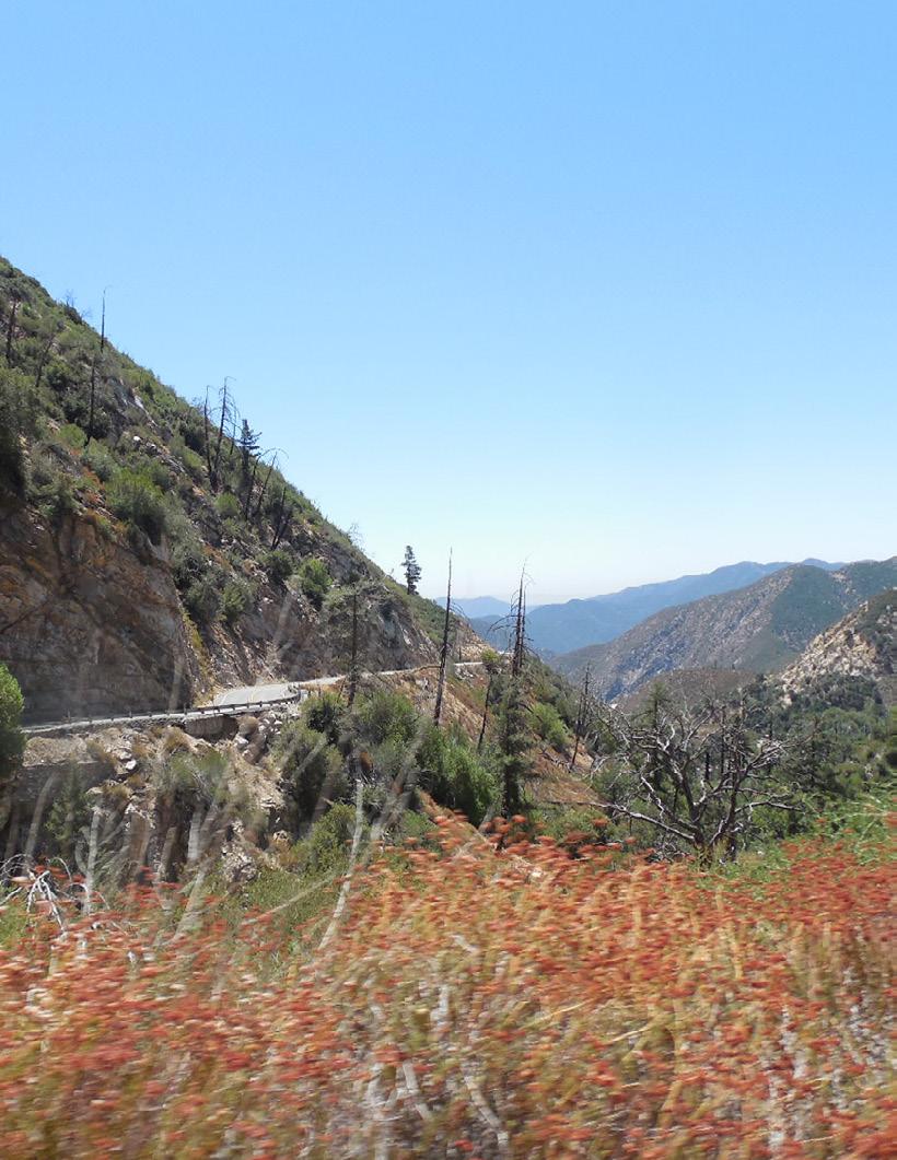
3 The USDA prohibits discrimination in all its programs and activities on the basis of race, color, national origin, age, disability, and where applicable, sex, marital status, familial status, parental status, religion, sexual orientation, genetic information, political beliefs, reprisal, or because all or part of an individual s income is derived from any public assistance program. (Not all prohibited bases apply to all programs.) Persons with disabilities who require alternative means for communication of program information (Braille, large print, audiotape, etc.) should contact USDA s TARGET Center at (voice and TDD). To file a complaint of discrimination, write USDA, Director, Office of Civil Rights, 1400 Independence Avenue, S.W., Washington, D.C , or call (voice) or (TDD). USDA is an equal opportunity provider and employer. Cover photo: Taylor Fork Creek, Gallatin National Forest, near Big Sky, MT, by David Scovell, engineer, Rogue River-Siskiyou National Forest. Photo taken in August 2005 in the Madison Range, just west of Yellowstone National Park.
4 Contents Executive Summary... 1 Introduction... 3 Background... 5 Objectives... 7 Results... 9 Discussion Conclusion References National Best Management Practices Monitoring Summary Report Fiscal Year 2013 iii
5

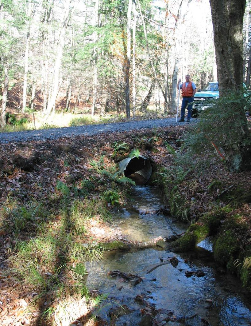
6 Executive Summary During fiscal year (FY) 2013, the U.S. Department of Agriculture (USDA), Forest Service monitored Best Management Practices (BMPs) on National Forest System (NFS) lands as part of the new National BMP Program. The agency applies BMPs to protect and maintain water quality on NFS lands. This report summarizes the national results from the first year of the 2-year phase-in period of national BMP monitoring. In FY 2013, 82 administrative units reported a total of 220 com - pleted evaluations in the interim National BMP Monitoring Database. Administrative units selected BMP sites either ran - domly for Washington Office and regional office targets or intentionally for other reasons specific to the reporting unit. Interdisciplinary teams comprised of hydrologists, soil scientists, engineers, recreation resource specialists, and other natural resource specialists performed more than half of the evaluations in the recreation, road, and vegetation resource management areas. As part of the national BMP monitoring program, resource specialists also assessed BMPs for whether prescriptions were implemented as intended and effective in meeting water quality objectives. Although there are some limitations, this report provides the first summary of results from BMP monitoring under the National BMP Program. Because the National BMP Program managers were still developing the rating system for BMP implementation and effectiveness in FY 2013, these ratings will not be available for reporting until FY As a whole, these results demonstrate the agency s commitment to reaching full implementation of a national system of BMP monitoring by the end of the National BMP Program s phase-in period. One of the interdisciplinary monitoring teams. National Best Management Practices Monitoring Summary Report Fiscal Year
7
, Forest Service National Best Management Practices (BMP) Program conducted across the Nation in fiscal year (FY) 2013.")
8 Introduction This report reviews the monitoring results of the U.S. Department of Agriculture (USDA), Forest Service National Best Management Practices (BMP) Program conducted across the Nation in fiscal year (FY) The report also summarizes the findings from BMP monitoring conducted by each national forest and grassland and highlights some of the key findings. FY 2013 marked the first year of BMP monitoring under the newly-established National BMP Program. With implementation of the National BMP Program in 2012, the Forest Service has reinforced its commitment to protect and maintain water quality and aquatic resources on National Forest System (NFS) lands across the country. The Forest Service manages 193 million acres of national forests and grasslands, containing approximately 400,000 miles of streams, 3 million acres of lakes, and numerous aquifer systems that provide drinking water for approximately 124 million people (USDA Forest Service 2010). These waters also provide recreational opportunities and habitat for aquatic and riparian wildlife. Water is a vital resource to the productivity and enjoyment of our national forests and grasslands. Maintaining water quality is a critical component of the Forest Service mission to sustain the health, diversity, and productivity of the Nation s forests and grasslands to meet the needs of present and future generations. The National BMP Program allows the Forest Service to protect the chemical, physical, and biological integrity of all water bodies on NFS lands. Monitoring and tracking BMPs using a consistent method across all NFS lands demonstrates an agencywide commitment to protect water quality and maintain aquatic resources on NFS lands. This report provides an overview of the first year of the phasein period of national BMP monitoring. Because this report is national in scope, it does not address all the monitoring results from specific sites. The report does show, however, where there may be opportunities to improve future BMP monitoring and adaptively manage at the local, regional, and national levels. Forest Service personnel assess Best Management Practices for a hardened road crossing. National Best Management Practices Monitoring Summary Report Fiscal Year
9
 and the U.S.")
10 Background In an effort to improve efficiency and accountability in manage - ment of water quality and aquatic resources, the Forest Service developed the National BMP Program. Under this newly stand - ardized agencywide program, BMPs are used to control nonpoint source pollution consistent with the requirements of the Clean Water Act (CWA) and the U.S. Environmental Protection Agency (EPA), State, tribal, and local water quality programs. Under the CWA, States and tribes are required to develop a process to identify categories of nonpoint sources of pollution and set forth procedures and methods to control such sources. Every State has a Nonpoint Source Management Program and Plan that describes how BMPs can be used to control levels of nonpoint source pollution. BMPs are often the primary tool for State water quality management, though they may be voluntary or obligatory depending on State law. All national forests and grasslands have adopted BMP prescriptions consistent with or approved by State Nonpoint Source Management Programs (USDA Forest Service 2012(a), p. 7). Development of the Forest Service National BMP Program began in 2004 and involved numerous Forest Service resource personnel at all levels of the agency and across deputy areas, including NFS, State and Private Forestry, and Research and Development. A new Forest Service land management planning rule in 2012 required the Forest Service Chief to establish a National BMP Program (36 CFR 219.8(a)(4)). The Forest Ser - vice modeled the national program after the preexisting BMP Evaluation Program in the Pacific Southwest Region (USDA Forest Service 2012(a), p. v). In an April 2012 letter, the Deputy Chief for NFS initiated the implementation of the National BMP Program. The Forest Service strategy for controlling nonpoint source pollution on NFS lands involves identifying necessary BMPs, applying locally appropriate BMP prescriptions, monitoring and assessing their implementation and effectiveness, and utilizing results to improve future management activities and adaptive management strategies. By establishing a uniform, objective, and adaptive process for monitoring BMPs, the Forest Service aims to protect water quality at national, regional, and forest and grassland scales. Moreover, consistency will allow data to be aggregated and compared at any of these levels. The National BMP Program consists of four components: a national set of core BMPs, a guide for monitoring BMP implementation and effectiveness, a data management system, Interdisciplinary monitoring team assesses Best Management Practices for road maintenance. and corresponding national direction. The national core BMPs are grouped into 11 categories, 1 for planning and 10 covering resource categories (table 1), that are purposely general and nonprescriptive so that prescriptions can be tailored to meet site-specific needs, water quality protection, and local regulations. These core BMPs are not intended to replace preexisting State and tribal BMPs, but rather to support States and tribes by enhancing compliance with CWA requirements on NFS lands (USDA Forest Service 2012(a), p. vi). Table 1. The national core Best Management Practices and their activity-based protocols. Resource Category Number of BMP Number of Protocols General Planning 3 0 Aquatic Ecosystems 4 2 Chemical Use 6 3 Facilities and Nonrecreation Special Uses 10 4 Wildland Fire 4 2 Minerals 8 4 Rangeland/Grazing 3 1 Recreation 12 9 Road 11 9 Mechanical Vegetation 8 3 Water Uses 6 5 Total National Best Management Practices Monitoring Summary Report Fiscal Year

11 There are 42 activity-based monitoring protocols in the 10 non - planning resource categories for evaluating the national core BMPs. The monitoring protocols include an implementation and effectiveness process for assessing whether the BMPs were implemented as planned and whether they were effective in meeting water quality management objectives. The BMP program involves monitoring BMP implementation and effectiveness at randomly selected sites using the activitybased monitoring protocols. Every year, the Washington Office (WO) and regional office (RO) assign each NFS unit a certain number of evaluations to complete; these evaluations are re - quired to meet national targets for randomized BMP monitoring. Because the Forest Service uses programmatic monitoring, BMPs are not monitored on every project or act ivity occurring on NFS lands but rather on a representative subset of projects (USDA Forest Service 2012). The National Best Management Practices for Water Quality Management on National Forest System Lands, Volume 1: National Core BMP Technical Guide (FS-990a) contains the national core set of BMPs to be used as part of the Forest Service National BMP Program. It was published in 2012 as the first volume of guidance for the Forest Service BMP Program. The second volume of guidance (FS-990b), which contains the national BMP monitoring protocols, is currently being finalized. It is expected to be published in Results from BMP monitoring are entered into the interim National BMP Monitoring Database. This system stores and retrieves data for both BMP monitoring completed to meet the National BMP monitoring target and BMP monitoring completed using the national BMP monitoring protocols for other forest, grassland, or regional monitoring needs. Data available from these reports are used to summarize the findings from FY 2013 BMP monitoring. Identified deficiencies from BMP implementation and effectiveness monitoring will be used to inform corrective action needs and adaptive manage strategies. Another important component of the National BMP Program is the National Directives System. Directives are needed to meet the requirements of the new planning rule (36 CFR 219.8(a)(4)) and mandate implementation of the National BMP Program. In May 2014, proposed directives, including a revised Water Quality Management manual (FSM 2532) and new BMP Program Handbook (FSH ), were published in the Federal Register for public review and comment. The public comment period closed in August 2014; comments will be addressed and the policy will soon be finalized. For current updates on the status of the proposed policy, visit the National BMP Program Internet site at html. Forest Service employee taking field notes during monitoring. The collected data from FY 2013 BMP monitoring demonstrate the Forest Service s commitment to land stewardship and the integrity of the Nation s waters located within or near the national forests and grasslands. 6 National Best Management Practices Monitoring Summary Report Fiscal Year 2013

12 Objectives The primary objective of this report is to provide an overview of the first year of the phase-in period of national BMP moni - toring. This summary will identify the successes of this first year of BMP monitoring and identify opportunities where BMP monitoring can be further improved. With this report, the Forest Service intends to further build trust between the agency and its partners by showing transparency, accountability, and commitment to protection of water quality and aquatic resources through BMP monitoring. Table 2. Total evaluations completed by region. Best Management Practices sites were selected randomly for Washington Office and regional office targets or intentionally for other reasons specific to the unit. Region Total Administrative Units That Completed Monitoring National Target Evaluations Other Project Evaluations Total Evaluations Northern Rocky Mountain Southwest Intermountain Pacific Southwest Pacific Northwest Southern Eastern Alaska Total Forest Service employee assessing Best Management Practices implementation and effectiveness for ski run operation and maintenance. National Best Management Practices Monitoring Summary Report Fiscal Year
13
, resource area, and type (implementation and")
14 Results The following results reflect the data reported in the interim National BMP Monitoring Database from FY The data include information about the number of evaluations completed based on project purpose (WO/RO target accomplishment or other reason), resource area, and type (implementation and effectiveness). During FY 2013, 82 administrative units across the Nation completed BMP monitoring. These units reported their BMP monitoring into the database for 220 evaluations, 172 of which were for WO/RO targets and 48 were for other projects (table 2). Table 3 displays the number of BMP evaluations completed for each of the 10 nonplanning resource areas. These resource areas encompass the 42 activity-based protocols covering one or more of the 75 national core BMPs. The most frequently used activity-based protocols are shown in table 4. Table 3 also indicates the most commonly used activity-based protocols during FY These include road management, vegetation management, and recreation management. There were 43 evaluations for assessing recreation management, 50 for road management, and 48 for vegetation management. Figure 1 illustrates the percentages of BMP evaluations by Table 3. Number of evaluations completed during fiscal year 2013 for each of the 10 nonplanning resource areas. Resource Area Number of Evaluations Aquatic Ecosystem 17 Chemicals 8 Facility 7 Fire 20 Minerals 14 Range 13 Recreation* 43 Road* 50 Vegetation* 48 Water Uses 0 Total 220 * Most evaluated resource. Table 4. Most frequently used activity-based protocols. Type of Protocol Number of Evaluations Description Veg-A 37 Ground-based skidding and harvesting Road-D 14 Maintenance level 1; stored roads Fire-A 13 Use of prescribed fires Range-A 13 Grazing and livestock management Figure 1. Percentage of evaluations completed by resource area. Of all resource areas, the majority of evaluations were completed for road, vegetation, and recreation management. National Best Management Practices Monitoring Summary Report Fiscal Year

15 resource area and shows the number of evaluations for these three resource areas, representing well over half of the evaluations. The BMP Monitoring Database also includes the number of evaluations completed for implementation and effectiveness. The available data indicate that there were 28 evaluations for implementation only, 18 for effectiveness only, and 192 for both implementation and effectiveness (table 5). Units monitored a total of 238 land and resource management activities. The inconsistency between this total and the total number of evaluations in table 2 and table 3 is explained by incomplete evaluations entered into the database in this first phase-in year of monitoring and reporting. As previously noted, 2013 was part of the phase-in period of the National BMP Program. As such, information in the BMP monitoring database reflected a need to improve data collection Table 5. Types of Best Management Practices monitored. Evaluation Type Number of Evaluations Implementation 28 Effectiveness 18 Both 192 Total 238 and input. National BMP Program leadership therefore provided training to field resource specialists throughout the country on BMP assessment protocols, forms and data entry in FY Additionally, BMP monitoring protocols and forms were revised to include clarifying language based on input from field resource specialists who have been conducting BMP monitoring during the phase-in period. A rating system was added to the interim National BMP Monitoring Database as a tool for evaluating whether BMPs were properly implemented and how well the applied BMPs protected water and aquatic resources on a na - tional, regional, or forest and grassland scale. Since the new rating system is not compatible with the previous versions of BMP monitoring forms, the Forest Service cannot fully determine the success of BMP implementation and effectiveness during the FY 2013 phase-in period. As a result, neither the rating scores nor the corrective action evaluations are included in this report. Overall, the reporting of 220 evaluations during the phase-in period of the National BMP Program demonstrates the agency s continuing efforts to monitor BMPs using nationally standardized protocols. Finally, a National BMP Program Interim Database User s Guide was created to guide users through the data input and querying functions. This is expected to improve data reliability. Interdisciplinary monitoring team conducting Best Management Practices implementation and effectiveness monitoring for a recently installed footbridge. 10 National Best Management Practices Monitoring Summary Report Fiscal Year 2013

16 Discussion Although BMP monitoring is not new to the Forest Service, prior to adoption of the national program, each Forest Service region monitored BMPs using separate methods and techniques. In addition, there was little consistency between the ways each administrative unit documented its BMP monitoring on NFS lands. The National BMP Program has addressed this issue by providing a foundation for water quality protection on NFS lands and facilitating a systematic approach to BMP monitoring (USDA Forest Service 2012(a), p. 2). The National BMP Program is still under development. In FY 2013, the national forests monitored BMPs using consistent methods; however, the rating system for implementation and effectiveness was still in draft form. Thus, the results from FY 2013 demonstrate progress implementing standardized BMP monitoring protocols across management areas. Future results will demonstrate how well the agency implemented BMPs and how effective the agency was at protecting water quality and aquatic resources. The current results show that the Forest Service is committed to improving: (1) monitoring and documentation of BMP implementation and effectiveness; (2) water quality and aquatic resources; (3) relationships with EPA, States, and the public; (4) the agency s ability to demon - strate results in watershed management; (5) the agency s ability to use adaptive management in resource planning and project implementation; and (6) National Environmental Policy (NEPA) analyses and compliance with other Federal laws (USDA Forest Service 2012(a), p. v). Interdisciplinary monitoring team conducting Best Management Practices implementation and effectiveness monitoring for a commercial timber sale. National Best Management Practices Monitoring Summary Report Fiscal Year

17 Results from FY 2013 BMP monitoring show that the Forest Service is actively working to provide consistent data through the National BMP Program. These data indicate that the agency is starting to use the national core BMPs. Moreover, BMP mon itoring data can now be aggregated and compared on a national, regional, or forest and grassland scale. A national overview indicates that of the 220 total evaluations submitted into the database, most were for recreation, road, and vegetation management (table 3). The most frequently used activity-based protocol forms were for ground-based skidding and harvesting, road maintenance level one, use of prescribed fires, and grazing and livestock management (table 4). These three resource areas and four protocols are likely to be emphasized in the future as they are among the most common activities undertaken on NFS lands. Despite the lack of conclusive information from FY 2013 BMP monitoring, there is enough data to conclude that the National BMP Program is on its way to meeting its objectives. Best Management Practices implementation and effectiveness monitoring of a vegetation management project. 12 National Best Management Practices Monitoring Summary Report Fiscal Year 2013

18 Conclusion During FY 2013, the Forest Service initiated implementation of BMP monitoring under its new National BMP Program. The results from this first year of BMP monitoring demonstrated outcomes expected of a program s phase-in period. There were some inconsistencies in data reporting that may not reflect the accurate totals of completed evaluations. The small differences between these figures, however, are not significant in recognizing the accomplishment of adopting a new, nationally consistent approach to BMP monitoring. The first year of monitoring has shown the agency where program implementation can be improved in the future. Currently, the Forest Service is addressing deficiencies in data reporting from FY As previously noted, protocols and rule sets for assessing project implementation and effectiveness have been refined based on input from resource specialists and monitoring results. Furthermore, additional training in the form of videos and guided sessions are being provided to improve BMP monitoring procedures. The use of a national core set of BMPs and monitoring protocols has allowed the data from the interim National BMP Monitoring Database to be aggregated into the national, regional, and unit levels used for this report. The results reveal that the agency is capable of implementing and monitoring BMPs using a national program. In the past, BMP monitoring focused on timber sales and associated roads (USDA Forest Service 2012(a), p10). But, now with the inclusion of other activities, the Forest Service can consistently monitor BMPs for most ground-disturbing activities on NFS lands. It is important that the Forest Service continues to monitor the implementation and effectiveness of BMPs. With sustained monitoring, the agency can ensure long-term protection of water quality and aquatic resources. The phase-in period of the National BMP Program is a new chapter in the Forest Service s commitment to water stewardship. For more information, visit the National BMP Program Internet site at Interdisciplinary monitoring team discussing Best Management Practices implementation and effectiveness of a recently constructed trail bridge and approach. National Best Management Practices Monitoring Summary Report Fiscal Year
19
20 References U.S. Department of Agriculture (USDA), Forest Service Water, Climate Change, and Forests: Watershed Stewardship for a Changing Climate. General Technical Report, PNW-GTR Portland, OR: USDA Forest Service, Pacific Northwest Research Station. U.S. Department of Agriculture (USDA), Forest Service. 2012(a). National Best Management Practices for Water Quality Manage - ment on National Forest System Lands, Volume 1: National Core BMP Technical Guide. FS-990a. Washington, DC: USDA Forest Service. U.S. Department of Agriculture (USDA), Forest Service. 2012(b). National Forest System Land Management Planning, Final Rule (36 CFR 219). 77 Fed. Reg (April 9, 2012). National Best Management Practices Monitoring Summary Report Fiscal Year
21
22
Why does the Forest Service need to propose this activity at this time?
 United States Department of Agriculture Forest Service Uinta-Wasatch-Cache NF Supervisor s Office www.fs.usda.gov/uwcnf 857 W. South Jordan Parkway South Jordan, UT 84095 Tel. (801) 999-2103 FAX (801)
United States Department of Agriculture. Forest Service. Beaverhead-Deerlodge National Forest. September 2014
 United States Department of Agriculture Forest Service Beaverhead-Deerlodge National Forest September 2014 Beaverhead-Deerlodge National Forest Land and Resource Management Plan Explanation Supporting
PROJECT INFORMATION Manchester Ranger District Apple Tree Release and Maintenance Project
 PROJECT INFORMATION Manchester Ranger District Apple Tree Release and Maintenance Project The USDA Forest Service is proposing to release and prune living apple trees in the Manchester Ranger District,
Draft Decision Memo Santiam Junction Maintenance Station Truck Shop Extension
 Draft Decision Memo Santiam Junction Maintenance Station Truck Shop Extension USDA Forest Service McKenzie River Ranger District Willamette National Forest Linn County, OR T.13 S., R.7 E., Section 14,
Decision Notice and Finding of No Significant Impact
 Decision Notice and Finding of No Significant Impact Gold Lake Bog Research Natural Area Boundary Adjustment and Nonsignificant Forest Plan Amendment #53 USDA Forest Service Middle Fork Ranger District,
Recreation Report Kimball Hill Stands Management Gold Beach Ranger District, Rogue River-Siskiyou National Forest Date: April 27, 2016
 Kimball Hill Stands Management Gold Beach Ranger District, Rogue River-Siskiyou National Forest /s/ Date: April 27, 2016 Lorelei Haukness, Resource Specialist Rogue River-Siskiyou National Forest In accordance
DECISION MEMO SFA EXPERIMENTAL FOREST HERBACEOUS POND RESTORATION AUGUST, 2009 ANGELINA/SABINE RANGER DISTRICT ANGELINA NATIONAL FOREST
 402 C B B DECISION MEMO SFA EXPERIMENTAL FOREST HERBACEOUS POND RESTORATION AUGUST, 2009 ANGELINA/SABINE RANGER DISTRICT ANGELINA NATIONAL FOREST NACOGDOCHES COUNTY, TEXAS USDA FOREST SERVICE, REGION 8
Supervisor s Office 5162 Valleypointe Parkway Roanoke, VA
 Supervisor s Office 5162 Valleypointe Parkway Roanoke, VA 24019 540-265-5100 www.fs.fed.us/r8/gwj James River Ranger District Glenwood-Pedlar Ranger District 810A East Madison Avenue 27 Ranger Lane Covington,
Decision Memo. Programmatic Forest Plan Amendment for Cultural Resource Protection Standards and Guidelines. United States Department of Agriculture
 United States Department of Agriculture Forest Service Decision Memo Programmatic Forest Plan Amendment for Cultural Resource Protection Standards and Guidelines Coconino National Forest Coconino, Gila,
OUTREACH NOTICE 2018 TEMPORARY POSITIONS BEAVERHEAD-DEERLODGE NATIONAL FOREST HOW TO APPLY: RECREATION POSITIONS BEING HIRED:
 OUTREACH NOTICE 2018 TEMPORARY POSITIONS BEAVERHEAD-DEERLODGE NATIONAL FOREST The Beaverhead-Deerlodge National Forest will be filling multiple temporary (seasonal) positions for the upcoming 2018 field
Preliminary Decision Memo Recreation Residence Septic Repairs
 Preliminary Decision Memo 2014 Recreation Residence Septic Repairs USDA Forest Service McKenzie River Ranger District Willamette National Forest Lane County, Oregon T. 16 S., R. 5 E, Section 16 Willamette
Lambson Draw On/Off Allotment Livestock Conversion Decision Notice
 United States Department of Agriculture Forest Service Lambson Draw On/Off Allotment Livestock Conversion Decision Notice Ashley National Forest Flaming Gorge-Vernal Ranger District Uintah County, Utah
Moonlight Aquatic Organism Passage Project
 Notice of Proposed Action Moonlight Aquatic Organism Passage Project Mt. Hough Ranger District Plumas National Forest Plumas County, California Figure 1. Hungry 1 aquatic organism passage outlet showing
Locally Led Conservation & The Local Work Group. Mark Habiger NRCS
 Locally Led Conservation & The Local Work Group Mark Habiger NRCS 1 What Is Locally Led Conservation? Community Stakeholders 1. Assessing their natural resource conservation needs 2. Setting community
SHASTA-MCCLOUD MANAGEMENT UNIT OVER SNOW VEHICLE TRAIL GROOMING AND SNOWMOBILE FACILITY MAINTENANCE PROPOSAL
 DRAFT DECISION MEMO SHASTA-MCCLOUD MANAGEMENT UNIT OVER SNOW VEHICLE TRAIL GROOMING AND SNOWMOBILE FACILITY MAINTENANCE PROPOSAL U.S. FOREST SERVICE TOWNSHIP 40, 41, 42 AND 43 NORTH, RANGE 1, 2, 3 WEST,
DECISION MEMO. Wildlife Habitat Improvement Project Wildlife Opening Construction, Rehabilitation and Expansion FY
 DECISION MEMO Wildlife Habitat Improvement Project Wildlife Opening Construction, Rehabilitation and Expansion FY 2007-2013 USDA Forest Service Bankhead National Forest - National Forests in Alabama Winston
Hungry Creek Watershed Road Maintenance and Stony Quarry Development
 Notice of Proposed Action Opportunity to Provide Scoping Comments Hungry Creek Watershed Road Maintenance and Stony Quarry Development Mt. Hough Ranger District Plumas National Forest Plumas County, California
Decision Memo Raptor 1 and 9 Prescribed Burns Project
 Decision Memo Raptor 1 and 9 Prescribed Burns Project USDA Forest Service Chemult Ranger District, Fremont-Winema National Forests Klamath County, OR Township (T) 29 South (S), Range (R) 6 East (E), Section
DECISION MEMO. Cheat-Potomac Ranger District Multiple Recreation Facilities and Related Granger-Thye Concessions Special Use Permit
 DECISION MEMO Cheat-Potomac Ranger District Multiple Recreation Facilities and Related Granger-Thye Concessions Special Use Permit United States Department of Agriculture Forest Service (FS) Eastern Region
DECISION MEMO. Bull Bear 1H-18 Oil and Gas Pipeline
 DECISION MEMO Bull Bear 1H-18 Oil and Gas Pipeline USDA, Forest Service Cibola National Forest, Black Kettle National Grasslands Roger Mills County, Oklahoma BACKGROUND: Laredo Petroleum, Inc., in order
General Location: Approximately 6 miles east of Huntsville, Utah along the South Fork of the Ogden River (Figure 1)
") PUBLIC SCOPING SOUTH FORK WUI OGDEN RANGER DISTRICT, UINTA-WASATCH-CACHE NATIONAL FOREST WEBER COUNTY, UTAH OCTOBER 6, 2017 1.0 INTRODUCTION The Ogden Ranger District of the Uinta-Wasatch-Cache National
PUBLIC SCOPING SOUTH FORK WUI OGDEN RANGER DISTRICT, UINTA-WASATCH-CACHE NATIONAL FOREST WEBER COUNTY, UTAH OCTOBER 6, 2017 1.0 INTRODUCTION The Ogden Ranger District of the Uinta-Wasatch-Cache National
Proposed Action. for the. North 40 Scrub Management Project
 United States Department of Agriculture Forest Service Proposed Action for the North 40 Scrub Management Project National Forests in Florida, Ocala National Forest February 2016 For More Information Contact:
DECISION MEMO 4-H Tree Farm LLC Driveway Permit
 DECISION MEMO 4-H Tree Farm LLC Driveway Permit I. DECISION USDA Forest Service, Eastern Region, Hoosier National Forest Tell City Ranger District Perry County, Indiana T73S, R2W, SESE Section 36 A. Description
Final Decision Memo. Murphy Meadow Restoration Project. USDA Forest Service Willamette National Forest McKenzie River Ranger District
 Final Decision Memo Murphy Meadow Restoration Project USDA Forest Service Willamette National Forest McKenzie River Ranger District T19S, R5E, Sec. 23, 24. Lane County Oregon BACKGROUND The Murphy Meadow
Proposed Action: In response to resource specialist concerns raised during internal scoping, the following restrictions will apply:
 DECISION MEMO USDA Forest Service Inyan Kara Riders Motorcycle Enduro Event Rocky Mountain Region Thunder Basin National Grassland Medicine Bow-Routt National Forests Douglas Ranger District April 2011
DECISION NOTICE FINDING OF NO SIGNIFICANT IMPACT (FONSI)
") DECISION NOTICE AND FINDING OF NO SIGNIFICANT IMPACT (FONSI) FOR CASA LOMA RECREATION RESIDENCE PERMIT RENEWAL U.S. FOREST SERVICE CIBOLA NATIONAL FOREST SANDIA RANGER DISTRICT BERNALILLO COUNTY, NEW MEXICO
DECISION NOTICE AND FINDING OF NO SIGNIFICANT IMPACT (FONSI) FOR CASA LOMA RECREATION RESIDENCE PERMIT RENEWAL U.S. FOREST SERVICE CIBOLA NATIONAL FOREST SANDIA RANGER DISTRICT BERNALILLO COUNTY, NEW MEXICO
Stonewall Vegetation Project FEIS Errata
 United States Department of Agriculture Stonewall Vegetation Project FEIS Errata Forest Service Helena National Forest 1 Lincoln Ranger District April 2015 These following missing items or edits are errata
National Soil Health Initiative
 National Soil Health Initiative Ensuring Sustainable Agriculture for the Future USDA is an equal opportunity provider and employer. Words from Former NRCS Chief Dave White soil is one of our most important
DECISION MEMO MANHATTAN FUELS REDUCTION PROJECT U.S. FOREST SERVICE CANYON LAKES RANGER DISTRICT LARIMER COUNTY, CO
 DECISION MEMO MANHATTAN FUELS REDUCTION PROJECT U.S. FOREST SERVICE CANYON LAKES RANGER DISTRICT LARIMER COUNTY, CO Background and Project Description In order to improve forest health and reduce hazardous
DECISION MEMO. Griz Thin (Stand )
") Background DECISION MEMO Griz Thin (Stand 507089) USDA Forest Service Siuslaw National Forest Central Coast Ranger District Lane County, Oregon Township 16 South, Range 10 West, Sections 6 and 7 The Cummins-Tenmile
Background DECISION MEMO Griz Thin (Stand 507089) USDA Forest Service Siuslaw National Forest Central Coast Ranger District Lane County, Oregon Township 16 South, Range 10 West, Sections 6 and 7 The Cummins-Tenmile
National Best Management Practices for Water Quality Management on National Forest System Lands
 National Best Management Practices for Water Quality Management on National Forest System Lands United States Department of Agriculture Forest Service FS-990a April 2012 National Best Management Practices
Storrie and Rich Fire Area Watershed Improvement and Forest Road 26N67 Re-alignment Project
 Notice of Proposed Action Opportunity to Provide Scoping Comments Storrie and Rich Fire Area Watershed Improvement and Forest Road 26N67 Re-alignment Project Mt. Hough Ranger District Plumas National Forest
Environmental Assessment for Jackson Thinning
 United States Department of Agriculture Forest Service Pacific Northwest Region Environmental Assessment for Jackson Thinning Olympic National Forest January 2008 Mt. Walker, 1928 The U.S. Department of
Draft Decision Memo OHV Trails 22 and 42 Reroute Project
 Draft Decision Memo OHV Trails 22 and 42 Reroute Project USDA Forest Service McKenzie River Ranger District Willamette National Forest Linn County, OR T13S, R7E, Sections 25 and 34 Willamette Meridian
Decision Memo Sawtooth Trail #3634 Reroute
 Decision Memo Sawtooth Trail #3634 Reroute USDA Forest Service Middle Fork Ranger District Willamette National Forest Lane County, OR T.25S, R.5.5E, Section 22, Willamette Meridian Purpose and Need The
KENTUCKY UTILITIES SPECIAL USE AUTHORIZATION AMENDMENT: MOUNT VICTORY TRANSMISSION TOWER REPLACEMENT DECISION MEMO
 UNITED STATES DEPARTMENT OF AGRICULTURE FOREST SERVICE SOUTHERN REGION DANIEL BOONE NATIONAL FOREST KENTUCKY MARCH 2016 KENTUCKY UTILITIES SPECIAL USE AUTHORIZATION AMENDMENT: MOUNT VICTORY TRANSMISSION
DECISION MEMO Eureka Fire Whitebark Pine Planting
 Page 1 of 6 DECISION MEMO Eureka Fire Whitebark Pine Planting USDA Forest Service Madison Ranger District Madison County T11S, R2W, Sections16, 17, 18, 19, 20, 29, 30, 31 & 32 T11S, R3W, Sections 25 &
Decision Memo Tongass National Forest. Wrangell Ranger District. Pre-Commercial Thinning CE 2010
 Decision Memo Tongass National Forest Pre-Commercial Thinning CE 2010 Decision It is my decision to authorize pre-commercial thinning (PCT) on approximately 7,500 acres of overstocked young-growth forest
Sage Steppe Ecosystem Restoration Strategy
 United States Department of Agriculture Forest Service Pacific Southwest Region R5-MB-161 September 2008 Sage Steppe Ecosystem Restoration Strategy Record of Decision Modoc National Forest The U.S. Department
Colorado Front Range Fuel Photo Series
 Colorado Front Range Fuel Photo Series Michael A. Battaglia Jonathan M. Dodson Wayne D. Shepperd Mark J. Platten Owen M. Tallmadge General Technical Report RMRS-GTR-1WWW United States Department of Agriculture
DECISION MEMO FOURTH OF JULY PARK 2 USDA Forest Service, Northern Region Red River Ranger District, Nez Perce National Forest Idaho County, Idaho
 DECISION MEMO FOURTH OF JULY PARK 2 USDA Forest Service, Northern Region Red River Ranger District, Nez Perce National Forest Idaho County, Idaho I. Decision II. I have decided to authorize issuance of
BACKGROUND DECISION. June 2016 Page 1 of 6
 BACKGROUND DECISION MEMO HOUSE ROCK WILDLIFE AREA PASTURE FENCE USDA FOREST SERVICE, SOUTHWEST REGION (R3) KAIBAB NATIONAL FOREST - NORTH KAIBAB RANGER DISTRICT COCONINO COUNTY, ARIZONA The Kaibab National
The 2014 Farm Bill. Texas Watershed Coordinators Roundtable Waco, Texas July 31, 2014
 The 2014 Farm Bill Texas Watershed Coordinators Roundtable Waco, Texas July 31, 2014 Differences Between the 2008 and 2014 Farm Bill Conservation Programs 2 Reauthorizes Programs from the 2008 Farm Bill
Proposed Action for Motorized Travel Management on the North Kaibab Ranger District
 United States Department of Agriculture Forest Service Proposed Action for Motorized Travel Management on the North Kaibab Ranger District Kaibab National Forest March 2010 The U.S. Department of Agriculture
DECISION MEMO SPECIAL USE AUTHORIZATION FOR GROUNDWATER MONITORING WELLS
 DECISION MEMO SPECIAL USE AUTHORIZATION FOR GROUNDWATER MONITORING WELLS USDA-Forest Service, Eastern Region Huron-Manistee National Forests, Baldwin/White Cloud Ranger District Newaygo County, Michigan
Notice of Solicitation of Applications for the Biorefinery, Renewable Chemical, and Biobased Product Manufacturing
 This document is scheduled to be published in the Federal Register on 07/25/2016 and available online at http://federalregister.gov/a/2016-17486, and on FDsys.gov BILLING CODE: 3410-XY-U DEPARTMENT OF
Proposed Action for 30-day Notice and Comment Emerald Ash Borer SLow Ash Mortality (SLAM) Hoosier National Forest Brownstown Ranger District
 Hoosier National Forest Brownstown Ranger District") United States Department of Agriculture Forest Service February 2012 Proposed Action for 30-day Notice and Comment 2012 Emerald Ash Borer SLow Ash Mortality (SLAM) Hoosier National Forest Brownstown Ranger
United States Department of Agriculture Forest Service February 2012 Proposed Action for 30-day Notice and Comment 2012 Emerald Ash Borer SLow Ash Mortality (SLAM) Hoosier National Forest Brownstown Ranger
On/Off periods Improvements Grazing System. 2 fence segments. 1 water development, 2 cattle guards
 DECISION NOTICE HENRY CREEK AND SWAMP CREEK RANGE ALLOTMENT MANAGEMENT PLANS REVISION U.S. FOREST SERVICE PLAINS/THOMPSON FALLS RANGER DISTRICT LOLO NATIONAL FOREST SANDERS COUNTY, MONTANA DECISION Based
SCOPING STATEMENT OF THE PROPOSED ACTION FOR THE
 SCOPING STATEMENT OF THE PROPOSED ACTION FOR THE PANGUITCH LAKE COURTESY DOCK INSTALLATION PROJECT U.S. FOREST SERVICE DIXIE NATIONAL FOREST CEDAR CITY RANGER DISTRICT GARFIELD COUNTY, UTAH PROJECT BACKGROUND
Tower Fire Salvage. Economics Report. Prepared by: Doug Nishek Forester. for: Priest Lake Ranger District Idaho Panhandle National Forests
 Tower Fire Salvage Economics Report Prepared by: Doug Nishek Forester for: Priest Lake Ranger District Idaho Panhandle National Forests April 2016 In accordance with Federal civil rights law and U.S. Department
A Comparison of Two Estimates of Standard Error for a Ratio-of-Means Estimator for a Mapped-Plot Sample Design in Southeast Alaska
 United States Department of Agriculture Forest Service Pacific Northwest Research Station Research Note PNW-RN-532 June 2002 A Comparison of Two Estimates of Standard Error for a Ratio-of-Means Estimator
DECISION MEMO. East Fork Blacktail Trail Reroute
 Page 1 of 6 DECISION MEMO USDA Forest Service Madison Ranger District Madison County Background The East Fork Blacktail Trail #6069 is a mainline trail in the Snowcrest Mountains. The Two Meadows Trail
West Branch LeClerc Creek Watershed Restoration Project Environmental Assessment
 West Branch LeClerc Creek Watershed Restoration Project Environmental Assessment Decision Notice, Finding of No Significant Impact, and Response to Public Comments April 2015 USDA Forest Service Colville
Porcupine Vegetation and Road Management Project - Shasta Salamander Report - June 23, 2011
 The following summary includes the best available science for Shasta salamander (Hydromantes shastae, HYSH) in regards to its range and habitat to determine whether a project would trigger the need for
Scoping and 30-Day Notice and Comment Period for. Grassy Knob American Chestnut Planting
 United States Department of Agriculture Forest Service Monongahela National Forest Greenbrier Ranger District Box 67 Bartow, WV 24920 Phone (304) 456-3335 File Code: 2020/2070/1950 Date: November 15, 2012
Decision Memo. North Fork Calispell Creek Restoration Project
 Project Description Decision Memo North Fork Calispell Creek Restoration Project USDA Forest Service Newport-Sullivan Lake Ranger Districts Colville National Forest Pend Oreille County, Washington Surveys
Draft Pine Mountain Late- Successional Reserve Habitat Protection and Enhancement Project
 Draft Pine Mountain Late- Successional Reserve Habitat Protection and Enhancement Project RecreationReport Prepared by: for: Upper Lake Ranger District Mendocino National Forest Month, Date, YEAR The U.S.
DECISION MEMO Divide Creek Barrier Enhancement
 Page 1 of 7 Background DECISION MEMO USDA Forest Service Butte Ranger District Silver Bow County, Montana T. 2 N., R. 9 W., Section 32 The North Fork of Divide Creek is approximately 4 miles west of the
Natural Resources Conservation Service
 Natural Resources Conservation Service Helping people, help the land Presented To: THE PAST, PRESENT, FUTURE, NATURAL FOOD HEALTH, INC. INFORMATIONAL WORKSHOP December 14 th, 2012 - Greensboro, GA Presented
U.S. Forest Service National BMP Program
 U.S. Forest Service National BMP Program Joan Carlson Hydrologist November 16, 2015 National Forests in Colorado 16,500+ miles perennial streams National Forests 22% of state land area produces 68% of
Environmental Assessment
 United States Department of Agriculture Forest Service May 2009 Environmental Assessment Powder River Campground Decommissioning Powder River Ranger District, Bighorn National Forest Johnson and Washakie
I. Decision to be Implemented. II. Reasons for Categorically Excluding the Decision. A. Description of Decision - 1 -
 Decision Memo Guitonville Penelec Power Line Right-of-Way Special Use Permit USDA Forest Service, Eastern Region 9 Allegheny National Forest Marienville Ranger District Warrant 5133, Green Township Forest
Environmental Issues: Opportunities and Challenges for Grazing Dairies. By Kevin Ogles Grazing Specialist NRCS ENTSC Greensboro, NC
 Environmental Issues: Opportunities and Challenges for Grazing Dairies By Kevin Ogles Grazing Specialist NRCS ENTSC Greensboro, NC Resource Concerns that could be encountered during inventory Soil Water
Decision Memo for the City of Detroit Root Rot Timber Sale Project
 Decision Memo for the City of Detroit Root Rot Timber Sale Project USDA Forest Service Detroit Ranger District Willamette National Forest Marion and Linn Counties, OR T.10S., R.5 E., Section 2, Willamette
NRCS Water Quality Practices
 NRCS Water Quality Practices Presented by: Ruth Book, P.E., Ph.D. State Conservation Engineer Champaign, Illinois www.il.nrcs.usda.gov 2016 Illinois Water Conference October 27, 2016 Agenda Working with
The location of the valve site is displayed on a map in the project file.
 DECISION MEMO Special Use Permit # RAR401201 Amendment #7 Hiawatha National Forest Rapid River Ranger District Delta County, Michigan I DECISION A. Description My decision is to issue an amendment to the
Telegraph Forest Management Project
 Telegraph Forest Management Project Black Hills National Forest Northern Hills Ranger District Lawrence and Pennington Counties, South Dakota Proposed Action and Request for Comments March 2008 Table of
FARM BILL 2002 Colorado Conservation Provisions
 United States Department of Agriculture Natural Resources Conservation Service FARM BILL 2002 Colorado Conservation Provisions Conserving Natural Resources on Colorado s Privately Owned Farmland Farm Bill
DECISION MEMO Robinhood Creek Helicopter Log Deck June, 2008
 DECISION MEMO Robinhood Creek Helicopter Log Deck June, 2008 USDA Forest Service, Mt. Hood National Forest Hood River Ranger District Hood River County, Oregon Flooding in the fall of 2006 caused significant
Financial Analysis of Fuel Treatments on National Forests in the Western United States
 United States Department of Agriculture Forest Service Pacific Northwest Research Station Research Note PNW-RN-555 Financial Analysis of Fuel Treatments on National Forests in the Western United States
 BEATONS LAKE TIMBER SALE Highlights Watersmeet Ranger District OTTAWA NATIONAL FOREST The Beatons Lake Timber Sale Area is located 10 miles west of Watersmeet, Michigan, and 1 mile north on Gogebic County
Engineering Watershed, Soil, & Air
 Engineering Watershed, Soil, & Air United States Department of Agriculture Forest Service Technology & Development Program December 2008 2500/7100 0871 2346 MTDC Using Scarification, Wood Shreddings, and
Agroforestry Treasures in the USDA Farm Bill
 Agroforestry Treasures in the USDA Farm Bill Doug Wallace, NRCS National Agroforester USDA National Agroforestry Center Lincoln, NE LaFarge, Wisconsin June 16, 2011 Discussion Topics Key USDA conservation
Environmental Assessment
 Forest Service February 2012 United States Department of Agriculture Environmental Assessment Henry Y.H. Kim Airbase Expansion Prescott National Forest Yavapai County, Arizona For Information Contact:
Land and Resource Management Plan
 Pacific Southwest Region United States Department of Agriculture Forest Service Land and Resource Management Plan Klamath National Forest 1995 (Including all amendments as of 11/21/01) Siskiyou County,
Laguna Water System Improvement Environmental Assessment (EA)
") Laguna Water System Improvement Environmental Assessment (EA) USDA Forest Service San Diego County, California 1. Background The Mount Laguna water system presently serves over eight recreation sites,
Laguna Water System Improvement Environmental Assessment (EA) USDA Forest Service San Diego County, California 1. Background The Mount Laguna water system presently serves over eight recreation sites,
Cheat Mountain Wildlife Habitat Enhancement
 United States Department of Agriculture Forest Service Monongahela National Forest Greenbrier Ranger District Box 67 Bartow, WV 24920 304-456-3335 File Code: 2670/1950 Date: June 7, 2011 Scoping - Opportunity
Forest Plan Amendment to Remove the Layng Creek Municipal Watershed Management Plan
 United States Department of Agriculture Forest Service Forest Plan Amendment to Remove the Layng Creek Municipal Watershed Management Plan Draft Decision Memo Umpqua National Forest Cottage Grove Ranger
DECISION MEMO JASON MINE-BAT HABITAT IMPROVEMENT AND MINE CLOSURE Section 22, T. 13S., R. 2W. Union County, Illinois
 DECISION MEMO JASON MINE-BAT HABITAT IMPROVEMENT AND MINE CLOSURE Section 22, T. 13S., R. 2W. Union County, Illinois USDA Forest Service Mississippi Bluffs Ranger District, Shawnee National Forest Background
Harvest, Employment, Exports, and Prices in Pacific Northwest Forests,
 Pacific Northwest Research Station Harvest, Employment, Exports, and Prices in Pacific Northwest Forests, 1965 2000 General Technical Report PNW-GTR-547 July 2002 Debra D. Warren United States Department
Michigan Wing-Civil Air Patrol
 DECISION MEMO Michigan Wing-Civil Air Patrol (CAP) Navigational Equipment Special Use Permit #MUN250 Hiawatha National Forest Munising Ranger District Alger County, Michigan I DECISION A. Description My
Texas, Forest Inventory & Analysis Factsheet. James W. Bentley. Forested Area. Introduction. Inventory Volume
 Texas, 21 James W. Bentley Forest Inventory & Analysis Factsheet F I A The Nation s Forest Census Introduction Guadalupe River State Park, Comel County, TX. (photo by This science update summarizes the
Appendix A: Best Management Practices for Water Quality Protection
 Appendix A: Best Management Practices for Water Quality Protection Plan-2. Project Planning and Analysis Use the project planning, environmental analysis, and decision making processes to incorporate water
NRCS Conservation Planning and Use of Monitoring and Business Planning Information
 United States Department of Agriculture Natural Resources Conservation Service NRCS Conservation Planning and Use of Monitoring and Business Planning Information NRCS-West National Technology Support Center
Upper Applegate Road Hazardous Fuel Reduction Project
 United States Department of Agriculture Forest Service March 2008 Environmental Assessment Upper Applegate Road Hazardous Fuel Reduction Project Siskiyou Mountains Ranger District Rogue River-Siskiyou
Sparta Vegetation Management Project
 Sparta Vegetation Management Project Social and Economics Report Prepared by: John Jesenko Presale/Forest Measurements Specialist /s/ John Jesenko for: Whitman Ranger District Wallowa-Whitman National
USDA Forest Service Decision Memo. Mattie V Creek Minesite Rehabilitation Project
 USDA Forest Service Decision Memo Mattie V Creek Minesite Rehabilitation Project Ninemile Ranger District Lolo National Forest Mineral County, Montana I. DECISION TO BE IMPLEMENTED A. Decision Description:
Appendix A: Best Management Practices for Water Quality Protection
 Plan-2. Project Planning and Analysis Use the project planning, environmental analysis, and decision making processes to incorporate water quality management BMPs into project design and implementation.
DECISION NOTICE & FINDING OF NO SIGNIFICANT IMPACT RAT RIVER RECREATIONAL TRAIL
 DECISION NOTICE & FINDING OF NO SIGNIFICANT IMPACT RAT RIVER RECREATIONAL TRAIL USDA FOREST SERVICE, CHEQUAMEGON-NICOLET NATIONAL FOREST LAKEWOOD-LAONA RANGER DISTRICT FOREST COUNTY, WISCONSIN T35N, R15E,
Dust Bowl and USDA - NRCS. Kim Wright USDA-NRCS Program Liaison Bryan, Texas
 Dust Bowl and USDA - NRCS Kim Wright USDA-NRCS Program Liaison Bryan, Texas Who is the NRCS? The Natural Resources Conservation Service is a Federal agency that works in partnership with the American people
Mississippi River Basin Healthy Watershed Initiative
 Mississippi River Basin Healthy Watershed Initiative A Progress Report for Arkansas Presented by: Mike Sullivan, State Conservationist FY 2010 12 States 41 Focus Areas FY 2011 Added two focus areas: SD/MS
RECORD OF DECISION BATTLE PARK C&H ALLOTMENTS FOR LIVESTOCK GRAZING ON THE AND MISTY MOON S&G. United States Department of Agriculture.
 United States Department of Agriculture Forest Service Rocky Mountain Region Bighorn National Forest RECORD OF DECISION FOR LIVESTOCK GRAZING ON THE BATTLE PARK C&H AND MISTY MOON S&G ALLOTMENTS September
Scoping Report for the Aldridge Creek Tornado Salvage Project 51712
 United States Department of Agriculture Scoping Report for the Aldridge Creek Tornado Salvage Project 51712 Poplar Bluff Ranger District Mark Twain National Forest Butler County, Missouri Cover Photo:
Land Values 2013 Summary
 United States Department of Agriculture National Agricultural Statistics Service Land Values 2013 Summary August 2013 ISSN: 19491867 Contents Agricultural Land Values Highlights... 4 Farm Real Estate,
Forest Glen Recreation Residence Septic System Improvements Soils Report Shasta-Trinity National Forest January 2011
 Terrain Background: Soil map units: Forest Glen Recreation Residence Septic System Improvements Soils Report Shasta-Trinity National Forest January 2011 32 Deadwood very gravelly loam, 40 to 60% slopes
Corn Objective Yield Survey Data,
 Washington, D.C. Corn Objective Yield Survey Data, 1992-2006 Released May 18, 2007, by the National Agricultural Statistics Service (NASS),, U.S. Department of Agriculture. For information on call Ty Kalaus
BANDIT TIMBER SALE Highlights Iron River Ranger District OTTAWA NATIONAL FOREST The Bandit Timber Sale Area is along the south side of FR 3110, 2.1 mi
 BANDIT TIMBER SALE Highlights Iron River Ranger District OTTAWA NATIONAL FOREST The Bandit Timber Sale Area is along the south side of FR 3110, 2.1 miles south of Iron County Highway 436 (Smokey Lake Road),
DECISION MEMO POT MOUNTAIN TRAIL CONSTRUCTION USDA
 DECISION MEMO POT MOUNTAIN TRAIL CONSTRUCTION USDA Forest Service, Northern Region North Fork Ranger District, Clearwater National Forest Clearwater County, Idaho I. Decision I have decided to authorize
U.S.D.A. Forest Service National Forest & Grasslands in Texas Angelina National Forest Angelina/Sabine Ranger District Jasper County, Texas
 DECISION MEMO WESTWOOD WATER SUPPLY CORPORATION SPECIAL USE PERMIT REISSUANCE AND MODIFICATION PROJECT U.S.D.A. Forest Service National Forest & Grasslands in Texas Angelina National Forest Angelina/Sabine
DECISION MEMO SMART CREEK MINERAL EXPLORATION PROJECT
 Page 1 of 7 DECISION MEMO SMART CREEK MINERAL EXPLORATION PROJECT Background USDA Forest Service Pintler Ranger District Granite County, Montana T8N, R13W, sections 5, 6 and 7 The Kennecott Exploration