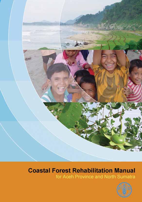
Coastal Forest Rehabilitation Manual for Aceh Province and North Sumatera. Russell Hanley Dennie Mamonto Jeremy Broadhead
|
|
|
- Diane Stone
- 6 years ago
- Views:
Transcription
1
2
3 Coastal Forest Rehabilitation Manual for Aceh Province and North Sumatera Russell Hanley Dennie Mamonto Jeremy Broadhead
4 The designations employed and the presentation of the material in this publication do not imply the expression of any opinion whatsoever on the part of the Food and Agriculture Organization of the United Nations concerning the legal status of any country, territory, city or area or of its authorities, or concerning the delimitation of its frontiers or boundaries. The views expressed in this publication are those of the author(s) and do not necessarily reflect the views of the Food and Agriculture Organization of the United Nations. Cover design: Chanida Chavanich Cover photos: Jeremy Broadhead For copies of the report, write to: Patrick Durst Senior Forestry Officer FAO Regional Office for Asia and the Pacific 39 Phra Atit Road, Bangkok Thailand Tel: Fax:
5 Table of Contents Table of Contents...i 1 Introduction The coastal plain Mangroves Coastal forest The coastal green belt Participatory approaches in coastal forest Rehabilitation Participatory rural appraisal Community action planning Awareness raising Implementing planned activities Community agreements Livelihood assessment and development activities Participatory monitoring and evaluation Coastal forest rehabilitation General site preparation The species selection process General planting considerations Mangroves Coastal forest Fencing Maintenance/management...64 References...66 i
6
7 Introduction1 The tsunami of December 2004 destroyed coastal forests and mangroves along the western and northern coastlines of Aceh province and also caused extensive damage to coastal vegetation along the north-eastern coastline. The loss of these resources had an immediate impact on the livelihoods of the tsunami survivors and that impact continues. Long before the tsunami, large tracts of mangroves had, however, been cleared for wood production, the construction of fishponds (tambak), and for brackish water rice cultivation (sawah), amongst other things. Since the tsunami of December 2004, the GOI has, however, consistently declared an intention to re-establish and maintain a coastal greenbelt in Aceh Province in line with national greenbelt legislation 1. A number of small scale mangrove and coastal forest reforestation projects have therefore been completed and more projects are anticipated, including some large scale projects of several thousand hectares. This manual has been produced to assist organisations engaged in rehabilitation and reconstruction in NAD Province that wish to implement mangrove or coastal forest reforestation projects. It provides information on the selection of mangrove and coastal forest species and collection of seeds and propagules, relevant nursery and planting techniques for each species. All coastal reforestation projects should be implemented as part of a co-ordinated planning and management process. Section 2 of this manual therefore provides a framework for engaging stakeholders and communities in coastal forest rehabilitation. Although time consuming, such processes are the only way to ensure that project interventions are sustained by individuals and institutions following completion of project activities. The role of legal agreements in protecting planted trees and forests and the long-term benefits they offer is also covered. This manual is intended as an introduction and field guide to participatory coastal forest rehabilitation. A range of more comprehensive guides published both by FAO and others are, 1 Act No. 41/1999 Forestry; Presidential Decree No. 32/1990 Management of Protected Areas. 3
8 however, available and should be consulted if further information is required. 1.1 The coastal plain The coastal plain is typically narrower on the west side of Sumatra, but has similar characteristics to that found on the eastern side (Figures 1 & 2). The process of formation of the coastal plain includes deposition of sediment transported from the mountains and reworking of this sediment into a barrier dune system, behind which rivers and streams are deflected to form shallow coastal lagoons with outlets to the sea. This system is present on both coasts, but on the west coast the coastal plain is usually narrower and consequently there has been less land available for conversion to fishponds and rice paddies as seen on the east coast. However, there are areas on the west coast where a larger coastal plain is evident, particularly where larger rivers discharge through valleys into the sea. In those locations some areas of tidal lagoon and associated vegetation have been converted into both tambak and sawah. Along the coastline on the west coast the dune system is often quite narrow and low in elevation. Much of the coastline comprises sandy bays between rocky headlands. The sand dunes are colonised by several forms of coastal vegetation. The generally narrow tidal lagoons behind the barrier dune are often colonized by mangroves wherever enough anoxic fine sediments with high organic content have collected. At the upper limit of tidal and maritime influence many village gardens are present, and these included a variety of trees. 4


9 Figure 1 The typical coastal profile on the west coast of Aceh Province. Figure 2 The typical coastal profile on the east coast of Aceh Province. 1.2 Mangroves Any tree or shrub growing between Mean Sea Level (MSL) and the upper intertidal limit is a mangrove. Whitten et al. (2000) report that there are 17 species of mangrove trees and shrubs that are (or were) commonly found in Sumatra as shown in Table 1. It is likely that these species were also present and common in Aceh province at one time. 5
10 Table 1 Common Mangrove Tree Species in Sumatra Rhizophora apiculata Sonneratia acida Rhizophora mucronata Sonneratia alba Bruguiera cylindrica Sonneratia caseolaris Bruguiera gymnorhiza Sonneratia griffithii Bruguiera parviflora Avicennia alba Bruguiera sexangula Avicennia marina Ceriops tagal Avicennia officianalis Kandelia candel Xylocarpus granatum Xylocarpus moluccensis Differences in physical factors across the intertidal zone such as frequency of inundation and salinity creates different habitat types to which some species are more suited than others. There is thus a tendency for groups of mangrove species to grow in zones. Whitten et al. (2000) provide a generalized illustration of the typical zonation pattern seen along the Sumatra shoreline. This is reproduced in Figure 3 which shows that the majority of the formerly common species, which are now absent or rare, occupied the middle of the zone colonized by mangroves. Whitten et al. (2000) consider this area of the intertidal zone optimal for mangrove development. Figure 3 Diagram showing typical zonation of mangrove flora in Sumatra (after Whitten et al., 2000). Excoecaria Heritiera Nipa Avicennia Ceriops Bruguiera Tidal Channel Bruguiera Rhizophora Avicennia Sonneratia HAT MSL Sawah Tambak The area of mangroves destroyed in Aceh by the tsunami was small and although figures of many thousands of hectares were quoted, these are likely to be a gross overestimates. The conversion to both sawah (brackish water rice paddy) and tambak (brackish water fish ponds) considerably reduced the area of mangroves long before the 6
11 tsunami and also resulted in species loss. These facts help explain why local communities have little knowledge of formerly present mangrove species and why so few species are available as seedlings in nurseries. The only species which remain common are those that occur naturally at levels near Mean Sea Level and below the areas preferred for conversion to tambak and sawah. Box 1. Mangroves and erosion It is sometimes claimed that mangroves can prevent or reverse the process of erosion. Mangroves can provide limited protection against erosive forces, but the following points must be borne in mind. Mangroves typically colonise sheltered areas where fine sediments are deposited by coastal processes. Once established, mangroves can enhance the process of sedimentation by increasing the rate of deposition. Mangroves do not, however, initiate sedimentation and are not able to colonise or persist on high energy shorelines. Episodic erosive events like storms, cyclones, floods and tsunamis create severe erosion and in many cases mangroves can reduce the scale of these impacts. If episodes of erosion are interspersed with long enough periods during which sediments can accrete, it is likely the mangroves will persist. However, if episodes are frequent enough then the coastline is eroding and eventually the mangroves will disappear. 1.3 Coastal forest Whitten et al (2000) identify two basic natural coastal forest communities present in Aceh (and in Sumatra and other Indo-Malay coastlines): Pes-caprae formation (pioneer community) Barringtonia formation on sandy soils behind the pes-caprae formation Pes-caprae formation Whitten et al. (2000) describe the pioneer vegetation of accreting coastlines on Sumatra (where new sand is being deposited) as the Pes-caprae formation. This vegetation type is found throughout the Indonesian Archipelago and western Pacific. The name of the vegetation formation is derived from the creeper Ipomoea pes- 7
12 caprae which is typically dominant, and conspicuous, among a number of low profile sand binding herbs, grasses and sedges. Other colonisers in this vegetation association are listed in Table 2 and include the grasses Thuarea involuta, Spinifex littoreus, and the sedges Cyperus pedunculatus and C. stoloniferus. Table 2 Common Pes-caprae formation species Species Ipomoea pes-caprae Thuarea involuta Spinifex littoreus Cyperus pedunculatus Cyperus stoloniferus Casuarina equisetifolia Cocos nucifera Form creeper grass grass sedge sedge tree palm All these plants have long deep rooting stems or stolons and can spread very quickly in favourable conditions. They have many adaptations to this harsh environment including tolerance of salt spray, strong winds, and aridity. The habitat on the inner edge of the Pes-caprae formation is often dominated by Casuarina equisetifolia. This tree can form pure stands, but is unable to regenerate under its own canopy. Therefore, unless the shoreline is accreting and providing new areas for Casuarina equisetifolia to colonise, the trees are eventually replaced by other species of trees (Whitten, 2000). Typically the trees that can become established under C. equisetifolia are members of the Barringtonia formation described below Barringtonia formation The other coastal forest formation is comprised primarily of trees and is termed the Barringtonia. Barringtonia asiatica isatreecommonly found behind the pes-caprae formation and is usually found with a number of other tree species which are listed in table 3. Whitten et al (2000) note that large tracts of the Barringtonia association on the coastline of Sumatra were cleared for coconut plantations and it is also the case that many coastal village gardens 8
13 and dwellings occupy the zone formerly occupied by the Barringtonia coastal forest type. Remnants of this forest type remain and many of the component tree species are still present in villages where they are valued for the various products they provide. Table 3 Species commonly found in the Barringtonia formation Species Form Barringtonia asiatica Tree Calophyllum inophyllum Tree Heritiera littoralis* Tree Excoecaria agallocha* Tree Terminalia catappa Tree Hibiscus tiliaceus* Tree Thespesia populnea* Tree Ardisia elliptica Shrub * Often classed as mangroves 1.4 The coastal green belt In Indonesia, including Aceh, National legislation exists that demarcates and makes provision for protection of a coastal greenbelt. There are two relevant pieces of legislation that apply 2 - both of which demarcate a zone of m width along the coast, and m along the tidal reaches of rivers (exact width depends on tidal range). On the north-east coast of Aceh it is clear that there has been little adherence to the requirement for a coastal greenbelt and many people in Aceh consider the absence of a greenbelt a contributing factor to the severity of tsunami impact on some sections of the coast. It appear that there has been some reluctance to tackle this fundamental issue and while it is relatively easy to draft a plan for integrated coastal development, it is not worthwhile unless translated into outcomes on the ground. 2 Act No. 41/1999 Forestry; Presidential Decree No. 32/1990 Management of Protected Areas. 9
14 It is generally accepted in Indonesia that there are many impediments to integrated coastal area management. However, an integrated development approach should still be aimed at to avert future social, environmental and economic problems. Elsewhere in Indonesia an approach that focuses on short-term economic development has led to serious degradation of coastal resources because of failure to address issues surrounding development in the coastal zone. There are other important issues to be considered in relation to the coastal greenbelt. The various government agencies who have some responsibility for coastal area development are not considering the possibility of setting targets for development of an effective greenbelt over a longer period of time. It appears that the problem of what to do with the people and industries that currently occupy the greenbelt zone is considered too difficult within government circles. If, however, it is simply not possible to create an effective greenbelt now, then it may still be possible to do it over time and to work steadily toward achieving that goal. There are many mechanisms that could be employed to achieve this, but first a conscious, collective decision needs to be made that it is a worthwhile goal. If the government for example decided that some 85% of the coastline in Aceh should have a greenbelt by the end of a 15 year period then it can begin today by examining which areas are already greenbelts, and by protecting them. Then each year, more areas would be added to the greenbelts. With a long enough horizon, this could be done with the minimum of dislocation and hardship. But it requires the will to stick to a plan, and the discipline to ensure all stakeholders are cooperative. Another opportunity that should be mentioned here is that while large areas of the coastline were washed away, and consequently the coastal plain is no longer as wide as it used to be in some areas, the coastline is coming back in many places through a process of onshore transport of sediment by the sea. Therefore in these area that are now accreting it may be possible to grow the greenbelt seaward as the coastline accretes. This again would require long term planning commitment, as well as knowledge of which areas are accreting and how fast. 10
15

16
17 Participatory approaches in coastal forest rehabilitation2 Coastal forests provide protection against storms, winds and salt spray, increase the ecological richness and diversity of the coastal environment and can also provide some protection against tsunamis. Additionally, they offer opportunities to improve livelihood by increasing the productivity of agricultural and fisheries systems and supplying wood and non-wood forest products. Because competing land uses are often preferred to forestry in coastal areas for the greater short-term benefits they may offer and as rural livelihoods in Aceh are often multi-sectoral in nature, an approach that addresses the integration of different activities is required. Participatory planning within the context of integrated coastal area management ensures that forest rehabilitation is both appropriate at a given location and implemented so as to yield the maximum benefit. Participatory approaches also provide an opportunity for relevant groups and institutions including communities, government and civil society to take part in and contribute to local development. Following such a process helps align interventions with government policies and plans, ensures the support of key stakeholders and ultimately improves the chances that interventions will be sustained following project completion. By involving communities rather than external agents in replanting coastal forests the community s sense of ownership and responsibility is also improved and this increases the chances of the project s ultimate benefits being realised. Figure 4 shows the approach detailed here the planning and implementation of participatory coastal forest rehabilitation. In summary, the project supports establishment of village Self Help Groups (SHGs), which it then works in partnership with to implement coastal forest rehabilitation activities. Throughout the process, training and awareness raising activities are run to build the capacity of villagers and of the SHG. Agreements between the SHG and the local authorities are established in the mean time to institutionalise land and resource use rights established with the project s support. Finally, livelihood assessment in target villages assists development of income generating activities, which may be supported by the SHG using funds accrued from tree planting activities. Following 11
18 maturation the planted forest and tree resources may also contribute to income generation within the village. Figure 4. Process of community involvement in coastal forest rehabilitation. PRA TRAINING Identification of PRA team members from community Community + NGO + Local Government VILLAGE APPRAISAL Assessment of village/community and identification of target groups Community+NGO+Local Government COMMUNITY AND LOCAL GOVT COMMITTMENT AWARENESS RAISING INCOME GENERATING ACTIVITIES GROUP IDENTIFICATION OR FORMATION PLANTING PROGRAMME LIVELIHOOD ASSESSMENT COMMUNITY PLANNING Participatory Rural Appraisal (PRA) forms the backbone of the approach and serves to gather community information and identify village needs in relation to coastal forest rehabilitation and village development. PRA capitalises on local knowledge and strengthens local capacity in coastal area planning and management by training villagers as Community Development Facilitators (CDFs, see Box 2), providing technical information, explaining policy matters and establishing selfhelp groups. PRA also allows the project to maintain a neutral position and ensures that: all stakeholders are respected and regarded as equals, 12
19 villagers are free to voice ideas without pressure from outside; women are able to participate and contribute, all stakeholders are able to play a part in the development process, programmes are appropriate and realistic, there is ownership of the project by the principal stakeholders, Only if, following PRA activities, it is clear that there is scope for development of a project to meet the desires of the villagers, will the project proceed to the next step. The subsequent planning and implementation activities are supplemented by awareness raising on the contribution of forestry to livelihoods and coastal area management. This enables communities, decision makers and planners to make better informed decisions based on long-term requirements rather than succumbing to poorly planned or superficially attractive options. During the planning process, it is of great importance that consideration be given to the maintenance of planted trees prior to the realisation of related benefits. Training in forest rehabilitation and discussion of incentives and benefits to ensure that coastal trees and forests can compete with alternative land uses is therefore integral to the PRA process. Social and legal issues including the development of agreements between village groups and local authorities to govern the use of planted areas should also receive attention during the PRA. Funding provided to the community groups to implement planting activities may subsequently be invested by the groups in income generating activities identified through the livelihoods assessment to spread benefits derived from project implementation into other areas. Whether working in reconstruction after emergencies or on development projects, investing in communities to help themselves provides the best approach by which sustainability can be achieved. Such an approach takes time and effort but the repeated failure of coastal forest rehabilitation projects that do not use such processes makes clear the need for the added exertion. 13
20 2.1 Participatory rural appraisal Participatory Rural Appraisal (PRA) is used to gain an understanding of the target community and the surrounding physical, social, economic and institutional environments. Before beginning with the PRA it is useful to review secondary information such as reports, case studies, working plans, books, etc. to speed up and inform fieldwork. During the PRA itself, information is collected on the following areas: village socio-economic conditions; village land use; seasonal activities within the community; villagers livelihoods composition (including fisheries, forestry and agriculture); villagers utilization of natural resources; the potential for tree and forest rehabilitation; village relationships with local institutions. PRA methods pursue issues through probing and cross-checking to elaborate and verify basic information. For that reason the approach utilizes semi-structured interviews and a range of activities after each of which data analysis and discussions take place. The PRA progresses through a number of activities including: semi-structured interviews and group discussions; Identification and analysis of land use development and related local/national decisions; sketch mapping and transect walking; construction of activity schedules and seasonal calendars; establishment of beneficiary selection criteria and selection of target beneficiaries; Assessment of the institutional capacity of agencies involved in project implementation; Identification of forest-based and other income-generating activities; preference ranking; 14
21 Participatory development of criteria for assessing village level project impacts. During PRA, conflicts are bound to emerge between different programmes and among different social and economic groups within the community. Conflicts are an inevitable part of any society and can provide a fertile ground developing a mutual understanding and consensus. However, it is important that they are not left unresolved. Hence, conflict management and mediation skills are valuable assets for staff involved in the PRA to possess PRA training The participatory rural appraisal process begins with a week long training workshop at each project site to provide the skills necessary for implementing a PRA. The training course should be attended by local forestry stakeholders including representatives of target villages, local government officials, NGOs and local civil society. Teams responsible for conducting the PRAs are formed after selecting members from amongst the trainees at the end of the course. Training should include an introduction to the concept and principles of PRA and the roles of the community and the PRA facilitators. Both in-class training and field practice are undertaken. The former includes several techniques such as practical activities, lectures, role playing, games, working groups, plenary discussions and brainstorming sessions. PRA techniques and tools outlined in this section are practiced during training and discussions are held following each session to assess general impressions, difficulties and possible improvements. At the end of the training week, a gender-balanced team of six to eight people is selected to conduct PRAs in the target villages. A good PRA team includes project staff, relevant government line agency representatives and participants selected from villages. It is important that the team also includes members who speak the local language or dialect. Regardless the PRA team member s professional affiliation, care must be taken that all team members act as facilitators only and do not push their own institutional or organizational agenda. PRA facilitators are selected from the trainees according to availability and competence in facilitating the appraisal process as 15
22 assessed during training. Those selected should also be wellrespected by the communities and be able to provide leadership and guidance during the PRA. Box 2 Local level staff The PRA process is used to identify and train Community Development Facilitators. The Community Development Facilitators are hired as project staff members and are stationed within target communities. They facilitate implementation of tree planting and management activities and for each community; there should be a pair of community development facilitators (one male and one female). The CDFs must have the ability to facilitate meetings of the Self Help Group (SHG) or Kelompok Swadaya Masyarakat (KSM), should be accepted by the local community and also possess basic monitoring and reporting skills. Senior Community Development Facilitators (SCDFs) may also be engaged to provide coordination and liaison with the project office and to assist during the PRA. During implementation the SCDFs support the development of the community groups, participate in developing community work programmes and liaise with the district and sub-district forestry offices and government agencies Semi-structured interviews and group discussions Semi-structured interviews are held to obtain information from individual community members or small groups and to better understand the community s relationship to and dependency on natural resources. They may also be used to collect preliminary information on areas focussed on later in the PRA such as relationships between institutions, village history, legislation, socioeconomic conditions, etc. Group discussions with the community or forestry/village development stakeholders allow exploration of concerns and interests and raising of awareness in relation to natural resources and related issues and also provide a platform for negotiation Community and forest history By understanding historical changes and associated driving forces in areas such as population and resettlement, the local economy, forest condition and management, agricultural production, etc., future 16

23 opportunities and threats can be better identified and addressed. To achieve this, a number of methods can be utilized including in-depth interviews with community members and local forestry staff and information collection during transect walks and mapping exercises. The information collected allows the PRA team to reconstruct treads over the past 50 to 100 years. These can be represented as shown for agricultural crops in Figure 5. Figure 5 Diagram of trends in agriculture in Krueng No village Timelines are simply chronological lists of important past and are used to understand areas such as the history of land use change and ownership. This information allows decisions to be made in light of past experience and an understanding of how the community dealt with significant events such as drought, land allocation, change in governance, etc. Historical documents and working plans developed by the forest department can help identify significant socio-political and environmental events. Semi-structured interviews can then be used to connect events to village level effects and responses. 17
24 Box 3 Krueng No before and after the tsunami Krueng No village in Sampoiniet sub-district of Aceh Jaya on the west coast of Aceh was devastated by the December 2004 tsunami. Figure 5 shows a diagram constructed during the PRA of trends in areas of agricultural crops and other types of vegetation between 1950 and The damage between 2000 and 2005 resulting from the tsunami is clear. Figure 6 and Figure depict the village area before and after the tsunami with the effects of the tsunami again being clearly visible. Following the tsunami the Government of Finland funded FAO Forestry programme for early rehabilitation in Asian tsunami-affected countries helped establish a village Self Help Group in Krueng No and provided technical and financial support to rehabilitate coastal forests adjacent to the village. Livelihood support was also provided following the methodology outlined in this manual. Villagers benefited in terms of the training offered by the project, the funding provided for tree planting and also the environmental services offered by the planted trees. Towards the end of the project the SHG took a decision to convert the group into a cooperative to provide the institutional structure necessary to further support village development following completion of project activities Sketch maps and transects To investigate the spatial aspects of land and forest use, sketch maps and land use transects are used. Participatory mapping techniques involve facilitating community members to create maps on the ground or on a large piece of paper. The maps provide a rapid understanding of the distribution of land use, including trees and forests, farm fields, markets, rivers, roads and other features of the landscape (see Figure 6). Information can also be collected on social-economic status to illustrate the location of the relatively poorer sections of the village community. 18

25 Figure 6 Krueng No village map - before the tsunami Figure 7 Krueng No village map - after the tsunami 19

26 Maps can also be used to record information on forest condition, protected and unprotected areas, and sources of specific forest products. This information supplements the spatial analysis of the management area, i.e. the area in which forest rehabilitation is being considered. The process of making the map and the discussions that occur while it is being made are important outputs of this exercise. By conducting interviews, observing the landscape from the top of a hill, if possible and walking through the village, a land use transect can be drawn on paper by delineating areas according to use and ecological zone as shown in Figure 8. For each area along the transect, information can be included on land use, land ownership, crop species, soil condition, potentials, problems, etc. Figure 8 Transect report from Krueng No PRA Seasonal calendars and activity schedules To supplement information on long term changes in land management and forest cover, etc., community agriculture, fisheries 20


27 and forestry activities during the year are assessed. Seasonal calendars can also be used to understand natural events such as water levels and weather patterns, etc. Seasonal activities are identified through group interviews and villagers indicate which products are collected during each month and how volume flows change throughout the year. This can be done for agriculture, forestry and fisheries activities as well as other relevant areas. Daily schedules are developed to record time and labour allocated to activities such as the collection of fuelwood and transportation to local markets. Many other activities can be included according to villagers routines and schedules will differ between professions, such as farmers to fishermen and according to gender. As such a range of village representatives should be interviewed Seasonal calendars and daily activity charts assist decision-making by allowing new activities to be integrated into existing routines and also facilitate improvement of productivity and effectiveness where existing schedules can be further rationalised Institutional linkages Information on institutions related to village life is collected using Venn diagrams. Venn diagrams are composed of circles indicating different user groups and institutions with overlaps representing common membership. 21
28 Internal village institutions are placed at the centre of the paper. Venn diagrams provide a basis to elicit community perceptions on the performance and quality of services offered by individual institutions and help identify conflicts over resources. They can also be used to establish which village institutions might play a lead role in supporting participatory management. Different sessions may be held with males and females to view their different perspectives Ranking tree species Ranking and scoring can be used to determine tree species preferred for coastal forest rehabilitation. During the exercise, participants develop several parameters describing different tree uses related to their importance for re-greening and livelihood/economic activities. For a range of relevant tree species, scores of between 1 and 5 are ascribed to indicate the value of the species for the different uses. It is useful to compare groups of tree species according to their use, i.e. fuel wood, construction timber, fruit, wind protection, etc. It is also useful to limit the number of species to be ranked and by asking villagers to identify the most popular species within a use type. The overall results of the scoring exercise are used to rank the different species and assist in final decision making Selection of target beneficiaries Target beneficiaries are generally the poorest and most vulnerable groups within the community. Through community meetings, criteria may be developed to select beneficiaries using economic and social factors. The list below shows possible criteria used to select individuals: Economic uncertain income; lack of knowledge related to economically productive activities; lack of options to engage in economically productive activities; dependent on others; lack of access to capital; 22
29 trapped in high interest credit scheme; failed harvest. Social poor household headed by widow/widower; socially marginalised; from minority or less well represented group; rarely/never involved in local level decision making processed Group formation The objective of group formation is to form a permanently structured community Self-Help Groups (SHGs) or Kelompok Swadaya Masyarakat (KSM) with formally approved members and a board responsible for activities. Groups are established in a participatory way through community identification of criteria for selecting members. The criteria may include economic and social factors similar to those used to select target beneficiaries. Representation of different social groups within the community, including women s group is of particular importance. The community are also supported in determining the group s structure and electing a board. Facilitators introduce the rules and regulations/code of conduct as a foundation for board member selection, roles and responsibilities and group management. The group size can be decided by the community but groups of greater than 20 members may be more difficult to manage. It is important to have the articles of agreement and the Self-Help Group constitution signed for the group to be legally recognised. Groups are legalised by issuing the Kecamatan degree (Surat Keputusan/Rekommendasi/SK). Following registration SHGs are able to hold bank accounts and become the implementing agency s partners in the field Village plenary session The plenary session constitutes a forum for clarification and revision of the appraisal process. In this forum, many villagers who were not closely involved in the PRA will be asked for their opinion of the 23
30 results. The session also acts as an example of a consultative, democratic process which the community may choose to adopt for activities. Display of results from the different PRA sessions augments discussions and assists the overall group to come to a negotiated general agreement on coastal forest rehabilitation plans and other livelihoods development activities. The plenary session of the PRA may also be used to inaugurate the village Self Help Group to implement coastal management activities in the long term. 2.2 Community action planning Village community action plans should be based on the PRA and specify areas to be planted, the names of those responsible at the village and site level and benefits and incentives to promote maintenance of trees. They should also include an assessment of the institutional capacity of agencies involved in implementation of activities and criteria for measuring progress. Details of income generating activities identified and supported by the project may further be included. The process of developing action plans with the communities should be facilitated to ensure that the plans are Specific, Measurable, Attainable, Realistic and Time-bound (SMART). A standard format may be used for the plan including: activities; responsible individuals timing and duration; area/s and location/s of land to be planted; types of trees to be planted; criteria for monitoring process; contributions to the activities from the SHG and the implementing agency; expected contribution from other institutions including technical facilitation from government agencies. The areas to be included in the forest rehabilitation programme may be verified by visiting the location to estimate the area of land to be 24
31 planted and to ensure that any conflicts of interest or ownership disputes are unearthed and dealt with. The action plans and plans for the long-term maintenance of planted trees should be agreed upon in association with relevant local government agencies. Agreement detailing the coastal forest rehabilitation plans, other community development and party s responsibilities are then signed between the implementing agency and the SHG. 2.3 Awareness raising Awareness raising provides villagers with information to assist them in making livelihood decisions that account for both short- and longterm requirements and also take into account different activities (e.g. fishing, forestry and agriculture). Awareness raising also builds confidence and capacity through discussion of issues such as land use planning and integration of traditional and alternative livelihoods. Awareness raising activities are implemented over long periods through informal discussions with project staff and during village meetings. Training to build SHG member s administration, group development, problem solving, managerial, organizational and financial skills can also be included. 2.4 Implementing planned activities To assist with execution of coastal forest rehabilitation, the implementing agency should procure seedlings from qualified suppliers and organise quality checks before the seedlings are transferred to the communities. Technical advice and supervision should also be provided during the planting programme. The SHG will generally be responsible for planting seedlings, erecting fences and maintaining the young trees during the first six month after planting. With funds provided to implement these activities, the SHGs may pay either daily wages or lump sum amounts per activity to the individuals involved. At regular junctures, the SHGs draft and submit reports and accounts with assistance from the implementing agency. These are inspected by project staff before funding for completed or planned activities is released to the community. Technical information related to implementation of planting activities is provided in the other sections of this manual. 25
32 2.5 Community agreements Sub-district level agreements govern the use and conservation of planted areas. The implementing agency should therefore provide legal advice and technical assistance to the communities in drafting standardised legal agreements between the SHGs and responsible government institutions. Signing of a decree between the community and the local government to ensure the protection of planted areas and community access and resource rights is an additional benefit to the community and provides considerably increases chances of sustainability. 2.6 Livelihood assessment and development activities Livelihood development activities ultimately function to support improvements in villager s welfare but also allow SHG members to manage and invest funds received from the forest rehabilitation program. This enables them to improve their own capacity and income and also allows them to become agents of change within their respective villages. Livelihoods assessment is carried out to identify viable activities for livelihoods improvement and income generation. A six-step approach consisting of livelihood assessment, data analysis, developing recommendations, partnership development and linkage establishment may be applied as follows: 1. Livelihood Assessment in which focus group discussions are held to identify the community s main livelihoods activities 2. Market survey in which information is collected on demand for products which can be supplied by project villages and means available to store and transport goods. 3. Assessment of economic feasibility, availability of labour, business management capacity, transport links, availability of support for development activities, availability of potential buyers, etc. 4. Development of recommendations. Based on the assessments listed above, recommendations for the most promising livelihoods activities are made. 5. Partnership development. To assist with development of the recommended activities, potential partners are identified and links are made with SHG representative. Care must be taken in 26
33 identifying partners so as to limit risks of failure of the proposed activities in economic, social or environmental terms. 6. Implementation and establishment of links. The final step is to begin activities and to build links between SHGs and potentially supportive organizations. 2.7 Participatory monitoring and evaluation Participatory monitoring and evaluation (PM&E) is conducted in each community towards the end of programme implementation to guide future implementation and record progress and lessons learned. During the exercise the SHG and the village community analyse implementation of project activities planned during the PRA. Adjustments to the original plans made during follow-up meetings were taken into account. The process includes discussions with SHG members and members of the community to whom they provided services. The exercise required a core group of programme staff and SHG members to walk through the village observing project planting sites and talking to community members. While a beneficiary of project activities, the SHGs are also an implementing partner providing services to the community and should therefore be included in the evaluation. The duration of the PE&M exercise is flexible, and depends on the level of discussion and agreement/disagreement between the participants. A full day should preferably be allowed for each village. 27

34
35 Coastal forestry rehabilitation3 3.1 General site preparation Prior to planting out the selected species, it may be necessary to prepare the site. For many mangrove and coastal forest species the amount of site preparation required is minimal. It is always prudent to plan access routes and pathways before planting begins as it avoids unnecessary movement and resulting damage to seedlings. At some sites it may be necessary to undertake some earthworks if there are drainage problems created by movement of sand and other material by the tsunami. Permanently water-logged areas will not support mangrove or coastal forest species. Removing plugs of sand and mud from old drainage channels or creating new drainage channels may fix the problem and open up much larger areas for planting. Removal of weeds is also advisable as a number of coastal forest species require minimal competition until they are established. 3.2 The species selection process Various factors need to be considered in selecting species for mangrove and coastal forest rehabilitation as follows: Physical - the range and nature of environmental conditions present, or possible, at a location, especially in relation to tidal range and heights. Ecological - identifying mangrove and coastal forest species which have the correct ecological requirements. Economic utility - the various economic values particular mangrove and coastal forest species have. Community aspirations - the needs and wants of the local community that has direct access, and the wider community that may derive benefits, but has no direct access, to the area planted. Information necessary to make decisions in relation to these points is provided in sections 3.4 and
36 3.3 General planting considerations In planning a reforestation project decisions need to be made about the planting pattern that will be adopted when the seedlings are planted out. The planting pattern will be dependent on the site conditions and also the future use options for the forest. Once the plantation pattern is determined then an estimate of the number of trees required can be calculated by multiplying the number per hectare by the total number of hectares. The number of trees per hectare can vary greatly between different planting densities. For example, planting trees at 0.5 x 0.5 m spacing requires 40,000 trees per hectare, while at 1 x 1 m spacing 10,000 trees are required and at 1 x 2 m only 5,000 trees are required. As choice of spacing has a marked impact on the number of trees required to cover a specified area, spacing will also be partly governed by a desire to cover as much area as possible with the funds available for a reforestation program. When seedlings are planted they should always be removed from the pot or polythene bags and placed into a suitably sized hole with minimal damage to the roots. Some coastal forest species may become stressed after planting if there is no rain. Watering them after planting is an option, but is time consuming/expensive and better strategies are to ensure all seedlings about to be planted are thoroughly watered in the nursery before planting and to time the planting to coincide with the months of heaviest rain. 3.4 Mangroves Species distribution Five groups of mangrove species can be defined 3,asfollows: Lower level, near Mean Sea Level (MSL) Mid level, at about the Mean High Water Neap level (MHWN) Upper level, at about the Mean High Water Spring level (MHWS) 3 The data from the tables in this section is derived from Field (1996), Kitamura et al. (1997), Saenger (2002), and Whitten et al. (2000). 30
37 Interface between upper intertidal and coastal forest zone Generalists, which can grow in any of the above areas but are usually excluded by other species Figure 3 in Section 1.2 shows the position on the shoreline of each group according to the dominant species found. Table 4 lists 6 species that are commonly found low on the shoreline, at or near mean sea level (MSL). These species are tolerant of frequent and prolonged inundation on each tidal cycle. However, like all mangroves they will not tolerate permanent inundation of the root system. Table 4 Mangrove species typically associated with lower levels near Mean Sea Level Species Notes Rhizophora apiculata Usually lining smaller channels Rhizophora mucronata Sonneratia alba Avicennia marina Avicennia alba Nypa fruticans Lower level than R. apiculata Usually lining larger channels and open water, pioneer on mud, sand and gravel, full sun. Pioneer, on new or disturbed habitat variety of substrates, full sun Pioneer on new or disturbed habitat, more sheltered locations than A. marina, softer muds. Freshwater/brackish water channels and swamps The Palm, Nypa fruticans is typically associated with river mouths and channels and requires the permanent presence of freshwater i.e. salinities much lower than that of seawater. The stilt rooted mangroves Rhizophora apiculata and Rhizophora mucronata are easily recognised by their distinctive root system although this may not be obvious in very young trees. These two species tend to be found in very sheltered conditions and often line small tidal channels. 31
38 The two species of Avicennia are very difficult to distinguish from each other in the field and both occur in very similar locations. Both species can look very different depending on their environment, ranging from low scrubby bushes to tall, thin trunked, closed forest and large spreading trees. These species are often the first colonisers of disturbed, or newly emerged substrates at about MSL. Sonneratia alba is a very large, often thick trunked spreading tree with the lower branches typically bending down to the mud surface. This species is often found right at the front of the mangrove zone at MSL, typically bordering wider river channels and sheltered bays. Table 5 shows the group of species that are typically found at about the mid level of the intertidal zone. At this height on the shore, the mangroves are inundated by the tide on many of the high tides, but the period of inundation is shorter; the mean neap high tide will wet the substrate. The dominant genus at this level is Bruguiera and particularly the species B. gymnorhiza which can form almost single species stands. The other species typically found here are often restricted to slightly lower levels of the shoreline within this zone where they line tidal channels draining the upper and mid levels (Rhizophora apiculata) and small channels draining freshwater runoff from the hinterland (Nypa fruticans). Also commonly found at this level are monospecific stands of Bruguiera parviflora which are associated with depressions where ponding of surface water occurs. Table 5 Mangrove species associated with mid level near Mean High Water Neap Species Notes Rhizophora apiculata Lining small drainage channels Bruguiera gymnorhiza Above and mixing with R.apiculata, shade tolerant Bruguiera parviflora Usually in shallow depressions with surface water Nypa fruticans Freshwater/brackish water channels and swamps Moving further up the shore toward the area around MHWS the frequency of inundation is reduced. Only average spring high tides 32
39 wet the substrate and the period of inundation is often quite short. The substrate therefore tends to be drier and can have soil salinities that are in excess of seawater salinities. Two other species, Bruguiera cylindrica and Bruguiera sexangula are found at these heights although the two species appear to prefer different substrate types as shown in Table 6. The dominant tree at these levels however is most likely to be Ceriops tagal, which in regions with relatively high rainfall and no real dry season (like Aceh) forms dense monospecific stands with a closed canopy. Scattered throughout, usually as single trees, or as a narrow fringe along waterways are the two cannonball mangroves Xylocarpus granatum and X. moluccensis. Table 6 Mangrove species associated with upper level near Mean High Water Spring Species Notes Bruguiera sexangula On soft muds, with high organic content Bruguiera cylindrica On firm stiff clays, above most tides Ceriops tagal Variety of substrates including sand and clay, usually in well drained locations Xylocarpus granatum Variety of substrates including sand and clay, usually in well drained locations Xylocarpus moluccensis Variety of substrates including sand and clay, usually in well drained locations At the highest level of the intertidal zone, the spring high tides may only wet the substrate a few times each year and at this level there is some confusion about which species are more correctly called mangroves and which species coastal forest. Table 7 lists five species that are commonly found at this level and of these, the three marked with an asterisk are often classified as members of the coastal forest community rather than mangroves. Sometimes at this interface there is a thin zone just a few trees wide of Lumnitzera racemosa and/or Excoecaria agallocha, but more often there is no clear demarcation between the trees of the coastal forest zone and the mangroves. This is typically the case wherever there is sufficient freshwater inflow from the hinterland due to sheet 33
40 runoff from rain, small drainage channels and groundwater seepage into the intertidal zone. The interface between the mangroves and coastal forest is often diverse with true coastal forest species such as Terminalia catappa and Hibiscus tiliaceus mixedwithmangrovespecies. Two of the species listed in Table 7 are also common at this level of the shore wherever there is permanent freshwater influence and these are Sonneratia caseolaris with its distinctive tall, thin pneumatophores and the palm Oncosperma tigillarium which is easily recognised by the long spines on the trunk. This palm is also common in freshwater swamps and is only mildly tolerant of saltwater. Table 7 Species found at interface between upper intertidal and coastal forest Species Notes Lumnitzera racemosa Rarely inundated by tide, on sand/mud mixed substrates Excoecaria agallocha* Rarely inundated by tide, on sand/mud mixed substrates Intsia bijuga* Rarely inundated by tide, sandy substrates Heritiera littoralis* sand/mud mixed substrates, requires low salinity year round Sonneratia caseolaris Freshwater / brackish water swamps Oncosperma tigillarium Freshwater/brackish water channels and swamps * - Species sometimes classed as coastal forest trees not mangroves The last group, shown in Table 8, are species which can be found at any level on shoreline from Mean Sea Level (MSL) right up to the landward margin of the intertidal zone. These species are sometimes present as individuals or small groups in areas that have been disturbed. Clearing of mangroves will often lead to colonisation by these three species of which only Avicennia marina is a tree, while Acrostichum aureum is a fern and Derris trifoliata is a creeping vine. All three species thrive in areas with full sun and are shade intolerant, which usually excludes them from the majority of the mangrove area where a closed canopy exists. 34
41 Table 8 Generalists, often excluded from middle levels of intertidal Species Avicennia marina Acrostichum aureum Derris trifoliata Notes Can occur throughout on a variety of soils, needs full sun Colonises disturbed areas at mid to upper levels, freshwater influence Colonises disturbed areas at mid to upper levels, low salt tolerance While A. marina is a worthwhile species in terms of providing shade for species such as Rhizophora and Bruguiera that will eventually replace it, the fern and the creeping vine are often problematic on disturbed sites because they can effectively cover the entire area with dense low foliage of m in height. This dense scrub can smother young seedlings of other mangrove species such as larger, more valuable trees Species descriptions and regeneration information In the following pages the specific details for nursery and plantation techniques are provided for the most common mangrove species in Sumatra. Many of these species are no longer common in NAD Province, partly because of the destruction caused by the tsunami of December 2004, but mostly because the habitat they occupied has been converted to other land uses. However all of these species are still relatively common between Langsa Bay and Medan and can be readily sourced. 35

. Propagules should be embedded to 10cm.")
42 Rhizophora mucronata Bakau Genjah (Ina) Bangka U (Aceh) General Description: Rhizophora mucronata is easily recognised by its stilt roots and very long propagules, leaves sharply pointed, tree up to 25 m tall. Flowers are in groups of 4-8. Collection of propagules: When the propagules are mature and ready to be picked from the tree the yellowish abscission collar is clearly visible at this stage the length of hypocotyl is typically greater than 50 cm. Storage of propagules: In shade, and kept moist 10 days maximum. Sowing and potting techniques: Medium should be muddy soil (saline). Propagules should be embedded to 10cm. Polythene bags should be medium to large size. Shading: 50% shade required, remove shade 1 month before planting. Watering: natural tidal flows if possible but with watering to keep soil moist at all times if necessary. Ready for planting out: seedling height greater than 55 cm, and more than two pairs of leaves, usually 4-5 months. Position on the shoreline: best located where salinity is lower in soft muddy substrates, and between Mean Sea Level and the average height of neap high tides. Plantation spacing: large stilt root systems need space so 1 m x 2 m and 2 m x 3 m are best. 36

.")
43 Rhizophora apiculata Bakau Kacang (Ina) Bangka Minyeuk (Aceh) General Description: Rhizophora apiculata is a stilt rooted mangrove similar in appearance to R. mucronata. Leaves are sharply tipped, tree is up to 15 m tall, flowers in groups of two. Collection of propagules: When the propagules are mature and ready to be picked from the tree the reddish ring-like abscission collar is clearly visible at this stage the length of hypocotyl is typically greater than 20 cm. Storage of propagules: In shade, and kept moist - 5 days maximum. Sowing and potting techniques: Medium should be saline muddy soil (saline). Propagules should be embedded to 5-6 cm. Polythene bags should be medium size. Shading: 50% shade required, remove shade 1 month before planting. Watering: natural tidal flows if possible but with watering to keep soil moist at all times if necessary. Ready for planting out: seedling height greater than 30 cm, and more than two pairs of leaves, usually 4-5 months. Position on the shoreline: best located where salinity is lower in soft muddy substrates, and between Mean Sea Level and the average height of neap high tides. Plantation spacing: large stilt root systems need space so 1 m x 2 m and 2 m x 3 m are best. 37


44 Bruguiera gymnorhiza Tumus (Ina) Tumus (Aceh) General Description: Bruguiera gymnorhiza has knee roots and small buttress roots, leaves are pointed, tree up to 30 m tall, flowers are single. Propagules are thick, slightly ribbed, cm long. Collection of propagules: When the propagules are mature and ready to be picked from the tree they change in colour from light to dark greenish brown. The propagules should be picked from the tree with the calyx cap intact, the length of hypocotyl is typically greater than 20 cm. Storage of propagules: In shade, and kept moist 10 days maximum. Sowing and potting techniques: Medium should be mixed saline muddy sand. Propagules should be embedded to 5-6 cm. Polythene bags should be medium size. Shading: 30% shade required, remove shade 1 month before planting. Watering: natural tidal flows if possible but with watering to keep soil moist at all times if necessary. Ready for planting out: seedling height greater than 35 cm, and more than three pairs of leaves, usually 3-4 months. Position on the shoreline: located at about the average height of neap high tides in mixed mud, sand substrates. Plantation spacing: 1 m x 2 m is best. 38


45 Bruguiera parviflora Lenggadai (Ina) General Description: Bruguiera parviflora has knee roots and small buttress roots, leaves are blunt tipped, tree up to 10m tall, flowers in groups of 3-4. Propagules are thin, yellowish green, cm long. Collection of propagules: When the propagules are mature and ready to be picked from the tree they are about cm long. The propagules should be picked from the tree with the calyx cap intact. Storage of propagules: In shade, and kept moist - 10 days maximum. Sowing and potting techniques: Medium should be mixed saline muddy sand. Propagules should be embedded to 5cm. Polythene bags should be medium size. Shading: 30% shade required, remove shade 1 month before planting. Watering: natural tidal flows if possible but with watering to keep soil moist at all times if necessary. Ready for planting out: seedling height greater than 30 cm, and more than three pairs of leaves, usually 3-4 months. Position on the shoreline: located at about the average height of neap high tides in mixed mud, sand substrates, usually in waterlogged depressions. Plantation spacing: 1 m x 1 m is best as they naturally form dense thickets. 39

. Propagules should be embedded to 5 cm.")
46 Ceriops tagal Tengar (Ina) Tengar (Aceh) General Description: Ceriops tagal has small buttress roots and sometimes knee roots, leave tips are rounded, tree up to 6 m tall, Flowers are in groups of Propagules are thin, greenish brown, 25 cm long. Collection of propagules: When the propagules are mature and ready to be picked from the tree they are about 25 cm long, and a yellow abscission collar is present. Storage of propagules: In shade, and kept moist - 10 days maximum. Sowing and potting techniques: Medium should be mixed mud/ sand/gravel (saline). Propagules should be embedded to 5 cm. Polythene bags should be medium size. Shading: can be grown in full sunlight. Watering: natural tidal flows if possible but with watering to keep soil moist at all times if necessary. Ready for planting out: seedling height greater than 30 cm, and more than two pairs of leaves, usually 4-5 months. Position on the shoreline: located at higher levels on the shore, at about mean high water spring tide, usually in very saline soils. Plantation spacing: 1 m x 1 m or 1 m x 2 m is best as they naturally form dense thickets. 40

47 Avicennia marina Api-api (Ina) Jampe (Aceh) General Description: Avicennia marina has numerous pencil like pneumatophores, leaf tips are variable, tree up to 20 m tall, flowers are small, in groups of Fruits are almond like, sometimes with a short beak like tip and cm long. Collection of propagules: When the fruit coat changes from green to light yellow, and becomes wrinkly. Storage of propagules: In shade, and kept moist - 10 days maximum. Sowing and potting techniques: soak fruits in freshwater for 1 day to remove pericarp. Sow in saline mixed mud/ sand. Propagules can be grown in terrestrial beds until roots are produced then transferred to small to medium polythene bags. should be embedded to 1/3 length with pointed end down. Shading: canbegrowninfullsunlight. Watering: natural tidal flows if possible but with watering to keep soil moist at all times if necessary. Ready for planting out: seedling height greater than 30 cm, and more than two pairs of leaves, usually 3-4 months. Position on the shoreline: can grow at all levels of shore, but favours open areas in full sun, and is highly tolerant of high salt levels in soil, a pioneer species. Plantation spacing: 2mx3misbest. 41


48 Sonneratia alba Pedada, Prapat (Ina) Pedada (Aceh) General Description: Sonneratia alba has numerous thick pneumatophores, leaf tips are rounded, tree up to 20 m tall, flowers are large, white, in groups of 1-2. Fruits large, green with cup shaped calyx on base, and cm diameter. Collection of propagules: Fruit changes colour from light to dark green, pick fallen fruits from beneath tree. Storage of propagules: In shade, and kept moist 5 days maximum. Sowing and potting techniques: soak fruits in brackish water for 1 to 2 hours and agitate to separate seeds from pericarp seeds float and are irregular in shape. Sow in a mixture of mud 70% and cow manure 30%. Seeds embedded to half of length, 2 each in small to medium polythene bags. Shading: can be grown in full sunlight. Watering: natural tidal flows if possible but with watering to keep soil moist at all times if necessary. Ready for planting out: seedling height greater than 15 cm, and more than three pairs of leaves, usually 5-6 months. Position on the shoreline: favours open areas in full sun, salt tolerant and usually found at or about mean sea level by larger channels and in sheltered bays. Plantation spacing: 2mx3mor3mx3marethebestforthis large, spreading tree. 42


49 Sonneratia caseolaris Pedada, Prapat (Ina) Pedada (Aceh) General Description: Sonneratia caseolaris has numerous conical pneumatophores to 1m tall, leaf tips are rounded, tree up to 20 m tall, Flowers are large, red/white, in groups of 1-2. Fruits large, green calyx does not enclose base of fruit which is 6-8 cm diameter. Collection of propagules: Fruit changes colour from yellowish to dark green, pick fallen fruits from beneath tree. Storage of propagules: In shade, and kept moist - 5 days maximum. Sowing and potting techniques: soak fruits in brackish water for 1 to 2 hours and agitate to separate seeds from pericarp seeds float and are irregular in shape. Sow in a mixture of mud 70%, cow manure 30%. Seeds embedded to half of length, 2 each in small to medium polythene bags. Shading: can be grown in full sunlight. Watering: hand water (low salinity) to keep soil moist at all times. Ready for planting out: seedling height greater than 15 cm, and more than three pairs of leaves, usually 5-6 months. Position on the shoreline: favours the upper levels of the intertidal zone where there is freshwater and low soil salinity. Often in the transition zones between fresh and brackish water swamps and can tolerate some water logging. Plantation spacing: 1 m x 2 m or 2 m x 3 m are the best. 43
.")

50 Xylocarpus granatum Nyirih (Ina) Nyirih (Aceh) General Description: Xylocarpus granatum has buttress and ribbon like plank roots, leaves are compound (4 leaflets), tree up to 12 m tall, flowers are small, in groups of Fruits very large, hard, cannonball like (up to 25 cm). Collection of propagules: Ripe fruit yellowish brown, often starting to crack open while on tree, fallen seeds surface yellowish with grey spots, root radicle evident. Storage of propagules: In shade and moist - 5 days max. Sowing and potting techniques: float fruits in brackish water, viable seeds will float, select those at least 30g. Sow in mud/sand mixture. Lay seeds on soil with radicle pointed down in medium polythene bags. Shading: decrease sunlight by 30%, remove shade 1 month before planting. Watering: natural tidal flows if possible but with watering to keep soil moist at all times if necessary. Ready for planting out: seedling height greater than 20 cm, and more than two pairs of leaves, usually 3-4 months.position on the shoreline: favours the mid-upper levels of the intertidal zone where there is abundant freshwater influence and low soil salinity. Shade tolerant. Plantation spacing: 2 m x 3 m or 4 m x 4 m in mixed plantings. 44


 to keep soil moist at all times.")
51 Heritiera littoralis Bayur Laut (Ina) Bayur Laut (Aceh) General Description: Heritiera littoralis has well developed buttress roots, leaves are simple, tree up to 25 m tall, flowers very small, in loose panicles. Fruits green to brown, smooth, with a raised ridge along one edge and 5-7 cm long. Collection of propagules: Fruit changes colour from yellowish green to dark brown, when mature, often starting to crack open while on tree, fallen fruit with radicle of root evident. produces a large fruit containing a single seed. After soaking in brackish water for up to 5 days the seed will germinate. Storage of propagules: In shade, and kept moist 5 days maximum. Sowing and potting techniques: Sow in mixture of mud/sand (low salinity or fresh). Lay seeds on soil with radicle pointed down in medium polythene bags. Shading: 30% shade required, remove shade 1 month before planting. Watering: hand water (low salinity) to keep soil moist at all times. Ready for planting out: seedling height greater than 30cm, and more than three pairs of leaves, usually 4-6 months. Position on the shoreline: favours upper levels of the intertidal zone at interface with coastal forest where there is abundant freshwater influence and low soil salinity. Shade tolerant. Plantation spacing: 2 m x 3 m or 4 m x 4 m in mixed plantings. 45
52 3.4.3 Collection of propagules Peak fruiting time for mangroves in Aceh is in the period June to October with the months of August and September producing the largest numbers of seeds and propagules. Rhizophora, Bruguiera and Ceriops Collection of the propagules of Rhizophora, Bruguiera and Ceriops species is relatively easy. When the propagules of both Rhizophora and Ceriops spp. are mature and ready to fall from the tree a thin collar is visible between the swollen pericarp (fruit) and the hypocotyl (root) that has grown from the base of the fruit. At this stage many of the propagules will detach easily from the tree after being lightly handled. It is possible to detach the propagules with the fruit still attached and this may easily detach after a few days. Bruguiera spp. on the other hand have a cap like calyx and this should not be forcibly removed but can be left on the propagules and will fall off when the seedling sprouts. At the time of collection propagules that have recently fallen from the parent tree and are lying on the mud beneath the tree should be inspected and also collected if they are free of insect or crab damage and have not already taken root. If the propagules are to be held in a nursery they can be sorted for up to 10 days as long as they are kept moist and cool. Planting into polythene bags or pots is simple and involves pushing the propagules about 1/3 of their length into the mud. Avicennia spp, and those with much smaller seeds inside tough fruits such as Sonneratia and Xylocarpus spp. Species with small viviparous seedlings like the Avicennia spp, and those with much smaller seeds inside tough fruits like the Sonneratia and Xylocarpus spp need specialised treatment to collect and prepare seeds and benefit from time in nurseries until they are large enough to be planted out. In Avicennia spp. the reproductive unit is a fleshy capsule with a single seed. The capsules are best collected from the parent tree by plucking them. Larger capsules should be targeted, particularly those where the outer covering of the capsule has already ruptured. This covering will be yellowish and wrinkled when the capsules are mature. Soaking the capsules in brackish water for one day is normally enough to cause shedding of the outer covering from the 46
53 capsule. The capsules can then be held for up to 5 days in brackish water and then planted in individual pots or polythene bags that contain wetted mangrove soil. Only about one third of the seed should be pushed into the soil. In Sonneratia spp. the reproductive unit is a many celled capsule containing a large number of small seeds that are irregular in shape. It is best is to collect recently fallen fruit beneath the trees on a neap tide when the mature fruits float and are easily collected. After collection, the fruits are soaked in brackish water for one or more hours and periodically stirred vigorously with a stick to separate the seeds from the fruit. The seeds float and can be strained off with a sieve after which they should be laid out on a flat surface to allow inspection for insect damage and selection of the larger seeds which are the best to use. They can be held in brackish water for about 5 days. At first most sink but as they sprout they float to the surface although it is better to plant them out before they sprout and the seed should be pushed gently into a mix of mud and cow dung in pots or polythene bags Soils for propagation The best soils for potting propagules and seeds in polythene bags or pots is taken from areas where mangroves grow (or grew) and while some sand/mud substrates are acceptable, the more mud the better as the content of organic material is higher. Use of soils without some salt content is not recommended as the salt-free soil may contain pathogens that attack the seeds and propagules of mangroves Nurseries Seedlings that have been reared in a nursery for some time often have better survival rates than propagules which are planted directly (Saenger 2002). However, there is a trade off between improved rates of survival and the extra costs incurred by nursery rearing. The major considerations are: whether or not predation of young seedlings by crabs, rats, goats etc is likely to be a problem; and/or whether the physical conditions at the site are likely to be harsh on very young plants (e.g. salinity too high); 47

54 and/or whether the reforestation program will last more than a few months in which case holding seedlings in a nursery ensures a steady supply of planting material. Mangrove nurseries are ideally sited within the tidal zone at a level which will provide natural inundation by tidal water. If the location permits then seedlings can be placed in polythene bags and stationed at the level which best reflects the preferred height on the shore. So species such as Bruguiera gymnorhiza should be placed at about Mean High Water Neap tide mark, Rhizophora and Sonneratia spp lower, and Ceriops and Xylocarpus spp higher. Care should be taken to ensure that the site is sheltered and the tidal water which flushes the site is brackish and of good quality. Provision of shade for seedlings is a standard practice in most nurseries and has been shown to be effective in promoting a larger leaf area than direct sunlight. Shade can be provided by shade cloth, or palm fronds or by stands of mature trees. Some species do not need shade as they typically grow in areas of full sun and so Avicennia spp., Sonneratia spp. and Rhizophora spp. can do without shading if necessary. Other species such as the Bruguiera, Xylocarpus and Heritiera spp. may benefit from shading as the natural habitat where seedlings normally grow is shady Site preparation In addition to the information in section 3.1, several other considerations must be taken into account when implementing a planting programme for mangrove trees. On any site where abandoned fishponds are present it is important to make sure that tidal access to the site is unimpeded. Breaking down dike walls is costly and requires large scale labour mobilization or the use of heavy earth moving equipment. However, as the majority of 48
55 disused fishponds are abandoned because of breaches in the dikes it may only be necessary to ensure that tidal water can enter and leave the site freely through several breaches in the walls. Ponding of water behind dike walls should also be eliminated by improving drainage. Seedlings should only be planted on the floor of disused ponds and the walls of the pond left bare. Many disused ponds on the coast have dike walls that are slowly eroding and this should be allowed to continue. At the majority of potential sites in Aceh Province a major problem is the presence of large amounts of debris, particularly on the West Coast. This material is mostly timber (branches and logs), and has the potential to damage seedlings when mobilized by tides or floods. The removal of this material can be costly, particularly in some of the shallow lagoons where there are many logs of coconut palm and other species lying in shallow water. If the cost of removal is prohibitive it may be possible to concentrate plantings around the old Rhizophora spp. trees/stumps where the young seedlings will gain some protection from the prop roots. The mangrove fern Acrostichum aureum is typically found within mature mangrove stands on piles of mud thrown up by the excavations made by the mud lobster Thalassina anomala. However, it is an invasive, pioneer species that will appear as one of the first colonizers on disturbed patches of intertidal land where it can exclude other species if allowed to develop into thickets. This species does not require any help to become established and is often considered a weed by forestry operations seeking to re establish tree species on a cleared area (Saenger 2002). It is therefore routinely cleared before planting mangrove seedlings. This can be expensive and difficult as the plant is vigorous and hardy. Decisions about whether to clear the fern from a site depend on the amountpresent.ifitisnotthicklydistributedthenitisunlikelyto impede the growth of planted tree seedlings. Surveys of several coastal areas in Aceh confirmed the presence of this species but at densities too low to constitute a problem Planting Choice of a spacing pattern is dependent on the species as well as the future use as per Section 3.3. For example, spacing Rhizophora spp less than 1 x 2 m apart means that a considerable number of trees have to be culled as this species produces a dense tangle of 49
56 prop roots and when the trees are planted close together the stems grow tall and are spindly. Thinning may, however, be planned as part of a harvest for direct use of products such as firewood, poles and charcoal. If development of substantial prop root systems is desired to provide a buffer against storm surges, trees may be planted at distances that maximise the entanglement of the root systems without impeding the growth rates of the trees. Spacing of 2 x 3 m may be best for this function. Other species such as Ceriops tagal and Bruguiera parviflora are often found naturally at spacings of less than 1 x 2 m and it may therefore be desirable to space this species at similar intervals if the aim is to recreate as natural as stand a possible. Species like Sonneratia alba, Xylocarpus and Heritiera spp are usually large spreading trees when mature and occur naturally at much wider intervals and are often mixed with other species. For these species wider intervals between trees of 3 x 3 m to 5 x 5 m may be used. For mangroves the three most widely used spacing patterns and equivalent densities are: 1 x 1 m : 10,000/ha 1 x 2 m : 5,000/ha 2 x 3 m : 1,700/ha At some of the sites where reforestation may be considered on the Acehnese coastline there is some natural regeneration already underway particularly of the species Avicennia marina, Sonneratia caseolaris and Nypa fruticans. In these areas it may only necessary to enhance and accelerate the natural process by adding more plants, perhaps of species that used to inhabit the area but have not yet decolonized it, and in these cases the planting densities required are likely to be much lower. It is also possible to vary the planting pattern away from the normal neat lines of evenly spaced plants. While this kind of pattern allows an easy estimate of how many plants there are, and is easy to follow during planting it is also possible to mix up the planting scheme so there are clumps of trees with wide open spaces in between. For example, on many of the coastal lagoon sites on both the west and east coasts of Aceh there are large areas of permanently 50
57 waterlogged land that are not currently suitable for mangrove plantings even though the habitat is brackish. Where it is not possible to drain these swamps, clumps of trees may be planted wherever the substrate is high enough and/or drained often enough to avoid water logging. Over time if the reforestation effort is successful there may be natural colonization of the remaining open areas from the clumps of trees established. Box 4. Post-Tsunami Coastal Forest Rehabilitation in Aceh The majority of coastal forest plantings following the tsunami appeared to be well implemented, with appropriate species selected, suitable spacing and good site preparation, etc. However, mangrove planting projects were generally sub-standard for a number of reasons. These can be summarized as: Limited areas planted in many cases a few hundred seedlings have been planted in a very small area. Seedlings too close together distances between seedlings of 50 cm were common and there were numerous examples of seedlings planted just 10 cm apart. Seedlings were planted without removal from polythene bags it s possible that some plants may survive this, but most plants will die. Poor site selection - many seedlings were planted in inappropriate sites. Typically only one species, Rhizophora apiculata, was planted - Rhizophora mucronata were also present at some sites but there was little evidence of species being matched to sites with respect to elevation on the shore, substrate type, salinity, etc. Often seedlings were planted among drifts of debris which damaged seedlings when moved by the tide and freshwater flows. There was little or no community commitment to maintenance of the seedlings - many NGOs undertook planting as a cash for work scheme and were not expected maintain the trees. 51


58 3.5 Coastal forest Species descriptions and regeneration information In the following pages the specific details for nursery and plantation techniques are provided for the most common species of coastal forest in Sumatra. The majority of these species are very common in coastal areas of Aceh, although substantial areas of coastal forest on the west coast were completely destroyed by the 2004 tsunami. All of the species listed here are commonly available from commercial nurseries throughout Aceh and the rest of Sumatra. 52
 and inside nuts in the cone and have a membranous wing (samara).")

59 Casuarina equisetifolia Cemara Laut (Ina) Aron (Aceh) General Description: Casuarina equisetifolia is a very fast growing tree that can reach 30 m. Looks like a conifer, with needle like leaves and cone like fruits. Seeds are small (4-5 mm) and inside nuts in the cone and have a membranous wing (samara). Propagation: seed, stem cutting, and air-layering. Most commonly propagated by seeds collected from mature (brown) cones before they have opened. Storage of Seeds: two weeks or ~6 months with freezing. Sowing and potting techniques: sown in trays under about 5 mm of sterilized nursery soil or artificial growing medium, preferably at seeds/m 2. A mixture of sand and peat moss is often used. Shading: can tolerate full sun, but shading advised for young seedlings. Watering: require regular watering in the nursery. Ready for planting out: 3-4 months old, cm in height. Plantation spacing: typically with 1 x 1 m, and seedlings are thinned out in the second year to 2.5 x 2.5 m. Some sources recommend as much as 4 x 4 m. 53


60 Cocos nucifera Kelapa (Ina) Bak U (Aceh) General Description: Cocos nucifera is one of the most widely known plants in the world and among the most useful. The tree is a single stemmed palm that can reach 40 m, the crown of fronds can be 8-10 m in diameter. Fruits are massive, embedded in a fibrous huskandweighfrom850gto3700g. Propagation: Seednuts collected throughout the year, mature when the husk begins to lose moisture, the skin starts to turn brown and liquid is partially lost from the nut cavity, all of which begins to occur 11 months after pollination. Fruits fall to the ground when fully ripe. Storage of Seeds: viable up to a month, no dormancy. Sowing and potting techniques: first placed in germination bed with 2/3 of the nut buried in coarse sand or soil (reduce loss of water from nut) germination takes from 4 12 weeks. Once germinated seedlings transferred either to well drained nursery beds, or large polythene bags (45 cm x 45 cm). Shading: prefers full sun. Watering: water every other day during germination. Ready for planting out: if raised in nursery bed (6 months), in polythene bags, 8-10 months. Seedlings of 6 months age have 7-8 leaves and are 0.8 m tall, 10 month seedlings have 8-11 leaves and are 1.5 m tall. Plantation spacing: typically planted 9 m apart in a triangular pattern and if intercropping is planned, wider spacings can be used. 54 Coastal Forest Rehabilitation Manual for Aceh Province and North Sumatra


61 Barringtonia asiatica Putat Laut (Ina) Birah (Aceh) General Description: Barringtonia asiatica isacommonspeciesin the coastal forests of Sumatra. A large spreading tree reaching 25 m. Leaves in rosettes at ends of branches, fruits large, four sided and ridged along each edge, poisonous and about cm long. Propagation: Fruits are yellowish brown when ripe. Collect seedhead/pod when flowers fade; allow to dry, or allow seedheads to dry on plants; remove and collect seeds: germinate in a damp paper towel. Storage of Seeds: remain viable up to a month. Sowing and potting techniques: embed seeds into sandy soil, in medium polythene bags. Shading: requires shade -50% sunlight, some hardening required in last month if plants will be placed in direct sunlight at plantation site. Watering: regular watering required in nursery. Ready for planting out: not a common nursery species, but recommend planting out when at least 2 pairs of leaves, and more than 30 cm in height. lantation spacing: 2 m x 3 m or 4 m x 4 m in mixed plantings. 55

62 Calophyllum inophyllum Nyamplung (Ina) Bunot (Aceh) General Description: Calophyllum inophyllum is a large spreading tree reaching 25 m. Leaves, dark green and shiny. Flowers about 3-4 cm diameter, fragrant, white and in clusters of Fruits like small green ping pong balls, in clusters and 2-5 cm in diameter, usually fruits twice a year. Propagation: Skin of fruit turns yellow and then brown and wrinkled when the fruit is ripe, easily collected from the ground under trees. large brown seed (2 4 cm in diameter) is found in each fruit. Seeds prepared by cleaning off the skin and husk from the shell. Storage of Seeds: several months if kept cool and dry. Sowing and potting techniques: Shells should be cracked, or seed entirely removed from shell. Sow in containers at least 6 cm in diameter, big enough for the large seeds. Seeds germinate gradually, and germination rates for fresh seeds are greater than 90%. The tree grows in any well drained medium. Shading: Partial shade is useful during the first few weeks in hot areas. Seedlings should be grown in full sun after 1 2 months. Watering: regular watering required in nursery. Ready for planting out: 5-6 months, more than 30 cm in height, with well developed root ball. This species can also be direct sown. Plantation spacing: 2mx3mor4mx4m. 56

. Storage of Seeds: sow within 4-6 weeks.")
63 Terminalia catappa Ketapang (Ina) Ketapang (Aceh) General Description: Terminalia catappa is a large spreading tree reaching 40 m. Leaves in close spirals at ends of branches, Flowers small, white or cream with unpleasant smell. Fruits sessile, laterally compressed, ovoid to ovate, smooth-skinned. Fruit size varies cm. Propagation: Fruit changes colour from green through yellow to bright red or dark purplish-red at full maturity. Mature fruits are harvested from the tree or collected from the ground. Fleshy outer covering should be removed from the seed/nut as soon as possible after collection (1 2 days). Storage of Seeds: sow within 4-6 weeks. Sowing and potting techniques: germinate in trays in a well drained potting mix in protected, rat-free area such as a shade house. Transplant seedlings into containers after germination and emergence. Growth is rapid so use 15 cm polythene bags. Shading: 30 50% shade for 1 2 weeks after transplanting, then 25% shade for 1 month, then full sun for 2 months prior to outplanting. Watering: regular watering required in nursery. Ready for planting out: 4 months and about 25 cm tall. Plantation spacing: 2mx3mor4mx4morwider. 57

64 Hibiscus tiliaceus Waru (Ina) Siron (Aceh) General Description: Hibiscus tiliaceus is a large shrub/small tree from 3-10 m high with a broad canopy. The stem is often twisted and it often forms thickets, particularly in drier regions. Leaves, simple, heart-shaped, Flowers large, typical hibiscus shape, lemon yellow petals. Fruit light brown, ovoid, dry capsule, 2 cm long. Fruiting may occur throughout the year. Propagation: easily propagated both from seed and stem or branch cuttings. Fruit collected from the tree before turning brown to avoid loss of seeds when capsules dry, split open, and release seeds. Each capsule contains 5 15 seeds which can be removed by shaking when capsule is dry. Storage of Seeds: sow within 4-6 weeks. Sowing and potting techniques: Seeds are 3 5 mm, scarify by lightly nicking seed coat with knife or nail clippers, use sandpaper, or soak seeds in water. Germinate in sunlit trays protected from wind and rain, seedlings transplanted at about 5cm height into containers medium polythene bags. Shading: prefers full sun. Watering: regular watering required in nursery, and for early stages of cuttings when direct planted. Ready for planting out: 5-6 months and about 25 cm tall. Can also direct plant from cuttings cm long, 1-3 cm diameter. Wound bark at base of cutting with knife to encourage side roots then bury one third to half of cutting in soil. Plantation spacing: 1mx2mor2mx3m. 58


65 Thespesia populnea Waru Laut (Ina) General Description: Thespesia populnea is a small evergreen tree about 6 10 m in height, with a short, often crooked stem and a broad, dense crown. Leaves glossy green, and heart shaped, flowers yellowish, hibiscus-like. Often confused with H. tiliaceus. Fruitbrittle, dry, woody or papery seed capsules (2.5-5 cm long), rounded and flattened, containing five cells and several seeds. Propagation: mostly by seed, but also stem and root cuttings and by air-layering. Seeds usually plentiful most of year. Ripe capsules hand-picked or knocked off trees, or freshly fallen capsules picked up under trees. Mature seed is extracted by crushing dried capsules carefully. Storage of Seeds: can be dried and stored for long periods. Sowing and potting techniques: scarify as for H. tiliaceus. Pre-germinate in moist towels and then transplant into pots with well drained soil. Long taproot, so pots must be at least 20 cm deep. Seeds should be planted about 5 mm deep and covered with a thin layer of potting mixture. Shading: prefers full sun. Watering: regular watering required in nursery, reduce and expose to full sun before planting out. Ready for planting out: 3-4 months and cm tall. Plantation spacing: 1mx2mor2mx3m. 59
66 3.5.2 Collection and planting of propagules Casuarina equisetifolia Casuarina equisetifolia seeds are collected from the maturing (brown) cones, before they fully ripen and release the seeds. The cones are either picked by hand or shaken onto canvas sheets and later processed. The seeds are usually ready about weeks after flowering. Larger cones and seeds are usually selected. Cones collected from the tree can be dried in racks in the sun or in ovens or kilns to open the cones, and the seeds are then extracted. Screens are sometimes used to separate the seeds from cone debris. The seeds start losing their viability within 2 weeks of being released. If they are to be stored, the typical methods of storage are used, i.e., at near-freezing or subfreezing temperatures ( 6 C, 21 F). The seeds can be stored from 6 months to a year in this way. Seeds are usually planted in well lit places, but in sunny climates some shading may be needed. Light, well drained soils should be used to help prevent diseases and pests. Germination rates range from 30-90% for fresh seeds but are much lower for seeds stored for up to a year. Germination normally starts 4 22 days after sowing but may take up to 40 days. Seeds can be sown in trays under about 5 mm of sterilized nursery soil or artificial growing medium, which prevents attack by fungi, preferably at seeds/m 2.Amixture of sand and peat moss is often used for this purpose. Seedlings of Casuarina equisetifolia are usually planted out when 3 4 months old, and are typically cm in height. Spacing is typically with 1 x 1 m, and seedlings are thinned out in the second year to 2.5 x 2.5 m. Some sources recommend as much as 4 x 4 m spacing, but the closer spacing will allow earlier returns (Elevitch 2006). Plantations of C. equisetifolia are already common in Aceh Province and a variety of spacing patterns have been used. Calophyllum inophyllum Fresh seeds of Calophyllum inophyllum may keep for a few months if stored in cool and dry conditions, usually with the husk removed. Seed germination is slow if the entire fruit is planted and ripe fruits (yellow or brown wrinkled skin) can be soaked overnight to remove the skin. Prior to planting, shells should be cracked, or the seed entirely removed from the shell. No additional treatments are required. 60
67 Plants may be started in containers at least 6 cm in diameter or of sufficient size to accommodate the fairly large seeds. Partial shade is useful during the first few weeks in hot areas. Seedlings should be grown in full sun after 1 2 months. Seeds germinate gradually, and shelled seeds germinate faster (22 days) than seeds in cracked shells (38 days) and seeds left inside whole shells. Germination rates for fresh seeds are greater than 90%. The tree grows in any well drained medium. Seedlings of Calophyllum inophyllum are ready for outplanting weeks after germination. Seedlings should be hardened-off in full sun before outplanting. They should also have a well developed root plug and be around cm tall. Survival is typically high, although the seedlings grow slowly at first and need to be protected from weeds during the first several years of growth. Because of its large seed, the tree may also be grown by directseeding and seeds should be sown about 2.5 cm deep (Elevitch 2006). There do not appear to be any guidelines on ideal spacing for C. inophyllum but as it is a large spreading tree with a good survival rate for seedlings a spacing of 2 x 3 m or more would be appropriate. Terminalia catappa Fruits of Terminalia catappa are ready for collection when they are full size and have begun to show some colour change (i.e., become red-purple or yellow, or brownish in the case of green-fruited forms). Mature fruits are harvested from the tree by hand and/or with the aid of long-handled pole pruners. Recently fallen fruits may be collected from the ground. The fleshy outer covering should be removed from the seed/nut as soon as possible after collection (within 1 2 days). Seeds of Terminalia catappa appear to lose viability fairly rapidly under storage. It is therefore recommended that seeds be sown within 4 6 weeks of collection. Seeds are best germinated in a freely draining potting mix in germination trays in a protected, under cover, rat-free area, such as a shade house. Seedlings should be transplanted into containers as soon as is practicable after germination and emergence. Growth is 61
68 rapid so the species requires larger containers than most forest tree species e.g. 15 cm polythene bags. Seedlings are progressively moved to higher light levels, e.g., 30 50% shade for 1 2 weeks after transplanting, then 25% shade for 1 month, then full sun for 2 months prior to outplanting (Elevitch 2006). The time from germination to outplanting for Terminalia catappa is about 4 months and plants should be about 25 cm tall. Smaller seedlings about cm high may also be used. Thespesia populnea Seeds of Thespesia populnea may be collected at almost any time of year. Capsules stay on the trees for some time after ripening and may be hand-picked or knocked with sticks or pruning hooks. Freshly fallen capsules may be picked up from the ground under trees. Only mature seed from dried capsules should be collected. If capsules are not completely dry they may be sun-dried for a day or two. Brittle seed capsules can be crushed by hand and the seeds extracted. Larger batches may be crushed inside bags and the seeds cleaned from the chaff by winnowing or blowing. Seeds retain viability when dried and stored and may also be stored at room temperature in sealed containers for short periods of time. Germination can be hastened by abrading the seed coat with sandpaper or nicking it with a sharp knife or nail clippers and soaking the seeds overnight in cool water (Elevitch 2006). Thespesia populnea seedlings should be grown in partial to full sunlight. Some cover is useful to protect the seedlings from hard rains right after germination. Germination begins in 8 days and may extend to 10 weeks. Germination rates of fresh seed should be 65 80%. Seeds may be pre-germinated in moist towels and then transplanted into growing containers. Trees of Thespesia populnea are ready to be outplanted when they reach cm in height, in about weeks. Seedlings should be hardened off with reduced watering and exposure to full sunlight for 4 6 weeks before being outplanted. Seedlings usually grow slowly for the first 6 10 weeks and then grow more rapidly. 62
69 Seedlings need to be protected from drying out on the way to the planting site, which means protecting them from sunlight, wind, and heat. Weed control at planting sites is essential, and watering aids initial establishment (Elevitch 2006). Other species of the coastal forest are also already common in Aceh, such as the coconut palm. Spacing in these plantations typically ranges from 5 x 5 m, to 10 x 10 m. Other species There is some potential to consider planting smaller species such as Hibiscus tiliaceus and Thespesia populnea among coconut palms if the aim is to provide a thicker, more diverse greenbelt. At some locations on the coast of Aceh mixed plantations of this type can be found. In addition coconut palms benefit from nitrogen fixing plants to improve the soil and one such plant is the tree Casuarina equisetifolia. Companion planting of this species with Cocos nucifera could be advantageous at some sites. If the aim is to try and reproduce a coastal forest that is similar to that which occurred naturally in the area, then reducing spacing to 1 x 2 m could produce the desired effect and provide opportunities for timber, firewood and charcoal production. In these kinds of mixed associations, species would be planted at random along clearly defined plantation rows, or possibly in clumps of similar species so that harvesting of products from individual species less labour intensive. In order to reduce the need for continuous maintenance of the seedlings after planting (particularly watering), the recommended planting season for coastal tree species is August-September, i.e. just a month or two before the onset of monsoon season. However, if unpredictable rain patterns prevail, seedlings should be watered regularly through the first six months after planting. 3.6 Fencing Destruction of coastal forest seedlings by herbivores, including domestic animals, pigs and rats should be addressed and it is recommended that all plantings be protected, either by placing barriers around each tree (as is already common practice on the west coast of Aceh) or by fencing the entire reforestation area (perimeter fencing). 63

70 Based on the FAO forestry programme experiences in Aceh, perimeter fencing is recommended. It is cheaper to erect fences around planted areas rather than around individual seedlings and is also preferable given that natural regeneration can then take place within the planted area. In this way, vegetation cover is then more rapidly established and greater species diversity is also encouraged. This approach, without planting, should be seriously considered as a standard means for reforesting degraded forest areas. Funds saved on planting can be used to employ community members to protect the fence for longer periods thus providing a better opportunity for successful regeneration. Materials for fencing may include polyethylene fishing net, if available, which is more durable than wire fencing. Fence posts should be of live woody material given that the posts are then more durable and also contribute to the reforestation effort. The minimum height of fencing should be around 1.5 and strong ropes are required to keep the fencing tight along the top and bottom edges. 3.7 Maintenance/management Once the seedlings have been planted it may be necessary to undertake maintenance. If mangrove seedlings were sited correctly and planted at the right height on the shoreline then the maintenance should be limited to ensuring that herbivory, trampling and crushing by debris do not cause excessive mortality. It may be necessary to fence the landward access to the site and/or periodically remove debris if these impacts are severe. Watering will be necessary for coastal forest seedlings in times of drought although this can be very labour intensive for extensive areas and may therefore be impossible. Consideration should, therefore, be given to digging a well near the area of planting to facilitate watering and mulching should be practiced. Seedlings 64
Workshop on mangrove rehabilitation and conservation 12 November 2012
 Workshop on mangrove rehabilitation and conservation 12 November 2012 U Win Maung Project Manager Coastal Livelihood and Environmental Assets Restoration in Rakhine (CLEARR) State/Div 1980 cover Acres
Proceedings of the workshop on coastal area planning and management in Asian tsunami-affected countries
 RAP PUBLICATION 2007/06 Proceedings of the workshop on coastal area planning and management in Asian tsunami-affected countries 27 29 September 2006, Bangkok, Thailand Compiled and edited by Jeremy S.
Rufford Small Grant. (for Nature Conservation) In association with the Whitley Laing Foundation REPORT
 In association with the Whitley Laing Foundation REPORT") Rufford Small Grant (for Nature Conservation) In association with the Whitley Laing Foundation REPORT 1. Title of Application Cost-Effective Mangrove Rehabilitation Focusing on Restoration of Hydrology
Rufford Small Grant (for Nature Conservation) In association with the Whitley Laing Foundation REPORT 1. Title of Application Cost-Effective Mangrove Rehabilitation Focusing on Restoration of Hydrology
Mangrove Reforestation and Community Development Program, Indonesia
 Mangrove Reforestation and Community Development Program, Indonesia Since 2006, a partnership between Created in July 2000, French NGO recognized of public interest in June 2009 (JORF n 0128) This NGO
This component of the toolbox will discuss how wetlands fit into the United Nations Framework Convention on Climate Change and the development of
 This component of the toolbox will discuss how wetlands fit into the United Nations Framework Convention on Climate Change and the development of Reducing Emissions from Deforestation and Forest Degradation
Mangrove Replanting Plan for Hihifo District Fo ui, Ha avakatolo, Kolovai and A hau November 2017
 Mangrove Replanting Plan for Hihifo District Fo ui, Ha avakatolo, Kolovai and A hau November 2017 1 Mangrove Replanting Plan for Hihifo District Fo ui, Ha avakatolo, Kolovai and Ahau 1. SUMMARY The GIZ
Progress Report on ECOLOGICAL MANGROVE RESTORARTION PROJECT IN THE AYEYARWADY DELTA. MYANMAR
 Progress Report on ECOLOGICAL MANGROVE RESTORARTION PROJECT IN THE AYEYARWADY DELTA. MYANMAR Mangrove Service Network MSN Yangon. Myanmar. July 2006 PROGRESS REPORT ON ECOLOGICAL MANGROVE RESTORATION PROJECT
Code: 15-A-124 THE NIWANO PEACE FOUNDATION THE FINAL REPORT OF ACTIVITY GRANTS FOR FISCAL YEAR 2015
 [Form 6] Code: 15-A-124 THE NIWANO PEACE FOUNDATION THE FINAL REPORT OF ACTIVITY GRANTS FOR FISCAL YEAR 2015 Title of the project: Support solidarity of multiple religious through mangrove reforestation
AUTECOLOGY Step One:
 AUTECOLOGY 1Step One: To understand the autecology (individual species ecology) of the mangrove species at the site, in particular the patterns of reproduction, propagule distribution, and successful seedling
Citation Vietnamese Academy of Science and T P.255-P
 Title Trials of mangrove plantation at mu waves and strong winds Author(s) Kitaya, Yoshiaki; Vien Ngoc Nam; Mi Annual Report of FY 2006, The Core Citation between Japan Society for the Promo Vietnamese
Participatory Rural Assessment
 Participatory Rural Assessment Introduction A sustainable society is one that can persist over generations, one that is foreseeing, flexible and wise enough not to undermine either its physical or its
Appendix 3. Country papers/presentations. Coastal forest rehabilitation and management in Bangladesh 2
 Appendix 3. Country papers/presentations Coastal forest rehabilitation and management in Bangladesh 2 Md. Mozaharul Islam, Deputy Conservator of Forests, Divisional Forest Officer, Sundarbans West Forest
PORTIONS 14, 15 & 18 OF THE FARM RONDE VALLEY NO 187 DIVISION GEORGE
 PORTIONS 14, 15 & 18 OF THE FARM RONDE VALLEY NO 187 SUBDIVISION AND CONSOLIDATION CLIENT: DERBYHOUSE LIMTED PREPARED BY: MARIKE VREKEN URBAN AND ENVIRONMENTAL PLANNERS FEBRUARY 2014 CONTENTS (I) TABLE
Princess Ramada Hotel Paramaribo, Suriname September11, /14/2015 1
 Princess Ramada Hotel Paramaribo, Suriname September11, 2015 9/14/2015 1 The First National Climate Outlook Forum (NCOF) The First National Climate Outlook Forum (NCOF) will function as an important platform
Assessing adaptation options for climate change: A guide for coastal communities in the Coral Triangle of the Pacific 7. Ecosystem Services Mapping
 Assessing adaptation options for climate change: A guide for coastal communities in the Coral Triangle of the Pacific 7. Ecosystem Services Mapping Scoping Identifying options Evaluation of options Planning
INTEGRATED COASTAL MANAGEMENT ACTION PLAN
 BAGAMOYO DISTRICT COUNCIL INTEGRATED COASTAL MANAGEMENT ACTION PLAN Prepared by: The District Executive Director P.O. BOX 59 BAGAMOYO NOVEMBER 2001 APPROVAL Approved by: Required TCMP Date. IMCIC Date.
INTEGRATED COASTAL MANAGEMENT ACTION PLAN
 BAGAMOYO DISTRICT COUNCIL INTEGRATED COASTAL MANAGEMENT ACTION PLAN Prepared by: The District Executive Director P.O. BOX 59 BAGAMOYO NOVEMBER 2001 APPROVAL Approved by: Required TCMP Date. IMCIC Date.
Ecological Impacts of the Tsunami: Field observations from Sri Lanka
 Ecological Impacts of the Tsunami: Field observations from Sri Lanka Dr. Jane Carter Ingram, Dr. Cristina Rumbaitis del Rio, Dr. Guillermo Franco, Dr. Bijan Khazai Affected zones and sites assessed by
Guidelines for a Mangrove Management Plan Cayman Islands, BWI. M. L. Anderson
 Guidelines for a Mangrove Management Plan Cayman Islands, BWI M. L. Anderson Knowledge of mangrove ecosystems: and how they react to external influences such as changes in the water table, changes in salinities
Guyana s Coastal Zone Climate change and the Coastal Zone Guyana s Coastal Mangrove Ecosystem Climate Impacts Mitigation and Adaptation methods
 Rudolph Adams Guyana s Coastal Zone Climate change and the Coastal Zone Guyana s Coastal Mangrove Ecosystem Climate Impacts Mitigation and Adaptation methods Mangroves: Nature s Sea Defence Guyana s Mangrove
Targeting the rural poor. The Participatory Wealth Ranking System
 Targeting the rural poor The Participatory Wealth Ranking System IFAD Cambodia Country Programme: Lessons Learned and Emerging Best Practices Year 2010 Targeting the rural poor IFAD in Cambodia Since 1996,
SEAFDEC/AQD Institutional Repository (SAIR)
") SEAFDEC/AQD Institutional Repository (SAIR) Title The use of mangroves for aquaculture: Indonesia. Author(s) Citation Sunaryanto, Anto Sunaryanto, A. (2004). The use of mangroves for aquaculture: Indonesia.
SEAFDEC/AQD Institutional Repository (SAIR) Title The use of mangroves for aquaculture: Indonesia. Author(s) Citation Sunaryanto, Anto Sunaryanto, A. (2004). The use of mangroves for aquaculture: Indonesia.
Code of Practice for the Sustainable Management of the Forests and Tree Resources of Tonga
 Code of Practice for the Sustainable Management of the Forests and Tree Resources of Tonga National Code Code for Eua plantations Why do we need a code of practice? Forests and trees make a significant
Great Wall of Tongke Tongke A Climate Change & Disaster Risk Management & So Much More a case study from South Sulawesi Indonesia.
 Great Wall of Tongke Tongke A Climate Change & Disaster Risk Management & So Much More a case study from South Sulawesi Indonesia Maeve Nightingale ECOSYSTEMS AND LIVELIHOODS GROUP, ASIA Outline 1. The
Southshore residential red zone: Summary of Technical Information as at September Area ID: 1. Purpose of this document
 Southshore residential red zone: Summary of Technical Information as at September 2016 Area ID: 1 Purpose of this document The following information is a summary of the local environmental values, conditions
MAIN REPORT of SOCIO ECONOMIC BASELINE SURVEY (SEBS) AND PARTICIPATORY RURAL APPRAISAL (PRA)
 AND PARTICIPATORY RURAL APPRAISAL (PRA)") FOOD AND AGRICULTURE ORGANIZATION OF THE UNITED NATIONS - ROME Special Programme for Food Security (SPFS Project GCSP/INS/073/JPN) MAIN REPORT of SOCIO ECONOMIC BASELINE SURVEY (SEBS) AND PARTICIPATORY
FOOD AND AGRICULTURE ORGANIZATION OF THE UNITED NATIONS - ROME Special Programme for Food Security (SPFS Project GCSP/INS/073/JPN) MAIN REPORT of SOCIO ECONOMIC BASELINE SURVEY (SEBS) AND PARTICIPATORY
FAO and UNEP Meeting on Forests and Climate Change Adaptation in Asia, 26 October, , Bangkok. Regan Suzuki, RECOFTC/ REDD net
 + FAO and UNEP Meeting on Forests and Climate Change Adaptation in Asia, 26 October, 201111, Bangkok Regan Suzuki, RECOFTC/ REDD net Presentation Outline 1. Role of forests for adaptive capacity and reducing
Potentialities for CDM in Africa Sudan case Abdalla Gaafar Mohammed Forests National Corporation Sudan
 Potentialities for CDM in Africa Sudan case Abdalla Gaafar Mohammed Forests National Corporation Sudan 1 Forest Cover Background Forest area in the Sudan declined from 43% (estimated by and Harrison and
Proposed Results-Based Loan Republic of Indonesia: Integrated Participatory Development and Management of Irrigation Program
 Initial Poverty and Social Analysis Project Number: 43220 May 2016 Proposed Results-Based Loan Republic of Indonesia: Integrated Participatory Development and Management of Irrigation Program The views
Southshore residential red zone: Summary of Technical Information as at October Area ID: 1. Purpose of this document
 Southshore residential red zone: Summary of Technical Information as at October 2016 Area ID: 1 Purpose of this document The following information is a summary of the local environmental values, conditions
CCAI Demonstration Projects in Viet Nam. Dr. Nguyen Anh Duc National CCAI Coordinator, Viet Nam National Mekong Committee
 1 CCAI Demonstration Projects in Viet Nam Dr. Nguyen Anh Duc National CCAI Coordinator, Viet Nam National Mekong Committee Outline Project: Preliminary Study on Climate Change Adaptation Plan in Kien Giang
Aquatic Salinization in a Changing Climate Impacts on Fish Habitats, Mangrove Species and Poor Communities in Coastal Bangladesh
 Aquatic Salinization in a Changing Climate Impacts on Fish Habitats, Mangrove Species and Poor Communities in Coastal Bangladesh Susmita Dasgupta DECEE World Bank 2016 Poverty Map of Bangladesh 2010 43.2
CATEGORY a protection of the natural environment, its ecosystems and biodiversity.
 29. ENVIRONMENTAL DEVELOPMENT PERMIT AREA CATEGORY a protection of the natural environment, its ecosystems and biodiversity. The requirement to obtain an environmental development permit is cited in Section
Section 2. GUIDANCE NOTE ON HOW TO DO STAKEHOLDER ANALYSIS OF AID PROJECTS AND PROGRAMMES. July 1995
 Section 2. GUIDANCE NOTE ON HOW TO DO STAKEHOLDER ANALYSIS OF AID PROJECTS AND PROGRAMMES July 1995 CONTENTS 1 INTRODUCTION: WHAT, WHY, WHEN AND WHO What is stakeholder analysis? Definitions Why do a stakeholder
ASSESSMENT OF A MANGROVE REHABILITATION PROGRAMME USING REMOTE SENSING AND GIS: A CASE STUDY OF AMPHUR KHLUNG, CHANTABURI PROVINCE, EASTERN THAILAND
 ASSESSMENT OF A MANGROVE REHABILITATION PROGRAMME USING REMOTE SENSING AND GIS: A CASE STUDY OF AMPHUR KHLUNG, CHANTABURI PROVINCE, EASTERN THAILAND Korn Manassrisuksi 1 Michael Weir 2 Yousif Ali Hussin
Your Excellency Yingluck Shinawatra, Prime Minister of the Kingdom of Thailand. Excellencies, Heads of Delegations, Ladies and Gentlemen,
 Statement by H.E. Mr. Susil Premajayantha Minister of Environment and Renewable Energy of the Democratic Socialist Republic of Sri Lanka delivering on the occasion of the 2 nd Asia-Pacific Water Summit
The natural hazard types that have been identified within the City include the following:
 Chapter 62 NATURAL HAZARDS 62.1 INTRODUCTION Napier City, like many other cities within New Zealand, is subject to the effects of natural hazards. Since the enactment of the Resource Management Act, the
UNDP-Spain MDG Achievement Fund. Terms of Reference for Thematic Window on Environment and Climate Change
 UNDP-Spain MDG Achievement Fund Terms of Reference for Thematic Window on Environment and Climate Change This document provides policy guidance to UN Country Teams applying for funding under the UNDP-Spain
Case Study. Irrigated and integrated agro production systems help Mozambique adapt to climate change. SDGs addressed CHAPTERS.
 Case Study Irrigated and integrated agro production systems help Mozambique adapt to climate change MAPUTO SDGs addressed This case study was prepared based on the joint programme, Mozambique: environment
Study on Coastal Protection and Production Functions of Mangrove Vegetation in Thanh Phu Natural Reserve, Mekong Delta, Vietnam
 Study on Coastal Protection and Production Functions of Mangrove Vegetation in Thanh Phu Natural Reserve, Mekong Delta, Vietnam Nguyen Thi Kim Cuc, Thuyloi University, Hanoi, Vietnam nguyencucvn@gmail.com
THE ASSESSMENT OF RAPID LANDUSE CHANGE AND ITS IMPACT ON SUSTAINABLE FISHERIES
 THE ASSESSMENT OF RAPID LANDUSE CHANGE AND ITS IMPACT ON SUSTAINABLE FISHERIES By: Dewayany Sutrisno National Coordination Agency For Survey And Mapping - Indonesia e-mail: dewayani@bakosurtanal.go.id
m:..district Agriculture an<lforestry Of.fkes
 Lao People I s Democratic Republic Peace Independence Democracy Unity Prosperity MAP N 0428/MAF m:..district Agriculture an
Single most important determinant of the establishment and maintenance of specific types of wetlands & wetland processes
 Wetland Ecology Lectures 12 & 13 Wetland Hydrology Hydrology Single most important determinant of the establishment and maintenance of specific types of wetlands & wetland processes Starting point of hydrological
Krueng Aceh Irrigation Project
 Indonesia 1. Project Profile and Japan s ODA Loan Krueng Aceh Irrigation Project Report Date: March 2001 Field Survey: August 2000 Location Map of Project Area Headwork Constructed by this Project (1)
Issues in measuring and managing changes to the ecological character of the Western Port Ramsar Site as a result of climate change
 presenter: Shelley Heron Issues in measuring and managing changes to the ecological character of the Western Port Ramsar Site as a result of climate change Western Port Bay Where is it? Ecological character
GENDER MAINSTREAMING STRATEGY AND ACTION PLAN. Introduction to project
 GENDER MAINSTREAMING STRATEGY AND ACTION PLAN Introduction to project In Liberia it is estimated that the rate of mangrove deforestation could be as high as 65% since 1980 (FAO 2007). The greatest threat
FAO STRATEGY FOR FORESTS AND FORESTRY
 FAO STRATEGY FOR FORESTS AND FORESTRY Food and Agriculture Organization of the United Nations Rome, 2010 FAO STRATEGY FOR FORESTS AND FORESTRY THE CHALLENGES AHEAD The forest sector continues to be affected
Freshwater ecosystems
 Aquatic Ecosystems Aquatic Ecosystems The types of organisms in an aquatic ecosystem are determined by the water s salinity. Salinity - Amount of salt in the water. Freshwater ecosystems do not have any
DISASTER RISK REDUCTION
 DISASTER RISK REDUCTION CONCEPTS AND MEASURES Session 3 Training Module on Climate Change considerations in the coastal zone and Disaster Risk Reduction MFF Regional Training Course Semarang, Indonesia
3. Present Situation of Environmental Problems
 3. Present Situation of Environmental Problems 3.1 Natural Environment The goals, issues and programmes regarding the natural environment of the Ten Year Perspective Development Plan 2001-2011 are shown
UN-Habitat, Terms of Reference, Evaluation of UN-Habitat s Country Programme in Sri Lanka, 2 November 2017 (updated: 12 January 2018)
") EXECUTIVE SUMMARY Evaluation Overview Since 1978, UN-Habitat has supported the development of human settlements policies in Sri Lanka. 1 Since this time, UN-Habitat has cooperated with the Government to
EXECUTIVE SUMMARY Evaluation Overview Since 1978, UN-Habitat has supported the development of human settlements policies in Sri Lanka. 1 Since this time, UN-Habitat has cooperated with the Government to
Report on SRI Development Work of Oxfam Australia (OAus)
") Report on SRI Development Work of Oxfam Australia (OAus) Prepared by Sengthong Vongsakid, Agriculture Program Officer, Oxfam Australia (OAus) 1. Introduction Oxfam Australia has been working in the Lao
Report on SRI Development Work of Oxfam Australia (OAus) Prepared by Sengthong Vongsakid, Agriculture Program Officer, Oxfam Australia (OAus) 1. Introduction Oxfam Australia has been working in the Lao
Rashid Ali Khan, FAO (Ret.) Gurgaon, Haryana
 Gurgaon, Haryana") Sustainability and Water Conservation mentioned in the draft strategic plan of DDWS was not provided adequate coverage, though important for improving the supply. In view of the unpredictable rainfall,
Sustainability and Water Conservation mentioned in the draft strategic plan of DDWS was not provided adequate coverage, though important for improving the supply. In view of the unpredictable rainfall,
Climate Change Adaptation and Wetlands: Lessons from the field (Green Coast) by Nyoman suryadiputra. Nature protection provides beauty and prosperity
 by Nyoman suryadiputra. Nature protection provides beauty and prosperity") Climate Change Adaptation and Wetlands: Lessons from the field (Green Coast) by Nyoman suryadiputra Nature protection provides beauty and prosperity What is climate change adaptation? UNFCCC: Practical
Climate Change Adaptation and Wetlands: Lessons from the field (Green Coast) by Nyoman suryadiputra Nature protection provides beauty and prosperity What is climate change adaptation? UNFCCC: Practical
SMALLHOLDER FARMERS ADAPTATION TO A CHANGING CLIMATE EASTERN UGANDA CASE STUDY. Patrick Kiirya - Managing Director BUSAINO FRUITS.
 SMALLHOLDER FARMERS ADAPTATION TO A CHANGING CLIMATE EASTERN UGANDA CASE STUDY Patrick Kiirya - Managing Director BUSAINO FRUITS. Outline Section 1: Introduction Section 2: What Government of Uganda is
Integrated Flood Risk Management
 Integrated Flood Risk Management setting the scene Eelco van Beek 17 June 2018 Asia-Netherlands Water Learning week 2018 Content presentation 1. Flooding - causes 2. Integrated Flood Risk Management (IFRM)
APPENDIX III LOGICAL FRAMEWORK ANALYSIS
 APPENDIX III LOGICAL FRAMEWORK ANALYSIS Project Goal: Project Purpose (target): Outputs (results) Intervention Logic Objectively Verifiable Indicators Sources of Verification Assumptions Ensure good quality
Use of a Diagnostic Tool for Community Perspective Planning
 Use of a Diagnostic Tool for Community Perspective Planning The IFAD-funded North-Eastern Region Community Resource Management Project (NERCORMP) for the Upland Areas was implemented by the Department
FCP IMPLEMENTATION PLAN: 2015 AND BEYOND
 FCP IMPLEMENTATION PLAN: FCP IMPLEMENTATION PLAN: 2013 On February 5 th 2013, we launched our Forest Conservation Policy (FCP). This included a moratorium on all natural forest clearance by Indonesian
KEY PRINCIPLES FOR TOURISM DEVELOPMENT
 KEY PRINCIPLES FOR TOURISM DEVELOPMENT Tourism is one of the world s largest industries and one that heavily depends on the natural resource base. Attractive coastal landscapes such as sandy beaches, dune
Forestry Department Food and Agriculture Organization of the United Nations
 Forestry Department Food and Agriculture Organization of the United Nations GLOBAL FOREST RESOURCES ASSESSMENT 2005 THEMATIC STUDY ON MANGROVES SEYCHELLES COUNTRY PROFILE DRAFT, AUGUST 2005 Forest Resources
ADB BRIEFS CLIMATE CHANGE IN CORAL TRIANGLE OF THE PACIFIC COUNTRIES: SUPPORTING COMMUNITIES TO ADAPT NO. 42 KEY POINTS SEPTEMBER 2015
 NO. 42 SEPTEMBER 2015 ADB BRIEFS KEY POINTS Climate change challenges poverty reduction and food and water security in the Coral Triangle. The project identifies actions to integrate into community efforts
River Talk Patterns. Student Copy Page PART I (1 of 1) 3. Human nervous system. Waters and drainage patterns. Road system.
 3. Human nervous system. Waters and drainage patterns. Road system.") River Talk Patterns Student Copy Page PART I (1 of 1) 3 Human nervous system photo credit: Hemera Thinkstock Photos Waters and drainage patterns photo credit: Comstock Getty Images Road system photo credit:
River Talk Patterns Student Copy Page PART I (1 of 1) 3 Human nervous system photo credit: Hemera Thinkstock Photos Waters and drainage patterns photo credit: Comstock Getty Images Road system photo credit:
CLIMATE CHANGE MITIGATION AND ADAPTATION IMPLEMENTATION PLAN for the Draft South East Plan
 CLIMATE CHANGE MITIGATION AND ADAPTATION IMPLEMENTATION PLAN for the Draft South East Plan EXECUTIVE SUMMARY What is the Purpose and Background to the Implementation Plan? The impact of climate change
Domestic adaptation to climate change in Rwanda
 Annex I Expert Global Forum on Sustainable Development: Key Issues for the Post-2012 Climate Change Framework OECD, Paris 4-5 March 2009 Domestic adaptation to climate change in Rwanda By URAMUTSE Charles
Assessing the roles of forests in reducing poverty and enhancing climate resilience in the Philippines Maurice Andres Rawlins NRM Specialist
 and for Assessing the roles of forests in reducing poverty and enhancing climate resilience in the Philippines Maurice Andres Rawlins NRM Specialist Asia-Pacific Forestry Week, Philippines February 24,
Transport and Sustainable Rural Livelihoods Session: 5.3 Part 1
 RURAL TRANSPORT TRAINING MATERIALS Module 5: Social and Environmental Issues Transport and Sustainable Rural Livelihoods Session: 5.3 Part 1 Presentation: 5.3a The Training Modules Module 1. Policies and
CLIMATE CHANGE ADAPTATION: AT THE CORE OF DEVELOPMENT CO-OPERATION
 CLIMATE CHANGE ADAPTATION: AT THE CORE OF DEVELOPMENT CO-OPERATION THE CLIMATE IS CHANGING SO MUST WE Human beings are remarkably good at adapting to new things a new school, a new office, a new house
Principles and Techniques for Participatory Rural Transport Surveys Session: 2.7
 RURAL TRANSPORT TRAINING MATERIALS Module 2: Planning, Design, Appraisal and Implementation Principles and Techniques for Participatory Rural Transport Surveys Session: 2.7 Presentation: 2.7 The Training
The Nam Theun 2 Resettlement Plan and Viability of Proposed Livelihood Options for Displaced Villagers
 The Nam Theun 2 Resettlement Plan and Viability of Proposed Livelihood Options for Displaced Villagers Compiled by International Rivers Network 1 1 1847 Berkeley Way, Berkeley CA 94703, USA. Email: info@irn.org,
Knowledge Network Dutch Consortium for Rehabilitation Research Brief #11. DCR Local Economic Development activities in Northern Uganda and Karamoja
 Knowledge Network Dutch Consortium for Rehabilitation Research Brief #11 DCR Local Economic Development activities in Northern Uganda and Karamoja Research by Lennart Funck February May 2014 This brief
SALT IN THE SOIL By Prof. R.B. Mapa, Dr. W.M.A.D.B. Wickramasinghe, D.N. Sirisena and K.M.A. Kendaragama
 SALT IN THE SOIL By Prof. R.B. Mapa, Dr. W.M.A.D.B. Wickramasinghe, D.N. Sirisena and K.M.A. Kendaragama Soil Science Society of Sri Lanka P.O. Box 10, Peradeniya. Email: soilscisoclk@yahoo.com Due to
Making forestry work for the poor: Adapting forest policies to poverty alleviation strategies in Asia and the Pacific
 Asia-Pacific Network for Sustainable Forest Management and Rehabilitation Making forestry work for the poor: Adapting forest policies to poverty alleviation strategies in Asia and the Pacific March 2010-December
(3 rd version to be launched in 2013)
") 2013 (3 rd version to be launched in 2013) Message of the President of the Republic Indonesia (extracted from the 2009 FSVA) Food is a basic human necessity, therefore the fulfillment is not only to satisfy
2013 (3 rd version to be launched in 2013) Message of the President of the Republic Indonesia (extracted from the 2009 FSVA) Food is a basic human necessity, therefore the fulfillment is not only to satisfy
1. Gender Dimensions in Natural Resources Management Roles, Responsibilities, Practices and Knowledge
 Gender Mainstreaming Strategy and Action Plan 1. Gender Dimensions in Natural Resources Management 1. Ensuring that both men and women have the opportunity to equally participate in, and benefit from,
COUNTRY REPORT ENVIRONMENTAL IMPACT ASSESSMENT MAY 02 TO JUNE 02 YEAR 2000
 Page 1 of 8 KINGDOM OF CAMBODIA NATION RELIGION KING COUNTRY REPORT ON ENVIRONMENTAL IMPACT ASSESSMENT ON MAY 02 TO JUNE 02 YEAR 2000 Prepared by Srun Im Ministry of Environment # 48, Samdech Preah Sihanouk,
EX-ACT Case Study. Sri Lanka Post-Tsunami Programme DRAFT
 EX-ACT Case Study Sri Lanka Post-Tsunami Programme DRAFT June 2016, GHG appraisal, Asia Region, IFAD Project Photograph: Sudeesa/Seacology Summarized Results The Sri Lanka Post-tsunami Programme aimed
General agreement that: Integrated land management to improve long-term benefits in coastal areas of Asian Tsunami affected countries
 Integrated land management to improve long-term benefits in coastal areas of Asian Tsunami affected countries Presented by Dr Russell Hanley General agreement that: Current ICM in most of the tsunami affected
REVIEW OF LAND ALLOCATION IN CHO DON DISTRICT, BAC THAI PROVINCE
 Page 1 of 7 The Vietnam - Finland Forestry Sector Co-Operation Programme The Department of Agriculture and Rural Development of Bac Thai Province TECHNICAL REPORT NO. 1 REVIEW OF LAND ALLOCATION IN CHO
Action Plan for Biodiversity Research in Europe European Platform for Biodiversity Research Strategy Aims Background
 The mission of the European Platform for Biodiversity Research Strategy (EPBRS) is to ensure that research contributes to halting the loss of biodiversity by 2010. Action Plan for Biodiversity Research
Integrated landscape approach
 Integrated landscape approach Terry Sunderland Ani Adiwinata Nawir Capacity-building workshop for South East Asia on ecosystem conservation and restoration to support achievement of the Aichi Biodiversity
Growing from the grassroots: building participatory planning, monitoring and evaluation methods in PARC
 10 Growing from the grassroots: building participatory planning, monitoring and evaluation methods in PARC Janet Symes and Sa'ed Jasser Introduction The Palestinian Agricultural Relief Committees, PARC,
Case Title: Supporting a second annual crop with seepage wells (Mkwaira, Malawi) What is the general context in which the story takes place?
 What is the general context in which the story takes place?") ASHWATTHA ADVISORS PRIVATE LIMITED Unit No 6, Neeru Silk Mills, Mathuradas Mill compound, 126, N M Joshi Marg, Lower Parel (West), Mumbai 400013 India, Phone: +91 22 61283200 Case Title: Supporting a second
ASHWATTHA ADVISORS PRIVATE LIMITED Unit No 6, Neeru Silk Mills, Mathuradas Mill compound, 126, N M Joshi Marg, Lower Parel (West), Mumbai 400013 India, Phone: +91 22 61283200 Case Title: Supporting a second
Property Rights and Collective Action for Pro-Poor Watershed Management
 Property Rights and Collective Action for Pro-Poor Watershed Management Watersheds are simultaneously managed at various social and spatial scales, from microcatchments to transnational river systems and
PROCOSTA SUSTAINABLE MANAGEMENT OF COASTAL AND MANGROVE ECOSYSTEMS PROGRAM
 PROCOSTA SUSTAINABLE MANAGEMENT OF COASTAL AND MANGROVE ECOSYSTEMS PROGRAM 2014-2024 PACHA PROCOSTA INTRODUCTION Along certain pacific coastal shores in Latin America, dramatic changes are underway. Mangroves,
FAMILY FARMING AND VALUE CHAIN DEVELOPMENT IN SIERRA LEONE AN OPPORTUNITY TO LINK FAMILY FARMERS TO MARKETS
 FAMILY FARMING AND VALUE CHAIN DEVELOPMENT IN SIERRA LEONE AN OPPORTUNITY TO LINK FAMILY FARMERS TO MARKETS Agricultural value chains are organizational schemes that enable a primary product to get sold
Forest Management. What is Forest Management? is the way that forests and the trees within them are protected
 The Farmers' Handbook - "Forest, Soil and other Topics", What is Forest Management? Forest Management is the way that forests and the trees within them are protected and used to provide forest products
Government of Uganda, United Nations Development Programme (UNDP) And World Bank
 And World Bank") Government of Uganda, United Nations Development Programme (UNDP) And World Bank Brief description Project title: The Poverty and Social Impact Analysis (PSIA) of the Proposed National Land Use Policy
Government of Uganda, United Nations Development Programme (UNDP) And World Bank Brief description Project title: The Poverty and Social Impact Analysis (PSIA) of the Proposed National Land Use Policy
Delivering Sustainable Change: TREE AID s Approach
 Delivering Sustainable Change: TREE AID s Approach June 2012 1.1 Sustainability and our Values Our values underpin this policy and our approach to delivering sustainable change. It is worth restating them
Chapter 6. Aquatic Biodiversity. Chapter Overview Questions
 Chapter 6 Aquatic Biodiversity Chapter Overview Questions Ø What are the basic types of aquatic life zones and what factors influence the kinds of life they contain? Ø What are the major types of saltwater
The Field Facilitator Guidelines: Assessing the existing situation MODULE 1
 The Field Facilitator Guidelines: Assessing the existing situation MODULE 1 FOOD AND AGRICULTURE ORGANIZATION OF THE UNITED NATIONS ROME, 2011 The designations employed and the presentation of material
Land Accounting for SDG Monitoring and Reporting
 Regional Expert Workshop on Land Accounting for SDG Monitoring and Reporting Bangkok - Thailand 25-27 September 2017 Mrs. Niroshinie De Silva Assistant Director Ministry of Mahaweli development & Environment
Enhancing sustainable production adaptations for recovery in a degraded environment
 Enhancing sustainable production adaptations for recovery in a degraded environment SYNOPSIS Since the 1970s, Burkina Faso has experienced drought, which has intensified vegetation loss and erosion from
Roadmap toward Effective Flood Hazard Map in Lampang Thailand. JICA region-focused training course on flood hazard mapping JFY 2005
 Roadmap toward Effective Flood Hazard Map in Lampang Thailand JICA region-focused training course on flood hazard mapping JFY 2005 Prepared by MR. SOMCHIT AMNATSAN Chief of Water Planning and Solution
WATERSHED. Maitland Valley. Report Card 201
 Maitland Valley WATERSHED Report Card 201 The Maitland Valley Conservation Authority has prepared this report card as a summary on the state of our forests, wetlands, surface water, and ground water resources.
Trenches combined with living hedges or grass lines Rwanda - Imiringoti
 Trenches combined with living hedges or grass lines Rwanda - Imiringoti Trenches combined with living hedges or grass lines are slow-forming terraces to control soil erosion by changing the length of the
Mainstreaming Climate Change Adaptation into the World Bank s Operational Work. Lessons learned from ADAPTATION TO CLIMATE CHANGE IN BANGLADESH
 Mainstreaming Climate Change Adaptation into the World Bank s Operational Work Lessons learned from ADAPTATION TO CLIMATE CHANGE IN BANGLADESH Prepared by Saleemul Huq Director Climate Change Programme
Coastal protection in the aftermath of the Indian Ocean tsunami: What role for forests and trees?
 RAP PUBLICATION 2007/07 Coastal protection in the aftermath of the Indian Ocean tsunami: What role for forests and trees? Proceedings of the Regional Technical Workshop, Khao Lak, Thailand, 28 31 August
Above: Participants of the Global Young Leaders Programme (YLP) engage in a group discussion. Photo: Yuxin Hou
 engage in a group discussion. Photo: Yuxin Hou") Global Young Leaders Programme Cocoa in Aceh: Providing a New Model of Development and Recovery after the Tsunami 1 On December 26, 2004 a devastating tsunami struck the province of Aceh on the northern
Global Young Leaders Programme Cocoa in Aceh: Providing a New Model of Development and Recovery after the Tsunami 1 On December 26, 2004 a devastating tsunami struck the province of Aceh on the northern
Challenges and Opportunities
 The 18th Asia-Pacific Seminar on Climate Change 2 3 March 2009, Hanoi, Viet Nam Viet Nam-Climate Change Adaptation: Challenges and Opportunities Nguyen Mong Cuong Task Leader, Vulnerability and Adaptation