What you should know about a written plan
|
|
|
- Veronica Prudence Pierce
- 5 years ago
- Views:
Transcription
1 APPENDIX
2

 within 300 feet of a significant wetland")
3 What you should know about a written plan It s a document, submitted by a landowner or operator to the Oregon Department of Forestry. It s more than the Notification of Operations it describes specifically how an operation will meet the requirements of the Oregon Forest Practices Act and Rules. ODF must review it before the operation begins. Statutory written plans are always required for operations: within 100 feet of a Type F, SSBT or D stream, large lake or significant wetland (not an estuary) within 300 feet of a significant wetland (an estuary) within 300 feet of a sensitive wildlife site used by threatened or endangered species or other sensitive birds; written plans may be required for these places when the operations are farther away than 300 feet if they could conflict with site protection Other written plans may be needed for other practices that require ODF review and, in some cases, formal approval. Some of these practices include: operations on high landslide hazard locations road construction with risk of material entering waters of the state burning in a riparian management area locating a log landing in an RMA road construction in an RMA stream crossings with 15 feet or higher fills temporary stream crossings with 8 feet or higher fills placement of wood in Type F, SSBT or N streams vegetation retention modification along Type F or SSBT streams vegetation modification along Type D and N streams locating a yarding corridor in an RMA activities that affect sensitive wildlife habitat machine activity in stream channels alternate practices beaver dam removal conversion of forestland to a non-forest use APPENDIX 143


4 Written Plans See sample written plans, which include: written plan for a sensitive wildlife site written plan for a stream crossing written plan for a harvest near a Type F or SSBT stream written plan for a harvest near a significant wetland Here s a list of items needed in every written plan: a legal description or reference to a Notification of Operation and number a map showing the operation, the protected resource and section lines, access roads and other important landscape features complete description of what s going to be done a description of the resource site you are protecting a description of how you will do the planned activities to protect the resource site during the operation Are there fill-in-the-blank forms for written plans? Yes, they are available from ODF. When can a written plan be waived? A Statutory Written Plan may not be required if the operation activity will not directly affect the physical components of the RMA. For more information check with ODF or see Forest Practices Act Technical Note 10: Statutory Written Plans, at www. oregon.gov/odf 144 APPENDIX
5 How to determine the site class for your harvest unit What is site class? Site class is a way to classify forests according to how well trees grow. Trees grow faster in locations with fertile soils and plenty of moisture these areas have higher site classes. Trees grow more slowly in rocky soils and drier climates where the site class is lower. The Oregon Forest Practices Act and Rules use six forest site classes, ranging from I, the highest site class, down to VI, the lowest. Site classes are measures of how many cubic feet of wood an acre of forest can grow each year until it reaches maturity and starts to slow down. Table A-1 shows how site classes are grouped according to their wood production for the purposes of the requirements. Table A-1 Site Classes for Oregon Forestlands Annual forest growth (cubic feet of wood volume per acre per year) I, II, III (High) IV and V (Medium) VI (Low) 120 plus Why do you need to know the site class? Site class is the basis for many specific requirements. It helps determine harvest type and reforestation stocking standards, and also the requirements for harvest unit leave trees, down wood and harvest size limitations. How can you find the site class for your harvest unit or reforestation area? Your ODF office can help you determine the site class of your harvest unit or reforestation area. You can hire a consulting forester. You can determine site class on your own. To do that, first determine site index, which can be converted to site class. Site index is a measure of the height (in feet) that forest trees will grow to at a specific age, usually 50 or 100 years. A higher site index value means that the forest is more productive and the trees will grow faster. Site index varies for different tree species, because each species has its own characteristic growth rate. APPENDIX 145


 Ponderosa pine site index (100-year basis) To determine height, use a clinometer or angle-measuring device.")
6 Site Class Here are two ways to find the site index for your property. 1. Check the soil survey published by the Natural Resources Conservation Service for most Oregon counties. Locate your harvest unit on the soil survey map, find your soil type and note the site index for the primary tree species that grows in your area To determine age, use an increment borer to take a core sample from the tree at 4.5 feet above the ground (breast height) and count the growth rings. Add five to 10 years to the ring count to account for the number of years it took the tree to grow to breast height. This is the total age of the tree. OR 2. Measure site index directly, following this process: A. Choose at least three trees, all the same species, that have grown with their crowns in the upper portion of the forest canopy. B. For each tree, measure and record the age and height. Tree 1 Tree 2 Tree feet 4.5 feet Table A-5 Matching Site Index To Site Class Site Class I, II, III (High) IV and V (Medium) VI (Low) Douglas-fir site index (100-year basis, westside) Douglas-fir site index (50-year basis, westside) Ponderosa pine site index (100-year basis) To determine height, use a clinometer or angle-measuring device. Measuring tree height is not difficult, but it takes instruction and practice to be accurate. See Other information sources below for a publication on using an increment borer, clinometer and other forest measurement tools. C. Use the table for your tree species to figure out the site index for each tree you measure. For example, let s say you measured a Douglas-fir from a forest in western Oregon and 124 or more Contact ODF 92 or more Contact ODF 109 or more Clinometer measuring tree height. found the tree was 70 years old and 110 feet tall. Table A-2 on page 147 shows that the 100- year site index of the tree would be 130. That means that if the tree continues growing to age 100, it is expected to grow to about 130 feet tall. Tables A-2, A-3 and A-4 allow you to find Douglas-fir site indexes (100- or 50-year basis) and ponderosa pine site indexes (100-year basis). D. The next step is to take the site index figure from Tables A-2, A-3 or A-4 and plug it into Table A-5 (at left) to find out the corresponding site class. For example, the Douglas-fir tree that had a 100-year site index of 130 is in the high category, which includes site classes I, II and III. For other information sources, see pages APPENDIX
7 Site Class Total age (years) Table A-2 Site Index for Douglas-fir, Western Oregon, 100-year Basis Total height (feet) Site index Age (years, at DBH) Table A-3 Site Index for Douglas-fir, Western Oregon, 50-year Basis Total height (feet) Site index Note: the first column is based on age at DBH (4.5 feet above ground), not total age of tree as in Tables A-2 and A-4. Do not add any years to the DBH age, unlike total age as noted on page 146. Table A-4 Site Index for Ponderosa Pine, 100-year Basis Total age (years) Total height (feet) Site index APPENDIX 147

8 Common types of timber harvest systems Cutting trees, moving logs to a landing and loading logs for transport to a mill are all part of a timber harvest system. It s the way forest owners supply wood products that everyone uses. It also helps them effectively establish new forests. There are different timber harvest systems. Each one has advantages, which are described below. Modifications can make them even more versatile. What are the harvest systems? 1. conventional chainsaw and tractor/skidder harvest 2. cable logging 3. shovel logging 4. cut-to-length harvesting 5. whole-tree harvesting 6. helicopter logging The terrain of your harvest unit will influence your choice of a logging system. On gentle terrain, tree processors and forwarders, excavators, tractors and skidders (explained in the following pages) and even horses can be logical choices. On steep terrain, the choice shifts to cable or helicopter systems. 148 APPENDIX
 drag the logs to landings, where they are loaded onto trucks. Typical harvest layout. Skid trails should be planned and marked in advance.")


9 Conventional chainsaw and tractor/skidder harvest Hand-operated chainsaws are used to cut, delimb and buck trees into logs at the stumps. Skidders or crawler tractors (dozers) drag the logs to landings, where they are loaded onto trucks. Typical harvest layout. Skid trails should be planned and marked in advance. They often follow parallel branching patterns as shown (see Page 64). By winching logs across greater distances, skid trails can be located farther apart, reducing the area of skid trails and soil impacts from vehicle traffic. Tree felling, limbing and bucking are done with chainsaws. Unit boundary Skid trail End of skid trail Haul road Landings Stream Advantages adaptable to smaller harvest locations generally less costly equipment Equipment used chainsaw log skidder or crawler tractor (dozer) log loader or self-loading log truck Topography considerations normally restricted to slopes less than 35 percent haul roads usually located at the bottom of the logging unit Soil considerations use of designated skid trails keeps machines on planned routes to help reduce soil disturbance on weaker soils, heavy traffic may result in trail ruts that require more water bars after logging soil disturbance can be reduced with widely spaced trails and pulling a winch line farther to logs synthetic lines and other equipment features can make this task easier tractors and skidders should lift the front end of logs to reduce soil gouging Forest stand considerations provides much flexibility with a variety of stand management goals Slash disposal considerations lop-and-scatter possible with light accumulations of slash pile and burn is an option but requires additional steps and costs chipping and biomass energy utilization may be possible Reforestation considerations yarding traffic or post-logging treatment can scarify ground and create areas for natural regeneration or hand-planting some advance regeneration may be lost or damaged by vehicle traffic Economic considerations often more labor intensive generally, more roads are necessary least expensive method if road construction is not needed or is budgeted separately Left: Skidders or dozers drag logs from the forest to the log landing. To reduce soil disturbance, rubber-tired skidders or crawler tractors are kept on skid trails. Winch line and chokers pull logs to the machine. Right: At the landing, a log loader moves logs onto trucks for delivery to the mill. APPENDIX 149


10 Cable logging Advantages On steep terrain, this system uses a steel cable to carry either whole trees or logs to a landing after trees are felled with chainsaws. allows for harvesting on steep ground and other sensitive terrain eliminates the need for skid trails can reduce construction and less favorable locations of roads Equipment used chainsaw cable yarder delimber and log loader Topography considerations well-suited for slopes of 35 percent and greater concave slopes allow more cable deflection and greater system efficiency intermediate supports allow for log lift in uneven terrain haul roads usually located at the top of the logging unit Soil considerations can significantly reduce soil compaction and disturbance if logs are properly lifted heavy equipment is confined to roads and landings Forest stand considerations primarily used with clearcuts and some partial cuts a more difficult method for thinning, with potential damage to residual stems Slash disposal considerations if whole trees are brought to the landing, in-unit slash is minimized heavy slash piles at the landing must be treated or utilized if whole tree yarding is not used, prescribed burning of slash may be needed (see pages 71-74) Cable yarding systems can reach out 2,500 feet or more, especially with intermediate cable supports. This can help limit road construction needs. Unit boundary Cable corridor Haul road Landings Wetland Stream Typical cable harvest layout. Generally logs are pulled uphill, but can also be moved downhill. With a strategic layout, logs can be lifted over streams, wetlands and canyons (see page 67). Reforestation considerations may expose fewer spots for easier planting or natural seeding brush control needs also may be greater when scarification is reduced Economic considerations can be more costly and specialized than ground-based systems small-scale systems can be competitive in some situations 150 APPENDIX
 several times before reaching the road.")

11 Shovel logging This ground-based harvest system uses a log loader (also called a shovel) to move logs rather than a skidder, tractor or forwarder. The shovel moves logs across the unit to locations near the road where they can be loaded onto log trucks. Logs are often picked up and moved ( swung ) several times before reaching the road. Advantages requires few people and machines few or no skid trails needed; existing roads may be adequate brush can be piled during harvest operations. Equipment used chainsaw tracked excavator equipped with a grapple to grip and move logs The shovel starts at the nearest access point and moves logs until they are within reach of the road. From there they can be loaded on trucks. Below: Excavators equipped with grapples are common choices for handling logs and doing other useful tasks. Topography considerations limited by slope due to machine instability on steep side hills may allow for harvest of some sensitive areas, with less disturbance than other systems Soil considerations less compaction and disturbance if machine passes are limited Forest stand considerations used primarily in clearcuts or partial cuts requires clearing of roadsides for log decks Slash disposal considerations while moving logs, the excavator can pile heavy concentrations of slash for burning, chipping or other utilization Reforestation considerations while or after moving logs or slash, the excavator can prepare the site for planting or seeding Economic considerations small crew size one machine for multiple tasks can reduce costs efficiency improves with shorter yarding distances APPENDIX 151


 in the forest reduces the need for log landings and access roads Equipment used harvester/processor (tracked or wheeled) forwarder (often")

12 Cut-to-length harvesting This ground-based system uses a mechanized harvester (tree processor) and a forwarder. The harvester severs, de-limbs and cuts each tree into logs and stacks them in the forest. The forwarder follows, picking up the logs and carrying loads to log trucks. It is also called a harvester-forwarder system. Unit boundary Harvester/forwarder trail Haul road Landings Wetland Typical harvest layout. Designated harvester/ forwarder trails are about 60 feet apart and often follow parallel patterns across the harvest units. A single grip processor can reach out 30 feet, cut a tree, strip the limbs, cut the stem into pre-programmed lengths and lay the logs on the ground, all in less than a minute. Ideally, they travel over the tree tops and limbs they leave. A forwarder follows the harvester, picking up logs and delivering them to log trucks. They can travel long distances, reducing the need for log truck roads. Logs are offloaded from the forwarder directly to log trucks. 152 APPENDIX Advantages leaves slash (tree branches and tops) in the forest reduces the need for log landings and access roads Equipment used harvester/processor (tracked or wheeled) forwarder (often wheeled) Topography considerations normally limited to slopes less than 35 percent Soil considerations can reduce compaction and disturbance, especially if the processor moves over duff and slash and if forwarders stay on slash-covered, designated skid trails slash left in the harvest unit will recycle nutrients and organic matter Forest stand considerations an efficient method for commercial thinning typically used to move short logs out of the forest rather than long logs processor efficiency in dense stands is useful for forest health and fuels treatments Slash disposal considerations by traveling over and compacting the slash, the system can reduce wildfire hazards and may meet slash hazard control requirements with no further treatment equipment can be used for slash piling for burning, chipping or other utilization Reforestation considerations common for thinnings where residual stocking does not trigger reforestation requirements if used for heavier cuts and slash loads, extra steps could create spots for planting or seeding Economic considerations may not require new or improved roads relatively expensive and specialized machinery and operators may require larger volumes or higher quality timber for efficient use


13 Whole-tree harvesting This harvest system brings the entire tree, limbs and tops attached, to the landing or roadside. It can be used for both ground-based and cable applications. When used in ground applications, a feller-buncher often is used to cut and pile bundles of trees in the forest. Then a tractor or skidder drags the tree bundles to the landing or roadside. Finally, a delimber converts the trees to logs. A feller-buncher severs trees and lays them in bunches with limbs and tops attached. Bunches are oriented with tree trunks facing downhill. Unit boundary Skid trail Haul road Landings Typical harvest layout. The feller-buncher and grapple skidder travel over most of the unit. Confining multiple trips to primary skid trails can reduce soil disturbance. Advantages can be relatively efficient, including use of smaller material slash is brought to the landing or roadside where it can be burned, chipped or otherwise utilized Equipment used feller-buncher crawler tractor or skidder with grapple stroke-boom delimber log loader Topography considerations normally limited to slopes less than 35 percent with ground-based harvest, haul roads are usually at the bottom of the logging area Soil considerations vehicles travel over a larger portion of the area as they cut, stack, gather and drag whole trees potential for more soil disturbance and compaction than other ground-based systems removal of tops and limbs does not recycle nutrients and organic matter near its source Forest stand considerations efficient harvest and stand conversion when using a clearcut, can be used when thinning, but damage to remaining trees can be a problem. Slash disposal considerations slash can be piled and later burned, chipped or otherwise utilized slash returned to the harvest area can recycle nutrients and organic matter (see pages 71-73) Reforestation considerations widespread traffic and large tree bundles may damage advance regeneration dragging tree bundles can expose areas for planting or seeding Economic considerations costs can increase on steeper ground or with longer skid distances bunching trees can help reduce the cost of handling small diameter trees. A crawler tractor or skidder with a grapple picks up bunched trees and drags them to a landing or roadside. Some grapples can swing 180 degrees, making it easier to operate in tight spaces. The stroke-boom delimber operates at the landing or roadside, removing tree limbs and top, cutting the stem into logs and stacking them. The loader serves two needs: loading trucks and piling tops, branches and log chunks for later burning, chipping or other utilization. APPENDIX 153


14 Helicopter logging This harvest system was once used exclusively for large, highvalue timber. Helicopter harvest remains a higher-cost alternative, but it can be used for smaller logs when timber volumes and quality are adequate. Advantages can harvest visually sensitive, inaccessible or other areas where other systems are unsuitable useful option for locations with high recreational use, special wildlife habitat, riparian/wetlands or geologic hazards may reduce or avoid new road construction, including hazardous/ sensitive locations Equipment used chainsaw logging helicopter helicopter maintenance and fueling equipment log loader Topography considerations can be used on any type of terrain with suitable landing and helicopter service area locations (i.e., adequate size, safety and efficiency) This helicopter has a payload capacity of 6,000 pounds. Flight distances are kept to one-half to 1.5 miles. Longer distances are more costly. Planning to achieve optimum payloads for each trip helps make the operation economic. Typical harvest layout Helicopter Service Area Unit boundary Flight path Haul road Landings Cliffs/sensitive soils Stream Log pick-up point Outgoing Flight Path miles Return Flight Path Soil considerations minimizes in-unit soil disturbance and compaction because logs are fully suspended large landings and service areas may require extra drainage or other treatment Forest stand considerations offers efficient, but costly method for commercial thinning large landings and service areas can locally impact forest stands. Slash disposal considerations lop-and-scatter methods typically are used to reduce fire hazards if further treatment is needed, it can be costly where road access is limited Reforestation considerations slash left on-site and limited yarding disturbance result in fewer exposed spots for easy planting or natural seeding Economic considerations typically the most expensive logging system equipment and crew needs can result in costs three to four times those of ground-based systems reduced road construction needs may help offset high costs without adequate volume of higher value logs, harvest costs may exceed timber revenues 154 APPENDIX

15 Cultural resources What are cultural resources? Cultural resources are archaeological sites or objects that are found on public or private lands. What do they look like? Typical indications of archeological sites include stone tools, fire-cracked rock, shells, bone fragments and things like house pit depressions, hearths, fire rings, cairns (heaps of stones that signify memorials or landmarks) and similar items. Glassy rock fragments, along with tools and debris from the manufacturing process -- in an area where they are not normally found -- are a good indicator of archaeological sites. Stewardship forests inform landowners when an operation may impact a cultural resources site and provide them with the ODF Fact Sheet Protecting Cultural and Historical Sites. Why are they important? The number of archaeological sites is limited. They are irreplaceable and nonrenewable. They are also an inherent part of the cultural heritage of the people of Oregon. How old is old? Cultural resources include more than prehistoric or Native American artifacts. Even old logging remains, stumps with springboard notches, camp dumps, railroad grades, homestead cabins, historic irrigation ditches, scribed trees and trails are included in the definition of cultural resources. In addition to artifacts, traditional hunting and gathering sites and religious sites may also be historical cultural records. What are the legal protections? Archaeological-object and -site laws protect these sites. Counties may also have regulations related to these sites, and landowners who find cultural artifacts should contact the county planning department. The State Historic Preservation Office maintains a comprehensive, statewide inventory of sites, structures and objects that are potentially significant in Oregon history, prehistory, architecture, archaeology and culture. This office is part of the Oregon Parks and Recreation Department. Game enforcement officers of the Oregon State Police serve as partners in initial investigation and protection of cultural sites, and thus may provide timely help when needed. For other information sources, see pages Steam Donkey. Photo by Tom Adams, APPENDIX 155
. Tree diameter is measured at 4.")


16 How to know the basal area of your harvest, reforestation or riparian management area What is basal area? Basal area is the cross-sectional area of a tree stem at 4.5 feet above the ground. The basal area of a tree is calculated by measuring its diameter (see diagram). Tree diameter is measured at 4.5 feet above the ground on the uphill size and is referred to as the DBH (diameter at breast height). Why 4.5 feet? It provides a convenient and consistent point for measuring tree diameter. To calculate basal area: Basal area = tree diameter 2 X If you know the diameter of a tree, you can calculate its basal area. It s the same formula used to calculate the area of a circle. This tree is 9.5 inches at DBH. Its basal area is 0.5 square feet. Therefore, in our example: BA = 9.5 x 9.5 x = 0.5 ft feet Imagine this to be one acre. The cross-section, at DBH, of each tree is indicated. Why do you need to know about basal area? Basal area is an important measurement. When combined with the average diameter of the trees, basal area gives people involved with a harvest a mental picture of the forest. If you know basal area you can calculate the number of trees per acre, another part of the picture. If you re planning to harvest, reforest, leave wildlife trees or evaluate options for an RMA, you ll need to know basal area. The requirements for each of these activities depend on knowing the basal area measurement. Basal area is usually calculated on a per-acre basis. That s because we re interested in knowing how much surface area (square feet) the tree stems are occupying on each acre. Add the individual basal area of every tree on an acre and you have the basal area per acre. Basal area is expressed in square feet per acre. Here s a simple example: 250 trees on an acre, all with diameters of 9.5 inches DBH square feet each -- would total 125 square feet of basal area. (0.5 x 250 = 125). If you ve never measured a tree s diameter, here s how: Obtain a diameter tape or a normal household tape to measure the DBH. A diameter tape is convenient because it measures the tree s circumference but its scale directly converts this amount and shows the diameter in inches. A normal tape can be used to measure circumference of a tree. The circumference is converted to diameter by the formula: DBH = circumference (inches) APPENDIX


 Acre 1 Acre 2 This acre has a BA of 78.5. This acre has a BA of 78.5. How do you measure the basal area of your harvest unit?")

17 Basal Area More about basal area Two separate acres can have the same basal area but a different number of trees. Tree diameters are an important influence on basal area. For example, these two acres have the same basal area but different numbers of trees. Here s the interesting part. If you know the basal area per acre of a stand of trees, and the average diameter of the trees, you can figure out the number of trees per acre. If Acre 1 has 24-inch trees and 78.5 square feet of BA, you would need 25 trees to equal 78.5 square feet per acre. BA = 24 x 24 x = ft 2 per acre 3.1= 25 trees per acre (41-foot spacing) If Acre 2 has 6-inch trees and a basal area of 78.5, you would need 392 trees to equal 78.5 square feet per acre. BA = 6 x 6 x = ft 2 per acre.2 = 392 trees per acre (10.5-foot spacing) Acre 1 Acre 2 This acre has a BA of This acre has a BA of How do you measure the basal area of your harvest unit? The simplest way to determine the basal area of your harvest unit is to sample the stand with plots. Space plots evenly across the unit along compass lines. On each plot, measure the diameter and calculate the basal area of each tree. Circular, one-fifth-acre plots are commonly used. To calculate the basal area of each tree on the plot, it s easiest to use Table A-6 at right. Or you may find it to your advantage to use Table A-7, which has the basal areas for tree diameters listed in 2-inch increments. A third option is to calculate the basal area for 1-inch intervals using the basal area formula on the previous page. These added options provide greater accuracy in determining basal area. However, in meeting legal requirements you must be consistent you can t switch back and forth between the tables and the formula. As an example, the illustration below shows a 20-acre site with 12 one- fifth-acre plots. First record the basal area of each plot. Then calculate the total basal area for all plots and determine the average basal area per plot by dividing the total basal area by 12. Then expand the average basal area per plot to an entire acre by multiplying by 5. Now you know the average basal area per acre for the 20-acre harvest unit One-fifth-acre plot has radius of 52.7 feet 139 DBH (inches) Table A-6 Basal area (square feet) 6 to to to to to to to DBH (inches) Table A-7 Basal area (square feet) APPENDIX 157


18 Basal Area 20 feet 60 feet It is easier to see and work with 100-foot segments of your RMA, as described in the example fe et This shows a 100-foot-wide RMA to be inventoried for basal area and tree numbers. The procedure: mark the 20-foot distance from the high-water level and the 100-foot RMA boundary 60 -f ar oo t t2 H i hi 0 r e t u gh gh f e rn wa wa e t p f te te r ro at h m rl ev l ev t h e l e l. e st start at 20 feet from the high- water level and walk parallel with the high-water level reverse your path and come back at the 60-foot distance How do you measure basal area of your RMA and identify which trees to leave? 1. Determine the necessary width of your RMA (Table 2-3). Then walk through a representative part of the RMA to see the size and density of conifers. Remember, conifers -- rather than hardwood trees -- are favored because, in general, they live longer, grow larger and last longer as snags and down logs. 2. Figure out how many trees must be left per 1,000 feet to meet the basal area target for the stream type (see, You want to harvest along a stream what do you need to know? Page 19). 158 APPENDIX 3. Use Table A-6, A-7 or the formula on page 156 to estimate average basal area per tree based on your estimate of the average diameter. For example, if the average diameter of conifers in the RMA is about 24 inches then the average basal area per tree is about 3 square feet. If the target for the stream is 170 square feet per 1,000 feet (17 per 100 feet) then you know that you will need to leave about five to six 24-inch conifers per 100 feet of RMA = 5.7
19 Basal Area 4. Determine the RMA length within the harvest unit by measuring in the field (pacing or using a tape) or scaling off an accurate aerial photo or map. Multiply the basal area target by this length. For example, if the RMA length is 1,500 feet and the basal area target is 170 square feet per 1,000 feet, the total for the 1,500 feet in the unit is 255 square feet. 170 x 1,500 1,000 = Use a tally sheet like the example on page 160 (RMA tree tabulation form) to keep track of acceptable leave trees. Keep in mind you may be asked to submit copies of such field notes to ODF. Walk along the stream and select acceptable leave trees, starting with those that must be left: trees within 20 feet of the high-water level and trees that lean over the stream. Mark a number on each tree with tree-marking paint and record its diameter, whether conifer or hardwood, and its distance from the stream. Wait to fill in the basal area column until you ve walked all of the 20-foot no touch portion of the RMA. Reverse direction and come back, marking and recording additional conifers in the outer RMA, as needed, to get close to the basal area target (recall your estimate of how many trees needed per 100 feet 5.7, as calculated in the above example). 6. Calculate values for the basal area column (use Table A-6, A-7 or the basal area formula) and sum up the tree numbers and basal area values. Separate snags and large hardwoods from the live conifers. Compare the total conifer basal area with the standard target for the georegion and stream type and size (remember, there is usually both a basal area and tree count requirement). If you are above the standard target, you can go through the RMA again and consider harvesting some of the trees found beyond the 20-foot zone. If you are below the target, you ll need to measure and identify enough acceptable leave trees in the outer RMA to reach the target. Table A-9 RMA Tree Tabulation Form (example) Tree # Conifer or hardwood DBH Basal area Distance from stream 1 C 12.9 <20 2 C C C C C C 11.9 <20 8 C 11.9 <20 9 C <20 10 C H C C C <20 15 C <20 16 C <20 17 C C C C Sum conifer Sum hardwood 19 trees, 7 <20 ft tree sq. ft. <20 ft. APPENDIX 159
20 General prescription requirements for stream RMAs This section includes the general prescription protection requirements for RMAs for various regions and stream and harvest types. Use these summaries when the live conifer basal area in the RMA is more than the standard target. For a detailed description of stream RMA protection see pages To use the summaries, you need to know the following: 1. the geographic region of your harvest (see page 10) 2. the type and size of the stream in the harvest unit (see page 8) 3. the type of harvest (1, 2, 3 or Unclassified) you will be doing (see page 17) Check the list below for the page number of the summary that fits your situation. For example, if you are planning an operation in the Siskiyou geographic region, with a Type 3 harvest along a Large, Type F stream, use the summary on page 162. Type F streams Page # WESTSIDE GEOGRAPHIC REGIONS Large Type F streams, Type 2 or 3 harvest 161 Medium Type F streams, Type 2 or 3 harvest 162 Small Type F streams, Type 2 or 3 harvest 163 Large Type F streams, Type 1 or unclassified harvest 164 Medium Type F streams, Type 1 or unclassified harvest 165 Small Type F streams, Type 1 or unclassified harvest 166 EASTSIDE GEOGRAPHIC REGIONS Large Type F streams, Type 2 or 3 harvest 167 Medium Type F streams, Type 2 or 3 harvest 168 Small Type F streams, Type 2 or 3 harvest 169 Large Type F streams, Type 1 or unclassified harvest 170 Medium Type F streams, Type 1 or unclassified harvest 171 Small Type F streams, Type 1 or unclassified harvest 172 Type SSBT streams COAST RANGE, SOUTH COAST, INTERIOR AND WESTERN CASCADES GEOGRAPHIC REGIONS Medium Type SSBT streams, prescription 1 no harvest RMA, Type 2 or 3 harvest Medium Type SSBT streams, prescription 2 partial harvest RMA, Type 2 or 3 harvest Medium Type SSBT streams prescription 3 north-sided buffer, Type 2 or 3 harvest Medium Type SSBT streams relief prescription 1 no harvest RMA, Type 2 or 3 harvest Medium Type SSBT streams relief prescription 2 partial harvest RMA, Type 2 or 3 harvest Type SSBT streams (continued) Page # Small Type SSBT streams, prescription 1 no harvest RMA, Type 2 or 3 harvest Small Type SSBT streams, prescription 2 partial harvest RMA, Type 2 or 3 harvest Small Type SSBT streams prescription 3 North-sided Buffer, Type 2 or 3 harvest Small Type SSBT streams relief prescription 1 no harvest RMA, Type 2 or 3 harvest Small Type SSBT streams relief prescription 2 partial harvest RMA, Type 2 or 3 harvest Type D and N streams WESTSIDE GEOGRAPHIC REGIONS Large Type D or N streams, Type 2 or 3 harvest 183 Medium Type D or N streams, Type 2 or 3 harvest 184 Large Type D or N streams, Type 1 or unclassified harvest 185 Medium Type D or N streams, Type 1 or unclassified harvest 186 EASTSIDE GEOGRAPHIC REGIONS Large Type D or N streams, Type 2 or 3 harvest 187 Medium Type D or N Streams, Type 2 or 3 harvest 188 Large Type D or N streams, Type 1 or unclassified harvest 189 Medium Type D or N streams, Type 1 or unclassified harvest 190 All geographic regions Small Type D streams, all harvest types 191 Small Type N streams, all harvest types APPENDIX
21 General Prescription Requirements large Type F streams, Type 2 or 3 harvests and west-side geographic regions. Use when the live conifer basal area in the RMA is more than the standard target. Geographic region Table A-10 Large Type F Basal Area Targets Square feet of basal area per 1,000 feet of stream Standard target Active management target Coast Range & South Coast Interior & Western Cascades Siskiyou RMA width 100 feet Leave the following on each side of the stream: all understory vegetation within 10 feet of the high-water level all trees within 20 feet of the high-water level all trees that lean over the channel and grow in the RMA all snags and down wood in the channel and RMA no fewer than 40 live conifers, at least 11 inches DBH, per 1,000 feet within the RMA enough conifer basal area within the RMA to meet the standard target [OR] Leave less conifer basal area, but no less than the active management target, in exchange for stream improvement work. This includes: placing logs or trees in stream channels to create pools or hiding cover for fish installing fencing or off-channel watering sites to keep livestock away from streams constructing small side channels to provide refuge for fish during high flows, and/or other enhancement work Check with ODF if you plan to exchange basal area for stream improvement work. Can some hardwoods and snags help meet the target? Yes. All cottonwood and Oregon ash trees (at least 6 inches DBH) left in the RMA but growing more than 20 feet from the high-water level may count toward the basal area target. A combination of the following can make up to 10 percent of the basal area target: the basal area of hardwoods (other than alder) left in the RMA that are at least 24 inches DBH but growing more than 20 feet from the high-water level the basal area of sound snags, at least 6 inches DBH and at least 30 feet high, that are anywhere within the RMA Can trees left in RMAs help meet other leave tree requirements? Yes. Conifers left in the RMA in excess of the active management target and hardwoods left beyond 20 feet from the channel may be counted toward requirements for leave trees within Type 2 or 3 harvests, as long as they meet the other requirements for leave trees. APPENDIX 161
22 General Prescription Requirements medium Type F streams, Type 2 or 3 harvests and west-side geographic regions. Use when the live conifer basal area in the RMA is more than the standard target. Geographic region Table A-11 Medium Type F Basal Area Targets Square feet of basal area per 1,000 feet of stream Standard target Active management target Coast Range & South Coast Interior & Western Cascades Siskiyou RMA width 70 feet Leave the following on each side of the stream: all understory vegetation within 10 feet of the high-water level all trees within 20 feet of the high-water level all trees that lean over the channel and grow in the RMA all snags and down wood in the channel and RMA no fewer than 30 live conifers, at least 8 inches DBH, per 1,000 feet within the RMA enough conifer basal area within the RMA to meet the standard target [OR] Leave less conifer basal area, but no less than the active management target, in exchange for stream improvement work. This includes: placing logs or trees in stream channels to create pools or hiding cover for fish installing fencing or off-channel watering sites to keep livestock away from streams constructing small side channels to provide refuge for fish during high flows other enhancement work Check with ODF if you plan to exchange basal area for stream improvement work. Can some hardwoods and snags help meet the target? Yes. A combination of the following can make up to 10 percent of the basal area target: the basal area of hardwoods (other than alder) left in the RMA that are greater than 24 inches DBH but growing more than 20 feet from the high-water level the basal area of sound snags, at least 6 inches DBH and at least 30 feet high, that are anywhere within the RMA Can trees left in RMAs help meet other leave tree requirements? Yes. Conifers left in the RMA in excess of the active management target and hardwoods left beyond 20 feet of the channel may be counted toward requirements for leave trees within Type 2 or 3 harvests, as long as they meet the other requirements for leave trees. 162 APPENDIX
23 General Prescription Requirements small Type F streams, Type 2 or 3 harvest and west-side geographic regions. Use when the live conifer basal area in the RMA is more than the standard target. Table A-12 Small Type F Basal Area Targets Geographic region Square feet of basal area per 1,000 feet of stream Standard target Active management target Coast Range & South Coast Interior & Western Cascades Siskiyou RMA width 50 feet Leave the following on each side of the stream: all understory vegetation within 10 feet of the high-water level all trees within 20 feet of the high-water level all trees that lean over the channel and grow in the RMA all snags and down wood in the channel and RMA enough conifer basal area within the RMA to meet the standard target [OR] Leave less conifer basal area, but no less than the active management target, in exchange for stream improvement work. This includes: placing logs or trees in stream channels to create pools or hiding cover for fish installing fencing or off-channel watering sites to keep livestock away from streams constructing small side channels to provide refuge for fish during high flows other enhancement work Check with ODF if you plan to exchange basal area for stream improvement work. Can some hardwoods and snags help meet the target? Yes. A combination of the following can make up to 10 percent of the basal area target: the basal area of hardwoods (other than alder) left in the RMA that are at least 24 inches DBH but growing more than 20 feet from the high-water level the basal area of sound snags, at least 6 inches DBH and at least 30 feet high, that are anywhere within the RMA Can trees left in RMAs help meet other leave tree requirements? Yes. All conifers and hardwoods left in the RMA may be counted toward requirements for leave trees within Type 2 or 3 harvests, as long as they meet the other requirements for leave trees. APPENDIX 163
24 General Prescription Requirements large Type F streams, Type 1 or unclassified harvest and west-side geographic regions. Use when the live conifer basal area in the RMA is more than the standard target. Geographic region Table A-13 Large Type F Basal Area Targets Square feet of basal area per 1,000 feet of stream Standard target Active management target Coast Range & South Coast Interior & Western Cascades Siskiyou RMA width 100 feet Leave the following on each side of the stream: all understory vegetation within 10 feet of the high-water level all trees within 20 feet of the high-water level all trees that lean over the channel and grow in the RMA all snags and down wood in the channel and RMA no fewer than 40 live conifers, at least 11 inches DBH, per 1,000 feet within the RMA enough conifer basal area within the RMA to meet the standard target [OR] Leave less conifer basal area, but no less than the active management target, in exchange for stream improvement work. This includes: placing logs or trees in stream channels to create pools or hiding cover for fish installing fencing or off-channel watering sites to keep livestock away from streams constructing small side channels to provide refuge for fish during high flows other enhancement work Check with ODF if you plan to exchange basal area for stream improvement work. Can some hardwoods and snags help meet the target? Yes. All cottonwood and Oregon ash trees at least 6 inches DBH left in the RMA but growing more than 20 feet from the high water level may count toward the basal area target. This allowance applies only to large Type F streams. A combination of the following can make up to 10 percent of the basal area target: the basal area of hardwoods (other than alder) left in the RMA that are at least 24 inches DBH but growing more than 20 feet from the high-water level the basal area of sound snags, at least 6 inches DBH and at least 30 feet high, that are anywhere within the RMA 164 APPENDIX
25 General Prescription Requirements medium Type F streams, Type 1 or unclassified harvest and west-side geographic regions. Use when the live conifer basal area in the RMA is more than the standard target. Geographic region Table A-14 Medium Type F Basal Area Targets Square feet of basal area per 1,000 feet of stream Standard target Active management target Coast Range & South Coast Interior & Western Cascades Siskiyou RMA width 70 feet Leave the following on each side of the stream: all understory vegetation within 10 feet of the high-water level all trees within 20 feet of the high-water level all trees that lean over the channel and grow in the RMA all snags and down wood in the channel and RMA no fewer than 30 live conifers, at least 8 inches DBH, per 1,000 feet within the RMA enough conifer basal area within the RMA to meet the standard target [OR] Leave less conifer basal area, but no less than the active management target, in exchange for stream improvement work. This includes: placing logs or trees in stream channels to create pools or hiding cover for fish installing fencing or off-channel watering sites to keep livestock away from streams constructing small side channels to provide refuge for fish during high flows other enhancement work Check with ODF if you plan to exchange basal area for stream improvement work. Can some hardwoods and snags help meet the target? Yes. A combination of the following can make up to 10 percent of the basal area target: the basal area of hardwoods (other than alder) left in the RMA that are at least 24 inches DBH but growing more than 20 feet from the high-water level the basal area of sound snags, at least 6 inches DBH and at least 30 feet high, that are anywhere within the RMA APPENDIX 165
26 General Prescription Requirements small Type F streams, Type 1 or unclassified harvest and west-side geographic regions. Use when the live conifer basal area in the RMA is more than the standard target. Table A-15 Small Type F Basal Area Targets Square feet of basal area per 1,000 feet of stream Geographic region Standard target Active management target Coast Range & South Coast Interior & Western Cascades Siskiyou RMA width 50 feet Leave the following on each side of the stream: all understory vegetation within 10 feet of the high-water level all trees within 20 feet of the high-water level all trees that lean over the channel and grow in the RMA all snags and down wood in the channel and RMA enough conifer basal area within the RMA to meet the standard target [OR] Leave less conifer basal area, but no less than the active management target, in exchange for stream improvement work. This includes: placing logs or trees in stream channels to create pools or hiding cover for fish installing fencing or off-channel watering sites to keep livestock away from streams constructing small side channels to provide refuge for fish during high flows other enhancement work Check with ODF if you plan to exchange basal area for stream improvement work. Can some hardwoods and snags help meet the target? Yes. A combination of the following can make up to 10 percent of the basal area target: the basal area of hardwoods (other than alder) left in the RMA that are at least 24 inches DBH but growing more than 20 feet from the high-water level the basal area of sound snags, at least 6 inches or greater DBH and at least 30 feet high, that are anywhere within the RMA 166 APPENDIX
27 General Prescription Requirements large Type F streams, Type 2 or 3 harvest and east-side geographic regions. Use when the live conifer basal area in the RMA is more than the standard target. Geographic region Table A-16 Large Type F Basal Area Targets Square feet of basal area per 1,000 feet of stream Standard target Active management target Eastern Cascades Blue Mountains RMA width 100 feet Leave the following on each side of stream: all understory vegetation within 10 feet of the high-water level all trees within 20 feet of the high-water level all trees that lean over the channel and grow in the RMA all snags and down wood in the channel and RMA no fewer than 40 live conifers, at least 11 inches DBH, per 1,000 feet within the RMA enough conifer basal area within the RMA to meet the standard target [OR] Leave less conifer basal area, but no less than the active management target, in exchange for stream improvement work. This includes: placing logs or trees in stream channels to create pools or hiding cover for fish installing fencing or off-channel watering sites to keep livestock away from streams constructing small side channels to provide refuge for fish during high flows other enhancement work Check with ODF if you plan to exchange basal area for stream improvement work. Can some hardwoods and snags help meet the target? Yes. All hardwoods at least 6 inches DBH left in the RMA may count toward the basal area target. Sound conifer snags, at least 6 inches DBH and at least 30 feet high, left in the RMA may count toward as much as 10 percent of the basal area target. Can trees left in RMAs help meet other leave tree requirements? Yes. Conifers left in the RMA in excess of the active management target and hardwoods left beyond 20 feet of the channel may be counted toward requirements for leave trees within Type 2 or 3 harvests, as long as they meet the other requirements for leave trees. APPENDIX 167
28 General Prescription Requirements medium Type F streams, Type 2 or 3 harvest and east-side geographic regions. Use when the live conifer basal area in the RMA is more than the standard target. Table A-17 Medium Type F Basal Area Targets Geographic region Square feet of basal area per 1,000 feet of stream Standard target Active management target Eastern Cascades Blue Mountains RMA width 70 feet Leave the following on each side of the stream: all understory vegetation within 10 feet of the high-water level all trees within 20 feet of the high-water level all trees that lean over the channel and grow in the RMA all snags and down wood in the channel and RMA no fewer than 30 live conifers, at least 8 inches DBH, per 1,000 feet within the RMA enough conifer basal area within the RMA to meet the standard target [OR] Leave less conifer basal area, but no less than the active management target, in exchange for stream improvement work. This includes: placing logs or trees in stream channels to create pools or hiding cover for fish installing fencing or off-channel watering sites to keep livestock away from streams constructing small side channels to provide refuge for fish during high flows other enhancement work Check with ODF if you plan to exchange basal area for stream improvement work Can some hardwoods and snags help meet the target? Yes. All hardwoods (6 inches or greater DBH) left in the RMA may count toward the basal area target. Sound conifer snags (6 inches or greater DBH and at least 30 feet high) left in the RMA may count toward as much as 10 percent of the basal area target. Can trees left in RMAs help meet other leave tree requirements? Yes. Conifers left in the RMA in excess of the active management target and hardwoods left beyond 20 feet of the channel may be counted toward requirements for leave trees within Type 2 or 3 harvests, as long as they meet the other requirements for leave trees. 168 APPENDIX
29 General Prescription Requirements small Type F streams, Type 2 or 3 harvest and east-side geographic regions. Use when the live conifer basal area in the RMA is more than the standard target. Geographic region Eastern Cascades Blue Mountains RMA width 50 feet Table A-18 Small Type F Basal Area Targets Square feet of basal area per 1,000 feet of stream Standard target 50 (40 of live conifer) 50 (40 of live conifer) Leave the following on each side of the stream: Active management target 50 (30 of live conifer) 50 (30 of live conifer) all understory vegetation within 10 feet of the high-water level all trees within 20 feet of the high-water level all trees that lean over the channel and grow in the RMA all snags and down wood in the channel and RMA enough conifer basal area within the RMA to meet the standard target [OR] Leave less conifer basal area, but no less than the active management target, in exchange for stream improvement work. This includes: placing logs or trees in stream channels to create pools or hiding cover for fish installing fencing or off-channel watering sites to keep livestock away from streams constructing small side channels to provide refuge for fish during high flows other enhancement work Check with ODF if you plan to exchange basal area for stream improvement work. Can some hardwoods and snags help meet the target? Yes. No more than 40 square feet per 1,000 feet of the standard target or 30 square feet per 1,000 feet of active management target is required to be live conifer. The remainder of the target is to be met by the basal area of retained snags, dead or dying trees, or hardwoods if they are available. All hardwoods at least 6 inches DBH left in the RMA may count toward the basal area target. Sound conifer snags, at least 6 inches DBH and at least 30 feet high, left in the RMA may count toward as much as 10 percent of the basal area target. Can trees left in RMAs help meet other leave tree requirements? Yes. All conifers and hardwoods left in the RMA may be counted toward requirements for leave trees within Type 2 or 3 harvests, as long as they meet the other requirements for leave trees. APPENDIX 169
30 General Prescription Requirements large Type F streams, Type 1 or unclassified harvest and east-side geographic regions. Use when the live conifer basal area in the RMA is more than the standard target. Table A-19 Large Type F Basal Area Targets Geographic region Square feet of basal area per 1,000 feet of stream Standard target Active management target Eastern Cascades Blue Mountains RMA width 100 feet Leave the following on each side of the stream: all understory vegetation within 10 feet of the high-water level all trees within 20 feet of the high-water level all trees that lean over the channel and grow in the RMA all snags and down wood in the channel and RMA no fewer than 40 live conifers, at least 11 inches DBH, per 1,000 feet within the RMA enough conifer basal area within the RMA to meet the standard target [OR] Leave less conifer basal area, but no less than the active management target, in exchange for stream improvement work. This includes: placing logs or trees in stream channels to create pools or hiding cover for fish installing fencing or off-channel watering sites to keep livestock away from streams constructing small side channels to provide refuge for fish during high flows other enhancement work Check with ODF if you plan to exchange basal area for stream improvement work. Can some hardwoods and snags help meet the target? Yes. All hardwoods at least 6 inches DBH left in the RMA may count toward the basal area target. Sound conifer snags, at least 6 inches DBH and at least 30 feet high, left in the RMA may count toward as much as 10 percent of the basal area target. 170 APPENDIX
31 General Prescription Requirements medium Type F streams, Type 1 or unclassified harvest and east-side geographic regions. Use when the live conifer basal area in the RMA is more than the standard target. Table A-20 Medium Type F Basal Area Targets Geographic region Square feet of basal area per 1,000 feet of stream Standard target Active management target Eastern Cascades Blue Mountains RMA width 70 feet Leave the following on each side of the stream: all understory vegetation within 10 feet of the high-water level all trees within 20 feet of the high-water level all trees that lean over the channel and grow in the RMA all snags and down wood in the channel and RMA no fewer than 30 live conifers, at least 8 inches DBH, per 1,000 feet within the RMA enough conifer basal area within the RMA to meet the standard target [OR] Leave less conifer basal area, but no less than the active management target, in exchange for stream improvement work. This includes: placing logs or trees in stream channels to create pools or hiding cover for fish installing fencing or off-channel watering sites to keep livestock away from streams constructing small side channels to provide refuge for fish during high flows other enhancement work Check with ODF if you plan to exchange basal area for stream improvement work. Can some hardwoods and snags help meet the target? Yes. All hardwoods at least 6 inches DBH left in the RMA may count toward the basal area target. Sound conifer snags, at least 6 inches DBH and at least 30 feet high, left in the RMA may count toward as much as 10 percent of the basal area target. APPENDIX 171
32 General Prescription Requirements small Type F streams, Type 1 or unclassified harvest and east-side geographic regions. Use when the live conifer basal area in the RMA is more than the standard target. Geographic region Eastern Cascades Blue Mountains RMA width 50 feet Table A-21 Small Type F Basal Area Targets Square feet of basal area per 1,000 feet of stream Standard target 50 (40 of live conifer) 50 (40 of live conifer) Leave the following on each side of the stream: Active management target 50 (30 of live conifer) 50 (30 of live conifer) all understory vegetation within 10 feet of the high-water level all trees within 20 feet of the high-water level all trees that lean over the channel and grow in the RMA all snags and down wood in the channel and RMA enough conifer basal area within the RMA to meet the standard target [OR] Leave less conifer basal area, but no less than the active management target, in exchange for stream improvement work. This includes: placing logs or trees in stream channels to create pools or hiding cover for fish installing fencing or off-channel watering sites to keep livestock away from streams constructing small side channels to provide refuge for fish during high flows other enhancement work Check with ODF if you plan to exchange basal area for stream improvement work. Can some hardwoods and snags help meet the target? Yes. No more than 40 square feet per 1,000 feet of the standard target or 30 square feet per 1,000 feet of the active management target is required to be live conifer. The remainder of the target is to be met by the basal area of retained snags, dead or dying trees, or hardwoods if they are available. All hardwoods at 6 inches DBH left in the RMA may count toward the basal area target. Sound conifer snags at least 6 inches DBH left in the RMA may count toward as much as 10 percent of the basal area target. 172 APPENDIX
33 General Prescription Requirements Medium Type SSBT, Prescription 1 No Harvest RMA, Type 2 or 3 harvests and Coast Range, South Coast, Interior and Western Cascades geographic regions, including the main stem of any Type F stream upstream of the Type SSBT of a harvest Type 2 or Type 3 units. Use when no harvest will take place within the RMA of a Type SSBT stream. Table A-22 Medium Type SSBT Prescription 1 No Harvest RMA: Streamside Tree Retention for Harvest Type 2 or Type 3 Units (OAR ) Wildlife Leave Trees: Up to 50% of the trees retained to meet the total basal area target and any wildlife leave trees in excess of the total basal area target: Square feet of basal area per each 500-foot stream segment, each side of the stream (any combination of conifers and hardwoods 6 inches or greater DBH) RMA Total basal area (20 to 80 feet) = 69 sq. ft. Notes for Table A Distances are measured from the high water level of the Type SSBT stream. 2. Up to 10% of the basal area requirement may be comprised of sound conifer snags 6 inches or greater DBH and at least 30 feet tall. RMA width 80 feet Leave the following on each side of the stream: all understory vegetation within 10 feet of the high-water level all trees within 20 feet of the high-water level all trees within the RMA that lean over the stream channel all snags and downed wood in the stream channel and RMA Can trees left in RMAs help meet the wildlife leave tree requirements? Yes. Operators may count as wildlife trees all conifers and hardwoods that meet wildlife leave tree requirements as follows: all trees within 20 feet of the high-water level channel in the remainder of the RMA, up to 50% of the trees retained to meet the total basal area target in Table A-22, and any trees in excess of the total basal area target in Table A-22 APPENDIX 173
34 General Prescription Requirements medium Type SSBT, Prescription 2 Partial Harvest RMA, Type 2 or 3 harvests and Coast Range, South Coast, Interior and Western Cascades geographic regions, including the main stem of any Type F stream upstream of the Type SSBT of a harvest Type 2 or Type 3 units. Use when the live conifer basal area in the RMA located more than 20 feet from the high water level of the Type SSBT stream is more than the RMA total basal area in Table A-23. Table A-23 Medium Type SSBT Prescription 2 - Partial Harvest RMA: Streamside Tree Retention for Harvest Type 2 or Type 3 Units (OAR ) Basal area target: Square feet of basal area per each 500- foot stream segment, each side of the stream (any combination of conifers and hardwoods 6 inches or greater DBH) RMA width 80 feet Leave the following on each side of the stream: Live conifer trees (8 inches or greater DBH) per each 500-foot stream segment, each side of the stream No Harvest Zone: 0 to 20 feet = Retain all trees. Trees in this area do not count toward meeting the basal area or live conifer tree requirements in this table. Inner Zone: 20 to 50 feet, minimum 18 sq. ft. Outer Zone: 50 to 80 feet, minimum 18 sq. ft. RMA Total (20 to 80 feet) = 69 sq. ft. Inner Zone: 20 to 50 feet, minimum 7 trees Outer Zone: 50 to 80 feet, minimum 7 trees RMA Total (20 to 80 feet) = 15 trees Notes for Table A Distances are measured from the high water level of the Type SSBT stream. 2. Up to 10% of the basal area requirement may be comprised of sound conifer snags 6 inches or greater DBH and at least 30 feet tall. 3. Must meet requirements of each zone and RMA total. all understory vegetation within 10 feet of the high-water level all trees within 20 feet of the high-water level all trees within the RMA that lean over the stream channel all snags and downed wood in the stream channel and RMA minimum live conifer trees, at least 8 inches DBH, per 500 feet within the RMA for the Inner Zone, Outer Zones and the RMA total in Table A-23 minimum conifer and hardwood basal area targets within the RMA for the Inner Zone, Outer Zones and the RMA total in Table A-23 Can some hardwoods and snags help meet the basal area targets? Yes. A combination of the following can be included in the basal area target: the basal area of hardwoods left in the RMA that are greater than 6 inches DBH but growing more than 20 feet from the high-water level the basal area of sound snags, at least 6 inches DBH and at least 30 feet high, that are growing more than 20 feet from the high-water level can account for up to 10% of the basal area requirement Can trees left in RMAs help meet the wildlife leave tree requirements? Yes. Operators may count as wildlife trees all conifers and hardwoods that meet wildlife leave tree requirements as follows: all trees within 20 feet of the high-water level channel in the remainder of the RMA, up to 50% of the trees retained to meet the total basal area target in Table A-23, and any trees in excess of the total basal area target in Table A APPENDIX
35 General Prescription Requirements medium Type SSBT, Prescription 3 Northsided Buffer, Type 2 or 3 harvests and Coast Range, South Coast, Interior and Western Cascades geographic regions, including the main stem of any Type F stream upstream of the Type SSBT of a harvest Type 2 or Type 3 units. Use when the north side of a Type SSBT stream has a stream segment at least 200 feet length and meets the standards in the Type SSBT Prescription 3. Table A-24. Medium Type SSBT Prescription 3 North-sided Buffer: Streamside Tree Retention for Harvest Type 2 or Type 3 Units (OAR ) Geographic Region: Coast Range, South Coast, Interior, Western Cascades Wildlife Leave Trees: All conifers and hardwoods trees that meet wildlife leave tree requirements within 40 feet of the stream high water level. Notes for Table A Distances are measured from the high water level of the Type SSBT stream. RMA width 40 feet Leave the following on the north side of the stream: all understory vegetation within 10 feet of the high-water level all trees within 20 feet of the high-water level all trees within the RMA that lean over the stream channel all snags and downed wood in the stream channel and RMA Type SSBT Prescription 3 standards: north side of a Type SSBT stream has a stream segment at least 200 feet in length, and Type SSBT stream has a stream valley direction that runs in a general east to west direction, stream valley direction is between 60 and 120 degrees east and 240 and 300 degrees west on a compass bearing of 0 and 360 degrees as north Operators shall: retain all trees within 40 feet of the high water level on the north side of a Type SSBT stream where the stream valley direction criteria are met apply either Type SSBT Prescription 1 No Harvest RMA or Type SSBT Prescription 2 Partial Harvest RMA, where the Type SSBT Prescription 3 North-sided Buffer is not applied describe in a written plan and map where Prescription 3 is intended to be implemented Can trees left in RMAs help meet the wildlife leave tree requirements? Yes. Operators may count as wildlife trees all conifers and hardwoods that meet wildlife leave tree requirements within 40 feet of the stream high water level. APPENDIX 175
36 General Prescription Requirements medium Type SSBT, relief Prescription 1 No Harvest RMA, Type 2 or 3 harvests and Coast Range, South Coast, Interior and Western Cascades geographic regions, including the main stem of any Type F stream upstream of the Type SSBT of a harvest Type 2 or Type 3 units. Use when no harvest will take place within the Type SSBT RMA and the parcel meets the standards of relief Prescription 1 No Harvest RMA Table A-25 Medium Type SSBT Relief Prescription 1 No Harvest RMA: Streamside Tree Retention for Harvest Type 2 or Type 3 Units (OAR ) Wildlife Leave Trees: Up to 50% of the trees retained to meet the total basal area target and any wildlife leave trees in excess of the total basal area target. Square feet of basal area per each 500-foot stream segment, each side of the stream (any combination of conifers and hardwoods 6 inches or greater DBH) RMA width 70 feet RMA Total basal area (20 to 70 feet) = 58 sq. ft. Notes for Table A Distances are measured from the high water level of the Type SSBT stream. 2. Up to 10% of the basal area requirement may be comprised of sound conifer snags 6 inches or greater DBH and at least 30 feet tall. Leave the following on each side of the stream: all understory vegetation within 10 feet of the high-water level all trees within 20 feet of the high-water level all trees within the RMA that lean over the stream channel all snags and downed wood in the stream channel and RMA Can trees left in RMAs help meet the wildlife leave tree requirements? Yes. Operators may count as wildlife trees all conifers and hardwoods that meet wildlife leave tree requirements as follows: the basal area of hardwoods left in the RMA that are greater than 6 inches DBH but growing more than 20 feet from the high-water level the basal area of sound snags, at least 6 inches DBH and at least 30 feet high, that are growing more than 20 feet from the high-water level can account for up to 10% of the basal area requirement Can trees left in RMAs help meet the wildlife leave tree requirements? Yes. Operators may count as wildlife trees all conifers and hardwoods that meet wildlife leave tree requirements as follows: all trees within 20 feet of the high-water level channel in the remainder of the RMA, up to 50% of the trees retained to meet the total basal area target in Table A-25, and any trees in excess of the total basal area target in Table A APPENDIX
37 General Prescription Requirements medium Type SSBT, relief Prescription 2 - Partial Harvest RMA, Type 2 or 3 harvests and Coast Range, South Coast, Interior and Western Cascades geographic regions, including the main stem of any Type F stream upstream of the Type SSBT of a harvest Type 2 or Type 3 units. Use when the live conifer basal area in the RMA located more than 20 feet from the high-water level of the Type SSBT stream is more than the RMA total basal area in Table A-24 and the parcel meets the standards in relief Prescription 2 Partial Harvest RMA. Table A-26 Medium Type SSBT Relief Prescription 2 - Partial Harvest RMA: Streamside Tree Retention for Harvest Type 2 or Type 3 Units (OAR ) Basal area target: Square feet of basal area per each 500- foot stream segment, each side of the stream (any combination of conifers and hardwoods 6 inches or greater DBH) RMA width 70 feet Leave the following on each side of the stream: Live conifer trees (8 inches or greater DBH) per each 500-foot stream segment, each side of the stream No Harvest Zone: 0 to 20 feet = Retain all trees. Trees in this area do not count toward meeting the basal area or live conifer tree requirements in this table. Inner Zone: 20 to 45 feet, minimum 15 sq. ft. Outer Zone: 45 to 70 feet, minimum 15 sq. ft. RMA Total (20 to 70 feet) = 58 sq. ft. Inner Zone: 20 to 45 feet, minimum 6 trees Outer Zone: 45 to 70 feet, minimum 6 trees RMA Total (20 to 70 feet) = 13 trees Notes for Table A Distances are measured from the high water level of the Type SSBT stream. 2. Up to 10% of the basal area requirement may be comprised of sound conifer snags 6 inches or greater DBH and at least 30 feet tall. 3. Must meet requirements of each zone and RMA total. all understory vegetation within 10 feet of the high-water level all trees within 20 feet of the high-water level all trees within the RMA that lean over the stream channel all snags and downed wood in the stream channel and RMA minimum live conifers, at least 8 inches DBH, per 500 feet within the RMA for the Inner Zone, Outer Zone and the RMA total in Table A-26 minimum conifer and hardwood basal area targets within the RMA for the Inner Zone, Outer Zone and the RMA total in Table A-26 Can some hardwoods and snags help meet the basal area targets? Yes. A combination of the following can be included in the basal area target: the basal area of hardwoods left in the RMA that are greater than 6 inches DBH but growing more than 20 feet from the high-water level the basal area of sound snags, at least 6 inches DBH and at least 30 feet high, that are growing more than 20 feet from the high-water level can account for up to 10% of the basal area requirement Can trees left in RMAs help meet the wildlife leave tree requirements? Yes. Operators may count as wildlife trees all conifers and hardwoods that meet leave tree requirements as follows: all trees within 20 feet of the high-water level channel in the remainder of the RMA, up to 50% of the trees retained that meet the basal area target in Table A-26, and any trees in excess of the total basal area target in Table A-26 APPENDIX 177
38 General Prescription Requirements small Type SSBT, Prescription 1 No Harvest RMA, Type 2 or 3 harvests and Coast Range, South Coast, Interior and Western Cascades geographic regions, including the main stem of any Type F stream upstream of the Type SSBT of a harvest Type 2 or Type 3 units. Use when no harvest will take place within the RMA of a Type SSBT stream. Table A-27 Small Type SSBT Prescription 1 No Harvest RMA: Streamside Tree Retention for Harvest Type 2 or Type 3 Units (OAR ) Wildlife Leave Trees: Up to 50% of the trees retained to meet the total basal area target and any wildlife leave trees in excess of the total basal area target. Square feet of basal area per each 500-foot stream segment, each side of the stream (any combination of conifers and hardwoods 6 inches or greater DBH) RMA width 80 feet RMA Total basal area (20 to 60 feet) = 37 sq. ft. Notes for Table A Distances are measured from the high water level of the Type SSBT stream. 2. Up to 10% of the basal area requirement may be comprised of sound conifer snags 6 inches or greater DBH and at least 30 feet tall.. Leave the following on each side of the stream: all understory vegetation within 10 feet of the high-water level all trees within 20 feet of the high-water level all trees within the RMA that lean over the stream channel all snags and downed wood in the stream channel and RMA Can trees left in RMAs help meet the wildlife leave tree requirements? Yes. Operators may count as wildlife trees all conifers and hardwoods that meet wildlife leave tree requirements as follows: all trees within 20 feet of the high-water level channel in the remainder of the RMA, up to 50% of the trees retained to meet the total basal area target in Table A-27, and any trees in excess of the total basal area target in Table A APPENDIX
39 General Prescription Requirements small Type SSBT, Prescription 2 Partial Harvest RMA, Type 2 or 3 harvests and Coast Range, South Coast, Interior and Western Cascades geographic regions, including the main stem of any Type F stream upstream of the Type SSBT of a harvest Type 2 or Type 3 units. Use when the live conifer basal area in the RMA located more than 20 feet from the high-water level of the Type SSBT stream is more than the RMA total Basal Area in Table A-28. Table A-28 Small Type SSBT Prescription 2 - Partial Harvest RMA: Streamside Tree Retention for Harvest Type 2 or Type 3 Units (OAR ) Basal area target: Square feet of basal area per each 500- foot stream segment, each side of the stream (any combination of conifers and hardwoods 6 inches or greater DBH) RMA width 60 feet Leave the following on each side of the stream: Live conifer trees (8 inches or greater DBH) per each 500-foot stream segment, each side of the stream No Harvest Zone: 0 to 20 feet = Retain all trees. Trees in this area do not count toward meeting the basal area or live conifer tree requirements in this table. Inner Zone: 20 to 40 feet, minimum 10 sq. ft. Outer Zone: 40 to 60 feet, minimum 10 sq. ft. RMA Total (20 to 60 feet) = 37 sq. ft. Inner Zone: 20 to 40 feet, minimum 4 trees Outer Zone: 40 to 60 feet, minimum 4 trees RMA Total (20 to 60 feet) = 8 trees Notes for Table A Distances are measured from the high water level of the Type SSBT stream. 2. Up to 10% of the basal area requirement may be comprised of sound conifer snags 6 inches or greater DBH and at least 30 feet tall. 3. Must meet requirements of each zone and RMA total. all understory vegetation within 10 feet of the high-water level all trees within 20 feet of the high-water level all trees within the RMA that lean over the stream channel all snags and downed wood in the stream channel and RMA minimum live conifers, at least 8 inches DBH, per 500 feet within the RMA for the Inner Zone, Outer Zone and the RMA total in Table A-28 minimum conifer and hardwood basal area targets within the RMA for the Inner Zone, Outer Zone and the RMA total in Table A-28 Can some hardwoods and snags help meet the basal area targets? Yes. A combination of the following can be included in the basal area target: the basal area of hardwoods left in the RMA that are greater than 6 inches DBH but growing more than 20 feet from the high-water level the basal area of sound snags, at least 6 inches DBH and at least 30 feet high, that are growing more than 20 feet from the high-water level can account for up to 10% of the basal area requirement Can trees left in RMAs help meet the wildlife leave tree requirements? Yes. Operators may count as wildlife trees all conifers and hardwoods that meet leave tree requirements as follows: all trees within 20 feet of the high-water level channel in the remainder of the RMA, up to 50% of the trees retained to meet the total basal area target in Table A-28, and any trees in excess of the total basal area target in Table A-28 APPENDIX 179
40 General Prescription Requirements small Type SSBT, Prescription 3 Northsided Buffer, Type 2 or 3 harvests and Coast Range, South Coast, Interior and Western Cascades geographic regions, including the main stem of any Type F stream upstream of the Type SSBT of a harvest Type 2 or Type 3 units. Use when the north side of a Type SSBT stream has a stream segment at least 200 feet length and meets the standards in the Type SSBT Prescription 3. Table A-29. Small Type SSBT Prescription 3 North-sided Buffer: Streamside Tree Retention for Harvest Type 2 or Type 3 Units (OAR ) Geographic Region: Coast Range, South Coast, Interior, Western Cascades Wildlife Leave Trees: All conifers and hardwoods trees that meet wildlife leave tree requirements within 40 feet of the stream high water level. Notes for Table A Distances are measured from the high water level of the Type SSBT stream. RMA width 40 feet Leave the following on the north side of the stream: all understory vegetation within 10 feet of the high-water level all trees within 20 feet of the high-water level all trees within the RMA that lean over the stream channel all snags and downed wood in the stream channel and RMA Type SSBT Prescription 3 North-sided Buffer Standards: north side of a Type SSBT stream has a stream segment at least 200 feet in length Type SSBT stream has a stream valley direction that runs in a general east to west direction stream valley direction is between 60 and 120 degrees east and 240 and 300 degrees west on a compass bearing of 0 and 360 degrees as north Operators shall: retain all trees within 40 feet of the high water level on the north side of a Type SSBT stream where the stream valley direction criteria are met apply either Type SSBT Prescription 1 No Harvest RMA or Type SSBT Prescription 2 Partial Harvest RMA, where the Type SSBT Prescription 3 North-sided Buffer is not applied describe in a written plan and map where Prescription 3 is intended to be implemented. Can trees left in RMAs help meet the wildlife leave tree requirements? Yes. Operators may count as wildlife trees all conifers and hardwoods that meet wildlife leave tree requirements within 40 feet of the stream high water level. 180 APPENDIX
41 General Prescription Requirements small Type SSBT, relief Prescription 1 No Harvest RMA, Type 2 or 3 harvests and Coast Range, South Coast, Interior and Western Cascades geographic regions, including the main stem of any Type F stream upstream of the Type SSBT of a harvest Type 2 or Type 3 units. Use when no harvest will take place within the RMA of a Type SSBT stream. Table A-30 Small Type SSBT Relief Prescription 1 No Harvest RMA: Streamside Tree Retention for Harvest Type 2 or Type 3 Units (OAR ) Wildlife Leave Trees: Up to 50% of the trees retained to meet the total basal area target and any wildlife leave trees in excess of the total basal area target. Square feet of basal area per each 500-foot stream segment, each side of the stream (any combination of conifers and hardwoods 6 inches or greater DBH) RMA width 50 feet RMA Total basal area (20 to 50 feet) = 28 sq. ft. Notes for Table A Distances are measured from the high water level of the Type SSBT stream. 2. Up to 10% of the basal area requirement may be comprised of sound conifer snags 6 inches or greater DBH and at least 30 feet tall. Leave the following on each side of the stream: all understory vegetation within 10 feet of the high-water level all trees within 20 feet of the high-water level all trees within the RMA that lean over the stream channel all snags and downed wood in the stream channel and RMA Can trees left in RMAs help meet the wildlife leave tree requirements? all trees within 20 feet of the high-water level channel in the remainder of the RMA, up to 50% of the trees retained to meet the total basal area target in Table A-30, and any trees in excess of the total basal area target in Table A-30 APPENDIX 181
42 General Prescription Requirements small Type SSBT, relief Prescription 2 Partial Harvest RMA, Type 2 or 3 harvests and Coast Range, South Coast, Interior and Western Cascades geographic regions, including the main stem of any Type F stream upstream of the Type SSBT of a harvest Type 2 or Type 3 units. Use when the live conifer basal area in the RMA located more than 20 feet from the high-water level of the Type SSBT stream is more than the RMA total in Table A-31 and the parcel meets the standards of relief Prescription 2 Partial Harvest RMA. Table A-31 Small Type SSBT Relief Prescription 2 - Partial Harvest RMA: Streamside Tree Retention for Harvest Type 2 or Type 3 Units (OAR ) Basal area target: Square feet of basal area per each 500- foot stream segment, each side of the stream (any combination of conifers and hardwoods 6 inches or greater DBH) RMA width 50 feet Leave the following on each side of the stream: Live conifer trees (8 inches or greater DBH) per each 500-foot stream segment, each side of the stream No Harvest Zone: 0 to 20 feet = Retain all trees. Trees in this area do not count toward meeting the basal area or live conifer tree requirements in this table. Inner Zone: 20 to 35 feet, minimum 7 sq. ft Outer Zone: 35 to 50 feet, minimum 7 sq. ft. RMA Total (20 to 50 feet) = 28 sq. ft. Inner Zone: 20 to 35 feet, minimum 3 trees Outer Zone: 35 to 50 feet, minimum 3 trees RMA Total (20 to 50 feet) = 6 trees Notes for Table A Distances are measured from the high water level of the Type SSBT stream. 2. Up to 10% of the basal area requirement may be comprised of sound conifer snags 6 inches or greater DBH and at least 30 feet tall. 3. Must meet requirements of each zone and RMA total. all understory vegetation within 10 feet of the high-water level all trees within 20 feet of the high-water level all trees within the RMA that lean over the stream channel all snags and downed wood in the stream channel and RMA minimum live conifers, at least 8 inches DBH, per 500 feet within the RMA for the Inner Zone, Outer Zone and the RMA total in Table A-31 minimum conifer and hardwood basal area targets within the RMA for the Inner Zone, Outer Zone and the RMA total in Table A-31 Can some hardwoods and snags help meet the basal area targets? Yes. A combination of the following can be included in the basal area target: the basal area of hardwoods left in the RMA that are greater than 6 inches DBH but growing more than 20 feet from the high-water level the basal area of sound snags, at least 6 inches DBH and at least 30 feet high, that are growing more than 20 feet from the high-water level can account for up to 10% of the basal area requirement Can trees left in RMAs help meet the wildlife leave tree requirements? Yes. Operators may count as wildlife trees all conifers and hardwoods that meet wildlife leave tree requirements as follows: all trees within 20 feet of the high-water level channel in the remainder of the RMA, up to 50% of the trees retained that meet the basal area target in Table A-31, and any trees in excess of the total basal area target in Table A APPENDIX
43 General Prescription Requirements large Type D or N streams, Type 2 or 3 harvest and west-side geographic regions. Use when the live conifer basal area in the RMA is more than the standard target. Geographic region Table A-32 Large Type D or N Basal Area Targets Standard target, square feet of basal area per 1,000 feet of stream Coast Range & South Coast 90 Interior & Western Cascades 110 Siskiyou 90 RMA width 70 feet Leave the following on each side of the stream: all understory vegetation within 10 feet of the high-water level all trees within 20 feet of the high-water level all trees that lean over the channel and grow in the RMA all snags and down wood in the channel and RMA no fewer than 30 live conifers, at least 11 inches DBH, per 1,000 feet within the RMA enough conifer basal area within the RMA to meet the standard target Can some hardwoods and snags help meet the target? Yes. All cottonwood and Oregon ash trees, at least 6 inches DBH, left in the RMA but growing more than 20 feet from the high-water level may count toward the basal area target. A combination of the following can make up to 10 percent of the basal area target: the basal area of hardwoods (other than alder) left in the RMA that are greater than 24 inches DBH but growing more than 20 feet from the high-water level the basal area of sound snags, at least 6 inches DBH and at least 30 feet high, that are anywhere within the RMA Can trees left in RMAs help meet other leave tree requirements? Yes. All conifers and hardwoods left in the RMA may be counted toward requirements for leave trees within Type 2 or Type 3 harvests, as long as they meet the other requirements for leave trees. APPENDIX 183
44 General Prescription Requirements medium Type D or N streams, Type 2 or 3 harvest and west-side geographic regions. Use when the live conifer basal area in the RMA is more than the standard target. Table A-33 Medium Type D or N Basal Area Targets Geographic region Coast Range & South Coast Interior & Western Cascades Siskiyou RMA width 50 feet Leave the following on each side of the stream: Standard target, square feet of basal area per 1,000 feet of stream 50 (30 may be from hardwoods) 50 (30 may be from hardwoods) 50 (30 may be from hardwoods) all understory vegetation within 10 feet of the high-water level all trees within 20 feet of the high-water level all trees that lean over the channel and grow in the RMA all snags and down wood in the channel and RMA no fewer than 10 live conifers, at least 8 inches DBH, per 1,000 feet within the RMA enough conifer basal area within the RMA to meet the standard target. Can some hardwoods and snags help meet the target? Yes. Hardwood trees left in the RMA can contribute up to a maximum of 30 square feet of basal area per 1,000 feet toward meeting the basal area target. Sound conifer snags, at least 6 inches DBH and at least 30 feet high, can make up as much as 5 percent of the basal area target. 184 APPENDIX
45 General Prescription Requirements large Type D or N streams, Type 1 or unclassified harvest and west-side geographic regions. Use when the live conifer basal area in the RMA is more than the standard target. Geographic region Table A-34 Large Type D or N Basal Area Targets Standard target, square feet of basal area per 1,000 feet of stream Coast Range & South Coast 140 Interior & Western Cascades 160 Siskiyou 120 RMA width 70 feet Leave the following on each side of the stream: all understory vegetation within 10 feet of the high-water level all trees within 20 feet of the high-water level all trees that lean over the channel and grow in the RMA all snags and down wood in the channel and RM, no fewer than 30 live conifers, at least 11 inches DBH, per 1,000 feet within the RMA enough conifer basal area within the RMA to meet the standard target. Can some hardwoods and snags help meet the target? Yes. All cottonwood and Oregon ash trees, at least 6 inches DBH, left in the RMA but growing more than 20 feet from the high-water level may count toward the basal area target. A combination of the following can make up to 10 percent of the basal area target: the basal area of hardwoods (other than alder) left in the RMA that are greater than 24 inches DBH but growing more than 20 feet from the high-water level the basal area of sound snags, at least 6 inches DBH and at least 30 feet high, that are anywhere within the RMA APPENDIX 185

46 General Prescription Requirements medium Type D or N streams, Type 1 or unclassified harvest and west-side geographic regions. Use when the live conifer basal area in the RMA is more than the standard target. Table A-35 Medium Type D or N Basal Area Targets Geographic region Coast Range & South Coast Interior & Western Cascades Siskiyou RMA width 50 feet Leave the following on each side of the stream: Standard target, square feet of basal area per 1,000 feet of stream 60 (30 may be from hardwoods) 60 (30 may be from Hardwoods) 60 (30 may be from hardwoods) all understory vegetation within 10 feet of the high-water level all trees within 20 feet of the high-water level all trees that lean over the channel and grow in the RMA all snags and down wood in the channel and RMA no fewer than 10 live conifers, at least 8 inches DBH, per 1,000 feet within the RMA enough conifer basal area within the RMA to meet the standard target Can some hardwoods and snags help meet the target? Yes. Hardwood trees left in the RMA can contribute up to a maximum of 30 square feet of basal area per 1,000 feet toward meeting the basal area target. Sound conifer snags, at least 6 inches DBH and at least 30 feet high, can make up as much as 5 percent of the basal area target. 186 APPENDIX
47 General Prescription Requirements large Type D or N streams, Type 2 or 3 harvest and east-side geographic regions. Use when the live conifer basal area in the RMA is more than the standard target. Table A-36 Large Type D or N Basal Area Targets Geographic region Standard target, square feet of basal area per 1,000 feet of stream Eastern Cascades 70 Blue Mountains 70 RMA width 70 feet Leave the following on each side of the stream: all understory vegetation within 10 feet of the high-water level all trees within 20 feet of the high-water level all trees that lean over the channel and grow in the RMA all snags and down wood in the channel and RMA no fewer than 30 live conifers, at least 11 inches DBH, per 1,000 feet within the RMA enough conifer basal area within the RMA to meet the standard target. Can some hardwoods and snags help meet the target? Yes. All hardwoods left in the RMA may count toward the basal area target. Sound conifer snags, at least 6 inches DBH and at least 30 feet high, left in the RMA may count toward as much as 10 percent of the basal area target. Can trees left in RMAs help meet other leave tree requirements? Yes. All conifers and hardwoods left in the RMA may be counted toward requirements for leave trees with Type 2 or 3 harvests, as long as they meet the other requirements for leave trees. APPENDIX 187
48 General Prescription Requirements medium Type D or N streams, Type 2 or 3 harvest and east-side geographic regions. Use when the live conifer basal area in the RMA is more than the standard target. Table A-37 Medium Type D or N Basal Area Targets Geographic region Standard target, square feet of basal area per 1,000 feet of stream Eastern Cascades 50 Blue Mountains 50 RMA width 50 feet Leave the following on each side of the stream: all understory vegetation within 10 feet of the high-water level all trees within 20 feet of the high-water level all trees that lean over the channel and grow in the RMA all snags and down wood in the channel and RMA no fewer than 10 live conifers, at least 8 inches DBH, per 1,000 feet within the RMA enough conifer basal area within the RMA to meet the standard target Can some hardwoods and snags help meet the target? Yes. All hardwoods left in the RMA may count toward the basal area target. Sound conifer snags, at least 6 inches DBH and at least 30 feet high, can make up as much as 5 percent of the basal area target. Can trees left in RMAs help meet other leave tree requirements? Yes. All conifers and hardwoods left in the RMA may be counted toward requirements for leave trees with Type 2 or 3 harvests, as long as they meet the other requirements for leave trees. 188 APPENDIX
49 General Prescription Requirements large Type D or N streams, Type 1 or unclassified harvest and east-side geographic regions. Use when the live conifer basal area in the RMA is more than the standard target. Geographic region Table A-38 Large Type D or N Basal Area Targets Standard target, square feet of basal area per 1,000 feet of stream Eastern Cascades 100 Blue Mountains 100 RMA width 70 feet Leave the following on each side of the stream: all understory vegetation within 10 feet of the high-water level all trees within 20 feet of the high-water level all trees that lean over the channel and grow in the RMA all snags and downed wood in the channel and RMA no fewer than 30 live conifers, at least 11 inches DBH, per 1,000 feet within the RMA enough conifer basal area within the RMA to meet the standard target Can some hardwoods and snags help meet the target? Yes. All hardwoods left in the RMA may count toward the basal area target. Sound conifer snags, at least 6 inches DBH and at least 30 feet high, left in the RMA may count toward as much as 10 percent of the basal area target. APPENDIX 189

50 General Prescription Requirements medium Type D or N streams, Type 1 or unclassified harvest and east-side geographic regions. Use when the live conifer basal area in the RMA is more than the standard target. Table A-39 Medium Type D or N Basal Area Targets Geographic region Standard target, square feet of basal area per 1,000 feet of stream Eastern Cascades 60 Blue Mountains 60 RMA width 50 feet Leave the following on each side of the stream: all understory vegetation within 10 feet of the high-water level all trees within 20 feet of the high-water level all trees that lean over the channel and grow in the RMA all snags and down wood in the channel and RMA no fewer than 10 live conifers, at least 8 inches DBH, per 1,000 feet within the RMA enough conifer basal area within the RMA to meet the standard target Can some hardwoods and snags help meet the target? Yes. All hardwoods left in the RMA may count toward the basal area target. Sound conifer snags, at least 6 inches DBH and at least 30 feet high, can make up as much as 5 percent of the basal area target. 190 APPENDIX
51 General Prescription Requirements small Type D streams, all types of harvest and all geographic regions. RMA width 20 feet There are no basal area targets for these streams. However, leave the following on each side of the stream: all understory vegetation within 10 feet of the high-water level all trees within 20 feet of the high-water level all trees that lean over the channel and grow in the RMA all snags and down wood in the channel and RMA small Type N streams, all types of harvest and all geographic regions. No RMA width designated There are no basal area targets for these streams. However, leave the following on each side of the stream: understory vegetation and unmerchantable conifers (those less than 6 inches DBH) for 10 feet on each side of the high-water level for the perennial channels indicated below Table A-40 Small Type N Vegetation Retention Geographic region Where required Coast Range South Coast Interior Western Cascades Siskiyou Eastern Cascades Blue Mountains None required Perennial channels where the upstream drainage area is greater than 160 acres Perennial channels where the upstream drainage area is greater than 330 acres None required Perennial channels where the upstream drainage area is greater than 580 acres All perennial channels All perennial channels A stream is considered to be perennial if it usually has summer surface flow after July 15, as determined by ODF. To minimize stream warming, operators are encouraged to leave understory vegetation and non-merchantable trees (those less than 6 inches DBH) along all perennial streams in operation areas. APPENDIX 191

52 How to plan for and calculate peak flows for stream crossings If you re planning to install or replace a stream crossing, there s a key question to answer: Are there fish in the stream? If yes, it s best to get help from a professional, because designing and installing the stream crossing can get complicated. Stream crossings must allow for fish passage, and this involves more things to consider. For example, the slope of the stream may require a different crossing design that makes the installation more costly. It s wise to check with experienced people. If no, your stream crossing is probably more straightforward. Follow these steps to calculate the size of the culvert needed if the crossing is not on a fish-bearing stream. In some situations the same size culvert also may be adequate for a stream that has fish, but this should be verified before construction. Remember that if the fill depth for your planned stream crossing is more than 15 feet (see page 129), it requires a written plan. What flow level must the crossing be able to handle? Forest practices rules require that a culvert or bridge crossing be sized to handle at least a 50-year peak flow (sometimes referred to as the 50-year storm). What this means You need to be sure the structure you re installing can handle a very large storm and the runoff it produces. If not, the resulting damage or washout can require a costly replacement, along with stream and fish habitat damage below the failure and the inconvenience of a closed road. The 50-year peak flow actually refers to the local storm flow that has a 2 percent chance of occurring in any given year. When averaged across many years, a flow of this size occurs only about twice a century, but it s important to understand that the occurrence of such a storm flow does not affect the likelihood of the next big event there s still a one in 50 chance (2 percent) a similar flow will occur in any following year. This is the ODF s Peak Flow for Forest Streams map for the northwest corner of Oregon. Lines on the map indicate the 50-year peak flow in cubic feet per second per square mile of drainage area. For this area of Oregon, 50-year peak flows vary from 75 cfs per square mile on east side of the map to 400 cfs on the (wet) west side. How do you determine the peak flow? Without a long-term gauging station on your stream, you can t know for sure what the 50-year peak flow is for a particular stream crossing location, but it can be estimated from an ODF map that s based on other local records and information. Here s how to do it. 192 APPENDIX


53 Planning for Peak Flows Proposed crossing STEP 1 Use a Peak Flows for Forest Streams map available at your local ODF office. The northwest corner of this map is illustrated on page 192. Find the location of your planned stream crossing on the map. What is the value of the closest line? If your crossing is between two lines, figure out the average value of the two closest lines. Example: Let s say you re planning to install a culvert in a location where the map indicates the 50-year peak flow to be 100 cfs per square mile of drainage. The next thing you have to figure out is the size of the drainage above your planned crossing. STEP 2 Determine the size of the drainage upstream of your crossing. Use a 7.5-minute topographic map or software. Outline the drainage boundary (highest terrain above the stream crossing) with a pencil or electronic drawing tool (see illustration above). Use a 1:24000 dot grid to determine the size of the drainage. Dot grids are printed on clear plastic so you can lay them on top of topographic maps and see drainage boundaries (see illustration above). If you have map software, it may have a tool that can determine areas within such boundaries. Count the number of grid intersections that fall within the drainage boundary. Multiply the number of grid intersections by.036. This is the drainage area in square miles. Example: If the number of squares counted within the drainage boundary is 23, the drainage is.83 square miles. STEP 3 Calculate peak flow for the size of your drainage. From Step 1 we know the peak flow: 100 cfs. From Step 2 we know the size of the drainage:.83 square miles. How many cubic feet per second must the culvert handle? The culvert must be sized to handle a flow of at least 83 cfs. Here s the calculation: 100 x.83 = 83 STEP 4 Determine what size culvert is needed. From Step 3 we know the peak flow in cfs. Go to Table A-40. It lists the flow capacities for common sizes of round culverts. The table shows that a 54-inch circular culvert has a capacity up to 87 cfs. With good conditions it would likely handle a flow of 83 cfs, but a larger pipe would provide an extra margin of safety. Table A-40 Flow Capacity For Circular Culverts Diameter (inches) Capacity (cfs) 18 Less than For other information sources, see pages Here s the calculation: 23 x.036 =.83 APPENDIX 193
54 Glossary Although some important terms are included here, many are specifically defined in sections of the Oregon Forest Practices Act (ORS ) and Rules (OAR ). Always verify these definitions to help ensure compliance with the act and rules. Acre a land area of 43,560 square feet, in any shape. If square, it would measure approximately 209 feet per side Active management target the minimum basal area required to protect the RMA when a landowner agrees to do stream improvement work on a Type F stream Active Road a road currently being used or maintained for removing commercial forest products. Afforestation planting a forest in an area where the previous vegetation or land use was not forest Aggregate mechanically crushed, angular rock used for forest road surfacing Alternatives to burning methods to reduce or avoid the need for slash burning (e.g., lop and scatter, chipping and biomass utilization) Anadromous fish fish that are born and reared in fresh water, move to the ocean to grow and mature, and return to fresh water to reproduce (e.g., salmon, steelhead, shad) Aquatic life organisms (e.g., plants, insects, animals) that spend all or a portion of their life in water Aspect the direction toward which a slope faces Basal area the cross-sectional area of the trunk of a tree, 4.5 feet above the ground, often calculated from the diameter at that height: basal area = tree diameter squared, times APPENDIX Biomass the wood product obtained by chipping or grinding all or some portion of trees (e.g., tops, limbs, unmerchantable stems and other residues) usually for renewable energy production Blowdown trees felled by high winds Bog a hydrologically closed (no significant water flow) wetland, characterized by saturated peat soils and specialized plant communities Bull trout Fish species Salvelinus confluentus Cable yarding moving logs from the stump to the landing using an overhead system of winch-driven cables to which logs are attached with chokers Clearcut a logging and reforestation method for shade-intolerant tree species, in which the entire timber stand, except required leave trees, is harvested Cobble the name for a specific size class of rock: 3 to 12 inches in diameter Conifer a tree with cones, often called evergreen because it keeps its foliage year-round (e.g., pine, spruce, fir and larch trees) and also known as softwood from its wood characteristics Culvert pipe that channels water under a road Cutslope the slope above a road, created by a cut into the face of a hill slope during road construction D stream see Type D stream DBH (diameter at breast height) the diameter of a tree outside of the bark at breast height (i.e., 4.5 feet above the ground, measured on the uphill side of the tree) Default standard the minimum basal area required to protect the RMA when the existing basal area is less than half of the standard target and Alternative Prescriptions #1 and #2 are not applicable Deforestation clearing a forest and putting the land into a nonforest use Domestic water use the use of water for human consumption and other household human use Down log a green tree or an existing log intentionally left on the ground after a harvest for wildlife habitat and other benefits Downspout an attachment (e.g., a half-round culvert section) to a culvert outlet that carries water beyond the fill slope to control erosion Drain dip a shallow depression in the road surface to provide for surface drainage without interrupting vehicle traffic End haul moving excavated roadway material by dump truck to another location, in contrast to sidecasting the material next to the road Estuary a body of water semi-enclosed by land and connected with the open ocean where saltwater and freshwater mix (e.g., all estuary waters, tidelands, tidal marshes and submerged lands extending upstream to the head of tidewater) Every reasonable effort actions required by the landowner or operator if a fire starts in an active operation, which maintain limited liability exposure; can vary based on amount and type of available resources F stream see Type F stream Fledgling a young bird learning to fly Flush any activity that causes a sensitive wildlife species to leave its nest, roost or perching tree Free-to-grow the point when a tree or stand has a high probability of remaining or becoming dominant over competing vegetation; reforestation rules require this be achieved within six years Geotextile synthetic fibers formed into woven or nonwoven fabric used to separate, filter or reinforce; used in road surfaces to reduce rutting, stabilize the ground and increase the load-carrying capacity Gradient the slope of a road surface in the direction of travel, usually expressed in percent; e.g., a 10 percent grade equals a change along the road of 10 feet vertical in 100 horizontal feet
55 Glossary Granite soils (decomposed granites; granitics) light-colored soils with a coarse texture due to particle sizes ranging from sand to small gravel; loose and highly erodible due to low clay content that does not hold particles together Ground-based yarding moving logs from the stump to the landing using a dozer or rubber-tired skidder; attached logs are pulled behind the machine with chokers or one end of the logs lifted and dragged with a grapple Hardwood a broadleaf, usually deciduous, tree (e.g., oak, maple, cottonwood, ash, madrone) Headwall the steep, often bowl-shaped, upper reaches of a drainage High-water level the water level reached during the average annual high flow; often corresponds with the edge of streamside terraces, a change in vegetation or a change in soil or litter characteristics Hog fuel logging debris (e.g., defective logs, chunks, branches) that is ground up at a log landing and sold to and/or used by a mill to create electricity Inactive Road a road used for forest management exclusive of removing commercial forest products. Juvenile fish immature fish or fingerlings; stream crossings must not impede their movement up and downstream Landowner any individual, combination of individuals, partnership, corporation or association of whatever nature that holds an ownership interest in forestland, including the state and any political subdivision of the state Limited liability (fire suppression) a landowner or operator is responsible for fire suppression costs of no more than $300,000, given every reasonable effort and no willful, malicious or negligent actions found to cause the fire Log landing the area where logs may be collected, delimbed and loaded onto trucks. Main stem the portion of a Type F stream that is directly upstream of a Type SSBT stream Marsh a wetland formed in a shallow pond, depression, river margin or tidal area; characteristic plants include grasses, sedges, cattails and bulrushes N stream see Type N stream Notification of Operation a document required to be filed with the ODF 15 days prior to starting a forest operation Operation any commercial activity relating to the establishment, management or harvesting of forest tree species Operator any person, including a landowner or timber owner, who conducts an operation Peak flow the highest stream flow from a large storm or snowmelt event; a 50-year return interval flow for stream crossing design Perennial stream a stream that has running water after July 15 under normal climatic conditions Plantation a reforested area composed primarily of trees established by planting or seeding practices Pole a young tree between 1 and 10 inches DBH (see DBH) Prescribed burn the deliberate burning of wildland fuels for the purpose of fire hazard reduction, with consideration of local weather, soil moisture, populated areas and time of day Prior approval formal permission from ODF for certain forest practices before the activities begin Ravel (dry ravel) the particle-by-particle erosion of loose rock or dry soil fragments from steep slopes, driven by gravity and not water; common on road cutslopes and on steep slopes after wildfire Reforestation the re-establishment of forest cover either naturally or by planting or seeding Resource site unique area used by sensitive, threatened or endangered species where protection measures are required; includes nesting, roosting, watering and foraging locations RMA (riparian management area) an area along each side of specified waters of the state with special vegetation retention and management requirements for the protection of water quality, fish and wildlife habitat Road prism the cross-section of a road between the points of excavation and fill Rule of thumb a simple guideline or procedure based on general concepts or experience, which provides roughly correct but not strictly accurate or reliable results Salmon any of the five salmon species that exist in Oregon. These species are: (a) Chinook salmon (Oncorhynchus tshawwytscha); (b) Coho salmon (Oncorhynchus kisutch); (c) Chum salmon (Oncorhynchus keta); (d) Sockeye salmon (Oncorhynchus nerka); and (e) Pink salmon (Oncorhynchus gorbuscha) SSBT a stream with salmon, steelhead or bull trout present or otherwise used by salmon, steelhead, or bull trout at any time of the year as determined by the State Forester Scarify mechanically remove competing vegetation or interfering debris, and/or disturbing the soil surface, to improve reforestation success Scenic highway designated highways with special requirements for forest operations within specified distances Seedling a young tree less than 1 inch DBH (see DBH) Seep water emerging from the ground along an extensive line or surface; in contrast to a spring where the water emerges from a localized spot Shelterwood A harvest and reforestation method in which most trees are removed but some are retained to shade seedlings that otherwise would be susceptible to heat and drought Shovel an excavator equipped with a grapple, used instead of a skidder or dozer to move logs APPENDIX 195
56 Glossary Side channel a channel other than a main channel of a stream that only has flowing water when highwater levels occur Significant wetland those wetland types that require site-specific protection Site class a grouping of site indexes that indicates relative productivity Site index a measure of forest site quality based on the height of the dominant trees in a stand at a specified age, usually 50 or 100 years Site preparation any treatment that enhances site conditions for plantation establishment or natural regeneration Skidding in ground-based logging, the process of dragging logs from the woods to a landing; called yarding in cable or helicopter logging Slash tree tops, branches, bark and other natural debris, left after a forest operation Slope (degrees or percent) an incline measured as the change in surface level within a given horizontal distance, expressed in degrees or as a percentage (e.g., a rise of 2 feet that spans 100 feet is a 2 percent slope or an angle of 1.15 degrees) Snag a dead standing tree or section of the stem at least 30 feet tall and at least 11 inches DBH (see DBH) Sound snag a dead tree with some intact bark or limb stubs; conifers can have merchantable wood Squash pipe a type of culvert used to cross streams in areas with low road clearances or wide channels; also can provide better conditions for fish passage Standard target the minimum basal area of specified tree types and sizes that must be retained in the RMA when harvesting near a Type F or D stream Steelhead the anadromous life history variant of Oncorhynchus mykiss Stocking the number of trees on a given area, as in the case of trees per acre required to be planted after a harvest 196 APPENDIX Stream a channel with a distinct bed or banks scoured by water which serves to confine water and that contains flowing surface water during some portion of the year. Stream-associated wetland a wetland that is not classified as significant and that is next to a stream Stream improvement actions to improve aquatic habitat, including placing logs, trees or boulders in streams, fencing out livestock, constructing side channels and afforestation Subgrade the layer of a roadbed on which the base or surface course is placed; on an unsurfaced road, this is the wearing surface (top layer upon which vehicles travel) Talus slope formed by an accumulation of rock debris, sometimes from a cliff or road cut above Temporary crossing a stream crossing installed and used during a harvest and promptly removed when the operation is completed or prior to seasonal runoff, whichever comes first Temporary fill material (e.g., soil and rock) used to construct a temporary crossing that must be removed from below the high water level of the stream at the completion of the operation Threatened or endangered species any species of plant or animal listed as in danger of becoming rare or extinct throughout all or a significant portion of its range, as defined by the Endangered Species Act of 1976 Topography the surface forms, elevations and contours of an area of land Turbidity the cloudy appearance of a water body, caused by suspended or dissolved solids, algae, etc.; can indicate natural or accelerated erosion Type 1 harvest a harvest operation that requires reforestation because the number of seedlings, saplings or poles left does not meet the local stocking standards; however, wildlife leave trees are not required Type 2 harvest a harvest operation that requires wildlife leave trees but not reforestation because an adequate number of seedlings, saplings or poles are left; sometimes called a green clearcut Type 3 harvest a harvest operation that requires reforestation and, if larger than 25 acres, wildlife leave trees and down logs; limited to 120 acres and typically a clearcut Type D stream a stream that has domestic water use, but no fish use Type F stream a stream with fish use, or both fish use and domestic water use Type N stream a stream with neither fish nor domestic water use Unclassified harvest a harvest operation that meets the standards for both reforestation stocking and wildlife trees; typically a commercial thinning Understory vegetation those plants growing below the canopy formed by other, taller plants in a forest Waste disposal area a location for excess soil, rock and other debris from road construction that is stable and from where the material will not enter waters of the state Water bar a diversion ditch and/or hump constructed diagonally across a road or skid trail to control runoff and prevent erosion of road and trail surfaces Waters of the State include canals, creeks, estuaries, ponds, reservoirs, springs, streams, wells and wetlands Wetland an area sufficiently inundated or saturated by surface or ground water that local plants are typically those adapted to wet soil conditions; includes marshes, swamps, bogs and similar areas Wildlife tree a green tree at least 30 feet tall and at least 11 inches DBH (see DBH), planned for and left after a harvest to supply habitat for birds and other wildlife Written plan a document prepared by an operator or landowner that describes how an operation will be conducted and will protect resources; required by the ODF for several types of operations and/or activity locations
57 Other information sources OAR = Oregon Administrative Rules ORS = Oregon Revised Statutes Copies of these and other publications and technical information available from ODF at or from OFRI at KnowYourForest.org FROM PAGE 6 SECTION: HOW TO COMPLY WITH THE OREGON FOREST PRACTICES ACT 1. OAR Chapter 629-Division 605, Planning Forest Operations 2. A Guide to Legal Requirements for Preventing and Controlling Fires in Operations on and near Forestland in Oregon ODF 3. OAR Chapter 629-Division 600, Definitions FROM PAGE 12 SECTION: HOW WATERS OF THE STATE ARE CLASSIFIED AND PROTECTED 1. OAR Chapter 629-Division 635, Water Protection Rules: Purpose, Goals, Classification and Riparian Management Areas 2. OAR Chapter 629-Division 642, Water Protection Rules: Vegetation Retention Along Streams 3. OAR Chapter 629-Division 645, Water Protection Rules: Riparian Management Areas and Protection Measures for Significant Wetlands 4. OAR Chapter 629-Division 650, Water Protection Rules: Riparian Management Areas and Protection Measures for Lakes 5. OAR Chapter 629-Division 655, Water Protection Rules: Riparian Management Areas and Protection Measures for Other Wetlands, Seeps and Springs 6. Forest Practices Technical Note 1 Water Classification FROM PAGE 18 SECTION: YOU WANT TO HARVEST TIMBER ON YOUR PROPERTY. HOW DO YOU PLAN FOR IT? 1. OAR Chapter 629-Division 630, Harvesting Rules 2. ORS , Definitions 3. ORS , Leaving snags and downed logs in harvest type 2 or type 3 units; green trees to be left near certain streams FROM PAGE 33 SECTION: YOU WANT TO HARVEST TIMBER ALONG A STREAM. WHAT DO YOU NEED TO KNOW? 1. OAR Chapter 629-Division 635, Water Protection Rules: Purpose, Goals, Classification and Riparian Management Areas 2. OAR Chapter 629-Division 642, Water Protection Rules: Vegetation Retention Along Streams FROM PAGE 35 SECTION: YOU WANT TO HARVEST TIMBER AROUND A LAKE. HOW DO YOU MEET THE REQUIREMENTS? OAR Chapter 629-Division 650, Water Protection Rules: Riparian Management Areas and Protection Measures for Lakes FROM PAGE 37 SECTION: YOU WANT TO HARVEST TIMBER IN OR NEAR A WETLAND. HOW DO YOU MEET THE REQUIREMENTS? OAR Chapter 629-Division 645, Water Protection Rules: Riparian Management Areas and Protection Measures for Significant Wetlands FROM PAGE 40 SECTION: WHAT ARE THE REQUIREMENTS FOR LEAVING WILDLIFE TREES, SNAGS AND DOWN LOGS? 1. Oregon Guidelines for Selecting Reserve Trees, Associated Oregon Loggers 2. ORS Leaving snags and downed logs in harvest type 2 or type 3 units; green trees to be left near certain streams FROM PAGE 47 SECTION: HOW DO YOU PROTECT SENSITIVE WILDLIFE SITES WHEN YOU HARVEST? 1. OAR Chapter 629-Division 665, Specified Resource Site Protection Rules 2. Forest Practices Note #8 (Revised), Spotted Owl, Dec Forest Practices Note #10, Osprey, Sept Forest Practices Program News Note, Summary of wildlife tree and down log retention requirements 5. Bald eagle management guidelines for Oregon and Washington. U.S. Fish and Wildlife Service, p. 6. Edge, W.D., Managing wildlife habitats in forested ecosystems. Oregon State University Extension Service, 12p. 7. Pederson, R.J., Managing small woodlands for cavity nesting birds. Woodland Fish and Wildlife Project. World Forestry Center, Portland, Oregon, p. 8. Forestry and wildlife. Oregon Forest Resources Institute, Portland, Oregon, p. APPENDIX 197
58 Other Information Sources FROM PAGE 50 SECTION: WHAT ARE THE REQUIREMENTS WHERE RAPIDLY MOVING LANDSLIDES MAY OCCUR? 1. Storm Impacts and Landslides of ODF Technical Report #4 2. Landslides and Public Safety Issues. ODF FROM PAGE 53 SECTION: WHAT ARE THE REQUIREMENTS FOR HARVESTING NEAR SCENIC HIGHWAYS? ORS , Scenic highways; visually sensitive corridors; operations restricted FROM PAGE 66 SECTION: WHAT SHOULD YOU KNOW WHEN GROUND YARDING OUTSIDE RMAS? 1. Designated Skid Trails Minimize Soil Compaction, Garland, John, Extension Circular 1110, Oregon State University Extension Service, reprinted OAR Chapter 629-Division 630, Harvesting Rules 3. Forest Practices Note #5, Ground Based Harvesting, July FROM PAGE 71 SECTION: WHAT SHOULD YOU KNOW ABOUT SLASH TREATMENT AND SITE PREPARATION? OAR Chapter 629-Division 615, Treatment of Slash Rules FROM PAGE 83 SECTION: YOU RE PLANNING A HARVEST; DO YOU NEED TO REFOREST? 1. Rose, R, and Morgan, P., Guide to Reforestation in Western Oregon, Oregon Department of Forestry and College of Forestry, Oregon State University, Corvallis, Stepby-step instructions for planting and taking care of seedlings. 2. Forest Practices Notes Number 2, Oregon Department of Forestry, Dec Summary of Oregon s Reforestation Requirements, The Forest Practices Program News Note 4. OAR Chapter 629-Division 610, Reforestation Rules FROM PAGES 101 AND 105 SECTION: WHAT ARE THE REQUIREMENTS WHEN APPLYING CHEMICALS, USING OTHER PETROLEUM PRODUCTS AND DISPOSING OF WASTE? 1. Harrington, T.B. & Parendes, L.A., Forest Vegetation Management without Herbicides, Forest Research Laboratory, Oregon State University, Dec OAR Chapter 629-Division 620, Chemical and Other Petroleum Product Rules 3. Forest Practices Note No. 3: Chemicals And Other Petroleum Products, Oregon Department of Forestry, Jan FROM PAGE 120 SECTION: YOU WANT TO BUILD OR RECONSTRUCT A FOREST ROAD. WHAT DO YOU NEED TO KNOW? 1. OAR Chapter 629-Division 625, Road Construction and Maintenance Rules 2. Forest Road Management Guidebook, Oregon Department of Forestry, Jan Forest Practices Note No. 4 (Revised July 1999): Road Maintenance, Oregon Department of Forestry, July DOGAMI Department of Geology and Mineral Industries 5. Kramer, Brian W., Forest Road Contracting, Construction and Maintenance for Small Forest Woodland Owners. Oregon State University, College of Forestry, Research Contribution 35, Nov FROM PAGE 133 SECTION: YOU WANT TO BUILD OR IMPROVE A ROAD ACROSS A STREAM CROSSING. WHAT DO YOU NEED TO KNOW? 1. Forest Road Management Guidebook, Oregon Department of Forestry, Jan Fish Passage Guidelines for New and Replacement Stream Crossing Structures. ODF Forest Practices Technical Note Number 4, May 10, Forest Practices Technical Note 3, Replacing stream crossing structures 4. Forest Practices Technical Note 4, Fish passage 5. Forest Practice Technical Note 5, 50-year peak flow FROM PAGE 146 SECTION: HOW TO KNOW THE SITE CLASS FOR YOUR HARVEST UNIT LEAVE TREES AND REFORESTATION REQUIREMENTS Estimating Site Productivity on Your Woodland. Oregon State University Extension Circular 1128 FROM PAGE SECTION: CULTURAL RESOURCES ODF Fact Sheet Protecting Cultural and Historic Sites FROM PAGE 193 SECTION: HOW TO PLAN FOR AND CALCULATE PEAK FLOWS FOR STREAM CROSSINGS 1. Estimating Streamflows on Small Forested Watersheds for Culvert and Bridge Design in Oregon, Oregon State University 2. Checklist for Storm-Proofing Rural Roads: Stream Crossings. Oregon State University 3. Determining the 50-year Peak Flow and Stream Crossing Structure Size for New and Replacement Crossings, ODF Forest Practices Technical Note Number 5, May 10, Forest Practices Technical Note 5, 50-year peak flow 198 APPENDIX
59 Index PAGE Active management target 23 Bald eagle Basal area Cable logging 67, 150 Chemical application Classification of state waters 8 Culvert sizing DBH 156 Ditch-relief culverts 112 Down logs End haul Felling, bucking, limbing Fertilizer application Fills over 15 feet deep 129 Fire prevention rules Fish passage through culverts 131 Forestland conversion 83 Free-to-grow 80 General Prescription 26, 32, Geographic regions 10 Great-blue heron 48 Ground yarding 57-66, Harvest methods 148 High-water level 20 Lakes Landslides Log landing Machine activity in streams 58 Mechanical site preparation Mixing chemicals Natural reforestation 81 Non-native tree species 83 Northern spotted owl 43 Notification of operation 6 Operation 4 Operator 6 Osprey Peak flow Petroleum products Pole 15, 76 Prescribed burning PAGE Prior approval 6 Reforestation standards RMA Road construction Road drainage Road maintenance Sapling 15, 76 Scenic highways Seedling 15, 76 Sensitive resource sites 41-48, 155 Side channel 21 Significant wetlands 8, Site class 14, Site index 14, Site preparation Skidding 57-66, 149 Slash removal from streams 74 Slash treatment Snags Spotted owl 43 Spring protection 8, Standard target Stream-associated wetland 8, Stream crossings Stream improvement 24 Temporary fills Threatened/endangered species Type 1 harvest 17, 160 Type 2 harvest 17, 160 Type 3 harvest 17, 160 Type D stream 8, 160 Type F stream 8, 160 Type N stream 8, 160 Understory vegetation 22 Waiting period for notification 6 Waste disposal area 101 Water bar 113 Wetland 8, Wildlife trees Written plan Yarding 57-66, 148 APPENDIX 199
60
61 DEVELOPED BY: Oregon Forest Resources Institute THIRD EDITION AUTHORS: Mike Cloughesy, Oregon Forest Resources Institute Julie Woodward, Oregon Forest Resources Institute THIRD EDITION DESIGNER: Cari Ingrassia, CAWOOD THIRD EDITION ADVISORY GROUP: Keith Baldwin, Oregon Department of Forestry Josh Barnard, Oregon Department of Forestry Seth Barnes, Oregon Forest & Industries Council Tamara Cushing, Oregon State University College of Forestry Tom Fields, Oregon Department of Forestry Ryan Gordon, Oregon Department of Forestry Doug Maguire, Oregon State University College of Forestry Rex Storm, Associated Oregon Loggers Inc. Jennifer Weikel, Oregon Department of Forestry SECOND EDITION AUTHORS: Paul W. Adams, Oregon State University College of Forestry Rex Storm, Associated Oregon Loggers Inc. SECOND EDITION DESIGNER: Sandra Arbogast, Oregon State University College of Forestry FIRST EDITION AUTHOR: Robert Logan, Montana State University Extension Service FIRST EDITION DESIGNER: Eileen Chontos ILLUSTRATION: Ed Jenne, Aaron Poor PHOTO CREDITS: Paul Adams, Tom Adams, Ric Balfour, Wylda Cafferata, Bud Clinch, Jim Cruce, Dave Degenhardt, John Garlan, Skip Hegman, Ed Hendrix, James Kaiser, Rod Krahmer, William Leonard, Alan Levno, Robert Logan, Keith Mills, OSU Forestry Communications Group, OSU Forestry Media Center, David Smith, Barte Starker, Craig Thomas, Chris Tootell, USFS Pacific Northwest Region, Weldwood of Canada, Steve Wirt PRINTING: Thanks to the Oregon Department of Forestry for financially supporting the printing of this guide. Paul Barnum, Executive Director Mike Cloughesy, Director of Forestry Julie Woodward, Senior Manager of Forestry Education Inka Bajandas, Public Outreach Manager 317 SW Sixth Ave., Suite 400 Portland, OR OregonForests.org KnowYourForest.org Follow OFRI on Facebook, Twitter and Instagram 2018 Oregon Forest Resources Institute Second edition published in 2012 First edition published in 2002
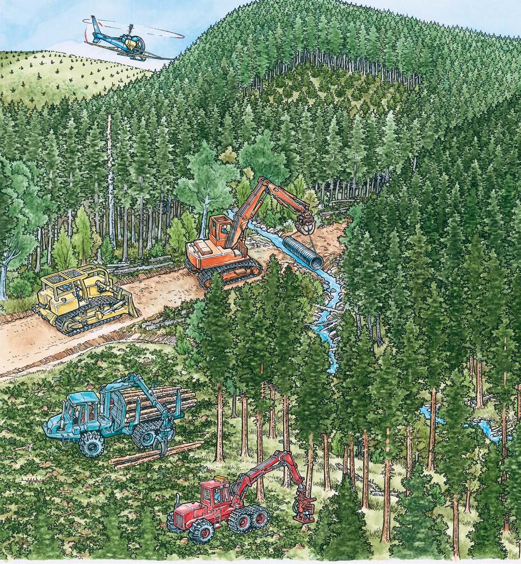

62 OregonForests.org KnowYourForest.org
REFORESTATION AFTER HARVEST
 REFORESTATION AFTER HARVEST You will be harvesting some timber. Do you need to plan to reforest the area? The purpose of the reforestation rules is to establish standards to ensure the timely replacement
ExtensionNotes. Careful Logging Practices: The Ontario Woodlot. Selecting the Right Harvesting Equipment ONTARIO WOODLOT ASSOCIATION
 ONTARIO WOODLOT ASSOCIATION ExtensionNotes Careful Logging Practices: Selecting the Right Harvesting Equipment The Ontario Woodlot Association published A Landowner s Guide to Careful Logging in 2009.
Harvesting Systems and Equipment in British Columbia
 Harvesting Systems and Equipment in British Columbia Ministry of Forests Forest Practices Branch Harvesting Systems and Equipment in British Columbia REFERENCE Operating Techniques Page 127 134 The handbook
Timber Harvesting Options for Woodland Owners
 LOGGING EC 1582 August 2006 $2.50 Timber Harvesting Options for Woodland Owners R. Parker and S. Bowers Contents Choosing the best harvest system... 2 Table 1. General performance of various timber yarding
The Science Behind Forest Riparian Protection in the Pacific Northwest States By George Ice, Summer 2004
 The Science Behind Forest Riparian Protection in the Pacific Northwest States By George Ice, Summer 2004 Riparian buffers, streamside management zones, and similar measures are essential parts of forest
LOGGING METHODS for WISCONSIN WOODLANDS. A landowner s guide to timber harvesting in Wisconsin s forests
 LOGGING METHODS for WISCONSIN WOODLANDS A landowner s guide to timber harvesting in Wisconsin s forests 1 Equipment descriptions & Illustrations Timber harvesting is an integral part of sound forest management.
What is Thinning? The most challenging logging chance faced by a harvesting system. The objectives of thinning are to: Thinning vs.
 What is Thinning? The most challenging logging chance faced by a harvesting system. The objectives of thinning are to: Remove small, poorly formed, diseased, or otherwise undesirable trees Improve the
Timber Sale Appraisal Shepherds Pie Sale cost summary. Conifer Hardwood Total. Gross Timber Sale Value $2,013, $13,263.
 Timber Sale Appraisal Shepherds Pie Sale 341-14-23 District: N Cascade Date: January 14, 2014 cost summary Conifer Hardwood Total Gross Timber Sale Value $2,013,923.22 $13,263.00 $2,027,186.22 Project
Timber Sale Appraisal Sunday Passage Sale FG
 Timber Sale Appraisal Sunday Passage Sale FG-341-2018-024- District: Forest Grove Date: August 23, 2017 Cost Summary Conifer Hardwood Total Gross Timber Sale Value $3,295,699.11 $68,708.64 $3,364,407.75
TIMBER SALE SUMMARY Rusty Rope Contract No Location: Portions of Sections 22, 26, 27 and 35, W.M., Clatsop County, Oregon.
 TIMBER SALE SUMMARY Rusty Rope Contract No. 341-16-52 1. Location: Portions of Sections 22, 26, 27 and 35, W.M., Clatsop County, Oregon. 2. Type of Sale: This timber sale is a 141 acre Modified Clearcut.
Timber Sale Appraisal More Cow Bell Sale FG W
 Timber Sale Appraisal Sale FG-341-2019-W00542-01 District: Forest Grove Date: January 24, 2019 Cost Summary Conifer Hardwood Total Gross Timber Sale Value $2,048,273.85 $10,164.42 $2,058,438.27 Project
Appendix A (Project Specifications) Patton Mill Fuel Break Project
 Patton Mill Fuel Break Project") Appendix A (Project Specifications) Patton Mill Fuel Break Project I. Proposed Actions: A. Construct a Fuel Break (approximately 5 miles, about 120 acres): The fuel break is located along a segment of
Appendix A (Project Specifications) Patton Mill Fuel Break Project I. Proposed Actions: A. Construct a Fuel Break (approximately 5 miles, about 120 acres): The fuel break is located along a segment of
Timber Sale Appraisal Likely Storey Sale FG W
 Timber Sale Appraisal Likely Storey Sale FG-341-2019-W00543-02 District: Forest Grove Date: August 28, 2018 Cost Summary Conifer Hardwood Total Gross Timber Sale Value $1,546,409.96 $0.00 $1,546,409.96
Timber Sale Appraisal Ten Points South Sale WL
 Timber Sale Appraisal Sale WL-341-2019-50- District: Western Lane Date: June 18, 2018 Cost Summary Conifer Hardwood Total Gross Timber Sale Value $290,447.68 $1,740.04 $292,187.72 Project Work: ($32,825.00)
SILVICULTURE SILVICULTURE 10/8/2018. Ecological forestry (Ecosystem management)
") SILVICULTURE SILVICULTURE Dave Peterson University of Washington School of Environmental and Forest Sciences Thanks to Kristi McClelland, Boyd Evison, and Greg Ettl Silviculture The science and art of
SILVICULTURE SILVICULTURE Dave Peterson University of Washington School of Environmental and Forest Sciences Thanks to Kristi McClelland, Boyd Evison, and Greg Ettl Silviculture The science and art of
Forest Harvesting in Virginia
 Forest Harvesting in Virginia Characteristics of Virginia s Logging Operations ANR-5 Forest Harvesting in Virginia Characteristics of Virginia s Logging Operations Scott M. Barrett Joshua L. Chandler M.
Timber Sale Appraisal Bad Ham Sale KL
 Timber Sale Appraisal Bad Ham Sale KL-341-2017-054- District: Klamath/Lake Date: October 06, 2016 Cost Summary Conifer Hardwood Total Gross Timber Sale Value $351,028.84 $0.00 $351,028.84 Project Work:
Harvesting Systems and Equipment in British Columbia
 Harvesting Systems and Equipment in British Columbia Ministry of Forests Forest Practices Branch Harvesting Systems and Equipment Part One EQUIPMENT SELECTION Chart 1 to 13 The handbook does not attempt
Final Economic Assessment and Logging Systems Report For Moonlight Wheeler Recovery Project
 Final Economic Assessment and Logging Systems Report For Moonlight Wheeler Recovery Project Submission of this report by Elaine Vercruysse, December 15, 2008 Moonlight Wheeler Recovery Project is contained
Dear Interested Party:
 United States Department of Agriculture Forest Service Beaverhead-Deerlodge National Forest 420 Barrett Street Dillon, MT 59725 406 683-3900 File Code: 1950 Date: June 7, 2011 Dear Interested Party: Thank
a.research 3.ssoc.iate 2nd "'''~,"u'a Forest F~esearc.h endo:rset:n.ent nor not of con1nj_e:tcic:u names failure to n1ention 2 r1ct1ne
 a.research 3.ssoc.iate 2nd "'''~,"u'a Forest F~esearc.h of con1nj_e:tcic:u names failure to n1ention 2 r1ct1ne not critic.isxr.l endo:rset:n.ent nor EFFECT OF MECHANIZED TREE HARVESTING ON JACK PINE REGENERATION
Timber Sale Appraisal Boxcar Willie Sale FG
 Timber Sale Appraisal Boxcar Willie Sale FG-341-2018-28- District: Forest Grove Date: July 11, 2017 Cost Summary Conifer Hardwood Total Gross Timber Sale Value $1,654,942.01 $50,453.52 $1,705,395.53 Project
PRODUCTIVITY OF A TREE LENGTH HARVESTING SYSTEM THINNING PONDEROSA PINE IN NORTHERN ARIZONA
 PRODUCTIVITY OF A TREE LENGTH HARVESTING SYSTEM THINNING PONDEROSA PINE IN NORTHERN ARIZONA Jason D. Thompson USDA Forest Service Auburn, AL jasonthompson@fs.fed.us ABSTRACT - In the fall of 2 a productivity
CATEGORICAL EXCLUSION WORKSHEET: RESOURCE CONSIDERATIONS
 CATEGORICAL EXCLUSION WORKSHEET: RESOURCE CONSIDERATIONS Operations Lower Snake WUI Dillon Ranger District White River National Forest Description of the Proposed Action Vegetation management activities
Timber Sale Appraisal Shroyer Summit. Sale WO Cost Summary. Conifer Hardwood Total. District: West Oregon Date: July 20, 2015
 Timber Sale Appraisal Shroyer Summit Sale WO-341-2016-34- District: West Oregon Date: July 20, 2015 Cost Summary Conifer Hardwood Total Gross Timber Sale Value $1,160,723.39 $48,338.72 $1,209,062.11 Project
CATEGORICAL EXCLUSION WORKSHEET: RESOURCE CONSIDERATIONS
 CATEGORICAL EXCLUSION WORKSHEET: RESOURCE CONSIDERATIONS Developed Recreation/Trails, Wilderness & Roadless Jasper Mountain Priest Lake Ranger District Idaho Panhandle National Forest Description of the
Thinning, Fuel Manipulation and Prescribed Fire in Dry Forest Types
 Thinning, Fuel Manipulation and Prescribed Fire in Dry Forest Types Bob Rich Forest Management Supervisor, Missoula Unit. Montana Department of Natural Resources and Conservation: Missoula, Montana ABSTRACT
Notice is hereby given that bids will be received by the Unit Manager, BARAGA MANAGEMENT UNIT, for certain timber on the following described lands:
 DEPARTMENT OF NATURAL RESOURCES STATE OF MICHIGAN TIMBER SALE PROSPECTUS #6400 SCHEDULED SALE DATE AND TIME: 9:00 a.m. (local time) on April 11, 2019. LOCATION: BARAGA MGMT UNIT, 427 US 41 NORTH, BARAGA,
Foresters utilize a variety of specialized tools to accomplish the following tasks:
 Forestry Tools Foresters utilize a variety of specialized tools to accomplish the following tasks: Measure trees Conduct forest inventory Mark trees Measure logs Plant trees Navigation and orientation
Ecological Assessment of Biomass Thinning in Coastal Forests. Phase II: Pre and post-harvest stand assessment of woody biomass harvesting
 Ecological Assessment of Biomass Thinning in Coastal Forests Phase II: Pre and post-harvest stand assessment of woody biomass harvesting REPORT COMPILED BY: GREGORY A. GIUSTI UNIVERSITY OF CALIFORNIA COOPERATIVE
GREAT LAKES REGIONAL MICHIGAN MASTER LOGGER FIELD AUDIT FORM. Field Verifier s I.D. #: Acres: Sale #:
 Applicant s I.D. #: Date Audited: Field Verifier s I.D. #: Acres: Sale #: 1 The purpose of this form is to document an applicant s compliance in specific areas of responsibility and with performance standards
Chapter 2 Timber Cruising
 Chapter 2 Timber Cruising Timber cruising is a procedure for determining the gross and net volume and value (timber quality) for a tract of timber. Cruising involves measuring tree diameter and height
Timber Sales 101 Accomplishing Multiple Objectives through Timber Harvesting February 21, 2013
 Timber Sales 101 Accomplishing Multiple Objectives through Timber Harvesting February 21, 2013 Don Hamann Logging Contractor Don Hamann, Inc. Butte Falls, Oregon Marty Main Consulting Forester Small Woodland
Timber Sale Appraisal Clatstastic Sale FG
 Timber Sale Appraisal Clatstastic Sale FG-341-2018-15- District: Forest Grove Date: February 20, 2018 Cost Summary Conifer Hardwood Total Gross Timber Sale Value $3,443,295.15 $56,673.24 $3,499,968.39
Timber Sale Appraisal Rock Fish Sale cost summary. Conifer Hardwood Total. Gross Timber Sale Value $0.00 $117, $117,005.
 Timber Sale Appraisal Rock Fish Sale 341-13-71 District: West Oregon Date: November 14, 2012 cost summary Conifer Hardwood Total Gross Timber Sale Value $0.00 $117,005.52 $117,005.52 Project Work: $(18,056.00)
Guide to Forest Aesthetics in Montana
 Guide to Forest Aesthetics in Montana Actively managing forests to insure their health and value often requires activities such as road building and commercial logging. In some situations, such activities
Full-tree harvesting system aids forest management
 Utah State University DigitalCommons@USU Aspen Bibliography Aspen Research 1969 Full-tree harvesting system aids forest management Z.A. Zasada J.C. Tappeiner Follow this and additional works at: https://digitalcommons.usu.edu/aspen_bib
Notice is hereby given that bids will be received by the Unit Manager, GWINN MANAGEMENT UNIT, for certain timber on the following described lands:
 DEPARTMENT OF NATURAL RESOURCES STATE OF MICHIGAN TIMBER SALE PROSPECTUS #6313 SCHEDULED SALE DATE AND TIME: 1:00 p.m. (local time) on December 17, 2018. LOCATION: GWINN MGMT UNIT, 410 WEST M 35, GWINN,
Timber Sale Appraisal East Dean Sale CS
 Timber Sale Appraisal Sale CS-341-2017-68- District: Coos Date: December 13, 2016 Cost Summary Conifer Hardwood Total Gross Timber Sale Value $395,372.12 $4,466.90 $399,839.02 Project Work: $0.00 Advertised
Harvesting Western Juniper (Juniperus occidentalis) in Eastern Oregon - A Case Study
 in Eastern Oregon - A Case Study") Harvesting Western Juniper (Juniperus occidentalis) in Eastern Oregon - A Case Study J.F. McNeel, University of British Columbia and L. Swan, U.S. Forest Service This paper summarizes the results of a
Harvesting Western Juniper (Juniperus occidentalis) in Eastern Oregon - A Case Study J.F. McNeel, University of British Columbia and L. Swan, U.S. Forest Service This paper summarizes the results of a
In-woods Chipping. Popular in the early 1970 s Big demand for pulp fiber and wood for industrial fuel. WDSC 422 Chipping and Wetland Systems 1
 In-woods Chipping Popular in the early 1970 s Big demand for pulp fiber and wood for industrial fuel WDSC 422 Chipping and Wetland Systems 1 In-woods Chipping Chippers: Produce whole-tree chips Grind/chip
Minnesota Logger Education Program s Minnesota Master Logger Certification Program
 Minnesota Logger Education Program s Minnesota Master Logger Certification Program Program Participant Responsibility Areas Include: Area One: Area Two: Area Three: Area Four: Area Five: Area Six: Area
Appendix A: Vegetation Treatment Descriptions and Unit Specific Design Criteria
 Appendix A: Vegetation Treatment Descriptions and Unit Specific Design Criteria The table below describes the Kabetogama Project proposed vegetation treatments associated with Alternative 2. The treatment
Timber Sale Appraisal Knob Point Combination. Sale AT Cost Summary. Conifer Hardwood Total. District: Astoria Date: April 20, 2015
 Timber Sale Appraisal Knob Point Combination Sale AT-341-2015-54- District: Astoria Date: April 20, 2015 Cost Summary Conifer Hardwood Total Gross Timber Sale Value $1,321,653.69 $34,121.84 $1,355,775.53
Notice is hereby given that bids will be received by the Unit Manager, BARAGA MANAGEMENT UNIT, for certain timber on the following described lands:
 DEPARTMENT OF NATURAL RESOURCES STATE OF MICHIGAN TIMBER SALE PROSPECTUS #6163 SCHEDULED SALE DATE AND TIME: 9:00 a.m. (local time) on March 8, 2018. LOCATION: BARAGA MGMT UNIT, 427 US 41 NORTH, BARAGA,
AVALONIA LAND CONSERVANCY FEE LAND STEWARDSHIP PRINCIPLES
 AVALONIA LAND CONSERVANCY FEE LAND STEWARDSHIP PRINCIPLES This document has been prepared for guidance in developing Property Management Plans for individual properties Avalonia owns in fee. It sets forth
Mechanical Site Preparation
 Mechanical Site Preparation 1 Mechanical Site Preparation Introduction...3 CONTENTS The Benefits of Guidelines...3 Considerations...5 Design Outcomes To Maintain Soil Productivity...6 Planning...7 Planning
Timber Sale Appraisal Iron Mountain Sale WL W
 Timber Sale Appraisal Sale WL-341-2019-W00579-01 District: Western Lane Date: October 04, 2018 Cost Summary Conifer Hardwood Total Gross Timber Sale Value $1,502,336.08 $780.25 $1,503,116.33 Project Work:
Walla Walla Ranger District
 United States Department of Agriculture Forest Service Walla Walla Ranger District 1415 West Rose Walla Walla, WA 99362 509-522-6290 File Code: 1950 Date: September 30, 2014 Dear Forest User: The Walla
National Forests in North Carolina Croatan National Forest Croatan Ranger District
 United States Department of Agriculture Forest Service National Forests in North Carolina Croatan National Forest Croatan Ranger District 141 East Fisher Avenue New Bern, NC 28560-8468 252-638-5628 File
CHARLES SOIL CONSERVATION DISTRICT COMPLIANCE AGREEMENT FOR THE STANDARD EROSION AND SEDIMENT CONTROL PLAN FOR FOREST HARVEST OPERATIONS
 CHARLES SOIL CONSERVATION DISTRICT COMPLIANCE AGREEMENT FOR THE STANDARD EROSION AND SEDIMENT CONTROL PLAN FOR FOREST HARVEST OPERATIONS I. Site Information A. Location (Include site map of harvest area)
Timber Sale Appraisal Buck Ridge. Sale GP Cost Summary. Conifer Hardwood Total. District: Southwest Date: April 23, 2015
 Timber Sale Appraisal Buck Ridge Sale GP-31-2015-88- District: Southwest Date: April 23, 2015 Cost Summary Conifer Hardwood Total Gross Timber Sale Value $68,0.32 $7,950.00 $76,35.32 Project Work: ($19,580.00)
DEPARTMENT OF NATURAL RESOURCES STATE OF MICHIGAN TIMBER SALE PROSPECTUS #6309
 DEPARTMENT OF NATURAL RESOURCES STATE OF MICHIGAN TIMBER SALE PROSPECTUS #6309 SCHEDULED SALE DATE AND TIME: 2:00 p.m. (local time) on December 19, 2018. LOCATION: SHINGLETON MGMT UNIT, PO BOX 67, M 28
Notice is hereby given that bids will be received by the Unit Manager, BARAGA MANAGEMENT UNIT, for certain timber on the following described lands:
 DEPARTMENT OF NATURAL RESOURCES STATE OF MICHIGAN TIMBER SALE PROSPECTUS #6329 SCHEDULED SALE DATE AND TIME: 9:00 a.m. (local time) on December 6, 2018. LOCATION: BARAGA MGMT UNIT, 427 US 41 NORTH, BARAGA,
PROSPECTUS CAPPELL C LOGGING UNIT YUROK INDIAN LANDS
 PROSPECTUS CAPPELL C LOGGING UNIT YUROK INDIAN LANDS I. INTRODUCTION The purpose of this Prospectus is to furnish sufficient information in addition to that contained in the published advertisement to
NATURAL RESOURCES FOREST MANAGEMENT
 ARMY TM 5-631 NAVY NAVFACM0-100.2 AIR FORCE AFM 126-3 TECHNICAL MANUAL NATURAL RESOURCES FOREST MANAGEMENT DEPARTMENTS OF T HE ARMY, THE NAVY, AND THE AIR FORCE DECEMBER 1981 Figure 2-2. Paint
Dr. Greg Bruland NREM 461
 Pasture, Rangeland, Forest Management Dr. Greg Bruland NREM 461 1 Soil conservation strategies for non-cultivated land (El-Swaify et al. 1982, Morgan 2005) 2 3 I. Pasture, Rangeland & Forest Mgmt A. Pasture,
Timber Sale Appraisal Fish Ridge Sale cost summary. Conifer Hardwood Total. Gross Timber Sale Value $574, $11, $585,953.
 Timber Sale Appraisal Sale 341-13-97 District: Western Lane Date: March 14, 2013 cost summary Conifer Hardwood Total Gross Timber Sale Value $574,044.63 $11,909.25 $585,953.88 Project Work: $(31,313.00)
Mixed Conifer Working Group Meeting April 15, 2011 Water and Soil Resource Management Considerations
 Mixed Conifer Working Group Meeting April 15, 2011 Water and Soil Resource Management Considerations It is difficult to tie watershed health directly to mixed-conifer forests. Watersheds encompass a variety
Timber Sale Appraisal Iron Nelson Sale WL W
 Cost Summary Conifer Hardwood Total Gross Timber Sale Value $2,038,184.46 $1,194.48 $2,039,378.94 Project Work: $0.00 Advertised Value: $2,039,378.94 9/26/18 1 Timber Description Location: Portions of
WEST VIRGINIA DIVISION OF FORESTRY STATE FOREST STANDARDS for LOGGING ROADS AND SKID TRAILS HAUL ROADS
 WEST VIRGINIA DIVISION OF FORESTRY STATE FOREST STANDARDS for LOGGING ROADS AND SKID TRAILS HAUL ROADS The objective of these specifications is to provide the construction requirements for haul roads and
Timber Sale Appraisal Happy Hen Sale WL
 Timber Sale Appraisal Sale WL-341-2018-64- District: Western Lane Date: June 22, 2017 Cost Summary Conifer Hardwood Total Gross Timber Sale Value $977,292.98 $45,232.56 $1,022,525.54 Project Work: ($46,019.00)
Shortwood Systems. NSCC-Natural Resources Forestry
 NSCC-Natural Resources Forestry Shortwood harvesting systems produce products at the stump Wood is piled (bunched) in the woods on cutting trails Products include pulpwood, studwood, sawlogs, fence posts
Timber Sale Appraisal Steep Puppy Sale KL
 Timber Sale Appraisal Steep Puppy Sale KL-341-2018-33- District: Klamath/Lake Date: August 24, 2017 Cost Summary Conifer Hardwood Total Gross Timber Sale Value $821,529.46 $0.00 $821,529.46 Project Work:
Stand Dynamics and Health. Helping Your Woods Grow. For most of us this is our goal. Traditional Land Knowledge. Forest Function and Wildlife Habitat
 Helping Your Woods Grow the art and science of silviculture Stand Dynamics and Health Kristi McClelland, King County DNRP Forester http://cru.cahe.wsu.edu/cepublications/eb2000/eb2000.pdf Photo by John
Focus on Forest Engineering 2011
 Focus on Forest Engineering 2011 The application of Full-tree and Treelength Systems on Difficult Terrain: Increasing our knowledge base to better select and operate FT and TL equipment Gary Olsen International
2008 Council on Forest Engineering (COFE) Conference Proceedings: Addressing Forest Engineering Challenges for the Future Charleston, June 22-25, 2008
 Conference Proceedings: Addressing Forest Engineering Challenges for the Future Charleston, June 22-25, 2008") Production for a Biomass Harvesting System in Pine Brandon O Neal and Tom Gallagher Graduate Research Assistant and Assistant Professor School of Forestry and Wildlife Sciences, Auburn University, Auburn,
Production for a Biomass Harvesting System in Pine Brandon O Neal and Tom Gallagher Graduate Research Assistant and Assistant Professor School of Forestry and Wildlife Sciences, Auburn University, Auburn,
Cable and Aerial Logging
 Cable and Aerial Logging Cable yarding Balloon yarding Helicopter logging 1 Cable Yarding Was first used in 1881 for logging redwoods in California stationary steam powered drum manila rope as the cable
Forest Stewardship Plan
 Forest Stewardship Plan Effective plan date: June 1, 2002 Forestry is the art and science of managing forest lands and their related resources, including trees and other plants, animals, soil, water, and
Lesson 11: Harvesting Timber Products
 Lesson 11: Harvesting Timber Products TEACHER: SCHOOL: GRADE LEVEL: 9-12 TASKS/COMPETENCIES ANR8040.102 Demonstrate ability to fell trees according to cutting patterns, using chain saw. ANR8040.103 Demonstrate
Forest Restoration and Fire Prevention in the Lake Tahoe Basin
 Forest Restoration and Fire Prevention in the Lake Tahoe Basin Legislative Committee for the Review and Oversight of the Tahoe Regional Planning Agency (TRPA) and the Marlette Lake Water System January
OVERVIEW OF APPROACHES TO SUSTAIN FOREST PRODUCTIVITY DURING FOREST ROAD DEVELOPMENT AND TIMBER HARVESTING ACTIVITIES
 OVERVIEW OF APPROACHES TO SUSTAIN FOREST PRODUCTIVITY DURING FOREST ROAD DEVELOPMENT AND TIMBER HARVESTING ACTIVITIES Charles R. Blinn, Rick Dahlman, James A. Mattson, and Michael A. Thompson 1 ABSTRACT.
SECTION C--DESCRIPTION/SPECIFICATIONS/STATEMENT OF WORK
 SECTION C--DESCRIPTION/SPECIFICATIONS/STATEMENT OF WORK C.1 SCOPE OF CONTRACT Description of Work: The intent of this contract is to secure whole tree harvesting with subsequent processing of dead and
Loading Productivity of Untrimmed and Trimmed Pulpwood
 Loading Productivity of Untrimmed and Trimmed Pulpwood Jason Thompson 1, John Klepac 1, and Dana Mitchell 2 1 Engineer, Forest Operations Research Unit, Southern Research Station, USDA Forest Service 2
Soil compaction can happen whenever machinery, livestock, or people
 FOREST PROTECTION EC 1109 Reprinted March 1998 $1.50 Soil Compaction on Woodland Properties P.W. Adams Contents What is soil compaction?... 1 Why is compaction a problem?... 2 How can you recognize compaction?...
Notice is hereby given that bids will be received by the Unit Manager, GWINN MANAGEMENT UNIT, for certain timber on the following described lands:
 DEPARTMENT OF NATURAL RESOURCES STATE OF MICHIGAN TIMBER SALE PROSPECTUS #6313 SCHEDULED SALE DATE AND TIME: 1:00 p.m. (local time) on December 17, 2018. LOCATION: GWINN MGMT UNIT, 410 WEST M 35, GWINN,
Timber Sale Appraisal Appairently Not Sale WO W
 Timber Sale Appraisal Appairently Not Sale WO-341-2019-W00227-01 District: West Oregon Date: August 27, 2018 Cost Summary Conifer Hardwood Total Gross Timber Sale Value $574,942.80 $0.00 $574,942.80 Project
Kuiu Timber Sale Unit Card. Resource Concerns & Responses
 Kuiu Timber Sale Unit Card Unit Number: 32 Unit Acres: 66 Alternatives: 4 1999 Aerial 298_123, Land Use Net Timber Photo: 298_124 Designation: Timber Production Volume: TM-Compartment and Stand: 3-136
2015 Wisconsin Envirothon KEY Forestry Exam
 2015 Wisconsin Envirothon KEY Forestry Exam Answers that are correct but differ strongly from answer key must be initialized by Station Captain as an approved answer prior to delivery to score stewards.
A Primer for Timber Harvesting
 A Primer for Timber Harvesting EB 1316 Washington State University Extension Pullman, Washington Authors Francis R. Greulich, Ph.D., Professor of Forest Engineering, College of Forest Resources, University
2.4 MANAGING FOR HIGH-VALUE TREES
 2.4 MANAGING FOR HIGH-VALUE TREES BACKGROUND Quality timber trees are important to the region s wood products industry. Quality is determined by tree size and the amount of clear, knot-free lumber the
The Art of Timber Cruising Part II Fixed-Area Plots
 The Art of Timber Cruising Part II Fixed-Area Plots In this second article on timber cruising, we will be looking at a simple method of preparing a basic description of the forest compartments in your
AG. 350 FORESTRY AND WILDLIFE MANAGEMENT
 AG. 350 FORESTRY AND WILDLIFE MANAGEMENT COURSE DESCRIPTION: A course designed to examine the importance of forestry, wildlife, and outdoor recreation with emphasis on efficient use of natural resources.
Harvesting Systems and Equipment in British Columbia
 Harvesting Systems and Equipment in British Columbia Ministry of Forests Forest Practices Branch Harvesting Systems and Equipment in British Columbia PART 2: REFERENCE PRIMARY TRANSPORT EQUIPMENT Part
DEPARTMENT OF NATURAL RESOURCES STATE OF MICHIGAN TIMBER SALE PROSPECTUS #6210
 DEPARTMENT OF NATURAL RESOURCES STATE OF MICHIGAN TIMBER SALE PROSPECTUS #6210 SCHEDULED SALE DATE AND TIME: 9:00 a.m. (local time) on August 16, 2018. LOCATION: PIGEON RIVER COUNTRY MGMT UNIT, 9966 TWIN
FOR 274 Forest Measurements and Inventory. Written Take Home Exam
 FOR 274 Forest Measurements and Inventory Written Take Home Exam Instructions: This exam is comprehensive of the material covered within the Forest Resources 274 class curriculum. The first question is
Group Selection Cutting in Mature Douglas-fir Forests
 Group Selection Cutting in Mature Douglas-fir Forests Tristan Huff Group selection is a way to partially emulate older forest structure while still allowing for significant timber production. Under this
MOTI -- Five Strand Barbed Wire & Paige Wire Fence Specifications
 MOTI -- Five Strand Barbed Wire & Paige Wire Fence Specifications SCHEDULE 8 (and attached drawings) FIVE STRAND BARBED-WIRE FENCE SPECIFICATIONS Rocky Mountain District General If equipment is used at
Appendix J-1 Marking Guidelines Alternative 4 GTR 220
 Appendix J-1 Marking Guidelines Alternative 4 GTR 220 General Principles The Alternative 4 of the KREW Project is implementing the landscape, ecological vision of An Ecosystem Management Strategy for Sierran
FORESTRY AND WILDLIFE MANAGEMENT AG
 Student's Name FORESTRY AND WILDLIFE MANAGEMENT AG 0350 Directions: Rating Scale: Evaluate the trainee using the rating scale below and check the appropriate number to indicate the degree of competency
Notice is hereby given that bids will be received by the Unit Manager, ROSCOMMON MANAGEMENT UNIT, for certain timber on the following described lands:
 DEPARTMENT OF NATURAL RESOURCES STATE OF MICHIGAN TIMBER SALE PROSPECTUS #6236 SCHEDULED SALE DATE AND TIME: 2:00 p.m. (local time) on November 20, 2018. LOCATION: ROSCOMMON MGMT UNIT, PO BOX 218, ROSCOMMON,
DEPARTMENT OF NATURAL RESOURCES STATE OF MICHIGAN TIMBER SALE PROSPECTUS #6265
 DEPARTMENT OF NATURAL RESOURCES STATE OF MICHIGAN TIMBER SALE PROSPECTUS #6265 SCHEDULED SALE DATE AND TIME: 9:00 a.m. (local time) on November 8, 2018. LOCATION: PIGEON RIVER COUNTRY MGMT UNIT, 9966 TWIN
UNEVEN-AGED MANAGEMENT NORTHWEST CERTIFIED FORESTRY
 UNEVEN-AGED MANAGEMENT NORTHWEST CERTIFIED FORESTRY Rolf Gersonde, 6/6/2015 Uneven-aged Management in 90 Minutes 2 Silviculture Background Forest Ecology Management Tools and Stocking Control Multi-aged
Notice is hereby given that bids will be received by the Unit Manager, BARAGA MANAGEMENT UNIT, for certain timber on the following described lands:
 DEPARTMENT OF NATURAL RESOURCES STATE OF MICHIGAN TIMBER SALE PROSPECTUS #6329 SCHEDULED SALE DATE AND TIME: 9:00 a.m. (local time) on December 6, 2018. LOCATION: BARAGA MGMT UNIT, 427 US 41 NORTH, BARAGA,
Unit C: Forest Management. Lesson 5: Harvesting Forest Trees
 Unit C: Forest Management Lesson 5: Harvesting Forest Trees 1 Terms Bucking Clear cutting Establishment cutting Felling Group selection method Limbing Logging Non-point source pollution Removal cuttings
3.15 SNAG AND SNAG ASSOCIATED SPECIES
 3.15 SNAG AND SNAG ASSOCIATED SPECIES 3.15.1 Scope of the Analysis Snags play an important role in creating biodiversity on the landscape. They provide holes that are homes for birds and small mammals,
Notice is hereby given that bids will be received by the Unit Manager, ESCANABA MANAGEMENT UNIT, for certain timber on the following described lands:
 DEPARTMENT OF NATURAL RESOURCES STATE OF MICHIGAN TIMBER SALE PROSPECTUS #6311 SCHEDULED SALE DATE AND TIME: 3:00 p.m. (local time) on January 16, 2019. LOCATION: ESCANABA MGMT UNIT, 6833 HWY'S 2, 41 &
DEPARTMENT OF NATURAL RESOURCES STATE OF MICHIGAN TIMBER SALE PROSPECTUS #6374
 DEPARTMENT OF NATURAL RESOURCES STATE OF MICHIGAN TIMBER SALE PROSPECTUS #6374 SCHEDULED SALE DATE AND TIME: 2:00 p.m. (local time) on February 13, 2019. LOCATION: SHINGLETON MGMT UNIT, PO BOX 67, M 28