A Lake Classification and Conservation Portfolio for Wisconsin
|
|
|
- Jesse Nichols
- 6 years ago
- Views:
Transcription
1 A Lake Classification and Conservation Portfolio for Wisconsin Kristen Blann Freshwater ecologist The Nature Conservancy Based on development of the lake classification and conservation portfolio for MN, ND, and SD
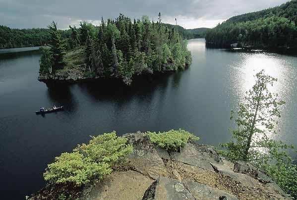
 Wild Rivers Legacy Forest (Northeast Wisconsin) www.nature.")
2 The Nature Conservancy in Wisconsin Nonprofit conservation organization Since 1960, the Conservancy has protected more than 230,000 acres of critical land and water habitats in Wisconsin, including: Border Lakes Area and Catherine Wolter Wilderness Area Caroline Lake (North Central Wisconsin) Wild Rivers Legacy Forest (Northeast Wisconsin)


3 Why a lake portfolio? How to protect the best of the best? TNC ecoregional plans but these focused on terrestrial habitats, rivers, and watersheds What about me?


4 Lake Classification What makes a lake a lake? How many unique lake types are there? What do we need to protect?
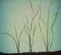
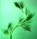
5 Step 1: Classification Which variables really matter? From literature review & analysis: Lake substrate & geology Connectivity Aquatic plant communities Drainage basin size & landscape position Lake Size Depth Max Mean Average Watershed land use
")
6 What do we already know about lake classification? Oligotrophic Mesotrophic Eutrophic Hypereutrophic TSI Transparency (Secchi disk) Chlorophyll-a Total Phosphorus


7 A lake is influenced by its watershed Geologic origin and history Climate & runoff Geology and Soils Topography & position Land use & vegetation cover Impervious Surface


8 Biological communities (fish, aquatic plants) strongly respond to water quality, ecoregion, and lake morphology

9 Fish communities also relate strongly to ecoregion Minnesota s Ecoregions
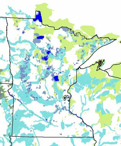
10 (3) Distribution of fisheries (Schupp) lake classes in MN

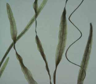
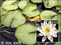
11 So do Aquatic Plant Communities N. Minnesota Drift & Lake Plains Southern Superior Uplands Western Superior Uplands Lake Agassiz, Aspen Parklands N. Minnesota & Ontario Peatlands Red River Valley Minnesota & NE Iowa Morainal North Central Glaciated Plains Northern Superior Upla Paleozoic Plateau Yellow water lily
12 FINAL CLASSIFICATION (1) Hierarchical lake macrohabitat classification Ecoregion Macrohabitat Ecological Drainage Unit Ecological Section Size Large Medium Small Depth Connectivity Landscape Geo position chemistry Shallow Deep Very deep Shallow Deep Very deep Shallow Deep Very deep Riverine Unconnected Upland/Headwater Downstream Hardwater Softwater (2) Biological Classifications - Fish community class - Aquatic plant community class


13 Step 2: Assessing Condition & Viability Condition: Undeveloped land use, high public/conservation ownership, groundwater, water quality indicators and criteria, IBI, intolerant and sensitive taxa/species Viability High natural cover, low vulnerability based on connections & drainage position, depth, volume, watershed: lake ratio, lake class Threats Threat indicators: exotic species, boat ramps, cropland and agriculture in the buffer, population growth and density, vulnerability to climate change


14 Step 3 Portfolio Priorities Selected top 10% (Representativeness) The Best of the Best?
15 Step 3 Portfolio Selection Identified top 10% of each by: Lake hydrogeomorphic types Fish community classes Aquatic plant community classes Species (including SGCN) Wild rice Final based on multiple top 10% criteria

16 Minnesota Lake Conservation Portfolio: Products Report Maps Spatial Data Fun Facts Fact Sheets Fun Facts


17 Outcomes & Potential Uses
18 Applications - Conservation Traditional Tools & Strategies Easements & Acquisition Shoreland protection/restoration Adaptive assessment & monitoring Wild Rice Lakes Tullibee Lakes

 in February 2010 Sunfish Lake project Twin Lakes project east of Camp")
19 Implementing the Portfolio: Supporting partners in identifying & protecting critical lands & shoreland Photo: Kristen Blann Lake Alexander ½ mile of shoreline as part of TNC Lake Alexander Preserve in central Minnesota + a recent 80 acre acquisition Recent assists in central Minnesota SNA acquisition between Lake Alexander and Fishtrap Lake Egg Lake 1446 feet of shoreline transferred to Cass County (thru TNC & anonymous donor) in February 2010 Sunfish Lake project Twin Lakes project east of Camp Ripley


20 Implementing the Portfolio: Watershed protection Cont d MN Forest Legacy Partnership: $Millions for conservation easements on 1000s of acres in Itasca, Cass, Koochiching - e.g. Pillsbury State Forest on Gull Lake, lots of small lakes Partnerships Wild rice protection, NW Itasca county portfolio lakes & basins BWSR CWF grant for Crow Wing County on Gull and Big Trout lakes Agate Lake/Lk Margaret grant app.
21 Applications Setting goals and priorities What should my lake look like? What are ecologically appropriate / realistic goals? Protect vs. Enhance vs. Restore
22 Assessing condition and viability to inform priority lakes and strategies Example: Minnesota DNR s Lake Fish Habitat Strategic Plan Low disturbance, high protection Low disturbance, low protection Moderate disturbance, low protection High disturbance, low protection Protect vs. Enhance vs. Restore


23 Assessing condition and viability to inform priority lakes and strategies Example: Minnesota DNR s Lake Fish Habitat Strategic Plan Low disturbance, high protection Low disturbance, low protection Moderate disturbance, low protection High disturbance, low protection

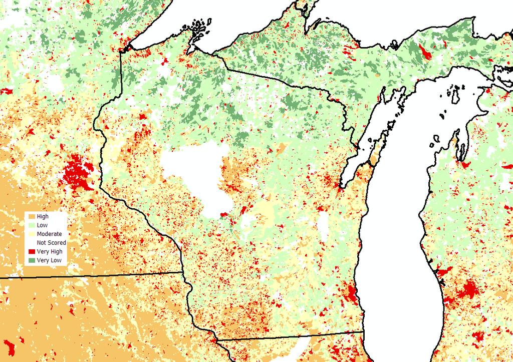
24 Cumulative Disturbance Index NFHP Assessment

25 Applications Conservation Guide partnership work Water Quality restoration & improvement projects Lake protection priorities Targeted education / outreach Climate change vulnerability assessment and adaptation strategies
26 We want your ideas and input! What should be included in a lake classification and conservation portfolio for Wisconsin? How could this be useful to you? Sign up to fill out a Survey Monkey survey for us: kblann@tnc.org

27 Acknowledgments Carrol Schaal, Water Quality, WI DNR Wisconsin TNC Darby Nelson, Author For Love of Lakes Everyone who shared datasets and advice Any Photographers whose photos appear brazenly unacknowledged in this presentation


28 A lake is the landscape's most beautiful and expressive feature; it is the earth's eye / Looking into which the beholder measures the depth of his own nature Henry David Thoreau
29
30


31 Development & shoreline alteration Aquatic plant removal & management Exotic Species Nutrient loading Water use / management Climate change Growing threats
32 Assessing condition and viability to inform priority lakes and strategies Action: Restore/Enhance Low (future) threat Action: Protection High viability: Low threat, high condition, high resilience Stressed current condition Resilience Healthy current condition Vulnerability Low viability/probability of protection success: High threat, low condition, high vulnerability High (future) threat Action: Threat abatement (future threats)
Boy Lake CASS COUNTY
 Boy Lake 11-143- CASS COUNTY Summary Boy Lake is located near Remer, MN in Cass County. It covers 3,452 acres, which places it in the upper 1% of lakes in Minnesota in terms of size. Boy Lake has two main
awetlands aprairie aforests ahabitat for Fish, Game & Wildlife
 Rec. H1 priority land habitats pp. 63-67 Priority areas identified in integrated mapping assessing critical land habitat and threats to habitat pp.33-63 o Mapping is scalable for use in localized areas
Gull Lake CASS & CROW WING COUNTIES
 Gull Lake 11-0305-00 CASS & CROW WING COUNTIES Summary Gull Lake is located just northwest of Brainerd, Minnesota, on the border of Cass and Crow Wing Counties. It covers 9,947 acres, which places it in
Portage Lake CASS COUNTY
 Portage Lake 11-0204-00 CASS COUNTY Summary Portage Lake is located near Bena, MN in Cass County. It covers 1,539 acres, which places it in the upper 10% of lakes in Minnesota in terms of size. Portage
Mud Lake Lakeshed Assessment
 Mud Lake Lakeshed Assessment The lakeshed vitals table identifies where to focus organizational and management efforts for each lake. Criteria were developed using limnological concepts to determine the
Ploof s Creek South. Johannes Creek. Grand Lake, Ploof s Creek South, Johannes Creek. Introduction
 524 4th Street South Sauk Centre, MN 56378 320.352.2231 Grand Lake, Ploof s Creek South, Johannes Creek Introduction Since the 2012 monitoring season, the Grand Lake Improvement District (Grand LID) and
State study highlights river health in central MN
 Page 1 of 5 Township elections Tuesday Tweet State study highlights river health in central MN By Chelsey Perkins on Jan 26, 2017 at 10:47 p.m. 8 1 / 2 The waters of the Mississippi River meandering through
Upper Hay Lake CROW WING COUNTY
 Upper Hay Lake 18-0412-00 CROW WING COUNTY Lake Water Quality Summary Upper Hay Lake is located 1 mile east of Jenkins, MN in Crow Wing County. It is a round lake with a total surface area of 596 acres.
Gull Lake CASS & CROW WING COUNTIES
 Gull Lake 11-0305-00 CASS & CROW WING COUNTIES Lake Water Quality Summary Gull Lake is located just northwest of Brainerd, Minnesota, on the border of Cass and Crow Wing Counties. It covers 9,947 acres,
Biodiversity Conservation and Climate Change
 Biodiversity Conservation and Climate Change Dr. Patrick Doran, The Nature Conservancy in Michigan. Climate Change: Challenges to Biodiversity Conservation. Chris Hoving, Michigan Department of Natural
Lower Hay Lake CROW WING COUNTY
 Lower Hay Lake 18-378- CROW WING COUNTY Lake Water Quality Summary Lower Hay Lake is located 2 miles northeast of Jenkins, MN in Crow Wing County. It has a rounded shape and covers 693 acres. Lower Hay
Burnt Shanty Lake ITASCA COUNTY
 Burnt Shanty Lake 31-424- ITASCA COUNTY Lake Water Quality Summary Burnt Shanty Lake is located 23 miles north of Grand Rapids, MN in Itasca County. It is a small lake covering 198 acres (Table 1). Burnt
Movil Lake BELTRAMI COUNTY
 Movil Lake 04-0152-00 -BELTRAMI COUNTY Lake Water Quality Summary Movil Lake is located 8 miles north of Bemidji, MN in Beltrami County. It is an irregular shaped lake covering 853 acres with a maximum
Placid Lake CROW WING COUNTY
 Placid Lake 18-76- CROW WING COUNTY Lake Water Quality Summary Placid Lake is located 5 miles south of Deerwood, MN in Crow Wing County. It is a long lake covering 185 acres (Table 1). Placid Lake has
Little Pine Lake CROW WING COUNTY
 Little Pine Lake 18-266- CROW WING COUNTY Lake Water Quality Summary Little Pine Lake is located 4 miles northeast of Crosslake, MN in Crow Wing County. It is a mostly oval lake covering 352 acres (Table
Clearwater Lake CLEARWATER / BELTRAMI COUNTY
 Clearwater Lake 04-0343-00 CLEARWATER / BELTRAMI COUNTY Lake Water Quality Summary Clearwater Lake is located on the border of Clearwater and Beltrami Counties, 16.5 miles northeast of the city of Bagley.
Lower Cullen Lake CROW WING COUNTY
 Lower Cullen Lake 18-0403-00 CROW WING COUNTY Lake Water Quality Summary Lower Cullen Lake is located on the north side of Nisswa, MN in Crow Wing County. It is a relatively round lake with smooth shorelines.
Big Trout Lake CROW WING COUNTY
 Big Trout Lake 18-0315-00 CROW WING COUNTY Lake Water Quality Summary Big Trout Lake is located just east of Pine River, Minnesota. It covers 1,363 acres, which places it in the upper 10% of lakes in Minnesota
Upper Cullen CROW WING COUNTY
 Upper Cullen 18-0376-00 CROW WING COUNTY Lake Water Quality Summary Upper Cullen Lake is located 3 miles southeast of Pequot Lakes, MN in Crow Wing County. It is an irregular shaped lake covering 435 acres
Daggett Lake CROW WING COUNTY
 Daggett Lake 18-271- CROW WING COUNTY Lake Water Quality Summary Daggett Lake is located 2 miles north of Cross Lake, MN in Crow Wing County. It is a long lake covering 231 acres (Table 1). Daggett Lake
Whitefish Lake CROW WING COUNTY
 Lake 18-0310-00 CROW WING COUNTY Lake Water Quality Summary Lake is located just east of Pine River, Minnesota. It covers 7,715 acres, which places it in the upper 5% of lakes in Minnesota in terms of
Lake Hubert CROW WING COUNTY
 Lake Hubert 18-0375-00 CROW WING COUNTY Lake Water Quality Summary Lake Hubert is located two miles southeast of Nisswa, Minnesota, in Crow Wing County. It is oval-shaped and covers 1,287 acres. According
Loon Lake ITASCA COUNTY
 Loon Lake 31-571- ITASCA COUNTY Lake Water Quality Summary Loon Lake is located 5 miles west of Grand Rapids, MN in Itasca County. It is a long lake covering 231 acres (Table 1). Loon Lake has one inlet
CLMP+ Report on Grass Lake (Anoka County) Lake ID# CLMP+ Data Summary
 Lake ID# CLMP+ Data Summary") CLMP+ Report on Grass Lake (Anoka County) Lake ID# 02-0113-00 2012-2013 CLMP+ Data Summary October 2014 Authors Shannon Martin, MPCA Editing and graphic design Public Information Office Staff The (MPCA)
CLMP+ Report on Grass Lake (Anoka County) Lake ID# 02-0113-00 2012-2013 CLMP+ Data Summary October 2014 Authors Shannon Martin, MPCA Editing and graphic design Public Information Office Staff The (MPCA)
There is no organized lake association for Clearwater (Round) Lake at this time. Transparency data Good data set from , 2015.
 Lake at this time. Transparency data Good data set from , 2015.") Clearwater (Round) 31-214- ITASCA COUNTY Lake Water Quality Summary Clearwater (Round) is located 9.7 miles southeast of Grand Rapids, MN in Itasca County. It is a round lake covering 132 acres (Table
Clearwater (Round) 31-214- ITASCA COUNTY Lake Water Quality Summary Clearwater (Round) is located 9.7 miles southeast of Grand Rapids, MN in Itasca County. It is a round lake covering 132 acres (Table
Platte Lake CROW WING & MORRISON COUNTIES
 Platte Lake 18-088-00 CROW WING & MORRISON COUNTIES Summary Platte Lake is located in Crow Wing and Morrison Counties of north-central Minnesota, six miles northeast of the town of Harding at the north
North Long Lake CROW WING COUNTY
 North Long Lake 18-0372-00 CROW WING COUNTY Lake Water Quality Summary North Long Lake is located about eight miles north of Brainerd in Crow Wing County. It covers 6,143 acres, which places it in the
Blackduck Lake BELTRAMI COUNTY
 Blackduck Lake 04-0069-00-BELTRAMI COUNTY Lake Water Quality Summary Blackduck Lake is located 2 miles west of Blackduck, MN in Beltrami County. It covers 2,685 acres, which places it in the upper 10%
Upper South Long Lake CROW WING COUNTY
 Upper South Long Lake 18-0096-00 CROW WING COUNTY Lake Water Quality Summary Upper South Long Lake is located 6 miles southeast of Brainerd, MN in Crow Wing County. It has an oblong shape, orientated southwest
Lake Ossawinnamakee CROW WING COUNTY
 Lake Ossawinnamakee 18-0352-00 CROW WING COUNTY Lake Water Quality Summary Lake Ossawinnamakee is located by Breezy Point, MN in Crow Wing County. It is an elongated L shape basin that covers 689 acres
Understanding Lake Data
 Understanding Lake Data Moriya Rufer Environmental Services Director moriya.rufer@rmbel.info Ellie Kriese Lakes Program Coordinator ellie.kriese@rmbel.info Why We re Here Take Homes Learn how to access
Julia Lake BELTRAMI COUNTY
 Julia Lake 04-0166-00 BELTRAMI COUNTY Lake Water Quality Summary Julia Lake is located 12.8 miles north of Bemidji, MN in Beltrami County. It is an irregularly-shaped lake covering 511 acres (Table 1).
Crow Wing Lake. Lake Water Quality Summary CROW WING COUNTY. Location Data. Physical Characteristics. Data Availability
 Crow Wing Lake 18-155- CROW WING COUNTY Lake Water Quality Summary Crow Wing Lake is located 1 miles south of Baxter, MN in Crow Wing County. It covers 373 acres (Table 1). Crow Wing Lake has two inlets
Lake Emily CROW WING COUNTY
 Lake Emily 18-0203-00 CROW WING COUNTY Lake Water Quality Summary Lake Emily is located on the eastern edge of the City of Emily, MN in Crow Wing County. It is a shallow lake that covers 720 acres and
Beltrami County Lake Protection Summary Report
 Beltrami County Lake Protection Summary Report 2012 Beltrami County Minnesota Board of Soil and Water Resources Beltrami County Lakes Summary Report generation: 2012, RMB Environmental Laboratories 1 of
Big Sand Lake HUBBARD COUNTY
 Big Sand Lake 29-0185-00 HUBBARD COUNTY Lake Water Quality Summary Big Sand Lake is located eight miles northeast of Park Rapids, Minnesota. It covers 1,659 acres and has a mostly round shape. Big Sand
Round Lake CROW WING COUNTY
 Round Lake 18-0373-00 CROW WING COUNTY Lake Water Quality Summary Round Lake is located 5 miles north of Brainerd, MN in Crow Wing County. It has a rounded shape, as the name implies, and covers 1,650
Lake Koronis STEARNS COUNTY
 Lake Koronis 73-0200-00 STEARNS COUNTY Lake Water Quality Summary Lake Koronis is located 1 mile south of Paynesville, MN in Stearns County and covers 2,958 acres. Lake Koronis has five inlets and one
Contiguous Lots, Relationships & Special Topics Fall Darrin Hoverson Area Hydrologist
 Contiguous Lots, Relationships & Special Topics Fall 2018 Darrin Hoverson Area Hydrologist 1. Nonconforming Lots 2. SL Model Ordinance Update 3. New Review Process 4. Website Resources Regs & Administration
Section III. Aitkin County Large Lakes
 Section III. Aitkin County Large Lakes 2008 Aitkin County Soil and Water Conservation District Minnesota Board of Soil and Water Resources 20 List of Abbreviations BWSR: Board of Soil and Water Resources
Section III. Aitkin County Large Lakes
 Section III. Aitkin County Large Lakes 2008 Aitkin County Soil and Water Conservation District Minnesota Board of Soil and Water Resources 20 List of Abbreviations BWSR: Board of Soil and Water Resources
M.L Project Abstract For the Period Ending June 30, 2014
 M.L. 2011 Project Abstract For the Period Ending June 30, 2014 PROJECT TITLE: St. Croix Basin Conservation Planning and Protection PROJECT MANAGER: Deb Ryun AFFILIATION: St. Croix River Association MAILING
Dead Lake DNR ID:
 East Otter Tail County Water Quality Factsheet Dead Lake DNR ID: 56-0383-00 Vitals Physical Characteristics MN Lake ID: 56-0383-00 Surface area (acres): 7,567 Zoning Authority: The City of Perham Littoral
Island Lake CROW WING COUNTY
 Island Lake 18-183- CROW WING COUNTY Lake Water Quality Summary Island Lake is located 4 miles southeast of Emily, MN in Crow Wing County. It is a round lake covering 237.5 acres (Table 1). Island Lake
CLMP+ Report on Fleming Lake (Aitkin County)
") CLMP+ Report on Fleming Lake (Aitkin County) Lake ID# -5-5-6 CLMP+ Data Summary July 7 Authors Shannon Martin Contributors/acknowledgements Terry Dahlberg Sandy Dahlberg Pam Anderson For questions regarding
CLMP+ Report on Fleming Lake (Aitkin County) Lake ID# -5-5-6 CLMP+ Data Summary July 7 Authors Shannon Martin Contributors/acknowledgements Terry Dahlberg Sandy Dahlberg Pam Anderson For questions regarding
Date: August 16, Upper South Long Lake Association c/o: Dan Martonik 9999 Leisure Lane Brainerd, MN 56401
 Date: August 16, 2011 To: Upper South Long Lake Association c/o: Dan Martonik 9999 Leisure Lane Brainerd, MN 56401 Subject: 2011 Trophic Status Index Mapping Flight Report From: Alan Cibuzar Sarah Fogderud
Walker Brook Lake CLEARWATER COUNTY
 Walker Brook Lake 15-0060-00 CLEARWATER COUNTY Lake Water Quality Summary Walker Brook Lake is located 4 miles southeast of Bagley, MN in Clearwater County. It is a long and narrow lake covering 95 acres
Prairie Lake OTTER TAIL COUNTY
 Prairie Lake 56-0915-00 OTTER TAIL COUNTY Lake Water Quality Summary Prairie Lake is located less than one mile north of Pelican Rapids, MN in northwestern Otter Tail County. It covers 1,004 acres and
Burrows Lake ITASCA COUNTY
 Burrows Lake 31-0413-00 ITASCA COUNTY Lake Water Quality Summary Burrows Lake is located 16.6 miles southeast of Marcell, MN in Itasca County. It is a long lake covering 306 acres (Table 1). Burrows Lake
Shoreland Rules Revision Project Using GIS in North-Central Minnesota
 Shoreland Rules Revision Project Using GIS in North-Central Minnesota Andrew J. Williquett Department of Resource Analysis, Saint Mary s University of Minnesota, Minneapolis, MN 55404 Keywords: GIS, docks,
Balsam Lake ITASCA COUNTY
 Balsam Lake 31-259- ITASCA COUNTY Lake Water Quality Summary Balsam Lake is located 27 miles north of Grand Rapids, MN in Itasca County. It has many bays and covers 714 acres total (Table 1). Balsam Lake
Little Turtle Lake BELTRAMI COUNTY
 Little Turtle Lake 04-0155-00-BELTRAMI COUNTY Lake Water Quality Summary Little Turtle Lake is located 10 miles north of Bemidji, MN in Beltrami County. It is an irregular-shaped shallow lake covering
Pelican Lake CROW WING COUNTY
 Pelican Lake 18-0308-00 CROW WING COUNTY Lake Water Quality Summary Pelican Lake is located six miles east of Pequot Lakes, Minnesota, in Crow Wing County. It covers 8,367 acres, which places it in the
Minnesota Prairie Conservation Plan 2 nd Edition, 2017
 Minnesota Prairie Conservation Plan 2 nd Edition, 2017 Steve Chaplin, TNC Greg Hoch, DNR for the Prairie Plan Working Group Pembina Glacial Ridge Agassiz Beach Ridges Antelope Hills Yellow Medicine Coteau
Franklin Lake OTTER TAIL COUNTY
 Franklin Lake 56-759- OTTER TAIL COUNTY Lake Water Quality Summary Franklin Lake is located about 1 miles northeast of Pelican Rapids, MN in Otter Tail County. It is a long and narrow lake covering 1,88
Rose Lake OTTER TAIL COUNTY
 Rose Lake 56-36- OTTER TAIL COUNTY Lake Water Quality Summary Rose Lake is located 2 miles northeast of Vergas, MN in OtterTail County. It is an L-shaped lake covering 1,2 acres (Table 1). Rose Lake has
Turtle Lake ITASCA COUNTY
 Turtle Lake 31-725- ITASCA COUNTY Lake Water Quality Summary Turtle Lake is located 2 miles north of Marcell, MN in Itasca County. It is a long, irregularly-shaped lake covering 2,155 acres (Table 1).
Serpent Lake CROW WING COUNTY
 Serpent Lake 18-9- CROW WING COUNTY Lake Water Quality Summary Serpent Lake is located at Crosby and Deerwood, Minnesota, in Crow Wing County. It covers 1,13 acres, which places it in the upper 1% of lakes
Lida Lakes & OTTER TAIL COUNTY
 Lida Lakes 56-747-1 & 56-747-2 OTTER TAIL COUNTY Lake Water Quality Summary Lake Lida is located 5 miles east of Pelican Rapids, MN in Otter Tail County. It is a long lake with a large northern bay and
Cannon River One Watershed, One Plan. POLICY COMMITTEE MEETING January 10, 2018 Rice County Government Center Faribault, MN
 Cannon River One, One Plan POLICY COMMITTEE MEETING January 10, 2018 Rice County Government Center Faribault, MN TASK Task 1. Aggregate Existing Physical & Spatial Data 1A. Create project maps 1B. Meeting
Little Pine Lake DNR ID:
 East Otter Tail County Water Quality Factsheet Little Pine Lake DNR ID: 56-0142-00 Vitals Physical Characteristics MN Lake ID: 56-0142-00 Surface area (acres): 2,080 Zoning Authority: The City of Perham
TOTAL: 5,250 acres over next 20 years 3
 Siting of Wetland Mitigation in Northeast Minnesota Issues, Concepts, and Alternatives from the Interagency Northeast Mitigation Siting Team 1 2 Projected Future Impacts TOTAL: 5,250 acres over next 20
A Summary of Efforts to Reduce Phosphorus in the Red Cedar River Basin
 A Summary of Efforts to Reduce Phosphorus in the Red Cedar River Basin State Laws to Reduce Phosphorus 1970s - Restriction on phosphorus in laundry detergent 1992 - Limits on point sources with significant
Watershed Health Assessment Framework. Watershed Report Card:
 Watershed Health Assessment Framework "Managing for System Health" Watershed Report Card: People and Places: Watershed Population: 2 census - 1, 21 census - 1,7 Largest Cities - Population: Blackduck -
Portage Lake Hubbard County
 Prepared in cooperation with the Minnesota Department of Natural Resources Minnesota Lake ID: 9- Area: acres Watershed Area: 6,7 acres Ecoregion: Northern Lakes and Forests (NLF) Portage Lake Hubbard County
West Leaf Lake DNR ID:
 East Otter Tail County Water Quality Factsheet West Leaf Lake DNR ID: 56-0114-00 Vitals Physical Characteristics MN Lake ID: 56-0114-00 Surface area (acres): 700 Zoning Authority: Ottertail Littoral area
Grace Lake has an organized association that is involved in activities such as water quality monitoring and education.
 Grace Lake 29-0071-00 BELTRAMI & HUBBARD COUNTY Lake Water Quality Summary Grace Lake is located 10.9 miles southeast of Bemidji, MN on the border of Beltrami and Hubbard Counties. It is a round lake covering
CITY OF HOYT LAKES, MINNESOTA SOURCE WATER ASSESSMENT
 CITY OF HOYT LAKES, MINNESOTA SOURCE WATER ASSESSMENT November 2002 Public Water Supplier ID 1690028 Facility Contact: Minnesota Department of Health Contact: Mr. Floyd Nelson, Supervisor Ms. Beth Kluthe
Cost-Effectiveness Analysis of Methods to Rehabilitate Shallow Lakes
 Cost-Effectiveness Analysis of Methods to Rehabilitate Shallow Lakes Patrick G. Welle, Ph.D.* Bemidji State University Paper Submitted for the Fifth Annual Conference of the Society for Benefit-Cost Analysis
Agricultural/Rural Riparian Buffer Analysis
 Agricultural/Rural Riparian Buffer Analysis December 2014 Executive Summary The Agricultural/Rural Riparian Buffer Analysis was developed from a 2014 analysis of current requirements for the riparian areas
BIG ROCHE A CRI LAKE CHARACTERISTICS
 BIG ROCHE A CRI LAKE CHARACTERISTICS Lake Description Big Roche Cri Lake is located in north central Adams County and has a surface area of 205 acres, a shoreline length of 6.1 mile, a volume of 6,993
CAMP KOOCH-I-CHING SOURCE WATER ASSESSMENT
 CAMP KOOCH-I-CHING SOURCE WATER ASSESSMENT PWS ID 5360100 Facility Contact: Minnesota Department of Health Contact: Mr. Jerry Bergvall Ms. Beth Kluthe Camp Kooch-I-Ching Minnesota Department of Health
Water Quality Assessment of Select Lakes within the Little Fork River Watershed
 Water Quality Assessment of Select Lakes within the Little Fork River Watershed Rainy River Basin St. Louis, Itasca, and Koochiching Counties, Minnesota Minnesota Pollution Control Agency Water Monitoring
Clitherall Lake DNR ID:
 East Otter Tail County Water Quality Factsheet Clitherall Lake DNR ID: 56-0238-00 Vitals Physical Characteristics MN Lake ID: 56-0238-00 Surface area (acres): 4,540 Zoning Authority: Fergus Falls Littoral
Big McDonald Lake OTTER TAIL COUNTY
 Big McDonald Lake 56-0386-01 OTTER TAIL COUNTY Lake Water Quality Summary Big McDonald Lake is located 6 miles northwest of Dent, MN in Otter Tail County. It is a long and narrow lake covering 992 acres
Lake Mille Lacs AITKIN, MILLE LACS, & CROW WING COUNTIES
 Lake Mille Lacs 48-0002-00 AITKIN, MILLE LACS, & CROW WING COUNTIES Summary Lake Mille Lacs is located near Garrison, MN and covers portions of both Aitkin and Mille Lacs Counties. With a surface area
State of the Lake Environment Report December Mackavoy Lake
 State of the Lake Environment Report December 2003 Mackavoy Lake Mackavoy Lake Mackavoy Lake is located in the Township of Addington Highlands. Mackavoy Lake is a headwater lake of the Mississippi River
Lake Blanche OTTER TAIL COUNTY
 Lake Blanche 56-24- OTTER TAIL COUNTY Lake Water Quality Summary Lake Blanche is located 7 miles south of Otter tail, MN in Otter tail County. It is a round lake covering 1,314 acres (Table 1). Lake Blanche
Crow Wing Soil and Water Conservation District Annual Plan
 Crow Wing Soil and Water Conservation District 2007 Annual Plan 1 I. INTRODUCTION The Crow Wing SWCD Supervisors and Staff with the aid of the U.S. Department of Agriculture, are developing this plan to
Water Quality in Mayflower Lake. N. Turyk Water Resource Scientist UW-Stevens Point
 Water Quality in Mayflower Lake N. Turyk Water Resource Scientist UW-Stevens Point Tonight s discussion Water movement Water quality Zoning/Build-outs in the Watersheds Recommendations and Considerations
ELK RAPIDS TOWNSHIP WATER QUALITY ACTION PLAN
 ELK RAPIDS TOWNSHIP WATER QUALITY ACTION PLAN Elk-River-Chain-of-Lakes Gaps Analysis Project The Watershed Center Grand Traverse Bay Tip of the Mitt Watershed Council Michigan Department of Natural Resources
Hadlock Pond, Washington Co., Lake Hadlock Association, Inc.
 Hadlock Pond, Washington Co., Lake Hadlock Association, Inc. Lake Characteristics Watershed Characteristics Surface Area (ac/ha) Max Depth (ft/m) Mean Depth (ft/m) Retention Time (years) Water Class Dam
Lino Lakes Chain of Lakes Nutrient TMDL
 Lino Lakes Chain of Lakes Nutrient TMDL Prepared for Rice Creek Watershed District Minnesota Pollution Control Agency July 213 Lino Lakes Chain of Lakes Nutrient TMDL Wenck File #1137-5 Prepared for: RICE
A Mandate for Sustainable Resource Management CONTENTS
 CHAPTER 1 A Mandate for Sustainable Resource Management CONTENTS The Rationale for Sustainable Resource Management...1 A Vision for a Sustainable Quality of Life...2 DNR Resource Management Principles...2
2017 Data Report for Perch Lake, Iron County
 Michigan Lakes Ours to Protect 217 Data Report for Perch Lake, Iron County Site ID: 3646 46.361392 N, 88.658338 W The CLMP is brought to you by: 1 About this report: This report is a summary of the data
Aquatic Science Unit 1. Introduction to Freshwater Ecology
 Aquatic Science Unit 1 Introduction to Freshwater Ecology Water is essential to life Water is essential to the survival of all living things No living organism can survive without water Humans cannot go
CLEARWATER TOWNSHIP WATER QUALITY ACTION PLAN
 CLEARWATER TOWNSHIP WATER QUALITY ACTION PLAN Elk-River-Chain-of-Lakes Gaps Analysis Project The Watershed Center Grand Traverse Bay Michigan Department of Environmental Quality July 2011 Purpose The Grand
National Lakes Assessment 2012
 National Lakes Assessment 2012 Lake Specific Reports: Lakes on the Red Lake Reservation This is part of a series based on Minnesota s participation in U.S. EPA s 2012 National Lakes Assessment November
2018 Data Report for. Lotus Lake, Oakland County
 Michigan Lakes Ours to Protect 218 Data Report for Lotus Lake, Oakland County 42.6941 N, 83.4244 W The CLMP is brought to you by: 1 About this report: This report is a summary of the data that have been
2016 Monitoring Report; Mississippi River Tributaries
 2016 Monitoring Report; Mississippi River Tributaries SWWD s East Mississippi watershed (Map 1) is named after the former East Mississippi Watershed Management Organization which managed the area prior
Shallow Lake Ecology and Management. Todd Call Shallow Lakes Program
 Shallow Lake Ecology and Management Todd Call Shallow Lakes Program Two Concepts to Take Away Shallow lakes can exist in two states Clear Water (Preferred for wetland wildlife) Turbid Water Fish and nutrients
Pierce County Islands and the Head of Lake Pepin
 Pierce County Islands and the Head of Lake Pepin CAP Section 204 - Beneficial Use of Dredged Material Public Meeting and Open House St. James Hotel April 4, 2018 US Army Corps of Engineers 1 What this
2017 Data Report for Painter Lake, Cass County
 Michigan Lakes Ours to Protect 217 Data Report for Painter Lake, Cass County Site ID: 1418 41.81667 N, 85.99194 W The CLMP is brought to you by: 1 About this report: This report is a summary of the data
Lower Pine River Sub watershed
 Lower Pine River Sub watershed Minor Watershed # Minor Watershed Name 05 Pine River / Fool Lake 05 Pine River / Horseshoe Lake 053 Pine River / Big Pine Lake 059 Goodrich / O'Brien Lakes 06 Lake Ossawinnamakee
State of the Lake Environment Report December Big Gull Lake
 State of the Lake Environment Report December 2004 Big Gull Lake Big Gull Lake Big Gull Lake is located in the Townships of Central and North Frontenac. Big Gull Lake is at an elevation of 253 metres above
STATE OF THE LAKE Environment Report 2012 JOES LAKE
 STATE OF THE LAKE Environment Report 2012 JOES LAKE JOES LAKE WHY WATERSHED WATCH? A lake monitoring program of the Mississippi Valley Conservation Authority Mississippi Valley Conservation Authority (MVCA)
FY Biennial Budget Request Mille Lacs SWCD
 FY 18-19 Biennial Budget Request Mille Lacs SWCD Total Requested Biennial State Contribution: $1,075,818.00 BBR ID BBR16-0773 Total Leveraged Funds $200,000.00 Submitted Date 4/14/2016 Total Resource Project
How Much Habitat Is Enough? How Much Disturbance is Too Much?
 How Much Habitat Is Enough? How Much Disturbance is Too Much? Jocelyn Sherwood Canadian Wildlife Service - Ontario January 27 th, 2017 Page 2 April 19, 2017 Page 3 April 19, 2017 Grasslands Forest Wetlands
C. Staffing Needs Approximately 150 staff days TSA #3 staff time will also be utilized.
 2017 Annual Plan I. Introduction The purpose of this annual plan is to detail work items that will be completed in 2017. The annual plan will provide a tool for SWCD staff and supervisors to evaluate program
ASWM Annual Meeting March 30, 2016 NCTC, Shepherdstown, WV. Andrew Robertson, Director
 ASWM Annual Meeting March 30, 2016 NCTC, Shepherdstown, WV Andrew Robertson, Director aroberts@smumn.edu Location Within Northern Wisconsin Watershed Characteristics Approximately 139,000 acres or 220