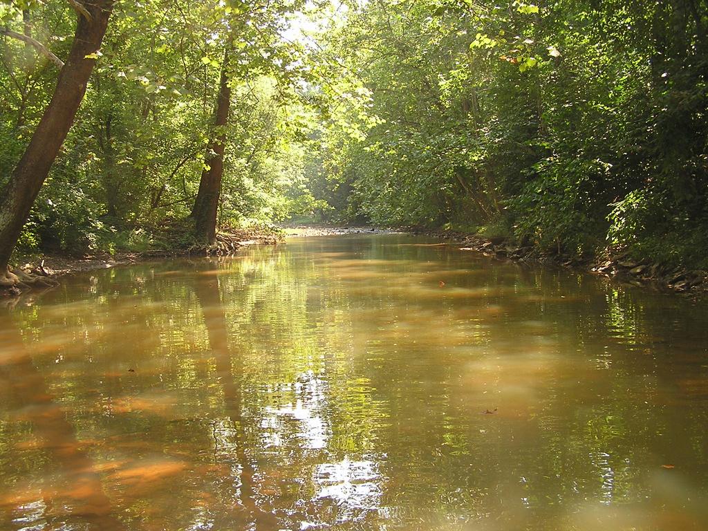
Recovery of Deckers Creek from Acid Mine Drainage. Martin Christ Water Remediation Director Friends of Deckers Creek
|
|
|
- Crystal Lester
- 6 years ago
- Views:
Transcription
1 Recovery of Deckers Creek from Acid Mine Drainage Martin Christ Water Remediation Director Friends of Deckers Creek
2 Table of Contents Location of the Deckers Creek watershed Geological setting Mining Flood control Past water quality Current water quality Reasons for recovery
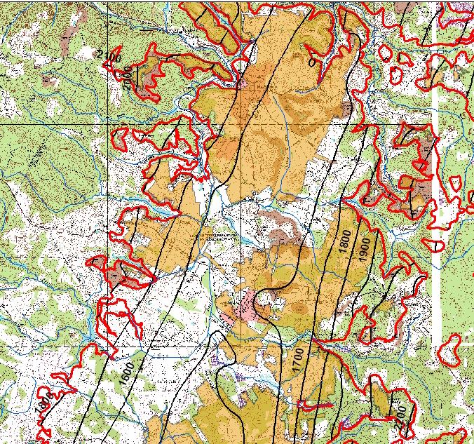
3 Location of the Deckers Creek watershed
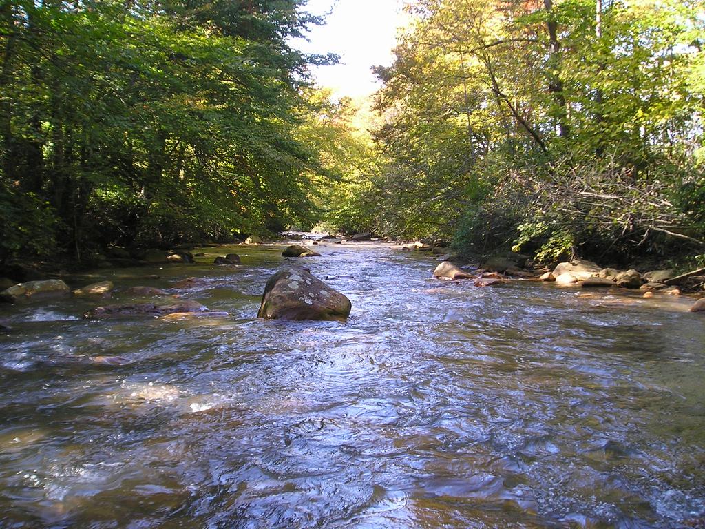
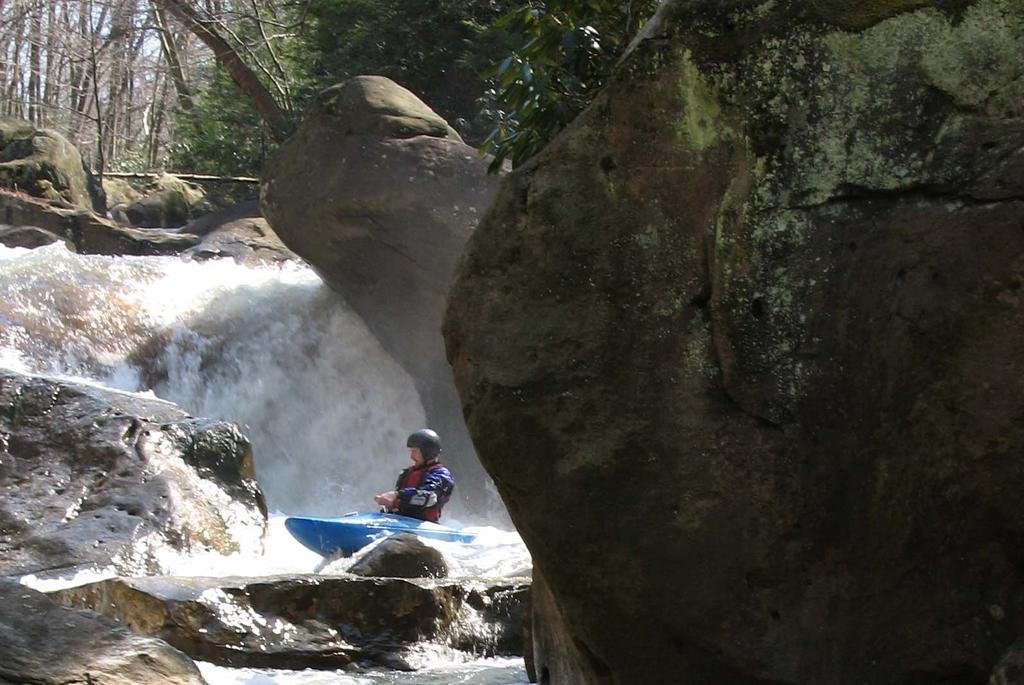
4 Features of the Deckers Creek watershed Towns of Reedsville, Masontown and Morgantown Arthurdale Heritage site Whitewater kayaking destination in scenic gorge Deckers Creek Trail: a 19-mile rail-trail along Deckers Creek and its tributary, Kanes Creek
5 Feet 5 1 Monongahela Group Conemaugh Series Allegheny Group Pottsville Group Geology: profile Pittsburgh Coal Bakerstown Coal Geology: bedrock profile Upper Freeport Coal Lower Freeport Coal Lower Kittanning Coal 15 Mauch Chunk Formation Greenbrier limestone 2


6 Topographical Setting Monongalia MORGANTOWN ð Marion ð ð REEDSVILLE MASONTOWN KINGWOOD ð Taylor Preston
7 Mining Surface mines Underground mines Limestone Bedrock SCI scores for stream segments (Higher scores indicate healthier stream segments) Not examined
8 Mining
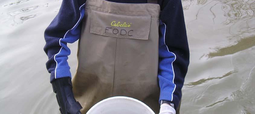
9 Overview of water quality # # # Interstate 68 # # # # 5 Sturgisson Richard Mine drain Pioneer Rocks # # # # 23 # # 1 # Greer # Monongalia County # 2 # # # 15 # # # Upper Deckers Creek Impoundment #1 # # Preston County Masontown McKinney Cave Rd Guseman Kanes Creek Confluence
10 Water quality ph near the mouth ph Date Henson, 195 Teti, 1975 WVDEP USGS Mains et al., 1999 Stewart, 21 SRG FODC
11 Water quality: along the stream Henson, 195 Teti, 1975 Stewart, 21 CCP 27 ph Distance from mouth (miles)
12 Current conditions starting from headwaters: Segment Location Setting Condition 1 Headwaters to Reedsville Farm Pond Rocky, surrounded by rhododendron Mildly acidic, Preston PSD 1 water supply 2 Below Reedsville Farm Pond to mouth of Kanes Creek Low gradient, channelized Nutrient and alkalinity inputs
13

14
15 Segment 3 Segment Location Setting Condition 3 Kanes Creek to Masontown Flat, mostly channelized, several tribs with mining Improved from acidic to neutral in last five years
16
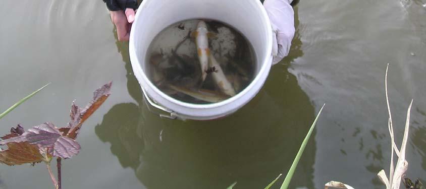
17 Segment 4 & 5 Segment Location Setting Condition 4 Masontown to Greer Steep Masontown sewage treatment plant drastically reduced bacteria pollution 5 Greer to Dellslow Steep, wellknown whitewater kayaking destination Water quality is currently excellent
18
19

20

21
22 Segment 6 & 7 Segment Location Setting Condition 6 Richard mine to mouth of Aarons Creek Swift, well defined channel Water always turbid, often red from Richard mine Discharge 7 Aarons Creek to mouth Swift, reinforced banks Red streambed, but fish often present
23
24
25
26 Water quality: along the stream Henson, 195 Teti, 1975 Stewart, 21 CCP 27 ph Distance from mouth (miles)
27 Water quality improvement : ph rises to 5 or above in lower part of the gorge and Morgantown : ph between 5 and 7 for entire creek except immediately below the Richard mine 2-28: average ph rises above 6 in all nine mainstem sites (metals continue to impede fish recovery below Richard)
28 What accounts for improvement in water quality in recent years? Decrease in pyrite oxidation Abandoned mineland reclamation Behavior of NPDES permittees Dry periods
29 FODC: Active but not that active Partnered with OSM and WVDEP-OAMLR to fund Kanes Creek South project Partnered with OSM, OAMLR, WVDEP-DWWM to fund Slabcamp project Worked with same partners to design and build Slabcamp ancillary project Currently constructing Valley Point #12 project (Skelly & Loy s design). Two more projects in design (Dietz-Gourley Consulting) Developing additional projects with funding from WVDEP-DWWM
30 Pyrite dissolution We compared water quality results at three sites where NRCS had monitored in 1994 and 1995, and where FODC monitored in 25 to 27. Sites are at the extreme eastern edge of the watershed, on the Preston anticline. NRCS installed wooden weirs in We monitor at the same sites: no reclamation, no wet seals.
31 Flow (L/s) Flow VH3prtl VP12A VP12B Concentration (mg-caco3/l) Acidity VH3prtl VP12A VP12B * Concentration (mg/l) Aluminum Concentration (mg/l) Sulfate VH3prtl VP12A VP12B VH3prtl VP12A VP12B Concentration (mg/l) Iron ph (SU) * * ph-lab VH3prtl VP12A VP12B 2 VH3prtl VP12A VP12B
32 Abandoned Mine Land reclamation OAMLR has reclaimed two large areas in the Kanes Creek watershed: 1996: Upper Deckers Creek Impoundment #5, reclaimed approximately 12 acres and built a SAPS 22: Kanes Creek South, reclaimed approximately 32 acres, wet-sealed portals, built open limestone channels, eliminated impoundments
33 Deckers Creek Kanes Creek South Kanes Creek # Upper Deckers Creek Impoundment #5
34 ph upstream from ICG permit Jan- Jan-1 Jan-2 Jan-3 Jan-4 Jan-5 Jan-6 Jan-7 Jan-8 Jan-9 Aluminum upstream from ICG permit Jan- Jan-1 Jan-2 Jan-3 Jan-4 Jan-5 Jan-6 Jan-7 Jan-8 Jan-9 Jan Iron upstream from ICG permit Jan- Jan-1 Jan-2 Jan-3 Jan-4 Jan-5 Jan-6 Jan-7 Jan-8 Jan-9 Jan Jan-99 Concentration (mg/l) Concentration (mg/l) ph (S.U.)
35 Permittees ICG, Coaltrain, DeCondor, and Greer all have discharges to Deckers Creek or its tributaries None have recently discharged any acid water to the creek, that we know of ICG pumps and treats water from two large mines, discharging to Kanes Creek DeCondor treats AMD with anhydrous ammonia in a tributary to Kanes Creek Coaltrain has obtained release on its permits in watershed. They discharged high alkalinity water from Bakerstown jobs. Greer maintains a refuse dump and limestone mines in the watershed.
36 Kanes Creek and Deckers Creek Deckers Creek ph values follow those in Kanes Creek Hits on iron in Deckers Creek occur on those days with higher iron concentrations in Kanes Creek Low ph values and high iron concentrations are missing after the end of 26 Some change in Kanes Creek is having a beneficial effect on Deckers Creek
37 ph in Kanes Creek and in Deckers Creek just below Kanes 8 7 ph 6 5 Kanes Creek Deckers Creek ph (SU) 4 3 Jan-99 Jul-99 Jan- Jul- Jan ph ph (SU) 3 Jan-3 Jul-3 Jan-4 Jul-4 Jan-5 Jul-5 Jan-6 Jul-6 Jan-7 Jul-7 Jan-8 Jul-8
38 Iron in Kanes Creek and Deckers Creek Total iron Kanes Creek Deckers Creek Concentration (mg/l) Jan-99 Jul-99 Jan- Jul- Jan Total iron Concentration (mg/l) Jan-3 Jul-3 Jan-4 Jul-4 Jan-5 Jul-5 Jan-6 Jul-6 Jan-7 Jul-7 Jan-8 Jul-8

39
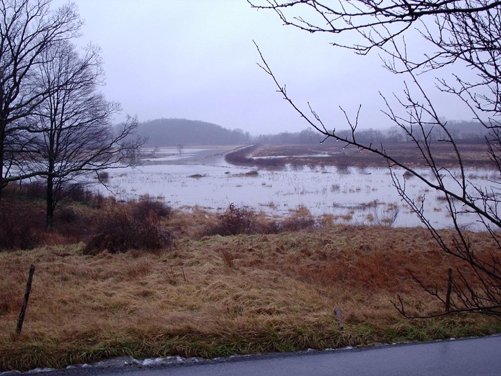
40 Weather USGS maintains a stream gauge on Deckers Creek in Morgantown It operated from 1946 to 1969, and again since 22 Data are available via the Internet or by contacting USGS
41 Jan-4 Apr-4 Jul-4 Oct-4 Jan-5 Discharge (CFS) Jan-5 Apr-5 Jul-5 Oct-5 Jan-6 Discharge (CFS) Jan-3 Apr-3 Jul-3 Oct-3 Jan-4 Discharge (CFS) Jan-6 Apr-6 Jul-6 Oct-6 Jan-7 Discharge (CFS) Jan-7 Apr-7 Jul-7 Oct-7 Jan-8 Discharge (CFS)
42 Observed pattern of rainfall and fish communities Fish results at Dellslow (September) 21: many small creek chub, a few large suckers 22: multiple size classes of creek chub, large carp 23: decrease by ~9% in fish community 24: multiple size classes present again 25-27: increasing quality of fishery (sauger, smallmouth bass) Hydrological year 22: Relatively dry year 23: Wet year, some low ph and high metal values measured 24: Relatively dry year 25: Relatively dry year 26-27: Relatively dry years 28:???
43 Conclusions Water monitoring data since 195 demonstrate improvement in water quality Current water quality is good, and there is some good fishing In the past 5 years, changes in mining practices and probably pyrite depletion has improved Deckers Creek In the past eight to ten years Depletion of pyrite and abandoned mine land reclamation have not played a strong role in recovery Changes in the behavior of permitted dischargers and the lack of really wet years may have aided recovery ICG s change of their pumping station may be having a very positive effect on Deckers Creek More AMD remediation projects should increase fishable areas Stream restoration requires vigilance and effort by agencies, the permitted community, and interested citizens.

44
ACID MINE DRAINAGE TREATMENT IN GREENS RUN BY AN ANOXIC LIMESTONE DRAIN
 ACID MINE DRAINAGE TREATMENT IN GREENS RUN BY AN ANOXIC LIMESTONE DRAIN Introduction Troy Titchenell and Jeff Skousen Anker Energy and West Virginia University From its headwaters in Pocahontas, Randolph
Susquehanna River Basin Commission Bear Run Watershed Renaissance Mine Drainage Restoration Project
 Susquehanna River Basin Commission Bear Run Watershed Renaissance Mine Drainage Restoration Project Publication 290 December 2013 INTRODUCTION T he Bear Run Watershed drains an area of about 19.3 square
CREATES: Cheat River Ephemeral Access Treatment and Enhancement Strategy
 CREATES: Cheat River Ephemeral Access Treatment and Enhancement Strategy Mission Statement: The CREATES team plans to revitalize and recover the streams entering the southern 20 miles of the Cheat River
Black Branch Acid Mine Drainage Remediation. ADEM Nonpoint Source Conference January 15,2015
 Black Branch Acid Mine Drainage Remediation Project ADEM Nonpoint Source Conference January 15,2015 Black Branch Small Watershed Drains approximately 3.3 square Miles Mulberry Fork Watershed Lost Creek
THE SUGAR CREEK COAL REFUSE PILE AND MINE DRAINAGE DISCHARGE RECLAMATION PROJECT
 THE SUGAR CREEK COAL REFUSE PILE AND MINE DRAINAGE DISCHARGE RECLAMATION PROJECT Eric E. Cavazza, P.E., Thomas C. Malesky, P.E., and Pamela J. Milavec Pennsylvania Department of Environmental Protection
November 15 th, 2012 WMAO 2012 Fall Conference 100 Years of Watershed Events. Amy Mackey Raccoon Creek Watershed Coordinator
 November 15 th, 2012 WMAO 2012 Fall Conference 100 Years of Watershed Events Amy Mackey Raccoon Creek Watershed Coordinator Surface Mining Control & Reclamation Act of 1977 (SMCRA) watershed event most
Steel Slag Leach Bed Longevity
 Steel Slag Leach Bed Longevity September 24 th 2014 National Association of Abandoned Mine Land Programs Conference Sarah Landers Raccoon Creek Water Quality Specialist Ohio Valley RC&D and Ohio University
IMPLEMENTATION PLAN FOR HUBLER RUN
 IMPLEMENTATION PLAN FOR HUBLER RUN CLEARFIELD COUNTY, PENNSYLVANIA Prepared for: The West Branch Sportsman s Association, Inc. 2657 Schoonover Road Kylertown, PA 16847 Prepared by: Alder Run Engineering
APPENDIX A. This is a comprehensive map of the areas that will orient the. This map shows the cross-sectional Area A to B at which the
 APPENDIX A EXPLANATION OF MAPS AND PLANS 1. LOCATION MAP - PLATE 1 This is a comprehensive map of the areas that will orient the numbers indicated on the Flow Data Charts interested reader of general location
SOUTH BRANCH SUBWATERSHED
 SOUTH BRANCH SOUTH BRANCH SUBWATERSHED The South Branch Subwatershed includes the South Branch drainage area plus all the drainage area along the main stream to the south from the mouth of Surrena Run
Advanced Planning Tools for Optimization of AMD Treatment
 Advanced Planning Tools for Optimization of AMD Treatment Jon Fripp, P.E., Hydraulic Engineer US Army Corps of Engineers, Baltimore District Baltimore, MD James M. Stiles, Ph.D., P.E., Environmental Engineer
Effects of Precipitation on the Acid Mine Drainage Impacted Hewett Fork Watershed Understanding Storm Response
 Effects of Precipitation on the Acid Mine Drainage Impacted Hewett Fork Watershed Understanding Storm Response Zeb Martin Ohio University Contents Project Overview Objectives of the Research Project Area
Selected Abandoned Mined Land Reclamation Projects and Passive Treatment in Ohio
 Selected Abandoned Mined Land Reclamation Projects and Passive Treatment in Ohio By Mitchell E. Farley 1 and Paul Ziemkiewicz 2 1 Environmental Scientist, ODNR Div. of Mineral Resources Management, 34
IMPLEMENTATION PLAN FOR JOHNSON CREEK
 IMPLEMENTATION PLAN FOR JOHNSON CREEK TIOGA COUNTY, PENNSYLVANIA Prepared for: The Arnot Sportsmen Association, Inc. P.O. Box 142 Arnot, PA 16911 Prepared by: Alder Run Engineering, LLC Civil & Environmental
I. FOREWORD. Purpose: The purpose of this acid mine drainage survey of the study portion of the Raccoon Creek Watershed was to:
 I. FOREWORD INTRODUCTION Description of Study: The Pennsylvania Department of Environmental Resources, in response to Commonwealth of Pennsylvania Legislative Act 443 "Land and Water Conservation and Reclamation
CONCLUSIONS AND RECOMMENDATIONS
 CONCLUSIONS AND RECOMMENDATIONS The Little Schuylkill River is polluted by acid mine drainage from twenty-four primary sources; fourteen deep mine workings, nine refuse storage bank seeps and the effluent
WATER QUALITY FROM ABOVE-DRAINAGE UNDERGROUND MINES OVER A 35-YEAR PERIOD 1
 WATER QUALITY FROM ABOVE-DRAINAGE UNDERGROUND MINES OVER A 35-YEAR PERIOD 1 Jeff Skousen 2, Louis McDonald 2, Ben Mack 2, and Jennifer Demchak 3 Abstract: The duration of acid mine drainage (AMD) flowing
Source Water Protection Challenges in the Alafia River Watershed - Tampa, FL
 Source Water Protection Challenges in the Alafia River Watershed - Tampa, FL Doug Robison ESA Bob McConnell Tampa Bay Water AMERICAN WATER RESOURCES ASSOCIATION 2014 Annual Conference November 4, 2014,
STREAM QUALITY EVALUTION GENERAL CONDITIONS. The study area is that portion of the Mahoning Creek Watershed comprising
 STREAM QUALITY EVALUTION GENERAL CONDITIONS The study area is that portion of the Mahoning Creek Watershed comprising three major drainage systems- Big Run (19.2 square miles), Stump Creek (28.3 square
Reassessment of Acid Mine Drainage Pollution in the Twomile Run Watershed, August December 2010 Kettle Creek Watershed, Clinton County
 Reassessment of Acid Mine Drainage Pollution in the Twomile Run Watershed, August December 21 Kettle Creek Watershed, Clinton County Technical Report Provided by Hedin Environmental through the Trout Unlimited
THE ABATEMENT PLAN. beneficial abatement plan. For the purpose of defining the pollution potential of surface waters
 THE ABATEMENT PLAN GENERAL PLAN Preventing surface waters from entering deep mine workings apparently offers the most beneficial abatement plan. For the purpose of defining the pollution potential of surface
Keystone and Rising Star Mines Shasta County, California
 CASE STUDY Keystone and Rising Star Mines Shasta County, California August 2010 Prepared by The Interstate Technology & Regulatory Council Mining Waste Team Permission is granted to refer to or quote from
CHAPTER I. PURPOSE The purpose of the acid mine drainage study of the Redstone Creek Watershed and portions of the Uniontown Syncline was to:
 CHAPTER I INTRODUCTION AUTHORITY The Pennsylvania Department of Environmental Resources, in response to the Commonwealth of Pennsylvania Legislative Act 443, "Land and Water Conservation and Reclamation
RACCOON CREEK WATERSHED
 RACCOON CREEK WATERSHED The Raccoon Creek Watershed Project is a local partnership working towards conservation, stewardship, and restoration of the watershed for a healthier stream and community. The
What is the purpose of the plan? Why did we choose Raccoon Creek? What pollutants does this TMDL address? Where do the pollutants come from?
 INFORMATION SHEET Proposed Total Maximum Daily Load (TMDL) for Raccoon Creek Watershed, located in Allegheny, Beaver, and Washington Counties, Pennsylvania What is being proposed? A TMDL is a report that
The surface water hydrology of the site has been logically divided into six phases of monitoring, analyses, and investigation as outlined below:
 SURFACE WATER HYDROLOGY The surface water hydrology of the site has been logically divided into six phases of monitoring, analyses, and investigation as outlined below: Sample Station Locations and Descriptions
TAPPAN LAKE 9/30/2014 RAPID WATERSHED INVENTORY INTRODUCTION
 TAPPAN LAKE 9/30/2014 RAPID WATERSHED INVENTORY Profile Contents Introduction Physical Description Land Use Map Resource Concerns Census and Social Data Progress/Status References INTRODUCTION Tappan Lake
Jennifer S. Simmons, National Mine Land Reclamation Center, West Virginia University, Morgantown, WV.
 Acid Mine Drainage Neutralization at Augusta Lake, Indiana Mike Kalagian, Office of Surface Mining, Indianapolis, IN Jennifer S. Simmons, National Mine Land Reclamation Center, West Virginia University,
March 20, 2007 Catawissa Creek Watershed Restoration Plan Update Addressing the TMDL
 March 20, 2007 Catawissa Creek Watershed Restoration Plan Update Addressing the TMDL Identification and Summary of Problem and Pollution Sources The Catawissa Creek watershed is a very rural, relatively
4. Present Activities and Roles
 4. Present Activities and Roles The present missions, authorities, activities and roles of the various agencies involved with flood protection, floodplain management and flood-damage reduction are identified
Is There AMD In This Stream?
 Is There AMD In This Stream? Adapted from: Is There Mine Drainage Impacting This Stream? in AMD Biology Module. St. Vincent College Environmental Education Center, 2002. Abandoned Mine Drainage Grade Level:
Design and Early Field Performance of AMD Treatment Systems Developed Under the Appalachian Clean Streams Initiative
 Design and Early Field Performance of AMD Treatment Systems Developed Under the Appalachian Clean Streams Initiative Paul Ziemkiewicz and Jennifer Simmons National Mine Land Reclamation Center West Virginia
Final Laurel Run Watershed TMDL Clearfield County
 Final Laurel Run Watershed TMDL Clearfield County For Acid Mine Drainage Affected Segments Prepared by: Pennsylvania Department of Environmental Protection April 2, 2007 TABLE OF CONTENTS FIGURES Introduction...
What is the purpose of the plan? Why did we choose Raccoon Creek? What pollutants does this TMDL address? Where do the pollutants come from?
 INFORMATION SHEET Proposed Total Maximum Daily Load (TMDL) for Harmon Creek, located in Hanover, Smith, Mount Pleasant, Robinson, Findlay, Independence, and Raccoon Townships, Allegheny, Beaver, and Washington
Barnes & Tucker Project
 West Branch Susquehanna Restoration Symposium April 27-28, 2007 Barnes & Tucker Project Daniel Sammarco,P.E. Jon Smoyer, P.G. DEP-Bureau of Abandoned Mine Reclamation Cambria Office Dsammarco@state.pa.us
WATER QUALITY FROM UNDERGROUND COAL MINES IN NORTHERN WEST VIRGINIA ( )
") INTRODUCTION WATER QUALITY FROM UNDERGROUND COAL MINES IN NORTHERN WEST VIRGINIA (1968-2000) Jennifer Demchak, Louis M. McDonald, Jr., and Jeff Skousen Acid mine drainage (AMD) is a serious problem from
INTRODUCTION WATER QUALITY FROM UNDERGROUND COAL MINES IN NORTHERN WEST VIRGINIA (1968-2000) Jennifer Demchak, Louis M. McDonald, Jr., and Jeff Skousen Acid mine drainage (AMD) is a serious problem from
II. STUDY RESULTS. In our opinion the following results may be presented based on the data contained in this report.
 II. STUDY RESULTS In our opinion the following results may be presented based on the data contained in this report. STREAM QUALITY General: Seventy-one (71) stream reading stations were established on
Qualified Hydrologic Unit Plan Process. Todd Wood, P.E. Bureau of Abandoned Mine Reclamation Wilkes Barre District Office
 Qualified Hydrologic Unit Plan Process Todd Wood, P.E. Bureau of Abandoned Mine Reclamation Wilkes Barre District Office HISTORY 5,543 stream miles impaired by AMD 1990 Amendment to SMCRA Allowed for up
INFORMATION SHEET. What is being proposed? A TMDL plan to improve the quality of water in the Redbank Creek Watershed.
 INFORMATION SHEET Proposed Total Maximum Daily Load (TMDL) for the Redbank Creek Watershed in Armstrong, Clarion, Clearfield, and Jefferson Counties Pennsylvania What is being proposed? A TMDL plan to
ADVANCES IN THE PREDICTION AND CONTROL OF ACID MINE DRAINAGE 1
 ADVANCES IN THE PREDICTION AND CONTROL OF ACID MINE DRAINAGE 1 By P.F. Ziemkiewicz 2 ABSTRACT. Over the past five years a research team at West Virginia University has developed a mathematical model: the
Blacks Creek Restoration Plan
 Blacks Creek Restoration Plan January 2007 SLIPPERY ROCK WATERSHED COALITION Prepared by BIOMOST, INC. and STREAM RESTORATION INCORPORATED (non-profit) Funded Through US EPA and PA DEP 319 Program TABLE
Zortman Landusky Swift Gulch Site Phillips County, Montana
 CASE STUDY Zortman Landusky Swift Gulch Site Phillips County, Montana August 2010 Prepared by The Interstate Technology & Regulatory Council Mining Waste Team Permission is granted to refer to or quote
Is There AMD In This Stream?
 Is There AMD In This Stream? Adapted from: Is There Mine Drainage Impacting This Stream? in AMD Biology Module. St. Vincent College Environmental Education Center, 2002. Abandoned Mine Drainage Grade Level:
FINAL. SOUTH BRANCH BLACKLICK CREEK WATERSHED TMDL Cambria and Indiana Counties. For Acid Mine Drainage Affected Segments.
 FINAL SOUTH BRANCH BLACKLICK CREEK WATERSHED TMDL Cambria and Indiana Counties For Acid Mine Drainage Affected Segments Prepared by: Pennsylvania Department of Environmental Protection January 14, 2005
ACID MINE DRAINAGE ABATEMENT AND TREATMENT (AMDAT) PLAN FOR THE HEADWATERS OF THE RACCOON CREEK WATERSHED
 PLAN FOR THE HEADWATERS OF THE RACCOON CREEK WATERSHED") ACID MINE DRAINAGE ABATEMENT AND TREATMENT (AMDAT) PLAN FOR THE HEADWATERS OF THE RACCOON CREEK WATERSHED by Chip Rice J.B. Hoy Rachael Hoy Ohio University, Institute for Local Government Administration
ACID MINE DRAINAGE ABATEMENT AND TREATMENT (AMDAT) PLAN FOR THE HEADWATERS OF THE RACCOON CREEK WATERSHED by Chip Rice J.B. Hoy Rachael Hoy Ohio University, Institute for Local Government Administration
INFORMATION SHEET. Proposed Total Maximum Daily Load (TMDL) for Bens Creek, located in Portage and Washington Townships, Cambria County, Pennsylvania
 for Bens Creek, located in Portage and Washington Townships, Cambria County, Pennsylvania") INFORMATION SHEET Proposed Total Maximum Daily Load (TMDL) for Bens Creek, located in Portage and Washington Townships, Cambria County, Pennsylvania What is being proposed? A TMDL is a report that documents
INFORMATION SHEET Proposed Total Maximum Daily Load (TMDL) for Bens Creek, located in Portage and Washington Townships, Cambria County, Pennsylvania What is being proposed? A TMDL is a report that documents
FGD as a Soil Amendment for Mine Reclamation Warren A. Dick
 FGD as a Soil Amendment for Mine Reclamation Warren A. Dick School of Environment and Natural Resources Ohio State University, Wooster, OH 220-263-3877; dick.5@osu.edu FGD Properties of Value for Mineland
Golden Sunlight Mine Bio-Treatment of Acid Producing Waste. By Rory Tibbals Operations Superintendent
 Golden Sunlight Mine Bio-Treatment of Acid Producing Waste By Rory Tibbals Operations Superintendent Golden Sunlight Mine Gold Producing Mine 2.5 Million Ounces Produced 20 Year Operation Ore and All
Otter Creek Watershed TMDL Project. Stakeholder Meeting June 6, 2013
 Otter Creek Watershed TMDL Project Stakeholder Meeting June 6, 2013 1 Meeting Purpose Meet with watershed & technical advisory group members and watershed landowners to provide basic Otter Creek TMDL project
INFORMATION SHEET. Proposed Total Maximum Daily Load (TMDL) for Stump Creek, Jefferson and Clearfield Counties, Pennsylvania
 for Stump Creek, Jefferson and Clearfield Counties, Pennsylvania") INFORMATION SHEET Proposed Total Maximum Daily Load (TMDL) for Stump Creek, Jefferson and Clearfield Counties, Pennsylvania What is being proposed? A TMDL plan to improve the quality of water in Stump
INFORMATION SHEET Proposed Total Maximum Daily Load (TMDL) for Stump Creek, Jefferson and Clearfield Counties, Pennsylvania What is being proposed? A TMDL plan to improve the quality of water in Stump
Water Quality Changes Over 30 Years from Fifteen Underground Mine Discharges
 Water Quality Changes Over 30 Years from Fifteen Underground Mine Discharges J. Demchak 1, J. Skousen 1, and G. Bryant 2 ABSTRACT Acid mine drainage (AMD) from both abandoned surface and underground mines
TOTAL MAXIMUM DAILY LOAD (TMDL)
") TOTAL MAXIMUM DAILY LOAD (TMDL) For ph In Crab Orchard Creek Located In The Cumberland & Morgan County, Tennessee Prepared by: Tennessee Department of Environment and Conservation Division of Water Pollution
TOTAL MAXIMUM DAILY LOAD (TMDL) For ph In Crab Orchard Creek Located In The Cumberland & Morgan County, Tennessee Prepared by: Tennessee Department of Environment and Conservation Division of Water Pollution
Water Quality Study In the Streams of Flint Creek and Flint River Watersheds For TMDL Development
 Water Quality Study In the Streams of Flint Creek and Flint River Watersheds For TMDL Development Idris Abdi Doctoral Dissertation Presentation Major Advisor: Dr. Teferi Tsegaye April 18, 2005 Alabama
FINAL. UNT STONYCREEK RIVER WATERSHED TMDL Somerset County. For Acid Mine Drainage Affected Segments. Prepared by:
 FINAL UNT 45603 STONYCREEK RIVER WATERSHED TMDL Somerset County For Acid Mine Drainage Affected Segments Prepared by: Pennsylvania Department of Environmental Protection March 19, 2007 1 TABLE OF CONTENTS
EVALUATION OF MINE DRAINAGE LIABILITY DURING PREAQUISITION SITE ASSESSMENTS¹
 EVALUATION OF MINE DRAINAGE LIABILITY DURING PREAQUISITION SITE ASSESSMENTS¹ Tiff Hilton Robert G. McLusky Terence C. Moran, P.E.² Abstract: Preaquisition site assessments of coal mining property have
North Fork of the Blackwater River Watershed Based Plan
 North Fork of the Blackwater River Watershed Based Plan Submitted to: United States Environmental Protection Agency, Region III & West Virginia Department of Environmental Protection Prepared by David
Fishing and Boating: Past, Present, and Restoration Thoughts
 Fishing and Boating: Past, Present, and Restoration Thoughts West Branch Susquehanna River Douglas Austen Pennsylvania Fish and Boat Commission West Branch Basin Stream Resources Miles Category 1,249
The Mahoning Valley Mushroom Farm North Lima, Ohio AMD Investigation
 The Mahoning Valley Mushroom Farm North Lima, Ohio AMD Investigation Department of Geology and Environmental Science The University of Akron Theresa McQuade Ohio Department of Natural Resources Division
Beneficial Use of FBC Coal Ash for Mine Reclamation in the Anthracite Region at the Wheelabrator Frackville and Mount Carmel Co-Gen Sites
 Beneficial Use of FBC Coal Ash for Mine Reclamation in the Anthracite Region at the Wheelabrator Frackville and Mount Carmel Co-Gen Sites Michael J. Menghini 1, Roger J. Hornberger 1, Thomas D. Owen 1,
Watershed Response to Water Storage. 8/1/2012 Paul Wymar Scientist Chippewa River Watershed Project
 Watershed Response to Water Storage 8/1/2012 Paul Wymar Scientist Chippewa River Watershed Project Chippewa River Watershed 1.3 Million Acres Largest tributary watershed in the Minnesota River Basin 7
Quittapahilla Creek Watershed Implementation Plan
 Quittapahilla Creek Watershed Implementation Plan Introduction Founded in 1997, the Quittapahilla Creek Watershed Association has been working with landowners, private organizations and public agencies
GREEN MOUNTAIN AND JEANSVILLE COAL-BASINS CARBON AND LUZERNE COUNTIES, PENNSVLVANIA DER PROJECT SL
 GREEN MOUNTAIN AND JEANSVILLE COAL-BASINS CARBON AND LUZERNE COUNTIES, PENNSVLVANIA DER PROJECT SL 135-11-101.6 DESIGN CRITERIA AND A CONCEPTUAL PLAN FOR THE ABATEMENT OF AMD DISCHARGES FROM FIVE WATER
Clyde Mine Discharge/Tenmile Creek Water Quality Final Report
 Clyde Mine Discharge/Tenmile Creek Water Quality Final Report November 01, 2016 Background In follow-up to the Pennsylvania Department of Environmental Protection s (DEP) December 15, 2015, Tenmile Creek
FINAL WILSON CREEK WATERSHED TMDL Somerset County
 FINAL WILSON CREEK WATERSHED TMDL Somerset County For Acid Mine Drainage Affected Segments Prepared by: Pennsylvania Department of Environmental Protection April 10, 2008 1 TABLE OF CONTENTS Introduction...
Water Quality Monitoring in the Upper Winooski River Headwaters 2017
 Water Quality Monitoring in the Upper Winooski River Headwaters 2017 E. coli, chloride, alkalinity, phosphorus, nitrogen, and turbidity levels in the streams of Cabot-Marshfield-Plainfield Elderberry plantings
Self-Sustainable Mine Water Treatment through Passive Iron Oxide Recovery
 Self-Sustainable Mine Water Treatment through Passive Iron Oxide Recovery Bob Hedin Iron Oxide Recovery, Inc. Hedin Environmental Current Mine Water Treatment COSTS PHASE BENEFITS Design and Construction
LOXAHATCHEE RIVER WATER QUALITY EVENT SAMPLING TASK 2: FINAL REPORT ASSESSMENT OF LOXAHATCHEE RIVER WATER QUALITY
 LOXAHATCHEE RIVER WATER QUALITY EVENT SAMPLING TASK 2: FINAL REPORT ASSESSMENT OF 2007-2008 LOXAHATCHEE RIVER WATER QUALITY In Partial Fulfillment of Agreement No. 4600001281 For the Period October 2007
DRAFT Slippery Rock Creek Priority Watershed Report 2004 Update
 DRAFT Slippery Rock Creek Priority Watershed Report 2004 Update Introduction This is the fourth annual update to the Slippery Rock Creek Priority Area Report, developed by the Knox District Mining Office
Gumboot Run Biological Assessment McKean County, Pennsylvania
 Gumboot Run Biological Assessment McKean County, Pennsylvania By: Elias J Heferle Water Pollution Biologist II Pennsylvania Department of Environmental Protection Knox District Mining Office January 2005
Location Bovard Township Cherry County Butler
 Project Area No. 26 Location Bovard Township Cherry County Butler Priority Rating 3 This area consists of a small deep mine and several strip mines in the Middle Kittanning seam of coal. The water discharges
Stream Restoration in Appalachia
 Stream Restoration in Appalachia Kevin Springob Background The extraction of coal and precious metals has greatly benefited the development of the United States for over one hundred years. Several states
Tenmile Creek Sampling Summary
 Tenmile Creek Sampling Summary December 15, 2015 Background In 2014, DEP s California District Mining Office collected surface water samples from three locations on Tenmile Creek (TMC) in the vicinity
DEPARTMENT OF ENVIRONMENTAL RESOURCES REVIEW NOTICE
 DEPARTMENT OF ENVIRONMENTAL RESOURCES REVIEW NOTICE This report, prepared by outside consultants, has been reviewed by the Department of Environmental Resources and approved for publication. The contents
FINAL. Unt BUFFALO CREEK Armstrong County, Pennsylvania
 FINAL Unt BUFFALO CREEK Armstrong County, Pennsylvania Prepared by: Pennsylvania Department of Environmental Protection March 5, 2007 1 TABLE OF CONTENTS Introduction... 3 Directions to the Unt (42685)
The lower portion of the main stream is located between the breast of the Two Lick Creek Dam and the junction of Blacklick Creek.
 5B. Lower Portion, Main Stream, Two Lick Creek Watershed a. General The lower portion of the main stream is located between the breast of the Two Lick Creek Dam and the junction of Blacklick Creek. Major
2011 NPS Report - Raccoon Creek Watershed
 Kingston Laurelville The Raccoon Creek Partnership is a local partnership working towards conservation, stewardship, and restoration of the watershed for a healthier stream and community. The partnership
A Cost Benefit Analysis of the Proposed Dunkard Creek Fish and Mussel Restoration Plan
 1 A Cost Benefit Analysis of the Proposed Dunkard Creek Fish and Mussel Restoration Plan Introduction: Dunkard Creek, a tributary of the Monongahela River, originates in the headwaters of western Monongalia
EFFECTS OF COAL-MINE DISCHARGES ON THE QUALITY OF THE STONYCREEK RIVER AND ITS TRIBUTARIES, SOMERSET AND CAMBRIA COUNTIES, PENNSYLVANIA
 EFFECTS OF COAL-MINE DISCHARGES ON THE QUALITY OF THE STONYCREEK RIVER AND ITS TRIBUTARIES, SOMERSET AND CAMBRIA COUNTIES, PENNSYLVANIA U.S. GEOLOGICAL SURVEY Water-Resources Investigations Report 96-4133
Growing Greener Watershed Protection and AMD Set-Aside Goals and Accomplishments Worksheets
 COMMONWEALTH OF PENNSYLVANIA DEPARTMENT OF ENVIRONMENTAL PROTECTION Project Name Growing Greener Watershed Protection and AMD Set-Aside Goals and Accomplishments Worksheets Project County *Is this project
Methodology for Estimating the Costs of Treatment of Mine Drainage
 17* International Mining Congress and Exhibition of Turkey-IMCET 2001, 2001, ISBN 975-395-417-4 Methodology for Estimating the Costs of Treatment of Mine Drainage V. Raj aram Tetra Tech EM Inc., Chicago,
Little Cypress Bayou Special Study - Subwatershed 1.10
 - Subwatershed 1.1 Sabine River Authority of Texas August 31, 21 Prepared in Cooperation with the Texas Natural Resource Conservation Commission Under the Authorization of the Texas Clean Rivers Act Table
Effective Treatment Options for Acid Mine Drainage in the Coal Region of West Virginia
 Marshall Digital Scholar Theses, Dissertations and Capstones 2014 Effective Treatment Options for Acid Mine Drainage in the Coal Region of West Virginia Daniel Kirby kirby51@live.marshall.edu Follow this
8B. Lower Portion, Yellow Creek Watershed (excluding Little Yellow Creek
 8B. Lower Portion, Yellow Creek Watershed (excluding Little Yellow Creek a. General The Lower Portion of Yellow Creek Watershed covers an area of 23.4 square miles. Major tributaries include Ferrier Run
FINAL. FOUNDRY RUN WATERSHED TMDL Armstrong and Jefferson Counties. For Acid Mine Drainage Affected Segments. Prepared by:
 FINAL FOUNDRY RUN WATERSHED TMDL Armstrong and Jefferson Counties For Acid Mine Drainage Affected Segments Prepared by: Pennsylvania Department of Environmental Protection January 3, 2007 1 TABLE OF CONTENTS
COMMONWEALTH OF PENNSYLVANIA Milton J.Shapp,Governor
 COMMONWEALTH OF PENNSYLVANIA Milton J.Shapp,Governor DEPARTMENT OF ENVIRONMENTAL RESOURCES Maurice K. Goddard, Secretary Office of Resources Management C. H. McConnell, Deputy Secretary OPERATION SCARLI
Final Draft Feasibility Study And Environmental Assessment APPENDIX B HYDROLOGY AND HYDRAULICS. November 2008
 Final Draft Feasibility Study And Environmental Assessment Prepared by: EMH&T, Inc. 5500 New Albany Road, Columbus, OH 43054 Tel: (614) 775-4500 Fax: (614) 775-4800 Prepared for: Prime Engineering & Architecture,
Iron Investigators. Adapted from: #435 Reading River Sediments, A Simulated Mining Activity for Molybdenum. Lab- Aids, Inc
 Iron Investigators Detecting Pollution Adapted from: #435 Reading River Sediments, A Simulated Mining Activity for Molybdenum. Lab- Aids, Inc. 1996. Grade Level: Intermediate and Advanced Duration: 40
Iron Mountain Mine Shasta County, California
 CASE STUDY Iron Mountain Mine Shasta County, California August 2010 Prepared by The Interstate Technology & Regulatory Council Mining Waste Team Permission is granted to refer to or quote from this publication
The Snapshot CONODOGUINET CREEK WATERSHED SNAPSHOT
 CONODOGUINET CREEK WATERSHED SNAPSHOT ABOVE: CONODOGUINET CREEK AT RT 74 BRIDGE FACING DOWNSTREAM The Snapshot The Conodoguinet Watershed Snapshot was a collaborative effort to engage local citizens in
Since the Game Lands are publicly owned, reclamation can be done with Project 500 bond issue funds. E. D'Appolonia Consulting Engineers, Inc.
 FINAL REPORT ENGINEERING SURVEY AND FEASIBILITY STUDY MINE DRAINAGE POLLUTION ABATEMENT STATE GAME LANDS NO. 117 WASHINGTON COUNTY, PENNSYLVANIA PROJECT NO. SL-130-1 1.0 INTRODUCTION Raccoon Creek is one
Final. MUDDY BRANCH CREEK WATERSHED TMDL Schuylkill County
 Final MUDDY BRANCH CREEK WATERSHED TMDL Schuylkill County For Acid Mine Drainage Affected Segments Prepared by: Pennsylvania Department of Environmental Protection March 9, 2005 1 TABLE OF CONTENTS FIGURES
WATER QUALITY CHANGES AND COSTS OF REMINING IN PENNSYLVANIA AND WEST VIRGINIA
 WATER QUALITY CHANGES AND COSTS OF REMINING IN PENNSYLVANIA AND WEST VIRGINIA Jeff Skousen, West Virginia University, Morgantown, WV; Robert Hedin, Hedin Environmental, Pittsburgh, PA; and Ben Faulkner,
An Alternative Alkaline Addition for Direct Treatment of Acid Mine Drainage
 An Alternative Alkaline Addition for Direct Treatment of Acid Mine Drainage Jennifer S. Simmons * and Paul Ziemkiewicz National Mine Land Reclamation Center Abstract The primary objective of the National
Narrows Creek Watershed TMDL Clearfield County, Pennsylvania
 Narrows Creek Watershed TMDL Clearfield County, Pennsylvania Prepared by: Pennsylvania Department of Environmental Protection September 30, 2008 1 TABLE OF CONTENTS Introduction...4 Directions to the Narrows
Precipitation, Flow and Loads at Active Mine Sites
 Trends in Acid Mine Drainage at Active Mines in West Virginia - 2000 1 Ben B. Faulkner 2 Abstract: WVDEP has inventoried water quality at active coal mine operations every other year since 1994. This 4
Recycling Mine Pool Water for Electricity Generation: Limerick Generating Station. William Skaff Nuclear Energy Institute September 26, 2011
 Recycling Mine Pool Water for Electricity Generation: Limerick Generating Station William Skaff Nuclear Energy Institute September 26, 2011 Mine Pool Water from Coal Mining Contaminated ground water inflows
THE FISHING RUN RESTORATION AND MAUDE MINE RECLAMATION PROJECT
 THE FISHING RUN RESTORATION AND MAUDE MINE RECLAMATION PROJECT LOCATION Problem Area PA 4422, Project Number OSM 02(4422)102.1 South Fayette Township, Allegheny County, Pennsylvania SUBMITTED BY Roderick
The recovery of an AMDimpacted stream treated by steel slag leach beds: a case study in the East Branch of Raccoon Creek
 The recovery of an AMDimpacted stream treated by steel slag leach beds: a case study in the East Branch of Raccoon Creek NAAMLP Conference, Columbus, OH September 21-24, 214 Caleb Hawkins Master of Science
Final. Bear Loop Run Watershed TMDL Cambria County
 Final Bear Loop Run Watershed TMDL Cambria County For Acid Mine Drainage Affected Segments Prepared by the Pennsylvania Department of Environmental Protection February 2002 1 TABLE OF CONTENTS FIGURES
Supplemental Guide II-Delineations
 Supplemental Guide II-Delineations Contents Source Water Protection Area Delineation... 1 Delineation Criteria for Systems Using Groundwater Sources... 2 Time of Travel... 4 Flow Boundaries... 4 Delineation