Adapted from: Same Title, Report of Investigation RI 111, Florida Geological Survey, in print
|
|
|
- Roxanne Freeman
- 6 years ago
- Views:
Transcription
1 Demonstrating interconnection between a wastewater application facility and a first magnitude spring in a karstic watershed: Tracer study of the Tallahassee, Florida Treated Effluent Spray field Todd R. Kincaid 1, Gareth J. Davies 2, Christopher L. Werner 3, and Rodney S. DeHan 4 Traced groundwater flow paths from the City of Tallahassee s waste water spray field to Wakulla, Indian, Sally Ward, and McBrides springs, north Florida. 1 GeoHydros, LLC, Reno Nevada, kincaid@geohydros.com 2 Cambrian Ground Water Co., Oak Ridge, Tennessee, cambriangroundwater@mac.com 3 Woodville Karst Plain Project, Houston Texas, chriswerner@att.net 4 Florida Geological Survey, Tallahassee Florida, Rodney.DeHan@dep.state.fl.us Adapted from: Same Title, Report of Investigation RI 111, Florida Geological Survey, in print
2 Groundwater Tracing from Tallahassee s Waste Water Spray Field Overview The City of Tallahassee s SE Spray Field (SESF) receives secondarily treated wastewater and disperses it onto the land surface via center-pivot irrigators at an average rate of approximately 17 million gallons per day (City of Tallahassee, 2007). The system is intended to provide nutrient removal through plant uptake from the infiltrating water. It became operational in 1981, encompassing 1000 acres and was expanded in 1982 to 1500 acres, 1986 to 1896 acres, and 1999 to 2,159 acres (Chelette et al, 2002). Nitrate levels in groundwater monitoring wells installed in the upper Floridan aquifer beneath the SESF increased precipitously after the SESF became operational rising from ~0.5 mg/l in 1980 to as much as 10 mg/l in the 1990 s and stabilizing at ~6 mg/l by 2000 (Chelette et al, 2002). During the same period, nitrate levels measured at Wakulla Spring rose from ~ mg/l between 1971 and 1976, to >1.0 mg/l in the late 1980 s, to ~ mg/l between 1998 and 2000 (Chelette et al, 2002). The increased nitrate levels are thought to be the primary cause of algae growth and enhanced hydrilla growth that have resulted in significant harm to the ecosystems supported by Wakulla Spring and the Wakulla River (Hand, 2005). Given the apparent correlation between nitrate increases in Wakulla Spring and in Floridan aquifer groundwater beneath the SESF, considerable attention became focused on the SESF as the primary source of nitrate contamination to the spring by Further attention was directed toward the SESF when Chelette and others (2002) reported nutrient budget calculations for the St Marks and Wakulla River Watersheds that attributed 40% of the nitrate loading in the Wakulla Springs contributory area to the SESF. In response to growing concerns about the fate of nitrates released to the Floridan aquifer from the SESF, the City of Tallahassee approved a 3-year study with the US Geological Survey to, in part, develop of model of nitrate transport through the upper Floridan aquifer. In concert with that effort, the Florida Department of Environmental Protection and the Florida Geological Survey commissioned Hazlett-Kincaid, Inc. to perform a groundwater tracing study to identify potential groundwater flow paths and velocities between the SESF and down-gradient springs. Tracer injections were performed in three wells across the northern side of the SESF and one sinking stream located on the southeastern side of the property. Water samples were subsequently collected from ten wells and eleven natural discharge points for between two and fourteen months and analyzed in a laboratory for the presence and relative amount of the injected tracers. Sampling for the fluorescent dyes was also conducted at two of the wells, Wakulla B-Tunnel, and the St. Marks River upstream of its disappearance with insitu filter fluorometers (IFF). One or more of the Fluorescent dyes was detected at five of the wells and five of the springs. The springs at which the fluorescent dyes were detected include: Wakulla Spring, Sally Ward Spring, Indian Spring, and one or more of the small springs contributing to flow in McBride s Slough. The fastest travel times to those springs established by fluorescent tracer breakthrough curves ranged from approximately days after the injections with subsequent smaller pulses of tracer-laden water arriving at Wakulla and McBride s Slough as late as approximately one year after the injections. Very minor quantities of fluorescent compounds that fluoresce in the same range as the injected tracers were detected at Monroe Spring and the St. Marks River Rise but not enough to be confident that our tracers were recovered at those locations. None of the fluorescent tracers were detected at in the St. Marks River at Natural Bridge, Rhodes Spring, or Newport Spring. Kincaid Talk, February of 4


, Wakulla Vent (WKV), and McBride s Slough (MBE) resulting from dye")
3 Groundwater Tracing from Tallahassee s Waste Water Spray Field AR87 injection in Turf Pond Sink AY73 siphon injection at well SE06 Photos of the dye injections that occurred at a swallet and monitoring wells located within the City of Tallahassee s waste water spray field. Uranine Dye (AY73) recovery curves for Indian Spring (IS), Sally Ward Spring (SWS), Wakulla B- Tunnel (WKB), Wakulla Vent (WKV), and McBride s Slough (MBE) resulting from dye injections performed at the City of Tallahassee s waste water spray field. Kincaid Talk, February of 4
4 Groundwater Tracing from Tallahassee s Waste Water Spray Field References Chelette, A., Pratt, T. R., and Katz, B. G., Nitrate loading as an indicator of nonpoint source pollution in the lower S. Marks-Wakulla Rivers watershed: Water Resources Special Report 02-1, Northwest Florida Water Management District, Havana, Florida, 138 p. City of Tallahassee, The Southeast Farm Wastewater Reuse Facility, accessed from Hand, J Nitrate & Hydrilla at Wakulla Spring, Untitled presentation, Solving Water Pollution Problems in the Wakulla Springshed of North Florida; Hydrogeology Consortium Workshop HC_Workshops/2005_WS_Workshop/ Kincaid Talk, February of 4


5 Tracing a Connection Between the Tallahassee Treated Effluent Spray Field & Wakulla Spring: Woodville Karst Plain, North Florida Presentation for the Edwards Aquifer Authority San Antonio, Texas February 16, 2011 Todd Kincaid, Ph.D. Gareth Davies, M.S. Christopher Werner, M.S. Rodney DeHan, Ph.D. Florida Geological Survey: RI 111, in print
6 Core Problem: Public Perception & Concern Topic Internet Hits global water resources: 24,800,000 aquifer protection: 1,350,000 water shortage: 8,130,000 water crisis: 27,900,000 water pollution: 34,400,000 bottled water: 10,100,000 Florida springs: 40,900,000 Florida springs decline: 651,000 Britney Spears: 49,800,000 free porn: 188,000,000 free sex: 366,000,000 Clean Water / Free Sex = < 10% Clean Water / Britney Spears = 68%


7 Where is Wakula? Is it unique? part of Karst Belt probably highest concentration of very large springs in the world all discharge from major cave systems all but a few are similarly or more impacted than Wakulla


8 Wakulla Spring, Florida ( cfs) 4

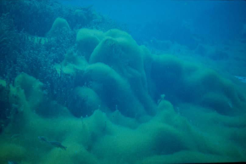


9 Wakulla Spring in Decline 5
 o Fertilizers (lawns & agriculture) o Industry")
10 Nitrate Loading to Groundwater & Springs Problem o o o Nitrate in Florida springs: X natural levels Very low ecological tolerance Very high human tolerance o Promotes algae and bacterial growth Sources o Sewage (septic systems & wastewater treatment) o Fertilizers (lawns & agriculture) o Industry (CAFOs) 6
11 Important Hydrogeologic Features ~35 miles developments confining unit springs disappearing streams caves potentiometric surface ~11 miles ~8 miles

12 Caves in the WKP feet meters Wakulla Springs 168,900 51,484 Chip's Hole 22,292 6,795 Natural Bridge 12,108 3,691 Indian Springs 11,897 3,626 Sally Ward 6,857 2,090 Shepard's 5,689 1,734 Bird Sink 4,839 1,475 Little Dismal 2, McBride's 2, Church's 2, Rat Sink 1, Hideaway 1, Hatchet 1, Spring Creek Meetinghouse Farrell Shallow Ventana Azul TOTAL 246,143 75,025
 2004: Emerald Sink Wakulla Spring 10.3 miles / 7.1 days (7,650 ft/day) 2005: Kelly Sink Indian Spring 5.2 miles / 13.5 days (2,040 ft/day) 2005: Ames Sink Indian Spring 5.")
13 Groundwater Tracing to Wakulla Spring?? 2002: Fisher Creek Emerald Sink 1.7 miles / 1.7 days (3,770 ft/day) 2003: Black Creek Emerald Sink 1.6 miles / 1.6 days (2,670 ft/day) 2004: Emerald Sink Wakulla Spring 10.3 miles / 7.1 days (7,650 ft/day) 2005: Kelly Sink Indian Spring 5.2 miles / 13.5 days (2,040 ft/day) 2005: Ames Sink Indian Spring 5.2 miles / 17.2 days (1,600 ft/day) 2005: Indian Spring Wakulla Spring 5.5 miles / 5.9 days (4,890 ft/day) 2006: Tallahassee Spray Field St. Marks or Wakulla?

14 Tallahassee Spray Field 10


15 Tracer Injections Near-field: o 20kg phloxine-b, 3 wells Far-field: o 60kg uranine, 3 wells o 60 kg eosine, 1 swallet 11
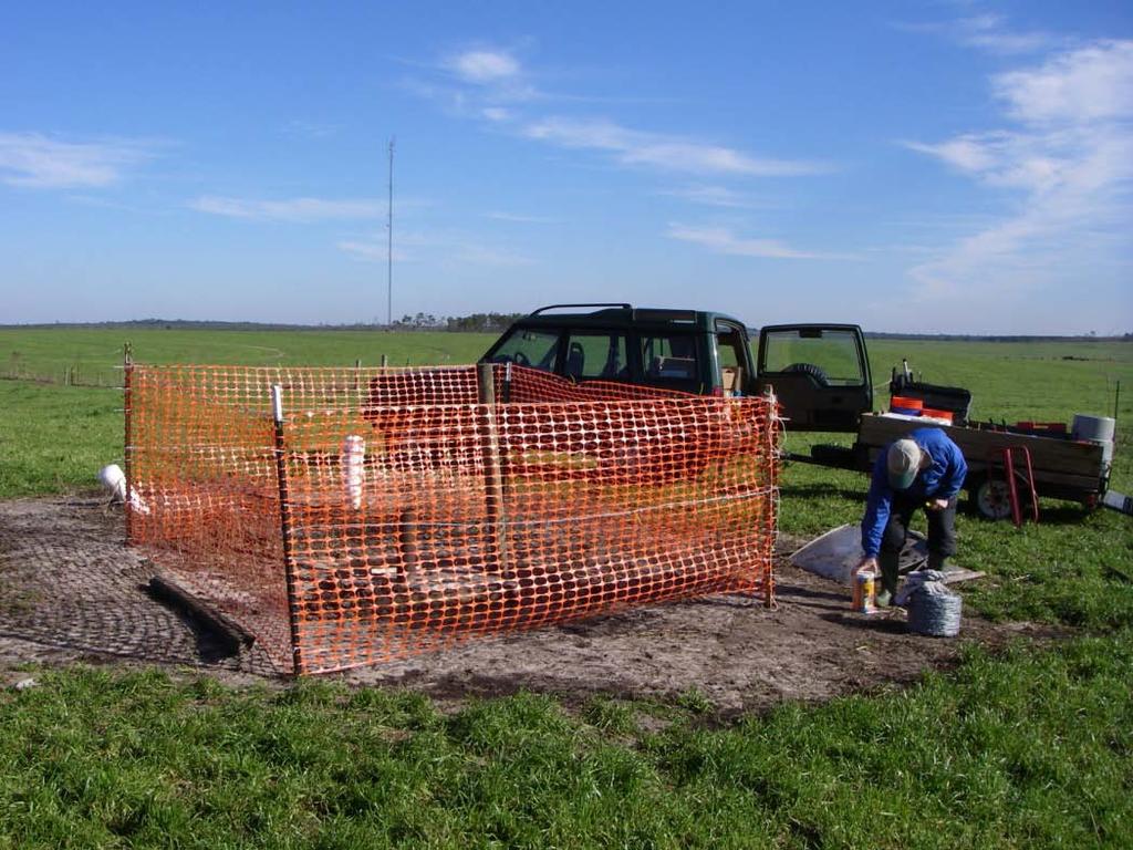


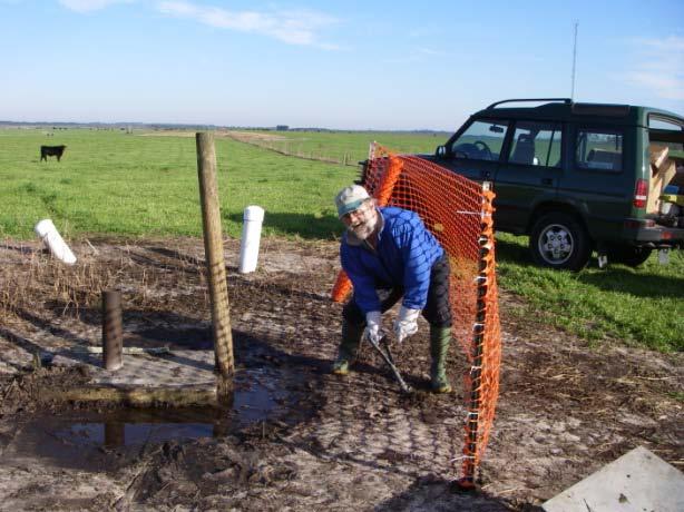
16 Unexpected Problems Cows are curious & mischievous! 12


 o")


17 Sampling o Collected water samples at all locations o Varied sampling interval throughout duration of test (4 hrs 12 hrs) o Initial duration: 4 months extended to 14 months o Developed recovery curves for each station fun stuff! 13

18 Sampling Strategy 8 automatic water samplers 4 insitu fluorometers 11 grab sample locations 14
 Inj.")
19 Injection & Near-Field Detections Inj. 1: Phloxine-B Jan. 26, kilograms (5 per well) Inj. 2: Uranine March 9, kilograms (20 per well) Inj. 3: Eosine March 9, kilograms (all at once) SJ1&2 SJ7 SE10
20 Far-Field Tracer Detections 5,262 samples collected & analyzed 6,485 positive detections (one sample can have 3 dyes) all flow paths predicted by potentiometric surface 16

21 Tracer Breakthrough at Wakulla B-Tunnel 1 st Slug 2 nd Slug?


22 And the Bottom Line? o $200 Million Dollar Breakthrough Curve Education + Science + Press = Results Tracer arrives at Wakulla: ~60 days City agrees to invest $200M in waste water treatment upgrades

23 Recovery Curve Analysis Aquifer Hydraulics 2 nd Inj. 1 st Inj.

24 Recovery Curve Analysis Aquifer Hydraulics 2 nd Inj. 1 st Inj.

25 Aquifer Hydraulics Aquifer / Matrix Interactions Injection #1 Rising Stage Injection #2 Falling Stage 21
26 Aquifer Hydraulics Low Flow High Flow
27 Comparison of Calculated Groundwater Velocities Method Velocity (m/day) Assumptions Source Tracing 252-2,337 m/day none Pumping Test Transmissivities Model Derived Transmissivities Geochemical age dates m/day m/day m/day Calculated Gradient Aquifer b = 100m Calculated Gradient Aquifer b = 100m Age ~20-40 years 100% of Recharge derived from top of basin (~110 km to north) Bush & Johnston, 1988 Davis, 1996 Chanton, 2002 Katz et al, 2004
28 Summary 24 o o o o o o o Three injections performed Near-field: 15 kg phloxine-b in 3 wells at middle of open interval Far-field wells: 60 kg uranine in same 3 wells Far-field swallet: 60 kg eosine in Turf Pond Sink of spray field property Sampled at 10 wells & 11 springs Dye detected at 3 wells and 5 springs Detected at all Wakulla area springs Not detected at any St. Marks area springs Both phloxine-b and uranine detected at Wakulla B-Tunnel (64 & 60 days after injection respectively) Wakulla detections convinced City to invest in advanced wastewater treatment. Timing of detections at SJ-1, SJ-2, and Wakulla B-Tunnel reveal how conduits and the matrix interact and respond to changing water levels. Under high-water conditions, swallets are full and pressurize the conduits resulting in slow travel-time through the matrix. Under low-water conditions, swallets are empty, conduits are low pressure zones resulting in fast travel-times through the matrix directed toward the conduits We can get much more from tracer tests than pathways and velocities. The shape and timing of tracer recovery curves reflect the operative aquifer hydraulics (conduit/matrix exchange, groundwater/ surface water interactions, etc) at the time of the test.

29 Questions? 25
Understanding Florida s Karst Results & Lessons Learned from the Woodville Karst Plain Research
 Understanding Florida s Karst Results & Lessons Learned from the Woodville Karst Plain Research Todd Kincaid, Ph.D. GeoHydros, LLC GeoHydros, LLC / 27 Keystone Ave, Reno, NV 89503 (775) 337-8803 / www.geohydros.com
Conduit Flow Paths and Conduit/Matrix Interactions Defined by Quantitative Groundwater Tracing in the Floridan Aquifer
 Conduit Flow Paths and Conduit/Matrix Interactions Defined by Quantitative Groundwater Tracing in the Floridan Aquifer Todd R. Kincaid 1 and Christopher L. Werner 2 1 GeoHydros, LLC Specialized Geological
Northwest Florida Water Management District. Water Policy Advisory Council 2013
 Northwest Florida Water Management District Water Policy Advisory Council 2013 Spring Management Challenges Jackson Blue Spring Nutrient pollution from agriculture Agricultural irrigation consumptive use
The Interconnectedness Between Spring Creek Springs and Wakulla Spring and the Effects on Flow at Wakulla Spring
 The Interconnectedness Between Spring and Wakulla Spring and the Effects on at Wakulla Spring U.S. GEOLOGICAL SURVEY In Cooperation With the Florida Dept. of Environmental Protection- Florida Initiative
Impairment Issues in the Ichetucknee Springs Basin Potential Research Questions and Hypotheses
 Impairment Issues in the Ichetucknee Springs Basin Potential Research Questions and Hypotheses Brian G. Katz U.S. Geological Survey Ichetucknee Springs Research Meeting February 10, 2011 Sources of hydrologic
NORTHWEST FLORIDA WATER MANAGEMENT DISTRICT
 Wakulla Spring Outstanding Florida Spring and National Natural Landmark Edward Ball Wakulla Springs State Park Human habitation for nearly 15,000 years Spring flow more than 400 cfs More than 35 miles
DELINEATION OF SPRING PROTECTION AREAS AT FIVE, FIRST-MAGNITUDE SPRINGS IN NORTH- CENTRAL FLORIDA
 DELINEATION OF SPRING PROTECTION AREAS AT FIVE, FIRST-MAGNITUDE SPRINGS IN NORTH- CENTRAL FLORIDA Prepared For The Suwannee River Water Management District Live Oak, Florida By SDII Global Corporation
DRAFT Priority Focus Areas for Devil s Spring System and Hornsby Spring
 DRAFT Priority Focus Areas for Devil s Spring System and Hornsby Spring Division of Environmental Assessment and Restoration Florida Department of Environmental Protection June 2017 2600 Blair Stone Road
Biogeosciences Disucssion: Review of Heffernan et al. Denitrification and inference of nitrogen sources in the karstic Floridan Aquifer
 Biogeosciences Disucssion: Review of Heffernan et al. Denitrification and inference of nitrogen sources in the karstic Floridan Aquifer S.V. Panno and K.C. Hackley Illinois State Geological Survey General
DELINEATION OF SPRING PROTECTION AREAS AT FIVE, FIRST-MAGNITUDE SPRINGS IN NORTH- CENTRAL FLORIDA
 DELINEATION OF SPRING PROTECTION AREAS AT FIVE, FIRST-MAGNITUDE SPRINGS IN NORTH- CENTRAL FLORIDA Prepared For The Suwannee River Water Management District Live Oak, Florida By SDII Global Corporation
PROTOTYPE FOR SPRING SYSTEM ASSESSMENTS. Debra Harrington and Haizhi Chen FDEP Groundwater Protection Watershed Monitoring Meeting February, 2005
 PROTOTYPE FOR SPRING SYSTEM ASSESSMENTS Debra Harrington and Haizhi Chen FDEP Groundwater Protection Watershed Monitoring Meeting February, 2005 WATERSHED MANAGEMENT and BASIN ASSESSMENTS IDENTIFY WATER
Restoration Plan for the Rainbow Springs and River DRAFT. 11 Appendices
 11 Appendices Appendix A. Location of Onsite Sewage Treatment Systems in Marion County Source: Marion County Utilities (Darker green areas indicate the locations of septic tanks) Normandeau Associates,
CHAPTER 369 PART IV SPRINGS PROTECTION. Be It Enacted by the Legislature of the State of Florida. Section 1: Part IV of chapter 369, Florida Statutes,
 CHAPTER 369 PART IV SPRINGS PROTECTION Be It Enacted by the Legislature of the State of Florida. Section 1: Part IV of chapter 369, Florida Statutes, consisting of sections 369.401, 369.402, 369.403, 369.407,
Altamonte Springs FDOT I-4 Storm water Capture and Reclaimed Water Project Phase I
 St. Johns River Water Management District Wekiva Spring Altamonte Springs FDOT I-4 Storm water Capture and Reclaimed Water Project Phase I Project includes construction of a 5.8 mile 20-inch diameter reclaimed
The Springs and. Aquifer System of Florida. Debra Segal, M.S. Volunteer for the Howard T. Odum Florida Springs Institute. Rock Springs, Orange County
 The Springs and Rock Springs, Orange County Aquifer System of Florida Debra Segal, M.S. Volunteer for the Howard T. Odum Florida Springs Institute Who Has Visited a Spring in Florida? Photos by John Moran
Investigation of Groundwater Flow Variations Near Spreading Ponds with Repeat Deliberate Tracer Experiments
 ABSTRACT & POWERPOINT PRESENTATION Investigation of Groundwater Flow Variations Near Spreading Ponds with Repeat Deliberate Tracer Experiments Jordan F. Clark, Ph.D. Professor, Dept. of Earth Science and
Aquifer Storage and Recovery: A Management Tool for Upstream Operators. Presented by: Lindsay Atkinson, PE James Dwyer, PE, D.W.R.
 Aquifer Storage and Recovery: A Management Tool for Upstream Operators Presented by: Lindsay Atkinson, PE James Dwyer, PE, D.W.R.E Outline Water Management Lifecycle in Unconventional E&P Incorporate ASR
Preferential Ground-Water Flow: Evidence from Decades of Fluorescent Dye-Tracing
 Preferential Ground-Water Flow: Evidence from Decades of Fluorescent Dye-Tracing Martin H. Otz & Nicholas A. Azzolina Nano Trace Technologies GSA Fall Meeting 2007 What is FDT? In fluorescent dye tracing
Florida Springs Protection and Restoration: Legislation, Projects and Prospects
 Florida Springs Protection and Restoration: Legislation, Projects and Prospects FSA Annual Conference June 2015 Casey Fitzgerald Director, Springs Protection Initiative SJRWMD Florida Springs Presentation
SUMMARY OF GROUNDWATER DYE TRACING STUDIES ( ), BARTON SPRINGS SEGMENT OF THE EDWARDS AQUIFER, TEXAS
, BARTON SPRINGS SEGMENT OF THE EDWARDS AQUIFER, TEXAS") Barton Springs/Edwards Aquifer Conservation District SUMMARY OF GROUNDWATER DYE TRACING STUDIES (1996-2002), BARTON SPRINGS SEGMENT OF THE EDWARDS AQUIFER, TEXAS INTRODUCTION The Barton Springs/Edwards
Barton Springs/Edwards Aquifer Conservation District SUMMARY OF GROUNDWATER DYE TRACING STUDIES (1996-2002), BARTON SPRINGS SEGMENT OF THE EDWARDS AQUIFER, TEXAS INTRODUCTION The Barton Springs/Edwards
Hydrogeologic Characterization Methods Used in Karst: A Contrast to the Darcian Aquifer Model
 Aquifer Characterization Groundwater Behavior in the Subsurface Environment Kentucky Section - American Institute of Professional Geologists Lexington, KY, May 29, 2014 Hydrogeologic Characterization Methods
Highlights of Study Results
 Report of Findings Test Well Construction and Aquifer Testing of the Electro Purification Wells: Hays County, Texas Highlights of Study Results For: Electro Purification, LLC 4605 Post Oak Place Houston,
Wakulla County Comprehensive Plan July 2013 GOALS, OBJECTIVES AND POLICIES
 GOALS, OBJECTIVES AND POLICIES INFRASTRUCTURE ELEMENT Goal 1: To provide needed public facilities in a manner that protects investments in existing facilities and supports orderly, efficient growth while
Rehoboth Beach Effluent Disposal Study. Evaluation of Wastewater Discharge Alternatives. Center for the Inland Bays STAC Meeting January 13, 2006
 Rehoboth Beach Effluent Disposal Study Evaluation of Wastewater Discharge Alternatives Center for the Inland Bays STAC Meeting January 13, 2006 1 Agenda Background Objectives/Goals Land Search Discharge
Brenna McDonald Missouri Department of Natural Resources Missouri Geological Survey
 Missouri Risk-Based Corrective Action Process for Petroleum Storage Tanks, Evaluation of Groundwater Use in Greene County from a Geological Perspective Brenna McDonald Missouri Department of Natural Resources
Summary of Outstanding Florida Springs Basin Management Action Plans June 2018
 Summary of Outstanding Florida Springs Basin Management Action Plans June 2018 Prepared by the Howard T. Odum Florida Springs Institute (FSI) Background The Florida Springs and Aquifer Protection Act (Chapter
Relationships Between Discharge And Water Quality In Florida Springs
 Relationships Between Discharge And Water Quality In Florida Springs Erich Marzolf, Ph.D. Ann B. Shortelle, Ph.D. Suwannee River Water Management District Data & Methods Data from SRWMD monitoring efforts,
Analyzing Groundwater
 Analyzing Groundwater SUBJECTS: Science GRADE LEVELS: 7 th DURATION: approximately two 60 minute periods ACTIVITY SUMMARY: Students will compare the properties of different soil types including texture
Aquifer Storage Recovery
 Aquifer Storage Recovery A Presentation to: Presented by: Neil Deeds, PhD, PE 1 August 12, 2015 Presentation Outline ASR Introduction What is it? How is it used? Where is it currently being used? What
The Impact of Nonpoint Source Contamination on the Surficial Aquifer of the Delmarva Peninsula
 The Impact of Nonpoint Source Contamination on the Surficial Aquifer of the Delmarva Peninsula Judith M. Denver National Water-Quality Assessment Program (NAWQA) September 28,2010 U.S. Department of the
Reference Guideline #1. Hydrogeological Impact Assessment
 Reference Guideline #1 Hydrogeological Impact Assessment Reference Guideline #1 Hydrogeological Impact Assessment Hydrogeological assessments are required for some subdivision applications when triggered
HYDROGEOLOGY OF THE HUMBOLDT RIVER BASIN, IMPACTS OF OPEN-PIT MINE DEWATERING AND PIT LAKE FORMATION
 HYDROGEOLOGY OF THE HUMBOLDT RIVER BASIN, IMPACTS OF OPEN-PIT MINE DEWATERING AND PIT LAKE FORMATION June, 2015 Tom Myers, Ph.D., Hydrologic Consultant, Reno NV tom_myers@charter.net Prepared for: Progressive
Variation in nitrate and calcium as indicators. of recharge pathways in Nolte Spring, PA. Introduction. L. Toran. W. B. White
 Environ Geol (2005) 48: 854 860 DOI 10.1007/s00254-005-0018-y ORIGINAL ARTICLE L. Toran Variation in nitrate and calcium as indicators W. B. White of recharge pathways in Nolte Spring, PA Received: 12
Florida Aquifer Geology
 Florida Aquifer Geology September 2017 Sampler Training Workshop Thomas Seal, ES III Watershed Monitoring Section (WMS) Water Quality Assessment Program DEAR Tallahassee Aquifer Basics Essential Definitions
Water Reuse: Orlando s Experiences & Perspectives. Rick Howard, PE Public Works Director
 Water Reuse: Orlando s Experiences & Perspectives Rick Howard, PE Public Works Director Water Reuse The process of using wastewater that has been thoroughly treated and disinfected to remove harmful organisms
Development of Alabama s First Water-Resource Management Plan: Are We There Yet?
 Development of Alabama s First Water-Resource Management Plan: Are We There Yet? Marlon Cook Geological Survey of Alabama, Retired Cook Hydrogeology, LLC. History of Alabama Water-Resource Planning and
Gooey Garbage. groundwater garbage contaminants leachate. landfills clay layers soil waste
 Gooey Garbage groundwater garbage contaminants leachate landfills clay layers soil waste The history of and landfills goes back to the beginning of time. Prehistoric cliff dwellers used to dump their waste
Florida Aquifer Geology
 Florida Aquifer Geology September 2016 Sampler Training Workshop Thomas Seal, ES III Watershed Monitoring Section (WMS) Water Quality Assessment Program DEAR Tallahassee Aquifer Basics Essential Definitions
Florida Aquifer Geology
 Florida Aquifer Geology February 2017 Sampler Training Workshop Thomas Seal, ES III Watershed Monitoring Section (WMS) Water Quality Assessment Program DEAR Tallahassee Aquifer Basics Essential Definitions
O R A N G E C I T Y S INTEGRAT E D W AT E R R E S O U R C E S M A N A G E M E N T & R E S I L I E N C Y P L A N
 O R A N G E C I T Y S INTEGRAT E D W AT E R R E S O U R C E S M A N A G E M E N T & R E S I L I E N C Y P L A N Cooperation is Key Cooperation among Volusia County and Cities is critical to solve our water
CHAPTER 10 NATURAL GROUNDWATER AND AQUIFER RECHARGE ELEMENT
 CHAPTER 10 NATURAL GROUNDWATER AND AQUIFER RECHARGE ELEMENT Page 1 of 7 G:\Comp\Adopted Comprehensive Plans\15. Cylce 16-2 and 16-3\Elements not changed\ Groundwater & Aquifer A. OVERVIEW CHAPTER 10 NATURAL
T E C H N I C A L M E M O R A N D U M
 INTERA Incorporated 9600 Great Hills Trail, Suite 300W Austin, Texas, USA 78759 512.425.2000 T E C H N I C A L M E M O R A N D U M To: From: Barton Springs/Edwards Aquifer Conservation District Wade Oliver,
Groundwater. Importance of Groundwater. The Water Table. Geol 104: Groundwater
 Groundwater Subsurface water contained in soil and bedrock. There is ~ 60 times as much water underground than in freshwater streams and lakes. Source of groundwater is rain and snow. Represents the infiltration
Florida Springs Initiative. Gary Maddox, P.G. Department of Environmental Protection
 Florida Springs Initiative Gary Maddox, P.G. Department of Environmental Protection Program History Kissengen Spring Program History Weeki Wachee Spring ca. 1950 and 2001 Program guided by the November,
Water Resources on PEI: an overview and brief discussion of challenges
 Water Resources on PEI: an overview and brief discussion of challenges Components: Components and links Atmospheric water Surface water (including glacial water) Groundwater Links: Precipitation (atm(
Report on the 2013 dye trace conducted on Girl Scout Camp Creek Houston County, Mn
 Report on the 2013 dye trace conducted on Girl Scout Camp Creek Houston County, Mn Minnesota Department of Natural Resources Funding for this Project is Provided by the Minnesota Environment and Natural
Using Isotopes and Other Chemical Indicators to Gain Insights into Spring Water Age and Timescales of Nitrate Contamination in Florida Karst Systems
 Using Isotopes and Other Chemical Indicators to Gain Insights into Spring Water Age and Timescales of Nitrate Contamination in Florida Karst Systems Brian G. Katz, PhD Florida Dept. of Environmental Protection
Numerical Modeling of Groundwater Flow in the Navajo Sandstone Aquifer at the Tuba City, Arizona, Disposal Site 15167
 Numerical Modeling of Groundwater Flow in the Navajo Sandstone Aquifer at the Tuba City, Arizona, Disposal Site 15167 ABSTRACT Richard Bush*, Timothy Bartlett** *US DOE, Office of Legacy Management **Stoller
Land Treatment of Sewage Effluent in Florida 1
 AE27 Land Treatment of Sewage Effluent in Florida 1 Allen R. Overman 2 Abstract During the last 20 years, land application has gained acceptance as an alternative method for sewage treatment. Experience
4S Ranch, Bulverde and ETJ. Water Quality Permit amendment
 4S Ranch, Bulverde and ETJ Water Quality Permit amendment Source: "Existing Conditions Landuse." Lewis Creek Drainage Study. N.p., n.d. Web. 10 Nov. 2015. .
global distribution of water!
 groundwater! hydrologic cycle! 2 global distribution of water! Source Volume Percent Ocean 97.2000 Glaciers and other ice 2.1500 Ground Water 0.6100 Lakes fresh 0.0090 saline 0.0080 Soil Moisture 0.0050
STATE OF FLORIDA DEPARTMENT OF ENVIRONMENTAL PROTECTION
 STATE OF FLORIDA DEPARTMENT OF ENVIRONMENTAL PROTECTION FLORIDA WILDLIFE FEDERATION and MANLEY FULLER, and WAKULLA COUNTY, a political subdivision of the State of Florida, and DEP OGC NO. 06-0320 FILE
Re-plumbing Roadside Ditch Networks
 Re-plumbing Roadside Ditch Networks Ditches Improving management to reduce flooding, water pollution, and in-stream erosion and habitat degradation Rebecca Schneider Dept. Natural Resources Cornell University,
But State Regulations Only Do So Much
 But State Regulations Only Do So Much The health of our waters is the principal measure of how we live on the land. Luna Leopold If this quote is true, then we are failing. The water resources in our state
Nitrate in Trout Brook
 Nitrate in Trout Brook Dakota County, Minnesota Prepared by Dakota County Soil and Water Conservation District, March 2014 Introduction Trout Brook is a trout stream in Dakota County, Minnesota. It is
Better Understanding the Impact of Onsite Sewage System on Quality of Florida Groundwater and Springs
 Better Understanding the Impact of Onsite Sewage System on Quality of Florida Groundwater and Springs Xueqing Gao, PhD Eberhard Roeder, PhD, PE, CPM Bureau of Environmental Health Division of Disease Control
Nitrogen Contributions of Karst Seepage into the Upper Floridan Aquifer from Sinking Streams and Sinking Lakes in the Wakulla Springshed
 Nitrogen Contributions of Karst Seepage into the Upper Floridan Aquifer from Sinking Streams and Sinking Lakes in the Wakulla Springshed September 30, 2016 Seán E. McGlynn, Principal Investigator Robert
Groundwater Flow Demonstration Model Activities for grades 4-12
 Groundwater Flow Demonstration Model Activities for grades 4-12 NR/WQ/2012-5 SET-UP Please allow time to practice using the groundwater model before conducting demonstrations. 1. Remove the groundwater
Florida Aquifer Geology
 Florida Aquifer Geology February 2018 Sampler Training Workshop Thomas Seal, ES III Watershed Monitoring Section (WMS) Water Quality Assessment Program DEAR Tallahassee Aquifer Basics Essential Definitions
San Mateo Plain Groundwater Basin Assessment Stakeholder Workshop #8 17 APRIL 2018
 San Mateo Plain Groundwater Basin Assessment Stakeholder Workshop #8 17 APRIL 2018 PRESENTATION OVERVIEW Introductions Project Overview Summary of Analysis Supporting Model Development Model Development
Characteristics and effects of flow reversals at Madison Blue and Peacock Springs (Florida) during river flooding
 during river flooding") Characteristics and effects of flow reversals at Madison Blue and Peacock Springs (Florida) during river flooding Jonathan B. Martin Jason Gulley Elizabeth J. Screaton Geological Sciences - UF Photo thanks
Characteristics and effects of flow reversals at Madison Blue and Peacock Springs (Florida) during river flooding Jonathan B. Martin Jason Gulley Elizabeth J. Screaton Geological Sciences - UF Photo thanks
General Groundwater Concepts
 General Groundwater Concepts Hydrologic Cycle All water on the surface of the earth and underground are part of the hydrologic cycle (Figure 1), driven by natural processes that constantly transform water
Surface Water and Seawater Interactions in the Coastal Environment of Biscayne Bay, Southeast Florida
 Surface Water and Seawater Interactions in the Coastal Environment of Biscayne Bay, Southeast Florida William C. Hutchings, MS, PG Nicholas Albergo, PE, DEE Paper No. 191-8 2005 Salt Lake City Annual Meeting
Upper Basalt-Confined Aquifer
 2.14 Upper Basalt-Confined Aquifer D. R. Newcomer and J. P. McDonald Upper basalt-confined aquifer groundwater quality is monitored because of the potential for downward migration of contaminants from
Northwest Florida Water Management District
 Looking at Northwest Florida Water Management District The Northwest Florida Water Management District and SWIM About the St. Marks Watershed When it rains in the Tallahassee area, water runs from the
BERRY CREEK WASTEWATER INTERCEPTOR PROJECT. December 11, 2018
 BERRY CREEK WASTEWATER INTERCEPTOR PROJECT December 11, 2018 Project Team City of Georgetown Owner Walker Partners Design Consultant SWCA Environmental and Hydrogeology Cambrian Geologic Assessment and
Detail on Concentrate Handling and Disposal Options
 Detail on Concentrate Handling and Disposal Options A number of options are available for disposing of concentrate including direct disposal as well as additional handling and/or treatment designed to
POTABLE WATER SUPPLY DEFINITIONS
 Definitions POTABLE WATER SUPPLY DEFINITIONS AQUIFER. A porous, water-bearing geologic formation. Generally restricted to materials capable of yielding an appreciable supply of water. BASIN. A natural
PIMA COUNTY COMPREHENSIVE PLAN CO PIMA COUNTY REGIONAL COMPREHENSIVE PLAN POLICY MAJOR PLAN AMENDMENT
 PIMA COUNTY COMPREHENSIVE PLAN CO7-07-04 PIMA COUNTY REGIONAL COMPREHENSIVE PLAN POLICY MAJOR PLAN AMENDMENT Arizona law [A.R.S. 11-821(C)(3)] requires: Planning for water resources that addresses: a)
FLORIDA SPRINGS. Source: J. Stevenson, Michigan State Univ. Case studies on impacts of nutrients on Florida springs ecosystems
 FLORIDA SPRINGS Source: J. Stevenson, Michigan State Univ. Case studies on impacts of nutrients on Florida springs ecosystems Florida Springs Karst geology Surface water & ground water are closely connected
Overview of Water Availability in Mississippi
 Overview of Water Availability in Mississippi April 6, 2016 Pat Phillips, RPG MDEQ - OLWR Mississippi s Abundant Water Resources Groundwater Surface Water Average Annual Precipitation in Mississippi Surface
Could Much of Edwards Aquifer Matrix Storage Actually be Trinity Aquifer Contributions from the Blanco River?
 Could Much of Edwards Aquifer Matrix Storage Actually be Trinity Aquifer Contributions from the Blanco River? Nico M. Hauwert City of Austin Watershed Protection Department Most storage within the Barton
AQUIFER STORAGE AND RECOVERY EVALUATION REPORT
 AQUIFER STORAGE AND RECOVERY EVALUATION REPORT Prepared for: CLALLAM COUNTY 228 East 4 th Street, Port Angeles, WA 98362 Prepared by: 12100 NE 195 th Street, Suite 200, Bothell, WA 99011 July 2003 TABLE
Occurrence of Iron in Surface Waters of the Upper St. Johns River Basin
 Occurrence of Iron in Surface Waters of the Upper St. Johns River Basin Prepared by Florida Department of Environmental Protection Bureau of Watershed Management Ground Water Protection Section December
2016 Water Quality Summary
 2016 Water Quality Summary 2016 WATER QUALITY SUMMARY The purpose of EAA s water quality program is to monitor the quality of water in the aquifer by sampling streams, wells, and springs across the region
A. POTABLE WATER AND GROUNDWATER RECHARGE WATER SUB-ELEMENT
 GOAL I-1: STRIVE TO PROVIDE HIGH QUALITY POTABLE WATER TO CURRENT AND FUTURE RESIDENTS AND VISITORS. Objective I-1.1 Water Supply Planning Walton County shall develop and maintain a Water Supply Facilities
Bill X. Hu. Department of Earth, Ocean and Atmospheric Sciences Florida State University
 Bill X. Hu Department of Earth, Ocean and Atmospheric Sciences Florida State University Outline of Presentation Introduction Purpose An evaluation of MODFLOW-CFP at the Laboratory Scale at the Sub-Regional
DEVELOPMENT OF AQUIFER TESTING PLANS. Brent Bauman, P.G. / Erin Lynam, Aquatic Biologist
 DEVELOPMENT OF AQUIFER TESTING PLANS Brent Bauman, P.G. / Erin Lynam, Aquatic Biologist DEVELOPMENT OF AQUIFER TESTING PLANS Goals of Aquifer Testing What questions are we trying to answer Staff review
Numerical Groundwater Flow Model Report. Caloosa Materials, LLC 3323 Gulf City Road Ruskin, Florida 33570
 Numerical Groundwater Flow Model Report Caloosa Materials, LLC 3323 Gulf City Road Ruskin, Florida 33570 GHD 2675 Winkler Ave Suite 180 Fort Myers, FL 33901 11138224 Report July 27, 2017 Table of Contents
Designing an ISCO Remedy for a Wood Treating Site Using Hydrogeologic Testing, High-Resolution Site Characterization, and 3D Modeling
 Designing an ISCO Remedy for a Wood Treating Site Using Hydrogeologic Testing, High-Resolution Site Characterization, and 3D Modeling Joseph Ivanowski, P.G. Shanna Thompson, P.E. Presentation Outline Site
IRP5 Workshop Knowledge-based water sensitive city solutions for groundwater impacted developments
 IRP5 Workshop Knowledge-based water sensitive city solutions for groundwater impacted developments Summary of relevant outputs and findings from Tranche 1 research Carolyn Oldham (UWA) Urban landscape
LOXAHATCHEE RIVER WATER QUALITY EVENT SAMPLING TASK 2: FINAL REPORT ASSESSMENT OF LOXAHATCHEE RIVER WATER QUALITY
 LOXAHATCHEE RIVER WATER QUALITY EVENT SAMPLING TASK 2: FINAL REPORT ASSESSMENT OF 2007-2008 LOXAHATCHEE RIVER WATER QUALITY In Partial Fulfillment of Agreement No. 4600001281 For the Period October 2007
CENTRAL ASSINIBOINE INTEGRATED WATERSHED MANAGEMENT PLAN SURFACE WATER HYDROLOGY REPORT
 CENTRAL ASSINIBOINE INTEGRATED WATERSHED MANAGEMENT PLAN SURFACE WATER HYDROLOGY REPORT Planning Area Boundary: The Central Assiniboine planning area covers the reach of the Assiniboine River from just
Edwards Aquifer Upper Glen Rose Aquifer Hydraulic Interaction
 Edwards Aquifer Upper Glen Rose Aquifer Hydraulic Interaction R.T. Green 1, F.P. Bertetti 1, and M.O. Candelario 2 1 Geosciences and Engineering Division, Southwest Research Institute, San Antonio, Texas;
Background Information on the. Peace River Basin
 Background Information on the Peace River Basin Resource Conservation & Development Department August 24 Background Physiography The Peace River drainage basin occupies large parts of Polk, Hardee, DeSoto,
5. Basin Evaluation Salt and Nitrate Balance
 SNMP Attachment B, Section B.2.1.3 (originally Section 5 in CV-SALTS Phase 2 Conceptual Model Task 5 deliverables) 5. As part of the evaluation of water quality the SNMP requires loading estimates and
ECONFINA CREEK SPRING INVENTORY WASHINGTON AND BAY COUNTIES, FL
 ECONFINA CREEK SPRING INVENTORY WASHINGTON AND BAY COUNTIES, FL Water Resources Special Report 04-02 Prepared by: Kristopher Barrios and Angela Chelette The Northwest Florida Water Management District
New Braunfels population growth ranks second in U.S. San Antonio Business Journal WHY ASR FOR NEW BRAUNFELS UTILITIES
 Discussion Outline Introduction Why ASR for NBU Phase 1 Feasibility Study TWDB Funding and Phase 2A Demonstration Program Coordination with EAA and Airport Conclusions Questions New Braunfels population
ALABAMA S FUTURE WITHOUT SUSTAINABLE WATER RESOURCES? NOT ON OUR WATCH. Marlon Cook
 ALABAMA S FUTURE WITHOUT SUSTAINABLE WATER RESOURCES? NOT ON OUR WATCH Marlon Cook Geological Survey of Alabama Groundwater Assessment Program Sustainable Water Resources Sustainable Yield: The water extraction
groundwater. Because watersheds are complex systems, each tends to respond differently to natural or human activities.
 The private development of Altos del María is located at an altitude between 550 and 1,000 meters above sea level in the environmentally sensitive Cordillera Central of Panama that separates the Pacific
GROUNDWATER TRANSFER & INJECTION: PROGRESS TOWARD A MANAGED AQUIFER RECHARGE OPTION FOR SUSTAINABLE GROUNDWATER SUPPLY
 GROUNDWATER TRANSFER & INJECTION: PROGRESS TOWARD A MANAGED AQUIFER RECHARGE OPTION FOR SUSTAINABLE GROUNDWATER SUPPLY J.R. Rigby, Ph.D. Research Hydrologist National Sedimentation Laboratory USDA-ARS,
Understanding the Water System
 W Water Is a Natural Resource Understanding the Water System Cost WATER QUALITY in KENTUCKY The Water Cycle Figure 1. Trends in Water Withdrawals and Population, 1950 to 1995. Millions of People/Billion
Spray Irrigation : RIBs Spray
 Spray Irrigation : RIBs DNREC s Perspective on Beneficial Reuse in Delaware Ronald E. Graeber Program Manager I Ground Water Discharges Section Ronald.graeber@state.de.us (302) 739-99489948 On-Site Wastewater
SOURCE WATER ASSESSMENT SUMMARY BROCHURE
 SOURCE WATER ASSESSMENT SUMMARY BROCHURE USFS WOLF CREEK JOB CORPS PWS # 4101095 WHAT IS A SOURCE WATER ASSESSMENT? The Source Water Assessment was recently completed by the Department of Environmental
Salinity in the Central Valley
 Salinity in the Central Valley Salinity Stakeholder Workshop April 17, 2008 Elaine Archibald California Urban Water Agencies Presentation Overview What is salinity? What is the problem? Why is salinity
Aquifer Science Staff, January 2007
 Guidelines for Hydrogeologic Reports and Aquifer Tests Conducted Within the Jurisdictional Boundaries of the Barton Springs / Edwards Aquifer Conservation District I. Introduction Aquifer Science Staff,
Amount of Water Available Annually: 21,000 acre-feet per year (af/yr) upon project completion
 upon project completion") DRAFT Name of Project: Expanded Carrizo Project Duration of Project: 50 years. Construction completed by 2026. Amount of Water Available Annually: 21,000 acre-feet per year (af/yr) upon project completion
DRAFT Name of Project: Expanded Carrizo Project Duration of Project: 50 years. Construction completed by 2026. Amount of Water Available Annually: 21,000 acre-feet per year (af/yr) upon project completion
INFRASTRUCTURE ELEMENT/NATURAL GROUNDWATER AQUIFER RECHARGE SUB-ELEMENT
 I. INTRODUCTION A. Purpose As provided in this Natural Groundwater Aquifer Recharge Sub-element, the City of Ocoee has developed guidelines based on the St. Johns River Water Management District s programs.
Analyses for geochemical investigations traditionally report concentrations as weight per volume of the measured ions (mg/l of NO 3 , NO 2
 Nitrate-Nitrogen 55 Nutrients The nutrients nitrogen and phosphorus occur naturally and also may be introduced to groundwater systems from urban and agricultural fertilizer applications, livestock or human
14 Water Resources. Looking for Water... in the Desert. Where Is Our Water? Lesson 1.1 Earth: The Water Planet
 CHAPTER 14 Water Resources Looking for Water... in the Desert The 2300-kilometer Colorado River once flowed deep and wide across the Southwest to Mexico s Gulf of California. Since the Colorado River Compact,