Environmental Assessment MCAS Cherry Point Range Operations
|
|
|
- Elvin Potter
- 6 years ago
- Views:
Transcription


1 January 2009 Environmental Assessment MCAS Cherry Point Range Operations MCAS Cherry Point, North Carolina Action Proponent: MCAS Cherry Point
2 THIS PAGE INTENTIONALLY LEFT BLANK
3 ENVIRONMENTAL ASSESSMENT MCAS CHERRY POINT RANGE OPERATIONS CRAVEN, CARTERET, AND PAMLICO COUNTIES, NORTH CAROLINA Responsible Officer: Commanding Officer Marine Corps Air Station Cherry Point, NC Point of Contact: Department of the Navy NAVFAC Atlantic Attn: Susan Admire NAVFAC Atlantic Environmental Planning 6506 Hampton Boulevard Norfolk, VA (757) MCAS Cherry Point: MCAS Cherry Point Attn: Carmen Lombardo Natural Resource Manager Marine Corps Air Station Bldg 4223, Access Road, PSC 8003 Cherry Point, NC (252) January 2009
4 Acronyms and Abbreviations ac acre(s) MC munitions constituent ADNL A-weighted Day-Night Level MCAS Marine Corps Air Station AEC Area of Environmental Concern MCALF Marine Corps Auxiliary Landing Field AIWW Atlantic Intracoastal Waterway MCB Marine Corps Base AOIs Areas of interest MCOLF Marine Corps Outlying Landing Field BNOISE Blast Noise Prediction mi mile(s) BT- Bombing Target MMPA Marine Mammal Protection Act cal caliber n/a Not applicable CAMA Coastal Area Management Act NAVFAC Naval Facilities Engineering Command CDNL C-weighted Day-Night Level NCAC North Carolina Administrative Code CFR Code of Federal Regulations NEPA National Environmental Policy Act CURRS Consolidated Utilization Range Report nm nautical mile(s) System CZMA Coastal Zone Management Act NMFS National Marine Fisheries Service db decibel(s) NOAA National Oceanic Atmospheric Administration dba A-weighted decibel(s) NRHP National Register of Historic Places dbc C-weighted decibel(s) OEIS Overseas Environmental Impact Statement DNL Day-Night Level ppm parts per million DoD Department of Defense psu practical salinity units DoN Department of the Navy REVA Range Environmental Vulnerability Assessment EA Environmental Assessment SAFMC South Atlantic Fishery Management Council EFH Essential Fish Habitat sq km square kilometer(s) EIS Environmental Impact Statement sq mi square miles EPA Environmental Protection Agency sq nm square nautical mile(s) ESA Endangered Species Act sm statute mile(s) FAA Federal Aviation Administration TOW tube-launched, optically-tracked, wire-guided FONSI Finding of No Significant Impact TTS Temporary Threshold Shift ft feet UAS Unmanned Aerial Systems FY fiscal year g/m 3 micrograms per cubic meter ha hectare(s) µpa micropascals kg kilogram(s) US United States km kilometer(s) USC US Code lbs pounds USDA US Department of Agriculture m meters USFWS US Fish and Wildlife Service mm millimeters USMC US Marine Corps
5 MCAS Cherry Point Range Operations EXECUTIVE SUMMARY The United States Marine Corps requires the best military training in the world to sustain its critical role in national defense and forward deployment in worldwide combat situations. Training provides the physical skills, ability, and knowledge to perform and survive in combat through basic military, skill-specific, and weapons-specific training (both hardware and tactical), as well as formal education. It builds proficiency, cohesion, and teamwork and is fundamental to achieving unity of effort. Training is the primary means for maintaining, improving, and displaying United States Marine Corps forces readiness to fight and win in times of crisis or conflict. The Navy and Marine Corps extensively use each other s training areas and conduct many highly integrated training activities in the three adjoining range complexes of Navy Cherry Point, Marine Corps Air Station (MCAS) Cherry Point, and Marine Corps Base (MCB) Camp Lejeune. Despite the interaction in this region, the functions, structure, management, and use of the three range complexes are sufficiently distinct. Therefore, the Navy and Marine Corps analyzed potential environmental effects of their combined training activities in separate environmental documents for the range complex(es) over which each has cognizance: Navy Cherry Point Range Complex Environmental Impact Statement (EIS)/Overseas Environmental Impact Statement (OEIS) considers training activities in the sea space and undersea space of the Cherry Point Operating Area; overlying special use airspace and coastal areas from the mean high tide line, up to and extending seaward to the western Cherry Point Operating Area boundary MCAS Cherry Point Range Operations Environmental Assessment (EA) considers training activities on the air station; its outlying and auxiliary landing fields; its two impact areas in Pamlico Sound; and overlying special use airspace MCB Camp Lejeune Range Operations EA considers training activities on the installation s many ranges and impact areas and overlying special use airspace The Marine Corps EAs analyze the potential environmental impact of training activities in the same resource areas as the Navy Cherry Point Range Complex EIS/OEIS. Each document addresses Navy and Marine Corps training activities that occur on that particular range complex and both services will comply with the mitigation and protective measures therein. The Navy will incorporate, by reference, relevant analyses from both Marine Corps EAs into the EIS/OEIS discussion of direct, indirect, and cumulative impacts. The Navy and Marine Corps coordinated their public outreach efforts to provide the public with access to clear, accurate information regarding the three environmental planning efforts. This EA considers the environmental impact of training operations in the MCAS Cherry Point Range Complex. The MCAS Cherry Point Range Complex provides a unique training environment comprised of airspace, land, and water training areas. This particular range complex is of vital importance to the readiness of Marine Forces. Due to the pre-deployment training schedules associated with emerging missions, including Operation Enduring Freedom and Operation Iraqi Freedom, there is a need to increase the operational training tempo at the MCAS January 2009 ES-1 Executive Summary
6 Environmental Assessment Cherry Point Range Complex. Moreover, increased training is needed to address foreseeable increases in the number of military personnel training at MCAS Cherry Point. Given these aspects, MCAS Cherry Point proposes to take action that would provide a training environment within the MCAS Cherry Point Range Complex with the capacity and capability to fully support required training tasks for operational units, military schools, and other users. The environmental impacts of the total influx of personnel that is expected at MCAS Cherry Point in the coming years in relation to achieving a balanced growth in capability throughout the Marine Corps are being analyzed in a separate document (United States Marine Corps Grow the Force at MCB Camp Lejeune, MCAS New River, and MCAS Cherry Point, North Carolina EIS). This EA has been prepared by the United States Marine Corps in accordance with the National Environmental Policy Act (NEPA) of 1969; 42 USC d, as implemented by the Council on Environmental Quality regulations, 40 Code of Federal Regulations Parts ; and the Marine Corps Order P5090.2A, Change 1, Chapter 12, dated 22 January 2008, Environmental Compliance and Protection Manual, which establishes procedures for implementing NEPA. ES.1 Description of the Proposed Action The proposed action is to support and conduct current and emerging training operations at the MCAS Cherry Point Range Complex. Under the proposed action, there would be increases in current training operations at existing ranges. These training operations would be conducted within existing special use airspace and on existing land and water ranges within the range complex. There are two alternatives for accomplishing the proposed action. Alternative 1 would provide the current level of training operations within the MCAS Cherry Point Range Complex that occur under the No Action Alternative plus additional training increases in sortie operations and munitions usage associated with rotary-wing aircraft (AH-1, CH-53, and UH-1) squadrons and a percent increase in small arms range activities. Alternative 2, the preferred alternative, would provide the Alternative 1 level of training operations within the MCAS Cherry Point Range Complex plus establish a water restricted area at Bombing Target (BT-) 11 for intermittent use in support of a proposed change in small arms live-fire training. Under the preferred alternative, the types of training operations at the MCAS Cherry Point Range Complex would remain essentially the same. The level of training to be provided under the preferred alternative is reflected by the sortie operations and munitions usage shown in Table and Table 2.3-2, respectively (see Proposed Action and Alternatives [Chapter 2] of this EA). The preferred alternative would fully support and enhance the MCAS Cherry Point mission, to provide training support to II Marine Expeditionary Force s Aviation Combat Elements, which include aircrew, combat engineers, and aviation control group personnel. Training operations under the proposed action will be reviewed every five years to determine if supplementary NEPA analysis is necessary. January 2009 ES-2 Executive Summary
7 MCAS Cherry Point Range Operations ES.2 Alternatives Considered Range complexes are necessary for the training and certification of Marine Corps and Navy operational forces in preparation for overseas deployment. The MCAS Cherry Point Range Complex is a vital component of the Atlantic Fleet system of range complexes. The only proximate alternative site (i.e., Stumpy Point Bombing Range, North Carolina) does not provide for the required training purposes/activities described above and no other range complex on the East Coast has the land areas, proximity, air traffic control assigned airspace, sea space, undersea space, military operations areas, impact areas, targets, and instrumented facilities in one geographic area. Consequently, alternative training locations were eliminated from further consideration. Computer technologies provide excellent tools for implementing a successful, integrated training program while reducing the risk and expense typically associated with military training. However, while it is an essential component of training, computer simulation cannot be used exclusively for training. An alternative that would rely entirely on computer simulated training at MCAS Cherry Point would not achieve the necessary levels of proficiency in communicating, maneuvering, operating, repairing equipment, and delivering ordnance in a high stress and realistic environment. Consequently, this alternative was not carried forward for analysis. An alternative that included training with live and inert Hellfire and tube-launched, opticallytracked, wire-guided (TOW) missiles initially was considered for the proposed action. However, during the course of evaluating the impacts that Hellfire and TOW missiles may have on the environment, the NEPA team was informed that the planning criteria used to develop safety footprints for specific weapon systems were being modified and would not be available in time for this document. Without accurate safety footprints, potential environmental and safety impacts associated with the Hellfire and TOW missiles cannot be evaluated appropriately. Therefore, this alternative was eliminated for analysis in this EA. Two alternatives and the No Action Alternative were carried forward for detailed analysis in this EA. Table ES-1 summarizes the key elements of the two alternatives and the No Action Alternative. Alternative 1 and Alternative 2 include common elements with regard to continuation of existing operations at MCAS Cherry Point. The preferred alternative would provide the current level of training operations (the No Action Alternative) plus increased training levels required by MCAS Cherry Point to carry out its mission to maintain a high level of combat readiness for Marine Corps and Naval forces. The additional training operations under the preferred alternative would include: (1) increases in rotary-wing aircraft sortie operations; (2) increases in munitions expenditures; and (3) establishment of a water restricted area at BT-11 for intermittent use in small arms live-fire training. January 2009 ES-3 Executive Summary
8 Environmental Assessment Table ES-1 Summary of Alternatives Alternative Alternative 2 Action to be Taken No Action Alternative 1 (Preferred Alternative Alternative) Increase of existing rotary-wing aircraft utilization levels Continuation of existing tactical vehicle utilization levels Increase of munitions expenditures Continuation of existing Explosive Ordnance Disposal Continuation of existing ground equipment use Accommodation of increased training levels Establishment of intermittent water restricted area at BT-11 ES.3 Environmental Impact of the Proposed Action Implementation of Alternative 2, the preferred alternative, would result in some minor environmental impacts. Following is a brief summary of the anticipated impacts to each resource area analyzed in the EA. The discussion of impacts is categorized by impacts resulting from proposed activities within special use airspace, land ranges, and water ranges. For a detailed description and analysis, refer to Environmental Consequences (Chapter 4) of this EA. Special Use Airspace Civil Aircraft Operations: There would be an increase in helicopter sorties under the preferred alternative. However, there would be no changes to the designated purpose, dimensions (shape or altitude), or hours of operation of the existing special use airspace for the MCAS Cherry Point Range Complex under Alternative 2. Civil aircraft would continue to conduct their flight operations to and from the public and private use airports, along airway route structures, and along the coastal areas under their current flight procedures. Therefore, there would be a negligible impact on civil aircraft operations from air training activities under Alternative 2. Noise: The potential aircraft noise impacts resulting from small increases in rotary-wing aircraft operations under the preferred alternative would not be noticeable. Public Health and Safety: Increases in training under the preferred alternative would not result in impacts to public health and safety. Use of lasers will increase under the proposed action; however, existing precautions are in place to minimize impact to the public. Current operating procedures, advanced communications systems, and prior public notification of Marine Corps aircraft training operations would minimize impacts to the public. Bird/wildlife aircraft strikes are not expected to increase. Therefore, safety impacts with respect to increased use of lasers and other weapons would be minor. Land Ranges Land Use: Implementation of the preferred alternative would not result in changes to existing land use patterns since the training increases would occur within existing ranges. Throughout January 2009 ES-4 Executive Summary
9 MCAS Cherry Point Range Operations MCAS Cherry Point land use would remain the same: operational and training facilities. The preferred alternative would have no impact on land use. Environmental Justice: As evaluated in accordance with Executive Orders and 13045, the direct and indirect effects of the preferred alternative would not cause disproportionately adverse environmental, economic, or health impacts specific to groups or individuals at MCAS Cherry Point or nearby communities, considered minorities, low-income populations, or children. Air Quality: There would be a slight increase in air pollutant emissions due to the increase in munitions usage and rotary-wing aircraft sorties; thus, a small negative impact to the regional air quality is expected. However, the air quality in Craven, Carteret, and Pamlico Counties is well within regulatory limits, and air pollution concentrations would not exceed the National Ambient Air Quality Standards as a result of the preferred alternative. Noise: The preferred alternative would increase the number of rounds of the types of largecaliber weapons firing that currently occurs, but would not increase the size of weapons fired. Small arms firing-related A-weighted Day Night Level (ADNL) noise conditions around BT-11 under the preferred alternative would have minimal noise effects on sensitive receptors. No vibration noise impact would result from the preferred alternative. Cultural Resources: Under the preferred alternative, training operations on MCAS Cherry Point land ranges may impact historic properties (i.e., prehistoric or historic sites, buildings, structures, objects, or districts included in or eligible for inclusion in the National Register of Historic Places [NRHP]). Ground training activities on land ranges could damage or may have damaged archaeological sites. However, MCAS Cherry Point has identified all high probability archaeological sensitive soils located within the installation boundary. As a result, established protocols exist at the Air Station that include coordination and input from training and range staff and environmental staff. Measures are employed to avoid, minimize, and/or reduce impacts to historic properties. There are no architectural resources that are eligible for inclusion in the NRHP in the MCAS Cherry Point Range Complex. Soils: The preferred alternative would result in minor impacts to soils, as increased training would increase soil disturbance. Maintenance and hardening of roads and trails, land management efforts, best management practices, and employing erosion and sedimentation control techniques at training sites would minimize impacts to soils. Water Resources: Under the preferred alternative, training activities would require an increase in the use of certain munitions. There would be a potential for impacts to two surface water bodies in proximity to two small arms ranges. There may be a potential for impacts to groundwater due to increased munitions. These areas are currently under assessment and will be evaluated every five years under the Range Environmental Vulnerability Assessment to verify that munitions constituents are not migrating off-range. Initial samples for the qualitative assessment indicate no adverse impacts to surface water or groundwater. January 2009 ES-5 Executive Summary
10 Environmental Assessment Minor impacts to wetlands and floodplains would result from the increased level of training on land ranges and training areas in the MCAS Cherry Point Range Complex under the preferred alternative. However, MCAS Cherry Point employs several management approaches and protection measures that would minimize impacts to wetlands and floodplains. Terrestrial Biology: Implementation of the preferred alternative would have minor impacts on vegetation. The preferred alternative is not likely to adversely affect wildlife or migratory bird populations. Adverse effects to federally listed and sensitive species are not expected. Hazardous Materials and Waste Management: No adverse impacts are expected to hazardous materials and waste management under the preferred alternative. MCAS Cherry Point would establish an appropriate course of action for the preferred alternative so that federal and state agency notification requirements are met and to arrange for agency consultation as necessary where sites with risk of pollutant migration could be affected. All hazardous waste would continue to be managed in compliance with Marine Corps Order P5090.2A and Air Station Order A. The anticipated increases in hazardous waste are well within the existing capacities of hazardous waste transporters and treatment and disposal facilities in MCAS Cherry Point. Public Health and Safety: Increases in training under the preferred alternative would not adversely affect public health and safety. Current operating procedures as described in Air Station Order P3570.2R, Target Facilities and Operation Areas (MCAS Cherry Point, December 2004) and advanced communications systems would minimize impacts to the public. Therefore, safety impacts with respect to increased use of lasers and other weapons would be minor. Bird/wildlife aircraft strikes are not expected to increase. Water Ranges Coastal Zone Management: Impacts to the coastal zone from the preferred alternative would not be substantial. The Marine Corps, through the Coastal Consistency Determination process, has determined that implementing the preferred alternative would be consistent to the maximum extent possible with the applicable and enforceable policies of the North Carolina Coastal Area Management Act. Socioeconomics: Under the preferred alternative, the intermittent use of the proposed water restricted area at BT-11 would result in periodic fishing prohibitions on 0.3 percent of the water area in the region of influence. This area would be removed from public use approximately 350 hours per year, or for the duration of 50, seven-hour periods, resulting in periodic impacts to commercial and recreational fishing. The intermittent closures of the water restricted area would allow fishermen to potentially shift fishing schedules to make up for those times when closures occur. The intermittent closures would not occur during the hours when most fishing activity takes place. Despite the minor economic impact, the effects of the intermittent use of the water restricted area would be experienced more severely by local fishermen that have fished commercially and recreationally in these areas for many years. Objections to additions to, or expansion of the water restricted areas at the bombing target ranges have been expressed through January 2009 ES-6 Executive Summary
11 MCAS Cherry Point Range Operations a public comment period on the proposed action as described in Public Involvement (Subchapter 1.4.4). Recreational activities such as boating, sports fishing, shellfishing, crabbing, and sport diving, would be affected by the preferred alternative. The intermittent closure of the proposed water restricted area would result in periodic impacts to recreational activities such as fishing and boating. However, the intermittent closures would not be scheduled during the hours when most recreational activities occur, thus minimizing the overall impact. Cultural Resources: Under Alternative 2, no impacts to historic properties (i.e., NRHP-listed or -eligible prehistoric or historic resources) are expected. No underwater archaeological surveys have been conducted in the MCAS Cherry Point water ranges. Records on known or reported underwater archaeological sites, including shipwrecks, in this area of the North Carolina coast identified no sites within the existing water ranges at BT-11 and two shipwrecks near the center of the danger zone (water) at BT-9. The existing BT-9 and BT-11 offshore impact areas have been extensively disturbed by bombing activities and thus, are not expected to have prehistoric or historic underwater archaeological resources that are eligible for inclusion in the NRHP. The sea floor within the proposed intermittent water restricted area at BT-11 would not be disturbed by small arms training; thus, no historic properties, if present, would be affected. Water Resources: Under the preferred alternative, increases in.50 caliber ammunition expenditures at BT-11 in would result in minor impacts to surface water and groundwater. Any changes in water quality would be negligible based on the dispersed nature of the expended rounds, slow breakdown rates, and enormous dilution capacity of the surrounding sea water. Therefore, indirect changes in water quality would not occur. Marine Biology: The preferred alternative is not likely to adversely affect marine bird, invertebrate, or fish populations. Conservation measures are in place, and there is a low likelihood of striking a bird by ordnance or ordnance delivery vessels. The preferred alternative would have no adverse effect on Essential Fish Habitat and only minor impacts to marine mammals. For threatened and endangered species, there are no foreseeable effects on the shortnose sturgeon, the West Indian manatee, or the Hawksbill sea turtle. Due to their known presence in the action area yet high mobility, activities associated with the preferred alternative may affect the loggerhead, green, Kemp s ridley, and leatherback sea turtles. Hazardous Materials and Waste Management: No adverse impacts are expected to hazardous materials and waste management under the preferred alternative as described previously in the Land Ranges section. Public Health and Safety: Increases in training under the preferred alternative would not adversely affect public health and safety as described previously in the Land Ranges section. January 2009 ES-7 Executive Summary
12 Environmental Assessment ES.4 Avoidance and Minimization Measures There are no identified mitigation measures for the proposed action alternatives. MCAS Cherry Point has previously implemented policies and procedures that conserve and protect environmental resources on the installation, including the range complex. Ongoing avoidance and minimization measures outlined in current standard operating procedures, Best Management Practices, or other Air Station Orders or programs would be applied to this proposed action to protect the environment; thus, no new mitigation measures are necessary. These ongoing measures include wildlife and habitat protection, erosion control, hazardous material and waste management, cultural resource inadvertent discovery procedures, and safety programs, among others. The Integrated Natural Resources Management Plan includes specifics regarding the schedule for implementation, funding, and monitoring of identified management actions for natural resources, including annual reviews and five-year updates. Establishing separate monitoring or tracking through this EA is not warranted; rather, the Integrated Natural Resources Management Plan review and update process serves as the monitoring and tracking mechanism for the natural resources potentially impacted by the action alternatives. January 2009 ES-8 Executive Summary
13 MCAS Cherry Point Range Operations TABLE OF CONTENTS Acronyms and Abbreviations... Inside Front Cover Executive Summary... ES PURPOSE AND NEED FOR PROPOSED ACTION Introduction Background Marine Corps and Navy Training Mission of MCAS Cherry Point Description of the MCAS Cherry Point Range Complex Installations and Special Use Airspace Purpose and Need for Proposed Action Environmental Review Process National Environmental Policy Act Navy Tactical Training Theater Assessment and Planning Program Scoping and Alternatives Development Public Involvement Related Environmental Documents Agency Coordination and Permit Requirements PROPOSED ACTION AND ALTERNATIVES No Action Alternative Current Target Operations Manual Environment Procedures Special Use Airspace Special Use Airspace Training Locations Typical Air Training Activities Airspace Training Levels Land Ranges Land Ranges Training Locations Land Ranges Training Activities Land Training Activities with Aircraft Operations Land Ranges Training Levels Water Ranges Water Ranges Training Locations Water Ranges Training Activities, Surface-to-Surface Water Ranges Training Activities, Air-to-Surface Water Ranges Training Levels Proposed Action Alternative Special Use Airspace, Alternative Land Ranges Ground-to-Ground Training, Alternative Land Ranges Air-to-Ground and Surface-to-Ground Training, Alternative Water Ranges Surface-to-Surface and Air-to-Surface Training, Alternative Alternative Special Use Airspace, Alternative Land Ranges Ground-to-Ground Training, Alternative Land Ranges Air-to-Ground and Surface-to-Ground Training, Alternative Water Ranges Surface-to-Surface and Air-to-Surface Training, Alternative Summary of Training Levels for All Alternatives Special Use Airspace Land and Water Ranges Training January 2009 i Table of Contents
14 Environmental Assessment 2.4 Alternatives Considered but Dismissed Alternative Range Training Locations Computer Simulated Training Evaluation of Alternatives AFFECTED ENVIRONMENT Special Use Airspace Civil (Non-Military) Aircraft Operations Special Use Airspace Commercial Aviation General Aviation Noise Special Use Airspace Measuring Noise Noise Standards and Guidelines Existing Noise Conditions Public Health and Safety Special Use Airspace Laser Safety Bird/Wildlife Aircraft Strike Hazard Communications Land Ranges Land Use Land Ranges MCAS Cherry Point Range Complex Regional Land Use Environmental Justice Land Ranges Air Quality Land Ranges National Ambient Air Quality Standards and Attainment Status Noise Land Ranges Existing Noise Conditions Cultural Resources Land Ranges Architectural Resources Archaeological Resources Natural Resources Land Ranges Soils Water Resources Terrestrial Biology Hazardous Materials and Waste Management Land Ranges Hazardous Materials Hazardous Constituents Hazardous Waste Management Public Health and Safety Land Ranges Laser Safety Bird/Wildlife Aircraft Strike Hazard Communications Water Ranges Coastal Zone Management Water Ranges Socioeconomics Water Ranges Commercial and Recreational Fishing Recreational Activities Noise Water Ranges January 2009 ii Table of Contents
15 MCAS Cherry Point Range Operations Cultural Resources Archaeological Resources Water Ranges Underwater Archaeological Sites Shipwrecks Natural Resources Water Ranges Underwater Sediments Water Resources Marine Biology Hazardous Materials and Waste Management Water Ranges Hazardous Materials Hazardous Constituents Hazardous Waste Management Public Health and Safety Water Ranges Laser Safety Communications ENVIRONMENTAL CONSEQUENCES Special Use Airspace Civil (Non-Military) Aircraft Operations Special Use Airspace No Action Alternative Alternative Alternative Noise Special Use Airspace No Action Alternative Alternative Alternative Public Health and Safety Special Use Airspace Laser Safety Bird/Wildlife Aircraft Strike Hazard Communications Land Ranges Land Use Land Ranges MCAS Cherry Point Range Complex Regional Land Use Environmental Justice Land Ranges No Action Alternative Alternative Alternative Air Quality Land Ranges No Action Alternative Alternative Alternative Noise Land Ranges No Action Alternative Alternative Alternative Cultural Resources Land Ranges Architectural Resources Archaeological Resources Natural Resources Land Ranges January 2009 iii Table of Contents
16 Environmental Assessment Soils Water Resources Terrestrial Biology Hazardous Materials and Hazardous Waste Management Land Ranges Hazardous Materials Hazardous Constituents Hazardous Waste Management Public Health and Safety Land Ranges Laser Safety Bird/Wildlife Aircraft Strike Hazard Communications Water Ranges Coastal Zone Management Water Ranges No Action Alternative Alternative Alternative Socioeconomics Water Ranges Commercial and Recreational Fishing Recreational Activities Noise Water Ranges Cultural Resources--Archaeological Resources Water Ranges No Action Alternative Alternative Alternative Natural Resources Water Ranges Underwater Sediments Water Resources Surface Water Marine Biology Hazardous Materials and Hazardous Waste Management Water Ranges Hazardous Materials Hazardous Constituents Hazardous Waste Management Public Health and Safety Water Ranges Laser Safety Communications Unavoidable Adverse Impacts Relationship between Local Short-Term Uses of the Environment and Enhancement of Long-Term Productivity Irreversible and Irretrievable Commitments of Resources Avoidance and Minimization Measures Land Use Coastal Zone Management Environmental Justice Socioeconomics Commercial and Recreational Fishing Recreational Activities Air Quality Noise Cultural Resources Natural Resources January 2009 iv Table of Contents
17 MCAS Cherry Point Range Operations Soils Underwater Sediments Water Resources Terrestrial Biology Marine Biology Hazardous Materials and Hazardous Waste Management Public Health and Safety Civil (Non-Military) Aircraft Operations CUMULATIVE IMPACTS Other Past or Planned Actions in the Vicinity of the Proposed Action Previously Prepared National Environmental Policy Act Documents for MCAS Cherry Point National Environmental Policy Act Documents Currently in Preparation for MCAS Cherry Point Potential Cumulative Impacts by Environmental Resource Category Land Use Coastal Zone Management Environmental Justice Socioeconomics Air Quality Noise Cultural Resources Natural Resources Soils Underwater Sediments Water Resources Terrestrial Biology Marine Biology Hazardous Materials and Hazardous Waste Management Public Health and Safety Civil (Non-Military) Aircraft Operations Conclusion OTHER CONSIDERATIONS Relationship of MCAS Cherry Point Operations to Federal, State, and Local Plans, Policies, and Controls Required Permits, Approvals, and Consultations Coastal Consistency Determination REFERENCES LIST OF PREPARERS LIST OF PERSONNEL AND AGENCIES CONTACTED APPENDICES APPENDIX PAGE APPENDIX A Range Complex Assets and Munitions... A-1 APPENDIX B Noise... B-1 APPENDIX C Migratory Bird Inventory... C-1 APPENDIX D Agency Coordination... D-1 APPENDIX E Coastal Consistency Determination... E-1 January 2009 v Table of Contents
18 Environmental Assessment LIST OF FIGURES FIGURE PAGE 1-1 Location of the Marine Corps Air Station Cherry Point, NC MCAS Cherry Point Range Complex, Range Components MCAS Cherry Point Range Complex and nearby Range Complexes Installations and Special Use Airspace Special Use Airspace in the MCAS Cherry Point Range Complex a Land Ranges in the MCAS Cherry Point Range Complex b Land Ranges in the MCAS Cherry Point Range Complex Water Ranges in the MCAS Cherry Point Range Complex Alternative Civil Aircraft Operations within the Vicinity of the MCAS Cherry Point Range Complex Land Use Study Area MCAS Cherry Point Range Complex Land Use CDNL Contours Modeled Firing and Target Positions Historic Architectural Resources and Archaeological Survey Areas MCAS Cherry Point Range Complex Soils a MCAS Cherry Point Range Complex Water Resources b MCAS Cherry Point Range Complex Water Resources a MCAS Cherry Point Range Complex Wetlands and Floodplains b MCAS Cherry Point Range Complex Wetlands and Floodplains Land Cover of MCAS Cherry Point Range Complex MCAS Cherry Point Range Complex Fisheries Resources MCAS Cherry Point Range Complex Fisheries Resources Commercial and Recreational Activities Observed in Vicinity of BT-11 in Calendar Year Commercial and Recreational Activities Observed in Vicinity of BT-9 in Calendar Year Alternative 1 and Alternative 2 CDNL Contours GRAPH LIST OF GRAPHS PAGE 3-1 Typical A-weighted Sound Levels of Common Sounds LIST OF TABLES TABLE PAGE Table Airspace Units above MCB Camp Lejeune and MCAS Cherry Point Table MCAS Cherry Point Airspace Table Characteristics of Unmanned Aerial Systems Table No Action Alternative Sortie Operations Table MCAS Cherry Point Land Ranges Table Characteristics of Basic Training and Maneuver Exercises Table Current Level of Training at the Base Rifle and Pistol Ranges Table Skeet Range Activity Table Explosive Ordnance Disposal Events Table Nuclear, Biological and Chemical Training Activity Table Estimated Level of Training at the Airfield Seizure Facility Table Current Level of Inert Munitions Expenditures Associated with Air-to-Ground Training Exercises at BT Table MCAS Cherry Point Water Training Locations Table Current Boat Operations at BT-9 and BT Table Current Level of Live and Inert Munitions Expended at BT Table Alternative 1 Proposed Increase in Sortie Operations January 2009 vi Table of Contents
19 MCAS Cherry Point Range Operations Table Alternative 1 Proposed Level of Training at the Small Arms Ranges Table Alternative 1 Proposed Level of Inert Munitions Expended at BT Table Alternative 1 Proposed Level of Live and Inert Munitions Expended at BT Table Alternative 2 Proposed Level of Inert Munitions Expended at BT Table Current and Proposed Aircraft Sortie Operations Table Summary of Munitions Usage Levels at BT-11 and BT Table Estimates for Annual Level of Munitions that May Land in Water Ranges Table Evaluation of Alternatives Table Public and Private Airports and Heliports in the Vicinity of the MCAS Cherry Point Range Complex 3-2 Table Decibel Changes and Loudness Table Army Land Use Planning Guides Table Navy Land Use Compatible Guidelines Table Annual Total Sortie Comparison Table Land Use by County Table Environmental Justice Populations (2006 estimates) Table National and North Carolina Ambient Air Quality Standards Table Small Arms Firing Comparisons Table Soils at MCAS Cherry Point Table Soils at MCOLF Atlantic Table Soils at MCALF Bogue Table Federally Listed Terrestrial Species and their Occurrence on the MCAS Cherry Point Range Complex Table Munitions Elements and Respective Hazardous Constituents Table Pamlico Sound Commercial Fishing Trips by Major Gears Table Englehard-Swanquarter, North Carolina Landings by Year Table Oriental-Vandemere, North Carolina Landings by Year Table Belhaven-Washington, North Carolina Landings by Year Table Essential Fish Habitat and Habitat Areas of Particular Concern for the MCAS Cherry Point Region 3-79 Table Fish species with EFH Designations and Their Characteristics Table Federally Threatened and Endangered Marine Species Known to Occur or Potentially Occurring in the Vicinity of MCAS Cherry Point Table Annual Total Sortie Comparison Table Annual Total Sortie Comparison: No Action and Proposed Action Alternatives Table Alternative 1 Munitions Increases Table Annual Rotary Wing Aircraft Utilization, No Action Alternative and Proposed Action Table Additional Alternative 2 Munitions Increases Table Carteret County Land Use/Coastal Zone Management Policies Table Craven County Land Use/Coastal Zone Management Policies Table Pamlico County Land Use/Coastal Zone Management Policies Table Summary of Potential Essential Fish Habitat and Habitat Areas of Particular Concern with Implementation of the No Action Alternative Table Bottlenose Dolphin Noise Exposures from Munitions Noise Under the No Action Alternative Table Potential for Direct Strike of Munitions on Dolphins Table Sea Turtle Noise Exposures from Munitions Noise Under the No Action Alternative Table Bottlenose Dolphin Noise Exposures from Munitions Noise for Alternatives 1 and Table Sea Turtle Noise Exposures from Munitions Noise for Alternatives 1 and Table Geographic Areas for Cumulative Impacts Analysis Table Summary of Potential Cumulative Effects by Environmental Resource Area Table Cumulative Impacts to Wetlands Table Cumulative Vegetation Impacts January 2009 vii Table of Contents
20 Environmental Assessment THIS PAGE INTENTIONALLY LEFT BLANK January 2009 viii Table of Contents
21 MCAS Cherry Point Range Operations 1.0 PURPOSE AND NEED FOR PROPOSED ACTION 1.1 Introduction Marine Corps Air Station (MCAS) Cherry Point has prepared this Environmental Assessment (EA) to evaluate the potential environmental consequences from current and emerging training operations at the MCAS Cherry Point Range Complex. The National Security Act of 1947, amended in 1952, established the mission of the United States Marine Corps (USMC). That mission, in summary, is to train, organize, and equip Marines for offensive amphibious employment and provide a force in readiness. The Department of the Navy (DoN) and the Marine Corps, as directed by 10 United States Code (USC), Chapter 507, Sections 5062 and 5063, respectively, are responsible for training Naval and Marine Forces for combat. The primary mission of MCAS Cherry Point is to provide a combat-ready aviation element that includes the training and support of aircrews, combat engineers, and aviation control group personnel. MCAS Cherry Point has fulfilled this mission since 1942 by providing coastal, inland, and airspace training areas, which together support the combat readiness of Marine Corps, Navy, and other operational forces. The MCAS Cherry Point Range Complex supports air combat, ground combat, and combat service support elements at varying levels of training complexity. The tempo of training operations fluctuates during times of conflict and declared war. The purpose and need for the proposed action is for the Marine Corps to meet its statutory responsibility to organize, train, equip, and maintain combat-ready Marine Forces at MCAS Cherry Point. The activities analyzed in this EA include: air combat training in restricted airspace, such as air-to-ground weapons delivery and electronic warfare; land-based training, such as convoy escort operations and weapons firing on ranges; water-based training occurring on the Pamlico Sound at Bombing Target (BT-) 9 and BT-11, such as small boat operations; and integrated training activities involving tactical vehicles and aircraft, such as forward arming and refueling exercises. This EA will take a detailed look at the potential environmental impacts associated with the current training tempo and proposed increases in the training tempo. Increasing the operational training tempo would address pre-deployment training schedules for emerging missions and foreseeable increases in the number of military personnel training at MCAS Cherry Point. The environmental impacts of the total influx of personnel that is expected at MCAS Cherry Point in the coming years in relation to achieving a balanced growth in capability throughout the Marine Corps are being analyzed in a separate document (Environmental Impact Statement, USMC Grow the Force at Marine Corps Base Camp Lejeune, MCAS New River, and MCAS Cherry Point, North Carolina). What is this EA about? This EA describes the purpose and need for the proposed action and evaluates the potential environmental consequences from current and emerging training operations at the MCAS Cherry Point Range Complex. What is the proposed action? The proposed action is to support and conduct current and emerging training operations at the MCAS Cherry Point Range Complex. Why are we writing this EA now? MCAS Cherry Point has prepared this EA to address potential environmental consequences from current operations at the MCAS Cherry Point Range Complex, as well as to address a proposed action that includes increased training operations. January Purpose and Need for Proposed Action
22 Environmental Assessment The scope of this EA does not include airfield operations at the main station or MCAS Cherry Point s outlying landing fields because the potential environmental impacts of these operations have been studied in previous documents (DoN, July 2003; DoN, October 1999). The scope of this EA also does not include combat operations, operations in direct support of combat, or other activities conducted primarily for purposes other than training. MCAS Cherry Point is located in eastern North Carolina, approximately 32.2 kilometers (km) (20 miles [mi]) southeast of New Bern and 161 km (100 mi) northeast of Wilmington (Figure 1-1). Region of influence is defined as the geographical region that may be affected in some way by the proposed action alternatives. The region of influence analyzed in this EA for potential environmental consequences encompasses assets within the MCAS Cherry Point Range Complex: MCAS Cherry Point Main Station; BT-9 and its existing danger zone (water) (water prohibited area); BT-11 and its existing water restricted areas and danger zone (water) (water prohibited area); special use airspaces R-5306A and R-5306C; Marine Corps Outlying Landing Field (MCOLF) Atlantic; and Marine Corps Auxiliary Landing Field (MCALF) Bogue (Figure 1-2). The Navy and Marine Corps extensively use each other s training areas and conduct many highly integrated training activities in the three adjoining range complexes of Navy Cherry Point, MCAS Cherry Point, and Marine Corps Base (MCB) Camp Lejeune (see Figure 1-3). Despite the high degree of Navy and Marine Corps interaction in this region, the functions, structure, management, and use of the three range complexes are sufficiently distinct that the Navy and Marine Corps have analyzed potential environmental effects of their combined training activities in three separate documents for the range complex(es) over which each has cognizance: Navy Cherry Point Range Complex Environmental Impact Statement (EIS)/Overseas Environmental Impact Statement (OEIS) considers training activities in the sea space and undersea space of the Cherry Point Operating Area; overlying special use airspace of Warning Area 122; and the 5.6-km (3-nautical-mile [nm]) -wide coastal strip from the mean high tide line, up to and extending seaward to the western Cherry Point Operating Area boundary. Refer to Navy Tactical Training Theater Assessment and Planning Program (Subchapter 1.4.2). The Navy is the Action Proponent for the Navy Cherry Point Range Complex EIS/OEIS. MCAS Cherry Point Range Operations EA considers training activities on the air station; its outlying and auxiliary landing fields; its two impact areas of BT-11 and BT-9 in Pamlico Sound; and overlying special use airspace. The Marine Corps is the Action Proponent for the MCAS Cherry Point Range Operations EA. MCB Camp Lejeune Range Operations EA considers training activities on the installation s many ranges and impact areas, some of which extend into the Cherry Point Operating Area (e.g., BT-3 Impact Area and N-1 Surface Water Maneuver Area), and overlying special use airspace. The Marine Corps is the Action Proponent for the MCB Camp Lejeune Range Operations EA. January Purpose and Need for Proposed Action


23 MCAS Cherry Point Range Operations January Purpose and Need for Proposed Action
24 Environmental Assessment January Purpose and Need for Proposed Action


25 MCAS Cherry Point Range Operations January Purpose and Need for Proposed Action
26 Environmental Assessment The Marine Corps EAs analyze the potential environmental impact of training activities in the same resource areas as the Navy Cherry Point Range Complex EIS/OEIS: land use, coastal zone management, socioeconomics, environmental justice, air quality, noise, cultural and natural resources, hazardous materials and waste, and public health and safety. Each document addresses Navy and Marine Corps training activities that occur on that particular range complex and both services will comply with the mitigation and protective measures therein. The Navy will incorporate by reference relevant analyses from both Marine Corps EAs into the EIS/OEIS Chapter 6 discussion of Direct, Indirect, and Cumulative Impacts. Examples of topics discussed in the EAs that are relevant to the Navy EIS/OEIS include the following: Training activities that occur on both land and sea. An example is Navy and Marine Corps aircraft launching from ships at sea and bombing or strafing targets on shore. Training areas and instrumentation that overlap geographically. The Mid-Atlantic Electronic Warfare Range threat emitters are examples of instrumentation overlap in that aircraft over land and over the Navy Cherry Point Operating Area can use the systems. Mobile environmental resources that occur within different portions of the range complex during different portions of their life cycle. For example, dolphins swim both at sea and in inshore waters. Additionally training impacts, such as noise and air emissions, have the potential to cross geographic boundaries. In order to provide access to clear, accurate information regarding the three environmental planning efforts to the public, the Navy and Marine Corps coordinated their public outreach efforts, by hosting six public information meetings at venues near MCAS Cherry Point and MCB Camp Lejeune. Refer to Public Involvement (Subchapter 1.4.4). The Marine Corps held additional public information meetings specific to the MCAS Cherry Point Range Operations EA on 6 and 7 October The Navy, with Marine Corps representation, held public meetings on 14 and 15 October 2008 in Morehead City and Wilmington, North Carolina, respectively, to provide information about the Navy Cherry Point Range Complex Draft EIS/OEIS. 1.2 Background MCAS Cherry Point is the Marine Corps largest air station. It is home to several tenant commands: 2d Marine Aircraft Wing, Marine Aircraft Group 14, Marine Wing Support Group 27, and Marine Air Control Group 28. Since the MCAS Cherry Point Range Complex is used by the Navy, MCAS Cherry Point is included in the Navy s Tactical Training Theater Assessment and Planning Program (Subchapter 1.4.2). The following subchapters provide background information on Marine Corps and Navy training, the mission of MCAS Cherry Point, a description of the MCAS Cherry Point Range Complex, and an explanation of special use airspace and the installation Marine Corps and Navy Training The Marine Corps requires the best military training in the world to sustain its critical role in national defense and forward deployment in worldwide combat situations. Training provides the physical skills, ability, and knowledge to perform and survive in combat. It includes basic January Purpose and Need for Proposed Action
27 MCAS Cherry Point Range Operations military, skill-specific, and weapons-specific training (both hardware and tactical), as well as formal education. It builds proficiency, cohesion, and teamwork and is fundamental to achieving unity of effort. Training is the primary means for maintaining, improving, and displaying the Marine Corps forces readiness to fight and win in times of crisis or conflict. MCAS Cherry Point supports Marine Corps and Navy tactical training by maintaining and operating the MCAS Cherry Point Range Complex for the combat readiness of the Marine Corps Forces Atlantic, the United States (US) Atlantic Fleet, and other operational forces (US Fleet Forces Command et al., April 2006). The MCAS Cherry Point Range Complex must be maintained to support national security objectives and a high state of readiness for Marine Corps and Navy forces. The training requirements of the Marines drive how the range complex is configured and the nature of the training that occurs at the range complex. Operational requirements (meaning deployment and employment of trained Marine Corps forces), in turn determine training requirements. Marine Corps training proceeds on a continuum, from teaching of basic and specialized individual military skills, to intermediate skills or small unit training, to advanced, integrated training events, culminating in joint exercises or pre-deployment certification events. Each step on this continuum is assessed for effectiveness on an ongoing basis, as new systems, tactics, techniques, and procedures are developed and implemented. The Joint Chiefs of Staff determine the deployment of Marine Corps forces, including those that train at the MCAS Cherry Point Range Complex, based on worldwide requirements and commitments. As a result, deployment schedules are not fixed, but are flexible, often changing to meet the Nation s security needs. The support necessary to conduct required pre-deployment training, particularly training range support, must therefore be available when and as needed Mission of MCAS Cherry Point Since 1942, the mission of MCAS Cherry Point has been to provide training support to II Marine Expeditionary Force s Aviation Combat Elements, which include aircrew, combat engineers, and aviation control group personnel. This mission supports Marine Corps, Navy, and other joint force tactical training for combat readiness and provides realistic training that is essential to preparing and protecting personnel deployment around the world. The MCAS Cherry Point Range Complex supports this mission by providing training opportunities for individual level, unit level, Marine Air-Ground Task Force Marine Expeditionary Unit level, and Marine Air Ground Task Force Marine Expeditionary Brigade level air combat element training. Types of ranges and training areas include airspace areas, outlying and auxiliary landing fields, water ranges, bombing targets, ground maneuver training areas, and small arms ranges. The Marine Air-Ground Task Force is the Marine Corps principal organization for conducting missions across the spectrum of military operations. The Marine Air-Ground Task Force provides combatant commanders or joint task force commanders with scalable and versatile January Purpose and Need for Proposed Action
28 Environmental Assessment expeditionary forces able to respond to a broad range of crisis and conflict situations. The expeditionary forces are balanced, combined-arms force packages containing organic command, ground, aviation, and sustainment elements. A single commander leads and coordinates this combined-arms team from peacetime training through deployment. The Marine Air-Ground Task Force teams live and train together, further increasing their cohesion and fighting power. Since the activation of the installation in May 1942, the tempo of training operations has fluctuated. During times of conflict and declared war, the installation experiences an increase in training prior to the conflict and a subsequent decrease toward the end of the event. Such fluctuations occurred during World War II, the Korean and Vietnam conflicts, Operation Desert Shield/Desert Storm, and in more recent times, Operation Enduring Freedom and Operation Iraqi Freedom. Through times of conflict and war comes the need to develop new training concepts. The Marine Corps adopted Expeditionary Maneuver Warfare as the capstone concept for developing the forces, tactics, and techniques required by the operational context of the twentyfirst century. Expeditionary Maneuver Warfare builds upon previous concepts and doctrine on amphibious operations by preparing the Marine Corps to maneuver operationally from the sea to conduct sustained combat or other expeditionary operations ashore. The MCAS Cherry Point Range Complex provides unique air combat element training opportunities that are of critical importance to the combat readiness of our nation s most rapid response forces. In addition to supporting training for Marine aviators, the MCAS Cherry Point Range Complex provides airspace, range infrastructure, training facilities, and resources to support Naval training requirements Description of the MCAS Cherry Point Range Complex MCAS Cherry Point Range Complex assets are located in four North Carolina counties, including Carteret, Craven, Pamlico, and Beaufort Counties (Figure 1-2). These range assets generally consist of special use airspace, land ranges, and water ranges. MCAS Cherry Point boasts one of the world s best all-weather jet bases with a runway system so large that it serves as an alternate emergency landing site for the space shuttle. The configuration of special use airspace in relation to land and water ranges within the range complex provides an exceptional environment for air combat training. Land range assets supply an excellent setting for maneuver, live-fire, and tactical training. Water ranges provide ideal conditions for small boat and air-tosurface (from aircraft to water-based targets) training activities. Specific information on the MCAS Cherry Point range assets is in Proposed Action and Alternatives (Chapter 2), and further detail is provided in Range Complex Assets and Munitions (Appendix A). Air Station Order P3570.2R and Wing Order C provide requirements, instructions, and procedures for use of training facilities, ranges, airspace and ground maneuver areas, and waters within the MCAS Cherry Point Range Complex Installations and Special Use Airspace Segments of airspace in eastern North Carolina are designated special use airspace for use by military aircraft. Consistent with the direction provided to the Federal Aviation Administration January Purpose and Need for Proposed Action
29 MCAS Cherry Point Range Operations (FAA) in the Federal Aviation Act of 1958, the concept of special use airspace was developed by the FAA and the Department of Defense (DoD) to identify areas where military activity or unusual flight conditions may occur, and its designation serves to alert a nonparticipating aircraft (civil or military) to the possible presence of these activities. FAA procedural guidelines established for special use airspace use are intended to maintain the safety of airspace uses and balance the needs of the military with the needs of commercial and general aviation. As a result, the military manages its assigned special use airspace by activating the smallest airspace footprint (fewest components and fewest altitudes) necessary to accomplish the military mission on any given day (DoN, January 2007). Eastern North Carolina is the location of important military air-to-ground training ranges. An airto-ground training range is a military training facility that supports realistic simulation of air-toair maneuvers, air-to-ground delivery of weapons, and electronic warfare training. These training ranges include the MCAS Cherry Point Range Complex and MCB Camp Lejeune Range Complex. Special use airspace above MCAS Cherry Point and MCB Camp Lejeune is divided into restricted and military operations areas. Restricted areas define airspace where the flight of commercial and general aircraft, while not wholly restricted, is subject to restrictions. Restricted areas denote the existence of unusual, often invisible, hazards to commercial and general aircraft, such as artillery firing, aerial gunnery, or guided missiles. Commercial and general aircraft operations in these areas are restricted during times when it is active. Military operations areas are blocks of airspace in which military training and other military maneuvers are conducted. Military operations areas have specified floors and ceilings for containing military activities. Commercial and general aircraft flying by visual flight rules are not restricted from flying through military operations areas while they are in operation, but are encouraged to contact MCAS Cherry Point Approach Control for radar services. Table lists the special use airspace segments above MCAS Cherry Point and MCB Camp Lejeune with their vertical extent and hours of operation. Figure 1-4 depicts these installations and locations of special use airspace segments. R-5303A/B/C and R-5304A/B/C lie over the Greater Sandy Run Area of the MCB Camp Lejeune Range Complex. This airspace is utilized by MCB Camp Lejeune for live firing operations, bombing, close air support (live or simulated), and/or combined air-to-ground exercises. The potential environmental impacts of training activities within R-5303A/B/C and R-5304A/B/C are being analyzed in the MCB Camp Lejeune Range Operations EA. R-5306A is the primary restricted airspace associated with MCAS Cherry Point. It is the northernmost of these special use airspace units. R-5306A lies over the Pamlico Sound and the mouths of the Neuse and Pamlico Rivers, as well as above the towns of Hobucken, Lowland, Merritt, Pamlico, Bayboro, Oriental, Sealevel, Stacy, and Davis. R-5306A, which is over BT-9, BT-11, and MCOLF Atlantic, is used for unmanned aerial system flights and pilot aircraft training in air-to-air tactics, air-to-ground weapons delivery, and tactical and electronic warfare January Purpose and Need for Proposed Action
30 Environmental Assessment exercises. The potential environmental impacts of training activities within R-5306A are being analyzed in this EA. Airspace Segment R-5303A R-5303B R-5303C R-5304A R-5304B R-5304C R-5306A R-5306C R-5306D/E Hatteras F Military Operations Area Table Airspace Units above MCB Camp Lejeune and MCAS Cherry Point Floor Ceiling Altitude Scheduling Altitude (ft) (ft) Agency¹ Hours of Operation² Surface 6,999 Mean MCB Camp Monday-Friday; other times by Sea Level Lejeune Notice to Airmen 24 hours in advance 7,000 Mean 9,999 Mean MCB Camp Sea Level Sea Level Lejeune By Notice to Airmen 24 hours in advance 10,000 Mean 18,000 Mean MCB Camp Sea Level Sea Level Lejeune By Notice to Airmen 24 hours in advance Surface 6,999 Mean MCB Camp Monday-Friday; other times by Sea Level Lejeune Notice to Airmen 24 hours in advance 7,000 Mean 9,999 Mean MCB Camp Sea Level Sea Level Lejeune By Notice to Airmen 24 hours in advance 10,000 Mean 17,999 Mean MCB Camp Sea Level Sea Level Lejeune By Notice to Airmen 24 hours in advance Surface 17,999 Mean MCAS Cherry Sea Level Point Continuous 1,200 Above 17,999 Mean MCAS Cherry Ground Level Sea Level Point Continuous Surface 3,000 Mean Sea Level 17,999 Above Ground Level 13,000 Mean Sea Level MCB Camp Lejeune MCAS Cherry Point Charted as active continuously Monday-Friday; other times by Notice to Airmen Notes: 1. Controlling agency for special use airspace is the FAA, Washington Air Route Traffic Control Center; however, MCAS Cherry Point is the controlling agency for special use airspace listed above with the exceptions of R-5303C and R-5304C. 2. Local Time. R-5306C is located to the south of MCAS Cherry Point and lies over MCALF Bogue. R-5306C is above several small towns, including Swansboro, Cape Carteret, Emerald Isle, Kuhns, Bogue, and Ocean, and a portion of Onslow Bay. R-5306C is primarily an aircraft approach and maneuvering area and additionally is used for unmanned aerial system flights and fighter/attack aircraft that carry and deliver ordnance on the adjacent R-5306D targets from within R-5306C. The potential environmental impacts of training activities within R-5306C are being analyzed in this EA. R-5306D/E lies over MCB Camp Lejeune as well as portions of the New River and Onslow Bay. The G-10 Impact Area lies beneath R-5306D while portions of the K-2 Impact Area are beneath R-5306E. This restricted airspace is used by MCB Camp Lejeune and frequently accommodates ground-to-ground as well as air-to-ground munitions. The potential environmental impacts of training activities within the R-5306D/E are being analyzed in the MCB Camp Lejeune Range Operations EA. January Purpose and Need for Proposed Action
31 MCAS Cherry Point Range Operations January Purpose and Need for Proposed Action
32 Environmental Assessment THIS PAGE INTENTIONALLY LEFT BLANK January Purpose and Need for Proposed Action
33 MCAS Cherry Point Range Operations Hatteras F Military Operations Area is south of MCB Camp Lejeune and is above the towns of Sneads Ferry, Peru, and Surf City as well as part of Onslow Bay. This airspace is used by MCAS Cherry Point and MCB Camp Lejeune and is frequently used in conjunction with R-5306D/E for air-to-ground ordnance training. The potential environmental impacts of training activities within the Hatteras F Military Operations Area are being analyzed in the MCB Camp Lejeune Range Operations EA. Known as joint use, the Marine Corps activates special use airspace only when the airspace is actually in use for its designated purpose. This airspace management practice avoids unnecessary restrictions to commercial and general aviation and permits access through these areas when they are not in use. 1.3 Purpose and Need for Proposed Action The purpose and need for the proposed action is for the Marine Corps to meet its statutory responsibility to organize, train, equip, and maintain combat-ready Marine Forces at MCAS Cherry Point. The MCAS Cherry Point Range Complex provides a unique training environment composed of land, water, and airspace training areas. This particular range complex is of vital importance to the readiness of Marine Forces. Due to the pre-deployment training schedules associated with emerging missions, including Operation Enduring Freedom and Operation Iraqi Freedom, there is a need to increase the operational training tempo at the MCAS Cherry Point Range Complex. Also, the quality of training is affected by shortfalls in existing training ranges within the complex. Given these aspects, MCAS Cherry Point proposes to take action that would provide a training environment within the MCAS Cherry Point Range Complex with the capacity and capability to fully support required training tasks for operational units, military schools, and other users. The BT-9 and BT-11 target ranges allow pilots to develop skills in delivering ordnance from aircraft to land-based and water-based targets. These ranges also allow aircrews to complete training requirements, which are necessary before deploying on missions. East Coast Marine Corps, Navy, and Air Force squadrons currently use the BT-9 and BT-11 ranges prior to deploying to Afghanistan and/or Iraq. In addition, every recently deployed carrier strike group and expeditionary strike group from the East Coast completed their training work-ups on BT- 11 prior to deploying for combat duty in Afghanistan and Iraq. BT-9 and BT-11 also support various small boat operations by military and federal security agencies, including insertions/extractions and rescues. The key to being effective in combat is realistic training in the air, on land, and at sea the single greatest tool the military has in preparing and protecting Marine forces. Realistic training supplements limited combat experience. 1.4 Environmental Review Process National Environmental Policy Act The National Environmental Policy Act (NEPA) of 1969 requires that federal agencies consider potential environmental consequences of proposed actions in their decision-making process. January Purpose and Need for Proposed Action
34 Environmental Assessment Under NEPA, federal agencies must prepare an EA or an EIS for any federal action, except those actions that are determined to be categorically excluded from further analysis. An EA is a concise public document that provides sufficient analysis for determining whether the potential environmental impacts of a proposed action are significant, resulting in the preparation of an EIS, or not significant, resulting in the preparation of a Finding of No Significant Impact (FONSI). An EIS is prepared for those federal actions that may significantly affect the quality of the human environment. Thus, if the Marine Corps were to determine that the proposed action would have a significant impact on the quality of the human environment, an EIS would be prepared. This EA will be reviewed by the lead agency, the Marine Corps, who will make a determination regarding the proposed action and whether a FONSI or an EIS is appropriate. Should the Marine Corps conclude that a FONSI is appropriate, a FONSI that summarizes the issues presented in this EA would be prepared. The Commanding Officer of MCAS Cherry Point would sign the FONSI and publish a notice of availability in local newspapers in eastern North Carolina. MCAS Cherry Point has prepared this EA in accordance with applicable federal and state regulations and instructions, as well as with other applicable laws, ordinances, rules, and policies. These include, but are not limited to the following: NEPA as amended by Public Law 94-52, July 3, 1975 (42 US Code 4321 et seq.), which requires environmental analysis for major federal actions significantly affecting the quality of the environment Council on Environmental Quality regulations, as contained in 40 Code of Federal Regulations (CFR) Parts 1500 to 1508, which direct federal agencies on how to implement the provisions of NEPA Marine Corps Order P5090.2A, Change 1 (USMC, January 22, 2008), which documents the Marine Corps internal operating instructions on how to implement the provisions of NEPA Navy Tactical Training Theater Assessment and Planning Program DoD Directive , Sustainment of Ranges and Operating Areas, defines range sustainment as managing and operating ranges to support their long-term viability and utility to meet the National defense mission. In 2002, Navy Fleet Forces Command/Pacific Fleet developed the Tactical Training Theater Assessment and Planning Program to serve as a comprehensive approach to sustain or preserve ranges for continued training access. One element of the Navy Tactical Training Theater Assessment and Planning Program is an analysis of the potential environmental impacts associated with activities and operations conducted within naval range complexes. The Navy is currently preparing an EIS/OEIS to assess the potential environmental impacts over a 10-year planning horizon associated with Navy Atlantic Fleet and Marine Corps training; research, development, testing, and evaluation activities; and associated range capabilities enhancements (including infrastructure improvements) in the Navy Cherry Point Range Complex. The Navy Cherry Point Range January Purpose and Need for Proposed Action
35 MCAS Cherry Point Range Operations Complex encompasses air, sea, and undersea space off the central coast of North Carolina, which is separate and distinct from the MCAS Cherry Point Range Complex and the nearby MCB Camp Lejeune Complex (Figure 1-3). The geographic scope of the Navy s EIS/OEIS includes the area from the mean high tide line, up to and extending seaward from the 5.6 km (3 nm) western boundary of the Navy Cherry Point operating area. It does not include land, inland ranges, or special use airspace associated with the MCAS Cherry Point and MCB Camp Lejeune Range Complexes. (Since training operations in the Navy Cherry Point Range Complex occur outside of US territory, greater than 22 km (12 nm) offshore, an OEIS is combined with the EIS to fulfill the requirements of Executive Order 12114, Environmental Effects Abroad of Major Federal Actions.) The Navy Cherry Point Range Complex EIS/OEIS will address typical training operations such as: Mine warfare mine countermeasures and mine neutralization Surface warfare bombing exercise, missile exercise, gunnery exercise, gunnery exercise ship, and visit, board, search, and seizure/maritime interdiction operation-ship and helicopter Air warfare air combat maneuver, gunnery exercise, missile exercise, and air intercept control Electronic combat electronic combat operation, chaff exercise, and flare exercise Strike warfare high-speed anti-radiation missile exercise Amphibious warfare firing exercise-land, firing exercise-integrated maritime portable acoustic scoring and simulator system, amphibious assault, and amphibious raid To summarize, Navy and Marine Corps training in Navy-controlled operating areas, special use airspace, and undersea space is being addressed in the Navy Cherry Point Range Complex EIS/OEIS. In contrast, Marine Corps and Navy training that occurs on Marine Corps-controlled special use airspace, land ranges, and water ranges within the MCAS Cherry Point Range Complex is addressed in this EA Scoping and Alternatives Development A project kickoff meeting was held on October 4, At this meeting, the NEPA team, which consists of representatives from Marine Corps Installations East, MCAS Cherry Point, Marine Corps Forces Command, US Fleet Forces Command, Naval Facilities Engineering Command (NAVFAC) Atlantic, NAVFAC Mid-Atlantic, and the EA preparer, discussed the scope of environmental issues to be addressed in the EA, along with alternatives to the proposed action. Further discussions between the NEPA team members on the alternatives for the proposed action occurred on November 29 30, The meeting determined that the following environmental resource categories would be addressed in the EA: civil (non-military) aircraft operations, noise, public health and safety, land use, environmental justice, air quality, cultural resources, natural resources (terrestrial and marine), hazardous materials and waste, coastal zone management, and socioeconomics. One of the alternatives that moved forward from the November 29 30, 2007 meeting included training with live and inert Hellfire and tube-launched, optically-tracked, wire-guided (TOW) January Purpose and Need for Proposed Action
36 Environmental Assessment missiles. However, during the course of evaluating the impacts that Hellfire and TOW missiles may have on the environment, the NEPA team was informed that the planning criteria used to develop safety footprints for specific weapon systems were being modified and would not be available in time for this document. Without accurate safety footprints, potential environmental and safety impacts associated with the Hellfire and TOW missiles cannot be evaluated appropriately. Therefore, alternatives in this document that included Hellfire and TOW missiles have been removed and will not be evaluated. It should be noted, however, that once the new safety footprints are available these actions will most likely be evaluated in their own NEPA document Public Involvement The public involvement process for this EA facilitates the integration of NEPA requirements with other planning and environmental review procedures that are required by state and federal law. It was the intention of the Marine Corps to provide opportunities for federal and state agency outreach and communications; maximize the flow of public information throughout the Range Operations EA process; and more fully involve interested members of the public in the proposed range operations actions at MCAS Cherry Point. An agency outreach meeting was held on April 29, 2008, for federal and state agency representatives, where the focus of the MCAS Cherry Point and MCB Camp Lejeune Range Operations EAs was explained, as well as the need for the proposed action at each installation. Among the agencies present were the North Carolina Office of State Archaeology, North Carolina Department of Cultural Resources, National Marine Fisheries Service (NMFS), United States Fish and Wildlife Service (USFWS), North Carolina Division of Coastal Management, and others. These agencies participated in an extensive question and answer session and were invited to provide comments on the proposed action by May 12, In addition to the Agency Outreach meeting, on June 11 and 12, 2008, public information meetings were held at East Carteret High School, Beaufort, and Havelock Tourist and Event Center, respectively. The public information meetings served to present information to the public about the Range Operations EA project, as well as receive public input on issues of concern. These meetings were held from 4:00 pm to 7:00 pm in open house format, which allowed for the public to review information provided on posters and speak one on one with project representatives. Fact sheets addressing the proposed action and alternatives, missions and current operations at MCAS Cherry Point, environmental considerations, and the NEPA process were made available for the public as handouts. Public comments were requested during the meetings. Comment forms to be submitted at the meeting or at a later time until the close of the public comment period were handed out. Three people attended the June 11, 2008 meeting, at which time three written comments were received. Twelve people attended the June 12, 2008 meeting and no written comments were received. However, numerous comments have been received since the public meetings were held. Issues of concern included: January Purpose and Need for Proposed Action
37 MCAS Cherry Point Range Operations Impacts to commercial fishermen of extended water prohibited areas (danger zones [water]) around BT-9 and BT-11 Intermittent closures of waters could become permanent Requests for advance notice via television VH7-16 and Marine Forecast of water access limitations caused by training operations Increases in risk and time for commercial and recreational fishermen to transit the additional distance needed to circumnavigate the current ranges Impacts to the natural resources of the area, such as turtles and marine mammals, as well as the state of what was Brant Island and blasted channels Requests that an EIS be conducted to evaluate the proposed action, stemming from an overall concern that the natural resources of this area are not being properly evaluated by the scope of an EA To the extent that the above-listed issues are within the scope of the proposed action, they are addressed in chapters 2, 3, 4, and 5 of this EA. The USMC held two additional public information meetings specific to the MCAS Cherry Point EA on 6 and 7 October 2008 because the proposed action had changed. At the time of the June public information meetings, the proposed action included a proposed intermittent expansion of the danger zone (water) (water prohibited area) at BT-9 to allow varied delivery when firing Hellfire and TOW missiles to the target. This component was subsequently removed from the proposed action (see Scoping and Alternatives Development [Subchapter 1.4.3]). During the public information meetings, the Marine Corps was available to describe the proposed action and alternatives, define the process involved in preparing the EA, and answer questions the public might have relevant to the proposal Related Environmental Documents Other relevant NEPA documents, which are being prepared or were previously prepared for proposed actions related to the MCAS Cherry Point Range Complex, are listed below. Cumulative Impacts (Chapter 6), provides descriptions of these other proposed actions and identifies potential cumulative impacts associated with the current and emerging training operations addressed in this EA. NEPA Documents Currently in Preparation Environmental Assessment, MCB Camp Lejeune Range Operations, Onslow and Jones Counties, North Carolina Environmental Impact Statement, USMC Grow The Force at MCB Camp Lejeune, MCAS New River, and MCAS Cherry Point, North Carolina ( Environmental Impact Statement/Overseas Environmental Impact Statement, Navy Cherry Point Range Complex ( Environmental Impact Statement/Overseas Environmental Impact Statement Navy Undersea Warfare Training Range ( USWTR_index.htm) January Purpose and Need for Proposed Action
38 Environmental Assessment Previously Prepared NEPA Documents Environmental Assessment for Temporary Beddown of Proposed Increase in End Strength, MCAS Cherry Point, North Carolina (MCAS Cherry Point, August 2008), FONSI signed August 6, 2008 Environmental Assessment for Proposed Military Operations Areas in Eastern North Carolina (DoN, June 2003a). A written reevaluation was prepared in FONSI signed January 29, 2008 Environmental Assessment for Training Facility Improvements at MCOLF Atlantic (MCAS Cherry Point, December 2006), FONSI signed June 27, 2007 Environmental Assessment for a Combat Vehicle Operators Training Course (MCAS Cherry Point, June 2007), FONSI signed June 21, 2007 Environmental Assessment, Construction and Operation of Digital Airport Surveillance Radar in Eastern North Carolina (USMC, February 2007), FONSI jointly signed April 25, 2007 and May 3, 2007 Environmental Assessment, Bombing Target-11 Target Improvements (MCAS Cherry Point, February 2007), FONSI signed February 27, 2007 Final Environmental Impact Statement on Bogue Inlet Channel Erosion Response Project, Carteret and Onslow Counties, North Carolina (US Army Corps of Engineers, March 2004), Record of Decision signed September 15, 2004 Final Environmental Impact Statement for the Introduction of the F/A-18 E/F (Super Hornet) Aircraft to the East Coast of the United States (DoN, July 2003), Record of Decision signed September 4, 2003 Final Environmental Assessment for the Introduction of the KC-130J to the 2d MAW, Marine Corps Air Station Cherry Point, North Carolina (MCAS Cherry Point, October 2000) Final Environmental Impact Statement, Introduction of the V-22 to the Second Marine Aircraft Wing in Eastern North Carolina (DoN, October 1999), Record of Decision signed December 22, Agency Coordination and Permit Requirements In addition to NEPA, other laws, regulations, permits, and licenses may be applicable to the proposed action (refer to Other Considerations, Chapter 6). Specifically, providing projected or new training operations at MCAS Cherry Point may require: Federal Coastal Consistency Determination concurrence by the North Carolina Department of Environment and Natural Resources, Division of Coastal Management Concurrence from the North Carolina State Historic Preservation Officer on cultural resource effects findings Coordination with the USFWS on Endangered Species Act (ESA) and Migratory Bird Treaty Act Consultation with NMFS on ESA and Magnuson-Stevens Fisheries Conservation and Management Reauthorization Act January Purpose and Need for Proposed Action
39 MCAS Cherry Point Range Operations 2.0 PROPOSED ACTION AND ALTERNATIVES This chapter provides detailed information on the proposed action and alternatives analyzed in this EA. NEPA implementing regulations (40 CFR ) provide guidance on the consideration of alternatives to a federal proposed action and require rigorous exploration and objective evaluation of reasonable alternatives. Each of the alternatives must be feasible, reasonable, and reasonably foreseeable in accordance with Marine Corps guidance in Marine Corps Order A, Change 1, Chapter 12, and Council on Environmental Quality regulations (40 CFR ). Alternatives that are outside the scope of what Congress has approved or funded must still be evaluated if they are reasonable because the EA may serve as the basis for modifying the congressional approval or funding in light of NEPA s goals and policies. 2.1 No Action Alternative The Marine Corps has been conducting training operations in the MCAS Cherry Point Range Complex for more than 65 years. Under the No Action Alternative training operations would continue at current levels in existing ranges (special use airspace, land ranges, water ranges) within and adjacent to the installation, using existing vehicles, aircraft, munitions, and weapons. There would be no additional or improved training activities within the range complex and no changes to restricted surface water designations at the BT-9 and BT-11 ranges. The No Action Alternative includes current training operations at the MCAS Cherry Point Range Complex plus the training operations associated with four actions that were analyzed previously under NEPA requirements and subsequently approved, but have not yet been fully implemented at the installation. The training operations associated with these four actions will be occurring at the MCAS Cherry Point Range Complex even if the Marine Corps determines not to approve this proposed action; thus, these actions are included in the No Action Alternative. The four actions are: The relocation of two squadrons of F/A-18 E/F Super Hornet aircraft from Naval Air Station Oceana to MCAS Cherry Point by Fiscal Year (FY) 2010 (DoN, July 2003); Typical Air Training Activities (Subchapter ) and Land Training Activities with Aircraft Operations (Subchapter ) describe the major training activities of F/A-18 squadrons The basing of six MV-22 aircraft squadrons at MCAS New River, which is in progress: four squadrons are now based at MCAS New River and the addition of the final two squadrons is scheduled to be completed in FY 2009 (DoN, October 1999); Typical Air Training Activities (Subchapter ) and Land Training Activities with Aircraft Operations (Subchapter ) describe the major training activities of MV-22 squadrons The construction and operation of a Combat Vehicle Operators Training Course at MCAS Cherry Point to train drivers how to navigate and maneuver armored vehicles on challenging terrain (MCAS Cherry Point, June 2007); Land Ranges Training Activities (Subchapter ) describes Combat Vehicle Operators Training January Proposed Action and Alternatives
40 Environmental Assessment The construction and operation of two helicopter landing zones and an airfield seizure facility at MCOLF Atlantic (MCAS Cherry Point, December 2006); Typical Air Training Activities (Subchapter ) and Land Training Activities with Aircraft Operations (Subchapter ) describe typical rotary-wing training exercises at MCOLF Atlantic (e.g., Terrain Flight, Forward Arming and Refueling, Gunnery Exercises), and Land Ranges Training Activities (Subchapter ) describes airfield seizure operations The following subchapters further describe the No Action Alternative in terms of the Marine Air- Ground Task Force Concept, target operations manual, and environmental protection procedures, and the three types of training areas: special use airspace, land ranges, and water ranges. Examples of the current training conducted in each of these training areas are provided. Information on the range complex assets of MCAS Cherry Point are contained in Tables 2.1-1, 2.1-4, and , and provided in further detail in Appendix A (Range Complex Assets). The descriptions of typical training activities and some of the tables of training levels for the No Action and proposed action alternatives in Chapter 2 indicate the size and types of various munitions used during the exercises. Munitions are described as either live or inert. The term live is used to describe explosive munitions. Live munitions are those typically used in combat or possess the same or similar explosive filler as combat munitions. The term inert, or practice munitions, is used to describe non-explosive munitions. Non-explosive, practice munitions may contain spotting charges or signal cartridges for impact locating purposes (smoke charges for daylight spotting, flash charges for night spotting, and an all purpose combination of both flash and smoke charges). Wholly inert munitions have no explosive, propellant, or pyrotechnic component (see below). Munitions expenditures training data are provided in tables in Chapter 2, which categorize the munitions as small arms, large arms, rockets, bombs, and pyrotechnics. Small arms are projectiles such as bullets designed to be fired from guns, rifles, or shotguns up to.50 caliber (cal) in size. Large arms are projectiles such as shells or bullets designed to be fired from a cannon or other artillery gun equal to or larger than 20 millimeters (mm). Rockets are large, unguided projectiles that are propelled by a motor. Rockets contain a payload that may be either inert or live. Bombs are unpowered munitions that contain an explosive or spotting charge and are dropped from aircraft. Certain bombs may be guided after being airdropped. For the purposes of this EA, grenades are included under the bombs category; grenades also are unpowered munitions containing explosive or spotting charge, but they are thrown by hand or may be fired from rifles or grenade launchers. Pyrotechnics are devices that use chemical reactions to produce heat, light, gas, smoke, and/or sound; they are not explosive. A very common example of pyrotechnics is fireworks; in the military, examples include flares and smoke devices. For the purposes of this EA, chaff is categorized under pyrotechnics. Chaff is a radar reflector material made of thin, narrow, metallic strips cut in various lengths to elicit frequency responses, which deceive enemy radars. Refer to Table A-3 in Appendix A for a list of the small arms, large arms, rockets, bombs, and pyrotechnics at the MCAS Cherry Point Range Complex. January Proposed Action and Alternatives
41 MCAS Cherry Point Range Operations Missiles are self-propelled, guided munitions. Two types of missiles, Hellfire and TOW, were previously approved for use at BT-9 (per Air Station Order P3570.2R). However, use of these missiles at MCAS Cherry Point has been cancelled since FY 2005 due to operational limitations imposed by an insufficient weapon safety footprint (danger zone [water]) at the water range. The training operations data presented throughout Chapter 2 represents the most recent data available. Data was collected from several sources. Data on the number and type of munitions expended on BT-9 and BT-11 and sorties flown in special use airspace units were collected from the Consolidated Utilization Range Report System (CURRS) database. This database is a derivative of the Targets and Ranges Information Management System database currently used by the Navy. CURRS includes data on all users of the MCAS Cherry Point Range Complex, including all DoD services, civilian, state, and non-dod federal government agencies. The CURRS data was available electronically from FY 2005 up to FY Several range operational guidance, particularly MCAS Cherry Point Range Orders, provided training operations information. In certain cases, NEPA documents and the MCAS Cherry Point range managers provided the requisite training operations data. Each training operations table in Chapter 2 lists the source, or sources, of the data Current Target Operations Manual Environment Procedures The MCAS Cherry Point manual Target Facilities and Operation Areas (Air Station Order P3570.2R) provides the specific and pertinent information relative to the operating procedures for the air-to-ground, air-to-air, surface-to-air, and air combat maneuvering ranges within special use airspaces R-5306A and R-5306C. The primary purpose of the manual is to provide the regulations and procedures for safe and orderly conduct of flight operations when using the ranges by aircrews. Nothing contained in the regulations permits live fire that endangers lives or property and equipment. The current Air Station Order P3570.2R (December 2004) is applicable to firing munitions and using lasers for training and target practice at BT-9 and BT-11. In addition to protecting lives, property, and equipment, protecting the environment is also a priority at MCAS Cherry Point. The MCAS Cherry Point landscape, with its rich diversity, has been professionally managed for decades with the goal of long-term sustainability of the training mission. This is mainly attributable to the environmental policies and procedures that have been developed. Additionally, aircrews are responsible for ensuring a target is clear of nonparticipating aircraft, surface vessels, and mammals before commencing training and releasing ordnance. Training ceases if mammals or unprotected or unauthorized individuals enter the target area. Aircraft in R-5306A must avoid flying over designated noise sensitive areas below certain altitudes. Due to fire conditions during the dry season, the use of certain munitions may be prohibited at BT-11. Wing Order C (August 2002), Letter of Instruction for Units Deploying to MCALF Bogue, provides operations standards and procedures for units deployed at MCALF Bogue. This Wing Order includes several environmental considerations. Digging of fighting positions, cutting trees, and open ground fires are strictly prohibited at MCALF Bogue. Generators must have January Proposed Action and Alternatives
42 Environmental Assessment either drip pans or containment berms under them to contain leaks and/or spills. Hazardous materials and hazardous waste must be stored and disposed of properly Special Use Airspace Training operations in special use airspace are described in this subchapter according to training locations, training activities, and training levels Special Use Airspace Training Locations A major portion of the MCAS Cherry Point Range Complex lies within special use airspace designated by the FAA as Restricted Airspace: R-5306A and R-5306C. Table describes the airspace that is utilized by MCAS Cherry Point. Special Use Airspace R-5306A R-5306C Table MCAS Cherry Point Airspace Training Operation Restricted airspace over BT-9 and BT-11; primarily used for pilot aircraft training in air-to-air tactics, air-to-ground weapons delivery, and tactical and electronic warfare exercises; also used for unmanned aerial system flights; Restricted airspace over MCALF Bogue; primarily an aircraft approach and maneuvering area; additionally used for unmanned aerial system flights and fighter/attack aircraft that carry and deliver ordnance on the adjacent R-5306D targets from within R-5306C. Authorized Munitions Small, Large, Rockets, Bombs, and Pyrotechnics Pyrotechnics (only Chaff) R-5306A is the primary restricted airspace associated with MCAS Cherry Point. This restricted airspace provides realistic training areas for fixed- and rotary-wing aircraft units to conduct air combat maneuvers, air-to-ground weapons delivery, air-to-surface weapons delivery, chaff and flare training, electronic warfare, and laser operations (see Figure 2-1). It extends from the surface to 5,486 meters (m) (17,999 feet [ft]) above mean sea level, covering a 2,302 square kilometer (sq km) (1,243 square nautical mile [sq nm]) area. R-5306A encompasses BT-9, BT- 11, MCOLF Atlantic, and two instrumented ranges: the Tactical Aircrew Combat Training System Range and the Mid-Atlantic Electronic Warfare Range. MCAS Cherry Point is the controlling agency and scheduling authority of R-5306A. R-5306C lies over MCALF Bogue and extends from 366 m (1,200 ft) to 5,486 m (17,999 ft) above mean sea level. R-5306C is primarily an air combat approach and maneuvering area. MCAS Cherry Point is the controlling agency and scheduling authority of R-5306C. R-5306C routinely is scheduled in conjunction with fixed-wing operations in the R-5306D, which is controlled by MCB Camp Lejeune. Ordnance release is not authorized in this restricted airspace. R-5306C encompasses a 172 sq km (93 sq nm) area Typical Air Training Activities The following paragraphs discuss routine air training activities within the restricted airspace that lies over the MCAS Cherry Point Range Complex. January Proposed Action and Alternatives
43 MCAS Cherry Point Range Operations January Proposed Action and Alternatives
44 Environmental Assessment THIS PAGE INTENTIONALLY LEFT BLANK January Proposed Action and Alternatives
45 MCAS Cherry Point Range Operations Tactical Reconnaissance and Surveillance Fixed-wing aircraft fly at low, medium, and high altitudes, day and night, on specially designated training courses over land to improve pilot skills in low-level navigation and combat maneuvers. F/A-18 and AV-8 on Low Altitude Training - Basic Phase (Unit Level Training) Scenario One or two aircraft fly from approximately 30.5 to 457 m (100 to 1,500 ft) at speeds of 360 to 480 knots along specially designed courses that require changes in altitude and speed along the course in order to arrive at designated route position points at specified times. Courses are typically 20 minutes long or longer. Night vision devices are used for night flights. Unmanned Aerial System/Unmanned Combat Air Vehicle Operations Unmanned Aerial Systems (UAS) and Unmanned Combat Air Vehicles obtain information about the activities of an enemy or potential enemy or tactical area of operations by use of various onboard surveillance systems, including: visual, aural, electronic, photographic, or other means. UAS and Unmanned Combat Air Vehicles with Surveillance Equipment Unmanned Aerial System intelligence missions may include: Land, sea, target, route, or amphibious operating area surveillance Post strike battle damage assessment or real time bomb hit assessment Special warfare Personnel recovery Over the horizon targeting Naval surface fire support Combat Search and Rescue/Tactical Recovery of Aircraft and Personnel/Noncombatant Evacuation Operations There are currently numerous types of Unmanned Aerial Systems employed to obtain intelligence data on threats (see Table 2.1-2). Table Characteristics of Unmanned Aerial Systems UAS Name Wing Span Length Endurance Max Speed Operating Altitude Propulsion Raven 4 ft 4 in 35 in 100 mins 50 mph 150 to 500 ft Electric Shadow 12 ft 9 in 11 ft 2 in 5 to 7 hrs 110 knots 14,000 ft Gasoline Dragon Eye 3 ft 9 in 2 ft in 60 mins 40 mph 1,000 ft Electric Scan Eagle 10 ft 4 ft 15 hrs 75 knots 16,000 ft Gasoline UAS are typically flown at various altitudes and in patterns to best collect the required data, yet remain beyond the reach of threat weapons systems. The UAS may be controlled by a pilot at a remote location, just as if the pilot was onboard, or may fly a preplanned, preprogrammed route from start to finish. Missions typically last four to six hours, but vary depending on the scheduled mission training. January Proposed Action and Alternatives

46 Environmental Assessment RQ-7 Shadow 200 Using specific FAA protocols, UAS may fly from MCAS Cherry Point to the surrounding training areas to operate at MCALF Bogue, R-5306C, and R-5306A. Furthermore, UAS flights may originate from MCOLF Atlantic and MCALF Bogue. Self Protection Chaff and Flare Expenditure Self protection chaff and flares are typically expended during other exercises being conducted in reaction to an opposing threat. This expenditure provides the aircraft an opportunity to launch chaff or flares as a defensive measure as it would in a real world situation. The expended chaff eventually falls over a wide area of the ocean or land areas where the exercise was conducted and the flares are typically completely consumed before they reach the ground. Terrain Flight Rotary-wing aircraft fly at low levels along specified military low-level routes, day and night, to develop or improve crew navigation and tactical skills. This is an especially valuable exercise in low light level conditions while using night vision devices. The crew skills developed here typically are used for Combat Search and Rescue and Noncombatant Evacuation Operations. Terrain flight is a skill necessary for the Combat Search and Rescue mission. The terrain flight skill must be mastered well before the Combat Search and Rescue mission is attempted through a mission building block training approach. This approach avoids the complex resource demands and numbers of personnel required for Combat Search and Rescue training. Terrain flight itself only requires the immediate rotary-wing aircraft crew and no additional supporting personnel. AH-1, UH-1, CH-46, CH-53, H-60, and MV-22 Single or multiple rotary-wing aircraft fly between 30 and 91 m (100 and 300 ft) at speeds between 50 and 100 knots over a specified land route in order to reach specified route points at specified times. The actual altitudes and speeds used are unique to the actual routes flown and local range directives. January Proposed Action and Alternatives
47 MCAS Cherry Point Range Operations During advanced scenarios the terrain flight route portion of the exercise typically would be combined with a larger scale Combat Search and Rescue exercise with several rotary-wing aircraft involved as well as E-2C aircraft for command and control and two or more fixed-wing combat air patrol escorts. Aerial Refueling Rotary-wing aircraft fly on established aerial refueling routes and receive fuel from tanker aircraft. CH-53 and MV-22 Rotary-Wing Aircraft with Fixed-Wing Tanker Aircraft Two to four rotary-wing aircraft fly at an altitude from 1,219 to 3,048 m (4,000 to 10,000 ft) at a speed of approximately 180 knots to receive fuel through a special fuel hose that is trailed from a KC-130 or other types of available tanker aircraft and connected to them by a probe fuel coupling. Rendezvous, communication, and other pilot skill procedures are the key factors of this operation, which may last up to one hour. The KC-130 aircraft is a medium-sized transport and tanker with capability for intra-theater and inter-theater airlift and aerial refueling operations. The KC-130 is capable of in-flight refueling of both fixed- and rotary-wing aircraft. The fuel system is a common cross-ship manifold that serves as a refueling system, a fuel supply cross feed, and a ground refueling system. The KC- 130 is capable of day, night, and adverse weather operations. Air Transportation Rotary-wing aircraft move cargo and personnel into and out of both opposed and unopposed areas. Most transportation training is combined with other training events lasting one to two hours for a single event. CH-53, MV-22, UH-1, and H-46 Rotary-Wing Aircraft Rotary-wing aircraft use internal and external transportation procedures to move weapons, vehicles, supplies (including food, water, ordnance, and fuel) and personnel. Cargo that can fit into the aircraft and has time to be loaded internally is normally carried internally. Larger cargo or cargo that must be picked up or dropped off quickly is carried externally with slings. Various flight procedures are used depending on the scenario, but the flights are typically low altitude and at a speed of approximately 100 knots or less. Combat Search and Rescue Fixed- and rotary-wing aircraft use tactical procedures to rescue military personnel within a hostile area of operation. This exercise is typically supported by an opposition force and is conducted in conjunction with other training exercises. January Proposed Action and Alternatives


48 Environmental Assessment CH-53E Super Stallion Helicopter CH-53, CH-46, UH-1, MV-22, H-60 with Machine Guns MV-22 Osprey Tiltrotor Aircraft Rotary-wing aircraft fly below 914 m (3,000 ft) and speeds between 50 to 100 knots to approach the area where the suspected personnel to be rescued are located. Machine guns (7.62 mm or.50 cal) are usually mounted, and blank ammunition is normally used in this exercise. Chaff and flares may be expended if a surface-to-air or air-to-air threat from an opposing force is available and an additional level of complexity is desired for the scenario. Marine or Naval Special Warfare personnel may be embarked during this exercise to act as the rescue party. This rescue squad would debark from the rotary-wing aircraft, rescue the personnel to be recovered, and return to the rotary-wing aircraft to be removed from the area. This basic exercise would last about one and one-half hours. For a more advanced scenario, complexity is added from the required coordination between rescue units and support from additional participants. See the E-2 and F/A-18 scenario below. E-2, F/A-18, AV-8, AH-1 with Cannon or Bombs The E-2 serves as a command and control element for the evolution while flying at an altitude of approximately 6,096 m (20,000 ft) and at a cruising speed of approximately 260 knots. While remaining within an assigned station, the E-2 maintains communications and a tactical picture of the area containing the personnel to be rescued and other forces involved in the evolution. Fixedor rotary-wing aircraft serve as a Rescue Combat Air Patrol or Rescue Escort. In this role, they approach the rescue area at altitudes below 914 m (3,000 ft), down to approximately 91 m (300 ft), or as low as 15 m (50 ft) for the helicopters, where they can observe the area and provide protection as required with cannon (gunnery exercise [air-to-ground]) or bombs (bombing exercise [air-to-ground]) for both the personnel to be rescued as well as rotary-wing aircraft and ground forces (Marine Corps or Naval Special Warfare) conducting the rescue. The principal focus of this exercise is the integration and coordination of actions between the various platforms and forces involved. A Combat Search and Rescue exercise lasts between two and three hours. January Proposed Action and Alternatives


49 MCAS Cherry Point Range Operations AV-8B Harrier II Aircraft F/A-18F Super Hornet Airspace Training Levels Training levels in special use airspace within the MCAS Cherry Point Range Complex are characterized by the number of sortie operations. A sortie operation is defined as a single aircraft entering and leaving a single airspace unit. Table provides the annual sortie operations for training activities in R-5306A and R-5306C and for training exercises at BT-9 and BT-11. The sortie operations in R-5306A are separated by transit to BT-9, transit to BT-11, and transit within R- 5306A for purposes other than exercises at either bombing range. The sorties listed in Table represent the training exercises described in the preceding subchapter and in Land Training Activities with Aircraft Operations (Subchapter ). Except for F/A-18 and MV-22, the sorties in the table are FY 2007 data from the CURRS database. This database tracks aircraft sortie operations, among other training operations data, on users of the MCAS Cherry Point special use airspace. Sortie operations associated with the basing of the F/A-18 squadrons at MCAS Cherry Point are the combination of FY 2007 CURRS data and estimated annual sorties for training under the Navy Tactical Training Theater Assessment and Planning Program. Sortie operations for the MV-22 are derived from the Final EIS since the basing of these squadrons is in progress and their training activities at the MCAS Cherry Point Range Complex are not yet at full capacity. Table No Action Alternative Sortie Operations BT-9 Sorties 1 BT-11 Sorties 1 R-5306C Sorties 1 R-5306A Sorties (For Aircraft Type Purposes Other Than Transit to Bombing Ranges) 1 Fixed-wing Aircraft A AV-8 1, , B B-1B BE BN C C C C C January Proposed Action and Alternatives
50 Environmental Assessment BT-9 Sorties 1 BT-11 Sorties 1 R-5306C Sorties 1 R-5306A Sorties (For Aircraft Type Purposes Other Than Transit to Bombing Ranges) 1 C C C C C C Civil E EA-6B Experimental F F F/A , G L L Lear Jet P P PA PA PA PA S T Ultra Light Rotary-wing Aircraft AH AH B BH CH CH CH CH Generic Helicopter H MV OH R R UH Total 3,468 1,539 6,727 1,238 Notes: 1. Sorties for all aircraft but the F/A-18 and MV-22 are from the CURRS database in FY F/A-18 sorties are the sum of FY 2007 CURRS data and the estimated annual Navy sortie operations for Atlantic Fleet training under the Navy Tactical Training Theater Assessment and Planning Program, as provided by US Fleet Forces Command. F-14 aircraft sorties were counted as F/A-18 aircraft sorties because the F-14 has been de-commissioned and functionally replaced by the F/A-18. In the FY 2006 CURRS data, 15 F-14 sorties occurred in R-5306A and 2 F-14 sorties occurred in R-5306C. 3. MV-22 sorties are from the Final EIS, Introduction of the V-22 to the Second Marine Aircraft Wing (DoN, October 1999). January Proposed Action and Alternatives
51 MCAS Cherry Point Range Operations Land Ranges Training operations on land ranges are described in this subchapter according to: training locations, training activities on land ranges, training activities on land ranges combined with aircraft training in special use airspace, and training levels Land Ranges Training Locations Land ranges and training areas on the MCAS Cherry Point Range Complex support various combat training activities. These ranges are located on the main air station and on two outlying landing fields: MCOLF Atlantic and MCALF Bogue. Additionally, MCAS Cherry Point also includes BT-11, an air-to-ground bombing range in the Pamlico Sound. The MCAS Cherry Point land ranges are illustrated in Figure 2-2a and 2-2b. Table correlates the types of training operations conducted and munitions used for each range asset. Table MCAS Cherry Point Land Ranges Range Field Maneuver/ Training Areas AA011, AA33, AA059, AA363 Nuclear, Biological and Chemical Defense Training Area Permitted Open Burn/Open Detonation Area BT-11 (Piney Island Bombing Range) MCOLF Atlantic MCALF Bogue Training Operation Operational range areas for varied ground training exercises; encompasses 1,860 hectares [ha] (4,596 acres [ac]) of main station, 546 ha (1,349 ac) at MCOLF Atlantic, and 276 ha (683 ac) at MCALF Bogue Small arms training (pistol, rifle, and shotgun) Nuclear, biological, and chemical training Explosive ordnance disposal and emergency response training Complex of land- and water-based targets designed to provide training in the delivery of conventional (non-explosive) and special (laser systems) weapons; secondary use for surface-tosurface training by small military watercraft Rotary-wing operations in support of the nearby target ranges of BT-9 and BT-11; training for tactics, air-to-ground, electronic warfare, and low altitude exercises; proposed construction of an Airfield Seizure facility at MCOLF Atlantic would provide for urban training Controlled landing field used for expeditionary forward base operations by AV-8 harriers stationed at MCAS Cherry Point; also supports Fleet Carrier Landing Practices and limited land and rotary-wing operations Type of Munitions Authorized Blank or Simulated Small Arms, Grenades, Pyrotechnics Small Arms and Pyrotechnics Explosives and Pyrotechnics Explosive Charges and Pyrotechnics Small Arms, Large Arms (inert), Rockets (inert), Bombs (inert), and Pyrotechnics Live, Blank, or Simulated Small Arms and Pyrotechnics Blank or Simulated Small Arms and Pyrotechnics The field maneuver/training area is an operational range that encompasses the majority of MCAS Cherry Point Main Station. Field maneuver/training areas also occupy MCOLF Atlantic and MCALF Bogue. The small arms range complex supports rifle, pistol, and shotgun training. It is located in the northeastern portion of the main station, with the ranges firing in a northeasterly direction. Operations on the rifle and pistol ranges generally involve the use of small arms, pyrotechnics, and simulated munitions. The station also includes a skeet range for recreational use. January Proposed Action and Alternatives


52 Environmental Assessment January Proposed Action and Alternatives
53 MCAS Cherry Point Range Operations January Proposed Action and Alternatives
54 Environmental Assessment Explosive ordnance disposal and emergency response training are conducted at the Permitted Open Burn/Open Detonation Area in the northeastern portion of the main station (the Explosive Ordnance Disposal Range). The Nuclear, Biological, and Chemical Training Area is located in the southeastern portion of the main station, south of one of the primary runways. BT-11, also known as the Piney Island Bombing Range, is a complex of land- and water-based targets located approximately 41 km (22 nm) east-northeast of MCAS Cherry Point. BT-11 encompasses approximately 50.6 sq km (19.5 square miles [sq mi]) and includes both land (all of Piney Island) and surrounding water areas in the Pamlico Sound in Carteret County. Only inert (non-explosive) ordnance is authorized for use on the BT-11 range. MCOLF Atlantic is located in northeastern Carteret County, approximately 56 km (35 mi) east of MCAS Cherry Point and 80 km (50 mi) northeast of MCAS New River. The facility has three runways, each approximately 1,067 m (3,500 ft) long and 46 m (150 ft) wide, and two helicopter landing zones. MCOLF Atlantic provides facilities for air-to-ground exercises and limited ground operations. MCALF Bogue is located approximately 24 km (15 mi) south of MCAS Cherry Point in Carteret County. The installation spans approximately 339 hectares (ha) (837 acres [ac]) of a peninsula extending into Bogue Sound and the Atlantic Intracoastal Waterway (AIWW). MCALF Bogue provides facilities and a controlled landing field for AV-8 Harrier practice operations, Fleet Carrier landing practices, expeditionary airfield operations, and limited ground and rotary-wing operations. Further detail on the MCAS Cherry Point land ranges is provided in Appendix A Land Ranges Training Activities The following descriptions of training activities occur on land ranges throughout the MCAS Cherry Point Range Complex. Convoy Operations Personnel in vehicles and cargo trucks drive along roads and trails using various unit tactics to provide defensive protection to the personnel and vehicles. Personnel in Tactical Vehicles with Small Arms Eight to ten vehicles consisting of Medium Tactical Vehicle Replacements, Logistics Vehicle Systems, and High Mobility Multipurpose Wheeled Vehicles with approximately two personnel per participating vehicle drive along a designated road and maintain alert for attack by opposition forces, mines, or improvised explosive devices. If attacked, units use blank small arms ammunition (5.56 mm, 7.62 mm, and.50 cal) to return fire and use unit tactics to defend their force. If a mine or an improvised explosive device is located, action is taken to avoid it or neutralize it as appropriate. January Proposed Action and Alternatives

55 MCAS Cherry Point Range Operations M1114 High Mobility Multipurpose Wheeled Vehicle Forward Arming and Refueling Point A Forward Arming and Refueling Point provides a relatively secure area close to an area of operation where tactical rotary-wing aircraft or vehicles are being employed so that they may be quickly and safely refueled and rearmed and then returned to combat. CH-53 with Ordnance and/or Fuel Cargo The CH-53 can be configured for ordnance or fuel support and assigned typically two sevenperson teams that can run the Forward Arming and Refueling Point operation 24 hours a day if required. The CH-53 flies to an assigned area to establish a Forward Arming and Refueling Point and other rotary-wing aircraft or tactical vehicles go to that location when they need fuel or ordnance. Expeditionary Airfield An expeditionary airfield is constructed from highly mobile systems to produce an aviation weapons support system that permits the deployment of Marine landing force aircraft within the effective range of ground forces. An expeditionary airfield can be as simple as a grass landing zone, but typically contains the following subsystems: Airfield surfacing system Aircraft recovery system Airfield terminal guidance landing system Airfield lighting and marking systems Airfield communication system The objective of this training is to be able to construct an airfield from the various available subsystems, then, when the mission has been completed, pick up the airfield and move it to another site for re-installation as the battle moves on. January Proposed Action and Alternatives
56 Environmental Assessment This training is done at MCALF Bogue, and may include establishment of other support areas such as: water production and storage, fuel storage and distribution, messing, berthing, and electrical power generation. Bulk Liquids Support activities on land ranges at MCAS Cherry Point include production of potable water and fuel storage and supply for all vehicles. A tactical water purification unit is used to produce potable water from either a saltwater (ocean or brackish pond) or fresh water (river or pond) source. The trailer-mounted unit is about 2.4 m tall, 2.4 m wide, 5.5 m long (8 ft tall, 8 ft wide, 18 ft long), and powered by a 30 kilowatt generator. Typically 2,268 liters (600 gallons) per hour may be produced from saltwater or 6,814 liters (1,800 gallons) per hour from fresh water. The potable water is stored in bladders arranged on the ground or in tanks mounted on trailers and is treated as required. Bladders are made of various fabrics and are typically 4.45 m x 5.73 m (14.6 ft x 18.8 ft) for an 18,927 liter (5,000 gallon) capacity. The typical trailer mounted tank (water buffalo) has a capacity of 1,514 liters (400 gallons). Ready access to fuel for all vehicles, boats, and aircraft is required for field training. Fuel may be provided to some training units directly by fuel trucks or in an administrative area at a planned fueling site. Fabric fuel bladders of various sizes and similar to water bladders, are used to store fuel. Fuel bladders are placed in secondary containment areas, such as berms lined with fabric sheeting, to contain any spills. Bladders typically store about 37,854 liters (10,000 gallons) of diesel fuel, although they are usually only partially filled during training exercises, and are supported by piping systems and transfer pumps to move the fuel to fuel trucks or tactical vehicles that require fuel. Fuel can also be stored in tactical bulk fuel tanks, which may be transported by the CH-53 helicopter. There are typically two methods of fueling or defueling (removing fuel) vehicles on land ranges at MCAS Cherry Point: ground-to-ground, which moves fuel either from a storage facility or fuel truck into a tactical vehicle or aircraft; or ground-to-surface, which moves fuel either from a storage facility or fuel truck into a small craft. Each method has procedures to reduce the probability of a fuel spill, and if a spill should occur, each has procedures to recover the spilled fuel. Combat Vehicle Operator Training Combat vehicle operators are challenged by a driving course through a contained, constructed terrain that might be met during a deployment. The course provides steep grades, rocky and muddy conditions, water crossings, and other challenges that drivers must learn to navigate. The course addresses the full range of wheeled and tracked tactical vehicles. MCAS Cherry Point has constructed a Combat Vehicle Operator Training course across from Slocum and Tucker Creeks on the main portion of the installation. January Proposed Action and Alternatives


57 MCAS Cherry Point Range Operations Airfield Seizure Airfield seizure operations are used to secure key airfield facilities belonging to an opposing force in order to support Marine Air Ground Task Force operations, receive follow-on forces, or enable the introduction of follow-on forces. Marine Corps, Naval Special Warfare, or Naval Expeditionary Combat Command Personnel with Small Arms Weapons Marine Corps, Naval Special Warfare, or Navy Expeditionary Combat Command units use combat tactics, such as advanced, offensive raid and close-quarters battle techniques, appropriate for seizing and securing an opposing force s airfield in order to make it available for follow-on friendly force use. The operation consists of a raid/seizure force coming from over the horizon and assaulting across an opposing force territory in a combination of rotary- and/or fixed-wing Close Air Support aircraft. The battle techniques applied must move the friendly force through a hostile environment where noncombatants are, or may be, present and where collateral damage must be kept to a minimum in order to be able to use the airfield facilities after they have been seized. Munitions used during this operation include live, simulated, or blank 5.56 mm, 7.62 mm, 9 mm, and 12-gauge small arms, 40 mm grenades, and breaching explosive charges. Blanks from organizational equipment or paint ball type weapons are typically employed over different portions of the training scenario, which is usually especially tailored for a possible real world scenario. M16A mm Rifle 9 mm Pistol MCAS Cherry Point is in the process of completing training facility improvements to MCOLF Atlantic. These include construction of two helicopter landing zones, which have been completed, and an Airfield Seizure facility. With the latter facility, aviation and ground combat units will develop and train tactics, techniques, and procedures for fixed-wing and rotary-wing Close Air Support and tactical air control party employment in an urban battle environment. The Airfield Seizure facility will consist of an arrangement of more than 30 prefabricated metal containers to simulate an urban environment (MCAS Cherry Point, December 2006). January Proposed Action and Alternatives

58 Environmental Assessment Communications Exercises Communications exercises occur throughout the year on land ranges within the MCAS Cherry Point Complex. This training evolution routinely includes platoon to unit level exercises involving the establishment of telecommunication and radio transmission across short and long distances. Equipment used in the training may include radio transmitters, antennae arrays, general purpose tents, generators, and tactical vehicle support for personnel transport and gear handling. Example of Prefabricated Metal Containers to be erected at Airfield Seizure Facility on MCOLF Atlantic Explosive Ordnance Disposal and Emergency Response Training Ordnance is used almost daily at MCAS Cherry Point. Explosive ordnance personnel routinely are called upon to recover unexploded ordnance or clear expended material or debris from the ranges to allow range operations to proceed. Explosive ordnance disposal and emergency response training consist of open burning and open detonation to dispose of unserviceable or otherwise unsafe ordnance. These activities occur throughout the year based on training requirements and the amount or condition of materials that need to be rendered safe. For each open detonation event, personnel use single or multiple (up to 20) charges to render the materials safe. A single charge has a net explosive weight of approximately 0.59 kilograms (kg) (1.3 pounds [lbs]). Nuclear, Biological, and Chemical Training In this training, Marines are trained on how to use gas masks and protective suits and decontaminate aircraft, runways, buildings, and other facilities in the event of a nuclear, biological, or chemical attack (US Army Corps of Engineers, December 2001). During training, personnel put on their protective gear and enter a contained chamber. Then, a gas is released in the chamber to simulate a nuclear, biological, and chemical attack. Personnel conduct mask January Proposed Action and Alternatives
59 MCAS Cherry Point Range Operations confidence exercises where they often run in place or shake their heads back and forth to ensure the mask is properly sealed. Military munitions used during these training exercises are smaller military munitions with a practice, spotting, or smoke charge. The following military munitions are associated with nuclear, biological, and chemical training: M7 chloroacetophenone (CN) gas hand grenade; AN/M15 incendiary hand grenade; M6 CN-DM hand grenade; M8 hexachloraethane (HC) smoke hand grenade; M18 colored smoke hand grenade; M1 detonation set gas; and M7A3 ortho-chlorobenzylidene malononitrile (C 10 H 5 ClN 2 ) gas hand grenade. The latter munitions are more commonly known as CS gas or tear gas. CS gas is actually a powder that is heated to the vapor phase so it can be dispersed or propelled into the air, where it later recondenses into a solid particulate. Tear gas is commonly used by law enforcement personnel to disperse crowds in riot situations. CS gas and smoke hand grenades are non-lethal and cause tearing of the eyes, skin irritation, coughing, and sneezing. While classified as military munitions, CS gas and chemical agents for smoke are not considered to be toxic chemical agents or toxic chemical munitions (DoD, October 2004). Table provides examples of typical training and maneuver exercises occurring on field maneuver/training areas on MCAS Cherry Point (main station), MCOLF Atlantic, and MCALF Bogue. The table includes the land ranges training activities described in the preceding paragraphs as well as some additional basic land training exercises. The training events listed in this table occurred between 2002 and This table does not represent the total usage of land range training activities at MCAS Cherry Point each year and is not intended to provide information on training tempo; rather, it illustrates types of disturbances of representative training activities. MCAS Cherry Point is primarily and aircraft operations installation. It is used for land training activities, but collection of data on these operations is evolving Land Training Activities with Aircraft Operations This subchapter describes those land training activities that occur in conjunction with aircraft operations in special use airspace (air-to-ground training). Insertion/Extraction Personnel approach or depart an objective area using various transportation methods and covert or overt tactics depending on the tactical situation. These operations train forces to insert and extract personnel and equipment day or night. Personnel Parachute from Fixed-Wing Aircraft Fixed-wing aircraft such as a C-17 or C-130 flies to the objective area from a land-based airfield. The embarked personnel parachute (static line or free fall) into the planned area from approximately 3,048 m (10,000 ft) or lower. Opposition force personnel may be employed, as well as small arms with blanks. Ammunition, if used, typically includes 5.56 mm blanks. This operation typically lasts from two to four hours. January Proposed Action and Alternatives
60 Environmental Assessment Table Characteristics of Basic Training and Maneuver Exercises Training Type 1 Training Pyrotechnic Days 2 Use 3 Digging 3 Vehicle Off- Road Use 3 Bivouac 3 MCAS Cherry Point Basic Infantry Skill 1 N N Y N Basic Training and Motor Training Operations 3 Y Y Y N Battle Skills Training 4 Y Y N Y Communications Exercise 3 N N N N Convoy Drills 1 N N N N Convoy Operations 1 Y N N N Convoy Operations 1 N N Y N Convoy Operations Convoy/Mounted Patrol 1 Y N N N Convoy Operations Vehicle Borne Convoy and Mounted Patrolling 1 N N N N Field Bivouac 25 N Y N Y Fuels Section Providing Ground Fuel 9 N N N N Off-Road Night Course 1 N N Y N Patrolling 1 Y N N N Patrolling 5 N N Y Y Patrolling and Basic Linear Defense Training 3 N Y N N Search and Rescue 1 N N N N MCOLF Atlantic Aerial Escort of Ground Convoy 5 Y N Y Y Aircraft Refueling and Rearming 11 N N N Y Aircraft Refueling and Rearming 12 N N Y N Expeditionary Airfield Base Camp Exercises, Flight Line Operations, Helicopter 15 Y Y N Y Air Refueling Point Forward Arming and Refueling Point Refueling Exercise 8 N N N N Forward Arming and Refueling Point and Tactical Operations Center for Aerial Gunnery 6 N N N N Helicopter Arming and Refueling 3 N N Y N Rearming/Refueling/Aerial Gunnery 8 N N N N MCALF Bogue Aviation Ground Support 5 Y N N Y Basic Skills Training 1 Y N N Y Communications Drill Long Range High Frequency and Satellite Communications 1 N N N N Communications Exercise 4 N N N N Communications Exercise 13 N N N Y Company Helicopter Raid 1 Y N N N Convoy Operations - Advanced Driving 4 N N N N Forward Arming and Refueling Point 1 N N Y N Land Navigation 1 N N N N Mounted/Dismounted Patrolling 4 Y N N Y NBC - Patrolling 1 N N N N Special Operations Capabilities 6 Y Y Y Y Notes: 1. Example training exercises from the period 2002 to The number of training days was generated from the start and end dates of the training exercise. 3. Y denotes yes; N denotes no. January Proposed Action and Alternatives
61 MCAS Cherry Point Range Operations Personnel from CH-53, CH-46, UH-1, H-60, or MV-22 Rotary-Wing Aircraft There are a number of different insertion or extraction techniques that are used depending on the mission and tactical situation. They include: Helicopter Rope Suspension Training is a collective term used for various techniques used for quickly deploying troops from a rotary-wing aircraft in locations where the rotary-wing aircraft itself is unable to touch down. - Fast Rope uses a large diameter rope attached to the rotary-wing aircraft at one end and loose to the ground point of insertion. A thick rope is used so that the rotary-wing aircraft rotor blast does not blow it around. One simply holds onto the rope with his hands and feet and slides down. Several people can slide down the same rope almost simultaneously as long as enough room is provided for each person to get out of the way when they reach the ground so that the next person will not land on them. - Rappelling is similar to the fast rope technique except that it uses a smaller diameter rope and the person wears a harness that is attached to the rope by a carabineer. It is safer than fast rope, but slower because the person is attached to the rope. Special Purpose Insertion/Extraction was designed for use in rough terrain and in water. This technique inserts or extracts an entire patrol at one time. Each person wears a harness and uses a carabineer to attach to D rings in a rope that is attached to the rotary-wing aircraft. The rotary-wing aircraft descends or lifts vertically into/from the insertion/extraction zone while ensuring that the rope and personnel are clear of obstructions. During forward flight the rope and personnel are treated as an external load and airspeeds, altitudes, and oscillations are closely monitored. Cast and Recovery is a method for delivering or recovering personnel to or from the water. A rotary-wing aircraft flies low and slow over the water near the target point and the personnel simply jump into the water one at a time. This method is also used for inserting and extracting a Combat Rubber Raiding Craft and its passengers. Rotary-wing aircraft with the embarked personnel approach the objective area at a low altitude, between 61 and 122 m (200 and 400 ft), descend quickly to the insertion position, and hover approximately 6 m (20 ft) above the ground. Once the passengers and equipment have been inserted/extracted, the aircraft departs the area. Opposition force personnel may be employed as well as small arms with blanks. Ammunition, if used, typically includes 5.56 mm. This operation typically lasts from two to four hours. Air Assault Large units of personnel use fixed-wing aircraft to insert troops and equipment by parachute or rotary-wing aircraft that fly directly to a specified objective area, land and off load their troops or cargo. Personnel Parachute from Fixed-Wing Aircraft Fixed-wing aircraft, such as a C-130, flies to the objective area from a land-based airfield. The embarked personnel parachute (static line or free fall) into the planned objective area from approximately 3,048 m (10,000 ft) or as low as 305 m (1,000 ft). Opposition force personnel may January Proposed Action and Alternatives
62 Environmental Assessment be employed. Blank small arms ammunition, when used, typically include 5.56 mm, 7.62 mm, and.50 cal. These operations vary from two to eight hours in length depending on the transportation method and systems being used. Personnel from CH-53, CH-46, MV-22, UH-1, or H-60 Rotary-Wing Aircraft Multiple rotary-wing aircraft with the embarked personnel approach the objective area at a low altitude, between 61 and 122 m (200 and 400 ft), descend quickly to the insertion position, land and disembark or embark personnel and/or equipment. Once the passengers and equipment have been inserted/extracted, the rotary-wing aircraft departs the area and a second package of aircraft may assault the objective area. Opposition force personnel may be employed. Blank small arms ammunition, when used, typically include 5.56 mm, 7.62 mm, and.50 cal. These operations vary from two to eight hours in length depending on the transportation method and systems being used. Bombing Exercise (Air-to-Ground) Fixed-wing strike fighter aircraft deliver bombs and rockets and rotary-wing aircraft deliver rockets against land targets, day or night, with the goal of destroying or disabling enemy vehicles, infrastructure, and personnel. F/A-18 and AV-8 with Unguided or Precision-guided Bombs or Rockets A flight of two aircraft approaches the target from an altitude of less than 914 m (3,000 ft) up to 4,572 m (15,000 ft) and, when on an established range, usually establishes a racetrack pattern around the target. The pattern is established in a predetermined horizontal and vertical position relative to the target. Participating aircraft follow the same flight path during their target ingress, ordnance delivery, target egress, and downwind profiles. This type of pattern is designed to allow only one aircraft releases ordnance at any given time. The typical bomb release altitude is below 914 m (3,000 ft) and within a range of 914 m (1,000 yards) for unguided munitions, and above 4,572 m (15,000 ft) and sometimes in excess of 1.8 km (1 nm) for precision-guided munitions. Laser designators from the aircraft dropping the bomb, a support aircraft, or ground support personnel are used to illuminate certified targets for use with lasers when using laser guided weapons. The average time for this exercise is about one hour. Bombing Exercise (Air-to-Ground) exercises employ unguided munitions, precision-guided munitions, or rockets. Unguided munitions include MK-76 and BDU-45 inert training bombs or the MK-80 series of inert bombs. Precision-guided munitions consist of laser-guided bombs (inert) and laser-guided training rounds (inert, but does contain an impact initiated spotting charge). Rockets typically are used only by the Marine Corps F/A-18 and AV-8, and not the Navy F/A-18. The 2.75-inch and 5-inch are the most commonly used rockets. January Proposed Action and Alternatives
63 MCAS Cherry Point Range Operations AH-1 or UH-1 with Rockets Rotary-wing aircraft typically operate as a section of two aircraft, and deliver rockets in a variety of ways, including diving, running, and hover fire methods. The 2.75-inch and 5-inch are the most commonly used rockets. One hour is the typical duration for this exercise. In the diving fire method, two rotary-wing aircraft approach the target at an altitude between 762 and 914 m (2,500 and 3,000 ft) above ground level and at a speed between 90 to 120 knots. When within 1,500 m (4,921 ft) of the target, one aircraft slows to approximately 60 knots, starts a 20 to 30 degree dive, releases the rocket(s) at an altitude of 457 m (1,500 ft) above ground level, then pulls off and descends to approximately 305 m (1,000 ft) above ground level. When the first aircraft clears the target, the second aircraft makes a similar dive and fire maneuver. Both aircraft may repeat the dive-fire attack if additional rockets are available. In the running fire method, two aircraft approach the target in level flight at an altitude between 15 and 91 m (50 and 300 ft) above ground level and at a speed between knots. The aircraft engage the target at a distance between 2,000 and 5,000 m (6,562 and 16,404 ft) either simultaneously or individually then turn away to egress or reengage. As a variation on this tactic, the aircraft may initiate a pop-up maneuver within 3,000 m (9,842 ft) of the target, during which the aircraft climbs 61 to 91 m (200 to 300 ft) and executes a shallow dive to engage the target. In the hover fire method, two aircraft hover between 3 and 5 m (10 and 50 ft) above ground level and at approximately 1,000 and 2,000 m (3,281 and 6,562 ft) from the target, they engage the target simultaneously. After firing, the aircraft reposition and reengage the target. Gunnery Exercise (Air-to-Ground) Strike fighter aircraft and rotary-wing aircraft crews use guns to attack ground targets, day or night, with the goal of destroying or disabling enemy vehicles, structures, or personnel. The BT- 11 target area provides excellent targets, scoring, and immediate feedback to aircraft conducting this operation. This feedback capability greatly increases the quality of training. F/A-18 with Vulcan M61A1/A2 20 mm Cannon, AV-8 with GAU-12, 25 mm Cannon A flight of two aircraft begins its descent to the target from an altitude of approximately 914 m (3,000 ft) while still several miles away. Within a distance of 1,219 m (4,000 ft) from the target, each aircraft fires a burst of approximately 30 rounds before reaching an altitude of 305 m (1,000 ft), then breaks off and repositions for another strafing run until each aircraft expends its exercise ordnance allowance of approximately 250 rounds. The exercise lasts about one hour. AH-1 with Vulcan M61A1/A2 20 mm Cannon Operating as a flight of two aircraft, the AH-1 has numerous options for firing its cannon, including strafing, running, and hover fire methods. For strafing and running fire, the aircraft typically flies at an altitude between m (50 3,000 ft) above ground level and a speed between 60 to 120 knots. The target is engaged by one or both aircraft at a distance of between January Proposed Action and Alternatives
64 Environmental Assessment 1,500 and 5,000 m (4,921 and 16,404 ft) with between 20 and 100 rounds. The aircraft engage the target individually or simultaneously then reposition and re-attack as required. For hover firing, two aircraft hovers at approximately 3 to 15 m (10 to 50 ft) above ground level at a distance from 1,000 to 1,500 m (3,281 to 4,921 ft) from the target. Both aircraft would engage the target simultaneously, firing 20 to 50 round bursts, repositioning and re-attacking as required. This exercise typically lasts for an hour. CH-53E, UH-1, CH-46, MV-22, H-60 Rotary-Wing Aircraft with Mounted 7.62 mm or.50 cal Machine Guns Typically, a single rotary-wing aircraft carries several air crewmen needing gunnery training and flies at an altitude between 15 and 30 m (50 and 100 ft) in a 91 m (300 ft) racetrack pattern around a bull s eye or realistic land target, such as a truck or tank. Each gunner expends approximately 400 rounds of 7.62 mm ammunition and 200 rounds of.50 cal ammunition in each exercise. The exercise lasts about one hour. Close Air Support Fixed-wing strike fighter aircraft deliver bombs, rockets, and cannon fire (machine guns) and rotary-wing aircraft deliver machine gun fire against ground targets, day or night, with the goal of directly supporting friendly troops within close range of enemy forces. Close Air Support is the employment of air-to-ground weapons in proximity to friendly forces, and differs from air strikes in that Close Air Support must be integrated with the fire and maneuver of ground forces. Close Air Support requires the precise application of firepower constrained by time, weapons effects, and circular error probable (a simple measure of a weapon system s precision, defined as the radius of a circle into which a bomb or projectile will land at least half the time). It also requires the highest level of coordination and integration of fires of any military operation involving air delivered weapons, and sufficient training is required to instill the degree of confidence necessary for ground forces to request and employ Close Air Support. With the advent of precision-guided air delivered munitions, any weapons-carrying aircraft or system, including fixed-wing aircraft, rotary-wing aircraft, or Unmanned Aerial System/Unmanned Combat Aerial Vehicle, can conduct Close Air Support. Close Air Support is often thought of as associated with amphibious operations, but the Close Air Support mission is conducted more frequently as part of missions in other operations such as, most recently, operations in Afghanistan and Iraq. These types of operations require Close Air Support training, but are disassociated with amphibious operations. Close Air Support is controlled centrally and executed de-centrally. As such, it requires specialized or dedicated radio communications networks to tie the engaged forces on the ground with headquarters planners and assigned air assets. A Close Air Support mission involves four separate elements: A ground command and control network element An aviation command and control element January Proposed Action and Alternatives
65 MCAS Cherry Point Range Operations A terminal controller element A delivery platform/weapons element Close Air Support air assets are requested and approved by the commander of the friendly unit to be supported and are controlled by a Joint Tactical Attack Controller. The Joint Tactical Attack Controller, which may be on the ground or in the air, has the mission to provide for the safety of friendly ground forces and to identify and designate targets using data transmissions, laser, or voice radio to assigned Close Air Support aircraft. Close Air Support training exercises comprise the largest number of the sorties flown at BT-11. F/A-18, AV-8, AH-1 with Inert Bombs, Rockets, or Guns as applicable (Basic Phase [Unit Level Training] Scenario) A flight of two aircraft approach the established training range (either BT-9 or BT-11) and adhere to designated ingress and egress routes. The aircraft contact the designated Forward Air Controller, which may also be an F/A-18, on the assigned radio frequency and receive information on the targets to be hit. They approach the target from an altitude of less than 914 m (3,000 ft) up to 4,572 m (15,000 ft). Typical bomb release altitude is below 914 m (3,000 ft) and within a range of 914 m (1,000 yards) for unguided munitions, and above 4,572 m (15,000 ft) and between 7.4 and 1.8 km (1 nm) for precision-guided munitions. Various tactics are employed depending on the specific weapon to be employed and where it is dropped in relation to friendly ground forces. Inert training munitions are normally used for this exercise. F/A-18 or AV-8 use unguided munitions (MK-76 and BDU-48 training bombs and the MK-80 series bombs) or precisionguided munitions (MK-82 laser-guided bombs and laser-guided training rounds). The 2.75-inch and 5-inch are the most commonly used rockets by F/A-18 and AV-8 fixed-wing aircraft and by AH-1 and UH-1 rotary-wing aircraft. When guns are employed during the Close Air Support Exercise, F/A-18 and AH-1 use 20 mm ammunition and the AV-8 use 25 mm. Targets, scoring, and feedback are similar to air-to-ground bombing and gunnery exercises. Integrated and Sustainment Phase Training Scenarios These training scenarios typically involve a flight of four or more aircraft, supported by an E-2 aircraft for command, control, and coordination between all units involved. If Close Air Support training is conducted as part of an Expeditionary Strike Group Exercise, it could be part of several independent or coordinated missions being conducted simultaneously, including Marine Corps artillery fires, Naval Surface Fire Support, and troop movements that are being coordinated by the Expeditionary Strike Group Commander embarked in the Amphibious Assault Ship. In a training environment, it is expected that Close Air Support would not be combined with another live or inert ordnance exercise in the same area. January Proposed Action and Alternatives
66 Environmental Assessment UH-1, MV-22, and H-60 Rotary-Wing Aircraft with 7.62 mm or.50 cal Machine Guns When using 7.62 mm or.50 cal machine guns, the exercise is similar to the air-to-ground gunnery exercise, except for the coordination required with the ground forces. Targets, scoring, and feedback are also similar to air-to-ground gunnery exercises. Laser Targeting Marine and other ground personnel and fixed-wing aircraft or rotary-wing aircraft use lasers to illuminate/designate enemy targets for destruction by aircraft using laser-guided bombs. Personnel with Laser Designators There are numerous types of laser designators including man-portable tripod-mounted or shoulder-fired units that incorporate a laser range-finder and target designator that works with all laser-guided weapons now under development. Laser designators are used to locate targets and to guide laser-guided projectiles to their targets. They can track moving targets and combine range, azimuth, and elevation into a digital message that can be sent to the tactical fire control center. These systems are typically capable of operating on rechargeable batteries or from vehicle power using an external power adapter. The effective range on a moving target is approximately 3,000 m (9,842 ft), and on a stationary target approximately 5,000 m (16,404 ft). A team moves to a position where a simulated hostile target certified for use in laser targeting can be observed and illuminated/designated by a laser device. The team communicates with a fixed- or rotary-wing aircraft armed with laser-guided bombs that then use the target designation to drop the bombs against the designated target. See Bombing Exercise (Air-to-Ground) or (Air-to-Surface) for specific details Land Ranges Training Levels Table and Table provide the maximum current number of operations at the MCAS Cherry Point rifle and pistol ranges and the skeet range. Data from the skeet range are presented to provide baseline conditions only. This facility is operating as a recreational use complex and not directly tied to military training. Table Current Level of Training at the Base Rifle and Pistol Ranges Weapon and Munitions Type Rounds of Ammunition Used (FY 2007) 5.56 mm Rifle 1,743,280 9 mm Pistol 380, Gauge 00 Buck 3,850 Total 2,127,730 Source: Carmen Lombardo, Environmental Affairs Department, MCAS Cherry Point. January Proposed Action and Alternatives
67 Table Skeet Range Activity Shooters Shots/Week 32 1,650 Source: Carmen Lombardo, Environmental Affairs Department, MCAS Cherry Point. MCAS Cherry Point Range Operations Table shows Explosive Ordnance Disposal events conducted at MCAS Cherry Point in calendar years 2006 and As shown in the table, these activities occur throughout the year based on training requirements and the amount or condition of materials deemed necessary to be rendered safe. For each open detonation event, personnel use either single or multiple (up to 20) charges to render the materials safe. A single charge has a net explosive weight of approximately 0.59 kg (1.3 lbs). Table Explosive Ordnance Disposal Events Calendar Year 2006 Calendar Year 2007 Emergency Emergency Training Open Burning Open Detonation Training Open Burning Open Detonation January 1 1 February 1 1 March 3 April May June July August 1 1 September October 1 2 November 1 December 1 1 Total Source: Carmen Lombardo, Environmental Affairs Department, MCAS Cherry Point. Table presents the total number of scheduled training events using the gas chamber at the Nuclear, Biological and Chemical Training Area during calendar years 2007 and Table Nuclear, Biological and Chemical Training Activity Calendar Year Training Events Source: 2d Marine Aircraft Wing, MCAS Cherry Point. Estimated munitions usage for the forthcoming Airfield Seizure facility at MCOLF Atlantic is included as part of the baseline conditions. Table illustrates a 12-month average of the number and types of munitions used at an equivalent type of training facility at MCB Camp Lejeune between 2004 and The Airfield Seizure facility at MCOLF Atlantic is expected to experience a similar level of activity when it is fully operational. January Proposed Action and Alternatives
68 Environmental Assessment Table Estimated Level of Training at the Airfield Seizure Facility Munitions Type Total Munitions Used 1.22 cal mm 507, cal gauge 8,278 Hand Grenade-Inert 4,533 Non-Lethal Stun Grenade-Inert 73 Simulated Booby Traps-Inert 115 Signal Illuminations-Inert 10 Total 521,561 Note: 12-month average of munitions used at the MCB Camp Lejeune Military Operations in Urban Terrain facility between 2004 and Table lists the total munitions expended for current air-to-ground training operations at BT- 11. These data represent the maximum number of munitions expended annually from FY 2005 to FY 2007 by all aircraft except for the F/A-18 E/F, and were collected from the CURRS database. This database tracks the number of rounds of ammunition expended on each range by ammunition type, among other training operations data. Munitions fired by F/A-18 E/F at BT-11 were estimated using CURRS data from FY 2007 and direction from US Fleet Forces Command. Table Current Level of Inert Munitions Expenditures Associated with Air-to-Ground Training Exercises at BT-11 No Action Alternative Small Arms Rounds 2 BT-11 Total Munitions Used 1 Small Arms Rounds Excluding.50 Cal 494, Cal 193,168 Large Arms Rounds 226,529 Rockets 3,853 Bombs 22,104 Pyrotechnics 8,871 Total 949,011 Note: 1. Munitions expenditures represent the highest number of each munitions type from CURRS data between FY 2005 and FY Munitions fired by F/A-18 E/F are estimated from FY 2007 CURRS data and direction from US Fleet Forces Command. 2. Small arms rounds fired from small boats at targets on BT-11 are included in Table Water Ranges Training operations on water ranges or surface ranges are described in this subchapter according to: training locations, surface-to-surface training activities (i.e., from watercraft to water ranges), air-to-surface training activities (i.e., from special use airspace to water ranges), and training levels Water Ranges Training Locations BT-9, a water-based target, and BT-11, an air-to-ground target range, provide surface-to-surface and air-to-surface training ranges for units from MCAS Cherry Point, MCB Camp Lejeune, and other Fleet Forces Command units (Figure 2-3). Table lists these ranges with general descriptions of the training operations and types of munitions used on the ranges. January Proposed Action and Alternatives
69 MCAS Cherry Point Range Operations January Proposed Action and Alternatives
70 Environmental Assessment Range Asset BT-9 (Brant Island Target) BT-11 (Piney Island Bombing Range) Table MCAS Cherry Point Water Training Locations Training Operation Water-based target range for air-to-surface and surface-tosurface warfare training, including bombing, strafing, special (laser systems) weapons, and surface fires, using nonexplosive and explosive ordnance; also provides a mining exercise area Complex of land- and water-based targets designed to provide training in the delivery of conventional (nonexplosive) and special (laser systems) weapons; secondary use for surface-to-surface training by small military watercraft Type of Munitions Used Small Arms, Large Arms (live and inert), Bombs (live and inert), and Pyrotechnics Small Arms, Large Arms (inert), Bombs (inert), and Pyrotechnics BT-9, also known as Brant Island Target, is a water-based target area located approximately 52 km (28 nm) northeast of MCAS Cherry Point in Pamlico Sound, Pamlico County. It consists of a ship hull grounded on Brant Island Shoals. Brant Island Shoals is located approximately 4.8 km (3 mi) southeast of Goose Creek Island. Non-explosive ordnance (practice bombs) up to 454 kg (1,000 lbs) and explosive ordnance up to 45.4 kg (100 lbs) trinitrotoluene (TNT) equivalent, including ordnance released during strafing, are authorized for use at this target range. BT-11 is a complex of land- and water-based targets on Piney Island. It includes both land (all of Piney Island) and surrounding water areas in the Pamlico Sound. Refer to Land Ranges Training Locations (Subchapter ) for additional information on BT-11. All practice and live-fire exercises at BT-9 and BT-11 are conducted so that all ammunition and other ordnance strike and/or fall within the existing danger zones (water) (water prohibited areas) or water restricted areas for each of the bombing target ranges. A danger zone (water) is a defined water area that is closed to the public on an intermittent or full-time basis for use by military forces for hazardous operations such as target practice and ordnance firing. A water restricted area is a defined water area where public access is prohibited or limited in order to provide security for Government property and/or to protect the public from the risks of injury or damage that could occur from the Government s use of that area (33 CFR 334.2). BT-9 has a 4.8 km (3 statute mile [sm]) radius danger zone (water) centered on the south side of the Brant Island Shoals. BT-11 has a 2.9 km (1.8 sm) radius danger zone (water) centered on a target in Rattan Bay (Figure 2-3). Both danger zones (water) are closed to the public at all times (33 CFR ). BT-11 also has three water restricted areas within 0.8 km (0.5 sm) radius areas located west of Point of Marsh and at Newstump Point and Jacks Bay (Figure 2-3). The water restricted areas are closed to the public during daylight hours (33 CFR ). MCAS Cherry Point also has a water restricted area encompassing the portion of the Neuse River within m (500 ft) of the shore along the installation boundary and all waters of Slocum, Tucker, Hancock, and Cahoogue Creeks within the installation boundary (33 CFR ). Public access through this restricted area is not prohibited. MCAS Cherry Point does not currently enforce these water restricted areas except in the case of heightened Force Protection levels. January Proposed Action and Alternatives

71 Water Ranges Training Activities, Surface-to-Surface Gunnery Exercise MCAS Cherry Point Range Operations A small boat, typically operated by Special Boat Team personnel, uses a machine gun to attack and disable or destroy a surface target that simulates another ship, boat, swimmer, floating mine or near shore land targets. A number of different types of boats are used depending on the unit using the boat and their mission. Boats are most often used by Naval Special Warfare teams, Navy Expeditionary Combat Command units (Naval Coastal Warfare, Inshore Boat Units, Mobile Security Detachments, Explosive Ordnance Disposal, and Riverine Forces), and US Coast Guard units. These units have missions to protect ships in harbors and high value units, such as aircraft carriers, nuclear submarines, liquid natural gas tankers, etc., while entering and leaving ports, as well as to conduct riverine operations, insertions and extractions, and various Naval Special Warfare operations. The boats used by these units include: Small Unit River Craft, Combat Rubber Raiding Craft, Rigid Hull Inflatable Boats, Patrol Craft, and many other versions of these types of boats. These boats use inboard or outboard, diesel or gasoline engines with either propeller or water jet propulsion. Patrol Craft: MK V Special Operations Craft Boats with 7.62 mm or.50 cal Machine Guns; 40 mm Grenade Machine Guns; or M3A2 Concussion Hand Grenades This exercise is usually a live-fire exercise, but at times blanks may be used so that the boat crews can practice their ship handling skills for the employment of the weapons without being concerned with the safety requirements involved with live weapons. Boat crews may use high or low speeds to approach and engage targets simulating other boats, swimmers, floating mines, or near shore land targets with 7.62 mm or.50 cal machine guns; 40 mm grenade machine guns; or M3A2 Concussion hand grenades (approximately 200, 800, 10, and 10 rounds respectively). January Proposed Action and Alternatives
72 Environmental Assessment The most common exercise target is BT-9. A target is not used for the M3A2 Concussion grenade, as the goal is to learn how to throw it into the water Water Ranges Training Activities, Air-to-Surface Mine Laying Fixed-wing aircraft lay offensive or defensive mines to create a tactical advantage for friendly forces. Offensive mines prevent enemy shipping from leaving an enemy port or area, or supplies from entering an enemy port or area. Defensive mines protect friendly forces and facilities by preventing enemy forces from entering the friendly port or area. F/A-18, P-3, and P-8 with Inert Mine Shapes Mine-laying exercises are simulation exercises only. Fixed-wing or maritime patrol aircraft (a P- 3 or P-8) attempt to fly undetected to the area where the mines are laid with either a low or high altitude tactic. The aircrew typically drops a series of about four inert training shapes (MK-76, BDU-45, or BDU-48), making multiple passes along a pre-determined flight azimuth, and dropping one or more shapes each time. The shapes are scored for accuracy as they enter the water and the aircrew is later debriefed on their performance. The training shapes are inert (no detonations occur) and expendable. Mine laying operations are regularly conducted in the waters in the vicinity of BT-9. Bombing Exercise (Air-to-Surface) Fixed-wing and maritime patrol aircraft deliver bombs against surface maritime targets, day or night, with the goal of destroying or disabling enemy ships or boats. F/A-18, AV-8 with Unguided or Precision-guided Munitions A flight of two aircraft approaches the target (principally BT-9) from an altitude of less than 914 m (3,000 ft) up to 4,572 m (15,000 ft) and, when on an established range, the aircraft adhere to designated ingress and egress routes. Typical bomb release altitude is below 914 m (3,000 ft) and within a range of 914 m (1,000 yards) for unguided munitions, and above 4,572 m (15,000 ft) and in excess of 1.8 km (1 nm) for precision-guided munitions. Onboard laser designators or laser designators from a support aircraft or ground support personnel are used to illuminate certified targets for use when using laser guided weapons. Air-to-surface bombing exercises employ either unguided or precision-guided munitions. Unguided munitions include MK-76 and BDU-45 inert training bombs, and MK-80 series of inert bombs (no cluster munitions authorized). Precision-guided munitions consist of laserguided bombs (inert) and laser-guided training rounds (inert). January Proposed Action and Alternatives
73 MCAS Cherry Point Range Operations Gunnery Exercise (Air-to-Surface) Fixed-wing and rotary-wing aircraft crews, including embarked Naval Special Warfare personnel, use guns to attack surface maritime targets during both the day and night. The goal of this exercise is to destroy or disable enemy ships, boats, or floating or near-surface mines. F/A-18 and AH-1 with Vulcan M61A1/A2, 20 mm Cannon; AV-8 with GAU-12, 25 mm Cannon A flight of two aircraft begins its descent to the target from an altitude of approximately 914 m (3,000 ft) while still several miles away. Within a distance of 1,219 m (4,000 ft) from the target, each aircraft fires a burst of approximately 30 rounds before reaching an altitude of 305 m (1,000 ft), then breaks off and repositions for another strafing run until each aircraft expends its exercise ordnance allowance of approximately 250 rounds. CH-53, UH-1, CH-46, MV-22, H-60 Rotary-Wing Aircraft with Mounted 7.62 mm or.50 cal Machine Guns Typically, a single rotary-wing aircraft carries several air crewmen needing gunnery training. The aircraft flies at an altitude between 15 and 30 m (50 and 100 ft) in a 91 m (300 ft) racetrack pattern around an at-sea target. Each gunner expends approximately 800 rounds of 7.62 mm and 200 rounds of.50 cal ammunition in each exercise. The target is normally a simulated ship, but may be a remote controlled speed boat towing a trimaran. Gunners shoot special target areas or at towed targets when using a remote controlled target to avoid damaging them. The exercise lasts about one hour. Rocket Exercise (Air-to-Surface) Fixed- and rotary-wing aircraft crews launch rockets at surface maritime targets, day and night, with the goal of destroying or disabling enemy ships or boats. These operations employ inch and 5-inch rockets Water Ranges Training Levels Table shows current surface-to-surface operations at BT-9 and BT-11. In FY 2007, a total of 216 boat sorties were conducted at BT-9 and BT-11. These sorties occurred in all seasons, with approximately the same number of sorties occurring in each season. The majority of boat sorties at BT-9 originated from MCB Camp Lejeune. Boats are transported on trailers from MCB Camp Lejeune to the Pamlico Sound for weapons training at BT-9, where live fire of 7.62 mm,.50 cal, and 40 mm grenades is allowed, as well as use of G911 concussion grenades. The boats are typically put in at Hobucken Coast Guard Station and then travel east for approximately 14.5 km (9 mi) to BT-9 (McGowan, 2008). January Proposed Action and Alternatives
74 Environmental Assessment Table Current Boat Operations at BT-9 and BT-11 Range Sorties 1 Munitions Type Munitions Expended mm 1, mm 218,500 BT cal 166, mm Inert 15,734 G911 Grenade mm 44,100 BT cal 4, mm Inert 1, mm Illumination-Inert 9 Notes: 1. Sorties are from FY 2007 CURRS data. 2. Munitions expenditures for all munitions types except for the G911 grenade are from FY 2007 CURRS data. G911 grenades are not recorded as being used in FY 2007, so FY 2006 CURRS data were determined to be representative for this munitions type. Table shows munitions expenditures from air-to-surface operations conducted at BT-9. These data represent the maximum number of munitions expended annually from FY 2005 to FY 2007 by all aircraft except for the F/A-18 E/F, and were collected from the CURRS database. This database tracks the number of rounds of ammunition expended on each range by ammunition type, among other training operations data. Munitions fired by F/A-18 E/F at BT-11 were estimated using CURRS data from FY 2007 and direction from US Fleet Forces Command. Table Current Level of Live and Inert Munitions Expended at BT-9 No Action Alternative BT-9 Total Munitions Used 1 Small Arms Rounds Excluding.50 Cal 525, Cal 250,050 Large Arms Rounds Live 12,592 Large Arms Rounds Inert 91,803 Rockets Live 219 Rockets Inert 695 Bombs and Grenades Live 144 Bombs and Grenades Inert 4,055 Pyrotechnics 4,496 Total 889,075 Note: 1. Munitions expenditures represent the highest number of each munitions type from CURRS data between FY 2005 and FY Munitions fired by F/A-18 E/F are estimated from FY 2007 CURRS data and direction from US Fleet Forces Command. The No Action Alternative would provide the Marine Corps with the capability to maintain a state of military readiness, but would not support emerging training requirements. The No Action Alternative is not considered a reasonable solution for satisfying the purpose and need for the proposed action because it does not address shortfalls in existing training at the range complex and, therefore, the Marine Corps would not be able to sustain its critical role in national defense. However, it does provide a baseline against which to measure the potential impacts of the proposed action. Both the Council on Environmental Quality regulations and Marine Corps Order P5090.2A, Change 1 require this comparison. Thus, it is evaluated in this EA. January Proposed Action and Alternatives
75 MCAS Cherry Point Range Operations 2.2 Proposed Action The proposed action is to support and conduct current and emerging training operations at the MCAS Cherry Point Range Complex. The proposed action would: Accommodate future increases in the operational training tempo at the MCAS Cherry Point Range Complex Support existing warfare missions at the range complex with an intermittent water restricted area around the existing restricted surface water designation in the Pamlico Sound Maintain the long-term viability of the MCAS Cherry Point Range Complex while protecting the environment Under the proposed action, there would be increases in current training operations at existing ranges. These training operations would be conducted within special use airspace and on land and water ranges within the range complex. There are two alternatives for accomplishing the proposed action; Alternative 2 is the preferred alternative. Other alternatives were considered prior to the selection of the preferred alternative. Alternatives Considered but Dismissed (Subchapter 2.4) discusses these other alternatives Alternative 1 Alternative 1 would provide the current level of training operations within the MCAS Cherry Point Range Complex that occur under the No Action Alternative plus: An increase in sortie operations and munitions usage associated with rotary-wing aircraft (AH-1, CH-53, and UH-1) squadrons A percent increase in small arms range activities Special Use Airspace, Alternative 1 Alternative 1 would include current levels of airspace training activities in existing special use airspace as described for the No Action Alternative, plus additional sortie operations in R-5306A associated with rotary-wing aircraft squadrons. These include the temporary basing of one Marine Heavy Lift and one Marine Light Attack Helicopter squadron at MCAS Cherry Point followed by the permanent basing of these two squadrons plus one additional Marine Light Attack Helicopter squadron at MCAS New River (USMC, June 2007). Marine Heavy Lift Squadron 366 and Marine Light Attack Helicopter Squadron 467 would activate at MCAS Cherry Point in FY 2009 and then move to MCAS New River in FY Marine Light Attack Helicopter Squadron 567 would stand up at MCAS New River in FY These squadrons, which would include 36 AH-1 aircraft, 16 CH-53 aircraft, and 18 UH-1 aircraft, would continue to conduct sortie operations in R-5306A after permanently basing at MCAS New River. Sortie operations associated with the basing of these rotary-wing aircraft squadrons are provided in Table The sortie operations in R-5306A exclude operations at BT-9 and BT-11. The munitions expenditures associated with the basing of the helicopter squadrons are presented in January Proposed Action and Alternatives
76 Environmental Assessment Land Ranges-Air to Ground and Surface to Ground Training, Alternative 1 (Subchapter ) and Water Ranges-Surface to Surface and Air to Surface Training, Alternative 1 (Subchapter ). Table Alternative 1 Proposed Increase in Sortie Operations 1 Aircraft Type R-5306A Sorties (Exclusive of % Increase BT-9 Sorties % Increase BT-11 Sorties % Increase BT-9 and BT-11) AH CH UH Total Note: 1. Sortie operations increases reflect the basing of additional primary assigned helicopters at MCAS Cherry Point, followed by transition of some helicopters to MCAS New River Land Ranges Ground-to-Ground Training, Alternative 1 Alternative 1 would include current levels of ground-to-ground training activities on existing land ranges as described for the No Action Alternative plus a 20 percent increase over a two-year period and an overall permanent proposed increase of up to 10 percent in the training activities at the small arms ranges. Table lists the proposed level of training at the small arms ranges. Table Alternative 1 Proposed Level of Training at the Small Arms Ranges Weapons/Munitions Proposed Increase (2 year) 2-year % Change Proposed Increase (Permanent) % Change 5.56 Rifle 2,153, ,942, mm Pistol 467, , Gauge Total 2,620,904-2,345,360 - Source: Carmen Lombardo, Environmental Affairs Department, MCAS Cherry Point, June Land Ranges Air-to-Ground and Surface-to-Ground Training, Alternative 1 Alternative 1 would include current levels of air-to-ground and surface-to-ground training activities on existing land ranges as described for the No Action Alternative plus an increase in munitions usage during training exercises at BT-11 attributable to the basing of the AH-1, CH- 53, and UH-1 helicopter squadrons. Table identifies levels of munitions firing from helicopters at BT-11 would increase as follows: Table Alternative 1 Proposed Level of Inert Munitions Expended at BT-11 Alternative 1 Proposed Total No. of Rounds 1 % Change Small Arms Rounds Excluding.50 Cal 507, Cal 216, Large Arms Rounds 240, Rockets 4, Bombs and Grenades 22, Pyrotechnics 8, Total 999, Note: 1. Increased munitions estimated using FY 2007 CURRS data on a per sortie-operation basis. January Proposed Action and Alternatives
77 MCAS Cherry Point Range Operations Water Ranges Surface-to-Surface and Air-to-Surface Training, Alternative 1 Alternative 1 would include current levels of surface-to-surface and air-to-surface training activities on existing water ranges as described for the No Action Alternative plus an increase in munitions usage during training exercises at BT-9 attributable to the basing of the AH-1, CH-53, and UH-1 squadrons. Levels of munitions firing at BT-9 would increase as indicated in Table Table Alternative 1 Proposed Level of Live and Inert Munitions Expended at BT-9 Alternative 1 Proposed Total No. of Rounds % Change Small Arms Rounds Excluding.50 cal 525, Cal 257, Large Arms Rounds Live 12,592 0 Large Arms Rounds Inert 93, Rockets Live Rockets Inert Bombs and Grenades Live Bombs and Grenades Inert 4,055 0 Pyrotechnics 4,496 0 Total 897,932 1 Note: Increased munitions estimated using FY 2007 CURRS data on a per sortie-operation basis Alternative 2 Alternative 2, the preferred alternative, would provide the Alternative 1 level of training operations within the MCAS Cherry Point Range Complex plus the designation of an intermittent water restricted area around the already established danger zone (water) at BT-11 to better accommodate training in.50 cal weapons delivery fired from helicopters and boats. Alternative 2 is the preferred alternative since it proposes increased range complex operations to address emerging and foreseeable future training requirements. Training operations under the proposed action will be reviewed every five years to determine if supplementary NEPA analysis is necessary Special Use Airspace, Alternative 2 Airspace training exercises and locations in special use airspace would remain the same for Alternative 2 as those described for Alternative Land Ranges Ground-to-Ground Training, Alternative 2 Ground-to-ground training exercises, locations, and munitions expenditures on land ranges would remain the same for Alternative 2 as those described for Alternative Land Ranges Air-to-Ground and Surface-to-Ground Training, Alternative 2 Alternative 2 would include Alternative 1 levels of air-to-ground and surface-to-ground training exercises and munitions expenditures on existing land ranges plus the establishment of a water restricted area at BT-11. The proposed water restricted area is designed to allow for firing of.50 cal ammunition from helicopters at a variety of land (air-to-ground) and water (air-to-surface) targets and from small boats at a variety of land (surface-to-ground) and water (surface-to- January Proposed Action and Alternatives
78 Environmental Assessment surface) targets. The water restricted area at BT-11 also would provide a variety of firing positions. The water restricted area at BT-11 would be used on an intermittent basis. The intermittent proposal for BT-11 would include a block training schedule of Monday through Friday (five days) per month during the months of February through November. Proposed operational times of live fire would be established from 4 p.m. to 11 p.m. on scheduled days. The proposed block training times would be scheduled two weeks in advance of the actual start date for the proposed training. This intermittent water restricted area would be required to optimize public safety and military training, and protect any vessels that operate in the vicinity of BT-11. The proposed intermittent water restricted area would overlap the existing danger zone (water) at BT-11. The existing danger zone (water) has a 2.9 km (1.8 sm) radius danger zone (water) centered on the target in Rattan Bay and encompasses a total of 2,636 ha (6,514 ac), of which 1,172 ha (2,895 ac) overlap water. The radius of the proposed intermittent water restricted area would be 4.0 km (2.5 sm) centered on a target in Rattan Bay. The extent of the proposed restricted area is 1,360 ha (3,360 ac). Figure 2-4 illustrates the limits of the existing danger zone (water) and water restricted areas at BT-11 and the proposed intermittent water restricted area. Table provides the proposed increases in.50 cal munitions firing from helicopters and boats at land and water targets at BT-11. Table Alternative 2 Proposed Level of Inert Munitions Expended at BT-11 Alternative 2 Proposed Total No. of Rounds % Change (from No Action Alternative).50 Cal Rounds from Helicopters 1 216, Cal Rounds from Small Boats 2 110, Total 326, Note: 1. Increased munitions estimated using FY 2007 CURRS data on a per sortie-operation basis. 2. Source: Range Management Department, MCAS Cherry Point Water Ranges Surface-to-Surface and Air-to-Surface Training, Alternative 2 Under Alternative 2, surface-to-surface and air-to-surface exercises and locations on water ranges would remain the same as those described for Alternative Summary of Training Levels for All Alternatives Data tables that describe training levels in the special use airspace and land and water ranges have been grouped together in this subchapter to provide an overall sense of training within the MCAS Cherry Point Range Complex Special Use Airspace Table presents a summary of the annual level of aircraft sortie operations in special use airspace in the MCAS Cherry Point Range Complex for the No Action and two proposed action alternatives. Tables A-1 and A-2 in Appendix A list the sortie operations by aircraft type. There would be no additional aircraft squadrons under Alternative 2. January Proposed Action and Alternatives


79 MCAS Cherry Point Range Operations January Proposed Action and Alternatives
80 Environmental Assessment Table Current and Proposed Aircraft Sortie Operations Aircraft Type R-5306A (Exclusive of BT-9 BT-11 R-5306C BT-9 and BT-11) No No No No Alt 1 Alt 2 Alt 1 Alt 2 Alt 1 Alt 2 Alt 1 Alt 2 Action Action Action Action Fixed-wing 1 2,818 2,818 2,818 1,224 1,224 1,224 5,750 5,750 5,750 1,026 1,026 1,026 Rotary-wing ,489 1, Total 3,468 3,598 3,598 1,539 1,582 1,582 6,727 7,239 7,239 1,238 1,238 1,238 Notes: 1. A-10, AV-8, B-1900, B-1B, BE-34, BN-2, C-17, C-130, C-140, C-172, C-182, C-185, C-188, C-206, C-210, C-310, C-441, Civil, E-3, EA-6B, Experimental, F-15, F-16, F/A-18, G-164, L-3, L-19, Lear Jet, P-3, P-91, PA-23, PA-31, PA-32, PA-68, S-3, T-34 and Ultra Light. 2. AH-1, AH-64, B-412, BH-407, CH-46, CH-47, CH-53, CH-146, Generic Helicopter, H-60, MV-22, OH-58, R 22, R44, and UH Land and Water Ranges Training Table presents a summary of munitions firing levels at BT-9 and BT-11 for the No Action Alternative, Alternative 1, and Alternative 2. Alternative 1 would include an increase in small arms range activities (see Table 2.1-6) and increases in munitions usage rates from firing exercises at the two target ranges. Additionally, the data in Table include munitions firing from air-to-ground and air-to-surface training associated with the basing of the helicopter squadrons described in Special Use Airspace, Alternative 1 (Subchapter ). Under Alternative 2, the data show an increase in expenditures of.50 cal rounds to accommodate training in.50 cal weapons delivery from helicopters and small boats to land and water targets in the BT-11 range. This training activity would require the establishment of an intermittent water restricted area at BT-11 (refer to Figure 2-4). Table presents a summary of estimates for the annual level of munitions that may land in the water ranges for the No Action Alternative and proposed action alternatives. These data include ground-to-ground munitions firing for those land ranges that have portions of their surface danger zones positioned over water ranges, which means that there is a chance that munitions aimed at ground targets may land in the water. January Proposed Action and Alternatives
81 MCAS Cherry Point Range Operations Munitions Type No Action Alternative¹ Alternative 1 Total No. of Rounds² Table Summary of Munitions Usage Levels at BT-11 and BT-9 BT-11 Alternative 1 Proposed Increase Alternative 2 Total No. of Rounds Alternative 2 Proposed Increase 3 No Action Alternative¹ Alternative 1 Total No. of Rounds² BT-9 Alternative 1 Proposed Increase Alternative 2 Total No. of Rounds Alternative 2 Proposed Increase 3 Small Arms Rounds Excluding , , % 507, % 525, , % 525, % Cal.50 Cal 193, , % 326, % 250, , % 257, % Large Arms Rounds - Live Not Applicable (N/A) N/A N/A N/A N/A 12,592 12,592 0% 12,592 0% Large Arms Rounds Inert 226, , % 240, % 91,803 93, % 93, % Rockets Live N/A N/A N/A N/A N/A % % Rockets - Inert 3,853 4, % 4, % % % Bombs and Grenades N/A N/A N/A N/A N/A % 144 0% Live Bombs and Grenades 22,104 22, % 22, % 4,055 4,055 0% 4,055 0% Inert Pyrotechnics 8,871 8, % 8, % 4,496 4,496 0% 4,496 0% Total 949, , % 1,109,955 17% 889, ,932 1% 897,932 1% Note: 1. Munitions expenditures are the maximum number of rounds fired between FY 2005 and FY 2007 from CURRS data with the exception of munitions fired by F/A-18 E/F. Munitions fired by the F/A-18 E/F are based on FY 2007 data from MCAS Cherry Point Range Management Department. The munitions information was estimated by using munitions fired per sortie operation to the baseline number of sortie operations from the Final Environmental Impact Statement for the Introduction of the F/A-18 E/F (Super Hornet) Aircraft to the East Coast of the United States (DoN, July 2003). 2. Munitions increases in Alternative 1 attributable to increased sortie operations from helicopters. Increased munitions estimated using FY 2007 CURRS data on a per sortie-operation basis. 3. Proposed percentage increase from the No Action Alternative. January Proposed Action and Alternatives
82 Environmental Assessment Munitions Type No Action Alternative Alternative 1 Table Estimates for Annual Level of Munitions that May Land in Water Ranges BT-11 BT-9 Total Ranges (BT-11 + BT-9) Proposed Increase Alternative 2 Proposed Increase 1 No Action Alternative Alternative 1 Proposed Increase Alternative 2 Proposed Increase 1 No Action Alternative Alternative 1 Proposed Increase Alternative 2 Small Arms (.50 cal and 247, , % 260, % 775, , % 892, % 1,022,626 1,043, % 1,153, % below) Large Arms (20 mm and 81,551 86, % 86, % 104, , % 105, % 185, , % 192, % above) Rockets (Unguided projectiles 1,387 1, % 1, % % % 2,301 2, % 2, % propelled by motors) Bombs and Grenades (Wholly inert munitions or munitions with 7,957 7, % 7, % 4,199 4,199 0% 4,199 0% 12,156 12, % 12, % an explosive or spotting charge) Pyrotechnics (Munitions that burn or create smoke 3,194 3, % 3, % 4,496 4,496 0% 4,496 0% 7,690 7, % 7, % or noise, but do not explode) Total 341, , % 359, % 889, ,932 1% 1,007, % 1,230,719 1,257, % 1,367, % 1. Proposed percentage increase from the No Action Alternative. Proposed Increase 1 January Proposed Action and Alternatives
83 MCAS Cherry Point Range Operations 2.4 Alternatives Considered but Dismissed The scoping and development process for this EA considered other alternatives for those aspects of the proposed action that are additional or emerging training requirements. As described in Alternatives 1 and 2, additional training operations include small arms range activities and rotary-wing sortie operations and munitions usage, and emerging training activities consist of.50 cal weapons delivery from helicopters and boats at varied targets and firing positions within a proposed intermittent water restricted area at BT-11. Alternatives for conducting these additional and emerging training operations elsewhere (i.e., Stumpy Point Bombing Range, North Carolina) or via computer simulation were considered but dismissed Alternative Range Training Locations Unique air, land, and water training areas are necessary to fulfill the Marine Corps training requirements. Aircraft forward firing operations, bombing, close air support (live or simulated), and/or combined air-to-ground exercises require special use airspace that separates military aircraft and ordnance from civil aircraft. Small boat operations need a stretch of inland water adjacent to land targets suitable for live fire. No single range complex on the East Coast has all the geographic attributes required to support the entire spectrum of Marine Corps and Navy training. To maintain a high level of combat readiness for Marine Corps and Naval forces at the best value to the US taxpayer, the Marine Corps and Navy concentrated their forces in areas that could support the training needs of both these forces. Instead of concentrating training capabilities in a single area, a system of range complexes was developed to support the limited set of warfare areas that predominate in that locale. Taken as a whole, this system of ranges provides a robust training capability for all types of combat. The mid-coastal region of North Carolina has been a Marine Forces Atlantic concentration area since World War II, and today has the largest assemblage of equipment and personnel on the East Coast. The local infrastructure has been built up over the years, providing an assortment of very different ranges that meet the wide variety of Marine Corps mission areas. For example, aircraft strike training requires an array of air-to-ground bombing ranges overlaid with special use airspace to separate military aircraft and ordnance from civil aircraft. Small boat riverine operations need a stretch of inland water adjacent to land targets suitable for live fire. Amphibious training requires a military beach that opens directly to maneuver areas and live fire ranges. The range complexes in the Mid-Atlantic region support a high volume of wide-ranging training operations relatively easily, an advantage that disappears if most training is done remotely. As a consequence of the historical and natural features that made this region a Marine Corps concentration area, the DoN has invested much money and effort in building the range infrastructure that supports training activities of homeported units. For example, all Marine Corps aircraft based at MCAS Cherry Point, MCB Camp Lejeune, or MCAS New River can easily and quickly access the air-to-ground bombing ranges that accommodate live and inert January Proposed Action and Alternatives
84 Environmental Assessment ordnance delivery. The BT-9 and BT-11 ranges also provide land and water targets for live fire training of Marine Corps and Navy small boat crews. MCAS Cherry Point hosts the Mid- Atlantic Electronic Warfare Range, a sophisticated instrumentation range that is unique to the Atlantic area. This range, in tandem with the Tactical Aircrew Combat Training System instrumentation range, creates a challenging electronic combat environment for training of Marine Corps and Navy aircrews. These training operations cannot be spread among other East Coast bases. The Navy s Stumpy Point Bombing Range is the only other near shore water target located in North Carolina. It is located on the Pamlico Sound and is part of the Virginia Capes (VACAPES) Range Complex. Although Stumpy Point Bombing Range is authorized for some Marine Corps fixed-wing training missions and is currently being evaluated for additional rotary-wing authorizations, it cannot be approved for emerging surface-to-surface riverine training requirements from small boat crews (e.g.,.50 cal machine gun fire) due to the limited expansion potential of the existing danger zone (water). The danger zone (water) requirement for.50 cal machine gun fire from small boats is significantly larger than.50 cal machine gun fire from helicopters due to the firing angle of the weapon. The Stumpy Point Bombing Range would only provide limited helicopter aircrew training due to excessive transit time, the associated fuel cost, and logistical concerns related to traveling to and from the range. Typical rotary-wing aircraft tactical training is now conducted at or within 30 minutes of flight time from an air station. Stumpy Point was therefore rejected as a viable alternative range for routine Marine Corps use. However, the Stumpy Point Bombing Range could be a viable training range for certain Marine Corps missions when aircraft are embarked (operating from ships) or are coincidently supporting Navy operations already occurring in the Virginia Capes Range Complex. The Stumpy Point Bombing Range and other alternative sites (e.g., Townsend Bombing Range, Georgia, which is owned by MCAS Beaufort, South Carolina) do not provide reasonable alternatives for required training purposes/activities described above because no other range complex on the East Coast has the land areas, airspace, sea space, undersea space, military operations areas, air traffic control assigned airspace, targets, and instrumented facilities in one geographic area. Consequently, alternative training locations were eliminated from further consideration Computer Simulated Training An alternative that would rely entirely on computer simulated training at MCAS Cherry Point would not achieve the necessary levels of proficiency in communicating, maneuvering, operating, repairing equipment, and delivering ordnance in a high stress and realistic environment. Computer technologies provide excellent tools for implementing a successful, integrated training program while reducing the risk and expense typically associated with military training. As a result, computer simulation is already utilized extensively to enhance combat performance in the Marine Corps training program. However, while it is an essential component of training, computer simulation cannot be used exclusively for training. January Proposed Action and Alternatives
85 MCAS Cherry Point Range Operations Consequently, this alternative fails to meet the purpose and need for the proposed action and it was not carried forward for analysis. 2.5 Evaluation of Alternatives Table summarizes the impacts of the three alternatives considered: the No Action Alternative, Alternative 1, and Alternative 2. Under the No Action Alternative, the MCAS Cherry Point Range Complex would continue to support and conduct current training operations. The distinctive and emerging operational training needs of the Marine Corps that are required for mission readiness would not be supported. The proposed action is to support and conduct current and emerging training operations at the MCAS Cherry Point Range Complex. Under the proposed action, there would be increases in current training operations at existing ranges. These training operations would be conducted within special use airspace and on land and water ranges within the range complex. There are two alternatives for accomplishing the proposed action; Alternative 2 is the preferred alternative since it proposes increased range complex operations to address all emerging and foreseeable future training requirements. Table Evaluation of Alternatives Range Impact No Action Alternative Alternative 1 Alternative 2 Air Traffic Negligible impact Negligible impact Same as Alternative 1 Noise Minor increase in ADNL Minor increase in ADNL Same as Alternative 1 Airspace Increased potential impacts Public Health No impact from lasers and Bird/Wildlife and Safety Aircraft Strike Hazard Same as Alternative 1 Land Use No impact No impact No impact Environmental Justice No impact No impact No impact Air Quality No impact Slight negative impact Same as Alternative 1 Noise No impact No to minimal impact from small arms on sensitive land uses Same as Alternative 1 No impacts to architectural No impacts to architectural resources listed or eligible resources listed or eligible for Cultural for listing on the National listing on the National Register Resources Register of Historic Places; of Historic Places; No adverse Same as Alternative 1 No adverse impacts to impacts to archaeological archaeological resources resources Land Ranges Natural Resources Minimal impacts to soils at BT-11; No impact to surface water; No to minimal impact to groundwater; No impacts to wetlands and floodplains; Minor impact to land cover; No adverse impacts to wildlife or migratory birds; No adverse impacts to Threatened, Endangered, and other Sensitive Species Minor impacts to soils; Negligible impact to surface water at BT-1a and potential to impact surface water near small bore and familiarization range and rifle range; No to minimal impact to groundwater; No adverse impacts to wetlands and floodplains; Minor impact to land cover; No adverse impacts to wildlife or migratory birds; No adverse impacts to Threatened, Endangered, and other Sensitive Species Same as Alternative 1 January Proposed Action and Alternatives
86 Environmental Assessment Range Impact No Action Alternative Alternative 1 Alternative 2 Hazardous Land Ranges Water Ranges Materials and Hazardous Waste Management Public Health and Safety Coastal Zone Management Commercial and Recreational Fishing Recreational Activities Cultural Resources Natural Resources Hazardous Materials and Hazardous Waste Management Public Health and Safety No impact No impact Consistent to the greatest extent practicable with the applicable requirements of the North Carolina Coastal Areas Management Act No adverse impact No to minimal impact from increase in use of hazardous materials Increased potential impacts from lasers and Bird/Wildlife Aircraft Strike Hazard Consistent to the greatest extent practicable with the applicable requirements of the North Carolina Coastal Areas Management Act No adverse impact Same as Alternative 1 Same as Alternative 1 Same as Alternative 1 Minor impact due to intermittent increase in water area restricted from public use at BT-11 No adverse impact No adverse impact Minor impact No impact No impact No impact Minimal impacts to underwater sediments or surface water; short-term, no impacts to marine birds, marine invertebrates, and fish; No adverse impacts on EFH, Habitat Areas of Particular Concern, or marine mammals; Potential impacts on the West Indian manatee and four Threatened and Endangered sea turtle species, but negligible impacts on other Threatened and Endangered species No impact No impact Minor impacts to marine mammals; Impacts to other Natural Resources are the same as the No Action Alternative No to minimal impact from increase in use of hazardous materials Increased potential impacts from lasers Same as Alternative 1 Same as Alternative 1 Same as Alternative 1 January Proposed Action and Alternatives
87 MCAS Cherry Point Range Operations 3.0 AFFECTED ENVIRONMENT This chapter provides a description of the environment that would be affected by the proposed action, as required by the Council on Environmental Quality regulations for implementing NEPA (40 CFR Parts ). The description focuses on those features of the environment that would potentially be affected by the current and emerging training operations at the MCAS Cherry Point Range Complex. The discussion in Chapter 3 is divided into three major sections by the type of range or training area: Special Use Airspace, Land Ranges, and Water Ranges. Each of these three sections includes subsections on the resource areas relevant to that type of range. Some resources (noise, cultural resources, water resources, hazardous materials and waste management, and public health and safety) are discussed in more than one section. Coastal Zone Management applies to both land and water ranges, but this discussion was grouped together and included under the Water Ranges section to eliminate redundancy. 3.1 Special Use Airspace Civil (Non-Military) Aircraft Operations Special Use Airspace An assessment of civil air traffic impacts is included in this EA because the proposed action has the potential to affect the regional commercial and general aviation industry in the vicinity of the MCAS Cherry Point Range Complex. Civil airspace users operate a wide variety of aircraft types, both commercial and general aviation (private). The flow of civil air traffic in eastern North Carolina is routed above, around, and sometimes through active special use airspace (DoN, January 2007). As shown in Table and Figure 3-1, there are 16 public and private-use airports and four private-use helipads/ports serving civil aviation located within the vicinity of the MCAS Cherry Point Range Complex Commercial Aviation Commercial aviation uses airspace to move people and cargo from one location to another in accordance with 14 CFR Parts 119, 121, 125, 127, 129, 135, 137, 139, and 212. The flow of commercial air traffic is predominately north/south and along the coastline over the Outer Banks, as determined by the east coast air corridor and the airline hubs of Washington, DC; Raleigh- Durham and Charlotte, North Carolina; and Atlanta, Georgia. The larger public civil airports in the vicinity of the MCAS Cherry Point Range Complex are Craven County Regional Airport (New Bern) and Warren Field (Beaufort County). January Special Use Airspace Affected Environment
88 Environmental Assessment Most commercial air carriers operate above 5,486 m (18,000 ft) mean sea level on jet routes, at all altitudes below 5,486 m (18,000 ft) on Victor Airways as appropriate to the terrain and air navigation aids, or under Visual Flight Rules. 1 Aircraft operating under Instrument Flight Rules 2 must maintain a 5.6 km (3 nm) lateral separation from restricted airspace boundaries (DoN, January 2007). MCAS Cherry Point Range Complex has established corridors through R-5306A to allow access to the Jackson, Wolf s Den, Outback, and Bay Creek airports. Table Public and Private Airports and Heliports in the Vicinity of the MCAS Cherry Point Range Complex Airport County City Keech Beaufort Lee Creek Beaufort Aurora Warren Field Beaufort Welbourn / Woolard Beaufort Jackson Private Carteret Atlantic Michael J. Smith Carteret Beaufort Outback Carteret Star Hill Golf Club Carteret Cape Carteret Triple M Carteret Cape Carteret Wolf s Den Carteret Cedar Island Anderson Landing Strip Craven Vanceboro Craven County Regional Craven New Bern Dogwood Farm Craven Newport Hickory Hill Craven Havelock Pamlico Pamlico Bayboro Bay Creek Pamlico Bayboro Heliport County City Pungo District Hospital Beaufort Belhaven Morehead City State Port Terminal Carteret Morehead City Craven Regional Medical Center Craven New Bern Croatan Ranger Station Craven Havelock Streets Ferry Craven New Bern Source: DoN, January R-5306A encompasses an area of approximately 2,797 sq km (1,080 sq mi) over the Pamlico Sound, the mouths of the Neuse and Pamlico Rivers, and the North Carolina coastline and extends inland (westerly) approximately 27 km (17 mi). The vertical extent of R-5306A is shown in Figure 2-1. The restricted airspace is managed on a real-time basis to minimize impact on non-military aircraft. Known as joint use, the Marine Corps activates special use airspace only when the airspace is actually in use for its designated purpose. This airspace management practice avoids unnecessary restrictions to commercial and general aviation and permits access through these areas when they are not in use. 1 Visual Flight Rules generally allow pilots to deviate from published air routes using visual references. Visual Flight Rules flight is restricted to altitudes below 5,486 m (18,000 ft) mean sea level, when the weather meets or exceeds minimum requirements (depending on the airspace classification), and does not require flight clearances from air traffic control. 2 Instrument Flight Rules require pilots to be trained and certified in navigational methodologies and to adhere to air traffic control clearances regarding specific flight route and altitude directions. January Special Use Airspace Affected Environment


89 MCAS Cherry Point Range Operations January Special Use Airspace Affected Environment
90 Environmental Assessment General Aviation Some of the general aviation in eastern North Carolina includes the following types of activities: menhaden fish spotters, crop dusters (aerial applicators), airships/forestry (industrial operations), tourist and business charters, pilot training, recreational flying, and emergency medical aircraft (Medivac). In addition, local and state governmental agencies, such as North Carolina Forest Service, North Carolina Highway Patrol, and North Carolina Division of Marine Fisheries, use their own aircraft and contract pilots and aircraft to perform many tasks, including aerial monitoring of state forests and wildlife and game areas, and for law enforcement. MCAS Cherry Point has a Letter of Agreement with the State of North Carolina providing coordination and control procedures for use of R-5306A and R-5306C by aircraft owned and operated by the state. The USFWS and National Park Service use aircraft to perform a number of operations over the national wildlife refuges and the national seashores, including wildlife-tracking flights, aerial survey flights, and fire spotting (for fire suppression as well as controlled burns). General aviation generally occurs at altitudes below 3,030 m (10,000 ft) and can range in duration from short distance flights in single-engine light aircraft to long-distance businesschartered flights (DoN, January 2007). These aircraft generally follow Visual Flight Rules and must avoid the restricted areas Noise Special Use Airspace Noise is analyzed in this EA because the proposed action would produce temporary and intermittent, slight increases in noise frequency (in regards to quantity, not intensity) in the vicinity of the proposed action sites. MCAS Cherry Point generates noise from various activities associated with training operations at special use airspace within the MCAS Cherry Point Range Complex, including aircraft flight operations noise from fixed-wing and rotary-wing aircraft using the restricted airspace (i.e., R-5306A) over the BT-9 and BT-11 bombing ranges. Given the likely minimal changes to MCAS Cherry Point aircraft operations under the proposed action, the aircraft noise conditions around the main air station would remain essentially the same as those studied in the prior environmental impact statements. Therefore, aircraft operations at the main air station are not considered in the EA Measuring Noise Noise is unwanted sound that reaches a level of annoyances and interferes with normal activities or otherwise diminishes the quality of the environment. There is wide diversity in responses to noise that vary not only according to the type of noise and the characteristics of the sound source, but also according to the sensitivity and expectations of the receptor, the time of day, and the distance between the noise source and the receptor. The noise levels at a receptor location can be measured either using a sound level meter or predicted using a mathematical model based on given source noise strength data. Normal conversational speech has a sound pressure level of approximately 60 decibels (db). Sound pressure levels above 120 db begin to be felt inside the human ear as discomfort and January Special Use Airspace Affected Environment
91 MCAS Cherry Point Range Operations eventually pain at still higher levels. The minimum change in sound pressure level that an average human ear can detect is about 3 db. A change in sound pressure level of 10 db is usually perceived by the average person as a doubling (or halving) of the sound s loudness, and this relationship holds true for loud sounds and for quieter sounds (Table 3.1-2). Typical sound pressure levels are illustrated in Graph 3-1. Table Decibel Changes and Loudness Change (db) Relative Loudness 0 Reference 3 Barely perceptible change 5 Readily perceptible change 10 Half or twice as loud 20 1/4 or four times as loud 30 1/8 or eight times as loud Source: Federal Highway Administration, June Graph 3-1 Typical A-weighted Sound Levels of Common Sounds Noise Metrics Source: Harris, Ambient noise conditions around MCAS Cherry Point bombing ranges and land ranges are dominated both by impulsive noise (generated by small arms and large artillery firing, and the January Special Use Airspace Affected Environment
92 Environmental Assessment detonation of explosives) and by continuous noise (generated by the operation of civilian and military aircraft, and civilian traffic and military tactical vehicles). Continuous noise is fundamentally different from impulsive noise. As such, noise threshold criteria differ. For example, permanent damage to unprotected ears due to continuous noise occurs at approximately 85 db, based on an eight-hour-per-day exposure, while the threshold for permanent damage to unprotected ears due to impulsive noise is approximately 140 db peak noise based on 100 exposures per day (Pater, September 1976). Military operations are often the source of sounds (e.g., small arms and large-caliber weapons firing, explosive detonations, aircraft flyovers, transport of heavy vehicles, etc.) that are experienced by the military community and civilians who live and work around military installations. Given the continuous versus impulsive types of noise, the variations in frequency and period of noise exposure, and the fact that the human ear cannot perceive all pitches and frequencies equally well, noise from military operations is measured using different noise metrics that reflect the different noise characteristics. Two common metrics are the following: Day-night Sound Level (DNL) This metric cannot be measured directly; rather, it is calculated as the average sound level in decibels with a 10 db penalty added to nighttime (2200 to 0700 hours) levels. This penalty accounts for the fact that noises at night sound louder because there are usually fewer noises occurring at night and generally are more noticed. The DNL noise metric may be further defined, as appropriate by the installation with a specific designation time period (for example, annual average DNL, average busy month DNL). Peak Sound Level The peak sound level (dbp) can be measured. It is the peak sound level that occurs in any given period. This metric is used to quantify short-duration impulses; e.g., the noise related to large-caliber weapons firing and the detonation of explosives. Frequency Weighting A number of factors affect sound, as the human ear perceives it. These include the actual level of noise, the frequencies involved, the period of exposure to the noise, and changes or fluctuations in noise levels during exposure. In order to correlate the frequency characteristics from typical noise sources to the perception of human ears, several noise frequency weighting measures have been developed. The most common frequency measures include the following: A-weighted Scale Since the human ear cannot perceive all pitches or frequencies equally well, these measures are adjusted or weighted to compensate for the human lack of sensitivity to low-pitched and high-pitched sounds. This adjusted unit is known as the A-weighted decibel, or dba. The dba is used to evaluate noise sources related to transportation (e.g., traffic and aircraft) and to small arms (smaller that 20 mm) firing. C-weighted Scale The C-weighted scale measures more of the low-frequency components of noise than does the A-weighted scale. It is used for evaluating impulsive noise and vibrations generated by large-caliber weapons, such as artillery, mortars, and explosive charges. C-weighted noise levels are indicated by dbc. January Special Use Airspace Affected Environment
93 MCAS Cherry Point Range Operations Noise levels from one scale cannot be added or converted mathematically to levels in another weighting scale Noise Standards and Guidelines The DNL metric has been recognized by the Department of Housing and Urban Development, the US Environmental Protection Agency (EPA), the FAA, and the DoD as an appropriate metric for estimating the degree of nuisance or annoyance that increased noise levels would cause, therefore evaluating land use compatability. The DNL metric is used here for evaluating effects from both continuous and impulsive noise sources, as follows: A-weighted DNL or ADNL for aircraft operations and small arms firing C-weighted DNL or CDNL for large-caliber weapon firing and detonation of explosives Noise models are used to calculate existing and predicted DNLs and to portray the modeled values as contours (i.e., lines on a map that join points of equal noise level). The analyses are conducted in accordance with the following DoD guidance. Marine Corps Although there is no formal Marine Corps order or Navy instruction on ground training noise, Headquarters Marine Corps issued a memorandum on ground training noise guidance for Marine Corps installations (USMC, June 2005) (see Appendix B) stating that CDNL is the appropriate noise metric to represent the effects of noise from Marine Corps ground training ranges. In addition, Marine Corps installations are required to evaluate their noise and other range impacts on land use and present the findings to the public. This is done through the completion of Range Compatible Use Zone studies. Army Army Regulation (Environmental Protection and Enhancement) Chapter 14 (Operational Noise) provides the guidance for evaluation of ground training noise at Marine Corps installations (US Army, December 2007). The Army Operational Noise Manual (US Army Center for Health Promotion and Preventative Medicine, November 2005) establishes noise zones and associated land use compatibility recommendations for ADNL and CDNL noise values. Table presents this information. Noise-sensitive land uses typically include residential areas, schools, hospitals, and churches. The Army s impulsive CDNL noise criteria are used in this EA to evaluate the effects of noise from large-caliber weapon firing and detonation of explosives. Table Army Land Use Planning Guides Noise Zone Aviation ADNL (dba) Impulsive CDNL (dbc) Land Use Recommendation I < 65 < 62 Generally acceptable with any residential or noise-sensitive uses. II Normally not recommended with residential or noise-sensitive uses. III >75 >70 Not recommended with any residential or noise-sensitive uses. Source: US Army Center for Health Promotion and Preventative Medicine, November 2005; US Army, December January Special Use Airspace Affected Environment
94 Environmental Assessment Navy In June 1980, the Federal Interagency Committee on Urban Noise published guidelines relating DNL to compatible land uses. This committee was composed of representatives of the DoD, the Department of Transportation, Department of Housing and Urban Development, the US EPA, and the Veterans Administration. The Navy has established the Range Air Installations Compatible Use Zones program procedures to protect public health, safety, and welfare, and to prevent encroachment from degrading the operational capability of air-to-ground ranges (DoN, August 1998). The Range Air Installations Compatible Use Zones program includes range safety and noise analyses, and provides land use recommendations that seek compatibility with range safety zones (i.e., areas of varying levels of safety hazard concerns due to potential weapons impact) and noise levels associated with the military range operations. The Navy defines three noise zones based on the ADNL metric and provides general action to be considered with respect to land use compatibility within these noise zones (Table 3.1-4). Table Navy Land Use Compatible Guidelines Noise ADNL Zone (dba) Land Use Compatibility I < 65 An area of minimal impact where sound attenuation is not needed. II An area of moderate impact where some land use noise controls are needed. III 75 or The most severely impacted area where the greatest degree of land use noise above controls is needed. Source: DoN, August The Navy s noise criteria are used in this EA to evaluate the effects of noise from aircraft operations. The Navy guidance does not specifically address small arms firing. However, as the noise from small arms firing is best evaluated using the ADNL metric, the Navy s noise criteria also are used to evaluate the effects of small arms firing noise. The Navy guidance also directs the use of the DoD s Blast Noise Prediction (BNOISE) program to establish ordnance blast noise contours. As discussed below, BNOISE is used here to predict the CDNLs for large-caliber weapon firing and explosive detonation noise Existing Noise Conditions Ambient background noise levels in the vicinity of MCAS Cherry Point are typical of a rural environment. However, the noise conditions are affected by two main types of noise sources at MCAS Cherry Point: 1) ordnance firing related to air-to-ground bombing range training discussed in Noise Land Ranges (Subchapter 3.2.4), and 2) aircraft flights within restricted airspace in the MCAS Cherry Point Range Complex, discussed here. Previous MCAS Cherry Point Noise Studies As part of the FEIS for the introduction of the F/A-18E/F to the East Coast (DoN, July 2003), an aircraft noise study was conducted to predict aircraft noise conditions around restricted area R- 5306A, as well as the noise levels around the BT-9 and BT-11 bombing ranges (Wyle Laboratories, April 2003). The DoD s aircraft noise model applicable for range operations, January Special Use Airspace Affected Environment
95 MCAS Cherry Point Range Operations MR_NMAP, was used to predict the training noise baseline condition, as well as two alternatives. The aircraft sorties modeled in the study are summarized in Appendix B for R-5306A, BT-9 and BT-11 bombing ranges. Within R-5306A, the noise modeling results indicate that the ADNLs for each analyzed alternative, including the baseline condition, is approximately 57 dba, which is well below the 65-dBA threshold. The modeled noise ADNLs within a 9.3 km (5 nm) radius of each bombing range show approximately 62 dba at BT-9 and 68 dba at BT-11, respectively. Current Noise Study Table compares the FY 2006 sorties within the R-5306A restricted airspace and the BT-9 and BT-11 bombing ranges to the sorties forecasted for the baseline condition in the F/A-18 E/F final EIS. The overall FY 2006 recorded sorties are substantially below the levels forecasted and modeled in the aircraft noise study for the final EIS. Therefore, the aircraft ADNL conditions around R-5306A, BT-9, and BT-11 would be below the levels predicted in the noise study conducted as part of the final EIS for the introduction of F/A-18E/F to the East Coast. Table Annual Total Sortie Comparison Source R-5306A BT-9 BT-11 FY 2006 Records 1 3, , Forecasted F/A-18 E/F Introduction EIS Baseline 2 5,705 1,945 4,487 Sources: 1. SAIC, August 2008; 2. Wyle Laboratories, April Public Health and Safety Special Use Airspace Public health and safety issues include potential hazards inherent in range training operations. It is the policy of the Marine Corps and the Navy to observe every possible precaution in the planning and execution of all activities that occur onshore or offshore to prevent injury to people or damage to property. All regulations, safety precautions, and procedures for operating on MCAS Cherry Point ranges and training areas are contained in the manual Target Facilities and Operation Areas (Air Station Order P3570.2R; MCAS Cherry Point, December 2004). This manual establishes procedures for the safe use of weapons. It also sets restrictions on the use of various types of ordnance and certain types of operations. The procedures provide specific safety guidelines for each individual range and training facility Laser Safety A comprehensive safety program exists for the use of lasers. Two bombing ranges for MCAS Cherry Point are approved to use lasers, BT-9 located in the Pamlico Sound and BT-11 located on Piney Island. Only specific types of laser systems are authorized on BT-9 and BT-11. Operating procedures established in OPNAVINST B and Marine Corps Order C, both dated May 2, 2008, are followed. Lasing operations follow these minimum requirements: Completion of appropriate laser range briefing before use of any laser exercise January Special Use Airspace Affected Environment
96 Environmental Assessment Adherence to procedures established in the Laser Safety Survey Report for MCAS Cherry Point, BT-11 (Piney Island), and BT-9 (Solis, July 2006) Constant communication with range safety/control during laser operations Firing aerial lasers only after positive identification of the target; laser hazard danger zones are clear of unauthorized personnel Lasers are used for precision range finding and by target designation systems for guided munitions. Procedures are required to protect individuals from the hazard of severe eye injury due to the nature of the laser light. The completion of a laser safety course, protective goggles, a medical surveillance program, and mishap reporting procedures are required by all units conducting laser training. Exposure of unprotected personnel, including the public, to laser radiation in excess of the maximum permissible exposure from either the direct or reflected beam is prohibited (DoD, December 1996). Lasers are used occasionally on the nearshore and onshore ranges or both precision distance range finding and target designation for guided munitions. Strict precautions and written instructions are in place and observed by laser users so that no personnel suffer eye or skin injury due to the light energy. Some Class 3b and Class 4 lasers also may pose a burn hazard to the skin. The hazard of exposure to the skin is small when compared to the eye; however, personnel avoid direct laser beam exposure to high power lasers (DoD, December 1996). When laser training occurs, the area is considered a Laser Hazard Area. Areas requiring personnel or moving targets need a determination and evaluation of the relative Laser Hazard Area. The type of laser protective devices required, if any, must then be determined for each occupied location (DoD, December 1996). The range facilities are evaluated in terms of location relative to populated areas, military and civilian industrial sites, and water surface traffic. To protect the public, airspace is restricted during training exercises. The aircraft exclusion zone is a cone around the laser line-of-sight that is 20 times the buffer angle. The FAA relays restricted airspace information to non-military aircraft in the area. Laser safety requirements for military aircraft include a dry run to make sure that target areas are clear. In addition, during actual laser use, the aircraft run-in headings are restricted to preclude inadvertent lasing of areas where personnel may be present (DoD, December 1996). To protect public safety during laser training in special use airspace, certain specific precautions are taken. Targets are not positioned outside the controlled area (including airspace). Appropriate precautions must be taken if expecting exposure to laser radiation levels that may cause dazzle or momentary flash blindness, especially for personnel performing critical tasks, such as flying aircraft. Lasing shall cease if unprotected or unauthorized aircraft enter the operations area or buffer zone from 0 to 549 m (0 to 1,800 ft) above mean sea level or between the lasing aircraft and the target. Class 3 and 4 lasers are not to be directed above the horizon unless coordinated with US Space Command (Laser Clearing House) and with the regional FAA office for laser radiation above the maximum permissible exposure for outside restricted airspace (DoD, December 1996). January Special Use Airspace Affected Environment
97 MCAS Cherry Point Range Operations Bird/Wildlife Aircraft Strike Hazard Migration corridors and other areas where birds congregate (e.g., water bodies) represent the locations with the greatest hazard when birds are present. Based on these potential effects, the Marine Corps devotes considerable attention to avoid the possibility of bird-aircraft strikes. Special purpose permits may be requested and issued that allow for the relocation or transport of migratory birds for management purposes. MCAS Cherry Point Air Station Order B established the Bird Hazard Working Group. This group is tasked with collecting, compiling and reviewing data on bird strikes, identifying and recommending actions to reduce hazards, recommending changes in operational procedures, preparing informational programs for aircrews, and serving as a point of contact for off-base Bird/Wildlife Aircraft Strikes (MCAS Cherry Point, August 2007). The DoN, in conjunction with the US Department of Agriculture (USDA), has conducted several studies in eastern North Carolina to study bird migrations, bird flight patterns, and past strikes to develop predictions of where and when bird-aircraft strikes might occur and how to avoid them (USDA Animal and Plant Health Inspection Service, Wildlife Services, February 2007). Current Navy and Marine Corps instructions implementing aspects of the Bird/Wildlife Aircraft Strikes program include OPNAVINST R, OPNAVINST B, and NAVFAC National Resources Management Procedural Manual P-73. OPNAVINST R (chapter 4) outlines the procedures for submitting hazard reports for bird and animal strikes. The DoN s draft OPNAVINST concerning the Bird/Wildlife Aircraft Strikes Prevention Manual discusses the role of Air Traffic Control Tower personnel to communicate the current airfield Bird/Wildlife Aircraft Strike Hazards condition via the Automatic Terminal Information System per FAA Order These procedures are in place for the airfields on the main station and on MCOLF Atlantic and MCALF Bogue Communications Exercise Control and Coordination circuits provide two-way communications among Range Operations personnel through radios and telephones. Two-way communication is maintained between the operators and all affected range personnel (DoD, December 1996). According to MCAS Cherry Point s Air Station Order P3570.2R, Target Facilities and Operation Areas, any operator who is unable to establish and maintain radio communications is not authorized to operate within R-5306A airspace, BT-9 or BT-11. Before any training can commence, personnel must conduct a visual clearance of the training area to assure that it is clear of both civilian and military personnel and report to Range Control any potential hazard or if there is a need to abort the scheduled training exercise using the operational communication circuits (USMC, October 2006). January Special Use Airspace Affected Environment
98 Environmental Assessment 3.2 Land Ranges Land Use Land Ranges For this EA, the study area for land use policies consists of those county areas immediately adjacent to MCAS Cherry Point controlled lands or portions of counties underlying the range complex restricted airspace. These counties include Carteret, Craven, and Pamlico (Figure 3-2). Land use often refers to human modification of land for residential or economic purposes. The attributes of land use include general land use and ownership, special use land areas, and land management plans. Land uses are frequently regulated by management plans, policies, ordinances, and regulations that determine the types of uses that are allowable or to protect specially designated or environmentally sensitive areas. Land use on the MCAS Cherry Point Range Complex and in surrounding county and municipal jurisdictions is influenced by various factors, all of which contribute to the development of county and local land use management plans. Land use is included in this EA because the Marine Corps has an active encroachment control program that strives to reduce incompatible development adjacent to its boundaries or under restricted airspace. Through collaborative efforts, Cherry Point works in coordination with local municipal, county, state and other nongovernmental entities to maintain that land use surrounding the military installation is compatible with mission readiness and sustainment while allowing for compatible development through various economic growth sectors. MCAS Cherry Point executes an encroachment control strategy based upon various planning documents: an Encroachment Control Plan and an Encroachment Partnering Strategy. The Encroachment Control Plan has a military training and operations focus directed toward incompatible development within Air Installation Compatible Use Zones and considers other military training requirements such as range operations and noise. The Encroachment Partnering Strategy also includes a mission focus while also considering specific regional natural resources conservation objectives found within multiple federal, state, and non-governmental planning documents (e.g., Onslow Bight Conservation Forum, North Carolina Coastal Habitat Protection Plan, North Carolina State Wildlife Action Plan, and Partners in Flight). The Cherry Point Encroachment Partnering Strategy was developed based upon provisions of USC 264a (National Defense Authorization Act) that encouraged the DoD to partner with eligible entities toward the preservation of lands that could serve the dual purpose of conserving lands with conservation significance in addition to preventing incompatible development that might impact mission readiness and sustainment. The encroachment strategy for MCAS Cherry Point includes three separate areas of interest (AOIs) based upon conservation values of lands and compatibility with the military mission. Figure 3-2 reflects MCAS Cherry Point AOIs. Under this effort, a total of 1,405 ha (3,471 ac) have been conserved around BT-11 (Piney Island) and 20 ha (49 ac) near the main station. An additional 1,619 ha (4,000 ac) are under consideration in future years. January Land Ranges Affected Environment
99 MCAS Cherry Point Range Operations MCAS Cherry Point Range Complex MCAS Cherry Point Main Station Land uses on the MCAS Cherry Point Range Complex are predominantly in support of mission training and operations. Figure 3-3 illustrates land use on the MCAS Cherry Point Range Complex. The main station encompasses 4,681 ha (11,567 ac). Consistent with its mission to provide a combat-ready aviation element that includes the training and support of aircrews, combat engineers, and aviation control group personnel, MCAS Cherry Point uses 1,428 ha (3,529 ac) of the station (31 percent of the total acreage) for operations and training. Mission support comprises 2,655 ha (6,561 ac) of administrative land use and undeveloped land. Much of the undeveloped tracts are used as field maneuver/training areas. Additionally, a portion of undeveloped land encompasses the surface danger zone of the small arms range complex. Personnel support (housing and community facilities) makes up the remaining land area on the main station, occupying 598 ha (1,477 ac). BT-11 The BT-11 range comprises 5,059 ha (12,500 ac) of undeveloped land in northeastern Carteret County (Figure 3-3). This range is a low-lying peninsula in the Pamlico Sound. As a multipurpose target complex, BT-11 is used in the training of conventional and special weapons delivery. The range contains multiple targets on the land and in the surrounding waters, as well as threat emitters associated with the Mid-Atlantic Electronic Warfare Range. BT-9 A second bombing target range in the MCAS Cherry Point Range Complex is BT-9, a waterbased target with no land area in the Pamlico Sound in Pamlico County. MCOLF Atlantic MCOLF Atlantic encompasses 605 ha (1,495 ac) of land in northeastern Carteret County; the majority of it is undeveloped (Figure 3-3). Land use at this facility consists of rotary-wing operations in support of the nearby target ranges of BT-9 and BT-11 where training includes training for tactics, air-to-ground, electronic warfare, and low altitude exercises; proposed construction of an Airfield Seizure facility at MCOLF Atlantic would provide for urban training. There is some high density development near the landing field, though most land uses are managed and natural forest land (DoN, October 1999). Since the Down East communities of Carteret County are less populated in the area around the MCOLF Atlantic, safety and noise concerns are not as prevalent as they are in other areas in proximity to MCAS Cherry Point. According to the 2005 Carteret County Land Use Plan, no special protection was available for this area, nor was it found to be necessary (Carteret County Planning Department, 2005). January Land Ranges Affected Environment


100 Environmental Assessment January Land Ranges Affected Environment
101 MCAS Cherry Point Range Operations January Land Ranges Affected Environment
102 Environmental Assessment MCALF Bogue MCALF Bogue is located in southeastern Carteret County and comprises 354 ha (875 ac). The runways and associated airfield facilities are surrounded by undeveloped land (Figure 3-3). Land use at this landing field is for military operations and training, primarily in support of AV-8 fixed-wing aircraft based at MCAS Cherry Point. Of the development that exists in proximity to MCALF Bogue, an Air Installation Compatible Use Zone study was conducted in 2001 to assist in land use planning (see Carteret County in Regional Land Use [Subchapter ]) Regional Land Use Craven County The total land area of Craven County is 176,087 ha (453,120 ac). Approximately half of the county s land area is under Craven County s regulatory jurisdiction. Lands not under Craven s regulatory jurisdiction include municipalities (i.e., Havelock, New Bern), and governmentowned facilities (i.e., MCAS Cherry Point and the Croatan National Forest) (Grimm, 2008). Government-owned facilities will not be considered regional land use as these areas are outside of County jurisdiction. MCAS Cherry Point is located in Havelock City, Craven County. Havelock s economic development goals seek to complement MCAS Cherry Point s existing and proposed activities (City of Havelock, 1998). Craven County has no county-wide zoning ordinance. The only zoning considered is the area east of MCAS Cherry Point, due to sound influence. The primary land use in Craven County is residential. The remaining land uses in Craven County consists of a mix of commercial, industrial, and agricultural. Commercial land use is located within and between the cities of New Bern and Havelock, specifically in the form of strip development along US 70 and US 17. As MCAS Cherry Point expands, this type of growth is expected to continue. Industrial land use within Craven County is concentrated primarily within the Craven County Industrial Park. The Weyerhaeuser Company, which produces bleached kraft pulp, is the largest single industrial land use within the county; therefore, it is a major factor of the county s industrial base. Farms dominate the northern half of Craven County. The leading crops produced include tobacco, forest products, cotton, and soybeans (Craven County Planning Department, 1999). Carteret County There are 111,594 ha (275,755 ac) in the Carteret County planning area. Of these, 32,360 ha (79,964 ac) are institutional areas, such as military bases, federal lands, state-owned lands, county parks and beach access, Cedar Island National Wildlife Refuge, a portion of the Croatan National Forest, schools, churches, and other similar institutions. Most of the county is undeveloped and residential areas make up most of the developed land under Carteret County planning jurisdiction, particularly along the coast line in Atlantic Township. There is little commercial and even less presence of industrial land use in Carteret County. Carteret County January Land Ranges Affected Environment
103 MCAS Cherry Point Range Operations acknowledges Piney Island (BT-11) as a Significant Natural Heritage Area (Carteret County Planning Department, 2005). Restricted airspace also covers a portion of Carteret County. The R-5306A airspace that overlays a portion of Carteret County is mostly undeveloped land, followed by large tracts of institutional land. Other counties below restricted airspace include Pamlico and Beaufort Counties. In 2001 an Air Installation Compatible Use Zone study was performed in and around Carteret County to evaluate potential effects of noise on zoning and land use. The Air Installation Compatible Use Zones are determined by a series of zones representing impact areas and noise exposures. The study was conducted to verify that development of surrounding areas would be compatible with noise levels and accident potential zones. Public distribution of this document and work in conjunction with local government agencies has assisted MCAS Cherry Point to foster compatible land uses and prevent encroachment (MCAS Cherry Point, December 2001). The interval of time between the current (2001) Air Installation Compatible Use Zone study and the previous (1981) Air Installation Compatible Use Zone study showed a considerable decrease in noise in Air Installation Compatible Use Zones surrounding MCALF Bogue (MCAS Cherry Point, December 2001). The 2005 Carteret County Land Use Plan Policy (Carteret County Planning Department, 2005) states that Carteret County: Supports measures to mitigate accident potential and elevated noise levels associated with operations at MCALF Bogue Discloses proximity to MCALF Bogue at the time of property transfers, leases for greater than 90 days and the issuance of building permits, as well as on subdivision plats with any lots located within the Air Installation Compatible Use Zones Requires a special permit from the Zoning Board of Adjustment with uses listed as a special use in the Compatible Use Zones Will not rezone areas within the Compatible Use Zones to allow higher residential densities than the current district Requires that property owners and developers implement and encourage appropriate construction techniques when developing or redeveloping Provides property owners information about impacts within the Air Installation Compatible Use Zones Pamlico County BT-9 is located in Pamlico County. Additionally, the R-5306A airspace overlays the majority of Pamlico County. Only about 3.5 percent of Pamlico County is developed, with residential areas comprising the greater part of the developed land. Undeveloped land uses include agricultural, open space, forestry and wooded areas, and other unspecified uses (Pamlico County Planning Department, November 2004). January Land Ranges Affected Environment
104 Environmental Assessment In Table below, Total Land Area includes the total land of the county, even though the planning jurisdiction for the county does not extend to all parts of the county. Undeveloped land is defined as vacant, agricultural, or forested land that is not government-owned. Institutional land is defined as land not under the county s jurisdiction or any of its municipalities, such as military bases, national forests, schools, and waste facilities. The primary land use of developed land considers land under the county s jurisdiction. Table Land Use by County County Total Land Undeveloped % of Institutional % of Primary Land Use of % of Area (ac) Land (ac) Total Land Total Developed Land (ac) Total Craven 453, , , Residential (19,382) 4.3 Carteret 275, , , Residential (12,548) 4.6 Pamlico 222, , , Residential (5,225) Environmental Justice Land Ranges An assessment of environmental justice is included in this EA to determine if the proposed action would affect low-income populations and/or minorities in the vicinity of MCAS Cherry Point. Executive Order 12898, Federal Actions to Address Environmental Justice in Minority Populations and Low-Income Populations, states that each federal agency shall make achieving environmental justice part of its mission by identifying and addressing, as appropriate, disproportionately high and adverse human health or environmental effects of its programs, policies, and activities on minority populations and low-income populations. Executive Order 13045, Protection of Children from Environmental Health Risks and Safety Risks, requires each federal agency to identify and assess environmental health and safety risks to children. Environmental health and safety risks are defined as risks to health or to safety that are attributable to products or substances that the child is likely to come in contact with or ingest. Demographic data for the areas with the potential to be affected by the proposed action are presented in Table Data for North Carolina are also included in Table for comparison. Minority populations are defined by the US Census Bureau as Black or African American, American Indian and Alaska Native, Asian, and Native Hawaiian and other Pacific Islander. Hispanic origin may be of any race. Low-income populations include individuals with income below their appropriate thresholds (based on family size and composition) (US Census Bureau, 2008). The percentage of minority populations in Craven County and the census tract near BT-9 are higher than that for North Carolina, while percentage of minority populations in the census tracts near BT-11, MCOLF Atlantic, and MCALF Bogue are much lower than the other areas and the state. The percentage of Hispanic population is greatest in North Carolina compared to the other areas. Only in the census tract near BT-9 is the percentage of low-income populations greater than that of the state. Craven County has a percentage of population younger than 18 years January Land Ranges Affected Environment
105 MCAS Cherry Point Range Operations slightly higher than the state s, while the other census tracts all have percentages of population younger than 18 years less than the state s. Access to the MCAS Cherry Point Range Complex is restricted to military personnel and others as authorized by military authority. All munitions firing at BT-9 and BT-11 are conducted within the existing danger zones (water) (water prohibited areas) or water restricted areas for each of the bombing target ranges, which are closed to the public on an intermittent or full-time basis to protect the public from the risks of injury or damage that could occur from the Government s use of that area. Table Environmental Justice Populations (2006 estimates) Range Area County Total Population Minority % Minority Hispanic % Hispanic Low- Income % Low- Income Under 18 % Under 18 MCAS Cherry Point BT-9 BT-11/ MCOLF Atlantic MCALF Bogue Craven County 94,875 26, , , , Pamlico County 1 7,305 2, , , Carteret County 2 6, , Carteret County 3 7, , North Carolina , million million million million Notes: 1. Census Tract data. 2. Census Tract data. 3. Census Tract data. Source: US Census Bureau, Air Quality Land Ranges Air quality is of concern relative to the proposed action because its implementation has the potential to introduce air pollutants to the atmosphere National Ambient Air Quality Standards and Attainment Status Seven pollutants (also known as criteria pollutants ) are commonly found in air, particularly in developed countries such as the United States. They are: particulate matter 10 microns in size, or PM 10 particulate matter 2.5 microns in size, or PM 2.5 ground-level ozone carbon monoxide sulfur oxides nitrogen oxides lead These pollutants can harm human health and the environment, and cause property damage. PM 10, PM 2.5 and ground-level ozone are the most widespread health threats. Particle pollution, which January Land Ranges Affected Environment
106 Environmental Assessment includes both PM 10 and PM 2.5, consists of very fine dust, soot, smoke, and droplets that are formed from chemical reactions. It is also produced when fuels such as coal, wood, or oil are burned. For example, sulfur dioxide and nitrogen oxide gases from motor vehicles, electric power generation, and industrial facilities react with sunlight and water vapor to form particles. Particles also may come from fireplaces, wood stoves, unpaved roads, crushing and grinding operations, and may be blown into the air by the wind. Ground-level ozone is a primary component of smog. Ground-level ozone can cause human health problems and damage forests and agricultural crops. The two types of chemicals that are the main ingredients in forming ground-level ozone are called volatile organic compounds (VOCs) and nitrogen oxides (NOx). Volatile organic compounds are released by cars burning gasoline, petroleum refineries, chemical manufacturing plants, and other industrial facilities. The solvents used in paints and other consumer and business products contain volatile organic compounds. Nitrogen oxides (NOx) are produced when cars and other sources like power plants and industrial boilers burn fuels such as gasoline, coal, or oil. The reddish-brown color sometimes seen when it is smoggy comes from the nitrogen oxides. The US EPA calls these pollutants criteria air pollutants because it regulates them by developing human health-based and/or environmentally-based criteria (science-based guidelines) for setting permissible levels. These guidelines are collectively called the National Ambient Air Quality Standards (US EPA, 2008). The National Ambient Air Quality Standards include primary and secondary standards. The primary standards are limits set based on human health. The secondary standards are another set of limits intended to prevent environmental and property damage. A geographic area with air quality that is cleaner than the primary standard is called an attainment area; areas that do not meet the primary standard are called nonattainment areas. The primary and secondary standards are listed in Table On March 12, 2008 the US EPA promulgated a revision to the 8-hour ozone standard for ground-level ozone, reducing it from 0.08 parts per million to parts per million. It became effective on June 12, The North Carolina Department of Environment and Natural Resources has an additional standard for total suspended particulates, which also is included in Table MCAS Cherry Point and 13 surrounding counties are located in an attainment area for these criteria pollutants; this attainment area is identified as the Southern Coastal Plain Intrastate Air Quality Control Region (defined in 40 CFR Part and classification can be found in 40 CFR Part ). However, under Title V of the Clean Air Act, MCAS Cherry Point is required to obtain a construction and operation permit from the North Carolina Division of Air Quality for certain stationary emission sources and their associated air pollution control equipment. This permit requires MCAS Cherry Point to perform intensive monitoring, record keeping, and reporting for more than 100 different stationary emission sources, such as boilers, generators, surface coating operations, and engine testing operations. With regard to range activities, the only sources of air emissions that might be included in an air quality permit would come from such stationary sources as emergency generators or boilers of a certain size that are constructed and operated as part of a building. January Land Ranges Affected Environment
107 MCAS Cherry Point Range Operations Table National and North Carolina Ambient Air Quality Standards Pollutant Averaging Time Primary Secondary Ozone (O 3 ) 8 Hours ppm Same as Primary Carbon Monoxide (CO) 8 Hours 9.0 ppm None 1 Hour 35 ppm Nitrogen Dioxide (NO 2 ) Annual Arithmetic Mean ppm Same as Primary Annual Arithmetic Mean 0.03 ppm None Sulfur Dioxide (SO 2 ) 24 Hours 0.14 ppm 3 Hours ppm PM Hours 150 g/m 3 Same as Primary PM 2.5 Annual 15 g/m 3 Same as Primary 24 Hours 35 g/m Lead (Pb) Quarterly Arithmetic Mean 1.5 g/m 3 Same as Primary North Carolina Total Suspended Particulates Standard Annual Geometric Mean 75 g/m 3 24 Hours 150 g/m 3 -- Notes: 1. These standards, other than for ozone and those based on annual averages, must not be exceeded more than once per year. The ozone standard is attained when the expected number of days per calendar year with a maximum hourly average concentration above the standard is equal to or less than one. 2. ppm = parts per million by volume, g/m 3 = micrograms per cubic meter. In addition to the ambient air quality standards for criteria pollutants, national standards exist for hazardous air pollutants. The National Emission Standards for Hazardous Air Pollutants regulates 188 hazardous air pollutants based on available control technologies. Examples of hazardous air pollutants include benzene, which is found in gasoline; perchlorethlyene, which is emitted from some dry cleaning facilities; and methylene chloride, which is used as a solvent and paint stripper. Examples of other listed air toxics include dioxin, asbestos, toluene, and metals such as cadmium, mercury, chromium, and lead compounds. The majority of hazardous air pollutants are volatile organic compounds. North Carolina regulates 105 toxic air pollutants under its toxic air pollutant control program. Toxic air pollutants are compounds that carry the potential for adverse health effects at certain ambient levels established by a Scientific Advisory Board created by the North Carolina Department of Environment and Natural Resources. The list of toxic air pollutants differs from the list of 188 hazardous air pollutants regulated under Section 112(b) of the 1990 Clean Air Act Amendments. Eighteen toxic air pollutants are not included on the US EPA s list of hazardous air pollutants, and 129 hazardous air pollutants are not considered as toxic air pollutants in North Carolina Noise Land Ranges MCAS Cherry Point generates noise from various activities associated with training operations at land ranges within the MCAS Cherry Point Range Complex, including: Weapon firing noise related to air-to-ground and surface-to-ground range operations at the BT-9 and BT-11 bombing ranges, at land ranges located on the main air station, and at two outlying landing fields MCOLF Atlantic and MCALF Bogue. This weapon firing noise comprises noise from small arms firing, large caliber weapon firing, and explosive detonations. January Land Ranges Affected Environment
108 Environmental Assessment Training vehicle noise during training operations As only inert rounds (non-explosive projectiles) are fired at MCOLF Atlantic, minimal small arms firing occurs at MCALF Bogue, and minimal detonations and limited small arms firing occurs at the land ranges on the main air station, this EA does not consider weapon firing noise at these range assets. Therefore, the EA only considers weapon firing noise around BT-9 and BT-11, given the greater scale of operations at these ranges compared to that at the other ranges. The noise from training vehicles is typically noticeable only in the immediate vicinity of the source and likely would not result in any concerns to surrounding, off-range sensitive land uses. Therefore, vehicle-related noise is not considered in the EA Existing Noise Conditions Ambient background noise levels in the vicinity of MCAS Cherry Point bombing ranges are typical of a rural environment. The communities around the bombing ranges are relatively quiet, but aircraft flying overhead and boats on Pamlico Sound add noise intermittently. Impulsive noise around the bombing ranges is generated by 1) large caliber weapon firing and small arms firing and 2) explosive detonations. These noise generating activities could occur approximately 244 days per year. Typically, range operations are not conducted during weekends and holidays when the surrounding community is more sensitive to noise. Range operations are conducted both during the day and at night. Large-Caliber Weapons and Explosive Detonations Large-caliber weapon fire includes both explosive and nonexplosive projectile fire. When a large-caliber, live projectile is fired, there is impulsive noise both when the gun is fired and when the projectile hits the target area and explodes, as well as bow Bow Shock A large-amplitude compression wave that occurs in front of an object with supersonic motion. shock noise from the projectile. The firing of an inert projectile does not create an explosion when the projectile hits a target area; therefore, only the firing of the gun creates an impulsive noise plus bow shock noise from the projectile. Existing noise conditions were modeled as discussed below, based on the maximum annual number of rounds fired over the 2005 to 2007 timeframe. Given the dominant low frequency component of large-caliber weapon firing and explosive detonation noise, the CDNLs were predicted using the DoD s large-caliber weapon noise model BNOISE2, Version BNOISE2 is a DoD-developed computer program that calculates and displays blast noise exposure contours resulting from specified operations involving large-caliber weapons and explosive charges. BNOISE2 considers the type of weapon and ammunition, the number of rounds fired and firing time (day or night), range attributes, weather, and which direction the weapon is pointing. The underlying data for the model are based on actual measurements and experimental data. January Land Ranges Affected Environment
109 MCAS Cherry Point Range Operations Figure 3-4 displays the estimated CDNL noise contours for both large-caliber weapon firing and explosive detonation noise maximum range operational condition between 2005 and Detailed modeling input data are presented in Appendix B. Figure 3-5 illustrates the range firing points and target points used for modeling the CDNL noise contours. The contours of Figure 3-4 indicate that: CDNLs at or greater than 70 dbc (Army Land Use Planning Guidelines Noise Zone III) and at or greater than 62 dbc but less than 70 dbc (Noise Zone II) are predicted to occur mostly within the water plus some land areas around BT-9 and within the target area at BT-11 No noise sensitive land uses are within Noise Zones II and III Small Arms An annual maximum of 1.46 million small arms rounds were fired at the BT-9 and BT-11 bombing ranges between 2005 and These rounds consisted of live fire and blank shots. When a live shot is fired from a small arm, impulsive noise occurs at the gun firing position. Bow shock noise from the projectile occurs as well. The firing of blanks only creates negligible noise at the gun position and generates no noise at the target area. Therefore, live firing is generally the main noise concern. Table presents a comparison of the weapon types and rounds fired at the MCB Camp Lejeune Stone Bay ranges and L-5 range and those fired at the MCAS Cherry Point BT-9 and BT-11 ranges. The number of rounds fired at BT-9 and BT-11, including both live and blank rounds, was substantially less than the number of live rounds fired at the Stone Bay and L-5 ranges. According to the small arms noise contours forecasted for the Stone Bay and L-5 ranges, the Noise Zones II and III contours are essentially confined to within the range boundary. Since the number of rounds fired at the BT-9 and BT-11 ranges is substantially less than the number of rounds fired at the Stone Bay ranges, it is expected that the Noise Zones II and III contours resulting from the firing of small arms at BT-9 and BT-11 would not extend beyond the boundaries of the bombing ranges. Moreover, since noise sensitive land uses around the BT-9 and BT-11 ranges are distant from the ranges, potential small arms firing noise in the neighborhoods surrounding the MCAS Cherry Point ranges is not of concern. Vibration In general, low frequency, impulsive sound pressure generated by the detonation of explosive charges or large-caliber weapon firing can cause structures to vibrate. Occupants often perceive this vibration as the rattling of loose windows and objects on shelves, and sometimes the building itself. There are two types of vibration, vibration that is transmitted through the ground (i.e., ground-borne vibration) and vibration that is transmitted through the air (i.e., airborne vibration). January Land Ranges Affected Environment
110 Environmental Assessment Range Stone Bay (Live Rounds) L-5 (Live Rounds) Ground-Borne Vibration BT-9 and BT-11 (Live and Blank Rounds Total) Table Small Arms Firing Comparisons Weapon Type Annual Average Rounds.22 Cal 2, Cal Cal 413, Gauge 13, mm 9,646, mm 282,409 9 mm 473,308 All Weapon Types 10,832, Gauge mm 1,609, mm 318,585 9 mm 19,690 All Weapon Types 1,947, Cal 6, Cal Cal 443, mm 10, mm 1,000,320 All Weapon Types 1,454,910 Ground-borne vibration originates from an explosive detonation that radiates vibration energy into the soil. The face of the nearest building foundation or underground wall responds to the incident ground-borne vibration and propagates the waves throughout the building. The resulting ground-borne vibration is a function of the magnitude of the energy source, distance from the source, response blasting-specific characteristics of the transmitting media (rock/soil), and response characteristics of the structural element (building). Vibration studies of coal mine detonations indicate that ground-borne vibration dominates structure vibration in the near field, while airborne vibration dominates at greater distances. For example, for a 100-lb charge, the ground-borne vibration is the dominant cause of building vibration if the building is located less than m (500 ft) from the detonation point. At distances greater than m (500 ft), the airborne sound wave is the dominant cause of the vibration. The US Bureau of Mines conducted an 18-month study at McAlester Army Ammunition Plant in 1988 (Siskind, 1989) and found that: 0.5 in/sec is the maximum ground-borne vibration level to prevent threshold damage 2.0 in/sec is the threshold level at which minor structural damage may begin to occur in 0.01 percent of structures Since only the firing of inert ordnance is allowed at the BT-11 bombing range, no ground vibrations are anticipated around the range. Although live firing occurs at BT-9, no buildings would be impacted by ground vibrations as none are in the vicinity of the detonation locations on the range. January Land Ranges Affected Environment
111 MCAS Cherry Point Range Operations January Land Ranges Affected Environment


112 Environmental Assessment January Land Ranges Affected Environment
113 MCAS Cherry Point Range Operations Airborne Vibration Most of the studies of airborne vibration and the damage guidelines derived from these studies used sonic booms as the vibration source. The vibration from open area explosive detonations and large-caliber weapon firing is similar to the vibration from sonic booms. Structural shaking or window rattling by airborne vibration can annoy the occupants and potentially cause structural damage (e.g., broken glass and plaster cracks). However, the effects of airborne vibration dissipates the farther the vibration source is from an occupied building Cultural Resources Land Ranges Cultural resources are defined as prehistoric or historic sites, buildings, structures, objects, districts, or other physical evidence of human activity that are considered important to a culture or community for scientific, traditional, religious, or other reasons. Cultural resources include prehistoric and historic archaeological resources, architectural resources, and traditional cultural properties. Under cultural resource legislation, historic properties are subject to protection or consideration by a federal agency. A historic property is a cultural resource that is listed on, or is eligible for listing on, the National Register of Historic Places (NRHP). MCAS Cherry Point manages a variety of prehistoric and historic cultural resources in accordance with its Integrated Cultural Resources Management Plan (MCAS Cherry Point, 2008). This plan provides guidance and establishes standard operating procedures for the management of historic properties on the station in compliance with Sections 106 and 110 of the National Historic Preservation Act, other federal laws, and DoD and Marine Corps directives and orders on the management of cultural resources. It also contains compliance procedures for Native American concerns and consultation. Currently, there is one federally recognized Native American Tribe in North Carolina, the Eastern Band of Cherokee Indians of North Carolina. However, the Tribe has no land area claims in the counties where MCAS Cherry Point or the outlying land fields are located (MCAS Cherry Point, 2008) Architectural Resources MCAS Cherry Point has only one NRHP-eligible architectural resource; however, this historic property is not located on the range complex (DoN, June 2004) (see Figure 3-6). The Officer s Housing Historic District is located in the northeast portion of the main station, between Roosevelt Boulevard and the Neuse River, in an area of the installation that contains housing and community facilities. The district encompasses 57 two-story Colonial Revival dwellings and 46 associated garages. The 80.9 ha (200 ac) residential subdivision was built between 1942 and 1944 as accommodations for officers. It is associated with the development of MCAS Cherry Point during World War II. There are no architectural resources eligible for listing on the NRHP at MCOLF Atlantic or MCALF Bogue. An architectural survey of the buildings and structures at the Atlantic and Bogue landing fields was completed in No buildings or structures at either facility were determined eligible as a result of the survey (MCAS Cherry Point, 2008). January Land Ranges Affected Environment
114 Environmental Assessment January Land Ranges Affected Environment
115 MCAS Cherry Point Range Operations Archaeological Resources Through the use of predictive modeling and previous field surveys, MCAS Cherry Point, in consultation with the North Carolina State Historic Preservation Officer, has identified all areas within the installation boundary that contain high probability archaeologically sensitive soils. A total of 94 archaeological sites have been identified within the MCAS Cherry Point installation and outlying landing fields. They include prehistoric and historic archaeological sites ranging from the middle Archaic period (6000 BC) to early European colonization and later settlement (MCAS Cherry Point, 2008). Of these sites, five have been determined eligible for listing on the NRHP and 17 require further evaluation to determine eligibility. Approximately 77 percent of all recorded sites (72 sites) on the installation (including outlying landing fields) have been determined ineligible for listing on the NRHP Natural Resources Land Ranges Soils Soils are included in this EA because the proposed action would result in some ground disturbance. For the purpose of this EA, the term soil refers to unconsolidated material. This includes sediments in the nearshore and open Sound underwater environment. MCAS Cherry Point Main Station There are 27 different soils found within the boundaries of MCAS Cherry Point. Seventeen of these soils cover the majority of the installation (MCAS Cherry Point, September 2001). Table provides specific information on each of the different soil types and the acreage present on the Station. Also included for each soil type is whether or not the soil is considered prime or unique farmland. Prime farmland is land that has the best combination of physical and chemical characteristics for producing agricultural crops with minimum inputs such as fertilizer, pesticides, and labor. Unique farmland is land other than prime farmland that could be used for the production of specific high value crops (USDA, Natural Resources Conservation Service, 2008). Figure 3-7 shows hydric and non-hydric soil distribution on the MCAS Cherry Point Range Complex.BT-11 Soils at the BT-11 range on Piney Island consist of only two types: Longshoal muck and Dare muck. Both of these soils are frequently flooded, poorly drained, and are not considered prime or unique farmland. The majority of the land surface at Piney Island is underlain by Longshoal muck. Elevations are less than 0.6 m (2 ft). There are two areas of Dare muck in the middle of the range. The water table is at or near the surface, and ponding is common (MCAS Cherry Point, September 2001). January Land Ranges Affected Environment
116 Environmental Assessment Soil Name Table Soils at MCAS Cherry Point Prime and Unique Drainage Class Farmland Erosion Potential Flooding Potential Arapahoe fine sandy loam Yes Very poorly drained Slight None 24.0 Augusta fine sandy loam Yes Somewhat poorly drained Slight Rare 13.5 Autryville loamy sand, 0 6% slopes No 1 Well drained Slight None 717 Bragg, 0 8% slopes No Well drained Moderate None Craven silt loam, 1 4% slopes Yes Moderately well drained Moderate None 45 Goldsboro loamy fine sand, 0 2% slopes Yes Moderately well drained Slight None Goldsboro-Urban land complex, 0 2% slopes No Moderately well drained Slight None 421 Lenoir silt loam No 1 Somewhat poorly drained Slight None 39.5 Leon fine sand Yes Poorly drained Slight None 0.5 Longshoal muck, very frequently Very Very Not in No Very poorly drained flooded Severe frequent Dataset Lynchburg fine sandy loam Yes Somewhat poorly drained Slight None 517 Lynchburg-Urban land complex No Somewhat poorly drained Slight None 133 Masontown mucky fine sandy loam No Very poorly drained Slight Frequent 441 Murville mucky sandy loam No Very poorly drained Slight Rare 441 Norfolk loamy fine sand, 0 2% slopes Yes Well drained Slight None Norfolk loamy fine sand, 2 6% slopes Yes Well drained Moderate None 1882 Norfolk-Urban land, 0 6% slopes No Well drained Slight None 446 Onslow loamy sand Yes Moderately well drained Slight None 409 Pantego fine sandy loam Yes Very poorly drained Slight Rare 19 Rains fine sandy loam Yes Poorly drained Slight None 1346 Rains-Urban land complex No Poorly drained Slight None 140 Seabrook loamy sand No Moderately well drained Slight Rare Suffolk loamy sand, 10 30% slopes No Well drained Severe None 869 Tarboro sand, 0 6% slopes No Somewhat excessively drained Slight None 17 Torhunta fine sandy loam Yes Poorly drained Slight None 55 Udorthents, loamy No Well drained Slight None 227 Urban land No No classification Not rated None 1040 Notes: 1.These soils do not meet the criteria for prime or unique farmland, but are designated as farmland of statewide importance. Generally, this land includes soils that nearly meet the requirements for prime farmland and that could economically produce high yields of crops when treated and managed according to acceptable farm practices. Source: USDA, Natural Resources Conservation Service, MCOLF Atlantic MCOLF Atlantic contains six different soils (Table 3.2-6). All the soils but the Mandarin sand are hydric soils (see Figure 3-7). The soil in the developed area is Leon sand and Leon-Urban land complex. Longshoal muck is very poorly drained. Murville mucky sand is present in the low-lying areas. The water table is at or near the surface nearly all the time, and water ponds on the surface frequently. Mandarin soils are nearly level and somewhat poorly drained and form the upland ridges on the facility. Only a small amount of Baymeade fine sand is found in the southwest corner of the facility (MCAS Cherry Point, September 2001). Acres January Land Ranges Affected Environment
117 MCAS Cherry Point Range Operations January Affected Environment
118 Environmental Assessment Soil Name Table Soils at MCOLF Atlantic Prime and Unique Drainage Class Farmland Erosion Potential Flooding Potential Acres Baymeade fine sand, 1 6% slopes No 1 Well drained Slight None 0.05 Leon sand Yes Poorly drained Slight None 451 Leon-Urban land complex No Poorly drained Slight None 187 Longshoal muck, very Very Very No Very poorly drained frequently flooded severe frequent 172 Mandarin sand No Somewhat poorly drained Slight None 36 Murville mucky sand No Very poorly drained Slight None 609 Notes: 1. These soils do not meet the criteria for prime or unique farmland, but are designated as farmland of statewide importance. Generally, this land includes soils that nearly meet the requirements for prime farmland and that could economically produce high yields of crops when treated and managed according to acceptable farm practices. Source: USDA, Natural Resources Conservation Service, MCALF Bogue There are seven different soils within the boundaries of MCALF Bogue (Table 3.2-7). Seabrook fine sand is in low-lying areas and is susceptible to wind erosion. Wando fine sand (from which the airfield soils, Wando-Urban land complex, have been developed) is a well-drained soil. Leon sand and Masontown mucky loam are both very poorly drained soils. Carteret sand is found in narrow strips around Bogue Sound. Arapahoe fine sandy loam is nearly level and very poorly drained and found along the western border of the facility (MCAS Cherry Point, September 2001). All seven soils are hydric (see Figure 3-7). Soil Name Table Soils at MCALF Bogue Prime and Unique Drainage Class Farmland Erosion Potential Flooding Potential Arapahoe fine sandy loam Yes Very poorly drained Slight Rare 8 Carteret sand, frequently flooded No Very poorly drained Slight Very frequent 44.5 Leon sand Yes Poorly drained Slight None 176 Masontown mucky loam, frequently flooded No 1 Very poorly drained Slight Frequent 0.5 Seabrook fine sand No Moderately well drained Slight None 144 Wando fine sand, 0 6% slopes No Well drained Slight None 232 Wando-Urban land complex, 0 6% slopes No Well drained Slight None 245 Notes: 1. These soils do not meet the criteria for prime or unique farmland, but are designated as farmland of statewide importance. Generally, this land includes soils that nearly meet the requirements for prime farmland and that could economically produce high yields of crops when treated and managed according to acceptable farm practices. Source: USDA, Natural Resources Conservation Service, Acres Water Resources Water resources are included in this EA because of the proximity of the proposed action to surface water, groundwater, wetlands, and floodplains. Water resources are essential components of the natural setting. These resources can have scientific, historic, economic, and recreational January Land Ranges Affected Environment
119 MCAS Cherry Point Range Operations value within a specific area. This EA covers the following water resource topics: surface water (e.g., streams, rivers, waters of the US, and primary nursery areas), groundwater, and stormwater. Surface Water The state of North Carolina has assigned water quality classifications for surface waters based on the existing and contemplated best usage for which the waters must be protected (15A North Carolina Administrative Code [NCAC] 02B). Tidal saltwater is divided into three primary classes: SA, SB, and SC. Class SA waters receive the highest rating for tidal waters and are suitable for shell fishing and any of the uses specified for SB and SC classifications. The intermediate rating is Class SB, waters suitable for primary recreation and other uses as specified by the SC classification. Class SC waters are suitable for aquatic life propagation and survival, fishing, wildlife, and secondary recreation (15A NCAC 02B.0101). In addition to these principal water quality classifications, the North Carolina Department of Environment and Natural Resources has applied supplemental classifications to describe other attributes of the water bodies. The term nutrient sensitive waters identifies streams, creeks, and rivers that show decreased fish populations, decreased ambient dissolved oxygen, increased frequency of fish kills, and increased algae concentrations. Outstanding resource waters are unique and special waters of exceptional state or national recreational or ecological significance, and require special protection to maintain existing uses. High quality waters are waters rated as excellent based on biological or physical/chemical characteristics. Swamp waters are waters that have low velocities and other natural characteristics that are different from adjacent streams (15A NCAC 02B.0101). MCAS Cherry Point Main Station Surface waters located at MCAS Cherry Point include Alligator Gut, Cahoogue Creek, Hancock Creek, Hunters Branch, Neuse River, Reeds Gut, Slocum Creek, and Tucker Creek. All these waters are considered class SC, and contain both nutrient sensitive waters and swamp waters since information is taken from various test points within a particular water body. Other waters on the MCAS Cherry Point installation include Sandy Branch, swamp waters with C classification, and the Neuse River, which contains waters with SA, SB, SC, and C classifications, as well as waters considered impaired (North Carolina Division of Water Quality, 2006 and September 2007). C classification waters are freshwaters protected for propagation of aquatic life and for secondary recreation (15A NCAC 02B.0101). Section 303(d) of the Clean Water Act requires states to outline those waters that do not meet the water quality standards of having impaired uses. These listed waters must undergo prioritization and formulate a management strategy, normally consisting of total maximum daily load, which is the maximum daily amount of allowed pollutants that a body of water can receive and still meet water quality standards. January Land Ranges Affected Environment
120 Environmental Assessment BT-11 Waters surrounding the BT-11 range consist of the Pamlico Sound, Cedar Bay, Long Bay, Jacks Bay, Rattan Bay, South Bay, Stump Bay, and Turnagain Bay. All of these waters are considered class SA, and comprise nutrient sensitive and high quality waters (North Carolina Division of Water Quality, September 2007). MCOLF Atlantic Surface waters associated with MCOLF Atlantic include the Pamlico Sound, Barry Bay, and Nelson Bay. Pamlico Sound is classified as SA, and includes nutrient sensitive and high quality waters. Barry Bay is classified SA, and has nutrient sensitive and outstanding resource waters. Nelson Bay has two classes. From its source to the mouth of Broad Creek it is considered SC and the rest is considered SA. The entire bay is classified as high quality waters (North Carolina Division of Water Quality, September 2007). MCALF Bogue Surface waters associated with MCALF Bogue include Goose Creek, Taylor Bay, and the Atlantic Intracoastal Waterway. Goose Creek is classified as SA and comprises high quality waters. Taylor Bay is classified as SA and outstanding resource waters. Within the White Oak River Basin, the Atlantic Intracoastal Waterway is classified SA and includes high quality and outstanding resource waters (North Carolina Division of Water Quality, September 2007). The North Carolina Marine Fisheries Commission has further designated certain estuarine areas as nursery areas to protect the habitat for juvenile populations of economically important commercial fish species. Nursery areas provide food, cover, suitable substrate, and appropriate salinity and temperature for young finfish and crustaceans over a major portion of their initial growing season (15A NCAC 3N). Primary nursery areas are located in the upper portions of creeks and bays. These areas are usually shallow with soft muddy bottoms and surrounded by marshes and wetlands. Low salinity and the abundance of food in these areas are ideal for young fish and shellfish (North Carolina Division of Marine Fisheries, 2008b). Special secondary nursery areas are located adjacent to secondary nursery areas, but closer to the open waters of our sounds and the oceans. These waters are closed to trawling the majority of the year when juvenile species are abundant. Figures 3-8a and 3-8b identify nursery areas within the MCAS Cherry Point Range Complex. Groundwater MCAS Cherry Point is underlain by interfingering beds of sand, silt, clay, and shell fragments that comprise the Pleistocene sediment cap of the North Carolina Coastal Plain. The surficial aquifer is intersected at shallow depths below surface grade with the depths being controlled by surface elevation. The water table ranges in depth from 1.5 to 10.6 m (5 to 35 ft) with its surface marking the top of the surficial aquifer (MCAS Cherry Point, September 2001). January Land Ranges Affected Environment
121 MCAS Cherry Point Range Operations At the Air Station, the surficial aquifer is divided into two intervals. The upper portion is unconsolidated fine sands, silts, peats, and shell fragments. The horizontal hydraulic conductivity of this unit ranges from 0.3 to 16 m (1 to 52.5 ft) per day. The lower portion is comprised of much coarser sediments combined with shell fragments. The horizontal conductivity of this section is 1 to 66.4 m (3.3 to 218 ft) per day. A confining layer of fine grained, glauconitic, dense, fine sand separates the surficial aquifer from the underlying Yorktown aquifer. Another confining layer separates the Yorktown aquifer from its underlying Pungo aquifer. The Pungo aquifer is in part contiguous with the Castle Hayne aquifer from which the Air Station and environs obtains its potable water supplies. In one area in the southern portion of the Air Station a paleochannel cuts through the Yorktown and Pungo aquifers and their confining units. The paleochannel is filled with coarse sands and has the potential of transmitting surficial contamination to the Castle Hayne aquifer (MCAS Cherry Point, September 2001). There are three operational small arms ranges at MCAS Cherry Point. They are the Pistol Range, the Small Bore and Familiarization Range (Action Range), and the Rifle Range. Historically there was also a Bore Sight range and a Skeet Range, both of which are now inactive. BT-11 on Piney Island consists of several land targets simulating ground features that would be encountered in combat scenarios. These targets are attacked by strafing and bombing aircraft. In addition, small boat operations are conducted that expend small arms projectiles into targets on the island shore. The island is a low-lying estuarine sediment landform with the water table at sea level and thus just a few feet below the ground. MCOLF Atlantic and MCALF Bogue are located within the White Oak River Basin. The former is on the north shore of the Core Sound, and the latter on the north shore of the Bogue Sound. At the Atlantic installation, groundwater outflow occurs in the marshlands and inland marsh. In the northern area of the Bogue installation, groundwater is near the surface (MCAS Cherry Point, September 2001). Wetlands Wetlands are considered transitional zones between terrestrial and aquatic environments. These areas are characterized by physical, chemical, and biological features indicative of hydric conditions. Wetlands serve as a valuable resource for groundwater recharge within the region and are currently regulated by the US Army Corps of Engineers under Section 404 of the Clean Water Act of Wetlands generally include swamps, marshes, bogs, and similar areas. Executive Order 11990, Protection of Wetlands, directs federal agencies to take action to minimize the destruction, loss, or degradation of wetlands on their property and mandates review of proposed actions on wetlands through procedures established by NEPA. It requires that federal agencies establish and implement procedures to minimize development in wetlands. In support of the Navy s goal of no net loss of wetlands, all Navy/Marine Corps construction and operational actions must avoid adverse impacts to, or destruction of, wetlands. If this is impossible, then designs shall be made to minimize wetland degradation and shall include mitigation to replace impacted wetlands in another location. January Land Ranges Affected Environment


122 Environmental Assessment January Land Ranges Affected Environment
123 MCAS Cherry Point Range Operations January Land Ranges Affected Environment
124 Environmental Assessment MCAS Cherry Point Main Station There are 540 ha (1,334 ac) of wetlands on the MCAS Cherry Point Main Station. Wetland areas on the main station are primarily palustrine (485.6 ha [1,200 ac]). Palustrine wetlands include all non-tidal wetlands dominated by trees, shrubs, persistent emergent plants, or emergent mosses or lichens as well as small, shallow open water ponds or potholes. The remainder of the wetland areas consists of approximately 49.8 ha (123 ac) of estuarine and 4.5 ha (11 ac) of riverine. Estuarine wetlands are tidal wetlands that are usually semi-enclosed by land but have open, partly obstructed or sporadic access to the open ocean, and in which ocean water is at least occasionally diluted by freshwater runoff from land (USDA, December 2000). Riverine wetlands are those associated with freshwater rivers. Figure 3-9a identifies wetlands on the MCAS Cherry Point Main Station. BT-11 Essentially, the entire area of BT-11 is covered with wetland areas. There are almost 4,735 ha (11,700 ac) of estuarine wetlands (Figure 3-9b). MCOLF Atlantic Just over ha (1,000 ac) of wetlands are found at MCOLF Atlantic, with 76.5 ha (189 ac) estuarine and 331 ha (819 ac) palustrine (Figure 3-9b). MCALF Bogue Approximately 55.8 ha (138 ac) of wetlands are found at MCALF Bogue. Estuarine wetlands make up 18.2 ha (45 ac) and palustrine wetlands make up the remaining 37.6 ha (93 ac) (Figure 3-9b). Floodplains Executive Order 11988, Floodplain Management, sets forth the responsibilities of federal agencies for reducing the risk of flood loss or damage to personal property, minimizing the impacts of flood loss, and restoring the natural and beneficial functions of floodplains. This order was issued in furtherance of the National Flood Insurance Act of 1968 and the Flood Disaster Protection Act of Approximately 6,111 ha (15,100 ac) of MCAS Cherry Point lie within floodplains. Floodplains and flood hazard zones are generally present throughout MCAS Cherry Point near the Neuse River and its creeks and estuaries. The northeastern portion of MCOLF Atlantic is within the 100-year flood zone. MCALF Bogue is within flood hazard zones along Goose Creek on the east and Bogue Sound on the south and west. Floodplains present within the MCAS Cherry Point Range Complex are shown in Figure 3-9a and Figure 3-9b. January Land Ranges Affected Environment


125 MCAS Cherry Point Range Operations January Land Ranges Affected Environment
126 Environmental Assessment January Land Ranges Affected Environment
127 MCAS Cherry Point Range Operations Terrestrial Biology Terrestrial biological resources on the MCAS Cherry Point Range Complex include plants and animals and the habitats in which they occur, on land and in adjacent marine and freshwater environments. Terrestrial biological resources are described for four properties that comprise the MCAS Cherry Point Range Complex: MCAS Cherry Point, the BT-11 range (Piney Island Bombing Range), MCOLF Atlantic, and MCALF Bogue. Descriptions of the land cover and associated natural areas on the installation are summarized below. Sections following describe terrestrial wildlife (migratory and resident) and federally listed threatened and endangered species occurring on the MCAS Cherry Point Range Complex. Land Cover Vegetative communities existing within the land cover are discussed in this EA because the proposed action may require vegetation clearing for activities associated with increases in training. MCAS Cherry Point Main Station MCAS Cherry Point includes pine forest communities, lower slope mixed hardwoods, inland floodplain swamp forests, freshwater marshes, and coastal fringe forests. Figure 3-10 illustrates the vegetation present on the MCAS Cherry Point Range Complex. A majority of the forested land is composed of loblolly pine (Pinus taeda). The lower slope forests are a mix of hardwood with canopy communities including sweetgum (Liquidambar styraciflua), white oak (Quercus alba), pignut hickory (Carya glabra), and beech (Fagus grandifolia). Smaller trees mixing in with hardwoods include American holly (Ilex opaca) and flowering dogwood (Cornus florida). Inland floodplain communities of the tributary streams include swamp tupelo (Nyssa biflora), bald cypress (Taxodium distichum), red maple (Acer rubrum), sweetgum, and a variety of oaks. Ironwood (Carpinus caroliniana) is the most common mid-canopy species occurring within the forested swamp areas. Loblolly pine, live oak (Q. virginiana), diamond leaf oak (Q. hemisphaerica), yaupon (Ilex vomitoria), and Spanish moss (Tillandsia usneoides) occur along the larger tidal creek areas. Forest management practices occurring at MCAS Cherry Point include prescribed burns every three to five years and restoration to longleaf pine on suitable soils. Prescribed burning is used not only to assist with military training, but also to promote native plant communities, improve wildlife habitat, and reduce potential for wildfires (MCAS Cherry Point, September 2001). BT-11 Piney Island is primarily brackish marsh communities consisting of black needlerush and saltmeadow cordgrass (Figure 3-10). Other species occurring include sawgrass and big cordgrass. The southern central portion of the island contains a small woodland community of sparse pond pine overstory and dense understory composed of sweetgum, red maple, wax myrtle, and swamp redbay (MCAS Cherry Point, September 2001). January Land Ranges Affected Environment
128 Environmental Assessment January Land Ranges Affected Environment
129 MCAS Cherry Point Range Operations MCOLF Atlantic Plant communities occurring at MCOLF Atlantic include pine forested upland and pocosin areas as well as marshland and smaller grassland areas (Figure 3-10). Shrub and mid-canopy species include swamp redbay (Persea borbona), white titi (Cyrilla racemiflora), fetterbush (Lyonia lucida), and inkberry (Ilex glabra). Loblolly pine forms the abundant canopies bordering the inland marshland areas. Marshland of mostly black needle communities encompasses the northern end of the property, along the southwest shore of Barry Bay. Saltmarsh and saltmeadow cordgrass as well as sawgrass form the inland saltmarsh areas around the Bay and along the tidal creeks (MCAS Cherry Point, September 2001). Swales and depressions enclosed by the Carolina Bay rims are inhabited by an abundant high pocosin community of pond pine (Pinus serotina). Wet pine flatwoods are abundant along the relict dune ridges and bay rims. Shrubs occurring on the ridges and bay rims include dwarf huckleberry (Gaylussacia dumosa), creeping blueberry (Vaccinium crassifolium), and sandmyrtle (Leiophyllum buxifolium) (MCAS Cherry Point, September 2001). Longleaf pine and pond pine are the main canopy trees occurring in the area with live oak and bluejack oak (Q. incana) forming the subcanopy and wiregrass (Aristida stricta) forming the ground layer within the relict dune ridges (MCAS Cherry Point, September 2001). MCALF Bogue The installation is located in an area vulnerable to storm damage such as hurricanes. MCALF Bogue was hit hard by hurricanes in Downed trees were salvaged and land prepared for potential natural regeneration or restoration to longleaf pine. Salt marsh cordgrass is abundant all along the shoreline areas of the Bogue Sound. Saltmeadow cordgrass occurs in the brackish marsh areas farther inland with a narrow band of water oak and loblolly pine occurring beyond the marsh areas (MCAS Cherry Point, September 2001) (Figure 3-10). Conservation measures are in place for loblolly stands that have been impacted by infestation from the southern pine beetle (Dendroctonus frontalis). Sanitation cuts are done to prevent further spread of the infestation (MCAS Cherry Point, September 2001). Natural Areas Natural areas managed by MCAS Cherry Point are defined as areas where natural, rare, and protected fish and wildlife species occur. Natural areas include creeks, rivers, swamps, marshland, and vegetation communities that function as habitat for species occurring within those areas. Descriptions of natural areas for MCAS Cherry Point, the BT-11 range, MCOLF Atlantic, and MCALF Bogue are described below: MCAS Cherry Point Tucker Creek Natural Area. This area includes drainages of Tucker and Anderson Creeks, and the peninsula between Anderson Creek and the Neuse January Land Ranges Affected Environment
130 Environmental Assessment River. Also included is Tucker Creek Parcel No. 2, which is located north from Roosevelt Boulevard to the Neuse River (MCAS Cherry Point, September 2001). BT-11 Range Piney Island Natural Area. This area, which includes the entire island and adjacent Raccoon Island, contains areas of brackish marsh and pond pine woodlands (MCAS Cherry Point, September 2001). MCOLF Atlantic Atlantic Natural Area. This area encompasses marshlands and forests north of State Route 1387 and the forests along both west and southwest sides of the installation. Included in this area are vegetation communities such as longleaf pine flatwoods, live oak uplands, loblolly pine estuarine fringe forest, pond pine pocosins, and brackish marsh (MCAS Cherry Point, September 2001). MCALF Bogue - No natural areas identified (MCAS Cherry Point, September 2001). Fish and Wildlife A discussion of fish and wildlife is included in this EA because various wildlife species would be expected to occur within the proposed action s region of influence and could therefore be displaced and/or disturbed by the increase in training. Below is a description of game and nongame species occurring on MCAS Cherry Point, the BT-11 range, MCOLF Atlantic, and MCALF Bogue. Landlocked freshwater environments under management by the station are described including occurrence of fish species. Migratory and resident bird species inhabiting the installations are also described. MCAS Cherry Point Main Station White-tailed deer (Odocoileus virginianus), eastern gray squirrel (Scirus carolinensis), black bear (Ursus americanus), and eastern cottontail rabbit (Sylvilagus floridanus) inhabit the pocosins and hardwood areas. Wetland areas are inhabited by beaver muskrat (Ondatra zibethica), raccoon (Procyon lotor), and opossum (Didelphis virginiana). Many species of amphibians are common on MCAS Cherry Point and serve an important role as sensitive indicators of environmental change. Fifteen species of frogs and four species of salamanders inhabit the Station. The green treefrog (Hyla cinerea), squirrel frog (Hyla squirella), and southern leopard frog (Rana sphenocephala utricularia) are the most abundant on MCAS Cherry Point. Frogs, for example, typically move extensive distances through the installation, occupying a variety of land types. Moist environments such as ponds and areas along streams are used for breeding (January July). Natural pools in mature pine/hardwood stands and downed logs are used for egg cover during postbreeding (August December) (North Carolina Division of Forest Services, October 2006). Day and nighttime surveys conducted in the past at MCAS Cherry Point determined that almost 1,800 amphibian individuals (adult, juvenile, and larval stage) inhabit the wetland and upland forested regions of the Station (DoD, 2001). There are three ponds on MCAS Cherry Point that are regularly stocked with fish. Bartlett and Catfish ponds contain largemouth bass (Micropterus salmoides), bluegill (Lepomis macrochirus), redear sunfish (Lepomis microlophus), and channel catfish (Ictalarus punctatus). January Land Ranges Affected Environment
131 MCAS Cherry Point Range Operations Hybrid striped bass (Morone spp.) are stocked in Duck Pond (MCAS Cherry Point, September 2001). Nest boxes are established for wood ducks (Aix sponsa) at MCAS Cherry Point. Black ducks (Anas rubripes), Canada geese (Branta canadensis), and mallards (Anas platyrhynchos) also regularly nest at the installation. Many species of diving ducks occur in the open waters of Slocum and Hancock Creeks and a variety of songbirds inhabit urbanized areas of MCAS Cherry Point (MCAS Cherry Point, September 2001). BT-11 Raccoons and deer occur throughout the range. Marsh rice rats and muskrats occur along the brackish marsh as do diamondback terrapin, which are known to nest on Piney Island (MCAS Cherry Point, September 2001). Waterfowl such as black ducks both winter and nest on the island. Marsh and shoreline areas are inhabited by mallards and other puddle ducks. Diving ducks species such as canvasback, redheads, and mergansers winter on Piney Island. A variety of songbirds inhabit the shoreline areas of the range (MCAS Cherry Point, September 2001). The coastal marsh environment of Piney Island also has potential for a variety of wading birds. MCOLF Atlantic Wetland areas are inhabited by black bear, marsh rabbit (Sylvilagus palustris), white-tailed deer, and raccoons. Amphibians such as southern leopard frog (Rana sphenocephala), ornate chorus frog (Pseudacris ornate), and eastern spadefoot toad (Scaphiopus holbrookii) occur in the wetland areas as well (MCAS Cherry Point, September 2001). Various waterfowl species inhabit the waters of Barry Bay. Black rail (Laterallus jamaicensis) and northern harriers (Circus cyaneus) are likely to occur in the marshland areas (MCAS Cherry Point, September 2001). MCALF Bogue Cottontail rabbit, bobwhite quail, gray squirrel, deer, and gray fox (Urocyon cinereoargenteus) occur within the upland areas of MCALF Bogue. Salt marsh areas are inhabited by muskrats and raccoons (MCAS Cherry Point, September 2001). Various species of waterfowl occur in Bogue Sound, which runs along the southern side of the installation. Mourning dove (Zenaida macroura) and many species of song birds occur on MCALF Bogue (MCAS Cherry Point, September 2001). Migratory Birds Migratory and most native-resident bird species are protected under the Migratory Bird Treaty Act, and their conservation by federal agencies is mandated by Executive Order The January Land Ranges Affected Environment
132 Environmental Assessment Migratory Bird Treaty Act prohibits the taking, killing, or possessing of migratory birds unless permitted by regulation. Eastern North Carolina sees a wide array of migratory birds because it is part of the Atlantic Flyway. Additionally, in eastern North Carolina there are 10 National Wildlife Refuges aimed to preserve and protect the natural environment. The Atlantic Flyway is heavily utilized by migratory birds and waterfowl during spring and fall. Species such as snowy egret and heron are likely to occur within the marsh and swamp habitats of the complex during summer months for breeding. BT-11 is primarily marshland habitat and likely to be abundant with migratory bird activity. Many species of ducks can be found wintering and nesting in the wetland habitat found on the installations, particularly the main station where known duck nesting occurs. Species such as Blue-gray gnatcatcher and Kinglet species breed in forested and deciduous wooded habitats that can be found with greatest abundance at MCOLF Atlantic and to a lesser extent at the main station and MCALF Bogue. MCAS Cherry Point biologists have compiled several regional reports and used them to prepare a list of the species of concern that could potentially occupy the habitat in the MCAS Cherry Point Range Complex. This list is provided in Appendix C. Environmental Consequences (Chapter 4) of this EA provides an assessment of the likelihood of population level effects on these species. A Bird/Wildlife Aircraft Strike Hazard Plan is in place for Main Station and MCALF Bogue. An initial wildlife hazard assessment was implemented during 2008 for MCOLF Atlantic. Threatened, Endangered, and Other Sensitive Terrestrial Species Threatened and endangered species are discussed in this EA because several are known to occur or potentially occur at MCAS Cherry Point. The Endangered Species Act (ESA) of 1973 and subsequent amendments provide for the conservation of threatened and endangered species of animals and plants, and the habitats in which they are found. The ESA prohibits jeopardizing endangered and threatened species or adversely modifying critical habitats essential to their survival. Section 7 of the Act requires consultation with the National Oceanic Atmospheric Administration (NOAA) Fisheries and USFWS to determine whether any endangered or threatened species under their jurisdiction may be affected by the proposed action. The Marine Corps conducts consultations with both agencies as required under Section 7 for any action that may affect a threatened or endangered species according to guidance provided in the Environmental Resources Program Manual, Marine Corps Order P5090.2A, Change 1. The Marine Corps coordinated with USFWS and NMFS to obtain their concurrence on the list of Threatened and Endangered Species with the potential to occur within the range complex (Appendix D). Table provides the federally listed threatened or endangered terrestrial species that potentially occur in the MCAS Cherry Point Range Complex and the locations of potential occurrence. There is no critical habitat designated on the MCAS Cherry Point Range Complex. Additional discussion of listed species potentially occurring or known to occur on the MCAS Cherry Point Range Complex is provided below. January Land Ranges Affected Environment
133 MCAS Cherry Point Range Operations Table Federally Listed Terrestrial Species and their Occurrence on the MCAS Cherry Point Range Complex Occurrence 1 Species/Status MCAS Cherry Point BT-11 Range MCOLF Atlantic MCALF Bogue Plants Sensitive joint-vetch (Aeschynomene virginica)/threatened P Rough-leaf loosestrife (Lysimachia asperulifolia)/endangered P Seabeach amaranth (Amaranthus pumilis)/threatened P Birds Red-cockaded woodpecker (Picoides borealis)/endangered P P P Piping plover (Charadrius melodus)/threatened P P Roseate tern (Sterna dougallii)/threatened P P P Reptiles American alligator (Alligator mississippiensis) 2 /Threatened O Notes: 1. P = potential occurrence, O = occurs 2. American alligator is listed as threatened due to similarity of appearance with the endangered American crocodile. Sources: MCAS Cherry Point, September 2001; USFWS, February Sensitive Joint-vetch Sensitive joint-vetch is an annual plant that inhabits sparsely vegetated habitat near marsh edges. It flowers from July through September and can grow to a height of approximately 2 m (6.6 ft). Habitat destruction has been the main source for decline of the species. Hyde and Beaufort Counties are the only counties in North Carolina where populations of sensitive joint-vetch occur (USFWS, February 2008). Surveys conducted at MCAS Cherry Point have not identified any populations occurring there; however, suitable habitat is present (MCAS Cherry Point, September 2001). Rough-leaved Loosestrife Rough-leaved loosestrife is a perennial herb that spreads from underground rhizomes. It is endemic to the coastal plain and sandhills of North and South Carolina, and generally occurs in fire-maintained, open-understory areas in the ecotone between upland longleaf pine woodlands and wet pond pine woodland (USFWS, February 2008). The rough-leaved loosestrife could potentially occur at MCOLF Atlantic; however, previous rare plant surveys have not located this species (MCAS Cherry Point, September 2001). Seabeach Amaranth Seabeach amaranth is an herbaceous plant, which colonizes and stabilizes the seaward areas of primary dunes, growing closer to the high tide line than any other coastal plant. This species is native to the barrier island beaches of the Atlantic Coast. An annual plant, this species appears to need extensive beach and inlet areas, functioning in a relatively natural and dynamic manner, January Land Ranges Affected Environment
134 Environmental Assessment allowing it to move around in the landscape, occupying suitable habitat as it becomes available. It often grows in the same areas selected for nesting by shorebirds such as plovers, terns, and skimmers. It emerges on sand dunes, inlets, and over-wash flats in summer and early fall. Its distribution varies from year to year, influenced by seed dispersal and locally favorable conditions for germination, growth, and flowering (USFWS, February 2008). The seabeach amaranth has been eliminated from two-thirds of its historic range. Although some of the surviving populations are on public lands (national seashores and state parks), they are not completely protected from the threats that face almost all populations. The most significant threats to seabeach amaranth are beach stabilization structures, beach erosion, tidal inundation, beach grooming, herbivory, and off-road recreational vehicles (USFWS, February 2008). Seabeach amaranth has not been identified at MCAS Cherry Point; however, suitable habitat is present on Piney Island (MCAS Cherry Point, September 2001). Red-cockaded Woodpecker Red-cockaded woodpeckers live in groups consisting of one nesting pair and typically one or more non-breeding helpers that assist with territory defense as well as nurturing the young. Nesting pairs typically produce clutches that contain two to four eggs with an average of two fledglings per successful nest. The red-cockaded woodpecker can be found inhabiting large old pines for which they excavate cavities in for nesting and roosting, creating clusters. Longleaf pines (Pinus palustris) are preferred habitat for red-cockaded woodpeckers with shortleaf (P. echinata), loblolly (P. taeda), and slash pine (P. elliottii) habitat utilized mainly when longleaf pines are absent or unavailable. Foraging habitat for red-cockaded woodpeckers includes areas of very little hardwood encroachment that contains mature pines with an open canopy. Because redcockaded woodpeckers require that potential cavity trees and foraging habitat be within open stands with little to no hardwood over- or understory, fire suppression has been a main cause for cluster abandonment (USFWS, 2003). The red-cockaded woodpecker historically occurred at MCAS Cherry Point. However, active colonies have not been observed since before 1980 when an abandoned colony was located near the Station Ordnance Area. Active colonies of red-cockaded woodpeckers occur within 2 km (1.25 mi) of MCAS Cherry Point in the Croatan National Forest (MCAS Cherry Point, September 2001). Piping Plover The piping plover breeds on coastal beaches from Newfoundland and southeastern Quebec to North Carolina. These birds winter primarily on the Atlantic Coast from North Carolina to Florida, although some migrate to the Bahamas and West Indies. Piping plover nests are situated above the high tide line on coastal beaches, sandflats at the ends of sandspits and barrier islands, gently sloping foredunes, blowout areas behind primary dunes, and washover areas cut into or between dunes. They may also nest on areas where suitable dredge material has been deposited. Nests are usually found in areas with little or no vegetation although, on occasion, piping plovers January Land Ranges Affected Environment
135 MCAS Cherry Point Range Operations will nest under stands of American beachgrass (Ammophila breviligulata) or other vegetation (USFWS, February 2008). Atlantic Coast piping plover migration patterns are not well documented. Most piping plover surveys have focused on breeding or wintering sites, and it is sometimes difficult to distinguish local nesting birds and fledged young feeding on neutral feeding areas from non-local breeders on stopover during southward migration. Northward migration to the breeding grounds occurs during late February, March, and early April, and southward migration to the wintering grounds is during late July, August, and September. Both spring and fall migration routes are believed to follow a narrow strip along the Atlantic Coast (USFWS, February 2008). In general, wintering plovers on the Atlantic Coast are found at accreting ends of barrier islands, along sandy peninsulas, and near coastal inlets. Plovers appear to prefer sandflats adjacent to inlets or passes, sandy mudflats along prograding spits, and overwash areas as foraging habitats. Roosting plovers are generally found along inlet and adjacent ocean and estuarine shorelines and their associated berms (with wrack and other debris often used as wind-shields), and on nearby exposed tidal flats (USFWS, February 2008). Based upon representative habitats present, piping plover could potentially occur on Piney Island and MCALF Bogue, although no actual occurrences have been recorded. Roseate Tern The roseate tern breeds primarily on small offshore islands, islets, rocks, and cays; rarely do they breed on large islands. They typically nest near vegetation or jagged rock, close to the waterline on narrow ledges of emerging rocks, on open sandy beaches, or among coral rubble. Habitat for roseate terns exists in Carteret County; however, the species has not been observed in the county for more than 20 years (USFWS, February 2008). American Alligator American alligator is listed as threatened due to similarity of appearance to the endangered American crocodile. A breeding population occurs on MCAS Cherry Point, occurring in Hancock and Slocum Creeks. Nests have been identified in Jack s Branch (MCAS Cherry Point, September 2001). Other Sensitive Terrestrial Species Sensitive species that are not federally listed as threatened or endangered under the ESA can be defined as federal species of concern by the USFWS. Federal species of concern are defined as species that might be in need of concentrated conservation actions varying by health of the populations and degree and types of threats. Species of concern do not receive legal protection and the use of the term does not necessarily mean that species will eventually be proposed for listing as a threatened or endangered species. However, MCAS Cherry Point will protect sensitive species populations through management and conservation practices in place where any January Land Ranges Affected Environment
136 Environmental Assessment restrictions set forth for the conservation of a species do not negatively impact training (MCAS Cherry Point, September 2001). Of the 13 federal species of concern identified as occurring within Craven County (USFWS, February 2008), spring-flowering goldenrod (Solidago verna) occurs within the open, sparsely wooded areas of MCAS Cherry Point. As many as 12 populations have been identified. Areas that the plants were spotted include the woody areas near Gaston and Cinder Roads; the runway complex clearing and nearby woody areas; and within the housing area on North Carolina 101 (MCAS Cherry Point, September 2001). Of the 22 species identified within Carteret County (USFWS, February 2008), the black rail (Laterallus jamaicensis) occurs throughout the marshes of the BT-11 range and there is a breeding population that inhabits the brackish marsh around Barry Bay at MCOLF Atlantic. Northern diamondback terrapin (Malaclemys terrapin terrapin) has several nesting areas on the BT-11 range and they forage within the salt marsh areas of MCOLF Atlantic. There are no occurrences of federal species of concern at MCALF Bogue (MCAS Cherry Point, September 2001) Hazardous Materials and Waste Management Land Ranges This EA analyzes impacts related to hazardous materials and hazardous waste based on the potential for hazardous materials to be introduced to the installations during the course of training exercises. This subchapter addresses hazardous materials and hazardous waste management in compliance with the Resource Conservation and Recovery Act on the Station, and potential hazardous waste contamination areas. The various departments and divisions within MCAS Cherry Point generally order hazardous materials through the supply system. Some materials are purchased through outside vendors. Implementation of the Hazardous Substance Management System has helped reduce the amount of hazardous materials purchased, resulting in a decrease in hazardous waste, particularly waste generated by product expiration Hazardous Materials Hazardous materials are broadly defined as those materials with clearly hazardous properties that are in general use in commercial, military, or industrial applications. Hazardous materials are chemical substances that pose a substantial threat to human health or the environment. In general, these materials pose hazards because of their quantity, concentration, physical, or chemical characteristics. Hazardous materials are present at MCAS Cherry Point as fuel, lubricants, munitions, and cleaning and maintenance materials. Larger volumes of these materials are stored in discrete locations such as fuel storage areas, vehicle maintenance areas, and pesticide storage areas. However, many of these compounds are also used and temporarily stored in smaller quantities in training areas during the duration of training events. On the land ranges hazardous materials are present mostly in the form of munitions and explosives. Hazardous materials used in training on the ranges include some common things such as petroleum products, coolants, paints, adhesives, solvents, corrosion inhibitors, cleaning January Land Ranges Affected Environment
137 MCAS Cherry Point Range Operations compounds, photographic materials, and chemicals. Hazardous materials are also used in high technology munitions and targets because they are strong, lightweight, reliable, or long-lasting. Both live and practice munitions contain hazardous materials, as do some non-munitions training materials Hazardous Constituents Hazardous constituents generally can be defined as hazardous materials present at low concentrations in a generally non-hazardous matrix, such that their hazardous properties do not produce acute effects. Component hazardous materials are considered hazardous constituents. Components that contain hazardous constituents include propellants, batteries, flares, igniters, jet fuel, diesel fuel, hydraulic fluid, and explosive warheads. Each of these constituents has the potential to affect human health and the environment through direct contact with water, soil, or air. Equipment used in training does not intentionally release hazardous constituents into the environment. However, tactical equipment may produce waste streams that contain hazardous constituents. Training-related material components that could potentially contain hazardous constituents include bilgewater/oil water separator discharges, gray water, and cooling water. Any waste streams are handled according to standard operating procedures and are not released into the environment. Expended training material such as bombs, targets, flares, and detonation residues can release contaminants to the environment upon use or leak, or leach small amounts of toxic substances as they degrade and decompose. The hazardous constituents that may be released upon use are generally referred to as energetic chemicals and are most commonly found in the explosive, propellant, and pyrotechnic elements of munitions as summarized in Table These constituents may also leak from munitions that do not detonate as intended. Munitions Element Table Munitions Elements and Respective Hazardous Constituents Energetic Chemicals Explosives TNT (Trinitrotoluene), RDX (Hexahydro-1,3,5-trinitro-1,3,5,-triazine), HMX (Octahydro- 1,3,5,7-tetranitro-1,3,5,7-tetrazocine) Propellants Nitrocellulose (NC), Nitroglycerin (NG), Nitroguanidine (NQ), 2,4-Dinitrotoluene (2,4- DNT), perchlorate Source: US Army Engineer Research and Development Center Cold Regions Research and Engineering Laboratory, The chemicals listed in Table were studied by the US Army Engineer Research and Development Center and based on the study, were considered to be the primary indicator munitions constituents (MCs) due to their chemical stability within the environment (US Army Engineer Research and Development Center Cold Regions Research and Engineering Laboratory, 2007). They are common high explosives used in a wide variety of military munitions and have the potential to occur in historical and current operational ranges and training areas on the MCAS Cherry Point Range Complex. The volume of expended material that decomposes within the training areas and the amounts of toxic substances being released to the January Land Ranges Affected Environment
138 Environmental Assessment environment gradually increase over the period of military use. Concentrations of some substances in sediments/soil surrounding the expended material may increase over time. Transport of these substances via currents/winds and erosion may eventually disperse these contaminants outside training areas. In addition to the hazardous constituents from energetic chemicals, hazardous constituents may also leach from solid components of munitions such as bomb hulls, targets, and small arms ammunition. For bomb construction, the American Society for Testing and Materials standards specify each of the iron bomb bodies or steel fins may contain small percentages (typically less than 1 percent) of any of the following: carbon, manganese, phosphorus, sulfur, copper, nickel, chromium, molybdenum, vanadium, columbium, or titanium. The aluminum fins, in addition to the aluminum, may also contain: zinc, magnesium, copper, chromium, manganese, silicon, or titanium (DoN, March 2005). MCs associated with small arms ammunition commonly used at operational ranges include lead, antimony, copper, and zinc. The primary MC of concern at small arms ranges is lead because it is the most prevalent (by weight) potentially hazardous constituent associated with small arms ammunition. Lead is geochemically specific regarding its mobility in the environment. Sitespecific conditions (i.e., geochemical properties) must be known to quantitatively assess lead migration. The properties of metallic lead (such as recently fired, unweathered bullets and shot) generally have low chemical reactivity and low solubility in water. Additionally, lead is relatively inactive in the environment under most ambient or everyday conditions. However, a portion of lead deposited on an operational range may become environmentally active if the right combination of conditions exists. Munitions constituents found in MCAS Cherry Point have been assessed under Range Environmental Vulnerability Assessment (REVA). Baseline assessments have been performed for range activities to determine whether MCs may migrate off-base potentially causing an unacceptable risk to human health and the environment. MCs accumulated in the loading areas may migrate to potential receptors through surface water runoff and leaching to the groundwater. Special status ecological receptors are the only identified point of exposure for receptors at MCAS Cherry Point. The initial assessment does not indicate any off-range migration that could potentially impact the public because there are no known users of shallow groundwater at the installation. The water supply for the installation and surrounding communities comes from two deeper aquifers, the upper and lower Castle Hayne, which is not known to be affected by MCs Hazardous Waste Management A hazardous waste may be a solid, liquid, or semi-solid, or contain gaseous material that alone or in combination may: 1) cause, or significantly contribute to, an increase in mortality or an increase in serious irreversible or incapacitating reversible illness; or 2) pose a substantial present or potential hazard to human health or the environment when improperly treated, stored, transported, disposed, or otherwise managed. January Land Ranges Affected Environment
139 MCAS Cherry Point Range Operations The Resource Conservation and Recovery Act, codified in 42 USC 6901 et seq., regulates management of solid waste and hazardous waste. The US EPA Military Munitions Rule clarifies when conventional and chemical military munitions become a hazardous waste under the Resource Conservation and Recovery Act. Military munitions are not considered hazardous waste under two conditions stated in the Military Munitions Rule and the DoD Interim Policy on Military Munitions (1997). These conditions cover virtually all the uses of munitions and targets at the MCAS Cherry Point Range Complex. Specifically, munitions are not considered hazardous waste when: used for their intended purpose, including training of military personnel and explosive emergency response specialists, research and development activities, and when recovered, collected, and destroyed during range clearance events unused and being repaired, reused, recycled, reclaimed, disassembled, reconfigured, or subjected to other material recovery activities Marine Corps Order P5090.2A, Chapter 9 and Air Station Order A provide information on management of hazardous waste. These documents provide a comprehensive compilation of procedures and requirements mandated by law, directive, or regulation. A compliance orientation enforces safe and efficient control, use, transport, and disposal of hazardous waste. Hazardous waste and materials used or generated at the MCAS Cherry Point Range Complex are handled, stored, and disposed of in accordance with the procedures mandated in these documents. Hazardous waste is present within the MCAS Cherry Point Range Complex. These materials typically are accumulated in designated areas and then transported to licensed disposal facilities in accordance with Resource Conservation and Recovery Act guidelines. Most of the accumulated hazardous waste are brought to the Environmental Affairs Department s consolidation site, and then transferred to the storage facility at the Defense Reutilization and Marketing Office. The remaining fraction is picked up on site and transferred to the Defense Reutilization and Marketing Office facility. As a result of historic incidences of improper disposal of hazardous waste, isolated deposits of various types of hazardous waste may be found at identified Installation Restoration sites. Known Installation Restoration sites are documented at locations across the range complex through the MCAS Cherry Point Installation Restoration program, which manages the cleanup of these sites. This program was initiated by the DoN to satisfy the requirements of the Comprehensive Environmental Response, Compensation, and Liability Act for former and current hazardous waste sites Public Health and Safety Land Ranges Public health and safety issues include potential hazards inherent in range training operations. It is the policy of the Marine Corps and the Navy to observe every possible precaution in the planning and execution of all activities that occur onshore or offshore to prevent injury to people or damage to property. January Land Ranges Affected Environment
140 Environmental Assessment All regulations, safety precautions, and procedures for operating on MCAS Cherry Point ranges and training areas are contained in the manual Target Facilities and Operation Areas (Air Station Order P3570.2R). This manual establishes procedures for the safe use of weapons. It also sets restrictions on the use of various types of ordnance and certain types of operations. The procedures provide specific safety guidelines for each individual range and training facility Laser Safety To protect public safety during laser training at land ranges certain specific precautions are taken. Laser users must ensure that ground-based lasers are at the approved operating position or firing points and always pointed down range toward the target. Targets are not positioned outside the controlled area (including airspace). Every diffuse reflecting object that the laser beam strikes reflects back some energy in all directions and toward the laser. To avoid hazardous specular reflections, the area around the target is cleared of specular (mirror-like) reflectors. Laser safety requirements for aircraft include a dry run to make sure that target areas are clear. In addition, during actual laser use, the aircraft run-in headings are restricted to preclude the inadvertent lasing of areas where personnel may be present. To protect the public and control access to potential laser hazard areas fences and warning signs are used. Roads or other access points to the range area are evaluated to determine the probabilities of non-controlled personnel entering the target area or controlled range areas. Roadblocks are established and posted at the area where access could occur (DoD, December 1996). Refer to Laser Safety (Subchapter ) Bird/Wildlife Aircraft Strike Hazard Bird/Wildlife Aircraft Strikes can represent a hazard to aircraft during landing and take-off and in extreme cases can result in accidents. Migration corridors and other areas where birds congregate (e.g., water bodies) represent the locations with the greatest hazard when birds are present. Based on these potential effects, the Marine Corps devotes considerable attention to avoid the possibility of bird-aircraft strikes. Special purpose permits may be requested and issued that allow for the relocation or transport of migratory birds as necessary to allow for safe operating procedures. MCAS Cherry Point Air Station Order B addresses the hazards during landing and take-off that arise from the resident white-tailed deer and coyote populations that traverse the runways systems (MCAS Cherry Point, August 2007). Current Navy and Marine Corps instructions implementing aspects of the Bird/Wildlife Aircraft Strikes program include OPNAVINST R, OPNAVINST B, and NAVFAC Natural Resources Management Procedural Manual P-73. OPNAVINST R (chapter 4) outlines the procedures for submitting hazard reports for bird and animal strikes. MCAS Cherry Point Air Station Order B discusses the role of Air Traffic Control Tower personnel to communicate the current airfield Bird/Wildlife Aircraft Strikes Hazard condition via the Automatic Terminal Information System per FAA Order Communications Refer to Communications (Subchapter ). January Land Ranges Affected Environment
141 MCAS Cherry Point Range Operations 3.3 Water Ranges Coastal Zone Management Water Ranges Coastal zone management is included in this EA because the proposed action would occur within Craven, Carteret, and Pamlico counties, three of North Carolina s 20 coastal counties. The coastal zone is rich in natural, commercial, recreational, ecological, industrial, and aesthetic resources. As such, it is protected by legislation for the effective management of its resources. The Coastal Zone Management Act (CZMA) of 1972 (16 USC 1451 et seq., as amended) provides assistance to states, in cooperation with federal and local agencies, for developing land and water use programs in the coastal zone. CZMA policy is implemented through state coastal zone management programs. Federal lands are excluded from the jurisdiction of these state programs. However, activities on federal lands are subject to CZMA federal consistency requirements if the federal activity will affect any land or water or natural resource in the state s coastal zone, including reasonably foreseeable effects. The North Carolina Coastal Area Management Act (CAMA) of 1974 was passed in accordance with the federal CZMA. It established a cooperative program of coastal area management between local and state governments. The CAMA established the Coastal Resources Commission, required local land use planning in the coastal counties, and provided for a program for regulating development. The North Carolina Coastal Management Program was federally approved in North Carolina s coastal zone includes the 20 counties that are adjacent to, adjoining, intersected by, or bounded by the Atlantic Ocean or any coastal sound. The coastal zone extends seaward to the 6 km (3 nm) territorial sea limit. There are two tiers of regulatory review for projects within the coastal zone. The first tier includes projects that are located in Areas of Environmental Concern, which are designated by the state. The second tier includes land uses with the potential to affect coastal waters, even though they are not defined as Areas of Environmental Concern. These projects are reviewed under the CZMA General Policy Guidelines. Both of these are explained in more detail below. Areas of Environmental Concern The North Carolina Coastal Resources Commission designated Areas of Environmental Concern within the 20 coastal counties and set rules for managing development within these areas. An Area of Environmental Concern (AEC) is an area of natural importance; it may be easily destroyed by erosion or flooding, or it may have environmental, social, economic, or aesthetic values that make it valuable. Its classification protects the area from uncontrolled development. Projects located within an AEC undergo a more thorough level of regulatory review. AECs include almost all coastal waters and about 3 percent of the land in the 20 coastal counties. The four categories of AECs are: The Estuarine and Ocean System, which includes public trust areas, estuarine coastal waters, coastal shorelines, and coastal wetlands January Water Ranges Affected Environment
142 Environmental Assessment The Ocean Hazard System, which includes components of barrier island systems Public Water Supplies, which include certain small surface water supply watersheds and public water supply well fields Natural and Cultural Resource Areas, which include coastal complex natural areas; areas providing habitat for federal or state designated rare, threatened or endangered species; unique coastal geologic formations; or significant coastal archaeological or architectural resources Various facilities associated with the MCAS Cherry Point Range Complex are located in areas designated as AECs, including estuarine wetlands, coastal shorelines, and high hazard flood areas. Please see Figures 2-1a and 2-1b in Appendix E. General Policy Guidelines Projects that are located outside of an AEC are reviewed under the General Policy Guidelines. The North Carolina CAMA sets forth 11 General Policy Guidelines, addressing: Shoreline erosion policies Shorefront access policies Coastal energy policies Post-disaster policies Floating structure policies Mitigation policy Coastal water quality policies Policies on use of coastal airspace Policies on water- and wetland-based target areas for military training areas Policies on beneficial use and availability of materials resulting from the excavation or maintenance of navigational channels Policies on ocean mining The purpose of these rules is to establish generally applicable objectives and policies to be followed in the public and private use of land and water areas within the coastal area of North Carolina. Local Coastal Management Policies The CAMA requires local governments in each of the 20 coastal counties in the state to prepare, implement, and enforce a land use plan and ordinances consistent with established state and federal policies. Specifically, local policy statements are required on resource protection; resource production and management; economic and community development; continuing public participation; and storm hazard mitigation, post-disaster recovery, and evacuation plans. Upon approval by the North Carolina Coastal Resources Commission, each plan becomes part of the North Carolina Coastal Management Plan. Various components of the MCAS Cherry Point Range Complex are located within the coastal zone areas of Craven, Carteret, and Pamlico Counties. Each of these counties has prepared a land January Water Ranges Affected Environment
143 MCAS Cherry Point Range Operations use plan in accordance with the requirements contained in the North Carolina CAMA. Although R-5306A overlies a small portion of Beaufort County, no land or water range components are located in Beaufort County. The 1996 Carteret County Land Use Plan was adopted by the County Board of Commissioners and certified by the Coastal Resources Commission in 1999 (Carteret County, 1999). A Land Use Plan update was completed in 2005, but has not been adopted yet by the Board of Commissioners; therefore, the 1996 Land Use Plan is still in effect (Jenning, 2008). The 1996 Craven County Land Use Plan, with a 1998 addendum, is currently being updated but has yet to be adopted (Craven County Planning Department, 1999). Therefore, the 1996 Land Use Plan is still in effect (Grimm, 2008). The 2004 Pamlico County Joint CAMA Land Use Plan was adopted by the County Board of Commissioners in November 2004 and certified by the Coastal Resources Commission in January 2005 (Pamlico County Planning Department, November 2004). These plans include the local policies required by the Coastal Resources Commission to meet the standards for land use planning and development in AECs. Specific information on the AECs, general policy guidelines, and local coastal management policies as related to the No Action Alternative and proposed action alternatives is included in Coastal Zone Management (Subchapters , , and , respectively) Socioeconomics Water Ranges Commercial and Recreational Fishing An assessment of commercial and recreational fishing impacts is included in this EA because the proposed action has the potential to affect the regional commercial fishing economy and recreational fishing community. The region of influence for this analysis includes the waters of Pamlico Sound, Pamlico River, Pungo River, and Neuse River within the counties of Pamlico, Carteret, Craven, Beaufort, and Hyde. The Atlantic Intracoastal Waterway skirts Pamlico Sound and is not affected by the bombing targets. BT-9 is located in Pamlico County and BT-11 is within Carteret County. Approximately 493,717 ha (1.22 million ac) of estuarine waters comprise the region of influence. The existing danger zones (water) (prohibited areas) at BT-9 and BT-11 cover 7,284 and 988 ha (18,000 and 2,442 ac) of water, respectively. The existing water restricted areas at BT-11 total 360 ha (890 ac) of water. This reduces the total area accessible for fishing by 1.7 percent to 485,324 ha (1.20 million ac). Much of the area in the prohibited areas is near the shore and in shallow water, characteristics of the most heavily fished waters in the region of influence. Commercial Fishing Economy Both commercial and recreational fishing are important to the Pamlico Sound basin. Blue crabs, oysters, shrimp, and finfish are abundant in the area, and fishery activities are of great importance to the coastal economy (DoN, June 2003b). Shrimp has been the most economically valuable species in the region of influence, while blue crab landings dominate by weight. Flounder is the third most valuable fishery species (Bianchi, September 2003). Important fishery January Water Ranges Affected Environment
144 Environmental Assessment species in the estuarine waters of the Neuse River basin include flounder, catfish, striped bass, blue crab, and oyster. Commercial fishing practices that occur in the area include pound nets, long haul seines, shrimp and crab trawls, crab pots, oyster dredging, drift and sink gillnets, baitfish pound nets, flounder gigging, and eel pots. Shellfish, including crabs, oysters, and bay scallops, are taken by tonging, raking, bull raking, hand harvesting, and dredging (DoN, June 2003b). In an economic study of commercial fishing for the period 1994 to 2001 (Bianchi, September 2003), commercial fisherman comprised between 1 and 9 percent of the total workforce of the counties in the region of influence. Among these counties, Hyde County had the highest percentage (between 7 and 9 percent) of the workforce employed as fishermen. The lowest, less than 1 percent of the workforce, occurred in Craven County. Commercial fishing employs an average of 4 percent of the workforce in Pamlico and Carteret Counties. The Pamlico County Chamber of Commerce estimates that about 10 percent of the county s population of 4,556 (2005) are directly or indirectly employed by commercial fishing. In Pamlico County, commercial fishermen consistently earn more than the average worker (Bianchi, September 2003). Based on landings data obtained from the North Carolina Division of Marine Fisheries, there is an overall downward trend in commercial fishing in the region of influence, despite fluctuations that bring increases in landings in some years of more than 30 percent (Pamlico County Planning Department, November 2004). The decline in landings may be caused by a variety of factors, including declining stocks due to habitat loss, damage from storms, natural cycles, harvest pressure, changes in stream flows and water quality, and overfishing. Overfishing is considered a major cause of decline in catch of certain species of finfish in the Pamlico Sound region (Albemarle-Pamlico National Estuary Program, 2008). Bycatch, particularly associated with the shrimp trawl, menhaden, gill net, and blue crab fisheries, is also thought to contribute to declining fisheries. Fishing communities cite fisheries regulations as a significant cause for the downward landings trend (Pamlico County Planning Department, November 2004). Landings information is discussed further below. Similarly, a social and economic study of fishermen of the Core Sound area in Carteret County, which overlaps the region of influence east of BT-11 at Cedar Island and extends east and south to Shackleford Banks along the Core Banks, demonstrates that commercial fishing has declined in volume and value over the last 10 years (Crosson, 2007). The value of landings in the area has declined by 50 percent since 1997, and the participation rates have dropped by 43 percent. According to the 2007 study, income from fishing has comprised a smaller portion of the total income for most fishermen, who were 96 percent male and 99 percent white. Fishermen interviewed for the study attributed the decline to (listed in order of ranked importance): high fuel prices; low seafood prices; imported seafood; coastal development; loss of working waterfronts; inability to predict future business; federal and state regulations; too many areas off limits to fishing; and gear and seasonal restrictions. January Water Ranges Affected Environment
145 MCAS Cherry Point Range Operations Commercial Fishing Areas and Activity The Pamlico River and Pungo River, which joins with the Pamlico River just before it flows into Pamlico Sound, are very intensely fished water bodies relative to their sizes. The Pamlico Sound, however, is relatively low in fishing intensity in comparison to its size, although the overall greatest number of commercial trips in the area takes place there (DoN, June 2003b). The Neuse River experiences a medium level of fishing intensity relative to the other waters in the region of influence. Recreational fishing hotspots in the region of influence occur on the Neuse, Pamlico, and Pungo Rivers; Great Island, approximately 9.7 km (6 mi) north of the BT-11 danger zone (water) boundary inside of Swan Quarter; and in Pamlico Sound inside of the barrier islands near Ocracoke and Hatteras. The most common commercial fishing gears used in the region of influence near the MCAS Cherry Point installations are crab pots and gillnets (MCAS Cherry Point, May 2008). Waters designated by North Carolina Division of Marine Fisheries for crab pots and gillnets are shown in Figures 3-11 and 3-12, respectively. North Carolina Division of Marine Fisheries conducts an oyster cultch planting program for the purpose of enhancing the commercial oyster fishery. Recycled oyster shell or marl rock (cultch) is deposited in bays and shoreline areas of Pamlico Sound to provide substrate on which oyster larvae can attach and grow; these sites are shown in Figure 3-8b. Oyster harvesting occurs throughout Pamlico Sound, but bays and shorelines are primarily used for oyster cultch planting because are they more easily accessed for establishing, monitoring, and harvesting. Sites designed for hand harvesting are planted in shallow waters m (1 6 ft) deep and sites that are open to oyster dredges are planted at a depth of m (5 12 ft). Cultch sites are typically centimeters (6 18 inches) high. Shallow water sites are an average of 0.4 ha (1 ac) wide and deeper sites are 0.4 to 0.8 ha (1 to 2 ac) in size (Caroon 2009). Oyster reefs require calm waters with a firm bottom and low turbidity. Planting generally occurs from late March through late August. A new site is usually ready for harvesting in two to three years, and may be productive for many years thereafter, depending on harvest pressure and other factors (Caroon 2009). Commercial harvesting of oyster clutches occurs primarily between October 15 and January 1. Smaller scale hand harvesting by commercial and recreational fishermen continues until the end of March. The most active time of day for oyster harvesting is from sunrise to midafternoon (Caroon 2009). According to a survey of commercial and recreational water uses conducted by the Marine Corps in 2007, recreational and commercial fishing is known to occur regularly in the waters around BT-9 and BT-11 (MCAS Cherry Point, May 2008). The majority of fisherman (75 percent) interviewed reported visiting the two sites fewer than 50 times annually; however, there were several individuals that reported frequenting the sites more than 200 days out of the year. In addition, nearly half (46 percent) of the individuals surveyed have been utilizing the waters around either Piney Island or Brant Island Shoal for more than 20 years. January Water Ranges Affected Environment
146 Environmental Assessment January Water Ranges Affected Environment
147 MCAS Cherry Point Range Operations January Water Ranges Affected Environment
148 Environmental Assessment Recreational fishermen have taken advantage of periods of low activity at BT-9 and BT-11 to fish within the prohibited areas. This occurs most frequently during the active recreational fishing seasons of summer and fall and on weekends when fishermen assume training exercises do not occur (MCAS Cherry Point, May 2008). Most of the individuals interviewed (69 percent) that fish near the two bombing target areas live within the surrounding counties of Pamlico, Carteret, Craven, Beaufort, and Hyde. However, several also make the trip from further inland (MCAS Cherry Point, May 2008). BT-11 Commercial fishing is known to occur in the vicinity of BT-11 and accounted for 29 percent of the activity sighted during a 2007 survey of the area (MCAS Cherry Point, May 2008) (Figure 3-13). The commercial fishermen, although not as prevalent as the recreational fishermen, employed a wider array of gears. Within the area surrounding Piney Island, the primary gears observed during the aerial survey were crab pots, gill nets, and shrimp trawls. However, it should be noted that no trawl boats were seen actually fishing within the area, but rather transiting through the area. In the waters adjacent to the area, gill nets were observed most frequently to the west of Piney Island along the north and south shoreline of the Neuse River. In addition, trawlers were most commonly reported to the north and the west of the island, while pound net sets occurred on the eastern side of the island in West, Merkle, and West Thorofare Bays. In 2007, little activity by recreational fisherman was noted during the winter months in the vicinity of Piney Island, and most activity was observed in summer and fall. In contrast, commercial fishing activity was most prevalent in winter and spring. In the winter, two trawlers were observed around the northeastern portion of Piney Island, while gill nets and a crabber setting pots were noted to the west of the island. During the spring, the only activity noted around Piney Island were gill nets, one just outside of Rattan Bay within the prohibited area and two more in the Neuse River just to the west of Turnagain Bay. In summer, more variation in the types of commercial operations in use around the area appeared. A gill net was observed on the eastern side of Piney Island just north of Newstump Point and a pound net was set at the mouth of West Thorofare Bay. In addition, two trawlers were seen to the northwest of Piney Island. Finally, in the fall only two commercial operations were sighted in the area. The first was a gill net set along the northwest tip of Piney Island just north of the mouth of Rattan Bay. The second was a gill net fisherman observed at the mouth of Turnagain Bay. In addition, there were also numerous pound net sets observed in West Bay (MCAS Cherry Point, May 2008). North Carolina Division of Marine Fisheries typically plants oyster cultch sites near BT-9 and BT-11 every year (Caroon 2009). Of 344 sites planted over the past 10 years ( ) in all of Pamlico Sound, eight areas were planted around Piney Island, just outside the existing danger zone (water) and water restricted areas of BT-11 (North Carolina Division of Marine Fisheries, 2009). January Water Ranges Affected Environment


149 MCAS Cherry Point Range Operations January Water Ranges Affected Environment
150 Environmental Assessment BT-9 During the 2007 surveys (MCAS Cherry Point, May 2008), which consisted of one visit per month to Brant Island Shoal as well as aerial surveys undertaken by the Marine Corps, the most common activity occurring around BT-9 and on Brant Island Shoal was fishing. Figure 3-14 shows survey results for activities in the vicinity of BT-9. For the commercial fishermen, only three types of gear were observed in use in the vicinity of Brant Island Shoal: crab pots, gill nets, and trawls. These gears comprise the majority of fishing trips in Pamlico Sound (Table 3.3-1). Table Pamlico Sound Commercial Fishing Trips by Major Gears Gear Dealers Number of Trips Cast net Clam dredges 1 1 Clam trawl kicking 1 2 Crab dredge 1 2 Crab pot 48 5,718 Crab trawl 7 20 Eel pot 1 1 Fish pot 1 2 Gigs 3 3 Gill net anchored 66 7,667 Gill net Drift 3 13 Gill net runaround Hand harvest Haul seines Peeler pot Pound nets Rakes 7 72 Shrimp trawl 66 2,541 Skimmer trawl 8 89 Tongs Oyster dredge 28 1,686 Source: North Carolina Division of Marine Fisheries, License and Statistics Section, December Gill nets and crab pots were the two commercial fisheries observed to be most frequently utilizing the waters surrounding BT-9. The gill nets observed during aerial observations tended to be focused heavily along the shoreline of Pamlico County, particularly in Middle and Big Porpoise bays and Bay River. While crab pots were presumably set along most of the Pamlico County shoreline as well, most of the crab pot boat activity observed from the plane was focused in Bay River and along the southern edge of the area. Trawlers were noted most frequently in Pamlico Sound in or to the south of the area and in Bay River. In addition, a clam dredge was also spotted within the southern portion of the area. January Water Ranges Affected Environment


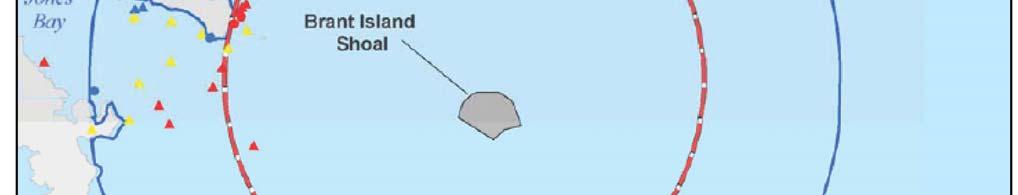


151 MCAS Cherry Point Range Operations January Water Ranges Affected Environment
152 Environmental Assessment In 2007, most of the commercial fishing activity around BT-9 occurred in the summer and fall. No activity at all was observed in the area during the winter months, with the exception of a single trawler north of the range in December. In spring, commercial activity increased in the vicinity. Three crabbers were observed within or adjacent to the area, one to the north around Mouse Harbor, a second at the mouth of Jones Bay within the area, and the third in the slue to the southeast. The Brant Island slue, located just outside the southeast portion of the water prohibited area of BT-9, also provides a passage for boats over Brant Island Shoal. Gill net sets were spotted during aerial observations, two in Jones Bay and one by Mouse Harbor. Additionally, two trawlers were observed in Bay River to the west of the area. Commercial activity increased greatly during the summer with gill-netters and crabbers primarily working the waters of Bay River, Jones Bay, and Middle Bay, as well as the waters just north of the area below Mouse Harbor. A trawler was also observed within an area to the southwest of the bombing range. By fall, the gill nets were concentrated along the northern shore of Long Bay and in Middle Bay, while the crabbers and a single trawler were observed in Bay River. A clam dredge was also noted within the area to the southeast of the bombing range near the slue (MCAS Cherry Point, May 2008). North Carolina Division of Marine Fisheries maintains oyster cultch sites in all the bays along the Pamlico County shoreline, 0.8 km (0.5 mi) or more west of the BT-9 danger zone (water) (North Carolina Division of Marine Fisheries 2009). Commercial Fishing Landings The NMFS tracks commercial fisheries landings at 93 major ports in the US. NMFS collects landings data from several sources, including state-mandated fishery or mollusk trip-tickets; landing weigh-out reports provided by seafood dealers; federal logbooks of fishery catch and effort; shipboard and portside interviews; and biological sampling of catches (NOAA, NMFS, 2008b). These data are incorporated into the NMFS Fisheries Statistics Division commercial landings databases. Three caveats are relevant to the interpretation of this data: Landing data do not indicate the location of capture. Fish landed in North Carolina by North Carolina fisherman could have been taken offshore of another state, but landed in North Carolina. Data report only non-confidential landing statistics. Whenever confidential landings occur, they have been combined with other landings and usually reported as unclassified. Total landings by state include confidential data and are accurate, but landings reported by individual species may be misleading. All of the estimates of value presented in the section are based on ex-vessel value, or the price the fishermen are paid for their catch at the point of landing. This value increases by several orders of magnitude as the fish are sold up the chain from the dealers to restaurants, grocery stores, etc. and later to the public. The major ports within the region of influence are Englehard-Swanquarter, Oriental-Vandemere, and Belhaven-Washington. Commercial fisheries landings in each year data were available are shown for these ports in the following tables. The port of Beaufort-Morehead City, North January Water Ranges Affected Environment
153 MCAS Cherry Point Range Operations Carolina to the south of MCAS Cherry Point is located in Carteret County within the region of influence. However, because of its location at Bogue Inlet, the majority of landings at this port come from outside the region of influence. Thus, this port is not included in this discussion. The port of Englehard-Swanquarter, in Hyde County, was ranked seventy-third out of the 93 major US ports in total dollar value of commercial landing and sixty-fifth in landings by pound in This port has experienced a serious decline in commercial fisheries landings over the last 10 years (Table 3.3-2). After a moderate increase in landings between 1995 and 1997, landings have steadily declined to 36 percent of their 1998 peak. Annual landings over the most recent five-year period reported ( ) averaged 7.76 million pounds and $7.68 million in value. Table Englehard-Swanquarter, North Carolina Landings by Year Year Millions of Millions of Pounds Dollars Average Source: NOAA, NMFS, 2008c. Landings data for the port of Oriental-Vandemere, the port closest to BT-11 in Pamlico County, show variable landings over the past 26 years with peak landings occurring in 1981, 1984, and 1996 (Table 3.3-3). This port was ranked seventy-ninth in dollar value of commercial landings and seventy-eighth in landings by pound out of the 93 three major US ports in Since 1996, landings have been in overall decline with a slight increase being observed in This increase, however, was only 41 percent of the highest peak level recorded in Annual landings over the most recent five-year period reported ( ) averaged 5.24 million pounds and $6.06 million in value. Landings reported at these two ports are generally representative of Pamlico County. January Water Ranges Affected Environment
154 Environmental Assessment Table Oriental-Vandemere, North Carolina Landings by Year Year Millions of Millions of Pounds Dollars Average Source: NOAA, NMFS, 2008c. Landings data for the port of Belhaven-Washington, located in Beaufort County, show an overall decline in commercial landings with peak years being observed in 1996 and 1999 (Table 3.3-4). Most recent landings data (2004) are approximately 37 percent of the highest peak in landings observed in This port was not listed among the 93 major US ports after 2004 and more recent data were not available. Annual landings over the period averaged 5.6 million pounds and $4.35 million in value. Table Belhaven-Washington, North Carolina Landings by Year Year Millions of Pounds Millions of Dollars Average Source: NOAA, NMFS, 2008c January Water Ranges Affected Environment
155 MCAS Cherry Point Range Operations In summary, the combined annual average of the three ports for the period ( for Belhaven-Washington) is 18.6 million pounds and $18.09 million in value. This is consistent with landings data compiled by waterbody for the North Carolina Division of Marine Fisheries 2008 report (North Carolina Division of Marine Fisheries, License and Statistics Section, 2008), in which the average annual landings from waterbodies in the region of influence (Pamlico Sound, Pamlico River, Pungo River, and Neuse River) for the five-year period from 2003 to 2007 was reported to be 18.3 million pounds. Commercial Fishing Effort Commercial fishing effort was determined using data derived from the North Carolina Division of Marine Fisheries trip ticket program. A trip is defined as the time period beginning when a vessel or fisherman leaves port to conduct fishing activities and ends when that vessel or fisherman returns to land the catch. The duration of the trip can vary from a few hours, as in hand clamming, to several days, as in ocean flounder trawling. An assessment of the number of trips gives an indication of the amount of effort conducted by commercial fishermen within that fishery. North Carolina commercial fishing trips by major gears are summarized in Table The most frequently used gear in the vicinity of BT-9 and BT-11 are crab pots and gill nets. Recreational Fishing Economics Recreational fishing generates significant revenue through the purchase of gear, bait, ice, and through the chartering of boats. A total of 6.6 million and 7.3 million saltwater fishing trips were taken in North Carolina during 2005 and 2006, respectively (North Carolina Division of Marine Fisheries, License and Statistics Section, 2008). These angler trips contributed to the local economy through purchases of boats, bait, and tackle and from fees for fishing piers, jetties, charter boats, and boat rentals. According to the Carteret County Chamber of Commerce, recreational sport fishing is nearly an $11 million industry in the county (Carteret County Chamber of Commerce, 2008). Recreational Fishing Areas and Activity BT-11 During the 2007 surveys, it was observed that recreational fishermen utilized most of the area throughout the year. The recreational hook-and-line fishermen were the most prevalent on the site, comprising 58 percent of the total fishermen utilizing the area. These anglers primarily sought to catch speckled trout, red drum, and flounder, but also fished for croaker, spot, mullet, and tarpon. Seasonally, the winter months saw a relatively low amount of recreational fishing in the waters surrounding Piney Island compared to the warmer seasons. Three recreational anglers were observed in Turnagain Bay fishing for trout, and a single angler was observed near Newstump Point within the restricted area. January Water Ranges Affected Environment
156 Environmental Assessment Utilization of the area surrounding Piney Island continued to remain relatively low throughout spring as it had in winter. Recreational fishermen observed in spring were fishing primarily on weekends (Figure 3-13). These anglers were concentrated either in Turnagain Bay fishing for trout or around Raccoon and Swan islands fishing for red drum. One of the angler boats in Turnagain Bay was a recreational charter boat out of Oriental that, in addition to fishing, also does bird watching tours in the area. Along with the warmer summer months came a proliferation in recreational fishing activity. A total of 29 sightings of recreational fishing were reported in the area during this survey period. Most of the activity, as with spring, was centered either in or just north of Turnagain Bay or around Raccoon and Swan islands. It is important to note that between August and September, the drum move into the area and aggregate north of Piney Island, particularly around Swan Island, at night to spawn. There is a huge recreational fishery based around this event. Anglers, sometimes as many as 20 to 50 boats, will set up around the island at night with their lights off fishing for drum. This level of activity will continue for as long as the fish are present. Drum fishermen were also noted just north of Turnagain Bay near the mouth of the Neuse River. Most of the anglers sighted in Turnagain Bay or around the eastern and western sides of Piney Island were fishing for trout, flounder, or bluefish. Oyster harvesting season begins on October 15. BT-9 During the 2007 surveys, it was observed that most of the water utilization by recreational fishermen occurred along the shore of Pamlico County (Figure 3-13). A small amount of activity was also noted in the southeastern portion along Brant Island Shoal. The majority of the fishing activity observed during the survey was recreational, with most of the anglers targeting speckled trout, red drum, and flounder. There was no recreational fishing observed at Brant Island Shoal during the winter months of December, January, or February. Activity in the area remained low during the spring. All activity observed during the three-month spring period was confined to the shoreline of Pamlico County. Only one recreational fisherman was observed in the vicinity of BT-9 over the course of the three survey trips. He was noted in April fishing in Jones Bay and was focused on catching trout. Recreational fishing activity increased quite a bit in the area over the summer, with much of the activity concentrated along the shoreline of Pamlico County between Middle Bay and Little Porpoise Bay. All of the fishermen interviewed stated they were targeting speckled trout. In addition, there was also very heavy recreational fishing activity, as many as 20 boats at one time, occurring inside of the BT-9 prohibited area. Many of these anglers were fishing adjacent to the bombing targets. All recreational fishing observed occurred nearly exclusively on the weekends. During the 2007 surveys, it was observed that many of the recreational fishermen that fish on the water targets at BT-9 do so because the targets act as artificial reefs, serving to attract fish by providing both refuge and food in an area that is otherwise open mud bottoms. The report suggests that to mitigate the situation, the Marine Corps could work cooperatively with the North Carolina Division of Marine Fisheries to establish other artificial reefs in Pamlico Sound to January Water Ranges Affected Environment
157 MCAS Cherry Point Range Operations provide recreational fishermen alternative locations to fish that would not impede military operations or endanger the fishermen (MCAS Cherry Point, May 2008). Recreational fishing activity around Brant Island Shoal continued to be fairly high through the fall. Five recreational anglers were interviewed on the weekend just outside the mouth of Jones Bay. All were or had been fishing for red drum, and many were leaving the area after fishing in the BT-9 prohibited area. Recreational Fishing Landings The Marine Recreational Fishery Statistics Survey conducted by NMFS provides estimates of fishing effort, catch, and participation by recreational anglers in the marine waters of the US states. Statistics on recreational value by individual port are not yet available. The following discussion of recreational fishing is based on the findings of the Marine Recreational Fishery Statistics Survey (NOAA, NMFS, 2008a). In 2005, North Carolina ranked third out of the US coastal states (including Puerto Rico) for pounds of finfish harvested recreationally via hook and line, at 10,953,349 kg (24,148,000 lbs) and number of shellfish harvested recreationally, at 13,381,000 fish (NOAA, NMFS, February 2007). In 2007, 3,887,000 kg (8,570,000 lbs) of finfish were caught in North Carolina state waters (NOAA, NMFS, 2008b). The most common species caught by recreational anglers via hook and line were yellowfin tuna 2,499,691 kg (5,510,876 lbs), dolphinfish 2,291,994 kg (5,052,981 lbs), striped bass 1,004,142 kg (2,213,754 lbs), king mackerel 588,185 kg (1,296,726 lbs) and bluefish 504,766 kg (1,112,818 lbs) (North Carolina Division of Marine Fisheries, April 2006). Recreational Fishing Effort In addition to the reported recreational catch, North Carolina also reports recreational fishing conducted with commercial gear. In 2005, 234,749 kg (517,533 lbs) of fish and shellfish were landed in North Carolina using recreational commercial gear. The top five species caught were spot 87,892 kg (193,769 lbs), blue crab 47,708 kg (105,179 lbs), flounder 26,353 kg (58,099 lbs), striped mullet 16,472 kg (36,314 lbs), and shrimp 14,761 kg (32,542 lbs) (North Carolina Division of Marine Fisheries, April 2006). The North Carolina Division of Marine Fisheries divides the state into the Northern, Pamlico, Central, and Southern Regions. Of the four regions, the Pamlico Region, which includes Pamlico Sound and the Neuse, Pamlico, and Pungo Rivers, consistently reported the highest numbers of commercial gear license trips for crab pots, gill nets, and shrimp trawls (North Carolina Division of Marine Fisheries, License and Statistics Section, 2008). The exception was small mesh gill nets, which are generally used more in the southern region of the state. January Water Ranges Affected Environment
158 Environmental Assessment Recreational Activities An assessment of impacts on recreational activities is included in this EA because the proposed action has the potential to affect regional recreational activities. Boating and Fishing Recreational boating has grown in popularity in recent years. In 2005, over 362,000 recreational boat permits were issued in the state of North Carolina (National Marine Manufacturers Association, 2007). These permits were issued to powerboats, sailboats, and personal watercraft. Recreational fishing and other recreational boating range throughout the North Carolina coastal waters, depending on season and weather conditions. However, most recreational fishing and boating occurs within a few miles off shore. The Atlantic Intracoastal Waterway is a toll-free boating channel part canal, part natural waterway that stretches for more than 1,600 km (1,000 mi) from Norfolk, Virginia to Miami, Florida. The Atlantic Intracoastal Waterway passes through the Neuse River west of BT-11, around Maw Point Shoal to Bay River. Military craft, commercial and recreational fishing boats, and other types of pleasure craft use the Atlantic Intracoastal Waterway and Pamlico Sound year round (USMC, February 2007). There are no data available for the number of recreational, nonmilitary annual boat trips on the Atlantic Intracoastal Waterway. The MCAS Cherry Point Range Complex has three water restricted areas off the shoreline, bays, and inlets of the BT-11 range at Piney Island. These areas are closed during daylight hours, consistent with 33 CFR Part , in order to prevent civilians and other non-participating craft from entering the operations area at the water restricted areas (see Figure 2-3). Hazardous operations are communicated to all vessels and operators by use of Notices to Mariners, issued by the US Coast Guard. Notices to Mariners advise the public, fishermen, and divers in advance of ongoing military activities. BT-11 also has a 2.9 km (1.8 sm) radius danger zone (water) (water prohibited area) centered on a water target in Rattan Bay. BT-9 has a 4.8 km (3 sm) radius danger zone (water) centered on the south side of the Brant Island Shoals. Both danger zones (water) are closed 24 hours a day. The Neuse River, approximately 314 km (195 mi) in length, is a very wide river, inviting day or night sailing in addition to motor cruising and water skiing. The many wandering tributaries promise scenic canoeing and exciting fishing (Insiders Guide, 2008). Much of the Neuse River s shoreline south of New Bern forms one of the boundaries of the vast 63,536 ha (157,000 ac) Croatan National Forest, which is an attractive area to fishermen and hunters. The Neuse River provides easy access to the Atlantic Ocean via the Atlantic Intracoastal Waterway and Pamlico Sound. MCAS Cherry Point is located along the south shore of the Neuse River. The portion of the Neuse River within m (500 ft) of the shore the MCAS Cherry Point installation is within a water restricted area (see Figure 2-3). However, MCAS Cherry Point does not currently enforce this water restricted area except in the case of heightened Force Protection levels. January Water Ranges Affected Environment
159 MCAS Cherry Point Range Operations Diving Approximately seven artificial reefs have been established in the Pamlico Sound primarily to support offshore sport fishing and recreational diving. Although the artificial reefs are utilized throughout the year by recreational vessels and commercial charter boats, use is highest during the summer (North Carolina Division of Marine Fisheries, 2008a). Sport diving generally is geographically restricted to shoreline ocean sites. The peak diving season for all of North Carolina is from May to October (DiveSpots.com, 2008). Shipwrecks provide habitat suitable for development of artificial reefs, and are popular destinations for divers. There are numerous records of shipwrecks within the Pamlico Sound (Lawrence, 2008). The presence of Brant Island Shoals, a natural hazard to navigation, likely increases the possibility for shipwrecks in this area. There are no recorded shipwrecks located within the vicinity of Piney Island (the BT-11 range), and there is no indication that the area was a center for maritime activity in the past (Lawrence, 2008). Tourism Tourism has grown into one of North Carolina s largest industries, generating more than $16.5 billion to the state economy per year (North Carolina Department of Commerce, 2008). Annually, more than 45 million people visit North Carolina. Tourism directly employs 190,000 North Carolinians with a payroll of $4 billion. According to the 2006 North Carolina Visitor and Trip Profile, 13 percent of visitors cited beach/waterfront activities as the reason for their visit (North Carolina Department of Commerce, 2006) Noise Water Ranges MCAS Cherry Point generates noise from various activities associated with training operations at water ranges within the MCAS Cherry Point Range Complex, including boat movement noise and weapon firing from boat to land target during training operations. The noise from weapon training operations is considered as part of discussion in the Land Ranges section. The noise from boats is typically noticeable only in the immediate vicinity of the source and likely would not result in any concerns to surrounding, off-range sensitive land uses. Therefore, boat-related noise is not considered in the EA Cultural Resources Archaeological Resources Water Ranges Underwater Archaeological Sites No underwater archaeological sites have been identified in the BT-9 or BT-11 danger zones (water) and water restricted areas (Lawrence, 2008; NOAA, 2008). However, no underwater surveys have been conducted to establish the presence or absence of archaeological sites within the vicinity of the project (Lawrence, 2008). Therefore, there is potential for prehistoric and historic archaeological sites to occur. With respect to prehistoric resources in depths of less than approximately 91 m (300 ft), archaeological sites with Paleo-Indian or Early Archaic components may be present. These sites in all probability would be buried deeply under January Water Ranges Affected Environment
160 Environmental Assessment sediments that have accumulated over time and therefore are less likely to be impacted than later historic sites (i.e., shipwrecks). If shipwrecks are present, it should be noted that due to mechanical, chemical, and biological erosion and decay, it is likely that older shipwrecks are represented by non-organic material (e.g., metal, ballast stones, etc.), which would also be covered by sediments that have accumulated over time Shipwrecks Both the Underwater Archaeology Branch of the North Carolina Office of State Archaeology and the Automated Wreck and Obstruction Information System established by NOAA were consulted to identify recorded shipwrecks occurring within the danger zones (water) and water restricted areas for the proposed action. The Underwater Archaeology Branch of the North Carolina Office of State Archaeology maintains files on historic shipwrecks for more than 5,000 vessel losses along the North Carolina coast (Lawrence, 2008). These are shipwrecks for which a historical reference (e.g., newspaper account, life-saving station records, etc.) exists; however, in most cases the physical remains of the vessels have not been located. The Automated Wreck and Obstruction Information System is a database of reported submerged shipwrecks and obstructions in US coastal waters. Neither this database nor the files from the Underwater Archaeology Branch provides a comprehensive record of wrecks in any particular area. There are no recorded shipwrecks located within the BT-11 danger zone (water) or water restricted areas (Lawrence, 2008). No historical accounts of shipwrecks in this area exist and there is no indication that the area was a center for maritime activity in the past (Lawrence, 2008). There are two charted shipwrecks near the center of the BT-9 danger zone (water) (NOAA, 2008). Although there are no historical accounts of shipwrecks in this specific area, there are numerous records of shipwrecks within the Pamlico Sound that might be located in or near the BT-9 range (Lawrence, 2008). The presence of Brant Island Shoals, a natural hazard to navigation, increases the possibility for shipwrecks in this area Natural Resources Water Ranges Underwater Sediments Underwater sediments are included in this EA because the proposed action would result in some disturbance of the sediments and rock outcroppings in the nearshore and open ocean underwater environment. Longshore currents are nearshore currents that move parallel to the shoreline and transport sediments (mostly sand) along the coast. Along the US East Coast, longshore currents transport sediments from the north, where they are usually generated by storms in the North Atlantic (DoN, June 2003b). Underwater sediments in Pamlico Sound are mostly fine to very fine sands with incursions of silt near the mouths of the Pamlico and Neuse Rivers and at the center of the sound. In the Core and Bogue Sounds, underwater sediments consist of fine sand (DoN, June 2003b). January Water Ranges Affected Environment
161 Water Resources MCAS Cherry Point Range Operations Water resources are included in this EA because water resources in the BT-9 and BT-11 water ranges may be impacted by the proposed action. Water resources are essential components of the natural setting. These resources can have scientific, historic, economic, and recreational value within a specific area. For BT-9 and BT-11 water ranges, this EA covers surface water (e.g., streams, rivers, waters of the US, and primary nursery areas). Surface Water The state of North Carolina has assigned water quality classifications for surface waters based on the existing and contemplated best usage for which the waters must be protected (15A NCAC 02B). BT-9 and BT-11 are in the Pamlico Sound, which is classified as SA. Class SA waters receive the highest rating for tidal waters and are suitable for shell fishing, as well as primary recreation, aquatic life propagation and survival, fishing, wildlife, and secondary recreation (15A NCAC 02B.0101). The Pamlico Sound also includes nutrient sensitive and high quality waters (North Carolina Division of Water Quality, September 2007). Nutrient sensitive waters demonstrate decreased fish populations, decreased ambient dissolved oxygen, increased frequency of fish kills, and increased algae concentrations. High quality waters are waters rated as excellent based on biological or physical/chemical characteristics (15A NCAC 02B.0101) Marine Biology A discussion of marine biology is included in this EA because various marine species would be expected to occur within the proposed action s region of influence. The marine environment in the region of influence is a complex mosaic of temperate coastal waters offshore, a long barrier island that borders the Atlantic Ocean, small interspersed islands throughout two sounds, and two large rivers that stretch inland. Inlets exist that maintain nearshore waters with estuarine qualities by introducing saltwater to fresh, leading to a mixture of the two water masses. The environment is home to a diverse array of marine habitats and species important to fisheries and local recreational activities. The region of influence includes Essential Fish Habitat and primary nursery areas (Figures 3-8a and 3-8b), which were designated by NMFS and the state of North Carolina, respectively, for conservation of sensitive or protected marine and estuarine species. Marine organisms with Threatened or Endangered species status regulated by the ESA are known to occur in the region of influence, and these will be discussed in detail. Physical Environment and Marine Habitats The Marine Resource Assessment for the Cherry Point and Southern Virginia Capes (VACAPES) Inshore and Estuarine Areas (DoN, June 2003b) provides an inventory of marine biological resources found in the coastal waters of North Carolina. This Marine Resource Assessment includes the MCAS Cherry Point and MCB Camp Lejeune operating areas out to 6 km (3 nm), which is beyond the spatial scope of this EA, but provides extensive information on the areas that are included in the current action. A more recent Marine Resource Assessment for the January Water Ranges Affected Environment
162 Environmental Assessment Cherry Point operating area (DoN, May 2007) was also referenced for updated information on species that occur inshore and offshore. The Integrated Natural Resources Management Plan, Marine Corps Air Station Cherry Point (MCAS Cherry Point, September 2001) includes information on the marine biology and marine threatened and endangered species in the region of influence. Additional sources for the most recent information on species in the region of influence are referenced as necessary, including a highly informative document describing results of aerial surveys for protected surface-dwelling species in the immediate area (Goodman et al., 2007). Shoreline Areas The Neuse River is located in the central area of the MCAS Cherry Point operating region, and therefore is one of the large contributors of freshwater to the Pamlico Sound area. The maximum depth of the river is 6 m (20 ft), and salinities are typical of estuarine waters, ranging from 0.5 to 25 parts per thousand (Paerl et al., 2001). The river is home to numerous species, including Atlantic Bottlenose dolphins, sea turtles, and a variety of fish and shellfish. The Pamlico River has similar characteristics to the Neuse River, and is located at the very northern border of the region of influence. The large Pamlico Sound that meets with the Neuse and Pamlico Rivers encompasses several of the major components of the project area (BT-9 and BT-11 ranges), and is the largest coastal lagoon estuary in the US. MCOLF Atlantic is located on the northern shore of Core Sound, and MCALF Bogue is located on the northern shore of Bogue Sound. Core and Bogue Sounds are narrow lagoon estuaries located behind the barrier islands of the lower Outer Banks. Both sounds are extremely shallow with a maximum depth of 1 m (3.3 ft). Freshwater discharge into both sounds is limited; thus, both have fairly high salinities (National Ocean Service, 2001). Unvegetated tidal flats are alternately flooded and exposed by the tides on a daily basis. They support large populations of invertebrates that in turn attract fishes and shorebirds. Some primary production by microalgae occurs on the flats, but the biological community is largely based on detritus produced by adjacent terrestrial, marsh, and submerged aquatic vegetation habitats (Peterson and Peterson, 1979). Tidal flats are extensive within the region of influence near the Neuse River banks and along the barrier islands (National Ocean Service, 2001). Commercially and ecologically important species such as the American oyster, red drum, blue crab, and brown shrimp are prevalent in tidal flat habitats (South Atlantic Fishery Management Council [SAFMC], February 2008). Salt marshes occur in the mid- to upper intertidal zone of sheltered shorelines. Salt marshes tend to be dominated by cordgrass (Spartina spp.) and other plants tolerant of intermediate flooding and saline conditions. Salt marshes develop only in calm-water conditions, and therefore are commonly found in sounds and other areas protected from harsh ocean conditions (Schafale and Weakley, 1990). Salt marshes and adjacent channel and mudflat habitats provide ecologically vital habitats for fishes and invertebrates and are considered Essential Fish Habitat in North Carolina. Salt marshes also stabilize shorelines, filter and trap sediments, and absorb nutrients January Water Ranges Affected Environment
163 MCAS Cherry Point Range Operations that could otherwise cause phytoplankton blooms in estuarine waters (SAFMC, February 2008). MCALF Bogue is located within salt marsh habitat. Hard Bottom Communities Hard bottom communities comprised of rocks, coral, encrusting sponges and other sessile organisms provide important habitat for many marine organisms. These communities are estimated to occupy 30 percent of the shelf area within the 200 m (656 ft) isobath between North Carolina and Cape Canaveral, Florida (SAFMC, October 1998). Live hard bottom organisms that form substrate have strict requirements for water quality and light availability, hence, they are not found in areas with extremely variable conditions. Live hard bottom is typically not found in estuarine waters, sounds, bays or rivers due to the extreme and frequent changes in physical properties of these waters. Small patches of live hard bottom exist on the ocean side directly south of the barrier island bordering the region of influence, but none is known to occur in Pamilico Sound (National Ocean Service, 2001). Coral patches exist near the region of influence, but no true coral reefs are found. Coral patches are found mainly on the ocean side of the barrier island and south of the project area in Onslow Bay (Huntsman and Macintyre, 1971; National Ocean Service, 2001). Artificial Reefs Artificial reefs provide substrate for many marine organisms to inhabit, from encrusting species to fish in the water column. Artificial reefs are composed of a large variety of materials, supplying structure similar to a natural reef. The structures often host settlement of marine invertebrates and the subsequent development of marine communities similar to those found on live/hard substrate (Bohnsack et al., 1991). These artificial substrates are so successful at attracting fish that they are considered Essential Fish Habitat for red drum and the snappergrouper complex. In the region of influence, artificial reefs are located in several locations within Pamlico Sound and the Neuse and Pamlico Rivers (South Atlantic Habitat Ecosystem Interactive Mapping Server, 2008). Marine Birds The nearshore habitats in the region of influence support numerous bird species. The open waters and shorelines of the sounds, rivers, and ocean in the project area provide important foraging and roosting habitats for migratory, wintering, and resident-breeding marine birds, including shorebirds, waterfowl, wading and diving birds, and generalist waterbirds (e.g., gulls). The nearshore habitats also and serve as a migratory corridor for various marine birds (e.g. terns). The shallow water estuarine habitat is heavily used by waterbirds for foraging and on-water resting habitat (Hunter et al., 2006). All seabirds (and virtually all other birds) in the project area are protected by the Migratory Bird Treaty Act of 1918, which prohibits the taking, killing, or possessing of migratory birds or the parts, nests, or eggs of such birds, unless permitted by regulation. In 2003, the National Defense January Water Ranges Affected Environment
164 Environmental Assessment Authorization Act was signed, which gives the Secretary of the Interior authority to prescribe regulations to exempt the Armed Forces from the incidental taking of migratory birds during authorized military readiness activities. The final rule authorizing the DoD to take migratory birds in such cases includes a requirement that the Armed Forces must cooperate with the USFWS to develop and implement conservation measures to minimize or mitigate adverse effects of activities (USFWS, June 2004). A list of bird species protected by the Migratory Bird Treaty Act that are known to occur at MCAS Cherry Point is included in Appendix C. Species occurrences throughout the project area vary greatly spatially due to strong association with the substrate type present. Federally listed birds that occur in the project area are discussed in Terrestrial Biology (Subchapter ). Marine Invertebrates The areas of the Pamlico, Core, and Bogue Sounds, Neuse River, and nearshore Atlantic Ocean occurring within the project area provide habitat for many shellfish. Common species associated with the estuary and nearby waters include blue crab (Callinectes sapidus), shrimp (Penaeus spp.), hard clams (Mercenaria mercenaria), and American oyster (Crassostrea virginica; Peterson and Peterson, 1979). The estuarine waters in the project area provide habitat for a wide variety of benthic invertebrates that serve as a food source for many of the fish that frequent its waters. Some flats are intermittently exposed at low tide, and these areas, along with adjacent tidal marshes provide foraging habitat for a variety of terrestrial invertebrates. Additional high quality habitat is provided by beds of submerged aquatic vegetation (SAFMC, October 1998). Fish Essential Fish Habitat Marine areas of particular importance in the region of influence include Essential Fish Habitat (EFH). EFH is defined by NMFS as an area that is essential to the long-term survival and health of our nation s fisheries, and is identified for all species that are federally managed. Fishery Management Councils may also designate Habitat Areas of Particular Concern, which are subsets of Essential Fish Habitat which are rare, particularly susceptible to human-induced degradation, especially ecologically important, or located in an environmentally stressed area (NMFS, February 1998). EFH in the South Atlantic region and associated Fishery Management Plans are listed in Table A comprehensive review of the EFH and Habitat Areas of Particular Concern found specifically in waters surrounding MCAS Cherry Point was conducted by the USMC, including surveys for habitats for which presence was previously unknown for the operating areas (MCAS Cherry Point, October 2007). This information was used to identify specific portions of the region of influence that are considered EFH and/or Habitat Areas of Particular Concern listed in the table below (SAFMC, October 1998, February 2008; MCAS Cherry Point, October 2007). January Water Ranges Affected Environment
165 MCAS Cherry Point Range Operations Table Essential Fish Habitat and Habitat Areas of Particular Concern for the MCAS Cherry Point Region Habitat Type Fishery Management Plan Operating Area of Occurrence Tidal freshwater (palustrine) Brown Pink, and White shrimp, Red drum MCAS Cherry Point, MCOLF Atlantic Estuarine and marine emergent wetlands (e.g., intertidal marshes) Tidal palustrine forested areas Estuarine and marine submerged aquatic vegetation (e.g., seagrass)** Subtidal and intertidal nonvegetated flats Brown, Pink and White shrimp, Red drum, Black sea bass, and Gray snapper Brown, Pink, and White shrimp Brown, Pink, and White shrimp, Black sea bass, Cobia, Red drum, Gray snapper, Snapper-grouper MCAS Cherry Point, MCOLF Atlantic, MCALF Bogue, Piney Island MCAS Cherry Point, MCOLF Atlantic, MCALF Bogue MCOLF Atlantic, MCALF Bogue, Piney Island Brown, Pink, and White shrimp MCOLF Atlantic, MCALF Bogue, Brant Island Shoal, Piney Island Oyster reefs and shell banks** Black sea bass, Red drum, Gray snapper, MCOLF Atlantic, MCALF Bogue, Snapper-grouper Brant Island Shoal Unconsolidated bottom Black sea bass, Red drum, Gray snapper MCAS Cherry Point, MCOLF Atlantic, MCALF Bogue, Brant Island Shoal, Piney Island Salinity-based habitat Bluefish, Summer flounder MCAS Cherry Point, MCOLF Atlantic, Brant Island Shoal, Piney Island All state-designated nursery MCAS Cherry Point, MCOLF Atlantic, Cobia, King, and Spanish mackerel habitats of particular importance** MCALF Bogue Bays and estuaries MCAS Cherry Point, MCOLF Atlantic, Bluefish, Summer flounder, Cobia, Atlantic MCALF Bogue, Brant Island Shoal, sharpnose, Dusky, and Tiger sharks Piney Island Tidal Creeks** Black sea bass, Red drum, Gray snapper, MCAS Cherry Point, MCOLF Atlantic, Panaeid shrimp MCALF Bogue Macroalgae Black sea bass, Red drum Brant Island Shoal, Piney Island Source: SAFMC, February 2008; MCAS Cherry Point, October ** Designates an area that is considered EFH and Habitat Area of Particular Concern. EFH or Habitat Areas of Particular Concern occur in each of the major operating areas at MCAS Cherry Point. The geographical areas of the habitat types vary, but are generally a small portion of each training area. Detailed maps and discussion are included in the 2007 USMC document identifying EFH (MCAS Cherry Point, October 2007). Descriptions from the Marine Corps EFH document (MCAS Cherry Point, October 2007) of the 12 habitat types and numerous fish species known to occur in these habitats are included below and in Table Tidal Freshwater Palustrine Tidal freshwater palustrine is defined as freshwater marsh, and little is known about the role this habitat plays as EFH due primarily to a lack of published research investigating the function of this habitat for fishes (SAFMC, October 1998). Tidal freshwater marshes are located in the uppermost portion of estuaries between the low salinity zone and non-tidal freshwater wetlands (SAFMC, October 1998). Tidal freshwater marshes house numerous aquatic plant species which likely provide nursery habitat for a variety of managed fish and invertebrate species and other wildlife. Freshwater marshes also help to preserve the water quality of other habitats (including essential fish habitats) located downstream by filtering, and therefore removing, pollutants from terrestrial runoff (MCAS Cherry Point, October 2007). January Water Ranges Affected Environment
166 Environmental Assessment Table Fish species with EFH Designations and Their Characteristics Stages with Species Distribution designated Essential Primary habitat Fish Habitat Bluefish Temperate Juvenile; adult Mixing zones of rivers and sounds Summer flounder Temperate Larvae; juvenile; adult Mixing zones of rivers and sounds Black sea bass Subtropical Juvenile; adult; spawning adult Brown shrimp Subtropical Juvenile Cobia Subtropical All life stages Gray snapper Subtropical Juvenile; adult; spawning adult Submerged aquatic vegetation; macroalgae; wetlands; creeks; oyster reefs; unconsolidated bottom; water column above spawning habitat Tidal palustrine forested areas; wetlands; submerged aquatic vegetation; non-vegetated flats High salinity bays, estuaries and seagrass; coastal inlets; state-designated nursery areas Submerged aquatic vegetation; macroalgae; wetlands; creeks; oyster reefs; unconsolidated; water column above spawning habitat bottom King mackerel Subtropical All life stages Coastal inlets; state-designated nursery areas Pink shrimp Subtropical Juvenile Tidal palustrine forested areas; wetlands; submerged aquatic vegetation; non-vegetated flats Red drum Subtropical All life stages Tidal freshwater palustrine; wetlands, creeks; submerged aquatic vegetation; oyster reefs; unconsolidated bottom Spanish mackerel Subtropical All life stages Coastal inlets; state-designated nursery areas White shrimp Subtropical Juvenile Tidal palustrine forested areas; wetlands; submerged aquatic vegetation; non-vegetated flats Atlantic sharpnose shark Highly migratory Neonate; juvenile Bays; estuaries; waters out to 50 m isobaths Dusky shark Highly migratory Neonate; juvenile Coastal waters; inlets; estuaries Tiger shark Highly migratory Juvenile Bays; estuaries; waters out to 100 m isobaths Sources: SAFMC, February 2008; MCAS Cherry Point, October Estuarine Emergent Wetlands Estuarine marshes represent a transition zone between the terrestrial and marine environments, growing above the surface of the water. They provide habitat for various shellfish and fish species, filtration for the estuary, and act as flood control for nearby inland communities (Sumich, 1988; Street et al., 2005). The plants that contribute to marsh habitats are highly adaptable to a wide range of rapidly changing salinity levels and serve as a food source for herbivorous animals. Decomposing marsh grasses serve as a food source for microbacteria, which in turn create food for benthic invertebrates and fish that may use emergent marsh habitat as nursery areas (Sumich, 1988; MCAS Cherry Point, October 2007). Tidal Palustrine Forested Areas Tidal palustrine forested areas (including swamp forests) occur in the tidal fresh and freshwater areas of estuarine drainages. This habitat may be located adjacent to or overlap tidal freshwater marshes, and likely serves a similar function as EFH (described above; SAFMC, October 1998). Managed species that utilize EFH found downstream of freshwater and tidal forested wetlands benefit from these habitats for various reasons. Terrestrial runoff is filtered in a similar manner to January Water Ranges Affected Environment
167 MCAS Cherry Point Range Operations intertidal salt marshes; food, shelter and spawning areas are provided for important prey species for many of the federally-managed carnivorous species located downstream (SAFMC, October 1998). Estuarine and Marine Submerged Aquatic Vegetation This habitat is described in detail in the following Submerged Aquatic Vegetation. Subtidal and Intertidal Non-Vegetated Flats The intertidal zone is defined as the area along the shoreline between the highest high tide and the lowest low tide, and the subtidal zone is the area below the lowest low tide line that is always submerged. Subtidal and intertidal flats are shaped by wave action, tidal currents, winds, geography of the coastline, riverine outflow, and human activity (e.g., dredging). The location of the flat and the prevailing weather patterns will determine which of these factors is usually dominant over the others. For example, the large tidal range (approximately 2 to 3 m [7 to 10 ft]) along the Georgia and South Carolina coast coupled with the presence of short barrier islands and numerous inlets creates a setting in which wave action and tidal currents are the most significant forces affecting tidal flats. In contrast, along the North Carolina coast the presence of extensive barrier islands, few inlets, and a microtidal range (0 to 2 m [0 to 7 ft]) results in winds dominating the formation of tidal flats (SAFMC, October 1998). Oyster Reefs and Shell Banks The South Atlantic Fishery Management Council (October, 1998) defines oyster reef and shell bank EFH as natural structures located within the intertidal or subtidal zones. Furthermore, this habitat is composed of oyster shell and live oysters as well as other organisms, and forms discrete, contiguous structures, clearly distinguishable from scattered oysters found in marshes and mudflats as well as from wave-formed shell windrows. Unconsolidated Bottom Unconsolidated bottom consists of seafloor substrate on the continental shelf and slope composed of soft sediments such as gravel, cobbles, pebbles, sand, clay, mud, silt, and shell fragments as well as the water-sediment interface directly above the bottom substrate that is used by many invertebrates (e.g., members of shrimp management unit). These benthic habitats are utilized by a variety of species for spawning, nesting, development, refuge, and feeding (SAFMC, October 1998). Salinity-based Habitat Important estuarine fish habitat can be classified into three zones based on the salinity of the estuarine waters. A tidal fresh zone consists of waters where the salinity is less than 0.5 practical salinity units (psu); a mixing or brackish zone is defined by waters where the salinity is greater than 0.5 psu but less than 25 psu; and a marine zone consists of waters where the salinity is January Water Ranges Affected Environment
168 Environmental Assessment greater than 25 psu (SAFMC, October 1998). On average, the salinity of open ocean waters is about 35 psu. Salinity based zones are not defined by fixed geographic boundaries, rather their borders change nearly continuously on daily and seasonal time scales. Fluctuating tides cause the extent of each zone to migrate on a daily but fairly regular cycle. Shifts in persistent wind events can cause the mixing zone to compress or expand in either the shoreward or seaward direction, depending on the wind direction. Seasonal fluctuations in freshwater runoff from rivers and streams are the dominant control on the extent of the tidal fresh zone. Salinity zones are also stratified vertically within the water column. Classically, the vertical profile of estuarine circulation uses the salt wedge model in which less dense freshwater flowing seaward sits on top of denser saltier water flowing shoreward from the ocean. Each water body forms a triangularly-shaped wedge with the tip pointing in the direction of the flow, and mixing occurring along the gradient separating each wedge (MCAS Cherry Point, October 2007). Nursery Areas Nursery areas are defined by the North Carolina Division of Marine Fisheries as those areas where juvenile finfish and crustaceans spend the majority of their initial growing season (Street et al., 2005). These areas may benefit juvenile species by providing sources of food, protective habitat, preferred habitat (e.g., hard bottom, salinity zone, or temperature range), as well as other factors. North Carolina divides its nursery areas into three categories: primary, secondary, and special secondary nursery areas (North Carolina Division of Marine Fisheries, 2008b). Primary Nursery Areas are located in the upper portions of creeks and bays. These areas are usually shallow with soft muddy bottoms and surrounded by marshes and wetlands. Low salinity and the abundance of food in these areas are ideal for young fish and shellfish. Secondary Nursery Areas are located in the lower portions of creeks and bays. As they develop and grow, young fish and shellfish, primarily blue crabs and shrimp, move into these waters. Special Secondary Nursery Areas are located adjacent to Secondary Nursery Areas but closer to the open waters of the sounds and the ocean (Street et al., 2005). Bays and Estuaries An estuary is most commonly defined as a semi-enclosed coastal body of water (inlet or bay) which has free connection to the open sea, extending into the river as far as the limit of tidal influence, and within which sea water is measurably diluted with fresh water derived from land drainage (Dyer, 1997). Estuaries are complex and dynamic systems that support very diverse communities of plants and animals (Zedler et al., 1992). Estuarine habitats can include intertidal waters, wetlands, swamps, marshes, seagrass beds, and mud flats. These habitats fulfill fish and wildlife needs for reproduction, refuge, feeding, and other physical necessities. January Water Ranges Affected Environment
169 MCAS Cherry Point Range Operations Tidal Creeks Tidal creeks are an important component of estuaries. They connect upland marsh habitat with brackish open water habitat and support numerous other types of habitats, including attached macroalgae, oyster beds, and submerged aquatic vegetation, all of which function independently as EFH for a variety of fish and invertebrate species (Tiner, 1993; SAFMC, October 1998). A tidal creek can be defined as a meandering channel connecting areas of estuarine marsh habitat with larger creeks, rivers, or bays in the marine environment. Tidal creeks are usually heavily influenced by the tides, experiencing low or even no water at low tide and flooded conditions at high tide. In regions where the tidal range is small, winds can have a significant effect on the flow of water through tidal creeks (Tiner, 1993). Macroalgae Macroalgae located within salt marsh tidal creeks and on the marsh surfaces serve as both refuge as well as a source of food for various fish and invertebrate species. Various species of macroalgae can be found attached to bottom sediments, submerged aquatic vegetation beds, and hard bottom surfaces as well as free-floating on the surface of the water (SAFMC, October 1998). Sargassum is an important genus of macroalgae and is considered EFH, but is only found in open water areas. Submerged Aquatic Vegetation Submerged aquatic vegetation consists primarily of seagrasses, which are rooted, vascular flowering plants, and secondarily of macroalgal species. Submerged aquatic vegetation is found in coastal nearshore environments, including estuaries and freshwater habitats, and plays many important roles in the health and success of nearshore communities. Submerged aquatic vegetation requires a certain amount of light for photosynthesis, so water quality is important to the success of these species. Areas with many suspended sediments and low light levels are not ideal for submerged aquatic vegetation, and thus, decreases in water quality from human influences have led to declines in submerged aquatic vegetation coverage in many areas. Because of the limiting light factor, submerged aquatic vegetation is not often found below 2.5 m (8 ft) in depth (Schneider, 1976; Searles, 1984; Ferguson and Wood, 1994). Submerged aquatic vegetation is considered an EFH along the North Carolina coast. It is a key source of primary production in the shallow marine estuarine environment, stabilizes the substrate, and provides habitat for many fish and invertebrate species at some stage of their life cycle. One of the most important functions of submerged aquatic vegetation is that it provides a nursery habitat for many coastal fish species during their critical juvenile period. Submerged aquatic vegetation provides a food source, places for fish to find refuge during vulnerable life stages, and an area for fish to forage (North Carolina Wildlife Resources Commission, 2005). Common seagrass submerged aquatic vegetation found in North Carolina includes eelgrass (Zostera marina), widgeon grass (Ruppia maritima), and shoal grass (Halodule wrightii). January Water Ranges Affected Environment
170 Environmental Assessment Common macroalgal submerged aquatic vegetation in North Carolina includes numerous species of red, green, and brown algae, with spatial distributions driven by temperature. North Carolina is located in an area where warm and cool water species converge, leading to a unique makeup of algal species (Searles, 1984). Macroalgae is found in patches in various locations in the project area, and the major species are red (e.g., Champia parvula) and brown algae (e.g., Giffordia intermedia) (Kapraun and Zechman, 1982). Submerged aquatic vegetation is most common north of the Hatteras Inlet, which is located to the northeast of the region of influence. Submerged aquatic vegetation is distributed in patches on the west side of the entire length of the barrier island and into the sound, some of which is located within the region of influence. Specific areas of seagrass within the region of influence include the east side of the BT-11 range, the marshlands and wetlands of MCOLF Atlantic, and the salt marsh portions of MCALF Bogue. Seagrass is not present in the shallow waters of the Neuse River due to highly variable water conditions in this area (USFWS, 1980; National Ocean Service, 2001). Marine Mammals Marine mammals are discussed in this EA because several are known to occur or potentially occur in the waters around MCAS Cherry Point. All marine mammals are protected under the Marine Mammal Protection Act (MMPA) of The MMPA makes it illegal to take a marine mammal. The definition of take refers to the harassing, injuring, or killing of any marine mammal, or the possessing of any marine mammal or part of a marine mammal without authorization. Some marine mammals are listed under the MMPA as strategic. The definition of strategic refers to a stock of marine mammals that is being negatively impacted by human activities and may not be sustainable. When a population or stock has fallen below optimum sustainable levels, it is considered depleted. A stock may be considered depleted when the mortality in multiple units exceeds the Potential Biological Removal identified for the species. All marine mammal species listed under the ESA of 1973 are considered depleted. The federally listed West Indian manatee is discussed in the Threatened and Endangered Marine Species subchapter below. The National Defense Authorization Act of FY 2004 (Public Law ) amended the definition of harassment as applied to military readiness activities or scientific research activities conducted by or on behalf of the federal government, consistent with Section 104(c)(3) [16 USC 1374 (c)(3)]. The FY 2004 National Defense Authorization Act adopted the definition of military activity as set forth in the FY 2003 National Defense Authorization Act (Public Law ). Military training activities within the MCAS Cherry Point study area constitute military readiness activities as that term is defined in Public Law because training activities constitute training and operations of the Armed Forces that relate to combat and constitute adequate and realistic testing of military equipment, vehicles, weapons, and sensors for proper operation and suitability for combat use. For military readiness activities, the relevant definition of harassment is any act that: Injures or has the significant potential to injure a marine mammal or marine mammal stock in the wild ( Level A harassment ) January Water Ranges Affected Environment
171 MCAS Cherry Point Range Operations Disturbs or is likely to disturb a marine mammal or marine mammal stock in the wild by causing disruption of natural behavioral patterns including, but not limited to, migration, surfacing, nursing, breeding, feeding, or sheltering to a point where such behavioral patterns are abandoned or significantly altered ( Level B harassment ) [16 USC 1362 (18)(B)(i)(ii)] Section 101(a)(5) of the MMPA directs the Secretary of the Department of Commerce to allow, upon request, the incidental (but not intentional) taking of marine mammals by US citizens who engage in a specified activity (exclusive of commercial fishing), if certain findings are made and regulations are issued. Permission will be granted by the Secretary for the incidental take of marine mammals if the taking will have a negligible impact on the species or stock and will not have an unmitigable adverse impact on the availability of such species or stock for taking for subsistence uses. The waters off North Carolina in general have the largest diversity of cetaceans (whales, dolphins, and porpoises) on the east coast of the US with both warm and cool water species present (Webster et al., 1995). The region of influence for the proposed project includes estuarine waters, and does not include offshore waters. A limited number of marine mammals occur in very nearshore, estuarine waters, and include the coastal stock of bottlenose dolphins (Tursiops truncatus) and the West Indian manatee (Trichechus manatus latirostris) (DoN, May 2007). Goodman et al. (2007) conducted weekly aerial surveys of the R-5306A airspace (Figure 1-4) from July 2004 to April 2006 during all seasons to identify the presence of protected surfacedwelling species in the area. Some weeks during the 22-month survey period were missed due to inclement weather. Only the bottlenose dolphin was sighted regularly, with occurrences yearround in Pamlico Sound (including the waters around the BT-9 and BT-11 ranges) and the Pamlico and Neuse Rivers. There were no reported sightings of any other marine mammal species within the entire project area during this study (Goodman et al., 2007; MCAS Cherry Point, February 2009). The Bottlenose dolphin is a relatively large dolphin species with a wide distribution. The coastal western North Atlantic stock of this species is known to occur in estuarine waters of North Carolina year-round. Sightings have been documented in sounds, rivers, and offshore waters, as this species is highly adaptable and known to migrate (MCAS Cherry Point, February 2009). Threatened and Endangered Marine Species Threatened and endangered marine species are discussed in this EA because several are known to occur or potentially occur at MCAS Cherry Point. Threatened and endangered marine species that potentially occur or are known to occur in the region of influence include two birds, one fish, one marine mammal, and several sea turtles. Marine species sightings for the region of influence were compiled from a large number of sources for the Marine Resource Assessment for the Cherry Point and Southern Virginia Capes (VACAPES) Inshore and Estuarine Areas (DoN, June 2003b). The occurrences of threatened and endangered marine species in the region of influence is summarized in Table and discussed in more detail below. January Water Ranges Affected Environment
172 Environmental Assessment Table Federally Threatened and Endangered Marine Species Known to Occur or Potentially Occurring in the Vicinity of MCAS Cherry Point Common name (Scientific name) Piping plover (Charadrius melodus) Roseate tern (Sterna dougallii) Status Seasonality Habitat Threatened Year-round Rivers, Shortnose sturgeon Endangered Year-round (Acipenser brevirostrum) West Indian manatee Late spring (Trichechus manatus Endangered through fall latirostris) Loggerhead sea turtle (Caretta caretta) Threatened Year-round Green sea turtle (Chelonia mydas) Threatened Year-round Coastal beaches, and migrating along coastlines Threatened Year-round Coastal beaches, offshore islands estuarine and nearshore coastal waters Warm freshwater, estuarine & nearshore coastal waters Potential occurrence within the project area MCAS Cherry Point MCAS Cherry Point; MCOLF Atlantic; MCALF Bogue; BT-9; BT-11 Not known BT-9; BT-11 Nearshore, continental shelf; nest on beaches in summer BT-9; BT-11 Shallow nearshore waters (adults); oceanic waters (juveniles) BT-9; BT-11 Shallow nearshore waters (large Kemp s ridley sea turtle Endangered Year-round juveniles & adults); oceanic waters (Lepidochelys kempii) (post-hatchlings & small juveniles) BT-9; BT-11 Leatherback sea turtle (Dermochelys coriacea) Endangered Year-round Nearshore to mid-ocean BT-9; BT-11 Hawksbill sea turtle Hard-bottom, coral reefs and Endangered Low/Unknown (Eretmochelys imbricata) mangroves; occasional river mouths BT-9; BT-11 Source: DoN, June 2003b; NMFS, 2008; USFWS, Birds Federally listed marine bird species occurring in the project area include the piping plover and roseate tern. As these species are found mainly on beaches or near land, they are discussed in detail in Terrestrial Biology (Subchapter ). Fish Historical distribution for shortnose sturgeon (Acipenser brevirostrum) has been in major rivers along the Atlantic seaboard, with the northern limit near the St. John River in Canada, and the southern limit near the Indian River in central Florida. This species is known to spawn in freshwater rivers, and feed and overwinter in both freshwater and marine habitats, although occurrence in the marine environment is less common. Adults are generally thought to be estuarine anadromous in southern rivers. Shortnose sturgeon were listed as an endangered species in 1967, and remained listed with the passing of the ESA in A recovery plan was completed for shortnose sturgeon in hopes to delist and recover populations depleted by habitat loss, fishing, and incidental fisheries bycatch. Currently, 19 populations of shortnose sturgeon have been identified throughout their distribution, and the only viable population south of Cape Hatteras, North Carolina resides in the Altahama River in Georgia. Population dynamics information is virtually non-existent for most southern populations due to the small number of individuals recorded in surveys (NMFS, February 1998). Due to the habitat present it is possible January Water Ranges Affected Environment
173 MCAS Cherry Point Range Operations that the shortnose sturgeon would occur in the region of influence, specifically the Neuse River, but there is no recent evidence of their occurrence, and past sightings are unconfirmed (Ross et al., 1988; NMFS, 1998). Marine Mammals The only threatened or endangered marine mammal species sighted with any frequency in the nearshore bays of the region of influence is the West Indian manatee. The West Indian manatee (Trichechus manatus latirostris) is endangered under the ESA, and in effect, is considered a depleted and strategic stock under the MMPA. Additionally, the West Indian manatee is listed under the North Carolina ESA of 1987 (Article 25 of Chapter 113 of the General Statues). Critical habitat was established in 1976 for the West Indian manatee and included approximately one-third of Florida s known manatee habitat, including freshwater springs and areas of the Gulf of Florida (USFWS, 2007). In general, manatees favor shallow seagrass beds immediately adjacent to deep channels. Such areas comprise warm freshwater areas, estuarine areas, rivers and streams, canals, bays, and lagoons. Preferred water depth ranges from 1.5 to 6 m (5 to 20 ft). Manatees also frequent artificial freshwater areas, notably near warm water discharges from power plants. These discharges, coupled with the introduction of exotic aquatic plants, have actually increased the manatee s range to the north along the Atlantic coast. Many manatees are year-round residents of certain areas and simply congregate in warm water springs when the water gets colder in winter. The rest of the year, they are generally solitary, except for mothers with calves. Subadults, in particular, sometimes wander considerable distances during summer and early fall, when the water is warmest. Manatees do not regularly venture beyond extremely nearshore waters (USFWS, 2007). They have been reported occasionally along the Atlantic Intracoastal Waterway, inside the barrier islands of the North Carolina coast, and on a few occasions off the beaches and nearshore banks. Manatees prefer warm water temperatures, so this area is unsuitable during winter. Sightings in North Carolina have increased over the years, although sightings in or near the region of influence are not commonly reported (Schwartz, 1995; DoN, May 2007). Due to an analysis of the current population status and risk of extinction of the West Indian manatee, the USFWS recommended a reduction in status to Threatened. Conservation measures recommended thus far have resulted in a decrease of manatee mortality due to watercraft collisions, and populations in Florida are experiencing increases (USFWS, 2007). Sea Turtles All sea turtles that occur in the US are listed under the ESA as either threatened or endangered. No critical habitat has been established for sea turtles in the US. Four species of sea turtles have been reported nesting on North Carolina beaches: loggerhead, green, Kemp s ridley, and leatherback. All four have the potential to occur in the waters in and adjacent to the MCAS Cherry Point Range Complex (Morreale, 2005; MCAS Cherry Point, September 2001). An January Water Ranges Affected Environment
174 Environmental Assessment additional sea turtle species, the hawksbill, does not nest in the region of influence, but may transit North Carolina waters seasonally (Parker, 1995). Loggerhead Sea Turtle The loggerhead sea turtle (Caretta caretta) is the most abundant sea turtle in US waters; however, it is listed as threatened under the ESA. Hatchling loggerhead sea turtles drift in convergence zones in floating patches of Sargassum (NMFS and USFWS, 1993). As juveniles, they begin occupying the waters inside the continental shelf, edge, and slope to 100 m (328 ft) depth, but the primary habitat preferences at this stage are coastal waters and estuaries (Hopkins- Murphy et al., 2003). Juveniles and adults feed mostly on benthic invertebrates. Loggerheads do not venture into the Gulf Stream in the fall, likely to avoid being swept into the colder northern waters. Based on sighting data, they are found year-round south of Cape Hatteras, and in spring and fall they are concentrated off Raleigh and Onslow Bays. Although most loggerheads travel north of Cape Hatteras in summer, some females remain in North Carolina to nest from April through September. Most loggerheads leave during the winter, either heading south or to the warm edges of the Gulf Stream along the west wall. Nonetheless, sightings are reported yearround near MCAS Cherry Point. Loggerheads are the most commonly sighted sea turtles in North Carolina. In Pamlico and Core Sounds, loggerheads are the most commonly sighted sea turtle species (DoN, May 2007). Most nesting in the region occurs at the northeast end of Onslow Beach (Schwartz, 1989). Nearshore estuarine waters are important for the juvenile phase of loggerhead sea turtles and adults who are foraging between nesting sessions (Morreale and Standora, 2005). The occurrence of this species in the region of influence is expected. Green Sea Turtle The green sea turtle (Chelonia mydas) is considered threatened under the ESA throughout all of its distribution area except for the Florida and Mexico nesting populations, which are considered endangered (NMFS and USFWS, August 2007a). Green sea turtles are highly mobile, making a series of long-distance movements throughout their lifetimes. The majority of adults migrate between foraging and nesting sites, often returning to the same foraging and resting grounds (Seminoff and Jones, 2006). Some adult individuals have been observed remaining in open ocean habitats for long periods with no evidence of inshore movement to foraging areas. Those adults that do favor nearshore waters typically reside in waters from 3 to 5 m (10 to 16 ft) deep to take advantage of an abundance of their vegetated food source, and rocks, reefs, and coral formations as rest sites (NMFS and USFWS, August 2007a). Juvenile green sea turtles reside in a variety of marine habitats for up to 40 years before returning to the same beach from which they originated (Limpus and Chaloupka, 1997). Much speculation exists concerning the activities that commence during the juvenile phase, but there is evidence that post-hatchlings and juveniles live in convergence zones, while feeding on pelagic prey items such as floating mats of algae (primarily Sargassum) and other planktonic prey items such as ctenophores (Salmon et al., 2004). The nearshore waters form an important January Water Ranges Affected Environment
175 MCAS Cherry Point Range Operations developmental habitat for the juveniles as they move in to shallower waters, as dietary preferences eventually shifts to benthic vegetation (NMFS and USFWS, August 2007a). Although green sea turtles can be found year-round in North Carolina, they are most abundant from spring through fall. They have been reported in nearshore, shelf, and edge waters, generally in less than 50 m (164 ft) depth. Although green sea turtles occasionally nest on Onslow Beach, these nests are relatively few compared to the number of nests made by loggerheads (Schwartz, 1989). Nearshore estuarine waters are important for the juvenile phase of green sea turtles and adults who are foraging between nesting sessions. The occurrence of this species in the region of influence is expected (DoN, May 2007). Kemp s Ridley Sea Turtle The Kemp s ridley sea turtle (Lepidochelys kempii) is listed as endangered under the ESA. It is considered the most endangered of all sea turtles globally. Virtually all nesting activity takes place in Mexico in large aggregations called arribadas (NMFS and USFWS, August 2007c). Adults migrate between nesting and foraging areas, following shallow migratory corridors. This species is the most restricted geographically, with distribution limited to the Gulf of Mexico and the east coast of the US (Morreale et al., 2007). On the east coast of the US, blue crabs (Callinectes sapidus) form an important part of the adult diet, which is why many Kemp s ridleys appear in the Chesapeake Bay during the summer (Seney and Musick, 2005). The nearshore waters of North Carolina are considered an important developmental habitat for juveniles of this species (Musick and Limpus, 1997). Post-hatchlings are carried from waters near nesting beaches north along the coast in neritic habitats until they are approximately two years in age. At this point juveniles are known to recruit to nearshore benthic habitats, which may vary depending on resource availability (NMFS and USFWS, August 2007c). Off North Carolina, Kemp s ridleys are most likely to be seen in spring and fall. Kemp s ridleys have been known to nest in North Carolina, but such an activity is very rare and they are not known to nest near the region of influence. The occurrence of this species in the region of influence is expected (DoN, May 2007). Hawksbill Sea Turtle The hawksbill sea turtle (Eretmochelys imbricata) is endangered under the ESA. Although the population does not appear to be declining, it remains very low and has not been increasing. The hawksbill is rare north of southeast Florida, as it is a more tropical species in general, and nests solely in the tropics and subtropics (NMFS and USFWS, August 2007b). Hawksbill sea turtles inhabit Sargassum rafts in convergence zones as post-hatchlings and young juveniles, venturing into nearshore waters to feed mainly on sponges as they mature. Larger juveniles are known to either remain in the same area for feeding for many years or continuously move from one site to another (Musick and Limpus, 1997). Neonates can be found in deeper waters (200 m; 656 ft) offshore, juveniles are generally found in water less than 12 m (39 ft), and January Water Ranges Affected Environment
176 Environmental Assessment adults are found in water less than 24 m (80 ft). Hawksbill sea turtles nest from spring through fall and occasionally in winter, leading to the longest nesting period of any sea turtle (NMFS and USFWS, August 2007b). Adults were once thought to avoid long migrations, but recent evidence suggests that they are very mobile, similar to other sea turtle species (Plotkin, 2003). Off North Carolina, Hawksbills are most likely to be observed from spring through fall, although the chances of sighting an individual are highly unlikely. Hawksbills do not nest near the region of influence, and the overall occurrence of this species in the region of influence is expected to be extremely low due to their warm water preferences (Dietz et al., 2003). Leatherback Sea Turtle The leatherback sea turtle (Dermochelys coriacea) is listed as endangered under the ESA. Leatherbacks are more dependent upon prey and reproductive requirements than upon temperature in regards to their distribution. Leatherbacks are able to regulate their internal temperature to a remarkable degree; for example, a leatherback found off Nova Scotia had a temperature of 25.5 C (80.0 F) when the water temperature was 7.5 C (45.5 F). Leatherbacks are capable of maintaining such relatively high internal temperatures due to several physiological features including countercurrent heat exchangers in their flippers and a subepidermal adipose layer that acts as an insulating layer (Goff and Stenson, 1988). As a consequence, leatherbacks range from the tropics into cool temperate waters (Frair et al., 1972). Leatherbacks are found from nearshore to mid-oceanic waters, including the waters of the continental shelf, edge, and slope. Off North Carolina, leatherbacks are observed from April to October in relatively shallow waters, although they have been reported year-round in offshore waters (Keinath et al., 1996). Leatherbacks are the second most common turtle reported in surveys conducted in the region, likely because their immense size (up to 2.5 m [8 ft]) makes them much easier to spot (DoN, June 2003b). Limited leatherback nesting activities in North Carolina have been confirmed. One nest was sighted at Cape Lookout, while six others were sighted at Cape Hatteras. No leatherback nests have been reported at nearby MCB Camp Lejeune (Rabon et al., 2003), however, many monitoring programs do not take place during the duration of the leatherback nesting season. As recent as 2005, a leatherback nested at Pine Knoll Shores, located between MCAS Cherry Point and MCB Camp Lejeune, indicating a distinct possibility that leatherbacks could nest in the region (DoN, May 2007). During a survey for sea turtles conducted from , only one leatherback sea turtle was sighted in the estuarine waters of the project area, therefore the presence of leatherbacks is expected to be infrequent (Goodman et al., 2007) Hazardous Materials and Waste Management Water Ranges This EA analyzes impacts related to hazardous materials and hazardous waste based on the potential for hazardous materials to be introduced to the installations during the course of water range training exercises. Refer to Hazardous Materials and Hazardous Waste Management Land Ranges (Subchapter 3.2.7). January Water Ranges Affected Environment
177 Hazardous Materials MCAS Cherry Point Range Operations Hazardous materials are chemical substances that pose a substantial threat to human health or the environment. Refer to Hazardous Materials (Subchapter ) for a detailed explanation of all hazardous materials present on MCAS Cherry Point. On the water ranges, hazardous materials are present in the form of munitions, explosives, and petroleum products. Infrequently, hazardous material leaks and spills especially of petroleum products impact soil and water resources in upland and marine environments. If a spill occurs, the effects would be mitigated through compliance with standard spill-control responses and wildlife rescue procedures. Fuel jettison by aircraft rarely occurs. DoN aircrews are prohibited from performing fuel jettison below 1,829 m (6,000 ft) except in an emergency situation. Above 1,829 m (6,000 ft), the fuel has enough time to completely vaporize and dissipate and would therefore have a negligible effect on the surface below Hazardous Constituents Hazardous constituents generally can be defined as hazardous materials present at low concentrations in a generally non-hazardous matrix; see Hazardous Constituents (Subchapter ). Equipment used in training does not intentionally release hazardous constituents into the environment. However, tactical equipment used on water ranges such as small boats discharge petroleum products in their wet exhaust. Any waste streams are handled according to standard operating procedures and are not released into the environment. Some targets may be remotely operated surface, or, in the case of at-sea targets, subsurface traveling units, most of which are designed to be recovered for reuse. A typical target drone may contain oils, hydraulic fluid, batteries, and explosive cartridges as part of its operating systems Hazardous Waste Management A hazardous waste may be a solid, liquid, semi-solid, or contain gaseous material that alone or in combination may: 1) cause, or significantly contribute to, an increase in mortality or an increase in serious irreversible or incapacitating reversible illness; or 2) pose a substantial present or potential hazard to human health or the environment when improperly treated, stored, transported, disposed, or otherwise managed. Refer to Hazardous Waste Management (Subchapter ). As a result of historic incidences of improper disposal of hazardous waste, isolated deposits of various types of hazardous waste may be found at identified Installation Restoration sites. Known Installation Restoration sites are documented at locations across the range complex through the MCAS Cherry Point Installation Restoration program, which manages the cleanup of these sites. This program was initiated by the DoN to satisfy the requirements of the Comprehensive Environmental Response, Compensation, and Liability Act for former and current hazardous waste sites. Although no such sites have been identified within the DoN s sea January Water Ranges Affected Environment
178 Environmental Assessment ranges, the potential for one or more hazardous waste deposits to be present cannot be discounted Public Health and Safety Water Ranges Public health and safety issues include potential hazards inherent in range training operations. It is the policy of the Marine Corps and the Navy to observe every possible precaution in the planning and execution of all activities that occur onshore or offshore to prevent injury to people or damage to property. All regulations, safety precautions, and procedures for operating on MCAS Cherry Point ranges and training areas are contained in the manual Target Facilities and Operation Areas (Air Station Order P3570.2R). This manual establishes procedures for the safe use of weapons. It also sets restrictions on the use of various types of ordnance and certain types of operations. The procedures provide specific safety guidelines for each individual range and training facility. Only hazardous activities require exclusive use of an area, and those periods are scheduled and broadcast by the Navy through Notices to Mariners issued by the US Coast Guard. The notices advise the public in advance of ongoing military activities that may temporarily relocate civilian/recreational activities Laser Safety To protect public safety during laser training at water ranges certain specific precautions are taken. Targets are never positioned outside the controlled area. Calm, smooth water and clean ice can reflect laser beams, especially at low angles of incidence. These potential reflections are considered when establishing target areas. Also, lasing ceases if unprotected or unauthorized surface craft enter the operations area or buffer zone. To protect the public near water ranges, water surface danger areas have been established (DoD, December 1996). The Coast Guard issues warnings to watercraft to stay away from established danger areas. Refer to Laser Safety (Subchapter ) Communications Refer to Communications (Subchapter ). January Water Ranges Affected Environment
179 MCAS Cherry Point Range Operations 4.0 ENVIRONMENTAL CONSEQUENCES This chapter presents an analysis of the potential impacts upon various components of the environment that could result from the proposed action. Like Chapter 3, Chapter 4 is divided into three major sections by the type of range or training area: Special Use Airspace, Land Ranges, and Water Ranges. Subsections on the environmental features relevant to each of these range types discuss the impacts of the No Action Alternative and the two action alternatives. Alternative 2 is the preferred alternative. As in Chapter 3, some resources are discussed in more than one section. Coastal Zone Management applies to both land and water ranges, but this discussion was grouped together and included under the Water Ranges section to eliminate redundancy. 4.1 Special Use Airspace Civil (Non-Military) Aircraft Operations Special Use Airspace No Action Alternative A wide variety of aircraft types are flown by civil aircraft users, both commercial and general aviation (private). The flow of civil air traffic in Eastern North Carolina is routed above, around, and sometimes through active special use airspace by Air Route Traffic Control Centers. General aviation, aircraft flying from private airports, in the vicinity of the MCAS Cherry Point Range Complex Restricted Airspace under Visual Flight Rules must avoid the special use airspace per FAA rules. Under the No Action Alternative, there would be no changes to the designated purpose, dimensions (shape or altitude), or times of use of the existing special use airspace for MCAS Cherry Point Range Complex. Commercial and general aviation would continue to conduct their current operations to and from the public and private use airports, along airway route structures, and along the coastal areas following their existing procedures. There would be negligible impact on civil aircraft operations because the existing relationship between the regional commercial and general aviation industry and ongoing air training activities in special use airspace would remain the same Alternative 1 Under Alternative 1, there would be additional sortie operations in R-5306A associated with rotary-wing aircraft (CH-53, AH-1, and UH-1) squadrons as shown in Tables and However, airspace training locations and air training activities would remain the same as described for the No Action Alternative in Special Use Airspace Training Locations and Typical Air Training Activities (Subchapters and ) respectively. Additional sortie operations would take place within the current hours of operation listed in Table Furthermore, joint use protocols dictate that airspace becomes available for access by nonparticipating aircraft during periods when the airspace is not needed for its designated purpose. The impact on civil aircraft operations from air training activities would be negligible for several reasons. Alternative 1 does not require changes to the designated purpose or dimensions (shape January Special Use Airspace Environmental Consequences
180 Environmental Assessment or altitude) of the existing special use airspace for MCAS Cherry Point Range Complex. The small increase in additional sortie operations do not conflict with any airspace use plans, policies, and controls. Moreover, civil aircraft would continue to conduct their flight operations to and from the public and private use airports, along airway route structures, and along the coastal areas under their current flight procedures Alternative 2 Alternative 2 would provide the Alternative 1 level of training operations within the MCAS Cherry Point Range Complex plus an intermittent water restricted area around BT-11 for firing.50 cal weapons from helicopters and small boats. The number of additional sortie operations proposed for Alternative 2 is the same as Alternative 1, shown in Tables and Airspace training locations and air training activities would remain the same as described for the No Action Alternative in Special Use Airspace Training Locations and Typical Air Training Activities (Subchapters and ) respectively. Additional sortie operations would take place within the current hours of operation listed in Table Also, joint use protocols maintain that airspace becomes available for access by non-participating aircraft during periods when the airspace is not needed for its designated purpose. Similar to Alternative 1, there would be a negligible impact on civil aircraft operations from air training activities under Alternative 2. There would be no changes to the designated purpose or dimensions of the existing special use airspace for the MCAS Cherry Point Range Complex. The small increase in additional sortie operations do not conflict with any airspace plans, policies, and controls. Lastly, civil aircraft would continue to conduct their flight operations to and from the public and private use airports, along airway route structures, and along the coastal areas under their current flight procedures Noise Special Use Airspace No Action Alternative Under the No Action Alternative, the arrival of the final two V-22 squadrons at MCAS New River and the relocation of two F/A-18 E/F squadrons from Naval Air Station Oceana to MCAS Cherry Point would increase aircraft operations at MCAS Cherry Point. These actions were analyzed previously under separate NEPA documents (DoN, October 1999; DoN, July 2003). The increases in sorties under the No Action Alternative compared to the existing condition are summarized in Table Table Annual Total Sortie Comparison Source R-5306A (Exclusive of BT- 9 and BT-11) BT-9 BT Sorties 3, , Forecasted F/A-18 E/F Introduction FEIS Baseline 1 5,705 1,945 4,487 No Action Alternative 3,468 1,539 6,727 Percentage Change Over 2003 Forecasted Condition Notes: 1. Source: Wyle Laboratories, April January Special Use Airspace Environmental Consequences
181 MCAS Cherry Point Range Operations Based on the percentage change in annual sorties within R-5306A and the two bombing targets, it is concluded that under the No Action Alternative: ADNL would be slightly greater than the 2006 conditions at R-5306A and BT-9, but lower than the previously predicted 2003 baseline conditions. ADNL would increase roughly 3 dba around BT-11, due to an approximate doubling of the number of sorties compared to the 2006 baseline. ADNL would increase less than 3 dba around BT-9 compared to the 2003 baseline conditions. Since there are no noise sensitive land uses within a 9.3-km (5-nm) radius of BT-9 or BT-11, the No Action Alternative would not result in impacts from aircraft noise Alternative 1 Relative to airspace usage under the No Action Alternative, the proposed action under Alternative 1 would include changes that are associated with several aircraft basing actions. Table presents a comparison between sortie operations under Alternative 1 and the No Action Alternative. The small increases in aircraft operations at MCAS Cherry Point under Alternative 1 would result in negligible aircraft noise impacts. Table Annual Total Sortie Comparison: No Action and Proposed Action Alternatives Source R-5306A (Exclusive of BT-9 and BT-11) BT-9 BT-11 No Action Alternative 3,468 1,539 6,727 Alternative 1/Alternative 2 3,598 1,582 7,239 Percentage Increase 3.7% 2.8% 7.6% Alternative 2 Noise impacts associated with Alternative 2 would not vary from Alternative Public Health and Safety Special Use Airspace Laser Safety No Action Alternative Implementation of the No Action Alternative would maintain current locations, activities, and levels of laser and munitions usage within the special use airspace at the MCAS Cherry Point Range Complex. There would be no adverse impact to public health and safety from laser training in special use airspace due to the comprehensive laser safety program (described in Laser Safety [Subchapter ]) that would continue to be followed during training operations. Also, the Marine Corps would notify the public of hazardous activities through the use of Notice to Airmen. Several factors reduce the potential for interaction between the public and military aircraft conducting laser training: prior public notification of Marine Corps training activities, use of known training areas, avoidance of non-military aircraft and civilians, and the remoteness of the training areas from coastal population centers. To date, these strategies have been successful in maintaining public safety. No further precautions for public safety would be required under the No Action Alternative. January Special Use Airspace Environmental Consequences
182 Environmental Assessment Alternative 1 Under Alternative 1, laser usage within the MCAS Cherry Point Range Complex would increase proportionally with the proposed increase in guided munitions expenditures (typically missiles and bombs). However, this increase in laser usage would not result in adverse impacts to public health and safety because MCAS Cherry Point would continue to comply with laser use regulations and implement the comprehensive laser safety program during laser training activities. MCAS Cherry Point was fully certified for laser use in 1996 (Solis, July 2006). Similar to the No Action Alternative, there are several factors that reduce the potential for interaction between the public and military aircraft conducting laser training, which are expected to maintain public safety. Alternative 2 Under Alternative 2, the increase in laser usage would be the same as described for Alternative 1. Public health and safety would not be adversely affected because MCAS Cherry Point would continue to comply with laser use regulations and implement the comprehensive laser safety program during laser training activities Bird/Wildlife Aircraft Strike Hazard No Action Alternative In order to maintain the safety of the public, pilots, and wildlife, MCAS Cherry Point closely follows the preventative measures outlined in the Bird/Wildlife Aircraft Strike Hazard and Procedures (MCAS Cherry Point, August 2007). High, moderate, and low bird activities are monitored closely to evaluate the appropriate and, therefore, safest time to conduct air training exercises. MCAS Cherry Point publishes the Bird/Wildlife Aircraft Strike Hazard threat level each day before air training exercises begin to avoid areas with the greatest hazard. The relatively low number of actual and predicted bird/wildlife aircraft strikes within the MCAS Cherry Point airspace indicates no need to change safety procedures currently being implemented. Alternative 1 Under Alternative 1, the proposed increase in sorties, and consequently in flying time, would result in an increase in bird/wildlife aircraft strike hazard potential; however, the potential incidents would remain low based on historical data. The Marine Corps would continue to employ bird/wildlife aircraft strike avoidance procedures that have proved successful in the past, as described under the No Action Alternative. Therefore, safety impacts with respect to an increase in bird/wildlife aircraft strike hazard potential would not be substantial. Alternative 2 Impacts associated with Alternative 2 would be the same as those described for Alternative 1. January Special Use Airspace Environmental Consequences
183 MCAS Cherry Point Range Operations Communications No Action Alternative Current communication procedures outlined in MCAS Cherry Point s Air Station Order P3570.2R, Target Facilities and Operation Areas, task the Range Officer in Charge with the responsibility that required communications are established with the Range Control Duty Officer and consistently maintained. Such communication includes two-way communication via radio and telephone between the operators and range personnel. If communication cannot be maintained then operators are not authorized within special use airspace. This allows on-range and off-range participants to maintain situational awareness needed to protect the safety of military personnel and civilians. Under the No Action Alternative, current communication procedures would remain in place. There would be no impact to public safety, and no further precautions would be required. Alternative 1 Under Alternative 1, communications would continue to follow the standard protocol of communication between operators and range personnel as described in the No Action Alternative to protect personnel and civilian safety during training operations. Although there is an increase in aircraft sortie operations, there would be no adverse impacts to public safety, as operators and Range Control Duty Officers follow such protocol for every aircraft that enters special use airspace. Alternative 2 Under Alternative 2, communications would continue to follow the standard protocol of communication between operators and range personnel as described in the No Action Alternative. Alternative 2 would be similar to Alternative 1 as there would be no increase in aircraft sortie operations. There would be no adverse impacts to public safety under Alternative 2, as operators and range control officers follow protocol for every aircraft that enters special use airspace. January Special Use Airspace Environmental Consequences
184 Environmental Assessment 4.2 Land Ranges Land Use Land Ranges Various planning documents provide guidance on land use as it relates to the military mission. County land use plans, Air Installation Compatible Use Zone studies, Joint Land Use studies, and other planning documents are in place to maintain consistency between or deconfliction with military training and operations requirements and municipal, county, and state land use policies. As outlined in Land Use (Subchapter 3.2.1), there are numerous existing land uses and land use categories adjacent to or underlying the MCAS Cherry Point Range Complex. To the extent covered by county land use policy and zoning, incompatible development is not encouraged in areas where public health and safety could be compromised by military training and operations, particularly near airfield settings or within aircraft accident potential zones. County and adjacent land use, as it relates to current or increased military training activities as proposed within this EA, would not be affected to any great extent and would essentially remain unchanged MCAS Cherry Point Range Complex No Action Alternative MCAS Cherry Point Main Station Impacts to land use would not occur under the No Action Alternative because land use patterns would not change. No construction of new facilities is necessary and therefore no planning or zoning ordinances would be affected. Training ranges at MCAS Cherry Point would remain the same as they are today. BT-11 Impacts to land use would not occur under the No Action Alternative because land use patterns would not change. BT-11 would remain the same as it is today. MCOLF Atlantic MCOLF Atlantic employs few operations in comparison to MCAS Cherry Point. There is little impact to the surrounding community. Its distant location creates infrequent usage (DoN, October 1999). Impacts to land use would not occur under the No Action Alternative because land use patterns would not change. MCALF Bogue Impacts to land use would not occur under the No Action Alternative because land use patterns would not change. No construction of new facilities is necessary and therefore no planning or zoning ordinances would be affected. Training ranges at MCALF Bogue would remain the same as they are today. January Land Ranges Environmental Consequences
185 MCAS Cherry Point Range Operations Alternative 1 Impacts to land use would not occur to the MCAS Cherry Point Range Complex at the Main Station, BT-11, MCOLF Atlantic, and MCALF Bogue under Alternative 1 as land use patterns would not change. The proposed actions under Alternative 1 would take place on current ranges, therefore land use would essentially remain the same: operational and training facilities. Alternative 2 MCAS Cherry Point Main Station Impacts to land use would not occur under Alternative 2 as land use patterns would not change. Activities such as increased small arms training proposed under Alternative 2 would occur on current training ranges. Land use would essentially remain the same: operational and training facilities. BT-11 Alternative 2 proposes to establish an intermittent water restricted area. Impacts to land use would not occur under Alternative 2 as land use patterns would not change. Activities under Alternative 2 would occur on current training ranges. Land use would essentially remain the same: operational and training facilities. MCOLF Atlantic Impacts to land use would not occur under Alternative 2 as land use patterns would not change. Activities proposed under Alternative 2 would occur on training ranges. Land use would essentially remain the same: operational and training facilities. MCALF Bogue Impacts to land use would not occur under Alternative 2 as land use patterns would not change. Increases in training activities proposed under Alternative 2 would not occur at MCALF Bogue. Land use would remain the same: operational and training facilities Regional Land Use No Action Alternative Craven County The land use policies relevant to the No Action Alternative in the 1996 Craven County Land Use Plan include zoning within the area east of MCAS Cherry Point. This area is zoned agricultural or forested and government. Such zoning is appropriate to the uses of MCAS Cherry Point and would not affect land uses currently in place. The 1996 Craven County Land Use Plan also states that it supports growth and development of MCAS Cherry Point and desires to complement January Land Ranges Environmental Consequences
186 Environmental Assessment MCAS Cherry Point s existing and proposed activities (Craven County Planning Department, 1999). The No Action Alternative would not impact land use in Craven County. The 1996 Havelock City Land Use Plan Addendum statements relevant to the No Action Alternative include its support of MCAS Cherry Point, including future expansion and additional personnel. Havelock s economic development goals seek to complement MCAS Cherry Point s existing and proposed activities (City of Havelock, 1998). The No Action Alternative would not impact land use in Havelock City; there would be no changes to off-site land uses. Carteret County BT-11 is considered a Significant Natural Heritage Area, as recognized by Carteret County. Although there is no official regulatory program or protection offered for areas recognized as Significant Natural Heritage Areas, measures are taken to mitigate effects on plant and animal species. More discussion about aerial training effects on Natural Heritage Areas is found in Natural Resources (Subchapters and 4.3.5). Impacts to land use would not occur under the No Action Alternative as land use patterns would not change; there would be no changes to offsite land uses. Pamlico County Pamlico County is primarily undeveloped land with land uses such as agricultural, open space, forestry, and wooded areas. Undeveloped land is appropriate to the uses of MCAS Cherry Point and would not affect land use currently in place. Under the No Action Alternative, there would be no impacts to land use in Pamlico County; there would be no changes to off-site land uses. Alternative 1 Craven County Impacts to land use would not occur under Alternative 1 as land use patterns would not change. Activities proposed under Alternative 1 would occur on training ranges, not on public land. There would be no changes to off-site land uses. Carteret County Impacts to land use would not occur under Alternative 1 as land use patterns would not change. Activities proposed under Alternative 1 would occur on training ranges, not on public land. There would be no changes to off-site land uses. Pamlico County Impacts to land use would not occur under Alternative 1 as land use patterns would not change. Activities proposed under Alternative 1 would occur on training ranges, not on public land. There would be no changes to off-site land uses. January Land Ranges Environmental Consequences
187 MCAS Cherry Point Range Operations Alternative 2 Craven County Impacts to land use would not occur under Alternative 2 as land use patterns would not change. Activities proposed under Alternative 2 would occur on training ranges, not on public land. There would be no changes to off-site land uses. Carteret County In addition to conditions listed under Alternative 1, Alternative 2 also would include establishment of an intermittent water restricted area at BT-11. Cedar Island National Wildlife Refuge land use would not be affected by Alternative 2 as the wildlife refuge and operation of BT-11 have coexisted harmoniously since the establishment of the wildlife refuge 12 years after the acquisition of Piney Island with such cooperative efforts as aerial surveys of the wildlife refuge (US Army Corps of Engineers, December 2001; DoN, January 2007). Activities under Alternative 2 would not affect land use on the wildlife refuge. Pamlico County Impacts to land use would not occur under Alternative 2 as land use patterns would not change. There would be no changes to off-site land uses Environmental Justice Land Ranges No Action Alternative As evaluated in accordance with Executive Orders and 13045, the direct and indirect effects of the No Action Alternative would not cause disproportionately adverse environmental, economic, or health impacts specific to any groups or individuals at MCAS Cherry Point or nearby communities, including minorities, low-income populations, or children. Children of military families reside and attend schools within the installation; however, military family housing areas are separated and apart from range and training areas. Therefore, children do not spend any time in the vicinity of the MCAS Cherry Point Range Complex. Training operations are conducted within federal property and access to the MCAS Cherry Point Range Complex is restricted to military personnel and others as authorized by military authority. It follows that civilian children from nearby communities would not spend any time in or near the MCAS Cherry Point Range Complex. Therefore, it is not expected that the No Action Alternative would have impacts to children. As mentioned in Environmental Justice (Subchapter 3.2.2), access to the MCAS Cherry Point Range Complex is restricted to military personnel and others as authorized by military authority. In addition, the US Army Corps of Engineers has designated danger zones (water) (water prohibited areas) and water restricted areas surrounding the BT-9 and BT-11 ranges to protect the public from exposure to munitions firing and unexploded ordnance. Therefore, the No Action January Land Ranges Environmental Consequences
188 Environmental Assessment Alternative would not adversely impact minority populations, low-income populations, or children Alternative 1 Under Alternative 1, there would be no disproportionately adverse environmental, economic, or health impacts specific to any groups or individuals at MCAS Cherry Point or nearby communities, including minorities, low-income populations, or children. The proposed increases in training operations would be conducted on existing ranges on the MCAS Cherry Point Range Complex. Access to the MCAS Cherry Point Range Complex is restricted to military personnel and others as authorized by military authority. Therefore, the potential effects resulting from the proposed increases in training activities would be the same as those discussed under the No Action Alternative Alternative 2 Under Alternative 2, there would be no disproportionately adverse environmental, economic, or health impacts specific to any groups or individuals at MCAS Cherry Point or nearby communities, including minorities, low-income populations, or children. Prior public notification of the closure of the new water restricted area at BT-11, which would be closed on an intermittent basis for.50 cal weapons training from helicopters and small boats, would protect the public from exposure to munitions firing and unexploded ordnance. Closure of the proposed new water restricted area at BT-11 would affect commercial and recreational fishermen and boaters equally, regardless of race, ethnicity, or income. There is no evidence to suggest that minority or low-income fishermen s livelihoods would be disproportionately affected. With the exception of the increases in.50 cal training and the establishment of an intermittent water restricted area at BT-11, all other project components are identical to Alternative 1. Therefore, the potential effects resulting from Alternative 2 would be the same as for Alternative Air Quality Land Ranges The proposed action, which addresses the support of current and emerging training needs at MCAS Cherry Point, has been evaluated for air quality impacts to ensure that there are no substantial, adverse impacts from the proposed action that could either cause the region to decline to nonattainment status or pose a health threat to the local population. Specifically, the air quality analysis evaluates proposed increases in munitions use. The region of influence for direct and indirect effects of air emissions associated with the proposed action is Craven County, North Carolina, which includes MCAS Cherry Point, and the cities of Havelock and New Bern. Craven County, including MCAS Cherry Point, is designated as in attainment for all criteria pollutants. Approach to Analysis Criteria pollutant emissions resulting from munitions use under the No Action Alternative and from proposed increases in munitions use under Alternative 1 and Alternative 2 have been January Land Ranges Environmental Consequences
189 MCAS Cherry Point Range Operations evaluated. Air quality impacts would be significant if emissions associated with the No Action Alternative or a proposed action alternative would: 1) increase ambient air pollution concentrations above the National Ambient Air Quality Standards; 2) contribute to an existing violation of the National Ambient Air Quality Standards; 3) interfere with, or delay timely attainment of the National Ambient Air Quality Standards; or 4) impair visibility within federally-mandated Prevention of Significant Deterioration Class I areas. Pollutants considered in this EA analysis include the criteria pollutants and hazardous air pollutants measured by state and federal standards. These pollutants are generated by the types of activities (e.g., munitions expenditures) associated with the No Action Alternative and the proposed action alternatives. Airborne emissions of lead are not included because there are no known significant lead emissions sources in the region or associated with the No Action or the proposed action alternatives. Determining the effects of the proposed action alternatives on local air quality and visibility involved comparing emissions associated with the proposed action alternatives to current munitions usage to determine air emissions increases or decreases relative to existing conditions and qualitatively assess the potential for air quality effects No Action Alternative There would be no impact to regional air quality under the No Action Alternative. For air emissions related to existing levels of munitions expenditures, air quality in Craven, Carteret, and Pamlico Counties is well within regulatory limits, and air pollution concentrations would not exceed the National Ambient Air Quality Standards. No change to existing conditions at the installation is anticipated if this alternative were implemented Alternative 1 Training activities associated with Alternative 1 would result in minor increases in air pollutant emissions from the detonation of munitions. Emission estimates account for increases at BT-11 and BT-9. Table lists the sums of proposed increases as defined in Proposed Action and Alternatives (Chapter 2). The increase in ordnance-related emissions would have a small impact on local air quality. The primary emissions from ordnance detonation are carbon dioxide (CO 2 ), carbon monoxide (CO), and particulate matter. Other criteria pollutants, hazardous air pollutants as defined by the Clean Air Act, and toxic chemicals (i.e., those chemicals regulated under Section 313 of the Emergency Planning and Community Right-to-Know Act) would be emitted at low levels. As this ordnance is typically used in the field, there are no controls associated with its use. January Land Ranges Environmental Consequences
190 Environmental Assessment Table Alternative 1 Munitions Increases BT-11 BT-9 No Action Alternative 1 Alternative 1 No Action Ordnance Type Alternative Proposed % Proposed % Alternative No. No. of Total No. of Change Total No. of Change of Rounds Rounds Rounds Rounds Small Arms Rounds Excluding.50 cal 494, , , , Cal 193, , , , Large Arms Rounds Live N/A N/A N/A 12,592 12,592 0 Large Arms Rounds Inert 226, , ,803 93, Rockets Live N/A N/A N/A Rockets Inert 3,853 4, Bombs and Grenades Live N/A N/A N/A Bombs and Grenades Inert 22,104 22, ,055 4,055 0 Pyrotechnics 8,871 8, ,496 4,496 0 Note: Increased munitions estimated using FY 2007 CURRS data on a per sortie-operation basis. There would be a slight increase in air emissions due to the increase in munitions usage, and so a small negative impact to the regional air quality is expected. However, the air quality in Craven, Carteret, and Pamlico Counties is well within regulatory limits, and air pollution concentrations would not exceed the National Ambient Air Quality Standards as a result of Alternative 1. Although the ranges affected by Alternative 1 are located within 100 km (62 mi) of a Class I Wilderness Area (Swanquarter Wilderness Area), there are no new or modified stationary source issues associated with the increase in munitions usage on the ranges, and so visibility impairment within a Class I Wilderness Area is not an issue requiring evaluation as part of this air quality analysis. Mobile Sources Under Alternative 1, mobile source usage would increase in terms of rotary-wing aircraft in the airspace in and around the ranges. MCAS Cherry Point is located in an area classified by the US EPA as in attainment for all criteria pollutants and therefore is not required to keep records on or otherwise track air emissions generated by these mobile sources operating on and around the ranges. No Action Alternative conditions and proposed action changes in rotary-wing aircraft usage associated with the proposed action alternatives are presented in Table Table Annual Rotary Wing Aircraft Utilization, No Action Alternative and Proposed Action No Action Alternative Sortie Operations Alternative 1 Sortie Operations % Increase 1,942 2, The combined impacts of the slight increase in munitions expenditures and use of rotary-wing aircraft at the ranges is expected to have an overall slightly negative impact on air quality for the area. However, the air quality in Carteret and Pamlico Counties is well within regulatory limits, January Land Ranges Environmental Consequences
191 MCAS Cherry Point Range Operations and air pollution concentrations would not exceed the National Ambient Air Quality Standards as a result of Alternative Alternative 2 Alternative 2 would include Alternative 1 levels of air-to-ground and surface-to-ground training exercises and munitions expenditures on existing land ranges plus the establishment of an intermittent water restricted area at BT-11. The proposed water restricted area is designed to allow for firing of.50 cal ammunition from helicopters at a variety of land and water targets and from small boats at a variety of land and water targets. Table indicates increases in the use of munitions that would be expended in addition to the munitions expenditures proposed under Alternative 1. Table Additional Alternative 2 Munitions Increases Alternative 2 Proposed Total No. of Rounds % Change.50 Cal Rounds from Helicopters 1 216, Cal Rounds from Small Boats 2 110, Total 326,234 Notes: 1. Increased munitions estimated using FY 2007 CURRS data on a per sortie-operation basis. 2. Source: Aerial/Surface Target Department, MCAS Cherry Point. Training activities associated with Alternative 2 would result in minor increases in air pollutant emissions from the detonation of munitions in addition to the Alternative 1 increases. However, the air quality in Carteret County is well within regulatory limits, and air pollution concentrations would not exceed the National Ambient Air Quality Standards as a result of Alternative 2. Mobile Sources Impacts on air quality from mobile sources under Alternative 2 would be the same as those described for Alternative Noise Land Ranges No Action Alternative Since land range operational conditions under the No Action Alternative would remain the same compared to the existing conditions described in Existing Noise Conditions (Subchapter ), no land range operational noise impact would occur under the No Action Alternative Alternative 1 The munitions usage rates at the BT-9 and BT-11 bombing ranges would increase under Alternative 1 due to the temporary basing of two helicopter squadrons at MCAS Cherry Point followed by the permanent basing of these two squadrons plus one additional helicopter squadron at MCAS New River (as described in Special Use Airspace, Alternative 1[Subchapter ]). January Land Ranges Environmental Consequences
192 Environmental Assessment Large-Caliber Weapons and Explosive Detonations The same methodology used to establish the baseline conditions CDNL contours around the bombing ranges, as described in Noise-Land Ranges (Subchapter 3.2.4), was used to develop the Alternative 1 CDNL contours. The detailed modeling inputs are presented in Appendix B. The CDNL contours predicted around BT-9 and BT-11 are shown in Figure 4-1. The contours are comparable to those under the existing condition, indicating that: CDNLs at or greater than 70 dbc (Army Land Use Planning Guidelines Noise Zone III) and at or greater than 62 dbc but less than 70 dbc (Noise Zone II) are predicted to occur mostly within the water plus some land areas around BT-9 and within the target area at BT-11 No noise sensitive land uses are within Noise Zones II and III Small Arms Small arms firing-related ADNL noise conditions around BT-9 and BT-11 would essentially remain the same as the baseline/no Action Alternative conditions, as described in Existing Noise Conditions (Subchapter ), and would have minimal noise effects on sensitive land uses. Vibration Given the great distances from the nearest off-range buildings to the ranges (e.g., 9 km [5.5 mi] from BT-9 and 11 km [7 mi] from BT-11), no vibration impacts would occur at the closest building structures Alternative 2 Under Alternative 2, intermittent closures of a new water restricted area at BT-11 would occur. This would allow for training of.50 cal weapons delivery from helicopters and small boats at a variety of targets. Large-Caliber Weapons and Explosive Detonations The large-caliber weapon and explosive detonations under Alternative 2 would remain the same as compared to Alternative 1. Therefore the CDNL contours around BT-9 and BT-11 remain the same as Alternative 1 shown in Figure 4-1, indicating that: CDNLs at or greater than 70 dbc (Army Land Use Planning Guidelines Noise Zone III) and at or greater than 62 dbc but less than 70 dbc (Noise Zone II) are predicted to occur mostly within the water plus some land areas around BT-9 and within the target area at BT-11 No noise sensitive land uses are within Noise Zones II and III January Land Ranges Environmental Consequences
193 MCAS Cherry Point Range Operations January Land Ranges Environmental Consequences
194 Environmental Assessment THIS PAGE INTENTIONALLY LEFT BLANK January Land Ranges Environmental Consequences
195 MCAS Cherry Point Range Operations Small Arms Small arms firing-related ADNL noise conditions around BT-9 and BT-11 would slightly increase as compared to Alternative 1 due to an increase in.50 cal weapons delivery from helicopters and small boats at a variety of targets. Such an increase would not result in any perceptible change in noise conditions as compared to Alternative 1. Therefore small arms firing under Alternative 2 would have minimal noise effects on sensitive land uses. Vibration Similar to Alternative 1, no vibration noise impact would result from Alternative Cultural Resources Land Ranges Training operations in the MCAS Cherry Point Range Complex have the potential to directly or indirectly affect archaeological and architectural resources eligible for listing on the NRHP (i.e., historic properties). The criteria of adverse effect were applied to assess the impacts of the No Action and proposed action alternatives on historic properties. These criteria include: physical destruction or damage to all or part of a historic property; alteration of a historic property in a way that is inconsistent with the Secretary of the Interior s Standards for the Treatment of Historic Properties (36 CFR Part 68); removal of a historic property from its historic location; any change that could adversely affect the qualities that contribute to a historic property s significance; introduction of visual, atmospheric, or audible elements that diminish the integrity of a historic property s significant historic features; and neglect of a historic property that results in its deterioration or destruction (36 CFR 800.5(a)(2)). The impacts analysis for the No Action Alternative, Alternative 1, and Alternative 2 involved identifying training activities that could directly or indirectly affect eligible cultural resources and determining the level of impacts on the resources Architectural Resources No Action Alternative The Officer s Housing Historic District is the only architectural resource on MCAS Cherry Point property that is eligible for inclusion in the NRHP. It is located in the northeastern portion of the main station and is not in the range complex (see Figure 3-6). The district is more than one-half mile west of the surface danger zone of the rifle range and an even farther distance from the pistol range, so it would not be affected by training activities at either of these ranges. Therefore, no NRHP-listed or -eligible architectural resources would be affected under the No Action Alternative. The North Carolina State Historic Preservation Officer had no comment on this EA, thus indicating concurrence on the cultural resources effect findings for the No Action Alternative (Appendix D). January Land Ranges Environmental Consequences
196 Environmental Assessment Alternative 1 Under Alternative 1, the tempo of small arms training activities on land ranges would increase. However, Alternative 1 would have no impact on NRHP-eligible architectural resources for the same reasons as those described for the No Action Alternative. Having no comment on this EA, the North Carolina State Historic Preservation Officer concurs with the cultural resources effect findings for Alternative 1 (Appendix D). Alternative 2 Under Alternative 2, training activities on land ranges would be the same as those described for Alternative 1. Alternative 2 would not affect NRHP-eligible architectural resources for the same reasons as those described for Alternative 1. The North Carolina State Historic Preservation Officer had no comment on this EA, thus indicating concurrence on the cultural resources effect findings for Alternative 2 (Appendix D) Archaeological Resources No Action Alternative Impacts to archaeological resources within land ranges at MCAS Cherry Point or outlying landing fields could occur under the No Action Alternative. Existing and past training activities on land ranges such as repetitive troop and vehicle movement over one particular area and exploding ordnance from air-to-ground weapons delivery could damage or may have damaged archaeological sites. However, MCAS Cherry Point has identified all high probability archaeological sensitive soils located within the installation boundary. As a result, established protocols exist at the Installation that include coordination and input from training and range staff and environmental staff to avoid, minimize, or reduce impacts to cultural resources. For all potential impacts to archaeological sites, MCAS Cherry Point consults with the North Carolina State Historic Preservation Officer in accordance with 36 CFR 800 to avoid, minimize, or mitigate any adverse effects to historic properties. Mitigation measures may include the following: avoidance (by implementing guidance in Standing Operating Procedures for Range Control); data recovery at the site prior to the impact occurring (results in complete disturbance of the resource, rendering it unavailable for further study); and mitigation of adverse effects to some sites by the preservation of others (marking and protecting certain sites for future study). In those instances where training activities have impacted or could potentially impact previously unidentified sites, the Integrated Cultural Resources Management Plan for MCAS Cherry Point includes procedures for inadvertent discovery, which require curtailing training activities at the site in addition to future avoidance and/or mitigation measures. The North Carolina State Historic Preservation Officer, having no comment on this EA, concurs with the cultural resources effect findings for the No Action Alternative (Appendix D). January Land Ranges Environmental Consequences
197 MCAS Cherry Point Range Operations Alternative 1 Under Alternative 1, impacts to archaeological resources by the proposed action generally would be the same as those described for the No Action Alternative. Although the tempo of some training activities on land ranges would increase, the general nature of these training activities would not change. The North Carolina State Historic Preservation Officer had no comment on this EA, thus indicating concurrence on the cultural resources effect findings for Alternative 1 (Appendix D). Alternative 2 Under Alternative 2, training activities on land ranges would be the same as those described for Alternative 1. Thus, impacts on archaeological resources by Alternative 2 would generally be the same as those described for the No Action Alternative. The North Carolina State Historic Preservation Officer, having no comment on this EA, concurs with the cultural resources effect findings for Alternative 2 (Appendix D) Natural Resources Land Ranges Soils No Action Alternative MCAS Cherry Point Main Station Under the No Action Alternative, there would be no change to current training operations and no additional training activities at the MCAS Cherry Point Range Complex. However, current training operations on land ranges that support various combat training activities, including small arms training, combat vehicle operator training, bivouacking, convoy operations, search and rescue, and patrolling, have the potential to impact soils. The potential disturbance of soil created by these types of training activities would include digging defensive positions, operating vehicles off-road, bivouacking, and rotary-wing aircraft operations. These activities, combined with the sometimes destructive weather-related events, can result in a reduction of vegetative cover and cause soil compaction, both of which can increase runoff and the potential for soil erosion. Under the No Action Alternative, potential impacts to soils at the MCAS Cherry Point Main Station would continue to be minimized through land management efforts and by employing applicable erosion and sedimentation control techniques at training sites, in accordance with guidelines provided in the Integrated Natural Resources Management Plan (MCAS Cherry Point, September 2001). These techniques could include: Conducting annual maintenance and hardening of roads and trails on the installation Closing selected areas to training use for restoration and recovery or eroded sites Using Best Management Practices for all training-related activities Implementing soil conservation restoration and maintenance projects Planting native warm season grasses where practical when restoring eroded sites Conducting stream restoration and shoreline stabilization projects January Land Ranges Environmental Consequences
198 Environmental Assessment As part of routine range maintenance activities, range debris (e.g., target debris, military munitions packaging and crating material, and unexploded ordnance) would continue to be removed periodically and disposed of in accordance with proper disposal procedures. Many training events include cleanup after the exercise. Discarded training materials (i.e., expended munitions debris) that accumulate on ranges would also be periodically removed. In accordance with Marine Corps Order Operational Range Clearance Program, ranges where ordnance is used are routinely cleared of military expended material and debris down to a depth of approximately 0.3 m (1 ft). The actual depth clearing and the frequency for how often this maintenance is required depend on the specific range and ordnance type. Soils would be impacted during the cleanup of discarded training materials, but would be regraded and reseeded using best management practices to restore range conditions. In addition, the majority of the sandy and loamy coastal plain soils found on MCAS Cherry Point only have a slight erosion risk. For these reasons, there would be no adverse impacts to soils at MCAS Cherry Point as a result of the No Action Alternative. BT-11 Under the No Action Alternative, there would be no change to current training operations and no additional training activities at the BT-11. However, current training operations that support various combat training activities, including air-to-ground bombing, gunnery exercises, and rocket exercises, have the potential to impact soils. As described in Natural Resources (Subchapter ), Piney Island is dominated by hydric muck soils, characteristic of coastal marsh environments. Coastal marsh vegetation dominates much of the island, particularly in the areas of the greatest potential for impacts from military training. The marsh substrate, vegetation, and soils are disturbed in the immediate vicinity of the targets during ordnance delivery. Due to the high water table on Piney Island, these depressions may fill with water. Over time, these areas re-vegetate and fill with organic matter from decaying vegetation. Under the No Action Alternative, potential impacts to soils at BT-11 from current training operations are minimal and short-term. MCOLF Atlantic Under the No Action Alternative, there would be no change to current training operations at the MCOLF Atlantic. However, current training operations that support various combat training activities, including forward arming and refueling, expeditionary airfield exercises, and convoy operations, have the potential to impact soils. As described in Natural Resources (refer to Table 3.2-6), six different soil types are found at MCOLF Atlantic. The majority of these soils are hydric soils and the erosion risk varies from slight to very severe. The water table is at or near the surface nearly all the time, and water ponds on the surface frequently. Soil displacement and disturbance from combat training activities, combined with the sometimes destructive weatherrelated events can result in a reduction of vegetative cover and cause soil compaction, both of which can increase runoff and the potential for soil erosion. January Land Ranges Environmental Consequences
199 MCAS Cherry Point Range Operations While impacts to soils could occur as a result of the No Action Alternative, land management efforts, as described above for the MCAS Cherry Point Main Station, would continue to minimize environmental impacts to soils due to training. For these reasons there would be no adverse impacts to soils at MCOLF Atlantic as a result of the No Action Alternative. MCALF Bogue Under the No Action Alternative, there would be no change to current training operations at the MCALF Bogue. However, current training operations that support various combat training activities, including convoy operations, communications exercises, forward arming and refueling, and patrolling, have the potential to impact soils. As described in Natural Resources (refer to Table 3.2-7), seven different soil types are found at MCALF Bogue. All of the soils are partially-hydric, but the erosion risk is slight. However, soil displacement and disturbance from combat training activities combined with the sometimes destructive weather-related events can result in a reduction of vegetative cover and cause soil compaction, both of which can increase runoff and the potential for soil erosion. While impacts to soils could occur as a result of the No Action Alternative, land management efforts, as described above for the MCAS Cherry Point Main Station, would continue to minimize environmental impacts to soils due to training. For these reasons there would be no adverse impacts to soils at MCALF Bogue as a result of the No Action Alternative. Alternative 1 MCAS Cherry Point Main Station Under Alternative 1, ground-to-ground training exercises and locations on land ranges would remain the same as those described for the No Action Alternative. In addition, there would be a 20 percent increase over a two-year period and an overall permanent proposed increase of up to 10 percent at the small arms ranges. Similar to the No Action Alternative, the use of land at the MCAS Cherry Point Main Station for military training combined with sometimes destructive weather-related events can result in erosion problems that impact the quality of training and reduce the land s ability to recover naturally. The combat training activities can reduce vegetative cover and cause soil compaction both of which can increase runoff and the potential for soil erosion. While minor impacts to soils could occur if Alternative 1 were implemented, employing existing land management efforts and applicable erosion and sedimentation control techniques, in accordance with guidelines provided in the Integrated Natural Resources Management Plan for MCAS Cherry Point (September 2001), would reduce soil erosion and degradation in training and maneuver areas. These techniques could include: Conducting annual maintenance and hardening of roads and trails on the installation Closing selected areas to training use for restoration and recovery or eroded sites Using Best Management Practices for all training-related activities January Land Ranges Environmental Consequences
200 Environmental Assessment Implementing soil conservation restoration and maintenance projects Planting native warm season grasses where practical in restoring eroded sites Conducting stream restoration and shoreline stabilization projects Therefore, any impacts associated with this alternative would be minor. BT-11 Alternative 1 would provide the current level of training operations within MCAS Cherry Point Range Complex that occur under the No Action Alternative as well as additional training increases. Munitions usage would increase during training exercises at BT-11 associated with rotary-wing aircraft squadrons. Similar to the No Action Alternative, the use of BT-11 for bombing and gunnery exercises combined with sometimes destructive weather-related events can result in erosion problems that impact the quality of training and reduce the land s ability to recover naturally. The ordnance impacts can reduce vegetative cover and cause soil compaction both of which can increase runoff and the potential for soil erosion. While minor impacts to soils could occur if Alternative 1 were implemented, land management efforts and employing applicable erosion and sedimentation control techniques, as described above for the MCAS Cherry Point Main Station, would minimize environmental impacts to soils due to increased training. MCOLF Atlantic Alternative 1 would provide the current level of training operations within MCAS Cherry Point Range Complex that occur under the No Action Alternative as well as additional training increases. Rotary-wing aircraft operations at the MCOLF Atlantic would increase in support of the increase in sortie operations and munitions usage at the nearby BT-11. Similar to the No Action Alternative, the use of MCOLF Atlantic for training operations combined with sometimes destructive weather-related events can result in erosion problems that impact the quality of training and reduce the land s ability to recover naturally. The training exercises can reduce vegetative cover and cause soil compaction both of which can increase runoff and the potential for soil erosion. While minor impacts to soils could occur if Alternative 1 were implemented, land management efforts and employing applicable erosion and sedimentation control techniques, as described for the MCAS Cherry Point Main Station, would continue to minimize environmental impacts to soils due to increased training. MCALF Bogue Alternative 1 would provide the current level of training operations within MCAS Cherry Point Range Complex that occur under the No Action Alternative as well as additional training increases. Similar to the No Action Alternative, the use of MCALF Bogue for training operations combined with sometimes destructive weather-related events can result in erosion problems that January Land Ranges Environmental Consequences
201 MCAS Cherry Point Range Operations impact the quality of training and reduce the land s ability to recover naturally. The training exercises can reduce vegetative cover and cause soil compaction both of which can increase runoff and the potential for soil erosion. While minor impacts to soils could occur if Alternative 1 were implemented, land management efforts and employing applicable erosion and sedimentation control techniques, as described for the No Action Alternative, would continue to minimize environmental impacts to soils due to increased training. Alternative 2 Alternative 2, the preferred alternative, would allow for the same level of training operations within the MCAS Cherry Point Range Complex as Alternative 1, plus establishment of a water restricted area at BT-11 for intermittent use in varied delivery of.50 cal weapons from helicopters and small boats. MCAS Cherry Point Main Station Potential impacts to soils would be the same as described under Alternative 1. The same erosion and sedimentation control techniques discussed under Alternative 1 would be implemented; therefore, under Alternative 2, impacts to soils would be minor. BT-11 Potential impacts to soils would be the same as described under Alternative 1. The same erosion and sedimentation control techniques discussed under Alternative 1 would be implemented; therefore, under Alternative 2, impacts to soils would be minor. MCOLF Atlantic Potential impacts to soils would be the same as described under Alternative 1. The same erosion and sedimentation control techniques discussed under Alternative 1 would be implemented; therefore, under Alternative 2, impacts to soils would be minor. MCALF Bogue Potential impacts to soils would be the same as described under Alternative 1. The same erosion and sedimentation control techniques discussed under Alternative 1 would be implemented; therefore, under Alternative 2, impacts to soils would be minor. January Land Ranges Environmental Consequences
202 Environmental Assessment Water Resources Surface Water No Action Alternative Under the No Action Alternative training activities at the BT-11 area would remain the same. Total munitions use would be approximately 949,011 rounds per year. BT-11 is being assessed under a separate study being conducted outside the original scope of the REVA Program. Based on the initial samples collected there is no indication that MCs are migrating off-range and causing an unacceptable risk to human health and the environment. On the main station, the primary MC of concern is lead at the small arms ranges because it is the most prevalent (by weight) potentially hazardous constituent associated with small arms ammunition. Modeling parameters for lead fate and transport are contingent upon site-specific geochemical data that are generally unavailable. Therefore, small arms ranges are qualitatively assessed under the Range Environmental Vulnerability Assessment (REVA) program to identify factors that influence the potential for lead migration. The additional training that will result from the relocation of F/A-18 and MV-22 squadrons and the construction of a Combat Vehicle Operators Training Course will not have any impacts on surface waters. Training done by the new F/A-18 and MV-22 squadrons will take place in established training areas. The FONSI for the EA for the Combat Vehicle Operators Training Course indicates that there will be no impacts to surface water (MCAS Cherry Point, June 2007). The Nuclear, Biological and Chemical Training Area was qualitatively assessed under the REVA program for MC concentrations in surface water. The military munitions used at this training area, located on the main station, are smaller military munitions comprised of a relatively small amount of indicator MCs when compared to high explosive-filled munitions of similar size. The assessment confirmed that there are no impacts to surface waters from training in the Nuclear, Biological and Chemical Training Area. Training taking place at MCOLF Atlantic and MCALF Bogue include activities such as patrolling, refueling and rearming, and tactical operations. Most of these training exercises use blanks in small arms weapons in lieu of live ammunition, resulting in lower levels of metals from ammunition. Refueling methods have procedures to reduce the probability of a fuel spill, and if a spill should occur, each has procedures to recover the spilled fuel. Fabric fuel bladders of various sizes are used to store fuel. Fuel bladders are placed in secondary containment areas, such as berms lined with fabric sheeting, to contain any spills. Vehicles that are used in training exercises stay on established trails or roads. The additional training that will result from the addition of two helicopter landing zones and an airfield seizure facility at MCOLF Atlantic would not have impacts on surface waters. The training associated with these facilities would take place in established training areas and would not result in modification of existing ditches, creation of new ditches, or soil disturbance near surface waters (MCAS Cherry Point, December 2006). Therefore, no impacts to surface waters are expected as a result of land training at MCOLF Atlantic and MCALF Bogue. January Land Ranges Environmental Consequences
203 MCAS Cherry Point Range Operations Alternative 1 Under Alternative 1, training activities at BT-11 would increase with a responding increase in the use of certain munitions. Total munitions would increase from 949,011 to 999,955, a 5.4 percent increase. This increase would have negligible adverse impacts to the water quality in and around BT-11. Small arms training would increase by a maximum of 20 percent under Alternative 1. The primary MC of concern at small arms ranges is lead because it is the most prevalent (by weight) potentially hazardous constituent associated with small arms ammunition. Site-specific conditions (i.e., geochemical properties) must be known to quantitatively assess lead migration. Site-specific geochemical properties are only identified via sampling and cannot be observed physically. Without site-specific physical and chemical characterization, lead cannot be modeled effectively using fate and transport modeling like the other indicator MCs in the REVA. The properties of metallic lead (such as recently fired, unweathered bullets and shot) generally have low chemical reactivity and low solubility in water. Additionally, lead is relatively inactive in the environment under most ambient or everyday conditions. However, a portion of lead deposited on an operational range may become environmentally active if the right combination of conditions exists. A Small Arms Range Assessment Protocol (SARAP) was developed in lieu of collecting site-specific information for every small arms range. The protocol helps to determine which ranges necessitate data collection of site-specific geochemical properties or further assessment based on the range s overall prioritization regarding the potential for an identified receptor to be impacted by potential lead migration through an identified pathway. Therefore, small arms ranges are qualitatively assessed under the REVA program to identify factors that influence the potential for lead migration. Existing data characterizing range operations, the physical environment, transport mechanisms, and potential receptors are gathered to complete the SARAPs. The data are used to populate SARAP tables, which produce scores for specific factors that may influence potential MC transport and exposure to receptors. The scores are aggregated to determine the overall Environmental Concern Evaluation Ranking for surface water and groundwater conditions. The scoring system assigns minimal, moderate, and high values for both environmental concern categories: Minimal (0 to 29 points) Moderate (30 to 49 points) High (50 to 65 points) A surface water body is located approximately 0.5 miles north of the pistol range; however, it is not anticipated to receive any fired bullets due to the presence of an earthen berm. No additional pathways or receptors were identified. The earthen berm is mined to remove any lead projectiles on an as-needed basis. Any recovered lead projectiles are properly disposed of offsite. In addition, it is Marine Corps policy to pick up any brass remaining on the ground after a firing session. The Surface Water Environmental Concern Evaluation Ranking resulted in a Minimal January Land Ranges Environmental Consequences
204 Environmental Assessment score (20 points). This score was a direct result of the existence of a bullet trap at the range. Therefore, there is minimal potential for lead migration and impact to surface water. A surface water body is located approximately 0.5 miles north of the Small Bore and Familiarization Range; however, it is not anticipated to receive any fired bullets due to the presence of an impact berm. No additional pathways or receptors were identified. Marine Corps policy requires collecting any brass remaining on the ground after a firing session. The Surface Water Environmental Concern Evaluation Ranking resulted in a Moderate score (33 points). This score was a result of a high precipitation rate, significant range slope, and long-term usage with no known lead removal. Since this range is located in proximity to the rifle range and associated wetlands, ecological receptors may be located in the vicinity of the range. Therefore, there is moderate potential for lead migration and impact to surface water. A surface water body is located approximately 0.25 miles north of the rifle range; however, it is not anticipated to receive any fired bullets due to the presence of an earthen berm. No additional pathways or receptors were identified. Marine Corps policy requires picking up any brass remaining on the ground after a firing session. The Surface Water Environmental Concern Evaluation Ranking resulted in a Moderate score (36 points). This score was a result of a high precipitation rate, significant range slope, and long-term usage with no known lead removal. Due to its proximity to identified wetlands, ecological receptors may be located in the vicinity of the range. Therefore, there is moderate potential for lead migration and impact to surface water. Alternative 2 Alternative 2 would provide the Alternative 1 level of training operations within the MCAS Cherry Point Range Complex plus a proposed water restricted area at BT-11 for use on an intermittent basis to allow.50 cal weapons delivery training from helicopters and small boats. There would be a 12 percent increase from helicopters and a 100 percent increase in small boat usage. Impacts on surface water on the land ranges under Alternative 2 would be the same as those described for Alternative 1. The analysis of impacts on surface waters at BT-9 and BT-11 water ranges under Alternative 2 is described in Water Resources (Subchapter ). Groundwater No Action Alternative Much of the groundwater analysis of the alternatives was derived from the REVA conducted for the ranges at MCAS Cherry Point in In the case where explosive munitions are used on the ranges, this is accomplished through the use of screening level fate and transport modeling and analysis of the indicator MCs based upon site specific environmental conditions at the operational ranges and training areas at an installation. Indicator MCs include trinitrotoluene (TNT), hexahydro-trinitro-triazine (HMX), cyclotetramethylene tetranitramine (RDX), and perchlorate. The screening level analyses determine whether MCs may reach the groundwater or surface water run-off at detectable concentrations. January Land Ranges Environmental Consequences
205 MCAS Cherry Point Range Operations The majority of the main station is an operational range in which infrequent use of military munitions occur. These munitions consist of practice charges, i.e., booby trap simulators, smoke charges, and blanks. The primary MCs at small arms ranges is lead because it is the most prevalent (by weight) potentially hazardous constituent associated with small arms ammunition. The pistol range has been evaluated through the Small Arms Range Assessment Protocol for the REVA. Although there is a high precipitation rate and low soil ph at this site, the pistol range received a minimal score for impacts to both ground and surface water. This is due to the presence of a bullet trap restricting introduction of MCs to the environment. Under the No Action Alternative conditions would remain the same as analyzed by the REVA process and thus impacts to groundwater would remain minimal. The Action Range has seen impacts of lead due to a long history of use without reclamation of spent projectiles, a high annual rate of precipitation (1,400 l/m 2 /year); a shallow water table; and a low groundwater ph. The No Action Alternative would not increase the current state within the Action Range. The rifle range has been in continuous use since 1942 without any recorded remediation to remove projectiles. It is equipped with an extensive impact berm, which effectively prevents projectiles from entering the bordering wetlands. It has seen impacts due to its long history, coupled with the lack of remediation, the high annual precipitation rate (1,400 l/m 2 /year), the shallow water table, and significant range slope. The No Action Alternative would not increase the current state within the rifle range. The permitted open burn/open detonation area is used for open burning of various materials including explosives and propellants. Additionally it is used for the detonation of unexploded ordnance using small charges. No impact to the groundwater is anticipated from activities at this site as surface soil sampling performed as part of the permit conditions for this area has produced non-detect results. The Nuclear, Biological, and Chemical Training Area covers 28 ha (69 ac) in the southern portion of the installation and is used primarily for testing nuclear, biological, and chemical gear and conducting decontamination drills. Occasionally some canister flares and blanks are discharged in this area. As no MCs are utilized in this area, it is not intended to cause impacts to the surrounding environment. Therefore, the current use of this training area, which would continue under the No Action Alternative, does not adversely impact groundwater. All ordnance directed at targets in BT-11 are inert and no MCs from explosives are deposited on the targets. Thus, at BT-11 the primary MCs are the heavy metals lead, antimony, copper, and zinc contained in expended projectiles and bomb casings. Based on the initial samples collected there is no indication that MCs are migrating off-range and causing an unacceptable risk to human health and the environment. Upon completion of a current ongoing study, a separate report will be developed for the public. January Land Ranges Environmental Consequences
206 Environmental Assessment The entire 607 ha (1,500 ac) of MCOLF Atlantic is considered a field maneuver training area. Conditions exist for a rapid transfer of MCs to groundwater as the soils are very porous and the water table is 0 to 0.9 m (0 to 3 ft) below ground. Training on MCOLF Atlantic does not involve any heavy munitions. Ordnance is limited to smoke generators, flash-bang booby trap simulators, and blanks. Recent analysis conducted for this area determined that there is a very low potential for MC migration to the groundwater. Some land training events occur at MCALF Bogue that involve practice grenades, smoke grenades, flash-bang simulators, and blanks. The MC loading of this ha (873 ac) property is extremely low and no infiltration of MCs to groundwater is expected under the No Action Alternative. Alternative 1 Under Alternative 1, training activities occurring on the field maneuver/training area would be the same as those described for the No Action Alternative. Alternative 1 would not change the extremely low potential for groundwater contamination on this range. The increased small arms training to take place under Alternative 1 would not impact the pistol range as the environmental safe guards in place (bullet traps) are adequate to deal with the projected increase of 5.6 percent in 9 mm rounds that would be fired. The earthen berm associated with the rifle range is mined to remove any lead projectiles on an as-needed basis. Any recovered lead projectiles are properly disposed of offsite. Under Alternative 1, 5.56 mm rounds expended at the action and rifle range would increase by 10.2 percent. This is not envisioned to considerably change the potential for groundwater contamination. USMC will evaluate the training ranges a minimum of every five years under REVA to verify that MCs are not migrating off-range and causing an unacceptable threat to human health and the environment. Marine Corps policy requires the pickup of any brass remaining on the ground after a firing session. Groundwater would not be impacted at the permitted open burn/open detonation area or the nuclear, biological, and chemical defense training area under Alternative 1 as there would be no increases in munitions expenditures at this training area. Alternative 1 would not change the low potential for groundwater impacts on this training area, as described under the No Action Alternative. Under Alternative 1 training activities at BT-9 and BT-11 area would increase with a responding increase in the use of certain munitions. It is anticipated that total munitions usage at BT-9 would rise from 899,451 to 908,264, a 1.0 percent increase, and from 949,011 to 999,955 at BT-11, a 5.4 percent increase. These increases are not expected to have adverse impacts to the water quality in and around either bombing target range. As noted under the No Action Alternative, no background studies have presently been conducted at BT-11. However, BT-9 and BT-11 are being assessed under separate studies being conducted outside the original scope of the REVA Program. Based on the initial samples collected there is no indication that MCs are migrating off- January Land Ranges Environmental Consequences
207 MCAS Cherry Point Range Operations range and causing an unacceptable risk to human health and the environment. It is not envisioned that the Alternative 1 training levels at BT-11 would change the existing potential for groundwater contamination. Although there is a slight increase of activity at MCOLF Atlantic under Alternative 1, it would not increase the potential for groundwater contamination. Activities at MCALF Bogue would not change from the No Action Alternative and therefore groundwater quality would not be impacted. USMC will evaluate the training ranges a minimum of every five years under REVA to verify that MCs are not migrating off-range and causing an unacceptable threat to human health and the environment. Alternative 2 Alternative 2 would provide the Alternative 1 level of training operations within the MCAS Cherry Point Range Complex plus a proposed water restricted area at BT-11 for use on an intermittent basis to allow.50 cal weapons delivery training from helicopters and small boats. There would be a 12 percent increase from helicopters and a 100 percent increase in small boat usage. Expended.50 cal ammunition may release small amounts of iron, aluminum, copper and tungsten into the sediments and the overlying water column as bullets corrode. Iron, aluminum, copper, and tungsten are elements that exist naturally in the environment. The presence of these metals in water is mainly due to erosion of soil and rock. Increased concentrations of metals in sediments would be restricted to a small zone around the bullet, and releases to the overlying water column would be quickly diluted (DoN, 2005). Any changes in water quality would be negligible based on the dispersed nature of the expended rounds, slow breakdown rates, and enormous dilution capacity of the surrounding sea water. Therefore, indirect changes in groundwater quality would not occur. Wetlands and Floodplains No Action Alternative Under the No Action Alternative, the existing current level of training would continue. The MCAS Cherry Point Range Complex provides coastal, riverine, inland, and airspace training areas. These ranges support various combat training activities including convoy operations, combat vehicle operator training, small arms training, expeditionary airfield, forward arming and refueling, insertion and extraction of personnel, air assault training, as well as bombing, gunnery, and missile exercises. As described in the Proposed Action and Alternatives (Chapter 2), Marines must have water-based training opportunities in order to successfully meet their mission requirements. As such, some aspects of training affect wetlands and floodplains, most notably at BT-11, almost all of which is classified as a wetland area and is subject to occasional flooding. The USMC recognizes that the natural environment, particularly wetlands, is a key asset in the training and support mission of the range complex. Wetland protection measures as outlined in January Land Ranges Environmental Consequences
208 Environmental Assessment the Memorandum of Agreement Between the Department of the Army and the US EPA, the Determination of Mitigation under the Clean Water Act Section 404(b)(1) Guidelines (US Army Corps of Engineers and US EPA, February 1990) are followed: Avoidance - avoid potential impacts to the maximum extent practicable Minimization - take appropriate and practicable steps to minimize the adverse impacts (e.g., limit the anticipated impact to an area of the wetland with lesser value than other areas, or reduce the actual size of the impacted area) Compensatory mitigation - take appropriate and practicable compensatory mitigation action for unavoidable adverse impacts that remain after all appropriate and practicable minimization has been made (e.g., create a new wetland area, restore existing degraded wetland, or enhance low value wetland) The Integrated Natural Resources Management Plan (MCAS Cherry Point, September 2001) further outlines management approaches taken to protect wetland resources and to minimize the risks associated with floodplains, including: Using Best Management Practices for all training-related activities Preventing erosion on land ranges and within the airfield clear zone Implementation of soil conservation, restoration, and maintenance projects Conducting stream restoration and shoreline stabilization projects There would be no construction within wetlands and no discharges of dredged or fill material into waters of the US or wetlands or encroachment on the floodplain associated with the No Action Alternative. Therefore, there would be no impacts on wetlands and floodplains associated with the No Action Alternative. Since there are no impacts, mitigation would not be required. Alternative 1 Under Alternative 1, potential impacts to wetlands and floodplains would be due primarily to an increased level of training on land ranges and training areas in the MCAS Cherry Point Range Complex from sortie operations and munitions expenditures by the helicopter squadrons. There would be no construction within wetlands, and there would be no discharges of dredged or fill material into waters of the US or wetlands as a result of Alternative 1. Therefore, a Section 404 Permit and 401 Water Quality Certification would not be required for this project. No construction would occur at the training ranges therefore, an erosion and sedimentation control plan is not required. Activities with the potential for soil disturbance involve engineer support activities on land ranges, including horizontal and vertical construction and battlefield damage repair. Horizontal and vertical construction is construction that takes place during a training exercise and is dismantled following the training exercise. These activities may include runway repair, runway construction with metal matting, road construction or repair and construction of tactical obstacles and construction of temporary buildings. Battlefield damage repair is a component of horizontal/vertical construction that trains personnel to make immediate repairs to roads, runways, and bridges. These activities can involve the use of heavy construction January Land Ranges Environmental Consequences
209 MCAS Cherry Point Range Operations equipment such as bulldozers, road graders, and cranes. Upon completion of these training activities, the area is restored to the pre-exercise condition. Rotary-wing aircraft operations have the potential to disturb vegetation; however, these operations would occur in varying locations. Therefore, it is anticipated that disturbance of vegetation would not result in impacts to soil erosion as vegetation would not be completely removed and/or re-vegetation would occur. Additionally, potential impacts would be minimized by avoiding wetlands and floodplains where possible when conducting military training activities, and employing applicable erosion and sedimentation control techniques at training sites to prevent sedimentation of wetlands, as described above for the No Action Alternative. Alternative 1 is consistent with current ongoing training operations at MCAS Cherry Point and, similar to the No Action Alternative, would not result in adverse impacts to wetlands and floodplains because wetland protection measures would be followed (MCAS Cherry Point, September 2001). Alternative 2 BT-11 is dominated by a coastal marsh environment. The marsh substrate, vegetation and soils may be disturbed in the immediate vicinity of the targets during ordnance delivery. It is anticipated that over time, these areas will re-vegetate and fill with organic matter from decaying vegetation. Additionally, personnel use amphibious personnel carriers to enter the area to retrieve munitions or fortify targets. While vegetation is disturbed when amphibious personnel carriers enter the area, utilization of various pathways allows vegetation time to recover so it is not permanently impacted. The firing point for BT-11 ranges would result in the release of energetic chemicals. Since BT- 11 only receives inert munitions there would be no high explosive munitions constituents at the target point. Minimal potential does exist for hazardous constituents to leach from solid components of munitions. Baseline assessments have been performed to determine if munitions constituents have migrated off site. The initial assessment does not indicate off-range migration that could potentially impact groundwater. Wetlands serve many functions including toxicant removal. Wetland vegetation has the capacity to filter toxic substances and store these substances in the plant s tissue. It is anticipated that one of the functions of the wetlands associated with BT-11 would be to filter the minimal hazardous constituents associated with munitions firing. Refer to Hazardous Waste and Hazardous Waste Management (Subchapters 3.2.7, 3.3.6, 4.2.7, and 4.3.6) for detailed discussions on waste management, including monitoring, associated with Alternative 2. Under Alternative 2 the training levels would be the same as with Alternative 1 plus intermittent use of a new water restricted area at BT-11. Impacts to wetlands and floodplains under Alternative 2 would be the same as those described under Alternative 1. January Land Ranges Environmental Consequences
210 Environmental Assessment Terrestrial Biology Training activities occurring on land ranges are divided into ground-to-ground and air-to-ground training activities. Munitions use, vehicle traffic, combination vehicle and aircraft, and air-toground bombing and gunnery exercises are all associated with land training activities. Potential effects from these activities are evaluated below for land cover and associated natural areas, wildlife, and federally listed and sensitive species. Land Cover and Associated Natural Areas No Action Alternative MCAS Cherry Point Main Station The main station has designated areas for weapons firing and explosive ordnance disposal. Vegetative communities existing in these areas endure regular burn control to facilitate safe munitions activities and reduce or eliminate the potential for accidental fires. Natural areas at the main station occur at a substantial distance away from designated firing and live ordnance disposal areas. Under the No Action Alternative, training operations would likely have minor impacts to vegetation and natural areas over time within designated firing and live ordnance areas. Convoy operations using vehicles and trucks described in Proposed Action and Alternatives (Chapter 2) occur mainly on designated roads and trails. To a lesser extent vehicles detour offroad during some of the training exercises, but off-road driving activity is infrequent. Combat vehicle operator training will occur within a specific designated course (when construction of that new course is completed) that requires vehicles to travel steep, rocky, and muddy terrain as well as water crossings. There are no adverse affects to vegetative communities or associated natural areas expected from either of these vehicle training exercises particularly since convoy operations generally remain on designated roads or trails and the course designated for combat vehicle training was subject to disturbance from past and current training exercises. Battle techniques that combine high-energy vehicle travel with rotary-wing and fixed-wing aircraft likely would have no effect to vegetative communities and associated natural areas as these battle techniques typically take place as part of an Airfield Seizure exercise and therefore occur in previously disturbed/open areas. Ground disturbing activities associated with digging and bivouacking operations include temporary erection of tents and equipment set-up that tend to be concentrated in areas that have been used before for such purposes. Use of new areas (and clearing of vegetation to support this use) is infrequent. Any affects to vegetation existing in the area primarily would be from foot traffic during the set-up, use, and dismantling operations. Standard operating procedures (i.e., prescribed burns in areas of munitions training to reduce risk of accidental fires) and primary use of designated roads and trails for vehicle and foot traffic and re-use of areas for bivouacking activities reduce effects to vegetation from training activities. Overall, with proper management, vegetated areas can sustain intense military activities (Trame and Harpor, July 1997). January Land Ranges Environmental Consequences
211 MCAS Cherry Point Range Operations BT-11 BT-11 comprises dense marshland vegetation. Munitions delivery is primarily from air with a few strikes directed from water and all munitions used on BT-11 are inert. Potential concerns would be the risk of fire ignition from practice munitions; however, BT-11 endures regular prescribed burning, and it has been determined from past activities that fire does not have any adverse effects on vegetation in the target area (MCAS Cherry Point, February 2007b). Continued use of practice munitions may cause minor degradation of vegetation over time, creating localized impacts to existing marsh vegetation. Under the No Action Alternative, training operations at BT-11 would likely have minor impacts to vegetation and natural areas over time. MCOLF Atlantic MCOLF Atlantic is primarily pine forested uplands and mixed pocosin, marshland, and smaller grassland vegetation with Natural Areas identified along the west and southwest sides of the installation. Munitions training is mainly small arms, live fire, and pyrotechnics and is directed away from Natural Areas. Ground disturbing activities include off-road vehicle use, digging, and bivouacking (Table 2.1-5). As described above for MCAS Cherry Point Main Station, off-road vehicle maneuvers are expected to occur, but infrequently. Digging and activities associated with bivouacking would likely occur in previous disturbed areas with very little affects to existing vegetation. Under the No Action Alternative, training operations at MCOLF Atlantic would have no adverse effect on vegetation and natural areas. MCALF Bogue MCALF Bogue functions as a controlled landing field. Ground disturbing activities conducted at this range are similar to those described above for MCOLF Atlantic with occasional off-road vehicle operations and bivouacking activities. Therefore, under the No Action Alternative, training operations at MCALF Bogue would have no adverse impact on vegetation and natural areas. Alternative 1 Under Alternative 1, small arms munitions would increase up to 20 percent over a two-year period for ground-to-ground operations (Table 2.2-3). Because the main station has designated weapons areas, impacts to vegetation are expected to be similar to those described for the No Action Alternative; therefore, implementation of Alternative 1 would not adversely impact vegetation at the main station. As described in Land Ranges Air-to-Ground and Surface-to- Ground Training, Alternative 1 (Subchapter ), air-to-ground and surface-to-ground training operations would also increase in munitions and associated rotary-wing sortie exercises under Alternative 1. Minor impacts to vegetation at BT-11 and MCOLF Atlantic may occur over time. January Land Ranges Environmental Consequences
212 Environmental Assessment Alternative 2 Under Alternative 2, impacts to vegetation on BT-11 from munitions usage, ground-to-ground operations, and air-to-ground operations would be the same as those described under Alternative 1. Fish, Wildlife and Migratory Birds No Action Alternative MCAS Cherry Point Main Station Noise is the primary stressor affecting wildlife and responses to noise vary among species (Goudie, 2006). In general, wildlife may temporarily avoid areas of the range where munitions firing or vehicle training exercises are taking place. Some species, however, may remain in the area because they have either become accustomed to the training activities or their behavioral fright response is to remain immobile until the activity subsides. Noise from munitions firing will likely affect songbirds or wood ducks as they are likely to flee the area in response to the noise disturbance. Other species such as black bear are not likely to be present in the immediate area of the training, and are likely acclimated to the noise in general. Training operations that involve vehicle exercises could impact white-tailed deer. Raccoon and opossum may also be affected, particularly during night driving training activities. Mortality from vehicle collision during vehicle training exercises is a possibility, however rare. Under the No Action Alternative, training operations at MCAS Cherry Point would not likely adversely affect wildlife populations. BT-11 Wildlife such as raccoons and deer that are found throughout the range may be temporarily affected during active training exercises that require munitions dropped on specific targets. Avoidance of the area during the training is likely, however temporary. Degradation of habitat or mortality of young could occur due to ordnance-ignited wildfires, although the possibility of wildfires is very small. Operating procedures are in place to manage accidental wildfires should they occur (MCAS Cherry Point, September 2001). The most likely cause for marshland fire is through use of chaff and flares during air-to-air and air-to-ground exercises. Waterfowl species such as black ducks may be impacted by the munitions training as they both winter and nest on the island. Other duck species will likely avoid the area temporarily, but are not likely to be adversely affected from the training. MCOLF Atlantic A variety of wildlife species occur within the diverse habitat of the installation. Species such as black bear and deer that may occur in the forested areas likely would not be adversely affected from munitions training, which would be directed away from these areas to reduce fire risk. White-tailed deer, raccoons, amphibians and migratory bird species would be temporarily affected during munitions training, but likely avoid the areas of disturbance and impact. There January Land Ranges Environmental Consequences
213 MCAS Cherry Point Range Operations are no adverse effects expected to land-based wildlife during bombing and gunnery exercises at low altitudes as species are likely to avoid the area or have become accustomed to the training. There may be temporary effects to deer and raccoons occurring in nearby areas during the combination vehicle and rotary-/fixed-wing aircraft training exercises causing avoidance of the area or potential for vehicle collisions. Smaller, quicker moving mammals are less likely to be affected by these training exercises. For these reasons, training activities occurring at MCOLF Atlantic are not likely to adversely affect wildlife populations under the No Action Alternative. MCALF Bogue MCALF Bogue functions as a controlled landing field with no munitions training conducted on the installation. Therefore, no munitions effects are expected to wildlife. Deer, raccoon, and gray fox may be impacted by training operations involving foot and/or vehicle exercises; however, these and other species with known occurrence at the installation have likely acclimated to the general disturbance that takes place there. Wildlife species, in general, are expected to avoid the landing field when training activities are taking place. For these reasons, training activities occurring at MCALF Bogue are not likely to adversely affect wildlife populations under the No Action Alternative. Migratory Birds Regarding bombing and gunnery exercises, and combination vehicle and rotary-/fixed-wing aircraft training, bird species may experience minor impacts from the aircraft disturbance during the time of the exercises. Temporary minor impacts to birds are expected during these exercises, resulting in avoidance of the area or potential for collisions with vehicles or aircraft. Birds are also at risk of bird strike if noise from the training causes them to flee the area and enter the training path. Wintering and breeding waterfowl and other migratory birds likely would be temporarily affected during the munitions training exercises. A remote possibility exists that individual birds may be directly impacted if present within the target area at the point of physical impact and at the time of inert/practice ordnance delivery. Degradation of habitat or mortality of young could occur due to ordnance-ignited wildfires although the possibility of wildfires is very small. Noise impacts may temporarily disturb migratory bird individuals. Potential impacts to birds from training impacts that occur within designated special use airspaces R-5306A and R-5306C include bird strikes, general disruption of migration patterns, and potential disturbance from munitions used. The following subchapter evaluates each potential impact below. Effects to migratory bird populations would primarily center on noise from training activities, including munitions firing and aircraft overflights. Behavioral responses to noise vary from species to species (Goudie 2006). While some birds will likely avoid or flee the area during training activities, others will become inactive and remain in the area. However, a variety of January Land Ranges Environmental Consequences
214 Environmental Assessment migratory bird species coexist with, and have acclimated to, daily training operations at MCAS Cherry Point range wide (Appendix D). Aircraft noise effects on bird species has long been a concern for active civilian airfields and military air stations. Birds that tend to flock, such as waterfowl and blackbirds, can react to disturbances by suddenly taking flight en masse ; and, if they are foraging in agricultural fields or wetland areas near the runways, the potential for bird-aircraft impacts can be substantial, resulting in wildlife mortality, and becoming a safety issue for pilots and passengers. As a result, nearly all active airfields and air stations are required by the FAA to develop and implement a Bird-Air Strike Hazard management and monitoring program, and to develop and use a Bird Avoidance Model based on known bird use and movement patterns in the area. Certainly, individual birds die each year from in-flight air impacts, but the level of mortality is not likely to jeopardize the continued existence of any species populations. For example, the number of reported wildlife (birds and mammals) strikes for North Carolina during the period October 2006 through September 2007 was 77 animals; during this same period, there were 6,543 reported strikes for the entire US, and MCAS Cherry Point reported 25 strikes (1 deer and 24 birds). In terms of entire migratory bird species populations, these airstrike mortality figures are quite low and the No Action Alternative not likely to have any adverse effects on the species. Training exercises conducted within R-5306A and R-5306C airspace may temporarily impact migrating birds that are traveling through the area. Noise associated with the aircraft may cause birds to temporarily alter their flight path or even avoid the area, but this behavior is expected to be short-term and therefore negligible. As stated above, spring and fall seasons are likely to be the busiest time for migratory birds in the area. Procedures listed in Air Station Order P3570.2R are in place by MCAS Cherry Point to avoid in-air training activities to the greatest extent practical during these seasons. In summary, air training exercises conducted within special use airspace are not likely to adversely affect migratory bird populations at the MCAS Cherry Point Range Complex under the No Action Alternative with implementation of safety procedures and precautions outlined in the Bird/Wildlife Aircraft Strike Hazard Plan. Alternative 1 Air-to-ground exercises would be increased at BT-11 under Alternative 1. Impacts to wildlife including migratory birds are expected to be similar to those described for the No Action Alternative. Implementation of Alternative 1 would not adversely impact wildlife populations. Alternative 2 Under Alternative 2, impacts to wildlife populations, including migratory birds, from munitions usage, ground-to-ground operations, and air-to-ground operations would be the same as those described under Alternative 1. January Land Ranges Environmental Consequences
215 MCAS Cherry Point Range Operations Threatened, Endangered, and Other Sensitive Species No Action Alternative MCAS Cherry Point Main Station Two federally listed species have the potential to occur at the main station due to the presence of suitable habitat (Table 3.2-8). Surveys conducted at the main station for sensitive joint-vetch and red-cockaded woodpecker have not identified the presence of either of these species. Adverse impacts to these species are not expected from training operations. Of known occurrence at the main station is the federally threatened American alligator (Table 3.2-8). Known areas of alligator occurrence exist considerably west of the live ordnance disposal area and firing ranges. Therefore, there would be no impacts to American alligators from munitions use at the main station. Due to the limited nature of potential disturbance (designated areas for firing ranges and live fire ordnance disposal) from munitions usage at the main station, federally listed and sensitive species would not be adversely impacted under the No Action Alternative. BT-11 Three federally listed species potentially occur on BT-11 due to the presence of suitable habitat (Table 3.2-8); however, surveys conducted for seabeach amaranth, piping plover, and roseate tern have not identified any of these species on this bombing range (MCAS Cherry Point, September 2001). There would be no impacts to these species from munitions usage under the No Action Alternative. MCOLF Atlantic Three federally listed species potentially occur on MCOLF Atlantic due to the presence of suitable habitat (Table 3.2-8); however, surveys conducted for rough-leaved loosestrife, redcockaded woodpecker, and roseate tern have not identified any of these species on this landing field (MCAS Cherry Point, September 2001). There would be no impacts to these species from munitions usage under the No Action Alternative. MCALF Bogue MCALF Bogue functions as a controlled landing field with no munitions training conducted on the installation. Therefore, federally listed and sensitive species that may occur or potentially occur at this installation would not be affected by munitions training. Alternative 1 Under Alternative 1, air-to-ground exercises would be increased at BT-11. Impacts to federally listed and other sensitive species are expected to be similar to those described for the No Action Alternative. Implementation of Alternative 1 would not adversely impact federally listed or other sensitive species. January Land Ranges Environmental Consequences
216 Environmental Assessment Alternative 2 Under Alternative 2, impacts to federally listed species from munitions usage, ground-to-ground operations, and air-to-ground operations would be the same as those described under Alternative Hazardous Materials and Hazardous Waste Management Land Ranges The significance of potential impacts associated with hazardous materials and hazardous wastes is based on the toxicity of the substances as well as their management (i.e., transportation, storage, disposal, etc.). Hazardous materials and waste impacts are considered adverse if the use, storage, transportation, or disposal of these substances substantially increases the human exposure risk or environmental contamination Hazardous Materials No Action Alternative Under the No Action Alternative, munitions firing, movement and support activities, and locations of activities on land ranges would remain the same. Tactical vehicles, aircraft, and other military assets employed in training operations on the land ranges would carry and use hazardous materials for routine operation and maintenance. Training operations involving the use of a variety of solid and liquid hazardous materials (fuel and paint) and training materials (live and practice munitions) would continue to be managed as outlined in Air Station Order on Oils and Hazardous Substances Spill Prevention and Contingency: [To] be conscious of the potential for spills and take precautionary measures during the handling, transfer or storage of oils and hazardous substances to reduce the threat of a spill of oil and hazardous substances into the environment (MCAS Cherry Point, February 2006). Under the No Action Alternative, the amount of hazardous materials purchased would continue to be managed under the Hazardous Materials Management System and the amount of hazardous waste, particularly waste generated by product expiration, would continue to decrease. Hazardous materials are handled, stored, and disposed of in accordance with the procedures of the Consolidated Hazardous Materials Reutilization and Inventory Management Program Manual and the Hazardous Materials Minimization, Hazardous Waste Reutilization and Disposal Guide. Environmental restrictions and procedures for use of the ranges would continue as established by Air Station Order P3570.2R for target facilities and operation areas on MCAS Cherry Point. For ground training operations at MCAS Cherry Point, there are procedures governing a number of environmental concerns, including the handling of hazardous materials and petroleum, oils, and lubricants. These products include, but are not limited to, spill control and response, disposal of battery waste, and fuel storage restrictions. By following procedures outlined in Air Station Order P3570.2R, personnel would avoid a release of contaminants during training and operations at MCAS Cherry Point, thus mitigating any appreciable impact to the surrounding environment January Land Ranges Environmental Consequences
217 MCAS Cherry Point Range Operations as a result of the No Action Alternative. The implementation of all these ongoing activities minimizes to the greatest extent practicable any hazardous materials impacts. Alternative 1 MCAS Cherry Point training operations involving hazardous materials would increase by varying degrees from current levels in support of Alternative 1. Amounts of expended training materials would increase in rough proportion to the overall increases in these training operations. Vessels, aircraft, and other military assets employed in these operations would carry and use hazardous materials for routine operation and maintenance. Increase in hazardous materials transport, storage, and use to support increased training operations under Alternative 1 would be managed in compliance with Marine Corps Order P5090.2A and Air Station Order A. No new types of hazardous materials would be required, and existing hazardous materials storage and handling facilities, equipment, supplies, and procedures would continue to provide for adequate management of these materials. No releases of hazardous materials to the environment and no unplanned exposures of personnel to hazardous materials are anticipated. Environmental restrictions and procedures for use of the ranges at MCAS Cherry Point are established by the Requirements for Handling, Storage, Transfer and Disposal of Hazardous Waste (Marine Corps Order A, Chapter 9). For training operations at MCAS Cherry Point, there are procedures governing a number of environmental concerns, including the handling of hazardous materials and petroleum, oils, and lubricants. These products include, but are not limited to, spill control and response, disposal of battery waste, and fuel storage restrictions. By following procedures outlined in Marine Corps Order A, personnel would avoid a release of contaminants during training and operations at MCAS Cherry Point, thus mitigating any appreciable impact to the surrounding environment as a result of Alternative 1. The overall increase in training operations at MCAS Cherry Point would lead to an increase in chemicals listed under the Emergency Planning and Community Right-to-Know Act. The presence of lead on the installation would increase due to the increase in training exercises; furthermore, there also would be more petroleum, oils, and lubricants along with other reportable chemicals used for vehicle operation and maintenance. However, as listed above, all ongoing hazardous material management actions would continue and would minimize any impacts to the greatest extent practicable. Alternative 2 Hazardous materials impacts under Alternative 2 would not differ from those listed under Alternative 1. January Land Ranges Environmental Consequences
218 Environmental Assessment Hazardous Constituents No Action Alternative Under the US EPA s Military Munitions Rule (40 CFR Parts and 270), hazardous materials are not deemed hazardous constituents when used properly on a range. MCs found at MCAS Cherry Point have been evaluated under the REVA. Baseline assessments have been performed for range activities to determine whether MCs have the potential to migrate off the installation, which would cause an unacceptable risk to human health or the environment (USMC, February 2006). Under the No Action Alternative, munitions firing levels would remain at current levels as shown in Table 2.3-2; therefore, no change in the baseline assessments of hazardous constituents is expected. Alternative 1 MCAS Cherry Point training operations involving hazardous constituents would increase by varying degrees from current levels in support of Alternative 1. Amounts of expended training materials would increase in rough proportion to the overall increases in these training operations. No new types of hazardous constituents would be used at MCAS Cherry Point under Alternative 1. The increases in training on ranges at MCAS Cherry Point would increase the amount of lead bullets and other munitions expended in the range areas. Live-fire small arms ranges would retain their berms to stop projectiles fired at the ranges. Although more lead from live-fire activities would be fired into the impact berms, the installation has mitigation measures in place to ensure that berms are well maintained and re-graded as needed. As discussed above in Hazardous Materials (Subchapter ), all ongoing hazardous material management actions would continue and would minimize any impacts to the greatest extent practicable. Alternative 2 Hazardous constituents impacts under Alternative 2 would not differ from those listed under Alternative 1. As discussed above in Hazardous Materials (Subchapter ), all ongoing hazardous material management actions would continue and would minimize any impacts to the greatest extent practicable Hazardous Waste Management No Action Alternative Under the No Action Alternative, tactical vehicles, aircraft, and other military assets would continue to be employed in training operations on the land ranges and would continue to carry and use hazardous materials for routine operation and maintenance. The current amount of hazardous waste generated by these activities would continue, and is within the existing January Land Ranges Environmental Consequences
219 MCAS Cherry Point Range Operations capacities of hazardous waste transporters and treatment and disposal facilities at MCAS Cherry Point. The use and handling of ordnance is regulated under the Military Munitions Rule, which excludes ranges used for training, for the testing of munitions, as well as range clearance as part of range management activities from the application of the Resource Conservation and Recovery Act or the Comprehensive Environmental Response, Compensation and Liability Act. However, DoD organizations must pursue aggressive range management policies that ensure compliance with existing regulations and promote environmental stewardship (DoD, July 1998). MCAS Cherry Point would establish an appropriate course of action to ensure that federal and state agency notification requirements are met and agency consultations are arranged, as necessary, when sites with risk of pollutant migration could be affected. All ongoing hazardous waste management activities, in addition to hazardous material management activities stated above in Hazardous Materials (Subchapter ), would continue to be implemented and would minimize any hazardous waste impacts to the greatest extent practicable. Alternative 1 MCAS Cherry Point would continue range management policies as required by the Military Munitions Rule. As appropriate, courses of action for Alternative 1 would be established to ensure that federal and state agency notification requirements are met and agency consultations are arranged, as necessary, when sites with risk of pollutant migration could be affected. The amounts of hazardous waste generated by training operations under Alternative 1 would be incrementally greater than those under the No Action Alternative. All hazardous waste would continue to be managed in compliance with Marine Corps Order P5090.2A. The anticipated increases are well within the existing capacities of hazardous waste transporters and treatment and disposal facilities at MCAS Cherry Point. All ongoing hazardous waste management activities, in addition to hazardous material management activities stated above in Hazardous Materials (Subchapter ), would continue to be implemented and would minimize any hazardous waste impacts to the greatest extent practicable. Alternative 2 Hazardous waste management impacts under Alternative 2 would not differ from those listed under Alternative 1. All ongoing hazardous waste management activities, in addition to hazardous material management activities stated above in Hazardous Materials (Subchapter ), would continue to be implemented and would minimize any hazardous waste impacts to the greatest extent practicable. January Land Ranges Environmental Consequences
220 Environmental Assessment Public Health and Safety Land Ranges Laser Safety No Action Alternative The current level of laser usage on the land ranges at MCAS Cherry Point would remain the same under the No Action Alternative. MCAS Cherry Point complies with all regulations on laser use and laser safety measures. Existing precautions to ensure public safety would continue under the No Action Alternative. Therefore, no impacts to public safety would be expected from laser use. Alternative 1 Under Alternative 1, laser usage at the MCAS Cherry Point land ranges would increase proportionally with the increase in training exercises. With the increase in laser usage there is a chance to increase the potential for public mishaps; however, due to the stringent precautions already taken, this is unlikely. Under Alternative 1 there would not need to be an increase in precautions taken to ensure public safety because the measures already taken by Air Station personnel ensure that no mishaps are to occur. The Marine Corps temporarily limits public access to areas where there is a risk of injury. Therefore, under Alternative 1, there would be no adverse impact on the public s safety. Alternative 2 Under Alternative 2, public health and safety would be impacted to the same degree and proportion as Alternative 1. All necessary procedures listed in Air Station Order P3570.2R and safety standards would be implemented to ensure the public is not harmed as a result of the proposed increases in training under Alternative 2. Therefore, there would be no adverse impacts to public safety from laser use under Alternative Bird/Wildlife Aircraft Strike Hazard No Action Alternative In order to ensure the safety of the public, station personnel, and wildlife, MCAS Cherry Point personnel closely follow the preventative measures outlined in the Bird/Wildlife Aircraft Strike Hazard and Procedures (MCAS Cherry Point, August 2007). The relatively low number of actual and predicted bird/wildlife aircraft strikes within the MCAS Cherry Point Range Complex indicates no need to change safety procedures currently being implemented. Alternative 1 The proposed increase in bombing target range usage would result in an increase in bird/wildlife aircraft strike potential; however, the potential incidents would remain low based on historical data. The Marine Corps would continue to employ bird/wildlife aircraft strike avoidance procedures that have proved successful in the past. Under normal conditions personnel make January Land Ranges Environmental Consequences
221 MCAS Cherry Point Range Operations adjustments to planned routes during mission planning and briefings to avoid areas known to support high densities of bird populations such as lakes, rivers, and wetlands, as well as other mammals that could be affected, such as deer. Therefore, safety impacts with respect to increase bird/wildlife aircraft strike potential would not be substantial. Alternative 2 Under Alternative 2, public health and safety would be impacted to the same degree and proportion as Alternative 1. All necessary procedures listed in Air Station Order P3570.2R and safety standards would be implemented to ensure birds and wildlife are not harmed as a result of the proposed increases in training under Alternative Communications No Action Alternative Current communication procedures outlined in MCAS Cherry Point s Air Station Order P3570.2R, Target Facilities and Operation Areas, task the Range Officer in Charge with the responsibility to ensure that required communications are established with the Range Control Duty Officer and maintained at all times. These procedures ensure that all on-range and offrange participants maintain situational awareness needed to protect the safety of military personnel and civilians. Under the No Action Alternative, there would be no impact to public safety as current communication procedures would remain in place. Alternative 1 Under Alternative 1, communications would continue to follow the standard protocol of communication between operators and range personnel as described in the No Action Alternative. Although there would be an increase in some training activities on land ranges, Alternative 1 would not result in adverse impacts to public safety as required communication procedures would remain in place. Alternative 2 Under Alternative 2, communications would continue to follow the standard protocol of communication between operators and range personnel as described in Alternative 1. Alternative 2 would not result in adverse impacts to public health and safety as required communication procedures would remain in place. January Land Ranges Environmental Consequences
222 Environmental Assessment 4.3 Water Ranges Coastal Zone Management Water Ranges Demands placed on lands and waters of the coastal zone from proposed development and population growth require that new projects or actions be carefully planned in order to avoid stress on the coastal zone. This planning involves a review of state and local enforceable policies, which are designed to provide effective protection and use of land and water resources of the coastal zone. The project alternatives were assessed for their applicability and consistency with the North Carolina Coastal Area Management Act (CAMA) and the Carteret, Craven, and Pamlico Counties Land Use Plans. (Although R-5306A overlies a small portion of Beaufort County, no land or water range components are located in Beaufort County.) MCAS Cherry Point is federal property, and in accordance with 15A NCAC 07K.0402, federal agency development activities in areas of environmental concern are exempt from the CAMA permit requirements. However, in accordance with the Coastal Zone Management Act (CZMA) of 1972, federal agency activities within or outside the coastal zone that may affect any land or water use or natural resource of the coastal zone shall consider the effect of such actions on coastal zone resources, and comply with coastal zone policies to the maximum extent practicable. Please see Appendix E for the detailed Coastal Consistency Determination No Action Alternative The No Action Alternative was reviewed to determine its consistency with the applicable requirements of the North Carolina CAMA. Under the No Action Alternative, all existing training would continue on the various components of the MCAS Cherry Point Range Complex; there would be no changes. Areas of Environmental Concern The North Carolina Coastal Resources Commission designated Areas of Environmental Concern within the 20 coastal counties and set rules for managing development within these areas. An Area of Environmental Concern (AEC) is an area of natural importance; it may be easily destroyed by erosion or flooding, or it may have environmental, social, economic, or aesthetic values that make it valuable. Its classification protects the area from uncontrolled development. Various aspects of the No Action Alternative take place in areas designated as AECs under the North Carolina Coastal Management Program. Activities occur in estuarine and ocean systems areas, ocean hazard areas, and natural and cultural resource areas. All ongoing activities occur on existing water and land ranges and in existing special use airspace within the MCAS Cherry Point Range Complex. The following is an analysis of the applicability of the CAMA s AECs policies to the No Action Alternative and the alternative s consistency with those policies, when applicable. January Water Ranges Environmental Consequences
223 MCAS Cherry Point Range Operations 15A NCAC 07H.0200 (Estuarine and Ocean Systems) Estuarine and ocean systems include estuarine waters, coastal wetlands, public trust areas, and estuarine and public trust shorelines. The management objective of this policy is to conserve and manage these resources as an interrelated group so as to safeguard and perpetuate their biological, social, economic, and aesthetic values and to ensure that development occurring within AECs is compatible with natural characteristics so as to minimize the likelihood of considerable loss of private property and public resources. An additional objective is to protect present common-law and statutory public rights of access to the lands and waters of the coastal area. Some aspects of the No Action Alternative occur in the estuarine and ocean system on existing water and land ranges. However, no construction of permanent facilities or any dredging or draining would occur under this alternative. Further, all training and range operations are governed by Air Station Order P3570.2R, Target Facilities and Operation Areas, and Wing Order C, Letter of Instruction for Units Deploying to MCALF Bogue. The Marine Corps has been conducting training at MCAS Cherry Point since With its coastal, riverine, inland, and airspace training areas, the MCAS Cherry Point Range Complex provides a unique resource to support the combat readiness of Marine Corps and Navy operational forces. Recognizing that the natural environment is a key asset in the training and support mission of the range complex, MCAS Cherry Point has developed and implemented the following environmental mission statements: Provide leadership in environmental compliance, protection, and enhancement Ensure that adverse impacts on human health and the environment are avoided or mitigated during Marine Corps planning, acquisition, and decision making at all levels of command Initiate and maintain proactive environmental programs to ensure compliance with all applicable federal, state, and local laws Integrate the pollution prevention ethic in all Marine Corps activities through materials substitution, resource recovery, and recycling Manage effectively all lands and natural resources over which the Marine Corps has stewardship, and remediate areas contaminated by past activities Enhance Marine Corps outreach activities with local communities by openly addressing environmental quality issues To protect public safety, MCAS Cherry Point has long restricted access to its facilities and water areas. All training exercises at BT-9 and BT-11 are conducted so that all ammunition and other ordnance strike and/or fall within the existing danger zones (water) (water prohibited areas) or water restricted areas for each of the bombing target ranges. A danger zone (water) is a defined water area that is closed to the public on a full-time or intermittent basis for use by military forces for hazardous operations such as target practice and ordnance firing. A water restricted area is a defined water area where public access is prohibited or limited in order to provide January Water Ranges Environmental Consequences
224 Environmental Assessment security for Government property and/or to protect the public from the risks of injury or damage that could occur from the Government s use of that area. BT-9 has a 4.8 km (3 sm) radius danger zone (water) centered on the south side of the Brant Island Shoals. BT-11 has a 2.9 km (1.8 sm) radius danger zone (water) centered on a target in Rattan Bay, and three water restricted areas within 0.8 km (0.5 sm) radius areas located west of Point of Marsh and at Newstump Point and Jacks Bay. MCAS Cherry Point also has a water restricted area encompassing the portion of the Neuse River within m (500 ft) of the shore along the installation boundary and all waters of Slocum, Tucker, Hancock, and Cahoogue Creeks within the installation boundary. MCAS Cherry Point does not currently enforce this latter water restricted area except in the case of heightened Force Protection levels. The general use standards outlined in 15A NCAC 07H.0208 state that uses that are not water dependent shall not be permitted in coastal wetlands, estuarine waters, and public trust areas. Numerous aspects of the alternative are water dependent in that Marines must have water-based training opportunities in order to effectively meet their mission requirements. There are no reasonable alternative sites. In addition, the national defense nature of the current ongoing use of the range complex supports the determination that the No Action Alternative is consistent to the maximum extent practicable with these policies. 15A NCAC 07H.0300 (Ocean Hazard Areas) Ocean hazard areas are those areas along the Atlantic Ocean shoreline where, because of their special vulnerability to erosion or other adverse effects of sand, wind, and water, uncontrolled or incompatible development could unreasonably endanger life or property. Ocean hazard areas include beaches, frontal dunes, inlet lands, and other areas in which geologic, vegetative, and soil conditions indicate a substantial possibility of excessive erosion or flood damage. The management objectives for these policies are to reduce the loss of life and property through the proper location and design of structures and by care taken in prevention of damage to natural protective features, particularly primary and frontal dunes. Various aspects of the No Action Alternative occur in ocean hazard areas. However, under this alternative, no construction of any permanent facilities would occur in the ocean hazard areas. Further, MCAS Cherry Point has implemented numerous actions to ensure the prevention of long-term erosion and preservation of the natural ecological systems as discussed below in Section 15A NCAC 07M.0200 (Shoreline Erosion Policies) and 15A NCAC 07M.0700 (Mitigation Policy). Therefore, since no actions would be taken that would increase the loss of life or property, no structures would be constructed in the ocean hazard area, and since MCAS Cherry Point would continue to implement measures to minimize damage to natural features, particularly primary and frontal dunes, the No Action Alternative is consistent to the maximum extent practicable with these policies. January Water Ranges Environmental Consequences
225 MCAS Cherry Point Range Operations 15A NCAC 07H.0400 (Public Water Supplies) This policy addresses valuable small surface water supply watersheds and public water supply well fields. These vulnerable, critical water supplies, if degraded, could adversely affect public health or require substantial monetary outlays by affected communities for alternative water source development. The management objective for this policy is to regulate development within critical water supply areas to protect and preserve public water supply well fields and surface water sources. The No Action Alternative does not affect areas where there are small surface water supply watersheds or public water supply well fields. Therefore, this policy protecting public water supplies is not applicable. 15A NCAC 07H.0500 (Natural and Cultural Resource Areas) Fragile coastal natural and cultural resource areas are defined as areas that contain environmental, natural, or cultural resources of more than local significance in which uncontrolled or incompatible development could result in major or irreversible damage to natural systems or cultural resources, scientific, educational, or associative values, or aesthetic qualities. 15A NCAC 07H.0505 (Coastal Areas That Sustain Remnant Species) Coastal areas that sustain remnant species are those areas that support native plants or animals determined to be rare or endangered within the coastal area. The management objective for this policy is to protect unique habitat conditions that are necessary for the continued survival of threatened and endangered native plants and animals and to minimize land use impacts that might jeopardize these conditions. MCAS Cherry Point is home to various threatened and endangered species of animals and plants, and also species considered at risk, and diverse natural communities (please refer to Natural Resources [Subchapters and 3.3.5]). The Integrated Natural Resources Management Plan (MCAS Cherry Point, September 2001) details the management practices that MCAS Cherry Point employs to protect and conserve these species and their habitats. MCAS Cherry Point regularly consults with the USFWS and NOAA to ensure that Marine Corps actions are not likely to jeopardize the continued existence of any endangered or threatened species and are in compliance with Section 7 of the ESA. The Marine Corps ensures that consultations with the USFWS and NOAA are conducted as required for any action which may affect a threatened or endangered species. As detailed in the Integrated Natural Resources Management Plan, MCAS Cherry Point implements numerous measures to protect the unique habitat conditions that are necessary to the continued survival of threatened and endangered native plants and animals on Station properties (MCAS Cherry Point, September 2001). Therefore, the No Action Alternative is consistent to the maximum extent practicable with this policy. January Water Ranges Environmental Consequences
226 Environmental Assessment 15A NCAC 07H.0506 (Coastal Complex Natural Areas) Coastal complex natural areas are defined as lands that support native plant and animal communities and provide habitat qualities that have remained essentially unchanged by human activity. Such areas may be either significant components of coastal systems or especially notable habitat areas of scientific, educational, or aesthetic value. The management objective of this policy is to protect the features of a designated coastal complex natural area to safeguard its biological relationships, educational and scientific values, and aesthetic qualities. MCAS Cherry Point has three designated natural areas: the Tucker Creek Natural Area, Piney Island Natural Area, and Atlantic Natural Area. All have been designated and registered as natural areas by the North Carolina Natural Heritage Program and are protected and managed by MCAS Cherry Point as detailed in the Integrated Natural Resources Management Plan. As fully detailed in Terrestrial Biology (Subchapter ), the No Action Alternative would not significantly affect the vegetative cover or habitats of these natural areas. Therefore the No Action Alternative is consistent to the maximum extent practicable with this policy. 15A NCAC 07H.0507 (Unique Coastal Geologic Formations) Unique coastal geologic formations are defined as sites that contain geologic formations that are unique or otherwise significant components of coastal systems or that are especially notable examples of geologic formations or processes in the coastal area. The management objective for this policy is to preserve unique resources of more than local significance that function as key physical components of natural systems, as important scientific and educational sites, or as valuable scenic resources. No unique geological formations are located within the MCAS Cherry Point Range Complex. This policy is not applicable. 15A NCAC 07H.0509 (Significant Coastal Archaeological Resources) Significant coastal archaeological resources are defined as areas that contain archaeological remains (objects, features, and/or sites) that have more than local significance to history or prehistory. The management objective for this policy is to conserve coastal archaeological resources of more than local significance to history or prehistory that constitute important scientific sites, or are valuable educational, associative, or aesthetic resources. MCAS Cherry Point manages a variety of historic and prehistoric archaeological resources in accordance with its Integrated Cultural Resource Management Plan (MCAS Cherry Point, 2008). The plan provides guidance and establishes standard operating procedures for the management of culturally important resources on site. As detailed in Archaeological Resources (Subchapter ), a total of 94 archaeological sites have been identified at MCAS Cherry Point and administered properties. No underwater archaeological sites have been identified within the BT-9 or BT-11 offshore range areas. There is the potential, however, for underwater prehistoric and historic cultural resources to occur. However, it is likely these sites would be buried under sediments that have accumulated over January Water Ranges Environmental Consequences
227 MCAS Cherry Point Range Operations time. As a result, the only cultural resources likely to exist in the water restricted areas of the bombing target ranges would be historic in nature (namely, shipwrecks). There are two chartered shipwrecks near the center of the BT-9 danger zone (water). Although there are no historical accounts of shipwrecks in this specific area, there are numerous records of shipwrecks within the Pamlico Sound that might be located in or near the BT-9 range. The presence of Brant Island Shoals, a natural hazard to navigation, increases the possibility for shipwrecks in this area. There are no recorded shipwrecks located within the BT-11 danger zone (water) or water restricted areas. No historical accounts of shipwrecks in this area exist and there is no indication that the area was a center for maritime activity in the past. BT-9 and BT-11 water ranges have been extensively disturbed by bombing activities and are not considered having potential for eligible prehistoric or historic archaeological resources. If shipwrecks are present in the danger zones (water) or water restricted areas of BT-9 or BT-11, it should be noted that due to mechanical, chemical, and biological erosion and decay, it is likely that older shipwrecks are represented by non-organic material (e.g., metal, ballast stones, etc.) and are likely covered by sediments that have accumulated over time. As detailed in Cultural Resources-Archaeological Resources (Subchapter 4.3.4), there would be no impact to underwater archaeological sites that may be present within BT-9 and BT-11 water ranges. Therefore, the No Action Alternative is consistent to the maximum extent practicable with this policy. 15A NCAC 07H.0510 (Significant Coastal Historic Architectural Resources) Significant coastal historic architectural resources are defined as districts, structures, buildings, sites, or objects that have more than local significance to history or architecture. The management objective for this policy is to conserve coastal historic architectural resources of more than local significance that are valuable educational, scientific, associative, or aesthetic resources. The Officer s Housing Historic District is the only architectural resource on MCAS Cherry Point property that is eligible for inclusion in the NRHP. This district is not affected by the No Action Alternative. This policy is not applicable. General Policy Guidelines The No Action Alternative was analyzed to determine the applicability of the CAMA s General Policy Guidelines and the alternative s consistency, when applicable and where enforceable. As detailed in the Coastal Consistency Determination in Appendix E, seven of the 11 policies are applicable. Consistency with these applicable policies is addressed as follows: 15A NCAC 07M.0200 (Shoreline Erosion Policies) This policy states that the general welfare and public interest require that development along the ocean and estuarine shorelines be conducted in a manner that avoids loss of life, property, and January Water Ranges Environmental Consequences
228 Environmental Assessment amenities. All proposals for shoreline erosion response projects shall avoid losses to North Carolina s natural heritage. All means should be taken to identify and develop response measures that would not adversely affect estuarine and marine productivity. Various aspects of the No Action Alternative occur along and adjacent to the shoreline. No construction activities or facilities to prevent shoreline erosion would occur under this alternative. The use of land for military training combined with sometimes destructive weather-related events can result in erosion problems that impact the quality of training and reduce the land s ability to recover naturally. Ranges and training areas at MCAS Cherry Point support various combat training activities. Off-road vehicle traffic, bivouacking, and digging can reduce vegetative cover and cause soil compaction, both of which can increase runoff and the potential for soil erosion. As detailed in Soils (Subchapter ), impacts to soils are minimized by employing applicable erosion and sedimentation control techniques at training sites. Best Management Practices used to help reduce soil erosion and degradation of maneuver areas on Station include: Conducting annual maintenance and hardening of roads and trails on the installation Closing selected areas to training use for restoration and recovery of eroded sites Using Best Management Practices for all training-related activities Implementing soil conservation restoration and maintenance projects Planting native warm season grasses where practical in restoring eroded sites Conducting stream restoration and shoreline stabilization projects These efforts minimize environmental impacts to soils due to training by rehabilitating degraded areas; reducing soil erosion and subsequent sedimentation in sensitive riparian habitats, streams, and estuaries; and enhancing vegetative recovery on site by establishing native warm season grasses where feasible to help prevent erosion. The No Action Alternative is consistent to the greatest extent practicable with this policy. 15A NCAC 07M.0300 (Shorefront Access Policies) This policy fosters, improves, enhances, and ensures optimum access to the public beaches and waters of the 20 coastal counties. Access shall be consistent with rights of private property owners and the concurrent need to protect important coastal natural resources. Due to extensive daily military training and to protect public safety, the MCAS Cherry Point Range Complex is a closed military installation. The military mission requires that public access to the range complex for recreational purposes be limited to military personnel and their dependents, civilian employees, and guests of the above. The No Action Alternative is consistent to the greatest extent practicable with this policy. January Water Ranges Environmental Consequences
229 MCAS Cherry Point Range Operations 15A NCAC 07M.0500 (Post-Disaster Policies) These policies require that all state agencies prepare for disasters and coordinate their activities in the event of a coastal disaster. MCAS Cherry Point Air Station Order P3140.2M, Destructive Weather Operations, provides guidance, information, and procedures for use in the event of destructive weather events requiring the activation of an emergency operations center, including policy, planning guidance, and assignment of responsibilities in response to requests for assistance from civil authorities. The No Action Alternative is consistent with this policy. 15A NCAC 07M.0700 (Mitigation Policy) This policy states that coastal ecosystems shall be protected and maintained as complete and functional systems by mitigating the adverse impacts of development as much as feasible, by enhancing, creating, or restoring areas with the goal of improving or maintaining ecosystem function and areal proportion. Mitigation shall be used to enhance coastal resources and offset any potential losses occurring from approved and unauthorized development. As stated above, MCAS Cherry Point has adopted and implemented a series of environmental mission statements to protect and enhance the natural environment. In addition, specific procedures and measures that protect natural resources are detailed in Air Station Order P3570.2R, Target Facilities and Operation Areas; Wing Order C, Letter of Instruction for Units Deploying to MCALF Bogue; Integrated Natural Resources Management Plan; Integrated Cultural Resources Management Plan; Wetland Mitigation Plan for Bombing Target-11 Improvements; Compliance for the Marine Mammal Protection Act; Biological Opinion on Ongoing Ordnance Delivery at BT-9 and BT-11, among others. MCAS Cherry Point uses every means practicable to avoid and minimize damage to the natural environment. Refer to Avoidance and Minimization Measures (Subchapter 4.7). The No Action Alternative is consistent to the greatest extent practicable with this policy. 15A NCAC 07M.0800 (Coastal Water Quality Policies) These policies state that all the waters of the state within the coastal area have a potential for uses that require optimal water quality. Therefore, at every opportunity, existing development adjacent to these waters shall be upgraded to reduce discharge of pollutants. Basinwide management both within and outside of the coastal area is necessary to preserve the quality of coastal waters. Methods to control development so as to eliminate harmful runoff that may impact water quality and the adoption of best management practices to control runoff from undeveloped lands are necessary to prevent the deterioration of coastal waters. MCAS Cherry Point operational ranges will continue to be evaluated during the ongoing REVA program. The initial REVA methodology consisted of the development of conceptual site models and screening-level surface and groundwater modeling, as necessary. MCs deposited through operational periods of both historical and currently operating ranges were estimated. These mass loading data were used during the screening-level modeling to determine whether detectable January Water Ranges Environmental Consequences
230 Environmental Assessment concentrations of MCs could reach the surficial aquifer and/or enter surface water runoff. Refer to Natural Resources (Subchapter 4.2.6). Potential impacts could be minimized by avoiding wetlands and floodplains where possible when conducting military training activities, and employing applicable erosion and sedimentation control techniques to prevent sedimentation of wetlands. Some actions outlined in the Integrated Natural Resources Management Plan to help protect wetlands include: Using Best Management Practices for all training-related activities Recovering training areas previously not suited for training due to erosion Reducing soil erosion and subsequent sedimentation in sensitive riparian habitats, streams, and estuaries Enhancing vegetative recovery onsite by planting native warm season grasses where feasible (MCAS Cherry Point, September 2001) The No Action Alternative is consistent to the greatest extent practicable with this policy. 15A NCAC 07M.0900 (Policies on Use of Coastal Airspace) These policies state that access corridors free of special use airspace designations shall be preserved along the length of the barrier islands and laterally at intervals not to exceed 40 km (25 mi) to provide unobstructed access both along the coastline and from inland areas to the coast. Development of aviation related projects and associated airspace management practices shall, to the maximum extent practicable, facilitate the use of aircraft by local, state, and federal government agencies for purposes of resource management, law enforcement, and other activities related to public health, safety, and welfare. Access to restricted areas shall be provided on a periodic basis for routine enforcement flights and access shall be provided on an emergency basis when required to respond to an immediate threat to public health and safety. All aircraft training activities are governed by Air Station Order P3570.2R, Target Facilities and Operation Areas Manual and Wing Order C, Letter of Instruction for Units Deploying to MCALF Bogue. All helicopter and fixed-wing aircraft operations occur in special use airspace and are conducted in a manner that is consistent with policies on use of coastal airspace. The No Action Alternative is consistent with these policies. 15A NCAC 07M.1000 (Policies on Water- and Wetland-Based Target Areas for Military Training Areas) These policies state that all public trust waters subject to surface water restrictions for use in military training shall be opened to commercial fishing at established times appropriate for harvest of the fisheries resources within those areas. In addition, where laser weaponry is used, the area of restricted surface waters shall be at least as large as the recommended laser safety zone. Further, water quality shall be tested periodically in the surface water restricted areas surrounding such targets and results of such testing shall be reported to the North Carolina Department of Environment and Natural Resources. January Water Ranges Environmental Consequences
231 MCAS Cherry Point Range Operations As discussed above in 15A NCAC 07H.0200 (Estuarine and Ocean Systems), MCAS Cherry Point has long restricted access to its facilities and water areas to protect the public and to provide security to Government property. For MCAS Cherry Point to fulfill its mission Marines must be able to train at BT-9 and BT-11; there are no reasonable alternatives for aircraft- and ship-delivered weapons training. All use of lasers at MCAS Cherry Point Range Complex facilities are governed by Air Station Order P3570.2R, Target Facilities and Operation Areas Manual, which provides the requirements, instructions, and procedures for use of the training facilities, ranges, airspace, ground maneuver areas, and waters within the MCAS Cherry Point Range Complex. MCAS Cherry Point operational ranges will continue to be evaluated during the ongoing REVA program. The initial REVA methodology consisted of the development of conceptual site models and screening-level surface and groundwater modeling, as necessary. MCs deposited through operational periods of both historical and currently operating ranges was estimated. These mass loading data were used during the screening-level modeling to determine whether detectable concentrations of MCs could reach the surficial aquifer and/or enter surface water runoff. Refer to Natural Resources (Subchapter 4.2.6). Potential impacts could be minimized by avoiding wetlands and floodplains where possible when conducting military training activities, and employing applicable erosion and sedimentation control techniques to prevent sedimentation of wetlands. Some actions outlined in the Integrated Natural Resources Management Plan to help protect wetlands include: Using Best Management Practices for all training-related activities Recovering training areas previously not suited for training due to erosion Reducing soil erosion and subsequent sedimentation in sensitive riparian habitats, streams, and estuaries Enhancing vegetative recovery onsite by planting native warm season grasses where feasible (MCAS Cherry Point, September 2001) The No Action Alternative is consistent to the greatest extent practicable with these policies. Local Coastal Management Policies The No Action Alternative was assessed for its consistency with the applicable land use, development, and coastal zone management policies of the Carteret, Craven, and Pamlico Land Use Plans. The ongoing training activities conducted at the MCAS Cherry Point Range Complex are consistent to the greatest extent practicable with the applicable local coastal management policies (Tables 4.3-1, 4.3-2, and below). January Water Ranges Environmental Consequences
232 Environmental Assessment Table Carteret County Land Use/Coastal Zone Management Policies Policies Resource Protection Policies Soils To mitigate existing septic tank problems and other restrictions on development posed by soil limitations, the County (a) opposes the installation of package treatment plants and septic tanks or discharge of waste in any areas classified as coastal wetlands, freshwater wetlands, or publicly owned natural heritage areas, (b) supports planning for and the development of a central sewer system(s) to serve areas of the county classified as developed, urban transition, limited transition, and rural with services, and (c) will cooperate with the US Army Corps of Engineers in the regulation/enforcement of the 404-wetlands permit process. Flood Hazard Areas The County desires to minimize the hazards to life, health, public safety, and development within flood hazard areas. The County will (a) continue to coordinate all development within the special flood hazard area with the county Inspections Department, North Carolina Division of Coastal Management, the Federal Emergency Management Agency, and the US Army Corps of Engineers, and (b) continue to enforce its existing zoning and flood damage prevention ordinances. Groundwater/Protection of Potable Water Supplies The County desires to conserve its surficial groundwater resources by (a) supporting CAMA and North Carolina Division of Water Quality stormwater run-off regulations, and by coordinating local development activities involving chemical storage or underground storage tank installation/abandonment with County Emergency Management personnel and the Groundwater Section of the North Carolina Division of Water Quality, and (b) encouraging and supporting water conservation efforts. Manmade Hazards The policy states that (a) Expansion of Aviation Military Restricted Areas or Military Operations Areas in eastern North Carolina must be consistent with civil aviation regulations, must comply with other applicable state and federal regulations, and must be supported by environmental impact statements addressing the cumulative impact of such airspace uses. The County is opposed to (b) the expansion of the Military Operations Areas designated as Cherry I and Core, (e) the bulk storage of man-made hazardous materials in areas classified as developed, urban, transition, and limited transition which are not also zoned for industrial use, (f) the establishment of toxic waste dump sites within the county. The County supports (c) growth and material expansion of the North Carolina State Port Terminal and (d) the expansion of Michael J. Smith Field as detailed in the airport s Master Plan. (g) Any expansion of fuel storage tank facilities on Radio Island must comply with applicable state and federal regulations. Stormwater Runoff The County supports (a) water quality maintenance in order to protect fragile areas and to provide clean water for recreational purposes, (b) control of agricultural and industry runoff, and (c) the policy that all North Carolina Department of Transportation projects should be designed to limit to the extent possible stormwater runoff into estuarine waters. Cultural/Historic Resources The County will protect its historic and archaeological resources as valuable cultural and economic assets. Industrial Impacts on Fragile Areas Except as may be allowed by state and federal agencies, no industrial development of any type shall be located in lands classified as coastal wetlands, freshwater wetlands, and Natural Heritage Areas. Package Treatment Plant Use The County will not oppose the construction of state-approved package treatment plants in areas not provided with central sewer service. Applicability to Project Consistent Consistent Consistent Consistent Consistent Consistent Not Applicable Not Applicable January Water Ranges Environmental Consequences
233 MCAS Cherry Point Range Operations Policies Marina and Floating Home Development The County does not (a) oppose the construction of marinas. The County opposes (b) the location of floating structures in primary nursery areas, outstanding resource waters, public trust areas, and estuarine waters, (c) marina construction or expansion in coastal wetlands and primary nursery areas, (d) construction of docks and piers with more than four boat slips in primary nursery areas. (e) The County s policy for marina construction in outstanding resource waters shall be consistent with the state s management strategies for outstanding resource waters. (f) No marina associated dredging will be allowed through active shellfishing areas. (g) The County will allow construction of dry stack storage facilities for boats associated either with or independent of marinas. Mooring Fields The County supports the regulation of mooring fields within its planning jurisdiction. Development of Sound and Estuarine Islands The County will allow the development of estuarine islands consistent with state minimum use standards and local ordinances. However, the County encourages public purchase and conservation of sound and estuarine islands which have been identified by the North Carolina Natural Heritage Program as important natural area locations. Bulkhead Construction The County does not oppose bulkhead construction in any areas of the county as long as they fulfill the use standards set forth in 15A NCAC 7H. Sea Level Rise While no specific policy is provided, the County will (a) cooperate with local, state, and federal efforts to inform the public of the anticipated effects of sea level rise and (b) monitor sea level rise and consider establishing setback standards, density controls, bulkhead restrictions, buffer vegetation requirements, and building designs which will facilitate the movement of structures. Maritime Forests There are no major maritime forest sites that are under Carteret County jurisdiction. Water Quality Management in White Oak and Neuse Basins The County supports addressing the following issues: long-term growth management, shellfish water closures, animal operation waste management, and nutrients/toxic dinoflagellate. Resource Production and Management Policies Recreation Resources This policy states that (a) all lands classified as coastal wetlands and freshwater wetlands are considered valuable passive recreation areas and should be protected in their natural state. Some development, as allowed by the County, may occur in these areas. (b) The County supports the development of additional estuarine and ocean shoreline access areas to ensure adequate shoreline access within all areas of the county. Productive Agriculture Lands The County (a) supports and encourages use of the US Soil Conservation Service Best Management Practices program, (b) discourages the direct point source discharge of agricultural runoff into primary nursery areas, productive shellfish waters, and outstanding resource waters, (c) supports and encourages the mapping of prime agricultural lands. Aquaculture Activities The County (a) does not oppose all aquaculture activities but reserves the right to comment on all aquaculture activities with require Division of Water Quality permitting and (b) objects to withdrawing water from aquifers or surface sources if such withdrawal will endanger water supply from the aquifers or surface sources. Productive Forestlands The County supports and encourages (a) the mapping of prime forest lands and (b) forestry best management practices. Applicability to Project Not Applicable Not Applicable Not Applicable Not Applicable Not Applicable Not Applicable Not Applicable Not Applicable Not Applicable Not Applicable Not Applicable January Water Ranges Environmental Consequences
234 Environmental Assessment Policies Residential, Commercial, and Industrial Development Impacts on Resources This policy states that (a) except as otherwise permitted by state and federal agencies, residential, commercial, and industrial development should not be allowed in coastal wetlands, freshwater wetlands, or publicly owned natural heritage areas. (b) The County discourages any additional point source discharge into primary nursery areas, outstanding resource waters, and shellfishing areas. (c) Residential development meeting the use standards of 15A NCAC 7H.0209 shall be allowed in estuarine shoreline and outstanding resource water estuarine shoreline classified lands. (d) All construction along estuarine shorelines will be in accordance with Carteret County Subdivision and/or Zoning Ordinance. (e) The County encourages private acquisition of conservation areas by purchase or gift from land owners. (f) For all waterfront development, parking lots shall be set back from the shoreline 75 feet or 20% of the depth of the lot, whichever is less. Marine Resource Areas The County supports the use standards for estuarine, public trust, and outstanding resource waters as specified in 15A NCAC 7H Off-Road Vehicles The County supports the regulation of off-road or all terrain vehicles in areas of environmental concern. Peat or Phosphate Mining The County (a) opposes any peat mining. (b) Phosphate mining activities will be allowed when an Environmental Impact Statement has been prepared with a finding of no significant effect on the environment. Economic and Community Development Policies Water Supply The County (a) supports efforts to extend central water service to the county. (b) The County recognizes that rural classified areas of the county may not be provided central water services within the planning period. However, the County supports development of a county-wide plan for the provision of central water service. Sewer System The County (a) recognizes that rural classified areas of the county may not be provided central sewer service within the planning period. However, the County supports development of a countywide plan for the provision of efficient and cost-effective waste water service. (b) The County supports the extension of central sewer service into all areas classified as developed, urban transition, limited transition, community, and rural with services. Solid Waste The County supports a regional multi-county approach to solid waste management. The County will support and dispose of its solid waste in the Tri-County Landfill. Energy Facility Siting and Development The County (a) supports the development of responsible and environmentally safe energy production and distribution facilities. (b) The County does not oppose offshore exploratory drilling for oil or gas. Community Facilities The County supports the provision of adequate community facilities to meet the demands of its residents and visitors. Redevelopment of Developed Areas The County will attempt to correct its worst substandard housing conditions during the planning period. Land Use Regulation The County will review and update its subdivision and group housing ordinances. This will be done to make the ordinances more responsive to current county needs and conditions. Estuarine Access The County supports the state s shoreline access policies as set forth in NCAC Chapter 15, Subchapter 7M. Applicability to Project Not Applicable Consistent Not Applicable Not Applicable Not Applicable Not Applicable Not Applicable Not Applicable Not Applicable Not Applicable Not Applicable Consistent January Water Ranges Environmental Consequences
235 MCAS Cherry Point Range Operations Policies Types and Locations of Desired Industry The County (a) encourages the development of industrial sites which are accessible to municipal/central water and sewer services. (b) Industrial development should occur in areas classified as developed, urban transition, and limited transition. (c) Industries which are noxious by reason of the emission of smoke, dust, glare, noise, and vibrations, and those which deal primarily in hazardous products such as explosives, should not be located in Carteret County. Commitment to State and Federal Programs The County is generally receptive to state and federal programs, particularly those which provide improvements to the county. Assistance In Channel Maintenance Proper maintenance of channels is very important to the County. The County will provide assistance to the US Army Corps of Engineers and state officials by either helping to obtain or providing spoil sites, especially to maintain all inlets. Assistance in Interstate Waterways The County considers the interstate waterway; to be a valuable economic asset. The County supports continued maintenance and protection of the interstate waterway. Tourism Tourism is extremely important to the County and will be supported by the County. Transportation The County supports transportation improvements which will improve highway safety, regional accessibility, and traffic flow within the county s planning jurisdiction. Land Use Trends The County supports addressing the following trends: increasing waterfront development, development of the North Carolina 24 corridor, anticipated low density development in the Down East area, continued concentration of urban development in areas served by municipal water and sewer facilities, continued minor losses of agricultural and forest lands, and continued expansion of the mainland municipal areas. Continuing Public Participation Policies The County recognizes that a basic element in developing and implementing a land use plan is the successful involvement of a jurisdiction s citizenry in the development of the plan. Citizen input will continue to be solicited, primarily through the Planning Board, and with advertised and adequately publicized public meetings held to discuss special land use issues and to keep citizens informed. Storm Hazard Mitigation, Post Disaster Recovery, and Evacuation Plans In order to minimize the damage caused by the effects of a hurricane or other major storm, the County has policies to address high winds, flooding, mitigation policies related to redevelopment of hazard areas after a storm, evacuation plans, post-disaster reconstruction plans and recovery. Applicability to Project Not Applicable Not Applicable Not Applicable Not Applicable Not Applicable Not Applicable Not Applicable Not Applicable Consistent January Water Ranges Environmental Consequences
236 Environmental Assessment Table Craven County Land Use/Coastal Zone Management Policies Policies Resource Protection Policies Soils To mitigate existing septic tank problems and other restrictions on development posed by soil limitation in Craven County, the County will (a) enforce all current relevant regulations of the North Carolina State Building Code and Craven County Health Department, (b) coordinate all development activity with appropriate county and state regulatory personnel, and in particular, with the Craven County Sanitation, (c) support the development of central water and sewer systems in all areas of the county, (d) development in areas where soil types have limited bearing capacity will not be encouraged, (e) in areas with possible septic tank limitations, the County will remain committed to decisions rendered by the Craven County Health Department, and (f) the County will cooperate with the US Army Corps of Engineers in the regulation/enforcement of the 404 wetlands permit process. Flood Hazard Areas The County will continue to (a) coordinate all development within t he special flood hazard area with the county s Inspection Department, North Carolina Division of Coastal Management, the Federal Emergency Management Agency, and the US Army Corps of Engineers, (b) participate in the National Flood Insurance Programs and enforce it regular Flood Damage Prevention Ordinance. Groundwater/Protection of Potable Water Supplies The County shall (a) conserve its surficial groundwater resources by enforcing CAMA and North Carolina Division of Environmental Management stormwater runoff regulations. (b) The County recognizes the importance of protecting potable water supplies and therefore supports the enforcement of these regulations. Also, the County may consider adopting controls which will discourage development that may encroach upon these wells. Manmade Hazards The County (a) supports the technical requirements and state program approval for underground storage tanks as prescribed by 15A NCAC 2H, (b) opposes the disposal of any toxic wastes within the Craven County planning jurisdiction, (c) supports continued growth and development of both MCAS Cherry Point and the Craven County Regional Airport, (d)supports the continued development of MCAS Cherry Point and the required infrastructure, and (e)development in the vicinity of MCAS Cherry Point should be compatible with the Cherry Point AICUZ. Stormwater Runoff The County will support state regulations relating to stormwater runoff resulting from development (15A NCAC 2H ). Cultural/Historic Resources The County shall (a) coordinate all housing rehabilitation/redevelopment projects with the North Carolina Division of Archives and History, to ensure that any significant architectural details or buildings are identified and preserved, (b) coordinate all public works projects with the North Carolina Division of Archives and History to ensure the identification and preservation of significant historic and archaeological sites, and (c) encourage the protection of historic sites at MCAS Cherry Point such as Gate 6. Applicability to Project Consistent Consistent Consistent Consistent Consistent Consistent January Water Ranges Environmental Consequences
237 MCAS Cherry Point Range Operations Policies Industrial Impacts on Fragile Areas This policy states that (a) Craven County aggressively encourages the development of industry. The County does not want any policies contained within the land use plan to prohibit industrial development which meets all applicable state and federal regulations. (b) The County will continue to support an active industrial recruitment program seeking low pollution, light manufacturing industries and those which do not require large commitments of water and/or sewer. (c) The County should seek technical assistance and financial help to develop another industrial park. The County also supports the eventual development of an air industrial park near the airport for aviation-related concerns. (d) The County believes that all industrial prospects should be given a fair, case-by-case assessment. (e) To qualified industrial clients, Craven County will extend utility lines, and/or make such improvements to utility systems as may be required to cause such industry to locate to the county. (f) The County supports the establishment of natural gas lines to MCAS Cherry Point and other potential users if the service should become available to the region. (g) The County supports the re-establishment of jet fuel distribution that would be barged into the Naval Boat Docks at MCAS Cherry Point and then distributed via pipeline aboard station to the appropriate fuel farms. Package Treatment Plant Use The County supports (a) the construction of package treatment plants which are approved and permitted by the State Division of Environmental Management and (b) the discharge of package treatment plant effluent into 404 wetland areas. Marina and Floating Home Development The County will (a) allow the construction and expansion of marinas in all areas which satisfy the use standards for marinas as specified in 15A NCAC 7H, (b) allow construction of dry stack storage facilities for boats associated either with or independent of marinas. (c) The County discourages the anchoring of floating homes within its planning jurisdictions. Development of Sound and Estuarine Islands There are no estuarine system islands of any significance in Craven County s jurisdiction. Bulkhead Construction The County supports the construction of bulkheads as long as they fulfill the use standards set forth in 15A NCAC 7H. Sea Level Rise Craven County will implement the following policies to respond to sea level rise: (a) continuously monitor the effects of sea level rise and update land use plans, as necessary, (b) support bulkheading on the mainland to protect its shoreline areas from intruding water resulting from sea level rise. Resource Production and Management Policies Recreation Resources This policy states that (a) the County supports a comprehensive recreational program to provide a broad range of recreational facilities for its citizens. (b) The County may require the dedication of public shoreline access sites in subdivisions having two hundred or more lots. (c) The County could seek donations of land, bargain sales, or grant funds to obtain sites suitable for development as a water park or swimming area. (d) The County would like to see an additional boat access ramp developed along the Neuse River. (e) The County is committed to pursuing development of at least one waterfront park or similar facility suitable for swimming, preferably along the shoreline of the Neuse River. Productive Agriculture Lands This policy states that (a) the County supports and encourages use of the US Soil Conservation Service Best Management Practices program to protect productive agricultural land and (b) the County believes that existing federal and state permitting procedures pose enough limitations to the use of farmland in the county. The County recognizes that proper drainage is essential. Aquaculture The County supports the development of aquaculture and mariculture facilities. Off-Road Vehicles The County does not object to the responsible use of off-road or all terrain wheeled vehicles in all areas except coastal wetlands. Applicability to Project Not Applicable Not Applicable Not Applicable Not Applicable Not Applicable Not Applicable Not Applicable Not Applicable Not Applicable Not Applicable January Water Ranges Environmental Consequences
238 Environmental Assessment Policies Solid Waste The County (a) supports a regional multi-county approach to solid waste management and (b) favors the siting of recycling centers, transfer stations, and solid waste collection sites within all land classifications except those within the conservation category. Productive Forest Lands The County encourages (a) the utilization of the Forest Best Management Practices Manual, 1989, North Carolina Division of Forest Resources for all forestry operations, and (b) the Croatan National Forest to maintain land holdings (no swaps) within the vicinity of Cherry Point. Residential, Commercial, and Industrial Development Impacts on Resources Residential, commercial, and industrial development with meets 15A NCAC 7H use standards will be allowed in estuarine shoreline, estuarine water, and public trust areas. Marine Resource Areas This policy states that (a) Craven County supports the use standards for estuarine and public trust areas as specified in 15A NCAC 7H (b) The County reserves the right to comment on the individual policies and requirements of the North Carolina Division of Marine Fisheries. (c) The County will support enforcement of current state, federal, and local regulations to improve water quality. (d) The County has reservations concerning the Albemarle-Pamlico Study Comprehensive Conservation Management Plan. Economic and Community Development Policies General/expand economic base The County desires to expand its economic base, including Cherry Point expansion, tourism, commercial fishing, retail and wholesale trade, real estate and construction, and industrial development. Water Supply The County supports (a) the extension of central water service into all areas of the county, (b) the addition of wells to its system to increase water supply, (c) the enforcement of regulations in NCAC Subchapters 2L and 2C to protect potable water supplies, and (d) all efforts to secure available state and federal funding for the construction and/or expansion of public and private water systems. Sewer System The County supports (a) the discharge of effluent into 404 wetland areas, (b) a discharge point(s) into the Neuse River to alleviate land application system(s) constrained by periods of extended wet weather, (c) the extension of central sewer service into all areas of the county, and (d) all efforts to secure available state and federal funding for the construction and/or expansion of public and private sewer systems. Stormwater The County will cooperate with the North Carolina Department of Transportation, the North Carolina Division of Environmental Management, and other state agencies in mitigating the impact of stormwater runoff on all conservation classified areas. Energy Facility Siting and Development This policy states that (a) the County will review proposals for development of electric generating plants, or plants associated with peat mining, on a case by case basis, judging the need for the facility against all identified possible adverse impacts. (b) The County will not oppose offshore drilling operations and onshore support facilities for which an environmental impact statement has been prepared with a finding of significant impact on the environment. Redevelopment of Developed Areas The County will attempt to correct its worst substandard housing conditions during the planning period. Estuarine Access The County supports participation in state/local sponsored shoreline access projects. The County supports the state s shoreline access policies as set forth in Chapter 15A, Subchapter 7M of the North Carolina Administrative Code. Types and Locations of Desired Industry The County supports all industrial development with satisfies applicable state and federal regulations. Applicability to Project Not Applicable Not Applicable Not Applicable Consistent Consistent Not Applicable Not Applicable Consistent Not Applicable Not Applicable Consistent Not Applicable January Water Ranges Environmental Consequences
239 MCAS Cherry Point Range Operations Policies Commitment to State and Federal Programs The County is receptive to all state and federal programs which provide improvements to the county. The County will continue to fully support such programs. Assistance In Channel Maintenance The County will consider on a case by case basis the provision of assistance to US Army Corps of Engineers and/or state officials to obtain spoil sites, provide financial aid, and assist in securing or providing easements for work. Tourism The County will support (a) North Carolina Department of Transportation projects to improve access to the county, (b) projects that will increase public access to shoreline areas, (c) the activities of the North Carolina Division of Travel and Tourism, (d) the Craven County Tourism Development Authority, (e) the Keep American Beautiful campaign, and (f) Craven County tourism programs should be coordinated with Cherry Point Public Affairs officials. Transportation The County supports (a) transportation improvements and programs, (b) construction of the North Carolina Transpark, (c) transportation improvements to improve access to MCAS Cherry Point, and (d) the county s transportation system should consider the Marine Corps need to move equipment and personnel to/from the Morehead City Port and Camp Lejeune. Continuing Public Participation Citizen input will continue to be solicited, primarily through the Planning Board, with advertised and adequately publicized public meetings held to discuss special land use issues and to keep citizens informed. Storm Hazard Mitigation Policies In order to minimize the damage potentially caused by the effects of a hurricane or other major storm, Craven County will have policies addressing: high winds, flooding, and evacuation plans. Applicability to Project Not Applicable Not Applicable Not Applicable Not Applicable Not Applicable Consistent January Water Ranges Environmental Consequences
240 Environmental Assessment Table Pamlico County Land Use/Coastal Zone Management Policies 1.0 Public Access 1.1 Pamlico County recognizes that the quality and quantity of access to its waters is an essential part of the lifestyle enjoyed by its residents, property owners, and visitors and that access is a key for development of its tourism economy. The county supports expansion of public and private access sites throughout the county. 1.2 The county will seek to maintain the pristine views along much of its shoreline and preserve free public use of its waters by encouraging upland marinas where sites are suitable and joint development of docks and piers to serve residential properties where practical. 1.3 The county will ensure that public access facilities have well designed ramps and put-in/take-out facilities and that adequate maneuvering and parking areas are available on site. All paved surfaces will have a 25-foot riparian buffer to help protect water quality. 1.4 The county will ensure that public access is protected through its review procedures for development proposals and plans. 2.0 Land Use Compatibility 2.1 Pamlico County strongly discourages any uses in estuarine waters that are not compatible with protection and conservation of their biological and community values Only development associated with water-dependent uses is allowed. Examples of appropriate development may include public access facilities, docks and piers, erosion control structures, or other uses that are permitted by CAMA use standards In all cases, the design of facilities or activities will ensure that any negative impacts on estuarine waters, during both construction and operation, are minimized and that they comply with all local policies and the policies of CAMA use standards. 2.2 The county strongly supports protection and conservation of its coastal wetlands, due to the essential role that they play in protecting water quality and providing food and habitat for fish and wildlife Pamlico County endorses the CAMA policies and use standards for coastal wetlands and the development permit process as an effective tool for conserving coastal wetlands Through its local review requirements, the county encourages land uses and development that are consistent with conservation of coastal wetlands. Only uses that require water access and cannot be located elsewhere will be accepted. Examples of appropriate uses are utility easements, piers, and docks Where acceptable uses are permitted, they must be developed in such a manner that the impact on coastal wetlands is minimized. 2.3 The county strongly supports management of development in its estuarine shoreline to protect water quality and the aesthetics of the waterfront The county supports the CAMA use standards for estuarine shorelines The county will continue to work with the Environmental Management Commission to devise buffer approaches that work for water quality and that are consistent with development patterns in Pamlico County The county establishes a local, permanent conservation zone within 75 feet of the normal mean high water level or normal water level for all shorelines bordering public trust waters, estuarine waters, and any waters designated as primary nursery areas. 2.4 The county strongly discourages any development in areas identified as non-coastal wetlands (sometimes referred to as 404 wetlands) that will alter their values for water storage, shoreline stabilization, protection of water quality, and provision of wildlife and aquatic life habitat. 2.5 The county recognizes that many areas have soils that are not suited for the use of traditional septic tanks, according to current state regulations. 3.0 Infrastructure Carrying Capacity 3.1 The county strongly supports completion of 5-laning of NC 55 from the Craven County line to Bayboro. Applicability to Project Not Applicable Not Applicable Not Applicable Not Applicable Applicability to Project Consistent Not Applicable Consistent Not Applicable Not Applicable Applicability to Project Not Applicable January Water Ranges Environmental Consequences
241 MCAS Cherry Point Range Operations 3.2 The Thoroughfare Plan of Pamlico County was last updated in 1994 and does not reflect many of the current development trends. The county has requested the North Carolina Department of Transportation to schedule an update process for the plan. The county will participate with the Department of Transportation staff in the update in order to ensure that the plan recognizes the following county concerns: County economic development goals; Existing and future development trends; Plans for construction of local infrastructure; Existing traffic safety concerns; Emergency evacuation needs; and Improved north-south access. 3.3 The county continues to support expansion of the Bay River Metropolitan Sewer District s central sewer system and the ongoing upgrade of its wastewater treatment and disposal facilities. 3.4 For areas not served by the Bay River Metropolitan Sewer District and areas where soils will not permit septic tanks, the county will support the use of state-of-the art package wastewater treatment plants. Owners and operators of these facilities must have a plan of operation, a financial plan, and security satisfactory to the county, that ensure the plan s continuous operation and its periodic repair, upgrade, and expansion as needed. 3.5 The county will continue to support expansion of the county water system to serve any existing un-served areas and new development. Specifically, the county will schedule implementation of its revised water system plan to address storage, flow, and system loops. 3.6 The county will cooperate with appropriate state and federal agencies to manage stormwater runoff and non-point source pollution discharges to its estuarine and public trust waters. 4.0 Areas with Natural Hazards 4.1 The county recognizes the risks to life and property that exist within its special flood hazard areas and those related areas that may be inundated by hurricanes. The county will continue implementing measures that mitigate these risks and will avoid taking any action in these areas that materially increases these risks to life and property. 4.2 The county allows development and redevelopment within special flood hazard areas subject to the provisions and requirements of the National Flood Insurance Program and the county s Flood Damage Prevention ordinance. Special flood hazard areas are those areas delineated on Flood Insurance Rate Maps as having a 1-% chance of flooding in any year. 4.3 The county will continue to place emphasis on enforcement of the Flood Damage Prevention Ordinance to help mitigate risks from flooding. 4.4 The county recognizes that, in recent years, homes and other structures built under the provisions of the current Flood Damage Prevention ordinance have sustained damage from flooding. Therefore, the County will request the Planning Board to prepare an amendment to this ordinance that will increase the minimum distance between flood level and the floor joists of the lowest finished floor to 24 inches. 4.5 The future location of public facilities and structures will take into consideration the existence and magnitude of natural hazards. The county will not allow construction of public facilities (i.e., utilities) in hazard areas unless no other option is available. When location in hazard areas is unavoidable, all facilities, utilities, and structures will be designed and located to comply with requirements of the National Flood Insurance Program and the county s Flood Damage Prevention Ordinance. 4.6 The county recognizes that a considerable share of its housing stock was built prior to the implementation of flood damage prevention measures. The county will cooperate with state and federal agencies and the municipalities to conduct an on-going program to elevate residences and other structures above the flood elevation. The objectives sought by this program are to mitigate risks for older properties and to keep neighborhood intact. 4.7 The county will adopt and periodically update a Hazard Mitigation Plan that addresses a range of natural hazards in the county. The plan will meet the standards of the North Carolina Division of Emergency Management and Federal Emergency Management Act. 4.8 The county will maintain or improve its Community Rating System score to make the county safer and to reduce premiums for Federal Flood Insurance. Not Applicable Not Applicable Not Applicable Not Applicable Not Applicable Applicability to Project Not Applicable Not Applicable Not Applicable Not Applicable Not Applicable Not Applicable Not Applicable Not Applicable January Water Ranges Environmental Consequences
242 Environmental Assessment 4.9 The county will take steps to ensure that traffic handling capacity in times of emergencies is a consideration in Thoroughfare Planning and that needed improvements are included in the North Carolina Department of Transportation Improvement Program. 5.0 Water Quality 5.1 The county recognizes the importance of water quality to preserving the life-style and economic well being of its residents and property owners and will implement measures to address both pointsource and non-point source discharges in order to protect and restore water quality The county will continue to enforce a 75-foot permanent conservation zone along its water bodies. Generally, except as allowed by policy 2.3.3, no construction is permitted within this zone on lots or parcels divided after January 26, The county will maintain an overall low-density development pattern that is consistent with maintaining and enhancing water quality. In traditional subdivisions, waterfront lots must be a minimum of 1 acre and interior lots must be at least ½ acre; in planned unit developments, the sizes of waterfront and interior lots may vary as long as prescribed densities are maintained according to the provisions of the county Subdivision Regulations The county strongly encourages cluster development and other techniques to reduce the impervious surfaces associated with new development or considerable redevelopment The county designates coastal and non-coastal wetlands as conservation areas to address their roles in protecting water quality. In non-coastal wetlands, the county encourages residential densities at no more than 1 dwelling per 2 acres The county strongly supports location, design, and operation requirements for open water and upland marinas that minimize any negative impacts of these operations on water quality. 5.2 The county will continue to reinforce the state s soil erosion and sedimentation control program and its stormwater management program by requiring proper permits prior to issuance of building permits or approval of preliminary plats for subdivisions. 5.3 The county will work with the Soil and Water Conservation District to identify solutions for existing drainage problems that protect water quality. 5.4 The county strongly encourages farmers and timber operators to employ accepted best management practices to minimize the impact of these operations on water quality. 6.1 Economic Development 6.2 Resource-Based Industries 6.3 Community Development 6.4 Land Use 6.5 Policies Related to Municipalities 6.0 Areas of Local Concern Not Applicable Applicability to Project Not Applicable Not Applicable Not Applicable Not Applicable Applicability to Project Not Applicable Not Applicable Not Applicable Not Applicable Not Applicable The No Action Alternative is consistent to the greatest extent practicable with the relevant enforceable policies of North Carolina s Coastal Management Program Alternative 1 Alternative 1 would provide the existing current level of training operations within the MCAS Cherry Point Range Complex (the No Action Alternative) with additional training increases that would include: A 20 percent increase in training at the small arms ranges for a two-year period and an overall permanent increase of 10 percent January Water Ranges Environmental Consequences
243 MCAS Cherry Point Range Operations A 100 percent increase in AH-1 helicopter sorties A 37.5 percent increase in CH-53 helicopter sorties at BT-9, a 33 percent increase in sorties at BT-11, and a 32.5 percent increase in sorties at R-5306A (excluding operations at BT-9 and BT-11) A 100 percent increase in UH-1 helicopter sorties The Coastal Consistency Determination would be the same as for the No Action Alternative with the following exceptions: 15A NCAC 07M.0700 (Mitigation Policy) In addition to the measures identified under the No Action Alternative, MCAS Cherry Point would require the following approvals and consultations for Alternative 1: Federal Coastal Consistency Determination concurrence by the North Carolina Department of Environment and Natural Resources, Division of Coastal Management Concurrence from the North Carolina State Historic Preservation Officer on cultural resource effects findings Coordination with the USFWS on ESA and Migratory Bird Treaty Act Consultation with NMFS on ESA and Magnuson-Stevens Fisheries Conservation and Management Reauthorization Act MCAS Cherry Point would implement all actions required by these approvals and consultations. Therefore, Alternative 1 would be consistent to the greatest extent practicable with this policy. 15A NCAC 07M.0800 (Coastal Water Quality Policies) Alternative 1 would not result in significant adverse impacts to coastal water quality. The ongoing REVA would continue to evaluate potential MC migration from operational range areas to off range areas and MCAS Cherry Point would continue to implement mitigation measures as necessary. As a result, Alternative 1 would not be expected to significantly impact coastal water quality. Implementation of this alternative would be consistent to the greatest extent practicable with coastal water quality policies. Alternative 1 is consistent to the greatest extent practicable with the relevant enforceable policies of North Carolina s Coastal Management Program Alternative 2 Alternative 2, the preferred alternative, would provide the Alternative 1 level of training operations within the MCAS Cherry Point Range Complex plus a water restricted area at BT-11 for intermittent use for.50 cal weapons delivery from helicopters and small boats. The Coastal Consistency Determination would be the same as for Alternative 1 with the following exceptions: January Water Ranges Environmental Consequences
244 Environmental Assessment 15A NCAC 07H.0200 (Estuarine and Ocean Systems) BT-11 has a 2.9 km (1.8 sm) radius danger zone (water) centered on a target in Rattan Bay, and three water restricted areas with 0.8 km (0.5 sm) radius areas located west of Point of Marsh and at Newstump Point and Jacks Bay. Under this alternative there would a new intermittent water restricted area at BT-11. The proposed water restricted area is designed to allow for firing of.50 cal ammunition from watercraft and helicopters at a variety of targets and from a variety of firing positions. Alternative 2 would result in intermittent closures of the water restricted area at BT-11 in order to protect the public. The general use standards outlined in 15A NCAC 07H.0208 state that uses that are not water dependent shall not be permitted in coastal wetlands, estuarine waters, and public trust areas. Numerous aspects of this alternative are water dependent in that Marines must have water-based training opportunities in order to effectively meet their mission requirements. There are no reasonable alternative sites. In addition, the national defense nature of this alternative and the current ongoing use of the range complex support the determination that Alternative 2 is consistent to the maximum extent practicable with these policies. 15A NCAC 07H.0500 (Natural and Cultural Resource Areas) 15A NCAC 07H.0509 (Significant Coastal Archaeological Resources) As detailed in Archaeological Resources (Subchapter ), no underwater archaeological sites, including shipwrecks, have been identified within the BT-11 offshore range area. If shipwrecks are present, it should be noted that due to mechanical, chemical, and biological erosion and decay, it is likely that older shipwrecks are represented by non-organic material (e.g., metal, ballast stones, etc.) and are likely covered by sediments that have accumulated over time. As stated in Cultural Resources-Archaeological Resources (Subchapter 4.3.4), there would be a low likelihood of impacts to any eligible underwater archaeological resources under Alternative 2. Therefore, Alternative 2 is consistent to the greatest extent practicable with this policy. 15A NCAC 07M.0300 (Shorefront Access Policies) Due to extensive daily military training, the MCAS Cherry Point Range Complex is a closed military installation. The military mission requires limiting access to the range complex for recreational purposes to military personnel and their dependents, civilian employees, and guests of the above. To protect public safety, the proposed project would result in an intermittent use of a new water restricted area at BT-11 (please see the discussion at 15A NCAC 07H.0200 [Estuarine and Ocean Systems] above). Alternative 2 is consistent to the greatest extent practicable with these policies. January Water Ranges Environmental Consequences
245 MCAS Cherry Point Range Operations 15A NCAC 07M.0800 (Coastal Water Quality Policies) Alternative 2 activities would not result in significant adverse impacts to coastal water quality. The ongoing REVA would continue to evaluate potential MC migration from operational range areas to off range areas and MCAS Cherry Point would continue to implement mitigation measures as necessary. As a result, Alternative 2 is not expected to significantly impact coastal water quality. Implementation of Alternative 2 would be consistent to the greatest extent practicable with coastal water quality policies Socioeconomics Water Ranges Commercial and Recreational Fishing No Action Alternative Ongoing operations at BT-9 and BT-11 require that all fishing be prohibited or restricted from 8,575 ha (21,190 ac) of Pamlico Sound because of the firing of live (explosive) and nonexplosive (inert) munitions. This area represents approximately 1.7 percent of the total 493,717 ha (1.22 million ac) of waters used for commercial and recreational fishing within the region of influence of the proposed action: Pamlico Sound, Pamlico River, Neuse River, and Pungo River. Although the area excluding fishing is relatively small, these waters have qualities characteristic of the more heavily used nearshore and shallow water fishing areas in the region and thus are important for quality and accessibility. The danger zone (water) at BT-9 affects fishing areas on the shoreline of Pamlico County in Jones Bay, Middle Bay, Big Porpoise Bay, and the west side of Brant Island Shoal. The danger zone (water) and water restricted areas at BT-11 exclude fishing in Pamlico Sound around Piney Island at Rattan Bay, South Bay, Cedar Bay, small portions of West Bay, and Long Bay, and the west side of Point of Marsh (the northern tip of Piney Island). Under the No Action Alternative, the levels of aircraft and watercraft sorties on the targets would continue throughout all seasons of the year totaling 1,539 aircraft and 165 boat sorties at BT-9 and 6,727 aircraft and 51 boat sorties at BT-11. As there would be no change in areas closed to fishing under the No Action Alternative, there would be no change in the regional commercial and recreational fishing economy as a result of the No Action Alternative. Alternative 1 Alternative 1 proposes an increase in sorties and munitions expenditures at BT-9 and BT-11 associated with rotary-wing aircraft squadrons. Total aircraft sorties would increase by 43 per year at BT-9 and 512 per year at BT-11 (Table 2.2-1). The danger zones (water) (prohibited areas) and water restricted areas at BT-9 and BT-11 would remain unchanged from the No Action Alternative. January Water Ranges Environmental Consequences
246 Environmental Assessment Because there would be no change in the size of the water areas closed to fishing under Alternative 1, there would be no impact to the regional commercial and recreational fishing economy. Increased activities may discourage unauthorized fishing that occurs within the prohibited areas on more days of the year than would occur under the No Action Alternative, but because this represents a small portion of total commercial and recreational fishing, Alternative 1 would not adversely affect the local or regional fisheries-based economy. Alternative 2 Establishment of an intermittent water restricted area at BT-11 is proposed under Alternative 2 to allow the firing of.50 cal munitions. This water restricted area would accommodate a 12 percent increase in the firing of.50 cal weapons from helicopters and a 100 percent increase in the firing of.50 cal weapons from small boats. The new water restricted area would occur on approximately 1,360 ha (3,360 ac) of Pamlico Sound that are used for fishing. The danger zone (water) (prohibited area) at BT-9 would remain unchanged from the No Action Alternative under Alternative 2. The intermittent use of the water restricted area at BT-11 would result in periodic fishing prohibitions on 0.3 percent of the water area in the region of influence. Although this is a small portion of the region of influence, the waters affected are of high value for fishing. The water restricted area reaches into the Neuse River, the east side of Point of Marsh, additional area in West Bay, and the eastern shore at the mouth of Turnagain Bay. Most of Turnagain Bay, a heavily used fishing area (MCAS Cherry Point, May 2008), would remain outside the restricted area. Access to three oyster cultch sites at BT-11, two outside Cedar Bay and one off the northeast coast of Piney Island, would be temporarily closed during the use of the proposed intermittent water restricted area. These sites represent 0.5 percent of all North Carolina Division of Marine Fisheries oyster cultch sites planted in Pamlico Sound between 1998 and An additional five sites, one at Point of Marsh and four clustered together in West Bay, would lie immediately outside the intermittent expansion area and would not be affected. Operations conducted under Alternative 2 would not physically impact the oyster cultches as there would be no increase in boat activity near the oyster sites and the cultches are not located near ordnance targets. The proposed intermittent use of the water restricted area would be for an estimated 5 weekdays per month, for 7 hours per day between 4 p.m. and 11 p.m., during each of approximately 10 months of the year. The training requiring the water restricted area expansion would not occur during the winter months or on weekends. The additional 1,360 ha (3,360 ac) area would be temporarily removed from public use approximately 350 hours per year, or for a duration of 50 seven-hour periods, which is less than 6 percent of the year. This action would result in periodic impacts to commercial and recreational fishing. The intent of limiting the intermittent restricted area to weekdays is to minimize impacts to recreational and commercial fishing. Recreational fishing is most active around BT-11 on weekends. Impacts to commercial fishermen would be January Water Ranges Environmental Consequences
247 MCAS Cherry Point Range Operations minimized by the expansion not occurring during two winter months when commercial fishing is active near BT-11, and they would also be able to work on weekends. The prohibition of fishing for 6 percent of the year on 0.3 percent of the region of influence would result in a minor impact to the local and regional fisheries-based economy. This is especially true given the context of the more extreme fluctuations in annual commercial fishing landings and recreational catch that occur over time due to variability in fisheries populations, storms, and harvesting pressures. Furthermore, because of the proposed intermittent nature of the water restricted area, fisherman would likely be able to shift fishing schedules to make up for those times when closures occur, minimizing the overall impact. The intermittent closures would not occur during the hours when most fishing activity occurs (MCAS Cherry Point, May 2008), further minimizing impacts. Despite the minor economic impact, the effects of the increase in sorties and intermittent closures of the water restricted area would be experienced more severely by local fishermen that have fished commercially and recreationally in these areas for many years. Objections to any additional closures of water areas at the bombing target ranges have been expressed through a public comment period on the proposed action, as described in Public Involvement (Subchapter 1.4.4). Another group of fishermen that would experience more of an impact would be the many recreational fishermen that participate in an annual nighttime fishing event north of Piney Island during the red drum spawning period in August and September (MCAS Cherry Point, May 2008). Because most of this activity occurs around Swan and Raccoon Islands, which would remain outside the water restricted area, and training operations would typically cease before midnight, the impact to these fishermen is expected to be minimal Recreational Activities No Action Alternative MCAS Cherry Point currently conducts water training exercises in the waters surrounding BT-9 and BT-11. BT-9 is a danger zone (water). BT-11 includes a danger zone (water) and three water restricted areas, which are closed to civilian vessel traffic and other activities during daylight hours (33 CFR ). Under the No Action Alternative, constraints due to military training on recreational activities such as boating, fishing, diving, and tourism would remain the same as described in Commercial and Recreational Fishing (Subchapter ), and Recreational Activities, (Subchapter ). Alternative 1 Alternative 1 would include all operations currently affecting recreational activities under the No Action Alternative. Constraints due to military training on recreational activities would remain the same as described in Commercial and Recreational Fishing (Subchapter ), and Recreational Activities (Subchapter ). January Water Ranges Environmental Consequences
248 Environmental Assessment Alternative 2 Alternative 2 would include the level of training operations under Alternative 1 in addition to the proposed establishment of a water restricted area for military training use on an intermittent basis at BT-11. Impacts to recreational activities would be minor under Alternative 2. The intermittent closure of the proposed water restricted area would result in periodic impacts to recreational activities such as fishing and boating. However, the intermittent closures would not be scheduled during the hours when most recreational activities occur, thus minimizing the overall impact. Furthermore, because of the intermittent nature of the restrictions, recreational fishermen would likely be able to shift fishing schedules to make up for those times when closures occur Noise Water Ranges As the noise from boats on the water ranges is typically noticeable only in the immediate vicinity of the source and likely would not result in any concerns to surrounding, off-range sensitive land uses, boat-related noise is not considered in the EA. Existing noise in terms of ADNL contributed from the firing of small arms on targets from boats is considered negligible since both firing and target positions are relatively far from noise sensitive land uses. There would be negligible impacts from aircraft noise at the water ranges (refer to Noise Special Use Airspace [Subchapter 4.1.2]) Cultural Resources--Archaeological Resources Water Ranges No Action Alternative As described in Underwater Archaeological Sites (Subchapter ), there is the potential that prehistoric archaeological sites may be present on the seafloor of the water ranges, although none have been formally recorded. There are no recorded shipwrecks within the danger zone (water) and water restricted areas at BT-11 and two unconfirmed charted shipwrecks near the center of the BT-9 danger zone (water). Under the No Action Alternative, there would be no impact to any underwater archaeological sites that may be present within the BT-9 and BT-11 water ranges. These water ranges have been extensively disturbed by bombing activities and are not considered to have potential for eligible prehistoric or historic archaeological resources. The North Carolina State Historic Preservation Officer, having no comment on this EA, concurs with the cultural resources effect findings for the No Action Alternative (Appendix D) Alternative 1 There would be no impacts to underwater archaeological resources under Alternative 1. An increase in training activities would not impact resources beyond what current or past training activities could or may have already resulted in. The North Carolina State Historic Preservation Officer had no comment on this EA, indicating concurrence with the cultural resources effect findings for Alternative 1 (Appendix D). January Water Ranges Environmental Consequences
249 Alternative 2 MCAS Cherry Point Range Operations Under Alternative 2 there would be a low likelihood of impacts to any eligible underwater archaeological resources in the water ranges in the MCAS Cherry Point Range Complex, if any exist. Alternative 2 would include intermittent use of a new water restricted area at BT-11 that would better accommodate training in.50 cal weapons delivery fired from helicopters and small boats. As discussed in Shipwrecks (Subchapter ), no prehistoric or historic archaeological sites have been identified within the vicinity of BT-11. Alternative 2 would have a low potential to affect underwater archaeological resources for the same reasons as those described for the No Action Alternative. The North Carolina State Historic Preservation Officer, having no comment on this EA, concurs with the cultural resources effect findings for Alternative 2 (Appendix D) Natural Resources Water Ranges Underwater Sediments No Action Alternative Live munitions could create a shallow depression in bottom sediments and suspend a certain volume of sediment in the water column, causing a localized increase in turbidity. The turbidity increases from such events would be short-lived, due to the fact that larger particles rapidly drop to the bottom and smaller particles are dispersed by local currents. Although the depressions would last longer, they also would act as sediment traps, which would be filled, thus not having a lasting effect on bathymetry or sediments. In 2005, the Canadian Forces Maritime Experimental and Test Ranges near Nanoose, British Columbia, were analyzed for chemical effects associated with expendable components from activities involving sonobuoys, torpedoes, expendable mobile training targets, and auxiliary dry cargo carriers. These expended materials contain many of the same constituents as training materials used at the Cherry Point water ranges. In the study, the analysis focused on lead, copper, lithium, and torpedo fuel. The study found that metal constituents were most likely to concentrate in fine-grained particulate matter, especially when the particulate matter was smaller than 63 micrometers. The findings demonstrated that Canadian operations did not cause a measurable effect on sediment quality (Environmental Sciences Group, July 2005). Based on the density of munitions use at the MCAS Cherry Point, military expended materials would not measurably affect sediment quality. As seen in Table 2.3-3, the total number of munitions that may land in water ranges each year is 1,230,719. The majority of these rounds are from small arms munitions. These small arms rounds are not recovered and would be deposited on the ocean bottom. Small arms rounds generally remain intact upon contact with the surface of the water and quickly sink through the water column to the bottom, where they would be eventually buried in sand or sediment. Ocean currents would disperse small arms rounds once they enter the water column. Corrosion of the metallic materials may affect bottom sediment quality, but not to a substantial degree due to the relatively slow rate of release into the environment. January Water Ranges Environmental Consequences
250 Environmental Assessment Small boat training operations have the potential to disturb bottom sediments, similar to commercial and recreational boating. Sediments would be temporarily suspended from boat motors. Military boats would use established piers while entering or leaving the water, which would minimize impacts to underwater sediments. Alternative 1 Sediments would have a slightly higher incident rate of disturbance from increased sorties. Temporary turbidity instances would likely increase. However, impacts on underwater sediments from spent munitions are not expected, as mentioned above in the No Acton Alternative. Under Alternative 1, there would be a 2.2 percent increase in the annual level of munitions that may land in water ranges, amounting to 1,257,917 rounds. As outlined in the No Action Alternative, small arms rounds are not recovered and would be deposited on the ocean bottom. Corrosion of the metallic materials may affect bottom sediment quality, but not to a substantial degree due to the relatively slow rate of release into the environment. Under Alternative 1, small boat movement on water ranges would remain the same. Therefore, the impact to underwater sediment from small boat movement would be similar to that described for the No Action Alternative. Alternative 2 As with Alternative 1, under Alternative 2, sediments would have a slightly higher incident rate of disturbance from increased sorties. Temporary turbidity instances would likely increase. Under Alternative 2, a total of 1,367,916 munitions may land in the water ranges. However, even with the increased use of.50 cal ammunition, impacts to underwater sediments are not expected to be substantial. Small boat movement on water ranges would remain the same under Alternative 2. Therefore, the impact to underwater sediment from small boat movement would be similar to that described for the No Action Alternative Water Resources Surface Water No Action Alternative Under the No Action Alternative training activities at BT-9 and BT-11 water ranges would remain the same. Based on initial samples collected under the REVA program, there is no indication that MCs are migrating off-range and causing an unacceptable risk to human health and the environment. Alternative 1 Under Alternative 1 training activities at BT-9 and BT-11 area would increase with a responding increase in the use of certain munitions. It is anticipated that total munitions usage at BT-9 would January Water Ranges Environmental Consequences
251 MCAS Cherry Point Range Operations rise from 899,451 to 908,264, a 1.0 percent increase, and from 949,011 to 999,955 at BT-11, a 5.4 percent increase. These increases are not expected to have major adverse impacts to the water quality in and around either bombing target range. BT-9 and BT-11 are being assessed under separate studies being conducted outside the original scope of the REVA Program. Based on the initial samples collected there is no indication that MCs are migrating off-range and causing an unacceptable risk to human health and the environment. Alternative 2 Under Alternative 2 the increases under Alternative 1 would occur with additional training activities within a new water restricted area at BT-11 for intermittent use in training with.50 cal weapons fired from helicopter and small boats. Alternative 2 would include a 12 percent increase in.50 cal expenditures from helicopters while.50 cal expenditures from small boats would increase 100 percent. Expended.50 cal ammunition may release small amounts of iron, aluminum, copper and tungsten into the sediments and the overlying water column as bullets corrode. Iron, aluminum, copper, and tungsten are elements that exist naturally in the environment. The presence of these metals in water is mainly due to erosion of soil and rock. Increased concentrations of metals in sediments would be restricted to a small zone around the bullet, and releases to the overlying water column would be quickly diluted (DoN, 2005). Any changes in water quality would be negligible based on the dispersed nature of the expended rounds, slow breakdown rates, and enormous dilution capacity of the surrounding sea water. Therefore, indirect changes in water quality would not occur Marine Biology Training activities conducted in water ranges may negatively impact marine or estuarine organisms or habitat. Training activities conducted in Core, Bogue, and Pamlico Sounds (including BT-9 and BT-11 located within R-5306A), the Pamlico and Neuse Rivers, and the Atlantic Intracoastal Waterway at MCAS Cherry Point is addressed to assess potential disturbances to marine resources including invertebrates, fish and EFH, marine mammals, and threatened and endangered species (fish, marine mammals, and sea turtles). The main activities to be addressed include the use of small boats throughout all seaside training areas and ordnance delivery to targets located near to or surrounded by water. Documents from a variety of sources including the Navy, NMFS, and individual scientific investigators are referenced for analysis of potential impacts to marine resources. No Action Alternative For the No Action Alternative training activities currently being conducted at MCAS Cherry Point (described in detail in No Action Alternative, [Subchapter 2.1]) would continue. These activities include several that may affect marine biological resources, some of which have not been addressed in previous environmental documents for MCAS Cherry Point. Several have been addressed in previous environmental documents and are indicated in the appropriate sections. January Water Ranges Environmental Consequences
252 Environmental Assessment Marine Birds Marine birds residing in the MCAS Cherry Point Range Complex may be temporarily disturbed by current training activities. The presence and associated noise of aircraft and boats likely deter birds from training areas during the time period of training and shortly thereafter, although habituation is possible. MCAS Cherry Point personnel practice caution during training activities to minimize negative impacts to birds. Large flocks of birds are highly visible, and thus easily avoided by aircraft and boats. The likelihood of ordnance striking a bird on the ground or while in flight is extremely low, as the surface area of these organisms is very small. However, at least for the purposes of consultation with the US Fish and Wildlife Service, direct hits by munitions have to be treated as a remote possibility, but the likelihood that they would result in adverse effects to marine bird populations can be discounted. Bird/Wildlife Aircraft Strike Hazard (Subchapter ) details the efforts of the Bird Hazard Working Group to minimize impacts to birds and maintain range safety. The amount of habitat available for birds to forage and nest at MCAS Cherry Point is large, so it is feasible for those that previously used bombing target areas for such activities to relocate. With conservation measures in place and the low likelihood of striking a bird in the air or on the ground by ordnance or ordnance delivery vessels, the No Action Alternative would result in short-term effects from individual mortality, but long-term impacts on marine bird populations would be discountable. Marine Invertebrates Marine invertebrates residing in the training areas may be temporarily disturbed by the current training activities. The use of ordnance for training operations would result in little if any disturbance to marine invertebrates, as the actual area of the seafloor potentially impacted by ordnance is small. Impacts are direct but short-term, and therefore negligible, as recruitment of new individuals occurs to replace organisms lost as a result of training activities. EFH-Habitat Areas of Particular Concern for various invertebrates including shrimp, coral, and lobster species occur within or in the vicinity of the training areas, and are discussed below. Fish, Essential Fish Habitat, and Habitat Areas of Particular Concern Fish residing in MCAS Cherry Point water ranges may be disturbed by training activities that include frequent boat traffic and other activities leading to increased underwater noise (e.g., ordnance firing). Fish are highly mobile organisms, so if disturbed would likely leave the area and return once activities cease. The potential for harm to fish from ordnance entering the water does exist, but the likelihood of such an occurrence is extremely low; once training activities commence, fish likely leave the area, and are not present in the immediate area of impact. The area of the water column in the ranges that is impacted by ordnance is relatively small in comparison to the water column in the entire region of influence. Activities associated with the No Action Alternative have indirect and short-term impacts on fish species in the region of influence, and therefore impacts are negligible. Potential impacts to the federally threatened shortnose sturgeon are addressed in the Threatened and Endangered Species subchapter below. January Water Ranges Environmental Consequences
253 MCAS Cherry Point Range Operations EFH-Habitat and Areas of Particular Concern for a number of invertebrate and fish species with Fishery Management Plans occurs within the project area. Effect determinations for EFH are either No Adverse Effect on Essential Fish Habitat or May Adversely Affect Essential Fish Habitat. Adverse effects include direct or indirect effects that reduce the quality or quantity of the habitat (NMFS, February 1998). Table includes information on the EFH and Habitat Areas of Particular Concern types present in the project area and potential adverse impacts from the current level of training activities. Table Summary of Potential Essential Fish Habitat and Habitat Areas of Particular Concern with Implementation of the No Action Alternative Essential Fish Habitat- Habitat Areas of Particular Concern Description Area of Occurrence Associated In-water or Near Water Training Activity Tidal freshwater (palustrine) MCAS Cherry Point, MCOLF Atlantic Vessel traffic Estuarine and marine emergent wetlands (e.g., intertidal marshes) Tidal palustrine forested areas Estuarine and marine submerged aquatic vegetation (e.g., seagrass) Subtidal and intertidal nonvegetated flats MCAS Cherry Point, MCOLF Atlantic, MCALF Bogue, BT-11 MCAS Cherry Point, MCOLF Atlantic, MCALF Bogue MCOLF Atlantic, MCALF Bogue, BT-11 Vessel traffic Ordnance delivery Ordnance delivery Effect Indirect, Temporary Indirect, Temporary Direct, Temporary Direct, Temporary MCOLF Atlantic, MCALF Bogue, BT-9, Direct, Ordnance delivery BT-11 Temporary Oyster reefs and shell banks MCOLF Atlantic, MCALF Bogue, BT-9 Ordnance delivery No Effect Unconsolidated bottom MCAS Cherry Point, MCOLF Atlantic, MCALF Bogue, BT-9, BT-11 Vessel Traffic No Effect All coastal inlets MCOLF Atlantic, MCALF Bogue Vessel traffic No Effect All state-designated nursery MCAS Cherry Point, MCOLF Atlantic, Indirect, habitats of particular Vessel traffic MCALF Bogue Temporary importance High salinity bays, estuaries, and seagrass habitat or average salinity bays and estuaries Tidal creeks Macroalgae MCAS Cherry Point, MCOLF Atlantic, MCALF Bogue, BT-9, BT-11 MCAS Cherry Point, MCOLF Atlantic, MCALF Bogue BT-9, BT-11 Sources: SAFMC, February 2008; MCAS Cherry Point, October Ordnance delivery Ordnance delivery Ordnance delivery, vessel traffic Indirect, Temporary Indirect, Temporary Indirect, Temporary Species with Fishery Management Plans (see Table 3.3-5) may be disturbed by training activities (ordnance delivery and vessel traffic), but likely resume normal behavior once training activities cease. All species are mobile, and therefore if disturbed likely leave the area temporarily. The No Action Alternative yields no long-term impacts on Fishery Management Plan species. The EFH and Habitat Areas of Particular Concern potentially influenced by ordnance reaching the bottom substrate are extremely small relative to the entire habitat present in the region of influence, and the likelihood of ordnance forcefully impacting the seafloor is extremely low. Once ordnance hits the water the speed decreases dramatically, and therefore if January Water Ranges Environmental Consequences
254 Environmental Assessment contact with the bottom substrate is made, the force is low. Vessel traffic would not significantly impact habitats, but would create sound that may temporarily disturb residents of habitats. Due to the temporary and limited nature of potential disturbances, the activities related to the No Action Alternative would have no adverse effect on EFH or Habitat Areas of Particular Concern. Marine Mammals In order to minimize adverse impacts to marine mammals MCAS Cherry Point personnel have implemented the following procedures and policies to ensure the water ranges are clear before conducting training (MCAS Cherry Point, February 2009): Conduct pre- and post-exercise monitoring of the target area by visual surveys Use high-resolution range cameras remotely operated by personnel in the Range Operations Control Center to visualize animals at the surface or breaking the surface Prohibit use of a range if a protected species is sighted within 915 m (3,000 ft) of the bombing targets or anywhere within Rattan Bay and cease operations until the animal(s) have moved away from or outside the restricted areas of the in-water bombing targets Perform a visual check prior to ordnance delivery to ensure that protected species are not present in the target areas. Pilots are directed to perform a low, cold (no ordnance delivered) pass. Prior to granting a First Pass Hot (use of ordnance) to the aircrew, range personnel make every attempt to clear the area via visual inspection and remotely operated cameras. The Range Controller may deny or approve the First Pass Hot clearance as conditions warrant Report any observations of stranded or injured marine mammals within the BT-9 and BT- 11 vicinity immediately to the NMFS stranding network Only 15 percent of the training activities take place during night-time hours when marine mammals cannot be detected visually. Moreover, each bombing target range has only one infrared (night vision) camera. Therefore, to attempt to detect marine mammals at night, MCAS Cherry Point personnel have implemented or will implement the following procedures (MCAS Cherry Point, February 2009): Develop a real-time passive acoustic monitoring system to listen for marine mammal sounds (Read et al., November 2007) Use acoustic deterrent devices that produce sound (e.g., Dukane NetMark 1000 [fundamental frequency 10 to 12 khz, sound pressure level 132 db re: 1 μpa, pulse duration of 300 milliseconds]) to repel dolphins from the bombing targets Use active acoustic detection methods for dolphins (e.g., fish finder devices) NMFS personnel provided observer training for MCAS Cherry Point personnel so that preexercise observations can be made to avoid activities when marine mammals are present. The fact that marine mammals breathe air, and consequently must surface periodically, leads to the ability to visually detect these organisms above water. Multiple high-resolution, remotecontrolled range cameras are used to identify animals at or breaking the surface (MCAS Cherry Point, February 2009). Floating weeds and kelp, algal mats, clusters of seabirds, and jellyfish are good indicators of marine mammals (and sea turtles). Therefore, increased vigilance in watching January Water Ranges Environmental Consequences
255 MCAS Cherry Point Range Operations for marine mammals is taken where these are present. Visual observation is an efficient, effective, and relatively easily-instituted method for detecting marine mammals in an area of proposed training activities (US Pacific Fleet, April 2008). If marine mammals are sighted, training activities cease until the individuals leave the area. A limited number of marine mammals occur in the very nearshore, estuarine waters of MCAS Cherry Point and the associated training areas. These include the coastal stock of bottlenose dolphin and the federally endangered West Indian manatee. Potential impacts to the West Indian manatee are discussed in the Threatened and Endangered Species subchapter below. All marine mammals are protected under the MMPA, and therefore numerous studies have been conducted to assess marine mammal species distributions in the region of influence. Live-fire and ammunitions testing potentially could lead to disturbances, injury, or mortality to dolphins from falling debris, ordnance landing in the water, or underwater noise. Training activities taking place within R-5306A include air-to-ground live-fire (BT-9 and BT-11), explosive ordnance (BT-9), and non-explosive ordnance (BT-9 and BT-11) at water targets surrounded by the waters of Pamlico Sound. Ingestion of marine debris by marine mammals can cause digestive tract blockages or damage the digestive system (Gorzelany, 1998; Stamper et al., 2006). Ingestion of debris by dolphins is not likely, as dolphins typically eat fish and other quickly moving prey items, which are not easily mistaken for debris. There is no evidence of a dolphin attempting to ingest material as large as a parachute, so parachutes are not likely to lead to harm from ingestion. If ingested, strands of chaff are not likely to harm a dolphin; filaments are fine and would pass through the digestive system. Studies suggest that the impacts of chaff ingestion are negligible, with no mortality or digestive disturbance apparent with exposure to high levels of chaff material and its major component, aluminum (Systems Consultants, 1977). Concerns about the impacts of chaff degrading in and polluting the marine environment are also negligible. The combination of the relatively small amount of chaff used in exercises and the dilution factor present in saline waters lead to an insignificant change, if any, in water quality as chaff degrades (US Air Force, 1997). Ingestion of expended ordnance is not expected to occur in the water column where dolphins feed because ordnance quickly sinks. Specific information on potential toxic effects of ingestion of the types of ordnance used in military activities on marine mammals is not available. Although there is a lack of directed studies on this topic, it is clear that the type of ordnance would determine potential effects: relatively small objects with smooth edges such as a cannon shell or small caliber ammunition would likely pass through the digestive tract without causing harm, while a piece of metal shrapnel with sharp edges would be more likely to cause damage. As mentioned above, the fact that ordnance quickly sinks to the bottom leads to a highly unlikely scenario of a dolphin ingesting expended ordnance. Entanglement in debris is also not likely, but is possible; dolphins are large animals, and for entanglement to occur debris would need to be large in size, and more importantly, structurally complex. The most likely occurrence of large debris in the project area is parachute material. January Water Ranges Environmental Consequences
256 Environmental Assessment Parachutes are large but flimsy and structurally simple, hence unlikely to trap a dolphin. Marine mammals are much more likely to become entangled in debris from fishing gear (Laist, 1997). A study was conducted by NMFS (Goodman et al., 2007) in R-5306A, which encompasses the BT-9/BT-11 range areas, in an attempt to identify seasonal movements of marine mammals and sea turtles. Results indicate that although dolphins are year-round residents of the Pamlico Sound area, the distribution within the Sound appears to change seasonally; dolphins were sighted more frequently in the southern sound (including the Neuse River) in the winter and northern sound in the summer. Twenty-three aerial surveys were conducted during which no dolphins were sighted in the direct vicinity of the two bombing targets, but many (nearly 300) were sighted within other areas of R-5306A. During boat surveys conducted by scientists from Duke University, dolphins were sighted in large groups (70 individuals) directly within the restricted areas of the BT-9 and BT-11 ranges (MCAS Cherry Point, February 2009). Acoustic surveys of dolphins were conducted in the MCAS Cherry Point area, and although results were incomplete with regards to seasons, acoustic monitoring proved reliable. A real-time monitoring system is being developed by the authors that will send a text message to a cell phone upon detection (Read et al., November 2007). Explosions from ordnance landing in the water have the potential to impact marine mammals. As a result, an analysis of the potential for Level A (injurious) or B (non-injurious) harassment as defined by the MMPA was conducted for the MCAS Cherry Point bombing targets areas. Activities that may pose a risk to marine mammals include those that involve amphibious vehicle and small boat traffic and the use of live-fire near the water, which could lead to Level A or B harassment. The different levels of harassment include Level A harassment leading to mortality or injury (injures or has significant potential to injure) and Level B (non-injurious) harassment causing potential disturbance of natural behavioral patterns or Temporary (Auditory) Threshold Shift (TTS), which is a slight, recoverable loss of hearing sensitivity. Level A injury or mortality could be caused by direct or near contact with live or non-live-fire munitions or underwater noise associated with explosive ordnance. Level B harassment resulting in TTS could be caused by underwater noise associated with explosive ordnance. Level B harassment altering natural patterns could be caused by significant disturbances on the surface of the water that deter mammals from surfacing including vessel traffic or live or inert missile firing. For training operations at MCAS Cherry Point, it was determined that noise from non-explosive ordnance does not pose a risk to marine life; noise levels above water are at levels that would not harm animals, and moderate-level noise (e.g., from non-explosive ordnance) below water is quickly absorbed (MCAS Cherry Point, February 2009). Potential impacts to marine mammals from underwater noise associated with explosive munitions that may land in the water and detonate underwater were analyzed specifically for the BT-9 area only, since explosive ordnance is delivered solely at this range (MCAS Cherry Point, February 2009). The analysis assumes that some high explosive munitions could miss their target (the ship hull or two barges) and inadvertently detonate in the water. The noise from these detonations may have potential adverse effects on marine mammals, resulting in Level A or Level B harassment. The munitions containing high explosives that have the potential to land in January Water Ranges Environmental Consequences
257 MCAS Cherry Point Range Operations the water include 30 mm and 40 mm high explosive incendiary machine gun fire, the 5-lb/2.75- in rocket, the 35-lb/5-in rocket, and G911 grenades. The most likely cause of exposures at BT-9 is underwater noise generated by explosions of 2.75-in rockets. Take estimates do not account for the reduction in impact due to application of mitigation procedures. Therefore, the estimated number of exposures without mitigation is a conservative estimate that likely overvalues the potential number of exposures. The analysis of explosive underwater noise impacts to marine mammals is fairly complex and requires an explanation of the metrics, criteria, and thresholds used to predict noise impacts. The underwater acoustic risk assessment of 30-mm, 40-mm, 5-lb/2.75-in, and 35-lb/5-in ordnance and G911 grenades for BT-9 applied models for explosive events, the soundpropagation environment, and marine mammal occurrences. The acoustic analyses were based on accepted methodology as well as established criteria and threshold values. Details of the approach taken for the acoustic analyses and the results follow here, but a full description is provided in the Compliance for the Marine Mammal Protection Act at Bombing Targets BT-9 and BT-11, Marine Corps Air Station Cherry Point (MCAS Cherry Point, February 2009) and in Appendix B. An estimate of the number of animals likely to be affected by munitions detonations (exposures) is calculated by first multiplying the area of noise associated with a particular effect or harassment threshold by the density (either summer or winter) of bottlenose dolphins found in the study area. Then, this number is multiplied by the number of munitions expended annually (Table B-2). The predicted numbers of exposures by munitions type are presented in Table Exposures and densities of bottlenose dolphins were assumed to be the same for summer and winter, and thus seasonal differences are not included in the analysis. Table Bottlenose Dolphin Noise Exposures from Munitions Noise Under the No Action Alternative Munitions Type Level B Level A TTS Injury Mortality 30 mm mm in Rocket in Rocket G911 Grenade Source: MCAS Cherry Point, February During one year of training with explosive ordnance at BT-9 with no precautionary measures in place, calculations of the largest impacts from noise indicated that bottlenose dolphins could die from extensive lung hemorrhage (Level A harassment-onset mortality), dolphins could suffer from slight but recoverable lung injury (Level A harassment), and dolphins could encounter behavioral disruption due to TTS (Level B harassment) (Table 4.3-5; MCAS Cherry Point, February 2009). There is no density information for the West Indian manatee within the study area, since individuals occur only occasionally. Thus, noise effects on these species cannot be calculated but is assumed to be zero due to very low numbers. January Water Ranges Environmental Consequences
258 Environmental Assessment Aircraft flyovers from ongoing training operations would continue to produce airborne noise and some of this energy would continue to be transmitted into the waters below special use airspace. Sound pressure levels at a range of 3 to 18 m (9.8 to 59.0 ft) underwater from aircraft flyovers have been measured at 100 to 124 db re 1 micro Pascal (µpa), which are below noise levels typically generated by traveling vessels. Moreover, these underwater noise levels from aircraft flyovers are substantially below levels considered as harassment to marine mammals (Richardson et al., 1995). Refer to Appendix B for more information on Air-to-Surface Sound Transmission from Aircraft. The likelihood of a direct hit to a marine mammal is extremely low. The probability of a direct strike was determined by first calculating the area of the potential strike surface and multiplying it by the total number of rounds that may enter the water. The area of the potential strike surface is a dolphin s dorsal surface area multiplied by the dolphin density in that location. Table lists the probabilities of direct impact to bottlenose dolphins (Tursiops truncates) from munitions that may land in the water under the No Action Alternative. The average number of ordnance fired from the years were used for probability calculations. Area Season Species Table Potential for Direct Strike of Munitions on Dolphins Species Density (animals/km 2 ) Probability of Direct Strike Annual Estimates of Dolphins Potentially Impacted by Direct Strike BT-9 Year-Round Bottlenose Dolphin x BT-11 Year-Round Bottlenose Dolphin x Source: MCAS Cherry Point, February The analysis for the potential for direct strikes of munitions on marine mammals under the proposed action confirms that the risk of a direct strike is improbable. With preventative measures in place and the extremely low probability of ordnance striking a marine mammal (dolphin) and the low number of expected exposures of dolphins to harmful noise levels, implementation of the No Action Alternative would not adversely impact marine mammals. Threatened and Endangered Species Marine Birds The two federally listed marine birds, the roseate tern and piping plover, are discussed in Terrestrial Biology (Subchapter ). Fish The only federally listed fish species that might occur in the region of influence is the shortnose sturgeon (Acipenser brevirostrum). This species has not been documented to occur in the waters surrounding MCAS Cherry Point, although the estuarine habitat present is known to be the ideal type for shortnose sturgeons. If present in the water ranges during training activities, this species would likely leave the area temporarily due to noise. Harm due to live-fire training operations is January Water Ranges Environmental Consequences
259 MCAS Cherry Point Range Operations very unlikely. A Biological Opinion was issued by NMFS for ordnance-related activities taking place at BT-9 and BT-11 that may impact marine resources. NMFS concluded that the proposed action would have no effect on the shortnose sturgeon (NMFS, October 2002). Implementation of the No Action Alternative would have no impact on the shortnose sturgeon. Marine Mammals Similar protocol for avoiding harm to dolphins is used for all marine mammals that might enter the area (described above), including the West Indian manatee. The West Indian manatee is the only ESA-listed marine mammal known to occur in the region of influence. This species has been reported occasionally along the Atlantic Intracoastal Waterway, inside the barrier islands of the North Carolina coast, and on several occasions off the beaches and nearshore banks of North Carolina. Manatees prefer warm water temperatures, so the region of influence is unsuitable during winter. Sightings in or near the region of influence are not common (DoN, June 2003b); manatees are not known to occur in the BT-9 or BT-11 water prohibited or restricted areas. During surveys conducted to address MMPA compliance for range activities, density of the West Indian manatee in the R-5306A was not able to be calculated due to the fact that manatees rarely occur in the area. Impacts from noise were not able to be calculated due to the lack of density estimates, and therefore are assumed to be zero (MCAS Cherry Point, February 2009). If manatees were to occur in the vicinity of training activities they may be disturbed and temporarily leave the area. Vessel strikes to manatees are common in general, as this species is slow-swimming with the exception of small bursts of speed. Precautionary measures implemented for sea turtles and marine mammals would be the same for the West Indian manatee, including halting training activities upon sighting a manatee. Manatees are known to ingest marine debris, but the most commonly ingested debris type is monofilament fishing line, which does not resemble any of the materials used in training operations (National Research Council, 2002). Although not likely, it is possible that manatees would ingest debris associated with training activities if they were to occur in the project area. Entanglement in debris is possible for manatees, as these organisms are not as agile as other marine mammals. As the occurrence of the West Indian manatee in the vicinity of the BT-9 and BT-11 ranges is not expected, training activities associated with the No Action Alternative may affect, but are not likely to adversely affect, this species. Sea Turtles Four species of federally-listed sea turtles (loggerhead, green, Kemp s ridley, and leatherback) may occur in the region of influence, but none of the species is known to nest on beaches directly located within MCAS Cherry Point. The hawksbill sea turtle is expected to occur very infrequently in the project area. None of the specific species of algae (genus Sargassum) preferred by several species of early-stage juvenile sea turtles are known to occur regularly in the nearshore project area, but are found offshore in the region of influence (DoN, June 2002). The lack of algae species does not equate to lack of juvenile presence in the project area. Sea turtle seasonal densities were examined in a study conducted by NMFS (Goodman et al., 2007) in the R-5306A. Sea turtles were sighted most commonly during summer along the coast north of the January Water Ranges Environmental Consequences
260 Environmental Assessment project area, and were not sighted in the region of influence during winter. In the Core and Pamlico Sounds, densities were highest in the fall. All sea turtle species in the project area are highly migratory, therefore it is extremely unlikely for any to be year-round residents. Thus, sea turtles may occur in the project area during all seasons, but less frequently during winter. Potential disturbances to sea turtles are similar for the four species that may occur in the region of influence, thus sources of potential impacts are analyzed for sea turtle species combined. Effects determinations take in to account the current status of the species and densities in the project area, so determinations will differ for each species. For example, the loggerhead sea turtle occurs in the project area in much higher densities than the Kemp s ridley, and therefore disturbances would be higher for the loggerhead sea turtle. Training activities that could adversely affect sea turtles include those that result in increased vessel traffic and the use of ordnance. In addition, the use of ordnance can lead to debris entering the water, which could pose a risk for entanglement of or accidental ingestion by sea turtles. Females who are ready to nest have behavioral modifications that would increase their likelihood of a strike. Although no monitoring program is in place, no nesting activities have been observed in the immediate project area to alter female behavior; thus, the potential behavioral shifts that would increase the likelihood of a strike from a vessel are absent. Sea turtles are highly mobile organisms. A strike from a vessel is possible, as vessel speeds are higher than sea turtle swimming speeds, but there is potential for sea turtles to avoid vessels if they hear the sound of the motor in advance. Although it is difficult to determine whether sea turtle response to vessel traffic is visual or auditory in nature, it is assumed that sea turtles can hear approaching vessels given their hearing range (Ketten and Bartol, 2006). In a study examining the response of green sea turtles to vessel movement, results indicated that the faster a vessel approached a turtle, the less responsive the turtle was. Even when a vessel approached at moderate speeds turtles fled at shorter distances from the vessel than when the approach was slow; vessels moving slowly were easily avoided by turtles (Hazel et al., 2007). Because sea turtles can hear in the range of sound produced by boat motors, there is the possibility of disturbance to normal activities from frequent boat noise alone, although the noise produced by vessels in the project area would not significantly increase the noise in the region produced by other, non-military vessels. Some research suggests that sea turtles may become habituated to sounds over time, including high levels of ambient noise found in areas of high vessel traffic (Moein et al., 1994; Hazel et al., 2007). Sea turtles in the immediate vicinity of delivered ordnance may experience major disturbances from noise; injury from noise created by ordnance delivered in proximity; injury and direct mortality if struck by ordnance; or entanglement in debris. Most of these disturbances are not well-studied for sea turtles. A summary of available information and analysis of impacts are included below for the No Action alternative. Noise created by ordnance delivery is sporadic and short in duration, so behavioral disturbances to sea turtles would be minimal. Injury to sea turtles from extremely loud noises has not been well-studied, but it can be assumed that ordnance delivered in proximity to a sea turtle would cause some level of injury. Ordnance that strikes the water creates a sound wave that propagates a distance that is determined by the angle of impact; most of the sound pressure wave is rapidly January Water Ranges Environmental Consequences
261 MCAS Cherry Point Range Operations dissipated (Ward et al., 1998). If ordnance was to strike the water within the range of the sound wave reaching a sea turtle, a hearing-related injury is possible. The analysis of explosive underwater noise impacts to sea turtles is fairly complex and requires an explanation of the metrics, criteria, and thresholds used to predict noise impacts. The acoustic analyses were based on accepted methodology as well as established criteria and threshold values. Details of the approach taken for the acoustic analyses and the results follow here, but a full description is provided in the Compliance for the Marine Mammal Protection Act at Bombing Targets BT-9 and BT-11, Marine Corps Air Station Cherry Point (MCAS Cherry Point, February 2009) and in Appendix B. Potential impacts to sea turtles from underwater noise associated with explosive munitions that may land in the water and detonate underwater were analyzed specifically for BT-9, since explosive ordnance is delivered solely at this range. The analysis combined all hardshell turtles known to occur in the project area; leatherback sea turtles were excluded from the analysis because density estimates on this species are not available. The analysis assumes that some high explosive munitions could miss their target and inadvertently detonate in the water. The noise from these detonations may have potential adverse effects on marine mammals. TTS has not been documented for sea turtles, so criteria are based on the exposure categories identified for marine mammals (see Appendix B). The munitions containing high explosives that have the potential to land in the water include 30 mm and 40 mm high explosive incendiary machine gun fire, the 5-lb/2.75-in rocket, the 35-lb/5-in rocket, and G911 grenades. Take estimates do not account for the reduction in impact due to application of mitigation procedures. Therefore, the estimated number of exposures without mitigation is a conservative estimate that likely overvalues the potential number of exposures. The underwater acoustic risk assessment of 30-mm, 40-mm, 5-lb/2.75-in, and 35-lb/5-in ordnance and G911 grenades for BT-9 applied models for explosive events, the soundpropagation environment, and sea turtle densities. For each ordnance, an estimate of the number of animals likely to be affected by high explosive detonations at BT-9 is calculated by first multiplying the area of noise associated with a particular effect or harassment threshold by the density (either summer or winter) of sea turtles found in the study area. Then, this number is multiplied by the number of munitions that may fall in the water annually (Table B-2). Densities of sea turtles were assumed to be different for summer and winter to take into account the difference in water clarity during summer (lesser clarity) and winter (greater clarity) months. Table provides the predicted exposures by harassment level. Modeling results indicate the most likely cause of exposures at BT-9 is underwater noise generated by explosions of 2.75-in rockets. Calculations of the largest impacts from noise show that there would be a potential for less than one (0.0103) exposure of a sea turtle to sound levels leading to harassment and mortality, less than one (0.0391) leading to harassment and injury, and less than two (1.5161) resulting in harassment including behavioral disruption due to TTS. January Water Ranges Environmental Consequences
262 Environmental Assessment Table Sea Turtle Noise Exposures from Munitions Noise Under the No Action Alternative Munitions Type TTS Injury Mortality 30 mm mm in Rocket in Rocket G911 Grenade Source: MCAS Cherry Point, February Modeling of underwater detonations predicts that there would be less than one mortality to sea turtles. Noise exposure to sea turtles is likely overestimated since these animals may be detected within the training area and avoided prior to training. It is current practice to cease training activities if a sea turtle is spotted within the water range. The likelihood of ordnance striking a sea turtle is extremely low. The probability of a direct hit to a dolphin was calculated for the R-5306A using the surface area of a dolphin and the estimated surface density of dolphins in the area; the likelihood of a strike was determined to be extremely low, with the highest probability within waters below R-5306A calculated at 2.61 x 10⁻⁷ (see Table 4.3-6). Similar conclusions of low potential for a strike can be made for sea turtles: with the exception of the leatherback, the surface area of an average sea turtle is smaller than a dolphin, and density estimates within Pamlico Sound are lower (by an order of magnitude) for sea turtles than dolphins (Goodman et al., 2007). Entanglement in debris is unlikely due to the ability of sea turtles to avoid entanglement, but since large debris such as parachutes may land in the water, such an occurrence is possible. In a survey conducted by the Ocean Conservancy in 2005, sea turtles were the marine animals with the lowest number of incidents of debris entanglement (Ocean Conservancy, 2005). Ingestion of debris is a potential source of harm to sea turtles. Even though they are visual predators and have excellent eyesight for choosing prey, if debris closely resembled a food source, the potential exists for a sea turtle to mistake the debris item for food. Small parachutes from sonobuoys slightly resemble plastic bags, and in effect, jellyfish, so these would provide a source potential harm to sea turtles if mistaken for food and ingested. Ingestion of foreign objects (namely plastic items) has been attributed to deaths of sea turtles (Bjordnal et al., 1994; Magnuson et al., 1990). A Biological Opinion was issued by NMFS for ordnance-related activities taking place at BT-9 and BT-11 that may impact sea turtles. NMFS concluded that the proposed action was not likely to jeopardize the continued existence of loggerhead, Kemp s ridley, green, or leatherback sea turtles, but that incidental takes might occur, resulting in a may affect determination (NMFS, October 2002). This Biological Opinion did not address all of the activities associated with the current No Action Alternative, but did include the use of live fire at the BT-9 and BT-11 ranges. The No Action Alternative may affect the loggerhead, green, Kemp s ridley, and leatherback sea turtles. Due to its extremely rare occurrence, project activities related to the No Action Alternative would have no affect on the hawksbill sea turtle. January Water Ranges Environmental Consequences
263 MCAS Cherry Point Range Operations In order to minimize adverse impacts to all protected species, including sea turtles, MCAS Cherry Point personnel have implemented the same general procedures and policies as outlined in the Marine Mammals section. Alternative 1 Under Alternative 1, the level of training, operations, and weapons ordnance delivery would increase from the baseline amount to include an increase in sortie operations and munitions usage associated with rotary-wing aircraft. Additionally, Alternative 1 would include a percent increase in small arms range activities. Activities associated with Alternative 1 are analyzed for potential impacts to marine biological resources relative to the No Action Alternative. Marine Birds Impacts of Alternative 1 on marine birds would not differ from impacts of the No Action Alternative, although increased munitions use at the BT-9 and BT-11 ranges would increase the likelihood of adverse effects to marine birds. More frequent disturbances from noise would occur, but the reaction of and possible impacts to birds from the activities would be similar to those described for the No Action Alternative. With conservation measures in place and the low likelihood of striking a bird by ordnance or ordnance delivery vessels, Alternative 1 would have short-term, negligible impacts on marine bird populations. Marine Invertebrates Potential disturbances to marine invertebrates from activities associated with Alternative 1 would be similar to those discussed for the No Action Alternative. There would be direct but shortterm, and therefore negligible, impacts to marine invertebrates. Fish, Essential Fish Habitat, and Habitat Areas of Particular Concern Similar to the No Action Alternative, activities associated with Alternative 1 would have indirect and short-term impacts on fish species in the project area, and therefore would result in negligible impacts. Potential disturbances to EFH-Habitat Areas of Particular Concern from activities associated with Alternative 1 would be similar to those discussed for the No Action Alternative (Table 4.3-4). There would be no adverse or long-term effect on Fishery Management Plans species. The EFH- Habitat Areas of Particular Concern altered by training activities at MCAS Cherry Point that impact the seafloor (ordnance delivery) would not increase from the No Action Alternative, and are extremely small relative to the entire habitat present in the region of influence. Due to the limited nature of potential disturbances, the activities related to Alternative 1 would have no adverse effect on EFH. January Water Ranges Environmental Consequences
264 Environmental Assessment Marine Mammals Potential disturbances to marine mammals from activities associated with Alternative 1 would be the same as those discussed for the No Action Alternative, although increased munitions use at the BT-9 and BT-11 ranges would increase the likelihood of adverse effects to marine mammals (dolphins). During one year of training with explosive ordnance at BT-9 with no precautionary measures in place, calculations of the largest impacts from noise indicated that bottlenose dolphins could die from extensive lung hemorrhage (Level A harassment-onset mortality), dolphins could suffer from slight but recoverable lung injury (Level A harassment), and dolphins could encounter behavioral disruption due to TTS (Level B harassment) (Table 4.3-8; MCAS Cherry Point, February 2009). Table Bottlenose Dolphin Noise Exposures from Munitions Noise for Alternatives 1 and 2 Munitions Type Level B Level A TTS Injury Mortality 30 mm mm in Rocket in Rocket G911 Grenade Source: MCAS Cherry Point, February The likelihood of ordnance striking a marine mammal was determined to be very low for the No Action Alternative (Table 4.3-6), and the slight increase in munitions use at the bombing targets (1 percent increase in munitions at BT-9 and 5.4 percent increase in munitions that may land in the water at BT-11) for Alternative 1 will result in a very slightly higher probability of strike. The number of dolphins potentially impacted by noise created by explosive munitions firing underwater is extremely low, as is the likelihood of munitions striking a marine mammal. Other activities for Alternative 1 are similar to the No Action Alternative, leading to similar temporary and minimal impacts. Therefore, activities associated with Alternative 1 are likely to have minor impacts, if any, to marine mammals. Threatened and Endangered Species Fish Potential disturbances to the shortnose sturgeon from activities associated with Alternative 1 would be similar to those discussed for the No Action Alternative. Marine Mammals Potential disturbances to the West Indian manatee from activities associated with Alternative 1 would be similar to those discussed for the No Action Alternative. As this mammal is not January Water Ranges Environmental Consequences
265 MCAS Cherry Point Range Operations commonly sighted in the vicinity of the bombing target areas, there would be no impact from activities associated with Alternative 1. Sea Turtles Potential impacts to sea turtles from underwater noise associated with explosive munitions that may land in the water and detonate underwater were analyzed specifically for BT-9, and are described in detail above for the No Action Alternative. Table provides the predicted exposures by harassment level. Modeling results indicate the most likely cause of exposures at BT-9 is underwater noise generated by explosions of 2.75-in rockets. Calculations of the largest impacts from noise show that there would be a potential for less than one (0.0107) exposure of a sea turtle to sound levels leading to harassment and mortality, less than one (0.0391) leading to harassment and injury, and less than two (1.5754) resulting in harassment including behavioral disruption due to TTS. Table Sea Turtle Noise Exposures from Munitions Noise for Alternatives 1 and 2 Munitions Type TTS Injury Mortality 30 mm mm in Rocket in Rocket G911 Grenade Source: MCAS Cherry Point, February Modeling of underwater detonations predicts that there would be less than one mortality to sea turtles. Noise exposure to sea turtles is likely overestimated since these animals may be detected within the training area and avoided prior to training. It is current practice to cease training activities if a sea turtle is spotted within the water range. Other potential disturbances to sea turtles from activities associated with Alternative 1 would be similar to those discussed for the No Action Alternative. Protective measures described for the No Action Alternative would be implemented during all exercises, thus decreasing the potential for impacts to sea turtles. Due to their known presence in the region of influence yet high mobility, activities associated with Alternative 1 may affect the loggerhead, green, Kemp s ridley, and leatherback sea turtles. Due to its rare occurrence in the project area, activities associated with Alternative 1 would have no impact on the hawksbill sea turtle. Alternative 2 Under Alternative 2, the level of training under Alternative 1 would occur along with the addition of a water restricted area at BT-11. The proposed water restricted area would allow varied (more unrestricted) weapons ordnance delivery of.50 cal weapons from helicopters and small boats. The water restricted area is proposed for use on an intermittent basis, defined as five week days per month from February through November from 4:00 pm to 11:00 pm. The.50 cal January Water Ranges Environmental Consequences
266 Environmental Assessment weapons delivery training would take place at BT-11 targets located in or adjacent to the marine environment, and therefore are analyzed for each marine biological resource category. Marine Birds Impacts of Alternative 2 on marine birds would be similar to those discussed under the No Action Alternative or Alternative 1. Under Alternative 2, there would be the potential for more frequent disturbances from noise, but the reaction of and possible impacts to birds from the activities would be similar to those described for the No Action Alternative. Increased use and area of BT-11 may increase the potential for ordnance striking a bird, but similar precautionary measures described for the No Action Alternative would be implemented. With conservation measures in place and the low likelihood of striking a bird by ordnance or ordnance delivery vessels, Alternative 2 would have short-term, negligible impacts on marine bird populations. Marine Invertebrates Potential disturbances to marine invertebrates from activities associated with Alternative 2 would be similar to those discussed for the No Action Alternative and Alternative 1. There would be direct but short-term, and therefore negligible, impacts to marine invertebrates. Fish, Essential Fish Habitat, and Habitat Areas of Particular Concern Similar to the No Action Alternative and Alternative 1, activities associated with Alternative 2 would have indirect and short-term impacts on fish species in the water range areas, and therefore negligible impacts. Potential disturbances to EFH-Habitat Areas of Particular Concern from activities associated with Alternative 2 would be the same as those discussed for the No Action Alternative and Alternative 1. EFH-Habitat Areas of Particular Concern potentially disturbed by training activities that impact the seafloor (ordnance delivery) would increase slightly from the No Action Alternative and Alternative 1, and are extremely small relative to the entire habitat present in the region of influence. Due to the limited nature of potential disturbances, the activities related to Alternative 2 would have no adverse effect on Essential Fish Habitat. Marine Mammals Potential disturbances to marine mammals from activities associated with Alternative 2 would be similar to those discussed for the No Action Alternative and Alternative 1. Training activities taking place at MCAS Cherry Point of concern for dolphins include those that involve increased vessel traffic, live-fire, and explosive and non-explosive training in areas where dolphins occur. Also of concern is ingestion of or entanglement in debris from training activities that occur in the water. Such debris may include parachutes or strands of chaff material. Dolphins are highly mobile organisms, so collisions with vessels are not likely, although collisions are possible when watercraft operate at high speeds. Noise from vessel motors may disturb dolphins, but disturbed individuals would likely leave the area temporarily. Training activities would not lead to higher January Water Ranges Environmental Consequences
267 MCAS Cherry Point Range Operations vessel traffic than the level of current activity by recreational boaters; when areas are closed off during training activities boating activity is confined to military vessels only, so the level of boat activity is lower than the normal conditions. Protective measures described for the No Action Alternative would be implemented during exercises utilizing any live fire, thus decreasing the potential for impacts to marine mammals. Noise impacts addressed for Alternative 1 are the same for Alternative 2, as levels of munitions firing do not differ for the two alternatives. The potential for injury or death from noise levels associated with high explosive munitions underwater is extremely low (Table 4.3-7). The likelihood of ordnance striking a marine mammal was determined to be very low for the No Action Alternative (Table 4.3-6), and the small increase in munitions use at the bombing targets (13.4 percent increase at BT-9 and 5.4 percent increase in munitions that may land in the water at BT-11) for Alternative 2 will result in a very slightly higher probability of strike. As the intermittent increase in use of the water restricted area is during evening hours (between 4 and 11 p.m.), and other training activities (described above) are not expected to result in adverse impacts to marine mammals, activities associated with Alternative 2 may disturb marine mammals, but are not likely to have adverse impacts on their existence (bottlenose dolphin). Threatened and Endangered Species Fish Potential disturbances to the shortnose sturgeon from activities associated with Alternative 2 would be similar to those discussed for Alternative 1. Marine Mammals Potential disturbances to the West Indian manatee from activities associated with Alternative 2 would be similar to those discussed for the No Action Alternative and Alternative 1. As this mammal is not commonly sighted in the MCAS Cherry Point area, there would be no impact from activities associated with Alternative 2. Sea Turtles Potential disturbances to sea turtles from activities associated with Alternative 2 would be similar to those discussed for the No Action Alternative and Alternative 1. Protective measures described for the No Action Alternative would be implemented during all exercises, thus decreasing the potential for impacts to sea turtles. Due to their known presence in the region of influence yet high mobility, activities associated with Alternative 2 may affect the loggerhead, green, Kemp s ridley, and leatherback sea turtles. Due to its rare occurrence in the action area, activities associated with Alternative 2 would have no impact on the hawksbill sea turtle. January Water Ranges Environmental Consequences
268 Environmental Assessment Hazardous Materials and Hazardous Waste Management Water Ranges Refer to Hazardous Materials and Hazardous Waste Management on Land Ranges (Subchapter 4.2.7) Hazardous Materials No Action Alternative Implementation of the No Action Alternative would maintain current munitions firing levels, movement and support activities, and locations of activities. Refer to Hazardous Materials on Land Ranges (Subchapter ). Alternative 1 MCAS Cherry Point training operations involving hazardous materials would increase by varying degrees from current levels in support of Alternative 1. Amounts of expended training materials would increase in rough proportion to the overall increases in these training operations. Refer to Hazardous Materials on Land Ranges (Subchapter ). Alternative 2 Hazardous materials impacts under Alternative 2 would not differ from those described under Alternative Hazardous Constituents No Action Alternative One goal of REVA is to determine the horizontal and vertical concentration profiles of heavy metals, explosives constituents, perchlorate nutrients, and dissolved salts in the sediment and seawater surrounding BT-9 and BT-11. The preliminary results of the sampling indicate that explosive constituents (e.g., trinitrotoluene (TNT), cyclotrimethylenetrinitramine (RDX), and hexahydro-trinitro-triazine (HMX), as described in Hazardous Constituents [Subchapter ]) were not detected in any sediment or water sample. Metals were not present above toxicity screening values. Perchlorate was detected in a few sediment samples above the detection limit (0.21 ppm), but below the reporting limit (0.6 ppm). Therefore, no impacts with regard to hazardous constituents are expected under the No Action Alternative. Alternative 1 MCAS Cherry Point training operations involving hazardous constituents would increase by varying degrees from current levels in support of Alternative 1. Amounts of expended training materials would increase in rough proportion to the overall increases in these training operations. No new types of hazardous constituents would be used at MCAS Cherry Point under Alternative 1. January Water Ranges Environmental Consequences
269 MCAS Cherry Point Range Operations Under the US EPA s Military Munitions Rule (40 CFR Parts and 270), hazardous materials are not deemed hazardous constituents when used properly on a range. The ongoing REVA would continue to evaluate potential MC migration from operational range areas to offrange areas and MCAS Cherry Point would continue to implement mitigation measures as necessary. Alternative 2 Hazardous constituents impacts under Alternative 2 would not differ from those described under Alternative Hazardous Waste Management No Action Alternative Under the No Action Alternative, the use and handling of ordnance would continue to be regulated under the US EPA s Military Munitions Rule (40 CFR Parts and 270). Refer to Hazardous Waste Management on Land Ranges (Subchapter ). Under the No Action Alternative, the current amount of hazardous waste generated by normal small boat and vehicle training operations and maintenance would continue to be managed in compliance with Air Station Order P3570.2R. The hazardous waste generated by training operations is well within the existing capacities of hazardous waste transporters and treatment and disposal facilities in MCAS Cherry Point. As a result of past practice of disposal of hazardous waste, isolated deposits of various types of hazardous waste may be found on the ocean floor and at identified Installation Restoration sites. Known Installation Restoration sites are documented at locations across the MCAS Cherry Point Range Complex and the cleanup of these sites is managed through the Air Station s Installation Restoration Program. Under the No Action Alternative, Installation Restoration sites would not be impacted and the efforts to clean up these sites would continue. Alternative 1 Under Alternative 1, the use and handling of ordnance would continue to be regulated under the Military Munitions Rule. The Military Munitions Rule excludes ranges used for training, the testing of munitions, as well as range clearance as part of range management activities from the application of Resource Conservation and Recovery Act or Comprehensive Environmental Response, Compensation and Liability Act. However, DoD organizations must pursue aggressive range management policies that ensure compliance with existing regulations and promote environmental stewardship (DoD, July 1998). MCAS Cherry Point would establish an appropriate course of action for Alternative 1 to ensure that federal and state agency notification requirements are met and to arrange for agency consultation as necessary where sites with risk of pollutant migration could be affected. January Water Ranges Environmental Consequences
270 Environmental Assessment The amount of hazardous waste generated by normal vessel and aircraft operations and maintenance during training under Alternative 1 would be about the same as that generated under the No Action Alternative. The amounts of hazardous waste generated by training operations under Alternative would be incrementally greater than those under the No Action Alternative. All hazardous waste would continue to be managed in compliance with Marine Corps Order P5090.2A and Air Station Order A. The anticipated increases are well within the existing capacities of hazardous waste transporters and treatment and disposal facilities in MCAS Cherry Point. Alternative 2 Hazardous waste management impacts under Alternative 2 would not differ from those described under Alternative Public Health and Safety Water Ranges Laser Safety No Action Alternative Implementation of the No Action Alternative would maintain current levels of laser usage on the water ranges at MCAS Cherry Point. MCAS Cherry Point complies with regulations on laser use and laser safety measures. No further precautions for public safety would be required under the No Action Alternative. Alternative 1 Under Alternative 1, laser usage at the MCAS Cherry Point ranges would increase proportionally with the increase in water training exercises. With the increase in laser usage there is a chance to increase the potential for public mishaps, particularly involving commercial and recreational boats; however, due to the stringent precautions already taken, this is unlikely. Under Alternative 1 there would not be a need to increase safety measures because the precautions already taken by base personnel ensure that no mishaps occur. The Marine Corps temporarily limits public access to areas where there is a risk of injury or property damage by establishing danger zones (water) and water restricted areas as described in Water Ranges Training Locations (Subchapter ). These limitations ensure that hazards to the public are minimized on water ranges. To ensure public safety during laser training at water ranges certain specific precautions are taken. Procedures listed in Air Station Order P3570.2R dictate that targets are never positioned outside the controlled area. Calm, smooth water and clean ice can reflect laser beams, especially at low angles of incidence and these potential reflections are considered when establishing target areas (DoD, December 1996). Also, lasing ceases if unprotected or unauthorized surface craft enter the operations area or buffer zone (DoD, December 1996). The Marine Corps notifies the public of hazardous activities through the use of Notice to Mariners. Prior public notification of Marine Corps training activities, use of known water training areas, avoidance of non-military vessels and personnel, and the remoteness of the offshore training areas from coastal population January Water Ranges Environmental Consequences
271 MCAS Cherry Point Range Operations centers reduce the potential for the interaction between the public and military vessels. To date, these strategies have been successful. Alternative 2 Under Alternative 2, public health and safety would be impacted to the same degree and proportion as described for Alternative Communications No Action Alternative Current communication procedures outlined in MCAS Cherry Point s Air Station Order P3570.2R, Target Facilities and Operation Areas, task the Range Officer in Charge with the responsibility to ensure that required communications are established with the Range Control Duty Officer and maintained at all times. These procedures ensure that all on-range and offrange participants maintain situational awareness needed to protect the safety of military personnel and civilians. Under the No Action Alternative, there would be no impact to public safety as current communication procedures would remain in place. Alternative 1 Under Alternative 1, communications would continue to follow the standard protocol of communication between operators and range personnel as described in the No Action Alternative. Although there would be an increase in some training activities on land ranges, Alternative 1 would not result in adverse impacts to public safety as required communication procedures would remain in place. Alternative 2 Under Alternative 2, communications would continue to follow the standard protocol of communication between operators and range personnel as described in Alternative 1. Alternative 2 would not result in adverse impacts to public health and safety as required communication procedures would remain in place. January Water Ranges Environmental Consequences
272 Environmental Assessment 4.4 Unavoidable Adverse Impacts The environmental analysis of the alternatives includes the avoidance, minimization, or mitigation of potential adverse impacts on natural, cultural, and environmental resources. However, all adverse impacts may not be completely avoided and/or mitigated. Current and proposed noise impacts within and adjacent to the Air Station would continue and would not be readily avoided or completely mitigated. Operations within ranges and training areas would continue to result in noise generation. Continued communication with the public would help address noise concerns, but imposing rigid restrictions on large-caliber weapons or night firing would decrease the realism of Marine training and, therefore, impede the training mission of MCAS Cherry Point. 4.5 Relationship between Local Short-Term Uses of the Environment and Enhancement of Long-Term Productivity NEPA requires consideration of the relationship between short-term use of the environment and the impacts that such use could have on the maintenance and enhancement of long-term productivity of the impacted environment. The proposed action represents a continuing action with regard to the current uses and training within the MCAS Cherry Point Range Complex. The proposed action would not have an impact on the maintenance and enhancement of long-term productivity. 4.6 Irreversible and Irretrievable Commitments of Resources NEPA requires that environmental analysis include identification of any irreversible or irretrievable commitments of resources that would be involved if the proposed action is implemented. Resources (both renewable and nonrenewable) means the natural and cultural resources committed to, or lost by, the action, as well as labor, funds, and materials committed to the action. Implementation of either proposed action alternative would result in the commitment and expenditure of human labor that could not be expended in the service of other projects. No construction is proposed; therefore, implementation of the proposed action would not result in an irreversible commitment of building materials, fuel for construction vehicles and equipment, and other resources. However, either Alternative 1 or Alternative 2 would require an expenditure of federal funds, increased munitions expenditures, and fuels necessary for training equipment, aircraft, and watercraft, which represents irretrievable commitments of resources. These commitments of resources are neither unusual nor unexpected, given the nature of the proposed action. The proposed action, either under Alternative 1 or Alternative 2, would not result in the destruction of environmental resources such that the range of potential uses of the environment would be limited or impact the biodiversity of the region. January Environmental Consequences
273 MCAS Cherry Point Range Operations 4.7 Avoidance and Minimization Measures There are no identified mitigation measures for the proposed action alternatives. MCAS Cherry Point has previously implemented policies and procedures that conserve and protect environmental resources on the installation, including the range complex. Ongoing avoidance and minimization measures outlined in current standard operating procedures, Best Management Practices, or other Air Station Orders or programs discussed above under the No Action Alternative would be applied to this proposed action to protect the environment; thus, no new mitigation measures are necessary. These ongoing measures include wildlife and habitat protection, erosion control, hazardous material and waste management, cultural resource inadvertent discovery procedures, and safety programs, among others. The Integrated Natural Resources Management Plan includes specifics regarding the schedule for implementation, funding, and monitoring of identified management actions for natural resources, including annual reviews and five-year updates. Establishing separate monitoring or tracking through this EA is not warranted; rather, the Integrated Natural Resources Management Plan review and update process serves as the monitoring and tracking mechanism for the natural resources potentially impacted by the action alternatives Land Use No impacts were identified; therefore, no mitigation is required Coastal Zone Management Coastal effects were identified in estuarine and ocean systems, ocean hazard areas, and natural and cultural resource areas. Coastal effects to shoreline erosion, shoreline access, and coastal water quality were also identified. However, continued implementation of the existing minimization measures detailed in this subchapter would minimize any potential coastal effects Environmental Justice No impacts were identified; therefore, no mitigation is required Socioeconomics Commercial and Recreational Fishing Implementation of Alternative 2 would result in periodic impacts to commercial and recreational fishing because of the intermittent closure of the proposed water restricted area. However, intermittent closures would not be scheduled when most fishing activities occur, thus minimizing impacts to recreational and commercial fishing. Impacts to commercial fishermen also would be minimized by the expansion not occurring during two winter months when commercial fishing is active near BT-11, and they would also be able to work on weekends. Furthermore, because of the proposed intermittent nature of the additional water restricted area, fisherman would likely be able to shift fishing schedules to make up for those times when closures occur, minimizing the overall impact. January Environmental Consequences
274 Environmental Assessment During public information meetings held in the community for the Range Operations EA, local commercial fishermen expressed difficulty in receiving notices of MCAS Cherry Point training activities. In response, MCAS Cherry Point is planning to establish a phone number the public can call to find out whether the intermittent water restricted area is open or closed, thus further minimizing impacts Recreational Activities Alternative 2 would have a minor impact on recreational activities because of the intermittent closure of the proposed water restricted area. However, the intermittent closures would not be scheduled during the daytime hours when most recreational activities occur, thus minimizing the overall impact. Furthermore, because of the intermittent nature of the restrictions, recreational fishermen would likely be able to shift fishing schedules to make up for those times when closures occur Air Quality MCAS Cherry Point operates under a current Title V permit. In addition, no air quality impacts were identified; therefore, no additional mitigation measures are required Noise MCAS Cherry Point generates noise from numerous training activities. Both proposed action alternatives involve increased sorties and munitions firings; however, these actions are contained within existing ranges. By following the detailed Marine Corps and MCAS Cherry Point range operation regulations and procedures, which reflect mitigation measures incorporated into the range locations and designs, noise impacts would remain essentially as predicted in the noise study. No additional mitigation measures are required Cultural Resources Established protocols exist at MCAS Cherry Point that include coordination and input from training and range staff and environmental resource staff to avoid, minimize, or reduce impacts to cultural resources. Although no archaeological sites, including underwater ones, have been identified within the areas potentially impacted by the proposed action alternatives, MCAS Cherry Point would consult with the North Carolina State Historic Preservation Officer in accordance with 36 CFR 800 to avoid, minimize, or mitigate any adverse effects resulting from either proposed action alternative should an archaeological site, such as a shipwreck, be discovered. MCAS Cherry Point has prepared an Integrated Cultural Resource Management Plan (currently undergoing update and revision), which contains detailed procedures for mitigation measures to protect eligible sites. No additional mitigation measures are required Natural Resources The MCAS Cherry Point Integrated Natural Resources Management Plan (MCAS Cherry Point, September 2001) contains detailed management and conservation measures for MCAS Cherry January Environmental Consequences
275 MCAS Cherry Point Range Operations Point natural resources assets, including soils, water, and terrestrial biology (including vegetation, fish, wildlife, and threatened and endangered species) Soils While minor impacts to soils could occur as a result of Alternatives 1 and 2, ongoing land management efforts that include existing applicable erosion and sedimentation control techniques, as described for the No Action Alternative (Subchapter ), would continue to mitigate environmental impacts to soils due to increased training. No additional mitigation measures are required Underwater Sediments As discussed under the No Action Alternative and Alternatives 1 and 2 (Subchapter ) above, studies have indicated that offshore training operations would not cause a measurable effect on underwater sediment quality. Impacts on underwater sediments from corrosion of metallic materials or small boat movements are not expected to be substantial. Therefore, no mitigation measures are required Water Resources Munitions constituent loading studies in the REVA analysis determined that any impact to ground or surface waters within field maneuver/training areas would be well below the detection limits for the MCs of concern. In the continuing effort to identify areas where mitigation may be required to address surface and groundwater quality, MCAS Cherry Point ranges are being studied through ongoing REVA studies, as discussed above under the No Action Alternative. Based on these studies, impacts to surface and groundwater quality under the proposed action alternatives are expected to be minimal. Therefore, no mitigation is required. Wetlands may be affected by the increased munitions use and increased vehicle and foot traffic on Air Station land ranges. As is current procedure, potential impacts would be minimized by avoiding wetlands and floodplains where possible when conducting military training activities, and by employing applicable erosion and sedimentation control techniques as explained above under the No Action Alternative (Subchapter ). No additional mitigation measures are required Terrestrial Biology As discussed above under the No Action Alternative (Subchapter ), MCAS Cherry Point implements numerous measures to protect the unique habitats and wildlife and vegetative species that occur on station. These measures are identified in the Integrated Natural Resources Management Plan, and Biological Opinion on Ongoing Ordnance Delivery at Bombing Target 9 and 11, among others. No additional mitigation measures are required. January Environmental Consequences
276 Environmental Assessment Marine Biology As discussed under the No Action Alternative within Marine Biology (Subchapter ), MCAS Cherry Point implements numerous preventative measures to protect marine species and habitats from the effects of water-based training. These measures are described in detail in the Integrated Natural Resources Management Plan (MCAS Cherry Point, September 2001), Compliance for the Marine Mammal Protection Act (MCAS Cherry Point, February 2009), and Target Facilities and Operation Areas (MCAS Cherry Point, November 2004), among others. As preventative measures are sufficient, no additional mitigation measures are required for marine resources Hazardous Materials and Hazardous Waste Management All hazardous materials and wastes are managed and disposed of according to numerous federal and Marine Corps regulations, orders, programs, and procedures as detailed under the No Action Alternative above. Munitions would be used for their intended purpose on active ranges and would not meet the definition of solid waste under 40 CFR If the material is not a solid waste then it is not subject to the Resource Conservation and Recovery Act subtitle C regulation and site cleanup would not be required until such time as the range became inactive and/or used for other purposes. No additional mitigation measures are required Public Health and Safety In an effort to ensure the safe operation of the MCAS Cherry Point Range Complex, particularly with regard to the use of lasers, all users of MCAS Cherry Point Range Complex must follow Air Station Order P3570.2R, Target Facilities and Operation Areas. As described above, this Order includes detailed safety requirements and procedures for each individual range, exercise type, and training facility within the range complex. No additional mitigation measures are required. In order to ensure the safety of the public, pilots, and wildlife, MCAS Cherry Point personnel closely follow the preventative measures outlined in the Bird/Wildlife Aircraft Strike Hazard and Procedures (MCAS Cherry Point, August 2007). No additional mitigation measures are required to protect against bird or wildlife strikes. All current communication procedures would remain in place to ensure that all on-range and offrange participants maintain situational awareness needed to protect the safety of military personnel and civilians. Current communication procedures outlined in Air Station Order P3570.2, Target Facilities and Operation Areas, task the Range Officer in Charge with the responsibility of ensuring that required communications are established with the Range Control Duty Officer and maintained at all times. No additional mitigation measures are required Civil (Non-Military) Aircraft Operations No mitigation measures are required because the airspace s designated purpose, dimensions, and times of use are unchanged for any of the alternatives under consideration. Further, joint use protocols ensure that the airspace becomes available for access by nonparticipating aircraft during periods when the airspace is not needed for its designated purpose. January Environmental Consequences
277 MCAS Cherry Point Range Operations 5.0 CUMULATIVE IMPACTS Cumulative impacts are defined by the Council on Environmental Quality in 40 CFR as: Impacts on the environment which result from the incremental impact of the action when added to other past, present, and reasonably foreseeable future actions regardless of what agency (federal or non-federal) or person undertakes such other actions. The Council on Environmental Quality regulations further require that NEPA environmental analyses address connected, cumulative, and similar actions in the same document (40 CFR ). Additionally, the Council on Environmental Quality further explained in Considering Cumulative Effects Under the National Environmental Policy Act (Council on Environmental Quality, January 1997) that each resource, ecosystem and human community must be analyzed in terms of its ability to accommodate additional effects, based on its own time and space parameters. Therefore, cumulative effects analysis normally will encompass geographic boundaries beyond the immediate area of the proposed action, and a time frame including past actions and foreseeable future actions, in order to capture these additional effects. Focusing on the cumulative effects analysis is a complex undertaking, appropriately limited by practical considerations. The level of detail required for cumulative effects analysis presented in this EA is appropriate and in context with the scope and magnitude of the proposed action and alternatives. The Council on Environmental Quality notes that It is not practical to analyze how the cumulative effects of an action interact with the universe; the analysis of environmental effects must focus on the aggregate effects of past, present, and reasonably foreseeable future actions that are truly meaningful The scope of the cumulative impact analysis is related to the magnitude of the environmental impacts of the proposed action. Proposed actions of limited scope typically do not require as comprehensive an assessment of cumulative impacts as proposed actions that have significant environmental impacts over a large area (Council on Environmental Quality, June 2005). US EPA guidance (US EPA, May 1999) states that information should be presented commensurate with the impacts of the project, with a greater degree of detail for more potentially serious impacts. The geographic boundaries for analyses of cumulative impacts in this EA vary for different resources and environmental media. For example, for air quality, the potentially affected air quality region(s) is the appropriate boundary for assessment of cumulative impacts from releases of pollutants into the atmosphere. For wideranging or migratory wildlife, specifically marine mammals and sea turtles, any impacts from the proposed action or alternatives might combine with impacts from other sources within the range of the population. Therefore, identification and consideration of related impacts elsewhere in the range of a potentially affected population is appropriate. For terrestrial biological resources, on the other hand, the boundary of MCAS Cherry Point would be the appropriate geographical area for assessing cumulative impacts. January Cumulative Impacts
278 Environmental Assessment 5.1 Other Past or Planned Actions in the Vicinity of the Proposed Action Several past and present actions have the potential to impact the resources described in Affected Environment (Chapter 3). An overview of past and present actions is provided in the following sections with descriptions of the activities that are relevant to the impact analysis in Environmental Consequences (Chapter 4) Previously Prepared National Environmental Policy Act Documents for MCAS Cherry Point Temporary Beddown of Proposed Increase in End Strength, MCAS Cherry Point, North Carolina EA. The Marine Corps prepared an EA to analyze the impacts of construction of temporary facilities that are needed to accommodate the influx of personnel at MCAS Cherry Point until permanent facilities can be analyzed in the EIS and later constructed (MCAS Cherry Point, August 2008). The FONSI was signed on August 6, Proposed Military Operations Areas in Eastern North Carolina EA. The proposed action created a functionally independent Military Operations Area to enhance existing and future training opportunities for the Second Marine Aircraft Wing and other aircraft operating out of MCAS Cherry Point. The final EA was completed in 2003 (DoN, June 2003a). A written reevaluation was prepared in The FONSI was signed on January 29, Training Facility Improvements at MCOLF Atlantic EA. The EA for training facility improvements at MCOLF Atlantic analyzed the impacts associated with constructing two tactical helicopter landing zones and an airfield seizure facility on MCOLF Atlantic (MCAS Cherry Point, December 2006). Vegetation was cleared to create each 9 ha (22 ac) landing zone. The airfield seizure facility consists of prefabricated metal structures arranged to simulate an urban environment. The result of the EA was a FONSI. Training activities analyzed in the MCOLF Atlantic EA are included in this project as part of the No Action Alternative. Combat Vehicle Operators Training Course at MCAS Cherry Point EA. This EA evaluated the potential effects of constructing and operating a Combat Vehicle Operators Training course on an 8 ha (20 ac) portion of Training Area 5 on MCAS Cherry Point (MCAS Cherry Point, June 2007). The Combat Vehicle Operators Training course consists of a network of built up roads, berms, simulated ditch and canal crossings, and other obstacles to provide a tactical training environment for driving and maneuvering armored vehicles. The result of this EA was a FONSI. Training activities analyzed in the Combat Vehicle Operators Training Course EA are included in this project as part of the No Action Alternative. Construction and Operation of Digital Airport Surveillance Radar in Eastern North Carolina EA. The objective of the radar is improved airspace management, air traffic control services, and safety in eastern North Carolina. The Digital Airport Surveillance Radar system would provide continuous and complete radar surveillance coverage in eastern North Carolina for air traffic control services. The EA analyzed the impacts of constructing this facility (USMC, February 2007). The FONSI was jointly signed April 25, 2007 and May 3, January Cumulative Impacts
279 MCAS Cherry Point Range Operations Bombing Target-11 Target Improvements, MCAS Cherry Point EA. An EA was prepared to analyze the impacts of improving four target areas on BT-11 (MCAS Cherry Point, February 2007). The proposed action consisted of removing the existing target materials, constructing target pads in the form of earthen berms, and placing new, realistic targets on the target pads. These improvements would improve the visibility of four targets and provide access to the target areas for maintenance and replacement. The outcome of the EA was a FONSI. Bogue Inlet Channel Erosion Response Project, Carteret and Onslow Counties, North Carolina EIS. The Bogue Inlet Channel Erosion Response Project was proposed to relocate the main ebb channel in Bogue Inlet. The US Army Corps of Engineers completed the EIS in March The Record of Decision was signed September 15, Introduction of the F/A-18E/F (Super Hornet) Aircraft to the East Coast of the United States EIS. In this EIS, the DoN analyzed the impacts of home basing 10 Super Hornet squadrons and one Super Hornet Fleet Replacement Squadron at several combinations of East Coast Navy and Marine Corps air stations, including MCAS Cherry Point and its associated training ranges (DoN, July 2003). The analysis considered the amount of ordnance typically used at each range. The EIS concluded that there would not be an increase in the amount of ordnance expended at any of the ranges and that there would not be a significant impact to resources at these ranges. The Record of Decision was signed September 4, Relevant training activities analyzed in this EIS are included in this project as part of the No Action Alternative. Introduction of the KC-130J to the 2d MAW, MCAS Cherry Point EA. This EA analyzed the impacts of introducing 23 KC-130J model aircraft into the Second Marine Aircraft Wing inventory to replace the 23 KC-130F and R model aircraft. Most KC-130 operations are conducted at MCAS Cherry Point: approximately 20 operations per year at MCALF Bogue and approximately 100 operations per year along several existing military training routes. The proposed action involved only a slight increase in training and currency operations (two or three per month). The KC-130J aircraft is slightly quieter than its KC-130F and R model predecessors, and there would be no change or a slight reduction in noise levels in operations areas. This EA concluded that there would be minimal impacts on humans or wildlife in the vicinity of the operations areas (MCAS Cherry Point, October 2000). Introduction of the V-22 to the Second Marine Aircraft Wing EIS. The DoN prepared an EIS to analyze the impacts of introducing the V-22, a new type of tiltrotor aircraft, to the Second Marine Aircraft Wing of the USMC at two different air stations, MCAS Cherry Point and MCAS New River (DoN, October 1999). The analysis also considered the impacts of aircraft training and readiness operations at existing outlying landing fields, targets, military training routes, and within special use airspace in eastern North Carolina. The EIS concluded that none of the impacts of basing the V-22 would be significant to resources. The Record of Decision was signed December 22, Relevant training activities in this EIS are included in this project as part of the No Action Alternative. January Cumulative Impacts
280 Environmental Assessment National Environmental Policy Act Documents Currently in Preparation for MCAS Cherry Point MCB Camp Lejeune Range Operations, Onslow and Jones Counties, North Carolina EA. The Marine Corps is preparing an EA to evaluate the potential environmental consequences from current and emerging training operations at the MCB Camp Lejeune Range Complex. United States Marine Corps Grow the Force at MCB Camp Lejeune, MCAS New River, and MCAS Cherry Point, North Carolina EIS. The Marine Corps is preparing an EIS to address the total influx of personnel that is expected at MCAS Cherry Point in the coming years in relation to achieving a balanced growth in capability throughout the Marine Corps. This EIS also will be addressing facility construction designed to meet the operational and training needs of these incoming personnel. Navy Cherry Point Range Complex EIS/OEIS. The DoN is preparing an EIS/OEIS to assess the potential impacts associated with Navy Atlantic Fleet training and associated range capabilities enhancements and infrastructure improvements in the Navy Cherry Point Range Complex. The Navy Cherry Point Range Complex includes targets and instrumented areas, airspace, seaspace, and undersea space offshore of MCAS Cherry Point. The proposed action is to support and conduct current and emerging training operations in the Navy Cherry Point Range Complex through small-scale enhancements to the ranges and operational areas. Navy Undersea Warfare Training Range OEIS/EIS. The DoN is preparing an OEIS/EIS to assess the potential impacts associated with the installation and operation of the Undersea Warfare Training Range offshore of the East Coast of the US. This instrumented range would include a system of undersea cables and sensor nodes to use the area for antisubmarine warfare training. The proposed action is to enable the Navy s Atlantic Fleet to train effectively in a shallow water environment. 5.2 Potential Cumulative Impacts by Environmental Resource Category As outlined in previous chapters, the proposed action alternatives would not make radical changes to MCAS Cherry Point ongoing operations and training functions. Rather, the actions proposed are incremental increases that would result in relatively small-scale, but critical, enhancements necessary for the Marine Corps to maintain a requisite state of military readiness to meet its national defense mission. The cumulative impacts discussion is presented by resource area. Within each resource area, potential cumulative impacts are discussed as they relate to special use airspace, land ranges, and water ranges, as appropriate. Where feasible, the cumulative impacts were assessed using quantifiable data. However, quantifiable data were not always available; this analysis utilized qualitative information where necessary. Table indicates the geographic area relevant to each cumulative impact analysis. Table indicates the past and present actions that have the potential to impact the resources described in Chapter 3 of this document. January Cumulative Impacts
281 MCAS Cherry Point Range Operations Table Geographic Areas for Cumulative Impacts Analysis Resource Areas for Impacts Analysis Land Use Coastal Zone Management Environmental Justice Socioeconomics Air Quality Noise Cultural Resources Natural Resources Hazardous Materials and Hazardous Waste Management Public Health and Safety Civil (Non-Military) Air Operations MCAS Cherry Point and Land Use Compatibility Assessment study areas (portions of Craven County, Carteret County, and Havelock City) MCAS Cherry Point and Carteret, Craven, and Pamlico Counties MCAS Cherry Point Range Complex and neighboring communities Commercial and Recreational Fishing: Waters adjacent to BT-9 and BT-11 (Pamlico Sound, Pamlico River, and Neuse River) Recreational Activities: Waters adjacent to MCAS Cherry Point, Pamlico Sound, Atlantic Intracoastal Waterway, and area beaches Southern Coastal Plain Intrastate Air Quality Control Region (13 counties) MCAS Cherry Point Range Complex and neighboring communities MCAS Cherry Point Range Complex, including the BT-9 and BT-11 water ranges Soils: MCAS Cherry Point Underwater Sediments: soils underlying water ranges and danger zones (water) and water restricted areas Water Resources: MCAS Cherry Point Range Complex (land areas) Terrestrial Biology: MCAS Cherry Point Range Complex (land areas) Marine Biology: Waters adjacent to MCAS Cherry Point, including Core, Bogue, and Pamlico Sounds, Pamlico and Neuse Rivers, Atlantic Intracoastal Waterway, and migratory range of potentially affected species populations MCAS Cherry Point Range Complex, including waters adjacent to BT-9 and BT-11 (Pamlico Sound) MCAS Cherry Point Range Complex, neighboring communities, land lying beneath MCAS Cherry Point special use airspace, and Pamlico Sound Eastern North Carolina January Cumulative Impacts
282 Environmental Assessment Past and Present Actions Table Summary of Potential Cumulative Effects by Environmental Resource Area EA Temporary Beddown of Proposed Increase in End Strength at MCAS Cherry Point, NC Land Use Coastal Zone Management Environmental Justice Socioeconomics Air Quality Noise Cultural Resources Natural Resources Hazardous Materials & Waste Management Public Health and Safety Civil Aircraft Operations EA Proposed Military Operations Areas in Eastern NC EA, Training Facility Improvements at MCOLF Atlantic EA, Combat Vehicle Operators Training Course at MCAS Cherry Point EA, Construction and Operation of Digital Airport Surveillance Radar in Eastern NC EA, Bombing Target-11 Target Improvements, MCAS Cherry Point EIS, Bogue Inlet Channel Erosion Response Project, Carteret and Onslow Counties, NC EIS, Introduction of F/A-18 E/F (Super Hornet) Aircraft to the East Coast of the US EA, Introduction of the KC-130J to the 2d MAW, MCAS Cherry Point EIS, Introduction of the V-22 to the Second Marine Aircraft Wing EA, MCB Camp Lejeune Range Operations EIS, USMC Grow the Force at MCB Camp Lejeune, MCAS New River, and MCAS Cherry Point EIS/OEIS, Navy Cherry Point Range Complex EIS/OEIS, Navy Undersea Warfare Training Range January Cumulative Impacts
283 MCAS Cherry Point Range Operations Land Use No Action Alternative. Training and bombing range use would remain within the existing range complex and at the baseline levels. There would be no land use impacts as training operations under the No Action Alternative occur within the range complex and do not affect land use outside of it. Other projects on MCAS Cherry Point would be subject to current land use policies. Therefore, the No Action Alternative, in conjunction with any past, present, or reasonably foreseeable actions would not result in adverse cumulative impacts to land use. Alternative 1. Existing land use within the area of impact analysis would not be changed by the relatively small increase in sorties and munitions use involved in this alternative. Land use patterns and designations on MCAS Cherry Point would remain unchanged: operational and training facilities. Actions within Alternative 1 are confined to training ranges and would not affect land use outside the MCAS Cherry Point Range Complex. There would be no land use impacts. Other projects located on MCAS Cherry Point also would be subject to the current land use policies. Thus, no adverse cumulative impacts to land use would be expected to result from Alternative 1 in conjunction with any past, present, or reasonably foreseeable future actions. Alternative 2. This alternative involves the intermittent use of a new water restricted area surrounding BT-11. This alternative involves no impact on land use, either on the MCAS Cherry Point Range Complex or on outside jurisdictions. Other projects located on MCAS Cherry Point would be subject to current land use policies. In conjunction with any past, present, or reasonably foreseeable future actions, Alternative 2 would not result in significant cumulative impact to land use Coastal Zone Management No Action Alternative. Based on an assessment of the North Carolina CAMA and the coastal zone management policies of the Carteret, Craven, and Pamlico Counties Land Use Plans, it was determined that MCAS Cherry Point s training activities conducted within the military enclave, designated water restricted areas and danger zones (water), and special use airspace are consistent to the greatest extent practicable with the relevant enforceable policies of North Carolina s Coastal Management Program. Other past and present projects that, in conjunction with the No Action Alternative and proposed action, have the potential to result in cumulative coastal zone impacts include: Proposed Military Operations Areas in Eastern North Carolina EA Training Facility Improvements at MCOLF Atlantic EA Combat Vehicle Operators Training Course at MCAS Cherry Point EA Bombing Target - 11 Target Improvements, MCAS Cherry Point, Craven County, North Carolina EA Bogue Inlet Channel Erosion Response Project, Carteret and Onslow Counties, North Carolina EIS MCB Camp Lejeune Range Operations, Onslow and Jones Counties, North Carolina EA January Cumulative Impacts
284 Environmental Assessment USMC Grow the Force at MCB Camp Lejeune, MCAS New River, and MCAS Cherry Point, North Carolina EIS Navy Cherry Point Range Complex EIS/OEIS Navy Undersea Warfare Training Range OEIS/EIS Each of these projects has been found to be consistent to the maximum extent practicable with the relevant enforceable policies of North Carolina s Coastal Management Program. Therefore, the No Action Alternative, in conjunction with past, present, or reasonably foreseeable future actions, would not be expected to result in adverse cumulative effects to the coastal zone that would be inconsistent with the relevant enforceable policies of the North Carolina Coastal Management Program. Alternative 1. This alternative involves increased use of special use airspace, land ranges, and water ranges, but does not entail any construction activities on the ranges involved in the proposed increased levels of training. Only existing ranges would be used, and the ranges would be used within the capabilities for which they were designed. MCAS Cherry Point is in compliance with the CZMA directive, which states that federal agency activities within or outside the coastal zone that may affect the coastal zone shall comply to the maximum extent practicable with relevant enforceable policies of North Carolina s Coastal Management Program. Other past and present projects that, in conjunction with Alternative 1, have the potential to result in cumulative coastal zone impacts are the same as listed above for the No Action Alternative. Each of these projects has been found to be consistent to the maximum extent practicable with the relevant enforceable policies of North Carolina s Coastal Management Program. Therefore, Alternative 1, in conjunction with past, present, or reasonably foreseeable future actions, would not be expected to result in adverse cumulative effects to the coastal zone that would be inconsistent with the relevant enforceable policies of the North Carolina Coastal Management Program. Alternative 2. This alternative involves increased use of special use airspace, land ranges, and water ranges, but does not entail any construction activities on the ranges involved in the proposed training activities. Only existing ranges would be used, and the ranges would be used within the capabilities for which they were designed. This alternative includes the impacts associated with Alternative 1 and the proposed intermittent use of an additional water restricted area at BT-11. The intermittent closure of the water restricted area would involve a small area compared to the coastal zone in the vicinity of the MCAS Cherry Point Range Complex. There is no practical alternative to this action, which is required to ensure public safety while MCAS Cherry Point fulfills its mission requirements. MCAS Cherry Point is in compliance with the CZMA directive, which states that federal agency activities within or outside the coastal zone that may affect the coastal zone shall comply to the maximum extent practicable with relevant enforceable policies of North Carolina s Coastal Management Program. Other past and present projects that, in conjunction with Alternative 2, have the potential to result in cumulative coastal zone impacts are the same as listed above for the No Action January Cumulative Impacts
285 MCAS Cherry Point Range Operations Alternative. Each of these projects has been found to be consistent to the maximum extent practicable with the relevant enforceable policies of North Carolina s Coastal Management Program. Therefore, Alternative 2, in conjunction with past, present, or reasonably foreseeable future actions, would not be expected to result in adverse cumulative effects to the coastal zone that would be inconsistent with the relevant enforceable policies of the North Carolina Coastal Management Program Environmental Justice No Action Alternative. The training activities currently conducted impose no disproportionate adverse environmental, economic, or health impacts specific to any groups or individuals within the area of impact analysis, including minorities, low-income populations, or children. Other projects located on MCAS Cherry Point also would be subject to Executive Orders and 13045, which would ensure that the No Action Alternative, in conjunction with any past, present, or reasonably foreseeable future actions, would not contribute to adverse cumulative impacts in the area of environmental justice. Alternatives 1 and 2. The proposed action alternatives involve essentially the same potential impacts to the entire populations of MCAS Cherry Point and neighboring communities as they do to minorities, low-income populations, or children. The increase in sorties and munitions use, and the intermittent use of a new water restricted area would not disproportionately affect minorities, low-income populations, or children. Other projects located on MCAS Cherry Point also would be subject to Executive Orders and 13045, which would ensure that Alternatives 1 and 2, in conjunction with any past, present, or reasonably foreseeable future actions, would not contribute to adverse cumulative impacts in the area of environmental justice Socioeconomics No Action Alternative. There would be no changes to areas closed for commercial and recreational fishing or recreational activities under the No Action Alternative. Ongoing training activities at BT-9 and BT-11 require that all fishing and civilian vessel traffic be prohibited or restricted from 8,575 ha (21,189 ac) of Pamlico Sound. Other past and present projects that, in conjunction with the No Action Alternative and proposed action, have the potential to result in cumulative impacts to commercial and recreational fishing or recreational activities include: Bombing Target - 11 Target Improvements, MCAS Cherry Point, Craven County, North Carolina EA. This EA determined that there would be no impacts to existing commercial and recreational fishing or recreational use of the Atlantic Intracoastal Waterway and Pamlico Sound. Bogue Inlet Channel Erosion Response Project, Carteret and Onslow Counties, North Carolina EIS. This EIS determined that the project would have long-term benefits to recreation. Any negative impacts to commercial and recreational fishing and recreational activities would be minor and short-term. January Cumulative Impacts
286 Environmental Assessment MCB Camp Lejeune Range Operations, Onslow and Jones Counties, North Carolina EA. This EA determined that impacts to commercial and recreational fishing would be adverse but minor since the fishing industry represents a small percentage of the local economy. Impacts on recreational activities would be minor due to the temporary nature of waterway closures. Navy Cherry Point Range Complex EIS/OEIS. The analysis indicated that implementation of the No Action Alternative, Alternative 1, or Alternative 2 would not result in unavoidable significant adverse effects to commercial and recreational fishing. The analysis also indicated that there would be no unavoidable significant adverse effects to recreation. Navy Undersea Warfare Training Range OEIS/EIS. The analysis in this document determined that there would be little potential interaction between the trunk cable and fishing gear, including bottom equipment. While recreational fishing is popular in each of the project areas, most recreational fishing and boating occurs within a few miles of shore and is expected to be infrequent in the vicinity of any of the proposed project sites. Operational activities would be required to avoid shipping vessels transiting through the range area or recreational boaters within the range. Since the proposed range is in international waters, no disruption to commercial shipping could be imposed. Commercial ship traffic or recreational boating activities within the operations area could require that the Navy delay, interrupt, or alter training exercises. Overall, the effects on commercial and recreational fishermen, divers, and boaters by these projects would be short-term in nature. Some offshore training activities could cause temporary displacement and potential economic loss to individual fishermen. However, most offshore operations have a small operational footprint. The No Action Alternative, in conjunction with the above actions, would not result in significant cumulative impacts to commercial and recreational fishing or recreational activities. Alternative 1. This proposed action alternative includes increased training on existing land and water ranges. The danger zones (water) (prohibited areas) at BT-9 and BT-11 and the water restricted areas at BT-11 would remain unchanged from the No Action Alternative. Therefore, there would be no impacts to commercial and recreational fishing or recreational activities. Other past and present projects that have the potential to result in cumulative impacts are the same as listed above for the No Action Alternative. For the reasons described for the No Action Alternative, no significant cumulative impacts to commercial and recreational fishing or recreational activities would occur under Alternative 1 in conjunction with other past and present actions. Alternative 2. This proposed action alternative includes the training operations and actions included in Alternative 1, and adds a water restricted area adjacent to BT-11 for use on an intermittent basis. The new water restricted area at BT-11 involves a very small area of the region of influence (approximately 0.3 percent). The prohibition of fishing for 6 percent of the year on 0.3 percent of the region of influence would result in a minor impact to the local and regional fisheries-based economy. Recreational fishing and activities would also be affected by the closure. January Cumulative Impacts
287 MCAS Cherry Point Range Operations Other past and present projects that have the potential to result in cumulative impacts are the same as listed above for the No Action Alternative. Alternative 2, in conjunction with other past and present actions, has the potential to result in minor adverse cumulative impacts to commercial and recreational fishing and recreational activities Air Quality No Action Alternative. There would be no munitions or sortie operation increases and existing emissions would be the same as the baseline conditions that currently exist. The air quality within the pertinent air quality control region is designated as being in attainment for all criteria pollutants. The following past or planned projects were reviewed and evaluated to determine cumulative effects associated with air quality as a result of the No Action Alternative and the proposed action: Temporary Beddown of Proposed Increase in End Strength at MCAS Cherry Point, North Carolina EA. The analysis in this EA describes several actions that would increase air emissions including operation of construction vehicles and facility construction. Construction impacts would be short-term in nature, lasting only for the duration of the temporary facility construction. Even with these increased emissions, the region is expected to remain in attainment for all criteria pollutants. Proposed Military Operations Areas in Eastern North Carolina EA. Military aircraft normally fly at altitudes where emissions would tend to be dispersed. From earth s surface extending up to altitudes of a few thousand feet, the atmosphere is completely mixed. The vertical limit of this mixing zone is known as the mixing height. Emissions of pollutants released below the mixing height may have an effect on ground-level air quality. US EPA (1992) recommends that a mixing height of 914 m (3,000 ft) be used in assessing the effects of aircraft emissions. The likelihood for air quality impacts associated with the proposed Military Operating Areas was evaluated based on their floor altitude (914 m [3,000 ft] mean sea level). This floor is the same as the mixing height for pollutants. Thus, all flight activities would occur consistently (100 percent) above the mixing height of 914 m (3,000 ft) mean sea level for all proposed Military Operating Areas. As a result, pollutants from aircraft operations in the Military Operating Areas would be dispersed and there would be no significant impact on ground level air quality conditions. Construction and Operation of Digital Airport Surveillance Radar in Eastern North Carolina EA. A short-term degradation in air quality was experienced as a result of construction activities. These emissions came from construction equipment, fugitive dust generated by construction, painting and paving activities and from private and government owned automobiles traveling to/from the project site during the construction period. These emissions ceased following completion of the project. In the long-term, operation of the Digital Airport Surveillance Radar system produces emissions, which are not anticipated to have significant adverse impacts on air quality. Sources of emissions during the operation of the Digital Airport Surveillance Radar system include the operation of the emergency generator at the radar site and interior heating and cooling systems in the equipment structure. Emissions from heating and cooling systems and January Cumulative Impacts
288 Environmental Assessment from the intermittent use of the emergency generator are anticipated to be minimal, and to have no adverse impact on air quality. The site for the radar system is in attainment for all National Ambient Air Quality Standards pollutants, therefore, air emissions generated by the construction and operation of the proposed Digital Airport Surveillance Radar system would not have a significant adverse impact on air quality at the site or in the region. Introduction of the F/A-18 E/F (Super Hornet) Aircraft to the East Coast of the US EIS. The existing Title V air operating permit required modification to incorporate potential new emission sources associated with the Aircraft Intermediate Maintenance Division, aircraft acoustical enclosure and an engine test cell. These sources were subject to existing emission limits with a requirement to maintain records and data to demonstrate compliance with applicable air quality regulations. Aircraft and engine test facilities are regulated by Special Conditions 5 and 6 of the existing Title V permit; thus, the aircraft acoustical enclosure and engine test cell are subject to visible emission control. Aircraft emissions are considered mobile emissions, which are not covered under the state s air emission permitting program. No significance thresholds have been established by North Carolina for evaluation of these emissions. Due to the increase in personnel at the station, emissions from privately owned vehicles increased. Also, there were temporary emissions from the operation of construction equipment. Introduction of the KC-130J to the 2d MAW MCAS Cherry Point EA. This EA analyzed replacing the KC-130JF and R aircraft models based at MCAS Cherry Point with the KC- 130J aircraft, which is equipped with a new and different engine. The change in aircraft engine resulted in changes in aircraft air pollutant emissions at the air station, MCALF Bogue, and the Military Training Routes utilized for KC-130J operations. Potential emissions from KC-130J operations resulted in a net reduction in total emissions for all pollutants except nitrogen oxides (NOx). Nitrogen oxides emissions increased, but were well below the 250 tons per year criterion. Stationary source emissions from boilers, jet engines test cells, etc. remained essentially unchanged. Construction activities generated short-term increases in vehicle emissions from construction machinery and worker vehicles and fugitive dust. Introduction of the V-22 to the Second Marine Aircraft Wing EIS. Emissions from sources associated with construction and operation of this project occurred in counties within the Southern Coastal Plain Intrastate Air Quality Control Region. Each of these counties is designated as being in attainment of the National Ambient Air Quality Standards for all criteria pollutants. The net increase in emissions for each county within the air quality control region resulting from this project (including operations at landing fields and training areas) was below 250 tons per year for all criteria pollutants. Thus, this project did not have a significant adverse impact on air quality. MCB Camp Lejeune Range Operations, Onslow and Jones Counties, North Carolina EA. There would be minor increases in air emissions due to the increase in munitions usage and tactical vehicle use; thus, a small negative impact to the regional air quality is expected. However, the air quality within the Jacksonville, North Carolina Metropolitan Statistical Area is well within regulatory limits, and air pollution concentrations would not exceed the National Ambient Air Quality Standards as a result of the proposed action. United States Marine Corps Grow the Force at MCB Camp Lejeune, MCAS New River, and MCAS Cherry Point, North Carolina EIS. The preferred alternative would result in a January Cumulative Impacts
289 MCAS Cherry Point Range Operations multi-year construction project at MCAS Cherry Point. Baseline emissions are expected to increase during the construction phase of the proposed action and with the ongoing operation phase. However, the preferred alternative would not change the attainment status of the surrounding area. Navy Cherry Point Range Complex EIS/OEIS. Emission sources associated with warfare areas and distances from shore where the exercises take place and the percentage of training events which take place below 914 m (3,000 ft) were considered for the analysis. Emissions occurring or that would occur above 914 m (3,000 ft) are considered to be above the atmospheric inversion layer and are, therefore, without impact on the local air quality. The affected environment for purposes of air quality includes the special use airspace associated with the Navy Cherry Point Operating Area, and the air above adjoining cities/counties in North Carolina whose air could mix with the Navy training space in the Navy Cherry Point Operating Area. The Navy Cherry Point Range Complex study area assessed in this document is entirely offshore training sea space, undersea space, and special use airspace. This vast area begins 5.6 km (3 nm) from shore, where state waters end. Pursuant to 40 CFR , each of the counties in North Carolina bordering the study area has been designated as being in attainment for all criteria pollutants. Implementation of the proposed action would result in minor, short-term effects, such as minor increases of aircraft air emissions within the airsheds, but would have no unavoidable significant environmental effects. Implementation of the proposed action would not result in significant adverse impacts to regional air quality and would not result in significant harm to the air quality of the global commons. These projects at MCAS Cherry Point are regulated by federal and state laws and would fall under the installation s Title V operating permit. These requirements would ensure that the No Action Alternative, in conjunction with any past, present, or reasonably foreseeable future actions, would not result in significant cumulative impacts on air quality. Alternatives 1 and 2. The proposed action alternatives would not impact or degrade the attainment status of the air quality control region in which MCAS Cherry Point is located when considered with the relevant projects listed above. The slight increase in air emissions associated with increased munitions use and aircraft sorties would not perceptively affect the in-attainment status of the region. Past, present, and planned projects in the MCAS Cherry Point Range Complex include various construction projects, operational activities, and training activities, as described in the No Action Alternative. These construction and operational projects have been required to demonstrate conformity with the existing Title V permit for MCAS Cherry Point, which involves a demonstration that the emissions would not result in a cumulatively significant impact for criteria pollutants. Relevant training activities from other projects are included in the ongoing level of training analyzed in the No Action Alternative. Thus, emissions from training activities are included in the air quality analysis for the No Action Alternative. Given the vast area across which these emissions occur and the relative sparse emission sources, no wide scale cumulative impacts to air quality would occur as a result of these projects with the additional training activities proposed under the proposed action alternatives. Cumulative impacts to air emissions would also be controlled through the Air Emissions Inventory process. Temporary impacts January Cumulative Impacts
290 Environmental Assessment resulting from construction activities and fugitive dust emissions would result in direct, shortterm adverse impacts, which would be mitigated through the application of appropriate Best Management Practices and dust control measures during construction. These measures in addition to the requirements of the Title V operating permit would ensure that Alternatives 1 and 2, in conjunction with any past, present, or reasonably foreseeable future actions, would have insignificant cumulative impacts on air quality Noise Since DNL noise levels from one scale (A-weighted or C-weighted) cannot be added or converted mathematically to levels in another weighting scale, cumulative noise resulting from operations from special use airspace and land ranges can only be evaluated separately. The following past or planned projects were reviewed and evaluated to determine cumulative effects associated with noise as a result of the proposed action: Temporary Beddown of Proposed Increase in End Strength at MCAS Cherry Point, North Carolina EA Proposed Military Operations Areas in Eastern North Carolina EA Construction and Operation of Digital Airport Surveillance Radar in Eastern North Carolina EA Introduction of the F/A-18E/F (Super Hornet) Aircraft to the East Coast of the United States EIS Introduction of the V-22 to the Second Marine Aircraft Wing EIS United States Marine Corps Grow the Force at MCB Camp Lejeune, MCAS New River, and MCAS Cherry Point, North Carolina EIS Navy Cherry Point Range Complex EIS/OEIS Navy Undersea Warfare Training Range OEIS/EIS Special Use Airspace No Action Alternative. The No Action Alternative, which includes the relocation of two F/A-18 E/F squadrons from Naval Air Station Oceana to MCAS Cherry Point and the arrival of the final two V-22 squadrons at MCAS New River, would not result in substantial impacts from aircraft noise. Other projects located on MCAS Cherry Point also would be subject to existing federal regulations/guidelines and state, regional, and local policies and programs relating to noise exposure. Therefore, the No Action Alternative, in conjunction with any past, present, or reasonably foreseeable future actions, would not be expected to result in major adverse cumulative noise impacts. Alternatives 1 and 2. Alternatives 1 and 2 would involve identical small increases in aircraft sorties (8 percent or less increase) within existing Special Use Airspace R-5306A and at BT-9 and BT-11. Alternatives 1 and 2 would result in increased noise impacts. However, since there are no noise sensitive land uses within a 9.3 km (5 nm) radius of BT-9 or BT-11, these impacts January Cumulative Impacts
291 MCAS Cherry Point Range Operations would be minor. Other projects located on MCAS Cherry Point also would be subject to existing federal regulations/guidelines and state, regional, and local policies and programs relating to noise exposure. Therefore, these alternatives, in conjunction with any past, present, or reasonably foreseeable future actions, would not be expected to result in major adverse cumulative noise impacts. Land Ranges No Action Alternative. The No Action Alternative does not involve any change in noise activities and, therefore, would not alter the existing land range operational noise impacts. Other projects located on MCAS Cherry Point also would be subject to existing federal regulations/guidelines and state, regional, and local policies and programs relating to noise exposure. Several past or planned projects have generated or would generate noise during the construction phases. These noise impacts vary widely, depending on the phase of construction and the specific task being undertaken. Increased noise from construction would be of relatively short duration and similar to noise generated from other construction projects on the Station. Therefore, the No Action Alternative, in conjunction with any past, present, or reasonably foreseeable future actions, would not be expected to result in cumulative noise impacts. Alternatives 1 and 2. Alternatives 1 and 2 involve increases in munitions use on the BT-9 and BT-11 ranges; however, the noise contours around these ranges would remain essentially unchanged from the No Action Alternative. Other projects located on MCAS Cherry Point also would be subject to existing federal regulations/guidelines and state, regional, and local policies and programs relating to noise exposure. Therefore, Alternatives 1 and 2, in conjunction with any past, present, or reasonably foreseeable future actions, would not be expected to result in cumulative noise impacts Cultural Resources Land Ranges No Action Alternative. There are no architectural resources listed, or eligible for listing, on the NRHP in the MCAS Cherry Point Range Complex. Under the No Action Alternative, there is the potential to impact onshore archaeological resources in the MCAS Cherry Point Range Complex. However, the potential for impacts is small, as the BT-11 range has been extensively disturbed by bombing activities and is not considered to have potential for prehistoric or historic archaeological resources. Likewise, ground-disturbing activities resulting from training activities such as small arms training (pistol, rifle, and shotgun) and small explosives and pyrotechnics would occur in existing disturbed areas. Past and present projects that, in conjunction with the No Action Alternative, have the potential to result in cumulative impacts on cultural resources include: Proposed Military Operations Areas in Eastern North Carolina EA. The analysis in this EA determined the impact of aircraft noise and overflights on the setting of historic properties in the land area underlying the proposed Core Military Operations Area would January Cumulative Impacts
292 Environmental Assessment be brief and transitory in nature and thus, would not adversely impact qualities of integrity or jeopardize historic properties eligibility for listing on the NRHP. MCB Camp Lejeune Range Operations EA. The analysis in this EA determined that the Proposed Action has a minor potential to increase impacts to onshore archaeological sites. The Marine Corps would consult with the North Carolina State Historic Preservation Officer in accordance with 36 CFR Part 800 to avoid, minimize, or mitigate adverse effects resulting from the Proposed Action. US Marine Corps Grow the Force Initiative at MCB Camp Lejeune, MCAS New River, and MCAS Cherry Point, North Carolina EIS. The analysis in this EIS concluded that the preferred alternative has the potential to impact historic properties at MCB Camp Lejeune. Once construction design plans have been finalized, the Marine Corps would consult with the North Carolina State Historic Preservation Officer in accordance with 36 CFR Part 800 to avoid, minimize, or mitigate adverse effects resulting from the Proposed Action. Any activities with the potential for adverse effects on historic properties require Section 106 consultation, and would be mitigated as required. Therefore, the No Action Alternative, in conjunction with any past, present, or reasonably foreseeable future projects, would not be expected to result in adverse cumulative impacts to cultural resources. Alternatives 1 and 2. These alternatives involve an increase in levels of training and thus, would have a minor potential to impact onshore archaeological resources. The Marine Corps would consult with the North Carolina State Historic Preservation Officer in accordance with 36 CFR Part 800 to avoid, minimize, or mitigate adverse effects resulting from either alternative. Past and present projects that, in conjunction with Alternatives 1 and 2, have the potential to result in cumulative impacts on cultural resources are the same as those described in the No Action Alternative. For the same reasons as discussed under the No Action Alternative, Alternatives 1 and 2, when considered in conjunction with other past, present, or reasonably foreseeable projects, would not have an adverse cumulative effect on cultural resources. Water Ranges No Action Alternative. The No Action Alternative would continue the current utilization of BT-9 and BT-11 as practice ranges with the current danger zones (water) and water restricted areas. Under the No Action Alternative, there would be no impact to any underwater archaeological sites that may be present within BT-9 and the BT-11 water ranges. BT-9 and the BT-11 water ranges have been extensively disturbed by bombing activities and are not considered to have potential for eligible prehistoric or historic archaeological resources. No past, present, or planned projects in the region of influence involve adverse impacts to underwater historic properties. Therefore, the No Action Alternative, in conjunction with any past, present, or reasonably foreseeable future actions, would not be expected to result in adverse cumulative impacts to underwater cultural resources. Alternative 1. There would be no impacts to underwater archaeological resources under Alternative 1. BT-9 and the BT-11 water ranges have been extensively disturbed by bombing January Cumulative Impacts
293 MCAS Cherry Point Range Operations activities and are not considered to have potential for prehistoric or historic archaeological resources. Past, present, and planned projects in the region of influence do not involve negative impacts to underwater historic properties. Alternative 1, in conjunction with any past, present, or reasonably foreseeable future projects, would not be expected to result in adverse cumulative impacts to underwater cultural resources. Alternative 2. Alternative 2 includes the increased level of training operations included in Alternative 1, and adds a new intermittent water restricted area adjacent to BT-11. This alternative is not expected to affect submerged historic shipwrecks located in the vicinity of BT- 11 since no shipwrecks have been identified within the area. The BT-11 water ranges have been extensively disturbed by bombing activities and are not considered to have potential for prehistoric or historic archaeological resources. No past, present, or planned projects in the region of influence involve adverse impacts to underwater historic properties. Alternative 2, in conjunction with any past, present, or reasonably foreseeable future actions, would not be expected to result in adverse cumulative impacts to underwater cultural resources Natural Resources Soils No Action Alternative. The current levels and types of training would continue under the No Action Alternative. Following current procedures and practices outlined in the Integrated Natural Resources Management Plan would reduce the potential impacts to soils. Other projects located at MCAS Cherry Point also would be required to follow the Integrated Natural Resources Management Plan and other applicable requirements. The following projects were reviewed and evaluated to determine cumulative effects associated with soils as a result of the No Action Alternative and proposed action: Temporary Beddown of Proposed Increase in End Strength at MCAS Cherry Point EA Combat Vehicle Operators Training Course at MCAS Cherry Point EA Training Facility Improvements at MCOLF Atlantic EA Cumulative impacts on soils would consist of the effects of the No Action Alternative in conjunction with these three other projects, which include new construction. The construction of temporary facilities associated with the first project would not occur on lands in the range complex. The construction associated with the other two projects could contribute locally and incrementally to increased runoff and erosion, but the cumulative effects would be negligible because best management practices for soil-disturbing activities were implemented. Therefore, the No Action Alternative, in conjunction with any past, present, or reasonably foreseeable projects, would not be expected to contribute to cumulative soil impacts. Alternatives 1 and 2. While increased training on land ranges adds to the potential for soil disturbances and erosion, mitigation through following the Integrated Natural Resources Management Plan would counter or contain any adverse direct impacts associated with the increase in training. Review of relevant past and present projects indicated minor impacts during clearing and grading activities, however potential erosion impacts were temporary and January Cumulative Impacts
294 Environmental Assessment minimized by utilizing best management practices for soil erosion and sedimentation. Affected soils were eventually covered with impervious surfaces or vegetation to prevent long-term erosion. Future projects located at MCAS Cherry Point also would be required to follow the Integrated Natural Resources Management Plan and other applicable requirements. Therefore, Alternatives 1 and 2, in conjunction with any past, present, or reasonably foreseeable future projects, would not be expected to contribute to cumulative soil impacts Underwater Sediments No Action Alternative. Munitions firing and boat operations could result in short-lived turbidity increases. The No Action Alternative does not involve excavation or bottom disturbing activities such as new dredging, bulkheading, jetty or mooring construction, or subaqueous pipeline installation. The following projects were reviewed and evaluated to determine cumulative effects associated with underwater sediments as a result of the No Action Alternative and proposed action: Bogue Inlet Channel Erosion Response Project, Carteret and Onslow Counties, North Carolina EIS Navy Undersea Warfare Training Range OEIS/EIS Disturbance to underwater sediments would occur over a broad region and would not be concentrated in the MCAS Cherry Point Range Complex. Ocean bottom sediments were disturbed by the latter project, permanently altering the bottom topography. However, the new structures occupy very small portions of the nearshore and offshore ocean bottom, and these areas will be returned to their previous condition by wave action and currents. Therefore, the No Action Alternative, in conjunction with other past, present, or reasonably foreseeable projects at MCAS Cherry Point, would not result in cumulative impacts to underwater sediments. Alternatives 1 and 2. Implementation of Alternatives 1 and 2 would have increases in munitions firing, but would not be expected to result in a measurable effect on underwater sediment quality. As outlined in the No Action Alternative, disturbance to underwater sediments would not be concentrated in the MCAS Cherry Point Range Complex. Therefore, Alternatives 1 and 2, in conjunction with other past, present, or reasonably foreseeable projects, would not be expected to result in cumulative impacts to underwater sediments Water Resources Surface Water No Action Alternative. The current levels and types of training would continue under the No Action Alternative. Standard operating procedures and minimization measures designed to protect the water resources on MCAS Cherry Point would continue to be implemented. Current rates of use indicate no adverse impacts to surface water quality. There would be no change in the potential for groundwater contamination. January Cumulative Impacts
295 MCAS Cherry Point Range Operations The following projects were reviewed and evaluated to determine cumulative effects associated with water quality as a result of the No Action Alternative and proposed action: Temporary Beddown of Proposed Increase in End Strength at MCAS Cherry Point EA Introduction of the V-22 to the Second Marine Aircraft Wing EIS The new construction associated with these two projects could result in the release of water pollutants to surface waters, but best management practices would be implemented and construction procedures in compliance with federal and state regulations would limit any releases of contaminants. Therefore, the No Action Alternative, in conjunction with past, present, or reasonably foreseeable future actions, would not be expected to result in adverse cumulative effects to surface water quality. Alternatives 1 and 2. Direct impacts upon surface water, including wetlands and floodplains, and groundwater quality from the increased munitions expenditures included in Alternatives 1 and 2 are estimated to result in minimal changes in the potential for increased surface water or groundwater contamination. Standard operating procedures and minimization measures designed to protect the water resources on MCAS Cherry Point would continue to be implemented. In assessing cumulative impacts, the baseline impact potential must be considered. Therefore, despite the fact that the small increase in munitions use at the various ranges included in Alternatives 1 and 2 would result in no additional direct negative impacts, the increase in munitions expended on these ranges would add weapons constituents to the soil and, therefore, result in an added potential for surface and groundwater contamination, albeit very small. Future projects located at MCAS Cherry Point also would be required to follow the Integrated Natural Resources Management Plan and other applicable requirements, as described under the No Action Alternative. Therefore, the increase in munitions use at the various ranges, in conjunction with other past, present, or reasonably foreseeable projects, would result in a very small additive adverse cumulative impact on water quality within the area of impact analysis. Wetlands No Action Alternative. The current levels and types of training would continue under the No Action Alternative. Standard operating procedures and minimization measures designed to protect the water resources on MCAS Cherry Point would continue to be implemented. There would be no impacts to wetlands or floodplains. Other projects located at MCAS Cherry Point also would be required to follow the Integrated Natural Resources Management Plan and other applicable requirements. The No Action Alternative, in conjunction with other past, present, or reasonably foreseeable projects, especially those that would increase munitions use at ranges, could result in a cumulative impact to water quality. Relevant projects were reviewed and evaluated to determine cumulative effects associated with wetlands as a result of the No Action Alternative and proposed action. Table identifies wetland impacts associated with each of the projects. January Cumulative Impacts
296 Environmental Assessment Table Cumulative Impacts to Wetlands Project Estimated Impacted Wetlands Temporary Beddown of Proposed Increase in End Strength, MCAS Cherry Point, North Carolina EA 0 Proposed Military Operations Areas in Eastern North Carolina EA 0 Training Facility Improvements at MCOLF Atlantic EA 0 Combat Vehicle Operators Training Course at MCAS Cherry Point EA 0 Construction and Operation of Digital Airport Surveillance Radar in Eastern North Carolina EA 0 Bombing Target - 11 Target Improvements, MCAS Cherry Point, Craven County, North Carolina EA 2.25 ha (5.5 ac) Bogue Inlet Channel Erosion Response Project, Carteret and Onslow Counties, North Carolina EIS 0 Introduction of the F/A-18 E/F (Super Hornet) Aircraft to the East Coast of the United States EIS 0 Introduction of the V-22 to the Second Marine Aircraft Wing EIS 0 MCB Camp Lejeune Range Operations, Onslow and Jones Counties, North Carolina EA 0 USMC Grow the Force at MCB Camp Lejeune, MCAS New River, and MCAS Cherry Point, North Carolina EIS 0 Navy Cherry Point Range Complex EIS/OEIS 0 Navy Undersea Warfare Training Range OEIS/EIS 0 No Action Alternative 0 Proposed Action 0 The impacts associated with these projects total approximately 2.25 ha (5.5 ac). All 4,735 ha (11,700 ac) of BT-11 are classified as wetlands; therefore, while there have been additive effects associated with wetland impacts on previous projects, they have been minimal and have not contributed to negative cumulative impacts to wetland resources. Impacts associated with these projects were mitigated in accordance with permit requirements and wetland protection measures as outlined in the Memorandum of Agreement Between the Environmental Protection Agency and the Department of the Army Concerning the Determination of Mitigation under the Clean Water Act Section 404(b)(1) Guidelines (US Army Corps of Engineers and US EPA, February 1990) were followed. Additionally, future actions will take these guidelines into consideration to avoid and minimize impacts, which will further help to reduce additive effects to wetlands. Therefore, the No Action Alternative, in conjunction with past, present, or reasonably foreseeable future actions at MCAS Cherry Point, would not result in cumulative impacts to wetlands. Alternatives 1 and 2. There would be no construction within wetlands, and there would be no discharges of dredged or fill material into waters of the US or wetlands as a result of the proposed action as outlined in Chapter 4. Therefore, there would be no impacts to wetlands as a result of either Alternative 1 or Alternative 2. The projects reviewed for cumulative impact assessment under the No Action Alternative were also reviewed for cumulative impacts resulting from the proposed action. The impacts associated with these projects total approximately 2.25 ha (5.5 ac). As discussed in the No Action January Cumulative Impacts
297 MCAS Cherry Point Range Operations Alternative, impacts associated with these projects were mitigated in accordance with permit requirements and wetland protection measures as outlined in the Memorandum of Agreement Between the Environmental Protection Agency and the Department of the Army Concerning the Determination of Mitigation under the Clean Water Act Section 404(b)(1) Guidelines (US Army Corps of Engineers and US EPA, February 1990) were followed. Additionally, future actions will take these guidelines into consideration to avoid and minimize impacts, which will further help to reduce additive effects to wetlands. Therefore, the proposed action, in conjunction with other past, present, or reasonably foreseeable future projects, would not contribute to cumulative impacts to wetlands Terrestrial Biology Vegetation and Wildlife Cumulative Impacts No Action Alternative. The current levels and types of training would continue under the No Action Alternative. Standard operating procedures and minimization measures designed to protect the habitats and animal and vegetative species on MCAS Cherry Point would continue to be implemented. No changes would occur to terrestrial biological resources. Future projects located at MCAS Cherry Point also would be required to follow the Integrated Natural Resources Management Plan and other applicable requirements. The following projects were reviewed and evaluated to determine cumulative effects associated with the No Action Alternative: Temporary Beddown of Proposed Increase in End Strength at MCAS Cherry Point EA Introduction of the V-22 to the Second Marine Aircraft Wing EIS Combat Vehicle Operators Training Course at MCAS Cherry Point EA Training Facility Improvements at MCOLF Atlantic EA Table identifies vegetation impacts associated with each of the projects. Review of these projects determined that approximately 10.3 ha (25.5 ac) of vegetation have been impacted by previous projects. MCAS Cherry Point contains approximately 4,171 ha (10,306 ac) of forested area comprised of hardwood and pine forests. Therefore while there have been additive effects associated with vegetation impacts from previous projects, they have been minimal and have not contributed to negative cumulative impacts to vegetation resources. These projects were required to follow mitigation measures outlined in the Integrated Natural Resources Management Plan. Additionally, future actions will be required to follow the same mitigation measures, which will further help to reduce additive effects of vegetation loss. For these reasons, the No Action Alternative, in conjunction with other past, present, or reasonably foreseeable projects, would not be expected to result in cumulative impacts to terrestrial biological resources. January Cumulative Impacts
298 Environmental Assessment Table Cumulative Vegetation Impacts Estimated Impacted Project Vegetation Temporary Beddown of Proposed Increase in End 2 ha (5 ac) Strength, MCAS Cherry Point, North Carolina EA Proposed Military Operations Areas in Eastern North 0 Carolina EA Training Facility Improvements at MCOLF Atlantic EA 0 Combat Vehicle Operators Training Course at MCAS Cherry Point EA 8.1 ha (20 ac) Construction and Operation of Digital Airport Surveillance Radar in Eastern North Carolina EA 0 Bombing Target - 11 Target Improvements, MCAS Cherry Point, Craven County, North Carolina EA 0.2 ha (0.5 ac) Bogue Inlet Channel Erosion Response Project, Carteret and Onslow Counties, North Carolina EIS 0 Introduction of F/A-18E/F (Super Hornet) Aircraft to the East Coast of the United States EIS 0 Introduction of the V-22 to the Second Marine Aircraft Wing EIS 0 MCB Camp Lejeune Range Operations, Onslow and Jones Counties, North Carolina EA 0 United State Marine Corps Grow the Force at MCB Camp Lejeune, MCAS New River, and MCAS Cherry Point, North 0 Carolina EIS Navy Cherry Point Range Complex EIS/OEIS 0 Navy Undersea Warfare Training Range OEIS/EIS 0 No Action Alternative 0 Proposed Action 0 Notes No specific impacts outlined other than trees and vegetation m (6 8 ft) in height would be removed. Alternatives 1 and 2. The increased training, including increased munitions usage on certain ranges, could have minor impacts on terrestrial biological resources. Although there would be no change in land use, and no on-station habitats would be changed, existing vegetation and wildlife, including threatened and endangered species, could possibly realize temporary, minor adverse impacts from added munitions and personnel movements. However, these temporary impacts would be mitigated through the use of current standard operating procedures and mitigation measures outlined in the Integrated Natural Resources Management Plan. The projects reviewed for cumulative impact assessment under the No Action Alternative were also reviewed for cumulative impacts resulting from the proposed action. As indicated in the No Action Alternative, approximately 10.3 ha (25.5 ac) of vegetation have been impacted by previous projects (Table 5.2-4). These projects were required to follow mitigation measures outlined in the Integrated Natural Resources Management Plan. Additionally, future actions will be required to follow the same mitigation measures, which will further help to reduce additive effects of vegetation loss. Therefore, Alternatives 1 and 2, in conjunction with other past, January Cumulative Impacts
299 MCAS Cherry Point Range Operations present, or reasonably foreseeable future projects, would not be expected to result in cumulative impacts to terrestrial biological resources Marine Biology No Action Alternative. The current levels and types of training would continue under the No Action Alternative. Standard operating procedures and minimization measures designed to protect marine resources on MCAS Cherry Point water ranges would continue to be implemented. No changes would occur to marine biological resources and impacts are considered to be short-term and minor. Other projects located at MCAS Cherry Point also would be required to follow the Integrated Natural Resources Management Plan and other applicable requirements. Other past and present projects, in conjunction with the No Action Alternative, that have the potential to result in cumulative marine biology impacts include: Bombing Target - 11 Target Improvements, MCAS Cherry Point, Craven County, North Carolina EA. Minor impacts to marsh habitat would occur, but would be minimized by restricting construction activities and equipment to designated and marked construction sites and construction access pathways across the marsh, and by requiring that contractors use construction methods and equipment that would minimize any disturbance to the marsh. All unavoidable wetland impacts are fully mitigated through implementation of a wetland mitigation plan. Bogue Inlet Channel Erosion Response Project, Carteret and Onslow Counties, North Carolina EIS. Positive indirect impacts are expected to high and low salt marsh habitat from restoration of inlet shoreline. Temporary negative impacts to submerged aquatic vegetation are anticipated from resuspension of sediments and possible increase in turbidity during construction. Negative long-term impacts to sea turtle species are expected from erosion, but positive long-term impacts are expected from nourishment of the shoreline and accretion of inlet material. Short-term negative impacts are expected to occur to marine benthic infaunal communities from dredging for the new channel, but recolonization of organisms would occur. Navy Cherry Point Range Complex EIS/OEIS. Marine communities including Sargassum, benthic organisms and water column organisms would be temporarily disturbed from project activities. Non-endangered species act listed and endangered species act listed marine mammals would be disturbed on an incidental basis by vessel movements, and the potential for vessel strike exists. Ingestion of debris, the potential for munitions strike are also of concern for these organisms. Training activities in general may lead to disturbance of marine mammals, but specific avoidance measures are practiced to minimize negative impacts from these activities. Navy Undersea Warfare Training Range OEIS/EIS. Impacts to the habitat include temporary increases in turbidity and the permanent reduction in quantity and quality of habitat, including EFH. Non-endangered species act listed and endangered species act listed marine mammals would be disturbed on an incidental basis by vessel movements, and the potential for vessel strike exists. Specific avoidance measures are practiced to minimize negative impacts from these activities. The deployment of materials was determined to have no affect on marine mammals. Impacts of acoustic disturbances to January Cumulative Impacts
300 Environmental Assessment marine mammals are expected, but the action will not jeopardize the existence of any species and impacts are considered negligible. The short-term and minimal impacts of the No Action Alternative, in conjunction with other past, present, or reasonably foreseeable projects would not be expected to result in major cumulative impacts to marine biological resources. Alternatives 1 and 2. Alternatives 1 and 2 involve increased weapons firing at targets on BT-9 and BT-11. Standard operating procedures and mitigation measures designed to protect marine resources on MCAS Cherry Point water ranges would continue to be implemented. Impacts would be short-term and minor. Other projects located at MCAS Cherry Point also would be required to follow the Integrated Natural Resources Management Plan and other applicable requirements. Because of their rare presence in the target areas, the increased weapons use associated with Alternatives 1 and 2 would not result in an increased cumulative impact upon threatened and endangered species, including fish, marine mammals, and sea turtles. There would be a minor cumulative impact on local marine mammals (bottlenose dolphin) due to the increased use of munitions, and therefore, the minute increase in likelihood of a direct hit by a projectile or damaging noise impact if the animal is close to a detonation. Hence, there would be a minor adverse cumulative impact to marine mammals under Alternatives 1 and Hazardous Materials and Hazardous Waste Management Land Ranges No Action Alternative. The current levels and types of training would continue under the No Action Alternative. The existing conditions respecting hazardous materials management and hazardous waste management throughout the Air Station and at the contaminated sites would not change. MCAS Cherry Point would continue to follow all federal, state, and installation requirements. Ongoing and planned remedial actions and pollution abatement programs would continue. The following projects were reviewed and evaluated to determine cumulative effects associated with the No Action Alternative and proposed action: Temporary Beddown of Proposed Increase in End Strength at MCAS Cherry Point EA Construction and Operation of Digital Airport Surveillance Radar in Eastern North Carolina EA Introduction of the V-22 to the Second Marine Aircraft Wing EIS US Marine Corps Grow the Force Initiative at MCB Camp Lejeune, MCAS New River, and MCAS Cherry Point, North Carolina EIS These other projects primarily involve construction projects and operations that could contribute minor amounts of hazardous contaminants into surface soils. The contribution of these other projects, however, would be minor since the impacts of these projects are separated by time (of implementation) and distance (location). Therefore, the No Action Alternative, in conjunction January Cumulative Impacts
301 MCAS Cherry Point Range Operations with any past, present, or foreseeable future actions, would not result in adverse cumulative impacts with respect to hazardous materials and hazardous waste management. Alternatives 1 and 2. These alternatives would result in added hazardous constituents being deposited on the ranges from munitions, and an increase in hazardous materials and weapons storage and movement on the Station, including additional storage and movement of petroleum products and other machinery maintenance chemicals. The level of increase in the use of hazardous materials would vary from current levels in different degrees, but the amounts of expended training materials would be a modest increase when compared to existing requirements. The amount of hazardous waste generated would increase, commensurate with the modest increase in training levels included in Alternatives 1 and 2. The increase in hazardous materials and hazardous waste associated with the alternatives would increase the potential damage a release might cause; however, the existing Hazardous Materials/Hazardous Waste Management programs and capabilities at MCAS Cherry Point could easily handle such an eventuality and contain the release. Other projects located at MCAS Cherry Point also would adhere to all requirements. The modest increase in hazardous materials and normal industrial hazardous waste associated with Alternatives 1 and 2 is not expected to perceptively add to the existing cumulative hazardous materials and waste impacts associated with the functions of the Air Station. Although hazardous weapons constituents are not considered hazardous waste until they leave the range, the increase in hazardous constituents from expended munitions in the soil of the ranges or water areas surrounding targets amounts to a potential contaminant and would be an added minor negative cumulative impact. Water Ranges No Action Alternative. The current levels and types of training would continue under the No Action Alternative. MCAS Cherry Point would continue to follow all federal, state, and installation requirements. The following project was reviewed and evaluated to determine cumulative effects associated with the No Action Alternative and proposed action: Navy Cherry Point Range Complex EIS/OEIS. Navy training activities in open ocean areas involve the use of fuel, lubricants, explosives, propellants, batteries, oxidizers, and other hazardous substances. Military munitions are not considered hazardous waste when used for their intended purpose, which includes training of military personnel and research and development activities. This includes all missiles, munitions, and targets used at the Navy Cherry Point Range Complex. The Navy makes every effort to minimize its use of hazardous materials during training, and recovers and reuses unexpended training materials to the extent practicable. As a result of the past practice of ocean disposal of hazardous waste, isolated deposits of various types of hazardous waste may be found on the ocean floor. Although no such sites have been identified within the January Cumulative Impacts
302 Environmental Assessment Navy s sea ranges, the potential for one or more hazardous waste deposits to be present cannot be discounted. Hazardous material, waste, and military expended material used and generated in the Navy Cherry Point Range Complex would be managed in accordance with applicable federal and state regulations and DoD service guidelines. The analysis of environmental stressors indicated that implementation of the No Action Alternative, Alternative 1, or Alternative 2 would not result in unavoidable significant adverse environmental effects from military expended material. The No Action Alternative, in conjunction with any past, present, or foreseeable future actions, would not result in adverse cumulative impacts. Alternatives 1 and 2. The proposed action s hazardous materials and hazardous waste impacts would be limited to hazardous constituent releases from the munitions that fall into the water and migrate off of the range or from hazardous constituents that might migrate from land ranges into the water. This impact would be extremely small, but in conjunction with any past, present, or reasonably foreseeable projects, would amount to a minor adverse cumulative impact on the waters adjacent to the target areas Public Health and Safety No Action Alternative. The current levels and types of training would continue under the No Action Alternative. Public health and safety concerns are centered on laser and munitions use on the MCAS Cherry Point Range Complex. The existing safety precautions would continue in effect; therefore, there would be no impact. Other projects located at MCAS Cherry Point also would adhere to all requirements. Therefore, the No Action Alternative, in conjunction with any past, present, or foreseeable future actions, would not result in adverse cumulative impacts. The following past, present, and reasonably foreseeable future projects have been determined to have possible impacts to public health and safety: Proposed Military Operations Areas in Eastern North Carolina EA. Existing management practices regarding public health and safety would continue into the future and adherence to existing environmental and safety procedures and policies would avoid potential adverse impacts. Navy Cherry Point Range Complex EIS/OEIS. The safety procedures implemented for this project would be effective in protecting public health and safety. Therefore, the types of operations that would be included would not result in any measurable changes in accidents, injuries, or illnesses. Because of the Navy s strict implementation of safety measures, current use of high-explosive bombs has not resulted in any civilian deaths or injuries. One of the alternatives would establish a littoral Mine Warfare Training Area in the Cherry Point Operating Area and in nearshore waters in Onslow Bay. Safety measures that would be implemented for the establishment and use of these training areas would include: - Avoiding shipping lanes, popular dive sites, shipwrecks, and recreational fishing areas when selecting training area locations - If a training area was fouled by recreational pursuits, cancelling or delaying training until the training area was clear January Cumulative Impacts
303 MCAS Cherry Point Range Operations - Using the live fire mine countermeasures platforms only in designated live-fire areas For the reasons discussed above, the No Action Alternative, in conjunction with past, present, or foreseeable future actions, would not result in adverse cumulative impacts. Alternatives 1 and 2. The same projects as those discussed above have implications in the impacts resulting from both alternatives. Alternatives 1 and 2 would involve increased laser use at MCAS Cherry Point ranges proportionally with the increase in training exercises. MCAS Cherry Point is certified for laser use and has formalized safety precautions that must be followed to protect the public from injury, including buffer zones, notification procedures, area restrictions, and exercise shut-down procedures. Because of the comprehensive safety precautions and since no accidents have occurred in more than 10 years of laser use, it is expected that there would be no adverse impacts associated with the moderate increased use of lasers. Other projects located at MCAS Cherry Point also would have to adhere to all requirements, as described in the No Action Alternative. Therefore, Alternatives 1 and 2, in conjunction with any past, present, or reasonably foreseeable projects, would not result in cumulative impacts Civil (Non-Military) Aircraft Operations No Action Alternative. MCAS Cherry Point Range Complex activities in special use airspace would remain the same as they are today. Commercial and general aviation would continue to conduct their current operations to and from the public and private use airports, along airway route structures and along the coastal areas following their existing procedures. There is no impact on civil aircraft operations under the No Action Alternative. Other past and present projects that, in conjunction with the No Action Alternative and proposed action, have the potential to result in cumulative impacts to civil (non-military) aircraft operations include: Proposed Military Operations Areas in Eastern North Carolina EA. Cumulatively, the Core Military Operating Area would be used for a total of about 24 hours per year (5.6 minutes per training day) for military sorties conducted over the Core Banks. General aviation aircraft would continue to be able to fly at all times up to 914 m (3,000 ft) mean sea level. Military pilots would be responsible for avoiding all other aircraft that could be flying Instrument Flight Rules or Visual Flight Rules within or near the Military Operating Area. Military aircraft would not be able to fly parallel to the Core Banks (only perpendicular) or linger within the proposed Core Military Operating Area. The Core Military Operating Area airspace would be considered in use (active) only when scheduled by military aircraft. In addition, there would be no potential to adversely affect non-participating civil aircraft operations as a result of the proposed Core Military Operations because the level of projected operations is low and there are no public or private airports located in the land areas underlying the proposed Military Operating Area. Introduction of the F/A-18 E/F (Super Hornet) Aircraft to the East Coast of the US EIS. The analysis for this EIS considered that there may be significant impacts on airspace in the area around an Outlying Landing Field in Washington County, called proposed Site January Cumulative Impacts
304 Environmental Assessment C. Aircraft operations at Site C might affect commercial and private users of airspace in the vicinity of the Plymouth Municipal Airport in Plymouth, North Carolina. Aircraft would not be able to utilize Visual Flight Rules when transiting airspace in the area of Site C. Additionally, the Navy would purchase a private airfield and provide relocation assistance to the owner. The Navy proposed to mitigate the impacts on airspace by designating a flights operations plan. This was to be submitted to the FAA for a final aeronautical review/approval of Site C. Deconfliction of military and civilian air traffic would be accomplished through the establishment of Class D airspace in conjunction with an air traffic control tower at Site C. Air traffic flying in Class D airspace at altitudes of 762 m (2,500 ft) or below would be required to contact the control tower in accordance with FAA regulations. Air traffic control personnel at the tower would facilitate the sequencing of aircraft inbound to the Outlying Landing Field and provide other air traffic with advisories regarding Outlying Landing Field operations. The Navy would prepare/update and implement an Air Installations Compatible Use Zones plan for Naval Air Station Oceana, MCAS Cherry Point, and Outlying Landing Field Site C. This would ensure that the local communities understand the Navy s operational mission and would assist the local communities in land use planning decisions. Introduction of the KC-130J to the 2d MAW MCAS Cherry Point, North Carolina EA. The total number of training, currency, and mission support operations conducted by the KC-130J under the proposed action would not increase by more than a few operations per month. Total KC-130J operations would still be a very small percentage of the overall aircraft operations at MCAS Cherry Point, where such operations are presently conducted by other military aircraft. The introduction of the KC-130J would therefore have a negligible impact on airfields and operating areas. Introduction of the V-22 to the Second Marine Aircraft Wing EIS. The analysis considered the impacts of aircraft training and readiness operations at existing outlying landing fields, targets, military training routes, and within special use airspace in eastern North Carolina. The EIS concluded that none of the impacts of basing the MV-22 at MCAS New River were considered to be significant. Navy Cherry Point Range Complex EIS/OEIS. Military and civilian use of the offshore sea and air areas within the vicinity of the Navy Cherry Point Operating Area is compatible with Navy ship activities. Where naval vessels and aircraft are conducting operations that are not compatible (e.g., hazardous weapons firing), they are confined to the Operating Area away from shipping lanes and inside special use airspace (W-122). The analysis of environmental stressors indicated that implementation of the No Action Alternative, Alternative 1, or Alternative 2 would not result in unavoidable significant adverse effects to civil aircraft operations. The flow of civil air traffic in eastern North Carolina is routinely routed above, around, and sometimes through active special use airspace by Air Route Traffic Control Centers. In addition, joint use protocols ensure that airspace becomes available for access by non-participating aircraft during periods when the special use airspace is not needed for its designated purpose. Therefore, the No Action Alternative, in conjunction with past, present, or reasonably foreseeable future actions would not be expected to result in adverse cumulative impacts to civil aircraft operations for either commercial or general aviation, and they would continue to conduct their current flight January Cumulative Impacts
305 MCAS Cherry Point Range Operations operations to and from the public and private use airports, along airway route structures, and along the coastal areas in North Carolina. Alternatives 1 and 2. Airspace training exercises and locations under Alternative 1 and 2 would remain the same as the No Action Alternative. There would be additional sortie operations in R- 5306A associated with selected rotary-wing aircraft squadrons. However, there would be no changes to the current restrictions, dimensions (shape or altitude), or hours of use of the existing special use airspace for the MCAS Cherry Point Range Complex. There would be no changes or impacts to civil aircraft operations for either commercial or general aviation under Alternatives 1 and 2. Civil aircraft would continue to conduct their flight operations to and from public and private use airports, along airway route structures, and along the coastal areas under their current flight procedures. Other past and present projects that, in conjunction with Alternatives 1 and 2, have the potential to result in cumulative impacts to civil aircraft operations are the same as listed above for the No Action Alternative. Similar to the No Action Alternative, Alternatives 1 and 2, in conjunction with past, present, or reasonably foreseeable future actions, would not be expected to result in adverse cumulative impacts to civil (non-military) aircraft operations in eastern North Carolina 5.3 Conclusion Implementation of either of the proposed action alternatives would result in minor adverse impacts to the environment. These impacts, in conjunction with other past, present and reasonably foreseeable future actions, would be expected to result in cumulative impacts that also would be minor. January Cumulative Impacts
306 Environmental Assessment THIS PAGE INTENTIONALLY LEFT BLANK January Cumulative Impacts
307 MCAS Cherry Point Range Operations 6.0 OTHER CONSIDERATIONS 6.1 Relationship of MCAS Cherry Point Operations to Federal, State, and Local Plans, Policies, and Controls There are numerous federal, state, and local plans, policies, and controls that may apply to the proposed action at MCAS Cherry Point. The following discussion identifies statutes (federal, state, and local) and Executive Orders that may apply to the proposed project. National Environmental Policy Act (42 USC 4321 et seq.) NEPA is a basic national charter for protection of the environment. It establishes policy, sets goals, and provides a means for carrying out environmental policy. NEPA mandates that Federal agencies utilize a systematic, interdisciplinary approach that will ensure the integrated use of the natural and social sciences and the environmental design arts in planning and decision making which may have an impact on man s environment. NEPA, and the implementing regulations promulgated by the Council on Environmental Quality and the DoN, requires that environmental information is made available to decision makers and citizens before making decisions and taking major Federal actions, and that the NEPA process should identify and assess reasonable alternatives to proposed actions to avoid or minimize adverse environmental effects. The EA is an analysis of the potential environmental impact of a proposed action. Action proponents must prepare an EA when they do not know beforehand whether the Proposed Action will significantly affect the human environment or be controversial regarding environmental effects. An EA will result in a FONSI, or, if a significant impact is expected, preparation of an EIS. National Historic Preservation Act (16 USC 470 [f]) The National Historic Preservation Act requires that Federal agencies allow the Advisory Council on Historic Preservation an opportunity to comment whenever their undertakings may affect resources that are listed, or determined eligible for listing, on the NRHP. The National Historic Preservation Act also requires Federal agencies to identify, evaluate, inventory, and protect NRHP resources (or resources that are determined eligible for listing on the NRHP) on lands that they control. The governor of each state or territory appoints a State Historic Preservation Officer who is responsible for administering cultural resources programs within a given jurisdiction. Prior to the approval of an expenditure of any Federal funds or the issuance of any Federal licenses or permits for an undertaking that may affect an NRHP-listed or -eligible resource, the Federal agency must initiate consultation procedures with the respective State Historic Preservation Officer(s) in accordance with the National Historic Preservation Act. January Other Considerations
308 Environmental Assessment Rivers and Harbors Act (33 USC 401 et seq.) The Rivers and Harbors Act of 1899 regulates the disposal of refuse and debris into the rivers and harbors of the US and makes it illegal to create any obstruction to navigable waters without the approval of the US Army Corps of Engineers. The US EPA, the US Army Corps of Engineers, and the States regulate dredge and fill operations and dredge fill material disposal. The US EPA establishes criteria and guidelines to protect the nation s waters from contamination by dredged or fill material. The US Army Corps of Engineers and the State of North Carolina administer permit programs for dredge and fill operations in waterways and for construction activities in navigable waters. Coastal Zone Management Act (16 USC 1451 et seq.) Pursuant to the Coastal Zone Management Act (CZMA) of 1972, the State of North Carolina has prepared a Federally-approved coastal management program, which is known as the North Carolina Coastal Area Management Act (CAMA) of Section 307(c) of the CZMA requires that any Federal activity that directly or indirectly affects any land or water use or natural resource of the coastal zone be consistent with the enforcement policies of the state s coastal management program to the maximum extent possible. The North Carolina Coastal Resources Commission is responsible for overseeing implementation of the North Carolina Coastal Management Program. The North Carolina Coastal Management Program defines the coastal zone, identifies the existing sensitive ecosystems within the zone, highlights potential threats resulting from development, and outlines programs designed to manage and protect this sensitive area. The coastal zone includes 20 counties that are adjacent to, adjoining, intersected by, or bounded by the Atlantic Ocean or any coastal sound. The coastal zone extends seaward to the 6 km (3 nm) territorial sea limit. Executive Order Floodplain Management Executive Order 11988, Floodplain Management, was issued to help avoid possible long- and short-term adverse impacts associated with the occupancy and modification of floodplains and to avoid direct or indirect support of floodplain development wherever there is a practicable alternative. Executive Order requires that Federal agencies establish and implement certain procedures to minimize development in floodplains, and if such development is unavoidable, to follow established design and construction guidelines. Executive Order Protection of Wetlands Executive Order 11990, Protection of Wetlands, was issued to help avoid possible long- and short-term adverse impacts associated with the destruction and modification of wetlands and to avoid direct or indirect support of development in wetlands wherever there is a practicable January Other Considerations
309 MCAS Cherry Point Range Operations alternative. Executive Order requires that Federal agencies establish and implement procedures to minimize development in wetlands. The USMC supports the national goal of no net loss of wetlands, and has a policy of avoiding loss of size, function, and value of wetlands on property under its control. The USMC has also committed to preserving and enhancing the natural and beneficial values of wetlands in carrying out its activities. In support of this policy, all USMC construction and operational actions must avoid, to the maximum degree feasible, adverse impacts to or destruction of wetlands. Any construction requirement that cannot be sited to avoid wetlands shall be designed to minimize wetlands degradation and shall include compensatory mitigation as required by wetlands agencies in all phases of the project s planning, programming, and budgeting process. Executive Order Environmental Justice in Minority Populations and Low Income Populations Executive Order 12898, Federal Actions to Address Environmental Justice in Minority and Low- Income Populations, was issued to focus the attention of Federal agencies on human health and environmental conditions in minority and low-income communities. Executive Order Protection of Children from Environmental Health Risks and Safety Risks Executive Order 13045, Protection of Children from Environmental Health Risks and Safety Risks, was issued to ensure the protection of children. Federal agencies shall identify and assess environmental health risks and safety risks that may disproportionally affect children. Clean Water Act (33 USC 1251 et seq.) The Federal Water Pollution Control Act, as amended by the Clean Water Act of 1977, is intended to restore and maintain the chemical, physical, and biological integrity of the Nation s waters. The Act regulates the discharge of pollutants from point sources into waters of the United States. The Clean Water Act, as amended in 1987, requires each State to establish water quality standards for its surface waters derived from the amount of pollutants that can be assimilated by a body of water without deterioration of a designated use. The State of North Carolina has promulgated Water Quality Regulations (Title 15A of the North Carolina Administrative Code) in accordance with the Clean Water Act. The Clean Water Act prohibits spills, leaks, or other discharges of oil or hazardous substances into the waters of the US in quantities that may be harmful. The Act limits any discharge of pollutants to a level sufficient to assure compliance with the State water quality standards. Direct discharges of effluents are regulated under numerical limitations contained in National Pollutant Discharge Elimination System permits issued by the US EPA or under State permit programs approved by the US EPA. The National Pollutant Discharge Elimination System Permitting and January Other Considerations
310 Environmental Assessment Compliance Programs of North Carolina s Division of Water Quality is responsible for administering the program for the state. Clean Air Act (42 USC 7401 et seq.) The Clean Air Act, as amended, is intended to protect and enhance the quality of the nation s air resources so as to promote public health and welfare and the productive capacity of its population To achieve this goal, the Clean Air Act established two strategies for setting standards: (1) National Ambient Air Quality Standards for six criteria pollutants; and (2) national emissions standards for individual sources of hazardous air pollutants. In addition, the Clean Air Act requires regulation of mobile sources of air emissions and a permit program for stationary sources. Achieving Clean Air Act standards is the responsibility of the States. Each state must develop a state implementation plan that outlines to the US EPA how it will achieve and maintain the standards. State implementation plans implement Clean Air Act programs such as the Title V operating permit, new source performance standards, new source review, and national emission standards for hazardous air pollutants at the state and local levels. States may require pollution control and prevention standards that are more stringent than those mandated by the US EPA, but may not allow measures that are less stringent. Federal agencies must comply with the requirements of Federal, state, interstate, and local air pollution regulations. The Clean Air Act prohibits Federal agencies from engaging in, supporting, providing financial assistance for, licensing, permitting, or approving any activity that does not conform to an applicable state implementation plan. Federal agencies must make a determination that a Federal action conforms to the state implementation plan before proceeding with the action. Endangered Species Act (16 USC 1531 et seq.) The ESA provides for the identification and protection of Federally-listed threatened and endangered species of plants and animals, and designation of critical habitat for animal species. The Act establishes Federal policy that Federal agencies, in exercise of their authorities, shall seek to conserve endangered species. The Act prohibits Federal agencies from taking any action that would adversely affect any endangered or threatened species, or critical habitat. It establishes a consultation process involving Federal agencies and Federal wildlife management agencies to facilitate avoidance of agency action that would adversely affect species or habitat. The ESA prohibits all persons subject to US jurisdiction, including Federal agencies, from taking endangered species. The taking prohibition includes any harm or harassment, and applies within the US and on the high seas. Although the USMC is not required by law to protect State-listed rare and endangered species, USMC policy encourages cooperation with States and territories to protect such species. January Other Considerations
311 MCAS Cherry Point Range Operations Comprehensive Environmental Response, Compensation and Liability Act (CERCLA or Superfund ) (42 USC 9601 et seq.) In 1980, the Comprehensive Environmental Response, Compensation and Liability Act (42 USC Part 9601 et seq.; 26 USC Parts 4611, 4612, 4661, 4662, 4671, and 4672) was passed to provide a Superfund for cleanup of sites with uncontrolled releases of hazardous substances. This law created a tax on the chemical and petroleum industries and provided Federal authority to respond directly to releases or threatened releases of hazardous substances that may endanger public health or the environment. The Act also established prohibitions and requirements concerning closed and abandoned hazardous waste sites, provided for liability of persons responsible for releases of hazardous waste at these sites, and established a trust fund to provide for cleanup when no responsible party could be identified. The Comprehensive Environmental Response, Compensation and Liability Act enabled the revision of the National Contingency Plan, which provided the guidelines and procedures needed to respond to releases and threatened releases of hazardous substances, pollutants, or contaminants. This program was continued in the Superfund Amendments and Reauthorization Act of 1986 (42 USC Part et seq.). Section 211 of the Superfund Amendments and Reauthorization Act provides continued authorization for the DoD Environmental Restoration Account. Major responsibility for monitoring compliance with these acts rests with the US EPA. Resource Conservation and Recovery Act (42 USC 6901 et seq.) In 1976, the Resource Conservation and Recovery Act (42 USC Part 6901) was passed to govern the disposal of solid waste. It established the Federal standards and requirements for state and regional solid waste authorities. The Act provides a cradle to grave approach to solid and hazardous waste regulations. It regulated transportation and tracking of hazardous waste; established standards for storage and treatment by waste generators; provided an identifying procedure for hazardous waste; provided minimum technology standards for treatment, storage, and disposal facilities; provided for corrective action for historic solid and hazardous waste management units; established land disposal prohibitions and restrictions; regulated the installation, testing, and removal and remediation of underground storage tanks; regulated the management of used oil; and provided an enforcement mechanism. The Resource Conservation and Recovery Act was amended by the Federal Facilities Compliance Act of 1992 (Public Law , 106 STAT. 1505), which provided a waiver of sovereign immunity with respect to Federal, state, and local procedural and substantive requirements relating to Resource Conservation and Recovery Act solid and hazardous waste laws and regulations at Federal facilities. State 401 Water Quality Certification When a 404 permit or section 10 permit is required because the proposed project involves impacts to wetlands or waters, then a 401 water quality certification is also required. When the January Other Considerations
312 Environmental Assessment state issues a 401 certification, this certifies that a given project will not degrade waters of the state or otherwise violate water quality standards. Magnuson-Stevens Fishery Conservation and Management Act (16 USC 1801 et seq.) This act governs the conservation and management of ocean fishing. The act established regional fishery management councils comprising Federal and state officials, including the Fish and Wildlife Service. It became effective March 1, 1977 by establishing exclusive US management authority over all fishing within the exclusive economic zone, all anadromous fish (species of fish that spawn in US fresh or estuarine waters and migrate to ocean waters) throughout their migratory range except when in a foreign nation s waters, and all fish on the Continental Shelf. The act establishes eight Regional Fishery Management Councils responsible for the preparation of fishery management plans to achieve the optimum yield from US fisheries in their regions. Congress amended the act extensively when it passed the Sustainable Fisheries Act in On January 12, 2007, the President signed the Magnuson-Stevens Fishery Conservation and Management Reauthorization Act of State Stormwater Management Plan The State Stormwater Management Program was established in the late 1980s under the authority of the North Carolina Environmental Management Commission and North Carolina General Statute This program, codified in 15A NCAC 2H.1000, affects development activities that require either an Erosion and Sediment Control Plan (for disturbances of one or more acres) or a CAMA major permit within one of the following areas: The 20 coastal counties, and/or Development draining to Outstanding Resource Waters or High Quality Waters The State Stormwater Management Program requires developments to protect these sensitive waters by maintaining a low density of impervious surfaces, maintaining vegetative buffers, and transporting runoff through vegetative conveyances. Low density development thresholds vary from percent built upon area (impervious surface) depending on the classification of the receiving stream. If low density design criteria cannot be met, then high density development requires the installation of structural best management practices to collect and treat stormwater runoff from the project. High density best management practices must control the runoff from the 1- or 1.5-inch storm event (depending on the receiving stream classification) and remove 85 percent of the total suspended solids. Migratory Bird Treaty Act (16 USC s) The Migratory Bird Treaty Act was implemented in 1918 for the protection of migratory birds. The Act implemented conventions between the US and Great Britain, the US and Mexico, the US and Japan, and the US and Russia. The Migratory Bird Treaty Act prohibits, unless permitted by regulations, to take, kill or possess any migratory bird listed under the conventions. January Other Considerations
313 MCAS Cherry Point Range Operations In 2003, the National Defense Authorization Act was signed, implementing regulations by the Secretary of Defense to exempt a member of the Armed Forces for an incidental taking of a migratory bird during military exercise activities. 6.2 Required Permits, Approvals, and Consultations Coastal Consistency Determination A number of activities are required to comply with the enforceable policies of North Carolina s certified Coastal Management Program, even if those activities do not require permits under state law. This Federal Consistency authority exists under the federal Coastal Zone Management Act. The CZMA was enacted on October 27, 1972 to encourage coastal states to develop comprehensive programs to manage and balance competing uses of and impacts to coastal resources. It applies to any activity that is within the state s coastal zone that may reasonably affect any coastal resource or coastal use within the coastal zone (even if the activity is outside of the coastal zone), if the activity is a Federal activity; requires a Federal license or permit; receives Federal money; or is a plan for exploration, development, or production from any area leased under the Outer Continental Shelf Lands Act. January Other Considerations
314 Environmental Assessment THIS PAGE INTENTIONALLY LEFT BLANK January Other Considerations
315 MCAS Cherry Point Range Operations 7.0 REFERENCES Albemarle-Pamlico National Estuary Program North Carolina Department of Environmental and Natural Resources. Comprehensive Conservation and Management Plan. Fisheries Plan. Available at Accessed July 23, Bartol, S. M., J. A. Musick, and M. L, Lenhardt Auditory evoked potencials of the loggerhead sea turtle (Caretta caretta). Copeia 3: Bianchi, Alan. September An Economic Profile Analysis of the Commercial Fishing Industry of North Carolina Including Profiles for the Coastal Fishing Counties. North Carolina Department of Environmental and Natural Resources, North Carolina Division of Marine Fisheries License and Statistics Section, Morehead City. Bjorndal, K. A Ingestion of marine debris by juvenile sea turtles in coastal Florida habitats. Marine Pollution Bulletin 28(3): Bohnsack, J. A., D. L. Johnson, and R. F. Ambrose Ecology of Artificial Reef Habitats and Fishes. In Artificial Habitats for Marine and Freshwater Fisheries, edited by W. Seaman, Jr. and L. M. Sprague. Academic Press, San Diego, California. Caroon, Clay North Carolina Division of Marine Fisheries. Personal communication, 13 January 13. Carteret County Carteret County, NC, 1996 Land Use Plan. Prepared by Holland Consulting Planners, Wilmington, North Carolina. Carteret County Chamber of Commerce Accessed February 27, Carteret County Planning Department Land Use Plan, Carteret County, North Carolina. Prepared by Kathy B. Vinson, AICP, Coastal Planning Services, Morehead City, North Carolina. City of Havelock Land Use Plan Addendum, City of Havelock, North Carolina. Prepared by Holland Consulting Planners, Wilmington, North Carolina. Council on Environmental Quality. January Considering Cumulative Effects under the National Environmental Policy Act. Washington, DC. Council on Environmental Quality. June Guidance on the Consideration of Past Actions in Cumulative Effects Analysis. January References
316 Environmental Assessment Craven County Planning Department Land Use Plan Addendum, 1998, Craven County, North Carolina. Prepared by Holland Consulting Planners, Wilmington, North Carolina. Crosson, Scott A Social and Economic Analysis of Commercial Fisheries in North Carolina: Core Sound. North Carolina Department of Environment and Natural Resources, Division of Marine Fisheries, Morehead City. Department of Defense (DoD). December Department of Defense Handbook Laser Safety on Ranges and in Other Outdoors Areas. DoD. July 1, Department of Defense Policy to Implement the EPA Military Munitions Rule. Available at Accessed July 3, DoD Monitoring and Management of a Sensitive Resource: A Landscape-level Approach with Amphibians. Legacy Resource Management Program Contract DACA87-99-H DoD. October 5, DoD Ammunition and Explosives Safety Standards. DoD Directive STD. Department of the Navy (DoN) Final Environmental Impact Statement, Shock Testing the SEAWOLF Submarine. U.S. Department of the Navy, Southern Division, Naval Facilities Engineering Command, North Charleston, South Carolina. DoN. August 7, OPNAVINST Range Air Installations Compatible Use Zones (RAICUZ) Program. Washington, DC. DoN. October Final Environmental Impact Statement Introduction of the V-22 to the Second Marine Aircraft Wing in Eastern North Carolina. DoN Final Environmental Impact Statement, Shock Trial of the WINSTON S. CHURCHILL (DDG 81). U.S. Department of the Navy, Naval Sea Systems Command. DoN. June Marine Resource Assessment for the Cherry Point Operating Area. Naval Facilities Engineering Command, Norfolk, Virginia. DoN. June 2003a. Environmental Assessment for Proposed Military Operations Areas in Eastern North Carolina. DoN. June 2003b. Marine Resource Assessment for the Cherry Point and Southern Virginia Capes (VACAPES) Inshore and Estuarine Areas. Naval Facilities Engineering Command, Norfolk, Virginia. January References
317 MCAS Cherry Point Range Operations DoN. July Final Environmental Impact Statement (FEIS) for the Introduction of the F/A- 18 E/F (Super Hornet) Aircraft to the East Coast of the United States. Prepared by Ecology and Environment, Arlington, Virginia. DoN. June MCB Camp Lejeune, MCAS Cherry Point, and Stewart Terrace Housing Privatization Request for Proposals Phase 1. Solicitation N RP Naval Facilities Engineering Command, Norfolk, Virginia. DoN Overseas Environmental Assessment for Air-to-Ground Bombing Exercises (BOMBEX) in Southeastern OPAREAS. DoN. March Final Range Condition Assessment (RCA), Decision Point 1 Recommendations Report for 14 the Rodman and Pinecastle Ranges. Prepared by EnSafe, Memphis, Tennessee. DoN. January Analysis of Cumulative Airspace Use in Eastern North Carolina: A Technical Report in Support of the Supplemental Environmental Impact Statement (SEIS) for Introduction of F/A-18 E/F (Super Hornet) Aircraft to the East Coast of the United States. Prepared by Ecology and Environment, Arlington, Virginia. DoN. May Marine Resources Assessment for the Cherry Point Operating Area. Draft Report. Dietz, C. E., X. Vélez-Zuazo, and R. P. Van Dam Hawksbill turtles in seagrass beds. Marine Turtle Newsletter 102:8 10. DiveSpots.com Diving USA: North Carolina. Accessed February 20, Dyer, K. D Estuaries: A physical introduction. 2d ed. New York: John Wiley and Sons. Environmental Sciences Group. July Canadian Forces Maritime Experimental and Test Ranges Environmental Assessment Update. Royal Military College, Kingston, Ontario, Canada. Federal Highway Administration. June Highway Traffic Noise Analysis and Abatement Policy and Guidance. Ferguson, R. L., and L. L. Wood Rooted vascular aquatic beds in the Albemarle/Pamlico estuarine system. National Marine Fisheries Service Project Number Finneran, J. J., and C. E. Schlundt. September Effects of intense pure tones on the behavior of trained odontocetes. Space and Naval Warfare Systems Center, San Diego. January References
318 Environmental Assessment Frair, W., R. G. Ackman, and N. Mrosovsky Body temperature of Dermochelys coriacea: Warm turtle from cold water. Science 177: Goertner, J. F Prediction of Underwater Explosion Safe Ranges for Sea Mammals. NSWC TR Naval Surface Weapons Center, Dahlgren, Virginia. Goff, G.P. and G.B. Stenson Brown adipose tissue in leatherback sea turtles: a thermogenic organ in an endothermic reptile? Copeia 1988(4): Goodman, M. A., J. B. McNeill, E. Davenport, and A. A. Hohn Protected species aerial survey data collection and analysis in waters underlying the R-5306A Airspace. Final Report submitted to MCAS Cherry Point. National Oceanic and Atmospheric Administration Technical Memorandum NMFS-SEFSC-551. Gorzelany, J. F Unusual deaths of two free-ranging Atlantic bottlenose dolphins (Tursiops truncatus) related to ingestion of recreational fishing gear. Marine Mammal Science 14(3): Goudie, R. Ian Multivariate behavioural response of harlequin ducks to aircraft disturbance in Labrador. Environmental Conservation 33(1): Grimm, Catherine Craven County, Planner. Personal communication, 16 July; 22 September. Harris, C. M Handbook of Noise Control. New York: McGraw-Hill. Hazel, J., I. R. Lawler, H. Marsh, and S. Robson Vessel speed increases collision risk for the green sea turtle Chelonia mydas. Endangered Species Research 3: Hopkins-Murphy, S. R., D. W. Owens, and T. M. Murphy Ecology of immature loggerheads on foraging grounds and adults in internesting habitat in the eastern United States. In Loggerhead sea turtles, edited by A. B. Bolten and B. E. Witherington. Washington, DC: Smithsonian Institution Press. Hunter, W. C., W. Golder, S. Melvin, and J. Wheeler Southeast United States Regional Waterbird Conservation Plan. North American Bird Conservation Initiative. Huntsman, G. R., and I. G. Macintyre Tropical coral patches in Onslow Bay. Underwater Naturalist 7(2): Insiders Guide North Carolina s Central Coast and New Bern: On the Water. Accessed March 28, January References
319 MCAS Cherry Point Range Operations Jenning, James Carteret County, Assistant Planning Director. Personal communication, 16 July. Kapraun, D. F., and F. W. Zechman Seasonality and vertical zonation of benthic marine algae on a North Carolina coastal jetty. Bulletin of Marine Science 32(3): Keinath, J. A., J. A. Musick, and D. E. Barnard Abundance and distribution of sea turtles off North Carolina. OCS Study MMS Prepared by the Virginia Institute of Marine Science, College of William and Mary. US Department of the Interior, Minerals Management Service, Gulf of Mexico OCS Region, New Orleans, Louisiana. Ketten, D. R Marine mammal auditory systems: A summary of audiometric and anatomical data and its implications for underwater acoustic impacts. NOAA-TM- NMFS-SWFSC-256. Department of Commerce. Ketten, D. R. and S. M. Bartol Functional measures of sea turtle hearing. Woods Hole, Massachusetts: Woods Hole Oceanographic Institution. Available at Accessed October 30, Laist, D. W Impacts of marine debris: Entanglement of marine life in marine debris including a comprehensive list of species with entanglement and ingestion records. In Marine Debris: Sources, Impacts, and Solutions, edited by J. M. Coe and D. B. Rogers. Springer-Verlag, New York, New York. Lawrence, Richard W Personal communication via with Richard W. Lawrence, Branch Head, Underwater Archaeology Branch, North Carolina Office of State Archaeology. 11 March. Lenhardt, M. L Seismic and Very Low frequency sound induced behaviors in captive loggerhead marine turtles (Caretta caretta). Proceedings, Fourteenth Annual Symposium on Sea Turtle Biology and Conservation, National Oceanic and Atmospheric Administration Technical Memorandum NMFS-SEFSC-351. Marine Fisheries Service, Southeast Fisheries Science Center, Miami, Florida. Limpus, C. and M. Chaloupka Nonparametric regression modeling of green sea turtle growth rates (southern Great Barrier Reef). Marine Ecology Progress Series 149: Magnuson, J. J., K. A. Bjorndal, W. D. DuPaul, G. I. Graham, F. W. Owens, C. H. Peterson, P. C. H. Pritchard, J. I. Richardson, G. E. Saul, and C. W. West Decline of the Sea turtles: Causes and prevention. National Academy Press, Washington, DC. Marine Corps Air Station (MCAS) Cherry Point. October Environmental Assessment for the Introduction of the KC-130J to the 2d MAW, Marine Corps Air Station Cherry Point, North Carolina. January References
320 Environmental Assessment MCAS Cherry Point. September Integrated Natural Resources Management Plan, MCAS Cherry Point, North Carolina. MCAS Cherry Point. December Final Air Installation Compatible Use Zone Requirements Update, Marine Corps Air Station, Cherry Point, North Carolina. MCAS Cherry Point. December Air Station Order P3570.2R Target Facilities and Operation Areas. MCAS Cherry Point. February Air Station Order Oils and Hazardous Substances Spill Prevention and Contingency. MCAS Cherry Point. December Environmental Assessment for Training Facility Improvements at MCOLF Atlantic. MCAS Cherry Point. February 2007a. Environmental Assessment Bombing Target - 11 Target Improvements, Marine Corps Air Station Cherry Point Craven County, North Carolina. Prepared by Earth Tech, New York, New York. MCAS Cherry Point. February 2007b. Wetland Mitigation Plan for Bombing Target-11 Target Improvements. MCAS Cherry Point. June Environmental Assessment for a Combat Vehicle Operators Training Course at MCAS Cherry Point. MCAS Cherry Point. August Bird/Wildlife Aircraft Strike Hazard (BASH) and Procedures. Air Station Order B. MCAS Cherry Point, North Carolina. MCAS Cherry Point. October Essential Fish Habitat Assessment and Study of the Marine Corps Air Station Cherry Point s Areas of Responsibility: Bogue Field, Atlantic Field, MCAS Cherry Point, BT-11 and Piney Island, BT-9 and Brant Island Shoal. Prepared by Geo-Marine, Hampton, Virginia. MCAS Cherry Point Final Integrated Cultural Resources Management Plan Archeology for Marine Corps Air Station Cherry Point. Prepared by Naval Facilities Engineering Command, Norfolk, Virginia. MCAS Cherry Point. May Assessment of the Commercial and Recreational Uses of the Waters Surrounding the Marine Corps Air Station (MCAS) Cherry Point s Bombing Targets at Piney Island and Brant Island Shoal, Final Report. Prepared for the Department of the Navy, Commander Naval Facilities Engineering Command Atlantic, Norfolk, Virginia, by Geo-Marine, Hampton, Virginia. MCAS Cherry Point. August Environmental Assessment for Temporary Beddown of Proposed Increase in End Strength, MCAS Cherry Point, North Carolina. January References
321 MCAS Cherry Point Range Operations MCAS Cherry Point. February Compliance for the Marine Mammal Protection Act at Bombing Targets BT-9 and BT-11 Marine Corps Air Station Cherry Point. Prepared by SAIC, Shalimar, Florida. McCauley, R. D., J. Fewtrell, A. J. Duncan, C. Jenner, M.-N. Jenner, J. D. Penrose, R. I. T. Prince, A. Adhitya, J. Murdoch, and K. McCabe Marine seismic surveys: analysis and propagation of air-gun signals; and effects of air-gun exposure on humpback whales, sea turtles, fishes and squid. CMST 163, Report R Prepared for the Australian Petroleum Production Exploration Association from the Centre for Marine Science and Technology, Curtin University, Perth, Western Australia. McGowan, Bernie Special Missions Training Center, MCB Camp Lejeune. Personal communication. 8 April. Moein, S. E., J. A. Musick, and M. L. Lenhardt Auditory behavior of the loggerhead sea turtle (Caretta caretta). In Proceedings of the Fourteenth Annual Symposium on Sea Turtle Biology and Conservation, edited by K. A. Bjorndal, A. B. Bolten, D. A. Johnson, and P. J. Eliazar. NOAA Technical Memorandum NMFS-SEFSC 351. Morreale, S. J Assessing health, status, and trends in northeastern sea turtle populations. Interim report: Sept Nov Prepared for the Northeast Regional Office, National Marine Fisheries Service, Gloucester, Massachusetts, by the Department of Natural Resources, Cornell University, Ithaca, New York. Morreale, S. J., and E. A. Standora Western North Atlantic waters: Crucial developmental habitat for Kemp s ridley and loggerhead sea turtles. Chelonian Conservation and Biology 4(4): Morreale, S. J., P. T. Plotkin, D. J. Shaver, and H. J. Kalb Adult migration and habitat utilization: Ridley turtles in their element. In Biology and Conservation of Ridley Sea Turtles, edited by P. Plotkin. Johns Hopkins University Press, Baltimore, Maryland. Mrosovsky, N The water-finding ability of sea turtles: Behavioral studies and physiological speculation. Brain Behav. Evol. 5: Musick, J. A. and C. J. Limpus Habitat utilization and migration of juvenile sea turtles. In The biology of sea turtles, edited by Lutz, P. L. and J. A. Musick. CRC Press, Boca Raton, Florida. National Marine Fisheries Service (NMFS) Final recovery plan for the humpback whale (Megaptera novaeangliae). Prepared for the National Marine Fisheries Service, Silver Spring, Maryland, by the Humpback Whale Recovery Team. January References
322 Environmental Assessment NMFS Recovery plan for the shortnose sturgeon (Acipenser brevirostrum). Prepared for the National Marine Fisheries Service, Silver Spring, Maryland, by the Shortnose Sturgeon Recovery Team. NMFS. February 13, Interim Final Rule for Essential Fish Habitat (EFH). Electronic document accessed at NMFS. October Biological Opinion of Endangered Species Act Section 7 Consultation on Ongoing Ordnance Delivery at Marine Corps Air Station Cherry Point Bombing Target 9 and Bombing Target 11 in Pamlico Sound, North Carolina. National Marine Fisheries Service Southeast Regional Office, St. Petersburg, Florida. NMFS NOAA Fisheries Office of Protected Resources. Species Information. Accessed 16 September. National Marine Fisheries Service and US Fish and Wildlife Service (NMFS and USFWS) Recovery Plan US Population of Loggerhead Turtle (Caretta caretta). Prepared by the Loggerhead/Green Turtle Recovery Team for the US Fish and Wildlife Service, Southeast Region, Atlanta, Georgia, and National Marine Fisheries Service, Washington, DC. NMFS and USFWS. August 2007a. Green Sea Turtle (Chelonia mydas), 5-year review: Summary and Evaluation. National Marine Fisheries Service, Silver Spring, Maryland and US Fish and Wildlife Service, Jacksonville, Florida. NMFS and USFWS. August 2007b. Hawksbill Sea Turtle (Eretmochelys imbricata), 5-Year Review: Summary and Evaluation. National Marine Fisheries Service, Silver Spring, Maryland and US Fish and Wildlife Service, Jacksonville, Florida. NMFS and USFWS. August 2007c. Kemp s Ridley Sea Turtle (Lepidochelys kempii), 5-year Review: Summary and Evaluation. National Marine Fisheries Service, Silver Spring, Maryland and US Fish and Wildlife Service, Jacksonville, Florida. National Marine Manufacturers Association Recreational Boating Statistical Abstract. National Ocean Service Environmental Sensitivity Index Atlases: North Carolina. Seattle, Washington: National Ocean Service, Office of Response and Restoration, Hazardous Materials Response Division. National Oceanic and Atmospheric Administration (NOAA) NOAA Ocean Explorer: Sound in the Sea. Accessed September 15, January References
323 MCAS Cherry Point Range Operations NOAA Automated Wreck and Obstruction Information System database. Electronic database available at Accessed 7 March. National Oceanic and Atmospheric Administration, National Marine Fisheries Service (NOAA, NMFS). February Fisheries of the United States NOAA, NMFS. 2008a. Annual Commercial Landing Statistics. National Marine Fisheries Service, Fisheries Statistics Division. Accessed 8 February. NOAA, NMFS. 2008b. Fisheries Statistics Division. National Marine Fisheries Service, Fisheries Statistics Division. Accessed 8 February 8. NOAA, NMFS. 2008c. Total Commercial Fishery Landings At An Individual US Port For All Years After National Marine Fisheries Service, Fisheries Statistics Division. Accessed 8 February. National Research Council Clean Ships, Clean Ports, Clean Oceans: Controlling Garbage and Plastic Wastes at Sea. National Academy Press, Washington, DC. North Carolina Department of Commerce Fast Facts, 2006 North Carolina Visitor & Trip Profile. B65A F/872/FastFactsVisitor_06.pdf. North Carolina Department of Commerce North Carolina Department of Commerce, Promote Travel and Tourism Industry. Accessed 28 March. North Carolina Division of Forest Services. October Working with Wildlife: Pools for Amphibians. North Carolina Division of Marine Fisheries. April Annual Fisheries Bulletin Commercial and Recreational Statistics. North Carolina Division of Marine Fisheries. 2008a. North Carolina Artificial Reefs. Accessed 28 March. North Carolina Division of Marine Fisheries. 2008b. North Carolina s Nursery System. Accessed 28 March. January References
324 Environmental Assessment North Carolina Division of Marine Fisheries Geographic Information System data, Oyster Cultch Planting sites North Carolina Division of Marine Fisheries, License and Statistics Section Summary Statistics of License And Permit Program, Commercial Trip Ticket Program, Marine Recreational Fishery Statistics Survey, Recreational Commercial Gear Survey, Striped Bass Creel Survey in the Central and Southern Management Area. North Carolina Division of Marine Fisheries, License and Statistics Section. December Spreadsheet on 2007 trips for Pamlico Sound by major gear category. from Stephanie McInerny, Trip Ticket Analyst, License and Statistics Section, North Carolina Division of Marine Fisheries, Morehead City. 4 December. North Carolina Division of Water Quality Final North Carolina Water Quality Assessment and Impaired Waters List (2006 Integrated 305(b) and 303(d) Report). Approved May 17, Available at Accessed March 28, North Carolina Division of Water Quality. September CSU: Surface Water Classification. Accessed March 28, North Carolina Wildlife Resources Commission North Carolina Wildlife Action Plan. Raleigh, North Carolina. Electronic document accessed at Ocean Conservancy International Coastal Cleanup: Summary Report for the United States. The Ocean Conservancy, Washington, DC. Paerl, H. W., J. D. Bales, L. W. Ausley, C. P. Buzzelli, L. B. Crowder, L. A. Eby, J. M. Fear, M. Go, B. L. Peierls, T. L. Richardson, and J. S. Ramus Ecosystem impacts of three sequential hurricanes (Dennis, Floyd, and Irene) on the United States largest lagoonal estuary, Pamlico Sound, North Carolina. Proceedings of the National Academy of Sciences 98(10): Pamlico County Planning Department. November Pamlico County Joint CAMA Land Use Plan. Parker, L. G Encounter with a juvenile hawksbill turtle offshore Sapelo Island, Georgia. Marine Turtle Newsletter 71: Pater, Larry. September Noise Abatement Program for Explosive Ordnance at NSWC/DL. Peterson, C. H., and Peterson, N. M The ecology of intertidal flats of North Carolina: A community profile. US Fish and Wildlife Service, Office of Biological Services. FWS/OBS-79/39. January References
325 MCAS Cherry Point Range Operations Plotkin, P Adult migrations and habitat use. In Biology of Sea Turtles, Volume II, edited by I. Kinan. CRC Press, Boca Raton, Florida. Rabon, D. R., Jr., S. A. Johnson, R. Boettcher, M. Dodd, M. Lyons, S. Murphy, S. Ramsey, S. Roff, and K. Stewart Confirmed leatherback turtle (Dermochelys coriacea) nests from North Carolina, with a summary of leatherback nesting activities north of Florida. Marine Turtle Newsletter 101:4 8. Read, A., L. Williams, K. Urian, D. Waples, and T. Boynton. November Acoustic Monitoring of Bottlenose Dolphin Use of the Brant Island Shoal Bombing Target (BT-9) and the Piney Island Bombing Range (BT-11), Final Report to Environmental Affairs Division, US Marine Corps, MCAS Cherry Point. Richardson J., C. Greene, C. Malme, and D. Thomson Marine Mammals and Noise. Academic Press, San Diego, California. Ridgway, S. H., E. G. Wever, J. G. McCormick, J. Palin, and J. H. Anderson Hearing in the giant sea turtle, Chelonia mydas. Proceedings of the National Academy of Sciences 64: Ridgway, S. H., D. A. Carder, R. R. Smith, T. Kamolnick, C. E. Schlundt, and W. R. Elsberry Behavioral responses and temporary shift in masked hearing threshold of bottlenose dolphins, Tursiops truncatus, to 1-second tones of 141 to 201 db re 1 µpa. Technical Report 1751, Revision 1. Naval Sea Systems Command, San Diego, California. Ross, S. W., F. C. Rohde, and D. G. Lindquist Endangered, threatened, and rare fauna of North Carolina. Part II. A re-evaluation of the marine and estuarine fishes. Occasional Papers of the North Carolina Biological Survey North Carolina State Museum of Natural Sciences, Raleigh. SAIC. August Marine Corps Air Station Cherry Point, North Carolina Operations Data Collection. Salmon, M., T. T. Jones, and K. W. Horch Ontogeny of diving and feeding behavior in juvenile sea turtles: leatherback sea turtles (Dermochelys coriacea) and green sea turtles (Chelonia mydas) in the Florida current. Journal of Herpetology 38: Schafale, M. P., and A. S. Weakley Classification of the natural communities of North Carolina. North Carolina Natural Heritage Program, Division of Parks and Recreation. North Carolina Department of Environment, Health, and Natural Resources, Raleigh. Schlundt, C. E., J. J. Finneran, D. A. Carder, and S. H. Ridgway Temporary shift in masked hearing thresholds of bottlenose dolphins, Tursiops truncatus, and white whales, January References
326 Environmental Assessment Delphinapterous leucas, after exposure to intense tones. Journal of the Acoustical Society of America. 107: Schneider, C. W Spatial and temporal distributions of benthic marine algae on the continental shelf of the Carolinas. Bulletin of Marine Science 26(2): Schwartz, F. J Zoogeography and Ecology of Fishes Inhabiting North Carolina s Marine Waters to Depths of 600 meters. In North Carolina Coastal Oceanography Symposium, National Undersea Research Program Research Report 89-2, edited by R. Y. George and A. W. Hulbert. Schwartz, F. J Florida manatees, Trichechus manatus (Sirenia: Trichechidae), in North Carolina Brimleyana 22: Searles, R. B Seaweed biogeography of the mid-atlantic coast of the United States. Helgolander Meeresunters 38: Seminoff, J. A. and T. T. Jones Diel movements and activity ranges of green turtles (Chelonia mydas) at a temperate coastal foraging area in the Gulf of California, Mexico. Herpetological Conservation and Biology 1(2): Seney, E. E. and J. A. Musick Diet analysis of Kemp s ridley sea turtles (Lepidochelys kempi) in Virginia. Chelonian Conservation Biology 4: Siskind, D Vibrations and Airblast Impacts on Structures from Munitions Disposal Blasts. Solis, Peter. July Naval Surface Warfare Center, Corona Division Laser Safety Survey Report for the Marine Corps Air Station Cherry Point, Piney Island BT-11 and BT-09. MCAS Cherry Point, North Carolina. South Atlantic Fishery Management Council (SAFMC). October Final Habitat Plan for the South Atlantic Region: Essential Fish Habitat requirements for fishery management plans of the South Atlantic Fishery Management Council The Shrimp Fishery Management Plan, the Red Drum Fishery Management Plan, the Snapper-Grouper Fishery Management Plan, the Coastal Migratory Pelagics Fishery Management Plan, the Golden Crab Fishery Management Plan, the Spiny Lobster Fishery Management Plan, the Coral, Coral Reefs, and Live/Hard Bottom Habitat Fishery Management Plan, the Sargassum Habitat Fishery Management Plan, and the Calico Scallop Fishery Management Plan. South Atlantic Fishery Management Council, Charleston, South Carolina. SAFMC. February South Atlantic Fishery Management Council s EFH Designations. Electronic document accessed at January References
327 MCAS Cherry Point Range Operations South Atlantic Habitat Ecosystem Interactive Mapping Server Interactive Habitat Maps for the southeast US. Accessed 19 February. Stamper, M. A., B. R. Whitaker, and T. D. Schofield Case study: morbidity in a pygmy sperm whale Kogia breviceps due to ocean-bourne plastic. Marine Mammal Science 22(3): Street, M. W., A. S. Deaton, W. S. Chappell, and P. D. Mooreside North Carolina Coastal Habitat Protection Plan. North Carolina Department of Environment and Natural Resources, Division of Marine Fisheries, Morehead City. Sumich, J. L An introduction to the biology of marine life. 4th ed. Wm. C. Brown Publishers, Dubuque, Iowa. Systems Consultants Effects of Aluminized Fiberglass on Representative Chesapeake Bay Marine Organisms. Report Prepared for Naval Research Laboratory by Systems Consultants, Washington, DC.; University of Delaware College of Marine Studies, Lewes, Delaware; and University of Maryland Center for Environmental and Estuarine Studies, Chesapeake Biological Laboratory, Solomons, Maryland. Tiner, R. W Field guide to coastal wetland plants of the southeastern United States. University of Massachusetts Press, Amherst. Trame, A. M. and M. Harpor. July Potential Military Effects on Selected Plant Communities in the Southeastern United States. US Army Construction Engineering Research Laboratory Technical Report 97/115/ADA US Air Force Environmental effects of self-protection chaff and flares. Prepared for Department of the Air Force, Headquarters Air Combat Command, Langley Air Force Base, Virginia. US Army. December 13, Army Regulation 200-1, Environmental Quality, Environmental Protection and Enhancement. US Army Center for Health Promotion and Preventive Medicine. November Operational Noise Manual. US Army Corps of Engineers. December Archives Search Report, Marine Corps Air Station Cherry Point. US Army Corps of Engineers. March Final Environmental Impact Statement on Bogue Inlet Channel Erosion Response Project, Carteret and Onslow Counties, North Carolina. January References
328 Environmental Assessment US Army Corps of Engineers and US Environmental Protection Agency (EPA). February 6, Memorandum of Agreement Between the Department of the Army and the Environmental Protection Agency, the Determination of Mitigation under the Clean Water Act Section 404(b)(1) Guidelines. US Army Engineer Research and Development Center Cold Regions Research and Engineering Laboratory Characterization of Energetic Constituents on Ranges. Paper presented at the Remediation Innovative Technology Seminar, Spring Electronic document accessed at VFAC_NFESC_PP/ENVIRONMENTAL/ERB/RESOURCEERB/RITS_2007A_RANG ES.PDF. US Census Bureau American FactFinder. Accessed 7 April. US Department of Agriculture. December Summary Report 1999 Natural Resources Inventory, revised December Available at Accessed August 11, US Department of Agriculture Animal and Plant Health Inspection Service, Wildlife Services. February Bird/wildlife Aircraft Strike Hazard (BASH) Assessments and Conceptual BASH Plans: USDA APHIS WS Technical Report in Support of the Supplemental Environmental Impact Statement for a Proposed US Navy Outlying Landing Field in North Carolina. US Department of Agriculture, Natural Resources Conservation Service Web Soil Survey. Electronic database available at Accessed 31 March. US Environmental Protection Agency (EPA). May Consideration of Cumulative Impacts in EPA Review of NEPA Documents. US EPA National Ambient Air Quality Standards. Accessed 21 March. United States Fish and Wildlife Service (USFWS) Proposed National Wildlife Refuge on the Currituck Outer Banks, Currituck County, North Carolina. Final Environmental Impact Statement. USFWS, Region 5, Newton Corner, Massachusetts. USFWS Recovery Plan for the Red-cocked Woodpecker. Second revision. Southeast Region, Atlanta, Georgia. January References
329 MCAS Cherry Point Range Operations USFWS. June Migratory Bird Permits: Take of Migratory Birds by Department of Defense. Federal Register 69(106): USFWS National Marine Fisheries Service, Silver Spring, Maryland and USFWS, Jacksonville, Florida. US Fish and Wildlife Service, Jacksonville, Florida, and Boquerón, Puerto Rico. USFWS US Fish and Wildlife Service Threatened and Endangered Species System. Accessed 16 September. USFWS. February Endangered species, Threatened species, Federal Species of Concern and Candidate Species of North Carolina. Accessed 21 February. US Fleet Forces Command, Marine Corps Combat Development Command, and Naval Facilities Engineering Command. April Cherry Point and Camp Lejeune Range Complexes Management Plan (RCMP) Volume II. US Marine Corps (USMC). June 29, Ground Training Noise Guidance for Marine Corps Installations. USMC. February Marine Corps Range Environmental Vulnerability Assessment (REVA) PowerPoint. Available at Accessed April 8, USMC. October Range and Training Regulations (BO P3570.1B): Standing Operating Procedures for Range Control. Range Control Division Training and Operations, MCB Camp Lejeune, North Carolina. USMC. February Environmental Assessment, Construction and Operation of Digital Airport Surveillance Radar in Eastern North Carolina. USMC. June Marine Aviation Plan. US Pacific Fleet. April Request for Letter of Authorization for the Incidental Harassment of Marine Mammals Resulting from Navy Training and Research, Development, Testing, and Evaluation Activities Conducted within the Southern California Range Complex. Ward, P. D., M. K. Donnelly, A. D. Heathershaw, S. G. Marks, and S. A. Jones Assessing the impact of underwater sound on marine mammals. In Proceedings of the Seismic and Marine Mammals Workshop, edited by M. L. Tasker and C. Weir. June 23 25, London, England. Webster, W. D., P. D. Goley, J. Pustis, and J. F. Gouveia Seasonality in cetacean strandings along the coast of North Carolina. Brimleyana 23: January References
330 Environmental Assessment Wyle Laboratories, April Noise Study for Introduction of F/A-18 E/F to the East Coast. Prepared for DoN, Engineering Field Activity Chesapeake, Naval Facilities Engineering Command, Washington, DC. Yelverton, J. T Underwater Explosion Damage Risk Criteria for Fish, Birds, and Mammals. Manuscript, presented at 102nd Meeting of the Acoustical Society of America, Miami Beach, Florida, December, Yelverton, J. T., D. R. Richmond, E. R. Fletcher, and R. K. Jones Safe distance from underwater explosions for mammals and birds. Tech. Rept. DNA 3114 T. Defense Nuclear Agency, Department of Defense, Washington, DC. Zedler, J. B., C. S. Nordby, and B. E. Kus The Ecology of Tijuana Estuary, California: A national estuarine research reserve. NOAA Office of Coastal Resource Management, Sanctuaries and Reserves Division, Washington DC. January References
331 MCAS Cherry Point Range Operations 8.0 LIST OF PREPARERS This Environmental Assessment was prepared by: Key Personnel included: TEC Inc. 18 S. George St. Ste 425-A York, Pennsylvania CRISTINA AILES, ENVIRONMENTAL SCIENTIST: 1 year experience in environmental toxicology, environmental policy and regulations, and monitoring conservation easements. 2006/B.S./Environmental Science and Ecology/B.A./International Studies/Lock Haven University of Pennsylvania. LEWIS ALBEE, PROJECT MANAGER: 16 years experience in management of planning studies, NEPA analysis, and environmental, natural, and cultural resource studies. 1994/M.S./Limnology/Bucknell University, 1989/B.A./Biology/Bucknell University. MARVIN ARTHUR, Jr., SRS, PRINCIPAL OPERATIONS RESEARCH ANALYST: 39 years of experience in Naval operations, tactics and warfighting, planning and organization, and implementation of lessons learned. 1981/M.S./Safety/University of Southern California; 1969/B.A./Psychology/University of Texas, Austin; Surface Warfare Officer/ US Navy/retired. DANA BANWART, ENVIRONMENTAL PLANNER: 9 years experience in biological services and NEPA analysis. 1998/B.S./Biology/Mary Washington College. ROBERT CARLON, ENVIRONMENTAL PLANNER: 5 years of experience in natural resource management; military land management; environmental, natural and cultural resource programs. 2001/M.S./Agricultural and Extension Education /Virginia Tech; 1998/B.S./ Business/Radford University; 1993/AAG/Agricultural Technology/ Virginia Tech. TODD CONIFF, ENVIRONMENTAL PLANNER: 16 years experience in environmental impact assessment, and editing, creating, and analyzing data with Geographical Information Systems software. 2005/M.S./Geography and Environmental Planning/Central Connecticut State University, 1995/M.A./Liberal Studies/Wesleyan University, 1989/B.A./American Studies/University of Minnesota. ERIKA FUERY, ENVIRONMENTAL SCIENTIST: 8 years experience in NEPA analysis, remedial investigations and documentation, air emissions calculations, and Geographical Information Systems analysis. 2004/M.S./Environmental Science/University of New Haven. KATHLEEN HALL, ENVIRONMENTAL PLANNER: 11 years experience in NEPA analysis and preparing environmental impact assessments. 1997/B.A./Earth and Environmental Science/Wesleyan University. January List of Preparers
332 Environmental Assessment LESLEY HAMILTON, SENIOR ENVIRONMENTAL SCIENTIST: 21 years of experience in air quality analysis, environmental compliance, environmental management, permitting, site investigations, and industrial hygiene. 1988/B.A./Chemistry/Mary Baldwin College. RICHELLE HAUCK, ENVIRONMENTAL SCIENTIST: 2 years experience in ecological surveys, NEPA analysis, and public involvement. 2006/B.S./Environmental Science/Messiah College. JACLYN JOHNSON, ENVIRONMENTAL PLANNER: 8 years experience in NEPA analysis, permitting, regulatory compliance issues, data analysis, and database management. 2000/B.S./Ecology/Juniata College. JOANNE LORTIE, AICP, ENVIRONMENTAL PLANNER: 19 years of experience in environmental impact analysis, socioeconomic analysis, and NEPA documentation. 1990/M.A./Economics/Tufts University, 1984/B.A./Economics and Spanish/Tufts University. DEANNA MEIER, BIOLOGIST: 9 years of experience in marine biological/ecological surveys and analysis, fisheries science and statistics, and marine reserve monitoring. 2002/M.S./Marine Biology/Florida Institute of Technology, 1999/B.S./Aquatic Biology/University of California Santa Barbara. WILLIAM PALMER, GIS SPECIALIST: 6 years experience in Geographical Information Systems support for all branches of the DoD as well as numerous private sector and municipal clients. 2000/M.S./Urban and Environmental Planning/University of Virginia, 1998/B.A./Economics/University of Virginia. KATHLEEN RIEK-MILLER, SENIOR ENVIRONMENTAL SCIENTIST: 17 years experience in environmental planning, impact analysis, natural resource surveys, public involvement, and management of NEPA projects. 1987/B.S./Biology/Indiana University of Pennsylvania. ERIN SANTOS, ENVIRONMENTAL ANALYST: 4 years of experience in NEPA analysis, archaeological surveys and evaluations, cultural resources management, and the Section 106 process. 2004/B.A./Anthropology/University of North Carolina. MEREDITH SHERRILL, GIS SPECIALIST:2 years of experience in Geographical Information Systems. 2008/B.A./Environmental Science/University of Virginia. RICK SPAULDING, SENIOR WILDLIFE BIOLOGIST: 23 yrs experience in wildlife biology including Endangered Species Act Section 7 consultation. 1996/M.S./Wildlife and Fisheries Science/University of Arizona, 1982/B.A./Biology/University of California Santa Cruz. PATRICIA STRICKLIN, ADMINISTRATIVE ASSISTANT: 24 years of experience in graphic design and technical editing. 1971/A.S./Endicott College. January List of Preparers
333 MCAS Cherry Point Range Operations LORI THURSBY, DEPUTY PROJECT MANAGER: 12 years of experience in historical/architectural surveys and evaluations, cultural resources management, the Section 106 process, and NEPA analysis. 1999/M.A.H./Architectural History/University of Virginia, 1993/B.E.D/Environmental Design in Architecture/Miami University. KING TROENSEGAARD, GEOLOGIST: 44 years experience conducting hydrologic, environmental geophysics, and hazardous waste remediation projects; performing soil and hydrogeological studies in support of preliminary assessments, site investigations, remedial investigations, and feasibility studies. 1965/M.S./Geology/University of Tennessee, 1962/B.A./Geology/Franklin and Marshall College. ROBERT WARDWELL, AICP, SENIOR PLANNER: 25 years of consulting experience in the management and preparation of environmental assessment and infrastructure planning projects. 1993/M.S./Environmental Science/University of New Haven, 1974/M.B.A./Business Administration/University of Maryland, 1970/B.A./Economics/Physical Sciences/Marietta College. WILLIAM WEAR, SENIOR AIRSPACE, RANGE, NOISE AND OPERATIONS SPECIALIST: 18 years experience in military operations, airspace and range environmental analysis and 26 years experience in military flight operations and aircrew member. Retired Colonel, US Air Force. 1979/M.A./Public Administration/Webster University, 1969/B.A./Economics/Auburn University. JENNIFER WEITKAMP, BIOLOGIST: 13 years of experience in field investigations and environmental planning documents. 1995/B.S. in Fisheries/University of Washington. FANG YANG, EARTH TEC: 19 years experience in air quality and noise studies, mostly through the use of mathematical modeling methods, for military EAs and environmental impact statements and technical studies. 1988/M.S./Atmospheric Science/New York University, 1982/B.S./Physics/Fudan University. CAROL ZURAWSKI, TECHNICAL ANALYST: 9 years of experience in NEPA analysis and wildlife and natural resource studies. 2001/M.E.M./Environmental Management and Policy/Duke University; 1998/B.A./Biology/University of Virginia. NAVY CONTRIBUTORS SUSAN ADMIRE, ENVIRONMENTAL PLANNER: Claimant NEPA Support, NAVFAC, Atlantic, Norfolk, Virginia. KERRY BUCHINGER, ENVIRONMENTAL PLANNER: Claimant NEPA Support, NAVFAC, Atlantic, Norfolk, Virginia. January List of Preparers
334 Environmental Assessment MICHAEL H. JONES, ENVIRONMENTAL PLANNER: Claimant NEPA Support, NAVFAC, Mid-Atlantic, Norfolk, Virginia. KELLY KNIGHT, NAVY TECHNICAL REPRESENTATIVE: Claimant NEPA Support, NAVFAC, Atlantic, Norfolk, Virginia. DEANNA REES, BIOLOGIST: Claimant NEPA Support, NAVFAC, Atlantic, Norfolk, Virginia. AMY VANDERCOOK, P.G., ENVIRONMENTAL SCIENTIST: Claimant NEPA Support, NAVFAC, Atlantic, Norfolk, Virginia. MARINE CORPS CONTRIBUTORS MICHAEL BARTON, DEPUTY DIRECTOR: Public Affairs Office, Marine Corps Air Station Cherry Point, North Carolina. SCOTT BREWER, REGIONAL ENVIRONMENTAL COORDINATOR: Marine Corps Installations East, Installations, Facilities, and Environment. MARK CONDRA, RANGE MAINTENANCE OFFICER: Range Management Department, Marine Corps Air Station Cherry Point, North Carolina. KIMBERLY FLEMING, REGIONAL ENVIRONMENTAL COORDINATOR: Marine Corps Installations East, Installations, Facilities, and Environment. JOHN GREENE, RANGE DEVELOPMENT OFFICER: Range Management Department, Marine Corps Air Station Cherry Point, North Carolina. TYLER HARRIS, DEPUTY COMMUNITY PLANS AND LIAISON OFFICER: Community Plans and Liaison Office, Encroachment Control Program, Marine Corps Air Station Cherry Point, North Carolina. CARMEN LOMBARDO, NATURAL RESOURCE MANAGER: Natural Resources Division, Environmental Affairs Department, Marine Corps Air Station Cherry Point, North Carolina. TINA MARTIN-NIMS, WILDLIFE BIOLOGIST: Natural Resources Division, Environmental Affairs Department, Marine Corps Air Station Cherry Point, North Carolina. DAVE PLUMMER, REGIONAL AIRSPACE COORDINATOR: Marine Corps Installations East, Air Traffic Control Type Commander s Office. January List of Preparers
335 MCAS Cherry Point Range Operations JAMES SCHLEINING, RANGE DEVELOPMENT OFFICER: Range Development Division Training and Operations Department. Marine Corps Base Camp Lejeune, North Carolina. MITCHELL TRIPLETT, RANGE MANAGEMENT OFFICER: Range Management Department, Marine Corps Air Station Cherry Point, North Carolina. RICHARD WEAVER, WILDLIFE BIOLOGIST: Natural Resources Division, Environmental Affairs Department, Marine Corps Air Station Cherry Point, North Carolina. January List of Preparers
336 Environmental Assessment THIS PAGE INTENTIONALLY LEFT BLANK January List of Preparers
337 MCAS Cherry Point Range Operations 9.0 LIST OF PERSONNEL AND AGENCIES CONTACTED LAWRENCE ABBOT, ARCHAEOLOGIST AND MANAGER: North Carolina Office of State Architecture, North Carolina. TERE BARRETT, DISTRICT MANAGER: Division of Coastal Management, Morehead City, North Carolina. KRISTY BROSKA, ENVIRONMENTAL PROTECTION SPECIALIST: United States Army Center for Health Promotion and Preventative Medicine, Aberdeen Proving Ground, Maryland. CLAY CAROON: North Carolina Division of Marine Fisheries, Morehead City, North Carolina PAUL DONNELLY, PARK SUPERINTENDENT: Hammocks Beach State Park, North Carolina. MOLLY ELLWOOD: North Carolina Wildlife Resources Committee, North Carolina. JOHN HAMMOND, FISH AND WILDLIFE BIOLOGIST: United States Fish and Wildlife Service, Endangered Species Coordinator; Military Projects; Endangered Species Act, North Carolina. JONATHAN HOWELL, FIELD OFFICER: Division of Coastal Management, North Carolina. SCOTT JONES, ENGINEER: Regulatory Branch US Army Corps of Engineers, Wilmington, North Carolina. RICHARD LAWRENCE, HEAD: North Carolina Division of Archives and History, Underwater Archaeology Branch, North Carolina. RON SECHLER, FISHERY BIOLOGIST: National Marine Fisheries Service, Habitat Conservation Division, North Carolina. TRACEY WHEELER: Regulatory Branch US Army Corps of Engineers, Wilmington District, North Carolina. January List of Personnel and Agencies Contacted
338 Environmental Assessment THIS PAGE INTENTIONALLY LEFT BLANK January List of Personnel and Agencies Contacted
339 APPENDIX A RANGE COMPLEX ASSETS AND MUNITIONS
340 THIS PAGE INTENTIONALLY LEFT BLANK
341 MCAS Cherry Point Range Operations MCAS CHERRY POINT RANGE COMPLEX ASSETS AND MUNITIONS This Appendix A describes MCAS Cherry Point Range Complex assets in detail and presents a table listing the specific munitions used at the range complex. A.1 MCAS CHERRY POINT RANGE COMPLEX ASSETS A summary of MCAS Cherry Point Range Complex assets is provided in Chapter 2, Tables 2.1-1, 2.1-4, and Detailed descriptions for these range complex assets are provided below. Special Airspace Restricted Area (R-) 5306A is the primary restricted airspace associated with MCAS Cherry Point. R-5306A contains the airspace for Bombing Target (BT-) 9 and BT-11 where ordnance delivery occurs. It also encompasses MCOLF (MCOLF) Atlantic, as well as two instrumented ranges: the Tactical Aircrew Combat Training System Range and the Mid-Atlantic Electronic Warfare Range. MCAS Cherry Point is the controlling agency and scheduling authority of R-5306A. Fixed- and rotary-wing aircraft use the restricted airspace in R-5306A for air-to-air tactics and maneuvering, unmanned aerial system flights, air-to-ground and air-to-surface weapons delivery and bombing, chaff and flare training, laser operations, and chaff and flare training. Tables A-1 and A-2 at the end of this subchapter list the annual sortie operations of fixed-wing and rotary-wing aircraft, respectively, for the No Action Alternative, Alternative 1, and Alternative 2. R-5306A is approximately 56 km by 56 km (30 nm by 30 nm) with an altitude band from the water surface up to 5,486 m (17,999 ft) mean sea level. It lies over portions of the Pamlico Sound, Neuse and Pamlico Rivers, and several small communities in eastern Carteret, eastern Pamlico, and eastern Beaufort Counties. R-5306C lies over MCALF (MCALF) Bogue. This restricted airspace is primarily an air combat approach and maneuvering area and additionally is used for unmanned aerial system flights and fighter/attack aircraft that carry and deliver ordnance on the adjacent R-5306D targets from within R-5306C. MCAS Cherry Point is the controlling agency and scheduling authority of R- 5306C. R-5306C is normally scheduled in conjunction with fixed- wing operations in the R- 5306D, which is controlled by MCB Camp Lejeune. Chaff is used in this restricted airspace, but no ordnance release is authorized. R-5306C encompasses a 172-sq-km (93-sq-nm) area. The restricted airspace has a floor to ceiling altitude of 366 m (1,200 ft) to 5,486 m (17,999 ft) above mean sea level. It is above portions of Bogue Sound and Onslow Bay and several small towns, including Swansboro, Cape Carteret, Emerald Isle, Kuhns, Bogue, and Ocean. Instrumented Ranges R-5306A also encompasses two instrumented ranges. The Cherry Point Tactical Aircrew Combat Training System Range extends along a northeast to southwest track from approximately 35-30N/75-30W to approximately 34-20N/77-30W. It covers approximately 46,300 sq km (25,000 sq nm). It is widest (approximately 93 km [50 nm]) in the northern part of the range and narrows January 2009 A-1 Range Complex Assets
342 Environmental Assessment to approximately 28 km (15 nm) at the southern part of the range. This range assists training in air combat maneuvering and tactics and scoring of simulated weapons drops. Tactical Aircrew Combat Training System Range also supports aircrew training and performance evaluation. Aircrafts are equipped with an electronic instrumentation pod that transmits exact speed and positional data to a central processing system by the use of the tower arrays on the range. The Mid-Atlantic Electronic Warfare Range is collocated with the Tactical Aircrew Combat Training System Range and provides an array of electronic threat emitters (radar simulators) from 30 threat sites and simulates surface-to-air missiles, antiaircraft artillery, and radio frequency threats. Bombing Target Ranges Training for the 11 squadrons based at MCAS Cherry Point is provided through the operation of two bombing target ranges and control of their associated restricted airspace within R-5306A. BT-9 and BT-11 are used for air-to-ground and air-to-surface weapons delivery and tactical and electronic warfare training. BT-9 is a water-based target area located approximately 52 km (28 nm) northeast of MCAS Cherry Point in Pamlico Sound, Pamlico County. It consists of a ship hull and two barges grounded on Brant Island Shoals. Brant Island Shoals is located approximately 4.8 km (3 mi) southeast of Goose Creek Island. BT-9, also known as Brant Island Target, has a 3.8 km (3.0 sm) radius danger zone (water) centered on the south side of the Brant Island Shoals. The danger zone (water) is designated by the US Army Corps of Engineers, Wilmington District [33 CFR (A)]. Various air-to-surface and surface-to-surface warfare techniques are practiced at BT- 9, including bombing, strafing, and surface fires. Inert (non-explosive) ordnance (practice bombs) up to 454 kg (1,000 lbs) and live (explosive) ordnance up to 45.4 kg (100 lbs) trinitrotoluene (TNT) equivalent, including ordnance released during strafing, are authorized for use. Special ordnance (e.g., laser-guided ordnance) and laser systems operations also are authorized for use at BT-9. BT-11, also known as the Piney Island Bombing Range, encompasses approximately 50.6 sq km (19.5 sq mi) and includes both land (all of Piney Island) and surrounding water areas in the Pamlico Sound in Carteret County. BT-11 is located approximately 41 km (22 nm) east-northeast of MCAS Cherry Point, and is bounded by Pamlico Sound on the north, east, and west, and a built canal named Indian Ditch on the south. It is a manned multipurpose target complex that is primarily used for air-to-ground targets; small military watercraft also uses this range (surfaceto-surface). BT-11 is designated for the delivery of conventional practice ordnance, special ordnance (e.g., laser guided ordnance), and laser systems operations; only inert ordnance is authorized for use on the BT-11 range. The complex consists of 13 land-based targets and two water-based targets. The land-based targets include m and 244-m (500-ft and 800-ft) diameter bull s eyes, a simulated truck convoy target, a simulated airstrip target, strafing banners, a simulated train target, and a surface-to-air missile target. The water-based targets are January 2009 A-2 Range Complex Assets
343 MCAS Cherry Point Range Operations stationary barge and patrol torpedo boat targets located on the west side of the island in Rattan Bay. Additionally, remotely controlled boats run a race track course 1.6 km (1 mi) in length in Rattan Bay. Danger zones (water) are designated areas for rocket firing, target practice, or other hazardous operations. Water restricted areas prohibit public access to defined areas surrounding the target complex on both a full-time and intermittent basis (33 CFR 334.2). BT-11 has a 2.9 km (1.8 sm) radius danger zone (water) centered on a target in Rattan Bay, and three water restricted areas within 0.8 km (0.5 sm) radius areas located west of Point of Marsh and at Newstump Point and Jacks Bay (33 CFR ). The danger zone (water) and restricted areas are designated by the US Army Corps of Engineers, Wilmington District [33 CFR (A)]. The in-water target area (prohibited area) in Rattan Bay includes approximately 9.3 sq km (3.6 sq mi) of water surface. Land Ranges and Training Areas The land ranges and training areas in the MCAS Cherry Point Range Complex include small arms ranges; field maneuver/training areas; a nuclear biological and chemical defense training area; and a permitted open burn/open detonation area (i.e., an explosive ordnance disposal range). These land ranges and training areas are located on the main air station. Other land ranges in the complex comprise two outlying landing fields: MCOLF Atlantic and MCALF Bogue. These are described in the next subchapter. The small arms ranges on MCAS Cherry Point (AA011, AA33, AA059, and AA363) support rifle, pistol, and shotgun training. The rifle and pistol ranges are located in the northeastern part of the air station. The rifle range has an impact berm of approximately 9.1 m (30 ft) in height. There are no berms flanking the rifle range. The rifle range 5.56 mm ball ammunition requires a surface danger zone distance of 3,437 m (11,276 ft). The pistol range has an impact berm approximately 6.1 m (20 ft) high with a Total Containment Bullet Trap and Bullet Trap Dust Collection Unit from Action Targets. The side berms also are approximately 6.1 m (20 ft) high. The pistol range 9 mm ball ammunition requires a surface danger zone distance of 1,800 m (5,905 ft) or less. The Action Range has an impact berm and side berms approximately 6.1 m (20 ft) high. The line of fire of the ranges is in a northeasterly direction. The area surrounding each range is heavily wooded with pine trees. As depicted in Figures 2-2a and 2-2b of the EA, ground training and field maneuver areas are distributed across much of the main air station. These areas comprise an operational range that provides ground based military training opportunities on Cherry Point lands, which play a vital role in meeting individual training standards of the 2d Marine Air Wing units and other visiting II Marine Expeditionary Force units. Ground maneuver training is controlled in a cooperative administrative process between the Range Management Department, the Environmental Affairs Department, and the G-3 unit of the 2d Marine Air Wing. Explosive ordnance disposal and emergency response training are conducted at MCAS Cherry Point. Explosive ordnance personnel routinely are called upon to recover unexploded ordnance January 2009 A-3 Range Complex Assets
344 Environmental Assessment or clear expended material or debris from the ranges to allow range operations to proceed. Explosive ordnance disposal activities consist of open burning and open detonation to dispose of unserviceable or otherwise unsafe ordnance. For each open detonation event, personnel use single or multiple (up to 20) charges to render the materials safe. Explosive ordnance disposal and emergency response training are conducted at the Permitted Open Burn/Open Detonation Area in the northeastern portion of the station. Nuclear, biological, and chemical training is conducted at MCAS Cherry Point. In this training, Marines are trained on how to use gas masks and protective suits and how to decontaminate aircraft, runways, buildings, and other facilities in the event of a nuclear, biological, or chemical attack (US Army Corps of Engineers, December 2001). The Nuclear, Biological, and Chemical Training Area is located in the southeastern portion of the station, south of one of the main runways. Outlying Landing Fields Land ranges in the MCAS Cherry Point Range Complex include MCOLF Atlantic and MCALF Bogue. MCOLF Atlantic is located in northeastern Carteret County, approximately 56 km (35 mi) east of MCAS Cherry Point and 80 km (50 mi) northeast of MCAS New River. The field has three runways, each approximately 1,067 m (3,500 ft) long and 46 m (150 ft) wide and two helicopter landing zones, and will have an Airfield Seizure Facility. MCOLF Atlantic provides facilities for air-to-ground exercises and limited ground operations. The annual number of field exercises occurring at MCOLF Atlantic can vary depending on how many units are deployed, but generally are between five and ten. Typical exercises involve between 10 and 100 personnel and last from a few hours to as long as a week. Multiservice and multinational exercises of longer duration and larger number of personnel are infrequent. A Forward Arming and Refueling Point exercise is a typical ground training exercise conducted at MCOLF Atlantic. MCOLF Atlantic presently supports various facilities associated with the multipurpose target complex that includes the Mid-Atlantic Electronic Warfare Range and the scored targets of BT-9 and BT-11, all of which occur underneath the R-5306A restricted airspace. These facilities are important military assets designed for operational flight and weapons systems training for pilots and crew of fleet aircraft. CH-53 and V-22 helicopter squadrons from MCAS New River are the primary users of the landing field. These squadrons use the landing field and associated facilities for tactics, air-to-ground, electronic warfare, and low altitude training missions. Small ordnance, explosives, and pyrotechnics are authorized for use at MCOLF Atlantic. MCALF Bogue is located approximately 24 km (15 mi) south of MCAS Cherry Point in Carteret County. MCALF Bogue spans approximately 339 hectares (837 acres) of a peninsula extending into Bogue Sound and the Atlantic Intracoastal Waterway. On the northeast it is bordered by Goose Creek Bay and to the south by Taylor Bay. Although no aircraft currently bed down at this range, it supports 3,500 Fleet Carrier Landing practices, expeditionary airfield operations, January 2009 A-4 Range Complex Assets
345 MCAS Cherry Point Range Operations and limited ground and rotary wing operations. It is the primary practice location for vertical short take-offs and landings of the AV-8B harriers. The US Air Force also uses the facility for short field operations for the C-17 transport aircraft. Ground operations at MCALF Bogue consist of Forward Arming and Refueling Point exercises by AV-8 fixed-wing aircraft; basic skills training; communications exercises, including long range high frequency and satellite communications; aviation ground support exercises; convoy operations; fixed site security exercises; and mounted/dismounted patrolling. Table A-1 Representative Annual Fixed-Wing Aircraft Sortie Operations (Same for No Action, Alternative 1, and Alternative 2) Aircraft Type R-5306A Sorties (exclusive of operations to BT-9 and BT-11) BT-9 Sorties BT-11 Sorties R-5306C Sorties A AV-8 1, , B B-1B BE BN C C C C C C C C C C C Civil E EA-6B Experimental F F F/A , G L L Lear Jet P P PA PA PA PA S T Ultra Light Total 2,818 1,224 5, January 2009 A-5 Range Complex Assets
346 Environmental Assessment Table A-2 Representative Annual Rotary-Wing Aircraft Sortie Operations R-5306A Sorties (Exclusive of Sorties to BT-9 Sorties BT-11 Sorties R-5306C Sorties Aircraft Type BT-9 and BT-11 No No No No Alt 1 Alt 2 Alt 1 Alt 2 Alt 1 Alt 2 Action Action Action Action Alt 1 Alt 2 AH AH B BH CH CH CH CH Generic Helicopter H MV OH R R UH Total ,221 1, A.2 MCAS CHERRY POINT RANGE COMPLEX MUNITIONS Table A-3 lists the different types of munitions approved for use at the MCAS Cherry Point Range Complex. Table A-3 Munitions Authorized for Use at the MCAS Cherry Point Range Complex. Small Arms Large Arms Missiles 1 Rockets Bombs Pyrotechnics.22 cal-live 20 mm-inert Hellfire 2.75-inch Rocket-Inert G911 Grenade-Live Chaff 5.56 mm- 25 mm-inert Tubelaunched, 2.75-inch Rocket Hand Grenade-Inert LUU-2 Live 7.62 mm- 30 mm-inert optically Illumination-Inert 2.75-inch Rocket White Non-Lethal Stun MI27A1-Parachute Flare Live 9 mm-live 30 mm-live tracked, wireguided Phosphorous-Inert 2.75-inch Rocket-Live Grenade-Inert BDU lb-inert Self Protection Flare.40 cal-live 40 mm-inert 5-inch Rocket-Inert BDU lb-inert Signal Illuminations-Inert.45 cal-live 40 mm-live (TOW) 5-inch Rocket White Phosphorous-Inert MK-48-Inert Simulated Booby Traps- Inert.50 cal-live 40 mm 5-inch Rocket-Live MK lb-inert Smokey Sams Illumination-Inert 12 Gauge- 105 mm Target LGTR 90 lb-inert Live Practice-Inert 105mm 40 lb-live BDU lb-inert BDU lb-inert GBU lb-inert MK lb-inert BDU lb-inert GBU-16 1,000 lb-inert MK-83 1,000 lb-inert Note: 1. Two types of missiles, Hellfire and TOW, were previously approved for use at BT-9 per Air Station Order P3570.2R; however, use of these missiles at MCAS Cherry Point has been cancelled since FY 2005 due to operational limitations imposed by an insufficient weapon safety footprint at the water range. January 2009 A-6 Range Complex Assets
347 APPENDIX B NOISE
348 THIS PAGE INTENTIONALLY LEFT BLANK
349 MCAS Cherry Point Range Operations A. LARGE CALIBER WEAPON BNOISE2 MODELING The large gun types and rounds fired, including explosives, for the 2005 to 2007 (baseline and No Action Alternative), Alternative 1, and Alternative 2 conditions are described in the report entitled Marine Corps Air Station Cherry Point, North Carolina Operations Data Collection (SAIC, August 2008). The CDNLs were predicted using BNOISE2, a DoD-developed computer program that calculates and displays blast noise exposure contours resulting from specified operations involving large-caliber weapons and explosive charges. The source model parameter values are based on empirical data while the propagation algorithms are based on sophisticated calculations and experimental data. For the subject noise modeling, the BNOISE2 BN3.2 weather emulation option, which reflects average weather and sound propagation conditions, was applied in predicting annual average CDNLs around the BT-9 and BT-11 bombing ranges since the majority of the large-caliber weapon operations at MCAS Cherry Point occur on these two ranges although there are some explosive detonations that occur at the Explosive Ordnance Disposal range. If a specific weather and sound propagation condition is considered, other options depicted in BNOISE2 can be used, such as desert, water, night focus condition, etc. The large-caliber weapon firing expenditures considered in the noise modeling are summarized in Table B-1 for BT-11 and Table B-2 for BT- 9 and the Explosive Ordnance Disposal range, respectively. The following modeling assumptions were used in developing a noise model using BNOISE2 to predict CDNL contours: Daily rounds were averages based on annual rounds over average range operational days (i.e., 244 days per year) defined by MCB Camp Lejeune (via on June 27, 2008) and they are assumed to be consistent with those at MCAS Cherry Point Average daytime and nighttime (10 p.m. 7 a.m.) operational percentages are 90 percent of day shots and 10 percent of nighttime shots as per MCB Camp Lejeune s recommendation (via on June 27, 2008) and they are assumed to be consistent with those at MCAS Cherry Point As per July 10, 2008 conference call: 20 mm and 30 mm rounds are fired from aircraft and 40 mm rounds are fired from boats All 105 mm rounds are fired at BT-9 For each range the helicopter firing point is approximately 1,000 m (3,281 ft) from the target and the boat firing point is approximately 400 m (1,312 ft) from west of the target MCOLF Atlantic consists of only inert weapon firing with limited annual rounds and no BNOISE2 modeling was conducted at MCOLF Atlantic January 2009 B-1 Noise
350 Environmental Assessment Table B-1 BNOISE2 Modeled Inert Large Caliber Weapon Expenditures at BT-11 Range North Guns Target 'A' Inert TOW Target Target 'B' Hammock Point Target 'C' Truck Convoy Target 'D' Weapon/Ammo Type Annual Number of Rounds No Action Alternative 1 Alternative " Rocket Inert " Rocket Illumination " Rocket White Phosphorous MM 8,150 8,150 8, MM MM 25,271 25,271 25, MM Inert 6,088 6,088 6,088 5" Rocket Inert " Rocket White Phosphorous BDU lb BDU lb BDU lb BDU lb MK lb MK- 82 I -500 lb GBU -12 I lb LGTR - 90 lb " Rocket Inert " Rocket Illumination " Rocket White Phosphorous MM 6,670 6,670 6, MM MM 36,483 36,483 36,483 5" Rocket Inert " Rocket White Phosphorous BDU lb BDU lb MK lb LGTR - 90 lb " Rocket Inert " Rocket Illumination MM MM MM 4,754 4,754 4, MM Inert BDU lb BDU lb LGTR - 90 lb MK lb 1,156 1,156 1, " Rocket Inert " Rocket White Phosphorous MM 9,320 9,320 9, MM MM 1,210 1,210 1,210 BDU lb BDU lb MK lb LGTR - 90 lb January 2009 B-2 Noise
351 MCAS Cherry Point Range Operations Range Helicopter Door Gunnery Barge Target Target 'E' Supply Barge Target 'F' 500' Bullseye Target Target 'G' Strafing Banners Target 'H' 800' Bullseye Target Target 'I' Train Target Target 'J' SAM Site Target 'K' Simulated Airstrip Target 'L' Simulated Airstrip Target 'L' (cont.) Weapon/Ammo Type Annual Number of Rounds No Action Alternative 1 Alternative " Rocket Inert 1,101 1,797 1, " Rocket Illumination " Rocket White Phosphorous MM 54,962 68,766 68, MM 2,712 2,712 2, MM 5,080 5,080 5, MM Inert 6,976 6,976 6, MM Illumination BDU lb BDU lb MK lb 1,122 1,122 1,122 LGTR - 90 lb MK " Rocket Inert MM BDU lb BDU lb MK lb LGTR - 90 lb " Rocket Inert " Rocket Illumination " Rocket White Phosphorous MM MM BDU lb BDU lb MK lb 10,968 10,978 10,978 LGTR - 90 lb MM 3,220 3,220 3, MM 6,030 6,030 6, " Rocket Inert " Rocket Illumination BDU lb MK lb LGTR - 90 lb BDU lb BDU lb MK lb LGTR - 90 lb BDU lb BDU lb BDU lb BDU lb MK lb GBU -12 I lb LGTR - 90 lb " Rocket Inert " Rocket Illumination BDU lb BDU lb MK lb LGTR - 90 lb January 2009 B-3 Noise
352 Environmental Assessment Range Trimaran TOW Target Target 'N' Weapon/Ammo Type Annual Number of Rounds No Action Alternative 1 Alternative " Rocket Inert MM 4,420 4,420 4, MM 1,260 1,260 1,260 BDU lb MK lb LGTR - 90 lb Table B-2 BNOISE2 Modeled Large Caliber Weapon Expenditures at BT-9 and Explosive Ordnance Disposal Range Annual Number of Rounds No Range Weapon/Ammo Type Action Alternative 1 Alternative " Rocket High Explosives " Rocket Inert " Rocket Illumination " Rocket White Phosphorous MM Target Practice MM 13,950 15,171 15, MM 1,703 1,703 1, MM 35,280 35,280 35, MM High Explosives 3,120 3,120 3, MM High Explosives 19, , , MM Inert 40,781 40,781 40,781 BT-9 40 MM Illumination " Rocket Inert (including Zuni) " Rocket HE G 911 Grenade BDU lb 1,191 1,191 1,191 BDU lb BDU lb BDU lb MK lb 2,066 2,066 2,066 MK- 82 I -500 lb MK- 83 I lb GBU -12 I lb GBU -16 I lb LGTR - 90 lb EOD Cat Island 1.3 lb TNT Note: 1. After the noise modeling was executed, an error was discovered in the number of 40 mm high explosive rounds expended at BT-9. The actual number of 40 mm high explosive rounds used at BT-9 is almost half (9,472; see Table 2.1-3) what was applied in the noise model. The noise modeling was not changed and thus, uses the worst cast number for this type of ordnance. January 2009 B-4 Noise
353 MCAS Cherry Point Range Operations B. GROUND TRAINING NOISE GUIDANCE January 2009 B-5 Noise
354 Environmental Assessment January 2009 B-6 Noise
355 MCAS Cherry Point Range Operations C. PREVIOUS MCAS CHERRY POINT AIRCRAFT NOISE STUDY SUMMARY TABLES Table B-3 Annual Sorties for R-5306A Aircraft Type Baseline Future Future Annual Sorties Alternative 1 Alternative 2 F/A-18 C/D (USMC) AV-8B (Fleet) 2,689 2,714 2,736 AV-8B (FRS) 2,341 2,444 2,452 A-10 (AF) F-15 E (AF) F-16 (AF) F-16 (ANG) AH-1 (USMC) Other Jets Other Prop Total 5,705 5,890 5,914 Average ADNL within Restricted Area Source: Wyle Laboratories, April Aircraft Type Table B-4 Annual Sorties for BT-9 Baseline Future Annual Alternative 1 Sorties Future Alternative 2 F-14 B/D (NAS Fleet) F-14 B/D (NAS FRS) F/A-18 C/D (NAS Fleet) F/A-18 C/D (USMC) T AV-8B (Fleet) AV-8B (FRS) F-15 E (AF) F-16 (AF) CH-46 (USMC) CH-53 (USMC) UH-1 (USMC) Army Helo Other Jets Other Prop Total 1,945 1,997 2,068 Average ADNL within 5 nm Source: Wyle Laboratories, April January 2009 B-7 Noise
356 Environmental Assessment Table B-5 Annual Sorties for BT-11 Aircraft Type Baseline Future Future Annual Sorties Alternative 1 Alternative 2 F-14 B/D (NAS Fleet) F-14 B/D (NAS FRS) F/A-18 C/D (NAS Fleet) F/A-18 E/F (NAS Fleet) F/A-18 E/F (NAS FRS) F/A-18 C/D (USMC) T AV-8B (Fleet) 1,182 1,044 1,057 AV-8B (FRS) KC-130 (MCAS) F-15 E (AF) F-16 (AF) F-16 (ANG) CH-46 (USMC) CH-53 (USMC) UH-1 (USMC) Army Helo Other Jets Other Prop Total 4,487 4,221 4,753 Average ADNL within 5 nm Source: Wyle Laboratories, April January 2009 B-8 Noise
357 MCAS Cherry Point Range Operations D. AIR-TO-SURFACE (WATER) SOUND TRANSMISSION FROM AIRCRAFT The loudness of a sound is dependent on the sound power of the source and the propagation and attenuation characteristics of the medium that the sound energy passes through. Waterborne (underwater) sound measurements are different from airborne sound measurements. When underwater objects vibrate, they create sound-pressure waves that alternately compress and decompress the water molecules as the sound wave travels through the water. Because of the differences in reference standards, noise levels cited for air do not equal underwater levels. In order to be useful, the sound levels need to be referenced to some standard pressure at a standard distance. The reference level used in air (20 micropascals (µpa) at 1 m) was selected to match human hearing sensitivity. A different reference level is used for underwater sound (1 µpa at 1 m). In addition, underwater sound measurements typically do not have any frequency weighting applied (i.e., A-weighted), while airborne noise is often measured using one of several frequency weighting scales. In many cases, underwater noise levels are reported only for limited frequency bands, while airborne noise is usually reported as an integrated value over a very wide range of frequencies. To compare noise levels in water to noise levels in air, one must subtract 26 db from the noise level referenced in water. Table B-6 illustrates common sounds in the different mediums and compares the noise that a very large crude carrier makes in the air and the water. A very large crude carrier radiates noise in the water at 190 db (re 1 µpa at 1 m). This underwater noise level has an equivalent noise level in the air of about 164 db (re 20 µpa at 1 m), which is much louder than a jet engine. These numbers are approximate and amplitude often varies with frequency (NOAA, 2003). Table B-6 Commons Sounds in Air and Water Amplitude of Example Sounds In Air In Water (db re 20 µpa at 1 m) (db re 1 µpa at 1 m) Threshold of hearing 0 db -- Whisper at 1 meter (3.3 ft) 20 db -- Normal conversation 60 db -- Painful to human ear 130 db -- Jet engine 140 db -- Blue whale db Earthquake db Very large crude carrier db 190 db Source: NOAA, Note: 1. Example conversion With regard to air-to-water surface sound transmission from aircraft, the underwater noise effects resulting from an aircraft flyover is not the same as an in-water vessel. Sound traveling from a source in air to a receiver underwater propagates in four ways: 1) via a direct refracted path; 2) via direct refracted paths that are reflected by the bottom; 3) via a lateral (surface traveling) wave; and 4) via scattering from a rough sea surface. The types of propagation vary depending on local conditions, depth of receiver, and bottom depth. The direct refracted path is important when the receiver is nearly under the aircraft. The critical angle is approximately 13 degrees January 2009 B-9 Noise
358 Environmental Assessment from the vertical for the transmission of sound from air to water (i.e., under calm sea conditions, sound is reflected at large angles [greater than 13 degrees] and does not enter the water). Levels received underwater from a passing aircraft depend on the altitude, aircraft types, receiver depth, and water depth. Table B-7 summarizes some available measurements of underwater noise received at a range of 3 to 18 m (9.8 to 59 ft) underwater from aircraft flyover at different altitudes. Table B-8 shows several typical underwater noise generated by traveling vessels for comparison purposes. Table B-7 Underwater Sound Pressure Levels under Dominant Frequency Bands from Aircraft Aircraft Altitude Received Level Meters (feet) (db re 1 µpa) Helicopter Bell 212 *20 Hz 152 (499) 305 (1,001) 610 (2,001) Fixed Wing B-N Islander (70 Hz) 152 (499) 101 Twin Otter (82 Hz) 457 (1,499) (2,001) 100 P-3 Orion (56 80 Hz) Source: Richardson et al., (249) 152 (499) 305 (1,001) Table B-8 Underwater Sound Pressure Levels for Various Vessels Vessel Length and Description Frequency Source Level (Hz) (db re 1µPa at 1 meter [3.3 ft]) Outboard drive 23 ft (7 m) (2 engines, 80 horsepower each) Twin Diesel 112 ft (34 m) Small Supply Ships 180 to 279 ft (55 to 85 m) 1, (at 50 m [164 ft]) Freighter 443 ft (135 m) Source: Richardson et al., January 2009 B-10 Noise
359 MCAS Cherry Point Range Operations E. CRITERIA AND IMPACT THRESHOLDS FOR UNDERWATER NOISE Introduction This section details the approaches taken for the acoustic analyses for potential direct and indirect effects to marine mammals and sea turtles as a result of exposure to explosive rounds entering the water at BT-9 and BT-11. Of marine mammals species, bottlenose dolphins occur regularly year-round in the Pamlico Sound. Four species of sea turtles (loggerhead, green, leatherback, and Kemp s ridley) have the potential to occur in the waters in the MCAS Cherry Point Range Complex and a fifth species (hawksbill) may transit North Carolina waters seasonally. All species but the loggerhead are classified as endangered; the loggerhead is classified as threatened. Underwater Noise Impacts on Marine Mammals Explosive Impact Thresholds For explosions of ordnance planned for use in the MCAS Cherry Point Range Complex, in the absence of any mitigation or monitoring measures, there is a very small chance that a marine mammal could be injured or killed when exposed to the energy generated from an explosive force. Analysis of noise impacts is based on criteria and thresholds initially presented in US Navy EISs for ship shock trials of the Seawolf submarine (DoN, 1998) and the USS Winston Churchill (DDG 81) (DoN, 2001), and subsequently adopted by the National Marine Fisheries Service (NMFS). Non-lethal injurious impacts (Level A Harassment) are defined in those documents as tympanic membrane (TM) rupture and the onset of slight lung injury. The threshold for Level A Harassment corresponds to a 50 percent rate of TM rupture, which can be stated in terms of an energy flux density (EFD) value of 205 db re 1 µpa 2 -s. TM rupture is well-correlated with permanent hearing impairment. Ketten (1998) indicates a 30 percent incidence of permanent threshold shift (PTS) at the same threshold. The criteria for onset of slight lung injury were established using partial impulse because the impulse of an underwater blast wave was the parameter that governed damage during a study using mammals, not peak pressure or energy (Yelverton, 1981). Goertner (1982) determined a way to calculate impulse values for injury at greater depths, known as the Goertner modified impulse pressure. Those values are valid only near the surface because as hydrostatic pressure increases with depth, organs like the lung, filled with air, compress. Therefore the modified impulse pressure thresholds vary from the shallow depth starting point as a function of depth. The shallow depth starting points for calculation of the modified impulse pressures are massdependent values derived from empirical data for underwater blast injury (Yelverton, 1981). During the calculations, the lowest impulse and body mass for which slight, and then extensive, lung injury found during a previous study (Yelverton et al, 1973) were used to determine the January 2009 B-11 Noise
360 Environmental Assessment positive impulse that may cause lung injury. The Goertner model is sensitive to mammal weight such that smaller masses have lower thresholds for positive impulse so injury and harassment will be predicted at greater distances from the source for them. Impulse thresholds of 13.0 and 31.0 pounds per square inch per millisecond (psi-ms), found to cause slight and extensive injury in a dolphin calf, were used as thresholds in the analysis contained in this document. Level B (non-injurious) Harassment includes temporary (auditory) threshold shift (TTS), a slight, recoverable loss of hearing sensitivity. One criterion used for TTS, the total energy flux density (EFD) of the signal, is a threshold of 182 decibel (db) re 1 µpa 2 -s maximum EFD level in any 1/3-octave band above 100 Hertz (Hz) for toothed whales (e.g., dolphins). A second criterion, a maximum allowable peak pressure of 23 psi, has recently been established by NMFS to provide a more conservative range for TTS when the explosive or animal approaches the sea surface, in which case explosive energy is reduced, but the peak pressure is not. NMFS applies the more conservative of these two. For multiple successive explosions, the acoustic criterion for non-tts behavioral disturbance is used to account for behavioral effects significant enough to be judged as harassment, but occurring at lower sound energy levels than those that may cause TTS. The non-tts threshold is derived following the approach of the Final EIS for the shock trial of the USS Winston Churchill for the energy-based TTS threshold (DoN, 2001). The research on pure-tone exposures reported in Schlundt et al. (2000) and Finneran and Schlundt (September 2004) provided a threshold of 192 db re 1 μpa 2 -s as the lowest TTS value. This value for pure-tone exposures is modified for explosives by: (a) interpreting it as an energy metric; (b) reducing it by 10 db to account for the time constant of the mammal ear; and (c) measuring the energy in 1/3 octave bands, the natural filter band of the ear. The resulting TTS threshold for explosives is 182 db re 1 μpa 2 -s in any 1/3 octave band. As reported by Schlundt et al. (2000) and Finneran and Schlundt (September 2004), instances of altered behavior in the pure-tone research generally began 5 db lower than those causing TTS. The non-tts threshold is therefore derived by subtracting 5 db from the 182 db re 1 μpa 2 -s in any 1/3 octave band threshold, resulting in a 177 db re 1 μpa 2 -s (EL) non-tts behavioral disturbance threshold for multiple explosions. Table B-9 summarizes the threshold levels for analysis of explosives used at MCAS Cherry Point. Table B-9 Explosives Threshold Levels Threshold Type Level A 50% Eardrum rupture Temporary Threshold Shift (TTS) (peak 1/3 octave energy) Non-TTS Threshold for Multiple Successive Explosions (peak 1/3 octave energy) Temporary Threshold Shift (TTS) (peak pressure) Level A Slight lung injury (positive impulse) Fatality 1% Mortal lung injury (positive impulse) Threshold Level 205 db re 1 µpa2-s 182 db re 1 µpa2-s 177 db re 1 µpa2-s 23 psi 13 psi-ms 31 psi-ms January 2009 B-12 Noise
361 MCAS Cherry Point Range Operations The sound sources will be located in an area that is inhabited by species listed as threatened or endangered under the Endangered Species Act (ESA) (16 USC ). Operation of the sound sources, that is, transmission of acoustic signals in the water column, could potentially cause harm or harassment to listed species. Harm defined under ESA regulations is an act which actually kills or injures (50 CFR ) listed species. Harassment is an intentional or negligent act or omission which creates the likelihood of injury to wildlife by annoying it to such an extent as to significantly disrupt normal behavioral patterns which include, but are not limited to, breeding, feeding, or sheltering (50 CFR 17.3). Level A harassment criteria and thresholds under the Marine Mammal Protection Act (MMPA) are appropriate to apply as harm criteria and thresholds under ESA. Analysis that predicts Level A harassment under MMPA that would occur as a result of the proposed action would correspond to harm to listed species under ESA. Level B harassment criteria and thresholds under MMPA are appropriate to apply as harassment criteria and thresholds under ESA. Acoustic Sources The acoustic sources employed in the MCAS Cherry Point Range Complex are categorized as broadband (producing sound over a wide frequency band) explosives. Broadband explosives produce significant acoustic energy across several frequency decades of bandwidth. Propagation loss is sufficiently sensitive to frequency as to require model estimates at several frequencies over such a wide band. Explosives are impulsive sources that produce a shock wave that dictates additional pressurerelated metrics (peak pressure and positive impulse). Detailed descriptions of the sources in the MCAS Cherry Point Range Complex are provided in this subsection. Explosives detonated underwater introduce loud, impulsive, broadband sounds into the marine environment. Three source parameters influence the effect of an explosive: the weight of the explosive material, the type of explosive material, and the detonation depth. The net explosive weight (NEW) accounts for the first two parameters. The NEW of an explosive is the weight of TNT required to produce an equivalent explosive power. The detonation depth of an explosive is particularly important due to a propagation effect known as surface-image interference. For sources located near the sea surface, a distinct interference pattern arises from the coherent sum of the two paths that differ only by a single reflection from the pressure-release surface. As the source depth and/or the source frequency decreases, these two paths increasingly, destructively interfere with each other, reaching total cancellation at the surface (barring surface-reflection scattering loss). For MCAS Cherry Point, there are five types of explosive sources: 2.75-inch (in) Rocket High Explosives, 5-in Rocket High Explosives, 30 millimeter (mm) High Explosives, 40 mm High Explosives, and G911 Grenades. January 2009 B-13 Noise
362 Environmental Assessment The harassments expected to result from these sources are computed on a per in-water explosive basis; to estimate the number of harassments for multiple explosives, consider the following. Let A represent the impact area (that is, the area in which the chosen metric exceeds the threshold) for a single explosive. The cumulative effect of a series of explosives is then dictated by the spacing of the explosives relative to the movement of the marine wildlife. If the detonations are spaced widely in time or space, allowing for sufficient animal movements as to ensure a different population of animals is considered for each detonation, then the cumulative impact area of N explosives is merely NA regardless of the metric. This leads to a worst case estimate of harassments and is the method used in this analysis. At the other extreme is the case where the detonations occur at essentially the same time and location (but not close enough to require the source emissions to be coherently summed). In this case, the pressure metrics (peak pressure and positive impulse) are constant regardless of the number of pings, while the energy metrics increase at a rate of N ½ (under spherical spreading loss only) or less. The firing sequence for some of the munitions consists of a number of rapid bursts, often lasting a second or less. Due to the tight spacing in time, each burst can be treated as a single detonation. For the energy metrics the impact area of a burst is computed using a source energy spectrum that is the source spectrum for a single detonation scaled by the number of rounds in a burst. For the pressure metrics, the impact area for a burst is the same as the impact area of a single round. For all metrics, the cumulative impact area of an event consisting of N bursts is merely the product of the impact area of a single burst and the number of bursts, as would be the case if the bursts are sufficiently spaced in time or location as to insure that each burst is affecting a different set of marine wildlife. All explosives are modeled as detonating at a 1.2 m (3.9 ft) depth. The NEW for these sources are provided in Table B-10 in pounds (lbs). Included in this table are the peak one-third-octave (OTO) source level and the approximate frequency at which the peak occurs. Table B-10 Source Weights and Peak Source Levels (SL) Source Type NEW Peak OTO SL Frequency of Peak OTO SL Rounds per Burst 2.75-in Rocket 4.8 lbs db re: 1μPa ~ 1500 Hz 1 5-in Rocket 15.0 lbs db re: 1μPa ~ 1000 Hz 1 30 mm lbs db re: 1μPa ~ 2500 Hz mm lbs db re: 1μPa ~ 1100 Hz 5 G911 Grenade 0.5 lbs db re: 1μPa ~ 2500 Hz 1 For sources that are detonated at shallow depths, it is frequently the case that the explosion may breech the surface with some of the acoustic energy escaping the water column. The source levels presented in the table above have not been adjusted for possible venting nor does the subsequent analysis attempt to take this into account. For the source weights and depths involved however, this is not a significant over-simplification. January 2009 B-14 Noise
363 MCAS Cherry Point Range Operations Underwater Noise Impacts on Sea Turtles A recent study on the effects of airguns on sea turtle behavior suggests that sea turtles are most likely to respond to low-frequency sounds (McCauley et al., 2000). The pressure level is measured at a standard reference point such as 1 meter (m) with a reference pressure of 1 μpa at 1 m (i.e., re 1 μpa-m). Green and loggerhead sea turtles will avoid air-gun arrays at 2 km (1.2 mi) and at 1 km (.6 mi), with received levels of 166 db re 1 μpa at 1 m and 175 db re 1 μpa, respectively (McCauley et al., 2000). The sea turtles response was consistent: above a level of about 166 db re 1 μpa, the turtles noticeably increased their swimming activity. Above 175 db re 1 μpa, their behavior became more erratic, possibly indicating that the turtles were agitated (McCauley et al., 2000). Extrapolation from human and marine mammal data to turtles may be inappropriate given the morphological differences between the auditory systems of mammals and turtles. Currently it is believed that the range of maximum sensitivity for sea turtles is 0.1 to 0.8 kilohertz (khz), with an upper limit of about 2.0 khz (Lenhardt, 1994). Hearing below 0.08 khz is less sensitive, but still potentially usable to the animal. Green turtles are most sensitive to sounds between 0.2 and 0.7 khz, with peak sensitivity at 0.3 to 0.4 khz (Ridgway et al., 1997). They possess an overall hearing range of approximately 0.1 to 1.0 khz (Ridgway et al., 1969). Juvenile loggerhead turtles hear sounds between 0.25 and 1.0 khz and, therefore, often avoid these low frequency sounds (Bartol et al., 1999). Finally, sensitivity even within the optimal hearing range is apparently low threshold detection levels in water are relatively high at 160 to 200 db re 1 μpa-m (Lenhardt, 1994). Given the lack of audiometric information, the potential for temporary threshold shifts (TTS) among leatherback turtles must be classified as unknown, but would likely follow those of other sea turtles. In terms of sound emission, nesting leatherback turtles produce sounds in the 0.3 to 0.5 khz range (Mrosovsky, 1972). Explosive Impact Thresholds The explosive impact thresholds for sea turtles are the same as those for marine mammals. Refer to the section above, Underwater Noise Impacts on Marine Mammals, Explosive Impact Thresholds. Potential Acoustic Effects There is no documentation in the literature of PTS or TTS in sea turtles. However, it is assumed that acoustic exposure may elicit a physiological or behavioral response (startle) to detonations (NMFS, 1991). Presumably the same broad categories of responses that were examined for marine mammals may also apply to sea turtles. Few experiments have been conducted to attempt to quantify explosive exposures on turtles, and unfortunately, the methods of these experiments do not allow for their results to be analyzed. Navy analysts have compared the injury levels reported by the best of these experiments to the injury levels that would be predicted using the modified Goertner method (Goertner, 1982). For this assessment, the Level A harassment/injury criteria for marine mammals, as established in the Final EIS for the shock trial of the USS Winston Churchill (DoN, 2001), is equated to ESA harm for turtles. In addition, the Level B January 2009 B-15 Noise
364 Environmental Assessment harassment criteria for toothed whales are equated to ESA harassment for sea turtles. Table B-11 shows the criteria used for sea turtles. Table B-11 Explosive Criteria Used for Estimating Sea Turtle Exposures Harassment Level Criteria Metric Threshold Mortality Harm (MMPA Level A) Harassment (MMPA Level B) Harassment (MMPA Level B) Onset extensive lung injury Onset slight lung injury/pts TTS Goertner modified positive impulse Goertner modified positive impulse Greatest energy flux density level in any 1/3-octave band above 100 Hz - for total energy over all exposures 30.5 psi-ms indexed to 13 psims 182 db re 1 µpa 2 -s TTS Peak pressure over all exposures 23 psi January 2009 B-16 Noise
365 APPENDIX C MIGRATORY BIRD INVENTORY
366 THIS PAGE INTENTIONALLY LEFT BLANK
367 MCAS Cherry Point Range Operations Species, Status, Family Habitat Rangewide and MCAS Cherry Point Distribution Breeds across Alaska and Canada, southward to northern US and Yellowstone COMMON LOON Breeds on clear freshwater lakes with rocky shorelines region. Also in Greenland, Iceland, and rarely in Scotland. Winters along both (Gavia immer) surrounded by forest; also on subarctic tundra lakes. Stages for coasts and inland on large lakes from Alaska to southern Mexico, and Status: NAWCP migration on large lakes and rivers. Winters primarily in coastal Newfoundland to eastern Mexico. Also winters in Europe from Iceland to the Family: Gaviidae marine areas near shore; also in large freshwater lakes. Mediterranean. RED-THROATED LOON (Gavia stellata) Status: NAWCP Family: Gaviidae PIED-BILLED GREBE (Podilymbus podiceps) Status: NAWCP Family: Podicipedidae HORNED GREBE (Podiceps auritus) Status: NAWCP Family: Podicipedidae BROWN PELICAN (Pelecanus occidentalis) Status: NAWCP Family: Pelecanidae DOUBLE-CRESTED CORMORANT (Phalacrocorax auritus) Status: NAWCP Family: Phalacrocoracidae GREAT CORMORANT (Phalacrocorax carbo) Status: NAWCP Family: Phalacrocoracidae LEAST BITTERN (Ixobrychus exilis) Status: NAWCP Family: Ardeidae GT. BLUE HERON (Ardea herodias) Status: NAWCP Family: Ardeidae GREAT EGRET (Ardea alba) Status: NAWCP Family: Ardeidae Breeds in low tundra wetlands, bogs, lakes, and ponds in forests and arctic coasts. In migration, flocks stage on large lakes. Winters in relatively shallow, sheltered marine habitat along coasts and in Great Lakes. Breeds on seasonal or permanent ponds or lakes with dense stands of emergent vegetation, bays and sloughs. Uses most types of wetlands or sheltered saltwater bays in winter. Breeds on small to moderate-sized, shallow freshwater ponds and marshes. Winters along coasts and on large bodies of water. Found in warm coastal marine and estuarine environments. Rare inland; breeds primarily on islands. Found in diverse aquatic habitats, such as ponds, lakes, rivers, lagoons, estuaries, and open coastline; more widespread in winter. Breeds along rocky maritime coasts, nesting on cliff ledges or rocky islands free of predators, and feeding in sheltered inshore waters. Winters along coast. Freshwater or brackish marshes with tall, dense emergent vegetation including sedges and cattails. Found along marshes, swamps, rivers, lake edges, tidal flats, mangroves, and seacoasts. Usually nests in trees near water, but colonies can be found away from water. Nests in colonies with other species, in shrubs and trees over water, and on islands. Feeds in variety of wetlands, including marshes, swamps, streams, rivers, ponds, lakes, tide flats, seashores, canals, and flooded fields. Breeds in coastal and inland tundra in Alaska and northern Canada. Also breeds across extreme northern Europe and Russia. Winters along Pacific Coast from Aleutian Islands to Baja California, and on the Atlantic Coast from southern Newfoundland to Georgia. Also winters in small numbers on the lower Great Lakes. Also on temperate near-shore waters off Europe and Asia. Breeds from southern Northwest Territories and central and southern Canada southward across the US into Central America, the Caribbean, and South America. Winters in central and southern US southward to Central America, wherever open water can be found. Breeds from central and western Alaska eastward to Manitoba, and southward to Oregon, northern Montana, northern South Dakota, and northwestern Minnesota. Also in Greenland and across northern Eurasia. Winters mostly along coasts from Alaska and Nova Scotia southward to Mexico and Texas. Also on inland lakes and rivers. Also along European and Asian coasts. Breeds in scattered locations along coasts from Maryland southward around Florida and westward to southern Texas and Mexico, to Honduras. Winters along both coasts from central California and Virginia southward to South America. Widely distributed across North America. Breeds locally along all coasts and extensively in Florida, the center of continent, and along the Great Lakes and the St. Lawrence Seaway. Winters along the Atlantic and Gulf coasts from North Carolina to Belize and at inland sites along large rivers and lakes northward to Indiana. In the summer, breeds along coast from Maine northward to Newfoundland. Non-breeding individuals may occur southward to New Jersey. Winters from Maritime Provinces southward along the Atlantic Coast to the Carolinas. Breeds in summer throughout the eastern and central US and southern Ontario from coastal Maine to Florida, and westward to the eastern Dakotas and central Texas. Winters from the mid-atlantic seaboard to south Florida and southward. Also along western Mexico. In summer, breeds from southern Alaska and central Canada southward to Central America and the Caribbean. Winters from southern Canada southward to northern South America, and along the coasts as far north as Alaska and Nova Scotia. Breeds in isolated locations in southern Canada and the northern US. Common along coasts from Washington and Maine southward and the southern Mississippi River drainage. Wanders in summer to areas outside breeding range. Winters from Oregon and New Jersey southward in breeding range. January 2009 C-1 Migratory Bird Inventory
368 Environmental Assessment Species, Status, Family Habitat Rangewide and MCAS Cherry Point Distribution SNOWY EGRET Breeds in summer primarily coastally from southern Maine southward, and (Egretta thula) Coastal areas, marshes, river valleys, lake edges. inland across the western US. Winters along the southern coasts of the US and Status: NCWRC-SC, NAWCP southward. Also along southern California coast into Mexico. Family: Ardeidae LITTLE BLUE HERON (Egretta caerulea) Status: NCWRC-SC, BCC, NAWCP Family: Ardeidae TRICOLOR HERON (Egretta tricolor) Status: NCWRC-SC, NAWCP Family: Ardeidae CATTLE EGRET (Bubulcus ibis) Status: NAWCP Family: Ardeidae GREEN HERON (Butorides virescens) Status: NAWCP Family: Ardeidae BLACK-CROWNED NIGHT HERON (Nycticorax nycticorax) Status: NAWCP Family: Ardeidae WHITE IBIS (Eudocimus albus) Status: NAWCP Family: Threskiornithidae GLOSSY IBIS (Plegadis falcinellus) Status: NCWRC-SC, NAWCP Family: Threskiornithidae CANADA GOOSE (Branta canadensis) Status: NAWMP, GBBDC Family: Anatidae SNOW GOOSE (Chen caerulescens) Status: Family: Anatidae Swamps, inland marshes, estuaries, rivers, ponds, lakes, and coastal areas. Marshes, shores, mudflats, and tidal creeks. Breeds in colonies with other herons on islands, isolated woods, and swamps. Found foraging in many habitats, terrestrial and aquatic, such as ponds, cattle pasture, roadsides, farmland, dumps, parks, sports fields, and lawns. Breeds in swampy thickets. Forages in swamps, along creeks and streams, in marshes, ponds, lake edges, salt marshes, ponds and pastures. Winters mostly in coastal areas, especially mangrove swamps. Various wetland habitats, including salt, brackish, and freshwater marshes, swamps, streams, lakes, and agricultural fields. Salt, brackish, and fresh marshes, rice fields, mangroves. May forage in any kind of shallow water, commonly flying to feed in fresh water even in coastal regions. Foraging sites include marshes, mudflats, flooded pastures, lake edges, mangrove lagoons, grassy fields. Nests in mangroves, trees in swamps, dense thickets, sometimes on ground on islands or in marshes. At edges of fresh, brackish, and salt water. Breeds in a broad range of habitats from low Arctic tundra to prairies and parklands, including lakes, meadows, golf courses, and city parks. Breeds on subarctic and arctic tundra, near ponds or streams. Winters in coastal marshes and bays, wet grasslands, freshwater marshes, and cultivated fields. Breeds in summer in the southeastern US, from the southern Ohio and Missouri River valleys to the Gulf Coast of Texas and Florida, and up the Atlantic Coast to New England. Winters along the coasts of the southeastern US, from New Jersey to Florida and south Texas. Breeds along coast from New Jersey southward to Mexico, winters in most of its breeding range. Common in southeastern US. Found throughout US and southern Canada, southward throughout Central and South America. Winters in southern California, coastal Texas, Florida, and southward. Breeds from southern Canada through Central America, avoiding the higher and drier areas of the continent. Winters from the southern US southward. Breeds across most of the US and very southern Canada, southward to southern South America. Winters from southern US southward. Breeds along the Atlantic coast from North Carolina southward, along the Gulf Coast to Mexico, and throughout the Caribbean to South America. Resident along coast from southern Maine to eastern Louisiana. Breeds from central and southeastern Alaska eastward across Canada to western Greenland, and southward to the central US. Breeds in scattered colonies north of the tree line from northern Alaska across arctic Canada to Greenland. Winters primarily in central California, western Gulf Coast, and the middle Atlantic coast. Also in lesser numbers in Pacific Northwest, in the central states, and the Southwest and central Mexico. January 2009 C-2 Migratory Bird Inventory
369 MCAS Cherry Point Range Operations Species, Status, Family Habitat Rangewide and MCAS Cherry Point Distribution MUTE SWAN Introduced. Resident along Atlantic Coast from New Hampshire southward to (Cygnus olor) Prefers shallow coastal ponds, estuaries, ponds, bogs, and Virginia, around the Great Lakes, and in Pacific Northwest. Captives and Status: streams flowing into lakes. escapees may be seen throughout North America. Native across Eurasia. Family: Anatidae WOOD DUCK (Aix sponsa) Status: GBBDC Family: Anatidae AMERICAN BLACK DUCK (Anas rubripes) Status: NAWMP, GBBDC Family: Anatidae MALLARD (Anas platyrhynchos) Status: NAWMP, GBBDC Family: Anatidae BLUE-WINGED TEAL (Anas discors) Status: NAWMP Family: Anatidae GREEN-WINGED TEAL (Anas crecca) Status: Family: Anatidae CINNAMON TEAL (Anas cyanoptera) Status: NAWMP Family: Anatidae BUFFLEHEAD (Bucephala albeola) Status: Family: Anatidae NORTHERN PINTAIL (Anas acuta) Status: GBBDC, NAWMP Family: Anatidae N. SHOVELER (Anas clypeata) Status: Family: Anatidae Found in forested wetlands, including along rivers, swamps, marshes, ponds, and lakes. Breeds in a variety of wetland habitats, from salt marshes to beaver ponds, river islands, and boreal bogs. Winters primarily in salt water along coasts, but in a variety of freshwater areas inland. Found in all wetland habitats, lakes, rivers, bays, and parks. Shallow ponds, small lakes and open grasslands, and seasonal and permanent wetlands ; winters on marshes and protected coastal areas. Shallow freshwater ponds and lakes with lots of emergent vegetation. Along the coast in winter, it prefers tidal creeks, rivers, mudflats, and sheltered marshes to more open water. Uses freshwater (including highly alkaline) seasonal and semipermanent wetlands of various sizes, including large marshes, open shallow lakes, reservoirs, sluggish streams, ditches, and stock ponds. Breeds along wooded freshwater ponds, small lakes, and rivers in forests inhabited by Northern Flickers. Winters in shallow saltwater, or in lakes and rivers. Nests in open country with shallow, seasonal wetlands or ponds and low vegetation. Winters in wide variety of shallow inland freshwater and intertidal habitats such as coastal bays, lakes, and agricultural fields. Breeds in open, shallow wetlands and lakes. In winter, inhabits both freshwater and saline marshes as well as protected coastal areas. Breeds from southern Canada, throughout the eastern half of the US, southward to Cuba. In the West, breeds from British Columbia southward along Pacific Coast to southern California, and at scattered locations inland. Winters in southern three-quarters of breeding range, and in Southwest. Eastern Canada and US, from northeastern Manitoba through Newfoundland, southward to northern Minnesota and eastern Virginia. Winters from southern Canada to Gulf Coast and northern Florida, westward to western Iowa. Breeds from Alaska to Nova Scotia southward to Mexico, northern Texas, Tennessee, and northern Georgia. Winters from southern Canada southward to Gulf Coast, northern Florida, and into northern Mexico. Breeds throughout much of North America, from southeastern Alaska to the Atlantic coast, and through the Great Plains as far south as the Gulf coast of Texas and Louisiana. Greatest breeding densities in the prairie states and provinces. Winters in small numbers along the southern coastlines of the US, from California and the Carolinas southward. Breeds in northern Alaska, Manitoba, and Quebec south to California, Colorado, Nebraska, and New York. Spends winters in southern states and along the coasts. Breeds from southern Canada southward to central Mexico, eastward to very western Nebraska. Also in South America. Winters from southern Texas and California southward to Central America. Also in South America. Should not be found in coastal NC. Breeds from central Alaska throughout Canada to western Quebec. Also in scattered localities in Mountain West. Winters along coasts from Alaska and Nova Scotia southward to Mexico and Florida, and inland across much of the US. Breeds throughout Alaska and Canada, southward to central Great Plains, Great Lakes, California, and Nevada. Also in northern Eurasia. Winters from central and northwestern US southward to northern South America. Also along Atlantic coast from New Jersey throughout Florida. Also in southern Europe, northern Africa, and southern Asia. Breeds from northern Alaska eastward to Manitoba and Minnesota and southward to the Central Valley of California and northern New Mexico. Also locally across eastern Canada and along Great Lakes and St. Lawrence Seaway. Winters throughout much of the southern and southwestern US, Mexico, western Central America, and the Caribbean. January 2009 C-3 Migratory Bird Inventory
370 Environmental Assessment Species, Status, Family Habitat Rangewide and MCAS Cherry Point Distribution Breeds across Alaska and Canada, southward to northern tier of US. Winters AMERICAN WIGEON Shallow freshwater wetlands, including ponds, lakes, marshes, from southern Alaska and British Columbia along Pacific coast to Baja (Anas americana) and rivers. Winters on wet meadows, lakes, protected coastal California, and from southern US southward to northern South America. Also Status: GBBDC, NAWMP waters. along Atlantic coast from Maine to the Gulf of Mexico southward to northern Family: Anatidae South America. GADWALL (Anas strepera) Status: Family: Anatidae GREATER SCAUP (Aythya marila) Status: GBBDC Family: Anatidae LESSER SCAUP (Aythya affinis) Status: NAWMP, GBBDC Family: Anatidae HOODED MERGANSER (Lophodytes cucullatus) Status: Family: Anatidae RED-BREASTED MERGANSER (Mergus serrator) Status: Family: Anatidae MOTTLED DUCK (Anas fulvigula) Status: GBBDC Family: Anatidae RING-NECKED DUCK (Aythya collaris) Status: GBBDC Family: Anatidae REDHEAD (Aythya americana) Status: NAWMP, GBBDC Family: Anatidae RUDDY DUCK (Oxyura jamaicensis) Status: Family: Anatidae Open lakes and marshes. Found on tundra lakes, ponds, and bays. Winters on salt water and coastal ponds. Summers on prairie lakes and marshes; winters on lakes, sheltered coastal areas, freshwater ponds. Breeds in forested wetlands and wooded rivers and lakes. In migration and in winter found in wider range of open waters, along coasts, and in shallower waters than other mergansers. Summers on rivers and lakes; winters along sheltered coastal waters, preferring salt water. Freshwater wetlands, ditches, wet prairies, and seasonally flooded marshes. Summers on open lakes, marshes; winters on large lakes and coastal areas. Nests in marshes, open lakes, and bays; often winters on saltwater. Summers on open lakes and freshwater marshes, marshy lakes, and ponds; winters along coast, marshes, and shallow coastal bays. Breeds from southeastern Alaska to the Great lakes southward to Texas and California. Greatest breeding densities in the prairie states and provinces. Winters in southern half of the US (Atlantic coast and Florida) and southward to Mexico and Cuba. Breeds from Alaska to Labrador, and in scattered localities across Canada. Also across northern Eurasia. Winters primarily on Pacific and Atlantic coasts from Alaska to Baja California, and from Newfoundland to Texas. Also on Great Lakes and other unfrozen large lakes. Also in Eurasia. Breeds from Alaska and western Ontario southward to Minnesota, northern Colorado, and very northern California. Winters across US where water is open, southward through Caribbean and Central America to northern South America. Breeds from central British Columbia southward to coastal Oregon and western Montana. Also from eastern Saskatchewan and eastern Dakotas eastward to Atlantic Coast northward to Nova Scotia, southward to Louisiana and northern Florida. Winters from southeastern Alaska to southern California, and Arizona. Also from southeastern Minnesota, southern Ontario, and central Maine southward to Gulf Coast and Florida. Breeds across Alaska and northern Canada southward to very northeastern US. Winters along all coasts from Alaska and Newfoundland southward to Mexico and in the Great Lakes. Resident from Florida to Gulf Coast of northern Mexico. Introduced to coastal South Carolina. Breeds across Canada southward to the northern US, and farther southward to northern California and Colorado. Winters across the southern US, up the coasts, and southward through Mexico, Central America, and the Caribbean. Breeds in the northern prairies of the US and Canada and intermountain marshes of the west. Also in scattered localities around the Great Lakes. Winters in much of US and Mexico with open water, mostly in Texas and Mexico. Breeds across American West from Northwestern Territories southward to Mexico, and in scattered localities in Midwest and Northeast. Winters along coasts from southern Canada southward, and southern US southward to northern Central America and the Caribbean. January 2009 C-4 Migratory Bird Inventory
371 MCAS Cherry Point Range Operations Species, Status, Family Habitat Rangewide and MCAS Cherry Point Distribution BLACK SCOTER (Melanitta nigra) Status: NAWMP Family: Anatidae Breeds on small tundra lakes. Winters in coastal waters, especially over rocky bottoms. Breeds in Alaska and northern Quebec and Labrador. Also across northern Eurasia. Winters along Pacific and Atlantic coasts from Alaska and Newfoundland southward to Mexico and northern Florida. Also from Siberia to China and from northern Europe to northern Africa. SURF SCOTER (Melanitta perspicillata) Status: NAWMP Family: Anatidae BLACK VULTURE (Coragyps atratus) Status: NCWRC-SC Family: Cathartidae TURKEY VULTURE (Cathartes aura) Status: Family: Cathartidae OSPREY (Pandion haliaetus) Status: Family: Accipitridae BALD EAGLE (Haliaeetus leucocephalus) Status: NCWRC-T Family: Accipitridae SWALLOW-TAILED KITE (Elanoides forficatus) Status: BCC, PIF Family: Accipitridae NORTHERN HARRIER (Circus cyaneus) Status: Family: Accipitridae AMERICAN KESTREL (Falco sparverius) Status: BCC, PIF Family: Falconidae SHARP-SHINNED HAWK (Accipiter striatus) Status: Family: Accipitridae Breeds on shallow semi-wooded arctic lakes and rivers in boreal forest and tundra. Winters in shallow marine coastal waters, usually over pebble and sand bottom, very infrequently found inland. Open country, dumps, and urban areas. Prefers rangeland and areas of mixed farmland and forest. Roosts in large trees or on large urban buildings. Breeds in variety of habitats with shallow water and large fish, including boreal forest ponds, desert salt-flat lagoons, temperate lakes, and tropical coasts. Winters along large bodies of water containing fish. Breeds in forested areas near large bodies of water. Winters in coastal areas, along large rivers, and large unfrozen lakes. Forested regions near marshes or swamps, often bottomland, or riverine forest, also open pine woodland. Open fields, wetlands, meadows, pastures, prairies, grasslands, croplands, and riparian woodlands. Breeds in a variety of open habitats, including meadows, grasslands, deserts, parkland, agricultural fields, urban and suburban areas. Nests in forests, usually with conifers. Generally not present in small woodlots and open areas. Winters in larger variety of habitats, including urban and suburban areas. Breeds across Alaska and northern Canada. Winters along Pacific and Atlantic coasts from Alaska and Nova Scotia southward to Mexico and northern Florida. Resident from southern New York and southern Ohio southward through Texas to Central and South America. Breeds from southern Canada throughout the US and southward through southern South America and the Caribbean. Local or absent in Great Plains. Winters from northern California, Mexican border, eastern Texas, southern Missouri, and southern New York southward throughout the southeastern US and south. Breeds from Alaska across Canada, southward locally and along coasts to Mexico and Caribbean. Winters from southern US southward to South America. Orton Pond, North Carolina once had highest nesting density of osprey in North America, 61 pairs in Breeds near water from Alaska throughout Canada and in scattered localities in nearly all of the US. Also a small number in Mexico. Winters in coastal Alaska and Canada, and throughout lower 48 states. A breeding pair has a nest aboard MCB Camp Lejeune on the New River near the Sneads Ferry Bridge. Breeds in scattered locations in very southeastern US; primarily in Florida. Winters in South America. There was a possible range extension into coastal North Carolina at the Cape Fear River in Breeds across Alaska and Canada, southward to California, Oklahoma, Wisconsin, and Maryland. Winters from southern Canada throughout the US southward throughout Central America and the Caribbean to northern South America. Breeds from Alaska across most of Canada and the US into Central and South America. Winters in southern portion of breeding range from Canadian border and northern Nebraska and Ohio southward. Breeds from central Alaska, throughout most of Canada, south to the northern states and through the Appalachians to northern Alabama. Largely absent through much of the Midwest and the Great Plains. Breeds locally throughout western US, south through central Mexico and Central America. Winters through most of the US. January 2009 C-5 Migratory Bird Inventory
372 Environmental Assessment Species, Status, Family Habitat Rangewide and MCAS Cherry Point Distribution COOPER'S HAWK Breeds in deciduous, mixed, coniferous forests and open (Accipiter cooperii) Breeds across southern Canada southward to southern US and into central woodland. Becoming more common in suburban and urban Status: NCWRC-SC Mexico. Winters throughout the US and Mexico. areas. Family: Accipitridae RED-SHOULDERED HAWK (Buteo lineatus) Status: Family: Accipitridae BROADWINGED HAWK (Buteo platypterus) Status: Family: Accipitridae RED-TAILED HAWK (Buteo jamaicensis) Status: Family: Accipitridae WILD TURKEY (Meleagris gallopavo) Status: Family: Phasianidae MERLIN (Falco columbarius) Status: Family: Falconidae N. BOB-WHITE (Colinus virginianus) Status: Family: Odontophoridae CLAPPER RAIL (Rallus longirostris) Status: NAWCP Family: Rallidae VIRGINA RAIL (Rallus limicola) Status: NAWCP Family: Rallidae SORA (Porzana carolina) Status: NAWCP Family: Rallidae Forests with open understory, especially bottomland hardwoods, riparian areas, and flooded swamps. Breeds in continuous deciduous or mixed-deciduous forest. Winters in tropical forests. Found in open areas with scattered elevated perches, including agricultural areas, fields, pasture, parkland, broken woodland, and scrub desert. Found in hardwood forests with scattered openings, wooded swamps, mesquite grassland, ponderosa pine, and chaparral. Breeds in open country from open coniferous woodland to prairie; also forest edges and farmland, occasionally in adjacent suburbs or urban areas. Winters in open woodland, grasslands, prairies, open cultivated fields, coastal lowlands, marshes, and estuaries. Farmland, brushy fields, open woodland. Salt marshes and mangrove swamps. Freshwater marshes; occasionally inhabits salt marshes. Lives in dense emergent vegetation. Breeds in shallow salt and freshwater marshes with lots of emergent vegetation. Breeds from Minnesota to New Brunswick, southward to eastern Texas and Florida, and on Pacific Coast from southwestern Oregon into Baja California. Winters throughout much of range below Canadian border. Breeds from Ontario to Nova Scotia, southward to Texas and northern Florida, and westward to central Alberta. Winters from southern Mexico southward to South America, and in Caribbean. Some winter in southern Florida. Breeds from Alaska to Labrador, southward to Mexico and the Caribbean, down to Panama. Winters from southern Canada southward. Resident from very southern Canada southward into Mexico and Florida, very local in West. Breeds across Alaska and Canada, southward to very northern US. Also across northern Eurasia. Winters in Western US, along Pacific coast to southern Alaska, along the Atlantic coast from Connecticut to southern Florida, along Gulf of Mexico, and into central Mexico. Resident from Nebraska, Wisconsin, southern Ontario and Massachusetts southward to Florida and southern Mexico. Also introduced in Pacific Northwest, Caribbean. Breeds along coast from Massachusetts southward to Florida, and around the Gulf Coast to Mexico. Also Pacific Coast from central California southward to southern Mexico and up the Colorado River. Also in Caribbean, Mexico, Central America, and both coasts of South America. Resident in most of breeding range, but leaves northern parts in winter. Breeds in appropriate habitat from southern British Columbia to the maritime provinces, and from Baja California across the desert states and the Great Plains to Pennsylvania, New York, and New England, and southward along the Atlantic coast to North Carolina. Winters along the coastlines from New Jersey and southern British Columbia to Mexico. Also in scattered localities in interior US. Breeds from northern Canada southward to New Jersey, Illinois, Nebraska, New Mexico, and central California. Winters from southern US southward throughout Central America and the Caribbean to northern South America. January 2009 C-6 Migratory Bird Inventory
373 MCAS Cherry Point Range Operations Species, Status, Family Habitat Rangewide and MCAS Cherry Point Distribution Breeds in appropriate habitat scattered throughout the US, from southern Minnesota through the Great Lakes region to the Atlantic Coast, southward COMMON MOORHEN through the Mississippi River basin to the Gulf Coast, and locally in the western (Gallinula chloropus) Freshwater or brackish marshes with tall emergent vegetation, states. Resident in West, along Gulf Coast, and southern Atlantic Coast. Status: NAWCP ponds, canals, and rice fields. Moorhens breeding in the north Atlantic and Midwestern states winter from Family: Rallidae North Carolina to Texas, and possibly southward to Central and South America. AMERICAN COOT (Fulica americana) Status: NAWCP Family: Rallidae SANDHILL CRANE (Grus canadensis) Status: NAWCP Family: Gruinae BLACK-BELLIED PLOVER (Pluvialis squatarola) Status: Family: Charadriidae WILSON'S PLOVER (Charadrius wilsonia) Status: BCC, USSCP Family: Charadriidae PIPING PLOVER (Charadrius melodus) Status:NCWRC-T, USSCP Family: Charadriidae SEMIPALMATED PLOVER (Charadrius semipalmatus) Status: Family: Charadriidae KILLDEER (Charadrius vociferus) Status: Family: Charadriidae PILEATED WOODPECKER (Dryocopus pileatus) Status: Family: Picidae EASTERN WOOD-PEWEE (Contopus virens) Status: Family: Tyrannidae Summers on marshy lakes; winters also along the coast. Breeds in open marshes or bogs, and in wet grasslands and meadows. Feed in marshes and grain fields. Summers on prairies and tundra; during winter, roosts on shallow water and feeds in agricultural fields. Nests in Arctic lowlands on dry tundra. Winters on coastal beaches, mudflats, and estuaries. May use flooded pasture and agricultural land. Ocean beaches, lagoons, and salt flats. Open sandy beaches, especially above tideline, and alkali flats. Summers on tundra; winters on muddy shores, tidal flats, sandy beaches. Open areas, especially sandbars, mudflats, pastures, cultivated fields, athletic fields, airports, golf courses, gravel parking lots, and graveled rooftops. Suburban or rural. Found in deciduous or coniferous forests with large trees, suburbs. Breeds in all woodland types in the east. Winters in partially cleared shrubby habitats and secondary forests. Breeds from British Columbia eastward to Atlantic Coast and southward to Central America and Caribbean. Winters from northern US southward, and northward in Canada along the coasts. Breeds across Alaska and Canada, eastward to western Quebec, and southward to northern US. Also in scattered localities across western US. Also in Siberia. Resident in southern Florida and Cuba. Winters in southern US and northern Mexico. Breeds along Arctic coast, from western Alaska to Baffin Island. Winters from British Columbia and Massachusetts southward along coasts of US and Central America, Bermuda, and West Indies, to southern coastal South America. Breeds along Atlantic and Gulf coasts from Virginia southward to Central America. Also in Caribbean, parts of South America, and along Pacific Coast from Baja California southward to South America. Winters from Florida and Texas southward. Breeds in the northern Great Plains from Alberta to Oklahoma, along the northern Great Lakes, and along the Atlantic Coast from Newfoundland to North Carolina. Winters along Atlantic and Gulf coasts from North Carolina to the Yucatan Peninsula, and on northern coast of Gulf of California. Breeds across Alaska and northern Canada eastward to Newfoundland, southward to southern shore of James Bay. Winters along coasts from northern California and southern Virginia southward to southern South America. Breeds from east-central Alaska across northern Canada, southward to southern Mexico and the Caribbean. Winters from southeastern Alaska (rarely), southern and coastal British Columbia, southern Midwestern states, and coastal Massachusetts southward through rest of breeding range and northern and western South America. Resident throughout southern Canada, Midwest, and Eastern half of US, from the coast westward to eastern North Dakota and eastern Texas. In western US found along Pacific Coast and northern Rockies. Breeds from southeastern Saskatchewan eastward to Nova Scotia, and southward to central Texas and northern Florida. January 2009 C-7 Migratory Bird Inventory
374 Environmental Assessment Species, Status, Family Habitat Rangewide and MCAS Cherry Point Distribution ACADIAN FLYCATCHER Breeds in mature forest, especially deciduous woods, along Breeds from southern Minnesota, southern Ontario, and southern New England (Empidonax virescens) streams, in ravines, and in swamps. Winters in lowland tropical southward to upper Gulf Coast and northern Florida. Winters in southern Status: forest and second growth. Central America and northern South America. Family: Tyrannidae EASTERN PHOEBE (Sayornis phoebe) Status: Family: Tyrannidae GREAT CRESTED FLYCATCHER (Myiarchus crinitus) Status: Family: Tyrannidae EASTERN KINGBIRD (Tyrannus tyrannus) Status: Family: Tyrannidae LOGGERHEAD SHRIKE (Lanius ludovicianus) Status: NCWRC-SC Family: Laniidae HORNED LARK (Eremophila alpestris) Status: Family: Alaudidae PURPLE MARTIN (Progne subis) Status: Family: Hirundinidae TREE SWALLOW (Tachycineta bicolor) Status: Family: Hirundinidae N. ROUGH-WINGED SWALLOW (Stelgidopteryx serripennis) Status: Family: Hirundinidae BANK SWALLOW (Riparia riparia) Status: Family: Hirundinidae Found in woodlands and along forest edges, often near water, farmlands, suburbs; nests on bridges, outbuildings. Breeds in open deciduous woodlands, old orchards, riparian corridors, wooded swamps, parks, cemeteries, and urban areas with large shade trees. Winters in humid forests and second growth. Breeds in open environments with scattered perches, such as fields, orchards, shelterbelts, and forest edges. Uses urban parks and golf courses. Winters in river- and lake-edge habitats and canopy of tropical forests. Open country with some shrubs and trees. Open, barren country. Prefers bare ground to short grasses. Breeds near human settlements where nest houses are provided, especially near water and large open areas. Also in saguaro cactus, and in western montane forests around beaver ponds. In winter, feeds in rainforest, clearings, and agricultural areas; may roost in village plazas. Open areas near water and fields, especially wooded swamps and shorelines. Breeds in a wide variety of open habitats, with openings in various vertical surfaces, including banks, gorges, and human structures, especially near water and cutaway banks. Open areas near water with cutaway banks. Breeds from southeastern Yukon and northeastern British Columbia eastward to Nova Scotia and southern Quebec, southward to central Texas, northern Mississippi, and central Georgia. Winters from Maryland, West Virginia, very southern Illinois, and southeastern Oklahoma, southward to Florida, the Gulf Coast, and eastern Mexico. Breeds from eastern Alberta through southern Canada to Nova Scotia, and southward to central Texas and Florida. Winters from southern Mexico to northern South America. Some in southern Florida. Breeds from western Northwest Territories and eastern and southern British Columbia eastward across Canada, across all of the eastern US, and southward in the western states to northern Nevada, northern New Mexico, and southern Texas. Winters in South America. Breeds from central prairie provinces and Canadian border southward throughout the US to Florida and southern Mexico. Winters from very southern Oregon, southern Kansas, Tennessee, and Virginia southward throughout the US to southern Mexico. Breeds across North America from Alaska and the Canadian arctic southward to northern Georgia, Louisiana, and Mexico. Winters in southern part of breeding range from southern Canada southward. Breeds from Alberta to New Brunswick, southward to central Texas and Florida. Also in scattered locations along Pacific Coast, and in the deserts and mountains of the southwestern US into Mexico. Winters in South America, in lowlands east of the Andes. Breeds from Alaska to Labrador, southward to southern California, New Mexico, northern South Dakota, Ohio, and Maryland. Winters from southern California, coastal North Carolina, Florida, and the Gulf Coast southward to Panama. Breeds from southern Canada to northern Mexico, including all of the contiguous US. Winters from southern California to southern Florida, and throughout Mexico and Central America. Breeds from western Alaska to Newfoundland, southward to central US and southern Texas. Winters in South America, with some in Mexico. January 2009 C-8 Migratory Bird Inventory
375 MCAS Cherry Point Range Operations Species, Status, Family Habitat Rangewide and MCAS Cherry Point Distribution CLIFF SWALLOW Breeds in a variety of habitats with open foraging areas and cliffs Breeds from western and central Alaska eastward to Nova Scotia, southward to (Petrochelidon pyrrhonota) or buildings for nesting. Avoids heavy forest, desert, or high southern Mexico, central Arkansas, northern Georgia, and New Jersey. Winters Status: mountains. in southern South America. Family: Hirundinidae BARN SWALLOW (Hirundo rustica) Status: Family: Hirundinidae CAVE SWALLOW (Petrochelidon fulva) Status: Family: Hirundinidae BLUE JAY (Cyanocitta cristata) Status: Family: Corvidae AMERICAN CROW (Corvus brachyrhynchos) Status: Family: Corvidae FISH CROW (Corvus ossifragus) Status: Family: Corvidae CAROLINA CHICKADEE (Poecile carolinensis) Status: Family: Paridae TUFTED TITMOUSE (Baeolophus bicolor) Status: Family: Paridae WHITE-BREASTED NUTHATCH (Sitta carolinensis) Status: Family: Sittidae BROWN-HEADED NUTHATCH (Sitta pusilla) Status: BCC, PIF Family: Sittidae Found in many habitats with open areas for foraging and structures for nesting, including agricultural areas, cities, and along highways. Needs mud for nest building. Nests in some natural or human-made structure (cave, sinkhole, building, silo, bridge, culvert). During the day forages over nearby open areas, often near water. Found in deciduous, coniferous, and mixed forests and woodlands. Found more along forest edges than in deep forest. Common in urban and suburban areas, especially where large oaks are present. Variety of habitats. Requires open ground for feeding and scattered trees for roosting, nesting, and refuge. Primarily coastal, along beaches and marshes into forests. Usually near water, but breeds in urban areas and farmland away from coast and large bodies of water. Common at dumps and in urban areas. Deciduous and mixed deciduous/coniferous woodlands, swamps, riparian areas, open woods and parks. Also in suburban and urban areas. Deciduous forest, swamps, orchards, parks, and suburban areas. Found in mature deciduous forests or mixed woods, especially near openings and edges. Also parks and suburbs with large trees. Pine forests, especially in open, mature forests with periodic fires. Breeds from southern Alaska through Canada, throughout the US, except for the peninsula of Florida, where it is a local breeder, and parts of desert Southwest. Southward into central Mexico. Winters in Southern Mexico through Central America and throughout lowland South America. Breeds in Texas and southern New Mexico into central Mexico, and in southern Florida and northern Caribbean. Also resident in northern South America. Winters in Mexico and Caribbean. Cliff swallow is similar. Resident from southern Canada through eastern US to Gulf Coast, westward to central Texas. Small, local, expanding populations westward to Washington. Partially migratory: some birds migrate out of northern portion of range, but some jays remain in all parts of range. Breeds from southeastern Yukon Territory eastward to Newfoundland, and southward to Florida and northern Mexico. Absent from desert regions. Winters from southern Canada southward. Along Atlantic and Gulf coasts and inland from southern Maine to eastern Texas, and up large rivers to Illinois, Oklahoma, and Kansas. Isolated populations further inland in New York. Same as summer range, but moves to areas of abundant food. Wintering areas may be north and inland of breeding area. Resident from central New Jersey westward to southeastern Kansas and central Texas, southward to Gulf Coast and northern Florida. Resident from southern Minnesota, northern Michigan, southern Ontario and southern Vermont, southward to northeastern Mexico and the Gulf Coast. Resident in deciduous forests from southern Canada southward to northern Florida and southern Mexico. Resident in pine forests from eastern Texas and extreme southeastern Oklahoma through the southern coastal states north to Delaware. Also in the Bahamas. January 2009 C-9 Migratory Bird Inventory
376 Environmental Assessment Species, Status, Family Habitat Rangewide and MCAS Cherry Point Distribution Resident in coniferous and mixed coniferous forests from southern Alaska RED-BREASTED NUTHATCH across Canada southward to northern US. Other populations in the South from Mature and diverse stands of coniferous forests, especially (Sitta canadensis) the Appalachians to northern Georgia and throughout the Mountain West. In spruce, fir, larch, and cedar. Also suburban habitat with sufficient Status: the winter, resident throughout breeding range. Irruptive movements southward conifers. Family: Sittidae throughout most of the US in years of poor cone production in boreal forest. Some birds move south every year, especially from most northern populations. BROWN CREEPER (Certhia americana) Status: NCWRC-SC Family: Certhiidae CAROLINA WREN (Thryothorus ludovicianus) Status: Family: Troglodytidae HOUSE WREN (Troglodytes aedon) Status: Family: Troglodytidae MARSH WREN (Cistothorus palustris) Status: Family: Troglodytidae WINTER WREN (Troglodytes troglodytes) Status: Family: Troglodytidae SEDGE WREN (Cistothorus platensis) Status: Family: Troglodytidae RUBY-CROWNED KINGLET (Regulus calendula) Status: Family: Regulidae GOLDEN-CROWNED KINGLET (Regulus satrapa) Status: Family: Regulidae Coniferous and mixed coniferous-deciduous forests. Found in a wide range of habitats, from swamps to forest to rural or residential areas. Requires moderately dense shrub or brushy cover, such as forest understory or vines. Breeds along forest edges and in open woodlands, city parks, and residential areas with trees. Also in mountain forests and clearings, and aspen groves. Winters in thickets, shrubby areas, residential yards and gardens, chaparral, and riparian areas. Nests in variety of marshes, especially with dense cattails and rushes. Breeds in many different habitat types, from cliff faces to rocky woodland streams to various forests; occurs in greatest densities in coniferous forests. Prefers areas with fallen logs and other dead wood. Winters in woods, wood piles, and tangles. Nests in dense tall sedges and grasses in wet meadows, hayfields, and marshes, often with sedges. Avoids cattails. Winters in grassy marshes, coastal marshes, and dry grass fields. Summers in coniferous woods; winters in woods and brushy edges. Breeds in spruce and fir forests, as well as some mixed coniferous-deciduous forests. Winters in woods and brushy edges. Breeds through southern Canada from Alaska to Newfoundland and southward to the western and northern US Spends winters in breeding range and south throughout the US to the Gulf coast and Florida. Resident from eastern Kansas to southern Ontario and Massachusetts, southward to Gulf Coast and into northeastern Mexico. Also a population in the Yucatan Peninsula. Breeds from southern Canada southward to central California, central New Mexico, northern Arkansas, and northern Georgia. Winters in the southern US and Mexico, from California, Texas, and central Arkansas, to southern Maryland and southward to Gulf Coast and throughout Florida. Breeds from British Columbia to Maine, and southward throughout intermountain West and along all coasts southward to Mexico. Winters in southern US and Mexico, as well as locally in West. Breeds from coastal Alaska southward to northern California, Idaho, and Montana, and across Canada to the Great Lakes, the Maritime Provinces, and the eastern US, as far southward as the southern Appalachians. Also breeds throughout Europe, Asia, and north Winters throughout much of far-western portion of breeding range, including Pacific Coast; also winters across most of the US, from eastern Washington to southern California, Idaho to central Arizona, and from southern New England to Florida and west into Texas. Breeds in the central prairie provinces and the upper mid-western states eastward to Quebec and New Hampshire. Varies from year to year at the edges of the range. Also in Central and South America. Winters in southern states and Mexico. Breeds from Alaska to Newfoundland, southward to New Hampshire, northern Wisconsin, and central Alberta. Southward in western mountains to southern California, Arizona, and New Mexico. Winters from Connecticut to southern Kansas, and southward to Florida and southern Mexico. Also throughout West northward to southern Canada. Breeds from southern Alaska and Northwest Territories, eastward to Newfoundland, southward to northern US and further southward in mountains. Also resident in southern Mexico. Winters from southern Alaska and southern Canada southward and eastward across most of the US. January 2009 C-10 Migratory Bird Inventory
377 MCAS Cherry Point Range Operations Species, Status, Family Habitat Rangewide and MCAS Cherry Point Distribution BLUE-GRAY GNATCATCHER Breeds from northern California, southwestern Wyoming, southern Minnesota, (Polioptila caerulea) Breeds in variety of deciduous wooded habitats from shrub land southern Ontario, and southern Maine southward to southern Mexico and El Status: to mature forest, especially near water. Also in swamps. Salvador. Winters from southern US southward to Cuba and Central America. Family: Sylviidae EASTERN BLUEBIRD (Sialia sialis) Status: Family: Turdidae WOOD THRUSH (Hylocichla mustelina) Status: BCC, PIF Family: Turdidae HERMIT THRUSH ( Catharus guttatus) Status: Family: Turdidae AMERICAN ROBIN (Turdus migratorius) Status: Family: Turdidae GRAY CATBIRD (Dumetella carolinensis) Status: Family: Mimidae N. MOCKINGBIRD (Mimus polyglottos) Status: Family: Mimidae BROWN THRASHER (Toxostoma rufum) Status: Family: Mimidae CEDAR WAXWING (Bombycilla cedrorum) Status: Family: Bombycillidae WHITE-EYED VIREO (Vireo griseus) Status: Family: Vireonidae Open habitat with little or no understory and sparse groundcover, such as orchards, clear-cuts, parks, and large lawns in suburban and urban areas. Breeds in the interior and edges of deciduous and mixed forests, in rural to urban areas, generally in cool, moist sites, often near water. Breeds in interior of deciduous, mixed, and coniferous forest, favoring internal forest edges. Winters in moist and dense cover of woody growth, forests, open woodlands, and in the northern part of range especially in ravines and sheltered sites. Found in from woods to open lawns and plains to timberline, especially where short-grass areas are interspersed with shrubs and trees. Common in urban and suburban areas. Found in dense, shrubby habitats with tangled thickets, such as abandoned farmland, fencerows, roadsides, stream sides, forest edges, and some residential areas. Found in areas with open ground and shrubby vegetation, such as in parkland, cultivated land, and suburbs. Breeds in brushy open country in thickets, shelter belts, riparian areas, and suburbs. Winters in hedgerows, gardens, thickets, and brushy woodland edges. Breeds in open woodland, old fields with shrubs and small trees, riparian areas, farms, and suburban gardens. Winters in areas with fruit-bearing trees and shrubs, especially open woodlands, parks, gardens, and forest edges. Found in deciduous scrub, dense understory, thickets, hedgerows, overgrown pastures, old fields, wood margins, streamside thickets, and mangroves. Breeds across eastern North America from southeastern Saskatchewan to Nova Scotia, southward to central Texas and Florida. Also southeastern Arizona through central Mexico to northern Nicaragua. Winters in southern part of breeding range, from Kansas to Connecticut and south. Also to southeastern New Mexico and west Texas. In mild winters, may be found farther north. Breeds in eastern North America, from southern Ontario, southwestern Quebec, New Brunswick, and Nova Scotia southward to northern Florida, westward to the eastern parts of the Great Plains in Texas, to eastern Oklahoma, Kansas, Nebraska, and South Dakota. May be slowly expanding its range northward. Winters in lowlands of Central America, from southern Mexico to western Panama; rarely in southeastern US. Breeds from southern Alaska through Canada, southward to northeastern states and into Appalachians, and in West southward to southern Arizona. Winters from southern Arizona to southern Missouri and Connecticut, southward to the Gulf of Mexico and Florida and through Mexico to El Salvador. Also up Pacific Coast to southern British Columbia. Breeds throughout most of North America, from Alaska and northern Canada southward to northern Florida and Mexico. Winters mostly south of Canada to Florida and Gulf Coast, to central Mexico. Winters along Pacific Coast to southern Alaska. Breeds across southern Canada, southward to northeastern Arizona, and eastward to northern Florida. Winters along East Coast from southern Massachusetts to Florida, and from the Gulf Coast southward into Central America and the Caribbean. Resident from southern Canada southward to southern Mexico and the Caribbean. Breeds from southern Canada south to east-central Texas and southern Florida, westward to southeastern Alberta and eastern Montana. Winters from southern Missouri and southern New Jersey southward to Gulf Coast, eastcentral Texas, and southern Florida. Breeds from British Columbia across Canada, southward to northern California, northern Arkansas, and northern Georgia. Winters from very southern Canada southward through US and Mexico into Central America. Numbers vary in each location from year to year. Breeds from Iowa to very southern Ontario and Connecticut, southward to Florida and Mexico. Winters in southern US and southward to northern Central America and the Caribbean. January 2009 C-11 Migratory Bird Inventory
378 Environmental Assessment Species, Status, Family Habitat Rangewide and MCAS Cherry Point Distribution BLUE-HEADED VIREO Breeds from southern Northwest Territories eastward across Canada to (Vireo solitarius) Newfoundland, and from northern Minnesota to Connecticut, and southward in Cool forests. Status: Appalachians. Winters in southeastern US, from southern Virginia southward to Family: Vireonidae Central America. YELLOW-THROATED VIREO (Vireo flavifrons) Status: Family: Vireonidae RED-EYED VIREO (Vireo olivaceus) Status: Family: Vireonidae N. PARULA WARBLER (Parula americana) Status: BCC, PIF Family: Parulidae YELLOW WARBLER (Dendroica petechia) Status: Family: Parulidae CAPE MAY WARBLER (Dendroica tigrina) Status: Family: Parulidae YELLOW-RUMPED WARBLER (Dendroica coronata) Status: Family: Parulidae YELLOW-THROATED WARBLER (Dendroica dominica) Status: Family: Parulidae PINE WARBLER (Dendroica pinus) Status: Family: Parulidae Breeds in a variety of edge habitats in mature deciduous and mixed deciduous forests. Breeds in deciduous and mixed deciduous forests. More abundant in forest interior. Lives in urban areas and parks with large trees. Deciduous and coniferous forests, usually near water. Breeds in wet, deciduous thickets, especially in willows. Also in shrubby areas and old fields, yards and gardens. In southern Florida and farther south, found in mangroves. Breeds in coniferous (spruce) forest. Winters in various habitats, including settled areas. Breeds in mature coniferous and mixed coniferous-deciduous woodlands. Winters in open areas along woodland edge, second growth, dunes, marshes, and residential areas. Only warbler able to digest the waxes found in bayberries and wax myrtles. Its ability to use these fruits allows it to winter farther north than other warblers. Breeds in pine forest, sycamore-bald cypress swamp, live oak woodland, floodplain forest and riparian woodland. Found in migration and winter in a variety of woodland, scrub, brush and thicket situations but most frequently in pine woodland if such habitat is available. Breeds in a variety of pine forests or mixed woodlands and plantations. Winters in similar habitats. Breeds from very southern Canada southward to eastern Texas and northern Florida. Winters from southern Mexico to northern South America. Breeds from southeastern Alaska, Yukon, and British Columbia eastward to Newfoundland, and from Canada southward to Oregon, Idaho, South Dakota, eastern Texas and Florida. Also populations resident in South America. Winters in northern South America in the Amazon Basin. Breeds from southern Ontario to Nova Scotia, and northern Minnesota to northern New York and southern New Hampshire. Also from southern Iowa to southern New York southward to eastern Texas and Florida. Winters in southern Mexico to Honduras and in the Caribbean. Some in very southern Florida. Breeds from northern Alaska and Canada southward to middle US (western NC and Northern AL), and in West into Mexico. Also breeds from southern Florida, throughout the Caribbean and Central American coasts, to northern South America. Winters in Mexico, Central and South America. Breeds across the Canadian boreal forest, from Alberta to the Atlantic coast, and southward to northern US. Migrates through eastern US and winters throughout the northern Caribbean and on the Caribbean coast of Central America. Breeds in coniferous forests from Alaska and Canada, southward to the northern US and southward in the western mountains through Mexico to Guatemala. "Myrtle" form breeds in coniferous forests from Alaska through Canada and to the northern US from Minnesota to Maine and southward to Pennsylvania and West Virginia. Myrtle winters primarily along the Atlantic and Gulf coasts, northward to Massachusetts. Also locally in interior eastern US, along the Pacific Coast. Breeds from Iowa to Pennsylvania and New Jersey, southward to eastern Texas and Florida. Winters from Georgia and Texas southward to Central America and Caribbean. Breeds locally from southeastern Manitoba and Minnesota eastward to Maine and New Brunswick, southward to Gulf Coast, from eastern Texas to Florida. Rare and very local in middle of range. Also Bahamas and Hispaniola. Winters in southeastern US, from Oklahoma to Virginia and southward. January 2009 C-12 Migratory Bird Inventory
379 MCAS Cherry Point Range Operations Species, Status, Family Habitat Rangewide and MCAS Cherry Point Distribution Breeds in spruce bogs, open boreal coniferous forest, and partly PALM WARBLER Breeds across Canada from Northwest Territories to Newfoundland, southward open situations with scattered trees and heavy undergrowth, (Dendroica palmarum) to Minnesota, Wisconsin, Michigan, New York, and Maine. Winters along usually near water. Found in migration and winter in a variety of Status: Pacific Coast of US and southeastern US, the Yucatan, Central America, and woodland, second growth and thicket habitats, on the ground in Family: Parulidae the Caribbean. savanna and open fields, beaches, lawns, and in mangroves. PRAIRIE WARBLER (Dendroica discolor) Status: BCC, PIF Family: Parulidae BLACKPOLL WARBLER (Dendroica striata) Status: Family: Parulidae BLACK & WHITE WARBLER (Mniotilta varia) Status: Family: Parulidae PROTHONTRY WARBLER (Protonotaria citrea) Status: Family: Parulidae WORM-EATING WARBLER (Helmitheros vermivorum) Status: PIF Family: Parulidae ORANGE-CROWNED WARBLER (Vermivora celata) Status: Family: Parulidae SWAINSON'S WARBLER (Limnothlypis swainsonii) Status: BCC, PIF Family: Parulidae OVENBIRD (Seiurus aurocapilla) Status: Family: Parulidae AMERICAN OYSTERCATCHER (Haematopus palliatus) Status: USSCP, BCC Family: Haematopodidae Various shrubby habitats, including regenerating forests, dry brushy areas, open fields, old fields, young pine plantations, mangrove swamps, and Christmas-tree farms. Florida residents live in mangrove forests. Breeds in boreal coniferous forest (primarily spruce or spruce-fir) and woodland, mixed coniferous-deciduous second growth, tall shrubs, and alder thickets; in migration and winter found in a variety of forest, woodland, scrub and brushy habitats. Breeds in mature and second-growth deciduous and mixed forests. Winters in variety of habitats from disturbed areas to mature forests. Breeds in wooded areas near water, especially flooded bottomland hardwood forests, cypress swamps, and along large lakes and rivers. Winters in mangrove swamps and coastal tropical forests. Breeds in mature deciduous or mixed deciduous-coniferous forest with patches of dense understory, usually on steep hillside. Winters in tropical forests. Breeds in streamside thickets and woodland groves with moderately dense foliage, forest edges, brushy fields, and in understory of forests and chaparral. Winters in thickets and shrubs along streams, forests, weedy fields, and dense tangles of shrubs and vines. Breeds in swamps and southern forests with thick undergrowth, especially canebrakes and floodplain forests in lowlands and rhododendron-mountain laurel in Appalachians. Winters in tropical scrub, evergreen, and gallery forests. Breeds in mature deciduous and mixed deciduous and coniferous forests. Winters in primary and second growth forests. Coastal islands, beaches, and mudflats. Breeds from southern Maine to southern Missouri, southward to northern Florida and eastern Texas. Also resident along coasts of Florida. Winters throughout Florida, Bermuda, the Bahamas, the Greater Antilles, the Virgin Islands. Occurs uncommonly on the coasts of Belize and Honduras. Breeds from Alaska to Newfoundland, southward to very northeastern US. Winters in South America. Breeds from southeastern Yukon to Newfoundland, southward to South Dakota, Texas, and northern Georgia. Winters near the coasts of the southeastern US, Bermuda, and many islands in the Caribbean, throughout most of Mexico, Central America, and northern South America. Breeds from southern Minnesota and southern Ontario southward to central Texas and Florida. Winters in Central and South America. Breeds locally in the Appalachian region, and westward to Missouri and eastern Texas, southward to northwestern Florida. Winters in Central America and in Caribbean. Breeds from western Alaska across Canada to Labrador, southward in western US to southern California, Arizona, and New Mexico. Winters from California and coastal Virginia southward to southern Mexico and Guatemala. Breeds locally from northeastern Oklahoma, southern Missouri, southern Illinois, West Virginia, and southern Virginia southward to eastern Texas and northern Florida. Winters in Caribbean and Yucatan Peninsula. Breeds from southeastern Yukon eastward to Newfoundland, southward to Wyoming, Nebraska, Arkansas, and Georgia. Winters in Florida, the Caribbean, Mexico, Central America, and northern South America. Breeds Along Atlantic and Gulf coasts from Massachusetts to southern Mexico, and scattered locations in the Caribbean. Resident on Pacific Coast from Baja California southward to South America. Winters from New Jersey southward. Range is expanding into NY and Massachusetts, where is used to breed in the 1800s. January 2009 C-13 Migratory Bird Inventory
380 Environmental Assessment Species, Status, Family Habitat Rangewide and MCAS Cherry Point Distribution BLK-NECKED STILT (Himantopus mexicanus) Status: USSCP (Hawaiian population) Family: Recurvirostridae Shallow fresh and saltwater wetlands, including salt ponds, rice fields, shallow lagoons, mangrove swamps, ditches, ponds salt ponds, or fields. Breeds in scattered localities across western and southern US southward through Caribbean and Central America to South America. Also in Hawaii. Winters from southern US southward. GREATER YELLOWLEGS (Tringa melanoleuca) Status: Family: Scolopacinae LESSER YELLOWLEGS (Tringa flavipes) Status: Family: Scolopacidae AMERICAN AVOCET (Recurvirostra americana) Status: Family: Recurvirostridae SOLITARY SANDPIPER (Tringa solitaria) Status: USSCP Family: Scolopacidae WILLET (Catoptrophorus semipalmatus) Status: Family: Scolopacidae SPOTTED SANDPIPER (Actitis macularius) Status: Family: Scolopacidae WHIMBREL (Numenius phaeopus) Status: BCC, USSCP Family: Scolopacidae RUDDY TURNSTONE (Arenaria interpres) Status: USSCP Family: Scolopacidae RED KNOT (Calidris canutus) Status: BCC, USSCP Family: Scolopacidae Breeds in muskeg, wet bogs with small wooded islands, and subarctic forests (usually coniferous) with abundant clearings. Winters in wide variety of shallow fresh and saltwater habitats. Breeds in open boreal forest with scattered shallow wetlands. Winters in wide variety of shallow fresh and saltwater habitats. Preferred habitats include freshwater marshes and shallow, marshy lakes. Breeds locally in salt or brackish marshes; often moves to coasts during winter. Breeds in taiga or boreal bogs, nesting in trees in deserted songbird nests. In migration and winter found along freshwater ponds, stream edges, temporary pools, flooded ditches and fields, more commonly in wooded regions, less frequently on mudflats and open marshes. Summers on coastal marshes in East and prairie marshes in West; winters on coastal marshes, beaches, and mudflats. Breeds in a variety of habitats, such as shoreline (rivers, lakes, seashore), sagebrush, grassland, forest, lawn, or park. Territories must include some shoreline of a stream, lake, or pond. Winters wherever water is present. Breeds in various tundra habitat, from wet lowlands to dry heath. In migration, frequents various coastal and inland habitats, including fields and beaches. Winters in tidal flats and shorelines, occasionally visiting inland habitats. Breeds on rocky arctic coasts and tundra. On migration and in winter, mostly along rocky shores, but also sand beaches and mudflats. Breeds in drier tundra areas, such as sparsely vegetated hillsides. Outside of breeding season, it is found primarily in intertidal, marine habitats, especially near coastal inlets, estuaries, and bays. Breeds across southern Alaska and central Canada eastward to Newfoundland. Winters in southern US southward to southern South America, northward along the coasts to southern British Columbia and Connecticut. Breeds across Alaska and northern Canada eastward to western Quebec. Winters in southern US southward to southern South America, northward along the coasts to southern central California and New Jersey. Breeds from interior Washington, Saskatchewan, and Minnesota south to California and Texas. Spends winters on the west coast north to California, on the Gulf coast, and in Florida. In fall, this bird is a regular visitor on the Atlantic coast. Breeds across Alaska and Canada, southward nearly to the US border. Winters from southern Texas southward through Caribbean, Central America, and South America. Migrates through eastern US Breeds in interior West from southern Alberta to eastern South Dakota, and southward to northeastern California and western Colorado. Also along Atlantic Coast from Newfoundland to northern Mexico and the West Indies. Winters along both coasts from northern California and Maryland to South America. Breeds across North America from Alaska to Newfoundland, southward to central California, southern Nebraska, and northern North Carolina. Winters from southern states to southern South America. Also along Pacific Coast northward to Puget Sound. Breeds along the coasts of Alaska and northern Canada as far eastward as Hudson Bay. Also in northern Europe and Russia. Winters on both coasts of the US, from northern California and North Carolina southward. Also along coasts and offshore islands from Mexico to Chile and Brazil. Old World populations winter in Africa, Asia, and Australia. Breeds along the arctic coastline, from western Alaska eastward to Greenland. Also across northern Eurasia from northern Scandinavia to eastern Siberia. Winters along coasts from northern California and northern Massachusetts southward to southern tip of South America. Breeds in extreme northern Alaska and Canada. Also breeds in northern Greenland and Russia. Winters very locally at coastal sites from California and Massachusetts southward to southern South America. January 2009 C-14 Migratory Bird Inventory
381 MCAS Cherry Point Range Operations Species, Status, Family Habitat Rangewide and MCAS Cherry Point Distribution Breeds in extreme northern Canada and parts of Alaska. Also breeds in SANDERLING northern Greenland, Norway, and Russia. Non-breeders occur south of (Calidris alba) Nests on islands and coastal tundra of high Arctic. On migration breeding range. Winters on all coasts from southern Alaska and Nova Scotia Status: USSCP and in winter prefers sandy beaches. southward to southern Chile and Argentina. Found on almost all temperate and Family: Scolopacidae tropical marine beaches throughout the world. SEMIPLAMATED SANDPIPER (Calidris pusilla) Status: BCC Family: Scolopacidae WESTERN SANDPIPER (Calidris mauri) Status: USSCP Family: Scolopacidae LEAST SANDPIPER (Calidris minutilla) Status: Family: Scolopacidae WHT-RUMP. SANDPIPER (Calidris fuscicollis) Status: Family: Scolopacidae DUNLIN ( Calidris alpina) Status: USSCP (Alaska-East Asian and Alaska-Pacific Coast populations) Family: Scolopacidae STILT SANDPIPER (Calidris himantopus) Status: BCC Family: Scolopacidae SHORT-BILLED DOWITCHER (Limnodromus griseus) Status: BCC, USSCP Family: Scolopacidae COMMON SNIPE (Gallinago gallinago) Status: Family: Scolopacidae Breeds on open tundra, generally near water. Winters and migrates along mudflats, sandy beaches, shores of lakes and ponds, and wet meadows. Breeds in coastal sedge-dwarf tundra. Migrates and winters along mudflats, beaches, shores or lakes and ponds, and flooded fields. Breeds in mossy or wet grassy tundra and tundra near tree line, occasionally in drier areas with scattered scrubby bushes. Migrates and winters in wet meadows, mudflats, flooded fields, shores of pools and lakes, and, less frequently, sandy beaches. Breeds in mossy or grassy tundra near water. On migration and during winter found in grassy marshes, mudflats, sandy beaches, flooded fields, and shores of ponds and lakes. Breeds in wet coastal tundra. Winters along mudflats, estuaries, marshes, flooded fields, sandy beaches, and shores of lakes and ponds. Breeds in sedge tundra near water, often near wooded borders of the taiga. On migration and in winter found along mudflats, flooded fields, shallow ponds and pools, and marshes. Breeds in muskegs of taiga to timberline and on bogs at northern limit of coniferous forests, and barely onto subarctic tundra. Winters on coastal mud flats and brackish lagoons. In migration prefers saltwater tidal flats, beaches, and salt marshes. Found in freshwater mud flats and flooded agricultural fields. Breeds in bogs, fens, swamps, and around the marshy edges of ponds, rivers, and brooks. Forages in marshes, wet meadows, wet fields, and the marshy edges of streams and ditches. Breeds along northern and coastal Alaska across northern Canada to Labrador. Also in eastern Siberia. Winters along northern and central coasts of South America. Breeds in western Alaska. Also in eastern Siberia. Winters along Pacific Coast from California to Peru, and along Atlantic Coast from southern New Jersey southward to northern South America. Breeds throughout Alaska and northern Canada eastward to Newfoundland. Winters from Oregon and New Jersey and Texas southward to central South America. Breeds across northern Alaska and Canada. Migrates through Eastern US and most of South America except for the west coast. Winters in southern South America. Breeds across northern Alaska and Canada. Winters along coasts from southern Alaska and Massachusetts southward to Mexico. Also on coasts of Eurasia, and western Africa. Breeds in northern Alaska and Canada. Winters primarily in interior of South America, but some found from very southern US southward to Central America and northern South America. Migrates through Eastern US and Central South America. Breeds in three areas in Alaska and Canada: Coastal southern Alaska to central British Columbia; northern Alberta, Saskatchewan, and Manitoba; and southern Hudson Bay to Labrador. Winters locally along both coasts from northern California and southern Virginia south through Central America to South America. Breeds across Alaska and Canada, southward to central California, Colorado, Wisconsin, northern Ohio, and southern Maine. Winters from southern Canada southward to South America and the Caribbean. January 2009 C-15 Migratory Bird Inventory
382 Environmental Assessment Species, Status, Family Habitat Rangewide and MCAS Cherry Point Distribution American Woodcocks breed from the Atlantic coast west to the edge of the AMERICAN WOODCOCK Great Plains and from southern Canada to the Carolinas and Arkansas. They (Scolopax minor) Forests and thickets with openings, shrubby areas, meadows. are permanent residents from west Texas through the southeastern US. Status: USSCP, GBBDC Significant populations winter along the Gulf Coast, across the Florida Family: Scolopacidae peninsula, and into central Texas. LAUGHING GULL (Larus atricilla) Status: NAWCP Family: Laridae BONAPARTE'S GULL (Larus philadelphia) Status: NAWCP Family: Laridae RING-BILLED GULL (Larus delawarensis) Status: NAWCP Family: Laridae HERRING GULL (Larus argentatus) Status: NAWCP Family: Laridae GREAT BLK-BACKED GULL (Larus marinus) * Status: NAWCP Family: Laridae CASPIAN TERN (Sterna caspia) Status: NAWCP Family: Laridae ROYAL TERN (Sterna maxima) Status: NAWCP Family: Laridae Nests in marshes, on beaches, and on islands along coast. Found along coasts, in estuaries, bays, and inland lakes. Feeds along the ocean, on rivers, at landfills, and in urban parks. Summers in northern coniferous forests. Breeds around lakes and marshes in boreal forest. Winters along lakes, rivers, marshes, bays, beaches along coasts, and inland waterways. Nests on islands. Found around fresh water, landfills, golf courses, farm fields, shopping areas, and coastal beaches. Breeds on islands. Forages and winters at sea, along beaches and mudflats, lakes, rivers, fields, at dumps, and other areas where human-produced food is available. Rests in open areas, including parking lots, fields, and airports. Breeds on small islands, salt marshes, spoil islands, and barrier beaches. Most common throughout the year along coast. Travels far out to sea in winter. Breeds in wide variety of habitats along water, such as salt marshes, barrier islands, dredge spoil islands, freshwater lake islands, and river islands. During migration and winter found along coastlines, large rivers and lakes. Roosts on islands and isolated spits. Coast. Breeds from coastal Maine southward along coast to southern Texas. Also breeds in Caribbean and in isolated locations in western Mexico. Winters from North Carolina southward through rest of breeding range to southern South America. Breeds across Alaska and central Canada to Quebec. Winters along coasts from Washington to southern Mexico and New Brunswick to the Caribbean, and along the Great Lakes and large inland lakes and rivers. Breeds from eastern British Columbia and northern California eastward to Newfoundland and New Brunswick, through the northern Great Plains and around the Great Lakes. Winters on coasts from British Columbia and Maine to Mexico, around the Great Lakes, and inland across the southern US where open water and food are available. Breeds across Alaska and northern Canada, southward to the Great Lakes and along the Atlantic Coast to North Carolina. Herring Gull or closely related species breed across Eurasia. Winters from southern Alaska southward to Mexico, and from the Great Lakes and Massachusetts southward into the Caribbean and Central America. Present year-round on East Coast of North America from Labrador to North Carolina, and on Great Lakes. Breeds in discontinuous local colonies south to northern North Carolina. Winters along coast from Newfoundland south to central Florida and inland at large lakes and rivers throughout Northeast. Subadults remain on wintering grounds throughout the year until they are four or five years old. Breeds in scattered locations across North America, along Pacific Coast, in central Canada, around the Great Lakes, in west-central US, along the Gulf Coast, and along the Atlantic Coast. Winters along the Pacific Coast from southern California southward to Guatemala, and along the Atlantic and Gulf coasts from North Carolina westward to Texas, Mexico, and southward to Honduras. Breeds along Atlantic Coast from Virginia to Florida, and along Gulf Coast to northern Mexico. Also in very southern California and western Mexico, and in scattered localities in Caribbean and South America. Winters along Pacific Coast from southern California to Peru, and along Atlantic and Gulf coasts from North Carolina southward to northern South America and throughout the Caribbean. January 2009 C-16 Migratory Bird Inventory
383 MCAS Cherry Point Range Operations Species, Status, Family Habitat Rangewide and MCAS Cherry Point Distribution SANDWICH TERN Breeds along coast from Virginia to Texas. Also in Caribbean, Atlantic Coast of (Sterna sandvicensis) Seacoasts, bays, estuaries, and mudflats, occasionally ocean far South America, Europe, and central Asia. Winters from Gulf Coast southward Status: NAWCP from land. to South America. Also along coasts of Africa. Family: Laridae COMMON TERN (Sterna hirundo) Status: NCWRC-SC, BCC, NAWCP Family: Laridae FORSTER'S TERN (Sterna forsteri) Status: NAWCP Family: Laridae LEAST TERN (Sterna antillarum) Status: NCWRC-SC, E, BCC, NAWCP Family: Laridae BLACK TERN (Chlidonias niger) Status: BCC, NAWCP Family: Laridae BLACK SKIMMER (Rynchops niger) Status: BCC, NAWCP, NCWRC-SC Family: Laridae MOURNING DOVE (Zenaida macroura) Status: Family: Columbidae YELLOW-BILLED CUCKOO (Coccyzus americanus) Status: Family: Cuculidae E. SCREECH OWL (Megascops asio) Status: Family: Strigidae Nests on islands, marshes, and sometimes beaches of lakes and ocean. Breeds in marshes, generally with lots of open water and large stands of island-like vegetation. Winters in marshes, coastal beaches, lakes, and rivers. Seacoasts, beaches, bays, estuaries, lagoons, lakes and rivers, breeding on sandy or gravelly beaches and banks of rivers or lakes, rarely on flat rooftops of buildings. Summers on wet meadows, marshes, ponds; winters on coast and at sea. Coast. Breeds in variety of open habitats, including agricultural areas, open woods, deserts, forest edges, cities and suburbs. Open woodlands with clearings and dense scrubby vegetation, thickets, often along water. Found in most habitats with trees--woods, swamps, parks, suburbs or urban areas. Breeds from Alberta and Northwest Territories of Canada southward to Montana, and eastward to Newfoundland and New Jersey, southward along Atlantic Coast to South Carolina and Louisiana. Also across Eurasia. Winters along coasts from southern US southward to southern South America. Also along Africa, Asia, and Australia. Breeds at scattered locations throughout North America. Largest area of breeding on freshwater lakes and marshes across south-central Canada and north-central US. Also in the Great Basin, locally in California, around the western Great Lakes, and locations along the Atlantic and Gulf coasts. Winters along California, Gulf, and lower Atlantic coasts. Also in smaller numbers inland from the upper Gulf Coast and in Central America. Breeds along coasts from central California and southern Maine southward to Mexico. Also along Missouri, Ohio, and Mississippi Rivers to Montana, Kentucky, and Missouri, and other scattered inland locations in to New Mexico, Texas, Colorado, and Nebraska. Also in Mexico, northern Central America, and Caribbean. Winters along coasts from Mexico southward to southern South America. Breeds locally across Canada and northern US, from Northwest Territories to New Brunswick, and central California to southern Indiana. Also in Eurasia. Winters at sea and along shore of both coasts of Central and South America. Also along African coasts. Migrates through Southern US and Central America. Breeds along coast from Massachusetts and New York southward to southern Mexico, and from Southern California to southern Mexico. Also in South America. Winters from North Carolina southward to South America. Breeds from southern Canada throughout the US to Central America and the Caribbean. Resident over most of range, but leaves Great Plains and northernmost areas in winter. Breeds from southeastern Canada southward to Mexico and the Caribbean, westward to Great Plains, and in scattered localities across the West. Winters in South America. Resident from central Montana and southeastern Saskatchewan eastward to southern Quebec, southward to Florida, western Texas, and northeastern Mexico. January 2009 C-17 Migratory Bird Inventory
384 Environmental Assessment Species, Status, Family Habitat Rangewide and MCAS Cherry Point Distribution GREAT HORNED OWL Found in a wide variety of habitats, but prefers open and (Bubo virginianus) Resident across North America from northern Alaska and Canada through secondary-growth woodlands and agricultural areas. Also in Status: Mexico to Nicaragua. Also in South America to Tierra del Fuego. boreal forest, desert, and suburban and urban areas. Family: Strigidae BARRED OWL (Strix varia) Status: Family: Strigidae COMMON NIGHTHAWK (Chordeiles minor) Status: Family: Caprimulgidae CHUCK-WILL'S-WIDOW (Caprimulgus carolinensis) Status: BCC Family: Caprimulgidae WHIP-POOR-WILL (Caprimulgus vociferus) Status: Family: Caprimulgidae CHIMNEY SWIFT (Chaetura pelagica) Status: Family: Apodidae RUBY-THROATED HUMMINGBIRD (Archilochus colubris) Status: Family: Trochilidae BELTED KINGFISHER (Megaceryle alcyon) Status: Family: Alcedinidae RED-HEADED WOODPECKER (Melanerpes erythrocephalus) Status: Family: Picidae RED-BELLIED WOODPECKER (Melanerpes carolinus) Status: Family: Picidae Forested areas, from swamps and riparian areas to uplands. Prefers large blocks of forest. Forests, plains, urban areas Along edges of coniferous or mixed forests; often along rivers. Breeds in deciduous or mixed forests with little or no underbrush- -open woods, canyons, dry, brushy areas. Winters in mixed woods near open areas. Nests in variety of habitats, especially common in urban or rural areas. More rarely in hollow trees. Forages over open areas. Breeds in mixed woodlands and eastern deciduous forest, streams, parks, gardens, and orchards. Winters in tropical deciduous forest, tropical dry forests, scrubland, citrus groves, and second growth. Breeds along streams, rivers, lakes, estuaries, and coastal bays with banks for nest holes. Winters along coast, streams, and lakes. Breeds in deciduous woodlands, especially beech or oak, river bottoms, open woods, groves of dead and dying trees, farmlands, orchards, parks, open country with scattered trees, forest edges, and open wooded swamps with dead trees and stumps. Attracted to burns and recent clearings. Winters in mature stands of forest, especially those with oaks. Lives in a variety of dry or damp forests (deciduous or pine) and in suburban areas. Widespread resident east of Great Plains from southern Canada to the Gulf Coast and Florida. Also from southeastern Alaska southward to northern California and Idaho, and across central Canada. Disjunct populations in southern Mexico. Breeds from Yukon to Labrador, southward to southern California, Florida, and South America. Winters in South America. Breeds from southern Iowa, Ohio, and Long Island southward to Florida and eastern Texas. Winters from southern Florida and central Mexico southward through Caribbean and Central America to South America. Breeds locally from central Canada eastward to Atlantic coast and southward to Oklahoma and Georgia. Also in scattered localities in Southwest and southward into Central America. Winters along southeastern US and into Central America. Breeds east of the Rocky Mountains from very eastern Saskatchewan eastward to Atlantic Coast, and southward to central Texas and Gulf Coast. Small population in southern California. Winters in Amazon Basin of South America. Breeds from central Alberta eastward to Nova Scotia, southward from eastern North Dakota to eastern Texas and Florida. Winters in southern Mexico and Central America south to Costa Rica. Breeds from Alaska to Newfoundland, southward to southern US. Winters from southern Canada southward to northern South America. Breeds from southern Canada to Gulf Coast, east of the Rocky Mountains and west of New England and eastern Canada. Withdraws from northern part of breeding range and winters farther southwest in Texas. Wintering numbers vary greatly from year to year. Resident from Minnesota, Wisconsin, Michigan, New York, and Massachusetts southward to Gulf Coast, westward to eastern Texas and extreme eastern Colorado. Not considered migratory, but at the northern edge of range may move farther south in very cold winters. January 2009 C-18 Migratory Bird Inventory
385 MCAS Cherry Point Range Operations Species, Status, Family Habitat Rangewide and MCAS Cherry Point Distribution DOWNY WOODPECKER Open deciduous woodlands, especially in riparian areas. (Picoides pubescens) Resident from western Alaska across Canada, southward to southern Common in human-modified habitats, such as orchards, Status: California, northern Arizona, and eastern Texas to Florida. farmland, parks, and residential areas. Family: Picidae HAIRY WOODPECKER (Picoides villosus) Status: Family: Picidae RED-COCKADED WOODPECKER (Picoides borealis) Status: NCWRC-E, PIF Family: Picidae N. FLICKER (Colaptes auratus) Status: Family: Picidae YELLOW-BELLIED SAPSUCKER (Sphyrapicus varius) Status: NCWRC-SC, FSC Family: Picidae LA.WATERTHRUSH (Seiurus motacilla) Status: Family: Parulidae N. WATERTHRUSH (Seiurus noveboracensis) Status: Family: Parulidae KENTUCKY WARBLER (Oporornis formosus) Status: Family: Parulidae COMMON YELLOW-THROAT (Geothlypis trichas) Status: Family: Parulidae HOODED WARBLER (Wilsonia citrina) Status: PIF Family: Parulidae Found in mature woods, small woodlots, wooded parks, and residential areas with large trees. Open pine forest maintained by frequent fires, especially longleaf pine forests. Found in open woodlands and forest edge, including cities, parks, suburbs, and farmlands. Breeds in young forests and along streams, especially in aspen and birch; also in orchards. Winters in variety of forests, especially semi-open woods. Breeds along wooded ravines near mountain, gravel-bottomed brooks and streams flowing through hilly, deciduous forest. Winters in similar habitat. Breeds in willow thickets near slow-moving streams or rivers, lake shores, wooded ponds, swamps, and bogs; in migration and winter, uses a variety of wooded habitats, generally near water, often in mangroves. Ravines and bottomlands of moist deciduous or mixed woodlands. Common in thick vegetation from wetlands to prairies to pine forests with dense understory. Dense shrubbery in mature deciduous woodlands, especially near streams. Resident from central Alaska to Newfoundland, southward to Florida and Central America. Also in the Bahamas. Very local resident in southeastern states from southern Virginia to Texas. Breeds across North America, from Alaska and northern Canada southward to Cuba and Central America. Red-shafted form breeds from southeastern Alaska through British Columbia, western North Dakota, and Colorado, southward into Mexico. Winters from southern Canada southward. Breeds from central Alaska to Newfoundland, southward to southern Alberta, northern Iowa, Pennsylvania, and southward in Appalachians to North Carolina. Winters in southeastern quarter of the US, southward to Panama and the West Indies. Breeds from southeastern Minnesota eastward to southern Maine, and southward to eastern Texas and northern Florida. Winters from Mexico to northern South America, and in the Caribbean. Breeds from Alaska to Newfoundland, southward to northern US. Winters from southern Florida and Mexico southward to South America. By late July or early August their journey south begins. Most people in the US see northern water thrushes at this time, when they are migrating. Breeds from western Wisconsin and southeastern New York, southward to eastern Texas and northern Florida. Winters from Mexico to northern South America. Breeds in extreme southeastern Alaska and Yukon, across most of Canada to Newfoundland, southward along both coasts to southern Florida and California, to Gulf Coast and eastern Texas. Scattered and local breeding populations throughout western states. Also central to southern Mexico. Winters in coastal states from North Carolina through Texas, in California, and along the Colorado River. Individuals found farther north in winter. Breeds from southern Wisconsin, southern Ontario, and Connecticut southward to eastern Texas and northern Florida. Winters in southern Mexico, Central America, and Caribbean. January 2009 C-19 Migratory Bird Inventory
386 Environmental Assessment Species, Status, Family Habitat Rangewide and MCAS Cherry Point Distribution YELLO-BREASTED CHAT (Icteria virens) Status: Family: Parulidae Dense second-growth, riparian thickets, and brushy edges in dry or moist areas. Breeds across eastern US and southern Canada from Iowa to New York, southward to Texas and northern Florida. Also in scattered regions across West from southern Canada to very northern Mexico. Winters in Mexico and Central America. SUMMER TANAGER (Piranga rubra) Status: Family: Thraupidae SCARLET TANAGER (Piranga olivacea) Status: Family: Thraupidae N. CARDINAL (Cardinalis cardinalis) Status: Family: Cardinalidae ROSE-BREASTED GROSBEAK (Pheucticus ludovicianus) Status: Family: Cardinalidae BLUE GROSBEAK (Passerina caerulea) Status: Family: Cardinalidae INDIGO BUNTING (Passerina cyanea) Status: Family: Cardinalidae PAINTED BUNTING (Passerina ciris) Status: BCC, PIF Family: Cardinalidae EASTERN TOWHEE (Pipilo erythrophthalmus) Status: Family: Emberizidae Breeds in deciduous forests in eastern part of range, especially open woods and near gaps. In Southeast, breeds in pine-oak forests, willows, and cottonwoods along streams. In West, uses riparian woodlands. Winters in wide range of open and secondgrowth habitats. Breeds in deciduous and mixed deciduous/coniferous woodlands, especially mature forests. Occasionally in suburban areas with large trees. Winters in montane evergreen forests. Areas with shrubs and small trees, including forest edges, hedgerows, and suburbs. Breeds in deciduous and mixed woodlands, especially at the edges, mixed shrubs and trees, second-growth woodlands, orchards, suburban parks and gardens. Winters in open tropical forest. Forest edge, fields, roadsides, power-line cuts, riparian areas, hedgerows, prairies, and other areas with medium-sized trees and low shrub density. Breeds in brushy and weedy areas along edges of cultivated land, woods, roads, power line rights-of-way, and in open deciduous woods and old fields. Winters in weedy fields, citrus orchards, and weedy cropland. Open brushlands, thickets, and scattered woodlands. Along Atlantic coast, also in hedges and yards. Breeds in shrub habitats or open woods with a shrub understory, often in dry environments and open ground. Old fields and forest edges, dune scrub, oak scrub, riparian thickets, and pine flatwoods with saw palmetto. Winters in similar areas and in residential areas. Breeds in southern US and northern Mexico, northward in East to southern Iowa and New Jersey. Winters from southern Mexico southward to northern South America. Breeds from southern Canada, Manitoba to Nova Scotia, southward to Arkansas and northern Georgia. Winters from Panama southward to northern and western South America. Resident from southeastern Canada, Minnesota, South Dakota, and Maine southward through southern Florida and Mexico to Belize and Guatemala. Also locally in Arizona, California, and New Mexico. Introduced to Hawaii and Bermuda. Breeds from southern Yukon southeastward to northern North Dakota, eastward to Newfoundland, and southward to Nebraska, New Jersey, and in the mountains to northern Georgia. Winters from southern Mexico to northern South America and the Caribbean. Breeds from central California across the central US, as far northward as southern North Dakota, to northern New Jersey and southward to central Mexico. Generally does not breed along Gulf Coast or in Florida. Also breeds throughout Mexico and Central America. Winters mostly from Mexico to Panama. Also recorded in winter in South America. Breeds from southern Manitoba to Maine, southward to northern Florida and eastern Texas, and westward to southern Nevada. Winters from southern Florida and central Mexico southward through Caribbean and Central America to northern South America. Breeds in two different regions. Western population ranges from southern Missouri and Kansas to the Gulf Coast and northern Mexico. Eastern population breeds along the Atlantic coast from central North Carolina to northcentral Florida. Western population winters in Mexico southward to Panama. Eastern population winters on the Florida peninsula, the Florida Keys, the Bahamas, and rarely in Cuba. Breeds from southern Canada, Manitoba to Quebec, southward to western Louisiana and southern Florida. Winters from Oklahoma, southern Ohio, and New Jersey southward to central Texas and Florida. Occasionally farther north to southern New England. January 2009 C-20 Migratory Bird Inventory
387 MCAS Cherry Point Range Operations Species, Status, Family Habitat Rangewide and MCAS Cherry Point Distribution BACHMAN'S SPARROW (Aimophila aestivalis) Status: NCWRC--SC and FSC; BCC, PIF Family: Emberizidae Open pine or oak woods, brushy fields. Found primarily in open pine woods with understory of wiregrass, palmettos, and weeds, and in oak-palmetto scrub, grasslands. It breeds throughout most of the Southeast and spends the winter from coastal North Carolina, south through Florida and west from Georgia to southern Arkansas and Louisiana. CHIPPING SPARROW (Spizella passerina) Status: Family: Emberizidae FIELD SPARROW (Spizella pusilla) Status: Family: Emberizidae SAVANNAH SPARROW (Passerculus sandwichensis) Status: Family: Emberizidae FOX SPARROW (Passerella iliaca) Status: Family: Emberizidae GRASSHOPPER SPARROW (Ammodramus savannarum) Status: Family: Emberizidae SALTMARSH SHARP-TAIL SPARROW (Ammodramus caudacutus) Status: BCC Family: Emberizidae NELSON'S SHARP-TAILED SPARROW (Ammodramus nelsoni) Status: BCC Family: Emberizidae Breeds in open woodlands with grass, along river and lake shorelines, orchards, farms, and in urban and suburban parks. Winters in similar areas. Breeds in old fields, woodland openings, open areas with scattered shrubs and small trees, and edges. Winters in fields and forest edges. Inhabits a wide range of open country or moist tall grass areas, including meadows, agricultural fields, pastures, salt marshes, beaches, lake and river edges, and tundra. Varied habitats in winter. Deciduous for coniferous woods, brushy areas, woods edges or second-growth forests or chaparral. Open grasslands, prairies, dry weedy fields, old pastures, hayfields with patches of bare ground. Salt and fresh-water marshes, wet meadows, lakeshores. Freshwater marshes, lakeshores, and wet meadows in interior and brackish marshes along coast; in winter in salt and brackish marshes. Breeds from very eastern Alaska through Canada, southward to southern US and into Mexico and Central America. Absent from southern Great Plains and most of Florida. Winters in Mexico, Central America, and the southern tier of the US. Breeds from eastern Montana eastward to southern Quebec and southern Maine, and southward to central Texas and northwestern Florida. Winters from Kansas, Illinois, Pennsylvania, and Massachusetts southward to very northeastern Mexico and northern Florida. Breeds throughout Alaska and most of Canada, into the US as far southward as coastal southern California, northern New Mexico, the Great Lakes region, and the southern Appalachian Mountains. Also breeds in Baja California and central Mexico. Winters from the mid-atlantic seaboard across the southern US to the southern California coast, as well as most of Mexico, Guatemala, Belize, and various islands in the Caribbean. The red or eastern form has reddish streaks on chest and back, a rufous cap, and a gray face. It breeds across the boreal forest and winters in the southeastern US. Breeds from Alberta to New England southward to Texas and Georgia. Also breeds locally in Florida, southern Arizona, eastern Washington, southern Idaho, and California. Populations also resident in localized areas of the Caribbean, Mexico, and Central and South America. Winters from southern US southward into Mexico, Central America, and Caribbean. Breeds along Atlantic Coast from Maine to Virginia, including Cedar Island Marshes of North Carolina. Winters from New York southward to Florida. Three distinct and geographically separate populations breed and winter in North America. From the southern Northwest Territories southeast to South Dakota, an interior population breeds on wet prairies and marshlands. A second breeding population is limited to the southern coasts of Hudson and James Bays, and a third ranges along the coastline from southern Maine, through the Atlantic Provinces, and then southward around the Gaspé Peninsula into the southern St. Lawrence Estuary. Nelson's Sharp-tailed Sparrows winter from New Jersey to southern Florida's east coast, and from Florida's Gulf Coast well into Texas. January 2009 C-21 Migratory Bird Inventory
388 Environmental Assessment Species, Status, Family Habitat Rangewide and MCAS Cherry Point Distribution SEASIDE SPARROW (Ammodramus maritimus) Status: BCC Family: Emberizidae Salt marshes, especially spartina grass, rushes, and tidal reeds; "Cape Sable" Seaside Sparrow in marsh prairie. Breeds along Atlantic Coast from New Hampshire to extreme northeastern Florida, and along Gulf Coast from western Florida to Texas. Also in prairie marshes of extreme southern Florida. Winters along coasts from North Carolina southward to southern Florida and southern Texas. WHITE-CROWNED SPARROW (Zonotrichia leucophrys) Status: Family: Emberizidae SWAMP SPARROW (Melospiza georgiana) Status: Family: Emberizidae SONG SPARROW (Melospiza melodia) Status: Family: Emberizidae WHITE-THROATED SPARROW (Zonotrichia albicollis) Status: Family: Emberizidae BOBOLINK (Dolichonyx oryzivorus) Status: Family: Icteridae RED-WINGED BLACKBIRD (Agelaius phoeniceus) Status: Family: Icteridae RUSTY BLACKBIRD (Euphagus carolinus) Status: Family: Icteridae E. MEADOWLARK ( Sturnella magna) Status: Family: Icteridae BOAT-TAILED GRACKLE (Quiscalus major) Status: Family: Icteridae Breeds in tundra, boreal forest, and alpine meadows over most of range. On West Coast is found in suburban areas and near the ocean in areas with bare ground and shrubs, woods, gardens, and parks. Various wetlands, including freshwater and tidal marshes, bogs, meadows, and swamps. Winters also in damp fields with tall grass. Dense shrubs at the edge of open areas such as fields, lawns, or streams. Especially near water in arid regions Breeds in coniferous and mixed forests with numerous openings and low, dense vegetation. In winter and in migration found in dense cover, along woodlots, in fence rows, swamps, weedy fields, parks, and in urban areas. Breeds in open grasslands and hay fields. In migration and in winter uses freshwater marshes, grasslands, rice and sorghum fields. Breeds in a variety of wetland and grassy areas, including marshes, meadows, alfalfa fields, and open patches in woodlands. Breeds in wet forests, including areas with fens, bogs, muskeg, and beaver ponds. Winters in swamps, wet woodlands, pond edges, and woods or fields near water. Grasslands, meadows, pastures, and hayfields, as well as croplands, golf courses, and other open habitat. Found in freshwater and salt marshes, open upland habitats, parks, lakes, cities, and agricultural fields, usually near the coast. Nests in marshes. Breeds from Alaska eastward across northern Canada, and southward along Pacific Coast and in the western mountains to southern California and northern New Mexico. Winters from southern British Columbia eastward to southern Michigan and southern New York, southward to the Gulf Coast and central Mexico. Breeds from eastern Yukon and British Columbia eastward to Labrador, southward to eastern Nebraska to coastal Maryland. Winters from southern New England to Florida, and from the southern Great Lakes region through Texas into much of the Mexican interior. Breeds from southwestern Alaska across Canada to Newfoundland, and southward to northern Mexico and northern Georgia. Also in central Mexico. Winters along coasts and from southern Canada southward to Mexico and Florida. Breeds from southeastern Yukon across Canada to Newfoundland, and southward to the northeastern US. Winters along the Pacific Coast from Washington to Mexico, along the southern states in the Southwest, and all across the mid-western and eastern US. Breeds across southern Canada and the northern US, southward to Colorado, Indiana, and northern New Jersey. Winters in central and southern South America. Migrates through the southeastern US. Breeds from southeastern Alaska across Canada and the US, southward to Central America. Winters from southern Canada southward. Local in northern part of winter range. Breeds across most of Alaska, Canada, and northern New England. Winters in the east-central US, from eastern Nebraska to eastern Texas, and from southern Massachusetts to Florida. Breeds in eastern and central North America, from southern Quebec to central Minnesota and from Florida to southeast Arizona. Also breeds in Mexico and parts of Central America and the Caribbean. Resident year-round in much of its breeding range, except Quebec, New England, and the Great Lakes region. Breeds along Atlantic Coast from New York to Florida, westward to central Texas coast. Winters in most of breeding range, but leaves the most northern locations, depending on the severity of the winter. January 2009 C-22 Migratory Bird Inventory
389 MCAS Cherry Point Range Operations Species, Status, Family Habitat Rangewide and MCAS Cherry Point Distribution COMMON GRACKLE Breeds from northeastern British Columbia, eastern Idaho, and eastern New Found in a variety of open areas with scattered trees, including (Quiscalus quiscula) Mexico eastward to the Atlantic and Gulf coasts. Winters from southern open woodland, boreal forest, swamps, marshes, agricultural Status: Minnesota and southern New England southward. areas, urban residential areas, and parks. Family: Icteridae BROWN-HEADED COWBIRD (Molothrus ater) Status: Family: Icteridae ORCHARD ORIOLE (Icterus spurius) Status: BCC Family: Icteridae HOUSE FINCH (Carpodacus mexicanus) Status: Family: Fringillidae PINE SISKIN (Carduelis pinus) Status: Family: Fringillidae AMERICAN GOLDFINCH (Carduelis tristis) Status: Family: Fringillidae HOUSE SPARROW (Passer domesticus) Status: Family: Passeridae Breeds in areas with grassland and low or scattered trees, such as woodland edges, brushy thickets, fields, prairies, pastures, orchards, and residential areas. Nests in gardens, orchards, open woods, wetlands, suburban areas, parks, along streams and lakes, and in large planted trees near houses. In winter found in tropical forests. In the East, found almost exclusively in urban and suburban habitats, especially in areas with buildings, lawn, and small conifers. In West, found around people, but also in desert, chaparral, oak savanna, riparian areas, and open coniferous forests. Breeds in open coniferous forests. Also in shrub thickets, suburban yards, parks, cemeteries, and in mixed coniferousdeciduous tree associations. Prefers conifers in migration and winter. Breeds in weedy fields, roadsides, orchards, farms, and gardens. Winters in weedy, open areas with some shrubs and trees, and moves into urban and suburban areas to eat at feeders. Found in human modified habitats: parks, farms, residential, and urban areas. Breeds from central British Columbia, southeastern Yukon, and Newfoundland southward to central Mexico and northern Florida. Winters along Pacific Coast of US and southern and eastern US southward to southern Florida and southern Mexico. Breeds from very southern Saskatchewan eastward to southern New Hampshire, southward to western Texas, central Mexico, and northern Florida. Winters from southern Mexico southward through Central America to northwestern South America. Most of eastern US as far west as eastern Illinois. Also in Western half of North America from southern British Columbia to central Mexico through southwestern Wyoming and Colorado. Breeds from central Alaska across Canada southward to northern states in East, and through mountain states in West into central Mexico to Guatemala. Southern extent of breeding range variable from year to year. May winter throughout breeding range, but generally winters from southern Canada southward throughout all of the US excluding Florida. In East, winters irregularly southward to Gulf of Mexico, but rarely south of middle states. Breeds across continent from central Canada southward to northern Nevada, Oklahoma, and central Georgia. Winters from Canadian border southward (excluding Montana and eastern Wyoming) to southern US and into Mexico. Resident from northern British Columbia to Labrador, and across Canada and the US southward into Mexico and Central America. Native to Eurasia. Introduced into Hawaii, South America, southern Africa, Australia, and New Zealand. January 2009 C-23 Migratory Bird Inventory
390 Environmental Assessment THIS PAGE INTENTIONALLY LEFT BLANK January 2009 C-24 Migratory Bird Inventory
391 APPENDIX D AGENCY COORDINATION
392 THIS PAGE INTENTIONALLY LEFT BLANK
393 MCAS Cherry Point Range Operations January 2009 D-1 Agency Coordination
394 Environmental Assessment January 2009 D-2 Agency Coordination
395 MCAS Cherry Point Range Operations January 2009 D-3 Agency Coordination
396 Environmental Assessment January 2009 D-4 Agency Coordination
397 MCAS Cherry Point Range Operations January 2009 D-5 Agency Coordination
398 Environmental Assessment January 2009 D-6 Agency Coordination
399 MCAS Cherry Point Range Operations January 2009 D-7 Agency Coordination
400 Environmental Assessment January 2009 D-8 Agency Coordination
401 MCAS Cherry Point Range Operations January 2009 D-9 Agency Coordination
402 Environmental Assessment THIS PAGE INTENTIONALLY LEFT BLANK January 2009 D-10 Agency Coordination
403 APPENDIX E COASTAL CONSISTENCY DETERMINATION
404 THIS PAGE INTENTIONALLY LEFT BLANK
405 MCAS Cherry Point Range Operations FEDERAL COASTAL CONSISTENCY DETERMINATION FOR MARINE CORPS AIR STATION CHERRY POINT RANGE OPERATIONS CRAVEN COUNTY, NORTH CAROLINA January 2009 The United States Marine Corps has determined that implementing the proposed action is consistent to the maximum extent practicable with the enforceable policies of North Carolina s approved Coastal Management Program. 1.0 FEDERAL AGENCY ACTION The primary mission of MCAS Cherry Point is to provide a combat-ready aviation element that includes the training and support of aircrews, combat engineers, and aviation control group personnel. MCAS Cherry Point has fulfilled this mission since 1942 by providing coastal, inland, and airspace training areas, which together support the combat readiness of Marine Corps, Navy, and other operational forces. Types of ranges and training areas include airspace areas, outlying and auxiliary landing fields, bombing targets, ground maneuver training areas, and small arms ranges. The MCAS Cherry Point Range Complex provides unique air combat element training opportunities that are of critical importance to the combat readiness of our nation s most rapid response forces. In addition to supporting training for Marine aviators, the MCAS Cherry Point Range Complex provides sustainable training and modernized ocean operating areas, airspace, range infrastructure, training facilities, and resources to support Naval training requirements. As shown in Figure 1-1, MCAS Cherry Point is located in eastern North Carolina, approximately 32.2 kilometers (km) (20 miles [mi]) southeast of New Bern and 161 km (100 mi) northeast of Wilmington. The action area for potential environmental consequences encompasses all assets within the MCAS Cherry Point Range Complex: MCAS Cherry Point Main Station; Bombing Target (BT-) 9 and its existing danger zone (water) (water prohibited area); BT-11 and its existing water restricted areas and danger zone (water); Maw Point and Pamlico Point; Restricted Airspaces R-5306A and R-5306C; Marine Corps Outlying Landing Field (MCOLF) Atlantic; and Marine Corps Auxiliary Landing Field (MCALF) Bogue (Figure 1-2). January 2009 E-1 Coastal Consistency Determination


406 Environmental Assessment January 2009 E-2 Coastal Consistency Determination
407 MCAS Cherry Point Range Operations January 2009 E-3 Coastal Consistency Determination
408 Environmental Assessment The purpose and need for the proposed action is for the Marine Corps to meet its statutory responsibility to organize, train, equip, and maintain combat-ready Marine Forces at MCAS Cherry Point. This particular range complex is of vital importance to the readiness of Marine Forces. Due to the pre-deployment training schedules associated with emerging missions, including Operation Enduring Freedom and Operation Iraqi Freedom, there is a need to increase the operational training tempo at the MCAS Cherry Point Range Complex. Also, the quality of training is affected by shortfalls in existing training ranges within the complex. Given these aspects, MCAS Cherry Point proposes to take action that would provide a training environment within the MCAS Cherry Point Range Complex with the capacity and capability to fully support required training tasks for operational units, military schools, and other users. The preferred action (Alternative 2), as discussed below, would accommodate future increases in the operational training tempo at the MCAS Cherry Point Range Complex; support existing warfare missions at the range complex with an intermittently expanded water restricted area around BT-11 in the Pamlico Sound; and maintain the long-term viability of the MCAS Cherry Point Range Complex while protecting the environment. Under the proposed action, there would be increases in current training operations at existing ranges. These training operations would be conducted within special use airspace and on land and water ranges within the range complex. There are two alternatives for accomplishing the proposed action; Alternative 2 is the preferred alternative. Alternative 1 would provide the existing current level of training operations within the MCAS Cherry Point Range Complex with additional training increases that would include: A 20 percent increase in training at the small arms ranges for a two-year period and an overall permanent increase of 10 percent A 100 percent increase in AH-1 helicopter sorties A 37.5 percent increase in CH-53 helicopter sorties at BT-9, a 33 percent increase in sorties at BT-11, and a 32.5 percent increase in sorties at R-5306A (excluding operations at BT-9 and BT-11) A 100 percent increase in UH-1 helicopter sorties Alternative 2, the preferred alternative, would provide the Alternative 1 level of training operations within the MCAS Cherry Point Range Complex plus the establishment and intermittent use of a water restricted area at BT-11 to better accommodate training in.50 cal weapons delivery fired from helicopters and small boats (Figure 1-3). January 2009 E-4 Coastal Consistency Determination


409 MCAS Cherry Point Range Operations January 2009 E-5 Coastal Consistency Determination
410 Environmental Assessment All land, water, and air training would be conducted in compliance with the terms and conditions established by applicable permits, Biological Opinions, and as set out in the MCAS Cherry Point Integrated Natural Resources Management Plan and Cultural Resources Management Plan. These terms and conditions are incorporated, as appropriate, into Air Station Order P3570.2R, Target Facilities and Operation Areas, and Wing Order C, Letter of Instruction for Units Deploying to MCALF Bogue, which provide the requirements, instructions, and procedures for use of the training facilities, ranges, airspace and ground maneuver areas, and waters within the MCAS Cherry Point Range Complex. This consistency determination assesses the proposed action (Alternative 2) for its applicability and consistency with the North Carolina Coastal Area Management Act and the Carteret, Craven, and Pamlico Counties Land Use Plans. (Although R-5306 overlies a small portion of Beaufort County, no land or water range components are located in Beaufort County.) MCAS Cherry Point is federal property, and federal activities on federal land are excluded from North Carolina Coastal Commission permit authority. However, in accordance with the Coastal Zone Management Act (CZMA) of 1972, federal agency activities within or outside the coastal zone that may affect any land or water use or natural resource of the coastal zone shall consider the effect of such actions on coastal zone resources, and comply with coastal zone policies to the maximum extent practicable. The information contained in this consistency determination is derived primarily from the Environmental Assessment for the Marine Corps Air Station Cherry Point Range Operations. The Environmental Assessment determined that the proposed action would not result in significant adverse impacts to water resources; terrestrial biology; marine biology; geology, topography, and soils; land use; the coastal zone; socioeconomics; environmental justice; air quality; noise; cultural resources; hazardous materials; waste management; and public health and safety. Additional information regarding the proposed project can be found in the Environmental Assessment, which is incorporated herein by reference. 2.0 NORTH CAROLINA COASTAL AREA MANAGEMENT ACT In 1972, Congress passed the CZMA, which encouraged states to keep the coasts healthy by establishing programs to manage, protect and promote the country's fragile coastal resources. Two years later, the North Carolina General Assembly passed the Coastal Area Management Act (CAMA). CAMA established the Coastal Resources Commission, required local land use planning in the coastal counties and provided for a program for regulating development. The North Carolina Coastal Management Program was federally approved in North Carolina s coastal zone includes the 20 counties that are adjacent to, adjoining, intersected by, or bounded by the Atlantic Ocean or any coastal sound. The coastal zone extends seaward to the three nautical mile territorial sea limit. There are two tiers of regulatory review for projects within the coastal zone. The first tier includes projects that are located in Areas of Environmental Concern (AECs), which are January 2009 E-6 Coastal Consistency Determination
411 MCAS Cherry Point Range Operations designated by the state. The second tier includes projects located outside of an AEC but with the potential to affect coastal resources. Both of these are explained in more detail below. 2.1 AREAS OF ENVIRONMENTAL CONCERN The North Carolina Coastal Resources Commission designated AECs within the 20 coastal counties and set rules for managing development within these areas. An AEC is an area of natural importance; it may be easily destroyed by erosion or flooding, or it may have environmental, social, economic, or aesthetic values that make it valuable. Its classification protects the area from uncontrolled development. Projects located within an AEC undergo a more thorough level of regulatory review. AECs include almost all coastal waters and represent about three percent of the land in the 20 coastal counties. The four categories of AECs are: The Estuarine and Ocean System, which includes public trust areas, estuarine coastal waters, coastal shorelines, and coastal wetlands; The Ocean Hazard System, which includes components of barrier island systems; Public Water Supplies, which include certain small surface water supply watersheds and public water supply well fields; and Natural and Cultural Resource Area, which include coastal complex natural areas; areas providing habitat for federal or state designated rare, threatened or endangered species; unique coastal geologic formations; or significant coastal archaeological or historic resources. Figures 2-1a and 2-1b shows the location of the proposed action relative to the AECs in the project vicinity. Various aspects of the proposed action would take place in areas designated as AECs under the North Carolina Coastal Management Program. Project activities would occur in estuarine and ocean systems areas, ocean hazard areas, and natural and cultural resource areas. All project activities would occur on existing water and land ranges and in existing special use airspace within the MCAS Cherry Point Range Complex. The following is an analysis of the applicability of the CAMA AEC policies to the proposed project and the project s consistency with those policies, when applicable. January 2009 E-7 Coastal Consistency Determination


412 Environmental Assessment January 2009 E-8 Coastal Consistency Determination
6 Other Considerations
 6 Other Considerations 6.1 Unavoidable Adverse Effects Under Alternatives 1, 2, and 3, there would be a change in the air emissions associated with replacing the Expeditionary VAQ EA-6B with the EA-18G
SUPPLEMENT TO THE DRAFT ENVIRONMENTAL IMPACT STATEMENT/OVERSEAS ENVIRONMENTAL IMPACT STATEMENT for NORTHWEST TRAINING AND TESTING ACTIVITIES.
 SUPPLEMENT TO THE DRAFT ENVIRONMENTAL IMPACT STATEMENT/OVERSEAS ENVIRONMENTAL IMPACT STATEMENT for NORTHWEST TRAINING AND TESTING ACTIVITIES Lead Agency: Cooperating Agency: Title of the Proposed Action:
9 OTHER CONSIDERATIONS REQUIRED BY NEPA
 9 OTHER CONSIDERATIONS REQUIRED BY NEPA 9.1 CONSISTENCY WITH OTHER FEDERAL, STATE, AND LOCAL LAWS, PLANS, POLICIES, AND REGULATIONS In accordance with 40 Code of Federal Regulations (CFR) section 1502.16(c),
FINDING OF NO SIGNIFICANT IMPACT FOR ESTABLISHMENT OF MERIDIAN 2 MILITARY OPERATIONS AREA (MOA) AT NAVAL AIR STATION (NAS) MERIDIAN, MISSISSIPPI
 AT NAVAL AIR STATION (NAS) MERIDIAN, MISSISSIPPI") DEPARTMENT OF THE NAVY UNITED STATES FLEET FORCES Pursuant to Council of Environmental Quality Regulations (40 Code of Federal Regulations Parts 1500 1508) implementing the procedural provisions of the
DEPARTMENT OF THE NAVY UNITED STATES FLEET FORCES Pursuant to Council of Environmental Quality Regulations (40 Code of Federal Regulations Parts 1500 1508) implementing the procedural provisions of the
6 Other Considerations Required by NEPA
 6 6.1 Consistency with Other Federal, State, and Local Laws, Plans, Policies, and Regulations In accordance with 40 Code of Federal Regulations section 1502.16(c), analysis of environmental consequences
3.8 SOCIOECONOMICS AND ENVIRONMENTAL JUSTICE
 3.8 SOCIOECONOMICS AND ENVIRONMENTAL JUSTICE 3.8.1 INTRODUCTION This section evaluates effects related to socioeconomics and environmental justice (as required under Executive Order [EO] 12898, Federal
CHAPTER 6 ADDITIONAL CONSIDERATIONS REQUIRED BY NEPA
 April 2015 Draft Table of Contents CHAPTER 6 ADDITIONAL CONSIDERATIONS REQUIRED BY NEPA Table of Contents CHAPTER 6 ADDITIONAL CONSIDERATIONS REQUIRED BY NEPA... I ACRONYMS AND ABBREVIATIONS... II 6.1
MARIANA ISLANDS TRAINING AND TESTING FINAL EIS/OEIS MAY 2015
 Executive Summary ES.1 INTRODUCTION The United States (U.S.) Department of the Navy (Navy) prepared this Environmental Impact Statement (EIS)/Overseas EIS (OEIS) to assess the potential environmental
EXECUTIVE SUMMARY Draft Environmental Impact Statement (EIS)
") Draft Environmental Impact Statement (EIS) KC-46A Main Operating Base #4 (MOB 4) Beddown Headquarters Air Mobility Command November 2017 ABBREVIATIONS AND ACRONYMS AFB AMC CEQ CFR DOD EIS JB MDL KC-10
Draft Environmental Impact Statement (EIS) KC-46A Main Operating Base #4 (MOB 4) Beddown Headquarters Air Mobility Command November 2017 ABBREVIATIONS AND ACRONYMS AFB AMC CEQ CFR DOD EIS JB MDL KC-10
TABLE OF CONTENTS EXECUTIVE SUMMARY... ES-1
 TABLE OF CONTENTS EXECUTIVE SUMMARY... ES-1 ES Introduction and Background... ES-1 ES Purpose and Need of the Proposed Action... ES-1 ES Proposed Action... ES-2 ES Decision to be Made... ES-2 ES Public
EXECUTIVE SUMMARY Final Environmental Impact Statement (EIS)
") Final Environmental Impact Statement (EIS) KC-46A Main Operating Base #4 (MOB 4) Beddown Headquarters Air Mobility Command June 2018 ABBREVIATIONS AND ACRONYMS AFB AMC CEQ CFR DOD EIS JB MDL KC-10 KC-135
Final Environmental Impact Statement (EIS) KC-46A Main Operating Base #4 (MOB 4) Beddown Headquarters Air Mobility Command June 2018 ABBREVIATIONS AND ACRONYMS AFB AMC CEQ CFR DOD EIS JB MDL KC-10 KC-135
Pre-Final SUPPLEMENTAL ENVIRONMENTAL ASSESSMENT FOR ADDITIONAL CONSTRUCTION AT THE MARINE SPECIAL OPERATIONS COMMAND COMPLEX
 Pre-Final SUPPLEMENTAL ENVIRONMENTAL ASSESSMENT FOR ADDITIONAL CONSTRUCTION AT THE MARINE SPECIAL OPERATIONS COMMAND COMPLEX PRE-FINAL SUPPLEMENTAL ENVIRONMENTAL ASSESSMENT FOR ADDITIONAL CONSTRUCTION
Environmental Impact Statement for EA-18G Growler Airfield Operations at Naval Air Station Whidbey Island Complex
 Environmental Impact Statement for EA-18G Growler Airfield Operations at Naval Air Station Whidbey Island Complex Volume I November 2016 Prepared for: 1002860.0041.06 1002860.0041.02-B4325 Environmental
WAKE ISLAND SUPPLEMENTAL ENVIRONMENTAL ASSESSMENT
 WAKE ISLAND SUPPLEMENTAL ENVIRONMENTAL ASSESSMENT AGENCY: Missile Defense Agency ACTION: Finding of No Significant Impact BACKGROUND: The Missile Defense Agency (MDA) prepared this Supplemental Environmental
ENVIRONMENTAL ASSESSMENT for Global Hawk Main Operating Base Beddown
 Final ENVIRONMENTAL ASSESSMENT for Global Hawk Main Operating Base Beddown United States Air Force Air Combat Command March 2001 ACRONYMS AND ABBREVIATIONS AB AFB AFI AGE AGL AICUZ APCD APZ AQMD AQCR ARTCC
Chapter 3.8. Socioeconomics and Environmental Justice
 Chapter. Socioeconomics and Environmental Justice NWSTF BOARDMAN DRAFT EIS AUGUST 0 This Page Intentionally Left Blank CHAPTER. SOCIOECONOMICS AND ENVIRONMENTAL JUSTICE NWSTF BOARDMAN DRAFT EIS AUGUST
4.4 AIR QUALITY Approach to Analysis
 4.4 AIR QUALITY Section 4.4 addresses the potential impacts to air quality as a result of the proposed action. Air quality can be affected by air pollutants produced by mobile sources, such as vehicular
Executive Summary. January 2015
 Executive Summary January 2015 NAS Patuxent River Joint Land Use Study Naval Air Station Patuxent River JLUS Overview The Naval Air Station (NAS) Patuxent River (PAX) Joint Land Use Study (JLUS) was conducted
Draft Environmental Impact Statement/Overseas Environmental Impact Statement Hawaii-Southern California Training and Testing TABLE OF CONTENTS
 Draft Environmental Impact Statement/Overseas Environmental Impact Statement Hawaii-Southern California Training and Testing TABLE OF CONTENTS EXECUTIVE SUMMARY... ES-1 ES.1 ES.2 ES.3 ES.4 ES.5 ES.6 Introduction...
Draft Supplemental Environmental Impact Statement
 Draft Supplemental Environmental Impact Statement December 2013 City of Seattle Department of Transportation 700 Fifth Avenue, Suite 3900 Seattle, WA 98124 TABLE OF CONTENTS Elliott Bay Seawall Project
Draft Environmental Assessment Terminal B/C Redevelopment, Secure National Hall, and Related Improvements
 JUNE 2016 RONALD REAGAN WASHINGTON NATIONAL AIRPORT Draft Environmental Assessment Terminal B/C Redevelopment, Secure National Hall, and Related Improvements PREPARED BY: Ricondo & Associates, Inc. IN
Hawaii-Southern California Training and Testing Activities Draft Environmental Impact Statement/ Overseas Environmental Impact Statement.
 Hawaii-Southern California Training and Testing Activities Draft Environmental Impact Statement/ Overseas Environmental Impact Statement Volume 1 May 2012 HSTT EIS/OEIS Project Manager Naval Facilities
FINDING OF NO SIGNIFICANT IMPACT (FONSI) FOR ENVIRONMENTAL ASSESSMENT (EA) OF MV-22 FACILITIES PROJECT RELOCATION
 FOR ENVIRONMENTAL ASSESSMENT (EA) OF MV-22 FACILITIES PROJECT RELOCATION") DEPARTMENT OF THE NAVY UNITED STATES MARINE CORPS FINDING OF NO SIGNIFICANT IMPACT (FONSI) FOR ENVIRONMENTAL ASSESSMENT (EA) OF Pursuant to the Council on Environmental Quality (CEQ) (Code of Federal Regulations
DEPARTMENT OF THE NAVY UNITED STATES MARINE CORPS FINDING OF NO SIGNIFICANT IMPACT (FONSI) FOR ENVIRONMENTAL ASSESSMENT (EA) OF Pursuant to the Council on Environmental Quality (CEQ) (Code of Federal Regulations
THIS PAGE INTENTIONALLY LEFT BLANK
 THIS PAGE INTENTIONALLY LEFT BLANK THIS PAGE INTENTIONALLY LEFT BLANK BURKE LAKEFRONT AIRPORT ENVIRONMENTAL ASSESSMENT FINAL TABLE OF CONTENTS PAGE CHAPTER ONE PROPOSED ACTION 1.1 Introduction...
SUMMARY S.1 ENVIRONMENTAL REVIEW PROCESS TUCSON INTERNATIONAL AIRPORT ENVIRONMENTAL IMPACT STATEMENT DRAFT
 SUMMARY The Federal Aviation Administration (FAA), as lead federal agency, along with the United States Air Force (USAF), and the National Guard Bureau (NGB) have prepared this Environmental Impact Statement
Proposal to Improve F-22 Operational Efficiency at Joint Base Elmendorf-Richardson, Alaska. Final Environmental Impact Statement
 Proposal to Improve F-22 Operational Efficiency at Joint Base Elmendorf-Richardson, Alaska Final Environmental Impact Statement February 2018 Privacy Advisory Any personal information provided throughout
Scoping Document for the Environmental Assessment. BP Exploration (Canada) Ltd. Tangier 3D Seismic Survey
 Ltd. Tangier 3D Seismic Survey") Scoping Document for the Environmental Assessment BP Exploration (Canada) Ltd. Tangier 3D Seismic Survey Exploration Licenses 2431, 2432, 2433, and 2434 August 2013 Contents 1.0 Purpose... 2 2.0 Regulatory
Scoping Document for the Environmental Assessment BP Exploration (Canada) Ltd. Tangier 3D Seismic Survey Exploration Licenses 2431, 2432, 2433, and 2434 August 2013 Contents 1.0 Purpose... 2 2.0 Regulatory
PUBLIC NOTICE. Village of Bald Head Island Mr. Chris McCall, Village Manager Post Office Box 3009 Bald Head Island, North Carolina
 US Army Corps Of Engineers Wilmington District PUBLIC NOTICE Issue Date: November 20, 2017 Comment Deadline: December 20, 2017 Corps Action ID Number: SAW-2012-00040 On November 19, 2014, the Wilmington
Scoping Document for the Environmental Assessment Statoil Waverley 3D Seismic Survey Exploration Licenses 2435 and 2436
 Scoping Document for the Environmental Assessment Statoil Waverley 3D Seismic Survey Exploration Licenses 2435 and 2436 September 1, 2017 Page 1 This page is intentionally left blank Table of Contents
SANDY HOOK CHANNEL, NEW YORK HARBOR FEDERAL NAVIGATION PROJECT MAINTENANCE DREDGING
 Public Notice In replying refer to: Public Notice No. Sandy Hook Channel, NY Harbor FY17 Published: 14 February 2017 Expires: 14 March 2017 New York District 26 Federal Plaza New York, N.Y. 10278 ATTN:
6 Additional Regulatory Considerations
 6 Additional Regulatory Considerations TABLE OF CONTENTS 6 ADDITIONAL REGULATORY CONSIDERATIONS...6-1 6.1 CONSISTENCY WITH OTHER APPLICABLE FEDERAL, STATE, AND LOCAL PLANS, POLICIES, AND REGULATIONS...6-1
October 19, 2017 Community Engagement Panel Meeting #4 Overview of Environmental Effects
 Lake Elmo Airport Environmental Assessment (EA)/ Environmental Assessment (EAW) Worksheet October 19, 2017 Community Engagement Panel Meeting #4 Overview of Environmental Effects Agenda Public Event #2
AGENCY: United States Air Force (USAF)
") DRAFT FINDING OF NO SIGNIFICANT IMPACT INTENT TO ADOPT THE NATIONAL AERONAUTICS AND SPACE ADMINISTRATION FINAL ENVIRONMENTAL ASSESSMENT FOR MULTI-USE OF LAUNCH COMPLEXES 39A AND 39B AT JOHN F. KENNEDY
DRAFT FINDING OF NO SIGNIFICANT IMPACT INTENT TO ADOPT THE NATIONAL AERONAUTICS AND SPACE ADMINISTRATION FINAL ENVIRONMENTAL ASSESSMENT FOR MULTI-USE OF LAUNCH COMPLEXES 39A AND 39B AT JOHN F. KENNEDY
PN Comment Period: April 13, 2016 to May 13, 2016
 Public Notice U.S. Army Corps In Reply to Application Number of Engineers CENAB-OPR-M (Department of Natural Resources: Town of Baltimore District Ocean City/Ocean City Beach) 2015-61754 PN 16-17 Comment
Table of Contents INTRODUCTION 2 NEPA ANALYSIS AIR QUALITY AIRSPACE RESOURCES CULTURAL RESOURCES HISTORIC BUILDINGS 6
 Table of Contents INTRODUCTION 2 NEPA ANALYSIS 2 4.1 AIR QUALITY 4 4.2 AIRSPACE RESOURCES 5 4.3 CULTURAL RESOURCES HISTORIC BUILDINGS 6 4.3 CULTURAL RESOURCES ARCHAEOLOGICAL RESOURCES 8 4.3 CULTURAL RESOURCES
Federal Aviation Administration
 U.S. Department of Transportation Federal Aviation Administration DRAFT Environmental Impact Statement for Proposed Redevelopment and Extension of Runway 9R/27L March 30, 2007 Fort Lauderdale-Hollywood
Final Supplemental Environmental Impact Statement
 Final Supplemental Environmental Impact Statement April 2014 City of Seattle Department of Transportation 700 Fifth Avenue, Suite 3900 Seattle, WA 98124 TABLE OF CONTENTS Elliott Bay Seawall Project TABLE
CESAM-RD-M March 16, 2018 PUBLIC NOTICE NO. SAM RCV JOINT PUBLIC NOTICE U.S. ARMY CORPS OF ENGINEERS
 DEPARTMENT OF THE ARMY U.S. ARMY ENGINEER DISTRICT, MOBILE DISTRICT P.O. BOX 2288 MOBILE, ALABAMA 36628-0001 CESAM-RD-M March 16, 2018 PUBLIC NOTICE NO. SAM-2017-00-RCV JOINT PUBLIC NOTICE U.S. ARMY CORPS
Draft Commonwealth of the Northern Mariana Islands Joint Military Training Environmental Impact Statement/ Overseas Environmental Impact Statement
 Draft Commonwealth of the Northern Mariana Islands Joint Military Training Environmental Impact Statement/ Overseas Environmental Impact Statement Table of Contents ABSTRACT... A 1 READERS GUIDE... ACRONYMS
PUBLIC NOTICE. Section 404 of the Clean Water Act (33 U.S.C. 1344) Section 10 of the Rivers and Harbors Act of 1899 (33 U.S.C.
 Section 10 of the Rivers and Harbors Act of 1899 (33 U.S.C.") US Army Corps Of Engineers Wilmington District PUBLIC NOTICE Issue Date: May 30, 2013 Comment Deadline: June 30, 2013 Corps Action ID Number: SAW-2005-11122 The Wilmington District, Corps of Engineers
US Army Corps Of Engineers Wilmington District PUBLIC NOTICE Issue Date: May 30, 2013 Comment Deadline: June 30, 2013 Corps Action ID Number: SAW-2005-11122 The Wilmington District, Corps of Engineers
VILLAGE OF BALD HEAD ISLAND SHORELINE PROTECTION PROJECT DRAFT ENVIRONMENTAL IMPACT STATEMENT
 VILLAGE OF BALD HEAD ISLAND SHORELINE PROTECTION PROJECT DRAFT ENVIRONMENTAL IMPACT STATEMENT Prepared By: U.S. Army Corps of Engineers Wilmington District and Land Management Group, Inc. (Third Party
 Table 2. Revised Table 2.2-4: FEIS MSCIP Channel Alternatives Comparison Table Alternatives No Action (200x36) DEIS Alternatives (DMMP Multi-Use Alternative 2A) FEIS Revised Alternatives (DMMP Multi-Use
Programmatic Environmental Assessment for Army 2020 Force Structure Realignment
 Programmatic Environmental Assessment for Chapter Affected Environment and Environmental Consequences Section. Fort Polk, Louisiana Section. Fort Riley, Kansas Section. Schofield Barracks and U.S. Army
Supplemental Environmental Impact Statement
 Final Supplemental Environmental Impact Statement Guam and Commonwealth of the Northern Mariana Islands Military Relocation (2012 Roadmap Adjustments) Prepared for: Joint Guam Program Office Washington,
TIER 2 EIS SCOPING MEETING WELCOME TO THE FEDERAL AVIATION ADMINISTRATION SCOPING MEETING
 TIER 2 EIS SCOPING MEETING WELCOME TO THE FEDERAL AVIATION ADMINISTRATION SCOPING MEETING TIER 2 EIS OVERVIEW SOUTH SUBURBAN INAUGURAL AIRPORT ENVIRONMENTAL IMPACT STATEMENT The proposed, (SSA) will require
Joint Public Notice. PURPOSE: To restore navigation depths for vessels using the facility. DREDGED MATERIAL MANAGEMENT PROGRAM (DMMP):
:") US Army Corps of Engineers Seattle District Joint Public Notice Application for a Department of the Army Permit and a Washington Department of Ecology Water Quality Certification and/or Coastal Zone Management
US Army Corps of Engineers Seattle District Joint Public Notice Application for a Department of the Army Permit and a Washington Department of Ecology Water Quality Certification and/or Coastal Zone Management
THIS IS NOT A PAID ADVERTISEMENT. Public Notice. Public Notice No.
 THIS IS NOT A PAID ADVERTISEMENT Public Notice Public Notice No. Date Wanamaker Building 100 Penn Square East Philadelphia, PA 19107-3390 ATTN: CENAP-OP-R CENAP-OP-R-2016-828-35 Application No. In Reply
The release of the Final Environmental Impact Statement (FEIS) for the Bogue
 for the Bogue") This document is scheduled to be published in the Federal Register on 03/05/2018 and available online at https://federalregister.gov/d/2018-04408, and on FDsys.gov BILLING CODE: 3720-58 DEPARTMENT OF DEFENSE
This document is scheduled to be published in the Federal Register on 03/05/2018 and available online at https://federalregister.gov/d/2018-04408, and on FDsys.gov BILLING CODE: 3720-58 DEPARTMENT OF DEFENSE
Integrated Natural Resources Management Plan/ Supplemental Environmental Assessment Selfridge Air National Guard Base Macomb County, Michigan
 Integrated Natural Resources Management Plan/ Supplemental Environmental Assessment Selfridge Air National Guard Base Macomb County, Michigan Draft Final June 2018 Integrated Natural Resources Management
Proposal to Improve F-22 Operational Efficiency
 Proposal to Improve F-22 Operational Efficiency at Joint Base Elmendorf-Richardson, Alaska Draft Environmental Impact Statement July 2017 This is not the Draft F-22 Operational Efficiencies Environmental
THIS IS NOT A PAID ADVERTISEMENT. Public Notice No.
 THIS IS NOT A PAID ADVERTISEMENT 0BPublic Notice Wanamaker Building 100 Penn Square East Philadelphia, PA 19107-3390 ATTN: CENAP-OP-R Public Notice No. 1BCENAP-OP-R-2010-898-24 Application No. In Reply
30 DAY PUBLIC NOTICE MAINTENANCE DREDGING OF THE PLYMOUTH HARBOR FEDERAL NAVIGATION PROJECT PLYMOUTH, MASSACHUSETTS
 696 Virginia Road Concord, MA 01742-2751 Public Notice In Reply Refer to: Mr. Michael Walsh nae-pn-nav@usace.army.mil Programs & Project Management Division Date: June 14, 2018 Comment Period Closes: July
PUBLIC NOTICE. Town of Beech Mountain Mr. Tim Holloman 503 Beech Mtn. Parkway Banner Elk, North Carolina 28604
 US Army Corps Of Engineers Wilmington District PUBLIC NOTICE Issue Date: April 9, 2019 Comment Deadline: April 23, 2019 Corps Action ID Number: SAW-2018-02144 The Wilmington District, Corps of Engineers
ESA INFORMATION GUIDELINES FOR THE REGULATORY PROGRAM
 ESA INFORMATION GUIDELINES FOR THE REGULATORY PROGRAM U.S. ARMY CORPS OF ENGINEERS BUILDING STRONG March 2018 Section 7(a)(2) of the Endangered Species Act (ESA) requires Federal agencies, in consultation
J O I N T P U B L I C N O T I C E
 J O I N T P U B L I C N O T I C E CHARLESTON DISTRICT, CORPS OF ENGINEERS 69A Hagood Avenue Charleston, SC 2943-517 and THE S.C. DEPARTMENT OF HEALTH AND ENVIRONMENTAL CONTROL Office of Ocean and Coastal
APPLICANT: Decatur Head Beach Association 1327 Decatur Head Drive Decatur Island Anacortes, WA Telephone: (425)
") US Army Corps of Engineers Seattle District Joint Public Notice Application for a Department of the Army Permit and a Washington Department of Ecology Water Quality Certification and/or Coastal Zone Management
US Army Corps of Engineers Seattle District Joint Public Notice Application for a Department of the Army Permit and a Washington Department of Ecology Water Quality Certification and/or Coastal Zone Management
THIS IS NOT A PAID ADVERTISEMENT. Public Notice. Public Notice No. CENAP-OP-R October 26, 2018
 THIS IS NOT A PAID ADVERTISEMENT Public Notice Wanamaker Building 100 Penn Square East Philadelphia, PA 19107-3390 ATTN: CENAP-OP-R Public Notice No. Date CENAP-OP-R-2018-822 October 26, 2018 Application
PUBLIC NOTICE NO. FP13-AB03-05 August 30, 2013 CESAM-PD-EC JOINT PUBLIC NOTICE
 DEPARTMENT OF THE ARMY MOBILE DISTRICT, CORPS OF ENGINEERS P.O. BOX 2288 MOBILE, ALABAMA 36628-0001 REPLY TO ATTENTION OF: JOINT PUBLIC NOTICE U. S. ARMY CORPS OF ENGINEERS, MOBILE DISTRICT AND FLORIDA
Agency Scoping. May 31, :00 a.m. 1:00 p.m. Environmental Impact Statement Port Columbus International Airport
 Agency Scoping Meeting 10:00 a.m. 1:00 p.m. Environmental Impact Statement Port Columbus International Airport Presented to: CMH EIS Agencies By: FAA Consultant, Landrum & Brown Date: Agenda I. History,
5.D.1 HISTORIC, ARCHITECTURAL, ARCHEOLOGICAL, AND CULTURAL RESOURCES
 5.D.1 HISTORIC, ARCHITECTURAL, ARCHEOLOGICAL, AND CULTURAL RESOURCES Section 106 of the National Historic Preservation Act (NHPA) of 1966, as amended (16 U.S.C. Section 470(f)) protects properties that
30 DAY PUBLIC NOTICE MAINTENANCE DREDGING OF THE GUILFORD HARBOR FEDERAL NAVIGATION PROJECT GUILFORD, CONNECTICUT
 US Army Corps of Engineers New England District 696 Virginia Road Concord, MA 1742-2751 Public Notice In Reply Refer to: Daniel Stenstream nae-pn-nav@usace.army.mil Programs/Project Management Division
DEPARTMENT OF THE ARMY CORPS OF ENGINEERS, MOBILE DISTRICT P.O. BOX 2288 MOBILE, AL
 DEPARTMENT OF THE ARMY CORPS OF ENGINEERS, MOBILE DISTRICT P.O. BOX 2288 MOBILE, AL 36628-0001 CESAM RD-A April 15, 2018 PUBLIC NOTICE NO. SAM-2018-01191-DCH JOINT PUBLIC NOTICE U.S. ARMY CORPS OF ENGINEERS
ENVIRONMENTAL ASSESSMENT FOR C-17 AND KC-135 RECURRING TRAINING AT LAWTON, OKLAHOMA
 ENVIRONMENTAL ASSESSMENT FOR C-17 AND KC-135 RECURRING TRAINING AT LAWTON, OKLAHOMA United States Air Force Air Education and Training Command Altus Air Force Base, Oklahoma May 2004 Report Documentation
Investigation of Former Off-Base Surface Danger Zones (SDZs)
") Investigation of Former Off-Base Surface Danger Zones (SDZs) Marine Corps Base Camp Lejeune February 2013 To ensure that Marine Corps Base Camp Lejeune units are combat ready, certain areas on the Base
Investigation of Former Off-Base Surface Danger Zones (SDZs) Marine Corps Base Camp Lejeune February 2013 To ensure that Marine Corps Base Camp Lejeune units are combat ready, certain areas on the Base
Chapter 5 Regulatory Coordination and Compliance
 Chapter 5 Regulatory Coordination and Compliance This chapter provides an update on the federal, state, and local laws and regulations that required the City to coordinate with regulatory agencies to obtain
THIS IS NOT A PAID ADVERTISEMENT. Public Notice. Public Notice No. CENAP-OP-R September 7, 2017
 THIS IS NOT A PAID ADVERTISEMENT Public Notice Wanamaker Building 100 Penn Square East Philadelphia, PA 19107-3390 ATTN: CENAP-OP-R Public Notice No. Date CENAP-OP-R-2017-00042 September 7, 2017 Application
30 DAY PUBLIC NOTICE MAINTENANCE DREDGING OF THE FEDERAL NAVIGATION PROJECT IN THE ROYAL RIVER, YARMOUTH, MAINE
 PUBLIC NOTICE 696 Virginia Road Concord, MA 01742-2751 In Reply Refer to: Programs Project Management Division Email: nae-pn-nav@usace.army.mil Date: February 28, 2013 Comment Period Closes: April 1, 2013
CHAPTER 8: ENVIRONMENTAL OVERVIEW
 CHAPTER 8: ENVIRONMENTAL OVERVIEW Introduction FAA Advisory Circular 150/5070-6B, Airport Master Plans identifies an environmental review as one of the elements of effective planning. The purpose behind
DRAFT ENVIRONMENTAL ASSESSMENT FOR THE TRANSITION FROM C-2A TO CMV-22B AIRCRAFT AT FLEET LOGISTICS CENTERS NAVAL AIR STATION NORTH ISLAND AND NAVAL
 DRAFT ENVIRONMENTAL ASSESSMENT FOR THE TRANSITION FROM C-2A TO CMV-22B AIRCRAFT AT FLEET LOGISTICS CENTERS NAVAL AIR STATION NORTH ISLAND AND NAVAL STATION NORFOLK JANUARY 2018 Image: CMV-22B Bell-Boeing
DRAFT. Environmental Assessment for the Beddown of C-17 or KC-135 at the 123d Airlift Wing Standiford Field Louisville, KY
 DRAFT Environmental Assessment for the Beddown of C-17 or KC-135 at the 123d Airlift Wing Standiford Field Louisville, KY Contract Number W9133L-14-D-0009 Task Order Number 0004 PWS 0134 National Guard
Volume I: Final Environmental Impact Statement for the Proposed Modernization and Expansion of Townsend Bombing Range, Georgia
 Volume I: Final Environmental Impact Statement for the Proposed Modernization and Expansion of Townsend Bombing Range, Georgia March 2013 UNITED STATES MARINE CORPS Marine Corps Air Station Beaufort Beaufort,
REALISTIC BOMBER TRAINING INITIATIVE FINAL ENVIRONMENTAL IMPACT STATEMENT
 DEPARTMENT OF THE AIR FORCE Realistic Bomber Training Initiative Final Environmental Impact Statement January 2000 Volume I In cooperation with the Federal Aviation Administration The NEPA Process NEPA
J O I N T P U B L I C N O T I C E
 J O I N T P U B L I C N O T I C E CHARLESTON DISTRICT, CORPS OF ENGINEERS 69A Hagood Avenue Charleston, South Carolina 29403 and THE S.C. DEPARTMENT OF HEALTH AND ENVIRONMENTAL CONTROL Office of Ocean
PUBLIC NOTICE. Section 404 of the Clean Water Act (33 U.S.C. 1344) Section 10 of the Rivers and Harbors Act of 1899 (33 U.S.C.
 Section 10 of the Rivers and Harbors Act of 1899 (33 U.S.C.") US Army Corps Of Engineers Wilmington District PUBLIC NOTICE Issue Date: June 17, 2014 Comment Deadline: July 17, 2014 Corps Action ID#: SAW-2009-00655 NC DOT TIP: R-4903 The Wilmington District, Corps
US Army Corps Of Engineers Wilmington District PUBLIC NOTICE Issue Date: June 17, 2014 Comment Deadline: July 17, 2014 Corps Action ID#: SAW-2009-00655 NC DOT TIP: R-4903 The Wilmington District, Corps
Updates on FAA Order F. Agenda. Communicate FAA Order Updates. Educate attendees on the changes to FAA Order
 Updates on FAA Order 1050.1F Rhonda Solomon March 3, 2015 Airports Conference 2015 Agenda Communicate FAA Order 1050.1 Updates Educate attendees on the changes to FAA Order 1050.1 1 1 Overview of NEPA
DRAFT FINDING OF NO SIGNIFICANT IMPACT. for. Tioga Sports Park
 DRAFT FINDING OF NO SIGNIFICANT IMPACT for Tioga Sports Park The U.S. Fish and Wildlife Service (USFWS) prepared an Environmental Assessment (EA) to analyze the potential effects of the proposal by the
DECISION MEMO SPECIAL USE AUTHORIZATION FOR GROUNDWATER MONITORING WELLS
 DECISION MEMO SPECIAL USE AUTHORIZATION FOR GROUNDWATER MONITORING WELLS USDA-Forest Service, Eastern Region Huron-Manistee National Forests, Baldwin/White Cloud Ranger District Newaygo County, Michigan
PUBLIC NOTICE. Attn: Mr. Greg Rudolph, Carteret County Shore Protection office Post Office Box 4297 Emerald Isle, North Carolina 28594
 US Army Corps Of Engineers Wilmington District PUBLIC NOTICE Issue Date: March 1, 2018 Comment Deadline: April 2, 2018 Corps Action ID Number: SAW-2009-00293 All interested parties are hereby advised that
E. Other Federal Requirements and CEQA Considerations
 E. Other Federal Requirements and CEQA Considerations Section E.1 includes discussions of various topics required by NEPA and/or CEQA, including a description of the long-term implications of the Project,
2016 CIS EIS Outreach Public Meetings Information Station Posters. Approved for Public Release 16 MDA 8688 (25 May 16)
") 2016 CIS EIS Outreach Public Meetings Information Station Posters Welcome to the Missile Defense Agency (MDA) Public Meeting Cooperating Agencies Thank You for Attending the MDA Public Meeting Your participation
2016 CIS EIS Outreach Public Meetings Information Station Posters Welcome to the Missile Defense Agency (MDA) Public Meeting Cooperating Agencies Thank You for Attending the MDA Public Meeting Your participation
ENVIRONMENTAL ASSESSMENT
 ENVIRONMENTAL ASSESSMENT Section 408 Request to Alter the Dubois Local Protection Project for the Beaver Drive sidewalk construction in Clearfield County, PA June 28, 2018 Prepared By: Environmental and
THIS IS NOT A PAID ADVERTISEMENT. Public Notice. Public Notice No. CENAP-OP-R February 13, 2019
 THIS IS NOT A PAID ADVERTISEMENT Public Notice Wanamaker Building 100 Penn Square East Philadelphia, PA 19107-3390 ATTN: CENAP-OP-R Public Notice No. Date CENAP-OP-R-2012-0699 February 13, 2019 Application
PUBLIC NOTICE. Mr. Jon Morris Beacon Partners, Inc 610 East Morehead Street Charlotte, North Carolina 28202
 US Army Corps Of Engineers Wilmington District PUBLIC NOTICE Issue Date: July 31, 2013 Comment Deadline: August 30, 2013 Corps Action ID Number: SAW-2013-01263 The Wilmington District, Corps of Engineers
4.1.1 Best Practices for Agency Coordination
 4.1.1 Best Practices for Agency Coordination 4.1.1.1 Introduction This section describes best practices for agency coordination in the use of data and information under existing authorities, as described
J O I N T P U B L I C N O T I C E
 J O I N T P U B L I C N O T I C E CHARLESTON DISTRICT, CORPS OF ENGINEERS 1949 INDUSTRIAL PARK ROAD, ROOM 140 CONWAY, SOUTH CAROLINA 29526 and THE S.C. DEPARTMENT OF HEALTH AND ENVIRONMENTAL CONTROL Water
Draft Environmental Assessment for Transition of HMM-774 to VMM-774
 Draft Environmental Assessment for Transition of HMM-774 to VMM-774 July 2015 Prepared by Department of Navy In accordance with: Office of the Chief of Naval Operations Instruction (OPNAVINST) 5090.1,
Washington Dulles International Airport EXECUTIVE SUMMARY
 EXECUTIVE SUMMARY The events of September 11, 2001 and the economic uncertainties facing commercial aviation have affected the timing of the Proposed Action. The Metropolitan Washington Airports Authority
U.S. ARMY CORPS OF ENGINEERS, GALVESTON DISTRICT AND TEXAS COMMISSION ON ENVIRONMENTAL QUALITY
 Public Notice U.S. Army Corps Permit Application No: SWG-2013-00247 Of Engineers Date Issued: 4 February 2014 Galveston District Comments Due: 7 March 2014 U.S. ARMY CORPS OF ENGINEERS, GALVESTON DISTRICT
APPENDIX E. MCAS MIRAMAR INRMP IMPLEMENTATION ACTION AND PROJECT SUMMARY
 APPENDIX E. MCAS MIRAMAR INRMP IMPLEMENTATION ACTION AND PROJECT SUMMARY INRMP actions and projects are summarized by general topics (e.g., Special Status Species Management, Vernal Pool Habitat Management,
Draft ENVIRONMENTAL IMPACT STATEMENT FOR DIVERT ACTIVITIES AND EXERCISES, GUAM AND COMMONWEALTH OF THE NORTHERN MARIANA ISLANDS
 Draft ENVIRONMENTAL IMPACT STATEMENT FOR DIVERT ACTIVITIES AND EXERCISES, GUAM AND COMMONWEALTH OF THE NORTHERN MARIANA ISLANDS J UNE 202 Privacy Advisory Public comments on this Draft EIS are requested
THIS IS NOT A PAID ADVERTISEMENT. Public Notice. Public Notice No. CENAP-OP-R November 21, 2017
 THIS IS NOT A PAID ADVERTISEMENT Public Notice U.S. Army Corps of Engineers Wanamaker Building 100 Penn Square East Philadelphia, PA 19107-3390 ATTN: CENAP-OP-R Public Notice No. Date CENAP-OP-R-2017-00716
CESAM-RD-M March 15, 2018 PUBLIC NOTICE NO. SAM RCV JOINT PUBLIC NOTICE U.S. ARMY CORPS OF ENGINEERS
 DEPARTMENT OF THE ARMY US ARMY ENGINEER DISTRICT, MOBILE DISTRICT PO BOX 2288 MOBILE, ALABAMA 36628-0001 CESAM-RD-M March 15, 2018 PUBLIC NOTICE NO SAM-2017-008-RCV JOINT PUBLIC NOTICE US ARMY CORPS OF
THIS IS NOT A PAID ADVERTISEMENT. Public Notice. Public Notice No. CENAP-OP-R
 THIS IS NOT A PAID ADVERTISEMENT Public Notice Wanamaker Building 100 Penn Square East Philadelphia, PA 19107-3390 ATTN: CENAP-OP-R Public Notice No. CENAP-OP-R-2015-167-24 Application No. In Reply Refer
J O I N T P U B L I C N O T I C E
 J O I N T P U B L I C N O T I C E CHARLESTON DISTRICT, CORPS OF ENGINEERS 69A Hagood Avenue Charleston, SC 2943-517 and THE S.C. DEPARTMENT OF HEALTH AND ENVIRONMENTAL CONTROL Office of Ocean and Coastal
THIS IS NOT A PAID ADVERTISEMENT. Public Notice. Public Notice No. CENAP-OP-R September 20, 2018
 THIS IS NOT A PAID ADVERTISEMENT Public Notice Wanamaker Building 100 Penn Square East Philadelphia, PA 19107-3390 ATTN: CENAP-OP-R Public Notice No. Date CENAP-OP-R-2007-1091-39 September 20, 2018 Application
Chapter 3 Affected Environment and Environmental Consequences
 Sterling Highway MP 45 60 Draft SEIS and Draft Section 4(f) Evaluation Chapter 3 Affected Environment and Environmental Consequences Prepared for: Alaska Department of Transportation and Public Facilities
THIS IS NOT A PAID ADVERTISEMENT. Public Notice. Public Notice No. CENAP-OP-R
 Wanamaker Building 100 Penn Square East Philadelphia, PA 19107-3390 ATTN: CENAP-OP-R THIS IS NOT A PAID ADVERTISEMENT Public Notice Public Notice No. CENAP-OP-R-2007-1271 Application No. In Reply Refer
WA Department of Ecology SEA Program Post Office Box Olympia, WA Telephone: (360) ATTN: Federal Permit Coordinator
 ATTN: Federal Permit Coordinator") US Army Corps of Engineers Seattle District Joint Public Notice Application for a Department of the Army Permit and a Washington Department of Ecology Water Quality Certification and/or Coastal Zone Management
US Army Corps of Engineers Seattle District Joint Public Notice Application for a Department of the Army Permit and a Washington Department of Ecology Water Quality Certification and/or Coastal Zone Management
15 DAY PUBLIC NOTICE. MAINTENANCE DREDGING OF THE FEDERAL NA VIGA TION PROJECT IN PA WTUXET COVE CRANSTON and WARWICK, RHODE ISLAND
 r.iif.i IIiIiII us Army Corps of Engineers New England District 696 Virginia Road Concord, MA 01742-2751 Public Notice In Reply Refer to: Mr. Duban Montoya nae-pn-nav@usace.army.mil ProgramsiProject Management
Appendix G Draft Coastal Consistency Determination
 Team NMD NMD NATIONAL MISSILE DEFENSE NATIONAL MISSILE DEFENSE JOINT PROGRAM PROGRAM OFFICE Appendix G Draft Coastal Consistency Determination DRAFT COASTAL CONSISTENCY DETERMINATION FOR NATIONAL MISSILE