Peterson Air Force Base
|
|
|
- Isabel Neal
- 6 years ago
- Views:
Transcription


1 FELSBURG H O LT & ULLE VI G December 2012 Peterson Air Force Base Draft Environmental Assessment: Base Wide Comprehensive Transportation Plan 2012
2 PETERSON AIR FORCE BASE BASE WIDE COMPREHENSIVE TRANSPORTATION PLAN DRAFT ENVIRONMENTAL ASSESSMENT Prepared for: Peterson Air Force Base Colorado Springs, Colorado Prepared by: Felsburg Holt & Ullevig 508 South Tejon Street Colorado Springs, CO / FHU Reference No November 2012
3 TABLE OF CONTENTS Page LIST OF ACRONYMS iv 1.0 PURPOSE AND NEED FOR ACTION Project Location Planning Context BluePrint Plan Envisioning the Future Peterson AFB Base Wide 2012 Comprehensive Transportation Plan Purpose of and Need for the Project DESCRIPTION OF THE PREFERRED ALTERNATIVE AND ALTERNATIVES Alternative Development Alternative Evaluation No Action Alternative Preferred Alternative (Alternative 1) Other Alternatives Considered Alternative Alternative Alternative Alternative Alternative Alternative Alternative Summary AFFECTED ENVIRONMENT Air Quality Environmental Consequences Mitigation Measures Hazardous Materials and Hazardous Waste Management Environmental Consequences Mitigation Measures Biological Resources Existing Conditions Environmental Consequences Mitigation Measures Land Use Environmental Consequences Mitigation Measures Water Resources Existing Conditions Environmental Consequences Mitigation Measures Noise Noise Descriptors TABLE OF CONTENTS Page i
4 3.6.2 Environmental Consequences Mitigation Measures Safety and Security Environmental Consequences Mitigation Measures CUMULATIVE IMPACTS Actions Considered Off-Base Activities On-Base Activities Resources Evaluated for Cumulative Impacts Cumulative Impacts Summary SUMMARY OF FINDINGS REFERENCES LIST OF APPENDICES APPENDIX A INTERAGENCY COORDINATION LETTERS APPENDIX B NOTICE OF AVAILABILITY (NOA) AND AFFIDAVIT OF PUBLICATION TABLE OF CONTENTS Page ii
5 LIST OF FIGURES Page Figure 1-1 Vicinity Map Figure 1-2 BluePrint Plan Figure 2-1 Preferred Alternative (Alternative 1) Figure 2-2 Alternative Figure 2-3 Alternative Figure 2-4 Alternative Figure 2-5 Alternative Figure 2-6 Alternative Figure 2-7 Alternative Figure 3-1 Base Wide Environmental Conditions Figure 3-2 Typical Sound Levels LIST OF TABLES Table 2-1 Preferred Alternative (Alternative 1) Roadway Changes Table 2-2 Alternative 2 Roadway Changes Table 2-3 Alternative 3 Roadway Changes Table 2-4 Alternative 4 Roadway Changes Table 3-1 National Ambient Air Quality Standards (NAAQS) Table 3-2 Fugitive Dust Table 3-3 Emission Factors for Combustion Sources Table 3-4 Emissions for Combustion Sources per Year Table 3-5 Sensitive Species Potentially Occurring on Peterson AFB Table 5-1 Summary of Environmental Impacts LIST OF FIGURES AND TABLES Page iii
6 LIST OF ACRONYMS 21 SW 21st Space Wing AFB Air Force Base AICUZ Air Installation Compatible Use Zone APEN Air Pollution Emissions Notice APZ Accident Potential Zone ARSTRAT Army Strategic Command AST Aboveground Storage Tank AT/FP Antiterrorism/Force Protection BMPs Best Management Practices BRAC Base Realignment and Closure CAA Clean Air Act CCR Colorado Code of Regulations CEQ Council on Environmental Quality CERCLA Comprehensive Environmental Response, Compensation and Liability Act CFR Code of Federal Regulations CH 4 Methane CNHP Colorado National Heritage Program CO Carbon Monoxide CO 2 Carbon Dioxide COS Colorado Springs Airport CWA Clean Water Act db Decibel dba A-weighted Decibel dnl Day-night average noise level DOPAA Description of the Proposed Action and Alternatives EA Environmental Assessment ECF Entry Control Facilities ECP Entry Control Point ECOS Environmental Conservation Online System EIS Environmental Impact Statement EO Executive Order ESA Endangered Species Act FAA Federal Aviation Administration FE Federally Endangered FT Federally Threatened FEMA Federal Emergency Management Agency FONSI Finding of No Significant Impact GHG Greenhouse Gases GP5 Final EA and FONSI, General Plan, Five-Year HQAFSPC Headquarters Air Force Space Command IPaC Information, Planning, and Conservation System MBTA Migratory Bird Treaty Act NAAQS National Ambient Air Quality Standards NEPA National Environmental Policy Act LIST OF ACRONYMS Page iv
7 N 2 O Nitrous Oxide NO 2 Nitrogen Dioxide NORAD North American Aerospace Defense NORTHCOM Northern Command NWI National Wildlife Inventory O 3 Ozone OEI One Engine Inoperative Pb Lead PM Particulate Matter PM 2.5 Particulate Matter 2.5 microns or less PM 10 Particulate Matter 10 microns or less PMJM Preble's Meadow Jumping Mouse ppb Parts per million ppm Parts per billion RCRA Resource Conservation and Recovery Act ROG Reactive Organic Gases RPZ Runway Protection Zone SE State Endangered SO 2 Sulfur Dioxide SO X Sulfur Oxides SPCC Spill Prevention and Countermeasure Control Program SSC State Special Concern ST State Threatened TNC The Nature Conservancy tpy Tons per year µg/m 3 Micrograms per cubic meter µm Micrometers USACE United States Army Corps of Engineers USAF United States Air Force USEPA United States Environmental Protection Agency USFWS United States Fish and Wildlife Service USGS United States Geological Survey USSPACECOM United States Space Command VOCs Volatile Organic Compounds vph Vehicles per hour LIST OF ACRONYMS Page v
8 1.0 PURPOSE AND NEED FOR ACTION This document was prepared in accordance with the requirements of the National Environmental Policy Act (NEPA) of 1969, (42 USC ), Council on Environmental Quality (CEQ) Regulations for Implementing the Procedural Revisions of NEPA; Regulations established by the CEQ (40 Code of Federal Regulations [CFR] ); and 32 CFR Part 989, et deq., Environmental Impact Analysis Process. NEPA established a mandate for federal agencies to consider the potential environmental consequences of their proposed actions, to document the analysis, and to make the information available to the public for comment prior to implementation. In accordance with NEPA and related regulations, Peterson Air Force Base (AFB) is preparing this Environmental Assessment (EA) to support the implementation of the Preferred Alternative. This EA will evaluate the impacts of implementing the Preferred Alternative recommendation from the Peterson AFB Base Wide Comprehensive Transportation Plan 2012 (2012 Transportation Plan) (FHU, 2012) and establish whether there will be significant adverse impacts associated with the implementation. If there are no significant impacts, a Finding of No Significant Impact (FONSI) will be prepared. If the results of the EA indicate that there will be significant adverse impacts, an Environmental Impact Statement (EIS) will be prepared rather than concluding the environmental process with a FONSI. 1.1 Project Location Peterson AFB is located in central Colorado, on the southeast side of Colorado Springs in El Paso County (Figure 1-1). Peterson AFB is bordered by the Colorado Springs Municipal Airport on the south, Platte Avenue (U.S. Highway 24) on the north, Powers Boulevard on the west and Marksheffel Road on the East. Peterson AFB encompasses approximately 1,457 acres of land, of which 218 acres are fee owned and 1,209 acres are leased from the City of Colorado Springs. Peterson AFB is home to the United States Space Command (USSPACECOM), North American Aerospace Defense (NORAD), Northern Command (NORTHCOM), Army Strategic Command (ARSTRAT), Headquarters Air Force Space Command (HQAFSPC), the 21st Space Wing (21 SW), and the 302nd Air Lift Wing. USSPACECOM is one of nine Unified (multi-service) Combatant Commands in the Department of Defense. The 21 SW is responsible for worldwide missile warning and space control working at what is referred to as the Peterson Complex, which includes Peterson AFB, Schriever AFB, and Cheyenne Mountain Air Station. PURPOSE AND NEED FOR ACTION Page 1-1

9 Figure 1-1 Vicinity Map PURPOSE AND NEED FOR ACTION Page 1-2
10 1.2 Planning Context Several documents support the selection of the Preferred Alternative. These documents are discussed below BluePrint Plan Envisioning the Future The Peterson AFB BluePrint Plan is part of the General Base Plan and was prepared in 2007 in response to the projected growth anticipated by 2050 for Peterson AFB and Colorado Springs (Figure 1-2). Peterson AFB is a desirable base for military missions to operate. As such there are many defense related functions that potentially may relocate to Peterson AFB. If these functions relocated to Peterson AFB, then on-base personnel could grow significantly from its current population of 13,300 personnel. However, Peterson AFB currently has a limited amount of land available for expansion and new development. Since Peterson AFB is limited in its ability to increase its land area to accommodate new facilities, the BluePrint Plan relocates a significant portion of on-base parking lots to remote parking lots in order to provide opportunities to in-fill existing base land with new buildings and services. As a result of this approach, Peterson AFB traffic demand increases as new personnel are added to while simultaneously concentrating Peterson AFB to a few specific locations. The potentially developable land on Base is currently being utilized for surface parking lots. In an effort to solidify the safety and security of Peterson AFB in the future, the BluePrint Plan was developed. The plan is to lessen encroachment issues, deter potential terrorist attacks, establish more defensive security measures, and allow for sustainable growth of existing and future missions. There are three facets to the BluePrint Plan: Installation area The assessment of potential expansion areas outside of the existing Peterson AFB installation area has been assessed to identify areas where procurement of land for future expansion may occur. Internal base layout Peterson AFB is focusing on a smarter base layout that adheres to the sustainability goals and objectives Peterson AFB has established. Traffic access and interface This focuses on the safe and expeditious entrance and exit off of Peterson AFB through entry control facilities (ECF) and interfaces with the local transportation network. The BluePrint Plan identified high level recommendations within the three facets: community facilities such as a future medical/dental clinic, and fire station; relocation of both the north and east gate, future airport land lease; and numerous future major facility sitings and a supporting basewide roadway network. PURPOSE AND NEED FOR ACTION Page 1-3

11 Figure 1-2 BluePrint Plan PURPOSE AND NEED FOR ACTION Page 1-4
12 1.2.2 Peterson AFB Base Wide 2012 Comprehensive Transportation Plan The 21st Civil Engineering Squadron is preparing the 2012 Transportation Plan concurrently with this EA. The purpose of the 2012 Transportation Plan was to investigate whether the transportation solutions proposed in the BluePrint Plan would support the land use recommendations of the BluePrint Plan. It was concluded that some elements of the BluePrint Plan could not accommodate the anticipated increase in traffic and that further analysis is needed to determine whether future gates have sufficient inbound and outbound capacity to process the volume of traffic coming into and out of Peterson AFB. Since completion of the 2050 evaluation, several variables have changed including: An update of the Pikes Peak Area Council of Governments long range plan to New interchange configurations are being investigated at the Powers and Stewart intersection. The ability of Peterson AFB to expand outside of their existing boundaries has changed. El Paso County is evaluating potential improvements to Marksheffel Road. These changes and others are incorporated into the 2012 Transportation Plan. The 2012 Transportation Plan includes an existing conditions parking assessment, a list of immediate or short-term transportation improvements, and a detailed evaluation of a range of transportation alternatives. These transportation alternatives incorporate not only roadway and intersection improvements but also include recommendations related to transit systems, bike and pedestrian facilities, parking lot locations, and sustainability guidelines. In preparation for the potential implementation of the improvements from the 2012 Transportation Plan, this EA evaluates the environmental impacts related to the Preferred Alternative and other alternatives considered. 1.3 Purpose of and Need for the Project The purpose of the project is to improve existing and projected traffic operational and safety issues associated with future personnel increases, at Peterson AFB. The project is needed to accommodate future personnel increases, future development, and expansion of mission-critical facilities at Peterson AFB. The need is driven by current and future US Air Force (USAF) requirements to replace aging facilities with out-of-date technology and/or expansion of mission-critical operations. Currently, Peterson AFB does not have enough developable space to accommodate anticipated future development to support the 21 SW expanding responsibilities and various mission requirements without having to further consolidate existing facilities and uses. This limitation would adversely affect the 21 SW operational functionality. Specific needs include: Improve Entry Control Facilities (ECF) Existing ECF need upgrades to meet current military design standards and to meet existing and future traffic demands. Address Operational and Safety Issues in the Near-Term Base staff has identified existing and potential near-term safety and traffic operational issues on base where nearterm projects are identified. In addition, intersection evaluations have identified other existing safety and operational issues at base intersections. PURPOSE AND NEED FOR ACTION Page 1-5
13 Accommodate Future Personnel Growth Recent planning has estimated Peterson AFB could see personnel growth from approximately 13,300 to 30,000 personnel. Such a substantial increase in personnel would force the relocation of a significant amount of onbase parking. In addition, a nearly threefold increase in personnel would overwhelm the existing transportation system. The 2012 Transportation Plan found that with nearly 20,000 new personnel base intersections would fail and gates, even with improvements to meet current Air Force standards, could not process peak hour traffic without excessive delay. For example, the relocated north gate was projected to have a peak hour inbound flow of over 5,000 vehicles per hour (vph). This far exceeds the 1,200 vph capacity of a gate with four inbound lanes. Under the BluePrint Plan, if fully implemented, Peterson AFB wide trip generation would increase from 3,400 vph to 7,400 vph. Given current vehicle processing rates at gates, it would require at least 23 processing lanes spread out among installation gates to process the peak vehicle demand with a delay of less than five minutes per vehicle. Between spaces lost and additional spaces required by new facilities the BluePrint Plan would require 7,600 spaces in remote parking lots served by a shuttle system. Identify Motorized and Non-Motorized Transportation Systems Future personnel growth cannot solely be accommodated by upgrading the existing transportation system. Under the scenario of significant personnel increases, most personal vehicle parking must occur in satellite lots. This situation generates the following needs of this planning effort. Develop a periphery transportation (including ECP changes) and parking systems to efficiently move passenger cars to and from satellite parking areas. These systems will need to integrate with existing on base roadways since there will still be a need to access existing base facilities via personal vehicle. Develop a transit system to move personnel from satellite parking lots to on base facilities. Identify non-motorized vehicle system to complement the motorized vehicle systems operating on base. Develop a conceptual system of way-finding and variable message signs to enhance the recommended transportation alternative. Identify Projects of Independent Utility It is likely that the recommended transportation system would be implemented in phases. There is a need to develop a Preferred Alternative that identifies smaller transportation projects that could be constructed as the need develops. PURPOSE AND NEED FOR ACTION Page 1-6
14 2.0 DESCRIPTION OF THE PREFERRED ALTERNATIVE AND ALTERNATIVES In accordance with NEPA standards, a broad range of alternatives was initially developed prior to the Preferred Alternative being selected. The full range of alternatives is documented in detail in the 2012 Transportation Plan. A multi-level screening process resulted in the identification of the Preferred Alternative. This chapter presents each alternative considered and the Preferred Alternative. 2.1 Alternative Development During the alternatives development the BluePrint Plan was utilized as the existing condition around which alternatives were developed. Alternatives were developed by focusing on two goals: process the peak vehicle demand at gates with a reasonable level of delay, and provide at least 7,600 remote parking spaces in order to accommodate the growth and to replace parking spaces lost by locating the new facilities identified in the BluePrint Plan. The two goals are not mutually exclusive. For example, locating remote parking outside of the installation gates and using shuttles to transport personnel onto the Peterson AFB reduces vehicle demand at gates and fewer processing lanes are required. This means that processing the peak vehicle demand at the gates becomes the key component in developing alternatives. Alternatives development focused on processing the peak vehicle demand effectively and efficiently as possible which can be accomplished using either approach or a combination of the two approaches described below: Increase the Number of Processing Lanes. This approach simply adds vehicle processing lanes to Peterson AFB by increasing the number of processing lanes at existing gates and/or by providing new gates. Reduce Vehicle Demand at Gates. This approach reduces peak vehicle demand at the gates by positioning remote parking areas outside of Peterson AFB installation areas. In this scenario, vehicles would enter remote parking areas via unsecured access points and ID s would be checked as passengers boarded the Base Wide shuttle system. Shuttles would then transport personnel to on-base facilities. Remote parking and introduction of a shuttle system effectively reduces vehicle demand at the gates because some passenger cars would no longer need to travel through a gate. 2.2 Alternative Evaluation Seven alternatives (Alternatives 1 through 7) and a No Action Alternative were initially developed to address the purpose and need for the project. Early screening determined that of these alternatives only four (Alternatives 1, 2, 3, and 4) had merit to continue through the screening process to be considered for the Preferred Alternative. A full description of the No Action Alternative, Preferred Alternative, and other alternatives considered is provided in Sections 2.3 through Section 2.5, including reasoning for dismissal or continuation for further consideration. All of the alternatives had two common characteristics gates and remote parking as described below. DESCRIPTION OF THE PREFERRED ALTERNATIVE AND ALTERNATIVES Page 2-1
15 Gates Each alternative has sufficient gate capacity to reasonably accommodate the projected traffic demand at the gates for that alternative. All alternatives keep the existing gates on base (West, North, and East). If an alternative recommends the addition of new gates, these gates would have standard gate requirements including: Gatehouse Vehicle processing lanes Overwatch tower Constructed to comply with all Antiterrorism / Force Protection (AT / FP) requirements Remote Parking Every alternative identified locations for an additional 7,600 remote parking spaces. These remote parking spaces are provided on Peterson AFB property either inside the proposed security boundary or outside the installation boundary. For the purposes of alternative development, the installation area is defined as the perimeter where access onto Peterson AFB requires an identification check. Alternative options create a realigned proposed security boundary in some instances. Other alternatives consider remote parking spaces on property not currently under the jurisdiction/ownership of Peterson AFB. All proposed remote parking lots would be served by a shuttle system. The 2012 Transportation Plan (FHU, 2012) has detailed information on the operations of the proposed shuttle system such as the numbers of shuttles, shuttle routes, shuttle headway, and service hours. Remote parking areas outside of the installation area would have unsecured access points to adjacent public roadways (such as Marksheffel Road). Since shuttle passengers will be outside of the proposed security boundary, identification checks would occur prior to boarding the shuttles. For remote parking areas inside of the installation area, identification checks would occur when personnel enter Peterson AFB through a gate in their private automobile. Remote parking areas would be designed to meet AT / FP requirements, including standards for site fencing, lighting and standoff distances to nearby structures. Electrical utilities to support lighting would connect to the nearest existing available electrical utility tie-in. 2.3 No Action Alternative The No Action Alternative would not provide any major improvements beyond continuing the existing level of maintenance and repair of the existing transportation and parking system. The No Action Alternative is the alternative that would be selected if Peterson AFB chooses not to implement the Preferred Alternative. Although future development of Peterson AFB would be concentrated within the existing footprint, if the No Action Alternative were selected, Peterson AFB would be limited by space restrictions, inefficient land uses, and potential future encroachment issues. These deficiencies would greatly hinder Peterson AFB s ability to support its current and future mission responsibilities. Therefore, the No Action Alternative does not meet the purpose and need for the project. However, the alternative is carried forward in the analysis in accordance with CEQ requirements. The No Action Alternative has been fully assessed as an alternative and is used as a baseline comparison for environmental analysis purposes. DESCRIPTION OF THE PREFERRED ALTERNATIVE AND ALTERNATIVES Page 2-2
16 2.4 Preferred Alternative (Alternative 1) Alternative 1 is depicted in Figure 2-1 and has the following elements. Gates This alternative utilizes the existing west, north and east gates. Each of these gates would require modifications in the number of processing lanes and in the number of roadway lanes entering and exiting the gate. The alternative has a new gate on Marksheffel Road north of the existing east gate. Remote Parking The alternative includes two remote parking areas. These areas are as follows: Northeast Parking Area. This 3,600 space parking area is inside the proposed security boundary and is located at the southwest corner of the Space Village Avenue and Marksheffel Road intersection. West Off-Base Parking Area. This is the main remote parking area of this alternative. This proposed parking area would be located outside of the west gate on land currently not under control of Peterson AFB. This parking area would consist of 4,000 parking spaces and several accesses would be provided along Stewart Avenue. Roadway Table 2-1 lists new roadway facilities and modifications to existing roadways facilities proposed for Alternative 1. Table 2-1 Preferred Alternative (Alternative 1) Roadway Changes Segment Proposed Roadway Beginning End Typical Section Paine Street Peterson Boulevard East Road 4-Lane Paine Street East New Road Marksheffel Road 6-Lane East Road Vandenberg Street Stewart Avenue 4-Lane Patrick Street Vandenberg Street Paine Street 4-Lane Vandenberg Street Peterson Boulevard East New Road 2-Lane Ent Avenue Goodfellow Street Peterson Boulevard. 2-Lane Peterson Boulevard Interchange Patrick Street 6-Lane Peterson Boulevard Vandenberg Street Paine Street Close Peterson Boulevard Paine Street Hamilton Avenue 2-Lane Stewart Avenue Visitor Center Access Paine Street 6-Lane Stewart Avenue Malmstrom Street Pete East 4-Lane East Gate Road Marksheffel Road Stewart Avenue 6-Lane North Parking Area Roadways East Road East Road 2-Lane Alternative 1 was carried forward for further continued evaluation and was identified as the Preferred Alternative. 2.5 Other Alternatives Considered Section through details individual specifics of each of the other alternatives evaluated Alternative 2 Alternative 2 is depicted in Figure 2-2 and has the following elements. DESCRIPTION OF THE PREFERRED ALTERNATIVE AND ALTERNATIVES Page 2-3
17 Figure 2-1 Preferred Alternative (Alternative 1) DESCRIPTION OF THE PREFERRED ALTERNATIVE AND ALTERNATIVES Page 2-4
18 Gates This alternative utilizes the existing west, north and east gates. Each of these gates would require modifications in the number of processing lanes and in the number of roadway lanes entering and exiting the gate. The alternative has a new gate on Marksheffel Road north of the existing east gate. Remote Parking The alternative includes two remote parking areas. These areas are as follows: Northeast Parking Area. This parking area would consist of 3,600 spaces and would be located outside of the proposed security boundary. It would be served by unsecured access points from Marksheffel Road and Space Village Avenue. Given the proximity to the existing runway, the elevation for this parking area would need to be significantly lowered to abide by Federal Aviation Administration (FAA) One Engine Inoperative (OEI) requirements. Golf Course Parking Area. This parking area would consist of 4,000 spaces and would be located in the area that is currently utilized as the 18-hole Silver Spruce Golf Course. Access to this parking area would be provided from roads within the installation perimeter. Roadway Table 2-2 lists new roadway facilities and modifications to existing roadways facilities proposed for Alternative 2. Table 2-2 Alternative 2 Roadway Changes Segment Proposed Roadway Beginning End Typical Section Paine Street Peterson Boulevard East Road 2-Lane Paine Street East New Road Marksheffel Road 6-Lane East Road Vandenberg Street Paine Street 2-Lane East Road Paine Street Ent Ave. Extension 4-Lane Patrick Street Paine Street Peterson Boulevard 2-Lane Vandenberg Street Peterson Boulevard East Road 2-Lane Ent Avenue Goodfellow Street Peterson Boulevard 2-Lane Ent Avenue Extension Peterson Boulevard East Road 4-Lane Peterson Boulevard Platte Avenue Interchange Vandenberg Street 6-Lane Peterson Boulevard Vandenberg Street Ent Avenue 4-Lane Peterson Boulevard Ent Avenue Hamilton Avenue 2-Lane Malmstrom Street Kincheloe Loop Stewart Avenue 2-Lane Kincheloe Loop Malmstrom Street East Road 2-Lane Stewart Avenue Malmstrom Street Pete East 4-Lane Stewart Avenue Visitor Center Access Paine Street 6-Lane East Gate Road Marksheffel Road Stewart Avenue 6-Lane Golf Course Parking Internal Roadways 2-Lane Parking Road Paine Street Space Village Avenue 4-Lane Northeast Parking Internal Roadways Parking Road Parking Road 2-Lane Alternative 2 was carried forward for further consideration. DESCRIPTION OF THE PREFERRED ALTERNATIVE AND ALTERNATIVES Page 2-5
19 Figure 2-2 Alternative 2 DESCRIPTION OF THE PREFERRED ALTERNATIVE AND ALTERNATIVES Page 2-6
20 2.5.2 Alternative 3 Alternative 3 is depicted in Figure 2-3 and has the following elements. Gates This alternative utilizes the existing west, north and east gates. Each of these gates would require modifications in the number of processing lanes and in the number of roadway lanes entering and exiting the gate. The location of the old east gate would be converted to a security check point. Remote Parking The alternative includes several remote parking areas as follows: East Area Parking #1. This 1,200 space parking lot is inside the proposed security boundary and would be bordered by East Road, Vandenberg Street and Paine Street. East Area Parking #2. This is the main remote parking area of this alternative. This proposed parking area would be bordered by Space Village Avenue to the north, Marksheffel Road on the east, Stewart Avenue on the south and East Road on the west. The entire parking area would consist of 4,400 parking spaces. Given the proximity to the existing runway, the elevation for this parking area would need to be significantly lowered to abide by FAA OEI requirements. Parking spaces within this lot would be outside of the proposed security boundary so vehicles would enter the parking area through unsecured access points on Space Village Avenue and Marksheffel Road. Pete East Parking #1. This 1,000 space parking area is located north of Pete East and would be inside the proposed security boundary and be accessed by Stewart Avenue. Pete East Parking #2. This 1,000 space parking lot would be outside of the proposed security boundary. Vehicles would access this lot via an unsecured access point off of Marksheffel Road. Roadway Table 2-3 lists new roadway facilities and modifications to existing roadways facilities proposed for Alternative 3. Table 2-3 Alternative 3 Roadway Changes Segment Proposed Roadway Beginning End Typical Section Paine Street Peterson Boulevard East Road 2-Lane East Road Vandenberg Street Stewart Avenue 4-Lane Patrick Street Peterson Boulevard Paine Street 4-Lane Vandenberg Street Peterson Boulevard East Road 4-Lane Ent Avenue Goodfellow Street Peterson Boulevard 2-Lane Peterson Boulevard Platte Avenue Interchange Vandenberg Street 6-Lane Peterson Boulevard Vandenberg Street Paine Street Close Peterson Boulevard Paine Street Hamilton Avenue 2-Lane Stewart Avenue Visitor Center Access Paine Street 6-Lane Stewart Avenue Malmstrom Street Pete East 4-Lane East Gate Road Marksheffel Road Stewart Avenue 6-Lane Parking Road North-South Space Village Avenue South Most Lot 4-Lane Parking Road East-West Marksheffel Road Parking Road N-S 6-Lane East Parking Roadways Parking Road N-S Parking Road N-S 2-Lane South Remote Parking Road Marksheffel Road Transit Connection 2-Lane Alternative 3 was carried forward for further consideration. DESCRIPTION OF THE PREFERRED ALTERNATIVE AND ALTERNATIVES Page 2-7

21 Figure 2-3 Alternative 3 DESCRIPTION OF THE PREFERRED ALTERNATIVE AND ALTERNATIVES Page 2-8
22 2.5.3 Alternative 4 Alternative 4 is depicted in Figure 2-4 and has the following elements. Gates This alternative utilizes the existing west, north and east gates. Each of these gates would require modifications in the number of processing lanes and in the number of roadway lanes entering and exiting the gate. The alternative has two new gates: one east of the existing north gate on Space Village Avenue and one on Marksheffel Road north of the existing east gate. Remote Parking The alternative includes two remote parking areas. These areas are as follows: East Parking Area This is the main remote parking area in this alternative with 6,600 spaces. This proposed parking area is located inside the installation area and is bordered by Space Village Avenue, Marksheffel Road, Stewart Avenue and East Road. The entire parking area would consist of 6,600 parking spaces and its elevation would need to be lowered to abide by FAA OEI requirements. Pete East Parking Area This 1,000 space parking area is located north of Pete East and would be inside the proposed security boundary and have access to Stewart Avenue. Roadway Table 2-4 lists new roadway facilities and modifications to existing roadway facilities proposed for Alternative 4. Table 2-4 Alternative 4 Roadway Changes Segment Proposed Typical Section Roadway Beginning End Paine Street Peterson Boulevard East Road 4-Lane Paine Street East Road Marksheffel Road 6-Lane East Road Space Village Avenue Stewart Avenue 6-Lane Patrick Street Vandenberg Street Paine Street 4-Lane Vandenberg Street Patrick Road East Road 2-Lane Ent Avenue Goodfellow Street Peterson Boulevard 2-Lane Peterson Boulevard Platte Avenue Interchange Patrick Street 6-Lane Peterson Boulevard Vandenberg Street Paine Street Close Peterson Boulevard Paine Street Hamilton Avenue 2-Lane Stewart Avenue Visitor Center Access Paine Street 6-Lane Stewart Avenue Malmstrom Street Pete East 4-Lane East Gate Road Marksheffel Road Stewart Avenue 6-Lane Parking Road Vandenberg Street East Road 4-Lane East Parking Area Roadways 2-Lane Alternative 4 was carried forward for continued evaluation. DESCRIPTION OF THE PREFERRED ALTERNATIVE AND ALTERNATIVES Page 2-9
23 Figure 2-4 Alternative 4 DESCRIPTION OF THE PREFERRED ALTERNATIVE AND ALTERNATIVES Page 2-10
24 2.5.4 Alternative 5 Alternative 5 (Figure 2-5) utilizes the existing gates and adds a new gate on Marksheffel Road. Roadway improvements and extensions would occur along the Vandenberg Street and Paine Street alignments. Peterson Boulevard would be closed and a new roadway would be constructed east of residential areas and the Command Area. The 7,600 remote parking spaces are provided in four areas with 2,900 spaces outside of the proposed security boundary. The remaining spaces are inside the proposed security boundary. Alternative 5 was eliminated from further consideration because it was redundant with Alternative 2 with regards to remote parking located near the Marksheffel Road / Space Village Avenue intersection and the number of gates. Additionally, the 1,000 space parking area south of Stewart Avenue, adjacent to the east of base housing, is not feasible as this land is slated for future youth athletic fields. Figure 2-5 Alternative Alternative 6 Alternative 6 (Figure 2-6) utilizes the existing gates plus adds two new gates: one on Marksheffel Road and one on Space Village Avenue. Roadway improvements and extensions would occur along the Vandenberg Street, Paine Street and Patrick Street alignments. A new roadway would be constructed east of residential areas and the Command Area. The 7,600 remote parking spaces would be located inside the installation area on land that is currently the Silver Spruce Golf Course. DESCRIPTION OF THE PREFERRED ALTERNATIVE AND ALTERNATIVES Page 2-11

25 Alternative 6 was eliminated from further consideration because it is redundant with Alternative 2 with regard to remote parking on the Silver Spruce Golf Course. It is also redundant with Alternative 4 as each alternative has five gates. In addition, concentrating all remote parking to one area would overload the surrounding transportation system. Figure 2-6 Alternative Alternative 7 Alternative 7 (Figure 2-7) utilizes the existing west and east gates and relocates the north gate east to a new gate off of Space Village Avenue. Roadway improvements and extensions would occur along the Vandenberg Street, Paine Street and Patrick Street alignments. Peterson Boulevard would be closed and a new roadway would be constructed east of residential areas and the Command Area. The 7,600 remote parking spaces would be split between off-base and on-base lots. The off-base remote parking would be concentrated into one area of 4,000 spaces and would be located outside of the west gate on land currently not under the control of Peterson AFB. The remaining 3,600 remote parking spaces would be located in two areas on-base and inside the installation boundary. Alternative 7 was eliminated from further consideration because it is redundant with the Preferred Alternative (Alternative 1) due to remote off-base parking areas and with Alternative 3 with regards to the number of gates. Additionally, the 1,000 space parking area south of Stewart Avenue, adjacent to the east of base housing, is not feasible as this land is slated for future youth athletic fields. DESCRIPTION OF THE PREFERRED ALTERNATIVE AND ALTERNATIVES Page 2-12
26 Figure 2-7 Alternative Alternative Summary Alternative 1 was identified as the Preferred Alternative to be carried forward for further detailed analysis. In addition, the No Action Alternative and Alternatives 2, 3, and 4 were retained for evaluation and consideration in this EA. Alternatives 5, 6, and 7 were eliminated from further consideration and are not evaluated further in this EA due to fatal flaws as discussed in Section 2.5.4, 2.5.5, and DESCRIPTION OF THE PREFERRED ALTERNATIVE AND ALTERNATIVES Page 2-13
27 3.0 AFFECTED ENVIRONMENT This chapter presents the results of the environmental analysis conducted for this EA. The resource areas that were studied were selected based on the characteristics of the areas surrounding the Preferred Alternative (Alternative 1) and other alternatives considered. The following resource topics were identified for analysis: Air Quality Hazardous Materials and Hazardous Waste Management Biological Resources Land Use Water Resources Noise Safety and Security Per NEPA, those environmental resource areas that are anticipated to experience either no or negligible environmental impacts under implementation of the Description of the Proposed Action and Alternatives (DOPAA) are not discussed in detail as part of this EA. These environmental resources include: Airspace Management. Implementation of the Preferred Alternative (Alternative 1) and other alternatives considered would not result in any changes to aircraft operations at the Colorado Springs Municipal Airport or Peterson AFB and would have no impact on airspace management or aircraft. Prior to implementation, Peterson AFB will verify that construction activities will remain clear of protected airspace surfaces associated with runways at Colorado Springs Municipal Airport. FAA approvals and coordination with Colorado Springs Airport will be implemented prior to the installation of any project appurtenances. Therefore, no impacts will occur to airspace management and it was dismissed from detailed evaluation. Environmental Justice. No major, adverse environmental impacts associated with the Preferred Alternative (Alternative 1) and other alternatives considered are anticipated to affect on- or off-base communities. Therefore, no populations (minority, low-income, or otherwise) would be disproportionately adversely impacted and no adverse impact with regard to environmental justice would result. In general, implementation of the Preferred Alternative (Alternative 1) and other alternatives considered would not result in increased exposure of children to environmental health risks or safety risks such as the generation, use, or storage of hazardous materials. Therefore, no environmental justice impacts will occur and it was dismissed from detailed evaluation. Cultural Resources. The Colorado Springs Municipal Airport Historic District, located on Peterson AFB encompasses approximately 8.6 acres between Peterson Boulevard and Suffolk Street (Figure 3-1). The historic district was avoided in all of the alternatives. Therefore, no adverse environmental impacts will occur to the district and it was dismissed from detailed evaluation. Transportation and Circulation. The 2012 Transportation Plan identifies in detail changes and enhancements to Peterson AFB transportation and circulation with respect to anticipated disruption or improvement of current transportation patterns and systems; deterioration or improvement of existing levels of service, and changes to existing levels of transportation safety (FHU, 2012). The 2012 Transportation Plan discusses in detail impacts to surrounding off-base roadways, such as Space Village Avenue, Marksheffel Road and Stewart Avenue. The 2012 Transportation Plan also AFFECTED ENVIRONMENT Page 3-1

28 Figure 3-1 Base Wide Environmental Conditions AFFECTED ENVIRONMENT Page 3-2
29 discusses how the proposed shuttle system will be incorporated into the transportation system, as well as other proposed congestion relief measures. This section presents the results of the analysis for each of the resource topics identified for analysis. Within each resource subsection, the existing conditions of the resource are introduced and followed by: Environmental Consequences Discusses impacts on the resource that would be expected under the No Action Alternative and the Preferred Alternative (Alternative 1) and other alternatives considered. Mitigation Measures Describes the mitigation measures that have been identified to address adverse impacts that would be expected with the Preferred Alternative (Alternative 1) and other alternatives considered. 3.1 Air Quality Air quality is affected by a number of sources including stationary (e.g., industrial, residential, and commercial development) and mobile sources (e.g., automobiles, airplanes). Air quality at a specific location is a function of a number of factors including the type and quantity of pollutants emitted on a local and regional scale, and the rate of dispersion of the pollutants throughout the region. This section discusses air quality standards, existing air pollutant sources, and regional air quality in the vicinity of Peterson AFB. Criteria Pollutants The National Ambient Air Quality Standards (NAAQS) define the maximum allowable concentrations of pollutants that may be reached but not exceeded within a given time period. They currently address six criteria pollutants: carbon monoxide (CO), sulfur dioxide (SO 2 ), ozone (O 3 ), particulate matter (PM), nitrogen dioxide (NO 2 ), and lead (Pb). A summary of the NAAQS is presented in Table 3-1. Table 3-1 National Ambient Air Quality Standards (NAAQS) Pollutant Averaging Time Primary Standard Carbon Monoxide (CO) 8 hours 9 ppm 1 hour 35 ppm Annual 0.03 ppm Sulfur Dioxide (SO 2 ) 24 hours 0.14 ppm 1 hour 75 ppb Ozone (O 3 ) 8 hour ppm Particulate Matter <10 µm (PM 10 ) 24 hours 150 µg/m 3 Particulate Matter <2.5 µm (PM 2.5 ) Annual 15 µg/m 3 24 hours 35 µg/m 3 Nitrogen Dioxide NO 2 Annual 53 ppb 1 hour 100 ppb Lead Quarterly 0.15 µg/m 3 Source: EPA, ppb = parts per billion ppm = parts per million µm = micrometers µg/m 3 = micrograms per cubic meter AFFECTED ENVIRONMENT Page 3-3
30 Areas that meet the NAAQS standard for a criteria pollutant are designated as being in attainment while areas where criteria pollutant levels exceed the NAAQS are designated as non-attainment. A maintenance area is an area that has recently been re-designated as an attainment area from a former non-attainment area. However, during the maintenance period, most of the Clean Air Act (CAA) rules for a non-attainment area are still applicable to a maintenance area. All Colorado communities are currently in attainment and or maintenance of all NAAQS. The Colorado Springs area (including Peterson AFB) is currently in attainment for all criteria pollutants (United States Environmental Protection Agency [USEPA], 2010). As part of the re-designation as a CO attainment area, the Colorado Springs area is under a maintenance plan until 2015 to demonstrate compliance with the CO standard (CDPHE, 2009). Under this maintenance plan, the Colorado Springs maintenance area has a mobile sources emissions budget of 531 tons per day from 2010 to 2015 (CDPHE, 2008). Emissions at Peterson AFB The Preferred Alternative (Alternative 1) and other alternatives considered will only impact mobile sources due to the transportation related nature of the improvements. Mobile sources are considerable components of total base air emissions. These emissions are periodically inventoried as part of Peterson AFB s air quality management program. Typical emissions from mobile sources include CO, NOx, Pb, sulfur oxides (SOx), PM10, and volatile organic compounds (VOCs). Greenhouse gases (GHGs) are compounds found naturally within the Earth s atmosphere. The most common GHGs emitted from natural processes and human activities include carbon dioxide (CO 2 ), methane (CH 4 ), and nitrous oxide (N 2 O). The primary greenhouse gas emitted by human activities in the U.S. was CO 2, representing approximately 85 percent of total GHG emissions. Because CO2 emissions comprise approximately 85 percent of GHGs and moreover CO 2 emission factors are readily available for many sources including construction equipment, CO 2 is considered the representative GHG emission in this EA. Construction of the Preferred Alternative (Alternative 1) and other alternatives considered is intended to benefit regional transportation, as it would enhance the function of surrounding infrastructure features. The potential improvements may help to alleviate some traffic congestion on adjacent roads. Improved traffic flow generally leads to fewer emissions from mobile sources, and this may lead to reduced emissions over the long term even with more vehicles in the area. The Preferred Alternative (Alternative 1) may generate additional vehicle trips during construction and require some traffic rerouting, but these should be temporary and not create substantial adverse effects Environmental Consequences The alternatives being considered would likely require an Air Pollutant Emissions Notice (APEN). The need for an APEN is limited to earthmoving activities taking longer than six months and disturbing more than 25 acres without erosion control measures being implemented. Fugitive Dust Emissions Fugitive dust emissions would be generated during ground clearing and grading activities, as well as combustion emissions from construction related vehicles and equipment. Dust emissions generated by such activity can vary substantially depending of levels of activity, specific operations and prevailing meteorological conditions. Using conservatively high estimates (based on moderate activity levels, moderate silt content in affected soils, and a temperate climate) the standard dust AFFECTED ENVIRONMENT Page 3-4
31 emission factor for construction activity is estimated at 1.2 tons of dust generated per acre per month of activity (USEPA, 1995). Consequently, the calculated fugitive dust emissions calculated are conservatively high estimates. Based on this conservatively high factor, fugitive dust emissions were calculated using the assumption that the project acreage would be disturbed simultaneously (approximately 160 acres each alternative). Table 3-3 depicts the contribution of the calculated fugitive dust emission in tons per month for each of the Alternatives. It is important to note that the emission factors (and the resulting emission rates) were determined nearly 20 years ago. Vehicles and combustion engines have generally become more efficient, so Table 3-2 represents conservative estimates that could be lower by the time the Preferred Alternative (Alternative 1) is constructed. Table 3-2 Fugitive Dust Disturbed Area (Sq Ft) Disturbed Area (acres) Construction Time (Months) Uncontrolled PM (tons per month [tpm]) Controlled PM (tpm) Preferred Alternative 6,095, (Alternative 1) Alternative 2 7,164, Alternative 3 6,771, Alternative 4 6,732, Alternative 2 would generate the greatest amount of fugitive dust due to the size of the improvements. The Preferred Alternative (Alternative 1) would generate the smallest amount. Combustion Emissions Combustion emissions associated with construction-related vehicles and equipment under each alternative would be minimal because most vehicles would be driven to and kept at the work site for the duration of the construction activities. Emissions generated by construction equipment would be temporary and short-term; therefore, no major impact to air quality would occur as a result of use and maintenance of construction related vehicles or equipment. Emission factors presented in Table 3-3 were representative of fleet wide average with a standard equipment list for construction equipment anticipated to be used. AFFECTED ENVIRONMENT Page 3-5
32 Table 3-3 Emission Factors for Combustion Sources* CO NO x PM 10 PM 2.5 SO x ROG Grader Loader Bobcat Dozer Paving Equip Paver Excavator *units are pounds per hour (lbs/hr) Source: USEPA, ROG - Reactive Organic Gases Projected combustion emissions under the implementation of the proposed construction plan are listed in Table 3-4, and are based on assumed construction schedule assumptions of 10 hours per day, 5 days per week and 48 weeks per year. The assumption is the same for each of the alternatives. Table 3-4 Emissions for Combustion Sources per Year* CO NO x PM 10 PM 2.5 SO x ROG Grader 1,368 3, Loader 1,008 2, Bobcat 648 1, Dozer 2,904 7, Paving Equip 1,008 2, Paver 1,080 2, Excavator 3,120 11, Total (tons per year [tpy]) *units are pounds per year (lbs/yr) General Conformity A local carbon monoxide conformity analysis was completed for the Powers Boulevard Corridor, located adjacent to the west side of Peterson AFB (CDOT, 2010). The conformity analysis examined the future traffic conditions at intersections with a Level of Service (LOS) of D, E or F, current emissions factors, and determined the carbon monoxide concentrations at those intersections. Future traffic data indicated that nearly all of the intersections along the Powers corridor would operate at a LOS F in the future. Several intersections around Peterson AFB would also operate at LOS F in future conditions (FHU, 2012), although base-wide daily traffic volumes are approximately one quarter or less of the Powers Boulevard Traffic Volumes. The results of the analysis showed that none of the intersections along Powers Boulevard (including those operating at LOS F would exceed the level allowed by the NAAQS. The intersection with the highest CO concentration would be 6.0 parts per million (ppm), two-thirds of the NAAQS (9.0 ppm). Criteria pollutant emissions resulting for the proposed construction plan would not AFFECTED ENVIRONMENT Page 3-6
33 exceed 10 percent of the regional emission inventories. Therefore, implementation of the proposed construction plan would result in minor impacts. No Action Alternative No temporary air quality impacts would occur if the No-Action Alternative was selected. Air quality conditions and emissions associated with ongoing operations at Peterson AFB would remain as described above. Preferred Alternative (Alternative 1) The Preferred Alternative (Alternative 1) would result in the least amount of fugitive dust compared to the other alternatives. The impacts would be temporary; mitigation measures are presented in Section that should be implemented to lessen the impacts. Combustion emissions would be approximately equal for all alternatives. Alternative 2 Alternative 2 would result in the highest amount of fugitive dust compared to the other alternatives. The impacts would be temporary; mitigation measures are presented in Section that should be implemented to lessen the impacts. Combustion emissions would be approximately equal for all alternatives. Alternative 3 Alternative 3 would result in less fugitive dust compared to the Alternative 2. The impacts would be temporary; mitigation measures are presented in Section that should be implemented to lessen the impacts. Combustion emissions would be approximately equal for all alternatives. Alternative 4 Alternative 4 would result in less fugitive dust compared to the Alternative 2. The impacts would be temporary; mitigation measures are presented in Section that should be implemented to lessen the impacts. Combustion emissions would be approximately equal for all alternatives Mitigation Measures No Action Alternative No mitigation measures are required if the No Action Alternative is chosen. Air quality conditions and emissions associated with ongoing operations at Peterson AFB would remain as described above. AFFECTED ENVIRONMENT Page 3-7
34 Preferred Alternative (Alternative 1) and Alternatives 2, 3, and 4 Increased fugitive dust emission resulting from the Preferred Alternative (Alternative 1) and Alternatives 2, 3, and 4 would involve short -term impacts that could be reduced through best management practices for dust control (i.e. regulation watering of exposed soil, soil stockpiling and soil stabilization, among others). These best management practices generally provide a reduction of fugitive dust emissions by 75 percent. 3.2 Hazardous Materials and Hazardous Waste Management This section discusses hazardous materials and waste issues at Peterson AFB related to construction of the Preferred Alternative (Alternative 1) and other alternatives considered. The objective of this section is to provide information needed for planning efforts related to sites that pose a potential risk of environmental contamination from hazardous materials. Hazardous materials and hazardous waste management activities at Peterson AFB are subject to several specific environmental regulations. For the purpose of this analysis, the term hazardous material or hazardous waste will mean those substances defined as hazardous by the Comprehensive Environmental Response, Compensation and Liability Act (CERCLA), 42 USC Section 9601, et seq., as amended, and the Solid Waste Disposal Act, as amended by the Resource Conservation and Recovery Act (RCRA), 42 USC Sections , as amended. In general, these include substances that, because of their quantity, concentration, or physical, chemical, or infectious characteristics, may present substantial danger to public health, welfare, or the environment when released into the environment. The state regulations, which are at least as stringent as the federal regulations, are found in 6 CCR Portions of Peterson AFB were constructed as early as the 1930s and early 1940s. Asbestos was widely used in building materials prior to Lead based paint was also a common component of interior and exterior paint prior to Given the construction date of Peterson AFB, building facilities on Peterson AFB can be expected to contain asbestos and lead based paint. There are several bulk fuel tanks on the west side of Peterson AFB. These tanks have associated pipelines and pumping equipment associated with them. Other storage tanks are located on base. There are no environmental restoration programs at Peterson AFB. Hazardous materials will be utilized during construction of the Preferred Alternative (Alternative 1) and other alternatives considered. Diesel fuel will be used by construction equipment during active construction. Construction equipment may also require periodic maintenance which may include the use of engine oil, coolant, or other fluids. Contractors may use other hazardous materials during construction. The utilization of temporary or permanent ASTs to store diesel fuel for equipment refueling may occur during construction Environmental Consequences No Action Alternative Hazardous material and hazardous waste management would remain unchanged under the No Action Alternative. AFFECTED ENVIRONMENT Page 3-8
35 Preferred Alternative (Alternative 1) and Alternatives 2, 3, and 4 There are no structures anticipated to be demolished and therefore no anticipated impacts are expected from asbestos or lead based paint. No impacts are expected from fueling facilities and associated pipelines and pumping stations. No other hazardous material or waste impacts are expected from the Preferred Alternative (Alternative 1) or other alternatives considered. Hazardous materials utilized during construction have the potential to leak or spill within project areas unless properly managed Mitigation Measures No Action Alternative No mitigation measures are required for the No Action Alternative. Preferred Alternative (Alternative 1) and Alternatives 2, 3, and 4 Construction activities will follow an established Spill Prevention and Countermeasure Control Program (SPCC) to avoid spills or leaks of hazardous materials. Hazardous materials used during the construction and operation of the Preferred Alternative (Alternative 1) can be managed effectively using existing management plans and by adhering to federal, state, and local regulations. The construction contractor would be responsible for following applicable regulations for management of any hazardous waste generated. Any spills or releases of fuel or oil from equipment would be cleaned up by the contractor. Best management practices would be utilized to minimize the likelihood of spills. The contractor would be responsible for the off-site disposal of any hazardous waste (including construction debris) generated on the property in accordance with applicable regulations. Because hazardous waste would be managed in accordance with applicable regulations, no significant impacts are anticipated. 3.3 Biological Resources Biological resources include the native and non-native plants and animals that make up natural communities. The natural communities are closely linked to the climate, soil, and topography of the area. Biological resources discussed below include vegetation, wildlife, special status species, and wetlands Existing Conditions Vegetation Peterson AFB lies along the western edge of the Great Plains and along the eastern foothills of the Rocky Mountains. The majority of lands on Peterson AFB have been impacted by construction activities (e.g., excavation, grading, and bulldozing) and landscaping practices. These activities have permanently altered the native habitats on base. Of the 1,399-acres on Peterson AFB, 903-acres are improved grounds (landscaped, irrigated, and intensively mowed), 490-acres are semi-improved (planted with native grasses, mowed, and weeds are suppressed), and 6-acres are aquatic. Most of Peterson AFB consists of a mosaic of highly managed traditional turf, shrub and tree landscaping, interspersed with lower maintenance areas featuring swathes of rock mulch or xeric grasses and native forbs. The natural vegetation of AFFECTED ENVIRONMENT Page 3-9
36 Peterson AFB, which exists only on portions of Peterson East, is comprised of mid- to tallgrass prairie, Blue grama (Bouteloua gracilis) and Buffalograss (Buchloe dactyloides), within a life zone largely dominated by shortgrass plains. The undeveloped areas to the north of Peterson East between Marksheffel Road and the installation area are classified as tallgrass/short-grass prairie type (Figure 3-1). Due to the proximity to Peterson AFB runways, the grasslands are regularly mowed to reduce attractiveness to wildlife that would result in bird-aircraft strike hazards. This disturbance and habitat modification limits the value of these grasslands for wildlife and native vegetation. (Peterson AFB, 2011a) Wildlife A majority of Peterson AFB provides limited quality habitat for wildlife; however, many species of mammals and more than 29 species of birds occur on base. The fauna of Peterson AFB and surrounding area is a mixture typical of both the foothills of the Southern Rocky Mountains and the western edge of the high plains. Typical wildlife occurrences on Peterson AFB include Pronghorn (Antilocapra americana), mule deer (Odocoileus hemionus) and coyote (Canis latrans). Red fox (Vulpes vulpes) actually live on the Silver Spruce Golf Course (USAF, 2003b). Several active prairie dog (Cynomys ludovicianus) holes were observed at Peterson East during August Eastern cottontail (Sylvilagus floridanus) is present extensively in base housing, while plains pocket gopher (Geomys bursarius), Ord s kangaroo rat (Dipodomys ordi), prairie and meadow voles (Microtus ochrogaster and M. pennsylvanicus, respectively) and deer mice (Peromyscus spp.) are present at least in neighboring grassland as are reptiles and amphibians that have the potential to occur on Peterson AFB include the western hognose snake (Heterodon nasicus), western rattlesnake (Crotalus viridis), many-lined skink (Eumeces multivirgatus), and plains spadefoot (Spea bombifrons) (Peterson AFB, 2011a). The grassland areas support a variety of small mammals. Rodents include the thirteen-lined ground squirrel (Spermophilus tridecemlineatus), black-tailed prairie dog (Cynomys ludovicianus), eastern fox squirrel (Sciurus niger), and western harvest mouse (Reithrodontomys megalotis). The olivebacked pocket mouse (perognathus fasciatus), black tailed jackrabbits (Lepus californicus) and desert cottontails (Sylvilagus audubonii) also utilize the grasslands. Preble s meadow jumping mouse (Zapus hudsonius preblei) may occur onsite, although none have been observed in surveys completed by the Colorado Natural Heritage Program (CNHP) in Large herbivores on base are generally absent due to conflicts with aircraft on the runways but an occasional mule deer (Odocoileus virginianus) may be found. Predators include the red fox (Vulpes vulpes), the swift fox (Vulpes velox), and coyote (Canis latrans). (Peterson AFB, 2011a) Special Status Species The Endangered Species Act (ESA) requires that any action authorized by a Federal agency shall not jeopardize the continued existence of a threatened, endangered, and candidate species, or result in the destruction or modification of designated critical habitat of such species. In May 2012 an assessment was conducted to collect data from the US Fish and Wildlife Service (USFWS) Environmental Conservation Online System (ECOS) - Information, Planning, and Conservation System (IPaC) database to identify threatened, endangered, and proposed species, designated critical habitat, and candidate species that may potentially occur within the boundary of Peterson AFB (Table 3-5). AFFECTED ENVIRONMENT Page 3-10
37 Table 3-5 Sensitive Species Potentially Occurring on Peterson AFB* Birds Common Name Scientific Name Status Ferruginous Hawk Buteo regalis SSC Mountain Plover Charadrius montanus SSC Whooping Crane Grus Americana FE, SE Western Burrowing owl Athene cunicularia ST Plants Ute ladies -tresses Spiranthes diluvialis FT Western Prairie Fringed Orchid Platanthera praeclara FT Mammals Black-tailed prairie dog Cynomys ludovicianus SSC Preble s Meadow Jumping Mouse (PMJM) Zapus hudsonius preblei FT, ST Black-footed ferret Mustele nigripes FE, SE Swift fox Vulpes velox SSC * The species list is not entirely based upon the current range of a species but may also take into consideration actions that affect a species that exists in another geographic area. For example, certain fish appear on this list because a project could affect the species downstream (USFWS, 2012). Potential for Occurrence on Sites Potentially present foraging for small mammals, including black-tailed prairie dogs Present as rare migratory transient No permanent habitat on Base but may migrate through area Present in prairie areas March through October in abandoned prairie dog burrows Present in prairie areas year round No critical habitat is present, trapped drainages in 2004 show that the PMJM was not found No live ferrets have been found in Colorado, or on Base Potentially present as a transitory resident SSC State special concern FE Federally endangered FT Federally threatened SE State endangered ST State threatened Sensitive habitats include those areas designated by the USFWS as critical habitat protected by the ESA and sensitive ecological areas as designated by federal or state rulings. Sensitive habitats also include plant communities that are unusual or of limited distribution, and important seasonal use areas for wildlife (e.g., migration routes, breeding areas, crucial summer/winter habitats), and wetlands. In a 1996 survey, the CNHP located a small remnant (<6 acre) of imperiled native northern sandhill prairie community consisting of big bluestem (Andropogen gerardii) and prairie sandreed (Calamovilfa longifolia). This habitat is located at Peterson East north of Fire Station 2 adjacent to the stormwater detention low area. This prairie grass ecosystem is monitored by The Nature Conservancy (TNC). Migratory birds, including raptors, as listed in 50 CFR 10.13, are ecologically and economically important to the U.S., and recreational activities such as bird watching, studying, and feeding are practiced by many Americans. Migratory birds are protected under the Migratory Bird Treaty Act (MBTA) (16 USC ). The eggs and active nests of migratory AFFECTED ENVIRONMENT Page 3-11
38 birds are also protected under the MBTA. Activities that may harm or harass migratory birds during the nesting and breeding season are prohibited by the MTBA. This includes the removal of active nests, which could result in the loss of eggs or young. In 2001, Executive Order (EO) 13186, Responsibilities of Federal Agencies to Protect Migratory Birds, was issued to ensure that Federal agencies consider environmental effects on migratory bird species and, where feasible, implement policies and programs which support the conservation and protection. The Cliff swallows (Hirundo pyrrhonota) has been identified on base. Additionally, bird species associated with surface water resources on base (e.g., lakes, ponds, streams) include mallards (Anas platyrhynchos), Canada geese (Branta canadensis), northern shoveler (Anas clypeata), great blue heron (Ardea herodias), brewer s blackbird (Euphagus cyanocephalus), and killdeer (Charadrius vociferus). Common prairie-based migratory birds are found at and in the vicinity of Peterson AFB include the horned lark (Eremophila alpestris), western meadowlark (Stuirnella neglecta), house finch (Carpodacus mexicanus), black-billed magpie (Pica pica), American robin (Turdus migratorius), and lark bunting (Calamospiza melanocorys). Birds of prey present at Peterson AFB include the redtailed hawk (Buteo jamaicensis), Swainson s hawk (Buteo swainsoni), and American kestrel (Falco sparverius). None of the birds identified were considered rare, threatened or endangered by state or federal agencies. The birds of most conservation concern and potential to occur on Peterson AFB are the grasshopper sparrow (Ammodramus savannarum), the golden eagle (Aquila Chrysaetos), the burrowing owl (Athene cunicularia), and the ferruginous hawk (Buteo regalis). The mountain plover (Charadrius montanus) is found in nearby southern and eastern El Paso County, but is not likely to inhabit Peterson AFB because of the lack of bare ground and height of grasses. These birds, their eggs, and nests are protected by the MBTA (USAF, 2010). Wetlands and Other Waters of the United States Wetlands are defined as those areas that are inundated or saturated by surface or groundwater at a frequency and duration sufficient to support, and that under normal circumstances do support, a prevalence of vegetation typically adapted for life in saturated soil conditions (USACE, 1987). Wetlands are protected as a subset of the Waters of the U.S. under Section 404 of the Clean Water Act (CWA); the United States Army Corps of Engineers (USACE) requires a permit for any activities crossing wetlands or other Waters of the U.S. Jurisdictional waters, including perennial, intermittent, and ephemeral streams, wetlands, and other special aquatic sites, are defined by 33 CFR Part et al. and are protected by Section 404 and other applicable sections of the Clean Water Act (e.g., 33 USC 1344 et al.), which is administered and enforced by the USACE as well as other federal and state government agencies. Golf Course Ponds Nos. 1, 2, and 3 were listed on the National Wetlands Inventory interactive web Map; however, they are not considered wetlands since they are man-made impoundments with no naturally occurring wetland vegetation or hydric soils, and they are rubber-lined (NWI, 2012). The East Branch of Sand Creek, which crosses the northwest corner of Peterson AFB, did not meet the USACE wetland criteria. The East Branch of Sand Creek, flowing through the northwest corner of Peterson AFB, is considered waters of the U.S., and is subject to regulatory authority under Section 404 of the CWA. Any proposed activities in this area would have to be approved by the USACE. AFFECTED ENVIRONMENT Page 3-12
39 3.3.2 Environmental Consequences No Action Alternative No adverse impacts to biological resources are expected under the No Action Alternative as no roadways or parking facilities would be constructed. Preferred Alternative (Alternative 1) Vegetation Implementation of the Preferred Alternative (Alternative 1) would have an additional 153 acres of pavement, much of which would be in areas that are currently mowed/maintained vegetated areas. Approximately 64 acres will be impacted that are designated as tallgrass/shortgrass prairie. Impacts to vegetation would be direct and long-term in duration. Disturbance during construction would also increase the potential for introduction or spread of noxious weeds such as Russian olive (Elaeagnus angustifolia), field bindweed (Convolvulus arvensis) and Canada thistle (Cirsium arvense). Wildlife Impacts to wildlife species from construction would include habitat loss, disturbance (avoidance and displacement) from construction and permanent presence, and mortality to smallsized animals from crushing, burial, or lethal prairie dog removal. Habitat loss would result from permanent removal of existing vegetation and replacement with pavement for parking lots and roadway networks; habitat loss may be temporary in areas that are revegetated after construction. Impacts to shortgrass prairie and mid-grass prairie have greater impacts to wildlife than mowed and maintained areas. The destruction of black-tailed prairie dog colonies would result in the permanent loss of habitat for species dependent on prairie dog colonies for food or shelter. Construction activity is likely to temporarily displace many animals due to noise, human presence, and heavy equipment. The duration and distance an animal is displaced is generally dependent on the individual or species, and an individual s response to disturbance may change with time. Direct impacts from mortality to smaller, less mobile species would occur during construction from ground clearing and earth-moving. Special Status Species Nearly all bird species present around Peterson AFB are protected by the MBTA. Vegetation-clearing, earth-moving, and other construction activities have the potential to destroy nests of bird species protected under the MBTA, particularly in areas that are undeveloped or that have tree cover. Wetlands and Other Waters of the United States Wetlands may be present within the vicinity of East Sand Creek near the West Off-Base Parking Area. During design of the parking area efforts will be made to avoid and minimize impacts to any wetlands. Alternative 2 Vegetation Implementation of Alternative 2 would have an additional 162 acres of pavement. Of the 162 acres, much of the areas are currently mowed/maintained, such as the Silver Spruce Golf Course. However, approximately 68 impacted acres are undeveloped vegetated areas classified as tallgrass/short-grass prairie type located to the east of Peterson AFB. Impacts to vegetation would be direct and long-term in duration. Disturbance during construction would also increase the potential for introduction or spread of noxious weeds such as Russian olive (Elaeagnus angustifolia), field bindweed (Convolvulus arvensis) and Canada thistle (Cirsium arvense). Wildlife Impacts to wildlife similar to those presented in Preferred Alternative (Alternative 1). AFFECTED ENVIRONMENT Page 3-13
40 Special Status Species Impacts to special status species would be similar to those presented in Preferred Alternative (Alternative 1). Wetlands and Other Waters of the United States No wetlands are anticipated to be impacted, as there are no wetlands present on Peterson AFB. Alternative 3 Vegetation Implementation of Alternative 3 would have an additional 154 acres of pavement. Approximately 107 acres of the impacts are located in areas that are currently undeveloped vegetated areas designated as tallgrass/short-grass prairie. Impacts to vegetation would be direct and long-term in duration. Disturbance during construction would also increase the potential for introduction or spread of noxious weeds such as Russian olive (Elaeagnus angustifolia), field bindweed (Convolvulus arvensis) and Canada thistle (Cirsium arvense). Wildlife Impacts to wildlife similar to those presented in Preferred Alternative (Alternative 1). Special Status Species Impacts to special status species would be similar to those presented in Preferred Alternative (Alternative 1). Wetlands and Other Waters of the United States No wetlands are anticipated to be impacted, as there are no wetlands present on Peterson AFB. Alternative 4 Vegetation Implementation of Alternative 4 would have an additional 153 acres of pavement. Approximately 116 of the impacts are located in areas that are currently undeveloped vegetated areas designated as tallgrass/short-grass prairie. Impacts to vegetation would be direct and longterm in duration. Disturbance during construction would also increase the potential for introduction or spread of noxious weeds such as Russian olive (Elaeagnus angustifolia), field bindweed (Convolvulus arvensis) and Canada thistle (Cirsium arvense). Wildlife Impacts to wildlife would be similar to those presented in Preferred Alternative (Alternative 1). Special Status Species Impacts to special status species would be similar to those presented in Preferred Alternative (Alternative 1). Wetlands and Other Waters of the United States No wetlands are anticipated to be impacted, as there are no wetlands present on Peterson AFB Mitigation Measures No Action Alternative No mitigation is required for the No Action Alternative. Preferred Alternative (Alternative 1) and Alternatives 2, 3, and 4 Vegetation Adverse impacts to vegetation would be minimized by revegetation of disturbed areas not planned for parking lots, roadway network improvements, or landscaping. Wildlife Adverse impacts to wildlife would be minimized by implementing planting native trees and shrubs, as well as seeding and regarding where possible. AFFECTED ENVIRONMENT Page 3-14
41 Special Status Species To avoid potential adverse impacts to ground-nesting birds and to comply with the MBTA, all vegetation should be cleared prior to 01 March or after 31 October. If construction occurs during the nesting season and vegetation has not been cleared, surveys for active ground nests should be conducted (including ground nests). If active nests occur on site, protective buffers should be implemented in coordination with USFWS. Wetlands and Other Waters of the United States During final design of the West Off-Base Parking Area wetlands associated with the East Branch of Sand Creek will be surveyed and avoidance and minimization opportunities will be identified. 3.4 Land Use This section describes existing land use on Peterson AFB and presents information pertaining to the Preferred Alternative (Alternative 1) and other alternatives considered and their impact or change, if any, on land use. Land use categories on Peterson AFB include administration, community commercial, industrial, airfield operations/reserve, space operations, medical/dental, training/education, dorms/lodging, community housing, recreation, open space, transportation. Land uses were derived from the BluePrint Plan (Figure 1-2) Environmental Consequences No Action Alternative There would be no changes to land use under the No Action Alternative, land use would remain as is until altered or replaced by other land uses in response to base expansion. Preferred Alternative (Alternative 1) Under the Preferred Alternative (Alternative 1) the following land uses deviate from the BluePrint Plan: The proposed Northeast parking area exceeds the parking footprint in the BluePrint Plan Baseball complex near Space Village Avenue is converted to a new gate and roadway West off-base parking area is outside base boundary Alternative 2 Under Alternative 2 the following land uses deviate from the BluePrint Plan: The Northeast parking area exceeds the parking footprint in the BluePrint Plan Silver Spruce Golf Course is converted to a designated parking area Baseball complex near Space Village Avenue is converted to a new gate and roadway Alternative 3 Under Alternative 3 the following land uses deviate from the BluePrint Plan: The proposed East parking area exceeds the parking footprint in the BluePrint Plan The proposed Pete East parking develops undeveloped land Baseball complex near Space Village Avenue is converted to a new gate and roadway AFFECTED ENVIRONMENT Page 3-15
42 Alternative 4 Under Alternative 4 the following land uses deviate from the BluePrint Plan: The East parking area exceeds the parking footprint in the BluePrint Plan Baseball complex near Space Village Avenue is converted to a new gate and roadway Undeveloped land to the north of Pete East is converted to designated parking Mitigation Measures No Action Alternative There are no mitigation measures required for the No Action Alternative. Preferred Alternative (Alternative 1) and Alternatives 2, 3 and 4 Coordination with Peterson AFB planning department would need to occur for all the alternatives in order to accommodate the Preferred Alternative (Alternative 1) as well as the BluePrint Plan. Coordination would occur under all of the alternatives. 3.5 Water Resources Water resources analyzed in this study include groundwater, surface water, groundwater, and floodplains. Water resources include surface and groundwater sources located within Peterson AFB as well as watershed areas affected by existing and potential runoff from Peterson AFB, including floodplains Existing Conditions Groundwater Groundwater comprises subsurface water resources that are interlaid in layers of rock and soil and recharged by surface water seepage. Colorado Springs lies on the southern edge of the Denver Basin Aquifer System. This system is comprised of four aquifers (Dawson, Denver, Arapahoe, and Laramie-Fox Hills) in five geologic formations and is up to 3,000 feet thick. At the outer edge of the system lies the Laramie-Fox Hills Aquifer, this underlies most of Peterson AFB. The Laramie-Fox Hills Aquifer varies between 50 and 100 feet in thickness and ranges between 600 and 700 feet deep along the northern edge of Peterson AFB (USGS, 1984). The southern boundary of the Arapahoe Aquifer is about 2,000 feet north of the North Gate (about 1,000 feet north of the proposed site for the access road). The Denver Aquifer is about two miles north of the North Gate and the Dawson Aquifer is about six miles to the north (USGS, 1984). Several water wells are located within 1,000 feet of the West Gate, between Stewart Avenue and Platte Avenue, and north of Peterson AFB. The area s principal unconfined aquifer is in the alluvial sediments of the Fountain Creek Valley. This shallow aquifer ranges in depth from 0.8 feet to more than 100 feet (USGS, 1995). This aquifer is hydraulically isolated from the Denver Basin aquifer system. AFFECTED ENVIRONMENT Page 3-16
43 Stormwater The East Branch of Sand Creek flows through the northwest corner of Peterson AFB. Peterson AFB lies within the Fountain Creek Watershed (USGS hydrologic unit catalog # ), which drains into the Arkansas River (located about 35 miles to the south of the project area). Stormwater drainage on Peterson AFB base drains into a series of inlets and buried lines. Five stormwater outfalls provide drainage at Peterson AFB. Another outfall discharges into the airport detention pond. Stormwater runoff from the north part of Peterson AFB (Command Area and along Paine Street) flows from an outfall at East Branch Sand Creek near the West Gate. This outfall is located about 30 feet north of the existing bridge over East Branch Sand Creek. Stormwater runoff from the North Gate vicinity flows into a localized area of inlets and infiltrates into the ground. Infiltration into soils and the underlying sediments is generally rapid in the Blakeland soils covering most of Peterson East and moderately rapid in the Blendon soils in the northern part of Peterson East. However, clay lenses occur in localized areas at a depth of 5 feet along Stewart Avenue north of the East Gate and sandy clay and clay lenses occur along Stewart Avenue south of the East Gate from 0 to 8 feet. These sandy clay and clay lenses inhibit the permeability and infiltration of water. Localized ponding occurs in many areas of Peterson East. Floodplains Peterson AFB includes 3.5 acres that are situated within a 100-year floodplain that has been delineated by the Federal Emergency Management Agency (FEMA)for the East Fork of Sand Creek, in the northwest corner of Peterson AFB (Figure 3-1) (FEMA, 2012). All of the floodplain in the vicinity of the West Gate has been designated as Zone AE, for which Peterson AFB flood elevations have been determined. The creek sustains year-round flow from the Cherokee Water and Sanitation District sewage lagoons. Governmental policy guides the actions for construction in or near floodplains. Executive Order Floodplain Management requires federal agencies to avoid, to the extent possible long-term and short-term adverse impacts associated with the modification of floodplains and to avoid floodplain development wherever there is a practicable alternative. Additionally, AFI , Integrated Natural Resources Management, lists three criteria that must be met for the USAF to construct in a floodplain: evaluate and document the potential effects of such actions through the environmental impact analysis process; consider alternatives to avoid these effects and incompatible development in the floodplain; and design or modify actions in order to minimize potential harm to or within the floodplain Environmental Consequences No Action Alternative Under the No Action Alternative, surface water, groundwater, and floodplains would remain unchanged from baseline conditions as described above, and no impacts would occur. AFFECTED ENVIRONMENT Page 3-17
44 Preferred Alternative (Alternative 1) Ground Water The establishment of additional impermeable surface areas would also reduce regional groundwater recharge capabilities but not at a significant level. Due to the limited area of excavation, impacts to the hydrogeologic properties of the aquifers (recharge and hydraulic conductivity) associated with Peterson AFB would not be significant. Stormwater Ground-disturbing activities associated with Preferred Alternative (Alternative 1) would include demolition and modification of existing roadways, in addition to new construction. Site preparation activities (e.g., grading) and construction would result in temporary exposure and compaction of soils, affecting surface water drainage flow patterns and percolation rates. Increases in surface water runoff would result in increased sediment loading to on-base water quality treatment areas during periods of precipitation. With regard to surface water, the effects of implementing any of the alternatives over the long term (including eventual expansion of the parking areas) would increase impermeable surface acreages. Floodplains A portion of the west off-base parking area is located in the floodplain for East Sand Creek. A floodplain development permit would be required during design to determine the effects of the parking lot on the floodplain. Water Quality The Preferred Alternative (Alternative 1) would impact the water quality through the addition of approximately 140 acres of impervious surfaces. The Preferred Alternative (Alternative 1) would add the least amount of impervious surfaces compared to the other alternatives. Alternative 2 Ground Water Impacts to ground water would be similar to those described in Preferred Alternative (Alternative 1). Stormwater Impacts to stormwater would be similar to those described in Preferred Alternative (Alternative 1). Floodplains There would be no impacts to floodplains under Alternative 2. Water Quality Alternative 2 would impact the water quality through the addition of approximately 165 acres of impervious surfaces. Alternative 2 would add the greatest amount of impervious surfaces compared to the other alternatives. AFFECTED ENVIRONMENT Page 3-18
45 Alternative 3 Ground Water Impacts to ground water would be similar to those described in Preferred Alternative (Alternative 1). Stormwater Impacts to stormwater would be similar to those described in Preferred Alternative (Alternative 1). Floodplains There would be no impacts to floodplains under Alternative 3. Water Quality Alternative 3 would impact the water quality through the addition of approximately 156 acres of impervious surfaces. Alternative 3 would add the less impervious surfaces than Alternative 2. Alternative 4 Ground Water Impacts to ground water would be similar to those described in Preferred Alternative (Alternative 1). Stormwater Impacts to stormwater would be similar to those described in Preferred Alternative (Alternative 1). Floodplains There would be no impacts to floodplains under Alternative 4. Water Quality Alternative 4 would impact the water quality through the addition of approximately 155 acres of impervious surfaces. Alternative 4 would add the less impervious surfaces than Alternative Mitigation Measures No Action Alternative Under the No Action Alternative, surface water, groundwater, and floodplains would remain unchanged from baseline conditions and no impacts would occur. Preferred Alternative (Alternative 1) and Alternatives 2, 3, and 4 Stormwater Design of stormwater drainage systems associated with the Preferred Alternative (Alternative 1) and other alternatives considered would incorporate low-impact development measures wherever feasible and practical, which would maintain site runoff to pre-development conditions. These measures could include the installation of vegetated filter strips, rain gardens or other best management practices (BMPs) along the inner medians that incorporate curb-cuts at engineered intervals to allow inflow and detention. There would also be potential for ponding to occur in areas surrounding the proposed parking apron and road due to a large increase in runoff. During construction phases, applying BMPs such as silt fencing, re-vegetation, and suspension of construction during rainy periods would mitigate the effects of increased surface water runoff and sedimentation. AFFECTED ENVIRONMENT Page 3-19
46 Preferred Alternative (Alternative 1) Floodplains The Preferred Alternative (Alternative 1) is situated within portions of a floodplain. General Condition 26 of the nationwide permits requires the permittee to construct the activity in accordance with FEMA or FEMA-approved local floodplain construction requirements to minimize adverse effects to flood flows in 100-year floodplains. The Pikes Peak Regional Floodplain Administration reviews proposed construction in floodplains within El Paso County. The need for a permit depends upon the degree of impact to the floodplain from the Preferred Alternative (Alternative 1), if any. The criterion for a permit is zero rise in the floodplain height or width. 3.6 Noise Noise can be defined as any unwanted sound that interferes with normal activities or in some way reduces the quality of the environment. Generally, noise levels at Peterson AFB and the surrounding areas result primarily from the operation of military and civilian aircraft at the three runways which Peterson AFB shares with the Colorado Springs Municipal Airport Noise Descriptors The decibel (db) is the unit used to quantify the intensity of sound throughout all frequencies. However, the human ear perceives only a relatively narrow range of sound frequencies. Therefore, the A-weighted decibel (dba) is used to measure sound intensity for the purposes of protecting human health and the environment. The use of the dba emphasizes the measurement of sound levels with frequencies in the range of human perception. Figure 3-2 presents the typical decibel levels associated with the environment and industry. Figure 3-2 Typical Sound Levels AFFECTED ENVIRONMENT Page 3-20
47 The City of Colorado Springs owns and operates the three runways at Colorado Springs Municipal Airport and is therefore responsible for managing noise generated at that facility. The day-night average noise level (DNL) is computed by averaging individual dba measurements and then making corrections to that average based on the number of noise events and the time of day they occurred. Noise levels generated by aircraft at the airport range from 60 to more than 75 DNL in the immediate vicinity of the runways (Peterson AFB, 2011b). Peterson AFB shares the runway with the City of Colorado Springs and supports approximately 230,000 flights a year. Other sources of noise at Peterson AFB include vehicular traffic, construction activities, and equipment operation. With the exception of the noise generated by aircraft, noise levels at Peterson AFB are generally lower than 65 dba. Air Installation Compatible Use Zone The DoD developed the Air Installation Compatible Use Zone (AICUZ) Program to manage noise levels in and around its air installations and to promote land use compatibility between air installations and surrounding communities. The City of Colorado Springs operates the airfield; therefore Peterson AFB is not required to implement the AICUZ program and the Springs airport has chosen to follow FAA criteria instead of the AICUZ Program. Sensitive Receptors Sensitive receptors are facilities or land-use areas which are the most sensitive to noise in that quietness is necessary for appropriate use of these areas. Examples of sensitive areas include residential areas, schools, healthcare facilities, and childcare facilities. Sensitive receptors are located on Peterson AFB and include the residential area in the east-central portion of base, a childcare facility, two child development centers, and Peterson AFB chapel (Figure 3-1). There are numerous future receptors that may be present on base with the implementation of the BluePrint Plan Environmental Consequences Noise impact analyses, in general, evaluate potential changes to existing noise environments that would result from implementation of a proposed action. Potential changes in the noise environment may be beneficial (i.e., reducing the number of sensitive receptors exposed to undesirable noise levels), negligible (i.e., total area exposed to undesirable noise levels is essentially unchanged), or adverse (i.e., if they result in increased exposure to unacceptable noise levels). An increase in noise levels due to introduction of a new noise source may constitute an impact on the surrounding environment. Construction Related Impacts Implementation of the Preferred Alternative (Alternative 1) or other alternatives considered would have minor, temporary increases in localized noise levels in the vicinity of the project area during construction. Peterson AFB is an active military facility that typically experiences high noise levels from daily flight operations. Use of construction and demolition equipment for site preparation and development (i.e., demolition, vegetation removal, grading, fill, and construction) would generate noise above typical ambient levels. However, noise would be similar to typical construction and AFFECTED ENVIRONMENT Page 3-21
48 demolition noise. Noise would be confined to normal working hours (i.e., between 7:00 a.m. and 5:00 p.m.), last only the duration of the specific construction and demolition activities (short-term), and could be potentially reduced by the use of equipment sound mufflers. Compared with aircraft noise, noise produced by construction and demolition of any proposed alternatives would be relatively lower in magnitude, and spread out during the day. Noise from truck traffic hauling construction materials to construction location and demolition materials away from the construction locations and the staging area would not affect base residents significantly. Any immediate noise disruptions would be temporary and would be limited to daytime hours; therefore, impacts are considered insignificant. Operational Related Impacts Construction of the proposed alternatives would not comprise a substantial source of new noise. Implementation of any one of the alternatives would likely increase traffic on Peterson AFB, however this would result in negligible localized noise impacts as the associated roadways and parking facilities would be similar to existing conditions and sited in an area where ambient noise levels are dominated by aircraft activity. No Action Alternative If the No-Action Alternative were selected, noise impacts anticipated to occur during implementation of the Preferred Alternative (Alternative 1) would not occur and noise levels associated with ongoing operations would be as described above. Preferred Alternative (Alternative 1) The Preferred Alternative (Alternative 1) would be constructed within an area that typically experiences noise levels of less than 65 day-night average sound level (DNL), no components of the Preferred Alternative (Alternative 1) would be considered sensitive receptors. Therefore, once operational, the Preferred Alternative (Alternative 1) would result in negligible impacts to noise resources over the long term. Alternatives 2, 3, and 4 The proposed alternatives would increase the noise levels around the residential portions of Peterson AFB (Figure 3-1). However, the noise increases from Alternatives 2, 3, and 4 are negligible compared to the noise from the aircraft activity occurring on adjacent runways Mitigation Measures No Action Alternative No mitigation measures are required for the No Action Alternative. Preferred Alternative (Alternative 1) and Alternatives 2, 3, and 4 Due to the proximity of all of the alternatives to the aircraft activity, no mitigation measures are necessary. 3.7 Safety and Security Ground, explosive and flight safety involving operations conducted by Peterson AFB are addressed in this section. The primary safety concern at facilities with aircraft operations is the potential for AFFECTED ENVIRONMENT Page 3-22
49 aircraft mishaps (i.e., crashes), which may be caused by mid-air collisions with other aircraft or objects, weather difficulties, or bird-aircraft strikes. Also considered in this section is the safety of personnel and facilities on the ground that may be placed at risk from flight operations. In the immediate vicinity of the runway, risks associated with safety-of-flight issues are interrelated with ground safety concerns. Any aircraft accident at the airfield would have direct impacts on the ground in the immediate vicinity of the mishap as a result of explosion, fire, and debris spread. Accident Potential Zones (APZ) are the areas extending from the end of the runway that have been deemed as having accident potential based on historical crash data, and is considered the most hazardous area. Three APZs are present surrounding Peterson AFB one on the east side extending from the north end of the Peterson AFB runway on the east of side to Stewart Avenue and two associated with the Colorado Springs Airport on the west side (Figure 3-1). APZs and noise zones together can result in areas that are not suited for some types of development. One-Engine Inoperative (OEI) This Federal Aviation (FAA) regulation states that an aircraft must be able to clear obstacles in the APZ in the event one of the engines on a typical multi-engine aircraft becomes inoperative during takeoff. Therefore, the FAA defines obstacle free areas in the APZ as 35 feet vertically or 300 feet horizontally in the event of an OEI situation on takeoff. These obstacle free areas may not be suitable for some types of development Environmental Consequences No Action Alternative There would be no safety and security changes under the No Action Alternative. Preferred Alternative (Alternative 1) The Preferred Alternative (Alternative 1) Northeast parking area is situated within the APZ extending north from the Peterson AFB runway. Alternative 2, 3, and 4 The Alternative 2 Northeast parking area, Alternative 3 East parking area #2, and Alternative 4 East parking area is situated within the APZ extending north from the Peterson AFB runway. Additionally, these alternative locations do not meet the clearance criteria required for the OEI as determined by the FAA Mitigation Measures No Action Alternative The No Action Alternative would not require mitigation as the Preferred Alternative (Alternative 1) would not be constructed. Preferred Alternative (Alternative 1) and Alternatives 2, 3, and 4 The Preferred Alternative (Alternative 1) and Alternatives 2, 3, and 4 will require coordination with the FAA and Peterson AFB security and planning departments prior to construction and operation of the Preferred Alternative (Alternative 1) or other alternatives considered. AFFECTED ENVIRONMENT Page 3-23
50 4.0 CUMULATIVE IMPACTS This chapter outlines potential cumulative impacts related to the Preferred Alternative (Alternative 1) and other alternatives described in this EA. Cumulative Impacts are defined in the CEQ Guidance as: The impact on the environment, which results from the incremental impact of the action when added to other past, present and reasonably foreseeable future actions and regardless of what agency (Federal or Non-federal) or person undertakes such other actions. Cumulative impacts can result from individually minor but collectively significant actions taking place over a period of time. (40 CFR ) The CEQ guidance limits cumulative impact analysis to important issues of national, regional or local significance (CEQ, 1997). The cumulative impacts analysis focuses on the resources that are directly impacted by the Preferred Alternative (Alternative 1) or other alternatives considered. If this project has no direct impacts to a resource, then it does not contribute to cumulative impacts to that resource, regardless of the effects of other past, present, or future projects. Given the resource analysis and resulting impacts established in Chapter 3, the following resource areas were evaluated for potential cumulative impacts: Biological Resources Land Use Based on the resource analysis and expected impacts established in Chapter 3, the following resources were determined not to contribute to cumulative impacts either because no impacts are associated with the resource or because implementation of the mitigation measures offsets the impact creating beneficial cumulative impacts: Air Quality Hazardous Materials and Hazardous Waste Management Water Resources Noise Safety and Security 4.1 Actions Considered The projects and other activities considered for cumulative impact analyses include continued upgrades and expansion of Peterson AFB as well as continued community expansion in the areas of Colorado Springs surrounding the AFB. 4.2 Off-Base Activities EA and FONSI for Powers Boulevard (SH 21) Between Woodmen Road and State Highway 16 in Colorado Springs, April 2010 (CDOT, 2010) This 17-mile corridor EA identified significant transportation improvements at the Stewart Avenue and Powers Boulevard intersection in order to accommodate Peterson AFB related traffic. The Preferred Alternative in the Powers Boulevard EA identifies a grade-separated interchange at Airport/Stewart Road and Powers Boulevard. The interchange would allow traffic to cross under Powers Boulevard. The EA deemed the interchange a high priority CUMULATIVE IMPACTS Page 4-1
51 segment given that it serves Peterson AFB s main entrance that is currently congested with commuter traffic in the peak travel hours. Construction of the interchange is undefined at this time due to funding constraints. Marksheffel - South Planning and Environmental Linkages Study El Paso County, in progress 2012 El Paso County has initiated a transportation corridor planning study for improvements to the Marksheffel Road corridor between Mesa Ridge Parkway and SH 94. The project began in 2012 and is in the early planning phases. The study is looking at defining the ultimate roadway section of Marksheffel Road, but is not considering realignment options. However, given the proximity of Marksheffel Road to Peterson AFB the results of this study are important to understand as they may directly influence some of the recommendations of this EA. However, given the early status of this study it is not further considered in the cumulative impacts discussion. 4.3 On-Base Activities Two Peterson AFB projects were evaluated as a part of the cumulative impacts Final EA and FONSI General Plan, Five-Year (GP5) Development Component for Peterson Air Force Base, Spring 2011 (Peterson AFB, 2011b) The USAF requires more modern facilities and/or expansion of mission-critical operations and needs to provide infrastructure improvements necessary to support the mission of Peterson AFB and their tenants. The Proposed Action in the GP5 EA includes construction of 11 components including: an Outdoor Multi-functional Training Facility, a Security Forces Facility and companion facilities, Reserve Forces Training Facility and Command Complex Fire Station, a Military Working Dog Kennel, a Fitness Center Annex, Headquarters Air Force Space Command Annex, additions to / alterations of a communications facility, 36 two-bedroom apartments as part of a Temporary Living Facility, a 25kW Photovoltaic Solar Array, a Fire Station and Explosive Ordinance Disposal Facility, and Peak View Park and Family Camp. EA and FONSI for Proposed Colorado Springs Airport for Proposed Colorado Springs Airport /El Paso County School District 11 Property Acquisition and Future Development at Peterson Air Force Base, February 2011 (Peterson AFB, 2011a) The Proposed Action in the COSA EA comprises the acquisition of approximately 345 acres of land adjacent to Peterson AFB via long-term lease; four parcels comprise the acreage and are currently owned by Colorado Springs Airport and El Paso County School District 11. In addition, the USAF proposes relocation of the existing East Gate and associated roadway, and eventual development of a parking lot on a portion of the land proposed for acquisition. Three alternatives were developed for implementation of the Proposed Action. Under the Proposed Action the proposed land acquisition, construction of the Command Complex Shuttle Parking Lot to the east of the Command Complex Area, and relocation of the existing East Gate would be implemented; however, the location of the proposed new East Gate could vary. CUMULATIVE IMPACTS Page 4-2
52 The Proposed Action in the COSA EA covers the acquisition of the land (Parcels 2 and 8) to the east of Peterson AFB that the Base Wide Comprehensive Transportation Plan recommends for the future transportation enhancements discussed in this EA. Acquisition of this land is essential for the Base Wide Comprehensive Transportation Plan recommendations to be implemented. 4.4 Resources Evaluated for Cumulative Impacts Past Cumulative Impacts Biological Resources Substantial wildlife habitat has been lost as a result of past development activities at Peterson AFB and surrounding areas, such as residential, commercial, recreational and military uses. Many species that avoid human presence were displaced from the areas long ago. Ranch land supporting wildlife habitat was sold off for development. Land Use After intermittent operations following World War II, Peterson Field was reactivated by the Air Force in 1951 at the Colorado Springs Airport. Following this reactivation, Peterson AFB had continued expansion including the municipal airport expansion and relocation of the terminal. Demand for development converted land uses from ranches to residential land uses. Between the mid-1950 s and 2005, the population of El Paso County grew from 110,000 residents to 568,000 residents; thereby pressuring land use conversions to support growth. Present and Future Cumulative Impacts Final EA and FONSI General Plan, Five-Year (GP5) Development Component for Peterson Air Force Base, Spring 2011 (Peterson AFB, 2011b) Biological Resources The Proposed Actions of the GP5 EA would disturb areas that were previously developed, have currently experienced high levels of continual human activity, lack native terrestrial habitat, and exhibit a low level of biodiversity. No anticipated long-term habitat loss would be recognized under the Proposed Actions of the GP5 EA. Permanent development would constitute a reduction of approximately less than 3 percent of habitats found on the proposed GP5 component locations. This would be considered negligible due to the abundance of similar habitat present to the east and south of Peterson AFB. Land Use Implementation of the Preferred Alternative of the GP5 EA would result in beneficial impacts to land use at Peterson AFB. Construction of the GP5 components would provide upgrades to existing facilities that are designed to increase mission efficiencies, future development and expansion of mission-critical facilities. No changes in zoning would be required to implement the Preferred Alternative. Further, the Preferred Alternative as a whole would be consistent with the base s General Plan (Peterson AFB, 2009) and ADPs. Finally, the Preferred Alternative would not conflict with the designated airfield APZs and RPZs, and would not conflict with airfield planning criteria. Therefore, impacts to land use would be considered negligible over the long term. EA and FONSI for Proposed Colorado Springs Airport for Proposed Colorado Springs Airport /El Paso County School District 11 Property Acquisition and Future Development at Peterson Air Force Base, February 2011 (Peterson AFB, 2011a) Biological Resources Implementation of the COSA EA Preferred Alternative would require construction activity that would result in vegetation and soil disturbance in previously undeveloped prairie communities. Phase I of the Proposed Action, would disturb approximately 32 acres of prairie, while Phase II would develop approximately 10 additional acres. The anticipated long-term CUMULATIVE IMPACTS Page 4-3
53 habitat loss under the Preferred Alternative would total approximately 36 acres. It should be noted that these impacts overlap with the impacts covered in the Base Wide Comprehensive Transportation Plan EA. Land Use Implementation of the Preferred Alternative in the COSA EA would result in beneficial impacts to land use at Peterson AFB. Acquisition of the proposed parcels would provide a buffer against future land-use encroachment threats posed by potential third party development of land adjacent to Peterson AFB, such as required AT/FP standoff distances associated with USAF facilities. Additionally, the relocation of the East Gate and the development of the Command Complex Shuttle Parking Lot would also create a centralized parking facility that would allow the 21 SW to reclaim land in the Headquarters Area that is currently utilized for parking for the efficient future development and expansion of mission-critical facilities. No changes in zoning would be required to implement the Preferred Alternative. Further, the Preferred Alternative as a whole would be consistent with the base s General Plan (Peterson AF, 2009). Finally, the Preferred Alternative would be compatible with the designated airfield APZs and RPZs, and would not conflict with airfield planning criteria. Therefore, impacts to land use would be considered minor over the long term. EA and FONSI for Powers Boulevard (SH 21) Between Woodmen Road and State Highway 16 in Colorado Springs, April 2010 (CDOT, 2010) Biological Resources The Powers Boulevard EA Proposed Action would convert 260 acres of grassland to highway use between Woodmen Road and State Highway 16. The area of permanent vegetation loss would be within long narrow strips next to the highway. Wetland loss would be 0.12 acres. No effects to threatened, endangered or sensitive species are expected to occur. The freeway would make it more difficult for wildlife movement. Land Use The Powers Boulevard EA would require the relocation of 47 households and displacement of 17 businesses. These properties would be converted to transportation land uses throughout the 17 mile corridor. 4.5 Cumulative Impacts Summary Biological Resources Cumulative effects of the Preferred Alternative (Alternative 1) and the other alternatives considered for the Peterson AFB Base Wide Comprehensive Transportation Plan 2012 (2012 Transportation Plan) (FHU, 2012), combined with past, present, and reasonably foreseeable future projects would represent a negligible contribution to the cumulative impacts discussed above and therefore do not require mitigation. Land Use Cumulative effects of the Preferred Alternative (Alternative 1) and the other alternatives considered for the Peterson AFB Base Wide Comprehensive Transportation Plan 2012 (2012 Transportation Plan) (FHU, 2012), combined with past, present, and reasonably foreseeable future projects would represent a negligible contribution to these cumulative impacts and therefore do not require mitigation. Other In combination with the other projects, the following beneficial cumulative impacts would be expected: reduced existing and future traffic congestion within the vicinity of Peterson AFB improved water quality through water quality BMPs CUMULATIVE IMPACTS Page 4-4
54 5.0 SUMMARY OF FINDINGS Environmental impacts anticipated to occur from implementation of the Preferred Alternative (Alternative 1) and other alternatives considered at Peterson AFB are summarized in Table 5-1. The following system was utilized to rank the level of impact: Fair a fair impact indicated that implementation of the alternative had relatively little change on the resource as compared to existing conditions. Poor a poor impact indicated that implementation of the alternative had negative impacts on a resource as compared to existing conditions and as compared to other alternatives. Table 5-1 Summary of Environmental Impacts Evaluation Resource Criteria Air Quality Attainment / Maintenance/ Non- Attainment Area (NAAQS) Hazardous Presence of Materials Asbestos or and Lead Based Wastes Paint Biological Resources Land Use Loss of Prairie/Wildlife Habitat Change in Land Use Type from BluePrint Plan Alternative Preferred Alternative (Alternative 1) Fair Carbon Monoxide Maintenance Area Fair Chance of Asbestos and LBP Fair Loss of 64 acres prairie/wildlife habitat Poor Recreation areas, off base land use converted Fair Carbon Monoxide Maintenance Area Fair Chance of Asbestos and LBP Fair Loss of 68 acres prairie/wildlif e habitat Poor Recreation areas, Silver Spruce Golf Course converted Fair Carbon Monoxide Maintenance Area Fair Chance of Asbestos and LBP Poor Loss of 107 acres prairie/wildlife habitat Fair Recreation areas converted to parking lots and roads Fair Carbon Monoxide Maintenance Area Fair Chance of Asbestos and LBP Poor Loss of 116 acres prairie/wildlife habitat Fair Recreation areas converted to parking lots and roads No Action Fair Carbon Monoxide Maintenance Area Fair Chance of Asbestos and LBP No Change No Change Water Resources Noise Amount of Impervious Surface Requiring Treatment # of sensitive receptors within 500 feet of new or expanded Roadways Poor 140 Acres Impervious Surface Impacts floodplain Fair 166 sensitive receptors Poor 165 Acres Impervious Surface Poor 190 sensitive receptors Fair 156 Acres Impervious Surface Fair 166 sensitive receptors Fair 155 Acres Impervious Surface Fair 166 sensitive receptors No Change No new Impervious Surface No Change SUMMARY OF FINDINGS Page 5-1
55 Resource Safety and Security Evaluation Criteria Parking lots in APZ 2 Summary of Results Alternative Preferred Alternative (Alternative 1) Poor Parking in APZ Negative impacts to land use, floodplain, and safety and security Fair Parking in APZ Negative impacts to land use, water resources, noise Fair Parking in APZ Negative impacts to biological resources Fair Parking in APZ Negative impacts to biological resources No Action No Change Does not meet Purpose and Need SUMMARY OF FINDINGS Page 5-2
56 6.0 REFERENCES Colorado Department of Public Health and Environment CCR 1007 Rules and Regulations Pertaining to Radiation Control. April. Colorado Department of Public Health (CDPHE) Revised Carbon Monoxide Maintenance Plan for Colorado Springs Attainment/Maintenance Area. 17 December. Colorado Department of Transportation Environmental Assessment for Powers Boulevard (SH 21) Between Woodmen Road and State Highway 16 in Colorado Springs. April CDPHE Air Pollutant Emissions Inventory. El Paso County. Available at: Accessed: 11 Sept Federal Emergency Management Agency (FEMA) Floodplain maps available at Accessed: 11 Sept Federal Register Environmental Impact Analysis Process (EIAP) 32 CFR Part 989 Federal Register. Regulations for Implementing NEPA. 40 CFR Felsburg Holt & Ullevig (FHU) Base Wide Comprehensive Transportation Plan 2012 Draft. National Wildlife Inventory (NWI) Available at: Accessed 13 September Peterson AFB Air Emissions Inventory. Peterson Air Force Base. Colorado. Final. June. Peterson AFB Final EA for Base General Plan at Peterson AFB, Colorado. November. Peterson AFB. 2011a. Environmental Assessment for Proposed Colorado Springs Airport/El Paso County School District 11 Property Acquisition and Future Development at Peterson Peterson AFB. 2011b. Final EA for General Plan 5-Year Development Component, September. Peterson AFB. BluePrint Plan Peterson AFB Integrated Natural Resource Management Plan. Final. 22 September. United States Code. National Environmental Policy Act. 42 USC United States Code. Resource Conservation and Recovery Act. 42 USC Sections United States Code. Comprehensive Environmental Response Compensation and Liability Act. 42 USC Section 9601 REFERENCES Page 6-1
57 United States Code. 33 USC 1344 Permits for Dredged or Fill Material. Environmental Protection Agency (USEPA) National Ambient Air Quality Standards. Available at: Accessed 13 September 2012.United Stated USEPA USEPA Green Book of Non Attainment Areas. Available At: Accessed 13 Sept USEPA AP-42 Compendium of Emission Factors, Fifth Edition. USEPA Executive Order No Floodplain Management. Available at: Accessed 13 September 2012 United States Air Force (USAF) Integrated Natural Resources Management Plan, Peterson Air Force Base. November. USAF Air Force Instruction Integrated National Resources Management. September. USFWS Threatened & Endangered Species Reports. Available at: Accessed: 13 September U.S. Army Corps of Engineers (USACE), Corps of Engineers Wetlands Delineation Manual. January. U.S. Geological Survey (USGS) Bedrock Aquifers in the Denver Basin, Colorado A Quantitative Water Resources Appraisal. Open File Report USGS, Groundwater Atlas of the United States: Arizona, Colorado, New Mexico, Utah. (Figure 80) HA 730-C. Basin1.html REFERENCES Page 6-2
58 APPENDIX A INTERAGENCY COORDINATION LETTERS Interagency coordination is ongoing. Letters from agencies will be included in this appendix after they are received when the circulation of this Draft EA is complete. Appendix A
59 APPENDIX B NOTICE OF AVAILABILITY (NOA) AND AFFIDAVIT OF PUBLICATION Appendix B
60 30 South Prospect St. Colorado Springs, CO Client: Felsburg Holt and Ullevig Phone: (303) Address: 6300 S. Syracuse Way 600 Centennial, CO Ad # Requested By: Fax: Sales Rep.: 0039 Mary Heifner Phone: (719) Class.: 0310 Legal Notices mheifner@freedom.com Fax: (719) Start Date: 11/30/2012 End Date: 12/06/2012 Publications: Colorado Springs Gazette, gazette.com Paid Amount: $ Mastercard Balance: $0.00 PROOF Total Price: $ Page 1 of 1 Notice of Availability Draft Environmental Assessment (EA) and Draft Finding of No Significant Impact (FONSI) Peterson Air Force Base Base Wide Comprehensive Transportation Plan Peterson Air Force Base, Colorado Felsburg Holt & Ullevig, on behalf of Peterson Air Force Base (PAFB), announces the availability of the Draft Environmental Assessment (EA) and Draft Finding of No Significant Impact (FONSI) for the proposed Base Wide Comprehensive Transportation Plan. An analysis of the environmental impacts of the Preferred Alternative is presented in a Draft EA and Draft FONSI, available for public review and comment. Copies may be reviewed at the Pikes Peak Library District - Penrose Library, 20 North Cascade Ave., Colorado Springs, CO Additionally, the document can be reviewed elect r o n i c a l l y a t : Written and substantive public comment concerning the Preferred Alternative is invited from November 30, 2012 and will be received until December 29, Comments or questions should be addressed in writing to PAFB, Attn: Keith Gramprie, 21CES/CENPL, 580 Goodfellow St., Peterson AFB, CO For more information, please contact Mr. Gramprie at (719) , or via at keith.gramprie@peterson.af.mil. Published in The Gazette November 30, December 1, 2, 2012.


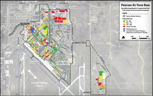

61 FELSBURG HOLT & ULLEVIG connecting and enhancing communities
Final Environmental Assessment
 March 2013 Peterson Air Force Base Transportation Plan Final Environmental Assessment FELSBURG HOLT & ULLEVIG Report Documentation Page Form Approved OMB No. 0704-0188 Public reporting burden for the collection
ENVIRONMENTAL ASSESSMENT for Global Hawk Main Operating Base Beddown
 Final ENVIRONMENTAL ASSESSMENT for Global Hawk Main Operating Base Beddown United States Air Force Air Combat Command March 2001 ACRONYMS AND ABBREVIATIONS AB AFB AFI AGE AGL AICUZ APCD APZ AQMD AQCR ARTCC
ENVIRONMENTAL ASSESSMENT
 FINAL ENVIRONMENTAL ASSESSMENT FOR PROPOSED COLORADO SPRINGS AIRPORT/ EL PASO COUNTY SCHOOL DISTRICT 11 PROPERTY ACQUISITION AND FUTURE DEVELOPMENT AT PETERSON AIR FORCE BASE, COLORADO DEPARTMENT OF THE
6.1 INTRODUCTION 6.2 REGULATORY FRAMEWORK NATIONAL AMBIENT AIR QUALITY STANDARDS COMPLIANCE STATUS TRANSPORTATION CONFORMITY
 Chapter 6 Air Quality 6.1 INTRODUCTION This chapter presents a project-level analysis of the potential for air quality impacts that could result from mobile and stationary sources of air emissions generated
THIS PAGE INTENTIONALLY LEFT BLANK
 THIS PAGE INTENTIONALLY LEFT BLANK THIS PAGE INTENTIONALLY LEFT BLANK BURKE LAKEFRONT AIRPORT ENVIRONMENTAL ASSESSMENT FINAL TABLE OF CONTENTS PAGE CHAPTER ONE PROPOSED ACTION 1.1 Introduction...
6 Other Considerations
 6 Other Considerations 6.1 Unavoidable Adverse Effects Under Alternatives 1, 2, and 3, there would be a change in the air emissions associated with replacing the Expeditionary VAQ EA-6B with the EA-18G
I-70 East ROD 1: Phase 1 (Central 70 Project) Air Quality Conformity Technical Report
 Air Quality Conformity Technical Report") I-70 East ROD 1: Air Quality Conformity Technical Report January 2017 I-70 East ROD 1: Air Quality Conformity Technical Report TABLE OF CONTENTS Chapter Page 1 PURPOSE OF THIS REPORT... 1 2 PROJECT DESCRIPTION...
I-70 East ROD 1: Air Quality Conformity Technical Report January 2017 I-70 East ROD 1: Air Quality Conformity Technical Report TABLE OF CONTENTS Chapter Page 1 PURPOSE OF THIS REPORT... 1 2 PROJECT DESCRIPTION...
Acronyms and. Abbreviations
 Acronyms and Abbreviations Acronyms and Abbreviations AADT annual average daily traffic ACHP Advisory Council on Historic Preservation ADT average daily traffic ANC Advisory Neighborhood Commissions APE
4.2 Air Quality and Greenhouse Gas
 4.2 Air Quality and Greenhouse Gas Federal agencies are required under the Clean Air Act (CAA) to ensure that projects they fund (such as the Center City Connector) are in compliance with existing federal
4.4 AIR QUALITY Approach to Analysis
 4.4 AIR QUALITY Section 4.4 addresses the potential impacts to air quality as a result of the proposed action. Air quality can be affected by air pollutants produced by mobile sources, such as vehicular
COMMERCIAL WASTE MANAGEMENT STUDY VOLUME III CONVERTED MARINE TRANSFER STATIONS - Commercial Waste Processing and Analysis of Potential Impacts
 COMMERCIAL WASTE MANAGEMENT STUDY VOLUME III CONVERTED MARINE TRANSFER STATIONS - Commercial Waste Processing and Analysis of Potential Impacts March 2004 Prepared for: New York City Department of Sanitation
Federal Aviation Administration
 U.S. Department of Transportation Federal Aviation Administration DRAFT Environmental Impact Statement for Proposed Redevelopment and Extension of Runway 9R/27L March 30, 2007 Fort Lauderdale-Hollywood
DRAFT. National Guard Bureau July 15, Guarding America - Defending Freedom. Contract Number W9133L-14-D-0009 Task Order Number 0005 PWS 0131
 DRAFT Environmental Assessment for Construction and Demolition Projects at Selfridge Air National Guard Base Michigan Air National Guard Mount Clemens, MI Contract Number W9133L-14-D-0009 Task Order Number
Environmental Assessment. Security and Traffic Upgrades
 Final Environmental Assessment Security and Traffic Upgrades Peterson AFB, Colorado November 2004 Report Documentation Page Form Approved OMB No. 0704-0188 Public reporting burden for the collection of
Oklahoma Department of Transportation Environmental Programs Division Office Fax
 Oklahoma Department of Transportation Environmental Programs Division Office 521-3050 Fax 522-5193 Documented Categorical Exclusion (DCE) for I-40: Pavement Reconstruction and Added Lanes from the Douglas
3 CONSTRUCTION-GENERATED CRITERIA AIR POLLUTANT AND PRECURSOR EMISSIONS
 3 CONSTRUCTION-GENERATED CRITERIA AIR POLLUTANT AND PRECURSOR EMISSIONS 3.1 INTRODUCTION Construction activities have the potential to generate a substantial amount of air pollution. In some cases, the
Vista Canyon Transit Center - Air Quality Technical Memorandum
 803 Camarillo Springs Road, Suite C Camarillo, California 93012 (805) 437-1900 FAX (805) 437 1901 www.impactsciences.com MEMORANDUM To: Kris Markarian, City of Santa Clarita Job No. 1046.003 From: Susan
Updates on FAA Order F. Agenda. Communicate FAA Order Updates. Educate attendees on the changes to FAA Order
 Updates on FAA Order 1050.1F Rhonda Solomon March 3, 2015 Airports Conference 2015 Agenda Communicate FAA Order 1050.1 Updates Educate attendees on the changes to FAA Order 1050.1 1 1 Overview of NEPA
Hamilton Green. Draft Environmental Impact Statement (DEIS)
") Hamilton Green Draft Environmental Impact Statement (DEIS) June 2017 HAMILTON GREEN DRAFT ENVIRONMENTAL IMPACT STATEMENT (DEIS) June 14, 2017 Lead Agency: SEQRA Classification: City of White Plains Common
Hamilton Green Draft Environmental Impact Statement (DEIS) June 2017 HAMILTON GREEN DRAFT ENVIRONMENTAL IMPACT STATEMENT (DEIS) June 14, 2017 Lead Agency: SEQRA Classification: City of White Plains Common
FINAL ENVIRONMENTAL ASSESSMENT FOR LAND EXCHANGE AT DYESS AIR FORCE BASE TAYLOR COUNTY, TEXAS. Prepared for: DYESS AIR FORCE BASE TAYLOR COUNTY, TEXAS
 FINAL ENVIRONMENTAL ASSESSMENT FOR LAND EXCHANGE AT DYESS AIR FORCE BASE TAYLOR COUNTY, TEXAS Prepared for: DYESS AIR FORCE BASE TAYLOR COUNTY, TEXAS October 2011 Report Documentation Page Form Approved
Taylorsville-Murray Transit
 Taylorsville-Murray Transit Environmental Study Report April 2013 Prepared for Table of Contents Acronyms & Abbreviations... iv Executive Summary... ES 1 Chapter 1: Purpose and Need 1.1 Project Description...
SUPPLEMENTAL ENVIRONMENTAL ASSESSMENT ADDRESSING CONSTRUCTION OF AN ACCESS CONTROL POINT AT FORT HUNTER LIGGETT, CALIFORNIA
 SUPPLEMENTAL ENVIRONMENTAL ASSESSMENT ADDRESSING CONSTRUCTION OF AN ACCESS CONTROL POINT AT FORT HUNTER LIGGETT, CALIFORNIA JUNE 2013 COVER SHEET SUPPLEMENTAL ENVIRONMENTAL ASSESSMENT ADDRESSING CONSTRUCTION
ENVIRONMENTAL ASSESSMENT PROPOSED EXPANSION OF THE BUREAU OF ENGRAVING & PRINTING WESTERN CURRENCY FACILITY FORT WORTH, TEXAS
 ENVIRONMENTAL ASSESSMENT PROPOSED EXPANSION OF THE BUREAU OF ENGRAVING & PRINTING WESTERN CURRENCY FACILITY FORT WORTH, TEXAS APRIL 0 PREPARED FOR U.S. Department of the Treasury Bureau of Engraving and
TIER 2 EIS SCOPING MEETING WELCOME TO THE FEDERAL AVIATION ADMINISTRATION SCOPING MEETING
 TIER 2 EIS SCOPING MEETING WELCOME TO THE FEDERAL AVIATION ADMINISTRATION SCOPING MEETING TIER 2 EIS OVERVIEW SOUTH SUBURBAN INAUGURAL AIRPORT ENVIRONMENTAL IMPACT STATEMENT The proposed, (SSA) will require
State Environmental Quality Review NEGATIVE DECLARATION Notice of Determination of Non-Significance
 State Environmental Quality Review NEGATIVE DECLARATION Notice of Determination of Non-Significance Project: East Hampton Temporary Generation Facility Expansion Date: May 17, 2018 This notice is issued
3.12 NOISE Regulatory Setting Environmental Setting EXISTING NOISE SOURCES AND SENSITIVE LAND USES
 3.12 NOISE This section assesses the potential for implementation of the West Village Expansion component to result in impacts related to short-term construction, long-term operational noise sources, and
FEDERAL HIGHWAY ADMINISTRATION RECORD OF DECISION FOR THE LYNNWOOD LINK EXTENSION
 FEDERAL HIGHWAY ADMINISTRATION RECORD OF DECISION FOR THE LYNNWOOD LINK EXTENSION AUGUST 2015 Table of Contents 1 Decision... 1 1.1 Project Description... 2 1.2 Basis for the FHWA Decision... 7 1.2.1
Table Ambient Criteria Air Pollutant Monitoring Data ( )
") Section 5.4 Air Quality and Climate Change This section describes the potential air quality and climate change impacts associated with the proposed changes to the approved project. This section supplements
Section 5.4 Air Quality and Climate Change This section describes the potential air quality and climate change impacts associated with the proposed changes to the approved project. This section supplements
9.0 I-26 & I-526 Interchange Improvements
 9.0 I-26 & I-526 Interchange Improvements The I-26 & I-526 System-to-System interchange currently consists of a combination of directional and loop ramps providing for all movements from one Interstate
DRAFT. Environmental Assessment for the Beddown of C-17 or KC-135 at the 123d Airlift Wing Standiford Field Louisville, KY
 DRAFT Environmental Assessment for the Beddown of C-17 or KC-135 at the 123d Airlift Wing Standiford Field Louisville, KY Contract Number W9133L-14-D-0009 Task Order Number 0004 PWS 0134 National Guard
Air Report. Project Information PPTA/LAP. Traffic Data I-495 NORTHERN SECTION SHOULDER USE. Project Number: , C501, P101 UPC:
 Air Report Project Information Project Name: I-495 NORTHERN SECTION SHOULDER USE Project Number: 0495-029-123, C501, P101 UPC: 105130 Route Number: 495 Project Limit - From: South of Old Dominion Drive
TRAFFIC STUDY GUIDELINES
 TRAFFIC STUDY GUIDELINES December 2013 The scope of the traffic impact analysis (TIA) should follow these guidelines and the requirements of VMC 11.80.130 and VMC 11.70, transportation concurrency (attached
Report Documentation Page
 WASTE-TO-ENERGY PLANT ENVIRONMENTAL ASSESSMENT Final Dyess Air Force Base, Texas September 2011 Report Documentation Page Form Approved OMB No. 0704-0188 Public reporting burden for the collection of information
REEVALUATION FORM. Page 1. Code:
 Page 1 COLORADO DEPARTMENT OF TRANSPORTATION Original NEPA Reevaluation Project Approval Date: Date: Code: REEVALUATION FORM FONSI 9/2004 August 31, 2012 17354 Project Name and Location: Interstate 25,
1.3.1 Purpose Need... 6
 PRE FINAL DRAFT ENVIRONMENTAL ASSESSMENT ENERGY SECURITY MICROGRID FOR CRITIC CAL FACILITIES PROJECT (P 906) Marine Corps Air Station Miramar San Diego County, California August 13, 2015 ENERGY SECURITY
ENVIRONMENTAL ASSESSMENT PROPOSED EXPANSION OF THE BUREAU OF ENGRAVING & PRINTING WESTERN CURRENCY FACILITY FORT WORTH, TEXAS
 ENVIRONMENTAL ASSESSMENT PROPOSED EXPANSION OF THE BUREAU OF ENGRAVING & PRINTING WESTERN CURRENCY FACILITY FORT WORTH, TEXAS JULY 2018 PREPARED FOR U.S. Department of the Treasury Bureau of Engraving
YORK TOLL PLAZA MAINE TURNPIKE AUTHORITY AIR QUALITY REPORT. September 28, 2016 NOISE ANALYSIS REPORT MAINETURNPIKE AUTHORI TY
 NOISE ANALYSIS REPORT MAINETURNPIKE AUTHORI TY YORK TOLL PLAZA MAINE TURNPIKE AUTHORITY AIR QUALITY REPORT September 28, 2016 (Cover photograph provided by MTA) TABLE OF CONTENTS 1.0 EXECUTIVE SUMMARY...
Draft Air Quality Analysis Protocol. Detroit River International Crossing Environmental Impact Statement
 Draft Air Quality Analysis Protocol Detroit River International Crossing Environmental Impact Statement May 31, 2007 1. Introduction Under the National Environmental Policy Act (NEPA), federal agencies
DEPARTMENT OF DEFENSE DEPARTMENT OF THE NAVY
 DEPARTMENT OF DEFENSE DEPARTMENT OF THE NAVY FINDING OF NO SIGNIFICANT IMPACT (FONSI) FOR IMPLEMENTATION OF THE DEVELOPMENT AGREEMENT BETWEEN THE CITY OF SAN DIEGO AND THE U.S. NAVY FOR REDEVELOPMENT OF
October 19, 2017 Community Engagement Panel Meeting #4 Overview of Environmental Effects
 Lake Elmo Airport Environmental Assessment (EA)/ Environmental Assessment (EAW) Worksheet October 19, 2017 Community Engagement Panel Meeting #4 Overview of Environmental Effects Agenda Public Event #2
DRAFT AIR QUALITY TECHNICAL MEMORANDUM
 AIR QUALITY TECHNICAL MEMORANDUM PROJECT DEVELOPMENT AND ENVIRONMENT STUDY STATE ROAD 60 GRADE SEPARATION OVER CSX RAILROAD Polk County, Florida Financial Project ID: 436559-1-22-01 Prepared for: Florida
2 ENVIRONMENTAL REVIEW AND THRESHOLDS OF SIGNIFICANCE
 2 ENVIRONMENTAL REVIEW AND THRESHOLDS OF SIGNIFICANCE 2.1 ENVIRONMENTAL REVIEW PROCESS The California Environmental Quality Act (CEQA) requires that public agencies (e.g., local, county, regional, and
SUMMARY S.1 ENVIRONMENTAL REVIEW PROCESS TUCSON INTERNATIONAL AIRPORT ENVIRONMENTAL IMPACT STATEMENT DRAFT
 SUMMARY The Federal Aviation Administration (FAA), as lead federal agency, along with the United States Air Force (USAF), and the National Guard Bureau (NGB) have prepared this Environmental Impact Statement
Chapter 8. Acronyms/Abbreviations
 AB Assembly Bill AB939 Integrated Solid Waste Management Act of 1989 or Assembly Bill 939 ACM ADT APN AP-42 AQMP ASL ATSF bgs BMP CAA Cal-EPA Cal-ESA CARB CBC CCR CDMG CEQA CF CFR CGS CHRI Asbestos-Containing
Draft Environmental Assessment Terminal B/C Redevelopment, Secure National Hall, and Related Improvements
 JUNE 2016 RONALD REAGAN WASHINGTON NATIONAL AIRPORT Draft Environmental Assessment Terminal B/C Redevelopment, Secure National Hall, and Related Improvements PREPARED BY: Ricondo & Associates, Inc. IN
EVALUATION OF ALTERNATIVES CARRIED FORWARD
 1 EVALUATION OF ALTERNATIVES CARRIED FORWARD This chapter presents a comparative evaluation of the alternatives carried forward in this Final Environmental Impact Statement (EIS). The intent of this evaluation
MOUNTAIN VISTA SUBAREA PLAN FORT COLLINS, COLORADO TRAFFIC NOISE EVALUATION REPORT
 MOUNTAIN VISTA SUBAREA PLAN FORT COLLINS, COLORADO TRAFFIC NOISE EVALUATION REPORT Prepared for: City of Fort Collins 250 N. Mason Street Fort Collins, CO 80522 Prepared by: Felsburg Holt & Ullevig 6300
CHAPTER 14. ROADWAYS AND MARINE TRANSPORTATION
 CHAPTER 14. ROADWAYS AND MARINE TRANSPORTATION 14.1 AFFECTED ENVIRONMENT 14.1.1 Definition of Resource This section describes the existing transportation facilities, specifically roads, the Tinian International,
AIR QUALITY TECHNICAL MEMORANDUM
 AIR QUALITY TECHNICAL MEMORANDUM AIR QUALITY TECHNICAL MEMORANDUM GOLDEN GLADES INTERCHANGE PD&E STUDY Miami-Dade County, Florida Financial Management Number: 428358-1-22-01 Efficient Transportation Decision
RECORD OF DECISION IMPLEMENTATION OF ENERGY, WATER, AND SOLID WASTE SUSTAINABILITY INITIATIVES FORT BLISS, TEXAS AND NEW MEXICO
 RECORD OF DECISION IMPLEMENTATION OF ENERGY, WATER, AND SOLID WASTE SUSTAINABILITY INITIATIVES FORT BLISS, TEXAS AND NEW MEXICO April 2014 This page intentionally left blank RECORD OF DECISION FOR THE
WAKE ISLAND SUPPLEMENTAL ENVIRONMENTAL ASSESSMENT
 WAKE ISLAND SUPPLEMENTAL ENVIRONMENTAL ASSESSMENT AGENCY: Missile Defense Agency ACTION: Finding of No Significant Impact BACKGROUND: The Missile Defense Agency (MDA) prepared this Supplemental Environmental
An Overview and Comparison of the Tennessee Department of Transportation s Environmental Evaluation Process
 Introduction This document provides a brief overview of the policy and procedures that govern the environmental evaluation process that the Tennessee Department of Transportation (TDOT) must follow for
DRAFT FINDING OF NO SIGNIFICANT IMPACT ADDRESSING AN ARMY AND AIR FORCE EXCHANGE SERVICE LIFESTYLE CENTER AT FORT SAM HOUSTON, SAN ANTONIO, TEXAS
 1 1 1 1 1 0 1 0 1 0 1 DRAFT FINDING OF NO SIGNIFICANT IMPACT ADDRESSING AN ARMY AND AIR FORCE EXCHANGE SERVICE LIFESTYLE CENTER AT FORT SAM HOUSTON, SAN ANTONIO, TEXAS Pursuant to the Council on Environmental
Overview of Section 2
 Overview of Section 2 2.0 Section 2 addresses Steps 1 through 3 of the GESC Permit Process: Step 1. Confirm that a Temporary Batch Plant, Standard GESC, Annual Maintenance GESC, or Small Utility GESC Permit
5.0 ALTERNATIVES 5.1 INTRODUCTION
 5.1 INTRODUCTION The California Environmental Quality Act (CEQA) Guidelines state that an EIR shall describe a range of reasonable alternatives to the Project, or to the location of the Project, which
Pollutant Averaging Time Primary Standard. Sulfur Dioxide 24 hours 0.14 ppm Ozone. 8 hour 0.08 ppm 1 hour 0.12 ppm Particulate Matter <10 µm
 4.4 AIR QUALITY The Clean Air Act (CAA) and its amendments led to the establishment by the U.S. Environmental Protection Agency (EPA) of National Ambient Air Quality Standards (NAAQS) for six criteria
12 Evaluation of Alternatives
 12 Evaluation of Alternatives This chapter evaluates the effectiveness of the No-Build Alternative and the proposed METRO Blue Line Light Rail Transit (BLRT) Extension project based on the information
Monterey Bay Unified Air Pollution Control District (
 3.3.8 Air Quality Introduction The Air Quality section addresses the impacts of the project on ambient air quality and the exposure of people, especially sensitive individuals, to hazardous pollutant concentrations.
Agency Scoping. May 31, :00 a.m. 1:00 p.m. Environmental Impact Statement Port Columbus International Airport
 Agency Scoping Meeting 10:00 a.m. 1:00 p.m. Environmental Impact Statement Port Columbus International Airport Presented to: CMH EIS Agencies By: FAA Consultant, Landrum & Brown Date: Agenda I. History,
Evaluation of Alternatives
 Chapter 9.0 Evaluation of Alternatives Chapter 9.0 provides a summary evaluation of the No Build Alternative and the Preferred Alternative. The evaluation contained within this chapter is an assessment
6Compliance. Reduce compliance costs. Plan, program, budget, and execute projects and activities that facilitate compliance
 6Compliance Department of Defense (DoD) operations must comply with applicable laws, regulations, Executive Orders (E.O. s), Final Governing Standards (FGS), and agreements designed to protect human health
Categorical Exclusion (CE)
") Categorical Exclusion (CE) Project Information Project Name: Federal Project#: Project Number: 0029-002-135, D624, P101 Project Type: Construction UPC: 77383 Charge Number: Route Number: 29 Route Type:
Categorical Exclusion (CE) Project Information Project Name: Federal Project#: Project Number: 0029-002-135, D624, P101 Project Type: Construction UPC: 77383 Charge Number: Route Number: 29 Route Type:
5.0 ALTERNATIVE VARIATIONS
 5.0 ALTERNATIVE VARIATIONS 5.1 INTRODUCTION The Draft EIR for the Beverly Hilton Revitalization Plan evaluated five alternatives to the project, pursuant to Section 15126.6 of the California Environmental
Southern Ute Indian Tribe Coordination Kick-Off Meeting November 4, 2015
 Southern Ute Indian Tribe Coordination Kick-Off Meeting November 4, 2015 Awareness of the Master Plan Recommendations (Proposed Action) Understanding of the Environmental Assessment (EA) purpose and content
DRAFT FINDING OF NO SIGNIFICANT IMPACT (FNSI)
") DRAFT FINDING OF NO SIGNIFICANT IMPACT (FNSI) Environmental Assessment (EA) for the Powertrain PN0 Project on (CCAD), at the Naval Air Station in Corpus Christi (NASCC), Texas RESPONSIBLE AGENCY: COORDINATING
DRAFT FINDING OF NO SIGNIFICANT IMPACT (FNSI) Environmental Assessment (EA) for the Powertrain PN0 Project on (CCAD), at the Naval Air Station in Corpus Christi (NASCC), Texas RESPONSIBLE AGENCY: COORDINATING
PARKMERCED PROJECT EIR ERRATA
 PARKMERCED PROJECT EIR ERRATA This section presents additional staff initiated text changes for the Parkmerced Project Draft Environmental Impact Report. These EIR text changes reflect revisions that have
FEDERAL BOULEVARD (5 TH AVENUE TO HOWARD PLACE) PLANNING ENVIRONMENTAL LINKAGE STUDY TRAFFIC NOISE IMPACT ANALYSIS
 PLANNING ENVIRONMENTAL LINKAGE STUDY TRAFFIC NOISE IMPACT ANALYSIS") FEDERAL BOULEVARD (5 TH AVENUE TO HOWARD PLACE) PLANNING ENVIRONMENTAL LINKAGE STUDY TRAFFIC NOISE IMPACT ANALYSIS Prepared for: City and County of Denver 201 West Colfax Avenue, Department 509 Denver,
FEDERAL BOULEVARD (5 TH AVENUE TO HOWARD PLACE) PLANNING ENVIRONMENTAL LINKAGE STUDY TRAFFIC NOISE IMPACT ANALYSIS Prepared for: City and County of Denver 201 West Colfax Avenue, Department 509 Denver,
LANDSIDE FACILITIES AIRLINE TERMINAL FACILITIES INVENTORY 5.0 INTRODUCTION C H A P T E R 1 CHAPTER 5
 C H A P T E R 1 INVENTORY AIRLINE TERMINAL FACILITIES INVENTORY CHAPTER 5 LANDSIDE FACILITIES 5.0 INTRODUCTION This chapter focuses on the landside circulation and access system at the Spokane International
actions and approvals by the Federal Aviation Administration ( FAA) and the Federal
 and the Federal") METROPOLITAN AIRPORTS COMMISSION In re MSP 2020 Improvements Final Environmental Assessment/Environmental Assessment Worksheet, Adequacy Determination, and Negative Declaration on the Need for an Environmental
METROPOLITAN AIRPORTS COMMISSION In re MSP 2020 Improvements Final Environmental Assessment/Environmental Assessment Worksheet, Adequacy Determination, and Negative Declaration on the Need for an Environmental
ENVIRONMENTAL ASSESSMENT FOR C-17 AND KC-135 RECURRING TRAINING AT LAWTON, OKLAHOMA
 ENVIRONMENTAL ASSESSMENT FOR C-17 AND KC-135 RECURRING TRAINING AT LAWTON, OKLAHOMA United States Air Force Air Education and Training Command Altus Air Force Base, Oklahoma May 2004 Report Documentation
2017 DRAFT SUPPLEMENTAL REVISED FINAL ENVIRONMENTAL IMPACT STATEMENT FOR PROPOSED UNITED STATES PENITENTIARY AND FEDERAL PRISON CAMP
 2017 DRAFT SUPPLEMENTAL REVISED FINAL ENVIRONMENTAL IMPACT STATEMENT FOR PROPOSED UNITED STATES PENITENTIARY AND FEDERAL PRISON CAMP Prepared for: United States Department of Justice Federal Bureau of
EXECUTIVE SUMMARY Draft Environmental Impact Statement (EIS)
") Draft Environmental Impact Statement (EIS) KC-46A Main Operating Base #4 (MOB 4) Beddown Headquarters Air Mobility Command November 2017 ABBREVIATIONS AND ACRONYMS AFB AMC CEQ CFR DOD EIS JB MDL KC-10
Draft Environmental Impact Statement (EIS) KC-46A Main Operating Base #4 (MOB 4) Beddown Headquarters Air Mobility Command November 2017 ABBREVIATIONS AND ACRONYMS AFB AMC CEQ CFR DOD EIS JB MDL KC-10
Section 7 Environmental Constraints
 Section 7 Environmental Constraints i Yakima Valley Metropolitan and Regional Transportation Plan Public Comment DRAFT 1/27/2016 Environmental Constraints Analysis A programmatic-level review of potential
Appendix G Analysis of Project Impacts Compared to Existing Conditions
 Appendix G Analysis of Project Impacts Compared to Existing Conditions This page intentionally left blank. Analysis of Project Impacts Compared to Existing Conditions Introduction The analysis scenarios
Willmar Wye Public Open House #4 and Public Hearing
 Willmar Wye Public Open House #4 and Public Hearing February 23, 2017 www.dot.state.mn.us/d8/willmarwye Agenda Time Topic 5:00 pm Open House Opportunity for the public to ask questions of project staff
Appendix U Air Quality Technical Memorandum DRAFT ENVIRONMENTAL IMPACT STATEMENT
 Appendix U Air Quality Technical Memorandum DRAFT ENVIRONMENTAL IMPACT STATEMENT Chicago Red Line Extension Project Air Quality Technical Memorandum June 21, 2013 Updated July 27, 2015 Prepared for: Chicago
Clean Air Act History
 Clean Air Act Compliance Clean Air Act Compliance Clean Air Act History 1940s serious smog in LA, CA and Donora, PA raised concerns about air quality. 1955, Air Pollution Control Act was the 1st national
KALIA-FORT DERUSSY WASTEWATER SYSTEM IMPROVEMENTS FINAL ENVIRONMENTAL ASSESSMENT EXECUTIVE SUMMARY
 EXECUTIVE SUMMARY This Environmental Assessment (EA) addresses the environmental impacts of the Proposed Action to construct certain improvements to the City and County of Honolulu (City) wastewater collection
All Aboard Florida. DRAFT Environmental Impact Statement. Martin Metropolitan Planning Organization (MPO) Staff Review. Photo courtesy Carla McMahon
 Staff Review. Photo courtesy Carla McMahon") All Aboard Florida DRAFT Environmental Impact Statement Martin Metropolitan Planning Organization (MPO) Staff Review Photo courtesy Carla McMahon Environmental Process An environmental assessment (EA)
All Aboard Florida DRAFT Environmental Impact Statement Martin Metropolitan Planning Organization (MPO) Staff Review Photo courtesy Carla McMahon Environmental Process An environmental assessment (EA)
AGENCY: United States Air Force (USAF)
") DRAFT FINDING OF NO SIGNIFICANT IMPACT INTENT TO ADOPT THE NATIONAL AERONAUTICS AND SPACE ADMINISTRATION FINAL ENVIRONMENTAL ASSESSMENT FOR MULTI-USE OF LAUNCH COMPLEXES 39A AND 39B AT JOHN F. KENNEDY
DRAFT FINDING OF NO SIGNIFICANT IMPACT INTENT TO ADOPT THE NATIONAL AERONAUTICS AND SPACE ADMINISTRATION FINAL ENVIRONMENTAL ASSESSMENT FOR MULTI-USE OF LAUNCH COMPLEXES 39A AND 39B AT JOHN F. KENNEDY
Pima Association of Government s Air Quality Forum June 23, 2015
 Pima Association of Government s Air Quality Forum June 23, 2015 Proposed new 8-hour ozone standard Background Proposed NAAQS Final NAAQS National and Regional Maps Planning or Implementation Requirements
Washington Dulles International Airport EXECUTIVE SUMMARY
 EXECUTIVE SUMMARY The events of September 11, 2001 and the economic uncertainties facing commercial aviation have affected the timing of the Proposed Action. The Metropolitan Washington Airports Authority
Transportation Conformity Guidance for Qualitative Hot-spot Analyses in PM 2.5 and PM 10 Nonattainment and Maintenance Areas
 Transportation Conformity Guidance for Qualitative Hot-spot Analyses in PM 2.5 and PM 10 Nonattainment and Maintenance Areas United States Environmental Protection Agency Federal Highway Administration
DRAFT. Draft Carbon Monoxide (CO) Traffic Air Quality Analysis
 Traffic Air Quality Analysis") Draft Carbon Monoxide (CO) Traffic Air Quality Analysis North Houston Highway Improvement Project From US 59/I-69 at Spur 527 To I-45 at Beltway 8 North Harris County TxDOT Houston District CSJ: 0912-00-146
Draft Carbon Monoxide (CO) Traffic Air Quality Analysis North Houston Highway Improvement Project From US 59/I-69 at Spur 527 To I-45 at Beltway 8 North Harris County TxDOT Houston District CSJ: 0912-00-146
PROJECT DESCRIPTION...
 TABLE OF CONTENTS Volume I Chapter Page 1. INTRODUCTION... 1-1 1.1 Introduction... 1-1 1.2 Project Description... 1-1 1.3 Purpose of the EIR... 1-2 1.4 EIR Process... 1-3 1.5 Scope of the Draft EIR...
CHAPTER 8: ENVIRONMENTAL OVERVIEW
 CHAPTER 8: ENVIRONMENTAL OVERVIEW Introduction FAA Advisory Circular 150/5070-6B, Airport Master Plans identifies an environmental review as one of the elements of effective planning. The purpose behind
3.11 HAZARDOUS MATERIALS
 3.11 HAZARDOUS MATERIALS 3.11.1 Introduction to Analysis This section provides information regarding known contaminated sites and general areas of potentially contaminated properties along the proposed
DRAFT ENVIRONMENTAL ASSESSMENT. for Construction and Operation of a Work Facilities Complex at Naval Air Station Patuxent River, Maryland
 DRAFT ENVIRONMENTAL ASSESSMENT for Construction and Operation of a Work Facilities Complex at Naval Air Station Patuxent River, Maryland February 2018 This page intentionally left blank. Designation: Title
DRAFT. SR-60 7 th Avenue Intersection Control Evaluation (ICE) I-605 Corridor Improvement Project (CIP) I-605/SR-60 EA# 3101U0
 I-605 Corridor Improvement Project (CIP) I-605/SR-60 EA# 3101U0") SR-60 7 th Avenue Intersection Control Evaluation (ICE) I-605/SR-60 EA# 3101U0 October 9, 2017 Contents 1 Purpose of ICE Memo... 1 2 Background... 1 3 Existing Interchange Deficiencies... 1 4 Context Sensitive
SR-60 7 th Avenue Intersection Control Evaluation (ICE) I-605/SR-60 EA# 3101U0 October 9, 2017 Contents 1 Purpose of ICE Memo... 1 2 Background... 1 3 Existing Interchange Deficiencies... 1 4 Context Sensitive
AIR QUALITY AND CLIMATE CHANGE EVALUATION GUIDANCE
 AIR QUALITY AND CLIMATE CHANGE EVALUATION GUIDANCE The following guidance provides additional details regarding the process followed by PSRC to evaluate projects for potential air quality benefits. As
5.7 Traffic 5.7 TRAFFIC Affected Environment
 5.7 TRAFFIC 5.7.1 Affected Environment Regional Transportation System The main vehicular traffic access routes into SBMR are via H-2 from the Ewa/Honolulu area, Kamehameha Highway and Kunia Road from the
Environmental Impact Statement for EA-18G Growler Airfield Operations at Naval Air Station Whidbey Island Complex
 Environmental Impact Statement for EA-18G Growler Airfield Operations at Naval Air Station Whidbey Island Complex Volume I November 2016 Prepared for: 1002860.0041.06 1002860.0041.02-B4325 Environmental
Table of Contents. Chapter I Purpose and Need A. Summary of Purpose and Need... I-1 B. Clarification of Draft First Tier EIS...
 TOC-1 Table of Contents Summary Chapter I Purpose and Need A. Summary of Purpose and Need... I-1 B. Clarification of Draft First Tier EIS... I-2 Chapter II Strategies and Conceptual Corridors A. Summary
Air Emissions 101. What are Some Types of Emissions? Oil & Gas Emissions: In Context VOC
 Oil & Gas Emissions: In Context Air Emissions 101 What are Some Types of Emissions? CO2 - Carbon dioxide is a greenhouse gas and is formed as one of the major products of combustion. CH4 - Methane, also
Environmental Analysis, Chapter 4 Consequences, and Mitigation
 Environmental Analysis, Chapter 4 Table 4.17-3. Summary of Adverse Environmental Justice Impacts Topic No Build TSM At-Grade Emphasis LRT Underground Emphasis LRT Locally Preferred Alternative Transit
Northwest State Route 138 Corridor Improvement Project
 Northwest State Route 138 Corridor Improvement Project Los Angeles County, CA DISTRICT 7- LA- 138 (PM 0.0/36.8); DISTRICT 7- LA- 05 (PM 79.5/83.1); DISTRICT 7- LA- 14 (PM 73.4/74.4) 265100/ 0700001816
Air Quality Technical Report PM2.5 Quantitative Hot spot Analysis. A. Introduction. B. Interagency Consultation
 Air Quality Technical Report PM2.5 Quantitative Hot spot Analysis I 65, SR44 to Southport Road (Segmented from SR44 to Main Street and Main Street to Southport Road) A. Introduction This technical report
RESOLUTION NO:
 RESOLUTION NO: 11-031 A RESOLUTION OF THE CITY COUNCIL OF THE CITY OF PASO ROBLES CERTIFYING THE FINAL ENVIRONMENTAL IMPACT REPORT FOR THE 2011 CIRCULATION ELEMENT OF THE GENERAL PLAN AND ADOPTING FINDINGS,
LONG ISLAND RAIL ROAD EXPANSION PROJECT FROM FLORAL PARK TO HICKSVILLE DRAFT ENVIRONMENTAL IMPACT STATEMENT
 LONG ISLAND RAIL ROAD EXPANSION PROJECT FROM FLORAL PARK TO HICKSVILLE DRAFT ENVIRONMENTAL IMPACT STATEMENT Project Name: Project Location: Lead Agency & Contact Person: SEQRA Classification: Project Sponsors:
Air Quality, General Conformity & Class Exercise
 Air Quality, General Conformity & Class Exercise Thurs., Dec. 10 th, 2009 (8:00 12:00) Ed Melisky Environmental Specialist, Federal Aviation Administration, Airports Planning and Environmental Division,