Wharf Resources Heap-Leach Gold Mine Permitting, Northern Black Hills, South Dakota
|
|
|
- Julian Grant
- 6 years ago
- Views:
Transcription
1 Wharf Resources Heap-Leach Gold Mine Permitting, Northern Black Hills, South Dakota Crystal M. Hocking Mine Design, Operations, and Closure Conference May 8, 2013 October 05, 2011 Innovation Collaboration Inspiration Thinking Together to Inspire
2 Presentation Overview Wharf and Expansion Project Overview Permitting Process Summary of Baseline Environmental Studies Reclamation Plans for the Area

3
 Rock Mined: 9 million tons/yr Ore Processed: 3 million tons/yr Gold Produced: 60,000 ounces/yr Average Grade: 0.")
4 Wharf Mine Facts Mining Type: Open pit, truck and loader operation Processing Method: Heapleach, recovery via carbon columns Minerals: Primary Au with secondary Ag Total Acres: ~1500 permitted (400 released) Rock Mined: 9 million tons/yr Ore Processed: 3 million tons/yr Gold Produced: 60,000 ounces/yr Average Grade: 0.74 g/ton

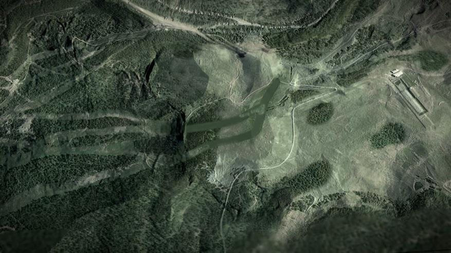
5 Existing Permit Boundaries Wharf Mine Expansion Permit Boundary 528 acres in Expansion 308 acres of Total Disturbance 116 acres of New Disturbance Processing Facilities Golden Reward

 Golden Reward Terry")
6 General Mine Expansion Layout Map Wharf Mine Expansion Permit Line Hwy 473 Reroute Seasonal Haul Road For additional Infrastructure Process Area (inset from west part of mine) Golden Reward Terry Peak Ski Area

7 Expansion Area Mining Methods Continue same mining process truck and loader heap-leach process Same size work force Use of same infrastructure all located at Wharf. All ore will be processed at Wharf Maintain high standards of erosional control, use Best Management Practices (BMPs)

8 Expansion Area Mining Schedule Wharf Permit boundary American Eagle Expansion Permit boundary Seasonal Haul Road between Wharf & GR Phase 1: Grubbing/topsoil of Green Mt., complete mining in American Eagle Phase 2: Construct Hwy 473, Mine Green Mt., haul road to Golden Reward Phase 3: Mine Golden Reward and Green Mt. Phase 4: Mine Portland Ridgeline, final reclamation Phase 3
9 Mine Permitting Process
10 Required Mine Permits County Lawrence County Office of Planning and Zoning Conditional Use Permit State South Dakota Department of Environment and Natural Resources (SD DENR) Determination of Special, Exceptional, Critical, or Unique Lands Large-Scale Mine Permit Federal BLM Plan of Operations Environmental Assessment 10
11 State Permit Review Agencies SD Department of Environment and Natural Resources Historical Society State Archaeological Research Center SD Department of Tourism SD Department of Resource Conservation & Forestry SD Department of Education & Cultural Affairs SD Department of Health SD Game, Fish, & Parks U.S. Fish & Wildlife Service USDA Natural Resource Conservation Service 11
12 SD DENR Permitting Process 1. Project Initiation and Kickoff Dec Develop Sampling Plans Dec Sampling Plan Discussion and Revisions with DENR Jan Apr Baseline Environmental Sampling Fall 2009 Winter Submit Unique and Scenic App Sept/Oct Submit Large-Scale Mine Permit Application Feb Board Hearing on Unique and Scenic Application March Revisions to LSMP and Response to DENR and Agency Comments Mar-Oct Board Large Scale Mine Permit Hearing and State Permit Approval Nov 2011
13 BLM Permitting Process The proposal was to mine and reclaim 0.12 acres of the 0.74 acres of BLM-administered surface within the 528-acre Wharf Mine expansion project. 1. Plan of Operations Submitted July Environmental Assessment Dec 2011 Mar Record of Decision/FONSI May 2012
14 Baseline Studies
15 Required Baseline Studies Hydrology Meteorology Air Quality Geology Slope Stability and Geotechnical Soils Vegetation Wildlife Aquatic Resources Cultural Resources Sound Socioeconomic Visual

16 Water-Quality Monitoring 110 Sites Sampling Frequency: Bi-weekly Monthly Quarterly Semi Annually Annually Reports to DENR
17 Surface Water and NPDES Monitoring 23 sites sampled, 11 considered baseline Eight tributaries have proposed surface disturbance related to the Expansion Project (Deadwood Creek, Nevada Gulch, Fantail Creek, Lost Camp Gulch, Stewart Gulch, Annie Creek, Long Valley, and McKinley Gulch) Sites are sampled 4 times a year Parameters analyzed include standard cations and anions, metals, and other constituents of potential concern, including cyanide and nitrate Statistical analyses for a 1-year baseline and a 5-year trend overview

18 Groundwater Groundwater Survey includes: Aquifer recharge and discharge Well locations, water rights, and usage Water quality Potentiometric levels Springs and seeps 52 sites sampled, 11 considered baseline Baseline water quality indicates that several parameters exceed SD groundwater standards. Some of these parameters, including arsenic, antimony, beryllium, copper, and a few radionuclides, are naturally occurring.
19 Groundwater Modeling Pathway and Fate Modeling Predict nitrate impacts from mining activities (blasting and waste rock disposal) Predict arsenic impacts from spent ore disposal Visual MODFLOW With MT3DMS Model first developed by RESPEC in 1997 with updates in 1999, 2002, 2004, 2006, and update included: Updating pit boundaries and areas Updating mining and backfill schedule Scheduling and locations of spent ore disposal (optimized disposal location and quantities) Refining model layers Modifying Precambrian rock porosity
20 Meteorology Purpose Conduct recent and historical analyses of meteorological conditions for fate and transport predictions. Analyzed 1-year (2009) and 5-year ( ) data from 3 met stations (Lead, Spearfish, Wharf) Parameters Temperature Wind speed and direction Precipitation Dew point Humidity Barometric pressure

21 Air-Quality Program Air Monitoring Ambient air network PM 10 discontinued in 2007 Fugitive emissions from plant still monitored Values for the past 5 years are 1/10 of the Air Quality Permit limit Proactive Dust Control Water haul roads and active mining areas Spray bars, foggers, and baghouse at crushing facility Vegetate disturbed areas as soon as it is practical


22 Geology and Geochemistry General geologic setting and stratigraphy Mineralization primarily within Deadwood and Tertiary intrusives Geochemical Testing ABA, MMRT, whole rock, and humidity cell ARD Mitigation Plans Not mining acidic Precambrian rock


23 Slope Stability Modeling Modeled using MVS geology, cross-sections Phase 2D finite element Sensitivity analyses show the highwall will be stable Recommend benchmark monitoring


24 Soils Soil Mapping 600 acres 32 soil profiles and 2 road cuts Soil Types Physical and Chemical Properties Topsoil Depth Survey Soils are similar to those within other permitted mine areas and are typical for the Black Hills. Loam and rocky soils are dominant. Adequate topsoil availability for reclamation. Topsoil salvage depths average 5.39 inches. Total available topsoil is about 400,000 yd 3. Soils have low erosion potential and high revegetation potential.


25 Vegetation Vegetation Mapping 600 acres Plant Species List Ground Cover Tree and Shrub Density Conducted June & October 2010 No Riparian or Wetland Areas No Threatened or Endangered Vegetation Species No Sensitive Species in Disturbance Area 4x Mountain Huckleberry 1x White-Veined Wintergreen
 Raptors Owls")

26 Wildlife Wildlife Survey Expansion Area and 0.5 mile perimeter Species List Habitat Assessment Bats (cave and addit searches) Raptors Owls Threatened and Endangered Species Conducted Nov 2009 July 2010 No critical deer winter range No critical or unique wildlife habitats No threatened & endangered species No raptor nests (current or historical) exist within disturbance area


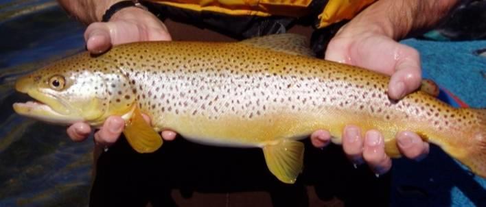
27 Aquatic Resources Aquatic Survey Habitat Periphyton Macroinvertebrates Hess replicate Kick composite Fish Backpack electrofishing
 found no impact to Cultural Resources")
28 Cultural Resources Several Previous Investigations Level III Pedestrian Survey of Expansion National Register of Historic Places Only 1 eligible site Segment of Freemont, Elkhorn, and Missouri Valley Railroad Located on Bald Mountain just above Nevada Gulch Road Additional documentation, mapping, and photographs SD Archaeological Research Center (SARC) found no impact to Cultural Resources Mitigation If any previously unrecorded cultural/historic properties are discovered, activity will be temporarily halted and SARC contacted.

29 Terry Cemetery Terry Cemetery placed on SD s preliminary list of Special, Exceptional, Critical, or Unique Places.
, and motorcycles.")
30 Sound Sound Monitoring 11 sites located at nearby recreational areas and residences 3 Recording Events morning, afternoon, rally Conducted July and August minute duration Most of the high values of noise recorded were from wind, wildlife (woodpeckers), and motorcycles. No significant mine noise Low boy, back up alarm, water truck, shift change traffic
31 Socioeconomic Assessment Review of Current Lawrence Co. Infrastructure Economic Aspects of Wharf Resources Economic Impacts Associated With Expansion Housing, Education, and Infrastructure Adjacent Land Use Issues (Recreation) 150 Full-Time Jobs for 7 years $3-5M per year in state taxes $20M per year spent in SD
32 Reclamation Plans and Postmining Use

33 Reclamation Plans Concurrent reclamation and mining Reclamation complete 2 years after mining Fewer exposed highwalls Multiple post mining land uses to stimulate economic development Recreation Residential Industrial/Commercial and Woodland grazing Year round tourism destination

34 Post-Mining Land Use HOMESITE DEVELOPMENT 110 ACRES COMMERCIAL DEVELOPMENT 34 ACRES Physical reclamation to control erosion using rangeland species Reclaimed for economic development Recreation area will meet the requirements for skiing and snowmobiling Homesite and commercial areas will help stimulate economic growth RECREATIONAL/ COMMERCIAL DEVELOPMENT 111 ACRES COMMERCIAL/ HOMESITE DEVELOPMENT 174 ACRES


 with intermittent reclamation to improve aesthetics Little")
35 Effects on Recreation and Skiing Current Impacts Mining operations at Wharf are visible from top of Terry Peak Current and past mining operations have had no significant impact on recreational usage. Statistical evidence that user visits correspond to snow conditions. Visitor volume increased from 50k to 80k during mining between 1986 to 1996 with current visits from 80k to 120k. Wharf Contributions Parking lot material Investments in snow making equipment Ski Lodge & chair lift contributions Expansion Mining Impacts Seasonal mining cycle (April Nov) with intermittent reclamation to improve aesthetics Little visual change toward east (Golden Reward) Increased views of mining operation to north (Wharf)

36 Effects on Recreation and Skiing Post-Reclamation Impacts Extended ski runs on eastern slope of Terry Peak Replacement of oldest chair lift New snowmobile trails Additional opportunities for crosscountry skiing and snowshoeing Additional areas open for commercial and residential development Overall enhanced winter recreation opportunities represent a substantial long-term economic benefit to the county.


37 Enhanced Reclamation at Golden Reward Current Conceptual


38 Summary 7 year mine life extension 116 additional acres disturbed No impact on the Terry Cemetery No interruption to the ski season Major benefits to the ski area Improvements to Highway 473 Enhanced reclamation Large economic benefits


39 THANK YOU! Crystal M. Hocking, P.G. October 05, 2011 Innovation Collaboration Inspiration Thinking Together to Inspire
Grassy Mountain Gold Project Environmental Evaluation - Draft Outline
 Grassy Mountain Gold Project Environmental Evaluation - Draft Outline EXECUTIVE SUMMARY Brief description of the Applicant s proposed project and concise presentation of the results of the environmental
FINDING OF NO SIGNIFICANT IMPACT OWL CREEK GRAVEL PIT EXPANSION U.S. FOREST SERVICE
 FINDING OF NO SIGNIFICANT IMPACT OWL CREEK GRAVEL PIT EXPANSION U.S. FOREST SERVICE OURAY RANGER DISTRICT OURAY COUNTY, COLORADO BACKGROUND The Owl Creek Gravel Pit, also known as the Spruce Ridge Pit,
Barr Road Quarry (Site N) Frequently Asked Questions Last updated: November 19, 2007
 Frequently Asked Questions Last updated: November 19, 2007") Barr Road Quarry (Site N) Frequently Asked Questions Last updated: November 19, 2007 1. Why site a quarry in the Cline Buttes Area? The Cline Buttes area is proximate to several highways, OR 126, US 97
Barr Road Quarry (Site N) Frequently Asked Questions Last updated: November 19, 2007 1. Why site a quarry in the Cline Buttes Area? The Cline Buttes area is proximate to several highways, OR 126, US 97
GUIDE TO THE DEVELOPMENT OF A MINING AND RECLAMATION PLAN IN NEW BRUNSWICK
 PROVINCE OF NEW BRUNSWICK DEPARTMENT OF ENERGY AND RESOURCE DEVELOPMENT Minerals and Petroleum Development Branch GUIDE TO THE DEVELOPMENT OF A MINING AND RECLAMATION PLAN IN NEW BRUNSWICK Guide to the
Environmental Impact Assessment (EIA)
") Environmental Impact Assessment (EIA) as a tool for sustainable mining Cheryl E. Wasserman Associate Director for Policy Analysis Office of Federal Activities Office of Enforcement and Compliance Assurance
Environmental Impact Assessment (EIA) as a tool for sustainable mining Cheryl E. Wasserman Associate Director for Policy Analysis Office of Federal Activities Office of Enforcement and Compliance Assurance
NICO COBALT-GOLD-BISMUTH-COPPER PROJECT Community Scoping Session Environmental Overview
 NICO COBALT-GOLD-BISMUTH-COPPER PROJECT Community Scoping Session Environmental Overview 1 INTRODUCTION Screening level environmental impact assessment provided in application package Many of the potential
Draft Mine Closure Plan. 17 October 2018 Longlac & Geraldton
 Draft Mine Closure Plan 17 October 2018 Longlac & Geraldton Project Update Federal EA Decision report was issued on October 1 st and Provincial Report is expected to be issued Oct 22 nd Federal approval
Warren Wagon Road Improvement Project McCall Ranger District, Payette National Forest Project Description
 Warren Wagon Road Improvement Project McCall Ranger District, Payette National Forest Project Description Introduction The analysis of the Warren Wagon Road Improvement Project is tiered to the 2003 Environmental
Stibnite Gold Project. Environmental Impact Statement (EIS)
") Stibnite Gold Project Environmental Impact Statement (EIS) 1 Mining History Coeur d Alene Stibnite Mining District McCall Cascade BOISE IDAHO 2 Mining Laws and Regulations on National Forest System lands
Stibnite Gold Project Environmental Impact Statement (EIS) 1 Mining History Coeur d Alene Stibnite Mining District McCall Cascade BOISE IDAHO 2 Mining Laws and Regulations on National Forest System lands
Introduction. Background
 Introduction Snow Forest Day Use Recreation Area Project Mountaintop Ranger District, San Bernardino National Forest San Bernardino County, California October 9, 2009 The Mountaintop Ranger District, San
Golden Sunlight Mine Bio-Treatment of Acid Producing Waste. By Rory Tibbals Operations Superintendent
 Golden Sunlight Mine Bio-Treatment of Acid Producing Waste By Rory Tibbals Operations Superintendent Golden Sunlight Mine Gold Producing Mine 2.5 Million Ounces Produced 20 Year Operation Ore and All
LEHIGH PERMANENTE QUARRY RECLAMATION PLAN AMENDMENT
 Draft LEHIGH PERMANENTE QUARRY RECLAMATION PLAN AMENDMENT Environmental Impact Report State Clearinghouse No. 2010042063 Santa Clara County December 2011 Department of Planning & Development Planning Office
RECORD OF PLAN CONFORMANCE AND CATEGORICAL EXCLUSION (CX) DETERMINATION
 DETERMINATION") RECORD OF PLAN CONFORMANCE AND CATEGORICAL EXCLUSION (CX) DETERMINATION CX Log #: OR-014-CX-04-24 Lease or Serial #: N/A Project Name: Surveyor Salvage CX Location: T.38S., R.5E., Sections 25,26,35,36;
RECORD OF PLAN CONFORMANCE AND CATEGORICAL EXCLUSION (CX) DETERMINATION CX Log #: OR-014-CX-04-24 Lease or Serial #: N/A Project Name: Surveyor Salvage CX Location: T.38S., R.5E., Sections 25,26,35,36;
Operating and Reclamation Plan
 Operating and Reclamation Plan For sites in sensitive locations, additional information may be required. If more space is needed, attach additional sheets or use the blank sheet provided at the end of
Nonmetallic Mining Reclamation & Operation Plan. Amendment No. 1 (Includes modifications for Wash Plant construction) DRAFT
 DRAFT") Nonmetallic Mining Reclamation & Operation Plan Amendment No. 1 (Includes modifications for Wash Plant construction) Mondovi Mine Town of Mondovi, Wisconsin Prepared for: Buffalo White Sand, LLC PO Box
Nonmetallic Mining Reclamation & Operation Plan Amendment No. 1 (Includes modifications for Wash Plant construction) Mondovi Mine Town of Mondovi, Wisconsin Prepared for: Buffalo White Sand, LLC PO Box
APPENDIX M CEQA Initial Study Checklist
 APPENDIX M CEQA Initial Study Checklist Appendix G ENVIRONMENTAL CHECKLIST FORM (To be Completed by Applicant) 1. Project title: 2. Lead agency name and address: 3. Contact person and phone number: 4.
ENVIRONMENT ACT TERMS OF REFERENCE NOVA SCOTIA DEPARTMENT OF TRANSPORTATION AND PUBLIC WORKS. Beaver Bank Bypass
 ENVIRONMENT ACT TERMS OF REFERENCE NOVA SCOTIA DEPARTMENT OF TRANSPORTATION AND PUBLIC WORKS Beaver Bank Bypass Highway 101 to the Beaver Bank Road Halifax County, NS NOVA SCOTIA DEPARTMENT OF THE ENVIRONMENT
RECLAMATION PLAN FOR. (name of Mine) MINING OPERATION
 MINING OPERATION") RECLAMATION PLAN FOR (name of Mine) MINING OPERATION Note: This prototype, developed by the State Mining and Geology Board (Board), is intended to assist smaller-scale mine operators in environmentally
RECLAMATION PLAN FOR (name of Mine) MINING OPERATION Note: This prototype, developed by the State Mining and Geology Board (Board), is intended to assist smaller-scale mine operators in environmentally
BEFORE THE OHIO POWER SITING BOARD
 BEFORE THE OHIO POWER SITING BOARD Application of a Certificate of Environmental Compatibility and Public Need Table of Contents Page No. List of Figures... xii List of Tables... xiii List of Appendices...xv
4.10 MINERAL RESOURCES
 4.10 MINERAL RESOURCES SCOPE AND METHODOLOGY This section examines the City s predominant mineral resource, aggregate, and the current mining operations in place to extract aggregate. Reclamation and reuse
ARTICLE 6 EXCAVATION OF MINERAL MATERIALS
 ARTICLE 6 EXCAVATION OF MINERAL MATERIALS SECTION 1. PURPOSE All excavations, extraction of materials and minerals, open pits and impounding of waters hereafter established or enlarged shall conform to
DETAILED IMPACT ANALYSIS OF MARMOT BASIN LONG RANGE PLAN
 2.0 JURISDICTION Parks Canada s decisions about the acceptability of proposals presented in the LRP are guided by a number of regulatory instruments and policies, the most relevant of which are described
SITE C FIELD WORK FOR 2019
 January 2019 SITE C FIELD WORK FOR 2019 During the construction of Site C, BC Hydro will conduct environmental and engineering field work along the Peace River between the Williston Reservoir and the Alberta
3 Baseline and Existing Conditions
 1 2 3 4 5 6 7 8 9 10 11 12 13 14 3 Baseline and Existing Conditions The effective date of the VSP legislation is July 22, 2011. This is also the date chosen by the legislature as the applicable baseline
2 Okanogan County Regional Setting
 1 1 1 1 1 1 1 1 0 1 0 1 Okanogan County Regional Setting.1 Okanogan County Profile Okanogan County is in North Central Washington State. The county borders Canada in the North and the southern and eastern
Abandoned Mine Waste Repositories: Site Selction, Design, and Cost
 University of Nebraska - Lincoln DigitalCommons@University of Nebraska - Lincoln U.S. Bureau of Land Management Papers U.S. Department of the Interior 2003 Abandoned Mine Waste Repositories: Site Selction,
What is the Terms of Reference?
 What is the Terms of Reference? Framework for content of the Environmental Assessment Certificate Application Provides the scope of technical studies and consultation processes with the public and First
PPL ELECTRIC UTILITIES CORPORATION SITING REQUIREMENTS FOR INDEPENDENT POWER PRODUCERS
 PPL ELECTRIC UTILITIES CORPORATION SITING REQUIREMENTS FOR INDEPENDENT POWER PRODUCERS PURPOSE/APPLICABILITY To ensure that Independent Power Producers (IPPs) selecting the Option to Build with the intent
2016 CIS EIS Outreach Public Meetings Information Station Posters. Approved for Public Release 16 MDA 8688 (25 May 16)
") 2016 CIS EIS Outreach Public Meetings Information Station Posters Welcome to the Missile Defense Agency (MDA) Public Meeting Cooperating Agencies Thank You for Attending the MDA Public Meeting Your participation
2016 CIS EIS Outreach Public Meetings Information Station Posters Welcome to the Missile Defense Agency (MDA) Public Meeting Cooperating Agencies Thank You for Attending the MDA Public Meeting Your participation
Public Notice.
 Public Notice US Army Corps of Engineers Louisville District Public Notice No. Open Date: Close Date: LRL-2013-0444-rjb 8 Aug 2014 8 Sep 2014 Please address all comments and inquiries to: U.S. Army Corps
Marcellus Shale Gas Development in Maryland: A Natural Resource Analysis
 Marcellus Shale Gas Development in Maryland: A Natural Resource Analysis Advisory Commission Meeting February 27, 2012 Garrett County Economic Development map Catherine McCall Balancing Natural Resources
DRAFT CH 10 & CH 11 October 7, 2015 From: SLDCProposedAmendmentsBCCPacket part3-1Nsm
 DRAFT CH 10 & CH 11 October 7, 2015 From: SLDCProposedAmendmentsBCCPacket10-13-2015part3-1Nsm 10.19. SMALL SCALE SAND AND GRAVEL EXTRACTION. 10.19.1. Applicability. This section applies to any mineral
Regulation of Mines In South Florida
 Florida Department of Environmental Protection Bureau of Mining and Minerals Regulation Regulation of Mines In South Florida Howard J. Hayes, Program Administrator February 8, 2011 What is a mine? Nonphosphate
APPENDIX N. Northern Rockies Lynx Management Direction, and Northern Rockies Lynx Standards and Guidelines
 APPENDIX N. Northern Rockies Lynx Management Direction, and Northern Rockies Lynx Standards and Guidelines This attachment evaluates project compliance with applicable Northern Rockies Lynx Management
Preliminary Disclosure; Application for Approval; Operating Permits, Volume 2: Licences and Approvals; and Abandonment Approval and
 Information required by EUB Guide G-23 1.0 GENERAL INFORMATION 1.1 INTRODUCTION The application should include: a brief project summary, objectives, approvals requested, technical and economic details,
TABLE OF CONTENTS. Page
 TABLE OF CONTENTS Page 1 PROJECT INTRODUCTION... 1-1 1.1 PROJECT BACKGROUND... 1-2 1.2 PROJECT PROPONENT... 1-2 1.3 PROJECT OVERVIEW... 1-3 1.4 PROJECT REGULATORY APPROVAL PROCESS... 1-4 1.4.1 Existing
List of Figures... xii. List of Tables... xiii. List of Appendices...xv. Glossary... xvii Project Summary and Facility Overview...
 BEFORE THE OHIO POWER SITING BOARD Application of a Certificate of Environmental Compatibility and Public Need Blue Creek Wind Farm Amendment Table of Contents Text sections that have been updated for
IMPACT ON LAND. 1. Will there be an effect as a result of a physical change to project site? Yes No
 Part 2 Project s Can Be IMPACT ON LAND 1. Will there be an effect as a result of a physical change to project site? Any construction on slopes of 15% or greater (15-foot rise per 100 feet of length) or
Chapter 13: Wildlife and Vegetation
 Chapter 13: Wildlife and Vegetation Introduction and Setting Nevada County contains an extremely wide range of plants, animals and habitat types. With topographic elevations ranging from 300 feet in the
VEGETATIVE, WATER, FISH AND WILDLIFE RESOURCES POLICIES
 VEGETATIVE, WATER, FISH AND WILDLIFE RESOURCES POLICIES The County will: GOALS AND OBJECTIVES 1.1 Conserve, Enhance, Protect, Maintain and Manage Vegetative, Water, Fish and Wildlife Resources Promote
Assessment of Landfill Footprint Alternatives West Carleton Environmental Centre. Option #4 Impact on Agriculture
 Assessment of Landfill Footprint Alternatives Figure 422 99 Option #4 Impact on Agriculture The net effects with respect to continued service to customers, the optimized site life/ capacity is 65 million
TABLE OF CONTENTS. List of Tables List of Plates. Previously Issued Design Memoranda
 TABLE OF CONTENTS Title List of Tables List of Plates Preface Previously Issued Design Memoranda Page v vi vii viii Section I Introduction 1-01. Authorization 1-1 1-02. Project Purposes 1-2 1-03. Purpose
ENVIRONMENTAL ASSESSMENT For Choctaw Utilities, Inc. Water Plant Replacement Loan Number FS
 ENVIRONMENTAL ASSESSMENT For Choctaw Utilities, Inc. Water Plant Replacement Loan Number FS391083-0002 Applicant: David Lohrer, President, Board of Directors Choctaw Utilities, Inc. 2005 Itawamba Trail
3.10 Recreation. REC1 Recreation Opportunity Manage national forest land to achieve Recreation Opportunity Spectrum (ROS) classes (LMP Part 2, p.
 classes (LMP Part 2, p.") 3.10 Recreation 3.10.1 Introduction A recreation technical report was completed for the Project (USDA Forest Service 2012; Appendix J). This report identifies recreation values and potential direct and
3.10 Recreation 3.10.1 Introduction A recreation technical report was completed for the Project (USDA Forest Service 2012; Appendix J). This report identifies recreation values and potential direct and
DECISION NOTICE FOR THE. Fremont-Winema National Forests Motorized Travel Management Project AND. Fremont National Forest Plan Amendment 36 AND
 DECISION NOTICE FINDING OF NO SIGNIFICANT IMPACT, AND FINDING OF NON-SIGNIFICANT LAND AND RESOURCE MANAGEMENT PLAN AMENDMENTS FOR THE Fremont-Winema National Forests Motorized Travel Management Project
Proposal for the Flag Point Emergency Rock Source Project
 Proposal for the Flag Point Emergency Rock Source Project USDA Forest Service Alaska Region Cordova Ranger District, Chugach National Forest BACKGROUND The Copper River Highway (CRH) extends about 49.5
NOTICE OF PREPARATION OF AN ENVIRONMENTAL IMPACT REPORT
 Date: September 18, 2017 NOTICE OF PREPARATION OF AN ENVIRONMENTAL IMPACT REPORT To: Agencies and Interested Parties Lead Agency: Sacramento Municipal Utility District 6201 S Street, MS H201 Sacramento,
The Wyoming Wildlife Advocates also value the Caribou-Targhee National
 May 20, 2016 Jay Pence District Ranger USDA Forest Service Caribou-Targhee National Forest P.O. Box 777 Driggs, ID 83422 Re: Comments on the proposed Southern Valley Recreation Project, submitted to the
Information for File # ARC
 Information for File # 2015-02993-ARC Applicant Corps Contact St. Louis-Lake Counties Regional Rail Authority Andrew R. Chambers Address 600 South Lake Avenue, Suite 211, Duluth, MN 55802 E-Mail Andrew.R.Chambers@usace.army.mil
5.0 LONG-TERM CEQA CONSIDERATIONS
 5.0 LONG-TERM CEQA CONSIDERATIONS Section 15126 of the CEQA Guidelines requires that all phases of a project must be considered when evaluating its impact on the environment, including planning, acquisition,
Florida Department of Environmental Protection. Bureau of Mining and Minerals Regulation. Regulation of Mines. Howard J. Hayes, Program Administrator
 Florida Department of Environmental Protection Bureau of Mining and Minerals Regulation Regulation of Mines Howard J. Hayes, Program Administrator April 2011 What is a mine? Nonphosphate mine: Subsections
CITY OF BISHOP DRAFT 2015 ECONOMIC DEVELOPMENT ELEMENT UPDATE
 A DRAFT NEGATIVE DECLARATION CITY OF BISHOP DRAFT 2015 ECONOMIC DEVELOPMENT ELEMENT UPDATE LEAD AGENCY: City of Bishop 377 West Line Street Bishop, CA 93514 Contact: Gary Schley (760) 873-8458 In accordance
MINING AND RECLAMATION PLAN BLACK MESA AND KAYENTA MINES INDEX. Chapter Title Volume
 INDEX Chapter Title Volume 15 (Cont.) Attachment 11 - Alluvial Well Lithologic Logs Attachment 12 - Alluvial Well Hydrograph Analyses Attachment 13 - Alluvial Cross Sections Using Seismic Refraction Technique
IDT Discussions on HRM Expansion Compiled on April 10, 2014
 IDT Discussions on HRM Expansion Compiled on April 10, 2014 IDT identified that Alternative 4 would fully address the cross-country skiing issues that were raised. The alternative locations suggested in
GENERAL GUIDELINES FOR CONDUCTING THREATENED AND ENDANGERED SPECIES SURVEYS IN THE PINELANDS AREA. March 25, 2006 INTRODUCTION
 GENERAL GUIDELINES FOR CONDUCTING THREATENED AND ENDANGERED SPECIES SURVEYS IN THE PINELANDS AREA March 25, 2006 INTRODUCTION This document is intended to provide general guidance for use in conducting
Chapter MINERAL EXTRACTION AND MINING OPERATIONS
 Chapter 17.31 MINERAL EXTRACTION AND MINING OPERATIONS Sections: 17.31.010 Purpose 17.31.020 Procedure for Extraction and Rehabilitation Requests 17.31.030 Operation and Rehabilitation Standards for all
RGNF / 3 rd Party Consultant Meeting June 23, 2011
 Village at Wolf Creek Land Exchange RGNF / 3 rd Party Consultant Meeting June 23, 2011 Agenda Summary of Scoping Comments Preview Individuals, Agencies, Environmental Groups, Wolf Creek Ski Area Alternatives
PROPOSED ACTION Cooperative Horse Removal with Fort McDermitt Paiute-Shoshone Tribe
 PROPOSED ACTION Cooperative Horse Removal with Fort McDermitt Paiute-Shoshone Tribe Proposed Action The Santa Rosa Ranger District of the Humboldt-Toiyabe National Forest is proposing to remove all unauthorized
City of Bishop. Environmental Checklist Form
 City of Bishop Environmental Checklist Form 1. Project title: Environmental Review / 2007 California Building Codes 2. Lead agency name and address: City of Bishop 377 W. Line Street Bishop, Ca 93514 3.
SECTION 4.0 ALTERNATIVES
 SECTION 4.0 ALTERNATIVES 4.1 CEQA REQUIREMENTS The key requirements under the California Environmental Quality Act (CEQA) to identify and evaluate alternatives in an Environmental Impact Report (EIR) are
ENVIRONMENTAL ASSESSMENT. Steubenville Isolation Valve Replacement and Rehabilitation
 ENVIRONMENTAL ASSESSMENT Project Identification Project: Applicant: Steubenville Isolation Valve Replacement and Rehabilitation Honorable James S. Mavromatis, Mayor City of Steubenville 115 South Third
Produced by Oxus International with the help of EcoSafety, and the Biotechnology Institute of the National Academy of Sciences of the Kyrgyz Republic
 Produced by Oxus International with the help of EcoSafety, and the Biotechnology Institute of the National Academy of Sciences of the Kyrgyz Republic The Biotechnology Institute of the National Academy
7th Annual Surface Water Monitoring and Standards Meeting SWiMS Chicago, IL March 18-20, 2008
 7th Annual Surface Water Monitoring and Standards Meeting SWiMS Chicago, IL March 18-20, 2008 Comparison of Predicted and Actual Water Quality at Hardrock Mines The reliability of predictions in Environmental
Carpinteria Valley Water District Carpinteria Advanced Purification Project
 NOTICE OF PREPARATION AND SCOPING MEETING Carpinteria Valley Water District Carpinteria Advanced Purification Project TO: Agencies, Organizations, and Interested Parties DATE: January 7, 2019 SUBJECT:
The Cool Soda Experience
 The Cool Soda Experience Karen Bennett Johan Hogervorst Anita Leach Nikola Smith The Sweet Home Community of Interest The Sweet Home Ranger District Interdisciplinary Team Regional NFS and Research staff
PROPOSED ACTION FOR THE NAVAJO CINDER PIT RECLAMATION PROJECT
 PROPOSED ACTION FOR THE NAVAJO CINDER PIT RECLAMATION PROJECT U.S. FOREST SERVICE DIXIE NATIONAL FOREST CEDAR CITY RANGER DISTRICT KANE COUNTY, UTAH PROJECT BACKGROUND AND SUMMARY The Navajo Cinder Pit,
Hamilton Green. Draft Environmental Impact Statement (DEIS)
") Hamilton Green Draft Environmental Impact Statement (DEIS) June 2017 HAMILTON GREEN DRAFT ENVIRONMENTAL IMPACT STATEMENT (DEIS) June 14, 2017 Lead Agency: SEQRA Classification: City of White Plains Common
Hamilton Green Draft Environmental Impact Statement (DEIS) June 2017 HAMILTON GREEN DRAFT ENVIRONMENTAL IMPACT STATEMENT (DEIS) June 14, 2017 Lead Agency: SEQRA Classification: City of White Plains Common
Notice of Proposed Action. Colorado Department of Transportation
 Colorado Department of Transportation Colorado State Highway 133 Horseshoe Bend Fill Site and Placita Restoration USDA Forest Service Aspen and Sopris Ranger District, White River National Forest SW1/4
Decision Memo for Juniper Ridge Opal Mine
 for USDA Forest Service Pacific Northwest Region Fremont-Winema National Forests Bly Ranger District Klamath County, Oregon Introduction The Bly Ranger District has received a proposed operating plan for
COUNTY COMPREHENSIVE PLAN
 86 : Policy Statement Lewis County has an abundance of natural resources, including water, wind, soils, and wildlife. Together with our citizens, they form a unique ecosystem that must be preserved and
General Permit No.: OHR Page 53 of 146
 Page 53 of 146 Part 8 Sector-Specific Requirements for Industrial Activity Subpart J Sector J Non-Metallic Mineral Mining and Dressing. You shall comply with Part 8 sector-specific requirements associated
Base Metal and Iron Ore Mining
 Multilateral Investment Guarantee Agency Environmental Guidelines for Base Metal and Iron Ore Mining Industry Description and Practices This document addresses the mining of base metal ores (copper, lead
SHASTA-MCCLOUD MANAGEMENT UNIT OVER SNOW VEHICLE TRAIL GROOMING AND SNOWMOBILE FACILITY MAINTENANCE PROPOSAL
 DRAFT DECISION MEMO SHASTA-MCCLOUD MANAGEMENT UNIT OVER SNOW VEHICLE TRAIL GROOMING AND SNOWMOBILE FACILITY MAINTENANCE PROPOSAL U.S. FOREST SERVICE TOWNSHIP 40, 41, 42 AND 43 NORTH, RANGE 1, 2, 3 WEST,
Pennsylvania Pequea and Mill Creek Watershed Section 319 National Monitoring Program Project
 Pennsylvania Pequea and Mill Creek Watershed Section 319 National Monitoring Program Project Figure 36: Pequea and Mill Creek (Pennsylvania) Watershed Project Location 231 T-1 C-1 T1-3 T-4 C1-2 T2-3 T-2
Draft Air Quality & Odour Net Effects Analysis & Comparative Evaluation Report
 Clean Harbors Canada Inc. Lambton Landfill Expansion Environmental Assessment Draft Air Quality & Odour Net Effects Analysis & Prepared By: JANUARY, 2014 Executive Summary Two expansion alternatives were
DECISION MEMO OREGON DEPARTMENT OF TRANSPORTATION (ODOT) SAND SHED CINDER PIT EXPLORATION PROJECT
 SAND SHED CINDER PIT EXPLORATION PROJECT") DECISION MEMO OREGON DEPARTMENT OF TRANSPORTATION (ODOT) SAND SHED CINDER PIT EXPLORATION PROJECT USDA Forest Service Bend/Fort Rock Ranger District, Deschutes National Forest Deschutes County, Oregon
DECISION MEMO OREGON DEPARTMENT OF TRANSPORTATION (ODOT) SAND SHED CINDER PIT EXPLORATION PROJECT USDA Forest Service Bend/Fort Rock Ranger District, Deschutes National Forest Deschutes County, Oregon
SMARA Reclamation Standards Review
 SMARA Reclamation Standards Review Focused Discussion SMARA Section 3704.1 - Performance Standards for Reclamation and Section 2711 Extraction of Minerals Essential to Well-Being of the State and the Needs
The SENATE COMMITTTEE ON ENERGY AND NATURAL RESOURCES
 Statement of Tony L. Ferguson, Director of Minerals & Geology Management For the National Forest System U.S. Forest Service Before The SENATE COMMITTTEE ON ENERGY AND NATURAL RESOURCES Concerning The Forest
NAPA SANITATION DISTRICT SOLAR PROJECT
 NAPA SANITATION DISTRICT SOLAR PROJECT Addendum to Initial Study / Mitigated Negative Declaration Prepared for March 2016 Napa Sanitation District NAPA SANITATION DISTRICT SOLAR PROJECT Addendum to Initial
ENVIRONMENTAL REVIEW PROCESS AND ADOPTION OF MITIGATED NEGATIVE DECLARATION
 CALIFORNIA ENVIRONMENTAL QUALITY ACT FINDINGS IN CONNECTION WITH THE APPROVAL OF LANDELS HILL-BIG CREEK NATURAL RESERVE AT THE UNIVERSITY OF CALIFORNIA, LANDELS HILL-BIG CREEK NATURAL RESERVE I. ENVIRONMENTAL
APPENDIX O COMPREHENSIVE ALTERNATIVES ASSESSMENT TABLES. RAINY RIVER PROJECT Final Environmental Assessment Report
 APPENDIX O COMPREHENSIVE ALTERNATIVES ASSESSMENT TABLES RAINY RIVER PROJECT APPENDIX O: COMPARATIVE ALTERNATIVES ANALYSIS GLOSSARY AND ABBREVIATIONS ARD EA EC DFO GHG HONI MMER MOE MTO NA NLSA NPAG NRSA
7.0 COMPARISON OF ALTERNATIVES AND OTHER NEPA CONSIDERATIONS
 7.0 COMPARISON OF ALTERNATIVES AND OTHER NEPA CONSIDERATIONS 7.1 INTRODUCTION This chapter compares the alternatives and their environmental consequences for the NorthMet Project Proposed Action and Land
DECISION RECORD for the Rattlesnake Negotiated Timber Sale (Reference:
 DECISION RECORD for the Rattlesnake Negotiated Timber Sale (Reference: Bly Mtn. / Swan Lake / Rattlesnake Reservoir Forest Health and Woodland Treatments Environmental Assessment #OR014-99-6) Introduction
Mining Impacts: A Case Study
 Mining Impacts: A Case Study Raymond K. Will William E. Motzer Tailings and Mine Waste 2008 Conference Colorado State University 2490 Mariner Square Loop, Suite 215, Alameda, CA Jamestown Mine Site Location
Page 1 of 6 Permit No: MN R J. Mineral Mining and Dressing
 Page 1 of 6 J. Mineral Mining and Dressing 1. Authorized Stormwater Discharges The requirements in Sector J apply to stormwater discharges associated with industrial activity from active, temporarily inactive
Fall River Mills Planning Unit. Fish, Plant, and Wildlife Habitat. LCP Volume II Supporting Analysis for Recommendations
 LCP Volume II Fall River Mills Planning Unit Fish, Plant, and Wildlife Habitat Conduct surveys of lands outside the FERC boundary to identify biological resources and enable their protection. It is likely
[LLNVL L GN0000. LVEMF A; MO# ] Notice of Availability of the Draft Environmental Impact Statement for the
![[LLNVL L GN0000. LVEMF A; MO# ] Notice of Availability of the Draft Environmental Impact Statement for the](/thumbs/95/125302935.jpg "[LLNVL L GN0000. LVEMF A; MO# ] Notice of Availability of the Draft Environmental Impact Statement for the") This document is scheduled to be published in the Federal Register on 08/14/2015 and available online at http://federalregister.gov/a/2015-19924, and on FDsys.gov 4310-HC DEPARTMENT OF THE INTERIOR Bureau
This document is scheduled to be published in the Federal Register on 08/14/2015 and available online at http://federalregister.gov/a/2015-19924, and on FDsys.gov 4310-HC DEPARTMENT OF THE INTERIOR Bureau
Conger Rock Harvesting Project
 Decision Notice and Finding of No Significant Impact Conger Rock Harvesting Project Aspen-Sopris Ranger District White River National Forest Gunnison County, Colorado T11S, R88W, Section 21 and 22 Decision
Proposed Terms of Reference for EIA studies
 1 Proposed Terms of Reference for EIA studies Collection of Base line data in any season other than Monsoon season in study area of 10 kms radius from Lease Area. Based on the Meteorological data from
U.S. ARMY CORPS OF ENGINEERS BUILDING STRONG LOS ANGELES DISTRICT
 PUBLIC NOTICE U.S. ARMY CORPS OF ENGINEERS BUILDING STRONG LOS ANGELES DISTRICT RECEIPT OF APPLICATION FOR A CORPS PERMIT, NOTICE OF INTENT TO PREPARE A DRAFT EIS AND HOLD A PUBLIC SCOPING MEETING Lone
Chapter 1: Preparing a Woodland Stewardship Plan. What will you do with your woodland? Some landowners choose to let nature take its course.
 1 Chapter 1: Preparing a Woodland Stewardship Plan John G. DuPlissis, Forestry Outreach Specialist, University of Wisconsin Stevens Point Melvin J. Baughman, Extension Forester, University of Minnesota
(1) The proposed commercial solar energy generation facility is either
 The proposed commercial solar energy generation facility is either") (2) The design and siting of these facilities shall avoid the placement of turbines on or immediately adjacent to the upwind side of ridge crests; (3) The design may include other design features to minimize
(2) The design and siting of these facilities shall avoid the placement of turbines on or immediately adjacent to the upwind side of ridge crests; (3) The design may include other design features to minimize
Comparative Evaluation Option #1 & Option #2
 Comparative Evaluation Option #1 & Option #2 Option #1 Existing Landfill Approx. 47 metres/14 stories Proposed Layout Approx. 31 metres/9.5 stories Option #2 Existing Landfill Approx. 47 metres/14 stories
Notice of Intent to Prepare a Draft Environmental Impact Statement for the
 BILLING CODE: 3720-58 This document is scheduled to be published in the Federal Register on 02/10/2017 and available online at https://federalregister.gov/d/2017-02779, and on FDsys.gov DEPARTMENT OF DEFENSE
U.S. ARMY CORPS OF ENGINEERS BUILDING STRONG LOS ANGELES DISTRICT
 PUBLIC NOTICE U.S. ARMY CORPS OF ENGINEERS BUILDING STRONG LOS ANGELES DISTRICT RECEIPT OF APPLICATION FOR A CORPS PERMIT, NOTICE OF INTENT TO PREPARE A DRAFT EIS AND HOLD A PUBLIC SCOPING MEETING Lone
Wood Canyon Emergent Wetland Project. City of Aliso Viejo 12 Journey, Suite 100 Aliso Viejo, CA 92656
 Wood Canyon Emergent Wetland Project City of Aliso Viejo 12 Journey, Suite 100 Aliso Viejo, CA 92656 Introduction Wood Canyon is located within Aliso and Wood Canyon Regional Park in southwest Orange County,
Galiuro Exploration Drilling Project
 Galiuro Exploration Drilling Project Range and Noxious Weeds Report Prepared by: Gwen Dominguez Range Staff for: Safford Ranger District Coronado National Forest Date September 2, 2016 Forest Plan/Policy
Chapter 10 Summary of Project Effects
 Chapter 10 Summary of Project Effects MINAGO PROJECT Environmental Impact Statement i TABLE OF CONTENTS 10. SUMMARY OF PROJECT EFFECTS 10-1 10.1 Key Findings 10-1 10.1.1 Aquatic Habitat 10-1 10.1.2 Wildlife
Environmental Information Worksheet
 Environmental Information Worksheet Water System Owner (Attach additional sheets if necessary) Needs and Alternatives Provide a brief narrative that describes: Current drinking water system needs. Project
TABLE OF CONTENTS Watson Ranch Specific Plan Draft Environmental Impact Report
 TABLE OF CONTENTS Watson Ranch Specific Plan Draft Environmental Impact Report 1. Introduction 1-1 1.1 Project Overview 1-1 1.2 Purpose of Environmental Impact Report 1-1 1.3 Lead Agency and Responsible