Additional Information. Box 21: Types of Material Being Discharged and the Amount of Each Type in Cubic Yards.
|
|
|
- Shavonne Bryan
- 6 years ago
- Views:
Transcription
1
2
3
4
5 Additional Information Box 21: Types of Material Being Discharged and the Amount of Each Type in Cubic Yards. New Pad: 140,000 cu yd gravel fill (140,000 cu yd Wetlands, 0 cu yd Uplands) Access Road: 125,000 cu yd gravel fill (95,000 cu yd Wetlands, 30,000 cu yd Uplands) Tie-in Pad: 1,500 cu yd gravel fill (1,500 cu yd Wetlands, 0 cu yd Uplands) Pipeline Vertical Support Members: 50 cu yd gravel fill (50 cu yd Wetlands, 0 cu yd Uplands) Total Anticipated Fill: 266,550 cu yd gravel fill (236,550 cu yd Wetlands, 30,000 cu yd Uplands) Box 22: Surface Area in Acres or Other Waters Filled (Acres or Linear Feet). New Pad: acres Wetlands, 0 acres Uplands Access Road: 12.8 acres Wetlands, 4.4 acres Uplands Tie-in Pad: 0.36 acres Wetlands, 0 acres Uplands Pipeline Vertical Support Members: 0.05 acres Wetlands, 0 acres Uplands Total Anticipated Footprint: acres Wetlands and 4.40 acres Uplands Box 23: Avoidance, Minimization, and Compensation The US Army Corps of Engineers manages natural resources to avoid, minimize, and compensate for impacts to wetlands. All Federal mitigation policies set a net benefit goal or, at a minimum, a no net loss goal for natural resources when allowed by existing statutory authority. Below we outline the steps we have taken to avoid, minimize, and compensate the impacts to wetlands. Avoidance: The following factors were incorporated into the project: Avoided crossing as many lakes, ponds, and streams as possible Limit anadromous stream crossing to a winter ice bridge so no permanent fill will be placed in to anadromous streams. Will use existing material sites and local existing roads to the extent possible Will work from an ice road to build access road and pipeline Utilize an ice road for transport of gravel to construct the project. Minimization: The following factors were incorporated into the project:
6 Minimized length of road and pads Routed road to follow along degraded Tractor Tracks to the maximum extent practicable. Field studies in 2016 identified that approximately 4.4 acres of this route are already uplands. Designed impacts to be the smallest possible while still accomplishing the project. Use approximate side slopes of 2:1 for gravel road and pad to limit footprint in wetlands Winter construction will minimize impacts to migratory birds Compensation: Hilcorp has investigated compensatory mitigation. Based on the discussion below, Hilcorp has not identified any means of practicable compensatory mitigation. Through Avoidance and Minimization, Hilcorp has worked to limit the impact to wetlands. Hilcorp s due diligence analysis of methods of compensation is described in detail below. Approved Wetlands Mitigation Bank No approved wetlands mitigation bank with a service area for the area of impacts is currently available. In Lieu Fee Agency The Conservation Fund was contacted on March 10, 2016 to inquire on the availability of credits. They have not confirmed that they are selling credits at this time. The Conservation Fund is the only In Lieu Fee agency in this watershed. Preservation The lands in the area are state and tribally owned. State lands cannot be used for preservation, as they are identified for resource development. This means there are state constitutional protection restrictions on the perpetual protection instrument which would be required for preservation. There are currently no parcels of land available in the watershed for purchase through the Alaska Department of Natural Resources. We investigated the use of tribal lands. According to communication with Arctic Slope Regional Corporation s Director of Land Management and Enforcement, at this time there are no tribal lands for sale in the area. Finally any preservation of lands in the watershed would appear not to have significant threat that would satisfy the regulatory requirements. Creation/Restoration Wetland creation/restoration on the North Slope is impracticable because wetlands are primarily developed though permafrost action (taking hundreds of years to develop) and the growing season is only 60 days. This prevents any reasonable success goals from being achieved that would show
7 replacement of the lost functions, as required by regulation. As shown through the preservation strategy, the perpetual protection instrument that would be required cannot be accomplished because of land ownership and constitutional protection restrictions. Out of kind mitigation (working with state/private/federal owners) is not considered practicable because: Those projects (e.g. culvert replacement, DOT road reinforcement) are a compliance issue and specifically excluded from gaining credits through compensatory mitigation. Ownership, long term maintenance, adaptive management strategies, financial assurance mechanisms, and perpetual conservation instruments would render any alternatives as being impracticable. Box 26: Other Certificates AGENCY PERMIT STATUS USACE Section 404 USEPA SPCC Plan To be revised USFWS ADNR Division of Oil and Gas ADNR Division of Mining, Land, and Water Endangered Species Act Section 7 Consultation Letter of Authorization Unit/Lease Operations Approval Plan of Development Material Sales Contract / Mining and Rehabilitation Plan Miscellaneous Land Use Permit Alaska Pollutant Discharge Elimination System (APDES) Permit Temporary Water Use Permit / Water Rights Existing / Existing To be revised Existing ADNR State Historical Preservation Office Tundra Travel / Ice Road Construction General Permit Archaeological Clearance Existing ADFG Title 16 Fish Habitat Permit ADEC NSB Oil Discharge Prevention and Contingency Plan Certificate of Reasonable Assurance Water Quality Certification- Concurrent with 404 Development Permit Ice Road Construction Permit Form 600 Form 500 To be revised Existing

8 PROJECT DESCRIPTION FOR THE MILNE POINT UNIT MOOSE PAD DEVELOPMENT AUGUST 2016
9 This page intentionally left blank.
10 Project Description Moose Pad Development TABLE OF CONTENTS 1.0 INTRODUCTION PROJECT DESCRIPTION Moose Pad Access Road Pipelines and Tie-In Pad Moose Pad Infrastructure PROJECT CONSTRUCTION AND OPERATIONS Ice Road Gravel Placement General Operations during Construction PROJECT SCHEDULE AUTHORIZATIONS ANTICIPATED... 5 Figure 1 Figure 2a-2e Figure 3a-3d LIST OF FIGURES Project Vicinity Map Project Plan View Maps Typical Road, Culvert, and VSM Design Diagrams Page i August 2016
11 Project Description Moose Pad Development This page intentionally left blank. Page ii August 2016
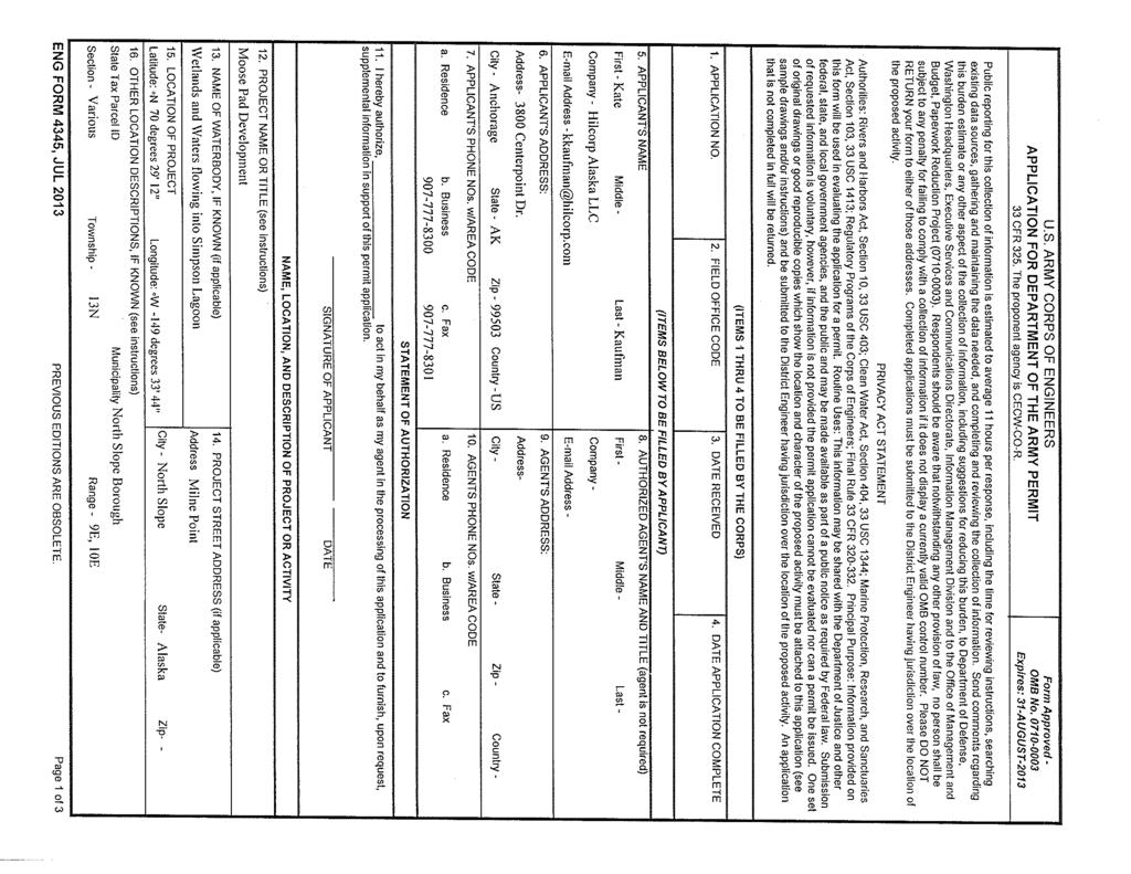
12 Project Description Moose Pad Development 1.0 INTRODUCTION The Schrader Bluff reservoir on the North Slope is estimated to contain 10 to 20 billion barrels of oil reserves. Hilcorp Alaska, LLC (Hilcorp) plans to expand oil resource development within the Milne Point Unit (MPU) Schrader Bluff reservoir by constructing a new pad and corresponding access road. In addition, Hilcorp plans to expand the existing pipeline, electrical, and communication in the western portion of MPU to accommodate additional future oil production. The proposed new pad (Moose Pad) will provide Hilcorp access to approximately 7 square miles of undeveloped oil reserves within the MPU. Initial development plans for Moose Pad will include approximately 44 new wells to be developed using directional drilling technology. To increase the amount of crude oil that can be extracted from the Schrader Bluff reservoir, the new wells will include both oil production wells and enhanced oil recovery (EOR) injection wells. 2.0 PROJECT DESCRIPTION The Moose Pad Development Project will occur within the MPU lease area at Alaska Division of Lands (ADLs) , , MPU is currently operated by Hilcorp and ownership is divided between Hilcorp (50%) and BP Alaska, Inc. (BPXA) (50%). The Moose Pad Development Project will involve the construction of Moose Pad and an access road located on the west side of Milne Point Road (Figure 1). To support new oil production wells on Moose Pad, an oil production pipeline, a small tie-in pad, and new pad infrastructure will also be installed. A total of 266,550 cubic yards of gravel fill into acres of footprint (30.43 acres of wetlands and 4.40 acres of uplands) is anticipated to be placed for all components of the project. Additional details for each of the Moose Pad Development Project components are described in this section Moose Pad As shown in the attached Figure 1, the approximate location for the proposed Moose Pad will be within Sections 13 and 14, Township 13 North, Range 9 East, Umiat Meridian, Alaska with an approximate pad center at latitude N and longitude W (NAD83). The exact location of Moose Pad and the access road will be dependent on the results of environmental and topographical evaluations. The Moose Pad footprint will be approximately 1,500 ft. long by 500 ft wide at the base, and 1,480 ft. by 480 ft. at the top (17.22 acres) requiring approximately 140,000 cubic yards (Cu yd) of gravel fill. Initial plans for Moose Pad include drilling approximately 44 new wells with a well layout similar to the existing well layout on MPU H Pad. The orientation for Moose Pad is proposed to be in an east-west direction to correspond with the prevailing winds in the area. This orientation will greatly facilitate snow removal on the pad during winter months Access Road An access road will be constructed to connect Moose Pad to the existing Milne Point Road between MPU C Pad and L Pad. The proposed access road will be located within Sections 17 and 18, Township 13 North, Range 10 East, Umiat Meridian, and Section 13, Township 13 North, Range 9 East, Umiat Meridian, Alaska. Long-term field personnel interviews, historical photos, and field verification have determined an area of previously disturbed tundra in the vicinity of the Moose Pad Development Project. This area, known as Tractor Tracks consists of 4.4 acres of uplands complex, which will be used for the Page 1 August 2016
13 Project Description Moose Pad Development access road footprint to the maximum extent practicable to minimize impacts on intact wetlands. The final route for the access road will be determined following a complete review of available environmental and topographical data. The proposed access road footprint is estimated to be approximately 2.83 miles (14,980 feet) long and 35 ft. wide at the top and 55 ft. wide at the base (17.20 acre total footprint). Within the proposed acre access road footprint, 4.40 acres of uplands tractor tracks have been identified, leaving acres of wetlands to be filled during access road construction. Construction of the access road is estimated to require approximately 125,000 Cu yd of gravel fill. Specific road design characteristics will be determined once a final route is determined however; a typical road design cross section is provided in Figure 3a. The Moose Pad will be tied into existing power and communication sources in MPU by installing power and fiber optic cables within the bed of the access road. In addition, to avoid disrupting the natural drainage and to allow fish passage, culverts will be sized accordingly and installed within the roadbed. To provide for fish passage at stream crossings, culverts will be designed based on recommendations of a consulting hydrologist and Alaska Department of Fish and Game personnel. A typical design for culvert installation in a roadway is shown in Figure 3b Pipelines and Tie-In Pad Development of the Schrader Bluff reservoir at Moose Pad will require the addition of a new oil production pipeline to transport 3-phase flow back to the Central Facilities Pad (CFP). The new pipeline will be installed adjacent the access road to the maximum extent practicable to facilitate future pipeline maintenance and inspection activities. The new oil production pipeline will be installed on vertical support members (VSMs) designed similar to the existing VSMs along Milne Point Road. The typical design for the VSMs is shown in Figure 3c. Pipeline VSM installation is anticipated to cover approximately 0.05 acres of footprint and utilize an additional 50 Cu yds. of gravel fill. The new oil production pipeline will transition from VSMs to a buried pipeline to cross the Milne Point Road and will return to VSMs to tie into the common carrier pipeline on the east side of Milne Point Road. At this time, water or gas injection pipelines are not anticipated to be required at Moose Pad. The new oil production pipeline will require the addition of a small tie-in pad to allow access to the pigging equipment. This new tie-in pad will be approximately 50 ft. by 140 ft. at the top and 60 ft. by 160 ft. at the base (0.36 acres) 2:1 side slopes, and is estimated to require approximately 1500 Cu yd of gravel fill. The final location of the tie-in pad will be dependent on the final routes selected for the access road and oil production pipeline. Current plans indicate the tie-in pad will likely be constructed at the intersection of Milne Point Road and the proposed Moose Pad access road. A pig launcher building approximately 10 ft. by 30 ft. (300 sqft.) will be constructed at the tie-in pad to facilitate pigging operations at the pipeline intersection. Power and fiber optic cables installed within the access road bed will also tie into existing MPU power and communication systems at the tie-in pad Moose Pad Infrastructure The Moose Pad Development Project will require specific infrastructure to be installed on the pad including: a test separator building, a pig launcher building, and an electric submersible pump (ESP) drive building. In addition, future operations at Moose Pad are anticipated to require two water source wells to support the EOR injection wells. Water source wells will utilize canned pumps and will be permitted prior to drilling. At this time, a water disposal well is not anticipated for Moose Pad. Any liquid wastes generated at Moose Pad will be manifested and transported to an approved disposal facility in accordance with the Alaska Waste Disposal and Reuse Guide, also referred to as the Red Book. Page 2 August 2016
14 Project Description Moose Pad Development 3.0 PROJECT CONSTRUCTION AND OPERATIONS Construction of the Moose Pad Development will include the construction of an ice road, installation of the oil production pipeline and placement of gravel fill. Hilcorp proposes to utilize standard winter construction techniques for the North Slope. Additional details for each of these construction and operational components are described in this section Ice Road Access to the Moose Pad Development area will require the construction of an approximately 1.5 mile long ice road from the Ugnu/E-Pit Mine Site to the Moose Pad Project location, and then approximately 2.83 miles long alongside the proposed access road corridor. The ice road will be utilized to protect the tundra from truck and equipment traffic during access road construction. The timing for the construction of the ice road will correspond with state and local approval for tundra travel which is determined using accumulated snowfall and soil temperature. The ice road will be constructed approximately 12 thick (or deemed sufficient to protect the underlying tundra), 50 wide. The proposed design for the ice road design is shown in Figure 3a. The oil production pipeline will be installed on VSMs using the ice road for access to the tundra. VSMs will be designed similar to those existing along Milne Point Road and will be set in a sand slurry. Cuttings will be removed and hauled to an approved disposal site or utilized in the sand/water slurry for VSM setting. Water sources used for ice road construction and pipeline hydrotesting will be obtained from nearby permitted tundra lakes and ponds. Snow will be prepacked to establish travel corridors to and from water sources as well as alongside the proposed access road route. Additional snow required will be stockpiled from surrounding lakes and utilized as needed Gravel Placement The Moose Pad Development project will require approximately 266,550 Cu yd. of gravel which will be obtained from the Ugnu/E-Pit Mine Site under the existing Material Sale Contract with the Alaska Department of Natural Resources, Division of Mining Land and Water. If for any reason, material sources are not available, Hilcorp will utilize material from the Milne Point Mine Site as a secondary option. Hilcorp will begin mining operations at the Ugnu/E-Pit Mine Site during ice road construction operations in preparation for gravel placement following ice road completion. Mining operations at the Milne Point Mine Site may include blasting during winter months. Gravel will be placed with a minimum compacted depth of 5 feet (ft) and will utilize a 2:1 edge slope. Culverts will be installed ahead of the road construction crews and using the ice road for access. Construction of the first ¼ mile of the access road may begin prior to the completion of the ice road. Trucks hauling and placing gravel fill material will begin placing gravel fill from the Milne Point Road and continue moving outwards as new material is placed and compacted. Dozers and sheep s foot rollers will be used to grade the material in 1.5 ft 2 ft lifts and compact material prior to truck access. Trucks hauling gravel fill material and additional support equipment will require additional space to turnaround after the initial ¼ mile of the access road is constructed. Construction activities will be coordinated to allow trucks and equipment to begin using the ice road to turnaround once the ice road reaches its full thickness. Page 3 August 2016
15 Project Description Moose Pad Development Gravel fill material will be compacted at the time of placement. Because construction activities will be occurring during winter months, the road bed and pad surface will be excavated and re-compacted during the summer months to ensure adequate compaction Construction Quantities The following table summarizes estimated construction footprint and fill quantities to wetlands and uplands for the Moose Pad Development Project: Project Component Total Footprint (acres) Wetlands Footprint (acres) Uplands Footprint (acres) Total Fill (Cu yds.) Wetlands Fill (Cu yds.) Uplands Fill (Cu yds.) Moose Pad , ,000 0 Access Road ,000 95,000 30,0000 Tie-In Pad ,500 1,500 0 Pipeline VSM s Totals , ,550 30,000 Note: All footprints and gravel quantities are estimated, and represent the most accurate information available for project planning purposes. Actual footprints and volume quantities may vary slightly based on local topography, gravel source quality, and compaction, as well as various other environmental and physical factors present during the extraction and installation of gravel resources General Operations during Construction During construction, existing facilities and infrastructure at MPU will be used for housing of construction crews and for mobilizing/transporting materials, supplies, and other equipment. Communications from the site during construction operations would be by radio and/or cellular phone. Portable toilets will be provided on site for construction workers. No food waste or other material that could attract wildlife will be stored at the site. Any C&D or MSW wastes generated on site will be bagged up and hauled to the North Slope Borough waste disposal facility on a regular basis. Any fuel tanks and/or generators utilized at the construction site would be located and contained within a bermed, lined, impermeable area sufficient to contain 110 percent of the largest tank capacity. The fuel storage capacity would be that required to meet daily operational and bulk re-supply needs during construction activities. During winter months, drifting snow will be cleared as needed on the pad location or as weather permits. Snow will be removed from the pad to the nearest available area permitted for snow storage. Page 4 August 2016
16 Project Description Moose Pad Development 4.0 PROJECT SCHEDULE Hilcorp plans to submit the permit application package to agencies in August Following agency approval, ice road construction and mining operations are anticipated to begin December 15, Pad and access road construction would follow ice road construction and would begin approximately January 15, Pad and access road construction is anticipated to take approximately three months to complete. Following spring thaw, the pad surface and road bed will be excavated and re-compacted during the month of July Pad infrastructure will be in installed following pad completion. 5.0 AUTHORIZATIONS ANTICIPATED Hilcorp will conduct the required environmental studies and obtain the appropriate approvals prior to beginning construction. The following authorizations are anticipated: AGENCY PERMIT STATUS USACE Section 404 USEPA SPCC Plan To be revised USFWS ADNR Division of Oil and Gas ADNR Division of Mining, Land, and Water Endangered Species Act Section 7 Consultation Letter of Authorization Unit/Lease Operations Approval Plan of Development Material Sales Contract / Mining and Rehabilitation Plan Miscellaneous Land Use Permit Alaska Pollutant Discharge Elimination System (APDES) Permit Temporary Water Use Permit / Water Rights Existing / Existing To be revised Existing ADNR State Historical Preservation Office Tundra Travel / Ice Road Construction General Permit Archaeological Clearance Existing ADFG Title 16 Fish Habitat Permit ADEC NSB Oil Discharge Prevention and Contingency Plan Certificate of Reasonable Assurance Water Quality Certification- Concurrent with 404 Development Permit Ice Road Construction Permit Form 600 Form 500 To be revised Existing Page 5 August 2016
17 Project Description Moose Pad Development This page intentionally left blank.
18 Project Description Moose Pad Development FIGURES
19 Leavitt Island r Spy Islands Pingok Island C h u k c h i S e a Wainwright! Barrow Jones Islands! B e a u f o r t S e a Nuiqsut!!! Deadhorse Kaktovik! Map Extent Bertoncini Island NW MILNE 1 S i m p s o n L a g o o n Milne Point Oliktok Point NIKAITCHUK OPP MPU-F Kavearak Point KRU-3R MPU-L N o Po MPU-C NIKAITCHUQ OC OLIKTOK CAMP i n t Creek MPU-D KRU-3Q KRU-3O U g n u r a v i k R i v MPU-A MPU-B e r MPU CFP KRU-O2-OB1 MINE SITE E MPU-E MPU MINE SITE Project Area Facility Primary Road Pipeline VICINITY MAP Moose Pad USACE Permit NAD83, Alaska State Plane Zone 4 SCALE: Miles FIGURE: AES-RTS: mxd, 08/10/16 1
 Access")

20 Pad width = 500' at base (including shoulder) Access Road width = 55' at base Pad length = 1500' at base (including shoulder)


21 Access Road width = 55' at base


22 Access Road width = 55' at base


23 Access Road width = 55' at base


24 Tie In Pad width = 60' wide x 160' long at base Access Road width = 55' at base
25 ~5' Drivable Access Road Width 30' Proposed Access Road Cross Section 4" Thick Pit Run of Max. 6" Rock Fill Geotextile Liner Ice Road Width 50' Proposed Ice Road Cross Section Grade Fig Typical Road, Culvert, and VSM Design Pipeline at Anchor/Saddle Cross Beam Vertical Support Member (VSM) Figure a: Typical Road Design Cross Sections Figure b: Typical Culvert Installation Design Figure c: Typical VSM Design
26 Fig Typical Pad Design Working Pad Width 480 Figure 3d: Typical Pad Cross Section
27
State of Alaska Department of Natural Resources Division of Mining, Land and Water Northern Regional Office. Preliminary Finding and Decision
 Proposed Action State of Alaska Department of Natural Resources Division of Mining, Land and Water Northern Regional Office Preliminary Finding and Decision ADL 416092 Designated Material Site Milne Point
DRAFT GREATER MOOSES TOOTH TWO (GMT2) DEVELOPMENT PROJECT PERMITTEE RESPONSIBLE WETLANDS MITIGATION PLAN NATIONAL PETROLEUM RESERVE-ALASKA
 DEVELOPMENT PROJECT PERMITTEE RESPONSIBLE WETLANDS MITIGATION PLAN NATIONAL PETROLEUM RESERVE-ALASKA") DRAFT GREATER MOOSES TOOTH TWO (GMT2) DEVELOPMENT PROJECT PERMITTEE RESPONSIBLE WETLANDS MITIGATION PLAN NATIONAL PETROLEUM RESERVE-ALASKA Prepared for: ConocoPhillips Alaska, Inc. Anchorage, AK March
DRAFT GREATER MOOSES TOOTH TWO (GMT2) DEVELOPMENT PROJECT PERMITTEE RESPONSIBLE WETLANDS MITIGATION PLAN NATIONAL PETROLEUM RESERVE-ALASKA Prepared for: ConocoPhillips Alaska, Inc. Anchorage, AK March
State of Alaska Department of Natural Resources Division of Mining, Land and Water Northern Regional Office. Preliminary Finding and Decision
 State of Alaska Department of Natural Resources Division of Mining, Land and Water Northern Regional Office Preliminary Finding and Decision ADL 416073 Designated Material Site: Mine Site C ADL 420290
Department of the Army Permit Application
 Department of the Army Permit Application DA File Number U.S. Army Corps of Engineers Honolulu District Date Received by CEPOH-RO Send Completed Application to: Honolulu District, U.S. Army Corps of Engineers
PROJECT DESCRIPTION KUPARUK RIVER UNIT KUPARUK CONSTRUCTION SERVICES PAD EXPANSION NORTH
 PROJECT DESCRIPTION KUPARUK RIVER UNIT KUPARUK CONSTRUCTION SERVICES PAD EXPANSION NORTH ConocoPhillips Alaska, Inc. 700 G Street Anchorage, AK 99501 September 29, 2015 This page intentionally left blank
Overview of Permitting Framework Alaska North Slope Oil and Gas Activities
 Overview of Permitting Framework Alaska North Slope Oil and Gas Activities Karen Wuestenfeld Regulatory Compliance and Environmental Manager BP Exploration (Alaska) Inc. January 6, 2011 Objectives and
NOTICE OF PREPARATION
 NOTICE OF PREPARATION Date: June 12, 2014 To: From: Subject: Governor s Office of Planning and Research/State Clearinghouse Unit, Responsible Agencies, Trustee Agencies, and Interested Parties Announcement
GUIDE TO THE DEVELOPMENT OF A MINING AND RECLAMATION PLAN IN NEW BRUNSWICK
 PROVINCE OF NEW BRUNSWICK DEPARTMENT OF ENERGY AND RESOURCE DEVELOPMENT Minerals and Petroleum Development Branch GUIDE TO THE DEVELOPMENT OF A MINING AND RECLAMATION PLAN IN NEW BRUNSWICK Guide to the
Revised by BP Exploration (Alaska) Inc. 16 April2014
 Inc. 16 April2014") MINING AND REHABILITATION PLAN PUT 23 GRAVEL MINE SITE PRUDHOE BAY UNIT, ALASKA as required by Material Sale Contract ADL 417964 USACE Permit No. POA-1984-454-0, Beaufort Sea 173 Revised by BP Exploration
MINING AND REHABILITATION PLAN PUT 23 GRAVEL MINE SITE PRUDHOE BAY UNIT, ALASKA as required by Material Sale Contract ADL 417964 USACE Permit No. POA-1984-454-0, Beaufort Sea 173 Revised by BP Exploration
Appendix D - Evaluation of Interim Solutions
 Appendix D - Evaluation of Interim Solutions D.1 Introduction The implementation of long-term improvements is projected to take 5 to 8 years. To reduce the number of years of flooding impacts, the partner
Department of the Army. Record of Decision
 U.S. Army Corps of Engineers Alaska District Department of the Army APPLICANT: Exxon Mobil Corporation and PTE Pipeline LLC ACTIVITY: Point Thomson Development Project (PTP) APPLICATION NO.: POA-2001-1082-M1
Eska Creek Preliminary Feasibility Analysis
 Introduction Eska Creek Preliminary Feasibility Analysis This report examines the feasibility issues of energy and economics for a 1.8 MW hydroelectric project on Eska Creek (project). The Project is located
Public Notice of Application for Permit
 US Army Corps of Engineers Alaska District KENAI FIELD OFFICE Regulatory Division (1145) CEPOA-RD 44669 Sterling Highway, Suite B Soldotna, Alaska 99669-7915 Public Notice of Application for Permit PUBLIC
The Business of Oil & Gas in Alaska Joshua Kindred, Alaska Oil and Gas Association. November 12, 2015
 The Business of Oil & Gas in Alaska Joshua Kindred, Alaska Oil and Gas Association November 12, 2015 Brief History First discovery of commercial quantities of oil in Alaska (1902) Richfield discovered
Instructions for the South Pacific Division Nationwide Permit Pre- Construction Notification (PCN):
:") This PCN integrates the requirements of the U.S. Army Corps of Engineers (Corps) Nationwide Permit Program within the South Pacific Division (SPD), including the Albuquerque, Los Angeles, San Francisco,
This PCN integrates the requirements of the U.S. Army Corps of Engineers (Corps) Nationwide Permit Program within the South Pacific Division (SPD), including the Albuquerque, Los Angeles, San Francisco,
TECHNICAL MEMORANDUM
 FOR INTERNAL DISCUSSION PURPOSES ONLY TECHNICAL MEMORANDUM TO: Augusta Resource Corp. ATTENTION: Jamie Sturgess FROM: Troy Meyer Project Manager, Vector Colorado LLC (Vector) DATE: June 5, 2006 SUBJECT:
ENVIRONMENT ACT TERMS OF REFERENCE NOVA SCOTIA DEPARTMENT OF TRANSPORTATION AND PUBLIC WORKS. Beaver Bank Bypass
 ENVIRONMENT ACT TERMS OF REFERENCE NOVA SCOTIA DEPARTMENT OF TRANSPORTATION AND PUBLIC WORKS Beaver Bank Bypass Highway 101 to the Beaver Bank Road Halifax County, NS NOVA SCOTIA DEPARTMENT OF THE ENVIRONMENT
SOUTH FLORIDA WATER MANAGEMENT DISTRICT. Question 13: Wetlands
 SOUTH FLORIDA WATER MANAGEMENT DISTRICT Question 13: Wetlands 1. The wetland responses and topographical data provided in the ADA for the 520- acre project site are conceptual in nature. The referenced
TABLE OF CONTENTS 4.17 UTILITIES AND SERVICE SYSTEMS...
 TABLE OF CONTENTS 4.17 UTILITIES AND SERVICE SYSTEMS... 4.17-1 4.17.0 Introduction... 4.17-1 4.17.1 Methodology... 4.17-2 4.17.2 Existing Conditions... 4.17-2 4.17.3 Impacts... 4.17-4 4.17.4 Applicant-Proposed
Cass County Soil Erosion & Sedimentation Control Program
 Cass County Soil Erosion & Sedimentation Control Program Both residents and visitors of Cass County enjoy the beauty of over 250 lakes and ponds, along with numerous streams, creeks, and wetlands that
Greenfield Pond B Rehabilitation
 Preliminary Investigation Report Centennial, Colorado November 15, 2011 Prepared for: Liverpool Metropolitan District Prepared by: Stantec Consulting Services, Inc. Table of Contents Executive Summary...
Closure Plan Ash Disposal Area PGE Boardman Power Plant
 FIRST ISSUE REVISION 0 Closure Plan Ash Disposal Area PGE Boardman Power Plant Prepared for Portland General Electric September 2015 2020 SW 4th Avenue, Suite 300 Portland, Oregon 97201 This document was
J O I N T P U B L I C N O T I C E
 J O I N T P U B L I C N O T I C E CHARLESTON DISTRICT, CORPS OF ENGINEERS 69A Hagood Avenue Charleston, South Carolina 29403-5107 and the S.C. DEPARTMENT OF HEALTH AND ENVIRONMENTAL CONTROL Office of Environmental
Chapter MINERAL EXTRACTION AND MINING OPERATIONS
 Chapter 17.31 MINERAL EXTRACTION AND MINING OPERATIONS Sections: 17.31.010 Purpose 17.31.020 Procedure for Extraction and Rehabilitation Requests 17.31.030 Operation and Rehabilitation Standards for all
Application For Waste Regulation (Check all that apply)
") Environmental Protection and Growth Management Department ENVIRONMENTAL ENGINEERING AND PERMITTING DIVISION 1 North University Drive, Mailbox #201 Plantation, Florida 33324 954-519-1483 FAX 954-519-1412
Environmental Protection and Growth Management Department ENVIRONMENTAL ENGINEERING AND PERMITTING DIVISION 1 North University Drive, Mailbox #201 Plantation, Florida 33324 954-519-1483 FAX 954-519-1412
Chapter 3 Affected Environment and Environmental Consequences
 Sterling Highway MP 45 60 Draft SEIS and Draft Section 4(f) Evaluation Chapter 3 Affected Environment and Environmental Consequences Prepared for: Alaska Department of Transportation and Public Facilities
Application for Gas Exploration and Production
 1800 Washington Blvd. Suite 655 Baltimore Maryland 21230 Application for Gas Exploration and Production This application is to be used to obtain a permit to Drill and Operate a well, within the State for
WETLANDS AND OPEN WATERS Compensatory Mitigation Definitions of Factors
 Adverse effects as used in this section of the SOP means any adverse ecological effect on wetlands or areas of open water. Those effects, or impacts, include filling, excavating, flooding, draining, clearing,
Environmental Review Standards for OHTF Funded Projects
 Environmental Review Standards for OHTF Funded Projects Updated May 1, 2017 ENVIRONMENTAL REVIEW STANDARDS FOR OHTF FUNDED PROJECTS Contents Environmental Review Standards... 1 OHTF Funded Projects...
Information for File # PRH
 Information for File # 2016-02602-PRH Applicant Corps Contact Tom Morley Paul Hauser Address 152 Baker Drive, Redwood Falls, MN 56283 E-Mail Paul.R.Hauser@usace.army.mil Phone 651-290-5357 Primary County
Construct and Operate a Rail Line Between North Pole, Alaska and Delta Junction, Alaska
 February 2, 2009 Reply To Attn Of: ETPA-088 Ref: 05-063-STB Mr. David Navecky STB Finance Docket No. 34658 Surface Transportation Board 395 E Street S.W. Washington, DC 20423-0001 Dear Mr. Navecky: The
June 1, Dear Mr. Simpson:
 10 Main Street Suite 321 New Paltz, NY 12561 T 845.255.0210 F 845.256.8110 www.willinghamengineering.com 1 June 1, 2016 Mr. Philip T. Simpson Robinson Brog Leinwand Greene Genovese & Gluck, P.C. 875 Third
SACHSE EROSION CONTROL GUIDELINES
 SACHSE EROSION CONTROL GUIDELINES Section I. Definitions The following words, terms, and phrases, when used in this guideline, shall have the meanings ascribed to them in this Section, except where the
Holly Swartz and Jason Shirey
 Chapter 105 General Permits for Stream and Wetland Impacts DEP Ch. 105 CONTACTS FOR BERKS COUNTY: Holly Swartz and Jason Shirey What DEP Regulates Under Chapter 105 Waters of the Commonwealth, which includes
Mill Creek (HHEI)
") Section 401 OEPA Water Quality Certification Application TRU-534-24.32 Transportation Improvements Project PID 23967 2-Aug-12 401 Table A Streams Affected by the Proposed Project Stream STA Description
Section 401 OEPA Water Quality Certification Application TRU-534-24.32 Transportation Improvements Project PID 23967 2-Aug-12 401 Table A Streams Affected by the Proposed Project Stream STA Description
Construction of Dariali HEPP. Reinstatement Plan
 Construction of Dariali HEPP Reinstatement Plan 2016 Table of Content 1. Introduction... 3 2. Site Clean-up... 4 3. Headwork Site Reinstatement... 4 4. Reinstatement Of The Pipeline Corridor.9 5. Cable
Nationwide Permit General Conditions
 Nationwide Permit General Conditions Note: To qualify for NWP authorization, the prospective permittee must comply with the following general conditions, as applicable, in addition to any regional or case-specific
Notice No Closing Date: May 12, 2017
 Public Notice U.S. Army Corps of Engineers Pittsburgh District In Reply Refer to Notice No. below US Army Corps of Engineers, Pittsburgh District 1000 Liberty Avenue Pittsburgh, PA 15222-4186 Application
Environmental Information Worksheet
 Environmental Information Worksheet Water System Owner (Attach additional sheets if necessary) Needs and Alternatives Provide a brief narrative that describes: Current drinking water system needs. Project
Information for File #MVP MVM
 Information for File #MVP-2015-04077-MVM Applicant: Preferred Properties and Management, LLC Corps Contact: Marissa Merriman Address: 180 Fifth Street East, Suite 700, St. Paul, Minnesota 55101-1678 E-Mail:
CITY OF ASTORIA PUBLIC WORKS ENGINEERING DIVISION ENGINEERING DESIGN STANDARDS FOR IN-FILL DEVELOPMENT
 CITY OF ASTORIA PUBLIC WORKS ENGINEERING DIVISION ENGINEERING DESIGN STANDARDS FOR IN-FILL DEVELOPMENT Adopted by City Council: May 21, 2007 X:\General Eng\DESIGN STANDARDS\Engineering Design Standards
Analysis of the City and Borough of Juneau Mining Ordinance. CBJ ; CBJ ; and October 12, 2017
 Analysis of the City and Borough of Juneau Mining Ordinance CBJ 49.65.110-195; CBJ 49.15.320; and 49.15.330 October 12, 2017 Prepared for the City and Borough of Juneau Municipal Attorney Prepared by Bob
GENERAL GUIDELINES FOR CONDUCTING THREATENED AND ENDANGERED SPECIES SURVEYS IN THE PINELANDS AREA. March 25, 2006 INTRODUCTION
 GENERAL GUIDELINES FOR CONDUCTING THREATENED AND ENDANGERED SPECIES SURVEYS IN THE PINELANDS AREA March 25, 2006 INTRODUCTION This document is intended to provide general guidance for use in conducting
Public Notice. Applicant: City of Dallas Project No.: SWF Date: April 18, Name: Chandler Peter Phone Number:
 Public Notice Applicant: City of Dallas Project No.: SWF- 2014-00151 Date: April 18, 2014 The purpose of this public notice is to inform you of a proposal for work in which you might be interested. It
(Instructions and explanations of bid items and sources of unit costs are provided on the back of this page.)
") CLOSURE COST ESTIMATE WORKSHEET FOR MSW LANDFILL FORM 1 OWNER: TOTAL PERMITTED AREA: AREA CURRENTLY OPEN: Total Volume of Site: LARGEST AREA TO EVER BE OPEN AT ANY TIME: (use this area for estimating closure
CLOSURE COST ESTIMATE WORKSHEET FOR MSW LANDFILL FORM 1 OWNER: TOTAL PERMITTED AREA: AREA CURRENTLY OPEN: Total Volume of Site: LARGEST AREA TO EVER BE OPEN AT ANY TIME: (use this area for estimating closure
ARTICLE 16 - WIND ENERGY CONVERSION FACILITIES
 ARTICLE 16 - WIND ENERGY CONVERSION FACILITIES SECTION 1601 Wind Energy Installation In any zoning district, a conditional use permit or building permit may be granted to allow a wind energy conversion
2015 ANNUAL ENGINEERING INSPECTION REPORT ENTERGY WHITE BLUFF PLANT CLASS 3N LANDFILL PERMIT NO S3N-R3 AFIN:
 2015 ANNUAL ENGINEERING INSPECTION REPORT ENTERGY WHITE BLUFF PLANT CLASS 3N LANDFILL PERMIT NO. 0199-S3N-R3 AFIN: 35-00110 JANUARY 15, 2016 ENTERGY WHITE BLUFF PLANT CLASS 3N LANDFILL 2015 ANNUAL ENGINEERING
Application Number: SP Project Name: Novo Nordisk Bright Sky Major Site Plan (acting as a Master Plan)
") STAFF REPORT Town of Clayton Staff Report Planning Department 111 E. Second Street, Clayton, NC 27520 P.O. Box 879, Clayton, NC 27528 Phone: 919-553-5002 Fax: 919-553-1720 Planning Board February 22, 2016
STAFF REPORT Town of Clayton Staff Report Planning Department 111 E. Second Street, Clayton, NC 27520 P.O. Box 879, Clayton, NC 27528 Phone: 919-553-5002 Fax: 919-553-1720 Planning Board February 22, 2016
Annex I Lyons Ferry Hatchery Modification Plan
 Annex I Lyons Ferry Hatchery Modification Plan Table I1 Figure I1 Figure I2 Figure I3 Figure I4 Figure I5 Well Characteristics Lyons Ferry Hatchery Vicinity Map Lyons Ferry Hatchery Site Plan Water Supply
7 Mineral and Energy Resources
 7 Mineral and Energy Resources This chapter examines Humboldt County s mineral (including sand and gravel extraction) and energy (oil, gas, and geothermal) resources. Existing General Plan policies and
Keefer Pasture Drift Fence Project. Challis-Yankee Fork Ranger District Salmon-Challis National Forest
 Keefer Pasture Drift Fence Project Challis-Yankee Fork Ranger District Salmon-Challis National Forest PROPOSED ACTION The Challis-Yankee Fork Ranger District proposes construction of approximately.11 miles
LAND USE APPLICATION - DIRECTOR Measure 49 Forest Zone Dwelling
 LAND MANAGEMENT DIVISION Date Received: LAND USE APPLICATION - DIRECTOR Measure 49 Forest Zone Dwelling PUBLIC WORKS DEPARTMENT 3050 N. DELTA HWY, EUGENE OR 97408 Planning: 682-3577 For Office Use Only:
Niagara Falls Storage Site Safety Measures During Remediation
 Niagara Falls Storage Site Safety Measures During Remediation On-Site Worker Protection Community and Environmental Protection Transportation and Disposal Safety Fully enclosed Retrieval Facility Regular
SP Old Florida Investment Resources, LLC SMR Aggregates SR 64 Borrow Pit (DTS # )
") H.O. 03/24/14 SP-14-01 Old Florida Investment Resources, LLC SMR Aggregates SR 64 Borrow Pit (DTS #201400001) Request: Approval of a Special Permit for major earthmoving in the A (General Agriculture)
H.O. 03/24/14 SP-14-01 Old Florida Investment Resources, LLC SMR Aggregates SR 64 Borrow Pit (DTS #201400001) Request: Approval of a Special Permit for major earthmoving in the A (General Agriculture)
RESIDENTIAL CONSTRUCTION New Dwellings and Additions
 How to Obtain a Building Permit For RESIDENTIAL CONSTRUCTION New Dwellings and Additions MIAMI COUNTY, KANSAS CODE SERVICES DEPARTMENT 201 South Pearl Street, Suite 201 Paola, Kansas 66071-1777 Phone:
is a possibility of the existence of permafrost as a result
 111.2 CERTAIN ASPECTS OF ALASKA DISTRICT ENGINEERS EXPERIENCE IN AREAS OF MARGINAL PERMAFROST E. L. Long In nearly twenty years of engineering and construction experience in Alaska, the Alaska District
Oil and Gas Fast Facts and Frequently Asked Questions February 19, 2013
 COMMUNITY DEVELOPMENT DEPARTMENT Oil and Gas Fast Facts and Frequently Asked Questions February 19, 2013 FACTS Property Rights and Interests Property rights: each tract of land contains a set of rights
MITIGATED NEGATIVE DECLARATION & MITIGATION MONITORING PROGRAM CITY OF CHICO PLANNING DIVISION
 MITIGATED NEGATIVE DECLARATION & MITIGATION MONITORING PROGRAM CITY OF CHICO PLANNING DIVISION Based upon the analysis and findings contained within the attached initial study, a mitigated negative declaration
2015 ANNUAL ENGINEERING INSPECTION REPORT ENTERGY INDEPENDENCE PLANT CLASS 3N LANDFILL PERMIT NO S3N-R2 AFIN:
 2015 ANNUAL ENGINEERING INSPECTION REPORT ENTERGY INDEPENDENCE PLANT CLASS 3N LANDFILL PERMIT NO. 0200-S3N-R2 AFIN: 32-00042 JANUARY 15, 2016 ENTERGY INDEPENDENCE PLANT CLASS 3N LANDFILL 2015 ANNUAL ENGINEERING
Environmental Assessment and Finding of No Significant Impact. Bethel Harbor Improvements Bethel, Alaska
 Environmental Assessment and Finding of No Significant Impact Bethel Harbor Improvements Bethel, Alaska February 2012 Prepared by the Alaska District, U.S. Army Corps of Engineers Finding of No Significant
SPECIFICATION FOR PIPE CULVERT CONSTRUCTION
 SPECIFICATION FOR PIPE CULVERT CONSTRUCTION 1. SCOPE Pipe culverts shall be constructed in accordance with this specification and in conformity with the lines, levels and cross-sections shown on the drawings.
CHAPTER 10: PAVING. Refer to page 548 of the 2016 Spec book or page 573 of the 2018 Spec book for material specifications under G.
 CHAPTER 10: PAVING AGGREGATE Aggregate has become more specific on how it is paid for. Therefore, make sure the plan specifies they type of aggregate to use. Spec 2118 Aggregate Surfacing - Aggregate placed
Nance County Zoning Regulations for Wind Energy Conversion Systems
 Nance County Zoning Regulations for Wind Energy Conversion Systems ARTICLE 1: SMALL / NON-COMMERCIAL WIND ENERGY SYSTEMS Section 1. Purpose It is the purpose of this regulation to promote safe, effective
Public Notice. Applicant: Lennar Homes Project No.: SWF Date: October 29, Name: Mr. Darvin Messer Phone Number:
 Public Notice Applicant: Lennar Homes Project No.: SWF-2013-00265 Date: October 29, 2013 The purpose of this public notice is to inform you of a proposal for work in which you might be interested. It is
BASE CONSTRUCTION MATERIALS A Aggregate
 BASE CONSTRUCTION 2211 AGGREGATE BASE 2211.1 DESCRIPTION This work consists of placing aggregate base. 2211.2 MATERIALS A Aggregate... 3138 Provide the class of aggregate as required by the contract. 2211.3
US Steel/Spirit Lake Sediment Cleanup Update for River Corridor Coalition
 US Steel/Spirit Lake Sediment Cleanup Update for River Corridor Coalition Erin Endsley, Project Manager Mike Bares, Technical Analyst Minnesota Pollution Control Agency August 26, 2015 Outline Site history
Design Considerations. Pursuing Dynamic Compaction. waste considered. Pursuing Dynamic Compaction. Page 1 of6
 Page 1 of6 waste considered. Pursuing Dynamic Compaction Waste Age Ali Khatami, Ph.D., Bruce Clark and Myles Clewner of SCS Engineers Fri, 2013-07-19 16:26 Rapid growth of development in metropolitan areas
(this cover page left intentionally blank)
") 4. Siting the Well (this cover page left intentionally blank) 4. Siting the Well Chapter Table of Contents Chapter Table of Contents Chapter Description... 4 Regulatory Requirements Well Siting... 4 Relevant
4. Siting the Well (this cover page left intentionally blank) 4. Siting the Well Chapter Table of Contents Chapter Table of Contents Chapter Description... 4 Regulatory Requirements Well Siting... 4 Relevant
Chapter 13: Wildlife and Vegetation
 Chapter 13: Wildlife and Vegetation Introduction and Setting Nevada County contains an extremely wide range of plants, animals and habitat types. With topographic elevations ranging from 300 feet in the
COMPENSATORY MITIGATION AND THE MITIGATION RULE. USACE, Jacksonville District
 COMPENSATORY MITIGATION AND THE MITIGATION RULE USACE, Jacksonville District US US Army Army Corps Corps of of Engineers Engineers BUILDING BUILDING STRONG STRONG What is Mitigation? Sequential process
Ingham County Drain Commissioner Patrick E. Lindemann 707 BUHL AVENUE P. O. BOX 220 MASON MI PH. (517) FAX (517)
 FAX (517)") Date Issued Ingham County Drain Commissioner Patrick E. Lindemann 707 BUHL AVENUE P. O. BOX 220 MASON MI 48854 PH. (517) 676-8395 FAX (517) 676-8364 APPLICATION FOR SOIL EROSION AND SEDIMENTATION POLLUTION
Date Issued Ingham County Drain Commissioner Patrick E. Lindemann 707 BUHL AVENUE P. O. BOX 220 MASON MI 48854 PH. (517) 676-8395 FAX (517) 676-8364 APPLICATION FOR SOIL EROSION AND SEDIMENTATION POLLUTION
Specifications for Asphaltic Paving of Clark Road in Salem Township and Ludlow Road in Union Township both in Champaign County, Ohio.
 Specifications for Asphaltic Paving of Clark Road in Salem Township and Ludlow Road in Union Township both in Champaign County, Ohio. General Conditions Scope: It is the intent of these specifications
Long-term Management Plan For The Mitigation Bank
 Note: The California multi-agency Project Delivery Team developed this general outline to assist in the development of the Long-term Management Plan for mitigation banks. Objectives and tasks are provided
Section SNOW DISPOSAL SITE DESIGN CRITERIA
 Section 2.150 SNOW DISPOSAL SITE DESIGN CRITERIA 2.150 A. Introduction Snow disposal sites provide storage areas for snowfall that exceeds the storage capacity of street rights-of-way and other public
DEPARTMENT OF ENVIRONMENTAL PROTECTION Bureau of Water Quality Protection. Design Criteria - Wetlands Replacement/Monitoring
 DEPARTMENT OF ENVIRONMENTAL PROTECTION Bureau of Water Quality Protection DOCUMENT NUMBER: 363-0300-001 TITLE: Design Criteria - Wetlands Replacement/Monitoring EFFECTIVE DATE: February 11, 1997 AUTHORITY:
NEW ENGLAND COUNCIL ON FOREST ENGINEERING CASE STUDY MARCH 6, 2012
 NEW ENGLAND COUNCIL ON FOREST ENGINEERING CASE STUDY MARCH 6, 2012 CONSTRUCTING A TEMPORARY ACCESS ROAD ACROSS AN ATLANTIC WHITE CEDAR ORGANIC BOG FOR THE PURPOSE OF MINING GRAVEL TEMPORARY BOG CROSSING
WILMINGTON DISTRICT US ARMY CORPS OF ENGINEERS REGULATORY DIVISION. US Army Corps of Engineers BUILDING STRONG
 WILMINGTON DISTRICT US ARMY CORPS OF ENGINEERS REGULATORY DIVISION US Army Corps of Engineers Organization The Wilmington District Regulatory Division consists of 4 field offices in Wilmington, Washington,
Public Notice ISSUED: June 29, 2017 EXPIRES: July 31, 2017
 SPONSOR: Gary Pestorious Public Notice ISSUED: June 29, 2017 EXPIRES: July 31, 2017 REFER TO: 2012-01634-DAS SECTION:404 - Clean Water Act 1. WETLAND COMPENSATORY MITIGATION BANK PROPOSAL: Pickerel Lake
I THOUGHT IT WAS JUST WET LAND: A GUIDE TO ENVIRONMENTAL PERMITTING FOR AIRPORTS ROAD SCHOOL 2018 SIMON DAVIES, SENIOR SCIENTIST MARCH 7, 2018
 I THOUGHT IT WAS JUST WET LAND: A GUIDE TO ENVIRONMENTAL PERMITTING FOR AIRPORTS ROAD SCHOOL 2018 SIMON DAVIES, SENIOR SCIENTIST MARCH 7, 2018 Definition Regulatory Definition - Those areas that are inundated
Constructed Wetland Pond T-8
 Constructed Wetland Pond T-8 Description A constructed wetlands pond is a shallow retention pond designed to permit the growth of wetland plants such as rushes, willows, and cattails. Constructed wetlands
Preliminary Decision Memo 2015 Recreation Residence Projects Odell Lake
 2015 Recreation Residence Projects Odell Lake USDA Forest Service Crescent Ranger District, Deschutes National Forest Klamath County, Oregon Background The Crescent Ranger District maintains 66 recreation
1. All underground utilities under railroad tracks shall be encased in a larger pipe or conduit called the casing pipe.
 MTS Jack and Bore Design Criteria Note: For the purposes of this Design Criteria and subsequent Construction Notes, the term Jack and Bore is used generically to refer to a number of trenchless construction
NEW CASTLE CONSERVATION DISTRICT. through. (Name of Municipality) PLAN REVIEW APPLICATION DRAINAGE, STORMWATER MANAGEMENT, EROSION & SEDIMENT CONTROL
 PLAN REVIEW APPLICATION DRAINAGE, STORMWATER MANAGEMENT, EROSION & SEDIMENT CONTROL") NEW CASTLE CONSERVATION DISTRICT through (Name of Municipality) PLAN REVIEW APPLICATION DRAINAGE, STORMWATER MANAGEMENT, EROSION & SEDIMENT CONTROL Office use only: Received by Municipality: Received by
NEW CASTLE CONSERVATION DISTRICT through (Name of Municipality) PLAN REVIEW APPLICATION DRAINAGE, STORMWATER MANAGEMENT, EROSION & SEDIMENT CONTROL Office use only: Received by Municipality: Received by
Project Alignment Appendix A
 Project Alignment Appendix A Fargo Moorhead Metropolitan Area Flood Risk Management Project EA Document This page is intentionally left blank Project Alignment Appendix A Table of Contents 1 BACKGROUND...
Master Development Plans (MDPs) / Geographic Area Plans (GAPS)
 / Geographic Area Plans (GAPS)") Master Development Plans (MDPs) / Geographic Area Plans (GAPS) COMPREHENSIVE PLANNING TOOLS FOR OIL AND GAS PROJECTS BUREAU OF LAND MANAGEMENT COLORADO RIVER VALLEY FIELD OFFICE (CRVFO) SILT, COLORADO
Master Development Plans (MDPs) / Geographic Area Plans (GAPS) COMPREHENSIVE PLANNING TOOLS FOR OIL AND GAS PROJECTS BUREAU OF LAND MANAGEMENT COLORADO RIVER VALLEY FIELD OFFICE (CRVFO) SILT, COLORADO
Operations Mine Site, Tote Road and Railway
 Operations Mine Site, Tote Road and Railway 2 Panel Members Michael Anderson Richard Cook John Binns Fernand Beaulac Steve Walker Mike Lepage Michael Sheahan 3 The Panel will address: FEIS Volumes 3, 5,
TECHNICAL CONTENT PROPOSED STEEP SLOPE REGULATION
 1 TECHNICAL CONTENT PROPOSED STEEP SLOPE REGULATION Draft 2/08/10 (Revised 02-14-11,Revised 02-21-11, Revised 03-03-11, Revised 04-19-11, Revised 04-20-11, Revised 05-05-11, Revised 05-09-11). DEFINITIONS
PERMEABLE INTERLOCKING PAVERS
 PERMEABLE INTERLOCKING PAVERS PART 1 - GENERAL 1.01 SECTION INCLUDES A. Subgrade Preparation B. Placement of Storage Aggregate C. Placement of Filter Aggregate D. Placement of Bedding Course E. Placement
VIRGINIA POLLUTION ABATEMENT PERMIT APPLICATION
 VIRGINIA POLLUTION ABATEMENT PERMIT APPLICATION FORM B ANIMAL WASTE Department of Environmental Quality VPA FORM B ANIMAL WASTE INSTRUCTIONS This form is to be completed by applicants requesting a VPA
JOINT PUBLIC NOTICE. April 14, 2014
 JOINT PUBLIC NOTICE April 14, 2014 United States Army State of Louisiana Corps of Engineers Department of Environmental Quality New Orleans District Attn: Water Quality Certification Regulatory Branch
ARTICLE XII RECREATIONAL VEHICLE PARK REGULATIONS
 ARTICLE XII RECREATIONAL VEHICLE PARK REGULATIONS ARTICLE XII RECREATIONAL VEHICLE PARK REGULATIONS Section 1201 Applicability For the purpose of this Article, recreation vehicles and recreational vehicle
Road Cards Appendix 2
 Appendix 2 Appendix 2 Introduction The following road cards are organized with new National Forest System (NFS) roads first, followed by reconstructed NFS roads second, and roads with bridge replacements
Blue Earth County Code
 Blue Earth County Code Sec. 114-116 Special Provisions (b) Agriculture use standards. (1)General cultivation farming, grazing, nurseries, horticulture, truck farming, sod farming and wild crop harvesting
Municipal Stormwater Ordinances Summary Table
 APPENDIX F Municipal Ordinances Summary Table Municipality Abington Bryn Athyn Borough Hatboro Borough Ordinance, SALDO Runoff equals pre post Erosion Sediment Control Water Quality Requirements Any which
Public Notice Charlestown Road New Albany, Indiana 47150
 Public Notice Public Notice No. Date: Closing Date: LRL-2014-408-teh Dec 25 2017 Jan 24 2018 Please address all comments and inquiries to: U.S. Army Corps of Engineers, Louisville District ATTN: Todd Hagman,
Erosion & Sedimentation Control Policy
 Issue Date 10/22/2010 Page 1 of 8 Erosion & Sedimentation Control Policy Introduction: Soil erosion is the removal of soil by water, wind, ice or gravity and sediment deposition occurs when the rate of
Lyon Creek Cedar Way Stormwater Detention Dam Operation and Maintenance Manual
 Lyon Creek Cedar Way Stormwater Detention Dam Operation and Maintenance Manual Prepared by: Mike Shaw Stormwater Program Manager City of Mountlake Terrace January 2010 Section I General Information This
TITLE 35 LEGISLATIVE RULES BUREAU OF ENVIRONMENT DIVISION OF ENVIRONMENTAL PROTECTION OFFICE OF OIL AND GAS
 TITLE 35 LEGISLATIVE RULES BUREAU OF ENVIRONMENT DIVISION OF ENVIRONMENTAL PROTECTION OFFICE OF OIL AND GAS SERIES 1 MISCELLANEOUS WATER POLLUTION CONTROL RULES 35-1. General. 1.1. Scope. -- This legislative
Table of Contents for Guide Specifications
 Table of Contents for Guide Specifications 01270A Measurement and Payment 01355A Environmental Protection 01356A Storm Water Pollution Prevention Measures 01421 Basic Storm Water Pollution Prevention Plan
CHAPTER 3 Environmental Guidelines for WATERCOURSE CROSSINGS GOVERNMENT OF NEWFOUNDLAND AND LABRADOR DEPARTMENT OF ENVIRONMENT AND LABOUR
 GOVERNMENT OF NEWFOUNDLAND AND LABRADOR DEPARTMENT OF ENVIRONMENT AND LABOUR CHAPTER 3 Environmental Guidelines for WATERCOURSE CROSSINGS WATER RESOURCES MANAGEMENT DIVISION Water Investigations Section