CHAPTER 12 RECREATION 12.1 ENVIRONMENTAL SETTING/AFFECTED ENVIRONMENT YUBA REGION
|
|
|
- Dwain Bates
- 5 years ago
- Views:
Transcription
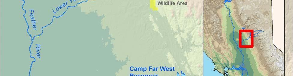
1 CHAPTER 12 RECREATION Wildlife viewing, fishing, waterfowl hunting, swimming, motor boating, rafting, sailing, and windsurfing are important water-enhanced or water-dependent recreational activities throughout California. The quality of recreation at lakes and reservoirs depends largely on surface water levels. Rafting and boating are popular activities that are often dependent on appropriate river flows and reservoir water levels for maximum enjoyment. Enjoyment of water-enhanced activities, such as picnicking and hiking, also can be related to water levels ENVIRONMENTAL SETTING/AFFECTED ENVIRONMENT Potential changes in reservoir water surface elevations and river flows could affect waterenhanced and water-dependant recreational activities such as boating, swimming, and fishing. al resources analyzed in the Yuba Region include water-enhanced and waterdependant recreation activities within the Yuba River Basin, including New Bullards Bar Reservoir, the North Yuba River downstream of New Bullards Bar Reservoir, Englebright Reservoir, areas along the lower Yuba River downstream of Englebright Reservoir to the confluence with the Feather River (Figure 2-1). The CVP/SWP waterways with recreational activities potentially influenced by altering facilities operation include the Sacramento River, Oroville Reservoir, the Feather River, the Delta and San Luis Reservoir. This section describes the existing recreational resources associated with surface water bodies and related facilities that provide water-related recreational opportunities within the four study area regions YUBA REGION Yuba County offers a variety of outdoor recreational opportunities but most of the recreation is water-oriented and includes boating, swimming, and fishing. Water-related and waterenhanced recreational resources in the Yuba Region include New Bullards Bar Reservoir, the North Yuba River between New Bullards Bar Reservoir and Englebright Reservoir, Englebright Reservoir, and the lower Yuba River from below Englebright Dam to the confluence with the Feather River. Hunting and wildlife viewing opportunities in this region are enhanced by natural or impounded shallow water areas that attract waterfowl. Ducks nesting along natural streams and other waterways is common. Large numbers of ducks and geese are observed in Yuba County during the fall and winter. Most of the organized waterfowl hunting clubs are north of Marysville in rice producing areas. Agricultural water supplies used to flood rice fields in Yuba County are administered through water contracts and conjunctive use agreements between YCWA and its Member Units (see Section in Chapter 5 for a full discussion). Public lands also provide access and recreational opportunities within the region (Figure 12-1). Draft EIR/EIS Page 12-1


2 Figure Public Lands that Provide al Opportunities Within the Yuba Region Draft EIR/EIS Page 12-2
3 NEW BULLARDS BAR RESERVOIR New Bullards Bar Reservoir is a YCWA-owned facility approximately 21 miles north of Nevada City, in historic gold country. The reservoir has a total storage volume of 960 TAF with a total surface area of 4,790 acres. on the reservoir is managed jointly between YCWA and the USDA, Tahoe National Forest. This reservoir is popular for boating, fishing, and camping from May through September. Over 20 miles of hiking and mountain biking trails exist in the area, including the Bullards Bar Trail, which runs along the perimeter of the reservoir. Several campgrounds, including Schoolhouse and Dark Day, are in the vicinity of the reservoir. Some campgrounds around the reservoir, such as Madrone Cove and Garden Point, are accessible by boat only (Figure 12-2). Emerald Cove Resort and Marina, located on the southern tip of New Bullards Bar Reservoir, has a general store, pumping station, launch ramp, boat rentals, moorage, and annual slips. Boat access to the reservoir is provided by the Cottage Creek boat ramp (at Emerald Cove Marina) and Dark Day boat ramp. Cottage Creek boat ramp is unusable when the reservoir level falls below 1,822 feet msl, and Dark Day boat ramp becomes inoperable when the reservoir level falls below 1,798 feet msl (Reclamation et al. 2003). Fish species found in the reservoir include rainbow trout, brown trout, Kokanee, bass, bluegill, crappie, and bullhead catfish. Some boat launching occurs year round; however, the typical boating season extends from about early May through mid-october. The greatest amount of boat ramp use occurs on weekends and holidays from Memorial Day to Labor Day (USFS 1999) LOWER YUBA RIVER The 24-mile long lower Yuba River extends from Englebright Dam to the Feather River confluence. Hiking and boating opportunities in the lower Yuba River are limited by poor access. Public river access in the 24-mile long lower Yuba River is available at Parks Bar approximately five miles northeast of Smartville, Sycamore Ranch near the Dry Creek and lower Yuba River confluence, and the Hallwood Avenue Access approximately five miles northeast of Marysville. Where access is available, fishing, picnicking, rafting, kayaking, tubing, and swimming are the dominant recreational uses. The lower Yuba River offers excellent American shad, Chinook salmon, and steelhead, smallmouth bass, and striped bass fishing CVP/SWP UPSTREAM OF THE DELTA REGION Major water-related recreation areas in the regional study area can be found at reservoirs, rivers, federal wildlife refuges, and state wildlife management areas (WMA) upstream of the Delta. Reservoirs offer recreationists many choices in destinations, settings, and activities. Oroville reservoir has boat launching facilities, day-use areas, and campgrounds. Oroville Reservoir has floating campsites, a feature unique among California state parks. Reservoirs and rivers upstream of the Delta provide habitat for both coldwater and warmwater fish. Anglers fish for striped bass, salmon, sturgeon, steelhead, trout, kokanee, black bass, crappie, bluegill, catfish, and others. CDFG publishes a fishing regulation booklet each year that summarizes the allowable fishing season, take limit, and other guidelines for each species. Fishing is popular year-round; however, the species caught may vary during different times of the year. According to CDFG, more than 2.2 million anglers purchase some type of fishing license each year. Draft EIR/EIS Page 12-3


4 Figure Public Access to al Opportunities at New Bullards Bar Reservoir Draft EIR/EIS Page 12-4
5 Many waterfowl hunting clubs are established on flooded rice fields during the winter because of the large number of ducks and geese that flock to the area to forage and nest. In 2001, approximately 45,000 hunter-visits to 11 sites within the area upstream of the Delta were reported by CDFG. Approximately two waterfowl (ducks, geese, or coots) were shot per hunter. Regulations vary by bird species; however, the hunting season generally extends from late October through January. Within the area upstream of the Delta, potential effects on recreational resources are focused on areas where the Proposed Project/Action and alternatives could alter water surface elevations within reservoirs or the timing and magnitude of reservoir releases, which could result in changes in river flows through the integrated operations of the CVP/SWP system including: Oroville Reservoir and the lower Feather River downstream from the Oroville Facilities to the confluence with the Sacramento River; FEATHER RIVER BASIN The Feather River Basin, which includes the Oroville Reservoir Complex, is an important recreational resource for Sutter, Butte and Yuba counties. These resources support a broad range of water-dependent and water-enhanced recreation opportunities, including reservoir and river facilities for boating, fishing, swimming, hunting, and camping. OROVILLE RESERVOIR Oroville Reservoir is the second largest reservoir in California and is a key component of the SWP. Oroville Reservoir, Thermalito Diversion Pool, Thermalito Forebay, Thermalito Afterbay, and the Oroville Wildlife Area all comprise the Oroville Reservoir Complex, which provides water, electrical power, and recreation. Oroville Reservoir has two full-service marinas and nine parks with facilities for baseball, tennis, swimming, and picnicking within the vicinity of the reservoir. The Oroville Reservoir State Area (SRA) provides camping, picnicking, boating, fishing, horseback riding, hiking, bicycling, sightseeing, and a variety of other activities. Major facilities in the Oroville SRA include Loafer Creek, Bidwell Canyon, Spillway, Lime Saddle, Oroville Reservoir Visitor Center, and North and South Thermalito Forebay (Figure 12-3). Only non-motorized boats are permitted on the North and South Forebays and the Diversion Pool. Additionally, the Area provides several lessdeveloped car-top launching areas, 84 boat-in campsites, and 10 floating campsites on Oroville Reservoir. Nearby, DWR maintains three launch ramps and a day-use area at the Oroville Wildlife Area, which includes the Thermalito Afterbay. The reported optimum range of surface water elevation for Oroville Reservoir recreation activities is between 850 and 950 feet above msl (DWR 2005). Oroville Reservoir is host to several bass fishing tournaments throughout the year and is reported to have some of the best bass fishing in California. Other fish species found in the reservoir include coho salmon, rainbow trout, sturgeon, crappie, and blue gill. The Thermalito Forebay is stocked regularly with trout and the South and North Forebay are popular with shoreline anglers. Draft EIR/EIS Page 12-5


6 Figure Public Access to al Opportunities near the Oroville Reservoir Complex Draft EIR/EIS Page 12-6
7 Boat ramps on the reservoir become unusable when water surface elevations are 750 feet msl or lower. Average water surface elevation in Oroville Reservoir has historically been between 817 feet msl and 787 feet msl between July and September, respectively. Access to swimming beaches begins to decline when reservoir elevations drop below 800 feet msl (DWR 2005) due to increases in distances and slope. LOWER FEATHER RIVER Swimming, rafting, kayaking, fishing, camping, bird watching, picnicking, and bicycling are popular activities along the lower Feather River. The section of the Feather River between the Oroville Facilities Thermalito Diversion Dam and Thermalito Afterbay Outlet is commonly referred to as the Low Flow Channel of the Feather River. The Low Flow Channel runs through the City of Oroville and draws anglers, wildlife and birdwatchers, sightseers, hikers, and bicyclists to trails and access points. The Brad P. Freeman Trail runs beside the Feather River from the Thermalito Diversion Dam to Highway 162. This section of the Feather River is an important recreational resource for the residents of Oroville and nearby areas. Non-motorized boating on the lower Feather River occurs from the Low Flow Channel to the town of Gridley. The eight-mile river reach between the Fish Barrier Dam and the Thermalito Afterbay Outlet has some Class II rapids. Flows in this reach typically remain between 600 and 700 cfs. The eight-mile reach between the Thermalito Afterbay Outlet and Gridley is also the most heavily used boating and fishing reach in the lower Feather River from July to September (DWR 2004). Based on CDFG regulations, the river is open for fishing north of the Table Mountain Bicycle Bridge. In the spring and fall, salmon are known to congregate at the Thermalito Afterbay Outlet. In recent years, the Feather River has provided habitat for a reported 40,000 Chinook salmon in the spring and fall. Most anglers are drawn to the Oroville Wildlife Area, and the Feather River Fish Hatchery, operated by CDFG located at the upper end of the Low Flow Channel immediately downstream of the Fish Barrier Dam. The hatchery has interpretive displays related to salmon and trout, and seasonally provides a unique opportunity for visitors to watch fish ascend the fish ladder to the hatchery through underwater windows. Downstream from the Thermalito Afterbay Outlet, the river continues through the Oroville Wildlife Area. The Oroville Wildlife Area provides opportunities for bird watching, in-season hunting, fishing, swimming, and camping. Minimum flow requirements for the lower Feather River are regulated by a 1983 agreement between CDFG and DWR, which specifies that a minimum of 600 cfs is released into the river from the Thermalito Diversion Dam for fisheries purposes. Instream flow requirements below the Thermalito Afterbay are generally 1,000 cfs from April through September (based on the 1983 agreement between CDFG and DWR). However, flow requirements may be adjusted based on April through July runoff volumes. Generally flows in the reach are higher than the minimum requirements SACRAMENTO RIVER BASIN The Sacramento River and major upstream reservoirs are important recreational resources in the Central Valley. These resources support a broad range of water-dependent and waterenhanced recreation opportunities, including reservoir and river facilities for boating, fishing, swimming, hunting, and camping. Draft EIR/EIS Page 12-7
8 SACRAMENTO RIVER Fishing, rafting, canoeing, kayaking, swimming, and boating are popular activities along most reaches of the Sacramento River. Whitewater rafting and other boating-type recreational activities are generally seasonal and are dependent on river flows. Additional recreational activities along the Sacramento River include hiking, wildlife viewing, and camping. Between Colusa and Sacramento, major recreational facilities exist at the Colusa-Sacramento River SRA, Colusa Weir access, Tisdale Weir access, River Bend Boating Facility, Knights Landing, Sacramento Bypass, and Elkhorn Boating Facility. The Colusa-Sacramento River SRA provides 60 acres of riverfront recreation near the City of Colusa and contains the only public boat launch and landing facility in Colusa County. The park is at the north end of town where the river makes a wide easterly bend. Its key features are boat ramps, picnic sites, nature trails, and campsites. The river s width at the park provides room for a variety of water-based activities, including fishing, boating, and waterskiing. The dynamic nature of the river has lengthened the channel leading from the boat ramp to the river over time and in the process deposited sediment in the channel. The build-up of sediment is to the point that the boat ramp becomes unusable as seasonal decreases in river flows occur at the end of the summer season (EDAW 2003). Wildlife refuges along the Sacramento River provide fishing, hunting, and wildlife viewing opportunities. These refuges include the Sacramento, Colusa, Sutter, and Delevan National Wildlife Refuges (NWR) and Gray Lodge WMA, which is the most popular of the five refuges in the region. Non-consumptive (photography and hiking) and consumptive (fishing and hunting) uses historically have been equally popular at the refuges, each accounting for approximately 50 percent of the total use with the exception of the Sutter and Delevan NWRs, which are used almost exclusively for hunting. Water supplies for certain wildlife refuges within the Central Valley are administered through CVPIA programs that acquire and convey water. Water for refuges is acquired through water supply contracts with willing sellers. 1 Any water acquired under the Proposed Project/Action or an alternative for refuge-related purposes would be used to help meet Reclamation s obligations under the CVPIA to provide Incremental Level 4 refuge water supply. Water supplies to wildlife refuges along the Sacramento River corridor would not be adversely affected, and would benefit from long-term water transfers to the CVP/SWP system implemented under the Proposed Project/Action (see Chapter 5 for a detailed description of water transfer programs and operations). As a recreational resource, the lower Sacramento River reach between the American River confluence and the Delta is closely associated with recreational use of Delta waterways due to the influence of tidal action. This lower reach of the river is a popular boating and fishing area 1 Environmental documentation has already been prepared that addresses the overall impacts of acquiring full Level 4 supplies at the refuges, the conveyance of water to the refuges, and use of water on the refuges. The overall impacts of implementing the CVPIA, including providing Level 4 water supplies to the refuges, were addressed in a Final Programmatic EIS/EIR (Reclamation and USFWS 1999) and environmental assessments/initial studies (EA/IS). These documents addressed both the conveyance of water to the Sacramento Valley and San Joaquin Valley Wildlife Refuges (Reclamation 1997a; Reclamation 1997b; Reclamation 1997d; Reclamation 1997c; Reclamation and CDFG 2003) and the use of water on these refuges (Reclamation 1997c; Reclamation et al. 2001a; Reclamation et al. 2001b; Reclamation and USFWS 2001). Therefore, the analysis in this EIR/EIS with respect to refuge water supplies is focused solely on the potential impacts of Reclamation acquiring water to help meet Incremental Level 4 refuge needs. Draft EIR/EIS Page 12-8
9 with dispersed public access, several private marinas, and extensive boat traffic, particularly in the summer DELTA REGION The Delta Region includes waterways in the Delta, including San Luis Reservoir. Because the reservoirs within the CVP/SWP system are operated in a coordinated manner to the various demands throughout California, changes in the timing and magnitude of exports from the Delta could indirectly result in changes to Delta flows and water surface elevations in San Luis Reservoir SACRAMENTO-SAN JOAQUIN DELTA Hunting, fishing, wildlife viewing, and water-based recreation such as boating, swimming, sailing, windsurfing and other activities are popular recreational activities throughout the Delta. The facilities available to boaters and other recreational users include marinas, city or county public access areas, hunting clubs, and yacht or waterskiing clubs. The increasing demand for Delta recreation opportunities spurred the state to establish Brannan Island SRA in 1965 and Franks Tract SRA in Popular areas also include the Sherman Island Wildlife Area, Twitchell Island, Franks Tract SRA, and the Clifton Court Forebay. Historically, year-round sport fishing from shore locations, piers, and boats has been a major activity in the Delta. According to the Delta Protection Commission (DPC), sportfishing tournaments are important recreational activities that contribute to the local economy. Important Delta sport fisheries include striped bass, shad, black bass, catfish, Chinook salmon, and steelhead. Most of the navigable waterways in the Delta are public, and most of the land is private. The lack of public lands limits the use of the Delta for recreation. Public use of the Delta is concentrated in a few areas where marinas and other facilities provide recreational opportunities and access to the Delta waterways, and at roadside areas where public roads are adjacent to the waterways. There are few public parks. Some of the recreation areas in the Delta are accessible only by boat, thus limiting shoreline fishing opportunities in the Delta. Popular access points for boating, waterskiing, and personal watercraft use include Windmill Cove near State Route (SR) 4; King Island; Paradise Point; Herman & Helen s near Eight Mile Road; Tower Park near SR 12; and Del s Boat Harbor near the City of Tracy. Houseboating also is concentrated along Eight Mile Road. Windsurfing, a popular sport in the Delta, typically occurs along SR 160 between Sherman Island and Rio Vista and at Windy Cove. Windy Cove is a new facility constructed at Brannan Island SRA and is the only formal windsurfing site in the area. Waterfowl and pheasant are hunted at WMAs including Grizzly Island, Joice Island, and Sherman Island, in addition to a variety of state cooperative hunting areas EXPORT SERVICE AREA SAN LUIS RESERVOIR San Luis Reservoir was constructed as a storage reservoir for the CVP/SWP for the purpose of storing water exports from the Delta that would otherwise flow into the Pacific Ocean. Water flows from the Delta through the California Aqueduct and the Delta-Mendota Canal to the O Neill Forebay, and is then pumped into the main reservoir primarily during the winter and Draft EIR/EIS Page 12-9
10 spring months. San Luis Reservoir is approximately nine miles long and five miles wide. San Luis Dam is located on the eastern end of the reservoir, the fourth largest embankment dam in the United States, which allows for a total water storage capacity of MAF making it the largest off-stream reservoir in the United States. During normal operations the reservoir is drawn down by 100 feet or more during the late-summer and early-fall (California State Parks Website 2003). San Luis Reservoir and O Neill Forebay provide for activities such as boating, waterskiing, fishing, camping, and picnicking. San Luis Reservoir is open year-round. Boat access is available in the Basalt area located in the southeastern portion of the reservoir and at Dinosaur Point in the northwestern portion of the reservoir. The usability of the Basalt boat ramp declines below reservoir elevations of 340 feet msl; and the Dinosaur Point boat ramp becomes difficult to access when the reservoir elevation is below 360 feet msl (USDOI et al. 1999). There are no designated swimming areas or beaches at San Luis Reservoir, but the O Neill Forebay provides opportunities for swimming, boating, fishing and camping REGULATORY SETTING FEDERAL NATIONAL WILD AND SCENIC RIVERS ACT The National Wild and Scenic Rivers System was established in 1968 with the enactment of PL (16 USC 1271 et seq.). Under this system, rivers possessing outstandingly remarkable scenic, recreational, geologic, fish and wildlife, historic, cultural, or other similar values may be designated as wild, scenic, or recreational. However, within the regions evaluated for this project, there are no designated rivers. CLEAN WATER ACT The CWA is aimed at restoring and maintaining the chemical, physical and biological integrity of the nation's waters (see Chapter 9). The act requires that due regard be given to improvements necessary to conserve waters for public water supplies, propagation of fish and aquatic life, agricultural and industrial uses and recreational purposes, including recreation in and on the water. Within the regions evaluated, recreational contact and non-contact beneficial uses are designated for the Sacramento, Feather and Yuba rivers, as well as the Delta. RECLAMATION CVPIA LEVEL 4 WILDLIFE REFUGE WATER PURCHASE PROGRAM Section 3406(d)(1) of the CVPIA 2, Title XXXIV of the Reclamation Projects Authorization and Adjustment Act of 1992 (PL ), requires the Secretary of the Interior (Secretary), immediately upon enactment, to provide firm delivery of Level 2 and 2/3 Full Habitat Development water supplies to the various refuges habitat areas identified in Reclamation's Refuge Water Supply Report. This report describes water needs and delivery requirements for each wetland habitat area to accomplish stated refuge management objectives. In the Refuge Water Supply Report, historical deliveries were termed Level 2, and the quantity of water 2 The CVPIA was signed into law on October 30, 1992, as Title XXXIV of PL The CVPIA mandated changes in CVP management, particularly to protect, restore, and enhance fish and wildlife. Draft EIR/EIS Page 12-10
11 needed to achieve full development was termed Level 4. Section 3406(d)(1) of the CVPIA requires the Secretary to provide firm delivery of Level 2 water supplies to each wildlife refuge in the Central Valley of California. Section 3406(d)(2) of the CVPIA further directs the Secretary to provide additional water supplies to meet Level 4 needs through the acquisition of water from willing sellers. The water to be acquired is known as Incremental Level 4 supplies. Incremental Level 4 supplies, when added to Level 2 supplies, make up full Level 4 supplies. The refuges specified in the CVPIA (see Table 12-1) are mainly located along the axes of the Sacramento and San Joaquin Valley. Table 12-1 Incremental Level 4 Contract Quantities at the Refuge Boundary Refuge Sacramento Valley 100% Incremental Level 4 Sacramento National Wildlife Reserve 3,600 Delevan National Wildlife Reserve 9,050 Sutter National Wildlife Reserve 6,500 Gray Lodge Wildlife Area 8,600 Subtotal 27,750 San Joaquin Valley San Luis National Wildlife Reserve Complex - West Bear Creek Unit 3,603 - East Bear Creek Unit 4,432 - Los Banos Wildlife Area 8,330 North Grasslands Wildlife Area Complex - China Island Unit 3,483 - Salt Slough Unit 3,340 Mendota Wildlife Area 2,056 Volta Wildlife Area 3,000 Grassland Resource Conservation District 55,000 Tulare Lake Basin Kern National Wildlife Reserve 15,050 Pixley National Wildlife Reserve 4,720 Subtotal 103,014 TOTAL 130,764 Recognizing the importance of recreational activities such as hunting and wildlife viewing, the CVPIA requires the Interior to acquire additional water supplies to meet optimal waterfowl habitat management needs at national wildlife refuges in California s Central Valley, certain state WMAs, and the Grassland Resource Conservation District (collectively know as refuges). The optimum water supply levels are referred to as Level 4. In recent years, acquired water to meet Level 4 needs have averaged between 70 to 80 TAF STATE STATE WILD AND SCENIC RIVERS ACT The State Wild and Scenic Rivers Act was passed by the California Legislature in 1972 (PRC Section et seq.). The Legislature declared that it was the state s intent that certain rivers which possess extraordinary scenic, recreation, fishery, or wildlife values shall be preserved in their free- Draft EIR/EIS Page 12-11
12 flowing state, together with their immediate environments, for the benefit and enjoyment of the people of the state. However, within the regions evaluated for this project, there are no designated rivers Delta Protection Act The state s 1992 Delta Protection Act designates the Delta Primary Zone 3 as an area to be protected from intrusion of nonagricultural uses (Section 29703a), and establishes the DPC. In 1995, the DPC adopted its Regional Plan, Land Use and Resource Management Plan for the Primary Zone of the Delta. With respect to recreation, the Delta Protection Act includes the following provisions: The state s basic goals for the Delta include the protection, maintenance and, where possible, the enhancement and restoration of the overall quality of the Delta environment including, but not limited to, agriculture, wildlife habitat and recreational activities (Section 29702). Wildlife and wildlife habitats in the Delta are valuable, unique and irreplaceable resources of critical statewide significance, and it is the policy of the state that they should be preserved and protected for the enjoyment of current and future generations (Section 29705). Agricultural, recreational, and other uses of the Delta can best be protected by implementing projects that protect wildlife habitat before conflicts arise (Section 29710). The waterways and marinas in the Delta offer recreational opportunities of statewide and local significance, and are a source of economic benefit to the region, and because of increased demand and use, public safety requirements will increase (Section 29702) LOCAL YUBA COUNTY GENERAL PLAN The Yuba River Restoration and Enhancement portion of the Yuba County General Plan (County of Yuba 1996) states that one of its primary goals is to Restore and enhance the Yuba River corridor for recreation and wildlife.through the development of a comprehensive and Wildlife Enhancement Plan for that portion of the Yuba River situated between Park s Bar Road and the City of Marysville ENVIRONMENTAL IMPACTS/ENVIRONMENTAL CONSEQUENCES River flows and reservoir water storage levels tend to be highest in late spring and early summer and taper off toward fall, somewhat reducing the quality or availability of waterdependant recreational activities such as rafting and boating in the late summer months. 3 "Primary Zone" is defined as the delta land and water area of primary state concern and statewide significance which is situated within the boundaries of the delta, as described in Section of the Water Code, but that is not within either the urban limit line or sphere of influence line of any local government's general plan or currently existing studies, as of January 1, The precise boundary lines of the primary zone includes the land and water areas as shown on the map titled "Delta Protection Zones" on file with the State Lands Commission. Where the boundary between the primary zone and secondary zone is a river, stream, channel, or waterway, the boundary line shall be the middle of that river, stream, channel, or waterway. (1992 Delta Protection Act Section 29728). Draft EIR/EIS Page 12-12
13 Water-based and water-enhanced activities are more popular during the summer months when the air temperature is warm; however, fishing and wildlife viewing are year-round activities. Under the alternatives considered in this EIR/EIS, modifications to water release patterns could result in hydrologic changes (i.e., changes in river flow patterns and fluctuations in reservoir water surface elevations) in the Yuba River Basin and possibly other CVP/SWP rivers and reservoirs within the regions described above. Potential impacts associated with the integrated operations of the Yuba River Basin could indirectly affect both reservoir water storage levels and river flows within the CVP/SWP system if surface water released from New Bullards Bar Reservoir were to be backed-up in Oroville Reservoir. For analytical purposes, modeling assumptions assume that backing-up of surface water could occur if YCWA was not able to transfer water to the CVP/SWP system because conditions were not balanced in the Delta, or if pumping capacity at the Jones or Banks pumping plants was limited. This type of integrated operation of the CVP/SWP system is governed by a series of operating rules which ensure that flood control storage targets in the reservoirs, and flow requirements downstream of the reservoirs, are not violated. (For a more detailed discussion of these operations, see Appendix D.) The assessment focuses on water-dependent (e.g., boating, swimming, angling) and waterenhanced (e.g., picnicking, birdwatching) recreation opportunities. Changes in reservoir storage and water surface elevations could affect recreational opportunities if boat ramps become unusable through implementation of one of the alternatives considered for the Proposed Yuba Accord, relative to the bases of comparison. Similarly, changes in river flows could affect public access and/or recreational opportunities such as angling and boating. Because of the nature of operations associated with implementing one of the alternatives (i.e., Yuba Accord Alternative, Modified Flow Alternative), there could be an increase in water transfers to the Delta through the EWA Program, which potentially could improve recreational conditions during some months and produce a beneficial effect on recreational resources in the Delta Region. For these reasons, the analysis for recreational resources relies upon both quantitative and qualitative methods to evaluate potential changes in the recreational use of regional facilities resulting from operational changes that could be expected to occur within the CVP/SWP and the Yuba River systems through implementation of the alternatives evaluated in this EIR/EIS. A description of the methodologies used to determine potential operationalrelated impacts to recreation resources is provided below IMPACT ASSESSMENT METHODOLOGY Reservoir water surface elevations and river flow changes were evaluated for potentially affected water bodies in the Yuba Region, the CVP/SWP Upstream of the Delta Region, the Delta Region, and the Export Service Area. Operational changes associated with surface water deliveries from the Yuba Region to the integrated CVP/SWP system under the Proposed Project/Action and alternatives may result in increases and decreases in river flows and reservoir storage volumes. al opportunities at reservoirs are affected if reservoir levels decline so much that boat ramps become unusable. Quantitative methods include consideration of thresholds at which recreational opportunities could potentially be affected (e.g., reservoir elevations at which boat ramps become unusable). Boat ramp usability is chosen as the impact indicator because it is a quantifiable measurement, and because lower reservoir levels would generally affect boat ramps prior to affecting other recreational activities (e.g., swimming or fishing). If boat ramps remain usable, it is assumed that there are sufficient water levels in the reservoir to sustain all Draft EIR/EIS Page 12-13
14 other recreational activities. In those cases where boat ramp usability is not a good indicator of ability to use other recreational facilities, a qualitative discussion follows. al opportunities in rivers are affected if river flow levels decline such that access to the river or whitewater rafting and other boating opportunities decline. Boating opportunities is chosen as an indicator of the ability of recreationists to utilize the river because if boating opportunities remain, then it is assumed that there are sufficient flows in the river to sustain all other recreational activities that could be limited due to limited access (i.e., swimming and fishing). In those cases where boating opportunities is not a good indicator of ability to use other recreational facilities, a qualitative discussion follows. Water-dependent recreation use is higher in May through September than in other months of the year, coincident with the warmer summer weather. Consequently, potential hydrologic changes resulting from the Proposed Project/Action and Alternatives during this period are important for evaluating potential impacts on recreational opportunities. Potential recreation impacts to regional water bodies were analyzed based on a comparison of reservoir water surface elevations and river flows under each of the alternatives evaluated in this EIR/EIS, relative to the bases of comparison, over the 72-year simulation period. Hydrologic modeling results were used to evaluate whether changes in the monthly average reservoir water surface elevations and river flows would be of sufficient frequency and magnitude to significantly affect public access and recreational opportunities on, or around these water bodies. The simulation comparisons conducted for each alternative are described in Chapter 4, and model template output supporting the analyses is presented in Appendix F IMPACT INDICATORS AND SIGNIFICANCE CRITERIA FOR RECREATION RESOURCES Impact indicators and significance criteria for recreational resources are presented in Table The impact indicators and significance criteria used to evaluate potential impacts on recreation resources are consistent with those presented in other relevant environmental documents (e.g., Water Forum Proposal (Water Forum 1999), CALFED EIS/EIR (CALFED 2000), the Oroville Preliminary Draft Environmental Assessment (2005)), and other federal, state, and local regulations and planning documents guiding recreational activities. Table 12-2 Impact Indicators and Significance Criteria for al Resources Impact Indicator Significance Criteria Yuba Region New Bullards Bar Reservoir A change in reservoir water surface elevation, relative to the basis of comparison, of sufficient magnitude and frequency to substantially decrease the availability use of boat ramps over the 72-year simulation Reservoir water surface elevations that period. determine boat ramp availability. New Bullards Bar Reservoir: Reservoir water surface elevations that determine public access to swimming beaches. Consistency with applicable regulations and planning documents, guiding recreation in the study area. When boat ramps are useable (1,798 feet msl or higher). A change in reservoir water surface elevation over the 72-year simulation period, relative to the basis of comparison, of sufficient magnitude and frequency to substantially decrease the availability or use of swimming beaches. A conflict or inconsistency with relevant policies, goals, or objectives (e.g., New Bullards Bar Reservoir Management Plan) guiding recreation activities in the Yuba River Basin. Draft EIR/EIS Page 12-14
15 Impact Indicator Lower Yuba River River flows that determine boating opportunities. Consistency with applicable regulations and planning documents, guiding recreation in the study area. Oroville Reservoir Reservoir water surface elevations that determine boat ramp availability. Reservoir water surface elevations that determine availability and optimum use of swimming beaches. Reservoir water surface elevations that determine recreation activity opportunities. Consistency with applicable regulations and planning documents, guiding recreation in the study area. Lower Feather River River flows affecting boating and fishing opportunities. Consistency with applicable regulations and planning documents guiding recreation. Sacramento River River flows affecting boating, hunting, and fishing opportunities. Consistency with applicable regulations and planning documents, guiding recreation in the study area. Sacramento-San Joaquin Delta River flows that determine boating or other recreational opportunities. Consistency with applicable regulations and planning documents, guiding recreation. Significance Criteria A decrease in the lower Yuba River flows, relative to the basis of comparison over the 72-year simulation period, of sufficient magnitude and frequency to adversely affect boating opportunities. A conflict or inconsistency with relevant recreation policies and implementation strategies (e.g., Yuba County General Plan) identified for recreation activities in the Yuba River Basin. CVP/SWP Upstream of the Delta Region A change in reservoir water surface elevation, relative to the basis of comparison, of sufficient frequency to substantially decrease the availability or optimum use of boat ramps or wet slips, for any given month of the year over the 72-year simulation period. Oroville Reservoir: When boat ramps are useable (850 to 950 feet msl). When boat ramps begin to become unusable (750 feet msl or lower). A change in reservoir water surface elevation, relative to the basis of comparison, of sufficient magnitude and frequency to substantially decrease the availability or use of campgrounds and swimming beaches, for any given month of the year over the 72-year simulation period. Oroville Reservoir: When recreation opportunities on the shoreline begin to decline (800 feet msl or lower). Changes in reservoir water surface elevation, relative to the basis of comparison, of sufficient magnitude and frequency, to substantially reduce high quality recreational opportunities, for any given month of the year over the 72-year simulation period. Oroville Reservoir: When the reservoir elevation is within the range of high quality recreational activities (850 to 950 feet msl). A conflict or inconsistency with relevant policies, goals, or objectives (e.g., Management Plans) guiding recreation activities in reservoirs, relative to the basis of comparison. A decrease in lower Feather River flows over the 72-year simulation period, relative to the basis of comparison, of sufficient magnitude and frequency to adversely affect boating and fishing opportunities. A conflict or inconsistency with relevant policies plans, goals, or objectives guiding recreation in the lower Feather River, relative to the basis of comparison. A decrease in upper or lower Sacramento River flows relative to the basis of comparison, of sufficient magnitude and frequency to adversely affect boating, hunting and fishing opportunities, over the 72-year simulation period. A conflict or inconsistency with relevant policies plans, goals, or objectives guiding recreation activities in the Sacramento River, relative to the basis of comparison. Sacramento-San Joaquin Delta Region A substantial decrease in the contribution of lower Sacramento River flows to the Delta over the 72-year simulation period, relative to the basis of comparison, of sufficient magnitude and frequency to adversely affect recreation activities in the Delta. A conflict or inconsistency with relevant policies, plan goals, or objectives, relative to the basis of comparison. Draft EIR/EIS Page 12-15
16 Impact Indicator San Luis Reservoir Reservoir water surface elevations that determine boat ramp availability. Significance Criteria Export Service Area A change in reservoir water surface elevation, relative to the basis of comparison, of sufficient frequency to substantially decrease the availability or optimum use of boat ramps, for any given month of the year over the 72-year simulation period. When boat ramps are useable (above 340 feet msl). As discussed in Chapter 4, CEQA and NEPA have different legal and regulatory standards that require slightly different assumptions in the modeling runs used to compare the Proposed Project/Action and alternatives to the appropriate CEQA and NEPA bases of comparison in the impact assessments. Although only one project (the Yuba Accord Alternative) and one action alternative (the Modified Flow Alternative) are evaluated in this EIR/EIS, it is necessary to use separate NEPA and CEQA modeling scenarios for the Proposed Project/Action, alternatives and bases of comparisons to make the appropriate comparisons. As a result, the scenarios compared in the impact assessments below have either a CEQA or a NEPA prefix before the name of the alternative being evaluated. A detailed discussion of the different assumptions used for the CEQA and NEPA scenarios is included in Appendix D. As also discussed in Chapter 4, while the CEQA and NEPA analyses in this EIR/EIS refer to potentially significant, less than significant, no and beneficial impacts, the first two comparisons (CEQA Yuba Accord Alternative compared to the CEQA No Project Alternative and CEQA Modified Flow Alternative compared to the CEQA No Project Alternative) presented below instead refer to whether or not the proposed change would unreasonably affect the evaluated parameter. This is because these first two comparisons are made to determine whether the action alternative would satisfy the requirement of Water Code Section 1736 that the proposed change associated with the action alternative would not unreasonably affect fish, wildlife, or other instream beneficial uses ENVIRONMENTAL IMPACTS/ENVIRONMENTAL CONSEQUENCES OF THE CEQA YUBA ACCORD ALTERNATIVE COMPARED TO THE CEQA NO PROJECT ALTERNATIVE Impact : Decreases in New Bullards Bar Reservoir monthly mean water surface elevations that could result in reduced boat ramp and swimming beaches availability Cottage Creek boat ramp is unusable when the lake level is below 1,822 feet above msl, and Dark Day boat ramp is unusable when the lake level is below 1,798 feet above msl. Emerald Cove Marina is operable at all lake levels. During the recreation use season, long-term average monthly water surface elevations and monthly average water surface elevations by water year type at the Cottage Creek boat ramp do not decrease below 1,822 feet msl under the CEQA Yuba Accord Alternative over the 72-year simulation period, with the exception of August and September of critical water years in which average water surface elevations are 1,809 feet msl and 1,798 feet msl under the CEQA Yuba Accord Alternative, and 1,817 feet msl and 1,808 feet msl under the CEQA No Project Alternative, respectively. Long-term average monthly water surface elevations and monthly water surface elevations by water year type at the Dark Day boat ramp do not decrease below 1,798 feet msl under the CEQA Yuba Accord Alternative during the 72-year simulation period. In addition, long-term average monthly water surface elevations, and water surface elevations by water year type are essentially equivalent under the Draft EIR/EIS Page 12-16
17 CEQA Yuba Accord Alternative relative to the CEQA No Project Alternative (Appendix F4, 3 vs. 2, pg. 50). Lower reservoir levels would generally affect boat ramps prior to affecting other recreational activities (e.g., swimming or fishing). If boat ramps remain usable, it is assumed that there are sufficient water levels in the reservoir to sustain other recreational activities. Therefore, because the analysis presented above indicates that New Bullards Bar Reservoir boat ramp availability would not be substantially changed, the CEQA Yuba Accord Alternative, relative to the CEQA No Project Alternative, would not unreasonably affect recreational opportunities, including boat ramp use and swimming beaches, at New Bullards Bar Reservoir. Impact : Decreases in lower Yuba River flows that could result in reduced boating opportunities Long-term average flows in the lower Yuba River at Smartville range from approximately 5 percent lower to approximately 25 percent higher during the recreational use season under the CEQA Yuba Accord Alternative, relative to the CEQA No Project Alternative, over the 72-year simulation period. Average flows by water year type are generally between 2 percent and 33 percent higher during both above normal and below normal years with the exception of flows occurring during May of below normal water years, during which long-term average flows are approximately 7 percent lower under the CEQA Yuba Accord Alternative, relative to the CEQA No Project Alternative (Appendix F4, 3 vs. 2, pg. 100). Long-term average flows in the lower Yuba River at Marysville range from approximately 5 percent lower to approximately 55 percent higher under the CEQA Yuba Accord Alternative, relative to the CEQA No Project Alternative, over the 72-year simulation period. Average flows by water year type are generally between 2 percent to 83 percent higher during most months of the recreational use season with the exception of water surface elevations occurring during May in below normal water years, in which flows are approximately 11 percent lower under the CEQA Yuba Accord Alternative, relative to the CEQA No Project Alternative (Appendix F4, 3 vs. 2, pg. 272). Long-term average monthly flow fluctuations in the lower Yuba River under the CEQA Yuba Accord Alternative during the recreational use season are generally lower in magnitude relative to the CEQA No Project Alternative (Appendix F4, 3 vs. 2, pgs. 100 and 272). Therefore, fluctuations in flows under the CEQA Yuba Accord Alternative, relative to the CEQA No Project Alternative, would not unreasonably affect recreational opportunities, including boating and angling, on the lower Yuba River. In addition, the ramping rates identified as part of the Yuba Project operations for lower Yuba River have been developed with consideration for the overall safety of anglers and other recreationists. Overall, based on the analysis presented above, potential impacts would not unreasonably affect river recreation activities, and could potentially be beneficial. Increases in river flows under the CEQA Yuba Accord Alternative would benefit rafting and other boating opportunities. Impact : Consistency with Yuba County General Plan recreation policies Local plans and polices provide for the protection and enhancement of recreation opportunities within Yuba County, including the Yuba County General Plan. They establish goals and policies that address maintaining and enhancing access to the lower Yuba River, open space, and recreation facilities. The CEQA Yuba Alternative would not conflict with plans to provide enhanced access to the lower Yuba River and would not conflict with policies to provide Draft EIR/EIS Page 12-17
18 recreation facilities or access to open space. Therefore, the CEQA Yuba Accord Alternative, relative to the CEQA No Project Alternative, would not conflict with the goals of the plans and policies to provide recreation opportunities. Impact : Decreases in Oroville Reservoir monthly mean water surface elevations that could result in reduced boat ramp availability All boat ramps at Oroville Reservoir are usable when the lake level ranges from 850 feet msl to 950 feet msl, and at least one boat ramp remains usable when the lake level is at 750 feet above msl or higher. During the recreation use season, long-term average monthly water surface elevations and average monthly water surface elevations by water year type are essentially equivalent, and therefore, there would be no additional months under the CEQA Yuba Accord Alternative, relative to the CEQA No Project Alternative, when long-term average monthly water surface elevations would decrease below the 750 feet msl or 850 feet msl thresholds, over the 72-year simulation period (Appendix F4, 3 vs. 2, pg. 455). Because the analysis presented above indicates that the range of potential variation in Oroville Reservoir water surface elevations would not affect boat ramp availability, the CEQA Yuba Accord Alternative, relative to the CEQA No Project Alternative, would not unreasonably affect boat ramp availability and recreation opportunities at Oroville Reservoir. Impact : Decreases in Oroville Reservoir monthly mean water surface elevations that could result in reduced camping and swimming beaches availability al opportunities, including use of campgrounds and swimming beaches begin to decline at Oroville Reservoir when the lake level is at 800 feet above msl or lower. During the recreation use season, there would be no additional months under the CEQA Yuba Accord Alternative, relative to the CEQA No Project Alternative, that average monthly water surface elevations would decrease below the 800 feet msl threshold over the 72-year simulation period (Appendix F4, 3 vs. 2, pg. 455). Therefore, the CEQA Yuba Accord Alternative would not result in substantial changes to the use of campground and swimming beaches at Oroville Reservoir. Because the analysis presented above indicates that the range of potential variation in Oroville Reservoir water surface elevations would be generally equivalent, or higher, the CEQA Yuba Accord Alternative, relative to the CEQA No Project Alternative, would not unreasonably affect, and could have beneficial impacts on the use of campgrounds and swimming beaches at Oroville Reservoir. Impact : Changes in Orville Reservoir monthly mean water surface elevations that could result in reduced recreation opportunities High quality recreational opportunities occur at Oroville Reservoir when the lake level is between 850 and 950 feet above msl. During the recreation use season, there would be no additional months under the CEQA Yuba Accord Alternative that long-term average water surface elevations, average monthly water surface elevations by water year type would decrease below, or increase above this range, relative to the CEQA No Project Alternative over the 72-year simulation period (Appendix F4, 3 vs. 2, pg. 455). Therefore, the CEQA Yuba Accord Alternative would not result in substantial changes to recreation opportunities at Oroville Reservoir. Because the analysis presented above indicates that the range of potential variation in Oroville Reservoir water surface elevations would be relatively minor, the CEQA Yuba Accord Draft EIR/EIS Page 12-18
CHAPTER 8 FLOOD CONTROL 8.1 ENVIRONMENTAL SETTING/AFFECTED ENVIRONMENT YUBA REGION
 CHAPTER 8 FLOOD CONTROL Floods can be damaging and costly, often resulting in loss of life or substantial property damage. Levees, dams, and reservoirs provide flood control throughout most of California.
EXECUTIVE SUMMARY INTRODUCTION
 EXECUTIVE SUMMARY INTRODUCTION The Yuba River Basin drains approximately 1,339 square miles of the western Sierra Nevada slope, including portions of Sierra, Placer, Yuba, and Nevada counties. The Yuba
CHAPTER 7 POWER PRODUCTION AND ENERGY CONSUMPTION
 CHAPTER 7 POWER PRODUCTION AND ENERGY CONSUMPTION Hydroelectric facilities generate a significant portion of California s energy requirements. Private electric utilities and water agencies own and operate
Water and Power Policy Group
 Water and Power Policy Group Retrospective Analysis of Changed Central Valley Project and State Water Project Conditions Due to Changes in Delta Regulations January 213 Retrospective Analysis January 213
CHAPTER 16 LAND USE 16.1 ENVIRONMENTAL SETTING/AFFECTED ENVIRONMENT YUBA REGION
 CHAPTER 16 LAND USE Counties and incorporated cities regulate land use within the Sacramento Valley. This section presents an overview of land use conditions in the Sacramento Valley, with specific attention
Chapter 3 Planning Objectives and Constraints and the Alternative Development Process
 Chapter 3 Planning Objectives and Constraints and the Alternative Development Process Planning Objectives and Constraints The planning objectives for the NODOS Investigation are consistent with the Federal
MANZANITA LAKE PLANNING UNIT Willow Creek Watershed
 Existing Conditions & Uses Overview Area surrounding a small afterbay and creeks with ethnobotanical resources and valuable habitat 472 acres in Madera County; 337 acres outside the FERC boundary and 135
Appendix VI: Illustrative example
 Central Valley Hydrology Study (CVHS) Appendix VI: Illustrative example November 5, 2009 US Army Corps of Engineers, Sacramento District Prepared by: David Ford Consulting Engineers, Inc. Table of contents
5.2 Comprehensive Development and Recommended Alternative. 5.4 Consistency with Comprehensive Plans
 SECTION 5.0 CONCLUSIONS 5.1 Comparison of Alternatives This section compares the developmental and non-developmental effects of YCWA s proposed Project and the No Action Alternative. 5.2 Comprehensive
APPENDIX A NOTICE OF PREPARATION/ NOTICE OF INTENT. Proposed Lower Yuba River Accord June 2007 Draft EIR/EIS
 APPENDIX A NOTICE OF PREPARATION/ NOTICE OF INTENT Proposed Lower Yuba River Accord June 2007 Draft EIR/EIS Proposed Lower Yuba River Accord June 2007 Draft EIR/EIS Interested Parties NOTICE OF PREPARATION
FRANKS TRACT PILOT PROJECT Summary Paper March 19, 2007
 FRANKS TRACT PILOT PROJECT Summary Paper March 19, 2007 DRAFT2 Introduction[1] The Flooded Islands Pre-Feasibility Study Report identified several project alternatives to alter the Delta hydrodynamics
Appendix 5G Comparison of FEIRS Alternative 4A Modeling Results to the California Water Fix Section BA Proposed Action Modeling Results
 Appendix G Comparison of FEIRS Alternative A Modeling Results to the California Water Fix Section BA Proposed Action Modeling Results 6 7 8 9 0 6 7 8 9 0 6 7 8 9 0 6 7 Appendix G Comparison of FEIRS Alternative
Investigation Highlights
 Investigation Highlights May 2014 INVESTIGATION HIGHLIGHTS A Summary North-of-the-Delta Offstream Storage (NODOS) would provide a robust set of benefits, including water supply reliability for municipal
Purpose, Need and Objectives for the Los Vaqueros Reservoir Expansion Project
 CHAPTER 1 Purpose, Need and Objectives for the Los Vaqueros Reservoir Expansion Project 1.1 Introduction The San Francisco Bay/Sacramento San Joaquin Delta estuary is the largest estuary on the West Coast
This chapter describes the development of the NODOS/Sites Reservoir Project alternatives.
 Chapter 6 Alternative Development This chapter describes the development of the NODOS/Sites Reservoir Project alternatives. Previous Facility and Alternative Evaluations The NODOS project alternatives
Spring-Run Chinook Salmon
 0 0 0 0 Impact AQUA-0: Effects of Nonphysical Fish Barriers on Chinook Salmon (Winter-Run ESU) (Environmental Commitment ) Under Alternative A, an NPB at the divergence of Georgiana Slough from the Sacramento
Study Authorization The Federal government received initial study authorization in 2003 under Public Law (P.L.) 108-7, which states,
 108-7, which states,") Executive Summary Introduction The purpose of this North-of-the-Delta Offstream Storage (NODOS) Investigation Draft Feasibility Report is to evaluate new offstream surface storage north of the Delta. This
Executive Summary Introduction The purpose of this North-of-the-Delta Offstream Storage (NODOS) Investigation Draft Feasibility Report is to evaluate new offstream surface storage north of the Delta. This
5.2 Comprehensive Development and Recommended Alternative. 5.4 Consistency with Comprehensive Plans
 SECTION 5.0 CONCLUSIONS 5.1 Comparison of Alternatives This section compares the developmental and non-developmental effects of YCWA s proposed Project and the No Action Alternative. 5.2 Comprehensive
EXECUTIVE SUMMARY ES.1 BACKGROUND
 EXECUTIVE SUMMARY ES.1 BACKGROUND The San Francisco Bay/Sacramento-San Joaquin Delta Estuary (Bay/Delta Estuary) is a critically important part of California s natural environment and economy. In recognition
CHAPTER 1 INTRODUCTION AND PURPOSE AND NEED
 CHAPTER 1 INTRODUCTION AND PURPOSE AND NEED The Yuba County Water Agency (YCWA) and the United States Department of the Interior (Interior) Bureau of Reclamation (Reclamation), as lead agencies under the
Report. Environmental Water Demands. Butte County Department of Water and Resource Conservation Integrated Water Resources Plan.
 Report Butte County Department of Water and Resource Conservation Integrated Water Resources Plan s June 2004 s Section 1 - Introduction 1.1 Project Description This project is a preliminary investigation
Folsom Dam Water Control Manual Update
 Folsom Dam Water Control Manual Update Stakeholder Discussion October 31, 2013 Location: Tsakopoulos Library Galleria, East Room, 828 I Street, Sacramento US Army Corps of Engineers WELCOME & INTRODUCTIONS
Option 11. Divert Water from Miocene and Hendricks Canal to Supply the Ridge
 Integrated Water Resources Plan Option 11 Divert Water from Miocene and Hendricks Canal to Supply the Ridge This option would use water from the Miocene Canal and/or Hendricks Canal for municipal supplies
Agricultural Resources
 0 0 0 0..0 Agricultural Resources Impact AG-: Temporary Conversion, Short-Term Conversion, and Permanent Conversion of Important Farmland or of Land Subject to Williamson Act Contracts or in Farmland Security
Chapter Content. Tables. Figures. Chapter 3 Watershed and Delta Hydrology...33 Precipitation...33 Runoff Index...34 Delta Outflows...
 MWQI Summary and Findings from Data Collected August 199 through September 1 Chapter 3 Watershed and Delta Hydrology - Content Chapter Content Chapter 3 Watershed and Delta Hydrology...33...33 Runoff Index...3
BDCP Public Meeting. November 29, 2012
 BDCP Public Meeting November 29, 2012 BDCP Proposed Project Update and Response to Agency Comments ICF International California Department of Water Resources California Department of Fish and Game U.S.
Chapter 8 National Economic Development and Locally Preferred Alternative
 Chapter 8 National Economic Development and Locally Preferred Alternative Determination of Feasibility This chapter considers the feasibility of the NED Plan and the Locally Preferred Alternative. As indicated
Section 3 Current and Future Water Demand
 Understanding the magnitude and location of future water demands, and any potential changes from existing water demands, allows the County to develop recommendations that will meet or manage demands for
4.0 Existing Information and Need for Additional Information
 Study 10.1 VISUAL QUALITY ON FEDERAL LAND August 2011 1.0 Project Nexus and Issue s (YCWA or Licensee) continued operation and maintenance (O&M) of the (Project) may have an effect on visual quality. 2.0
Sierra Mountains. LA Aqueduct. Supplies Conservation
 Sierra Mountains LA Aqueduct Delta State Water Project Supplies Groundwater and Recycling Colorado River Aqueduct Supplies Conservation Groundwater Recovery CRA 21% SWP 29% Local Supplies & LA Aqueduct
Applying Recreation Survey Results to Recreation Planning for Water-Based Recreation Areas in California
 Applying Recreation Survey Results to Recreation Planning for Water-Based Recreation Areas in California Garrett Duncan John Mintz Douglas Rischbieter John Baas 1 Introduction This paper focuses on identifying
Appendix I: Fixed-400,000 af Flood Storage Operation
 Appendix I: Fixed-400,000 af Flood Storage Operation 1.0 FIXED-400,000 AF FLOOD STORAGE OPERATION This operation set provides a comparison of operations before the SAFCA/Reclamation interim agreement in
KILARC RESERVOIR PLANNING UNIT Cow-Battle Creek Watershed
 Existing Conditions & Uses Overview Canal, small forebay, and powerhouse surrounded by private land in a rural setting 111 acres in Shasta County; 16 acres outside the FERC boundary and 95 acres inside
SOUTH FORK AMERICAN RIVER (CHILI BAR), CALIFORNIA
, CALIFORNIA") Hydropower Project Summary SOUTH FORK AMERICAN RIVER (CHILI BAR), CALIFORNIA CHILI BAR HYDROELECTRIC PROJECT (P-2155) Photo Credit: PG&E This summary was produced by the Hydropower Reform Coalition and
Hydropower Project Summary SOUTH FORK AMERICAN RIVER (CHILI BAR), CALIFORNIA CHILI BAR HYDROELECTRIC PROJECT (P-2155) Photo Credit: PG&E This summary was produced by the Hydropower Reform Coalition and
1. Introduction SITES RESERVOIR PROJECT DRAFT EIR/EIS 1-1
 1. Introduction This Draft Environmental Impact Report (EIR)/Environmental Impact Statement (EIS) has been prepared for the Sites Reservoir Project (Project) by the Sites Project Authority (Authority)
Are Juvenile Chinook Salmon Entrained at Unscreened Diversions in Direct Proportion to the Volume of Water Diverted?
 Are Juvenile Chinook Salmon Entrained at Unscreened Diversions in Direct Proportion to the Volume of Water Diverted? Charles H. Hanson Abstract Mark-recapture experiments were used to test the null hypothesis
2. Alternatives Analysis
 2. Alternatives Analysis 2.1 Introduction This chapter summarizes the process used to develop the alternatives for the Sites Reservoir Project (Project). A detailed description of this comprehensive and
Pacheco Reservoir Expansion
 California Water Commission Pacheco Reservoir Expansion Unique Opportunity for Fisheries Recovery, Flood Risk Reduction and Emergency Water Supply December 13, 2017 1 of 33 Project Partners Pacheco Pass
KINGS RIVER PLANNING UNIT Kings River Watershed
 Existing Conditions & Uses Overview Remote parcel in rugged canyon with adjoining whitewater rafting base camps 100 acres in Fresno County The Kings River Planning Unit is outside any FERC Project boundary
Hydrologic Characteristics of the Owens River Basin below the Upper Owens River
 Appendix T. Hydrologic Characteristics of the Owens River Basin below the Upper Owens River The hydrology of Mono Basin is described in detail in Chapter 3A. This appendix describes the Owens River basin
3. AFFECTED ENVIRONMENT
 3. AFFECTED ENVIRONMENT This chapter presents a general description of the physical environment of the project area and vicinity. The existing condition of resources sets the baseline against which the
32. Relationship Between Short-term Uses and Long-term Productivity
 32. Relationship Between Short-term Uses and Long-term Productivity 32.1 Introduction The Council on Environmental Quality (CEQ) NEPA regulations (40 CFR 1502.16) require consideration of the relationship
Long-Term Recapture and Recirculation of Restoration Flows Environmental Impact Statement. Public Scoping Meeting
 Long-Term Recapture and Recirculation of Restoration Flows Environmental Impact Statement Public Scoping Meeting Sacramento Monday, August 10 1:00 3:00 p.m. USBR 2800 Cottage Way Café Conf. Room C-1002
1. PURPOSE OF AND NEED FOR ACTION
 1. PURPOSE OF AND NEED FOR ACTION INTRODUCTION The Bureau of Reclamation (Reclamation) and the San Joaquin River Group Authority (Authority) are jointly preparing this Environmental Impact Statement/Environmental
The Los Vaqueros Reservoir Expansion Project
 The Los Vaqueros Reservoir Expansion Project Marguerite Patil Special Assistant to the General Manager Contra Costa Water District SCVWD/CCWD Joint Meeting July 14, 2016 Today s Itinerary 11:00 11:50 Presentation
LAND 2 Multiple Use Opportunity Assessment
 LAND 2 MULTIPLE USE OPPORTUNITY ASSESSMENT This study provides information to address the study objectives described in the LAND 2, Multiple Use Opportunity Assessment study plan, developed for the relicensing
Initial Study/Notice of Preparation Shasta Dam Raise Project Environmental Impact Report
 Initial Study/tice of Preparation Environmental Report vember 2018 Subject: tice of Preparation of a Draft Environmental Report Project Title: Project Location: Shasta County This tice of Preparation has
APPENDIX A. Project Scoping
 APPENDIX A Project Scoping Notice of Preparation To: From: Agencies and Interested Parties Paul Brunner, Executive Director, Three Rivers Levee Improvement Authority Date: June 13, 2006 Subject: Notice
VII - WATER CONTROL PLAN
 VII - WATER CONTROL PLAN 7-01. General Objectives. Regulation of Saylorville Lake in conjunction with Lake Red Rock provides flood control benefits along both the Des Moines and Mississippi Rivers. Additionally,
Application for a New License Major Project Existing Dam
 Application for a New License Major Project Existing Dam New Bullards Bar Reservoir Floating Material Management Plan Security Level: Public April 2014 2014, Yuba County Water Agency All Rights Reserved
MUNICIPAL AND INDUSTRIAL WATER SHORTAGE POLICY CENTRAL VALLEY PROJECT, CALIFORNIA Environmental Assessment
 MUNICIPAL AND INDUSTRIAL WATER SHORTAGE POLICY CENTRAL VALLEY PROJECT, CALIFORNIA Environmental Assessment October 2005 Table of Contents Items Page CHAPTER 1 PURPOSE AND NEED Introduction...1-1 Background
The Fish River Chain of Lakes Concept Plan
 The Fish River Chain of Lakes Concept Plan Overview and Summary December 2014 THE FISH RIVER CHAIN OF LAKES The Fish River chain of lakes in northern Aroostook County is as special as any place in the
Water for Southern California: How Bay-Delta is Key to All of the Above Strategy
 Water for Southern California: How Bay-Delta is Key to All of the Above Strategy Stephen N. Arakawa Manager, Bay-Delta Initiatives The Metropolitan Water District of Southern California October 15, 2016
UPPER NORTH FORK FEATHER RIVER PROJECT FERC NO
 UPPER NORTH FORK FEATHER RIVER PROJECT Pacific Gas & Electric Company ) ) ) ) FERC NO. 2105-089 Magalie Roman Salas, Secretary Federal Energy Regulatory Commission 888 First Street, NE Washington, DC 20426
State of California Department of Water Resources
 Yolo Bypass Salmonid Habitat Restoration & Fish Passage Environmental Impact Statement Environmental Impact Report Presentation for the Yolo Bypass Fisheries Enhancement Planning Team March 20, 2014 (Abridged)
Los Vaqueros Reservoir Expansion Investigation Update on Draft Feasibility Report and State Funding Application
 Los Vaqueros Reservoir Expansion Investigation Update on Draft Feasibility Report and State Funding Application February 22, 2018 Los Vaqueros Reservoir Off-stream storage facility currently served by
FALL RIVER MILLS PLANNING UNIT Pit-McCloud River Watershed
 Existing Conditions & Uses Overview Scenic lake and river corridor adjacent to the town of Fall River Mills; 5,310 acres in Shasta County 4,732 acres outside the FERC boundary; 578 acres inside the FERC
Acronyms and Abbreviations
 F Fahrenheit AB BA Bay-Delta BiOp BMP C.F.R. CAISO Assembly Bill Biological Assessment San Francisco Bay Sacramento River and San Joaquin River Delta USFWS Biological Opinion Best Management Practice Code
NORTH FORK FEATHER RIVER PLANNING UNIT Feather River Watershed
 Existing Conditions & Uses Overview Historic and scenic North Fork Feather River Canyon with four small reservoirs within a 30-mile river reach 5,614 acres in Plumas and Butte Counties; 5,128 acres outside
Appendix B. Input Assumptions and Flow Parameter Values Used In CALSIM II and DMS2 Modeling
 Appendix B. Input Assumptions and Flow Parameter Values Used In CALSIM II and DMS2 Modeling This appendix presents the input assumptions and flow parameters and values for the 4 Options, as well as the
ADOPT A RESOLUTION OF THE CITY COUNCIL IN SUPPORT OF THE CALIFORNIA WATERFIX AND CALIFORNIA ECO RESTORE
 ADOPT A RESOLUTION OF THE CITY COUNCIL IN SUPPORT OF THE CALIFORNIA WATERFIX AND CALIFORNIA ECO RESTORE Presented by Gary Takara City Council September 18, 2017 Agenda Item 12 Recommendations Find that
The Fish River Chain of Lakes Concept Plan
 The Fish River Chain of Lakes Concept Plan Overview and Summary May 2017 THE FISH RIVER CHAIN OF LAKES THE CONCEPT PLAN The Fish River chain of lakes in northern Aroostook County is as special as any place
Report to the House and Senate Committees on Appropriations
 Report to the House and Senate Committees on Appropriations Distribution of Fiscal Year 2017 Funding for Water Conservation and Delivery- Pub. L. 114-322 (Section 4007), Water and Related Resources, Bureau
The Nature Conservancy Cosumnes River Preserve Franklin Boulevard Galt CA 95632
 Study Partners The Nature Conservancy Cosumnes River Preserve 13501 Franklin Boulevard Galt CA 95632 East Bay Municipal Utility District 1 Winemaker Way, Unit K Lodi CA 95240 Sacramento County Water Agency
Executive Summary. Introduction
 Executive Summary ES. Introduction 0 This Draft Environmental Impact Statement (EIS) for the Coordinated Long-Term Operation of the Central Valley Project (CVP) and State Water Project (SWP) has been prepared
The Loup River Hydroelectric Project Recreational Resources
 The Loup River Hydroelectric Project Recreational Resources May 11, 2009 Review Study Plan Process & Study Criteria 2 FERC Study Request Criteria 1. Goals & Objectives of Study 2. Relevant Resource Management
Technical Memorandum
 Specialists in Agricultural Water Management Serving Stewards of Western Water since 1993 To: From: Technical Memorandum Butte County Department of Water and Resource Conservation Davids Engineering Date:
Revised 8-4. Board of Directors Water Planning and Stewardship Committee. September 11, 2007 Board Meeting. Subject. Description
 Board of Directors Water Planning and Stewardship Committee September 11, 2007 Board Meeting Subject Adopt criteria for conveyance options in implementation of Long Term Delta Plan Description Revised
3.8 Recreation AFFECTED ENVIRONMENT/ENVIRONMENTAL SETTING
 This section addresses recreational issues related to construction and operation of the proposed Project, including the project conformance with the federal and state Wild and Scenic Rivers Acts (WSRAs).
EXECUTIVE SUMMARY INTRODUCTION LEGAL AND POLICY FRAMEWORK. Wild and Scenic Rivers Act
 INTRODUCTION The Merced Wild and Scenic River originates at the crest of the Sierra Nevada in Yosemite National Park, descending almost 10,000 feet on its 81-mile journey through the park and the El Portal
Appendix G NODOS/Sites Reservoir Project Operations Plan (Alternative D) North-of-the-Delta Offstream Storage Investigation
 North-of-the-Delta Offstream Storage Investigation") Appendix G NODOS/Sites Reservoir Project Operations Plan (Alternative D) North-of-the-Delta Offstream Storage Investigation July 2017 This page intentionally left blank. Contents Appendix G NODOS/Sites
Appendix G NODOS/Sites Reservoir Project Operations Plan (Alternative D) North-of-the-Delta Offstream Storage Investigation July 2017 This page intentionally left blank. Contents Appendix G NODOS/Sites
Section V: Water Accounting and Water Supply Reliability
 Section V: Accounting and Supply Reliability A. Quantifying the Supplier s Supplies 1. Agricultural Supplier Quantities Table 38 shows typical water diversions from the CA Aqueduct during the representative
SCOPING STATEMENT OF THE PROPOSED ACTION FOR THE
 SCOPING STATEMENT OF THE PROPOSED ACTION FOR THE PANGUITCH LAKE COURTESY DOCK INSTALLATION PROJECT U.S. FOREST SERVICE DIXIE NATIONAL FOREST CEDAR CITY RANGER DISTRICT GARFIELD COUNTY, UTAH PROJECT BACKGROUND
Farmington Dam Repurpose Project
 Farmington Dam Repurpose Project 2017 $158,100,000 to re-purpose the Farmington Dam from flood protection only to a long-term water storage facility that increases water supply reliability to the region.
Sovereign Lands and Great Salt Lake
 Sovereign Lands and Great Salt Lake The Living Lake - Charles Uibel Laura Ault Sovereign Lands Program Manager Division of Forestry, Fire and State Lands What are Sovereign Lands? Lakebeds and riverbeds
Boulder Gulch Off-Highway Vehicle (OHV) Restoration Project Page 1
 Restoration Project Page 1") BOULDER GULCH OFF-HIGHWAY VEHICLE (OHV) RESTORATION PROJECT USDA Forest Service, Sequoia National Forest Kern River Ranger District Kern County, California INTRODUCTION The Boulder Gulch Off-Highway Vehicle
BOULDER GULCH OFF-HIGHWAY VEHICLE (OHV) RESTORATION PROJECT USDA Forest Service, Sequoia National Forest Kern River Ranger District Kern County, California INTRODUCTION The Boulder Gulch Off-Highway Vehicle
PHASE II UPPER COLORADO RIVER STUDY EXECUTIVE SUMMARY
 PHASE II UPPER COLORADO RIVER STUDY EXECUTIVE SUMMARY I. Introduction The Upper Colorado River Basin Study (UPCO) was initiated in 1998 to identify and investigate water quantity and quality issues in
CALFED Ecosystem Restoration Program (ERP)
") CALFED Ecosystem Restoration Program (ERP) The goal of the Ecosystem Restoration Program is to improve and increase aquatic and terrestrial habitats and improve ecological functions in the Bay-Delta to
CALFED Ecosystem Restoration Program (ERP) The goal of the Ecosystem Restoration Program is to improve and increase aquatic and terrestrial habitats and improve ecological functions in the Bay-Delta to
7.0 SUMMARY AND CONCLUSIONS
 7.0 SUMMARY AND CONCLUSIONS 7.1 SUMMARY This report results from a Washington State Legislature grant to study the feasibility of storing additional water in Lake Wenatchee. The Legislature acted upon
NEPA Effects: The effects of NPB would not be adverse because it is intended to improve migration survival.
 Alternative A Fish and Aquatic Resources 0 0 0 0 NEPA Effects: The effects of NPB would not be adverse because it is intended to improve migration survival. CEQA Conclusion: As discussed above, the NPB
Section V: Water Accounting and Water Supply Reliability
 Section V: Water Accounting and Water Reliability A. Quantifying the Water Supplier s Water Supplies 1. Agricultural Water Supplier Water Quantities Table 41 shows typical water diversions from the CA
Appendix 3D Defining Existing Conditions, No Action Alternative, No Project Alternative, and Cumulative Impact Conditions
 1 2 3 4 5 6 7 8 9 Appendix 3D Defining, No Action Alternative, No Alternative, and Impact 3D.1 Introduction The Proposed and alternatives will be compared in the (BDCP) Environmental Impact Report (EIR)/Environmental
Chapter 2 Project Objectives and Purpose and Need
 Chapter Project Objectives and Purpose and Need The BDCP sets out a comprehensive conservation strategy for the Delta designed to restore and protect ecosystem health, water supply reliability, and water
Lower Yuba River Redd Dewatering and Fry Stranding Study 2008 Annual Report
 Lower Yuba River Redd Dewatering and Fry Stranding Study 2008 Annual Report Prepared for: Yuba County Water Agency 1220 F Street Marysville, CA 95901 Contact: Curt Aikens 530/741-6278 Prepared by: ICF
Biodiversity Debate. To evaluate the biological, aesthetic, ethical, social and economic arguments with regard to maintaining biodiversity.
 Purpose: Summary: To evaluate the biological, aesthetic, ethical, social and economic arguments with regard to maintaining biodiversity. In this exercise, students will hold a debate about the construction
Yuba River Development Project FERC Project No. 2246
 TECHNICAL MEMORANDUM 2-2 Water Balance/ Operations Model November 2012 2012, Yuba County Water Agency All Rights Reserved TECHNICAL MEMORANDUM 2-2 EXECUTIVE SUMMARY In 2011 and 2012, the Yuba County Water
21. Recreation Resources
 21. Recreation Resources 21.1 Introduction This chapter provides a description of the recreation resources setting for the Extended, Secondary, and Primary study areas. Descriptions and maps of these three
Restoration Program Overview
 San Joaquin River Restoration Program Restoration Program Overview Donald E. Portz, Ph.D. Program Manager Water Education Foundation San Joaquin River Tour November 7 & 8, 2018 LET S GET OUR BEARINGS Key
Marysville Levee Commission
 Marysville Levee Commission Outline CVFPP Goals & Objectives Highlights of Draft Feather River RFMP Integration between Flood Protection, Agriculture and Wildlife and Floodplain Uses Proposed Projects
UPPER AMERICAN RIVER, CALIFORNIA
 Hydropower Project Summary UPPER AMERICAN RIVER, CALIFORNIA UPPER AMERICAN RIVER HYDROELECTRIC PROJECT (P-2101) South Fork of the American River Canyon Slab Creek Dam Photo Credit: Sacramento Municipal
6. Future Water Demands and Supplies
 As part of the WI&A, agricultural and urban demand scenarios and climate change scenarios have been developed to support analysis of potential future supplies and demands using the BBGM (Davids Engineering
Dolores River Management Plan. (Update of the 1990 Dolores River Corridor Management Plan)
") Dolores River Management Plan (Update of the 1990 Dolores River Corridor Management Plan) Topics of Discussion 1968 Wild and Scenic Rivers Act, Public Law 90-542 1976 Dolores River Wild and Scenic River
Dolores River Management Plan (Update of the 1990 Dolores River Corridor Management Plan) Topics of Discussion 1968 Wild and Scenic Rivers Act, Public Law 90-542 1976 Dolores River Wild and Scenic River
2.0 Resource Management Goals of Agencies with Jurisdiction Over the Resource to be Studied
 Study 2.2 WATER BALANCE/OPERATIONS MODEL August 2011 1.0 Project Nexus Yuba County Water Agency s (Licensee or YCWA) continued operation and maintenance (O&M) of the (YRDP or Project) affects storage in
PREFACE PREFACE. Red Rock. Project. Master Plan Project. Master Plan 2015
 PREFACE The Lake is a vital tool for the responsible stewardship of resources to benefit present and future generations. The provides guidance and includes direction for appropriate management, use, development,
Fall River Mills Planning Unit. Fish, Plant, and Wildlife Habitat. LCP Volume II Supporting Analysis for Recommendations
 LCP Volume II Fall River Mills Planning Unit Fish, Plant, and Wildlife Habitat Conduct surveys of lands outside the FERC boundary to identify biological resources and enable their protection. It is likely
Case Study: Camp Far West Reservoir Spill as an indicator of water supply availability in the Bear River system for Centennial Reservoir
 Bear River Awakening Project Camp Far West/Centennial Dam Case Study page 1 of 9 Case Study: Camp Far West Reservoir Spill as an indicator of water supply availability in the Bear River system for Centennial
LOWER DRUM PLANNING UNIT Yuba-Bear River Watershed
 Existing Conditions & Uses Overview Provides open space and recreation opportunities within the Sierra Nevada foothills 1,098 acres in Placer and Nevada Counties 789 acres outside the FERC boundary; 309
ARCHITECTURAL & ENGINEERING CONTRACTS TASK ORDER
 ARCHITECTURAL & ENGINEERING CONTRACTS TASK ORDER Public Draft Habitat Conservation Plan/Natural Community Conservation Plan TASK ORDER NO. ICF-11 and Amendment 1 Contractor:. Request for Services under
Chapter 3 FEDERAL POLICIES SOUTH DAKOTA DRAINAGE MANUAL
 Chapter 3 FEDERAL POLICIES SOUTH DAKOTA DRAINAGE MANUAL October 2011 Table of Contents Section Page 3.1 ENVIRONMENTAL...3-1 3.2 HEALTH...3-3 3.3 HISTORIC AND ARCHEOLOGICAL PRESERVATION...3-4 3.4 LAND
Notice of Availability and Notice of Public Hearings for the Draft Environmental
 This document is scheduled to be published in the Federal Register on 06/09/2015 and available online at http://federalregister.gov/a/2015-14032, and on FDsys.gov DEPARTMENT OF THE INTERIOR Bureau of Reclamation