Post-Wildfire Soil Erosion, Flood, and Landslide Risks
|
|
|
- Nicholas Golden
- 5 years ago
- Views:
Transcription
 Wildland Urban Interface Symposium 2008,")
1 Post-Wildfire Soil Erosion, Flood, and Landslide Risks Peter Jordan, Ashley Covert, Ken Soneff, Mike Curran, Kevin Turner Southern Interior Forest Region (Nelson and Kamloops) Wildland Urban Interface Symposium 2008, Penticton


2 1. What happened after the 2003 fires? Peter Jordan, Research Geomorphologist, Nelson 2. Development of risk analysis procedure and policy. Ken Soneff, Forest Science Officer, Kamloops 3. The fires of 2007 in southeastern B.C. application of the procedure to high-risk fires. Peter Jordan 4. Research on effects of wildfire on soil erosion, streamflow, and mass movement. Ashley Covert, Assistant Research Ecologist, Nelson

3 Landslide / erosion / flood events following 2003 fires Okanagan Mtn. Park Fire Cedar Hills Strawberry Hills Kuskanook Lamb Creek Vaseux Hellroar Creek McLure Fire McGillivray Fire Mt Ingersoll Fire Cedar Hills Mt Ingersoll Okanagan Mtn Park Kuskonook Lamb Creek

4


5 Okanagan Mountain Fire, ,912 ha fire, 2003 Rainstorm Oct 2003 Okanagan Lake 2 channel failures Kelowna


6 KELOWNA: Erosion event following 2003 Okanagan Mountain Park fire Photos courtesy of Dobson Engineering Ltd.


7 Cedar Hills Fire, ha fire, 2003 Rainstorm June 2004 ~ 50 gully failures 2 hillslope failures Damage to 3 homes & 1 vehicle Highway closure


8 Unconfined overland flow Cedar Hills Fire, 2003 Flow confinement in gullies Loss of confinement on fan Photos courtesy of Grainger Associates Consulting Ltd.


9 4839 ha fire, 2003 Rainstorm August major debris flows Destroyed 2 homes & damaged others Highway closure at 2 locations Kuskanook Fire, 2003

10


11 The 2003 fires occurred when soils were drier than usual. This led to a number of erosion events from 2003 to 2005, likely as a result of water-repellent soils. At Kuskanook, the results were devastating.
12 This was an unusual debris flow event: It was very large (20,000 30,000 m 3 ). It happened in mid-summer, which is rare almost all debris flows in this region occur during spring snowmelt, or occasionally in late fall. Large mass movement events following wildfires have not been previously reported in this region in recent history. This debris flow, and several similar events following the 2003 fires, led the Southern Interior Forest Region to develop a risk assessment procedure, and to seek research funds to study the process.


13 August 2004 Kuskonook Cr fan in 1994


14 Lamb Creek Fire, 2003


15 Lamb Creek Fire, ,882 ha, 2003 Rainstorm Sept channel failure 2 hillslope failures Fish habitat was impacted; no other consequences


16 Ingersoll Fire, ha fire, 2003 Rainstorm Oct channel failures 7 hillslope failures


17 Ingersoll Fire, 2003
18 Post-Wildfire Natural Hazards Risk Management Policy and procedures completed, or under development: Ministry of Forests and Range (MFR) policy backgrounder completed in 2007 the policy has been submitted for approval. Southern Interior Forest Region (SIFR) Standard Operating Procedure was developed in , - latest draft February 2007 tested in 2006 and MFR and Provincial Emergency Program (PEP) draft memorandum-of-understanding to clarify agency roles and responsibilities. MFR Risk analysis procedure what we do, when we identify a fire that presents possible risks of post-wildfire natural hazards.
19 Outline of the risk management process (based on CSA standards) What is risk? Risk = Hazard X Consequence (e.g. probability of a hazardous event occurring X probability of the event impacting the element at risk) Communication with stakeholders about risks is important at all stages. MFR risk analysis procedure only deals with the first 3 steps. Steps 4 6 include evaluating whether or not rsks are tolerable, developing strategies to control or mitigate risks, and acting on these strategies.
20 Background how did we get here? 2003 Fire Storm interface fires in the Kamloops and Southeast Fire Centres. SIFR specialists staff were involved with Protection fireguard rehabilitation operations. Increased awareness of post-wildfire natural hazards. There appeared to be no legal/regulatory mandate to deal with potential hazards. Recognition of professional obligations. After the 2003 fires, MFR sent information about potential risks to various agencies, local governments, etc response was mixed.
21 THE FILMON REPORT The provincial government, in partnership with local governments, should examine watershed restoration as soon as possible, to identify areas of severe watershed destruction and develop a plan for protection and rehabilitation of these areas. FPB REPORT Forest Practices Board released a report on post-fire site rehabilitation (FPB/SIR/12) (February 2005) It mentioned the lack of defined responsibilities in managing the increased risk from natural hazards.
22 NATURAL HAZARDS MITIGATION FUND In , the Natural Hazard Mitigation Fund provided support for engineering and planning projects. Ministry of Forests & Range received funding from the NHMF for development of a risk analysis procedure.
23 Risk Analysis Procedure: Based in part on the US Forest Service BAER (Burned Area Emergency Response) program. Screen all fires using the Protection database typically include all interface fires, and fires >100 ha near highways, in community watersheds, etc. Preliminary flyover or ground reconnaissance if there is a concern. A risk analysis is conducted where warranted (soil, stream channel, or landslide hazards and consequences). The main objective is to identify risks, and warn or inform affected stakeholders. Risk reduction or mitigation strategies depend on stakeholder involvement (e.g. land owners/managers).
24 Steps in the procedure: What MFR Forest Sciences/Engineering specialists will do each fire season Screen all wildfires in potential high-risk areas (interface areas, highway/industrial corridors, community watersheds). For fires of concern: - map burn severity based on helicopter aerial photographs; - field work on the ground: test soils to determine burn severity; - identify areas of high landslide, debris flow, or flood hazard; - inspect elements at risk (e.g. alluvial fans, highway culverts). For high risk fires: - inform PEP who contacts affected stakeholders; - prepare satellite-based burn severity maps, and do more detailed ground investigations; - make recommendations on defensive works or treatments. Work is done by MFR research and engineering staff; consultants will be used in bad fire years.
25 Summary of MFR Role and Responsibility Screen wildfires and conduct risk analyses. For high risk fires: inform PEP who contacts affected stakeholders and warns them of the risks. May make recommendations on defensive works or treatments. We consider mitigative works on Crown forest within the burn perimeter may undertake mitigative works if likely to be of benefit to reduce risks to public safety or infrastructure Our mandate is limited to Crown forest, but we will provide information on risks affecting other areas.


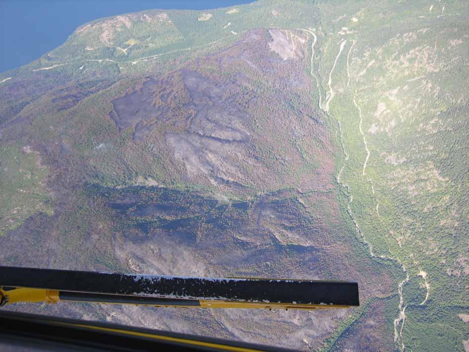
26 2007 Fires in South-East BC Springer Creek 3137 ha Kaslo Pend D Oreille 3969 ha Sitkum 1075 ha Slocan Kemp Creek 200 ha Hamill 1528 ha Nelson Penstock 315 ha Trail Fruitvale
27 What the BC Forest Service did for 2007 fires One SIFR specialist (Jordan) screened all wildfires in SE Fire Centre, and did preliminary field reviews of some fires with Protection staff Once several fires were of serious concern, we assigned a coordinator (Curran) to assist risk analysis teams, and be responsible for communication with PEP, Fire Centre, others Risk Analysis teams (lead by Jordan, Nicol and Alcock) - mapped burn severity based on helicopter aerial photos - field work on the ground: test soils, inspect channels & fans - identified areas of high landslide or debris flow hazard For highest risk fires: - informed PEP who contacted affected stakeholders of the risks - prepared hillslope soil mitigation plans (Curran) - assisted Forest Districts in implementation of mitigative treatments

28 Risk Analysis Springer Fire
29


30 Risk Analysis - Springer Fire High Severity Burn on Upper Slope Steep Slopes, debris flow gullies Down Slope Values at Risk Residences Alluvial fans Highway

31 Risk Analysis Springer Fire Ground truth burn severity maps Test for water repellency Assess hazards


32 Springer Fire Vegetation Burn Severity Map


33


34 Risk Analysis Sitkum Fire


35 Sitkum Fire


36 Pend D Oreille Fire

37 Kemp Creek Fire Kaslo community watershed


38 Kemp Creek Fire
39 Summary of 2007 Fires: Springer: High hazard (debris flows, snow avalanches) Moderate-High consequence to public safety High risk mitigation treatments recommended Sitkum: Moderate incremental hazard (flooding) Moderate-High consequence to public safety, water quality Moderate-High risk mitigation treatments recommended Pend d Oreille: High hazard (erosion, debris flows) Low consequence to infrastructure, none to public safety Low risk Kemp Creek: Moderate incremental hazard (flooding, erosion) High consequence to water supply, low consequence to public safety Risk is low (public safety) to high (water supply)

")


40 Mitigation (and other risk management) Options: Avoidance of the hazard Defensive structures in channels and on fans
 Options:")


41 Mitigation (and other risk management) Options: Engineering treatments upgrade creek crossings, cross-drain culverts etc (forest roads, non-status roads, highways)


42 Mitigation (and other risk management) Options: Broadcast treatments of burned areas - straw mulching - contour log felling
43 Mitigation (and other risk management) Options: Reforestation can speed hydrologic recovery where equivalent clearcut area is a concern. Grass seeding generally not effective (and can compete with planted trees) but fall rye can be useful.


44 Overland Flow and Soil Erosion What s going on??
45 Wildfire Ground Cover Consumed (moderate - high severity,untreated) High High Intensity Intensity Rain Rain Storm Storm Ground Cover Remaining (Low severity or hi/moderate treated with mulch) Exposed / Water repellent soil Protective soil cover Overland Flow Soil Erosion Minimal Overland Flow Infiltration loss of top soil, seed, nutrients soil moisture retention Debris Flows Flooding Minimal Soil Loss Vegetation Recovery Risk to human life, property, infrastructure Sedimentation of streams Degraded water quality & aquatic habitat Soil recovery Restoration of hydrologic cycle

46 Generation of Overland Flow Drought conditions can lead to unusually severe burning of the litter and surface soil High Severity burns and dry mineral soil can become water-repellent or pores become clogged with ash and charcoal Result is increased overland flow, particularly during summer thunderstorms Water Repellency


47 Overland Flow Leading to Soil Erosion Water repellent soils occur at 0 to 5 cm, and creates a tin-roof effect Surface erosion from overland flow causes sediment bulking in gullies/channels Summer thunderstorm with intensity of 10mm/hr for 30 minutes can cause debris flows or flooding
48

49
50 Wildfire Ground Cover Consumed (moderate - high severity,untreated) High High Intensity Intensity Rain Rain Storm Storm Ground Cover Remaining OR RESTORED BY MITIGATION (Low severity or hi/moderate treated with mulch) Exposed mineral soil Protective soil cover Overland Flow Soil Erosion Minimal Overland Flow Infiltration loss of top soil, seed, nutrients soil moisture retention Debris Flows Flooding Minimal Soil Loss Vegetation Recovery Risk to human life, property, infrastructure Sedimentation of streams Degraded water quality & aquatic habitat Soil recovery Restoration of hydrologic cycle


51

52 Wildfire Erosion Research Project What was the driving force behind 2003 and other post-fire erosion events in BC: Soil type, soil moisture (DC), rainfall intensity, basin configuration, fire intensity, burn severity, water repellency? How can we predict it and protect life and property? Gain information to improve procedures and mitigation options
53 Wildfire Erosion Research Project Knowledge Gaps How common is severe water repellency following fires in this region? How can we predict when it will be a problem (e.g., antecedent moisture conditions in duff/soil (DMC?), soil texture, fuel type and supply, burn severity)? How long does water repellency persist? How applicable are research results from the U.S. to B.C. (where soil and climate conditions are somewhat different)?
54 What is the role of pre-fire weather on burn severity and post-fire erosion events? Area Burned (ha) 13 Events Events Event 1 Event Penticton Total Rainfall for June, July and August Max Drought Code (DC) Index for June July and August


55 2. How do water repellency and burn severity affect infiltration, runoff and hillslope erosion? Runoff = Rainfall - Infiltration Runoff (mm) Sediment (g) Runoff Sediment Sample Minute 0


56 2. How do water repellency and burn severity affect infiltration, runoff and hillslope erosion? Event 1 2 Sediment (t/ha ) Untreated Straw Mulch 0 0


57 3. What role do watershed size and extent of burn severity play in channel failure initiation? - Paired Watershed Study Unburned Treated Untreated Untreated H 50% M 33% L 16% 65 ha Treated H 41% M 24% L 32% 50 ha Unburned L 2% 64 ha Sitkum Fire, 2007


58 Kuskanook Fire, 2003

59 What Are Our Options? Increase our knowledge and understanding of post-fire erosion processes in BC Educate the stakeholders about these risks Mitigate after a fire mulch, channel barriers, road upgrade/deact., berms, planting etc. Consider fuel management in upper watershed basins Warn people not to build their $$$ homes on alluvial fans Southern California. Photograph by Sue Cannon, USGS
Post-Wildfire Soil Erosion, Flood, and Landslide Risks
 Post-Wildfire Soil Erosion, Flood, and Landslide Risks Peter Jordan, Ashley Covert, Ken Soneff, Mike Curran, Kevin Turner Southern Interior Forest Region (Nelson and Kamloops) Kootenay Interface Steering
The hydrological effects of wildfire. David Scott The University of British Columbia, Kelowna, BC
 The hydrological effects of wildfire David Scott The University of British Columbia, Kelowna, BC Effects of fire on hydrology Scientific literature is full of contrasting reports Fires: little effect or
Direct Effects of Wildfire on Soil (and Water) David F Scott The University of British Columbia, Kelowna, BC
 David F Scott The University of British Columbia, Kelowna, BC") Direct Effects of Wildfire on Soil (and Water) David F Scott The University of British Columbia, Kelowna, BC Outline of presentation Flooding & erosion after wildfire - brief overview Some observations
Direct Effects of Wildfire on Soil (and Water) David F Scott The University of British Columbia, Kelowna, BC Outline of presentation Flooding & erosion after wildfire - brief overview Some observations
Post-Wildfire Hazard Assessment and Risk Management. Special Report
 Post-Wildfire Hazard Assessment and Risk Management Special Report FPB/SR/24 February 2006 Acknowledgements The Board would like to thank the following individuals for their participation in this project
Statement of. Dale Bosworth, Chief U.S. Forest Service United States Department of Agriculture
 Statement of Dale Bosworth, Chief U.S. Forest Service United States Department of Agriculture Before the House Resource Committee Subcommittee on Forests and Forest Health U.S. House of Representatives
Hayman Fire Rehabilitation Treatment Monitoring Progress Report
 Hayman Fire Rehabilitation Treatment Monitoring Progress Report Sediment yields, runoff, and ground cover in the first two years after the Hayman Fire P. Robichaud J. Wagenbrenner 7 March 2005 USD Forest
Post-wildfire Natural Hazards Risk Analysis in British Columbia
 L A N D M A N A G E M E N T H A N D B O O K 6 9 Post-wildfire Natural Hazards Risk Analysis in British Columbia 2 1 5 The Best Place on Earth Post-wildfire Natural Hazards Risk Analysis in British Columbia
Sitkum Creek Fire, 2007, N70347 Post-Wildfire Risk Analysis
 Sitkum Creek Fire, 2007, N70347 Post-Wildfire Risk Analysis Prepared for BC Ministry of Forests and Range: Southeast Fire Centre, Southern Interior Forest Region, and Kootenay Lake Forest District Assessment
Sustainable Post Disaster Recovery
 Sustainable Post Disaster Recovery May 14, 2013 4 PM Lucinda Andreani & Dustin Woodman Coconino County Public Works (Arizona) 1 Presenters Lucinda Andreani, Deputy Director, Coconino County Public Works
Forest Practices and the Hummingbird Creek Debris Flow
 Forest Practices and the Hummingbird Creek Debris Flow Complaint Investigation 990189 FPB/IRC/50 August 2001 Table of Contents The Investigation...1 Background...1 Relevant Legislation...3 Discussion...3
U.S. Forest Service Burned Area Emergency Response (BAER) Program
 Program") U.S. Forest Service Burned Area Emergency Response (BAER) Program Pre and Post Wildfire Conference Sacramento, CA Feb. 10, 2010 Brent Roath, Regional Soil Scientist/BAER Coordinator USFS, Pacific Southwest
U.S. Forest Service Burned Area Emergency Response (BAER) Program Pre and Post Wildfire Conference Sacramento, CA Feb. 10, 2010 Brent Roath, Regional Soil Scientist/BAER Coordinator USFS, Pacific Southwest
Watershed. Topography. Soil. Hydrology
 Watershed Topography The Egley Complex occurred within the Silver Creek watershed and Silvies River watershed both of which drain into the Oregon closed basins of Harney and Malheur Lakes. Most of the
Central Washington 2012 Wildfires Burned Area Emergency Response (BAER) Information Brief October 19, 2012 BAER Information: (208)
 Information Brief October 19, 2012 BAER Information: (208)") Okanogan-Wenatchee National Forest Central Washington 2012 Wildfires Burned Area Emergency Response (BAER) Information Brief October 19, 2012 BAER Information: (208) 398-3348 Fire Background WENATCHEE
Okanogan-Wenatchee National Forest Central Washington 2012 Wildfires Burned Area Emergency Response (BAER) Information Brief October 19, 2012 BAER Information: (208) 398-3348 Fire Background WENATCHEE
Emergency Stabilization, Rehabilitation, and Restoration
 Statement of Dr. Ann Bartuska Deputy Chief for Research and Development Forest Service; Mr. Steve Eubanks Forest Supervisor, Tahoe National Forest U.S. Department of Agriculture Before House Resources
Fires and Flash Flooding Federal Lands/Local Impact Waldo Canyon Fire Recovery Update: September Fall 2013
 Fires and Flash Flooding Federal Lands/Local Impact Waldo Canyon Fire Recovery Update: September 2013 Fall 2013 Started June 23, 2012, near Colorado Springs in western El Paso County Two people killed
Interior Lumber Manufacturers Association
 Interior Lumber Manufacturers Association Overview 2 Concerns with Development Historical Harvesting Activities Current Forest Management Planning of Harvesting Timber Supply Considerations Working Together
Managing Fire Risk in the Bowen Island Municipality. April By 2007 B.A. Blackwell & Associates Ltd.
 Managing Fire Risk in the Bowen Island Municipality April By 2007 B.A. Blackwell & Associates Ltd. PURPOSE OF THE PLAN To identify interface wildfire risks and develop steps needed to reduce those risks
Mixed Conifer Working Group Meeting April 15, 2011 Water and Soil Resource Management Considerations
 Mixed Conifer Working Group Meeting April 15, 2011 Water and Soil Resource Management Considerations It is difficult to tie watershed health directly to mixed-conifer forests. Watersheds encompass a variety
FIRST CREEK FIRE: FS BURNED AREA REPORT SUMMARY
 FIRST CREEK FIRE: FS-2500-8 BURNED AREA REPORT SUMMARY October 22, 2015 Okanogan-Wenatchee National Forest 215 Melody Lane Wenatchee WA 98801 Fire Background Following severe lightning storms that covered
Fire Management CONTENTS. The Benefits of Guidelines...3 Considerations...4
 Fire Management CONTENTS Fire Management 1 Introduction...3 The Benefits of Guidelines...3 Considerations...4 Planning...5 Burn Plan Development...5 Operational Activities...8 Pre-Ignition Activities...8
Stream Water Quality Concerns Linger Long After the Smoke Clears Learning from Front Range Wildfires
 Stream Water Quality Concerns Linger Long After the Smoke Clears Learning from Front Range Wildfires Chuck Rhoades, U.S. Forest Service, Rocky Mountain Research Station, Susan Miller, Freelance Science
VOLE MONITORING NETWORK
 1 VOLE MONITORING NETWORK Prince George Vanderhoof Dunkley Salmon Arm Golden Kamloops Kelowna Summerland Vernon Penticton IS THE AMOUNT OF FEEDING DAMAGE RELATED TO POPULATION SIZE OF VOLES How many voles
The New Normal Sustainable and Firewise Landscaping. UC Master Gardener Program of Sonoma County Mimi Enright, Program Manager
 The New Normal Sustainable and Firewise Landscaping UC Master Gardener Program of Sonoma County Mimi Enright, Program Manager Sustainable & Firewise Landscaping Framework & Agenda Sustainable & firewise
Geo Wise STRATEGIC. File: 07CR-GWRP , March 2007
 Geo Wise STRATEGIC Engineering Forest Management Inc. File: 07CR-GWRP001 28, March 2007 Mr. Martin Buchanan, RFT Western Forest Products Ltd. 1334 Island Highway Campbell River, B.C. V9W 8C9 RE: RISK ASSESSMENT
Sediment yields and water quality effects of severe wildfires in southern British Columbia
 Wildfire and Water Quality: Processes, Impacts and Challenges (Proceedings of a conference held in Banff, Canada, 1114 June 2012) (IAHS Publ. 354, 2012). 1 Sediment yields and water quality effects of
4. Present Activities and Roles
 4. Present Activities and Roles The present missions, authorities, activities and roles of the various agencies involved with flood protection, floodplain management and flood-damage reduction are identified
CHAPTER 3 Environmental Guidelines for WATERCOURSE CROSSINGS GOVERNMENT OF NEWFOUNDLAND AND LABRADOR DEPARTMENT OF ENVIRONMENT AND LABOUR
 GOVERNMENT OF NEWFOUNDLAND AND LABRADOR DEPARTMENT OF ENVIRONMENT AND LABOUR CHAPTER 3 Environmental Guidelines for WATERCOURSE CROSSINGS WATER RESOURCES MANAGEMENT DIVISION Water Investigations Section
Watershed Health and Water Management in the Porcupine Hills
 Watershed Health and Water Management in the Porcupine Hills In Alberta, our quality of life is tied to healthy and sustainable water supplies for the environment, for our communities, and for our economic
PROJECT SCREENING MATRIX: A User s Guide
 Version 2.0 Page 1 of 7 November 9, 2010 PROJECT SCREENING MATRIX: A User s Guide BACKGROUND The Project Screening Matrix (Screening Matrix) is one of several tools that comprise the River Restoration
Post-Wildfire Forest Management: Soils and Soil Productivity
 Pre- and Post-Wildfire Forest Management Conference, 2010 Post-Wildfire Forest Management: Soils and Soil Productivity David Young, Zone Soil Scientist USDA Forest Service, Redding daveyoung@fs.fed.us
California Tahoe Conservancy Monitoring Plan
 California Tahoe Conservancy Monitoring Plan Acknowledgements University of California Cooperative Extension Expertise and time contributed Susie Kocher Richard Harris Gary Nakamura Mike De Lasaux United
Report. Hydrologic Assessment of Areas of Interest, Perry Ridge. BC Timber Sales Kootenay Business Area. Project:
 Report BC Timber Sales Kootenay Business Area Hydrologic Assessment of Areas of Interest, Perry Ridge Project: 2012-8170.000 March 2013 CONFIDENTIALITY AND COPYRIGHT This document is for the sole use of
Sheppard Creek Post-Fire Project
 Flathead National Forest Tally Lake Ranger District Sheppard Creek Post-Fire Project Purpose of the Project and Proposed Action December 14, 2007 This document presents information about the Brush Creek
Evaluations of Impacts of the Okanagan Mountain Park Fire on In-stream Wood and Other Watershed Processes
 Evaluations of Impacts of the Okanagan Mountain Park Fire on In-stream Wood and Other Watershed Processes Adam Wei Earth and Environmental Science University of British Columbia Okanagan Kelowna, British
Climate Change Water Implications for Michigan Communities, Landsystems and Agriculture
 Climate Change Water Implications for Michigan Communities, Landsystems and Agriculture Distinguished Senior Research Specialist Department of Geography Institute of Water Research Climate Change Summary
Climate Change Adaptation Strategy
 Climate Change Adaptation Strategy BY 2050, IN METRO VANCOUVER TYPES OF CLIMATIC CHANGES CLICK TO EDIT MASTER TITLE 1. Hotter average annual air temperatures 2. Changing precipitation 3. Higher sea level
Upper South Platte Source Water Assessment and Protection Plan
 Upper South Platte Source Water Assessment and Protection Plan Unpaved Roads and Trails Presented by: Kyle Hamilton, P.E. CH2M HILL May 9, 2014 Background Four watershed / unpaved roadway system assessments
Post-Fire BAER Assessment Burned Area Emergency Response (BAER)
") November 2017 Post-Fire BAER Assessment Burned Area Emergency Response (BAER) Information Brief Diamond Creek Fire Values at Risk Matrix and Treatments CentralWashingtonFireRecovery.info EMERGENCY DETERMINATION
November 2017 Post-Fire BAER Assessment Burned Area Emergency Response (BAER) Information Brief Diamond Creek Fire Values at Risk Matrix and Treatments CentralWashingtonFireRecovery.info EMERGENCY DETERMINATION
Thanks to Bill Elliot, Research Leader U.S. Department of Agriculture Forest Service
 Thanks to Bill Elliot, Research Leader U.S. Department of Agriculture Forest Service To present an overview Forest Soil Erosion Processes 2 Precipitation or melting snow Evapotranspiration Infiltration
Prioritizing restoration activities for salmonid habitat within a watershed
 Prioritizing restoration activities for salmonid habitat within a watershed Author: Lisa Lackey Co-author: Laurel Marcus Abstract Maacama Creek, a tributary of the Russian River has 45 miles of tributary
Challenges of Applying a Risk-based Watershed Assessment in the BC interior. By Kim Green, PhD., P.Geo. Apex Geoscience Consultants Ltd
 Challenges of Applying a Risk-based Watershed Assessment in the BC interior By Kim Green, PhD., P.Geo. Apex Geoscience Consultants Ltd Why this talk? Forest Practices Board finding in the Duhamel Creek
General Disclaimer. Disclaimer of Liability
 General Disclaimer The use of trade, firm, or corporation names in this publication is for the information and convenience of the reader. Such use does not constitute an official endorsement or approval
JOE RICH CREEK WATERSHED
 Water Quality Monitoring For the South Slopes of the JOE RICH CREEK WATERSHED (Year 4-2003 Data) Prepared for GORMAN BROS. LUMBER LTD. Westbank, BC by DOBSON ENGINEERING LTD. #4, 1960 Springfield Road
ROCK LAKE AREA PHASE 1 HYDROLOGY ASSESSMENT
 Pse 1 Hydrology Assessment Prepared ffor by February 2007 ROCK LAKE AREA PHASE 1 HYDROLOGY ASSESSMENT 1. INTRODUCTION This Pse 1 report s been prepared for Gorman Bros. Ltd. (Gormans) to update the watershed
SEATTLE CITY LIGHT: CLIMATE RESILIENCE AND ADAPTATION. Crystal Raymond, Climate Change Strategic Advisor Environment, land and Licensing
 SEATTLE CITY LIGHT: CLIMATE RESILIENCE AND ADAPTATION Crystal Raymond, Climate Change Strategic Advisor Environment, land and Licensing Resilience in the Energy Sector Reliability Resilience Adaptation
Towards. Sustainable Forest Management
 SAUNDERS CREEK WATERSHED Towards Sustainable Forest Management Prepared for Gold River Operations March 2004 Prepared for: Reporting by: Shawn Hamilton and Associates Saunders Creek Sustainable Forest
File Code: 1950 Date: September 13, 2017
 United States Department of Agriculture Forest Service Darby-Sula Ranger District 712 N. Main Street Darby, MT 59829 406-821-3913 File Code: 1950 Date: September 13, 2017 The Bitterroot National Forest
CLIMATE CHANGE ASSESSMENT (SUMMARY)
") Chongqing Longxi River Basin Integrated Flood and Environmental Risk Management Project (RRP PRC 51005) CLIMATE CHANGE ASSESSMENT (SUMMARY) I. Basic Project Information Project Title: Chongqing Longxi
Chongqing Longxi River Basin Integrated Flood and Environmental Risk Management Project (RRP PRC 51005) CLIMATE CHANGE ASSESSMENT (SUMMARY) I. Basic Project Information Project Title: Chongqing Longxi
Elko Project Water Use Plan. Revised for Acceptance by the Comptroller of Water Rights
 Elko Project Water Use Plan Revised for Acceptance by the Comptroller of Water Rights 7 April 2005 B Elko Project Water Use Plan Revised for Acceptance by the Comptroller of Water Rights Elko Project
THOMPSON PLATEAU ACCESS MANAGEMENT PLAN. Prepared for: Vavenby Forestlands. Prepared by:
 THOMPSON PLATEAU ACCESS MANAGEMENT PLAN Prepared for: Vavenby Forestlands Prepared by: #330 42nd St SW Salmon Arm, BC V1E 4R1 Tel: (250) 832 3366 Fax: (250) 832 3811 September 6, 2005 TABLE OF CONTENTS
Chapter 2: Selecting Best Management Practices (BMPs)
") Chapter 2: Selecting Best Management Practices (BMPs) 2.1 - Temporary versus Permanent BMPs The same level of care should be taken to select both temporary BMPs and permanent BMPs. The same level of care
Chapter 2: Selecting Best Management Practices (BMPs) 2.1 - Temporary versus Permanent BMPs The same level of care should be taken to select both temporary BMPs and permanent BMPs. The same level of care
Acres within Planning Area. Total Acres Burned
 Calf-Copeland Project Description Figure 1: Dead sugar pine in the Calf-Copeland planning area. Sugar pine grow best in open conditions. In the absence of fire disturbance, high densities of Douglas-fir
Ecosystem Restoration Program (ERP) Presentation for the Western Silviculture Contractors Association, February 2, 2006
 Presentation for the Western Silviculture Contractors Association, February 2, 2006") Ecosystem Restoration Program (ERP) Presentation for the Western Silviculture Contractors Association, February 2, 2006 Outline Background Ecological Restoration Strategy Values at Risk Restoration Treatments
Ecosystem Restoration Program (ERP) Presentation for the Western Silviculture Contractors Association, February 2, 2006 Outline Background Ecological Restoration Strategy Values at Risk Restoration Treatments
 Good Morning! Bruce Gilman Department of Environmental Conservation and Horticulture Finger Lakes Community College 3325 Marvin Sands Drive Canandaigua, New York 14424 585-785- 1255 gilmanba@flcc.edu Northern
CLIMATE RESILIENCE FOR ALBERTA MUNICIPALITIES
 CLIMATE RESILIENCE FOR ALBERTA MUNICIPALITIES INTRODUCTION On March 11 in Edmonton and March 14 in Calgary the Municipal Climate Change Action Centre (MCCAC) and C-3 hosted Climate Resilience for Alberta
Forest Service Angora Recovery Efforts. Eli Ilano Deputy Forest Supervisor Lake Tahoe Basin Management Unit USDA Forest Service November 3, 2007
 Forest Service Angora Recovery Efforts Eli Ilano Deputy Forest Supervisor Lake Tahoe Basin Management Unit USDA Forest Service November 3, 2007 Fire Facts Started June 24, 2007; Contained July 2; Controlled
Kamloops Fire Centre KAMLOOPS FIRE CENTRE BOUNDARIES
 2011.05.24 Kamloops Fire Centre As of May 24, 2011, the Kamloops Fire Centre has responded to 40 wildfires consuming 202 hectares since April 1, 2011. This is well below the 10 year average of 67 wildfires
Municipal Stormwater Management Plan Prepared For The Borough of Cape May Point By Van Note-Harvey Associates VNH File No.
 Municipal Stormwater Management Plan Prepared For The Borough of Cape May Point By Van Note-Harvey Associates 2005 VNH File No. 35317-210-21 Table of Contents Introduction... 3 Goals... 3 Storm water Discussion...
Understanding Stormwater Pollution Prevention Plans (SWPPPs) (SWPPPS)
 (SWPPPS)") Understanding Stormwater Pollution Prevention Plans (SWPPPs) (SWPPPS) Definitions SWPPP: Storm Water Pollution Prevention Plan BMP: Best Management Practice(s) to control pollution IDNR: Iowa Department
Understanding Stormwater Pollution Prevention Plans (SWPPPs) (SWPPPS) Definitions SWPPP: Storm Water Pollution Prevention Plan BMP: Best Management Practice(s) to control pollution IDNR: Iowa Department
Hungry Creek Watershed Road Maintenance and Stony Quarry Development
 Notice of Proposed Action Opportunity to Provide Scoping Comments Hungry Creek Watershed Road Maintenance and Stony Quarry Development Mt. Hough Ranger District Plumas National Forest Plumas County, California
Four Forest Restoration Initiative
 Four Forest Restoration Initiative OVERVIEW, STATUS AND WATERSHED CONSIDERATIONS F E B R U A R Y 3 RD, 2 0 1 2 L C R WINTER WATERSHED C O N F E R E N C E S H A R O N M A S E K L O P E Z NAU Departure from
Q&A: Omineca spruce beetle outbreak May 4, 2018
 Q&A: Omineca spruce beetle outbreak May 4, 2018 Q. How big is this outbreak? What kind of impact has it had so far? The most recent provincial aerial overview survey was completed in fall 2017 and found
Pole Creek Timber Salvage Project Specialist Report. Transportation. Introduction. Regulatory Framework / Management Direction
 Pole Creek Timber Salvage Project Specialist Report Transportation Donald Walker P.E. June 13, 2013 Introduction This report describes the effects to the transportation system from the Pole Creek Timber
Climate Change Impacts on Hydrology of the Western Cascades
 Climate Change Impacts on Hydrology of the Western Cascades Marketa M. Elsner UW Climate Impacts Group Mt Baker - Snoqualmie National Forest Climate Change Workshop April 28, 2011 We care about climate
Support legislation that will protect the quantity of water in Lake Erie
 Specific Regional Priorities Each of Pennsylvania s major drainage basins has an array of individual characteristics that distinguish it from other regions of the state. These include diverse geographic
Trenches combined with living hedges or grass lines Rwanda - Imiringoti
 Trenches combined with living hedges or grass lines Rwanda - Imiringoti Trenches combined with living hedges or grass lines are slow-forming terraces to control soil erosion by changing the length of the
Humboldt County Community Wildfire Protection Plan 2013 UPDATE
 Humboldt County Community Wildfire Protection Plan 2013 UPDATE Humboldt County Fire Safe Council A committee appointed by your Board to oversee the maintenance and implementation of the County s fire plan
WASA Quiz Review. Chapter 2
 WASA Quiz Review Chapter 2 Question#1 What is surface runoff? part of the water cycle that flows over land as surface water instead of being absorbed into groundwater or evaporating Question #2 What are
Introduction to wildfires. Assoc. Prof. Dr. Simon Schnabl Assist. Marko Radak
 Introduction to wildfires Assoc. Prof. Dr. Simon Schnabl Assist. Marko Radak 1 Outline What is natural disaster? What is fire? What is wildfire? Global wildfire map What causes wildfires? Wildfire spread
Public Information Centre # 2 Flood Mitigation Opportunities Study Fourteen Mile Creek & M c Craney Creek Systems Town of Oakville
 Public Information Centre # 2 Flood Mitigation Opportunities Study Fourteen Mile Creek & M c Craney Creek Systems Town of Oakville Municipal Class Environmental Assessment Study Area The limits of the
Adapting to Climate Change in Kimberley, BC. Executive Summary June Prepared by Ingrid Liepa
 Adapting to Climate Change in Kimberley, BC Executive Summary June 2009 Prepared by Ingrid Liepa Executive Summary The City of Kimberley was selected by the Columbia Basin Trust (CBT) in April 2008 as
FIRE ECOLOGY AND RESTORATION IN THE SOUTH LLANO WATERSHED Gary Garrett, Texas Parks & Wildlife
 FIRE ECOLOGY AND RESTORATION IN THE SOUTH LLANO WATERSHED Gary Garrett, Texas Parks & Wildlife The Texas Parks and Wildlife Department and the South Llano Watershed Alliance convened a workshop of 25 experts
Nez Perce National Forest Moose Creek Ranger District
 United States Department of Agriculture Forest Service Nez Perce National Forest Moose Creek Ranger District 831 Selway Road Kooskia, ID 83539 208 926-4258 TTY 208 926-7725 File Code: 1950 Date: Dec 30,
APPENDIX H Guidance for Preparing/Reviewing CEQA Initial Studies and Environmental Impact Reports
 APPENDIX H H.1 Guidance for Preparing and Reviewing CEQA Initial Studies Step 1: Consider the Project Characteristics as Provided by the Project Applicant Review the project application and draft plan
Effects of Fire on Water Infiltration Rates in a Ponderosa Pine Stand
 Effects of Fire on Water Infiltration Rates in a Ponderosa Pine Stand Item Type text; Proceedings Authors Zwolinski, Malcolm J. Publisher Arizona-Nevada Academy of Science Journal Hydrology and Water Resources
Lower Glade and Upper McPhee Harvest Update November 2018
 BC Ferries Forum Lower Glade and Upper McPhee Harvest Update November 2018 Kalesnikoff Lumber Company has been meeting and communicating with Glade residents since 2015. We appreciate your input and have
Western Forest Fires and Long-term Impacts on Water Quality ASHLEY RUST, PHD
 Western Forest Fires and Long-term Impacts on Water Quality ASHLEY RUST, PHD 1 Currently 4 large fires burning throughout the West, 3 are in California. More acres have burned in California in 2018 than
Module 1: Construction Site Erosion Control
 Module 1: Construction Site Erosion Control Problems and Regulations Robert Pitt Department of Civil and Environmental Engineering University of Alabama Tuscaloosa, AL Problems Associated with Erosion
Development Services. Amendments to Tolko Forest Stewardship Plan to add new Cutblocks and Roads
 Development Services Amendments to Tolko Forest Stewardship Plan to add new Cutblocks and Roads RECOMMENDATION: THAT: the Board recommend to Tolko Industries Ltd. (Lumby) and the Minister of Forest Lands
Overview and Managing Risks of Wildfire for Drinking Water Systems: Results from two research workshops. Chi Ho Sham, Ph.D., The Cadmus Group, Inc.
 Overview and Managing Risks of Wildfire for Drinking Water Systems: Results from two research workshops Chi Ho Sham, Ph.D., The Cadmus Group, Inc. AWRA Annual Conference, Tysons Corner, VA November 6,
Surface Water. Solutions for a better world
 1 Surface Water Solutions for a better world Our Surface Water Services Expertise Growing worldwide awareness of water scarcity has encouraged water preservation programs, better irrigation techniques
Maitland Valley WATERSHED
 Maitland Valley WATERSHED Report Card 2018 Maitland Conservation has prepared this report card as a summary of the state of your forests, wetlands, and water resources. WHERE ARE WE? We are one of 36 Conservation
County of Calaveras Department of Planning
 Date: July 18, 2013 To: From: Project: Advisory Agencies Amy Augustine, AICP - Planner County of Calaveras Department of Planning Rebecca L. Willis, AICP ~ Planning Director Phone (209) 754-6394 Fax (209)
Project/Research Sponsors. Why Manage Stormwater? Why Manage Stormwater? Why Manage Stormwater? Soils. Applications to Stormwater Management
 Applications to Stormwater Management Project/Research Sponsors Presented by: Mr. Brian Oram, PG, PASEO Soil Scientist Wilkes University Environmental Engineering and Earth Sciences Wilkes - Barre, PA
Controlling runon and runoff:
 Chapter 8. Surface Water Management This chapter explores: runon and runoff what they are, and the risks associated with them. various management options runon reductions, runoff catchbasins, vegetated
WATERSHED. Maitland Valley. Report Card 201
 Maitland Valley WATERSHED Report Card 201 The Maitland Valley Conservation Authority has prepared this report card as a summary on the state of our forests, wetlands, surface water, and ground water resources.
Adaptation: Advising Local Governments on Climate Change Vulnerability
 Local Government Commission Building Livable Communities Ahwahnee Hotel Adaptation: Advising Local Governments on Climate Change Vulnerability March 12, 2009 2 Planning for Climate Vulnerability Exec.
Forest Recreation Management
 Forest Recreation Management 1 Forest Recreation Management Introduction...3 CONTENTS The Benefits of Guidelines...3 Considerations...4 Planning...5 Construction of Recreation Areas...6 Protecting Cultural
Riparian Areas. 101 An overview. Prepared by: Jacque Sorensen, M.Sc. TRU Department of Natural Resource Sciences
 Riparian Areas 101 An overview Prepared by: Jacque Sorensen, M.Sc. TRU Department of Natural Resource Sciences February 11, 2015 Presented for the Gardom Lake Planning Committee Today s focus Riparian
Chapter 5. Natural Features. Environmental Management Mode Land Resources Water Resources Air Quality Preparing for Climate Change
 Chapter 5 Natural Features Natural Features Environmental Management Mode Land Resources Water Resources Air Quality Preparing for Climate Change 5.1 NATURAL FEATURES BACKGROUND Maple Ridge encompasses
The Construction General Permit and Erosion Prevention and Sedimentation Control
 The Construction General Permit and Erosion Prevention and Sedimentation Control Presented at the Tennessee Gas Association Conference April 23, 2008 More than thirty years ago, two-third of the nation's
RIPARIAN CORRIDOR STUDY FINAL PARLEYS CREEK MANAGEMENT PLAN TABLE OF CONTENTS
 TABLE OF CONTENTS 1.0 INTRODUCTION... 1-1 Riparian Corridor Study and Management Plan Goals... 1-1 Study Area... 1-2 Importance and Functions of Riparian Corridors... 1-2 Habitat for Mammals, Birds, and
THE EFFECTS OF URBANIZATION ON THE MINGO CREEK WATERSHED
 THE EFFECTS OF URBANIZATION ON THE MINGO CREEK WATERSHED by Tim Marshall (presented at the Sixth Conference on Hydrometeorology in Indianapolis, IN, 1984) 1. INTRODUCTION Urbanization of flood plains presents
General Disclaimer. Disclaimer of Liability
 General Disclaimer The use of trade, firm, or corporation names in this publication is for the information and convenience of the reader. Such use does not constitute an official endorsement or approval
IPCC WG II Chapter 3 Freshwater Resources and Their Management
 IPCC WG II Chapter 3 Freshwater Resources and Their Management Impacts increasingly harmful & more costly to adapt as global temperature increases May imperil sustainable development goals Semi-arid /
Rangeland Hydrology and Management
 Rangeland Hydrology and Management This watershed rehabilitation and restoration training was prepared by the U.S. Department of Agriculture (USDA) team of Melvin Westbrook, Director USDA-NRCS/IPD, Otto
Climate Trends in Northern California: How Do We Manage for the Future?
 Climate Trends in Northern California: How Do We Manage for the Future? Forest Management and Watershed Science Symposium April 30, 2013 Kyle Merriam, Sierra Cascade Province Ecologist, USDA Forest Service,
Juncrock Timber Sale Draft Environmental Impact Statement. Appendix G Soils
 Juncrock Timber Sale Draft Environmental Impact Statement Appendix G Soils Soil Condition Monitoring on the Barlow Ranger District of the Mt. Hood National Forest 1999 The Barlow Ranger District conducts
Section 3 General Development Policies
 3.4.6 Substandard System Improvements The Municipality will actively encourage the participation of its residents in any program that the HKPRDHU or the MOE designed to upgrade or replace existing substandard