Dutchess County Soil and Water District
|
|
|
- Cuthbert Alexander
- 6 years ago
- Views:
Transcription
1 Dutchess County Soil and Water District LESA as a tool for: County Wide Resource Planning Agricultural Lands Habitat Water Resources Farmland Protection Modified Selection Criteria Community Assistance Farmland Protection Resource Issues Ecosystem Based Management Site Selection Program Delivery

2

3 Dutchess County 514,600 Acres of Dutchess County 160,000 Acres of Ag Land 283,030 Acres of Woodland Population of 292,000 Prime Farmland Soils 63,932 Acres* Statewide Importance Soils 192,923 Acres
4

5
6 Land use 1979 Vs for the Wappinger Watershed 1979 Land-Use Data 1994 Land-Use Data Agriculture Forest Residential Other Data Source: USGS Data Source: DCEMC

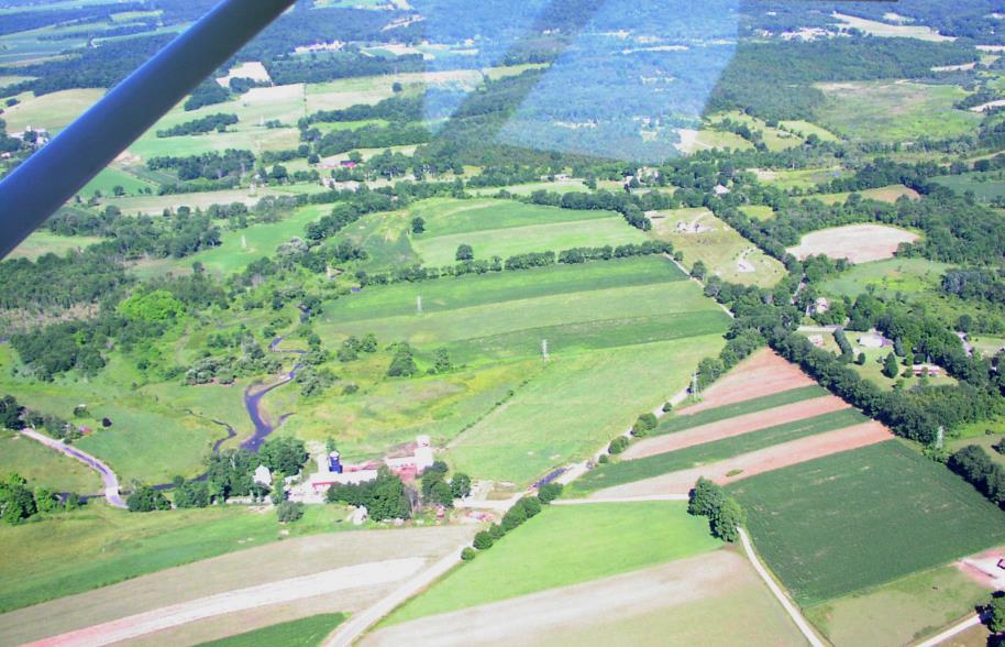
7 Salt Point Prime Soils Area

8 Changing Landscapes Salt Point Prime Soils

9 8. Sprout Creek

10 2. Dutchess Dairy Heartland
11 Dutchess County Agriculture and Farmland Protection Board: PDR Criteria Worksheet Resources Protection Point Per July 28, 2008 Category Pulver Mead-82 Sanford Marshall Chase Wolcott Smith Soils -- Prime and Important Farmland Water Resources Wildlife Habitat Conservation Plan Implemented Scenic Value Historic Subtotal Viability Economics, Feasible potential Current activity -- management Located in core farming area Services neighboring farms Subtotal Development Pressure Adjacent Land Protected Adjoining property, lots, subdivisions, or open Rapid growth Urban Community Relative to character of town Subtotal Local Support ProActive Local Government Funding Support Town Zoning/Master Plan/Right to Farm Law Landowner donation commitment Subtotal Total Total as Percentage % 67.50% 73.90% 73.90% 77.10% 66.20% 56.10% 82.80%
12 Smith s

13

14 Community Assistance Route 22 Corridor Town of Northeast

15 Route 22 Scenic/Agriculture Corridor Panhandle Town of North East Prime Soils Statewide Important Soils - Ag District Parcels - Tax Parcels

16 2. Dutchess Dairy Heartland

17 Route 22 Scenic/Agriculture Corridor SOUTHERN CORRIDOR AERIAL PHOTO AG DISTRICTS
18 Southern Corridor Prime Soils Statewide Important Soils - Ag District Parcels - Tax Parcels

19 Mission To support communities, public officials, Districts in their efforts to protect local soil and water resources from unplanned municipal landuse impacts. Community Conservation Assistance Toolkit (CCAT)

20 Challenge Degradation of natural resources resulting from landuse development Degraded drinking water quality Erosion Stormwater runoff Habitat fragmentation Community Conservation Assistance Toolkit (CCAT)
21 Challenge (Cont d) Although strides have been made to be more conscious of natural resources in planning, negative effects continue to arise as a result of ineffective systems planning. Community Conservation Assistance Toolkit (CCAT)
22 Challenge (Cont d) Ecosystems provide us with a wide range of benefits and services that make our lives possible. The degradation of the environment negatively impacts ecosystems ability to provide these services. In turn, the health and wellbeing of communities and individuals is compromised. Community Conservation Assistance Toolkit (CCAT)
23 Ecosystem Based Management (EBM) New York State s new initiative to integrate knowledge amongst sectors to better coordinate planning and improve the health of local ecosystems. EBM focuses on how natural systems are impacted by human activities, and vice versa. Community Conservation Assistance Toolkit (CCAT)


24 Ecosystem Based Management Resource Planning
25 EBM Goals Lead to decisions based on a holistic understanding of ecosystems Place-based management Be adaptive and responsive to change Foster cooperation and coordination among sectors Community Conservation Assistance Toolkit (CCAT)

26 EBM in Action Given that most land use decisions are made at the local level, it is appropriate that change be pursued at a local scale. Soil and Water Conservation Districts are positioned to play a pivotal role in assisting communities to implement EBM at the local level. Community Conservation Assistance Toolkit (CCAT)


27 Ed Hoxsie Executive Director Dutchess County Soil and Water Conservation District 2715 Route 44, Suite 3, Millbrook, NY Telephone: (845) ext.3
There are currently 379 active farms in the County. They occupy approximately 63,100.
 Goal: Policy Area I Open Space and Natural Resource Management Maintain the County s valuable farmland in active agricultural use while creating and promoting land use planning and zoning incentives that
Agricultural Environmental Management
 NYS Soil & Water Conservation Committee Department of Agriculture & Markets Environmentally Sound Economically Viable Energy Efficient Agriculture Over 12,000 farms of all types & sizes Statewide Meeting
Headwater Wetland Restoration Techniques The Wetland Drain Restoration Project
 Headwater Wetland Restoration Techniques The Wetland Drain Restoration Project Tools for Managing Small Drainage Features in Rural Landscapes Workshop, March 5, 2014 Dave Richards, Partnership Specialist,
EAST TORRANCE SOIL AND WATER CONSERVATION DISTRICT. LONG RANGE PLAN July 1, 2009 June 30, 2019
 EAST TORRANCE SOIL AND WATER CONSERVATION DISTRICT LONG RANGE PLAN July 1, 2009 June 30, 2019 INTRODUCTION The East Torrance Soil and Water Conservation District covers 1,142,028 acres of land in Torrance
Conservation District Business Plan Steuben County Soil and Water Conservation District
 Conservation District Business Plan Steuben County Soil and Water Conservation District I find the great thing in this world is not so much where we stand as in what direction we are moving Oliver Wendell
Introduction to the Natural Resources Element
 Introduction to the Natural Resources Element The protection of Cranston s natural resources is a common theme expressed throughout this Plan. While the methods, management techniques, and programs highlighted
Minnesota River Basin Interagency Study
 650 Minnesota River Basin Interagency Study Agencies collaborate for basin water quality and ecosystem restoration in Minnesota, Iowa, North Dakota, and South Dakota A multi-state effort is underway to
Natural Resources and Climate Resiliency in Germantown
 Natural Resources and Climate Resiliency in Germantown Ingrid Haeckel, Andrew Meyer, and Elizabeth Murphy NYSDEC Hudson River Estuary Program and Cornell University Presentation to the Town of Germantown,
Highlands Council Meeting May 19 19, 2011
 Highlands Council Meeting May 19, 2011 Public Hearing Franklin Township Petition for Plan Conformance Introduction to Franklin Franklin Township Background Statistics Incorporated: 1798 Preserved Lands:
General Plan Update Workshop 6 Agriculture, Conservation, & Open Space February 23, 2005
 General Plan Update Workshop 6 Agriculture, Conservation, & Open Space February 23, 2005 Municipal Services Agency Planning and Community Development Department Workshop Outline GPU Update Background &
VII. WATER SUPPLY AND SEWAGE TREATMENT
 VII. WATER SUPPLY AND SEWAGE TREATMENT Water supply and sewage treatment are essential services accompanying the development of land for housing, non-profit and community institutions, commerce and industry.
Rural Living Environment
 1 RLE.1 Rural Living Environment RLE.1.1 Description & Expectations The Rural Living Environment (RLE) covers rural areas within the District that are either already characterised by lifestyle activities
Natural Resource Management of Pipeline Infrastructure
 Natural Resource Management of Pipeline Infrastructure Dan Devlin Director, Bureau of Forestry www.dcnr.state.pa.us Connection between Pipelines & DCNR Commonwealth s forests Fragmentation or reduction
Ottawa County Farmland Preservation Program Scoring Criteria
 Ottawa County Farmland Preservation Program Scoring Criteria 1 Section I Primary Characteristics These characteristics apply directly to those outlined by the USDA. Furthermore, these primary characteristics
RURAL RESIDENTIAL COMMUNITY ROLE COUNCIL ROLE RURAL RESIDENTIAL ALL COMMUNITIES
 Orderly and Efficient Land Use Align land use, development patterns, and infrastructure to make the best use of public and private investment. Discourage future development of rural residential patterns
This page intentionally left blank
 Monterey County has elected to include an as part of the General Plan. Agriculture consisting of crop farming and livestock grazing is the largest industry in the County and contributes a significant amount
NATURAL RESOURCES AND ENVIRONMENTAL PROTECTION
 NATURAL RESOURCES AND ENVIRONMENTAL PROTECTION INTRODUCTION The Town of Batavia is rich in natural resources. The Tonawanda Creek and other waterbodies, wetlands, woodlands and wildlife habitat are key
New Jersey Forest Stewardship Program Spatial Analysis Project Map Products And Data Layers Descriptions
 New Jersey Forest Stewardship Program Spatial Analysis Project 2007 Map Products And Data Layers Descriptions 01/07 NJ Forest Stewardship Program (FSP) Spatial Analysis Project (SAP) Methodology Project
STREAM AND BUFFER AREA PROTECTION/RESTORATION
 STREAM AND BUFFER AREA PROTECTION/RESTORATION AMENDMENT OPTIONS TO STRENGTHEN POLICY IN HEADWATERS AREAS DRAFT SUBSEQUENT TO THE JANUARY 25, 2007 MEETING OF THE PLANNING COMMISSION ENVIRONMENT COMMITTEE
Porter County Soil & Water Conservation District Five Year Strategic Plan
 Porter County Soil & Water Conservation District Five Year Strategic Plan 2017-2021 This long range strategic plan has been developed to guide the Porter County Soil and Water Conservation District s programs
City of Virginia Beach Urban Tree Canopy Implementation Plan. Susan French, City Arborist Barbara Duke, Senior Planner
 City of Virginia Beach Urban Tree Canopy Implementation Plan Susan French, City Arborist Barbara Duke, Senior Planner Urban Tree Canopy Implementation Plan Motivation In 2012: PAR began active development
COUNTYWIDE FARMLAND PROTECTION PLAN FOR IREDELL COUNTY, NORTH CAROLINA
 COUNTYWIDE FARMLAND PROTECTION PLAN FOR IREDELL COUNTY, NORTH CAROLINA Adopted by the Board of County Commissioners, Iredell County October 7, 2008 1 ARTICLE I: STATEMENT OF NEED FOR ACTION Agriculture
Why we re against the SHELLEY S FIELDS development plan
 Why we re against the SHELLEY S FIELDS development plan BACKGROUND In late 2004, developer Randy Shelley and a representative of the Hereford Zone Recreation Council unveiled a development plan known as
Chapter 10 Natural Environment
 Chapter 10 Natural Environment Existing Conditions The Natural Environment Element addresses the protection, conservation, preservation, and restoration of the natural resources the Bayview Ridge Subarea,
Appendix A. Agricultural Resource Lands Designation: Selected Washington Counties Fully Planning Under the Growth Management Act
 Appendix A Agricultural Resource Lands Designation: Selected Washington Counties Fully Planning Under the Growth Management Act Chelan County Comprehensive Plan, Land Use Element Chelan County is in the
4 CONSERVED LANDS, PUBLIC LANDS, AND OTHER RECREATIONAL OPPORTUNITIES
 4 CONSERVED LANDS, PUBLIC LANDS, AND OTHER RECREATIONAL OPPORTUNITIES At the time of this study, there are approximately 2,300 acres of conservation land in Grantham, or 12% of the land area. The Town
A Salt Marsh Advancement Zone Assessment of West Haven, Connecticut
 A Salt Marsh Advancement Zone Assessment of West Haven, Connecticut Front cover image: Open space and unprotected parcels critical to the conservation of marsh advancement corridors in West Haven; from
BRUNSWICK, VT MUNICIPAL DEVELOPMENT PLAN. Adopted. May 23,1995
 BRUNSWICK, VT MUNICIPAL DEVELOPMENT PLAN Adopted May 23,1995 Brunswick Selectmen: Brendan Whittaker, Chair Kenneth Hook Robert Hook Brunswick Planning Commission: James Bates, Chair Tim Meunier Donald
Crow s Foot Conservation Area Feasibility Study
 Crow s Foot Conservation Area Feasibility Study Site Opportunities Presentation Trust For Public Land PRESENTED BY SmithGroup JJR August, 2002 McHenry County Conservation District Boone County Conservation
SANTA CLARA Protections in place:
 SANTA CLARA s in place: General Plan Language Specific Tree Retention/ Replacement The Tree prohibits cutting 12 dbh trees on hillside zone parcels
Acres 32% 35% Not Suitable. Impervious. Possible UTC. Vegetation. Existing UTC
 Acres A Report on Washington, D.C. s Urban Tree Canopy Why is Tree Canopy Important? Urban tree canopy (UTC) is the layer of leaves, branches, and stems of trees that cover the ground when viewed from
Characteristics of Land Resources
 Chapter Chapter 1 Characteristics of Land Resources The geology, soils and topography of Woodford County T he geology, soils and topography of an area are important to the community planning process for
Siting Guidelines for Windpower Projects in Kansas
 Siting Guidelines for Windpower Projects in Kansas The Kansas Renewable Energy Working Group Environmental and Siting Committee Introduction The Environmental and Siting Committee of the Kansas Renewable
ENVIRONMENT LONG-TERM GOAL: INTRODUCTION: Environment 117
 ENVIRONMENT LONG-TERM GOAL: There is a complex relationship between physical geography and human life. Humans continually have a significant impact upon the environment through actions such as construction,
Pierce County s Green Y
 Rural Meets Urban Pierce County s Green Y The Central Puget Sound Region continues to lose agricultural lands and other open space, especially at the urban fringe. Figure 1 provides a stark image of the
A Community Wildfire Protection Plan. Insert signature Block
 A Community Wildfire Protection Plan Insert signature Block A Community Wildfire Protection Plan A Simplified Template Objectives of a Community Wildfire Protection Plan: Comprehensive Forest planning
Management of New York City Water Supply Lands: A Component of a Comprehensive Watershed Protection Program
 Management of New York City Water Supply Lands: A Component of a Comprehensive Watershed Protection Program John R. Potter New York City Department of Environmental Protection 71 Smith Avenue Kingston,
FINAL SCOPING DOCUMENT
 State Environmental Quality Review Act (SEQR) FINAL SCOPING DOCUMENT HR Ventures Subdivision Town of Shawangunk, Ulster County, NY Draft Environmental Impact Statement SEQR CLASSIFICATION: UNLISTED ACTION
APPENDIX E. LESA Models
 APPENDIX E LESA Models LESA ASSESSMENT CALEXICO SOLAR FARM I PHASE A PROJECT AREA CALEXICO SOLAR FARM I PHASE A PROJECT (SW/4 Section 13, S/2 Section 14, S/2 NE/4 Section 15, NW/4 Section 15, T17S, R13E,
BMPs TO CONSERVE WOODED AREAS AT THE SUBDIVISION LEVEL
 BMPs to Conserve Wooded Areas 31 BMPs TO CONSERVE WOODED AREAS AT THE SUBDIVISION LEVEL Audience This section is primarily directed toward: local units of government, landowners and developers, builders
2009 MEMORANDUM OF AGREEMENT for the establishment of the TENNESSEE FARMLAND LEGACY PARTNERSHIP
 2009 MEMORANDUM OF AGREEMENT for the establishment of the TENNESSEE FARMLAND LEGACY PARTNERSHIP PARTIES: Cumberland Region Tomorrow MTSU Center for Historic Preservation Tennessee Department of Agriculture
King County Flood Control District approves grants for flood prevention projects Regional projects to benefit from district funds
 News Release Contact: Al Sanders 206-477-1016 August 31, 2015 Flood Control District approves grants for flood prevention projects Regional projects to benefit from district funds The Flood Control District
Environmental Information Worksheet
 Environmental Information Worksheet Water System Owner (Attach additional sheets if necessary) Needs and Alternatives Provide a brief narrative that describes: Current drinking water system needs. Project
The total population of the township is 9,942 (2015 Five-Year American Community Survey [ACS]). The median household income is over $109,000.
![The total population of the township is 9,942 (2015 Five-Year American Community Survey [ACS]). The median household income is over $109,000.](/thumbs/72/67990406.jpg "The total population of the township is 9,942 (2015 Five-Year American Community Survey [ACS]). The median household income is over $109,000.") East Bradford Township, Pennsylvania Motivated by watershed impairment caused by suburban development over the past 30 years, a township with a full slate of water quality improvement programs looks outside
East Bradford Township, Pennsylvania Motivated by watershed impairment caused by suburban development over the past 30 years, a township with a full slate of water quality improvement programs looks outside
Chautauqua County Farmland Protection Plan. The Plan Chapter 2
 The Plan Chapter 2 The Chautauqua County Agriculture and Farmland Protection Plan is a project of the Chautauqua County Agriculture and Farmland Protection Board in collaboration with the County Executive,
Chapter 5. Natural Features. Environmental Management Mode Land Resources Water Resources Air Quality Preparing for Climate Change
 Chapter 5 Natural Features Natural Features Environmental Management Mode Land Resources Water Resources Air Quality Preparing for Climate Change 5.1 NATURAL FEATURES BACKGROUND Maple Ridge encompasses
Step 4 DRAFT Last Modified 7/2003. Highway and Right of Way Maintenance Tier 2 Worksheet CEM. Community Environmental Management
 CEM Highway and Right of Way Maintenance Tier 2 Worksheet Community Environmental Management 215 Acknowledgements The New York State Soil and Water Conservation Committee and Department of Environmental
City of Winter Haven Water Sustainability Program. Mike Britt, P.E., Natural Resources Division
 Florida Stormwater Association EXCELLENCE AWARD for STORMWATER PROGRAMS and PROJECTS NOMINATION FORM I. Nomination Information Nomination Category (please check only one box): Program (Department/Division)
[CAMROSE COUNTY MDP & LUB OPENHOUSE DISPLAY BOARDS SUMMARY COMMENTS] Share your thoughts, fill in the blank: Not enough. Less. Too many.
![[CAMROSE COUNTY MDP & LUB OPENHOUSE DISPLAY BOARDS SUMMARY COMMENTS] Share your thoughts, fill in the blank: Not enough. Less. Too many.](/thumbs/76/74066251.jpg "[CAMROSE COUNTY MDP & LUB OPENHOUSE DISPLAY BOARDS SUMMARY COMMENTS] Share your thoughts, fill in the blank: Not enough. Less. Too many.") Share your thoughts, fill in the blank: There are Acreages. Too many We must take a look at how man acres we take out of agriculture each year and this information should be available to the tax payers.
Share your thoughts, fill in the blank: There are Acreages. Too many We must take a look at how man acres we take out of agriculture each year and this information should be available to the tax payers.
Texas Land Trends. Texas A&M Institute of Renewable Natural Resources Roel R. Lopez
 Texas Land Trends Texas A&M Institute of Renewable Natural Resources Roel R. Lopez Value of Rural Lands Rural working lands play an unseen yet critical role in water/food sustainability and national/energy
DUTCHESS COUNTY ENVIRONMENTAL MANAGEMENT COUNCIL
 DUTCHESS COUNTY ENVIRONMENTAL MANAGEMENT COUNCIL AVAILABLE REFERENCE DOCUMENTS: Creating EV-Ready Towns and Cities: A Guide to Planning and Policy Tools, November 2012 - New York State Energy Research
NATURAL AND PHYSICAL FEATURES
 NATURAL AND PHYSICAL FEATURES Water Bodies and Wetlands Wetlands Wetlands play an integral role in the natural environment. Wetlands have highly absorptive properties that reduce the impact of flooding
Extension s Role in Improving Water Resource Sustainability
 Extension s Role in Improving Water Resource Sustainability Extension has a 100-Year History Working on Water Issues By Bob Simmons It is well understood that water is key to life on Earth, it is also
A Summary Guide to the. Rifle River WATERSHED MANAGEMENT PLAN. Know Your Watershed Protect Its Resources
 A Summary Guide to the Rifle River WATERSHED MANAGEMENT PLAN Know Your Watershed Protect Its Resources Table of Contents The Watershed... 3 The Management Plan... 4 Designated and Desired Uses... 5 Sources
Section 4-2 Land Use and Agriculture
 Section 4-2 Land Use and Agriculture This section provides information on land use and agricultural resources located in the study area. A discussion of federal, state, and local laws, policies, and regulations
Building Resilient Communities - Low Impact Development and Green Infrastructure Strategies
 Building Resilient Communities - Low Impact Development and Green Infrastructure Strategies October 24, 2013 Bridgewater State University E. Heidi Ricci Senior Policy Analyst Mass Audubon Shaping the Future
Community and Urban Forestry The Benefits of Trees
 Community and Urban Forestry The Benefits of Trees Drew Hart US Forest Service Community and Urban Forestry Chicago Region What exactly is the Urban Forest? Forest Preserves/Natural Areas Buffer Trees/Shelter
MADISON COUNTY 2020 LAND USE AND RESOURCE MANAGEMENT PLAN
 TABLE OF CONTENTS MADISON COUNTY 2020 LAND USE AND RESOURCE MANAGEMENT PLAN PART I EXECUTIVE SUMMARY Executive Summary... 1 Plan Goals... 4 Plan Recommendations... 5 American Bottoms Corridor Plan... 5
Chapter 13: Wildlife and Vegetation
 Chapter 13: Wildlife and Vegetation Introduction and Setting Nevada County contains an extremely wide range of plants, animals and habitat types. With topographic elevations ranging from 300 feet in the
Champaign County LESA Update Committee MEETING 8 - AGENDA. Kevin Donoho Debra Griest (Committee Chair) Elizabeth R.
 Elizabeth R.") Champaign County LESA Update Committee Committee Members: MEETING 8 - AGENDA Kevin Donoho Debra Griest (Committee Chair) Elizabeth R. Jones Kyle Krapf Committee Facilitator: Susan Monte W. Steven Moser
Champaign County LESA Update Committee Committee Members: MEETING 8 - AGENDA Kevin Donoho Debra Griest (Committee Chair) Elizabeth R. Jones Kyle Krapf Committee Facilitator: Susan Monte W. Steven Moser
FEMA s Mitigation Support for Resiliency: Innovative Drought and Flood Mitigation Projects
 FEMA s Mitigation Support for Resiliency: Innovative Drought and Flood Mitigation Projects Jordan Williams, CFM Eric Kenney, PE, CFM May 4, 2017 2 Hazard Mitigation Purpose: Research climate resilient
Staff Report. Application: A Application #: A Parcel number:
 Staff Report Application: 2016 20A Application #: 2016 20A Parcel number: 87-029-1110 Applicants: Bob and Carol Faye Muller on property described as: All that part of Government Lot 1, Section 29 Township
LAND AND USE. Figure 2. Land cover in Rhode Island, Forest land. Nonforest land and smaller forest patches predominate in the area surrounding
 Mountain laurel Kalmia latifolia Figure 2. Land cover in Rhode Island, 1992. Forest land Developed land Agricultural land Other land Water Source: U.S. Geologic Survey, National Land Cover Data LAND AND
E. STORMWATER MANAGEMENT
 E. STORMWATER MANAGEMENT 1. Existing Conditions The Project Site is located within the Lower Hudson Watershed. According to the New York State Department of Environmental Conservation (NYSDEC), Lower Hudson
Integrated Community Sustainability Plan for County of Grande Prairie
 Integrated Community Sustainability Plan for County of Grande Prairie 2009 to 2013 Monday, December 01, 2008 County of Grande Prairie No. 1 Table of Contents Executive Summary... 3 Strategy Summary...
Calvert County Comprehensive Plan. October 2017 Draft
 Calvert County Comprehensive Plan October 2017 Draft DRAFT 10/16/17 Calvert County Comprehensive Plan CHAPTER 1. EXECUTIVE SUMMARY... 1-1 Calvert County s Twin Goals... 1-1 Visions... 1-1 Managing Residential
LID & Detention Pond Sizing Tool to Address Hydromodification and Water Quality in Clackamas County
 LID & Detention Pond Sizing Tool to Address Hydromodification and Water Quality in Clackamas County Leah Johanson, Water Environment Services February 12 th, 2015 Agenda» WES History/Stormwater Standards»
MEMORANDUM. Purpose: Background:
 MEMORANDUM To: MCWD Board of Managers From: Becky Christopher, Lead Planner CC: James Wisker, Director of Planning Date: January 11, 2016 Re: Mission, Vision, Values, Goals Purpose: At the January 14,
TORCH LAKE TOWNSHIP WATER QUALITY ACTION PLAN
 TORCH LAKE TOWNSHIP WATER QUALITY ACTION PLAN Elk-River-Chain-of-Lakes Gaps Analysis Project The Watershed Center Grand Traverse Bay Tip of the Mitt Watershed Council Michigan Department of Natural Resources
SECTION 3.5 AGRICULTURE AND FORESTRY
 SECTION 3.5 AGRICULTURE AND FORESTRY Agriculture in the Watershed: According to the United States Department of Agriculture (USDA), National Agriculture Statistic Services (NASS) 2007 census within the
The BCFGA welcomes the opportunity to comment on the Agriculture Land Commission role and performance.
 BCFGA Discussion Note Review of the Agriculture Land Commission Role September 9, 2010 Introduction The BCFGA welcomes the opportunity to comment on the Agriculture Land Commission role and performance.
Millar Western Forest Products Ltd.
 Millar Western Forest Products Ltd. A RESOURCEFUL COMPANY Application for a Commercial Timber Permit to Harvest in WO1 in 2017-18 MILLAR WESTERN FOREST PRODUCTS LTD. 1 Company Overview Privately held business
Village of Mount Horeb 138 E Main St/Mt Horeb, WI 53572/(608) /Fax (608) Website:
 /Fax (608) Website:") Village of Mount Horeb 138 E Main St/Mt Horeb, WI 53572/(608) 437-6884/Fax (608) 437-3190/vilmth@mhtc.net Website: www.mounthorebwi.info September 16, 2008 To the Capital Area Regional Plan Commission,
Village of Mount Horeb 138 E Main St/Mt Horeb, WI 53572/(608) 437-6884/Fax (608) 437-3190/vilmth@mhtc.net Website: www.mounthorebwi.info September 16, 2008 To the Capital Area Regional Plan Commission,
5 th National Conference on Ecosystem Restoration. Alliance for the Great Lakes. Policy & Partnership for Ecosystem Restoration
 5 th National Conference on Ecosystem Restoration Policy & Partnership for Ecosystem Restoration Alliance for the Great Lakes Angela Larsen Coastal Program Manager, Lake Michigan Watershed Ecosystem Partnership
Provincial Policy Statement 2014 Training Aid
 This job aid has been developed for education and training purposes as a high-level summary of the policy changes in the PPS 2014. It should not be relied upon as a substitute for specialized legal or
A Bird s Eye View of Habitat. Putting the pieces together
 A Bird s Eye View of Habitat Putting the pieces together Restoration Ecology Using what science has learned about living things and their interactions with their environment to re-create habitats that
HIGH SCHOOL #2 Severance, CO MANAGEMENT PLAN November,
 HIGH SCHOOL #2 Severance, CO MANAGEMENT PLAN November, 18 2016 1 VICINITY MAP Site Data Land Use Statistics o Proposed Developed Site 55 acres 22.8% o Flood Plain 6 acres 2.4% o Open Space 100.6 acres
Hello my name is Joy Loughry and I am with the groundwater technical unit of the Minnesota department of natural resources. Today I am going to talk
 Hello my name is Joy Loughry and I am with the groundwater technical unit of the Minnesota department of natural resources. Today I am going to talk about how the state of Minnesota manages its Water resources
Township of Washington Master Plan Highlands Element Exhibit A:
 Exhibit A: Regional Master Plan Overlay Zone Designation Zone Protection Lakes Greater Than 10 acres Conservation Existing Community Sub-Zone Existing Community Environmentally Constrained Conservation
3 REVISIONS TO THE DRAFT EIR
 3 REVISIONS TO THE DRAFT EIR This section contains changes to the text of the Draft EIR and General Plan. The changes are presented in the order in which they appear and are identified by page number.
APPENDIX A. NEPA Assessment Checklist
 APPENDI A NEPA Assessment Checklist NEPA CHECKLIST DATE: January 12, 2009 PREPARER: Frederick Wells, RLA PIN and Project Title: Surplus Property Request Wilder Balter Partners Marketplace Town of Newburgh,
Renewing Hawaii s System of Land Use Planning & Regulation
 Renewing Hawaii s System of Land Use Planning & Regulation Background In the early 1960 s, Hawaii enacted and implemented the nation s first statewide land-use regulation system, commonly known as the
VIBRANT AGRICULTURAL ECONOMY AGRICULTURAL ECONOMIC DEVELOPMENT STRATEGY LANDUSE ORDINANCES AND POLICIES
 VIBRANT AGRICULTURAL ECONOMY LANDUSE ORDINANCES AND POLICIES REGIONAL AGRICULTURAL CONSERVATION EASEMENT PROGRAM & VOLUNTARY FINANCIAL INCENTIVES AGRICULTURAL ECONOMIC DEVELOPMENT STRATEGY REGIONAL BRANDING,
Annual Report 2016 July 1, 2015 June 30, 2016
 Wake Soil and Water Conservation District Wake County Soil and Water Conservation Department Annual Report 2016 July 1, 2015 June 30, 2016 Protecting Wake County s Natural Resources 2 Executive Summary
Climate and Agricultural Preservation Plan Action Plan Outline. HLUET Committee August 17, 2017
 Climate and Agricultural Preservation Plan ----------------------- Action Plan Outline HLUET Committee August 17, 2017 Outline 1. SALC / CAPP / Program Context 2. Agricultural Trends Key Findings 3. CAPP
Wildlife Habitat Overlay District
 Wildlife Habitat Overlay District [Explanatory Note: This example is not designed as a stand-alone ordinance. If a municipality chooses to incorporate the provisions of this ordinance into a comprehensive
Agricultural/Rural Riparian Buffer Analysis
 Agricultural/Rural Riparian Buffer Analysis December 2014 Executive Summary The Agricultural/Rural Riparian Buffer Analysis was developed from a 2014 analysis of current requirements for the riparian areas
Geography Stage 4. Lesson plan Murky Waters
 Lesson plan Murky Waters Objective To understand water turbidity, what causes water to become turbid, impacts on ecosystems and water filtration, and ways to protect waterways Lesson schedule - Introductory
Chapter 4 Watershed Goals and Objectives
 Chapter 4 Watershed Goals and Objectives Eight (8) long-term watershed goals have been developed by the NEW Watershed Advisory Group (WAG) after consideration of discussions held during monthly watershed
Day 1 Workshop Activities 1 & 2: Habitats and Species/Species Groups
 Day 1 Workshop Activities 1 & 2: Habitats and Species/Species Groups Instructions for Small Group Discussions Divide up into umbrella habitats groups A & B Upland Desert/Grassland Wetland Riparian/Riverine
Notwithstanding article VII of this chapter, the following conditional uses may be permitted in the planned mixed use development (PMUD) zone:
 zone:") DIVISION 14. - PLANNED MIXED USE DEVELOPMENT (PMUD) Sec. 78-1021. - Purpose. The town is a community with a rich tradition of mixed use neighborhoods and a paucity of land area dedicated for large commercial,
DIVISION 14. - PLANNED MIXED USE DEVELOPMENT (PMUD) Sec. 78-1021. - Purpose. The town is a community with a rich tradition of mixed use neighborhoods and a paucity of land area dedicated for large commercial,
8/5/2011. Lesson Overview. Disturbance/Fragmentation. Shifting Mosaic. Number one cause of biodiversity loss. Types of disturbance. - Scale, frequency
 Lesson Overview Disturbances Fragmentation Types Measuring Corridors Effects Texas Example 1 Shifting Mosaic Landscape a shifting mosaic. - Made up of patches in different phases of successional development.
FERRY COUNTY COUNTY-WIDE PLANNING POLICIES
 FERRY COUNTY COUNTY-WIDE PLANNING POLICIES This memorandum of understanding lays out the framework upon which the comprehensive planning process for Ferry County and the City of Republic will be built.
Estimated Construction Cost: $30,000-$110,000
 SITE 11 BMP retrofits at Smith Middle School Index Sheet No.: 16 Raw Data Name: IJ 34 Estimated Construction Cost: $30,000-$110,000 Page 73 CAMDEN LN CLAYMORE RD BURNS PL WHITMORE CIR S HAWICK CT ROGERS
Linking Land Use to Water Quality
 Title Slide Title Slide Linking Land Use to Water Quality NEMO Intro/Credit Slide This educational slide show has been created by the NEMO Project at the University of Connecticut Cooperative Extension
Carving up the Landscape
 10 NEMO PROJECT FACT SHEET Linking Land Use to Water Quality Carving up the Landscape Habitat Fragmentation and What to Do About It SUMMARY A Joint Publication of UConn Cooperative Extension s NEMO Project
Raritan River Basin. How to protect quality & quantity of water resources? Land Protection and Management to Protect Water Resources
 Land Protection and Management to Protect Water Resources New Jersey Water Supply Authority: Kathy Hale, Principal Watershed Protection Specialist (908) 685-0315 x228 khale@raritanbasin.org Jen Zhang,
AUMA Policy Paper 2013.A1
 AUMA Paper 2013.A1 AUMA Board of Directors Municipal Water on Wetlands WHEREAS in 2012 the AUMA Board of Directors issued the mandate of developing Municipal Water Policies and approved advancing polices