Stream Restoration Raccoon Creek A Case Study
|
|
|
- Lily Newman
- 5 years ago
- Views:
Transcription

1 Stream Restoration Raccoon Creek A Case Study Restoration of a Degraded Stream System Steven Glickauf
2 Presentation Overview Stream Restoration Raccoon Creek Restoration Site Case Study Existing Conditions Assessment Bankfull Verification Design Criteria Selection Design Permitting Construction Evaluation Stream Construction and Post Construction Photos
3 What is Stream Restoration? Uses Natural Channel Design Techniques to Restore Natural Hydrologic and Sediment Transport Functions to a Stream While Accounting for its Current Watershed Conditions A Stable Stream Moves the Sediment and Water Generated by its Watershed while Maintaining Dimension, Pattern, and Profile without Aggrading or Degrading


4 Traditional Design vs. Natural Channel Design

5


6 Loss of Function wr_rsa_2785.jpg


7 Improved sediment transport Restore Function Reconnect stream to floodplain Improve Bedform Diversity and Habitat
8 What is a Stable Stream? A Stable Stream Moves the Sediment and Water Generated by its Watershed while Maintaining Dimension, Pattern, and Profile without Aggrading or Degrading


9 Lane s Diagram
10 Bankfull Discharge Bankfull Q Fills a stable channel up to the elevation of the active floodplain. Represents a breakpoint between processes of channel formation and floodplain development. Assumed to be equal to Effective Q and Dominant Q. Typically has a return period of years (1.5 commonly quoted)
11 Presentation Overview Stream Restoration Raccoon Creek Restoration Site Existing Conditions Assessment Bankfull Verification Design Criteria Selection Design Permitting Construction Evaluation Stream Construction and Post Construction Photos


12 Raccoon Creek Restoration Raccoon Creek is one of TNC s high priority watersheds in the Greater Etowah Watershed Supports one of the largest populations of Cherokee darter in species genetically distinct lower evolutionary species unit Purpose of project is to improve aquatic habitat for the Etowah and Cherokee Darters through the restoration, enhancement and stabilization of ~ 6,441 feet of channel. Phase 1 completed March 2011 Phase 2 completed February 2013


13 Design Considerations Primary goal was to reduce bank erosion Secondary goal was to create and improve habitat for the both the Etowah and Cherokee Darter Design Considerations Re-establish a floodplain Bank stabilization Addition of structure for habitat and stability Riparian reforestation


14 Etowah Darter Federally Endangered Preferred habitat is riffles, typically in moderate to strong current Gravel and cobble substrate Occurs in the main channel of the Etowah River and in larger tributaries Sensitive to sediment Etheostoma etowahae, Fed E


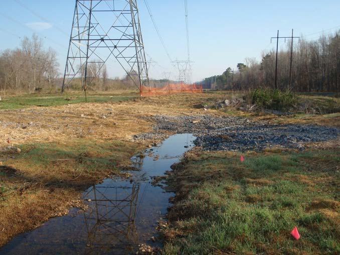
15 Raccoon Creek Overview


16 Cherokee Darter Federally threatened Know from only about 20 streams in the Etowah basin Prefers small streams and can be found in small pools and in runs/riffles over coarse gravel and cobble Etheostoma scotti, Fed T Photo by Bud Freeman


17 Raccoon Creek Overview
18 Steps for Developing a Restoration Project Existing Conditions Assessment Bankfull Verification Design Criteria Selection Design Permitting Construction Evaluation

19 Existing Conditions Drainage Areas of: Darter Creek: 0.1 mi² Raccoon Creek: 23.6 mi² Suburban and Forested Watershed Sites Located within Georgia Power Company Right of Way


20 Existing Conditions Assessment

")

21 BEHI & NBS Analysis EPA Accepted Method for Developing Sediment TMDL (WARSS) Statistically Valid Method for Predicting Bank Erosion Rates


22 Unstable Bank High BEHI Stable Bank Low BEHI BEHI Assessment with NBS will provide an approximate sediment contribution for the reach assessed in tons/year


23
24 Longitudinal Profile Raccoon Creek Elevation Thalweg Water Surface 680 Top of Bank Station
25 Cross Sections
26 Bed Materials 100 Raccoon Creek Pebble Count Particle Distribution Silt/Clay Sand Gravel Cobble Boulder Bedrock 70 Percent Cumulative (%) Particle Class Size (mm) Reach Summary Riffle Summary Pool Summary
27 Geomorphic Results Each stream has Bank Height Ratios, indicative of severe incision stream type Existing Conditions Notation Units minimum maximum average drainage area DA sq mi Mannings Roughness Coefficient "n" bankfull discharge Q bkf cfs Cross-Section Features bankfull cross-sectional area A bkf SF average velocity during bankfull event v bkf fps width at bankfull w bkf feet riffle maximum depth at bankfull d max feet riffle mean depth at bankfull d bkf feet bankfull width to depth ratio (W/D) w bkf /d bkf riffle max depth ratio d max /d bkf max tob d maxtob feet bank height ratio BHR feet/feet floodprone area width w fpa feet entrenchment ratio (Wfpa/Wbkf) ER feet/feet C5
28 Steps for Developing a Restoration Project Existing Conditions Assessment Bankfull Verification Design Criteria Selection Design Permitting Construction Evaluation

29 Bankfull Verification Field Verification of bankfull in ungauged watershed Aid in designing new channels Know your watershed Know that rainfall/runoff drives the relationship Gage Station Survey Reference Reach Survey Regional Curves

30 Reference Reach Surveys 2 Onsite Reaches Used Reach 1 Drainage Area: 23.6 mi² Cross Sectional Area: 130 ft²


31 Gauge Station Survey Hurricane Creek Drainage Area: 0.33 mi² Bankfull Discharge: 50cfs Return Interval: ~1.5 years Cross Sectional Area: ft²
32 Regional Curve Developed by Dunne and Leopold in 1978 Relates dependent variables such as cross sectional area, width, depth, and discharge versus the independent variable of drainage area Used as a tool to help verify bankfull stage, and as an aid in design No published GA Piedmont Regional Curve GA Coastal Plain Regional Curve is available, however, the project is in the Piedmont
33 1000 GA Corblu y = x R 2 = NC and GA Rural Piedmont Regional Curve NC y = x R 2 = Bankfull X-Sec. Area (Sq. Ft.) Lower 95 % Upper 95% GA NC Raccoon Creek NC Piedmont GA Piedmont* Watershed Area (Sq. Mi.)
34 Steps for Developing a Restoration Project Existing Conditions Assessment Bankfull Verification Design Criteria Selection Design Permitting Construction Evaluation
35 Design Criteria Selection Design Criteria Selection YES Is there a reference reach upstream with a stable riffle and the same valley slope? NO Reference Reach Survey Reference Reach Ratios as Design Criteria Reference Reach Database Review Ratios Reference Reach Search Reference Reach Survey If Possible Ratios Regime/Literature Review Equations Regime Equations Past Project Evaluation Review of Monitoring Data Regime Equations and Ratios Select Design Ratios and Equations
36 Design Criteria Raccoon Creek Design Notation Units minimum maximum average stream type drainage area DA sq mi C Mannings Roughness Coefficient "n" bankfull discharge Q bkf cfs Cross-Section Features bankfull cross-sectional area A bkf SF average velocity during bankfull event v bkf fps width at bankfull w bkf feet riffle maximum depth at bankfull d max feet riffle mean depth at bankfull d bkf feet bankfull width to depth ratio (W/D) w bkf /d bkf riffle max depth ratio d max /d bkf max tob d maxtob feet bank height ratio BHR feet/feet 1 1 floodprone area width w fpa feet entrenchment ratio (Wfpa/Wbkf) ER feet/feet Sinuosity valley slope S v alley feet/ foot channel slope S channel feet/ foot sinuosity K Riffle Features riffle slope S riffle feet/ foot riffle slope ratio S riffle /S channel Pool Features pool slope S pool feet/ foot pool slope ratio S poo l/s channel pool-to-pool spacing L p-p feet NA NA pool spacing ratio L p-p /w bkf NA NA maximum pool depth at bankfull d pool feet pool depth ratio d pool /d bkf pool width at bankfull w pool feet pool width ratio w pool /w bkf pool cross-sectional area at bankfull A pool SF pool area ratio A bkf /A pool
37 Sediment Transport Analysis Test for aggradation or degradation potential Competency analyses Capacity analyses
38 Sediment Transport Analysis Sand/Gravel Bed Stream Competency analyses performed Raccoon Creek Shear Stress Analysis Existing Conditions Design Bankfull Discharge (cfs) Bankfull Xsec Area, Abkf (sq ft) Bankfull Width, Wbkf (ft) Bankfull Mean Depth, Dbkf (ft) W/D Ratio Wetted Perimeter, WP=W+2D (ft) Hydraulic Radius, R (ft) Schan (ft/ft) Boundary/Bankfull Shear Stress, t (lb/sq ft) d50 of pavement 100 ct (mm) Subpavement Bar sample Subpavement Bar sample d50 of bar / subpavement (mm) di = D100 of bar / subpavement (mm) di = D100 of bar / subpavement (ft) ratio - d50pavem / d50subpavem 0.06 #DIV/0! 0.06 #DIV/0! ratio - di / d50 pavement ci-equation
39 Hydraulic Analysis Existing versus design water surface profiles Design stage / discharge relationship Existing versus design shear and power versus discharge relationships
40 Morphological Measurements and Ratios Pattern (Plan View) Belt Width Thalweg (Channel Length) Radius of Curvature (Rc) Meander Length (Lm) Channel Pattern Measurements Meander Length (Lm) Radius of Curvature (Rc) Belt Width (Wblt) Valley Length (VL) Channel Pattern Calculations Ratio: Radius of Curvature/Riffle Width (Rc/Wr) Ratio: Meander Length/Riffle Width (Lm/Wr) Meander Width Ratio (MWR=Wblt/Wr) Sinuosity (K) = Channel Length/Valley Length
41 Steps for Developing a Restoration Project Existing Conditions Assessment Bankfull Verification Design Criteria Selection Design Permitting Construction Evaluation


42 Design


43 Design


44 Design
45 Proposed Cross Sections
46 Proposed Profile
47 Steps for Developing a Restoration Project Existing Conditions Assessment Bankfull Verification Design Criteria Selection Design Permitting Construction Evaluation

48 Permitting USACE 404 Stream Buffer Variance LDP NPDES CLOMR/LOMR
49 Steps for Developing a Restoration Project Existing Conditions Assessment Bankfull Verification Design Criteria Selection Design Permitting Construction Evaluation

50 Darter Creek : Construction January 2011


51 Darter Creek : Post-Construction bankfull rain event

52 Raccoon Creek Site # 3 : Pre-Restoration


53 Raccoon Creek Site # 3 : Construction January 2011


54 Raccoon Creek Site # 3: Post-Construction bankfull rain event


55 Raccoon Creek Site # 3: Post-Construction

56 Raccoon Creek Site # 4: Pre-Restoration


57 Raccoon Creek Site # 4: Construction


58 Raccoon Creek Site # 4: Post-Construction bankfull rain event


59 Raccoon Creek Site # 4: Post-Construction


60 Raccoon Creek Site # 5: Pre-Restoration


61 Raccoon Creek Site # 5: Construction (Jan-Feb, 2013)


62 Raccoon Creek Site # 5: Post-Construction ( )


")
63 Raccoon Creek Site # 5: Bankfull Rain Event ( ) (day before) (after water receded)


64 Raccoon Creek Site # 5: Post Construction


65 Raccoon Creek Site # 6: Pre-Restoration


66 Raccoon Creek Site # 6: Construction (Jan-Feb 2013)


67 Raccoon Creek Site # 6: Post-Construction (Feb 2013)


68 Raccoon Creek Site # 6: Post-Construction


69 Raccoon Creek Site # 8: Pre-Restoration Curb in culvert

 to")
70 Raccoon Creek Site # 8: Post-Restoration Curb cut (~10 ) to enhance fish passage


71 QUESTIONS? Etheostoma scotti Etheostoma stigmaeum Etheostoma etowahae Darters, from top left: Cherokee, Speckled, & Etowah (center)
Use of WARSSS in Stream Restoration and Watershed Planning. Michigan Aquatic Restoration Conference 2015
 Use of WARSSS in Stream Restoration and Watershed Planning Michigan Aquatic Restoration Conference 2015 October 22, 2015 Use of WARSSS in Stream Restoration and Watershed Planning 1. Watershed Management
Old Mill School Stream Restoration
 Project Overview This conceptual plan restores and stabilizes two consecutive reaches of a highly incised and unstable stream and reconnects them with the floodplain. The restoration reaches are part of
IMPROVING OUTCOMES FOR STREAM ALTERATION PROJECTS
 IMPROVING OUTCOMES FOR STREAM ALTERATION PROJECTS Bethany Matousek Inland Lakes and Streams Program Coordinator Wetlands, Lakes and Streams Unit DEQ Water Resources Division MatousekB@Michigan.gov 517-243-6421
Condition and Trend: as of May 1st Presented by W. Barry Southerland, Ph.D Fluvial Geomorphologist USDA-NRCS WNTSC Portland, OR
 Monitoring tools: streams Condition and Trend: as of May 1st Presented by W. Barry Southerland, Ph.D Fluvial Geomorphologist USDA-NRCS WNTSC Portland, OR Monitoring and assessment? White River, WA, 2002
Stream Restoration at Road Crossings in Northern Wisconsin. Dale Higgins, USDA Forest Service
 Stream Restoration at Road Crossings in Northern Wisconsin Dale Higgins, USDA Forest Service Key Points Large # of road and trail stream crossings on the landscape Many crossings adversely impact streams
Mill Creek Restoration in Lower Merion Township. PH (610) ; FAX (610) ;
 ; FAX (610) ;") Mill Creek Restoration in Lower Merion Township Vincent L. Sortman 1 and Robert M. Lambert 2 1 Biohabitats, Inc., 15 W. Aylesbury Road, Timonium, MD 21093; PH (410) 337-3659; FAX (410) 583-5678; email:
Mill Creek Restoration in Lower Merion Township Vincent L. Sortman 1 and Robert M. Lambert 2 1 Biohabitats, Inc., 15 W. Aylesbury Road, Timonium, MD 21093; PH (410) 337-3659; FAX (410) 583-5678; email:
Stream Simulation in Very Low Gradient Channels
 University of Massachusetts - Amherst ScholarWorks@UMass Amherst International Conference on Engineering and Ecohydrology for Fish Passage International Conference on Engineering and Ecohydrology for Fish
FINAL REPORT. Dry Gulch Stream Restoration
 FINAL REPORT Dry Gulch Stream Restoration Biological and Agricultural Engineering Department North Carolina State University Raleigh, North Carolina Town of Carrboro Carrboro, North Carolina December 15,
Natural Channel Design and Dead River Case Study Stream Restoration in the Great Lakes Basin: Using In-stream Structures & Natural Channel Design
 Natural Channel Design and Dead River Case Study Stream Restoration in the Great Lakes Basin: Using In-stream Structures & Natural Channel Design January 22, 2013 S. Paige Baker, PE, MLE Presentation Outline
STREAM RESTORATION PURPOSE, PRACTICE, AND METHODS. By Marcus Rubenstein, CPESC
 STREAM RESTORATION PURPOSE, PRACTICE, AND METHODS By Marcus Rubenstein, CPESC WHAT IS STREAM RESTORATION? The return of a stream s lost natural functions, usually resulting from watershed alterations,
Assessing Morphological Performance of Stream Restoration in North Carolina
 Assessing Morphological Performance of Stream Restoration in North Carolina Barbara Doll, PE, Ph.D., Extension Specialist NC Sea Grant and Biological and Agricultural Engineering Department, NC State University
Functional Uplift Based Stream Assessment & Restoration Design
 Functional Uplift Based Stream Assessment & Restoration Design Darcy K.L. Turner Senior Environmental Scientist, Biohabitats, Inc. (dturner@biohabitats.com) Christopher A. Streb, PE Ecological Engineer,
PROJECT SCREENING MATRIX: A User s Guide
 Version 2.0 Page 1 of 7 November 9, 2010 PROJECT SCREENING MATRIX: A User s Guide BACKGROUND The Project Screening Matrix (Screening Matrix) is one of several tools that comprise the River Restoration
LITTLE SHADES CREEK RESTORATION PROJECT CWA Section 319(h) Nonpoint Source Implementation Grant Project Workplan #17 ADEM Contract #C
 Nonpoint Source Implementation Grant Project Workplan #17 ADEM Contract #C") LITTLE SHADES CREEK RESTORATION PROJECT CWA Section 319(h) Nonpoint Source Implementation Grant Project Workplan #17 ADEM Contract #C90593066 PARTNERS Alabama Department of Environmental Management Cawaco
LITTLE SHADES CREEK RESTORATION PROJECT CWA Section 319(h) Nonpoint Source Implementation Grant Project Workplan #17 ADEM Contract #C90593066 PARTNERS Alabama Department of Environmental Management Cawaco
Adjusted Flood Prone Acres
 Adjusted Flood Prone Acres The flood prone area is defined as the area adjacent to the stream that is innundated or saturated when the elevation of the water is at twice the maximum depth at bankfull stage
Stevens Creek Steelhead Limiting Factors Analysis. Stillwater Sciences
 Stevens Creek Steelhead Limiting Factors Analysis Stillwater Sciences May 18, 2004 Project Goals! Identify and fill information gaps related to physical and biological factors controlling population dynamics
Stream Restoration in the Urban Environment Concepts and Considerations
 Stream Restoration in the Urban Environment Concepts and Considerations The Restoration of Our Rivers; October 5, 2012 Matthew A. Van Eps, PE & Sandi J. Formica: Watershed Conservation Resource Center
Wisconsin Hydraulic Geometry Regional Curves
 Wisconsin Hydraulic Geometry Regional Curves Marie Peppler and Faith Fitzpatrick, USGS, Middleton, WI Michigan Stream Team Conference Call February 17, 2010 Objectives Develop relations between channel
Lessons Learned from the Jocko River Demonstration Project
 Lessons Learned from the Jocko River Demonstration Project Applied Adaptive Management Matt Daniels, P.E. Presentation Objectives Provide a brief overview of the project context. Describe the monitoring
3.0 Stream Assessment
 3.0 Stream Assessment 3.1 Methods Stream aquatic integrity in urban settings is directly affected by the physical changes in the watershed, some of which result in the degradation of the chemical and/or
Bluff Creek One Water
 Bluff Creek One Water The Bluff Creek Watershed has no lakes within its boundaries. As the westernmost watershed within the District, land use changes from agricultural to residential have occurred relatively
A Method for the Determination of Design Discharges for Urban Stream Restoration Projects in Northern Virginia. Scott Raymond Petrey
 A Method for the Determination of Design Discharges for Urban Stream Restoration Projects in Northern Virginia Scott Raymond Petrey Thesis submitted to the Faculty of Virginia Polytechnic Institute and
Stream Mitigation Considerations. CESAS-RD / 25Sep2014
 The following is a living document subject to change at any time. For the most up to date version: http://www.sas.usace.army.mil/missions/regulatory/mitigation.aspx Action ID: SAS- Project Name: County:
Introduction to stream assessment
 Why do stream assessment? Introduction to stream assessment Given the current condition of rivers and the heightened public interest in them, there is a significant need for the ability to determine the
STREAM CONDITION & EROSION CONCERNS IN CITY OF FORT WORTH. Ranjan S. Muttiah Stormwater Management City of Fort Worth
 STREAM CONDITION & EROSION CONCERNS IN CITY OF FORT WORTH Ranjan S. Muttiah Stormwater Management City of Fort Worth Contrast in Practices AG LAND URBAN LAND - Soil is the livelihood - Soil for building
RETENTION BASIN EXAMPLE
 -7 Given: Total Tributary Area = 7.5 ac o Tributary Area within Existing R/W = 5.8 ac o Tributary Area, Impervious, Outside of R/W = 0.0 ac o Tributary Area, Pervious, Outside of R/W = 1.7 ac o Tributary
Effects of Riparian Vegetation on Channel Hydraulics and Flow Conveyance
 Effects of Riparian Vegetation on Channel Hydraulics and Flow Conveyance Andrew P. Hood Sustainable Resources Group Intn l Inc. Presented at: Ecology, Restoration, and Management of Hawaiian Stream and
2012 Mill Creek Watershed Habitat Assessment Level 3 Project Study Plan Results
 2012 Mill Creek Watershed Habitat Assessment Level 3 Project Study Plan Results Cranberry Run This project study plan was financed through a Sub-grant from the Ohio EPA with funds from the State of Ohio.
Urban Hydrology Characteristics and their Influence on Urban Stream Restoration Technology. Presented by:
 Urban Hydrology Characteristics and their Influence on Urban Stream Restoration Technology Presented by: Michael Clar Ecosite, Inc. James Gracie Brightwater, Inc. BACKGROUND Many streams in urban areas
River Processes River action (fluvial)
") River action (fluvial) is probably the single most important geomorphic agent and their influence in geomorphology can hardly be overestimated. 1 To understand the complexity associated with river flow
River action (fluvial) is probably the single most important geomorphic agent and their influence in geomorphology can hardly be overestimated. 1 To understand the complexity associated with river flow
NCS Design Approach. Biology/Ecology Primer. Presented by: Jack Imhof, National Biologist Trout Unlimited Canada
 NCS Design Approach Biology/Ecology Primer Presented by: Jack Imhof, National Biologist Trout Unlimited Canada Biology/Ecology Key biological principles that are applied Need to speak the same language
Applied Research Efforts to Improve the Design, Implementation and Management of Ecological Restoration in North Carolina
 Applied Research Efforts to Improve the Design, Implementation and Management of Ecological Restoration in North Carolina Barbara Doll, PE, Ph.D., Assistant Extension Professor and Extension Specialist
4.1 Traditional Approach versus Geomorphic Approach
 RESTORATION 4.0 Introduction As we discussed in the Watersheds and Streams Section, many streams have been severely impacted by urbanization as a result of changes in their hydrologic and sediment regimes,
WQPBWMSSOP-03 Rev# 01 03/15/2010 FIELD METHODOLOGY FOR THE ASSESSMENT OF TMDL SEDIMENT AND HABITAT IMPAIRMENTS
 WQPBWMSSOP-03 Rev# 01 03/15/2010 FIELD METHODOLOGY FOR THE ASSESSMENT OF TMDL SEDIMENT AND HABITAT IMPAIRMENTS Montana Department of Environmental Quality 1520 East Sixth Avenue Helena, Montana 59620 March
Culvert Prioritization Model: Aiding Communities in the Selection of Priority Restoration Projects
 Culvert Prioritization Model: Aiding Communities in the Selection of Priority Restoration Projects Meeting #1 of the Technical Advisory Committee March 18, 2016 1 Press 2 Prepared February 2016 Undersized
Watershed Hydrology: Go with the flow. Greg Jennings, PhD, PE
 Watershed Hydrology: Go with the flow Greg Jennings, PhD, PE jenningsenv@gmail.com Streams What are your CHALLENGES? Hydrology too much water Pollutants upstream and on-site Vegetation wrong plants, wrong
Freight Street Development Strategy
 Freight Street Development Strategy Appendix B: Naugatuck River Floodplain Analysis Freight Street Development Strategy DECEMBER 2017 Page B-1 1.0 NAUGATUCK RIVER FLOODPLAIN AT FREIGHT STREET 1.1 Watershed
* For applicants utilizing bank for compensatory mitigation requirements, information below is not applicable.
 Mitigation Plan (33 CFR 332.4(c)/40 CFR 230.92.4(c)) A mitigation plan is required for all forms of compensatory mitigation, whether permittee-responsible mitigation, mitigation banks, or in-lieu fee mitigation
Hydrology Attribute 1/15/2016. California Rapid Assessment Method for Wetlands. Hydrology. Precipitation Increases the Extent of Wetlands
 California Rapid Assessment Method for Wetlands Hydrology Attribute Hydrology Determines existence of wetlands, drives primary physical and ecological processes: Establishment of reducing conditions Nutrient
Stream Assessment Form (Form 1) Unified Stream Methodology for use in Virginia
 Unified Stream Methodology for use in Virginia") Stream Assessment Form (Form 1) Unified Stream Methodology for use in Virginia Project Name For use in wadeable channels classified as intermittent or perennial Cowardin HUC Date SAR # Class. Impact/SAR
Stream Assessment Form (Form 1) Unified Stream Methodology for use in Virginia Project Name For use in wadeable channels classified as intermittent or perennial Cowardin HUC Date SAR # Class. Impact/SAR
Developing Tools for Hydromodification Management and Assessment
 Developing Tools for Hydromodification Management and Assessment Hydromodification: Channel Erosion Before Development After Development Increase in: - Imperviousness - Drainage Slope - Direct Runoff Decrease
Checklist for Stream Habitat Improvement Projects
 Minnesota Department of Natural Resources Section of Fisheries Checklist for Stream Habitat Improvement Projects Checklist Objectives and Intent: This checklist is intended for work with cooperative partners
Designing roads for fish, floods and foxes
 Designing roads for fish, floods and foxes Calculations 9 Swimming Plunging Flow & Leaping Occupied Velocity Prolonged > Capability Yes Swim in Burst Total Time in Burst Time to > Exhaustion Yes Barrier
5 th Avenue Dam Removal & Lower Olentangy River Ecosystem Restoration Project
 5 th Avenue Dam Removal & Lower Olentangy River Ecosystem Restoration Project October 2013 Agenda 1 Project Background 2 Design Report 3 Design Process 4 Permitting 5 Construction 1 Project Background
Functions Lost, Functions Gained: Can Stream Mitigation Work? Will Harman, PG Stream Mechanics
 Functions Lost, Functions Gained: Can Stream Mitigation Work? Will Harman, PG Stream Mechanics Overview of Presentation Functions Lost Our war against the river. Functions Gained Our attempts at restoration.
MINNEHAHA COUNTY HIGHWAY DEPARTMENT CULVERT REPLACEMENT REQUEST FORM
 MINNEHAHA COUNTY HIGHWAY DEPARTMENT CULVERT REPLACEMENT REQUEST FORM Instructions & Background Information (This page to be completed by Township personnel) The purpose of this form is to provide a means
Gwinnett County Dept. of Water Resources Watershed Improvement Program. Russell Manley, CFM, Gwinnett County DWR Kevin Middlebrooks, CH2M
 Gwinnett County Dept. of Water Resources Watershed Improvement Program Russell Manley, CFM, Gwinnett County DWR Kevin Middlebrooks, CH2M Gwinnett County: Population: 859,000 Area: 437 sq. miles 2,000 miles
SWAP Risk Informed Methods for Stormwater Assessment and Prioritization
 SWAP Risk Informed Methods for Stormwater Assessment and Prioritization Sara Hillegas Woida, Hydraulic Engineer US Army Corps of Engineers, Pittsburgh Thomas Maier, Biologist/Planner US Army Corps of Engineers,
Rapid Data Collection Methods
 Rapid Data Collection Methods Tennessee Stream Quantification Tool Tennessee Debit Tool i Tennessee Stream Quantification Tool Rapid Data Collection Methods TN SQT v1.0 November 2018 Lead Agency: Tennessee
Jason R. Vogel, Ph.D., P.E. Biosystems and Agricultural Engineering Oklahoma State University
 Stormwater 101 OKLAHOMA STATE UNIVERSITY Biosystems and Agricultural Engineering Department Jason R. Vogel, Ph.D., P.E. Biosystems and Agricultural Engineering Oklahoma State University Stormwater is excess
Hydromodification Management Measures
 Chapter 7 Hydromodification Management Measures This Chapter summarizes the requirements for controlling erosive flows from development projects. 7.1 Why Require Hydromodification Management? Changes in
Hydromodification Management Measures
 Chapter 7 Hydromodification Management Measures This Chapter summarizes the requirements for controlling erosive flows from development projects. 7.1 Why Require Hydromodification Management? Changes in
McNally Post-Fire Discharge and the Relationship of Sierra Nevada-wide Flood Frequency Curves and Local Kern River Discharge Curves
 McNally Post-Fire Discharge and the Relationship of Sierra Nevada-wide Flood Frequency Curves and Local Kern River Discharge Curves Terry A. Kaplan-Henry Sequoia National Forest, Porterville, California
Existing Land Use USACE Fountain Creek Watershed Study Watershed Management Plan, Pueblo
 Existing Land Use USACE Fountain Creek Watershed Study Watershed Management Plan, 2009 Pueblo N Future Land Use (2025) USACE Fountain Creek Watershed Study Watershed Management Plan, 2009 Pueblo N Project
Bonsall Creek Watershed Management Plan Gap Analysis
 Bonsall Creek Watershed Management Plan Gap Analysis March 2015 Prepared by Gap Analysis Introduction The Bonsall Creek Watershed Management Plan provides a vision for water use in the watershed, including
F7 Stream Reach Summary
 F7 Stream Reach Summary Study Reach: F7, Fraser River - Ranch Creek confluence downstream to Canyon below Strawberry Road. Reach Description: Approximate channel length: 1 ½ miles, approximate channel
Aquatic Mitigation Riverside Oxbow and Sycamore Creek Restoration
 Aquatic Mitigation Riverside Oxbow and Sycamore Creek Restoration Brian Murphy, P.E., D.WRE July 30, 2014 Overview Central City Project Marine Creek Sycamore Creek Design (Criteria & Approach) Summary
Hydraulic Modeling with HY-8
 Hydraulic Modeling with HY-8 Linda Hansen PE, PWS MI Dept. of Environmental Quality Water Resources Division UP District Floodplain Engineer Today s Outline What is HY-8? Best Applications & Limitations
Southeast Policy Area Drainage Study
 Southeast Policy Area Drainage Study Prepared for City of Elk Grove January 2014 448-00-12-03 Table of Contents 1.0 Introduction... 1 2.0 Watershed Description... 1 3.0 Drainage Plan Concept... 1 4.0
Department of the Army Corps of Engineers. State of Missouri Stream Mitigation Method
 Department of the Army Corps of Engineers State of Missouri Stream Mitigation Method Updated February 2007 A. GENERAL INFORMATION 1. Regulatory Authorities & Guidelines B. ADVERSE IMPACT FACTORS 1. Stream
Introduction to Storm Sewer Design
 A SunCam online continuing education course Introduction to Storm Sewer Design by David F. Carter Introduction Storm sewer systems are vital in collection and conveyance of stormwater from the upstream
CLAY STREET BRIDGE REPLACEMENT
 HYDROLOGY /HYDRAULICS REPORT. EL DORADO COUNTY CLAY STREET BRIDGE REPLACEMENT Prepared by: Joseph Domenichelli Domenichelli & Associates 1107 Investment Blvd., Suite 145 El Dorado Hills, California 95762
The Beckett s Run Experience. Fort Wayne, Indiana
 The Beckett s Run Experience Fort Wayne, Indiana Introductions Charlie Cochran City of Fort Wayne, Wet Weather Storm & Sewer Engineering Jason Durr, PE Christopher B. Burke Engineering, LLC 2 A Little
Post-Storm Infrastructure Improvements and Stream Restoration: Three Case Studies Northeastern Transportation and Wildlife Conference September 10,
 Post-Storm Infrastructure Improvements and Stream Restoration: Three Case Studies Northeastern Transportation and Wildlife Conference September 10, 2018 Today s Session: Three Case Study Examples Hurricanes,
NCEES NCEES-PE. NCEES - PE Civil Engineering.
 NCEES NCEES-PE NCEES - PE Civil Engineering https://killexams.com/pass4sure/exam-detail/ncees-pe Question: 35 Which of the following assumptions regarding the compression strength of concrete used in reinforced
Scope of Work Lower Arroyo Grande Creek Flooding Analysis
 Scope of Work Lower Arroyo Grande Creek Flooding Analysis Overview Please note that the limits of work for the hydrologic and hydraulic analysis include the following: Detailed topographic surveys: flood
Chapter Three: Discussion and Conclusion. 3.1 Introduction/Overview. 3.2 Countywide Stream Assessment
 3.1 Introduction/Overview The objective of this study was to develop a stream prioritization tool that evaluates stream reaches in terms of the potential water quality improvements that could be achieved
California Rapid Assessment Method for Wetlands (CRAM) Riverine Training Module
 Riverine Training Module") California Rapid Assessment Method for Wetlands (CRAM) Riverine Training Module Steps of CRAM Assessment Step 1: Assemble background information Step 2: Classify wetland Step 3: Verify the appropriate
California Rapid Assessment Method for Wetlands (CRAM) Riverine Training Module Steps of CRAM Assessment Step 1: Assemble background information Step 2: Classify wetland Step 3: Verify the appropriate
Development of a Stage-Discharge Rating for Site Van Bibber Creek at Route 93
 Development of a Stage-Discharge Rating for Site 330 - Van Bibber Creek at Route 93 Prepared for: Urban Drainage and Flood Control District 2480 W. 26 th Avenue Suite 156-B Denver, CO 80211 May 19, 2006
NORTHERN VIRGINIA STREAM RESTORATION BANK Concept Plan
 Dated May 15, 2006 NORTHERN VIRGINIA STREAM RESTORATION BANK Concept Plan Northern Virginia Stream Restoration, L.C. c/o Wetland Studies and Solutions, Inc. 5300 Wellington Branch Drive, Suite 100 Gainesville,
Pete Cruickshank and Mike Kaputa; Chelan County Natural Resource Department
 To: From: Pete Cruickshank and Mike Kaputa; Chelan County Natural Resource Department Mike (Rocky) Hrachovec, PE; Tim Abbe, PhD, PG; Susan Dickerson-Lange, PhD; and John Soden, MS, PWS; Natural Systems
Crooked Creek Storm Water Master Plan
 Final Crooked Creek Storm Water Master Plan Submitted to Gwinnett County, Georgia July 2003 Contents Executive Summary...ES-1 Background... ES-1 Purpose of the Storm Water Master Plan... ES-2 Regulatory
Information for EFSAB:
 Information for EFSAB: Stream-ecology and flow relationships based on our ACF research Transferability of species preferences Defensibility of ACF work in context of controversy Mary Freeman USGS Patuxent
SECTION IV WATERSHED TECHNICAL ANALYSIS
 A. Watershed Modeling SECTION IV WATERSHED TECHNICAL ANALYSIS An initial step in the preparation of this stormwater management plan was the selection of a stormwater simulation model to be utilized. It
Low Head Stone Weirs By: Jon Fripp 1, Dr. Craig Fischenich 2, and Dr. David Biedenharn 2
 Low Head Stone Weirs By: Jon Fripp 1, Dr. Craig Fischenich 2, and Dr. David Biedenharn 2 Complexity Low Moderate High Environmental Value Low Moderate High Cost Low Moderate High OVERVIEW Establishing
Module 3: Rainfall and Hydrology for Construction Site Erosion Control
 Module 3: Rainfall and Hydrology for Construction Site Erosion Control Robert Pitt Department of Civil, Construction, and Environmental Engineering University of Alabama Tuscaloosa, AL Rainfall and Hydrology
Methods of Streamflow Analysis
 4 Methods of Streamflow Analysis CHAPTER 4 Streamflow Measurements Danielle M. Andrews Department of Crop and Soil Sciences, The Pennsylvania State University I. INTRODUCTION Perennial carries water all
Fish Passage Barrier Removal on Denson s Creek: Triple Bottom Line Solution
 Fish Passage Barrier Removal on Denson s Creek: Triple Bottom Line Solution Grace Messinger Piedmont Conservation Council grace@piedmontconservation.org Laura Fogo US Fish and Wildlife Service laura_fogo@fws.gov
Hydroecological tool: enhancements and results. enhancements and results. Marci Meixler. Project partners: Sponsored by:
 Hydroecological tool: Marci Meixler Sponsored by: Project partners: Motivation Great Lakes Charter Annex establish uniform, regional protections for Great Lakes waters ensure that authority over the Lake
FORT COLLINS STORMWATER CRITERIA MANUAL Hydrology Standards (Ch. 5) 1.0 Overview
 1.0 Overview") Chapter 5: Hydrology Standards Contents 1.0 Overview... 1 1.1 Storm Runoff Determination... 1 1.2 Design Storm Frequencies... 1 1.3 Water Quality Storm Provisions... 2 1.4 Design Storm Return Periods...
Chapter 5: Hydrology Standards Contents 1.0 Overview... 1 1.1 Storm Runoff Determination... 1 1.2 Design Storm Frequencies... 1 1.3 Water Quality Storm Provisions... 2 1.4 Design Storm Return Periods...
River Restoration, 2018 Has stormwater management been our Achilles Heel in River Management?
 River Restoration, 2018 Has stormwater management been our Achilles Heel in River Management? By Bill Annable, PhD, PhD, PEng, PE, PGeo Department of Civil & Environmental Engineering, University of Waterloo
Programmatic General Permit Army Corps of Engineers Connecticut Addendum
 Programmatic General Permit Army Corps of Engineers Connecticut Addendum DEP USE ONLY NAE#: DEP #: PGP Screening Date: Determinations: Eligible Category 2 Eligible Category 1 Individual Permit Print or
Appendix B Stormwater Site Plan Submittal Requirements Checklist
 Stormwater Site Plan Submittal Requirements Checklist The Submittal Requirements Checklist is intended to aid the design engineer in preparing a Stormwater Site Plan. All items included in the following
Hydraulic Report. County Road 595 Bridge over Mulligan Creek. Prepared By AECOM Brian A. Hintsala, P.E
 Prepared for: Prepared by: Marquette County Road Commission AECOM Ishpeming, MI Marquette, MI 60240279 December 9. 2011 Hydraulic Report County Road 595 Bridge over Mulligan Creek Prepared By AECOM Brian
Case Study 19. Mill Creek Embedded Box Culvert Vented Ford
 Case Study. Mill Creek Embedded Box Culvert Vented Ford Location Southeast Missouri. Mark Twain National Forest; Houston-Rolla Ranger District. Southeast of Rolla, south of Interstate 44, off of State
APPENDIX F RATIONAL METHOD
 7-F-1 APPENDIX F RATIONAL METHOD 1.0 Introduction One of the most commonly used procedures for calculating peak flows from small drainages less than 200 acres is the Rational Method. This method is most
Drop Height For Channel Erosion Control
 Drop Height For Channel Erosion Control James C.Y. Guo, Professor and Director Department of Civil Engineering, U. of Colorado at Denver, Denver, Colorado 8017 E-mail: James.Guo@cudenver.edu Introduction
APPENDIX E SECTION 404 (B) (1) EVALUATION OF DREDGE AND FILL MATERIAL
 (1) EVALUATION OF DREDGE AND FILL MATERIAL") APPENDIX E SECTION 404 (B) (1) EVALUATION OF DREDGE AND FILL MATERIAL SECTION 404 (B) (1) EVALUATION FOR AUGUSTA ROCKY CREEK SECTION 205 FEASIBILITY STUDY, RICHMOND COUNTY, GEORGIA FEBRUARY 2016 TABLE
APPENDIX E SECTION 404 (B) (1) EVALUATION OF DREDGE AND FILL MATERIAL SECTION 404 (B) (1) EVALUATION FOR AUGUSTA ROCKY CREEK SECTION 205 FEASIBILITY STUDY, RICHMOND COUNTY, GEORGIA FEBRUARY 2016 TABLE
Mitigation Banking. Southeast Stormwater Association SESWA. Creative Alternatives for Stormwater Funding. April 23, 2010
 Mitigation Banking Southeast Stormwater Association SESWA Creative Alternatives for Stormwater Funding April 23, 2010 Steve Leo, Stormwater Management Director, Gwinnett County Pete Wright, Principal Engineer,
S.R. 0944, Section 015 (Wertzville Road) Bridge over the West Branch of Simmons Creek. Silver Spring Township Cumberland County.
 Bridge over the West Branch of Simmons Creek. Silver Spring Township Cumberland County.") Hydrologic and Hydraulic Report For S.R. 0944, Section 015 (Wertzville Road) Bridge over the West Branch of Simmons Creek Silver Spring Township Cumberland County August 13, 2003 Prepared For Pennsylvania
Hydrologic and Hydraulic Report For S.R. 0944, Section 015 (Wertzville Road) Bridge over the West Branch of Simmons Creek Silver Spring Township Cumberland County August 13, 2003 Prepared For Pennsylvania
Final Stream Restoration Assessment Report 2009
 Final Stream Restoration Assessment Report 2009 Prepared by NC State University January 2010 For NC Clean Water Management Trust Fund 1 Introduction: In 2006, NC State University was awarded a monitoring
INTERMEDIATE BMI ASSESSMENT TIER 2 FIELD SHEET
 INTERMEDIATE BMI ASSESSMENT TIER 2 FIELD SHEET PHYSICAL PARAMETERS ASSESSMENT FIELD SHEET ALL TIERS NAME: DATE: TIME: STREAM OR RIVER NAME: WATERSHED NAME: TOWN: WEATHER PRESENT PAST 48 HOURS SITE DESCRIPTION
Monotoring of instream habitats with focus on morphological dynamics based on Airborne Laser Bathymetry
 Monotoring of instream habitats with focus on morphological dynamics based on Airborne Laser Bathymetry Gottfried Mandlburger, Christoph Hauer, and Martin Wieser gottfried.mandlburger[martin.wieser]@geo.tuwien.ac.at
Burke Creek Highway 50 Crossing and Realignment Project Monitoring Plan
 Burke Creek Highway 50 Crossing and Realignment Project Monitoring Plan Table of Contents Table of Figures... i Introduction... 1 Background... 1 Burke Creek Issues... 2 Monitoring Objectives and Goals...
Local Watershed Plan for the French Broad River Basin: South Hominy Creek Watershed
 Local Watershed Plan for the French Broad River Basin: South Hominy Creek Watershed Technical Memorandum 3: Field Assessment and Functional Status Report North Carolina Department of Environment and Natural
1/30/2014. SR-BOK Outcomes. Sue Niezgoda, Gonzaga University January 28, Depth. Breadth
 SR-BOK Outcomes Sue Niezgoda, Gonzaga University January 28, 2014 Breadth Depth 1 Foundational Outcomes Hydrology Hydraulics Fluvial geomorphology Sediment Transport Stream Ecology Habitat Structure and
Improving the Success of In-Stream Structures
 Improving the Success of In-Stream Structures Restoration Question 8: Stability What design and construction factors are correlated with structural instability for certain site conditions? $88,076 Tess
ATTACHMENT 6 WATER QUALITY SWALE DESIGN ADDENDUM
 ATTACHMENT 6 WATER QUALITY SWALE DESIGN ADDENDUM 12 October 2010 Project No. 073-81694.0022 Mr. Robert R. Monok Project Manager Energy Fuels Resource Corporation 44 Union Boulevard, Suite 600 Lakewood,
Fish Habitat Design, Operation and Reclamation Workbook and Worksheets for Placer Mining in the Yukon Territory
 Fish Habitat Design, Operation and Reclamation Workbook and Worksheets for Placer Mining in the Yukon Territory Version 1.0 April 2008 This document is available from the Yukon Placer Secretariat, Yukon
TWIP and FLDPLN applications for Watershed Restoration Activities
 TWIP and FLDPLN applications for Watershed Restoration Activities Jeff Neel 1, Jude Kastens 2, Mike Houts 2, Kevin Dobbs 2, Debra Baker 3, Frank Norman 4 Talking Points Agenda Soapbox Job at Hand Toolbox