NORTHERN VIRGINIA STREAM RESTORATION BANK Concept Plan
|
|
|
- Maximilian Campbell
- 5 years ago
- Views:
Transcription

1 Dated May 15, 2006 NORTHERN VIRGINIA STREAM RESTORATION BANK Concept Plan Northern Virginia Stream Restoration, L.C. c/o Wetland Studies and Solutions, Inc Wellington Branch Drive, Suite 100 Gainesville, Virginia 20155
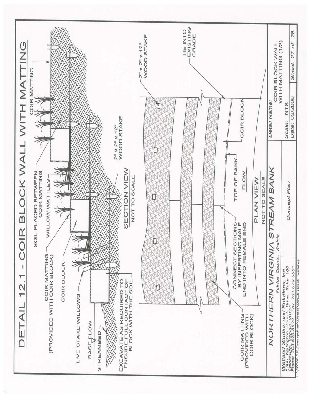
2 Northern Virginia Stream Restoration Bank Concept Plan INDEX Part Title Page I. BACKGROUND 1 II. CHANNEL DESIGN PROCESS 2 A. Detailed Topographic Survey 2 B. Hydrologic Analysis 2 C. Regional Curve and Reference Data 2 D. Existing Condition Assessment 3 E. Constraint Assessment 3 F. Final Design 3 III. STREAM RESTORATION SITE PLAN 3 A. Cover Sheet 4 B. Project Narrative 4 C. Hydrologic/Hydraulic Analyses 4 D. Design Parameters Summary 4 E. Plan and Profile Sheets of Restored Stream 5 F. Erosion and Sediment Control Plan 5 G. Structure Details 5 H. Planting Plan 5 IV. MONITORING PROGRAM 6 A. Monitoring Goals 6 B. Monitoring Success Criteria 6 C. Monitoring Protocol 8 D. Monitoring Reports 11 V. MAINTENANCE PLAN 11 EXHIBITS 1. Northern Virginia Stream Restoration Bank Phase I 2. Detailed Calculations Phase I Weighted Average Drainage Areas 3. Typical Details l:\20000s\20000\conceptplan\cover and index doc
3 DESIGN NARRATIVE I. Background Stream restoration will be conducted using Natural Channel Design methodologies, subject to the constraints of minimizing tree disturbance, working in an urban environment, and also satisfying all applicable homeowner association, local, state, and federal regulations. An overriding principle in the natural channel design process is that stable streams will maintain a consistent dimension, pattern, and profile thus understanding these central tendencies of the stream (i.e. where it is now and where it is going) are paramount to developing a successful restoration design that maintains itself within the natural variability of the design parameters. Integral to this approach is the careful analysis of the current geomorphic condition of the stream, followed by the comparison of these results to stable (reference) streams with similar characteristics (valley type, slope, soil type, etc.). Development of a successful design, one that meets the requirement of providing a self-maintaining stream 1 in an aesthetically pleasing, natural manner, requires a very detailed study and design process. Such a process in this area is further complicated by the urban setting in which most of the streams are found. Ideally, stable streams are connected to their floodplains during the bankfull event (generally every yrs in urbanized areas). However, given that many of the streams within the service area are essentially in urban settings with limited available space, providing effective alternatives to this ideal situation will be necessary. As such, tree preservation and other constraints posed by the urban setting (i.e. culvert crossings, bridges, utilities, trails, etc.) will be important elements of the design. Attached to this Concept Plan is a map depicting the Northern Virginia Stream Restoration Bank Phase I boundary (Exhibit 1). Note that the total stream lengths and resulting number of available SCU s are different than those originally estimated in the MBI Phase I now includes a total of 79,042 lf for a total of 671,857 SCU s. In the intervening time since the original stream lengths were estimated (based on Fairfax County data), a more detailed field assessment to confirm the stream lengths, as well as some detailed channel surveys of a portion of the Phase I streams, has been conducted. This more detailed review accounts for the difference. A more detailed review of the average restoration drainage area was also conducted using all the currently proposed restoration reaches. The result was a slight decrease in the average restoration drainage area, from the previously stated 229 ac down to 210 ac (details provided in Exhibit 2). Also included with this Concept Plan is a discussion of the channel design process, elements of the stream restoration site plan, as well as information on the 1 A self maintaining stream is defined as one that is able to transport the flow rates and sediment produced by its watershed without significant aggradation or degradation. 1
4 monitoring and maintenance protocols. Finally, details depicting the types of structural practices that will be employed are also provided (Exhibit 3). II. Channel Design Process As stated, the Natural Channel Design process will be the basis for the restoration designs with modifications applied as necessary to accommodate the specific design constraints of each particular reach. For each stream restoration project undertaken, the applicable elements of the 40-step process that defines the natural channel design methodology (Rosgen, 2004) will be performed to the degree possible given the urban constraints, current lack of gage data for small streams, and local and state regulatory requirements. However, the basic steps that will be performed for every restoration project will include the following (some to run concurrently): A. Detailed Topographic Survey To develop a successful restoration design, detailed topographic data (6-in. contour interval) is necessary. Also important is the survey location of all trees adjacent to the streams (as well as tag, measure, and identify) that are greater than 4-in in diameter. B. Hydrologic Analysis - The process will start with a detailed hydrologic analysis and modeling of the contributing watershed. Watershed models will be verified to make certain the design (bankfull) flow rates are correct a very important step that is often not performed - as this will be the basis for the design. C. Regional Curve and Reference Data - A concurrent step will be the assessment of regional curve data to aid in the comparison of the unstable stream dimensions (at bankfull) to the measured dimensions in other streams in the same hydro-physiographic province. Regional curves for this area are available from a study performed in Maryland by the U.S. Fish and Wildlife Service (USFWS, 2002). The final important piece of background information relates to the identification of reference reach data. While regional curves provide information on stream dimension targets, they do not provide a complete picture of the geometry, plan-form, and other important characteristics of a stable reach that can be used as a reference. Ideally, study of a stable reach can provide valuable information as to what might be the natural variability of the stream characteristics this in turn can help set realistic goals in restoring similar, unstable streams. The goal shall always be to identify a suitable reference reach to apply towards the design of the restored reach. However, realizing that locating an ideal reference reach suitable for each restored reach may not be possible (as finding reference reaches in urbanized areas is a challenge), the natural channel design of each reach shall utilize the best available data. 2
5 D. Existing Condition Assessment A very detailed, geomorphic analysis (applicable elements of the 40-step design process) will be performed to assess the condition of the unstable reach so it can be classified to determine where in the channel evolution process it may be is it working toward stability, or is it still degrading at a rapid rate? Is sediment supply adequate, excessive, or lacking? Answering these questions will be important in deciding what approach to take in the restoration design. E. Constraint Assessment With the above tasks complete, ideally the last tasks would be the design of the restored channel. While a complicated task in and of itself, it is made more complicated in this instance owing to the urban nature of the streams. Analysis of the constraints posed on the design solution is integral to developing a successful restoration. In some instances, it is anticipated that re-connection to the historic floodplain will not be a viable option. Further, trees desired by the community and anthropogenic structures such as sewers, roads, houses, etc. will prevent changes to the existing plan form of the stream. The alternative, therefore, will be the construction of a multi-staged channel within the existing channel banks. The multi-stage approach is key given the lack of available data on small, urban streams and the potential difficulty in precisely determining bankfull in severely incised streams, determining with absolute certainty the correct bankfull cross-section may be difficult. By implementing a multi-staged channel that provides a floodplain relief valve within the existing eroded banks of the channel, the risk posed by the potential uncertainty in computing bankfull discharge can be minimized. At the same time, the smaller channel within the existing channel can be sized to route sediment, an essential capability of a stable stream. Due to the flashy nature of urban watersheds, energy dissipation will also be essential thus deep lateral scour pools, step pools, and other energy dissipation structures will be employed. F. Final Design - After completing all of the steps outlined above, the final task will be the completion of the design plans. Structural elements will be necessary to stabilize virtually the entire restored reach to allow time for vegetation to become established. Insufficient structure with no existing vegetation will lead to failure. The types of structures that will be employed include, cross-vanes, j-hooks, step pools, imbricated riprap, and reinforced channel linings, to name a few. Step pools, whether incorporated within other structures or as stand-alone elements, will be very important as significant energy dissipation must be provided. III. Stream Restoration Site Plan The Stream Restoration Site Plans will meet all the requirements contained in the Fairfax County Public Facilities Manual or waivers will be obtained as necessary due 3
6 to the unique elements of stream restoration that are not specifically detailed in current Fairfax County regulations. As discussed previously, structural measures will be necessary elements of the restoration designs. Designs of many of these structural measures are included in detailed specifications provided with this concept plan. Other elements of the Stream Restoration Site Plans shall include, at a minimum: A. Cover Sheet 1. Proposed restoration site name/stream name. 2. Site location (i.e. county/city, along adjacent route numbers). 3. Location map (i.e. topo map; include latitude/longitude of center of site, HUC, County PIN). 4. Plan sheet index. 5. Approval blocks for the applicable jurisdiction. B. Project Narrative 1. Narrative describing the nature of the stream restoration concept. 2. Goals and objectives of restoration in terms of water quality benefits, replacement of functions and values, and stream stability. 3. Summary of restoration activities. 4. Brief summary of construction impacts. 5. Information on the Monitoring and Maintenance program. C. Hydrologic/Hydraulic Analyses 1. Results of hydrologic modeling of the contributing watershed to determine design flow rates. 2. Results of hydraulic modeling of the existing and proposed reaches. D. Design Parameters Summary 1. Results of the applicable portions of the 40-step, natural channel design methodology that lead to the channel design. This may include: a) reference reach information, including any geomorpholgical measurements, b) summary of design geomorphologic measurements (entrenchment ratio, width/depth ratio, sinuosity, stream type, slope, and predominant channel material) for the proposed stream, c) proposed stream type, d) summary matrix of all proposed restoration measures, including both structural and non-structural components. 4
7 2. An SCU analysis based on the Stream Restoration Site Plan for the subject stream reach, utilizing the methodology described in the Stream Impact Assessment Manual for the Northern Virginia Stream Bank (SIAM), Version 1.3, February 2006, to estimate the expected number of SCU s that will be created by the plan. E. Plan and Profile Sheets of Restored Stream 1. Grading plans at a scale of 1" = 50' and providing 0.5 ft contour intervals in stream restoration areas (or metric equivalent), or at a more detailed scale. Plans shall use the vertical and horizontal datums required by Fairfax County DPWES at the time of plan submission, NAD 83 and NGVD 29, respectively, at this time. 2. A survey of all trees measuring 4 and greater in diameter within 25 of all streams and access areas. 3. A surveyed wetland delineation, in accordance with the Corps 1987 Manual, of existing wetlands areas in the vicinity of each reach. F. Erosion and Sediment Control Plan 1. Developed in accordance with the Fairfax and/or Loudoun County Design and Construction Standards Manual and the most current edition of the Virginia Erosion and Sediment Control Handbook. 2. Details for all proposed E&S measures. G. Structure Details 1. Details of all proposed structures with specifications for each application. H. Planting Plan 1. Vegetation plan depicting or listing expected zonation (i.e., stream channel or floodplain/riparian area). 2. Vegetation schedule with plants and seeds selected based on habitat value and projected water elevation and duration. Said schedule shall include: a) species; b) wetland indicator status as specified in the current version of the National List of Plant Species That Occur in Wetlands: 5
8 Northeast (Region 1) c) plant size and spacing; and d) wildlife value assessment. The vegetation shall primarily comprise of a native riparian buffer seed mix to reflect the expected community type during the initial growth years of tree and shrub seedlings. Tree seedlings (bare root, tublings, or container) and shrubs (livestakes, bare root, tubling, or container) shall be randomly planted in Restoration areas, and comprised of at least 5 of the following species: pin oak, willow oak, sycamore, green ash, red maple, black willow, brookside alder, silky dogwood, or arrowwood. IV. Monitoring Program A. Monitoring Goals It is understood that urban/suburban stream restoration projects in the Northern Piedmont Physiographic Region of Virginia need further assessment by the Regulatory Agencies that comprise the MBRT in order to develop definitive success criteria. Therefore, one of the important goals of the proposed Bank is to collect data that can advance the state-of-the-art of Natural Channel Design in urban/suburban areas of Piedmont, Virginia. To achieve this, the monitoring and maintenance provisions provided in the MBI are extensive but not determinative in order to develop sufficient scientific and engineering data to develop better designs and objective measurable success criteria for future Phases of this Bank and any others that will follow. Adaptive management techniques shall be implemented to ensure that a successful stream restoration project results. In accordance with the MBI, each Phase of the Bank shall be monitored and maintained for a period of 10 years in such a condition as to meet specific monitoring success criteria. It is expected that the success criteria shall be modified in time to reflect knowledge gained from monitoring of this project and apply said modified criteria to subsequent Phases of the Bank. B. Monitoring Success Criteria All necessary work required to monitor the Bank to demonstrate compliance with the following Success Criteria established in Part V.E. of the MBI shall be performed: 1. With respect to reforested riparian buffer/areas: a. Plant density of at least 400 living wood stems (including volunteers) per acre of trees and shrubs must be achieved by the 6
9 end of the first growing season following planting and maintained through the end of the monitoring period or until canopy coverage is greater than 30%, and b. Herbaceous plant coverage of at least 60% must be achieved by the end of the first growing season, and at least 80% each monitoring year thereafter. c. Woody plant coverage (from live-stakes, tublings, container grown material, and volunteers) along stream banks shall achieve a density of at least 5 l.f./stem by the end of the first growing season and for each monitoring year thereafter. 2. With respect to the stream and riparian system, the following elements of the restored stream reach shall be assessed using the stated criteria: a. Dimension - The analysis of each permanent cross-section specified on the Stream Restoration Site Plan shall indicate that: 1) The Width/Depth Ratio (defined as the width at bankfull divided by the mean riffle depth at bankfull) did not increase or decrease by an amount greater than 1.2 of the as-built cross-section. 2) The bankfull Cross-Sectional Area did not increase or decrease by an amount greater than 20% of the as-built cross-section. 3) The Bank Height Ratio (defined as the low bank height divided by the maximum riffle depth) did not increase or decrease by an amount greater than 0.2 of the as-built cross-section. b. Pattern - The analysis of the plan-view survey of field measurements shall indicate that: 1) The Sinuosity of the stream (defined as the stream length along the thalweg divided by the valley length) did not increase or decrease by an amount greater than 0.2 of the as-built pattern. 2) The Radius of Curvature/Width ratio did not increase or decrease by an amount greater than 0.2 of the as-built condition. 7
10 c. Profile - The analysis of the longitudinal profile shall indicate that the slope of the longitudinal profile did not increase or decrease by an amount greater than 0.3% of the as-built slope. d. Structures - The analysis of each instream structure shall indicate that: 1) The angle of any rock vane, j-hook, or cross vane did not increase or decrease by an amount greater than 3 degrees from the as-built angle, and remains between 20 and 30 degrees from the streambank. 2) The slope of any rock vane, j-hook, or cross vane did not increase or decrease by an amount greater than 2% from the as-built slope (i.e. if the design slope was 5%, then any slope from 3% to 7% would be acceptable) and remains between 2% and 7%. 3. Submittal of required documentation, including monitoring reports, semi-annual Ledgers, as-built drawings, and proof of escrow deposits and withdrawals, shall be performed in accordance with Part VI. C. (Maintenance and Monitoring) of the MBI. C. Monitoring Protocol All necessary work shall be performed to monitor the Bank to demonstrate compliance with the Success Criteria listed above, established in the MBI, and as required by the regulatory agencies. As such, the monitoring program shall follow the guidelines established below: 1. With respect to reforested riparian buffer areas: a. Visual Description. Visual descriptions shall be provided with each monitoring report by one of the following means: 1) ground level photographs, taken facing north, south, east, and west from stations located adjacent to each vegetation plot [permanent markers shall be established to ensure that the same locations (and view directions) are monitored in each monitoring period], or 2) one color aerial photograph (8" x 10" or larger) depicting the entire site. An aerial photograph should be taken once the site has been graded, planted, and stabilized (preferably in the 3 rd or 5 th year following final grading). 8
11 b. Vegetation. Sample plots shall be located on a stratified random basis over the reforested riparian buffer at locations adjacent to each photo location marker. The following numbers of samples will be required: 1) If the reforested site is < 5 acres, then a minimum of 3 plots/acre is necessary. 2) If the reforested site is > 5 acres but less than 20 acres, then a minimum of 2 plots/acre is necessary. 3) If the reforested site is > 20 acres, then a minimum of 1 plot/acre is necessary. Each plot shall be of a size no less than 30-ft radius for woody plants and a 3-ft diameter for herbaceous plants. Alternative sampling methods may be submitted for MBRT review and approval. The vegetation data shall be collected in the July - November time period and shall include: 1) Dominant vegetation species identification; 2) Coverage assessment; 3) Number of woody plant stems (total and #/acre); 4) Indicator Status. 2. With respect to the stream and riparian system: a. Woody plant coverage (from live stakes, tublings, container grown material, and volunteers) along stream banks shall be quantified by species and density (5 l.f./stem along the stream bank edge). b. Exposure of bank pins (with locations specified on the Stream Restoration Site Plan) shall be measured to provide an assessment of bank erosion in the restored reach. c. Scour chains (with locations specified on the Stream Restoration Site Plans) shall be assessed to provide data on sediment movement in the stream bed. d. Pebble counts and bar samples will be collected (with possible locations specified on the Stream Restoration Site Plans) and analyzed to document changes in streambed material particle size. e. Each Stream Stabilization Structure shall be surveyed, photographed from a permanent monitoring post, or otherwise 9
12 designated location, established in the first report, visually evaluated for stability, and a narrative statement provided as to whether or not specific Success Criteria have been violated. f. To assess channel stability Success Criteria related to crosssections, at least one cross section per 1,000 lf shall be provided (with permanent markers established the first time in locations specified in the Stream Restoration Site Plan) on a representative mix of riffles and pools. g. A surveyed profile of the stream along its thalweg provided as soon as practicable after completion, and in years 1, 3, 5, and 10 and compared to the original design to assess compliance with Success Criteria and to provide feedback for future stream restoration designs. The slope of the individual stream features (riffle, run, pool, glide) shall also be measured, as well as the specific stream pattern parameters. h. Location of any riparian areas with excessive erosion that needs replanting or protection with rock or coir logs shall be identified. i. Assessment of biological conditions (habitat) using the following methods, with the number of study reaches equal to the length (in feet) divided by 2,000, shall be provided pre-restoration, and then in years 1, 5, and 10: 1) Biological Reconnaissance (BioRecon) or Problem Identification Survey, following the guidance established in the Rapid Bioassessment Protocols for Use in Streams and Wadeable Rivers (Barbour et al. 1999). 2) Calculation of the Virginia Stream Condition Index (VA-SCI) following the guidance established in A Stream Condition Index for Virginia Non-Coastal Streams (Burton and Gerritsen 2003). j. Within one week after any storm event that exceeds 3.2 inches in 24 hours or 2.0 inches in 2 hours (Fairfax County 2 year storms), the subject stream reach shall be visually inspected for damages. Any damage noted shall be immediately reported to the Corps in writing, with supporting photographs, and accompanied by a remediation plan. Photographs and narrative shall be utilized to summarize performance and remediation efforts in the next monitoring report, and shall also be submitted to the Corps immediately upon completion of restoration efforts. 10
13 3. Timing. During the 10 year monitoring and maintenance period, monitoring activities shall occur during the growing season, and at least: a. Prior to restoration activities, as soon as practicable after completion of restoration, and once during the 1 st, 2 nd, 3 rd, 5 th, 7 th, and 10 th growing seasons following completion of grading (note that the profile survey will be conducted in years 1, 3, 5, and 10 and biological surveys in years 1, 5, and 10, in addition to the prerestoration surveys); b. Monitoring of woody vegetation for the first year or any year following planting shall take place between August and November; c. If all Success Criteria have not been met in the 10 th year, then a monitoring report shall be required for each consecutive year until two annual sequential reports indicate that all criteria have been successfully satisfied (i.e., that corrective actions were successful). d. A final monitoring report (typically prepared the 10 th growing season following completion of grading). Monitoring may be terminated earlier (for a specific bank phase) at the discretion of the MBRT. D. Monitoring Reports: Reports shall be submitted to the MBRT describing the conditions of the Bank and relating those conditions to the Success Criteria. Reports will be submitted by November 30 th of each monitoring year and shall contain the following: 1. All data and photos collected in the Monitoring Program, comparison of the data relevant to the Success Criteria with respect to the design plans and previous monitoring reports and as-builts and; 2. A summary of SCU s created by the Bank and the permits that have been Debited against these SCU s. V. Maintenance Plan All necessary work required to maintain the Bank consistent with the maintenance criteria established in the MBI shall be performed. Such maintenance activities shall continue until the completion of the monitoring period described above. 11
14 In the event the Bank or a specific phase of the Bank fails to achieve the Success Criteria specified in Part V.E. of the MBI, all necessary contingency plans shall be developed and appropriate remedial actions shall be implemented for the Bank or that phase in coordination with the MBRT. l:\20000s\20000\conceptplan\narrative.doc 12

15

16

17

18
19
20
21

22
23
24
25
26
27
28
29
30
31

32
33

34
35

36

37

38

39

40

41
42
43
44
45
46
* For applicants utilizing bank for compensatory mitigation requirements, information below is not applicable.
 Mitigation Plan (33 CFR 332.4(c)/40 CFR 230.92.4(c)) A mitigation plan is required for all forms of compensatory mitigation, whether permittee-responsible mitigation, mitigation banks, or in-lieu fee mitigation
PERFORMANCE STANDARDS AND MONITORING PROTOCOL FOR TIDAL WETLAND MITIGATION BANKS. October 28, 2016
 PERFORMANCE STANDARDS AND MONITORING PROTOCOL FOR TIDAL WETLAND MITIGATION BANKS October 28, 2016 A. Tidal wetland mitigation banks shall conform to the following performance standards by the end of the
Stream Restoration in the Urban Environment Concepts and Considerations
 Stream Restoration in the Urban Environment Concepts and Considerations The Restoration of Our Rivers; October 5, 2012 Matthew A. Van Eps, PE & Sandi J. Formica: Watershed Conservation Resource Center
LITTLE SHADES CREEK RESTORATION PROJECT CWA Section 319(h) Nonpoint Source Implementation Grant Project Workplan #17 ADEM Contract #C
 Nonpoint Source Implementation Grant Project Workplan #17 ADEM Contract #C") LITTLE SHADES CREEK RESTORATION PROJECT CWA Section 319(h) Nonpoint Source Implementation Grant Project Workplan #17 ADEM Contract #C90593066 PARTNERS Alabama Department of Environmental Management Cawaco
LITTLE SHADES CREEK RESTORATION PROJECT CWA Section 319(h) Nonpoint Source Implementation Grant Project Workplan #17 ADEM Contract #C90593066 PARTNERS Alabama Department of Environmental Management Cawaco
Old Mill School Stream Restoration
 Project Overview This conceptual plan restores and stabilizes two consecutive reaches of a highly incised and unstable stream and reconnects them with the floodplain. The restoration reaches are part of
IMPROVING OUTCOMES FOR STREAM ALTERATION PROJECTS
 IMPROVING OUTCOMES FOR STREAM ALTERATION PROJECTS Bethany Matousek Inland Lakes and Streams Program Coordinator Wetlands, Lakes and Streams Unit DEQ Water Resources Division MatousekB@Michigan.gov 517-243-6421
Mill Creek Restoration in Lower Merion Township. PH (610) ; FAX (610) ;
 ; FAX (610) ;") Mill Creek Restoration in Lower Merion Township Vincent L. Sortman 1 and Robert M. Lambert 2 1 Biohabitats, Inc., 15 W. Aylesbury Road, Timonium, MD 21093; PH (410) 337-3659; FAX (410) 583-5678; email:
Mill Creek Restoration in Lower Merion Township Vincent L. Sortman 1 and Robert M. Lambert 2 1 Biohabitats, Inc., 15 W. Aylesbury Road, Timonium, MD 21093; PH (410) 337-3659; FAX (410) 583-5678; email:
Stream Assessment Form (Form 1) Unified Stream Methodology for use in Virginia
 Unified Stream Methodology for use in Virginia") Stream Assessment Form (Form 1) Unified Stream Methodology for use in Virginia Project Name For use in wadeable channels classified as intermittent or perennial Cowardin HUC Date SAR # Class. Impact/SAR
Stream Assessment Form (Form 1) Unified Stream Methodology for use in Virginia Project Name For use in wadeable channels classified as intermittent or perennial Cowardin HUC Date SAR # Class. Impact/SAR
Maine s Land Use Regulations and Erosion Control Techniques
 Maine s Land Use Regulations and Erosion Control Techniques Protecting Maine s Air, Land and Water Colin Clark 441-7419 colin.a.clark@maine.gov Tom Gilbert 441-8031 thomas.gilbert@maine.gov Jim Rodrigue
FINAL REPORT. Dry Gulch Stream Restoration
 FINAL REPORT Dry Gulch Stream Restoration Biological and Agricultural Engineering Department North Carolina State University Raleigh, North Carolina Town of Carrboro Carrboro, North Carolina December 15,
Stormwater Erosion Control & Post-Construction Plans (Stormwater Quality Plans)
") Stormwater Erosion Control & Post-Construction Plans (Stormwater Quality Plans) Allen County Stormwater Plan Submittal Checklist The following items must be provided when applying for an Allen County Stormwater
Stormwater Erosion Control & Post-Construction Plans (Stormwater Quality Plans) Allen County Stormwater Plan Submittal Checklist The following items must be provided when applying for an Allen County Stormwater
2015 Monitoring Report Year 2 Harmon Property Stream Restoration Aurora, Ohio. Corps Permit Number Prepared by:
 2015 Monitoring Report Year 2 Harmon Property Stream Restoration Aurora, Ohio Prepared by: EnviroScience Excellence n Any Environment EnviroScience, nc. 5070 Stow Rd Stow OH 44224 (330) 688-0111 Year Ending:
WHY ARE STREAM IMPROVEMENTS NEEDED IN TENNESSEE? TENNESSEE STREAMS
 WHY ARE STREAM IMPROVEMENTS NEEDED IN TENNESSEE? TENNESSEE STREAMS Most diverse aquatic fauna in the country Majority of West TN streams are channelized 36,000 miles of degraded stream are in need of restoration
Appendix D: MULTI-AGENCY COMPENSATORY MITIGATION PLAN CHECKLIST 1
 Appendix D: MULTI-AGENCY COMPENSATORY MITIGATION PLAN CHECKLIST 1 Mitigation Goals and Objectives o Describe functions lost at impact site o Describe functions to be gained at mitigation site o Describe
Urban and Suburban Stream Restoration Structures
 Urban and Suburban Stream Restoration Structures Examples, guidance, construction and long-term performance 3 Rivers Wet Weather Stream Restoration Symposium June 22, 2018 Kelly Lennon, PE Vice President
RIPARIAN CORRIDOR STUDY FINAL PARLEYS CREEK MANAGEMENT PLAN TABLE OF CONTENTS
 TABLE OF CONTENTS 1.0 INTRODUCTION... 1-1 Riparian Corridor Study and Management Plan Goals... 1-1 Study Area... 1-2 Importance and Functions of Riparian Corridors... 1-2 Habitat for Mammals, Birds, and
STREAM RESTORATION PURPOSE, PRACTICE, AND METHODS. By Marcus Rubenstein, CPESC
 STREAM RESTORATION PURPOSE, PRACTICE, AND METHODS By Marcus Rubenstein, CPESC WHAT IS STREAM RESTORATION? The return of a stream s lost natural functions, usually resulting from watershed alterations,
Introduction to stream assessment
 Why do stream assessment? Introduction to stream assessment Given the current condition of rivers and the heightened public interest in them, there is a significant need for the ability to determine the
Logan River at Rendezvous Park, Channel and Floodplain Restoration: Crack Willow (Salix fragilis) Issues and Management Strategies
 Issues and Management Strategies") Logan River at Rendezvous Park, Channel and Floodplain Restoration: Crack Willow (Salix fragilis) Issues and Management Strategies Prepared May 2, 2017 by Darren Olsen, BIO-WEST, Inc. Issues Crack willow
Logan River at Rendezvous Park, Channel and Floodplain Restoration: Crack Willow (Salix fragilis) Issues and Management Strategies Prepared May 2, 2017 by Darren Olsen, BIO-WEST, Inc. Issues Crack willow
Will County Site Development Permit Submittal Checklist TAB 1 PROJECT OVERVIEW
 Applicant: Reviewer: Permit No.: The following tables contain a checklist of the requirements before a review for a Site Development Permit submittal will be accepted. Not all requirements pertain to every
Stream Restoration Planting for Success
 Stream Restoration Planting for Success Presented by: Dillon Conner Landscape Designer, ISA Certified Arborist September 2015 Wetland Studies and Solutions, Inc. Natural & Cultural Resources Consulting
Department of the Army Corps of Engineers. State of Missouri Stream Mitigation Method
 Department of the Army Corps of Engineers State of Missouri Stream Mitigation Method Updated February 2007 A. GENERAL INFORMATION 1. Regulatory Authorities & Guidelines B. ADVERSE IMPACT FACTORS 1. Stream
TABLE OF CONTENTS. TOC-i
 TOC-i TABLE OF CONTENTS 1.0 INTRODUCTION... 1-1 Riparian Corridor Study and Management Plan Goals... 1-1 Study Area... 1-2 Importance and Functions of Riparian Corridors... 1-2 Habitat for Mammals, Birds,
Use of WARSSS in Stream Restoration and Watershed Planning. Michigan Aquatic Restoration Conference 2015
 Use of WARSSS in Stream Restoration and Watershed Planning Michigan Aquatic Restoration Conference 2015 October 22, 2015 Use of WARSSS in Stream Restoration and Watershed Planning 1. Watershed Management
STREAMBANK STABILIZATION: POST CONSTRUCTION MITIGATION MONITORING REPORT (YEAR 4 OF
 STREAMBANK STABILIZATION: POST CONSTRUCTION MITIGATION MONITORING REPORT (YEAR 4 OF 5) July 2008 Contract Number PG3525173 CABIN BRANCH POTOMAC CROSSING CONSULTANTS TABLE OF CONTENTS Executive Summary...
Natural Channel Design and Dead River Case Study Stream Restoration in the Great Lakes Basin: Using In-stream Structures & Natural Channel Design
 Natural Channel Design and Dead River Case Study Stream Restoration in the Great Lakes Basin: Using In-stream Structures & Natural Channel Design January 22, 2013 S. Paige Baker, PE, MLE Presentation Outline
4.1 Traditional Approach versus Geomorphic Approach
 RESTORATION 4.0 Introduction As we discussed in the Watersheds and Streams Section, many streams have been severely impacted by urbanization as a result of changes in their hydrologic and sediment regimes,
Appendix E : Guidelines for Riparian Buffer Areas
 Appendix E : Guidelines for Riparian Buffer Areas This document should be read in conjunction with the CRCA Planning Policy. 1.0 PURPOSE The purpose of this document is to summarize the recommendations
SW-74 SERENOVA PRESERVE SITES 2, 3, 4, 8 MITIGATION PLAN
 SW-74 SERENOVA PRESERVE SITES 2, 3, 4, 8 MITIGATION PLAN BACKGROUND INFORMATION Project SWIM? Aquatic Control? Exotic Control? Mitigation Bank? Type No No No No Mitigation Restoration and enhancement Type
Stream Restoration Proposal 2014, Plum Run Tributary West Branch
 West Chester University Digital Commons @ West Chester University Biology Student Work Biology 2014 Stream Restoration Proposal 2014, Plum Run Tributary West Branch Jesse McLaughlin West Chester University
Lessons Learned from the Jocko River Demonstration Project
 Lessons Learned from the Jocko River Demonstration Project Applied Adaptive Management Matt Daniels, P.E. Presentation Objectives Provide a brief overview of the project context. Describe the monitoring
RIPARIAN CORRIDOR STUDY FINAL CITY CREEK MANAGEMENT PLAN TABLE OF CONTENTS
 TABLE OF CONTENTS 1.0 INTRODUCTION... 1-1 Riparian Corridor Study and Management Plan Goals... 1-1 Study Area... 1-2 Importance and Functions of Riparian Corridors... 1-2 Habitat for Mammals, Birds, and
FieldDoc.org User Guide For 2017 NFWF Chesapeake Bay Stewardship Fund Applicants. Background 2. Step 1: Register for a FieldDoc account 3
 FieldDoc.org User Guide For 2017 NFWF Chesapeake Bay Stewardship Fund Applicants Table of Contents (click to go to page) Background 2 Step 1: Register for a FieldDoc account 3 Step 2: Create the Project
Stream Restoration Raccoon Creek A Case Study
 Stream Restoration Raccoon Creek A Case Study Restoration of a Degraded Stream System Steven Glickauf Presentation Overview Stream Restoration Raccoon Creek Restoration Site Case Study Existing Conditions
PROSPECTUS. Proposed Beech River Canal Wetland and Stream Mitigation Bank
 PROSPECTUS Proposed Beech River Canal Wetland and Stream Mitigation Bank INTRODUCTION This prospectus provides an overview of Beech River Farms, LLC s (BRF) proposed Beech River Canal Wetland and Stream
FieldDoc.org User Guide - for 2018 NFWF Chesapeake Bay Stewardship Fund Applicants -
 FieldDoc.org User Guide - for 2018 NFWF Chesapeake Bay Stewardship Fund Applicants - Table of Contents (click to go to page) Background 2 Step 1: Register for a FieldDoc account 3 Step 2: Create the Project
Monitoring Report #3 Kenston Lake Stream Restoration Bainbridge, Ohio
 Monitoring Report #3 Kenston Lake Stream Restoration Bainbridge, Ohio Prepared by: EnviroScience, Inc. 5070 Stow Rd Stow OH 44224 (330) 688-0111 Year Ending: December 31, 2013 I. Project Overview The following
Eco-engineering on the Edge:
 Eco-engineering on the Edge: Decision Making for Stream Restoration and Stabilization in High Profile or Risk Environments Dan Salas, Ecologist Cardno JFNew Types of Risk Physical/Structural = Property
FieldDoc.io User Guide For 2016 NFWF Chesapeake Bay Stewardship Fund Applicants
 FieldDoc.io User Guide For 2016 NFWF Chesapeake Bay Stewardship Fund Applicants This guide provides step-by-step instructions for the use of FieldDoc.io to estimate nutrient and sediment load reductions
Appendix B Stormwater Site Plan Submittal Requirements Checklist
 Stormwater Site Plan Submittal Requirements Checklist The Submittal Requirements Checklist is intended to aid the design engineer in preparing a Stormwater Site Plan. All items included in the following
Urban Stream Restoration Practices: An Initial Assessment
 Urban Stream Restoration Practices: An Initial Assessment Kenneth B. Brown The Center For Watershed Protection 8391 Main Street Elliot City, MD 21043 www.cwp.org Abstract Urban stream restoration projects
Urban Stream Restoration Practices: An Initial Assessment
 Urban Stream Restoration Practices: An Initial Assessment Kenneth B. Brown The Center For Watershed Protection 8391 Main Street Elliot City, MD 21043 www.cwp.org Abstract Urban stream restoration projects
CITY OF GRIFFIN STREAM BANK RESTORATION PROGRAM
 CITY OF GRIFFIN STREAM BANK RESTORATION PROGRAM Lee Phillips 1, J. Erik Alford2 and M. Brad McLeod 3 AUTHORS: 'Project Engineer, Integrated Science & Engineering, 118 North Expressway, Griffin, GA 30223;
BMP 5.4.2: Protect /Conserve/Enhance Riparian Areas
 BMP 5.4.2: Protect /Conserve/Enhance Riparian Areas The Executive Council of the Chesapeake Bay Program defines a Riparian Forest Buffer as "an area of trees, usually accompanied by shrubs and other vegetation,
ARLINGTON COUNTY, VIRGINIA. County Board Agenda Item Meeting of April 21, 2018
 ARLINGTON COUNTY, VIRGINIA County Board Agenda Item Meeting of April 21, 2018 DATE: April 13, 2018 SUBJECT: Virginia Department of Forestry Grant for riparian buffer restoration in Arlington County Parks.
Galveston District Stream Condition Assessment June 2013
 Determination of Compensation 5.0 Determination of Compensation Requirements (Credits) This section describes the methods and alternatives for fulfilling the Compensation Requirement (CR), representing
Urban Hydrology Characteristics and their Influence on Urban Stream Restoration Technology. Presented by:
 Urban Hydrology Characteristics and their Influence on Urban Stream Restoration Technology Presented by: Michael Clar Ecosite, Inc. James Gracie Brightwater, Inc. BACKGROUND Many streams in urban areas
U.S. Army Corps of Engineers (USACE) Galveston District
 Galveston District") Appendix II U.S. Army Corps of Engineers (USACE) Galveston District SWG MITIGATION BANK PROSPECTUS TEMPLATE This Template includes the information required for a mitigation bank prospectus as outlined
Appendix II U.S. Army Corps of Engineers (USACE) Galveston District SWG MITIGATION BANK PROSPECTUS TEMPLATE This Template includes the information required for a mitigation bank prospectus as outlined
GRADING, EROSION AND SEDIMENTATION CONTROL
 SECTION 500 GRADING, EROSION AND SEDIMENTATION CONTROL 501 Erosion and Sedimentation Control Plan All engineering plans for projects that propose to construct new, or modify existing drainage facilities,
Stream Mitigation Considerations. CESAS-RD / 25Sep2014
 The following is a living document subject to change at any time. For the most up to date version: http://www.sas.usace.army.mil/missions/regulatory/mitigation.aspx Action ID: SAS- Project Name: County:
TOWN OF WINDSOR, CONNECTICUT INLAND WETLANDS & WATERCOURSES COMMISSION. 1. APPLICANT Name: Phone: Address: Cell:
 TOWN OF WINDSOR, CONNECTICUT INLAND WETLANDS & WATERCOURSES COMMISSION This application form is intended to expedite the work of the Town Staff, the Town Inland Wetlands and Watercourses Commission, and
U.S. ARMY CORPS OF ENGINEERS, GALVESTON DISTRICT AND TEXAS COMMISSION ON ENVIRONMENTAL QUALITY
 Public Notice U.S. Army Corps Permit Application No: SWG-2012-01007 Of Engineers Date Issued: 29 April 2014 Galveston District Comments Due: 30 May 2014 U.S. ARMY CORPS OF ENGINEERS, GALVESTON DISTRICT
ILLINOIS URBAN MANUAL PRACTICE STANDARD TEMPORARY STREAM CROSSING (no.) CODE 975. Source: Hey and Associates, Inc.
 CODE 975. Source: Hey and Associates, Inc.") ILLINOIS URBAN MANUAL PRACTICE STANDARD TEMPORARY STREAM CROSSING (no.) CODE 975 Source: Hey and Associates, Inc. DEFINITION A bridge or culvert crossing installed across a stream or watercourse for short-term
ILLINOIS URBAN MANUAL PRACTICE STANDARD TEMPORARY STREAM CROSSING (no.) CODE 975 Source: Hey and Associates, Inc. DEFINITION A bridge or culvert crossing installed across a stream or watercourse for short-term
CCSD#1 Stormwater Standards
 SECTION 4 NATURAL RESOURCES AND VEGETATED BUFFERS The provisions of this section are intended to prevent and reduce adverse impacts and to enhance drainageways and natural resources. These requirements
CITY UTILITIES DESIGN STANDARDS MANUAL
 CITY UTILITIES DESIGN STANDARDS MANUAL Book 2 (SW) SW3 June 2015 SW3.01 Purpose The purpose of this Chapter is to outline the minimum drawing and submittal requirements for proposed stormwater improvements.
Request for Proposal Scope Development Guide. Asotin County Geomorphic Assessment. and. Conceptual Restoration Plan
 Request for Proposal Scope Development Guide Asotin County Geomorphic Assessment and Conceptual Restoration Plan Asotin County Conservation District December 3, 2015 1 1.0 INTRODUCTION The Asotin County
Wisconsin Hydraulic Geometry Regional Curves
 Wisconsin Hydraulic Geometry Regional Curves Marie Peppler and Faith Fitzpatrick, USGS, Middleton, WI Michigan Stream Team Conference Call February 17, 2010 Objectives Develop relations between channel
CATEGORY a protection of the natural environment, its ecosystems and biodiversity.
 29. ENVIRONMENTAL DEVELOPMENT PERMIT AREA CATEGORY a protection of the natural environment, its ecosystems and biodiversity. The requirement to obtain an environmental development permit is cited in Section
Compensatory Mitigation Plan Requirements For Permittee Responsible Mitigation Projects St. Louis District, Corps of Engineers May 2010
 Compensatory Mitigation Plan Requirements For Permittee Responsible Mitigation Projects St. Louis District, Corps of Engineers May 2010 The U.S. Army Corps of Engineers (Corps) and U.S. Environmental Protection
STREAMBANK RESTORATION DESIGN
 STREAMBANK RESTORATION DESIGN WITH VINYL SHEET PILE GRADE CONTROL STRUCTURES BRUCE M. PHILLIPS, M.S., P.E. ABSTRACT Grade control structures are an effective channel stabilization measure which can eliminate
Wetlands. DuPage County Stormwater Ordinance Update- Wetlands and Buffers. Is a Stormwater Permit Required? 7/13/2012
 DuPage County Stormwater Ordinance Update- Wetlands and Buffers PRESENTED BY: MARY BETH FALSEY WETLAND SPECIALIST Wetlands Section 15-18.A.1.a: If a Stormwater Administrator has the expertise, he/she can
Water Resources Program.
 POCKET GUIDE Water Resources Program http://tfsweb.tamu.edu/bmp Texas Forestry Best Management Practices Pocket Guide August 2017 This guide was financed in part (60%) by a 319 (h) grant from the U.S.
Gwinnett County Dept. of Water Resources Watershed Improvement Program. Russell Manley, CFM, Gwinnett County DWR Kevin Middlebrooks, CH2M
 Gwinnett County Dept. of Water Resources Watershed Improvement Program Russell Manley, CFM, Gwinnett County DWR Kevin Middlebrooks, CH2M Gwinnett County: Population: 859,000 Area: 437 sq. miles 2,000 miles
Step-Pool Creation to Restore Fish Passage and Riparian Health
 Step-Pool Creation to Restore Fish Passage and Riparian Health Jenny Kindig Water Resources Engineer Denny Mengel, Senior Environmental Scientist Steve Miller, Water Resources Engineer Gloria Beattie,
TEMPORARY STREAM DIVERSION
 ILLINOIS URBAN MANUAL PRACTICE STANDARD TEMPORARY STREAM DIVERSION (ft,) CODE 976 (Source: Aukland Regional Council Stream Facts) DEFINITION A temporary channel or pipe used to convey stream flow around
SR 161: Jovita Boulevard to South 360th St. Stage 2 / WSDOT Stream Buffer Mitigation (Agreement Y-9403) 2012 Final Monitoring Report
 2012 Final Monitoring Report") 2012 SR 161: Jovita Boulevard to South 360th St. Stage 2 / WSDOT Stream Buffer Mitigation (Agreement Y-9403) 2012 Final Monitoring Report SR 161: Jovita Boulevard to South 360th St. Stage 2 (MP 31.95 to
2012 SR 161: Jovita Boulevard to South 360th St. Stage 2 / WSDOT Stream Buffer Mitigation (Agreement Y-9403) 2012 Final Monitoring Report SR 161: Jovita Boulevard to South 360th St. Stage 2 (MP 31.95 to
NCS Design Approach. Biology/Ecology Primer. Presented by: Jack Imhof, National Biologist Trout Unlimited Canada
 NCS Design Approach Biology/Ecology Primer Presented by: Jack Imhof, National Biologist Trout Unlimited Canada Biology/Ecology Key biological principles that are applied Need to speak the same language
WQPBWMSSOP-03 Rev# 01 03/15/2010 FIELD METHODOLOGY FOR THE ASSESSMENT OF TMDL SEDIMENT AND HABITAT IMPAIRMENTS
 WQPBWMSSOP-03 Rev# 01 03/15/2010 FIELD METHODOLOGY FOR THE ASSESSMENT OF TMDL SEDIMENT AND HABITAT IMPAIRMENTS Montana Department of Environmental Quality 1520 East Sixth Avenue Helena, Montana 59620 March
7.0 WATER-BASED CONTROL MEASURES
 7.0 WATER-BASED CONTROL MEASURES 7.1 IDENTIFICATION AND DESCRIPTION OF CONTROL MEASURES Table 7-1 lists the water-based options being considered for implementation in the initial screening stage. Descriptions
Division of Watershed Stewardship Drainage Program
 Not Your Father s Tax Ditch Enhancing Delaware s Drainage Network Through the Use of Natural Channel Design Techniques Division of Watershed Stewardship Drainage Program Presented at the National Conference
ADDENDUM #1 RFP WOLFTRAP CREEK STREAM RESTORATION
 ADDENDUM #1 February 6, 2015 RFP 15-03 WOLFTRAP CREEK STREAM RESTORATION ******ATTENTION BIDDERS****** (To be completed and returned with bid response) A request was made that the Stormwater Local Assistance
3.0 Stream Assessment
 3.0 Stream Assessment 3.1 Methods Stream aquatic integrity in urban settings is directly affected by the physical changes in the watershed, some of which result in the degradation of the chemical and/or
Calleguas Creek Watershed Wetland Restoration Plan. David L. Magney. David Magney Environmental Consulting
 Calleguas Creek Watershed Wetland Restoration Plan David L. Magney David Magney Environmental Consulting Calleguas Creek Watershed About the Watershed Located in southeastern Ventura County Drains 343
COMMONWEALTH OF PENNSYLVANIA DEPARTMENT OF ENVIRONMENTAL PROTECTION
 COMMONWEALTH OF PENNSYLVANIA DEPARTMENT OF ENVIRONMENTAL PROTECTION PERMIT GUIDELINES FOR PHASED NPDES STORMWATER DISCHARGES ASSOCIATED WITH CONSTRUCTION ACTIVITY PERMITS, CHAPTER 102 EROSION AND SEDIMENT
Stream Condition Assessment 2013
 US Army Corps of Engineers Galveston District Regulatory Branch P.O. Box 1229 2000 Ft Point RD Galveston, Texas 77553-1229 Phone: 409-766-3982 Fax: 409-766-3931 E-mail: ceswg-pe-r@usace.army.mil US Army
Department of the Army Permit Application
 Department of the Army Permit Application DA File Number U.S. Army Corps of Engineers Honolulu District Date Received by CEPOH-RO Send Completed Application to: Honolulu District, U.S. Army Corps of Engineers
Get the Rock Out: Engineered wood structures for stream restoration. Joe Berg, Doug Streaker, Matt Koozer and Kevin Nunnery Biohabitats, Inc.
 Get the Rock Out: Engineered wood structures for stream restoration Joe Berg, Doug Streaker, Matt Koozer and Kevin Nunnery Biohabitats, Inc. Examples of Wood Structures in Stream Design Root wads one of
Functional Uplift Based Stream Assessment & Restoration Design
 Functional Uplift Based Stream Assessment & Restoration Design Darcy K.L. Turner Senior Environmental Scientist, Biohabitats, Inc. (dturner@biohabitats.com) Christopher A. Streb, PE Ecological Engineer,
Public Notice. Public Notice No. Date: April 8, 2016 CENAP-PL-E Comment Period Closes: May 9, 2016
 Public Notice Public Notice No. Date: April 8, 2016 CENAP-PL-E-16-02 Comment Period Closes: May 9, 2016 USACE Philadelphia District: http://www.nap.usace.army.mil COBBS CREEK FISH PASSAGE PROJECT SECTION
DEPARTMENT OF ENVIRONMENTAL PROTECTION Bureau of Water Quality Protection. Design Criteria - Wetlands Replacement/Monitoring
 DEPARTMENT OF ENVIRONMENTAL PROTECTION Bureau of Water Quality Protection DOCUMENT NUMBER: 363-0300-001 TITLE: Design Criteria - Wetlands Replacement/Monitoring EFFECTIVE DATE: February 11, 1997 AUTHORITY:
Ithaca Creek Habitat Monitoring
 Ithaca Creek Habitat Monitoring My name is: Class: Date: Ithaca Creek is part of the Catchment. Today when I was walking at the creek I decided that I wanted to investigate how healthy my waterway was.
S.R. 4007, Section 14B PADEP Environmental Assessment Form. Enclosure C Description of Aquatic Habitat
 S.R. 4007, Section 14B PADEP Environmental Assessment Form Description of Aquatic Habitat Cresheim Creek is the only water resource that exists within the project area. No jurisdictional wetlands were
Mitigation Banking. Southeast Stormwater Association SESWA. Creative Alternatives for Stormwater Funding. April 23, 2010
 Mitigation Banking Southeast Stormwater Association SESWA Creative Alternatives for Stormwater Funding April 23, 2010 Steve Leo, Stormwater Management Director, Gwinnett County Pete Wright, Principal Engineer,
Mixed Conifer Working Group Meeting April 15, 2011 Water and Soil Resource Management Considerations
 Mixed Conifer Working Group Meeting April 15, 2011 Water and Soil Resource Management Considerations It is difficult to tie watershed health directly to mixed-conifer forests. Watersheds encompass a variety
PROJECT SCREENING MATRIX: A User s Guide
 Version 2.0 Page 1 of 7 November 9, 2010 PROJECT SCREENING MATRIX: A User s Guide BACKGROUND The Project Screening Matrix (Screening Matrix) is one of several tools that comprise the River Restoration
Quittie Nature Park Stream Restoration Phase 1 Construction Scope of Work and Budget
 Quittie Nature Park Stream Restoration Phase 1 Construction Scope of Work and Budget Project Management 1. Coordination with Client, Contractors, Permitting agencies, and Funder a. Coordinate with Client
Typical Local Erosion Control Requirements (Storm Water Management Authority, Inc.)
") Module 2: Selection of Controls and Site Planning for Construction Site Erosion Prevention Robert Pitt Department of Civil, Construction, and Environmental Engineering University of Alabama Tuscaloosa,
Module 2: Selection of Controls and Site Planning for Construction Site Erosion Prevention Robert Pitt Department of Civil, Construction, and Environmental Engineering University of Alabama Tuscaloosa,
SECTION I: BACKGROUND INFORMATION
 1 of 8 6/17/2008 1:05 PM APPROVED JURISDICTIONAL DETERMINATION FORM U.S. Army Corps of Engineers SECTION I: BACKGROUND INFORMATION A. REPORT COMPLETION DATE FOR APPROVED JURISDICTIONAL DETERMINATION (JD):
5A Consider Approval of 60% Design Plans for 2017 Plymouth Creek Stream Restoration Project, Plymouth (CIP 2017CR-P)
") Memorandum Subject: Item 5A Consider Approval of 60% Design Plans for 2017 Plymouth Creek Stream Restoration Project, Plymouth (CIP 2017CR-P) Project: 23270051 2017 635 5A Consider Approval of 60% Design
Memorandum Subject: Item 5A Consider Approval of 60% Design Plans for 2017 Plymouth Creek Stream Restoration Project, Plymouth (CIP 2017CR-P) Project: 23270051 2017 635 5A Consider Approval of 60% Design
ZONING ORDINANCE FOR THE ZONED UNINCORPORATED AREAS ARTICLE 1500 OF PUTNAM COUNTY, WEST VIRGINIA Page 149 ARTICLE 1500 DRAINAGE AND STORM SEWERS
 OF PUTNAM COUNTY, WEST VIRGINIA Page 149 ARTICLE 1500 DRAINAGE AND STORM SEWERS 1500.01 GENERAL REQUIREMENTS 1500.02 NATURE OF STORM WATER FACILITIES 1500.03 DRAINAGE EASEMENTS 1500.04 STORM WATER MANAGEMENT
TRCA Natural Channel Design Monitoring Program. SOSMART Group Meeting December 7, 2010
 TRCA Natural Channel Design Monitoring Program SOSMART Group Meeting December 7, 2010 Natural Channel Design (NCD) Reconstruction of a stream channel and floodplain using techniques to restore or replicate
ENVIRONMENTAL RESOURCE PERMIT APPLICATION
 ENVIRONMENTAL RESOURCE PERMIT APPLICATION SOUTHWEST FLORIDA WATER MANAGEMENT DISTRICT 2379 BROAD STREET, BROOKSVILLE, FL 34604-6899 (352) 796-7211 OR FLORIDA WATS 1 (800) 423-1476 SECTION E INFORMATION
Hydromodification Management Measures
 Chapter 7 Hydromodification Management Measures This Chapter summarizes the requirements for controlling erosive flows from development projects. 7.1 Why Require Hydromodification Management? Changes in
Hydromodification Management Measures
 Chapter 7 Hydromodification Management Measures This Chapter summarizes the requirements for controlling erosive flows from development projects. 7.1 Why Require Hydromodification Management? Changes in
U.S. Army Corps of Engineers (USACE) Portland District
 Portland District") U.S. Army Corps of Engineers (USACE) Portland District Mitigation Plan Template This template includes the components required in a mitigation plan as outlined in the Final Rule on Compensatory Mitigation
U.S. Army Corps of Engineers (USACE) Portland District Mitigation Plan Template This template includes the components required in a mitigation plan as outlined in the Final Rule on Compensatory Mitigation
Phase II: Proposed (regulated) Impervious in disturbed area (ac) Long Lake Existing Impervious in disturbed area (ac)
 Impervious in disturbed area (ac) Long Lake Existing Impervious in disturbed area (ac)") Permit Application No.: 17-181 Rules: Erosion Control, Wetland Protection, and Waterbody Crossings & Structures Applicant: Hennepin County Received: 4/27/17 Project: CSAH 112 Phase II Complete: 9/5/17
Permit Application No.: 17-181 Rules: Erosion Control, Wetland Protection, and Waterbody Crossings & Structures Applicant: Hennepin County Received: 4/27/17 Project: CSAH 112 Phase II Complete: 9/5/17
NEW CASTLE CONSERVATION DISTRICT. through. (Name of Municipality) PLAN REVIEW APPLICATION DRAINAGE, STORMWATER MANAGEMENT, EROSION & SEDIMENT CONTROL
 PLAN REVIEW APPLICATION DRAINAGE, STORMWATER MANAGEMENT, EROSION & SEDIMENT CONTROL") NEW CASTLE CONSERVATION DISTRICT through (Name of Municipality) PLAN REVIEW APPLICATION DRAINAGE, STORMWATER MANAGEMENT, EROSION & SEDIMENT CONTROL Office use only: Received by Municipality: Received by
NEW CASTLE CONSERVATION DISTRICT through (Name of Municipality) PLAN REVIEW APPLICATION DRAINAGE, STORMWATER MANAGEMENT, EROSION & SEDIMENT CONTROL Office use only: Received by Municipality: Received by
RIVERSIDE COUNTY FLOOD CONTROL AND WATER CONSERVATION DISTRICT
 ENCROACHMENT PERMIT INFORMATION SHEET Applicants: Please note that the following information and documents MUST be submitted with your application in order for the Riverside County Flood Control and Water
SECTION 10: WETLANDS PROTECTION
 SECTION 10: WETLANDS PROTECTION 10-1 INTENT AND PURPOSE A. Intent 1. The City finds that wetlands serve a variety of beneficial functions. Wetlands maintain water quality, reduce flooding and erosion,
Watershed Hydrology: Go with the flow. Greg Jennings, PhD, PE
 Watershed Hydrology: Go with the flow Greg Jennings, PhD, PE jenningsenv@gmail.com Streams What are your CHALLENGES? Hydrology too much water Pollutants upstream and on-site Vegetation wrong plants, wrong