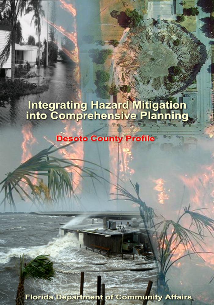
INTEGRATION OF THE LOCAL MITIGATION STRATEGY INTO THE LOCAL COMPREHENSIVE PLAN. ExecutiveSumary
|
|
|
- Hester Wheeler
- 6 years ago
- Views:
Transcription
1
2 ExecutiveSumary The experiences of the 2004 hurricane season epitomize the importance of better integrating hazard mitigation activities into local comprehensive planning. Last fall, residents all over the state experienced significant damages from Hurricanes Charley, Frances, Jeanne, and Ivan as a result of winds, tornadoes, surge, and/or flooding. But this was not the only time we have experienced natural disasters, nor will it be the last. In 1992, Hurricane Andrew devastated South Florida. In 1998 and 1999, most counties in Florida experienced wildfires. In some cases, despite firefighters' best efforts, fires advanced through neighborhoods and homes were lost. Every year in Central Florida, new sinkholes emerge, swallowing homes and damaging infrastructure. The cost of recovery for these various disasters ranges from hundreds of thousands to billions of dollars, significantly taxing local, State, and federal financial sources. Losses covered through federal funding as a result of the 2004 hurricanes alone could reach as high as $7 billion. Worst of all, however, are the many lives that, directly or indirectly, are lost due to natural disasters. It is imperative that we reduce the human and financial costs of natural disasters. Through better integration of natural hazard considerations into local comprehensive planning, we can build safer communities. This DeSoto County Profile has been prepared as part of a statewide effort by the Florida Department of Community Affairs to guide local governments in integrating hazard mitigation principles into local Comprehensive Plans. Information provided in this profile will enable planners to (1) convey DeSoto County s existing and potential risk to identified hazards; (2) assess how well local hazard mitigation principles have been incorporated into the County s Comprehensive Plan; (3) provide recommendations on how hazard mitigation can be better integrated into the Comprehensive Plan; and (4) determine if any enhancements could be made to the Local Mitigation Strategy (LMS) to better support comprehensive planning. Best available statewide level data are provided to convey exposure and risk as well as illustrate the vulnerability assessment component of the integration process. In this profile, we present an argument for why hazard mitigation needs to be a part of comprehensive planning through an examination of population growth, the hazards that put the County at risk, the special needs population and structures that could be affected by these hazards, and the distribution of existing and future land uses in different hazard areas. We hope that this analysis will serve as an example of the issues each jurisdiction should consider as they update their plans to include hazard mitigation. The profile also contains a review of the LMS and the Comprehensive Plan. Based on the analysis and review, we were able to develop specific options for the County on how to incorporate more hazard mitigation into the Comprehensive Plan and how to enhance the LMS so that it is also a better tool for local planners. During our review, we found that DeSoto County had many strengths regarding hazard mitigation in both its LMS and Comprehensive Plan, and these are outlined in the profile. There are always ways to further strengthen such plans, however, and the following is a summary of some of the options that would enable the County to do so. GENERAL RECOMMENDATIONS DeSoto County currently includes the following maps in their LMS: County 100-year floodplain base map, County Future Land Use Map, County Vegetation map and County wind zone map. It is suggested that this information also be included for the City of Arcadia. Furthermore, based upon completion of the state LMS objective to establish GIS/Mapping Capabilities, the county should overlay the hazard related layers with the FLUM in order to determine where growth management techniques are needed in order to minimize the vulnerability of hazard prone areas. This information could then be placed in the City and County Comprehensive plans as well as the LMS. Maps, such as Draft 3/17/2006 FLORIDA DEPARTMENT OF COMMUNITY AFFAIRS ii
3 the ones in this profile, provide useful visual knowledge on the relationship between land uses and hazard zones that can be used for planning mitigation or changes in future land use map. The County LMS makes multiple references to the DeSoto County Comprehensive Plan and its intention of integrating hazard mitigation techniques into the comp planning process, however it doesn t mention the City of Arcadia Comprehensive Plan. Due to the fact that disasters know no boundaries and that it is requirements in Florida that all incorporated jurisdictions and counties have comprehensive plans, it is suggested that this information also be referenced in the LMS.. Several of the goals and objectives listed in the LMS indicate the County s intention to protect and conserve their coastal areas, marine resources and dune systems. These areas could be mapped and included in both the comprehensive plan as well as the LMS as it is unclear where these resources are located on the current maps. Both the LMS and the comprehensive plan make reference to many techniques used to protect natural resources, however only the LMS points out the hazard mitigation benefit gained when employing these techniques. This benefit could also be referenced in the comprehensive plan in order to provide further incentive for using such techniques. The County can use impact fees linked to the LOS standards or special assessment districts to finance maintenance and expansion of evacuation routes. The County can prioritize evacuation route improvements in the Capital Improvements Schedule and MPO Long-Range Transportation Plan. This is considered a best management practice from Protecting Florida's Communities. (FDCA, 2005b) The LMS can add an objective that supports maintaining or reducing evacuation clearance times by planning for population growth. The County can address redevelopment in the hazard area by only allowing redevelopment after a natural disaster to occur at the density/intensity of the land use designation currently in place. This is considered on of the best management practices from Protecting Florida's Communities. (FDCA, 2005b) The County comprehensive plan makes reference to minimizing the impacts to wetlands by using innovative design layouts (Policy 1.5.5). These innovative layouts could be described in detail and used for the purposes of hazard mitigation. Furthermore, incentives such as density bonuses could be granted to those who choose to use these innovative design techniques. Wildfire Hazards The County can require management plans for conservation areas that address reduction of wildfire fuels. Forests that are maintained, through prescribed fire or other mechanical means, will not become a wildfire risk to the nearby community. As mentioned above, Policy of the County comprehensive plan suggests using innovative design layouts for the purposes of minimizing the impacts to wetlands. Innovative design layouts, such as those advocated by the Firewise USA program. Furthermore, the county can require firewise neighborhood design as a condition of approval for subdivision or PUS in high risk areas. The County can adopt LDRs that limit residential development in high-risk fire areas, such as those adjacent to conservation lands. Limiting development near conservation Draft 3/17/2006 FLORIDA DEPARTMENT OF COMMUNITY AFFAIRS iii
4 areas will assuage some of the liability and practical issues of using prescribed fire as a management practice. NOTE: The recommendations set out in this section are only suggestions. Through the workshop process and contact with the local governments, the goal of this project is to result in specific recommendations tailored and acceptable to each county. While the profile addresses hurricanes, flooding, wildfire, and sinkholes, the County should consider other hazards, if appropriate, such as tornadoes and soil subsidence, during the update of the local Comprehensive Plan. Draft 3/17/2006 FLORIDA DEPARTMENT OF COMMUNITY AFFAIRS iv
5 TableofContents Executive Summary...i 1. Recommendations... ii 2. County Overview Hazard Vulnerability Existing Mitigation Measures Comprehensive Plan Review Sources...14 Attachments... Attachment A: Maps of the Existing and Future Land Uses within the 100-year Floodplain... A-1 Attachment B: Maps of the Existing and Future Land Uses within Wildfire Susceptible Areas... B-1 Attachment C: DeSoto County Local Mitigation Strategy Goals and Objectives...C-1 Attachment D: DeSoto County Comprehensive Plan Excerpts Related to Hazard Mitigation...D-1 Draft 3/17/2006 FLORIDA DEPARTMENT OF COMMUNITY AFFAIRS v
. There is one incorporated municipality within the County listed in Table 1.")
6 1.CountyOverview Geography and Jurisdictions DeSoto County is located along the southwestern portion of Florida. It covers a total of 637 square miles with an average population density of 50.5 people per square mile (U.S. Census, 2000). There is one incorporated municipality within the County listed in Table 1.1. Population and Demographics Official 2004 population estimates for all jurisdictions within DeSoto County as well as the percent change in population from the 2000 U.S. Census are presented in Table 1.1. The most current estimated countywide population of DeSoto County is 34,105 people (University of Florida, Bureau of Economic and Business Research, 2004). Approximately 79.5% of the countywide population lives in the unincorporated portion of the County. Between 1990 and 2000, DeSoto County as a whole had a growth rate of 35%, which was greater than the statewide growth rate of 23.5% in those 10 years. Table 1.1 Population Estimates by Jurisdiction Jurisdiction Population, Census 2000 Population Estimate, 2004 % Change, % of Total Population (2004) Unincorporated 25,605 27, % 79.9% Atlantis 6,604 6, % 20.1% Countywide Total 32,209 34, % 100.0% Source: University of Florida, Bureau of Economic and Business Research, According to the University of Florida, Bureau of Economic and Business Research (2004), DeSoto County s population is projected to grow steadily for the next 25 years, reaching 52,900 people by the year Figure 1.1 illustrates medium population projections for DeSoto County based on 2004 calculations. Figure 1.1 Medium Population Projections for DeSoto County, ,000 50,000 Population 40,000 30,000 20,000 10, Year Source: University of Florida, Bureau of Economic and Business Research, Draft 3/17/2006 FLORIDA DEPARTMENT OF COMMUNITY AFFAIRS 1
7 Of particular concern within DeSoto County s population are those persons with special needs and/or limited resources such as the elderly, disabled, low-income, or language-isolated residents. According to the 2000 U.S. Census, 19% of DeSoto County residents are listed as 65 years old or over, 20.5% are listed as having a disability, 23.6% are listed as below poverty, and 24.1% live in a home with a primary language other than English. 2.HazardVulnerability Hazards Identification The following are natural hazards that pose a risk for the County as identified in the County s Local Mitigation Strategy (LMS): hurricanes, floods, wildfires, tornadoes, freezes and sink holes. The LMS did not prioritize these hazards, however, the hazard profiles did include a discussion of the risk faced by the community concerning each of these hazards. Hurricanes, wildfires and floods were considered to have a high risk, whereas the risk to the community from tornadoes and freezes was determined to be medium and sinkholes low. The county experiences flooding on a regular basis, especially during heavy rainfall events in low lying areas along the Peace River and Horse Creek. Wildfire also poses a high risk. In DeSoto County during 1998/1999 brush fire seasons the Florida Division of Forestry responded to a total of 48 wildfires totaling acres. Between the year 1993 and 1999, the DeSoto County Department of Public Safety reported 1261 wildfire events. Although DeSoto County is not located along the coast, hurricanes pose a great threat to the area and can have both excessive wind and water impacts. Hazards Analysis The following analysis looks at two major hazard types: flooding and wildfire. All of the information in this section, except the evacuation and shelter estimates, was obtained through the online Mapping for Emergency Management, Parallel Hazard Information System (MEMPHIS). MEMPHIS was designed to provide a variety of hazard related data in support of the Florida Local Mitigation Strategy DMA2K revision project. It was created by Kinetic Analysis Corporation under contract with the Florida Department of Community Affairs (FDCA). Estimated exposure values were determined using the Category 3 Maxima Scenario for storm surge, the Federal Emergency Management Agency's (FEMA s) designated 100-year flood zones (A, AE, V, VE, AO, 100 IC, IN, AH) and levels of concern 5 through 9 for wildfire. For more details on a particular hazard or an explanation of the MEMPHIS methodology, consult the MEMPHIS Web site ( or your countywide LMS. Existing Population at Risk Table 2.1 presents the estimated countywide population at risk from hazards, as well as a breakdown of the sensitive needs populations at risk. The first column in the table summarizes the residents of DeSoto County that live within FEMA Flood Insurance Rate Map zones that signify special flood hazard areas. According to these maps, 4.5% of the population, or 1,561 people, are within the 100-year flood zone. A majority of those at risk of flooding are either elderly and/or disabled. These special-needs citizens require extra planning by local governments to ensure their safety. Wildfire is also a hazard of concern to the County, with 74.3% of the population living in medium- to high-risk wildfire zones. Thirty-three percent of those at risk from wildfire are disabled, making a quick evacuation difficult. Table 2.1 Estimated Number of Persons at Risk from Selected Hazards Draft 3/17/2006 FLORIDA DEPARTMENT OF COMMUNITY AFFAIRS 2
8 Population Flood Sinkhole (high-adjacent risk) Wildfire (medium-high risk) Minority ,535 Over ,266 Disabled ,376 Poverty ,961 Language Isolated Single Parent ,187 Countywide Total 1, ,325 Source: Florida Department of Community Affairs, 2005a. Evacuation and Shelters As discussed in the previous sections, population growth in DeSoto County has been steady, and this trend is projected to continue. As the population increases in the future, the demand for shelter space and the length of time it takes to evacuate the County is only going to increase. Currently, evacuation clearance times for DeSoto County are estimated to be 18 hours for Category 3, 4 and 5 hurricanes, as shown in Table 2.2. These data were derived from 11 regional Hurricane Evacuation Studies that have been produced by FEMA, the U.S. Army Corps of Engineers, and Florida Regional Planning Councils. The study dates range from 1995 to 2004 and are updated on a rotating basis. According to Rule 9J-5, counties must maintain or reduce hurricane evacuation times. Some experts have suggested that counties should try to achieve 12 hours or less clearance time for a Category 3 hurricane. This is due to the limited amount of time between the National Hurricane Center issuing a hurricane warning and when the tropical stormforce winds make landfall. DeSoto County is able to meet this recommendation for now, but with continued growth and the limited road network of the region, it will be difficult to maintain this evacuation time. Additionally, storm events requiring evacuation typically impact larger areas, often forcing multiple counties to issue evacuation orders and placing a greater number of evacuees on the major roadways, further hindering evacuation progress. Thus, it is important to not only consider evacuation times for DeSoto County, but also for other counties in the region as shown in Table 2.2. Table 2.2 County Evacuation Clearance Times in Hours (High Tourist Occupancy, Medium Response) County Hurricane Category Desoto Glades Hardee Hendry Highlands Polk Note: Best available data as of 7/05 Source: State of Florida, 2005 (some counties may be in the process of determining new clearance times) Coupled with evacuation is the need to provide shelters. If adequate space can be provided in safe shelters for DeSoto County residents, then this could be a partial solution to the everincreasing clearance times for evacuation. Currently, the State Shelter Plan reports that there is space for 4,245 people in the County s shelters, and there are 2,171 more people that will need sheltering in the case of a Category 5 hurricane. It is projected that by 2009 the deficit will increase to 3,002 people in need of space (FDCA, 2004). The County will need to address this deficiency but might also try to decrease the demand for public shelters by encouraging new homes to be built with safe rooms if they are outside of flood and surge zones. Residents who Draft 3/17/2006 FLORIDA DEPARTMENT OF COMMUNITY AFFAIRS 3
9 are further inland in the County and not in a flood zone could shelter in place if they had a safe room that could withstand hurricane-force winds. Safe rooms could at least be a last option for residents who cannot evacuate in time, especially in the case of a tornado. Existing Built Environment While the concern for human life is always of utmost importance in preparing for a natural disaster, there also are large economic impacts to local communities, regions, and even the State when property damages are incurred. To be truly sustainable in the face of natural hazards, we must work to protect the residents and also to limit, as much as possible, property losses that slow down a community s ability to recover from a disaster. Table 2.3 presents estimates of the number of buildings in DeSoto County by structure type that are at risk from each of the four hazards being analyzed. Flooding presents a large risk to property in the County, with 12,141 structures within a flood zone. A majority of those structures are designated as single-family homes or agricultural uses. According to the latest National Flood Insurance Program Repetitive Loss Properties list, there are 21 homes in unincorporated DeSoto County that have had flood damage multiple times and received insurance payments but have not remedied the recurring problem. Table 2.3 also shows 9,954 structures with a medium to high risk for wildfire, with 33.5% of those structures being single-family homes. Table 2.3 Estimated Number of Structures at Risk from Selected Hazards Structure Type Flood Sinkhole (highadjacent risk) Wildfire (mediumhigh risk) Single-Family Homes 3, ,339 Mobile Homes 1, ,018 Multi-Family Homes Commercial Agriculture 4, ,291 Gov./Institutional ,107 Total 12, ,954 Source: Florida Department of Community Affairs, 2005a. In addition to understanding exposure, risk assessment results must also be considered for prioritizing and implementing hazard mitigation measures. The risk assessment takes into account not only the people and property in a hazard area, but also the probability of occurrence that is necessary to understand the impacts to people and property. Although people and property are exposed to hazards, losses can be greatly reduced through building practices, land use, and structural hazard mitigation measures. The next section of this report examines the existing and future land use acreage in hazard areas. This information can be useful in considering where to implement risk reducing comprehensive planning measures. Draft 3/17/2006 FLORIDA DEPARTMENT OF COMMUNITY AFFAIRS 4
10 Analysis of Current and Future Vulnerability The previous hazards analysis section discussed population and existing structures at risk from flooding and wildfire according to MEMPHIS estimates. This section demonstrates the County s vulnerabilities to these hazards spatially and in relation to existing and future land uses. The following maps of existing land use within hazard areas are based on the 1999 geographic information system (GIS) shapefiles from the Florida Department of Environmental Protection and the Southwest Florida Regional Planning Council. Maps of future land uses in hazard areas were developed using the DeSoto County future land use map obtained in In Attachment A, two maps present the existing and future land uses within a 100-year flood zone. There are large swaths of flood-prone areas along the banks of water bodies located in the western and southeastern portions of the county. In addition to this, patches of flood-prone areas can be found throughout the county. The total amount of land in these special flood hazard areas is 98,096.5 acres for the unincorporated County. As shown in Table 2.4, only 47.3 acres are currently undeveloped, however, a majority of the flood prone land is mostly currently in agricultural uses with a smaller percentage in conservation/recreational uses. Table 2.5 shows that 18.1% of the flood prone acres are designated for conservation overlay, with 12.5% designated for rural residential uses and 65.0% designated for rural agricultural uses. In Attachment B, maps present the land uses associated with high-risk wildfire zones. The central area of the County, which includes the City of Arcadia contains much of the areas at risk from wildfire, in addition to a vulnerable arge low density residential area located west of the City of Arcadia in the unincorporated county. A total of 1.8% of the land within these wildfire zones is currently vacant, as shown in Table 2.4. Of those 358 undeveloped acres the majority of the land is designated for urban/residential uses including, 60% is for suburban residential, 15.4% for town center uses and 10.2% designated for municipal uses in the future (Table 2.5). If homes are built in these risk areas, DeSoto County's vulnerability to wildfire hazards will greatly increase. Additionally, 32.7% of the wildfire susceptible areas already have low residential development (including high, medium and low density) present, as seen in Table 2.4. Large-lot residential development is the most at risk since these homes typically are surrounded by wooded lots and often do not have enough defensible space to stop a wildfire from spreading throughout the neighborhood. Draft 3/17/2006 FLORIDA DEPARTMENT OF COMMUNITY AFFAIRS 5
11 Table 2.4 Total Unincorporated Acres in Hazard Areas by Existing Land Use Category Existing Land Use Category Flood Zones Wildfire Susceptible Areas Agriculture Commercial Government, Institutional, Hospitals, Education Industrial Parks, Conservation Areas, Golf Courses Residential High-Density Residential Low-Density Residential-mh Submerged Lands (Water Bodies) Transportation, Communication, Rights-of-Way Utility Plants and Lines, Solid Waste Disposal Vacant Total Acres Acres 82, ,975.5 % Acres % Acres % Acres % Acres 12, % Acres % Acres 1, ,879.0 % Acres ,427.3 % Acres 1, % Acres % Acres % Acres % Acres 98, ,652.2 % Draft 3/17/2006 FLORIDA DEPARTMENT OF COMMUNITY AFFAIRS 6
12 Table 2.5 Total and Undeveloped Acres in Hazard Areas by Future Land Use Category for the Unincorporated County Future Land Use Category Flood Zones Wildfire Susceptible Areas Total Undev. Total Undev. Conservation Overlay Mixed Use Corridor Municipality Preservation Public/Insitutional Recreation Rural Residential Rural/Agricultural Semi-Rural Residential Suburban Residential Town Center Urban Residential Total Acres 17, , % Acres % Acres , % Acres % Acres % Acres % Acres 12, , % Acres 63, , % Acres , % Acres 1, , % Acres , % Acres % Acres 98, , % Table 2.6 presents the total numbers of acres in a hazard zone in DeSoto County s incorporated areas and how many of those acres are currently undeveloped. The City of Arcadia currently has acres within the flood zone, with only 1.8% of this land vacant and 1,118.4 acres within wildfire susceptible areas with only 3.1% of this land vacant. Much of the land located within the hazard areas is considered to be developed or not vacant and therefore mitigation techniques must be appropriately applied to current development in order to reduce the vulnerability of these areas. Draft 3/17/2006 FLORIDA DEPARTMENT OF COMMUNITY AFFAIRS 7
13 Table 2.6 Total and Vacant Incorporated Acres in Hazard Areas Jurisdiction Flood Zones Wildfire Susceptible Areas Total Vacant Total Vacant Arcadia Total Acres Acres , % Acres , % ExistingMitigationMeasures Local Mitigation Strategy The LMS is an ideal repository for all hazard mitigation analyses, policies, programs, and projects for the County and its municipalities due to its multi-jurisdictional and intergovernmental nature. The LMS identifies hazard mitigation needs in a community and structural or non-structural initiatives that can be employed to reduce community vulnerability. Communities can further reduce their vulnerability to natural hazards by integrating the LMS analyses and mitigation objectives into their Comprehensive Plans. An LMS prepared pursuant to the State s 1998 guidelines has three substantive components (FDCA, 2005b): Hazard Identification and Vulnerability Assessment (HIVA). This section identifies a community s vulnerability to natural hazards. Under Florida rules, the HIVA is required to include, at a minimum, an evaluation of the vulnerability of structures, infrastructure, special risk populations, environmental resources, and the economy to any hazard the community is susceptible to. According to FEMA, LMSs revised pursuant to the Disaster Mitigation Act of 2000 (DMA 2000) criteria must include maps and descriptions of the areas that would be affected by each hazard, information on previous events, and estimates of future probabilities. Vulnerability should be assessed for the types and numbers of exposed buildings, infrastructure, and critical facilities with estimates of potential monetary losses. Plan updates will be required to assess the vulnerability of future growth and development. Guiding Principles. This section lists and assesses the community s existing hazard mitigation policies and programs and their impacts on community vulnerability. The Guiding Principles typically contain a list of existing policies from the community s Comprehensive Plan and local ordinances that govern or are related to hazard mitigation. Coastal counties frequently include policies from their Post-Disaster Redevelopment Plans (PDRPs). Mitigation Initiatives. This component identifies and prioritizes structural and non-structural initiatives that can reduce hazards vulnerability. Proposals for amendments to Comprehensive Plans, land development regulations, and building codes are often included. Structural projects typically address public facilities and infrastructure, and buyouts of private structures that are repetitively damaged by flood. Many of these qualify as capital improvement projects based on the magnitude of their costs and may also be included in the capital improvements elements of the Counties and Cities Comprehensive Plans. The LMS Goals and Objectives will guide the priority of the mitigation initiatives. Draft 3/17/2006 FLORIDA DEPARTMENT OF COMMUNITY AFFAIRS 8
14 The DeSoto County LMS (adopted in 2004) was used as a source of information in developing this profile and was also reviewed for any enhancements that could be made to allow better integration with other plans, particularly the local Comprehensive Plans. Hazard Identification and Vulnerability Assessment This section of the LMS was briefly reviewed for its ability to provide hazard data that can support comprehensive planning. The LMS uses detailed data on structures at risk for all of the major hazards discussed in this profile. It does not, however, discuss populations at risk or future land use issues. The maps included in the appendix of the LMS show the hazard areas. Future land use maps have also been included. While these two layers have not been overlain, if used together it can provide valuable information. Incorporating land use and population data into the risk assessment of the LMS provides a better source of data for planners to use in policy making and policy evaluation of the local Comprehensive Plan. The LMS also sets a standard for the quality of data that should be used in determining risk and thereby used to determine mitigation policies. Guiding Principles While there is a guiding principles section in the LMS, it doesn t directly fits the above-described Guiding Principles section. The DeSoto LMS does not list policies from other plans that relate to hazard mitigation. It does, however, have a section that lists the plans and studies that were used in updating the LMS (Section D: Governmental Hazard Mitigation Functions, p. 1-3). It lists the DeSoto county Flood Damage Prevention Ordinance, Peace River Comprehensive Water Management, Open Use Floodplain Districts, Flood Standard Building Code of 2001, DeSoto County Comprehensive Plan, Public Information/Educational Program on Emergency Preparedness and the Comprehensive Emergency Management Plan. It would be much more useful if a list of the hazard-related policies from each jurisdiction's Comprehensive Plan were included in the LMS for reference. This would allow all jurisdictions and County departments access to this information that can be used to judge whether more integration is needed. LMS Goals and Objectives The LMS Goals and Objectives can be found in Attachment C. The goals and objectives are also summarized in Section 5 as part of the recommendations analysis. The following is a summary of how well the LMS has addressed mitigation issues that coincide with planning concerns. DeSoto County has many objectives that tie mitigation through the LMS to programs and regulations that are found in other plans. The plan does a great job of linking hazard mitigation to growth management and land use planning by the way of the Goals and Objectives. The DeSoto County Comprehensive Plan and Land Development Regulations are mentioned quite a few times throughout this section of the LMS. One objective advocates the promotion and coordination of appropriate regional and local planning studies which includes local comprehensive plans, Local Mitigation Strategies and Redevelopment Plans. Another objective states that planning capabilities in all levels of government will be integrated for the purposes of maximizing citizen awareness. One of the goals of the LMS specifically addresses land use issues (Goal 2). Modifications to the Future Land Use Map as well as growth management strategies are included in the detailed objectives that further this goal. Other policies that have a duel purpose in both the comprehensive plan and Local Mitigation Strategy include the protection of natural resources, provision of guidance and adoption of local Post Disaster Redevelopment Plan, the promotion of state programs, investments, development and re-development activities which encourage efficient development, the provision of educational programs and research to meet growth management and hazard mitigation planning needs for state, regional and local planning and the promotion of agricultural uses to protect Draft 3/17/2006 FLORIDA DEPARTMENT OF COMMUNITY AFFAIRS 9
15 natural systems. Furthermore the plan contains an objective to establish a relationship with an agency that has the GIS/Mapping capabilities. The plan also states the county s intention to join the Community Rating System Program and develop of make required changes to both the city and county ordinances to address post disaster recovery operations. Additionally the plan states that landscaping and detailed site planning (development orders) as well as screening and buffering (planned development rezoning and development orders) need to be considered in planning for both residential and commercial developments. While te intent of these provisions is not clear, it would be an appropriate growth management technique to mitigate wildfires. Referencing other plans and programs in the goals and objectives of the LMS lays a clear foundation for this plan to be integrated with other plans and for its committee to oversee programs that may involve many different departments of the County and municipalities. There is no section in this LMS, however, that lists existing policies or guiding principles from other plans within the County or its municipalities. This component is found in most counties LMSs and is useful in providing the different jurisdictions ideas for enhancing their own plans or providing the LMS committee an analysis of where there may be weaknesses in implementing mitigation strategies. Comprehensive Emergency Management Plan The Mitigation Annex of the 2002 DeSoto County CEMP was reviewed for consistency with the other plans and evaluated in its effectiveness as a tool for planners. The Annex does a good job of summarizing the responsibilities of hazard mitigation among the different agencies and organizations within the County. There is no paid employee directly responsible for mitigation, however the primary responsibility for the program is designated to the Emergency Management Specialist. While it is good that this responsibility has been allocated to a certain individual, it would be great to include more linkages to the development services and/or planning department. The CEMP states that DeSoto County and the City of Arcadia work together on policies concerning development to ensure continuity, which is very important. It would provide an added benefit to both the city and the county if hazard vulnerabilities were also included in this joint effort. The CEMP states that the county is not a member of the NFIP program, however according to FEMA records, both the county and City of Arcadia are participatnts. There is talk about the role of mitigation planning following a disaster as well as the funding opportunities that are available post-catastrophic event. Specific disaster-scenario mitigation functions are listed as well as both the departments that will have the primary as well as secondary role in the execution of the function. Post-Disaster Redevelopment Plan A PDRP for DeSoto County was not available for review at the time this profile was drafted. If DeSoto County has a current PDRP, this will be obtained and reviewed for the final version of this document. National Flood Insurance Program/Community Rating System DeSoto County, and the City of Arcadia are both participating communities in the National Flood Insurance Program, however neither jurisdiction currently participates in the Community Rating System program. 4.ComprehensivePlanReview DeSoto County s Comprehensive Plan (adopted in 2005) was reviewed in order to see what the County has already done to integrate their LMS policies, and hazard mitigation in general, into their planning process. A list of the goals, objectives, and policies currently in the plan that contribute to hazard mitigation is found in Attachment D. These policies are also presented in Draft 3/17/2006 FLORIDA DEPARTMENT OF COMMUNITY AFFAIRS 10
16 Section 5. The following is a summary of how well the plan addressed the four hazards of this analysis. Flooding Hazards Flooding was addressed in the Comprehensive Plan in multiple policies. There were many policies for protecting natural resources such as environmental sensitive lands and endangered species habitat, for environmental purposes. Wetlands protection is addressed in the Objective 1.5 for the purposes of flood control. The policies that correlate with this objective include the use of the following growth management tools for the preservation of wetlands: buffers, acquisition and innovative design layouts. Objective 1.6 of the DeSoto County Comprehensive Plan concerns floodplains and floodways and includes a policy to address the protection, restoration, and acquisition of the natural and hydraulic functions of the 100-year floodplain. The plan also contains an objective (1.2) that proposes to create a Stormwater Master Plan. It states that the county intends to pursue funding for the preparation of a Stormwater Master Plan which would establish high water elevations, address existing deficiencies, and coordinate the construction of new and replacement facilities. Wildfire Hazards There were no policies in the Comprehensive Plan that related to wildfire hazards. An objective to conserve fresh water supplies by the way of adopting specific Land Development Regulations indirectly relates to having sufficient water to put out a wildfire. Other Hazard Mitigation Policies There were other policies that furthered hazard mitigation efforts in spite of the fact that their intended purpose was not hazard mitigation related. These include the preservation of open space as well as planning coordination. The plan states its intention to encourage mixed use and cluster development that could also be used to reduce the vulnerability of developments to hazards such as wildfire and inland flooding. 5.Recomendations For the LMS to be effective in the decision-making process of growth management, its objectives and policies must be integrated into the Comprehensive Plan. The Plan is the legal basis for all local land use decisions made. If hazard mitigation is to be accomplished beyond the occasional drainage project, these hazards must be addressed in comprehensive planning, where development can be limited or regulated in high-risk hazard areas just as sensitive environments are routinely protected through growth management policies. Mitigation of hazards is considerably easier and less expensive if done when raw land is being converted into development. Retrofitting structure and public facilities after they have been built is significantly more expensive. However, if older neighborhoods or communities are scheduled to be revitalized or redeveloped, hazard mitigation needs to be an aspect considered and integrated into the project prior to the time of development approval. DeSoto County has begun this process of integrating hazard mitigation throughout its Plan s elements. The prior section summarized how the major hazards for the County have been for the most part well-addressed. There is, however, still some disconnection between the LMS objectives and initiatives, and the policies in the Comprehensive Plan. By tightening the connection between these documents, the County will find it easier to implement hazard mitigation, and there will be higher awareness of these issues within more departments of the County government.. Draft 3/17/2006 FLORIDA DEPARTMENT OF COMMUNITY AFFAIRS 11
17 6.Sources DeSoto County DeSoto County Comprehensive Plan. DeSoto County Local Mitigation Strategy. Florida Department of Community Affairs Statewide Emergency Shelter Plan. Tallahassee, FL. Florida Department of Community Affairs. 2005a. Mapping for Emergency Management, Parallel Hazard Information System. Tallahassee, FL. Florida Department of Community Affairs. 2005b. Protecting Florida s Communities: Land Use Planning Strategies and Best Development Practices for Minimizing Vulnerability to Flooding and Coastal Storms. Tallahassee, FL. State of Florida Hurricane Evacuation Study Database. Florida Department of Community Affairs, Division of Emergency Management. University of Florida, Bureau of Economic and Business Research Florida Statistical Abstract. Gainesville, FL. U.S. Census Bureau State & County Quickfacts. Retrieved in 2005 from Draft 3/17/2006 FLORIDA DEPARTMENT OF COMMUNITY AFFAIRS 12
18 AtachmentA MapsoftheExistingandFutureLandUses withinthe10-yearflodplain 3/17/2006 FLORIDA DEPARTMENT OF COMMUNITY AFFAIRS A-1
19 AtachmentB MapsoftheExistingandFutureLandUses withinwildfiresusceptibleareas 3/17/2006 FLORIDA DEPARTMENT OF COMMUNITY AFFAIRS B-1
20 Attachment C DeSoto County Local Mitigation Strategy Goals and Objectives GOAL 1: Objective 1.1: Objective 1.2: Objective 1.3: Objective 1.4: Objective 1.5: Objective 1.6: Objective 1.7: Objective 1.8: Objective 1.9: Objective 1.10: Objective 1.11: GOAL 2: Objective 2.1: Florida shall reduce the vulnerability and exposure of the public by protecting lives and property from losses by natural disasters. Maximize the protection of the public s health, safety and welfare as they are related to natural disasters. Reduce the loss of personal and public property due to natural disasters. Require the protection of natural resources (such as environmentally sensitive lands and endangered species habitat) in order to maximize their mitigation benefits and to safeguard them from damage caused by natural disasters. Ensure that Florida s codes and standards are sufficient to protect public safety and property. Require local governments in cooperation with regional and state agencies, to prepare advance plans for the safe evacuation of coastal residents. Require local governments, in cooperation with regional and state agencies, to adopt plans and policies to protect public and private property and human lives from the effects of natural disasters. Avoid expenditure of state funds that subsidize development in highhazard coastal areas. Protect coastal resources, marine resources, and dune systems from the adverse effects of development. Ensure mitigation measures are effectively incorporated in a comprehensive system of coordinated planning, management, and land acquisition. Encourage land and water uses which are compatible with the protection of sensitive coastal resources having value and benefits as mitigation measures. Prohibit development and other activities, which disturb coastal dune systems, and ensure and promote the restoration of coastal dune systems that are damaged. In order to enhance hazard mitigation planning and subsequent mitigation actions, the Florida Division of Emergency Management will take a proactive lead to ensure intergovernmental coordination (before, during and after a natural disaster) among municipal, county, regional, state, federal agencies and public services groups. Implement a series of regularly scheduled on-going interagency disaster training programs and excercises. 3/17/2006 FLORIDA DEPARTMENT OF COMMUNITY AFFAIRS C-1
21 Objective 2.2: Objective 2.3: Objective 2.4: Objective2.5: Objective 2.6: Objective 2.7: Objective 2.8: Objective 2.9: GOAL 3: Objective 3.1: Objective 3.2: Objective 3.3: Objective 3.4: Objective 3.5: GOAL 4: Objective 4.1: Pre-establish and regularly update a network of state interagency contacts to coordinate intergovernmental needs. Computerize information systems between state agencies and within the state emergency operations center to speed response, recovery, and mitigation decisions. Increase the availability of computerized information to all counties to speed response, recovery and mitigation decisions. Promote the coordination of appropriate regional and local plans and studies (i.e., Comprehensive Plans, Local Mitigation Plans and Redevelopment Plan). Establish and protect the essential flow of information before, during and after a natural or manmade disaster. Encourage greater cooperation between, among and within all levels of Florida government through the use of appropriate interlocal agreements and mutual participation for mutual benefit. Ensure that the State Hazard Mitigation Plan incorporates appropriate hazard mitigation measures as reflected in each agency s functional plan. Ensure the development of comprehensive regional policy plans and local plans that implement and accurately reflect state goals and objectives reflected in Florida s Section 409 Hazard Mitigation Plan that addresses hazard-related problems, issues and conditions that are of particular concern in each region. Reduce the vulnerability of critical public facilities from natural and manmade disasters. Establish uniform criteria for identifying and rating the at-risk potential of critical facilities for the purpose of protection in the event of a natural disaster. Disaster-proof existing and proposed critical facilities, in regards to location and construction. Promote the development and application of solar energy technologies and passive solar design techniques. Develop and maintain energy preparedness plans that will be both practical and effective under circumstances of disrupted energy supplies. Incorporate hazard mitigation measures in any rehabilitation or reuse of existing public facilities, structures and buildings. Strengthen plans for post-disaster recovery and mitigation. Ensure the implementation and maintenance of this statewide comprehensive hazard mitigation plan. 3/17/2006 FLORIDA DEPARTMENT OF COMMUNITY AFFAIRS C-2
22 Objective 4.2: Objective 4.3: Objective 4.4: GOAL 5: Objective 5.1: Objective 5.2: Objective 5.3: Objective 5.4: Objective 5.5: GOAL 6: Objective 6.1: Objective 6.2: Objective 6.3: Objective 6.4: Objective 6.5: Provide incentives and guidance for responsible post-disaster redevelopment. Encourage the adoption of local post-disaster redevelopment plans, which specifically identify potential hazard mitigation projects in advance of disaster events. Promote state programs, investments, development and redevelopment activities, which encourage efficient development and occur in areas which will have the capacity to service new population and commerce. Improve coordination of emergency management information through the media in order to increase public awareness and participation in preparedness, response, mitigation and recovery. Develop and implement a comprehensive, multi-media/multi-lingual public education campaign on emergency preparedness, response, recovery and hazard mitigation. Provide educational programs and research to meet state, regional and local planning, growth management and hazard mitigation needs. Integrate planning capabilities into all levels of government in Florida with particular emphasis on maximizing citizen awareness and involvement. Establish a standardized format for use in the dissemination of information to the media following a disaster. Establish coordinated information and procedures for public involvement to the media during a disaster. Florida shall protect and acquire unique natural habitats and ecological systems (such as: wetlands, tropical hard wood hammocks, palm hammocks and virgin longleaf pine forests) and restore degraded natural systems to a functional condition in order to maximize hazard mitigation values. Conserve forests, wetlands and coastal natural features to maintain their economic, aesthetic, and recreational values. Acquire, retain, manage and inventory public lands to provide conservation and related public benefits including hazard mitigation. Promote the use of agricultural practices, which are compatible with the protection of natural systems. Encourage multiple use of forest resources, where appropriate, to provide for watershed protection and erosion control and maintenance of water quality. Protect and restore the ecological functions of wetland systems to ensure their long-term environmental, economic and recreational values including hazard mitigation values. 3/17/2006 FLORIDA DEPARTMENT OF COMMUNITY AFFAIRS C-3
23 Objectives 6.6: Objective 6.7: Objective 6.8: GOAL 7: Objective 7.1: Objective 7.2: Promote restoration of the Everglades systems and of the hydrological and ecological functions of all degraded or substantially disrupted surface waters. Develop and implement a comprehensive planning management and acquisition program to ensure the integrity of all Florida River Systems. Emphasize the acquisition and maintenance of ecologically intact systems in all land and water planning, management and regulation. Improve communication capabilities among states, regional, local and Federal governments and public service groups. Encourage greater efficiency and economy at all levels of government through adoption and implementation of effective record management, information management and evaluation procedures. Improve disaster related communications throughout Florida, with regard to adequate and compatible equipment and training. The DeSoto County Local Mitigation Working Group adopted the following Goals and Objectives to be reviewed annually by the LMS: GOAL 1: Objective 1.1: Within Year 1 (2005): Submit to the County Commission and the City Council the Local Mitigation Strategy for adoption as required by the Florida Department of Community Affairs (DCA) 9G-22. Complete a list of facilities at risk from hazards and identify the high hazard area to provide a basis for the county and city to develop plans for mitigation activities. Establish a relationship with an agency that has the capability to perform the required GIS/Mapping data. By using mitigation worksheets, develop a list showing the Top 10 projects to be targeted for mitigation. Update the list of Critical Facilities located within the County. Develop a county reserve for both pre and post mitigation activities which would be required by both the Federal Government and State of Florida. Examples of projects that require matching funds under both state and federal grants are: o Buy out and retrofitting projects of structures along the Peace River and Horse Creek. o Critical Facility Improvements (public shelters and command and control facilities). o Public Works Projects (roads, water and sewer) o Development of early warning system Objective 1.2: Within Year 2 (2006): DeSoto County to join the Community Rating System under the National Flood Insurance Program. Mitigation programs undertaken by the county can reduce the number of points and can help lower flood policy rates. Develop a list of all properties that have had a repetitive flooding since 1960 and seek funding for either buyouts or mitigation of 3/17/2006 FLORIDA DEPARTMENT OF COMMUNITY AFFAIRS C-4
INTEGRATION OF THE LOCAL MITIGATION STRATEGY INTO THE LOCAL COMPREHENSIVE PLAN. Executive Summary
 Executive Summary The experiences of the 2004 hurricane season epitomize the importance of better integrating hazard mitigation activities into local comprehensive planning. Last fall, residents all over
INTEGRATION OF THE LOCAL MITIGATION STRATEGY INTO THE LOCAL COMPREHENSIVE PLAN. ExecutiveSumary
 ExecutiveSumary The experiences of the 2004 and 2005 hurricane seasons epitomize the importance of better integrating hazard mitigation activities into local comprehensive planning. In the fall of 2004,
INTEGRATION OF THE LOCAL MITIGATION STRATEGY INTO THE LOCAL COMPREHENSIVE PLAN. ExecutiveSumary
 ExecutiveSumary The experiences of the 2004 hurricane season epitomize the importance of better integrating hazard mitigation activities into local comprehensive planning. That fall, residents all over
INTEGRATION OF THE LOCAL MITIGATION STRATEGY INTO THE LOCAL COMPREHENSIVE PLAN. Executive Summary
 Executive Summary The experiences of the 2004 Hurricane Season epitomize the importance of better integrating hazard mitigation activities into local comprehensive planning. Last fall, residents from all
INTEGRATION OF THE LOCAL MITIGATION STRATEGY INTO THE LOCAL COMPREHENSIVE PLAN. Executive Summary
 Executive Summary The experiences of the 2004 hurricane season epitomize the importance of better integrating hazard mitigation activities into local comprehensive planning. That fall, residents all over
INTEGRATION OF THE LOCAL MITIGATION STRATEGY INTO THE LOCAL COMPREHENSIVE PLAN. Executive Summary
 Executive Summary The experiences of the 2004 hurricane season epitomize the importance of better integrating hazard mitigation activities into local comprehensive planning. Last fall, residents all over
INTEGRATION OF THE LOCAL MITIGATION STRATEGY INTO THE LOCAL COMPREHENSIVE PLAN. ExecutiveSumary
 ExecutiveSumary The experiences of the 2004 and 2005 hurricane seasons epitomize the importance of better integrating hazard mitigation activities into local comprehensive planning. In the fall of 2004,
INTEGRATION OF THE LOCAL MITIGATION STRATEGY INTO THE LOCAL COMPREHENSIVE PLAN COLLIER COUNTY PROFILE. Executive Summary
 Executive Summary The experiences of the 2004 Hurricane Season epitomize the importance of better integrating hazard mitigation activities into local comprehensive planning. Last fall, residents from all
INTEGRATION OF THE LOCAL MITIGATION STRATEGY INTO THE LOCAL COMPREHENSIVE PLAN. Executive Summary
 Executive Summary The experiences of the 2005 hurricane season epitomize the importance of better integrating hazard mitigation activities into local comprehensive planning. In the fall of 2005, residents
INTEGRATION OF THE LOCAL MITIGATION STRATEGY INTO THE LOCAL COMPREHENSIVE PLAN SARASOTA COUNTY PROFILE. Executive Summary
 Executive Summary The experiences of the 2004 Hurricane Season epitomize the importance of better integrating hazard mitigation activities into local comprehensive planning. Last fall, residents from all
INTEGRATION OF THE LOCAL MITIGATION STRATEGY INTO THE LOCAL COMPREHENSIVE PLAN HERNANDO COUNTY PROFILE. Executive Summary
 Executive Summary The experiences of the 2004 Hurricane Season epitomize the importance of better integrating hazard mitigation activities into local comprehensive planning. Residents from all over the
INTEGRATION OF THE LOCAL MITIGATION STRATEGY INTO THE LOCAL COMPREHENSIVE PLAN
 SEMINOLE COUNTY The 2004 hurricane season underscores the importance of better integrating hazard mitigation activities and local comprehensive planning. This past fall, Floridians experienced significant
INTEGRATION OF THE LOCAL MITIGATION STRATEGY INTO THE LOCAL COMPREHENSIVE PLAN
 ORANGE COUNTY The 2004 Hurricane Season underscores the importance of better integrating hazard mitigation activities and local comprehensive planning. This past fall, Floridians experienced significant
INTEGRATING HAZARD MITIGATION INTO COMPREHENSIVE PLANNING THE GLADES COMMUNITIES OF PALM BEACH COUNTY, FL
 INTEGRATING HAZARD MITIGATION INTO COMPREHENSIVE PLANNING THE GLADES COMMUNITIES OF PALM BEACH COUNTY, FL THE CITY OF BELLE GLADE January 15, 2007 Executive Summary The experiences of the 2004 and 2005
SECTION VIII PLAN MAINTENANCE AND EVALUATION
 SECTION VIII PLAN MAINTENANCE AND EVALUATION 44 Code of Federal Regulations 44 CFR 201.6(c)(4)(i): A section describing the method and schedule of monitoring, evaluating, and updating the mitigation plan
EXHIBIT # ATTACHMENT #
 EXHIBIT # ATTACHMENT # Proposed Text Amendment to the Broward County Land Use Plan II. GOALS, OBJECTIVES AND POLICIES SMART GROWTH, AND GREEN/ENERGY EFFICIENT AND SUSTAINABLE LAND USE PATTERNS GOAL A.00.00
EXHIBIT # ATTACHMENT #
 EXHIBIT # ATTACHMENT # Proposed Text Amendment to the Broward County Land Use Plan II. GOALS, OBJECTIVES AND POLICIES SMART GROWTH AND GREEN/ENERGY EFFICIENT AND SUSTAINABLE LAND USE PATTERNS GOAL A.00.00
MECKLENBURG COUNTY HAZARD MITIGATION PLAN
 MECKLENBURG COUNTY HAZARD MITIGATION PLAN 2010 Plan Update Adopted By: Mecklenburg County City of Charlotte Town of Cornelius Town of Davidson Town of Huntersville Town of Matthews Town of Mint Hill Town
TREASURE COAST REGIONAL PLANNING COUNCIL M E M O R A N D U M. To: Council Members AGENDA ITEM 3E
 TREASURE COAST REGIONAL PLANNING COUNCIL M E M O R A N D U M To: Council Members AGENDA ITEM 3E From: Date: Subject: Staff May 19, 2017 Council Meeting Local Government Comprehensive Plan Review Draft
Climate Smart Resiliency Plans, Policies, and Projects Improvement Plan for: The Town of Caroline
 Climate Smart Resiliency Plans, Policies, and Projects Improvement Plan for: The Town of Caroline Overview This document should serve as a supplement to the Climate Smart Resiliency Planning Evaluation
SECTION 6: MITIGATION STRATEGIES
 SECTION 6: MITIGATION STRATEGIES This section presents mitigation actions for Onondaga County to reduce potential exposure and losses identified as concerns in the Risk Assessment portion of this plan.
Infrastructure Element
 Infrastructure Element 1 2 3 4 5 6 7 8 9 10 11 12 13 14 15 16 17 18 19 20 21 22 23 24 25 26 27 28 29 30 31 32 33 34 35 36 37 38 39 40 41 42 43 44 45 INFRASTRUCTURE ELEMENT GOAL 1: To provide for environmentally
Chapter 11 Intergovernmental Coordination and Implementation
 Chapter 11 Intergovernmental Coordination and Implementation Regional Framework Plan Vision In the year 2020, Lake County will have developed cooperation between County, municipal, township, and other
No Adverse Impact Floodplain Management
 No Adverse Impact Floodplain Management June 6, 2013 Beth Lucas, Senior Planner Broome County Planning No Adverse Impact Developed by Association of State Floodplain Managers Purposes: Address the shortcomings
Proactive Planning for Resilient Coasts Lessons for North Texas
 Proactive Planning for Resilient Coasts Lessons for North Texas Kimberly M. Miller, Senior Planner & Operations Manager, Allen Engineering and Science Overview of Today s Program 1. Planning for Coastal
DRAINAGE AND NATURAL AQUIFER GROUNDWATER RECHARGE ELEMENT
 Goal 7.0. To optimize integrated stormwater management in order to reduce damage and impacts from sea level rise and flooding, promotes recharge to the Surficial Aquifer System (SAS), improve and protect
Hazard Mitigation Strategies to Reduce Damages from Disasters. Jennifer Z. Carver, AICP May 2007 Florida Department of Community Affairs
 Hazard Mitigation Strategies to Reduce Damages from Disasters Jennifer Z. Carver, AICP May 2007 Florida Department of Community Affairs Florida s s Hazards Flooding Coastal Zone Karst/Sinkholes Wildfires
Environmental Protection Update Stormwater and Floodplain. February 2, 2017
 Environmental Protection Update Stormwater and Floodplain Glen Behrend, P.E. 2017 GA Zoning Conference February 2, 2017 INTRODUCTION Today s discussion: Stormwater Overview Stormwater and Smart Growth
Comprehensive Plan Update - Stormwater Management Section Planning Commission Workshop: November 10, 2014
 Comprehensive Plan Update - Stormwater Management Section Planning Commission Workshop: November 10, 2014 Application type Agency Review Comments Applicable Plan Sections Staff Planner Staff Recommendation
Protecting Open Space & Ourselves
 Protecting Open Space & Ourselves Reducing Flood Risk in the Gulf of Mexico Through Strategic Land Conservation NATURE.ORG/GULF PROTECTING OPEN SPACE & OURSELVES: REDUCING FLOOD RISK IN THE GULF OF MEXICO
OVERVIEW... 1 PUBLIC SURVEY RESULTS... 2
 A P P E N D I X B OVERVIEW... 1 PUBLIC SURVEY RESULTS... 2 OVERVIEW Otsego County prepared public surveys that asked a wide range of questions concerning the opinions of the public regarding natural and
DEKALB COUNTY STORMWATER MANAGEMENT PLAN PHASE 2
 DEKALB COUNTY STORMWATER MANAGEMENT PLAN PHASE 2 Introduction DeKalb County, Illinois, located approximately 50 miles west of Lake Michigan, is rectangular in shape, with a north/south dimension of 36
Baldwin County, Alabama
 2015 Baldwin County, Alabama Multi-Hazard Mitigation Plan II. A multi-jurisdiction plan City of Bay Minette City of Daphne Town of Elberta City of Fairhope City of Foley City of Gulf Shores Town of Loxley
ANCR INDIVIDUAL RESPONSES SUMMARY: 2/11/04 WATER RESOURCES GOALS AND OBJECTIVES
 ANCR INDIVIDUAL RESPONSES SUMMARY: 2/11/04 WATER RESOURCES GOALS AND OBJECTIVES Goal 1: Protect the health and safety of the Dane County population. a. Prevent development that may have an adverse effect
GOAL 1: To preserve, restore, and enhance coastal resources to maximize public use and assure their future ecological benefit.
 GOALS, OBJECTIVES, AND POLICIES GOAL 1: To preserve, restore, and enhance coastal resources to maximize public use and assure their future ecological benefit. Objective 1.1: To maintain and upgrade the
2006 EVALUATION AND APPRAISAL REPORT
 EVALUATION OF MAJOR ISSUES 2.1 DISASTER MITIGATION AND RECOVERY 2006 EVALUATION AND APPRAISAL REPORT Disaster Mitigation: The County will assess whether provisions of the Comprehensive Plan have been successful
CHAPTER 6 SANITARY SEWER SUB-ELEMENT
 CHAPTER 6 SANITARY SEWER SUB-ELEMENT Page 1 of 10 CHAPTER 6 SANITARY SEWER SUB-ELEMENT A. OVERVIEW The following Future Land Use categories are considered to be urban and require the provision of sanitary
ACKNOWLEDGEMENTS. Sincerely, Executive Director and Staff. Rockingham Planning Commission. 156 Water Street Exeter, NH (603)
") ACKNOWLEDGEMENTS The gratefully acknowledges the participation of coastal New Hampshire municipalities in the preparation of this report: City of Portsmouth Town of New Castle Town of Rye Town of North
ACKNOWLEDGEMENTS The gratefully acknowledges the participation of coastal New Hampshire municipalities in the preparation of this report: City of Portsmouth Town of New Castle Town of Rye Town of North
EXECUTIVE OFFICE OF THE GOVERNOR
 EXECUTIVE OFFICE OF THE GOVERNOR STATE REPORT OF FINDINGS AND RECOMMENDATIONS FOR THE TREASURE COAST REGIONAL PLANNING COUNCIL'S STRATEGIC REGIONAL POLICY PLAN OCTOBER 23, 1995 INTRODUCTION The State Report
INTERGOVERNMENTAL COORDINATION ELEMENT GOALS, OBJECTIVES, AND POLICIES
 INTERGOVERNMENTAL COORDINATION ELEMENT GOALS, OBJECTIVES, AND POLICIES Goal 8 To provide accessible, effective and frequent intergovernmental opportunities to achieve consistency among all government agencies
Work Group Discussion Guidance
 Infrastructure Work Group Discussion Guidance Lead Work Group Member: Agency or Department: Additional Departments/Organizations Identified Please list any contact information for the departments or organizations
CHAPTER 3. PLANNING BASIC: LAND USE PLANNING AND ZONING
 CHAPTER 3. PLANNING Communities use planning to direct development and public projects and ensure their land use regulations (zoning) meet the community s needs. When done correctly, planning can prevent
Public Facilities Element (WAT) (SEW) (SOL) (STM)
 (SEW) (SOL) (STM)") Public Facilities Element (WAT) (SEW) (SOL) (STM) Potable Water Sub-Element (WAT) Goal Provide public potable water supply facilities in a manner, which ensures the health, welfare and safety of the residents
Public Facilities Element (WAT) (SEW) (SOL) (STM) Potable Water Sub-Element (WAT) Goal Provide public potable water supply facilities in a manner, which ensures the health, welfare and safety of the residents
ANNEX M: HAMILTON CREEK METROPOLITAN DISTRICT
 ANNEX M: HAMILTON CREEK METROPOLITAN DISTRICT M.1 Community Profile (HCMD) is a special district in Summit County. The District operates under the direction of a five person, elected Board of Directors.
ADDITIONS & DELETIONS TO THE COMPREHENSIVE PLAN
 LGCP/EAR-2008 Section One: Summary of SubElement Comprehensive Plan Amendments. The following table summarizes additions and deletions made to the Comprehensive Plan as a result of processing the EAR-
Table G - 7. Mitigation Actions Identified for Implementation by the City of Eyota ( ) (From Olmsted County Master Mitigation Action Chart)
 (From Olmsted County Master Mitigation Action Chart)") Multi-Hazard Plan, 2017 Table G - 7. Actions Identified for by the City of () (From Master Action Chart) City of Action Comments on 1 All- Hazards Preparedness & Response Support Identify and map locations
Multi-Hazard Plan, 2017 Table G - 7. Actions Identified for by the City of () (From Master Action Chart) City of Action Comments on 1 All- Hazards Preparedness & Response Support Identify and map locations
Kane County Natural Hazards Mitigation Committee
 Kane County Natural Hazards Mitigation Committee Annual Report For 2004 TO: Members of the Kane County Board FROM: Kane County Natural Hazards Mitigation Committee SUBJECT: Annual Report for 2004 Date:
APPENDIX 5: PIONEER/VOLCANO PLAN- NING UNIT COMMUNITY FEATURES
 APPENDIX 5: PIONEER/VOLCANO PLAN- NING UNIT COMMUNITY FEATURES CONTENTS Pioneer/Volcano Community Features... 102 5.1. Social and Political Setting... 102 5.1.1. Cultural Resources... 102 5.1.2. Population
Clay Macon. Kickoff Meeting. January 6, Peeks Creek Landslide, Macon County, NC Photo Source: Wikipedia
 Clay Macon Regional Hazard Mitigation Plan Kickoff Meeting January 6, 2015 Peeks Creek Landslide, Macon County, NC Photo Source: Wikipedia Handouts Agenda Presentation Slides Data Collection Tools Public
HAZARD MITIGATION PLANNING
 HAZARD MITIGATION PLANNING October 5, 2016 Joseph Boxhorn, Ph.D., Senior Planner Southeastern Wisconsin Regional Planning Commission DOCS #232977 What is Mitigation? Mitigation is any sustained action
INFRASTRUCTURE ELEMENT STORMWATER SUB-ELEMENT GOALS, OBJECTIVES & POLICIES
 INFRASTRUCTURE ELEMENT STORMWATER SUB-ELEMENT GOALS, OBJECTIVES & POLICIES GOALS, OBJECTIVES & POLICIES GOAL DR 1: STORMWATER MANAGEMENT/DRAINAGE SYSTEMS. It is the goal of the City of Casselberry to provide
Welcome to our program introducing the High Performance Building Requirements and Disaster Resiliency.
 Welcome to our program introducing the High Performance Building Requirements and Disaster Resiliency. 1 The High Performance Building Requirements for Sustainability go beyond and enhance the key concepts
MEMORANDUM AGENDA ITEM #4b
 South Florida Regional Planning Council MEMORANDUM AGENDA ITEM #4b DATE: AUGUST 3, 2009 TO: FROM: SUBJECT: EXECUTIVE COMMITTEE STAFF CITY OF CORAL GABLES PROPOSED COMPREHENSIVE PLAN AMENDMENT Introduction
Mitigation Plan Mission, Goals and Action Items
 Section 4: Mitigation Plan Mission, Goals and Action Items Introduction... 2 Mission... 2 Mitigation Plan Goals... 2 Natural Hazard Mitigation Plan Action Items... 3 Coordinating Organization... 4 Partner
Flood Mitigation Plan
 City of Huntsville, Alabama Flood Mitigation Plan 2001 Prepared by Flood Mitigation Planning Committee June 1, 2001 City of Huntsville, Alabama Flood Mitigation Plan Executive Summary 1973 1999 Prepared
11. Planning and Growth Management
 11. Planning and Growth Management Tony A. Arrant INTRODUCTION The State of Florida has one of the most comprehensive and progressive land use planning programs in the country. The authority and responsibility
Natural Hazards Mitigation Plan Kankakee County, Illinois Executive Summary
 1. Introduction Natural Hazards Mitigation Plan Kankakee County, Illinois Executive Summary Kankakee County s first Natural Hazards Mitigation Plan was adopted by the Kankakee County Board on October 11,
Goals, Objectives, and Policies Infrastructure Element Introduction
 Goals, Objectives, and Policies Infrastructure Element Introduction Pursuant to Section 163.3177 (6) (c), FS and Sections 9J-5.011 (2)(b) and (c), FAC, the following represents the Potable Water, Sanitary
Preparing a Community Wildfire Protection Plan
 Preparing a Community Wildfire Protection Plan A Handbook for Wildland Urban Interface Communities Sponsored By: Communities Committee National Association of Counties National Association of State Foresters
Chapter 5 Transportation Draft
 Chapter 5 Transportation Draft Discussion Similar to the other elements in the Comprehensive Plan, the transportation element impacts the quality of life, economic development and public safety of the
TOWN OF KILL DEVIL HILLS, NORTH CAROLINA ANNUAL PROGRESS REPORT ON ADOPTED HAZARD MUTIGATION PLAN COMMUNITY #
 TOWN OF KILL DEVIL HILLS, NORTH CAROLINA ANNUAL PROGRESS REPORT ON ADOPTED HAZARD MUTIGATION PLAN COMMUNITY # 375353 Since the last application for continued participation in the Community Rating System
4.7 HAZARDS AND HAZARDOUS MATERIALS
 4.7 This chapter evaluates the potential environmental impacts related to hazards and hazardous materials in Palo Alto that could occur as a result of Scenarios 5 and 6. This analysis is based on the Regulatory
4. Present Activities and Roles
 4. Present Activities and Roles The present missions, authorities, activities and roles of the various agencies involved with flood protection, floodplain management and flood-damage reduction are identified
Capital Facilities Element
 Capital Facilities Element Purpose The Growth Management Act requires cities to prepare a capital facilities element consisting of: 1. An inventory of current capital facilities owned by public entities,
CLIMATE RESILIENCE FOR ALBERTA MUNICIPALITIES
 CLIMATE RESILIENCE FOR ALBERTA MUNICIPALITIES INTRODUCTION On March 11 in Edmonton and March 14 in Calgary the Municipal Climate Change Action Centre (MCCAC) and C-3 hosted Climate Resilience for Alberta
SECTION 6: MITIGATION STRATEGY
 SECTION 6: MITIGATION STRATEGY This section describes the process by which the Lehigh Valley Steering Committee and municipal planning partnership performed the update to the county and local mitigation
Conservation, Open Space & Groundwater Recharge Element
 Conservation, Open Space & Groundwater Recharge Element GOAL 1 ESTABLISH AND MAINTAIN AN INTEGRATED AND URBAN-DEFINING OPEN SPACE NETWORK THAT PROTECTS AND CONSERVES KEY ENVIRONMENTAL FEATURES. Objective
STREAM AND BUFFER AREA PROTECTION/RESTORATION
 STREAM AND BUFFER AREA PROTECTION/RESTORATION AMENDMENT OPTIONS TO STRENGTHEN POLICY IN HEADWATERS AREAS DRAFT SUBSEQUENT TO THE JANUARY 25, 2007 MEETING OF THE PLANNING COMMISSION ENVIRONMENT COMMITTEE
Wood-Pawcatuck Watershed Flood Resiliency Management Plan
 Wood-Pawcatuck Watershed Flood Resiliency Management Plan Project Steering Committee Kickoff Meeting March 26, 2015 Wood-Pawcatuck Watershed Association Meeting Agenda 10:00 10:05 Welcome and Opening Remarks
Mitigation for Emergency Managers. Mitigation for Emergency Managers
 Unit 1: Course Introduction Administrative Information Emergency procedures Mobile devices Breaks Questions Course materials Receiving credit Evaluation forms Action item list 3 Emergency Management Mission
HAZARD MITIGATION PLANNING
 HAZARD MITIGATION PLANNING April 22, 2015 Joseph Boxhorn, Ph.D., Senior Planner Southeastern Wisconsin Regional Planning Commission Katie Sommers, CFM, State Hazard Mitigation Officer Wisconsin Division
- Intergovernmental Coordination Goal, Objectives and Policies.
 9.0 INTERGOVERNMENTAL COORDINATION 9.1 INTRODUCTION The INTERGOVERNMENTAL COORDINATION element is required to be included within the Comprehensive Plan per requirements of State planning law and criteria.
CHAPTER 8: INTERGOVERNMENTAL COOPERATION
 CHAPTER 8: INTERGOVERNMENTAL COOPERATION Photos above by Randy Uhl 8.1 Introduction Intergovernmental cooperation involves working with neighboring communities, school districts and agencies to understand
TREASURE COAST REGIONAL PLANNING COUNCIL M E M O R A N D U M. To: Regional Planning Council Members AGENDA ITEM 5F
 TREASURE COAST REGIONAL PLANNING COUNCIL M E M O R A N D U M To: Regional Planning Council Members AGENDA ITEM 5F From: Date: Subject: Staff September 18, 2009 Regional Planning Council Meeting Local Government
Climate Change, Conservation and Coastlines Critical Concerns in South Florida?
 Climate Change, Conservation and Coastlines Critical Concerns in South Florida? Contents Greenhouse gas emissions Climate Challenges Interrelated Impacts Concepts for the Comprehensive Plan Dr. Ana Puszkin-Chevlin
City of Titusville Comprehensive Plan Evaluation and Appraisal Report (EAR) Executive Summary
 Executive Summary") City of Titusville Comprehensive Plan Evaluation and Appraisal Report (EAR) Executive Summary On September 27, 1988 the City of Titusville adopted the Comprehensive Plan as mandated by the State s Growth
City of Titusville Comprehensive Plan Evaluation and Appraisal Report (EAR) Executive Summary On September 27, 1988 the City of Titusville adopted the Comprehensive Plan as mandated by the State s Growth
ATTACHMENT 2A- Issues Tentatively Resolved Decisions from the Board of Supervisors Hearing on September 11, 2007
 1. Introduction (on pg 1-15) Add the following goal: A Community safe from climate change. Marin will be a leader in averting and adapting to aspects of climate change. 2. Biological Resources 2.A. Richardson
Tipton Flood Resilience Plan - Strategies for Smart Growth and Long-Term Flood Risk Reduction
 Tipton Flood Resilience Plan - Strategies for Smart Growth and Long-Term Flood Risk Reduction An Action Discovery Project as part of the Upper White River Watershed Discovery Report Presented by: Siavash
UTILITIES: SOLID WASTE GOALS, OBJECTIVES AND POLICIES. Goal 1: [SW] (EFF. 7/16/90; REV. EFF. 12/24/10)
![UTILITIES: SOLID WASTE GOALS, OBJECTIVES AND POLICIES. Goal 1: [SW] (EFF. 7/16/90; REV. EFF. 12/24/10)](/thumbs/93/113960126.jpg "UTILITIES: SOLID WASTE GOALS, OBJECTIVES AND POLICIES. Goal 1: [SW] (EFF. 7/16/90; REV. EFF. 12/24/10)") UTILITIES: SOLID WASTE GOALS, OBJECTIVES AND POLICIES Goal 1: [SW] (EFF. 7/16/90; REV. EFF. 12/24/10) Provide an environmentally sound, sustainable, and cost effective integrated solid waste materials
UTILITIES: SOLID WASTE GOALS, OBJECTIVES AND POLICIES Goal 1: [SW] (EFF. 7/16/90; REV. EFF. 12/24/10) Provide an environmentally sound, sustainable, and cost effective integrated solid waste materials
M E M O R A N D U M. Workshop Discussion: Review of Results Neutral Crosswalk Methodology for Reforming the Comprehensive Plan Utility Elements
 M E M O R A N D U M DATE: April 14, 2015 TO: FROM: RE: Planning and Zoning Board Alaina Ray, Director Planning, Zoning and Building Department Workshop Discussion: Review of Results Neutral Crosswalk Methodology
ARTICLE 14: ADMINISTRATION
 ARTICLE 14: ADMINISTRATION The purpose of this article is to provide guidance on the responsibilities of both the District and an authorized municipality for the enforcement of the regulations contained
EXECUTIVE SUMMARY. The criteria are divided into three major parts:
 EXECUTIVE SUMMARY These planning criteria are arranged to provide guidance for the development, review and capability demonstration of Local Comprehensive Emergency Management Plans (CEMPs). It is designed
Appendix C Risk Assessment Methods
 Appendix C Risk Assessment Methods The following section outlines the specific methods, data, and values used to evaluate wildfire risk in Lane County. Identifying the Wildland Urban Interface Risk The
Executive Summary. San Marcos Pass - Eastern Goleta Valley Mountainous Communities Community Wildfire Protection Plan
 Executive Summary San Marcos Pass - Eastern Goleta Valley Mountainous Communities Community Wildfire Protection Plan The San Marcos Pass and Eastern Goleta Valley (SMP/EGV) Mountainous Communities Community
Chapter 5 - Transportation
 Chapter 5 - Transportation Discussion Similar to the other elements in the Comprehensive Plan, the transportation element impacts the quality of life, economic development and public safety of the residents
Appendix IV Village of Bald Head Island Hazard Mitigation Plan. Mitigation Strategy
 Appendix IV Island Hazard Mitigation Plan Mitigation Strategy This section of the Plan summarizes study conclusions, outlines community goals and objectives, and describes the action plan to reduce vulnerability
Volume II Recommendations January 2006 City of Madison Comprehensive Plan
 11 INTERGOVERNMENTAL COOPERATION THE PLAN: GOALS, OBJECTIVES, POLICIES AND IMPLEMENTATION RECOMMENDATIONS Volume II Recommendations January 2006 TABLE OF CONTENTS Intergovernmental Overview...11 1 Summary
Policy NR Maintain the natural and functional characteristics of Portsmouth s soils. (Related Policies: AG 1.1, LU 6.2)
") PORTSMOUTH DRAFT COMPREHENSIVE COMMUNITY PLAN POLICY STATEMENTS SUMMARY 1 NATURAL RESOURCES Policy NR - 1.1 - Ensure that new development and redevelopment in Portsmouth takes place in a manner which protects
PORTSMOUTH DRAFT COMPREHENSIVE COMMUNITY PLAN POLICY STATEMENTS SUMMARY 1 NATURAL RESOURCES Policy NR - 1.1 - Ensure that new development and redevelopment in Portsmouth takes place in a manner which protects
Comprehensive Plan for Unincorporated Hillsborough County Solid Waste Element - DRAFT
 Results Neutral Revision Critical Findings Hillsborough County manages the collection and disposal of solid waste for unincorporated Hillsborough County and for designated service areas within municipal
FUTURE LAND USE ELEMENT
 FUTURE LAND USE ELEMENT 0 GOALS, OBJECTIVES AND POLICIES GOAL 1: ENSURE THAT FUTURE DEVELOPMENT AND REDEVELOPMENT OF THE CITY ACCOMMODATES THE PROJECTED POPULATION PROMOTING DEVELOPMENT PATTERNS WHICH
FLORIDA STATE UNIVERSITY MASTER PLAN 9 General Infrastructure
 GENERAL INFRASTRUCTURE ELEMENT NOTE: Unless otherwise noted, the goals, objectives and policies contained in this element shall guide development of the Main Campus and Southwest Campus in Tallahassee
Welcome and Introductions Project Overview Draft Plan Review
 Public Review of Draft Plan September 20, 2016 Welcome and Introductions Project Overview Draft Plan Review Planning Process Risk Assessment Capability Assessment Mitigation Strategy Plan Maintenance Planning
Environment & Conservation Introduction
 Environment & Conservation Introduction Anacortes is blessed with an abundance of natural beauty. Residents identify marine shorelines, streams, lakes, forested areas, and other natural features as defining
CHNEP/SWFRPC Climate Ready Programs
 CHNEP/SWFRPC Climate Ready Programs Southwest Florida is currently experiencing climate change. The natural setting of southwest Florida coupled with extensive overinvestment in the areas closest to the
Wakulla County Comprehensive Plan July 2013 GOALS, OBJECTIVES AND POLICIES
 GOALS, OBJECTIVES AND POLICIES INFRASTRUCTURE ELEMENT Goal 1: To provide needed public facilities in a manner that protects investments in existing facilities and supports orderly, efficient growth while
Why Plan? Sean Rausch Disaster Response and Recovery Planner Mitigation Ozaukee County Hazard Mitigation Kickoff Meeting February 13, 2018
 Why Plan? Sean Rausch Disaster Response and Recovery Planner Mitigation Ozaukee County Hazard Mitigation Kickoff Meeting February 13, 2018 According to the Federal Emergency Management Agency (FEMA): Mitigation
Mobility Management STAFF SUMMARY REPORT
 Mobility Management STAFF SUMMARY REPORT COMPREHENSIVE PLAN AMENDMENTS Transportation Element Capital Improvement Element LAND DEVLOPMENT REGULATIONS Mobility Update Treasure Island PAGE INTENTIONALLY
CHAPTER 5 OVERLAY ZONES
 CHAPTER 5 OVERLAY ZONES SECTION: 10-5-1: Conditional Use Permit Required 10-5-2: Sensitive Areas 10-5-3: Hazard Flood Zone (HF) 10-5-4: Hazard Slope Zone (HS) 10-5-5: Hazard Water Table Zone (HW) 10-5-6:
Municipal Stormwater Management Planning
 Municipal Stormwater Management Planning Christopher C. Obropta, Ph.D., P.E. Water Resources Extension Specialist with Rutgers Cooperative Extension Assistant Professor with Department of Environmental