Lake Pepin TMDL Water Quality Objectives
|
|
|
- Brett Fox
- 6 years ago
- Views:
Transcription
1 some preliminary thoughts on how Upper Mississippi River Environmental Pool Plan Restoration Features and Activities may relate to Lake Pepin TMDL Water Quality Objectives TMDL = WLA + LA + MOS + RC Scot Johnson, Mississippi River Hydrologist DNR Waters January 10, 2006


2 Upper Mississippi River Planning River-wide Minneapolis to St. Louis Navigation Study Report UMRCC/Audubon Report

3 First Step Down - St. Paul District Reach Plan Identify Goals and Objectives and Summarize Resource Issues Common to Pools 1-10


4 2 nd Step Down - Environmental Pool Plans Lake Pepin TMDL St. Paul District River Resources Forum St. Paul District Fish and Wildlife Work Group Working Together to Manage the Mississippi River for the Future

5 Public Citizens, Non-Governmental Organizations and Other Interest Groups

6 River Lake Grey Cloud Slough Mooers Lake Pool 2 Water Resources Baldwin Lake Lower Mooers Lake Lower Impoundment Spring Lake

7 Conley Lake Minnesota St. Croix River Point Douglas Prescott Island Prescott Mississippi River - Upper Pool 3 Wisconsin
")
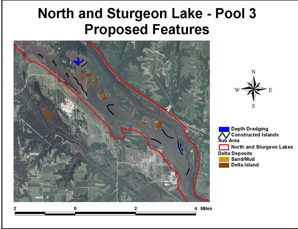
8 Prairie Island North Lake Sturgeon Lake Corps Island Diamond Bluff Upper Spot Dikes Marsh Lake Lock and Dam 3 Intermediate Dike Gatenbein (Goose) Lake

9 Prairie Island Goose Lake Mississippi River - Lower Pool 3 Pickerel Lake Lock and Dam 3 Mississippi River - Upper Pool 4 Vermillion River

10 Vermillion River Cannon River Delta Cannon River Cannon Lake Dukes Pond Spring Creek Lake Espen Lake Mud Lake

11 Wisconsin Channel Upper Pool 4 Water Resources Mud Lake Goose Lake Dead Slough Lake Bay City Flats Wacouta Bay Lake Pepin

12 AQUATIC VEGETATION QUALITY Pool 5 Pool 5A Pool 6 Pool 2 Pool 7 Pool 3 Pool 8 Pool 4 Pool 9 Poor Quality Good Quality Excellent Quality UMRCC adhoc Vegetation Technical Committee 2003 Report and field observations in Pool 2
13 Environmental Pool Planning Steps Desired Future Potential Actions Existing Conditions
14 2004

15 Environmental Pool Plan Restoration Features/Activities Water Level Management Summer Drawdown Floodplain Island Restoration Surface Water Use Management Floodplain Connectivity and Flow Redistribution Floodplain Forest, Prairie and Marsh Restoration/Management Vegetative Buffers

16 Water Level Management EPP Fish and Wildlife Objectives Increase emergent aquatic plant coverage Increase submersed aquatic plant coverage Pool-wide Drawdown during the Summer Growing Season Consolidate sediments Diversify floodplain bathymetry Reduce wave heights TMDL Water Quality Objectives Reduce Chlorophyll a concentrations Reduce turbidity to improve water clarity/light penetration Reduce suspended solids concentrations Reduce water column nutrient concentrations
17

18 Predicted vs. Actual exposed substrate at 30,000 cfs USGS UMESC

19 Lock and Dam # 7 (Dresbach) La Crosse Drawdown depths gradually decline the further upstream of the Lock and Dam Brownsville Stoddard USACE Lock and Dam # 8 (Genoa)


20 June 11, 2001 Pre Drawdown June 24, 2002 Pool 8 Pool-Wide Water Level Drawdowns August 19, 2002 During Drawdown September 17, st Year Post Drawdown August 8, 2003


21 7/13/05 9/14/05 Pool 5 Drawdown Whitewater River Delta

22 Vegetation provides excellent food, food, shelter, shelter, cover, and breeding and and rearing grounds for for aquatic life. life.


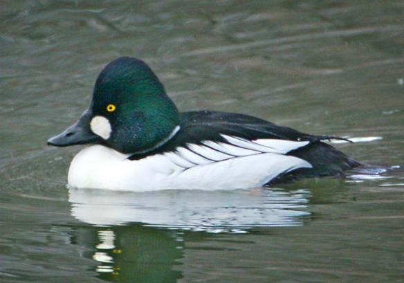
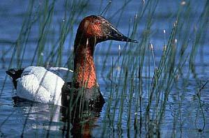
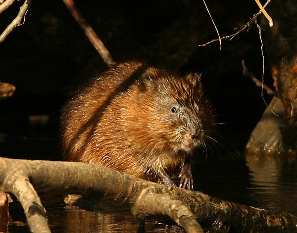

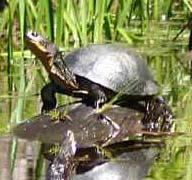

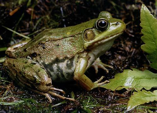
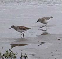
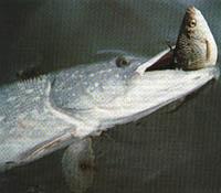

23 Just a few of the organisms that benefit from vegetation pg
24 Water Level Management TMDL = WLA + LA + MOS + RC Highlighted Potential Outcomes Shift from algae dominated to macrophyte dominated freshwater ecosystem Reduced bottom sediment resuspension Reduced streambank erosion Increased suspended solids deposition Reduced reintroduction of phosphorus currently sequestered in bottom sediments


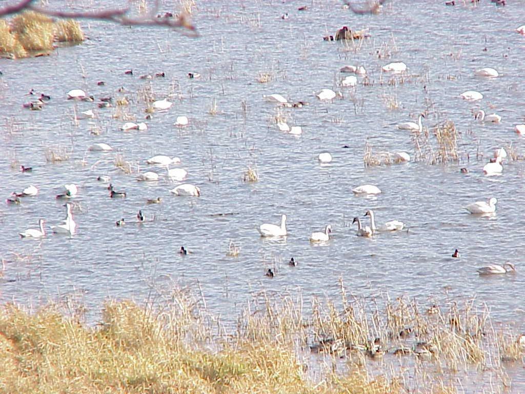
25 Tundra Swans USFWS UMR Refuge

26 Floodplain Islands EPP Fish and Wildlife Objectives Restore lost physical structure Diversify habitat Create sheltered areas Reduce wind fetch TMDL Water Quality Objectives Reduce turbidity to improve water clarity/light penetration Reduce suspended solids concentrations Reduce water column nutrient concentrations Reduce wave heights Redistribute flow USACE

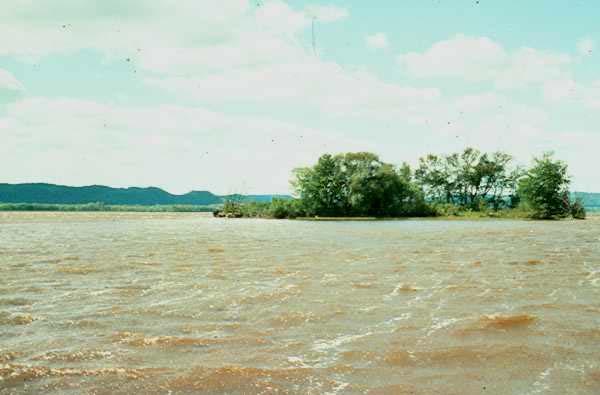
27 Lower Pool 8 Island Erosion USGS - UMESC
28


29 Change in Fetch in Lower Pool 8 from 1937 to present Fetch increased after impoundment as islands eroded. Fetch decreased after 1989 as a result of island building Lowest fetch 1937 Highest fetch 2007? USGS - UMESC


30 Island Protection and Restoration Past Experiences October 1961 USGS UMESC August 1994 August 2000 Pool 8 Islands Phase II, near Stoddard, Wisconsin
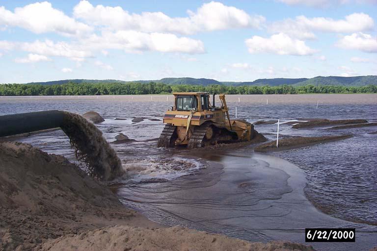
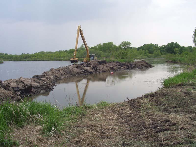
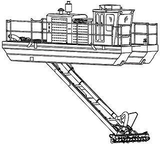
31 Island Construction Mechanical Hydraulic
32

33 Pool 2 Natural River Levee Island Restoration
34 Floodplain Islands Highlighted Potential Outcomes TMDL = WLA + LA + MOS + RC Reduced sediment resuspension Reduced streambank erosion Reduced reintroduction of phosphorus currently sequestered in bottom sediments


35 Surface Water Use Management EPP Fish and Wildlife Objectives Reduce streambank erosion Reduce sediment resuspension Reduce prop wash Reduce loss of aquatic plants Minimize other biological impacts TMDL Water Quality Objectives Reduce turbidity to improve water clarity/light penetration Reduce suspended solids concentrations Reduce water column nutrient concentrations
36

37 -The more recreational boating activity the more sediment resuspended in the water column. USACE % E r o d i n g Maximum Wave Height USACE - The more recreational boats capable of creating large waves the more shoreline that is eroding.


38 - Recreational boat traffic is forecast to increase 20% on the Upper Mississippi River in the next 50 years. USACE - Most of the traffic increase will be in Pools 3 and 4 which are already the busiest pools. USACE
39 Documented Commercial Navigational Impacts Resuspension of sediments Erosion of streambanks Damage to submerged plants Changes in flow direction and magnitude Greater impacts in upper reaches/narrow channels
40 Surface Water Use Management TMDL = WLA + LA + MOS + RC Highlighted Potential Outcomes Reduced sediment resuspension Reduced streambank erosion Reduced reintroduction of phosphorus currently sequestered in bottom sediments Surface water use legislation, policy and regulations Fleeting Plan Implementation Mooring Cell Plan Implementation

41 Preliminary List of Information and Modeling Needs Complete Bathymetry Mapping in Pools 2-4 HEC RAS Model and/or RMA 2 Seed Bank Analysis Wind Fetch Model Submersed Aquatic Plant Model Navigation Study Models Phytoplankton and Zooplankton community dynamics USGS - UMESC

42 USFWS - Refuge
Upper Mississippi River Floodplain Restoration Priorities in Pools 1, 2, 3, Upper 4 and Lower Vermillion River
 Upper Mississippi River Floodplain Restoration Priorities in Pools 1, 2, 3, Upper 4 and Lower Vermillion River Minnesota Department of Natural Resources Interdivisional Meeting July 8, 2009 Lake City Area
Upper Mississippi River Floodplain Island Restoration Details
 Upper Mississippi River Floodplain Island Restoration Details Mississippi Makeover Meeting Citizens Advisory Group December 1, 2009 Hastings City Hall Community Room Scot Johnson Minnesota Department of
Upper Mississippi River Restoration:
 Upper Mississippi River Restoration: Managing a Dual Purpose River for Fish and Wildlife Habitat Jeff Janvrin Wisconsin Dept. of Natural Resources Mississippi River Habitat Specialist Mud Lake HREP, Lower
Lake Pepin. TMDL Basics
 NORTH DAKOTA SOUTH DAKOTA Lake Pepin Basins BASIN Cannon River Basin Minnesota River Basin Minnesota River Basin St. Croix River Basin Upper Mississippi River Basin HUC 07040001 Major Rivers Metro Area
Pierce County Islands and the Head of Lake Pepin
 Pierce County Islands and the Head of Lake Pepin CAP Section 204 - Beneficial Use of Dredged Material Public Meeting and Open House St. James Hotel April 4, 2018 US Army Corps of Engineers 1 What this
HYDRAULIC CONNECTIVITY (HC) ENGINEERING & HYDRAULICS PERSPECTIVES
 ENGINEERING & HYDRAULICS PERSPECTIVES") HYDRAULIC CONNECTIVITY (HC) ENGINEERING & HYDRAULICS PERSPECTIVES Presented at the UMRR HREP Team Meeting September 28, 2016 Jon Hendrickson Regional Technical Specialist, Eco-Hydraulics & WQ USACE, Mississippi
HYDRAULIC CONNECTIVITY (HC) ENGINEERING & HYDRAULICS PERSPECTIVES Presented at the UMRR HREP Team Meeting September 28, 2016 Jon Hendrickson Regional Technical Specialist, Eco-Hydraulics & WQ USACE, Mississippi
Shallow Lake Ecology and Management. Todd Call Shallow Lakes Program
 Shallow Lake Ecology and Management Todd Call Shallow Lakes Program Two Concepts to Take Away Shallow lakes can exist in two states Clear Water (Preferred for wetland wildlife) Turbid Water Fish and nutrients
TURKEY RIVER BOTTOMS DELTA AND BACKWATER COMPLEX
 TURKEY RIVER BOTTOMS DELTA AND BACKWATER COMPLEX HABITAT REHABILITATION AND ENHANCEMENT PROJECT CLAYTON COUNTY, IOWA AND GRANT COUNTY, WISCONSIN UPPER MISSISSIPPI RIVER RESTORATION ENVIRONMENTAL MANAGEMENT
BOSTON BAY HABITAT REHABILITATION AND ENHANCEMENT PROJECT (HREP) MERCER COUNTY, ILLINOIS
 MERCER COUNTY, ILLINOIS") BOSTON BAY HABITAT REHABILITATION AND ENHANCEMENT PROJECT (HREP) MERCER COUNTY, ILLINOIS UPPER MISSISSIPPI RIVER RESTORATION ENVIRONMENTAL MANAGEMENT PROGRAM ROCK ISLAND DISTRICT FACT SHEET I. LOCATION
BOSTON BAY HABITAT REHABILITATION AND ENHANCEMENT PROJECT (HREP) MERCER COUNTY, ILLINOIS UPPER MISSISSIPPI RIVER RESTORATION ENVIRONMENTAL MANAGEMENT PROGRAM ROCK ISLAND DISTRICT FACT SHEET I. LOCATION
Selecting indicators based on river science two examples
 Selecting indicators based on river science two examples use High turbidity, poor vegetation Increase vegetation using summer water level drawdowns to expose sediment and germinate plants Sediments dry
Minnesota EAW Supplement
 Appendix I: Minnesota EAW Supplement Lower Pool 2 Channel Management Study: Boulanger Bend to Lock and Dam No. 2 Minnesota EAW Item Identification A supplement prepared for the Minnesota DNR to identify
UPPER MISSISSIPPI RIVER Illinois Waterway NAVIGATION AND ECOSYSTEM SUSTAINABILITY PROGRAM
 UPPER MISSISSIPPI RIVER Illinois Waterway NAVIGATION AND ECOSYSTEM SUSTAINABILITY PROGRAM One Ken Team: Barr Corps Relevant, of Engineers Ready, Responsive Rock Island District Reliable 1 UMR-IWW NAVIGATION
Upper Mississippi River Lake Pepin Modeling Lake Pepin Municipal Sector Meeting August 6, 2008
 Upper Mississippi River Lake Pepin Modeling Lake Pepin Municipal Sector Meeting August 6, 2008 Lake Pepin Photo by Guy Schmickle Overview Fundamentals Why model? What is a model? Model Development How
Cat Island Chain Restoration, Green Bay
 Cat Island Chain Restoration, Green Bay Victoria Harris, UW Sea Grant January 27, 2005 Southern Green Bay historically provided diverse coastal wetland habitats for fish and wildlife Expansive emergent
Upper Mississippi River Basin Environmental Management Program Workshop
 Presentation to the Upper Mississippi River Basin Environmental Management Program Workshop by Kara Mitvalsky Environmental Engineer US Army Corps of Engineers, Rock Island District August 18, 2005 Engineering
Lake Pepin Photo by Guy Schmickle
 Science Advisory Panel Meeting Lake Pepin Water Quality Modeling Project April 30, 2008 Lake Pepin Photo by Guy Schmickle Overview Modeling status Historical system behavior Model simulation scenarios
Weaver Bottoms Wildlife Habitat Restoration: A Case Study
 WRP Technical Note FW-RS-7. 1 ~- Weaver Bottoms Wildlife Habitat Restoration: A Case Study PURPOSE: This technical note evaluates the success of a wetland rehabilitation project in the first four years
Initial Application of a Landscape Evolution Model to a Louisiana Wetland
 Initial Application of a Landscape Evolution Model to a Louisiana Wetland by Carl F. Cerco PURPOSE: Corps planning projects encompass a wide variety of restoration goals. These include wetland restoration,
Upper Mississippi River. Systemic Forest Stewardship Plan. Executive Summary
 Upper Mississippi River Systemic Forest Stewardship Plan Executive Summary St. Paul District Rock Island District St. Louis District August 2012 Introduction The Mississippi River is the largest riverine
Upper Mississippi River Lake Pepin Water Quality Model July INTRODUCTION
 1. INTRODUCTION This report describes the development, calibration/confirmation, and application of a linked hydrodynamic-sediment transport-water quality model for the Upper Mississippi River from Lock
Ecological Considerations in Setting MFLs and Lake Regulation Targets for the Ocklawaha Chain of Lakes
 Ecological Considerations in Setting MFLs and Lake Regulation Targets for the Ocklawaha Chain of Lakes Rolland Fulton, Ph.D. Environmental Scientist VI Bureau of Environmental Sciences St. Johns River
DRAFT. Appendix B 404(b)(1) Clean Water Act Pigs Eye Lake Ramsey County, MN Section 204
(1) Clean Water Act Pigs Eye Lake Ramsey County, MN Section 204") Appendix B 404(b)(1) Clean Water Act Pigs Eye Lake Ramsey County, MN Section 204 Draft Feasibility Study Report with Integrated Environmental Assessment St. Paul District U.S. Army Corps of Engineers March
Appendix B 404(b)(1) Clean Water Act Pigs Eye Lake Ramsey County, MN Section 204 Draft Feasibility Study Report with Integrated Environmental Assessment St. Paul District U.S. Army Corps of Engineers March
Section 404(b)(1) Evaluation
(1) Evaluation") Appendix B: Section 404(b)(1) Evaluation Lower Pool 2 Channel Management Study: Boulanger Bend to Lock and Dam No. 2 I. Project Description A. Location The proposed fill activities would occur between
Appendix B: Section 404(b)(1) Evaluation Lower Pool 2 Channel Management Study: Boulanger Bend to Lock and Dam No. 2 I. Project Description A. Location The proposed fill activities would occur between
Developing a Plan to Improve Water Quality in the Lower Vermillion River
 Developing a Plan to Improve Water Quality in the Lower Vermillion River Public Meeting for the Turbidity Total Maximum Daily Load Study March 19, 2008 Hastings, Minnesota :30 PM 1 MPCA: Minnesota Pollution
Lake Pepin Photo by Guy Schmickle
 Options for Meeting Water Quality Standards Lake Pepin Technical Conference September 23, 28 Lake Pepin Photo by Guy Schmickle Overview Role of modeling in the TMDL Main features of UMR-LP Model Reductions
SECTION 1 FRESHWATER SYSTEMS UNIT 4: AQUATIC ECOLOGY
 SECTION 1 FRESHWATER SYSTEMS UNIT 4: AQUATIC ECOLOGY CENTRAL CASE STUDY: STARVING THE LOUISIANA COAST OF SEDIMENT LOUISIANA IS LOSING 25MI2 OF COASTAL WETLANDS ANNUALLY WETLANDS SUPPORT A DIVERSITY OF
The Flood of 1993 resulted in catastrophic
 31 UNIVERSITIES COUNCIL ON WATER RESOURCES ISSUE 130, PAGES 31-35, MARCH 2005 The Upper Mississippi River Comprehensive Flood Damage Reduction Study: Taking a Fresh Look at an Old Problem on a Basin-Wide
Wetland Policy In Vermont and Louisiana. Litsey Corona and Emily Karwat
 Wetland Policy In Vermont and Louisiana Litsey Corona and Emily Karwat What is a wetland? An area inundated by surface or groundwater with a frequency sufficient to support plants and animals that depend
J.F. Brennan Co., Inc. FULL SERVICE MARINE CONTRACTOR Lock and Dam Construction Hydraulic Dredging & Dewatering Specialty Construction and Diving
 J.F. Brennan Co., Inc. FULL SERVICE MARINE CONTRACTOR Lock and Dam Construction Hydraulic Dredging & Dewatering Specialty Construction and Diving Brennan Marine Co., Inc. MARINE TRANSPORTATION SERVICES
Ocklawaha River Restoration as Mitigation
 Ocklawaha River Restoration as Mitigation Dredging Will Further Harm the St. Johns Salinity = Farther Upstream Impacting Wetlands Damaging Submerged Grasses Further Stressing Trees Altering Dissolved Oxygen
Phosphorus Goal Setting Process Questions and Answers 2010
 Lake Winnipesaukee Watershed Management Plan Phase I: Meredith, Paugus, Saunders Bays 1. What is phosphorus? Phosphorus (P) is a naturally occurring element and a major nutrient required for biological
Tracking Change in Land Cover Within Lake Onalaska, Navigation Pool No. 7, Upper Mississippi River Between 1975 and 1994
 Tracking Change in Land Cover Within Lake Onalaska, Navigation Pool No. 7, Upper Mississippi River Between 1975 and 1994 Shawn Weick 1,2 1 Saint Mary s University Department of Resource Analysis of Minnesota,
Appendix D Section 404 Certification
 Appendix D Section 404 Certification Appendix D Section 404(b)(1) Evaluation Marsh Lake Ecosystem Restoration Project Minnesota River Big Stone, Lac qui Parle, and Swift Counties, Minnesota June 2011 I.
Final TMDL Implementation Plan. Prepared for Minnesota Pollution Control Agency
 Wirth Lake Final TMDL Implementation Plan Prepared for Minnesota Pollution Control Agency September 2010 4700 West 77 th Street Minneapolis, MN 55435-4803 Phone: (952) 832-2600 Fax: (952) 832-2601 wq-iw11-03c
CLMP+ Report on Fleming Lake (Aitkin County)
") CLMP+ Report on Fleming Lake (Aitkin County) Lake ID# -5-5-6 CLMP+ Data Summary July 7 Authors Shannon Martin Contributors/acknowledgements Terry Dahlberg Sandy Dahlberg Pam Anderson For questions regarding
CLMP+ Report on Fleming Lake (Aitkin County) Lake ID# -5-5-6 CLMP+ Data Summary July 7 Authors Shannon Martin Contributors/acknowledgements Terry Dahlberg Sandy Dahlberg Pam Anderson For questions regarding
2016 Monitoring Report; Mississippi River Tributaries
 2016 Monitoring Report; Mississippi River Tributaries SWWD s East Mississippi watershed (Map 1) is named after the former East Mississippi Watershed Management Organization which managed the area prior
McGregor Lake Habitat Rehabilitation and Enhancement Project Feasibility Report and Integrated Environmental Assessment
 Main Report McGregor Lake Habitat Rehabilitation and Enhancement Project Feasibility Report and Integrated Environmental Assessment Upper Mississippi River Restoration Program Mississippi River: Mile 633
Weaver Bottoms Wildlife Habitat Restoration: A Case Study
 WRP Technical Note FW-RS-7. 1 ~- Weaver Bottoms Wildlife Habitat Restoration: A Case Study PURPOSE: This technical note evaluates the success of a wetland rehabilitation project in the first four years
EVALUATION - SECTION 404 OF THE CLEAN WATER ACT DISCHARGE OF SEDIMENTS FROM OR THROUGH A DAM
 EVALUATION - SECTION 404 OF THE CLEAN WATER ACT DISCHARGE OF SEDIMENTS FROM OR THROUGH A DAM U.S. ARMY CORPS OF ENGINEERS, NEW ENGLAND DISTRICT CONCORD, MA PROJECT: Northfield Brook Dam, Naugatuck River
Appendix I Cost Engineering Pigs Eye Lake Ramsey County, MN Section 204 DRAFT. Draft Feasibility Study Report with Integrated Environmental Assessment
 Appendix I Cost Engineering Pigs Eye Lake Ramsey County, MN Section 204 Draft Feasibility Study Report with Integrated Environmental Assessment St. Paul District U.S. Army Corps of Engineers March 2018
Figure 1. Map of Platte River Watershed.
 Figure 1. Map of Platte River Watershed. Hatchery Total Phosphorus (TP) Load Total Phosphorus (lbs) 199 1995 5 Figure. Long-Term Pattern of Hatchery Total Phosphorus Loads. TP (lbs) 3 1 1 3 5 7 9 1 11
Shaina Keseley MPCA-Rochester Watershed Project Manager
 Shaina Keseley MPCA-Rochester Watershed Project Manager Why study Minnesota s waters? Basis of Clean Water work: Federal Clean Water Act of 1972 Goal Fishable/Swimmable by 1983 MPCA completes work for
UPPER MISSISSIPPI RIVER RESTORATION LAKE ODESSA HABITAT REHABILITATION AND ENHANCEMENT PROJECT OPERATION AND MAINTENANCE MANUAL APPENDIX G
 UPPER MISSISSIPPI RIVER RESTORATION LAKE ODESSA HABITAT REHABILITATION AND ENHANCEMENT PROJECT OPERATION AND MAINTENANCE MANUAL APPENDIX G PROJECT POSTERS U.S. ARMY CORPS OF ENGINEERS Partners: U.S. Fish
Towards Effective Adaptive Management on the Upper Mississippi river System
 Towards Effective Adaptive Management on the Upper Mississippi river System TITLE VIII WRDA 2007: UPPER MISSISSIPPI RIVER and ILLINOIS WATER SYSTEM Navigation & Ecosystem Sustainability Program (NESP)
Issue Paper: Sediment-Related Water Quality Criteria for the Upper Mississippi River
 Issue Paper: Sediment-Related Water Quality Criteria for the Upper Mississippi River February 2007 Upper Mississippi River Basin Association Upper Mississippi River Basin Association 415 Hamm Building,
Environmental Services
 Environmental Services 14 River Water Quality Summary for the Twin Cities Metropolitan Area This document is a summary of the 14 water quality of major rivers in the Twin Cities metropolitan area (metro
Recent Modeling in the Maumee Watershed and the Western Basin of Lake Erie
 LEMN Conference University of Windsor April 27-29, 2010 Recent Modeling in the Maumee Watershed and the Western Basin of Lake Erie J.V. DePinto, T.R. Redder, E.M. Verhamme, L. Weintraub LimnoTech, Ann
Cost-Effectiveness Analysis of Methods to Rehabilitate Shallow Lakes
 Cost-Effectiveness Analysis of Methods to Rehabilitate Shallow Lakes Patrick G. Welle, Ph.D.* Bemidji State University Paper Submitted for the Fifth Annual Conference of the Society for Benefit-Cost Analysis
Letter - R5 Page
 Page 18 Response to Comment R5-70 The salinity impacts resulting in a shift to a brine fly- and brine shrimpbased ecosystem have already been described. It is not known if the decreased loads (but selectively
CLMP+ Report on Grass Lake (Anoka County) Lake ID# CLMP+ Data Summary
 Lake ID# CLMP+ Data Summary") CLMP+ Report on Grass Lake (Anoka County) Lake ID# 02-0113-00 2012-2013 CLMP+ Data Summary October 2014 Authors Shannon Martin, MPCA Editing and graphic design Public Information Office Staff The (MPCA)
CLMP+ Report on Grass Lake (Anoka County) Lake ID# 02-0113-00 2012-2013 CLMP+ Data Summary October 2014 Authors Shannon Martin, MPCA Editing and graphic design Public Information Office Staff The (MPCA)
POOL 11 ISLANDS SUNFISH LAKE AND MUD LAKE OPERATION AND MAINTENANCE MANUAL
 MISSISSIPPI RIVER POOL 11 ISLANDS SUNFISH LAKE AND MUD LAKE GRANT COUNTY, WISCONSIN AND DUBUQUE COUNTY, IOWA U.S. ARMY CORPS OF ENGINEERS ENVIRONMENTAL MANAGEMENT PROGRAM HABITAT REHABILITATION AND ENHANCEMENT
What is an ecosystem?
 What is an ecosystem? An ecosystem is generally defined as a community of organisms living in a particular environment and the physical elements in that environment with which they interact. (http://www.enviroliteracy.org/category.php/3.html)
Environment and Natural Resources Trust Fund 2019 Request for Proposals (RFP)
") Environment and Natural Resources Trust Fund 2019 Request for Proposals (RFP) Project Title: Restoring Native Mussels in Streams and Lakes Category: A. Foundational Natural Resource Data and Information
Environment and Natural Resources Trust Fund 2019 Request for Proposals (RFP) Project Title: Restoring Native Mussels in Streams and Lakes Category: A. Foundational Natural Resource Data and Information
McGREGOR LAKE HABITAT REHABILITATION AND ENHANCEMENT PROJECT
 US Army Corps Of Engineers St. Paul District UPPER MISSISSIPPI RIVER SYSTEM ENVIRONMENTAL MANAGEMENT PROGRAM PROBLEM APPRAISAL REPORT Project #144152 McGREGOR LAKE HABITAT REHABILITATION AND ENHANCEMENT
Making Floodplain Restoration Normal
 Making Floodplain Restoration Normal Eileen Shader American Rivers ASFPM National Conference 2017 Kansas City Rivers Flood Floods drive natural processes and ecosystem functions that sustain rivers and
I. INTRODUCTION. 1 See explanatory statement at 612 (referencing line item included on pages 603 and 751 appropriating
 to the Navigation and Ecosystem Sustainability Program I. INTRODUCTION Following authorization of the Upper Mississippi River and Illinois Waterway System Navigation and Ecosystem Sustainability Program
Welcome. Thank you for joining us! Lower Mississippi River Watershed Management Organization
 Welcome. Thank you for joining us! Lower Mississippi River Watershed Management Organization Lower Mississippi River Watershed Management Organization Watershed Restoration and Protection (WRAP) Study
Appendix J Hydrology and Hydraulics
 Appendix J Hydrology and Hydraulics Marsh Lake Dam Ecosystems Restoration Feasibility Study Hydraulics & Hydrology Appendix January 2011 Contents List of Figures iii List of Tables iii I. General 1 II.
DES MOINES RIVER RESERVOIRS WATER CONTROL PLAN UPDATES IOWA ASCE WATER RESOURCES DESIGN CONFERENCE
 DES MOINES RIVER RESERVOIRS WATER CONTROL PLAN UPDATES 237 237 237 217 217 217 200 200 200 0 0 0 163 163 163 131 132 122 80 119 27 252 174.59 110 135 120 112 92 56 IOWA ASCE WATER RESOURCES DESIGN CONFERENCE
Lake Lou Yaeger Section 206 Study Aquatic Ecosystem Restoration
 Lake Lou Yaeger Section 206 Study Aquatic Ecosystem Restoration Ashley Rasnic Michelle Kniep St. Louis District U.S. Army Corps of Engineers July 2, 2015 US Army Corps of Engineers Concerns Loss of lake
UPPER MISSISSIPPI RIVER RESTORATION - ENVIRONMENTAL MANAGEMENT PROGRAM
 UPPER MISSISSIPPI RIVER RESTORATION - ENVIRONMENTAL MANAGEMENT PROGRAM Joint Charter of the Upper Mississippi River Restoration - Environmental Management Program Coordinating Committee, Analysis Team,
Prioritizing Habitat Projects in Areas of Concern Throughout the Great Lakes
 Prioritizing Habitat Projects in Areas of Concern Throughout the Great Lakes Karen Rodriguez U.S. Environmental Protection Agency Great Lakes National Program Office August 1, 2013 Great Lakes Water Quality
Water Quality in Mayflower Lake. N. Turyk Water Resource Scientist UW-Stevens Point
 Water Quality in Mayflower Lake N. Turyk Water Resource Scientist UW-Stevens Point Tonight s discussion Water movement Water quality Zoning/Build-outs in the Watersheds Recommendations and Considerations
Coastal Restoration in Louisiana
 Coastal Restoration in Louisiana Presentation Topics Wetland Loss & the Importance of Coastal Louisiana The Coastal Restoration Effort The Louisiana Coastal Area Plan Development Components Status How
INDICATOR: DETROIT RIVER COASTAL WETLANDS
 INDICATOR: DETROIT RIVER COASTAL WETLANDS Background Wetlands are characterized by water saturation, which is the dominant factor determining the nature of soil development and the types of plant and animal
Natural Shoreline Landscapes on Michigan Inland Lakes
 Natural Shoreline Landscapes on Michigan Inland Lakes Excerpts from Chapters 2 and 3 Session topics Characteristics of natural and altered shorelines Lakes, shorelines, habitat and water quality Considerations
Drawdown at Lower St. Anthony Falls Lock and Dam for Inspection of the Bassett Creek Flood Control Project
 DRAFT ENVIRONMENTAL ASSESSMENT Drawdown at Lower St. Anthony Falls Lock and Dam for Inspection of the Bassett Creek Flood Control Project U.S. ARMY CORPS OF ENGINEERS ST. PAUL DISTRICT JANUARY 2019 Table
EXECUTIVE SUMMARY DES PLAINES RIVER WATERSHED-BASED PLAN WHY A WATERSHED-BASED PLAN? WHAT IS A WATERSHED?
 Des Plaines River Watershed-Based Plan EXECUTIVE SUMMARY June 2018 EXECUTIVE SUMMARY DES PLAINES RIVER WATERSHED-BASED PLAN WHY A WATERSHED-BASED PLAN? Water is elemental to our lives. Plants and animals,
Watershed Response to Water Storage. 8/1/2012 Paul Wymar Scientist Chippewa River Watershed Project
 Watershed Response to Water Storage 8/1/2012 Paul Wymar Scientist Chippewa River Watershed Project Chippewa River Watershed 1.3 Million Acres Largest tributary watershed in the Minnesota River Basin 7
Cedar Island, Pike, and Eagle Lakes Nutrient TMDL Implementation Plan
 Cedar Island, Pike, and Eagle Lakes Nutrient TMDL Implementation Plan Wenck File #1240-76 Prepared for: SHINGLE CREEK WATERSHED MANAGEMENT COMMISSION MINNESOTA POLLUTION CONTROL AGENCY Prepared by: May
Chapter 8: Aquatic Biodiversity
 Chapter 8: Aquatic Biodiversity APES 2013 1 Aquatic Life Zones 71% of the Earth is covered in saltwater 2.2% is freshwater Aquatic life zones are the equivalent of biomes Two major types: saltwater (marine)
Achieving the Philosophy of GOMA Through MsCIP
 Achieving the Philosophy of GOMA Through MsCIP 4 th National Conference on Ecosystem Restoration August 3, 2011 The Spirit of Cooperation Integrating Partnerships for Sustainable Ecosystem Restoration
Mississippi Coastal Improvements Program A Comprehensive Plan for Coastal Resilience
 Mississippi Coastal Improvements Program A Comprehensive Plan for Coastal Resilience 200 Coastal Resilience Symposium 26 May 200 US Army Corps of Engineers BUILDING STRONG Mississippi Coastal Improvements
Where in the Draft FR/EIS can I Find?
 Wildlife Preble s Meadow Jumping Mouse Discussion of Species & Habitat: pp. 3-63 3-64 Habitat in Chatfield Project Area: Fig 3-12, p. 3-65 Habitat in Reallocation Study Area: Fig 3-13, p. 3-67 Habitat
Public Notice. Public Notice No. Date: April 8, 2016 CENAP-PL-E Comment Period Closes: May 9, 2016
 Public Notice Public Notice No. Date: April 8, 2016 CENAP-PL-E-16-02 Comment Period Closes: May 9, 2016 USACE Philadelphia District: http://www.nap.usace.army.mil COBBS CREEK FISH PASSAGE PROJECT SECTION
Upper Mississippi River Conference 2016 Action Agenda: Raise the Grade
 Upper Mississippi River Conference 2016 Action Agenda: Raise the Grade December 16, 2016 On Oct. 13 14, 2016, a partnership of river stakeholders hosted the ninth annual Upper Mississippi River Conference,
for U.S. Army Corps of Engineers Rock Island District Rock Island, IL 61204
 An Adaptive Management Approach for Summer Water Level Reductions on the Upper Mississippi River System by B. L. Johnson 1, J. W. Barko 2, S. M. Bartell 3, R. Clevenstine 4, M. Davis 5, D. L. Galat 6,
Florida Fish and Wildlife Conservation Commission s Response. Florida Fish and Wildlife Conservation Commission Dennis J. Renfro
 Florida Fish and Wildlife Conservation Commission s Response Florida Fish and Wildlife Conservation Commission Dennis J. Renfro Mission Statement The Florida Fish and Wildlife Conservation Commission s
Clam Lakes (Lower & Upper), Burnett County Four-Phased Lake Management Planning Project Description
, Burnett County Four-Phased Lake Management Planning Project Description") 1 Clam Lakes (Lower & Upper), Burnett County Four-Phased Lake Management Planning Project Description Lake and Watershed Characteristics The Clam Lakes are a combined 1544 acres with Upper Clam Lake essentially
1 Clam Lakes (Lower & Upper), Burnett County Four-Phased Lake Management Planning Project Description Lake and Watershed Characteristics The Clam Lakes are a combined 1544 acres with Upper Clam Lake essentially
Little Bay Water Quality Report Card Spring 2014
 Little Bay Water Quality Report Card Spring 2014 Little Bay is a small, semi-enclosed estuary located in the heart of Rockport, Texas. Estuaries, where freshwater from rivers and streams mixes with salt
D o n a b a u m & W o lfra m, C o n s u ltin g E n g in e e rs fo r E c o lo g y, W ie n
 The impoundment of the River Danube at Vienna - impact on the water quality of the New Danube and opportunity for water management Georg Wolfram* & Uwe H. Humpesch D o n a b a u m & W o lfra m, C o n s
Webinar for the Natural Floodplain Function Alliance 18 November 2013
 Moving toward Floodplain Restoration at Scale on the Illinois River and Upper Mississippi Basin: Valuing Ecosystem Services, Demonstrating Flood Reduction, and Policy Implications Webinar for the Natural
Chapter 4 Watershed Goals and Objectives
 Chapter 4 Watershed Goals and Objectives Eight (8) long-term watershed goals have been developed by the NEW Watershed Advisory Group (WAG) after consideration of discussions held during monthly watershed
vice ark Ser a#onal P N
 Na#onal Park Service Great lakes Fisheries Commission USGS Na#onal Great Rivers Research & Educa#on Center Species Maximum Size Food Source Fun Fact Bighead Silver Black Grass 110 lbs, 55 inches 100 lbs,
ENVIRONMENTAL RESTORATION IN COASTAL MISSISSIPPI: MARSH RE-ESTABLISHMENT PROJECT HARRISON AND JACKSON COUNTIES, MISSISSIPPI
 SECTION 404(b)(1) EVALUATION REPORT FOR THE SECTION 204 ECOSYSTEM RESTORATION PROJECT IN CONNECTION WITH CONSTRUCTION, OPERATION, OR MAINTENANCE DREDGING OF A FEDERALLY AUTHORIZED PROJECT ENVIRONMENTAL
Upper Mississippi. River Restoration. Report to Congress ENVIRONMENTAL MANAGEMENT PROGRAM
 Upper Mississippi River Restoration ENVIRONMENTAL MANAGEMENT PROGRAM 2010 Report to Congress U.S. Army Corps of Engineers St. Paul, Rock Island, and St. Louis Districts 2010 Report to Congress Upper Mississippi
Evolution of Modeling Tools to Support Management and Restoration of the Great Lakes
 NCER 2011 Conference Baltimore, MD August 1-5, 2011 Evolution of Modeling Tools to Support Management and Restoration of the Great Lakes Joseph DePinto, Todd Redder, Ed Verhamme, Tim Dekker LimnoTech Ann
Shoreland Rules Revision Project Using GIS in North-Central Minnesota
 Shoreland Rules Revision Project Using GIS in North-Central Minnesota Andrew J. Williquett Department of Resource Analysis, Saint Mary s University of Minnesota, Minneapolis, MN 55404 Keywords: GIS, docks,
Ch. 7 Aquatic Ecology
 Ch. 7 Aquatic Ecology 1.Coral Reefs: the aquatic equal to the tropical rain forests 2.The two major aquatic life zones A. saltwater or marine (estuaries, coastlines, coral reefs, coastal marshes, mangrove
U.S. Army Corps of Engineers Mobile District
 U.S. Army Corps of Engineers Mobile District General Permit for Living Shorelines in Alabama Sandy P. Gibson Regulatory Specialist, Coastal Alabama Regulatory Division, Mobile District US Army Corps of
Maryland s Living Shorelines Program. Bhaskaran Subramanian February 27, 2015
 Maryland s Living Shorelines Program Bhaskaran Subramanian February 27, 2015 1 Erosion & traditional approaches Living shorelines- what is it? Maryland s Living Shorelines program LS Law Products Funding-
Orange Creek Basin Lakes Public Meeting
 Orange Creek Basin Lakes Public Meeting September 25, 2014 Grand Lake RV and Golf Resort Citra, Florida Meeting is hosted by the Orange Creek Basin Interagency Working Group Meeting Purpose Provide community
Prepared by: Skamania County Noxious Weed Control Program Post Office Box Rock Creek Drive Stevenson, Washington
 Skamania County Cooperative Indigobush Control Project Project Completion Report Washington State Department of Natural Resources Aquatic Land Grant IL 14-249 Prepared by: Skamania County Noxious Weed
Chapter 6. Aquatic Biodiversity. Chapter Overview Questions
 Chapter 6 Aquatic Biodiversity Chapter Overview Questions Ø What are the basic types of aquatic life zones and what factors influence the kinds of life they contain? Ø What are the major types of saltwater
Responding to Natural Resource Damage Associated with the Enbridge Line 6b Oil Spill
 Responding to Natural Resource Damage Associated with the Enbridge Line 6b Oil Spill Jay K. Wesley Southern Lake Michigan Unit Manager Fisheries Division Michigan Department of Natural Resources Stephanie
Mobile Bay National Estuary Program Project Implementation Committee Meeting
 Mobile Bay National Estuary Program Project Implementation Committee Meeting Mobile Bay Interagency Working Group Activities Larry Parson U.S. Army Corps of Engineers, Mobile District February 18, 2016
FY16 RSM IPR Portland District, Optimizing Fall Creek Reservoir Flush TMDL s, Stanford Gibson, Chris Nygaard, Jim Crain, Jarod Norton
 Fall Creek Reservoir Fall Creek Dam is at river mile 7.2 on Fall Creek, a tributary of the Willamette River, about 20 miles southeast of Eugene, OR. Dam works in coordination with Lookout Point and Hills
FOCUSED FEASIBILITY STUDY FOR PASSAIC RIVER SEDIMENTS: IDENTIFYING OPPORTUNITIES FOR EARLY ACTION
 FOCUSED FEASIBILITY STUDY FOR PASSAIC RIVER SEDIMENTS: IDENTIFYING OPPORTUNITIES FOR EARLY ACTION Liam Bossi 1, Scott E. Thompson, PE 2, R. Bruce Fidler, PE 3, Daria Navon, PE 4, and Thalia Loor 5 ABSTRACT
Land and Water Management Division Programs. Department of Environmental Quality
 Land and Water Management Division Programs Department of Environmental Quality Land and Water Management Programs Since the mid-1970 s, special resources that exist at the interface between land and water
Lake Pepin Watershed TMDL: Looking Ahead. August 2008 Sector Meetings. Lake Pepin Photo by Guy Schmickle
 Lake Pepin Watershed TMDL: Looking Ahead August 2008 Sector Meetings Lake Pepin Photo by Guy Schmickle Three Questions What are the critical issues to face moving forward? How can we as a sector address