Vegetation Condition and Water Quality in Great Lakes Coastal Wetlands
|
|
|
- Derek Shaw
- 5 years ago
- Views:
Transcription
1 Vegetation Condition and Water Quality in Great Lakes Coastal Wetlands Carol A. Johnston, Professor South Dakota State University Understanding the Vegetation and Hydrology of Upper Midwest Wetlands September 22-24, 2010 Carlton, MN

")
 Project, US EPA Agreement")
2 Acknowledgments Many collaborators, including: Michael Bourdaghs Bad River Band of the Lake Superior Tribe of Chippewa Indians for permission to sample Tom Hollenhorst This research has been supported by a grant from the US Environmental Protection Agency's Science to Achieve Results (STAR) Estuarine and Great Lakes (EaGLe) Coastal Initiative through funding to the Great Lakes Environmental Indicators (GLEI) Project, US EPA Agreement EPA/R


3 GLEI: Great Lakes Environmental Indicators ENVIRONMENTAL INDICATORS IN THE ESTUARINE ENVIRONMENT 2000 Science To Achieve Results (STAR) Program Carol A. Johnston develop a suite of new, integrative indicators of ecological condition, integrity, and/or sustainability that can be incorporated into long-term monitoring programs Great Lakes, Great Wetlands
4 Research Questions What are the plant community types of northern Great Lakes coastal wetlands? How are they related to water chemistry?

5 Carol A. Johnston Made 20,560 observations of cover class within 2051 sample plots in 90 wetlands Great Lakes, Great Wetlands Photo: Lynn Vaccaro

6 Northern Great Lakes wetland vegetation sample sites +3 sites on northern L. Huron Water chemistry measured on 26 northern sites (Trebitz et al. 2007, Morrice et al. 2008)
7 A Unifying Approach sample sample wetlands wetlands representing representing the the entire entire Carol A. Johnston range range of of anthropogenic anthropogenic stress stress sample sample aa range range of of water water depths depths within within wetlands wetlands use use non-metric non-metric multidimensional multidimensional scaling scaling to to determine determine aa condition condition gradient gradient use use hierarchical hierarchical clustering clustering to to interpret interpret MDS MDS results results use use GIS GIS to to map map results results Great Lakes, Great Wetlands

8 Step 1: Sample wetlands representing the entire range of anthropogenic stress Wolter et al Land use land cover change in the U.S. Great Lakes basin 1992 to J. Great Lakes Res. 32:


9 Step 2: sample a range of water depths within wetlands
10 Step 3: Use non-metric multidimensional scaling to determine a condition gradient Carol A. Johnston MDS, MDS, NMS, NMS, NMDS NMDS computed computed Bray-Curtis Bray-Curtis similarities similarities among among wetlands wetlands ordination ordination based based on on ranked ranked distances distances among among vegetation vegetation species species assemblages assemblages software software packages packages PC-ORD, PC-ORD, Primer Primer Great Lakes, Great Wetlands
11 Step 4: Use hierarchical clustering to interpret MDS results eastern cattail western cattail burreed/ lake sedge threesquare bluejoint/ tussock poor fens Phragmites % similarity Mere
12 Step 5: Use GIS to map results Carol A. Johnston ArcMap ArcMap identify identify geographic geographic clusters clusters of of similar similar vegetation vegetation identify identify geographic geographic outliers outliers Great Lakes, Great Wetlands

13 Plant Communities of Northern Great Lake Wetlands Pokegama River
 Northwest Territory sedge (Carex utriculata)")
 Photo: M.")
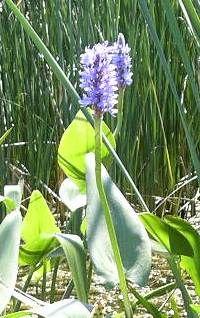
14 burreed (Sparganium eurycarpum) arrowhead (Sagittaria latifolia) Northwest Territory sedge (Carex utriculata) bladderwort (Utricularia macrorhiza) bulrush (Schoenoplectus tabernaemontani) Photo: M. Bourdaghs Burreed marsh Photo: C. Johnston

15 Wild rice (Zizania aquatica) 8 out of 90 sites, 7 on Lake Superior Silt soil indicator

16 Plant Communities of Northern Great Lake Wetlands Bayview Beach
 bog rosemary (Andromeda")
 Photo: M.")
17 Sphagnum moss Wooly-fruit sedge (Carex lasiocarpa) Myrica gale leatherleaf (Chamaedaphne calyculata) bog rosemary (Andromeda polifolia) pitcher plant (Sarracenia purpurea) bogbean (Menyanthes trifoliata) Photo: M. Bourdaghs Northern poor fen Photo: C. Johnston

18 Tahquamenon River Plant Communities of Northern Great Lake Wetlands
 Tussock sedge (Carex")
 Jointed rush (Juncus nodosus)")
19 Bluejoint / tussock sedge Bluejoint (Calamagrostis canadensis) Tussock sedge (Carex stricta) Softstem bulrush (Schoenoplectus tabernaemontani) Jointed rush (Juncus nodosus) Photos: M. Bourdaghs

20 Plant Communities of Northern Great Lake Wetlands Point au Sable
 bluejoint (Calamagrostis canadensis)")
21 Cattail marshes Photos: C. Johnston cattail (Typha angustifolia, Typha x glauca) bluejoint (Calamagrostis canadensis) jewelweed (Impatiens capensis) rice cutgrass (Leersia oryzoides)


22 So much diversity hat are plants telling us about wetland conditio
23 Non-metric multidimensional scaling northern Great Lakes wetland vegetation
24 Non-metric multidimensional scaling northern Great Lakes wetland vegetation worst Condition best
25 Chemical gradients among plant communities log conductivity log [Chloride] a bc b ph c poor fen burreed bluejoint cattail
26 Nutrient gradients among plant communities log [TN] log [TP] a b log [Chlorophyll a] b b poor fen burreed bluejoint cattail
27 Turbidity gradients among plant communities log [TSS] log Ttube a a b b b b b poor fen burreed bluejoint cattail poor fen b burreed bluejoint cattail
28
29 Plant communities have different chemistry Parameter Relationship specific conductance*** cattail & bluejoint > burreed & fen chloride***, ph** cattail > bluejoint burreed fen total P***, total N***, chl_a***, turbidity***, TSS*** cattail > bluejoint & burreed & fen NO3-N, NH4-N, DOC, DO not significant ** p < 0.01, *** p < 0.001
30 Non-metric multidimensional scaling northern Great Lakes wetland vegetation Superior Michigan, Huron
31 Lake Superior fluctuates less than Lakes Michigan/Huron Elevation, meters Superior lake level Michigan/Huron lake level Year
32 Lakes have different chemistry Parameter Relationship specific conductance***, ph*** Huron & Michigan > Superior chloride** Michigan Huron Superior total P**, total N*** Michigan > Superior & Huron chlorophyll_a* Michigan Superior Huron NO3-N* no Tukey differences NH4-N, TSS, DOC, DO, turbidity not significant * p < 0.05, ** p < 0.01, *** p < 0.001
33 3 Geomorphic Types Open-coast wetlands (Cw) Riverine wetlands (Rw) Protected wetlands (Pw)
34 Geomorphology conductivity: Pw < Cw*
35 Conclusions Plant species distinguish four major plant communities in northern Great Lakes Water quality varies by plant community and lake but not by geomorphology Based on chloride: cattail > bluejoint burreed fen Cattail wetlands (Lake Michigan) have poorest water quality (more total P, total N, chl_a, turbidity, TSS)


36 Future threats: invasive wetland plants


37 2004: common reed (Phragmites australis) 1999!!!!!!!!!!!!! Kilometers Photos: M. Tulbure 0.2
38 M a J u r - 99 Se n D p-9 e 9 M c - 99 a Ju r-00 Se n D p- 0 e 0 M c-00 a J u r - 01 Se n D p- 0 e 1 M c-0 ar 1 J u - 02 Se n D p- 0 e 2 M c - 02 a Ju r-03 Se n D p-0 e 3 M c-03 a J u r - 04 Se n - 0 p Water level (Meters above IGLD 1985) MWL Mean Minimum /10/99 6/19/01 7/9/04 Monthly Water Level (MWL) at Green Bay, Lake Michigan, WI from Source: NOAA
39 Take home messages A one-time snapshot sampling of multiple wetlands can advance understanding Take a GPS with you when you do the sampling! Keep looking at the data it has many stories to tell
40 References Johnston, C.A., et al Plant species indicators of physical environment in Great Lakes coastal wetlands. J. Great Lakes Res. 33 (sp3): Trebitz A.S., et al Water quality in Great Lakes coastal wetlands: Basin-wide patterns and responses to an anthropogenic disturbance gradient. J. Great Lakes Res. 33 (sp3): Morrice J.A., et al Human influences on water quality in Great Lakes coastal wetlands. Environ. Manage. 41: Johnston, C.A., et al A unifying approach for evaluating the condition of wetland plant communities and identifying related stressors. Ecol. Appl. 19:
Environmental indicators of condition, integrity, and sustainability in the Great Lakes basin
 Environmental indicators of condition, integrity, and sustainability in the Great Lakes basin PI: Gerald Niemi, University of Minnesota Duluth Cooperative Agreement with US EPA ORD; MED Co-PIs: 27 individuals
An integrated approach to assessing multiple stressors for coastal Lake Superior
 An integrated approach to assessing multiple stressors for coastal Lake Superior Gerald J. Niemi, 1, Euan D. Reavie, 2 Gregory S. Peterson, 3 John R. Kelly, 3 Carol A. Johnston, 4 Lucinda B. Johnson, 1
Vegetation survey of South Lindstrom Lake ( ), Chisago County, Minnesota. Summer 2010
, Chisago County, Minnesota. Summer 2010") Minnesota Dept. of Natural Resources Division of Fish and Wildlife Section of Fisheries Vegetation survey of South Lindstrom Lake (13-0028), Chisago County, Minnesota Summer 2010 Area Fisheries Supervisor
Minnesota Dept. of Natural Resources Division of Fish and Wildlife Section of Fisheries Vegetation survey of South Lindstrom Lake (13-0028), Chisago County, Minnesota Summer 2010 Area Fisheries Supervisor
Plant Species Indicators of Physical Environment in Great Lakes Coastal Wetlands
 J. Great Lakes Res. 33 (Special Issue 3):106 124 Internat. Assoc. Great Lakes Res., 2007 Plant Species Indicators of Physical Environment in Great Lakes Coastal Wetlands Carol A. Johnston 1,*, Barbara
Using Ecological Site Concepts to Assess Restoration Success: A Case Study on MLRA 98 Mucky Depressions
 Soil Science Division Using Ecological Site Concepts to Assess Restoration Success: A Case Study on MLRA 98 Mucky Depressions August, 2018 Skye Wills, National Resource Soil Scientist Greg Schmidt, Ecological
Sustainable Typha management in the Great Lakes. Shane Lishawa Loyola University Chicago Institute of Environmental Sustainability
 Sustainable Typha management in the Great Lakes Shane Lishawa Loyola University Chicago Institute of Environmental Sustainability Sustainable Typha management in the Great Lakes Adaptive restoration Research
Aquatic Plant Control
 Tawas Lake Nuisance Aquatic Plant Control Report Prepared for: Tawas Lake Improvement Association Aquatic Plant Control Prepared by: Progressive AE 1811 4 Mile Road, NE Grand Rapids, MI 49525-2442 616/361-2664
Stop & Shop. File No.: City and State: Milford, CT. General Impacts: Discharge of clean fill into 0.34 acres non-tidal freshwater.
 Stop & Shop File No.: 199501396 City and State: Milford, CT General Impacts: Discharge of clean fill into 0.34 acres non-tidal freshwater. Functions and Values Lost: (from database) Groundwater Floodflow
Overview National Aquatic Resource Surveys
 Overview National Aquatic Resource Surveys Tribal Water Workshop Oct. 6 th 2016 Mari Nord- USEPA Region 5 Sarah Lehmann USEPA Headquarters 1 Designed to Answer Key Policy Questions What is the condition
Lake Quassapaug 2017 Management Report December 11, 2017
 Northeast Aquatic Research northeastaquaticresearch.net 74 Higgins Highway Mansfield, CT 06250 (860) 456-3179 Lake Quassapaug 2017 Management Report December 11, 2017 Water Quality Summary Not all water
Pine Lake ( ) Aquatic Vegetation Survey
 Aquatic Vegetation Survey") Pine Lake (15-0149-00) Aquatic Vegetation Survey 22796 County Highway 6 Detroit Lakes, MN 56501 (218) 846-1465 www.rmbel.info Lake: Pine Lake DOW Number: 15-0149-00 Date of inspection: 6/30, 7/2/ 2015
Pine Lake (15-0149-00) Aquatic Vegetation Survey 22796 County Highway 6 Detroit Lakes, MN 56501 (218) 846-1465 www.rmbel.info Lake: Pine Lake DOW Number: 15-0149-00 Date of inspection: 6/30, 7/2/ 2015
Wallace Camp Auto. File No.: City and State: Westbrook, ME. General Impacts: 2.88 acres non-tidal wet meadow
 Wallace Camp Auto File No.: 199501767 City and State: Westbrook, ME General Impacts: 2.88 acres non-tidal wet meadow Functions and Values Lost: (From EA/SOF) Water Quality Maintenance Floodflow Alteration
Characterization of wetland soils and vegetation in Cranberry Bog and Goodyear Swamp, Otsego County, New York, summer 2009
 Characterization of wetland soils and vegetation in Cranberry Bog and Goodyear Swamp, Otsego County, New York, summer 2009 Maribeth Rubenstein 1 ABSTRACT Over a period of six weeks in the summer of 2009,
Ecological Impacts of invasive cattails in the Great Lakes. Shane Lishawa Loyola University Chicago Institute of Environmental Sustainability
 Ecological Impacts of invasive cattails in the Great Lakes Shane Lishawa Loyola University Chicago Institute of Environmental Sustainability Typha latifolia (broad-leaved cattail) Native to U.S. / Great
Effectiveness of Temporary Carp Barriers for Promoting Wild Rice Growth in a Southern Bay of Upper Clam Lake
 www.fixmylake.com 18029 83 rd Avenue North Maple Grove, MN 55311 mail@freshwatersci.com (651) 336-8696 Effectiveness of Temporary Carp Barriers for Promoting Wild Rice Growth in a Southern Bay of Upper
Draft North Lake Muskeg ERA Plan
 Draft North Lake Muskeg ERA Plan Figure 1. North Lake Muskeg ERA locator map Administrative Information: The North Lake Muskeg ERA is on State Forest land in the Escanaba Forest Management Unit (FMU),
Vegetation survey of North Center Lake ( ), Chisago County, Minnesota. Summer 2011
, Chisago County, Minnesota. Summer 2011") Minnesota Dept. of Natural Resources Division of Fish and Wildlife Section of Fisheries Vegetation survey of North Center Lake (13-0032), Chisago County, Minnesota Summer 2011 Area Fisheries Supervisor
Minnesota Dept. of Natural Resources Division of Fish and Wildlife Section of Fisheries Vegetation survey of North Center Lake (13-0032), Chisago County, Minnesota Summer 2011 Area Fisheries Supervisor
Vegetation Succession of Riverine Planted and Unplanted Wetlands Years After Creation in Ohio
 Vegetation Succession of Riverine Planted and Unplanted Wetlands 15-17 Years After Creation in Ohio Kay C. Stefanik and and William J. Mitsch Wilma H. Schiermeier Olentangy River Wetland Research Park
Sage Lake Cedar Swamp Ecological Reference Area (ERA)
") Sage Lake Cedar Swamp Ecological Reference Area (ERA) Administrative Information: Sage Lake Cedar Swamp Atlanta Management Unit Compartment 12, stands 26 & 188 (Avery Hills Management Area) Montmorency
Sage Lake Cedar Swamp Ecological Reference Area (ERA) Administrative Information: Sage Lake Cedar Swamp Atlanta Management Unit Compartment 12, stands 26 & 188 (Avery Hills Management Area) Montmorency
Prison Camp Muskeg ERA Plan
 Prison Camp Muskeg ERA Plan Figure 1. Prison Camp Muskeg ERA locator map Administrative Information: The Prison Camp Muskeg ERA is on State Forest land in the Newberry FMU, Whitefish Vermillion Point Management
Lake Quassapaug 2014 Study Results
 Lake Quassapaug 2014 Study Results February 23, 2015 Northeast Aquatic Research, LLC NEAR 2014 Scope Review Eurasian milfoil distribution June 18 Collect one round of water quality data June 18 Lake-wide
Chemical Control of Invasive Phragmites in a Great Lakes Marsh: A Field Demonstration
 Chemical Control of Invasive Phragmites in a Great Lakes Marsh: A Field Demonstration by Kurt D. Getsinger, Angela G. Poovey, Ernest Kafcas, and John Schafer PURPOSE: This field demonstration evaluated
Wetland Rehabilitation in a Reservoir Setting Wetland Habitat Enhancement: U.S. 95 Sand Creek Byway Josh Butler & Gretchen Herron CH2M HILL Inc.
 Wetland Rehabilitation in a Reservoir Setting Wetland Habitat Enhancement: U.S. 95 Sand Creek Byway & Gretchen Herron CH2M HILL Inc., Boise, Idaho CONTENTS 1. Background & Design Basis 2. Construction
Design Strategies for Stormwater Wetlands to Maximize Plant Diversity
 Design Strategies for Stormwater Wetlands to Maximize Plant Diversity Introduction Stephen Mastey Stormwater is a major stressor of urban aquatic systems because of changes in water quality and quantity
Multivariate summaries of Great Lake stressor loadings using watershed delineations at multiple scales
 Multivariate summaries of Great Lake stressor loadings using watershed delineations at multiple scales Tom Hollenhorst, Lucinda Johnson,, George Host, Jan Ciborowski, Gerald Niemi, and Nick Danz Great
Applications of National Wetland Condition Assessment Data to Wetland Protection and Management
 United States Environmental Protection Agency Office of Research and Development Applications of National Wetland Condition Assessment Data to Wetland Protection and Management Mary E. Kentula USEPA, ORD,
Above and Below Ground Nutrient Cycling in Northern Prairie Wetlands
 Above and Below Ground Nutrient Cycling in Northern Prairie Wetlands Lindsey M. Meyers, Edward S. DeKeyser, Jack E. Norland, Christina L.M. Hargiss, Thomas DeSutter North Dakota State University Introduction
Evaluation of the Lake Macroinvertebrate Integrity Index (LMII) and Alternate Indices for Eastern US Lakes and Reservoirs
 and Alternate Indices for Eastern US Lakes and Reservoirs") Evaluation of the Lake Macroinvertebrate Integrity Index (LMII) and Alternate Indices for Eastern US Lakes and Reservoirs Sheila North/Dynamac Corp. c/o USEPA ORD-NERL, James Kurtenbach/USEPA Region II,
Evaluation of the Lake Macroinvertebrate Integrity Index (LMII) and Alternate Indices for Eastern US Lakes and Reservoirs Sheila North/Dynamac Corp. c/o USEPA ORD-NERL, James Kurtenbach/USEPA Region II,
Finding Signals of Landscape in Coastal Ecosystems
 Finding Signals of Landscape in Coastal Ecosystems Coastal Jack Kelly, Peder Yurista, Sam Miller, Greg Peterson, John Morrice, Anne Cotter, Jill Scharold, Mike Sierszen, Corlis West, Mike Knuth, Tim Corry
Biomass harvest of invasive Typha promotes plant diversity in a Great Lakes coastal wetland
 RESEARCH ARTICLE Biomass harvest of invasive Typha promotes plant diversity in a Great Lakes coastal wetland Shane C. Lishawa 1,2,3,BethA.Lawrence 4,2,DennisA.Albert 5,2, Nancy C. Tuchman 1,2 Ecological
Laurentian-Acadian Freshwater Marsh Ecological System
 Laurentian-Acadian Freshwater Marsh Ecological System December 15, 2005 Ecological Integrity Assessment Prepared by: Don Faber-Langendoen and Joe Rocchio Ecology Department NatureServe 3467 Amber Road
APn81. Northern Poor Conifer Swamp
 Northern Poor Conifer Swamp Conifer-dominated peatlands with sparse canopy of stunted trees. Understory is depauperate and dominated by ericaceous shrubs, fine-leaved graminoids, and low Sphagnum hummocks.
Provided for: The Residents of Center Lake, the Sherman Township Board & the Kettunen Center
 Center Lake 2016 Aquatic Vegetation & Water Quality Report & 2017 Management Recommendations October, 2016 Center Lake 2016 Aquatic Vegetation & Water Quality Report & 2017 Management Recommendations Provided
An introduction to the plants, soils, and hydrology of California tidal marshes
 An introduction to the plants, soils, and hydrology of California tidal marshes John Callaway Department of Environmental Science University of San Francisco What s happened to California s wetlands? What
Human Influences on Water Quality in Great Lakes Coastal Wetlands
 Environmental Management (2008) 41:347 357 DOI 10.1007/s00267-007-9055-5 Human Influences on Water Quality in Great Lakes Coastal Wetlands John A. Morrice Æ Nicholas P. Danz Æ Ronald R. Regal Æ John R.
Assessment of Contaminated Soil in the Canadian Boreal Forest using Standardized Toxicity tests. Mary Moody, SRC Rick Scroggins, Environment Canada
 Assessment of Contaminated Soil in the Canadian Boreal Forest using Standardized Toxicity tests Mary Moody, SRC Rick Scroggins, Environment Canada Outline 1. Methods Plants Invertebrates Soil collection
Biomass harvest of invasive Typha promotes plant diversity in a Great Lakes coastal wetland
 Biomass harvest of invasive Typha promotes plant diversity in a Great Lakes coastal wetland Lishawa, S. C., Lawrence, B. A., Albert, D. A., & Tuchman, N. C. (01). Biomass harvest of invasive Typha promotes
MANOOMIN (WILD RICE) ENHANCEMENT AND RESEARCH IN THE CEDED TERRITORIES
 ENHANCEMENT AND RESEARCH IN THE CEDED TERRITORIES") MANOOMIN (WILD RICE) ENHANCEMENT AND RESEARCH IN THE CEDED TERRITORIES - 2006 INTRODUCTION The Great Lakes Indian Fish and Wildlife Commission (GLIFWC) conducts a manoomin (Zizania palustris) enhancement
MANOOMIN (WILD RICE) ENHANCEMENT AND RESEARCH IN THE CEDED TERRITORIES - 2006 INTRODUCTION The Great Lakes Indian Fish and Wildlife Commission (GLIFWC) conducts a manoomin (Zizania palustris) enhancement
Finding Signals of Landscape in Coastal Ecosystems
 Finding Signals of Landscape in Coastal Ecosystems Coastal Jack Kelly, Peder Yurista, John Morrice, Greg Peterson, Sam Miller, Anne Cotter, Jill Scharold, Mike Sierszen, Corlis West, Mike Knuth, Tim Corry
Status and Trends of Water Quality in Wisconsin s Lakes, Streams, and Rivers
 Status and Trends of Water Quality in Wisconsin s Lakes, Streams, and Rivers Tim Asplund, Matt Diebel, Katie Hein, and Mike Shupryt Water Resources Program, WDNR AWRA Wisconsin Section Annual Meeting March
The 2007 National Lakes Assessment
 The 2007 National Lakes Assessment Water Quality, Recreational Suitability, and Ecological Integrity of Lakes and Reservoirs Richard Mitchell, United States Environmental Protection Agency Neil Kamman,
Restoration of Lake Superior Coastal Wetlands in Michigan's Keweenaw Peninsula
 Restoration of Lake Superior Coastal Wetlands in Michigan's Keweenaw Peninsula By James Bess, PhD Candidate School of Forest Resources and Environmental Sciences Michigan Technological University Houghton,
You may use the information and images contained in this document for non-commercial, personal, or educational purposes only, provided that you (1)
") You may use the information and images contained in this document for non-commercial, personal, or educational purposes only, provided that you (1) do not modify such information and (2) include proper
You may use the information and images contained in this document for non-commercial, personal, or educational purposes only, provided that you (1) do not modify such information and (2) include proper
ADAPTATION. Great Lakes Wetlands. Climate Change. Lesson #1. Lesson 1-1
 Great Lakes Wetlands Climate Change ADAPTATION 1 Lesson Lesson #1 Financial assistance for this project was provided, in part, by the Michigan Coastal Zone Management Program, Office of the Great Lakes,
Yes. Place on invasive plant list, no further investigation needed. STOP. Yes. Place on invasive plant list, no further investigation needed.
 Ohio Plant Assessment Protocol 7 Posted Date: 7/20/1 Step II Outcome: Directions: Place an "" in the Score column next to the selected answer to each of the four questions. 1. Is this plant known to occur
Lake at a Glance Crystal Lake
 1 Waterfront Association. CRYSTAL LAKE..1 An Introduction to, Oneida County, is a drainage lake with a maximum depth of nine feet and a surface area of 1 acres. This eutrophic lake has a relatively large
VT AOT Chittenden County Circumferential Highway Essex Junction
 VT AOT Chittenden County Circumferential Highway Essex Junction File No.: 199011150 City and State: Essex Junction, VT General Impacts: 20.2 acres other 3.4 acres PEM meadow and marsh 13 acres PEM hayfield
ME DOT Orrington Bypass
 File No.: 199301389 City and State: Hampden, ME ME DOT Orrington Bypass General Impacts: 2.2 acres palustrine forested, scrub-shrub, and emergent Functions and Values Lost: Groundwater Discharge Floodflow
NASA Workshop for Remote Sensing of Coastal & Inland Waters
 NASA Workshop for Remote Sensing of Coastal & Inland Waters Madison, Wisconsin June 20-22, 2012 Dr. Robert Shuchman, MTRI George Leshkevich, NOAA GLERL Contributors: Michael Sayers, MTRI Colin Brooks,
Aquatic vegetation point intercept survey of Spectacle Lake ( ), Isanti County, Minnesota. July 9-11, 2008
, Isanti County, Minnesota. July 9-11, 2008") Minnesota Dept. of Natural Resources Division of Fish and Wildlife Section of Fisheries Aquatic vegetation point intercept survey of Spectacle Lake (30-0135), Isanti County, Minnesota July 9-11, 2008 Area
Minnesota Dept. of Natural Resources Division of Fish and Wildlife Section of Fisheries Aquatic vegetation point intercept survey of Spectacle Lake (30-0135), Isanti County, Minnesota July 9-11, 2008 Area
Michael C. Cox, Ryan M. Wersal, and John D.Madsen
 Michael C. Cox, Ryan M. Wersal, and John D.Madsen A 33,000 acre (13,400 hectare) freshwater impoundment Primary potable water source for City of Jackson, MS Encompassed by extensive community development
WALTON COUNTY COASTAL DUNE LAKES WATER CHEMISTRY SUMMARY 2016
 WALTON COUNTY COASTAL DUNE LAKES WATER CHEMISTRY SUMMARY 2016 Prepared by Choctawhatchee Basin Alliance in partnership with Mattie Kelly Environmental Institute Contents Overview Northwest Florida Coastal
DEALING WITH SOURCES OF VARIATION IN THE DEVELOPMENT OF WETLAND TIERED AQUATIC LIFE USES
 State of Ohio Environmental Protection Agency Wetland Ecology Group Division of Surface Water DEALING WITH SOURCES OF VARIATION IN THE DEVELOPMENT OF WETLAND TIERED AQUATIC LIFE USES Ohio EPA Technical
Concurrent Sessions A: Dam Removal II - Integrated River and Floodplain Restoration on the Clark Fork River Following Removal of Milltown Dam
 University of Massachusetts - Amherst ScholarWorks@UMass Amherst International Conference on Engineering and Ecohydrology for Fish Passage International Conference on Engineering and Ecohydrology for Fish
Fish Lake; Echo Bay ( ) Aquatic Vegetation Survey
 Aquatic Vegetation Survey") Fish Lake; Echo Bay (56-0768-00) Aquatic Vegetation Survey 22796 County Highway 6 Detroit Lakes, MN 56501 (218) 846-1465 www.rmbel.info Lake: Fish Lake; Echo Bay DOW Number: 56-0768-00 Date of inspection:
Fish Lake; Echo Bay (56-0768-00) Aquatic Vegetation Survey 22796 County Highway 6 Detroit Lakes, MN 56501 (218) 846-1465 www.rmbel.info Lake: Fish Lake; Echo Bay DOW Number: 56-0768-00 Date of inspection:
End of Project Summary
 End of Project Summary Poskin Lake Phase 2 - Watershed Evaluation, Paleocore, Plant Survey, and Shoreland Inventory Barron County, Wisconsin Grant No. LPL 1271 09 SEH No. POSKI 106161 June 2010 June 11,
Mapping Coastal Great Lakes Wetlands and Adjacent Land use Through Hybrid Optical-Infrared and Radar Image Classification Techniques
 Mapping Coastal Great Lakes Wetlands and Adjacent Land use Through Hybrid Optical-Infrared and Radar Image Classification Techniques Laura L. Bourgeau-Chavez, Kirk Scarbrough, Mary Ellen Miller, Zach Laubach,
A program of the WSMD within the ANR. Determines the condition of Vermont s wetlands
 A program of the WSMD within the ANR A work in progress Links wetland impact(s) to: current condition and water quality the community structure of the flora water quality sampling Determines the condition
National Lakes Assessment: Reporting on the Condition of the Nation s Lakes. Guide to Our Webcasts For Technical Support click the Help button
 National Lakes Assessment: Reporting on the Condition of the Nation s Lakes A Watershed Academy Webcast Sarah Lehmann, Team Leader, National Aquatic Resource Surveys, U.S. EPA Office of Water Neil Kamman,
Sustainable Lake Management Plan. Black Lake, Ramsey County, MN
 Sustainable Lake Management Plan Black Lake, Ramsey County, MN Prepared by Kristine Jenson, Program Manager 2015 This page was left blank intentionally. BLACK LAKE SUSTAINABLE LAKE MANAGEMENT PLAN - 2015
Wetland Mitigation Site Monitoring Report
 Wetland Mitigation Site Monitoring Report Agassiz Valley Water Resource Management Project 2014 (year three of five) Prepared for: The Middle-Snake-Tamarac Rivers Watershed District 453 McKinley Street,
Development of a Statewide Wetland Reference Network for Montana. Karen Newlon and Linda Vance Montana Natural Heritage Program Helena, MT
 Development of a Statewide Wetland Reference Network for Montana Karen Newlon and Linda Vance Montana Natural Heritage Program Helena, MT Montana s s source for information on native species and habitats,
Christopher Carlson & Joseph Gurrieri. Leslie Bach & Allison Aldous. USDA Forest Service National Groundwater Program
 Christopher Carlson & Joseph Gurrieri USDA Forest Service National Groundwater Program Leslie Bach & Allison Aldous The Nature Conservancy Oregon Chapter The fundamental goal of this effort is to help
PATTERNS, MECHANISMS, AND ECOLOGICAL IMPLICATIONS OF CATTAIL (TYPHA SPP.) DOMINANCE IN GREAT LAKES WETLANDS
 DOMINANCE IN GREAT LAKES WETLANDS") PATTERNS, MECHANISMS, AND ECOLOGICAL IMPLICATIONS OF CATTAIL (TYPHA SPP.) DOMINANCE IN GREAT LAKES WETLANDS A Thesis Presented to the Faculty of the Graduate School of Cornell University in Partial Fulfillment
PATTERNS, MECHANISMS, AND ECOLOGICAL IMPLICATIONS OF CATTAIL (TYPHA SPP.) DOMINANCE IN GREAT LAKES WETLANDS A Thesis Presented to the Faculty of the Graduate School of Cornell University in Partial Fulfillment
USGS Great Lakes Science Center Biological Research in the Great Lakes Basin
 USGS Great Lakes Science Center Biological Research in the Great Lakes Basin Jacqueline Savino, Deputy Director LEMN Conference April 30, 2008 U.S. Department of the Interior U.S. Geological Survey Co-authors
The Impacts of Various Types of Vegetation Removal on Great Lakes Coastal Wetlands of Saginaw Bay and Grand Traverse Bay
 The Impacts of Various Types of Vegetation Removal on Great Lakes Coastal Wetlands of Saginaw Bay and Grand Traverse Bay Produced by: Dennis Albert Michigan Natural Features Inventory Stevens T. Mason
ASSESSING THE ACCURACY OF FISH-BASED BIOLOGICAL INDICATORS OF WETLAND CONDITION AT THE GREAT LAKES COASTAL MARGINS
 ASSESSING THE ACCURACY OF FISH-BASED BIOLOGICAL INDICATORS OF WETLAND CONDITION AT THE GREAT LAKES COASTAL MARGINS Jeff Buckley University of Windsor GLEI GREAT LAKES ENVIRONMENTAL INDICATORS PROJECT FISH-BASED
Wetland Loss and Degradation: The Hidden Costs of Ethical Oil
 Wetland Loss and Degradation: The Hidden Costs of Ethical Oil Photo: Peter Essick Rebecca Rooney 1,2, Suzanne Bayley 2, Dustin Raab 2 1 Dept Biology, University of Waterloo, Waterloo, ON, Canada 2 Dept
Turning water quality data into lake-specific nutrient standards
 Turning water quality data into lake-specific nutrient standards 2015 Tribal Lands and Environment Forum Nancy Schuldt, Water Projects Coordinator Fond du Lac Reservation Current Narrative Standard:
Synergistic impact of water level fluctuation and invasion of Glyceria on Typha in a freshwater marsh of Lake Ontario
 Aquatic Botany 84 (2006) 63 69 www.elsevier.com/locate/aquabot Synergistic impact of water level fluctuation and invasion of Glyceria on Typha in a freshwater marsh of Lake Ontario Anhua Wei *, Patricia
Status of Aquatic and Terrestrial Plant Methods in Canada. Contact:
 Status of Aquatic and Terrestrial Plant Methods in Canada Contact: Lisa.Taylor@ec.gc.ca Why do we need standardized biological test methods? scientifically defensible minimize variation comparable data
Case Study of Bog Change on Long Lake in Aitkin County, Minnesota USA
 Case Study of Bog Change on Long Lake in Aitkin County, Minnesota USA Kelsey L. Beery Department of Resource Analysis, Saint Mary s University of Minnesota, Winona MN 55987 Keywords: Aerial Imagery, Bog,
Methods for Generating Multi-scale Watershed Delineations for Indicator Development in Great Lake Coastal Ecosystems
 J. Great Lakes Res. 33 (Special Issue 3):13 26 Internat. Assoc. Great Lakes Res., 2007 Methods for Generating Multi-scale Watershed Delineations for Indicator Development in Great Lake Coastal Ecosystems
MULTI-YEAR RESEARCH ON THE USE OF CONSTRUCTED WETLANDS FOR ADVANCED WASTEWATER TREATMENT
 MULTI-YEAR RESEARCH ON THE USE OF CONSTRUCTED WETLANDS FOR ADVANCED WASTEWATER TREATMENT Gene W. Eidson 1 and Oscar P. Flite 2 AUTHORS: 1 President and 2 Research Manager, Southeastern Natural Sciences
Climate Change Vulnerability Assessment for Poor Fen in Wisconsin
 Climate Change Vulnerability Assessment for Poor Fen in Wisconsin In 2014, the Wisconsin DNR s Natural Heritage Conservation program conducted ten vulnerability assessment workshops across Wisconsin to
Climate Change Vulnerability Assessment for Northern Sedge Meadow in Wisconsin
 Climate Change Vulnerability Assessment for Northern Sedge Meadow in Wisconsin In 2014, the Wisconsin DNR s Natural Heritage Conservation program conducted ten vulnerability assessment workshops across
Georgian Bay Foundation s Adopt-a- Wetland program. Georgian Baykeeper Mary Muter
 Georgian Bay Foundation s Adopt-a- Wetland program Georgian Baykeeper Mary Muter Talk outline Importance of coastal wetlands Quality of wetlands in Great Lakes basin Georgian Bay wetlands Current status
Nutrient Response to Sewage Abatement in Hong Kong
 Nutrient Response to Sewage Abatement in Hong Kong Prof. Paul J. Harrison Atmospheric, Marine & Coastal Environment Program Institute for the Environment HK University of Science & Technology Outline Background
The Water Institute
 The Water Institute http://www.oaecwater.org/ Assessing Cumulative Watershed Stressors: Using LIDAR to Assess the Amount of Open Lands and Young Forest Associated with In- Channel Erosion for North Shore
Dwarf Shrub Bog. Summary. Protection Not listed in New York State, not listed federally. Rarity G4, S3
 Dwarf Shrub Bog Dwarf Shrub Bog System Subsystem Palustrine Open Peatlands Photo credits: Timothy G. Howard Did you know? Cranberries (Vaccinium macrocarpon, V. oxycoccos) grow wild in dwarf shrub bogs.
MANOOMIN (WILD RICE) ENHANCEMENT AND RESEARCH IN THE CEDED TERRITORIES
 ENHANCEMENT AND RESEARCH IN THE CEDED TERRITORIES") MANOOMIN (WILD RICE) ENHANCEMENT AND RESEARCH IN THE CEDED TERRITORIES - 2009 INTRODUCTION The Great Lakes Indian Fish and Wildlife Commission (GLIFWC) conducts a wild rice (Zizania palustris) enhancement
MANOOMIN (WILD RICE) ENHANCEMENT AND RESEARCH IN THE CEDED TERRITORIES - 2009 INTRODUCTION The Great Lakes Indian Fish and Wildlife Commission (GLIFWC) conducts a wild rice (Zizania palustris) enhancement
FREMONT LAKE. Aquatic Vegetation of. Sherburne County, MN DOW #
 Aquatic Vegetation of FREMOT LAKE Sherburne County, M DOW 71001600 Surveyed: June 6, 12, 13, 2002 Donna Perleberg June 14, 2002 Donna Perleberg and Ed Feiler Minnesota Dept. of atural Resources Report
Lochmere Golf Course
 Lochmere Golf Course File No.: 199600376 City and State: Northfield, NH General Impacts: 3.76 acres Functions and Values Lost: (From EA/SOF) Floodflow Alteration Water Quality Maintenance Wildlife Habitat
Typha Control and Sedge/Grass Meadow Restoration on a Lake Ontario Wetland
 The College at Brockport: State University of New York Digital Commons @Brockport Environmental Science and Ecology Theses Environmental Science and Ecology 2012 Typha Control and Sedge/Grass Meadow Restoration
Appendix 2: Individual RoW Descriptions
 Appendix 2: Individual RoW Descriptions Appendix 2: Individual RoW Descriptions List of RoW Locations Visited KP River / Location Date Visited 33 East of Val River Near NOB 04 3 October 14 36-37 Wetland
FY2004 EXECUTIVE SUMMARY OF THE WATER QUALITY MONITORING PROJECT
 FY2004 EXECUTIVE SUMMARY OF THE WATER QUALITY MONIRING PROJECT FOR THE WATER QUALITY PROTECTION PROGRAM IN THE FLORIDA KEYS NATIONAL MARINE SANCTUARY Pine Island Sound Water Quality Monitoring Network
FIRST YEAR MONITORING REPORT
 FIRST YEAR MONITORING REPORT FOR WAY/ /MED-71-7.04/0.00 (PID 14017) USACE Permit: NWP 14# 200500803 OEPA ID#: 033596 STREAM MITIGATION AREA Prepared by The Ohio Department of Transportation Office of Environmental
Choptank Monitoring Snapshot
 Choptank Monitoring Snapshot Cooperative Oxford Laboratory Parameters/Frequency Measured: At the water quality sites, physical (YSI) and chemical (nutrients) are measured seasonally (May, July, Sep).
Phosphorus Biogeochemistry in the Everglades
 Phosphorus Biogeochemistry in the Everglades True Color False color composite to detect water on land Florida s Everglades is a region of broad, slow-moving sheets of water flowing southward over low-lying
BIG CARNELIAN LAKE, WASHINGTON COUNTY: 2017 AQUATIC VEGETATION REPORT
 BIG CARNELIAN LAKE, WASHINGTON COUNTY: 2017 AQUATIC VEGETATION REPORT Report by the Invasive Species Program Division of Ecological and Water Resources Minnesota Department of Natural Resources Lake: Big
Camden and Rockland Water Company
 Camden and Rockland Water Company File No.: 199201515 City and State: West Rockport, ME General Impacts: 1.13 acres of an unspecified type Functions and Values Lost: (From Compensation Plan) Groundwater
Working under the Updated Agreement: The Great Lakes Restoration Initiative. National Conference on Ecosystem Restoration July 31, 2013
 Working under the Updated Agreement: The Great Lakes Restoration Initiative National Conference on Ecosystem Restoration July 31, 2013 The Great Lakes Water Quality Agreement 1972: to restore and maintain
Conservation Assessment & Prioritization System (CAPS)
") Conservation Assessment & Prioritization System (CAPS) Assessing ecological integrity and supporting decision-making for land conservation, habitat management, project review & permitting to protect biodiversity
Conservation Assessment & Prioritization System (CAPS) Assessing ecological integrity and supporting decision-making for land conservation, habitat management, project review & permitting to protect biodiversity
Nutrient Limits: What to Expect. Water Division Arkansas Department of Environmental Quality
 Nutrient Limits: What to Expect Water Division Arkansas Department of Environmental Quality wentz@adeq.state.ar.us bailey@adeq.state.ar.us Timeline of Nutrient Criteria Development 1998 EPA published the
PATTERNS OF ENVIRONMENTAL CHANGE ASSOCIATED WITH TYPHA X GLAUCA INVASION IN A GREAT LAKES COASTAL WETLAND
 WETLANDS, Vol. 29, No. 3, September 2009, pp. 964 975 2009, The Society of Wetland Scientists PATTERNS OF ENVIRONMENTAL CHANGE ASSOCIATED WITH TYPHA X GLAUCA INVASION IN A GREAT LAKES COASTAL WETLAND Nancy
Contact zones of the Amur River basin: Landscape structure, Land cover and Anthropogenic influence
 Contact zones of the Amur River basin: Landscape structure, Land cover and Anthropogenic influence Ermoshin Victor V. Pacific Geographical Institute FEB RAS Vladivostok, Russia Finance support by ISTC
Wisconsin Hydraulic Geometry Regional Curves
 Wisconsin Hydraulic Geometry Regional Curves Marie Peppler and Faith Fitzpatrick, USGS, Middleton, WI Michigan Stream Team Conference Call February 17, 2010 Objectives Develop relations between channel
Ecological Considerations in Setting MFLs and Lake Regulation Targets for the Ocklawaha Chain of Lakes
 Ecological Considerations in Setting MFLs and Lake Regulation Targets for the Ocklawaha Chain of Lakes Rolland Fulton, Ph.D. Environmental Scientist VI Bureau of Environmental Sciences St. Johns River
Using Beaver as an Ecosystem Service Provider on Forestlands in the Snohomish River Basin
 FY 2011 Noncompetitive Tribal Projects for Restoration and Protection of Puget Sound Using Beaver as an Ecosystem Service Provider on Forestlands in the Snohomish River Basin Project Deliverable: Skykomish