Columbia River Project Water Use Plan. Kinbasket and Arrow Recreation Management Plan
|
|
|
- Carmel Weaver
- 5 years ago
- Views:
Transcription
1 Columbia River Project Water Use Plan Kinbasket and Arrow Recreation Management Plan Reference: CLBWORKS#18 Shelter Bay Boat Launch Ramp Feasibility Study Final Report Moffat & Nichol December 24, 2009


2 Shelter Bay Boat Launch Ramp Feasibility Study FINAL REPORT Prepared by 777 W. Broadway, Suite 301, Vancouver, BC, Canada, V5Z 4J7 In association with December 24, 2009 M&N Project No
3 Table of Contents Shelter Bay Boat Launch Ramp Feasibility Study 1.0 INTRODUCTION PROJECT BACKGROUND SCOPE OF WORK REPORT ORGANIZATION DATA COLLECTION INSPECTION FINDINGS OF THE EXISTING BOAT LAUNCH FACILITIES AND POTENTIAL BOAT LAUNCH RAMP SITES SHELTER BAY BOAT LAUNCH RAMP FEASIBILITY DESIGN OF BOAT LAUNCH RAMP EXTENSIONS AND MODIFICATIONS, AND NEW LOCATIONS WATER LEVEL DATA COLLECTION AND ANALYSIS EVALUATION OF RAMP EXTENSION REQUIREMENTS PROPOSED UPLAND AND RAMP IMPROVEMENTS FOR THE EXISTING SHELTER BAY BOAT LAUNCH RAMP ENVIRONMENTAL ASSESSMENT OVERVIEW ARCHAEOLOGICAL ASSESSMENT OVERVIEW COST BENEFIT ANALYSIS SHELTER BAY COST ESTIMATE CONCLUSIONS AND RECOMMENDATIONS CLOSURE Appendices APPENDIX A: DRAWINGS. APPENDIX B: PHOTOGRAPHS TAKEN ON FIELD TRIP AT SHELTER BAY, MAY 5, APPENDIX C: ENVIRONMENTAL REPORT. APPENDIX D: ARCHAEOLOGICAL REPORT. List of Figures Figure 4.1: Water Levels versus Months at Nakusp... 4 Figure 4.2: Monthly Water Level Exceedance Plots for Nakusp... 6 Final Report Page i of ii
4 Shelter Bay Boat Launch Ramp Feasibility Study List of Tables Table 4.1: Maximum and Minimum Recorded Water Levels January March Table 4.2: Percent Availability of Access to the Reservoir for Boat Ramps at Various Elevations by Month... 6 Table 7.1: Cost Estimate for Proposed Upland improvements Table 7.2: Cost Estimates for Ramp Improvements Table 7.3: Cost Estimates for Ramp Extension Table 7.4: Shelter Bay Cost Estimate of Annual Maintenance Table 7.5: Summary of Cost Estimates for Upland and Ramp Improvements Final Report Page ii of ii
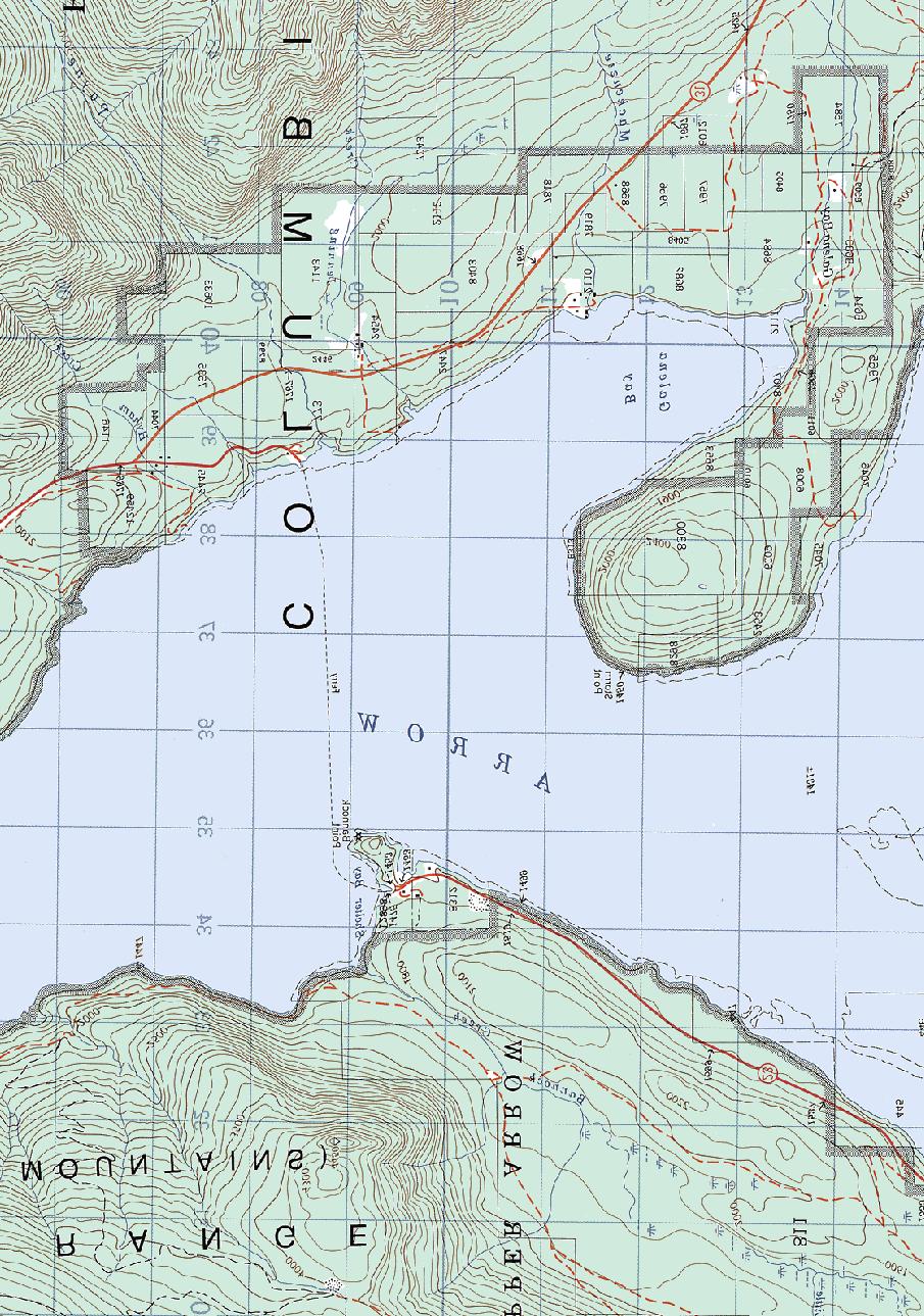
5 1.0 Introduction 1.1 Project Background Shelter Bay Boat Launch Ramp Feasibility Study In response to the Order (File No ) dated January 23, 2006 issued by the Comptroller of Water Rights to BC Hydro (BCH), BCH issued a verbal Terms of Reference (TOR) to Moffatt and Nichol (M&N) to undertake a feasibility study to evaluate the construction of a new ramp or extension of an existing ramp, including annual maintenance requirements, and recommend options for the recreational boat launch ramp at Shelter Bay. The Order was issued in pursuant of Clause (m) of the Conditional Water License (CWL) 27066, where BCH (the licensee) is to provide public access to the reservoir in the form of boat launching facilities at various locations along the shores of the Arrow Lakes Reservoir. Shelter Bay is identified as one of the seven locations listed in Clause (m). BCH engaged the Moffatt & Nichol project team 1, to complete a feasibility study related to the extension or replacement of the Shelter Bay Provincial Park boat launch ramp. 1.2 Scope of Work In accordance with the TOR provided by BCH, the feasibility study includes the following tasks: Perform a reconnaissance survey of the existing boat launch ramp location. Determine the feasibility of extending or constructing the existing ramp using the same guidelines as recommended by the Water Use Plan Consultative Committee (WUP CC) based on engineering technical feasibility, a cost benefit analysis, heritage and environmental criteria and also provide recommendations for the existing facilities. 1.3 Report Organization The data collection and field investigation program for this study are described in Sections 2 and 3 below. Analysis of ramp design alternatives is provided in Section 4. Sections 5 and 6 respectively present a summary of the environmental and heritage issues associated with the proposed developments. Cost-benefit analyses of the development options are presented in Section 7, with conclusions and recommendations for further work in Section 8. Our closing remarks are in Section 9. Appendix A contains drawings including a project location map, site plans of the existing facilities and potential improvements. Appendix B contains photographs taken during the field visits. Appendix C contains the full Environmental Overview Assessment report prepared by our team partner Triton Environmental (Triton). Finally, Appendix D contains the Archaeological Overview Assessment report prepared by Golder Associates (Golder). 1 The Team is comprised of Moffatt & Nichol (M&N), Golder Associates (Golder), Triton Environmental Consultants (Triton) and Atek Hydrographic Surveys Ltd. (Atek). Final Report Page 1 of 15
6 2.0 Data Collection Shelter Bay Boat Launch Ramp Feasibility Study The following background data and information were provided by BCH: Order (File no ) dated January 23, 2006 from the Comptroller of Water Rights; Review of the Arrow Lake Reservoir Boat Launching Areas, Johnston/Mair report dated June 2001; Columbia River Projects Water Use Plan, dated January 11, 2007; Terrain Resources Information Management (TRIM) AutoCAD drawing files provided by BCH; and, Arrow Lakes Reservoir Water Level data 1984 March Final Report Page 2 of 15
7 Shelter Bay Boat Launch Ramp Feasibility Study 3.0 Inspection Findings of the Existing Boat Launch Facilities and Potential Boat Launch Ramp Sites 3.1 Shelter Bay Boat Launch Ramp The existing Shelter Bay boat launch ramp site is located in the Shelter Bay Provincial Park located approximately 55 km south of Revelstoke and on the eastern side of Highway 23 as shown on the location plan on Drawing in Appendix A. An asphalt paved road (5 m wide) through the park is used to access to the boat launch site. The access road is in good condition; see Photograph No. 1 in Appendix B. The existing upland parking area is an unpaved area approximately 15 m by 15 m just immediately east of the top of the ramp. This area can accommodate parking for approximately 5-6 vehicles and trailers. Additional parking area is potentially available along the unpaved shoulders of the access road. The turnaround area at the top of the ramp is T shaped where vehicles and trailers turn in the short section of the T and then reverses down the ramp for launching their boats. The turning area at the T junction is tight and traffic movement in this area can get congested with long launch and retrieval waiting times due to inefficiencies in the circulatory traffic flow. The existing boat launch ramp is a single lane concrete surfaced ramp with two turnaround areas as shown on Drawing in Appendix A and Photograph No. 2 in Appendix B. It has a smooth concrete surface which is approximately 5 m wide and approximately 149 m long. The concrete slab is approximately 200 mm thick as shown in Photograph No. 3. The top of the existing ramp is at El. 441 m and the approximate toe of the ramp is at El. 423 m. the gradient of the ramp is approximately 12 % which is minimum gradient for boat ramps. The turnaround areas are also at grade concrete slabs with infill concrete placed at the corners between the ramp and the turnaround to improve the turning areas required for manoeuvring the vehicles and trailers. These infill areas are also likely to be mitigation measures for erosion occurring at the edges of the ramp as shown on Photographs Nos. 4 and 5 in Appendix B. The northern edge of the ramp is bounded by a single height gabion wall 2 topped with a concrete slab. Two rows of timber rubbing strips are fixed to the sides of the gabion wall to allow boats to dock on both sides of the walkway. The gabion wall serves as an access for boarding boats as well as a protective structure for the ramp. In general, the concrete surface of the ramp is in fair condition with only some minor cracking. There are areas of erosion at the edges the ramp and turnaround areas as evidenced by missing scour protection rock around the edges of the concrete slab as shown in Photograph No. 6. The lower section of the gabion wall walkway is showing signs of instability as shown in Photograph Nos. 7 and 8 due to erosion occurring at the base of the structure. The remnant of a small rubble mound breakwater to the north of the ramp is shown on Photograph No. 9. Sections of the rubble mound have been destroyed by wave action indicating that the armour rock size is inadequate for stability, and also there may have been possible deficiencies in the quality of the construction of the rubble mound breakwater. 2 A gabion basket is a wire cage or basket filled with rocks to form an abutment or retaining wall. Final Report Page 3 of 15
8 Shelter Bay Boat Launch Ramp Feasibility Study 4.0 Feasibility Design of Boat Launch Ramp Extensions and Modifications, and New locations 4.1 Water Level data collection and analysis BCH provided M&N with an Excel file containing daily averaged water level data from January 1984 to March Data were provided for three monitoring stations on the reservoir: Hugh Keenleyside Dam; Fauquier; and Nakusp. The water level records are shown in Figure 4.1. Only the Naksup data are shown, as this is considered reasonably representative of the other recording stations and it is the closest station to Shelter Bay. Although there is some variability from year to year, peak water levels tend to occur during the months of July and August, while minimum levels tends to occur in March and April. Existing Ramp Elevations vs. Historical waters Percentile Reservoir Water Elevation (m) Percentile 10 Percentile 425 Shelter Bay El m 420 Jan-00 Feb-00 Mar-00 Apr-00 May-00 Jun-00 Jul-00 Aug-00 Sep-00 Oct-00 Nov-00 Dec-00 Jan-01 Figure 4.1: Water Levels versus Months at Nakusp Final Report Page 4 of 15
9 Shelter Bay Boat Launch Ramp Feasibility Study According to the records, the maximum and minimum recorded water levels with respect to Geodetic Datum are as follows: Table 4.1: Maximum and Minimum Recorded Water Levels January March 2007 Location Maximum Water Elevation with respect to Geodetic Datum Minimum Water Elevation with respect to Geodetic Datum Water Level (m) BCH is licensed to store up to 7.1 million acre-feet (MAF) in the Arrow Lakes Reservoir up to the Maximum Normal Level of El m ( ft). Permission is required from the Comptroller of Water Rights to surcharge the Arrow Lakes Reservoir up to a maximum flood level of El m ( ft) for economic, environmental, or other purposes. The water level records were analysed statistically to determine suitable ramp extension/ modification scenarios. 4.2 Evaluation of ramp extension requirements The existing boat ramp at Shelter Bay terminates at El m. From Figure 4.1, accessibility to the lake at this site is good throughout most of the year. The WUP CC did not make recommendations for an end of ramp elevation for Shelter Bay. Extending the boat ramps to a lower elevation would extend the useful season by a corresponding amount. Determining exactly how far the ramps should be extended involves an economic trade-off that weighs the cost of construction against the incremental additional benefit. Construction costs escalate rapidly if underwater construction is needed, as would be the case if access is required at any conceivable water level. However, the heaviest use periods tend to occur in summer months when the water levels are relatively high, and thus providing low water access during the less-used low water periods is a case of diminishing returns. Instead, a compromise approach which balances the additional cost against the added benefit is likely the most practical solution. The water level data from Section 4.1 were analysed statistically to produce a series of exceedance curves, expressed as the percentage of time that the water level was higher than a given water elevation. This allows an analysis to be made of the degree of availability that would be provided by extending the ramps down to any particular elevation. The analysis was conducted on a month-by-month basis to account for the seasonal effects. Although the 23-year period of record (1984 to 2007) is too short to generate reliable longterm statistics, the data nonetheless provide a reasonable means of establishing performance thresholds (i.e. percent of time the ramps can be used throughout the year). In the discussion that follows, it should be remembered that the performance levels and reliability are relative to the period of data record only. Performance levels on a long term basis will likely vary somewhat from these figures, although the difference is likely to be slight provided that water level variations in future years are similar to those that have been experienced since Final Report Page 5 of 15
10 Shelter Bay Boat Launch Ramp Feasibility Study Water level data were first sorted into months of the year. For each water level between the low pool and high pool elevations, the number of days in that month which equalled or exceeded that water level were counted. This exceedance count was expressed as a percentage of the total number of daily records for that month, irrespective of the year in which they occurred. Strictly speaking, this approach is not statistically rigorous since it treats all such monthly records as statistically random events. In reality, water levels within a particular month are somewhat correlated to one another (i.e. one particular low or high month in the record can skew the results). Nonetheless, given the other inherent uncertainties in the seasonality data (e.g. the relatively short period of record, and variable power generation needs) this approach provides a reasonable indication as to the level of service that would be provided by extending the boat ramps down to any particular elevation. The results of the exceedance plots for monthly historic water levels over the period 1984 to 2007 are shown in Figures 4.2 on the following page for Nakusp. Water Level Exceedance Plots for Nakusp Percentage Exceedance 100% 90% 80% 70% 60% 50% 40% 30% 20% 10% 0% January Februray March April May June July August September October November Reservoir Water Level Elevations (metres) December Figure 4.2: Monthly Water Level Exceedance Plots for Nakusp From the above graph, the percentage availability of access to the reservoir for various end of ramp elevations is shown in Table 4.2: Month Table 4.2: Percent Availability of Access to the Reservoir for Boat Ramps at Various Elevations by Month End of Ramp Elevations (metres) January 100% 96% 90% 70% February 100% 91% 72% 46% March 97% 79% 48% 21% April 98% 79% 48% 20% May 99% 93% 87% 63% June 100% 100% 99% 93% Final Report Page 6 of 15
11 Shelter Bay Boat Launch Ramp Feasibility Study Month End of Ramp Elevations (metres) July 100% 100% 100% 100% August 100% 100% 100% 100% September 100% 100% 100% 99% October 100% 100% 100% 99% November 100% 97% 96% 95% December 100% 99% 96% 89% The existing toe of the ramp extends to just below El m ( ft). As can be seen from the exceedance curves, this end of ramp elevation provides essentially 100% access at high water and throughout the main summer months of the year, but gets progressively less access as the water level falls. During the lowest water months of March and April, the Shelter Bay ramp is useable roughly 78-80% of the time. Although there is a fairly high percentage of availability of access during the winter months, we understand that BC Parks (personal communications with Alex Greene) does not clear the snow from this ramp, and therefore use of the ramp may not be possible during winter months. We also understand (personal communications with Alex Greene, BC Parks) that boaters will use the Shelter Bay ferry ramp for launching their boats instead. 4.3 Proposed Upland and Ramp Improvements for the existing Shelter Bay Boat Launch Ramp Proposed Upland Improvements Based on the guidelines provided by California Department of Boating and Waterways, a minimum of parking spaces should be provided for a single lane launch ramp. Based on this guideline, a proposed parking area of 70 m x 44 m to accommodate 30 vehicles and trailers arranged at 60 degree angle spaces is shown on Drawing The provision of the parking area east of the ramp and clockwise circulatory one-way movement of traffic will potentially reduce congestion at the top of the ramp and along the existing access road to the ramp and increase capacity. As the proposed parking area is an existing wooded area, careful retention of trees in the area can provide a green buffer zone between the parking area and camping areas Proposed Boat Ramp Improvements From the visual site inspection, the following remedial works will be required: Reconstruct north rubble mound breakwater or install new floating breakwater; New scour protection is required to prevent erosion of the edges of concrete ramp; and, Add new boarding float to replace gabion walkway. This will eliminate boaters complaints of damage to boat propellers by submerged section of the gabion wall. The profile on Drawing shows that there is the potential to extend the end of ramp to facilitate boat launches at the historic lowest water levels at El. 421 m. Final Report Page 7 of 15
12 Shelter Bay Boat Launch Ramp Feasibility Study 5.0 Environmental Assessment Overview M&N Team member Triton Environmental conducted a screening level environmental assessment of the Shelter Bay site. Given the environmental conditions at the existing boat launch ramp, the proposed upgrades are not likely to have a negative effect on the fish habitat within the disturbance footprint. However, the construction of a parking lot in the upland area will have an impact on the upland vegetation. Careful design and construction mitigative strategies should be implemented to reduce the footprint as much as possible. Ministry of Environment (MOE) may treat the upland vegetation as lake riparian habitat and may request additional plantings to offset the disturbance footprint. For the full Environmental Assessment report, please refer to Appendix C. Final Report Page 8 of 15
13 Shelter Bay Boat Launch Ramp Feasibility Study 6.0 Archaeological Assessment Overview M&N Team member Golder Associates Ltd. (Golder) conducted an archaeological overview assessment (AOA) for Shelter Bay site. The AOA consisted of a combination of background research and a brief preliminary field reconnaissance (PFR). Representatives of the Neskonlith Indian Band, Ktunuxa Nation Council, Okanagan Indian Band and Splatsin First Nation (represented by Black Bear Developments) participated in the PFR component of the AOA. As a result of the study, the north-western portion of the proposed project area is determined to have high archaeological potential and warrants additional archaeological work. Such work would be in the form of Archaeological Impact Assessment (AIA), should this location be subject to land-altering impacts. An AIA must be completed under the Heritage Conservation Act (HCA) Section 14 permit, which is administered by the Archaeology Branch, Ministry of Tourism, Culture and the Arts. With the exception of the north-western portion, the remaining areas of the proposed boat ramp and associated infrastructure locations are considered to have low likelihood to contain archaeological materials. This is primarily due to previous construction disturbances, erosion processes associated with the seasonal reservoir fluctuation, and slope in exceed of 10 %. Further archaeological work for these areas is not recommended. For the full archaeological assessment report, please refer to Appendix D. Final Report Page 9 of 15
14 7.0 Cost Benefit Analysis Shelter Bay Boat Launch Ramp Feasibility Study While assessing the capital and maintenance costs of the proposed ramp improvements is relatively straight forward, assessing the benefits in this case is much more difficult, at least in quantitative terms. BCH does not currently charge a fee for using the boat ramps, so there are no actual revenues associated with these facilities. Apart from meeting BCH s goals and commitments under the Columbia River Water Use Planning Process, there does not appear to be any direct financial benefit to offset against the capital costs. There are also no usage statistics to indicate how many boaters take advantage of the Arrow Lake Reservoir amenities, nor the seasonal distribution of that use. It is therefore impossible to quantify the non-financial societal benefits based on industry averages or other rules of thumb. To develop quantitative cost/benefit ratios or internal rates of return, it would first be necessary to conduct a number of socio-economic studies which are outside the scope of this assignment, such as collecting seasonal usage statistics, conducting market surveys, estimating population growth projections and demographic shifts over time, and so forth. On a qualitative basis, some of the societal benefits which may accrue from the ramp improvements include: Improved access for area residents to recreational activities (e.g. fishing, boating); Short-term economic spin-off in the region from the construction program (employment wages, taxes, materials purchases, meals and accommodations during construction); and, Long-term economic spin-off from increased usage, tourism, and local resident day-trips to the area. Since it is not possible to establish a dollar value equivalent for these societal benefits, it is necessary to make a value judgement on the viability of each project on its own merits. The estimated costs of making the improvements noted on the drawings are summarized in the tables below. Cost estimates are considered upper bound, order-of-magnitude estimates based on providing the maximum possible benefit. In each case, the proposed improvements could be scaled back to provide less benefit at a correspondingly reduced cost. 7.1 Shelter Bay Cost Estimate Table 7.1 below shows the estimated cost for the proposed upland improvements to the parking area of the ramp which include the provision of a parking area for 30 vehicles and trailers. The estimated cost for remedial works to the concrete ramp is shown in Table 7.2 below. The estimates include remedial work to the existing rubble mound breakwater, scour protection along the edges of the ramp and boarding floats along the ramp. Table 7.3 provides an estimated cost of $37,000 for extending the end of the ramp to allow for 100 % access at the lowest recorded historical water level at El. 421 m. The estimated annual maintenance costs for removing silt build-up the end of the ramp and allowances for repairs to the appurtenances of the ramp is given in Table 7.4. Final Report Page 10 of 15
15 Shelter Bay Boat Launch Ramp Feasibility Study Item no. Table 7.1: Cost Estimate for Proposed Upland improvements Item Description Unit Quantity Rate Rounded Totals 1 Clearing and Grubbing m $6.51 $24,000 2 Excavate for parking area sub grade foundation m $20.00 $33,000 3 Sub base m $11.00 $12,000 4 Granular Base m $13.00 $15,000 5 Asphalt Pavement m $23.00 $25,000 6 Lane Markings Sum 1 $1, $1,500 Sub-Total $110,500 Mobilization / Demobilization (5% of Total) $6,000 Contingencies (10 %) $11,000 Total $127,500 Item no. Table 7.2: Cost Estimates for Ramp Improvements Item Description Unit Quantity Rate Rounded Totals 1 Scour protection around ramp m $29.68 $9,000 Repairs to rubble mound 2 breakwater m $43.94 $78,000 3 Walkway Floats m $ $115,000 Steel guide piles for Walkway 4 Floats m $ $337,000 5 Demolish Gabion wall m 90 $ $17,000 Sub-Total $556,000 Mobilization / Demobilization (5% of Total) $28,000 Contingencies (10 %) $56,000 Total $640,000 Final Report Page 11 of 15
16 Shelter Bay Boat Launch Ramp Feasibility Study Item no. 1 Excavation Table 7.3: Cost Estimates for Ramp Extension Item Description Unit Quantity Rate Rounded Totals m 3 75 $19.08 $2,000 2 Granular Base m 3 75 $32.50 $3,000 3 Concrete Slab 4 Scour Protection for Ramp m $ $17,000 m 273 $32.50 $9,000 Sub-Total $31,000 Mobilization / Demobilization (5% of Total) $2,000 Contingencies (10 %) $4,000 Total $37,000 Item no. Table 7.4: Shelter Bay Cost Estimate of Annual Maintenance Item Description Unit Quantity Rate Rounded Totals 1 Remove Sand build-up on Ramp m $18 $2,000 2 Repair Floats Sum - - $3,000 3 Repair Breakwater Sum - - $3,000 4 Repair Chain Anchorages Sum - - $3,000 5 Repair Scour Protection Sum - - $3,000 Total $ 14,000 In reviewing the above cost estimates, it is important to note the following: The estimates are concept level only and are not intended to be used to establish a project budget. The estimates are intended to provide an indication of the probable ranges of the Project costs to determine which boat launch ramp facility alternative(s) warrant further consideration. The estimates are based on Moffatt & Nichol s in-house experience and data for projects of a similar nature. The estimates are based upon early 2009 price levels in Canadian dollars, and do not allow for escalation. Final Report Page 12 of 15
17 Shelter Bay Boat Launch Ramp Feasibility Study The estimated costs for supplying the walkway floats are based on a quotation from Blue Water Systems Limited for floats in steel framed chassis with timber decking. The estimates exclude any archaeological investigation assessment, additional habitat compensation programmes, permitting, removal and remediation of contaminated materials and other hazardous waste. This estimates excludes costs for engineering, geotechnical, archaeological and environmental consulting fees. A contingency allowance of 10% was included in the cost estimates to cover unforeseen construction costs at the feasibility stage of this project. The estimates exclude the GST. Table 7.5 below summaries the cost estimate for the upland and ramp improvements excluding the ramp extension. Table 7.5: Summary of Cost Estimates for Upland and Ramp Improvements Work Section TOTAL incl. contingencies Upland Improvements $194,500 Ramp Improvements $640,000 Grand Total $834,500 Final Report Page 13 of 15
18 Shelter Bay Boat Launch Ramp Feasibility Study 8.0 Conclusions and Recommendations Our general conclusions for the condition of the existing Shelter Bay boat launch ramp are as follows: The existing parking area is not large enough to accommodate the number of vehicle and trailers using the park on peak days; The existing layout of the manoeuvring area at the top of the ramp results in traffic conflicts and congestion due to two way traffic flow in a small area; The existing rubble mound breakwater is damaged and will require reconstruction; Erosion of soil is occurring around the edges of the ramp. New scour protection is required; and, Sections of the gabion wall foundation are being undermined by wave action. The following is recommended: Provide 30 parking stalls for vehicles and trailers just east of the top of the ramp with a one-way circulatory traffic pattern to reduce traffic congestion; Reconstruct the existing rubble mound breakwater to protect the ramp for wave action; Install new scour protection around the perimeter of the concrete ramp; and, Demolish existing gabion wall and provide new walkway floats and guide piles. The estimated cost for the upland and ramp improvements including contingencies is $834,500. Final Report Page 14 of 15
19 Shelter Bay Boat Launch Ramp Feasibility Study 9.0 Closure This report has been prepared for the sole benefit of BC Hydro and its agents, and may not be used by any third party without the expressed written consent of Moffatt & Nichol and BC Hydro. Any use of this document by a third party is at the sole risk of such third party. The statements and conclusions presented herein are valid as of the date of publication. Future changes in the conditions affecting the underlying assumptions of this report may alter its findings and the conclusions. Moffatt & Nichol does not undertake to revise and update this report should future events reflect changed conditions. We trust that this report meets BC Hydro s requirements at this time. Should you have any questions, or if we can be of further assistance, please contact the undersigned at any time. Prepared by: MOFFATT & NICHOL Reviewed by: MOFFATT & NICHOL [Original signed by: Paul Hoo, P.Eng.] [Original signed by: Charles Rosner, P.Eng.] Paul Hoo, P.Eng. Project Manager Charles Rosner, P.Eng. Project Manager Final Report Page 15 of 15
20 Shelter Bay Boat Launch Ramp Feasibility Study Appendix A: Drawings

21
22
23 Shelter Bay Boat Launch Ramp Feasibility Study Appendix B: Photographs Taken on Field Trip at Shelter Bay, May 5, 2009


24 Shelter Bay Boat Launch Ramp Feasibility Study Photograph No. 1: View looking north at asphalt surfaced access road through the park to the boat launch ramp. Note there is a small parking area to the west of the access road for vehicles and trailers. Photograph No. 2: View looking east at the boat launch ramp. Note there is a gabion basket walkway on the north side of the boat launch ramp and two concrete turnarounds. Final Appendix B Page 1 of 5


25 Shelter Bay Boat Launch Ramp Feasibility Study Photograph No. 3: Close up view looking at the boat launch ramp concrete slab. Note exposed geotextile fabric and missing scour protection rock at edge of concrete slab. Photograph No. 4: Close up view looking west at the boat launch ramp turnaround No. 1 concrete slab. Note infill concrete area at the corner between the ramp and turnaround. Final Appendix B Page 2 of 5


26 Shelter Bay Boat Launch Ramp Feasibility Study Photograph No. 5: Close up view looking north at the boat launch ramp turnaround No. 2 concrete slab. Note infill concrete area at the corner between the ramp and turnaround as possible mitigation measure to arrest erosion occurring at the concrete slab edges. Photograph No. 6: Close up view looking south at the boat launch ramp turnaround no. 1 concrete slab. Final Appendix B Page 3 of 5


27 Shelter Bay Boat Launch Ramp Feasibility Study Photograph No. 7: Close up view looking west along the gabion walkway. Note tilt in wall in the foreground of the photo. Photograph No. 8: Close up view looking east along the gabion walkway. Note lower section wall with undermined foundation. Final Appendix B Page 4 of 5

28 Shelter Bay Boat Launch Ramp Feasibility Study Photograph No. 9: Close up view looking east along the rubble mound breakwater to the north of the boat launch ramp. Note damage in the lower section of the breakwater. Final Appendix B Page 5 of 5
29 Shelter Bay Boat Launch Ramp Feasibility Study Appendix C: Environmental Report


30 3917//WP-P2054 Shelter Bay Boat Ramp Feasiblity Study Environmental Component. December 2009 Prepared for: Moffatt & Nichol 777 W. Broadway, Suite 301 Vancouver, BC V5Z 4J7 Prepared by: # Fifth Ave. Prince George, BC. Canada V2L 3L1 Phone (250) Fax (250)
31 3917/WP#P-2054 Shelter Bay Boat Ramp Feasibility Study Environmental Component Prepared for: Moffatt & Nichol 777 W. Broadway, Suite 301 Vancouver, BC V5Z 4J7 Prepared by: Suite th Avenue Prince George, BC, V2L 3L1 Tel: (250) Fax: (250) December 18, 2009
32 TABLE OF CONTENTS 1.0 INTRODUCTION PURPOSE OF DOCUMENT ENVIRONMENTAL SETTING FISH AND FISH HABITAT WILDLIFE AND WILDLIFE HABITAT Wildlife Species of Management Concern VEGETATION POTENTIAL IMPACTS ENVIRONMENTAL OVERVIEW ASSESSMENT FISH AND FISH HABITAT WILDLIFE AND WILDLIFE HABITAT VEGETATION Rare Plant Communities Rare Plant Species First Nations Traditional Plant Use EXISTING SHELTER BAY BOAT LAUNCH RAMP FISH AND FISH HABITAT WILDLIFE AND WILDLIFE HABITAT VEGETATION POTENTIAL ENVIRONMENTAL EFFECTS MITIGATIVE MEASURES, GUIDELINES AND RECOMMENDATIONS MITIGATIVE MEASURES MONITORING REQUIREMENTS TIMING WINDOWS PERMITTING REQUIREMENTS SUMMARY REFERENCES December, 2009 Page i
33 LIST OF TABLES TABLE 1. SARA SPECIES WHICH MAY OCCUR ON THE LANDSCAPE SURROUNDING THE PROJECT AREA TABLE 2. FISH SPECIES OF MANAGEMENT CONCERN WITHIN THE ARROW LAKE RESERVOIR TABLE 3. LISTED WILDLIFE SPECIES IN THE ICH ZONE OF THE COLUMBIA FOREST DISTRICT TABLE 4. PLANT SPECIES FOUND WITHIN THE PROJECT AREA WITH TRADITIONAL USES LIST OF FIGURES FIGURE 1. SHELTER BAY BOAT RAMP LOCATION FIGURE 2. CLOSE UP OF PROJECT AREA WITH RAMP LOCATION AND FERRY LANDING LIST OF APPENDICES Appendix 1. Appendix 2. Appendix 3. Report photographs SARA Species List Rare Plant Species List LIST OF ATTACHMENTS Attachment 1. Digital CD with all project photographs and final report (PDF). December, 2009 Page ii
34 Shelter Bay Boat Ramp Feasibility Study 1.0 INTRODUCTION 1.1 Purpose of Document The purpose of this document is to identify the environmental sensitivities surrounding the existing Shelter Bay boat launch ramp located in Shelter Bay Provincial Park. This report is prepared in response to the BC Hydro Columbia River Water Use Plan Feasibility of Boat Ramps Study Terms of Reference. This report will be submitted in conjunction with the associated Engineering Technical and Archaeological Feasibility reports completed by Moffatt & Nichol (M&N) and Golder Associates (Golder). This report has been prepared to: Provide a description of the environmental setting; Document baseline environmental conditions based on existing information, field data and observations; Identify valued ecosystem components (VEC) at or near each of the proposed sites; Provide an assessment of potential impacts of development on the VEC s at each site; Provide an Environmental Management Plan (EMP) for each site; Identify regulatory permitting and approval requirements necessary to proceed with construction at each site; and Identify if any additional environmental investigations may be required. 1.2 Environmental Setting The Shelter Bay boat launch ramp is located on the Upper Arrow Lake, 30 km south of Revelstoke, BC (Figures 1 and 2). The boat launch is located 400 m northwest from the Shelter Bay/ Galena Bay ferry landing which is part of Highway 23 connecting Revelstoke and Nakusp. The project is within the Selkirk Foothills Ecosection along the valley bottom between the Monashee mountain range in the west and the Selkirk range in the east. The Interior Cedar Hemlock biogeoclimatic zone (ICH) is characteristic of the lower elevations of this region, with cedar, hemlock, Douglas fir and Western larch predominating (Braumandl and Curran 1992). The climate and vegetation communities of project area are described by the Thompson moist warm subzone (mw3) of the ICH zone. The ICHmw3 subzone occurs at elevations ranging from 400 to 1000 m on southerly aspects and 400 to 1350 m on northerly aspects. The climate of the area is represented by warm, moist, summers and mild winters with moderate snowfall. The daily maximums temperatures average 18.2º C and daily minimums average -5.3º C (Environment Canada 2007). The mean annual precipitation recorded in Revelstoke is 1278 mm (Environment Canada 2007). December, 2009 Page 1
, western larch (Larix occidentalis), and paper birch (Betula papyrifera). Late seral and climax stands are limited due to disturbances such as fire and harvesting.")
35 Shelter Bay Boat Ramp Feasibility Study Within this subzone, the dominant tree species include western red cedar (Thuja plicata) and western hemlock (Tsuga heterophylla) with varying amounts of Douglas-fir (Pseudotsuga menziesii), western larch (Larix occidentalis), and paper birch (Betula papyrifera). Late seral and climax stands are limited due to disturbances such as fire and harvesting. Shrub species include falsebox (Paxistima myrsinites), mountain alder (Alnus incana), and soopollalie (Shepherdia canadensis). Herbaceous species include prince s pine (Chimaphila umbellata), queen s cup (Clintonia uniflora) and bunchberry (Cornus canadensis) (Parish et al 1996; Lloyd et al 1990). Figure 1. Shelter Bay Boat Ramp Location. December, 2009 Page 2

36 Shelter Bay Boat Ramp Feasibility Study Figure 2. Project area with existing ramp location and ferry landing. December, 2009 Page 3
37 Shelter Bay Boat Ramp Feasibility Study 2.0 METHODOLOGY Field surveys were conducted in conjunction with the engineering and archaeological surveys on May 5, 2009 to document existing conditions in aquatic and terrestrial habitats surrounding the existing and proposed boat ramp locations. 2.1 Fish and Fish Habitat Aquatic habitats were assessed in terms of substrate, gradients (% slope), and drawdown zone vegetation. No fish sampling was conducted but data on the potential fish species within the project area was reviewed along with the associated habitat requirements of those species for all life stages. Habitat observed at the boat ramp site was described in terms of its suitability to provide habitat for the identified species. 2.2 Wildlife and Wildlife Habitat In order to determine the local, regional and provincial significance of habitats within the study area, it is necessary to consider the full range of wildlife species known, or with significant potential to occur in the vicinity of each boat ramp. Key references that were utilized to achieve this include: Stevens et al. (1994) provide a breakdown of wildlife species by biogeoclimatic zones and subzones with some habitat cross referencing, and habitat preferences; The Mammals of British Columbia (Eder and Pattie, 2001); The Birds of British Columbia Vol 1, Vol 2, Vol 3, Vol 4 (Campbell et al. 1990); A field guide to site identification and interpretation for the Nelson Forest Region (Braumandl and Curran 1992); A Field Guide for Identification and Interpretation of Ecosystems of the Rocky Mountain Trench, Prince George Forest Region (Meidinger et al 1998; 2007); BC Conservation Data Centre tracking lists (BC CDC 2007a); Bats of British Columbia (Nagorsen and Brigham 1993); and The Amphibians and Reptiles of British Columbia (Matsuda et al. 2006) Wildlife Species of Management Concern The primary warehouse of information on the status of flora and fauna in the province is the BC Conservation Data Centre (CDC). The CDC provides tracking lists for flora, fauna, and plant communities for each Forest District in the province. The District lists identify species that can be expected to occur within the District boundaries, which is often coincident with watershed divides. These areas can include the bulk of some wildlife sub-populations. These status lists use a colour-coding system to rank the status and management priorities for species at risk. Following is a breakdown and brief description of the status and ranking criteria used in developing these lists: December, 2009 Page 4
38 Shelter Bay Boat Ramp Feasibility Study Red-listed Species: candidates for legal designation as threatened or endangered under Federal legislation; include threatened species - any indigenous species of fauna or flora that is likely to become endangered in British Columbia if the factors affecting its vulnerability do not become reversed; and include endangered species - any indigenous species of fauna or flora that is threatened with imminent extinction or extirpation throughout all or a significant portion of its British Columbia range. Blue-listed Species: considered to be vulnerable or sensitive and are candidates for upgrade to the red-list or downgrade to yellow; and include vulnerable species - any indigenous species of fauna or flora that is particularly at risk in British Columbia because of low or declining populations. Yellow-listed Species the yellow-listed species are those considered not at risk in British Columbia and are considered for management emphasis for various reasons including recent declines in population numbers, restricted distribution, losses of habitat, public interest, species that are maintained by ecosystem management and species for which the Province has a global responsibility. In addition to red, blue, and yellow-listed species, numerous other species are of management concern within the province due to: populations that are actively managed; species that are of commercial value; species with specific habitat requirements (e.g. nest cavities); species found at low densities; and colony nesters. In order to identify species of management concern that potentially occur in the study area, the full list of wildlife species known to occur, or with significant potential to occur within the ICHmw3 were considered. Based on sub-regional wildlife distribution, abundance, and species sensitivities the CDC has developed tracking lists for individual forest districts. The CDC red, blue and yellow lists for rare vertebrate species within the Columbia Forest District were acquired. In addition, the Federal Species at Risk Act Registry (SARA) was also reviewed for the potential of any Schedule 1 listed species to be present within the project area (Appendix 2). The comprehensive list can be reduced based on known regional distributions, specialized habitat requirements, and extreme rarity to a subset of species that is more reasonable to expect within the project area. This was done using the descriptions of terrestrial habitat observed at the boat ramp site to determine its suitability to provide December, 2009 Page 5
39 Shelter Bay Boat Ramp Feasibility Study habitat for identified wildlife species. As such, six SARA species may be found within the vicinity of the project area (Table 1). Table 1. SARA species which may occur on the landscape surrounding the project area. Scientific name Common Name SARA Category Cottus confuses Shorthead Sculpin Threatened Rangifer tarandus caribou Woodland Caribou (Southern Threatened Mountain population) Plethodon idahoensis Couer d Alene salamander Special Concern Chrysemys picta pop.2 Western Painted Turtle- Special Concern Intermountain Rocky Mountain pop. Danaus plexippus Monarch Special Concern Bufo boreas Western toad Special Concern 2.3 Vegetation There are two useful land classification schemes that capture the variation in plant and animal communities at a sub-regional scale. Ecosections (Regional Ecosystem Classification) are contiguous areas with similar climate and physiography, which are large enough to sustain a variety of plant and wildlife communities. Biogeoclimatic subzones and subzone variants (Biogeoclimatic Ecosystem Classification, BEC) are characterized by a particular combination of dominant plant species. Subzones and subzone variants are dispersed within sub-regional areas and often occur within a relatively narrow elevational range and/or in relation to aspect. The Province has protected representative natural examples of both ecosections and subzones/variants at the landscape level. Site associations or site series units are the fine units of the biogeoclimatic classification system that capture plant community variation at the stand or operational level and these are the ecosystems that are tracked by the Conservation Data Centre (CDC). The CDC red and blue-lists identify ecosystems that are considered rare or at risk. The biogeoclimatic site series unit is also routinely used by forest and wildlife resource managers, and provides an appropriate means to assess the local, regional and provincial significance of potential effects of habitat alteration in the study area. The ecosystems of the study area have been described at the biogeoclimatic site series level. A review of Species at Risk and the CDC red and blue-lists were completed prior to the field assessments. Plant species that were located in areas that may be impacted by construction relating to the boat ramps were identified. A review of potentially occurring species, their habitat requirements and the likelihood of any being present in the project area was also conducted as a risk assessment rather than an actual inventory. December, 2009 Page 6
40 Shelter Bay Boat Ramp Feasibility Study 2.4 Potential Impacts Valued Ecosystem Components (VECs) are elements of the biophysical and socioeconomic environment that are valued by society and of particular relevance in completing the project scoping. They may be landscape level features (ecosystems), or individual fish, wildlife or plant species that are recognized as rare, sensitive or vulnerable to human activity. VEC s were identified by reviewing the fish and fish habitats, wildlife and wildlife habitat and vegetation at each site and assigning an Environmental Sensitivity Rating (ESA) of either low, moderate or high, based on how sensitive that habitat feature would be to the proposed boat ramp construction at the site. December, 2009 Page 7
41 Shelter Bay Boat Ramp Feasibility Study 3.0 ENVIRONMENTAL OVERVIEW ASSESSMENT 3.1 Fish and Fish Habitat The Arrow Lake Reservoir (ALR) provides habitat for a variety of fish species include several fish species of management concern within the Columbia Forest District (Table 2). Burbot has just recently been added as a red-listed species within the Kootenay Region and is not yet included on the CDC website (BC CDC 2008). Table 2. Fish Species of Management Concern within the Arrow Lake Reservoir. Scientific Name Acrocheilus alutaceus Acipenser transmontanus pop. 2 Cottus hubbsi Cottus confusus Lota lota Oncorhynchus clarkii lewisi Rhinichthys umatilla Salvelinus confluentus Common Name Chiselmouth White sturgeon (Columbia River population) Columbia sculpin Shorthead sculpin Burbot Westslope cutthroat trout Umatilla dace Bull trout Chiselmouth has not been identified within the ALR but is suspected to be present. Chiselmouth prefers warmer sections of streams and lakes and is primarily an algae feeder. It can be found within the littoral zones of some lakes but because it is an algae specialist, it requires rocks or large woody debris covered with algae as forage habitat. They spawn in tributary streams during June or July when water temperatures reach 17 o C and in gravel/cobble substrates (Cannings and Ptolemy 1998). Since the lakebed substrate near the ramp is not covered with algae, it is unlikely that they will be in the project area. Literature reviews for the habitat requirements of the Umatilla dace, Columbia and shorthead sculpin, Westslope cutthroat trout, also remove them from the species of concern for these boat ramp areas. For example, the Umatilla dace is primarily a riverine species (Ford et al. 1993) and no occurrences of Westslope cutthroat trout were found in stream data records for the tributary streams closest to the boat ramp locations. FISS data does not identify the Columbia sculpin as present in the ALR but occurrences of the shorthead sculpin in the Columbia River system have been noted. Shorthead sculpin is usually found in fast riffles in colder streams with gravel and cobble substrates. Occurrences have been limited to tributaries of the lower Columbia and Slocan Rivers (Troffe 1999). Prickly sculpin as shown some affinity to the shallow muddy inlets and bays within the ALR while the torrent sculpin prefers areas more exposed to the current (which does December, 2009 Page 8
42 Shelter Bay Boat Ramp Feasibility Study exist in the ALR) (Northcote undated). Therefore, some of the project area may provide some habitat for prickly sculpin. Adult Burbot are usually found in waters deeper than 16 m. Burbot are winter spawners preferring water depths between 1 and 10 m and sand or gravel substrates (McPhail 2007). A potentially area for Burbot spawning in the ALR is near Mosquito Creek, south of Nakusp (Arndt and Baxter 2006). White sturgeon within the ALR have been found to congregate near Burton where the mouth of Burton and Caribou Creeks provide suitable spawning grounds for Kokanee, a prey species for White sturgeon (Westslope 2004). Spawning occurs in early spring and has been documented in the Mid-Columbia near Revelstoke. Overall habitat at the end of the existing ramp is not likely to provide important habitat for adult white sturgeon. Adult bull trout found within the ALR spawn between August and October in several large tributaries to the ALR (FISS 2008). They are usually found in the upper reaches of these tributaries and are associated with steeper, colder waters, with cobble and gravel substrates. Adults within the ALR are usually found in deeper water and associated with some form of cover. When juveniles return to the lake, they are also usually found in deep water (McPhail 2007). Given the habitats adjacent to the existing ramp, no affects on bull trout are expected from this ramp extension. 3.2 Wildlife and Wildlife Habitat The CDC red, blue and yellow list for rare wildlife species within the ICH subzone of the Columbia Forest District was acquired and a total of 5 red-listed, 24 blue-listed, and two yellow-listed species were identified (Table 3). Nine bird, 16 invertebrate, and 6 mammal species were identified. Thirteen species have formal COSEWIC designations (1 endangered, 8 special concern, 2 threatened/special concern, and 2 not at risk), 12 species are Identified Wildlife, and 7 species are listed under the Species at Risk Act. Table 3. Listed wildlife species in the ICH zone of the Columbia Forest District. Species COSEWIC BC Status Identified Wildlife SARA Occurrence in Project Area Potential Effects Vivid Dancer No Blue Y (Jun 2006) Unlikely given habitats present. None anticipated. Albert s Fritillary SC(Mar 2008) Blue Y (May 2004) 3 Unlikely given habitats present. None anticipated. Great Blue heron, herodias subspecies No Blue Y (Jun 2006) Potential occurrence along Arrow Lakes. None anticipated. Pelidne Sulphur No Blue No Unlikely given habitats present. None anticipated. Short-eared Owl SC (Mar 2008) Blue Y (May 2004) 3 Potential occurrence along Arrow Lakes. None anticipated. American Bittern No Blue No Unlikely given habitats present. None anticipated. Western Painted Turtle - Intermountain - SC (Apr Potential occurrence along Arrow Lakes. Rocky Mt. Pop 2006) Blue No 1 None anticipated. December, 2009 Page 9
43 Shelter Bay Boat Ramp Feasibility Study Species COSEWIC BC Status Identified Wildlife SARA Occurrence in Project Area Potential Effects Rough-legged Hawk NAR Blue No Unlikely given habitats present. None anticipated. Olive-sided Flycatcher T (Nov 2007) Blue No Potential occurrence along None anticipated. Arrow Lakes. Northern Myotis No Blue No Unlikely given habitats present. None anticipated. Monarch SC (Nov 2001) Blue No 1 Potential occurrence along Arrow Lakes. None anticipated. Sandhill Crane NAR yellow Y (Jun 2006) Unlikely given habitats present. None anticipated. Black crowned nightheron None anticipated. No Red No Unlikely given habitats present. Jutta Arctic No Blue No Unlikely given habitats present. None anticipated. Wolverine, luscus subspecies SC (May 2003) Blue Y (May 2004) Unlikely given habitats present. None anticipated. Pale Jumping-slug No Blue No Unlikely given habitats present None anticipated Barn Swallow No Blue No Unlikely given habitats present None anticipated Magnum Mantleslug No Blue No Unlikely given habitats present None anticipated Fisher No Blue Y (Jun 2006) Unlikely given habitats present. None anticipated Band-tailed Pigeon SC (Nov 2008) Blue No Unlikely given habitats present None anticipated Rotund Physa No Red No Unlikely given habitats present. None anticipated. Tawny-edged Skipper No Blue No Unlikely given habitats present None anticipated Northern Leopard Frog E (Apr 2009) Red Y (May 2004) 1 Unlikely, mostly found in extreme southeastern BC. None anticipated Rocky Mountain snail No Blue No Unlikely given habitats present None anticipated Subalpine Mountainsnail No Blue No Unlikely given habitats present. None anticipated Bighorn Sheep No Blue Y (Jun 2006) Unlikely given habitats present. None anticipated Zerene Fritillary No Blue No Unlikely given habitats present. None anticipated Coeur d'alene Salamander SC (Nov 2001) Yellow Y (May 2004) 1 Potential occurrence along Arrow Lakes. None anticipated Herrington Fingernail clam No Red Unlikely given habitats present. None anticipated Caribou (southern population) T (May 2000) Red Y (May 2004) 1 Unlikely given habitats present. None anticipated Grizzly Bear SC (May 2002) Blue Y (May 2004) Unlikely given habitats present. None anticipated The comprehensive list can be reduced based on known regional distributions, specialized habitat requirements, and extreme rarity to a subset of species that is more reasonable to expect may occur within the project area. In general, the project area surrounding can provide habitat for black bear, ungulates, songbirds, and some amphibians and reptiles. The available habitats and plant species that were documented within the project area are common and not limiting on the landscape. Therefore, it is unlikely that they are important for several of the listed species, which are more likely to be associated with larger areas of more contiguous preferred habitats. The invertebrates listed above may occur within the project area; however, it is difficult to determine their use of the area at this level of assessment. Life history and distribution December, 2009 Page 10
44 Shelter Bay Boat Ramp Feasibility Study data for these species are not readily available, and directed searches for these species were not conducted. In general, the available habitats and plant species of the project area are common and not limiting on the landscape, therefore it is unlikely that they are critically important for the invertebrate species at risk, which are likely to be habitat or plant species specialists. Of the listed species, six have potential to occur with the assessed area including: great blue heron, short-eared owl, western painted turtle, olive-sided flycatcher, monarch, and the Coeur d Alene salamander. In addition, Western toad should be added to this list. It is not found on the CDC list for the Columbia Forest District, but it is a SARA listed species of special concern and therefore must be considered during this assessment. 3.3 Vegetation Rare Plant Communities The CDC Rare Natural Plant Community Tracking List for the Columbia Forest District identifies three blue-listed and seven yellow-listed plant communities (site series unit) in the ICHmw3 biogeoclimatic subzone (Table 4). Where there is poor representation of mature natural examples of given subzones in protected areas and there has been substantial modification of existing areas, most or all site series units in a subzone often appear on the CDC lists. There are no occurrences of red-listed communities in this subzone which are typically rare on the landscape and are often sensitive to disturbance. Table 4. Red-listed, blue-listed and yellow-listed plant communities in the ICHmw3. Scientific Name English Name BC Status Site Series Carex lasiocarpa / slender sedge / common Blue ICHmw3/Wf05 Drepanocladus aduncus hook-moss Carex spp. - Potentilla spp. sedges - cinquefoils Yellow ICHmw3/09 Equisetum fluviatile - Carex swamp horsetail - beaked Blue ICHmw3/Wm02 utriculata sedge Pseudotsuga menziesii / Juniperus communis / Cladina spp. Pseudotsuga menziesii - Pinus contorta / Calamagrostis rubescens / Pleurozium schreberi Thuja plicata / Oplopanax horridus / Athyrium filix-femina Thuja plicata - Picea engelmannii x glauca / Lysichiton americanus Trichophorum cespitosum / Campylium stellatum Tsuga heterophylla / Paxistima myrsinites Douglas-fir / common juniper / reindeer lichens Douglas-fir - lodgepole pine / pinegrass / red-stemmed feathermoss western redcedar / devil's club / lady fern western redcedar - hybrid white spruce / skunk cabbage tufted clubrush / golden starmoss Yellow Yellow Yellow Yellow Blue ICHmw3/02 ICHmw3/03 ICHmk3/06 ICHmw3/08 ICHmw3/Wf11 western hemlock / falsebox Yellow ICHmw3/04;ICHmw3/0 5 December, 2009 Page 11
45 Shelter Bay Boat Ramp Feasibility Study Scientific Name English Name BC Status Site Series Tsuga heterophylla - Thuja plicata / Paxistima myrsinites / Pleurozium schreberi western hemlock - western redcedar / falsebox / redstemmed feathermoss Yellow ICHmw3/01 Other vegetation communities of particular importance and sensitivity include riparian communities, which are not described in the site identification field guide, but typically have high wildlife values and are sensitive to disturbance Rare Plant Species Plant species can be identified using several keys. Generally the nomenclature follows Hitchcock et al. (1973), however The Vascular Plants of British Columbia (Ministry of Forests 1989, 1990, 1991 & 1994) was used where there were discrepancies in the species names used. There are 10 plant species that appear on the CDC red-list and 23 that occur on the blue-list of rare vascular plant species within the ICH subzone of the Columbia Forest District (BC CDC 2009, Appendix 3). This list was further examined to determine if the listed plant species have the potential to occur within the ICHmw3 subzone. Focus was placed on the potential for red-listed species to occur within the project area and based on their known distribution and habitat requirements, only one has the potential to occur at this boat ramp location (Table 5). Table 5. Red-listed plant species within the ICH subzone within the Columbia Forest District. Species BC Habitat* Occurrence in Project Area Status Hairy rockcress Red Rock outcrops and waste places in the montane zone. Unlikely given habitats present, not found within ICHmw3. Mountain moonwort Red Mesic, shady coniferous forests in the upper Unlikely given habitats present. montane and lower subalpine zones. Crawe s Sedge Red Moist meadows and calcareous bogs in the montane zone. Unlikely given habitats present, not found within ICHmw3. cup clover Red Vernally wet seepage areas and mesic to moist Potential but not observed. open, often sandy sites in the lowland, steppe, and montane zones. Lakeshore sedge Red Wet meadows, sandy beaches, and marsh edges in the montane zone. Unlikely given habitats present, not found within ICHmw3. Dark lamb s quarters Red Dry waste places in the montane zone Unlikely given habitats present, not found within ICHmw3. Macoun s fringed gentian Red Wet to moist fens, meadows and stream sides in the montane zone. Unlikely given habitats present, not found within ICHmw3. smooth goldenrod Red Moist meadows, streambanks and forest openings in the montane zone. Unlikely given habitats present, not found within ICHmw3. Prairie golden bean Red Mesic to moist meadows and grasslands in the montane zone. Unlikely given habitats present, not found within ICHmw3. Oregon checker- mallow Red Dry grasslands, shrublands and forest openings in the steppe and lower montane zones. Unlikely given habitats present, however, historical observation made north of site. December, 2009 Page 12
46 Shelter Bay Boat Ramp Feasibility Study First Nations Traditional Plant Use A variety of plants have been identified as providing value to First Nations people. Indigenous peoples throughout BC have used plants for food, medicine, tools, transportation, and shelter (Davis 1993). Foods such as berries, roots, fruits, bark, shoots, leaves and lichens have been included in their diets for centuries. Plants also provide forage for the animals on which they hunted and relied on for meat. Table 5 outlines those species of importance that were observed or are likely to occur in the upland areas near this site. Table 4. Plant species found within the project area with traditional uses. Common Name Scientific Name Use Douglas-fir Pseudotsuga menziesii Medicinal tea, gum. Saskatoon Amelanchier alnifolia Berries. Paper birch Betlua papyrifera Sap used for medicine, bark used for baskets, cradles and canoes. Trembling aspen Populus tremuloides Tent poles, deodorizer, absorbent material. Black cottonwood Populus balsamifira Canoes and fire sets. Oregon grape Mahonia aquifolium Berries, flavour, jelly, beneficial to blood. Red osier dogwood Cornus sericea Smoked for lung disease Wild raspberry Rubus idaeus Popular berry. Wild strawberry Fragaria virginiana Berries. Thimbleberry Rubus parviflorus Berries. December, 2009 Page 13
47 Shelter Bay Boat Ramp Feasibility Study 4.0 EXISTING S H E L T ER BAY BOAT LAUNCH RAMP 4.1 Fish and Fish Habitat One unnamed 1 st order stream is located in the vicinity of the existing boat ramp. At the time of the assessment, the mouth of the stream was located 75 m south from the end of the ramp (Appendix 1; Plate 4). Although no fish sampling was conducted, the stream is defaulted to fish- bearing due to the lack of upstream migration barriers, even at low reservoir levels. During high water levels, the stream is limited to just below the highway culvert. At this location, no stream channel was observed as vegetation was noted throughout the wetted area and no scour was observed. From the reservoir level, the stream channel was 180 m in length and the average channel width was 1.7 m. Overall gradient of this section of channel was 6%. Historical data for this stream was obtained and although no sampling was conducted it was defaulted to fish bearing with an overall gradient of 3% (IME/CEC 2003). The closest large system, excluding the Mid-Columbia River, to the existing boat ramp is Bannock Creek (WSC: ), located 1.6 southeast. Historical sampling within the watershed has identified kokanee, scuplins, redside shiner, and rainbow trout utilizing this stream with Kokanee actively spawning at the mouth (IME/CEC 2003). Given the distance from this stream to the boat launch ramp, no effects on this system are expected. The lakebed substrates in the area of the proposed boat ramp location were observed to be primarily composed of silt and sands with a smaller component of cobbles and gravels (Appendix 1; Plate 3). The fine substrates do not provide adequate rearing or spawning habitat for most species in the lake and limited cover was observed. Some cover would be provided at higher water levels by the stumps and LWD scattered along the shoreline. There may also be a few larger boulders but as the water depths increased, the substrates could not be accurately classified. The existing concrete ramp (Appendix 1; Plate 1) will be extended by 52 m and another turnaround will be required (Moffatt & Nichol 2009). Excavation around the new extension would be required to achieve the correct elevation and ramp slope. A floating walkway attached to steel piles may be constructed or the existing gabion walkway may be repaired (Appendix 1; Plate 2). A floating breakwater is also proposed 30 m north of the ramp following along the semi-natural existing rock breakwater. This breakwater will be approximately 140 m in length. Since this floating breakwater will use piles, the disturbance footprint on the lakebed will be minor. The disturbance footprint area for the ramp below the high water mark is approximately 290 m Wildlife and Wildlife Habitat In the vicinity of the project site, there is potential habitat for a variety of bird species. Active great blue heron nests have been recorded around Revelstoke (Machmer and December, 2009 Page 14
48 Shelter Bay Boat Ramp Feasibility Study Steeger 2003) but none were observed in the vicinity of the project site. During the field assessment Canada geese were observed on the flat areas surrounding the stream, foraging on emergent vegetation (Appendix 1; Plate 6). Killdeer, American robin, dark eyed junco, Northern flicker, and red-breasted nuthatch were observed around the site. Portions of the grassy area may be suitable for nesting however, this area tends to flood once the reservoir reaches full pool (in July). The vegetation above the high water mark would provide good nesting opportunities for several species. No large nests were observed in the larger trees, however a small nest from last year was observed (Appendix 1; Plate 10). The lower valley slopes adjacent to the Upper Arrow Reservoir have been identified as ungulate winter range for moose (U-4-001) (MOE 2007). Deer, elk, and moose have been the targets of several ungulate winter range projects in the surrounding areas (D Eon et al 2002). Evidence of moose and deer were prevalent in the area given the scat and browse on vegetation observed (Appendix 1; Plate 11). While none were observed during the assessment, it is possible that amphibians and reptiles may also use the bay area given its close proximity to the lakeshore and the presence of standing water in the isolated depressions (Appendix 1; Plate 5). No standing water was observed within the disturbance footprint and thus habitats for these species are not likely to be affected by the construction. 4.3 Vegetation The vegetation observed surrounding the ramp can be found within several of the site series present within the ICHmw3. The upland area to the south of the ramp contains tree species such as: Douglas Fir, Western hemlock, lodegpole pine, paper birch, trembling aspen. Understory species included: red-osier dogwood, bunchberry, falsebox, Prince s pine, mountain alder, willow sp., soopolallie, prickly rose, freckled lichen, and electrified cat s-tail moss. It is difficult to determine the plant community that best represents this area given that portions of the area are inundated by reservoir levels during the summer and part of the upland area has already been disturbed. However, given the location on the slope (toe) and shallow soils, the vegetation, the upland areas are most likely in the ICHmw3/04;ICHmw3/05 site series which are both yellow listed. Yellow-listed communities can occur when there is poor representation of mature natural examples of subzones in protected areas and there has been substantial modification of existing areas. Having a yellow-listed plant community in this area does not mean that development cannot occur in this area; however, attempts should be made to avoid its disturbance. Vegetation within the bay area was difficult to identify to species given that emergence was just occurring. It is likely that sedge species are present here. Given the layout for the proposed construction, the vegetation within the bay area should not be disturbed. Vegetation in the area just above the high water mark would be considered lake riparian December, 2009 Page 15
49 Shelter Bay Boat Ramp Feasibility Study (Legebokow 2009) although there are existing paved roads between the high water mark and this vegetation. The proposed plan would require the clearing of approximately 4800 m 2. The larger Douglas-fir should be retained if possible as they provide good snow interception for ungulates and good perch trees for raptors Other vegetation communities of particular importance and sensitivity include riparian communities, which are not described in the site identification field guide, but typically have high wildlife values and are sensitive to disturbance. The riparian vegetation along the drainage is important for maintaining water quality and quantity within the stream and a 15 m wide riparian buffer would be proposed. In addition to the above mentioned species, noxious and/or invasive plant species were also observed in the upland areas. These included spotted knapweed, ox-eye daisy, and Canada thistle. Attempts should be made to reduce the spread of noxious weeds into the area during and after construction. 4.4 Potential Environmental Effects The wildlife habitat and terrestrial habitat existing in the project area are not deemed critical and are not limited upon the landscape. However, the bay area may provide habitat for sedges, amphibians, reptiles and birds. These ecosystem components are assigned a moderate ESA rating. The fish habitat value in the area of the extension is assigned a low ESA rating given that the substrates area not conducive to spawning. Cover is provided by LWD features in the area which should be maintained. If LWD is located within the extension footprint, it should be relocated nearby (below the high water mark) to continue to provide cover for fish. The total disturbance footprint for this design layout is approximately 7700 m 2. Based on the conceptual plans for the proposed extension of this boat ramp, no significant immitigable impacts to these ecosystem components are expected, provided that an Environmental Management Plan for this site is implemented for the construction (Section 5.1). December, 2009 Page 16
50 Shelter Bay Boat Ramp Feasibility Study 5.0 MITIGATIVE MEASURES, GUIDELINES AND RECOMMENDATIONS The purpose of an Environmental Management Plan (EMP) is to identify the components of a project with may impact identified ecosystem components (see previous sections). It shall be used as a guide by all parties associated with the construction process to ensure best management practices are followed and negative impacts to the environment are nil. A specific EMP will likely be required prior to construction; however, general measures have been provided to guide future EMP development. Potential impacts from the development of the marina are expected to be moderate however, if a construction environmental management plan is proposed once an option is selected, the effects should be easily avoided and/or mitigated. The primary potential impact is the introduction and/or mobilization of deleterious substances into the lake habitat during construction. This may include the following: sediment mobilization during excavation of the lakebed in preparation for the installation of the concrete slab; oil/fuel spills to occur both on the soils surrounding the work area and into the water; disturbance to fish during pile driving operations; leaching of grouting materials, waste water or concrete slurry into the water if concrete poured on site; and erosion of exposed soils and transport into waterways. The intent of any EMP is to limit the suspended sediment discharged from the site to within 25 mg/l under normal conditions and 75 mg/l during storm events, which is consistent with the recommendations in the Land Development Guidelines for the Protection of Aquatic Habitat (Chilibeck 1993). The general approach to meet the criteria will be to ensure construction works occur in the dry, isolate any sediment-laden water from the lake, minimize surface erosion, and minimize the size of disturbed areas. 5.1 Mitigative Measures General mitigative measures that are recommended during the course of construction at this site include the following: 1. Construction should be completed within the lowest reservoir water levels, which usually occur between late-april and early May. This will help ensure that the work is completed in the dry. If water levels begin to increase during the construction, an isolation fence or berm must be constructed to keep water out of the work site. 2. Isolation fences can be installed using a variety of materials. Concrete lock blocks can be placed and will provide a level of isolation. Also, a section of filter fabric with a sheet of heavy gauge polyethylene plastic, as a liner would be laid December, 2009 Page 17
51 Shelter Bay Boat Ramp Feasibility Study on the lakebed, the sandbags placed on top, and the fabric wrapped over the sandbags to create an impermeable barrier. Other materials such as rebar, hay bales and silt fencing can be combined to create an isolation fence. The availability of materials, site conditions, and access to the site will determine the type of fence constructed. Disturbed sediment within the construction site will be allowed to settle out prior to removal of the enclosure. 3. With most isolation features, some degree of seepage should be expected. If this does occur, any sediment-laden water that is created should be retained in the isolation area. If necessary, the turbid water can be pumped out of the area by a vacuum truck. If water is present within the work area, a fish salvage using an electrofisher should be completed prior to the beginning of works to prevent potential injury to fish. 4. Pre-cast concrete slabs are to be used in remote areas and in areas near the water. If a cast-in place concrete slabs are to be used, it is very important that no concrete or grouts enter the water as the leachate is toxic and is considered a deleterious substance. To prevent this, the work area should be isolated from the water with a waterproof barrier such as polyethylene sheets or sealed coffer dams. These should remain in place during the curing period (at least 72 hours) (MOT 2004). Monitoring of the ph frequently in the watercourse immediately downstream of the isolated worksite will be required until completion of the works. Emergency measures will be implemented if downstream ph has changed more than 1.0 ph unit from the background level, or is below 6.0 or above 9.0 ph units (MWLAP 2004). Keep a carbon dioxide (CO 2 ) tank with regulator, hose and gas diffuser readily available during concrete work as it can be used to neutralize ph levels if a spill occurs. 5. Pile driving may be required to support the floating breakwater. Pile driving does not usually cause enough disturbance to the stream/lake bed to cause the mobilization of any significant amount of sediment. It is recommended that precast concrete or steel piles are used instead of treated wooden pilings. Untreated wooden piling may also be used however, they will require more maintenance than steel piles (MOE 2006). Steel piles should be used instead of treated timber piles as DFO does not recommended the used of treated lumber due to the potential for leaching of contaminants into the water (DFO 2007). 6. It is recommended that pile driving be completed using a drop hammer or at a minimum, a bio-fueled diesel hammer. While pile driving may have as some impact on the fish in the immediate vicinity, a 3000 lb drop hammer will not produce a large concussive force, therefore the effects will be localized. A 10 m 2 zone around each pier can be isolated by seine nets to reduce any potential impacts to fish within the zone of influence. It is unlikely that fish will be present within the pile driving area as this should be completed in the dry. 7. If there is surface flow at the time of construction, it will be necessary to dewater the work area. To facilitate pumping, a sump would need to be excavated in the December, 2009 Page 18
52 Shelter Bay Boat Ramp Feasibility Study drainage upstream of the work area as there is no well defined channel to dam, and the flow pumped out of the sump and into the bush for natural filtration. Once the water in the sump has clarified, the flows should be pumped around the work area and discharged directly back into the lake. 8. As heavy equipment activity will occur in close proximity to the lakeshore or other streams, the equipment should be inspected to ensure it is clean, in good working order and free of any fluid leaks or excess grease. Equipment that uses synthetic biodegradable hydraulic fluid oil would be preferred. The environmental monitor should inspect the equipment for leaks and the operator should be asked to comment on the condition of the hydraulic lines. A spill kit should be present on any machinery working on this project. 9. Excavated material should be placed on level ground, away from any concentrated flows. Stockpiled materials can be covered with polyethylene tarps, or silt fences may be placed around the perimeter of the pile if excessive erosion occurs that results in sediment laden water being transported off the site. 10. In order to minimize tracking dirt onto the Park roads and Highway 23, gravel pads should be maintained at access points. If necessary these pads can be modified to function as active (pressure wash) or passive (wet trench) wash stations. Other general mitigative measures may include but not be limited to: Flagging or otherwise delineating the limits of disturbance prior to initiating construction; A daily tailgate meeting to review environmental objectives and procedures with the construction supervisor and crew; If rocks, stumps or logs need to be moved from the lakebed to build the ramp, they should be relocated to an area of similar depth and not removed from the site; Ensuring that a spill kit is present on-site; Ensuring there are no fuel or fluid leaks from equipment; Prohibiting refueling or fuel storage within 20 m of waterbodies; Minimize unnecessary clearing; and Avoid working during heavy or prolonged rains 5.2 Monitoring Requirements A suitably qualified professional should be retained as an environmental monitor during the construction process. The monitor should be on site prior to the start of the project to ensure all parties are aware and familiar with the EMP, during all phases of the construction that are in the wetted area, during significant weather events, and at completion to ensure site is left stable and environmentally sound. December, 2009 Page 19
53 Shelter Bay Boat Ramp Feasibility Study Activities with associated environmental monitoring responsibilities can include: Installation of isolation structures at site to prevent mobilization of any sediment-laden water; Thoroughly monitoring machinery before and during works to ensure no hydraulic fluid leaks; Fish salvage within isolation area; Monitoring of water quality to ensure no sediment is mobilized during construction; Ensuring no concrete leachate or slurry enters the water and monitoring of water ph levels; Construction and decommissioning of any isolation structures; and Mitigation activities (e.g. erosion and sediment control measures). Additional monitoring requirements may be outlined in the Letter of Advice or Authorization issued by DFO. The monitor will complete daily environmental monitoring reports which will accurately document the daily activities and any problems/solutions that were managed on site. A post-construction monitoring will be completed and submitted to both BC Hydro and the appropriate agencies. 5.3 Timing Windows In addition to the low water levels required, the timing of construction is also potentially limited by the Periods of Least Risk for Instream Works (MOE 2007c). Based on the presence of bull trout, rainbow trout, Kokanee, and burbot in the ALR, the instream work window is July 15 to August 15 th. Since this timeframe corresponds with higher water levels not suitable for construction, a variance must be obtained from MOE prior to construction (Section 5.4). However, if work is to be conducted in the dry, then the window does not apply. It is advised that if clearing of the upland area is required, operations such as brushing and mowing, should not be conducted in the spring or early summer when birds are nesting. Work areas should be thoroughly inspected for occupied bird nests, eggs or nests of species protected under the Wildlife Act and Migratory Bird Convention Act (MOT 2004). 5.4 Permitting Requirements If during construction, an isolation fence is required, a fish salvage should be conducted. A fish collection permit for fish salvage must be obtained from MOE. December, 2009 Page 20
54 Shelter Bay Boat Ramp Feasibility Study Since all construction must occur during low water levels, the timing of these works will be outside of the instream work window and a variance from MOE will be required. In order to satisfy MOE requirements for granting a variance, the basic requirements include: 1. Justification for why the works need to be conducted outside of the default instream work window; 2. Demonstration that fish passage will be maintained to accommodate fish migration to or from spawning areas; and 3. A sediment management plan that minimizes the potential for sediment release. This feasibility study and a site specific EMP should provide MOE with the required information to grant a variance. As this construction is the extension of an existing structure, it is likely that a Water Act Notification form is required for submission to the Ministry of Environment. This feasibility study along with the Notification form should also be forwarded to the local DFO office (Nelson, BC) for their review prior to construction. Normally the conversion of lakebed habitat to a hard surface (i.e. concrete) would constitute a Harmful Alteration, Disruption or Disturbance (HADD) under section 35(2) of the Federal Fisheries Act. DFO will determine if the project can proceed under a Letter of Advice (which approves the project without legal requirements for reporting or monitoring) or an Authorization (which may require legal compensation, post-construction monitoring, and reporting requirements). Also, Transport Canada will also require notification. If the project is an alteration of an existing boat ramp, Transport Canada does not usually require further regulatory interest in the project and it can proceed as necessary (Mackie 2007). December, 2009 Page 21
55 Shelter Bay Boat Ramp Feasibility Study 6.0 SUMMARY Given the environmental conditions at the existing boat launch ramp, the proposed upgrades are not likely to have a negative affect on the fish habitat within the disturbance footprint. However, the construction of a parking lot in the upland area will have an impact on the upland vegetation. Careful design and construction mitigative strategies should be implemented to reduce the footprint as much as possible. MOE may treat the upland vegetation as lake riparian habitat and may request additional plantings to offset the disturbance footprint. December, 2009 Page 22
56 Shelter Bay Boat Ramp Feasibility Study 7.0 REFERENCES Arndt. S. and J. Baxter Status of Burbot (Lota lota) in Arrow Lakes Reservoir. Prepared for: Columbia Basin Fish & Wildlife Compensation Program and BC Hydro. B.C. Conservation Data Centre BC Species and Ecosystems Explorer. B.C. Minist. of Environ. Victoria, BC. Available: (accessed May 1, 2009). BC Hydro Columbia River Project Water Use Plan: Revised for Acceptance by the Comptroller of Water Rights. BC Hydro Generation, Vancouver, BC. 16 pp. Braumandl, T.F. and M.P. Curran A Field Guide for Site Identification and Interpretation for the Nelson Forest Region. Ministry of Forests, Nelson, BC. 311 pp. Campbell, R. W., N. K. Dawe, I. McTaggart-Cowan, J. M. Cooper, G. W. Kaiser, M. C. E. McNall The birds of British Columbia Volumes 1-4. Royal British Columbia Museum, Victoria, and Canadian Wildlife Service, Delta. 514pp. Cannings, S.G., and J. Ptolemy Rare Freshwater Fish of British Columbia. B.C. Minist. Environ., Lands and Parks, Victoria, BC. 214pp. Chilibeck, Barry Land development guidelines for the protection of aquatic habitat. Department of Fisheries and Oceans and the Ministry of Environment, Lands and Parks, Victoria, BC. 129 pp. Coupe, Ray Personal Communication regarding site series information in the SBSmh Biogeoclimatic subzone in the Quensel Forest Region. Cranston, R., D. Ralph, and D. Wikeem Field Guide to Noxious and Other Selected Weeds of British Columbia, Fourth Edition. Government of British Columbia, Ministry of Agriculture and Lands. Victoria, BC. Davies, A. J The Traditional Role of Plants Amongst the Sekani Peoples of Northeastern BC. Prepared by the University of Victoria, Department of Environmental Studies and Anthropology. Victoria BC. Davidson, G. S Aerial and Ground Surveys of Ospreys Nesting of Utility Poles in the West Kootenay Region of British Columbia in In: British Columbia Birds, Volume 7; page 8. Decker, S., Hagen, J. and J. Baxter Feasibility of Juvenile and Adult Bull Trout Abundance Monitoring in Selected Tributaries of the Arrow Lakes Reservoir. December, 2009 Page 23
57 Shelter Bay Boat Ramp Feasibility Study Prepared for: Columbia Basin Fish and Wildlife Compensation Program, Nelson BC and BC Hydro and Power Authority, Castlegar BC. Eder, T. and D. Pattie Mammals of British Columbia. Lone Pine Publishing, Edmonton, AB. 296 pp. Ehrlich, P.R., D.S Dobkin, and D. Wheye The Birder s Handbook: A Field Guide to the Natural History of North American Birds: The Essential Companion to Your Identification Guide. Simon and Schuster Inc.; Toronto ON. Environment Canada, Atmospheric Environment Service Canadian Climate Normals Volume 1 British Columbia. Minister of Supply and Services, Ottawa. Fisheries and Oceans Canada (DFO) Dock Construction in Freshwater Systems: Pacific Region Operational Statement. Habitat Enhancement Branch, Department of Fisheries and Oceans, Regional Headquarters, Vancouver, BC. Fisheries Information Summary System (FISS) Online database maintained by B.C. Fisheries and Fisheries and Oceans Canada. Ford, B.S., P.S. Higgins, A.F. Lewis, K.L. Cooper, T.A. Watson, G.L. Ennis, and R.L. Sweeting, Literature reviews of the life history, habitat requirements and mitigation/compensation strategies for 13 species of sport fish in the Peace and Columbia River drainages of British Columbia. Triton Environmental Consultants Ltd. Richmond, BC. Froese, R. and D. Pauly. Editors FishBase. World Wide Web electronic publication. version (01/2005). Ingersol Mountain Enterprises and Columbia Environmental Consulting Ltd Reconnaissance (1:20,000) Fish and Fish Habitat Inventory (Phase 4-6) of the North Fosthall, Ledge, Thor, Bannock and residuals, Jennings, Cranberry, Blanket, and Mountain Goat Watersheds. Prepared for: Pope and Talbot Ltd., Nakusp, BC. Johnston, M. and J. Mair Review of Arrow Reservoir Boat Launching Areas. BC Hydro Power Supply, Environment, Land and Social Issues Division. Vancouver, BC. Legebokow, Cory Personal Communication regarding potential impacts to fish and fish habitat from boat ramp works in the Shelter Bay Provincial Park. Lindsay, R.A. and D.J. Seaton Sport Fishery Compensation Study on Selected Streams Tributary to the Lower Arrow Lake Prepared for: Ministry of Environment, Nelson, BC. December, 2009 Page 24
58 Shelter Bay Boat Ramp Feasibility Study Lloyd, D., K Angove, G. Hope, and C. Thompson A Guide to Site Identification within the Kamloops Forest Region. Ministry of Forests, Victoria, BC. 399 pp. Mackie, John Personal Communication regarding Transport Canada and the Navigable Waters Protection Act and its requirements for the proposed boat ramp locations. Matsuda, B.M., D. M Green, and P.T. Gregory Amphibians and Reptiles of British Columbia. Royal BC Museum Handbook, Victoria, BC. 266 pp. McPhail, J.D The freshwater fishes of British Columbia. Univ. of Alberta Press, Edmonton, AB. 620 pp. Ministry of Environment. 2007a. Schedule A Ungulate Winter Range UWR Plan Number U-4-001, Kootenay Region. Ecosystems Branch, Victoria, BC c. Kootenay Region Periods of Least Risk for Instream Works. Ecosystems Branch, Nelson, BC d. Water Act, Section 9 Changes in and about a Stream. Water Stewardship Division, Victoria, BC. ml Best Management Practices for Boat Launch Construction and Maintenance on Lakes. Environmental Stewardship Division, Penticton, BC. Ministry of Transportation Best Management Practices For Highway Maintenance. Ministry of Transportation. Victoria, BC. Moffatt & Nichol Overview map of the study area and preliminary design drawings for the proposed Shelter Bay Marina. Northcote, T.G. Undated. Some Notes on the Structure and Habits of the Prickly and Torrent Sculpins as Found in the Arrow Lakes British Columbia. Prepared for the British Columbia Game Department. Parish, R, R. Coupe, and D.Lloyd Plants of Southern Interior of British Columbia. Lone Pine Publishing, Vancouver. BC. 462 pp. Poole, K., Mowat, G., and B. Park Deer Winter Range Habitat Use Along the Arrow Lakes, Southeastern BC: Progress Report. Prepared for: Pope and Talbot Ltd., Nakusp, BC. 46 pp. December, 2009 Page 25
59 Shelter Bay Boat Ramp Feasibility Study Province of British Columbia The vascular plants of British Columbia: Part 1 Gymnosperms and Dicotyledons (Aceraceae through Cucurbitaceae). Ministry of Forests, Research Branch Publications, Victoria, B.C. 208 pp. Province of British Columbia The vascular plants of British Columbia: Part 2 Dicotyledons (Diapensiaceae through Portulaceae). Ministry of Forests, Research Branch Publications, Victoria, B.C. 158 pp. Province of British Columbia The vascular plants of British Columbia: Part 3 Dicotyledons (Primulaceae through Zygophyllaceae and Pteridophytes). Ministry of Forests, Research Branch Publications, Victoria, B.C. 177 pp. Province of British Columbia The vascular plants of British Columbia: Part 4 Monocotyledons. Ministry of Forests, Research Branch Publications, Victoria, B.C. 257 pp. Pojar, J., K. Klinka, and D.V. Meidinger Biogeoclimatic ecosystem classification in British Columbia. Forest Ecol. and Manage. 22: Scott, W.B. and E.J. Crossman Freshwater Fishes of Canada. Fisheries Research Board of Canada. Bulletin 184. Ottawa, ON. Troffe, P Freshwater Fishes of the Columbia Basin. Royal B.C. Mus. 102pp. Westslope Fisheries Ltd Arrow Reservoir White Sturgeon Assessment Prepared for: Canadian Columbia River Intertribal Fisheries Commission, Cranbrook, BC. December, 2009 Page 26
60 APPENDIX 1 REPORT PHOTOGRAPHS December, 2009


61 Plate 1. Looking east down existing ramp at Shelter Bay Provincial Park. Plate 2. Looking west up existing ramp at Shelter Bay. Note turn around area to left and gabion erosion protection on right. December, WP#:P-2054


62 Plate 3. View of substrates at current boat launch location at Shelter Bay. Plate 4. Downstream view of stream located 75 m south of ramp. December, WP#:P-2054


63 Plate 5. Looking east along stream and area flooded during high water at Shelter Bay. Plate 6. North facing upland area south of creek, note high water mark where LWD is located. December, WP#:P-2054


64 Plate 7. Looking west within upland area immediately west of existing parking area at Shelter Bay ramp. Plate 8. Looking west at parking area upslope of the ramp at Shelter Bay. December, WP#:P-2054

65 Plate 9. Large Douglas fir observed in upland area at Shelter Bay ramp. Plate 10. Old nest found around edge of high water mark closer to old access road. December, WP#:P-2054

66 Plate 11. Evidence of ungulate activity within the project area. December, WP#:P-2054
Arrow Reservoir Constant Mid-Elevation Scenarios: Scoping Evaluation
 Arrow Reservoir Constant Mid-Elevation Scenarios: Scoping Evaluation September 12, 2016 Fauquier Community Hall Presented by: Alan Thomson Mountain Station Consultants Inc., Nelson, B.C. Bill Green Canadian
Appendix B. Operations on the Columbia River - Relationship between Columbia River Treaty, Non Treaty Storage Agreement, and Water Use Plans
 Appendix B Operations on the Columbia River - Relationship between Columbia River Treaty, Non Treaty Storage Agreement, and Water Use Plans The actual physical operations on the Columbia River are a result
Physical Works Terms of Reference
 Physical Works Terms of Reference Williston Targeted Debris Management GMSWORKS #22 Order/Clause: Schedule A 3 (c ) and 5 (a) November 26, 2008 1.0 Introduction Terms of Reference for the Peace Water Use
Water Use Planning. Ministry of Forest, Lands and Natural Resource Operations
 Water Use Planning Prepared for the Columbia Basin Regional Advisory Committee February 17, 2016 By Connie Chapman, Water Resource Specialist and, Pieter Bekker, Deputy Comptroller of Water Rights 1 Overview:
2017 Operations Update Meeting. Castlegar Monday, 1 June 19, 2017
 2017 Operations Update Meeting Castlegar Monday, 1 June 19, 2017 Welcome & Introductions Darren Sherbot, Manager, Operations Planning Gillian Kong, Specialist Engineer, Operations Planning Chris Egan,
Environmental Impact Statement for the Slave Falls Tramway Conversion Project
 Environmental Impact Statement for the Slave Falls Tramway Conversion Project Prepared for Submitted by 41844.101 March 2008 ENVIRONMENTAL IMPACT STATEMENT FOR THE SLAVE FALLS TRAMWAY CONVERSION PROJECT
Management of Species and Plant Communities at Risk Stuart-Nechako Business Area BC Timber Sales
 Management of Species and Plant Communities at Risk Stuart-Nechako Business Area BC Timber Sales TRAINING OBJECTIVES Awareness of existing legislation pertaining to the protection of species at risk in
Duncan Dam Project Water Use Plan Monitoring Program Terms of Reference. DDMMON-16 Lower Duncan River Fish Stranding Impact Monitoring
 Duncan Dam Project Water Use Plan Monitoring Program Terms of Reference DDMMON-16 Lower Duncan River Fish Stranding Impact Monitoring April 24, 2008 Monitoring Program Terms of Reference 2008-04-24 1.0
Columbia River Operations Summary
 Columbia River Operations Summary Spring 2018 Seven Mile Reservoir. Photo by Megan Chadwick. This publication provides an overview of BC Hydro s operations on the Columbia River. At 2,000 kilometres long,
Physical Works Recommendation Report
 Physical Works Recommendation Report JHTWORKS-2 Upper and Lower Campbell Lake Recreation Facility Redevelopment Recommendation Report from Identification/Feasibility Phase Addendum 1 October 11, 2017 JHTWORKS-2
Alouette Project Water Use Plan Monitoring Program Terms of Reference
 Monitoring Program Terms of Reference ALUMON#1 Smolt Enumeration ALUMON#2 Kokanee Out-migration ALUMON#3 Substrate Quality ALUMON#4 Sockeye Adult Enumeration ALUMON#5 Water Temperature ALUMON#6 Kokanee
We re here to share information about the project so you can see how it might affect you, your community, and the environment.
 Welcome Revelstoke 6 Project We re here to share information about the project so you can see how it might affect you, your community, and the environment. Is there anything else that needs to be considered?
TABLE OF CONTENTS 5.0 FOREST MANAGEMENT PLANNING...
 TABLE OF CONTENTS 5.0 FOREST MANAGEMENT PLANNING... 1 5.1 Planning Framework... 1 5.1.1 Sustainable Forest Management Planning... 1 5.1.2 Five-Year Operating Plan... 1 5.1.3 Annual Operating Plans... 3
Peace Water Use Plan Dinosaur Reservoir Management Plan
 Peace Water Use Plan Dinosaur Reservoir Management Plan Monitoring Programs and Physical Works Annual Report 2017 Implementation Period: June 2016 to May 2017 GMSMON-14 DNR Tributary Habitat Review GMSWORKS-8
Phase 1 - Technical Assessment Kettle River Watershed Management Plan. Request for Proposals
 Phase 1 - Technical Assessment Kettle River Watershed Management Plan Request for Proposals Closing date and time: 4:00 PM, January 28, 2011 Pacific Standard Time Location of proposal closing: Regional
Peace Project Water Use Plan Physical Works Terms of Reference
 Peace Project Water Use Plan Physical Works Terms of Reference GMSWORKS-16 Williston Reservoir Wetlands Inventory GMSWORKS-17 Williston Reservoir Trial Wetland April 21, 2008 Terms of Reference for the
An Example of Long-Form Audit Reporting
 An Example of Long-Form Audit Reporting Special Report www.fpb.gov.bc.ca FPB/SR/15 May 2003 Introduction The Forest Practices Board is changing its approach to compliance audits of certified forest licensees.
Columbia River Project Water Use Plan. Monitoring Program Terms of Reference KINBASKET RESERVOIR FISH AND WILDLIFE INFORMATION PLAN
 Columbia River Project Water Use Plan Monitoring Program Terms of Reference KINBASKET RESERVOIR FISH AND WILDLIFE INFORMATION PLAN CLBMON-4 Kinbasket Reservoir Fish Stranding Assessment 24 October 2007
REVISED PREDICTIVE ECOSYSTEM MAP AND WILDLIFE HABITAT MODELS FOR TFL 23
 E C O L O G I C R E S E A R C H Report Series No. 35 REVISED PREDICTIVE ECOSYSTEM MAP AND WILDLIFE HABITAT MODELS FOR TFL 23 PREPARED BY Steven F. Wilson, Ph.D., R.P.Bio. EcoLogic Research, Gabriola, BC
GMSWORKS 12/13 Water License Requirements
 GMSWORKS 12/13 Water License Requirements Peace and Williston Recreational Access Feasibility Study Public Access on the Williston Reservoir, Peace Reach, and Dinosaur Lake FINAL REPORT 777 W. Broadway
This Notice applies to the Squamish Forest District. Schedule 1. 1) Marbled Murrelet (Brachyramphus marmoratus) Amount:
 Marbled Murrelet (Brachyramphus marmoratus) Amount:") December 30, 2004 NOTICE INDICATORS OF THE AMOUNT, DISTRIBUTION AND ATTRIBUTES OF WILDLIFE HABITAT REQUIRED FOR THE SURVIVAL OF SPECIES AT RISK IN THE SQUAMISH FOREST DISTRICT This Notice is given under
December 30, 2004 NOTICE INDICATORS OF THE AMOUNT, DISTRIBUTION AND ATTRIBUTES OF WILDLIFE HABITAT REQUIRED FOR THE SURVIVAL OF SPECIES AT RISK IN THE SQUAMISH FOREST DISTRICT This Notice is given under
NON-TREATY STORAGE AGREEMENT JIM GASPARD
 NON-TREATY STORAGE AGREEMENT JIM GASPARD April 2, 2014 Storage at Mica and Arrow Kinbasket Reservoir Treaty Storage (7.0 MAF) Non-Treaty Storage (5.0 MAF) Dead Unusable Storage (8.0 MAF) Mica Dam Arrow
Linda Dupuis Box 663 Garibaldi Highlands, British Columbia Telephone: V0N 1T0 Cell:
 TECHNICAL MEMORANDUM Box 663 Garibaldi Highlands, British Columbia Telephone: 604-567-7062 V0N 1T0 Cell: 604-815-7062 TO: Metro Vancouver Policy and Planning Dept. 4330 Kingsway, Burnaby, BC, V5H 4G8 Attention:
Campbell River Project Water Use Plan Physical Works Terms of Reference
 Campbell River Project Water Use Plan Physical Works Terms of Reference JHTWORKS-2 Upper Campbell Lake Reservoir and Campbell Lake Reservoir Recreation Facility Upgrade Feasibility January 2016 Campbell
Columbia River Treaty: Recommendations December 2013
 L O CA L G O V E R N M E N TS CO M M I TTEE Columbia River Treaty: Recommendations The BC Columbia River Treaty Local Governments Committee (the Committee) has prepared these Recommendations in response
PENDER HARBOUR DOCK MANAGEMENT PLAN
 PENDER HARBOUR DOCK MANAGEMENT PLAN 1.0 INTENT OF DOCK MANAGEMENT PLAN The Pender Harbour Dock Management Plan (the DMP) is an instrument of policy that provides guidance in relation to docks authorized
EXECUTIVE SUMMARY. Consultative Committee Report Jordan River Water Use Plan
 EXECUTIVE SUMMARY The consultative process was initiated in April 2000 and completed in November 2001. The consultative process follows the steps outlined in the 1996 provincial government Water Use Plan
KEEYASK TRANSMISSION PROJECT EA REPORT APPENDIX C VALUED ENVIRONMENTAL COMPONENTS
 APPENDIX C VALUED ENVIRONMENTAL COMPONENTS C.1. VALUED ENVIRONMENTAL COMPONENTS Valued environmental components (VECs) are defined as fundamental elements of the physical, biological or socio-economic
Elko Project Water Use Plan. Revised for Acceptance by the Comptroller of Water Rights
 Elko Project Water Use Plan Revised for Acceptance by the Comptroller of Water Rights 7 April 2005 B Elko Project Water Use Plan Revised for Acceptance by the Comptroller of Water Rights Elko Project
Case Study 12. Grubbs Concrete Slab Vented Ford
 Appendix A Case Study Case Study. Grubbs Concrete Slab Vented Ford Location North central California. Plumas National Forest. Mount Hough Ranger District. Grizzly Creek. 3 miles west of Bucks Lake, CA.
Appendix I: Fixed-400,000 af Flood Storage Operation
 Appendix I: Fixed-400,000 af Flood Storage Operation 1.0 FIXED-400,000 AF FLOOD STORAGE OPERATION This operation set provides a comparison of operations before the SAFCA/Reclamation interim agreement in
Modernizing the Columbia River Treaty D.R. Michel, Executive Director, Upper Columbia United Tribes Jim Heffernan, Policy Analyst, Columbia River
 Modernizing the Columbia River Treaty D.R. Michel, Executive Director, Upper Columbia United Tribes Jim Heffernan, Policy Analyst, Columbia River Inter-Tribal Fish Commission On behalf of the Columbia
March 30, Prepared by: Donald Sachs, PhD Forest Research Consulting 3928 W. 31 st Ave. Vancouver, BC
 Options for modeling the effects of various silvicultural practices on the abundance of early seral vegetation to reduce the availability of moose and deer winter browse in the upper Columbia River Valley
What is Run-of-river hydro?
 The Project: The Corporation of the Village of Slocan submitted a waterpower project application on Springer Creek in May 2010 Engineering & Environmental studies were performed on the project site to
Monitoring Program Terms of Reference REVELSTOKE FLOW MANAGEMENT PLAN
 Columbia River Project Water Use Plan Monitoring Program Terms of Reference REVELSTOKE FLOW MANAGEMENT PLAN CLBMON-17 Middle Columbia River Juvenile Fish Habitat Use Revisions May 12, 2010 Revised Terms
Facts and Figures. Greater Victoria Water Supply Area. May 2015
 Facts and Figures Greater Victoria Water Supply Area May 2015 Greater Victoria Water Supply Area The Greater Victoria Water Supply Area is made up of 20,549 hectares of land in the Sooke, Goldstream, Council,
Fort St. John Timber Supply Area
 Timber Supply Review Fort St. John Timber Supply Area P u b l i c D i s c u s s i o n P a p e r June 2002 Ministry of Forests Introduction Welcome to the timber supply review in the Fort St. John Timber
A landscape perspective of stream food webs: Exploring cumulative effects and defining biotic thresholds
 A landscape perspective of stream food webs: Exploring cumulative effects and defining biotic thresholds Objectives To better understand how stream food webs are embedded in their landscapes To quantify
Background and History of Water Management of Okanagan Lake and River
 Background and History of Water Management of Okanagan Lake and River Prepared by: B.J. Symonds, P. Eng. Water Management Ministry of Environment, Lands and Parks Penticton, BC Since the early 1900 s people
Columbia River Project Water Use Plan
 Columbia River Project Water Use Plan Lower Columbia River Fish Management Plan Lower Columbia River Physical Habitat and Ecological Productivity Monitoring Implementation Year 8 Reference: CLBMON-44 Lower
SITE C FIELD WORK FOR 2019
 January 2019 SITE C FIELD WORK FOR 2019 During the construction of Site C, BC Hydro will conduct environmental and engineering field work along the Peace River between the Williston Reservoir and the Alberta
LAND 2 Multiple Use Opportunity Assessment
 LAND 2 MULTIPLE USE OPPORTUNITY ASSESSMENT This study provides information to address the study objectives described in the LAND 2, Multiple Use Opportunity Assessment study plan, developed for the relicensing
Stand structural attributes and canopy lichen diversity in B.C. s Inland Temperate Rainforest, Upper Fraser River Valley Watershed.
 Stand structural attributes and canopy lichen diversity in B.C. s Inland Temperate Rainforest, Upper Fraser River Valley Watershed. Darwyn Coxson, University of Northern British Columbia, 3333 University
Case Study 5. Willow Creek Concrete Plank Ford
 Appendix A Case Study Case Study. Willow Creek Concrete Plank Ford Location Northeastern California. Plumas National Forest. Willow Creek. miles northwest of Portola, CA, on Spur Road 23N97Y off Forest
Columbia River Project Water Use Plan. Monitoring Program Terms of Reference KINBASKET RESERVOIR FISH AND WILDLIFE INFORMATION PLAN
 Columbia River Project Water Use Plan Monitoring Program Terms of Reference KINBASKET RESERVOIR FISH AND WILDLIFE INFORMATION PLAN CLBMON-44 Lower Columbia River Physical Habitat and Ecological Productivity
FISH COLLECTION PERMIT SUMMARY REPORT FOR PERMIT NO.: CB
 North/South Consultants Inc. 440, 1121 Centre St. NW Calgary, Alberta T2E 7K6 Tel: (403) 410-4068 Fax: (403) 410-5633 Email: cfazakas@nscons.ca Web: www.nscons.ca FISH COLLECTION PERMIT SUMMARY REPORT
Invermere Timber Supply Area
 Southern Interior Beetle Action Coalition Forest Sector Trend Analysis Fact Sheet A project submitted by: Contacts: In conjunction with: Forest Ecosystem Solutions Ltd. #227 998 Harbourside Dr. North Vancouver
November 2013 Community Consultation Summary Report
 November 2013 Community Consultation Summary Report Contents INTRODUCTION... 3 OVERVIEW... 3 Background... 3 Attendance... 4 Format of Public Sessions... 5 COMMUNITIES... 6 Jaffray... 6 Cranbrook... 7
Columbia River Project Water Use Plan. Monitoring Program Terms of Reference
 Columbia River Project Water Use Plan Monitoring Program Terms of Reference COLUMBIA RIVER WHITE STURGEON MANAGEMENT PLAN CLBMON-20 Mid Columbia River White Sturgeon Spawning Habitat Assessment 22 February
APPENDIX A Application Form for Regional General Permit 7 (RGP-7) Valid: July 26, 2011-July 26, 2016
 Valid: July 26, 2011-July 26, 2016") RGP 7 Page 1 of 6 APPENDIX A Application Form for Regional General Permit 7 (RGP-7) Valid: July 26, 2011-July 26, 2016 Please fully complete a JARPA and this form and submit with vicinity, plan, and elevation
RGP 7 Page 1 of 6 APPENDIX A Application Form for Regional General Permit 7 (RGP-7) Valid: July 26, 2011-July 26, 2016 Please fully complete a JARPA and this form and submit with vicinity, plan, and elevation
Physical Works Terms of Reference
 Peace Project Water Use Plan Physical Works Terms of Reference District of Mackenzie Effluent Discharge Feasibility and Design Study GMSWORKS #28a 23 November 2009 Terms of Reference for the Peace Water
ICELANDIC RIVER / WASHOW BAY CREEK INTEGRATED WATERSHED MANAGEMENT PLAN STATE OF THE WATERSHED REPORT CONTRIBUTION SURFACE WATER HYDROLOGY REPORT
 ICELANDIC RIVER / WASHOW BAY CREEK INTEGRATED WATERSHED MANAGEMENT PLAN STATE OF THE WATERSHED REPORT CONTRIBUTION SURFACE WATER HYDROLOGY REPORT Disclaimer: The hydrologic conditions presented in this
Complaint Investigation
 Wood Waste in Bigmouth Creek Complaint Investigation 090915 FPB/IRC/172 November 2010 Table of Contents Introduction... 1 The Complaint... 1 Background... 1 Discussion... 2 Timber Left On The Block Does
DETAILED IMPACT ANALYSIS OF MARMOT BASIN LONG RANGE PLAN
 2.0 JURISDICTION Parks Canada s decisions about the acceptability of proposals presented in the LRP are guided by a number of regulatory instruments and policies, the most relevant of which are described
Columbia River Project Water Use Plan. Monitoring Program Terms of Reference KINBASKET RESERVOIR FISH AND WILDLIFE INFORMATION PLAN
 Columbia River Project Water Use Plan Monitoring Program Terms of Reference KINBASKET RESERVOIR FISH AND WILDLIFE INFORMATION PLAN CLBMON-47 Lower Columbia River Whitefish Spawning Ground Topography Survey
Columbia Basin Operations and Flood Risk Management
 Columbia Basin Operations and Flood Risk Management Julie Ammann, PE Chief, Reservoir Control Center Northwestern Division USACE US Army Corps of Engineers BUILDING STRONG The Columbia River Basin Drainage
CATEGORY a protection of the natural environment, its ecosystems and biodiversity.
 29. ENVIRONMENTAL DEVELOPMENT PERMIT AREA CATEGORY a protection of the natural environment, its ecosystems and biodiversity. The requirement to obtain an environmental development permit is cited in Section
PRINCE GEORGE NATURAL AREAS AND THE EFFECTS OF CLIMATE CHANGE: CASE STUDY
 PRINCE GEORGE NATURAL AREAS AND THE EFFECTS OF CLIMATE CHANGE: CASE STUDY Natural Areas in Prince George The City of Prince George is dominated by natural, undeveloped areas within city limits and in adjacent
Warm Springs Hydro LLC 5203 South 11 th East Idaho Falls, ID
 Warm Springs Hydro LLC 5203 South 11 th East Idaho Falls, ID 83404 208-522-8069 ted@tsorenson.net September 26, 2013 Elizabeth A.O. Moats Oregon Department of Fish and Wildlife 107 20 th Street La Grande,
COTTON CREEK CULVERT REPLACMENT
 COTTON CREEK CULVERT REPLACMENT Integrating Mobility with Environmental Innovation Located along a scenic section of Highway 3/95 in British Columbia, Moyie Bluffs, a 6.5 km stretch of inland highway had
Towards. Sustainable Forest Management
 SAUNDERS CREEK WATERSHED Towards Sustainable Forest Management Prepared for Gold River Operations March 2004 Prepared for: Reporting by: Shawn Hamilton and Associates Saunders Creek Sustainable Forest
Columbia River Project Water Use Plan Kinbasket Fish and Wildlife Information Plan
 Kinbasket Fish and Wildlife Information Plan Monitoring Programs Annual Report: 2014 Implementation Period: January 2013 to December 2013 CLBMON-1 Mica Dam Total Gas Pressure Monitoring and Abatement Program
FISHER RIVER INTEGRATED WATERSHED MANAGEMENT PLAN STATE OF THE WATERSHED REPORT CONTRIBUTION SURFACE WATER HYDROLOGY REPORT
 FISHER RIVER INTEGRATED WATERSHED MANAGEMENT PLAN STATE OF THE WATERSHED REPORT CONTRIBUTION SURFACE WATER HYDROLOGY REPORT Disclaimer: The hydrologic conditions presented in this report are estimates
PRELIMINARY SHORELINE PROTECTION STUDY Parking Lot D to the JFK Library
 PREPARED FOR: UNIVERSITY OF MASSACHUSETTS BOSTON PRELIMINARY SHORELINE PROTECTION STUDY Parking Lot D to the JFK Library UNIVERSITY OF MASSACHUSETTS Boston, Massachusetts PREPARED BY: PARE CORPORATION
Columbia River Treaty
 Columbia River Treaty 2014/2024 Review United States Entity Supplemental Report Appendix A September 2010 United States Entity APPENDIX A U.S. ENTITY SUPPLEMENTAL STUDIES METHODOLOGY TABLE OF CONTENTS
Monitoring Program Terms of Reference
 Columbia River Project Water Use Plan Monitoring Program Terms of Reference Revelstoke Flow Management Plan CLBMON-17 Middle Columbia River Juvenile Fish Habitat Use Addendum 2 January, 2017 Addendum 2
Columbia River Project Water Use Plan
 Columbia River Project Water Use Plan Columbia River White Sturgeon Management Plan Monitoring Program and Physical Works Annual Report: 2018 Implementation Period: July 2017 to June 2018 CLBMON-19 Kinbasket
Forest & Range Evaluation Program
 Forest & Range Evaluation Program Riparian Management Effectiveness & the Fish Value Post-Harvest Assessments of Riparian, Stream, & Fish Habitat Conditions Peter J. Tschaplinski Ministry of Environment
Peace Region Electricity Supply Project open house
 Peace Region Electricity Supply Project open house Welcome! Please take a look at our materials to learn more about the project and what to expect during construction. Project team members are here to
Monitoring Programs Annual Report: 2009
 Ash River Project Water Use Plan Assessment of Adult Fish Passage at Dickson Falls during Pulse Flow Releases from Elsie Lake Dam Elsie Reservoir Archaeological Investigations For Water Licences FL119975
Status Report. Work to Date on the Development of the VARQ Flood Control Operation at Libby Dam and Hungry Horse Dam. January 1999.
 Status Report Work to Date on the Development of the VARQ Flood Control Operation at Libby Dam and Hungry Horse Dam January 1999 Section 3 29 JULY 1998 Prepared by U. S. Army Corps of Engineers Seattle
Sim Landscape Unit. Draft Strategic-Level Reserve Design. Prepared by: Darrin Finnerty, RPF Warren Warttig, RPBio Mike Landers, RPF.
 Draft Strategic-Level Reserve Design Prepared by: Darrin Finnerty, RPF Warren Warttig, RPBio Mike Landers, RPF March 31, 2011 March 31, 2011 Page 1 Table of Contents 1. PREFACE... 3 2. LANDSCAPE UNIT DESCRIPTION...
FINAL WILDLIFE and VEGETATION RESOURCES STUDY PLAN. Blue Lake Hydroelectric Project FERC No Expansion. Prepared by:
 FINAL WILDLIFE and VEGETATION RESOURCES STUDY PLAN Blue Lake Hydroelectric Project FERC No. 2230 Expansion Prepared by: City and Borough of Sitka, Electric Department 105 Jarvis Street Sitka, Alaska 99835
Wharf, Dock and Buoy Policy
 DEV-250 Wharf, Dock and Buoy Policy Effective Date: June 12, 2018 Authorized By: Council Regular Meeting Replaces: August 28, 2012 April 12, 2011 1.1 Policy Statement The District of Peachland has entered
Monitoring Programs Annual Report: 2008
 Ash River Project Water Use Plan Assessment of Adult Fish Passage at Dickson Falls During Pulse Flow Releases from Elsie Lake Dam Elsie Reservoir Archaeological Investigations For Water Licences FL119975
Ministry of Forests, Lands, Natural Resource Operations and Rural Development nd Avenue Kamloops BC V2C 5W1
 P.O. Box 3116, Revelstoke, BC V0E 2S0 EMAIL: info@northcolumbia.org WEBSITE: www.northcolumbia.org Ministry of Forests, Lands, Natural Resource Operations and Rural Development 510-175 2nd Avenue Kamloops
Introduction. Background
 Introduction Snow Forest Day Use Recreation Area Project Mountaintop Ranger District, San Bernardino National Forest San Bernardino County, California October 9, 2009 The Mountaintop Ranger District, San
Peace River Project Water Use Plan
 Peace River Project Water Use Plan Dunlevy Boat Ramp Feasibility, Design and Costing Final Report Reference: GMSWORKS54 Dunlevy Replacement Boat Ramp Feasibility Study Moffatt & Nichol June 28, 2013 DUNLEVY
Change Monitoring Inventory
 Change Monitoring Inventory Ground Sampling Quality Assurance Standards Prepared by Ministry of Forests Resources Inventory Branch for the Terrestrial Ecosystem Task Force Resources Inventory Committee
BC Hydro Contact: Vancouver Island Community Relations Phone:
 BC Hydro Contact: Vancouver Island Community Relations Phone: 250 755-7173 Project Team: Trade-off Analyst and Facilitator: Tony Wong, Quintry Management Consulting Inc. Resource Valuation Task Manager:
US Columbia Operations Overview. Columbia Basin Advisory Committee
 US Columbia Operations Overview Columbia Basin Advisory Committee October 27, 2015 The Role of Reservoir Storage The The Role Role of of of Reservoir Storage Reservoir Inflow Reservoir Level Electricity
Haida Gwaii Land Use Objectives Order. Consolidated Version 1 For Communication Only. Background
 Haida Gwaii Land Use Objectives Order Consolidated Version 1 For Communication Only Background A community-based, strategic-level land use planning process led by the Council of the Haida Nation and the
Modernizing the Columbia River Treaty
 Modernizing the Columbia River Treaty Jim Heffernan, Policy Analyst, Columbia River Inter-Tribal Fish Commission On behalf of the Columbia Basin Tribes Coalition for the Pacific Northwest Waterways Association
The Galton Project Kootenai National Forest. The Galton Project
 Introduction The Galton Project The Fortine Ranger District of the Kootenai National Forest is in the early stages of developing a project entitled Galton, named for the mountain range dominating the eastern
3.15 SNAG AND SNAG ASSOCIATED SPECIES
 3.15 SNAG AND SNAG ASSOCIATED SPECIES 3.15.1 Scope of the Analysis Snags play an important role in creating biodiversity on the landscape. They provide holes that are homes for birds and small mammals,
Lillooet Forest District. Inventory Plan
 Lillooet Forest District Inventory Plan MINISTRY OF FORESTS RESOURCES INVENTORY BRANCH JUNE 1998 Table of Contents 1. INTRODUCTION...1 1.1 Background...1 1.2 Objectives...2 2. BUSINESS CONSIDERATIONS...3
OBSERVATIONS OF CHANGING HABITAT AND BENTHIC INVERTEBRATE COMMUNITIES FROM THE SIERRA NEVADA SENTINEL STREAM NETWORK DURING EXTENDED DROUGHT Dave
 OBSERVATIONS OF CHANGING HABITAT AND BENTHIC INVERTEBRATE COMMUNITIES FROM THE SIERRA NEVADA SENTINEL STREAM NETWORK DURING EXTENDED DROUGHT Dave Herbst, Bruce Medhurst, Ian Bell, Mike Bogan University
BC Hydro Generation system operation Columbia Basin Regional Advisory Committee
 BC Hydro Generation system operation Columbia Basin Regional Advisory Committee Renata Kurschner Director, Generation Resource Management 11 September 2014 Generation System Operation Coordination of provincial
Working Around Water?(Saskatchewan Fact Sheets)
") 1 of 5 25/02/2013 9:58 AM Home > Central and Arctic > Publications > Working Around Water? (Saskatchewan Fact Sheets) > What You Should Know About Fish Habitat and Building a Beach Working Around Water?(Saskatchewan
1 of 5 25/02/2013 9:58 AM Home > Central and Arctic > Publications > Working Around Water? (Saskatchewan Fact Sheets) > What You Should Know About Fish Habitat and Building a Beach Working Around Water?(Saskatchewan
Columbia River Treaty the setting
 the setting Whistler Vancouver Jasper Banff USA has hydro plants & flood control needs Canada has good storage dam sites Canada has 15% of the basin area Canadian basin is mountainous, with lots of snow
Implementation of Biodiversity Measures under the Forest Practices Code
 Implementation of Biodiversity Measures under the Forest Practices Code Implications for the Transition to the Forest and Range Practices Act Special Report www.fpb.gov.bc.ca FPB/SR/17 March 2004 Executive
Monitoring Program Terms of Reference REVELSTOKE FLOW MANAGEMENT PLAN
 Columbia River Project Water Use Plan Monitoring Program Terms of Reference REVELSTOKE FLOW MANAGEMENT PLAN CLBMON-18 Middle Columbia River Adult Fish Habitat Use Revisions May 12, 2010 Revised Terms of
DECISION MEMO. Crow Creek Hardened Crossing
 Page 1 of 5 DECISION MEMO USDA Forest Service Madison Ranger District Madison County T12S, R4W in Section 35 Background A perennial cattle crossing on Crow Creek in in the Gravelly Landscape in the Centennial
Wood Canyon Emergent Wetland Project. City of Aliso Viejo 12 Journey, Suite 100 Aliso Viejo, CA 92656
 Wood Canyon Emergent Wetland Project City of Aliso Viejo 12 Journey, Suite 100 Aliso Viejo, CA 92656 Introduction Wood Canyon is located within Aliso and Wood Canyon Regional Park in southwest Orange County,
A Framework for Monitoring & Evaluating Wildlife Resource Values
 A Framework for Monitoring & Evaluating Wildlife Resource Values RESOURCE VALUE FRAMEWORK September 2009 Prepared by Kathy Paige, Ministry of Environment Laura Darling, Ministry of Forests and Range Introduction
3 Baseline and Existing Conditions
 1 2 3 4 5 6 7 8 9 10 11 12 13 14 3 Baseline and Existing Conditions The effective date of the VSP legislation is July 22, 2011. This is also the date chosen by the legislature as the applicable baseline
Wildlife Conservation Strategy
 Wildlife Conservation Strategy Boise National Forest What is the Wildlife Conservation Strategy? The Boise National Forest is developing a Wildlife Conservation Strategy (WCS) in accordance with its Land