CHAPTER 4 Affected Environment, Environmental Consequences, and Mitigation
|
|
|
- Shona Holland
- 5 years ago
- Views:
Transcription
1 CHAPTER 4 Affected Environment, Environmental Consequences, and Mitigation Los Vaqueros Reservoir Expansion Project 4-1 June 2017
2 This page intentionally left blank Los Vaqueros Reservoir Expansion Project 4-2 June 2017
3 4.1 Introduction 4.1 Introduction Organized by environmental resource category, this chapter provides an integrated discussion of the affected environment (including regulatory and environmental settings) and environmental consequences (including direct, indirect, and cumulative impacts and mitigation measures) associated with implementation of the Phase 2 Expansion. The affected environment, regulatory setting, and analytical methodology from each resource category from the Final EIS/EIR are relied on to the extent practicable in this Supplement to the Final EIS/EIR, and are discussed only to the extent that those applicable to the Phase 2 Expansion differ from those described in the Final EIS/EIR. As in the Final EIS/EIR, the analytical methodology and thresholds for determining the significance of impacts are based on the environmental checklist in Appendix G of the State CEQA Guidelines, the professional judgment of the EIS/EIR preparers, and also encompass the factors taken into account under NEPA to determine the significance of an action in terms of its context and the intensity of its effects (also see Appendix D for the NEPA context and intensity associated with each impact discussed in this Chapter). Throughout this chapter, the Final EIS/EIR, including this Supplement, uses an approach that addresses both lead agencies requirements under CEQA and NEPA. Mitigation measures relevant to Phase 1 of the project (expansion to 160 TAF) were adopted in the Mitigation Monitoring and Reporting Program (MMRP). Where these adopted mitigation measures are relevant to the Phase 2 Expansion with no revisions necessary, the reader is referred to the Final EIS/EIR. Mitigation measures described in the Final EIS/EIR but not adopted in the MMRP (e.g., because they were relevant only to components of the expansion to 275 TAF and not to 160 TAF), as well as new mitigation measures required for components not previously analyzed, are provided in full in this Supplement. Finally, all mitigation measures applicable to the Phase 2 Expansion are presented in Appendix E, which consists of a draft MMRP specific to the Phase 2 Expansion Supplement to the CEQA and NEPA Analysis According to Section of the California Environmental Quality Act (CEQA) Guidelines, a supplement to an Environmental Impact Report (EIR) can be prepared if only minor additions or changes would be necessary to make the previous EIR adequately apply to the project in the changed situation. Furthermore, the supplement to the EIR need contain only the information necessary to make the previous EIR adequate for the project as revised. As stated in 40 CFR Section , a supplement to an Environmental Impact Statement (EIS) shall be prepared if the National Environmental Policy Act (NEPA) lead agency makes substantial changes in the proposed action that are relevant to environmental concerns, or if there are significant new circumstances or information relevant to environmental concern bearing on the proposed action or its impacts. Additionally, a lead agency may prepare a supplement when the agency determines that the purposes of NEPA will be furthered by doing so. Reclamation s NEPA Handbook Section 7.11 states that an EIS should be supplemented when substantial changes have been made in the alternatives that are relevant to environmental concerns, when significant new circumstances or information relevant to environmental concerns arise that have a bearing on the proposed actions or impacts, and/or when it has been 5 years since the Final EIS and ROD have been issued or if the project has been substantially modified. Los Vaqueros Reservoir Expansion Project June 2017
4 4.1 Introduction Changes in CEQA and NEPA Requirements Since the Final EIS/EIR California Assembly Bill (AB) 52 was passed in 2014 and establish[ed] a new category of resources in the California Environmental Quality Act called tribal cultural resources that considers the tribal cultural values in addition to the scientific and archaeological values when determining impacts and mitigation. AB 52 applies to any project for which a Notice of Preparation, Notice of Mitigated Negative Declaration, or Notice of Negative Declaration is filed on or after July 1, The Notice of Preparation for the Los Vaqueros Reservoir Expansion Project is dated January 2006, and no new Notice of Preparation was required or issued for this Supplement. Therefore, the provisions of AB 52 do not apply to this project. In a decision issued in 2015, the California Supreme Court ruled CEQA generally does not require that public agencies analyze the impact existing environmental conditions might have on a project s future users or residents. California Building Industry Association v Bay Area Air Quality Management District, 62 Cal. 4th 369 (2015). An agency must analyze how environmental conditions might adversely affect a project s residents or users only where the project itself might worsen existing environmental hazards in a way that will adversely affect them, or if one of the provisions of CEQA which require such an analysis for certain airport, school, and housing projects applies. In addition to stating this general rule, the court invalidated provisions of the CEQA Guidelines that stated exposure of people or structures to seismic hazards were an impact within the ambit of CEQA. Even though this Supplement updates the analysis of all impacts described in the Final EIS/EIR, impacts associated with exposure of project structures and operators to existing geological conditions are no longer considered to be impacts within the ambit of CEQA Resources Eliminated from Detailed Analysis There has been no change in the determination as set forth in Final EIS/EIR Volume 2, Section 4.1.4, Resources Eliminated from Detailed Analysis (p ) that mineral resources would not experience any potential environmental impacts resulting from Phase 2 Expansion Impact Assessment Impacts are assessed by comparing Phase 2 Expansion effects to Existing Conditions, Future without Project/without Climate Change Conditions, and Future without Project/with Climate Change Conditions. See Chapter 2.0 for further description of the 100-TAF No Project/No Action Alternative and the 160-TAF No Project/No Action Alternative. For landside resource issues associated with construction and operation of the Phase 2 Expansion alternatives, it is assumed that future conditions without the project would be the same as existing conditions. While some small projects and changes in land use in the project area can be anticipated over time, there are no major development or facilities projects proposed in the area of the Phase 2 Expansion facilities that warrant describing a future-without-project scenario that is different from existing conditions relating to landside resources. Thus, for purposes of this impact analysis for landside issues, the Future without Project Conditions are the same as Existing Conditions. Los Vaqueros Reservoir Expansion Project June 2017
5 4.1 Introduction For water-related issues (i.e., Delta water resources, water quality, fisheries and aquatic resources), future without-project conditions are not expected to be the same as existing conditions. For purposes of the impact analysis, Existing Conditions are defined as the 2015 level of demand for water supply from the Delta along with the 2015 Delta water system infrastructure and the interim flow schedule for the San Joaquin River Restoration Settlement agreement. The hydrology for the Existing Conditions is based on the measured historical hydrology. The Future without Project/Without Climate Change Conditions are defined as the projected 2030 levels of demand, the same infrastructure as assumed for the Existing Conditions, full implementation of the San Joaquin River Restoration Settlement Agreement flows, and the completed Fremont weir notch. The Future without Project/Without Climate Change Conditions assumes the same historical hydrology as the Existing Conditions. The Future without Project/with Climate Change Conditions demands, infrastructure and operations are the same as the Future without Project/without Climate Change Conditions; however, the hydrology reflects the California Water Commission s climate change projections for the year 2030 and sea level rise of 15 centimeters. See Section 4.2, Delta Hydrology and Water Quality, for additional details on model assumptions for the alternatives. Chapter 5 provides additional information about the California Water Commission s climate change projections Cumulative Impact Analysis Definition of Cumulative Impacts There have been no changes in the State CEQA Guidelines or NEPA regulations for the definition of cumulative impacts as set forth in Final EIS/EIR Volume 2, Section 4.1.3, Cumulative Impact Analysis (p ) Methodology The cumulative analyses generally use the same methodology described in Final EIS/EIR Volume 2, Section 4.1.3, Cumulative Impact Analysis (pp and 4.1-8). It evaluates the potential cumulative effects of Phase 2 Expansion by subdividing impacts into landside resources and waterside resources in order to address the two generally distinct categories of effects associated with the alternatives. Both the landside and waterside resources use a list approach to evaluate cumulative impacts, and the waterside resources also utilize a projection approach to analyze assumptions regarding operation of the state and federal Delta water systems. Additionally, the cumulative analyses in this Supplement consider the difference between the cumulative impacts of the Phase 2 Expansion alternatives and the cumulative impacts of the incremental expansion from 160 TAF to 275 TAF described in the Final EIS/EIR in order to evaluate whether the impacts of the Phase 2 Expansion would be increased, decreased, or the same as those already analyzed. Such comparisons stem from different cumulative impacts associated with Phase 2 Expansion components that are new or updated from the Final EIS/EIR or from the addition of new potential cumulative projects that apply to Phase 2 Expansion but were not included in the Final EIS/EIR. Los Vaqueros Reservoir Expansion Project June 2017
6 4.1 Introduction Landside Resources As indicated in Table 4.1-1, the appropriate geographic scope for cumulative effects analysis associated with the landside resource areas ranges from site-specific to regional, encompassing primarily eastern Contra Costa County, but also potentially including eastern Alameda County and western San Joaquin County. In addition, since many of the effects on landside resources result from construction activities and would be short-term, lasting only until construction is completed (e.g., construction traffic, noise, or site erosion), projects proposed for construction in the same timeframe as the Phase 2 Expansion (approximately 2021 to 2026) are particularly relevant for evaluation of potential cumulative effects. A list of possible projects for consideration in evaluation of potential cumulative effects on landside resources was compiled based on review of publically available information as well as contacts with local and regional planning, public works departments, and special districts or agencies (e.g., parks). The following regional and local plans were also reviewed as part of this process: 1. Contra Costa County General Plan 2. East Contra Costa County Habitat Conservation Plan and Natural Community Conservation Plan 3. City of Brentwood General Plan 4. Alameda County East County Area Plan - A Portion of the Alameda County General Plan 5. San Joaquin County General Plan 6. Mountain House Master Plan 7. San Joaquin Council of Governments 2007 Regional Transportation Plan 8. Metropolitan Transportation Commission Transportation 2030 Plan 9. Bay Area Air Quality Management District Year 2000 Plan 10. City of Antioch General Plan 11. City of Oakley General Plan The list of planned and possible projects was screened to determine which projects had the potential to contribute to cumulative effects in combination with the Phase 2 Expansion. If a future project was not reasonably probable, it was not included in the analysis. Further, a project was eliminated from further consideration of cumulative effects for one or more of the following reasons: 1. It would not be constructed in a location where its effects would combine with the effects of the proposed Phase 2 Expansion; 2. It would not generate the same type of impacts as those resulting from the Phase 2 Expansion; 3. A project or activity would be too small to make a considerable contribution to cumulative effects in combination with the Phase 2 Expansion. Los Vaqueros Reservoir Expansion Project June 2017
7 4.1 Introduction TABLE GEOGRAPHIC SCOPE FOR EACH RESOURCE AREA CONSIDERED FOR CUMULATIVE EFFECTS ANALYSIS Resource Area Section Geographic Scope Waterside Delta Hydrology and Water Quality Delta Fisheries and Aquatic Resources Landside Geology, Soils and Seismicity Local Hydrology, Drainage and Groundwater 4.2 Sacramento-San Joaquin Delta system as reflected in the CalSim model. Also local Delta channels at and near the existing CCWD intake facilities including Old River and Middle River. 4.3 Sacramento-San Joaquin Delta system as reflected in the CalSim model. Also local Delta channels at and near the existing CCWD intake facilities including Old River and Middle River. 4.4 Site-specific. Individual construction sites or other ground disturbance area associated with the Phase 2 Expansion. 4.5 Local. Local drainage system and individual construction / grading sites. Local groundwater resources at individual construction sites. Terrestrial Biology 4.6 Regional. Los Vaqueros Watershed, eastern Contra Costa and Alameda counties and western San Joaquin County Land Use 4.7 Local. Individual facility sites and immediate vicinity. Agriculture 4.8 Local and Regional. Individual facility sites and immediate vicinity as well as eastern Contra Costa County. Transportation and Circulation 4.9 Local and Regional. Roadway network within and to eastern Contra Costa County (includes local roadways in eastern Contra Costa County and major freeways / roadways in Contra Costa, Alameda, and San Joaquin counties). Air Quality 4.10 Regional. Bay Area Air Basin. Global for greenhouse gas emissions. Noise and Vibration 4.11 Local. Immediate vicinity of individual facility sites (i.e., typically within half a mile or less, depending on the nature of the Phase 2 Expansion noise source). Utilities and Public Services Hazardous Materials / Public Health Visual/Aesthetic Resources Local. Local utility and public services service areas. Local. Individual facility sites and immediate vicinity for hazardous materials. Local. Individual facility sites and local viewshed. Recreation 4.15 Local and Regional. Local recreation facilities / areas near facility sites. Regional recreation areas that provide recreational uses similar to the existing Los Vaqueros Reservoir. Cultural Resources 4.16 Local. Individual construction sites or other ground disturbance areas and immediate vicinity. Potential regional implications, depending on nature of resources affected. Paleontological Resources 4.16 Site-specific. Individual construction sites or other ground disturbance area associated with the Phase 2 Expansion. Socioeconomics 4.17 Regional. Contra Costa County. Environmental Justice 4.18 Local and Regional. Communities near Phase 2 Expansion facilities in eastern Contra Costa County. Indian Trust Assets 4.19 Local. Sites near Phase 2 Expansion facilities. Growth Inducing 4.20 Local and Regional. Local agency partners water service districts. Los Vaqueros Reservoir Expansion Project June 2017
8 4.1 Introduction Table describes the projects retained for consideration in the assessment of potential cumulative effects on landside resources. It indicates whether the project might contribute to cumulative construction effects; siting or footprint effects, such as habitat or farmland loss; and/or operational effects in combination with one or more of the project alternatives. As appropriate and indicated in each environmental resource section, the projects listed in Table are considered in the analysis of cumulative effects for landside resources. TABLE PROJECTS CONSIDERED IN THE ANALYSIS OF CUMULATIVE EFFECTS ON LAND-SIDE RESOURCES Project City of Brentwood. Various proposed residential developments. A total of 4,844 residential units and 1,373,275 square feet of commercial development are currently planned for construction by Of this total, 484 units are under construction, 3889 units are approved, but no permit has been issued and 471 units are proposed but are not yet approved. Some units are under construction with project approval up until Pantages Bay at Discovery Bay. Change in the land use designation from Agricultural Lands (AL) to Single Family Residential-High Density (SH) to allow for approximately 290 units, including 116 water-oriented residences. Approximately 172 acres in size. Project would include widening the Kellogg Creek, construction of a Sheriff Marine Patrol Station, and a public trail. The EIR was published July 2013 and ground work is estimated to begin in Bixler Road Residential Project, Discovery Bay. GPA study to re-designate Agricultural Lands (AL) to combination of Single Family Residential High Density (SH), Open Space (OS), and Parks and Recreation (PR) in order to subdivide and develop 20-acre site into 68 single family lots. GPA authorized, but no applications submitted to date. Zone 7 Water Treatment Plant Expansion northeastern Alameda County; constructed at Patterson Pass Water Treatment Plant mgd capacity. Mountain House Community northwestern San Joaquin County. Future phases of multi-year build out of new community on 4,784 acres including 2,500 acres for residential, 700 acres commercial, and 750 acres open space and parks. Total ultimate population projected to be 43,500. First phase 14 neighborhoods have been completed. Relationship to Proposed Project In vicinity of Brentwood Pipeline, ECCID Intertie Pipeline, Pumping Plant #1, Neroly High-Lift Pump Station 0.50 mile east of the ECCID Intertie Pipeline; 1 mile north of the Delta-Transfer Pipeline 1.5 miles north of Delta-Transfer Pipeline West of Bethany Reservoir, the southern terminus of the proposed Transfer-Bethany Pipeline Just east of Bethany Reservoir, the southern terminus of the proposed Transfer-Bethany Pipeline Area of Potential Cumulative Effect Construction: Possible construction period overlap. Consider for potential cumulative construction effects related to traffic and air quality. Siting: Consider potential cumulative effects related to loss of habitat and/or important farmland. Operations: Yes, consider potential cumulative operational noise effects from Neroly High-Lift Pump Station and Pumping Plant #1. Construction: Possible construction period overlap. Consider for potential cumulative construction effects related to traffic, air quality, and noise Siting: Consider potential cumulative effects related to loss of habitat and/or important farmland. Operations: No. The ECCID Intertie Pipeline and Buried Delta-Transfer Pipeline would not generate operational effects (e.g., noise). Construction: Possible construction period overlap. Consider for potential cumulative construction effects related to noise, traffic and air quality. Siting: Consider potential cumulative effects related to loss of habitat and/or important farmland. Operations: No. Buried Delta-Transfer Pipeline, the Phase 2 Expansion facility nearest to this development (Alternatives 1, 2, and 3) would not generate operational effects (e.g., noise). Construction: Possible construction period overlap. Consider potential for cumulative effects related to noise, traffic, and air quality Siting: Consider potential for cumulative effects related to loss of habitat. Operations: NA Construction: No. Area access by different regional roads and too far away to generate cumulative construction effects in combination with the Phase 2 Expansion. Siting: Consider potential for cumulative effects related to loss of habitat and/or important farmland. Operations: No. Los Vaqueros Reservoir Expansion Project June 2017
9 4.1 Introduction TABLE (CONTINUED) PROJECTS CONSIDERED IN THE ANALYSIS OF CUMULATIVE EFFECTS ON LAND-SIDE RESOURCES Project Road Safety Improvement and Widening Projects: Vasco Road, Walnut Boulevard Widening, Byron Highway, Brentwood Boulevard Widening Southeastern Contra Costa and northeastern Alameda Counties. Phased improvements for safety and traffic congestion reduction that include widening, land reconfiguration, restriping, and addition of safety railing / barriers and signage. City of Brentwood. Capital Improvements. Sewer and Water Main Upgrades ( ); Water Distribution System Blending Facility ( ); Non-potable Water Distribution System Phase III ( ) City of Brentwood. Waste Water Treatment Plant Phase II Expansion Project. Increased treatment capacity from 5.0 mgd to 7.5 mgd. City of Antioch. Laurel Ranch. Proposed residential development for 187 lots on 54 acres. West of Highway 4 Bypass, north of future Laurel Road extension California Department of Water Resources. Bay Delta Conservation Plan/California WaterFix. Physical and operational improvements to the State Water Project and Central Valley Project water supplies, Delta ecosystem restoration and protection, and water quality. Located in the Sacramento and San Joaquin Delta. Relationship to Proposed Project Key regional traffic access routes to and through project area. In vicinity of components in City of Brentwood In vicinity of Brentwood Pipeline In vicinity of upgrades to Los Vaqueros Pipeline, and both options for Neroly High-Lift Pump Station In vicinity of the eastern terminus of the Delta- Transfer Pipeline and Transfer- Bethany Pipeline Area of Potential Cumulative Effect Construction: Most improvements scheduled for completion prior to Phase 2 Expansion construction but some construction schedule overlap is possible. Consider potential for cumulative traffic, noise, and air quality effects. Siting: Consider potential for cumulative effects related to loss of habitat and/or important farmland. Operations: No. No relevant operational effects from road improvement projects. Construction: Possible construction period overlap. Consider potential for cumulative effects related to noise, traffic, and air quality. Siting: No. Operational: No. No relevant operational effects from underground utilities. Construction: Possible construction period overlap. Consider potential for cumulative effects related to noise, traffic, and air quality. Siting: No. Operations: No Construction: Possible construction period overlap. Consider potential for cumulative effects related to noise, traffic, and air quality. Siting: No. Built-up, urban area. Operations: No. Construction: Possible construction period overlap. Consider potential for cumulative effects related to traffic, agricultural resources, and terrestrial biological resources. Siting: Consider potential for cumulative effects related to loss of habitat and/or important farmland. Operations: No Waterside Resources For the water-related issues addressed in Sections 4.2 and 4.3, the analysis of cumulative impacts includes evaluation of quantitative modeling assessments for certain future conditions and qualitative consideration of projects that are reasonably foreseeable but not included in the modeling tool. Chapter 5 includes a quantitative evaluation of Phase 2 Expansion impacts under climate change. Appendix B includes a quantitative evaluation of Phase 2 Expansion impacts with the California WaterFix Project. These quantitative analyses are included in the evaluation of cumulative impacts. There are several projects that have not been incorporated into the modeling tool but are considered reasonably foreseeable and are evaluated along with the Phase 2 Expansion for potential cumulative effects on Delta water resources. Habitat restoration projects in the Delta are Los Vaqueros Reservoir Expansion Project June 2017
10 4.1 Introduction considered reasonably foreseeable but not incorporated into the modeling tools. The reasonably foreseeable habitat restoration projects that will be implemented by DWR include: Winter Island, Decker Island, Dutch Slough, Hill Slough, McCormack Williamson Tract, Chipps Island, Bradmoor Island, and Prospect Island. Sacramento Regional County Sanitation District completed a Final EIR in January 2017 for the South Sacramento County Agriculture and Habitat Lands Recycled Water Program, which is considered a reasonably foreseeable project. There are also other projects, programs, and regulatory changes that are now under initial consideration but are not included in the cumulative effects analysis because there is insufficient information available at this time. Water supply projects that are not considered reasonably foreseeable include: Shasta Lake Water Resources Investigation, Centennial Reservoir, Sites Reservoir, Temperance Flat Reservoir, and Lake Del Valle Water Supply Storage Expansion, and Pacheco Reservoir Expansion. There are several changes to regulatory conditions that are under initial consideration so are not included the cumulative impact analysis. Updates to the State Water Resources Control Board s Bay-Delta Water Quality Control Plan, the re-consultation of the long term operations of the Central Valley Project and State Water Project, and amendments to the Delta Plan are all under consideration but there is not sufficient information available at this time to include the potential changes in the cumulative impacts analysis. Los Vaqueros Reservoir Expansion Project June 2017
11 4.2 Delta Hydrology and Water Quality 4.2 Delta Hydrology and Water Quality This section presents an analysis of potential Delta hydrology and water quality impacts that would result from implementation of the Phase 2 Expansion. The affected environment, regulatory setting, and analytical methodology from the Final EIS/EIR are relied on to the extent practicable in this Supplement, and are discussed only to the extent that factors applicable to the Phase 2 Expansion differ from those described in the Final EIS/EIR Affected Environment Regulatory Setting Federal The federal regulatory setting has not changed from that described in the Final EIS/EIR. When the Draft EIS/EIR was published in 2009, the Biological Opinions for the Long-Term Operational Criteria and Plan for the CVP and SWP (OCAP BOs) were being litigated, and the impact analyses reflected a degree of uncertainty. In 2010, the OCAP BOs requirements had been made clear and were included in the Final EIS/EIR. The modeling described herein includes the same OCAP BOs assumptions as were used in the Final EIS/EIR. State The state regulatory setting has not changed from that described in the Final EIS/EIR, with the exception of the passage of Senate Bill X7-7 (SBX7-7). In November 2009 the California State Legislature enacted SBX7-7, which called for increased urban water use efficiency, specifically a 20 percent reduction in per capita water use by the year 2020, as described in Chapter 1. The demands for CCWD and each of the Local Agency Partners have been adjusted to be compliant with SBX7-7. Local The local regulatory setting has not changed from that described in the Final EIS/EIR Environmental Setting The environmental setting in the Delta has not changed significantly from that described in the Final EIS/EIR, changes in conditions are described in Section 1.3. The Phase 2 Expansion now includes potential impacts within the Mokelumne River watershed due to the EBMUD components as described in Chapter 2 and Appendix A. The Mokelumne River watershed located upstream of Camanche Dam is relatively narrow and steep and is located north east of the Sacramento-San Joaquin River Delta on the western slope of the Sierra Nevada in Alpine, Amador, and Calaveras Counties. Above Camanche Dam, the Mokelumne River drains over 600 square miles with elevation in the watershed ranging from about 235 feet at the dam to 10,000 feet in the headwater region. The lower portion of the Mokelumne River is located in the Los Vaqueros Reservoir Expansion Project June 2017
12 4.2 Delta Hydrology and Water Quality Central Valley and the Delta in San Joaquin and Sacramento Counties. The lower Mokelumne River begins downstream of Camanche Dam and runs southwesterly through Lodi and then northwesterly until it is joined by the Cosumnes River. It then enters the Delta, splitting into the North and South Fork channels near the Delta Cross Channel. Additional details regarding the environmental setting for the Mokelumne River and EBMUD can be found in Appendix A. EBMUD operates Pardee and Camanche Reservoirs in a coordinated manner to meet its water supply needs while concurrently making releases from Camanche Reservoir to satisfy downstream senior rights and regulatory and environmental obligations. Flow downstream of Camanche Dam is affected by: a. instream flow requirements under EBMUD s Joint Settlement Agreement to protect and enhance conditions for the anadromous fish and ecosystem of the lower Mokelumne River; b. entitlements held by the North San Joaquin Water Conservation District (NSJWCD), and Woodbridge Irrigation District; c. diversions by other water right holders and riparian landowners; and d. carriage water releases for losses from evaporation, seepage from the river, and evapotranspiration by riparian vegetation Environmental Consequences Methodology Modeling simulations for all alternatives were conducted under three different scenarios: the Existing Condition, Future without Climate Change, and Future with Climate Change. The action alternatives were compared to the No Project/No Action alternatives for each of these scenarios to assess potential impacts of the action alternatives. The assumptions for the scenarios and the alternatives are discussed in greater detail below. This Supplement identifies the incremental impacts of the Phase 2 Expansion by comparing modeling simulations of the action alternatives to the model simulation of the 160-TAF No Project/No Action Alternative. This Supplement also identifies the impacts of the Total Project by comparing model simulations of the action alternatives to the 100-TAF No Project/No Action Alternative. The Total Project impacts are comparable to the previously disclosed impacts of the Timing Variant from the Final EIS/EIR. The impacts of the Total Project comprise the incremental impacts of each Phase 2 Expansion action alternative plus the impacts of Alternative 4 in the Final EIS/EIR (with the exception of the Transfer Facility upgrades that were not undertaken). Alternative 4 in the Final EIS/EIR was the expansion of the then-existing 100-TAF Los Vaqueros Reservoir to 160-TAF and associated improvements to Los Vaqueros Watershed recreational facilities and the Transfer Facility pump station. The Delta Hydrology and Water Quality impact assessment for the incremental expansion from 160 TAF to 275 TAF under Alternative 1 as proposed in the Final EIS/EIR was addressed in Final EIS/EIR Volume 4, Appendix B (p. B-1), while the detailed discussion of Delta Hydrology and Water Quality impacts was provided in Final EIS/EIR Volume 1, Section 4.2 (p et seq.). Los Vaqueros Reservoir Expansion Project June 2017
13 4.2 Delta Hydrology and Water Quality CalSim II Updates The CalSim II modeling platform, which consists of the standard CalSim II model used state-wide to simulate water operations for CVP and SWP systems plus the Los Vaqueros Reservoir Expansion Project module developed for the Final EIS/EIR, was updated for this analysis. Table shows a summary of the CalSim II assumptions for the three scenarios simulated: Existing Conditions, Future without Climate Change, and Future with Climate Change scenarios. Key changes since the Final EIS/EIR include the demand projections for CCWD and the Local Agency Partners, which have been adjusted to be compliant with SBX7-7, and Refuge demands, as described in Chapter 2. CCWD demand projections are based on projected changes in population, implementation of regulations, passive and active conservation, the local economy, and weather. CCWD demands projected for the year 2030 are consistent with the demands presented in the 2015 UWMP. Chapter 5 contains an analysis of the Phase 2 Expansion at the year 2070 with climate change where the demands have been increased to account for the projected changes in population, conservation, economy, and weather. Table 2-4 in Chapter 2 summarizes Local Agency Partner water supply and demands. San Joaquin River Restoration Settlement Agreement flows and operation of the Fremont Weir have also been incorporated since the Final EIS/EIR. Projections of future hydrology and sea level rise have been included in the Future with Climate Change scenario. For additional details regarding the climate change projections, see Chapter 5. TABLE CALSIM II MODELING ASSUMPTIONS USED FOR THE EXISTING CONDITIONS, FUTURE WITHOUT CLIMATE CHANGE, AND FUTURE WITH CLIMATE CHANGE SCENARIOS Assumption Existing Conditions Future without Climate Change Conditions Future with Climate Change Conditions Source of CalSim Model 2015 DWR Delivery Capability Report 2015 DWR Delivery Capability Report 2016 CA Water Commission Delta Regulations D-1641, OCAP BOs Same as Existing Same as Existing Demands San Joaquin River Restoration Flows Interim Full Full Fremont Weir Notch Not operable In Operation In Operation Inflow Hydrology Historical Historical Modified to reflect 2.3 degree Fahrenheit increase in air temperature and 2.4 percent increase in precipitation Artificial Neural Network Historical Historical 15 cm Sea level rise CCWD Salinity Delivery Limit 80 mg/l, 100 mg/l during critically dry years Same as Existing Same as Existing Table shows a summary of the CalSim II assumptions for each of the alternatives. The 100-TAF No Project/No Action Alternative assumes the capacity of Los Vaqueros Reservoir is 100 TAF and is similar to the No Project/No Action Alternative used in the Final EIS/EIR. The impacts of the Total Project are calculated relative to the 100-TAF No Project/No Action Alternative, so the impacts of the action alternatives can be compared to the timing variant in the Final EIS/EIR. The 160-TAF No Project/No Action Alternative assumes the existing capacity and operations of the Los Vaqueros Reservoir. The impacts of the Phase 2 Expansion are calculated relative to the 160-TAF No Project/No Action Alternative. The action alternatives, Alternative Los Vaqueros Reservoir Expansion Project June 2017
14 4.2 Delta Hydrology and Water Quality 1A, Alternative 1B, Alternative 2A, and Alternative 4A assume a range of reservoir capacities, operations, and infrastructure as summarized in Table TABLE CALSIM II MODELING ASSUMPTIONS USED FOR THE ALTERNATIVES Assumption 100-TAF No Project / No Action 160-TAF- No Project / No Action Alt 1A Alt 1B Alt 2A Alt 4A Los Vaqueros Reservoir Size Portion of Los Vaqueros Reservoir Dedicated to CCWD Operations Delta-Transfer Pipeline Capacity CCWD No Fill/No Diversion Period (CCWD BO & ITP) Old and Middle River Flow Restrictions (Dec- Jun) (OCAP BO) Freeport Intake Use San Joaquin I:E Restriction (OCAP BO) Delta Export/Inflow Limitation (SWRCB D-1641) 100 TAF 160 TAF 275 TAF 275 TAF 275 TAF 160 TAF 100 TAF 160 TAF 100 TAF Existing 125TAF- Future 100 TAF Existing 125 TAF- Future 100 TAF Existing 125 TAF- Future Not Included Not Included 180 cfs 180 cfs 180 cfs Shifted to SJR I:E Compatible timing No Filling Reservoir when Old and Middle River Flow Restrictions control CVP/SWP Delta Operations CCWD Settlement of 3.2 TAF/yr when EBMUD uses Freeport, preference to fill Reservoir Does not affect CCWD operations Does not affect CCWD operations Shifted to SJR I:E Compatible timing No Filling Reservoir when Old and Middle River Flow Restrictions control CVP/SWP Delta Operations CCWD Settlement of 3.2 TAF/yr when EBMUD uses Freeport, preference to fill Reservoir Does not affect CCWD operations Does not affect CCWD operations Eliminated Filling Reservoir Allowed from Rock Slough Intake and Freeport when Old and Middle River Flow restriction control CVP/SWP Operations Available for use Oct - Feb, annual cap on diversion specified by EBMUD Applied to diversions for Local Agency Partners and Refuges Applied to diversions for Local Agency Partners and Refuges Bethany Pipeline Same as Alt 1A Same as Alt 1A Same as Alt 1A Same as Alt 1A Same as Alt 1A Same as Alt 1A Same as Alt 1A Same as Alt 1A Same as Alt 1A Same as Alt 1A 100 TAF Existing 125 TAF- Future Not Included Same as Alt 1A Same as Alt 1A Same as Alt 1A Same as Alt 1A Same as Alt 1A Delta Simulation Model 2 Updates The modeling results from the CalSim II simulations are input to a 1-dimensional model called the Delta Simulation Model 2 (DSM2) to simulate Delta water quality. Version of DSM2 was used for the water quality impacts assessment in the Supplement. For the Future with Climate Change scenario, the Martinez boundary conditions (water level and salinity) of the DSM2 was altered to reflect sea-level rise consistent with the climate projections developed by the California Water Commission. Beyond changes in sea-level for the Future with Climate Change scenarios, there are no differences in the DSM2 configuration used to simulate the alternatives. A recognized issue in using CalSim II inputs to DSM2 is that the estimation of Delta water quality is approached differently by the two models. This sometimes leads to a condition in which the CalSim II model estimates the amount of outflow required to avoid causing a Delta water quality exceedance, but the subsequent DSM2 estimate of Delta salinity shows that the standard might be Los Vaqueros Reservoir Expansion Project June 2017
15 4.2 Delta Hydrology and Water Quality exceeded. Due to this known mismatch, interpretation of DSM2 results that are based on CalSim II inputs is best done in a comparative fashion between two studies, i.e. comparing the No Project/No Action Alternative to the action alternatives. The mismatch between CalSim II and DSM2 is evident when water quality exceedances are predicted by DSM2 in the No Project/No Action Alternative. This discrepancy in water quality prediction between the models is generally small, but still occurs. Mokelumne River Operations EBMUD s potential impacts on the Mokelumne River were modeled using Riverware. Riverware is EBMUD s reservoir operations planning model that simulates the operation of EBMUD s current Mokelumne River water supply system under the regulatory constraints that EBMUD must observe. The Riverware model is used to analyze system performance given the effects of facility modifications, changes in operating rules and regulation, and supplemental water supply options. The Riverware model was used to simulate the No Action/No Project hydrologic conditions and conditions with the EBMUD components of the Phase 2 Expansion. For additional information, please see Appendix A Significance Criteria This analysis uses the same significance criteria described in Final EIS/EIR Volume 1, Section (p ), except where additional criteria have been added to address potential hydrologic impacts in locations not previously considered in the Final EIS/EIR. For the reader s convenience, significance criteria from the Final EIS/EIR are restated here. An alternative was determined to result in a significant effect on water supply, water quality, or water level if it would do any of the following: 1. Result in substantial adverse effects on operations or decreases in water deliveries for water users including the SWP, CVP, and Delta agricultural diverters, or significant changes in carryover storage, or timing or rate of river flows 2. Violate existing water quality standards 3. Result in substantial water quality changes that would adversely affect beneficial uses 4. Reduce surface water elevations in the Delta to a level that would not support existing land uses or planned land uses for which permits have been granted or to a level that would restrict water transfers at the SWP and/or CVP export facilities due to conflicts with in-delta diversions 5. Substantially deplete groundwater supplies or interfere substantially with groundwater recharge such that there would be a net deficit in aquifer volume or a lowering of the local groundwater table level (e.g., the production rate of existing nearby wells would drop to a level that would not support existing land uses or planned uses for which permits have been granted) 1 6. Substantially alter the existing drainage pattern of the site or area, including through the alteration of the course of a stream or river, or substantially increase the rate or amount of surface runoff in a manner that would result in flooding on- or off-site 2 1 With regard to effects on groundwater within the local Phase 2 Expansion area, these impacts are addressed in Section With regard to effects on flooding within the local Phase 2 Expansion area, these impacts are addressed in Section 4.5. Los Vaqueros Reservoir Expansion Project June 2017
16 4.2 Delta Hydrology and Water Quality New facilities and operations proposed under the Phase 2 Expansion alternatives that were not previously analyzed in the Final EIS/EIR could have the potential to cause impacts on groundwater supplies, groundwater recharge, and/or flooding outside of the area addressed in Section 4.5, Local Hydrology and Water Quality. Therefore, new impact statements 4.2.6s and 4.2.7s are included in the impact analysis below, and are placed at the end of the list of impacts to preserve numbering of impacts through from the Final EIS/EIR Impact Summary Table provides a summary of the Total Project impact analysis for issues related to Delta hydrology and water quality (water supply, water quality, and water levels) based on the action alternatives described in Chapter 2. Table provides the incremental impacts of Phase 2 Expansion alternatives to water supply, water quality, and water level. TABLE COMPARISON OF TOTAL PROJECT IMPACTS DELTA HYDROLOGY AND WATER QUALITY Impact Timing Variant a Alternative 1A Alternative 1B Alternative 2A Alternative 4A 4.2.1: The Total Project would not adversely alter deliveries of water to other users : The Total Project would not result in significant adverse changes in Delta water quality causing the violation of a water quality standard : The Total Project would not result in changes to Delta water quality that would result in significant adverse effects on beneficial uses : Diversions of Delta water under the Total Project would not result in a significant reduction of Delta water levels : The Total Project would not result in a cumulatively considerable contribution to significant adverse cumulative effects on deliveries of water to other users, changes in Delta water quality, changes in Delta water levels, changes in groundwater recharge due to changes in Mokelumne River flows, and changes in flooding potential due to changes in Mokelumne River flows s: The Total Project would not result in changes in Mokelumne River flow that would significantly affect groundwater recharge 4.2.7s: The Total Project would not result in changes in Mokelumne River flow that would significantly increase the potential for flooding LS LS LS LS LS LS LS LS LS LS LS LS LS LS LS LS LS LS LS LS LS LS LS LS LS NA LS LS LS LS NA LS LS LS LS NOTES: SU = Significant Unavoidable Impact LSM = Less-than-Significant Impact with Mitigation LS = Less-than-Significant Impact NI = No Impact a Source: 2010 Final EIS/EIR, Appendix B, Table B Los Vaqueros Reservoir Expansion Project June 2017
17 4.2 Delta Hydrology and Water Quality TABLE SUMMARY OF INCREMENTAL IMPACTS OF PHASE 2 EXPANSION ALTERNATIVES DELTA HYDROLOGY AND WATER QUALITY Impact Alternative 1A Alternative 1B Alternative 2A Alternative 4A 4.2.1: The Phase 2 Expansion alternatives would not adversely alter deliveries of water to other users : The Phase 2 Expansion alternatives would not result in significant adverse changes in Delta water quality causing the violation of a water quality standard : The Phase 2 Expansion alternatives would not result in changes to Delta water quality that would result in significant adverse effects on beneficial uses : Diversions of Delta water under the Phase 2 Expansion alternatives would not result in a significant reduction of Delta water levels : The Phase 2 Expansion alternatives would not result in a cumulatively considerable contribution to significant adverse cumulative effects on deliveries of water to other users, changes in Delta water quality, changes in Delta water levels, changes in groundwater recharge due to changes in Mokelumne River flows, and changes in flooding potential due to changes in Mokelumne River flows s: The Phase 2 Expansion would not result in changes in Mokelumne River flow that would significantly affect groundwater recharge 4.2.7s: The Phase 2 Expansion would not result in changes in Mokelumne River flow that would significantly increase the potential for flooding LS LS LS LS LS LS LS LS LS LS LS LS LS LS LS LS LS LS LS LS LS LS LS LS LS LS LS LS NOTES: SU = Significant Unavoidable Impact LSM = Less-than-Significant Impact with Mitigation LS = Less-than-Significant Impact NI = No Impact Impact Analysis No Project/No Action Alternative Under the 160-TAF No Project/No Action Alternative, no new facilities would be constructed, and CCWD would continue operating the existing Los Vaqueros Reservoir and other CCWD facilities to deliver water to meet its customer demands and delivered water quality goal subject to current regulatory and physical constraints. This alternative would not change operations of the Los Vaqueros Reservoir system or the CVP or SWP in a way that would have a direct or indirect effect on water supply, water quality, or water levels for other Delta water users, and would not considerably contribute to any adverse cumulative water resource effects. Water supply reliability for CCWD and the Local Agency Partners would not be improved and additional emergency storage the Local Agency Partners would not be increased. No additional supplies for improved environmental water management would be provided. Los Vaqueros Reservoir Expansion Project June 2017
18 4.2 Delta Hydrology and Water Quality Impact 4.2.1: Neither the Phase 2 Expansion nor the Total Project would adversely alter deliveries of water to other users. (Less than Significant Impact) Each of the action alternatives would alter the quantity, location, and timing of water diversions from the Delta to varying degrees. The following analysis addresses the potential for these changes to affect deliveries of water to other users. The effects of the alternatives on water deliveries to CVP and SWP customers were evaluated by comparing the modeled estimates of these deliveries in the No Project/No Action Alternatives to the corresponding estimates under each of the action alternatives. Other parameters, including major CVP and SWP upstream reservoir carry-over storage and river flows into the Delta, are used to support the evaluation of effects on CVP and SWP water users, and also to evaluate potential effects on other water users, including other in-delta diverters. Alternatives 1A, 1B, 2A, and 4A would result in no significant changes that would adversely affect deliveries to other water users and would not affect water supplies of other water users. They would result in small changes in total Delta diversions, largely in periods when the Delta is in surplus conditions and in wet and above normal water year types, resulting in a more reliable water supply for the Local Agency Partners and Refuges, and minimal changes in SWP and CVP water supply deliveries. Average Delta outflow changes would be less than significant in both magnitude and timing, decreasing by less than one half of one percent from the No Project/No Action Alternatives. Changes to upstream flows and reservoir carryover storage would be less than significant and the water supplies of other water users would not be significantly impacted. The changes in diversions at CCWD intakes, storage in Los Vaqueros Reservoir, and total deliveries to Local Partner Agencies, CCWD, and Refuges for each of the action alternatives are compared to the 100-TAF No Project/No Action Alternative in Table and to the 160-TAF No Project/No Action Alternative in Table The monthly average of Delta Surplus Water available and the amount of Delta Surplus Water diverted in each of the action alternatives are compared to the 100-TAF No Project/No Action Alternative in Table and to the 160-TAF No Project/No Action Alternative in Table Table shows the summary of changes to exports, carryover storage, Delta inflow, and Delta outflow for the action alternatives compared to the 100-TAF No Project/No Action Alternative for all water year types over the 82-year simulation period. Tables , , , , and show the summary of these changes by water year type. These metrics, which show the changes associated with the Total Project, were also analyzed in the Final EIS/EIR. Similar to the results presented in the Final EIS/EIR for the Timing Variant Alternative, the changes due to the action alternatives would be less than significant. Table shows the summary of changes to exports, carryover storage, Delta inflow, and Delta outflow for the action alternatives compared to the 160-TAF No Project/No Action Alternative for all water year types over the 82-year simulation period. Tables , , , , and show the summary of these changes by water year type. These results show the changes associated with the Phase 2 Expansion and represent changes that could occur if the action alternatives were implemented compared to current actual conditions. The changes due to the action alternatives would be less than significant for the Phase 2 Expansion. Los Vaqueros Reservoir Expansion Project June 2017
19 4.2 Delta Hydrology and Water Quality TABLE TOTAL PROJECT COMPARED TO 100-TAF NO PROJECT/NO ACTION ALTERNATIVE SUMMARY OF DIVERSIONS, STORAGE, AND DELIVERIES (AVERAGE OVER ALL WATER YEAR TYPES) Rock Slough Intake Diversion [TAF/yr] Old River Intake Diversions [TAF/yr] Middle River Intake Diversions [TAF/yr] Freeport Intake Diversions [TAF/yr] Mokelumne Surplus Diversion [TAF/yr] Diversion s to Los Vaqueros Storage [TAF/yr] Los Vaqueros Releases [TAF/yr] Total Diversions from the Delta [TAF/yr] Total Project Deliveries [TAF/yr] 100-TAF No Project/ No Action Alt Existing Condition Future, Without Climate Change Alt. 1A Alt. 1B Alt. 2A Alt. 4A TAF No Project/ No Action Alt Alt. 1A Alt. 1B Alt. 2A Alt. 4A Los Vaqueros Reservoir Expansion Project June 2017
20 4.2 Delta Hydrology and Water Quality TABLE INCREMENTAL PHASE 2 EXPANSION COMPARED TO 160-TAF NO PROJECT/NO ACTION ALTERNATIVE SUMMARY OF DIVERSIONS, STORAGE, AND DELIVERIES (AVERAGE OVER ALL WATER YEAR TYPES) Rock Slough Intake Diversion [TAF/yr] Old River Intake Diversions [TAF/yr] Middle River Intake Diversions [TAF/yr] Freeport Intake Diversions [TAF/yr] Mokelumne Surplus Diversions [TAF/yr] Diversions to Los Vaqueros Storage [TAF/yr] Los Vaqueros Releases [TAF/yr] Total Diversions from the Delta [TAF/yr] Total Project Deliveries [TAF/yr] 160-TAF No Project/ No Action Alt Existing Condition Future, Without Climate Change Future, with Climate Change 2030 Alt. 1A Alt. 1B Alt. 2A Alt. 4A TAF No Project/ No Action Alt Alt. 1A Alt. 1B Alt. 2A Alt. 4A TAF No Project/ No Action Alt Alt. 1A Alt. 1B Alt. 2A Alt. 4A Los Vaqueros Reservoir Expansion Project June 2017
21 4.2 Delta Hydrology and Water Quality TABLE TOTAL PROJECT COMPARED TO 100-TAF NO PROJECT / NO ACTION ALTERNATIVE SUMMARY OF DELTA SURPLUS WATER AVAILABLE AND THE AMOUNT OF DELTA SURPLUS WATER DIVERTED Jan Feb Mar Apr May Jun Jul Aug Sept Oct Nov Dec Total Delta Surplus Water Available [TAF] TAF No Project/ No Action Alternative Existing Condition Future, Without Climate Change Delta Surplus Water Diverted [TAF] Alt. 1A Alt. 1B Alt. 2A Alt. 4A Delta Surplus Water Available [TAF] Delta Surplus Water Diverted [TAF] 100 TAF No Project/ No Action Alternative Alt. 1A Alt. 1B Alt. 2A Alt. 4A Los Vaqueros Reservoir Expansion Project June 2017
22 4.2 Delta Hydrology and Water Quality TABLE INCREMENTAL PHASE 2 EXPANSION COMPARED TO 160-TAF NO PROJECT/NO ACTION ALTERNATIVE SUMMARY OF DELTA SURPLUS WATER AVAILABLE AND THE AMOUNT OF DELTA SURPLUS WATER DIVERTED Jan Feb Mar Apr May Jun Jul Aug Sept Oct Nov Dec Total Delta Surplus Water Available [TAF] Existing Condition Future, Without Climate Change Future, with Climate Change 2030 Delta Surplus Water Diverted [TAF] 160 TAF No Project / No Action Alternative Alt. 1A Alt. 1B Alt. 2A Alt. 4A Delta Surplus Water Available [TAF] Delta Surplus Water Diverted [TAF] 160 TAF No Project / No Action Alternative Alt. 1A Alt. 1B Alt. 2A Alt. 4A Delta Surplus Water Available [TAF] Delta Surplus Water Diverted [TAF] 160 TAF No Project / No Action Alternative Alt. 1A Alt. 1B Alt. 2A Alt. 4A Los Vaqueros Reservoir Expansion Project June 2017
23 4.2 Delta Hydrology and Water Quality TABLE TOTAL PROJECT COMPARED TO 100-TAF NO PROJECT/NO ACTION ALTERNATIVE SUMMARY OF CHANGES USED TO EVALUATE WATER DELIVERY TO OTHER USERS (ALL YEARS) Annual CVP Deliveries 1 [TAF] Annual SWP Deliveries 2 [TAF] CVP and SWP Carry-over Storage 3 [TAF] Sacramento River Inflow to the Delta [TAF] San Joaquin River Flow at Vernalis [TAF] Net Delta Outflow [TAF] Existing Condition 100-TAF No Project/ No Action Alt Alt. 1A 0.1% 0.1% 0.1% 0.0% 0.0% -0.4% Percent Change from 100-TAF No Project/No Action Alt Alt. 1B 0.0% 0.0% 0.0% -0.1% 0.0% -0.4% Alt. 2A 0.0% 0.0% 0.1% -0.1% 0.0% -0.4% Alt. 4A 0.0% 0.0% 0.1% 0.0% 0.0% -0.4% Future, Without Climate Change 100-TAF No Project/ No Action Alt Alt. 1A 0.1% 0.1% 0.1% 0.0% 0.0% -0.3% Percent Change from 100-TAF No Project/No Action Alt Alt. 1B 0.0% 0.0% 0.1% -0.1% 0.0% -0.3% Alt. 2A 0.0% 0.0% 0.1% -0.1% 0.0% -0.4% Alt. 4A 0.0% 0.0% 0.2% -0.1% 0.0% -0.3% NOTES: 1 Total CVP deliveries include total agricultural, refuge, municipal and industrial deliveries. 2 Total SWP deliveries include Table A, Article 56 and Article 21 3 CVP and SWP carry-over storage includes storage in Shasta, Trinity, Oroville, Folsom and San Luis reservoirs. % = percent Alt. = Alternative CVP = Central Valley Project SWP = State Water Project TAF = thousand-acre foot (feet) Los Vaqueros Reservoir Expansion Project June 2017
24 4.2 Delta Hydrology and Water Quality TABLE INCREMENTAL PHASE 2 EXPANSION COMPARED TO 160-TAF NO PROJECT/NO ACTION ALTERNATIVE SUMMARY OF CHANGES USED TO EVALUATE WATER DELIVERY TO OTHER USERS (ALL YEARS) Annual CVP Deliveries 1 [TAF] Annual SWP Deliveries 2 [TAF] CVP and SWP Carry-over Storage 3 [TAF] Sacramento River Inflow to the Delta [TAF] San Joaquin River Flow at Vernalis [TAF] Net Delta Outflow [TAF] Existing Condition 160-TAF No Project/ No Action Alt Alt. 1A 0.1% 0.1% 0.2% 0.0% 0.0% -0.4% Percent Change from 160-TAF No Project/ No Action Alt. 1B 0.0% 0.1% 0.1% -0.1% 0.0% -0.4% Alt. 2A 0.0% 0.0% 0.2% -0.1% 0.0% -0.4% Alt. 4A 0.0% 0.0% 0.2% -0.1% 0.0% -0.4% Future, Without Climate Change 160-TAF No Project/ No Action Alt Alt. 1A 0.1% 0.1% 0.2% 0.0% 0.0% -0.3% Percent Change from 160-TAF No Project/ No Action Alt Alt. 1B 0.0% 0.1% 0.2% -0.1% 0.0% -0.3% Alt. 2A 0.0% 0.0% 0.1% -0.1% 0.0% -0.4% Alt. 4A 0.0% 0.0% 0.2% -0.1% 0.0% -0.3% Future, with Climate Change TAF No Project/ No Action Alt Alt. 1A 0.0% 0.1% 0.0% 0.0% 0.0% -0.3% Percent Change from 160-TAF No Project/ No Action Alt Alt. 1B 0.0% 0.0% 0.0% -0.1% 0.0% -0.3% Alt. 2A 0.0% 0.0% 0.0% -0.1% 0.0% -0.3% Alt. 4A 0.0% 0.0% 0.1% 0.0% 0.0% -0.3% NOTES: 1 Total CVP deliveries include total agricultural, refuge, municipal and industrial deliveries. 2 Total SWP deliveries include Table A, Article 56 and Article 21 3 CVP and SWP carry-over storage includes storage in Shasta, Trinity, Oroville, Folsom and San Luis reservoirs. % = percent Alt. = Alternative CVP = Central Valley Project SWP = State Water Project TAF = thousand-acre foot (feet) Los Vaqueros Reservoir Expansion Project June 2017
25 4.2 Delta Hydrology and Water Quality TABLE TOTAL PROJECT COMPARED TO 100-TAF NO PROJECT/NO ACTION ALTERNATIVE WET YEAR ANNUAL AVERAGES OF CHANGES USED TO EVALUATE WATER DELIVERY TO OTHER USERS Annual CVP Deliveries 1 [TAF] Annual SWP Deliveries 2 [TAF] CVP and SWP Carry-over Storage 3 [TAF] Sacramento River Inflow to the Delta [TAF] San Joaquin River Flow at Vernalis [TAF] Net Delta Outflow [TAF] Existing Condition 100-TAF No Project/ No Action Alt Alt. 1A 0.2% 0.1% 0.0% 0.0% 0.0% -0.3% Percent Change from 100-TAF No Project/ No Action Alt Alt. 1B 0.1% 0.1% -0.1% 0.0% 0.0% -0.4% Alt. 2A 0.1% 0.0% 0.0% 0.0% 0.0% -0.4% Alt. 4A 0.1% 0.0% 0.0% 0.0% 0.0% -0.3% Future, Without Climate Change 100-TAF No Project/ No Action Alt Alt. 1A 0.2% 0.1% 0.0% 0.0% 0.0% -0.3% Percent Change from 100-TAF No Project/ No Action Alt Alt. 1B 0.1% 0.1% 0.0% -0.1% 0.0% -0.3% Alt. 2A 0.1% 0.0% 0.0% 0.0% 0.0% -0.4% Alt. 4A 0.1% 0.0% 0.0% 0.0% 0.0% -0.3% NOTES: 1 Total CVP deliveries include total agricultural, refuge, municipal and industrial deliveries. 2 Total SWP deliveries include Table A, Article 56 and Article 21 3 CVP and SWP carry-over storage includes storage in Shasta, Trinity, Oroville, Folsom and San Luis reservoirs. % = percent Alt. = Alternative CVP = Central Valley Project SWP = State Water Project TAF = thousand-acre foot (feet) Los Vaqueros Reservoir Expansion Project June 2017
26 4.2 Delta Hydrology and Water Quality TABLE INCREMENTAL PHASE 2 EXPANSION COMPARED TO 160-TAF NO PROJECT/NO ACTION ALTERNATIVE WET YEAR ANNUAL AVERAGES OF CHANGES USED TO EVALUATE WATER DELIVERY TO OTHER USERS Annual CVP Deliveries 1 [TAF] Annual SWP Deliveries 2 [TAF] CVP and SWP Carry-over Storage 3 [TAF] Sacramento River Inflow to the Delta [TAF] San Joaquin River Flow at Vernalis [TAF] Net Delta Outflow [TAF] Existing Condition 160-TAF No Project/ No Action Alt Percent Change from 160-TAF No Project/ No Action Alt Future, Without Climate Change Percent Change from 160-TAF No Project/ No Action Alt Future, with Climate Change 2030 Percent Change from 160-TAF No Project/ No Action Alt Alt. 1A 0.2% 0.1% 0.0% 0.0% 0.0% -0.3% Alt. 1B 0.1% 0.1% -0.1% 0.0% 0.0% -0.4% Alt. 2A 0.1% 0.0% 0.0% 0.0% 0.0% -0.4% Alt. 4A 0.1% 0.0% 0.0% 0.0% 0.0% -0.3% 160-TAF No Project/ No Action Alt Alt. 1A 0.2% 0.1% 0.0% 0.0% 0.0% -0.3% Alt. 1B 0.1% 0.1% 0.0% -0.1% 0.0% -0.3% Alt. 2A 0.1% 0.0% 0.0% 0.0% 0.0% -0.4% Alt. 4A 0.1% 0.0% 0.1% 0.0% 0.0% -0.3% 160-TAF No Project/ No Action Alt Alt. 1A 0.0% 0.1% 0.0% 0.0% 0.0% -0.3% Alt. 1B 0.0% 0.0% 0.0% -0.1% 0.0% -0.3% Alt. 2A 0.0% 0.0% -0.1% 0.0% 0.0% -0.3% Alt. 4A 0.0% 0.0% 0.1% -0.1% 0.0% -0.2% NOTES: 1 Total CVP deliveries include total agricultural, refuge, municipal and industrial deliveries. 2 Total SWP deliveries include Table A, Article 56 and Article 21 3 CVP and SWP carry-over storage includes storage in Shasta, Trinity, Oroville, Folsom and San Luis reservoirs. % = percent Alt. = Alternative CVP = Central Valley Project SWP = State Water Project TAF = thousand-acre foot (feet) Los Vaqueros Reservoir Expansion Project June 2017
27 4.2 Delta Hydrology and Water Quality TABLE TOTAL PROJECT COMPARED TO 100-TAF NO PROJECT/NO ACTION ALTERNATIVE ABOVE NORMAL YEAR ANNUAL AVERAGES OF CHANGES USED TO EVALUATE WATER DELIVERY TO OTHER USERS Annual CVP Deliveries 1 [TAF] Annual SWP Deliveries 2 [TAF] CVP and SWP Carry-over Storage 3 [TAF] Sacramento River Inflow to the Delta [TAF] San Joaquin River Flow at Vernalis [TAF] Net Delta Outflow [TAF] Existing Condition 100-TAF No Project/ No Action Alt Alt. 1A 0.2% 0.3% -0.2% 0.0% 0.0% -0.2% Percent Change from 100-TAF No Project/ No Action Alt Alt. 1B 0.1% 0.2% -0.1% 0.0% 0.0% -0.3% Alt. 2A 0.0% 0.1% 0.0% 0.0% 0.0% -0.3% Alt. 4A 0.2% 0.2% 0.0% 0.0% 0.0% -0.3% Future, Without Climate Change 100-TAF No Project/ No Action Alt Alt. 1A 0.2% 0.2% -0.1% 0.0% 0.0% -0.2% Percent Change from 100-TAF No Project/ No Action Alt Alt. 1B 0.1% 0.2% 0.0% 0.0% 0.0% -0.2% Alt. 2A 0.0% 0.0% 0.0% 0.0% 0.0% -0.2% Alt. 4A 0.2% 0.1% 0.0% 0.0% 0.0% -0.2% NOTES: 1 Total CVP deliveries include total agricultural, refuge, municipal and industrial deliveries. 2 Total SWP deliveries include Table A, Article 56 and Article 21 3 CVP and SWP carry-over storage includes storage in Shasta, Trinity, Oroville, Folsom and San Luis reservoirs. % = percent Alt. = Alternative CVP = Central Valley Project SWP = State Water Project TAF = thousand-acre foot (feet) Los Vaqueros Reservoir Expansion Project June 2017
28 4.2 Delta Hydrology and Water Quality TABLE INCREMENTAL PHASE 2 EXPANSION COMPARED TO 160-TAF NO PROJECT/NO ACTION ALTERNATIVE 1 ABOVE NORMAL YEAR ANNUAL AVERAGES OF CHANGES USED TO EVALUATE WATER DELIVERY TO OTHER USERS Annual CVP Deliveries 1 [TAF] Annual SWP Deliveries 2 [TAF] CVP and SWP Carry-over Storage 3 [TAF] Sacramento River Inflow to the Delta [TAF] San Joaquin River Flow at Vernalis [TAF] Net Delta Outflow [TAF] Existing Condition 160-TAF No Project/ No Action Alt Alt. 1A 0.2% 0.3% -0.1% 0.0% 0.0% -0.2% Percent Change from 160- TAF No Project/No Action Alt Alt. 1B 0.1% 0.2% 0.0% 0.0% 0.0% -0.3% Alt. 2A 0.0% 0.1% 0.0% -0.1% 0.0% -0.3% Alt. 4A 0.2% 0.2% 0.0% -0.1% 0.0% -0.3% Future, Without Climate Change 160-TAF No Project/ No Action Alt Alt. 1A 0.2% 0.2% -0.1% 0.0% 0.0% -0.2% Percent Change from 160- TAF No Project/No Action Alt Alt. 1B 0.1% 0.2% 0.0% 0.0% 0.0% -0.2% Alt. 2A 0.0% 0.0% 0.0% 0.0% 0.0% -0.2% Alt. 4A 0.2% 0.1% 0.0% 0.0% 0.0% -0.2% Future, with Climate Change TAF No Project/ No Action Alt Alt. 1A 0.1% 0.3% 0.0% -0.1% 0.0% -0.3% Percent Change from 160- TAF No Project/No Action Alt Alt. 1B 0.2% 0.2% -0.1% -0.1% 0.0% -0.3% Alt. 2A 0.1% 0.0% 0.0% -0.1% 0.0% -0.3% Alt. 4A 0.1% 0.1% 0.1% -0.1% 0.0% -0.3% NOTES: 1 Total CVP deliveries include total agricultural, refuge, municipal and industrial deliveries. 2 Total SWP deliveries include Table A, Article 56 and Article 21 3 CVP and SWP carry-over storage includes storage in Shasta, Trinity, Oroville, Folsom and San Luis reservoirs. % = percent Alt. = Alternative CVP = Central Valley Project SWP = State Water Project TAF = thousand-acre foot (feet) Los Vaqueros Reservoir Expansion Project June 2017
29 4.2 Delta Hydrology and Water Quality TABLE TOTAL PROJECT COMPARED TO 100-TAF NO PROJECT/NO ACTION ALTERNATIVE BELOW NORMAL YEAR ANNUAL AVERAGES OF CHANGES USED TO EVALUATE WATER DELIVERY TO OTHER USERS Annual CVP Deliveries 1 [TAF] Annual SWP Deliveries 2 [TAF] CVP and SWP Carry-over Storage 3 [TAF] Sacramento River Inflow to the Delta [TAF] San Joaquin River Flow at Vernalis [TAF] Net Delta Outflow [TAF] Existing Condition 100-TAF No Project/ No Action Alt Alt. 1A 0.0% 0.1% 0.3% -0.1% 0.0% -0.5% Percent Change from 100-TAF No Project/No Action Alt Alt. 1B -0.1% -0.1% 0.1% -0.1% 0.0% -0.4% Alt. 2A 0.0% 0.0% 0.2% -0.1% 0.0% -0.4% Alt. 4A -0.1% -0.1% 0.3% -0.1% 0.0% -0.5% Future, Without Climate Change 100-TAF No Project/ No Action Alt Alt. 1A 0.0% 0.1% 0.2% -0.1% 0.0% -0.3% Percent Change from 100-TAF No Project/No Action Alt Alt. 1B -0.1% 0.0% 0.2% -0.1% 0.0% -0.3% Alt. 2A 0.0% 0.0% 0.2% -0.1% 0.0% -0.3% Alt. 4A -0.1% 0.0% 0.3% -0.1% 0.0% -0.3% NOTES: 1 Total Los Vaqueros Reservoir Expansion changes calculated by comparing alternatives to existing and future conditions that assume Los Vaqueros Reservoir capacity is 100 TAF as in the Final EIS/EIR 2 Total CVP deliveries include total agricultural, refuge, municipal and industrial deliveries. 3 Total SWP deliveries include Table A, Article 56 and Article 21 4 CVP and SWP carry-over storage includes storage in Shasta, Trinity, Oroville, Folsom and San Luis reservoirs. Alt. = alternative CVP = Central Valley Project SWP = State Water Project TAF = thousand acre-feet Los Vaqueros Reservoir Expansion Project June 2017
30 4.2 Delta Hydrology and Water Quality TABLE INCREMENTAL PHASE 2 EXPANSION COMPARED TO 160-TAF NO PROJECT/NO ACTION ALTERNATIVE BELOW NORMAL YEAR ANNUAL AVERAGES OF CHANGES USED TO EVALUATE WATER DELIVERY TO OTHER USERS Annual CVP Deliveries 1 [TAF] Annual SWP Deliveries 2 [TAF] CVP and SWP Carry-over Storage 3 [TAF] Sacramento River Inflow to the Delta [TAF] San Joaquin River Flow at Vernalis [TAF] Net Delta Outflow [TAF] Existing Condition 160-TAF No Project/ No Action Alt Alt. 1A 0.0% 0.1% 0.4% -0.1% 0.0% -0.5% Percent Change from 160-TAF No Project/ No Action Alt Alt. 1B -0.1% -0.1% 0.2% -0.2% 0.0% -0.4% Alt. 2A 0.0% 0.0% 0.3% -0.1% 0.0% -0.4% Alt. 4A -0.1% -0.1% 0.3% -0.2% 0.0% -0.5% Future, Without Climate Change 160-TAF No Project/ No Action Alt Alt. 1A 0.0% 0.1% 0.3% -0.1% 0.0% -0.3% Percent Change from 160-TAF No Project/ No Action Alt Alt. 1B -0.1% 0.0% 0.3% -0.1% 0.0% -0.3% Alt. 2A 0.0% 0.0% 0.3% -0.1% 0.0% -0.3% Alt. 4A -0.1% -0.1% 0.3% -0.1% 0.0% -0.3% Future, with Climate Change TAF No Project/ No Action Alt Alt. 1A 0.0% -0.1% 0.1% -0.1% 0.0% -0.4% Percent Change from 160-TAF No Project/ No Action Alt Alt. 1B 0.0% -0.2% 0.0% -0.1% 0.0% -0.4% Alt. 2A 0.0% -0.1% 0.1% 0.0% 0.0% -0.4% Alt. 4A 0.0% -0.1% 0.1% 0.0% 0.0% -0.3% NOTES: 1 Total CVP deliveries include total agricultural, refuge, municipal and industrial deliveries. 2 Total SWP deliveries include Table A, Article 56 and Article 21 3 CVP and SWP carry-over storage includes storage in Shasta, Trinity, Oroville, Folsom and San Luis reservoirs. % = percent Alt. = Alternative CVP = Central Valley Project SWP = State Water Project TAF = thousand-acre foot (feet) Los Vaqueros Reservoir Expansion Project June 2017
31 4.2 Delta Hydrology and Water Quality TABLE TOTAL PROJECT COMPARED TO 100-TAF NO PROJECT/NO ACTION ALTERNATIVE DRY YEAR ANNUAL AVERAGES OF CHANGES USED TO EVALUATE WATER DELIVERY TO OTHER USERS Annual CVP Deliveries 1 [TAF] Annual SWP Deliveries 2 [TAF] CVP and SWP Carry-over Storage 3 [TAF] Sacramento River Inflow to the Delta [TAF] San Joaquin River Flow at Vernalis [TAF] Net Delta Outflow [TAF] Existing Condition 100-TAF No Project/ No Action Alt Alt. 1A -0.1% 0.0% 0.2% -0.1% 0.0% -0.5% Percent Change from 100-TAF No Project/ No Action Alt Alt. 1B -0.1% -0.2% 0.2% -0.1% 0.0% -0.5% Alt. 2A -0.1% 0.0% 0.2% -0.1% 0.0% -0.5% Alt. 4A -0.2% 0.0% 0.2% -0.1% 0.0% -0.5% Future, Without Climate Change 100-TAF No Project/ No Action Alt Alt. 1A -0.1% -0.1% 0.3% -0.2% 0.0% -0.5% Percent Change from 100-TAF No Project/ No Action Alt Alt. 1B -0.1% -0.1% 0.3% -0.1% 0.0% -0.5% Alt. 2A -0.1% 0.1% 0.2% -0.2% 0.0% -0.5% Alt. 4A -0.1% 0.0% 0.3% -0.1% 0.0% -0.5% NOTES: 1 Total CVP deliveries include total agricultural, refuge, municipal and industrial deliveries. 2 Total SWP deliveries include Table A, Article 56 and Article 21 3 CVP and SWP carry-over storage includes storage in Shasta, Trinity, Oroville, Folsom and San Luis reservoirs. % = percent Alt. = Alternative CVP = Central Valley Project SWP = State Water Project TAF = thousand-acre foot (feet) Los Vaqueros Reservoir Expansion Project June 2017
32 4.2 Delta Hydrology and Water Quality TABLE INCREMENTAL PHASE 2 EXPANSION COMPARED TO 160-TAF NO PROJECT/NO ACTION ALTERNATIVE DRY YEAR ANNUAL AVERAGES OF CHANGES USED TO EVALUATE WATER DELIVERY TO OTHER USERS Annual CVP Deliveries 1 [TAF] Annual SWP Deliveries 2 [TAF] CVP and SWP Carry-over Storage 3 [TAF] Sacramento River Inflow to the Delta [TAF] San Joaquin River Flow at Vernalis [TAF] Net Delta Outflow [TAF] Existing Condition 160-TAF No Project/ No Action Alt Alt. 1A -0.1% -0.1% 0.3% -0.1% 0.0% -0.5% Percent Change from 160-TAF No Project/ No Action Alt Alt. 1B -0.1% -0.3% 0.3% -0.1% 0.0% -0.5% Alt. 2A -0.1% -0.1% 0.3% -0.1% 0.0% -0.5% Alt. 4A -0.2% -0.1% 0.4% 0.0% 0.0% -0.5% Future, Without Climate Change 160-TAF No Project/ No Action Alt Alt. 1A -0.1% -0.1% 0.3% -0.1% 0.0% -0.5% Percent Change from 160-TAF No Project/ No Action Alt Alt. 1B -0.1% -0.1% 0.4% -0.1% 0.0% -0.5% Alt. 2A -0.1% 0.1% 0.2% -0.1% 0.0% -0.5% Alt. 4A -0.1% 0.0% 0.3% -0.1% 0.0% -0.5% Future, with Climate Change TAF No Project/ No Action Alt Alt. 1A -0.1% 0.1% 0.1% -0.1% 0.0% -0.4% Percent Change from 160-TAF No Project/ No Action Alt Alt. 1B -0.1% -0.1% 0.1% -0.1% 0.0% -0.4% Alt. 2A -0.1% 0.1% 0.2% -0.1% 0.0% -0.5% Alt. 4A -0.1% 0.1% 0.2% -0.1% 0.0% -0.4% NOTES: 1 Total CVP deliveries include total agricultural, refuge, municipal and industrial deliveries. 2 Total SWP deliveries include Table A, Article 56 and Article 21 3 CVP and SWP carry-over storage includes storage in Shasta, Trinity, Oroville, Folsom and San Luis reservoirs. % = percent Alt. = Alternative CVP = Central Valley Project SWP = State Water Project TAF = thousand-acre foot (feet) Los Vaqueros Reservoir Expansion Project June 2017
33 4.2 Delta Hydrology and Water Quality TABLE TOTAL PROJECT COMPARED TO 100-TAF NO PROJECT/NO ACTION ALTERNATIVE CRITICAL YEAR ANNUAL AVERAGES OF CHANGES USED TO EVALUATE WATER DELIVERY TO OTHER USERS Annual CVP Deliveries 1 [TAF] Annual SWP Deliveries 2 [TAF] CVP and SWP Carry-over Storage 3 [TAF] Sacramento River Inflow to the Delta [TAF] San Joaquin River Flow at Vernalis [TAF] Net Delta Outflow [TAF] Existing Condition 100-TAF No Project/ No Action Alt Alt. 1A 0.0% 0.3% 0.8% -0.1% 0.0% -0.5% Percent Change from 100-TAF No Project/ No Action Alt Alt. 1B 0.0% 0.3% 0.6% -0.1% 0.0% -0.5% Alt. 2A 0.0% 0.0% 0.6% -0.1% 0.0% -0.5% Alt. 4A -0.1% 0.4% 0.5% 0.0% 0.0% -0.4% Future, Without Climate Change 100-TAF No Project/ No Action Alt Alt. 1A 0.0% 0.0% 0.8% 0.0% 0.0% -0.4% Percent Change from 100-TAF No Project/ No Action Alt Alt. 1B 0.0% -0.1% 0.8% 0.0% 0.0% -0.5% Alt. 2A 0.0% -0.4% 0.5% -0.1% 0.0% -0.4% Alt. 4A 0.0% -0.1% 0.7% 0.0% 0.0% -0.4% NOTES: 1 Total CVP deliveries include total agricultural, refuge, municipal and industrial deliveries. 2 Total SWP deliveries include Table A, Article 56 and Article 21 3 CVP and SWP carry-over storage includes storage in Shasta, Trinity, Oroville, Folsom and San Luis reservoirs. % = percent Alt. = Alternative CVP = Central Valley Project SWP = State Water Project TAF = thousand-acre foot (feet) Los Vaqueros Reservoir Expansion Project June 2017
34 4.2 Delta Hydrology and Water Quality TABLE INCREMENTAL PHASE 2 EXPANSION COMPARED TO 160-TAF NO PROJECT/NO ACTION ALTERNATIVE CRITICAL YEAR ANNUAL AVERAGES OF CHANGES USED TO EVALUATE WATER DELIVERY TO OTHER USERS Annual CVP Deliveries 1 [TAF] Annual SWP Deliveries 2 [TAF] CVP and SWP Carry-over Storage 3 [TAF] Sacramento River Inflow to the Delta [TAF] San Joaquin River Flow at Vernalis [TAF] Net Delta Outflow [TAF] Existing Condition 160-TAF No Project/ No Action Alt Alt. 1A 0.0% 0.5% 0.9% -0.1% 0.0% -0.5% Percent Change from 160-TAF No Project/ No Action Alt Alt. 1B 0.0% 0.4% 0.7% -0.1% 0.0% -0.5% Alt. 2A 0.0% 0.2% 0.8% -0.1% 0.0% -0.5% Alt. 4A -0.1% 0.5% 0.7% 0.0% 0.0% -0.4% Future, Without Climate Change 160-TAF No Project/ No Action Alt Alt. 1A 0.0% 0.2% 0.9% -0.1% 0.0% -0.4% Percent Change from 160-TAF No Project/ No Action Alt Alt. 1B 0.0% 0.2% 0.9% -0.1% 0.0% -0.5% Alt. 2A 0.0% -0.2% 0.5% -0.1% 0.0% -0.4% Alt. 4A 0.0% 0.2% 0.7% 0.0% 0.0% -0.4% Future, with Climate Change TAF No Project/ No Action Alt Alt. 1A 0.0% 0.3% 0.3% 0.1% 0.0% -0.3% Percent Change from 160-TAF No Project/ No Action Alt Alt. 1B 0.1% 0.0% 0.2% 0.0% 0.0% -0.3% Alt. 2A 0.1% -0.1% -0.1% 0.0% 0.0% -0.3% Alt. 4A 0.0% 0.2% 0.2% 0.1% 0.0% -0.2% NOTES: 1 Total CVP deliveries include total agricultural, refuge, municipal and industrial deliveries. 2 Total SWP deliveries include Table A, Article 56 and Article 21 3 CVP and SWP carry-over storage includes storage in Shasta, Trinity, Oroville, Folsom and San Luis reservoirs. % = percent Alt. = Alternative CVP = Central Valley Project SWP = State Water Project TAF = thousand-acre foot (feet) Los Vaqueros Reservoir Expansion Project June 2017
35 4.2 Delta Hydrology and Water Quality Alternatives 1A and 1B Alternatives 1A and 1B would have the same facilities but differ in terms of the priority of storage and deliveries. Alternative 1A would prioritize water supply reliability to the Local Agency Partners whereas Alternative 1B would balance the priorities of water supply reliability to the Local Agency Partners and environmental water management for the Refuges. See Chapter 2 for a more detailed description of Alternatives 1A and 1B. The magnitude of diversions and total deliveries for Alternatives 1A and 1B would be similar. The magnitude of the changes in deliveries, storage, and flows compared to the No Project/No Action alternatives would be small. Delta outflow would decrease less than one half of one percent (<0.5 percent) on average. Carryover storage would increase slightly on average (0.2 percent). Total CVP and SWP deliveries would increase slightly (<0.1 percent) on average. The impacts of Alternatives 1A and 1B for the Phase 2 Expansion would be less than significant, as shown by the comparison to the 160-TAF No Project/No Action Alternative. The impacts of the Total Project under Alternatives 1A and 1B would be less than significant, as shown by the comparison to the 100-TAF No Project/No Action Alternative; this is the same conclusion as in the Final EIS/EIR for the Timing Variant alternative. Alternative 2A Alternative 2A would prioritize environmental water management for the Refuges, as described in greater detail in Chapter 2. Diversions from the Delta under this alternative would be similar to those in Alternative 1A and 1B. Changes in CVP and SWP deliveries, carryover storage, and Delta flows would be minimal. Total CVP/SWP deliveries would not change on average. Delta outflow would decrease by less than 0.4 percent on average. Carryover storage would increase slightly (0.1 percent) on average. The impacts of Alternative 2A for the Phase 2 Expansion would be less than significant, as shown by the comparison to the 160-TAF No Project/No Action Alternative. The impacts of the Total Project under Alternative 2A would be less than significant, as shown by the comparison to the 100-TAF No Project/No Action Alternative; this is the same conclusion as in the Final EIS/EIR. Alternative 4A Alternative 4A would use the same operational priorities as Alternative 1B, but Los Vaqueros Reservoir capacity would be 160 TAF rather than being expanded to 275 TAF. See Chapter 2 for a more detailed description of Alternative 4A. Changes due to Alternative 4A would be small compared to 100-TAF No Project/No Action Alternative and to the 160-TAF No Project/No Action Alternative for the three scenarios simulated. CVP/SWP deliveries would not change on average. Carryover storage would increase slightly on average. Delta outflow would decrease slightly on average. The impacts of Alternative 4A for the Phase 2 Expansion would be less than significant, as shown by the comparison to the 160-TAF No Project/No Action Alternative. The impacts of the Total Project under Alternative 4A would be less than significant, as shown by the comparison to the 100-TAF No Project/No Action Alternative; this is the same conclusion as in the Final EIS/EIR. Mitigation: None required. Los Vaqueros Reservoir Expansion Project June 2017
36 4.2 Delta Hydrology and Water Quality Impact 4.2.2: Neither the Phase 2 Expansion nor the Total Project would result in significant adverse changes in Delta water quality causing the violation of a water quality standard. (Less than Significant Impact) Delta water quality standards are established by the SWRCB in the Water Quality Control Plan for the San Francisco Bay/Sacramento-San Joaquin Delta Estuary. The Water Quality Control Plan sets flows and salinity standards throughout the Delta which the CVP and SWP are largely responsible for meeting. Changes in salinity at a select group of compliance locations were evaluated: Rock Slough, Emmaton, Jersey Point, Brandt Bridge, Old River near Middle River, and Old River near Tracy Bridge. The numerical values of the standards at these locations are shown in Table These stations were selected because they span a wide spatial range in the Delta and represent standards that are intended to be protective of municipal, industrial, and agricultural beneficial uses. TABLE SUMMARY OF SELECTED WATER QUALITY STANDARDS IN THE DELTA PROMULGATED BY THE STATE WATER RESOURCES CONTROL BOARD Compliance Location Description Value Rock Slough Maximum mean daily Cl 250 mg/l Sacramento River at Emmaton San Joaquin River at Jersey Point San Joaquin River at Brandt Bridge Old River near Middle River Old River at Tracy Bridge NOTES: Cl = chloride cm = centimeter EC = electrical conductivity mg/l = milligram(s) per liter mmhos/cm = millimhos per centimeter 14-day running average of mean EC during the spring and summer months depending on water year type 14-day running average of mean EC during the spring and summer months depending on water year type Maximum 30-day running average of mean daily EC Maximum 30-day running average of mean daily EC Maximum 30-day running average of mean daily EC mmhos/cm depending on water year type and time of year mmhos/cm depending on water year type and time of year Apr Aug: 0.7 mmhos/cm Sep Mar: 1.0 mmhos/cm Apr Aug: 0.7 mmhos/cm Sep Mar: 1.0 mmhos/cm Apr Aug: 0.7 mmhos/cm Sep Mar: 1.0 mmhos/cm Tables and show a summary of the potential water quality standards violations simulated for the Total Project and the Phase 2 Expansion respectively. The No Project/No Action Alternatives simulations show that there would be water quality standard violations; however, in reality the CVP and SWP operate in such way that the standards are typically met. The water quality violations in the No Project/No Action Alternatives are likely due to the different ways the CalSim II model estimates the amount of water required to meet water quality standards and the way the DSM 2 simulates water quality. The simulated water quality violations in the No Project/No Action Alternatives are indicative that the modeling tools are best used in a comparative fashion to evaluate the relative effects of the action alternatives. Los Vaqueros Reservoir Expansion Project June 2017
37 4.2 Delta Hydrology and Water Quality TABLE TOTAL PROJECT COMPARED TO 100-TAF NO PROJECT/NO ACTION ALTERNATIVE CHANGES IN THE FREQUENCY OF POTENTIAL WATER QUALITY STANDARDS VIOLATIONS AVERAGED OVER 82 YEARS Rock Slough [# of violations] Sacramento River at Emmaton [# of violations] San Joaquin River at Jersey Pt [# of violations] San Joaquin at Brandt Bridge [# of violations] Old River near Middle River [# of violations] Old River at Tracy [# of violations] Existing Condition Change from 100-TAF No Project/ No Action Alt Future, Without Climate Change Change from 100-TAF No Project/ No Action Alt 100-TAF No Project/ No Action Alt Alt. 1A Alt. 1B Alt. 2A Alt. 4A TAF No Project/ No Action Alt Alt. 1A Alt. 1B Alt. 2A Alt. 4A TABLE INCREMENTAL PHASE 2 EXPANSION COMPARED TO 160-TAF NO PROJECT/NO ACTION ALTERNATIVE CHANGES IN THE FREQUENCY OF POTENTIAL WATER QUALITY STANDARDS VIOLATIONS AVERAGED OVER 82 YEARS Rock Slough [# of violations] Sacramento River at Emmaton [# of violations] San Joaquin River at Jersey Pt [# of violations] San Joaquin at Brandt Bridge [# of violations] Old River near Middle River [# of violations] Old River at Tracy [# of violations] Existing Condition Change from 160-TAF No Project/ No Action Alt Future, Without Climate Change Change from 160-TAF No Project/ No Action Alt 160-TAF No Project/ No Action Alt Alt. 1A Alt. 1B Alt. 2A Alt. 4A TAF No Project/ No Action Alt Alt. 1A Alt. 1B Alt. 2A Alt. 4A Los Vaqueros Reservoir Expansion Project June 2017
38 4.2 Delta Hydrology and Water Quality TABLE (CONTINUED) INCREMENTAL PHASE 2 EXPANSION COMPARED TO 160-TAF NO PROJECT/NO ACTION ALTERNATIVE CHANGES IN THE FREQUENCY OF POTENTIAL WATER QUALITY STANDARDS VIOLATIONS AVERAGED OVER 82 YEARS Rock Slough [# of violations] Sacramento River at Emmaton [# of violations] San Joaquin River at Jersey Pt [# of violations] San Joaquin at Brandt Bridge [# of violations] Old River near Middle River [# of violations] Old River at Tracy [# of violations] Future, with Climate Change 2030 Change from 160-TAF No Project/ No Action Alt 160-TAF No Project/ No Action Alt Alt. 1A Alt. 1B Alt. 2A Alt. 4A Alternatives 1A, 1B, 2A, and 4A The change in the number of water quality standard violations for the Phase 2 Expansion and the Total Project would be small at all six water quality monitoring stations for all of the action alternatives. The number of water quality standard violations at Old River near Rock Slough could increase slightly for the Phase 2 Expansion and Total Project compared to No Project/No Action Alternative under the Existing Condition. However, compared to the No Project/No Action Alternative under the Future without and with Climate Change, the number of water quality violations at Old River near Rock Slough would be reduced slightly. The number of water quality violations at Jersey Point would be reduced for the Phase 2 Expansion and the Total Project for all of the scenarios simulated. The Phase 2 Expansion and the Total Project would not result in a change in the number of water quality standard violations at the San Joaquin River at Brandt Bridge, Old River near Middle River and Old River at Tracy stations. Given that the change in the number of water quality standards violations would be small and often decreasing the number of potential water quality standard violations, the action alternatives would not result in significant adverse changes in Delta water quality causing the violation of a water quality standard and would have a less than significant impact. The impacts of Alternatives 1A, 1B, 2A, and 4A for the Phase 2 Expansion would be less than significant, as shown by the comparison to the 160-TAF No Project/No Action Alternative in Table The impacts of Alternatives 1A, 1B, 2A and 4A for the Total Project would be less than significant, as shown by the comparison to the 100-TAF No Project/No Action Alternative as shown in Table ; this is the same conclusion as in the Final EIS/EIR. Mitigation: None required. Los Vaqueros Reservoir Expansion Project June 2017
39 4.2 Delta Hydrology and Water Quality Impact 4.2.3: Neither the Phase 2 Expansion nor the Total Project would result in changes to Delta water quality that would result in significant adverse effects on beneficial uses. (Less than Significant Impact) Tables and show the long term average change in salinity at municipal water intakes for the Total Project and Phase 2 Expansion respectively. The Total Project and Phase 2 Expansion would result in small increase in salinity at Clifton Court Forebay, Jones Pumping Plant and the intake for the City of Vallejo. The Total Project and Phase 2 Expansion would not change salinity at the City of Stockton Intake or at the North Bay Aqueduct. TABLE TOTAL PROJECT COMPARED TO 100-TAF NO PROJECT/NO ACTION ALTERNATIVE SUMMARY OF LONG-TERM SALINITY CHANGES AT DELTA INTAKES Entrance to Clifton Court Forebay [μs/cm] Jones Pumping Plant [μs/cm] City of Stockton Delta Intake [μs/cm] Barker Slough at North Bay Aqueduct Intake [μs/cm] Cache Slough at City of Vallejo Intake [μs/cm] Existing Condition 100-TAF No Project/ No Action Alt Percent Change from 100- TAF No Project/No Action Alt Alt. 1A 0.2% 0.2% 0.0% 0.0% 1.4% Alt. 1B 0.2% 0.2% 0.0% 0.0% 0.5% Alt. 2A 0.2% 0.1% 0.0% 0.0% 0.3% Alt. 4A 0.1% 0.1% 0.0% 0.0% 0.2% Future, Without Climate Change 100-TAF No Project/ No Action Alt Percent Change from 100- TAF No Project/No Action Alt Alt. 1A 0.1% 0.1% 0.0% 0.0% -0.1% Alt. 1B 0.1% 0.1% 0.0% 0.0% -0.2% Alt. 2A 0.0% 0.1% 0.0% 0.0% -0.7% Alt. 4A 0.0% 0.0% 0.0% 0.0% -0.2% NOTE: Alt. = alternative μs/cm = microsiemens per centimeter Los Vaqueros Reservoir Expansion Project June 2017
40 4.2 Delta Hydrology and Water Quality TABLE INCREMENTAL PHASE 2 EXPANSION COMPARED TO 160-TAF NO PROJECT/NO ACTION ALTERNATIVE SUMMARY OF LONG-TERM SALINITY CHANGES AT DELTA INTAKES Entrance to Clifton Court Forebay [μs/cm] Jones Pumping Plant [μs/cm] City of Stockton Delta Intake [μs/cm] Barker Slough at North Bay Aqueduct Intake [μs/cm] Cache Slough at City of Vallejo Intake [μs/cm] Existing Condition 160-TAF No Project/ No Action Alt Percent Change from 160- TAF No Project/No Action Alt Alt. 1A 0.2% 0.2% 0.0% 0.0% 1.4% Alt. 1B 0.2% 0.2% 0.0% 0.0% 0.5% Alt. 2A 0.1% 0.1% 0.0% 0.0% 0.3% Alt. 4A 0.1% 0.1% 0.0% 0.0% 0.2% Future, Without Climate Change 160-TAF No Project/ No Action Alt Percent Change from 160- TAF No Project/No Action Alt Alt. 1A 0.1% 0.1% 0.0% 0.0% 0.6% Alt. 1B 0.1% 0.1% 0.0% 0.0% 0.5% Alt. 2A 0.0% 0.0% 0.0% 0.0% 0.0% Alt. 4A 0.0% 0.0% -0.1% 0.0% 0.5% Future, with Climate Change TAF No Project/ No Action Alt Percent Change from 160- TAF No Project/No Action Alt Alt. 1A 0.1% 0.1% 0.0% 0.0% 0.0% Alt. 1B 0.1% 0.1% 0.0% 0.0% 0.0% Alt. 2A 0.0% 0.1% 0.0% 0.0% 0.0% Alt. 4A 0.0% 0.0% 0.0% 0.0% 0.5% NOTE: Alt. = alternative μs/cm = microsiemens per centimeter The City of Antioch has a pre-1914 water right and diverts water from their intake in the western Delta when salinity is sufficiently fresh. For the purposes of this analysis, and similar to the terms of the City of Antioch s settlement agreement with DWR, if the daily maximum chloride concentration at the City of Antioch is less than 250 mg/l chloride concentration, water was deemed usable and the City of Antioch would be able to exercise their water right. When the maximum daily chloride concentration exceeds 250 mg/l, Antioch would not be able to divert under their water right and would purchase water from CCWD consistent with the terms of the settlement agreement. Tables and show the change in the number of days when water would be useable and able to be diverted under the City of Antioch s water right. The Total Project and the Phase 2 Expansion would reduce the number of days with useable water quality by one day or less on average and less than two days per year during critical water years. Los Vaqueros Reservoir Expansion Project June 2017
41 4.2 Delta Hydrology and Water Quality TABLE TOTAL PROJECT COMPARED TO 100-TAF NO PROJECT/NO ACTION ALTERNATIVE SUMMARY OF CHANGE IN NUMBER OF DAYS WITH USEABLE WATER AT CITY OF ANTIOCH S INTAKE Water Year Type 1 All Years Wet Above Normal Below Normal Dry Critical Existing Condition Change from 100-TAF No Project/ No Action Alt Future, Without Climate Change Change from 100-TAF No Project/ No Action Alt 100-TAF No Project/ No Action Alt Alt. 1A Alt. 1B Alt. 2A Alt. 4A TAF No Project/ No Action Alt Alt. 1A Alt. 1B Alt. 2A Alt. 4A NOTE: 1 Useable water defined as daily maximum electrical conductivity less than or equal to 1050 µs/cm (~250 mg/l Chloride) TABLE TOTAL PROJECT COMPARED TO 160-TAF NO PROJECT/NO ACTION ALTERNATIVE SUMMARY OF CHANGE IN NUMBER OF DAYS WITH USEABLE WATER AT CITY OF ANTIOCH S INTAKE Water Year Type 1 All Years Wet Above Normal Below Normal Dry Critical Existing Condition Change from Existing Condition Future, Without Climate Change Change from 160-TAF No Project/ No Action Alt Future Without Project, With Climate Change Change from 160- TAF No Project/ No Action Alt Alt. 1A Alt. 1B Alt. 2A Alt. 4A Alt. 1A Alt. 1B Alt. 2A Alt. 4A Alt. 1A Alt. 1B Alt. 2A Alt. 4A NOTE: 1 Useable water defined as daily maximum electrical conductivity less than or equal to 1050 µs/cm (~250 mg/l Chloride) Los Vaqueros Reservoir Expansion Project June 2017
42 4.2 Delta Hydrology and Water Quality Alternatives 1A, 1B, 2A, and 4A The salinity at the municipal intakes in the Delta would not change significantly and would not result in adverse effects on beneficial uses. The impacts of the Total Project under action alternatives would be less than significant, as shown by the comparison to the 100-TAF No Project/No Action Alternative as shown in Tables and ; this is the same conclusion as in the Final EIS/EIR. The impacts of the action alternatives for the Phase 2 Expansion would be less than significant, as shown by the comparison to the 160-TAF No Project/No Action Alternative in Tables and Mitigation: None required. Impact 4.2.4: Diversions of Delta water under the Phase 2 Expansion or the Total Project would not result in a significant reduction of Delta water levels. (Less than Significant Impact) Delta water users have a substantial interest in maintaining Delta water levels so that their siphons and pumps, installed at fixed elevations, can continue to divert water onto Delta islands for agricultural irrigation. To evaluate water level effects of the project alternatives, modeling results were examined for sites in the vicinity of the Los Vaqueros system intakes, and at the four monitoring locations identified in the CVP/SWP Joint Point of Diversions Water Level Response Plan. The changes in water levels simulated was small for all of the action alternatives for the Total Project and the Phase 2 Expansion and would not result in a significant reduction in Delta water levels. Alternatives 1A, 1B, 2A, and 4A Tables and show the maximum decrease in water levels at various locations in the Delta from April through September for the Total Project and Phase 2 Expansion respectively. The maximum reduction in water levels ranged from 0.02 feet to 0.06 feet under the Existing and Future without Climate Change scenarios for all of the action alternatives. The impacts of the Total Project under the action alternatives would be less than significant, as shown by the comparison to the 100-TAF No Project/No Action Alternative as shown in Table ; this is the same conclusion as in the Final EIS/EIR. The greatest changes in water levels were simulated for the Phase 2 Expansion at Doughty Cut above Grant Line Canal Barrier under the Future with Climate Change scenario. Alternatives 1A, 1B, and 4A would decrease water level at Doughty Cut above Grant Line Canal Barrier by up to a maximum of 0.11 feet under the Future with Climate Change scenario. While this is larger than the maximum water level decrease simulated under the Existing and Future without Climate Change scenarios, it is still a small change in water level and would not cause a significant impact. The impacts of the action alternatives for the Phase 2 Expansion would be less than significant, as shown by the comparison to the 160-TAF No Project/No Action Alternative in Table Los Vaqueros Reservoir Expansion Project June 2017
43 4.2 Delta Hydrology and Water Quality TABLE TOTAL PROJECT COMPARED TO 100-TAF NO PROJECT/NO ACTION ALTERNATIVE LARGEST WATER LEVEL DECREASE AT LOWER-LOW TIDE IN IRRIGATION SEASON (IN FEET) Doughty Cut above Grant Line Canal Barrier Old River near Tracy Road Bridge Middle River near Howard Road Bridge East of Coney Island Old River Intake Middle River Intake Existing Condition Change from 100-TAF No Project/ No Action Alt Future, Without Climate Change Change from 100-TAF No Project/ No Action Alt Alt. 1A Alt. 1B Alt. 2A Alt. 4A Alt. 1A Alt. 1B Alt. 2A Alt. 4A NOTES: Irrigation season is assumed to be April through September Alt. = alternative TABLE INCREMENTAL PHASE 2 EXPANSION COMPARED TO 160-TAF NO PROJECT/NO ACTION ALTERNATIVE LARGEST WATER LEVEL DECREASE AT LOWER-LOW TIDE IN IRRIGATION SEASON (IN FEET) Doughty Cut above Grant Line Canal Barrier Old River near Tracy Road Bridge Middle River near Howard Road Bridge East of Coney Island Old River Intake Middle River Intake Existing Condition Change from 160-TAF No Project/ No Action Alt Future, Without Climate Change Change from 160-TAF No Project/ No Action Alt Future, with Climate Change 2030 Change from 160-TAF No Project/ No Action Alt Alt. 1A Alt. 1B Alt. 2A Alt. 4A Alt. 1A Alt. 1B Alt. 2A Alt. 4A Alt. 1A Alt. 1B Alt. 2A Alt. 4A NOTES: Irrigation season is assumed to be April through September Alt. = alternative Los Vaqueros Reservoir Expansion Project June 2017
44 4.2 Delta Hydrology and Water Quality Mitigation: None required. Impact 4.2.5: Neither the Phase 2 Expansion nor the Total Project would result in a cumulatively considerable contribution to significant adverse cumulative effects on deliveries of water to other users, changes in Delta water quality, change in Delta water levels, changes in groundwater recharge due to changes in Mokelumne River flows, and changes in flooding potential due to changes in Mokelumne River flows. (Less than Significant Impact) Alternatives 1A, 1B, 2A, and 4A A cumulative impact arises when two or more individual effects which, when considered together, are considerable, or which compound or increase other environmental impacts. Cumulative impacts can result from individually minor but collectively significant impacts, meaning that the project s incremental effects must be viewed in connection with the effects of past, current, and probable future projects. Cumulative impacts were determined considering the reasonably foreseeable projects described in Section 4.1. These include increased demands in the CCWD and EBMUD service area in the future, changes in hydrology and sea-level consistent with climate change projections as discussed in Chapter 5, the California WaterFix as discussed in Appendix B, and the analysis of potential cumulative impacts along the Mokelumne River as discussed in greater detail in Appendix A. Phase 2 Expansion combined with a number of future Delta projects considered in the cumulative impact analysis could result in significant adverse effects on Delta water quality and delivery of water to others. For example, many of the habitat restoration projects that will be implemented by the Department of Water Resources in the Delta and Suisun Marsh could increase salinity intrusion into the Delta. Similarly, sea-level rise associated with climate change could also increase salinity in the Delta thus degrading water quality and requiring additional releases from upstream reservoirs to meet existing water quality objectives. Furthermore, changes in Delta inflows due to climate change and the California WaterFix could also increase salinity and degrade water quality in the Delta and reduce water deliveries to other water users. Regardless of whether future cumulative increases in salinity and decreases in water supply are considered to be a significant adverse impact on other water users, the changes caused by the Phase 2 Expansion alternatives would remain small and they would not be cumulatively considerable in the context of combined past, present, and probable future projects. These future projects will not change the overall impact of the Phase 2 Expansion alternatives or the conclusion that the alternative s contribution to a significant cumulative effect would not be considerable. The EBMUD components of the Phase 2 Expansion combined with other projects affecting the Mokelumne River region were also examined. The Phase 2 Expansion with EBMUD s projected demand of 230 mgd and Amador and Calaveras Counties using their full 47 TAF water rights entitlement were modeled to analyze the potential cumulative impacts on the Mokelumne River. Los Vaqueros Reservoir Expansion Project June 2017
45 4.2 Delta Hydrology and Water Quality The cumulative modeling results show the EBMUD components of the Phase 2 Expansion is unlikely to have a significant effect on channel shape because reduction in flow would be small (overall reduction of 0.6 percent of flow below Camanche Dam). Given that a previous analysis (EBMUD, 2014) concluded that cumulative impacts associated with meeting EBMUD s projected demand of 230 mgd and projected demand of other water users on the lower Mokelumne River would be less than significant, and given the small (3 cfs) reduction in flows that would be attributable to the EBMUD components of the Phase 2 Expansion, the cumulative impacts of the Phase 2 Expansion on groundwater recharge would be less than significant. The cumulative modeling results show that the EBMUD components of the Phase 2 Expansion would result in one fewer day with flows above 3,000 cfs (21 vs. 22 days, out of 1,101 days modeled) compared to the No Project/No Action Alternative. Given that there would be a very slight improvement, the contribution to potential cumulative impacts of the Phase 2 Expansion on flooding would not be considerable (less than significant). Mitigation: None required. Impact 4.2.6s: The Phase 2 Expansion would not result in changes in Mokelumne River flow that would significantly affect groundwater recharge. (Less than Significant Impact) Alternatives 1A, 1B, 2A, and 4A There is some potential for a reduction in river flow to cause a reduction in groundwater recharge. A reduction in groundwater recharge could result from reduced Mokelumne River contact with the substrate caused by reduced channel width and depth. The EBMUD components of the Phase 2 Expansion are unlikely to have a substantial effect on channel shape because reduction in flow would be small (overall reduction of 0.7 percent of flow below Camanche Dam as described in Appendix A). In Riverware, channel losses are generally assumed to be in the 50 to 65 cfs range from below Camanche Dam to Frandy for the No Project/No Action Alternative. Since the overall reduction in flow below Camanche Dam with the Phase 2 Expansion is only 5.25 cfs, the EBMUD components of the Phase 2 Expansion would have less than significant impacts on groundwater recharge in the lower Mokelumne River. For additional details regarding this lessthan-significant impact, see Appendix A. Mitigation: None required. Los Vaqueros Reservoir Expansion Project June 2017
46 4.2 Delta Hydrology and Water Quality Impact 4.2.7s: The Phase 2 Expansion would not result in changes in Mokelumne River flow that would significantly increase the potential for flooding. (Less than Significant Impact) Alternatives 1A, 1B, 2A, and 4A High-flow events can have both negative and positive effects. For example, high flows may improve conditions for fish by removing fine sediment and aiding migration but could also damage agricultural lands, property, and structures. In the lower Mokelumne River, studies indicate floodplain inundation occurs at flows above 3,000 cfs. The analysis in Appendix A shows the same number (25) of days with flows above 3,000 cfs for both the No Project/No Action and with the EBMUD components of the Phase 2 Expansion. Therefore, this is considered a less than significant impact. For additional details regarding this less-than-significant impact, see Appendix A. Mitigation: None required. Los Vaqueros Reservoir Expansion Project June 2017
47 4.3 Delta Fisheries and Aquatic Resources 4.3 Delta Fisheries and Aquatic Resources This section presents an analysis of potential fisheries and aquatic resources impacts that would result from implementation of the Phase 2 Expansion. The affected environment, regulatory setting, and analytical methodology from the Final EIS/EIR are relied on to the extent practicable in this Supplement, and are discussed only to the extent that factors applicable to the Phase 2 Expansion differ from those described in the Final EIS/EIR Affected Environment Regulatory Setting There has been no significant change to the regulatory setting since the Final EIS/EIR that would affect the impact analysis for Delta fisheries and aquatic resources. For a complete description of the regulatory setting please see Chapter 2 and Section 4.2 in Volume 1 of the Final EIS/EIR. Federal The federal regulatory setting has not changed from that described in the Final EIS/EIR. When the Draft EIS/EIR was published in 2009, the Biological Opinions for the Long-Term Operational Criteria and Plan for the Central Valley Project (CVP) and State Water Project (SWP) (OCAP BOs) were being litigated, and the impact analyses reflected a degree of uncertainty. In 2010, the OCAP BOs requirements had been made clear and were included in the Final EIS/EIR. The modeling described herein includes the same OCAP BOs assumptions as were used in the Final EIS/EIR. State The state regulatory setting has not changed from that described in the Final EIS/EIR. Local The local regulatory setting has not changed from that described in the Final EIS/EIR. Contra Costa Water District s (CCWD s) operations of the existing Los Vaqueros Reservoir are governed in part by the following three biological documents: a) 1993 National Marine Fisheries Service (NMFS) Biological Opinion for winter-run Chinook Salmon b) 1993 United States Fish and Wildlife Service (USFWS) Biological Opinion for Delta Smelt c) 2009 California Department of Fish and Wildlife (CDFW) Incidental Take Permit for maintenance and operation of the Los Vaqueros Reservoir and Alternative Intake Project These are described in Chapter 2 and Section 4.2 of the Final EIS/EIR, Volume 1. Los Vaqueros Reservoir Expansion Project June 2017
48 4.3 Delta Fisheries and Aquatic Resources Environmental Setting The environmental setting in the Delta has not changed from that described in the Final EIS/EIR. A brief overview of the environmental setting described in greater detail in Section 4.3 in Volume 1 of the Final EIS/EIR is provided here. The EBMUD component of the Phase 2 Expansion, as described in Chapter 2 and Appendix A, necessitate the inclusion of the lower Mokelumne River in the environmental setting of the Supplement. Special-status species observed in the lower Mokelumne River include steelhead, delta smelt, fall-run Chinook salmon, splittail, and hardhead. Fall-run chinook salmon and steelhead are the primary management species in the lower Mokelumne River because of their regulatory status and their recreational or commercial value. For more information regarding the environmental setting of the Mokelumne River, see Appendix A. The following assessment primarily addresses the fisheries and aquatic resources of the Delta and the lower Mokelumne River, where construction- and operations-related impacts on special-status fish species and their habitat could result from the action alternatives. Table contains a list of special status fish species that could be affected by the Phase 2 Expansion. In addition to the Delta and the lower Mokelumne River, aquatic habitat is present within the Los Vaqueros Watershed in the form of seasonal freshwater drainages such as Kellogg Creek, Brushy Creek, and several unnamed drainages. The Final EIS/EIR found that due to the seasonal nature of these streams, as well as the absence of special-status fish species or critical habitat designations for fish, no project-related impacts on fishery resources would occur in these drainages; thus, these drainages are not further discussed in this section. In addition, Los Vaqueros Reservoir does not support any special-status fish species or designated critical habitat. The reservoir does, however, support a recreational fishery. Potential impacts to the recreational fishery of Los Vaqueros Reservoir are discussed in Section Environmental Consequences Analysis of Project Alternatives Methodology for Impact Assessment The impact analysis presented here includes both: (1) potential short-term impacts associated with construction activities, and (2) potential long-term impacts associated with facility operations. The issues and considerations involved in evaluation of the long-term operational impacts are described in more detail below. Short-term construction impacts of the action alternatives on Delta fisheries and aquatic resources would be minimal because no in-channel work would be performed for the construction of the new facilities. The new Delta Intake and Pump Station that was previously proposed in the Final EIS/EIR has been eliminated from all of the action alternatives, eliminating the short-term construction impacts associated with the only proposed facility that had an in-channel construction element. Los Vaqueros Reservoir Expansion Project June 2017
49 4.3 Delta Fisheries and Aquatic Resources TABLE SPECIAL-STATUS FISH SPECIES INHABITING THE DELTA POTENTIALLY AFFECTED BY CONSTRUCTION OR OPERATION OF THE PHASE 2 EXPANSION ACTION ALTERNATIVES Federal a State b Species Scientific Name Status Date Listed Status Date Listed Designated Habitat Sacramento River winter-run chinook salmon Central Valley spring-run chinook salmon Central Valley fall/late fall-run chinook salmon Central Valley steelhead Delta smelt c North American green sturgeon Longfin smelt d Splittail Hardhead Northern anchovy (Pacific sardine, Pacific (chub) mackerel, and jack mackerel) Oncorhynchus tshawytscha Oncorhynchus tshawytscha Oncorhynchus tshawytscha Oncorhynchus mykiss Hypomesus transpacificus Acipenser medirostris Spirinchus thaleichthys Pogonichthys macrolepidotus Mylopharaodon conocephalus Engraulis mordax Sardinops sagax caerulea Scomber japonicas Trachurus symmetricus FE 1994 CE 1989 Critical Habitat FT 1999 CT 1999 Critical Habitat FSC CSC Essential Fish Habitat FT 2006 Critical Habitat FT 1993 CE 2010 Critical Habitat FT 2006 CSC NA Candidate Species NA CT 2009 CSC CSC Starry flounder Platichthys stellatus NOTES: a FE = Federal Endangered FT = Federal Threatened FSC = Federal Species of Concern b CE = California Endangered CT = California Threatened CSC = California Species of Special Concern c Delta smelt are currently being evaluated as a candidate under FESA for uplisting to endangered status d Longfin smelt are currently being evaluated as a candidate species for listing under FESA Essential Fish Habitat Essential Fish Habitat This Supplement identifies the incremental impacts of the Phase 2 Expansion by comparing modeling simulations of the action alternatives to the model simulation of the 160-TAF No Project/No Action Alternative. This Supplement also identifies the impacts of the Total Project by comparing model simulations of the action alternatives to the 100-TAF No Project/No Action Alternative. The Total Project impacts are comparable to the previously disclosed impacts of the Timing Variant from the Final EIS/EIR. The impacts of the Total Project comprise the incremental impacts of each Phase 2 Expansion action alternative plus the impacts of Alternative 4 in the Final EIS/EIR (with the exception of the Transfer Facility upgrades that were not undertaken). Alternative 4 in the Final EIS/EIR was the expansion of the then-existing 100-TAF Los Vaqueros Reservoir to 160 TAF and associated improvements to Los Vaqueros Watershed recreational Los Vaqueros Reservoir Expansion Project June 2017
50 4.3 Delta Fisheries and Aquatic Resources facilities and the Transfer Facility pump station. The Delta hydrology and water quality impact assessment for the incremental expansion from 160 TAF to 275 TAF under Alternative 1 as proposed in the Final EIS/EIR was addressed in Final EIS/EIR Volume 4, Appendix B (p. B-1), and the detailed discussion of Delta fisheries and aquatic resources impacts was provided in Final EIS/EIR Volume 1, Section 4.3 (p et seq.). The effects of Phase 2 Expansion operations on hydrologic and aquatic habitat conditions in the Delta were examined using CalSim II. CalSim II modeling assumptions are discussed in Section 4.2. Potential effects on fish populations were evaluated using a number of different parameters that have been shown to be, or are thought to be, significant factors that affect habitat conditions and the reproduction of various fish and macroinvertebrate species inhabiting the Delta. The effects were based on consideration of: a) Existing habitat conditions in the Delta b) Historical occurrence of special-status species near the Old River Intake, Rock Slough, Middle River, and the SWP and CVP export facilities c) Changes in Delta conditions that are regulated under State Water Resources Control Board Decision 1641 (SWRCB D1641) to protect fish and wildlife such as net Delta outflow, the location of the two parts per thousand isohaline as measured from the Golden Gate (X2), and the ratio of CVP and SWP exports to Delta inflow (E/I ratio) d) Changes in other Delta flows such as total Delta inflow from the Sacramento and San Joaquin Rivers and net flow within Old and Middle Rivers (OMR) e) Changes in water diversions from the Delta including CCWD s Rock Slough, Old River, and Middle River Intakes; EBMUD s Freeport Intake; SWP exports at Banks Pumping Plant; and CVP exports at Jones Pumping Plant f) Changes in potential fish entrainment at CCWD s intakes and the CVP and SWP Delta export facilities The effects of the Phase 2 Expansion on hydrologic and aquatic habitat conditions in the lower Mokelumne River were examined using Riverware. Riverware modeling assumptions are discussed in Appendix A. Potential effects on fish populations were evaluated using a number of different parameters that are known to be significant factors that affect fisheries in the lower Mokelumne River including: a) Flow in the lower Mokelumne River b) Reservoir storage in Camanche Reservoir c) Water temperature (as related to storage in Camanche Reservoir) d) Water quality in the lower Mokelumne River Entrainment Assessment The changes in potential entrainment and impingement of various fish species at CCWD s intakes and the CVP and SWP Delta export facilities were evaluated. The two methods presented below rely on historical observations of fish presence and entrainment at Delta intakes. The assessment of Los Vaqueros Reservoir Expansion Project June 2017
51 4.3 Delta Fisheries and Aquatic Resources hydrologic and hydrodynamic conditions that affect fish populations and quality or quantity of habitat also include evaluation of the No Project/No Action and action alternatives with climate change. Entrainment at CVP and SWP Export Facilities For larval and juvenile delta smelt and longfin smelt entrainment at the CVP and SWP export facilities, regression equations relating mean X2(km) and mean OMR flow (cfs) to entrainment were used. OMR flow and X2 position were simulated using CalSim II. The regression equations were originally developed by Kimmerer (2008) and were recently modified in 2016 as part of the Biological Assessment for the California WaterFix Project (DWR, 2016). The most current regression equations used to evaluate delta smelt and longfin smelt entrainment at the CVP and SWP export facilities are as follows: Entrainment at CCWD Intakes Potential fish entrainment at CCWD intakes was estimated by using historical measurements of larval entrainment data collected at CCWD intakes. CCWD has performed entrainment monitoring behind the fish screens at CCWD intakes from January through June consistent with the requirements of CCWD s Incidental Take Permit No issued by CDFW in Construction of the Rock Slough Fish Screen was completed in 2011, and entrainment monitoring behind that screen began in Table summarizes the entrainment of special status species behind the fish screens at CCWD s intakes since As shown in Table 4.3-2, very few special status species have been entrained at CCWD intakes. Of the fourteen species listed in Table 4.3-1, three have been observed behind CCWD s fish screens. Many of the species listed in Table are present near CCWD intakes as juveniles and adults when they are large enough to be effectively excluded by the fish screens. Species that have been observed behind the fish screens, delta smelt, longfin smelt, and splittail, are present near CCWD intakes during the larval stage of development when they are small enough to pass through the fish screens. It is assumed that the fish screens will continue to be effective at excluding juvenile and adult special status species, so the evaluation of potential changes to entrainment risk is specific to those special status species that may be present as larvae. The historical measurements of entrainment at CCWD intakes were used to develop an average catch per volume pumped during the monthly monitoring surveys from 2010 through Historical average estimates of catch per volume pumped were calculated for delta smelt, longfin smelt, and splittail from January through June. Average monthly catch per volume pumped was calculated for each intake and then summed to calculate the total catch per volume pumped at all CCWD Intakes. Table shows the summary of the total historical average of catch per volume pumped at all CCWD intakes. Los Vaqueros Reservoir Expansion Project June 2017
52 4.3 Delta Fisheries and Aquatic Resources Number of Surveys (Jan-Jun) TABLE SUMMARY OF ENTRAINMENT MONITORING AT CCWD INTAKES Rock Slough Plankton Net Behind Screen Total Delta smelt NA NA Longfin smelt NA NA Splittail NA NA Number of Surveys (Jan-Jun) Old River Plankton Net Behind Screen Total Delta smelt Longfin smelt Splittail Number of Surveys (Jan-Jun) Middle River Plankton Net Behind Screen Total Delta smelt NA NA 0 Longfin smelt NA NA 0 Splittail NA NA 0 TABLE SUMMARY OF HISTORICAL MONTHLY AVERAGE CATCH PER VOLUME PUMPED AT ALL CCWD INTAKES Delta Smelt [Fish/TAF] Longfin Smelt [Fish/TAF] Splittail [Fish/TAF] Jan Feb Mar Apr May Jun Entrainment for each alternative was calculated by multiplying the monthly average catch per volume pumped shown in Table by the total volume of monthly diversions to estimate the total number of fish that could be entrained. The equation is shown below. Each of the action alternatives was compared to the 100-TAF and the 160-TAF No Action/No Project Alternative to determine the change in potential entrainment. Monthly pumping volumes were calculated using CalSim II for each alternative. This methodology for evaluating entrainment risk has several limitations. This methodology assumes that the historical patterns of entrainment will continue in the future. Furthermore, the Los Vaqueros Reservoir Expansion Project June 2017
53 4.3 Delta Fisheries and Aquatic Resources measurements of entrainment at CCWD intakes occurred during a period ( ) when there was particularly low abundance of species in the Delta. The pelagic organism decline began in 2004, and since that time the abundance of certain species in the Delta has plummeted. The abundance of many species were depressed to the lowest levels ever recorded during the drought from If the abundance of species changes in the future or the distribution of species changes in the future, the historical average measurements of entrainment may misestimate entrainment potential in the future. Nearly all methods to predict entrainment rely on historical measurements of fish populations and are subject to similar limitations caused by the difficulty in using historical data to predict future changes in fish populations. Most methods to predict entrainment also rely on a theoretical screen efficiency to determine how many fish may pass through the screen. By relying on observed entrainment at CCWD intakes, rather than a theoretical screen efficiency, there is less uncertainty regarding the efficiency of CCWD s fish screens. Despite these limitations, the historical average of the measured entrainment at CCWD intakes is the most appropriate way available to estimate potential changes in entrainment of species for each alternative Significance Criteria This analysis uses the same significance criteria described in Final EIS/EIR Volume 1, Section 4.3 (p ). For the reader s convenience, they are restated here. An alternative was determined to result in a significant effect on Delta fisheries and aquatic resources if it would do any of the following: 1. Directly or indirectly reduce the growth, survival, reproductive success, or recovery of individuals of species listed or proposed for listing as threatened or endangered under the California Endangered Species Act or Federal Endangered Species Act. 2. Directly or indirectly reduce the growth, survival, or reproductive success of substantial portions of candidate species populations, federal species of concern, state species of special concern, or regionally important commercial or game species. 3. Reduce the quality or quantity of important or unique habitat for fish species or their prey that would adversely affect the ability of the species to successfully reproduce and maintain selfsustaining populations. 4. Interfere substantially with the movement of any native resident or migratory fish or wildlife species or with established native resident or migratory wildlife corridors, or impede the use of native wildlife nursery sites. 5. Conflict with the provisions of an adopted Habitat Conservation Plan (HCP), Natural Community Conservation Plan (NCCP), or other approved local, regional, or state HCP. New facilities and operations proposed under the Phase 2 Expansion alternatives that were not previously analyzed in the Final EIS/EIR could have the potential to cause impacts on fisheries and aquatic resources in locations not considered in the Final EIS/EIR. Therefore, new impact statements s through s are included in the impact analysis below, and are placed at the end of the list of impacts to preserve numbering of impacts through from the Final EIS/EIR. Los Vaqueros Reservoir Expansion Project June 2017
54 4.3 Delta Fisheries and Aquatic Resources The last criterion is not applicable here because, as discussed in the Final EIS/EIR (Section in Volume 1), fish species are not covered in the East Contra Costa County HCP/NCCP, and the CALFED Multi-Species Conservation Strategy (MSCS) and related BOs and NCCPA determination are programmatic documents that do not provide coverage for the Los Vaqueros Reservoir Expansion Project or any specific CALFED actions. Rather, the MSCS provides the basis for preparing an Action Specific Implementation Plan that could be used to comply with federal and state Endangered Species Acts and the Natural Community Conservation Plan Act Impact Summary Table shows a summary of the Total Project impacts for issues related to Delta fisheries and aquatic resources by action alternative. Table shows summary of incremental impacts of Phase 2 expansion alternatives to Delta fishers and aquatic resources by action alternative. See Chapter 2 for additional details about the action alternatives and project description. TABLE COMPARISON OF TOTAL PROJECT IMPACTS DELTA FISHERIES AND AQUATIC RESOURCES Impact Timing Variant a Alternative 1A Alternative 1B Alternative 2A Alternative 4A 4.3.1: In-channel construction activities associated with the new Delta Intake structure would increase short-term localized suspended sediment, turbidity, and possibly contaminant concentrations within Old River, which would increase exposure of various life stages and species of fish to temporarily degraded water quality conditions : Underwater sound-pressure levels generated during cofferdam installation for the new Delta Intake could result in behavioral avoidance or migration delays for special-status fish species : Dewatering of the cofferdam for the new Delta Intake could result in stranding of fish : The new Delta Intake structure and associated fish screens in Old River would physically exclude fish from a small area of existing aquatic habitat and modify existing aquatic habitat : The new Delta Intake structure and associated fish screens in Old River would modify hydraulic conditions next to the intake structure, but would not disorient special-status fish or attract predatory fish : Operation of the Total Project would not result in changes to Delta hydrologic or hydrodynamic conditions that affect Delta fish populations or quality and quantity of aquatic habitat within the Sacramento- San Joaquin River system, including the Delta : Operation of the Total Project would not significantly affect direct entrainment or impingement of fish Fish screen maintenance activities would not significantly increase fish entrainment at the new Delta Intake or the expanded Old River Intake : The Total Project, when combined with other planned projects or projects under construction in the area, could cumulatively contribute to substantial adverse impacts to fisheries and aquatic resources. LSM NI NI NI NI LSM NI NI NI NI LSM NI NI NI NI LSM NI NI NI NI LS NI NI NI NI LS LS LS LS LS B LS LS LS LS LS NI NI NI NI LSM LS LS LS LS Los Vaqueros Reservoir Expansion Project June 2017
55 4.3 Delta Fisheries and Aquatic Resources TABLE (CONTINUED) COMPARISON OF TOTAL PROJECT IMPACTS DELTA FISHERIES AND AQUATIC RESOURCES Impact Timing Variant a Alternative 1A Alternative 1B Alternative 2A Alternative 4A s: Operation of the Total Project would not result in changes to Delta hydrologic or hydrodynamic conditions that affect the growth of algal blooms s: Operation of the Total Project would not significantly reduce migration habitat for adult fall-run chinook salmon and steelhead in the lower Mokelumne River. NA LS LS LS LS NA LS LS LS LS s: Operation of the Total Project would not significantly reduce spawning and rearing habitat for fall-run chinook salmon and steelhead in the lower Mokelumne River s: Operation of the Total Project would not significantly reduce outmigration for juvenile fall-run chinook salmon and steelhead in the lower Mokelumne River s: Operation of the Total Project would not significantly reduce floodplain habitat for native fish species in the lower Mokelumne River. NA NA NA LS LS LS LS LS LS LS LS LS LS LS LS s: Operation of the Total Project would not significantly reduce flows that support native fish species habitat in the lower Mokelumne River s: Operation of the Total Project would not significantly reduce fish habitat in Pardee and Camanche Reservoirs s: Operation of the Total Project would not significantly affect water temperature for coldwater fish species in Pardee and Camanche Reservoirs s: Operation of the Total Project would not significantly affect water temperature for migration, spawning and incubation of fall-run chinook salmon in the lower Mokelumne River s: Operation of the Total Project would not significantly affect water temperature for rearing, smoltification, and emigration of juvenile fall-run chinook salmon in the lower Mokelumne River s: Operation of the Total Project would not significantly affect water temperature for migration, spawning and incubation of steelhead in the lower Mokelumne River s: Operation of the Total Project would not significantly affect water temperature for rearing, smoltification, and emigration of steelhead in the lower Mokelumne River s: Operation of the Total Project would not significantly affect water quality for fall-run chinook salmon and steelhead in the lower Mokelumne River. NA LS LS LS LS NA LS LS LS LS NA LS LS LS LS NA LS LS LS LS NA LS LS LS LS NA LS LS LS LS NA LS LS LS LS NA LS LS LS LS NOTES: SU = Significant Unavoidable Impact LSM = Less-than-Significant Impact with Mitigation LS = Less-than-Significant Impact NI = No Impact NA = Not applicable a Source: 2010 Final EIS/EIR, Appendix B, Table B Los Vaqueros Reservoir Expansion Project June 2017
56 4.3 Delta Fisheries and Aquatic Resources TABLE SUMMARY OF INCREMENTAL IMPACTS OF PHASE 2 EXPANSION ALTERNATIVES DELTA FISHERIES AND AQUATIC RESOURCES Impact Alternative 1A Alternative 1B Alternative 2A Alternative 4A 4.3.1: In-channel construction activities associated with the new Delta Intake structure would increase short-term localized suspended sediment, turbidity, and possibly contaminant concentrations within Old River, which would increase exposure of various life stages and species of fish to temporarily degraded water quality conditions : Underwater sound-pressure levels generated during cofferdam installation for the new Delta Intake could result in behavioral avoidance or migration delays for special-status fish species : Dewatering of the cofferdam for the new Delta Intake could result in stranding of fish : The new Delta Intake structure and associated fish screens in Old River would physically exclude fish from a small area of existing aquatic habitat and modify existing aquatic habitat : The new Delta Intake structure and associated fish screens in Old River would modify hydraulic conditions next to the intake structure, but would not disorient special-status fish or attract predatory fish : Operation of the Phase 2 Expansion would not result in changes to Delta hydrologic or hydrodynamic conditions that affect Delta fish populations or quality and quantity of aquatic habitat within the Sacramento-San Joaquin River system, including the Delta : Operation of the Phase 2 Expansion would not significantly affect direct entrainment or impingement of fish Fish screen maintenance activities would not significantly increase fish entrainment at the new Delta Intake or the expanded Old River Intake : The Phase 2 Expansion, when combined with other planned projects or projects under construction in the area, could cumulatively contribute to substantial adverse impacts to fisheries and aquatic resources s: Operation of the Phase 2 Expansion would not result in changes to Delta hydrologic or hydrodynamic conditions that affect the growth of algal blooms s: Operation of the Phase 2 Expansion would not significantly reduce migration habitat for adult fall-run chinook salmon and steelhead in the lower Mokelumne River s: Operation of the Phase 2 Expansion would not significantly reduce spawning and rearing habitat for fall-run chinook salmon and steelhead in the lower Mokelumne River s: Operation of the Phase 2 Expansion would not significantly reduce outmigration for juvenile fall-run chinook salmon and steelhead in the lower Mokelumne River s: Operation of the Phase 2 Expansion would not significantly reduce floodplain habitat for native fish species in the lower Mokelumne River s: Operation of the Phase 2 Expansion would not significantly reduce flows that support native fish species habitat in the lower Mokelumne River. NI NI NI NI NI NI NI NI NI NI NI NI NI NI NI NI NI NI NI NI LS LS LS LS LS LS LS LS NI NI NI NI LS LS LS LS LS LS LS LS LS LS LS LS LS LS LS LS LS LS LS LS LS LS LS LS LS LS LS LS Los Vaqueros Reservoir Expansion Project June 2017
57 4.3 Delta Fisheries and Aquatic Resources TABLE (CONTINUED) SUMMARY OF INCREMENTAL IMPACTS OF PHASE 2 EXPANSION ALTERNATIVES DELTA FISHERIES AND AQUATIC RESOURCES Impact Alternative 1A Alternative 1B Alternative 2A Alternative 4A s: Operation of the Phase 2 Expansion would not significantly reduce fish habitat in Pardee and Camanche Reservoirs s: Operation of the Phase 2 Expansion would not significantly affect water temperature for coldwater fish species in Pardee and Camanche Reservoirs s: Operation of the Phase 2 Expansion would not significantly affect water temperature for migration, spawning and incubation of fall-run chinook salmon in the lower Mokelumne River s: Operation of the Phase 2 Expansion would not significantly affect water temperature for rearing, smoltification, and emigration of juvenile fall-run chinook salmon in the lower Mokelumne River s: Operation of the Phase 2 Expansion would not significantly affect water temperature for migration, spawning and incubation of steelhead in the lower Mokelumne River s: Operation of the Phase 2 Expansion would not significantly affect water temperature for rearing, smoltification, and emigration of steelhead in the lower Mokelumne River s: Operation of the Phase 2 Expansion would not significantly affect water quality for fall-run chinook salmon and steelhead in the lower Mokelumne River. LS LS LS LS LS LS LS LS LS LS LS LS LS LS LS LS LS LS LS LS LS LS LS LS LS LS LS LS NOTES: SU = Significant and Unavoidable LSM = Less-than-Significant Impact with Mitigation LS = Less-than-Significant Impact NI = No Impact B = Beneficial Impact Analysis No Project/No Action Alternative Under the 160-TAF No Project/No Action Alternative, no new facilities would be constructed, and CCWD would continue operating the existing Los Vaqueros Reservoir and other facilities according to existing operating goals and regulatory constraints. Given the projected increase in the future demands, entrainment could increase at CCWD facilities due to increased diversions; however, the positive barrier fish screens at CCWD intakes would continue to minimize entrainment. Furthermore, CCWD operations would continue to be coordinated with the CVP and SWP such that changes in entrainment at the export facilities would be minimized. This alternative would not change the operation of CCWD s system or the CVP or SWP in a way that would have direct or indirect effects on Delta fisheries and aquatic resources, and would not considerably contribute to any adverse cumulative impacts. Los Vaqueros Reservoir Expansion Project June 2017
58 4.3 Delta Fisheries and Aquatic Resources Impact 4.3.1: In-channel construction activities associated with the new Delta Intake structure would increase short-term localized suspended sediment, turbidity, and possibly contaminant concentrations within Old River, which would increase exposure of various life stages and species of fish to temporarily degraded water quality conditions. (No Impact) Alternatives 1A, 1B, 2A, and 4A As described in Chapter 2, the new Delta Intake and Pump Station previously proposed in the Final EIS/EIR have been eliminated from all of the action alternatives, so the associated construction impacts would not occur. The construction of facilities included in the action alternatives would not increase short-term suspended sediment, turbidity, and contaminant concentrations within Delta channels because there would be no in-water work. Mitigation: None required. Impact 4.3.2: Underwater sound-pressure levels generated during cofferdam installation for the new Delta Intake could result in behavioral avoidance or migration delays for special-status fish species. (No Impact) Alternatives 1A, 1B, 2A, and 4A As noted above, the new Delta Intake and Pump Station have been eliminated from the action alternatives, so the associated construction impacts would not occur. The construction of facilities included in the action alternatives would not increase underwater sound-pressure levels within Delta channels because there would be no in-water work. Mitigation: None required. Impact 4.3.3: Dewatering of the cofferdam for the new Delta Intake could result in stranding of fish. (No Impact) Alternatives 1A, 1B, 2A, and 4A As noted above, the new Delta Intake and Pump Station have been eliminated from the action alternatives, so the associated construction impacts would not occur. There would be no dewatering activities in the construction of the facilities included in the action alternatives because there would be no in-water work. Mitigation: None required. Los Vaqueros Reservoir Expansion Project June 2017
59 4.3 Delta Fisheries and Aquatic Resources Impact 4.3.4: The new Delta Intake structure and associated fish screens in Old River would physically exclude fish from a small area of existing aquatic habitat and modify existing aquatic habitat. (No Impact) Alternatives 1A, 1B, 2A, and 4A As noted above, the new Delta Intake and Pump Station have been eliminated from the action alternatives, so there would be no new Delta Intake structure or associated fish screens. Existing aquatic habitat at the proposed location for the previously proposed Delta Intake and Pump Station would not be modified by the action alternatives. Mitigation: None required. Impact 4.3.5: The new Delta Intake structure and associated fish screens in Old River would modify hydraulic conditions next to the intake structure, but would not disorient special-status fish or attract predatory fish. (No Impact) Alternatives 1A, 1B, 2A, and 4A As noted above, the new Delta Intake and Pump Station have been eliminated from the action alternatives, so there would be no new Delta Intake structure and associated fish screens. Existing hydraulic conditions at the proposed location for the previously proposed intake structures would not be modified by the action alternatives. Mitigation: None required. Impact 4.3.6: Operation of the Phase 2 Expansion alternatives would not result in changes to Delta hydrologic or hydrodynamic conditions that affect Delta fish populations or quality and quantity of aquatic habitat within the Sacramento-San Joaquin River system, including the Delta (Less than Significant) Alternatives 1A, 1B, 2A, and 4A The Phase 2 Expansion would alter the location and timing of water diversions from the Delta by varying amounts depending on the action alternative. The analysis of changes in Delta inflow in the action alternatives relative to the No Project/No Action Alternatives indicates a less than significant effect on Delta fish. The analysis of the changes to parameters currently regulated by SWRCB D1641 for fish and wildlife beneficial use, including net Delta outflow, the location of X2, and the Export/Inflow ratio, indicates a less than significant effect on Delta fish. Additionally, analysis of changes in Delta circulation as indicated by net flow in Old and Middle Rivers indicates a less than significant effect on Delta fish. Table shows a summary of the Total Project changes for each of the action alternatives compared to the 100-TAF No Project/No Action Alternative, and Table shows a summary of the incremental Phase 2 Expansion changes for each of the action alternatives compared to the 160-TAF No Project/No Action Alternative. Los Vaqueros Reservoir Expansion Project June 2017
60 4.3 Delta Fisheries and Aquatic Resources TABLE TOTAL PROJECT COMPARED TO 100-TAF NO PROJECT/ NO ACTION ALTERNATIVE SUMMARY OF CHANGES USED TO EVALUATE HYDRODYNAMIC CONDITIONS THAT AFFECT DELTA FISH POPULATIONS AND QUALITY OF AQUATIC HABITAT QUALITY OF AQUATIC HABITAT IN THE DELTA (ALL YEARS) Delta Inflow 1 [cfs] Delta Outflow 2 [cfs] X2 Position [km] Export /Inflow Ratio OMR 3 [cfs] Existing Condition Percent Change from 100-TAF No Project/ No Action Alt Future, Without Climate Change Percent Change from 100-TAF No Project/ No Action Alt 100-TAF No Project/ No Action Alt Alt. 1A 0.0% -0.4% 0.1% 0.7% -0.1% Alt. 1B 0.0% -0.4% 0.1% 0.7% 0.0% Alt. 2A 0.0% -0.4% 0.1% 0.7% 0.4% Alt. 4A 0.0% -0.4% 0.1% 0.7% -0.1% 100-TAF No Project/ No Action Alt Alt. 1A 0.0% -0.3% 0.1% 0.5% -0.1% Alt. 1B 0.0% -0.3% 0.1% 0.6% -0.1% Alt. 2A 0.0% -0.4% 0.1% 0.6% 0.3% Alt. 4A 0.0% -0.3% 0.1% 0.5% -0.1% NOTES: 1 Includes flows from Sacramento River and San Joaquin River 2 Outflow decreases primarily during times of Delta surplus. See Chapter 2 for description of Delta surplus conditions. 3 Dec-Jun for all years. Positive percent increase indicates a potential environmental benefit as OMR is regulated as a negative number TABLE INCREMENTAL PHASE 2 EXPANSION COMPARED TO 160-TAF NO PROJECT/ NO ACTION ALTERNATIVE SUMMARY OF CHANGES USED TO EVALUATE HYDRODYNAMIC CONDITIONS THAT AFFECT DELTA FISH POPULATIONS AND QUALITY OF AQUATIC HABITAT QUALITY OF AQUATIC HABITAT IN THE DELTA (ALL YEARS) Delta Inflow 1 [cfs] Delta Outflow 2 [cfs] X2 Position [km] Export/Inflow Ratio OMR 3 [cfs] Existing Condition Percent Change from Existing Condition Future Without Climate Change Percent Change from Future, Without Climate Change 160-TAF No Project/ No Action Alt. 1A 0.0% -0.4% 0.1% 0.7% -0.1% Alt. 1B 0.0% -0.4% 0.1% 0.7% 0.0% Alt. 2A 0.0% -0.4% 0.1% 0.7% 0.4% Alt. 4A 0.0% -0.4% 0.1% 0.7% -0.1% 160-TAF No Project/ No Action Alt. 1A 0.0% -0.3% 0.1% 0.6% -0.2% Alt. 1B 0.0% -0.3% 0.1% 0.6% -0.1% Alt. 2A 0.0% -0.4% 0.1% 0.6% 0.2% Alt. 4A 0.0% -0.3% 0.1% 0.6% -0.1% Los Vaqueros Reservoir Expansion Project June 2017
61 4.3 Delta Fisheries and Aquatic Resources TABLE (CONTINUED) INCREMENTAL PHASE 2 EXPANSION COMPARED TO 160-TAF NO PROJECT/ NO ACTION ALTERNATIVE SUMMARY OF CHANGES USED TO EVALUATE HYDRODYNAMIC CONDITIONS THAT AFFECT DELTA FISH POPULATIONS AND QUALITY OF AQUATIC HABITAT QUALITY OF AQUATIC HABITAT IN THE DELTA (ALL YEARS) Delta Inflow 1 [cfs] Delta Outflow 2 [cfs] X2 Position [km] Export/Inflow Ratio OMR 3 [cfs] Future with Climate Change Percent Change from Future No Project with Climate Change 160-TAF No Project/ No Action Alt. 1A 0.0% -0.3% 0.0% 0.5% 0.0% Alt. 1B 0.0% -0.3% 0.0% 0.4% 0.0% Alt. 2A 0.0% -0.3% 0.0% 0.5% 0.6% Alt. 4A 0.0% -0.3% 0.0% 0.5% -0.1% NOTES: 1 Includes flows from Sacramento River and San Joaquin River 2 Outflow decreases primarily during times of Delta surplus. See Chapter 2 for description of Delta surplus conditions. 3 Dec-Jun for all years. Positive percent increase indicates a potential environmental benefit as OMR is regulated as a negative number Because each of the analyses performed to evaluate the effects of Total Project and Phase 2 Expansion operations indicate a less-than-significant impact on Delta hydrodynamic conditions that affect fisheries and aquatic habitat, the facilities and operations under the action alternatives would not result in significant changes in Delta hydrologic conditions that affect Delta fish populations or quality and quantity of aquatic habitat within the Sacramento-San Joaquin River system, including the Delta. The analysis performed for the Supplement found no significant changes that would adversely affect Delta hydrologic conditions that in turn affect Delta fish populations or quality and quantity of aquatic habitat within the Sacramento-San Joaquin River system, including the Delta. The conclusion presented above for the modeling analysis regarding potential impacts of Alternatives 1A, 1B, 2A and 4A on Delta hydrologic conditions that affect Delta fish populations or habitat has not changed since the Final EIS/EIR. Delta Inflow Delta inflow affects hydrologic conditions within Delta channels, hydraulic residence times, salinity gradients, and the transport and movement of various life stages of fish, invertebrates, phytoplankton, and nutrients into and through the Delta. Delta inflow serves as a surrogate metric for a variety of habitat conditions within the Delta that directly or indirectly affect fish and other aquatic resources. Under each of the action alternatives, Delta inflow would be reduced by less than half of one percent (<0.5 percent). The greatest reductions occur in the fall and winter months when the Freeport Intake is utilized. Table and Table show a summary of changes in Delta Inflow associated with the action alternatives, compared to the 100-TAF No Project/No Action Alternative and the 160-TAF No Project/No Action Alternative, respectively. Los Vaqueros Reservoir Expansion Project June 2017
62 4.3 Delta Fisheries and Aquatic Resources TABLE TOTAL PROJECT COMPARED TO 100-TAF NO PROJECT/ NO ACTION ALTERNATIVE MONTHLY AVERAGE CHANGES TO DELTA INFLOW [CFS] Jan Feb Mar Apr May Jun Jul Aug Sept Oct Nov Dec Existing Condition Percent Change from 100-TAF No Project/ No Action Alt Future Without Climate Change Percent Change from 100-TAF No Project/ No Action Alt 100-TAF No Project/ No Action Alt Alt. 1A -0.1% -0.1% 0.0% 0.0% 0.1% 0.1% 0.0% 0.3% 0.0% -0.5% 0.0% -0.2% Alt. 1B -0.1% -0.1% 0.1% 0.0% 0.1% 0.1% 0.1% 0.2% 0.0% -0.5% -0.3% -0.1% Alt. 2A -0.1% -0.1% 0.1% 0.0% 0.1% 0.1% -0.1% 0.0% 0.0% -0.4% -0.2% -0.1% Alt. 4A -0.1% 0.0% 0.0% 0.0% 0.1% 0.1% 0.0% -0.1% 0.0% -0.2% 0.0% -0.1% 100-TAF No Project/ No Action Alt Alt. 1A -0.1% -0.1% 0.0% 0.0% 0.1% 0.0% 0.0% 0.2% -0.1% -0.3% 0.0% -0.2% Alt. 1B -0.1% -0.1% 0.0% 0.0% 0.1% 0.0% 0.0% 0.1% -0.1% -0.3% -0.2% -0.1% Alt. 2A -0.1% -0.1% 0.0% 0.0% 0.1% 0.1% -0.1% 0.1% 0.0% -0.4% -0.2% -0.1% Alt. 4A -0.1% -0.1% 0.1% 0.0% 0.1% 0.1% -0.2% -0.1% 0.0% -0.1% 0.1% -0.2% Los Vaqueros Reservoir Expansion Project June 2017
63 4.3 Delta Fisheries and Aquatic Resources TABLE INCREMENTAL PHASE 2 EXPANSION COMPARED TO 160-TAF NO PROJECT/ NO ACTION ALTERNATIVE MONTHLY AVERAGE CHANGES IN DELTA INFLOW [CFS] Jan Feb Mar Apr May Jun Jul Aug Sep Oct Nov Dec Existing Condition Percent Change from 160-TAF No Project/ No Action Alt Future Without Climate Change Percent Change from 160-TAF No Project/ No Action Alt Future With Climate Change Percent Change from 160-TAF No Project/ No Action Alt 160-TAF No Project/ No Action Alt Alt. 1A -0.1% 0.0% 0.1% 0.0% 0.1% 0.1% 0.0% 0.3% -0.1% -0.5% 0.0% -0.2% Alt. 1B -0.1% -0.1% 0.1% 0.0% 0.1% 0.1% 0.0% 0.2% 0.0% -0.5% -0.3% -0.1% Alt. 2A -0.1% -0.1% 0.1% 0.0% 0.1% 0.1% -0.1% 0.0% 0.0% -0.4% -0.2% 0.0% Alt. 4A -0.1% 0.0% 0.1% 0.0% 0.1% 0.1% -0.1% -0.1% 0.0% -0.3% 0.0% -0.1% 160-TAF No Project/ No Action Alt Alt. 1A -0.1% 0.0% 0.0% 0.0% 0.1% 0.0% -0.1% 0.1% 0.0% -0.4% 0.0% -0.2% Alt. 1B -0.1% 0.0% 0.0% 0.0% 0.0% 0.0% -0.1% 0.0% 0.0% -0.4% -0.2% -0.1% Alt. 2A -0.1% -0.1% 0.0% 0.0% 0.1% 0.1% -0.1% 0.0% 0.1% -0.4% -0.2% -0.1% Alt. 4A -0.1% 0.0% 0.1% 0.0% 0.1% 0.1% -0.3% -0.2% 0.0% -0.2% 0.1% -0.1% 160-TAF No Project/ No Action Alt Alt. 1A -0.1% 0.0% 0.0% 0.0% 0.0% 0.1% 0.0% 0.2% -0.2% -0.2% -0.2% -0.1% Alt. 1B -0.1% -0.1% 0.0% 0.0% 0.0% 0.1% -0.1% 0.0% 0.0% -0.1% -0.2% -0.1% Alt. 2A -0.1% -0.1% 0.0% 0.0% -0.1% 0.2% -0.1% 0.3% -0.2% -0.2% -0.1% 0.0% Alt. 4A -0.1% 0.0% 0.0% 0.0% 0.0% 0.1% -0.1% -0.2% -0.1% 0.1% 0.1% -0.1% Los Vaqueros Reservoir Expansion Project June 2017
64 4.3 Delta Fisheries and Aquatic Resources Delta Outflow Seasonal variations in Delta outflow influence the transport of planktonic organisms, such as zooplankton, fish eggs and larvae, through the Delta and into Suisun Bay and San Francisco Bay. Minimum Delta outflow objectives are set by SWRCB D1641 and vary by month and water year type. The Phase 2 Expansion action alternatives, by design, increase Delta diversions and consequently decrease Delta outflow when the Delta is in surplus conditions. As described in Section , the action alternatives propose to divert Delta Surplus Water for Local Agency Partners and Refuges. By definition, Delta Surplus Water is the amount of water available in the Delta above what is needed to meet in-basin requirements, including fish and wildlife and water quality regulations. Changes to Delta outflow would not cause a violation of the minimum Delta outflow standards as required in SWRCB D1641. Under each of the Phase 2 Expansion action alternatives, monthly average Delta outflow would be reduced by less than one half of one percent (<0.4 percent) on average and reduced up to seventh tenths of one percent (0.7 percent). Tables and show the average change in Delta outflow by month. Low Salinity Habitat and Location of X2 X2, the distance from the Golden Gate Bridge to the location in the Bay-Delta where salinity is equal to 2 parts per thousand, is used as an index of the location in the estuary that supports increased biological productivity. SWRCB D1641 requires CVP and SWP to manage the location of X2 during the February through May period each year. X2 position is maintained by managing releases from upstream reservoirs and/or CVP and SWP Delta exports. X2 location is controlled directly by the volume of Delta outflow, but minor modifications in outflow do not greatly alter X2. Under each of the Phase 2 Expansion action alternatives, the location of X2 would increase by less than three tenths of one percent (<0.3 percent), and the changes would not result in an exceedance of the X2 standard set by SWRCB D1641. Tables and show the average change in X2 position by month. Export/Inflow Ratio The Export/Inflow ratio, which is the percentage of Delta inflow exported by SWP Banks Pumping Plant and CVP Jones Pumping Plant in the south Delta, is regulated by SWRCB D1641. The Export/Inflow ratio reflects the balance between freshwater inflows to the Delta and what can be exported through the SWP and CVP facilities while maintaining other beneficial uses of the Delta. The maximum allowable Export/Inflow ratio varies with the season of the year; the Export/Inflow ratio is limited to 35 percent from February through June when juvenile fish are most vulnerable to losses resulting from exports and increases to 65 percent during the remainder of the year. Diversions for CCWD, City of Brentwood, BBID, and ECCID are not counted as exports because their service areas are located in the Delta. Diversions delivered directly to other Local Agency Partners located outside of the Delta and Refuges are included in the calculation of total exports. The Export/Inflow ratio would increase by less than seven tenths of one percent (<0.7 percent) on average across the action alternatives and would not exceed the standards set by SWRCB D Table and Table show the average change in the Export/Inflow ratio by month. Los Vaqueros Reservoir Expansion Project June 2017
65 4.3 Delta Fisheries and Aquatic Resources TABLE TOTAL PROJECT COMPARED TO 100-TAF NO PROJECT/ NO ACTION ALTERNATIVE MONTHLY AVERAGE CHANGES IN DELTA OUTFLOW [CFS] Jan Feb Mar Apr May Jun Jul Aug Sep Oct Nov Dec Existing Condition Percent Change from 100-TAF No Project/ No Action Alt Future Without Climate Change Percent Change from 100-TAF No Project/ No Action Alt 100-TAF No Project/ No Action Alt Alt. 1A -0.5% -0.5% -0.7% 0.2% 0.1% -0.6% 0.0% -0.6% 0.2% -0.4% -0.4% -0.7% Alt. 1B -0.5% -0.5% -0.7% 0.2% 0.1% -0.6% -0.2% -0.6% 0.2% -0.5% -0.3% -0.7% Alt. 2A -0.5% -0.5% -0.8% 0.2% 0.1% -0.7% 0.1% -0.8% 0.2% -0.5% -0.4% -0.6% Alt. 4A -0.5% -0.5% -0.7% 0.2% 0.1% -0.6% 0.1% -0.4% 0.1% -0.4% -0.4% -0.7% 100-TAF No Project/ No Action Alt Alt. 1A -0.4% -0.5% -0.7% 0.2% 0.1% -0.4% 0.0% -0.4% 0.1% -0.3% -0.4% -0.6% Alt. 1B -0.4% -0.5% -0.7% 0.2% 0.1% -0.4% -0.2% -0.4% 0.1% -0.4% -0.3% -0.6% Alt. 2A -0.5% -0.5% -0.8% 0.2% 0.1% -0.5% 0.0% -0.6% 0.3% -0.5% -0.4% -0.6% Alt. 4A -0.4% -0.4% -0.7% 0.2% 0.1% -0.4% 0.0% -0.2% 0.1% -0.3% -0.3% -0.6% Los Vaqueros Reservoir Expansion Project June 2017
66 4.3 Delta Fisheries and Aquatic Resources TABLE INCREMENTAL PHASE 2 EXPANSION COMPARED TO 160-TAF NO PROJECT/ NO ACTION ALTERNATIVE MONTHLY AVERAGE CHANGE IN DELTA OUTFLOW [CFS] Jan Feb Mar Apr May Jun Jul Aug Sept Oct Nov Dec Existing Condition Percent Change from 160-TAF No Project/ No Action Alt Future Without Climate Change Percent Change from 160-TAF No Project/ No Action Alt Future With Climate Change Percent Change from 160-TAF No Project/ No Action Alt 160-TAF No Project/ No Action Alt Alt. 1A -0.4% -0.5% -0.7% 0.2% 0.2% -0.6% 0.0% -0.5% 0.1% -0.4% -0.4% -0.6% Alt. 1B -0.4% -0.5% -0.7% 0.2% 0.1% -0.6% -0.2% -0.6% 0.2% -0.5% -0.3% -0.6% Alt. 2A -0.5% -0.5% -0.8% 0.2% 0.1% -0.6% 0.1% -0.7% 0.2% -0.5% -0.4% -0.6% Alt. 4A -0.5% -0.5% -0.7% 0.2% 0.1% -0.6% 0.1% -0.4% 0.1% -0.4% -0.4% -0.6% 160-TAF No Project/ No Action Alt Alt. 1A -0.4% -0.5% -0.7% 0.2% 0.1% -0.4% 0.1% -0.4% 0.1% -0.3% -0.4% -0.6% Alt. 1B -0.4% -0.5% -0.7% 0.2% 0.1% -0.4% -0.1% -0.3% 0.1% -0.4% -0.3% -0.5% Alt. 2A -0.5% -0.5% -0.8% 0.2% 0.1% -0.5% 0.1% -0.5% 0.3% -0.5% -0.3% -0.5% Alt. 4A -0.4% -0.4% -0.7% 0.2% 0.1% -0.4% 0.1% -0.2% 0.1% -0.3% -0.3% -0.5% 160-TAF No Project/ No Action Alt Alt. 1A -0.4% -0.4% -0.6% 0.2% 0.1% -0.3% 0.6% 0.1% 0.0% -0.2% -0.5% -0.5% Alt. 1B -0.4% -0.4% -0.6% 0.2% 0.1% -0.3% 0.4% 0.1% 0.1% -0.1% -0.5% -0.6% Alt. 2A -0.4% -0.4% -0.7% 0.2% -0.1% -0.2% 0.7% 0.0% 0.1% -0.1% -0.4% -0.5% Alt. 4A -0.4% -0.4% -0.6% 0.2% 0.1% -0.3% 0.6% 0.2% 0.0% -0.2% -0.4% -0.5% Los Vaqueros Reservoir Expansion Project June 2017
67 4.3 Delta Fisheries and Aquatic Resources TABLE TOTAL PROJECT COMPARED TO 100-TAF NO PROJECT/ NO ACTION ALTERNATIVE MONTHLY AVERAGE CHANGE IN X2 POSITION [KM] Jan Feb Mar Apr May Jun Jul Aug Sept Oct Nov Dec Existing Condition Percent Change from 100-TAF No Project/ No Action Alt Future Without Climate Change Percent Change from 100-TAF No Project/ No Action Alt 100-TAF No Project/ No Action Alt Alt. 1A 0.1% 0.2% 0.2% 0.2% 0.0% 0.0% 0.0% 0.0% 0.0% 0.0% 0.0% 0.1% Alt. 1B 0.1% 0.2% 0.2% 0.2% 0.0% 0.0% 0.0% 0.0% 0.0% 0.0% 0.0% 0.1% Alt. 2A 0.1% 0.2% 0.2% 0.2% 0.1% 0.0% 0.1% 0.0% 0.0% 0.0% 0.0% 0.1% Alt. 4A 0.1% 0.2% 0.2% 0.2% 0.0% 0.0% 0.0% 0.0% 0.0% 0.0% 0.0% 0.1% 100-TAF No Project/ No Action Alt Alt. 1A 0.1% 0.1% 0.2% 0.2% 0.0% 0.0% 0.0% 0.0% 0.0% 0.0% 0.0% 0.0% Alt. 1B 0.1% 0.2% 0.2% 0.2% 0.0% 0.0% 0.0% 0.0% 0.0% 0.0% 0.0% 0.1% Alt. 2A 0.1% 0.1% 0.2% 0.2% 0.0% 0.0% 0.0% 0.0% 0.0% 0.0% 0.0% 0.1% Alt. 4A 0.1% 0.1% 0.2% 0.2% 0.0% 0.0% 0.0% 0.0% 0.0% 0.0% 0.0% 0.0% Los Vaqueros Reservoir Expansion Project June 2017
68 4.3 Delta Fisheries and Aquatic Resources TABLE INCREMENTAL PHASE 2 EXPANSION COMPARED TO 160-TAF NO PROJECT/ NO ACTION ALTERNATIVE MONTHLY AVERAGE CHANGE IN X2 LOCATION [KM] Jan Feb Mar Apr May Jun Jul Aug Sept Oct Nov Dec Existing Condition Percent Change from 160-TAF No Project/ No Action Alt Future Without Climate Change Percent Change from 160-TAF No Project/ No Action Alt Future With Climate Change Percent Change from 160-TAF No Project/ No Action Alt 160-TAF No Project/ No Action Alt Alt. 1A 0.1% 0.2% 0.2% 0.2% 0.0% 0.0% 0.0% 0.0% 0.0% 0.0% 0.0% 0.1% Alt. 1B 0.1% 0.2% 0.2% 0.3% 0.1% 0.0% 0.0% 0.0% 0.0% 0.0% 0.0% 0.1% Alt. 2A 0.1% 0.2% 0.2% 0.3% 0.1% 0.0% 0.0% 0.0% 0.0% 0.0% 0.0% 0.1% Alt. 4A 0.1% 0.2% 0.2% 0.2% 0.0% 0.0% 0.0% 0.0% 0.0% 0.0% 0.0% 0.1% 160-TAF No Project/ No Action Alt Alt. 1A 0.1% 0.1% 0.2% 0.2% 0.0% 0.0% 0.0% 0.0% 0.0% 0.0% 0.0% 0.0% Alt. 1B 0.1% 0.1% 0.2% 0.2% 0.0% 0.0% 0.0% 0.0% 0.0% 0.0% 0.0% 0.0% Alt. 2A 0.1% 0.1% 0.2% 0.2% 0.1% 0.0% 0.0% 0.0% 0.0% 0.0% 0.0% 0.1% Alt. 4A 0.1% 0.1% 0.2% 0.2% 0.1% 0.0% 0.0% 0.0% 0.0% 0.0% 0.0% 0.0% 160-TAF No Project/ No Action Alt Alt. 1A 0.1% 0.1% 0.1% 0.2% 0.0% 0.0% 0.0% 0.0% 0.0% 0.0% 0.0% 0.1% Alt. 1B 0.1% 0.1% 0.1% 0.2% 0.0% 0.0% 0.0% 0.0% 0.0% 0.0% 0.0% 0.0% Alt. 2A 0.1% 0.1% 0.2% 0.2% 0.0% 0.0% 0.0% -0.1% 0.0% 0.0% 0.0% 0.0% Alt. 4A 0.1% 0.1% 0.1% 0.2% 0.0% 0.0% 0.0% 0.0% 0.0% 0.0% 0.0% 0.0% Los Vaqueros Reservoir Expansion Project June 2017
69 4.3 Delta Fisheries and Aquatic Resources TABLE TOTAL PROJECT COMPARED TO 100-TAF NO PROJECT/ NO ACTION ALTERNATIVE MONTHLY AVERAGE CHANGE IN EXPORT/INFLOW RATIO Jan Feb Mar Apr May Jun Jul Aug Sept Oct Nov Dec Existing Condition Percent Change from 100-TAF No Project/ No Action Alt Future Without Climate Change Percent Change from 100-TAF No Project/ No Action Alt 100-TAF No Project/ No Action Alt Alt. 1A 1.7% 2.4% 2.3% 0.5% 0.5% 1.4% 0.7% 0.7% -0.1% -0.4% 0.3% 0.7% Alt. 1B 1.6% 2.6% 2.4% 0.5% 0.5% 1.4% 1.0% 0.6% -0.2% -0.3% -0.1% 0.7% Alt. 2A 1.9% 2.5% 2.5% 0.5% 0.5% 1.4% 0.6% 0.6% -0.1% -0.2% 0.1% 0.7% Alt. 4A 1.7% 2.5% 2.2% 0.5% 0.4% 1.3% 0.7% 0.3% -0.1% -0.2% 0.4% 0.8% 100-TAF No Project/ No Action Alt Alt. 1A 1.4% 2.0% 1.8% 0.6% 0.4% 0.7% 0.6% 0.6% -0.1% -0.3% 0.2% 0.5% Alt. 1B 1.5% 2.1% 2.0% 0.6% 0.3% 0.7% 0.8% 0.5% -0.1% -0.2% 0.0% 0.5% Alt. 2A 1.7% 2.1% 2.0% 0.5% 0.5% 0.7% 0.6% 0.6% -0.1% -0.1% 0.1% 0.5% Alt. 4A 1.7% 1.9% 1.6% 0.5% 0.3% 0.6% 0.4% 0.3% -0.1% 0.0% 0.5% 0.5% Los Vaqueros Reservoir Expansion Project June 2017
70 4.3 Delta Fisheries and Aquatic Resources TABLE INCREMENTAL PHASE 2 EXPANSION COMPARED TO 160-TAF NO PROJECT/ NO ACTION ALTERNATIVE MONTHLY AVERAGE CHANGE IN EXPORT/INFLOW RATIO Jan Feb Mar Apr May Jun Jul Aug Sept Oct Nov Dec Existing Condition Percent Change from 160-TAF No Project/ No Action Alt Future Without Climate Change Percent Change from 160-TAF No Project/ No Action Alt Future With Climate Change Percent Change from 160-TAF No Project/ No Action Alt 160-TAF No Project/ No Action Alt Alt. 1A 1.7% 2.4% 2.4% 0.5% 0.5% 1.3% 0.7% 0.7% -0.1% -0.3% 0.3% 0.6% Alt. 1B 1.6% 2.6% 2.5% 0.5% 0.5% 1.4% 0.9% 0.6% -0.2% -0.2% -0.1% 0.7% Alt. 2A 1.9% 2.5% 2.6% 0.4% 0.5% 1.4% 0.6% 0.6% -0.1% -0.1% 0.1% 0.7% Alt. 4A 1.7% 2.5% 2.3% 0.4% 0.3% 1.2% 0.7% 0.4% -0.1% -0.1% 0.4% 0.8% 160-TAF No Project/ No Action Alt Alt. 1A 1.4% 2.0% 1.8% 0.6% 0.4% 0.7% 0.6% 0.6% 0.0% -0.3% 0.3% 0.5% Alt. 1B 1.5% 2.1% 2.0% 0.6% 0.3% 0.7% 0.8% 0.5% 0.0% -0.1% 0.1% 0.6% Alt. 2A 1.6% 2.1% 2.1% 0.5% 0.5% 0.7% 0.6% 0.6% -0.1% -0.1% 0.2% 0.5% Alt. 4A 1.6% 1.9% 1.7% 0.5% 0.3% 0.6% 0.4% 0.3% 0.0% 0.1% 0.6% 0.5% 160-TAF No Project/ No Action Alt Alt. 1A 1.2% 2.6% 1.2% 0.0% 0.5% 0.3% 0.3% 0.5% -0.1% 0.0% 0.3% 0.7% Alt. 1B 1.1% 2.7% 1.3% 0.0% 0.5% 0.1% 0.3% 0.2% 0.0% 0.0% 0.2% 0.7% Alt. 2A 1.3% 2.9% 1.6% 0.1% 0.9% 0.2% 0.1% 0.6% 0.0% -0.1% 0.3% 0.9% Alt. 4A 1.4% 2.6% 1.1% 0.0% 0.4% 0.2% 0.1% 0.1% 0.1% 0.3% 0.6% 0.8% Los Vaqueros Reservoir Expansion Project June 2017
71 4.3 Delta Fisheries and Aquatic Resources Old and Middle River Flow The OCAP BOs contain limits on allowable net reverse flow in Old and Middle Rivers. The reference net flow in Old and Middle Rivers is normally defined to be in the northerly direction, i.e., downstream towards San Francisco Bay, the natural outlet of the Sacramento and San Joaquin Rivers. A net reverse flow condition occurs within Old and Middle Rivers when the rate of water exported at the SWP and CVP export facilities exceeds tidal and downstream flows within the central region of the Delta, resulting in a negative value of net flow in Old and Middle Rivers. The OCAP BOs set limits on net flows in Old and Middle River (OMR) from December through June. The action alternatives would reduce OMR by minimal amounts, less than 0.2% on average. The action alternatives would increase OMR during April and May by as much as 13%. In the No Project/No Action alternatives, diversions to storage from CCWD s Old and Middle River intakes took place more often during April and May when San Joaquin I:E ratio governed CVP/SWP export operations rather than OMR. In the action alternatives, Los Vaqueros Reservoir is filled more frequently from the Rock Slough intake leading to a reduction in pumping at Old and Middle River intakes during April and May. Because the CVP/SWP operations at that time are governed by the more restrictive San Joaquin I:E ratio, the increase in flows in Old and Middle Rivers are not exported and therefore the OMR flows increase. The increase in OMR is a potential benefit because an increase in OMR means greater net flows northward toward the ocean, and a potential reduction in entrainment risk at the CVP and SWP export facilities for adult species. Table and Table show the average change in OMR by month. Impact 4.3.7: Operation of the Total Project and the Phase 2 Expansion would not significantly affect direct entrainment or impingement of fish. (Less than Significant) Alternatives 1A, 1B, 2A, and 4A The Phase 2 Expansion would alter the location and timing of water diversions from the Delta to varying degrees according to each action alternative. A change in diversions can correspond to a change in entrainment of fish at drinking water intakes. Based on the analyses performed to evaluate change in entrainment at the CVP and SWP export facilities and CCWD intakes, the actions alternatives would not have a significant effect on the direct entrainment or impingement of fish at Delta intakes. Changes in Entrainment at CVP and SWP Delta Export Facilities An analysis of changes in net Old and Middle River flows (OMR), change in the location of X2, and changes to CVP and SWP operations indicates there would be virtually no change in entrainment at the CVP and SWP export facilities due to the action alternatives. Table shows a summary of Total Project changes to entrainment at CVP and SWP facilities relative to the 100-TAF No Action/No Project Alternative. Table shows a summary of incremental Phase 2 Expansion changes to entrainment at CVP and SWP export facilities relative to the 160-TAF No Project/No Action Alternative. The action alternatives would not result in a significant change in diversions at the CVP and SWP export facilities and would not affect entrainment or impingement at the CVP and SWP export facilities. Los Vaqueros Reservoir Expansion Project June 2017
72 4.3 Delta Fisheries and Aquatic Resources TABLE TOTAL PROJECT COMPARED TO 100-TAF NO PROJECT/ NO ACTION ALTERNATIVE MONTHLY AVERAGE CHANGE IN NET OLD AND MIDDLE RIVER FLOWS [CFS] Dec Jan Feb Mar Apr May Jun Existing Condition Percent Change from 100-TAF No Project/ No Action Alt Future Condition Percent Change from 100-TAF No Project/ No Action Alt 100-TAF No Project/ No Action Alt Alt. 1A 0.4% 0.4% 0.8% 0.8% 8.8% 9.4% 0.3% Alt. 1B 0.6% 0.2% 1.1% 1.2% 9.5% 11.2% 0.3% Alt. 2A 0.5% 0.6% 1.1% 1.6% 7.4% 4.1% 0.4% Alt. 4A 0.5% 0.4% 0.7% 0.6% 8.3% 7.6% 0.2% 100-TAF No Project/ No Action Alt Alt. 1A 0.2% 0.5% 0.9% 0.8% 7.4% 8.8% 0.3% Alt. 1B 0.5% 0.3% 1.1% 1.0% 8.0% 10.7% 0.2% Alt. 2A 0.3% 0.5% 1.1% 1.5% 6.3% 4.3% 0.4% Alt. 4A 0.2% 0.5% 0.7% 0.6% 6.8% 6.8% 0.3% TABLE INCREMENTAL PHASE 2 EXPANSION COMPARED TO 160-TAF NO PROJECT/ NO ACTION ALTERNATIVE MONTHLY AVERAGE CHANGE IN NET OLD AND MIDDLE RIVER FLOWS [CFS] Dec Jan Feb Mar Apr May Jun Existing Condition Percent Change from 160-TAF No Project/ No Action Alt Future Without Climate Change Percent Change from 160-TAF No Project/ No Action Alt Future With Climate Change Percent Change from 160-TAF No Project/ No Action Alt 160-TAF No Project/ No Action Alt Alt. 1A 0.4% 0.5% 0.8% 0.9% 8.5% 11.1% 0.3% Alt. 1B 0.7% 0.2% 1.1% 1.2% 9.2% 13.0% 0.3% Alt. 2A 0.5% 0.6% 1.1% 1.6% 7.1% 5.7% 0.4% Alt. 4A 0.5% 0.4% 0.7% 0.7% 7.9% 9.4% 0.2% 160-TAF No Project/ No Action Alt Alt. 1A 0.2% 0.5% 0.9% 0.7% 7.0% 10.8% 0.3% Alt. 1B 0.5% 0.2% 1.1% 0.9% 7.6% 12.8% 0.2% Alt. 2A 0.3% 0.5% 1.1% 1.4% 5.9% 6.3% 0.4% Alt. 4A 0.2% 0.5% 0.7% 0.5% 6.4% 8.8% 0.3% 160-TAF No Project/ No Action Alt Alt. 1A 0.8% 0.8% 2.3% 0.5% 7.6% 9.0% -0.2% Alt. 1B 0.9% 0.8% 2.6% 0.7% 7.9% 9.4% -0.5% Alt. 2A 1.0% 0.9% 3.0% 1.8% 6.4% 6.6% -0.1% Alt. 4A 0.6% 0.6% 1.7% 0.3% 7.3% 7.6% 0.0% Los Vaqueros Reservoir Expansion Project June 2017
73 4.3 Delta Fisheries and Aquatic Resources TABLE TOTAL PROJECT COMPARED TO 100-TAF NO PROJECT/ NO ACTION ALTERNATIVE SUMMARY OF CHANGES USED TO EVALUATE DIRECT ENTRAINMENT AT CVP AND SWP EXPORT FACILITIES (ALL YEARS) Larval & Early Juvenile % Entrainment Loss Adult % Entrainment Loss Existing Condition Change from 100-TAF No Project/No Action Alt Future, Without Climate Change Percent Change from 100-TAF No Project/ No Action Alt 100-TAF No Project/ No Action Alt 6.1% 7.5% Alt. 1A 0.0% 0.0% Alt. 1B 0.0% 0.0% Alt. 2A 0.0% 0.0% Alt. 4A 0.0% 0.0% 100-TAF No Project/ No Action Alt 6.0% 7.5% Alt. 1A 0.0% 0.0% Alt. 1B 0.0% 0.0% Alt. 2A 0.0% 0.0% Alt. 4A 0.0% 0.0% TABLE PHASE 2 EXPANSION COMPARED TO 160-TAF NO PROJECT/ NO ACTION ALTERNATIVE SUMMARY OF CHANGES USED TO EVALUATE DIRECT ENTRAINMENT AT CVP AND SWP EXPORT FACILITIES (ALL YEARS) Larval & Early Juvenile % Entrainment Loss Adult % Entrainment Loss Existing Condition Change from 160-TAF No Project/No Action Alt Future Without Climate Change Change from 160-TAF No Project/No Action Alt Future with Climate Change Change from 160-TAF No Project/No Action Alt 160-TAF No Project/ No Action Alt 6.1% 7.5% Alt. 1A 0.0% 0.0% Alt. 1B 0.0% 0.0% Alt. 2A 0.0% 0.0% Alt. 4A 0.0% 0.0% 160-TAF No Project/ 6.0% 7.5% No Action Alt Alt. 1A 0.0% 0.0% Alt. 1B 0.0% 0.0% Alt. 2A 0.0% 0.0% Alt. 4A 0.0% 0.0% 160-TAF No Project/ 6.0% 7.0% No Action Alt Alt. 1A 0.0% 0.0% Alt. 1B 0.0% 0.0% Alt. 2A 0.0% 0.0% Alt. 4A 0.0% 0.0% Los Vaqueros Reservoir Expansion Project June 2017
74 4.3 Delta Fisheries and Aquatic Resources Changes in Entrainment at CCWD Intakes An analysis of changes in potential entrainment at CCWD intakes indicates that, although overall diversions would increase, the risk of entrainment would continue to remain low and similar to the No Project/No Action Alternative because CCWD s positive barrier fish screens are highly effective. Table shows the summary of Total Project changes in potential entrainment at CCWD intakes relative to the 100-TAF No Action/No Project Alternative. Table shows the summary of incremental Phase 2 Expansion changes in potential entrainment at CCWD intakes relative to the 160-TAF No Action/No Project Alternative. The entrainment risk is very small for the No Action/No Project Alternative (less than three tenths of one fish per thousand acre-foot diverted) and would continue to be low for the action alternatives (less than three tenths of one fish per thousand acre-foot diverted). The potential entrainment at CCWD intakes would increase a small amount for delta smelt and longfin smelt but would decrease for splittail. The increase in entrainment risk for delta smelt is due to an increase in pumping in February and May when delta smelt have been observed at CCWD intakes. The increase in entrainment risk for longfin smelt is due to an increase in pumping in February and March when longfin smelt have been observed at CCWD intakes. The decrease in entrainment risk for splittail is due to a decrease in pumping in April when splittail have been observed at CCWD intakes. Table shows a summary of Total Project monthly average total diversions relative to the 100-TAF No Action/No Project Alternative. Table shows a summary of incremental Phase 2 Expansion monthly average total diversions relative to the 160-TAF No Action/No Project Alternative. Mitigation: None required. Impact 4.3.8: Fish screen maintenance activities would not significantly increase fish entrainment at the new Delta Intake or the expanded Old River Intake. (No Impact) Alternatives 1A, 1B, 2A, and 4A As noted above, the new Delta Intake and Pump Station have been eliminated from the action alternatives, so there would be no new Delta Intake structure or associated fish screens. Accordingly, there would not be an increase in entrainment at the New Delta intake or an expanded Old River Intake. Mitigation: None required. Los Vaqueros Reservoir Expansion Project June 2017
75 4.3 Delta Fisheries and Aquatic Resources TABLE TOTAL PROJECT COMPARED TO 100-TAF NO PROJECT/ NO ACTION ALTERNATIVE SUMMARY OF CHANGES USED TO EVALUATE DIRECT ENTRAINMENT AT CCWD S INTAKES (TOTAL AVERAGE ANNUAL FISH ENTRAINED JANUARY THROUGH JUNE) Delta Smelt Longfin Smelt Splittail Existing Condition Change from 100-TAF No Project/No Action Alt Future Without Climate Change Change from 100-TAF No Project/No Action Alt 100-TAF No Project/ No Action Alt Alt 1A Alt 1B Alt 2A Alt 4A TAF No Project/ No Action Alt Alt 1A Alt 1B Alt 2A Alt 4A TABLE INCREMENTAL PHASE 2 EXPANSION COMPARED TO 160-TAF NO PROJECT/ NO ACTION ALTERNATIVE SUMMARY OF CHANGES USED TO EVALUATE DIRECT ENTRAINMENT AT CCWD S INTAKES (TOTAL AVERAGE ANNUAL FISH ENTRAINED JANUARY THROUGH JUNE) Delta Smelt Longfin Smelt Splittail Existing Condition Change from 160-TAF No Project/No Action Alt Future Without Climate Change Change from 160-TAF No Project/No Action Alt Future With Climate Change Change from 160-TAF No Project/No Action Alt 160-TAF No Project/ No Action Alt Alt 1A Alt 1B Alt 2A Alt 4A TAF No Project/ No Action Alt Alt 1A Alt 1B Alt 2A Alt 4A TAF No Project/ No Action Alt Alt 1A Alt 1B Alt 2A Alt 4A Los Vaqueros Reservoir Expansion Project June 2017
76 4.3 Delta Fisheries and Aquatic Resources TABLE TOTAL PROJECT COMPARED TO 100-TAF NO PROJECT/ NO ACTION ALTERNATIVE 1 SUMMARY OF AVERAGE CHANGES TO CCWD TOTAL DIVERSIONS [TAF/MONTH] Jan Feb Mar Apr May Jun Jul Aug Sep Oct Nov Dec Total Existing Condition Change from 100-TAF No Project/ No Action Alt Future Without Climate Change Change from 100-TAF No Project/ No Action Alt 100-TAF No Project/ No Action Alt Alt. 1A Alt. 1B Alt. 2A Alt. 4A TAF No Project/ No Action Alt Alt. 1A Alt. 1B Alt. 2A Alt. 4A Los Vaqueros Reservoir Expansion Project June 2017
77 4.3 Delta Fisheries and Aquatic Resources TABLE INCREMENTAL PHASE 2 EXPANSION COMPARED TO 160-TAF NO PROJECT/ NO ACTION ALTERNATIVE SUMMARY OF AVERAGE CHANGES TO CCWD TOTAL DIVERSIONS [TAF/MONTH] Jan Feb Mar Apr May Jun Jul Aug Sep Oct Nov Dec Total Existing Condition Change from 160- TAF No Project/ No Action Alt Future Without Climate Change Change from 160- TAF No Project/ No Action Alt Future With Climate Change Change from 160- TAF No Project/ No Action Alt 160-TAF No Project/ No Action Alt Alt. 1A Alt. 1B Alt. 2A Alt. 4A TAF No Project/ No Action Alt Alt. 1A Alt. 1B Alt. 2A Alt. 4A TAF No Project/ No Action Alt Alt. 1A Alt. 1B Alt. 2A Alt. 4A Los Vaqueros Reservoir Expansion Project June 2017
78 4.3 Delta Fisheries and Aquatic Resources Impact 4.3.9: The Phase 2 Expansion alternatives, when combined with other planned projects or projects under construction in the area, could cumulatively contribute to substantial adverse impacts to Delta fisheries and aquatic resources (Less than Significant) Alternatives 1A, 1B, 2A, and 4A A cumulative impact arises when two or more individual effects which, when considered together, are considerable, or which compound or increase other environmental impacts. Cumulative impacts can result from individually minor but collectively significant impacts, meaning that the project s incremental effects must be viewed in connection with the effects of past, current, and probable future projects. Cumulative impacts were determined considering the reasonably foreseeable projects described in Section 4.1. These include increased demands in the CCWD service area in the year 2030, changes in hydrology and sea-level consistent with climate change projections as discussed in Chapter 5 and the California WaterFix as discussed in Appendix B. The cumulative impacts of the Phase 2 Expansion combined with those of other reasonably foreseeable projects and conditions could adversely affect Delta fisheries and aquatic resources. The Draft Biological Assessment for the California WaterFix found that the Proposed Action is likely to adversely affect winter-run and spring-run chinook salmon due to incidental take associate with facility construction, operation and maintenance. Foreseeable climate change effects include sea level rise, reduced Sierra Nevada winter snowpack, and warmer water temperatures; these effects will tend to impair habitat quality and quantity for chinook salmon, delta smelt, longfin smelt and other Delta species. Increased temperatures and changes in Delta flows could also increase the frequency of noxious algae blooms in the Delta. Regardless of whether future cumulative changes in climate and Delta flows are considered to be a significant adverse impact on Delta fisheries and aquatic resources, the changes caused by the project alternatives would remain small and they would not be cumulatively considerable in the context of combined past, present, and probable future projects. These future projects and conditions will not change the overall impact of the project alternatives or the conclusion that the alternative s contribution to a significant cumulative effect would not be considerable. The EBMUD components of the Phase 2 Expansion combined with other projects affecting the Mokelumne River region were also examined. The Phase 2 Expansion with EBMUD s projected demand of 230 MGD and Amador and Calaveras Counties using their full 47 TAF water rights entitlement were modeled to analyze the potential cumulative impacts on the Mokelumne River. Projected increases in water demands could affect fish resources in the Mokelumne River through changes in reservoir inflows, storage, and releases to the lower Mokelumne River. Potential changes in lower Mokelumne River water temperature could also affect fish resources. The quantitative cumulative impact analysis helps isolate the degree to which the Phase 2 Expansion contributes to potential cumulative impacts. The analysis concludes that the EBMUD component of the Phase 2 Expansion would not result in cumulatively considerable impacts on fish resources. The cumulative modeling is discussed in detail in Appendix A. Los Vaqueros Reservoir Expansion Project June 2017
79 4.3 Delta Fisheries and Aquatic Resources The cumulative modeling indicates that the Phase 2 Expansion would reduce monthly average flows below Camanche and Woodbridge Dams by a small amount (3 cfs). This reduction in flow would occur in primarily in wetter years which when the availability of spawning and rearing habitat is less limiting for fish due to overall higher flows on the river. The cumulative modeling found that the Phase 2 Expansion would improve conditions for adult migrating salmon in critically dry years and conditions for juvenile outmigration. The cumulative modeling found there would not be a difference in the availability of floodplain habitat between the No Project/No Action Alternative and the Phase 2 Expansion and therefore would not result in cumulatively considerable impacts. Cumulative impacts of the Phase 2 Expansion on fish habitat in Pardee and Camanche Reservoirs were evaluated by comparing the magnitude of reservoir surface elevation changes based on modeled end-of-month reservoir water surface elevations under cumulative Phase 2 Expansion and No Project/No Action Alternative. The rate of reservoir elevation change would be similar between both the No Project/No Action Alternative and the Phase 2 Expansion indicating that the Phase 2 Expansion would not significantly impact reservoir elevation under cumulative conditions. Based on available and reconstructed historical data, there is a significant correlation between Camanche Reservoir water surface elevation below elevation 190 feet and Camanche Reservoir and the temperature of water both in the reservoir and released downstream. This relationship was used to evaluate the cumulative effects of Phase 2 Expansion-related changes in reservoir water surface elevation on Camanche release temperatures and the adequacy of the coldwater pool volume. There would be a slight improvement in the number of years when Camanche water surface elevation was below 190 feet under cumulative Phase 2 Expansion relative to cumulative No Project/No Action Alternative resulting a small benefit to water temperature management both in Camanche Reservoir and downstream in the lower Mokelumne River. As a result, the Phase 2 Expansion would not contribute to cumulative impacts to cold water fish species. Given that the cumulative Phase 2 Expansion modeling showed there would be a slight improvement in the number of years that meet the Camanche water surface elevation threshold of 190 feet, as a threshold criteria for cold water pool, it would not be expected that dissolved oxygen levels would be less under the cumulative Phase 2 Expansion than under the cumulative No Project/No Action Alternative condition. As a result, the project would not contribute to cumulative water quality impacts affecting aquatic organisms. Mitigation: None required. Los Vaqueros Reservoir Expansion Project June 2017
80 4.3 Delta Fisheries and Aquatic Resources Impact s: Operation of the Phase 2 Expansion alternatives would not results in changes to Delta hydrologic or hydrodynamic conditions that affect the growth of algal blooms. (Less than Significant) Alternatives 1A, 1B, 2A, and 4A During the recent drought from 2012 through 2016, waterways throughout California, including the Delta, experienced a large increase in the number and persistence of harmful algal blooms. In 2016, the Contra Costa County Health Department issued a health advisory for the residents of Discovery Bay, warning residents not to come in contact with the Delta waters surrounding their homes, due to an elevated concentration of Microcystis spp., a potentially toxic species of algae (CCHS, 2016). Most species of harmful algae thrive in relatively warm, calm, clear, nutrient-rich waters (Paerl, 1996; Chorus et al., 2000). The hydrodynamic modeling performed for the Supplement indicates that the action alternatives would not result in changes to Delta hydrodynamic conditions that would increase the likelihood or persistence of harmful algal blooms. The action alternatives would not significantly alter the residence time in the Delta as demonstrated by the less than significant changes in Delta Inflow (Table 4.3-8, Table 4.3-9), net Delta outflow (Table , Table ), CVP and SWP exports (Table 4.2-9, Table ) and net flows in Old and Middle River (Table , Table ). The alternatives would not have a significant impact on hydrodynamic conditions that affect algae growth in the Delta. Given the insignificant changes in Delta hydrodynamics due to the action alternatives, the action alternatives would also not significantly impact other factors that may affect the growth of harmful algal blooms in the Delta, including Delta nutrient concentration, turbidity, and water temperature. Mitigation: None required. Impact s: Operation of the Phase 2 Expansion would not significantly reduce migration habitat for adult fall-run chinook salmon and steelhead in the lower Mokelumne River. (Less than Significant) Alternatives 1A, 1B, 2A, and 4A The operation of the EBMUD component of the Phase 2 Expansion project would change the flow in the lower Mokelumne River and consequently could alter flow and habitat conditions for fall-run chinook salmon and steelhead. The operational effects of the other components of the Phase 2 Expansion project on flows and fisheries in the Delta are covered in Impact Changes to migration habitat for adult fall-run chinook salmon and steelhead were evaluated by comparing simulated flows in the lower Mokelumne River under the No Project/No Action Alternative to simulated flows under the Phase 2 Expansion. To successfully navigate to their natal streams, adult chinook salmon and steelhead require sufficient flow to provide adequate water depth in stream channels and to overcome flow-related barriers. Flows that result in water depths of at least 0.8 foot typically provide adequate adult Los Vaqueros Reservoir Expansion Project June 2017
81 4.3 Delta Fisheries and Aquatic Resources salmonid passage (Taylor and Love, 2003). The State Water Resources Control Board recommendation for northern California coastal streams is at least 0.7 foot of water depth for steelhead and 0.9 foot of water depth for chinook salmon (State Water Resources Control Board, 2010). EBMUD measurement of flow below Woodbridge Dam and upstream of salmonid passage at Woodbridge Dam indicate that 95 percent of adult salmonid passage occurs at flows exceeding 100 cfs. Based on observations of fish passage at Woodbridge Dam at low flows, flows below Woodbridge Dam of at least 100 cfs from September through December and from September through February provide adequate passage for adult fall-run chinook salmon and adult steelhead, respectively. Over the 92-year hydrologic period modeled, 551 months fell between September and February, when reduced flows below Woodbridge Dam could result in reduced migration habitat for fallrun chinook salmon and steelhead. Comparison of No Project/No Action Alternative and Phase 2 Expansion modeling results indicates that the Phase 2 Expansion would only result in two additional months out of those 551 months when average flows below Woodbridge Dam would drop below 100 cfs (see Appendix A). As a result, this impact is less than significant. See Appendix A for additional details. Mitigation: None required. Impact s: Operation of the Phase 2 Expansion would not significantly reduce spawning and rearing habitat for fall-run chinook salmon and steelhead in the lower Mokelumne River. (Less than Significant) Alternatives 1A, 1B, 2A, and 4A The operation of the EBMUD component of the Phase 2 Expansion project would change the flow in the lower Mokelumne River and consequently could alter flow and habitat conditions for fall-run chinook salmon and steelhead. The operational effects of the other components of the Phase 2 Expansion project on flows and fisheries in the Delta are covered in Impact Changes to spawning and rearing habitat for adult fall-run chinook salmon and steelhead were evaluated by simulated flows in the lower Mokelumne River under the No Project/No Action Alternative to simulated flows under the Phase 2 Expansion. Flow affects the quantity of available spawning, fry, and juvenile rearing habitat for fall-run chinook salmon and steelhead through its effect on water depths and velocities over suitable substrates. To evaluate the potential impact of these flow reductions on salmonid spawning and rearing habitat, the changes in chinook salmon and steelhead habitat Weighted Usable Area (WUA) were examined under the No Project/No Action Alternative and with the Phase 2 Expansion using the flow and WUA curves developed by CDFW in 1991 (California Department of Fish and Game, 1991). Los Vaqueros Reservoir Expansion Project June 2017
82 4.3 Delta Fisheries and Aquatic Resources The flow duration curve for Camanche minimum required releases under No Project/No Action Alternative and Phase 2 Expansion indicates minimal changes in flows below 600 cfs during the 92-year period of record. Over the course of the modeled period, the overall average reduction in monthly flows below Camanche is approximately 5 cfs. The EBMUD component of the Phase 2 Expansion diverts Mokelumne River water during wet years when water is available above EBMUD s needs and reduces diversions from the Mokelumne River in drier years by obtaining exchanged water supplies to meet demands. Reducing diversions from the Mokelumne River in drier periods is expected to provide net benefits to lower Mokelumne River resources. As a result, this impact is considered less than significant. See Appendix A for additional details. Mitigation: None required. Impact s: Operation of the Phase 2 Expansion would not significantly reduce outmigration for juvenile fall-run chinook salmon and steelhead in the lower Mokelumne River. (Less than Significant) Alternatives 1A, 1B, 2A, and 4A The operation of the EBMUD component of the Phase 2 Expansion project would change the flow in the lower Mokelumne River and consequently could alter flow and habitat conditions for fall-run chinook salmon and steelhead. The operational effects of the other components of the Phase 2 Expansion project on flows and fisheries in the Delta are covered in Impact Changes to outmigration for juvenile fall-run chinook salmon and steelhead were evaluated by comparing simulated flows in the lower Mokelumne River under the No Project/No Action Alternative to simulated flows under the Phase 2 Expansion. In the lower Mokelumne River, a bimodal emigration pattern occurs with a distinct fry emigration period from January through March and a distinct smolt emigration period from April through June. Under certain hydrologic conditions (e.g., higher flow conditions), more fry typically disperse downstream from spawning areas soon after emergence. These movements, facilitated by peak winter flows, result in dispersal of fry throughout the lower reaches of the spawning streams and upper reaches of the Bay-Delta estuary, where they seek out shallow river margins, floodplains, and tidal wetlands. These fry are dependent on the Delta and estuary for the majority of their rearing before emigrating as smolts in the late spring. During dryer hydrologic conditions, more fry remain near the spawning areas, where they rear for several months before emigrating in the late spring. Based on data collected from rotary screw traps in the river just below Woodbridge Dam from 1993 through 2012, there is no significant relationship (R2=0.09) between average monthly flow release from Camanche Dam and the normalized number (juveniles per spawning adult) of juvenile fall-run chinook salmon outmigrating during that month. However, there is a significant relationship (R2=0.49, P<0.001) between the average flow from January through March and the proportion of juvenile fall-run chinook salmon that migrate downstream as fry. These data Los Vaqueros Reservoir Expansion Project June 2017
83 4.3 Delta Fisheries and Aquatic Resources suggest that average flow releases from Camanche Dam of approximately 800 cfs and above during January through March may encourage early outmigration. Outmigration timing and emigrant size and abundance are influenced by a variety of factors including the abundance of adult spawners and the timing of their return; temperatures during early development ultimately affecting the timing of fry emergence; and conditions during juvenile rearing including habitat quality and predation (Groot and Margolis, 1991; Quinn, 2005). Numerous studies indicate that transiting the Delta interior is a very risky undertaking for juvenile salmonids (National Marine Fisheries Service, 2009) and may be more difficult as fry. However, management and recovery of salmon populations should focus on maintenance of life-history variation, including outmigration timing and emigrant size (Miller et al., 2010). There are 34 years under both No Project/No Action Alternative and Phase 2 Expansion when the average flows for the January through March period are greater than 800 cfs. That is, the frequency of flows greater than 800 cfs during January thru March does not change as a result of the Phase 2 Expansion. Therefore, the impacts are less than significant. See Appendix A for additional details. Mitigation: None required. Impact s: Operation of the Phase 2 Expansion would not significantly reduce floodplain habitat for native fish species in the lower Mokelumne River. (Less than Significant) Alternatives 1A, 1B, 2A, and 4A The operation of the EBMUD component of the Phase 2 Expansion project would change the flow in the lower Mokelumne River and consequently could alter flow and habitat conditions for native fish. The operational effects of the other components of the Phase 2 Expansion project on flows and fisheries in the Delta are covered in Impact Changes to floodplain habitat for native fish were evaluated by comparing simulated flows in the lower Mokelumne River under the No Project/No Action Alternative to simulated flows under the Phase 2 Expansion. Inundation of floodplain habitat for native fishes along the Mokelumne River is most important in March, April and May, and flows in excess of 3,000 cfs below Woodbridge Dam may support floodplain inundation (i.e., in wetter years when floodflow releases from Camanche Dam are required). Connectivity between the river channel and floodplain should occur in multiple events or continuously between March 1st and May 1st, and one or more flood peak flows should occur in early May to maximize benefits to native fish species. These flows should occur as frequently as hydrologic conditions provide sufficient runoff (e.g., in wetter years when floodflow releases from Camanche Dam are required). Of the 92 simulated years, the occurrence of flows exceeding 3,000 cfs in March, April, and/or May below Woodbridge Dam are infrequent (approximately 11 months out of a total of 276 months) but are the same with the Phase 2 Expansion and No Los Vaqueros Reservoir Expansion Project June 2017
84 4.3 Delta Fisheries and Aquatic Resources Project/No Action Alternative; therefore, impacts are less than significant. See Appendix A for additional details. Mitigation: None required. Impact s: Operation of the Phase 2 Expansion would not significantly reduce mobilization of substrate for salmonid spawning habitat maintenance in the lower Mokelumne River. (Less than Significant) Alternatives 1A, 1B, 2A, and 4A The operation of the EBMUD component of the Phase 2 Expansion project would change the flow in the lower Mokelumne River and consequently could alter flow and habitat conditions for salmonids. The operational effects of the other components of the Phase 2 Expansion project on flows and fisheries in the Delta are covered in Impact Changes to mobilization of substrate for salmonids spawning habitat were evaluated by comparing simulated flows in the lower Mokelumne River under the No Project/No Action Alternative to simulated flows under the Phase 2 Expansion. Merz et al. (2008) estimated that flows of 2,000 cfs or greater were needed to mobilize surface bed material and dislodge aquatic plants from salmonid spawning areas. The duration of these flows should occur continuously over a few days and should occur as frequently as hydrologic conditions provide sufficient runoff (e.g., in wetter years when floodflow releases from Camanche Dam are required). Flows of this frequency, duration, and magnitude can serve as a general indicator of the flows needed for maintaining the quantity and quality of spawning gravel in the lower Mokelumne River. Under both the No Project/No Action Alternative and the Phase 2 Expansion, the frequency of flows exceeding 2,000 cfs below Camanche Dam occur approximately 8 percent of the time (88 months out of 1101 total months). There is no change in the frequency of flows greater than 2,000 cfs below Camanche Dam under Phase 2 Expansion as compared to No Project/No Action Alternative conditions. Therefore, impacts are less than significant. Mitigation: None required. Impact s: Operation of the Phase 2 Expansion would not significantly reduce fish habitat in Pardee and Camanche Reservoirs. (Less than Significant) Alternatives 1A, 1B, 2A, and 4A The operation of the EBMUD component of the Phase 2 Expansion project would change the operation of Pardee and Camanche Reservoirs and consequently could alter the volume of water in the reservoirs and the quality of habitat for fish in the reservoirs. The operational effects of the other components of the Phase 2 Expansion project on flows and fisheries in the Delta are covered in Los Vaqueros Reservoir Expansion Project June 2017
85 4.3 Delta Fisheries and Aquatic Resources Impact Changes to fish habitat in Pardee and Camanche Reservoirs were evaluated by comparing simulated storage in the Camanche Reservoir under the No Project/No Action Alternative to simulated storage under the Phase 2 Expansion. Phase 2 Expansion effects on fish habitat in Pardee and Camanche Reservoirs were evaluated by comparing the magnitude of reservoir surface elevation changes (i.e., monthly average of extrapolated daily rates) based on modeled end-of-month (EOM) reservoir water surface elevations under simulated No Project/No Action Alternative and Phase 2 Expansion conditions. The difference in EOM Pardee storage under the Phase 2 Expansion relative to No Project/No Action Alternative is minimal, with a maximum storage level change of 9,500 AF in simulated September This change in level equates to 48 inches out of 172 feet (height of Pardee Reservoir). Similarly, the maximum difference in Camanche storage is 17,830 AF in simulated December 1979, which equates to 30 inches. Results indicate that this decline lasts just two months and Camanche storage recovers to No Project/No Action Alternative levels by March Because the storage change is relatively minimal in Pardee and Camanche Reservoirs, the impact to fish in these reservoirs is considered less than significant. See Appendix A for additional details. Mitigation: None required. Impact s: Operation of the Phase 2 Expansion would not significantly affect water temperature for coldwater fish species in Pardee and Camanche Reservoirs. (Less than Significant) Alternatives 1A, 1B, 2A, and 4A The operation of the EBMUD component of the Phase 2 Expansion project would change the operation of Pardee and Camanche Reservoirs and consequently could alter the volume of water in the reservoirs and the quality of habitat for fish in the reservoirs. The operational effects of the other components of the Phase 2 Expansion project on flows and fisheries in the Delta are covered in Impact Changes to water temperature in Pardee and Camanche Reservoirs were evaluated by comparing simulated storage in the Camanche Reservoir under the No Project/No Action Alternative to simulated storage under the Phase 2 Expansion. There is a relationship between the storage level in Camanche Reservoir and temperatures in the Lower Mokelumne River. Based on available and reconstructed historical data (March 1974 through October 2008), there is a significant correlation between Camanche Reservoir water surface elevation below elevation 190 feet and Camanche Reservoir storage effects on release temperatures. This relationship was used to evaluate the effects of Phase 2 Expansion-related changes on temperature impacts in the Lower Mokelumne River. Additionally, EBMUD s JSA requirements include maintaining minimum pool volume to ensure sufficient cold water pool for fishery needs, along with dissolved oxygen levels. For both the No Los Vaqueros Reservoir Expansion Project June 2017
86 4.3 Delta Fisheries and Aquatic Resources Project/No Action Alternative and Phase 2 Expansion conditions, the modeling results show EBMUD meeting all JSA flow release requirements. Coldwater species include kokanee and rainbow trout in Pardee Reservoir, and rainbow trout in Camanche Reservoir. Kokanee salmon prefer well-oxygenated open water in reservoirs where temperatures are 10 to 15 C, and rainbow trout growth is optimal when temperatures are around 15 to 18 C (Moyle, 2002). Potential impacts on these species were evaluated based on the 190-foot msl Camanche elevation threshold discussed above. Under the No Project/No Action Alternative, Camanche Reservoir is below the 190-foot threshold 5.7 percent of the time (5.2 years). The Phase 2 Expansion would result in improvements whereby Camanche Reservoir is below the 190-foot threshold 4.9 percent of the time (4.5 years). Using the Camanche water surface elevation threshold of 190 msl as a criterion for cold water pool, there would be a slight improvement in the number of years when Camanche water surface elevation was below 190 feet msl under Phase 2 Expansion relative to No Project/No Action Alternative. Therefore, the impacts are less than significant. See Appendix A for additional information. Mitigation: None required. Impact s: Operation of the Phase 2 Expansion would not significantly affect water temperature for migration, spawning and incubation of fall-run chinook salmon in the lower Mokelumne River. (Less than Significant) Alternatives 1A, 1B, 2A, and 4A The operation of the EBMUD component of the Phase 2 Expansion project would change the operation of Pardee and Camanche Reservoirs and consequently could alter the volume of water in the reservoirs and the temperature of water released downstream. The operational effects of the other components of the Phase 2 Expansion project on flows and fisheries in the Delta are covered in Impact Changes to water temperature in the lower Mokelumne River were evaluated by comparing simulated storage in the Camanche Reservoir under the No Project/No Action Alternative to simulated storage under the Phase 2 Expansion. Most adult fall-run chinook salmon in the lower Mokelumne River return in September through December. During this period, adults actively migrate through the lower reaches of the lower Mokelumne River until they reach the primary spawning areas. Fall-run chinook salmon spawn in the lower Mokelumne River primarily from October through December, particularly from Camanche Dam downstream to the Elliott Road Bridge. The incubation period extends from the time of spawning to fry emergence, and is controlled largely by water temperature. Based on general relationships between water temperature and emergence times, the incubation period in the lower Mokelumne River extends primarily from the onset of spawning through March. Los Vaqueros Reservoir Expansion Project June 2017
87 4.3 Delta Fisheries and Aquatic Resources Under the No Project/No Action Alternative, Camanche Reservoir is below the 190-foot threshold 5.7 percent of the time (5.2 years). The Phase 2 Expansion would result in improvements whereby Camanche Reservoir is below the 190-foot threshold 4.9 percent of the time (4.5 years). Using the Camanche water surface elevation threshold of 190 msl as a criterion for cold water pool, there would be a slight improvement in the number of years when Camanche water surface elevation was below 190 feet msl under Phase 2 Expansion conditions relative to the No Project/No Action Alternative. Therefore, the impacts are less than significant. See Appendix A for additional details. Mitigation: None required. Impact s: Operation of the Phase 2 Expansion would not significantly affect water temperature for rearing, smoltification, and emigration of juvenile fall-run chinook salmon in the lower Mokelumne River. (Less than Significant) Alternatives 1A, 1B, 2A, and 4A The operation of the EBMUD component of the Phase 2 Expansion project would change the operation of Pardee and Camanche Reservoirs and consequently could alter the volume of water in the reservoirs and the temperature of water released downstream. The operational effects of the other components of the Phase 2 Expansion project on flows and fisheries in the Delta are covered in Impact Changes to water temperature in the lower Mokelumne River were evaluated by comparing simulated storage in the Camanche Reservoir under the No Project/No Action Alternative to simulated storage under the Phase 2 Expansion. After emergence, chinook salmon fry disperse downstream or reside for several months in their natal streams before emigrating to the ocean. In the lower Mokelumne River, a bimodal emigration pattern occurs with a distinct fry emigration period in late December through March and a distinct smolt emigration period in late April through June. Smaller numbers of yearling smolts also are observed between late December and May. Most of the juvenile salmon rearing and smolting in the lower Mokelumne River takes place from Camanche Dam downstream to Woodbridge Dam (location of Station Golf). The critical period for juvenile salmon rearing is January through June, and from April through June for smolting. During the emigration period (primarily from January through June), juveniles actively migrate through the lower reaches of the lower Mokelumne River until they reach the Delta. Under the No Project/No Action Alternative, Camanche Reservoir is below the 190-foot threshold 5.7 percent of the time (5.2 years). The Phase 2 Expansion conditions result in improvements whereby Camanche Reservoir is below the 190-foot threshold 4.9 percent of the time (4.5 years). Using Camanche water surface elevation threshold of 190 msl as a criterion for cold water pool, there would be a slight improvement in the number of years when Camanche water surface elevation was below 190 feet msl under the Phase 2 Expansion conditions relative to the No Project/No Action Alternative. Therefore, the impacts are less than significant. See Appendix A for additional details. Los Vaqueros Reservoir Expansion Project June 2017
88 4.3 Delta Fisheries and Aquatic Resources Mitigation: None required. Impact s: Operation of the Phase 2 Expansion would not significantly affect water temperature for migration, spawning and incubation of steelhead in the lower Mokelumne River. (Less than Significant) Alternatives 1A, 1B, 2A, and 4A The operation of the EBMUD component of the Phase 2 Expansion project would change the operation of Pardee and Camanche Reservoirs and consequently could alter the volume of water in the reservoirs and the temperature of water released downstream. The operational effects of the other components of the Phase 2 Expansion project on flows and fisheries in the Delta are covered in Impact Changes to water temperature in the lower Mokelumne River were evaluated by comparing simulated storage in the Camanche Reservoir under the No Project/No Action Alternative to simulated storage under the Phase 2 Expansion. In the lower Mokelumne River, most steelhead pass Woodbridge Dam from September through February and spawn in the upper reaches of the lower Mokelumne River from December through March. During this period, adults actively migrate through the lower reaches of the lower Mokelumne River until they reach the primary spawning areas. The steelhead spawning and incubation period in the lower Mokelumne River occurs primarily from December through May, particularly from Camanche Dam downstream to the Elliott Road Bridge. Water temperatures from Camanche Dam downstream to Station Elliott (where most steelhead spawning occurs in the lower Mokelumne River) during December through May are considered in the analysis of Phase 2 Expansion temperature effects on adult steelhead spawning and incubation habitat. Under the No Project/No Action Alternative, Camanche Reservoir is below the 190-foot threshold 5.7 percent of the time (5.2 years). The Phase 2 Expansion conditions would result in improvements whereby Camanche Reservoir is below the 190-foot threshold 4.9 percent of the time (4.5 years). Using the Camanche water surface elevation threshold of 190 msl as a criterion for cold water pool, there would be a slight improvement in the number of years when Camanche water surface elevation was below 190 feet msl under the Phase 2 Expansion conditions relative to the No Project/No Action Alternative. Therefore, the impacts are less than significant. See Appendix A for additional details. Mitigation: None required. Los Vaqueros Reservoir Expansion Project June 2017
89 4.3 Delta Fisheries and Aquatic Resources Impact s: Operation of the Phase 2 Expansion would not significantly affect water temperature for rearing, smoltification, and emigration of juvenile steelhead in the lower Mokelumne River. (Less than Significant) Alternatives 1A, 1B, 2A, and 4A The operation of the EBMUD component of the Phase 2 Expansion project would change the operation of Pardee and Camanche Reservoirs and consequently could alter the volume of water in the reservoirs and the temperature of water released downstream. The operational effects of the other components of the Phase 2 Expansion project on flows and fisheries in the Delta are covered in Impact Changes to water temperature in the lower Mokelumne River were evaluated by comparing simulated storage in the Camanche Reservoir under the No Project/No Action Alternative to simulated storage under the Phase 2 Expansion. Central Valley steelhead typically rear in freshwater for 1 or 2 years before emigrating to the ocean. Juveniles typically are observed passing Woodbridge Dam from December through July, including young-of-year (fish born in the year of capture) that appear from March through July. Juvenile steelhead rear in the lower Mokelumne River year-round, and smolting typically occurs from February through June. Most rearing and smolting take place from Camanche Dam downstream to Woodbridge Dam. Steelhead emigrate from the lower Mokelumne River primarily from February through June. During the emigration period, juveniles actively migrate through the lower reaches of the lower Mokelumne River until they reach the Delta. Under the No Project/No Action Alternative, Camanche Reservoir is below the 190-foot threshold 5.7 percent of the time (5.2 years). The Phase 2 Expansion conditions result in improvements whereby Camanche Reservoir is below the 190-foot threshold 4.9 percent of the time (4.5 years). Using the Camanche water surface elevation threshold of 190 msl as a criterion for cold water pool, there would be a slight improvement in the number of years when Camanche water surface elevation was below 190 feet msl under the Phase 2 Expansion conditions relative to the No Project/No Action Alternative. Therefore, the impacts are less than significant. See Appendix A for additional details. Mitigation: None required. Impact s: Operation of the Phase 2 Expansion would not significantly affect water quality for fall-run chinook salmon and steelhead in the lower Mokelumne River. (Less than Significant) Alternatives 1A, 1B, 2A, and 4A The operation of the EBMUD component of the Phase 2 Expansion project would change the operation of Pardee and Camanche Reservoirs and consequently could alter the volume of water in the reservoirs and the quality of water in the lower Mokelumne River. The operational effects of the other components of the Phase 2 Expansion project on flows and fisheries in the Delta are covered in Impact Changes to water quality in the lower Mokelumne River were evaluated Los Vaqueros Reservoir Expansion Project June 2017
90 4.3 Delta Fisheries and Aquatic Resources by comparing simulated storage in the Camanche Reservoir and flows in the lower Mokelumne River under the No Project/No Action Alternative to storage and flows simulated under the Phase 2 Expansion. In addition to flow, aquatic organisms can be affected by various water quality parameters. In addition to cold water, salmon and steelhead need high levels of dissolved oxygen, a ph close to neutral and limited turbidity. As explained below, prior studies have not found these water quality parameters to be problematic in the lower Mokelumne River. Studies of the effects of ph on salmonids have that levels between 5.0 and 9.0 are generally acceptable (Deas and Orlob, 1999), and long-term (2000 through 2012) monthly sampling in the lower Mokelumne River showed ph levels ranging from 6.37 to 8.03, with a mean of The EBMUD component of the Phase 2 Expansion would not be expected to result in changes in ph, so significant impacts related to ph are not anticipated. Similarly, studies of turbidity show that suspended solid concentrations below 20 to 25 mg/l would result in few, if any, measurable effects on fish populations (Robertson-Bryan Inc., 2006), with the possible exception of egg and larvae mortality and reduced growth rates in salmonids at lower levels (10 to 20 mg/l) (Newcombe and Jenson, 1996). However, analysis of total suspended solids in the lower Mokelumne River of samples collected monthly by EBMUD at the Elliott Road Bridge from December 1999 through May 2005 (extent of EBMUD s existing data) resulted in measures ranging from 1.5 to 7.2 mg/l (mean 2.98 mg/l). The EBMUD component of the Phase 2 Expansion would not be expected to result in changes in total suspended solid concentrations, so significant impacts related to turbidity are not anticipated. In terms of dissolved oxygen, the California Regional Water Quality Control Board s Basin Plan for the Sacramento River and San Joaquin River basins dissolved oxygen objective is a minimum of 7.0 milligrams per liter (mg/l) (California Regional Water Quality Control Board, 2011), and EBMUD targets maintaining a dissolved oxygen level of 7 mg/l downstream from Camanche at Station 11. EBMUD manages dissolved oxygen levels by changing how water is released from Camanche, increasing sluicing to oxygenate water heading downstream. In addition, as part of EBMUD s Permit Time Extension Project EIR, EBMUD determined that downstream dissolved oxygen levels were related to flow, reservoir surface elevation, and temperature. Using modeling based on that relationship, the Permit Time Extension Project EIR determined that the Permit time extension would result in no impacts related to dissolved oxygen levels in the lower Mokelumne River. Given that the EBMUD component of the Phase 2 Expansion would result in overall minor changes in flow below Camanche Reservoir and is not expected to have significant impacts on reservoir surface elevations that could cause temperature impacts in the lower Mokelumne River, significant impacts in the lower Mokelumne River related to dissolved oxygen levels are not expected to occur. For these reasons, impacts to fishery resources related to water quality would be less than significant. Mitigation: None required. Los Vaqueros Reservoir Expansion Project June 2017
91 4.4 Geology, Soils, and Seismicity 4.4 Geology, Soils, and Seismicity This section presents an analysis of potential impacts on geology, soils, and seismicity that would result from implementation of the Phase 2 Expansion. The affected environment, regulatory setting, and analytical methodology from the Final EIS/EIR are relied on to the extent practicable in this Supplement, and are discussed only to the extent that factors applicable to the Phase 2 Expansion differ from those described in the Final EIS/EIR. This section analyzes the direct, indirect, and cumulative effects of the Phase 2 Expansion alternatives; modifications (additions, deletions, or other revisions) to the approved mitigation measures provided in the adopted Final EIS/EIR Mitigation Monitoring and Reporting Program (MMRP); and any residual effects that may remain following the implementation of such measures Affected Environment Regulatory Setting Federal There has been no change in the Dam Safety and Security Act of 2002 (Public Law ), which is the only federal regulation as set forth in Final EIS/EIR Volume 2, Section 4.4, Geology, Soils, and Seismicity (p ). The analysis of the Phase 2 Expansion relies on that summary. State In a decision issued in 2015, the California Supreme Court ruled CEQA generally does not require that public agencies analyze the impact existing environmental conditions might have on a project s future users or residents. California Building Industry Association v Bay Area Air Quality Management District, 62 Cal. 4th 369 (2015). An agency must analyze how environmental conditions might adversely affect a project s residents or users only where the project itself might worsen existing environmental hazards in a way that will adversely affect them, or if one of the provisions of CEQA which require such an analysis for certain airport, school, and housing projects applies. In addition to stating this general rule, the court invalidated provisions of the CEQA Guidelines that stated exposure of people or structures to seismic hazards were an impact within the ambit of CEQA. Even though this Supplement updates the analysis of all impacts described in the Final EIS/EIR, impacts associated with exposure of project structures and operators to existing geological conditions are no longer considered to be impacts within the ambit of CEQA. There has been one change in the local laws, regulations, policies, or plans relevant to the Phase 2 Expansion as set forth in Final EIS/EIR Volume 2, Section 4.4, Geology, Soils, and Seismicity (pp through 4.4-4). The California Building Code was updated in 2013 and is included below to supplement the Final EIS/EIR discussions of other state laws, regulations, and policies that have not changed since Final EIS/EIR publication. These include the Alquist-Priolo Earthquake Fault Zoning Act, the Seismic Hazards Mapping Act and the policies of the California Department of Water Resources, Division of Safety of Dams. Los Vaqueros Reservoir Expansion Project June 2017
92 4.4 Geology, Soils, and Seismicity California Building Code The California Building Code (CBC), which is codified in Title 24 of the California Code of Regulations, Part 2, was promulgated to safeguard the public health, safety, and general welfare by establishing minimum standards related to structural strength, means of egress facilities, and general stability of buildings. The purpose of the CBC is to regulate and control the design, construction, quality of materials, use/occupancy, location, and maintenance of all buildings and structures within its jurisdiction. Title 24 is administered by the California Building Standards Commission, which, by law, is responsible for coordinating all building standards. Under State law, all building standards must be centralized in Title 24 or they are not enforceable. The provisions of the CBC apply to the construction, alteration, movement, replacement, location, and demolition of every building or structure or any appurtenances connected or attached to such buildings or structures throughout California. The 2013 edition of the CBC is based on the 2012 International Building Code (IBC) published by the International Code Council. The code is updated triennially, and the 2013 edition of the CBC was published by the California Building Standards Commission in July, 2013, and took effect starting January 1, The 2013 CBC contains California amendments based on the American Society of Civil Engineers (ASCE) Minimum Design Standard ASCE/SEI 7-10, Minimum Design Loads for Buildings and Other Structures, provides requirements for general structural design and includes means for determining earthquake loads as well as other loads (such as wind loads) for inclusion into building codes. Seismic design provisions of the building code generally prescribe minimum lateral forces applied statically to the structure, combined with the gravity forces of the dead and live loads of the structure, which the structure then must be designed to withstand. The prescribed lateral forces are generally smaller than the actual peak forces that would be associated with a major earthquake. Consequently, structures should be able to: (1) resist minor earthquakes without damage, (2) resist moderate earthquakes without structural damage but with some nonstructural damage, and (3) resist major earthquakes without collapse, but with some structural as well as nonstructural damage. Conformance to the current building code recommendations does not constitute any kind of guarantee that significant structural damage would not occur in the event of a maximum magnitude earthquake. However, it is reasonable to expect that a structure, designed inaccordance with the seismic requirements of the CBC, should not collapse in a major earthquake. The earthquake design requirements take into account the occupancy category of the structure, site class, soil classifications, and various seismic coefficients, all of which are used to determine a seismic design category (SDC) for a project. The SDC is a classification system that combines the occupancy categories with the level of expected ground motions at the site; SDC ranges from A (very small seismic vulnerability) to E/F (very high seismic vulnerability and near a major fault). Seismic design specifications are determined according to the SDC in accordance with Chapter 16 of the CBC. Chapter 18 of the CBC covers the requirements of geotechnical investigations (Section 1803), excavation, grading, and fills (Section 1804), load-bearing of soils (1806), as well as foundations (Section 1808), shallow foundations (Section 1809), and deep foundations (Section 1810). For Seismic Design Categories D, E, and F, Chapter 18 requires analysis of slope instability, liquefaction, and surface rupture attributable to faulting or lateral spreading, plus an evaluation of lateral pressures on basement and retaining walls, liquefaction and soil strength loss, and lateral movement or reduction in foundation soil-bearing capacity. It also addresses measures to Los Vaqueros Reservoir Expansion Project June 2017
93 4.4 Geology, Soils, and Seismicity be considered in structural design, which may include ground stabilization, selecting appropriate foundation type and depths, selecting appropriate structural systems to accommodate anticipated displacements, or any combination of these measures. The potential for liquefaction and soil strength loss must be evaluated for site-specific peak ground acceleration magnitudes and source characteristics consistent with the design earthquake ground motions. Chapter 18 also describes analysis of expansive soils and the determination of the depth to groundwater table. Expansive soils are defined in the CBC as follows: 1803A.5.3 Expansive Soil. In areas likely to have expansive soil, the building official shall require soil tests to determine where such soils do exist. Soils meeting all four of the following provisions shall be considered expansive, except that tests to show compliance with Items 1,2 and 3 shall not be required if the test prescribed in Item 4 is conducted: 1. Plasticity index (PI) of 15 or greater, determined in accordance with ASTM D More than 10 percent of the soil particles pass a No. 200 sieve (75 micrometers), determined in accordance with ASTM D More than 10 percent of the soil particles are less than 5 micrometers in size, determined in accordance with ASTM D Expansion index greater than 20, determined in accordance with ASTM D 4829 Geotechnical investigations required under the CBC also must evaluate the depth to groundwater as follows: 1803A.5.4 Ground-water table. A subsurface soil investigation shall be performed to determine whether the existing ground-water table is above or within 5 feet (1524mm) below the elevation of the lowest floor level where such floor is located below the finished ground level adjacent to the foundation. Contra Costa Water District Engineering Standard Practice No for Seismic Design Requirements In addition to the Engineering Standard Practice Number for Seismic Design Requirements and its Engineering Standard Practices and Specifications as described in the Final EIS/EIR, CCWD has adopted Engineering Standard Practice No to set forth a consistent and cost-effective set of criteria for the seismic resistive design of District facilities in order to provide an appropriate level of reliability (CCWD, 2011). This standard practice is intended to be used as a reference by all persons performing design of District facilities. This Standard incorporates by reference, wherever appropriate, the applicable building codes and industry standard procedures typically used for the design of similar facilities. This includes codes and specifications published by the California Building Standards Commission (CBSC), International Code Council (ICC), American Society of Civil Engineers (ASCE), the American Concrete Institute (ACI) and the American Water Works Association (AWWA). This standard is applicable to the design, repair, alteration, and rehabilitation of low-rise buildings (less than 60 feet tall), water retention structures (except dams and associated components under California Division of Safety of Dams jurisdiction), canals, small buried structures (including pumping plants/stations), underground piping, atmospheric water/chemical storage tanks and their internal/external elements/appurtenances, and silos and pressure vessels. Los Vaqueros Reservoir Expansion Project June 2017
94 4.4 Geology, Soils, and Seismicity Criteria contained in this Standard are intended to provide greater reliability for District facilities than would be obtained by straight application of the CBC and other similar standards, when such greater reliability is economically justified. It is intended that these criteria equal or exceed those of the CBC. In this standard CCWD identifies intended performance goals for different classes of facilities, depending on the necessity or importance of resuming operation after a seismic event. CCWD intends to classify each element of any project this way. The standard relies on multiple chapters of ASCE 7 (including Chapters 11, 21, and 13) similar to the California Building Code, for seismic design information. As discussed above, this ASCE standard provides requirements for general structural design and includes means for determining earthquake loads as well as other loads (such as wind loads). In addition to reliance on these industry standards, this standard includes specific requirements for CCWD projects. Any site with a high water table, within 30 feet of grade, and loose sandy soils will be investigated by a Geotechnical Engineer to determine the potential for liquefaction, the probable effects on development, and engineering mitigation which may be incorporated into the design. Potential for landslides at hillside sites, or sites adjacent to steep slopes or cuts will be addressed by a Geotechnical Engineer. If necessary, recommendations for mitigating the effects of potential landslides will be provided. General requirements for underground piping in this standard include consideration of appropriate materials (for seismic as well as corrosion hazard) and flexibility at pipe transitions. For underground structures, this standard relies on Chapter 18 of the CBC requirements, except in cases where a site-specific geotechnical report recommends variance. The standard also adapts ASCE 7 Site Class recommendations to facilities based on CCWD s facility classification system, requiring different design conditions for various classes of facilities built in firm or soft soil conditions. As discussed above for the CBC, Chapter 18 also addresses expansive soils. East Bay Municipal Utilities District (EBMUD) Engineering Standard Practices EBMUD has developed standard specifications and practices designed to address typical characteristics of EBMUD construction projects. Relevant practices include EBMUD s Engineering Standard Practice 512.1, Water Main and Services Design Criteria, and Engineering Standard Practice 550.1, Seismic Design Requirements, which dictate basic requirements for water pipelines and design standards for pipelines to withstand seismic hazards (EBMUD, 2001; EBMUD, 2006). These Standard Practices and Construction Specifications are not projectspecific or tailored to the unique characteristics of the project. Local There has been no change in the local laws, regulations, policies, or plans relevant to the Phase 2 Expansion as set forth in Final EIS/EIR Volume 2, Section 4.4, Geology, Soils, and Seismicity (pp through 4.4-4). Additionally, new facilities proposed under the Phase 2 Expansion are located in the cities of Oakley, Antioch, Brentwood, and Walnut Creek. Los Vaqueros Reservoir Expansion Project June 2017
95 4.4 Geology, Soils, and Seismicity Environmental Setting The Final EIS/EIR Volume 2, Section (p et seq.) describes the regional and local geologic setting in the vicinity of Los Vaqueros Reservoir Expansion Project, and discusses in greater detail the geologic and seismic history and hazards in the vicinity of Los Vaqueros Reservoir, the Transfer Facility, the Delta-Transfer Pipeline, and the Transfer-Bethany Pipeline, in addition to other facilities not included in the Phase 2 Expansion. The analysis of these Phase 2 Expansion components on geology, soils, and seismicity relies upon the Final EIS/EIR description for all elements of the Phase 2 Expansion that are within the areas described in that document. Certain elements of the Phase 2 Expansion not analyzed in the Final EIS/EIR would occupy lands not described in the Final EIS/EIR. These elements include the Neroly High-Lift Pump Station at CCWD s Randall Bold Water Treatment Plant and associated pipelines, Pumping Plant #1, the Upgraded Transfer Facility, the ECCID Intertie Pipeline, the EBMUD-CCWD Intertie Pump Station, VFD Buildings 1 and 2, and the relocation of the Transfer-Bethany Pipeline Eastside Option. Other facility modifications or upgrades identified in Chapter 2, Project Description, would occupy lands evaluated in the Final EIS/EIR. No substantial relevant changes have occurred since publication of the Final EIS/EIR related to lands evaluated in the Final EIS/EIR. Thus, this analysis of Phase 2 Expansion impacts on geology, soils, and seismicity also relies upon that description and only provides detailed discussion of lands not already described in the Final EIS/EIR. Geology The regional bedrock and recent geology described in the Final EIS/EIR has not changed. The areas of ground disturbance not previously analyzed in the Final EIS/EIR are mostly located in Quaternary sediments of the Central Valley and Coast Ranges geomorphic provinces, including alluvial and fluvial sand, silt, and clay eroded from the Coast Ranges; dune sands; and natural levee deposits of porous and permeable sandy silt and clay closer to the current Delta waterways. The Upgraded Transfer Facility, Transfer-Bethany Pipeline eastern alignment, relocated Marina Complex and demonstration garden/parking are generally located on eastward-dipping Cretaceous (144 to 65 million years old) or early Tertiary (65 to 45 million years old) marine and nonmarine sandstone and shale of the Coast Ranges province. The geologic structure of Contra Costa County is dominated by broadly distributed transpressional faults, with both strike-slip and reverse motions, trending roughly north to west in response to the dominant tectonic forces in central coastal California. As discussed in greater detail in Final EIS/EIR Section 4.4, multiple faults in the region periodically rupture to accommodate accumulated stresses, including the Greenville, Concord, West Tracy (Vernalis), Calaveras, Hayward, and San Andreas faults. While none of the Phase 2 Expansion components traverse these faults, motion along them results in seismic hazards such as ground shaking, liquefaction settlement, and seismically-induced landsliding in the region. The latest compilation of quaternary faults available indicates that no additional faults demonstrating recent activity have been identified in the region (CGS, 2010). Los Vaqueros Reservoir Expansion Project June 2017
96 4.4 Geology, Soils, and Seismicity Landslides Ground failure can be dependent on slope angle and geology as well as the amount of rainfall, excavation, or seismic activities. A slope failure is a mass of rock, soil, and debris displaced downslope by sliding, flowing, or falling. Steep slopes and downslope creep of surface materials characterize landslide-susceptible areas. Debris flows consist of a loose mass of rocks and other granular material that, if present on a steep slope and saturated, can move downslope. No known landslides occur at the locations of the Neroly High-Lift Pump Station and associated pipelines, Pumping Plant #1, ECCID Intertie Pipeline, EBMUD-CCWD Intertie Pump Station, VDF Buildings 1 and 2, and Brentwood Pipeline. The Upgraded Transfer Facility is also located at lower elevations where the topography is generally gentler and less susceptible to landslides or slope failures. The expanded Marina Complex and new Transfer-Bethany Eastside Option alignment are both located in areas where few landslides have occurred (Ellen et al, 1997). Landslides were mapped along hillsides immediately upstream of the dam during evaluation of the 160-TAF dam raise (URS and MWH, 2004). Other landslide deposits remain in place in these areas. Based on reviews of aerial photography from 2016, no new landslides have occurred in these areas since publication of the Final EIS/EIR. Seismicity and Seismic Hazards Similar to the Los Vaqueros Expansion previously analyzed, the Phase 2 Expansion components would be constructed in a seismically active region, as described in Final EIS/EIR Section 4.4 (pp et seq.). Ground shaking The amplitude and frequency content of ground shaking is related to the size of an earthquake, the distance from the causative fault, the type of fault (e.g., strike-slip), and the response of the geologic materials at the site. Ground shaking can be described in terms of acceleration, velocity, and displacement of the ground. As a rule, the greater the earthquake magnitude and the closer the fault rupture to a site, the greater the intensity of ground shaking. The amount of ground shaking at the Los Vaqueros Dam site is listed in Final EIS/EIR Section 4.4 (pp 4.4-9). There are no changes to this section, which states that the highest ground motions would be generated from a moment magnitude (M) 7.0 earthquake on the Greenville Fault. Given the proximity of the fault (4 miles), the potential ground shaking is expected to be strong to very strong at the Los Vaqueros Reservoir site if such an event occurs on this fault. In addition, because the San Andreas Fault can produce a very large earthquake, M 8.0, such potential ground shaking has also been addressed in design studies for Los Vaqueros Dam. The seismic design of the dam includes the modeled calculations of dynamic forces that could be expected from these controlling faults to ensure that the dam could withstand such forces. For the elements of the Phase 2 Expansion not evaluated in the Final EIS/EIR, the estimated intensity of ground shaking resulting from an earthquake on regional faults in the area could range from moderate at eastern elements (such as Pumping Plant #1 and the Upgraded Transfer Facility) to strong at western elements (closer to the Greenville, Concord, and Calaveras faults) (Branum et al., 2016). Los Vaqueros Reservoir Expansion Project June 2017
97 4.4 Geology, Soils, and Seismicity Liquefaction and Lateral Spreading Liquefaction is an earthquake-induced phenomenon in which loose to moderately dense saturated granular sediments temporarily lose their shear strength and become fluid-like. Liquefactioninduced phenomena include vertical settlement from densification, lateral spreading, ground oscillation, flow failures, loss of bearing strength, subsidence, and buoyancy effects. Susceptibility to liquefaction depends on the depth and density of the sediments and the magnitude of earthquake. Saturated, unconsolidated silts, sands, silty sands, and gravels within 50 feet of the ground surface are most susceptible to liquefaction. Pumping Plant #1, portions of the ECCID Intertie Pipeline, and the Brentwood Pipeline would be constructed in areas generally highly susceptible to liquefaction (Contra Costa County, 2004a). Other components not evaluated in the Final EIS/EIR would be located in areas ranging from generally moderate to low liquefaction susceptibility (Contra Costa County, 2004a; Alameda County, 1994). Lateral spreading generally is a phenomenon where blocks of intact, non-liquefied soil move down slope on a liquefied substrate of large areal extent. Liquefiable substrate may be present below the Phase 2 Expansion components located in alluvial and fluvial sediments of the Central Valley. Settlement As described in the Final EIS/EIR, during an earthquake, settlement can occur as a result of the relatively rapid compaction and settling of surface materials particularly loose, non-compacted and variable sandy sediments due to the rearrangement of soil particles during prolonged ground shaking. Saturated, unconsolidated sands and fine-grained sediments are associated with the deposits of the San Joaquin River and other low gradient streams in the Great Valley geomorphic province. Settlement would generally be considered a lower potential for higher areas such as the Marina Complex and Upgraded Transfer Facility. The potential for settlement would be greatest in lowland areas such as the ECCID Intertie Pipeline and Pumping Plant #1. Soils Most of the soil associations to be disturbed during Phase 2 Expansion were identified in the Final EIS/EIR. Table lists the four additional soil map units that would be disturbed by Phase 2 Expansion activities at the Neroly High-Lift Pump Station, Pumping Plant #1, and the Brentwood Pipeline (Delhi sand), the ECCID Intertie Pipeline and Upgraded Transfer Facility (Briones loamy sand), and the VFD Buildings (Clear Lake clay and Tierra loam). Subsidence As described in Final EIS/EIR page , subsidence is the lowering of the ground surface due to consolidation of underlying materials. Subsidence can be caused by decay of previously-submerged organic soils and the withdrawal of subsurface groundwater, oil, and gas, or consolidation of collapsible soils due to rising groundwater or other causes of increased soil moisture content. The Phase 2 Expansion does not include components such as ongoing extraction of groundwater or substantial new interception of surface water that would potentially cause subsidence. Settlement and liquefaction hazards, which can have similar effects, are discussed below in Section Los Vaqueros Reservoir Expansion Project June 2017
98 4.4 Geology, Soils, and Seismicity TABLE ADDITIONAL PHASE 2 EXPANSION SOIL CHARACTERISTICS Soil Association/Soil a Shrink-Swell b Erodibility c Corrosivity d Delhi sand Low Low Briones loamy sand Low Moderate Clear Lake Clay High Moderate Tierra Loam Moderate Moderate Low (Concrete) Moderate (Steel) Moderate (Concrete) Low (Steel) Moderate (Concrete) High (Steel) Moderate (Concrete) Moderate (Steel) NOTES: a Properties of other soils to be disturbed during Phase 2 Expansion included in Final EIS/EIR Table b The shrink-swell potential is low if the soil has a linear extensibility of less than 3 percent; moderate if 3 to 6 percent; high if 6 to 9 percent; and very high if more than 9 percent. c Erosion hazard is rated based on the soil erodibility factor (K), which represents the susceptibility of soil or surface material to erosion, the transportability of the sediment, and the amount and rate of runoff given a particular rainfall input, as measured under a standard condition. The California Water Resources Control Board identifies erosion hazard as low for K values ranging from 0.05 to 0.2, moderate for K values ranging from 0.25 to 0.45, and high for K values ranging from 0.45 to d The risk of corrosion to concrete or steel is rated as high, moderate, or low by the Natural Resources Conservation Service (NRCS) based on the combination of soil moisture, soil texture, acidity, and other chemical characteristics of the soil. SOURCE: NRCS, Web Soil Survey data for Contra Costa and Alameda Counties, accessed February 24, 2017 and May 12, Mineral Resources The mineral resource information contained in the Contra Costa County and Alameda County General Plans has not been updated since publication of the Final EIS/EIR (Alameda County, 1994; Contra Costa County, 2014; Contra Costa County, 2004b). While Pumping Plant #1 and the Brentwood Pipeline would be constructed within the River Break Gas field, all Phase 2 Expansion components would not result in the loss of availability of oil or gas resources because construction and operation of the facilities would not remove, block access to, or otherwise alter these resources. The only mapped mineral resource area from the Contra Costa and Alameda County General Plans in proximity to the Phase 2 Expansion components (including components evaluated in the Final EIS/EIR) is a deposit of Domengine sandstone; as the Phase 2 Expansion would not alter the Transfer-Bethany Pipeline alignment in this area, the Phase 2 Expansion alternatives would not result in the loss of availability of any known mineral resource, or interfere with any existing commercial mining activity. No impacts to mineral resources would occur and no further evaluation is included in this document Environmental Consequences Methodology This analysis generally uses the same methodology described in Final EIS/EIR Volume 2, Section (p ). It considers the potential of the Los Vaqueros Reservoir Phase 2 Expansion and alternatives to interact with the local geologic environment to produce conditions that would exceed the applied significance criteria identified below. Los Vaqueros Reservoir Expansion Project June 2017
99 4.4 Geology, Soils, and Seismicity Additionally, this supplemental analysis considers the difference between the impacts of the Phase 2 Expansion alternatives and the impacts of the incremental expansion from 160 TAF to 275 TAF described in the Final EIS/EIR in order to evaluate whether the impacts of the Phase 2 Expansion would be increased, decreased, or the same as those already analyzed. The geology, soils, and seismicity impact assessment for the incremental expansion from 160 TAF to 275 TAF was addressed in Final EIS/EIR Volume 4, Appendix B (p. B-3), while the detailed discussion of geology, soils, and seismicity impacts was provided in Final EIS/EIR Volume 2, Section (p et seq.) Significance Criteria This analysis uses the same significance criteria described in Final EIS/EIR Volume 2, Section (p ). For the reader s convenience, they are restated here. An alternative was determined to have a significant impact related to geology, soils, and seismicity if it would do any of the following: 1. Expose people or structures to potential substantial adverse effects, including the risk of loss, injury, or death involving rupture of a known earthquake fault, strong seismic ground shaking, or seismic-related ground failure, including liquefaction and landslide 2. Result in substantial soil erosion or the loss of topsoil 3. Be located on a geologic unit or soil that is unstable or would become unstable as a result of the project, and potentially result in onsite or offsite landslides, lateral spreading, subsidence, liquefaction, or collapse, creating substantial risks to life or property; or be located on an expansive soil, as defined in Table 18-1-B of the Uniform Building Code (1995), creating substantial risks to life or property 4. Have soils incapable of adequately supporting the use of septic tanks or alternative wastewater disposal systems where sewers are not available for the disposal of wastewater The Phase 2 Expansion would not expose people or structures to injury, death, or damage from fault rupture because none of the Phase 2 Expansion components intersect any active faults, as determined by California Geological Survey mapping performed in accordance with the Alquist-Priolo Earthquake Fault Zoning Act. Accordingly, fault rupture is not discussed further in this section. Soils that are susceptible to collapse are typically found in regions outside of the Phase 2 Expansion area. Collapsible soils are most often encountered in arid climates, where wind and intermittent streams deposit loose low-density materials. When placed under new loading or the addition of water that reaches deeper than under normal conditions, these soils can collapse causing structural damage. However, these conditions or soils are not found in the study area and therefore, there is no potential for collapsible soils and it is not discussed further in this section. As discussed above in the setting section, lateral spreading is a hazard that is associated with liquefaction. Therefore, where the impact discussion below refers to potential liquefaction hazards, it addresses any potential lateral spreading hazards. Los Vaqueros Reservoir Expansion Project June 2017
100 4.4 Geology, Soils, and Seismicity At the Los Vaqueros Reservoir day-use areas, wastes and wastewater from the public restrooms and other facilities are regularly pumped and captured in a holding tank and hauled offsite by a contractor for treatment. The Final EIS/EIR stated that no septic systems would be included in the project and thus did not discuss soil capability related to septic tanks or alternative wastewater disposal systems. New facilities proposed under the Phase 2 Expansion alternatives that were not previously analyzed in the Final EIS/EIR would include a septic system. Therefore, new impact statement 4.4.5s is included below, and is placed at the end of the list of impacts to preserve numbering of impacts through from to the Final EIS/EIR Impact Summary Table provides a summary of the impact analysis for issues related to geology, soils, and seismicity based on actions outlined in Chapter 2. TABLE SUMMARY OF INCREMENTAL IMPACTS OF PHASE 2 EXPANSION GEOLOGY, SOILS, AND SEISMICITY Impact Alternative 1A Alternative 1B Alternative 2A Alternative 4A 4.4.1: The Phase 2 Expansion could expose people or structures to potential substantial adverse effects, including the risk of loss, injury, or death involving strong seismic ground shaking or seismic-related ground failure, including liquefaction and landslides : During construction and operations, the Phase 2 Expansion could result in substantial soil erosion or the loss of topsoil : Phase 2 Expansion components could be located on expansive or corrosive soils or on a geologic unit or soil that is unstable or could become unstable as a result of the project or construction activities; with mitigation, those components would not likely result in onsite or offsite landslides, lateral spreading, subsidence, liquefaction, or collapse, and would not create substantial risks to life or property : The Phase 2 Expansion would not make a cumulatively considerable contribution to cumulative effects associated with erosion, topsoil loss or increased exposure to seismic or other geohazard risks s: The Phase 2 Expansion would not have soils incapable of adequately supporting the use of septic tanks or alternative wastewater disposal systems where sewers are not available for the disposal of wastewater. LS LS LS LS LSM LSM LSM LSM LSM LSM LSM LSM LS LS LS LS LS LS LS NI NOTES: LSM = Less-than-Significant Impact with Mitigation LS = Less-than-Significant Impact NI = No Impact Los Vaqueros Reservoir Expansion Project June 2017
101 4.4 Geology, Soils, and Seismicity Table provides a summary of the Total Project impacts under each Phase 2 Expansion Alternative, with comparison to the Timing Variant as analyzed in Appendix B of the Final EIS/EIR. TABLE COMPARISON OF TOTAL PROJECT IMPACTS GEOLOGY, SOILS, AND SEISMICITY Impact Timing Variant a Alternative 1A Plus 160-TAF Expansion Alternative 1B Plus 160-TAF Expansion Alternative 2A Plus 160-TAF Expansion Alternative 4A Plus 160-TAF Expansion 4.4.1: The project could expose people or structures to potential substantial adverse effects, including the risk of loss, injury, or death involving strong seismic ground shaking or seismicrelated ground failure, including liquefaction and landslides : During construction and operations, the project could result in substantial soil erosion or the loss of topsoil : Project components could be located on expansive or corrosive soils or on a geologic unit or soil that is unstable or could become unstable as a result of the project or construction activities; however, those components would not likely result in onsite or offsite landslides, lateral spreading, subsidence, liquefaction, or collapse, and would not create substantial risks to life or property : The project would not make a cumulatively considerable contribution to cumulative effects associated with erosion, topsoil loss or increased exposure to seismic or other geohazard risks s: The project would not have soils incapable of adequately supporting the use of septic tanks or alternative wastewater disposal systems where sewers are not available for the disposal of wastewater. NOTES: a Source: Final EIS/EIR, Appendix B, Table B SU = Significant and Unavoidable LSM = Less-than-Significant Impact with Mitigation LS LS LS LS LS LSM LSM LSM LSM LSM LS LSM LSM LSM LSM LS LS LS LS LS NI LS LS LS NI LS = Less-than-Significant Impact NI = No Impact Impact Analysis No Project/No Action Alternative Under the No Project/No Action Alternative, no new facilities would be constructed. Therefore, this alternative would have no impact associated with geological hazards or soil erosion. All of the geotechnical hazards described in Section 4.4.1, Affected Environment would remain as under existing conditions. The No Project/No Action Alternative would not create any conditions to exacerbate those hazards or result in risks to people, structures, or the environment. Los Vaqueros Reservoir Expansion Project June 2017
102 4.4 Geology, Soils, and Seismicity Impact 4.4.1: The Phase 2 Expansion could expose people or structures to potential substantial adverse effects, including the risk of loss, injury, or death involving strong seismic ground shaking or seismic-related ground failure, including liquefaction and landslides. (Less than Significant) Alternatives 1A, 1B, 2A, and 4A As no new faults or landslides have been identified in the areas previously evaluated in the Final EIS/EIR, the discussion below focuses on impacts occurring due to new or upgraded Phase 2 Expansion components. The impact of the dam raise related to seismic hazards was evaluated in the Final EIS/EIR. No additional analysis of the dam raise is necessary for Alternatives 1A, 1B, and 2A. Alternative 4A does not include raising the dam but does include most other Phase 2 Expansion components, evaluated below for all four alternatives. Neroly High-Lift Pump Station and associated pipeline, Pumping Plant #1, ECCID Intertie Pipeline, Brentwood Pipeline, EBMUD-CCWD Intertie Pump Station, and VFD Buildings Ground Shaking The moderate hazard of ground shaking in most of these areas could be amplified by local geologic conditions in the lowland areas, such as thick alluvial deposits that are susceptible to amplified ground shaking during a significant seismic event. Typically, construction on these types of geologic materials requires geotechnical considerations to ensure that seismic stability is incorporated into design and carried through during construction. The pumping facilities would primarily be controlled remotely and thus present little risk to any workers. The CCWD Standard Practice No specifies criteria for the seismic-resistive design of District facilities in order to provide an appropriate level of reliability during a major seismic event. This adopted standard practice applies to all CCWD facilities, and relies upon the CBC and industry standard practices including preparation of geotechnical reports incorporating design recommendations applicable to seismic hazards such as ground shaking. EBMUD has a similar adopted design standard that would apply to EBMUD facilities. The California Building Code, American Society of Civil Engineers/Structural Engineering Institute (ASCE/SEI) Standard 7 10 Minimum Design Loads for Buildings and Other Structures, and other standard design guidelines provide definitions of seismic sources that could produce ground shaking at the Project site, specify the procedures to calculate seismic forces on structures during the expected ground shaking, and specify construction standards to withstand the calculated forces. Compliance with these standards at the EBMUD facilities would be enforced through EBMUD s Engineering Standard Practice 550.1, Seismic Design Requirements and 512.1, Water Main and Services Design Criteria. These practices address design requirements for pump stations, underground structures, pipelines, and other types of structures. Incorporation of the appropriate engineering and design features would ensure that the Project would be able to withstand the calculated seismic forces, and would also ensure that EBMUD facilities would not be substantially damaged in the event of a major earthquake. Los Vaqueros Reservoir Expansion Project June 2017
103 4.4 Geology, Soils, and Seismicity Phase 2 Expansion facilities would not expose people or structures to substantial adverse effects related to ground shaking. Liquefaction and Landslides In eastern Contra Costa and Alameda counties, the areas which are most susceptible to ground failure include geologically young sediments such as the Delta lowlands. Depending upon the composition and consolidation of these sediments, as well as the depth of the water table, materials underlying lowland area Phase 2 Expansion components would present low to high liquefaction hazard. As discussed above, the CCWD Standard Practice No and EBMUD Engineering Standard Practice specify criteria for the seismic-resistive design of District and EBMUD facilities, respectively, relying upon the CBC and industry standard practices including preparation of geotechnical reports incorporating design recommendations applicable to seismic hazards such as liquefaction and landslides. These standards would apply to the Phase 2 Expansion components. As described in the Setting, the Phase 2 Expansion components in low-lying areas would be located in areas without mapped landslides; given the topography and lack of previous landslides, the landslide potential in these areas is very low. Therefore, no on- or off-site landslides are anticipated to be exacerbated or affected by the Phase 2 Expansion in the lowland areas. Upgraded Transfer Facility, Transfer-Bethany Pipeline Eastside Option, Marina Complex, Interpretive Center, and Watershed Office Barn Ground Shaking As described above, the Phase 2 Expansion area is within a seismically active region. The Phase 2 Expansion components in upland areas would be located on bedrock or in areas where bedrock is at shallow depths, where earthquake waves would be experienced as sharp but short-lived ground motions. The Transfer-Bethany Pipeline Eastside Option and portions of the Upgraded Transfer Facility would be buried underground (although not tunneled); typically, buried conveyance facilities are at less risk of damage from ground shaking than are above-ground structures. All of the upland facilities would be designed in accordance with CCWD Standard Practice No ; in addition, the CBC would apply to construction of all structures associated with the Marina Complex, Interpretive Center, and Watershed Office Barn. Compliance with these standards would ensure that upland facilities are constructed to sufficiently withstand anticipated ground shaking. Liquefaction and Landslides Due to the presence of bedrock at or near the ground surface at Phase 2 Expansion components sites in upland areas, the liquefaction potential in these areas is generally low and Phase 2 Expansion in these areas would not expose people or structures to substantial adverse seismicrelated ground failure effects. However, similar to the previously-evaluated fishing piers, the relocated fishing piers would be partially located above saturated Los Vaqueros Reservoir sediments that could potentially liquefy. In addition, the Transfer-Bethany Pipeline would traverse lands mapped as moderately susceptible to liquefaction. Similar to other CCWD facilities, the relocated fishing piers and Transfer-Bethany Pipelines would be required to comply with CCWD Standard Practice No , incorporating consideration of liquefaction hazards Los Vaqueros Reservoir Expansion Project June 2017
104 4.4 Geology, Soils, and Seismicity in fishing pier and pipeline design such that substantial adverse effects do not result. The upland areas to be disturbed as part of the Phase 2 Expansion are within areas mapped as few landslides (Ellen et al., 1997). CCWD Standard Practice No requires that the potential for landslides at hillside sites or sites adjacent to steep slopes or cuts be addressed by a geotechnical engineer, and that recommendations to address potential landslides be provided for incorporation into project design. Compliance with this Standard Practice would reduce impacts associated with liquefaction and landslides to less-than-significant levels. Summary All Phase 2 Expansion components are located within a seismically active region. All proposed facilities are subject to potential ground shaking but none are likely to be affected by surface fault rupture. Phase 2 Expansion buildings and structures would be designed in accordance with CCWD Standard Practice No , EBMUD Engineering Standard Practice 550.1, or the CBC, consequently employing standard conservative design and construction measures for Phase 2 Expansion structures. Therefore, the potential impact from strong seismic ground shaking or seismic-related ground failure, including liquefaction and landslides, would be less than significant. The Phase 1 components had a less-than-significant impact with respect to seismic hazards such as ground shaking, liquefaction, and landslides. Therefore, under all Phase 2 Expansion alternatives, the Total Project would have a less-than-significant impact; this impact conclusion is the same conclusion as the Final EIS/EIR. Mitigation: None required. Impact 4.4.2: During construction and operations, the Phase 2 Expansion could result in substantial soil erosion or the loss of topsoil. (Less than Significant with Mitigation) Alternatives 1A, 1B, 2A, and 4A The types of construction activities required to complete the Phase 2 Expansion would be similar to those described and analyzed in the Final EIS/EIR, but would occur in additional locations. In some cases, Phase 2 Expansion components would disturb less soil than would have been disturbed under the Final EIS/EIR Timing Variant proposal (such as for the Delta-Transfer Pipeline, trenching for which would be reduced to a narrower area in the Phase 2 Expansion). Construction earthwork activities, such as soil excavation and transport, stockpiling, and grading, as well as demolition and removal of existing facilities (such as at Pumping Plant #1 under all alternatives and the existing South Marina Complex under Alternatives 1A, 1B, and 2A) would disturb soils of varying erodibility. Site topography can also affect the severity of erosion once soil is disturbed. Soil disturbance in upland areas, with steeper slopes, would further increase the potential for erosion to occur during these construction activities. In addition, if Los Vaqueros Reservoir sediments become substantially dried during dam construction under Alternatives 1A, 1B, and 2A, these sediments could be mobilized by wind. Given the soil characteristics, topography, and Phase 2 Expansion activities, without adequate precaution soils disturbed or Los Vaqueros Reservoir Expansion Project June 2017
105 4.4 Geology, Soils, and Seismicity exposed by earthwork and construction activities for Phase 2 Expansion components, as well as any stockpiled materials for use during construction, would be susceptible to the effects of windor water-induced erosion and loss of topsoil. Similar to Phase 1 of the project, for the Phase 2 Expansion CCWD and EBMUD would be required to obtain Construction General Permit coverage from the Central Valley Regional Water Quality Control Board (as discussed in Final EIS/EIR Volume 1, Section 4.5, Local Hydrology, Drainage, and Groundwater [p ]). Development and implementation of a storm water pollution prevention plan (SWPPP) is necessary to obtain coverage under this permit. A SWPPP incorporates sediment control best management practices (BMPs) designed to limit the amount of soil eroded by water. Examples of typical construction BMPs include scheduling or limiting activities to certain times of the year; installing sediment barriers such as silt fence and fiber rolls along the perimeter of the construction area; maintaining equipment and vehicles used for construction; tracking controls, such as stabilizing entrances to the construction site, and developing and implementing a spill prevention and cleanup plan. In addition to measures required during construction, a SWPPP also requires implementation of post-construction BMPs that would restore the work sites to their original condition, reducing long-term erosion problems and the impacts of soil loss or removal. As discussed in Section 4.5, Local Hydrology, Drainage, and Groundwater, Los Vaqueros Reservoir expansion would increase the reservoir shoreline area subject to erosion; this impact was evaluated in Final EIS/EIR Volume 1, Section 4.5, Local Hydrology, Drainage, and Groundwater (p ). During operations, while changes in reservoir level could temporarily and periodically expose a band of bare sediment around the reservoir to erosion, the amount of sediment lost is not expected to be substantial because soils along much of the shoreline are relatively thin and waves of sufficient power to erode mass amounts of sediment would not be generated on the reservoir due to its size. Operations of all other Phase 2 Expansion facilities would not interact with soil such that substantial soil erosion or topsoil loss could occur. The previous work evaluated in the Final EIS/EIR was conducted solely by CCWD; for this reason, previously adopted mitigation measures assign responsibility for implementation to CCWD. However, because the Phase 2 Expansion includes facilities that would be constructed by EBMUD as well as CCWD, for purposes of the Phase 2 Expansion adopted Mitigation Measure 4.5.1a will be revised to reflect the inclusion of EBMUD as an agency implementing the project. In summary, revised Mitigation Measure 4.5.1a, which requires implementation of a SWPPP containing a minimum list of best management practices (in compliance with the Construction General Permit), would reduce potential impacts of soil erosion and topsoil loss to a less-thansignificant level. Additionally, the Phase 1 components had a less-than-significant impact with mitigation with respect to soil erosion and topsoil loss. Therefore, under all Phase 2 Expansion alternatives, the Total Project would have a less-than-significant impact with mitigation; this is the same conclusion as in the Final EIS/EIR. Los Vaqueros Reservoir Expansion Project June 2017
106 4.4 Geology, Soils, and Seismicity Mitigation: Implement Mitigation Measure 4.5.1a (see Section 4.5). Significance after Mitigation: Less than Significant. Impact 4.4.3: Phase 2 Expansion components could be located on expansive or corrosive soils or on a geologic unit or soil that is unstable or could become unstable as a result of the project or construction activities; with mitigation, those components would not likely result in offsite landslides, lateral spreading, subsidence, liquefaction, or collapse, and would not create substantial risks to life or property. (Less than Significant with Mitigation) Alternatives 1A, 1B, and 2A Los Vaqueros Reservoir and Dam As described above in the setting, landslides have been mapped along slopes within the Los Vaqueros Reservoir valley near the dam location with head scarps at or below 560 feet NAVD. During construction, the reservoir would be drained, reducing the hydraulic pressure at the downslope ends of these landslides and potentially triggering slope movement in these areas. While this could result in landslides within the reservoir valley, public access in the areas would be prohibited (as is unauthorized access to other in-watershed areas) and no structures are in these areas. For these reasons, while landslides could occur as a result of emptying the reservoir, this activity would not create substantial risks to life or property. Neroly High-Lift Pump Station and associated pipelines, Pumping Plant #1, Brentwood Pipeline, EBMUD-CCWD Intertie Pump Station, and VFD Buildings Landslides. These Phase 2 Expansion components are located on flat land with no known landslide occurrences. For this reason, these components would not expose project structures to landslide risks. Expansive soils. The soil associations in the vicinity of the CCWD components range from low to moderate expansion potential east of the Union Pacific Railroad tracks, and high to very high to the west of the tracks (in the vicinity of the western Neroly High-Lift Pump Station site option). CCWD would include considerations from Chapter 18 of the CBC in design of the Phase 2 Expansion components pursuant to Standard Practice No , which would be effective in reducing the potential risk to life and property resulting from construction on expansive soils. The expansion potential of soil associations in the vicinity of the EBMUD components would also range in value, from moderate to very high. EBMUD s Engineering Standard Practice 512.1, Water Main and Services Design Criteria address design requirements for pump stations, underground structures, pipelines, and other types of structures. Included are requirements for material type that specify which materials to use when installing structures in areas of differential settlement or unstable ground. Incorporation of the appropriate engineering and design features would ensure that the Project would designed to reduce risks associated with expansive soils. The impact would be less than significant. Los Vaqueros Reservoir Expansion Project June 2017
107 4.4 Geology, Soils, and Seismicity Corrosive soils. Soil surveys in Contra Costa County indicate that native soils with moderate to high corrosive potential for steel occur within the vicinity of these Phase 2 Expansion components. Soil survey maps also indicate that soils near these components would have low to moderate corrosive potential for concrete. The CCWD Phase 2 Expansion components would be designed in accordance with Standard Practice No , which for design of underground structures relies on requirements of Chapter 18 of the CBC, except in cases where a site-specific geotechnical report recommends variance. Design of these components in accordance with this Standard Practice would limit the potential effects of corrosive soils to less-than-significant levels. The corrosion potential of soil associations in the vicinity of the EBMUD components would also range in value, from moderate to high. EBMUD s Engineering Standard Practice 512.1, Water Main and Services Design Criteria address design requirements for pump stations, underground structures, pipelines, and other types of structures. Included are requirements for material type that identify use of nonmetallic and non-concrete pipeline materials unless specific conditions require other material types. Incorporation of the appropriate engineering and design features would ensure that the Project would designed to reduce risks associated with corrosive soils. The impact would be less than significant. Conveyance Facilities Landslides. The Phase 2 Expansion conveyance facilities would be located over a range of topographic environments from the lowlands of the ECCID Intertie Pipeline to the steeper terrain associated with the Transfer-Bethany Pipeline and Upgraded Transfer Facility. Generally, the installation of pipelines does not represent significant loads that can cause an otherwise stable geologic unit to result in a landslide. However, during construction, disturbance from earthwork activities can potentially trigger slope failures if not engineered appropriately. CCWD would design conveyance facilities in accordance with Standard Practice No , which includes the provisions that potential for landslides at hillside sites, or sites adjacent to steep slopes or cuts, will be addressed by a Geotechnical Engineer, and that recommendations to address the effects of potential landslides will be provided. Expansive Soils. The conveyance facilities would traverse a range of soils with varying expansion potential, including high to very high expansion potential along the ECCID Intertie Pipeline. CCWD would include considerations from Chapter 18 of the CBC in design of the conveyance facilities pursuant to Standard Practice No , which would be effective in reducing the potential risk to life and property resulting from construction on expansive soils. Corrosive Soils. Soil surveys for Contra Costa and Alameda Counties indicate that native soils with moderate to high corrosive potential for steel occur within the vicinity of these Phase 2 Expansion components. Soil survey maps also indicate that soils near these components would have low to moderate corrosive potential for concrete. These Phase 2 Expansion components would be designed in accordance with Standard Practice No , which includes general requirements for underground piping such as consideration of appropriate materials (for seismic as well as corrosion hazard) and flexibility at pipe transitions. Design of these components in Los Vaqueros Reservoir Expansion Project June 2017
108 4.4 Geology, Soils, and Seismicity accordance with this Standard Practice would limit the potential effects of corrosive soils to lessthan-significant levels. Recreational Facilities Landslides. The fishing piers and trails surrounding Los Vaqueros Reservoir are currently available for recreational use; thus, Alternatives 1A, 1B, and 2A would not alter the existing exposure to landslide hazards. The expanded Interpretive Center and Watershed Office Barn would be located in areas without known landslide deposits, and the Watershed Office area is relatively flat, thus the construction of these features would not exacerbate landslide risk. While the relocated Marina Complex would be relocated upslope of the existing fishing piers, and would be expanded, it would be relocated to a similarly gently-sloping area that is not within known landslides or debris flows. However, localized areas of relatively increased infiltration could occur without adequate precautions, potentially weakening soil slopes at their contacts with the eastward-dipping bedrock. Implementation of Mitigation Measure 4.5.2, which would include provisions designed to slow and disperse (instead of concentrate) stormwater, such as flow-through planters, vegetative swales, and bioretention facilities would reduce landslide risks to structures and people at the Marina Complex. Expansive soils. Similar to the recreational facilities described in the Final EIS/EIR, all of the Phase 2 Expansion recreational facilities would be located on the Altamont soils association which has a high potential for expansion. CCWD would include considerations from Chapter 18 of the CBC in design of the recreational facilities pursuant to Standard Practice No , which would be effective in reducing the potential risk to life and property resulting from construction on expansive soils. Corrosive Soils. The proposed recreational facilities generally do not include any elements such as pipelines that would be impacted by corrosive soils; for this reason, the recreational facilities would not be exposed to soil corrosion hazards. Summary While portions of the Phase 2 Expansion components would be built in expansive or corrosive soils, CCWD Standard Practice No and EBMUD Engineering Standard Practice 512.1, based on industry standards, would be effective in reducing potential soils impacts associated with Phase 2 Expansion. Most of the Phase 2 Expansion facilities not previously evaluated would be built on flat land; the Upgraded Transfer Facility, Transfer-Bethany Pipeline Eastside Option, Watershed Office and Marina Complex would be in areas mapped as few landslides; these issues would be addressed in Phase 2 Expansion design as part of CCWD Standard Practice No and with implementation of Mitigation Measure With mitigation stated above, Alternatives 1A, 1B, and 2A would not result in significant impacts associated with unstable or corrosive soils. Additionally, the Phase 1 components had a less-than-significant impact with respect to unstable or corrosive soils. Therefore, under Alternatives 1A, 1B, and 2A the Total Project would have a lessthan-significant impact with mitigation; this impact conclusion is increased compared to the conclusion of less than significant in the Final EIS/EIR. Los Vaqueros Reservoir Expansion Project June 2017
109 4.4 Geology, Soils, and Seismicity Alternative 4A Alternative 4A would not include raising the dam, construction of the Delta-Transfer Pipeline, replacing the Marina Complex, or replacing the fishing piers, but would include all other Phase 2 Expansion components. The potential impacts of Alternative 4A would be the same as described above for all other Phase 2 Expansion components, and would be less than significant with mitigation. Additionally, the Phase 1 components had a less-than-significant impact with respect to unstable or corrosive soils. Therefore, under Alternative 4A the Total Project would have a less-than-significant impact with mitigation; this impact conclusion is increased compared to the conclusion of less than significant in the Final EIS/EIR. Mitigation: Implement Mitigation Measure (see Section 4.5). Significance after Mitigation: Less than Significant. Impact 4.4.4: The Phase 2 Expansion would not make a cumulatively considerable contribution to cumulative effects associated with erosion, topsoil loss or increased exposure to seismic or other geohazard risks. (Less than Significant Impact) All Alternatives Impacts on geology and soils are generally localized and do not result in regionally cumulative impacts. Geologic conditions can vary significantly over short distances creating entirely different effects elsewhere. Unless a project would alter the soils and rock underlying other adjacent projects or affect surrounding land due to landslides, impacts related to geologic, soils, and seismic hazards would be limited to the project sites. The geographic scope of cumulative impacts related to geologic, soils, or seismic hazards therefore includes areas immediately adjacent to the Phase 2 Expansion components. Road safety improvement and widening projects such as Walnut Boulevard Widening and the City of Brentwood Waste Water Treatment Plant Phase II Expansion Project could occur adjacent to Phase 2 Expansion facilities, and thus could combine with the Phase 2 Expansion to generate cumulative impacts related to geology, soils, and seismicity. The Walnut Boulevard Widening project and the City of Brentwood Waste Water Treatment Plant Phase II Expansion would be constructed in areas that could experience strong shaking during an earthquake, like the Phase 2 Expansion. The seismic and soil hazard impacts of the Phase 2 Expansion components near the projects in the geographic scope would be less than significant, as while the Phase 2 Expansion would install structures in corrosive, moderately sloping, and potentially liquefiable soils in a seismically active region, CCWD and EBMUD would employ standard design and construction practices for structures and excavations. The projects in the geographic scope would likely be engineered and designed according to the same or similar building code or engineering standard requirements as the Phase 2 Expansion; however, even if cumulative projects are not designed to the same standards and a cumulative effect associated with exposure of project structures to seismic or geohazard risks occurs, the Los Vaqueros Reservoir Expansion Project June 2017
110 4.4 Geology, Soils, and Seismicity Phase 2 Expansion designed in accordance with CCWD Standard Practice No and EBMUD Engineering Standard Practices 550.1, and 512.1would not provide a cumulatively considerable contribution to cumulative impacts related to seismic and other geologic hazards. The Phase 2 Expansion along with these other projects in the geographic scope could cumulatively result in the loss of substantial amounts of soil due to erosion during construction; however, the cumulative projects greater than 1 acre would be required to comply with the Construction General Permit, which includes storm water and dust control measures designed to reduce soil loss. Compliance with these requirements would ensure the cumulative effect on soil loss would be less than significant. The Phase 1 components had a less-than-significant impact with respect to both cumulative effects on seismic and other geologic hazards and cumulative soil loss. Therefore, under all alternatives the Total Project would have a less-than-significant impact; this is the same conclusion as in the Final EIS/EIR. Mitigation: None required. Impact 4.4.5s: The Phase 2 Expansion would not have soils incapable of adequately supporting the use of septic tanks or alternative wastewater disposal systems where sewers are not available for the disposal of wastewater. (Less than Significant Impact) Alternatives 1A, 1B, and 2A The Los Vaqueros Marina is on a septic system. This system would be relocated along with relocation of the Marina Complex under Alternatives 1A, 1B, and 2A. The Marina Complex would be relocated upslope of the existing complex. Soils at the location of the relocated Marina Complex have the same relevant properties (such as hydraulic conductivity and depth to bedrock) as the current Marina Complex location (NRCS, 2017). Alternatives 1A, 1B, and 2A would also include installation of a new vault toilet at the Los Vaqueros Watershed Office Barn. The vault toilet would be self-contained, with waste pumped from the vault three to four times per year, and thus would have no effect on the surrounding soils. For these reasons, the Phase 2 Expansion would not alter the ability of soils to support alternative wastewater disposal systems, a less-than-significant impact. Alternative 4A Alternative 4A would not include, among other components, relocating the Marina Complex., but would include installation of a new vault toilet at the Los Vaqueros Watershed Office Barn. As described above, the new vault toilet would have no effect on the surrounding soils. For these reasons, Alternative 4A would not affect the ability of soils to support septic tanks or alternative wastewater disposal systems. This alternative would have no impact with respect to septic systems. Los Vaqueros Reservoir Expansion Project June 2017
111 4.4 Geology, Soils, and Seismicity The Phase 1 components had no impact with respect to septic systems and alternative wastewater systems. Therefore, under all Phase 2 Expansion alternatives, the Total Project would have a lessthan-significant impact. Mitigation: None required. Los Vaqueros Reservoir Expansion Project June 2017
112 4.4 Geology, Soils, and Seismicity This page intentionally left blank Los Vaqueros Reservoir Expansion Project June 2017
113 4.5 Local Hydrology, Drainage, and Groundwater 4.5 Local Hydrology, Drainage, and Groundwater This section presents an analysis of potential impacts on local hydrology, drainage, and groundwater that would result from implementation of the Phase 2 Expansion. The affected environment, regulatory setting, and analytical methodology from the Final EIS/EIR are relied on to the extent practicable in this Supplement, and are discussed only to the extent that factors applicable to the Phase 2 Expansion differ from those described in the Final EIS/EIR. This section analyzes the direct, indirect, and cumulative effects of the Phase 2 Expansion alternatives; modifications (additions, deletions, or other revisions) to the approved mitigation measures provided in the adopted Final EIS/EIR Mitigation Monitoring and Reporting Program (MMRP); and any residual effects that may remain following the implementation of such measures Affected Environment Regulatory Setting Federal There has been no change in the federal laws, regulations, policies, or plans relevant to the Phase 2 Expansion as set forth in Final EIS/EIR Volume 1, Section 4.5, Local Hydrology, Drainage, and Groundwater (p ). This analysis relies on those summaries. State Basin Plans and Water Quality Objectives Water quality beneficial uses and objectives pertaining to the San Francisco Bay Delta are discussed in Section 4.2, Delta Hydrology and Water Quality, and are not described in this section. The Phase 2 Expansion is within the jurisdiction of the Central Valley Regional Water Quality Control Board (CVRWQCB), which has adopted a basin plan for the Sacramento and San Joaquin River Basin covering all Phase 2 Expansion components. The basin plan has been updated since publication of the Final EIS/EIR (described in Final EIS/EIR Vol. 2 Section 4.5, p ). Historic and ongoing land uses such as agriculture, mines, silviculture, industrial facilities, military bases, rail yards, and urban development activities have affected the quality of ground and surface waters in the region. Since publication of the Final EIS/EIR, in addition to the substances and parameters identified in the Final EIS/EIR, the CVRWQCB has set water quality objectives for the surface waters in the region for cryptosporidium and giardia, mercury, and methylmercury. Cryptosporidium and Giardia contamination of surface waters generally derive from domestic and wild animal wastes and human wastes (MDH, 2014). The Cryptosporidium and Giardia narrative objective and associated implementation program are to maintain existing conditions for public water systems, as monitoring for Cryptosporidium has not responded in additional treatment requirements for public water systems treating water from the Delta and its Los Vaqueros Reservoir Expansion Project June 2017
114 4.5 Local Hydrology, Drainage, and Groundwater tributaries (CVRWQCB, 2016). Mercury and methylmercury have entered the Sacramento-San Joaquin delta system primarily as a result of mining activities in the Sierra foothills and the Coast Ranges. Along much of the east side of the Coast Range, runoff, drainage, and erosion from old mercury mines is a problem that has resulted in high levels of mercury in aquatic environments (CVRWQCB, 2016). Methylmercury objectives, a mercury control implementation program, and monitoring apply to Marsh Creek and Kellogg Creek (CVRWQCB, 2016). Basin plans are primarily implemented through the NPDES permitting system and by issuing waste discharge regulations to ensure that water quality objectives are met. Dewatering Discharges to Surface Waters Permit The CVRWQCB s Order R , Waste Discharge Requirements Limited Threat Discharges to Surface Water (Limited Threat General Order) updates the requirements for groundwater dewatering discharge described in the Final EIS/EIR. This order is designed to allow limited threat discharges to surface waters or surface water drainage courses as long as the discharge does not include human waste or acid mine drainage, and as long as the discharge does not exceed water quality requirements for applicability of the General Order. Construction of pump stations and pipelines, and associated facilities, where dewatering of sediments is necessary, would require compliance with this order. This order specifies water quality-based effluent limitations, technology-based effluent limitations, effluent limitations applicable to specific water bodies, and receiving water limitations based on the water quality objectives identified in the basin plan. To obtain coverage under this order, a discharger must submit a Notice of Intent that contains a description of the project; map showing project location, discharge points, and receiving waters; statement of discharge type; evaluation of disposal/reclamation options (sanitary sewage system, land disposal, or underground injection); analytical results of sampling as specified in the order; and certification by authorized personnel. Additional information describing treatment systems to be used is required if such treatment is required to reduce pollutants to levels that will meet the effluent limitations. Analytical results are good for five years unless discharge characteristics change. Official termination of permit coverage may be sought upon cessation of discharge. Municipal Regional Stormwater Permit To control pollution from urban runoff, in 2009 the RWQCB issued Municipal Regional Stormwater NPDES Permit (MRP; NPDES Permit Order R , NPDES Permit No. CAS612008, as revised) to regulate stormwater discharges from municipalities and local agencies in Alameda, Contra Costa, San Mateo, and Santa Clara counties, and the cities of Fairfield, Suisun City, and Vallejo. The MRP requires that permittees prohibit the discharge of non-stormwater (materials other than stormwater) into storm drain systems and watercourses. Stormwater discharges are also required to not adversely affect state waters or contribute to a violation of water quality standards for receiving waters (such as the San Francisco Bay). Some provisions require regional action and collaboration, but others relate to specific municipal activities over which the municipalities have individual responsibility and control. The MRP includes provisions applicable to new development and redevelopment, which require permittees to use their planning authorities to include appropriate source control, site design, and stormwater Los Vaqueros Reservoir Expansion Project June 2017
115 4.5 Local Hydrology, Drainage, and Groundwater treatment measures in new development and redevelopment projects to address stormwater runoff pollutant discharges and prevent increases in runoff flows from new development and redevelopment projects. As described in Final EIS/EIR Volume 1, Section (p ), Contra Costa County adopted the Contra Costa County Stormwater Management and Discharge Control Ordinance to comply with the requirements of this permit. Effective December 2012, surface coverage threshold was reduced to 2,500 square feet; otherwise, this analysis relies on the summary of the ordinance provided in the Final EIS/EIR. Sustainable Groundwater Management Act The Sustainable Groundwater Management Act (SGMA) of 2014, effective January 1, 2015, gives local agencies the authority to manage groundwater in a sustainable manner and allows for limited state intervention when necessary to protect groundwater resources. The SGMA establishes a definition of sustainable groundwater management, establishes a framework for local agencies to develop plans and implement strategies to sustainably manage groundwater resources, prioritizes basins with the greatest problems (ranked as high- and medium-priority) and sets a 20-year timeline for implementation (Water Education Foundation, 2015). The initial basin prioritization under SGMA uses the prioritization conducted by the California Department of Water Resources (DWR) in 2014 under the California Statewide Groundwater Elevation Monitoring program. The Tracy subbasin (Basin Number ) is ranked as medium-priority (DWR, 2014). Local The relevant elements of the Contra Costa and Alameda County General Plans have not been updated since publication of the Final EIS/EIR; this analysis relies on the summaries provided in that document Environmental Setting Final EIS/EIR Volume 1, Section (p et seq.) describes the local hydrology, drainage, and groundwater in the vicinity of Los Vaqueros Reservoir Expansion Project, and discusses in greater detail the hydrologic and flooding history and hazards in the vicinity of Los Vaqueros Reservoir, the Transfer Facility, the Delta-Transfer Pipeline, and the Transfer-Bethany Pipeline, in addition to other facilities not included in the Phase 2 Expansion. Certain elements of the Phase 2 Expansion not analyzed in the Final EIS/EIR would occupy lands not described in the Final EIS/EIR. These elements include the Neroly High-Lift Pump Station, Pumping Plant #1 Replacement, upgrades to the existing Los Vaqueros Pipeline, the Upgraded Transfer Facility, the ECCID Intertie Pipeline, the EBMUD-CCWD Intertie Pump Station, Variable Frequency Drive (VFD) Buildings 1 and 2, and the relocation of the Transfer-Bethany Pipeline eastside option. Los Vaqueros Reservoir Expansion Project June 2017
116 4.5 Local Hydrology, Drainage, and Groundwater Other facility modifications or upgrades identified in Chapter 2, Project Description, would occupy lands evaluated in the Final EIS/EIR. The following discussion is limited to the lands not described in the Final EIS/EIR as no substantial relevant changes have occurred regarding lands evaluated in the Final EIS/EIR since publication of the Final EIS/EIR. Therefore, this analysis of impacts of the Phase 2 Expansion on local hydrology, drainage, and groundwater also relies upon the Final EIS/EIR description for all elements of the Phase 2 Expansion that are within the areas described. As described in Final EIS/EIR Vol. 1 Section 4.4, Geology, Soils, and Seismicity, and Section 4.4, Geology, Soils, and Seismicity of this document, Phase 2 Expansion components are located on faulted, mountainous Cretaceous-, Paleogene- and Neogene-age 1 sedimentary rocks of the Coast Ranges geomorphic province to the west and younger Quaternary-age alluvial, fluvial, and dune sand sediments of the Central Valley geomorphic province to the east. The Phase 2 Expansion components would be constructed over the Tracy groundwater subbasin (Basin Number ) or outside of any defined groundwater basins, similar to the components evaluated in the Final EIS/EIR. The characteristics of the Tracy subbasin and of groundwater in areas outside of defined groundwater basins, as described in the Final EIS/EIR, have not changed. In the region surrounding Phase 2 Expansion components topography generally decreases from the northwest trending ridges and valleys of the Coast Ranges and Mount Diablo to the west (at elevations above 3,000 feet) to sea level or near sea level in the San Joaquin Valley and Sacramento-San Joaquin River Estuary and Delta (Delta) to the north and east. The region has a Mediterranean climate; average precipitation ranges from 12.5 to 30 inches per year, falling primarily during winter storms (FEMA, 2015). Temperatures range from lows of about 38 degrees Fahrenheit ( F) in the winter to highs of up to 90 F during summer (WRCC, 2017). Prior to around 1950 land in the region surrounding Phase 2 Expansion components was primarily devoted to agricultural use; after 1950 the amount of agricultural land declined and suburban development expanded (FEMA, 2015). The northern Phase 2 Expansion components would be located in more urbanized areas, while the southern Phase 2 Expansion components would be in more rural areas. Most of the Phase 2 Expansion components drain to watersheds described in the Final EIS/EIR. The ECCID Intertie Pipeline drains to the San Joaquin Delta Watershed. The Upgraded Transfer Facility, core material borrow area and Watershed Office Barn and demonstration garden and parking drain to Kellogg Creek. The Marina Complex and the shell borrow area drain to Los Vaqueros Reservoir. The realigned segment of the Transfer-Bethany eastside option drains to Bethany Reservoir and the San Joaquin Delta. The EBMUD-CCWD Intertie Pump Station drain to Marsh Creek (discussed below). 1 The Cretaceous, Paleogene, and Neogene periods occurred between , 66-23, and million years ago, respectively. Los Vaqueros Reservoir Expansion Project June 2017
117 4.5 Local Hydrology, Drainage, and Groundwater In addition to the watersheds identified in the Final EIS/EIR, Phase 2 Expansion activities would also occur in the following watersheds: 1. East Antioch Creek. The East Antioch Creek Watershed is approximately 11 square miles, and is drained by the intermittent East Antioch Creek. Due to the moderate to high permeability of soils in the area, detention basins and levees are located along the Creek to encourage stormwater infiltration and to prevent stormwater from flooding areas to the east and south during storm events. In 2004, impervious surface was estimated to cover approximately 35 percent of the land area in this watershed (CCCWP and EOA, 2004). Mean daily flow is about 6.5 cfs (CCCWP and EOA, 2004). 2. Marsh Creek. The Marsh Creek Watershed is 94 square miles and drained by many water bodies tributary to Marsh Creek. The presence of irrigation canals and diversions developed to supply historical agricultural use in the region has resulted in complex hydrology in the eastern portion of this watershed, where Phase 2 Expansion components would be located (CCCWP and EOA, 2004). The reach of Marsh Creek nearest Pumping Plant #1 does not meet water quality standards for pesticides, bacteria, metals, and toxicity, and total maximum daily loads for these pollutants have not been developed for this reach (SWRCB, 2012). 3. Walnut Creek. The Walnut Creek Watershed encompasses 146 square miles and includes many tributaries. The watershed drains the west side of Mount Diablo and flows north toward Susuin Bay. The VDF Buildings 1 and 2 both drain towards the east branch of the east fork of Grayson Creek, a tributary to Walnut Creek. Flooding is known to occur along East Antioch Creek upstream of the Neroly High-Lift Pump Station and the Brentwood Pipeline. This area floods with average water depths less than one foot during the 100-year flood, and drains to a subsurface culvert sized to contain the 100-year flood discharge. The segment of the discharge pipeline connecting the Neroly High-Lift Pump Station to Los Vaqueros Pipeline south of Randall-Bold Water Treatment Plant would be within this flood zone. Other Phase 2 Expansion facilities are not located in flood hazard areas identified by FEMA or in local general plans beyond what has been described in the Final EIS/EIR Volume 1, Section 4.5, Local Hydrology, Drainage, and Groundwater. Phase 2 Expansion construction activities would occur adjacent to levees along either side of the Contra Costa Canal at Pumping Plant #1, but would not modify these levees (FEMA, 2009). Other Phase 2 Expansion components would not be built in areas near levees or modify levees. The Neroly High-Lift Pump Station and Upgraded Los Vaqueros Pipeline would be constructed within the City of Oakley, but would be located in areas of relatively higher elevation approximately 2 miles from the San Joaquin River. Los Vaqueros Reservoir Expansion Project June 2017
118 4.5 Local Hydrology, Drainage, and Groundwater Environmental Consequences Methodology This analysis generally uses the same methodology described in Final EIS/EIR Volume 1, Section (p ). It identifies hydrologic, floodplain management, and groundwater issues that are relevant to the Phase 2 Expansion. The impact analysis identifies foreseeable changes in existing conditions based on the significance criteria below. This Supplement first considers the incremental impacts of the Phase 2 Expansion action alternatives compared to the 160-TAF No Project/ No Action Alternative. Second, this Supplement identifies the impacts of the Total Project, and compares those impacts to the previously disclosed impacts of the Timing Variant. The impacts of the Total Project comprise the incremental impacts of each Phase 2 Expansion action alternative plus the impacts of Alternative 4 in the Final EIS/EIR (with the exception of the Transfer Facility upgrades that were not undertaken). Alternative 4 in the Final EIS/EIR is expansion of the then-existing 100-TAF Los Vaqueros Reservoir to a 160-TAF Los Vaqueros Reservoir with associated improvements. The local hydrology, drainage, and groundwater impact assessment for the incremental expansion from 160 TAF to 275 TAF was addressed in Final EIS/EIR Volume 4, Appendix B (p. B-4), while the detailed discussion of local hydrology, drainage, and groundwater impacts was provided in Final EIS/EIR Volume 1, Section (p et seq.) Significance Criteria This analysis uses the same significance criteria described in Final EIS/EIR Volume 1, Section (p ). For the reader s convenience, they are restated here. An alternative was determined to have a significant impact related to local hydrology, drainage, and groundwater if it would do any of the following: 1. Violate any water quality standards or waste discharge requirements, or otherwise substantially degrade water quality; 2. Substantially deplete groundwater supplies or interfere substantially with groundwater recharge such that there would be a net deficit in aquifer volume or a lowering of the local groundwater table (e.g., the production rate of pre-existing nearby wells would drop to a level which would not support existing land uses or planned uses for which permits have been granted); 3. Substantially alter the existing drainage pattern of the site or project area in a manner that would cause substantial erosion and sedimentation and/or flooding onsite or offsite; 4. Create or contribute runoff water that would exceed the capacity of existing or planned stormwater drainage systems or provide substantial additional sources of polluted runoff; 5. Place people or structures within a 100-year flood hazard area which could impede or redirect flood flows; or Los Vaqueros Reservoir Expansion Project June 2017
119 4.5 Local Hydrology, Drainage, and Groundwater 6. Expose people or structures to a significant risk of loss, injury, or death involving flooding, including flooding as a result of the failure of a levee or dam or inundation by seiche, tsunami, or mudflow Impact Summary Table provides a summary of the impact analysis for issues related to local hydrology, drainage, and groundwater for each Phase 2 Expansion alternative outlined in Chapter 2. TABLE SUMMARY OF INCREMENTAL IMPACTS OF PHASE 2 EXPANSION ALTERNATIVES LOCAL HYDROLOGY, DRAINAGE, AND GROUNDWATER Impact Alternative 1A Alternative 1B Alternative 2A Alternative 4A 4.5.1: During construction, the Phase 2 Expansion alternatives could violate water quality standards through increased erosion and sedimentation to local waterways, release of fuels or other hazardous materials during construction, or dewatering of excavated areas that could result in substantial water quality degradation : Construction and operation of the Phase 2 Expansion alternatives could deplete local groundwater supplies or interfere with groundwater recharge : Phase 2 Expansion alternatives could substantially alter drainage patterns and reservoir expansion would increase the reservoir shoreline area subject to erosion : Phase 2 Expansion alternatives could create or contribute runoff water that would exceed the capacity of existing or planned stormwater drainage systems or provide substantial additional sources of polluted runoff during operation : Phase 2 Expansion could place structures within a 100-year flood hazard area as mapped on a federal Flood Insurance Rate Map, which could impede or redirect flood flows : The Phase 2 Expansion alternatives would not substantially increase the exposure of people and/or structures to risks associated with inundation by dam or levee failure : Construction and operation of the Phase 2 Expansion alternatives would not make a cumulatively considerate contribution to cumulative effects on drainage, flooding, groundwater recharge, or water quality degradation in the project area. LSM LSM LSM LSM LS LS LS LS LS LS LS LS LSM LSM LSM LSM LS LS LS LS LS LS LS LS LS LS LS LS NOTES: SU = Significant Unavoidable Impact LSM = Less-than-Significant Impact with Mitigation LS = Less-than-Significant Impact NI = No Impact Table provides a summary of the Total Project impacts under each Phase 2 Expansion Alternative, with comparison to the Timing Variant as analyzed in Appendix B of the Final EIS/EIR. Los Vaqueros Reservoir Expansion Project June 2017
120 4.5 Local Hydrology, Drainage, and Groundwater TABLE COMPARISON OF TOTAL PROJECT IMPACTS LOCAL HYDROLOGY, DRAINAGE, AND GROUNDWATER Impact Timing Variant a Alternative 1A Plus 160-TAF Expansion Alternative 1B Plus 160-TAF Expansion Alternative 2A Plus 160-TAF Expansion Alternative 4A Plus 160-TAF Expansion 4.5.1: During construction, the project alternatives could violate water quality standards through increased erosion and sedimentation to local waterways, release of fuels or other hazardous materials during construction, or dewatering of excavated areas that could result in substantial water quality degradation : Construction and operation of the project alternatives would not deplete local groundwater supplies or interfere with groundwater recharge : Project alternatives would not substantially alter drainage patterns but reservoir expansion would increase the reservoir shoreline area subject to erosion. LSM LSM LSM LSM LSM LS LS LS LS LS LS LS LS LS LS 4.5.4: Project alternatives would not create or contribute runoff water that would exceed the capacity of existing or planned stormwater drainage systems or provide substantial additional sources of polluted runoff during operation : Project alternatives 1, 2, and 3 could place structures within a 100-year flood hazard area as mapped on a federal Flood Insurance Rate Map, which could impede or redirect flood flows : The project alternatives would not substantially increase the exposure of people and/or structures to risks associated with inundation by dam or levee failure : Construction and operation of the project alternatives would not make a cumulatively considerate contribution to cumulative effects on drainage, flooding, groundwater recharge, or water quality degradation in the project area. LSM LSM LSM LSM LSM LS LS LS LS LS LS LS LS LS LS LS LS LS LS LS NOTES: a Source: Final EIS/EIR, Appendix B, Table B SU = Significant and Unavoidable LSM = Less-than-Significant Impact with Mitigation LS = Less-than-Significant Impact NI = No Impact Los Vaqueros Reservoir Expansion Project June 2017
121 4.5 Local Hydrology, Drainage, and Groundwater Impact Analysis No Project/No Action Alternative Under the No Project/No Action Alternative, none of the proposed facilities would be constructed. Local hydrology and drainage in the vicinity of proposed project facilities would be expected to remain substantially the same. Therefore, this alternative would not result in potential water quality degradation of surface water or groundwater or expose people to potential hazardous conditions associated with the placement of facilities within 100-year floodplain areas or areas susceptible to flooding from dam or levee failure. Impact 4.5.1: During construction, the Phase 2 Expansion alternatives could violate water quality standards through increased erosion and sedimentation to local waterways, release of fuels or other hazardous materials during construction, or dewatering of excavated areas that could result in substantial water quality degradation. (Less than Significant with Mitigation) Alternatives 1A, 1B, 2A, and 4A The impacts of the dam raise on water quality were evaluated in the Final EIS/EIR. Alternative 4A does not include raising the dam but does include all other Phase 2 Expansion components, evaluated below for all four alternatives. Los Vaqueros Dam Borrow Areas Dam construction under the Phase 2 Expansion would proceed as described in the Final EIS/EIR with the exception of dam shell and core borrow area locations. Dam shell material would be borrowed from two new sites within the Los Vaqueros Watershed, areas which were not evaluated in the Final EIS/EIR. Dam core material would be borrowed from an area north of the core borrow areas evaluated in the Final EIS/EIR, draining to Kellogg Creek. Without measures to protect soils and waterways from erosion and sedimentation, sediment-laden runoff could reach these surface waters and degrade water quality during construction, and could have similar effects if the area is not restored after construction. Construction equipment and activities could also adversely affect water quality by accidentally releasing fuel or other fluids, metals, or garbage in areas draining to surface waters if adequate measures are not taken to protect these waters. Implementation of adopted Mitigation Measure 4.5.1a, requiring implementation of erosioncontrol measures as part of a Storm Water Pollution Prevention Plan (SWPPP), would control storm water and construction activities in order to reduce the amounts of pollutants (sediment, fuels, garbage) entering downstream waters. The SWPPP must also include post-construction performance standards. These post-construction performance standards are designed to result in land surfaces that match post-construction runoff to pre-construction runoff for the 85 th percentile storm event, which reduces the risk of impact on the receiving water s channel morphology and provides some protection of water quality. It also requires dischargers to maintain Los Vaqueros Reservoir Expansion Project June 2017
122 4.5 Local Hydrology, Drainage, and Groundwater pre-development drainage densities and times of concentration in order to protect channels and encourages dischargers to implement setbacks to reduce channel slope and velocity changes that can result in water pollution. All areas within which the SWPPP applies would be restored to meet these requirements, and every construction area where disturbance occurs, including borrow areas and construction staging areas, would be subject to SWPPP requirements. Revegetation of construction sites upon completion of work causing disturbance would also reduce the amounts of pollutants entering downstream waters once construction is complete. Pumping Facilities Phase 2 Expansion pumping facilities not evaluated in the Final EIS/EIR include Pumping Plant #1 Replacement and the Neroly High-Lift Pump Station. Elements of construction of these two pumping facilities would be similar to those described for other pumping facilities previously evaluated in the Final EIS/EIR. If construction practices do not include measures to protect soils and waterways from erosion and sedimentation, then sediment-laden stormwater runoff could reach surface waters and, in turn, degrade receiving water quality, while leading to increased downstream sedimentation. Hazardous materials associated with construction equipment and practices, such as fuels, antifreeze, coolants, and other substances, could also become entrained in stormwater and adversely affect surface and groundwater quality if released. Implementation of Mitigation Measures 4.5.1a and (requiring enforcement of strict best management practices to control hazardous materials) for all ground disturbing activities would reduce this impact by reducing the possibility of water quality violations related to erosion/sediment and hazardous materials, as described above. Construction of the Phase 2 Expansion pumping facilities may require excavation activities in sediments that are currently water-saturated. Temporary sheetpile curtains or walls and dewatering wells would be used during construction activities to maintain dry work areas during pumping facility excavations. The dewatering water would be handled in compliance with CVRWQCB General Order No. R This order encourages discharge via land disposal (dispersion in the local area). The potential exists for extracted groundwater to contain constituents in excess of applicable standards, thereby adversely affecting water quality; however, implementation of adopted Mitigation Measure 4.5.1b would protect the quality of receiving waters during construction-associated groundwater dewatering. Conveyance Facilities Phase 2 Expansion conveyance facilities not evaluated in the Final EIS/EIR include the pipelines associated with the Neroly High-Lift Pump Station, the ECCID Intertie Pipeline, the Brentwood Pipeline, the Upgraded Transfer Facility, The EBMUD-CCWD Intertie Pump Station, VFD Buildings 1 and 2, and the relocated eastside option of the Transfer-Bethany Pipeline. Construction of the Phase 2 Expansion conveyance facilities would include activities similar to those described for the conveyance facilities analyzed in the Final EIS/EIR. Open-trench construction methods would be used for most pipeline installation, and bore-and-jack methods Los Vaqueros Reservoir Expansion Project June 2017
123 4.5 Local Hydrology, Drainage, and Groundwater would be used for crossings where trenching methods are not feasible or where restrictions warrant other construction methods (e.g. major roadways and intersections, railroad lines, flood control channels). Either of these methods would include excavation, potentially requiring shoring or sheetpiles, along with occasional groundwater dewatering, and construction staging. Construction of the pump stations and VFD buildings would also likely include some level of ground disturbance. Once complete, the as-built surface elevation would generally match the original ground surface elevation. Conveyance facility construction would occur in areas draining to surface waters such as East Antioch Creek and Bethany Reservoir, and would cross other unnamed drainages as shown in Final EIS/EIR Figure As described in the Final EIS/EIR, to the extent that other Phase 2 Expansion conveyance facilities disturb the geomorphology of channels or channel banks or remove vegetation, Phase 2 Expansion could affect surface water quality by causing erosion and sedimentation in surrounding surface waters. In addition, as described in greater detail in Section 4.4, Geology, Soils, and Seismicity, ground-disturbing construction activities could enhance soil erosion, potentially resulting in adverse water quality effects. In addition, similar to the pumping facilities discussed above, without adequate precaution, construction activities could accidentally introduce pollutants such as fuels and other substances into stormwater, with the potential to be conveyed into surrounding and downstream surface waters. This could result in water quality degradation of receiving waters. As discussed in Final EIS/EIR Section 4.5, Local Hydrology, Drainage, and Groundwater, groundwater may be encountered during construction of conveyance facilities, and could either release contaminants to surface waters if the groundwater is contaminated and not adequately treated, or could collect and distribute pollutants from construction sites or dispersal areas to surface waters if the groundwater is not adequately controlled during discharge. Implementation of adopted Mitigation Measure 4.5.1a, requiring implementation of best management practices (BMPs) in compliance with the Construction General Permit, and adopted Mitigation Measure 4.5.1b, related to groundwater collection, treatment, and disposal, would reduce these potential effects by controlling the flow of surface and groundwater across and from the construction areas, and by requiring treatment of groundwater prior to land disposal. With implementation of these mitigation measures, the water quality impacts of Phase 2 Expansion conveyance facilities would be less than significant. Recreation Facilities As with other ground disturbing activities associated with Phase 2 Expansion, construction of the recreation facilities within Los Vaqueros and Kellogg Creek Watersheds could result in release of sediment, fuels and oils, and other contaminants into nearby surface waters, a potentially adverse effect on water quality. Implementation of best management practices as part of the SWPPP required by adopted Mitigation Measure 4.5.1a would reduce the amount of these materials mobilized during construction, limiting impacts to a less-than-significant level. Los Vaqueros Reservoir Expansion Project June 2017
124 4.5 Local Hydrology, Drainage, and Groundwater Summary In summary, while construction of Phase 2 Expansion components would disturb sediment and include activities that could release fuels and other substances into surface waters, with implementation of Mitigation Measures 4.5.1a and 4.5.1b the impact would be less than significant. Additionally, the Phase 1 components had a less-than-significant impact with mitigation with respect to water quality degradation. Therefore, under all Alternatives the Total Project would have a less-than-significant impact with mitigation; this is the same conclusion as in the Final EIS/EIR. Mitigation Measures: Implement adopted Mitigation Measures 4.5.1a (Implement a SWPPP), 4.5.1b (Dewatered Groundwater Treatment), and (Enforce Strict Hazardous Materials BMPs). Impact Significance After Mitigation: Less than Significant. Impact 4.5.2: Construction and operation of the Phase 2 Expansion alternatives could deplete local groundwater supplies or interfere with groundwater recharge. (Less than Significant) Alternatives 1A, 1B, 2A, and 4A The impacts of the dam raise on groundwater in the vicinity of Los Vaqueros Reservoir were evaluated in the Final EIS/EIR. No additional analysis of the dam raise is necessary for Alternatives 1A, 1B, and 2A, and Alternative 4A does not include raising the dam. All other Phase 2 Expansion components are evaluated below for all four alternatives. Los Vaqueros Dam Borrow Areas The disturbance of borrow areas would temporarily affect surface hydrology, but would not introduce substantial new impervious surface area to the watersheds and would not require extensive dewatering; for these reasons, Phase 2 Expansion activities in dam borrow areas would not substantially affect groundwater supplies or groundwater recharge. Pumping Facilities Groundwater barriers and dewatering could be required during construction of pumping facilities. In the vicinity of the existing Pumping Plant #1, groundwater occurs at an elevation above the bottom of the proposed construction excavation (approximately 50 feet below ground surface; Brown and Caldwell, 2011). After preliminary excavation, a temporary sheetpile curtain would be installed to allow for dewatering of the deep wet well construction. Dewatering pumps would be operated continuously to maintain dry work areas during wet well construction. Dewatering during construction would primarily draw groundwater from an unconfined waterbearing zone that extends to around 45 feet below ground surface (the depth of a hard clay layer in the area), but could also draw from confined groundwater, should excavation extend below the Los Vaqueros Reservoir Expansion Project June 2017
125 4.5 Local Hydrology, Drainage, and Groundwater hard clay layer. Installation of sheetpile curtains and the presence of existing sheetpile walls passing into the hard clay layer around the Pumping Plant #1 forebay would reduce the amount of dewatering required during construction. Similar construction activities would be required at Neroly High-Lift Pump Station. Extracted water would likely be discharged locally in either location, provided that the water meets the requirements of the CVRWQCB General Order No. R This order encourages discharge via land disposal (dispersion in the local area). Following construction, the Neroly High-Lift Pump Station would introduce new impervious surfaces that would prevent groundwater recharge immediately beneath the footprint of the facilities; however, water would runoff to adjacent open areas surrounding the western site option, and the eastern site option is within an area that already drains to a stormwater collection system, reducing the effect of development at either site option. Pumping Plant #1 would replace existing impervious surface and so would not change existing groundwater recharge in the area. Conveyance Facilities As discussed in the Final EIS/EIR Volume 1 (p ), construction or upgrades of the conveyance pipelines and Transfer Facility would not contribute substantial amounts of impervious surface to the region, would direct storm water runoff to adjacent open areas, and would result in localized groundwater drawdown of only limited extent; in addition, construction dewatering would be conducted in compliance with Order No. R For these reasons, as in the Final EIS/EIR, the effect of conveyance facilities on groundwater supplies and recharge would not be substantial. Recreation Facilities The Recreation Facilities would introduce new impervious surface to the Los Vaqueros Watershed and areas draining to Kellogg Creek, intercepting water that could otherwise infiltrate into the groundwater system; however, these facilities would be located at sites surrounded by pervious, undeveloped lands, where runoff from new impervious areas could infiltrate into the local groundwater. The Marina Complex, Interpretive Center, and Watershed Office Barn thus would not substantially interfere with groundwater recharge or supplies. Summary In summary, Phase 2 Expansion would not substantially interfere with groundwater recharge or supplies, and the impact would be less than significant. Additionally, the Phase 1 components had a less-than-significant impact with respect to groundwater recharge and supplies. Therefore, under all Alternatives the Total Project would have a less-than-significant impact. Mitigation: None required. Los Vaqueros Reservoir Expansion Project June 2017
126 4.5 Local Hydrology, Drainage, and Groundwater Impact 4.5.3: Phase 2 Expansion alternatives could substantially alter drainage patterns and reservoir expansion would increase the reservoir shoreline area subject to erosion. (Less than Significant Impact) Alternatives 1A, 1B, and 2A The impacts of the dam raise on drainage patterns in the vicinity of Los Vaqueros Reservoir, including increasing the reservoir shoreline area subject to erosion, were evaluated in the Final EIS/EIR. As discussed on Final EIS/EIR Volume 1, p , with the increased water level a longer band of shoreline would be exposed to erosion. While shoreline erosion could locally alter drainage, all areas would continue to drain to the reservoir; for this reason, the impact of reservoir expansion on drainage patterns would be less than significant. No additional analysis of the dam raise is necessary for Alternatives 1A, 1B, and 2A. The Phase 2 Expansion, just like the version of the project evaluated in the Final EIS/EIR, would not substantially alter existing drainage patterns. Material would be removed from borrow areas, but would not be removed from creeks, and overall drainage patterns (either to Los Vaqueros Reservoir, in the case of the shell borrow area, or to Kellogg Creek in the case of the core borrow area) would not substantially change after borrow excavation is completed. Installation of new impervious surfaces can also affect drainage patterns. New impervious surface area would be created at the expanded Marina Complex, the Interpretive Center, and the Neroly High-Lift Pump Station. Similar to the existing Marina Facility, design of the Marina Complex would be required by Contra Costa County to comply with the Municipal Regional Permit. As discussed in Section , as part of compliance with this permit, development projects must demonstrate that hydromodification is managed by controlling runoff durations and peak flows such that erosion in receiving stream reaches is not accelerated by the project. The Interpretive Center and the Neroly High-Lift Pump Station at the western site option would not substantially alter existing drainage in the vicinity of either component because the impervious surface added in either of these areas would be less than one acre, and would continue to drain to Kellogg Creek. The eastern Neroly High-Lift Pump Station site drains to a stormwater collection system and thus would not affect drainage patterns. Alternative 4A Alternative 4A would not expand the Los Vaqueros Reservoir and thus would not increase the shoreline length susceptible to erosion or disturb the two dam material borrow areas. All other impacts of Alternative 4A would be the same as those disclosed in Final EIS/EIR Volume 1, Section 4.5, Local Hydrology, Drainage, and Groundwater, and in the discussion above for the Phase 2 Expansion. The impacts of Alternative 4A would be less than significant. This is the same as described in the Final EIS/EIR. Mitigation: None required. Los Vaqueros Reservoir Expansion Project June 2017
127 4.5 Local Hydrology, Drainage, and Groundwater Impact 4.5.4: Phase 2 Expansion alternatives could create or contribute runoff water that would exceed the capacity of existing or planned stormwater drainage systems or provide substantial additional sources of polluted runoff during operation. (Less than Significant with Mitigation) Alternatives 1A, 1B, 2A, and 4A The impacts of the dam raise on runoff in the vicinity of Los Vaqueros Reservoir were evaluated in the Final EIS/EIR; however, the locations of dam borrow areas have changed. Without adequate measures to secure sediment after construction is complete, the dam borrow areas could generate substantial sediment flowing into Kellogg Creek. With implementation of adopted Mitigation Measure 4.5.1a, which would include revegetation of construction sites immediately upon completion of work causing ground disturbance, use of the dam borrow areas would not result in substantial additional sources of polluted runoff during operation. No additional analysis of the dam raise is necessary for Alternatives 1A, 1B, and 2A. Alternative 4A does not include raising the dam but does include all other Phase 2 Expansion components, evaluated below for all four alternatives. Pumping Facilities Pumping Plant #1 would replace existing impervious surface already served by stormwater drainage infrastructure; Phase 2 Expansion would not alter the amount of runoff from Pumping Plant #1 such that capacity of existing or planned stormwater drainage systems would be exceeded. The Neroly High-Lift Pump Station would either be constructed on developed land at the Randall-Bold Water Treatment Plant site (eastern site) or on undeveloped land adjacent to surface infrastructure near the confluence of the Contra Costa Canal and Los Vaqueros Pipeline (western site). If the Neroly High-Lift Pump Station is constructed at the western site, it would create additional impervious surfaces which could result in additional sources of polluted runoff; however, designing the facility in accordance with Mitigation Measure would reduce the discharge of stormwater during operations and would also limit water quality effects. Conveyance Facilities The only substantial impervious surfaces introduced as part of the conveyance facilities would be associated with the Upgraded Transfer Facility, which would create additional impervious surfaces and potentially generate polluted runoff during operational maintenance of this facility. Currently the Transfer Facility directs runoff to ponds that were built to take discharge in the event that the transfer needed to be drained. While the Upgraded Transfer Facility would be located east of the existing Transfer Facility instead of north of it as proposed in the Final EIS/EIR, the facility would drain to the same ponds as identified in the Final EIS/EIR, and would be similarly designed incorporating Mitigation Measure 4.5.2, which would reduce the potential for polluted runoff to exit the site. Los Vaqueros Reservoir Expansion Project June 2017
128 4.5 Local Hydrology, Drainage, and Groundwater Recreational Facilities The Marina Complex proposed as part of Phase 2 Expansion would be the same total acreage of impervious surface as was evaluated in the Final EIS/EIR, but would be consolidated in one location instead of split into north and south Los Vaqueros Reservoir locations. Stormwater runoff would continue to be routed toward the reservoir, and parking areas would receive similar if not improved treatment, as required by Mitigation Measure This measure would similarly be implemented in association with impervious surfaces created at the Interpretive Center and the Watershed Office Barn. Use of treatment and control measures such as oil/water separators, bioswales, and vegetative infiltration would reduce the potential for the recreational facilities to generate polluted runoff. All other facilities would either be located in rural areas not served by stormwater drainage infrastructure or would be buried underground, and would not make use of or require development of stormwater drainage infrastructure. Summary In summary, while construction of Phase 2 Expansion components would include development of new impervious surface that could provide additional sources of polluted runoff during operation, with implementation of Mitigation Measure the impact would be less than significant. Additionally, the Phase 1 components had a less-than-significant impact with mitigation with respect to quality of storm water runoff. Therefore, under all Alternatives the Total Project would have a less-than-significant impact with mitigation; this is the same conclusion as in the Final EIS/EIR. Mitigation Measures: Implement adopted Mitigation Measure 4.5.1a and recommended Mitigation Measure 4.5.2, below. Mitigation Measure 4.5.2: CCWD and EBMUD shall design facilities with introduced impervious surfaces with stormwater control measures that are consistent with the Regional Water Quality Control Board s NPDES municipal stormwater runoff requirements. The stormwater control measures shall be designed and implemented to reduce the discharge of stormwater pollutants through such features as bioretention facilities, flow-through planters, detention basins, vegetative swales, covering pollutant sources, oil/water separators, retention ponds, etc. As required, CCWD and EBMUD shall prepare and implement a Stormwater Facility Operation and Management Plan that assigns responsibility for maintenance of stormwater facilities for the life of the project. Impact Significance After Mitigation: Less than Significant. Los Vaqueros Reservoir Expansion Project June 2017
129 4.5 Local Hydrology, Drainage, and Groundwater Impact 4.5.5: Phase 2 Expansion would place structures within a 100-year flood hazard area as mapped on a federal Flood Insurance Rate Map, which could impede or redirect flood flows. (Less than Significant Impact) Alternatives 1A, 1B, 2A, and 4A As described above in the Environmental Setting, the southern extent of the Neroly High-Lift Pump Station discharge pipeline would traverse an area within the 100-year floodplain. Otherwise Phase 2 Expansion components not evaluated in the Final EIS/EIR would be located outside of the 100-year floodplain and thus would not substantially impede or redirect flood flows. Following construction, the Neroly High-Lift Pump Station discharge pipeline would be buried 7 to 10 feet below the ground surface, and any aboveground blow off and air valves would be designed to account for potential flood risk and would not impede flood flows. Flooding would not deleteriously affect the pump station. All other conveyance pipelines, with the exception of any blow off and air valves, would be completed subsurface and would not be affected by flood flows nor affect flood flows. None of the proposed components of Phase 2 Expansion alternatives would place structures that could impede or redirect flood flows within a 100-year flood hazard area, and the impact would be less than significant. Additionally, the Phase 1 components had a less-than-significant impact with respect to impedance or redirection of flood flows. Therefore, under all Alternatives the Total Project would have a lessthan-significant impact; this is the same conclusion as in the Final EIS/EIR. Mitigation: None required. Impact 4.5.6: The Phase 2 Expansion alternatives would not substantially increase the exposure of people and/or structures to risks associated with inundation by dam or levee failure. (Less than Significant Impact) Alternatives 1A, 1B, 2A, and 4A The impacts of the dam raise required to contain 275 TAF of water in the Los Vaqueros Reservoir was evaluated in the Final EIS/EIR. No additional analysis of the dam raise is necessary for Alternatives 1A, 1B, and 2A. Alternative 4A does not include raising the dam but does include all other Phase 2 Expansion components, evaluated below for all four alternatives. There are no enclosed bodies of water in the vicinity of the City of Antioch that would be affected by seiches. Low lying portions of the City adjacent to the San Joaquin River could be affected by a tsunami; however, projected wave height and tsunami runup is expected to be small in the interior portions of the San Francisco Bay and Delta (City of Antioch, 2003). Los Vaqueros Reservoir Expansion Project June 2017
130 4.5 Local Hydrology, Drainage, and Groundwater The conveyance facilities, recreation facilities, and Neroly High-Lift Pump Station would not affect the dam or any levees in the vicinity of Phase 2 Expansion components. Therefore, construction of these facilities would not alter the risk of inundation from dam or levee failure. Pumping Plant #1 construction activities would include excavation adjacent to the levees on either side of the Contra Costa Canal. As discussed in Section 4.4, Geology, Soils, and Seismicity, the excavation would be supported by sheetpile curtains to prevent slope failure, which would reduce the potential for excavation to destabilize adjacent levees. Temporary dewatering during construction would occur primarily within unconfined groundwater, would be limited by the presence of sheetpile curtains secured in hard clay (effectively reducing the rate of groundwater inflow to the excavations), and therefore would not substantially reduce the groundwater table such that inelastic (unrecoverable) land subsidence would occur. For these reasons construction of Pumping Plant #1 would not substantially affect risk of levee failure. In summary, none of the proposed components of Phase 2 Expansion alternatives would substantially increase the exposure of people or structures to risks associated with inundation by dam or levee failure and the impact would be less than significant. Additionally, the Phase 1 components had a less-than-significant impact with respect to risks associated with dam inundation and levee failure. Therefore, under all Alternatives the Total Project would have a less-than-significant impact; this is the same conclusion as in the Final EIS/EIR. Mitigation: None required. Impact 4.5.7: Construction and operation of the Phase 2 Expansion alternatives would not make a cumulatively considerable contribution to cumulative effects on drainage, flooding, groundwater recharge, or water quality degradation in the project area. (Less than Significant Impact) Alternatives 1A, 1B, 2A, and 4A The geographic scope of local (as opposed to Delta) water quality, groundwater, drainage, and flooding impacts is generally the local drainage areas, flood hazard areas, and groundwater basins within which any given Phase 2 Expansion component is located. The local drainage areas include the vicinity of Marsh Creek to which Pumping Plant #1 drains; East Antioch Creek; Kellogg Creek; Los Vaqueros Reservoir; Bethany Reservoir; and the local drainages in the vicinity of the Transfer Facility, ECCID Intertie Pipeline, and Delta-Transfer Pipeline. Phase 2 Expansion construction activities would affect groundwater in the Tracy Subbasin. This cumulative analysis considers all Phase 2 Expansion components, including those in areas previously evaluated in the Final EIS/EIR, as the cumulative projects in the area have changed since publication of the Final EIS/EIR. This analysis assumes that construction and operations of other projects in the geographical area would be required to comply with the same regulatory requirements as the Phase 2 Expansion, which would serve to avoid and reduce many impacts to less-than-significant levels on a project-by-project basis. Los Vaqueros Reservoir Expansion Project June 2017
131 4.5 Local Hydrology, Drainage, and Groundwater The following projects from Section 4.1, Introduction, would be constructed in the drainages listed above: Pantages Bay at Discovery Bay Project; Zone 7 Water Treatment Plant Expansion; Road Safety Improvement and Widening Projects; City of Brentwood Waste Water Treatment Plant Phase II Expansion Project; and the City of Antioch Laurel Ranch Project. Phase 2 Expansion components could result in water quality degradation, interfere with groundwater recharge, alter drainage patterns, and temporarily lower groundwater levels at Pumping Plant #1. During Phase 2 Expansion construction, while ground-disturbing activities and construction equipment could enhance the possibility of mobilizing water quality pollutants, the other projects in the same local drainages would be required to implement BMPs as part of compliance with the Construction General Permit or, in the case of activities at the City of Brentwood Waste Water Treatment Plant, storm water would likely be collected on site and treated at the Plant to standards compliant with the existing NPDES permit for the Plant. Similarly, projects including groundwater dewatering during construction would be required to comply with the Limited Threat General Order (or more restrictive waste discharge requirements), as would the Phase 2 Expansion construction. For these reasons, the cumulative effect of these projects on water quality in local drainages during construction would be less-than-significant. Phase 2 Expansion would add impervious surfaces to the Los Vaqueros Watershed, Kellogg Creek Watershed, East Antioch Creek Watershed, and local drainages of the San Joaquin River near the Transfer Facility. The new impervious surfaces created by Phase 2 Expansion could collect pollutants during operations, interfere with groundwater recharge, and result in changes to surface drainage patterns in these watersheds. The other projects in the same watersheds would comply with the requirements of the municipal regional permit, as would Phase 2 Expansion where required by Contra Costa County, and as a result the cumulative effect of these projects on water quality, groundwater recharge, and surface drainage patterns would be less than significant. None of the cumulative projects would lower groundwater in the vicinity of Pumping Plant #1; thus there is no cumulative impact related to risks associated with inundation by dam or levee failure. In summary, none of the proposed components of Phase 2 Expansion alternatives would make a cumulatively considerable contribution to cumulative effects on drainage, flooding, groundwater recharge, or water quality degradation in the project area and the impact would be less than significant. Additionally, the Phase 1 components had a less-than-significant impact with respect to cumulative effects on drainage, flooding, groundwater recharge, or water quality degradation in the project area. Therefore, under all Alternatives the Total Project would have a less-than-significant impact; this is the same conclusion as in the Final EIS/EIR. Mitigation: None required. Los Vaqueros Reservoir Expansion Project June 2017
132 4.5 Local Hydrology, Drainage, and Groundwater This page intentionally left blank Los Vaqueros Reservoir Expansion Project June 2017
133 4.6 Biological Resources 4.6 Biological Resources This section presents an analysis of potential impacts on biological resources that would result from implementation of the Phase 2 Expansion. The affected environment, regulatory setting, and analytical methodology from the Final EIS/EIR are relied on to the extent practicable in this Supplement, and are discussed only to the extent that those factors applicable to the Phase 2 Expansion differ from those described in the Final EIS/ EIR. This section analyzes the direct, indirect, and cumulative effects of the Phase 2 Expansion alternatives; modifications (additions, deletions, or other revisions) to the approved mitigation measures provided in the adopted Final EIS/EIR Mitigation Monitoring and Reporting Program (MMRP); and any residual effects that may remain following the implementation of such measures Affected Environment Regulatory Setting There have been no changes that would affect biological resources in the federal, state, or local laws, regulations, policies, or plans relevant to the Phase 2 Expansion as set forth in Final EIS/EIR Volume 2, Section 4.6, Biological Resources (p ). This analysis relies on those summaries Environmental Setting Final EIS/EIR Volume 2, Section (p et seq.) describes the portion of the Phase 2 Expansion Area setting in southeastern Contra Costa County and northeastern Alameda County. Vegetation consists of annual grasslands, croplands, oak woodlands, upland scrubs, wetland communities, riparian scrubs, and forests. The setting of the pipeline corridors in the Phase 2 Expansion Area includes annual grasslands, upland croplands, intermittent streams, and seasonal wetlands. Most areas support agriculture, livestock grazing, or low-density residential, commercial, and industrial development. See Final EIS/EIR Volume 2, Section 4.6, Biological Resources (p ) for more information. Some additional development has occurred in these areas since publication of the Final EIS/EIR, but no substantial changes have occurred. Therefore, this analysis of impacts of the Phase 2 Expansion on biological resources relies upon the Final EIS/EIR description for all areas of the Phase 2 Expansion that are within the areas described. New elements of the Phase 2 Expansion not analyzed in the Final EIS/EIR would occupy lands not described in the Final EIS/EIR. These lands include the existing CCWD property at the Randall- Bold Water Treatment Plant site and adjacent lands (for the Neroly High-Lift Pump Station and associated pipelines), the existing Contra Costa Canal right-of-way (for the Pumping Plant #1 replacement) and areas to the south of the Contra Costa Canal right-of-way (for the Brentwood Pipeline), the existing ECCID right-of-way (for the proposed ECCID Intertie Pipeline), a parcel in Brentwood where the EBMUD-CCWD Intertie Pump Station would be located, and the existing Walnut Creek Pumping Plants (for the proposed VFD buildings). The proposed elements are shown in Figures 2-11, 2-12, 2-13, 2-14, and Biological communities occurring in these rights of way include annual grassland, seasonal wetland, freshwater emergent wetland, and disturbed habitat. On Armstrong Road near Byron Airport, mitigation ponds (not present during preparation Los Vaqueros Reservoir Expansion Project June 2017
134 4.6 Biological Resources of Final EIS/EIR) containing seasonal wetland habitat were constructed in an area now included as part of the proposed Transfer-Bethany Pipeline alignment. All of these community types were addressed in the Final EIS/EIR. Special-status species with potential to occur in the portions of the Phase 2 Expansion Area evaluated in the Final EIS/EIR are shown in Table of Final EIS/EIR Volume 2, Section 4.6 (p ). The potential for species occurrence described in Table 4.6-1, below, refers to the new areas that would be affected by the Phase 2 Expansion that were not previously studied in the Final EIS/EIR. Those species that had potential to occur within the watershed study area in the Final EIS/EIR still have potential to occur there, but may have no potential to occur in the new Phase 2 Expansion Area Environmental Consequences Methodology This analysis generally uses the same methodology described in Final EIS/EIR Volume 2, Section (p ). It considers construction activities and the expected maximum area of ground disturbance, the area of potential effect of long-term operations, existing habitat conditions, and known or presumed occurrence of sensitive habitats and protected species in the Phase 2 Expansion area and within a specified buffer zone. This Supplement first identifies the incremental impacts of the Phase 2 Expansion action alternatives compared to the 160-TAF No Project/No Action Alternative. Second, this Supplement identifies the impacts of the Total Project, and compares those impacts to the previously disclosed impacts of the Timing Variant. The impacts of the Total Project comprise the incremental impacts of each Phase 2 Expansion action alternative plus the impacts of Alternative 4 in the Final EIS/EIR (with the exception of the Transfer Facility upgrades that were not undertaken). Alternative 4 in the Final EIS/EIR is expansion of the then-existing 100-TAF Los Vaqueros Reservoir to a 160-TAF Los Vaqueros Reservoir with associated improvements. The biological resources impact assessment for the incremental expansion from 160 TAF to 275 TAF was addressed in Final EIS/EIR Volume 4, Appendix B (p. B-5), while the detailed discussion of biological resources impacts was provided in Final EIS/EIR Volume 2, Section (p et seq.) Significance Criteria This analysis uses the same significance criteria described in Final EIS/EIR Volume 2, Section (p ). For the reader s convenience, they are restated here. An alternative was determined to have a significant impact related to biological resources if it would do any of the following: 1. Have a substantial adverse effect, either directly or through habitat modifications, on any species identified as a candidate, sensitive, or special-status species in local or regional plans, policies, or regulations, or by the California Department of Fish and Wildlife (CDFW) or U.S. Fish and Wildlife Service (USFWS) Los Vaqueros Reservoir Expansion Project June 2017
135 4.6 Biological Resources TABLE SPECIAL-STATUS SPECIES WITH POTENTIAL FOR OCCURRENCE IN THE NEW PHASE 2 EXPANSION AREA Scientific Name Common Name Listing Status USFWS/CDFW/ CRPR (plants) a General Habitat Potential for Species Occurrence in the Project Area Period of Identification or Blooming Period NCCP Habitat Associations Invertebrates FEDERAL OR STATE THREATENED AND ENDANGERED SPECIES Branchinecta lynchi Vernal pool fairy shrimp Desmocerus californicus dimorphus Valley elderberry longhorn beetle SPECIES OF SPECIAL CONCERN Branchinecta mesovallensis Midvalley fairy shrimp Amphibians FT/-- FT/-- FEDERAL OR STATE THREATENED AND ENDANGERED SPECIES Ambystoma californiense California tiger salamander Rana draytonii California red-legged frog SPECIES OF SPECIAL CONCERN Scaphiopus hammondii Western spadefoot Vernal pools or other areas capable of ponding water seasonallythis page intentionally left blank Riparian habitat, levee and riprap lined stream banks containing its host plant, elderberry shrubs (Sambucus spp.) --/-- Vernal pools or other areas capable of ponding water seasonally FT/ST FT/CSC --/CSC Wintering sites occur in grasslands occupied by burrowing mammals; breed in ponds and vernal pools Breed in stock ponds, pools, and slowmoving streams Shallow streams with riffles and seasonal wetlands, such as vernal pools in annual grasslands and oak woodlands Low-moderate. Potential habitat in isolated pools south of the Brentwood Pipeline. No other habitat in other new Phase 2 Expansion areas. Absent (in new Phase 2 Expansion Area). This species was determined in 2010 to be present (inwatershed).elderberry shrubs in the watershed show larval exit holes. Elderberry shrubs are not otherwise present in the project area; none were observed in the Phase 2 expansion area. This species would not be affected by project activities in the Phase 2 Expansion Area. Absent (in new Phase 2 Expansion Area). This species was determined in 2010 to have low-moderate likelihood of occurrence in created pools on the Transfer-Bethany Pipeline. This species would not be affected by project activities in the Phase 2 Expansion Area. High. Potential upland habitat present at the new Transfer-Bethany Pipeline Eastside Option tie-in to the California Aqueduct and south of the Brentwood Pipeline; potential breeding habitat in newly constructed mitigation pools on Armstrong Rd. Moderate. Upland habitat present at the new Transfer- Bethany Pipeline Eastside Option tie-in to the California Aqueduct and south of the Brentwood Pipeline. No other habitat in new Phase 2 Expansion areas. Year-round (eggs in dry season, adult shrimp in winter) Year round, emergence March- June Year-round (eggs in dry season, adult shrimp in winter) Winter rains and March-April Year-round NSW VFR, Gr, US, VFW, UC NSW NFE, NSW, VFR, Gr, VFW NFE, VFR, Gr, VFW Low. No habitat in new Phase 2 Expansion areas. Year-round NFE, VFR, Gr Los Vaqueros Reservoir Expansion Project June 2017
136 4.6 Biological Resources TABLE (CONTINUED) SPECIAL-STATUS SPECIES WITH POTENTIAL FOR OCCURRENCE IN THE NEW PHASE 2 EXPANSION AREA Scientific Name Common Name Listing Status USFWS/CDFW/ CRPR (plants) a General Habitat Potential for Species Occurrence in the Project Area Period of Identification or Blooming Period NCCP Habitat Associations Reptiles FEDERAL OR STATE THREATENED AND ENDANGERED SPECIES Masticophis laterals euryxanthus Alameda whipsnake (= Alameda striped racer) FT/ST Coastal ranges, in chaparral and riparian habitat and adjacent grasslands. Absent (in new Phase 2 Expansion Area). This species is present in the watershed. Occupied scrub habitat present in the watershed study area. Snakes are expected to use grasslands, woodlands, and other non-scrub habitat in the watershed. This species would not be affected by project activities in the Phase 2 Expansion Area. March-November VFR, Gr, US, VFW FEDERAL OR STATE SPECIES OF SPECIAL CONCERN Actinemys marmorata Western pond turtle --/CSC Lakes, ponds, reservoirs, and slowmoving streams and rivers, primarily in foothills and lowlands Absent (in new Phase 2 Expansion Area). This species was present in stock ponds and drainages in the watershed and likely in intermittent drainages and swales on pipeline routes. This species would not be affected by project activities in the new Phase 2 Expansion Area. Year-round La, NFE, VFR, Gr, US, VFW Masticophis flagellum ruddocki San Joaquin whipsnake (= coachwhip) --/CSC Open grassland, pasture, and alkali scrub Low-moderate (in new Phase 2 Expansion Area). This species was presumed present in grasslands in the watershed, on pipeline routes, and at the Expanded Transfer Facility. This species would not be affected by project activities in the new Phase 2 Expansion Area; habitat present near the California Aqueduct. March-October Gr, US, VFW Phrynosoma coronatum Coast horned lizard --/CSC/--/-- Valley woodland, coniferous forest, riparian, and grassland habitats; most commonly in sandy washes with scattered shrubs Absent (in new Phase 2 Expansion Area).This species was determined in 2010 to have a high potential to occur in the watershed study area. There is no suitable habitat for this species in the new Phase 2 Expansion Area. Year-round VFR, US, VFW Birds FEDERAL OR STATE THREATENED AND ENDANGERED SPECIES Buteo swainsoni Swainson s hawk --/ST Nests in large trees, often near water, open grasslands, or agricultural lands Moderate. Moderate likelihood of nesting south of Brentwood Pipeline; no recent nesting records in this area. No other habitat in other new Phase 2 Expansion areas. March-July VFR, Gr, UC, VFW, NSW, US Haliaeetus leucocephalus Bald eagle BEPA-FD/SE- CFP Winter foraging at lakes and along major rivers Absent (in new Phase 2 Expansion Area). This species was determined in 2010 to have a low likelihood of nesting in watershed. The watershed supported active wintering and foraging habitat, but no active nesting was observed. There is no suitable habitat for this species in the new Phase 2 Expansion Area. Year-round La, NFE, VFR, VFW Los Vaqueros Reservoir Expansion Project June 2017
137 4.6 Biological Resources TABLE (CONTINUED) SPECIAL-STATUS SPECIES WITH POTENTIAL FOR OCCURRENCE IN THE NEW PHASE 2 EXPANSION AREA Scientific Name Common Name Listing Status USFWS/CDFW/ CRPR (plants) a General Habitat Potential for Species Occurrence in the Project Area Period of Identification or Blooming Period NCCP Habitat Associations Birds (cont.) SPECIES OF SPECIAL CONCERN Agelaius tricolor Tricolored blackbird --/Candidate- Endangered - CSC Nests in freshwater marshes with dense stands of cattails or bulrushes, occasionally in willows, thistles, mustard, blackberry brambles, and dense shrubs and grains Moderate. Nesting sites available at disjunctive locations south of the Brentwood Pipeline. No other habitat in new Phase 2 Expansion areas. Year-round; spring (nesting) NFE, VFR, Gr, UC Ammodramus savannarum Grasshopper sparrow --/CSC In California, prefers short to middleheight, moderately open grasslands with scattered shrubs. Low-Moderate. Nesting sites available at disjunct locations of Phase 2 expansion area, in grasslands south of the Brentwood Pipeline and along Transfer- Bethany Pipeline. March-September Gr Athene cunicularia hypugea Western burrowing owl --/CSC Nests and forages in low-growing grasslands with burrowing mammals High. Nesting habitat present in grasslands on new portion of the Transfer-Bethany Pipeline Eastside Option, and south of the Brentwood Pipeline. Year-round Gr, UC Asio flammeus Short-eared owl --/CSC Inhabits open fields, meadows, and marshes High. Nesting habitat present in grasslands south of the Brentwood Pipeline and along new portions of the Transfer-Bethany Pipeline. Year-round Gr, UC Circus cyaneus Northern harrier --/CSC Ground nester found in grasslands and in adjacent wetlands or upland/wetland areas Low. Though nests have not been identified, low likelihood of nesting in grasslands south of the Brentwood Pipeline. Year-round NFE, NSW, Gr, UC Aquila chrysaetos Golden eagle BEPA/CSC-CFP Nests on canyon ledges and in large trees. Hunts for small mammals up to 50 km from nest site in a home range Present. Six nesting sites in the Los Vaqueros Watershed, similar to prior nesting conditions. Nesting not expected near new Phase 2 Expansion areas. Year-round Gr, US, VFW Charadrius montanus Mountain plover --/CSC Winters in flat shortgrass prairies with minimal vegetation in the Central Valley and Interior Coast Range. Low. This species may occur in migration but the site is out of range of its current wintering habitat. September-March Gr, US Elanus leucurus White-tailed kite --/CFP Nests in shrubs and trees next to grasslands, forages over grasslands and agricultural lands High. Nesting sites available at disjunctive locations south of the Brentwood Pipeline. No other habitat in new Phase 2 Expansion areas. Year-round VFR, Gr, UC Lanius ludovicianus Loggerhead shrike --/CSC Scrub, open woodlands, and grasslands High. May nest in brush and scrub south of the Brentwood Pipeline and along Contra Costa Canal. No other habitat in new Phase 2 Expansion areas. Year-round VFR, Gr, US, VFW Pandion haliaetus Osprey --/CSC Large bodies of water that produce fish and are surrounded by forested habitats Absent (in new Phase 2 Expansion Area). This species has high potential to occur near Los Vaqueros Reservoir. Nesting may occur in watershed. There is no suitable habitat in the Phase 2 Expansion Area. Year-round VFR, Gr, UC Los Vaqueros Reservoir Expansion Project June 2017
138 4.6 Biological Resources TABLE (CONTINUED) SPECIAL-STATUS SPECIES WITH POTENTIAL FOR OCCURRENCE IN THE NEW PHASE 2 EXPANSION AREA Scientific Name Common Name Listing Status USFWS/CDFW/ CRPR (plants) a General Habitat Potential for Species Occurrence in the Project Area Period of Identification or Blooming Period NCCP Habitat Associations Mammals FEDERAL OR STATE THREATENED AND ENDANGERED SPECIES Vulpes macrotis mutica San Joaquin kit fox FE/ST Annual grasslands or grassy open areas with shrubs, loose-textured soils for burrows and prey base Low-moderate (in new Phase 2 Expansion Area). This species was presumed present within the watershed study area. High quality habitat is present in the watershed and portions of each pipeline alignment; Low to moderate quality habitat is present at the Expanded Transfer Facility. There is no suitable habitat in the new Phase 2 Expansion Area. Year-round Gr, US, VFW FEDERAL OR STATE SPECIES OF SPECIAL CONCERN Antrozous pallidus Pallid bat --/CSC Roosts in buildings, caves, or cracks in rocks Absent (in new Phase 2 Expansion Area). This species was determined in 2010 to have low-moderate potential to occur. Rock crevice habitat is generally lacking in the watershed study area. There is no suitable habitat for this species in the new Phase 2 Expansion Area. February-August La, VFR, Gr, US, VFW Corynorhinus townsendii Townsend s big-eared bat --/CSC Oak and coniferous woodland and arid grasslands. Roosts in caves, buildings, etc. Low. Habitat available in the Los Vaqueros Watershed, but large rock crevices are generally lacking in the new Phase 2 Expansion areas April-October La, VFR, Gr, US, VFW Bassariscus astutus Ringtail --/CFP Rocky desert near sources of water. Dens in hollow trees or abandoned structures. Low. No habitat in new Phase 2 Expansion Area. Potential habitat present in chaparral in the vicinity of Los Vaqueros reservoir. Year-round Gr, US Eumops perotis californicus Greater western mastiff bat --/CSC Breeds in rugged, rocky canyons and forages in a variety of habitats Absent (in new Phase 2 Expansion Area). This species had low potential to occur in the watershed. Rock crevice habitat is generally lacking in the watershed study area. There is no suitable habitat in the new Phase 2 Expansion Area. February-August La, VFR, Gr, US, VFW Myotis yumanensis Yuma myotis bat --/CSC Open forests and woodlands below 8,000-foot elevation in close association with water bodies Absent (in new Phase 2 Expansion Area). This species was determined to have a low potential to occur in the watershed. Rock crevice habitat is generally lacking in the watershed study area. This species would not be affected by project activities in the new Phase 2 Expansion Area. February-August La, VFR, Gr, US, VFW Perognathus inornatus inornatus San Joaquin pocket mouse --/-- Annual grasslands, saltbush scrub, and oak savannah habitats; usually found in areas with friable soils Absent (in new Phase 2 Expansion Area). This species was determined to have moderate potential to occur within the Los Vaqueros Watershed. This species would not be affected by project activities in the new Phase 2 Expansion Area. Year-round Gr Los Vaqueros Reservoir Expansion Project June 2017
139 4.6 Biological Resources TABLE (CONTINUED) SPECIAL-STATUS SPECIES WITH POTENTIAL FOR OCCURRENCE IN THE NEW PHASE 2 EXPANSION AREA Scientific Name Common Name Listing Status USFWS/CDFW/ CRPR (plants) a General Habitat Potential for Species Occurrence in the Project Area Period of Identification or Blooming Period NCCP Habitat Associations Mammals (cont.) FEDERAL OR STATE SPECIES OF SPECIAL CONCERN (cont.) Taxidea taxus American badger Plants FEDERAL OR STATE THREATENED AND ENDANGERED SPECIES Erysimum capitatum ssp. angustatum Contra Costa wallflower Lasthenia conjugens Contra Costa goldfields Oenothera deltoides ssp. howellii Antioch Dunes evening-primrose SPECIES OF SPECIAL CONCERN Atriplex cordulata var. cordulata Heartscale Atriplex depressa Brittlescale Calochortus pulchellus Mt. Diablo fairy-lantern Delphinium recurvatum Recurved larkspur --/CSC Dry, open grasslands Low to moderate (in new Phase 2 Expansion Area). In 2010, this species was determined to be present. High quality habitat is present in the watershed and portions of each pipeline alignment; low to moderate quality habitat is present at the Expanded Transfer Facility. There is no suitable habitat for this species in the new Phase 2 Expansion Area. FE/SE Inland dunes. Low. Low potential at the Pumping Plant #1 replacement site. No other habitat in new Phase 2 Expansion areas. FE/--/1B FE/SE/1B.1 --/--/1B.2 --/--/1B.2 --/--/1.B.2 --/--/1B Vernal pools and seasonal wetlands in grassland and woodland Remnant river bluffs and sand dunes east of Antioch Chenopod scrub and sandy, alkaline grasslands Alkaline or clay grasslands, chenopod scrub, and playas; occasionally in riparian areas, marshes, or vernal pools On woody and brushy slopes in Chaparral, cismontane woodland, riparian woodland, valley and foothill grassland. On alkaline soils mostly in saltbush scrub and chenopod scrub but also grasslands and woodland. Low. Transfer-Bethany Pipeline traverses critical habitat for this species. Not found in focused botanical surveys conducted for the Final EIS/EIR. Low potential at Pumping Plant #1 replacement site. Nearest occurrence between Brentwood and Oakley, west of Highway 4. Low-Moderate potential at a few distinct sites on the Transfer-Bethany Pipeline alignment and in the new Phase 2 Expansion area. Present in Los Vaqueros Watershed. Moderate potential at a few distinct sites on the Transfer-Bethany Pipeline alignment and in the new Phase 2 Expansion area. Moderate potential along the Transfer-Bethany Pipeline alignment and in the new Phase 2 Expansion area. Present in Los Vaqueros Watershed. Low to Moderate. Occurs approximately 1 mile from Transfer-Bethany route and potential habitat near Brentwood Pipeline. Year-round March - July March-June March - September April-October May-October April -June March-May Gr SE NSW SE NSW, Gr NSW, Gr VFR, Gr, US, VFW NSW, Gr, VFW Los Vaqueros Reservoir Expansion Project June 2017
140 4.6 Biological Resources TABLE (CONTINUED) SPECIAL-STATUS SPECIES WITH POTENTIAL FOR OCCURRENCE IN THE NEW PHASE 2 EXPANSION AREA Scientific Name Common Name Listing Status USFWS/CDFW/ CRPR (plants) a General Habitat Potential for Species Occurrence in the Project Area Period of Identification or Blooming Period NCCP Habitat Associations Plants (cont.) SPECIES OF SPECIAL CONCERN (cont.) Extriplex joaquiniana San Joaquin spearscale Helianthella castanea Diablo helianthella (=rock-rose) Hesperolinon breweri Brewer s dwarf-flax (=western flax) --/--/1B.2 --/--/1B.2 --/--/1B.2 Alkaline seasonal wetlands and sinks in grasslands, chenopod scrub, and alkali meadows Forest, woodland, chaparral, coastal scrub, riparian woodland, and grassland; usually in chaparral/oak woodland ecotone Transition between annual grassland and mixed chaparral; also near woodlands Present in the Los Vaqueros Watershed and on portions of the Transfer-Bethany Pipeline alignment. Low to moderate potential near the Brentwood Pipeline alignment. Present in Los Vaqueros Watershed. Low potential in grassland in the new Phase 2 Expansion Area. Present in the Los Vaqueros Watershed. Low potential in grassland in the new Phase 2 Expansion Area. a STATUS CODES: Federal (U.S. Fish and Wildlife Service): Natural Community Conservation Plan Habitat Type BEPA = Bald and Golden Eagle Protection Act Gr = Grassland FE = Listed as Endangered by the Federal Government La = Lacustrine FT = Listed as Threatened by the Federal Government NFE = Nontidal Freshwater Emergent FPE = Proposed for Listing as Endangered NSW = Natural Seasonal Wetland FPT = Proposed for Listing as Threatened SE = Saline Emergent FD = Federal Delisted Species TFE = Tidal Freshwater Emergent FC = Candidate for Federal listing UC = Upland Cropland State (California Department of Fish and Wildlife): US = Upland Scrub SE = Listed as Endangered by the State of California VFR = Valley/Foothill Riparian ST = Listed as Threatened by the State of California VFW = Valley/Foothill Woodland Forest CSC = California species of special concern CFP = California fully protected species California Rare Plant Ranking: List 1A = Plants believed extinct; List 1B= Plants rare, threatened, or endangered in California and elsewhere; List 2= Plants rare, threatened, or endangered in California but more common elsewhere SOURCES: Final EIS/EIR, Volume 2, Section 4.6, Table (p et seq.); CNPS 2017; CDFW 2017; ipac 2017 ; CCWD 2017, 2016a, 2016b, 2014 April-October April-June May-July NSW, Gr Gr, US, VFW Gr, US, VFW Los Vaqueros Reservoir Expansion Project June 2017
141 4.6 Biological Resources 2. Have a substantial adverse impact on any riparian habitat or other sensitive natural community identified in local or regional plans, policies, or regulations or by CDFW or USFWS 3. Have a substantial adverse effect on federally protected wetlands as defined by the Clean Water Act (CWA) Section 404 (including, but not limited to marsh, vernal pool, coastal, etc.) through direct removal, filling, hydrological interruption, or other means 4. Interfere substantially with the movement of any native resident or migratory wildlife species or with established native resident or migratory native wildlife corridors, or impede the use of wildlife nursery sites 5. Conflict with any local policies or ordinances protecting biological resources, such as a tree preservation policy or ordinance 6. Conflict with the provisions of an adopted Habitat Conservation Plan (HCP), Natural Communities Conservation Plan (NCCP), or other approved local, regional, or state habitat conservation plan Impact Summary Table provides a summary of the impact analysis for issues related to biological resources based on actions outlined in Chapter 2. TABLE SUMMARY OF INCREMENTAL IMPACTS OF PHASE 2 EXPANSION ALTERNATIVES BIOLOGICAL RESOURCES Impact Alternative 1A Alternative 1B Alternative 2A Alternative 4A 4.6.1: Phase 2 Expansion construction may affect NCCP habitat types (CDFW sensitive plant communities in parentheses) Natural Seasonal Wetland (i.e., bulrush-cattail series, northern claypan vernal pool, bush seepweed and saltgrass series), Valley/Foothill Riparian (i.e., Fremont cottonwood series and valley oak series), and Grassland (i.e., purple needlegrass series) : Phase 2 Expansion construction could affect potentially jurisdictional wetlands or water, and streambeds and banks regulated by CDFW : Phase 2 Expansion construction could affect populations of special-status plant species including brittlescale, San Joaquin spearscale, and Brewer s dwarfflax : Phase 2 Expansion construction would result in impacts on California red-legged frog and California tiger salamander, including aquatic breeding habitat and upland aestivation habitat for these species : Phase 2 Expansion construction would result in direct and indirect impacts on existing populations of and habitat for the western pond turtle : Phase 2 Expansion construction would result in direct and indirect impacts on listed vernal pool fairy shrimp and their habitat, and on the non-listed midvalley fairy shrimp : Phase 2 Expansion construction would have temporary and permanent impacts on potential San Joaquin kit fox habitat and permanently reduce potential regional movement opportunities in one location for this species. LSM LSM LSM LSM LSM LSM LSM LSM LSM LSM LSM LSM LSM LSM LSM LSM LSM LSM LSM LSM LSM LSM LSM LSM LSM/LS LSM/LS LSM/LS LSM/NI Los Vaqueros Reservoir Expansion Project June 2017
142 4.6 Biological Resources TABLE (CONTINUED) SUMMARY OF INCREMENTAL IMPACTS OF PHASE 2 EXPANSION ALTERNATIVES BIOLOGICAL RESOURCES Impact Alternative 1A Alternative 1B Alternative 2A Alternative 4A 4.6.8: Phase 2 Expansion construction would result in temporary and permanent loss of habitat for burrowing owls. LSM LSM LSM LSM 4.6.9: Phase 2 Expansion construction and operation activities would result in direct and indirect impacts on existing populations of and habitat for the golden eagle, bald eagle, and Swainson s hawk. LSM/B (bald eagle) LSM/B (bald eagle) LSM/B (bald eagle) LSM/NI (bald eagle) : Phase 2 Expansion construction and increased reservoir water levels would result in temporary and permanent loss of potential and occupied habitat for Alameda whipsnake : Phase 2 Expansion construction activities could result in direct and indirect impacts on the valley elderberry longhorn beetle and its habitat : Phase 2 Expansion construction activities could affect active breeding bird nest sites and new powerlines could affect migratory birds : Phase 2 Expansion construction activities could affect designated critical habitat for listed species (vernal pool fairy shrimp and Contra Costa goldfields) : Phase 2 Expansion construction activities could affect nonlisted special-status reptile species (San Joaquin coachwhip and coast horned lizard) : Phase 2 Expansion construction activities could affect nonlisted special-status mammal species (American badger, special-status bats, and San Joaquin pocket mouse) : Draining the reservoir during Phase 2 Expansion construction could affect Pacific Flyway species, including waterfowl and shorebirds : The Phase 2 Expansion would not result in conflicts with local and regional conservation plans, or local plans or ordinances protecting biological resources : Phase 2 Expansion construction would not make a cumulatively considerable contribution to cumulative effects on special-status species and habitats. LSM LSM LSM LSM LSM LSM LSM LS LSM LSM LSM LSM LSM LSM LSM LSM LSM LSM LSM LSM LSM LSM LSM LSM LS LS LS NI LSM LSM LSM LSM LS LS LS LS NOTES: SU = Significant Unavoidable Impact LSM = Less-than-Significant Impact with Mitigation LS = Less-than-Significant Impact NI = No Impact B = Beneficial Table provides a summary of the Total Project impacts under each Phase 2 Expansion Alternative, with comparison to the Timing Variant as analyzed in Appendix B of the Final EIS/EIR. 1 When the Final EIS/EIR was published in 2010, the San Joaquin pocket mouse was identified by CFDW as a California Species of Special Concern. CDFW has since dropped this designation, leaving the mouse with no protective status. Los Vaqueros Reservoir Expansion Project June 2017
143 4.6 Biological Resources TABLE COMPARISON OF TOTAL PROJECT IMPACTS BIOLOGICAL RESOURCES Impact Timing Variant a Alternative 1A Plus 160-TAF Expansion Alternative 1B Plus 160-TAF Expansion Alternative 2A Plus 160-TAF Expansion Alternative 4A Plus 160-TAF Expansion 4.6.1: Project construction may affect NCCP habitat types (CDFW sensitive plant communities in parentheses) Natural Seasonal Wetland (i.e., bulrush-cattail series, northern claypan vernal pool, bush seepweed and saltgrass series), Valley/Foothill Riparian (i.e., Fremont cottonwood series and valley oak series), and Grassland (i.e., purple needlegrass series) : Project construction could affect potentially jurisdictional wetlands or water, and streambeds and banks regulated by CDFW : Project construction could affect populations of special-status plant species including brittlescale, San Joaquin spearscale, and Brewer s dwarf-flax : Project construction would result in impacts on California red-legged frog and California tiger salamander, including aquatic breeding habitat and upland aestivation habitat for these species : Project construction would result in direct and indirect impacts on existing populations of and habitat for the western pond turtle : Project construction would result in direct and indirect impacts on listed vernal pool fairy shrimp and their habitat, and on the non-listed midvalley fairy shrimp : Project construction would have temporary and permanent impacts on potential San Joaquin kit fox habitat and permanently reduce potential regional movement opportunities in one location for this species : Project construction would result in temporary and permanent loss of habitat for burrowing owls. LSM LSM LSM LSM LSM LSM LSM LSM LSM LSM LSM LSM LSM LSM LSM LSM LSM LSM LSM LSM LSM LSM LSM LSM LSM LSM LSM LSM LSM LSM LSM/SU LSM/SU LSM/SU LSM/SU LSM/SU LSM LSM LSM LSM LSM 4.6.9: Project construction and operation activities would result in direct and indirect impacts on existing populations of and habitat for the golden eagle, bald eagle, and Swainson s hawk. LSM/B (bald eagle) LSM/B (bald eagle) LSM/B (bald eagle) LSM/B (bald eagle) LSM/NI (bald eagle) : Project construction and increased reservoir water levels would result in temporary and permanent loss of potential and occupied habitat for Alameda whipsnake : Project construction activities could result in direct and indirect impacts on the valley elderberry longhorn beetle and its habitat. LSM LSM LSM LSM LSM LSM LSM LSM LSM LSM Los Vaqueros Reservoir Expansion Project June 2017
144 4.6 Biological Resources TABLE (CONTINUED) COMPARISON OF TOTAL PROJECT IMPACTS BIOLOGICAL RESOURCES Impact Timing Variant a Alternative 1A Plus 160-TAF Expansion Alternative 1B Plus 160-TAF Expansion Alternative 2A Plus 160-TAF Expansion Alternative 4A Plus 160-TAF Expansion : Project construction activities could affect active breeding bird nest sites and new powerlines could affect migratory birds : Project construction activities could affect designated critical habitat for listed species (vernal pool fairy shrimp and Contra Costa goldfields) : Project construction activities could affect nonlisted special-status reptile species (San Joaquin coachwhip and coast horned lizard) : Project construction activities could affect nonlisted special-status mammal species (American badger, special-status bats, and San Joaquin pocket mouse) : Draining the reservoir during project construction could affect Pacific Flyway species, including waterfowl and shorebirds : The project would not result in conflicts with local and regional conservation plans, or local plans or ordinances protecting biological resources : Project construction would not make a cumulatively considerable contribution to cumulative effects on special-status species and habitats. LSM LSM LSM LSM LSM LSM LSM LSM LSM LSM LSM LSM LSM LSM LSM LSM LSM LSM LSM LSM LS LS LS LS NI NI LSM LSM LSM LSM LS LS LS LS LS NOTES: a Source: Final EIS/EIR, Appendix B, Table B SU = Significant Unavoidable Impact LSM = Less-than-Significant Impact with Mitigation LS = Less-than-Significant Impact NI = No Impact B = Beneficial Impact Analysis No Project/No Action Alternative Under the No Project/No Action Alternative, the 160-TAF reservoir would continue under present operations. No new facilities would be constructed and no existing facilities would be altered, expanded, or demolished. Implementation of this alternative would neither temporarily nor permanently affect wetlands or other waters of the United States, special-status species or their habitat, or sensitive plant communities. Movement corridors and nursery sites for wildlife would remain unchanged. The No Project/No Action Alternative would not conflict with any policies protecting biological resources or approved HCPs or NCCPs, nor degrade the quality of the environment. Los Vaqueros Reservoir Expansion Project June 2017
145 4.6 Biological Resources Impact 4.6.1: Phase 2 Expansion construction would affect the following NCCP habitat types (CDFW sensitive plant communities in parentheses): Natural Seasonal Wetland (i.e., bulrush-cattail series, northern claypan vernal pool, bush seepweed and saltgrass series), Valley/Foothill Riparian (i.e., Fremont cottonwood series and valley oak series), Grassland (i.e., purple needlegrass series) and Valley/Foothill Woodland Forest (i.e., blue oak series). (Less than Significant with Mitigation) Alternatives 1A, 1B, and 2A As analyzed in the Final EIS/EIR Volume 2, Section 4.6, Biological Resources (Table 4.6-9, p ), expansion to 275 TAF would directly impact sensitive plant communities within and outside the Los Vaqueros Watershed, including mitigation plantings that compensated for impacts from the existing Los Vaqueros Reservoir. Blue oak woodlands and valley oak woodlands would experience the greatest impacts by area. Impacts would also be incurred to seasonal wetlands and native grassland habitat. The impacts from full buildout of the dam modification, Los Vaqueros Reservoir expansion to 275 TAF, in-watershed facilities, and Delta-Transfer Pipeline were analyzed in the Final EIS/EIR (pp to and ). The construction of the Transfer-Bethany Pipeline would impact newly constructed mitigation ponds (not present during preparation of Final EIS/EIR) that contain natural seasonal wetland habitat totaling between 0.5 and 1.0 acre. Table summarizes the incremental acreages of sensitive plant communities that were impacted by Phase 1 and that would be impacted by the Phase 2 Expansion, and Table provides a comparison of the Total Project impacts under each Phase 2 Expansion alternative to the acreages projected to be impacted by the Timing Variant in the Final EIS/EIR. The impacts of Alternatives 1A, 1B, and 2A, in combination with Phase 1 impacts, would be the same as or reduced compared to the impacts analyzed in the Final EIS/EIR. These impacts would be mitigated to a less-than-significant level through the incorporation of onsite and offsite mitigation. Mitigation Measure 4.6.1a seeks to avoid and minimize impacts to sensitive plant communities, and Mitigation Measure 4.6.1b provides compensation for impacts through habitat creation, enhancement, and preservation of affected sensitive plant communities. The impact of Alternatives 1A, 1B, and 2A would be added to that already experienced as a result of construction of the Phase 1 expansion to 160 TAF. Combined, these represent a significant impact of the Total Project that would be reduced to less than significant with implementation of mitigation measures; this is the same conclusion as in the Final EIS/EIR. Alternative 4A Alternative 4A would result in reduced impacts on sensitive habitat compared to Alternatives 1A, 1B, and 2A because it would not include further dam modification or inundation and would not include construction of the Delta-Transfer Pipeline. Alternative 4A would result in temporary and permanent effects on blue oak and valley oak woodlands, seasonal wetlands, and native grassland habitat as shown in Table as a result of construction of in-watershed facilities and the Transfer-Bethany Pipeline. Total Project impacts on specific sensitive habitat types under Alternative 4A, in combination with Phase 1 impacts, would be the same as or reduced compared to the impacts analyzed in the Final EIS/EIR, as shown in Table Los Vaqueros Reservoir Expansion Project June 2017
146 4.6 Biological Resources TABLE INCREMENTAL IMPACTS OF PHASE 1 AND PHASE 2 EXPANSION ALTERNATIVES ON SENSITIVE PLANT COMMUNITY IMPACTS BY PROJECT COMPONENT (ACRES) Phase 1 Impact (completed) Incremental Phase 2 Impact of Alternatives 1A, 1B, and 2A Incremental Phase 2 Impact of Alternative 4A Project Component Temporary Permanent Total Temporary Permanent Total Temporary Permanent Total IN-WATERSHED FACILITIES Los Vaqueros Reservoir Inundation Footprint and Dam Blue oak series Bulrush-cattail series Fremont cottonwood series Purple needlegrass series Saltgrass series Valley oak series Valley oak mitigation plantings Blue oak mitigation plantings Subtotal Other In-Watershed Facilities Bush seepweed series Blue oak series Bulrush-cattail series Fremont cottonwood series Purple needlegrass series Valley oak series Valley oak mitigation plantings Subtotal Delta Intake Facilities (eliminated) Bulrush-cattail series Subtotal Delta-Transfer Pipeline Saltgrass series Valley oak series Subtotal Los Vaqueros Reservoir Expansion Project June 2017
147 4.6 Biological Resources TABLE (CONTINUED) INCREMENTAL IMPACTS OF PHASE 1 AND PHASE 2 EXPANSION ALTERNATIVES ON SENSITIVE PLANT COMMUNITY IMPACTS BY PROJECT COMPONENT (ACRES) Phase 1 Impact (completed) Incremental Phase 2 Impact of Alternatives 1A, 1B, and 2A Incremental Phase 2 Impact of Alternative 4A Project Component Temporary Permanent Total Temporary Permanent Total Temporary Permanent Total Transfer-LV Pipeline Bulrush-cattail series Fremont cottonwood series Saltgrass series Valley oak series Subtotal Transfer-Bethany Pipeline Bulrush-cattail series Bush seepweed Saltgrass series Northern claypan vernal pool Subtotal Power Option 1 (eliminated) Northern claypan vernal pool Bulrush-cattail series Bush seepweed Subtotal Power Option 2 (eliminated) Northern claypan vernal pool Bulrush-cattail series Bush seepweed Fremont cottonwood Subtotal New Phase 2 Expansion Components (none) Subtotal Los Vaqueros Reservoir Expansion Project June 2017
148 4.6 Biological Resources TABLE (CONTINUED) INCREMENTAL IMPACTS OF PHASE 1 AND PHASE 2 EXPANSION ALTERNATIVES ON SENSITIVE PLANT COMMUNITY IMPACTS BY PROJECT COMPONENT (ACRES) Phase 1 Impact (completed) Incremental Phase 2 Impact of Alternatives 1A, 1B, and 2A Incremental Phase 2 Impact of Alternative 4A Project Component Temporary Permanent Total Temporary Permanent Total Temporary Permanent Total Total Impacts to Sensitive Habitats Bush seepweed series Blue oak series Bulrush-cattail series Fremont cottonwood series Northern claypan vernal pool Purple needlegrass series Saltgrass series Valley oak series Valley oak mitigation plantings Blue oak mitigation plantings Los Vaqueros Reservoir Expansion Project June 2017
149 4.6 Biological Resources TABLE COMPARISON OF TOTAL PROJECT IMPACTS ON SENSITIVE PLANT COMMUNITY IMPACTS BY PROJECT COMPONENT (ACRES) Timing Variant Alternatives 1A, 1B, and 2A Plus 160- TAF Expansion Alternative 4A Plus 160-TAF Expansion Project Component Temporary Permanent Total Temporary Permanent Total Temporary Permanent Total IN-WATERSHED FACILITIES Los Vaqueros Reservoir Inundation Footprint and Dam Blue oak series Bulrush-cattail series Fremont cottonwood series Purple needlegrass series Saltgrass series Valley oak series Valley oak mitigation plantings Blue oak mitigation plantings Subtotal Other In-Watershed Facilities Bush seepweed series Blue oak series Bulrush-cattail series Fremont cottonwood series Purple needlegrass series Valley oak series Valley oak mitigation plantings Subtotal Delta Intake Facilities (eliminated) Bulrush-cattail series Subtotal Delta-Transfer Pipeline Saltgrass series Valley oak series Subtotal Los Vaqueros Reservoir Expansion Project June 2017
150 4.6 Biological Resources TABLE (CONTINUED) COMPARISON OF TOTAL PROJECT IMPACTS ON SENSITIVE PLANT COMMUNITY IMPACTS BY PROJECT COMPONENT (ACRES) Timing Variant Alternatives 1A, 1B, and 2A Plus 160- TAF Expansion Alternative 4A Plus 160-TAF Expansion Project Component Temporary Permanent Total Temporary Permanent Total Temporary Permanent Total Transfer-LV Pipeline Bulrush-cattail series Fremont cottonwood series Saltgrass series Valley oak series Subtotal Transfer-Bethany Pipeline Bulrush-cattail series Bush seepweed Saltgrass series Northern claypan vernal pool Subtotal Power Option 1 (eliminated) Northern claypan vernal pool Bulrush-cattail series < < Bush seepweed Subtotal < < Power Option 2 (eliminated) Northern claypan vernal pool Bulrush-cattail series < < Bush seepweed Fremont cottonwood < < Subtotal New Phase 2 Expansion Components (none) Subtotal Los Vaqueros Reservoir Expansion Project June 2017
151 4.6 Biological Resources TABLE (CONTINUED) COMPARISON OF TOTAL PROJECT IMPACTS ON SENSITIVE PLANT COMMUNITY IMPACTS BY PROJECT COMPONENT (ACRES) Timing Variant Alternatives 1A, 1B, and 2A Plus 160- TAF Expansion Alternative 4A Plus 160-TAF Expansion Project Component Temporary Permanent Total Temporary Permanent Total Temporary Permanent Total Total Impacts to Sensitive Habitats Bush seepweed series Blue oak series Bulrush-cattail series Fremont cottonwood series Northern claypan vernal pool Purple needlegrass series Saltgrass series Valley oak series Valley oak mitigation plantings Blue oak mitigation plantings Los Vaqueros Reservoir Expansion Project June 2017
152 4.6 Biological Resources These impacts would be mitigated to a less-than-significant level through the incorporation of onsite and offsite mitigation. Mitigation Measure 4.6.1a seeks to avoid and minimize impacts to sensitive plant communities, and Mitigation Measure 4.6.1b provides compensation for impacts through habitat creation, enhancement, and preservation of affected sensitive plant communities. The impact of Alternative 4A would be added to that already experienced as a result of construction of the Phase 1 expansion to 160 TAF. Combined, these represent a significant impact of the Total Project that would be reduced to less than significant with implementation of mitigation measures; this is the same conclusion as in the Final EIS/EIR. Mitigation: Implementation of adopted Mitigation Measures 4.6.1a (avoid and minimize impacts to sensitive plant communities) and 4.6.1b (compensation through habitat enhancement, preservation or creation where avoidance is not possible) would apply to Alternatives 1A, 1B, 2A, and 4A. Significance after Mitigation: Less than Significant. Impact 4.6.2: Phase 2 Expansion construction could affect potentially jurisdictional wetlands or waters, and streambeds and banks regulated by the State. (Less than Significant with Mitigation) Alternatives 1A, 1B, and 2A Expansion of the Los Vaqueros Reservoir to 275 TAF and construction of in-watershed facilities would directly impact wetlands and other waters in the watershed study area, resulting in the permanent fill of potentially jurisdictional wetlands or other waters of the United States and waters of the State, as described in Final EIS/EIR Volume 2, Section 4.6, Biological Resources (p ). In addition, construction of the Delta-Transfer Pipeline and the Transfer-Bethany Pipeline would have temporary impacts on jurisdictional waters and permanent impacts on seasonal pools along the Transfer-Bethany Pipeline. The impacts from full buildout of these facilities were analyzed in the Final EIS/EIR. While the revised portion of the Transfer-Bethany Pipeline Eastern Option would not impact waters of the U.S. or State, wetlands have been recently constructed in the Transfer-Bethany Pipeline alignment by the East Contra Costa Habitat Conservancy near Byron Airport, totaling between 0.5 and 1.0 acre that would be subject to disturbance during installation of the Transfer- Bethany Pipeline. Before disturbing any jurisdictional water features, CCWD would obtain all required permit approvals from the U.S. Army Corps of Engineers (USACE), CDFW, Regional Water Quality Control Board (RWQCB), and all other agencies with permitting responsibilities for construction activities within jurisdictional waters. Nonetheless, impacts on jurisdictional wetlands and waters would be significant. The total permanent incremental impact on wetlands of Phase 2 Expansion facilities under Alternatives 1A, 1B, and 2A would be approximately 9 acres. Impacts would be reduced to a less-than-significant level through implementation of Mitigation Measures 4.6.2a and 4.6.2b. Los Vaqueros Reservoir Expansion Project June 2017
153 4.6 Biological Resources Mitigation Measure 4.6.2a seeks to avoid and minimize effects to wetlands and other waters to the greatest extent practicable, and Mitigation Measure 4.6.2b includes mitigation for impacts to jurisdictional features. The impact of Alternatives 1A, 1B, and 2A would be added to that already experienced as a result of construction of the Phase 1 expansion to 160 TAF. Combined, these represent a significant impact of the Total Project that would be reduced to less than significant with implementation of mitigation measures; this is the same conclusion as in the Final EIS/EIR. Alternative 4A Alternative 4A would result in reduced impacts on jurisdictional wetlands and waters compared to Alternatives 1A, 1B, and 2A because it would not include further dam modification or inundation (avoiding some permanent impacts) and would not include construction of the Delta-Transfer Pipeline (avoiding some temporary impacts). Alternative 4A would result in significant impacts on up to 2 acres of wetlands as a result of construction of the Transfer-Bethany Pipeline, including the newly constructed wetlands near Byron Airport described above, and may permanently impact less than 1 acre within the watershed. Alternative 4A, in combination with Phase 1 impacts, would be the same as or reduced compared to the impacts analyzed in the Final EIS/EIR. The impact of Alternative 4A would be added to that already experienced as a result of construction of the Phase 1 expansion to 160 TAF. Combined, these represent a significant impact of the Total Project that would be reduced to less than significant with implementation of mitigation measures; this is the same conclusion as in the Final EIS/EIR. Mitigation: Implementation of adopted Mitigation Measures 4.6.2a (avoid and minimize effects to wetlands and other waters to the greatest extent practicable) and 4.6.2b (restoration and/or compensatory mitigation for impacts to jurisdictional features that cannot be avoided) would apply to Alternatives 1A, 1B, 2A and 4A. Significance after Mitigation: Less than Significant. Impact 4.6.3: Phase 2 Expansion construction could affect populations of special-status plant species including brittlescale, San Joaquin spearscale, and Brewer s dwarf-flax. (Less than Significant with Mitigation) Alternatives 1A, 1B, and 2A Focused botanical surveys were conducted for the Final EIS/EIR. Brewer s dwarf-flax (Hesperolinon breweri) was observed in the Los Vaqueros Reservoir inundation area. Brittlescale (Atriplex depressa) and San Joaquin spearscale (Atriplex joaquiniana) were also identified near staging areas, outside of the project area. Several San Joaquin spearscale populations were identified in the Transfer-Bethany Pipeline alignment near Armstrong Road. (See Figures and , pp and in Final EIS/EIR, Volume 2, and included here.) No rare plants were observed in the locations of the Upgraded Transfer Facility or Delta-Transfer Pipeline. The Los Vaqueros Reservoir Expansion Project June 2017


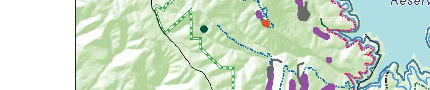


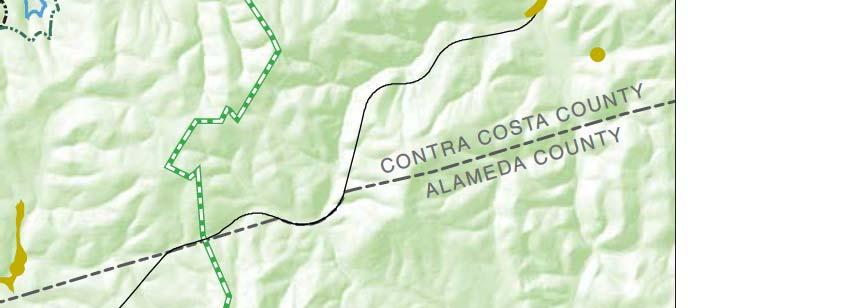
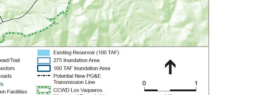
154 4.6-22


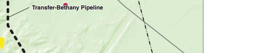


155 4.6-23
156 4.6 Biological Resources impacts from full buildout of these facilities were analyzed in the Final EIS/EIR with the finding that special-status plants within the reservoir facilities footprint would be subject to direct and permanent loss. This would result in a significant impact. Botanical surveys have not yet been performed in new Phase 2 Expansion component locations. Based on biological reconnaissance surveys, review of California Native Plant Society (CNPS) database and California Natural Diversity Database (CNDDB), and review of aerial imagery, no federal- or State-listed special-status plants are expected in these new areas. However, it is possible that one or more non-listed rare plants species could be present in the new Phase 2 Expansion areas and would be subject to direct and permanent loss. This would result in a significant impact. Impacts on rare plants can be mitigated to a less-than-significant level through avoidance, protection, restoration, and habitat enhancement, through implementation of adopted Mitigation Measures 4.6.3a and 4.6.3b. These include focused plant surveys coupled with avoidance and minimization of impacts; harvesting, transplanting, and long-term maintenance of affected individuals; and the establishment of permanent mitigation sites that provide the specific habitat needs for each affected species. The Final EIS/EIR found that this impact would be associated with the Phase 2 Expansion only. The impact of Alternatives 1A, 1B, and 2A would represent the anticipated significant impact of the Total Project, which would be reduced to less than significant with implementation of mitigation measures; this is the same conclusion as in the Final EIS/EIR. Alternative 4A Alternative 4A may result in reduced impacts on rare plants compared to Alternatives 1A, 1B, and 2A because it would not include further dam modification or inundation, and thus would avoid impacts on known occurrences of Brewer s dwarf flax. However, Alternative 4A could still result in significant impacts on rare plants, including known occurrences of brittlescale and San Joaquin spearscale in areas outside the watershed, as well as occurrences that may not yet be mapped. Such impacts would be reduced to a less-than-significant level through implementation of Mitigation Measures 4.6.3a and 4.6.3b. The Final EIS/EIR found that this impact would be associated with the Phase 2 Expansion only. The impact of Alternative 4A would represent the anticipated significant impact of the Total Project, which would be reduced to less than significant with implementation of mitigation measures; this is the same conclusion as in the Final EIS/EIR. Mitigation: Implementation of adopted Mitigation Measures 4.6.3a and 4.6.3b would apply to Alternatives 1A, 1B, 2A and 4A. Significance after Mitigation: Less than Significant. Los Vaqueros Reservoir Expansion Project June 2017
157 4.6 Biological Resources Impact 4.6.4: Phase 2 Expansion construction would result in impacts on California red-legged frog and California tiger salamander, including aquatic breeding habitat and upland aestivation habitat for these species. (Less than Significant with Mitigation) Alternatives 1A, 1B, and 2A As analyzed in the Final EIS/EIR Volume 2, Section (p ), the Los Vaqueros Reservoir expansion to 275 TAF and facility construction would directly impact California red-legged frog and California tiger salamander aquatic breeding habitat and upland aestivation habitat via inundation, altered hydrology, sustained dewatering of some ponds, and other construction activities. Portions of the Delta-Transfer Pipeline alignment and the Transfer-Bethany Pipeline alignment both include potentially occupied California red-legged frog and California tiger salamander aestivation habitat that could be temporarily affected (see Table on p of Final EIS/EIR Volume 2). In addition to the impacts of these facilities identified in the Final EIS/EIR, newly constructed mitigation ponds (between 0.5 and 1 acre) on East Contra Costa Habitat Conservancy lands along Armstrong Road represent potential aquatic habitat for both California tiger salamander and California red-legged frog. This habitat would be impacted by the Transfer-Bethany Pipeline construction. New Phase 2 Expansion component locations include additional potential habitat for California red-legged frog in the unnamed channel and annual grassland located between the Neroly Blending Facility and the Randall-Bold Water Treatment Plant, near the locations of the Brentwood Pipeline and Neroly High-Lift Pump Station and associated pipelines. Additional potential habitat for California red-legged frog is also present in the unnamed channel downslope from the Neroly Blending Facility west of SR4, also near the Brentwood Pipeline. Impacts of Alternatives 1A, 1B, and 2A would be significant, but can be mitigated to a less-thansignificant level through implantation of avoidance and minimization measures. Mitigation Measure 4.6.4a includes measures to avoid and minimize take of individual frogs and salamanders, and Measure 4.6.4b, which provides for habitat compensation and enhancement, would reduce the impacts on California red-legged frogs and California tiger salamanders to a less-than-significant level. The impact of Alternatives 1A, 1B, and 2A would be added to that already experienced as a result of construction of the Phase 1 expansion to 160 TAF. Combined, these represent a significant impact of the Total Project that would be reduced to less than significant with implementation of mitigation measures; this is the same conclusion as in the Final EIS/EIR. Alternative 4A Alternative 4A would result in reduced impacts on California red-legged frog and California tiger salamander compared to Alternatives 1A, 1B, and 2A because it would not include further dam modification or inundation or construction of the Delta-Transfer Pipeline. However, Alternative 4A could still result in significant impacts on potential aquatic and upland California red-legged frog and California tiger salamander habitat as a result of construction of the Transfer-Bethany Pipeline, Brentwood Pipeline, and pipelines associated with the Neroly High-Lift Pump Station, Los Vaqueros Reservoir Expansion Project June 2017
158 4.6 Biological Resources that would be reduced to a less-than-significant level through implementation of Mitigation Measures 4.6.4a and 4.6.4b. The impact of Alternative 4A would be added to that already experienced as a result of construction of the Phase 1 expansion to 160 TAF. Combined, these represent a significant impact of the Total Project that would be reduced to less than significant with implementation of mitigation measures; this is the same conclusion as in the Final EIS/EIR. Mitigation: Implementation of adopted Mitigation Measures 4.6.4a and 4.6.4b would apply to Alternatives 1A, 1B, 2A, and 4A. Significance after Mitigation: Less than Significant. Impact 4.6.5: Phase 2 Expansion construction would result in direct and indirect impacts on existing populations of and habitat for the western pond turtle. (Less than Significant with Mitigation) Alternatives 1A, 1B, and 2A Western pond turtles are expected in aquatic and upland habitat in the Los Vaqueros Reservoir expansion area and watershed construction areas. Thus, during construction, Alternatives 1A, 1B, and 2A would result in short-term direct impacts on western pond turtle individuals and aquatic and upland nesting habitat through road relocation and upland construction. During and following the filling period of the expanded Los Vaqueros Reservoir to 275 TAF, Alternatives 1A, 1B, and 2A would result in permanent direct impacts on western pond turtle aquatic and upland nesting habitat, and thus also would have indirect impacts on individuals. Impacts would be the of the same nature as described in Final EIS/EIR Volume 2, Section 4.6, Biological Resources (p ), but as described in Final EIR/EIS Volume 4, Appendix B (p. B-6), the Phase 2 Expansion would account for the second phase of overall impacts on western pond turtle individuals and habitat. No additional potential habitat for western pond turtle was identified in the new Phase 2 Expansion Area; therefore, components outside the watershed that were not previously evaluated in the Final EIS/EIR would have no impact on western pond turtle. Impacts would be reduced to a less-than-significant level through implementation of Mitigation Measure 4.6.5, which includes biological monitoring and turtle relocation. The impact of Alternatives 1A, 1B, and 2A would be added to that already experienced as a result of construction of the Phase 1 expansion to 160 TAF. Combined, these represent a significant impact of the Total Project that would be reduced to less than significant with implementation of mitigation measures; this is the same conclusion as in the Final EIS/EIR. Alternative 4A Alternative 4A would result in reduced impacts on western pond turtle compared to Alternatives 1A, 1B, and 2A because it would not include further dam modification or inundation, and thus would Los Vaqueros Reservoir Expansion Project June 2017
159 4.6 Biological Resources not affect aquatic habitat in the reservoir or additional upland habitat due to inundation. However, Alternative 4A could still result in significant impacts on potential upland western pond turtle habitat as a result of other construction work within the watershed. These significant impacts would be reduced to a less-than-significant level through implementation of Mitigation Measure The impact of Alternative 4A would be added to that already experienced as a result of construction of the Phase 1 expansion to 160 TAF. Combined, these represent a significant impact of the Total Project that would be reduced to less than significant with implementation of mitigation measures; this is the same conclusion as in the Final EIS/EIR. Mitigation: Implementation of adopted Mitigation Measure would apply to Alternatives 1A, 1B, 2A and 4A. Significance after Mitigation: Less than Significant. Impact 4.6.6: Phase 2 Expansion construction would result in direct and indirect impacts on listed vernal pool fairy shrimp and their habitat, and on the non-listed midvalley fairy shrimp. (Less than Significant with Mitigation) Alternatives 1A, 1B, 2A Vernal pool fairy shrimp and midvalley fairy shrimp are presumed present in all potentially suitable habitat in the Phase 2 Expansion Area. Alternatives 1A, 1B, and 2A would directly and indirectly impact these species and their habitat during construction of the Delta-Transfer Pipeline and the Transfer-Bethany Pipeline, as discussed in Final EIS/EIR Volume 2, Section 4.6, Biological Resources (p et seq.). Additionally, along the Transfer-Bethany Pipeline, wetlands have been recently constructed in the pipeline alignment by the East Contra Costa Habitat Conservancy near Byron Airport, totaling between 0.5 and 1.0 acre, that were not present during preparation of the Final EIS/EIR and thus not identified in that analysis. These pools are assumed to contain fairy shrimp habitat. The new Phase 2 Expansion area contains additional potential vernal pool branchiopod habitat in several non-jurisdictional puddles located in the annual grassland just south of the proposed Brentwood Pipeline alignment. Excavation for pipeline construction may impact these puddles. No other new Phase 2 Expansion component locations contain potential fairy shrimp habitat. Impacts to fairy shrimp pools can be mitigated to a less-than-significant level through implementation of adopted Mitigation Measures 4.6.2a and 4.6.2b related to wetland impacts, described above, Mitigation Measure 4.6.6a, which avoids potential fairy shrimp habitat and restricts post-project public access, and adopted Mitigation Measure 4.6.6b which provides for cyst salvage and the creation and restoration of local vernal pools, or acquisition of credits from local mitigation banks. Standard water quality protection measures as established in adopted Mitigation Measures 4.5.1a and 4.5.1b would also help avoid and minimize direct and indirect impacts on vernal pool branchiopods. Los Vaqueros Reservoir Expansion Project June 2017
160 4.6 Biological Resources The Final EIS/EIR found that this impact would be associated with the Phase 2 Expansion only. The impact of Alternatives 1A, 1B, and 2A would represent the anticipated significant impact of the Total Project, which would be reduced to less than significant with implementation of mitigation measures; this is the same conclusion as in the Final EIS/EIR. Alternative 4A Alternative 4A would result in reduced impacts on fairy shrimp compared to Alternatives 1A, 1B, and 2A because it would not include construction of the Delta-Transfer Pipeline. However, Alternative 4A could still result in significant impacts on potentially suitable habitat within and near the Transfer-Bethany Pipeline and Brentwood Pipeline alignments, as described above, that would be reduced to a less-than-significant level through implementation of Mitigation Measures 4.6.2a, 4.6.2b, 4.6.6a, 4.6.6b, 4.5.1a, and 4.5.1b. The Final EIS/EIR found that this impact would be associated with the Phase 2 Expansion only. The impact of Alternative 4A would represent the anticipated significant impact of the Total Project, which would be reduced to less than significant with implementation of mitigation measures; this is the same conclusion as in the Final EIS/EIR. Mitigation: Implementation of adopted Mitigation Measures 4.6.2a, 4.6.2b, 4.5.1a and 4.5.1b, as well as Mitigation Measures 4.6.6a and 4.6.6b, below, would apply to Alternatives 1A, 1B, 2A, and 4A. Mitigation Measure 4.6.6a: CCWD shall assume the presence of listed vernal pool branchiopods in all suitable habitat for which CCWD chooses not to perform protocollevel surveys. Longhorn fairy shrimp are not expected in the project areas based on this species narrow habitat requirements, restricted range, and available habitat. CCWD shall minimize impacts on listed vernal pool branchiopods. To avoid and minimize direct and indirect impacts on listed vernal pool branchiopods, standard water quality protection measures shall be implemented as established in Mitigation Measures 4.5.1a and 4.5.1b. Additional measures to minimize and avoid habitat for listed vernal pool branchiopods shall be implemented as required by USFWS and include: 1. Avoidance of potential habitat by narrowing work corridors near potential vernal pool branchiopod habitat to the greatest extent practicable. 2. Establishment of 250-foot buffers around potential branchiopod habitat, which is a typical avoidance distance that is recommended by the USFWS to minimize and avoid direct and indirect impacts. For the Kellogg Creek vernal pool complex (Alternatives 1A, 1B, and 2A only) the following protection measures shall be implemented: 1. Land uses in the easternmost portion of the Los Vaqueros Watershed shall remain restricted to activities associated with wind energy generation, dry-land farming, grazing, and administration by CCWD. 2. East of Los Vaqueros Reservoir, public access shall be restricted from CDFG conservation easement lands at the Kellogg Creek vernal pool complex and lands Los Vaqueros Reservoir Expansion Project June 2017
161 4.6 Biological Resources within 500 feet. Public access shall be restricted to research and occasional educational activities conducted under the supervision of CCWD staff or other designated land management agencies. 3. The eastside trail and other public access trails located in proximity to the vernal pool complex shall be 500 feet or farther from the CDFG conservation easement and beyond direct line of sight to rock outcrop features. 4. The eastern boundary of the public access area shall be fenced to prevent human access to the vernal pool complex and this fence and the Kellogg Creek vernal pools area shall be patrolled to ensure that no trespassing happens and that the fence remains intact. 5. Before opening the eastside trail to public access, a biological evaluation shall be prepared by CCWD that establishes baseline environmental conditions at the vernal pool complex. Elements to be assessed include signs of trespass (e.g., trash, fires, site trampling, wear marks, rocks or other features in pools, or bicycle tire tracks), an evaluation of water quality during winter months to include at a minimum total dissolved solids, ph, and alkalinity, and documentation of any site damage. These conditions will be used as a basis for later site evaluations. An assessment of branchiopod populations shall also be provided as a component of the baseline evaluation. 6. If excessive trespass, defined here as noticeable site deterioration relative to baseline conditions, is identified at the vernal pool complex CCWD shall immediately coordinate with USFWS. If site damage is identified, corrective remedies shall be implemented to prevent further harm to the complex. Such actions may include removing trash or debris from the complex, closing portions of the eastside trail to public access, enhancing site fencing, or other remedies to prevent trespass. 7. While the eastside trail remains open to public access, annual reports shall be prepared to document site conditions relative to baseline conditions. 8. Permanent signage shall be installed within 50 feet of the Kellogg Creek vernal pool complex (or on the surrounding fence) that specifies that, This area is habitat of the vernal pool fairy shrimp, a threatened species, and must not be disturbed. This species is protected by the Endangered Species Act of 1973, as amended. Violators are subject to prosecution, fines, and imprisonment. 9. A USFWS-approved construction monitor shall be present during construction within 0.5 mile of the Kellogg Creek vernal pool complex, as identified in the 1995 USFWS Biological Opinion. Mitigation Measure 4.6.6b: CCWD shall mitigate for impacts to vernal pool fairy shrimp habitat through one or more of the following steps to provide compensatory habitat: (a) salvage of cysts and creation of replacement pool habitat in the local area at a replacement ratio of at least 3:1, (b) restoration of affected pools onsite after construction completion, or (c) acquisition of credits from a local mitigation bank(s). To mitigate for the loss of aquatic sites on the Delta-Transfer Pipeline and Transfer- Bethany Pipeline alignments where vernal pool branchiopods are presumed present, CCWD shall implement the following measures: Los Vaqueros Reservoir Expansion Project June 2017
162 4.6 Biological Resources 1. CCWD shall mitigate for the loss of branchiopod habitat that will be filled or otherwise directly affected by the project (estimated to be 17 pools) by providing compensatory habitat. 2. For portions of the Transfer-Bethany Pipeline alignment near Byron Airport (e.g., adjacent to Wildlands Byron Conservation Bank and Contra Costa County lands at Byron Airport) that support vernal pools, CCWD shall conduct a preconstruction land survey of the pipeline construction area to document current conditions of topography and existing drainage patterns, and to document shallow soil lithology within the construction area footprint as a baseline for restoring vernal pool hydrology following construction. In areas where claypan soils are encountered within critical habitat for vernal pool fairy shrimp (and Contra Costa goldfields) the upper clay soil layer shall be locally stockpiled and reestablished in place following pipeline installation. Upon completion of construction activities, final grading shall be completed to maintain surface flow conditions, local hydrology and similar compaction of surface soils to that of the documented current conditions prior to construction activities. 3. CCWD shall develop and implement a mitigation, monitoring, and management plan, with input from regulatory agencies that shall outline long-term management strategies and performance standards to be attained to compensate for habitat losses resulting from the project. At a minimum, the plan shall include standards for mitigation site selection and construction specifications for mitigation sites, a description of site conditions including aerial maps, an analysis of local branchiopod habitat, and performance criteria by which site quality can be assessed over time (e.g., size, vegetation species present, date of initial ponding, ponding duration, and wildlife usage). A monitoring program will be established to track the development of habitat conditions that are conducive to the establishment of vernal pool branchiopods. 4. To the greatest practicable extent, CCWD or its contractors shall construct compensation habitat (i.e., replacement pools) before habitat disturbances are incurred; or directly within the project footprint after construction. A qualified biologist shall ensure that ponds are functioning as designed. 5. CCWD shall submit the name and credentials of a biologist qualified to act as construction monitor to USFWS for approval at least 15 days before construction work begins. 6. With concurrence from the USFWS, a USFWS-approved biologist shall salvage soils from sites that are known to support vernal pool branchiopods at least 2 weeks before the onset of construction, or during the preceding dry season if pools are anticipated to hold water when construction begins. The salvaged soil samples will be stored and used to inoculate created pools once minimum performance standards are met at these locations. 7. A USFWS-approved biologist shall be present at each active work site within 0.5 mile of potential fairy shrimp habitat until habitat disturbance has been completed. Thereafter, the contractor or CCWD shall designate a person to monitor onsite compliance with all minimization measures. A USFWS-approved biologist shall ensure that this individual receives training consistent with USFWS requirements. Los Vaqueros Reservoir Expansion Project June 2017
163 4.6 Biological Resources 8. A USFWS-approved biologist shall conduct a training session for all construction personnel. At a minimum, the training shall include a description of the vernal pool fairy shrimp and their habitat, the importance of these species and their habitat, the general measures that are being implemented to conserve fairy shrimp as they relate to the project, and the boundaries within which the project construction shall occur. 9. All fueling and maintenance of vehicles and other equipment and staging areas will occur at least 100 feet from any fairy shrimp habitat. Significance after Mitigation: Less than Significant. Impact 4.6.7: Phase 2 Expansion construction would have temporary and permanent impacts on potential San Joaquin kit fox habitat (Less Than Significant with Mitigation) and permanently reduce potential regional movement opportunities in one location for this species. (Less than Significant for Alternatives 1A, 1B, and 2A; No Impact for Alternative 4A) Alternatives 1A, 1B, 2A Alternatives 1A, 1B, and 2A would directly and indirectly impact San Joaquin kit fox habitat in several locations. The greatest habitat impact would occur in grassland, which provides potential kit fox denning, foraging, and dispersal habitat. Grassland that provides potential habitat is present in the Los Vaqueros Watershed, in the vicinity of the Upgraded Transfer Facility, and along the Delta- Transfer Pipeline and Transfer-Bethany Pipeline alignments as described in the Final EIS/EIR. The revised Transfer-Bethany Pipeline Eastside Option is proposed within kit fox habitat; however, the shortened pipeline would temporarily impact less kit fox habitat than identified in the Final EIS/EIR. Additionally, the Upgraded Transfer Facility would be constructed within the existing footprint, avoiding 1.2 acres of permanent impact on kit fox habitat anticipated in the Final EIS/EIR. The incremental impact of Alternatives 1A, 1B, and 2A would be approximately 250 acres of temporary habitat disturbance (from in-watershed and pipeline construction) and 600 acres of permanent habitat loss (from inundation and other permanent in-watershed facility footprints). In combination with the incremental impacts already experienced under the Phase 1 expansion, total permanent habitat loss would be approximately 1,467 acres, slightly less than identified for Alternative 1 and for the Timing Variant in the Final EIS/EIR. Direct impacts on kit fox and kit fox habitat would be mitigated to a less-than-significant level through implementation of Mitigation Measure 4.6.7a, which serves to identify kit fox in the area and protect them during Phase 2 Expansion construction; Mitigation Measure 4.6.7b, which provides for the acquisition and dedication of lands into conservation easements or the purchase of mitigation credits; and Mitigation Measure 4.6.7c, which requires that for each acre of impacted kit fox habitat within a conservation easement, an equivalent number of non-impacted kit fox habitat acres are put in a conservation easement within the Los Vaqueros Watershed. The Final EIS/EIR anticipated that temporary and permanent impacts on kit fox habitat would occur in two phases, both of which would be significant but mitigable to a less-than-significant Los Vaqueros Reservoir Expansion Project June 2017
164 4.6 Biological Resources level. Combined with the incremental impacts of Phase 1, the Total Project temporary and permanent direct impacts on kit fox habitat under Alternatives 1A, 1B, and 2A would be less than significant with mitigation; this is the same conclusion as in the Final EIS/EIR. Indirect effects on kit fox include grassland isolation, risk for increased competition by coyotes and nonnative red foxes, and sustained habitat disturbances related to Phase 2 Expansion construction. Many of these impacts would occur on lands that currently are subject to kit fox mitigation easements and would be the same as described in the Final EIS/EIR. As discussed in Final EIS/EIR Volume 2, Section 4.6, Biological Resources (p ), expansion of the Los Vaqueros Reservoir to 160 TAF under Phase 1 reduced the northern-eastern kit fox movement corridor shown in Final EIS/EIR Figure (Volume 2, p ) by about 50 feet in width, from an estimated 5,222 feet at the narrowest point to 5,172 feet after reservoir expansion to 160 TAF. This was considered a less-than-significant impact of Phase 1. Inundation due to reservoir expansion to 275 TAF under Alternatives 1A, 1B, and 2A would further reduce this corridor by an additional 37 feet to 5,135 feet. The Final EIS/EIR also found that the total reduction of about 87 feet would be a less-than-significant impact. Additionally, on the western side of the Los Vaqueros Reservoir, Phase 1 expansion to 160 TAF inundated some of the remaining grassland area that represented a potential kit fox movement corridor, effectively eliminating this area as a kit fox movement corridor. Despite acquiring significant compensatory mitigation, including the preservation of potential kit fox movement corridors outside of the Watershed, this was considered to be a significant and unavoidable effect of Phase 1. Under Alternatives 1A, 1B, and 2A, reservoir expansion from 160 TAF to 275 TAF would inundate the remaining grassland area, as shown in Final EIS/EIR Figure (Volume 2, p ). Because the loss of this movement corridor occurred as a result of Phase 1, no movement corridor currently exists on the west side of the reservoir; thus, further inundation of this grassland area would not cause further impacts on kit fox movement. The incremental impact of Phase 2 Expansion under Alternatives 1A, 1B, and 2A would therefore be less than significant. Combined with the significant and unavoidable impact on kit fox movement corridors that occurred under Phase 1, the Total Project under Alternatives 1A, 1B, and 2A would be significant and unavoidable; this is the same conclusion as in the Final EIS/EIR. Alternative 4A Alternative 4A would have reduced temporary and permanent impacts on kit fox and habitat compared to Alternatives 1A, 1B, and 2A because it would not include Los Vaqueros Reservoir expansion or construction of the Delta-Transfer Pipeline. Alternative 4A would have an incremental temporary habitat impact of approximately 150 acres as a result of Transfer-Bethany Pipeline construction, and negligible additional permanent impacts on habitat. Combined with the incremental impacts of Phase 1, the Total Project temporary and permanent direct impacts on kit fox habitat under Alternative 4A would be less than significant with mitigation; this is the same conclusion as in the Final EIS/EIR. Los Vaqueros Reservoir Expansion Project June 2017
165 4.6 Biological Resources Alternative 4A would result in no incremental indirect impact on kit fox habitat because it would not increase the amount of inundation from the existing conditions resulting from the 160-TAF reservoir. However, combined with the significant and unavoidable impact on kit fox movement corridors that occurred under Phase 1, the Total Project under Alternative 4Awould be significant and unavoidable; this is the same conclusion as in the Final EIS/EIR. Mitigation: Implementation of adopted Mitigation Measures 4.6.7a, 4.6.7b, and 4.6.7c would apply to Alternatives 1A, 1B, 2A, and 4A. Significance after Mitigation: Less than Significant (for Phase 2 Expansion increments and Total Project direct impact on kit fox and habitat); significant and unavoidable (for Total Project indirect impacts on habitat). Impact 4.6.8: Phase 2 Expansion construction would result in temporary and permanent loss of habitat for burrowing owls. (Less than Significant with Mitigation) Alternatives 1A, 1B, and 2A Alternatives 1A, 1B, and 2A would directly impact burrowing owls and their habitat through grading and excavation of grasslands. High quality nesting and foraging habitat for this species was found along the Delta-Transfer Pipeline and Transfer-Bethany Pipeline alignments during reconnaissance surveys in spring Incidental take of burrowing owls would result in a significant impact. As stated in the Final EIS/EIR Volume 2, Section 4.6, Biological Resources (p ), grading and excavation would constitute temporary impacts to habitat. Permanent impacts would occur as a result of Los Vaqueros reservoir expansion resulting in inundation of grassland habitat. The incremental permanent impact from reservoir expansion under Alternatives 1A, 1B, and 2A would be approximately 477 acres of burrowing owl habitat. Additionally, Phase 1 incurred permanent loss of acres. The Final EIS/EIR considered each of these phases to represent a significant impact. Additional potential nesting and foraging habitat for burrowing owl is present in the grassland area near the Brentwood Pipeline and Neroly High-Lift Pump Station pipelines, which could result in temporary impacts. All temporary impacts on burrowing owl habitat under Alternatives 1A, 1B, and 2A would be significant. Mitigation measures would be required to reduce these impacts to a less-than-significant level. Adopted Mitigation Measure 4.6.8a includes preconstruction surveys, breeding season surveys in nesting habitat, and measures to protect nesting owls during construction. Adopted Mitigation Measure 4.6.8b would compensate for loss of burrowing owl habitat. The Final EIS/EIR anticipated that temporary and permanent impacts on burrowing owl and habitat would occur in two phases, both of which would be significant but mitigable to a lessthan-significant level. Combined with the incremental impacts of Phase 1, the Total Project Los Vaqueros Reservoir Expansion Project June 2017
166 4.6 Biological Resources impacts on burrowing owl habitat under Alternatives 1A, 1B, and 2A would be less than significant with mitigation; this is the same conclusion as in the Final EIS/EIR. Alternative 4A Alternative 4A would result in minor permanent loss of burrowing owl habitat because it would not include Los Vaqueros Reservoir expansion. Less than 1 acre of permanent loss could be associated with the Watershed Office barn parking lot and garden construction. Nonetheless, potential incidental take of burrowing owls would result in a significant impact. Implementation of adopted Mitigation Measures 4.6.8a and 4.6.8b would reduce impacts of Alternative 4A to less than significant. The Final EIS/EIR anticipated that temporary and permanent impacts on burrowing owl and habitat would occur in two phases, both of which would be significant but mitigable to a lessthan-significant level. Combined with the incremental impacts of Phase 1, the Total Project impacts on burrowing owl habitat under Alternative 4A would be less than significant with mitigation; this is the same conclusion as in the Final EIS/EIR. Mitigation: Implementation of adopted Mitigation Measures 4.6.8a and 4.6.8b would apply to Alternatives 1A, 1B, 2A, and 4A. Significance after Mitigation: Less than Significant. Impact 4.6.9: Phase 2 Expansion construction and operation activities would result in direct and indirect impacts on existing populations of and habitat for the golden eagle, bald eagle, and Swainson s hawk. (Less than Significant with Mitigation; Beneficial for bald eagle foraging habitat for Alternatives 1A, 1B, and 2A; No impact for bald eagle foraging habitat for Alternative 4A) Alternatives 1A, 1B, and 2A As stated in the Final EIS/EIR Volume 2, Section 4.6, Biological Resources (p ), golden eagles nest within the Los Vaqueros Watershed, though nest sites shift regularly. Bald eagles and Swainson s hawks forage but are not known to nest within the Watershed. As described in Final EIS/EIR Impact 4.6.9, expansion of the Los Vaqueros Dam and other facilities would cause construction noise and related disturbances that could temporarily reduce available nesting and foraging habitat for golden eagles near the dam and along lower Kellogg Creek (below Los Vaqueros Dam). As analyzed in the Final EIS/EIR Volume 2, Section 4.6, Biological Resources (p ), Swainson s hawks are known to nest in the vicinity of the Delta-Transfer Pipeline alignment. Foraging habitat for golden eagles is found along the Transfer-Bethany Pipeline alignment, but there are few available nest sites. Los Vaqueros Reservoir Expansion Project June 2017
167 4.6 Biological Resources The northern portions of the Phase 2 Expansion area near the Contra Costa Canal lack nesting habitat for Swainson s hawk, golden eagle or bald eagle, but provide potential foraging habitat for Swainson s hawk and golden eagle. Impacts to foraging habitat in these areas would be temporary. Bald eagles could benefit from increased foraging opportunities in the expanded inundation area. To date in 2017, six active golden eagle nests have been observed in the Los Vaqueros Watershed area and have necessitated trail closures (CCWD, 2017). Impacts to nesting golden eagles and Swainson s hawks would be reduced to a less-than-significant level through implementation of adopted Mitigation Measures 4.6.9a and 4.6.9b. Mitigation Measure 4.6.9a requires preconstruction nesting surveys during active nesting season, as well as minimization and avoidance measures and Mitigation Measure 4.6.9b compensates for permanent loss of raptor foraging habitat and includes long term eagle conservation and territory monitoring. The Final EIS/EIR anticipated that temporary and permanent impacts on golden eagle, bald eagle, and Swainson s hawk would occur in two phases, both of which would be significant but mitigable to a less-than-significant level. Combined with the incremental impacts of Phase 1, the Total Project impacts on golden eagle, bald eagle, and Swainson s hawk under Alternatives 1A, 1B, and 2A would be less than significant with mitigation; this is the same conclusion as in the Final EIS/EIR. Alternatives 4A Alternative 4A would have a reduced potential to temporarily disturb nesting and foraging habitat due to the decreased amount of construction, and in particular because the Los Vaqueros Dam would not be expanded and the Delta-Transfer Pipeline would not be constructed. Nonetheless, construction could result in some temporary disturbance that may result in significant impacts. Because Alternative 4A would not further expand the Los Vaqueros Reservoir, it would have no incremental beneficial impact on bald eagle foraging opportunities. The Final EIS/EIR anticipated that temporary and permanent impacts on golden eagle, bald eagle, and Swainson s hawk would occur in two phases, both of which would be significant but mitigable to a less-than-significant level. Combined with the incremental impacts of Phase 1, the Total Project impacts on golden eagle, bald eagle, and Swainson s hawk under Alternative 4A would be less than significant with mitigation; this is the same conclusion as in the Final EIS/EIR. Mitigation: Implementation of Mitigation Measures 4.6.9a and 4.6.9b would apply to Alternatives 1A, 1B, 2A, and 4A. Significance after Mitigation: Less than Significant. Los Vaqueros Reservoir Expansion Project June 2017
168 4.6 Biological Resources Impact : Phase 2 Expansion construction and increased reservoir water levels would result in temporary and permanent loss of potential and occupied habitat for Alameda whipsnake. (Less than Significant with Mitigation) Alternatives 1A, 1B, and 2A As stated in the Final EIS/EIR Volume 2, Section 4.6, Biological Resources (p ), upland scrub and nearby associated woodland and grassland (nonscrub) habitats in the vicinity of the Los Vaqueros Reservoir expansion area are assumed to support Alameda whipsnakes. Alameda whipsnake habitat is not present at any other proposed facility outside the Los Vaqueros Watershed including around new Phase 2 Expansion components. No impacts would occur as a result of construction or operation of these facilities. Therefore, impacts would be as discussed in the Final EIS/EIR for in-watershed facilities. Potential direct impacts on Alameda whipsnake (mortality or injury) could occur during construction, which would result in a significant impact. The incremental permanent impact of Alternatives 1A, 1B, and 2A on upland scrub habitat for Alameda whipsnake would be approximately 0.5 acre (of a Total Project impact of 6.9 acres), and the incremental impact on nonscrub habitat would be approximately 80 acres; however, no mitigation is necessary for impacts on nonscrub habitat, as explained in the Final EIS/EIR. Impacts on Alameda whipsnake would be reduced to a less-than-significant level through implementation of Mitigation Measure a, which provides for surveys, protection measures during construction, revegetation, and compensatory habitat creation/restoration within the project area; and Mitigation Measure b, which provides for compensation of permanent habitat losses through acquisition, protection, and management of occupied scrub habitat. The Final EIS/EIR anticipated that temporary and permanent impacts on Alameda whipsnake would occur in two phases, both of which would be significant but mitigable to a less-thansignificant level. Combined with the incremental impacts of Phase 1, the Total Project impacts on Alameda whipsnake under Alternatives 1A, 1B, and 2A would be less than significant with mitigation; this is the same conclusion as in the Final EIS/EIR. Alternative 4A Alternative 4A would have a reduced potential for direct impacts on Alameda whipsnake (mortality or injury) to occur during construction, but could still result in a significant impact. No additional incremental impacts on upland scrub or nonscrub habitat would occur under Alternative 4A. Mitigation Measure a would be required to reduce potential direct impacts to a less-than-significant level, but Mitigation Measure b would not be needed because no additional significant habitat impact would occur. The Final EIS/EIR anticipated that temporary and permanent impacts on Alameda whipsnake would occur in two phases, both of which would be significant but mitigable to a less-thansignificant level. Combined with the incremental impacts of Phase 1, the Total Project impacts on Alameda whipsnake under Alternative 4A would be less than significant with mitigation; this is the same conclusion as in the Final EIS/EIR. Los Vaqueros Reservoir Expansion Project June 2017
169 4.6 Biological Resources Mitigation: Implementation of adopted Mitigation Measures a and b would apply to Alternatives 1A, 1B, and 2A. Mitigation Measure a also would apply to Alternative 4A. Significance after Mitigation: Less than Significant. Impact : Phase 2 Expansion construction activities could result in direct and indirect impacts on the valley elderberry longhorn beetle and its habitat. (Less than Significant with Mitigation for Alternatives 1A, 1B, and 2A; Less than Significant for Alternative 4A) Alternatives 1A, 1B, and 2A As stated in the Final EIS/EIR Volume 2, Section 4.6, Biological Resources (p ), in the Los Vaqueros Watershed, the valley elderberry longhorn beetle was documented to occur in several drainages within the proposed inundation area for the 275-TAF Los Vaqueros Reservoir expansion, outside of the Phase 1 expansion area to 160 TAF that already has been inundated. Therefore, these remaining drainages that would be inundated as a result of Alternatives 1A, 1B, and 2A would result in the loss of elderberry shrubs providing potential valley elderberry longhorn beetle habitat, which could cause direct mortality of beetles and loss of potential and occupied habitat. Indirect impacts could include habitat degradation and loss of community complexity, general disturbance near occupied habitat, and possibly accumulation of construction-generated dust on leaves. Habitat for valley elderberry longhorn beetle was not observed in the vicinity of the Delta- Transfer Pipeline, Transfer-Bethany Pipeline, or Upgraded Transfer Facility. Habitat for valley elderberry longhorn beetle may be present near the Neroly to Los Vaqueros Pipeline connection; impacts on this species are possible if elderberry shrubs are present, depending on the location of ground disturbance. Elderberry shrubs are most likely to occur at stream crossings. Direct mortality of beetles and/or loss of potential and occupied beetle habitat would result in a significant impact. Implementation of Mitigation Measure , which would replace elderberry shrubs where impacts could not be avoided, would reduce impacts on valley elderberry longhorn beetle to a less-than-significant level. The Final EIS/EIR anticipated that temporary and permanent impacts on valley elderberry longhorn beetle and its habitat would occur in two phases, both of which would be significant but mitigable to a less-than-significant level. Combined with the incremental impacts of Phase 1 (i.e., 16 shrubs in the area previously inundated by the expansion to 160 TAF), the Total Project impacts on valley elderberry longhorn beetle and its habitat under Alternatives 1A, 1B, and 2A would be less than significant with mitigation; this is the same conclusion as in the Final EIS/EIR. Los Vaqueros Reservoir Expansion Project June 2017
170 4.6 Biological Resources Alternative 4A Alternative 4A would not result in the loss of elderberry shrubs. It also would have reduced potential for temporary construction-related impacts due to reduced construction within the Los Vaqueros watershed compared to Alternatives 1A, 1B, and 2A. The impact of Alternative 4A on valley elderberry longhorn beetle would be less than significant. The Final EIS/EIR anticipated that temporary and permanent impacts on valley elderberry longhorn beetle and its habitat occur in two phases, both of which would be significant but mitigable to a less-than-significant level. Although the incremental impact of Alternative 4A would be less than significant, when combined with the incremental impacts of Phase 1, the Total Project impacts on valley elderberry longhorn beetle and its habitat under Alternative 4A would be less than significant with mitigation; this is the same conclusion as in the Final EIS/EIR. However, no mitigation is necessary to reduce the incremental impact of Alternative 4A to less than significant. Mitigation: Implementation of adopted Mitigation Measure would apply to Alternatives 1A, 1B, and 2A. Significance after Mitigation: Less than Significant. Impact : Phase 2 Expansion construction activities could affect active bird nesting sites. (Less than Significant with Mitigation) Alternatives 1A, 1B, 2A, and 4A As stated in the Final EIS/EIR Volume 2, Section 4.6, Biological Resources (p ), construction would cause temporary habitat disturbance or permanent habitat loss within or near potential nesting habitat for birds protected under the federal Migratory Bird Treaty Act. Bird species may forage and nest in riparian, woodland, scrub, and/or grassland habitats throughout the Phase 2 Expansion area. Temporary habitat disturbance and noise disturbance, and permanent habitat loss within or near potential nesting habitat for protected birds may occur under all action alternatives. Construction activities including grading and removal of trees, shrubs, and other potential nesting habitat during the breeding season could result in direct mortality of nesting birds. Power lines could cause collision risk for birds and provide perches for raptors, which are predators of smaller birds. Indirect impacts from construction noise, vibrations, and increased human presence could cause nest abandonment, or loss of reproductive potential at active nests near Phase 2 Expansion sites. Additional habitat for nesting birds occurs in the northern portion of the Phase 2 Expansion Area, including in riparian trees and shrubs and ornamental trees near the Brentwood Pipeline alignment, Neroly High-Lift Pump Station site, Transfer-Bethany Pipeline and Delta-Transfer Pipeline alignments, and around the Upgraded Transfer Facility. Los Vaqueros Reservoir Expansion Project June 2017
171 4.6 Biological Resources Although Alternative 4A would include less construction activity than Alternatives 1A, 1B, and 2A, it would still have the potential for the above-described significant impacts. The implementation of Mitigation Measures a and c would ensure that during the nesting season pre-construction surveys will be conducted, impacts from power lines will be minimized, and any active nests will be adequately buffered. Implementation of these mitigation measures would reduce impacts to a less-than-significant level. The Final EIS/EIR anticipated that temporary and permanent impacts on bird nesting sites would occur in two phases, both of which would be significant but mitigable to a less-than-significant level. When combined with the incremental impacts of Phase 1, the Total Project impacts on bird nesting sites under Alternatives 1A, 1B, 2A, and 4A would be less than significant with mitigation; this is the same conclusion as in the Final EIS/EIR. Mitigation: Implementation of adopted Mitigation Measures a and c would apply to Alternatives 1A, 1B, 2A and 4A. Significance after Mitigation: Less than Significant. Impact : Phase 2 Expansion construction activities could affect designated critical habitat for listed species (vernal pool fairy shrimp and Contra Costa goldfields). (Less than Significant with Mitigation) Alternatives 1A, 1B, 2A, and 4A As stated in the Final EIS/EIR Volume 2, Section 4.6, Biological Resources (p ), a portion of the Transfer-Bethany Pipeline alignment is within the Altamont Hills core area of the Livermore vernal pool region. This portion of the alignment has been designated by USFWS as critical habitat for Contra Costa goldfields and vernal pool fairy shrimp (see Figure in Final EIS/EIR Volume 2, p , provided below). Construction of the Transfer-Bethany Pipeline would directly affect designated critical habitat for Contra Costa goldfields and vernal pool fairy shrimp. The new Phase 2 Expansion component sites do not include additional critical habitat for these species. Thus, impacts would be as was discussed in the Final EIS/EIR, and summarized below. Focused presence/absence surveys failed to identify Contra Costa goldfields in the study area (p ). Focused surveys in winter 2008 identified 16 vernal pools within or next to the Transfer-Bethany Pipeline alignment that could support vernal pool fairy shrimp. This species was observed in four pools, and non-listed fairy shrimp species (versatile fairy shrimp [Branchinecta lindahli] and alkali fairy shrimp [B. mackini]) were collected from six others. Vernal pool fairy shrimp are presumed present in all pools based on the presence of suitable habitat. Los Vaqueros Reservoir Expansion Project June 2017


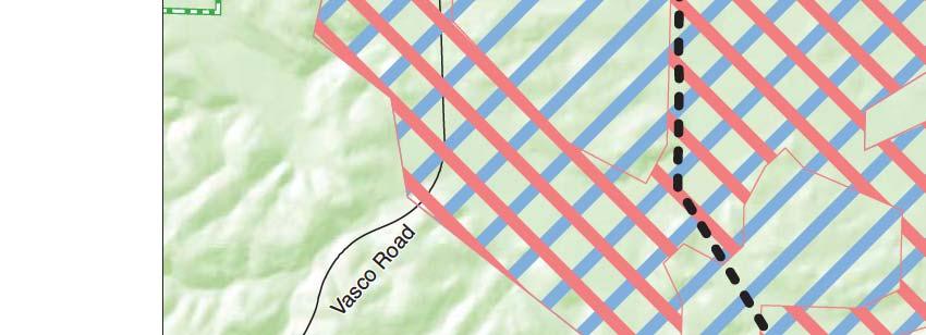


172 4.6-40
173 4.6 Biological Resources Any proposed activities within designated critical habitat that would alter the physical makeup of pools or reduce the functionality of the larger vernal pool complex would constitute a significant impact. The impact would be reduced to a less-than-significant level by implementation of Mitigation Measures 4.6.2a and 4.6.2b, which protect jurisdictional wetlands, and Mitigation Measures 4.6.6a and 4.6.6b, which protect fairy shrimp. The Final EIS/EIR found that this impact would be associated with the Phase 2 Expansion only. The impact of Alternatives 1A, 1B, 2A, and 4A would represent the anticipated significant impact of the Total Project, which would be reduced to less than significant with implementation of mitigation measures; this is the same conclusion as in the Final EIS/EIR. Mitigation: Implementation of adopted Mitigation Measures 4.6.2a and 4.6.2b, as well as recommended Mitigation Measures 4.6.6a and 4.6.6b would apply to Alternatives 1A, 1B, 2A, and 4A. Significance after Mitigation: Less than significant. Impact : Phase 2 Expansion construction activities could affect nonlisted specialstatus reptile species (San Joaquin coachwhip and coast horned lizard). (Less than Significant with Mitigation) Alternatives 1A, 1B, 2A, and 4A As stated in the Final EIS/EIR Volume 2, Section 4.6, Biological Resources (p ), San Joaquin coachwhip and coast horned lizard (Phrynosoma coronatum blainvillii) occur sporadically throughout the regional project vicinity in open, dry areas with little or no tree cover. Both species are relatively uncommon and difficult to detect, even when present. All Phase 2 Expansion alternatives could result in direct mortality of these species as well as temporary and permanent loss of their habitat. Impacts include the potential for mortality by equipment or entrenchment in open trenches or other facilities. No additional potential habitat for these species was identified in the new Phase 2 Expansion component sites. Thus, impacts would be the same as discussed in the Final EIS/EIR. Although Alternative 4A would include less construction activity than Alternatives 1A, 1B, and 2A, and would result in negligible additional habitat loss because it would not further expand the Los Vaqueros Reservoir, it would still have the potential for the above-described significant impacts. Implementation of Mitigation Measure , which minimizes the Phase 2 Expansion footprint within suitable habitat and provides for preconstruction surveys, would reduce impacts on these species from construction to a less-than-significant level. The Final EIS/EIR anticipated that temporary and permanent impacts on nonlisted special-status reptile species would occur in two phases, both of which would be significant but mitigable to a less-than-significant level. When combined with the incremental impacts of Phase 1, the Total Los Vaqueros Reservoir Expansion Project June 2017
174 4.6 Biological Resources Project impacts nonlisted special-status reptile species under Alternatives 1A, 1B, 2A, and 4A would be less than significant with mitigation; this is the same conclusion as in the Final EIS/EIR. Mitigation: Implementation of adopted Mitigation Measure would apply to Alternatives 1A, 1B, 2A, and 4A. Significance after Mitigation: Less than Significant. Impact : Phase 2 Expansion construction activities could affect nonlisted specialstatus mammal species (American badger, special-status bats, and San Joaquin pocket mouse 2 ). (Less than Significant with Mitigation) Alternatives 1A, 1B, 2A, and 4A As stated in the Final EIS/EIR Volume 2, Section 4.6, Biological Resources (p ), American badgers are known to occur in low densities within the Los Vaqueros Watershed and could be directly affected by vehicle and construction-related mortality at any active construction sites, including those within the watershed and on pipeline routes and at the Upgraded Transfer Facility. The principal threat to badgers is vehicle mortality. No additional badger habitat is present in the vicinity of new Phase 2 Expansion components. Breeding and nonbreeding bats could roost in many of the large sycamore or oak trees that occur in the Los Vaqueros Watershed as well as in trees or structures near pipeline alignments. Crevices in Los Vaqueros Dam could also provide roosting habitat for special-status bats. Bat species that could be affected by the Phase 2 Expansion include the pallid bat, Townsend s big-eared bat, greater western mastiff bat, small-footed myotis bat, long-eared myotis bat, fringed myotis bat, long-legged myotis bat, and Yuma myotis bat. Additional trees potentially suitable for use by nonbreeding bats are present in the new Phase 2 Expansion area in trees along the unnamed channel south of the proposed Brentwood Pipeline alignment, west of Highway 4. The same grassland impacts described in Impact would affect San Joaquin pocket mouse habitat. Although Alternative 4A would include less construction activity than Alternatives 1A, 1B, and 2A, and would result in negligible additional habitat loss because it would not further expand the Los Vaqueros Reservoir, it would still have the potential for the above-described significant impacts. Mitigation Measure a from the Final EIS/EIR would include worker training, preconstruction surveys, and relocation of badgers, if necessary. Measure b includes preconstruction surveys, seasonal restrictions, and buffers for bat roosts. Mitigation Measures a and b would 2 Note that San Joaquin pocket mouse is no longer regulated as a CDFW Species of Special Concern. Therefore, impacts on this species are not considered significant in this Supplement. Los Vaqueros Reservoir Expansion Project June 2017
175 4.6 Biological Resources reduce impacts to American badgers and special-status bats to less-than-significant. The implementation of Measure 4.6.7b, which provides habitat compensation for temporary and permanent impacts to annual grasslands that are potentially occupied by San Joaquin kit fox, would also benefit American badgers and San Joaquin pocket mouse. The Final EIS/EIR anticipated that temporary and permanent impacts on nonlisted special-status mammal species would occur in two phases, both of which would be significant but mitigable to a less-than-significant level. When combined with the incremental impacts of Phase 1, the Total Project impacts to nonlisted special-status mammal species under Alternatives 1A, 1B, 2A, and 4A would be less than significant with mitigation; this is the same conclusion as in the Final EIS/EIR. Mitigation: Implementation of adopted Mitigation Measures a and b would apply to Alternatives 1A, 1B, 2A, and 4A. Significance after Mitigation: Less than Significant. Impact : Draining the reservoir during Phase 2 Expansion construction could affect Pacific Flyway species, including waterfowl and shorebirds. (Less than Significant for Alternatives 1A, 1B, and 2A; No Impact for Alternative 4A) Alternatives 1A, 1B, and 2A As stated in the Final EIS/EIR Volume 2, Section 4.6, Biological Resources (p ), Los Vaqueros Reservoir is a stopover for many species of waterfowl and shorebirds on the Pacific Flyway. The temporary loss of this habitat during reservoir construction was identified as a less-than-significant impact in the Final EIS/EIR. The Final EIS/EIR found that no impact would occur under the Phase 1 construction already completed. Because Alternatives 1A, 1B, and 2A would result in a less-than-significant impact, the Total Project under these Alternatives similarly would have a less-than-significant impact; this is the same conclusion as in the Final EIS/EIR. Alternative 4A Because the Los Vaqueros Reservoir would not be drained under Alternative 4A, avian stopover habitat would be available throughout the construction period and no impact would occur. The Final EIS/EIR found that no impact would occur under the Phase1 construction already completed. Because Alternative 4A also would have no impact, the Total Project under Alternative 4A similarly would have no impact; this is a reduced significance conclusion compared to the less-than-significant conclusion for the Timing Variant in the Final EIS/EIR. Mitigation: None required. Los Vaqueros Reservoir Expansion Project June 2017
176 4.6 Biological Resources Impact : The Phase 2 Expansion would not result in conflicts with local and regional conservation plans, or local plans or ordinances protecting biological resources. (Less than Significant with Mitigation) Alternatives 1A, 1B, 2A, and 4A The Los Vaqueros Watershed lies within the biological inventory area of the East Contra Costa County HCP/NCCP, but outside of the action area and defined mitigation areas (see Figure in the Final EIS/EIR, Volume 2, page ). The Los Vaqueros Watershed is identified in the East Contra Costa County HCP/NCCP as public land for the purposes of protecting water supply, natural resources, and recreation, and is not identified as potential East Contra Costa County HCP/NCCP acquisition land. Therefore, proposed facilities sited within the Watershed, and mitigation measures to replace and enhance habitat areas within the Watershed, would not conflict with any lands targeted by the HCP/NCCP for acquisition. As quantified in this section, habitat impacts outside the Los Vaqueros Watershed are mostly temporary and associated with Phase 2 Expansion pipelines. Studies completed to date for this project indicate that the region includes ample acreage of suitable habitat to allow implementation of the Phase 2 Expansion mitigation program in concert with the HCP/NCCP. Along Armstrong Road in the Transfer-Bethany Pipeline alignment, the East Contra Costa Habitat Conservancy has constructed mitigation ponds since the Final EIS/EIR was published. These ponds are potentially jurisdictional waters that may provide habitat for vernal pool fairy shrimp, California tiger salamander, or California red-legged frog. If these ponds are temporarily impacted by the construction of the new Transfer-Bethany Pipeline, the temporary impact could conflict with the HCP/NCCP, an adopted conservation plan protecting biological resources. Mitigation Measures 4.6.2a and 4.6.2b, which protect jurisdictional wetlands, and Measures 4.6.6a and 4.6.6b, which protect fairy shrimp would reduce these impacts to a less-than-significant level. As a result of the potential conflict with the HCP/NCCP, the incremental impact of the Phase 2 Expansion under all alternatives would have an increased significance conclusion (less than significant with mitigation) compared to the Final EIS/EIR (no impact). The Total Project impact under all Phase 2 Expansion alternatives also would be increased to less than significant with mitigation. Mitigation: Implementation of adopted Mitigation Measures 4.6.2a and 4.6.2b and recommended Mitigation Measures 4.6.6a and 4.6.6b would apply to Alternatives 1A, 1B, 2A, and 4A. Significance after Mitigation: Less than significant. Los Vaqueros Reservoir Expansion Project June 2017
177 4.6 Biological Resources Impact : Phase 2 Expansion construction would not make a cumulatively considerable contribution to cumulative effects on special-status species and habitats. (Less than Significant) Alternatives 1A, 1B, 2A, and 4A As discussed throughout this section, the Phase 2 Expansion of the Los Vaqueros Reservoir and associated facilities would result in both temporary and permanent effects on biological resources in southeastern Contra Costa County. Most of the Phase 2 Expansion impacts on biological resources would occur within CCWD s Los Vaqueros Watershed. Incremental effects of the Phase 2 Los Vaqueros Reservoir expansion would inundate an additional approximately 580 acres of habitat, mostly grasslands, and represents the majority of the permanent impact the Phase 2 Expansion would have on biological resources. Other recent and pending projects in the region described in Section 4.1, including developments in the City of Brentwood, Discovery Bay, Mountain House Community, and various proposed road safety and widening projects, as well as implementation of the California Waterfix project, also would contribute to the incremental loss of biological resources and habitat, regardless of when construction would occur. Specifically, the California Waterfix project is another major water infrastructure project that would contribute to cumulative direct and indirect impacts on San Joaquin coachwhip, western burrowing owl, golden eagle, short-eared owl, horned lark, San Joaquin kit fox and American badger, seasonal wetlands and associated species, and wetlands and other jurisdictional waters. Although the Phase 2 Expansion would result in permanent loss of habitat, mitigation measures have been identified to reduce these effects to less-than-significant levels. The mitigation program for the Los Vaqueros Reservoir Expansion Project, which would be continued through adopted mitigation measures described in this section, has been designed to complement the habitat and species conservation goals and principles established by the East Contra Costa County HCP/NCCP. Implementation of this mitigation program would significantly advance the goals of the East Contra Costa County HCP/NCCP by securing, enhancing, and protecting both a substantial amount of additional biological resources habitat in the region and habitat in strategic locations that can provide valuable linkages among other conservation areas in the region. Given the scope of the mitigation program to be implemented for the Phase 2 Expansion to address effects on biological resources, the effects of the Phase 2 Expansion are considered less than significant after mitigation, and the Phase 2 Expansion would not make a cumulatively considerable contribution to potential cumulative effects on biological resources and habitat in the region. One impact of the Total Project was considered to be significant and unavoidable the loss of the potential kit fox movement corridor in the grassland area west of the existing Los Vaqueros Reservoir (Impact 4.6.7). This impact occurred during Phase 1 Los Vaqueros Reservoir expansion to 160 TAF; hence, no additional impacts to this movement corridor would occur under Phase 2 Expansion or from other planned or proposed projects in the region. Elsewhere in the region, the Vasco Road, Byron Highway, and other road widening and safety improvement projects would cause permanent loss of habitat but will not be expected to change the barriers to kit fox migration represented by the existing roads unless roadway modification incorporates substantially increased center divide structures. Los Vaqueros Reservoir Expansion Project June 2017
178 4.6 Biological Resources The Mountain House Community in northwestern San Joaquin County is near the foot of the Diablo Range north of Interstate 205. This phased, 5,000-acre residential and commercial development project, which is identified in the San Joaquin County Multiple Species Habitat Conservation Plan, occupies annual grasslands and former agricultural lands that presumably provided moderate to high habitat values for San Joaquin kit foxes. This project could present a barrier to north-south kit fox movement through agricultural portions of the Valley floor. The environmental reviews conducted for the Mountain House Specific Plan considered direct project effects upon occupied kit fox denning and foraging habitat; however, effects on movement corridors were not identified. Because the Los Vaqueros Reservoir is over 10 miles from the Mountain House Community, and would not affect the same area of potential kit fox movement, the two projects would not result in a significant cumulative impact on kit fox movement corridors. The California Waterfix project would result in the loss of 334 acres of kit fox habitat (identified as a significant impact); however, the mitigation program for that project focuses on the preservation of contiguous areas of unprotected grassland that connect to more than 620 acres of existing kit fox habitat that was protected under the East Contra Costa County HCP/NCCP. Thus, the residual impact of the California Waterfix project on the loss of kit fox movement corridors would support the goals of the East Contra Costa County HCP/NCCP. The kit fox habitat that would be lost due to Waterfix is concentrated around the Clifton Court Forebay, over 8 miles from the movement corridor lost under the Total Project, and in combination with the Total Project would not result in a significant cumulative impact on kit fox movement corridors. After implementation of mitigation described in Impact , the action alternatives would not conflict with local or regional conservation plans including HCPs or NCCPs, or local plans or ordinances protecting biological resources. Mitigation: Implementation of measures identified throughout this section to address direct and indirect effects of the Phase 2 Expansion on terrestrial biological resources would also reduce the Phase 2 Expansion s contribution to cumulative effects to a less-than-significant level (adopted Mitigation Measures 4.6.1a, 4.6.1b, 4.6.2a, 4.6.2b, 4.6.3a, 4.6.3b, 4.6.4a, 4.6.4b, 4.6.5, 4.6.7a, 4.6.7b, 4.6.7c, 4.6.8a, 4.6.8b, 4.6.9a, 4.6.9b, a, b, , a, , a, and b and recommended Mitigation Measures 4.6.6a and 4.6.6b would apply to Alternatives 1A, 1B, 2A and 4A). No additional mitigation would be required. Significance after Mitigation: Less than Significant. Los Vaqueros Reservoir Expansion Project June 2017
179 4.7 Land Use 4.7 Land Use This section presents an analysis of potential land use impacts that would result from implementation of the Phase 2 Expansion. The affected environment, regulatory setting, and analytical methodology from the Final EIS/EIR are relied on to the extent practicable in this Supplement, and are discussed only to the extent that factors applicable to the Phase 2 Expansion differ from those described in the Final EIS/EIR. This section analyzes the direct, indirect, and cumulative effects of the Phase 2 Expansion alternatives; modifications (additions, deletions, or other revisions) to the approved mitigation measures provided in the adopted Final EIS/EIR Mitigation Monitoring and Reporting Program (MMRP); and any residual effects that may remain following the implementation of such measures Affected Environment Regulatory Setting Federal There has been no change in the federal laws, regulations, policies, or plans relevant to the Phase 2 Expansion as set forth in Final EIS/EIR Volume 2, Section 4.7, Land Use (p ). This analysis relies on those summaries. State Because the previously proposed new Delta Intake and Pump Station on Old River have been eliminated, the discussion of State Lands Commission jurisdiction as contained in the Final EIS/EIR Volume 2, Section 4.7 does not apply to the Phase 2 Expansion. The only relevant state policy is the revised Land Use and Resource Management Plan for the Delta, which was adopted February 25, 2010 and is discussed below. Land Use and Resource Management Plan for the Delta The Delta Protection Act of 1992 (Act) established the Delta Protection Commission, a State entity to plan for and guide the conservation and enhancement of the natural resources of the Delta, while sustaining agriculture and meeting increased recreational demand. The Act defines a Primary Zone, which comprises the principal jurisdiction of the Delta Protection Commission. The Secondary Zone is the area outside the Primary Zone and within the Legal Delta; the Secondary Zone is not within the planning area of the Delta Protection Commission. The Act requires the Commission to prepare and adopt a Land Use and Resource Management Plan for the Primary Zone of the Delta, which must meet specific goals. No Phase 2 Expansion components are within the Primary Zone. However, the Delta Protection Commission may comment on development projects within the Secondary Zone in the event that a project in the Secondary Zone could affect lands within the Primary Zone. Phase 2 Expansion facilities within the Secondary Zone of the Delta include most of the Delta-Transfer Pipeline, the Neroly High- Lift Pump Station and associated pipelines, the Brentwood Pipeline, the Pumping Plant #1 Replacement, and the ECCID Intertie Pipeline. Los Vaqueros Reservoir Expansion Project June 2017
180 4.7 Land Use The Delta Protection Commission updated the Land Use and Resource Management Plan for the Primary Zone of the Delta in The prior version of the plan was described in Final EIS/EIR Volume 2, Section 4.7 (p et seq.). As stated above, while though the Commission does not have land use authority in the Secondary Zone, the land use policies and recommendations in this Plan may inform the Delta Protection Commission s comments. The Land Use section of the updated Plan no longer contains recommendation R-5 listed in the Final EIS/EIR and contains an updated policy P-8: P-8. Local government policies regarding mitigation of adverse environmental impacts under the California Environmental Quality Act may allow mitigation beyond county boundaries, if acceptable to reviewing fish and wildlife agencies and with approval of the recipient jurisdiction, for example in approved mitigation banks or in the case of agricultural loss to mitigation. Mitigation in the Primary Zone for loss of agricultural lands in the Secondary Zone may be appropriate if the mitigation program supports continued farming in the Primary Zone. California Government Code Section (Assembly Bill 797) specifically allows an agricultural conservation easement located within the Primary or Secondary Zone of the Delta to be related to Williamson Act contract rescissions in any other portion of the secondary zone without respect to County boundary limitations. The Utilities and Infrastructure section of the Plan contains an updated policy P-1: Local P-1. Impacts associated with construction of transmission lines and utilities can be mitigated by locating new construction in existing utility or transportation corridors, or along property lines, and by minimizing construction impacts. Before new transmission lines are constructed, the utility should determine if an existing line has available capacity. To minimize impacts on agricultural practices, utility lines shall follow edges of fields. Pipelines in utility corridors or existing rights-of-way shall be buried to avoid adverse impacts to terrestrial wildlife. Pipelines crossing agricultural areas shall be buried deep enough to avoid conflicts with normal agricultural or construction activities. Utilities shall be designed and constructed to minimize any detrimental effect on levee integrity or maintenance, agricultural uses and wildlife within the Delta. Utilities shall consult with communities early in the planning process for the purpose of creating an appropriate buffer from residences, schools, churches, public facilities and inhabited marinas. (Delta Protection Commission, 2010) There has been no change in the local laws, regulations, policies, or plans relevant to the Phase 2 Expansion as set forth in Final EIS/EIR Volume 2, Section 4.7, Land Use (pp through ). This analysis relies on those summaries Environmental Setting Existing and Sensitive Land Uses Final EIS/EIR Volume 2, Section (p et seq.) describes the land uses in eastern Contra Costa and Alameda Counties, primarily consisting of agriculture, grazing, and recreation. Urban areas in the cities of Brentwood, Oakley, and Livermore and the unincorporated communities of Byron and Discovery Bay, shown in Final EIS/EIR Figure (Volume 2, p ) have experienced some additional development; however, no substantial changes in land Los Vaqueros Reservoir Expansion Project June 2017
181 4.7 Land Use use have occurred since publication of the Final EIS/EIR. Therefore, this analysis of land use impacts of the Phase 2 Expansion relies upon the Final EIS/EIR description for all elements of the Phase 2 Expansion that are within the areas described. Additionally, new elements of the Phase 2 Expansion not analyzed in the Final EIS/EIR would occupy lands not described in the Final EIS/EIR. These lands include the existing CCWD property at the Randall-Bold Water Treatment Plant site (for the Neroly High-Lift Pump Station and associated pipelines), the existing Contra Costa Canal right-of-way (for the Pumping Plant #1 replacement), the existing ECCID right-of-way (for the proposed ECCID Intertie Pipeline), the proposed Brentwood Pipeline right-of-way, the existing Walnut Creek Pumping Plants 1 and 2 (for the EBMUD Variable Frequency Drive [VFD] Buildings), and the proposed location of the EBMUD-CCWD Intertie Pump Station in Brentwood. The sensitive land uses (e.g., residences) described in the Final EIS/EIR (Volume 2, pp and ) have not changed substantially since publication of the Final EIS/EIR. In addition to those described, housing developments have been built within 200 feet of the existing Randall- Bold Water Treatment Plant site. With respect to new Phase 2 Expansion components, there are residences within approximately 500 feet of the proposed Pumping Plant #1 replacement location, within 100 feet of the ECCID Intertie Pipeline route, within 160 feet of the EBMUD-CCWD Intertie Pump Station, and within 100 feet of the VFD Buildings Environmental Consequences Methodology This analysis uses the same methodology described in Final EIS/EIR Volume 2, Section (p ). It evaluates the potential for the Phase 2 Expansion alternatives to conflict with existing land use plans and policies by analyzing whether an alternative will further the objectives and policies of the general plan and not obstruct their attainment (OPR, 2003). Although CCWD is not subject to local general plan and zoning regulations, discussions of consistency with the land use designations of the general plans are provided to give context and to fully inform the public and the decision makers. This Supplement first identifies the incremental impacts of the Phase 2 Expansion action alternatives compared to the 160-TAF No Project/ No Action Alternative. Second, this Supplement identifies the impacts of the Total Project, and compares those impacts to the previously disclosed impacts of the Timing Variant. The impacts of the Total Project comprise the incremental impacts of each Phase 2 Expansion action alternative plus the impacts of Alternative 4 in the Final EIS/EIR (with the exception of the Transfer Facility upgrades that were not undertaken). Alternative 4 in the Final EIS/EIR is expansion of the then-existing 100-TAF Los Vaqueros Reservoir to a 160-TAF Los Vaqueros Reservoir with associated improvements. The land use impact assessment for the incremental expansion from 160 TAF to 275 TAF was addressed in Final EIS/EIR Volume 4, Appendix B (p. B-8), while the detailed discussion of land use impacts was provided in Final EIS/EIR Volume 2, Section (p et seq.). Los Vaqueros Reservoir Expansion Project June 2017
182 4.7 Land Use Significance Criteria This analysis uses the same significance criteria described in Final EIS/EIR Volume 2, Section (pp and ). For the reader s convenience, they are restated here. An alternative was determined to have a significant land use impact if it would do any of the following: 1. Physically divide an established community 2. Conflict with any applicable land use plan, policy, or regulation of an agency adopted for the purpose of avoiding or mitigating a significant environmental effect 3. Conflict with any applicable Habitat Conservation Plan (HCP) or Natural Community Conservation Plan (NCCP) The potential for the Phase 2 Expansion alternatives to conflict with applicable HCPs or NCCPs is addressed in Section 4.6, Biological Resources, under Impact Therefore, the potential to conflict with HCPs and NCCPs is not discussed further in this section Impact Summary Table provides a summary of the land use impact analysis for each Phase 2 Expansion alternative described in Chapter 2. Table provides a summary of the Total Project impacts under each Phase 2 Expansion Alternative, with comparison to the Timing Variant as analyzed in Appendix B of the Final EIS/EIR. TABLE SUMMARY OF INCREMENTAL IMPACTS OF PHASE 2 EXPANSION ALTERNATIVES LAND USE Impact Alternative 1A Alternative 1B Alternative 2A Alternative 4A 4.7.1: The Phase 2 Expansion alternatives would not physically divide an existing community : Facility siting and operation under the Phase 2 Expansion alternatives would not conflict with any applicable land use plans : Construction activities within designated Airport Land Use Compatibility Zones near the Byron Airport could cause potential temporary height impacts by conflicting with FAR Part 77 surfaces during construction : Construction activities within the AIA for Byron Airport could cause potential temporary flight hazards through the creation of glare or distracting lights; the generation of dust or smoke, which could impair pilot visibility; or could attract an increased number of birds : The Phase 2 Expansion alternatives would not contribute to cumulative land use impacts. NI NI NI NI LS LS LS LS LSM LSM LSM LSM LSM LSM LSM LSM NI NI NI NI NOTES: SU = Significant and Unavoidable LSM = Less-than-Significant Impact with Mitigation LS = Less-than-Significant Impact NI = No Impact AIA = Airport Influence Area FAR = Federal Aviation Regulation Los Vaqueros Reservoir Expansion Project June 2017
183 4.7 Land Use TABLE COMPARISON OF TOTAL PROJECT IMPACTS LAND USE Impact Timing Variant a Alternative 1A Plus 160-TAF Expansion Alternative 1B Plus 160-TAF Expansion Alternative 2A Plus 160-TAF Expansion Alternative 4A Plus 160-TAF Expansion 4.7.1: The project alternatives would not physically divide an existing community : Facility siting and operation under the project alternatives would not conflict with any applicable land use plans : Construction activities within designated Airport Land Use Compatibility Zones near the Byron Airport could cause potential temporary height impacts by conflicting with FAR Part 77 surfaces during construction : Construction activities within the AIA for Byron Airport could cause potential temporary flight hazards through the creation of glare or distracting lights; the generation of dust or smoke, which could impair pilot visibility; or could attract an increased number of birds : The project alternatives would not contribute to cumulative land use impacts. NI NI NI NI NI LS LS LS LS LS LSM LSM LSM LSM LSM LSM LSM LSM LSM LSM NI NI NI NI NI NOTES: a Source: 2010 Final EIS/EIR, Appendix B, Table B SU = Significant and Unavoidable LSM = Less-than-Significant Impact with Mitigation LS = Less-than-Significant Impact NI = No Impact AIA = Airport Influence Area FAR = Federal Aviation Regulation Impact Analysis No Project/No Action Alternative Under the No Project/No Action Alternative, no new facilities would be constructed and no existing facilities would be altered, expanded, or demolished. Therefore, for all significance criteria, no impacts related to land use would occur from implementing this alternative. Impact 4.7.1: The Phase 2 Expansion alternatives would not physically divide an existing community. (No Impact) Alternatives 1A, 1B, and 2A As described in Impact in Final EIS/EIR Volume 2, Section (p ), two established communities are in the project area evaluated for components common to the Final EIS/EIR alternatives the towns of Byron and Discovery Bay. Numerous rural residential homes are scattered throughout that area; however, for purposes of this Impact assessment, they are not considered to be a community that would be subject to division by physical infrastructure. There are no existing communities located within the existing CCWD watershed property. All pipelines Los Vaqueros Reservoir Expansion Project June 2017
184 4.7 Land Use would be buried, and thus would not physically divide an existing community. The Neroly High- Lift Pump Station, Pumping Plant #1 Replacement, and VFD Buildings would be constructed within the footprints of existing facilities and would not encroach on or impede access to or through nearby residential communities. The EBMUD-CCWD Intertie Pump Station would be located outside of the existing residential community to the east of the proposed site in Brentwood. No impact would occur from any of the Phase 2 Expansion components. Additionally, the Phase 1 components had no impact with respect to dividing an established community. Therefore, under Alternatives 1A, 1B, and 2A, the Total Project would have no impact; this is the same conclusion as in the Final EIS/EIR. Alternative 4A Because the physical components of Alternative 4A consist of a subset of the components analyzed under Alternatives 1A, 1B, and 2A, Alternative 4A also would result in no impact. Additionally, the Phase 1 components had no impact with respect to dividing an established community. Therefore, under Alternative 4A, the Total Project would have no impact; this is the same conclusion as in the Final EIS/EIR. Mitigation: None required. Impact 4.7.2: Facility siting and operation under the Phase 2 Expansion alternatives would not conflict with any existing land use plans. (Less than Significant) Alternatives 1A, 1B, and 2A Land Use and Resource Management Plan for the Delta Unlike the facilities analyzed in the Final EIS/EIR, no new Delta intake would be constructed under Alternatives 1A, 1B, 2A, or 4A. As stated above, no Phase 2 Expansion components are within the Primary Zone of the Delta as defined in the Land Use and Resource Management Plan for the Delta. There are Phase 2 Expansion components in the Secondary Zone of the Delta, including portions of the Delta-Transfer Pipeline, the Neroly High-Lift Pump Station, the Brentwood Pipeline, the Pumping Plant #1 Replacement, the ECCID Intertie Pipeline, and the EBMUD-CCWD Intertie Pumping Plant. As described above in Section , the Land Use and Resource Management Plan for the Delta Utilities and Infrastructure policy P-1 recommends minimizing impacts associated with construction of utilities by locating new construction in existing utility or transportation corridors, or along property lines, and by minimizing construction impacts. The Plan also recommends that pipelines be buried so as to avoid adverse impacts on wildlife and agricultural uses. The Delta-Transfer Pipeline, Brentwood Pipeline, and ECCID Intertie Pipeline would be located along roads and property lines, and would be buried to a minimum 5-foot cover over the pipe. These buried pipelines would not conflict with normal above-ground uses and resources. As a result, these Los Vaqueros Reservoir Expansion Project June 2017
185 4.7 Land Use pipeline components would be consistent with policies of the Land Use and Resource Management Plan for the Delta. Similarly, the Neroly High-Lift Pump Station and Pumping Plant #1 replacement would be located within existing footprints of related water utility infrastructure facilities, and would be consistent with the Plan policies. The EBMUD-CCWD Intertie Pumping Plant would be located at the existing EBMUD-CCWD Intertie (connection of EBMUD and CCWD pipelines), and would therefore be in an existing pipeline corridor. Therefore, the impact associated with conflicts with this land use plan would be less than significant. Contra Costa County General Plan and Alameda East County Area Plan As described in Section , no changes have been made to these general plans that are relevant to the Phase 2 Expansion. Therefore, for physical components of these Phase 2 Expansion alternatives that were analyzed in the Final EIS/EIR, there would be no change in the conclusion that all components would be consistent with these plans. In addition, as noted above, CCWD is not subject to local general plan and zoning regulations. Discussions of consistency with the land use designations of the general plans are provided to give context and to fully inform the public and the decision makers. The only new component in Alameda County would be a portion of the Transfer-Bethany Pipeline that would tie into the California Aqueduct just south of the Contra Costa-Alameda County line. For the same reasons described for previous alignments of the Transfer-Bethany Pipeline in Final EIS/EIR Volume 2, Section (p ), this pipeline located within the Large Parcel Agriculture designation would be consistent with policies for that land use designation. Thus, the overall conclusion for consistency with general plans would be less than significant; the same as in the Final EIS/EIR. Contra Costa County Airport Land Use Compatibility Plan Because the electrical facilities analyzed in the Final EIS/EIR have been eliminated from the Phase 2 Expansion, no permanent components of the Phase 2 Expansion would have the potential to conflict with applicable policies (i.e., height limitations) of the Airport Land Use Compatibility Plan (ALUCP). As described in the Final EIS/EIR, facility siting and operation of buried pipelines would be consistent with the ALUCP policies. City General Plans The Neroly High-Lift Pump Station and the eastern portion of the Brentwood Pipeline would be consistent with allowable uses in the Public and Semi-Public or Commercial designations in the City of Oakley General Plan. Similarly, the western portion of the Brentwood Pipeline and the portion of the Neroly-LV pipeline located in Antioch would be consistent with the allowable uses in the Open Space/Public designation in the City of Antioch General Plan (2003). The EBMUD- CCWD Intertie Pump Station would be consistent with the City of Brentwood General Plan (2014) land use designation of Mixed Use Pedestrian Transit. The VFD Buildings would be located within the existing Walnut Creek Pumping Plants and would not change the land uses at those sites. Los Vaqueros Reservoir Expansion Project June 2017
186 4.7 Land Use In summary, none of the proposed components of Phase 2 Expansion alternatives 1A, 1B, or 2A would conflict with any applicable land use plan adopted for the purpose of avoiding or mitigating a significant environmental effect and the impact would be less than significant. Additionally, the Phase 1 components had a less-than-significant impact with respect to conflicting with applicable land use plans. Therefore, under Alternatives 1A, 1B, and 2A, the Total Project would have a less-than-significant impact; this is the same conclusion as in the Final EIS/EIR. Alternative 4A Because the physical components of Alternative 4A consist of a subset of the components analyzed under Alternatives 1A, 1B, and 2A, Alternative 4A also would not conflict with any applicable land use plan adopted for the purpose of avoiding or mitigating a significant environmental effect. Impacts would be less than significant. Additionally, the Phase 1 components had a less-than-significant impact with respect to conflicting with applicable land use plans. Therefore, under Alternative 4A, the Total Project would have a less-than-significant impact; this is the same conclusion as in the Final EIS/EIR. Mitigation: None required. Impact 4.7.3: Construction activities within designated Airport Land Use Compatibility Zones near the Byron Airport could cause potential temporary height impacts by conflicting with FAR Part 77 surfaces during construction. (Less than Significant with Mitigation) Alternatives 1A, 1B, and 2A No changes have been made to the portions of the Delta-Transfer Pipeline and Transfer-Bethany Pipeline alignments that are within the ALUCP Compatibility Zones shown in Final EIS/EIR Volume 2, Section 4.7, Figure (i.e., B1, B2, C1, and D). The electrical power transmission lines and Western substation analyzed in the Final EIS/EIR have been eliminated from the Phase 2 Expansion alternatives, thus eliminating construction activities associated with installing permanent structures greater than 35 feet in height. However, during the construction phase, installation of pipelines could involve the use and onsite staging and storage of cranes, drills, or other tall construction equipment that may exceed the height limitations within Compatibility Zones as identified in applicable ALUCP policies. These policies specify height limitations above which ALUCP review is required for any proposed objects: the limit is 35 feet in Compatibility Zone B1 (policy 6.3.4), 70 feet in B2 (6.4.4), and 100 feet in C1 and D (6.5.4 and 6.7.4). As explained in Final EIS/EIR Volume 2, Section 4.7 on page , these measurements refer to the difference between the height of the proposed object and the height of the runway end, and changes in topography could therefore lead to variations in the allowable height of proposed objects based on the location. Los Vaqueros Reservoir Expansion Project June 2017
187 4.7 Land Use Therefore, the use, staging, and storage of construction equipment exceeding the applicable height limitations in the ALUCP could result in a significant impact. This impact would be reduced to less than significant with implementation of adopted mitigation measures. The Phase 1 components had no impact with respect to construction within an Airport Land Use Compatibility Zone because none were located in Compatibility Zones; all potential impacts were associated with Phase 2. Under Alternatives 1A, 1B, and 2A, the Total Project would have significant impact associated with the Phase 2 Expansion components as described above. This significant impact would be reduced to less than significant with implementation of Mitigation Measure 4.7.3; this is the same conclusion as in the Final EIS/EIR. Alternative 4A Construction of the Transfer-Bethany pipeline under Alternative 4A would be the same as described above for Alternatives 1A, 1B, and 2A; thus, pipeline construction for Alternative 4A also would occur within ALUCP Compatibility Zones B1, B2, C1, and D. Impacts related to construction within protected airspace associated with Byron Airport under Alternative 4A would be the same as described for the above alternatives. Alternative 4A would have a significant impact related to construction within protected airspace associated with Byron Airport; this is the same conclusion as in the Final EIS/EIR. The Phase 1 components had no impact with respect to construction within an Airport Land Use Compatibility Zone because none were located in Compatibility Zones; all potential impacts were associated with Phase 2. Under Alternative 4A, the Total Project would have a significant impact associated with the Phase 2 Expansion components as described above. This significant impact would be reduced to less than significant with implementation of Mitigation Measure 4.7.3; this is the same conclusion as contained in the Final EIS/EIR. Mitigation: Implementation of Mitigation Measure would apply to Alternatives 1A, 1B, 2A, and 4A. Mitigation Measure 4.7.3: Pursuant to ALUCP policy 4.3.4, CCWD shall notify the FAA, as required by FAR Part 77, Subpart B, of its proposed project to determine whether the proposed construction equipment and the location of construction activities and staging areas have the potential to intrude into protected airspace associated with Byron Airport. To facilitate FAA coordination, CCWD shall consult with County Airport staff. If necessary, CCWD will ensure that appropriate notes or modifications are made on all applicable design plans and specifications to ensure that construction activities would not conflict with the airport height limitations. Impact Significance after Mitigation: Less than Significant. Los Vaqueros Reservoir Expansion Project June 2017
188 4.7 Land Use Impact 4.7.4: Construction activities within the AIA for Byron Airport could cause potential temporary flight hazards through the creation of glare or distracting lights; the generation of dust or smoke, which could impair pilot visibility; or could attract an increased number of birds. (Less than Significant with Mitigation) Alternatives 1A, 1B, and 2A No changes have been made to the portions of the Delta-Transfer Pipeline and Transfer-Bethany Pipeline that are within the Airport Influence Area (AIA) for Byron Airport shown in Final EIS/EIR Volume 2, Section 4.7, Figure (i.e., within Zones B1, B2, C1, and D). Although the electrical power transmission lines and Western substation analyzed in the Final EIS/EIR have been eliminated from the Phase 2 Expansion alternatives, construction of pipelines could involve the potential to create glare or distracting lights in the vicinity of Byron Airport through the illumination of staging and equipment storage areas or work areas next to roadways, such as Vasco Road and Bixler Road. ALUCP county policies prohibit land uses that would create potential hazards to flight. Airport-specific policy prohibits land uses that would result in an increased attraction of birds or would create a visual or electronic hazard to flights. Federal Aviation Administration Advisory Circular 150/ B, Hazardous Wildlife Attractants on and near Airports (2007) also warns against the creation of open water and other wildlife attractions within 5 statute miles of airports that support piston-powered aircraft, which would expand the zone to include the Los Vaqueros Reservoir Expansion and Recreation Facilities, Upgraded Transfer Facility, and a southern portion of the ECCID Intertie Pipeline. Furthermore, ALUCP countywide policy cites excavation of tunnel portals, pipeline transfer facilities, and pump station construction, etc. as specific activities that should be avoided within the AIA. Project construction activities include excavation, soil stockpiles, sediment and erosion control, and re-vegetation measures. Soil excavation and the creation of soil stockpiles can result in the generation of dust that could obscure pilot views during construction. The stabilization of excavated areas and soil stockpiles through the use of standard sediment and erosion control seed mixtures can also reduce the generation of dust, but such mixtures frequently include grains and other constituents that can serve as food sources for birds and other potentially hazardous wildlife. In addition, the creation of temporary sediment and erosion control ponds or other temporary open water facilities can attract avian wildlife by providing areas for nesting and loafing. In summary, Alternatives 1A, 1B, and 2A would result in construction activities within the AIA for Byron Airport that could cause temporary flight hazards. This would be a significant impact; this is the same conclusion as in the Final EIS/EIR. This significant impact would be reduced to a lessthan-significant level through implementation of adopted Mitigation Measures 4.7.4a (consult with Contra Costa County Airport staff to minimize light and glare impacts to Byron Airport), 4.7.4b (prohibit use of temporary sediment ponds and use appropriate seed mixtures for revegetation and sediment/erosion control measures during construction to minimize attraction for birds), and (implement BAAQMD measures to control construction-generated fugitive dust emissions). The impact of Alternatives 1A, 1B, and 2A would be added to that already experienced as a result of construction of the Phase 1 expansion to 160 TAF. Combined, these represent a significant Los Vaqueros Reservoir Expansion Project June 2017
189 4.7 Land Use impact of the Total Project that would be reduced to less than significant with implementation of adopted mitigation measures; this is the same conclusion as in the Final EIS/EIR. Alternative 4A The Transfer Bethany Pipeline, Upgraded Transfer Facility, and ECCID Intertie Pipeline under Alternative 4A would be the same as described for Alternatives 1A, 1B, and 2A; thus, Alternative 4A also would result in construction activities within the AIA for Byron Airport that could have a significant impact related to potential temporary flight hazards; this is the same conclusion as in the Final EIS/EIR. This significant impact would be reduced to a less-than-significant level through implementation of adopted Mitigation Measures 4.7.4a, 4.7.4b, and The impact of Alternative 4A would be added to that already experienced as a result of construction of the Phase 1 expansion to 160 TAF. Combined, these represent a significant impact of the Total Project that would be reduced to less than significant with implementation of adopted mitigation measures; this is the same conclusion as in the Final EIS/EIR. Mitigation: Implementation of adopted Mitigation Measures 4.7.4a, 4.7.4b, and would apply to Alternatives 1A, 1B, 2A, and 4A. Impact Significance after Mitigation: Less than Significant. Impact 4.7.5: The Phase 2 Expansion alternatives would not contribute to cumulative land use impacts. (No Impact) All Alternatives Impacts involving land use plans or policies would not combine to result in cumulative impacts. The determination of significance for impacts related to these issues is whether a project would conflict with any applicable land use plan or policy adopted for the purpose of reducing or avoiding environmental impacts. Such a conflict is site-specific and would be addressed on a project-byproject basis. As described above, implementing the Phase 2 Expansion alternatives would not conflict with any land use plan, including any airport land use plan and policies, adopted for the purpose of avoiding or mitigating a significant environmental effect. Similarly, construction, siting, or operation of any of the Phase 2 Expansion facilities would not physically divide a community. Thus, the Phase 2 Expansion would not contribute to any significant cumulative land use impacts; this is the same conclusion as in the Final EIS/EIR. Additionally, the Phase 1 components had no impact with respect to dividing an established community. Therefore, under all alternatives, the Total Project would have no impact; this is the same conclusion as in the Final EIS/EIR. Mitigation: None required. Los Vaqueros Reservoir Expansion Project June 2017
190 4.7 Land Use This page intentionally left blank Los Vaqueros Reservoir Expansion Project June 2017
191 4.8 Agricultural Resources 4.8 Agricultural Resources This section presents an analysis of potential impacts on agricultural resources that would result from implementation of the Phase 2 Expansion. The affected environment, regulatory setting, and analytical methodology from the Final EIS/EIR are relied on to the extent practicable in this Supplement, and are discussed only to the extent that factors applicable to the Phase 2 Expansion differ from those described in the Final EIS/EIR. This section analyzes the direct, indirect, and cumulative effects of the Phase 2 Expansion alternatives; modifications (additions, deletions, or other revisions) to the approved mitigation measures provided in the adopted Final EIS/EIR Mitigation Monitoring and Reporting Program (MMRP); and any residual effects that may remain following the implementation of such measures Affected Environment Regulatory Setting Federal Farmland Protection Policy Act The only relevant federal law as listed in the Final EIS/EIR at Volume 2, Section 4.8, Agricultural Resources (p ) is the Farmland Protection Policy Act. There have been no changes in this Act since the publication of the Final EIS/EIR. The analysis in this Section relies on the summary in the Final EIS/EIR. State California Important Farmland Inventory System and Farmland Mapping and Monitoring Program and Williamson Act There have been no changes to the California Important Farmland Inventory System, Farmland Mapping and Monitoring Program (FMMP), or the Williamson Act provisions that would apply to the Phase 2 Expansion since publication of the Final EIS/EIR. The analysis in this Section relies on those summaries. Land Use and Resource Management Plan for the Delta The Delta Protection Commission updated the Land Use and Resource Management Plan for the Primary Zone of the Delta in The prior version of the plan was described in Final EIS/EIR Volume 2, Section 4.7 (p et seq.). As described in Section 4.7, Land Use, the Phase 2 Expansion project is not within the planning area of the Delta Protection Commission, but the Commission may comment on development projects within the Secondary Zone in the event that a project in the Secondary Zone could affect lands within the Primary Zone. Section 4.7, Land Use, provides a more comprehensive discussion of the Delta Management Plan; the Plan is not discussed further in this section. Los Vaqueros Reservoir Expansion Project June 2017
192 4.8 Agricultural Resources Local There have been no changes to the local agriculture-related laws, regulations, policies, or plans relevant to the Phase 2 Expansion as contained in the Final EIS/EIR Volume 2, Section (p through 4.8-4). These include the Contra Costa County General Plan, the Alameda East County Area Plan, and Contra Costa and Alameda County Right-to-Farm Ordinances. This analysis relies on those summaries Environmental Setting Final EIS/EIR Volume 2, Section (p et seq.) describes the land uses in eastern Contra Costa and Alameda Counties, primarily consisting of lands designated for open space and agricultural uses associated with grazing, with some land north and east of the Los Vaqueros Reservoir used for irrigated farming. However, no substantial changes have occurred since publication of the Final EIS/EIR; therefore, this analysis of impacts of the Phase 2 Expansion on agricultural resources relies upon the Final EIS/EIR description for all elements of the Phase 2 Expansion that are within the areas described. Additionally, new elements of the Phase 2 Expansion not analyzed in the Final EIS/EIR would occupy lands not described in the Final EIS/EIR; however, the locations proposed for the Neroly High-Lift Pump Station and related pipelines, Pumping Plant #1 replacement, Brentwood Pipeline, and Variable Frequency Drive (VFD) buildings at EBMUD s Walnut Creek Pumping Plan are designated as Urban and Built Up or Other Land on the most recent available FMMP map (California Department of Conservation [CDC], 2016a) and Williamson Act map (CDC, 2013), are not currently used for agriculture, and thus not are discussed further. Important Farmland in the Project Area The following is a review of the designated FMMP farmlands that occur on or near Phase 2 Expansion facility sites. Further information on each facility, including the type of agricultural land affected, is more fully described in Section 4.8.2, Environmental Consequences, below. Also indicated are lands under Williamson Act contract; and a more complete discussion of Williamson Act lands is found under Impact Los Vaqueros Reservoir Expansion and Recreation Facilities. The CCWD watershed property does not include Important Farmland as designated by the FMMP, but does include Farmland of Local Importance, Grazing Land, or Other Lands. No CCWD properties fall under Williamson Act contract, therefore the Los Vaqueros Reservoir expansion and improved recreation facilities would not affect any contracted lands (CDC, 2016a, 2013). Although much of the CCWD watershed property is used for grazing, the purpose of the grazing is for habitat management, control of non-native species and fuel load reduction. CCWD operates grazing in the Watershed pursuant to a grazing management program included in the USFWS and CDFW approved Resource Management Plan, and consistent with the November 2012 Programmatic Biological Opinion (BO) for the Los Vaqueros Watershed Long-term Operations and Maintenance Program. Land management activities include grazing cattle and sheep on large portions of CCWD property (about 16,000 acres) to provide 800 to 1,200 pounds of residual dry matter per acre and maintain Los Vaqueros Reservoir Expansion Project June 2017
193 4.8 Agricultural Resources a grass height of less than 12 inches to benefit San Joaquin kit fox, California tiger salamander and other special status species. Conveyance Facilities. The eastern portion of the Delta-Transfer Pipeline extends through areas of Important Farmland (Prime Farmland, Farmland of Statewide Importance, and Unique Farmland), while the western portion would occur primarily on Grazing Land and Farmland of Local Importance. The new Transfer-Bethany Pipeline, including the Eastern and Western Options, would not pass through Important Farmland, but would pass through lands designated as Farmland of Local Importance and Grazing Land. The Upgraded Transfer Facility would be located solely on Other Land. The ECCID Intertie Pipeline would be installed adjacent to lands designated as Prime Farmland and Farmland of Local Importance. The EBMUD-CCWD Intertie Pump Station in the City of Brentwood would be located on Prime Farmland. The Delta- Transfer Pipeline and Transfer-Bethany Pipeline (both options) would pass through land subject to Williamson Act contracts, the Upgraded Transfer Facility would be near Williamson Act lands, and the ECCID Intertie Pipeline would run adjacent to Williamson Act lands (CDC, 2013, 2015, 2016a, 2016b). Farmland Conversion Table and Table provide a summary of recent changes to agricultural land within Contra Costa and Alameda Counties, respectively. According to the California Department of Conservation, which provides summary data on land use conversion between 2012 and and is the most recent published data, both counties experienced a net loss of agricultural land between 2012 and In Contra Costa County, the most significant net losses were in Farmland of Local Importance and Grazing Land. In Alameda County the most significant net losses were in Prime Farmland and Grazing Land. TABLE RECENT FARMLAND CONVERSIONS IN CONTRA COSTA COUNTY Land Use Category Total Acres Inventoried Acres Lost Acreage Changes Acres Gained Net (Loss) Gain Prime Farmland 25,601 25, (99) Farmland of Statewide Importance 7,347 7, Unique Farmland 3,012 3, Farmland of Local Importance 52,907 52,431 1, (476) Grazing Land 167, , (229) Agricultural Land Subtotal 256, ,479 2,285 2,201 (184) SOURCE: CDC, 2016a Los Vaqueros Reservoir Expansion Project June 2017
194 4.8 Agricultural Resources TABLE RECENT FARMLAND CONVERSIONS IN ALAMEDA COUNTY Total Acres Inventoried Acreage Changes Land Use Category Acres Lost Acres Gained Net Loss Prime Farmland 3,690 3, Farmland of Statewide Importance 1,129 1, Unique Farmland 2,380 2, Farmland of Local Importance Grazing Land 243, ,169 2, ,349 Agricultural Land Subtotal 250, ,970 3, ,745 SOURCE: CDC, 2016b Environmental Consequences Methodology This analysis generally uses the same methodology described in Final EIS/EIR Volume 2, Section (p ). The Phase 2 Expansion alternatives are analyzed for their potential to impact Important Farmland (Prime Farmland, Farmland of Statewide Importance, and Unique Farmland) during construction, or to permanently convert Important Farmland to nonagricultural uses. Potential conflicts with agricultural zoning designations, potential incompatibility with a Williamson Act contract, or other changes resulting from project implementation that would remove Important Farmlands from agricultural production are also discussed. Section 4.17, Socioeconomic Effects, addresses the economic effects of permanently and temporarily converting Important Farmland to nonagricultural use and of temporarily disrupting farming activities at the proposed facility sites. This Supplement first identifies the incremental impacts of the Phase 2 Expansion action alternatives compared to the 160-TAF No Project/ No Action Alternative. Second, this Supplement identifies the impacts of the Total Project, and compares those impacts to the previously disclosed impacts of the Timing Variant. The impacts of the Total Project comprise the incremental impacts of each Phase 2 Expansion action alternative plus the impacts of Alternative 4 in the Final EIS/EIR (with the exception of the Transfer Facility upgrades that were not undertaken). Alternative 4 in the Final EIS/EIR is expansion of the then-existing 100-TAF Los Vaqueros Reservoir to a 160-TAF Los Vaqueros Reservoir with associated improvements. The agricultural impact assessment for the incremental expansion from 160 TAF to 275 TAF was addressed in Final EIS/EIR Volume 4, Appendix B (p. B-9), while the detailed discussion of agricultural impacts was provided in Final EIS/EIR Volume 2, Section (p et seq.). Los Vaqueros Reservoir Expansion Project June 2017
195 4.8 Agricultural Resources Significance Criteria This analysis uses the same significance criteria described in Final EIS/EIR Volume 2, Section (p ). For the reader s convenience, they are restated here. The Phase 2 Expansion action alternatives would result in a significant impact on agricultural resources if they result in any of the following: 1. Permanently convert Prime Farmland, Unique Farmland, or Farmland of Statewide Importance (Important Farmland, collectively) to nonagricultural use, as shown on the maps prepared pursuant to the FMMP of the California Resources Agency 2. Conflict with existing zoning for agricultural use or a Williamson Act contract 3. Involve other changes in the environment that, because of their location or nature, could individually or cumulatively result in the conversion of Important Farmland to nonagricultural uses Impact Summary Table provides a summary of the impact analysis for issues related to agricultural lands and activities based on actions outlined in Chapter 2. Table provides a summary of the Total Project impacts under each Phase 2 Expansion Alternative, with comparison to the Timing Variant as analyzed in Appendix B of the Final EIS/EIR. TABLE SUMMARY OF INCREMENTAL IMPACTS OF PHASE 2 EXPANSION ALTERNATIVES AGRICULTURAL RESOURCES Impact Alternative 1A Alternative 1B Alternative 2A Alternative 4A 4.8.1: Construction of Phase 2 Expansion Alternatives would temporarily impact the agricultural uses of Prime Farmland, Unique farmland, or Farmland of Statewide Importance : Phase 2 Expansion alternatives would permanently convert Prime Farmland, Unique Farmland, or Farmland of Statewide Importance : Phase 2 Expansion alternatives would not conflict with zoning for agricultural use or a Williamson Act contract : Phase 2 Expansion alternatives would involve changes in the environment that, due to their location or nature, could contribute to cumulative impacts from conversion of Important Farmland to non-agricultural uses. LSM LSM LSM LSM SU SU SU SU LS LS LS LS LSM LSM LSM LSM NOTES: SU = Significant and Unavoidable LSM = Less-than-Significant Impact with Mitigation LS = Less-than-Significant Impact NI = No Impact Los Vaqueros Reservoir Expansion Project June 2017
196 4.8 Agricultural Resources TABLE COMPARISON OF TOTAL PROJECT IMPACTS AGRICULTURAL RESOURCES Impact Timing Variant a Alternative 1A Plus 160-TAF Expansion Alternative 1B Plus 160-TAF Expansion Alternative 2A Plus 160-TAF Expansion Alternative 4A Plus 160-TAF Expansion 4.8.1: Construction of project alternatives would temporarily impact the agricultural uses of Prime Farmland, Unique farmland, or Farmland of Statewide Importance : Project alternatives would permanently convert Prime Farmland, Unique Farmland, or Farmland of Statewide Importance : Project alternatives would not conflict with zoning for agricultural use or a Williamson Act contract : Project alternatives would involve changes in the environment that, due to their location or nature, could contribute to cumulative impacts from conversion of Important Farmland to non-agricultural uses. LSM LSM LSM LSM LSM SU SU SU SU SU LS LS LS LS LS LSM LSM LSM LSM LSM NOTES: a Source: 2010 Final EIS/EIR, Appendix B, Table B SU = Significant and Unavoidable LSM = Less-than-Significant Impact with Mitigation LS = Less-than-Significant Impact NI = No Impact Impact Analysis No Project/No Action Alternative Under the No Project/No Action Alternative, no new facilities would be constructed, and no changes in CCWD facilities or operations would occur that would directly or indirectly convert Important Farmland to nonagricultural use or otherwise affect the continued use of agricultural lands for agricultural production. Therefore, for all significance criteria, this alternative would have no impact on agriculture. Impact 4.8.1: Phase 2 Expansion construction would temporarily impact the agricultural use of Prime Farmland, Unique Farmland, or Farmland of Statewide Importance. (Less than Significant with Mitigation) As noted in the Final EIS/EIR Volume 2, Section (pp and 4.8-3), Important Farmland is defined as Prime Farmland, Unique Farmland, and Farmland of Statewide Importance. Project impacts on Farmland of Local Importance, Grazing Lands, and Other Lands are not considered significant in this analysis, and are therefore not described further. The potential for the Phase 2 Los Vaqueros Reservoir Expansion Project June 2017
197 4.8 Agricultural Resources Expansion to result in long-term or permanent loss of Important Farmland is discussed in Impact Construction of the Phase 2 Expansion components discussed below could cause direct disturbance to agricultural lands or indirectly disrupt agricultural lands and activities through disruption of irrigation systems, soil compaction affecting drainage, dewatering, and dust generation. Construction dewatering of pipeline trenches could also affect agricultural drainage in fields next to the pipeline construction. Dewatering operations would be designed to maximize dewatering in the immediate area of the trench and minimize the amount of drawdown in areas outside the trench. Drawdown inside and outside the trench construction area would be temporary; the affected land could be returned to agricultural use after construction has ended. In addition to the temporary direct disturbance of land, construction activities could indirectly affect agricultural operations on adjacent lands. Temporary impacts on farming activities may extend slightly beyond the easement to provide temporary farming access roads, temporary relocation of irrigation and drainage ditches, and/or turn rows for equipment maneuvering. Construction across agriculture fields for pipeline and power supply construction could also isolate areas and render them too small to effectively or economically farm during construction. Alternative 1A, 1B, and 2A Under Alternatives 1A, 1B, and 2A, construction activities would temporarily affect land that is currently under cultivation during the construction period for individual project components. Compared to the facilities analyzed in the Final EIS/EIR, Alternatives 1A, 1B, and 2A would have a decreased impact on Important Farmland during construction because there would be no construction of Delta Intake Facilities or power supply options, which together would have temporarily impacted 61.5 acres of Important Farmland. Alternatives 1A, 1B, and 2A would include construction of the Delta-Transfer Pipeline, which would temporarily affect up to acres of Important Farmland, compared to a total of up to 171 acres as analyzed in the Final EIS/EIR. The Phase 2 Expansion facilities that would affect Important Farmland are described below. Delta-Transfer Pipeline. A construction easement up to 200 feet wide has been evaluated for the Delta-Transfer Pipeline. Not of all the construction easement for this pipeline would occur within active farmland, but the assumption being made is that pipeline construction could affect agricultural lands for 6 to 12 months depending on the nature of the construction and timing of site restoration. Construction of this pipeline within the 200-foot-wide construction easement would cause shortterm disruption of up to acres of Prime Farmland, Unique Farmland, and Farmland of Statewide Importance. This acreage is conservatively assumed to be the same as calculated in Table on page in Final EIS/EIR Volume 2, Section 4.8; however, the 2014 FMMP map shows that portions of Important Farmland along the Delta-Transfer Pipeline have been Los Vaqueros Reservoir Expansion Project June 2017
198 4.8 Agricultural Resources converted to non-important Farmland designations compared to the 2007 FMMP map used in the Final EIS/EIR. ECCID Intertie Pipeline. Construction of the ECCID Intertie Pipeline would be constructed entirely within existing ECCID rights-of-way that are not in agricultural production. However, the alignment runs adjacent to Prime Farmland, and construction could indirectly affect agricultural operations through temporary disruption of irrigation systems or dust generation. EBMUD-CCWD Intertie Pump Station. Construction of this pump station and associated infrastructure would occur on Prime Farmland. The footprint of this facility would be located within a larger parcel designated as Prime Farmland and currently used for agricultural production. Because of its proximity to cropland, construction could indirectly affect agricultural operations through temporary disruption of irrigation systems or dust generation. Summary. Under Alternatives 1A, 1B, and 2A, temporary construction would affect Important Farmland, either directly or indirectly. Temporary construction impacts on Important Farmland under each of these alternatives would be significant. No temporary loss of Important Farmland occurred under Phase 1 construction and operation. All potential impacts were associated with Phase 2. Under Alternatives 1A, 1B, and 2A, the Total Project temporary construction effects on Important Farmland would be significant; this is the same conclusion as in the Final EIS/EIR. Alternative 4A Alternative 4A does not include the Delta-Transfer Pipeline, but construction of this Alternative could indirectly affect Important Farmland during construction of the ECCID Intertie Pipeline. Compared to the Alternatives 1A, 1B, and 2A, there would be less impact on Important Farmland from construction of Alternative 4A since the Delta-Transfer Pipeline would not be constructed, but temporary construction impacts on Important Farmland could be significant if it would impact the agricultural use of this farmland. No temporary loss of Important Farmland occurred under Phase 1 construction and operation. All potential impacts were associated with Phase 2. Under Alternative 4A, the Total Project temporary construction effects on Important Farmland would be significant; this is the same conclusion as in the Final EIS/EIR. Mitigation: Implementation of Mitigation Measure to minimize temporary construction impacts on agricultural activities for Alternatives 1A, 1B, 2A, and 4A. Mitigation Measure 4.8.1: To minimize temporary construction impacts to agricultural activities on Important Farmland, CCWD (and where applicable, responsible agencies) shall ensure that the following measures are incorporated into the project construction plans and specifications: 1. Ensure that the existing drainage systems at proposed project sites needed for farming activities function as necessary to avoid disrupting agriculture Los Vaqueros Reservoir Expansion Project June 2017
199 4.8 Agricultural Resources 2. Design dewatering operations to maximize dewatering in the immediate area of trench and to minimize drawdown area outside of trench during dewatering of construction trenches and other excavated areas; monitor soil moisture in adjacent crop fields to ensure adequate crop moisture and assist with irrigation scheduling 3. Locate construction access and staging areas in areas that are fallow and use existing roads to access construction areas to the extent possible 4. Coordinate construction scheduling as practicable to minimize disruption of agricultural operations by scheduling excavation before or after the growing season 5. Minimize construction dust on crops by implementing Air Quality Mitigation Measure Impact Significance after Mitigation: Less than Significant. Impact 4.8.2: The Phase 2 Expansion would permanently convert Prime Farmland, Unique Farmland, or Farmland of Statewide Importance to nonagricultural use. (Significant and Unavoidable) Alternatives 1A, 1B, and 2A Under Alternatives 1A, 1B, and 2A, a small amount of permanent conversion of Important Farmland would occur as a result of Phase 2 Expansion facilities permanently occupying ground surface designated as Important Farmland. Permanent conversion of Important Farmland would be less than anticipated in the Final EIS/EIR. Elimination of the Delta Intake Facilities included in Alternatives 1 and 2 in the Final EIS/EIR eliminates the anticipated permanent conversion of 21.5 acres of Farmland of Statewide Importance as identified in the Final EIS/EIR. Construction of the Delta-Transfer Pipeline and ECCID Intertie Pipeline could result in permanent conversion if protective measures are not taken to protect land during and after construction, and siting and operation of the EBMUD-CCWD Intertie Pump Station and associated infrastructure would result in the permanent conversion of up to 0.5 acre of Prime Farmland to non-agricultural use. Construction of the Delta-Transfer Pipeline, though temporary, could result in permanent conversion as a result of the impairment of agricultural land that could contribute to permanent long-term loss of agricultural acreage for cultivation if protective measures are not taken. For example, pipeline construction through cultivated agricultural areas could result in adverse effects, such as soil compaction, changes in groundwater or surface hydrology and drainage, and soil profile alteration. The Delta-Transfer Pipeline would primarily be constructed using a conventional trench design and buried in a trench excavated to maintain a minimum 5-foot cover over the pipe. As described in Impact in the Final EIS/EIR, the current practice of managing water levels below the root zone via subsurface drainage could continue to be implemented with the minimum cover Los Vaqueros Reservoir Expansion Project June 2017
200 4.8 Agricultural Resources over the pipeline. Thus, the siting of the pipeline underground would not result in permanent changes that would impede the use of surface soils for agricultural use. As also described in Impact in the Final EIS/EIR, appurtenances such as valves would not be located in Important Farmland. The same types of impacts from construction methods, such as soil compaction, described in the Final EIS/EIR could occur; resulting in a significant impact. However, with implementation of Mitigation Measure 4.8.2a, to ensure that protective measures are taken during construction, no acreage of permanent agricultural land conversion is anticipated for the Delta-Transfer Pipeline corridor. The ECCID Intertie Pipeline would be installed entirely in the ECCID right-of-way. Although no Important Farmland is located within the right-of-way, and therefore no permanent agricultural land conversion would occur, indirect effects to adjacent Important Farmland similar to those described for the Delta-Transfer Pipeline could result from installation of the ECCID Intertie Pipeline, and the same mitigation would apply that would reduce this potentially significant impact to a less-than-significant level. The EBMUD-CCWD Intertie Pump Station and associated infrastructure would be installed on up to 0.5 acre of Prime Farmland, located within an approximately 19-acre parcel. This pump station would be located at the existing EBMUD-CCWD Intertie. There are other existing water conveyance facilities in close proximity to this parcel, and long-term operation of the pump station would not preclude the use of other portions of the parcel for agricultural production. Therefore, permanent conversion would be limited to the 0.5 acre or less occupied by the pump station. Conversion of Prime Farmland would result in a significant impact. Implementation of Mitigation Measure 4.8.2b would require that this impact be mitigated through conservation of Prime Farmland at 1.5 times the area of impact under an agricultural conservation easement. Because it would not avoid the permanent loss of Prime Farmland, even with mitigation, this impact would remain significant. Because the pump station must be located at the existing EBMUD-CCWD Intertie, this facility could not be relocated to a site that is not designated Prime Farmland. Therefore, this impact would be unavoidable. However, the impact of up to 0.5 acre of permanent conversion would be substantially reduced compared to the 21.5 acres identified in the Final EIS/EIR. No permanent loss of Important Farmland occurred under Phase 1 construction and operation; all potential impacts were associated with Phase 2. Implementation of Mitigation Measure 4.8.2a would avoid permanent conversion of Important Farmland to non-agricultural use associated with the Delta-Transfer Pipeline and ECCID Intertie Pipeline, resulting in a less-than-significant impact from these components. Implementation of Mitigation Measure 4.8.2b would compensate for permanent conversion associated with the EBMUD-CCWD Intertie Pump Station; however, this impact would remain significant and unavoidable. Under Alternatives 1A, 1B, and 2A, the Total Project impacts on Important Farmland would be significant and unavoidable; this is the same conclusion as in the Final EIS/EIR. Los Vaqueros Reservoir Expansion Project June 2017
201 4.8 Agricultural Resources Alternative 4A Alternative 4A does not include the Delta-Transfer Pipeline, but significant permanent effects on Important Farmland could occur from ECCID Intertie Pipeline installation and EBMUD-CCWD Intertie Pump Station siting and operation. No permanent loss of Important Farmland occurred under Phase 1 construction and operation; all potential impacts were associated with Phase 2. Implementation of Mitigation Measure 4.8.2a would avoid permanent conversion of Important Farmland to non-agricultural use associated with the ECCID Intertie Pipeline, resulting in a less-than-significant impact from this component. Implementation of Mitigation Measure 4.8.2b would compensate for permanent conversion associated with the EBMUD-CCWD Intertie Pump Station; however, this impact would remain significant and unavoidable. Under Alternative 4A, the Total Project impacts on Important Farmland would be significant and unavoidable; this is the same conclusion as in the Final EIS/EIR. Mitigation: Implementation of Mitigation Measures 4.8.2a and b for Alternatives 1A, 1B, 2A, and 4A. Mitigation Measure 4.8.2a: To support the continued productive use of Important Farmlands in the project area, CCWD shall ensure that the following measures are taken during project construction activities in Important Farmland: 1. Replace soils over pipelines in a manner that will minimize any negative impacts on crop productivity. The surface and subsurface soil layers will be stockpiled separately and returned to their appropriate locations in the soil profile. 2. Monitor pre-construction soil densities and return the surface soil (approximately the top 3 feet) to within 5 percent of original density so that over-compaction of the top layers of soil is avoided. 3. Rip the top soil layers, where necessary, to achieve the appropriate soil density. Ripping may also be used in areas, such as in construction staging locations, where vehicle and equipment traffic have compacted the top soil layers. 4. Minimize compaction and loss of soil structure by not working or traveling on wet soil. Before construction begins, geotechnical testing will be done to determine the moisture content limit above which work should not occur. Where working or driving on wet soil cannot be avoided, roadways will be capped with spoils that will be removed at the end of construction and/or ripped and amended with organic material as needed. 5. Remove all construction-related debris from the soil surface. This will prevent rock, gravel, and construction debris from interfering with agricultural activities. 6. Perform soil density monitoring during backfill and ripping to minimize excessive compaction and minimize effects on future agricultural land use. 7. Remove topsoil before excavating in fields. Return topsoil to top of fields to avoid detrimental inversion of soil profiles. Los Vaqueros Reservoir Expansion Project June 2017
202 4.8 Agricultural Resources 8. Control compaction to minimize changes to lateral groundwater flow, which could affect both irrigation and internal drainage. Mitigation Measure 4.8.2b: For each acre of Prime Farmland, Unique Farmland, or Farmland of Statewide Importance that is permanently converted to nonagricultural use, the responsible agency for conversion of the land shall obtain 1.5 acres of agricultural conservation easement. An agricultural conservation easement is a voluntary, recorded agreement between a landowner and a holder of the easement that preserves the land for agriculture. The easement places legally enforceable restrictions on the land. The exact terms of the easement are to be negotiated in coordination with a local agriculture land trust, but restricted activities will include subdivision of the property, non-farm development, and other uses that are inconsistent with agricultural production. The mitigation lands must be of equal or better quality (according to the latest available FMMP data) and have an adequate water supply. In addition, the mitigation lands must be within the same county. Information presented in Impact indicates that this compensatory mitigation would require acquisition of easements on about 0.75 acre (0.5 acres of impact x 1.5:1 mitigation ratio) acres of Prime Farmland within Contra Costa County. Impact Significance after Mitigation: Significant and Unavoidable. These mitigation measures would reduce the impact of the proposed conversion of Prime Farmland to nonagricultural uses, but not to a less-than-significant level. Impact 4.8.3: The Phase 2 Expansion would not conflict with zoning for agricultural use or a Williamson Act contract. (Less than Significant) Alternatives 1A, 1B, and 2A Phase 2 Expansion components would be on or next to nine properties under Williamson Act contract. The Delta-Transfer Pipeline and the Upgraded Transfer Facility would be adjacent to properties under Williamson Act contract. The main portion of the Transfer-Bethany Pipeline would be adjacent to or pass through parcels under Williamson Act contract. However, the pipeline s Westside Option would tunnel under Williamson Act land and the tunneling portals would also be outside of Williamson Act contract areas. The Eastside Option would not affect Williamson Act contracted land. No Williamson Act lands in Alameda County would be affected by Phase 2 Expansion construction. Portions of the ECCID Intertie Pipeline would be installed adjacent to two properties under Williamson Act lands. The EBMUD-CCWD Intertie Pump Station would not be installed on any Williamson Act lands and would not conflict with zoning for agricultural use. The Pump Station would require conversion of agricultural production land, but this land is currently zoned PD-52 which refers to a Planned Development Zone (City of Brentwood, 2015). The same parcel has a general plan land use designation of Mixed Use Pedestrian Transit and is considered to be a Priority Area for building development (City of Brentwood, 2014). A specific plan covering this area is currently being developed and has not yet undergone environmental review (City of Brentwood, 2017). Los Vaqueros Reservoir Expansion Project June 2017
203 4.8 Agricultural Resources Construction of the Delta-Transfer Pipeline would temporarily affect agricultural use of lands because it would require acquisition of temporary construction easements in active or fallowed agricultural lands under Williamson Act contract. Construction of the Transfer-Bethany Pipeline would require both temporary construction easements (up to 300 feet wide) and long-term (up to 85 feet wide) acquisition of fee title or easement interests in the active or fallowed agricultural lands that are under Williamson Act contract. The Williamson Act anticipates such acquisitions and states that when an agency acquires all or a portion of property subject to the Williamson Act for public improvement, then the contract is void as to the land actually acquired and the land actually taken shall be removed from the contract (California Government Code Section 51295). The remaining Williamson Act property is unaffected. Long-term acquisition of land for the erection, construction, or alteration of piped subterranean water facilities is exempt from requirements that direct the public agency to advise the Director of Conservation and the local governing body responsible for the administration of the preserve of its intention to consider the location of public improvement within the preserve (California Government Code Sections and ). Moreover, proposed water facility uses on Williamson Act contracted lands are considered compatible under Section 51238(a)1 of the California Government Code that governs compatibility of Williamson Act lands with nonagricultural uses. The section states that the erection, construction or maintenance of water...facilities are hereby determined to be compatible uses within any agricultural preserve. Therefore, temporary construction easements on Williamson Act lands for the purposes of water facility uses would be compatible with agricultural uses. Long-term easements by a public utility for piped subterranean water facilities would be exempt from noticing the Director of Conservation and local governing bodies of intentions to locate such facilities on Williamson Act land. In summary, under Alternatives 1A, 1B, and 2A, the temporary impacts and a small area of permanent impacts on lands that are under Williamson Act contract are considered less than significant. No temporary or permanent impacts on lands under Williamson Act contract occurred under Phase 1 construction and operation; all potential impacts were associated with Phase 2. Under Alternatives 1A, 1B, and 2A, the Total Project effects on Williamson Act contracts would be less than significant; this is the same conclusion as in the Final EIS/EIR. Alternative 4A Alternative 4A facilities would affect the same Williamson Act lands as in Alternatives 1A, 1B, and 2A, with the exception of Williamson Act lands affected by the new Delta-Transfer Pipeline, since that pipeline would not be constructed under Alternative 4A. Temporary and permanent impacts on lands that are under Williamson Act contract are considered less than significant. No temporary or permanent impacts on lands under Williamson Act contract occurred under Phase 1 construction and operation; all potential impacts were associated with Phase 2. Under Los Vaqueros Reservoir Expansion Project June 2017
204 4.8 Agricultural Resources Alternative 4A, the Total Project effects on Williamson Act contracts would be less than significant; this is the same conclusion as in the Final EIS/EIR. Mitigation: None required. Impact 4.8.4: The Phase 2 Expansion would involve changes in the environment that, due to their location or nature, could contribute to cumulative impacts from conversion of Important Farmland to nonagricultural uses. (Less than Significant with Mitigation) All Alternatives The Phase 2 Expansion would not result in further urbanization of the area, make agricultural land vulnerable to the pressures of urbanization, or lead to the additional loss of farmland to nonagricultural uses. Nonetheless, under all alternatives, about 0.5 acre of Prime Farmland would be permanently removed from agricultural use to allow construction of the new EBMUD-CCWD Intertie Pump Station. Most agricultural lands in Contra Costa and Alameda Counties are in the eastern portion of each county. In 2014 (most recent inventory), the total acreages of Prime Farmland, Unique Farmland, and Farmland of Statewide Importance in Contra Costa County and Alameda County were 36,481 and 6,801 acres, respectively (CDC, 2016a, 2016b). A net gain of 521 acres of Important Farmland for Contra Costa County and net loss of 396 acres for Alameda County has occurred between 2012 and 2014 (see Tables and 4.8-2), while compared to the 2004 Important Farmland acreages identified in Final EIS/EIR Volume 2, Section 4.8 (pages and 4.8-9), a reduction of 8,019 acres of Important Farmland for Contra Costa County and of 2,464 acres for Alameda County has occurred between 2004 and With or without the Phase 2 Expansion, the trend of land conversion from agricultural uses to urban and other nonagricultural uses (e.g., wildlife habitat enhancement) in these counties will continue. The land development projects considered for the assessment of cumulative impacts are listed in Table Projects that are located in areas with agricultural use that would contribute to loss of Important Farmland to non-agricultural uses include residential development projects in Brentwood, Discovery Bay, Antioch, Contra Costa County, and San Joaquin County. A number of public works projects, including local Road Safety Improvement and Widening Projects and City of Brentwood Capital Improvements, could contribute to the ongoing loss of Important Farmland through direct conversion of farmland and/or by supporting the change of agricultural areas to more urban uses. The Bay Delta Conservation Plan/California WaterFix Project would permanently convert 3,283 acres of Prime Farmland to non-agricultural use, with much of the conversion occurring in the vicinity of the Clifton Court Forebay in Contra Costa County. As a number of the proposed projects are not yet in the environmental planning stage, the precise acreage of Prime Farmland, Unique Farmland, and Farmland of Statewide Importance that could be converted by these projects is not known. In the City of Brentwood, where the Phase 2 Expansion s only permanent conversion of Important Farmland would occur as a result of the EBMUD-CCWD Los Vaqueros Reservoir Expansion Project June 2017
205 4.8 Agricultural Resources Intertie Pump Station, the 2014 Brentwood General Plan Draft EIR identifies acres of Important Farmland within the city limits and notes that all of the land within the city limits is planned for urban development in one form or another. Therefore, it is assumed that the agricultural viability of all of the Important Farmlands within the city limits will eventually be lost upon full buildout of the Brentwood General Plan. (City of Brentwood, 2014b, p ) 1 In general, the acreage of Important Farmland in Contra Costa County and in Alameda County is expected to continue to decline. Under all Phase 2 Expansion alternatives, Important Farmland could be temporarily and/or permanently impacted. Before mitigation, all alternatives could result in significant contributions to cumulative impacts as a result of temporary disturbance resulting in permanent conversion due to degradation of topsoils or other indirect effects, but with implementation of Mitigation Measures and 4.8.2a, temporary impacts of the Phase 2 Expansion would not contribute significantly to the cumulative loss of Important Farmland. Under all alternatives, siting and operation of the EBMUC-CCWD Intertie Pump Station would result in the permanent conversion of up to 0.5 acre of Prime Farmland to non-agricultural use. Considered in light of ongoing and anticipated cumulative loss of Important Farmland, this would represent 0.07 percent of the total anticipated loss of Prime Farmland in the Brentwood General Plan EIR, and 0.5 percent of the 99 acres of Prime Farmland lost in Contra Costa County between 2012 and Although the loss would be small in comparison to losses attributable to other projects and plans, as described in the Final EIS/EIR, the incremental contribution of farmland conversion associated with the Phase 2 Expansion would be a cumulatively considerable contribution to an existing significant cumulative impact. This impact would be significant. However, as described in Final EIS/EIR Volume 4, Section 5.2 (page ), with implementation of Mitigation Measure 4.8.2b, this impact would be reduced to less than significant. No permanent loss of Important Farmland occurred under Phase 1 construction and operation; therefore, Phase 1 had no contribution to cumulative impacts associated with permanent loss. All potential impacts were associated with Phase 2. The potential for the Total Project to have a cumulatively considerable contribution to a significant cumulative impact could be significant, but with implementation of mitigation would be reduced to less than significant; this is the same conclusion as in the Final EIS/EIR. Mitigation: Implementation of Mitigation Measures 4.8.1, 4.8.2a, and 4.8.2b for Alternatives 1A, 1B, 2A, and 4A. Impact Significance after Mitigation: Less than Significant. 1 The parcel on which the EBMUD-CCWD Intertie Pump Station is proposed to be located was not identified as Important Farmland on the 2010 FMMP map, on which the City of Brentwood s General Plan EIR relies for its assessment of the impacts of the General Plan. Therefore, this specific parcel is not covered in the General Plan EIR s analysis of impacts of build-out on Prime Farmland, and would be additional to the acres of impact disclosed in the General Plan EIR. Los Vaqueros Reservoir Expansion Project June 2017
206 4.8 Agricultural Resources This page intentionally left blank Los Vaqueros Reservoir Expansion Project June 2017
207 4.9 Transportation and Circulation 4.9 Transportation and Circulation This section presents an analysis of potential impacts on transportation and circulation that would result from implementation of the Phase 2 Expansion. The affected environment, regulatory setting, and analytical methodology from the Final EIS/EIR are relied on to the extent practicable in this Supplement, and are discussed only to the extent that factors applicable to the Phase 2 Expansion differ from those described in the Final EIS/EIR. This section analyzes the direct, indirect, and cumulative effects of the Phase 2 Expansion alternatives; modifications (additions, deletions, or other revisions) to the approved mitigation measures provided in the adopted Final EIS/EIR Mitigation Monitoring and Reporting Program (MMRP); and any residual effects that may remain following the implementation of such measures Affected Environment Regulatory Setting There has been no change in the federal, state, or local laws, regulations, policies, or plans relevant to the Phase 2 Expansion as set forth in Final EIS/EIR Volume 2, Section 4.9, Transportation and Circulation (p ). This analysis relies on those summaries Environmental Setting Final EIS/EIR Volume 2, Section (p et seq.) describes the regional and local roadway network that could be affected by construction and operation of the Phase 2 Expansion facilities. Some additional roads, beyond those shown in Final EIS/EIR Table and Figure (Volume 2, pp and 4.9-4), could be either used as travel access routes and/or affected by Phase 2 Expansion construction (e.g., Los Vaqueros Road would provide access to the Marina Complex area at the southern end of Los Vaqueros Reservoir, and Laurel Road would provide access from SR 4 to the Neroly High-Lift Pump Station and other facilities in the northern project area); however, most of the roads that would be used to access work sites and/or would be affected by pipeline construction were included in the Final EIS/EIR. In addition, average daily traffic volumes on relevant regional and local roadways (shown in Final EIS/EIR Volume 2, Table and Table (pp and 4.9-6) have increased somewhat in the ensuing years since publication of the Final EIS/EIR (reflective of increases in area population), but those increases would not affect impact determinations presented in the Final EIS/EIR. Lastly, public transit service provided by Tri-Delta Transit and Wheels in the project area (described in the Final EIS/EIR on page 4.9-8) has changed somewhat, but like the changes to traffic volumes, the changes to transit service would not result in changes to the impact determinations presented in the Final EIS/EIR. In conclusion, no substantial changes to the setting have occurred since publication of the Final EIS/EIR. Therefore, this analysis of impacts of the Phase 2 Expansion on transportation and circulation relies upon the Final EIS/EIR description for all elements of the Phase 2 Expansion that are within the areas described. Los Vaqueros Reservoir Expansion Project June 2017
208 4.9 Transportation and Circulation The new elements of the Phase 2 Expansion not analyzed in the Final EIS/EIR would be served by the regional and local road network within Contra Costa and Alameda Counties, and the above-cited roads (Los Vaqueros Road and Laurel Road) are described below. Local Setting Los Vaqueros Road Los Vaqueros Road is a two-lane road that travels north from Vasco Road and serves as the south entrance of the Los Vaqueros Watershed. Laurel Road Laurel Road is a four- to six-lane divided road that connects State Route 4 to the City of Oakley and provides access to CCWD s Randall Bold Water Treatment Plant Environmental Consequences Methodology This analysis generally uses the same methodology described in Final EIS/EIR Volume 2, Section (p et seq.). The impact analysis continues to focus on the most extensive construction activity that is reasonably expected to occur, and assumes that construction activity would be occurring at all facility sites at the same time, representing a peak construction scenario. The actual schedule of construction activities would be determined after final design and largely by the construction contractors. While some phasing of construction activities would be expected, some level of construction activity would need to occur concurrently at most facility sites. Construction characteristics, including proposed labor and equipment, location of construction, and rate of construction, were used to conservatively estimate the manpower level and number of vehicles that would be required for facilities installation. Key construction scenario assumptions used in the analysis of potential Phase 2 Expansion effects on traffic and circulation are similar to those used for the analysis in Final EIS/EIR. The analysis relies on available information, a field inventory of the project area, and estimates of daily vehicle trips generated by Phase 2 Expansion-related activities, augmented by professional traffic engineering judgment. Estimates of increased roadway traffic volumes generated by the Phase 2 Expansion were compared to existing traffic volumes, and the effect of that percent increase on traffic flow was judged by a qualified expert in traffic analysis based upon experience and knowledge of the relevant roadway facilities and conditions. The analysis for long-term increases in traffic associated with Phase 2 Expansion operation continues to be based on the expectation that fewer than ten additional employees and little additional maintenance activity would be required. Current maintenance and inspection trips to monitor the existing Los Vaqueros system would simply be extended to maintain and inspect new and expanded facilities. The potential for increased visitor traffic to the expanded recreation facilities within the Los Vaqueros Watershed is also evaluated. Los Vaqueros Reservoir Expansion Project June 2017
209 4.9 Transportation and Circulation This Supplement first identifies the incremental impacts of the Phase 2 Expansion action alternatives compared to the 160-TAF No Project/ No Action Alternative. Second, this Supplement identifies the impacts of the Total Project, and compares those impacts to the previously disclosed impacts of the Timing Variant. The impacts of the Total Project comprise the incremental impacts of each Phase 2 Expansion action alternative plus the impacts of Alternative 4 in the Final EIS/EIR (with the exception of the Transfer Facility upgrades that were not undertaken). Alternative 4 in the Final EIS/EIR is expansion of the then-existing 100-TAF Los Vaqueros Reservoir to a 160-TAF Los Vaqueros Reservoir with associated improvements. The transportation and circulation impact assessment for the incremental expansion from 160 TAF to 275 TAF was addressed in Final EIS/EIR Volume 4, Appendix B (p. B-9 et seq.), while the detailed discussion of transportation and circulation impacts was provided in Final EIS/EIR Volume 2, Section (p et seq.) Significance Criteria This analysis uses the same significance criteria described in Final EIS/EIR Volume 2, Section (pp and ). For the reader s convenience, they are restated here. An alternative was determined to have a significant impact related to transportation and circulation if it would do any of the following: 1. Cause an increase in traffic that is substantial in relation to the existing traffic load and capacity of the street system (e.g., result in a substantial increase in traffic congestion affecting vehicle or transit circulation); 2. Substantially impede access to local streets or adjacent uses, including access for emergency vehicles; 3. Substantially increase traffic safety hazards due to incompatible uses (e.g., construction in or adjacent to roadways, heavy truck traffic, and roadway wear-and-tear); 4. Exceed, either individually or cumulatively, a level of service (LOS) standard established by the county congestion management agency for designated roads or highways. The following transportation, traffic and circulation issues (including some identified in Appendix G of the CEQA guidelines) do not apply to the project, including the Phase 2 Expansion, and, as a result, are not addressed in this analysis, as explained below. 1. Interference with Rail Service or Operations. Bore-and-jack construction techniques would be used to install pipelines underneath railroad tracks at the few places where a pipeline crosses an existing railroad corridor. This construction technique involves tunneling beneath railroad tracks without compromising their stability or restricting rail activity. Therefore, the Phase 2 Expansion action alternatives would not affect rail service or operation. 2. Change in Air Traffic Patterns resulting in substantial safety risks. Phase 2 Expansion alternatives would not affect air traffic patterns of the Byron Airport. Although some of the proposed pipelines would be located within the Byron Airport Influence Area, construction equipment and permanent components would not exceed height restrictions within this area. Also, the Phase 2 Expansion alternatives would not alter air traffic patterns nor result in Los Vaqueros Reservoir Expansion Project June 2017
210 4.9 Transportation and Circulation substantial safety risks associated with airport operations (see airport impact discussion in Section 4.7, Land Use, under impacts and 4.7.4). 3. Increased Hazards Due to a Design Feature. The Phase 2 Expansion alternatives would not include new design features for any roadways (e.g., new facilities or obstructions within public roadways) or alterations of existing features (e.g., road realignment). Therefore, the alternatives would not result in hazards caused by a design feature. 4. Conflicts with Adopted Policies, Plans, or Programs Supporting Alternative Transportation. Phase 2 Expansion alternatives would not directly or indirectly eliminate existing or planned alternative transportation corridors or facilities (e.g., bike paths, lanes, bus turnouts, etc.). In addition, the alternatives would not include changes in policies or programs that support alternative transportation, and it would not construct facilities in locations in which future alternative transportation facilities are planned. Therefore, the Phase 2 Expansion alternatives would not conflict with adopted policies, plans, or programs supporting alternative transportation. The potential effect of construction on existing bus transit service in the project area is discussed in Impact Impact Summary Table provides a summary of the impact analysis for issues related to transportation and circulation for each Phase 2 Expansion alternative described in Chapter 3. TABLE SUMMARY OF INCREMENTAL IMPACTS OF PHASE 2 EXPANSION ALTERNATIVES TRANSPORTATION AND CIRCULATION Impact Alternative 1A Alternative 1B Alternative 2A Alternative 4A 4.9.1: Phase 2 Expansion construction activities would intermittently and temporarily increase traffic congestion due to vehicle trips generated by construction workers and construction vehicles on area roadways : Phase 2 Expansion construction activities would intermittently and temporarily impede access to local streets or adjacent uses, including access for emergency vehicles and could substantially increase traffic hazards due to construction in or adjacent to roads or due to possible road wear : Traffic associated with operation of Phase 2 Expansion facilities, including the expanded recreation facilities, would not exceed, either individually or cumulatively, a level of service standard established by the county congestion management agency for designated roads or highways : Construction of Phase 2 Expansion alternatives, when combined with construction of other future projects, could contribute to construction-related short-term cumulative impacts to traffic and transportation (traffic congestion, access, and traffic safety). LSM LSM LSM LSM LSM LSM LSM LSM LS LS LS LS LSM LSM LSM LSM NOTES: SU = Significant Unavoidable Impact LSM = Less-than-Significant Impact with Mitigation LS = Less-than-Significant Impact NI = No Impact Los Vaqueros Reservoir Expansion Project June 2017
211 4.9 Transportation and Circulation Table provides a summary of the Total Project impacts under each Phase 2 Expansion Alternative, with comparison to the Timing Variant as analyzed in Appendix B of the Final EIS/EIR. TABLE COMPARISON OF TOTAL PROJECT IMPACTS TRANSPORTATION AND CIRCULATION Impact Timing Variant a Alternative 1A Plus 160-TAF Expansion Alternative 1B Plus 160-TAF Expansion Alternative 2A Plus 160-TAF Expansion Alternative 4A Plus 160-TAF Expansion 4.9.1: Project construction activities would intermittently and temporarily increase traffic congestion due to vehicle trips generated by construction workers and construction vehicles on area roadways : Project construction activities would intermittently and temporarily impede access to local streets or adjacent uses, including access for emergency vehicles and could substantially increase traffic hazards due to construction in or adjacent to roads or due to possible road wear : Traffic associated with operation of project facilities, including the expanded recreation facilities, would not exceed, either individually or cumulatively, a level of service standard established by the county congestion management agency for designated roads or highways : Construction of project alternatives, when combined with construction of other future projects, could contribute to construction-related short-term cumulative impacts to traffic and transportation (traffic congestion, access, and traffic safety). LSM LSM LSM LSM LSM LSM LSM LSM LSM LSM LS LS LS LS LS LSM LSM LSM LSM LSM NOTES: a Source: 2010 Final EIS/EIR, Appendix B, Table B SU = Significant and Unavoidable LSM = Less-than-Significant Impact with Mitigation LS = Less-than-Significant Impact NI = No Impact Impact Analysis No Project/No Action Alternative Under the No Project/No Action Alternative, no new facilities would be constructed and no existing facilities would be altered, expanded, or demolished. Because no additional vehicle trips would be generated, this alternative would not result in any adverse environmental effects with respect to transportation and circulation. Further, the No Project/No Action Alternative would not contribute to any cumulative transportation impacts. Los Vaqueros Reservoir Expansion Project June 2017
212 4.9 Transportation and Circulation Impact 4.9.1: Phase 2 Expansion construction activities would intermittently and temporarily increase traffic congestion due to vehicle trips generated by construction workers and construction vehicles on area roadways. (Less than Significant with Mitigation) Alternatives 1A, 1B, and 2A As described in Impact in Final EIS/EIR Volume 2, Section (p et seq.), construction activities at all of the facility sites included in Alternatives 1A, 1B, and 2A could involve construction crews plus construction management personnel (conservatively assumed to each drive alone in their own vehicle). As compared to the truck trip assumptions for the construction phase as listed in Final EIS/EIR Volume 2, p , materials hauling requirements for Alternatives 1A, 1B, and 2A would be minimized by several features including: 1) import and export of most of the material required for the dam expansion would come from borrow areas within the CCWD watershed and would be reused or disposed of onsite within the Los Vaqueros Reservoir inundation area; and 2) up to 75 percent of the materials removed from the pipeline trenches would be reused as backfill or spread out over adjacent land. Construction equipment would be delivered to and removed from each facility site as needed to complete phases of work. In some instances, it might be necessary to off-haul materials to a specific waste disposal site. The level of daily traffic increases generated by Phase 2 Expansion construction would be similar to that used as the basis for the impact analysis in the Final EIS/EIR. As was the case for Phase 1 of the Los Vaqueros Reservoir expansion, addressed in the Final EIS/EIR, the short-term effect that Phase 2 Expansion construction traffic could have on local and regional roads is assessed based on both the percentage increase the construction traffic would contribute over existing conditions and the capacity of the road to handle the additional traffic. A change in traffic volume of five percent or less is generally not perceptible to the average motorist (because it would fall within the typical daily fluctuation in traffic volumes on roadways). The level of short-term traffic increase on regional highways expected to be used to access the project area would be similar to that described in Final EIS/EIR Volume 2, Section 4.9 (two percent or less of the existing traffic volume), which would not be a substantial traffic increase. Although in some cases, construction traffic might represent more than a five percent increase in traffic volume over existing conditions (e.g., on local roads with relatively low traffic volumes), the effect on traffic flow is not substantial because traffic volumes would remain well within the design carrying capacity levels for these roads. The main roads providing access from the highway system to the project area and access to specific facility sites would be similar to those for the Phase 1 expansion, and construction traffic to and from the different Phase 2 Expansion facility sites would be distributed over those roads. As described in the Final EIS/EIR, construction traffic for the pipeline facilities would use different roads to access different portions of the alignments such that there is not a single point of access. These roads do not change from those listed in the Final EIS/EIR. As was the case for Phase 1 of the Los Vaqueros Reservoir expansion, described in Final EIS/EIR Volume 2, Section 4.9, traffic volumes on project area roads are typically highest during morning and evening peak commute hours, and traffic increases during those peak periods may exacerbate short-term traffic congestion. Implementation of Mitigation Measures 4.9.1a and 4.9.1b would minimize Phase 2 Expansion construction traffic Los Vaqueros Reservoir Expansion Project June 2017
213 4.9 Transportation and Circulation during peak commute hours. Impacts would be less than significant with mitigation; this is the same conclusion as in the Final EIS/EIR. The impact of Alternatives 1A, 1B, and 2A would be added to that already experienced as a result of construction of the Phase 1 expansion to 160 TAF. Both phases of the Total Project were determined to be less than significant with mitigation; this is the same conclusion as in the Final EIS/EIR. Alternative 4A Although Alternative 4A would not include dam modification, construction of the other facilities proposed under this alternative could result in significant increases in area traffic, as they would under Alternatives 1A, 1B, and 2A, described above. This impact could be reduced to less than significant with implementation of mitigation measures; this is the same conclusion as in the Final EIS/EIR. The impacts of Alternative 4A would be added to that already experienced as a result of construction of the Phase 1 expansion to 160 TAF. Both phases of the Total Project were determined to be less than significant with mitigation; this is the same conclusion as in the Final EIS/EIR. Mitigation Measure 4.9.1a: CCWD shall schedule project-generated construction truck trips on Vasco Road, Byron Highway, SR 4, and SR 4 Bypass outside the peak morning and evening commute hours such that the frequency of construction truck trips on these roads would be no greater than one every two minutes (i.e., 30 trucks per hour) during these peak commute periods. Mitigation Measure 4.9.1b: When more than one facility site is under construction concurrently, CCWD shall develop and implement a construction truck hauling plan that designate specific routes to be used to access the project facilities under simultaneous construction so that project-generated construction traffic is dispersed over a number of roads (i.e., no greater than 30 trucks per hour on any road). Impact Significance after Mitigation: Less than Significant. Impact 4.9.2: Phase 2 Expansion construction activities would intermittently and temporarily impede access to local streets or adjacent uses, including access for emergency vehicles and could substantially increase traffic hazards due to construction in or adjacent to roads or due to possible road wear. (Less than Significant with Mitigation) Alternatives 1A, 1B, 2A, and 4A As stated in the discussion of Impact in Final EIS/EIR Volume 2, Section (p et seq.), construction of Phase 2 Expansion pipelines would occur adjacent to, and in a few instances across, local roads in the project area, which could result in some road restrictions that affect the vehicle travel lanes in order to provide adequate construction work area adjacent to the roadway Los Vaqueros Reservoir Expansion Project June 2017
214 4.9 Transportation and Circulation and/or adequate access to the construction right-of-way. Such major construction activity along roadways could create traffic safety hazards. In addition, construction adjacent to roadways would temporarily block vehicle, bicycle, and pedestrian access to local streets or property driveways, including access for emergency vehicles. Finally, construction activity along roads as well as heavy truck traffic delivering equipment and materials to other facilities sites could result in road wear and damage that result in a driving safety hazard. Also as described in Final EIS/EIR Impact 4.9.2, the use of trucks to transport equipment and material to and from work sites could affect road conditions on the designated haul routes by increasing the rate of road wear. The degree to which this impact would occur depends on the existing roadway design (pavement type and thickness) and existing condition of the road. Freeways, major arterials and collectors (e.g., I-580, SR 4, and Vasco Road) are designed to accommodate a mix of vehicle types, including heavy trucks. The Phase 2 Expansion impacts are expected to be negligible on those roads. However, rural roadways may not have been constructed to support the weight and use of large construction equipment. Construction damage on designated haul routes used by construction vehicles would be a significant impact. In addition, trucks delivering materials and equipment and removing debris would be entering and exiting unpaved areas along area roads. In some areas, the presence of slow-moving trucks entering or exiting construction areas could create a traffic safety hazard to other vehicles, requiring the need for traffic control. Although Alternative 4A would require less truck traffic than Alternatives 1A, 1B, and 2A, the creation of potential traffic safety hazards as a result of construction of any Phase 2 Expansion alternative would be a significant impact. Mitigation measures are proposed to minimize traffic safety hazards during Phase 2 Expansion construction. Impacts would be less than significant with mitigation for all alternatives. This is the same conclusion as in the Final EIS/EIR. No impact occurred under Phase 1 construction and operation; all potential impacts were associated with Phase 2. Under all Phase 2 Expansion alternatives, the Total Project effects would be less than significant with mitigation; this is the same conclusion as in the Final EIS/EIR. Mitigation: Implement adopted Mitigation Measures 4.9.2a and 4.9.2b, as well as Mitigation Measures 4.9.2c and 4.9.2d, below. Measure 4.9.2c: Install traffic control devices as specified in Caltrans Manual of Traffic Controls for Construction and Maintenance Work Zones where needed to maintain safe driving conditions. This measure includes the use of signage to alert motorists of construction activities, potential hazards and travel detours as well as the use of flaggers when appropriate. Measure 4.9.2d: Prior to construction, CCWD or its contractors will survey and describe the pre-construction roadway conditions on rural roadways and residential streets (including, but not limited to, Walnut Boulevard and Camino Diablo). Within 30 days after construction is completed, CCWD will survey these same roadways and residential streets in order to identify any damage that has occurred. Roads damaged by construction will be repaired to a structural condition equal to the condition that existed prior to construction activity. Impact Significance after Mitigation: Less than Significant. Los Vaqueros Reservoir Expansion Project June 2017
215 4.9 Transportation and Circulation Impact 4.9.3: Traffic associated with operation of Phase 2 Expansion facilities under all alternatives, including the expanded recreational facilities, would not exceed, either individually or cumulatively, a level of service standard established by the county congestion management agency for designated roads or highways. (Less than Significant) Alternatives 1A, 1B, and 2A As described in Impact in Final EIS/EIR Volume 2, Section (p et seq.), operation of the expanded Los Vaqueros Reservoir system facilities is projected to require only a few additional employees, resulting in a negligible increase in worker commute trips. In addition, maintenance and inspection of the expanded system facilities would be incorporated into the existing system operations and maintenance effort. The new pipelines added to the system under Alternatives 1A, 1B, and 2A would be inspected as part of the District s routine system inspection effort. Traffic trips for inspection and maintenance of the expanded system under these alternatives would result in a negligible increase in traffic trips on project area roads. Traffic associated with operation of Phase 2 Expansion facilities would also be generated by visitors to the expanded recreation facilities within the Los Vaqueros Watershed. As stated in Final EIS/EIR Volume 2, Section 4.9, the majority of visitors to the watershed are fishermen as well as school-age children that participate in weekday educational programs sponsored by CCWD. Los Vaqueros Reservoir competes with other fishing locations in the region, most notably the Delta, for visitors. Although visitation to the Los Vaqueros Watershed may increase some in the future as population increases in the eastern Contra Costa County and Alameda County communities, this would be expected to occur with or without the Phase 2 Expansion. The enhancement/expansion of recreation facilities proposed under the Alternatives 1A, 1B, and 2A is not projected to result in significant additional recreational visitors to the watershed. As a result, the total two-way visitor-generated traffic volumes on area roads (e.g., Vasco Road, Marsh Creek Road, and I-580) would be similar to current conditions. The impact thus would be less than significant; this is the same conclusion as in the Final EIS/EIR. The impact of Alternatives 1A, 1B, and 2A would be added to that already experienced as a result of construction of the Phase 1 expansion to 160 TAF. Both phases of the Total Project were determined to be less than significant; this is the same conclusion as in the Final EIS/EIR. Alternative 4A Alternative 4A would not include changes in the existing Los Vaqueros Reservoir recreational facilities or opportunities, and thus would not change operational traffic associated with recreation. Operation of other facilities common to Alternatives 1A, 1B, and 2A and also contained in this Alternative would result in less-than-significant traffic impacts for the reasons described above. The impact would be less than significant; this is the same conclusion as in the Final EIS/EIR. The impact of Alternative 4A would be added to that already experienced as a result of construction of the Phase 1 expansion to 160 TAF. Both phases of the Total Project were determined to be less than significant; this is the same conclusion as in the Final EIS/EIR. Los Vaqueros Reservoir Expansion Project June 2017
216 4.9 Transportation and Circulation Mitigation: None required. Impact 4.9.4: Construction of the Phase 2 Expansion alternatives, when combined with construction of other future projects, could contribute to construction-related shortterm cumulative impacts to traffic and transportation (traffic congestion, access, parking, traffic safety, and pavement wear-and-tear). (Less than Significant with Mitigation) The geographic scope of potential cumulative traffic impacts is the same as in Final EIS/EIR Volume 2, Section 4.9.2; i.e., it includes access routes to area freeways, and arterial and collector roadways used for haul routes and construction equipment/vehicle access to the construction sites. Locating and operating the facilities associated with the Phase 2 Expansion alternatives, described above, would not result in long-term traffic-related impacts. However, Impact identifies short-term increases in traffic volumes associated with construction of the Phase 2 Expansion facilities. Additional construction-related traffic impacts include temporary increases in traffic congestion, temporary and intermittent impedances to access, and increased potential for traffic safety hazards. These impacts would be temporary, occurring during the construction period. Alternatives 1A, 1B, and 2A Similar to the impact described in Impact in Final EIS/EIR Volume 2, Section (p et seq.), construction activities at all of the facility sites included in Alternatives 1A, 1B, and 2A have the potential to contribute incrementally to cumulative construction-related impacts as a result of (1) cumulative projects that generate increased traffic at the same time on the same roads as would the project facilities, causing increased congestion and delays such as land development projects; and (2) infrastructure projects on roads that would be used by project construction workers and trucks, which could affect detour routes around project work zones or could delay project-generated vehicles past the work zones of those other projects. A review of planned development and infrastructure improvement projects in the geographic scope indicate a few projects that could also generate construction-related traffic impacts at the time that Alternative 1A, 1B, or 2A would be under construction. Implementation of circulation and detour plans, installing traffic control devices, and scheduling, to the extent feasible, truck trips outside of peak morning and evening commute hours (as identified in Mitigation Measure 4.9.1a) would reduce these alternatives contribution to cumulative impacts. However, some traffic disruption and increased delays would still occur during Phase 2 Expansion construction, even with mitigation. Given the lack of certainty about the timing (and identification) of other projects, specifically what projects would be constructed during construction of these alternatives, it is prudent to conclude that significant cumulative traffic and circulation impacts could occur, and that impacts would be significant; this is the same conclusion as in the Final EIS/EIR. This cumulative impact would be reduced to less than significant with implementation of Mitigation Measure Los Vaqueros Reservoir Expansion Project June 2017
217 4.9 Transportation and Circulation The impact under Phase 1 construction and operation was determined to be less than significant in the Final EIS/EIR, while potential impacts associated with Phase 2 were determined to be less than significant with mitigation. Under all Alternatives 1A, 1B, and 2A, the Total Project effects would be less than significant with mitigation; this is the same conclusion as in the Final EIS/EIR. Alternative 4A Although Alternative 4A would not include dam modification, construction of other facilities proposed under this alternative also could result in significant increases in area traffic, as they would under Alternatives 1A, 1B, and 2A, described above. Thus, for the same reasons described for those alternatives, it is assumed that significant cumulative traffic and circulation impacts could occur under Alternative 4A; this is the same conclusion as in the Final EIS/EIR. The impact under Phase 1 construction and operation was determined to be less than significant in the Final EIS/EIR, while potential impacts associated with Phase 2 were determined to be less than significant with mitigation. Under all Alternative 4A, the Total Project effects would be less than significant with mitigation; this is the same conclusion as in the Final EIS/EIR. Mitigation Measure 4.9.4: Prior to construction, CCWD shall coordinate with the appropriate local government departments in Oakley, Antioch, Brentwood, Contra Costa County, Alameda County, and Caltrans, and with utility districts and agencies regarding the timing of construction projects that would occur near project sites. Specific measures to mitigate potential significant impacts shall be determined as part of the interagency coordination, and shall include measures to achieve the performance standards of 1) reducing potential traffic impacts such that no more than 30 trucks per hour would be added to any road (e.g., by scheduling construction truck trips and designating alternate haul routes to disperse truck trips); 2) reducing potential traffic safety impacts (e.g., by employing flaggers to manage traffic flow at conflict locations); and 3) providing outreach and community noticing for locations where multiple projects will be creating construction traffic at one time (e.g., via the web, utility bill inserts, and other methods). Impact Significance after Mitigation: Less than Significant. Los Vaqueros Reservoir Expansion Project June 2017
218 4.9 Transportation and Circulation This page intentionally left blank Los Vaqueros Reservoir Expansion Project June 2017
219 4.10 Air Quality and Greenhouse Gases 4.10 Air Quality and Greenhouse Gases This section presents an analysis of potential impacts on air quality and greenhouse gases (GHGs) that would result from implementation of the Phase 2 Expansion. The affected environment, regulatory setting, and analytical methodology from the Final EIS/EIR are relied on to the extent practicable in this Supplement, and are discussed only to the extent that those factors applicable to the Phase 2 Expansion differ from those described in the Final EIS/EIR. This section analyzes the direct, indirect, and cumulative effects of the Phase 2 Expansion alternatives; modifications (additions, deletions, or other revisions) to the approved mitigation measures provided in the adopted Final EIS/EIR Mitigation Monitoring and Reporting Program (MMRP); and any residual effects that may remain following the implementation of such measures Affected Environment Regulatory Setting Air Quality Federal Table , below, presents updates to the national and state ambient air quality standards and attainment status(es) since publication of the Final EIS/EIR (Volume 2, Section 4.10, p ). National Ambient Air Quality Standards (NAAQS) for 8-hour ozone levels and the annual average for PM2.5 have changed since publication of the Final EIS/EIR. In 2015, the USEPA lowered the national standard for 8-hour ozone levels from ppm to ppm. The Fine Particulate Matter (PM2.5) standard was changed by the USEPA in 2012 from 15 to 12 microgram per cubic meter (μg/m 3 ). Federal Attainment Status Phase 2 Expansion components would remain within Contra Costa and Alameda counties and within the boundaries of the San Francisco Bay Area Air Basin. The Bay Area is in attainment or unclassified for all federal criteria pollutant standards, except for the 8-hour ozone and the 24-hour PM2.5 standards which are classified as marginal nonattainment for the national standard. Federal Conformity Requirements As described in the Final EIS/EIR, the proposed Los Vaqueros Reservoir expansion is subject to the General Conformity Rule (40 CFR, Part 51, Subpart W) which is intended to ensure that federal projects conform to applicable state implementation plans (SIPs) so that they do not interfere with strategies employed to attain the NAAQS. The rule does not apply to federal projects for which it can be demonstrated that associated emissions are below specified de minimis threshold levels (i.e., levels beyond which an air quality effect is considered significant). If the project would result in total direct and indirect emissions in excess of the de minimis emission rates, it must be demonstrated through conformity determination procedures that the emissions conform to the applicable SIP for each affected pollutant. The San Francisco Bay Area Air Basin is in marginal nonattainment of the federal 8-hour ozone standard. Los Vaqueros Reservoir Expansion Project June 2017
220 4.10 Air Quality and Greenhouse Gases TABLE STATE AND FEDERAL CRITERIA AIR POLLUTANT STANDARDS California Standards a National Standards b Pollutant Averaging Time Concentration Attainment Status Concentration c Attainment Status Ozone Carbon Monoxide Nitrogen Dioxide Sulfur Dioxide 1 hour 0.09 ppm N d 8 hours ppm N e ppm N f 1 hour 20 ppm A 35 ppm A 8 hours 9.0 ppm A 9 ppm A g 1 hour 0.18 ppm A ppm U Annual Avg ppm ppm A 1 hour 0.25 ppm A ppm A 24 hours 0.04 ppm A 0.14 ppm A Annual Avg ppm A Respirable Particulate 24 hours 50 μg/m 3 N 150 μg/m 3 U Matter (PM10) Annual Avg. 20 μg/m 3 N h Fine Particulate Matter 24 hours 35 μg/m 3 N i (PM2.5) Annual Avg. 12 μg/m 3 N h 12 μg/m 3 A Lead Monthly 1.5 μg/m 3 A Quarterly 1.5 μg/m 3 A Hydrogen Sulfide 1 hour 0.03 ppm U Sulfates 24 hour 25 μg/m 3 A Vinyl Chloride 24 hour ppm Visibility-Reducing Particles 8 hour Visibility of 10 miles or more j U NOTES: A=Attainment N=Nonattainment U=Unclassified mg/m 3 =milligrams per cubic meter ppm=parts per million µg/m 3 =micrograms per cubic meter a California standards for ozone, carbon monoxide, sulfur dioxide (1-hour and 24-hour), nitrogen dioxide, suspended particulate matter - PM10, and visibility-reducing particles are values that are not to be exceeded. The standards for sulfates, lead, hydrogen sulfide, and vinyl chloride are not to be equaled or exceeded. If the standard is for a 1-hour, 8-hour or 24-hour average (i.e., all standards except for lead and the PM10 annual standard), then some measurements may be excluded. In particular, measurements are excluded that The California Air Resources Board (CARB) determines would occur less than once per year on the average. b National standards other than for ozone, particulates, and those based on annual averages are not to be exceeded more than once a year. The 1-hour ozone standard is attained if, during the most recent three-year period, the average number of days per year with maximum hourly concentrations above the standard is equal to or less than one. The 8-hour ozone standard is attained when the 3-year average of the fourth highest daily concentrations is 0.08 ppm or less. The 24-hour PM10 standard is attained when the 3-year average of the 99th percentile of monitored concentrations is less than 150 µg/m 3. The 24-hour PM2.5 standard is attained when the 3-year average of 98th percentiles is less than 65 µg/m 3. Except for the national particulate standards, annual standards are met if the annual average falls below the standard at every site. The national annual particulate standard for PM10 is met if the 3-year average falls below the standard at every site. The annual PM2.5 standard is met if the 3-year average of annual averages spatially-averaged across officially designed clusters of sites falls below the standard. c National air quality standards are set at levels determined to be protective of public health with an adequate margin of safety. Each state must attain these standards no later than three years after that state's implementation plan is approved by the USEPA. d The national 1-hour ozone standard was revoked by USEPA on June 15, e This standard was approved by CARB on April 28, 2005, and became effective on May 17, f On October 1, 2015, the national 8-hour ozone primary and secondary standards were lowered from to ppm. However, attainment of the revised standard has not yet been determined by USEPA g In April 1998, the Bay Area was redesignated to attainment for the national 8-hour carbon monoxide standard. h In June 2002, CARB established new annual standards for PM2.5 and PM10. I U.S. EPA lowered the 24-hour PM2.5 standard from 65 µg/m 3 to 35 µg/m 3 in USEPA has not yet determined the attainment status of San Francisco Bay Area Air Basin for the new standard. j Statewide Visibility-Reducing Particle Standard: Particles in sufficient amount to produce an extinction coefficient of 0.23 per kilometer when the relative humidity is less than 70 percent. This standard is intended to limit the frequency and severity of visibility impairment due to regional haze and is equivalent to a 10-mile nominal visual range. SOURCE: BAAQMD, 2017a. Los Vaqueros Reservoir Expansion Project June 2017
221 4.10 Air Quality and Greenhouse Gases The Air Basin is also still designated as a moderate maintenance area with respect to the federal carbon monoxide standard. The applicable de minimis thresholds are 100 tons per year of reactive organic gases (ROG), nitrogen oxides (NOx), PM2.5, and carbon monoxide. If the project would result in total direct and indirect emissions in excess of the de minimis emission rates, it must be demonstrated through conformity determination procedures that the emissions conform to the applicable SIP for each affected pollutant. State There has been no change in the state laws, regulations, policies, or plans relevant to the Phase 2 Expansion as set forth in Final EIS/EIR Volume 2, Section 4.10, Air Quality (p et seq.). This analysis relies on those summaries. Table summarizes the Bay Area s attainment status with regard to California standards. Regional and Local There has been no change in the Contra Costa and Alameda County General Plans relevant to the Phase 2 Expansion as set forth in Final EIS/EIR Volume 2, Section 4.10, Air Quality (p ). This analysis relies on those summaries. Updates to relevant air quality plans and Bay Area Air Quality Management District (BAAQMD) rules, regulations, and guidelines since publication of the Final EIS/EIR are described below. Air Quality Plans The federal Clean Air Act amendments require that regional planning and air pollution control agencies prepare a regional Air Quality Plan to outline the measures to achieve all standards specified in the Clean Air Act. The 1988 California Clean Air Act also requires development of air quality plans. Bay Area plans are prepared with the cooperation of the BAAQMD, Metropolitan Transportation Commission (MTC), and the Association of Bay Area Governments (ABAG). On April 19, 2017, the BAAQMD adopted the most recent revision to the Clean Air Plan the Spare the Air Cool the Climate, 2017 Clean Air Plan (BAAQMD, 2017a). The primary goals of the Bay Area 2017 Clean Air Plan serve to protect public health and protect the climate. The plan includes a wide range of proposed control measures, which consist of actions to reduce combustion-related activities, decrease fossil fuel combustion, improve energy efficiency, and decrease emissions of potent GHGs. Numerous measures address reduction of several pollutants: ozone precursors, particulate matter, air toxics, and/or GHGs. Other measures focus on a single type of pollutant, potent GHGs such as methane and black carbon, or harmful fine particles that affect public health. The 2017 Clean Air Plan/Regional Climate Protection Strategy (CAP/RCPS) is a roadmap for BAAQMD s efforts over the next few years to reduce air pollution and protect public health and the global climate. The CAP/RCPS includes the Bay Area s first-ever comprehensive RCPS, which will identify potential rules, control measures, and strategies that the BAAQMD can pursue to reduce greenhouse gases in the Bay Area. Measures of the CAP/RCPS addressing the transportation sector are in direct support of Plan Bay Area, which was prepared by ABAG and Los Vaqueros Reservoir Expansion Project June 2017
222 4.10 Air Quality and Greenhouse Gases MTC and includes the region s Sustainable Communities Strategy and the 2040 Regional Transportation Plan. BAAQMD Rules, Regulations, and CEQA Guidelines The BAAQMD is the regional agency responsible for rulemaking, permitting, and enforcement activities affecting stationary sources in the Bay Area. BAAQMD does not have authority to regulate emissions from motor vehicles. Specific rules and regulations adopted by the BAAQMD limit the emissions that can be generated by various stationary sources, and identify specific pollution reduction measures that must be implemented in association with various activities. These rules regulate not only emissions of the six criteria air pollutants; TACs emissions sources subject to these rules are also regulated through the BAAQMD s permitting process and standards of operation. Through this permitting process, including an annual permit review, the BAAQMD monitors generation of stationary emissions and uses this information in developing its air quality plans. Any sources of stationary emissions constructed as part of project would be subject to the BAAQMD Rules and Regulations. Both federal and State ozone plans rely heavily upon stationary source control measures set forth in BAAQMD s Rules and Regulations. With respect to construction activities associated with the project, applicable BAAQMD regulations would relate to portable equipment (e.g., concrete batch plants, and gasoline- or diesel-powered stationary engines used for power generation, pumps, compressors, pile drivers, and cranes), architectural coatings, and paving materials. Equipment used during Phase 2 Expansion construction would be subject to the requirements of BAAQMD Regulation 2 (Permits); Rule 1 (General Requirements) with respect to portable equipment unless exempt under Rule (Exemption, Registered Statewide Portable Equipment); Regulation 2 Rule 5 (New Source Review of Toxic Air Contaminants); Regulation 8 (Organic Compounds), Rule 3 (Architectural Coatings); and Regulation 8 (Organic Compounds), Rule 15 (Emulsified and Liquid Asphalts). In addition, the BAAQMD regulates the demolition of buildings or structures that may contain asbestos through Regulation 11 (Hazardous Pollutants), Rule 2 (Asbestos Demolition, Renovation, and Manufacturing). The BAAQMD adopted updated CEQA Air Quality Guidelines (Guidelines), including new thresholds of significance for criteria air pollutants and GHG emissions, in June 2010, and revised them in May The Guidelines advise lead agencies on how to evaluate potential air quality impacts, including establishing quantitative and qualitative thresholds of significance. The thresholds BAAQMD adopted faced legal challenge. The State Court of Appeal agreed with BAAQMD that there were scenarios in which the thresholds could be used to properly assess whether and in what amount a project would add pollution to the environment. The BAAQMD has not formally re-instated the thresholds, and in 2012 issued updated CEQA Guidelines that do not include the thresholds. The most current version of the Guidelines published in May 2017 explains that the Guidelines, including the thresholds, may inform environmental review for development projects in the Bay Area, but do not commit local governments or the BAAQMD to any specific course of regulatory action (BAAQMD, 2017c). Consistent with the Final EIS/EIR, this Supplement does not use these thresholds. Los Vaqueros Reservoir Expansion Project June 2017
223 4.10 Air Quality and Greenhouse Gases Regulatory Setting Greenhouse Gases Federal CEQ NEPA Guidelines on GHG On August 2, 2016 the Federal Council on Environmental Quality (CEQ) released final guidance for Federal agencies on how to consider the impacts of their actions on global climate change in their National Environmental Policy Act (NEPA) reviews. This final guidance was subsequently withdrawn pursuant to Executive Order 13783, Promoting Energy Independence and Economic Growth. Consequently there is no active federal guidance of analyzing GHGs resulting from proposed federal agency actions that are subject to NEPA. State Executive Order B Executive Order (EO) B-30-15, issued in April 2015 additional to EO S-3-05, 1 set an interim statewide GHG reduction target of 40 percent below 1990 levels to be achieved by The purpose of this interim target is to ensure California meets its target of reducing GHG emissions to 80 percent below 1990 levels by EO B also requires all state agencies with jurisdiction over sources of GHG emissions to implement measures within their statutory authority to achieve reductions of GHG emissions to meet the 2030 and 2050 GHG emissions reductions targets (Office of the Governor, 2005, 2015). AB 32, Reduction of Greenhouse Gases Pursuant to AB 32, the Climate Change Scoping Plan (Scoping Plan) must be updated every five years to evaluate AB 32 policies and ensure that California is on track to achieve the 2020 GHG reduction goal. In 2014, CARB released the First Update to the Climate Change Scoping Plan (First Update), which builds upon the initial scoping plan with new strategies and recommendations. The First Update identifies opportunities to leverage existing and new funds to further drive GHG emission reductions through strategic planning and targeted low carbon investments. This update defines CARB s climate change priorities for the next five years and sets the groundwork to reach long-term goals set forth in EO S The First Update highlights California s progress toward meeting the near-term 2020 GHG emission reduction goals in the initial scoping plan. It also evaluates how to align the state's longer-term GHG reduction strategies with other state policy priorities for water, waste, natural resources, clean energy, transportation, and land use (CARB, 2014). 1 Executive Order S-3-05 sets forth a series of target dates by which statewide emissions of GHGs need to be progressively reduced, as follows: by 2010, reduce GHG emissions to 2000 levels (approximately 457 million metric tons of carbon dioxide equivalents (MTCO 2 E)); by 2020, reduce emissions to 1990 levels (approximately 427 million MTCO 2 E); and by 2050 reduce emissions to 80 percent below 1990 levels (approximately 85 million MTCO 2 E). Because of the differential heat absorption potential of various GHGs, GHG emissions are frequently measured in carbon dioxide-equivalents, which present a weighted average based on each gas s heat absorption (or global warming ) potential. Los Vaqueros Reservoir Expansion Project June 2017
224 4.10 Air Quality and Greenhouse Gases Senate Bill 32 and Assembly Bill 197 In August 2016, the California state legislature passed Senate Bill 32 (SB 32) which establishes a new target for GHG emissions reductions in the state. This bill requires CARB to ensure that statewide GHG emissions are reduced to 40 percent below the 1990 level by the year The bill would augment AB 32 (described above), the California Global Warming Solutions Act of 2006, which calls for California to reduce greenhouse gases to 1990 levels by 2020 a target the state is expected to reach. The Legislature paired SB 32 with Assembly Bill (AB 197), which directs CARB to prioritize disadvantaged communities in its climate change regulations and to evaluate the cost-effectiveness of the measures it considers. SB 32 and AB 197 took effect on January 1, Senate Bill 375 The Scoping Plan also relies on the requirements of SB 375, also known as the Sustainable Communities and Climate Protection Act of 2008, to reduce carbon emissions from land use decisions. SB 375 requires regional transportation plans developed by each of the State s 18 metropolitan planning organizations to incorporate a sustainable communities strategy (SCS) in each regional transportation plan that will then achieve GHG emission reduction targets set by CARB. For the Bay Area, the per-capita GHG emission reduction target is a 7 percent reduction by 2020 and a 15 percent reduction by 2035 from 2005 levels. Plan Bay Area, the MTC s regional transportation plan, adopted in July 2013, is the region s first plan subject to SB 375 requirements Environmental Setting Final EIS/EIR Volume 2, Section (p et seq.) describes the existing climate, meteorology, and air quality in addition to identifying air pollutants of concern and sensitive receptors. No substantial changes have occurred since publication of the Final EIS/EIR. Therefore, this analysis of impacts of the Phase 2 Expansion on air quality relies upon the Final EIS/EIR description for all elements of the Phase 2 Expansion that are within the areas described. Additionally, new elements of the Phase 2 Expansion not analyzed in the Final EIS/EIR would occupy lands not described in the Final EIS/EIR. Sensitive receptors close to the locations for the Pumping Plant #1, Neroly High-Lift Pump Station, Brentwood Pipeline, and ECCID Intertie Pipeline are described in this section. Existing Air Quality Setting The Final EIS/EIR relied on data obtained from the monitoring station located on Rincon Avenue in Livermore. The data has since been updated to include a more recent 5-year summary of ozone and particulate matter monitoring data as shown in Table Carbon monoxide and PM10 are no longer monitored at the Livermore station. The table also compares measured pollutant concentrations with state and federal ambient air quality standards. Another nearby monitoring station at Bethel Island on Bethel Island Road approximately 3 to 6 miles away from Pumping Plant #1, Neroly High-Lift Pump Station, and the Brentwood Pipeline has also been identified. Los Vaqueros Reservoir Expansion Project June 2017
225 4.10 Air Quality and Greenhouse Gases TABLE LIVERMORE MONITORING STATION AMBIENT AIR QUALITY SUMMARY ( ) Pollutant Standard a Year Ozone: Rincon Avenue, Livermore Highest 1-Hour Average (ppm) b ppm Days over State Standard Highest 8-Hour Average (ppm) b ppm Days over State Standard Days over National Standard ppm Particulate Matter (PM2.5): Rincon Avenue, Livermore Highest 24-Hour Average (µg/m 3 ) b µg/m 3 Days over National Standard d National Annual Average (µg/m 3 ) b 12.0 µg/m NOTES: Values in bold are in excess of at least one applicable standard. NA = Not Available. --- indicates that data are not available; ppm = Parts per million; µg/m 3 = Micrograms per cubic meter * On October 1, 2015, the national 8-hour ozone primary and secondary standards were lowered from to ppm. However, the Days over Standard shown reflect violations of the old ppm standard. a Generally, state standards and national standards are not to be exceeded more than once per year. b ppm = parts per million; µg/m3 = micrograms per cubic meter. c PM10 is not measured every day of the year. Number of estimated days over the standard is based on 365 days per year. d USEPA lowered the 24-hour PM2.5 standard from 65 µg/m3 to 35 µg/m3 in The CARB website compares monitoring data for these years to the previous PM2.5 standard of 65 µg/m3. SOURCE: CARB, 2016a. Table provides a 5-year summary of ozone, carbon dioxide, and particulate matter monitoring data at the Bethel Island. The table also compares measured pollutant concentrations with state and federal ambient air quality standards. Existing GHG Setting Global Emissions Worldwide emissions of GHGs in 2011 were 45 billion tons of carbon dioxide equivalent (CO 2 e) per year (CAIT, 2014). This figure includes ongoing emissions from industrial and agricultural sources, but excludes emissions from land use changes. U.S. Emissions In 2014, the United States emitted about 6.87 billion tons of CO 2 e per year or about 21.5 tons/ person/ year. Of the five major sectors nationwide residential and commercial, industrial, agriculture, transportation, and electricity electricity accounts for the highest fraction of GHG emissions (approximately 30 percent), closely followed by transportation (approximately 26 percent); these emissions from energy are primarily generated from the combustion of fossil fuels (approximately 82 percent), and emissions from transportation are entirely generated from direct fossil fuel combustion (USEPA, 2016). Los Vaqueros Reservoir Expansion Project June 2017
226 4.10 Air Quality and Greenhouse Gases TABLE BETHEL ISLAND MONITORING STATION AMBIENT AIR QUALITY SUMMARY ( ) Pollutant Standard a Year Ozone: Bethel Island Road, Bethel Island Highest 1-Hour Average (ppm) b ppm Days over State Standard Highest 8-Hour Average (ppm) b ppm Days over State Standard Days over National Standard ppm Carbon Monoxide: Bethel Island Road, Bethel Island Highest 8-Hour Average (ppm) b Days over State Standard Days over National Standard Particulate Matter (PM10): Bethel Island Road, Bethel Island Highest 24-Hour Average (µg/m 3 ) b State Measurement Est. Days over State Standard c Highest 24-Hour Average (µg/m 3 ) b National Measurement Est. Days over Nat. Standard c State Annual Average (µg/m 3 ) b NA NOTES: Values in bold are in excess of at least one applicable standard. NA = Not Available. --- indicates that data are not available; ppm = Parts per million; µg/m3 = Micrograms per cubic meter * On October 1, 2015, the national 8-hour ozone primary and secondary standards were lowered from to ppm. However, the Days over Standard shown reflect violations of the old ppm standard. a Generally, state standards and national standards are not to be exceeded more than once per year. b ppm = parts per million; µg/m3 = micrograms per cubic meter. c PM10 is not measured every day of the year. Number of estimated days over the standard is based on 365 days per year. d USEPA lowered the 24-hour PM2.5 standard from 65 µg/m3 to 35 µg/m3 in The CARB website compares monitoring data for these years to the previous PM2.5 standard of 65 µg/m3. SOURCE: CARB, 2016a State of California Emissions In 2014, California emitted approximately million tons of CO 2 e. This represents about 6.4 percent of total U.S. emissions. This large number is due primarily to the sheer size of California compared to other states. By contrast, at 11.4 tons/ person/ year, California has one of the lowest per capita GHG emission rates in the country (CARB, 2016b). This is in part due to the success of the state s energy efficiency and renewable energy programs and commitments that have lowered the GHG emissions rate of growth by more than half of what it would have been otherwise (CEC, 2007). Another factor that has reduced California s fuel use and GHG emissions is its mild climate compared to that of many other states. The latest California Air Resources Board (CARB) inventory also reports that the composition of gross climate change pollutant emissions in California in 2016 (expressed as CO 2 e) were as follows: Los Vaqueros Reservoir Expansion Project June 2017
227 4.10 Air Quality and Greenhouse Gases 1. Carbon dioxide (CO 2 ) accounted for 84.3 percent; 2. Methane (CH 4 ) accounted for 9 percent; 3. Nitrous oxide (NO 2 ) accounted for 2.8 percent; and 4. High Global Warming Potential gases (HFCs, PFC, and SF 6 ) accounted for 3.9 percent. Of these gases, CARB found that transportation is the source of approximately 37 percent of the state s GHG emissions, followed by industrial sources at 24 percent and electricity generation (both in-state and out-of-state) at 20 percent. Agriculture is the source of approximately 8 percent, and residential activity is the source of about 6 percent, followed by commercial activities at 5 percent (CARB, 2016b). Bay Area Emissions In the San Francisco Bay Area, the last inventory prepared by the BAAQMD (dated 2011, and updated in 2015) indicates that the transportation sector and industrial/commercial sector represent the largest sources of GHG emissions, accounting for 39.7 percent and 35.7 percent, respectively, of the Bay Area s 86.6 million tons of CO 2 e in Electricity/co-generation sources account for about 14 percent of the Bay Area s GHG emissions, followed by residential fuel usage at about 7.7 percent. Off-road equipment sources currently account for approximately 1.5 percent of total Bay Area GHG emissions (BAAQMD, 2015). The 2015 CAP indicates that in the 2005 baseline inventory, the Water and Wastewater sector accounted for 1 percent of countywide GHG emissions (consisting of energy used to pump and treat water and wastewater, and emissions from the processing of wastewater) (Contra Costa County, 2015). Sensitive Receptors The closest sensitive receptors to new Phase 2 Expansion components are described below. For the Los Vaqueros Reservoir expansion, the receptors are the same as those described in the Final EIS/EIR. Pumping Plant #1 Replacement Construction activities for the Pumping Plant #1 Replacement on the Contra Costa Canal would occur approximately 550 feet and 1,900 feet from the nearest residences located to the south and east, respectively, and approximately 3,000 feet from two schools to the east. Neroly High-Lift Pump Station The Neroly High-Lift Pump Station would be located east of Highway 4 near the Randall-Bold Water Treatment Plant. The pump station location is approximately 1,350 feet from the nearest residence located to the north and 600 feet from the Laurel Ridge Church to the north. The associated pipelines to tie into the Contra Costa Canal and Los Vaqueros Pipeline would begin approximately at the Neroly High-Lift Pump Station and would each extend less than 1 mile to connect with these existing conveyance facilities. This work would occur approximately 150 feet from the nearest residence on the north side of the Contra Costa Canal. Los Vaqueros Reservoir Expansion Project June 2017
228 4.10 Air Quality and Greenhouse Gases Brentwood Pipeline The Brentwood Pipeline would connect the Neroly Blending Facility to the Brentwood Water Treatment Plant Inlet Pipeline, which is north of the Brentwood Water Treatment Plant. The pipeline alignment would occur approximately 140 feet south of residences east of Live Oak Avenue and as close as 50 feet from a residence on Neroly Road and from the Laurel Ridge Church. ECCID Intertie Pipeline The ECCID Intertie Pipeline would begin along Walnut Boulevard near the Upgraded Transfer Facility, continue northward to the Contra Costa Canal, and head eastward along the canal to connection with the existing Bixler Intake near Bixler Road. The nearest residences along the pipeline route would be approximately 75 feet from construction activities at several locations along either side of Walnut Boulevard, and approximately 100 feet north of the pipeline route along the Contra Costa Canal. At the eastern terminus at the Bixler Intake, the nearest residences are approximately 400 feet to the northeast and southeast. In addition, La Paloma High School is approximately 685 feet north of the proposed ECCID Intertie Pipeline. EBMUD Facilities The EBMUD-CCWD Intertie Pumping Plant would be located approximately 270 feet from the nearest residences in Brentwood on Mojave Drive. The VFD buildings would be located approximately 70 feet from the nearest residences to the west on Boris Land and 140 feet from the nearest residence in Walnut Creek on Andrew Lane Environmental Consequences Methodology This analysis generally uses the same methodology described in Final EIS/EIR Volume 2, Section (p ). However, it employs updated emissions factors (EMFAC2014 as opposed to EMFAC2007) of the CARB to update estimated truck emissions. Estimated emissions from off-road equipment were also updated using CARB s 2011 updates to off-road equipment emission factors. This supplement first identifies the incremental impacts of the Phase 2 Expansion action alternatives compared to the 160-TAF No Project/ No Action Alternative. Second, this Supplement identifies the impacts of the Total Project, and compares those impacts to the previously disclosed impacts of the Timing Variant. The impacts of the Total Project comprise the incremental impacts of each Phase 2 Expansion action alternative plus the impacts of Alternative 4 in the Final EIS/EIR (with the exception of the Transfer Facility upgrades that were not undertaken). Alternative 4 in the Final EIS/EIR is expansion of the then-existing 100-TAF Los Vaqueros Reservoir to a 160-TAF Los Vaqueros Reservoir with associated improvements. The air quality impact assessment for the incremental expansion from 160 TAF to 275 TAF was addressed in Final EIS/EIR Volume 4, Appendix B (p. B-10), while the detailed discussion of air quality impacts was provided in Final EIS/EIR Volume 2, Section (p et seq.). Los Vaqueros Reservoir Expansion Project June 2017
229 4.10 Air Quality and Greenhouse Gases Significance Criteria This analysis uses the same air quality significance criteria described in Final EIS/EIR Volume 2, Section (p ). For the reader s convenience, they are restated here. An alternative was determined to have a significant impact related to air quality if it would do any of the following: 1. Generate substantial criteria air pollutants during construction that would contribute to existing nonattainment conditions and further degrade air quality; 2. Generate substantial criteria pollutants from operations that would contribute to existing nonattainment conditions or violate applicable air quality standards; 3. Expose sensitive receptors to substantial pollutant concentrations, including concentrations of hazardous air pollutants/toxic air contaminants, during construction and/or operations; 4. Create objectionable odors affecting a substantial number of people; 5. Result in cumulatively considerable contributions to GHG emissions in light of state goals for reducing GHG emissions; or 6. Result in cumulatively considerable criteria pollutant emissions during construction and operations. These criteria are defined further as follows: Short-term construction criteria air pollutant emissions: For fugitive dust emissions, BAAQMD emphasizes implementation of effective and comprehensive control measures rather than requiring a detailed quantification of construction emissions. If effective and comprehensive control measures are implemented as appropriate, then short-term constructions impacts from fugitive dust would be reduced to a less-than-significant level. For construction-related emissions, the same thresholds applied in the Final EIS/EIR are also used herein. According to 40 CFR , conformity determinations are required for federal actions that occur in nonattainment or maintenance areas and result in generation of emissions that exceed established de minimis levels. The federal emissions thresholds applicable to the Phase 2 Expansion, which now include thresholds for PM2.5 for which the air basin is now non-attainment of the 1-hour standard federal standard, are 100 tons/year of NOx, ROG, CO, and PM2.5. If the emissions would not exceed the de minimis levels, then the project is assumed to conform, and no further analysis or determination is required. These standards are applied to construction emissions associated with Phase 2 Expansion. The analysis of short-term construction criteria air pollutant emissions considers whether the Phase 2 Expansion would conflict with or obstruct implementation of the applicable air quality plan and/or violate any air quality standard or contribute substantially to an existing or projected air quality violation. Los Vaqueros Reservoir Expansion Project June 2017
230 4.10 Air Quality and Greenhouse Gases Long-term operational criteria air pollutant emissions: Regional impacts would be considered significant if implementation of the Phase 2 Expansion would result in emissions of ROG, NO x, or PM2.5 that exceed the BAAQMD thresholds of 10 tons per year, or emissions of PM10 that exceed 15 tons per year. The analysis of long-term operational criteria air pollutant emissions considers whether the Phase 2 Expansion would conflict with or obstruct implementation of the applicable air quality plan and/or violate any air quality standard or contribute substantially to an existing or projected air quality violation. Hazardous Air Pollutants/Toxic Air Contaminants (HAP/TAC) emissions: HAP/TAC emissions would be considered significant if incremental increases in emissions from the Phase 2 Expansion would result in a probability of contracting cancer for the Maximally Exposed Individual (MEI) that exceeds 10 in 1 million. Additionally, as a precursor to a formal health risk evaluation, screening tests have been published by the BAAQMD (BAAQMD, 2010) and the Guidance of the Office of Health Hazard Assessment (OEHHA, 2015) may be used to screen out projects that are too distant from sensitive receptors or of too short duration to warrant a formal health risk assessment. Odors: Odors would be considered significant if Phase 2 Expansion implementation would result in excessive nuisance odors to any considerable number of persons or the public, as defined under the California Code of Regulations, Health & Safety Code section 41700, Air Quality Public Nuisance. Greenhouse gas emissions: The analysis of greenhouse gas emissions considers whether the Phase 2 Expansion would generate GHG emissions, either directly or indirectly, that may have a significant impact on the environment; or conflict with any applicable plan, policy or regulation of an agency adopted for the purposes of reducing GHG emissions, including if the Phase 2 Expansion would conflict with the state goal of reducing greenhouse gas emissions in California to 1990 levels by 2020, as set forth by the timetable established in AB 32, the California Global Warming Solutions Act of The lead agencies consider a conflict with the state goals identified in AB 32 to arise if a project would not comply with requirements adopted by CARB to carry out AB 32, or if a project would not incorporate features designed to reasonably minimize its GHG emissions, consistent with the policy intent of AB Impact Summary Table provides a summary of the impact analysis for issues related to air quality based on actions outlined in Chapter 2. Table provides a summary of the Total Project impacts under each Phase 2 Expansion Alternative, with comparison to the Timing Variant as analyzed in Appendix B of the Final EIS/EIR. Los Vaqueros Reservoir Expansion Project June 2017
231 4.10 Air Quality and Greenhouse Gases TABLE SUMMARY OF INCREMENTAL IMPACTS OF PHASE 2 EXPANSION ALTERNATIVES AIR QUALITY AND GREENHOUSE GASES Impact Alternative 1A Alternative 1B Alternative 2A Alternative 4A : Construction of Phase 2 Expansion alternatives could generate short-term emissions of criteria air pollutants: ROG, NOx, CO, PM2.5 and PM10 that could contribute to existing nonattainment conditions and further degrade air quality. However, Phase 2 Expansion alternatives would not exceed federal general conformity de minimis standards for emissions : Operation of Phase 2 Expansion alternatives would not result in emissions of criteria air pollutants at levels that would substantially contribute to a potential violation of applicable air quality standards or to nonattainment conditions : Construction and/or operation of Phase 2 Expansion alternatives would expose sensitive receptors to substantial pollutant concentrations : Operation of Phase 2 Expansion alternatives would not create objectionable odors affecting a substantial number of people : Construction and operation of Phase 2 Expansion alternatives would result in a cumulatively considerable increase in greenhouse gas emissions : Construction and operation of the Phase 2 Expansion alternatives could result in cumulatively considerable increases of criteria pollutant emissions. LSM LSM LSM LSM LS LS LS LS LSM LSM LSM LSM LS LS LS LS LS LS LS LS LSM LSM LSM LSM NOTES: LSM = Less-than-Significant Impact with Mitigation LS = Less-than-Significant Impact TABLE COMPARISON OF TOTAL PROJECT IMPACTS AIR QUALITY AND GREENHOUSE GASES Impact Timing Variant a Alternative 1A Plus 160-TAF Expansion Alternative 1B Plus 160-TAF Expansion Alternative 2A Plus 160-TAF Expansion Alternative 4A Plus 160-TAF Expansion : Construction of project alternatives could generate short-term emissions of criteria air pollutants: ROG, NOx, CO, PM2.5 and PM10 that could contribute to existing nonattainment conditions and further degrade air quality. However, project alternatives would not exceed federal general conformity de minimis standards for emissions : Operation of project alternatives would not result in emissions of criteria air pollutants at levels that would substantially contribute to a potential violation of applicable air quality standards or to nonattainment conditions : Construction and/or operation of project alternatives would not expose sensitive receptors to substantial pollutant concentrations. LSM LSM LSM LSM LSM LS LS LS LS LS LS LSM LSM LSM LSM Los Vaqueros Reservoir Expansion Project June 2017
232 4.10 Air Quality and Greenhouse Gases TABLE (CONTINUED) COMPARISON OF TOTAL PROJECT IMPACTS AIR QUALITY AND GREENHOUSE GASES Impact Timing Variant a Alternative 1A Plus 160-TAF Expansion Alternative 1B Plus 160-TAF Expansion Alternative 2A Plus 160-TAF Expansion Alternative 4A Plus 160-TAF Expansion : Operation of project alternatives would not create objectionable odors affecting a substantial number of people : Construction and operation of project alternatives would not result in a cumulatively considerable increase in greenhouse gas emissions : Construction and operation of the project alternatives could result in cumulatively considerable increases of criteria pollutant emissions. LS LS LS LS LS LS LS LS LS LS LSM LSM LSM LSM LSM NOTES: LSM = Less-than-Significant Impact with Mitigation LS = Less-than-Significant Impact a Source: Final EIS/EIR, Appendix B, Table B Impact Analysis No Project/No Action Alternative Under the No Project/No Action Alternative, no facilities would be constructed. Therefore, this alternative would have no impacts associated with air quality or construction-related GHG emissions. The operational GHG emissions associated with future operational changes under the No Project/No Action Alternative would be 20,947 metric tons CO2e per year. This is reduced compared to the projected 26,000 metric tons CO2e per year anticipated in the Future Without Project scenario in the Final EIS/EIR (Table on page in Volume 2, Section 4.10). Impact : Construction of Phase 2 Expansion alternatives would generate short-term emissions of criteria air pollutants: ROG, NOx, CO, PM2.5 and PM10 that could contribute to existing nonattainment conditions and further degrade air quality. However, Phase 2 Expansion alternatives would not exceed federal general conformity de minimis standards for emissions. (Less than Significant with Mitigation) Alternatives 1A, 1B, and 2A The Final EIS/EIR did not consider construction of the Pumping Plant #1 Replacement, the Neroly High-Lift Pump Station, the Brentwood Pipeline, or the ECCID Intertie Pipeline. The construction emissions expected for construction of these facilities was estimated by using an equipment mix identified in the Final EIS/EIR for pipelines and pumps station and applying the latest off-road equipment emission factors from CARB. Emissions were estimated for a worstcase year assuming simultaneous construction of all four of these facilities. Los Vaqueros Reservoir Expansion Project June 2017
233 4.10 Air Quality and Greenhouse Gases However, the Phase 2 Expansion would also eliminate previous project elements (the Delta Intake and Pump Station and the Transfer-Los Vaqueros Pipeline) that were calculated to contribute air quality emissions in the Final EIS/EIR that would no longer be constructed. Table presents the estimated annual emissions associated with simultaneous construction of all four of the new facilities and identifies the emission calculated in the Final EIS/EIR for the eliminated facilities that would be avoided. The table also presents the worst year annual emissions for reservoir construction as calculated in the Final EIS/EIR and compares the newly estimated emissions to the de minimis thresholds applicable to the San Francisco Bay Area Air Basin. Emissions from construction of these new facilities would be below the de minimis thresholds and the General Conformity Rule would not apply to these construction activities. This finding is consistent with that of the Final EIS/EIR. TABLE MAXIMUM ANNUAL CONSTRUCTION-RELATED EMISSIONS, ALTERNATIVES 1A, 1B, AND 2A Construction Emissions (tons/year) ROG NO x CO PM 2.5 Emissions avoided due to components eliminated a b Phase 2 Expansion Emissions Unmitigated emissions from new Phase 2 Expansion components Unmitigated emissions from reservoir expansion construction a b Fugitive dust Total Unmitigated Phase 2 Expansion Emissions Total unmitigated emissions reported in Final EIS/EIR a b Change in emissions compared to Final EIS/EIR General Conformity de minimis threshold Exceeds threshold? No No No No NOTES: a Numbers are from Final EIS/EIR, Volume 2, Table , on page b The Final EIS/EIR calculated PM10, which is now an attainment pollutant in the Bay Area Air Basin. However, the Basin is now designated as non-attainment for PM2.5. Consequently, the PM10 emissions reported in the Final EIS/EIR have been converted to PM2.5 based on emission ratios to compare to the PM2.5 threshold. SOURCE: ESA, 2017 Estimated emissions increases are presented in Table and compared to the anticipated emissions disclosed in the Final EIS/EIR. Average daily emissions would be similar to or reduced compared to those presented in the Final EIS/EIR. This reduction is largely due to revised emission factors of the California Air Resources Board that reflect improvements to the off-road equipment fleet assumed in the calculation of emissions of new project elements compared to those calculated in the Final EIS/EIR for eliminated project elements. Additionally, truck hauling distances for pipelines no longer assume that pipe is sourced from southern California as was the case in the Final EIS/EIR, resulting in a shorter hauling distance used for these estimates. Consequently, construction-related emissions of ROG, NOx, PM10, and PM2.5 would be reduced Los Vaqueros Reservoir Expansion Project June 2017
234 4.10 Air Quality and Greenhouse Gases compared to the emissions estimated in the Final EIS/EIR, and so for the same reasons described in the Final EIS/EIR, would remain less than significant. TABLE AVERAGE DAILY CONSTRUCTION-RELATED EXHAUST EMISSIONS, ALTERNATIVES 1A, 1B, AND 2A Average Daily Construction Emissions (lb/day) ROG NO x PM 10 PM 2.5 Emissions avoided due to components eliminated a Phase 2 Expansion Emissions Unmitigated emissions from new Phase 2 Expansion components Unmitigated emissions from reservoir expansion construction Total Unmitigated Phase 2 Expansion Average Daily Emissions Total emissions (exhaust only) reported in Final EIS/EIR a Change in emissions compared to Final EIS/EIR NOTES: a Numbers are from Final EIS/EIR, Volume 2, Table , on page , and have been converted into pounds per day. SOURCE: ESA, 2017 Mitigation Measure , required for Impact , below, would require the use of Tier 4 engines or diesel particulate filters for construction of the Pumping Plant #1 Replacement and Neroly High-Lift Pump Station. This would reduce average daily emissions of ROG by approximately 3.0 lbs/day, of NOx by approximately 35.2 lbs/day, of PM10 by approximately 2.1 lbs/day, and of PM2.5 by approximately 1.9 lbs/day. This mitigation measure is not required to reduce Impact to a less-than-significant level. As at the time of preparation of the Final EIS/EIR, BAAQMD continues to identify Best Management Practices (BMPs) for control of fugitive dust as its significance threshold for addressing non-exhaust emissions of PM10 and PM2.5 from construction activities such as material loading and stockpiling, excavation activities, and equipment and truck operations on unpaved surfaces. Such BMPs would be implemented pursuant to adopted Mitigation Measure Consequently, air quality impacts from emission of fugitive dust would be less than significant with mitigation. The impact of Alternatives 1A, 1B, and 2A would be added to that already experience as a result of construction of the Phase 1 expansion to 160 TAF. Both phases of the Total Project were determined to be less than significant with mitigation; this is the same conclusion as in the Final EIS/EIR. Alternative 4A Because Alternative 4A would not include reservoir expansion, its maximum annual criteria air pollutant emissions and average daily exhaust emissions would be reduced compared to Los Vaqueros Reservoir Expansion Project June 2017
235 4.10 Air Quality and Greenhouse Gases Alternatives 1A, 1B, and 2A, as shown in Tables and These emissions also would be substantially reduced compared to those reported in the Final EIS/EIR, and so for the same reasons described in the Final EIS/EIR, would remain less than significant. TABLE MAXIMUM ANNUAL CONSTRUCTION-RELATED EMISSIONS, ALTERNATIVE 4A Construction Emissions (tons/year) ROG NO x CO PM 2.5 Emissions avoided due to components eliminated a b Phase 2 Expansion Emissions Unmitigated emissions from new Phase 2 Expansion components Fugitive dust Total Unmitigated Phase 2 Expansion Emissions Total unmitigated emissions reported in Final EIS/EIR a b Change in emissions compared to Final EIS/EIR General Conformity de minimis threshold Exceeds threshold? No No No No NOTES: a Numbers are from Final EIS/EIR, Volume 2, Table , on page , and include reservoir expansion not proposed under Alternative 4A b The Final EIS/EIR calculated PM10, which is now an attainment pollutant in the Bay Area Air Basin. However, the Basin is now designated as non-attainment for PM2.5. Consequently, the PM10 emissions reported in the Final EIS/EIR have been converted to PM2.5 based on emission ratios to compare to the PM2.5 threshold. SOURCE: ESA, 2017 TABLE AVERAGE DAILY CONSTRUCTION-RELATED EXHAUST EMISSIONS, ALTERNATIVE 4A Average Daily Construction Emissions (lb/day) ROG NO x PM 10 PM 2.5 Emissions avoided due to components eliminated a Phase 2 Expansion Emissions Unmitigated emissions from new Phase 2 Expansion components Total Unmitigated Phase 2 Expansion average daily emissions Total emissions (exhaust only) reported in Final EIS/EIR a Change in emissions compared to Final EIS/EIR NOTES: a Numbers are from Final EIS/EIR, Volume 2, Table , on page , and have been converted into pounds per day. Includes reservoir expansion not proposed under Alternative 4A. SOURCE: ESA, 2017 Los Vaqueros Reservoir Expansion Project June 2017
236 4.10 Air Quality and Greenhouse Gases Mitigation Measure , required for Impact , below, would require the use of Tier 4 engines or diesel particulate filters for construction of the Pumping Plant #1 Replacement and Neroly High-Lift Pump Station as described under Alternatives 1A, 1B, and 2A. This would reduce average daily emissions of ROG, NOx, PM10, and PM2.5 resulting from construction of these components. This mitigation measure is not required to reduce Impact to a less-thansignificant level. As described for Alternatives 1A, 1B, and 2A, BMPs for control of fugitive dust would be required to reduce fugitive dust-related emissions of PM10 and PM2.5 to a less-than-significant level, and would be implemented pursuant to adopted Mitigation Measure The impact of Alternative 4A would be added to that already experience as a result of construction of the Phase 1 expansion to 160 TAF. Both phases of the Total Project were determined to be less than significant with mitigation; this is the same conclusion as in the Final EIS/EIR. Mitigation: Implementation of adopted Mitigation Measure (implement BAAQMD measures to control construction-generated fugitive dust emissions) would apply to Alternatives 1A, 1B, 2A, and 4A. Significance after Mitigation: Less than Significant. Impact : Operation of the Phase 2 Expansion alternatives would not result in emissions of criteria air pollutants at levels that would substantially contribute to a potential violation of applicable air quality standards or to nonattainment conditions. (Less than Significant) All Alternatives Long-term operation of the proposed facilities under all alternatives would result in traffic volumes similar to the existing traffic within the project area. The proposed facilities would have no other direct criteria air pollutant emissions during operation. Phase 1 of the Los Vaqueros Expansion resulted in fewer than 10 additional employees being added to operate the expanded system. The additional new elements that would occur under the Phase 2 Expansion would not result in new employees or associated commute trips. Expanded Marina facilities under Alternatives 1A, 1B, and 2A are not anticipated to result in an appreciable increase in daily traffic on local roadways, and therefore would not be sufficient to cause a measureable increase in criteria air pollutant emissions. The impact of Phase 2 Expansion alternatives would be added to that already experience as a result of construction of the Phase 1 expansion to 160 TAF. Both phases of the Total Project were determined to be less than significant; this is the same conclusion as in the Final EIS/EIR. Mitigation: None required. Los Vaqueros Reservoir Expansion Project June 2017
237 4.10 Air Quality and Greenhouse Gases Impact : Construction and/or operation of the Phase 2 Expansion alternatives would expose sensitive receptors to substantial pollutant concentrations. (Less than Significant with Mitigation) All Alternatives Phase 2 Expansion construction activities would generate emissions of DPM (a TAC) from operation of equipment and vehicles during construction activities. Construction activity within the watershed would occur at a substantial distance from sensitive receptors and thus would not affect sensitive receptors. Construction-related TAC emissions outside of the watershed could impact existing off-site receptors. Pipeline construction typically progresses at a rate of 100 feet per day. Therefore, any one receptor would only be exposed to TAC emissions or DPM that exceed applicable standards for one to two weeks as pipeline construction work approaches and recedes. The duration of exposure from pipeline construction activities would be well below the minimum two-month exposure recommended by the Office of Health Hazard Assessment for conducting a health risk analysis. Consequently, pipeline construction activities would have a less-than-significant impact with respect to exposure of sensitive receptors to substantial pollutant concentrations. Construction of the Pumping Plant #1 Replacement, Neroly High-Lift Pump Station, EBMUD- CCWD Intertie Pumping Plant, and the VFD buildings could occur over approximately 18 months. BAAQMD has estimated that construction of industrial land uses, which the pump stations, lift station, and VFD buildings could be considered, would need to have a separation of at least 100 meters (328 feet) to ensure avoidance of potential construction-related health exposure impacts without mitigation (BAAQMD, 2010). The nearest receptors to the EMBUD- CCWD Intertie Pumping Plant and VFD buildings would be located approximately 270 feet and 70 feet away, respectively. The nearest receptor to the Pumping Plant Replacement #1 and Neroly High-Lift Pump Station would be located over 500 feet away. However, while these distances published by BAAQMD in 2010 included age sensitivity factors, they were published prior to updated health risk guidance of the Office of Health Hazard Assessment in 2015 (OEHHA, 2015) which require more stringent exposure assumptions. Consequently, construction activities could potentially have a significant impact with respect to exposure of sensitive receptors to substantial pollutant concentrations and Mitigation Measure is identified to reduce this potentially significant impact to a less-than-significant level by requiring the use of Tier 4 engines or diesel particulate filters on construction equipment to reduce DPM emissions by 80 percent or more. The proposed facilities would have no direct pollutant emissions during operation that could affect sensitive receptors. The impact of Phase 2 Expansion alternatives would be added to that already experienced as a result of construction and/or operation of the Phase 1 Expansion to 160 TAF, which was determined to be less than significant, with no mitigation required. Phase 2 Expansion alternatives would result in an increased impact related to the exposure of sensitive receptors to substantial pollutant concentrations during construction and/or operation, which would be less than significant with implementation of mitigation. The Total Project impact under all Phase 2 Expansion alternatives also would be increased to less than significant with mitigation. Los Vaqueros Reservoir Expansion Project June 2017
238 4.10 Air Quality and Greenhouse Gases Mitigation Measure : Require Tier 4 engines or diesel particulate filters on Construction Equipment for the Pumping Plant #1 Replacement, the Neroly High-Lift Pump Station, the EBMUD-CCWD Intertie Pumping Plant, and the VFD buildings. This measure would require all contractors, as a condition of contract, to further reduce construction-related exhaust emissions by ensuring that all off-road equipment greater than 25 horsepower (hp) and operating for more than 20 total hours over the entire duration of construction activities shall operate on a USEPA-approved Tier 4 engine. Construction equipment with Tier 4 engines comprised 22 percent of the statewide construction equipment fleet in 2014 and CARB Regulations will result in the percentage increasing over the next several years. Alternatively, equipment with Tier 2 or Tier 3 engines may be retrofitted with diesel particulate filters to achieve a similar reduction in DPM emissions. Tier 4 engines reduce DPM emissions by 80 percent or more over Tier 2 engines. Significance after Mitigation: Less than Significant. Impact : Operation of the Phase 2 Expansion alternatives would not create objectionable odors affecting a substantial number of people. (Less than Significant) All Alternatives Typical odor sources of concern include wastewater treatment plants, sanitary landfills, transfer stations, composting facilities, petroleum refineries, asphalt batch plants, chemical manufacturing facilities, fiberglass manufacturing facilities, auto body shops, rendering plants, and coffee roasting facilities. There are no odor sources associated with the proposed Phase 2 Expansion components or land uses. During construction, diesel exhaust from construction equipment under all alternatives and potential odors from the exposed Los Vaqueros Reservoir bed under Alternatives 1A, 1B, and 2A could generate some odors. However, construction-related odors would be temporary and would not persist upon completion of construction. Potential odors from the exposed Los Vaqueros Reservoir bed would not affect a substantial number of people because recreational access to the watershed would be restricted for most of the time that the bed would be exposed. Therefore, odor impacts would be less than significant. The impact of Phase 2 Expansion alternatives would be added to that already experienced as a result of construction of the Phase 1 expansion to 160 TAF. Both phases of the Total Project were determined to be less than significant; this is the same conclusion as in the Final EIS/EIR. Mitigation: None required. Los Vaqueros Reservoir Expansion Project June 2017
239 4.10 Air Quality and Greenhouse Gases Impact : Construction and operation of the Phase 2 Expansion alternatives would not result in a cumulatively considerable increase in GHG emissions. (Less than Significant) Alternatives 1A, 1B, and 2A Construction Emissions The Final EIS/EIR did not consider construction of the Pumping Plant #1 Replacement, the Neroly High-Lift Pump Station, the Brentwood Pipeline, or the ECCID Intertie Pipeline. The construction GHG emissions for these facilities were estimated by using an equipment mix identified in the Final EIS/EIR for pipelines and pumps station and applying the latest off-road equipment emission factors from CARB. Emissions were estimated for a worst-case year assuming simultaneous construction of all four of these facilities and the dam modification. An estimated total of approximately 2,251 metric tons (MT) of CO 2 e would be emitted during the peak construction year from new facilities not considered in the Final EIS/EIR. However, emissions related to facilities previously proposed that have been eliminated from the Phase 2 Expansion would also be avoided. Table presents the estimated annual emissions associated with simultaneous construction of all four of the new facilities. The table also presents the worst year annual emissions for reservoir expansion construction as calculated in the Final EIS/EIR and compares the total emissions of the Phase 2 Expansion to those associated with Alternative 1 evaluated in the Final EIS/EIR. TABLE MAXIMUM ANNUAL CONSTRUCTION-RELATED GHG EMISSIONS, ALTERNATIVES 1A, 1B, AND 2A Construction Emissions (metric tons CO2e/year) Emissions avoided due to components eliminated 2,731 Phase 2 Expansion Emissions Emissions from new Phase 2 Expansion components 2,251 Emissions from reservoir expansion construction 19,599 Total Phase 2 Expansion Emissions 21,850 Total emissions reported in Final EIS/EIR 22,550 Change in emissions compared to Final EIS/EIR -700 SOURCE: ESA, 2017 Construction-related emissions of Alternatives 1A, 1B, and 2A would be less than those estimated for construction of Alternative 1 in the Final EIS/EIR. This reduction is largely due to revised emission factors of the California Air Resources Board that reflect improvements to the off-road equipment fleet assumed in the calculation of emissions of new Phase 2 Expansion components compared to those calculated in the Final EIS/EIR for components that have been eliminated. Additionally, truck hauling distances for pipelines no longer assume that pipe is sourced from southern California as was the case in the Final EIS/EIR, resulting in a shorter Los Vaqueros Reservoir Expansion Project June 2017
240 4.10 Air Quality and Greenhouse Gases hauling distance used for these estimates. Consequently, construction-related GHG emissions would be reduced and therefore would be less than significant for the same reasons described in the Final EIS/EIR. Operational Emissions Increases in electrical demand under the Phase 2 Expansion alternatives would result in more operational GHG emissions than reported for Alternative 2 of the Final EIS/EIR. Alternative 2 had the highest disclosed operational GHG emissions in the Final EIS/EIR which were approximately 3 percent higher than Alternative 1 emissions, and Timing Variant operational emissions were assumed to be somewhat greater than emissions from Alternative 1; therefore, Alternative 2 is an appropriate point of comparison to determine whether impacts would be greater than disclosed in the Final EIS/EIR. The Final EIS/EIR estimated that Alternative 2 would have resulted in 34,900 metric tons CO2e per year from operational electricity use, or a net increase of 9,000 metric tons CO2e per year compared to the Future Without Project (No Project/No Action future operational scenario). Table presents a comparison of the GHG emissions from electricity use as calculated for each of the Phase 2 Expansion alternatives and compares them to the GHG emissions reported in the Final EIR/EIS for Alternative 2. TABLE INDIRECT GHG EMISSIONS FROM PHASE 2 EXPANSION OPERATIONAL ELECTRICITY USE, ALL ALTERNATIVES (METRIC TONS CO2E PER YEAR) Alternative Operational Emissions a Net Increase Compared to Future Without Project Change in Total Emissions Compared to Alternative 2 in Final EIS/EIR Future Without Project b 8,279 n/a n/a Alternative 1A 26,134 17,855-8,766 Alternative 1B 28,190 19,911-6,710 Alternative 2A 26,998 18,719-7,902 Alternative 4A 24,556 16,277-10,344 NOTES: a Annual CO 2 E emissions were calculated using emissions factors reported by utilities and the California Climate Action Registry General Reporting Protocol methodology. b Future Without Project includes power required for pumping at Banks and Jones Pumping Plants needed to deliver water to the SBA, SCVWD via San Luis Reservoir, and power required at CCWD s pumping facilities. SOURCE: ESA, 2008, 2017; Climate Registry, 2015; CCWD, 2017; PG&E 2015, CAPCOA, 2016 As shown in Table , total annual GHG emissions and net annual increases would be less than those disclosed in the Final EIS/EIR, due primarily to more refined energy accounting and improved portfolios of energy providers that has occurred over the past nine years pursuant to AB32 and the Renewable Portfolio Standard adopted pursuant to SB Alternatives 1A, 1B, and 2A would result in smaller contributions of GHGs compared to those considered in the Final EIS/EIR. Los Vaqueros Reservoir Expansion Project June 2017
241 4.10 Air Quality and Greenhouse Gases The Final EIS/EIR relied on a methodology that determined impact significance based on whether the emissions would conflict with the state goal of reducing greenhouse gas emissions in California to 1990 levels by 2020, as set forth by the timetable established in AB 32. The analysis focused on three questions: A) Does the proposed project conflict with any measures adopted by CARB for implementation of AB 32?; B) What is the level of emissions for the proposed project in relation to the estimated GHG emissions for the Bay Area, as well as to the major facilities that are required to report GHG emissions (25,000 metric tons/year CO2e)?; and C) Are the basic parameters of the proposed project inherently energy efficient? For the same reasons described in Impact in Final EIS/EIR Volume 2, Section 4.10, the Phase 2 Expansion would not conflict with any applicable CARB early action strategies related to fuel efficiency and emission reduction methods for vehicles. Additionally, as shown in Table , the increase in indirect GHG emissions from electricity use for each Phase 2 Expansion alternative would be no more than 20,000 metric tons/year CO2e, which is under the 25,000 metric tons/year CO2e threshold used to classify major emitters. Finally, the same energy efficiency design features described on page in Final EIS/EIR Volume 2, Section 4.10 remain relevant to and would be implemented as part of the Phase 2 Expansion. Therefore, GHG emissions would be less than disclosed in the Final EIS/EIR and for the same reasons described therein, the Phase 2 Expansion would not result in a cumulatively considerable increase in GHG emissions such that the project would impair the State s ability to implement AB 32, and would therefore result in a less-than-significant impact. The impact of Alternatives 1A, 1B, and 2A would be added to that already experience as a result of construction of the Phase 1 expansion to 160 TAF. Both phases of the Total Project were determined to be less than significant; this is the same conclusion as in the Final EIS/EIR. Alternative 4A The maximum annual construction-related GHG emissions for Alternative 4A would consist only of emissions from construction of Alternative 4A elements that would be constructed concurrently in the most intensive construction year. Construction-related GHG emissions would be substantially reduced compared to those disclosed in the Final EIS/EIR, and therefore would be less than significant for the same reasons described in the Final EIS/EIR. As shown in Table , the net increase in annual operational GHG emissions under Alternative 4A would be greater than disclosed in the Final EIS/EIR, but would be less than those of Alternative 1A, 1B, and 2A. Therefore, for the same reasons described above for Alternative 1A, 1B, and 2A, Alternative 4A would result in a less-than-significant impact. The impact of Alternative 4A would be added to that already experience as a result of construction of the Phase 1 expansion to 160 TAF. Both phases of the Total Project were determined to be less than significant; this is the same conclusion as in the Final EIS/EIR. Mitigation: None required. Los Vaqueros Reservoir Expansion Project June 2017
242 4.10 Air Quality and Greenhouse Gases TABLE MAXIMUM ANNUAL CONSTRUCTION-RELATED GHG EMISSIONS, ALTERNATIVE 4A Construction Emissions (metric tons CO2e/year) Emissions avoided due to components eliminated 22,330 Phase 2 Expansion Emissions Emissions from new Phase 2 Expansion components 2,251 Total Phase 2 Expansion emissions 2,251 Total emissions reported in Final EIS/EIR 22,550 Change in emissions compared to Final EIS/EIR -20,299 SOURCE: ESA, 2017 Impact : Construction and operation of the Phase 2 Expansion alternatives could result in cumulatively considerable increases of criteria pollutant emissions. (Less than Significant with Mitigation) All Alternatives The contribution of a project s individual air emissions to regional air quality impacts is, by its nature, a cumulative effect. Emissions from past, present, and future projects in the region also have or will contribute to adverse regional air quality impacts on a cumulative basis. No single project by itself would be sufficient in size to result in non-attainment of ambient air quality standards. Instead, a project s individual emissions contribute to existing cumulative air quality conditions. As described above, the project-level thresholds for criteria air pollutants are defined as levels by which new sources are not anticipated to contribute to an air quality violation or result in a considerable net increase in criteria air pollutants. Therefore, because the Phase 2 Expansion s emissions would not exceed the project-level thresholds, the project would not result in a considerable contribution to cumulative regional air quality impacts. As discussed above, implementation of adopted Mitigation Measures would reduce fugitive dust impacts to a less-than-significant level. Mitigation: Implementation of adopted Mitigation Measures would reduce fugitive dust impacts to less than significant. Significance after Mitigation: Less than Significant. Los Vaqueros Reservoir Expansion Project June 2017
243 4.11 Noise 4.11 Noise This section presents an analysis of potential impacts on noise that would result from implementation of the Phase 2 Expansion. The affected environment, regulatory setting, and analytical methodology from the Final EIS/EIR are relied on to the extent practicable in this Supplement, and are discussed only to the extent that those factors applicable to the Phase 2 Expansion differ from those described in the Final EIS/EIR. This section analyzes the direct, indirect, and cumulative effects of the Phase 2 Expansion alternatives; modifications (additions, deletions, or other revisions) to the approved mitigation measures provided in the adopted Final EIS/EIR Mitigation Monitoring and Reporting Program (MMRP); and any residual effects that may remain following the implementation of such measures Affected Environment Regulatory Setting Federal and State There has been no change in the federal or state laws, regulations, policies, or plans relevant to the Phase 2 Expansion as set forth in Final EIS/EIR Volume 2, Section 4.11, Noise (pp and ). These include the Code of Federal Regulations, Title 40, Part 205, Subpart B; the State of California s standard guidelines for evaluating the compatibility of various land uses as a function of community noise exposure; and the California Noise Insulation Standards (Title 24, California Code of Regulations). This analysis relies on that summary. Local There has been no change in the Contra Costa County Noise Element, the East County Area Plan (a portion of the Alameda County General Plan), or the Alameda County Noise Ordinance as set forth in Final EIS/EIR Volume 2, Section 4.11, Noise (pp and ). This analysis relies on those summaries. Additionally, new facilities proposed under the Phase 2 Expansion are located in the cities of Oakley, Antioch, Brentwood, and Walnut Creek. City of Oakley Municipal Code. Section (c) of the Oakley Municipal Code prohibits operation of machinery between the hours of 10 p.m. and 8 a.m. in a manner causing excessive noise to nearby residents. Section (d) prohibits construction or repair work, which creates noise, within or adjacent to a residential land use district except during the hours of 7:30 a.m. to 7 p.m., Monday through Friday; or from 9 a.m. to 7 p.m. Saturdays, Sundays, and holidays. General Plan. Policy of the Oakley General Plan states that noise created by new proposed non-transportation noise sources shall be mitigated so as not to exceed the noise level standards Los Vaqueros Reservoir Expansion Project June 2017
244 4.11 Noise of an hourly Leq 1 of 55 db during the daytime (7 a.m. to 10 p.m.) and an hourly L eq db of 45 db during the nighttime (10 p.m. to 7 a.m.). Policy states that mitigation measures to achieve noise standards should be included in site planning and project design, with noise barriers considered only after all other practical design-related noise mitigation measures have been integrated into the project. Noise standards for transportation noise sources are described in Table TABLE MAXIMUM ALLOWABLE NOISE EXPOSURE TRANSPORTATION NOISE SOURCES FOR THE CITY OF OAKLEY Land Use Outdoor Activity Areas a L dn /CNEL, db Interior Spaces L dn /CNEL, db Interior Spaces L eq, db b Residential Transient Lodging 65 c Hospitals, Nursing Homes Theaters, Auditoriums, Music Halls Churches, Meeting Halls Office Buildings Schools, Libraries, Museums Playground, Neighborhood Parks NOTES: a Where the location of outdoor activity areas is unknown, the exterior noise level standard shall be applied to the property line of the receiving land use. b As determined for a typical worst-case hour during periods of use. c In the case of hotel/motel facilities or other transient lodging, outdoor activity areas such as pool areas may not be included in the project design. In these cases, only the interior noise level criterion will apply. Ldn/CNEL = The Ldn (Day Evening Night Sound Level) or CNEL (Community Noise Equivalent Level) is the average sound level over a 24-hour period, with a penalty of 5 db added for the evening hours or 5 p.m. to 10 p.m., and a penalty of 10 db added for the nighttime hours of 10 p.m. to 7 a.m. SOURCE: City of Oakley, 2016 City of Antioch Municipal Code. Sections and of the Antioch Municipal Code prohibits the use of heavy construction equipment used in grading and earth moving, (including diesel engine equipped machines over one ton); the starting, warming-up, and idling of heavy construction equipment engines or motors; and construction activity on weekdays prior to 7 a.m. and after 6 p.m.; on weekdays within 300 feet of an occupied dwelling space prior to 8 a.m. and after 5 p.m.; and on weekends and holidays prior to 9 a.m. and after 5 p.m. The City addresses noise from stationary 1 The Leq or equivalent sound level is used to describe noise over a specified period of time, typically one hour, in terms of a single numerical value. The Leq is the constant sound level that would contain the same acoustic energy as the varying sound level, during the same time period (i.e., the average noise exposure level for the given time period). Los Vaqueros Reservoir Expansion Project June 2017
245 4.11 Noise noise sources through enforcement of its non-quantitative ordinance for Disturbing the Peace in Section of the Antioch Municipal Code. General Plan. The Noise Objective for the City of Antioch General Plan (Section ) calls for achieving and maintaining a 60 CNEL for single- and multi-family residential uses and 70 dba 2 CNEL at the front setback for commercial/industrial uses. Other noise policies pertaining to Phase 2 Expansion are as follows: Policy (e) requires the implementation of appropriate noise mitigation when the proposed project will cause new exceedances of General Plan noise objectives, or an audible (3.0 dba) increase in noise in areas where General Plan noise objectives are already exceeded as the result of existing development. Policy (g) allows the use of noise barriers (walls, berms, or a combination thereof) to reduce significant noise impacts. Policy (j) requires proposed development adjacent to occupied noise sensitive land uses to implement a construction-related noise mitigation plan during construction. Policy (k) requires all construction equipment to utilize noise reduction features that are no less effective than those originally installed by the manufacturer. City of Brentwood Municipal Code. Section (B)(1) of the City of Brentwood Municipal Code assigns exterior noise levels that apply to receiving properties as described in Table Construction noise is exempt from these standards. TABLE EXTERIOR NOISE LEVEL STANDARDS FOR RECEIVING PROPERTIES Zone #s Designated Zone Time Interval Exterior Noise Levels Zone I Residential 7 am-10 pm 60 Zone I Residential 10 pm-7 am 45 Zone II Commercial 7 am-10 pm 60 Zone II Commercial 10 pm-7 am 45 Zone III Industrial 7 am-10 pm 65 Zone III Industrial 10 pm-7 am 60 2 The typical human ear is not equally sensitive to all frequencies of the audible sound spectrum. As a consequence, when assessing potential noise impacts, sound is measured using an electronic filter that de-emphasizes the frequencies below 1,000 Hz and above 5,000 Hz in a manner corresponding to the human ears decreased sensitivity to low and extremely high frequencies instead of the frequency mid-range. This method of frequency weighting is referred to as A-weighting and is expressed in units of A-weighted decibels (dba). Los Vaqueros Reservoir Expansion Project June 2017
246 4.11 Noise Section (B)(2) states that no person shall operate or cause to be operated any source of sound at any location within the city, or allow the creation of any noise on property owned, leased, occupied or otherwise controlled by such person which causes the noise level when measured on any receiving property to exceed the following noise level limits: 1. The exterior noise levels for that land use, as specified in subsection (B)(1), for a total of more than thirty minutes in any consecutive sixty minutes; 2. The exterior noise levels plus 5 db for a total period of more than fifteen minutes in any consecutive sixty minutes; 3. The exterior noise levels plus 10 db for a total period of more than five minutes in any consecutive sixty minutes; or 4. The exterior noise levels plus 15 db for a total period of more than one minute in any consecutive sixty minutes; or 5. The exterior noise levels plus 20 db for any time. Section (B)(3) states that if the ambient noise level exceeds that permissible for any of the noise level limits in listed above, the noise level limit shall be increased in 5 db increments as appropriate to encompass or reflect said ambient noise level. In the event the ambient noise level exceeds the noise level limits listed above, this limit shall be increased to the maximum ambient noise level. Section (B)(4) states that if the measurement location is on a boundary between two different designated noise zones, the lower noise level limit applicable to the two zones shall apply. Section (B)(5) states that if the event the intrusive noise is judged by the enforcing officer to contain a steady, audible, pure tone such as a whine, screech or hum, or is an impulsive noise, or is a repetitive noise exceeding one second in duration or contains music or speech, the noise level limits set forth in subsection (B)(2), shall be reduced by 5 db. General Plan. Table describes the stationary noise source standards described in the City of Brentwood General Plan (City of Brentwood, 2014): TABLE STATIONARY (NON-TRANSPORTATION) NOISE SOURCE STANDARDS FOR THE CITY OF BRENTWOOD Land Use Receiving the Noise Hourly Noise-Level Descriptor Daytime Exterior Noise- Level Standard (dba) (7 am 10 pm) Nighttime Exterior Noise- Level Standard (dba) (10 pm 7 am) Residential L eq Residential L max NOTES: a Exterior noise exposure level not exceeding 65 db Ldn is allowed along the State Route 4 corridor, the Union Pacific Railroad corridor, and arterial roadways. SOURCE: City of Brentwood, 2014 Los Vaqueros Reservoir Expansion Project June 2017
247 4.11 Noise The following General Plan noise policies are relevant to Phase 2 Expansion: Policy N 1-2: Require development and infrastructure projects to be consistent with the Land Use Compatibility for Community Noise Environments standards indicated in Table to ensure acceptable noise levels for existing and future development. Policy N 1-7: For projects that are required by CEQA to analyze noise impacts, the following criteria shall be used to determine the significance of those impacts: 1. For stationary and non-transportation noise sources, a significant impact will occur if the project results in an exceedance of the noise level standards contained in this element, or the project will result in an increase in ambient noise levels by more than 3 db, whichever is greater. Policy N 1-15: Require construction activities to comply with the following standard best practices: 1. During the environmental review process, determine if proposed construction will constitute a significant impact on nearby residents and, if necessary, require mitigation measures in addition to the standard best practice controls. Suggested best practices for control of construction noise include: a. Construction period shall be less than 12 months; b. Noise-generating construction activities, including truck traffic coming to and from the construction site for any purpose, shall be limited to between the hours of 7 am and 6 pm on weekdays, and between 8 am and 5 pm on Saturdays. No construction shall occur on Sundays or City holidays; c. All equipment driven by internal combustion engines shall be equipped with mufflers, which are in good condition and appropriate for the equipment; d. The construction contractor shall utilize quiet models of air compressors and other stationary noise sources where technology exists; e. At all times during project grading and construction, stationary noise generating equipment shall be located as far as practicable from sensitive receptors and placed so that emitted noise is directed away from residences; f. Unnecessary idling of internal combustion engines shall be prohibited; g. Construction staging areas shall be established at locations that will create the greatest distance between the construction-related noise sources and noise-sensitive receptors nearest the project site during all project construction activities, to the extent feasible; h. The required construction-related noise mitigation plan shall also specify that haul truck deliveries are subject to the same hours specified for construction equipment; i. Neighbors located adjacent to the construction site shall be notified of the construction schedule in writing; and j. The construction contractor shall designate a noise disturbance coordinator who will be responsible for responding to any local complaints about construction noise. The disturbance coordinator shall be responsible for determining the cause of the noise complaint (e.g., starting too early, poor muffler, etc.) and instituting reasonable Los Vaqueros Reservoir Expansion Project June 2017
248 4.11 Noise City of Walnut Creek measures as warranted to correct the problem. A telephone number for the disturbance coordinator shall be conspicuously posted at the construction site. Municipal Code Title 4, Chapter 6 of the Walnut Creek Municipal Code also contains noise standards. Through these standards, the City intends to control and, in some instances, restrict noise and vibration, which may impact the health, safety or welfare of the citizens of Walnut Creek. Section f of the municipal code generally prohibits construction noise outside specified hours: The erection, construction, demolition, alteration or repair of any building, structure or residence that requires a permit, or the excavation of any earth, fill, streets or highways that requires a grading permit, other than between the hours of 7:00 a.m. and 6:00 p.m. on weekdays which are not holidays, or those precise hours of operation enumerated in individual building and grading permits. Section f allows for exceptions to this prohibition: If the Chief of Code Enforcement determines that the public health, safety and welfare will not be impaired by the erection, construction, demolition, alteration or repair of any building, structure or residence during hours other than permitted in the preceding paragraph, and if he or she further determines that loss or inconvenience would result to any person in interest, he or she may grant permission for such work to be done, the specific hours and days of operation to be enumerated in the permit. If the City Engineer determines that the public health, safety and welfare will not be impaired by the excavation of any earth, fill, streets or highways during the hours of the first paragraph of this subsection and if he or she further determines that loss or inconvenience would result to any person in interest, he or she may grant permission for such work to be done, the specific hours and days of operation to be enumerated in the permit. In case of urgent necessity in the interest of public health and safety, the Chief of Code Enforcement or the City Engineer may issue a permit to conduct such emergency work for a period not to exceed three (3) days or less while the emergency continues. Such permit may be renewed for periods of three (3) days or less while the emergency continues. With respect to landscaping and maintenance, Section g prohibits the use and operation of any noise-creating commercial or residential landscaping or home maintenance equipment or tools including, but not limited to, hammers, blowers, trimmers, mowers, chainsaws, power fans or any engine, the operation of which causes noise due to the explosion of operating gases or fluids, other than between the hours of 8:00 a.m. and 7:00 p.m. on weekdays and 9:00 a.m. and 7:00 p.m. on weekends and holidays. Section b (Exemptions) states that businesses and individuals using maintenance equipment in the Core Area and in business parks may commence at 7:00 a.m. on weekdays which are not holidays but are otherwise subject to the limitations set forth in other code sections. Los Vaqueros Reservoir Expansion Project June 2017
249 4.11 Noise General Plan The Safety and Noise Chapter of the General Plan contains the following policies to achieve the goal of providing an acceptable noise environment for existing and future residents of Walnut Creek (City of Walnut Creek, 2006): Goal 8: Provide compatible noise environments for new development, redevelopment and condo conversion. Policy 8.1: Apply the noise and land use compatibility table and standards to all residential, commercial, and mixed-use proposals, including condominium conversions. Policy 8.2: Address the issue of residences affected by intermittent urban noise from sources such as heating, ventilating, and air conditioning equipment and by outdoor maintenance activities, such as parking lot sweeping and early morning garbage collection. Action 8.2.1: For new single-family residential projects, use a standard of 60 Ldn for exterior noise in private use areas. Action 8.2.2: For new multifamily residential projects and for the residential component of mixed-use development, use a standard of 65 Ldn in outdoor areas, excluding balconies. Action 8.2.3: Strive for a maximum interior noise levels at 45 Ldn in all new residential units. Action 8.2.4: For new downtown mixed-use development or for new residential development affected by noise from BART or helicopters, ensure that maximum noise levels do not exceed 50 Ldn in bedrooms and 55 Ldn in other rooms. Policy 9.1: Control all residential and commercial noise sources to protect the existing noise environment. Action 9.1.1: Require the evaluation of noise mitigation measures for projects that would cause a substantial increase in noise. Policy 9.2: Strive to reduce traffic noise levels in existing residential areas. Action 9.2.1: Install quiet pavement surfaces for repaving projects, where feasible. Action 9.2.2: Control vehicle-related noise. The Community Development Department requires non-residential projects to conduct acoustical studies if there are any questions regarding noise and land use compatibility. The Department also requires an evaluation of the mitigation measures for any projects that would cause an increase in noise of 3 dba or more thereby exceeding the 60 DNL standard in residential areas and causing significant adverse community response. Table shows the City s land use compatibility guidelines established by Policy 8.1 of the General Plan. Los Vaqueros Reservoir Expansion Project June 2017
250 4.11 Noise TABLE LAND USE COMPATIBILITY FOR COMMUNITY NOISE ENVIRONMENTS Exterior Noise Exposure (L DN ) Land Use Category Normally Acceptable a Conditionally Acceptable b Unacceptable c Single-family Residential < to 75 > 75 Multifamily residential, hotels, and motels < 65* 65 to 75 > 75 Outdoor sports and recreation, neighborhood parks and playgrounds < to 80 > 80 Schools, libraries, museums, hospitals, personal care, meeting halls, churches < to 75 > 75 Office buildings, business commercial, and professional < to 80 > 80 Auditoriums, concert halls, amphitheaters --- < 70 > 70 NOTES: * Require noise mitigation to reduce interior noise levels pursuant to Action a Normally Acceptable Specified land use is satisfactory, based upon the assumption that any buildings involved are of normal conventional construction, without any special noise insulation requirements. b Conditionally Acceptable Specified land use may be permitted only after detailed analysis of the noise reduction requirements. c Unacceptable New construction or development should not be undertaken because mitigation to comply with Safety and Noise Chapter policies is unfeasible. SOURCE: Walnut Creek General Plan, Safety and Noise Chapter Figure Environmental Setting Final EIS/EIR Volume 2, Section (p et seq.) describes the existing noise environment, which is influenced primarily by agricultural operations and traffic on local roadways, the ambient noise level measurements at the Phase 2 Expansion alternative sites, and the sensitive receptors in the Phase 2 Expansion area. Besides the elimination of the Delta Intake and Pump Station, and the completion of the Transfer-LV Pipeline during Phase 1 of the project, no substantial changes to the components described in the Final EIS/EIR have occurred since publication of the Final EIS/EIR. Therefore, this analysis of noise impacts of the Phase 2 Expansion relies upon the Final EIS/EIR description for all elements of the Phase 2 Expansion that are within the areas described. New elements of the Phase 2 Expansion not analyzed in the Final EIS/EIR would occupy lands not described in the Final EIS/EIR, specifically for the locations of the Pumping Plant #1 replacement, Neroly High-Lift Pump Station and associated pipelines, Brentwood Pipeline, and ECCID Intertie Pipeline. The sensitive receptors close to these locations are described below. Sensitive Receptors Some land uses are considered more sensitive to ambient noise levels than others because of the amount of noise exposure (in terms of both exposure duration and insulation from noise) and the types of activities typically involved. Residences, hotels, schools, rest homes, and hospitals are generally more sensitive to noise than commercial and industrial land uses. The closest sensitive receptors to new Phase 2 Expansion components are described below. Table presents existing noise levels monitored at representative sensitive receptors nearest the Phase 2 Expansion elements. Los Vaqueros Reservoir Expansion Project June 2017
251 4.11 Noise TABLE EXISTING NOISE ENVIRONMENT AT RECEPTORS NEAR NEW PHASE 2 EXPANSION ELEMENTS Location Time Period Monitored Leq (db) Existing Noise Sources Short-Term Location 1: Northern edge of residences on Bayside Way, approximately 550 feet from the proposed Pumping Plant #1 Short-Term Location 2: Laurel Ridge Church, approximately 600 feet from the proposed Neroly High-Lift Pump Station and 50 feet from the Brentwood Pipeline. Short-Term Location 3: Adjacent to residences North of Armstrong Road approximately 75 feet from Brentwood Pipeline alignment. 20 Minutes 3/16/17 1:23 p.m. 20 Minutes 3/16/17 2:21 p.m. 15 Minutes 3/16/17 3:08 p.m Traffic on Main Street (speed limit is 45 mph) Railroad operations 55.2 Traffic on Laurel Road (speed limit is 45 mph) 51.8 Traffic on Walnut Boulevard (speed limit is 40 mph) Location 4: Corner of Geary Road and Andrew Lane, adjacent to residences North of Geary Road Long-term 65 Traffic on Geary Road Location 5: 900 feet west of Highway 4; adjacent to residences on Mojave Drive Peak hour estimate using Caltrans data 68 Traffic on SR4 SOURCE: Locations 1 through 3 and 5 ESA, 2017 unpublished data; Location 4: City of Walnut Creek General Plan Draft EIR Pumping Plant #1 Replacement Construction activities for the Pumping Plant #1 replacement on the Contra Costa Canal would occur approximately 550 feet and 1,900 feet from the nearest residences located to the south and east, respectively, and approximately 3,000 feet from two schools to the east. Neroly High-Lift Pump Station The Neroly High-Lift Pump Station would be located east of Highway 4 near the Randall-Bold Water Treatment Plant. The pump station location is approximately 1,350 feet from the nearest residence located to the north and 600 feet from the Laurel Ridge Church to the north. The associated pipelines to tie into the Contra Costa Canal and Los Vaqueros Pipeline would begin approximately at the Neroly High-Lift Pump Station and would each extend less than one mile to connect with these existing conveyance facilities. This work would occur approximately 150 feet from the nearest residence on the north side of the Contra Costa Canal. Brentwood Pipeline The Brentwood Pipeline would connect the Neroly Blending Facility to the Brentwood Water Treatment Plant Inlet Pipeline, which is north of the Brentwood Water Treatment Plant. The pipeline alignment would occur approximately 140 feet south of residences east of Live Oak Avenue and as close as 50 feet from a residence on Neroly Road and from the Laurel Ridge Church. Los Vaqueros Reservoir Expansion Project June 2017
252 4.11 Noise ECCID Intertie Pipeline The ECCID Intertie Pipeline would begin along Walnut Boulevard near the Upgraded Transfer Facility, continue northward to the Contra Costa Canal, and head eastward along the canal to connection with the existing Bixler Intake near Bixler Road. The nearest residences along the pipeline route would be approximately 75 feet from construction activities at several locations along either side of Walnut Boulevard, and approximately 100 feet north of the pipeline route along the Contra Costa Canal. At the eastern terminus at the Bixler Intake, the nearest residences are approximately 400 feet to the northeast and southeast. In addition, La Paloma High School is approximately 685 feet north of the proposed ECCID Intertie Pipeline. EBMUD Facilities The EBMUD-CCWD Intertie Pumping Plant would be located approximately 270 feet from the nearest residences in Brentwood on Mojave Drive. The VFD buildings would be located approximately 70 feet from the nearest residences to the west on Boris Land and 140 feet from the nearest residence in Walnut Creek on Andrew Lane Environmental Consequences Methodology This analysis generally uses the same methodology described in Final EIS/EIR Volume 2, Section (p ). It assesses noise impacts based on a comparative analysis of the noise levels resulting from the construction and operation of the alternatives and the noise levels under existing conditions. In addition, vibration from construction is evaluated for potential impacts at sensitive receptors. This Supplement first identifies the incremental impacts of the Phase 2 Expansion action alternatives compared to the 160-TAF No Project/ No Action Alternative. Second, this Supplement identifies the impacts of the Total Project, and compares those impacts to the previously disclosed impacts of the Timing Variant. The impacts of the Total Project comprise the incremental impacts of each Phase 2 Expansion action alternative plus the impacts of Alternative 4 in the Final EIS/EIR (with the exception of the Upgraded Transfer Facility that was not undertaken). Alternative 4 in the Final EIS/EIR is expansion of the then-existing 100-TAF Los Vaqueros Reservoir to a 160-TAF Los Vaqueros Reservoir with associated improvements. The noise impact assessment for the incremental expansion from 160 TAF to 275 TAF was addressed in Final EIS/EIR Volume 4, Appendix B (p. B-11), while the detailed discussion of noise impacts was provided in Final EIS/EIR Volume 2, Section (p et seq.). Consequently, the impact analysis that follows focuses on facilities or facility improvements added that were not considered in the Final EIS/EIR, including Pumping Plant #1 Replacement, the Neroly High-Lift Pump Station and associated pipelines, the Brentwood Pipeline, the ECCID Intertie Pipeline, and EBMUD facilities. Los Vaqueros Reservoir Expansion Project June 2017
253 4.11 Noise Significance Criteria This analysis uses the same significance criteria and thresholds described in Final EIS/EIR Volume 2, Section (p ), except where new thresholds must be relied on to determine the significance of impacts in jurisdictions not previously considered in the Final EIS/EIR (e.g., the cities of Antioch and Oakley). For the reader s convenience, they are restated here. An alternative was determined to result in a significant effect on the noise environment if it would do any of the following: 1. Construction of facilities under the Phase 2 Expansion alternatives could generate noise levels that exceed the Contra Costa County or Alameda County, or City of Antioch or Oakley noise standards at nearby sensitive receptors if construction activities are carried out during noise-sensitive hours, causing sleep disturbance and/or annoyance. Applicable Thresholds. Neither Contra Costa County nor Alameda County apply quantitative noise level standards to daytime construction noise. Short-term construction noise impacts in unincorporated Contra Costa County would be considered significant if construction activities would be conducted outside of normal working hours. Contra Costa County does not have noise-related performance standards or definitions of daylight or normal working hours, but for purposes of this impact analysis normal working hours are considered to be 7 a.m. to 7 p.m. Monday through Friday, and 8 a.m. to 5 p.m. on Saturday and Sunday -- the same as the exempt construction hours in Alameda County. Similarly, for construction activities within Alameda County, in accordance with the Alameda County Noise Ordinance, short-term noise impacts from construction would also be considered significant if construction activities would be conducted outside the daytime hours of 7 a.m. to 7 p.m. Monday through Friday, or 8 a.m. to 5 p.m. on Saturday and Sunday. Alameda County does not have quantitative noise-related performance standards for construction. Within the City of Oakley, noise impacts would be significant if construction activities would be conducted between 7 p.m. and 7:30 a.m. Monday through Friday, or between 7 p.m. and 9 a.m. on weekends and holidays. Within the City of Antioch, noise impacts would be significant if construction activities would be conducted on weekdays prior to 7 a.m. and after 6 p.m.; on weekdays within 300 feet of an occupied dwelling space prior to 8 am and after 5 p.m.; and on weekends and holidays prior to 9 a.m. and after 5 p.m. In addition, Policy (j) requires proposed development adjacent to occupied noise sensitive land uses to implement a constructionrelated noise mitigation plan during construction, while Policy (k) requires all construction equipment to utilize noise reduction features that are no less effective than those originally installed by the manufacturer. Within the City of Brentwood, noise impacts would be significant if construction activities were to occur adjacent to or within any residential zone Monday through Thursday between the hours of 5 p.m. of one day and 8 a.m. of the next day, Friday between the hours of 5 p.m. of one day and 9 a.m. of the next day, Saturday after 4 p.m., and never on Sunday or city holidays. Within the City of Walnut Creek, noise impacts would be significant if construction activities were to occur between the hours of 7 a.m. and 6 p.m. on weekdays which are not holidays. Los Vaqueros Reservoir Expansion Project June 2017
254 4.11 Noise 2. Operation of the Phase 2 Expansion alternatives would generate traffic, stationary source, and area source noise similar to existing noise associated with operation of Los Vaqueros Reservoir system and would not exceed County noise requirements. Applicable Thresholds. Long-term traffic noise impacts would be significant if Phase 2 Expansion-generated traffic would increase the average daily noise levels at a noise-sensitive land use by more than 5 dba, or cause the overall level to exceed the normally acceptable standard for land use compatibility established by the applicable County or City General Plan (typically 60 dba L dn for the most noise-sensitive land uses considered by each jurisdiction in its general plan). Stationary and Area-Source Impacts. Long-term stationary and area source impacts would be significant if Phase 2 Expansion results in an substantial permanent increase in ambient noise levels (i.e., 5 dba for most jurisdictions, except areas of Antioch where a 3 dba increase is specified in the General Plan) at noise-sensitive receptors (i.e., residences) as this would result in a readily perceptible noise increase above ambient levels, or causes the overall total noise level to exceed the normally acceptable standards for land use compatibility described above. For Stationary sources within the City of Oakley, Policy of the Oakley General Plan states that noise created by new proposed non-transportation noise sources shall be mitigated so as not to exceed the noise level standards of an hourly L eq db of 55 during the daytime (7 a.m. to 10 p.m.) and an hourly L eq db of 45 during the nighttime (10 p.m. to 7 a.m.). While the Alameda County Code establishes noise standards for stationary sources, there are no stationary sources proposed within the County under any of the alternatives. Traffic Noise Impacts. Long-term traffic noise impacts would be significant if Phase 2 Expansion-generated traffic would increase the average daily noise levels at a noise-sensitive land use by more than 5 dba, or cause the overall level to exceed the normally acceptable standard for land use compatibility established by the applicable County or City General Plan (typically 60 dba L dn for the most noise-sensitive land uses considered by each jurisdiction in its general plan). 3. Phase 2 Expansion construction would not expose persons to or generate excessive ground borne vibration or ground-borne noise levels. Applicable Thresholds. For most structures, a peak particle velocity (PPV) threshold of 0.5 inch per second is sufficient to avoid structural damage; however, the California Department of Transportation recommends a more conservative threshold of 0.2 inch per second PPV for residential buildings. Impacts would be considered significant if 0.2 inch per second PPV were reached at nearby vibration-sensitive receptors. In addition, an air-overpressure greater than 133 dbl is considered by the U.S. Bureau of Mines to be significant The Phase 2 Expansion alternatives would not make a cumulatively considerable contribution to noise levels during either construction or operation. 3 See Final EIS/EIR, Volume 2, pages and for detailed descriptions of PPV, the maximum instantaneous peak of the vibration signal, and dbl, a measurement of air-overpressure or blast noise that occurs at frequencies below the threshold of human hearing. Los Vaqueros Reservoir Expansion Project June 2017
255 4.11 Noise Impact Summary Table provides a summary of the impact analysis for issues related to noise based on actions outlined in Chapter 2. TABLE SUMMARY OF INCREMENTAL IMPACTS OF PHASE 2 EXPANSION ALTERNATIVES NOISE Impact Alternative 1A Alternative 1B Alternative 2A Alternative 4A : Construction of facilities under the Phase 2 Expansion alternatives could generate noise levels that exceed the applicable county or city noise standards at nearby sensitive receptors if construction activities are carried out during noise-sensitive hours, causing sleep disturbance and/or annoyance : Operation of the Phase 2 Expansion alternatives would generate traffic, stationary source, and area source noise similar to existing noise associated with operation of Los Vaqueros Reservoir system and would not exceed County noise requirements : Phase 2 Expansion construction would not expose persons to or generate excessive ground-borne vibration or ground-borne noise levels : The Phase 2 Expansion alternatives would not make a cumulatively considerable contribution to noise levels during either construction or operation. LSM LSM LSM LSM LSM LSM LSM LSM LS LS LS LS LS LS LS LS NOTES: LSM = Less-than-Significant Impact with Mitigation LS = Less-than-Significant Impact Table provides a summary of the Total Project impacts under each Phase 2 Expansion Alternative, with comparison to the Timing Variant as analyzed in Appendix B of the Final EIS/EIR. TABLE COMPARISON OF TOTAL PROJECT IMPACTS NOISE Impact Timing Variant a Alternative 1A Plus 160-TAF Expansion Alternative 1B Plus 160-TAF Expansion Alternative 2A Plus 160-TAF Expansion Alternative 4A Plus 160-TAF Expansion : Construction of facilities under the project alternatives could generate noise levels that exceed the Contra Costa County or Alameda County, City of Antioch, Brentwood or Oakley noise standards at nearby sensitive receptors if construction activities are carried out during noise-sensitive hours, causing sleep disturbance and/or annoyance : Operation of the project alternatives would generate traffic, stationary source, and area source noise similar to existing noise associated with operation of Los Vaqueros Reservoir system and would not exceed County noise requirements. LSM LSM LSM LSM LSM LS LSM LSM LSM LSM Los Vaqueros Reservoir Expansion Project June 2017
256 4.11 Noise TABLE (CONTINUED) COMPARISON OF TOTAL PROJECT IMPACTS NOISE Impact Timing Variant a Alternative 1A Plus 160-TAF Expansion Alternative 1B Plus 160-TAF Expansion Alternative 2A Plus 160-TAF Expansion Alternative 4A Plus 160-TAF Expansion : Project construction would not expose persons to or generate excessive ground-borne vibration or ground-borne noise levels : The project alternatives would not make a cumulatively considerable contribution to noise levels during either construction or operation. LS LS LS LS LS LS LS LS LS LS NOTES: a Source: Final EIS/EIR, Appendix B, Table B LSM = Less-than-Significant Impact with Mitigation LS = Less-than-Significant Impact Impact Analysis No Project/No Action Alternative Under the No Project/No Action Alternative, no additional project construction work would take place and no construction-generated noise would result. No new stationary sources of noise would be created, and there would be no new source of ground-borne vibration or noise. Impact : Construction of facilities under the Phase 2 Expansion alternatives could generate noise levels that exceed the applicable county or city noise standards at nearby sensitive receptors if construction activities are carried out during noise-sensitive hours, causing sleep disturbance and/or annoyance. (Less than Significant with Mitigation) Alternatives 1A, 1B, 2A, and 4A Neither Contra Costa County nor Alameda County apply quantitative noise level standards to daytime construction noise. Similarly, the Cities of Antioch and Oakley exempt daytime construction noise from quantitative noise standards. However, if Phase 2 Expansion construction proceeded at night in the vicinity of sensitive receptors, it could cause significant impacts by causing 5-dBA or greater increases in noise at sensitive receptors. Construction noise levels at and near the construction areas would fluctuate depending on the particular type, number, and duration of use of various pieces of construction equipment. Construction-related material haul trips would raise ambient noise levels along haul routes, depending on the number of haul trips and types of vehicles used. In addition, certain types of construction equipment and construction activities generate impulsive noises (such as pile driving), which can be particularly annoying. Table shows typical noise levels produced by various types of construction equipment. Los Vaqueros Reservoir Expansion Project June 2017
257 4.11 Noise TABLE TYPICAL NOISE LEVELS FROM CONSTRUCTION EQUIPMENT Construction Equipment Noise Level (dba, Leq at 50 Feet) Dump truck 80 Portable air compressor 80 Concrete mixer (truck) 85 Scraper 85 Jackhammer 89 Dozer 85 Paver 85 Generator 82 Backhoe 80 SOURCE: FHWA, Noise from construction activities generally attenuates at a rate of 4.5 to 7.5 dba per doubling of distance; therefore, other sensitive receptors in the study area would be exposed to construction noise at incrementally lower levels than the noise levels expected at the closest residences. Noise levels are analyzed below with an assumed attenuation rate of 7.5 dba because construction activities would attenuate at a rate similar to a point source over an absorptive ground surface. Pumping Plant #1 Replacement Construction activities for Pumping Plant #1 replacement on the Contra Costa Canal would occur approximately 550 feet and 1,900 feet from the nearest residences located to the south and east in the City of Oakley, respectively, and approximately 3,000 feet from two schools to the east. Existing noise levels at the nearest receptors were monitored to be 65.5 dba as shown in shown in Table , and were primarily affected by roadway traffic and rail activity. Table presents the potential construction noise levels at sensitive receptors nearest each project element assuming the two noisiest pieces of equipment operating simultaneously, 4 as calculated using the Highway Noise Construction Model. For the replacement of Pumping Plant #1, the increase in noise levels would not exceed 5 dba at the nearest receptor and therefore, would be less than significant. Construction activities would occur during daytime noise hours and would be consistent with Section (c) of the Oakley Municipal Code addressing construction noise. 4 This is consistent with the General Assessment methodology of the Federal Transit Administration for assessing construction noise impacts (FTA, 2006). Los Vaqueros Reservoir Expansion Project June 2017
258 4.11 Noise TABLE CONSTRUCTION NOISE LEVELS AT SENSITIVE RECEPTORS Project Element Closest Sensitive Receptor(s) Distance to Receptor (feet) Existing Ambient Noise Level at Receptor(s) (dba L eq ) Attenuated Construction Equipment Noise Level at Receptor(s) (dba L eq ) a Resultant Noise Level at Receptor(s) during Construction (dba L eq ) b Exceeds 5- dba increase over Existing? Pumping Plan #1 Neroly High-lift Pump Station Neroly High-lift Pipeline Brentwood Pipeline ECCID Intertie Pipeline VFD Buildings EBMUD-CCWD Intertie Pumping Plant) Residences on Bayside Way Laurel Ridge Church Residences across canal Laurel Ridge Church Residences on Armstrong Road Residence on Boris Court Residences on Mojave Drive No No Yes Yes Yes Yes No NOTES: a Attenuated construction equipment noise levels at the nearest sensitive receptors were calculated using FHWA Roadway Construction Noise Model Version 1.1. This value represents hourly average noise levels based on the estimated percentage of time the various pieces of construction equipment would be operating. b Resultant noise level is the result of logarithmic addition of the values in the two previous columns (i.e., the attenuated construction equipment noise in combination with the ambient noise level at the sensitive receptor). This represents the noise level that could be experienced by a human at the sensitive receptor location. Neroly High-Lift Pump Station and Associated Pipelines The Neroly High-Lift Pump Station would be located east of Highway 4 near the Randall-Bold Water Treatment Plant. The pump station location is approximately 1,350 feet from the nearest residence located to the north and 600 feet from the Laurel Ridge Church to the north in the City of Antioch. Existing noise levels at the nearest receptors were monitored to be 55.2 dba as shown in Table , and were primarily affected by roadway traffic. Assuming simultaneous operation of a paver and a dump truck, construction noise would be expected to be approximately 65.5 dba at the nearest receptor, with a resultant (including background) noise level of 65.9 dba. However, Laurel Road is elevated prior to the SR4 overcrossing, which provides an effective berm shielding line-of-sight and noise at the nearest receptors (e.g., the Laurel Ridge Church). Caltrans estimates the transmission loss of berms to be 23 dba (Caltrans, 2013). Conservatively assuming 15 dba of noise reduction from the berm results in an estimated noise level during construction of 55.7 dba, which would be an increase of 0.5 dba over existing monitored conditions. This increase would be less than 5 dba and therefore less than significant. Other residential receptors are located sufficiently distant to attenuate construction noise to below Los Vaqueros Reservoir Expansion Project June 2017
259 4.11 Noise the existing monitored level. Regardless, construction activities would occur during daytime noise hours and would be consistent with Section (c) of the Oakley Municipal Code addressing construction noise. Construction of the pipelines connecting the Neroly High-Lift Pump Station to existing infrastructure would extend less than 1 mile southeast to connect with the existing Los Vaqueros Pipeline adjacent to Highway 4, and less than 1 mile north to connect with the existing Contra Costa Canal. Construction would occur approximately 150 feet from the nearest residences across the Contra Costa Canal. Construction equipment noise levels would be attenuated by distance to approximately 73.0 dba at 150 feet with a resultant (including background) noise level of 73.1 dba. This would be greater than 5 dba above typical ambient noise levels of 55.2 dba as shown in Table Pipeline construction typically progresses at a rate of 120 feet per day, the pipeline to the Contra Costa Canal is only within 150 feet of these residences at its nearest point, and noise from farther portions would be attenuated by distance. Therefore, receptors would only be exposed to maximum construction noise for several days as pipeline construction work approaches the canal. Construction activities would occur during daytime noise hours and would be consistent with Section (c) of the Oakley Municipal Code addressing construction noise. Nonetheless, the potentially substantial temporary increase in noise levels could result in a significant temporary noise impact. Implementation of recommended Mitigation Measures a through d would reduce temporary increases in noise levels above those existing without the construction of these facilities to a less-than-significant level. Brentwood Pipeline The Brentwood Pipeline would connect the Neroly Blending Facility to the Brentwood Water Treatment Plant Inlet Pipeline, which is north of the Brentwood Water Treatment Plant. The pipeline alignment would occur approximately 140 feet south of residences east of Live Oak Avenue and as close as 50 feet from a several residences along Neroly Road and the Laurel Ridge Church. Existing noise levels at the nearest receptors were monitored to be 55.2 dba and were primarily affected by roadway traffic. As indicated in Table , the estimated construction equipment noise levels at 50 feet would be above daytime noise levels by more than 20 dba, which would exceed the significance threshold of a 5 dba increase. Pipeline construction typically progresses at a rate of 120 feet per day. Therefore, any one receptor would only be exposed to construction noise for one to two weeks as pipeline construction work approaches and recedes. Construction activities would occur during daytime noise hours and would be consistent with Sections and of the Antioch Municipal Code addressing construction noise. Nonetheless, the potentially substantial temporary increase in noise levels could result in a significant temporary noise impact. Implementation of Mitigation Measures a through d would reduce temporary increases in noise levels above those existing without the construction of the Brentwood Pipeline to a less-than-significant level. Los Vaqueros Reservoir Expansion Project June 2017
260 4.11 Noise ECCID Intertie Pipeline The ECCID Intertie Pipeline would begin along Walnut Boulevard near the Upgraded Transfer Facility, continue northward to the Contra Costa Canal, and head eastward along the canal to connection with the existing Bixler Intake near Bixler Road. The nearest residences along the pipeline route would be approximately 75 feet from construction activities at several locations along either side of Walnut Boulevard, and approximately 100 feet north of the pipeline route along the Contra Costa Canal. At the eastern terminus at the Bixler Intake, the nearest residences are approximately 400 feet to the northeast and southeast. In addition, La Paloma High School is approximately 685 feet north of the proposed ECCID Intertie Pipeline. Construction would occur within the jurisdiction of Contra Costa County. Existing noise levels at receptors adjacent to the canal and Armstrong Road in the City of Brentwood were monitored to be 51.8 dba 75 feet from the Brentwood alignment and were primarily affected by roadway traffic. As indicated in Table , the estimated construction equipment noise levels at the nearest receptor would be above daytime noise levels by more than 20 dba, which would exceed the significance threshold of a 5 dba increase. Pipeline construction typically progresses at a rate of 120 feet per day. Therefore, any one receptor would only be exposed to construction noise for one to two weeks as pipeline construction work approaches and recedes. Construction activities would occur during daytime noise hours and would be consistent with Contra Costa County Code which exempts daytime construction noise from its applicable standards. The City of Brentwood General Plan Policy N 1-1 requires construction activities to comply with standard best practices for construction. Nonetheless, the potentially substantial temporary increase in noise levels could result in a significant temporary noise impact. Implementation of Mitigation Measures a through d would reduce temporary increases in noise levels above those existing without the construction of the ECCID Intertie Pipeline and ensure consistency with Policy N 1-1 of the City of Brentwood General Plan with regard to best construction practices. EBMUD Facilities The proposed VFD buildings in Walnut Creek would be located at existing pump plants, near Geary Road. The VFD building locations are approximately 70 feet from the nearest residence located to the west on Boris Court and 140 feet from the nearest residence to the north on Andrew Lane. Existing noise levels at the nearest receptors are estimated based on data in the Draft EIR for the City of Walnut Creek s General Plan to be 65 dba as shown in Table , and were primarily affected by roadway traffic. As indicated in Table , construction equipment noise levels at 50 feet would be above daytime noise levels by more than 14 dba, which would exceed the significance threshold of a 5 dba increase. Construction activities would occur during daytime noise hours and would be consistent with Section f of the Walnut Creek Municipal Code addressing construction noise. Nonetheless, the potentially substantial temporary increase in noise levels could result in a significant temporary noise impact. Implementation of Mitigation Measures a through d would reduce temporary increases in noise levels above those existing without the construction of the VFD buildings to a less-than-significant level. Los Vaqueros Reservoir Expansion Project June 2017
261 4.11 Noise The EBMUD-CCWD Intertie Pumping Plant would be located approximately 270 feet from the nearest residences in Brentwood on Mojave Drive. The noise environment of these receptors is dominated by traffic noise on State Route 4 (SR4). Existing noise levels at the nearest receptors, estimated based on traffic noise modeling of SR4 using Caltrans vehicle volumes and truck percentages for 2015 are estimated to be 68 dba as shown in Table As indicated in Table , estimated construction equipment noise levels at 270 feet would be above daytime noise levels by 3 dba, which would be below the significance threshold of a 5 dba increase. While the City of Brentwood municipal code exempts construction noise from its noise standards, Policy N 1-15 of the City s General Plan requires construction activities to comply with standard best practices. To address this requirement, Mitigation Measures a through d are identified to ensure consistency with Policy N The impact of Phase 2 Expansion alternatives would be added to that already experienced as a result of construction of the Phase 1 expansion to 160 TAF. Both phases of the Total Project were determined to be less than significant with implementation of mitigation; this is the same conclusion as in the Final EIS/EIR. Mitigation: Implementation of Mitigation Measures a through d for all alternatives. Mitigation Measure a: To avoid noise-sensitive hours of the day and night, construction shall be limited to the hours between 7 a.m. to 7 p.m. Monday through Friday, and 8 a.m. to 5 p.m. on Saturday and Sunday for the construction of any facilities in those areas that are 3,000 feet or less from sensitive residences. Mitigation Measure b: To further address the impact of construction for all alternatives, construction contractors shall implement the following: 1. Signs shall be posted at all construction site entrances to the property when project construction begins to inform all contractors/subcontractors, their employees, agents, material haulers, and all other persons at the applicable construction sites of the basic requirements of Mitigation Measures a, c, and d. 2. Signs shall be posted at the construction sites that include permitted construction days and hours, a day and evening contact number for the job site, and a contact number in the event of problems. 3. An onsite complaint and enforcement manager shall respond to and track complaints and questions related to noise. Mitigation Measure c: To reduce noise impacts due to construction for all alternatives, construction contractors shall be required to implement the following measures: 1. During construction, the contractor shall outfit all equipment, fixed or mobile, with properly operating and maintained exhaust and intake mufflers, consistent with manufacturers standards. 2. Impact tools (e.g., jackhammers, pavement breakers, and rock drills) used for construction shall be hydraulically or electrically powered wherever possible to avoid Los Vaqueros Reservoir Expansion Project June 2017
262 4.11 Noise noise associated with compressed air exhaust from pneumatically powered tools. Where use of pneumatic tools is unavoidable, an exhaust muffler on the compressed air exhaust shall be used. External jackets on the tools themselves shall be used where feasible. Quieter procedures, such as use of drills rather than impact tools, shall be used whenever construction occurs within 3,000 feet of sensitive residences. 3. Stationary noise sources shall be located as far from adjacent sensitive receptors as possible. Mitigation Measure d: For all alternatives, no amplified sources shall be used in the vicinity of residences during project construction. Significance after Mitigation: Less than Significant. Impact : Operation of the Phase 2 Expansion alternatives would generate traffic, stationary source, and area source noise similar to existing noise levels and would not exceed County noise requirements. (Less than Significant with Mitigation) Alternatives 1A, 1B, 2A, and 4A Traffic Noise Long-term operation of the proposed facilities under all Phase 2 Expansion alternatives would result in traffic volumes similar to the existing traffic within the project area. Phase 1 of the Los Vaqueros Reservoir Expansion Project resulted in fewer than 10 additional employees being added to operate the expanded system. The additional new elements that would occur under Phase 2 Expansion would not result in new employees or associated commute trips over those that were analyzed in the Final EIS/EIR. While portions of the proposed pump stations and pipelines would be located near residences, periodic inspection and maintenance of these facilities would not generate significant noise as these inspections would be infrequent. Expanded Marina facilities are not anticipated to result in an appreciable increase in daily traffic on local roadways, and thus would not be sufficient to affect ambient noise levels. No significant impacts would occur. Operational Noise Pumping Plant #1 Replacement. Noise generated by the new Pumping Plant #1 would result from pump operations. The new Pumping Plant #1 could be located as close as 550 feet to the nearest sensitive receptor. Existing noise levels measured at the nearest receptor Short-Term Location 1 (65.5 dba Leq, described in Table ). Without noise control or enclosure, pump station equipment could result in noise levels in the range of 78 to 88 dba at 3 to 5 feet from the source depending on the type and size (USEPA, 1971). Such noise levels would attenuate by distance to about 54 dba Leq at the residences west of the new Pumping Plant #1, which when added to the existing ambient noise levels would result in an estimated noise level of 65.8 dba. This resultant 0.3 dba noise increase would not be noticeable. No significant impacts would occur. Los Vaqueros Reservoir Expansion Project June 2017
263 4.11 Noise Neroly High-Lift Pump Station. Noise generated by the new Neroly High-Lift Pump Station would result from pump operations. The new Neroly High-Lift Pump Station could be located as close as 600 feet from the Laurel Ridge Church to the north in the City of Antioch. Existing noise levels measured at the nearest receptor Short-Term Location 2 (55.2 dba Leq, as described in Table ). Without noise control or enclosure, pump station equipment could result in noise levels in the range of 78 to 88 dba at 3 to 5 feet from the source depending on the type and size (USEPA, 1971). Such noise levels would attenuate by distance to about 54 dba Leq at the church. However, Laurel Road is elevated prior to the SR4 overcrossing, which provides an effective berm shielding line-of-sight and noise at the nearest receptors (e.g., the Laurel Ridge Church). Caltrans estimates the transmission loss of berms to be 23 dba (Caltrans, 2013). Conservatively assuming 15 dba of noise reduction from the berm results in an estimated noise level during construction of 39 dba, which when added to the existing ambient noise level results in a noise level of This would be an increase of 0.1 dba over existing monitored conditions, which would not be noticeable. No significant impacts would occur. EBMUD Facilities. The VFD building locations are approximately 70 feet from the nearest residence located to the west on Boris Court and 140 feet from the nearest residence to the north on Andrew Lane. Noise generated by variable frequency drives can occur from different sources but the predominant airborne noise results from motor operation and new frequencies which can have both positive and negative effects depending on the frequency. (Joliet Technologies, 2012) A given motor may experience increased vibration at characteristic frequencies, which can increase noise to a level greater than that produced at base speed. Most VFDs can be userprogrammed to jump those frequencies. Given these variables, a potentially significant operational noise impact is identified and Mitigation Measure is recommended to establish a performance standard of 60 dba, LDN, consistent with land use compatibility standards for residential uses. Implementation of this measure would reduce impacts to less than significant. The EBMUD-CCWD Intertie Pumping Plant would be located approximately 270 feet from the nearest residences in Brentwood on Mojave Drive. The noise environment of these receptors is dominated by traffic noise and is estimated to be 68 dba as shown in Table Without noise control or enclosure, pump station equipment could result in noise levels in the range of 78 to 88 dba at 3 to 5 feet from the source depending on the type and size (USEPA, 1971). Such noise levels would attenuate by distance to about 62 dba Leq at the residences east of the EBMUD-CCWD Intertie Pumping Plant, which when added to the existing ambient noise level results in a noise level of 69.0 dba. This would be an estimated increase of 1.0 dba over existing conditions, which would not be noticeable. No significant impacts would occur. Summary Operation of the Phase 2 Expansion alternative facilities would not generate appreciable traffic and would have less-than-significant impacts with regard to increases of traffic noise on local roadways. The proposed new Pumping Plant #1 and Neroly High-Lift Pump Station are sufficiently distant from existing noise sensitive receptors to not result in a noticeable increase in ambient noise levels. Due to variability inherent in VFD operations, Mitigation Measure is recommended to ensure operations are consistent with land use compatibility standards of the Walnut Creek General Plan. Pipelines would be below ground and would not represent stationary Los Vaqueros Reservoir Expansion Project June 2017
264 4.11 Noise noise sources. Therefore, with Mitigation Measure , operation of the Phase 2 Expansion alternative facilities would generate traffic, stationary source, and area source noise similar to existing noise levels and would not exceed County or City noise requirements and operational noise would be less than significant with mitigation. The operational impact of Phase 2 Expansion alternatives would be added to the less-thansignificant operational noise already in effect as a result of operation of the Phase 1 expansion to 160 TAF. Combined, the impact of the Total Project would be less than significant with mitigation; this is increased compared to the conclusion of less than significant in the Final EIS/EIR. Mitigation Measure : Noise control for Variable Frequency Drives. To ensure that noise from operation of variable frequency drives is consistent with the land use compatibility standards of the Walnut Creek General Plan, CCWD shall enclose variable frequency drives sufficiently to maintain a 60 dba, Ldn performance standard at the nearest property line. Compliance with this standard shall be demonstrated within two weeks of commencement of operations. Significance after Mitigation: Less than Significant. Impact : Phase 2 Expansion construction would not expose persons to or generate excessive ground-borne vibration or ground-borne noise levels. (Less than Significant) Alternatives 1A, 1B, 2A, and 4A Some types of construction equipment can produce vibration levels that can cause architectural damage to structures and be annoying to nearby sensitive receptors. Vibration levels generated during construction of the Phase 2 Expansion would vary during the construction period, depending upon the construction activity and the types of construction equipment used. Typical vibration levels for the construction equipment types that would generally result in the highest vibration levels (e.g., drill rig, large bulldozers) are presented in Table TABLE VIBRATION VELOCITIES FOR CONSTRUCTION EQUIPMENT Equipment Activity PPV at 25 Feet (inches/second) a RMS at 25 Feet (VDB) b Large Bulldozer Loaded Trucks Jackhammer NOTES: a Buildings can be exposed to ground-borne vibration levels of 0.2 PPV without experiencing structural damage. b The human annoyance response level is 80 RMS. SOURCE: FTA, Los Vaqueros Reservoir Expansion Project June 2017
265 4.11 Noise Large bulldozers and drill rigs would generate approximately PPV and 87 root mean square (RMS) amplitude 5 at 25 feet. The nearest sensitive receptors to any of the proposed pipelines would be approximately 50 feet (for construction of the Brentwood Pipeline and ECCID Intertie Pipeline, as previously described in the Sensitive Receptor discussion) from heavy equipment activity and could experience vibration levels of PPV and 78 RMS from bulldozer operation. Vibration levels at these receptors would not exceed the potential building damage threshold of 0.2 PPV or the annoyance threshold of 80 RMS. Other sensitive receptors in the project vicinity would be exposed to vibration levels at incrementally lower levels than those calculated for the nearest receptors. The impact of Phase 2 Expansion alternatives would be added to that already experienced as a result of construction of the Phase 1 expansion to 160 TAF. Both phases of the Total Project were determined to be less than significant; this is the same conclusion as in the Final EIS/EIR Mitigation: None required. Impact : The Phase 2 Expansion alternatives would not make a cumulatively considerable contribution to noise levels during either construction or operation. (Less than Significant) Alternatives 1A, 1B, 2A, and 4A Noise is a localized occurrence and attenuates with distance. Therefore, only other projects or activities in relatively close proximity (about 1,000 feet or less) to the Phase 2 Expansion sites would have the potential to add to anticipated Phase 2 Expansion-generated noise and create cumulative noise effects. As discussed in Section 4.1 Approach to Analysis (see subsection 4.1.3, Approach to Cumulative Analysis), there are no other identified development or public works projects proposed for construction during the same timeframe as, and in close proximity to, the proposed new facility sites for Phase 2 Expansion. Based on this review of probable future projects, Phase 2 Expansion construction activities would not produce noise effects to cause cumulatively significant daytime noise impact. In addition, as described in Impact , Phase 2 Expansion construction activities that would result in the greatest noise effects would occur at pipeline construction sites in the proximity of noise-sensitive receptors. However, under adopted Mitigation Measure a, all pipeline construction activities within 3,000 feet of residences would be prohibited at night. Therefore, there is no potential for Phase 2 Expansion construction activities to contribute to cumulative nighttime noise effects. Phase 2 Expansion construction is anticipated to be completed in approximately 3 years, after which there would be no further potential to contribute to cumulative noise effects associated with construction activities. 5 See Final EIS/EIR, page , for a detailed description of RMS amplitude, the average of the squared amplitude of the vibration signal - most frequently used to describe the effect of vibration on the human body. Los Vaqueros Reservoir Expansion Project June 2017
266 4.11 Noise With respect to long-term operational noise from Phase 2 Expansion traffic and stationary noise sources, again there is no appreciable potential to make a considerable contribution to cumulative noise effects. As noted in subsection 4.1.3, Approach to Cumulative Analysis, inquiries with local land use and utility agencies in the Phase 2 Expansion area did not identify any reasonably foreseeable new projects in the areas that could overlap with operational noise impacts of Phase 2 Expansion facilities in the longer term. Although land use changes could occur in the vicinity of Phase 2 Expansion facilities such as the Neroly High-Lift Pump Station, which is located within the City of Antioch s East Lone Tree Focus Area for proposed development, development would be separated from the noise source at Neroly High-Lift Pump Station by SR4, which is a predominating existing noise source which would essentially mask contributions from operation of the pump station which would be over 1,000 feet to the east. Further, as discussed in Impact , operation under all alternatives would make minor contributions to the existing ambient noise levels. These contributions would be so small that they would not be cumulatively considerable. With the addition of Phase 2 Expansion operations, noise levels would remain similar to existing conditions, and in most Phase 2 Expansion areas outside of the CCWD watershed, ambient noise levels would continue to be dominated by agricultural operations and local traffic noise. Phase 2 Expansion would not make a cumulatively considerable contribution to the noise environment. As described above, since no other nearby construction projects are anticipated to coincide with Phase 2 Expansion construction activities, the Project would not produce cumulatively significant vibration effects. The impact of the Phase 2 Expansion alternatives would be added to that already experienced as a result of construction and operation of the Phase 1 expansion to 160 TAF. Both phases of the Total Project were determined to be less than significant; this is the same conclusion as in the Final EIS/EIR. Mitigation: None required. Los Vaqueros Reservoir Expansion Project June 2017
267 4.12 Utilities and Public Service Systems 4.12 Utilities and Public Service Systems This section presents an analysis of potential impacts on utilities and public service systems that would result from implementation of the Phase 2 Expansion. The affected environment, regulatory setting, and analytical methodology from the Final EIS/EIR are relied on to the extent practicable in this Supplement, and are discussed only to the extent that factors applicable to the Phase 2 Expansion differ from those described in the Final EIS/EIR. This section analyzes the direct, indirect, and cumulative effects of the Phase 2 Expansion alternatives; modifications (additions, deletions, or other revisions) to the approved mitigation measures provided in the adopted Final EIS/EIR Mitigation Monitoring and Reporting Program (MMRP); and any residual effects that may remain following the implementation of such measures Affected Environment Regulatory Setting Federal There are no federal laws, regulations, policies, or plans relevant to the Phase 2 Expansion. State California Green Building Standards Code The 2016 California Green Building Standards Code, effective January 1, 2017, requires construction waste reduction of 65 percent, increased from 50 percent required under AB 939, which was discussed in Final EIS/EIR Volume 2, Section 4.12, Utilities and Public Service Systems (pp and ) (CBSC, 2016). Local There have been no changes in the local laws, regulations, policies, or plans relevant to the Phase 2 Expansion as set forth in Final EIS/EIR Volume 2, Section 4.12, Utilities and Public Service Systems (pp and ). This analysis relies on those summaries Environmental Setting Final EIS/EIR Volume 2, Section (p et seq.) describes the utilities (water, wastewater, drainage/storm water, energy, infrastructure, and solid waste) and public services (fire protection, emergency medical, law enforcement, and schools and recreation) that serve the Phase 2 Expansion project area; however, no substantial changes have occurred since publication of the Final EIS/EIR. Therefore, this analysis of impacts of the Phase 2 Expansion on utilities and public service systems relies upon the Final EIS/EIR description for all elements of the Phase 2 Expansion that are within the areas described. Los Vaqueros Reservoir Expansion Project June 2017
268 4.12 Utilities and Public Service Systems Additionally, new elements of the Phase 2 Expansion not analyzed in the Final EIS/EIR would occupy lands not described in the Final EIS/EIR. The Neroly High-Lift Pump Station, Pumping Plant #1 replacement, and Brentwood Pipeline would be constructed in the cities of Antioch and Oakley. The EBMUD-CCWD Intertie Pump Station would be located in Brentwood, and the VFD Buildings would be located in Walnut Creek. All utilities and public services discussed in the Final EIS/EIR serve the cities of Antioch, Oakley, Brentwood, and Walnut Creek, with the exception of the following. Wastewater, sewer, and storm water conveyance is provided by the cities of Antioch and Brentwood, while the Iron House Sanitary District provides such services to Oakley. The cities of Antioch, Oakley, Brentwood, and Walnut Creek provide law enforcement to their respective communities. The City of Walnut Creek is served by the Contra Costa County Fire Protection District and the East Bay Municipal Utilities District (EBMUD) for water and wastewater services Environmental Consequences Methodology This analysis generally uses the same methodology described in Final EIS/EIR Volume 2, Section (p ). It evaluates the potential for construction activities to disrupt utilities and public services, including analysis of the potential to increase solid waste generation and meet or exceed state targets for construction debris recycling and diversion. This Supplement first identifies the incremental impacts of the Phase 2 Expansion action alternatives compared to the 160-TAF No Project/ No Action Alternative. Second, this Supplement identifies the impacts of the Total Project, and compares those impacts to the previously disclosed impacts of the Timing Variant. The impacts of the Total Project comprise the incremental impacts of each Phase 2 Expansion action alternative plus the impacts of Alternative 4 in the Final EIS/EIR (with the exception of the Transfer Facility upgrades that were not undertaken). Alternative 4 in the Final EIS/EIR is expansion of the then-existing 100-TAF Los Vaqueros Reservoir to a 160-TAF Los Vaqueros Reservoir with associated improvements. The utilities and public service systems impact assessment for the incremental expansion from 160 TAF to 275 TAF was addressed in Final EIS/EIR Volume 4, Appendix B (p. B-12), while the detailed discussion of utilities and public service systems impacts was provided in Final EIS/EIR Volume 2, Section (p et seq.) Significance Criteria This analysis uses the same significance criteria described in Final EIS/EIR Volume 2, Section (p ). For the reader s convenience, they are restated here. An alternative was determined to result in a significant impact on utilities and public service systems if it would do any of the following: 1. Disrupt utility or public services (e.g., interfere with emergency services or evacuation plans) such that a public health hazard could be created or an extended service disruption could result. Los Vaqueros Reservoir Expansion Project June 2017
269 4.12 Utilities and Public Service Systems 2. Result in substantial adverse physical impacts associated with the provision of new or physically altered governmental facilities in order to maintain acceptable service ratios, response times, or other performance objectives for any of the following public services: fire protection, police protection, schools, or other public facilities. 3. Require or result in the construction of expanded or new water or wastewater treatment facilities or stormwater drainage facilities, the construction of which could cause significant environmental effects (part of the project description; addressed throughout Supplement). 4. Have insufficient water supplies available to serve the project from existing entitlements and resources, thereby necessitating new or expanded entitlements. 5. Generate waste materials that would exceed the permitted capacity of local landfills, or not comply with state regulations related to solid waste. 6. Require the construction of additional energy infrastructure facilities that would have significant environmental effects. The Phase 2 Expansion involves construction of expanded and new water facilities and infrastructure, as described in Section 2.1, Phase 2 Expansion Alternatives. Because water-related facilities form the major components of the Phase 2 Expansion, each technical section and related impact discussion evaluates potential impacts associated with expansion of the Los Vaqueros Reservoir, new pipelines, and facility locations. Potential impacts related to water supplies are addressed in Section 4.2, Delta Hydrology and Water Quality. Impacts associated with drainage facilities are addressed in Section 4.5, Local Hydrology, Drainage, and Groundwater. For these reasons, no further discussion about the need for additional water treatment facilities or infrastructure, or their associated impacts, are included in this section. The previously proposed construction of additional energy infrastructure facilities has been eliminated from the Phase 2 Expansion alternatives. Where applicable, each technical section and related impact discussion in this Supplement indicates the effect the elimination of previously proposed Power Options 1 and 2 would have in avoiding the potential impacts of those facilities. However, in light of the updated approach to evaluating greenhouse gas (GHG) emissions in Section 4.10, Air Quality, the discussion of energy efficiency in Final EIS/EIR Volume 2, Section 4.10 (pp and ) is being updated in this section to address significance criterion number 6 and the requirements set forth in CEQA Guidelines Appendix F, Energy Consumption Impact Summary Table provides a summary of the impact analysis for issues related to utilities and public service systems based on actions outlined in Chapter 2. Table provides a summary of the Total Project impacts under each Phase 2 Expansion Alternative, with comparison to the Timing Variant as analyzed in Appendix B of the Final EIS/EIR. Los Vaqueros Reservoir Expansion Project June 2017
270 4.12 Utilities and Public Service Systems TABLE SUMMARY OF INCREMENTAL IMPACTS OF PHASE 2 EXPANSION ALTERNATIVES UTILITIES AND PUBLIC SERVICE SYSTEMS Impact Alternative 1A Alternative 1B Alternative 2A Alternative 4A : Construction or operation of Phase 2 Expansion alternatives could temporarily disrupt utilities and public service systems such that a public health hazard could be created or an extended service disruption could result : Phase 2 Expansion alternatives would not require or result in construction of new or expanded utility infrastructure or public service facilities that would result in substantial adverse physical impacts : Construction of the Phase 2 Expansion alternatives could increase solid waste generation such that the capacity of local landfills would be exceeded or the project would not comply with state regulations related to solid waste : Construction of the Phase 2 Expansion alternatives could make a cumulatively considerable contribution to cumulative effects on public services and utilities, or local landfill capacity s: The Phase 2 Expansion would not result in the wasteful, inefficient, or unnecessary consumption of energy or require the construction of additional energy infrastructure facilities that would have significant environmental effects. LSM LSM LSM LSM LS LS LS LS LSM LSM LSM LSM LSM LSM LSM LSM LS LS LS LS NOTES: LSM = Less-than-Significant Impact with Mitigation LS = Less-than-Significant Impact TABLE COMPARISON OF TOTAL PROJECT IMPACTS UTILITIES AND PUBLIC SERVICE SYSTEMS Impact Timing Variant a Alternative 1A Plus 160-TAF Expansion Alternative 1B Plus 160-TAF Expansion Alternative 2A Plus 160-TAF Expansion Alternative 4A Plus 160-TAF Expansion : Construction or operation of project alternatives could temporarily disrupt utilities and public service systems such that a public health hazard could be created or an extended service disruption could result : Project alternatives would not require or result in construction of new or expanded utility infrastructure or public service facilities that would result in substantial adverse physical impacts : Construction of the project alternatives could increase solid waste generation such that the capacity of local landfills would be exceeded or the project would not comply with state regulations related to solid waste. LSM LSM LSM LSM LSM LS LS LS LS LS LSM LSM LSM LSM LSM Los Vaqueros Reservoir Expansion Project June 2017
271 4.12 Utilities and Public Service Systems TABLE (CONTINUED) COMPARISON OF TOTAL PROJECT IMPACTS UTILITIES AND PUBLIC SERVICE SYSTEMS Impact Timing Variant a Alternative 1A Plus 160-TAF Expansion Alternative 1B Plus 160-TAF Expansion Alternative 2A Plus 160-TAF Expansion Alternative 4A Plus 160-TAF Expansion : Construction of the project alternatives could make a cumulatively considerable contribution to cumulative effects on public services and utilities, or local landfill capacity s: The project would not result in the wasteful, inefficient, or unnecessary consumption of energy or require the construction of additional energy infrastructure facilities that would have significant environmental effects. LSM LSM LSM LSM LSM LS b LS LS LS LS NOTES: a Source: Final EIS/EIR, Appendix B, Table B b While this impact statement was not included in the Final EIS/EIR, Impact concluded that the Timing Variant would not have a significant impact with respect to energy inefficiency or consumption. LSM = Less-than-Significant Impact with Mitigation LS = Less-than-Significant Impact Impact Analysis No Project/No Action Alternative Under the No Project/No Action Alternative, no new facilities would be constructed and no existing facilities would be altered, expanded, or demolished. Implementation of this alternative would neither temporarily nor permanently affect the utilities and public services evaluated in this section. Impact : Construction or operation of the Phase 2 Expansion alternatives could temporarily disrupt utilities and public service systems such that a public health hazard could be created or an extended service disruption could result. (Less than Significant with Mitigation) Overview All Alternatives Construction of Phase 2 Expansion facilities has the potential to cause short-term disruptions in utility and public services during the approximately 3- to 4-year construction period. For utilities, construction activities have the potential to directly interrupt water, wastewater, and drainage, electrical or gas lines during installation of new pipelines, auguring for power poles or similar activities. This could include planned shut off of electrical service in a limited area and for a limited duration while crossing existing utilities lines; alternatively, disruption of utilities could be an unintentional result of encountering unsurveyed drainage or other utility lines during pipeline trenching. Indirect effects, such as availability of potable water and wastewater services in the Los Vaqueros Watershed while the Los Vaqueros Reservoir area is under construction, are Los Vaqueros Reservoir Expansion Project June 2017
272 4.12 Utilities and Public Service Systems also addressed in this section. Extended disruption of electricity, gas or other utilities could result in public health hazards, such as loss of power during an extended heat wave. As for public services, major construction projects such as the Phase 2 Expansion could result in short-term, localized access issues such as blocked driveway at residences needing fire protection, emergency medical, or law enforcement services. There is also the potential to increase emergency response times for fire, emergency medical and law enforcement equipment and personnel due to increased traffic for construction material deliveries and construction workers. Section 4.9, Transportation and Circulation, addresses the potential of the Phase 2 Expansion to temporarily affect emergency response times and access during construction. Section 4.13 analyses impacts on emergency response/evacuation plans and wildland fire risk. Alternatives 1A, 1B, and 2A Los Vaqueros Reservoir Expansion and Recreation Facilities Water Supply Disruption. Under Alternatives 1A, 1B, and 2A, the Los Vaqueros Reservoir would be drained to allow for the dam modification construction, would remain empty for the 3- year dam modification construction period and then would take approximately 1 year to fill. The time needed to refill the Los Vaqueros Reservoir depends on hydrologic conditions and Delta water quality during the refilling. During this period, CCWD would be able to meet its water quality goals in all but short portions of the driest years through use of the AIP facility on Victoria Canal and the intertie with EBMUD s Mokelumne Aqueduct. Under current reservoir operations, most blending for water quality is done in the fall when the quality at the Old River Intake declines. However, water quality is higher at the AIP during fall allowing water quality goals to be met with direct deliveries in most years. Additionally, under CCWD s agreement with EBMUD, 3,200 acre-feet per year of CCWD s CVP water can be diverted through the Freeport Regional Water Project facilities in the northern Delta where water quality is significantly better than at the Old River Intake. CCWD would coordinate with EBMUD to take this water when it would provide the most water quality benefit to CCWD customers. The intertie with EBMUD could also provide water in an emergency. Utilities. Expansion of the Los Vaqueros Reservoir would not be expected to disrupt utilities because there are relatively few utility lines in place, and because the reservoir area would be closed to visitors during construction. During construction, potable water systems that supply water within the Los Vaqueros Watershed would be dismantled in preparation for relocation to new sites. Drinking water would be delivered to the site for CCWD staff and construction workers using bottled water or other temporary systems. Non-potable water for landscape irrigation, care of oak trees and other plants, and livestock ponds would be obtained by tapping water stored in pipelines on the east side of the Los Vaqueros Reservoir, and through use of tanker trucks for water delivery. Existing wastewater systems would also be closed during construction, and vaults removed from areas to be inundated. Temporary portable systems (port-o-potties) would be used during construction. In summary, only temporary utility systems would be operated during construction, including construction of replacement and new recreation facilities, and there would be no customers to be disrupted within the reservoir area. Los Vaqueros Reservoir Expansion Project June 2017
273 4.12 Utilities and Public Service Systems Energy. Six natural gas lines, including one near the base of the dam, traverse the existing Los Vaqueros Reservoir; however, these facilities are no longer operational and are partially submerged due to construction of existing reservoir facilities. An existing PG&E electrical transmission line traverses the eastern shoreline, but would not be affected by the increased water level of the reservoir, the new dam impoundment, or the relocated recreation facilities. Therefore, these lines would not be affected by the Phase 2 Expansion. Two active wind turbine sites located at the southeastern shore of the Los Vaqueros Reservoir would be inundated. CCWD would work with the owners of the wind generation facilities to relocate the generation capacity within the existing wind generation easement area or to compensate the owner as required under existing operating agreements. Public Services. During the 3-year dam modification construction period, the Los Vaqueros Watershed would be closed to visitors; only limited numbers of CCWD staff and construction workers would be allowed on CCWD property. Some CCWD staff would continue to manage watershed lands outside of construction areas; however, the area gates would be locked to prevent visitors. Until construction of replacement and new recreational facilities is completed, including a new Marina Complex, access to watershed recreation areas would remain closed to the public. Therefore, there would be less need than usual for fire, emergency medical, and law enforcement services and provision of public safety services would not be disrupted. More information about maintaining emergency access during construction is provided in Section 4.9, Transportation and Circulation. More information about reducing the risk of wildfires is provided in Section 4.13, Hazardous Materials/Public Health. Conveyance Facilities Utilities. Construction of the Upgraded Transfer Facility, Delta-Transfer Pipeline, Transfer-Bethany Pipeline, Neroly High-Lift Pump Station, Pumping Plant #1 replacement, Brentwood Pipeline, and ECCID Intertie Pipeline could result in disruptions to the underground and/or overhead utilities. There is also the possibility during construction of disrupting un-surveyed utilities. The Delta-Transfer Pipeline would cross as many as six BBID irrigation lines; three active petroleum pipelines (Chevron s Kettleman-Los Medanos Pipeline, Chevron s Bay Area Products Line, and one Kinder Morgan pipeline); two historical petroleum pipelines (Chevron s double Tidewater Associated Oil Company Pipeline and Old Valley Pipeline); a Sprint fiber-optic cable line; a Western transmission overhead line; and two PG&E 500 kv overhead transmission lines. The Delta-Transfer Pipeline would also cross the Union Pacific Railroad tracks and would utilize a trenchless technique, such as jack and bore, to pass under the railroad crossing. The Transfer-Bethany Pipeline would cross one Western electric transmission line and two 36-inch PG&E natural gas lines. There are no known utility lines located in the area planned for the Eastside Option connection to the California Aqueduct or the Westside Option pipeline tunnel. The Neroly High-Lift Pump Station would be constructed on existing CCWD property at the Randall-Bold Water Treatment Plant (east of SR 4). A new connection pipeline would cross underground utilities at the intersection of Laurel Road and Neroly Road to connect to the Contra Los Vaqueros Reservoir Expansion Project June 2017
274 4.12 Utilities and Public Service Systems Costa Canal, and second pipeline would cross under the Union Pacific Railroad tracks to connect to the Los Vaqueros Pipeline. Both pipelines would utilize a trenchless technique to cross underneath roads and the railroad tracks. The Pumping Plant #1 replacement would require upgraded electrical facilities, which would have some potential to disrupt existing utilities. The Brentwood Pipeline would connect the Neroly Blending Facility to the intertie for the City of Brentwood Water Treatment Plant. It would cross underneath the SR 4 overpass using open-trench construction methods and would cross the Union Pacific Railroad tracks using a trenchless technique. The Brentwood Pipeline would cross underneath several buried utility lines. The ECCID Intertie Pipeline would cross underneath several overhead utility lines, and two overhead transmission lines - one south of Armstrong Road, and another at Brentwood Boulevard. The Intertie would cross several irrigation lines and would cross underneath canals between Marsh Creek and Concord Avenue and ECCID s main distribution canal. In addition, the ECCID Intertie Pipeline would cross Union Pacific Railroad tracks. The EBMUD-CCWD Intertie Pumping Plant and VFD buildings would be located within existing utility corridors or pumping plant footprints and would not disrupt existing utilities except to the extent that EBMUD temporarily may interrupt its own services to accommodate these new facilities. Public Services. More information about emergency medical services, including discussion of access during construction, is addressed in Section 4.9, Transportation and Circulation. Summary In summary, there is a relatively low potential for any one Phase 2 Expansion component to disrupt existing utility lines or public services; however, when considered in the context of multiple project components under concurrent construction for an approximately 3- to 4-year period, the potential for disruption is increased. There is also the possibility during construction of disrupting unsurveyed utilities. For this reason, under Alternatives 1A, 1B, and 2A, there is the potential for short-term disruption of utilities and public services, which would be a significant impact. Implementation of adopted Mitigation Measures 4.9.2a (maintain alternative property access or trench plates on site to restore access for emergency vehicles), 4.9.2b (provide pre-construction notification to emergency service providers of activities that could affect movement of emergency vehicles), a (conduct a detailed survey to identify utilities along proposed pipeline alignments), and (require contractor to enforce strict onsite BMPs to minimize potential for accidental fires), as well as recommended Mitigation Measure b (phase construction to minimize potential for water supply emergencies), would reduce impacts to less than significant. The impact of Alternatives 1A, 1B, and 2A would be added to that already experienced as a result of construction of the Phase 1 expansion to 160 TAF. Both phases of the Total Project were determined to be less than significant with mitigation; this is the same conclusion as in the Final EIS/EIR. Los Vaqueros Reservoir Expansion Project June 2017
275 4.12 Utilities and Public Service Systems Alternative 4A Under Alternative 4A, impacts from the disruption of utilities and public services would be less than that generated by construction of Alternatives 1A, 1B, and 2A because Alternative 4A would not include dam modification and Los Vaqueros Reservoir expansion or construction of the Delta-Transfer Pipeline. However, there would be some potential for short-term disruption of utilities and public services resulting in a potentially significant impact under Alternative 4A. Implementation of Mitigation Measures 4.9.2a, 4.9.2b, a, and would reduce impacts of Alternative 4A to less than significant (recommended Mitigation Measure b would not apply because Alternative 4A would not include draining Los Vaqueros Reservoir). The impact of Alternatives 1A, 1B, and 2A would be added to that already experienced as a result of construction of the Phase 1 expansion to 160 TAF. Both phases of the Total Project were determined to be less than significant with mitigation; this is the same conclusion as in the Final EIS/EIR. Mitigation: Implementation of Mitigation Measures 4.9.2a and 4.9.2b described in Section 4.9, and of adopted Mitigation Measures a and , and would apply to Alternatives 1A, 1B, 2A, and 4A. Additionally, Mitigation Measure b is recommended for Alternatives 1A, 1B, and 2A. Mitigation Measure b: CCWD shall phase construction to minimize the potential for water supply emergencies and complete formal arrangements with EBMUD for water supply backup prior to draining the Los Vaqueros Reservoir and initiating construction. Significance after Mitigation: Less than Significant. Impact : The Phase 2 Expansion alternatives would not require or result in construction of new or expanded utility infrastructure or public service facilities that would result in substantial adverse physical impacts. (Less than Significant) For a finding of adverse significance related to Impact to be made, two conditions must be met simultaneously: 1) the Phase 2 Expansion must require or result in construction of new or expanded utility infrastructure or public service facilities; and 2) those required facilities must result in substantial adverse physical impacts. Additional infrastructure, such as a new wastewater treatment facility or fire station, would be required in the event the Phase 2 Expansion would result in an adverse effect on performance objectives during construction or operations such that additional services and new facilities would be required. The Phase 2 Expansion does not involve development of new residential, commercial, or industrial land uses, therefore none of the alternatives would directly result in the kind of development that requires additional utilities and public services. For example, substantial expansion of water supply infrastructure would not be required to serve construction or operation of any of the proposed facilities. In addition, pipelines associated with Phase 2 Expansion Los Vaqueros Reservoir Expansion Project June 2017
276 4.12 Utilities and Public Service Systems alternatives would not require or result in construction of new or expanded utility infrastructure or public service facilities; therefore, pipelines would have no impact related to Impact Alternatives 1A, 1B, and 2A As indicated in Section , Significance Criteria, above, the proposed Los Vaqueros Reservoir expansion and related components of Alternatives 1A, 1B, and 2A involve construction of expanded and new water facilities and infrastructure. As described in Section 2.1, Phase 2 Expansion Alternatives, these water-related facilities form the major components of the Phase 2 Expansion; they do not require or result in the need for additional water or power infrastructure that are not already integral parts of the project description. The potential for the water infrastructure components of the Phase 2 Expansion to cause adverse physical impacts is addressed in each technical section, where each impact discussion evaluates potential impacts associated with expansion of the reservoir, new pipelines, and other facilities. Impacts related to other types of utilities and public services are assessed by type, below. Wastewater Los Vaqueros Reservoir Expansion, Dam Modification, and Recreation Facilities. At present in Los Vaqueros Reservoir day-use areas, wastewater from the public restrooms and other facilities is regularly pumped and captured in a holding tank and hauled offsite by a licensed contractor. During construction, the reservoir would be closed to recreationalists and other visitors, and area use limited to CCWD staff and construction workers. Upon re-opening of the reservoir, new and updated recreation facilities could result in a substantial increase in visitors. However, the Los Vaqueros Reservoir s utility and recreational components are widely dispersed throughout the Los Vaqueros Watershed such that there would not be a need to construct an onsite wastewater treatment system. A new vault restroom would be installed at the Watershed Office Barn. The wastewater containment vault would be pumped out 3 to 4 times a year, and would not include a septic system or connection to a wastewater treatment facility. After construction, CCWD would resume the existing system of wastewater treatment via off-site hauling, including hauling of waste from the Watershed Office Barn, which would not require construction of new or expanded wastewater utility infrastructure. Upgraded Transfer Facility, Neroly High-Lift Pump Station, Pumping Plant #1 Replacement, EBMUD-CCWD Intertie Pumping Plant, VFD buildings. These proposed components would not have any new additional staff assigned to them and there would be no new wastewater facilities provided or required at these locations. Stormwater Drainage Many Phase 2 Expansion components would be located in a rural setting, and much of the drainage system consists of natural drainage swales, ditches, and watercourses. The Neroly High- Lift Pump Station, Pumping Plant #1 replacement, and VFD buildings would be constructed in areas with a developed stormwater drainage system and would not include substantial new impervious surfaces that would increase the amount of stormwater running off from these properties. No new stormwater drainage facilities would be required to accommodate Phase 2 Los Vaqueros Reservoir Expansion Project June 2017
277 4.12 Utilities and Public Service Systems Expansion facilities. More information about stormwater drainage facilities, including more discussion of impacts, is provided in Section 4.5, Local Hydrology, Drainage, and Groundwater. Fire Protection/ Emergency Medical Services Los Vaqueros Reservoir Expansion, Dam Modification, and Recreation Facilities. Although recreational opportunities would be enhanced, there would not be such a substantial increase in recreational amenities that the annual number of visitors to the reservoir would increase such that additional fire engines, ambulances, or a new fire station would be needed to maintain service objectives of fire protection or emergency medical services. More information about site access for fire protection and/or emergency medical services is provided in Section 4.9, Transportation and Circulation. Upgraded Transfer Facility, Neroly High-Lift Pump Station, Pumping Plant #1 Replacement, EBMUD-CCWD Intertie Pumping Plant, VFD buildings. These proposed components would not have any staff assigned to them and there would be no fire-prone facilities provided at these locations; thus, they would not result in increased demand for fire protection or emergency medical services. Law Enforcement Los Vaqueros Reservoir Expansion, Dam Modification, and Recreation Facilities. Although recreational opportunities would be enhanced, there would not be such a substantial increase in recreational amenities that the annual number of visitors to the reservoir would increase such that additional patrol vehicles or a police substation would be needed. The Los Vaqueros Reservoir is available for day use only, its gates are locked each evening, and there is an on-site Marina manager that provides security. Upgraded Transfer Facility, Neroly High-Lift Pump Station, Pumping Plant #1 Replacement, EBMUD-CCWD Intertie Pumping Plant, VFD buildings. These proposed components would be gated, would not have any staff assigned to them, and are not the type of facilities that attract law enforcement issues. Summary In summary, none of the Phase 2 Expansion components would require construction of new or expanded utility infrastructure or public service facilities. Therefore, there is no potential for the need for such facilities that would result in substantial adverse physical impacts. The Final EIS/EIR identified that both phases of the project would result in less-than-significant impacts. Because Alternatives 1A, 1B, and 2A would result in less-than-significant impacts, the Total Project impact under these alternatives also would be less than significant; this is the same conclusion as in the Final EIS/EIR. Los Vaqueros Reservoir Expansion Project June 2017
278 4.12 Utilities and Public Service Systems Alternative 4A The same assessment for Alternatives 1A, 1B, and 2A would apply to Alternative 4A, except there would be no reservoir expansion, dam modification, or construction of the Delta-Transfer Pipeline. Construction and operation of the Alternative 4A facilities would result in less-thansignificant impacts. The Final EIS/EIR identified that both phases of the project would result in less-than-significant impacts. Because Alternative 4A would result in less-than-significant impacts, the Total Project impact under this alternative also would be less than significant; this is the same conclusion as in the Final EIS/EIR. Mitigation: None required. Impact : Construction of the Phase 2 Expansion alternatives could increase solid waste generation such that the capacity of local landfills would be exceeded or the project would not comply with state regulations related to solid waste. (Less than Significant with Mitigation) Construction of Phase 2 Expansion facilities would have the potential to increase solid waste generation during the construction period. However, there would be relatively little trash hauled to landfills because a high amount of clean excavation materials would be re-used for backfill. There would also be re-cycling of building materials from the demolished existing Pumping Plant #1, diversion of tunnel spoils to designated areas or as road base, stockpiling of clean fill in a manner that would allow its subsequent re-use; and use of landfills as a final choice for solid waste disposal after other options have been exhausted. Contractors hauling waste to County transfer stations or landfills would be required to demonstrate reuse, recycling, and diversion of construction debris prior to loads being accepted at those facilities. Alternatives 1A, 1B, and 2A Los Vaqueros Reservoir Expansion and Dam Modification Dam modification would generate substantial amounts of excess materials, especially during construction of the dam impoundment and also, to a lesser extent, during the relocation of existing recreational facilities. No excavated materials would require offsite disposal as excess earthen materials would be disposed within the Los Vaqueros Reservoir inundation zone. Although not expected based on experience from construction of the original dam and Phase 1 modification, any spoils or waste not suitable for the reservoir inundation zone would be hauled to a suitable location for recycling or disposal, depending on the type and volume of material to be disposed. Types of solid waste that would be removed include a minor amount of construction debris, including miscellaneous wood scraps, metals, and packaging materials for equipment would likely be hauled off-site to materials recycling facilities. Los Vaqueros Reservoir Expansion Project June 2017
279 4.12 Utilities and Public Service Systems Conveyance Facilities Pipelines. An estimated 25 percent of the excavated soil from pipeline construction would be hauled away from the work sites for disposal or reuse elsewhere. The remaining 75 percent would be stockpiled (sidecast) near the construction work zones for later use as backfill material. Excess fill dirt not used to backfill trenches would be stored and reused as clean fill for other Phase 2 Expansion components; due to the value of clean fill and the availability of space to store the fill until it is used, fill is unlikely to be hauled a construction materials recycling facility. The new Transfer-Bethany Pipeline would generate a reduced volume of waste rock and tunnel spoil compared to the alignment evaluated in the Final EIS/EIR because the pipeline diameter would be reduced to 84 inches from 132 inches, and because the modified Eastside Option would be a shorter distance compared to the Eastside Option evaluated in the Final EIS/EIR. The Final EIS/EIR estimated 112,000 cubic yards of spoils for the Westside Option and 15,000 cubic yards of spoils for the Eastside Option. Tunnel spoils from the Westside Option would be hauled from the tunnel excavation for temporary onsite storage and/or subsequent final disposal. The larger waste rock would be disposed at either a 22-acre area near the terminus of Byron Hot Springs Road or along project access roads where it would be used as a roadway sub-base or surface. The Vasco Road Landfill could potentially serve as a disposal site for construction spoils near this project area, although landfill disposal is not anticipated for earthen materials. Upgraded Transfer Facility. The new pump station and 5 million-gallon (MG) storage tank would be sited within the existing Transfer Facility site, which would reduce the length of piping for connections with conveyance facilities compared to the Final EIS/EIR. Construction of the Upgraded Transfer Facility and associated components would generate less construction spoils than estimated in the Final EIS/EIR due to the smaller storage tank size (approximately 270,000 cubic yards of excess fill dirt was estimated for the previously proposed 8 MG tank) and the reduced length of pipeline installation. Any excess fill dirt would be stored and reused as backfill for other Phase 2 Expansion components or sent to a construction materials recycling facility. Neroly High-Lift Pump Station, Pumping Plant #1 Replacement, EBMUD-CCWD Intertie Pump Station, and VFD buildings. Excavation for placement of the Neroly High-Lift Pump Station and EBMUD-CCWD Intertie Pump Station would generate clean fill that would be stored and reused as backfill for other Phase 2 Expansion components or sent to a construction materials recycling facility. No substantial excavation is anticipated to accommodate the proposed VFD buildings. Demolition waste from removal of existing Pumping Plant #1 is estimated to be 50 tons (Brown and Caldwell, 2011). This debris would be hauled off-site to materials recycling facilities or to Keller Canyon Landfill, a Class II facility with a projected lifespan of 40 years and sufficient permitted capacity to accommodate the anticipated solid waste disposal needs of the Phase 2 Expansion. Recreation Facilities Relocation and re-construction of recreational facilities would generate relatively small amounts of excess fill. However, during construction of the new Marina Complex, expansion of the Interpretive Center, and other recreational facilities (fishing piers, picnic areas, restrooms, trails, Los Vaqueros Reservoir Expansion Project June 2017
280 4.12 Utilities and Public Service Systems and parking), there is the potential for construction debris to be generated. If excess materials were not re-used, re-cycled or diverted from local landfills, non-reusable solid waste generated during construction would be taken to the nearest materials recovery facility/transfer station and transferred to Keller Canyon Landfill. Post-Construction Operations Once constructed, operation of recreation facilities would continue to produce solid waste in a quantity that is approximately equivalent to that generated under existing operations; therefore, Phase 2 Expansion operations would not substantially increase the amount of waste to be collected, transported, and disposed of at a regional landfill. Summary In summary, Alternatives 1A, 1B, and 2A would result in potentially significant impacts related to solid waste generation due to the scale of the Phase 2 Expansion and amount of excess materials to be generated by dam modifications, pipeline and tunnel excavation, building demolition, and construction of new recreation structures. Implementation of adopted Mitigation Measure (solid waste reduction and debris recovery practices) would reduce this impact to less than significant. The impact of Alternatives 1A, 1B, and 2A would be added to that already experienced as a result of construction of the Phase 1 expansion to 160 TAF. Both phases of the Total Project were determined to be less than significant with mitigation; this is the same conclusion as in the Final EIS/EIR. Alternative 4A The same assessment for Alternatives 1A, 1B, and 2A would apply to Alternative 4A, except there would be no Los Vaqueros Reservoir expansion, no dam modification, no construction of a new marina complex, and no construction of the new Delta-Transfer Pipeline. Alternative 4A would result in less solid waste generation than what has been determined in Alternatives 1A, 1B, and 2A because there would be fewer components constructed. However, there would be potential under Alternative 4A for solid waste generation to result in potentially significant impacts due to the scale of spoils generated by other Phase 2 Expansion components. Implementation of adopted Mitigation Measure would reduce this impact to less than significant. The impact of Alternative 4A would be added to that already experienced as a result of construction of the Phase 1 expansion to 160 TAF. Both phases of the Total Project were determined to be less than significant with mitigation; this is the same conclusion as in the Final EIS/EIR. Mitigation: Implementation of adopted Mitigation Measure would apply to Alternatives 1A, 1B, 2A, and 4A. Significance after Mitigation: Less than Significant. Los Vaqueros Reservoir Expansion Project June 2017
281 4.12 Utilities and Public Service Systems Impact : Construction of the Phase 2 Expansion alternatives could make a cumulatively considerable contribution to cumulative effects on public services and utilities, or local landfill capacity. (Less than Significant Impact with Mitigation) All Alternatives Disruption of Utilities and Services As indicated in the discussion related to Impact , construction of major facilities and their associated infrastructure have the potential to cause short-term disruptions in utility and public services during the construction period including limitations on use of Los Vaqueros Reservoir for approximately 5 years. Disruptions could include planned shut offs of electrical or other service in a limited area and for a limited duration while crossing existing utility lines; alternatively, disruption of utilities could be unintentional. There is also some potential for extended disruption of electricity, gas, or other utilities that could result in public health hazards, such as loss of power during an extended heat wave. If the Phase 2 Expansion were to be built concurrently with other area projects, there would be an increased potential for cumulative disruption-related impacts. However, with implementation of adopted Mitigation Measures 4.9.2a, 4.9.2b, a, and , and recommended Mitigation Measure b, impacts associated with disruption of utilities and public services would not have a cumulatively considerable contribution to cumulative impacts; this is the same conclusion as in the Final EIS/EIR. Additional Utilities and Services As discussed under Impact , the Phase 2 Expansion does not involve development of new residential, commercial, or industrial land uses that would directly or indirectly result in the kind of population growth or non-residential development that requires additional utilities and public services. Assessment of all the alternatives indicated that the Phase 2 Expansion would not require construction of new or expanded utility infrastructure or public service facilities. Furthermore, there is no potential for Phase 2 Expansion facilities to result in substantial adverse physical impacts; therefore, the Phase 2 Expansion would not contribute to significant cumulative impacts; this is the same conclusion as in the Final EIS/EIR. Solid Waste Generation The Phase 2 Expansion with construction of major facilities and their associated infrastructure have the potential to significantly increase solid waste generation during the construction period. State regulations related to solid waste require construction and demolition debris generated on a jobsite to be reused, recycled, or otherwise diverted. Contractors hauling waste to County transfer stations or landfills would be required to demonstrate reuse, recycling and diversion of construction debris prior to loads being accepted at those facilities. The Phase 2 Expansion would incorporate activities and other requirements in order to minimize environmental impacts of solid waste generation, transport and disposal and meet requirements of AB 939 and the California Green Building Standards Code. In the same way, other construction projects would be required to meet waste reduction standards, which would lower the potential for creating cumulative impacts related to solid waste. With implementation of adopted Mitigation Los Vaqueros Reservoir Expansion Project June 2017
282 4.12 Utilities and Public Service Systems Measure , the Phase 2 Expansion impacts related to solid waste generation are not anticipated to be cumulatively considerable; this is the same conclusion as in the Final EIS/EIR. The impact of all Phase 2 Alternatives would be added to that already experienced as a result of construction of Phase 1. Both phases of the Total Project were determined to be less than significant; this is the same conclusion as in the Final EIS/EIR. Mitigation: Implementation of adopted Mitigation Measures 4.9.2a, 4.9.2b, a, , and , and recommended Mitigation Measure b would reduce potential cumulative impacts to less-than-significant levels. Significance after Mitigation: Less than Significant with Mitigation. Impact s: The Phase 2 Expansion would not result in the wasteful, inefficient, or unnecessary consumption of energy or require the construction of additional energy infrastructure facilities that would have significant environmental effects. (Less than Significant) Alternatives 1A, 1B, and 2A Construction Energy Consumption Direct energy use would include the consumption of petroleum fuel for worker and haul vehicles and construction equipment. Indirect energy use includes the energy required to make the materials and components used in construction of the Phase 2 Expansion facilities. This includes energy used for extraction of raw materials, manufacturing, and transportation associated with manufacturing. Although construction-related energy consumption would occur temporarily during the construction period, it would represent irreversible consumption of finite natural energy resources. Construction-related energy expenditures would include direct uses of energy in the form of fuel (typically diesel fuel for trucks and on-site equipment, and gasoline for commuter vehicles). The precise amount of petroleum fuel demand that would be required to construct the new Phase 2 Expansion facilities is uncertain; however, for the purposes of this analysis, fuel usage in terms of gasoline and diesel have been estimated based on GHG emission estimates for the new Phase 2 Expansion facilities (see Section 4.10, Air Quality, and Impact ) and The Climate Registry fuel use emission factors (The Climate Registry, 2017). It is estimated that construction of the new Phase 2 Expansion facilities would use approximately 69,000 gallons of gasoline and 206,000 gallons of diesel per year (conservatively based on peak construction year intensity). Combined, this annual fuel consumption would represent less than percent of statewide annual petroleum fuel use. The use of petroleum fuels during construction would be comparable to similar construction projects of this size, and this consumption would not have a measurable effect on local and regional energy supplies. Los Vaqueros Reservoir Expansion Project June 2017
283 4.12 Utilities and Public Service Systems The primary manufactured materials used in construction of the new Phase 2 Expansion would be the prefabricated pipeline sections and steel, masonry, and concrete for the Neroly High-Lift Pump Station, Pumping Plant #1 replacement, EBMUD-CCWD Intertie Pumping Plant, and VFD buildings. The use of concrete and other construction materials would result in indirect energy consumption as a result of the energy required to produce them. Required compliance with Contra Costa County Ordinance (Construction and Demolition Debris Recovery Program) described in Final EIS/EIR Volume 2, Section 4.12, requiring would ensure that most of the concrete and other materials to be removed from construction and demolition sites such as the demolished existing Pumping Plant #1 would be recycled, contributing to indirect energy conservation by putting these materials to use instead of new materials. Additionally, several features of Phase 2 Expansion design promote the efficient use of energy during construction, including: On-site borrow areas for dam construction materials. Designated borrow areas have been identified with the Los Vaqueros Watershed to supply most of the materials needed for construction of the expanded dam core and shell. This minimizes vehicle miles traveled, and associated fuel consumption, from transportation of materials to the project site. Local acquisition opportunities for construction materials to be imported. While some construction materials would need to be imported to the project sites, most would be acquired locally from mining operations and manufacturers in northern California, including concrete supply and many of the pipeline segments. Local acquisition limits the potential materials hauling distances required for the Phase 2 Expansion, which also reduces vehicle miles traveled and associated fuel consumption. This construction energy use would be necessary to implement the Phase 2 Expansion, and none of the proposed energy-consuming activities associated with each facility would be a wasteful, inefficient, or unnecessary use of energy. The Phase 2 Expansion would not have a significant impact with respect to fuel energy requirements or on local or regional energy supplies. Operational Energy Consumption Increases in operational energy use for the Los Vaqueros Reservoir system would be associated with increased water diversion and pumping through the expanded Los Vaqueros Reservoir system and decreased energy use for the state and/or federal Delta water systems associated with a commensurate reduction in water pumping (e.g., at Banks and Jones Pumping Plants). Table shows the potential changes in operational energy consumption under all Phase 2 Expansion alternatives compared to existing operation of the 160-TAF Los Vaqueros Reservoir system. Alternatives 1A, 1B, and 2A would increase annual operational energy consumption of the Los Vaqueros Reservoir system by 3.33 to 3.64 percent. As described in Final EIS/EIR Volume 2, Section 4.12, hydroelectric energy is a chief source of the energy delivered to the existing Los Vaqueros Reservoir system now and would be in the future as well. CCWD obtains some electricity from PG&E, and also obtains electricity from both the Central Valley Project (CVP) and Modesto Irrigation District (MID) at some of its eastern Contra Costa County facilities, including the Old River Pump Station. Hydroelectric power from the CVP is delivered by the Western Area Power Administration (Western). The CVP system of hydroelectric facilities generates power primarily for use by Reclamation in support of pumping requirements as well as Los Vaqueros Reservoir Expansion Project June 2017
284 4.12 Utilities and Public Service Systems TABLE OPERATIONAL ENERGY CONSUMPTION OF LOS VAQUEROS RESERVOIR SYSTEM COMPONENTS (KWH PER YEAR) Los Vaqueros Reservoir System Component Existing Operations (160 TAF) Alternative 1A Alternative 1B Alternative 2A Alternative 4A Middle River Intake 15,984,683 21,345,912 21,548,764 20,366,251 20,101,550 Old River Intake 3,276,097 5,634,806 7,067,338 6,767,077 4,950,016 Rock Slough 18,830,401 27,060,374 27,063,258 27,169,903 27,250,746 Freeport Intake 1,601,796 14,080,107 16,744,622 15,964,075 13,810,850 Transfer to LV 10,021,162 14,165,839 14,333,830 12,149,015 8,329,532 Transfer to Bethany 0 7,983,836 9,758,964 10,723,083 8,674,921 Banks Pumping Plant 910,893, ,169, ,222, ,835, ,611,501 Jones Pumping Plant 584,978, ,098, ,780, ,068, ,857,894 Neroly High-Lift Pump Station 0 16,460,868 16,390,296 16,729,392 16,649,085 Total 1,545,585,741 1,596,999,513 1,601,909,764 1,601,773,388 1,591,236,095 % Increase 3.33% 3.64% 3.64% 2.95% SOURCE: CCWD, 2017 providing power to Reclamation contractors, such as CCWD, for use in delivering CVP water. The CVP generates 5.6 million MWh of electricity annually. The increases in operational electricity consumption resulting from Alternatives 1A, 1B, and 2A are within the capacity of the CVP and Western to accommodate this demand. As a result, no new energy infrastructure facilities would be required to support the operational needs of the Phase 2 Expansion. Accordingly, as described in Chapter 2, power infrastructure previously proposed for Phase 2 of the Los Vaqueros Reservoir Expansion Project has been eliminated from the Phase 2 Expansion alternatives under consideration. Therefore, the Phase 2 Expansion not result in the need for new or expanded energy infrastructure facilities that may have a significant effect on the environment. The use of CVP hydroelectric power has a beneficial effect during periods of seasonal and daily peak electricity demand because CVP operates its regulated reservoirs to produce electricity during peak demand periods when the use of conventional (e.g., natural gas-fired) peaker power plants is expensive and inefficient (Reclamation, 2013). Additionally, because Alternatives 1A, 1B, and 2A would provide for increased water storage, they would increase operational flexibility of the Los Vaqueros Reservoir system and increase the flexibility of state-wide water operations, which could result in beneficial effects on peak-period demands for electricity. Excess water from wetter years would be stored for later use during drier years. Releases of stored water from the Los Vaqueros Reservoir during drier years would coincide with periods of reduced hydroelectric power availability due to reduced flows (Reclamation, 2013; CAISO, 2015), and could reduce the need for more energy-intensive pumping from other sources. Los Vaqueros Reservoir Expansion Project June 2017
285 4.12 Utilities and Public Service Systems With respect to the question of energy efficiency, the Phase 2 Expansion alternatives have been designed to be energy efficient to control operational costs and the need for energy infrastructure. Alternatives 1A, 1B, and 2A include the following features that would minimize increases in energy use (these are assumed in the energy consumption reported in Table ). Efficient (high-efficiency) pumping facilities. All new pumping facilities or pump station upgrades would make use of current, high energy efficiency equipment to minimize energy use and operational cost. Renewable energy generation and energy recovery. Renewable energy generation and energy recovery would be incorporated into the project design. Solar panels would be incorporated into the roofing of the Marina Complex and expanded interpretive center. Energy recovery would be implemented through hydroelectric generation incorporated into the Transfer-Bethany Pipeline. Fuel efficient / low emission vehicles. CCWD has a fleet of fuel-efficient vehicles. CCWD personnel would use these vehicles during both the construction and operations phases. Additionally, CCWD has implemented an energy recovery project at its flow control structure #2 located at the Neroly Blending Basin, where the Los Vaqueros Pipeline empties into the Contra Costa Canal. In addition, CCWD has started a pilot program to convert existing treated water pump stations throughout its system to solar power. CCWD also supports wind power generation on its watershed lands, consistent with its water quality and resource management objectives for the watershed. The District has reserved additional wind rights within the watershed and leases its lands for wind power generation. The District also continues to promote water conservation and efficiency as a way to save both water and energy. In Fiscal Year 2011, CCWD delivered 85,013 acre-feet (AF) of water, a reduction of 32,898 AF (28 percent) compared to deliveries in Fiscal Year Additionally, the Water Conservation Act that passed in 2009 requires CCWD to reduce its total per capita water use 20 percent by the year 2020, and CCWD is currently developing a plan to meet this goal. (CCWD, 2011) Conservation efforts to date have reduced CCWD s water deliveries from the Delta, reducing associated water pumping energy costs, and are expected to further reduce water and associated energy consumption in future years. Overall, as shown in Tables 3-1 and 3-2 in Chapter 3, Project Benefits, Alternatives 1A, 1B, and 4A would provide up to 35 TAF annually in increased water supply reliability and supplemental water supply. Each of these alternatives would increase operational energy consumption by approximately 38 million kwh annually. Thus, water reliability improvements under these alternatives would consume an incremental 1,100 kwh per acre-foot of increased reliability or supply. Although Alternative 2A would prioritize Refuge partner deliveries and so is reported on differently in Chapter 3, it would have a similar energy intensity per acre-foot of increased reliability or supply (though slightly reduced compared to Alternatives 1A and 1B). Alternative 4A would provide less emergency water supply reliability than Alternatives 1A and 1B, but would provide the same amount of supplemental water supply. It also would increase operational energy Los Vaqueros Reservoir Expansion Project June 2017
286 4.12 Utilities and Public Service Systems consumption by less than Alternatives 1A, 1B, and 2A, as a result of the reduced level of water pumping and avoiding the demand associated with the Delta-Transfer Pipeline. Transportation-related fuel energy use for operation and maintenance of the Phase 2 Expansion alternatives would be substantially the same as under existing conditions, with no new permanent staff added. Because the Neroly High-Lift Pump Station would be located at the existing Randall- Bold Water Treatment Plant, maintenance of this facility would result in negligible transportation fuel consumption. Similarly, operation and maintenance of the replacement Pumping Plant #1 and Upgraded Transfer Facility would be the same as under existing conditions because these facilities would be located in the same place as current facilities. Overall, operational energy consumption increases would be required to provide the benefits of the Phase 2 Expansion, which would be an energy-efficient means of delivering these benefits. None of the proposed energy-consuming activities associated with each facility would be a wasteful, inefficient, or unnecessary use of energy. The Phase 2 Expansion would not have a significant impact with respect to local or regional energy supplies. The Final EIS/EIR concluded that both phases of the Timing Variant would not have significant energy consumption impacts in its discussion of Impact Similarly, under all Phase 2 Expansion alternatives, the Phase 2 Expansion facilities and the Total Project would have a lessthan-significant impact. Mitigation: None required. Los Vaqueros Reservoir Expansion Project June 2017
287 4.13 Hazardous Materials/Public Health 4.13 Hazardous Materials/Public Health This section presents an analysis of potential impacts on hazardous materials and public health that would result from implementation of the Phase 2 Expansion. The affected environment, regulatory setting, and analytical methodology from the Final EIS/EIR are relied on to the extent practicable in this Supplement, and are discussed only to the extent that factors applicable to the Phase 2 Expansion differ from those described in the Final EIS/EIR. This section analyzes the direct, indirect, and cumulative effects of the Phase 2 Expansion alternatives; modifications (additions, deletions, or other revisions) to the approved mitigation measures provided in the adopted Final EIS/EIR Mitigation Monitoring and Reporting Program (MMRP); and any residual effects that may remain following the implementation of such measures. Because the previously proposed electrical facilities analyzed in the Final EIS/EIR have been eliminated, the discussion of regulations and impacts related to Electric and Magnetic Fields (EMF) does not apply to the Phase 2 Expansion alternatives. EMF is not discussed further in this section Affected Environment Regulatory Setting Federal and State There have been no substantial changes in the federal or state regulations, policies, or plans relevant to the Phase 2 Expansion as set forth in Final EIS/EIR Volume 2, Section 4.13, Hazardous Materials / Public Health (p ). This analysis relies primarily on those summaries. Additionally, the following descriptions supplement the information provided in the Final EIS/EIR. Unified Hazardous Waste and Hazardous Materials Management Regulatory Program (Unified Program) This program, codified in California Health and Safety Code Sections et seq., requires the administrative consolidation of six hazardous materials and waste programs (Program Elements) under a Certified Unified Program Agency (CUPA). The following Program Elements are consolidated under the Unified Program: 1. Hazardous Waste Generator and On-site Hazardous Waste Treatment Programs (a.k.a. Tiered Permitting) 2. Aboveground Petroleum Storage Tanks 3. Hazardous Materials Release Response Plans and Inventory Program (a.k.a. Hazardous Materials Disclosure or Community-Right-To-Know ) 4. California Accidental Release Prevention Program 5. UST Program 6. Uniform Fire Code Plans and Inventory Requirements Los Vaqueros Reservoir Expansion Project June 2017
288 4.13 Hazardous Materials/Public Health The Unified Program is intended to provide relief to businesses complying with the overlapping and sometimes conflicting requirements of formerly independently managed programs. The Unified Program is implemented at the local government level by CUPAs. Most CUPAs have been established as a function of a local environmental health or fire department. The local CUPA for the Phase 2 Expansion is the Hazardous Materials Programs Division of the Contra Costa County Health Services Department. Additionally, the Alameda County Department of Environmental Health is the CUPA for that county. Businesses that use, handle, or store more than specified quantities of hazardous material and/or waste are required to comply with the Unified Hazardous Waste and Hazardous Materials Management Regulatory Program in part by submitting a Hazardous Materials Business Plan to the applicable CUPA. The minimum statewide standards for these plans are defined in Chapter 6.95 of the California Health and Safety Code. CCWD and/or its contractor(s) would be required to submit and implement a Hazardous Materials Business Plan that addresses the use, handling, and storage of any hazardous material and/or waste or an extremely hazardous material in quantities greater than or equal to the following: a) 55 gallons for a liquid b) 500 pounds of a solid c) 200 cubic feet for any compressed gas d) Threshold planning quantities of an extremely hazardous substance. Hazardous Materials Storage and Handling, California Fire Code The California Fire Code (California Code of Regulations, Title 24, Part 9, Section 2700 et seq.) includes specific requirements for the safe storage and handling of hazardous materials. These requirements reduce the potential for a release of hazardous materials and for mixing of incompatible chemicals, and specify the following design features to reduce the potential for a release of hazardous materials that could affect public health or the environment: a) Separation of incompatible materials with a noncombustible partition, or appropriate distance separation. b) Spill control in all storage, handling, and dispensing areas. c) Separate secondary containment for each chemical storage system. The secondary containment must hold the entire contents of the tank, plus the volume of water needed to supply the fire suppression system for a period of 20 minutes in the event of a catastrophic spill. The California Fire Code (Chapter 14) also addresses fire safety during construction and demolition and includes requirements for smoking, waste disposal, cutting and welding, fire protection equipment, fire reporting, access for firefighting. CCWD and its construction contractor(s) would be required to comply with the Hazardous Materials Storage and Handling regulations. Los Vaqueros Reservoir Expansion Project June 2017
289 4.13 Hazardous Materials/Public Health Local Contra Costa County revised the Contra Costa County Hazardous Materials Area Plan in 2016 to include further refinements on procedures that County regulatory and response agencies will use to coordinate management, monitoring, containment, and removal of hazardous materials in the event of an accidental release (Contra Costa County, 2016) Environmental Setting Final EIS/EIR Volume 2, Section (p et seq.) describes existing hazardous materials in the project region which likely include petroleum hydrocarbons and hazardous materials common to agriculture. Because the previously proposed electrical facilities analyzed in the Final EIS/EIR have been eliminated, the discussion on Electric and Magnetic Fields does not apply to the Phase 2 Expansion. No other substantial changes have occurred since publication of the Final EIS/EIR. Therefore, this analysis of impacts of the Phase 2 Expansion on hazardous materials and public health relies upon the Final EIS/EIR description for all elements of the Phase 2 Expansion that are within the areas described. Additionally, new elements of the Phase 2 Expansion not analyzed in the Final EIS/EIR would occupy sites not described in the Final EIS/EIR. The closest communities to any Phase 2 Expansion components include Brentwood, Byron, Discovery Bay, Oakley and Antioch. None of the Phase 2 Expansion facilities would be in the towns of Byron or Discovery Bay, although portions of the ECCID Intertie Pipeline would be adjacent to Discovery Bay. A records search of the available online databases has been performed for this project. These databases include Geotracker, maintained by the State Water Resources Control Board (SWRCB, 2017), and the Cortese List/Envirostor database, maintained by the State Department of Toxic Substances Control (DTSC, 2017a), for known hazardous materials storage, generation, use and/or disposal. The results did not reveal any sites within 0.25 miles of the areas proposed for Phase 2 Expansion facilities. In addition, according to the available databases reviewed as part of this analysis, no hazardous materials leaks or spills are known to have occurred within the Los Vaqueros Watershed. No Very High Fire Hazard Severity Zones are within the vicinity of Phase 2 Expansion components (CAL FIRE, 2007a, 2007b, 2008, 2009) Environmental Consequences Methodology This analysis generally uses the same methodology described in Final EIS/EIR Volume 2, Section (p ). It evaluates the potential for construction activities of the Phase 2 Expansion alternatives to encounter subsurface hazardous materials as well as potential of the Phase 2 Expansion to release hazardous materials. Impacts on emergency response/evacuation and wildland fire risk are also analyzed. Los Vaqueros Reservoir Expansion Project June 2017
290 4.13 Hazardous Materials/Public Health This Supplement first identifies the incremental impacts of the Phase 2 Expansion action alternatives compared to the 160-TAF No Project/No Action Alternative. Second, this Supplement identifies the impacts of the Total Project, and compares those impacts to the previously disclosed impacts of the Timing Variant. The impacts of the Total Project comprise the incremental impacts of each Phase 2 Expansion action alternative plus the impacts of Alternative 4 in the Final EIS/EIR (with the exception of the Transfer Facility upgrades that were not undertaken). Alternative 4 in the Final EIS/EIR is expansion of the then-existing 100-TAF Los Vaqueros Reservoir to a 160-TAF Los Vaqueros Reservoir with associated improvements. The hazardous materials and public health impact assessment for the incremental expansion from 160 TAF to 275 TAF was addressed in Final EIS/EIR Volume 4, Appendix B (p. B-13), while the detailed discussion of hazardous materials and public health impacts was provided in Final EIS/EIR Volume 2, Section (p et seq.) Significance Criteria This analysis uses the same significance criteria described in Final EIS/EIR Volume 2, Section (p ). For the reader s convenience, they are restated here. An alternative was determined to result in a significant effect on hazardous materials and public health if it would do any of the following: 1. Expose construction workers to hazardous materials that would create health risks during construction 2. Create a significant hazard to the public or the environment through the routine transport, use, or disposal of hazardous materials, or through reasonably foreseeable upset or accident conditions involving their release into the environment 3. Emit hazardous emissions or involve the handling of hazardous or acutely hazardous materials, substances, or waste within 0.25 mile of an existing or proposed school 4. Be on a site that is included on a list of hazardous materials sites compiled pursuant to Government Code (not analyzed in this section) 5. Expose people or structures to a significant risk of loss, injury, or death from wildland fires 6. Locate electrical transmission facilities less than 150 feet from the property line of an existing or approved school site 7. Result in a safety hazard for people residing or working in a project area that is within 2 miles of a public airport or public-use airport (not analyzed in this section) 8. Impair implementation of or physically interfere with Alameda County and/or Contra Costa County s emergency response and evacuation plans (not analyzed in this section) The Final EIS/EIR, Volume 2, Section (p ) stated that no acutely hazardous materials would be used in construction or operations of the Los Vaqueros Reservoir Expansion Project, and none of the proposed project facilities where hazardous materials (such as fuels) might be used in operations would be built within 0.25 mile of an existing or proposed school. Thus, item 3 in the Los Vaqueros Reservoir Expansion Project June 2017
291 4.13 Hazardous Materials/Public Health Significance Criteria list above was not addressed further in the Final EIS/EIR. New facilities proposed under the Phase 2 Expansion alternatives that were not previously analyzed in the Final EIS/EIR would be located within 0.25 mile of a school. Therefore, new impact statement s is included in the impact analysis below, and is placed at the end of the list of impacts to preserve numbering of impacts through from to the Final EIS/EIR. Regarding criterion 4, none of the Phase 2 Expansion components would be constructed on a site that is included on any list of hazardous materials sites, including the list compiled pursuant to Government Code section Accordingly, the effects of construction on such a site are not discussed further in this section, for the same reason they were not discussed in Final EIS/EIR, Volume 2, Section Regarding criterion 7, the nearest airport to the Phase 2 Expansion facilities is the Byron Airport (a public airport), which is about 1 to 2 miles east of the proposed Transfer-Bethany Pipeline Eastside option. Construction activities near the Byron Airport are discussed in Section 4.7, Land Use, under Impacts and Therefore, this issue is not addressed further in this impact analysis, for the same reason they were not discussed in Final EIS/EIR, Volume 2, Section Regarding criterion 8, most proposed Phase 2 Expansion components are outside of road rightsof-way or other evacuation routes and would not interfere with any emergency response plans or evacuation plans. The Phase 2 Reservoir Expansion/Dam Modification and recreation facilities are within the CCWD watershed. Outside of the watershed property, most of the facilities would be underground pipelines or structures on CCWD property (i.e., Neroly High-Lift Pump Station, Pumping Plan #1 Replacement, and Upgraded Transfer Facility). The Phase 2 Expansion components are relatively dispersed across the large project area and would not otherwise interfere with implementation of any emergency response plans or evacuation plans, this topic is not discussed further in this section, for the same reason they were not discussed in Final EIS/EIR, Volume 2, Section See also Section 4.9, Transportation and Circulation, Impact 4.9.2, for additional discussion of emergency vehicle access and Mitigation Measure 4.9.2, which addresses requirements of a project traffic control and safety assurance plan Impact Summary Table provides a summary of the impact analysis for issues related to hazardous materials and public health based on actions outlined in Chapter 2. Table provides a summary of the Total Project impacts under each Phase 2 Expansion Alternative, with comparison to the Timing Variant as analyzed in Appendix B of the Final EIS/EIR. Los Vaqueros Reservoir Expansion Project June 2017
292 4.13 Hazardous Materials/Public Health TABLE SUMMARY OF INCREMENTAL IMPACTS OF PHASE 2 EXPANSION ALTERNATIVES HAZARDOUS MATERIALS/PUBLIC HEALTH Impact Alternative 1A Alternative 1B Alternative 2A Alternative 4A : Construction of the Phase 2 Expansion alternatives would disturb subsurface soils and groundwater; if hazardous substances are present in the disturbed areas, construction workers and the public could be exposed to these substances : Phase 2 Expansion construction and operation could, through routine transport, use or disposal, accidentally release hazardous materials, thereby exposing construction workers, project personnel, and the public to hazardous materials, or accidentally releasing hazardous materials into the soil, groundwater, and/or a nearby surface water body : Improper handling or use of flammable or combustible materials such as internal combustion equipment could result in wildland fires, exposing people or structures to a significant risk of loss, injury, or death : Construction and operation of power supply facilities would not locate electrical transmission facilities within 150 feet of a school : The Phase 2 Expansion alternatives would not contribute to cumulative impacts associated with release of hazardous materials or other hazards s: The Phase 2 Expansion alternatives would emit hazardous emissions or involve the handling of hazardous or acutely hazardous materials, substances, or waste within 0.25 mile of an existing or proposed school. LS LS LS LS LSM LSM LSM LSM LSM LSM LSM LSM NI NI NI NI LS LS LS LS LSM LSM LSM LSM NOTES: SU = Significant Unavoidable Impact LSM = Less-than-Significant Impact with Mitigation LS = Less-than-Significant Impact NI = No Impact TABLE COMPARISON OF TOTAL PROJECT IMPACTS HAZARDOUS MATERIALS/PUBLIC HEALTH Impact Timing Variant a Alternative 1A Plus 160-TAF Expansion Alternative 1B Plus 160-TAF Expansion Alternative 2A Plus 160-TAF Expansion Alternative 4A Plus 160-TAF Expansion : Construction of the project and alternative components would disturb subsurface soils and groundwater; if hazardous substances are present in the disturbed areas, construction workers and the public could be exposed to these substances : Project construction and operation could, through routine transport, use or disposal, accidentally release hazardous materials, thereby exposing construction workers, project personnel, and the public to hazardous materials, or accidentally releasing hazardous materials into the soil, groundwater, and/or a nearby surface water body. LS LS LS LS LS LSM LSM LSM LSM LSM Los Vaqueros Reservoir Expansion Project June 2017
293 4.13 Hazardous Materials/Public Health TABLE (CONTINUED) COMPARISON OF TOTAL PROJECT IMPACTS HAZARDOUS MATERIALS/PUBLIC HEALTH Impact Timing Variant a Alternative 1A Plus 160-TAF Expansion Alternative 1B Plus 160-TAF Expansion Alternative 2A Plus 160-TAF Expansion Alternative 4A Plus 160-TAF Expansion : Improper handling or use of flammable or combustible materials such as internal combustion equipment could result in wildland fires, exposing people or structures to a significant risk of loss, injury, or death : Construction and operation of project power supply facilities would not locate electrical transmission facilities within 150 feet of a school : The project alternatives would not contribute to cumulative impacts associated with release of hazardous materials or other hazards s: The project would emit hazardous emissions or involve the handling of hazardous or acutely hazardous materials, substances, or waste within 0.25 mile of an existing or proposed school. LSM LSM LSM LSM LSM NI NI NI NI NI LS LS LS LS LS n/a LSM LSM LSM LSM NOTES: a Source: Final EIS/EIR, Appendix B, Table B SU = Significant Unavoidable Impact LSM = Less-than-Significant Impact with Mitigation LS = Less-than-Significant Impact NI = No Impact n/a = not applicable (new impact statement) Impact Analysis No Project/No Action Alternative Under the No Project/No Action Alternative, no new facilities would be constructed. Therefore, this alternative would not result in any impacts on public health or safety related to hazards or hazardous materials. Impact : Construction of the Phase 2 Expansion alternatives would disturb subsurface soils and groundwater; if hazardous substances are present in the disturbed areas, construction workers and the public could be exposed to these substances. (Less than Significant) Alternatives 1A, 1B, and 2A Most areas of ground disturbance proposed under the Phase 2 Expansion would be located in rural and agricultural areas of eastern Contra Costa and Alameda Counties (e.g., Demonstration Garden and Parking, Transfer-Bethany Pipeline, Upgraded Transfer Facility, ECCID Intertie Pipeline, EBMUD-CCWD Intertie Pumping Plant) or within or adjacent to developed areas (e.g., Los Vaqueros Reservoir Expansion Project June 2017
294 4.13 Hazardous Materials/Public Health Neroly High-Lift Pump Station, Brentwood Pipeline, Pumping Plant #1 Replacement, VFD buildings). Some of the Phase 2 Expansion components could be in or near areas with a history of hazardous materials use, as described below. If areas of contamination were encountered, construction workers and potentially the public could be exposed to contaminated soil particulates and, potentially, to chemical vapors. Marina Complex The existing Los Vaqueros Watershed Marina Complex would be inundated and replaced at the southern end of the Los Vaqueros Reservoir as a result of the Phase 2 Expansion, but would remain within CCWD watershed property lines. Review of available environmental regulatory databases for known current and historical sites of hazardous materials storage, generation, use, and/or disposal did not reveal any new known sites within the CCWD property, including any new areas proposed for construction. Demonstration Garden and Parking A new conservation and native plant demonstration garden and an expanded parking area would be located in the vicinity of the old barn within the existing Watershed Office complex to the west of Kellogg Creek (see Figure 2-18). Review of available environmental regulatory databases for known current and historical site of hazardous materials storage, generation, use, and/or disposal did not reveal any new known sites within the CCWD property, including any new areas proposed for construction. Conveyance Facilities Under Phase 2 Expansion, the Upgraded Transfer Facility would remain within the existing footprint of the existing Transfer Pump Station. The Transfer-Bethany Pipeline Eastside Option would tie into the California Aqueduct just north of the Bethany Reservoir in the Bethany Recreation Area. The Neroly High-Lift Pump Station and portions of the associated pipelines would be constructed within existing CCWD property at the Randall-Bold Water Treatment Plant Site, with other portions of pipeline running along road right-of-way and across a field to connect to the existing Los Vaqueros Pipeline. The Pumping Plant #1 Replacement would be built in the already disturbed vicinity of the existing pumping plant structure in the existing Contra Costa Canal right-of-way (see Figure 2-11). The Brentwood Pipeline would be would be built on the already disturbed properties of the Randall-Bold Water Treatment site and the Brentwood Water Treatment Plant, as well as to the south of the existing Contra Costa Canal. The new ECCID Intertie Pipeline would be constructed within ECCID s existing, graded right-of-way and parallel to ECCID s main distribution canal. The EBMUD-CCWD Intertie Pumping Plant would be constructed at the location of the existing EBMUD-CCWD Intertie, and the VFD buildings would be located at the existing Walnut Creek Pumping Plant. According to a review of environmental databases, the closest database sites to any of the Phase 2 Expansion conveyance facilities is a School Investigation at Brentwood s La Paloma High School/ Liberty Union Continuation High School, north of the ECCID Intertie Pipeline route, listed for arsenic and organochlorine pesticides. However, the Department of Toxic Substances Los Vaqueros Reservoir Expansion Project June 2017
295 4.13 Hazardous Materials/Public Health Control (DTSC) issued a no further action determination on in 2007 as no release nor presence of a naturally occurring hazardous material was identified (DTSC, 2017b). Unforeseen Hazardous Conditions Construction activities are required to comply with numerous hazardous materials and stormwater regulations designed to ensure that hazardous materials are transported, used, stored, and disposed of in a safe manner to protect worker safety, and to reduce the potential for a release of construction-related fuels or other hazardous materials to affect stormwater and downstream receiving water bodies. Implementation of a Hazardous Materials Business Plan required by state law would ensure that hazardous materials used for construction are stored in appropriate containers, with secondary containment to ensure that a potential release does not occur. In addition, compliance with the California Fire Code would require measures for the safe storage and handling of hazardous materials. As discussed in Section 4.5, Local Hydrology, Drainage, and Groundwater, the construction contractor would be required to prepare a Stormwater Pollution Prevention Plan (SWPPP) for construction activities according to the National Pollutant Discharge Elimination System (NPDES) General Construction Permit requirements. The SWPPP would list the hazardous materials (including petroleum products) proposed for use during construction and describe spill prevention measures, equipment inspections, equipment and fuel storage, and protocols for responding immediately to spills. Existing federal, state, and local worker safety and emergency response regulations (see Final EIS/EIR, Volume 2, Section ) require that if any unforeseen hazardous conditions are discovered during construction, the contractor coordinate with the appropriate agencies for safe handling, sampling, transportation, and disposal of encountered materials. As described in the Final EIS/EIR, Alameda and Contra Costa counties have adopted County Hazardous Materials Area Plans for their respective jurisdictions that outline the procedures that county regulatory and response agencies will use to coordinate management, monitoring, containment, and removal of hazardous materials in the event of an accidental release. The contractor would also be required to comply with Cal-OSHA worker health and safety standards that ensure safe workplaces and work practices, as specified in CCWD s Contractor/Consultant Safe Practices Handbook (CCWD, 2016). Potential impacts would be less than significant; this is the same conclusion as in the Final EIS/EIR. The impact of Alternatives 1A, 1B, and 2A would be added to that already experienced as a result of construction of the Phase 1 expansion to 160 TAF. Both phases of the Total Project were determined to be less than significant; this is the same conclusion as in the Final EIS/EIR. Alternative 4A Because Alternative 4A would consist of a subset of the facilities described under Alternatives 1A, 1B, and 2A, for the same reasons described above, Alternative 4A would have less-than-significant impacts. This is the same conclusion as in the Final EIS/EIR Los Vaqueros Reservoir Expansion Project June 2017
296 4.13 Hazardous Materials/Public Health The impact of Alternative 4A would be added to that already experienced as a result of construction of the Phase 1 expansion to 160 TAF. Both phases of the Total Project were determined to be less than significant; this is the same conclusion as in the Final EIS/EIR. Mitigation: None required. Impact : Phase 2 Expansion construction and operation could, through routine transport, use or disposal, accidentally release hazardous materials, thereby exposing construction workers, project personnel, and the public to hazardous materials, or accidentally releasing hazardous materials into the soil, groundwater, and/or a nearby surface water body. (Less than Significant with Mitigation) Alternatives 1A, 1B, 2A, and 4A Phase 2 Expansion construction and operations activities and facilities would require use of limited quantities of hazardous materials such as fuels, oils, grease, lubricants, and glues. The improper use, storage, handling, or disposal of hazardous materials could allow hazardous releases from equipment or through other means during project construction or operation activities, thereby exposing construction workers and CCWD personnel to hazardous materials. There could also be accidental or intentional acts of destruction, including releases of hazardous materials that would contaminate soil or degrade water quality. The types and quantities of hazardous materials would vary throughout construction of the Phase 2 Expansion components but would likely involve small quantities (less than 5 gallons) of miscellaneous substances (e.g., paint and solvents) at each work area. The primary hazardous materials handled would be fuel and hydraulic fluid in quantities that would likely be in the range of hundreds of gallons over the course of construction. All hazardous material would be contained and stored according to the manufacturer s recommendations and hazardous material storage requirements. For construction of Phase 2 Expansion stationary facilities, refueling the construction equipment could occur in one location on the construction site and, if access allows, the refueling vehicle may also be taken out to a piece of equipment. Routine maintenance and refueling would occur in available parking areas and major maintenance would occur in the CCWD watershed mechanics yard. For the construction of pipelines, the contractor would use a fuel vehicle or refuel construction equipment in a manner that protects water quality, as required under Mitigation Measure 4.5.1a. Regulatory compliance procedures would be in place to contain spillage during refueling and other maintenance. For facility operations after construction is completed, CCWD would be required to update its existing permits and comply with appropriate regulations. For the purposes of maintenance during operations, the Phase 2 Expansion contractor would continue to handle and store limited quantities of hazardous materials such as paints, solvents, fuels, and oil, but in far smaller quantities than during construction. As noted in the Final EIS/EIR Volume 2, p , the CCWD would update its existing Emergency Response Plan and Hazardous Materials Business Los Vaqueros Reservoir Expansion Project June 2017
297 4.13 Hazardous Materials/Public Health Plan for this project, which would state quantities stored and provide handling procedures to ensure the safety of workers and the public. Due to the extent and duration of construction and common use of hazardous materials such as fuels, oils, grease, lubricants, and glues during construction, all Phase 2 Expansion alternatives have the potential to expose people and the environment to accidental releases of hazardous substances, resulting in a significant impact that would be reduced to less than significant with implementation of mitigation measures; this is the same conclusion as in the Final EIS/EIR. The impact of the Phase 2 Expansion alternatives would be added to that already experienced as a result of construction of the Phase 1 expansion to 160 TAF. Both phases of the Total Project were determined to be less than significant with implementation of mitigation; this is the same conclusion as in the Final EIS/EIR. Mitigation: Implementation of adopted Mitigation Measures 4.5.1a and 4.5.1b (protection of water quality) and (best management practices to control hazardous materials). Impact Significance after Mitigation: Less than Significant. Impact : Improper handling or use of flammable or combustible materials such as internal combustion equipment could result in wildland fires, exposing people or structures to a significant risk of loss, injury, or death. (Less than Significant with Mitigation) Alternatives 1A, 1B, and 2A The rural areas of Contra Costa and Alameda Counties in which some of the Phase 2 Expansion components would be constructed are dominated by grasslands, shrublands, and woodlands. The relatively dry climate conditions make the fire regime rich with fuels, although areas with active grazing, agricultural irrigation, and landscape irrigation provide some fuel reduction. Wildland fires in this region are largely caused by human activities as opposed to being ignited by lightning. The most likely source of an ignition from the proposed project would be from construction and construction-related activities, such as welding, re-fueling, or use of other fuelmotorized equipment. All components within the Los Vaqueros Watershed, the western portion of the Delta-Transfer Pipeline, the Upgraded Transfer Facility, the western portion of the Transfer-Bethany Pipeline, and the south end of the ECCID Intertie Pipeline are located within moderate to high fire hazard severity zones (CAL FIRE 2007a, CAL FIRE 2007b). Construction activities associated with these components would be required to adhere to fire safety measures in the California Public Resources Code that restrict the use of equipment that may produce a spark, flame, or fire; require the use of spark arrestors on construction equipment that has an internal combustion engine; specify requirements for the safe use of gasoline-powered tools in fire hazard areas; and specify fire suppression equipment that must be provided onsite for various types of work in fire-prone areas. Los Vaqueros Reservoir Expansion Project June 2017
298 4.13 Hazardous Materials/Public Health Due to the extent and duration of construction as well as activities such as welding, re-fueling, and use of fuel-motorized equipment, Alternatives 1A, 1B, and 2A have the potential to expose people and structures to wildland fires. The impact would be significant, but would be reduced to less than significant with implementation of mitigation measures. The impact of Alternatives 1A, 1B, and 2A would be added to that already experienced as a result of construction of the Phase 1 expansion to 160 TAF. Both phases of the Total Project were determined to be less than significant with implementation of mitigation; this is the same conclusion as in the Final EIS/EIR. Alternative 4A Although Alternative 4A would have fewer components within State Responsibility Area, the same fire safety requirements would apply to the Alternative 4A components within moderate to high fire hazard severity zones. Because construction activities could have the potential to expose people and structures to wildland fires, the impact would be significant, but would be reduced to less than significant with implementation of mitigation measures. The impact of Alternative 4A would be added to that already experienced as a result of construction of the Phase 1 expansion to 160 TAF. Both phases of the Total Project were determined to be less than significant with implementation of mitigation; this is the same conclusion as in the Final EIS/EIR. Mitigation: Implementation of adopted Mitigation Measure , which includes BMPs to reduce the potential for accidental fires). Impact Significance after Mitigation: Less than Significant. Impact : Construction and operation of power supply facilities would not locate electrical transmission facilities within 150 feet of a school. (No Impact) Alternatives 1A, 1B, 2A, and 4A As described in Section 2.2.2, Facilities Eliminated, the electrical facilities analyzed in the Final EIS/EIR have been eliminated from the Phase 2 Expansion, and thus no electrical transmission facilities would occur within 150 feet of a school. Additionally, the nearest school (La Paloma High School) is more than 150 feet away from any Phase 2 Expansion components. No impact would occur under the Phase 2 Expansion or the Total Project; this is the same conclusion as in the Final EIS/EIR. Mitigation: None required. Los Vaqueros Reservoir Expansion Project June 2017
299 4.13 Hazardous Materials/Public Health Impact : The Phase 2 Expansion alternatives would not contribute to cumulative impacts associated with release of hazardous materials or other hazards. (Less than Significant) Alternatives 1A, 1B, 2A, and 4A Construction of the Phase 2 Expansion components for all alternatives would disturb subsurface soil and groundwater during site preparation and building of reservoir facilities, excavation for pipelines, and other construction activities (Impact ). If contaminated soils or hazardous substances are present in the disturbed areas, construction workers and the public could be exposed to these substances; however, there is no recorded indication that contaminated sites or hazardous substances are within areas to be disturbed (DTSC, 2017a; SWRCB, 2017). Therefore, there would be limited opportunity for the Phase 2 Expansion alternatives to contribute to cumulative impacts associated with exposure to hazardous materials. Most construction projects, like the Phase 2 Expansion, would involve the storage, use, disposal, and transport of hazardous materials to varying degrees during construction and operation. Most potential hazards and hazardous materials impacts associated with the storage, use, disposal, and transport of materials are extensively regulated by various federal, state and local agencies. Accidental spill or contamination impacts (Impact ) would be focused at individual facility locations and construction activities would be required to implement BMPs to keep hazardous materials from being accidentally released (Mitigation Measure ). In the same manner as other hazardous materials, use of flammable and combustible materials (such as internal combustion equipment) is extensively regulated by various federal, state and local agencies to reduce chances of starting wildland fires (Impact ). The Phase 2 Expansion would not make a cumulatively considerable contribution to any significant cumulative impact related to hazardous materials or public health due to the sitespecific nature of the potential impacts and the required implementation of BMPs to avoid accidental hazardous material spills and wildland fire. Cumulative impacts would be less than significant; this is the same conclusion as in the Final EIS/EIR. The impact of the Phase 2 Expansion alternatives would be added to that already experienced as a result of construction of the Phase 1 expansion to 160 TAF. Both phases of the Total Project were determined to be less than significant; this is the same conclusion as in the Final EIS/EIR. Mitigation: None required. Los Vaqueros Reservoir Expansion Project June 2017
300 4.13 Hazardous Materials/Public Health Impact : The Phase 2 Expansion alternatives would emit hazardous emissions or involve the handling of hazardous or acutely hazardous materials, substances, or waste within 0.25 mile of an existing or proposed school. (Less than Significant with Mitigation) Alternatives 1A, 1B, 2A, and 4A La Paloma High School is located within 0.25 mile of the proposed ECCID Intertie Pipeline. The school is not located on the proposed pipeline alignment and no acutely hazardous materials would be used in construction or operations of the ECCID Intertie Pipeline. The CCWD would ensure that all construction-related hazardous materials and hazardous wastes be stored, handled, and used in a manner consistent with relevant and applicable federal, state, and local laws. However, construction of this component has the potential to release hazardous materials (e.g., fuels) and emit hazardous emissions (e.g., from fuel exhaust) in proximity to a school, which would be considered a sensitive receptor. Construction of the ECCID Intertie Pipeline would be short-term and would only occur within 0.25 mile of La Paloma High School for a period of several weeks before moving to a farther portion of the pipeline route. Implementation of adopted Mitigation Measure would ensure enforcement of strict onsite BMPs to keep hazardous materials from accidental release, reducing the potential impact of handling hazardous materials, substances, or waste within 0.25 mile of this school to less than significant. No impact occurred as a result of construction of the Phase 1 expansion to 160 TAF, and no impact was identified for Phase 2 in the Final EIS/EIR. This conclusion of less than significant with implementation of mitigation for the Phase 2 Expansion alternatives also results in a conclusion for the Total Project of less than significant with mitigation. This conclusion differs from the Final EIS/EIR, because none of the components analyzed for the Timing Variant in the Final EIS/EIR were within 0.25 mile of a school. Mitigation: Implementation of adopted Mitigation Measure (best management practices to control hazardous materials). Significance after Mitigation: Less than Significant. Los Vaqueros Reservoir Expansion Project June 2017
301 4.14 Visual/Aesthetic Resources 4.14 Visual/Aesthetic Resources This section presents an analysis of potential impacts on visual/aesthetic resources that would result from implementation of the Phase 2 Expansion. The affected environment, regulatory setting, and analytical methodology from the Final EIS/EIR are relied on to the extent practicable in this Supplement, and are discussed only to the extent that factors applicable to the Phase 2 Expansion differ from those described in the Final EIS/EIR. This section analyzes the direct, indirect, and cumulative effects of the Phase 2 Expansion alternatives; modifications (additions, deletions, or other revisions) to the approved mitigation measures provided in the adopted Final EIS/EIR Mitigation Monitoring and Reporting Program (MMRP); and any residual effects that may remain following the implementation of such measures Affected Environment Regulatory Setting There are no federal requirements relevant to visual/aesthetic resources that apply to the Phase 2 Expansion. There has been no change in the California Scenic Highway Program, which is the relevant state law, or the local laws, regulations, policies, or plans set forth by either Contra Costa County or Alameda County that are relevant to the Phase 2 Expansion, as set forth in Final EIS/EIR Volume 2, Section 4.14, Visual/Aesthetic Resources (p ). This analysis relies on those summaries where applicable. Under the Phase 2 Expansion, project components would be located in portions of the County and incorporated areas where additional regulations would apply. There are no state-designated scenic routes in the project area. With respect to other scenic roadways, in addition to those identified in the Final EIS/EIR (e.g., State Route [SR] 4, a Contra Costa County-designated Scenic Highway), new Phase 2 Expansion components would occur in the vicinities of Walnut Boulevard and Brentwood Boulevard, near the City of Brentwood. These roads have been designated by Contra Costa County as Scenic Routes. Other Phase 2 Expansion alternatives components are proposed for the cities of Oakley and Antioch, whose respective general plans contain policies related to visual/aesthetic resources. No relevant policies were identified in the general plans for the cities of Brentwood (where the EBMUD-CCWD Intertie Pumping Plant would be located) or Walnut Creek (where the VFD buildings would be located). City of Antioch General Plan A portion of the Brentwood Pipeline would be located within the City of Antioch. The General Plan identifies views of the San Joaquin River, Mount Diablo and its foothills, and Black Diamond Mines Regional Preserve as important scenic resources (City of Antioch, 2003). City policies related to the protection of scenic views and resources are as follows: Policy 5.4.2c: Maintain view corridors from public spaces to natural ridgelines and landmarks, such as Mount Diablo and distant hills, local ridgelines, the San Joaquin River, and other water bodies. a. Recognizing that new development will inevitably result in some loss of existing views, as part of the City s review of development and commercial and industrial landscape plans, minimize the loss of views from public spaces. Los Vaqueros Reservoir Expansion Project June 2017
302 4.14 Visual/Aesthetic Resources b. Important view corridors to be protected include Somersville Road, Lone Tree Way, Hillcrest Avenue, SR 4, SR 160, James Donlon Boulevard, Deer Valley Road, and Empire Mine Road. Policy b: Implement the design standards of the Community Image and Design Element so as to maintain views of the San Joaquin River, Mount Diablo and its foothills, Black Diamond Mines Regional Preserve and other scenic features, and protect the natural character of Antioch s hillside areas as set forth in the Community Image and Design Element. City of Oakley General Plan The Pumping Plant #1 Replacement, Neroly High-Lift Pump Station, and Brentwood Pipeline are located wholly or partially within the City of Oakley. The General Plan identifies scenic resources within the City as including predominant natural landscape features of the Delta waterways, agricultural and other open space lands, and views of Mount Diablo to the west (City of Oakley, 2016). City policies related to the protection of scenic resources are as follows: Policy 6.7.1: Encourage preservation and enhancement of views of the Delta and Mount Diablo to the extent possible. Policy 6.7.2: New development and redevelopment along the Delta, adjacent to Marsh Creek and throughout the City should take advantage of view opportunities and visual impacts to the waterway and Mount Diablo, respectively Environmental Setting Final EIS/EIR Volume 2, Section (p et seq.) addresses the visual quality, viewer types and exposures, and visual sensitivity of the region and locations of alternatives components evaluated. There have been various land use changes within the analysis area, including those associated with expansion of the Los Vaqueros Reservoir to 160 TAF (e.g., relocation of the Marina Complex). However, no substantial changes to visual quality, viewer types and exposure, or visual sensitivity have occurred since publication of the Final EIS/EIR. Therefore, this analysis of impacts of the Phase 2 Expansion on visual/aesthetic resources relies upon that description. New elements of the Phase 2 Expansion would occupy other lands not described in the Final EIS/EIR. These include lands in the vicinity of the Contra Costa Canal in Antioch and Oakley where the Neroly High-Lift Pump Station and associated pipelines and Brentwood Pipeline would be located; the Pumping Plant #1 site within the Contra Costa Canal right-of-way near the Diablo Water District and Ironhouse Sanitary District facilities, also in Oakley; and East Contra Costa County Irrigation District (ECCID) Intertie Pipeline route along Walnut Boulevard and intersecting Brentwood Boulevard in unincorporated Contra Costa County. The visual quality, viewer types and exposures, and visual sensitivity of these lands are described below. Existing Visual Quality With respect to visual quality, the Final EIS/EIR describes the visual landscape. The discussion is supplemented by representative photographs and a map identifying the vantage points from which the photographs were taken. Those descriptions remain valid and applicable for most of the locations of Phase 2 Expansion alternatives components. Therefore, the following discussion is limited to areas where Phase 2 Expansion alternatives components are proposed which were not Los Vaqueros Reservoir Expansion Project June 2017
303 4.14 Visual/Aesthetic Resources previously addressed in the Final EIS/EIR, specifically Pumping Plant #1 Replacement, Neroly High-Lift Pump Station and associated pipelines, Brentwood Pipeline, and ECCID Intertie Pipeline. Neroly High-Lift Pump Station and Brentwood Pipeline The visual character of the landscape surrounding the sites of the proposed Neroly High-Lift Pump Station and associated pipelines and the Brentwood Pipeline is generally open space, characterized by rolling grassland hills and low-density light industrial and institutional development on either side of the SR 4 corridor (Figure a, Photograph 1). Neroly Road, a two-lane frontage road, extending in a north-south alignment between the sites of the Neroly High-Lift Pump Station and Los Vaqueros Pipeline Upgrades, and bisecting the Brentwood Pipeline route, is a prominent landscape feature and public vantage point for the development under consideration in this area. To the west of Neroly Road, the landscape is characterized by the Union Pacific Railroad corridor; the four-lane SR 4; and distant, rolling, and mostlyundeveloped grassland hills. To the east, mostly screened by perimeter vegetation and barbedwire-topped fencing, lies the Randall-Bold Water Treatment Plant whose grounds are characterized by a flat, denuded landscape surrounding industrial-scale treatment works. The visual quality of the area is representative of landscapes in the vicinity of SR 4 within portions of Oakley and Brentwood. Pumping Plant #1 Replacement The visual character of the landscape around the Pumping Plant #1 Replacement site is generally flat, characterized by a diverse mix of development types (Figure a, Photograph 2). Main Street, a two-lane thoroughfare extending in an east-west alignment, is the primary arterial route through this portion of Oakley. To the south of Main Street, the landscape is characterized by lowdensity residential development and agricultural lands west of the Contra Costa Canal, and mediumdensity residential development east of the canal. To the north, beyond the bermed Union Pacific Railroad corridor, the landscape is more open, characterized by a patchwork of mostly flat farmland, interspersed with medium-density residential and light-industrial developments, including the existing Pump Station #1. The visual quality of the area is indistinctive. ECCID Intertie Pipeline The visual character of the landscape surrounding the ECCID Intertie Pipeline alignment is predominately agricultural. The pipeline would extend in a north-south direction along Walnut Boulevard, and an east-west direction along ECCID s main canal, bisected by Brentwood Boulevard. The north-south alignment area (along Walnut Boulevard) is bounded on either side by mostly-flat, open grassland, orchards, and row-crop farms (Figure b, Photograph 3). Distant grassland hills are partially visible to the west, beyond areas of low-lying vegetation. To the east, the landscape is flat and consists almost entirely of row-crop farmland with limited public accessibility. The east-west pipeline alignment area is characterized by the California Glory residential development and agricultural lands to the north, and a fenced canal corridor and agricultural lands to the south (Figure b, Photograph 4). High-voltage power lines and towers extend along the north and south sides of the canal. The visual quality of the area is representative of the agricultural areas next to the Delta and throughout the southeastern county area. Los Vaqueros Reservoir Expansion Project June 2017


304 4.14-4


305 4.14-5
306 4.14 Visual/Aesthetic Resources EBMUD Facilities The visual character of the landscape around the EBMUD-CCWD Intertie Pumping Plant site is generally flat, surrounded by agriculture to the north, south, and west, and by low-density residential development to the east. SR 4 runs north-south immediately to the west of the proposed site. Numerous water conveyance-related facilities are visible in the foreground, including the large concrete intertie structure near the eastern corner of the potential pumping plant location. Grassland hills are visible in the background to the west, and high-voltage power lines run to the west and south of the site. The visual quality of the area is representative of landscapes visible from the edges of residential development in Brentwood bordering public infrastructure and/or the remaining parcels of agricultural land in the city. The VFD buildings would be located within the property boundaries of the existing Walnut Creek Pumping Plants #1/#2 and #3. With the exception of an approximately 40-foot section of Geary Road from which a portion of the VFD building at Pumping Plant #1/#2 may be visible, these buildings would be screened from public views by existing buildings, trees, fences, and other obstructions. Viewer Types and Exposures Concerning viewer types and exposures, the Final EIS/EIR identifies motorists traveling along scenic routes and visitors of parks and recreational areas as the primary groups whose views could be affected by alternatives components evaluated, and describes the conditions under which these viewer groups would be exposed to those components (e.g., visibility, distance, angle, extent, and duration). As with the previous discussion, the following addresses the sites of Phase 2 Expansion alternatives components not previously addressed in the Final EIS/EIR. Motorists on Major or Scenic Travel Routes The Neroly High-Lift Pump Station and associated pipelines, the Brentwood Pipeline, and the EBMUD-CCWD Intertie Pumping Plant would be within the foreground view from SR 4. Traffic volumes along SR 4 are generally high. Given their distance and the intervening topography and vegetation, views from SR 4 to the Neroly High-Lift Pump Station and pipeline sites would be mostly constrained, if not entirely obstructed. Views toward the Brentwood Pipeline alignment would be indirect and partially obstructed by terrain and an existing sound wall. The duration of views would be limited, as motorists would be traveling at highway speeds. The ECCID Intertie Pipeline would be in the foreground view from Walnut Boulevard and Brentwood Boulevard. Traffic volumes along these roads are moderate. Views from Walnut Boulevard and Brentwood Boulevard towards the pipeline alignment would be direct and generally unobstructed. The duration of views would be limited, as motorists would be traveling at near-highway speeds. Los Vaqueros Reservoir Expansion Project June 2017
307 4.14 Visual/Aesthetic Resources Park and Recreation Areas Parks and recreational areas in the vicinity of the ECCID Intertie Pipeline include Spirit and Glory parks in Brentwood. The only park or recreational area near the Pumping Plant #1 Replacement site is the Claremont Bay Park in Oakley. Due to distance and intervening development, no Phase 2 Expansion sites are visible from these parks. Parks and recreational areas in the vicinity of the Neroly High-Lift Pump Station and associated pipelines and the Brentwood Pipeline include Crockett Park, Nelson Ranch Park, and the Delta de Anza Regional Trail. Due to distance and intervening vegetation and topography, Phase 2 Expansion sites would not be visible from Crocket or Nelson Ranch parks. In addition, for the same reason, the Neroly High-Lift Pump Station site would not be visible from the Delta de Anza Regional Trail. However, the sites of the Contra Costa Canal, Neroly High-Lift Pump Station intake pipeline, and the Brentwood Pipeline would be in the foreground view from the Delta de Anza Regional Trail. Views from the trail would be direct and generally unobstructed. The duration of views would be limited, as trail users would be in motion, walking, jogging, or cycling along the trail. The EBMUD-CCWD Intertie Pumping Plant may be visible from the western end of a 3-mile segment of recreational trail; however, views from the trail toward the pumping plant site would be partially obstructed by tall infrastructure (the existing intertie structure) at the end of the trail that would obstruct an increasingly large portion of the view of the site as trail users approach it. The duration of views would be limited, as trail users would be in motion, walking, jogging, or cycling along the trail, and would need to turn around before the intertie structure to continue using the trail. Visual Sensitivity Visual sensitivity is a composite measurement of the overall susceptibility of an area or viewer group to adverse visual or aesthetic impacts, given the combined factors of landscape visual quality, viewer types, and exposure conditions. The Final EIS/EIR Volume 2, Section 4.14, Visual/Aesthetic Resources, (p ) presents the visual sensitivity for all Phase 2 Expansion sites, except those under consideration for the Neroly High-Lift Pump Station and associated pipelines, Brentwood Pipeline, Pumping Plant #1 Replacement, and ECCID Intertie Pipeline. Visual sensitivity of the major viewer types that would be affected by Phase 2 Expansion alternatives components not addressed in the Final EIS/EIR are presented in Table Los Vaqueros Reservoir Expansion Project June 2017
308 4.14 Visual/Aesthetic Resources TABLE SUMMARY OF VISUAL SENSITIVITY FINDINGS VIEWER TYPES, VISUAL EXPOSURES, AND VISUAL QUALITY Viewer Type Visual Quality Viewer Exposure and Volumes Visual Sensitivity Phase 2 Expansion Component Travel Routes SR 4 Representative Foreground Distance Obstructed Views High Number of Viewers Low View Duration Walnut Boulevard Representative Foreground Distance Unobstructed Views Moderate Number of Viewers Brentwood Boulevard Park/Recreation Delta de Anza Regional Trail Multi-use paved trail in Brentwood Representative Distinct Representative Low View Duration Foreground Distance Unobstructed Views Moderate Number of Viewers Low View Duration Foreground Distance Obstructed/Unobstructed Views Low Number of Viewers Low View Duration Foreground Distance Partially Obstructed Views Low Number of Viewers Low View Duration Low Moderate Moderate Moderate Moderate Neroly High-Lift Pump Station Neroly High-Lift Pump Station Intake and Discharge Pipelines Brentwood Pipeline EBMUD-CCWD Intertie Pumping Plant ECCID Intertie Pipeline ECCID Intertie Pipeline Neroly High-Lift Pump Station Intake Pipeline Brentwood Pipeline EBMUD-CCWD Intertie Pumping Plant Los Vaqueros Reservoir Expansion Project June 2017
309 4.14 Visual/Aesthetic Resources Environmental Consequences Methodology This analysis generally uses the same methodology described in Final EIS/EIR Volume 2, Section (p ). It evaluates the potential for the Phase 2 Expansion alternatives to have an adverse effect on visual/aesthetic resources of the project area and surroundings. Such impacts may occur when: (1) an action perceptibly changes the existing physical features of the landscape that are characteristic of the region or locale; (2) an action introduces new features to the physical landscape that are perceptibly uncharacteristic of the region or locale, or become visually dominant in the viewshed; or (3) an action blocks or totally obscures aesthetic features of the landscape. The degree of visual impact depends on how noticeable the adverse change is. The noticeability of a visual impact is a function of the project features, context, and viewing conditions (angle of view, distance, and primary viewing directions). As outlined in the Final EIS/EIR, the key factors in determining the degree of visual change are visual contrast, project dominance, and view blockage. In general, the determination of impact significance is based on combined factors of visual sensitivity and the degree of visual change that the Phase 2 Expansion would cause. The inter-relationship of these two overall factors in determining whether adverse visual impacts are significant is shown in Table The potential visual impacts associated with each alternative are characterized based on the significance language used in Table TABLE GUIDELINES FOR DETERMINING ADVERSE VISUAL IMPACT SIGNIFICANCE Overall Visual Change Overall Visual Sensitivity Low Low to Moderate Moderate Moderate to High High Low Not Significant Not Significant Adverse, but Not Significant Low to Moderate Moderate Moderate to High High Not Significant Adverse, but Not Significant Adverse, but Not Significant Adverse, but Not Significant Adverse, but Not Significant Adverse, but Not Significant Adverse, but Not Significant Adverse and Potentially Significant Adverse, but Not Significant Adverse, but Not Significant Adverse and Potentially Significant Adverse and Potentially Significant Adverse, but Not Significant Adverse, but Not Significant Adverse and Potentially Significant Adverse and Potentially Significant Significant Adverse, but Not Significant Adverse, but Not Significant Adverse and Potentially Significant Significant Significant NOTES: Not Significant impacts may or may not be perceptible but are considered minor in the context of existing landscape characteristics and view opportunity. Adverse, but Not Significant Impacts are perceived as negative but do not exceed environmental thresholds. Adverse and Potentially Significant Impacts are perceived as negative and may exceed environmental thresholds depending on project- and site-specific circumstances. Significant impacts with feasible mitigation may be reduced to less-than-significant levels or avoided all together. Without mitigation or avoidance measures, significant impacts would exceed environmental thresholds. Los Vaqueros Reservoir Expansion Project June 2017
310 4.14 Visual/Aesthetic Resources This Supplement first identifies the incremental impacts of the Phase 2 Expansion action alternatives compared to the 160-TAF No Project/ No Action Alternative. Second, this Supplement identifies the impacts of the Total Project, and compares those impacts to the previously disclosed impacts of the Timing Variant. The impacts of the Total Project comprise the incremental impacts of each Phase 2 Expansion action alternative plus the impacts of Alternative 4 in the Final EIS/EIR (with the exception of the Transfer Facility upgrades that were not undertaken). Alternative 4 in the Final EIS/EIR is expansion of the then-existing 100-TAF Los Vaqueros Reservoir to a 160-TAF Los Vaqueros Reservoir with associated improvements. The visual/aesthetic resources impact assessment for the incremental expansion from 160 TAF to 275 TAF was addressed in Final EIS/EIR Volume 4, Appendix B (p. B-15), while the detailed discussion of visual/aesthetic resources impacts of other project components was provided in Final EIS/EIR Volume 2, Section (p et seq.). Consequently, the impact analysis that follows focuses on facilities or facility improvements added that were not considered in the Final EIS/EIR, including Pumping Plant #1, Neroly High-lift Pump Station and associated pipelines, Brentwood Pipeline, the ECCID Intertie Pipeline Significance Criteria This analysis uses the same significance criteria described in Final EIS/EIR Volume 2, Section (p ). For the reader s convenience, they are restated here. An alternative was determined to result in a significant effect on visual/aesthetic resources if it would do any of the following: 1. Have a substantial, demonstrable negative aesthetic effect on a scenic vista 2. Substantially damage scenic resources including, but not limited to, scenic waterways, trees, rock outcroppings, and historic buildings within a state scenic highway 3. Substantially degrade the existing visual character or quality of the site and its surroundings 4. Create a new source of substantial light or glare that would adversely affect day or nighttime views in the area Impact Summary Table provides a summary of the impact analysis for issues related to visual/aesthetic resources based on actions outlined in Chapter 3. Table provides a summary of the Total Project impacts under each Phase 2 Expansion Alternative, with comparison to the Timing Variant as analyzed in Appendix B of the Final EIS/EIR. Los Vaqueros Reservoir Expansion Project June 2017
311 4.14 Visual/Aesthetic Resources TABLE SUMMARY OF INCREMENTAL IMPACTS OF PHASE 2 EXPANSION ALTERNATIVES VISUAL/AESTHETIC RESOURCES Impact Alternative 1A Alternative 1B Alternative 2A Alternative 4A : The Phase 2 Expansion alternatives would not have a substantial, demonstrable negative aesthetic effect on a scenic vista or from a county-designated scenic highway or route : The Phase 2 Expansion alternatives would substantially degrade the existing visual character or quality of the site and its surroundings : The Phase 2 Expansion alternatives would not create a new source of substantial light or glare : The Phase 2 Expansion alternatives would not make a cumulatively considerable contribution to adverse effects on visual/aesthetic resources in the project area or broader region. LS LS LS LS LSM LSM LSM LS LS LS LS LS LS LS LS LS NOTES: LSM = Less-than-Significant Impact with Mitigation LS = Less-than-Significant Impact TABLE COMPARISON OF TOTAL PROJECT IMPACTS VISUAL/ AESTHETIC RESOURCES Impact Timing Variant a Alternative 1A Plus 160-TAF Expansion Alternative 1B Plus 160-TAF Expansion Alternative 2A Plus 160-TAF Expansion Alternative 4A Plus 160-TAF Expansion : The project alternatives would not have a substantial, demonstrable negative aesthetic effect on a scenic vista or from a countydesignated scenic highway or route : The project alternatives would not substantially degrade the existing visual character or quality of the site and its surroundings : The project alternatives would not create a new source of substantial light or glare : The project alternatives would not make a cumulatively considerable contribution to adverse effects on visual/aesthetic resources in the project area or broader region. LS LS LS LS LS LSM LSM LSM LSM LSM LSM LS LS LS LS LS LS LS LS LS NOTES: a Source: Final EIS/EIR, Appendix B, Table B LSM = Less-than-Significant Impact with Mitigation LS = Less-than-Significant Impact Los Vaqueros Reservoir Expansion Project June 2017
312 4.14 Visual/Aesthetic Resources Impact Analysis No Project/No Action Alternative Under the No Project/No Action Alternative, no new facilities would be constructed, and existing facilities would not be altered, expanded, or demolished. Implementation of this alternative would not affect scenic vistas, scenic resources, or the existing visual character of the surrounding area, and would not create any additional source of light or glare. No impact would occur. Impact : The Phase 2 Expansion alternatives would not have a substantial, demonstrable negative aesthetic effect on a scenic vista or from a county-designated scenic highway or route. (Less than Significant) The Final EIS/EIR analysis of effects on scenic vistas addresses scenic resources relevant to the project area as identified in the Contra Costa General Plan, including: scenic ridges, hillsides, and rock outcroppings; SR 4 and Vasco Road (scenic highways and expressways); Camino Diablo Road, Walnut Boulevard (to the entrance of the Los Vaqueros Watershed), and Byron Highway (scenic routes); and Old River and Clifton Court Forebay (scenic waterways). In addition to such resources, on account of the Phase 2 Expansion s consideration of alternatives components not previously evaluated, the analysis presented herein also analyzes Contra Costa s Brentwood Boulevard (scenic route), as well as effects on scenic resources relevant to the project area as identified in the Antioch and Oakley general plans, including: agricultural and other open space lands, and views of Mount Diablo, views of the San Joaquin River, Mount Diablo and its foothills, and Black Diamond Mines Regional Preserve. Alternatives 1A, 1B, and 2A As discussed in Chapter 2 Project Description, Phase 2 Expansion, Alternatives 1A, 1B, and 2A would involve modifications to components whose effects were analyzed in the Final EIS/EIR. Specifically, the Final EIS/EIR considered the scenic resources impacts associated with the Delta- Transfer Pipeline (p ), Transfer Facility Expansion (p ), and Transfer-Bethany Pipeline ( ). Under the Phase 2 Expansion, each of these components would be reduced in size relative to those analyzed in the Final EIS/EIR. However, they would be sited in the same or substantially similar locations. Therefore, for the reasons presented in the Final EIS/EIR, their scenic resources impacts would be the same as presented in the Final EIS/EIR (i.e., weak- to no visual contrast, no domination of existing views, and low- to no change in views of scenic resources). Given that the visual sensitivity is low to moderate; based upon the guidelines in Table , the overall effect of these changes would be Adverse, but Not Significant. The scenic resources effects of new Phase 2 Expansion components are addressed in the following subsections. However, the Pumping Plant #1 Replacement, Watershed Office Barn improvements, Interpretive Center upgrades, and core borrow area and new trail at the Mortero Wetland complex would not occur within the viewshed of any scenic vistas, and therefore are not addressed further in this impact discussion. Los Vaqueros Reservoir Expansion Project June 2017
313 4.14 Visual/Aesthetic Resources Los Vaqueros Reservoir Expansion Los Vaqueros Reservoir expansion would result in an increase in the inundation area of the reservoir. Currently, the reservoir high-water level is about 510 feet above mean sea level (msl) and with inundation it would rise to a height of 560 feet msl. The existing marina complex would be inundated and a new, slightly larger marina complex would be constructed upslope of the existing facility. This increase in inundation and expanded marina complex footprint would be perceptible to anglers, boaters and hikers within the Los Vaqueros Watershed. However, give the presence of the existing marina and the scale of the expansion, the contrast would be weak. The change would not dominate or obstruct views of the Black Hills Ridgeline. For these reasons, the relative change in the views of the Black Hills Ridgeline, a County-designated scenic ridgeline, would be low. Given that the visual sensitivity is moderate to high; based upon the guidelines in Table , the overall effect of the change would be Adverse, but Not Significant. Neroly High-Lift Pump Station and Brentwood Pipeline The Neroly High-Lift Pump Station would be located among the Randall-Bold Water Treatment Plant facilities, on a site that is screened from public view by dense perimeter vegetation along its western border, more than 1,500 feet east of SR 4. For these reasons, the pump station would not be visible from SR 4. Permanent above-ground structures associated with the Brentwood Pipeline would include blow-off valves and air valves that stand approximately 2 feet above ground. Drivers along SR 4 could see these structures in the foreground views. However, because the blow-off valves and air valves structures would be similar to existing structures along SR 4 at this location, the visual contrast would be weak. Some of the blow-off valve structures would be in low-lying areas and some would be screened by intermittent vegetation along SR 4. Therefore, the introduction of these new structures would result in a weak visual contrast and would not dominate or obstruct the views from SR 4. Therefore, the relative change in the views from SR 4, a County-designated scenic route, would be low. Given that the visual sensitivity is low, based upon the guidelines in Table , the overall effect of the change would be Not Significant. ECCID Intertie Pipeline Permanent above-ground structures associated with the ECCID Intertie Pipeline would include blow-off valves and air valves. Numerous structures of similar size and scale exist in the vicinity of the Brentwood Boulevard crossing of the pipeline route. Drivers along Walnut Boulevard and Brentwood Boulevard would see these new structures in foreground views. However, because these structures would appear similar to existing water and irrigation-related structures along these corridors, the visual contrast would be weak. Moreover, as some blow-off valve structures would be in low-lying areas, and others would be screened by the intermittent vegetation and topography along Walnut Boulevard and Brentwood Boulevard, the new structures would not dominate or obstruct the views from these roads. Therefore, the relative change in the views from Walnut Boulevard and Brentwood Boulevard, County-designated scenic routes, would be low. Given that the visual sensitivity is moderate, based upon the guidelines in Table , the overall effect of the change would be Adverse, but Not Significant. Los Vaqueros Reservoir Expansion Project June 2017
314 4.14 Visual/Aesthetic Resources EBMUD-CCWD Intertie Pumping Plant The EBMUD-CCWD Intertie Pumping Plant would be housed within a building likely constructed of reinforced concrete. Electrical infrastructure may also be needed adjacent to the building. The plant would be located near the existing large concrete intertie structure. Vehicle passengers traveling along SR 4 would have views of the structures in the foreground to middleground, depending on the final location of the structures. Because these structures would appear similar to existing water conveyance-related structures at the intertie location, the visual contrast would be weak. The new structures may obstruct some angled views across open fields. The relative change in the views from SR 4, a scenic highway, would be low. Given that the visual sensitivity is moderate, based upon the guidelines in Table , the overall effect of the change would be Adverse, but Not Significant. The impacts of Alternatives 1A, 1B, and 2A would be added to those already incurred as a result of Phase 1. Both phases of the Total Project were determined to be less than significant; this is the same conclusion as in the Final EIS/EIR. Alternative 4A Under Alternative 4A, the Los Vaqueros Reservoir storage capacity would not be expanded, and a new Delta-Transfer Pipeline would not be constructed. As a result, Alternative 4A would have no scenic resources impacts related to increased inundation of Los Vaqueros Watershed lands, relocation or expansion of the Marina Complex, or above-ground components of the Delta- Transfer Pipeline. Effects related to the Upgraded Transfer Facility, Transfer-Bethany Pipeline, Neroly High-Lift Pump Station and associated pipelines, Brentwood Pipeline, and ECCID Intertie Pipeline would be as described for Alternatives 1A, 1B, and 2A, above. Impacts would be less than significant. The impact of Alternative 4A would be added to those already incurred as a result of Phase 1. Both phases of the Total Project were determined to be less than significant; this is the same conclusion as in the Final EIS/EIR. Mitigation: None required. Impact : The Phase 2 Expansion alternatives would substantially degrade the existing visual character or quality of the site and its surroundings. (Less than Significant with Mitigation for Alternatives 1A, 1B, and 2A; Less than Significant for Alternative 4A) Alternatives 1A, 1B, and 2A The Final EIS/EIR considered the visual character and quality impacts associated with the Delta- Transfer Pipeline (p ), Transfer Facility Expansion (pp and ), and Transfer-Bethany Pipeline (pp and ). Under the Phase 2 Expansion, the Upgraded Transfer Facility would be reduced in size relative to the Transfer Facility Expansion analyzed in the Final EIS/EIR. It would be sited in the same location, but would be entirely Los Vaqueros Reservoir Expansion Project June 2017
315 4.14 Visual/Aesthetic Resources within the existing footprint of the Transfer Facility, and would involve the same types of aboveground infrastructure as analyzed in the Final EIS/EIR. Therefore, for the reasons presented in the Final EIS/EIR, their visual character and quality impacts would be the same as presented in the Final EIS/EIR (i.e., weak- to no visual contrast, no domination of existing views, and low- to no change in existing visual character and quality). Given that the visual sensitivity is low to moderate; based upon the guidelines in Table , the overall effect of these changes would be Adverse, but Not Significant. The scenic resources effects of new Phase 2 Expansion components are addressed in the following subsections. Construction Construction of the Phase 2 Expansion Alternatives 1A, 1B, and 2A would occur over a period of 3 to 4 years. During the approximately 3-year dam modification construction period, the Los Vaqueros Watershed would be closed to public access. 1 During the 1-year period prior to construction, the Los Vaqueros Reservoir would be drawn down to allow for equipment access and work during the construction period. Similarly, upon completion of construction, the reservoir would take approximately 1 year to refill. The public would have access to the watershed during these periods and would be exposed to views of a ring of barren hillside below the reservoir s current water surface elevation. These views would be temporary, limited to the draw-down and replenishment periods. During the construction period, construction-related activities that could degrade the existing visual character of watershed lands, including those associated with the Marina Complex, Watershed Office Barn, Interpretive Center, and Kellogg Valley Borrow Area excavation and trails construction, would not be visible to the public. 2 During the 3-year dam modification construction period, on lands beyond the Los Vaqueros Watershed, construction equipment, excavated stockpiled soils, sections of pipe, and other materials along pipeline corridors and at Phase 2 Expansion sites could degrade the existing visual character or quality of the site and its surroundings. These impacts would be temporary, limited to the construction period. In addition, as discussed below, many construction activities would not be visible to the public and recreational users because project sites would be screened by topography, vegetation, and existing developments. Los Vaqueros Reservoir Expansion As discussed in the Final EIS/EIR Volume 2, Section 4.14, Visual/Aesthetic Resources (p ), an increase in water surface elevation to 560 feet msl would inundate a band of hillside adjacent to the existing Los Vaqueros Reservoir, and post-construction fluctuations in water surface elevations would periodically expose a band of barren hillside along the reservoir shoreline. The relocated and expanded Marina Complex, along with the new access road and trails, would be similarly situated along the shoreline and be similar in appearance to existing Marina buildings and the existing road and trails. While the expanded Marina Complex would be 1 The Miwok Trail, to maintain connectivity between Round Valley and Morgan Territory Regional Preserves, would remain open; however, this trail offers no views of the Los Vaqueros Reservoir. See Final EIS/EIR Figure The reservoir area is not visible from trails associated with Morgan Territory and Round Valley Regional Preserves. Therefore, recreational users of these areas would not be exposed to degraded views of the reservoir area during construction. Los Vaqueros Reservoir Expansion Project June 2017
316 4.14 Visual/Aesthetic Resources larger in size, it would generally retain the weak visual contrast exhibited by the existing Marina Complex. The same would be the case for the relocated road and trails. These changes would be visible to anglers, boaters, and trail users. However, given their location along the water s edge and the scope of expansion relative to vastness of the surrounding landscape features, these changes would not appear as dominant features within the reservoir or its surroundings. The relative change in visual character and quality would be low. Given that the visual sensitivity is moderate to high, based upon the guidelines in Table , the overall effect of the change would be Adverse, but Not Significant. Los Vaqueros Watershed Office Barn and Los Vaqueros Interpretive Center The Los Vaqueros Watershed Office Barn improvements would involve negligible visual changes to the barn structure, and low-lying parking and garden improvements within the existing footprint of disturbed areas of the office complex. These developments would occur within the interior of the complex, approximately 500 feet from Walnut Boulevard. The Interpretive Center expansion would involve new developments amidst the structures of the existing Interpretive Center complex, approximately 250 to 500 feet from the unrestricted portion of Walnut Boulevard. While some views of these developments would be screened by existing vegetation, topography, and structures; these changes would be visible from hiking trails and panoramic viewpoints within the watershed. Because of their scale relative to the vastness of the surrounding hillsides and vistas, and because these improvements would be clustered among existing development, the visual contrast would be weak. The changes would not appear as dominant features on the landscape. The relative change in visual character and quality would be low. Given that the visual sensitivity is moderate to high, based upon the guidelines in Table , the overall effect of the change would be Adverse, but Not Significant. Core Borrow Area and Trail at Mortero Wetland Complex Naturally occurring alluvial clay deposits would be excavated from the Kellogg Valley for use in the Phase 2 dam expansion. An ADA-compliant trail loop would also be constructed in this area, around the existing Mortero Wetland Complex. The Kellogg Valley site served as the dam core borrow source for the 160-TAF dam raise and has since been recontoured and revegetated. Views from Walnut Boulevard of the Phase 2 core borrow area would be mostly screened by the Kellogg Creek riparian vegetation. The trail loop would appear similar to existing roads and trails in the area, and would therefore have a negligible effect on visual character or quality. The area would be closed to hikers during the construction process. However, upon completion of construction, the Phase 2 core excavation area would be visible to hikers along portions of the Alkali Meadow Trail. The exposed borrow area would constitute a moderate visual contrast and dominate the viewshed of the recreational trail users. The borrow site is situated in a low-lying valley. As a result, it would not block middleground and background views of the valley and surrounding hills. The relative change in visual/aesthetic character would be moderate. Given that the visual sensitivity is moderate to high, based upon the guidelines in Table , the overall effect of the change would be Adverse and Potentially Significant. Through implementation of measures to return the borrow area to a more naturalistic state following completion of construction, as described in Mitigation Measure a, the effect would be reduced to a less- Los Vaqueros Reservoir Expansion Project June 2017
317 4.14 Visual/Aesthetic Resources than-significant level. While these site restoration steps are similar to those that would be required at all Phase 2 sites, these specific measures are required because of the extent of ground disturbance that would occur at the borrow site. Shell Borrow Area on Peninsula above Los Vaqueros Reservoir The Phase 2 shell borrow area would occur at the end of the peninsula separating the northwestern and southwestern arms of the Los Vaqueros Reservoir, and would extend approximately 150 feet above the proposed water line at 560 feet above msl (see Chapter 2, Project Description, Figure 2-6). Upon completion of construction, once the Los Vaqueros Watershed is reopened for public recreation, the shell borrow area would be visible to recreationalists at the Marina Complex area, anglers and boaters on and along the reservoir, and from the trails that face this area. The prominence of the borrow area would diminish as the reservoir is refilled. Nevertheless, given that the visual sensitivity is moderate to high, based upon the guidelines in Table , the overall effect of the change would be Adverse and Potentially Significant. Through implementation of measures to return the shell borrow area to a more naturalistic state following completion of construction, as described in Mitigation Measure a, the effect would be reduced to a less-than-significant level. Neroly High-Lift Pump Station The Neroly High-Lift Pump Station would consist of a concrete, masonry, and steel structure. The facility would be sited on a denuded lot within the Randall-Bold Water Treatment Plant complex, which is surrounded by barbed wire-topped chain link fence and perimeter street trees. Existing structures within the water treatment plant complex include one- and two-story concrete, steel, and masonry buildings and enclosures, as well as various large tanks, pipelines, and other appurtenant water treatment and conveyance structures. The Neroly High-Lift Pump Station would be situated among and appear similar in scale and finish to these existing structures. Given its scale, construction, and location relative to existing structures, the new pump station would have weak visual contrast and not appear as a dominant landscape feature. The relative change in visual/aesthetic character would be low. Given that the visual sensitivity is moderate, based upon the guidelines in Table , the overall effect of the change would be Adverse, but Not Significant. Pumping Plant #1 Replacement The Pumping Plant #1 Replacement would consist of a new concrete and steel structure. The facility would be constructed at the site of the existing approximately 30-foot-tall, 200-squarefoot, concrete and steel Pumping Plant #1 enclosure. The site is situated along the Contra Costa Canal and proximate to Diablo Water District and Ironhouse Sanitary District corporation yards and treatment plant sites. The canal consists of a bermed and cobble-lined channel that is surrounded by a barbed wire-topped chain-link fence. The corporation yard and treatment facility sites, also fenced, are characterized by a nearly 50-foot-tall white water storage tank, an approximately 140-foot-tall wireless communications transmission tower, and various other smaller-scale concrete and steel administrative office, storage, and water treatment and conveyance structures. The Pumping Plant #1 Replacement would be situated among and appear similar in scale and finish to those nearby existing structures. Given its scale, construction, and Los Vaqueros Reservoir Expansion Project June 2017
318 4.14 Visual/Aesthetic Resources location relative to existing development, the new pumping plant structure would have weak visual contrast and not appear as a dominant landscape feature. The relative change in visual character and quality would be low. Given that the visual sensitivity is low, based upon the guidelines in Table , the overall effect of the change would be Not Significant. Pipelines After installation of the pipelines, the sites would be restored to their approximate preconstruction conditions (i.e., reestablishing existing topography and reseeding with a native seed mix typical of the immediately surrounding area). As with the Delta-Transfer and Transfer-Bethany pipelines addressed in the Final EIS/EIR, the other Phase 2 Expansion pipelines (i.e., Brentwood Pipeline and ECCID Intertie Pipeline) would be buried below the ground surface. Blow-off and air valves, rising to a height of approximately 2 feet above ground surface and occurring at approximately 1,000 foot intervals, would be the only above-ground portions of the pipelines. The blow-off and air valves would be similar in appearance to those occurring along portions of SR 4 and Walnut Boulevard from the Transfer Facility to the dam, as described and analyzed in the Final EIS/EIR (Volume 2, p ; Figure , Photograph 14). Motorists traveling along SR 4, Walnut and Brentwood Boulevards, and Vasco Road, as well as recreational users of the Delta de Anza Regional Trail west of Neroly Road, could see these structures in foreground views. The visual contrast would be weak, as these structures would be similar in size and appearance to other existing water-related infrastructure along the pipeline routes, and in some areas would be screened from view by intervening topography and vegetation. Due to their modest heights relative to other surrounding features, the blow-off valves and air valves would not appear dominant among the landscape. The relative change in visual character and quality would be low. Given that the visual sensitivity along these routes is low to moderate, based upon the guidelines in Table , the overall effect of the change would be Adverse, but Not Significant. EBMUD-CCWD Intertie Pumping Plant The EBMUD-CCWD Intertie Pumping Plant would be housed within a building likely constructed of reinforced concrete. Electrical infrastructure may also be needed adjacent to the building. The plant would be located near the existing large concrete intertie structure. Residences along Mojave Drive would have a view of the new structures in the foreground. Views from the recreational trail would be partially or mostly obstructed, depending on the location of the structures. Because these structures would appear similar to existing water conveyance-related structures at the intertie location, the visual contrast would be weak. The new structures may obstruct some angled views across open fields. The relative change in visual character would be low. Given that the visual sensitivity is moderate, based upon the guidelines in Table , the overall effect of the change would be Adverse, but Not Significant. Summary The impacts of Alternatives 1A, 1B, and 2A would be added to those already incurred as a result of Phase 1. Both phases of the Total Project were determined to be less than significant with mitigation; this is the same conclusion as in the Final EIS/EIR. Los Vaqueros Reservoir Expansion Project June 2017
319 4.14 Visual/Aesthetic Resources Alternative 4A Under Alternative 4A, the Los Vaqueros Reservoir storage capacity would not be expanded and a new Delta-Transfer Pipeline would not be constructed. As a result, Alternative 4A would have no visual character or quality impacts related to the core borrow area, increased inundation of Los Vaqueros Watershed lands, relocation or expansion of the Marina Complex, or above-ground components of the Delta-Transfer Pipeline. Effects related to the Watershed Office Barn, Interpretive Center, Neroly High-Lift Pump Station, Pumping Plant #1 Replacement, pipelines (i.e., Transfer-Bethany, Brentwood, and ECCID Intertie), and EBMUD-CCWD Intertie Pumping Plant would be as described for Alternatives 1A, 1B, and 2A, above. The impacts of Alternative 4A would be added to those already incurred as a result of Phase 1. Phase 1 of the Total Project was determined to be less than significant with mitigation. Phase 2 Expansion under Alternative 4A would be less than significant, and in combination the Total Project would be less than significant with mitigation; this is the same conclusion as in the Final EIS/EIR. Mitigation: Implementation of adopted Mitigation Measure a for Alternatives 1A, 1B, and 2A. No mitigation would be required for Alternative 4A. This measure has been slightly updated for the Phase 2 Expansion, and is as follows: Mitigation Measure a: CCWD shall develop and implement a site restoration plan specifically for the shell and core borrow areas that shall provide for finished topography that, while not restored to prior condition, shall blend in with the surrounding landscape, minimizing the visual contrast. The plan shall include a revegetation plan that includes a native seed mix typical of the surrounding area and a target of 70 percent vegetative cover within 5 years of planting. Significance after Mitigation: Less than Significant. Impact : The Phase 2 Expansion alternatives would not create a new source of substantial light or glare. (Less than Significant) Alternatives 1A, 1B, and 2A The Final EIS/EIR considered potential light and glare impacts associated with construction and operation of the expanded Los Vaqueros Reservoir (Volume 2, p ), Transfer Facility Expansion ( ), and Delta-Transfer and Bethany-Transfer pipelines (p ). Under the Phase 2 Expansion, siting, construction, and operation of these facilities would be substantially similar to that describe and analyzed in the Final EIS/EIR. Therefore, for the reasons presented in the Final EIS/EIR, the lighting and glare impacts associated with these facilities, as modified under the Phase 2 Expansion (e.g., Marina Complex expansion), would be the same as presented in the Final EIS/EIR (i.e., would not result in new sources of substantial light or glare that would be visible to the public or recreational users). The visual sensitivity of these areas ranges from low through moderate to high. Therefore, based upon the guidelines in Table , the overall effect of these changes would be Adverse, but Not Significant. The nighttime lighting and glare Los Vaqueros Reservoir Expansion Project June 2017
320 4.14 Visual/Aesthetic Resources effects of new Phase 2 Expansion components are addressed in the following subsections. There would be no impacts associated with trails construction or operation. Therefore, these components are not discussed further in this impact discussion. Los Vaqueros Watershed Office Barn, Los Vaqueros Interpretive Center, Core Borrow Area During the 3-year dam modification construction period, the Los Vaqueros Watershed would be closed to the public. 3 As a result, during this period, work within the areas of the Watershed Office Barn, Interpretive Center, and core borrow area would not be visible to the public or recreational users. Therefore, no light or glare impacts would result from construction of these alternatives components. Upon completion of construction, there would be no new lighting at the core borrow area. The Watershed Office Barn and Interpretive Center would have nighttime lighting for safety and security. This lighting would not vary substantially from what is currently used at existing facilities, which is generally shielded light or lamps installed such that the light is directed downwards. Moreover, the Los Vaqueros Watershed is a day-use facility which closes at sunset or earlier and is obscured from public views from other recreational facilities. Therefore, operational impacts that could result from creation of a new source of substantial light or glare from the use of lighting for safety and security in the watershed would not be obvious to the public or recreational users. The visual sensitivity of these areas is generally moderate to high. Therefore, based upon the guidelines in Table , the overall effect of these changes would be Adverse, but Not Significant. Neroly High-Lift Pump Station and Pumping Plant #1 Replacement Nighttime lighting and construction equipment storage could be required for safety and security at the Neroly High-Lift Pump Station and Pumping Plant #1 Replacement sites. When construction is completed, each of these facilities would have nighttime lighting for safety and security. This lighting would not vary substantially from what is currently used at these sites, which is generally shielded or downcast, such that the light is directed downwards. Each of these sites is partially screened from public view by intervening topography or vegetation, and both are distant from homes or other light-sensitive receptors. Therefore, construction and operation of the Neroly High-Lift Pump Station and Pumping Plant #1 Replacement would not result in a new source of substantial light or glare that would be visible to the public or recreational users. The visual sensitivity of these areas is generally low. Therefore, based upon the guidelines in Table , the overall effect of these changes would be Not Significant. Pipelines As with the Delta-Transfer and Transfer-Bethany Pipelines addressed in the Final EIS/EIR, during construction of the Brentwood and ECCID Intertie Pipelines, site lighting and construction equipment could be required at night for safety and security. However, because pipeline installation would be expected to progress at a rate of approximately 120 feet per day, lighting within any given segment of these pipelines would be of a limited duration. After completion of 3 The Miwok Trail, to maintain connectivity between Round Valley and Morgan Territory Regional Preserves, would remain open; however, this trail offers no views of the Los Vaqueros Reservoir. Los Vaqueros Reservoir Expansion Project June 2017
321 4.14 Visual/Aesthetic Resources construction, no lighting would be required because the pipelines would be buried below the ground surface. Therefore, construction and operation of the pipelines would not result in a new source of substantial light or glare that would be visible to the public or recreational users. The visual sensitivity of these areas is generally moderate. Therefore, based upon the guidelines in Table , the overall effect of these changes would be Adverse, but Not Significant. The impacts of Alternatives 1A, 1B, and 2A would be added to those already incurred as a result of Phase 1. Phase 1 of the Total Project was determined to be less than significant. Phase 2 Expansion under Alternatives 1A, 1B, and 2A would be less than significant; a reduced impact compared to Phase 2 of the Timing Variant which was anticipated to have a significant impact requiring mitigation to be reduced to a less-than-significant level. In combination, the Total Project under Alternatives 1A, 1B, and 2A would be less than significant; this is a reduced conclusion compared to the Final EIS/EIR. Alternative 4A Under Alternative 4A, the Los Vaqueros Reservoir storage capacity would not be expanded and a new Delta-Transfer Pipeline would not be constructed. As a result, Alternative 4A would have no light or glare impacts related to the reservoir expansion (e.g., Marina Complex); the Kellogg Valley Borrow Area, or Delta-Transfer Pipeline. Effects related to the Watershed Office Barn, Interpretive Center, Neroly High-Lift Pump Station, Pumping Plant #1 Replacement, and pipelines (i.e., Transfer-Bethany, Brentwood, and ECCID Intertie) would be as described for Alternatives 1A, 1B, and 2A, above. The impacts of Alternative 4A would be added to those already incurred as a result of Phase 1. Phase 1 of the Total Project was determined to be less than significant. Phase 2 Expansion under Alternative 4A would be less than significant; a reduced impact compared to Phase 2 of the Timing Variant which was anticipated to have a significant impact requiring mitigation to be reduced to a less-than-significant level. In combination, the Total Project under Alternative 4A would be less than significant; this is a reduced conclusion compared to the Final EIS/EIR. Mitigation: None required. Impact : The Phase 2 Expansion alternatives would not make a cumulatively considerable contribution to adverse effects on visual/aesthetic resources in the project area or broader region. (Less than Significant) Alternatives 1A, 1B, 2A, and 4A The geographic scope of potential cumulative impacts on visual/aesthetic resources encompasses the locations from which a viewer could see the Phase 2 Expansion construction or operations elements, along with those of other projects in the cumulative scenario. The timeframe during which the Phase 2 Expansion could contribute to cumulative visual/aesthetic resources effects includes the 3-to 4-year construction phase, as well as the operations phase. A significant Los Vaqueros Reservoir Expansion Project June 2017
322 4.14 Visual/Aesthetic Resources cumulative effect on visual/aesthetic resources would result if the effects of the Phase 2 Expansion, when combined with those of cumulative projects, would cause substantial adverse effects on the same scenic resource, visual quality or character of the site, or day or nighttime lighting environment. Within the geographic scope of analysis, no other projects could have impacts on visual quality or aesthetic resources within the Los Vaqueros Watershed that could combine with those of the Phase 2 Expansion. Outside of the Los Vaqueros Watershed, permanent impacts from the Phase 2 Expansion would include blow-off valves and air valves along new pipeline routes that would be limited to 2 feet in height, new structures within and adjacent to existing water infrastructure facility sites with similar building types, and limited incremental increases in nighttime lighting at Neroly High-Lift Pump Station, and Pumping Plant #1. No proposed projects in the cumulative scenario would result in additional new facilities or other changes in visual character at these sites. Additionally, because permanent aboveground facilities would have weak visual contrast with the surrounding areas, and would replace or augment existing structures and plant locations, they would not have the potential to combine with visual impacts of other projects in the cumulative scenario to result in a significant cumulative impact. The impacts of Alternatives 1A, 1B, 2A, and 4A would be added to those already incurred as a result of Phase 1. Both phases of the Total Project were determined to be less than significant; this is the same conclusion as in the Final EIS/EIR. Mitigation: None required. Los Vaqueros Reservoir Expansion Project June 2017
323 4.15 Recreation 4.15 Recreation This section presents an analysis of potential impacts on recreational facilities that would result from implementation of the Phase 2 Expansion. The affected environment, regulatory setting, and analytical methodology from the Final EIS/EIR are relied on to the extent practicable in this Supplement, and are discussed only to the extent that factors applicable to the Phase 2 Expansion differ from those described in the Final EIS/EIR. This section analyzes the direct, indirect, and cumulative effects of the Phase 2 Expansion alternatives; modifications (additions, deletions, or other revisions) to the approved mitigation measures provided in the adopted Final EIS/EIR Mitigation Monitoring and Reporting Program (MMRP); and any residual effects that may remain following the implementation of such measures Affected Environment Regulatory Setting Federal and State There has been no change in federal or state laws, regulations, policies, or plans relevant to the Phase 2 Expansion, as set forth in Final EIS/EIR Volume 2, Section 4.15, Recreation (p ). As stated in that section, no federal or state regulations specifically apply to recreational activity in the Los Vaqueros Watershed, with the exception of state limits on body contact recreation in domestic water supply reservoirs (see California Health and Safety Code section (b)). Local Local laws, regulations, policies, or plans relevant to the Phase 2 Expansion include policies of the Contra Costa County General Plan and the Alameda County East County Area Plan. The Counties policies have not changed since publication of the Final EIS/EIR; this analysis relies on those summaries where applicable. CCWD Policies The Final EIS/EIR listed relevant CCWD policies, including Ordinance 01-01, which specifically contains policies for managing resources in the Los Vaqueros Watershed. The policies have not changed so are not listed here. The policies are incorporated into the Los Vaqueros Watershed Resource Management Plan (CCWD, 2016a) which has been updated since publication of the Final EIS/EIR and is presented below. Ordinance CCWD has adopted a specific ordinance for managing resources in the Los Vaqueros Watershed. CCWD Ordinance states: The rules and regulations included herein are necessary or convenient for the control, operation, and protection of the reservoir and surrounding land Contra Costa Water District owns, operates, or controls; for the control, operation, and protection of structures and facilities, and equipment used in connection with the reservoirs; for the protection of property, watersheds, and watercourses; for the due operation, management, or control of the property; to prevent water pollution; and to protect the health and safety of its customers and other members of the public. Los Vaqueros Reservoir Expansion Project June 2017
324 4.15 Recreation Article 3 of CCWD Ordinance further defines specific restrictions on activities that could occur in the watershed including prohibition of body or clothing contact in any District water body and operating any vessel without a permit. The full list of restrictions is included in Appendix E-4. Los Vaqueros Watershed Resource Management Plan. This Resource Management Plan contains the CCWD s management guidance to ensure compliance with all policies, goals, and regulatory requirements, including environmental laws, during operation and maintenance of the Los Vaqueros Reservoir and surrounding watershed lands. The goals of the Resource Management Plan depict the results CCWD intends to achieve from managing the Los Vaqueros Watershed lands. CCWD will implement the management programs described in this Resource Management Plan to achieve the following goals: 1. Protect water quality and the availability of a reliable water supply. 2. Protect environmental, biological, and cultural resources. 3. Operate recreation, public access and transportation facilities in a cost effective, environmentally responsible and safe manner. 4. Provide recreation facilities, programs, and public access at reasonable costs that are distributed equitably amongst users. 5. Promote educational, interpretive, and research programs within the Watershed. 6. Conserve the tranquility, remoteness, and natural landscape of the Los Vaqueros Watershed. 7. Enable continued agricultural use in order to meet CCWD s obligations to limit impacts on the agricultural economy of Contra Costa County Environmental Setting Final EIS/EIR Volume 2, Section 4.15, Recreation (pp through ) as well as Volume 4, Section 3.11, Master Response 11: Recreation (pp through 3-142) describe regional and local recreational opportunities throughout southeastern Contra Costa County and northeastern Alameda County. These include large parks of regional significance, such as Mount Diablo State Park and Morgan Territory Regional Preserve; but also several smaller lands of existing and potential future local significance, such as Vasco Caves Regional Preserve, Byron Vernal Pools Preserve, and Bethany Reservoir State Recreation Area, among others. Regional trails are also noted. At the time of Final EIS/EIR preparation, state park use of the Cowell Ranch Open Space was being collaboratively planned by California State Parks and the City of Brentwood. The 3,600-acre park has since been renamed the Marsh Creek State Historic Park and is now publicly accessible. Regional and local recreational opportunities in the project area are presented in Figure The Final EIS/EIR also describes local recreational opportunities and associated facilities within the Los Vaqueros Watershed, including those for hiking, biking, boating, fishing, and horseback riding (see Volume 2, Section 4.15, Recreation (p , Table ). The Final EIS/EIR also identifies Los Vaqueros Reservoir Expansion Project June 2017


325 4.15-3
326 4.15 Recreation certain restrictions on recreational activities, such as prohibitions on body or clothing contact with the reservoir water, and public access limitations on the west and east sides of the reservoir. Since preparation of the Final EIS/EIR, the Los Vaqueros Reservoir has been expanded from 100 TAF to 160 TAF. As a result, the Marina Complex has since been relocated upslope of its location at the time of Final EIS/EIR preparation, as have various trails and access roads that were inundated by the expansion. No loss of trails has occurred in this relocation. The existing types and distribution of Watershed recreational opportunities are presented in Figure New elements of the Phase 2 Expansion would be sited in proximity to neighborhood parks and recreational facilities not described in the Final EIS/EIR. Parks and recreational areas in the vicinity of the ECCID Intertie Pipeline route include Spirit, Walnut, and Glory parks in Brentwood. The only park or recreational facility near the Pumping Plant #1 Replacement site is the Claremont Bay Park in Oakley. Parks and recreational facilities in the vicinity of the Neroly High-Lift Pump Station and pipeline connections sites and the Brentwood Pipeline route include Crockett Park in Oakley and Nelson Ranch Park in Antioch. The Delta de Anza Regional Trail, a 19-mile-long paved path that extends between Willow Pass Road northeast of Concord and E. Cypress Road in Oakley, also passes through this area. None of the Phase 2 Expansion elements or construction activities is proposed within or adjacent to any of these neighborhood parks; all Phase 2 Expansion sites lie at least 500 feet from any neighborhood park. The Brentwood Pipeline route would be located parallel to and on the south side of the Contra Costa Canal. The Delta de Anza Trail alignment is on the south side of the canal west of Neroly Road and on the north side of the canal east of Neroly Road Environmental Consequences Methodology This analysis generally uses the same methodology described in Final EIS/EIR Volume 2, Section 4.15, Recreation (p ). It focuses on the effects that the Phase 2 Expansion could have on local recreational opportunities and park resources. The analysis assumes that public demand for recreational opportunities and use of recreational facilities is likely to increase at a rate commensurate with additional population growth contemplated by current growth projections. This Supplement first identifies the incremental impacts of the Phase 2 Expansion action alternatives compared to the 160-TAF No Project/ No Action Alternative. Second, this Supplement identifies the impacts of the Total Project, and compares those impacts to the previously disclosed impacts of the Timing Variant. The impacts of the Total Project comprise the incremental impacts of each Phase 2 Expansion action alternative plus the impacts of Alternative 4 in the Final EIS/EIR (with the exception of the Transfer Facility upgrades that were not undertaken). Alternative 4 in the Final EIS/EIR is expansion of the then-existing 100-TAF Los Vaqueros Reservoir to a 160-TAF Los Vaqueros Reservoir with associated improvements. The recreation impact assessment for the incremental expansion from 160 TAF to 275 TAF was addressed in Final EIS/EIR Volume 4, Appendix B (pp. B-15 and B-16), while the detailed discussion of recreation impacts was provided in Final EIS/EIR Volume 2, Section (p et seq.). Los Vaqueros Reservoir Expansion Project June 2017


327 4.15-5
Appendix 5G Comparison of FEIRS Alternative 4A Modeling Results to the California Water Fix Section BA Proposed Action Modeling Results
 Appendix G Comparison of FEIRS Alternative A Modeling Results to the California Water Fix Section BA Proposed Action Modeling Results 6 7 8 9 0 6 7 8 9 0 6 7 8 9 0 6 7 Appendix G Comparison of FEIRS Alternative
Los Vaqueros Reservoir Expansion Investigation Update on Draft Feasibility Report and State Funding Application
 Los Vaqueros Reservoir Expansion Investigation Update on Draft Feasibility Report and State Funding Application February 22, 2018 Los Vaqueros Reservoir Off-stream storage facility currently served by
CHAPTER 8 FLOOD CONTROL 8.1 ENVIRONMENTAL SETTING/AFFECTED ENVIRONMENT YUBA REGION
 CHAPTER 8 FLOOD CONTROL Floods can be damaging and costly, often resulting in loss of life or substantial property damage. Levees, dams, and reservoirs provide flood control throughout most of California.
Chapter 3 Planning Objectives and Constraints and the Alternative Development Process
 Chapter 3 Planning Objectives and Constraints and the Alternative Development Process Planning Objectives and Constraints The planning objectives for the NODOS Investigation are consistent with the Federal
The Los Vaqueros Reservoir Expansion Project
 The Los Vaqueros Reservoir Expansion Project Marguerite Patil Special Assistant to the General Manager Contra Costa Water District SCVWD/CCWD Joint Meeting July 14, 2016 Today s Itinerary 11:00 11:50 Presentation
CHAPTER 2 Project Description
 CHAPTER 2 Project Description The March 2010 Final EIS/EIR, as modified by the August 2013 EIR Addendum #1 (together the Final EIS/EIR ) analyzed, among other alternatives, a Timing Variant under which
32. Relationship Between Short-term Uses and Long-term Productivity
 32. Relationship Between Short-term Uses and Long-term Productivity 32.1 Introduction The Council on Environmental Quality (CEQ) NEPA regulations (40 CFR 1502.16) require consideration of the relationship
Water and Power Policy Group
 Water and Power Policy Group Retrospective Analysis of Changed Central Valley Project and State Water Project Conditions Due to Changes in Delta Regulations January 213 Retrospective Analysis January 213
California Water Commission. June 28, 2018
 California Water Commission June 28, 2018 1 Los Vaqueros Reservoir Off-stream reservoir in Contra Costa County Operated in conjunction with four Delta intakes Capacity of 160 TAF Uses: Water quality Drought
California League of Cities Briefing on Water Supply Issues
 California League of Cities Briefing on Water Supply Issues Stephen N. Arakawa Manager, Bay-Delta Initiatives The Metropolitan Water District of Southern California May 5, 2016 California WaterFix: Securing
Use of Optimization and Data Visualization Tools in Water Resources Planning: Case Study of the Los Vaqueros Expansion Investigation
 Use of Optimization and Data Visualization Tools in Water Resources Planning: Case Study of the Los Vaqueros Expansion Investigation Tom FitzHugh, Enrique Triana, Samantha Mauzy, and Neil Stewart 2017
Chapter Content. Tables. Figures. Chapter 3 Watershed and Delta Hydrology...33 Precipitation...33 Runoff Index...34 Delta Outflows...
 MWQI Summary and Findings from Data Collected August 199 through September 1 Chapter 3 Watershed and Delta Hydrology - Content Chapter Content Chapter 3 Watershed and Delta Hydrology...33...33 Runoff Index...3
Section V: Water Accounting and Water Supply Reliability
 Section V: Accounting and Supply Reliability A. Quantifying the Supplier s Supplies 1. Agricultural Supplier Quantities Table 46 illustrate the District s water. The District routinely transfers and/or
Folsom Dam Water Control Manual Update
 Folsom Dam Water Control Manual Update Stakeholder Discussion October 31, 2013 Location: Tsakopoulos Library Galleria, East Room, 828 I Street, Sacramento US Army Corps of Engineers WELCOME & INTRODUCTIONS
Water for Southern California: How Bay-Delta is Key to All of the Above Strategy
 Water for Southern California: How Bay-Delta is Key to All of the Above Strategy Stephen N. Arakawa Manager, Bay-Delta Initiatives The Metropolitan Water District of Southern California October 15, 2016
MUNICIPAL AND INDUSTRIAL WATER SHORTAGE POLICY CENTRAL VALLEY PROJECT, CALIFORNIA Environmental Assessment
 MUNICIPAL AND INDUSTRIAL WATER SHORTAGE POLICY CENTRAL VALLEY PROJECT, CALIFORNIA Environmental Assessment October 2005 Table of Contents Items Page CHAPTER 1 PURPOSE AND NEED Introduction...1-1 Background
Section V: Water Accounting and Water Supply Reliability
 Section V: Accounting and Supply Reliability A. Quantifying the Supplier s Supplies 1. Agricultural Supplier Quantities Table 38 shows typical water diversions from the CA Aqueduct during the representative
CONTRA COSTA WATER DISTRICT. Yield Study Report. for the Refinery Recycled Water Project. May Prepared by: In association with MBK Engineers
 CONTRA COSTA WATER DISTRICT Yield Study Report for the Refinery Recycled Water Project Prepared by: In association with MBK Engineers This page is intentionally left blank. Yield Study Report for the Refinery
Amendment to EBMUD Retirement System Ordinance (No. 40) - Section 21 First Reading. Board of Directors March 10, 2015
 - Section 21 First Reading. Board of Directors March 10, 2015") Amendment to EBMUD Retirement System Ordinance (No. 40) - Section 21 First Reading Board of Directors March 10, 2015 Updates to Ordinance No. 40 Section 21 provides for an optional modification of a member
Amendment to EBMUD Retirement System Ordinance (No. 40) - Section 21 First Reading Board of Directors March 10, 2015 Updates to Ordinance No. 40 Section 21 provides for an optional modification of a member
Water Operations 101. Jerry Johns and John Leahigh Department of Water Resources BDCP Steering Committee 5/8/09
 Water Operations 101 Jerry Johns and John Leahigh Department of Water Resources BDCP Steering Committee 5/8/09 Water Operations Overview Where Does BDCP Fit Into California Planning Hydrologic Variability
Section V: Water Accounting and Water Supply Reliability
 Section V: Water Accounting and Water Reliability A. Quantifying the Water Supplier s Water Supplies 1. Agricultural Water Supplier Water Quantities Table 41 shows typical water diversions from the CA
EXECUTIVE SUMMARY INTRODUCTION
 EXECUTIVE SUMMARY INTRODUCTION The Yuba River Basin drains approximately 1,339 square miles of the western Sierra Nevada slope, including portions of Sierra, Placer, Yuba, and Nevada counties. The Yuba
Appendix A East Bay Municipal Utility District Water Supply Reliability
 Appendix A Water Supply Reliability Water Supply Reliability Freeport Regional Water Authority Sacramento County Water Agency U.S. Department of Interior, Bureau of Reclamation Contents Page Assessing
EXECUTIVE SUMMARY ES.1 BACKGROUND
 EXECUTIVE SUMMARY ES.1 BACKGROUND The San Francisco Bay/Sacramento-San Joaquin Delta Estuary (Bay/Delta Estuary) is a critically important part of California s natural environment and economy. In recognition
ADOPT A RESOLUTION OF THE CITY COUNCIL IN SUPPORT OF THE CALIFORNIA WATERFIX AND CALIFORNIA ECO RESTORE
 ADOPT A RESOLUTION OF THE CITY COUNCIL IN SUPPORT OF THE CALIFORNIA WATERFIX AND CALIFORNIA ECO RESTORE Presented by Gary Takara City Council September 18, 2017 Agenda Item 12 Recommendations Find that
Agricultural Resources
 0 0 0 0..0 Agricultural Resources Impact AG-: Temporary Conversion, Short-Term Conversion, and Permanent Conversion of Important Farmland or of Land Subject to Williamson Act Contracts or in Farmland Security
CHAPTER 16 LAND USE 16.1 ENVIRONMENTAL SETTING/AFFECTED ENVIRONMENT YUBA REGION
 CHAPTER 16 LAND USE Counties and incorporated cities regulate land use within the Sacramento Valley. This section presents an overview of land use conditions in the Sacramento Valley, with specific attention
NOTICE OF PREPARATION. Notice of Preparation of an Environmental Impact Report for the Kern Water Bank Conservation and Storage Project
 NOTICE OF PREPARATION To: Responsible, Federal and Trustee Agencies (Agency) From: Kern Water Bank Authority 1620 Mill Rock Way, Suite 500 Bakersfield, California 93311 (Address) Subject: Notice of Preparation
Administrative Final 1
 1 For the (ARWA), we appreciate the opportunity to comment on the final environmental impact report/environmental impact statement (FEIR/EIS) for the California WaterFix project. These agencies rely, in
Freeport Regional Water Authority. c/o Gregg Ellis 2600 V Street Sacramento, CA 95818
 Notice of Preparation and Notice of Intent for the Freeport Regional Water Project, Sacramento, Environmental Impact Report/Environmental Impact Statement Freeport Regional Water Authority U.S. Bureau
Water Supply Board Briefing. Water Operations Department March 22, 2016
 Water Supply Board Briefing Water Operations Department March 22, 2016 Water Supply Briefing California Water Supply District Water Supply Water Supply Projections Water Supply Schedule 2 California Water
Hydrologic Characteristics of the Owens River Basin below the Upper Owens River
 Appendix T. Hydrologic Characteristics of the Owens River Basin below the Upper Owens River The hydrology of Mono Basin is described in detail in Chapter 3A. This appendix describes the Owens River basin
Carpinteria Valley Water District Carpinteria Advanced Purification Project
 NOTICE OF PREPARATION AND SCOPING MEETING Carpinteria Valley Water District Carpinteria Advanced Purification Project TO: Agencies, Organizations, and Interested Parties DATE: January 7, 2019 SUBJECT:
Appendix K: Preliminary Project Assessment
 Appendix K: Preliminary Project Assessment Appendix K provides the MCG-approved preliminary assessment of concepts. This assessment determined if project concepts were feasible, beneficial, attainable,
CVSIM: Linking C2VSIM with CVP-SWP Reservoir Operations
 CVSIM: Linking C2VSIM with CVP-SWP Reservoir Operations Tariq N. Kadir, Ph.D., P.E. California Department of Water Resources CWEMF 2018 Annual Meeting April 2, 2018 Acknowledgements Jay Lund UC Davis Department
2. Alternatives Analysis
 2. Alternatives Analysis 2.1 Introduction This chapter summarizes the process used to develop the alternatives for the Sites Reservoir Project (Project). A detailed description of this comprehensive and
Cost Sharing Agreement For The Los Vaqueros Reservoir Expansion Project Planning. ACWD Board Meeting December 8, 2016
 Cost Sharing Agreement For The Los Vaqueros Reservoir Expansion Project Planning ACWD Board Meeting December 8, 2016 Los Vaqueros Reservoir (LV) Owned and operated by CCWD Off-stream reservoir, adjacent
31.1 Irreversible and Irretrievable Commitments of Resources/Significant Irreversible Environmental Changes
 Chapter This chapter provides an overview of other CEQA and NEPA considerations based on the technical analyses presented in Chapters. This chapter addresses significant irreversible and irretrievable
El Dorado Water & Power Authority. El Dorado Water Reliability Project
 El Dorado Water & Power Authority 1 WELCOME El Dorado Water Reliability Project EIR SCOPING MEETING El Dorado Water & Power Authority is implementing the El Dorado Water Reliability Project as a component
Purpose, Need and Objectives for the Los Vaqueros Reservoir Expansion Project
 CHAPTER 1 Purpose, Need and Objectives for the Los Vaqueros Reservoir Expansion Project 1.1 Introduction The San Francisco Bay/Sacramento San Joaquin Delta estuary is the largest estuary on the West Coast
Incremental Recycled Water Program 2007 ADDENDUM TO PROGRAM ENVIRONMENTAL IMPACT REPORT
 SANTA ROSA SUBREGIONAL WATER REUSE SYSTEM Incremental Recycled Water Program 2007 ADDENDUM TO PROGRAM ENVIRONMENTAL IMPACT REPORT SCH #2002072046 March 2007 SANTA ROSA SUBREGIONAL WATER REUSE SYSTEM 2007
2.1 Overview. Chapter 2 Project Objectives and Purpose and Need
 1 Chapter The BDCP sets out a comprehensive conservation strategy for the Delta designed to restore and protect ecosystem health, water supply, and water quality within a stable regulatory framework. The
Chapter 2 Project Objectives and Purpose and Need
 Chapter Project Objectives and Purpose and Need The BDCP sets out a comprehensive conservation strategy for the Delta designed to restore and protect ecosystem health, water supply reliability, and water
In the final EIR/EIS, FRWA commits to maintaining operational noise levels at or below existing background noise levels.
 Freeport Regional Water Authority and the U.S. Department of the Interior, Bureau of Reclamation Chapter 8. Responses to Comments from Individuals Mary McDonald (I40) Response to Comments of Mary McDonald
Sierra Mountains. LA Aqueduct. Supplies Conservation
 Sierra Mountains LA Aqueduct Delta State Water Project Supplies Groundwater and Recycling Colorado River Aqueduct Supplies Conservation Groundwater Recovery CRA 21% SWP 29% Local Supplies & LA Aqueduct
Draft Environmental Impact Report
 Revised Draft Environmental Impact Report San Francisquito Creek Flood Protection, Ecosystem Restoration, and Recreation Project Upstream of Highway 101 This notice announces that a Draft Environmental
System Plan Components Inventory
 Northeast San Joaquin County Groundwater Bank System Plan Components Inventory Northeast San Joaquin County Groundwater Banking Authority April, 2002 The Northeast San Joaquin County Groundwater Banking
Subject: Notice of Preparation of a Draft Environmental Impact Report
 NOTICE OF PREPARATION From: Santa Clara Valley Water District 5750 Almaden Expressway San Jose, CA 95118 Subject: Notice of Preparation of a Draft Environmental Impact Report Project Title: Guadalupe Dam
CHAPTER 11 Climate Change Considerations
 CHAPTER 11 CHAPTER 11 CLIMATE CHANGE CONSIDERATIONS 11.1 INTRODUCTION Human activities, such as energy production and land development also result in both direct and indirect emissions that contribute
DRINKING WATER QUALITY MANAGEMENT PLAN DRAFT FINAL. June 2005
 DELTA REGION DRINKING WATER QUALITY MANAGEMENT PLAN DRAFT FINAL June 2005 Funding for this project was made possible by a CALFED Grant through the Drinking Water Quality Program This document was funded
PROJECT OVERVIEW. B.G. Heiland, P.E. June 15, 2016
 PROJECT OVERVIEW B.G. Heiland, P.E. June 15, 2016 WATER DELIVERY UPGRADE PERMITTING APPROACH BDCP Habitat Conservation Plan under Section 10 of the U.S. Endangered Species Act. Natural Community Conservation
Chapter 5: Use of CALVIN in DSM2 Planning Studies
 Methodology for Flow and Salinity Estimates in the Sacramento-San Joaquin Delta and Suisun Marsh 24 th Annual Progress Report June 2003 Chapter 5: Use of CALVIN in DSM2 Planning Studies Author: Jamie Anderson
EAST BAY MUNICIPAL UTILITY DISTRICT
 EAST BAY MUNICIPAL UTILITY DISTRICT DATE: May 6, 2010 MEMO TO: Board of Directors THROUGH: Dennis M. Diemer, General Manager td^i FROM: SUBJECT: Alexander R. Coate, Director of Water and Natural Resources
FRANKS TRACT PILOT PROJECT Summary Paper March 19, 2007
 FRANKS TRACT PILOT PROJECT Summary Paper March 19, 2007 DRAFT2 Introduction[1] The Flooded Islands Pre-Feasibility Study Report identified several project alternatives to alter the Delta hydrodynamics
City and County of San Francisco San Francisco Planning Department. Summary Presentation on
 City and County of San Francisco San Francisco Planning Department Summary Presentation on Draft Program Environmental Impact Report for the San Francisco Public Utilities Commission s Water System Improvement
Response to Comments of Don and Tricia Nevis (Letter I25) See the master response to Public Outreach Process.
 See the master response to Public Outreach Process.") Freeport Regional Water Authority and the U.S. Department of the Interior, Bureau of Reclamation Chapter 8. Responses to Comments from Individuals Don and Tricia Nevis (I25) Response to Comments of Don
Freeport Regional Water Authority and the U.S. Department of the Interior, Bureau of Reclamation Chapter 8. Responses to Comments from Individuals Don and Tricia Nevis (I25) Response to Comments of Don
2015 Restoration Allocation and Default Flow Schedule January 20, 2015
 Bureau of Reclamation 00 Cottage Way, MP- Sacramento, California 01 January 0, 01 1 Introduction The following transmits the 01 to the Restoration Administrator for the San Joaquin River Restoration Program
Investigation Highlights
 Investigation Highlights May 2014 INVESTIGATION HIGHLIGHTS A Summary North-of-the-Delta Offstream Storage (NODOS) would provide a robust set of benefits, including water supply reliability for municipal
Amador County General Plan Final Environmental Impact Report
 ENVIRONMENTAL IMPACT REPORT FINAL JULY 2016 Amador County General Plan Final Environmental Impact Report Prepared for: Amador County 810 Court Street Jackson, CA 95642 Contact: Susan Grijalva Planning
Pacheco Reservoir Expansion
 California Water Commission Pacheco Reservoir Expansion Unique Opportunity for Fisheries Recovery, Flood Risk Reduction and Emergency Water Supply December 13, 2017 1 of 33 Project Partners Pacheco Pass
If you need this publication in alternate form, contact the Public Affairs Office at
 If you need this publication in alternate form, contact the Public Affairs Office at 1-800-272-8869. Table of Contents Volume 3 - Regional Reports Chapter 1: State Summary Chapter 2: North Coast Hydrologic
LOS VAQUEROS RESERVOIR EXPANSION PROJECT DRAFT SUPPLEMENT TO THE FINAL EIS/EIR
 Volume 1 of 2 LOS VAQUEROS RESERVOIR EXPANSION PROJECT DRAFT SUPPLEMENT TO THE FINAL EIS/EIR Prepared for United States Department of the Interior Bureau of Reclamation Mid-Pacific Region Contra Costa
5. OTHER CEQA CONSIDERATIONS
 5. OTHER CEQA CONSIDERATIONS Cumulative Impacts CEQA requires the analysis of impacts due to cumulative development that would occur independent of, but during the same timeframe as, the project under
Sacramento Area Flood Control Agency. May State Clearinghouse No Prepared for: Prepared by: Consulting Engineers and Scientists
 Addendum No. 3 (North Sacramento Streams) to the Environmental Impact Report on the North Sacramento Streams, Sacramento River East Levee, Lower American River, and Related Flood Improvements Project Prepared
9 CEQA Alternatives. Alternatives
 9 CEQA Alternatives 9 CEQA Alternatives CHAPTER 9 CEQA Alternatives Sections Tables 9.1 Introduction 9.2 Alternatives Analysis 9.3 Comparison of Alternatives to the Proposed WSIP 9.4 Alternatives Identification
APPENDIX M CEQA Initial Study Checklist
 APPENDIX M CEQA Initial Study Checklist Appendix G ENVIRONMENTAL CHECKLIST FORM (To be Completed by Applicant) 1. Project title: 2. Lead agency name and address: 3. Contact person and phone number: 4.
Morro Bay Water Reclamation Facility Draft Environmental Impact Report Public Meeting
 Morro Bay Water Reclamation Facility Draft Environmental Impact Report Public Meeting May 1, 2018 3:00 PM Meeting Agenda Purpose of Meeting California Environmental Quality Act (CEQA) Overview and Process
NOTICE OF PREPARATION
 NOTICE OF PREPARATION Date: June 12, 2014 To: From: Subject: Governor s Office of Planning and Research/State Clearinghouse Unit, Responsible Agencies, Trustee Agencies, and Interested Parties Announcement
The following findings are hereby adopted by The Regents in conjunction with the approval of the Project which is set forth in Section III, below.
 CALIFORNIA ENVIRONMENTAL QUALITY ACT FINDINGS IN CONNECTION WITH THE APPROVAL OF THE EAST CAMPUS STUDENT HOUSING PHASE III DEVELOPMENT PROJECT UNIVERSITY OF CALIFORNIA, IRVINE I. ADOPTION OF THE MITIGATED
The Nature Conservancy Cosumnes River Preserve Franklin Boulevard Galt CA 95632
 Study Partners The Nature Conservancy Cosumnes River Preserve 13501 Franklin Boulevard Galt CA 95632 East Bay Municipal Utility District 1 Winemaker Way, Unit K Lodi CA 95240 Sacramento County Water Agency
3.1 Existing Setting Regulatory Framework Changes in Population, Employment, and Housing
 EXECUTIVE SUMMARY ES.1 Purpose and Scope of the EIR... ES-1 ES.2 Project Characteristics... ES-1 ES.3 Project Alternatives Summary... ES-2 ES.4 Areas of Controversy... ES-2 ES.5 Summary of Environmental
CHAPTER 7 POWER PRODUCTION AND ENERGY CONSUMPTION
 CHAPTER 7 POWER PRODUCTION AND ENERGY CONSUMPTION Hydroelectric facilities generate a significant portion of California s energy requirements. Private electric utilities and water agencies own and operate
Project Labor Agreements. Board Meeting February 11, 2014
 Project Labor Agreements Board Meeting February 11, 2014 Outline PLA Background PLA History at the District Other Agency Experiences Pilot PLA Recommended Next Steps PLA Background Project-specific agreement
APPENDIX A. 2-Gates Fish Protection Demonstration Project Background and Regulatory Constraints
 APPENDIX A 2-Gates Fish Protection Demonstration Project Background and Regulatory Constraints Project Background The Delta serves many functions and has many competing uses. It is a vital diversion point
Appendix I: Fixed-400,000 af Flood Storage Operation
 Appendix I: Fixed-400,000 af Flood Storage Operation 1.0 FIXED-400,000 AF FLOOD STORAGE OPERATION This operation set provides a comparison of operations before the SAFCA/Reclamation interim agreement in
Sacramento and San Joaquin Basins Study & Climate Adaptation Options
 Sacramento and San Joaquin Basins Study & Climate Adaptation Options Presentation to MCWRA and ACWA Region 3 March 11, 2014 v2 WaterSMART Basin Study Program Overview Basin Studies Authorized in SECURE
Appendix A: CalSimII Modeling
 Appendix A: CalSimII Modeling Table of Contents Appendix A CalSim II Modeling... 1 1.0 General CalSim II Assumptions... 1 1.1 CalSim II Version... 1 1.2 System-Wide Assumptions... 1 2.0 WCM Updates to
4.2 Cumulative Projects
 4.2 This section describes the approach to the cumulative impacts analysis for the Moosa 100K Alternative and identifies cumulative projects in the vicinity of the Moosa 100K study area. 4.2.1 Regulatory
IV. ENVIRONMENTAL IMPACT ANALYSIS G. HYDROLOGY/WATER QUALITY
 IV. ENVIRONMENTAL IMPACT ANALYSIS G. HYDROLOGY/WATER QUALITY ENVIRONMENTAL SETTING The project site is located in the Wilshire community of the City of Los Angeles and is bound by S. Wetherly Drive to
6. Cumulative Impacts
 6.1 OVERVIEW Section 15355 of the California Environmental Quality Act (CEQA) Guidelines defines cumulative impacts as: "...two or more individual effects which when considered together, are considerable
Pajaro River Watershed Integrated Regional Water Management Plan Update Project Solicitation Form
 Pajaro River Watershed Integrated Regional Water Management Plan Update PROJECT OVERVIEW General Project Information Project Title: South County Recycled Water Pipeline - Short-Term CIP Implementation
Santa Clara Valley Water District 2017 Water Supply Master Plan Planning Objectives
 Santa Clara Valley Water District 2017 Water Supply Master Plan Planning Objectives The purpose of the Water Supply Master Plan (Water Master Plan) is to present the District s strategy for ensuring a
BDCP Public Meeting. November 29, 2012
 BDCP Public Meeting November 29, 2012 BDCP Proposed Project Update and Response to Agency Comments ICF International California Department of Water Resources California Department of Fish and Game U.S.
APPENDIX A NOTICE OF PREPARATION/ NOTICE OF INTENT. Proposed Lower Yuba River Accord June 2007 Draft EIR/EIS
 APPENDIX A NOTICE OF PREPARATION/ NOTICE OF INTENT Proposed Lower Yuba River Accord June 2007 Draft EIR/EIS Proposed Lower Yuba River Accord June 2007 Draft EIR/EIS Interested Parties NOTICE OF PREPARATION
Environmental Setting, Impacts, and Mitigation Measures
 First page header CHAPTER 4 Environmental Setting, Impacts, and Mitigation Measures 4.0 INTRODUCTION TO THE ENVIRONMENTAL ANALYSIS Sections 4.1 through 4.13 of Chapter 4 of this EIR contain a discussion
SECTION 9.0 Effects Found Not To Be Significant
 SECTION 9.0 Effects Found Not To Be Significant 9.0 EFFECTS FOUND NOT TO BE SIGNIFICANT The City of Santa Clarita conducted an Initial Study in April 2006 to determine significant effects of the proposed
CALSIM II Sacramento River Basin Hydrology Enhancements
 CALSIM II Sacramento River Basin Hydrology Enhancements Andy Draper Walter Bourez - Montgomery Watson Harza - MBK Engineers February 26, 2004 Current representation Problems Solutions Work completed Possible
Initial 2018 Restoration Allocation & Default Flow Schedule January 23, 2018
 Initial 2018 Restoration Allocation & Default Schedule January 23, 2018 Bureau of Reclamation 2800 Cottage Way, MP-170 Sacramento, California 95825 Introduction The following transmits the initial 2018
Subject: Notice of Preparation of a Draft Environmental Impact Report
 NOTICE OF PREPARATION From: Santa Clara Valley Water District 5750 Almaden Expressway San Jose, CA 95118 Subject: Notice of Preparation of a Draft Environmental Impact Report Project Title: Calero Dam
2. Introduction. California Environmental Quality Act (CEQA) of 1970, as amended (Public Resources Code Section et seq.)
 of 1970, as amended (Public Resources Code Section et seq.)") 2.1 PURPOSE OF THE ENVIRONMENTAL IMPACT REPORT The California Environmental Quality Act requires that all State and local governmental agencies consider the environmental consequences of projects over
2.1 PURPOSE OF THE ENVIRONMENTAL IMPACT REPORT The California Environmental Quality Act requires that all State and local governmental agencies consider the environmental consequences of projects over
Acronyms and Abbreviations
 F Fahrenheit AB BA Bay-Delta BiOp BMP C.F.R. CAISO Assembly Bill Biological Assessment San Francisco Bay Sacramento River and San Joaquin River Delta USFWS Biological Opinion Best Management Practice Code
Executive Summary. ES.1 Project Background
 ES.1 Project Background The natural flow of the Kern River has been apportioned among various water users pursuant to a series of court decisions and agreements including, but not limited to, the following:
State of California Department of Water Resources
 Yolo Bypass Salmonid Habitat Restoration & Fish Passage Environmental Impact Statement Environmental Impact Report Presentation for the Yolo Bypass Fisheries Enhancement Planning Team March 20, 2014 (Abridged)
Appendix G Alternative 4A (Proposed Project) Compatibility with the Delta Plan
 Compatibility with the Delta Plan") Appendix G Alternative A (Proposed Project) Compatibility with the Delta Plan Appendix G Alternative A (Proposed Project) Compatibility with the Delta Plan 0 0 This appendix is intended to discuss an approach
Appendix G Alternative A (Proposed Project) Compatibility with the Delta Plan Appendix G Alternative A (Proposed Project) Compatibility with the Delta Plan 0 0 This appendix is intended to discuss an approach
CHAPTER 3 Water Supply
 CHAPTER 3 3.1 WATER SUPPLY OVERVIEW This chapter describes the sources of water available to the City and MID. The chapter includes a description of each water source, including limitations, water quality
3.10 Hydrology and Water Quality. Environmental Setting
 3.10 Hydrology and Water Quality This section describes the potential hydrology and water quality impacts associated with the proposed changes to the approved project. Environmental Setting This section
SECTION 6.0 Alternatives to the Proposed Project
 SECTION 6.0 Alternatives to the Proposed Project 6.0 ALTERNATIVES TO THE PROPOSED PROJECT CEQA requires that an EIR include an analysis of a range of project alternatives that could feasibly attain most
ENVIRONMENTAL SETTING
 R. AGRICULTURE AND FOREST RESOURCES Section 4.R, Agriculture and Forest Resources, examines the effects of the Proposed Project related to agricultural and forest resources. The Environmental Setting discussion
1. PURPOSE OF AND NEED FOR ACTION
 1. PURPOSE OF AND NEED FOR ACTION INTRODUCTION The Bureau of Reclamation (Reclamation) and the San Joaquin River Group Authority (Authority) are jointly preparing this Environmental Impact Statement/Environmental
City of Bishop. Environmental Checklist Form
 City of Bishop Environmental Checklist Form 1. Project title: Environmental Review / 2007 California Building Codes 2. Lead agency name and address: City of Bishop 377 W. Line Street Bishop, Ca 93514 3.