Guidance on Developing Structural Operating Protocols
|
|
|
- Kathryn Joseph
- 5 years ago
- Views:
Transcription


1 Guidance on Developing Structural Operating Protocols March 2009 Website Version
2 2
3 Introduction The River Avon, upon which this approach is based, is one of the UK s most biodiverse chalk streams. The importance of the river is recognised by its designation as an internationally important Special Area of Conservation (SAC) and Special Protection Area (SPA), as well as a Site of Special Scientific Interest (SSSI). Sluice and hatch operation is a key factor in managing water levels throughout the River Avon catchment. With over 100 weir and hatch structures throughout its entire length, it is crucial that an integrated approach to their management is adopted to enable control of water levels for the benefit of the river and adjacent floodplain and to reflect the many different functions of the river. Currently, many of structures along the River Avon are in private ownership and hatch operators have no clear guidance on best practice. Demonstrating Strategic Restoration and Management (STREAM) is funded jointly by the European Commission's LIFE- Nature programme, Natural England,, Wiltshire Wildlife Trust, Hampshire and Isle of Wight Wildlife Trust, and Wessex Water to improve river habitat conditions along a number of reaches of the River Avon Special Area of Conservation. As part of the STREAM project, Royal Haskoning were commissioned by Natural England to develop Hatch Operating Protocols (HOPs) for seven pilot structures in the River Avon Catchment and, based on the lessons learnt, provide generic guidance applicable to other structures and other catchments. Purpose of Hatch Operating Protocols In common with other catchments, there is currently no clear guidance as to how structures (locally known as hatches) within the River Avon catchment should be operated in the best interest of the SAC, SPA or SSSI. As a consequence, a number of privately owned structures are not being appropriately operated or maintained or are being operated in a way that conflicts with the interests of the SAC, SPA or SSSI. Lack of agreed objectives and of co-ordination between hatch operators, land managers and other stakeholders can lead to conflict and inappropriate water level management. The key purpose of developing a Hatch Operating Protocol (HOP) is to set clear objectives for each structure and to provide guidance to meeting these objectives through appropriate operation. Although the protocol is not a legally binding document the idea is that by reaching agreement with all parties involved, it will be in the stakeholder s best interests to operate the structure according to the protocol. Where formal abstraction or impoundment licence conditions apply, the HOP should also reflect these conditions. Aims and Objectives The aim of this document is to outline a generic approach towards drafting and agreeing Hatch Operating Protocols, which has been developed based on experiences in developing seven pilot HOPs in the Hampshire Avon catchment. The guidance should be particularly useful to and Natural England staff, as well as local stakeholders with an interest in the operation of in-channel structures. It is intended that this approach should be applicable both on a catchment-wide basis for the River Avon SAC and also to other catchments where similar issues are encountered. It is likely on application of this guidance that many other lessons will be learnt relating to issues that may not have been encountered during the development of the seven pilot HOPs. Issues encountered to date, and potential ways of resolving them, are recorded in the final chapter of this guidance document and it is intended that this section of the guidance is reviewed and added to as appropriate. The guidance should be read in conjunction with the flow chart included within the inside cover. A copy of the flow chart can also be obtained as a standalone document from the STREAM website ( Further information Other outputs of the HOP development process include a Technical Report that provides further information on the HOP development process and detailed baseline information on the structures upon which this generic guidance is based. A Geographical Information System (GIS) has also been produced containing information relating to all of the water level control stuctures in the catchment and their condition and operation. This data is held by the at their Wessex Area Office in Blandford and Natural England at their Wiltshire Office in Devizes Office (addresses supplied below). Wessex Area Office, Rivers House, Sunrise Business Park Higher Shaftesbury Road Blandford DT11 8ST Tel: Natural England Units 5 & 6, Prince Maurice Court, Hambleton Avenue, Devizes, Wiltshire, SN10 2RT Tel:

4 The flow chart below summarises the process of developing a structural operating protocol. This process is explained in the following sections of this guidance document. 4
5 Stage 1: Establishment of Baseline Conditions 1.1 Review of existing data In many cases there is likely to be relevant existing data relating to the structure in question or the river corridor and floodplain where it is located. It is important to review the available data to gain an understanding of baseline conditions at the site and inform HOP development. A list of typically useful data and likely sources is provided in Table 1. Table 1 Suggested data and possible sources Type of data Specific Data Source Geomorphology Fluvial audits Catchment baseline surveys Geomorphological audits River enhancement information Sediment transport modelling records Topographic survey Catchment Flood Management Plans /Natural England Ecological Fisheries surveys EC salmonid and cyprinid reaches Macrophyte survey data SSSI Citation SSSI Unit condition Natural England Natural England Water resources Alleviation of low flow schemes Water Level Management Plan (WLMP) Catchment Abstraction Management Strategies Flood risk modelling outputs Water level gauging information Historical Landuse change Historical maps Landowner maps Structure design document /internet (old-maps.co.uk) /Natural England While every effort should be made to collect as much relevant information as possible there will be cases where information is limited. More detailed information is likely to be available for structures located in a SSSI where a WLMP is available or along main rivers monitored by the. 1.2 Identification of stakeholders Consultation with all relevant stakeholders is critical to development of the HOP and allows their views and interests to be taken into account. A list of likely stakeholders is shown below, although this should not be considered exhaustive: (including representatives from Fisheries, Recreation and Biodiversity, Water Resources, Asset System Management, and Operations Delivery) Natural England Landowner (s) Structure owner(s) Structure operator(s) Fishing clubs Abstraction licence holder(s) If the site is located within a SSSI, the nominated Natural England officer is likely to be able to provide details of relevant local stakeholders and potentially also details of fishing clubs and other river users. If there is a WLMP, the Environment Agency WLMP contact is likely to hold contact details for relevant stakeholders. If the site is not within a SSSI, the (particularly the Asset System Management and Operations Delivery teams) are likely to hold relevant information. It is useful to record landownership in the form of an annotated map, if this has not already been done. It is important to consider stakeholders located upstream and downstream of the structure as well as those directly involved with management of the structure, as they may also affected by flow and water level management control using the structure. 5
6 Having identified all relevant stakeholders, it is recommended that an introductory leaflet is distributed that describes the nature and purpose of hatch operating protocols and outlines the intention to develop one for the structure in question. This leaflet provides an opportunity to begin the consultation process and provides context for the initial site visit (see next section). An example leaflet is available on the STREAM website ( 1.3 Initial Site Visit Arranging a site visit with key stakeholders provides a good opportunity to build on existing relationships and gain a first hand understanding of the site. The key aims of the initial site visit are to: Make direct, face-to-face contact with key stakeholders. Establish Natural England s assessment of current SSSI condition (if the site is in a SSSI) and any priorities for improvement. Record the current condition and operation of the structure. Identify potential issues, concerns or conflicts of interest at the site. Obtain stakeholders views on future operation. Facilitate initial discussions regarding to potential changes already identified through previous work. Take photographs of the structure(s) and key features of the site. Record the National Grid Reference of the structure(s). If it is not possible to involve all stakeholders in the site visit, alternative consultation methods must be used to ensure that the views of those not able to attend are obtained and included in the HOP development process. 1.4 Determining Baseline Conditions Following the review of available data and initial site visit, understanding of the baseline conditions at the site should be documented so that all the relevant information required to develop the HOP is collated in one place. A structured format for presenting the baseline conditions, with a brief description of the relevant information under each heading, is provided in Table 2. A worked example of a baseline conditions table from one of the seven pilot HOPs is contained in Appendix A for further information. Table 2 Example table for the presentation of baseline information. Heading Required Information Information Source Pilot Structure Function Insert the recognised name of the structure Function of the structure eg. abstraction for public water supply, flood prevention, aesthetics., Natural England, local stakeholders WLMP or Operations Delivery teams, local stakeholders. Relevant WLMP(s) If a WLMP exists for the river, insert the relevant name and unit number. WLMP. Relevant SSSI/SAC/SPA units & condition If the structure is located within a designated site include all the relevant unit numbers and their condition. Natural England website. Overview of Location Include a location map of the site, labelling all the structures, key features and any SSSI Units. Ordnance Survey 1:10000 mapping, Natural England website. Site Description Landowner (s) Structure owner/operator Current Operation A general description of the site and the nature and purpose of any structures. Name and location of landowner(s) including upstream and downstream of the site. The current owner and operator of the structures. Details of how the structure is currently operated and the justification for the operation. This should include whether any existing abstraction or impoundment license conditions apply, and quantitative details of the extent of hatch opening, timing and resulting water levels wherever possible. Findings of initial site visit, local stakeholders. Natural England,, WLMP. Natural England,, WLMP. Information obtained directly from the operator, findings of the initial site visit. Potential constraints / problems with current operation Potential opportunities / improvements in operation. Constraints include physical and environmental constraints. Problems may reflect both actual problems and identified conflicts of interest. Opportunities may include enhancement of channel or floodplain conditions due to changes in flow or water level management, as well as practical operational improvements. Findings of initial site visit, responses to initial consultation leaflet. 6
7 At this stage, key opportunities for enhancement and potential constraints should have been identified. This will involve obtaining the views of all relevant and Natural England staff and all local stakeholders involved. Potential opportunities include: Increase in flow velocities, often resulting in reduced siltation (particularly upstream of structures). Easement of fish passage. Changes in apportionment of flow between connected channels to provide more appropriate water levels or flow conditions. Increase in wetness of adjacent floodplain wetland habitats. Reduction of flood risk. More appropriate timing or coordination of hatch operation involving more than one structure. Reduce build up of debris and weed. Constraints could include: Structures that do not operate as designed. Physical dimensions or operational design of structure that limited the extent of change that is possible. Migratory and spawning habits of fish. Existence of abstraction and eeling licences. Legal obligations e.g. ensuring fish passage under the Salmon and freshwater fisheries act. 1.5 Do we have sufficient information? It is desirable to obtain as much information relating to the structure and its operational and environmental context as possible. However, in some cases information may be limited. The list below indicates the information that is essential to the development of an appropriate HOP. If any of this information is missing, further consultation and research should be carried out prior to setting draft objectives:- Function of the structure. Condition of designated site(s) (if located within a designated site). Landowner, structure owner and operator details and views on operation. Nature of current operation. Potential opportunities and constraints. Much of this essential information can be obtained through consultation with stakeholders. Where it is not possible to contact the relevant stakeholders, it will prove extremely difficult to develop and implement an appropriate HOP. 1.6 Is change in current operation desirable? When the necessary baseline information has been collected and recorded, consultation should be undertaken with the and Natural England and local stakeholders as required to confirm that the information accurately reflects existing knowledge of the structure. The agreed baseline conditions should then be used to inform a decision as to whether a change in operation is desirable or whether the current operation is considered best practice. Some simple guidance on making this decision is contained in Table 3, although these considerations will vary according to the site. Table 3 Deciding if a change in operation is desirable Circumstances where a change in operation is likely to be required: The structure is not operated with the interests of the designated site in mind. There are identified, realistic opportunities for improvement in operation of the structure, including for habitat enhancement, flood risk, or operation and maintenance purposes. There are obvious conflicts of interest between current operation and stakeholder requirements. It is practically feasible to implement changes to structural operation. Circumstances where current operation is likely to be best practice: Channel and floodplain designated sites are already in favourable condition. Changing the operation would have no obvious beneficial effect on the designated site There are no identified opportunities for improvement. There are no obvious conflicts of interest between current operation and stakeholder requirements. Identified constraints limit alternative operation of the structures. It is unlikely to be within the scope of the development of a HOP to implement structural changes, or changes to the nature of eeling and abstraction licenses associated with the structures or channels involved. The HOP should therefore aim to reach a balance between the requirements of the HOP and the constraints that exist. If structural changes are required this could be delivered through the WLMP process or from the agri-environment capital works scheme. 7
8 Stage 2: Development of the HOP 2.1 Setting HOP objectives Setting clear and achievable objectives is critical both for the development and future success of the HOP. Specific objectives will ensure that the HOP remains focussed on the opportunities identified to improve operation, provides the basis for operation of the structure(s) concerned and will be of value in the future in assessing the success of the HOP itself. There are a number of considerations to take into account when setting objectives for the HOP: 1. Consideration of the conservation objectives and current condition of designated sites and the causes underlying this condition. Where the HOP relates to a designated site, the conservation objectives for the site should be reviewed. Causes of unfavourable condition and conflicts with conservation objectives should be identified. This may include factors such as inappropriate water levels, flow velocities, land drainage, water abstraction, impoundment or siltation. The objectives of the HOP may include resolution of one or several of these issues. 2. Legal requirements Although the overall HOP is voluntary, certain aspects are legal requirements e.g. allowing fish passage under the Salmon and freshwater fisheries act. Mandatory legal requirements should be clearly identified as separate from voluntary aspects of the HOP. 3. Requirements of local stakeholders. Landowners, structure owners, structure operators, fishing clubs and other stakeholders are likely to have objectives for the site that are unrelated to conservation. These may include maintaining meadows for grazing, irrigation of crops, water supply to fish farms, eeling activities or water abstraction. The overall aims of the HOP will need to balance conservation requirements with the needs of other river or floodplain users. If a change in operation is considered desirable, the inclusion of change in the objectives for the HOP will need to be negotiated and discussed with stakeholders. 4. Physical limitations of structural operation. It is imperative that any proposed objectives are achievable through physical operation of the structure. It is unlikely to be within the scope of the HOP to implement any structural changes and therefore it must be possible to satisfy the objectives using the resources currently available to the operator. 5. Consideration of the function of the individual structures. If there is more than one water level control structure at the site for which the HOP is being developed, specific objectives will need to be set for each structure. These should aim to meet the overall HOP objectives whilst not compromising the overall function of the structure eg. flood prevention, flow apportionment or fish passage. 8

9 2.2 Drafting the HOP Having set the overall objectives for the HOP, a draft HOP should be developed providing simple and clear instructions that enable these objectives to be met. A template has been developed for the HOP as part of this project. A generic example HOP template is described in detail in this section and illustrated in figures 1, 2 and 3. Generic names are used for rivers, locations etc. Page 1 should include the following: Purpose - A brief description of the purpose of HOPs in general. Golden rules for fish passage - These have been developed in consultation with the and Natural England and provide general rules for fish passage. These can be adjusted to account for the main fishery interests and specific timings relating to the location in question. Location of structure - A brief description of the location of the structure and a map locating the site in the river catchment. Review and monitoring - Include details of how the HOP will be reviewed and monitored including the frequency of review and responsibilty for agreed monitoring activities. Agreed objectives at the site - List the agreed overall HOP objectives and highlight any that are a legal requirements. Agreement to hatch operating protocol - Include space for all relevant stakeholders to sign to indicate their agreement to the HOP. Figure 1 Page one of an example HOP Hatch Operating Protocol: Willow Hatches Purpose Sluice and hatch operation is a key factor in managing water levels on the River Red and its tributaries. With over 100 weir and hatch structures throughout the catchment, they make a vital contribution to water level management within the river and adjacent floodplain. The purpose of Hatch Operating Protocols is to document agreed best practice guidance on how structures should be operated in order to both sustain the internationally important habitats along the river and meet the needs of river users. Golden rules for fish passage Hatches should be operated to achieve optimum attracting flow for fish in order to ease their passage upstream. This will meet the following conditions: The greatest flow velocity, to attract fish should be at one point and along one channel (where the channel divides). Uninterrupted flow should be maintained through at least one hatch. There should be no obstruction at this flow point the bottom of the hatch will be clear of the water (i.e. visible air space between the water surface and the hatch) and kept clear of debris. The head difference (the difference between water surface level above and below the sluice) at the weir structures should be kept as low as possible, consistent with other factors. The main period of concern is between November and June because this is the primary time for fish spawning and fish passage. Open apertures of a gate should be a minimum size of 0.3m x 0.3m, with a head drop of less than 0.6m. A head drop exceeding 0.6m may cause an obstruction, requiring investigation. At a head drop of less than 0.6m, obstruction to migration may still occur and is dependent on factors such as approach conditions and hatch operation. Spreading the flow across the structure should be avoided, particularly at low flows. Agreed objectives at this site 1. Allow fish passage all year round (legal requirement) 2. Minimise bank erosion downstream. 3. Keep sufficient water in the Eel Stream to maintain flow through Willow House gardens and to allow salmon passage while minimising flooding of the field opposite the house. 4. Give priority to maintaining flow in the Eel Stream rather than feeding the ornamental lake. Location of structures at Willow Hatches Willow Hatches are located to the west of Ambridge on the River Blue There are 3 structures at the site which are currently operated to apportion flow between the main river and two side channels (see map overleaf): Willow Hatches Eel Stream Hatches Lake Feed Hatches The Eel Stream flows through the gardens of Willow House and is important for aesthetic reasons. The northern side channel feeds an ornamental lake to the north. Review and monitoring The protocol will be reviewed annually by representatives of Willow Estate, Natural England and. The will be responsible for occasional monitoring of the hatches and an investigation into the river condition / macrophyte community upstream of that hatches and in the Eel Stream. Agreement to Hatch Operating Protocol (described overleaf) Natural England Signed. Signed. Willow Hatches Willow Hatches Print name Date Print name Date Willow Estate Signed. Print name Date 9

10 Figure 2 Page two of an example HOP Ornamental Lake Northern Side Channel Concrete abutment to gauge Lake Feed Hatches Eel Stream Eel Stream Hatches Willow Hatches Page 2 should consist of a location map of the site including the following: Base mapping - 1:10,000 Ordnance Survey base mapping is recommended. Structure and watercourse labels - the location of all water level control structures within the site. Photographs - a photograph of each individual structure should be included with the labels to aid identification in the field. Annotated notes notes should be included describing any other key features of the site that are referred to or are of relevance to the HOP. Page 3 should contain the following information relating to each individual structure:- National Grid Reference can be taken in the field using GPS or measured using GIS where the structure is marked on OS mapping. Annotated photograph should be the same photograph used on Page 2 of the HOP. Hatch specific objectives individual objectives should be developed to balance achievement of the overall HOP objectives and function of the structure. Agreed operation; - quantitative details, including timing, sequencing, extent of hatch opening and resulting water levels should be included wherever possible. Owner and operator details may be different for different structures at the same site. The nature of the guidance relating to the agreed operation will vary according to the type of the structure and feasibility of measurements being made by the operator (e.g. gauge boards). It is not anticipated that the HOP should provide guidance for maintenance or safe practices of operation, as ultimately this is the responsibility of the owner/operator and is often based on long-term experience with the particular structure. 10
11 Figure 3 - Page 3 of an example HOP Willow Hatches Eel Stream Hatches Lake Feed Hatches National Grid Reference AB National Grid Reference AN National Grid Reference AB Hatch 1 Hatch 6 Hatch 1 Hatch 2 Hatch 1 Hatch 2 Hatch 3 Function Control the distribution of flow between the main river and two side channels (the northern channel and the Eel Stream to the south) Hatch Specific Objectives Minimise downstream bank erosion. Minimise flood risk in Ambridge. Maintain sufficient flow in Eel Stream to enable fish passage. Function Control flow from the Main River to the Eel Stream. Hatch Specific Objectives Maintain sufficient flow in Eel Stream to enable fish passage and to keep water flowing through Willow House Gardens. Prevent flooding of paddock opposite Willow House. Function Controls flow from the Main River to the northern side channel which feeds an ornamental lake. Hatch Specific Objectives Relieve flood pressure downstream at times of very high flows. Maintain flows to the ornamental lake downstream for aesthetic purposes. Agreed Operation The desired river level is within 45cm of the top of the concrete abutment located just upstream on the left hand bank. Primarily gates 1 and 6 should be used to control river levels to minimise erosion. In low flows gates 1 and 6 should be lowered sufficiently to maintain flow in the Eel Stream. In high flows 4-5 gates to be opened. Agreed Operation In normal flows:- Hatch 1 kept 50% open. Hatch 2 kept 25% open. In low flows:- Hatch 1 and Hatch 2 kept 100% open. Agreed Operation Hatch 1 and 2 should be shut at all times in normal flows. Hatch 3 should be 25% open to feed ornamental lake. In very high flows, all hatches to be opened to reduce flooding of the paddock downstream. Owner: Willow Estate - Mr. Yellow Current Operator: Mr. Orange - River Keeper Owner: Willow Estate - Mr. Yellow Current Operator: Mr. Orange - River Keeper Owner: Willow Estate - Mr. Yellow Current Operator: Mr. Orange - River Keeper 2.3 Discuss, develop and agree draft objectives and HOP Since the HOP is not a legally binding document (although it may include legal requirement associated with fish passage), the future success of any protocol depends largely on agreeing the objectives and proposed operation with all relevant stakeholders. Discussion with local stakeholders is therefore critical to agreeing the objectives and proposed operation of the structure(s) in question. The most effective method of consultation with local stakeholders is through face-to-face meetings. Although arrangement of the necessary meetings and reaching agreement can take considerable time, it is important that this process is not rushed for the agreed HOP to be successful. Agreeing the draft objectives and HOP should be done using a tiered approach to ensure that all comments are incorporated in sequence. Tier 1 Steering group A meeting should be held with key Natural England and contacts to obtain their comments on the draft objectives and HOP. Revisions should be made to the HOP to take account of any issues raised prior to further circulation. Meetings may be held to discuss more than one HOP should several be in the process of development in the same area. Tier 2 Wider consultation group The revised HOP should be circulated to key interest groups, likely to include representatives of other functions, the structure operator and landowner(s) directly involved. It is preferable if the HOP can be discussed face-to-face with local stakeholders to obtain their buy-in to the HOP. If they have further comments, the HOP should be revised in close consultation with Natural England and the to ensure that additional revisions do not conflict. Face-to-face meetings are the most effective method of obtaining comments from stakeholders and provide an opportunity for two way discussion of the issues involved. In the event that this is not possible, or post can be used to circulate the HOP, followed by discussion by telephone. 11
12 Stage 3 - Agreement and dissemination 3.1 Finalise HOP When final comments from all stakeholders have been received and incorporated, the HOP should be sent to all stakeholders for final agreement. This can be done using or post, since the relevant issues should already have been discussed in the previous round of consultation on the draft HOP. There should also be few additional comments at this stage in finalising the HOP. Comments should only be incorporated if they are agreeable to all parties 3.2 Obtain sign off and disseminate final HOP Once all parties have agreed to the final HOP, the final document needs to be circulated for signature by all parties. The most effective method for achieving sign-off is to arrange a meeting with Natural England and the relevant stakeholders (landowner/structure operator). The HOP should then be signed by the and a signed copy circulated to all interested parties. In the event of a face-to-face meeting proving problematic the HOP could be posted to stakeholders to sign individually before forwarding on in sequence until all relevant parties have signed the document. The signed HOP should be scanned to create an electronic copy that is reproducible. Copies of the HOP should then be printed and issued to relevant parties. It is recommended that the key stakeholders are issued with a laminated copy of the HOP as this will be more durable and could potentially be kept on-site adjacent to the structure or in a site office. Stage 4 - Evaluation 4.1 Monitor and review performance of HOP The HOP should be continually monitored and it is recommended that it is formally reviewed after the first year of its implementation so that stakeholders have an opportunity to discuss any issues or concerns. Monitoring requirements will depend on the objectives of the HOP and may be limited to qualitative, informal monitoring by operators who regularly visit the structure. More quantitative monitoring techniques could include: Repeated SSSI condition assessment Analysis of routine monitoring data already been collected by the. Recording water levels using gauge boards. Measuring of changes in silt depths. Physical habitat mapping. River Corridor Survey. Monitoring water levels on the floodplain. Monitoring plant growth in the channel and/or on the floodplain. Monitoring upstream or downstream fish populations to assess improvement in fish passage. Monitoring activities may be undertaken by the, Natural England and the landowner/structure operator and responsibilities should be agreed as part of the HOP. Based on the findings of monitoring a summary of influence on physical and ecological conditions should be drafted as part of the review process. 4.2 Is HOP satisfying objectives? Having reviewed the findings of monitoring, the performance of the HOP should be measured against the original overall HOP objectives. Where structure operation is not currently felt to be fulfilling the objectives of the HOP, causes should be identified where possible. These may include: Operation of structures other than outlined in the HOP Misunderstanding of the influence of the structure(s) Factors outside the influence of hatch operation (e.g. increased fine sediment input upstream or low flows limiting the reduction in siltation) Where it is felt that the HOP is not being fully implemented, negotiations with relevant stakeholders should be held to understand why. If it is felt that the HOP objectives are not appropriate, changes should be agreed following the approach outlined in Stage 1, section 1. 12
13 Documenting Lessons Learnt There are a number of issues that may be encountered during the HOP development process and these can often take time to resolve and delay the development of HOPs. By maintaining a live record of lessons learnt, we hope to make the process of developing HOPs more easy and efficient in the future. A table highlighting the issues encountered by Royal Haskoning during the development of HOPs and what was done to resolve these issues is contained in Appendix B. A live copy of this table is held by the River Avon lead at Natural England in Devizes. Any additional issues encountered in the future development of HOPs should be forwarded to Natural England so that the table can be revised and circulated in the future. 13
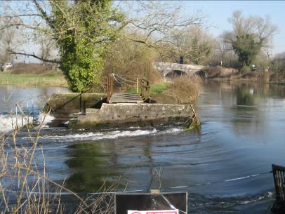
 Northern Side Channel Ornamental Lake Willow Hatches & Eel Stream Hatches Overview")

14 APPENDIX A - WORKED EXAMPLE OF BASELINE CONDITION TABLE Pilot Structure Function Relevant WLMP(s) Relevant SSSI units & condition Willow Hatches Aesthetics River Red and Tributaries WLMP Unit Y River Red System SSSI SSSI Unit Z Unfavourable no change (invasive freshwater species; water abstraction; water pollution) Northern Side Channel Ornamental Lake Willow Hatches & Eel Stream Hatches Overview of Location Eel Stream Site Description Willow hatches consist of a steel structure with a set of six sluice gates, numbered 1-6, from the left to right hand bank. The hatches are in good condition, and were renovated approximately 10 years ago. The hatches control the distribution of flow between the main river and two side channels (the northern channel and the Eel Stream to the south). Willow Hatches can increase upstream water levels by approximately 90cm which prevents the lower reaches of the river owned by the neighbouring Alder Estate from experiencing very low flows. Sections of the river upstream are used for fisheries purposes by Alder Estate. Downstream of the hatches habitat appears to be in good condition with a gravel bed and Ranunculus that has been transplanted from the Eel Stream. Water from the northern side channel is used to feed an ornamental lake and is controlled by the Lake Feed Hatches. The Eel Stream is part of the SSSI unit, and flows parallel with the main channel until it rejoins the River Blue at Alder House. The channel acts as the main route of passage for Salmon, although habitat conditions are unfavourable due to shading from overhanging trees. The channel is relatively natural at its upstream end, but becomes more landscaped at the downstream end. Flow is controlled by Eel Stream Hatches which consist of two bays with wooden boards. Landowner (s) Structure owner/operator A. N. Other River Estate A. N. Other River Estate The River Keeper is currently responsible for operating all of the hatches on a daily basis. He tries to keep the river level within approximately 18 inches of the top of a concrete section of the bank, just upstream of the hatches. This is a level he has identified as appropriate through operation of the hatches over a period of 12 years. Current Operation Control on water levels is mainly achieved by adjusting Willow Hatches, hatches one and six so as to minimise erosion downstream by having two concentrations of flow rather than one higher velocity flow in the centre of the channel. This also helps to hold back water from the village of Ambridge. When the river is in spate, four or five hatches are opened. Opening all of the gates concurrently is avoided as this tends to uproot the planted Ranunculus plants further downstream. Flow into the Eel Stream is controlled by Eel Stream Hatches. The hatches are rarely adjusted and at the time of the site visit one hatch was open 50% and the other approximately 25%. The hatches are sometimes operated in conjunction with Hanging Hatches during high flows, although if too much water is allowed to flow down the Eel Stream then the field at Alder House is susceptible to flooding. 14
15 Lake Feed Hatches consist of three undershot hatches and at the time of the site visit only the right hand hatch was open approximately 50%. The hatches are not actively operated apart from in high flows when they are fully opened allowing the adjacent fields to flood. This happens about once a year. Potential constraints / problems with current operation Potential opportunities / improvements to HOP Changes to hatch operation must avoid making significant changes to the river level upstream of Willow Hatches because sections of the river are used for fisheries purposes by Alder Estate. The Eel Stream is currently managed for salmon fisheries purposes and this should not be adversely affected by changes in operation. Previous consultation with Natural England has indicated that the Eel Stream has good Ranunculus growth and that the channel may also provide good habitat for bullhead and brook lamprey. Optimising flow in the Eel Stream is likely to benefit these species. The non-sssi side channel controlled by Lake Feed Hatches drains into a lake, which is situated downstream of the structures on the north bank of the River Blue. This is in poor condition and does not retain water. Flow into the lake could be put to better use in the Main River and/or the Eel Stream during low flow conditions. Proposed objectives of HOP Allow fish passage all year round. Minimise erosion downstream. Minimise the damage to planted Ranunculus downstream of the hatches by reducing/concentrating flow. Keep sufficient water in the Eel Stream to maintain flow through House B gardens and to allow salmon passage while minimising flooding of the field opposite the house. Give priority to maintaining flow in the Eel Stream rather than feeding the ornamental lake. Implications for operation In low flows supply to the ornamental lake might have to be sacrificed in favour of maintaining flow in the SSSI designated Eel Stream. 15
16 APPENDIX B LESSONS LEARNT RECORD Issue encountered Difficulties identifying all the relevant landowners and other stakeholders. Resolution Extensive consultation with and known stakeholders. Lack of information on fish spawning and migratory habits Contacted FRB team within the who provided further information on nature of fish habits, timing of migrations for both salmonid and cyprinid species. Delays caused by lack of stakeholder engagement Proactive approach to consultation undertaken using face-to-face meetings where possible. Still some problems in obtaining busy landowners. Establishing the function of the structure at Ringwood. Contacted Operations Delivery within the and obtained the original structure design document. This contained information describing the factors taken into consideration in designing the structure. Automatic sluice gate at Ibsley was reportedly not working correctly. Contacted the structure owner, Wessex Water, to enquire about status of the structure. Wessex Water carried out tests on its functionality and informed us of the results. Works to repair the structure were undertaken. HOP is voluntary, but certain aspects are legal requirements e.g. allowing fish passage under the Salmon and freshwater fisheries act. Ensure that mandatory legal requirements are clearly indentified as separate from voluntary aspects of the HOP 16
These potential changes and their implications are outlined in Annex 1.
 Guidance Note Hydropower Guidance Note: This Guidance Note has been prepared by Natural Resources Wales (NRW) to provide applicants for abstraction and impoundment licences for hydropower schemes with
Council CNL (15)43. Maintaining and improving river connectivity: the current position and experience in England
43. Maintaining and improving river connectivity: the current position and experience in England") Agenda item 5.2 For information Council CNL (15)43 Maintaining and improving river connectivity: the current position and experience in England CNL(15)43 Maintaining and improving river connectivity: the
Agenda item 5.2 For information Council CNL (15)43 Maintaining and improving river connectivity: the current position and experience in England CNL(15)43 Maintaining and improving river connectivity: the
Site Improvement Plan. River Kent SAC. Improvement Programme for England's Natura 2000 Sites (IPENS) Planning for the Future
 Planning for the Future") Improvement Programme for England's Natura 2000 Sites (IPENS) Planning for the Future Site Improvement Plan River Kent Site Improvement Plans (SIPs) have been developed for each Natura 2000 site in England
Improvement Programme for England's Natura 2000 Sites (IPENS) Planning for the Future Site Improvement Plan River Kent Site Improvement Plans (SIPs) have been developed for each Natura 2000 site in England
Working together To improve our water environment Glazert Water
 Working together To improve our water environment Glazert Water Potential options for river restoration and natural flood management in the Glazert catchment Draft summary report 1.0 Introduction 1 Report
Why manage ditches? Managing ditches is a win - win situation! Ditches for wildlife - best practice management.
 Why manage ditches? The ditch networks in river valleys have been established over the centuries linked with traditional agricultural practices. Today they contribute to the unique landscape character
CATCHMENT RESTORATION FUND: RIVER REA RESTORATION PROJECT
 CATCHMENT RESTORATION FUND: RIVER REA RESTORATION PROJECT Project Summary The River Rea Restoration Project was a partnership project to improve watercourses in the River Rea Catchment affected by sedimentation,
Improving the physical condition of Scotland s water environment. A supplementary plan for the river basin management plans
 Improving the physical condition of Scotland s water environment A supplementary plan for the river basin management plans Contents Executive summary... 2 1. Introduction... 3 2. Vision... 4 3. Taking
CNL(10)51. NASCO Guidelines for the Protection, Restoration and Enhancement of Atlantic salmon Habitat
51. NASCO Guidelines for the Protection, Restoration and Enhancement of Atlantic salmon Habitat") CNL(10)51 NASCO Guidelines for the Protection, Restoration and Enhancement of Atlantic salmon Habitat 1. Introduction Salmon habitat in freshwater has been greatly affected by various activities, both
CNL(10)51 NASCO Guidelines for the Protection, Restoration and Enhancement of Atlantic salmon Habitat 1. Introduction Salmon habitat in freshwater has been greatly affected by various activities, both
Hydropower Guidance Note: HGN 7 Competing Schemes
 Guidance Note Hydropower Guidance Note: HGN 7 Competing Schemes This guidance is not intended as a statement of law and should be read in combination with and in the context of the relevant enactments
Physical and biological monitoring of STREAM restoration projects Monitoring Protocol
 Physical and biological monitoring of STREAM restoration projects Monitoring Protocol Natural England November 2007 Final Protocol 9S0459 Burns House Harlands Road Haywards Heath, West Sussex RH16 1PG
Welsh Assembly Government Written Response to the Sustainability Committee Report on its Inquiry into Access to Inland Water.
 Welsh Assembly Government Written Response to the Sustainability Committee Report on its Inquiry into Access to Inland Water. August 2010 The Assembly Government s approach to water related recreation
6. AFTER LIFE PLAN. The key outstanding issues are:
 6. AFTER LIFE PLAN This Plan focuses on the Threats addressed by STREAM, related issues and future action required to address them. It outlines the other threats affecting the conservation status of the
River Avon SAC: Demonstrating Strategic Restoration and Management STREAM. LIFE05 UK/Nat/000143
 River Avon SAC: Demonstrating Strategic Restoration and Management STREAM LIFE05 UK/Nat/000143 FINAL REPORT Covering the period 01 August 2005 30 September 2009 REPORTING DATE: 30 September 2009 REPORT
Cranbrook Drain/Counter Drain Flood Risk Management Strategy
 Cranbrook Drain/Counter Drain Flood Risk Management Strategy Flood Risk Management Principles and Specification Environment Agency Submission to Cambridgeshire County Council in Support of Proposals to
Don Catchment Vision
 Don Catchment Vision Don Catchment Vision A healthy and biodiverse catchment that is valued and enjoyed, contributing to the economic and social well-being of local communities. Aims for the Don To identify
Martin Gaywood and Angus Tree Scottish Natural Heritage
 Scottish Could Natural beavers Heritage have a role in river restoration? Martin Gaywood and Angus Tree Scottish Natural Heritage What we re going to talk about Some background The effects beavers can
Oxon Ray Catchment Summary of significant issues affecting the water environment
 Oxon Ray Catchment Summary of significant issues affecting the water environment Introduction This information pack has been produced to support the Challenges and Choices consultation document for the
CHAPTER 3 Environmental Guidelines for WATERCOURSE CROSSINGS GOVERNMENT OF NEWFOUNDLAND AND LABRADOR DEPARTMENT OF ENVIRONMENT AND LABOUR
 GOVERNMENT OF NEWFOUNDLAND AND LABRADOR DEPARTMENT OF ENVIRONMENT AND LABOUR CHAPTER 3 Environmental Guidelines for WATERCOURSE CROSSINGS WATER RESOURCES MANAGEMENT DIVISION Water Investigations Section
Policy Statement Floods and Coastal Defence: Approved by LDC Interim Cabinet March 2001
 1 INTRODUCTION Policy Statement http://www.lewes.gov.uk/floodpol.htm Floods and Coastal Defence: Approved by LDC Interim Cabinet March 2001 1.1 This Policy Statement has been prepared by Lewes District
SECTION 3: Water, Wetlands and Waterways
 SECTION 3: Water, Wetlands and Waterways KEY PRIORITY To ensure protection of water quality and quantity for use by residents, the commercial sector and ecosystems, through integrated consultation, planning,
MEMORANDUM OF UNDERSTANDING THE FLOW OF THE RIVER THROUGH CIRENCESTER
 1. Introduction MEMORANDUM OF UNDERSTANDING THE FLOW OF THE RIVER THROUGH CIRENCESTER 1.1 The control and distribution of fluvial flow through Cirencester is manually controlled by the operation of sluice
Downstream Flow Regimes
 This guideline expands on the criteria statements in the Hydropower Sustainability Assessment Protocol for the topic, relating to Assessment, Management, Stakeholder Engagement, Conformance/ Compliance
Copyright United Utilities Water Limited
 Copyright United Utilities Water Limited 2016 1 Contents 1. Aims... 2 2. Background... 2 3. Tracking supply-demand in West Cumbria... 3 4. Contingency plan... 3 5. River Ehen Special Area of Conservation
Thames Regional Flood and Coastal Committee (RFCC) Flood risk management and environmental benefits in the Thames River Basin, 2015 to 2021
 Flood risk management and environmental benefits in the Thames River Basin, 2015 to 2021") Thames Regional Flood and Coastal Committee (RFCC) Flood risk management and environmental benefits in the Thames River Basin, 2015 to 2021 1. Thames Region Flood Risk Management Programme 1.1 A 2.3 billion
Thames Regional Flood and Coastal Committee (RFCC) Flood risk management and environmental benefits in the Thames River Basin, 2015 to 2021 1. Thames Region Flood Risk Management Programme 1.1 A 2.3 billion
Site Improvement Plan. South Solway Mosses SAC. Improvement Programme for England's Natura 2000 Sites (IPENS) Planning for the Future
 Planning for the Future") Improvement Programme for England's Natura 2000 Sites (IPENS) Planning for the Future Site Improvement Plan South Solway Mosses Site Improvement Plans (SIPs) have been developed for each Natura 2000 site
Improvement Programme for England's Natura 2000 Sites (IPENS) Planning for the Future Site Improvement Plan South Solway Mosses Site Improvement Plans (SIPs) have been developed for each Natura 2000 site
Habitats Regulation Compensation Package
 Itchen Drought Order Habitats Regulation Compensation Package Draft 20 March 2018 This document has been prepared following consultation with the Environment Agency, Natural England and the Hampshire &
Site Improvement Plan. River Axe SAC. Improvement Programme for England's Natura 2000 Sites (IPENS) Planning for the Future
 Planning for the Future") Improvement for England's Natura 2000 Sites (IPENS) Planning for the Future Site Improvement Plan River Axe Site Improvement Plans (SIPs) have been developed for each Natura 2000 site in England as part
Improvement for England's Natura 2000 Sites (IPENS) Planning for the Future Site Improvement Plan River Axe Site Improvement Plans (SIPs) have been developed for each Natura 2000 site in England as part
Policy Development Guidelines. Produced by the Local Government Natural Resource Management Project
 Policy Development Guidelines Produced by the Local Government Natural Resource Management Project March 2008 Table of Contents Table of Contents...ii Policy Development Guidelines...4 Introduction...4
Warwickshire Avon Catchment Partnership
 Warwickshire Avon Catchment Partnership Working in Partnership Gina Rowe Living Landscapes Manager Tim Precious Wetland Project Officer Warwickshire Wildlife Trust Creating a Living Landscape www.warwickshirewildlifetrust.org.uk
Response from the Institute of Fisheries Management to the Government s A Green Future: Our 25 Year Plan to Improve the Environment
 Response from the Institute of Fisheries Management to the Government s A Green Future: Our 25 Year Plan to Improve the Environment SUMMARY The Institute of Fisheries Management welcomes the Government
Cambridgeshire s Culvert Policy. An explanation of our policy regarding applications to culvert ordinary watercourses.
 Cambridgeshire s Culvert Policy An explanation of our policy regarding applications to culvert ordinary watercourses. Document History Document history Details By Current Version Date Initial draft RH
Improving the River Petteril Online Story Map featuring a case study in catchment management
 Improving the River Petteril Online Story Map featuring a case study in catchment management Summary The Improving the River Petteril story map presents a catchment management case study for the River
Goring & Streatley Hydro-Electricity Project: Planning a Community Hydro Scheme
 Goring & Streatley Hydro-Electricity Project: Planning a Community Hydro Scheme South Oxfordshire District Council September 2010 TVR 154 TV Energy, Liberty House, The Enterprise Centre, New Greenham Park,
The Wildlife Trusts Biodiversity Benchmark Requirements
 1 COMMIT 1.1 Policy Your organisation has a biodiversity policy in relation to its landholdings which is: a. a statement of your organisation s commitment to i. compliance with legal requirements relevant
8 Geology, Hydrology & Hydrogeology
 Inverneill Wind Farm Scoping Report Page 42 8 Geology, Hydrology & Hydrogeology 8.1 Introduction The EIA will consider the potential issues arising from the construction, operation and decommissioning
Improving the condition of Solway Tweed s water environment Tweed area management plan
 Improving the condition of Solway Tweed s water environment Tweed area management plan 2010 2015 Supplementary to the river basin management plan for the Solway Tweed river basin district Page 1 of 20
Temporary Watercourse Crossing: Culverts
 Temporary Watercourse Crossing: Culverts DRAINAGE CONTROL TECHNIQUE Low Gradient Velocity Control Short Term Steep Gradient Channel Lining Medium-Long Term Outlet Control Soil Treatment Permanent Symbol
Background for: Upper Piddle Headwaters
 Background for: Upper Piddle Headwaters Environment Agency Information Waterbody Upper Piddle Waterbody ID GB108044010120 Status Poor Failing elements Fish macrophytes (flows) Phytobenthos (nutrients)
Appendix A SMP development
 Appendix A SMP development The Wash SMP2 - Ai - Appendix A SMP Development Contents Page A1 Introduction 1 A2 SMP tasks 2 A2.1 Stage 1: Scope the SMP 2 A2.1.1 Tasks based on SMP guidance 2 A2.1.2 Additional
Invitation to Tender For the Coll Community Development Trust (CCDT) Consultancy Brief. June 2016
 Consultancy Brief. June 2016") Invitation to Tender For the Coll Community Development Trust (CCDT) Consultancy Brief June 2016 BRIEF FOR CONSULTANT TO CARRY OUT A FEASIBILITY STUDY TO DETERMINE THE MOST SUITABLE SITE(S) FOR WIND TURBINES
Invitation to Tender For the Coll Community Development Trust (CCDT) Consultancy Brief June 2016 BRIEF FOR CONSULTANT TO CARRY OUT A FEASIBILITY STUDY TO DETERMINE THE MOST SUITABLE SITE(S) FOR WIND TURBINES
WHITE-CLAWED CRAYFISH SPECIES ACTION PLAN
 LOWLAND DERBYSHIRE LOCAL BIODIVERSITY ACTION PLAN WHITE-CLAWED CRAYFISH SPECIES ACTION PLAN 2007 2010 Picture courtesy of Chesterfield Borough Council Prepared by the Lowland Derbyshire Biodiversity Partnership
Ordinary watercourse maintenance
 Guide to Ordinary watercourse maintenance As a Lead Local Flood Authority, Essex County Council is responsible for overseeing the management of flooding from surface water and local drainage systems such
Site Improvement Plan. Cerne & Sydling Downs SAC. Improvement Programme for England's Natura 2000 Sites (IPENS) Planning for the Future
 Planning for the Future") Improvement Programme for England's Natura 2000 Sites (IPENS) Planning for the Future Site Improvement Plan Cerne & Sydling Downs Site Improvement Plans (SIPs) have been developed for each Natura 2000
Improvement Programme for England's Natura 2000 Sites (IPENS) Planning for the Future Site Improvement Plan Cerne & Sydling Downs Site Improvement Plans (SIPs) have been developed for each Natura 2000
COTTON CREEK CULVERT REPLACMENT
 COTTON CREEK CULVERT REPLACMENT Integrating Mobility with Environmental Innovation Located along a scenic section of Highway 3/95 in British Columbia, Moyie Bluffs, a 6.5 km stretch of inland highway had
River Lod Lurgashall Mill Pond
 River Lod Lurgashall Mill Pond A Project Proposal by the Wild Trout Trust May 2014 1 1. Introduction This report is the output of a Wild Trout Trust visit to the River Lod at Lurgashall Mill Pond in West
Town of Aurora Stream Management Master Plan PUBLIC INFORMATION CENTRE May 1 st, 2018
 Town of Aurora Stream Management Master Plan PUBLIC INFORMATION CENTRE May 1 st, 2018 Your comments are encouraged and appreciated, as this will provide us an opportunity to address project issues and
UK Technical Advisory Group on the Water Framework Directive
 UK Technical Advisory Group on the Water Framework Directive Criteria and Guidance Principles for the designation of heavily modified water bodies This Guidance Paper is a working draft defined by the
Bonsall Creek Watershed Management Plan Gap Analysis
 Bonsall Creek Watershed Management Plan Gap Analysis March 2015 Prepared by Gap Analysis Introduction The Bonsall Creek Watershed Management Plan provides a vision for water use in the watershed, including
WHOLE RIVER RESTORATION PLAN FOR THE RIVER KENNET AND RIVER LAMBOURN SSSI
 WHOLE RIVER RESTORATION PLAN FOR THE RIVER KENNET AND RIVER LAMBOURN SSSI Title here in 8pt Arial (change text colour to black) i We are The Environment Agency. It's our job to look after your environment
The draft criteria for BAP Rivers in the England Biodiversity Strategy that are relevant to Buckinghamshire and Milton Keynes are as follows;
 Rivers and Streams Key associated species Bittern Black Poplar Brook Lamprey Bullhead Depressed River Mussel Daubenton s Bat Flowering Rush Freshwater Pea Mussel Kingfisher Otter Pipistrelle Reed Warbler
Statement of Particulars Western Wales Flood Risk Management Plan
 Statement of Particulars Western Wales Flood Risk Management Plan FINAL 22 September 2015 Date Our purpose is to ensure that the natural resources of Wales are sustainably maintained, used and enhanced,
PLANNING ON SOLID GROUND
 Nile Basin Initiative 1 Background Shared by 11 countries with a combined population of over 400 million, the River Nile exemplifies both the opportunities and challenges of managing a resource that sustains
Working together to deliver a consistent supply of high quality water. Our approach to catchment management
 Working together to deliver a consistent supply of high quality water Our approach to catchment management 1 Our approach to catchment management At South Staffs Water we are committed to providing a consistent
Grovelands Park Wetlands, Enfield
 Grovelands Park Wetlands, Enfield Description This project was undertaken as part of the Salmons Brook Healthy River Challenge, an initiative designed to improve water quality in the Salmons Brook and
Sustainable Catchment Area Management Planning (SCAMP NI)
") CIEEM Conference 24 th November 2014 Sustainable Catchment Area Management Planning (SCAMP NI) a more environmentally sustainable approach to improving water quality Roy Taylor Catchment Manager Presentation
CIEEM Conference 24 th November 2014 Sustainable Catchment Area Management Planning (SCAMP NI) a more environmentally sustainable approach to improving water quality Roy Taylor Catchment Manager Presentation
RETURNING THE TIDE TO HEXHAM SWAMP
 Sixth International River Symposium Brisbane September 2003 RETURNING THE TIDE TO HEXHAM SWAMP Glenn Evans, Chief Executive Officer Hunter Catchment Management Trust 1 RETURNING THE TIDE TO HEXHAM SWAMP
DFO s Fish Habitat Management Program
 DFO s Fish Habitat Management Program Overview Fish and Fish Habitat DFO Policy - Objectives and Goals How Do the Fisheries Act and Navigable Waters Protection Act Affect Cattle Producers Riparian Areas,
Appendix C Draft AONB Management Plan SEA Appraisal Matrix
 Appendix C SEA Appraisal Matrix Key Scoring codes S++ Strongly supports the SEA objective S+ Supports the SEA objective N= Is neutral in effect C- Potentially conflicts with the SEA objective C-- Strongly
Overview of the Walkover Assessments conducted on the Pont and Blyth catchments
 Overview of the Walkover Assessments conducted on the Pont and Blyth catchments Pont upstream of the Matfen Transfer (08/03/12) Pont, as supplied from the Matfen Transfer. Also an impassable barrier to
Preface. MNR # Queen s Printer for Ontario, 2012 ISBN (PRINT) ISBN (PDF)
 ISBN (PDF)") Preface In 2008, the inter-agency Drainage Act & Section 28 Regulations Team (DART) was established by the Ministry of Natural Resources (MNR) and the Ministry of Agriculture, Food and Rural Affairs (OMAFRA)
Preface In 2008, the inter-agency Drainage Act & Section 28 Regulations Team (DART) was established by the Ministry of Natural Resources (MNR) and the Ministry of Agriculture, Food and Rural Affairs (OMAFRA)
Public Notice. Public Notice No. Date: April 8, 2016 CENAP-PL-E Comment Period Closes: May 9, 2016
 Public Notice Public Notice No. Date: April 8, 2016 CENAP-PL-E-16-02 Comment Period Closes: May 9, 2016 USACE Philadelphia District: http://www.nap.usace.army.mil COBBS CREEK FISH PASSAGE PROJECT SECTION
APPENDIX G METHODOLOGY FOR EVALUATING RETROFIT OPTIONS/RETROFIT STUDIES
 APPENDIX G METHODOLOGY FOR EVALUATING RETROFIT OPTIONS/RETROFIT STUDIES G.1 Introduction Retrofitting of existing infrastructure may be required to achieve water balance, water quantity, water quality,
Estuary Habitat Restoration STRATEGY 2012
 Estuary Habitat Restoration STRATEGY 2012 INTRODUCTION The Estuary Restoration Act of 2000 (ERA), as amended, (title I of Pub. L. 106 457) fosters a collaborative and comprehensive process among federal
Honeysuckle Reservoir decommissioning
 Honeysuckle Reservoir decommissioning Christopher Dwyer Earth Tech, PO Box 165 Wangaratta, 3676. Web: www.earthtech.com.au, Email: chris.dwyer@earthtech.com.au Abstract Often significant investment is
PR19 Business Plan. Delivering the Water Industry Strategic Environmental Requirements (WISER)
") PR19 Business Plan Delivering the Water Industry Strategic Environmental Requirements (WISER) 17 August 2018 Contents 1. Introduction... 3 2. Our business plan at a glance: 5 years, 5 pledges... 4 3. Meeting
PR19 Business Plan Delivering the Water Industry Strategic Environmental Requirements (WISER) 17 August 2018 Contents 1. Introduction... 3 2. Our business plan at a glance: 5 years, 5 pledges... 4 3. Meeting
Voluntary Commitment Document
 Voluntary Commitment Document A Voluntary Commitment for the restoration of blanket bog This Agreement is dated 2018 This agreement is between: 1) Natural England of Foss House, 1-2 Peasholme Green, York
Natural flood management guidance:
 Practical Guidence Natural flood management guidance: Woody dams, deflectors and diverters July 2016 Natural flood management guidance: Woody dams, deflectors and diverters July 2016 1 Introduction Large
Case study 11. Low Stanger Floodplain Reconnection Project
 Case study 11. Low Stanger Floodplain Reconnection Project Author: Ian Creighton Main driver: Flood alleviation Project stage: Completed 2015 Photo 1: Downstream breach, Low Stranger Farm (source: West
De-culverting of watercourses
 Policy Position Statement De-culverting of watercourses Purpose This Policy Position Statement sets out the position of the Chartered Institution of Water and Environmental Management (CIWEM) on de-culverting
AVISORY VISIT TO THE GRANTHAM ANGLING ASSOCIATION FISHERY AT BELTON HOUSE, RIVER WITHAM, LINCOLNSHIRE UNDERTAKEN BY VAUGHAN LEWIS, WINDRUSH AEC.
 . AVISORY VISIT TO THE GRANTHAM ANGLING ASSOCIATION FISHERY AT BELTON HOUSE, RIVER WITHAM, LINCOLNSHIRE UNDERTAKEN BY VAUGHAN LEWIS, WINDRUSH AEC. SEPTEMBER 2005 1.0 Introduction This report forms the
3 Baseline and Existing Conditions
 1 2 3 4 5 6 7 8 9 10 11 12 13 14 3 Baseline and Existing Conditions The effective date of the VSP legislation is July 22, 2011. This is also the date chosen by the legislature as the applicable baseline
SITE OF SPECIAL SCIENTIFIC INTEREST: MANAGEMENT STATEMENT PEMBROKESHIRE AFON CLEDDAU GORLLEWINOL / WESTERN CLEDDAU RIVER
 CYNGOR CEFN GWLAD CYMRU COUNTRYSIDE COUNCIL FOR WALES SITE OF SPECIAL SCIENTIFIC INTEREST: MANAGEMENT STATEMENT PEMBROKESHIRE AFON CLEDDAU GORLLEWINOL / WESTERN CLEDDAU RIVER Date of Notification: 24 March
Case study 21. Lustrum Beck Flood Alleviation Scheme: Phase 2
 Case study 21. Lustrum Beck Flood Alleviation Scheme: Phase 2 Authors: Joe Reed, Ted Thomas Main driver: Flood risk management Project stage: Detailed design Photo 1: Flooding event, September 2012 Project
CATEGORY a protection of the natural environment, its ecosystems and biodiversity.
 29. ENVIRONMENTAL DEVELOPMENT PERMIT AREA CATEGORY a protection of the natural environment, its ecosystems and biodiversity. The requirement to obtain an environmental development permit is cited in Section
14. Sustainable Forestry Principals
 14. Sustainable Forestry Principals Fish River Lakes Concept Plan Addendum Materials April 2018 14. SUSTAINABLE FORESTRY PRINCIPLES In response to our discussion with LUPC Staff and others on the topic
Aberdeen Western Peripheral Route (AWPR)
") Lessons Learnt from Biodiversity Offsetting for a Large Infrastructure Project in Scotland Aberdeen Western Peripheral Route (AWPR) Dr Peter Gilchrist CIEEM C Env peter.gilchrist@jacobs.com This presentation
Lessons Learnt from Biodiversity Offsetting for a Large Infrastructure Project in Scotland Aberdeen Western Peripheral Route (AWPR) Dr Peter Gilchrist CIEEM C Env peter.gilchrist@jacobs.com This presentation
Case study 6. Chelmer Valley Local Nature Reserve
 Case study 6. Chelmer Valley Local Nature Reserve Author: Trevor Bond Main driver: Habitat improvement Project stage: Completed spring 2016 Photo 1: River Chelmer, Chelmer Valley Local Nature Reserve (source:
The Nature Conservancy Cosumnes River Preserve Franklin Boulevard Galt CA 95632
 Study Partners The Nature Conservancy Cosumnes River Preserve 13501 Franklin Boulevard Galt CA 95632 East Bay Municipal Utility District 1 Winemaker Way, Unit K Lodi CA 95240 Sacramento County Water Agency
DEVELOPING A GREEN INFRASTRUCTURE POLICY FOR THE AUCKLAND COUNCIL STORMWATER UNIT
 DEVELOPING A GREEN INFRASTRUCTURE POLICY FOR THE AUCKLAND COUNCIL STORMWATER UNIT Ian Mayhew 1, Wolfgang Kanz 2, Claudia Hellberg 2, Nicki Green 3 1 4Sight Consulting; 2 Auckland Council Stormwater Unit;
Site Improvement Plan. River Ehen SAC. Improvement Programme for England's Natura 2000 Sites (IPENS) Planning for the Future
 Planning for the Future") Improvement Programme for England's Natura 2000 Sites (IPENS) Planning for the Future Site Improvement Plan River Ehen Site Improvement Plans (SIPs) have been developed for each Natura 2000 site in England
Improvement Programme for England's Natura 2000 Sites (IPENS) Planning for the Future Site Improvement Plan River Ehen Site Improvement Plans (SIPs) have been developed for each Natura 2000 site in England
GN40: BREEAM, CEEQUAL, HQM Ecology Assessment Issues Reporting Template
 Guidance te GN40 V0.0 August 2018 GN40: BREEAM, CEEQUAL, HQM Ecology Assessment Issues Reporting Template Applicability of this Guidance te (GN) to the BREEAM Family of Schemes (BREEAM, CEEQUAL, HQM) This
Long-term Management Plan For The Mitigation Bank
 Note: The California multi-agency Project Delivery Team developed this general outline to assist in the development of the Long-term Management Plan for mitigation banks. Objectives and tasks are provided
Long-term Management Plan For The Mitigation Bank
 Note: The California multi-agency Project Delivery Team developed this general outline to assist in the development of the Long-term Management Plan for mitigation banks. Objectives and tasks are provided
Delivering project aims. Jenny Mant
 Delivering project aims Jenny Mant How to achieve? Monitoring/appraisal can be done whatever your budget Must be an integral part of your project process, from inception right through to project signoff
Ecology and River Restoration
 Ecology and River Restoration Ecology is the study of the relationships between plants and animals and the environment in which they live. Owen, 1980 Martin Janes Managing Director The River Restoration
South West Water Strategic Environmental Assessment of Water Resources Plan Summary Document
 South West Water Strategic Environmental Assessment of Water Resources Plan 2009 Summary Document Hyder Consulting (UK) Limited 2212959 5th Floor The Pithay All Saints Street Bristol BS1 2NL United Kingdom
CITY OF NAPIER DISTRICT PLAN. The following resource management issues have been identified as significant throughout Napier City:
 Chapter 60 TREES 60.1 RESOURCE MANAGEMENT ISSUES: The following resource management issues have been identified as significant throughout Napier City: 60.1.1 The identification and protection of both individual
Created by Simpo PDF Creator Pro (unregistered version) Asst.Prof.Dr. Jaafar S. Maatooq
 Asst.Prof.Dr. Jaafar S. Maatooq") Lect.No.9 2 nd Semester Barrages, Regulators, Dams 1 of 15 In order to harness the water potential of a river optimally, it is necessary to construct two types of hydraulic structures, as shown in Figure
Lect.No.9 2 nd Semester Barrages, Regulators, Dams 1 of 15 In order to harness the water potential of a river optimally, it is necessary to construct two types of hydraulic structures, as shown in Figure
GB River Esk from source to Baysdale Beck (Esk and Coast) Ecological Status: Moderate. Failing Elements: Fish, ph, Zinc
 Ecological Status: Moderate. Failing Elements: Fish, ph, Zinc") GB104027068090 River Esk from source to Baysdale Beck (Esk and Coast) Ecological Status: Moderate Failing Elements: Fish, ph, Zinc Costings Issues identified Solutions / work required Responsibility/Lead
GB104027068090 River Esk from source to Baysdale Beck (Esk and Coast) Ecological Status: Moderate Failing Elements: Fish, ph, Zinc Costings Issues identified Solutions / work required Responsibility/Lead
1 General questions on zone and catchment management plans
 1 General questions on zone and catchment management plans 1.1 What is a zone plan? The Waikato region is divided into eight zones. There is a separate, non statutory, zone plan for each one. The key purpose
Recreation on YW Land and Waters. Policy Statement
 Recreation on YW Land and Waters Policy Statement Yorkshire Water Land and Waters Policy Statement 2 Document Name: Recreation on YW Land and Waters Controlled Copy No: 01 Revision No Date Description/Amendment
Woady Yaloak Catchment Group
 Woady Yaloak Catchment Group Five year direction plan (2003-2007) February 2003 (Draft Version 1) About the catchment The Woady Yaloak Catchment covers an area of 115,000 ha and is located south west
Application Form for the Transfer/Release of Grass Carp and/or Silver Carp
 Application Form for the Transfer/Release of Grass Carp and/or Silver Carp We recommend that you contact your usual permissions advisor, or the appropriate Department of Conservation Office to discuss
Phase III Watershed Implementation Plans
 Phase III Watershed Implementation Plans Including programmatic outcomes in your planning to provide co-benefits for your community and reduce pollution Rachel Felver Chesapeake Bay Program Director of
Figure 1: The Proportion of Features in Favourable Condition 1 at 31 st March
 The Proportion of Scotland's Protected Sites in Favourable Condition 2018 An Official Statistics Publication for Scotland Scotland has a rich and important diversity of biological and geological natural
Water Framework Directive and EIA: our experience. Jo Murphy, MIEMA CEnv MCIM National Environmental Assessment Service (NEAS) 31 May 2012
 31 May 2012") Water Framework Directive and EIA: our experience Jo Murphy, MIEMA CEnv MCIM National Environmental Assessment Service (NEAS) 31 May 2012 The plan Me: Aims & objectives of the Water Framework Directive
Water Framework Directive and EIA: our experience Jo Murphy, MIEMA CEnv MCIM National Environmental Assessment Service (NEAS) 31 May 2012 The plan Me: Aims & objectives of the Water Framework Directive
TABLE OF CONTENTS 5.0 FOREST MANAGEMENT PLANNING...
 TABLE OF CONTENTS 5.0 FOREST MANAGEMENT PLANNING... 1 5.1 Planning Framework... 1 5.1.1 Sustainable Forest Management Planning... 1 5.1.2 Five-Year Operating Plan... 1 5.1.3 Annual Operating Plans... 3
Levels of evidence for completing investigations and selecting measures
 Levels of evidence for completing investigations and selecting measures Guidance note Issued 23 May 2011 1. Purpose of this guidance note As part of implementing the first river basin management plans,
The Basics: What Communities Need to Know
 Shoreland & Floodplain Variance Guidance Series This document provides an overview of the statewide regulations governing development and land use along lakes and rivers; the roles of local governments
R & E Grant Application 13 Biennium
 R & E Grant Application 13 Biennium Project #: 13-111 Project Information R&E Project $4,715.00 Request: Match Funding: $5,400.00 Total Project: $10,115.00 Start Date: 9/15/2015 End Date: 6/30/2015 Project