Impact of Acid Mine Drainage on Streams in Southeastern Ohio: Importance of Biological Assessments
|
|
|
- Daniela Morris
- 6 years ago
- Views:
Transcription
1 Impact of Acid Mine Drainage on Streams in Southeastern Ohio: Importance of Biological Assessments Abstract Dr. Ben J. Stuart, P.E., Assistant Professor Ohio University Department of Civil Engineering 120 Stocker Center Athens, OH, Phone: (740) Fax: (740) Rajesh Ramachandran Graduate Research Assistant Ohio University Department of Environmental Studies Athens, Ohio, James Grow Aquatic Biologist Division of Surface Water Southeast District Office Ohio Environmental Protection Agency Logan, Ohio, Acid mine drainage (AMD) forms from oxidation of iron disulfide minerals, pyrite and marcasite, when they are exposed to air, water and chemosynthetic bacteria. Oxidation occurs through the mining process, which allows air entry and increases the surface area for reactions. Formation of AMD involves xseveral reactions beginning with oxidation and hydrolysis of pyrite producing soluble hydrous iron sulfates and acidity. Coal has been mined in Ohio since 1804 and AMD has been a major problem. Various chemical studies have been performed on watersheds throughout the Ohio River basin. Recently the need for biological assessments has been stressed due to their reflection on the overall integrity of the watershed in terms of chemical, physical and biological composition.
2 Integrating the study of the biological communities with other aspects has been found to be a more valid approach to ecosystem studies. The goal of the study is to examine stream quality and to assess the impact of AMD on the organisms. This paper evaluates streams in Southeastern Ohio using chemical, physical, and biological assessments. Comprehensive chemical characterization was completed and the Qualitative Habitat Evaluation Index (QHEI) used by the Ohio Environmental Protection Agency (OEPA) was incorporated during site characterization. Fish are selected as the studied organisms due to their high sensitivity to changes in water quality. The fish populations in the stream are evaluated for species diversity, presence of any anomalies, and quantitative changes. These fish evaluations are converted to an Index of Biotic Integrity (IBI) to allow for comparisons between streams. In this paper, comparisons are made between contaminated portions of the streams and sections not impacted by AMD. Introduction Mining has been a significant component of the Appalachian economy for about 200 years (Robert et al, 1995). Both abandoned and active mines may cause considerable damage to streams and rivers stretching over thousands of miles. Most of the problems arise from high acidity, sulfate and various metals such as iron, manganese and aluminum. Contaminated drainage from abandoned mines is considered to be the most significant non point source of pollution. Chemistry of Acid Mine Drainage (AMD) Acid mine drainage is caused by the following series of equations (Sobek et al, 1978): FeS O 2 + H 2 O Fe SO H + (1) FeS Fe H 2 O 15 FeS SO H + (2) In this process more acid is produced when ferric iron oxidizes pyrite. From these reactions ferrous iron is oxidized to ferric in the presence of oxygen as shown in the following equation (Sobek et al, 1978): Fe O 2 + H + Fe H 2 O (3) Some bacteria, which thrive in the mines with minimum oxygen act as a catalyst in generating AMD, resulting in a precipitation reaction (Sobek at al, 1978): Methods Study Areas Fe H 2 O Fe(OH) H + (4)
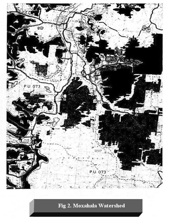
3 Two creeks were selected for the study from different watersheds. These streams were selected mainly due to their extreme conditions, which will show diverse water and habitat quality. The first watershed in the study is the Upper Pine Creek watershed. Pine Creek is a 48 mile long tributary to the Ohio River in Lawrence and Scioto counties. The drainage area is approximately 184 square miles. The Upper Pine Creek hydrologic unit begins slightly upstream from the mouth of Hales Creek at the Poplar Road bridge at river mile The Upper Pine Creek hydrologic unit drains 33.3 square miles of primarily forested land, 60 percent of which is controlled by the United States Forest Service. The stream gradient is low throughout the watershed. The Upper Pine Creek hydrologic unit includes; Kimble Creek, Painter Creek, Saw Mill Run, Negro Creek, Olive Creek, Bukhorn Hollow, Brushy Fork, and Young Branch tributaries. The tributaries that are significantly affected by AMD are Kimble Creek, Upper Pine Creek (from Negro Creek down stream to Young s Branch) and in Negro Creek (Figure 1). Two sites, one upstream and one downstream of Kimble Creek, were assessed for the present study. The upstream site was at river mile 0.8 and down stream site was at river mile 0.6. The Kimble Creek discharge averages 8.6 gpm with maximum flows up to 20 gpm (ODNR, 1998). The second watershed in the study is the Moxahala Creek watershed (Figure 2). The watershed has a 106 square mile basin area located in Perry, Muskingum, and Morgan Counties (Eberhart, 1998). Moxahala Creek flows towards Zanesville, where it enters the Muskingum River, which in turn enters the Ohio River. The Moxahala Creek watershed has numerous tributaries, including; Black Fork, Andrew Creek, McLuney Creek and Bear Creek. Combined, these four streams comprise 50% of the total flow to Moxahala Creek, 89% of the acid load, 78% of the sulfate load, and 92% of the iron load. Two points in Black Fork were chosen for the study. Black Fork was selected because it was the only one of the four tributaries having a net alkalinity and a ph greater than 5.5 prior to discharge into Moxahala Creek. The other tributaries had no locations of substantial flow able to support a fish population, and would therefore not provide a basis for comparison. The upstream location was at river mile 3.4 and the downstream location was at river mile 0.01 (Eberhart, 1998). Qualitative Habitat Evaluation Index (QHEI) The QHEI is based on five general classes of landscape characteristics; land use, riparian zone, substrate cover, and channel morphology (Rankin, 1989). These characteristics are important for describing the overall system and have been shown to correlate with stream fish communities in Ohio (Rankin, 1989). The QHEI was developed as an intermediate index between completely subjective habitat descriptions and the more labor intensive habitat suitability indices, which were developed for individual species (Rankin, 1989). Undisturbed sites are reference locations, scoring high values, where as drastically affected streams receive low scores. When scores of the metric from all five classes are summed, a maximum score of 100 may be obtained. The lowest value a stream could score is 12. For our study, the QHEI data sheet was adapted from the Ohio Environmental Protection Agency. Index Of Biotic Integrity (IBI) The integrity of water resources can best be assessed by evaluating the degree to which water provides beneficial uses (Karr, 1981). A balanced biotic community indicates the
4 sanctity and beneficial use of the water resource. Biological communities reflect watershed conditions since they are sensitive to changes in a wide array of environmental factors. Various organisms were considered as indicators of environmental conditions. Usually, a biological assessment must include an integrative approach in evaluation. However, due to limited funds and time, it is usually confined to a few selected taxa. Taxa other than fish, such as macroinvertebrates or diatoms, have been widely used in monitoring because of the availability of a theoretical substrate that allows an integrated ecological approach (Vannote et al, 1980). Unfortunately, diatom and macroinvertebrate use in assessments is difficult, time consuming and requires expert knowledge for identification. Fish assessments have several advantages, including extensive life information, a wide range of communities representing various trophic levels, ease of identification, general public awareness, stress effects, omnipresence, and the ability to relate data directly to fishable waters (Karr, 1989). The major disadvantages are the manpower and monitoring problems, which are also present in any other taxa. Various criteria are considered when calculating an IBI value. These include diversity indices, species richness, and abundance of species. Each species have different tolerance limits. Presence of intolerant species indicates a healthy the stream. For example, the presence and abundance of green sunfish species or a high number of Johnny darters usually indicates a degraded environment, while the presence of other darter species requires low sedimentation environments. Hybrids may also indicate the presence of degraded conditions. Decline in stream quality may be due to water quality, habitat degradation, or both (Karr, 1989). Karr assumes three major factors in the classification process; fish sample, sample site, and local fish fauna details. Generally an excellent stream will have an IBI value of 57 60, and a completely degraded stream will have values less than 20. Rankin (1989) related the IBI to the QHEI and found significant correlation for streams in the Ohio River Valley. Fish Shocking Method Fish shocking is the principle method used by Ohio EPA to obtain relative abundance and distribution data. Pulsed direct current electrofishing is a widely used method for sampling. Among the different fish shocking methods, the long line generator unit method was utilized. This is mainly due the low pool and riffle depth, which made boat or sportyak methods impossible. The longline generator method uses 100 meters of a heavily insulated 4 wire electrical line. The anode is the net ring, and the cathode is the aluminum plate attached to the net pole. The unit is powered by 12 VDC power source. An on/off safety switch is placed on the pole. The electrofishing unit produces a 200 VDC output. Results and Discussions The chemical, physical, and biological properties of both sites are summarized in Table1. For the upstream locations, it can be seen that similar values are obtained for nearly all indicators. The exceptions were that the conductivity and sulfate values for Black Fork were approximately twice those of Kimble Creek. From the indicators presented, the healthy conditions of the upstream location on Black Fork and Kimble Creek can be seen. Both have an optimum ph above 7. The alkalinity values are with in standard limits. The iron concentrations are only slightly elevated. The conductivity at
5 the upstream location of Black Fork was slightly higher than Kimble Creek, but not unreasonable for natural waters. The elevated sulfate, a conserved AMD indicator, is present in both upstream locations. This suggests probable AMD in the upstream, but not enough to negatively impact other chemical or biological indicators. The QHEI value in Black Fork was slightly higher than Kimble Creek, however, both values indicate a pristine macrohabitat environment. The high IBI values substantiate all of the above parameters, with both streams exhibiting richness in species quantity and quality. The downstream sites of both Kimble and Black Fork were heavily affected by AMD. In Black Fork, the ph decreased by 0.6 units, the alkalinity was one fifth of the upstream value, the conductivity tripled, and the sulfate concentration was six times higher. It is interesting to note that the iron concentration remained unchanged. Kimble Creek demonstrated substantial deterioration in water quality. The impact of the AMD is seen in all water quality indicators, especially in the ph of 2.69 and a net acidity over 700 mg/l. The conductivity was seven times greater, sulfate was more than 20 times higher, and the iron concentration was almost 100 times greater. Table 1. Chemical, Biological, and Physical Data. Alkalinity, iron, and sulfate are reported as mg/l, conductivity as m S/cm. Black Fork Kimble Creek WQI Upstream Downstream Upstream Downstream ph Alkalinity Acidity = 705 Conductivity Iron Sulfate IBI QHEI The downstream values of the Kimble Creek water quality indicators show a considerable deterioration to the stream from the AMD. A very low ph and the high net acidity verifies a heavy inflow of acid into the stream. The sulfate and iron content are quite high and those species are also reflected in the high conductivity. A QHEI value of 36, although slightly lower than the upstream location, suggests a fairly good macrohabitat. This would suggest that the macrohabitat is unaffected by even substantial AMD discharges. However, since the lowest possible value for IBI is 12, Kimble Creek at the downstream location shows a complete impairment of fish species in the stream, clearly indicating the disturbed aquatic environment. The downstream location in Black Fork is a perfect example for stressing the need for biological assessments. The ph and alkalinity of the stream are well inside acceptable limits. The iron is only slightly above the permissible limit. The high sulfate content is the only indicator of an AMD impacted stream. Even the QHEI value demonstrates a near pristine macrohabitat, again stressing the fact that AMD does not significantly impact the
6 macrohabitat. However, an IBI of 28 indicates the presence of few fish and low species diversity, which clearly confirms the poor quality of water (Rankin, 1989). From the chemical and physical data, one can easily assume that Black Fork is not severely impacted by the acid mine drainage, but the biological assessment confirms the presence of water which is not able to sustain aquatic life. Conclusion This paper suggests that chemical data may indicate some AMD impacted streams are biologically viable, however, comparisons of chemical and physical assessments to biological assessments are not always consistent with expected results. The IBI value verifies the biological viability of a stream. A complete remediation strategy for AMD affected streams should not focus solely on chemical indicators, but requires biological and habitat recovery as evaluated by IBI and QHEI. Acknowledgements Ohio Department of Natural Resources provided support for the Black Fork project. We thank the Ohio Environmental Protection Agency for field assessments and data of the Upper Pine Creek watershed. We also appreciate the help rendered by Ohio University students Mathew Smith, Jon Crawford, and Julie Kocsis. References Eberhart, J.R Characterization Of A Highly Acid Watershed Location Mainly In Perry County, Ohio. Masters Thesis, Ohio University, Athens, Ohio Hocutt, C.H Fish As Indicators Of Biological Integrity. Fisheries. 6: Karr, J.R Assessment Of Biotic Integrity Using Fish Communities. Fisheries. 6: Karr, J.R Biological Integrity: A Long Neglected Aspect of Water Resource Management. Ecological Applications. 1: Kleinmann, Robert L.P., Richard A. Allwes, Paul W. Jeran, Perry M. Jones, R.J. Matetic, and Robert Statnick Environmental Issues of the Appalachian Coal Region. Mining Engineering. Dec: Ohio Department of Natural Resources, Division of Mines and Reclamation. February Upper Pine Creek Watershed Acid Mine Drainage Abatement And Treatment Plan. Ohio Environmental Protection Agency Standardized Biological Field Sampling And Laboratory Methods For Assessing Fish And Macro Invertebrate Community. Volume III.
7 Rankin, E.T The Qualitative Habitat Evaluation Index (QHEI): Rationale, Methods, and Application. Ohio Environmental Protection Agency, Ecological Assessment Section, Division of Water Quality and Assessments. Columbus. Ohio. Sobek, Andrew A., W.A. Schuller, J.R. Freeman, and R.M. Smith. March Field and Laboratory Methods Applicable to Overburdens and Minesoils. EPA600/ , PB Stuaffer, Joseph C., and Robert M. Goldstein Comparison of Three Qualitative Habitat Indices And Their Applicability to Prairie Streams. North American Journal of Fisheries Management. 17: Thompson, Kevin G., and Eric P. Bergersen Long Term Effects of Electrofishing on Growth and Body Conditions of Brown Trout and Rainbow Trout. North American Journal of Fisheries Management. 17: Vannote, R. L., G. W. Minshall, K.W. Cimmins, J.R. Sedell, and C.E. Cushing The River Continuum Concept. Canadian Journal of Fisheries and Aquatic Sciences. 37:

8
9

10
Maumee Area of Concern Water Quality Database Development
 Maumee Area of Concern Water Quality Database Development Project Overview Background In 1987 the Maumee Area of Concern (AOC) in northwest Ohio was designated as an Area of Concern based on the identification
Advanced Planning Tools for Optimization of AMD Treatment
 Advanced Planning Tools for Optimization of AMD Treatment Jon Fripp, P.E., Hydraulic Engineer US Army Corps of Engineers, Baltimore District Baltimore, MD James M. Stiles, Ph.D., P.E., Environmental Engineer
2011 NPS Report - Raccoon Creek Watershed
 Kingston Laurelville The Raccoon Creek Partnership is a local partnership working towards conservation, stewardship, and restoration of the watershed for a healthier stream and community. The partnership
The effects of a plug of alkaline water in an acid stressed watershed
 The effects of a plug of alkaline water in an acid stressed watershed Natalie Kruse, Amy Mackey Ohio University, Athens, Ohio, USA, krusen@ohio.edu Extended Abstract Alkaline addition is a common strategy
Dr. William W. Hellier, P.E.
 Abatement of Acid Mine Drainage to Upper Three Runs: by Capping an Acid Producing Reclaimed Surface Mine with Fluidized Bed Combustion Fly Ash Dr. William W. Hellier, P.E. Bureau of Mining and Reclamation
An Evaluation of Antes Creek. Antes Creek has a drainage area of square miles and is a tributary of the
 An Evaluation of Antes Creek Introduction Antes Creek has a drainage area of 55.75 square miles and is a tributary of the West Branch of the Susquehanna near Jersey Shore, PA. The purpose of this study
Black Branch Acid Mine Drainage Remediation. ADEM Nonpoint Source Conference January 15,2015
 Black Branch Acid Mine Drainage Remediation Project ADEM Nonpoint Source Conference January 15,2015 Black Branch Small Watershed Drains approximately 3.3 square Miles Mulberry Fork Watershed Lost Creek
Appendix D3. Aquatic Resources. Tennessee Valley Authority Reservoir Operations Study Final Programmatic EIS
 Tennessee Valley Authority Reservoir Operations Study Final Programmatic EIS This page intentionally left blank. D3.1 Fish Index of Biotic Integrity (Used in Tailwaters)... D3-1 D3.2 Benthic Index of Biotic
November 15 th, 2012 WMAO 2012 Fall Conference 100 Years of Watershed Events. Amy Mackey Raccoon Creek Watershed Coordinator
 November 15 th, 2012 WMAO 2012 Fall Conference 100 Years of Watershed Events Amy Mackey Raccoon Creek Watershed Coordinator Surface Mining Control & Reclamation Act of 1977 (SMCRA) watershed event most
Gumboot Run Biological Assessment McKean County, Pennsylvania
 Gumboot Run Biological Assessment McKean County, Pennsylvania By: Elias J Heferle Water Pollution Biologist II Pennsylvania Department of Environmental Protection Knox District Mining Office January 2005
Amanda Deal & Len Lichvar Somerset Conservation District
 Stonycreek River Watershed Reassessment Amanda Deal & Len Lichvar Somerset Conservation District August 2008 Watershed Characteristics ti 298,920 acres 538 perennial stream miles 519 mi natural stream/river
THE NORTH BRANCH OF THE POTOMAC RIVER: RESULTS OF TWO YEARS OF LIME DOSING
 THE NORTH BRANCH OF THE POTOMAC RIVER: RESULTS OF TWO YEARS OF LIME DOSING INTRODUCTION Joseph E. Mills Maryland Department of the Environment Bureau of Mines 160 S. Water Street Frostburg, Maryland 21532
Report on Biological & Water Quality Monitoring in the East Branch DuPage Watershed: 2014
 Report on Biological & Water Quality Monitoring in the East Branch DuPage Watershed: 2014 DuPage River-Salt Creek Work Group April 26, 2017 Chris O. Yoder Midwest Biodiversity Institute Columbus, OH 2014
Ohio Bioassessments - Applicatio
 Must be conducted if important aquatic ecological resources or sediments are impacted (or chemical of concern has no sediment benchmark value in the benchmark hierarchy) Must demonstrate compliance with
Upper Des Plaines River Feasibility Study
 Upper Des Plaines River Feasibility Study Appendix M Monitoring & Adaptive Management Plan August 2013 Study Partnership Illinois Department of Natural Resources (IDNR) Southeastern Wisconsin Regional
Effects of Precipitation on the Acid Mine Drainage Impacted Hewett Fork Watershed Understanding Storm Response
 Effects of Precipitation on the Acid Mine Drainage Impacted Hewett Fork Watershed Understanding Storm Response Zeb Martin Ohio University Contents Project Overview Objectives of the Research Project Area
Monitoring the River Crane Water Quality and Ecology 2016
 Monitoring the River Crane Water Quality and Ecology 2016 Heathrow Airport uses specialist accredited consultants to monitor water quality and biological indicators in the River Crane, a tributary of the
Susquehanna River Basin Commission Bear Run Watershed Renaissance Mine Drainage Restoration Project
 Susquehanna River Basin Commission Bear Run Watershed Renaissance Mine Drainage Restoration Project Publication 290 December 2013 INTRODUCTION T he Bear Run Watershed drains an area of about 19.3 square
The Development of New Fish Monitoring Methodology and Its Application for National Stream Health Assessments in Korea
 The Development of New Fish Monitoring Methodology and Its Application for National Stream Health Assessments in Korea Kwang-Guk An 1, Jae-Kwan Lee 2, Myeong-Seop Byeon 2, and Soon Cho 3 (Fax:82-42-822-9690;
Qualified Hydrologic Unit Plan Process. Todd Wood, P.E. Bureau of Abandoned Mine Reclamation Wilkes Barre District Office
 Qualified Hydrologic Unit Plan Process Todd Wood, P.E. Bureau of Abandoned Mine Reclamation Wilkes Barre District Office HISTORY 5,543 stream miles impaired by AMD 1990 Amendment to SMCRA Allowed for up
2015 STREAM HEALTH REPORT
 2015 STREAM HEALTH REPORT AN EVALUATION OF WATER QUALITY, BIOLOGY, AND ACID MINE DRAINAGE RECLAMATION IN FIVE WATERSHEDS: RACCOON CREEK, MONDAY CREEK, SUNDAY CREEK, HUFF RUN, AND LEADING CREEK. CREATED
REFERENCES. Cooly, J.L Nonpoint pollution and water quality monitoring. J. Soil Water Cons., March- April:
 REFERENCES Center for Applied Bioassessment and Biocriteria. 2003. Comparison of biological-based and water chemistry-based aquatic life attainment/impairment measures under a tiered aquatic life use system.
Follow this and additional works at:
 University of Massachusetts Amherst ScholarWorks@UMass Amherst Water Resources Research Center Conferences Water Resources Research Center 4-9-2007 Evaluation of Impact of Land Use, Habitat, and Water
TAPPAN LAKE 9/30/2014 RAPID WATERSHED INVENTORY INTRODUCTION
 TAPPAN LAKE 9/30/2014 RAPID WATERSHED INVENTORY Profile Contents Introduction Physical Description Land Use Map Resource Concerns Census and Social Data Progress/Status References INTRODUCTION Tappan Lake
ACID MINE DRAINAGE TREATMENT IN GREENS RUN BY AN ANOXIC LIMESTONE DRAIN
 ACID MINE DRAINAGE TREATMENT IN GREENS RUN BY AN ANOXIC LIMESTONE DRAIN Introduction Troy Titchenell and Jeff Skousen Anker Energy and West Virginia University From its headwaters in Pocahontas, Randolph
Division of Surface Water Response to Comments
 Division of Surface Water Rule: Water Quality Standards Beneficial Use Designation Rules OAC Chapter 3745-1 Agency Contact for this Package Division Contact: Dan Dudley Division of Surface Water 614-644-2876
INFORMATION SHEET. Proposed Total Maximum Daily Load (TMDL) for Bens Creek, located in Portage and Washington Townships, Cambria County, Pennsylvania
 for Bens Creek, located in Portage and Washington Townships, Cambria County, Pennsylvania") INFORMATION SHEET Proposed Total Maximum Daily Load (TMDL) for Bens Creek, located in Portage and Washington Townships, Cambria County, Pennsylvania What is being proposed? A TMDL is a report that documents
INFORMATION SHEET Proposed Total Maximum Daily Load (TMDL) for Bens Creek, located in Portage and Washington Townships, Cambria County, Pennsylvania What is being proposed? A TMDL is a report that documents
Dissolved Oxygen Concentrations and Relationships in Waters of the Loxahatchee River near Riverbend Park
 Dissolved Oxygen Concentrations and Relationships in Waters of the Loxahatchee River near Riverbend Park Introduction Richard C. Dent Loxahatchee River District November, 1995 The Loxahatchee River was
FISH COLLECTION PERMIT SUMMARY REPORT FOR PERMIT NO.: CB
 North/South Consultants Inc. 440, 1121 Centre St. NW Calgary, Alberta T2E 7K6 Tel: (403) 410-4068 Fax: (403) 410-5633 Email: cfazakas@nscons.ca Web: www.nscons.ca FISH COLLECTION PERMIT SUMMARY REPORT
EVALUATION OF THE IMPACT FROM TWO POINT SOURCES OF ACID MINE DRAINAGE UPON FISH AND MACROINVERTEBRATE ASSEMBLAGES IN SUNDAY CREEK, OH
 EVALUATION OF THE IMPACT FROM TWO POINT SOURCES OF ACID MINE DRAINAGE UPON FISH AND MACROINVERTEBRATE ASSEMBLAGES IN SUNDAY CREEK, OH A thesis presented to the faculty of the College of Arts and Sciences
RACCOON CREEK WATERSHED
 RACCOON CREEK WATERSHED The Raccoon Creek Watershed Project is a local partnership working towards conservation, stewardship, and restoration of the watershed for a healthier stream and community. The
What is the purpose of the plan? Why did we choose Raccoon Creek? What pollutants does this TMDL address? Where do the pollutants come from?
 INFORMATION SHEET Proposed Total Maximum Daily Load (TMDL) for Raccoon Creek Watershed, located in Allegheny, Beaver, and Washington Counties, Pennsylvania What is being proposed? A TMDL is a report that
What is the purpose of the plan? Why did we choose Raccoon Creek? What pollutants does this TMDL address? Where do the pollutants come from?
 INFORMATION SHEET Proposed Total Maximum Daily Load (TMDL) for Harmon Creek, located in Hanover, Smith, Mount Pleasant, Robinson, Findlay, Independence, and Raccoon Townships, Allegheny, Beaver, and Washington
Brown s Creek Impaired Biota TMDL Phase II
 PROJECT WORKPLAN TMDL Summary and Cover Sheet Project Name: Brown s Creek Impaired Biota TMDL Phase II Project and Budget Period: Project Sponsor: November 1, 2007 August 31, 2009 Project Representatives:
Stream Restoration in Appalachia
 Stream Restoration in Appalachia Kevin Springob Background The extraction of coal and precious metals has greatly benefited the development of the United States for over one hundred years. Several states
Low Maintenance Passive Treatment Systems for Mining Site Contaminants. Robert C. Thomas, Ph.D
 Low Maintenance Passive Treatment Systems for Mining Site Contaminants Robert C. Thomas, Ph.D Acid rock drainage (ARD) forms when sulfide minerals are exposed to oxygen and water during large-scale land
Implementation Guidelines for the AMD Set-Aside Program in Pennsylvania. By Pam Milavec and Eric Cavazza Bureau of Abandoned Mine Reclamation
 Implementation Guidelines for the AMD Set-Aside Program in Pennsylvania By Pam Milavec and Eric Cavazza Bureau of Abandoned Mine Reclamation July 15, 2009 The Surface Mining Control and Reclamation Act
Introduction. Methods
 Introduction Brush Creek is located in the south central part of the Roaring Fork Watershed. It is between the drainages of Maroon Creek and Snowmass Creek and is the major creek flowing below the Snowmass
Jennifer S. Simmons, National Mine Land Reclamation Center, West Virginia University, Morgantown, WV.
 Acid Mine Drainage Neutralization at Augusta Lake, Indiana Mike Kalagian, Office of Surface Mining, Indianapolis, IN Jennifer S. Simmons, National Mine Land Reclamation Center, West Virginia University,
CHAPTER I. PURPOSE The purpose of the acid mine drainage study of the Redstone Creek Watershed and portions of the Uniontown Syncline was to:
 CHAPTER I INTRODUCTION AUTHORITY The Pennsylvania Department of Environmental Resources, in response to the Commonwealth of Pennsylvania Legislative Act 443, "Land and Water Conservation and Reclamation
The recovery of an AMDimpacted stream treated by steel slag leach beds: a case study in the East Branch of Raccoon Creek
 The recovery of an AMDimpacted stream treated by steel slag leach beds: a case study in the East Branch of Raccoon Creek NAAMLP Conference, Columbus, OH September 21-24, 214 Caleb Hawkins Master of Science
Use of Flue Gas Desulfurization By-Product for Mine Sealing and Abatement of Acid Mine Drainage
 Use of Flue Gas Desulfurization By-Product for Mine Sealing and Abatement of Acid Mine Drainage Ben J. Stuart 1, Gary Novak 2, Harry Payne 3, and Carl S. Togni 4 1 Ohio University, Department of Civil
SOUTH BRANCH SUBWATERSHED
 SOUTH BRANCH SOUTH BRANCH SUBWATERSHED The South Branch Subwatershed includes the South Branch drainage area plus all the drainage area along the main stream to the south from the mouth of Surrena Run
REPORT ON RABBIT CREEK SPECIAL STUDY SUBWATERSHED 5.19
 REPORT ON RABBIT CREEK SPECIAL STUDY SUBWATERSHED 5.19 Sabine River Authority of Texas August 31, 23 Prepared in Cooperation with the Texas Commission on Environmental Quality Under the Authorization of
CONCLUSIONS AND RECOMMENDATIONS
 CONCLUSIONS AND RECOMMENDATIONS The Little Schuylkill River is polluted by acid mine drainage from twenty-four primary sources; fourteen deep mine workings, nine refuse storage bank seeps and the effluent
TOTAL MAXIMUM DAILY LOAD (TMDL)
") TOTAL MAXIMUM DAILY LOAD (TMDL) For ph In Crab Orchard Creek Located In The Cumberland & Morgan County, Tennessee Prepared by: Tennessee Department of Environment and Conservation Division of Water Pollution
TOTAL MAXIMUM DAILY LOAD (TMDL) For ph In Crab Orchard Creek Located In The Cumberland & Morgan County, Tennessee Prepared by: Tennessee Department of Environment and Conservation Division of Water Pollution
3.4 AQUATIC ECOSYSTEMS AND FISH SPECIES
 3.4 AQUATIC ECOSYSTEMS AND FISH SPECIES The following section supplements the analysis found in Chapter Three, Section 3.4 - Aquatic Ecosystems and Fish Species of the Draft EIS on page 3.59, Impacts Related
MURPHY DRAIN CATCHMENT
 The RVCA produces individual reports for 16 catchments in the Lower Rideau subwatershed. Using data collected and analysed by the RVCA through its watershed monitoring and land cover classification programs,
Conceptual model Source: Knight, 1994
 Link Ecohydrology Conceptual model Source: Knight, 1994 Rainfall pathways Source: Federal Stream Corridor Restoration Handbook, Natural Resources Conservation Service Fades of water Source: http://wapi.isu.edu/envgeo/eg7_water/eg_module_7pt1.htm
INFORMATION SHEET. What is being proposed? A TMDL plan to improve the quality of water in the Redbank Creek Watershed.
 INFORMATION SHEET Proposed Total Maximum Daily Load (TMDL) for the Redbank Creek Watershed in Armstrong, Clarion, Clearfield, and Jefferson Counties Pennsylvania What is being proposed? A TMDL plan to
Water Quality in the Rat River St.Malo Watershed:
 Water Quality in the Rat River St.Malo Watershed: Current conditions, historical trends, and potential actions. September 8 th, 2010 Jennifer Stephens Water Quality Management Section Manitoba Water Stewardship
Effects of the 1988 Wildfires on Stream Systems of Yellowstone National Park
 University of Wyoming National Park Service Research Center Annual Report Volume 16 16th Annual Report, 1992 Article 32 111992 Effects of the 1988 Wildfires on Stream Systems of Yellowstone National Park
Buffers improve water quality
 Buffers improve water quality Recently, the MPCA had a request asking if we could see a difference in water quality in streams from sites where there are buffers compared to sites without buffers. We looked
Lake Fork of the Gunnison Watershed: Status and Stewardship. Camille Richard, Project Director
 Lake Fork of the Gunnison Watershed: Status and Stewardship Camille Richard, Project Director Upper Gunnison Basin Lake Fork Watershed 7,500 14,309 ft Sagebrush to alpine 432 square miles Population 900
EXECUTIVE SUMMARY. Consultative Committee Report Jordan River Water Use Plan
 EXECUTIVE SUMMARY The consultative process was initiated in April 2000 and completed in November 2001. The consultative process follows the steps outlined in the 1996 provincial government Water Use Plan
Hydroecological tool: enhancements and results. enhancements and results. Marci Meixler. Project partners: Sponsored by:
 Hydroecological tool: Marci Meixler Sponsored by: Project partners: Motivation Great Lakes Charter Annex establish uniform, regional protections for Great Lakes waters ensure that authority over the Lake
July Cleaning Up Abandoned Mine Drainage. in the West Branch Susquehanna Watershed
 S u m m a r y July 2009 Cleaning Up Abandoned Mine Drainage in the West Branch Susquehanna Watershed Why It Makes Economic Sense The Area The West Branch Susquehanna River watershed drains a 6,978 squaremile
Carbon Dioxide Pretreatment of AMD for Limestone Diversion Wells
 Carbon Dioxide Pretreatment of AMD for Limestone Diversion Wells ABSTRACT Barnaby J. Watten NBS Research and Development Laboratory Wellsboro, Pennsylvania Michael F. Schwartz Freshwater Institute Sheperdstown,
Tangascootack Creek Watershed TMDL
 Tangascootack Creek Watershed TMDL For Acid Mine Drainage Affected Segments Prepared by Pennsylvania Department of Environmental Protection February 23, 2001 1 Table of Contents Introduction...4 Directions
Iron Investigators. Adapted from: #435 Reading River Sediments, A Simulated Mining Activity for Molybdenum. Lab- Aids, Inc
 Iron Investigators Detecting Pollution Adapted from: #435 Reading River Sediments, A Simulated Mining Activity for Molybdenum. Lab- Aids, Inc. 1996. Grade Level: Intermediate and Advanced Duration: 40
2007 Cuyahoga River Biological, Water Quality and Habitat Survey Results
 2007 Cuyahoga River Biological, Water Quality and Habitat Survey Results Introduction During 2007, the Northeast Ohio Regional Sewer District 1 (NEORSD) conducted electrofishing, benthic macroinvertebrate
Otter Creek Watershed TMDL Project. Stakeholder Meeting June 6, 2013
 Otter Creek Watershed TMDL Project Stakeholder Meeting June 6, 2013 1 Meeting Purpose Meet with watershed & technical advisory group members and watershed landowners to provide basic Otter Creek TMDL project
Reassessment of Acid Mine Drainage Pollution in the Twomile Run Watershed, August December 2010 Kettle Creek Watershed, Clinton County
 Reassessment of Acid Mine Drainage Pollution in the Twomile Run Watershed, August December 21 Kettle Creek Watershed, Clinton County Technical Report Provided by Hedin Environmental through the Trout Unlimited
ACID MINE DRAINAGE TREATMENT VIA ALKALINE INJECTION TECHNOLOGY 1
 ACID MINE DRAINAGE TREATMENT VIA ALKALINE INJECTION TECHNOLOGY 1 G.A. Canty and J.W. Everett 2 Abstract. The Oklahoma Conservation Commission conducted a demonstration project to investigate the feasibility
Assessing Morphological Performance of Stream Restoration in North Carolina
 Assessing Morphological Performance of Stream Restoration in North Carolina Barbara Doll, PE, Ph.D., Extension Specialist NC Sea Grant and Biological and Agricultural Engineering Department, NC State University
IMPLEMENTATION PLAN FOR JOHNSON CREEK
 IMPLEMENTATION PLAN FOR JOHNSON CREEK TIOGA COUNTY, PENNSYLVANIA Prepared for: The Arnot Sportsmen Association, Inc. P.O. Box 142 Arnot, PA 16911 Prepared by: Alder Run Engineering, LLC Civil & Environmental
Services and Technologies
 Services and Technologies BioRemedial Technologies, Incorporated Hermitage, Pennsylvania 724-981-1994 www.bioremedial.com BioRemedial Technologies, Inc. Biological Solutions for Environmental Problems
TMDL MODEL DEVELOPMENT FOR ACIDIC MINE DRAINAGE
 TMDL MODEL DEVELOPMENT FOR ACIDIC MINE DRAINAGE James M. Stiles West Virginia Water Resources Institute West Virginia University The quality of Paint Creek and its tributaries in West Virginia are being
Impact of an Agricultural Point Source on Macroinvertebrate Communities and Water Quality on the Lamoille River
 Impact of an Agricultural Point Source on Macroinvertebrate Communities and Water Quality on the Lamoille River Fundamentals of Ecology 12/2/05 Introduction The purpose of this study was to determine if
Nutrients. Water Quality Planning Branch Water Division Arkansas Department of Environmental Quality
 Nutrients Water Quality Planning Branch Water Division Arkansas Department of Environmental Quality Water Quality & Biological Data Water Quality Standards & Criteria Assessment Permit Limitations Impairment
How does sediment affect fish and macroinvertebrates?
 How does sediment affect fish and macroinvertebrates? How does sediment affect fish and macroinvertebrates? Suspended sediment (TSS): breathing, vision Sediment on streambed: egg development living space
1998 Volume I Addendum: Stream Segment Summaries (95-96)
") 1998 Volume I Addendum: Stream Segment Summaries (95-96) 1998 Division of Surface Water Monitoring & Assessment Section Edward T. Rankin Chris O. Yoder Dennis Mishne State of Ohio Environmental Protection
1998 Volume I Addendum: Stream Segment Summaries (95-96) 1998 Division of Surface Water Monitoring & Assessment Section Edward T. Rankin Chris O. Yoder Dennis Mishne State of Ohio Environmental Protection
Summary of Preliminary Results of EPA Remedial Investigation Molycorp molybdenum mine Questa, New Mexico
 Summary of Preliminary Results of EPA Remedial Investigation Molycorp molybdenum mine Questa, New Mexico Prepared by Steve Blodgett, Technical Advisor Rio Colorado Reclamation Committee Introduction On
2012 Nutrient Regulations Update
 2012 Nutrient Regulations Update OWEA Government Affairs Workshop March 1, 2012 Guy Jamesson, PE, BCEE Malcolm Pirnie, The Water Division of ARCADIS Imagine the result Agenda Nutrient impacts Nutrient
ATTENUATION OF METAL CONCENTRATIONS IN TERRACE RESERVOIR, CONEJOS COUNTY, COLORADO, MAY 1994 THROUGH MAY 1995
 ATTENUATION OF METAL CONCENTRATIONS IN TERRACE RESERVOIR, CONEJOS COUNTY, COLORADO, MAY 1994 THROUGH MAY 1995 By Robert W. Stogner, Sr. U.S. Geological Survey, WRD 201 W. 8th Street, Suite 200 Pueblo,
Tioga County Conservation District Watershed Program
 Tioga County Conservation District Watershed Program What is a watershed? A watershed is the land area that drains into a stream, river, or body of water. In Tioga County, there are seven major watersheds,
Re mining and FGD Seal Placement for AMD Abatement at Broken Aro Mine
 Ohio on State Route 541 at the Woodbury Wildlife Preserve Re mining and FGD Seal Placement for AMD Abatement at Broken Aro Mine Dr. Ben J. Stuart, P.E. Dr. Kenneth B. Edwards, P.E. Michael T. Rudisell
Influence of Land Use, and its Change, on Streams and Rivers
 Influence of Land Use, and its Change, on Streams and Rivers Ways in which land use alteration modifies streams. (from JD Allan 2004, Annu. Rev. Ecol., Evol. and Syst.) Dominant types of land use change:
SECTION 4 BIOLOGICAL ASSESSMENT
 SECTION 4 BIOLOGICAL ASSESSMENT 4.1 Introduction The Nature Conservancy Arkansas Field Office (TNC-ARFO) personnel performed a biological assessment of the Cache River and its major tributaries in conjunction
ASSESSMENT OF MACROINVERTEBRATE COMMUNITIES IN AN ACID MINE DRAINAGE IMPACTED STREAM IN THE GEORGE S CREEK WATERSHED, ALLEGANY COUNTY, MARYLAND
 ASSESSMENT OF MACROINVERTEBRATE COMMUNITIES IN AN ACID MINE DRAINAGE IMPACTED STREAM IN THE GEORGE S CREEK WATERSHED, ALLEGANY COUNTY, MARYLAND JULY 23, 2014 ABSTRACT Macroinvertebrates are a diverse group
Innovative Method to Reduce Land Area and Cost in the Treatment of Acid mine Drainage by
 Presented at the 2001 National Association of Abandoned Mine Lands Conference, August 19-22, 2001, Athens, Ohio Innovative Method to Reduce Land Area and Cost in the Treatment of Acid mine Drainage by
Tenmile Creek Sampling Summary
 Tenmile Creek Sampling Summary December 15, 2015 Background In 2014, DEP s California District Mining Office collected surface water samples from three locations on Tenmile Creek (TMC) in the vicinity
Clockhouse Lane Pit Lakes - Water Quality and Ecology Overview 2015
 Clockhouse Lane Pit Lakes - Water Quality and Ecology Overview 2015 Heathrow Airport uses specialist consultants to monitor the Clockhouse Lane Pit system of interconnected lakes for water quality and
Effectiveness Monitoring
 Effectiveness Monitoring to Achieve Watershed Goals Ohio s Commitment to Watersheds 40 Endorsed Plans 58 TMDLs 26 Approved $800K/year in Grants $6.1 million total Russ Gibson, NPS Program Manager Ohio
II. STUDY RESULTS. In our opinion the following results may be presented based on the data contained in this report.
 II. STUDY RESULTS In our opinion the following results may be presented based on the data contained in this report. STREAM QUALITY General: Seventy-one (71) stream reading stations were established on
INFORMATION SHEET. Proposed Total Maximum Daily Load (TMDL) for the Daguscahonda Run Watershed, located in Elk County, Pennsylvania
 for the Daguscahonda Run Watershed, located in Elk County, Pennsylvania") INFORMATION SHEET Proposed Total Maximum Daily Load (TMDL) for the Daguscahonda Run Watershed, located in Elk County, Pennsylvania What is being proposed? A TMDL is a report that documents the pollution
INFORMATION SHEET Proposed Total Maximum Daily Load (TMDL) for the Daguscahonda Run Watershed, located in Elk County, Pennsylvania What is being proposed? A TMDL is a report that documents the pollution
Recovery of Deckers Creek from Acid Mine Drainage. Martin Christ Water Remediation Director Friends of Deckers Creek
 Recovery of Deckers Creek from Acid Mine Drainage Martin Christ Water Remediation Director Friends of Deckers Creek Table of Contents Location of the Deckers Creek watershed Geological setting Mining Flood
The Status of Rainbow Trout (Oncorhynchus mykiss) in the Stanislaus River Summary report of 2015 snorkel surveys
 in the Stanislaus River Summary report of 2015 snorkel surveys") The Status of Rainbow Trout (Oncorhynchus mykiss) in the Stanislaus River Summary report of 2015 snorkel surveys Prepared By: Matt Peterson Jason Guignard Andrea Fuller Doug Demko FISHBIO 1617 S. Yosemite
The Status of Rainbow Trout (Oncorhynchus mykiss) in the Stanislaus River Summary report of 2015 snorkel surveys Prepared By: Matt Peterson Jason Guignard Andrea Fuller Doug Demko FISHBIO 1617 S. Yosemite
Stream Restoration Proposal 2014, Plum Run Tributary West Branch
 West Chester University Digital Commons @ West Chester University Biology Student Work Biology 2014 Stream Restoration Proposal 2014, Plum Run Tributary West Branch Jesse McLaughlin West Chester University
DRAFT Introduction:
 Introduction: Bay Area Macroinvertebrate Bioassessment Information Network San Francisco Bay Area Creeks Benthic Index of Biotic Integrity (IBI) Draft IBI Workplan v.4 The following describes a series
ROLE OF ACCELERATED OXIDATION FOR REMOVAL OF METALS FROM MINE DRAINAGE 1
 ROLE OF ACCELERATED OXIDATION FOR REMOVAL OF METALS FROM MINE DRAINAGE 1 Don Budeit 2 Abstract. The kinetics of iron oxidation can dictate the effectiveness of both passive and active mine drainage treatment
Western Strait Drainages. Watershed Summaries DRAINAGES EST WRIA 19 EST
 Page 31 WESTERN STRAIT DRAINAGES EST WRIA 19 WEST EST Snow, Bullman, Jansen & Olsen Creeks Sekiu River Hoko & Little Hoko Rivers Clallam River & Estuary Pysht River & Estuary Green Creek Jim & Joe Creeks
INFORMATION SHEET. Proposed Total Maximum Daily Load (TMDL) for Stump Creek, Jefferson and Clearfield Counties, Pennsylvania
 for Stump Creek, Jefferson and Clearfield Counties, Pennsylvania") INFORMATION SHEET Proposed Total Maximum Daily Load (TMDL) for Stump Creek, Jefferson and Clearfield Counties, Pennsylvania What is being proposed? A TMDL plan to improve the quality of water in Stump
INFORMATION SHEET Proposed Total Maximum Daily Load (TMDL) for Stump Creek, Jefferson and Clearfield Counties, Pennsylvania What is being proposed? A TMDL plan to improve the quality of water in Stump
Ecological/Watershed Modeling. Cindy Ryals Taylor Carroll
 Ecological/Watershed Modeling Cindy Ryals Taylor Carroll Defining Models Defining the problem the question Conceptual Model a set of ideas Verbal Model translate into words Mathematical Model translate
Support legislation that will protect the quantity of water in Lake Erie
 Specific Regional Priorities Each of Pennsylvania s major drainage basins has an array of individual characteristics that distinguish it from other regions of the state. These include diverse geographic
Eric McCleary. ACES and Ecosytem Markets Conference Ft. Lauderdale, Florida December 10-14, 2012
 Eric McCleary ACES and Ecosytem Markets Conference Ft. Lauderdale, Florida December 10-14, 2012 A Pilot Environmental Restoration Initiative to Treat Acid Mine Drainage Mitigation Banking Approach NO PUBLIC
Selected Abandoned Mined Land Reclamation Projects and Passive Treatment in Ohio
 Selected Abandoned Mined Land Reclamation Projects and Passive Treatment in Ohio By Mitchell E. Farley 1 and Paul Ziemkiewicz 2 1 Environmental Scientist, ODNR Div. of Mineral Resources Management, 34
Historical Water Quality Data Analysis, Pearson Creek, Springfield, Missouri
 The Ozarks Environmental and Water Resources Institute (OEWRI) Missouri State University (MSU) Historical Water Quality Data Analysis, Pearson Creek, Springfield, Missouri Prepared by: Marc R. Owen, M.S.,
Impaired Watersheds and Stream Designations in Adams County
 Impaired Watersheds and Stream Designations in Adams County Rod Kime PA Department of Environmental Protection Water Quality Standards What are Water Quality Standards? Protected water uses Ex: Aquatic
2012 Mill Creek Watershed Habitat Assessment Level 3 Project Study Plan Results
 2012 Mill Creek Watershed Habitat Assessment Level 3 Project Study Plan Results Cranberry Run This project study plan was financed through a Sub-grant from the Ohio EPA with funds from the State of Ohio.