Exe Estuary Management Plan Protecting our Estuary for future generations
|
|
|
- Edwina Sylvia Cunningham
- 6 years ago
- Views:
Transcription


1 Exe Estuary Management Plan Protecting our Estuary for future generations


2 Preface This Management Plan has been prepared by the Exe Estuary Management Partnership. The Partnership acknowledges the helpful contributions made by all of those who use and value the Exe Estuary. This Plan updates the Exe Estuary Interim Management Plan and will cover the period until The Exe Estuary Management Plan is supported by the State of the Exe The State of the Exe 2014 was reviewed and updated from the 2006 edition through the Living with a Changing Coast (LiCCo) project and describes the changing pressures, natural processes, varied uses and quality of the Estuary, and how these aspects interact with each other. It is being used to identify the management measures set out in this Management Plan. The Exe Estuary Management Plan forms the second part of the review process. It outlines policies, issues and five year objectives to ensure sustainable use of the Exe Estuary for the future. Integration with spatial planning and informed management activity will strengthen our commitment to this valuable area for the future. Acknowledgments The Exe Estuary Management Partnership would like to thank all of the people who have contributed to this report: the local people who use the Estuary and have offered their time, opinions and experience; the professional officers who monitor, manage and protect the Estuary and have offered their advice and views for the future; the organisations that manage water bodies on a national scale; Plymouth Marine Laboratory for their guidance and support in incorporating elements of Ecosystem Services into the Management Plan; and the Partnership itself who contribute daily to its successful functioning, both professionally and financially. The Management Plan review was facilitated and funded by the Exe Estuary Management Partnership. Exe Estuary Management Partnership EXMOUTH TOWN COUNCIL DAWLISH TOWN COUNCIL 1 Exe Estuary Management Plan
3 Exe Estuary Management Plan Protecting our Estuary for future generations Table of Contents Background to the Exe Estuary The Exe Estuary and Management Plan Management of the Partnership and Organisation Climate Change Natural and Historic Environment Wildlife, Habitats and Designations Landscape History and Archaeology Use of the Exe Estuary Farming and Farmed Landscape Fisheries Water Based Recreation Tourism Public Transport, Access and Land Based Recreation Navigation, Commercial and Other Uses Environmental Quality Water Quality Waste Management and Recycling Promoting Understanding of the Exe Estuary Education & Interpretation Protecting the Exe Estuary Pollution Contingency Planning Flood and Coastal Risk Management Spatial Planning and Development Management Exe Estuary Management Plan

4 Foreword from the Partnership Chair I am very pleased to present this latest revision of the Exe Estuary Management Plan. As Devon County Councillor, I have represented the people in my constituency on the eastern banks of the great River Exe between Exmouth Station and the River Clyst Bridge for many years. It was an immense pleasure to go on to serve the people around the entire Exe as Chairman of the Exe Estuary Management Partnership Committee for 14 of these years. This important publication reflects the contribution made over many years by professional officers, elected local government councillors, and many more local people with specialist interests in all aspects of our magnificent Exe Estuary. It is in many ways just the latest statement of Work in Progress and continues to evolve in order to maintain the special qualities of the Estuary. The depth of knowledge of successive Exe Estuary Officers and senior Devon County Officers is incredible. Add to this the professional officers and elected members of the districts, towns, city and Parish Councils and where would we be without the input of the RSPB, Environment Agency, Natural England, Devon and Severn Inshore Fisheries and Conservation Authority, Devon Wildlife Trust, Lympstone Fisheries and Harbour Association, the RYA and the Powderham Estate. Just as significant are the many hundreds of local people who love and care for this Estuary and work together in protecting this special place for the future. One notable achievement since the last Plan has been the completion of the Exe Estuary Trail, which was started in my Local Government patch. This trail provides tremendous opportunities for people of all ages and abilities to access and enjoy the Estuary. Devon County Council has been an avid supporter of the Exe Estuary Management Partnership during the 20-plus years of its existence. The County Council continues to take the lead role in facilitating the Partnership and hosts the Exe Estuary Officer. Local Government has had to grapple with the loss of Central Government finance and we are very grateful to all the Partners who have supported this Partnership through some difficult times. My plea is to keep faith and do all that you can to keep this very valuable Partnership viable and effective. In conclusion, as I step down from Local Government I would like to thank everyone for their contribution to our success, which is the Exe Estuary. May it continue to be loved, preserved, and maintained for posterity. CC Bernard C J Hughes OBE 3 Exe Estuary Management Plan
5 List of Abbreviations AONB Area of Outstanding Natural Beauty MCA Maritime and Coastguard Agency CaBA Catchment Based Approach MMO Marine Management Organisation CEFAS CIL CO2 D&SIFCA DCC Defra DLPG DWT EA EC ECC EDDC EEMP EEO EU F&CERMS FWAG GDP GLA HMO HRA LiCCo LNR LPA Centre for Environment, Fisheries and Aquaculture Science Community Infrastructure Levy Carbon Dioxide Devon and Severn Inshore Fisheries and Conservation Authority Devon County Council Department for Environment, Food and Rural Affairs Devon Landscape Policy Group Devon Wildlife Trust Environment Agency European Commission Exeter City Council East Devon District Council Exe Estuary Management Partnership Exe Estuary Officer European Union Flood and Coastal Erosion Risk Management Strategy Farming and Wildlife Advisory Group Gross Domestic Product General Lighthouse Authority Habitat Mitigation Officers Habitats Regulations Assessment Living with a Changing Coast Local Nature Reserve Local Planning Authority MSFD NE NEP NLO NNR NVZ OS PML PUG RBMP RSPB RYA SAC SANG SEDHRP SMP SPA SRC SSSI SWW TH UST WCO WFD WRT Marine Strategy Framework Directive Natural England National Environmental Programme Net Limitation Order National Nature Reserve Nitrate Vulnerable Zone Ordnance Survey Plymouth Marine Laboratory Port User Group River Basin Management Plan Royal Society for the Protection of Birds Royal Yachting Association Special Area of Conservation Sustainable Alternative Natural Greenspace South East Devon Habitat Regulations Partnership Shoreline Management Plan Special Protection Area Shoreline Response Centre Site of Special Scientific Interest South West Water Trinity House Upstream Thinking Western Channel Observatory Water Framework Directive Westcountry Rivers Trust Source of the information presented in the images Unless otherwise specified, all images used in this report are the property of the Exe Estuary Management Partnership. Exe Estuary Management Plan

6 Background to the Exe Estuary 1. Background to the Exe Estuary 1.1 The Exe Estuary and Management Plan Aerial view of the Exe Estuary Area of Study The Exe Estuary Management Plan study area is the area bounded by the 5m contour line around the Estuary (see Figure 1). The main focus of the management work is, therefore, on the sub-tidal, inter-tidal, shore and nearby areas of the River Exe between Exeter and Exmouth/Dawlish. Consideration is given to the management of the wider catchment area where necessary. 5 Exe Estuary Management Plan

7 Background to the Exe Estuary Exe Estuary Management Plan

8 Background to the Exe Estuary Exe at Topsham, Source: D. Burch The Exe Estuary The Exe Estuary covers 3,000 hectares of diverse aquatic and terrestrial habitat, which support an abundant range of flora and fauna. It is internationally designated as an Estuary of great importance for nature conservation. Protected from the open sea by the sand spits of Dawlish Warren and Pole Sands, the Estuary lends itself beautifully to a feeding and breeding retreat for birds. This also makes it a perfect open space for a wide range of recreational activities, shellfish cultivation and tourism. Access to the Estuary is excellent with rail and road connections along both sides and the Exe Estuary Trail multi-use route for cyclists and walkers circling the Estuary. The Exe Estuary contains many varied sites of archaeological and historical importance and has been used by people throughout time. Estuaries can act as barriers, boundaries, places of entry and exit, communication routes and as a source of mineral and food resources. The Exe Estuary landscape we know today has been shaped by both natural and human influences over time, and this will continue. This range of competing interests of users of the Exe can often lead to conflict between different user groups and between the best interests of wildlife and human use. While the Partnership must consider the impact that people have on the Estuary it must also investigate and understand the value of the goods and services that the Estuary provides to society and how human use may affect these assets. There are many fundamental benefits, or services, that marine ecosystems, such as estuaries, provide for human society including the provision of food, raw materials and opportunities for recreation. Estuaries also have a role in maintaining our climate, transforming waste products and preventing coastal erosion. By valuing the ecosystem services provided by the Exe Estuary we can examine environmental challenges in ways that can better inform the management and governance. It is important that the Management Partnership considers the components of the Estuary not only in terms of biodiversity and habitats, but also with regards to the functioning of its ecosystem and its provision of ecosystem services and benefits. Understanding and valuing ecosystem services is a growing scientific field. For the first time, the Exe Estuary Management Partnership has incorporated findings and concepts from this work into the Management Plan. Further detail about the Exe, including its present condition and recent changes in aspects of the natural and human environment, can be found in the State of the Exe Estuary The changes outlined in this report help to highlight that the Estuary is a dynamic system, and that the people and wildlife living here will need to adapt and adjust. 7 Exe Estuary Management Plan

9 Background to the Exe Estuary Dawlish Warren The Designations The international, European and national designations work to conserve and enhance the Exe Estuary and ensure the protection of important habitats, species and geological and coastal geomorphological interests. This chapter summarises information on the designations, with more detail within the State of the Exe Estuary 2014 report. All competent authorities have a duty to protect and, where possible, enhance the SPA, SAC and SSSI. Following the European Union referendum result in June 2016, current arrangements remain in place and the UK continues to be a member of the EU. There will be no immediate changes and, even once Article 50 is invoked, the UK will remain bound by EU legislation until the withdrawal agreement comes into force. Until the UK formally leaves the EU, it still has a legal obligation to comply with EU law and all of the rules and regulations that apply and we still need to meet international and domestic commitments. This means current arrangements for fishing, farming and the environment are unchanged. International designations Exe Estuary Ramsar site (including Dawlish Warren) This site encompasses the waters, foreshore, low-lying land, three marshes and an unusual double spit across the mouth of the Estuary and sand dunes of Dawlish Warren. This complex of habitats supports internationally important numbers of wintering and passage waterfowl, as well as populations of breeding birds and nationally important rare plants and invertebrates. European designations Exe Estuary Special Protection Area (SPA) (including Dawlish Warren) This SPA is designated due to supporting populations, of international importance, of the following overwintering / non-breeding species; Avocets; Slavonian Grebe; Black-tailed Godwit; Dark-bellied Brent Goose; Dunlin; Grey Plover and Oystercatcher. The site also qualifies for its internationally important assemblage of wintering wildfowl and waders. The main species in this assemblage include, but are not limited to, Oystercatcher, Grey Plover, Black-tailed Godwit, Dunlin, Dark-bellied Brent Goose, Wigeon, Ringed Plover and Greenshank. Natural England has published Conservation Advice for the Exe Estuary SPA. This advice includes attributes (characteristics or requirements) for the qualifying species and a target for each attribute. Targets for the Exe SPA generally relate to the maintenance (rather than restoration) of populations and habitats / features. However, importantly Natural England has set targets relating to increasing the current population of Darkbellied Brent Goose, Oystercatcher and Slavonian Grebe. Targets include: Exe Estuary Management Plan
10 Background to the Exe Estuary restoring the non-breeding populations of Dark-bellied Brent Goose, Oystercatcher and Slavonian Grebe (which has a five year average (2010/ /15) of only two individuals), reducing disturbance caused by human activity to Oystercatcher and Dark-bellied Brent Goose, restoring the distribution, abundance and availability of food for Oystercatcher at preferred sites (e.g. it is thought that a significant decline in the density and extent of mussel bed communities at Bull Hill and Starcross has reduced the availability of mussels for oystercatchers in intertidal areas) The numbers of non-breeding Black-tailed Godwit and Avocet have increased on the Estuary since the SPA was classified in Note that while the numbers of non-breeding Grey Plover and Dunlin have also declined this is thought to be due to general fluctuations in population distribution, rather than site specific pressures. Natural England is required to report on the Favourable Condition Status of the SPA features every six years, there is currently no Natural England feature condition assessment for the Exe, however the development of a new condition assessment methodology began in Dawlish Warren Special Area of Conservation (SAC) This site is designated for its dune systems and population of petalwort (a liverwort). Natural England has published High Level Conservation Objectives for this site. Natural England has published a Site Improvement Plan for the Exe Estuary SPA and Dawlish Warren SAC as part of the Improvement Programme for England s Natura 2000 sites. This plan sets out priority issues and actions relating to the features of the European Sites (including actions for the Exe Estuary Management Partnership). National and local designations Exe Estuary Site of Special Scientific Interest (SSSI) This site is designated due to the international importance of its wintering wildfowl and waders, the rare species of plant and the sandbanks and mudflats which support invertebrate communities of national significance. This site includes Orcombe Rocks, which are also recognised as a feature of geological interest, and mark the start of the Dorset and East Devon Coast (Jurassic Coast) World Heritage Site. Dawlish Warren SSSI / National Nature Reserve (NNR) / Local Nature Reserve (LNR) Dawlish Warren is designated primarily for its saltmarsh and dune communities which support aggregations of non-breeding waterbirds. It is also recognised for its coastal geomorphology, invertebrate assemblage and vascular plant assemblage as well as supporting the rare sand crocus. The double sand spit at Dawlish Warren is also recognised for its archaeological and historical value. The most recent Natural England assessments state that the condition of the majority of the two SSSIs is favourable. There are some areas which are recognised as unfavourable recovering / declining condition, which are due to the following reasons: poorly understood declines of some wintering bird populations across the sites; the recovering but not yet favourable mussel beds at Bull Hill; the presence of coastal defence structures at Dawlish Warren which impede the active geomorphological processes of the sand dunes on the foreshore; and some unconsented work in adjoining grassland. Further information on these sites can be found on Natural England s Designated Sites System. Exmouth Local Nature Reserve (LNR) This Reserve provides protection for the eelgrass beds and invertebrates, which live in the tidal mudflats, which provide a rich food source for the bird populations. The large eelgrass Zostera noltii beds are particularly notable. A nationally rare bristle worm Ophelia bicornis can also be found on the Reserve. 9 Exe Estuary Management Plan

11 Background to the Exe Estuary Lapwing, Source: Mike Lane Further information on waterbirds associated with the Exe Estuary In general on the Exe, wader numbers have declined since Wildfowl numbers have increased, in part due to a major increase in the non-native Canada Goose population over that period. The WeBS Alerts system provides a method of identifying changes in numbers of waterbirds at a variety of spatial and temporal scales. Of the 10 species that are evaluated on the Exe Estuary short (five years), medium (10 years) and long term (25 years) trends currently (2016) include Oystercatcher, Lapwing, Brent Goose, Red Breasted Merganser and Grey Plover all triggering either high or medium alerts. Further information on the WeBs alert system and the current alerts for the Exe Estuary can be found on the BTO website: Comparison of site trends with broadscale trends suggests that declines may be driven by site-specific pressures. There is a large residential population close to the Exe, and high levels of residential development being planned for into the future. This will increase the demand for recreational activity on and around the Estuary, which, if not addressed, will potentially exacerbate existing recreational impacts on sensitive wildlife, such as disturbance and habitat damage. The South East Devon Habitat Regulations Partnership (SEDHRP) manages additional pressures from new development on areas of international wildlife importance, such as the Exe Estuary, Dawlish Warren and the East Devon Pebblebed Heaths. The work of this partnership is guided by the South-east Devon European Site Mitigation Strategy and is implemented by two Habitat Mitigation Officers and a Dog Project Coordinator, over seen by the Habitat Regulations Delivery Manager. Their roles will help provide safe areas for people to enjoy and protect the important bird species these areas support. On behalf of the EEMP, the Exe Estuary Officer is a member of the SEDHRP Working Group and works in partnership with the SEDHRP. Exe Estuary Management Plan

12 Background to the Exe Estuary Mussels at the mouth of the Exe Nature s value It is important to understand that the use of the Exe provides many benefits to society and that these uses and benefits are inter-related and may change in the future. These benefits derive from the Estuary s ecosystem services and they can be classified into four categories which are shown in Table 1. They include the mental and physical benefits that the natural environment can provide as well as the more tangible products, such as fish. Considering the Exe Estuary s natural environments from this perspective and attributing an economic value to each benefit provides a better understanding of exactly what will be gained or lost from exploiting different aspects of the environment. It ensures that all valuable aspects of the Estuary can be considered in the management process, and allows direct comparisons of the economic and societal impact of different uses. The Estuary s ecosystem services are strongly interlinked with biological activity or functions which underpin waste regulation, climate regulation and nutrient cycling. These functions also underpin cultural services, such as leisure and recreation, which depend on clean, functioning seas. For instance, seabirds and mammals are important for tourism and recreation, but compete with humans for fish as food or are trapped in fishing nets; this indicates a trade-off between food provision, cultural services and conservation. Likewise, mussels provide a food source for local wildlife and improve water quality. The farming of mussels provides important economic wealth and jobs for the local community as well as a food source. Mussels need good water quality and a supply of healthy phytoplankton to thrive but water quality is significantly impacted by inputs up river and by the different uses of the catchment. During periods of high rainfall the Exe is used to minimise flooding in local towns and villages by pumping untreated water directly out into the Estuary; demonstrating the often competing uses of the Exe and the trade-offs that are made between protecting communities and providing for them. Table 1: The benefits provided by estuaries, such as the Exe, can be divided into four categories Provisioning Regulating Habitat Cultural Food provision: Wild caught fish (e.g. salmon, bass) Farmed sea food (e.g. mussels, oysters) Fishing bait (e.g. rag worm, crabs) Biotic raw material: Genetic resources Medicinal resources Ornamental resources Air purification Biological control (checks & balances) Climate regulation Coastal erosion prevention Disturbance prevention and moderation Regulation of water flows Waste treatment and assimilation Gene pool protection Migratory and nursery habitat Aesthetic experience Cultural heritage Cultural diversity Information for cognitive development Inspiration for culture, art and design Leisure, recreation and tourism Spiritual experience Many of these benefits are accrued by the local communities but some can have far wider implications, benefitting UK society in general. 11 Exe Estuary Management Plan

13 Background to the Exe Estuary Crab tiles and boats: multiple use of the Exe Estuary The need for a Management Plan: The Exe Estuary Management Plan is written to provide guidance on delivering statutory compliance and best practice in managing this special place. It will: Promote the sustainable use of the Exe Estuary, balancing the demands made on its natural resources and resolving conflicts of interest where they arise. Provide a framework for the co-ordinated management of the Estuary and improve communications between users and organisations with authority over the Exe. The Exe Estuary Management Plan was drafted following a review of the Interim Management Plan. In the drafting of this new plan, consideration has been given to the ongoing relevance of objectives that were included in the Interim Management Plan. A further review will be carried out during 2020/21 to inform a new Plan for the following five years. The contents of the Management Plan: Background and evidence for topics within each section Key achievements during the period of the Interim Management Plan Current and potential management issues The key objective for each sector of activity for the next five years The policy framework for each sector Indicative actions for delivery within the five year timeframe (full detail on actions to be delivered each year will be given in an annual Delivery Plan) The Exe Estuary Management Plan incorporates the Management Scheme for the Special Protection Area (Regulation 34, Habitats Directive). Therefore, it identifies policies which aim to achieve favourable condition of the wildlife and supporting habitats protected under the Special Protection Area (SPA). Relevant actions will apply to the Competent Authorities that have a statutory responsibility for the protection of the SPA. Exe Estuary Management Plan
14 Background to the Exe Estuary The Management Plan: Where has it come from and where does it take us? The Exe Estuary Management Plan: Is based on the scientific report: The State of the Exe Estuary 2014 Identifies specific management measures which will be implemented through an annual Delivery Plan Shall be applied until the next review of the State of the Exe Estuary The State of the Exe Estuary 2014 records the information currently available on the condition of the environment. It shows how the Estuary has changed over the years and illustrates its present condition. The report identifies the potential management issues on the Exe, which have been addressed in the Management Plan. The plan includes background information on each topic, but further detail can be found in the State of the Exe Estuary 2014 report. The Exe Estuary Management Plan is jointly agreed by Partner organisations and local community representatives. Priorities for action were informed through a public consultation exercise at the Winter Forum in 2016, a six-week public consultation period from 19th September to 30th October 2016 and a public consultation drop-in event on 5th October This Management Plan will be delivered through an annual Delivery Plan in a process led by the Exe Estuary Officer. The Delivery Plan indicates how the Management Plan will be implemented and identifies who is responsible for a given action. Electronic copies of the State of the Exe Estuary 2014 and the Delivery Plans, as well as details of the public consultation, are available on the Partnership s website at The role of Key and Statutory Organisations The management measures specified within this plan encompass the duties that key and statutory organisations have a responsibility for, when managing this designated site. Table 2 lists the organisations that are involved with the management of the Exe Estuary and highlights which sections of the Management Plan they have an interest in. Key Legislation and Policies The principle European, national, regional and local legislation, plans and policies relevant to the Estuary, and the sections to which they apply, are set out in Table Exe Estuary Management Plan
15 Background to the Exe Estuary Table 2: Key and Statutory Organisations Management of the Partnership and Organisation Climate Change Wildlife, Habitats and Designations Landscape History and Archaeology Farming and Farmed Landscape Fisheries Water Based Recreation Tourism Public Transport, Access and Land Based Recreation Navigation, Commercial and Other Uses Water Quality Waste Management and Recycling Education & Interpretation Pollution Contingency Planning Flood and Coastal Risk Management Spatial Planning and Development Management Organisation Devon County Council District Councils Exeter City Council Town Councils Parish Councils Harbour Authority Port Authorities Natural England Environment Agency Devon and Severn IFCA Defra Marine Management Organisation (MMO) European Union Chambers of Commerce CEFAS Plymouth Marine Laboratory (PML) Lympstone Fishery and Harbour Association RSPB Devon Wildlife Trust (DWT) Royal Yachting Association (RYA) Maritime & Coastguard Agency Trinity House Powderham Estate Crown Estate National Trust Westcountry Rivers Trust English Heritage South East Devon Habitat Regulations Partnership East Devon AONB Jurassic Coast World Heritage Site Climate UK Devon Countryside Access Forum National Farmers Union Country Landowners Association FWAG South West Visit Devon Network Rail Sustrans Exmouth Marina Local Ferry Operators Stagecoach Exeter Airport Business Link Local Business Associations Federation of Small Businesses Armed Forces South West Water University of Exeter University of Plymouth Marine Response Centre Shoreline Response Centre Local Communities Exe Estuary Management Plan
16 Background to the Exe Estuary Table 3: Key Legislation Management of the Partnership and Organisation Climate Change Wildlife, Habitats and Designations Landscape History and Archaeology Farming and Farmed Landscape Fisheries Water Based Recreation Tourism Public Transport, Access and Land Based Recreation Navigation, Commercial and Other Uses Water Quality Waste Management and Recycling Education & Interpretation Pollution Contingency Planning Flood and Coastal Risk Management Spatial Planning and Development Management Key documents, legislation and statutory plans National Policy, Legislation and Documents Ancient Monuments and Archaeological Areas Act 1979 Coast Protection Act 1949 Common Law Public Right of Navigation Control of Pollution (Oil Storage) (England) Regulations 2001 Coastal Margins. In The UK National Ecosystem Assessment technical report, ch. 11. Cambridge, UK: UNEP-WCMC. Jones et al (2011) Countryside and Rights of Way Act 2000 Ecosystem Services Valuation for Coastal Managers: A follow-on guide based on a PML-led Ecosystem Services Valuation Workshop for southwest coastal managers. Plymouth Marine Laboratory. Austen, M. et al (2016) Eels Regulations 2009 Environment Act 1995 Environmental Assessment of Plans and Programmes Regulations Environmental Civil Sanctions Order 2010 Environmental Damage Regulations 2009 Environmental Damage (Prevention and Remediation) Regulations 2009 as amended Environmental Permitting (England and Wales) Regulations 2010 as amended Environment Protection Act Flood and Water Management Act 2010 Harbours Act 1964 Marine and Coastal Access Act 2009 Marine Licensing Regulations 2014 Marine Strategy Regulations 2010 plus the UK Marine Strategy (Marine Strategy Framework Directive) MCA Marking of Fishing Gear 2008 Merchant Shipping Act 1995 (as amended) National Parks and Access to the Countryside Act 1949 National Planning Policy Framework Natural Environment and Rural Communities Act 2006 Onshore Hydraulic Fracturing Regulations 2016 Salmon and Freshwater Fisheries Act 1975 Town and Country Planning & the EIA Regulations 1999 (inc. marine) UK Marine Policy Statement Urban Waste Water Directive Waste (England and Wales) Regulations 2011 (Waste Framework Directive) Water and Sewerage Order 2000 Water Environment (Water Framework Directive) (England and Wales) Regulations 2003 Water Resources Act Wildlife and Countryside Act 1981 (as amended) 15 Exe Estuary Management Plan
17 Background to the Exe Estuary Key documents, legislation and statutory plans Regional and Local Policy, Plans and Documents Dawlish Warren Beach Management Scheme Devon & Severn IFCA Byelaws Devon County Coastal Pollution Plan (2008) Devon Landscape Character Assessment: East Devon AONB Teignbridge Devon Redlands Devon Local Flood Risk Management Strategy ( ) Devon Minerals Plan Devon Standing Environment Group Contingency Plan (2010) Devon Waste Plan East Devon Catchment Action Plan 2015 East Devon Local Plan Ecosystem Services Valuation for Coastal Managers: A follow-on guide based on a PML -led Ecosystem Services Valuation Workshop for southwest coastal managers. Plymouth Marine Laboratory. Austen, M. et al (2016) Exe Catchment Flood Management Plan Exe Disturbance Study (Footprint Ecology, 2011) Exe Estuary Flood and Coastal Erosion Risk Management Strategy (2014) Exe Estuary Protection Plan (1999) Exe Estuary Recreational Framework (EEMP, 2014) Exeter City Council Core Strategy Exmouth Tidal Defence Scheme Exmouth Town Centre and Seafront Masterplan Exe Estuary Recreational Framework 2014 Green Infrastructure Strategy South Inshore and South Offshore Marine Plan South-east Devon European Site Mitigation Strategy (Liley et al, 2014) South Marine Plan (draft) South West River Basin Management Plan (2015) Shoreline Management Plan Starcross and Cockwood Tidal Defence Scheme Teignbridge District Council Local Plan Exe Estuary Designations Dawlish SAC citation Dawlish Warren SAC Conservation Objectives Exe Estuary Ramsar Ramsar Sites Information Service Exe Estuary Ramsar Site information, Designated Sites View (DSS) Exe Estuary SPA Conservation Advice Package Exe Estuary SPA citation Exe Estuary SPA Improvement Plan for European Natura 2000 Sites (IPENS) Site Improvement Plan (SIP) Exe Estuary SSSI Citation, Views About Management (VAM) and Operations Requiring Natural England s Consent Exmouth LNR Site information Ramsar Convention European Legislation and Directives Bathing Waters (EC Bathing Water Directive) Regulations 2008 Common Agricultural Policy Cross Compliance: Guidance for 2015 Conservation of Habitats and Species Regulations 2010 (as amended) Drinking Water Directive EU Fisheries legislation EU Recreational Craft and Personal Watercraft Directive 2013 Industrial Emissions Directive International Convention for the Prevention of Pollution from Ships Exe Estuary Management Plan
 coordinates management of the Estuary, on behalf")
18 Background to the Exe Estuary 1.2 Management of the Partnership and Organisation Exe Estuary Management Partnership: Mission Statement The Exe Estuary Management Partnership (EEMP) coordinates management of the Estuary, on behalf of local authorities, government agencies and conservation bodies and provides a contact point for local communities of the Estuary. The Partnership seeks to conserve and enhance the Estuary s special nature and promote sustainable economic and social activity by managing competing demands and addressing any conflicts as they arise, to ensure that interests and activities are harmonised. Figure 2: Structure of the Exe Estuary Management Partnership (see page 3 for explanation of abbreviations) Background and Evidence The Exe Estuary Management Partnership has existed since the mid-1990s. Due to the complex array of organisations with (sometimes overlapping) management responsibilities for different aspects of the Estuary, a partnership approach is the most effective model by which to achieve consistent management of the Estuary resource as a whole. The Exe Estuary Management Partnership is the management group responsible for the delivery of the SPA management scheme. The structure of the Exe Estuary Management Partnership is illustrated in Figure 2, and reflects the effective and streamlined structure of the delivery of Estuary-related work. The Partnership funds an Exe Estuary Officer, who is hosted by Devon County Council, to act on its behalf but retains joint authority for the work through regular Management Group meetings. Users of the Estuary play a key role in the Partnership and the Public Forum will 17 Exe Estuary Management Plan
19 Background to the Exe Estuary continue through annual public meetings. The Partnership also includes a Forum Chair and Forum Vice Chair, who have been elected by the local community to represent their views through this group. The role of the Partnership is two-fold: to deliver the Management Plan for the Estuary, including the European Marine Site Scheme of Management; and to work with local users and communities to find a balance of interests and work to resolve issues where they arise. The funding arrangements for the Estuary Partnership are detailed in a Memorandum of Agreement, which also sets out the roles of the Management Group and Officer Working Group. Key Achievements Funding through the LiCCo initiative (further details in Climate Change section) allowed the Partnership to deliver a number of community and education projects. State of the Exe Estuary 2014 report produced, funded through the LiCCo project. Issues At a time of reducing resources, the Partnership needs to broaden its funding base for core and project work and to look for new opportunities for sponsorship, income generation and external funding, including commercial possibilities. The composition and operation of the Partnership is kept under regular review to ensure it remains effective, efficient and fit for purpose. There is an ongoing need to foster and develop links with other local and sub-regional bodies such as the East Devon Catchment Partnership to help effective delivery of the Management Plan at a time of reducing resources. Opportunities should be taken to increase joint working and good practice exchange with other Estuary partnerships, both in Devon and elsewhere, to avoid duplication and to optimise limited resources. Key Objective The Exe Estuary Partnership has sufficient resources to operate efficiently in coordinating the management of the Estuary and to promote its sustainable use. Policies PO1: Maintain an effective and fit for purpose management structure for the Estuary Partnership which can demonstrate accountability and transparency of decision making. PO2: Encourage Partnership members, individually and collectively, to actively support the implementation of the Management Plan and the reporting requirements. PO3: Engage local communities and user groups in the management of the Exe through an active Forum and Task and Finish Groups. PO4: Find sufficient resources to maintain the employment of an Exe Estuary Officer to be hosted by Devon County Council to support the management function. PO5: Support a volunteer network as an increasingly important resource for undertaking delivery of some aspects of the Management Plan. PO6: Ensure that the Management Plan is reviewed every five years and is regularly reported on and monitored. PO7: Maintain a clear relationship with other partner bodies which have a role in delivering the Management Plan objectives. PO8: Enable partners, parish and town councils, other stakeholders, local communities and user groups to be informed of activity on the Exe Estuary through its Forum. Indicative Actions Annual Delivery Plans and Annual Reports are published each year. Produce updated State of the Exe report for Produce updated Management Plan for Explore opportunities to provide a Technical Secretariat for other Exe Estuary groups where appropriate. Exe Estuary Management Plan
, warming of the climate")
20 Climate Change 2. Climate Change Failing groyne at Dawlish Warren Background and Evidence According to the fifth synthesis report from the Intergovernmental Planet on Climate Change (2014), warming of the climate system is unequivocal. Climate change is already bringing changes to some of the physical attributes of the Exe Estuary including erosion of cliffs and beaches, and longshore drift and tidal currents moving sand and sediments on a major scale. These changes are being caused by sea level rise. Climate projections indicate more frequent and severe storms and potential increases in intensity and duration of rainfall patterns in the future which will contribute to further change. Changes in sea temperature are likely to affect most ecosystem services provided by the Exe. Nationally, these changes are already understood to be affecting food production, wildlife populations, such as seabirds, and possibly human health through the increase in optimum environmental conditions that could facilitate outbreaks of pathogens. Yet at the same time, climate change could bring increased benefits for the marine leisure and recreation industries because of the potential for warmer summers. Human activities that emit greenhouse gases are extremely likely to be the main cause of global warming. Without intervention, the Stern Review in 2006 estimated that overall costs of climate change impacts will be equivalent to losing between 5% and 20% of global GDP each year, now and forever. Climate change is affecting all sectors of society, from industry and commerce to utilities, infrastructure and buildings. Climate change is also impacting the natural environment of the Exe Estuary, causing coastal squeeze against hard defences as sea levels rise. As this progresses, this will result in loss of habitats, which are legally protected by both UK and European law, and affect internationally important wildlife. The Exe Estuary Management Partnership was involved with Living with a Changing Coast (LiCCo), the crosschannel, European-funded project which was led by the Environment Agency. It aimed to help coastal communities better understand, prepare for and adapt to the impacts of climate change, sea level rise and coastal erosion. The project, which has now come to its end, has achieved a number of objectives, including the development of a suite of learning and teaching resources, which won a Geographical Association Publishers Award. Further information and all resources can be found at 19 Exe Estuary Management Plan
21 Climate Change Key Achievements Completion of the Living with a Changing Coast (LiCCo) project. Dawlish Warren Beach Management Scheme demonstrates how flood defences should adapt to coastal change. Issues Climate change is already affecting, and will continue to have an impact on all social, environmental and economic aspects on an international scale. Climate change will impact many of the goods and services provided by the Exe Estuary, including food provision and coastal defence but there may be benefits in terms of tourism and recreation. It is difficult to manage the Estuary appropriately through five year Management Plans when the impacts of climate change are on a far longer timeframe. No managed realignment projects, i.e. to set back sea defences, creating new inter-tidal land to enable natural evolution of the Estuary as sea levels rise and counter losses of inter-tidal habitats to coastal squeeze (and all of the societal and wildlife benefits they generate), are currently proposed on the Exe Estuary. The contribution of activities within the Exe Estuary to global warming is unknown, but it is safe to assume that efforts should be directed towards reducing emissions. With a lack of monitoring, it is difficult to evaluate the potential impact of climate change on social, economic, and environmental aspects of the Estuary. Even if greenhouse gas emissions cease now, the climate will continue to change well into the mid-21st century, meaning that adaptation is necessary irrespective of international action on emissions reduction. Key Objective Impacts of climate change on the Exe Estuary are better understood, promoted, monitored and minimised through promotion of adaptation measures and sustainable management. Policies CC1: Identify and minimise the activities within the Exe Estuary that are the main contributors to global warming, by increasing public understanding and encouraging responsible behaviour. CC2: Use local knowledge and existing surveys to analyse past occurrence of climate related incidents on social, economic and environmental aspects of the Estuary, identifying the areas which are the most vulnerable to climate change and suggesting adequate sustainable management (such as flood and coastal risk management), ensuring that the chosen management method is climate proof for the following 50 years as recommended in the Devon Climate Change Strategy. CC3: Using the South West Coastal Monitoring programme, develop an integrated monitoring method for analysing the impact of climate change on the Estuary in the short, medium and long term (to include impacts on historical and archaeological sites). CC4: Ensure that Partners and others with interests in the Exe Estuary are actively engaged in the potential impacts of climate change and are prepared to adapt to these changes. Indicative Actions Research existing studies on how plant and animal species can act as indicators of climate change. Continue to use and disseminate the LiCCo education resources. Exe Estuary Management Plan

22 Natural and Historic Environment 3. Natural and Historic Environment 3.1 Wildlife, Habitats and Designations Avocets and Black-tailed Godwits at Topsham, Source: Colin Scott Background and Evidence The Exe Estuary is recognised as a nationally and internationally important site for its species and habitats. The Estuary provides key habitats such as mudflats and sandflats, mussel beds, eelgrass beds, reed beds, sand dunes, salt marsh and intertidal reefs which attract internationally important numbers of wintering and on passage waterbirds. Their presence can act as a good indicator of the general health of the ecosystem. Changes in numbers that visit the site throughout the year can signal a variety of circumstances, for example, earlier arrival in the year of some birds may be due to milder winters and can indicate changes in climate, or alternatively can signal a failure to breed. Milder winters may also result in fewer wintering birds, as there is not the need to travel this far south. As well as waterbirds, the Estuary and its immediate environs are home and feeding ground to a diverse range of wildlife species, including birds of prey (e.g. Kestrel, Peregrine), invertebrates (e.g. dragonflies, worms), reptiles and amphibians (e.g. sand lizard, newts), fish (e.g. salmon, bass) and mammals (e.g. otters, seals, wild deer). The Exe Estuary is protected by national and international protection due to the important habitats and species present, as well as geological and coastal geomorphological interests. These designations and information on why they are protected is provided in Section Exe Estuary Management Plan
23 Natural and Historic Environment Key Achievements The majority of the Exe Estuary SSSI has reached a favourable condition. Eelgrass survey completed in Published the new Conservation Advice package for the Exe Estuary SPA. The Environment Agency s investigation of the creation of intertidal habitat on the Exe. New Habitat Regulations Delivery Manager in post. Further survey work carried out on bird disturbance from human activities. Issues Lack of knowledge and management of various impacts, such as invasive species, diffuse pollution, development and sediment and hydrodynamics on the habitats and designated areas. Parts of the SSSIs are in unfavourable recovering / declining condition. Lack of enforcement of management measures on site. Some areas of nature conservation value fall outside present designations. Loss and deterioration of intertidal habitats due to development, provision of coastal defences and sea level rise against hard defences (coastal squeeze). Lack of an integrated monitoring plan within the Estuary. Loss and disturbance of biodiversity, including wintering, farmland and breeding birds, due to a variety of impacts which are not fully understood. Need for clarification nationally on the definition of disturbance and what level of disturbance is potentially detrimental to bird life. Difficult to place a financial value on biodiversity. Limited public understanding of, and engagement with, the benefits of designated sites and management measures. Key Objective Habitats along with qualification features of designated sites are maintained in favourable condition and, where possible, enhanced. Policy WHD1: Identify how to increase the percentage of the SSSIs, SPAs and SACs in favourable condition status. WHD2: Identify and pursue habitat re-creation opportunities that favour natural processes. WHD3: Encourage further studies to help understand why certain species are declining and how this could be managed. WHD4: Work with the South East Devon Habitat Regulations Partnership (SEDHRP) to minimise and manage harmful impacts of development and activities that take place on and around the Exe Estuary, developing best practice guidance to ensure that the nature conservation features of the designated sites are not adversely affected. WHD5: Work with Estuary users and groups to achieve greater appreciation of biodiversity and increase awareness and compliance of legislation for designated sites. WHD6: Encourage the recognition and designation of any additional areas of high conservation value. WHD7: Assess the economic value of biodiversity to EEMP area. WHD8: Establish and deliver Habitats and Species of Principle Importance/ Priority Species and Habitats (previously Biodiversity Action Plan) targets relevant to the EEMP area. WHD9: Ensure priority biodiversity is appropriately monitored. Indicative Actions Review Natural England s Conservation Advice Package for the Exe Estuary SPA, identifying objectives and issues where the Partnership can contribute to maintaining or restoring attributes necessary to conserve site features. Support and help to guide future review of byelaws. Revise activity zones, exclusion zones and codes of conduct, working with Estuary users and groups. Provide guidance towards the work of the SEDHRP and work with Habitat Mitigation Officers (HMOs). Exe Estuary Management Plan

24 Natural and Historic Environment 3.2 Landscape Landscape as seen from across the Exe Estuary Background and Evidence The distinctive character, valued features and special qualities of the Exe Estuary area are protected through Local Plan policies linked to Landscape Character Assessments which form part of the Local Plan evidence base. These policies are also linked to a number of international, national and local landscape designations found within the vicinity of the Exe Estuary, including: East Devon Area of Outstanding Natural Beauty Dorset and East Devon Coast World Heritage Site Haldon Hills Area of Great Landscape Value (protected through Teignbridge Policy EN2A) East Devon Coastal Preservation Area and Teignbridge Undeveloped Coast - which both seek to maintain the character of the undeveloped coast East Devon Green Wedge and Teignbridge Strategic Open Break which seek to maintain the separate identity and character of certain settlements The Exe Estuary and Farmlands is one of 68 Devon Character Areas that have been defined within the Devon Landscape Character Assessment. The written profile for this area contains a description of the area s character, constituent landscape character types, distinctive characteristics, special qualities and features, as well as the current and future forces for change and their landscape implications. It contains a landscape strategy and guidelines that seek to conserve and enhance the area s distinctive character. The Landscape Character Assessments also describe variations in the generic Landscape Character Types found in this area. These comprise lower rolling farmland and settled slopes, lowland plains, marine levels, estuaries, dunes and cliffs. The Exe Estuary and Farmlands also forms part of the Devon Redlands National Character Area defined by Natural England. The Devon Landscape Policy Group (DLPG) is recognised as the body responsible for creating, updating and promoting Landscape Character Assessments relevant to planning and land management decisions in Devon. The DLPG has published Advice Notes relating to landscape policy and evidence, including those about Devon s Landscape Character Assessments, Devon Character Area profiles and their use in neighbourhood planning, details of which are in the Key Legislation table. The Devon-wide landscape character type profiles for East Devon and Teignbridge are being updated. This presents an opportunity for the Exe Estuary Management Partnership to engage with the process and influence the guidelines used in land management and planning decisions. 23 Exe Estuary Management Plan
25 Natural and Historic Environment Key Achievements Increased awareness within local planning authorities of the importance of the landscape when dealing with planning applications and the sensitivity of the Estuary to development. Issues Potential agricultural intensification, leading to loss of traditional field boundaries, change to existing landscape patterns, and the need for larger farm buildings. New development and flood defences at the fringes of urban areas and larger villages and on undeveloped Estuary sides. Potential pressure for the tidal energy of the Estuary to be harnessed as a renewable energy source in response to government targets for climate change mitigation. Abandoned vessels and shipwrecks on the Exe which may have detrimental visual and environmental impacts. Key Objective The distinctiveness of the natural and cultural landscape of the Exe Estuary is conserved and enhanced and is understood and valued by local residents, users and visitors. Policies L1: Ensure that all relevant authorities treat the Estuary as a single landscape character area entity with reference to relevant Landscape Character Assessments as set out in Devon Landscape Policy Group Advice Note 1: A Guide to Devon s Landscape Character Assessments. L2: Ensure that the planning process properly considers the character of the Exe Estuary landscape and the likely visual impact of major developments (including coastal defences) and scope for mitigation of adverse effects is fully explored as part of landscape and visual impact assessments along with opportunities to enhance the landscape. L3: Ensure that land management schemes conserve and where possible enhance the distinctive character of the Estuary landscape with reference to the information contained within relevant Landscape Character Assessments. L4: Encourage new recreation and tourism initiatives and facilities which will help promote and celebrate the unique and distinctive nature of the Estuary s landscape whilst respecting its distinctive characteristics and special qualities. L5: Ensure the aims of the Management Plan are understood and implemented by the determining authorities for development affecting the area and that the EEMP are consulted when the Landscape Character Assessments are updated. Indicative Actions Ensure relevant Landscape Character Assessments are up to date and adequately addressing the issues of the EEMP. Engagement with Local Planning Authorities to ensure that proper consideration is given to the distinctive character, special qualities and valued features of the Exe Estuary landscape. Promote Advice Notes published by the Devon Landscape Policy Group, including that related to neighbourhood planning. Promote relevant Landscape Character Assessments to land managers within the EEMP area. Exe Estuary Management Plan

26 Natural and Historic Environment 3.3 History and Archaeology Historic hulk and boats at Topsham Background and Evidence The Exe Estuary contains many varied sites of archaeological and historical importance, indicating that the Exe played a strong strategic communication and supply/trade role during the first decades of the Roman occupation. Topsham was once the second busiest port in Britain through medieval centuries, with Dutch-influenced architecture coming via the strong wool trade links with Holland. Exeter Canal and Locks are the oldest of their kind in Britain, built in the 1560s to take lighters, transporting goods to and from seagoing ships moored in the Estuary, to the Quay. Many historical buildings can be found in the villages alongside the Estuary, including Powderham Castle which dates from the 14th century. Brunel s Atmospheric Railway along the western bank of the Estuary opened in 1846 and was converted to conventional steam after A number of features of the original railway survive beside the course of the present railway, principally the engine house at Starcross. Many former dry land sites are now in a submerged or intertidal environment. Covered by layers of silt, they can be protected from erosion, but can also result in difficulties in establishing the existence and extent of sites. The Exe Estuary contains a significant number of abandoned vessels in relation to other estuaries in the South West, with over 20 historic vessels, with the majority identified as sailing trawlers or ketches and most dating from the late 19th and early 20th century. Natural resources have been extracted from the Estuary for thousands of years, including fish, shellfish and waterfowl for food, reeds to make thatch and bedding, seaweed for fertiliser and sand, clay and salt. 25 Exe Estuary Management Plan
27 Natural and Historic Environment Key Achievements Support given to the ongoing study on historic hulks led by the University of Plymouth. Completion of Rapid Coastal Zone Assessment National Mapping Programme project for South Devon (2014) Completion of Rapid Coastal Zone Assessment for the South Devon Coast (2015) Archaeological monitoring of construction of the Exe Estuary Trail including the new bridges at Powderham and over the Clyst. Issues Potential exposure, damage and/or loss of historical and archaeological features due to pressures such as development, dredging, coastal defence management, changing land use, agricultural practices, habitat creation and climate change (including coastal erosion, sea level rise and increased frequency of storms). Unknown impact of potential water level changes likely to alter archaeological preservation conditions. Lack of information concerning the extent of the Estuary s archaeological and historical resources and features, with potential under-reporting of archaeological finds on land, in the intertidal zone and at sea. Lack of promotion of existing cultural and heritage features along public access routes, which leads to lack of understanding of the value of historical and archaeological sites and the need to protect them. Loss of historical features perceived as an eyesore. Key Objective The historical, landscape and archaeological resources of the Estuary are safeguarded, conserved and, where appropriate, promoted. Policies HA1: Ensure appropriate consideration of historical, landscape and archaeological interest when assessing development, dredging, coastal defence and habitat creation proposals, and ensure early implementation of existing consultation procedures, ensuring appropriate action is taken following archaeological consultation results. HA2: Improve the general level of understanding of the value and sensitivity of historical and archaeological sites, features and related evidence, taking opportunities to celebrate the historic heritage of the Exe. HA3: Raise awareness of existing reporting schemes when archaeological or historical discoveries are made on land, at sea or in the inter-tidal zone. HA4: Support continued monitoring of the condition of historical and archaeological sites, especially those threatened by erosion, sea level rise or potential development. Indicative Actions Explore the opportunities for creating an Exe Estuary Heritage Trail, coupled with a heritage themed event (EEMP). Encourage public participation in the CITiZAN (Coastal and Intertidal Zone Archaeological Network) project, a Museum of London led community archaeology project to record eroding inter-tidal archaeology. Exe Estuary Management Plan

28 Use of the Exe Estuary 4. Use of the Exe Estuary 4.1 Farming and Farmed Landscape Grazing at Powderham Background and Evidence The agricultural catchments associated with the Exe Estuary management boundary are the Clyst, Exe Tidal and Exe Lower. Farming in the Exe Estuary Management Plan boundary includes: Grazing for beef and sheep production. Grassland management for dairy production. Arable farming. Deer farming. Management of wild game. The number of holdings in the Exe Estuary management boundary decreased between 2005 and 2010, due to a change in the way Defra collects the data. The number of smaller farms decreased, although this may be in correlation with the decrease in number of holdings. The 2010 census shows small differences in the number of full time and part time farmers within the sub-catchments. In the past, large areas of former salt marsh were reclaimed to create pasture in many areas including on Exminster and Powderham marshes, as a site for summer grazing of cattle and early spring lamb. Fertiliser use and agrochemicals can increase food production, but excess nutrients run off the land into river, estuarine and coastal waters. Excessive enrichment of water by nutrients can reduce the flow of oxygen and nutrients to the seabed, with a deleterious effect on the water quality and other organisms. Eutrophication is not considered to be a significant threat on the Exe but the Partnership is conscious of the risks it poses. As well as food and employment, with the right practices, farming has the potential to enhance wildlife and biodiversity, and improve water quality and flood alleviation. Schemes are available to support farmers to develop catchment sensitive farming practices. Through South West Water (SWW) funding, Westcountry Rivers Trust (WRT) are managing the Upstream Thinking (UST) project, working with farmers and landowners on the west bank for the Exe Estuary around the SWW boreholes at Duckaller and Vennbridge. Advice on land management and nutrient efficiency is offered alongside sustainable soil protection activities to protect the boreholes and wider environment. 27 Exe Estuary Management Plan
29 Use of the Exe Estuary There are a number of farming and wildlife advice providers in place to support the farming industry, including the national FWAG Association which represents local Farming and Wildlife Advisory Groups (FWAGs) across the UK. These groups have assisted British farmers for over four decades by providing independent environmental advice. Key Achievements Communication with agricultural and land owner interests has increased through the East Devon Catchment Partnership. Increased engagement with the Powderham Estate. Upstream Thinking has encouraged partnership working with farmers to improve raw water quality at source. Issues Impact of existing farming practices on the decline of farmland species and other breeding bird populations. Research available on the impact of farming practices on water quality through diffuse water pollution and soil erosion is not specific to the area. Farming practices and rapid changes in farming practices as they follow the market or price changes, which affects the landscape as well as water and soil quality. Increasing input costs can be used effectively as a way of changing practices that contribute to diffuse water pollution. In many cases, farming activity is only viable through financial support, such as payment subsidies or funding schemes. However, potential changes to agricultural subsidies may see a shift from area based payments to payments for environmental measures, which may be beneficial to the Plan. Uncertainty of continued economic viability to support the current mixture of farming. Following the EU Referendum result, current arrangements remain in place but the future of the Common Agricultural Policy and therefor the Countryside Stewardship Scheme is unknown. Impact of natural and physical processes on agriculture and farming around the Estuary. The land around the Exe is designated as a Groundwater Nitrate Vulnerable Zone (NVZ) Area, which means that it is at risk from agricultural nitrate pollution. Key Objective To achieve a sustainable balance between farming land use and environmental quality supported through effective agri-environment and regulatory programmes. Policies FA1: Identify the effects of natural and physical processes on agricultural and farming around the Estuary. FA2: Promote agri-environment schemes to achieve Favourable Condition, help halt the decline in the populations of farmland bird species and increase populations of key species. FA3: Continue to identify and improve understanding about the link between catchment land use, water quality and sediment deposition in the Estuary (Water Framework Directive activities). FA4: Promote and support sustainable farming activity. FA5: Promote available funding schemes to landowners and farmers to ensure continued viability and sustainable practices. Indicative Actions Encourage landowners to enter into appropriate and available agri-environment schemes through continued communication via the East Devon Catchment Partnership. Continuation of the East Devon Diffuse Pollution project through the East Devon Catchment Partnership. Exe Estuary Management Plan

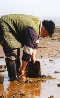
30 Use of the Exe Estuary 4.2 Fisheries The Exmouth Mussel Company boat harvesting mussels on the Exe Background and Evidence The Exe Estuary supports a wide variety of shellfish, including mussels, shore crabs, cockles, clams, oysters and winkles, with the Exmouth Mussel Company harvesting mussels and re-laying seed mussels in the Estuary. Winkles are commercially gathered on a low level, and cockles and mussels are gathered recreationally. D&SIFCA conduct annual stock assessments on the cockle bed at Cockle Sands, and the mussel beds across the Estuary. Bait digging takes place on the Exe, with D&SIFCA carrying out an assessment of the level of bait digging during Crab tiling has been present on the Exe for generations, particularly in the Starcross area. This is managed by a D&SIFCA Byelaw which limits the area in which crab tiles can be laid. Surveys carried out every four years since 2001 have shown an overall decrease in the number of crab tiles on both sides of the Estuary between 2008 and 2012 but an increase in tiling in the bird sensitive area north of Dawlish Warren, the reasons for which are unknown (suggestions for overall decrease include buried tiles, decline in crab populations or a reduced demand for bait). A voluntary code of conduct was developed with the EEMP in There is currently no oyster harvesting in the Exe. D&SIFCA Byelaws prohibit the use of nets, other than salmon seines and sand eel nets licensed by the Environment Agency, on the Estuary in tidal waters enclosed by a line from Langstone Rock to Orcombe Point. There are currently three salmon nets with licences issued for the Exe, which are also licenced to catch sea-trout, although this is a minor component of the catch by the Exe fishery. The salmon fishery is subject to periodic Net Limitation Order reviews (NLO s), where the number of licences made available for salmon netting is revised based on the current and longterm status of the rivers migratory salmonid stocks. The Environment Agency s latest assessment of the Exe salmon stock indicates that the river has been meeting its Conservation Limit (conservation limit compliance is expressed as a 10 year trend, with salmon spawning levels having met or exceeded agreed standards for sustaining salmon stocks over the past 10 years, but with a current and predicted compliance status as Probably at Risk ). However, there has been a marked general decline in Atlantic salmon numbers on an international scale, which is reflected in the long-term catch data for the Exe. Additionally, early indications in 2016 show very low numbers of salmon reaching spawning grounds in the upper Exe Catchment. Illegal exploitation of salmon in the Exe is of concern. Obstacles to fish migration have an impact and are generally difficult for salmon to navigate at low flows, for example, at St James Weir. Angling for bass, flounder and mullet is popular in the area. Under MMO legislation the Exe is designated a Bass Nursery Area. D&SIFCA has recently undertaken a Recreational Sea Angling project to look at angling effort and catches, and are currently reviewing their Byelaws. 29 Exe Estuary Management Plan
31 Use of the Exe Estuary Key Achievements Creation of the Exe Estuary Local Fisheries Group as one of the national Coastal Community Teams. Production of the Economic Plan and Exe Estuary Fisheries Report. Introduction of D&SIFCA s Mobile Fishing Permit Byelaw and Potting Permit Byelaw. Issues Complex consenting processes and regulation, and lack of a flexible management framework for fisheries (shellfisheries and sea fishery). Lack of data on the existing resource to facilitate the development of a strategy to improve economic viability of the fisheries sector. Locally caught / landed seafood not widely promoted / sold in the local area. Fishing infrastructure falling into disrepair (oyster racks / crab tiles). Conflict with other users and wildlife and potential fishing impact on river bed habitat and maritime archaeology. Impact of water quality on shellfish quality and price, but limitations in the current water quality testing system and understanding of associated economic impacts. Decrease in salmon stock population. Unknown impact of climate change on fishery resources. Unknown impact of water quality and sewage discharge on migrating salmon during low summer flows. Key Objective The commercial and recreational fisheries resources within the Exe Estuary are managed sustainably to ensure stocking levels remain viable into the future. Policies F1: Monitor spawning levels and undertake regular surveys of the fish stocks and bait collection to underpin management decisions. F2: Encourage sustainable fishing practices within the Exe, ensuring they have no adverse effect on the SSSI or SPA, and developing and implementing a flexible and responsive management framework (including bait collection). F3: Improve understanding of the implications of fisheries on biodiversity, working with local groups to create codes of conduct for fishing and bait collection. F4: Work with Regulatory Authorities to safeguard and improve shellfish water quality, exploring options for improved water quality testing. F5: Improve the viability and productivity of the Exe fishery through working with the local industry and within environmental controls. F6: Encourage the removal of all fishing gear and infrastructure (e.g. oyster trestles) that is not being actively used. F7: Continue to protect and enhance the salmon fishery. F8: Encourage the promotion of locally caught / landed seafood, including investigation into the potential for sustainable or local certification of Exe fisheries. F9: Enable fish passage through the Estuary to spawning grounds. Indicative Actions Revise and promote code of conduct for crab tiling and bait digging. Explore new and innovative methods to undertake surveys of fish stocks and bait collection. Investigate whether current bait collection activities have any negative effects on the features of the SPA. Investigate potential markets for suitable seafood species, which are currently commercially unexploited. HRAs on fishing activities within the EMS carried out by D&SIFCA. Introduction of permitting byelaws through D&SIFCA s Byelaw Review, allowing more flexibility in management. Exe Estuary Management Plan

32 Use of the Exe Estuary 4.3 Water Based Recreation Exe Regatta Background and Evidence Water based recreation is becoming increasingly popular, with a growing number of people wanting to use the Estuary for various activities, including kitesurfing, sailing and the use of Personal Water Craft (PWC or Jet Skis). This rise in interest is important for growth in tourism and is a benefit for local businesses, shaping the boatyards, moorings, quays and slipways along Estuary. It also provides an excellent way for the public to enjoy the open spaces, to appreciate the environment, and to engage in a healthy lifestyle. Growth of the popularity of water based recreational activities has also led to increased competition for space on and around the water, leading to the potential for conflicts between users and with wildlife. It is important to ensure all water users of the Estuary are given optimum space to enjoy their recreational activity without threatening or causing undue damage to the wildlife, the Estuary s conservation status, or other users. Several of the local authorities around the Estuary notably Exeter City Council as Harbour Authority have created Byelaws intended to control the impacts of recreational use on the water, with several voluntary measures also in place, such as codes of conduct and voluntary exclusion zones. Currently the enforcement of Byelaws and promotion of voluntary measures are not well resourced. 31 Exe Estuary Management Plan
33 Use of the Exe Estuary Key Achievements Improved guidance on moorings through the EEMP website. A successful Water Safety Day was organised and run in Issues Increase in both the amount and variety of water-based recreational activities taking place can result in increasing competition for space and cumulative negative impacts for all users. Lack of consideration and lack of awareness of restrictions by some users of the Estuary, with insufficient publicity, policing and enforcement, leading to conflicts with other users and impacts on wildlife. Codes of conduct are dated and are not actively promoted, leading to increase in misuse of the Estuary. Lack of safe and well-managed access to the water, with poor facilities for recreational users. New recreational activities, such as the use of drones, will have unknown effects on the features of the site. Key Objective A well-managed Estuary will be better able to accommodate a wide range of water-based recreational activity without negative impacts on other users or disturbance or harm to wildlife. Policies WBR1: Continue to work with recreation organisations (e.g. those representing sailing, mooring and angling) to optimise opportunities, increase awareness and understanding of other user s needs and to minimise conflict and environmental damage. WBR2: Develop a flexible, responsive and effective framework for recreation management to address activities that are causing disturbance or have an adverse effect on the SPA, SSSI or SAC, through appropriate controls, codes of conduct and speed limits within the Exe Estuary. WBR3: Encourage appropriate enforcement of controls through working in partnership with the harbour authority, representing the needs of all stakeholders. WBR4: Promote a comprehensive approach to water safety, addressing antisocial behaviour and issues with vandalism through increased involvement of local communities. WBR5: Identify and promote further water-based recreation opportunities and facilities and well-managed access to the water. Indicative Actions Develop a consensus and acceptable zonation scheme for the various uses on the Estuary. Review all of the codes of conduct, in response to the increase in use of the Estuary for water-based recreation. Raise awareness and support the work of Habitat Mitigation Officers and the Patrol Boat in regulating revised codes and zones. Exe Estuary Management Plan

34 Use of the Exe Estuary 4.4 Tourism A busy day at Dawlish Warren Background and Evidence A unique place, with stunning scenery, diverse wildlife and lots of activities on offer, the Exe Estuary is a popular tourist destination. The majority of accommodation is in hotels and guest houses in Exmouth, Dawlish Warren and surrounding villages, together with large caravan and camping parks at Dawlish Warren, alongside the Estuary. Dawlish Warren attracts families and birdwatchers alike, whilst Exmouth is a hub for many recreational activities. The Exe is steeped in rich history, with Topsham once the second busiest port in Britain, and Exeter Canal and Locks the oldest of their kind in Britain. Visitors can visit a variety of historical buildings, such as Powderham Castle, build during and now surrounded by a deer park of 2,000 acres. The Estuary is surrounded by pretty villages, each with their own charm and history and boasting good, local pubs with views of the Exe. Lots of local businesses have relied on the Estuary for many years, including boat yards, fishermen, local artists and moorings associations. Tourism is busier in summer, with designated bathing areas and sandy beaches at the mouth of the Estuary at Exmouth and Dawlish Warren. However, visitors are attracted to the Exe all year around by the draw of the thousands of birds that visit the Estuary every winter. Birders are spoilt for choice with the numerous bird hides, bird-watching cruises and nature reserves on offer around the Exe. Various leaflets are produced by the EEMP to enhance visitors experience of the Exe, and are available at local Tourist Information Centres, on the EEMP website or by post from the EEMP: Exe Explorer Exe Wildlife Exe Activities Exe Heritage 33 Exe Estuary Management Plan
35 Use of the Exe Estuary Tourism acts as a driving force to maintain a beautiful environment to attract tourists and provides a boost to the local economy, generating employment and ensuring local facilities are maintained. It is important to ensure that tourism is managed so that it does not negatively affect the quality of life of local residents. Key Achievements Exe Heritage leaflet produced. Suite of Exe leaflets updated and distributed. Partnership with Devon and Cornwall Rail Partnership in wider distribution of Exe Explorer leaflet. Issues The Exe Estuary could be better promoted as an all year round destination, emphasising low impact and sustainable ecologically based activities and suitability for all ability access to the natural world. Need to address the negative impacts of tourism such as disturbance to wildlife, overcrowding, congestion, pollution and litter. Unknown impact of natural and physical changes, such as coastal defences on the amenity value of beaches or poor water quality incidences, on the tourism economy throughout the Estuary. The limited opportunities and sites along the water front for tourism development. Key Objective The Exe Estuary is widely promoted and recognised as a destination for sustainable tourism. Policies TO1: Promote the implementation of low key and sustainable tourism opportunities around the Exe Estuary, exploring examples of good practice from other sites. TO2: Maintain the local tourism potential by protecting the Estuary from over-development. TO3: Encourage tourism development to be in keeping with all the qualities and designations on the Estuary. TO4: Ensure measures are taken to minimise the effects of natural, physical changes, extreme events, and the measures taken to address them, on the tourism industry. Indicative Actions Develop mitigation measures to compensate for increased tourism pressure on the site. Exe Estuary Management Plan

36 Use of the Exe Estuary 4.5 Public Transport, Access and Land Based Recreation Exe Estuary Trail Background and Evidence Both sides of the Exe Estuary are excellently served by public transport including a range of very regular train and bus services. In addition there are ferry services across the Estuary although these are prone to seasonality and affected by tide conditions. Generally, most places of interest along the Estuary are very easily accessible. The recently opened 26 mile, multi-use Exe Estuary Trail has significantly increased the land-based recreation opportunities available and allows access close to the Estuary waterside. Recently 1.3 million has been secured from the Coastal Communities Fund to complete the Trail from Dawlish Warren into Dawlish. The Trail is part of Route 2 (South Coast) of the National Cycle Network and is also well-used as a scenic route for walkers including those with limited mobility and wheelchair users. A campaign has been developed to encourage users to Share the Space and be tolerant of other users. The Trail connects 80,000 residents to the city of Exeter and is used by over 200,000 people each year. It is a popular commuter route and provides an excellent opportunity for the public to enjoy the open spaces, to appreciate the environment, and to engage in a healthy lifestyle. As well as the circular route around the Exe, there are also several long distance walking routes which converge on the Estuary, including the South West Coast Path National Trail, and the East Devon Way and the Exe Valley Way regional routes. The M5 crosses the Estuary north of Topsham, and two main roads (A376 to Exmouth and A379 to Dawlish) run alongside both banks. Air quality management is necessary to ensure air pollution is maintained at low levels that are safe for people to breathe. In addition, air pollution can have negative impacts on our environment, both in terms of direct effects of pollutants on vegetation, and indirectly through effects on the acid and nutrient status of soils and waters. At local level, air pollution policy is focused on the potential impacts on human health, whilst at a European level the concerns extend to biodiversity and wildlife. The quality of the air around the Exe Estuary is relatively good compared to more urban locations nearby. The main pollutants affecting human health and wildlife around the Estuary are Nitrogen Dioxide (main source from traffic), Particulates (small pollutant particles) and ozone. 35 Exe Estuary Management Plan
37 Use of the Exe Estuary Key Achievements Creation of the Exe Estuary Trail, providing sustainable access to the Estuary. Increased engagement with the Devon and Cornwall Rail Partnership to encourage visitors to make use of sustainable transport. New bird screen and path improvement at Exmouth, working with Stuart Line Cruises. Issues Lack of ferry services (seasonal, infrequent or non-existent) to provide cross-estuary access, partly due to the lack of maintenance of passages on the Estuary which could have an effect on the use of the historic waterway. Insufficient promotion and information for use of public/sustainable transport to access the Estuary including to those with disabilities. Concern on volume of vehicles being used to access the Estuary and the resulting scale of CO2 emissions. Integration of Exe Estuary Trail with other public transport facilities, e.g. limited space for bicycles on trains and poor accessibility for cyclists, wheelchairs and pushchairs at the Starcross ferry bridge. Confused and insufficient signing in places, for the Exe Estuary Trail. Impact of natural and physical changes on public transport and access provision. Unknown impact of rail, water and road transport on the Estuary quality and wildlife. Lack of promotion of accessibility of Exe Estuary Trail. Key Objective Use of sustainable access to the Estuary using public transport and the Exe Estuary Trail will continue to improve. Policies PTA1: Promote use of the bus and train networks to access the Estuary from outside the area. PTA2: Encourage walking and cycling as a means of accessing and exploring the Estuary through improved information and signage, including promotion of accessibility of the Exe Estuary Trail for all abilities. PTA3: Develop partnerships to make the best of opportunities presented by the completion of the Exe Estuary Trail including integration with public transport and ferry service improvements. PTA4: Investigate and mitigate the effects of public transport on the SPA, SSSI and SAC. PTA5: Identify and provide input into addressing the effects of natural and physical changes on public transport and access provision, including extreme events. PTA6: Encourage greater access and the provision of facilities for less able users of the Exe Estuary Trail, for example, wheelchair accessible toilets and convenient electric charging points for electric mobility vehicles. Indicative Actions Produce an improved version of the Exe Explorer leaflet including more detailed insets showing the actual route of the Exe Estuary Trail through built-up areas, e.g. Topsham. Promote the Share this Space messages to users of the Exe Estuary Trails. Develop itineraries using public transport to connect places of interest. Exe Estuary Management Plan

38 Use of the Exe Estuary 4.6 Navigation, Commercial and Other Uses Military use of the Estuary, Source: CTC Royal Marine Background and Evidence The banks of the Exe Estuary are largely influenced by human factors, and its many defining features are evidence of a flourishing and historically important commercial trade, that made use both of the flat land alongside the Estuary, and the transportation on the water itself. These features range from the fertile marshes at Exminster and Powderham, drained by Dutch engineers during the middle ages to create extensive grazing land, to the Exeter canal (which when constructed was the first canal in England built since the Roman times), to the railway lines and embankments that line each side of the Estuary. The Exe Estuary was historically one of the most important commercial lifeblood of Devon, and has been hugely important in creating the communities that surround it. The commercial uses currently found on the Exe Estuary are relatively low impact marine business and commercial transport (shipping and rail transport). With no significant industrial processes along the Estuary, industrial air pollution is not really considered to be an issue. Since 1939, the Exe Estuary has also accommodated military activity, in the form of the Lympstone Commando Training Centre. Small scale commercial opportunities are arising from the increased interest in water sport activities and the development of the Exe Estuary Trail such as cycle and kayak hire, watersport businesses, cafes and refreshments. Human activities that have a physical impact on the seafloor (e.g. trawl fishing, building offshore windfarms, aggregate extraction, coastal defences, ports and coastal developments) damage the benthic biota (species which live on the seabed) and their communities, and affect the regulating and supporting services that they provide. As the Exe is a fairly small Estuary, uses and developments of this type are minimal but the Partnership is mindful of the impacts of activities that disturb the seabed. The development of many marine sectors, such as marine renewable energy development, expansion in recreation and leisure activities, and port activities, puts extra pressure on estuarine habitats. Their impacts vary in spatial extent and importance, but are compounded by climate change. The management of navigation is important for both the environment and safety of users of the Exe. Exeter City Council (ECC) is the Harbour Authority for the River Exe and Exe Estuary, responsible for navigation of the Estuary seaward from Exeter to Start Point, and over the extent of the navigable channel out to Straight Point and Orcombe Rocks. ECC recently applied to the Department for Transport for designation of power to make Harbour Directions, which are distinct from the current authority to make General Directions. Enshrined within 37 Exe Estuary Management Plan
39 Use of the Exe Estuary new powers is the requirement for consultation with a representative group, prior to the making of a Harbour Direction. The Council is happy to recognise the new Port User Group (PUG) in this context and as a broader vehicle for consultation and dialogue in matters concerning the wider use of the waterways. Trinity House (TH) is the General Lighthouse Authority (GLA) and its powers are principally derived from the Merchant Shipping Act It is responsible for the inspection and audit of all local aids to navigation, including the management of all lighthouses, buoys and beacons, with the objective of ensuring the safety of navigation. It also has powers to mark, destroy, remove or raise wrecks that pose a navigational hazard and which lie outside areas controlled by harbour or conservancy authorities in order to safeguard life, to prevent shipping casualties and to reduce the risk of environmental damage. Key Achievements Application by Exeter City Council for designation of power to make Harbour Directions. Issues Unknown effect of the military activity, marine related businesses and commercial and transport uses on the Estuary. Lack of awareness by local businesses of the importance of the Estuary and its special designations. Failure to invest in marine related industries and lack of analysis of the economic benefits of marine industry. Conflict between conservation interests and inappropriate industries sited next to the Estuary. Key Objective Commercial, industrial and military use of the Estuary is managed to a sustainable level. Policies NCO1: Work in partnership with the Harbour Authority. NCO2: Increase understanding of the marine related business activity on the Estuary and the economic benefits. NCO3: Facilitate systematic means of communication with the military, industry and commercial businesses to help better understand their effects on the Estuary, mitigate negative impacts and influence their decisions, encouraging them to use sustainable methods and processes in their activities and help their understanding of the Estuary s natural environment and its economic value. NCO4: Seek to support suitable enterprises and commercial opportunities which promote the natural value of the Estuary. Indicative Actions Support the Port User Group (PUG), to ensure that the group and Harbour Directions support sustainable management of the Estuary and its wildlife. Potential involvement with Using Sediment As a Resource (USAR), a new project examining reuse of dredged sediments. Exe Estuary Management Plan

40 Environmental Quality 5. Environmental Quality 5.1 Water Quality Pollution on the Exe Estuary Background and Evidence Water quality is crucial to life in and around the Estuary. The South West European Marine Sites 2003 characterisation of the Exe Estuary came with several conclusions on the state of the Estuary s environment that are still accurate and are detailed in the State of the Exe Estuary 2014 report. Improvements in the environmental quality of the Exe Estuary will lead to improvements in the quality of life for the local human and wildlife populations and in turn, the local economy. In order to gain maximum benefit from the Exe Estuary, environmental quality must be maintained or improved, which is particularly challenging in the face of increased pressures from a larger population and the greater variety of activities taking place on or around the Estuary. Nationally, improvements have been made to water quality through reductions in industrial effluent and improvements in sewage treatment infrastructure; however, there are now concerns about more recently introduced chemicals, such as nanoparticles and pharmaceuticals. The waste processing and purification services widely provided by marine habitats generally ensure that food provided by the sea is safe to eat and the water is clean enough to use for recreation. In some estuaries local contamination by diffuse pollution (e.g. agricultural fertiliser, urban runoff and synthetic chemicals) still exceeds the capacity of the ecosystem to remediate or assimilate it. The EC Bathing Waters Directive outlines the legislation relating to the quality of bathing waters in England and Wales. The Directive was revised in 2006 and introduces a new classification system with more stringent water quality standards and puts an emphasis on providing information to the public. All bathing waters local to the Exe Estuary were classed as excellent in 2016, which included Dawlish Town Beach, Dawlish Warren Beach, Exmouth Beach and Sandy Bay. The chemical status of the water of the Exe Estuary is good, whilst the ecological status is only moderate, which indicates some water management issues, mainly stemming from the Exe Operational Catchment. The Exe Catchment contains a number of water bodies, including the River Creedy and Clyst which feed into the Exe Estuary. The ecological status of this catchment is generally moderate to good, and the chemical status is good. The reasons for not achieving good status include diffuse source pollution from mixed agricultural run-off and point source sewage discharges. River Basin Management Plans (RBMPs) are designed to protect and improve the quality of the water environment and set out how organisations, stakeholders and communities will work together to improve the water environment. They underpin the delivery of the objectives of the Water Framework Directive and the Catchment Based Approach (CaBA). The Exe Estuary is covered by the East Devon Catchment Partnership 39 Exe Estuary Management Plan
41 Environmental Quality which has been set up by the Environment Agency. It is important that the water quality of the entire Exe Catchment is considered, from the source at Exmoor to the sea at the mouth of the Estuary. South West Water s (SWW) Upstream Thinking programme recognises the importance of clean water in the Exe Catchment through support for three partnership projects. There are additional benefits associated with improvements in water quality, for instance by managing base flows which are important for fish passage. Key Achievements Catchment Sensitive Farming working in the Exe Catchment to reduce diffuse pollution from agriculture through specialist advice and grants. Issues Impact of water quality on biodiversity and habitats, farming, fisheries and recreation activities. Impact of catchment land use on water quality and dilution in the Estuary and difficulty in identifying the source of diffuse pollution. Effects of nutrient enrichment and potential eutrophication from run-off, sewage outfalls and sewage discharge from sewage treatment works around the Estuary and boating activities on the Estuary. Potential for hydrocarbon and heavy metal pollution associated with adjacent roads and railways, boating activities and oil storage. Low level of public understanding of water pollution causes and consequences. Impact of storm and flood events on water quality, combined with unknown impact of climate change on regularity of flood incidents. Lack of integrated working between the EEMP and water quality related projects. Key Objective Improved water quality within the Exe Estuary, with a responsible and responsive attitude towards water quality from all users. Policies WQ1: WQ2: WQ3: WQ4: WQ5: WQ6: WQ7: WQ8: Develop or co-ordinate partnerships to identify, manage and improve water quality within the Exe Estuary and its catchment Encourage South West Water through its National Environment Programme to continue to improve the sewage treatment discharge programme and exceed consented conditions. Continue sustainable management of water abstraction by implementing the Catchment Abstraction Management Strategy. Promote the reduction of oil and hydrocarbon pollution from storage on land and boating activities. Educate and inform about the impact of human activities on water quality. Complete a review of the consents process for the SPA. Implement the Water Framework Directive and incorporate new research findings into management decisions. Explore which areas of the Exe are affected by Nitrate Vulnerable Zones and work with farms to ensure adherence to the associated Action Programme of measures. Indicative Actions Investigate measures that could be implemented to improve the quality of shellfish waters, including improvement of water quality testing systems. Continue to work with the East Devon Catchment Partnership to manage water quality on the scale of the Exe Catchment and explore opportunities to work in partnership on new projects. Investigate possibilities for co-ordinated behavioural change campaigns, subject to additional funding, in coordination with the Litter Free Coast and Sea campaign. Exe Estuary Management Plan

42 Environmental Quality 5.2 Waste Management and Recycling Exe Estuary Management Partnership Clean-Up event Background and Evidence The UK is working towards a household recycling rate of 60% by 2020, set by the European Union and contained in the revised Waste Framework Directive. In 2014/15 Devon s household recycling rate was 55%, exceeding the national recycling rate of 44%. Devon has continued to have involvement in a variety of campaigns and initiatives to improve recycling opportunities and reduce waste, including erosion protection work undertaken at the Imperial Recreation Ground in Exmouth. This work aimed to prevent waste from the old landfill emerging and being washed onto the foreshore, as well as preventing pollutant chemicals leaking into the water. The EEMP supports a variety of clean-up events around the Estuary, including at Exmouth Local Nature Reserve in the spring and autumn. The clean-up events remove a large volume of rubbish from the Estuary, leaving the site safer for people and wildlife and more appealing for visitors and local residents. There are a variety of campaigns which aim to tackle waste issues, such as Litter Free Coast and Sea, Stop the Spill, Love Where You Sail, as well as free site audits available to improve waste management. 41 Exe Estuary Management Plan
43 Environmental Quality Key Achievements Public shoreline clean-up events are supported and organised around the Estuary. Recycled materials for printing and energy-efficient transport options are chosen when they are available. Issues Impact of waste and disposal on habitats and biodiversity. Visual impact of litter and other waste, including its impact on tourism. Fly tipping. Excessive amount of waste packaging on site and high costs of disposal. Increasing demand for recycling facilities. Low level of public understanding of waste related issues. Key Objective Adverse effects of waste are reduced on the Exe Estuary by encouraging the minimising of resource use, the choice of reused and recycled products and low energy options and recycling waste. Policies WMR1: Reduce the amount of waste, litter and fly tipping on the Estuary with benefits for wildlife and tourism. WMR2: Identify new guidance on disposal and handling of waste on site. WMR3: Re-invest recycling savings into relevant area. WMR4: Work with the harbour authority and water users to ensure good waste recycling facilities exist and encourage marinas to produce their own strategies on waste management and pollution prevention. WMR5: Actively raise awareness of the threats posed to wildlife by the presence of litter and waste on the Estuary and promote the waste hierarchy: reduce, re-use, recycle, energy recovery, disposal. WMR6: Specify or encourage sustainable packaging when purchasing or contracting services and suppliers. Indicative Actions Promote and support regular beach and shoreline clean-ups. Investigate possibilities for promoting the use of targeted recycling and waste management schemes, as well as co-ordinated behavioural change campaigns (e.g. Refill project) and available funding, in coordination with the Litter Free Coast and Sea campaign. Exe Estuary Management Plan

44 Promoting Understanding of the Exe Estuary 6. Promoting Understanding of the Exe 6.1 Education and Interpretation Exploring Exmouth Local Nature Reserve Background and Evidence It is important to promote a good understanding of the impressive ecosystems supported by the Exe Estuary in order to raise local awareness of their rarity value. Educational opportunities can also promote sustainability and the importance of the Estuary within the recreational and tourism industry, for instance relating to water quality, recreational routes and initiatives such as the Heritage Lottery Fund s Moor to Sea project. Engaging local communities with the Estuary can have considerable benefits for both the site and the health and wellbeing of the individuals. Biannual clean-up events have proven to be a considerable success on the Estuary with high numbers of participation and excellent feedback. Events like these and the annual Spirit of the Exe Festival are a great opportunity to engage people with the site and help them to understand its value to their lives including the natural benefits, or ecosystem services, that it provides. Research has shown that people who perceive more natural benefits in their environment are more likely to engage in acts that intend to protect it, such as buy sustainable fish, manage waste responsibly, volunteer in beach cleans and encourage family and friends to look after the environment. Hence, it is important for the Partnership to promote the natural benefits that the Exe provides. Providing education opportunities for the people who use the Estuary is vital for the future sustainability of the area. The EEMP offers educational sessions, resources and teacher training, both directly through the EEMP and via our Partners. There are also a variety of interpretation panels and Estuary leaflets to relay information about the Estuary and its environment. Providing easy public access to information encourages people to feel a sense of ownership for their natural surroundings and take an active interest in their management. 43 Exe Estuary Management Plan
45 Promoting Understanding of the Exe Estuary Key Achievements School group visits and supervision for student research have been facilitated. New LiCCo learning and teaching programmes created for primary, secondary and A-level education providers, available to download at and supported by training days. Geographical Association Publisher s Award received for the primary programme. A variety of information and interpretation boards developed and installed at different sites along the Estuary, including on the Exe Estuary Trail and LiCCo interpretation panels. A bespoke Spiral Wishing Well was created by the EEMP in partnership with The Rotary Club of Exmouth and District, to promote the Estuary and its wildlife and raise funds towards local community projects. Public events such as the Spirit of the Exe Festival and the biannual clean-ups. Improvement works at Bowling Green hide. Issues Requirement for improved education facilities (including indoor educational space) and facilitators focussed on the Estuary s biodiversity and geography and implications of coastal change and management. Lack of co-ordination between research studies led by statutory, voluntary organisations and universities and the dissemination of results in a user-friendly manner including to the EEMP. Insufficient understanding by the public and businesses of the Estuary s conservation and economic value, resources and capacity to support recreation, businesses and other activities. Insufficient provision, restricted content (e.g. on cultural and heritage features) and lack of consistency of physical interpretation material on some parts of the Estuary. Requirement for additional resources to raise awareness about the importance of the Estuary within the recreational and tourism sectors, and developing stronger links between the Estuary and Exe Catchment. Key Objective There is greater understanding of the importance of the Exe Estuary through a continuing programme of education and interpretation provision. Policies EI1: Improve education and interpretation facilities around the Estuary, ensuring a consistent approach is taken. EI2: Co-ordinate the development of a holistic and innovative promotion strategy to showcase the Estuary including opportunities at locations away from the Estuary, e.g. Exeter St David s station. EI3: Develop a comprehensive metadatabase and improve communication of results and sharing of resources. EI4: Encourage co-ordination between ongoing surveys and develop partnerships where possible. EI5: Improve awareness and understanding on the issues that impact on the management of the Estuary. EI6: Explore opportunities in developing new educational programmes, working in partnership with other organisations and the recreational and tourism sectors, and improving links with the Exe Catchment. EI7: Raise awareness of the value of the Exe s habitats and designated sites to ensure local communities and visitors understand the importance of the site in terms of its natural values. EI8: Promote the ecosystem services that the Estuary provides including the health and wellbeing benefits that can be gained from its natural spaces. Indicative Actions Continue to promote and distribute the LiCCo learning and teaching programme. Undertake an audit of signage and make proposals for additions or reductions as required. Coordinate the provision of interpretation and signage around the Estuary. Develop funding packages for new, and maintenance of existing, interpretation provision including developer contributions as part of the South-east Devon European Site Mitigation Strategy. Explore options to address the lack of educational facilities, facilitators and heritage interpretation. Provide and promote additional web-based resources. Exe Estuary Management Plan

46 Protecting the Exe Estuary 7. Protecting the Exe Estuary 7.1 Pollution Contingency Planning Boom deployment at the mouth of the Exe Background and Evidence There are various risks to the Exe Estuary and its environment. Local authorities and organisations have identified the main risks and have produced a number of different contingency plans in an attempt to mitigate these risks. Some of these plans are required by law whilst others have been prepared in response to a specific threat. The key plans for the Exe are the Devon County Coastal Pollution Plan (2008) and the Exe Estuary Booming Plan. The Coastal Pollution Plan has been produced by Devon County Council s Emergency Planning Department, although Local Authorities have no statutory duty to plan for or manage measures to mitigate the effect of a third party coastal pollution incident. The plan aims to protect this valuable environment in the event of a maritime pollution incident and should be used in conjunction with District Council Coastal Pollution Plans, and memoranda of understanding. This Plan will be activated when a major coastal pollution incident occurs which requires DCC to set up a Shoreline Response Centre (SRC), but may also be enacted or referred to (in whole or in part) in response to smaller incidents or those which do not require an SRC to be set up. Booming plans have been prepared for 14 individual sites in Devon, including 12 estuaries in the county, which includes the Exe Estuary. The Environment Agency has statutory authority for the control of water quality in waters extending seaward for three miles. The Environment Agency has a responsibility to prevent the spread of pollution inland from estuaries, and assists in the preparation of booming plans for Devon s estuaries. The Maritime and Coastguard Agency (MCA) will head the local response team if booming becomes necessary. 45 Exe Estuary Management Plan
47 Protecting the Exe Estuary Key Achievements Review of Coastal Pollution Plan in line with MCA National Contingency Plan and updated Scientific, Technical and Operational (STOp) notices. Issues Risk of uncontrolled pollution, including oil and chemical spills especially from shipping traffic. Pollution from incidents can potentially damage wildlife, habitats, human health and water quality, and will have an economic impact on related industries, including tourism. Absence of an international convention to cover inert pollution and regulations to control ship to ship transfer. Changes in waste regulations have affected the management and disposal of contamination from shipping incidents and are yet to be accommodated. Lack of structures and procedures for the management of volunteers. Risk of shore based sources of pollution from industrial plants or transport derived. Key Objective In response to incidences, the Devon Oil Contingency Plan and Exe Estuary Protection Plan are implemented. Key Objective PCP1: Ensure contingency plans are in place, supporting the implementation of the reviewed Devon Coastal Pollution Contingency Plan, and ensure that regular pollution contingency planning exercises are carried out. PCP2: Support research on wildlife and habitat recovery, and the impact of pollution on human health. PCP3: Investigate ways to increase legal protection covering pollution from shipping. PCP4: Improve awareness of the hazards that pollution poses for local people, volunteers and wildlife species and habitats. PCP5: Identify new guidance on disposal and handling of waste on site. PCP6: Identify and implement structures and procedures for the management of volunteers. PCP7: Support the work of wildlife protection organisations and provide resources in the event of an incident. PCP8: Identify new guidance on responding to shore based sources of pollution. Indicative Actions Carry out a review of the Exe Estuary Booming Plan. Exe Estuary Management Plan

48 Protecting the Exe Estuary 7.2 Flood and Coastal Risk Management Lympstone Flood Gate Background and Evidence With sea levels predicted to rise and increased frequency and severity of storms, coastal management is required to reduce the risks of flooding and erosion to people, property, infrastructure and the natural environment. This will become increasingly challenging and costly, so requires a partnership approach between organisations, taking a proactive approach to manage risks. Estuaries and their wetlands, sand dunes, mudflats and intertidal reefs provide valuable natural flood and storm defences by attenuating and dissipating tidal and wave energy. Shoreline Management Plans (SMPs) are large-scale assessments of the risks associated with coastal processes, developed by Coastal Groups with members mainly from local councils and the Environment Agency. They identify the most sustainable approach to managing the flood and coastal erosion risks to the coastline in the short-term (0 to 20 years), medium term (20 to 50 years) and long term (50 to 100 years). The overarching Defra strategy to manage flood and coastal erosion risks and planning is the South Devon and Dorset Shoreline Management Plan and within this the Exe area is developed further through the Exe Estuary Flood and Coastal Erosion Risk Management Strategy (F&CERMS). The strategy looks ahead and identifies how the Environment Agency and partners will manage this, with an emphasis on the years up to The strategy concludes that the Environment Agency and partners should continue to defend most of the developed coastline, although some defences may need moving or altering. 47 Exe Estuary Management Plan
49 Protecting the Exe Estuary Key Achievements A long term strategic approach to flood and coastal risk management within the Shoreline Management Plan boundaries has been achieved through the Exe Estuary F&CERMS, with development of priority projects at various sites around the Exe, e.g. progression of a major beach recharge scheme and associated hard defences at Dawlish Warren. Issues Impact of flooding and coastal processes on the local population and built environment. Loss of intertidal habitats to coastal squeeze arising from sea level rise against hard sea defences. No managed realignment projects being pursued on and around the Exe to compensate for habitat losses to coastal squeeze. Uncertainty of risk linked to storm surges, flood and erosion. Limited understanding of the impact of climate change and the value of natural habitats for flood and storm defences. Lack of information on, and consistency of monitoring of, coastal processes within the Estuary. Deterioration and potential damage or loss of habitat, biodiversity, archaeological features. Potential impact of coastal defence on economic activities. Low level of public awareness of the causes and effects of coastal processes on people, property and the environment. Increasing awareness of the need for a sustainable approach to coastal protection and flood defence. Key Objective The maintenance, planning and implementation of coastal defence strategies contribute to the sustainable use of the environment whilst minimising the risks associated with flooding and erosion. Policies FM1: Evaluate and manage the risk of erosion and flooding on the Estuary s built environment and biodiversity and produce improved flood and coastal erosion maps. FM2: Where possible, avoid further development on floodplain and areas at risk, and encourage the use of sustainable drainage systems to improve water quality in the Exe Catchment. FM3: Understand and continue to evaluate impacts of climate change for flood and coastal risk management. FM4: Implement the Shoreline Management Plan (taking into consideration the SMP2 review) and other associated relevant plans, including the Exe Estuary F&CERMS, the Exe Catchment Flood Management Plan and the recommendations of the Exe Estuary Coastal Management Study. FM5: Identify and address any local gaps in the knowledge of coastal processes on the Estuary and share results with other studies, as part of the SMP review. FM6: Ensure that biodiversity, archaeology and landscape policies and guidance are adhered to when considering new coastal development. FM7: Consider the impact of coastal defence and coastal management on economic activities. FM8: Ensure all flood and coastal defence plans adhere to nature conservation legislation and, wherever possible, intertidal habitats (existing or newly created) are seen as a natural form of sea defence. FM9: Promote relevant plans and involve local communities and businesses in the development of flood risk management schemes. Indicative Actions Implement the projects identified in the Exe Estuary F&CERMS. Promote current flood and coastal risk management measures to local communities, e.g. through the Exe Press newsletter. Encourage the take up of community flood plans and resilience amongst Estuary communities, e.g. through the Devon Community Resilience Forum, including practical actions by volunteers. Exe Estuary Management Plan

50 Protecting the Exe Estuary 7.3 Spatial Planning and Development Management Development at Exmouth Background and Evidence The three current Local Plans relevant to the Exe are produced and administered by Teignbridge District Council, East Devon District Council and Exeter City Council. In 2016 the Local Authorities (including Mid Devon District Council and Devon County Council) started work on aligning planning policy and development strategy and as part of this are preparing a joint Greater Exeter Strategic Plan to cover the four districts. Devon County Council is responsible for waste, transport and minerals planning. Under the Localism Act, 2011, town and parish councils and community groups are able to produce their own Neighbourhood Plans. In March 2012 the Government published the National Planning Policy Framework which sets out national planning policies. As the marine planning authority for England, the MMO is responsible for preparing marine plans for 11 marine planning regions in English inshore and offshore waters in order to inform and guide decision makers on development in marine and coastal areas. The Exe Estuary falls into the South Inshore Marine Plan Area and the plan for this area will be adopted in Since a marine plan will apply up to the mean high water springs mark at its landward extent, there will be an overlap with terrestrial plans which generally extend to the mean low water springs mark. Planning documents for the Exe Estuary area may make reference to the MMO s licensing requirements and South Marine Plan to ensure that necessary regulations are adhered to. The Marine Policy Statement is also in place for guidance on any planning activity. The Marine and Coastal Access Act 2009 provides the legal mechanism to help ensure clean, healthy, safe, productive and biologically diverse oceans and seas by putting in place a new system for improved management and protection of the marine and coastal environment. Public authorities taking authorisation or enforcement decisions that affect or might affect the UK marine area must do so in accordance with this Act and the UK Marine Policy Statement, unless relevant considerations indicate otherwise. There is also online guidance and the Planning Advisory Service soundness self-assessment checklist for Local Authorities. Under the Conservation of Habitats and Species Regulations 2010 all competent authorities are required to carry out a Habitats Regulations Assessment of plans and projects in order to ensure that there is no adverse effect on European Sites such as the Exe Estuary SPA and Dawlish Warren SAC. Exeter, East Devon and 49 Exe Estuary Management Plan
51 Protecting the Exe Estuary Teignbridge LPAs have been working together as competent authorities to secure Habitats Regulations compliance with regard to their current planned growth and development. As part of this a South-east Devon European Site Mitigation Strategy has been produced and financial contributions are secured from relevant housing developments around the Estuary. These funds pay for on- and off-site mitigation measures (such as the creation of Sustainable Alternative Natural Greenspace SANGs) which will ensure that recreational impacts do not have an adverse effect on the SPA and SAC. The green infrastructure strategy for the Exeter Growth Area has been produced to provide a framework for the cross local authority boundary provision of high quality green infrastructure through a number of strategic projects and key initiatives. There are areas of this work that are complimentary to the work of the Partnership, including the mitigation of the impacts of the growing population around the Exe through the enhancement and promotion of Suitable Alternative Natural Green Space (SANGS). Key Achievements All Local Plans have been recently approved and adopted. Neighbourhood Plans are in development. Input provided into the development of the South Marine Plans. Issues Potential damage or loss of habitat, biodiversity, archaeological features, and the impact of development pressures on landscape character. Vulnerability of development, and the potential cost of defending built areas in the flood plain and eroding areas. Low public awareness of the potential impacts of coastal processes, floods and climate change on existing properties and built environment, and restrictions on the availability of sites suitable for development. Key Objective Planning Authorities and the MMO promote and adhere to the concept of sustainable development, thus helping to maintain the Favourable Conservation Status of the Exe Estuary through their planning functions. Policies SP1: Ensure the views of the Exe Estuary Management Partnership are incorporated into the Local Plan processes. SP2: Encourage a sustainable and long term approach to development management and ensure developer contributions through Section 106 or Community Infrastructure Levy (CIL) are used for the long-term benefit of the Estuary. SP3: Ensure that both Local Plans and developments comply with the policies of the Shoreline Management Plan and Exe Estuary F&CERMS. SP4: Promote the biodiversity, historic environment and landscape policies and guidance for incorporation into the neighbourhood planning processes. SP5: Ensure that the Marine Policy Statement and the South Marine Plan are referred to when planning development in marine and coastal areas. Indicative Actions Develop a Planning Protocol between the EEMP and the local authorities. Offer appropriate input into the Greater Exeter Strategic Plan, ensuring it helps to maintain the favourable conservation status of the Exe. Explore options for joint working between the EEMP and Exeter and East Devon Growth Point Partnership to deliver the green infrastructure strategy. Exe Estuary Management Plan

52 Exe Estuary Management Partnership C/o Devon County Council Lucombe House County Hall Topsham Road Exeter EX2 4QD Tel: Website: 51 Exe Estuary Management Plan
List of Abbreviations
 Preface This report has been prepared by the Exe Estuary Management Partnership. The work has been made possible through the Cycleau project. The Partnership acknowledges this support and the valuable
Exe Estuary Action Plan
 Exe Estuary Action Plan 2015 2016 RSPB Images Exmouth Town Council Dawlish Town Council 1 Summary Action Plan Contents 3 Introduction Exe Estuary Management Plan The Management Partnership Meeting Dates
Exe Estuary Annual Review Exe Estuary Annual Review 2014 / 2015
 Exe Estuary Annual Review -15 Exe Estuary Annual Review / 2015 Exe Estuary Management Partnership 1 Stephanie Clark, Exe Estuary Officer /15 Exe Estuary Annual Review -15 Contents Partnership Achievements
Figure 1: The Proportion of Features in Favourable Condition 1 at 31 st March
 The Proportion of Scotland's Protected Sites in Favourable Condition 2018 An Official Statistics Publication for Scotland Scotland has a rich and important diversity of biological and geological natural
Chapter 8 Natural Resources
 Chapter 8 Natural Resources 127-134 8.1 Introduction 8.2 Extractives Industry 8.3 Forestry 8.4 Fishing / Aquaculture 8.1 Introduction Kerry has a number of naturally occurring resources that contribute
The Proportion of Scotland's Protected Sites in Favourable Condition 2017 Evidence
 The Proportion of Scotland's Protected Sites in Favourable Condition 2017 An Official Statistics Publication for Scotland Scotland has a rich and important diversity of biological and geological natural
Site Improvement Plan. Saltfleetby-Theddlethorpe Dunes & Gibraltar Point SAC
 Improvement Programme for England's Natura 2000 Sites (IPENS) Planning for the Future Site Improvement Plan Site Improvement Plans (SIPs) have been developed for each Natura 2000 site in England as part
Taw - Torridge Estuary Management Plan 2010
 Overview Taw - Torridge Estuary Management Plan 2010 Image courtesy of www.airscapedevon.co.uk North Devon AONB and Biosphere Service Bideford Station East the Water Bideford - 1 - Overview This page is
Site Improvement Plan Solent and Isle of Wight Lagoons
 Improvement Programme for England's Natura 2000 Sites (IPENS) Planning for the Future Site Improvement Plan Solent and Isle of Wight Lagoons Site Improvement Plans (SIPs) have been developed for each Natura
A coastal concordat for England - draft v.6
 A coastal concordat for England - draft v.6 1 Executive Summary This coastal concordat is an agreement between the Department for Environment, Food and Rural Affairs (Defra), Department for Communities
IROPI: National politics v environmental decisions
 Bruce Munro National Environmental Assessment Service Environment Agency Abstract IROPI: National politics v environmental decisions As a public body responsible for flood risk management in England and
Planning for Dredging and the Environment on the Tidal Thames
 Planning for Dredging and the Environment on the Tidal Thames 1 INTRODUCTION This Information Note forms the final document in a set of three notes designed to inform berth operators and environmental
Brightlingsea Harbour Strategic Study. Katherine Harris, HR Wallingford Dan McKiernan, Marina Projects
 Brightlingsea Harbour Strategic Study Katherine Harris, HR Wallingford Dan McKiernan, Marina Projects 7 March 2012 Strategic study To identify and plan the actions necessary to sustain a harbour that can
Norfolk Minerals and Waste Local Plan. Sustainability Appraisal Report Non-technical summary
 Norfolk Minerals and Waste Local Plan Minerals Site Specific Allocations Development Plan Document (DPD) Single Issue Silica Sand Review Sustainability Appraisal Report Non-technical summary March 2016
Proposed Tidal Lagoon Development, Cardiff, South Wales
 Proposed Tidal Lagoon Development, Cardiff, South Wales Evidence Plan Framework August 2015 www.tidallagooncardiff.com Document title Evidence Plan Framework Document reference Revision number 0.4 Date
ISLAND PLAN. Solent Special Protection Areas. Supplementary Planning Document
 ISLAND PLAN Solent Special Protection Areas Supplementary Planning Document Adopted May 2014 Contents 1. Why a Supplementary Planning Document is required 4 The Solent SPAs... 5 The Isle of Wight Council
Benefits of SSSIs in England and Wales
 Benefits of SSSIs in England and Wales Sites of Special Scientific Interest Sites of Special Scientific Interest (SSSIs) are the best places for wildlife and geology nationally. There are 5,000 SSSIs in
Statement of Particulars Western Wales Flood Risk Management Plan
 Statement of Particulars Western Wales Flood Risk Management Plan FINAL 22 September 2015 Date Our purpose is to ensure that the natural resources of Wales are sustainably maintained, used and enhanced,
Integrated Coastal Zone Management
 Integrated Coastal Zone Management Steve Collins Marine Planning & Coastal Integration Team Date: 05 November 2014 Overview To cover ICZM History and context MSP Directive MPS How marine planning contributes
Memorandum of Understanding for the Teesmouth and Cleveland Coast Special Protection Area and proposed extension
 Memorandum of Understanding for the Teesmouth and Cleveland Coast Special Protection Area and proposed extension Date 31 st October 2017 1 Contents: 1. Foreword... 3 2. Introduction... 4 2.1 Background...
Chapter 6 Objective: Protect and Enhance the Environment
 Chapter 6 Objective: Protect and Enhance the Environment 49 Irish Water Water Services Strategic Plan Our Strategic Aims Ensure that Irish Water services are delivered in a sustainable manner which contributes
Site Improvement Plan. Penhale Dunes SAC. Improvement Programme for England's Natura 2000 Sites (IPENS) Planning for the Future
 Planning for the Future") Improvement Programme for England's Natura 2000 Sites (IPENS) Planning for the Future Site Improvement Plan Penhale Dunes Site Improvement Plans (SIPs) have been developed for each Natura 2000 site in
Improvement Programme for England's Natura 2000 Sites (IPENS) Planning for the Future Site Improvement Plan Penhale Dunes Site Improvement Plans (SIPs) have been developed for each Natura 2000 site in
Synthesis of Key Findings. The Foundation for Science and Technology at The Royal Society 13 July NEA Main Features
 Synthesis of Key Findings The Foundation for Science and Technology at The Royal Society 13 July 2011 NEA Main Features Independent Assessment Expert Panel chaired by Prof R Watson and Prof S Albon Independent
Site Improvement Plan. River Kent SAC. Improvement Programme for England's Natura 2000 Sites (IPENS) Planning for the Future
 Planning for the Future") Improvement Programme for England's Natura 2000 Sites (IPENS) Planning for the Future Site Improvement Plan River Kent Site Improvement Plans (SIPs) have been developed for each Natura 2000 site in England
Improvement Programme for England's Natura 2000 Sites (IPENS) Planning for the Future Site Improvement Plan River Kent Site Improvement Plans (SIPs) have been developed for each Natura 2000 site in England
Improving the condition of Solway Tweed s water environment Tweed area management plan
 Improving the condition of Solway Tweed s water environment Tweed area management plan 2010 2015 Supplementary to the river basin management plan for the Solway Tweed river basin district Page 1 of 20
Alde and Ore Estuary Partnership Plan
 Alde and Ore Estuary Partnership Plan Sustainability Appraisal/Strategic Environmental Assessment Scoping Report Suffolk County Council August 2015 Contents 1. Introduction... 4 Background... 4 1.1 Alde
Flooding and coastal change risks from the Climate Change Risk Assessment
 Independent advice to government on building a low-carbon economy and preparing for climate change Thursday 22 nd March 2018 Flooding and coastal change risks from the Climate Change Risk Assessment Dr
SW E N. South West Environment Network 2010 Environment Priorities
 SW E N South West Environment Network 2010 Environment Priorities SWEN s 2010 Environmental Priorities The top four environmental priorities for the South West. At a time when the natural environment,
Kent Biodiversity 2020 and beyond a strategy for the natural environment
 Kent Biodiversity 2020 and beyond a strategy for the natural environment 2015-2025 Introduction Action for the natural environment in Kent and Medway will be delivered by many organisations and individuals
Issues in measuring and managing changes to the ecological character of the Western Port Ramsar Site as a result of climate change
 presenter: Shelley Heron Issues in measuring and managing changes to the ecological character of the Western Port Ramsar Site as a result of climate change Western Port Bay Where is it? Ecological character
What are biodiversity targets?
 This leaflet details the Regional Habitat Biodiversity Targets for the East of England. It is aimed at decision-makers in regional and local government, at environmental organisations, and at land owners
FENS, MARSHES AND SWAMPS. Jeremy Fraser and Carl Cornish. The Old Ragged School Brook Street Nottingham NG1 1EA. MOST RECENT UPDATE: May 2005
 FENS, MARSHES AND SWAMPS AUTHORS: LEAD AGENCY: Jeremy Fraser and Carl Cornish Notts Wildlife Trust The Old Ragged School Brook Street Nottingham NG1 1EA MOST RECENT UPDATE: May 2005 Current status Wetlands
Hesketh Out Marsh East Managed Realignment
 Hesketh Out Marsh East Managed Realignment Presentation for by Richard A Shirres (Environment Agency) 29 th April 2015 HOME: location Hesketh Out Marsh East Managed Realignment Partnership Scheme HOME:
D9. Significant Ecological Areas Overlay
 D9. Significant Ecological Areas Overlay D9.1. Background Auckland's indigenous biodiversity is unique with a diverse range of ecosystems reflecting the complex physical environment of the region. Natural
UK Technical Advisory Group on the Water Framework Directive
 UK Technical Advisory Group on the Water Framework Directive Criteria and Guidance Principles for the designation of heavily modified water bodies This Guidance Paper is a working draft defined by the
Irvine to Troon (Potentially Vulnerable Area 12/07) Local Plan District Local authority Main catchment North Ayrshire Council, Ayrshire Monkton to Irv
 Local Plan District Local authority Main catchment North Ayrshire Council, Ayrshire Monkton to Irv") Irvine to Troon (Potentially Vulnerable Area 12/07) Local Plan District Ayrshire Local authority North Ayrshire Council, South Ayrshire Council Main catchment Monkton to Irvine coastal Summary of flooding
Irvine to Troon (Potentially Vulnerable Area 12/07) Local Plan District Ayrshire Local authority North Ayrshire Council, South Ayrshire Council Main catchment Monkton to Irvine coastal Summary of flooding
Consenting, EIA and HRA Guidance for Marine Renewable Energy Developments in Scotland
 Consenting, EIA and HRA Guidance for Marine Renewable Energy Developments in Scotland Scottish Environment LINK is the forum for Scotland's voluntary environment organisations, with over 30 member bodies
Firth of Tay & Eden Estuary Special Area of Conservation
 Firth of Tay & Eden Estuary Special Area of Conservation Advice under Regulation 33(2) of The Conservation (Natural Habitats, &c.) Regulations 1994 (as amended) 30 March 2006 About this Package: Section
Chapter 6 Objective: Protect and Enhance the Environment
 Chapter 6 Objective: Protect and Enhance the Environment 55 Irish Water Water Services Strategic Plan - October 2015 Our Strategic Aims Ensure that Irish Water services are delivered in a sustainable manner
THE MERSEA HARBOUR PROTECTION TRUST. EXECUTIVE SUMMARY. Draft 8. Dated 01 DECEMBER 2016.
 THE MERSEA HARBOUR PROTECTION TRUST EXECUTIVE SUMMARY. Draft 8. Dated 01 DECEMBER 2016. PROPOSED CLIMATE CHANGE ADAPTION RECHARGE PROJECT Mersea Harbour and Tollesbury Wick Protection to Mersea Harbour
Climate Change Strategy for Wales. Adaptation Delivery Plan
 Climate Change Strategy for Wales Adaptation Delivery Plan October 2010 1 ISBN 978 0 7504 5715 6 Crown Copyright October 2010 WAG10-03167 F0021011 Introduction As a result of past and current emissions,
REGIONAL EXPERT ADVISORY WORKSHOP REPORT 01 MAR 2011 VIENTIANE, LAO PDR WETLANDS ECOSYSTEM SERVICES AND BIODIVERSITY AND CC
 Mekong Wetlands ecosystem services and biodiversity and Climate Change Peter-John Meynell, based on paper by Mark Bezuijen Outline Wetland Ecosystem services a means of valuing the importance of wetlands
BIODIVERSITY AND DEVELOPMENT GUIDANCE FOR HAMPSHIRE
 BIODIVERSITY AND DEVELOPMENT GUIDANCE FOR HAMPSHIRE RECOMMENDATIONS FOR INTEGRATING BIODIVERSITY INTO LOCAL DEVELOPMENT FRAMEWORKS Prepared by Mike Oxford On behalf of the Hampshire Biodiversity Partnership
As one of our greatest assets there is a need to take collective action to protect, enhance and value our environment for now and for future
 1 As one of our greatest assets there is a need to take collective action to protect, enhance and value our environment for now and for future generations, ensuring that the Vale of Glamorgan is globally
Babergh & Mid Suffolk Joint Local Plan: Sustainability Appraisal. August 2017
 Babergh & Mid Suffolk Joint Local Plan: Sustainability Appraisal August 2017 Contents NON TECHNICAL SUMMARY... 1 CHAPTER 1 INTRODUCTION... 2 Table 1: Stages of SA/SEA production... 2 Table 2: Statutory
Hydropower Guidance Note: HGN 7 Competing Schemes
 Guidance Note Hydropower Guidance Note: HGN 7 Competing Schemes This guidance is not intended as a statement of law and should be read in combination with and in the context of the relevant enactments
BALANCE. Kick-off Meeting, Copenhagen, Denmark. 31st of August - 1st of September 2005
 BALANCE Baltic Sea Management - Nature Conservation and Sustainable Development of the Ecosystem through Spatial Planning Kick-off Meeting, Copenhagen, Denmark 31st of August - 1st of September 2005 Johnny
Monitoring the impact of onshore wind farms on birds - January 2009
 Guidance te Monitoring the impact of onshore wind farms on birds - January 2009 Introduction 1. As the number of wind farms constructed in Scotland increases the need to understand the impact that these
Site Improvement Plan. Fens Pools SAC. Improvement Programme for England's Natura 2000 Sites (IPENS) Planning for the Future
 Planning for the Future") Improvement Programme for England's Natura 2000 Sites (IPENS) Planning for the Future Site Improvement Plan Fens Pools Site Improvement Plans (SIPs) have been developed for each Natura 2000 site in England
Improvement Programme for England's Natura 2000 Sites (IPENS) Planning for the Future Site Improvement Plan Fens Pools Site Improvement Plans (SIPs) have been developed for each Natura 2000 site in England
Freshwater Neighbourhood Plan. Habitats Regulations Assessment Report
 Freshwater eighbourhood Plan Habitats Regulations Assessment Report October 2016 COTETS ITRODUCTIO... 2 Figure 1: Location Map showing Freshwater Parish and eighbourhood Plan Area.... 2 LEGISLATIO... 3
Marine Works (Environmental Impact Assessment) Regulations 2007 (as amended), Regulation 22 - EIA Consent Decision
 Regulations 2007 (as amended), Regulation 22 - EIA Consent Decision") Marine Works (Environmental Impact Assessment) Regulations 2007 (as amended), Regulation 22 - EIA Consent Decision Title: Colwyn Bay Promenade Enhancement and Coastal Defence Works Regulatory Approval:
Marine Works (Environmental Impact Assessment) Regulations 2007 (as amended), Regulation 22 - EIA Consent Decision Title: Colwyn Bay Promenade Enhancement and Coastal Defence Works Regulatory Approval:
FUTURE MANAGEMENT IN ENGLAND
 Opportunities for Inshore Fisheries and Marine Environment Association of FUTURE MANAGEMENT IN ENGLAND Association of Inshore Fisheries and Conservation Authorities FORWARD This position paper was developed
Don Catchment Vision
 Don Catchment Vision Don Catchment Vision A healthy and biodiverse catchment that is valued and enjoyed, contributing to the economic and social well-being of local communities. Aims for the Don To identify
Sustainable Shellfish aquaculture the Ecosystem approach
 Sustainable Shellfish aquaculture the Ecosystem approach Shellfish Growing in Ireland Fish Farmers 1,716 Processing 2,860 Ancillary 1,140 Shellfish 172 million - 4.53 from 4920 tonnes In total in N Ireland
ENVIRONMENTAL BRIEFING: WATER FRAMEWORK DIRECTIVE MAY 2013
 ENVIRONMENTAL BRIEFING: WATER FRAMEWORK DIRECTIVE MAY 2013 The EU Water Framework Directive (WFD) promotes a new approach to water management through river basin planning. It aims to prevent deterioration
Objectives Implications / comments
 Appendix 1: Environmental Protection Objectives Biodiversity UN Convention on Biological Diversity (1992) Bern Convention on the Conservation of European Wildlife and Natural Habitats (1979) Bonn Convention
PART 1 PART 2. An SEA Screening Report is attached for the plan, programme or strategy (PPS) entitled: COMPLETE PART 3 OR 4 OR 5 PART 3
 entitled: COMPLETE PART 3 OR 4 OR 5 PART 3") PART 1 To: Scottish Consultation Authorities: SEA.gateway@scotland.gsi.gov.uk Natural England: consultations@naturalengland.org.uk cc Ruth Reaney (NE) ruth.reaney@naturalengland.org.uk cc Paul Glading
PART 1 To: Scottish Consultation Authorities: SEA.gateway@scotland.gsi.gov.uk Natural England: consultations@naturalengland.org.uk cc Ruth Reaney (NE) ruth.reaney@naturalengland.org.uk cc Paul Glading
The Wildlife Trusts Biodiversity Benchmark Requirements
 1 COMMIT 1.1 Policy Your organisation has a biodiversity policy in relation to its landholdings which is: a. a statement of your organisation s commitment to i. compliance with legal requirements relevant
Flooding and Flood Management Inquiry
 Scottish Environment LINK is the forum for Scotland's voluntary environment organisations representing a broad spectrum of environmental interests with the common goal of contributing to a more environmentally
Climate Change Strategy Tackling Climate Change
 Fife Environmental Partnership Climate Change Strategy 2014-2020 Tackling Climate Change 1 Introduction Climate Change is going to have a dramatic impact on our future. The effects of a changing climate
Welsh Assembly Government. Summary of Changes. Planning Policy Wales Edition 2
 Welsh Assembly Government Summary of Changes Planning Policy Wales Edition 2 Planning Policy Wales Edition 2, Summary of changes Introduction 1. This document provides a summary of the main changes that
Site Improvement Plan. Isle of Wight Downs SAC. Improvement Programme for England's Natura 2000 Sites (IPENS) Planning for the Future
 Planning for the Future") Improvement Programme for England's Natura 2000 Sites (IPENS) Planning for the Future Site Improvement Plan Isle of Wight Downs Site Improvement Plans (SIPs) have been developed for each Natura 2000 site
Improvement Programme for England's Natura 2000 Sites (IPENS) Planning for the Future Site Improvement Plan Isle of Wight Downs Site Improvement Plans (SIPs) have been developed for each Natura 2000 site
WELSH GOVERNMENT RESPONSE TO RECOMMENDATIONS FROM THE CLIMATE CHANGE, ENVIRONMENT AND RURAL AFFAIRS COMMITTEE REPORT:
 WELSH GOVERNMENT RESPONSE TO RECOMMENDATIONS FROM THE CLIMATE CHANGE, ENVIRONMENT AND RURAL AFFAIRS COMMITTEE REPORT: FEEDBACK ON THE WELSH GOVERNMENT S DRAFT WELSH NATIONAL MARINE PLAN JUNE 2018 Background
Humber Management Scheme. FAQs Water quality
 Humber Management Scheme FAQs Water quality Key organisations and involvement in EMS management The Water Framework Directive (WFD) sets out how the water environment in England will be managed using a
BIODIVERSITY ACTION PLAN
 BIODIVERSITY ACTION PLAN FOR HAMPSHIRE V O L U M E O N E HAMPSHIRE BIODIVERSITY PARTNERSHIP BIODIVERSITY ACTION PLAN FOR HAMPSHIRE VOLUME ONE Compiled by Jacklyn Johnston on behalf of the Hampshire Biodiversity
Statement of Environmental Particulars for the Medway Estuary and Swale Shoreline Management Plan
 Statement of Environmental Particulars for the Medway Estuary and Swale Shoreline Management Plan Introduction This statement of particulars indicates how environmental and consultee considerations were
Resolution XI.3. Adjustments to the Strategic Plan for the triennium
 11 th Meeting of the Conference of the Parties to the Convention on Wetlands (Ramsar, Iran, 1971) Wetlands: home and destination Bucharest, Romania, 6-13 July 2012 Resolution XI.3 Adjustments to the Strategic
Immingham Outer Harbour port development, Humber Estuary, UK:
 b) Immingham Outer Harbour, Humber, England Kate Jennings, RSPB (formerly Natural England) Immingham Outer Harbour port development, Humber Estuary, UK Full Title Immingham Outer Harbour port development,
A summary of the State of Natural Resources Report:
 A summary of the State of Natural Resources Report: An assessment of the sustainable management of natural resources September 2016 www.naturalresources.wales/sonarr A new approach This State of Natural
Water Quality and Pollution
 Chapter 6 Water Quality and Pollution Guiding Principles: Chapter 4 details all the guiding principles relevant to the overall management of the Harbour. Whilst all should be given some consideration the
Thames Regional Flood and Coastal Committee (RFCC) Flood risk management and environmental benefits in the Thames River Basin, 2015 to 2021
 Flood risk management and environmental benefits in the Thames River Basin, 2015 to 2021") Thames Regional Flood and Coastal Committee (RFCC) Flood risk management and environmental benefits in the Thames River Basin, 2015 to 2021 1. Thames Region Flood Risk Management Programme 1.1 A 2.3 billion
Thames Regional Flood and Coastal Committee (RFCC) Flood risk management and environmental benefits in the Thames River Basin, 2015 to 2021 1. Thames Region Flood Risk Management Programme 1.1 A 2.3 billion
S e c t i o n B i o d i ve r s i t y
 S e c t i o n 2. 2 - B i o d i ve r s i t y The District has a wealth of ecosystems which support indigenous vegetation and habitats of indigenous fauna. Many of these ecosystems are the remnants of the
Site Improvement Plan. Newham Fen SAC. Improvement Programme for England's Natura 2000 Sites (IPENS) Planning for the Future
 Planning for the Future") Improvement Programme for England's Natura 2000 Sites (IPENS) Planning for the Future Site Improvement Plan Newham Fen Site Improvement Plans (SIPs) have been developed for each Natura 2000 site in England
Improvement Programme for England's Natura 2000 Sites (IPENS) Planning for the Future Site Improvement Plan Newham Fen Site Improvement Plans (SIPs) have been developed for each Natura 2000 site in England
Cairngorms National Park Partnership Plan Strategic Environmental Assessment Environmental Report Appendix 1: Plans, Policies and
 Cairngorms National Park Partnership Plan 2017-2022 Strategic Assessment Report Appendix 1: Plans, Policies and Strategies June 2016 Appendices Appendix 1: Plans, Policies and Strategies International
PART 1. To: Scottish Consultation Authorities: PART 2
 PART 1 To: Scottish Consultation Authorities: SEA.gateway@scotland.gsi.gov.uk PART 2 An SEA Screening Report is attached for the plan, programme or strategy (PPS) entitled: Scotland River Basin Management
GWYNEDD LOCAL FLOOD RISK MANAGEMENT STRATEGY (GLFRMS)
") GWYNEDD LOCAL FLOOD RISK MANAGEMENT STRATEGY (GLFRMS) STRATEGIC ENVIRONMENTAL ASSESSMENT ENVIRONMENTAL REPORT NON TECHNICAL SUMMARY CPF: 3861 Document Control Document Author: Project Manager: Chris Jones
GWYNEDD LOCAL FLOOD RISK MANAGEMENT STRATEGY (GLFRMS) STRATEGIC ENVIRONMENTAL ASSESSMENT ENVIRONMENTAL REPORT NON TECHNICAL SUMMARY CPF: 3861 Document Control Document Author: Project Manager: Chris Jones
Water for life and livelihoods
 Water for life and livelihoods Dee River Basin District: Challenges and choices Facts and statistics Background information On 1 April Natural Resources Wales brought together the work of the Countryside
Site Improvement Plan. Cannock Chase SAC. Improvement Programme for England's Natura 2000 Sites (IPENS) Planning for the Future
 Planning for the Future") Improvement Programme for England's Natura 2000 Sites (IPENS) Planning for the Future Site Improvement Plan Cannock Chase Site Improvement Plans (SIPs) have been developed for each Natura 2000 site in
Improvement Programme for England's Natura 2000 Sites (IPENS) Planning for the Future Site Improvement Plan Cannock Chase Site Improvement Plans (SIPs) have been developed for each Natura 2000 site in
VEGETATIVE, WATER, FISH AND WILDLIFE RESOURCES POLICIES
 VEGETATIVE, WATER, FISH AND WILDLIFE RESOURCES POLICIES The County will: GOALS AND OBJECTIVES 1.1 Conserve, Enhance, Protect, Maintain and Manage Vegetative, Water, Fish and Wildlife Resources Promote
European coasts, Biodiversity and climate change The EU Policy Context. Laure Ledoux Biodiversity Unit, DG Environment European Commission
 European coasts, Biodiversity and climate change The EU Policy Context Laure Ledoux Biodiversity Unit, DG Environment European Commission European coasts and climate change - Biodiversity response and
The Environment Agency s Objectives and Contributions to Sustainable Development: Statutory Guidance
 The Environment Agency s Objectives and Contributions to Sustainable Development: Statutory Guidance by the Secretary of State for Environment, Food and Rural Affairs The Environment Agency s Objectives
Eutrophic standing waters
 Eutrophic standing waters Eutrophic standing waters have high levels of plant nutrients, often supporting algal blooms in mid summer and dark, anaerobic silts rich in organic matter. In their natural state,
Site Improvement Plan. Pevensey Levels SAC. Improvement Programme for England's Natura 2000 Sites (IPENS) Planning for the Future
 Planning for the Future") Improvement Programme for England's Natura 2000 Sites (IPENS) Planning for the Future Site Improvement Plan Pevensey Levels Site Improvement Plans (SIPs) have been developed for each Natura 2000 site in
Improvement Programme for England's Natura 2000 Sites (IPENS) Planning for the Future Site Improvement Plan Pevensey Levels Site Improvement Plans (SIPs) have been developed for each Natura 2000 site in
Prepared by the National Parks & Wildlife Service of the Department of Arts, Heritage & the Gaeltacht
 MARINE NATURA IMPACT STATEMENTS IN IRISH SPECIAL AREAS OF CONSERVATION A WORKING DOCUMENT APRIL 2012 Prepared by the National Parks & Wildlife Service of the Department of Arts, Heritage & the Gaeltacht
Kooragang Wetland Rehabilitation Project : 21 years of ecosystem repair and management in the Hunter River estuary Updated: 8/3/2016
 Kooragang Wetland Rehabilitation Project : 21 years of ecosystem repair and management in the Hunter River estuary Updated: 8/3/2016 Kooragang Wetland Rehabilitation Project (KWRP) was launched in 1993
Nature conservation in coastal areas - a delicate balance - Dr. Micheal O'Briain Deputy Head Nature Unit DG ENVIRONMENT
 Nature conservation in coastal areas - a delicate balance - Dr. Micheal O'Briain Deputy Head Nature Unit DG ENVIRONMENT Littoral 2012 Conference Oostende, Belgium, 28 November 2012 Outline of the presentation
Site Improvement Plan. South Solway Mosses SAC. Improvement Programme for England's Natura 2000 Sites (IPENS) Planning for the Future
 Planning for the Future") Improvement Programme for England's Natura 2000 Sites (IPENS) Planning for the Future Site Improvement Plan South Solway Mosses Site Improvement Plans (SIPs) have been developed for each Natura 2000 site
Improvement Programme for England's Natura 2000 Sites (IPENS) Planning for the Future Site Improvement Plan South Solway Mosses Site Improvement Plans (SIPs) have been developed for each Natura 2000 site
Cascade Consulting APPENDICES
 APPENDICES APPENDIX A REVIEW OF POLICY, PLANS AND PROGRAMMES The findings of the review of policy, plans and programmes are set out in Table A1. This table sets out the purpose and objectives of the policies,
Prestwick and Ayr (Potentially Vulnerable Area 12/09) Local Plan District Ayrshire Local authority South Ayrshire Council Main catchment Doonfoot to M
 Local Plan District Ayrshire Local authority South Ayrshire Council Main catchment Doonfoot to M") Prestwick and Ayr (Potentially Vulnerable Area 12/09) Local Plan District Ayrshire Local authority South Ayrshire Council Main catchment Doonfoot to Monkton coastal Summary of flooding impacts At risk
Prestwick and Ayr (Potentially Vulnerable Area 12/09) Local Plan District Ayrshire Local authority South Ayrshire Council Main catchment Doonfoot to Monkton coastal Summary of flooding impacts At risk
Norfolk Minerals and Waste Local Plan. Sustainability Appraisal Report Part B
 Norfolk Minerals and Waste Local Plan Minerals Site Specific Allocations Development Plan Document (DPD) Single Issue Silica Sand Review Sustainability Appraisal Report Part B March 2016 Norfolk County
Aquaculture in Natura 2000
 Aquaculture in Natura 2000 Vedran Nikolić DG ENVIRONMENT Nature unit Aquaculture in motion 2015 Integrating Aquaculture Bruxelles, 16 th November 2015 7 th Environment Action Program Living well, within
Berth 9 Quay Extension Environmental Statement Non-Technical Summary
 Berth 9 Quay Extension Hutchison Ports UK Ltd July 2013 Final Report 9Y0150 CONTENTS Page 1 PROJECT BACKGROUND 1 2 NEED FOR THE PROPOSED SCHEME 4 3 DESCRIPTION OF THE CONSTRUCTION PHASE 4 4 DESCRIPTION
Natural England s climate change risk assessment and adaptation plan (2015)
") Natural England s climate change risk assessment and adaptation plan (2015) www.gov.uk/natural-england Contents Page Preface 3 1. Introduction 4 2. Background: Natural England and Change 5 3. How climate
Natural England s climate change risk assessment and adaptation plan (2015) www.gov.uk/natural-england Contents Page Preface 3 1. Introduction 4 2. Background: Natural England and Change 5 3. How climate
Response to consultation on the Marches LEP Draft Strategic Economic Plan : Accelerating Growth through Opportunity 28 Feb 2014
 Working together to conserve and sustain the landscape www.shropshirehillsaonb.co.uk Shropshire Hills AONB Partnership The Old Post Office, Shrewsbury Road, CRAVEN ARMS, SY7 9NZ T:01588 674080 F:01588
Water for life and livelihoods
 Water for life and livelihoods Western Wales River Basin District: Challenges and choices Facts and statistics Background information On 1 April Natural Resources Wales brought together the work of the
Strategic Environment Assessment. For the. New Structure Plan for the Maltese Islands. Scoping Report
 Strategic Environment Assessment For the New Structure Plan for the Maltese Islands Scoping Report Structure Plan Team December 2004 CONTENTS 1 Introduction...3 1.1 Purpose of the scoping report...3 1.2
6 ENVIRONMENTAL SCOPING STUDY
 6 ENVIRONMENTAL SCOPING STUDY 6.1 INTRODUCTION The study area for the Murrough Coastal Protection Study has been defined in previous sections of this report. This section aims to undertake a broad desktop
Cork County Development Plan Volume Three: SEA Statement and Natura Impact Report
 Cork County Development Plan 2014 Volume Three: SEA Statement and Natura Impact Report 3 Volume 3: SEA Statement and Natura Impact Report Cork County Development Plan 2014 Contents Section 1 Strategic
Strategic planning for flood and coastal risk management: Shoreline management plans - monitoring, change and reporting
 Strategic planning for flood and coastal risk management: Shoreline management plans - monitoring, change and reporting Operational instruction D12_34 Issued 01/03/2013 What s this document about? This
Wetland Ecosystem Services- Experience of The UK National Ecosystem Assessment. Edward Maltby Laborde Endowed Chair in Research Innovation, LSU
 Wetland Ecosystem Services- Experience of The UK National Ecosystem Assessment Edward Maltby Laborde Endowed Chair in Research Innovation, LSU Emeritus Professor of Wetland Science, Water and Ecosystem