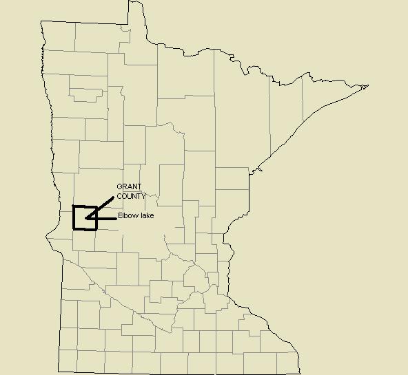
Appendix A PRIORITY CONCERNS SCOPING DOCUMENT FOR GRANT COUNTY LOCAL WATER MANAGEMENT PLAN
|
|
|
- Madison Barton
- 5 years ago
- Views:
Transcription
1 Appendix A PRIORITY CONCERNS SCOPING DOCUMENT FOR GRANT COUNTY LOCAL WATER MANAGEMENT PLAN
2 Appendix A Introduction:
3 The population of Grant County is listed at 6,289 (2000 Census). The trend of population change shows a 12.3 percent decline in population from 1980 to However, future trend predictions indicate that the population will rise slightly by 2010 and beyond. Most of this increase is predicted to occur in the eastern tier of townships where the majority of Grant County surface waters are located. Based on the most recent land use data (1990 census of the land) land use in the county continues to remain primarily in agriculture. There are a total of 368,559 acres in the county, broken down to the following land use categories: 4,750 acres (1.3%) of Urban and Rural development, 294,199 acres (79.8%) of cultivated land, 26,975 acres (7.3%) of Pasture/Grassland, 1,578 acres (.4%) of Brush land, 10,305 acres (2.8%) of Forested land, 20,498 acres (5.6%) of Water, 10,117 acres (2.7%) Wetlands, and 137 acres in Gravel pits. Within the cultivated land there has been a significant change from predominantly close grown small grains in 1978 to predominantly row crops such as corn and soybeans in The Grant Soil and Water Conservation District is the Local Government Unit (LGU) delegated to administer the Local Water Management Plan and to oversee completion of the update. A task force called the Environmental Advisory Council has been formed to guide the LGU and water plan update. The original Comprehensive Local Water Plan was adopted in May of 1990 and it has been updated once since its adoption. An update occurred in 1996 and a two year extension was granted in 2002 to extend the current plan until December 31 st Priority Concerns: A number of water resource concerns were submitted to the Grant County Environmental Advisory Council (EAC). Many of these concerns had a common theme which allowed the EAC to arrive at the following priority concerns that will be addressed in the Water Plan Revision. 1. Contaminated runoff from both urban and agricultural land entering surface waters. 2. Excessive runoff water volumes from urban and agricultural land. 3. Management of shoreland areas and surface water use. Specifically, on natural environment lakes, rivers, and sensitive areas on recreational, and general development lakes. Priority Concerns of Grant County were identified through the following process: February 2004 February 4 th, 2004 the Grant County Board of Commissioners signed a resolution to update the Comprehensive Local Water Plan. A meeting was held with Pete Waller of BWSR to discuss the update process and to receive BWSR input. A mailing with written notice was sent to all 16 townships; mayors of Elbow Lake, Barrett, Herman, Wendell, Hoffman, Ashby and Norcross; all members of the CLWP Environmental Advisory Council/ task force committee including representatives from the Bois de Sioux Watershed District, BWSR, Grant County Department of Land Management, MDH, MPCA, DNR, NRCS, FSA, USFWS, Pelican lake Assn, Pomme de Terre Lake Assn., Barrett Lake Assn., Elk Lake Assn., Water planners in Stevens County, Douglas County, Pope County, Wilkin County, Ottertail County and Traverse County. The notice explained the intent to update the water plan, invited all recipients to submit priority concerns and any water and related land resources plans and official controls. July 2004 An Environmental Advisory Council meeting was held July 1 st, 2004 to discuss the timeline and priority concerns
4 submitted by Townships, Cities, and Agencies. A discussion on the priority concerns of the individual members also occurred at this meeting. August 2004 A public meeting advertised in the Grant County Herald, Hoffman Tribune, and Herman Review, was held on August 26 th, 2004 in Elbow Lake and was attended by seven people. A presentation was given on the background and accomplishments of the current Local Water Management Plan and the need for public input for the update was explained. Those present were encouraged to express issues that they believed to be priority concerns, which should be addressed in the Water Plan Revision. Results Public Meetings and written comments from government units and agencies. Public Meeting August 26th: Some of the relevant topics and priority concerns that the public expressed during the discussion were as follows: High water levels and shoreland erosion on Flekkejord and Trisko lakes. High water from increased runoff in the Chippewa River. Increased demand for development on natural environment lakes and sensitive areas of other lakes, and the need to insure that the current Shoreland Ordinance is adequate to protect these areas. The need to educate lakeshore owners in the value of establishing or maintaining natural buffer strips on their property. Results (continued) Public Meetings and written comments from government units and agencies. The need for possible monetary incentives such as property tax reductions for lakeshore owners who establish or maintain natural buffer strips. Water levels on many lakes rise to fast after rain events. Runoff volumes need to be slowed through wetland restoration and the establishment of buffer strips. The need for additional buffer strips, not only in cropland areas but also in developed areas. The need to remove livestock from lakes and rivers in certain instances. Written responses were received from the following: Minnesota Department of Natural Resources (DNR), Division of Fisheries: Priority concerns listed were: 1. Shoreland development; the increase in proposed and potential subdivisions on natural environment Lakes and on marginal lots on general development and recreational lakes have the potential to have a negative impact on water quality, fish and wildlife habitat and shoreline erosion. The County Shoreland Ordinance should be updated to provide more protection for shoreline areas especially in the shore impact zone. There is a need to better define allowable shoreline alterations, vegetative clearing, and access on undeveloped lots and the land suitability provisions. (Note: the County Shoreland Ordinance was in the process of being updated as this document was being formulated.) 2. Surface Water Quality; Recreational and property values depend on water quality and clarity. There is a need to maintain or improve water quality in most of Grant County Lakes through the implementation of BMPʼS in the watershed such as filter strips, wetland restorations, sedimentation basins, manure management facilities, and
5 Individual sewage treatment systems within lakeshore and along tributary waters. 3. The need to identify sensitive areas for future protection; need to identify and catalogue sensitive fish and wildlife habitat. These areas would then be a high priority for protection, acquisition, and enhancement. Board of Water and Soil Resources (B WSR) Pete Waller: 1. Restoration of drained wetlands; Utilize drained basin inventory and base strategy for priority restoration sites on functions and values. Utilize existing programs to the greatest extent possible to achieve highest level of function and values. 2. Development pressures on recreational lakes; Grant County is no longer on the fringe of recreational development. The lakes portion of the county appears to be experiencing increased development pressure with a potential impact to the natural resources of those areas. Are the countyʼs ordinances prepared to deal with the potential conflict of development pressures and resource protection? Minnesota Pollution Control Agency (MPCA) Jack Frederick 1. The buffering of surface waters; Runoff from ag land is the greatest threat to the contamination of surface waters via sedimentation and nutrient enrichment. 2. Coordination of local water quality programs with TMDL impaired waters. 3. Restricting development of natural environment lakes. Minnesota Pollution Control Agency (MPCA) Lisa Thorvig: 1. Total Maximum Daily Load (TMDL)/ Impaired Waters; MPCA strongly encourages counties to consider how their local water plans address impaired waters, as identified on the Final List of Impaired Waters. Areas of the county that should be considered priority waters are the impaired water bodies and reaches of impaired water bodies on this list. 2. Feedlots and Individual Sewage Treatment Systems (ISTS); Recommend the County and MPCA work together to more effectively regulate feedlot operations within the County. Recommend the County adopt the Feedlot Work Plan, cooperate to reconcile feedlot compliance issues, and target worst-case feedlots within sensitive areas. The County should consider helping with establishing local training and workshops to assist in compliance with Minn. R for ISTS. Areas for focusing efforts on feedlots and ISTS are those near lakes, streams, wetlands, and impaired waters. 3. Priority Resource Protection and Planning; Recommend that the priority concerns of the County Local Water Management Plan, as they relate to water quality issues, are consistent with other local, regional, and statewide resource management documents, activities, goals and objectives. This would include the Red River and Minnesota River Basin Information Documents, the Grant County Comprehensive Plan, and Bois de Sioux Watershed District Plan. 4. Stormwater Management; Recommend the County cooperate with MPCA with insuring that the provisions of the General Stormwater Permit for construction activities are met by permittees within the County. By cooperating with regional MPCA staff in educating contractors and ensuring that appropriate best management practices are installed surface water resources within the County will be further protected from sediment during rain events. Shoreland areas and highly erodible areas are a high priority. Bois de Sioux Watershed District (BDSWD) 1. North Ottawa Sub-watershed; Actions needed include, restoration of 600 acres of drained basins above the beach ridge providing approximately 1200 acre feet of storage, establishing 1500 acres of buffer strips (some are completed), increase conservation tillage by 15% and inventory culverts.
6 Minnesota Department of Health: 1. Recognizing and supporting needs of public water suppliers in their wellhead protection planning programs: plan development, and plan implementation. 2. Recognizing non-community public water supply systems and the inner well management zone (a 200 foot radius around the public water supply well also known as IWMZ) protection needs. 3. Supporting the establishment of monitoring and testing of private wells, conducting testing clinics for nitrate testing and possible testing for arsenic where that is considered a risk potential and developing a county wide program to accurately locate wells that have a construction log to better understand the geology of the area. Importance of plan focus on these concerns is because drinking water is important to everyone and is a vital necessity for community health and economic well being. Action needed is to add language in the county water plan to reflect above statements. Local resources are the best way to address local issues. However, the MDH provides a high level of technical assistance support on most drinking water issues. Areas of highest priority will be approved wellhead protection areas (when identified) and a 200 foot radius around all public water supply wells (also know as IWMZ). Minnesota Department of Agriculture 1. Promoting conservation tillage; According to Minnesota agricultural statistics, it appears that Grant county plants almost two acres of beans for every acre of corn. Because of that fact, the county may have some crop residue issues. Our suggestion is to encourage adoption of conservation tillage and high residue management systems to reduce soil erosion. The AgBMP loan program is a good avenue for financial assistance for producers interested in conservation tillage. 2. Septic upgrades around lakes; Septic system upgrades will help improve water quality by reducing nutrient inputs. Also, compliant septic systems will reduce the risk of contaminating surface and ground water with human pathogens. 3. Grant County is not high on MDAʼs list of pesticide water quality concerns. However, the county should be aware of the pesticide best management practices available on the MDA web page. Also because of the amount of surface water, especially small wetlands, in grant county it would be good for the county to work with the MDA on promoting the implementation of generic as well as pesticide specific BMPʼs. City of Herman 1. Big Lake Retention Project; This project would help with flooding problems in Herman. 2. Storm water runoff from city streets; Funding needs to be available to help cities resolve this problem. 3.Niemackl Lakes Improvement Project; Continue working on filter strips and water retention. Pomme de Terre Lake Association 1. Surface water quality. 2. Shoreline erosion and sedimentation Lien Township 1. Potential development on Barrett Lake; Potential contamination of ground water, and erosion. Hooking up to City of Barrett water and sewage system should be investigated. 2. Farming road right of ways; Grass in the ditches is gone so there is no filtration left in the ditches. Existing ordinances should be enforced or make new ones, Right of ways should be marked.
7 Lawrence Township 1. High water on Denton slough is damaging township road. 2. Mud lake outlet; Road has washed out and been rebuilt several time in recent years. North Ottawa Township 1. Wetland restoration; This would reduce downstream flooding and slow down runoff. Elk Lake Township 1. Need buffer zones along rivers; seems that the set back on rivers should be the same as lakes since itʼs the same water and itʼs all connected. 2. Roads built to serve new developments; There should be a knowledgeable inspection as to fill material etc. of these roads. Environmental Advisory Council Meeting July 29 th, 2004 : Some of the relevant topics and priority concerns expressed by members of the council during the discussion were as follows: The need for additional buffer strips. The need for additional wetland restorations. Concern of shoreline development on natural environment lakes. The potential need for surface water use ordinances. Flooding of shallow lakes and the subsequent fish and wildlife habitat loss. The need for education and promotion of buffer strips with lakeshore owners. The need for additional acres utilizing conservation tillage. Surface water quality should be the main focus of the Water Plan Revision. Plans were collected and reviewed from the following: Grant SWCD Annual Work Plan 2003 and 2004 Bois de Sioux Watershed Districtʼs Overall Plan which includes overviews of Local County Water Management Plans and SWCD Plans for Big Stone County, Traverse County, Ottertail County, Stevens County, and Wilkin County. Douglas County Draft Comprehensive Local Water Plan. Grant County Comprehensive Plan. Other items important to the selection of priorities for Grant County include: Lakes and rivers are a major water resource for habitat and recreation. All goals of contaminated runoff and runoff volume reduction will have a positive effect on water quality and clarity. Drainage into a number of lakes and wetlands that do not have outlets has been a cause of major concern in the last decade. This additional runoff has been a factor in shoreline erosion, the destruction of wildlife habitat and damage to infrastructure such as roads. Lake eutrophication related to excess nutrients and contaminated runoff into Grant County lakes is a major issue. The Grant Soil and Water Conservation District in cooperation with NRCS and FSA have had good
8 success in implementing buffer strips on agricultural land, however it was noted by many respondents that additional buffers on agricultural land as well as shore land are still needed. Land use in the county is almost exclusively based in agricultural production, and practices to reduce soil erosion have multi-faceted benefits. While a majority of the land use in the County is agricultural, Grant County recognizes the potential for urban development in the shoreland areas of the County and if not properly managed the potential negative impacts (storm water runoff, loss of fish and wildlife habitat etc.) from this type of development. It is not possible to address all existing water management issues in the updated plan. Due to program budget cuts the focus of the work plan has been narrowed. Remaining concerns such as TMDLs,(currently there are no waters in Grant on the impaired list, however it is anticipated that action items implemented to reduce contaminated runoff will at least indirectly address this issue) and wellhead protection will be re-examined for higher prioritization during the next plan update or addressed as unforeseen opportunities arise.
Our Vision of the Future
 INTRODUCTION Our Vision of the Future The function of the Grant Soil and Water Conservation District is to provide the general population of Grant County with the knowledge and ability needed to protect
Shell Rock River Watershed: Water Plans
 Shell Rock River Watershed: Water Plans The Shell Rock River Watershed encompasses Freeborn County. Each county has developed a 10-year rotating comprehensive local water management plan (LWMP) in order
Water Plans. Water Plans: Houston County LWMP amended 2012 Winona County LWMP
 Mississippi River La Crescent Watershed: Water Plans The Mississippi River La Crescent Watershed encompasses Houston and Winona Counties. Each county has developed a 10-year rotating comprehensive local
Crow Wing Soil and Water Conservation District Annual Plan
 Crow Wing Soil and Water Conservation District 2007 Annual Plan 1 I. INTRODUCTION The Crow Wing SWCD Supervisors and Staff with the aid of the U.S. Department of Agriculture, are developing this plan to
January 1, 2017 to December 31, 2017
 BIG STONE SOIL & WATER CONSERVATION DISTRICT S ANNUAL PLAN OF WORK In Cooperation with Big Stone County Environmental Office, the Natural Resources Conservation Service, and Farm Services Agency January
Otter Tail County Local Water Management Plan August 31, Amended 2014
 Otter Tail County Local Water Management Plan August 31, 2009-2019 Amended 2014 Official Comment Period February 21 March 21 Comments and Plans received from the following: MN DNR MDA BWSR Douglas County
Des Moines River Headwaters Watershed: Water Plans
 Des Moines River Headwaters Watershed: Water Plans The Des Moines River Headwaters Watershed encompasses Cottonwood, Jackson, Lyon, Murray, Nobles, and Pipestone Counties. Each county has developed a 10-year
PART VI MINNESOTA COASTAL NONPOINT SOURCE PROGRAM
 PART VI MINNESOTA COASTAL NONPOINT SOURCE PROGRAM A. SUMMARY OF DEVELOPMENT AND STATUS OF STATE NPS PROGRAMS 1. Background A major effort to combat water pollution began with the passage of the federal
DAKOTA COUNTY SOIL AND WATER CONSERVATION DISTRICT COMPREHENSIVE PLAN
 DAKOTA COUNTY SOIL AND WATER CONSERVATION DISTRICT COMPREHENSIVE PLAN 2011-2015 4100 220 th Street West, Suite 102 Farmington, MN 55024 651-480-7777 www.dakotacountyswcd.org I. INTRODUCTION A. Purpose
MGWA Spring Conference April 19, 2012
 Lanya Ross, Metropolitan Council for the Interagency Groundwater/Drinking Water Team MGWA Spring Conference April 19, 2012 to protect drinking water sources to protect, enhance, and restore wetlands, prairies,
City of Fairmont Storm Water Pollution Prevention Plan Annual Public Meeting. June 11, 2018
 City of Fairmont Storm Water Pollution Prevention Plan Annual Public Meeting June 11, 2018 Why is Water Quality Important? Water has always been important to Minnesota and is a key part of our history,
FY Biennial Budget Request Mille Lacs SWCD
 FY 18-19 Biennial Budget Request Mille Lacs SWCD Total Requested Biennial State Contribution: $1,075,818.00 BBR ID BBR16-0773 Total Leveraged Funds $200,000.00 Submitted Date 4/14/2016 Total Resource Project
II. Priority Concerns
 II. Priority Concerns Assessment of Priority Concerns: The three priority concerns of Contaminated Runoff, Excessive Runoff, Management of Shoreland Areas and Surface Water use are described in detail
3D WETLAND MANAGEMENT
 3D WETLAND MANAGEMENT 1. ISSUE Wetlands are one of the most productive ecosystems. They provide biological and chemical functions to the landscape that serve the watershed including the moderation of nutrient
Long Prairie River Watershed Restoration and Protection Strategies (WRAPS) Report Summary
 Report Summary") Long Prairie River Watershed Restoration and Protection Strategies (WRAPS) Report Summary Minnesota has adopted a watershed approach to address the state s 80 major watersheds (denoted by 8-digit hydrologic
Long Prairie River Watershed Restoration and Protection Strategies (WRAPS) Report Summary Minnesota has adopted a watershed approach to address the state s 80 major watersheds (denoted by 8-digit hydrologic
ELK RAPIDS TOWNSHIP WATER QUALITY ACTION PLAN
 ELK RAPIDS TOWNSHIP WATER QUALITY ACTION PLAN Elk-River-Chain-of-Lakes Gaps Analysis Project The Watershed Center Grand Traverse Bay Tip of the Mitt Watershed Council Michigan Department of Natural Resources
Pomme de Terre River Watershed: Water Plans
 Pomme de Terre River Watershed: Water Plans The Pomme de Terre River Watershed encompasses Big Stone, Douglas, Grant, Otter Tail, Stevens, and Swift Counties. Each county has developed a 10-year rotating
C. Staffing Needs Approximately 150 staff days TSA #3 staff time will also be utilized.
 2017 Annual Plan I. Introduction The purpose of this annual plan is to detail work items that will be completed in 2017. The annual plan will provide a tool for SWCD staff and supervisors to evaluate program
CLEARWATER TOWNSHIP WATER QUALITY ACTION PLAN
 CLEARWATER TOWNSHIP WATER QUALITY ACTION PLAN Elk-River-Chain-of-Lakes Gaps Analysis Project The Watershed Center Grand Traverse Bay Michigan Department of Environmental Quality July 2011 Purpose The Grand
Water Governance Evaluation
 Water Governance Evaluation Streamline, strengthen and improve sustainable water management John Linc Stine MPCA Commissioner Suzanne Rhees Water Governance Evaluation Coordinator Clean Water Council November
BANKS TOWNSHIP WATER QUALITY ACTION PLAN
 BANKS TOWNSHIP WATER QUALITY ACTION PLAN Elk-River-Chain-of-Lakes Gaps Analysis Project The Watershed Center Grand Traverse Bay Tip of the Mitt Watershed Council Michigan Department of Natural Resources
Cottonwood River Watershed: Water Plans
 Cottonwood River Watershed: Water Plans The Cottonwood River Watershed encompasses Brown, Cottonwood, Lyon, Murray, Nicollet, and Redwood Counties. Each county has developed a 10-year rotating comprehensive
WATER RESOURCES DRAFT 2040 CARVER COUNTY COMPREHENSIVE PLAN.
 WATER RESOURCES DRAFT 2040 CARVER COUNTY COMPREHENSIVE PLAN www.co.carver.mn.us/2040plan 5. WATER RESOURCES PLAN Introduction The Water Resources Section of the 2040 Comprehensive Plan is intended to meet
WATERSHED MANAGEMENT IN MINNESOTA. GOVERNANCE, PLANNING, AND FUNDING June 19, 2018 Cedar Rapids, Iowa
 WATERSHED MANAGEMENT IN MINNESOTA GOVERNANCE, PLANNING, AND FUNDING June 19, 2018 Cedar Rapids, Iowa GOVERNANCE - WD 1955 Watershed Act (MN Statute 103D) Local petition to form VOLUNTARY watershed district
Red Rock Lake: A Path Forward
 University of Minnesota Morris Digital Well University of Minnesota Morris Digital Well Center for Small Towns 6-2016 Red Rock Lake: A Path Forward Colette Millard Student - University of Minnesota, Morris
VILLAGE OF BELLAIRE WATER QUALITY ACTION PLAN
 VILLAGE OF BELLAIRE WATER QUALITY ACTION PLAN Elk-River-Chain-of-Lakes Gaps Analysis Project The Watershed Center Grand Traverse Bay Tip of the Mitt Watershed Council Michigan Department of Natural Resources
DRAFT Budget and Outcomes Committee FY18-19 Clean Water Fund recommendations (July 8, 2016)
") Name FY18-19 Description s 20 BWSR Targeted Wellhead/Drinking Water Protection For permanent conservation easements on wellhead protection areas under Minnesota Statutes, section 103F.515, subdivision
Name FY18-19 Description s 20 BWSR Targeted Wellhead/Drinking Water Protection For permanent conservation easements on wellhead protection areas under Minnesota Statutes, section 103F.515, subdivision
Natural Resource Protection is the Goal: (no further elaboration needed)
") What is NEMO? NEMO (Nonpoint Education for Municipal Officials) is an educational program for local land use decision makers focusing on the relationship between land use and natural resource quality.
What is NEMO? NEMO (Nonpoint Education for Municipal Officials) is an educational program for local land use decision makers focusing on the relationship between land use and natural resource quality.
Introducing Act 64 - the Vermont Clean Water Act - and Vermont s Clean Water Goals
 Introducing Act 64 - the Vermont Clean Water Act - and Vermont s Clean Water Goals Marli Rupe, DEC Clean Water Initiative Program Asst. Manager February 22, 2016 Clean Waters are a Critical Community Asset
CITY OF HOYT LAKES, MINNESOTA SOURCE WATER ASSESSMENT
 CITY OF HOYT LAKES, MINNESOTA SOURCE WATER ASSESSMENT November 2002 Public Water Supplier ID 1690028 Facility Contact: Minnesota Department of Health Contact: Mr. Floyd Nelson, Supervisor Ms. Beth Kluthe
Agricultural/Rural Riparian Buffer Analysis
 Agricultural/Rural Riparian Buffer Analysis December 2014 Executive Summary The Agricultural/Rural Riparian Buffer Analysis was developed from a 2014 analysis of current requirements for the riparian areas
C Fish Lake C Rice Lake C Mud Lake C Weaver Lake C Elm Creek*
 IV. PROBLEMS AND CORRECTIVE ACTIONS Outlined below is an assessment of existing and potential water resource-related issues that are known at this time. These issues have been identified based on Commission
TORCH LAKE TOWNSHIP WATER QUALITY ACTION PLAN
 TORCH LAKE TOWNSHIP WATER QUALITY ACTION PLAN Elk-River-Chain-of-Lakes Gaps Analysis Project The Watershed Center Grand Traverse Bay Tip of the Mitt Watershed Council Michigan Department of Natural Resources
CHAPTER 4 WATERSHED PLAN GOALS & OBJECTIVES
 4.0 Introduction CHAPTER 4 WATERSHED PLAN GOALS & OBJECTIVES After the watershed analysis had been completed, the next step in the planning process followed by the group was to come up with goals and objectives
DOUGLAS SOIL AND WATER CONSERVATION DISTRICT PLAN OF WORK JANUARY 1, 2012 THROUGH DECEMBER 31, 2012
 DOUGLAS SOIL AND WATER CONSERVATION DISTRICT PLAN OF WORK JANUARY 1, 2012 THROUGH DECEMBER 31, 2012 I. INTRODUCTION The purpose of this Plan of Work is to provide a short term approach to implementing
MORRISON SOIL AND WATER CONSERVATION DISTRICT
 MORRISON SOIL AND WATER CONSERVATION DISTRICT 16776 Heron Road Little Falls, MN 56345 (320) 616-2479 www.morrisonswcd.org ANNUAL PLAN OF OPERATIONS January 1, 2014 to December 31, 2014 OBJECTIVE ONE: To
City of Fairmont Storm Water Pollution Prevention Plan (SWPPP) January 23, 2017
 January 23, 2017") City of Fairmont Storm Water Pollution Prevention Plan (SWPPP) January 23, 2017 Why is Water Quality Important? Water has always been important to Minnesota and is a key part of our history, culture, economy
City of Fairmont Storm Water Pollution Prevention Plan (SWPPP) January 23, 2017 Why is Water Quality Important? Water has always been important to Minnesota and is a key part of our history, culture, economy
Isanti Soil and Water Conservation District Strategic Framing
 Isanti Soil and Water Conservation District Strategic Framing Completed August 18, 2015 Adopted by the Isanti SWCD Board September 15, 2015 Assisted by Jason Weinerman MN Board of Water and Soil Resources
BWSR PROGRAMS THAT ADDRESS NUTRIENT LOSS
 BWSR PROGRAMS THAT ADDRESS NUTRIENT LOSS DRAINAGE LAW BUFFER PROGRAM CREP - GRANT PROGRAMS - PROJECTS 2017 MVTL Agronomy Update Meeting New Ulm, MN February 28, 2017 Jill Sackett Eberhart ~ BWSR Board
Norman County s Priority Concerns Scoping Document
 Norman County s Priority Concerns Scoping Document a The Priority Concerns Scoping Document of the Norman County Comprehensive Local Water Management Plan was developed in accordance with the changes to
One Watershed, One Plan Plan Content Requirements
 One Watershed, One Plan Plan Content Requirements From the Board of Water and Soil Resources, State of Minnesota Version: 2.00 Effective Date: 03/28/2018 Approval: Board Decision #18-14 Policy Statement
Nitrogen and Pesticide Use
 On behalf of the Minnesota Department of Agriculture, thank you for the Pomme de Terre 1W1P notification letter. We appreciate the invitation to submit water management issues and concerns. As a first
Boardman River Townships Project EAST BAY TOWNSHIP. WATER QUALITY ACTION PLAN Fall 2009
 Boardman River Townships Project EAST BAY TOWNSHIP WATER QUALITY ACTION PLAN Fall 2009 Partners: The Watershed Center Grand Traverse Bay Northwestern Michigan College - Great Lakes Water Studies Institute
MILTON TOWNSHIP WATER QUALITY ACTION PLAN
 MILTON TOWNSHIP WATER QUALITY ACTION PLAN Elk-River-Chain-of-Lakes Gaps Analysis Project The Watershed Center Grand Traverse Bay Tip of the Mitt Watershed Council Michigan Department of Natural Resources
Annual Plan of Work 2009
 Annual Plan of Work 2009 Our mission is to assist the citizens of Faribault County in improving water quality and reducing soil erosion, establishing wildlife habitat, and promoting information and education
MORRISON SOIL AND WATER CONSERVATION DISTRICT
 MORRISON SOIL AND WATER CONSERVATION DISTRICT 16776 Heron Road Little Falls, MN 56345 (320) 616-2479 www.morrisonswcd.org ANNUAL PLAN OF OPERATIONS January 1, 2014 to December 31, 2015 OBJECTIVE ONE: To
Clallam County DCD Update to Critical Area Ordinance for Existing & On-Going Agriculture
 Clallam County DCD Update to Critical Area Ordinance for Existing & On-Going Agriculture Background on Ag in Clallam County 1. In 1945 there was 1,133 farms on 77,880 acres 2. Since then the number of
Maintaining and Improving the Health of All Minnesotans
 Protecting, Maintaining and Improving the Health of All Minnesotans 7/10/17 Stephanie Adams 12 Hwy 28 E St 2 Morris, MN 56267 Dear Stephanie: Subject: Initial Comment Letter, One Watershed One Plan Thank
Mississippi River Winona Watershed: Water Plans
 Mississippi River Winona Watershed: Water Plans The Mississippi River Winona Watershed encompasses Olmsted, Wabasha, and Winona Counties. Each county has developed a 10-year rotating comprehensive local
Feedlot Financial Needs Report
 Feedlot Financial Needs Report for Feedlots with Less Than 300 Animal Units to Comply with Applicable State Rules and Statutes by October 1, 2010 Minnesota Board of Water and Soil Resources January 2008
CLMP+ Report on Fleming Lake (Aitkin County)
") CLMP+ Report on Fleming Lake (Aitkin County) Lake ID# -5-5-6 CLMP+ Data Summary July 7 Authors Shannon Martin Contributors/acknowledgements Terry Dahlberg Sandy Dahlberg Pam Anderson For questions regarding
CLMP+ Report on Fleming Lake (Aitkin County) Lake ID# -5-5-6 CLMP+ Data Summary July 7 Authors Shannon Martin Contributors/acknowledgements Terry Dahlberg Sandy Dahlberg Pam Anderson For questions regarding
Voluntary Water Quality Conservation Plan
 Voluntary Water Quality Conservation Plan Plan Table of Contents A. Mid Coast Agricultural Water Quality Management Area Rules and Plan Overview B. Landowner Resource/Practice Inventory C. Recommended
Cannon River One Watershed, One Plan. POLICY COMMITTEE MEETING January 10, 2018 Rice County Government Center Faribault, MN
 Cannon River One, One Plan POLICY COMMITTEE MEETING January 10, 2018 Rice County Government Center Faribault, MN TASK Task 1. Aggregate Existing Physical & Spatial Data 1A. Create project maps 1B. Meeting
Regional Watershed Planning. Calumet Summit 2010: A Call to Connect Calumet Conference Center April 27, 2010
 Regional Watershed Planning Calumet Summit 2010: A Call to Connect Calumet Conference Center April 27, 2010 Basins The Calumet Region Watershed Communities Land Cover- 2006 Impervious Cover 303d Listed
Comprehensive Plan
 Comprehensive Plan 2008-2012 Approved April 16, 2008 South St. Louis SWCD Board of Supervisors I. Introduction A. Purpose The purpose of this Comprehensive Plan is to establish an action strategy for the
Mud Lake Lakeshed Assessment
 Mud Lake Lakeshed Assessment The lakeshed vitals table identifies where to focus organizational and management efforts for each lake. Criteria were developed using limnological concepts to determine the
Site Condition Evaluation & Environmental Benefits Report
 Site Evaluation & Environmental Benefits Report Background The New York State Conservation Reserve Enhancement Program is a collaborative effort between the USDA and the State of New York. The goal of
LAKE CHEMUNG GENOA TOWNSHIP LIVINGSTON COUNTY, MICHIGAN STORM DRAIN AND TRIBUTARY STUDY. Prepared for:
 LAKE CHEMUNG GENOA TOWNSHIP LIVINGSTON COUNTY, MICHIGAN STORM DRAIN AND TRIBUTARY STUDY Prepared for: Lake Chemung Riparian Association c/o 1125 Sunrise Park Drive Howell, MI 48843 Prepared by: Progressive
CAMP KOOCH-I-CHING SOURCE WATER ASSESSMENT
 CAMP KOOCH-I-CHING SOURCE WATER ASSESSMENT PWS ID 5360100 Facility Contact: Minnesota Department of Health Contact: Mr. Jerry Bergvall Ms. Beth Kluthe Camp Kooch-I-Ching Minnesota Department of Health
Chapter 5 Goals and Objectives of the Watershed
 Chapter 5 Goals and Objectives of the Watershed 5.1 Goals for the Watershed 5.2 Objectives for the Watershed Goals 5.2.1 Water Quality Impairments 5.2.2 Preserving and Protecting Designated Areas 5.2.3
Northern Chain of Lakes
 Northern Chain of Lakes Presented by Pat Conrad and Joe Pallardy on behalf of the Brown s Creek Watershed District Board of Managers w a t e r I e c o l o g y I c o m m u n i t y Lake by Lake Analysis
MORRISON SOIL AND WATER CONSERVATION DISTRICT
 MORRISON SOIL AND WATER CONSERVATION DISTRICT 16776 Heron Road Little Falls, MN 56345 (320) 616-2479 www.morrisonswcd.org ANNUAL PLAN OF OPERATIONS January 1, 2016 to December 31, 2016 OBJECTIVE ONE: To
The Regulatory Framework
 The Regulatory Framework Water reuse project objectives How Do MN Agencies Currently Manage Water Reuse? Agency Roles Regulation by Source What Have We Heard? Agency roles and responsibilities Department
[] The Red Cedar River and its Streams (Fall 2001)
![[] The Red Cedar River and its Streams (Fall 2001)](/thumbs/81/84582489.jpg "[] The Red Cedar River and its Streams (Fall 2001)") [] The Red Cedar River and its Streams (Fall 2001) This is an opportunity for you to provide information for local water resource planning. Your input will help planners make informed water quality decisions.
[] The Red Cedar River and its Streams (Fall 2001) This is an opportunity for you to provide information for local water resource planning. Your input will help planners make informed water quality decisions.
Comfort Lake-Forest Lake Watershed District Six Lakes Total Maximum Daily Load Implementation Plan
 Prepared by: for the Comfort Lake-Forest Lake Watershed District and the Minnesota Pollution Control Agency Comfort Lake-Forest Lake Watershed District Six Lakes Total Maximum Daily Load February 16, 2010
Stakeholder Identification Plan
 Minnesota Pollution Control Agency and Wisconsin Department of Natural Resources Lake St Croix TMDL Excess Nutrients Combined Stakeholder Participation Strategy Stakeholder Participation Water bodies that
awetlands aprairie aforests ahabitat for Fish, Game & Wildlife
 Rec. H1 priority land habitats pp. 63-67 Priority areas identified in integrated mapping assessing critical land habitat and threats to habitat pp.33-63 o Mapping is scalable for use in localized areas
Reservoir age, increasing human population,
 B-6249 02/12 Eagle Mountain Watershed Management Brent Clayton, Justin Mechell, David Waidler and Clint Wolfe* Reservoir age, increasing human population, and changing land uses have prompted the development
Chapter 2. Watershed Characteristics
 Chapter 2. Watershed Characteristics The Pelican Lakes are glacial lakes formed during the last retreat of the Red River Lobe starting about 13,000 years ago. The soils deposited by the glacier are primarily
Nutrient Management in. A presentation to the West Metro Water Alliance
 Nutrient Management in Developing and Agricultural Areas A presentation to the West Metro Water Alliance Chris Meehan, P.E. May 25, 2011 Agenda Physical Improvements Planning Improvements How to get it
Conservation District Business Plan Steuben County Soil and Water Conservation District
 Conservation District Business Plan Steuben County Soil and Water Conservation District I find the great thing in this world is not so much where we stand as in what direction we are moving Oliver Wendell
Watershed Response to Water Storage. 8/1/2012 Paul Wymar Scientist Chippewa River Watershed Project
 Watershed Response to Water Storage 8/1/2012 Paul Wymar Scientist Chippewa River Watershed Project Chippewa River Watershed 1.3 Million Acres Largest tributary watershed in the Minnesota River Basin 7
Shaina Keseley MPCA-Rochester Watershed Project Manager
 Shaina Keseley MPCA-Rochester Watershed Project Manager Why study Minnesota s waters? Basis of Clean Water work: Federal Clean Water Act of 1972 Goal Fishable/Swimmable by 1983 MPCA completes work for
Data Collection and Monitoring
 One Watershed, One Plan Data Collection and Monitoring Supporting information for Section III.F.5 of the 1W1P Plan Content Requirements This document discusses considerations for local governments in designing
3.0 Regulatory Framework
 3.0 Regulatory Framework Various units of government are involved in regulating water resource related activities. For example: The Board of Water and Soil Resources (BWSR) oversees the state s watershed
Lake Minnewaska Phase 1 Resource Investigation
 Final Report Format Section 319 and Clean Water Partnership Projects or Final Progress Report for TMDL / WRAPS Development and TMDL / WRAPS Implementation Projects Lake Minnewaska Phase 1 Resource Investigation
AGREEMENT BETWEEN THE U.S. DEPARTMENT OF AGRICULTURE COMMODITY CREDIT CORPORATION AND STATE OF NEW YORK
 AGREEMENT BETWEEN THE U.S. DEPARTMENT OF AGRICULTURE COMMODITY CREDIT CORPORATION AND STATE OF NEW YORK IMPLEMENTING THE CONSERVATION RESERVE ENHANCEMENT PROGRAM This Agreement is between the U.S. Department
2nd Bulletin of the Minnesota Agriculture Water Quality Certification Program and Assessment Tool
 2nd Bulletin of the Minnesota Agriculture Water Quality Certification Program and Assessment Tool What s in this bulletin? May 2014 1. Soil hydrologic group and tile drainage 2. Irrigation scoring 3. Alternative
Contiguous Lots, Relationships & Special Topics Fall Darrin Hoverson Area Hydrologist
 Contiguous Lots, Relationships & Special Topics Fall 2018 Darrin Hoverson Area Hydrologist 1. Nonconforming Lots 2. SL Model Ordinance Update 3. New Review Process 4. Website Resources Regs & Administration
11:10 Stakeholder Process Discuss stakeholder process for policy recommendations.
 Policy Ad Hoc Committee (Committee) Meeting Agenda Clean Water Council (Council) July 22, 2016 10:00-1:30 MPCA, 520 Lafayette Road North, St. Paul, MN MPCA Conference Room 100 2015-2016 Policy Ad Hoc Committee
CBP Implementation Plan
 York County Conservation District CBP Implementation Plan March 2014 York County Conservation District 118 Pleasant Acres Road York, PA 17402 Phone: (717) 840-7430 www.yorkccd.org 1 Table of Contents Introduction
LaPorte County Soil and Water Conservation District Business Plan
 LaPorte County Soil and Water Conservation District Business Plan 2011-15 LaPorte County Soil and Water Conservation District Business Plan 2011-2015 Who We Are: What We Do: Who We Serve: Our Mission:
RICE COUNTY LOCAL WATER MANAGEMENT PLAN
 RICE COUNTY LOCAL WATER MANAGEMENT PLAN IMPLEMENTATION UPDATE TO FOURTH GENERATION January 29, 2014 Through December 31, 2019 Adopted by the Rice County Board of Commissioners 01/12/16 Rice County Water
Model Riparian Buffer Ordinance.
 Model Riparian Buffer Ordinance. This is a sample riparian buffer ordinance written as an amendment to an existing zoning ordinance. This ordinance complies with the state minimum standards for river corridor
Table G - 7. Mitigation Actions Identified for Implementation by the City of Eyota ( ) (From Olmsted County Master Mitigation Action Chart)
 (From Olmsted County Master Mitigation Action Chart)") Multi-Hazard Plan, 2017 Table G - 7. Actions Identified for by the City of () (From Master Action Chart) City of Action Comments on 1 All- Hazards Preparedness & Response Support Identify and map locations
Multi-Hazard Plan, 2017 Table G - 7. Actions Identified for by the City of () (From Master Action Chart) City of Action Comments on 1 All- Hazards Preparedness & Response Support Identify and map locations
Chapter 4 Watershed Goals and Objectives
 Chapter 4 Watershed Goals and Objectives Eight (8) long-term watershed goals have been developed by the NEW Watershed Advisory Group (WAG) after consideration of discussions held during monthly watershed
INDIAN CREEK WATERSHED PLAN EXECUTIVE SUMMARY
 INDIAN CREEK WATERSHED PLAN EXECUTIVE SUMMARY The Indian Creek Watershed covers a 38 square mile area in southern Lake County, Illinois that drains 24,116 acres before discharging into the Des Plaines
St. Joseph River Watershed 319 Project Technical Subcommittee November 3, 2003 Meeting Summary DRAFT
 St. Joseph River Watershed 319 Project Technical Subcommittee November 3, 2003 Meeting Summary DRAFT Attendees Sandra Nordmark, FOTSJR Steve Blumer, USGS Water Resources Division Todd Kesselring, Elkhart
Rice SWCD 2018 Annual Plan of Work
 Rice SWCD 2018 Annual Plan of Work Introduction The Rice Soil and Water Conservation District s Annual Plan is developed to provide guidance and direction to district staff and supervisors for the goals
WATERSHED. Maitland Valley. Report Card 201
 Maitland Valley WATERSHED Report Card 201 The Maitland Valley Conservation Authority has prepared this report card as a summary on the state of our forests, wetlands, surface water, and ground water resources.
EXECUTIVE SUMMARY DES PLAINES RIVER WATERSHED-BASED PLAN WHY A WATERSHED-BASED PLAN? WHAT IS A WATERSHED?
 Des Plaines River Watershed-Based Plan EXECUTIVE SUMMARY June 2018 EXECUTIVE SUMMARY DES PLAINES RIVER WATERSHED-BASED PLAN WHY A WATERSHED-BASED PLAN? Water is elemental to our lives. Plants and animals,
Watershed master planning, City of Griffin, Georgia, USA
 Water Resources Management VII 3 Watershed master planning, City of Griffin, Georgia, USA J. K. Kaplan & B. J. Watson Tetra Tech, Water Resources Group, Atlanta, Georgia, USA Abstract Tetra Tech has assisted
Deborah Swackhamer University of Minnesota
 Deborah Swackhamer University of Minnesota What is the Framework? A 25-year plan to protect, conserve, and enhance the quantity and quality of the state's groundwater and surface water An approach to manage
Capacity Building Through the Watershed Approach
 Capacity Building Through the Watershed Approach Mississippi Department of Environmental Quality (MDEQ) and US Environmental Protection Agency, Region 4 (USEPA, R4) MDEQ Process 1. Develop water quality
Appendix X: Non-Point Source Pollution
 Appendix X: Non-Point Source Pollution Sources Nonpoint source of pollution, unlike pollution from industrial and sewage treatment plants, comes from many different sources. Nonpoint source pollution is
How is Water Quality Affected by Land Use?
 Watershed Connections Lesson Les4 3 How is Water Quality Affected by Land Use? Overview What are the benefits of a healthy watershed? What are examples of land uses? What types of pollution can come from
Ann River Watershed TMDL Restoration Plan
 Ann River Watershed TMDL Restoration Plan June 2013 ANN RIVER WATERSHED TMDL RESTORATION PLAN PRIMARY AUTHORS AND CONTRIBUTORS: KANABEC SOIL & WATER CONSERVATION DISTRICT KELLY OSTERDYK MILLE LACS SOIL
Key Strategic Goal Of the MVCA
 Garvey Glenn Shoreline watershed project Soil and Water Environmental Enhancement Plan (SWEEP) May 2012 Preface This document is a working document which has been and will continually be updated as the
Setting the Course for Improved Water Quality Collecting Land Use Data for TMDLs
 Setting the Course for Improved Water Quality Collecting Land Use Data for TMDLs A TMDL training program for local government leaders and other water managers Session 6b wq-iw3-56b In this presentation
Conservation District Business Plan Steuben County Soil and Water Conservation District
 1 Conservation District Business Plan Steuben County Soil and Water Conservation District I find the great thing in this world is not so much where we stand as in what direction we are moving Oliver Wendell