K&C Phase 3 Brief project essentials. Climate-Relevant Modernization of the National Forest Policy and Piloting of REDD+ Measures in the Philippines
|
|
|
- Vernon Jordan
- 6 years ago
- Views:
Transcription
1 K&C Phase 3 Brief project essentials Climate-Relevant Modernization of the National Forest Policy and Piloting of REDD+ Measures in the Philippines Francisco B. Tavora, Jr. 1, Jose Don T. De Alban 2, Enrico C. Paringit 3, and Angelica Kristina V. Monzon 2 1 Deutsche Gesellschaft für Internationale Zusammenarbeit (GIZ PH) 2 Fauna & Flora International (FFI) 3 Department of Geodetic Engineering, University of the Philippines (UP-DGE) Science Team meeting #17 Phase 3 RESTEC HQ, Roppongi, Tokyo, March 26-29, 2012

2 Project areas: Philippines Sub-national REDD+ Pilot Sites 1. Southern Sierra Madre mountain range 2. Leyte island 3. Victoria-Anepahan mountain range, Palawan island
3 K&C Project Collaborators and Partners Project Collaborators 1. Deutsche Gesellschaft für Internationale Zusammenarbeit (GIZ) 2. Fauna & Flora International (FFI) 3. Department of Geodetic Engineering, University of the Philippines (UP-DGE) Partners & Supporting Agencies 1. Non-Timber Forest Products Task Force / Exchange Programme 2. TEaM Energy Foundation in the Philippines (supported by Tokyo Electric Company & Marubeni) 3. European Commission 4. Department of Environment and Natural Resources: Forest Management Bureau & National Mapping and Resource Information Authority
4 Project objectives For each of the three identified REDD+ pilot sites, the project aims to: 1. Establish baseline forest carbon stocks 2. Pilot forest carbon inventory and monitoring methods in support of validating ALOS PALSAR imageries 3. Determine reference deforestation rate

5 Leyte island Updates LEYTE ISLAND


6 Leyte: Systematic Cluster Distribution
7 Leyte Island FRA Update Total of 123 of 200 clusters in Southern Leyte assessed 81 clusters inside pilot area 42 clusters outside pilot area Total of 15 of 50 clusters assessed in (Northern) Leyte 15 clusters inside Energy Development Corporation area 13 clusters in dense natural forest 2 clusters in forest plantation non-native species


8 Variability/Change Detection Same Polarizations Stack Acquired same year:2007, 2008, & 2009 R: 2007 HV G: 2008 HV B: 2009 HV 2009 HV 2008 HV 2007 HV
9 Some challenges: Leyte island


10 Southern Sierra Madre Victoria-Anepahan mountains, Palawan Updates SOUTHERN SIERRA MADRE & PALAWAN
11 Some background In the Philippines, 12 natural forest formations have been described based on physical characteristics (Fernando et al 2008; Whitmore 1984) Limitations of previous national mapping efforts: 1 Multi-spectral data affected by cloud cover 2 Different forest classification schemes employed 3 Only partially reflects various Philippine forest formations Forest classification scheme by Whitmore (1984) was adopted in the 1997 NBSAP, but still not adopted by DENR Some previous efforts to map the extent of Philippine forests using satellite remote sensing: SSC land cover map using 15m SPOT imagery NAMRIA/FMB land cover map using 30m Landsat data


12 Forest formations of the Philippines Image source: Fernando et al Forest Formations of the Philippines. ASEAN-Korea Environmental Cooperation, Seoul, Korea.

13 Forest types, elevation, rainfall, and temperature Image source: Heaney and Regalado Vanishing Treasures of the Philippine Rain Forest. The Field Museum, Chicago, Illinois, USA.


14 Some factors shaping forest structure and growth Elevation Rainfall Soils Image source: Ong et al. (eds.) Philippine Biodiversity Conservation Priority-setting Programme. Final Report. DENR, CI-P, UP-CIDS, and FPE, Quezon City, Philippines.
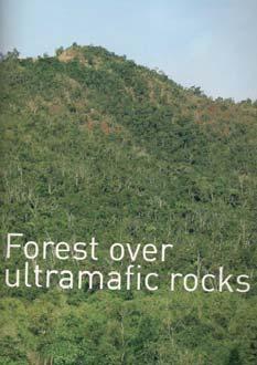
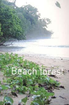
15 Comparison of forest classification Forest formations 1987 SSC 2002 NAMRIA/FMB Lowland evergreen forest Closed canopy, mature >50% Closed broadleaf forest Lower montane forest Open canopy, mature <50% Open broadleaf forest Upper montane forest Mossy forest Coniferous forest, closed Subalpine forest Pine forest Coniferous forest, open Forest over limestone Mangrove forest Mixed forest Forest over ultramafic Marshy area and swamp Mangrove forest Beach forest Submarginal forest Forest plantation, broadleaf Mangrove forest Forest plantation, coniferous Peat swamp forest Forest plantation, mangrove Freshwater swamp forest Semi-evergreen forest Moist deciduous forest
16 Methodology: image processing ALOS/PALSAR 2010 Mosaic 25m, HH+HV Ancillary Data (e.g., DEM) Radar Backscatter Calculation Textural Analysis Modeling and Regression Image Segmentation / Object-Based Classification Forest Plot Inventory Data Accuracy Assessment/Va lidation Forest Formation Maps
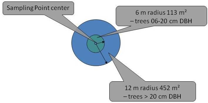
17 Methodology: field sampling design (biodiversity transects and forest carbon plots) 50m. 50m. St.1 25m. 250m. St.2 2-kilometer transect Plot 1 Plot 2 Area per plot = 50m x 50m = 2,500 sq.m Total plots per transect = 9 Total area for plots = 22,500 sq.m (2.25 ha.)


18

19 Considerations: accessibility elevation gradients sampling intensity per strata


20 Aramaywan meter mosaic ALOS/PALSAR Victoria- Anepahan mountains Unsupervised classification Initial 11 forest carbon plots Estrella Legend Forest? Transition? Lowland?
21 Methodology: carbon estimation modeling GPS coordinates of Plots Slope Corrected Image DN values from plots (HH, HV, HH/HV) Forestry Inventory Plots Compute Individual Trunk Vol (merchantable ht) Sum of Trunk Vol (merchantable height) REGRESSION Resulting GRAPHS Compute Individual Trunk Vol (total height) Sum of Trunk Vol (total height)
22 Project schedule Main Activities Image processing S1 S2 S1 S2 S1 S2 S1 S2 2. Forest carbon inventories and biodiversity assessments 3. Image post-processing, analysis, change detection 4. Report writing Legend: Sierra Madre Leyte Palawan
23 Support to JAXA s global forest mapping effort 1. Sharing of in-situ data from forest inventories and other field activities from REDD+ sites 2. Validation of JAXA forest/non-forest cover maps and land use/land cover change maps 3. Input to development of algorithms for forest classification, carbon stock assessment, and forest stratification The in-situ data that will be shared with JAXA includes: broad habitat and land cover types; location/gps coordinates; tree diameter, merchantable tree height, and tree species; tree canopy cover; leaf litter; and deadwood.
24 Deliverables The project envisions the following results: Forest cover and change maps produced Deforestation rates determined Baseline forest carbon stocks established Image processing methodologies and accuracy assessments documented.
K&C Phase 4 Status report. Utilising L-Band SAR Data for Natural Resource Management in the Philippines
 K&C Phase 4 Status report Utilising L-Band SAR Data for Natural Resource Management in the Philippines Mari Trix Estomata 1, Jose Don De Alban 2, Angelica Kristina Monzon 2, Patricia Sanchez 3, and Enrico
JAXA s MRV - current status and future envision -
 JAXA s MRV - current status and future envision - Masanobu Shimada Japan Aerospace Exploration Agency Earth Observation Research Center MRV symposium at Tokyo Forum Feb. 17, 2011 Concept Satellite data
K&C Phase 3 Brief project essentials
 K&C Phase 3 Brief project essentials Aboveground Biomass and Carbon Stock Mapping and Changes Monitoring in the Forest of Peninsular Malaysia Using L-Band ALOS Palsar and JERS-1 Khali Aziz Hamzah & Hamdan
Use of ALOS PALSAR data for supporting forest carbon tracking in Sumatra island: Collaborative research between LAPAN and JAXA
 K&C Phase 3 First Report Use of ALOS PALSAR data for supporting forest carbon tracking in Sumatra island: Collaborative research between LAPAN and JAXA PI : Dr. Orbita Roswintiarti CI : Katmoko Ari, Novie,
Updating Forest Cover and Assessing Aboveground Biomass in Various Tropical Forest Ecosystems from PALSAR-2 Polarizations
 K&C Phase 4 Status report Updating Forest Cover and Assessing Aboveground Biomass in Various Tropical Forest Ecosystems from PALSAR-2 Polarizations Hamdan Omar Research Officer Forest Research Institute
Local livelihoods: Farmers stories from Southern Leyte, Philippines
 Local livelihoods: Farmers stories from Southern Leyte, Philippines Climate-Relevant Modernization of Forest Policy and Piloting of REDD+ in the Philippines Preparation of a National REDD+ Mechanism for
Community Carbon Pools Programme
 Community Carbon Pools Programme Gen. Nakar, Quezon Province Edmund Leo B. Rico Programme Officer / EU REDD National Coordinator 12 April 2012 Environmental Service Market Fair Trader s Hotel, Roxas Blvd.,Pasay
K&C Phase 3 Brief project essentials. Wide area forest monitoring of Insular SE Asia and Guiana Shield. Dirk Hoekman Wageningen University
 K&C Phase 3 Brief project essentials Wide area forest monitoring of Insular SE Asia and Guiana Shield Dirk Hoekman Wageningen University Science Team meeting #16 Phase 3 Kick-off JAXA TKSC/RESTEC HQ, Tsukuba/Tokyo,
Product Delivery Report for K&C Phase 3. Francesco Holecz sarmap
 Product Delivery Report for K&C Phase 3 Francesco Holecz sarmap Science Team meeting #21 Phase 3 Result Presentations Kyoto Research Park, Kyoto, Japan, December 3-4, 2014 Project objectives The objective
Integration of Alos PalSAR and LIDAR IceSAT data in a multistep approach for wide area biomass mapping
 Integration of Alos PalSAR and LIDAR IceSAT data in a multistep approach for wide area biomass mapping. Above Ground Biomass (carbon) mapping and monitoring: Importance Supporting UNFCC KP, REDD+, Monitoring
FOREST BIOMASS & CARBON STOCKS MAPPING USING SATELLITE IMAGERIES & ISSUES RELATING TO REDD+ IN MALAYSIA
 FOREST BIOMASS & CARBON STOCKS MAPPING USING SATELLITE IMAGERIES & ISSUES RELATING TO REDD+ IN MALAYSIA Hamdan Omar GeoInformation Programme Division of Forestry and Environment, FRIM Workshop on Methods
Satellite data applications in Indonesia
 Satellite data applications in Indonesia International Workshop on Inventory, Modeling, and Climate Impacts of GHG s and Aerosols in the Asian Region, Tsukuba, 26-28 June 2013 Outline National priorities
Methodologies of tropical forest carbon monitoring: Development and state-of-the-art for REDD+
 Methodologies of tropical forest carbon monitoring: Development and state-of-the-art for REDD+ International Symposium on Southeast Asian Tropical Rain Forest Research related with Climate Change and Biodiversity,
Jo rg Haarpaintner Norut, N-9294 Tromsø, Norway
 Validation of SAR-based forest land cover and forest change maps and detectability of slash-and-burn activities in the Kwamouth region, Mai-Ndombe District, DRC. Jo rg Haarpaintner Norut, N-9294 Tromsø,
Forest Biomass Estimation, Australia
 Forest Biomass Estimation, Australia 1 Richard Lucas, 2 John Armston, 1 Peter Bunting, 1 Daniel Clewley, 2 Peter Scarth, 2 Michael Schmidt, 2 Arnon Accad, 3 Paul Siqueira and 3 Yang Lei 1 Institute of
K&C Phase 3 Brief project essentials
 K&C Phase 3 Brief project essentials Aboveground Biomass and Carbon Stock Mapping and Changes Monitoring in the Forest of Peninsular Malaysia Using L-Band ALOS Palsar and JERS-1 Hamdan Omar & Khali Aziz
K&C Phase 3 Brief project essentials Forest Resources Mapping and Monitoring in Kenya
 K&C Phase 3 Brief project essentials Forest Resources Mapping and Monitoring in Kenya SUZUKI KEI JAFTA(Japan Forest Technology Association) Science Team meeting #16 Phase 3 Kick-off JAXA TKSC/RESTEC HQ,
County- Scale Carbon Estimation in NASA s Carbon Monitoring System
 County- Scale Carbon Estimation in NASA s Carbon Monitoring System Ralph Dubayah, University of Maryland 1. Motivation There is an urgent need to develop carbon monitoring capabilities at fine scales and
Using multi-temporal ALOS PALSAR to investigate flood dynamics in semi-arid wetlands: Murray Darling Basin, Australia.
 Using multi-temporal ALOS PALSAR to investigate flood dynamics in semi-arid wetlands: Murray Darling Basin, Australia. Rachel Melrose, Anthony Milne Horizon Geoscience Consulting and University of New
National Forest Monitoring System Development in Cambodia
 National Forest Monitoring System Development in Cambodia 5 th UN-REDD Regional Lesson Learn Workshop Forest Monitoring System and Reference Levels for REDD+ Hanoi, Vietnam, 20-22 October, 2014 Presented
MOSAICKING. Affiliation: European Commission DG Joint Research Centre. Method
 MOSAICKING Affiliation: European Commission DG Joint Research Centre Geocoding using: Method JAXA slant range 50 m HH+HV detected data + SCANSAR data SRTM, GTOPO elevation data JAXA orbital data Radiometric
Malawi Multi-purpose use of ALOS PALSAR-1 data. sarmap and Forest Research Institute of Malawi (FRIM)
") Malawi Multi-purpose use of ALOS PALSAR-1 data sarmap and Forest Research Institute of Malawi (FRIM) Objective The objective is to demonstrate, at country-level, the multi-purpose use of ALOS PALSAR-1
Malawi Multi-purpose use of ALOS PALSAR-1 data sarmap and Forest Research Institute of Malawi (FRIM) Objective The objective is to demonstrate, at country-level, the multi-purpose use of ALOS PALSAR-1
Integration methods for forest degradation assessment and change monitoring
 VTT TECHNICAL RESEARCH CENTRE OF FINLAND LTD Joint GFOI / GOFC-GOLD / CONABIO / SilvaCarbon R&D Expert and Capacity Building workshop on: Regional solutions to forest type stratification and characterising
Monitoring Forest Dynamics in Northeastern China in Support of GOFC
 Monitoring Forest Dynamics in Northeastern China in Support of GOFC Principal Investigator: Dr. Guoqing Sun, University of Maryland Co-Principal Investigator: Dr. Darrel L. Williams, NASA s Goddard Space
PALSAR TROPICAL FOREST COVER MAPPING, MOSAICING AND VALIDATION, CASE STUDY BORNEO
 PALSAR TROPICAL FOREST COVER MAPPING, MOSAICING AND VALIDATION, CASE STUDY BORNEO Dirk H. Hoekman 1), M.J. Quiñones 2), R. Verhoeven 2), M.A.M. Vissers 2), V. Schut 2) and N. Wielaard 2) 1) Wageningen
K&C Phase 4 Status report. Retrieval of forest biomass and biomass change with spaceborne SAR
 K&C Phase 4 Status report Retrieval of forest biomass and biomass change with spaceborne SAR Johan Fransson 1, Jonas Fridman 1, Ivan Huuva, Håkan Olsson 1, Henrik J. Persson 1, Jörgen Wallerman 1, Maurizio
Estimation of above-ground biomass of mangrove forests using high-resolution satellite data
 Estimation of above-ground biomass of mangrove forests using high-resolution satellite data Yasumasa Hirata 1, Ryuichi Tabuchi 2, Saimon Lihpai 3, Herson Anson 3*, Kiyoshi Fujimoto 4, Shigeo Kuramoto 5,
Development of Reference Level for REDD+ Result Based Implementation in Vietnam. Vu Tan Phuong Vietnam Academy of Forest Sciences
 Development of Reference Level for REDD+ Result Based Implementation in Vietnam Vu Tan Phuong Vietnam Academy of Forest Sciences Why Reference Level (RL)? is a benchmark to quantify mitigation actions
K&C Phase 4 Status report
 K&C Phase 4 Status report Measuring above ground biomass and changes over Brazilian tropical secondary forests and savanna woodlands (Cerrado) using L-band SAR data Shaun Quegan, João Carreiras National
Wolf Forstreuter Pacific Community (SPC)
") K&C Phase 4 Status report Improving Forest and Carbon Monitoring in the Pacific Island Region Wolf Forstreuter Pacific Community (SPC) Science Team meeting #22 Tokyo, Japan, February 16-18, 2016 Pacific
K&C Phase 4 Status report Improving Forest and Carbon Monitoring in the Pacific Island Region Wolf Forstreuter Pacific Community (SPC) Science Team meeting #22 Tokyo, Japan, February 16-18, 2016 Pacific
REMOTE SENSING BASED FOREST MAP OF AUSTRIA AND DERIVED ENVIRONMENTAL INDICATORS
 REMOTE SENSING BASED FOREST MAP OF AUSTRIA AND DERIVED ENVIRONMENTAL INDICATORS Heinz GALLAUN a, Mathias SCHARDT a, Stefanie LINSER b a Joanneum Research, Wastiangasse 6, 8010 Graz, Austria, email: heinz.gallaun@joanneum.at
Using Hansen's Global Forest Cover Change Datasets to Assess Forest Loss in Terrestrial Protected Areas
 Using Hansen's Global Forest Cover Change Datasets to Assess Forest Loss in Terrestrial Protected Areas A Case Study of the Philippines Armando Apan (Prof.), L.A. Suarez, Tek Maraseni & Allan Castillo
Report of the technical assessment of the proposed forest reference level of India submitted in 2018
 United Nations FCCC/TAR/2018/IND Distr.: General 29 October 2018 English only Report of the technical assessment of the proposed forest reference level of India submitted in 2018 Summary This report covers
Advancing Indonesian Forest Resource Monitoring Linking the approach from Global to National: Indonesia s experience. Belinda Arunarwati Margono
 Advancing Indonesian Forest Resource Monitoring Linking the approach from Global to National: Indonesia s experience Belinda Arunarwati Margono Outline The context Indonesia NFMS: how it was developed,
Module 2.1 Monitoring activity data for forests using remote sensing
 Module 2.1 Monitoring activity data for forests using remote sensing Module developers: Frédéric Achard, European Commission (EC) Joint Research Centre (JRC) Jukka Miettinen, EC JRC Brice Mora, Wageningen
LiDAR/SAR-based mapping of savannahs forests in Southern Africa
 Joint GFOI / GOFC-GOLD / CONABIO / SilvaCarbon R&D Expert and Capacity Building workshop on: Regional solutions to forest type stratification and characterising the forest state for national forest monitoring
Current experiences in the use of satellite information in development aid activities from Germany
 Current experiences in the use of satellite information in development aid activities from Germany Antje Hecheltjen, Stephan Krall, Luis Waldmüller Deutsche Gesellschaft für Internationale Zusammenarbeit
Generating Data from National Forest Monitoring
 Generating Data from National Forest Monitoring and Click Carbon to edit Accounting (REDD Master MRV) title style Alexander Lotsch Click to edit Master subtitle style World Bank Forest Carbon Partnership
FOREST COVER MAPPING AND GROWING STOCK ESTIMATION OF INDIA S FORESTS
 FOREST COVER MAPPING AND GROWING STOCK ESTIMATION OF INDIA S FORESTS GOFC-GOLD Workshop On Reducing Emissions from Deforestations 17-19 April 2007 in Santa Cruz, Bolivia Devendra PANDEY Forest Survey of
K&C Phase 4 Brief project essentials
 K&C Phase 4 Brief project essentials Measuring above-ground biomass and its changes over Brazilian tropical secondary forests and savanna woodlands (Cerrado) using L-band SAR data Shaun Quegan, João Carreiras
2014REDD302_41_JCM_PM_ver01
 Joint Crediting Mechanism Proposed Methodology Form Cover sheet of the Proposed Methodology Form Form for submitting the proposed methodology Host Country Indonesia Name of the methodology proponents Mitsubishi
Forest Assessments with LiDAR: from Research to Operational Programs
 Forest Assessments with LiDAR: from Research to Operational Programs David L. Evans Department of Forestry Forest and Wildlife Research Center Mississippi State University Forest Remote Sensing: Then and
Quantifying forest degradation and associated drivers in the Congo Basin Aurélie C. Shapiro World Wide Fund for Nature (WWF)
") Quantifying forest degradation and associated drivers in the Congo Basin Aurélie C. Shapiro World Wide Fund for Nature (WWF) Science Team meeting #16 Phase 3 Kick off JAXA TKSC/RESTEC HQ, Tsukuba/Tokyo,
Quantifying forest degradation and associated drivers in the Congo Basin Aurélie C. Shapiro World Wide Fund for Nature (WWF) Science Team meeting #16 Phase 3 Kick off JAXA TKSC/RESTEC HQ, Tsukuba/Tokyo,
FREL for REDD+ Nguyen Dinh Hung, FIPI, Viet Nam GFOI Plenary 2017, Ho Chi Minh City, 12 April 2017
 FREL for REDD+ Nguyen Dinh Hung, FIPI, Viet Nam GFOI Plenary 2017, Ho Chi Minh City, 12 April 2017 FREL overview Final report of TA 2015 - Preparation FREL submitted to UNFCCC Jan. 2016 National FREL submitted
Using Imagery and LiDAR for cost effective mapping and analysis for timber and biomass inventories
 Using Imagery and LiDAR for cost effective mapping and analysis for timber and biomass inventories Mark Meade: CTO Photo Science Mark Milligan: President LandMark Systems May 2011 Presentation Outline
FOREST AND FOREST CHANGE MAPPING WITH C- AND L-BAND SAR IN LIWALE, TANZANIA
 FOREST AND FOREST CHANGE MAPPING WITH C- AND L-BAND SAR IN LIWALE, TANZANIA J. Haarpaintner a, C. Davids a, H. Hindberg a, E. Zahabu b, R.E. Malimbwi b a Norut, P.O. Box 6434, Tromsø Science Park, N-9294
RADAR for Biomass Mapping
 RADAR for Biomass Mapping Josef Kellndorfer Wayne Walker, Katie Kirsch, Greg Fiske The Woods Hole Research Center GOFC-GOLD Biomass Workshop Missoula, 15-June-2009 Outline Some Radar principles Measurements
Product Delivery Report for K&C Phase 3. Wide area forest monitoring of Insular SE Asia and Guiana Shield. Dirk Hoekman Wageningen University
 Product Delivery Report for K&C Phase 3 Wide area forest monitoring of Insular SE Asia and Guiana Shield Dirk Hoekman Wageningen University Martin Vissers and Marcela Quiñones, SarVision Hidayat and Johannes
BIODIVERSITY AND CLIMATE CHANGE. Jeremy Carew-reid, SEA Team Leader
 BIODIVERSITY AND CLIMATE CHANGE Jeremy Carew-reid, SEA Team Leader BIODIVERSITY Ecoregions Ecoregion Area (km2) % Central Indochina dry forests 4.0 0.0 Chin Hills-Arakan Yoma montane forests 29,810.7 4.4
Development of Sub National FREL in West Kalimantan
 Development of Sub National FREL in West Kalimantan Hideyuki Kubo JICA Expert Indonesia Japan Project for Development of REDD+ Implementation Mechanism (IJ REDD+) 10 November 2016 Presentation 1. West
Forest change detection and monitoring using passive and active remote sensing data (RS4FOR project)
") Forest change detection and monitoring using passive and active remote sensing data (RS4FOR project) Katarzyna Staszyńska, Ewa Grabska, Anna Zielonka, Katarzyna Ostapowicz Institute of Geography and Spatial
Forest change detection and monitoring using passive and active remote sensing data (RS4FOR project) Katarzyna Staszyńska, Ewa Grabska, Anna Zielonka, Katarzyna Ostapowicz Institute of Geography and Spatial
India s Readiness for REDD+
 INDIA@COP22 India s Readiness for REDD+ Dr. T.P. Singh Sustainable Lifestyle = Positive Climate Action www.indiaatcop22.org Forests Cover in India Class Area (sq km) % of geo area Very Dense Forest 85,904
Addressing countries reporting requirements to REDD in FAO Approach to National Forest Monitoring and Assessment
 UNFCCC workshop on Methodological Issues for REDD Tokyo, June 25 27, 2008 Addressing countries reporting requirements to REDD in FAO Approach to National Forest Monitoring and Assessment Mikko Leppanen
¼ Century GIS and RS in Fiji Forestry
 ¼ Century GIS and RS in Fiji Forestry NOA VAKACEGU, MSD-FORESTRY 1991 Establishment of GIS&RS in MSD Forestry PC with 400 MB hard disk, the biggest computer in Government! Digitising table Tape drive GPS
Myanmar s efforts towards the reduction of deforestation, forest degradation and restoration of forest ecosystem
 Myanmar s efforts towards the reduction of deforestation, forest degradation and restoration of forest ecosystem Naing Zaw Htun Forest Department Myanmar Trends of Forest Covers in Myanmar 2 Trends of
Tropical forest mapping and change detection using ALOS PALSAR data
 Tropical forest mapping and change detection using ALOS PALSAR data Wenmei Li a, Qi Feng a, Erxue Chen a, Zengyuan Li *a a The research institute of forest resources information technique, Chinese Academy
Remote sensing as a tool to detect and quantify vegetation properties in tropical forest-savanna transitions Edward Mitchard (University of Edinburgh)
") Remote sensing as a tool to detect and quantify vegetation properties in tropical forest-savanna transitions Edward Mitchard (University of Edinburgh) Presentation to Geography EUBAP 10 th Oct 2008 Supervisor:
Remote sensing as a tool to detect and quantify vegetation properties in tropical forest-savanna transitions Edward Mitchard (University of Edinburgh) Presentation to Geography EUBAP 10 th Oct 2008 Supervisor:
Classification of Forest Dominate Types Using an Integrated Landsat and Ecological Model
 Classification of Forest Dominate Types Using an Integrated Landsat and Ecological Model Southern Region Existing Vegetation Mapping Pilot Project Test Supported By Region 8 Engineering/GeoSpatial 3 Year
Climate and Biodiversity
 LIVING IN THE ENVIRONMENT, 18e G. TYLER MILLER SCOTT E. SPOOLMAN 7 Climate and Biodiversity Core Case Study: A Temperate Deciduous Forest Why do forests grow in some areas and not others? Climate Tropical
Forest Modelling
 10676 - Forest Modelling 10676 - Forest Modelling Satellite Data-based Modelling of Forest Eco-system Services of Forest Areas in China Prof. Xiaoli Zhang Department of Forestry Management Beijing Forestry
Remote Sensing of Mangrove Structure and Biomass
 Remote Sensing of Mangrove Structure and Biomass Temilola Fatoyinbo 1, Marc Simard 2 1 NASA Goddard Space Flight Center, Greenbelt, MD USA 2 NASA Jet Propulsion Laboratory, Pasadena, CA USA Introdution
K&C Phase 3 Brief project essentials. Mangrove extent, change and structure in Africa and the Americas
 K&C Phase 3 Brief project essentials Mangrove extent, change and structure in Africa and the Americas Lola Fatoyinbo NASA Goddard Space Flight Center Marc Simard Caltech Jet Propulsion Laboratory Science
Report of the technical assessment of the proposed forest reference level of Cambodia submitted in 2017
 United Nations FCCC/TAR/2017/KHM Distr.: General 29 March 2018 English only Report of the technical assessment of the proposed forest reference level of Cambodia submitted in 2017 Summary This report covers
Guiana Shield Activities Radar Point of view
 Guiana Shield Activities Radar Point of view SAR Technical Workshop for Forest Mapping Session 2 Applications - April 2015 Cédric Lardeux Jean-Paul Rudant Pierre-Louis Frison cedric.lardeux@onfinternational.com
Problem. Land should be paid in order to reduce deforestation. Particularly challenging to turn data into useful information / country statistics
 FAO / Norway SEPAL April 2016 Problem Deforestation in the tropics constitutes of 15-20% of global greenhouse gas emissions (GHG) Reduction of GHG needed to achieve the two-degree target Norway advocates
Forest & Land Use in Papua New Guinea -2013
 Forest & Land Use in Papua New Guinea -2013 Gewa Gamoga a/redd & Climate Change Manager PNG Forest Authority Papua New Guinea ASIA-PACIFIC FORESTRY WEEK 2016 Presentation Outline 1. Papua New Guinea in
CORRUPTION AND REDD+ IN THE PHILIPPINES: RISKS AND WAYS FORWARD. Justine Nicole Torres Ateneo School of Government Ateneo de Manila University
 CORRUPTION AND REDD+ IN THE PHILIPPINES: RISKS AND WAYS FORWARD Justine Nicole Torres Ateneo School of Government Ateneo de Manila University INTRODUCTION Reducing Emissions from Deforestation and Forest
K&C Phase 4 Status report. Retrieval of forest biomass and biomass change with spaceborne SAR
 K&C Phase 4 Status report Retrieval of forest biomass and biomass change with spaceborne SAR Johan Fransson 1, Jonas Fridman 1, Ivan Huuva 1 Håkan Olsson 1, Henrik Persson 1, Jörgen Wallerman 1, Maurizio
Ruandha Agung Sugardiman
 Ruandha Agung Sugardiman Outline Land Cover Change Forest Resources Monitoring Continue Monitoring System Quick Count Human Resources Development Land Cover Change Monitoring Background: Land cover condition
Role and importance of Satellite data in the implementation of the COMIFAC Convergence Plan
 Plenary Meeting of the Congo Basin Forest Partnership (CBFP) Palais des Congrès, Yaoundé. Cameroon 11-12 November, 2009 Role and importance of Satellite data in the implementation of the COMIFAC Convergence
Role of Forest Monitoring in the Democratic Republic of the Congo Kei Suzuki (Japan Forest Technology Association (JAFTA)) Session 1
) Session 1") Role of Forest Monitoring in the Democratic Republic of the Congo Kei Suzuki (Japan Forest Technology Association (JAFTA)) I would like to introduce to you results of a JICA project in the Congo as a case
Role of Forest Monitoring in the Democratic Republic of the Congo Kei Suzuki (Japan Forest Technology Association (JAFTA)) I would like to introduce to you results of a JICA project in the Congo as a case
MOLI Science Plan. Forestry and Forest Products Research Institute Yasumasa Hirata
 International Workshop on Vegetation Lidar and Application from Space May 26, 2017 MOLI Science Plan Forestry and Forest Products Research Institute Yasumasa Hirata Current Global Issues Contributions
Monitoring Natural Sal Forest Cover in Modhupur, Bangladesh using Temporal Landsat Imagery during
 Monitoring Natural Sal Forest Cover in Modhupur, Bangladesh using Temporal Landsat Imagery during 1972 2015 Hasan Muhammad Abdullah *, M. Golam Mahboob, Md.Mezanur Rahman, Tofayel Ahmed * Assistant Professor,
Product Delivery Report for K&C Phase 3. Christian Thiel et al. Friedrich-Schiller-University Jena, Germany
 Product Delivery Report for K&C Phase 3 Christian Thiel et al. Friedrich-Schiller-University Jena, Germany Science Team meeting #21 Phase 3 Result Presentations Kyoto Research Park, Kyoto, Japan, December
Standard Methods for Estimating Greenhouse Gas Emissions from Forests and Peatlands in Indonesia
 Standard Methods for Estimating Greenhouse Gas Emissions from Forests and Peatlands in Indonesia (Version 2) Chapter 5: Standard Method Forest Cover Change MINISTRY OF ENVIRONMENT AND FORESTRY RESEARCH,
Monitoring historical forest degradation (with focus on changes in carbon stocks on national level)
") Global Observation of Forest and Land Cover Dynamics Monitoring historical forest degradation (with focus on changes in carbon stocks on national level) Martin Herold GOFC-GOLD Land Cover Office, FSU Jena,
Global Observation of Forest and Land Cover Dynamics Monitoring historical forest degradation (with focus on changes in carbon stocks on national level) Martin Herold GOFC-GOLD Land Cover Office, FSU Jena,
Tiger project #2 : Biomass evaluation of tropical dry and wet forests. Climate change impacts
 Tiger II Workshop Hartebeeshoek, South Africa, 12 13 December 2011 Tiger project #2 : Biomass evaluation of tropical dry and wet forests. Climate change impacts Laboratory Institution Partners Project
GFOI Plenary/SDCG 11. GFOI R&D Groups. Martin Herold, Brice Mora (GOFC-GOLD) Anthea Mitchell (UNSW) Ake Rosenqvist (soloeo)
 Anthea Mitchell (UNSW) Ake Rosenqvist (soloeo)") GFOI Plenary/SDCG 11 GFOI R&D Groups Martin Herold, Brice Mora (GOFC-GOLD) Anthea Mitchell (UNSW) Ake Rosenqvist (soloeo) Defining research priorities & stimulating R&D Country needs and priorities UN-REDD,
GFOI Plenary/SDCG 11 GFOI R&D Groups Martin Herold, Brice Mora (GOFC-GOLD) Anthea Mitchell (UNSW) Ake Rosenqvist (soloeo) Defining research priorities & stimulating R&D Country needs and priorities UN-REDD,
By: I Wayan Susi Dharmawan. Research, Development and Innovation Agency Ministry of Environment and Forestry Republic of Indonesia
 ENHANCED APPROACHES TO ESTIMATES NET EMISSION REDUCTIONS FROM DEFORESTATION AND DEGRADATION OF UNDRAINED PEAT SWAMP FORESTS IN CENTRAL KALIMANTAN, INDONESIA By: I Wayan Susi Dharmawan Research, Development
Forest Management Mapping, monitoring, and inference of biophysical parameters using ALOS PALSAR and Cosmo-SkyMed data
 Forest Management Mapping, monitoring, and inference of biophysical parameters using ALOS PALSAR and Cosmo-SkyMed data Francesco Holecz 1, Massimo Barbieri 1, Charles Eyre 2, and Nico Mönnig 3 1 sarmap
Satellite Technology for Mitigating Deforestation
 National Directorate of Forestry Ministry of Lands, Environment and Rural Development Mozambique Satellite Technology for Mitigating Deforestation Poland, Katowice, COP24 December 6 th 2018 Joaquim A.
Characterisation, modelling and assessment of native vegetation condition in Tasmania
 Characterisation, modelling and assessment of native vegetation condition in Tasmania Who: Grant Dickins & Karyl Michaels, Project 1, University of Tasmania & RMIT University Team Members: Prof. Tony Norton,
Land Use/Land Cover Change Research and Management in Vietnam
 NASA-LCLUC Science Team Joint Meeting with MAIRS, GOFCGOLD and SEA START on LC/LU Change Processes in Monsoon Asia Region Jan.12-17, 2009 Land Use/Land Cover Change Research and Management in Vietnam By:
Space Technology for Monitoring & Managing Forest in Nigeria
 Space Technology for Monitoring & Managing Forest in Nigeria Professor Ayobami T. Salami Project Coordinator, Geo-information System-Based Forest Monitoring in Nigeria (GEOFORMIN) & Dr. Joseph Akinyede
Monitoring Deforestation and Forest Degradation on National and Local Level in Indonesia
 Monitoring Deforestation and Forest Degradation on National and Local Level in Indonesia Dr. Ir. Ruandha A. Sugardiman, M.Sc. Dr. Ir. Belinda A. Margono, M.Sc. Ministry of Environment and Forestry Indonesia
ANALYSIS OF ALOS/PALSAR POLARIMETRIC SIGNATURES AND SCATTERING MECHANISMS OF FOREST TYPES IN TAPAJÓS S REGION, BRAZIL
 ANALYSIS OF ALOS/PALSAR POLARIMETRIC SIGNATURES AND SCATTERING MECHANISMS OF FOREST TYPES IN TAPAJÓS S REGION, BRAZIL J. R. dos Santos 1 ; I. S. Narvaes 1.; P. M. L. A. Graça 2 ; F. G. Gonçalves 3 (1)
Impact of oil palm plantations on peatland conversion in Sarawak
 Impact of oil palm plantations on peatland conversion in Sarawak 2005-2010 January 2011 Commissioned by Wetlands International Cover image credit: ALOS satellite (left) EORC/JAXA, Aerial photo (right)
Forest Applications. Chris Schmullius, Oliver Cartus, Maurizio Santoro. 5 September 2007, D3PB
 Forest Applications Chris Schmullius, Oliver Cartus, Maurizio Santoro 5 September 2007, D3PB 4 September 2007 D3PB-2 Forest practicals Christiane Schmullius 2 Einführung mit C/X-Äthna-Beispielen MFFU Sommerschule
Observatory of Central African Forests : National and regional estimate of forest cover and forest cover change for 1990, 2000 and 2005
 COMIFAC - Atelier régional Suivi des stocks et flux de carbone dans le Bassin du Congo Février 2010 - Brazzaville Observatory of Central African Forests : National and regional estimate of forest cover
A Remote Sensing Based Urban Tree Inventory for the Mississippi State University Campus
 A Remote Sensing Based Urban Tree Inventory for the Mississippi State University Campus W. H. Cooke III a and S.G. Lambert b a Geosciences Department, GeoResources Institute, Mississippi State University,
William Salas Applied GeoSolutions (AGS) Durham, NH USA,
 Durham, NH USA,") K&C Phase 3 Brief project essentials Application of PALSAR for regional assessments of forest disturbance, rice agriculture and wetland habitats. William Salas Applied GeoSolutions (AGS) Durham, NH USA,
K&C Phase 3 Brief project essentials Application of PALSAR for regional assessments of forest disturbance, rice agriculture and wetland habitats. William Salas Applied GeoSolutions (AGS) Durham, NH USA,
K&C Phase 4 Status report
 K&C Phase 4 Status report Measuring above ground biomass and changes over Brazilian tropical secondary forests and savanna woodlands (Cerrado) using L-band SAR data Shaun Quegan, João Carreiras National
Carbon and land cover change in Central Africa : where are we? Robert Nasi Center for International Forest Research
 Carbon and land cover change in Central Africa : where are we? Robert Nasi Center for International Forest Research Outline Information needed Available or missing? Errors and uncertainties Where we are...:
MRV to support REDD+ implementation in DCR
 MRV to support REDD+ implementation in DCR Danae Maniatis, Christophe Musampa, André KondjoShoko, Vincent Kasulu, Sebastien Malele Mbala, Danilo Mollicone, Erik Lindquist FAO, 2 October 2009 Structure
Fire Occurrence in Borneo s Peatlands Between 1997 and 2005 and it s Impacts
 Workshop on Vulnerability of Carbon Pools of Tropical Peatlands in Asia Pekanbaru, Riau, Sumatra, Indonesia 24-26 January 2006 Fire Occurrence in Borneo s Peatlands Between 1997 and 2005 and it s Impacts
Asia RiCE: Rice Crop Estimation and Monitoring (the role of PALSAR 2)
") ALOS Kyoto & Carbon Initiative 22snd Science Team meeting (KC#22) Asia RiCE: Rice Crop Estimation and Monitoring (the role of PALSAR 2) Toshio Okumura (RESTEC) On behalf of the GEOGLAM Asia RiCE team Feb
ALOS Kyoto & Carbon Initiative 22snd Science Team meeting (KC#22) Asia RiCE: Rice Crop Estimation and Monitoring (the role of PALSAR 2) Toshio Okumura (RESTEC) On behalf of the GEOGLAM Asia RiCE team Feb
Accuracy assessment of the vegetation continuous field tree cover product using 3954 ground plots in the south-western USA
 International Journal of Remote Sensing Vol. 26, No. 12, 20 June 2005, 2699 2704 Accuracy assessment of the vegetation continuous field tree cover product using 3954 ground plots in the south-western USA
Forest Changes and Biomass Estimation
 Forest Changes and Biomass Estimation Project Title: Comparative Studies on Carbon Dynamics in Disturbed Forest Ecosystems: Eastern Russia and Northeastern China Supported by NASA Carbon Cycle Science
Measurement, Reporting and Verification (MRV) Manual
 Manual") INTERNATIONAL CLIMATE INITIATIVE Regional project Climate Protection through Forest Conservation in Pacific Island Countries Measurement, Reporting and Verification (MRV) Manual for Improved Forest Management
INTERNATIONAL CLIMATE INITIATIVE Regional project Climate Protection through Forest Conservation in Pacific Island Countries Measurement, Reporting and Verification (MRV) Manual for Improved Forest Management
FOREST PLANTATION MAPPING OF THE SOUTHERN HIGHLANDS
 FOREST PLANTATION MAPPING OF THE SOUTHERN HIGHLANDS Forest Plantation Mapping of the Southern Highlands Final report 5 March 2017, Turku, Finland Forest Plantation Mapping of the Southern Highlands Final