Little Bay Project Summary
|
|
|
- Scarlett Holmes
- 5 years ago
- Views:
Transcription
1 Little Bay Project Summary Mike Gill, Kim Jackson, and Sally Morehead Submitted by Ken Dunton, Professor UT Marine Science Institute Port Aransas, TX July 27 Introduction: Little Bay is a relatively small and semi-enclosed coastal lagoon on the north side of Aransas Bay in Rockport, Texas. This bay has historically supported lush seagrass beds that provide shelter and nursery areas for a variety of aquatic species. Some of these species are preyed upon by the diverse bird population in the area that has made Little Bay a popular spot for birders around the state. However, recent aerial photography and local surveys show that the shoal grass (Halodule wrightii) beds in Little Bay are in decline, having diminished considerably over the past decade (Figure 1). Consequently, the city of Rockport is considering a planting program in an attempt to restore the seagrass beds to their historically healthy status. In support of this effort, a sampling program was designed to assess the abiotic factors that ultimately determine the suitability of the sediments and water column to support shoalgrass establishment and growth. This brief report summarizes the results of measurements made in and around the fringing seagrass beds at four locations in Little Bay. Methods: Multiple key parameters were chosen to assess the chemistry and abiotic conditions of each of four study sites at Little Bay (Figure 2) on 26 June 27. Station locations included a site located just south of a storm water outfall adjacent to Cherry Street (site 1), just south of Tule Creek outfall (site 3), and a station located between sites 1 and 3 in proximity to a nearby storm drain (site 2). A fourth station (Bayside site) was established on the channel that connects Little Bay with Aransas Bay. We used a YSI sonde to take basic water quality measurements of temperature (degrees C), salinity (ppt), dissolved oxygen (% and mg/l), and ph at the surface and at depth from within the seagrass bed and an adjacent unvegetated (barren) area at each of the four locations. A light meter was also employed to measure photosynthetically active radiation (PAR) at surface and bottom depths from within the seagrass bed and barren patch at each location. Additionally, duplicate samples were taken for total suspended solids (TSS), nitrite (NO 2 - ) + nitrate (NO 3 - ), ammonium (NH 4 + ), and chlorophyll a content in the water column at the barren patch at each site. We collected replicate benthic sediment samples for porewater ammonium analysis within both the seagrass bed and barren patch at each site. Finally, we constructed a landscape profile of each of the four sites by measuring the distance from the shore to the center of the fringing seagrass bed, the depth in the center of the bed, the distance from the shore to the barren patch sampling location, and the depth at that location. GPS coordinates were used to mark the shore location and barren patch location of each study site. Water and sediment samples were processed in the lab. Nitrate + nitrite content was measured by first running samples through a cadmium reduction column to reduce nitrate to nitrite, with absorbance measured at a given wavelength to determine concentrations after additional reagents were added on a spectrophometer. Similarly, both the water column and 1
2 sediment ammonium (after centrifugation and isolation) samples were oxidized by several chemical reagents to yield a sample that could be run through the spectrometer at a specific wavelength to determine concentrations. Total suspended sediment samples were weighed following filtration; chlorophyll a samples were first filtered, extracted with acetone overnight, and then run on a spectrometer to determine concentrations. Results: At midday on 26 June, we noted seagrasses at sites 1, 2 and Bayside. At site 1, a H. wrightii bed 2.5 in width was located at.5 m depths 16 m from the shoreline. No grasses were present at.65 m in the adjacent barren area 3 m from shore. At site 2, a bed 12 m in width was located at.42 m depths 25 m from the shoreline. No grasses were present at.68 m in the adjacent barren area 4 m from shore. We found no grasses at site 3, although water depths were only.39 m about 3 m from the shoreline. At the bayside site, a bed 17.5 in width was located at.37 m depths 21 m from the shoreline. In comparison to sites 1 and 2, blades of H. wrightii were shorter and narrower. No grasses were present at.75 m in the adjacent barren area 4 m from shore. The slope of the seabed from shore to barren patch was greatest at the bayside site and least at site 1. The water quality data from the four study sites at Little Bay were consistent, showing very little horizontal or vertical variation between sites and within each site. Overall, temperature varied slightly from 3.7 to 31.9 ºC, and salinity from 15.1 to 15.6 ppt, Dissolved oxygen was slightly higher at the surface than at depth with an overall range of 6. to 9.1 mgl -1. PAR data was used to calculate the light attenuation (k s ) coefficients for each respective location. We found the most turbid waters at the bayside site, while all other sites were characterized by slightly higher attenuation coefficients within the seagrass bed compared to the adjacent barren patch (Figure 3). Light attenuation coefficients ranged from 1.8 to 3. m -1 except at the bayside seagrass site (5.8 m -1 ). TSS levels were high, ranging from 34 to 4 mgl -1 except at the bayside seagrass site, which was 56 m -1 (Figure 4). Chlorophyll a content ranged from µg/l and was quite consistent among all sites, except for site 2, which was nearly half the value of the others (Figure 5). Porewater ammonium concentrations (15-3 µm) were highest at the bayside barren site, though sites 1 and 2 indicated higher values within the seagrass bed (Figure 6). As shown in Figure 7, there were significant amounts of ammonium ( µm) in the water column at all sites, with the highest concentrations occurring at the barren areas at sites 2 and 3. Only trace amounts of nitrate and nitrite were found in the water column samples, the highest of which (.3 µm) was recorded in the barren area at site 1 (Figure 8). Discussion: The data collected on a single visit to Little Bay in June demonstrated that there are no conditions that in themselves are well outside the tolerances for establishment and growth of shoal grass. However, the water quality conditions in Little Bay are also not conducive for seagrass bed proliferation. Salinities in Little Bay are on the low side (15 ppt) to maintain healthy populations of shoal grass (Halodule wrightii), although the brackish waters are ideal for widgeon grass (Ruppia maritima). It is important to note that the water quality concentrations, including salinity, were collected on a single day and may not be representative of the average water quality concentrations. In the six days prior to sampling, the area experienced several days of rainfall (2 inches total) (Weather Underground, which combined with the large number of storm water outfalls into Little Bay, could be the cause of the low 2
3 salinity values. It is likely that the average salinities in Little Bay are sufficient for the current populations of shoal grass, but additional water quality monitoring would be required to test this hypothesis. Both TSS and PAR data (Figures 3 and 4) verify the field observations that the bayside site in Little Bay is subject to greater light attenuation which may be related to its closer proximity to the centrally-located channel used for recreational boating. The less favorable light conditions at this site is likely the reason for the noticeably less robust seagrass specimens that were present at this site. The light attenuation coefficients at all sites were high; values equal or greater than 2 for k s are not conducive for seagrass bed expansion into deeper waters. The restriction of shoal grass in Little Bay to relatively very shallow depths (.5 m) reflect the poor light environment in which these plants must live. The high light attenuation coefficients are clearly associated with elevated TSS vales and chlorophyll. The higher k s values in the seagrass beds (Figure 3) could be the result of terrestrial runoff that affects the near-shore fringing seagrass patches to a greater extent than the offshore barren areas. Photosynthetic organisms preferentially take up ammonium over other nitrogen nutrient forms because of its energy-efficient conversion into amino acids. The presence of this nutrient in significant amounts in the water column is likely responsible for the higher chlorophyll concentrations noted at all the sites. Since nitrate levels are low, the source for the water column ammonium is likely the sediments, which were characterized by relatively high ammonium values (15-3 µm). The high porewater ammonium values in seagrass beds in this area are not unusual, but the longer residence time of waters in Little Bay allows for limited dilution by bay waters. Based on the limited data available, low salinity and high light attenuation of waters in Little Bay are likely responsible for the disappearance of shoal grass. The absence of grasses at site 2 is probably related to the presence of a storm drain which exposes the immediate area to periods of freshwater inundation and higher turbidity. Elevated light attenuation coefficients (>2) are related to both chlorophyll and TSS. Although non-point anthropogenic sources of nitrogen may be responsible for the ammonium present in the water column, this cannot be determined without stable isotopic analyses of the plants and water. 3


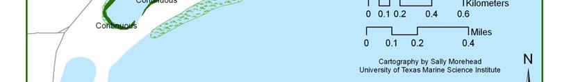
4 Figures: Figure 1: Historical coverage of seagrass beds in Little Bay. 4


5 Figure 2: Location of sampling sites in Little Bay, Rockport. 5
 total suspended solids (TSS) measured from water column samples taken at the barren areas of each site.")
6 Ks From Little Bay Sites Ks #1 seagrass #1 barren #2 seagrass #2 barren #3 barren Bayside seagrass Bayside barren Figure 3: The light attenuating coefficients (K s ) for the seagrass beds and barren patches at each study site. Figure 4: The mean (± SE) total suspended solids (TSS) measured from water column samples taken at the barren areas of each site. 6
7 Chl a at Little Bay Study Sites µg/l Chl a #1 barren #2 barren #3 barren bayside barren Figure 5: The mean (± SE) chlorophyll a concentrations measured from the water column samples taken at the barren areas of each site. NH4+ Sediment Porewater at Little Bay Study Sites µm NH #1 seagrass #1 barren #2 seagrass #2 barren #3 barren Bayside seagrass Bayside barren Figure 6: The average NH 4 + (± SE) concentrations in sediment porewater within the seagrass beds and barren patches at each study site. 7
8 NH4+ Water Column at Little Bay Study Sites µm NH #1 barren #2 barren #3 barren bayside barren Figure 7: The mean (± SE) NH 4 + concentrations measured from the water column samples taken at the barren areas of each site. NO3+NO2 in Little Bay Study Sites µm NO3+NO #1 barren #2 barren #3 barren bayside barren Figure 8: The average (± SE) NO 3 - and NO 2 - concentrations measured from the water column samples taken at the barren areas of each site. 8
Seagrass Health in Texas
 Seagrass Health in Texas A Comprehensive Monitoring Program Florida Museum of Natural History Harte Institute Florida Museum of Natural History Prepared by Susan E. Linn Marine Science Department University
Little Bay Water Quality Report Card Spring 2014
 Little Bay Water Quality Report Card Spring 2014 Little Bay is a small, semi-enclosed estuary located in the heart of Rockport, Texas. Estuaries, where freshwater from rivers and streams mixes with salt
TIER 2 SEAGRASS MONITORING 2015
 TIER 2 SEAGRASS MONITORING 2015 Prepared for Mobile Bay National Estuary Program 118 North Royal Street #601 Mobile, Alabama 36602 Alabama DCNR State Lands Division Coastal Section 31115 5 Rivers Boulevard
Chemical and Physical Analysis of the Cape Fear Estuary
 The Cape Fear River Chemical and Physical Analysis of the Cape Fear Estuary The Cape Fear River (CFR), the most industrialized of all North Carolina s rivers, winds for over miles through the heart of
Background Information
 Project Overview The Citizen Science: Salinity and Turbidity Monitoring Project is designed to monitor spatial and temporal variations in salinity and turbidity in Little Bay in Rockport Texas. Salinity
Assessment of seagrass habitat quality and plant physiological condition in Texas coastal waters: Summer 2012
 Assessment of seagrass habitat quality and plant physiological condition in Texas coastal waters: Summer 2012 Kenneth Dunton and Christopher Wilson, UTMSI Report to SMWG, 4 May 2012 Our Goal: To provide
Climate Change and Chesapeake Bay Habitats
 Climate Change and Chesapeake Bay Habitats Donna Marie Bilkovic STAC Chesapeake Bay Forage Base Workshop 12 November 2014 http://www.chesapeake.org/stac/ Virginia Institute of Marine Science www.ccrm.vims.edu
Update on Straits Pond
 Update on Straits Pond Presented to the Board of Selectmen July 27, 2017 Issues of Concern raised by citizens along Straits Pond: Midges (?) Offensive odor Excessive Algae Background: Straits Pond is a
Seaweeds. Is there anything unusual? Nothing special was noted but I was pleased with observations being made of animals and sea weeds.
 Commentary on our big day out September 17 th 2016. Very good day for monitoring. Low tide and pleasant weather. Spring is here!!!! Most impressive observations of the sea weeds in at the sites. The lab
Introduction to SAV and Seagrass of Our Coastal Waters
 Introduction to SAV and Seagrass of Our Coastal Waters Hyun Jung (J.) Cho hyun_jung.cho@jsums.edu Department of Biology Jackson State University 1400 Lynch St. Jackson, Mississippi 39217 Submerged Aquatic
Climate Change and Chesapeake Bay Habitats
 Climate Change and Chesapeake Bay Habitats Donna Marie Bilkovic Sustainable Fisheries GIT Meeting 4 June 2014 Virginia Institute of Marine Science www.ccrm.vims.edu http://www.chesapeake.org/stac/ Existing
CBF Water Quality Interactive Map
 CBF Water Quality Interactive Map Student and adult groups that take part Often, they measure the water chemistry to evaluate the be doing it when you come out with us! By compiling these points on a map
Cleveland Bay Marine Water Quality (Turbidity and Available Light) Monitoring Plan
 Monitoring Plan") Cleveland Bay Marine Water Quality (Turbidity and Available Light) Monitoring Plan 1 BACKGROUND Port of Townsville Limited (PoTL) administers the Port of Townsville, a general purpose cargo port in North
Cleveland Bay Marine Water Quality (Turbidity and Available Light) Monitoring Plan 1 BACKGROUND Port of Townsville Limited (PoTL) administers the Port of Townsville, a general purpose cargo port in North
Historical overview of Tampa Bay water quality and seagrass issues and trends
 University of South Florida Scholar Commons Reports Tampa Bay Area Study Group Project 1-1-2002 Historical overview of Tampa Bay water quality and seagrass issues and trends J.O. R. Johansson Follow this
Estuaries and Catchments team, Water Wetlands and Coasts Science Branch, Science Division, Office of Environment and Heritage
 Impact assessment of Berkeley Vale subcatchment pollutant loads in nearshore zone of Tuggerah Lakes Rebecca Swanson, Aaron Wright, Peter Scanes and Angus Ferguson Estuaries and Catchments team, Water Wetlands
2016, 2017 Estuarine Water Quality and Modeling in the Royal and Cousins Rivers
 2016, 2017 Estuarine Water Quality and Modeling in the Royal and Cousins Rivers Angela Brewer and Robert Mohlar Division of Environmental Assessment Bureau of Water Quality Protecting Maine s Air, Land
Student Data Sheet 1
 Student Data Sheet 1 Name Date Latitude (e.g. 75 o N) Longitude (e.g.18 o W) Recent weather conditions: Current weather (circle one) Clear Partly Cloudy Fog Overcast Rain Snow Air Temperature C or F Wind
Ecological Considerations in Setting MFLs and Lake Regulation Targets for the Ocklawaha Chain of Lakes
 Ecological Considerations in Setting MFLs and Lake Regulation Targets for the Ocklawaha Chain of Lakes Rolland Fulton, Ph.D. Environmental Scientist VI Bureau of Environmental Sciences St. Johns River
How global warming and climate change may be accelerating losses of Chesapeake Bay seagrasses.
 How global warming and climate change may be accelerating losses of Chesapeake Bay seagrasses. Dr. Ken Moore The Virginia Institute of Marine Science School of Marine Science College of William and Mary
Water Monitoring in Spa Creek: A Summary
 Water Monitoring in Spa Creek: A Summary Written by: Alexis Jones & Blake Harden Edited by: Hannah Krauss Water monitoring is very important in order to determine the health of the Chesapeake Bay and its
Nutrient distributions and the interaction between coastal wetlands and the nearshore of Lake Ontario
 Nutrient distributions and the interaction between coastal wetlands and the nearshore of Ontario Krista Chomicki and Gary Bowen International Association of Great s Research, 25 Type Durham Region Coastal
2016 HLWD WATER QUALITY RESULTS CATHERINE WEGEHAUPT WATERSHED TECHNICIAN JULY 2017 BOARD MEETING
 2016 HLWD WATER QUALITY RESULTS CATHERINE WEGEHAUPT WATERSHED TECHNICIAN JULY 2017 BOARD MEETING JACK CREEK 1200 2016 JACK CREEK HYDROGRAPH 1.80 1000 1.60 1.40 MEAN DAILY DISCHARGE (CFS) 800 600 400
Assessment of seagrass habitat quality and plant physiological condition in Texas coastal waters: Summer 2012 and 2013
 Assessment of seagrass habitat quality and plant physiological condition in Texas coastal waters: Summer 2012 and 2013 Kenneth Dunton, Sara Wilson and Christopher Wilson, UTMSI Report to SMWG, 8 May 2013
Chemical Parameters of Northern Alaska Coastal Lagoons
 Chemical Parameters of Northern Alaska Coastal Lagoons Stephanie D. Smith December 7, 2012 University of Texas Marine Science Institute CE 394K: GIS in Water Resources Dr. David Maidment Introduction The
CLMP+ Report on Grass Lake (Anoka County) Lake ID# CLMP+ Data Summary
 Lake ID# CLMP+ Data Summary") CLMP+ Report on Grass Lake (Anoka County) Lake ID# 02-0113-00 2012-2013 CLMP+ Data Summary October 2014 Authors Shannon Martin, MPCA Editing and graphic design Public Information Office Staff The (MPCA)
CLMP+ Report on Grass Lake (Anoka County) Lake ID# 02-0113-00 2012-2013 CLMP+ Data Summary October 2014 Authors Shannon Martin, MPCA Editing and graphic design Public Information Office Staff The (MPCA)
Santa Rosa Creek Water Quality Results 2004
 Santa Rosa Creek Water Quality Results 24 Community Clean Water Institute Site Description: SRC4: Off 3rd Street in downtown Santa Rosa. Behind the Vineyard Hotel just West of Highway 11 along the Prince
A multi-tiered monitoring approach to address management-driven research questions
 A multi-tiered monitoring approach to address management-driven research questions Amanda Kahn Dickens, Ph.D. & Christopher Buzzelli, Ph.D. Senior Scientist, Coastal Ecosystem Section Applied Science Bureau
2017 Water Quality Report and Historical Analysis. Long Lake Mickey Lake Ruth Lake. Monitoring Years
 2017 Water Quality Report and Historical Analysis Long Lake Mickey Lake Ruth Lake Monitoring Years 1993-2017 Submitted to: Long Lake Association October 2017 Prepared by: Great Lakes Environmental Center
Section Submerged Aquatic Vegetation and Aquatic Habitats of Particular Concern
 Section 300.18 Submerged Aquatic Vegetation and Aquatic Habitats of Particular Concern A. Definitions 1. Submerged Aquatic Vegetation (SAV) refers to rooted, vascular, flowering plants that, except for
Trans-Tasman Resources Ltd consent application: Ecological monitoring
 Trans-Tasman Resources Ltd consent application: Ecological monitoring M.R. James 1, A. MacDiarmid 2 Prepared for Trans-Tasman Resources ltd January 2016 1 Aquatic Environmental Sciences Ltd PO Box 328
Anthropogenic Impacts on Bays and Watersheds. HI-MOES Presentation 2009 The Kohala Center Kohala Watershed Partnership
 Anthropogenic Impacts on Bays and Watersheds HI-MOES Presentation 2009 The Kohala Center Kohala Watershed Partnership Some Common Terms Watershed = An area of land that drains into a common destination
What We Know About the Water Quality of the Florida Keys National Marine Sanctuary
 What We Know About the Water Quality of the Florida Keys National Marine Sanctuary Joseph N. Boyer This report serves as a summary of our efforts to date in the execution of the Water Quality Monitoring
CHAPTER 15 WATER POLLUTION. INTO THE GULF Researchers try to pin down what s choking the Gulf of Mexico
 CHAPTER 15 WATER POLLUTION INTO THE GULF Researchers try to pin down what s choking the Gulf of Mexico SAVING THE BAY Teams of researchers try to pin down what s choking the Chesapeake Water pollution
Boston Harbor Water Quality ( ) Massachusetts Water Resources Authority Environmental Quality Department Report
 Massachusetts Water Resources Authority Environmental Quality Department Report") Boston Harbor Water Quality (1994-2015) Massachusetts Water Resources Authority Environmental Quality Department Report 2016-08 Citation: Taylor, DI. 2016. Boston Harbor Water Quality (1994-2015). Boston:
Boston Harbor Water Quality (1994-2015) Massachusetts Water Resources Authority Environmental Quality Department Report 2016-08 Citation: Taylor, DI. 2016. Boston Harbor Water Quality (1994-2015). Boston:
Estuary Adventures. Background. Objective
 Estuary Adventures Objective Students will work in groups to understand the concept of estuaries, their importance, and the role that density plays in the mixing of fresh and salt water. Students will
Jackson Lake Analysis
 Jackson Lake Analysis Lake Zones Lake Zones Limnetic Zone- open water far from shore Light penetrates shallow, allowing photosynthesis Supports phytoplankton (algae, protists, cyanobacteria) which then
Lesson Overview 4.5 Aquatic Ecosystems
 Lesson Overview 4.5 Conditions Underwater What factors affect life in aquatic ecosystems? Aquatic organisms are affected primarily by the water s depth, temperature, flow, and amount of dissolved nutrients.
Report No September Interpreting Northland s Coastal Water Quality Monitoring Results Under Different Tide Conditions
 Report No. 6 September Interpreting Northland s Coastal Water Quality Monitoring Results Under Different Tide Conditions EXECUTIVE SUMMARY As part of State of the Environment (SoE) Monitoring, New Zealand
5.0 PHYTOPLANKTON PHYSIOLOGY. Luke Twomey Christopher P. Buzzelli Hans W. Paerl. 5.1 Introduction
 5. PHYTOPLANKTON PHYSIOLOGY Luke Twomey Christopher P. Buzzelli Hans W. Paerl 5.1 Introduction Phytoplankon production is the primary source of organic carbon in the water column of the NRE (Matson and
Drones: A New Tool for Water Monitoring
 Drones: A New Tool for Water Monitoring Donglai Gong Carl Friedrichs, Ryan Carnegie Outline What are the goals of water monitoring (from marine scientist s perspective)? Healthy ecosystem? Fisheries /
Water Quality Assessment for the Town of Caswell Beach, 2008
 Water Quality Assessment for the Town of Caswell Beach, 2008 UNCW-CMS Report 08-02 Report to: Town of Caswell Beach 1100 Caswell Beach Rd. c/o Mr. Jim Carter, Town Administrator Caswell Beach, N.C. 28465
REND LAKE WATER QUALITY
 REND LAKE 1999-2002 WATER QUALITY REPORT U.S. ARMY CORPS OF ENGINEERS, ST. LOUIS DISTRICT ENVIRONMENTAL QUALITY SECTION - Water Quality Billy Arthur, Section Chief Theodore Postol, Environmental Engineer
Why is the Benthos Important? OR Pre- and Post- Salt Pond Restoration Assessment of Benthic Communities in South San Francisco Bay
 Why is the Benthos Important? OR Pre- and Post- Salt Pond Restoration Assessment of Benthic Communities in South San Francisco Bay Jan Thompson and Francis Parchaso Menlo Park, USGS Benthic communities
2015 Water Quality Monitoring of Mill and Dividing Creeks Arnold, MD
 215 Water Quality Monitoring of Mill and Dividing Creeks Arnold, MD ---------------------------------------------------------- Prepared for the Mill Creek Headwaters Restoration Project Anne Arundel County
Lake Elsinore and San Jacinto Watersheds Authority. Canyon Lake Phase 2 Water Quality Monitoring Plan
 Lake Elsinore and San Jacinto Watersheds Authority December 2010 Background Canyon Lake was formed in 1928 when the Canyon Lake (Railroad Canyon) Dam was constructed; the lake has three main sections the
Nitrogen Cycling, Primary Production, and Water Quality in the New River Estuary. Defense Coastal/Estuarine Research Program (DCERP)
") Nitrogen Cycling, Primary Production, and Water Quality in the New River Estuary Defense Coastal/Estuarine Research Program (DCERP) Introduction: A key theme of the ongoing DCERP program is monitoring
Nitrogen Cycling, Primary Production, and Water Quality in the New River Estuary Defense Coastal/Estuarine Research Program (DCERP) Introduction: A key theme of the ongoing DCERP program is monitoring
FY2004 EXECUTIVE SUMMARY OF THE WATER QUALITY MONITORING PROJECT
 FY2004 EXECUTIVE SUMMARY OF THE WATER QUALITY MONIRING PROJECT FOR THE WATER QUALITY PROTECTION PROGRAM IN THE FLORIDA KEYS NATIONAL MARINE SANCTUARY Pine Island Sound Water Quality Monitoring Network
Enhanced Mobility of Arsenic and Molybdenum in a Tailings Pond in Response to Nitrate Depletion
 Enhanced Mobility of Arsenic and Molybdenum in a Tailings Pond in Response to Nitrate Depletion Alan J. Martin, John Dockrey, Scott Jackson and Justin Stockwell Lorax Environmental Services Ltd. Cody Meints
Assessment of the St. Marys River Biological Water Quality, Primary Productivity, and Pollutant Load Phase I Monitoring
 Assessment of the St. Marys River Biological Water Quality, Primary Productivity, and Pollutant Load Phase I Monitoring COASTAL INCENTIVE GRANT FINAL REPORT FOR THE PERIOD 10/1/06 3/31/08 GDNR CYCLE IX
Nutrient Limits: What to Expect. Water Division Arkansas Department of Environmental Quality
 Nutrient Limits: What to Expect Water Division Arkansas Department of Environmental Quality wentz@adeq.state.ar.us bailey@adeq.state.ar.us Timeline of Nutrient Criteria Development 1998 EPA published the
Fate of nitrogen during oxic submarine groundwater discharge into Stony Brook Harbor, Long Island, NY
 Fate of nitrogen during oxic submarine groundwater discharge into Stony Brook Harbor, Long Island, NY Caitlin Young Department of Geosciences, Stony Brook University, Stony Brook, NY 11794 caitlin_young@yahoo.com
4. Ponds and infiltration BMPs can achieve 60 to 100% removal efficiencies for sediment.
 Landscape BMPs For the purposes of this project, preventive measures have been categorized into two categories: landscape BMPs and source prevention BMPs. Landscape BMPs includes both vegetative practices
Three bubblers were installed as a pilot project to improve oxygen levels.
 Update April, 2010 Three bubblers were installed as a pilot project to improve oxygen levels. Based on a proposal by Dr. Alex Horne (professor emeritus of engineering at UC Berkeley) and Dr. Ken O Hara
Chapter 6.1. Seagrass abundance and habitat criteria in the Maryland Coastal Bays
 Chapter 6.1 Seagrass abundance and habitat criteria in the Maryland Coastal Bays Catherine Wazniak 1, Lee Karrh 1, Thomas Parham 1, Michael Naylor 1, Matthew Hall 1, Tim Carruthers 2, and Robert Orth 3
Water Quality. Report for State of the Bay Casco Bay Water Quality Report for State of the Bay 2010 Friends of Casco Bay, 2009
 Water Quality Report for State of the Bay 2010 Casco Bay Water Quality Report for State of the Bay 2010 Friends of Casco Bay, 2009 Muskie School of Public Service University of Southern Maine www.cascobayestuary.org
The Hypoxic Zone in the Gulf of Mexico
 The Hypoxic Zone in the Gulf of Mexico References Council Committee on Environmental and Natural Resources. 2003. An Assessment of Coastal Hypoxia and Eutrophication in U.S. Water. National Science and
Pacific Coastal Ecology Branch Physical and Water Quality Data
 Pacific Coastal Ecology Branch Physical and Water Quality Data Data Contributors: Cheryl A. Brown, Peter Eldridge, Robert Ozretich, Anne Sigleo & David Specht CRUISES CTD profiles using (SBE 19 SEACAT)
Nitrogen, Phosphorus, and Suspended Solids Concentrations in Tributaries to the Great Bay Estuary Watershed in 2015
 University of New Hampshire University of New Hampshire Scholars' Repository PREP Publications Institute for the Study of Earth, Oceans, and Space (EOS) 5-16-2016 Nitrogen, Phosphorus, and Suspended Solids
biology Slide 1 of 39 End Show Copyright Pearson Prentice Hall
 biology 1 of 39 2 of 39 4-4 Aquatic Ecosystems Nearly three-fourths of the Earth s surface is covered with water. Almost all bodies of water contain a wide variety of communities governed by biotic and
Gulf of Mexico Hydrological Restoration Criteria for Identifying and Prioritizing Projects
 Gulf of Mexico Hydrological Restoration Criteria for Identifying and Prioritizing Projects Definition of hydrological restoration for this Partnership To remove or modify anthropogenic barriers to restore
Chapter 6. Aquatic Biodiversity. Chapter Overview Questions
 Chapter 6 Aquatic Biodiversity Chapter Overview Questions Ø What are the basic types of aquatic life zones and what factors influence the kinds of life they contain? Ø What are the major types of saltwater
4-4 Aquatic Ecosystems
 biology 1 of 39 2 of 39 Nearly three-fourths of the Earth s surface is covered with water. Almost all bodies of water contain a wide variety of communities governed by biotic and abiotic factors including
Eelgrass Distribution in the Great Bay Estuary for 2013
 University of New Hampshire University of New Hampshire Scholars' Repository PREP Reports & Publications Institute for the Study of Earth, Oceans, and Space (EOS) 10-2014 Eelgrass Distribution in the Great
Lower Mission Creek Watershed Status Survey 2002
 Lower Mission Creek Watershed Status Survey 2002 Prepared For: Mosquito Creek Stewardship Society Prepared By: Fernando F. Junqueira, Ph.D. August 16, 2002 North Vancouver, August 16, 2002 ENVIRONMENTAL
Water Quality Indicators
 Water Quality Indicators Ashley T. Slagle PVSC NJ Water Monitoring Council Meeting NJDEP Headquarters Trenton, NJ Wednesday, January 25, 2012 Who is the New Jersey Harbor Dischargers Group? 9 Sewerage
Mercantile Creek Community Watershed Water Quality Objectives Attainment Report
 Mercantile Creek Community Watershed Water Quality Objectives Attainment Report Environmental Quality Section Environmental Protection Division Coast Region 2015 Report Prepared by: Martina Kopat. Approved
Biscayne Bay. A Jewel in Jeopardy? Stephen Blair 1 and Sarah Bellmund 2
 Biscayne Bay A Jewel in Jeopardy? Stephen Blair 1 and Sarah Bellmund 2 1 Department of Regulatory and Economic Resources; Division of Environmental Resources Management (DERM), Miami, FL 2 National Park
6.1. UTILIZATION OF WATER QUALITY MONITORING DATA TO SUPPORT THE CITY OF DETROIT S LONG TERM COMBINED SEWER OVERFLOW CONTROL PLAN.
 6.1. UTILIZATION OF WATER QUALITY MONITORING DATA TO SUPPORT THE CITY OF DETROIT S LONG TERM COMBINED SEWER OVERFLOW CONTROL PLAN Imad Salim, Wade Trim Associates, Detroit, Michigan Mirza Rabbaig, Detroit
Environmental Services
 215 Environmental Services River Water Quality Summary for the Twin Cities Metropolitan Area In 215, Metropolitan Council Environmental Services (MCES) river monitoring was conducted at six automated and
EUTROPHICATION. Student Lab Workbook
 EUTROPHICATION Student Lab Workbook THE SCIENTIFIC METHOD 1. Research Background literature research about a topic of interest 2. Identification of a problem Determine a problem (with regards to the topic)
Results from the 2017 Water Quality Monitoring Program
 Results from the 217 Water Quality Monitoring Program As part of a larger project, this summer the BWC conducted water sampling throughout the Belleisle Bay to get a baseline of data and determine the
First Flush Water Quality Results 2016
 First Flush Water Quality Results 2016 First big rain of the season Freshwater runoff enters storm drains High pollution Sample at outfalls to ocean Oct 14 th : 0.45 in What is First Flush? Partners Objectives
Data Required to Support Reservoir Water Quality Modeling
 Data Required to Support Reservoir ater Quality Modeling The recommendations contained within this document are intended to assist with developing field data collection programs that can support reservoir
Research Project Summary May 2010
 Office of Science Research Project Summary May 2010 Rutgers University - Assessment of Eutrophication in the Barnegat Bay Little Egg Harbor System: Use of SAV Biotic Indicators of Estuarine Condition Authors
Causes of Gulf of Mexico Hypoxia
 Causes of Gulf of Mexico Hypoxia Nancy N. Rabalais 1 R. Eugene Turner 2 1 Louisiana Universities Marine Consortium 2 Louisiana State University Center for Sponsored Coastal Ocean Research, Coastal Ocean
SERIES 5. Water Quality Instruments
 SERIES 5 Water Quality Instruments SUPERIOR SENSOR TECHNOLOGY Hydrolab sondes are built with the industry s best sensor technology, to provide high quality data that you can trust. UNSURPASSED RELIABILITY
Water Resources/Water Quality
 Water Resources/Water Quality From where does your drinking water come? How much land should be set aside for aquifer protection? Why should we care about Barton Springs? What are the effects (if any!)
Jim Nickels Marine Scientist Urban Coast Institute Monmouth University May 25, NJ Water Monitoring Council Meeting
 Jim Nickels Marine Scientist Urban Coast Institute Monmouth University May 25, 2011 NJ Water Monitoring Council Meeting Program and Research Areas Real Time Water Quality Monitoring Network Shrewsbury
Keeyask Infrastructure Project
 Keeyask Infrastructure Project Terrestrial and Aquatic Monitoring Plan Annual Report 2014-2015 December 2015 KEEYASK INFRASTRUCTURE PROJECT TERRESTRIAL AND AQUATIC MONITORING PLAN Water Quality: Annual
EXECUTIVE SUMMARY. Introduction
 Introduction In September 2003, Hillsborough County retained Ayres Associates Inc to update the Watershed Management Plan (WMP) for the Rocky/Brushy Creek watershed, which was originally prepared in 2001.
Eutrophication. A Synthesis for Scientific Understanding and Management Applications. W. M. Kemp University of Maryland CES Horn Point Laboratory
 Eutrophication in Chesapeake Bay: A Synthesis for Scientific Understanding and Management Applications W. M. Kemp University of Maryland CES Horn Point Laboratory Cambridge, MD Work supported by UMCES,
MS4 Assessment Program to Satisfy Part V. Monitoring Requirements
 MS4 Assessment Program to Satisfy Part V. Monitoring Requirements Submitted by City of Boynton Beach MS4 Permit No. FLS000018-004 The purpose of this document is to outline the City of Boynton Beach Stormwater
How the Ecology and Biology of Florida s Seagrasses Drive the Reality of Regulatory Options
 How the Ecology and Biology of Florida s Seagrasses Drive the Reality of Regulatory Options CSA Ocean Sciences Inc. Mark S. Fonseca Ph.D. Science Director CSA Ocean Sciences Inc. Outline What are seagrasses?
Eelgrass Distribution in the Great Bay Estuary for 2012
 University of New Hampshire University of New Hampshire Scholars' Repository PREP Reports & Publications Institute for the Study of Earth, Oceans, and Space (EOS) 8-23-2013 Eelgrass Distribution in the
Monitoring the Effects of Acid Rain on Freshwater Metal Chemistry. Tyler Ueltschi University of Puget Sound Tacoma, WA
 Monitoring the Effects of Acid Rain on Freshwater Metal Chemistry Tyler Ueltschi University of Puget Sound Tacoma, WA Advisor: Anne Giblin Marine Biological Laboratory 7 MBL Street, Woods Hole, MA 2543
Chapter Concepts LIFE IN WATER. The Hydrologic Cycle. The Hydrologic Cycle
 Chapter Concepts Chapter 3 LIFE IN WATER The hydrologic cycle exchanges water among reservoirs The biology of aquatic environments corresponds broadly to variations in physical factors such as light, temperature,
Galveston Bay Ecosystems & Issues
 An overview of Galveston Bay Ecosystems & given by Issues Jim Dobberstine The Galveston Bay Foundation Photo courtesy of Bob Moore, Galveston Galveston Bay Background Largest/most productive estuarine
THE INDIAN RIVER LAGOON: AN ESTUARY IN TRANSITION
 THE INDIAN RIVER LAGOON: AN ESTUARY IN TRANSITION Indian River Lagoon One of the longest barrierisland/ tidal-inlet systems in continental U.S. A unique, highly diverse, shallow-water estuary of national
Fremont Tree Well Filters LID Performance on a Redeveloped Urban Roadway
 Fremont Tree Well Filters LID Performance on a Redeveloped Urban Roadway Site Summary Project Features Subsurface-Loaded Surface-Loaded The Fremont Low Impact Development Tree Well Filter pilot project
Dead-Zones and Coastal Eutrophication: Case- Study of Chesapeake Bay W. M. Kemp University of Maryland CES Horn Point Laboratory Cambridge, MD
 Dead-Zones and Coastal Eutrophication: Case- Study of Chesapeake Bay W. M. Kemp University of Maryland CES Horn Point Laboratory Cambridge, MD Presentation to COSEE Trends Orientation at UMCES HPL 4 August
Chesapeake Bay. report card
 Chesapeake Bay report card 2010 C- C Healthy water quality provides better habitat conditions for crabs, fish, and other aquatic species. issolved oxygen is essential to the survival of all these organisms;
CARLYLE LAKE WATER QUALITY REPORT. for
 CARLYLE LAKE WATER QUALITY REPORT for 1997 U.S. ARMY CORPS OF ENGINEERS, ST. LOUIS DISTRICT ENVIRONMENTAL QUALITY SECTION - Water Quality Ted Postol, Section Chief Tori Foerste, Environmental Engineer
ULTRAVIOLET DISINFECTION FOR STORMWATER TREATMENT IN COASTAL CAROLINAS
 ULTRAVIOLET DISINFECTION FOR STORMWATER TREATMENT IN COASTAL CAROLINAS Ronald A. Geiger HDR Engineering, Charlotte, NC Tom Garigen, Horry County Storm Water, Conway, SC BACKGROUND South Carolina's beaches
Water Quality on the Toronto-Mississauga Waterfront after the July 8, 2013 Deluge
 Water Quality on the Toronto-Mississauga Waterfront after the July 8, 213 Deluge November 4, 214 Todd Howell and Peter Nettleton Environmental Monitoring and Reporting Branch Ontario Ministry of the Environment
Citizen Science Monitoring for Pathogens on Staten Island A FINAL REPORT FOR THE NY-NJ HARBOR AND ESTURARY PROGRAM
 Citizen Science Monitoring for Pathogens on Staten Island A FINAL REPORT FOR THE NY-NJ HARBOR AND ESTURARY PROGRAM Prepared by Paul L. Sieswerda, President, Gotham Whale September 2017 Introduction: Gotham
Florida Watersheds Video Southwest Florida Water Management District
 Teacher s Guide Florida Watersheds Video Download at: http://www.watermatters.org/watershedvideo Middle School Video Length: 11 minutes Lesson Time: One block or class period (approximately 45 minutes)
Unit 1 Hydrodynamics. Introduction to Seagrasses
 Unit 1 On the cutting edge Scientists at the University of South Florida s Biology department are on the cutting edge of science studying how water velocity influences the ecology of seagrass communities.
Ecology Chapter 11: Marine
 Ecology Chapter 11: Marine 1 I. Oceans made up of all waters between continents The World Ocean because waters are interconnected can be thought of as one large biome with many different ecosystems and
Water Quality Impacts on Submerged Aquatic Vegetation (SAV): From Quadrats to Seascapes
: From Quadrats to Seascapes") Water Quality Impacts on Submerged Aquatic Vegetation (SAV): From Quadrats to Seascapes Diego Lirman, R. Santos, G. Liehr, S. Schopmeyer, C. Drury, L. Collado, S. Bellmund, J. Serafy, J. Browder Rosenstiel
Water Quality Impacts on Submerged Aquatic Vegetation (SAV): From Quadrats to Seascapes Diego Lirman, R. Santos, G. Liehr, S. Schopmeyer, C. Drury, L. Collado, S. Bellmund, J. Serafy, J. Browder Rosenstiel
Phosphorus Goal Setting Process Questions and Answers 2010
 Lake Winnipesaukee Watershed Management Plan Phase I: Meredith, Paugus, Saunders Bays 1. What is phosphorus? Phosphorus (P) is a naturally occurring element and a major nutrient required for biological