Report on Archaeological Testing of Luas Line A1 Belgard to Saggart, Co.Dublin.
|
|
|
- Bryan Farmer
- 6 years ago
- Views:
Transcription
1 Project code: RPLT08 Client: Railway Procurement Agency Date: October, Report on Archaeological Testing of Luas Line A1 Belgard to Saggart, Co.Dublin. Director: Liam Hackett. Author : Liam Hackett. Licence No: 08E0792
2 HEADLAND ARCHAEOLOGY LTD. Archaeological testing of the Luas Line A1, Belgard to Saggart (08E0792) CONTENTS Summary 2 1. INTRODUCTION 3 2. BACKGROUND 3 3. METHODS 4 4. RESULTS 4 5. DISCUSSION 6 6. IMPACT 6 7. MITIGATION 7 Appendices : 1. Trench record Register 2. Context register. 3. Photograph register. Figures: 1. Figure 1: Site Location of Luas Line A1: Belgard to Saggart, Co. Dublin. (1: 15000) 2. Figure 2: Luas Line A1: Belgard to Saggart, Co. Dublin: Archaeological Testing Areas(1: 20000) 3. Figure 3: Luas Line A1: Belgard to Saggart, Co. Dublin: Testing Area 1, Fettercairn stop (1:2500) 4. Figure 4: Luas Line A1: Belgard to Saggart, Co. Dublin: Testing Area 2, Cheeverstown stop(1:2500) 5. Figure 5: Luas Line A1: Belgard to Saggart, Co. Dublin: Testing Areas 3 and 4, City West Campus stop(1:2500) 6. Figure 6: Luas Line A1: Belgard to Saggart, Co. Dublin: Testing Area 5, Saggart stop(1:2500) 7. Figure 7: Luas Line A1: Belgard to Saggart, Co. Dublin: Untested Areas, Testing Area 2, Cheeverstown stop(1:2500) 8. Figure 8: Luas Line A1: Belgard to Saggart, Co. Dublin: Untested Areas, Testing Areas 3 and 4, City West Campus stop(1:2500) 9. Figure 9: Luas Line A1: Belgard to Saggart, Co. Dublin: Untested Areas, Testing Area 5, Saggart stop(1:2500) Plates: 1. Plate 1, Testing Area 1, trench 1, facing southwest. 2. Plate 2, Testing Area 2, trench 2, C.003, water mains trench, facing southwest. 3. Plate 3, Testing Area 2, trench 5, C.011, natural feature, facing north. 4. Plate 4, Testing Area 2, trench 5, C.013, stone filled modern drain, facing east. 5. Plate 5, Testing Area 3, trench 1, facing southwest. 6. Plate 6, Testing Area 4, trench 3, facing southwest. 7. Plate 7, Testing Area 5, trench 1, facing west. 1
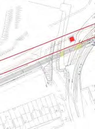
3 HEADLAND ARCHAEOLOGY LTD. Archaeological testing of the Luas Line A1, Belgard to Saggart (08E0792) SUMMARY Advance Archaeological testing was undertaken in specified areas of the Luas Line A1, Belgard to Saggart, Co.Dublin (figure 2) in accordance with conditions of Archaeological Testing Licence 08E0792, between September 22 nd and September 26 th. A total of 3400 linear metres of test trenches were excavated along the length of the route. No material of an archaeological origin was recovered and no further recommendations are proposed for the areas tested. Testing could not be carried out between chainage points , , , , and in Testing area 2 due to power lines, an ESB substation, dyke, ditch with associated underground services and a construction compound. Testing could not be carried out between chainage points in Testing Area 3 due to disturbed ground. Testing could not be carried out between chainage points in Testing Area 4 due to an open concrete built drain. Testing could not be carried out between chainage points and in Testing Area 5 due to underground gas mains and overhead power lines( figures 7,8,9). (see section 4.6) 2
4 HEADLAND ARCHAEOLOGY LTD. Archaeological testing of the Luas Line A1, Belgard to Saggart (08E0792) 1. INTRODUCTION This report presents the results of an advance archaeological test trenching programme along the route of the proposed Luas Line A1. The development begins at Saggart village and runs in a general east/west direction to join with the existing Luas Red Line at Cookstown. Stops are located at Fortunestown, Citywest Campus, Cheeverstown, Fettercairn and Belgard. The area of development extends for 4.2 kilometres and will be predominantly on waste ground and greenfield sites, (See figure 2). The route has been divided into five separate areas, for ease of recognition and description. These Testing Areas are : Testing Area 1: Total area of 4830m². Located between CH 780 to CH 960 and represents the footprint for the Fettercairn stop, (figure 3). Testing Area 2: Total area of 38861m². Located between CH 1670 to CH 2550 and represents the footprint for the Cheeverstown stop, (figure 4). Testing Area 3: Total area of 10074m². Located between CH 2550 to CH 2890 and represents the footprint for the City West Campus stop, (figure 5). Testing Area 4: Total area of 4291m². Located between CH 2920 to CH 3100, (figure 5). Testing Area 5: Total area of 4763m². Located between CH 3790 to CH 4050 and represents the footprint for the Saggart stop, (figure 6). 2. BACKGROUND Headland Archaeology Ltd was contracted by the Railway Procurement Agency (RPA) to undertake an archaeological testing programme in advance of development works in the area. This is necessary to evaluate and quantify the archaeological deposits or features that may be affected by groundworks for Luas Line A1. Luas Line A1 is one of a series of large scale infrastructural RPA projects which will link existing Luas lines and other public transport systems to a proposed Metro system which will run from Dublin Airport to St. Stephens Green in Dublin City Centre. For the purpose of the proposed testing, Luas Line A1 has been subdivided into five Testing Areas. These are referenced as Testing Area s 1-5, (see figure 2). A number of Recorded Monuments (RMP S) lie in the vicinity of the proposed Luas Line A1, however none are impacted directly by it. These RMP sites include an archaeological complex at Cheeverstown comprising a castle site (DU ), a possible Holy Well (DU ) and a possible bawn site (DU ) located c.500m to the north of the route. A second castle site (DU ) is located at Cheeverstown Road c.700m south of the route. The terminal of Luas Line A1 at Saggart Village, is located within the constraint area for Saggart Village (DU ) and c.20m from the Tower House (DU ). Previous testing of this area carried out by Margaret Gowen & Co. Ltd (see figure 2) as part of the Luas Line A1 EIS under licence 06E572 found no features or deposits of archaeological significance (Luas line A1, Belgard to Saggart Environmental Impact Statement, p.92). 3
5 HEADLAND ARCHAEOLOGY LTD. Archaeological testing of the Luas Line A1, Belgard to Saggart (08E0792) 3.METHODS A programme of advance test trenching with off-set trenches placed perpendicular to the centre trench was originally envisioned for the route of the Luas Line A1, however, due to the narrow confines of a number of test areas (8-12 metres maximum), off-set trenches were considered an unviable approach, therefore the centreline trench was excavated at double the normal width (1.9m), giving the centre trench an average width of 3.8m where possible (see table 1). This effectively doubled the linear metreage of the testing programme at certain locations and increased the actual area of ground tested. The land being utilised for the Luas Line A1 is predominantly waste ground with a large degree of previous disturbance from buildings and developments in the surrounding areas. Testing Area 5 (figure 6) was built up with imported soil to a depth of 0.60m, and large portions of Testing Area 2 have been excavated previously for drainage, during Garda Siochanna searches and by the City West Security team to discourage temporary occupation of the area. The area surrounding the City West Electrical sub-station was not tested due to the convergence of major utilities, including the National Grid, at the station. 4. RESULTS The results of the testing programme are as follows: 4.1 Testing Area 1 The total area of Testing Area 1 is 4830m², located between CH 780 to CH 960 and represents the footprint for the Fettercairn stop, (figure 3). Trench 1(TA1/T1) was 196 m long, 3.8m wide, with a minimum depth of 0.10m and a maximum depth of 0.90m. The overlying topsoil (001) was a brown sandy silt with very frequent inclusions of modern domestic debris throughout, including electrical appliances and automobile parts, plastic and construction waste, 0.70m deep (max). The subsoil (002) was compact yellow brown silty clay with frequent small and medium sized stones. This area traverses the former location of the townland boundary between Whitehall and Cheeverstown, however no traces of features relating to this were revealed. No features of archaeological significance were found and the trench was reinstated. 4.2 Testing Area 2 The total area of Testing Area 2 is 38861m², located between CH 1670 to CH 2550 and represents the footprint for the Cheeverstown stop, (figure 4). Nine trenches were excavated in this Testing Area (TA2/T1-9, figure 4) at the normal bucket width of 1.9m. No testing was implemented in the central section of the proposed park and ride area between chainage points , due to the risk to personal safety and possibility of disruption of services at the City West electrical sub station, as described in Section 4.6 (Untested Areas) of this report (figure 4). The overlying topsoil (001) in this area was brown sandy clay with moderate inclusions of modern debris and construction waste, 0.25m deep. The subsoil (002) was yellow brown silty clay with frequent small to medium sized stones throughout. No features of archaeological significance were found and the trenches were reinstated. Trench 1(TA2/T1) was 132.6m long, 1.9m wide, with a maximum depth of 0.50m and a minimum depth of 0.30m. Two linear features were found in this trench (003, 005, figure 4) both measuring 2.4m 4
6 HEADLAND ARCHAEOLOGY LTD. Archaeological testing of the Luas Line A1, Belgard to Saggart (08E0792) wide. Both of these features ran towards above ground water mains access and were also found in trench B, which ran parallel to trench A. Both of these features and their fills (004, 006) were considered modern, due to the amount of modern debris, and of no archaeological significance. Trench 2 (TA2/T2) was 301.5m long, 1.9m wide, with a maximum depth of 0.50m and a minimum depth of 0.20m. The linear features (003, 005, 007,009) described in trench 1 were also found in this trench and received the same number. Trench 3 (TA2/T3) was 157.3m long, 1.9m wide, with a maximum depth of 0.60m and a minimum depth of 0.25m. Two linear features were found in this trench (007, 009, figure 4) both measuring 2.4m wide. Both of these features ran towards above ground water mains access points and were also found in trench 2, which ran parallel to trench 3 and trench 1. Both of these features and their fills (008, 010) were considered modern, due to the amount of modern debris, and of no archaeological significance. Trench 4 (TA2/T4) was 82.1m long, 1.9m wide, with a maximum depth of 0.60m and a minimum depth of 0.30m. No features of archaeological significance were uncovered. Trench 5 (TA2/T5) was 49.2m long, 1.9m wide, with a maximum depth of 0.40m and a minimum depth of 0.35m. One possible feature was found in this trench, (011) an irregular sub oval shaped pit with gradually sloping sides and an irregular base, 1.5m long, 0.70m wide, 0.25m deep, which, when sectioned, proved to be a natural feature with decomposed brown and black organic matter and no inclusions (012). Modern agricultural furrows (C.015) and a stone filled drainage feature (C.013) ran in a general north/south orientation through this trench and trenches 6, 8 and 9. No features of archaeological significance were uncovered. Trench 6( TA2/T6) was 71.9m long, 1.9m wide, with a maximum depth of 0.60m and a minimum depth of 0.25m. As described in trench 5, modern agricultural furrows (C.015) and a stone filled drainage feature (C.013) ran in a general north/south orientation through this trench. No features of archaeological significance were uncovered. Trench 7(TA2/T7) was 104.4m long, 1.9m wide, with a maximum depth of 0.40m and a minimum depth of 0.25m. No features of archaeological significance were uncovered. Trench 8(TA2/T8) was 17.0m long, 1.9m wide, with a maximum depth of 0.30m and a minimum depth of 0.20m. As described in trench 5, modern agricultural furrows (C.015) and a stone filled drainage feature (C.013) ran in a general north/south orientation through this trench. No features of archaeological significance were uncovered. Trench 9(TA2/T9) was 18.2m long, 1.9m wide, with a maximum depth of 0.30m and a minimum depth of 0.20m. As described in trench 5, modern agricultural furrows and stone filled drainage features ran in a general north/south orientation through this trench. No features of archaeological significance were uncovered. All trenches were re-instated. 4.3 Testing Area 3 The total area of Testing Area 3 was 10074m², located between CH 2550 to CH 2890 and represents the footprint for the City West Campus stop, (figure 5). Trench 1(TA3/T1) was m long, 145m was 1.9m wide and c.145m was 3.8m wide (figure 5) with a maximum depth of 0.60m and a minimum depth of 0.30m. This Testing Area and the surrounding land has been extensively excavated with tank traps, 4 to 5 metre long trenches, allowed to remain open to trap the front wheels of cars being driven into the area 5
7 HEADLAND ARCHAEOLOGY LTD. Archaeological testing of the Luas Line A1, Belgard to Saggart (08E0792) and abandoned or burnt. Two such features were noted in TA3/T1 (figure 5). The overlying topsoil (001) was mid brown sandy silt with small to medium sized stones and roots, 0.35m deep. The subsoil (002) was yellow brown silty clay with frequent small stones. No features of archaeological significance were found and the trench was reinstated. 4.4 Testing Area 4 The total area of Testing Area 4 was 4291m², located between CH 2920 to CH 3100, (figure 5). A burnt mound was identified along a nearby watercourse in the townland of Brownsbarn (DU021:023), which increased the possibility of related or associated features in this Testing Area. No such features were revealed during the testing of this area. The overlying topsoil (001) was mid brown sandy clay with frequent small stones and roots, 0.50m deep (max). The subsoil was yellow brown silty clay with frequent small stones throughout. Trench 1 (TA4/T1) was 81.3m long, 3.8m wide, with a maximum depth of 0.80m and a minimum depth of 0.20m. Two test pits from the geotechnical investigations conducted by AGL Consulting (2006) were found in TA4/T1 ( figure 5). No features of archaeological significance were uncovered and the trench was reinstated. Trench 2 (TA4/T2): 12.3m long, 3.8m wide, with a maximum depth of 0.40m and a minimum depth of 0.35m. No features of archaeological significance were uncovered and the trench was reinstated. Trench 3 (TA4/T3): 34.5m long, 3.8m wide, with a maximum depth of 0.80m and a minimum depth of 0.40m. No features of archaeological significance were uncovered and the trench was reinstated. 4.5 Testing Area 5 The total area of Testing Area 5 is 4763m², located between CH 3790 to CH 4050 and represents the footprint for the Saggart stop, (figure 6). Testing could not be carried out between chainage points due to the proximity of overhead power lines (see section 4.6). The ground surface (001) in this area has been introduced to an average depth of 0.50m, made up of mottled mid brown silty sand with frequent inclusions of modern construction material and debris. The topsoil layer (002) was mid brown silty clay with frequent small and medium sized stones and roots, 0.30m deep (max). The subsoil (002) was yellow brown silty clay with frequent small stones throughout. Trench 1 (TA5/T1) was 151.4m long, 3.8m wide, with a maximum depth of 1.00m and a minimum depth of 0.60m. A test pit from the geotechnical investigations conducted by AGL Consulting (2006) was found in TA5/T1 (figure 6). No features of archaeological significance were uncovered and the trench was reinstated. 4.6 Untested Areas (figures 7,8,9) Between chainage points , in Testing Area 2, no testing was carried out due to the proximity of an electricity sub-station. 110kv, 38kv and 10 kv power lines directly overhead. fibre optic security camera lines for the City West Business Park. electrical lines underground, with above ground junction boxes. a copper mesh buried in the ground directly under and extending beyond the footprint of the sub-station, used as an earthing agent for the station. 6
8 HEADLAND ARCHAEOLOGY LTD. Archaeological testing of the Luas Line A1, Belgard to Saggart (08E0792) a large, modern culvert/drain, 4.5 metres wide, 2.5 metres deep, with an associated 3 metre high embankment running parallel and inside the route of the proposed development, effectively destroying any possible archaeological remains in the area. Where power lines crossed the route of the proposed development, a 6 metre buffer zone on either side of the lines was established, with appropriate safety measures in place prior to machinery entering the site. The untested areas are detailed as follows: Untested Area No. Testing Excavation Area Chainage Area (msq.) Area Total (msq.) Access Limitatons/ Restrictions Power Lines Power Lines Power Lines ESB Substation /Embankments Spoil Heap Ditch/Services Compound Disturbed ground Open Concrete Drain Gas Mains Power Lines 5. IMPACT There will be no predicted impact of the proposed rail scheme on archaeological remains in the areas tested, but in untested areas it is recommended that a suitably qualified archaeologist be present during the construction phase with the appropriate machinery enabled to excavate, i.e a toothless bucket. 6. MITIGATION The results of the testing programme for the Luas Line A1 route have shown that no archaeological features were present in the tested areas. Some of the remaining untested areas will require monitoring by a suitably qualified Archaeologist. No additional monitoring is recommended for untested areas 5, 7, 8, 9 and 10, as the possibility of archaeological evidence remaining in these areas is almost nil, due to previous construction and drainage work. The strategy for implementing monitoring in the other areas should be incorporated into the construction phase of the proposed development. The land in the environment has been extensively drained and artificially managed due to the expansion of Dublin City, and especially the development of the City West Campus and associated services. A small portion of the testing programme for the Luas Line A1 Centreline testing was deemed unviable due to the volume of services and utilities that were adjacent to or directly within the route of the proposed development. Monitoring of these areas during the construction phase of this development is recommended, when the power lines and services are removed during the construction phase. 7
9 HEADLAND ARCHAEOLOGY LTD. Archaeological testing of the Luas Line A1, Belgard to Saggart (08E0792) 6. APPENDICES (1) Trench recording register Testing Area Trench no Length Width Depth (min) (max) Figure no m 3.8m 0.1 m 0.90m m 1.9m 0.30m 0.50m m 1.9m 0.30m 0.50m m 1.9m 0.25m 0.60m m 1.9m 0.30m 0.60m m 1.9m 0.35m 0.40m m 1.9m 0.25m 0.60m m 1.9m 0.25m 0.40m m 1.9m 0.20m 0.30m m 1.9m 0.20m 0.30m m 1.9m 0.30m 0.60m 5 3.8m m 3.8m 0.20m 0.80m m 3.8m 0.35m 0.40m m 3.8m 0.40m 0.80m m 3.8m 0.60m 1.0m 6 (2) Context register Testing Area 1 Context no Trench no. Description Topsoil: brown sandy silt with very frequent inclusions of modern domestic debris throughout, including electrical appliances and automobile parts, plastic and construction waste, 0.70m deep (max) Subsoil: compact yellow brown silty clay with frequent small and medium sized stones. Testing Area 2 Context no Trench no(s) Description 001 All Topsoil: brown sandy clay with moderate inclusions of modern debris and construction waste, 0.25m deep. 002 All Subsoil: yellow brown silty clay with frequent small to medium sized stones throughout 003 1,2 North/south running linear water mains pipe trench, 2.4m wide. N.A.S 004 1,2 Mottled brown/yellow fill of C.003, with modern debris and plastic ,2 North/south running linear water mains pipe trench, 2.4m wide. N.A.S 1
10 HEADLAND ARCHAEOLOGY LTD. Archaeological testing of the Luas Line A1, Belgard to Saggart (08E0792) Context no Trench Description no(s) 006 1,2 Mottled brown/yellow fill of C.005, with modern debris and plastic ,2 North/south running linear water mains pipe trench, 2.4m wide. N.A.S 008 3,2 Mottled brown/yellow fill of C.007, with modern debris and plastic ,2 North/south running linear water mains pipe trench, 2.4m wide. N.A.S 010 3,2 Mottled brown/yellow fill of C.009, with modern debris and plastic. N.A.S Irregular sub oval shaped pit with gradually sloping sides and an irregular base, 1.5m long, 0.70m wide, 0.25m deep. N.A.S Natural feature with decomposed brown and black organic matter and no inclusions. N.A.S Cut of linear drainage feature with steeply sloping sides, running in a north/south orientation, 2.5m wide, available depth 1.0m, length n/a Fill of linear drainage feature, comprising re-deposited subsoil and well sorted blue hardcore ,6,8,9 Cuts of modern agricultural features, i.e machine made drains and furrows, all in a general north/south orientation ,6,8,9 Fills of modern agricultural features, re-deposited subsoil. Testing Area 3 Context no Trench no Description Topsoil: mid brown sandy silt with small to medium sized stones and roots, 0.35m deep Subsoil: yellow brown silty clay with frequent small stones Testing Area 4 Context no Trench Description no (s) 001 1, 2, 3 Topsoil: mid brown sandy clay with frequent small stones and roots, 0.50m deep (max) , 2, 3 Subsoil: yellow brown silty clay with frequent small stones throughout. Testing Area 5 Context no Trench Description no Imported soil: mottled mid brown silty sand with frequent inclusions of modern construction material and debris, 0.50m deep (max) Topsoil: mid brown silty clay with frequent small and medium sized stones and roots, 0.30m deep (max) Subsoil: yellow brown silty clay with frequent small stones throughout. 2
11 HEADLAND ARCHAEOLOGY LTD. Archaeological testing of the Luas Line A1, Belgard to Saggart (08E0792) (3) Photograph register. Photo no. Testing Area Description 1 1 Testing Area 1, trench 1, mid testing, facing southwest. 2 1 Testing Area 1, trench 1, facing southwest. 3 1 Testing Area 1, trench 1, facing southwest. 4 1 Testing Area 1, trench 1, facing northeast. 5 1 Testing Area 1, trench 1, facing northeast. 6 1 Testing Area 1, trench 1, facing northeast. 7 1 Testing Area 1, trench 1 backfilled, facing northeast. 8 1 Testing Area 1, trench 1 backfilled, facing southwest. 9 2 Testing Area 2, working shot Testing Area 2, scanning ground prior to testing, facing southwest Testing Area 2, trench 2, facing northeast Testing Area 2, trench 2, facing southwest Testing Area 2, trench 2, facing northeast Testing Area 2, trench 2, facing northeast Testing Area 2, trench 2, facing northeast Testing Area 2, chainage , electrical substation, facing northeast Testing Area 2, chainage , power lines, facing southwest Testing Area 2, chainage , power lines, facing southwest Testing Area 2, chainage , culvert/drain, facing southwest Testing Area 2, chainage , embankment, facing southwest Testing Area 2, trench 1, water mains trench.007, facing northwest Testing Area 2, trench 2, water mains trench C.005, facing northeast Testing Area 2, trench 3, water mains trench C.007, facing northwest Testing Area 2, trench 2, water mains trench C.003, facing northeast Testing Area 2, trench 2, facing northeast Testing Area 2, trench 2, facing northeast Testing Area 2, trench 3, water mains trench C.005, facing northeast Testing Area 2, trench 3, water mains trench C.009, facing northwest Testing Area 2, trench 3, water mains trench C.007, facing northwest Testing Area 2, trench 3, water mains trench C.009, facing northwest Testing Area 2, trench 4, facing northeast Testing Area 2, trench 5, facing east Testing Area 2, trench 5, pre ex of oval pit, C.011, facing northeast Testing Area 2, trench 5, pre ex of oval pit, C.011, facing east Testing Area 2, trench 5, modern stone filled drain, C.013, facing east Testing Area 2, trench 5, modern stone filled drain, C.013, facing southeast Testing Area 2, trench 5, modern stone filled drain, C.013, facing east Testing Area 2, trench 5, modern field drain, C.015, facing east Testing Area 2, trench 5, modern field drain, C.013, facing west. 3
12 HEADLAND ARCHAEOLOGY LTD. Archaeological testing of the Luas Line A1, Belgard to Saggart (08E0792) Photo no. Testing Area Description 40 2 Testing Area 2, trench 5, facing west Testing Area 2, trench 5, facing west Testing Area 2, trench 5, half section of oval pit, C.011 facing north Testing Area 2, trench 5, half section of oval pit, C.011 facing east Testing Area 2, trench 6, modern field drain with blue plastic, C.015, facing east Testing Area 2, trench 6, backfilling, facing east Testing Area 2, trench 6, backfilling, facing east Testing Area 2, trench 7, facing southwest Testing Area 2, trench 7, facing northeast Testing Area 2, trench 4, facing southwest Testing Area 2, trench 8, facing north Testing Area 2, trench 9, facing north Testing Area 2, trench 6 backfilled, facing east Testing Area 2, trench 6 backfilled, facing east Testing Area 2, trench 6 backfilled, trench 8 open, facing north 55 2 Testing Area 2, trench 8 backfilled, facing east Testing Area 2, trench 4 backfilled, facing southwest Testing Area 2, trench 4 backfilled, facing southwest Testing Area 3, trench 1, facing northeast Testing Area 3, trench 1, facing northeast Testing Area 3, trench 1, facing northeast Testing Area 3, trench 1, small stream, facing northeast Testing Area 3, trench 1, facing northeast Testing Area 3, trench 1, facing southwest Testing Area 3, trench 1, facing southwest Testing Area 3, trench 1, facing northeast Testing Area 3, trench 1, facing northeast Testing Area 3, trench 1, small stream, facing northeast Testing Area 3, trench 1, facing southwest Testing Area 3, trench 1, facing southwest Testing Area 3, trench 1, facing southwest Testing Area 3, trench 1, facing northeast Testing Area 3, trench 1 backfilled, facing southwest Testing Area 3, trench 1 backfilled and egress, facing southwest Testing Area 4, pre testing, facing northwest Testing Area 4, access, facing southeast Testing Area 4, access, facing east Testing Area 4, trench 1, facing southeast Testing Area 4, trench 1, facing east Testing Area 4, trench 1, facing northeast Testing Area 4, trench 1, test pit (modern), facing southeast Testing Area 4, trench 1, test pit, close up (modern), facing northeast Testing Area 4, trench 1, test pit (modern), facing southwest Testing Area 4, trench 1, test pit, close up (modern), facing south Testing Area 4, trench 2, facing southeast Testing Area 4, trench 2, facing southeast Testing Area 4, trench 2, facing northwest Testing Area 4, trench 1, facing north Testing Area 4, trench 1, facing north. 4
13 HEADLAND ARCHAEOLOGY LTD. Archaeological testing of the Luas Line A1, Belgard to Saggart (08E0792) Photo no. Testing Area Description 89 4 Testing Area 4, access to trench 3, facing east Testing Area 4, access to trench 3, facing east Testing Area 4, trench 3, facing southwest Testing Area 4, trench 3, facing southwest Testing Area 4, trench 3, facing southwest Testing Area 4, trench 3, facing southwest Testing Area 4, trench 3 backfilled, facing northeast Testing Area 4, trench 1, 2 backfilled, facing north Testing Area 5, scanning prior to testing, facing southwest 98 5 Testing Area 5, trench 1, facing west Testing Area 5, trench 1, facing northwest Testing Area 5, trench 1, facing northwest Testing Area 5, trench 1, facing northwest Testing Area 5, trench 1, facing west Testing Area 5, trench 1,C.001 above C.002, original surface, facing northwest Testing Area 5, trench 1,C.001 above C.002, original surface, facing northwest Testing Area 5, trench 1, facing west Testing Area 5, trench 1, facing west Testing Area 5, trench 1, facing west Testing Area 5, trench 1, facing east Testing Area 5, trench 1, facing west Testing Area 5, trench 1, facing west Testing Area 5, trench 1 proximity to power lines, facing west Testing Area 5, trench 1 backfilled, facing west. 5

14
15


16


17


18


19


20


21


22

, facing")


23 Plate 1 - Testing area 1, trench 1, facing southwest. Plate 2 - Testing area 2, trench 2, water mains trench, (003), facing northeast. Plate 3 - Testing area 2, trench 5, (011), natural; feature, facing north. Plate 4 - Testing area 2, trench 5, (013), modern stone filled drain, facing east


24 Plate 5 - Testing area 3, trench1, facing southwest Plate 6 - Testing area 4, trench 3, facing southwest. Plate 7 - Testing area 5, trench 1, facing west.
Archaeological Monitoring of Luas Line A1 Belgard to Saggart, Co. Dublin
 Project code: RPLM09 Client: BAM Contractors on behalf of Railway Procurement Agency Date:. Archaeological Monitoring of Luas Line A1 Belgard to Saggart, Co. Dublin Director: Liam Hackett. Authors: Liam
Evaluation/Monitoring Report No. 248
 OLD GENERAL HOSPITAL WOODSIDE AVENUE LISNAMALLARD COUNTY TYRONE LICENCE NO.: AE/12/132E NAOMI CARVER 1 Site Specific Information Site Name: Old General Hospital, Woodside Avenue, Omagh, Co. Tyrone Townland:
Water of Leith Flood Prevention Scheme, St Mark s Park, Edinburgh: Archaeological Evaluation Report No. 1874
 ! Water of Leith Flood Prevention Scheme, St Mark s Park, Edinburgh: Archaeological Evaluation Report No. 1874! ARCHAEOLOGY LTD The Old Engine House Eskmills Business Park Musselburgh East Lothian EH21
Oweninny Wind Farm. Oweninny Environmental Impact Statement Appendix 5B
 Oweninny Wind Farm Oweninny Environmental Impact Statement Appendix 5B Access Tracks, Hardstanding Areas, Electrical Compounds, Borrow Pit And Cable Laying Construction Method Statement Copyright ESB International
Project Update. Gas to Great Island Power Station
 Project Update Gas to Great Island Power Station Introduction The Transmission System Operator, Gaslink, on behalf of Endesa Ireland Ltd., has requested Bord Gáis Networks to design for a new gas supply
Low Gradient Velocity Control Short Term Steep Gradient Channel Lining Medium-Long Term Outlet Control Soil Treatment Permanent [1]
![Low Gradient Velocity Control Short Term Steep Gradient Channel Lining Medium-Long Term Outlet Control Soil Treatment Permanent [1]](/thumbs/83/88729038.jpg "Low Gradient Velocity Control Short Term Steep Gradient Channel Lining Medium-Long Term Outlet Control Soil Treatment Permanent [1]") Diversion Channels DRAINAGE CONTROL TECHNIQUE Low Gradient Velocity Control Short Term Steep Gradient Channel Lining Medium-Long Term Outlet Control Soil Treatment Permanent [1] [1] The design of permanent
Diversion Channels DRAINAGE CONTROL TECHNIQUE Low Gradient Velocity Control Short Term Steep Gradient Channel Lining Medium-Long Term Outlet Control Soil Treatment Permanent [1] [1] The design of permanent
Phase I Archaeological Survey of the Lawrence University Garden, Appleton, Wisconsin
 Lawrence University Lux Archaeological Reports Anthropology Department 10-2-2009 Phase I Archaeological Survey of the Lawrence University Garden, Appleton, Wisconsin Lawrence University Follow this and
Residential Development North of B9119, Echt, Westhill
 Residential Development North of B9119, Echt, Westhill 21 April 2011 Residential Development North of B9119, Echt, Westhill CONTENTS 1 INTRODUCTION 3 2 ARCHAEOLOGICAL BACKGROUND 4 3 THE ARCHAEOLOGICAL
Flow Diversion Banks: On earth slopes
 Flow Diversion Banks: On earth slopes DRAINAGE CONTROL TECHNIQUE Low Gradient Velocity Control Short Term Steep Gradient Channel Lining Medium-Long Term Outlet Control Soil Treatment Permanent [1] [1]
Contents 1.0 Trenches 1, 2 and Trench 4, (Main Excavation Area)... 1
... 1") Contents 1.0 Trenches 1, 2 and 3... 1 2.0 Trench 4, (Main Excavation Area)... 1 2.1 Gillespie Bros Flour Mill... 2 2.2 The nineteenth-century terraces... 2 3.0 Trench 5... 13 4.0 Trench 6... 13 5.0 Trench
Contents 1.0 Trenches 1, 2 and 3... 1 2.0 Trench 4, (Main Excavation Area)... 1 2.1 Gillespie Bros Flour Mill... 2 2.2 The nineteenth-century terraces... 2 3.0 Trench 5... 13 4.0 Trench 6... 13 5.0 Trench
An archaeological watching brief at the new garrison, Colchester, Essex January-March 2004
 An archaeological watching brief at the new garrison, Colchester, Essex January-March 2004 report prepared by Laura Pooley on behalf of Sir Robert McAlpine Ltd CAT project ref.: 04/1c Colchester Museums
Re: 61 Appin Road Archaeological Programme: Progress Statement 2. If you require more information please call me at any time.
 63 Hannah Street Beecroft NSW 2119 M: 0411 500 484 P/F: 02 9481 8100 E: enquiries@culturalresourcesmanagement.com.au www.culturalresourcesmanagement.com.au NSW Heritage Division Locked Bag 5020 Parramatta.
Plan 10.36: Area 8CT - All Phases Houses (Nos 10-14) remaining along Barker Street (post-1840s).
 remaining along Barker Street (post-1840s).") House 10 Bitumen road/footpath () Sandstone footings (Phase 5) 9049 Footing (Phase 6) (pre-1865 houses) Cut (wall trench) 9030 9031 9025 (Phase 6) 0E BARKER STREET House 130E Brick (floor supports) 9028
House 10 Bitumen road/footpath () Sandstone footings (Phase 5) 9049 Footing (Phase 6) (pre-1865 houses) Cut (wall trench) 9030 9031 9025 (Phase 6) 0E BARKER STREET House 130E Brick (floor supports) 9028
Construction Specification for General Excavation
 Engineering & Construction Services Division Standard Specifications for Road Works TS 2.10 September 2018 for General Excavation Table of Contents TS 2.10.01 SCOPE... 2 TS 2.10.02 REFERENCES... 2 TS 2.10.03
. 01 & 02 - Soil Samples Streets & Laneway Property Boundaries Plan 10.31: Area 8 - Phase s-1860s houses and yards.
 8742 Fill 8741 8745 871 864 8628 863 footings fill House 7 House 9 House 13 House 15 House 17 (post 1865) House 19 8746 Posthole verandah Cesspit fills 8713 8723 8724 8736 (No 7) 13 Common passageway Broken
T H A M E S V A L L E Y S E R V I C E S. North Lodge, Hamstead Marshall, Newbury, West Berkshire. Archaeological Watching Brief. by Henrietta Longden
 T H A M E S V A L L E Y ARCHAEOLOGICAL S E R V I C E S North Lodge, Hamstead Marshall, Newbury, West Berkshire Archaeological Watching Brief by Henrietta Longden Site Code: HMN09/117 (SU 4223 6693) New
SITE C14: H771:04 Slide and Culvert Distress
 SITE C14: H771:04 Slide and Culvert Distress LEGAL LOCATION: NW34-45-1-W5 REFERENCE LOCATION ALONG HIGHWAY: UTM COORDINATES (NAD 83): N 5,868,192 E 696,622 AT FILE: H771:04 AT PLAN & PROFILE: Date of Initial
Centre for Archaeological Fieldwork Evaluation/Monitoring Report No Monitoring Report No. 224
 Monitoring Report No. 224 Monitoring of the consolidation of Harryville Motte (ANT 037:022) Ballymena County Antrim LICENCE NO.: AE/11/48E Brian Sloan 1 Site Specific Information Site Name: Harryville
GROUSEMOUNT WIND FARM County Kerry
 GROUSEMOUNT WIND FARM County Kerry ENVIRONMENTAL IMPACT STATEMENT VOLUME 1 - NON-TECHNICAL SUMMARY & EIS TEXT ESB WIND DEVELOPMENT Report No. QR-320171-11-GK0715-R01 ESB WIND DEVELOPMENT LIMITED GROUSEMOUNT
Based on conversations with WSP personnel, the following items require Paterson s review:
 consulting engineers memorandum to: 2015-2017 RR Ltd - Mr. Jonah Bonn - jbonn@firstbay.ca to: WSP - Mr. James Johnston - james.johnston@wsp.com re: Parking Lot Rehabilitation Pavement Structure Recommendations
Holywell Cottage, Boon Close, Bury St Edmunds BSE 192
 ARCHAEOLOGICAL MONITORING REPORT Holywell Cottage, Boon Close, Bury St Edmunds BSE 192 A REPORT ON THE ARCHAEOLOGICAL MONITORING, 2002 and 2006 (Planning app. Nos. E/99/3263/P and SE/05/02385) Jo Caruth
Archaeological trial-trenching evaluation: The Maltings, Waterside Place, Lower Sheering Road, Sheering, Essex
 Archaeological trial-trenching evaluation: The Maltings, Waterside Place, Lower Sheering Road, Sheering, Essex report prepared by Ben Holloway on behalf of Foxley Builders Planning reference: EPF/0360/12
GRADING, FILL, EXCAVATION AND LANDSCAPING 2012 EDITION
 CHAPTER 23.105 GRADING, FILL, EXCAVATION AND LANDSCAPING 2012 EDITION Sections 23.105.101 General... 1 23.105.102 Definitions... 1 23.105.103 Permits required... 3 23.105.104 Hazards.... 4 23.105.105 Permit
STANDARD SPECIFICATIONS JULY 2012 S-11 CULVERTS, HEADWALLS AND ROADSIDE DRAINAGE TABLE OF CONTENTS
 TABLE OF CONTENTS 11.01 SCOPE OF WORK... 1 11.02 REFERENCES... 1 11.03 MATERIALS... 2 11.04 GRANULAR & NATIVE BACKFILL... 2 11.05 CONSTRUCTION... 2 11.06 MEASUREMENT FOR PAYMENT... 5 11.07 BASIS OF PAYMENT...
Archaeological Evaluation: Gore Street Car Park, Gore Street, Salford, Greater Manchester. Client: UK Land and Property
 Archaeological Evaluation: Gore Street Car Park, Gore Street, Salford, Greater Manchester Client: UK Land and Property Technical Report: Graham Mottershead Report No: 01/2016 Contents Summary 2 1. Introduction
BTR Works, Sewardstone Road, Waltham Abbey, Essex
 BTR Works, Sewardstone Road, Waltham Abbey, Essex An Archaeological Evaluation for Tesco Stores Ltd by Sarah Coles Thames Valley Archaeological Services Ltd Site Code WABT03 June 2003 Summary Site name:
10.0 AIR QUALITY AND CLIMATIC FACTORS
 .0 AIR QUALITY AND CLIMATIC FACTORS.1 ASSESSMENT METHODOLOGY.1.1 General Section 39 (2) (b) (ii) of the Transport (Railway Infrastructure) Act 2001, requires that proposed developments are examined in
APPENDIX E SELECTION EXAMPLE
 APPENDIX E SELECTION EXAMPLE E-1 Site conditions: Disposal System Selection Example Slope 9% Test pit data: Organic Mat - 100 mm - this is not a permeable soil Silty sand - 200 mm,loose, brown -permeable
B M CIVIL ENGINEERS CLIENT: Warramunda Aged Care
 B M B.M PTY.LTD. A.B.N 36 473 826 551 8 Midstar Crescent, Shepparton, 3631 P.O. Box 6577, Shepparton, 3632 David Earl B. Eng. (Civil), M.I.E. (Aus.) EC30953 Peter Willmott B. Eng. (Civil), M.I.E. (Aus.)
Debrob Investments Limited FUNCTIONAL SERVICING REPORT DRAFT PLAN OF SUBDIVISION, CITYVIEW DRIVE CITY OF GUELPH
 JULY 2013 DOCUMENT CONTROL Client: Project Name: Report Title: IBI Reference: 25528 Cityview Drive Version: JULY 2013 Digital Master: Originator: Reviewer: Authorization: [File Location] Scott MacDonald,
MEMORANDUM. TO: STUART OLSON DOMINION CONSTRUCTION LTD. DATE: JANUARY 31, 14 ATTENTION: MR. Dave Bauder, Construction Manager KENNY K. C.KO, P.ENG.
 MEMORANDUM Levelton Consultants Ltd. 150-12791 Clarke Place Richmond, BC V6V 2H9 Canada Tel: 604 278-1411 Fax: 604 278-1042 E-Mail: rhillaby@levelton.com Web Site: www.levelton.com TO: STUART OLSON DOMINION
Following the November 2009 flood event Galway County Council and the OPW have been working together on the Ballinasloe flooding situation.
 Derrymullan, Ballinasloe Flood Defence Wall, Report October 2011 Following the November 2009 flood event Galway County Council and the OPW have been working together on the Ballinasloe flooding situation.
SECTION GENERAL EXCAVATION
 02210-1 of 11 SECTION 02210 GENERAL EXCAVATION 02210.01 GENERAL A. Description 1. General excavation shall include but not necessarily be limited to, excavation and grading for general site work, roadways,
Requirements for Measuring and Pricing of Drainage and Service Ducts
 Requirements for Measuring and Pricing of Drainage and Service Ducts October 2016 TRANSPORT INFRASTRUCTURE IRELAND (TII) PUBLICATIONS About TII Transport Infrastructure Ireland (TII) is responsible for
Terraprobe Consulting Geotechnical & Environmental Engineering Construction Materials Engineering, Inspection & Testing
 Terraprobe Consulting Geotechnical & Environmental Engineering Construction Materials Engineering, Inspection & Testing PRELIMINARY SUBSURFACE INVESTIGATION TTC LFLRV MAINTENANCE & STORAGE FACILITIES LAKESHORE
NZQA Expiring unit standard version 3 Page 1 of 6
 Page 1 of 6 Title Supervise civil construction earthworks Level 4 Credits 15 Purpose People credited with this unit standard are able to: estimate quantities of material to be excavated and calculate haul
Refer to Chapter 3.0 (Description of Development) for a detailed site and development description.
 for a detailed site and development description.") 7. WATER: HYDROGEOLOGY & HYDROLOGY 7.1 Introduction This chapter of the EIAR comprises of an assessment of the likely impact of the proposed development on the surrounding surface water and hydrogeological
7. WATER: HYDROGEOLOGY & HYDROLOGY 7.1 Introduction This chapter of the EIAR comprises of an assessment of the likely impact of the proposed development on the surrounding surface water and hydrogeological
Civil Geotechnical Surveying
 Civil Geotechnical Surveying Mr. David Burnett Cabarrus County Schools 4425 Old Airport Road Charlotte, North Carolina 28025 May 16, 2017 Reference: Geotechnical Engineering Evaluation Future PLC Site
4.0 ENVIRONMENTAL IMPACTS AND MITIGATION MEASURES. Negative or adverse impacts during the construction phase are:
 4.0 ENVIRONMENTAL IMPACTS AND MITIGATION MEASURES 4.1 POTENTIAL ENVIRONMENTAL IMPACTS 4.1.1 Impacts during Construction Phase Negative or adverse impacts during the construction phase are: Land environment:
ARCHAEOLOGICAL REPORT ON 21 COPELAND GROVE
 ARCHAEOLOGICAL REPORT ON CONTENTS SITE HISTORY LOCATION AND PROTOCOL ANALYSIS OF RESULTS Description of pit Finds Interpretation O06 SITE HISTORY This pit was at the western extremity of Bingham on a 1980
13. NETWORK UTILITIES
 13. NETWORK UTILITIES Overview The Project directly affects a number of existing network utilities, including electricity transmission and distribution lines, telecommunications, water supply, wastewater
Archaeological Evaluation of Plot E, north of Lower Castleshaw hamlet, Dirty Lane, Castleshaw, Saddleworth September 2013
 Archaeological Evaluation of Plot E, north of Lower Castleshaw hamlet, Dirty Lane, Castleshaw, Saddleworth September 2013 Volunteers undertaking test pitting Report written by Norman Redhead Greater Manchester
Anchorplex retaining wall construction guide
 Anchorplex retaining wall construction guide Building Anchorplex Retaining Wall Systems Table of Contents and Introduction table of contents ow to Use This Guide......................... 2 About the Anchorplex
Borrow Pit and Quarry Management Procedure Environmental
 1 Purpose and Scope This procedure specifies the operational environmental requirements relating to borrow pit (BP) and quarry management at the Roy Hill Project. This procedure applies to all personnel
Linfairn Wind Farm Addendum Chapter A3: Project Description
 A3. PROJECT DESCRIPTION 3.1 Introduction This chapter provides a description of the changes to the Project since the ES was published. An outline Construction Environmental Management Plan (CEMP) is included
Fabric Drop Inlet Protection
 Fabric Drop Inlet Protection SEDIMENT CONTROL TECHNIQUE Type 1 System Sheet Flow Sandy Soils Type 2 System Concentrated Flow Clayey Soils [1] Type 3 System Supplementary Trap Dispersive Soils [1] Block
TECHNICAL NOTE HDPE Pipe and Utility Crossings
 TECHNICAL NOTE HDPE Pipe and Utility Crossings TN 5.09 April 2008 Introduction Underground utilities include storm sewer, electric, sanitary sewer, gas, water, telephone and cable. Utility conflicts are
ARCHAEOLOGICAL MONITORING REPORT. Smear Farm, Reydon (construction of a new house) REY 059
 REY 059") ARCHAEOLOGICAL MONITORING REPORT SCCAS REPORT No. 2009/321 Smear Farm, Reydon (construction of a new house) REY 059 HER Information Planning Application No: DC/08/0460/FUL Date of Fieldwork: 30th July
ARCHAEOLOGICAL MONITORING REPORT SCCAS REPORT No. 2009/321 Smear Farm, Reydon (construction of a new house) REY 059 HER Information Planning Application No: DC/08/0460/FUL Date of Fieldwork: 30th July
Construction and Civil Engineering Operations Option Routes:
 Recommended Qualification Structure for Construction and Civil Engineering Operations (Construction) Level 2 This structure has been recommended by employers and stakeholders from the above occupational
On-Site Wastewater Disposal Site Assessment, Subsoil Investigation and Site Evaluation Checklist
 On-Site Wastewater Disposal Site Assessment, Subsoil Investigation and Site Evaluation Checklist 1. Site Evaluator 1.1 Name: Registration Number: Company: Address: Phone: Fax: Mobile: 2. Site Information
Work involving excavations
 Annex DD To Loughborough University Facilities Management (FM) Health and Safety Policy Work involving excavations All persons who carry out or work in excavations have a duty to :- Comply with the Safety
Tullynahaw Wind Energy Project County Roscommon ENVIRONMENTAL IMPACT STATEMENT
 HIBERNIAN WIND POWER LIMITED Tullynahaw Wind Energy Project County Roscommon ENVIRONMENTAL IMPACT STATEMENT NON-TECHNICAL SUMMARY September 2003 Report P04E311A-R2 Stephen Court, 18/21 St. Stephen's Green,
Applying for a Kinder Morgan Cochin Canada / UTOPIA Canada Proximity & Crossing Permit. Design and Construction Guidelines
 Applying for a Kinder Morgan Cochin Canada / UTOPIA Canada Proximity & Crossing Permit Design and Construction Guidelines A Guide to Applying for a Kinder Morgan Cochin Canada / UTOPIA Canada Proximity
HIBERNIA ROW PUMPING STATION, HOLYHEAD ARCHAEOLOGICAL FIELD EVALUATION
 HIBERNIA ROW PUMPING STATION, HOLYHEAD ARCHAEOLOGICAL FIELD EVALUATION GAT Project No. G1750 Report No. 520 Hibernia Row: Trench 1. The stone railway sleepers and track bed revetment Prepared for Galliford
Features Include: Near Vertical Walls Do it Yourself No Concrete Footings Required
 Features Include: Near Vertical Walls Do it Yourself No Concrete Footings Required Tel: Office: +27 (0)11 964 2995 Fax number: +27 (0)86 601 6692 info@dsmmasonry.co.za www.dsmmasonry.co.za Range three
TRENCHING AND EXCAVATION
 TRENCHING AND EXCAVATION The following guide is an aid intended for students who have completed the ClickSafety training course or module associated with Trenching and Excavation. This guide is a resource
Papua New Guinea LNG Project. Environmental and Social Management Plan Appendix 11: Reinstatement Management Plan PGGP-EH-SPENV
 Esso Highlands Limited Papua New Guinea LNG Project Environmental and Social Management Plan Appendix 11: PGGP-EH-SPENV-000018-013 LNG Project Page 2 of 13 CONTENTS 1.0 Objectives... 3 2.0 Legal and Other
MCKAYS CREEK HYDRO-ELECTRIC POWER SCHEME ENHANCEMENT FEASIBILITY AND SCOPING REPORT PREPARED FOR SCHEME RECONSENTING
 i MCKAYS CREEK HYDRO-ELECTRIC POWER SCHEME ENHANCEMENT FEASIBILITY AND SCOPING REPORT PREPARED FOR SCHEME RECONSENTING ii Table of contents 1 Enhancement Scope of Work 1 1.1 Introduction 1 2 McKays Intake
It will be of particular interest to those potentially affected by the Government s proposals for high speed rail.
 HIGH SPEED TWO INFORMATION PAPER E8: ARCHAEOLOGY This paper outlines HS2 Ltd's approach to assess and reduce as far as reasonably practicable the impact on archaeological remains that could result from
NOVEMBER 2016 GRANDWALL. retaining walls installation guide
 NOVEMBER 2016 GRANDWALL retaining walls installation guide RETAINING WALL INSTALLATION GUIDE RETAINING WALL information Austral Masonry Grandwall retaining wall blocks are an ideal choice for retaining
Summary of Phase I Archaeological Survey for the NICTD Double Track NWI, Gary, IN, to Michigan City, IN
 Summary of Phase I Archaeological Survey for the NICTD Double Track NWI, Gary, IN, to Michigan City, IN INDOT Des. No. DHPA No. 19318 May 25, 2017 Summary of Phase I Archaeological Survey for the NICTD
Geotechnical Investigation Report
 Geotechnical Investigation Report Proposed,000-Gallon Water Storage Tank Fagasa Pass Tank Upper Pago Pago, American Samoa Prepared for: ASPA Water Engineering Division Tafuna, American Samoa PO Box PPB
Foundations, Excavation & Shoring Specialists
 Foundations, Excavation & Shoring Specialists July 8, 017 Reference: 17-7 McElhanney Consulting Services Ltd. Suite 00 Central City Tower 10 10 nd Avenue Surrey, BC VT X Via email: mflorendo@mcelhanney.com
Details of the Proposed Action
 Details of the Proposed Action Proposed Action This alternative is based on the proposed Plan of Operations submitted to the Forest Service on June 4, 2010 by Shoshone Silver/Gold Mining Company for the
Appleton Area Archaeological Research Project (AAARP): Test Pit AP17 TP19
: Test Pit AP17 TP19") Appleton Area Archaeological Research Project (AAARP): Test Pit AP17 TP19 Location of Test Pit: 42, Badswell Lane, Appleton, Abingdon, Oxon, OX13 5JN Owner: Claire Salmon Date of Excavation: 3-4 June 2017
Appleton Area Archaeological Research Project (AAARP): Test Pit AP17 TP19 Location of Test Pit: 42, Badswell Lane, Appleton, Abingdon, Oxon, OX13 5JN Owner: Claire Salmon Date of Excavation: 3-4 June 2017
Excavation and Trenching
 Excavation and Trenching Excavation and trenching are among the most hazardous construction operations. The Occupational Safety and Health Administration s (OSHA) Excavation standards, 29 Code of Federal
Flow Diversion Banks: On grassed slopes
 Flow Diversion Banks: On grassed slopes DRAINAGE CONTROL TECHNIQUE Low Gradient Velocity Control Short Term Steep Gradient Channel Lining Medium-Long Term Outlet Control Soil Treatment Permanent [1] [1]
B M CIVIL ENGINEERS 19/10/2016. CLIENT: Summit Group. JOB DESCRIPTION: Provide limited site investigation & site classification for the allotment.
 B M B.M PTY.LTD. A.B.N 36 473 826 55 8 Midstar Crescent, Shepparton, 363 P.O. Box 6577, Shepparton, 3632 David Earl B. Eng. (Civil), M.I.E. (Aus.) EC30953 Peter Willmott B. Eng. (Civil), M.I.E. (Aus.)
Monitoring Report No. 45
 Enniskillen Castle Barracks Enniskillen Co. Fermanagh AE/05/112 Dr Colm Donnelly Site Specific Information Site Address: Enniskillen Castle Barracks, Enniskillen, Co. Fermanagh Town: Enniskillen SMR No.:
Viridor Waste Management. Proposed Development of an In-Vessel Composting Facility. Land at Exide Batteries, Salford Road, Bolton
 Viridor Waste Management Proposed Development of an In-Vessel Composting Facility Land at Exide Batteries, Salford Road, Bolton Non-Technical Summary January 2009 Introduction Viridor Waste Management
Meadowbank Phase 2, Edinburgh: Archaeological Evaluation Data Structure Report. AOC April 2018
 Meadowbank Phase 2, Edinburgh: Archaeological Evaluation Data Structure Report AOC 24273 April 2018 AOC Archaeology Group 2018 Meadowbank Phase 2, Edinburgh: Archaeological Evaluation Data Structure Report
B701 WATERMAINS- OPSS 701
 B701 - OPSS 701 701.1 GENERAL Watermains are a component of a water supply network. Watermains are a system of engineered hydraulic components designed for the conveyance of water from storage to consumption.
LAYING IBSTOCK CLAY PAVERS FOR PERMEABLE PAVEMENTS
 PERMEABLE PAVEMENTS (SUDS) This leaflet highlights the basic requirements for laying Ibstock clay pavers to form a permeable pavement. Ibstock clay pavers are intended for domestic use only i.e. patios
Anchorplex retaining wall construction guide. Building. Anchorplex. Retaining Wall Systems
 Anchorplex retaining wall construction guide Building Anchorplex Retaining Wall Systems Table of Contents and ow to Use This Guide table of contents ow to Use This Guide. 2 About the Anchorplex System.
CAPRICORN MUNICIPAL DEVELOPMENT GUIDELINES
 CAPRICORN MUNICIPAL DEVELOPMENT GUIDELINES INCLUDING KERB & GUTTER (CHANNEL) C224 CONSTRUCTION SPECIFICATION CAPRICORN MUNICIPAL DEVELOPMENT GUIDELINES C224 ISSUE: NO:1 October 2007 TABLE OF CONTENTS
CI/SfB. Common Arrangement R12 Uniclass JQ24/L8141. Golpla. Engineered Solution for Grass Reinforcement and Gravel Retention.
 CI/SfB Common Arrangement R12 Uniclass JQ24/L8141 Engineered Solution for Grass Reinforcement and Gravel Retention www.geosyn.co.uk High Quality Plastic Grass Reinforcement The System is a rigid, high
Excavation of an earthwork at Townhead Farm, Raisbeck (NY644084)
") Excavation of an earthwork at Townhead Farm, Raisbeck (NY644084) LAS would like to thank Graham and Michelle Curtis for allowing us to survey and excavate on their land. We would also like to thank the
Excavation of an earthwork at Townhead Farm, Raisbeck (NY644084) LAS would like to thank Graham and Michelle Curtis for allowing us to survey and excavate on their land. We would also like to thank the
4 Description of the Development
 Inverclyde Wind Farm Environmental Statement Inverclyde Renewables LLP 4 Description of the Development Introduction Table 4.1: Drawings 4.1 This chapter provides a description of the physical characteristics
This report presents the findings of the subsurface exploration concerning the design of the taxiway rehabilitation. Description
 September 22, 2016 American Infrastructure Development, Inc. 3810 Northdale Boulevard, Suite 170 Tampa, Florida 33624 Attn: Mr. Mohsen Mohammadi, Ph.D., P.E. Senior Consultant Mob: (813) 244-6609 E-mail:
Building. Anchorplex. Retaining Wall Systems
 Building Anchorplex Retaining Wall Systems Table of Contents and Introduction table of contents ow to Use This Guide 2 About the Anchorplex System 2 Anchorplex System Material Specifications 3 Anchorplex
SECTION UNCLASSIFIED EXCAVATION AND GRADING
 SECTION 02210 UNCLASSIFIED EXCAVATION AND GRADING PART 1 GENERAL 1.1 DESCRIPTION Work in this section includes the excavation, undercut excavating, grading, earthwork and compaction required as shown on
METHOD STATEMENT. MVV O&M GmBH, South West Devon Waste Partnership & Kier Construction Limited. Document No: CMS/ E0788 /003 FOR
 METHOD STATEMENT, South West Devon Waste Partnership & Kier Construction Limited Document No: CMS/ E0788 /003 FOR Construction of Bull Point Access Road DOCUMENT HISTORY DATE ISSUE COMMENTS ORIGINATOR
Infrastructure Services Report. Lara West Growth Area. September ELL
 Lara West Growth Area Infrastructure Services Report September 2012 3440359ELL urban design planning engineering surveying landscape architecture project management Contents 1 Introduction 2 2 Urban Structure
Excavation for Natural Gas Mains and Services
 Excavation for Natural Gas Mains and Services Trench Padding & Backfilling Requirements for Mains General Install mains with a minimum of 36 of cover. Exceptions may be made within state and federal codes
ENVIRONMENTAL IMPACT STATEMENT METRO NORTH BELINSTOWN TO SWORDS STOP AREA MN101 VOLUME 2 BOOK 1 OF 7
 ENVIRONMENTAL IMPACT STATEMENT METRO NORTH BELINSTOWN TO SWORDS STOP AREA MN101 VOLUME 2 BOOK 1 OF 7 ENVIRONMENTAL IMPACT STATEMENT For ease of local identification this Environmental Impact Statement
BRITISH CONSTRUCTIONAL STEELWORK ASSOCIATION LIMITED
 SAFE SITE HANDOVER CERTIFICATE AND CHECKLIST 2008 Introduction Safety during steelwork erection is a key focus of BCSA and its member companies; issues such as safety when working at height, personal protective
CITY OF SCHERTZ TEXAS ENGINEERING AND PUBLIC WORKS
 TEXAS STANDARD CONSTRUCTION NOTES DRWN. BY: DSGN. BY: KJW 1 of 2 *Place geotextile fabric as a permeable seperator to prevent mixing of coarse aggregate and underlying soil. (as needed). 1. GEOTEXTILE
Tasman Retaining Wall System
 Tasman Retaining Wall System The Tasman Retaining Wall System incorporates purpose made corners and capping units to provide classical reconstructed stone retaining walls for any landscape situation. From
IMTO Italian Mission to Oman University of Pisa PRELIMINARY REPORT (FEBRUARY - MARCH 2012)
") IMTO Italian Mission to Oman University of Pisa PRELIMINARY REPORT (FEBRUARY - MARCH 2012) Salut 2012 From January to March 2012 work took place at three locations: Jabal Salut, Salut and the nearby Bronze
IMTO Italian Mission to Oman University of Pisa PRELIMINARY REPORT (FEBRUARY - MARCH 2012) Salut 2012 From January to March 2012 work took place at three locations: Jabal Salut, Salut and the nearby Bronze
Tasman Retaining Wall System
 Tasman Retaining Wall System The Tasman Retaining Wall System incorporates purpose made corners and capping units to provide classical reconstructed stone retaining walls for any landscape situation. From
Field Instruction. All Horizon Power workers who work in and around excavations.
 6.4 Excavation work and directional drilling Purpose This instruction provides the minimum requirements for: All Horizon Power workers who work in and around excavations. All Horizon Power workers who
INSPECTORS REPORT DRAFT PD REGISTER NUMBER
 INSPECTORS REPORT DRAFT PD REGISTER NUMBER 156-1 Applicant: KTK Sand and Gravel Ltd. Facility: Kimmeens, Ballymore Eustace, Co. Kildare Inspector s Recommendation: The licence be granted subject to conditions.
SECTION A1 EXCAVATION AND BACKFILL GENERAL
 SECTION A1 EXCAVATION AND BACKFILL GENERAL The work under this section shall include all excavation to such width and depth as shown on the drawings, specified herein, or ordered by the Engineer. Such
Bill of Quantities. Bill 1: Site Preparatory Works. Page No. 1/7. Bill 1 Page 1/1. Contract No.
 Bill 1: Site Preparatory Works Page No. 1/7 Bill 1 Page 1/1 1.1 Construction of access roads to quarry sites LS 1 including their maintenance throughout the working period 1.2 Construction of deviations
Reassessed Streetworks Excavation and Reinstatement ( )
") Reassessed Streetworks Excavation and Reinstatement (6156-24) Qualification unit handbook for centres www.cityandguilds.com October 2015 Version 4.0 Ov 0 Reassessed Streetworks Excavation and Reinstatement
Reassessed Streetworks Excavation and Reinstatement (6156-24) Qualification unit handbook for centres www.cityandguilds.com October 2015 Version 4.0 Ov 0 Reassessed Streetworks Excavation and Reinstatement
Retaining Wall System
 Your local distributor Retaining Wall System Prestige & Quality Near Vertical Walls Do It Yourself No Concrete Footings Flexible - 90 o Corners, Steps, Straight or Curved Walls Commercial or Civil Walls
B M CIVIL ENGINEERS 17/10/2016. CLIENT: Summit Group. JOB DESCRIPTION: Provide limited site investigation & site classification for the allotment.
 B M B.M PTY.LTD. A.B.N 36 473 826 551 8 Midstar Crescent, Shepparton, 3631 P.O. Box 6577, Shepparton, 3632 David Earl B. Eng. (Civil), M.I.E. (Aus.) EC30953 Peter Willmott B. Eng. (Civil), M.I.E. (Aus.)
1 of 5. University of Leicester, University Road, Leicester, LE1 7RH T W.
 Document Control Rev Date By Comments A Jun 16 L. Davies Technical Review Update B Jun 17 L. Davies Technical Review Update C Dec 17 UoL Sign off for release Design Guidance 1. Any underground jointing
RE: HWY 63:02 HIGHWAY EMBANKMENT REPAIR NORTH OF LABICHE RIVER BRIDGE COMPLETION REPORT
 THURBER ENGINEERING LTD. Suite 200, 9636-51st Avenue EDMONTON, Alberta T6E 6A5 Phone (780) 438-1460 Fax [780) 437-7125 I \ DO THURBER February 2, 1999 File: 15-16-101 Alberta Transportation & Utilities
For historic building applications, archaeological surveys are often required by the local planning authority (LPA) in order to:
 in order to:") Archaeological Recording of Buildings For historic building applications, archaeological surveys are often required by the local planning authority (LPA) in order to: i) inform decisions about proposed
Archaeological Recording of Buildings For historic building applications, archaeological surveys are often required by the local planning authority (LPA) in order to: i) inform decisions about proposed