Assessing Vulnerability & Developing Adapta6on Strategies for Key Southern California Habitats
|
|
|
- Rhoda Cunningham
- 5 years ago
- Views:
Transcription


1 Assessing Vulnerability & Developing Adapta6on Strategies for Key Southern California Habitats USFS Pacific Southwest Region Sarah Sawyer, Regional Wildlife Ecologist, EcoAdapt Jessi Kershner, Senior Scien6st, Whitney Reynier, Scien6st, Laura Hilberg, Scien6st, hhp://ecoadapt.org/programs/adapta6on-consulta6ons/socal


2 Project Overview Meet Climate Scorecard Goals Forest Plan revision (e.g. Monitoring program transi6on) Project planning and NEPA Facilitate partnerships & collabora6on around climate change vulnerability and adapta6on
3 Climate-Smart Planning Process Changes in management Coopera?on across organiza?ons 4. Implement Adapta6on Op6ons 1. Define Goals and Iden6fy Priori6es Define goals Iden?fy focal resources Scenario planning 5. Monitor, Review, Revise Reduce vulnerability Increase resilience 3. Iden6fy Adapta6on Strategies and Ac6ons 2. Assess Vulnerability to Climate Change Sensi?vity Exposure Adap?ve capacity Non-climate stressors

4 Project Methodology Focal Resources Workshop Vulnerability Assessment Adapta6on Workshop #1 Adapta6on Workshop #2 Step 1 Step 2 Step 3A Step 3B Iden6fy focal resources; gather relevant data and info Assess vulnerability of focal resources Apply assessment results in adapta6on planning Develop implementa6on plans for onthe-ground ac6on Phase 1: Vulnerability Assessment Phase 2: Adapta?on Planning


5 Step 1: Iden6fy Priori6es GOAL: Collabora?vely iden?fy regionally important resources - Habitats, Species/Species groups, Ecosystem services Form Stakeholder Working Group Iden6fy dra_ list of habitat types Create focal resource selec6on guidance Convene Focal Resources Workshop to finalize list of resources

6 Step 1: Products Coarse Filter (Habitat) Alluvial Scrub Chaparral Conifer Desert Narrowed to Focal Habitats Endemic Grassland Oak Woodlands Pinyon-Juniper Riparian Rivers & Streams Sage Scrub Subalpine

7 Step 2: Assess Vulnerabili6es GOAL: Assess vulnerabili?es of focal resources to climate and non-climate stressors by considering exposure, sensi?vity, and adap?ve capacity Exposure Poten?al Impact Sensi?vity Vulnerability Adap?ve Capacity Scien6sts, managers, and other stakeholders evaluate resource vulnerabili6es Add informa6on from the scien6fic literature Stakeholders/Experts review dra_ vulnerability assessment results Which focal resources are most vulnerable to climate change, and why?
8 Step 2: Results Low High HABITAT VULNERABILITY SCORE CONFIDENCE SCORE Pinyon-Juniper Moderate-High High Alluvial Scrub Moderate-High High Riparian Moderate Moderate Desert Moderate High River & Streams Moderate Moderate Endemics Moderate Moderate Conifers Moderate High Sage Scrub Moderate High Grasslands Moderate Moderate Subalpine Low-Moderate Moderate Oak Woodland Low-Moderate Moderate Chaparral Low-Moderate Moderate

9 ADAPTIVE CAPACITY Low Moderate High Low Vulnerability Step 2: Results Oak Woodlands Chaparral Grasslands Rivers & Streams Sage Scrub Conifers Pinyon-Juniper Riparian Endemics Alluvial Scrub Subalpine Desert High Vulnerability Low Moderate High SENSITIVITY & EXPOSURE
 High Confidence Low High USFWS (Public Domain) Exposure Sensi?")
 High Confidence Air temperatures Precipita6on Wildfire")

 High Confidence - Fairly degraded - Low con6nuity - Site")
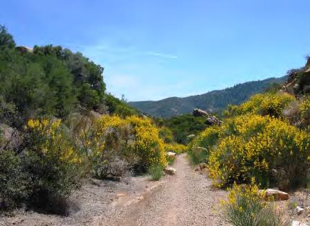
10 Step 2: Generated Vulnerability Informa6on Vulnerability: Alluvial Scrub Moderate-High (4) High Confidence Low High USFWS (Public Domain) Exposure Sensi?vity Adap?ve Capacity HIGH (5) High Confidence Air temperatures Precipita6on Wildfire Drought Soil Moisture Stream flows MODERATE-HIGH (4) High Confidence Climate drivers: Non-climate Precipita6on stressors: Drought Invasive species Soil moisture Dams & Low stream water diversions flows Disturbance regimes: Flooding Wildfire MODERATE (3) High Confidence - Fairly degraded - Low con6nuity - Site restric6ons - Low-moderate diversity + Moderate resistance and recovery + Moderate-high societal value
11 Step 2: Products What type of informa6on do I need? What level of informa6on do I need?
 Format: Narra6ve Examines key vulnerabili6es and provides in-depth discussions of poten6al")
12 Step 2: Products Vulnerability Syntheses Alluvial Scrub Habitats In-depth vulnerability informa?on Vulnerability Syntheses Long (15+ pages) Format: Narra6ve Examines key vulnerabili6es and provides in-depth discussions of poten6al impacts USFWS (Public Domain) USFWS (Public Domain)
 Format: Tables w/ bulleted lists Highlights key vulnerabili6es and")
13 Step 2: Products Vulnerability Summaries Alluvial Scrub Habitats USFWS (Public Domain) Key vulnerability informa?on Vulnerability Summaries Shorter length (5-9 pages) Format: Tables w/ bulleted lists Highlights key vulnerabili6es and summarizes poten6al impacts

14 Step 2: Products Vulnerability Briefings Alluvial Scrub Habitats USFWS (Public Domain) Vulnerability snapshot Vulnerability Briefings One page Format: Informa6onal flyer Lists key vulnerabili6es, and provides brief descrip6on of overarching impacts
15 Step 3: Adapta6on Planning Adapta?on strategies ahempt to reduce the nega6ve impacts of climate change Decrease vulnerability Increase resilience! Exposure ê Sensi?vity " Adap?ve Capacity Climate change adapta/on refers to natural or human adjustments in an ecosystem in response to changing climate condi?ons
 Adapta?")
16 Step 3A: Iden6fy Adapta6on Strategies Goal: Develop climate-smart adapta?on strategies and ac?ons to reduce vulnerabili?es or increase resilience of focal habitats Credit: Jus6n Meissen (CC BY-SA 2.0) Adapta?on Workshops: Generated adapta6on strategies and specific ac6ons to reduce climate change vulnerability for focal habitats within the context of regional management goals Where, when, and how those ac6ons can be applied Implementa6on feasibility and effec6veness Ways to modify exis6ng ac6ons to reduce vulnerabili6es and/or increase resilience
17 Step 3A: Products 17
18 Step 3A: Products Adapta?on Category Adapta?on Strategy Specific Adapta?on Ac?ons Enhance resistance Promote resilience Facilitate transi?on Increase knowledge Engage coordina?on Restore fluvial processes to streams that support alluvial scrub vegeta6on Maintain and/or restore the natural and historical characteris6cs of a watershed Promote species that are tolerant of clima6c changes Iden6fy and protect refugia Improve habitat restora6on tools to support the ability of plants and animals to respond to changing climate condi6ons Maintain the natural and historical characteris6cs of a watershed Map species distribu6ons to understand poten6al habitat loss or gain and improve restora6on Work across jurisdic6ons Remove dikes, mining opera?ons, and recharge basins that obstruct the migra?on ability of streams and sediment deposi?on areas Require undeveloped buffers along streams Raise roads out of washes Designate cri6cal habitat where the most sensi6ve species are found, and in areas where the home ranges of several species overlap Build a reserve of seeds and plants that are tolerant of disturbed condi6ons Restore habitat with na?ve species that are tolerant of disturbed condi?ons and clima?c extremes Protect areas that may be buffered from the effects of climate change, including microhabitats that may provide cooler temperatures or maintain higher soil moisture during periods of drought Conduct a common garden experiment to determine which species are most likely to persist under projected climate condi?ons Use species distribu6on modeling to improve understanding and acceptance of facilitated migra6on for plant species Research alluvial scrub species that are tolerant of disturbed condi?ons Compile informa?on on species ecology, range, and gene?cs to create detailed profiles Use species distribu?on modeling to look at mul?ple species within a habitat or community simultaneously, incorpora?ng mul?ple threats Survey the vegeta?on and environment to aid in the design of a plant palehe with species suited for various posi?ons within an alluvial fan or watercourse, Photos: J. Armstrong then update survey as habitat suitability changes under future climate condi?ons Coordinate invasive species management and funding between agencies Communicate about projects and coordinate on-the-ground ac6vi6es Align budgets and program work priori6es with adjacent lands


19 Step 3A: Products
20 Step 3A: Products EFFECTIVENESS Low Moderate High Low F/High E Require undeveloped buffers along streams Remove dikes, mining opera6ons, and recharge basins* Low F/Low E Raise roads out of washes * Survey the vegeta6on and design plant palehe with suitable species for current and future condi6ons * Iden6fy and protect areas that may be buffered from the effects of climate change Mod F/Mod E Designate cri6cal habitat where sensi6ve species are found Restore habitat with na6ve species that are tolerant of disturbed condi6ons and clima6c extremes * Conduct a common garden experiment that includes plants from across the species range to understand the level of adap6ve varia6on Use species distribu6on modeling to look at mul6ple species within a habitat or community simultaneously, incorpora6ng mul6ple threats Low Moderate High FEASIBILITY High F/High E Build a reserve of seeds and plants that are tolerant of disturbed condi6ons Research alluvial scrub species that are tolerant of disturbed condi6ons Coordinate invasive species management, funding, and support between agencies Compile informa6on on species ecology, range, and gene6cs to create detailed profiles High F/Low E
21 Step 3B: Develop Adapta6on Implementa6on Plans Goal: Develop implementa?on plans for on-the-ground ac?ons ADAPTATION IMPLEMENTATION PLANS 1. Evaluated vulnerabili6es of and developed adapta6on implementa6on plans for management ac6vi6es Fire & Fuels, Grazing, Watershed Improvement, Restora6on & Plan6ng


22 Step 3B: Products
23 Step 3B: Fire & Fuels Implementa6on Plan Implementa?on Steps 1. Iden6fy and map valued resources at risk, most vulnerable sites, and high-value sites 2. Set clear goals for each loca6on and site 3. Iden6fy ac6ons/strategies to achieve site goals; for example: Protect key areas Determine risk/benefit of fire at various stages Reduce fuels in strategic areas around sites 4. Integrate ac6ons/strategies for specific loca6ons into annual plan updates 5. Ensure that specific informa6on about ac6ons and loca6ons is given to firefighters Challenges to and Solu?ons for Implementa?on Challenge: Lack of fine-scale monitoring informa6on Solu?on: Collect informa6on on microsites and land facets as part of long-term, large-scale monitoring in order to iden6fy connec6vity or climate refugia areas Challenge: Integra6ng informa6on into cross-jurisdic6onal ac6vi6es Solu?on: Gather organiza6ons together for resource preplanning; work with S&P liaisons to help ins6tu6onalize concepts in other orgs Challenge: Lack of understanding of larger resource context Solu?on: Change ins6tu6onal/opera6onal mind-frame to incorporate informa6on before or during fire by training fire staff, incorpora6ng local knowledge of fire staff, incorporate resource advisors in fire ac6vi6es, etc.
24 Step 3B: Develop Adapta6on Implementa6on Plans Goal: Develop implementa?on plans for on-the-ground ac?ons ADAPTATION IMPLEMENTATION PLANS 1. Evaluated vulnerabili6es of and developed adapta6on implementa6on plans for management ac6vi6es Fire & Fuels, Grazing, Watershed Improvement, Restora6on & Plan6ng 2. Integrated climate change informa6on into current forest projects - Chaparral fuelbreaks, Sage scrub restora6on, Aqua6c organism passage, Grazing allotments
25 Case Study: Ojai Community Defense Zone Project Project Goals Maintain exis6ng fuel breaks and increase defensible space to: 1. Reduce the threat of wildfire to the urban interface 2. Create safer condi6ons for the public and firefighters 3. Protect watershed values and water quality 4. Reduce poten6al impacts of high intensity wildfire 5. Increase efficiency and cost effec6veness of fire suppression ac6vi6es Ac6ons 1. Manage ground cover 2. Use irregular shapes in design 3. Expand width 4. Use mechanical treatments
26 Case Study: Ojai Community Defense Zone Project Project Goals Maintain exis6ng fuel breaks and increase defensible space to: 1. Reduce the threat of wildfire to the urban interface 2. Create safer condi6ons for the public and firefighters 3. Protect watershed values and water quality 4. Reduce poten6al impacts of high intensity wildfire 5. Increase efficiency and cost effec6veness of fire suppression ac6vi6es How might climate change affect the ability of the project to meet these goals? Wildfire, Extreme Precipita?on Events, Invasive Grasses
27 Case Study: Ojai Community Defense Zone Project Do current project ac?ons reduce any vulnerabili?es? 1. Manage ground cover to result in mixture of bare ground, na6ve grasses and forbs Reduces invasive grasses 2. Use irregular shapes in fuelbreak design Reduces erosion poten6al 3. Expand width of fuelbreak Increases response speed and/or tac6cs so less area burned Wildfire, Extreme Precipita?on Events, Invasive Grasses


28 Case Study: Ojai Community Defense Zone Project What new ac?ons could be added to further reduce vulnerabili?es? 1. Plant na6ve perennial grasses within fuelbreak Limits invasive grasses, decreases flashy fire behavior, reduces erosion poten6al and increases water infiltra6on 2. Establish trigger points for recrea6on closures and restric6ons Reduces likelihood of human-caused igni6ons Wildfire, Extreme Precipita?on Events, Invasive Grasses
29 Case Study: Lower Piru Rangelands Project Project Goals Ensure that livestock grazing is managed in a manner that moves toward desired resource condi6ons consistent with mul6ple use goals; Mi6gate livestock grazing impacts to threatened and endangered species habitats; Determine the suitability of roads in Wilderness and Inventoried Roadless Area that provide management access within allotments; Make forage available; and Prevent livestock from impac6ng recrea6on. Ac?ons 1. Graze Piru, Pothole, Temescal allotments 2. Eliminate 0.1 mi road; convert 0.7 mi to trail 3. Reinstall and repair fencing in riparian areas 4. Consider adjus6ng season of use, stocking rate, and/or using temporary improvements (e.g., water troughs) to influence livestock distribu6on
30 Case Study: Lower Piru Rangelands Project Project Goals Ensure that livestock grazing is managed in a manner that moves toward desired resource condi6ons consistent with mul6ple use goals; Mi6gate livestock grazing impacts to threatened and endangered species habitats; Determine the suitability of roads in Wilderness and Inventoried Roadless Area that provide management access within allotments; Make forage available; and Prevent livestock from impac6ng recrea6on. How might climate change affect the ability of the project to meet these goals? Wildfire, Drought, Extreme Precipita?on Events, Invasive Grasses
31 Case Study: Lower Piru Rangelands Project Do current project ac?ons reduce any vulnerabili?es? 1. Graze Piru, Pothole, Temescal allotments Reduces fire risk by decreasing fine fuel loads 2. Eliminate road and convert road to trail Reduces erosion/sedimenta6on in riparian areas (if next to road) Reduces likelihood of vehicle-caused igni6ons 3. Reinstall and repair fencing Reduces erosion/sedimenta6on in riparian areas Wildfire, Drought, Extreme Precipita?on Events, Invasive Grasses


32 Case Study: Lower Piru Rangelands Project What new ac?ons could be added to further reduce vulnerabili?es? 1. Plant palatable and climate-resilient na6ve species Increases forage produc6vity Promotes water infiltra6on and reduces erosion risk Reduces invasive species risk 2. Prac6ce invasive species management Reduces invasive species risk Promotes desired plant species composi6on Wildfire, Drought, Extreme Precipita?on Events, Invasive Grasses

33 Step 3B: Products The Lower Piru Rangelands Project A Southern California Climate Change Adaptation Case Study Overview Climate change may affect the ability to achieve on-the-ground project goals and objectives. The following case study demonstrates how climate change vulnerability and adaptation information can be integrated into existing and future regional grazing management projects to increase overall project resilience. For this example, resource managers and regional stakeholders worked together to evaluate: 1) how climate and non-climate vulnerabilities could impact the ability to achieve project goals, 2) what current project actions Credit: Wikimedia (Public Domain) help to address or minimize vulnerabilities, and 3) what new actions could be added to the project to address remaining vulnerabilities. While this specific project has already been completed, developing and revising grazing management plans is a common activity in southern California, and this type of process could easily be replicated in future projects. Lower Piru Rangelands Project Goals & Actions The Ojai Ranger District within the Los Padres National Forest revised a grazing management plan for three allotments within the coastal scrub and annual grassland-dominated Lower Piru Rangelands. The goals of this project were to: 1. Ensure that livestock grazing is managed in a manner that moves toward desired resource conditions consistent with multiple use goals; 2. Mitigate livestock grazing impacts to threatened and endangered species habitats at specific locations; 3. Determine the suitability of roads in Wilderness and Inventoried Roadless Area that provide management access within allotments; 4. Make forage available to qualified livestock operators that are suitable for livestock grazing; and 5. Prevent livestock from impacting recreation in the Lake Piru Recreation Area. Primary project actions included: Graze Piru, Pothole, and Temescal allotments Eliminate 0.1 miles of road and convert 0.7 miles to trail (maintain 10 total road miles) Reinstall and repair fencing to prevent livestock from impacting riparian species and habitats Consider adjusting season of use, stocking rate, and/or temporary improvements (install water trough, salting) to influence livestock distribution and promote progress toward desired resource conditions Step 1: Identify Climate & Non-Climate Vulnerabilities How may climate change and non-climate stressors affect the ability to meet goals or implement project actions? Increased drought/precipitation changes! Impacts forage availability by decreasing forage productivity, altering plant composition, and reducing water sources Altered wildfire regimes! Reduces forage availability by temporarily increasing bare ground, altering planting composition, and promoting conversion to annual grassland! Impacts ability to mitigate grazing impacts by damaging fencing Product of EcoAdapt's Awareness to Action Program, Southern California Climate Adaptation Project Credit: I. Haykinson Increased extreme precipitation events! Impacts ability to mitigate grazing impacts by increasing erosion in riparian areas and damaging/destroying fencing Increased invasive plants (e.g., bromes, mustards)! Undermines progress toward desired resource conditions and may decrease forage availability/productivity Funded by the U.S. Forest Service and California Landscape Conservation Cooperative Step 2: Reducing Vulnerabilities Through Existing Project Actions Which existing project actions help address potential vulnerabilities? Action: Graze Piru, Pothole, and Temescal allotments Increases regional rangeland productivity and forage available to livestock operators Increases total available water sources by accessing additional riparian/water source areas Reduces fire risk by reducing fine fuel loads Action: Eliminate 0.1 miles of road and convert 0.7 miles to trail (maintain 10 total road miles) Reduces riparian erosion (if road is adjacent to riparian areas) Reduces fire risk by reducing vehicular ignitions Action: Reinstall and repair fencing to eliminate livestock from impacting riparian species and habitats Reduces riparian erosion Action: Consider adjusting season of use, stocking rate, and/or installing temporary improvements Increases regional rangeland productivity by distributing grazing pressure temporally and spatially Increases total available water sources Promotes desired plant species composition (depending on management and grazing intensity) Credit: D. Jackson EcoAdapt P.O. Box Bainbridge Island, WA info@ecoadapt.org Credit: J. Jacobus Step 3: Integrating New Project Actions to Address Remaining Vulnerabilities What additional actions could be implemented in the future to further reduce identified vulnerabilities? Action: Practice invasive species management (e.g., early detection/rapid response, treat/remove invasives) Reduces invasive species risk in rangeland and riparian areas Increases forage productivity Promotes desired plant species composition Action: Seed/Plant palatable and climate-resilient native species (e.g., drought-tolerant species; perennials) Increases forage productivity Promotes water infiltration and reduces riparian erosion by stabilizing soil Reduces invasive species risk and promotes desired plant species composition Action: Incorporate climate conditions, trends, and triggers into adaptive grazing management Utilizing planned grazing rotations during drought periods helps maintain long-term forage production Action: Plan for and implement water development based on projected future water conditions Identifying proper areas for and installing stock ponds to capture runoff helps ensure water for cattle Product of EcoAdapt's Awareness to Action Program Southern California Climate Adaptation Project Funded by the U.S. Forest Service and California Landscape Conservation Cooperative

34 Applying Climate Informa6on in Management Opera6ons Climate Adapta?on Products Vulnerability Assessment Science synthesis of exis6ng condi6on and projected changes/impacts Adapta?on Strategies & Ac?ons Menu of adapta6on op6ons based on vulnerabili6es How can climate adapta6on products be applied to management opera6ons? Management Opera?ons Forest planning Landscape Assessments Resource Program Strategies Project NEPA analysis Project design/ implementa?on Monitoring plans Climate Scorecard 34

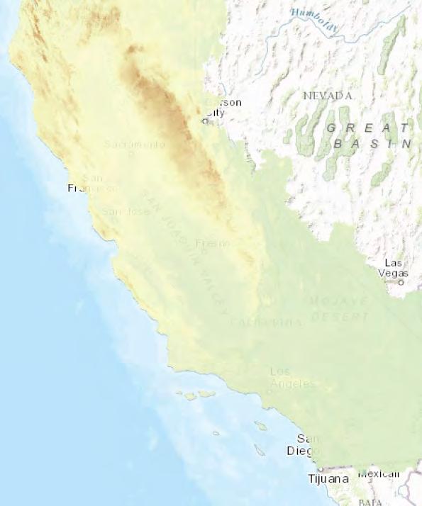
35 Spa6al Climate Tools Databasin.org

36 Spa6al Climate Tools 36
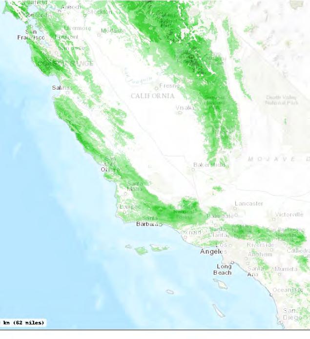


37 1. hhps://databasin.org/groups/0271e0425e8b4505a5a8ed694dbe8ad6 Spa6al Climate Tools Southern California Climate Adapta6on Project 1 Maps can help iden6fy: Projected climate changes for region Where and why resources are vulnerable Magnitude of change they are likely to experience

38 Acknowledgements hhp://ecoadapt.org/programs/adapta6on-consulta6ons/socal A big thank you to par?cipants!
Northern California Climate Adapta2on Project
 Northern California Climate Adapta2on Project Focal Resources & Scenario Planning Workshops March 7-10, 2016 Eureka, CA (March 7-8) and Redding, CA (March 9-10) Jessi Kershner, Lead Scien0st EcoAdapt Climate-
Southern California Chaparral and Sage Scrub Habitats
 Southern California Chaparral and Sage Scrub Habitats Climate Change Adaptation Actions Summary An Important Note About this Document: This document represents an initial effort to identify adaptation
Southern California Grassland Habitats
 Southern California Grassland Habitats Climate Change Adaptation Actions Summary An Important Note About this Document: This document represents an initial effort to identify adaptation actions for grassland
Southern California River and Stream Habitats
 Southern California River and Stream Habitats Climate Change Adaptation Actions Summary An Important Note About this Document: This document represents an initial effort to identify adaptation actions
Fire & Fuels Management
 Overview Fire & Fuels Management Southern California Adaptation Implementation Plan During a two- day workshop in January 2016, southern California resource managers and regional stakeholders discussed
Southern California Conifer and Subalpine Habitats
 Southern California Conifer and Subalpine Habitats Climate Change Adaptation Actions Summary An Important Note About this Document: This document represents an initial effort to identify adaptation actions
Collabora've Forest Landscape Restora'on Planning in the Southwestern Crown of the Con'nent: A Partner Perspec've
 Collabora've Forest Landscape Restora'on Planning in the Southwestern Crown of the Con'nent: A Partner Perspec've Anne A. Carlson, Ph.D. The Wilderness Society The Forest Landscape Restora'on Act (2009)
Day 1 Workshop Activities 1 & 2: Habitats and Species/Species Groups
 Day 1 Workshop Activities 1 & 2: Habitats and Species/Species Groups Instructions for Small Group Discussions Divide up into umbrella habitats groups A & B Upland Desert/Grassland Wetland Riparian/Riverine
Flood & Erosion Control
 Flood & Erosion Control Climate Change Adaptation Summary for Oʻahu An Important Note About this Document: This document represents an initial effort to identify adaptation actions for flood and erosion
Strong site and year specific needs, particularly driven by annual systems Well drained, <1200 m, over diverse soil types
 California s grasslands span over 10% of CA s land area (5,640,400 ha). The grasslands are also a key understory component of California s woodlands and coastal scrub, so grassland species cover at least
Hawaii Hazards Awareness & Resilience Program. Contents. Module 5: Risk Assessment 3/1/17. Vulnerability and Capacity Assessment (VCA)
") Hawaii Awareness & Resilience Program Produced by Hawaii State Civil Defense HAWAII HAZARDS AWARENESS & RESILIENCE PROGRAM: GOAL: To enhance community resilience to mul?ple hazards through a facilitated
Hawaii Awareness & Resilience Program Produced by Hawaii State Civil Defense HAWAII HAZARDS AWARENESS & RESILIENCE PROGRAM: GOAL: To enhance community resilience to mul?ple hazards through a facilitated
APPENDIX F LIVESTOCK MANAGEMENT TOOLS
 APPENDIX F LIVESTOCK MANAGEMENT TOOLS Management of livestock grazing has always been a fluid process that requires the flexibility to address resource issues/concerns as they occur, there is not a one
Ecosystem Sustainability and the Cheatgrass Fire Cycle
 Ecosystem Sustainability and the Cheatgrass Fire Cycle Jeanne C. Chambers Research Ecologist US Forest Service, RMRS Reno, Nevada jchambers@fs.fed.us http://www.fs.fed.us/rm/reno SUSTAINABLE ECOSYSTEMS
USDA defers to the Department of the Interior regarding the impact of the legislation on the Department s programs and authorities.
 Statement of Leslie Weldon Deputy Chief, National Forest System Forest Service United States Department of Agriculture Before the United States Senate Committee on Energy and Natural Resources Subcommittee
Using urban forests to increase community resiliency to climate change
 Using urban forests to increase community resiliency to climate change Andy Whitman awhitman@manomet.org www.manomet.org Local Solu
Southern California Chaparral and Sage Scrub Habitats
 Southern California Chaparral and Sage Scrub Habitats Climate Change Adaptation Synthesis Introduction The following section presents climate change adaptation planning results for chaparral and sage scrub
Great Basin Landscape Conservation Cooperative 2017 Online Public Forum Summary Report
 Photo: BLM Nevada Great Basin Landscape Conservation Cooperative 017 Online Public Forum Summary Report Online Public Forum Overview The Great Basin Landscape Conservation Cooperative (LCC) hosted an online
Applying Ecosystem Services to Collaborative Forest Management Elk River Public Meeting
 Applying Ecosystem Services to Collaborative Forest Management Elk River Public Meeting Nikola Smith Ecologist and Ecosystem Services Specialist U.S. Forest Service Port Orford City Hall February 2, 2017
Southern California Riparian Habitats
 Southern California Riparian Habitats Climate Change Adaptation Synthesis Introduction The following section presents climate change adaptation planning results for riparian habitats. The results summarize
Fire Initiatives & Strategic Planning
 Fire Initiatives & Strategic Planning Intermountain West Rangelands & Mojave Desert Presentation Sky Islands Fire Goals Learning Network Explain the choice of priority landscapes Demonstrate effective
Galiuro Exploration Drilling Project
 Galiuro Exploration Drilling Project Range and Noxious Weeds Report Prepared by: Gwen Dominguez Range Staff for: Safford Ranger District Coronado National Forest Date September 2, 2016 Forest Plan/Policy
Climate Adapta<on at SeaDle Public U<li<es
 Toward a Well Adapted Future in Puget Sound: A Symposium on Climate Change Adapta
Southern California River and Stream Habitats
 Southern California River and Stream Habitats Climate Change Adaptation Synthesis Introduction The following section presents climate change adaptation planning results for rivers and streams. The results
Ecology & Management of Cheatgrass
 Ecology & Management of Cheatgrass Dr. Jay Norton, Soils Specialist University of Wyoming Land Reclamation Basics for Energy Development in Northeastern Wyoming February 3, 2009 Overview Exotic Exotic
The National Fire Plan: Managing the Impacts of Wildfires on Communities and the Environment. An Overview and Look Ahead
 The National Fire Plan: Managing the Impacts of Wildfires on Communities and the Environment An Overview and Look Ahead April 23, 2002 Background: In September 2000, the Departments of Agriculture and
Miller Pasture Livestock Water Pipeline Extension Proposed Action
 Introduction Miller Pasture Livestock Water Pipeline Extension Proposed Action USDA Forest Service Williams Ranger District, Kaibab National Forest Coconino County, Arizona February 10, 2017 The Miller
Range Management and Conservation. Rangeland Management and
 Range Management and Conservation Leslie Roche and Ken Tate Rangeland Watershed Lab University of California, Davis Rangeland Management and Water quality, species of concern, riparian and meadow health,
Proposed Action and Alternatives
 Chapter Proposed Action and Alternatives Page 15 CHAPTER 2 - PROPOSED ACTION AND ALTERNATIVES INTRODUCTION Chapter 2 describes and compares the Southwest Fence Relocation and Waterline Project s Proposed
Southern California Alluvial Scrub Habitats
 Southern California Alluvial Scrub Habitats Climate Change Vulnerability Assessment Summary An Important Note About this Document: This document represents an initial evaluation of vulnerability for alluvial
Regional Integrated Sciences and Assessments (RISA): examples from our regional teams
: examples from our regional teams") Regional Integrated Sciences and Assessments (RISA): examples from our regional teams Caitlin Simpson Chelsea Combest-Friedman RISA Program Management Team NOAA Climate Program Office The RISA Program:
Regional Integrated Sciences and Assessments (RISA): examples from our regional teams Caitlin Simpson Chelsea Combest-Friedman RISA Program Management Team NOAA Climate Program Office The RISA Program:
Vulnerability Assessment and Adaptation Strategies for Focal Resources of the Sierra Nevada
 Vulnerability Assessment and Adaptation Strategies for Focal Resources of the Sierra Nevada An Overview of Project Components and Utility Purpose of this Document This document serves as a guide to the
Proposed Action and Alternatives
 Chapter Proposed Action and Alternatives Chapter 2 Proposed Action and Alternatives Page 15 CHAPTER 2 - PROPOSED ACTION AND ALTERNATIVES INTRODUCTION Chapter 2 describes and compares the Southwest Fence
Public adapta,on through the backdoor: Can we move to adap,ve water governance?
 Public adapta,on through the backdoor: Can we move to adap,ve water governance? Clement and Amezaga, 2013 Privately- provided public adapta=on goods (Tompkins and Eakin, GEC, 2012)?? Sensi=vity to signal
Mukwonago River Watershed Protection Plan Recommendations & Implementation Update Friends of Mukwonago River March 16, 2013 Mukwonago, WI
 Mukwonago River Watershed Protection Plan Recommendations & Implementation Update Friends of Mukwonago River March 16, 2013 Mukwonago, WI Thomas M. Slawski, Principal Specialist Biologist Southeastern
Wildlife Conservation Society Climate Adaptation Fund 2014 Restoring Oak Resilience at the Table Rocks, Rogue River Basin, Oregon FACT SHEET
 Wildlife Conservation Society Climate Adaptation Fund 2014 Restoring Oak Resilience at the Table Rocks, Rogue River Basin, Oregon FACT SHEET Project Overview Oak ecosystems in the Pacific Northwest exist
Putting Resilience and Resistance Concepts into Practice
 Number 1 2015 Putting Resilience and Resistance Concepts into Practice Estimates of resilience and resistance provide information on how an area is likely to respond to disturbances and management. Relative
Forest Service Angora Recovery Efforts. Eli Ilano Deputy Forest Supervisor Lake Tahoe Basin Management Unit USDA Forest Service November 3, 2007
 Forest Service Angora Recovery Efforts Eli Ilano Deputy Forest Supervisor Lake Tahoe Basin Management Unit USDA Forest Service November 3, 2007 Fire Facts Started June 24, 2007; Contained July 2; Controlled
Adapting to Climate Change in Western National Forests
 Adapting to Climate Change in Western National Forests David L. Peterson 1, Jessica E. Halofsky 2, Natalie Little 3 ¹USDA Forest Service, Pacific Northwest Research Station ²University of Washington, School
Assessing and Adapting to Climate Change Intermountain Region. Natalie Little Forest Service Ogden, Utah
 Assessing and Adapting to Climate Change Intermountain Region Natalie Little Forest Service Ogden, Utah We have lots of information! Adapting to climate change: USFS information & tools Climate Change
California s Rangelands. Annual Grassland Dominated Systems
 *Grazing Systems on California s Rangelands Annual Grassland Dominated Systems What is a Grazing System & are they applicable for California Grazing Systems refers to specialized grazing management that
3.28 RESEARCH NATURAL AREAS
 3.28 RESEARCH NATURAL AREAS Introduction Research Natural Areas (RNAs) are areas designated, in perpetuity, for non-manipulative research and educational purposes, as well as to help maintain ecological
San Gabriel Mountains National Monument Need to Change Analysis June 2015
 San Gabriel Mountains National Monument San Gabriel Mountains National Monument Need to Change Analysis June 2015 I. Background Throughout this document for consistency, the term Monument will be used
Rangeland Conservation Effects Assessment Program (CEAP)
") Rangeland Conservation Effects Assessment Program (CEAP) Program Overview with Emphasis on the Literature Review of Rangeland Practices Pat L. Shaver, PhD Rangeland Management Specialist USDA-NRCS West
Rangeland Conservation Effects Assessment Program (CEAP) Program Overview with Emphasis on the Literature Review of Rangeland Practices Pat L. Shaver, PhD Rangeland Management Specialist USDA-NRCS West
Assessing Habitat in Watersheds. Sabrina Drill UC Cooperative Extension Los Angeles and Ventura
 Assessing Habitat in Watersheds Sabrina Drill UC Cooperative Extension Los Angeles and Ventura sldrill@ucdavis.edu 323-260 260-3404 What is Habitat? The environment in which a plant and animal lives, and
Sustainable Land and Ecosystem Management Country Partnership Program (SLEM- CPP)
") Public Disclosure Authorized Public Disclosure Authorized Public Disclosure Authorized Public Disclosure Authorized INDIA Sustainable Land and Ecosystem Management Country Partnership Program (SLEM- CPP)
Public Disclosure Authorized Public Disclosure Authorized Public Disclosure Authorized Public Disclosure Authorized INDIA Sustainable Land and Ecosystem Management Country Partnership Program (SLEM- CPP)
Rangeland CEAP Literature Synthesis: Conclusions and Recommendations
 Rangeland CEAP Literature Synthesis: Conclusions and Recommendations David D. Briske, Academic Coordinator, Texas A&M University, College Station TX Leonard Jolley, Range and Pastureland CEAP Director,
GREATER SAGE-GROUSE CONSERVATION
 United States Department of Agriculture GREATER SAGE-GROUSE CONSERVATION Forest Service 1 en.wikipedia.org/wiki/greater_sage-grouse. Cover photo & the photo above courtesy of Shutterstock.com Meet the
April 2, Lloyd McGee, President Northeast Washington Forestry Coalition 565 West 5 th Colville, Washington 99114
 April 2, 2007 Lloyd McGee, President Northeast Washington Forestry Coalition 565 West 5 th Colville, Washington 99114 Ms. Margaret Hartzell, Team Leader Colville, Okanogan, and Wenatchee - National Forests
CATEGORY a protection of the natural environment, its ecosystems and biodiversity.
 29. ENVIRONMENTAL DEVELOPMENT PERMIT AREA CATEGORY a protection of the natural environment, its ecosystems and biodiversity. The requirement to obtain an environmental development permit is cited in Section
US Forest Service Open Space Conservation Strategy
 US Forest Service Open Space Conservation Strategy Transportation Research Board September 3, 2008 Atlanta, Georgia Photo Credit: Regents at the University of Minnesota. All rights reserved. Used with
Threats, Vulnerabili0es, Tough Choices Oh My!
 Human Dimensions and Ocean Health in a Changing Climate Symposium USC March 12, 2013 Threats, Vulnerabili0es, Tough Choices Oh My! Research and Ac,on for Adapta,on Success Susanne C. Moser, Ph.D. Susanne
NWRMs in Cyprus Past present future
 NWRM Natural Water Reten@on Measures Mediterranean Network Regional Workshop #2 Turin, September 11th 12th, 2014 Session 4 NWRM as a catalyst for policy co ordina@on NWRMs in Cyprus Past present future
New Mexico Forest Restoration Principles
 New Mexico Forest Restoration Principles Preamble These principles were collaboratively developed by a team of dedicated professionals representing industry, conservation organizations, land management
Statement of. Dale Bosworth, Chief U.S. Forest Service United States Department of Agriculture
 Statement of Dale Bosworth, Chief U.S. Forest Service United States Department of Agriculture Before the House Resource Committee Subcommittee on Forests and Forest Health U.S. House of Representatives
Range Capability Process on Strawberry Peak Allotment
 Range Capability Process on Strawberry Peak Allotment Capability on the Ashley National Forest was largely determined for the current 1986 Forest Plan and beginning around the 1960s using a data collection
GREAT BASIN ENVIRONMENTAL PROGRAM
 GREAT BASIN ENVIRONMENTAL PROGRAM A Multi-state Partnership to Improve Land Health and Ecosystem Productivity NEVADA UTAH IDAHO OREGON CALIFORNIA Summary FOCUS: INVASIVE PLANT SPECIES Wildfires Water Resources
Keefer Pasture Drift Fence Project. Challis-Yankee Fork Ranger District Salmon-Challis National Forest
 Keefer Pasture Drift Fence Project Challis-Yankee Fork Ranger District Salmon-Challis National Forest PROPOSED ACTION The Challis-Yankee Fork Ranger District proposes construction of approximately.11 miles
Proposed Plan High Level Overview
 Introduction Navigating the Document Key Appendices Proposed Plan Primary Threats in Oregon Addressing Threats Mitigation Strategy Adaptive Management Strategy Next Steps Questions Proposed Plan High Level
VEGETATIVE, WATER, FISH AND WILDLIFE RESOURCES POLICIES
 VEGETATIVE, WATER, FISH AND WILDLIFE RESOURCES POLICIES The County will: GOALS AND OBJECTIVES 1.1 Conserve, Enhance, Protect, Maintain and Manage Vegetative, Water, Fish and Wildlife Resources Promote
Landscape Analysis for Forest Conservation Planning. June 2005, Toronto FPAC/ WWF Technology Transfer Workshop
 Landscape Analysis for Forest Conservation Planning June 2005, Toronto FPAC/ WWF Technology Transfer Workshop Presentation Overview WWF overview Forest statistics the case for forest conservation Market
Sierra Nevada Forest Plan Amendment Volume 1, Summary, Chapters 1 & 2
 reader's guide Sierra Nevada Forest Plan Amendment Table of Contents Sierra Nevada Forest Plan Amendment Volume 1, Summary, Chapters 1 & 2 TABLE OF CONTENTS The Table of Contents is divided into 3 Sections.
Developing Climate-Smart Adaptation Strategies for the Sagebrush Landscape Gunnison Basin, Colorado
 Developing Climate-Smart Adaptation Strategies for the Sagebrush Landscape Gunnison Basin, Colorado Gunnison Climate Working Group Betsy Neely, TNC & Renee Rondeau, CNHP 4 th Gunnison Sage-grouse Summit
THE SAN DIEGO DECLARATION ON CLIMATE CHANGE AND FIRE MANAGEMENT
 THE SAN DIEGO DECLARATION ON CLIMATE CHANGE AND FIRE MANAGEMENT THE ASSOCIATION FOR FIRE ECOLOGY Presented at THIRD INTERNATIONAL FIRE ECOLOGY AND MANAGEMENT CONGRESS 1, 2 November 13-17, 2006 PREAMBLE
Future of the Four Forests
 Future of the Four Forests Monica Bond Kristeen Penrod Helen Wagenvoord Center for Biological Diversity Southern California Forests 1. Scenery Southern California Forests 2. Habitat last refuge for animals
Rogue Basin Ecological Integrity Assessment and Climate Change Management Interactions
 Rogue Basin Ecological Integrity Assessment and Climate Change Management Interactions Jimmy Kagan OSU PSU UO Ecological Integrity Measures (by area) Land management status Landscape features Habitat characteristics
Re: Initial Comments on the Mount Laguna and Pine Valley Community Defense and Healthy Forest Restoration Project
 Marian Kadota Adaptive Management Services Enterprise Team U.S. Forest Service 1072 Casitas Pass Road #288 Carpinteria, CA 93013 mkadota@fs.fed.us Re: Initial Comments on the Mount Laguna and Pine Valley
Potential Effects of Climate Change on Mixed Severity Fire Regimes of the Western U.S.
 Potential Effects of Climate Change on Mixed Severity Fire Regimes of the Western U.S. Jessica E. Halofsky David L. Peterson Pacific Wildland Fire Sciences Lab Seattle, WA Climate controls ecosystem processes
CHATHAM PARK EXCEPTIONAL DESIGN EVALUATION
 CHATHAM PARK EXCEPTIONAL DESIGN EVALUATION 1 Chatham Park Basics 7,600 Acre Mixed Use Development 22,000 New Residences 22 Million Square Feet Commercial Space 60,000 Jobs 2,000+ Acres Open Space Estimated
Central Washington 2012 Wildfires Burned Area Emergency Response (BAER) Information Brief October 19, 2012 BAER Information: (208)
 Information Brief October 19, 2012 BAER Information: (208)") Okanogan-Wenatchee National Forest Central Washington 2012 Wildfires Burned Area Emergency Response (BAER) Information Brief October 19, 2012 BAER Information: (208) 398-3348 Fire Background WENATCHEE
Okanogan-Wenatchee National Forest Central Washington 2012 Wildfires Burned Area Emergency Response (BAER) Information Brief October 19, 2012 BAER Information: (208) 398-3348 Fire Background WENATCHEE
3 Baseline and Existing Conditions
 1 2 3 4 5 6 7 8 9 10 11 12 13 14 3 Baseline and Existing Conditions The effective date of the VSP legislation is July 22, 2011. This is also the date chosen by the legislature as the applicable baseline
Concerns about ranching and
 Understanding the Science of Ranch Water Quality Ken Tate UC Davis Concerns about ranching and Microbial quality Erosion and sedimentation Riparian and stream health Sensitive aquatic species Stream temperature
STANDARDS FOR HEALTHY PUBLIC RANGELANDS
 STANDARDS FOR HEALTHY PUBLIC RANGELANDS Standard #1 Within the potential of the ecological site (soil type, landform, climate, and geology), soils are stable and allow for water infiltration to provide
Pilot Climate Change Adapta1on Market Study: Turkey
 Pilot Climate Change Adapta1on Market Study: Turkey Market study aims Develop new approaches to help businesses manage the risks, and unlock the opportuni:es, caused by a changing climate Iden:fy ways
Riparian Buffer Requirements. Department of Environmental Protection Bureau of Watershed Management
 102.14 - Riparian Buffer Requirements Department of Environmental Protection Bureau of Watershed Management 102.2 Scope and Purpose BMPs to protect, maintain, and restore water quality and existing designated
Pre and Post Vegetation Management Decisions around Burning & Grazing
 Pre and Post Vegetation Management Decisions around Burning & Grazing Stephanie Larson, PhD Livestock & Range Management Advisor Sonoma & Marin Counties Prescriptive Burning Weather Fire Spread, Severity
DECISION MEMO. West Fork Blacktail Deer Creek Hardened Crossing
 Page 1 of 6 Background DECISION MEMO USDA Forest Service Madison Ranger District Madison County T12S, R4W, Section 30 The project is in the Gravelly Landscape, Snowcrest Recommended Wilderness Management
What are cultural methods? Cultural methods part 1. Grazing. Disadvantages. Multi-species grazing. Controlled access and use
 Cultural methods part 1 Reading:Targeted grazing: chapters 6,9,&12 and skim chapter 15 What are cultural methods? Controlled access and use Grazing yes/no Grazing intensity Grazing season Recreation http://www.usda.gov/oc/photo/02c1219.jpg
New Mexico Forest Restoration Principles Preamble Participants Principles Collaborate Reduce the threat of unnatural crown fire.
 New Mexico Forest Restoration Principles Preamble These principles were collaboratively developed by a team of dedicated professionals representing industry, conservation organizations, land management
Land Use: Forests, Rangelands, Parks and Wilderness
 Land Use: Forests, Rangelands, Parks and Wilderness World Land Use Types of Protected Lands in U.S. Multiple-use lands National Forest (U.S.F.S.) sustainable yield multiple use used for logging, mining,
WELCOME! Four Corners and Upper Rio Grande Vulnerability Assessment Webinar Series
 WELCOME! Four Corners and Upper Rio Grande Vulnerability Assessment Webinar Series Phone audio: Dial: 866-620-8138; Passcode: 5952203# Mute your phone and turn off computer speakers (prevents echo issue).
Angeles National Forest Invasive Plant Project Station Fire Burn Area
 Tiernan Doyle California State Polytechnic Unversity, Pomona January-August 2013 Advisor: Katie VinZant Submitted September 12, 2013 Angeles National Forest Invasive Plant Project Station Fire Burn Area
PRINCE GEORGE NATURAL AREAS AND THE EFFECTS OF CLIMATE CHANGE: CASE STUDY
 PRINCE GEORGE NATURAL AREAS AND THE EFFECTS OF CLIMATE CHANGE: CASE STUDY Natural Areas in Prince George The City of Prince George is dominated by natural, undeveloped areas within city limits and in adjacent
Climate Change: A New Partnership for Restoration in the Rogue Basin
 Climate Change: A New Partnership for Restoration in the Rogue Basin Gwyn Myer Southern Oregon Forest Restoration Collaborative Dave Peterson USFS Pacific Northwest Research Station Ken Wearstler Rogue
Southern California Oak Woodland Habitats
 Southern California Oak Woodland Habitats Climate Change Adaptation Synthesis Introduction The following section presents climate change adaptation planning results for oak woodland habitats. The results
Washington Department of Fish and Wildlife Climate Change Adaptation. Lynn Helbrecht Climate Change Coordinator
 Washington Department of Fish and Wildlife Climate Change Adaptation Lynn Helbrecht Climate Change Coordinator Washington Department of Fish and Wildlife Policy framework for adaptation Governors Executive
FEMA s Mitigation Support for Resiliency: Innovative Drought and Flood Mitigation Projects
 FEMA s Mitigation Support for Resiliency: Innovative Drought and Flood Mitigation Projects Jordan Williams, CFM Eric Kenney, PE, CFM May 4, 2017 2 Hazard Mitigation Purpose: Research climate resilient
Water Quality Conditions & Management on Rangelands
 Water Quality Conditions & Management on Rangelands Ken Tate, Leslie Roche, and Rob Atwill UC Davis and UC Cooperative Extension Grazing Workshop Mariposa County UCCE March 2014 CA Rangelands Safe Water
PLANT AND ANIMAL DIVERSITY
 by the planning rule team as of. These ideas are for discussion purposes and do not What we want to achieve PLANT AND ANIMAL DIVERSITY The Forest Service is committed to protecting species and sustaining
Common water resource goals
 Healthy Rangeland Watersheds and Productive Livestock Enterprises: Why Not? Society for Range Management Annual Conference Billings, MT February 7, 2011 Common water resource goals Improve water quality.
Climate Change Adaptation: Great Lakes region examples
 Climate Change Adaptation: Great Lakes region examples Kimberly Hall kimberly_hall@tnc.org Credits: IPCC 2007, Photos Photography Plus, Julie Craves Mark Godfrey October 21, 2010 Freshwater Future CC Workshop,
FACT SHEET: BLM, USFS Greater Sage-Grouse Conservation Effort
 EMBARGOED UNTIL SEPTEMBER 22, 2015 @ 12:00PM ET FACT SHEET: BLM, USFS Greater Sage-Grouse Conservation Effort Overview Effective conservation of the greater sage-grouse and its habitat requires a collaborative,
Climate Change Vulnerability & Adap5ve Capacity Assessment: Example from Ka ūpūlehu ahupua a - Hawai i Island
 Climate Change Vulnerability & Adap5ve Capacity Assessment: Example from Ka ūpūlehu ahupua a - Hawai i Island Alex Frost Graduate Student University of Hawaii Department of Urban and Regional Planning
Patrick White Senior Consultant Akvaplan-niva
 Zone Management Patrick White Senior Consultant Akvaplan-niva Patrick White is a specialist in marine fish hatchery production and an expert on the environmental impacts of aquaculture. He has over 35
A Mul&- Modal Freight Safety, Security and Environmental Rou&ng Tool
 A Mul&- Modal Freight Safety, Security and Environmental Rou&ng Tool Janey Camp, Mark Abkowitz & Robert Stammer Vanderbilt University Mid- Con?nent Transporta?on Research Symposium August 2014 Madison,
Acres within Planning Area. Total Acres Burned
 Calf-Copeland Project Description Figure 1: Dead sugar pine in the Calf-Copeland planning area. Sugar pine grow best in open conditions. In the absence of fire disturbance, high densities of Douglas-fir
Forest Plan Monitoring Program Frequently Asked Questions
 U.S. Forest Service Pacific Southwest Region June 2016 Forest Plan Monitoring Program Frequently Asked Questions What is the forest plan monitoring program? The monitoring program is one of three phases
The Monongahela National Forest
 The Monongahela National Forest ~ 1 million acres High elevation Location of headwater streams for millions in the East Rain shadow effect The Allegheny Front Sedimentary geology and acidic environments
Poker Chip Project. Noxious Weed Risk Assessment Almanor Ranger District Lassen National Forest
 Noxious Weed Risk Assessment Almanor Ranger District Lassen National Forest June 3, 2013 Introduction When a ground-disturbing action or activity is proposed, a Noxious Weed Risk Assessment (NWRA) determines
The New Normal Sustainable and Firewise Landscaping. UC Master Gardener Program of Sonoma County Mimi Enright, Program Manager
 The New Normal Sustainable and Firewise Landscaping UC Master Gardener Program of Sonoma County Mimi Enright, Program Manager Sustainable & Firewise Landscaping Framework & Agenda Sustainable & firewise
C SO. Coastal Zone Management and Community Resilience. Coastal States Organiza0on
 Coastal Zone Management and Community Resilience Mary Munson Executive Director, Coastal States Organization Congress on Coastal Resilience and risk December 11-12, 2013 Established in 1970, CSO represents