Nantahala Pisgah NF Plan Process - Natural Range of Variation. Gary Kauffman National Forests in NC Ecologist
|
|
|
- Leo Cannon
- 6 years ago
- Views:
Transcription
1 Nantahala Pisgah NF Plan Process - Natural Range of Variation Gary Kauffman National Forests in NC Ecologist 1

2 NRV Plan Directives indicate must contain plan components, including standards or guidelines, that maintain or restore composition, structure, ecological processes, and connectivity of plan area ecosystems in a manner that promotes their ecological integrity. When developing plan components, the Interdisciplinary Team shall consider the role of the natural range of variation. Each Ecozone has a Natural Range of Variability that is described by: Composition (veg. type) Structure (Open vs. Closed) Disturbance (Age- Early, Mid, Late, Old) 2
3 Defining Natural Range of Variation Determine appropriate ecozones Correlate Landfire biophysical setting (BPS) modeled vegetation units with ecozones Review other local Landfire modeling examples in Southern Apps Develop age and successional classes for Nantahala/Pisgah Determine appropriate disturbance regimes (type and frequency) for each separate BPS Run state and transition simulation models (STSMs) for each separate BPS; incorporate variability for all disturbance regimes Define a geographic area for BPS models 3
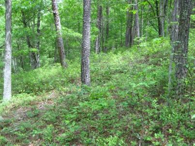
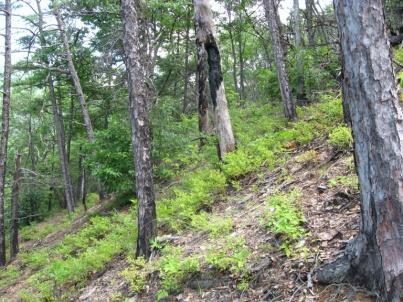
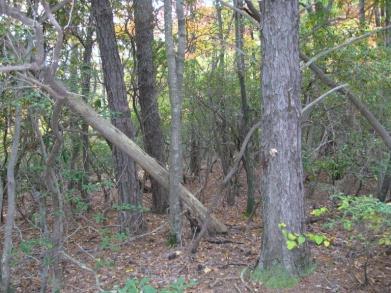
4 1 Dry-Mesic Oak Ecozone Desired Conditions 4 The overstory consists of oak and other deciduous hardwood canopy trees. Aggressive native tree species, such as red maple and white pine, are present but not dominant. Shrub densities, primarily deciduous species, range from 25 to 50 percent. A diverse herbaceous layer occurs within open canopy sites while a sparser layer occurs within closed canopy sites. Grasses are dispersed and evident within fire-maintained sites. Young forest is represented, 5-7 percent of the landscape, across this ecozone. Potential old-growth conditions, from percent of the landscape, are present in amounts that support species diversity. With the older closed-canopy forest, a mosaic of different size openings are dispersed throughout providing structural and age class diversity. Greater than half of the old-growth class, representing percent of the landscape, is open canopy. A greater portion of the landscape supports open canopy forest, percent, compared to closed canopy forest, percent. Open canopy conditions are distributed across all age classes. Wildland fire occurs across this ecozone at intervals ranging from years. Periodic burns regenerate the dominant oak species. Table 8. Dry-Mesic Oak Forest Age and Structural Classes Age/Structural Classes Young Mid Closed Mid Open Late Closed Late Open OG Closed OG Open 2 3 Age (years) Landscape %
5 5
6 6
7 Environmental modeling Uses digital terrain data (elevation, aspect, slope, etc.) to approximate environmental gradients (moisture, temperature, fertility) to define types of environment Uses Plant Associations (Dry Oak, Rich Cove, Spruce-Fir, etc.) to name the types of environment Determines relationships between Plant Associations and digital terrain data at known locations and extrapolates to unknown locations: Model = a mathematical approximation of reality 7
8 Ecological Systems / Zone modeling Known Location (point) 10m 10m Spatial Data Layers (DTMs) Elevation Aspect Slope Ave. annual precipitation Relative slope position Geology (+ 24 others) f(x) statistical function* Maxent 8
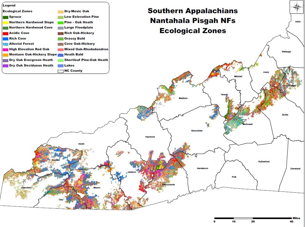
9 Determination of Final Ecozones by combining various model zones; merged types with similar plant diversity EcoZones 1 Nant-Pisgah Acres Nant-Pisgah Percent Spruce-Fir % Changes Northern Hardwood % includes slope and cove types High Elevation Red Oak % Acidic Cove Forest % combine acidic cove and mixed oak rhododendron tpes Rich Cove Forest % Mesic Oak % includes slope, cove and rich types Dry Mesic Oak % Dry Oak % Pine-Oak Heath % Shortleaf Pine-Oak heath % Floodplain % includes evergreen and deciduous types Combine low elevation mixed pineoak and pine types combine alluvial and large floodplain types 1 Third Approximation Southern App Model 9

10 Plant Communities in Southern Appalachian Landscape Spruce-Fir Grassy Bald Beech Gap High Elevation Red Oak Northern Hardwood Northern Hardwood Pine-Oak/ Heath Mesic Oak Mesic Oak Dry-Mesic Oak Dry-Mesic Oak Shortleaf Pine-Oak Floodplain Forest 10


11 Spruce-fir High Elevation Red Oak High Elevation > 4200 Feet 10% of Nantahala & Pisgah NFs Northern Hardwood 11


12 Mid Elevation: Feet Acidic Cove 85% of Nantahala & Pisgah NFs Rich Cove Pine- Oak/Heath Dry Oak Dry-Mesic Oak Mesic Oak 12


13 Low Elevation < 2300 Feet Shortleaf Pine Forest 5% of Nantahala & Pisgah NFs Floodplain Forest 13
14 1 Dry-Mesic Oak Ecozone Desired Conditions 4 The overstory consists of oak and other deciduous hardwood canopy trees. Aggressive native tree species, such as red maple and white pine, are present but not dominant. Shrub densities, primarily deciduous species, range from 25 to 50 percent. A diverse herbaceous layer occurs within open canopy sites while a sparser layer occurs within closed canopy sites. Grasses are dispersed and evident within fire-maintained sites. Young forest is represented, 5-7 percent of the landscape, across this ecozone. Potential old-growth conditions, from percent of the landscape, are present in amounts that support species diversity. With the older closed-canopy forest, a mosaic of different size openings are dispersed throughout providing structural and age class diversity. Greater than half of the old-growth class, representing percent of the landscape, is open canopy. A greater portion of the landscape supports open canopy forest, percent, compared to closed canopy forest, percent. Open canopy conditions are distributed across all age classes. Wildland fire occurs across this ecozone at intervals ranging from years. Periodic burns regenerate the dominant oak species. Table 8. Dry-Mesic Oak Forest Age and Structural Classes Age/Structural Classes Young Mid Closed Mid Open Late Closed Late Open OG Closed OG Open 2 3 Age (years) Landscape %
 represents vegetation that may have been dominant in former times with less human intervention. Map units are defined by Nature Serve (NatureServe.")
15 Landfire is a nation-wide database that in part describes vegetation dynamics, including structure and disturbance regimes, for 1000 plus ecosystems, known as Biophysical Settings (BpS). Biophysical Settings (BpS) represents vegetation that may have been dominant in former times with less human intervention. Map units are defined by Nature Serve (NatureServe.org) Ecological Systems, a nationally consistent set of mid-scale ecological units. BpS are dynamic, can be regionally updated with more accurate information 15
16 Bridge from BpS to review of existing modeling effort Correlated BpS with the 11 ecozones. Rich Cove and Acidic Cove were combined in a single BpS given similar landscape position and disturbance history Examined three regional modeling efforts north zone Cherokee NF, Warwoman watershed on Chattahoochee NF, and southern Apps overall Within separate models observed variation in number of structural-age (s-classes), wide variation in percent particularly for oak types Decided to include old growth for all BpS models Decided to document a range per individual s-class 16
17 Added old growth classes for all models, these varied from 6-7 classes per model Calibrated age classes based on dominate tree species growth, the density of tree species, and changes in grass, shrub, and species dominance. Old growth ages typically used data from Region 8 Old Growth Guidance Ecozones Age Class Early Mid Late Old Growth Spruce-Fir High Elevation Red Oak Northern Hardwood Cove (Rich or Acidic) Mesic Oak Dry-Mesic Oak Dry Oak Pine-Oak heath Low Elevation pine Floodplain
18 1 Dry-Mesic Oak Ecozone Desired Conditions 4 The overstory consists of oak and other deciduous hardwood canopy trees. Aggressive native tree species, such as red maple and white pine, are present but not dominant. Shrub densities, primarily deciduous species, range from 25 to 50 percent. A diverse herbaceous layer occurs within open canopy sites while a sparser layer occurs within closed canopy sites. Grasses are dispersed and evident within fire-maintained sites. Young forest is represented, 5-7 percent of the landscape, across this ecozone. Potential old-growth conditions, from percent of the landscape, are present in amounts that support species diversity. With the older closed-canopy forest, a mosaic of different size openings are dispersed throughout providing structural and age class diversity. Greater than half of the old-growth class, representing percent of the landscape, is open canopy. A greater portion of the landscape supports open canopy forest, percent, compared to closed canopy forest, percent. Open canopy conditions are distributed across all age classes. Wildland fire occurs across this ecozone at intervals ranging from years. Periodic burns regenerate the dominant oak species. Table 8. Dry-Mesic Oak Forest Age and Structural Classes Age/Structural Classes Young Mid Closed Mid Open Late Closed Late Open OG Closed OG Open 2 3 Age (years) Landscape %
19 Examined frequency of disturbance types for each BpS model for each s-class Data was incorporated from literature, previous determinations, and discussion with experts. Included Disturbance Frequency for following major types Fire - Surface, mixed, and sever Wind including hurricanes and downbursts Hoar Frost-Ice Severe Rain Events Insect Outbreaks Diseases Flooding Models were examined relative to all other models. Given the lack of historical data and the uncertainty on frequencies, there was greater emphasis placed on reviewing all models together ensuring frequencies for individual BpS units were realistic based on landscape exposure, topography, etc. 19
20 Disturbance Ecology Young Mid Mid Closed Mid Open Late Open Old Growth Open Late Closed Old Growth Closed 20
21 Disturbance Frequency By Ecozones in Western North Carolina Ecozones Disturbances POH SLP Dry Oak Dry-Mesic Oak Mesic Oak HERO SF NHwd Cove Flood Min Surface Fire Max Surface Fire Average Surface Fire Min Mixed Fire Max Mixed Fire Average Mixed Fire Min Replacement Fire Max Replacement Fire Average Replacement Fire Min Wind/Weather Max Wind/Weather Average Wind/Weather Min Extreme Wind/Ice Max Extreme Wind/Ice Average Extreme Wind/Ice Min Insect/Disease Max Insect/Disease Average Insect/Disease Min Flooding 50 Max Flooding 400 Average Flooding 120 * all frequencies in years POH = Pine-Oak/Heath SLP = Low Elevation Pine HERO = High Elevation Red Oak SF = Spruce-Fir NHwd = Northern Hardwoods Cove = Acidic or Rich Flood = Floodplain 21
22 Modeling Developed models with state and transition simulation software Each model ran for 1000 years with 100 simulations All models were non-spatial Model results for broader spatial scale Models do not provide compositional distribution Structural diversity does not define gap size -- simply defines open habitat as less than 60 % canopy cover Results with greater open forest (young and woodlands) in drier ecozones compared to moist ecozones High elevation models more open based on more frequent storm impacts 22

23 Ecozones POH SLP Dry Oak Dry-Mesic Mesic HERO SF NHwd Cove Flood S-Classes Early Mid-Closed Mid-Open Late-Open Late-Closed OG-Open OG-Closed Total Closed
24 Young Forest lower range upper range NP Acres Pine-oak Shortleaf Dry Oak Dry-Mesic Oak Mesic Oak HERO Spruce-Fir Northern Hardwood Cove Floodplain % % Varies from 4-5% to depending on ecozone 24
25 Old Growth Closed lower range upper range NP Acres Pine-oak Shortleaf Dry Oak Dry-Mesic Oak Mesic Oak HERO Spruce-Fir Northern Hardwood Cove Floodplain % % Lower amount in drier fire adapted types compared to mesic types 25
26 Old Growth Open lower range upper range NP Acres Pine-oak Shortleaf Dry Oak Dry-Mesic Oak Mesic Oak HERO Spruce-Fir Northern Hardwood Cove Floodplain % % Higher amounts in more fire adapted drier types 26

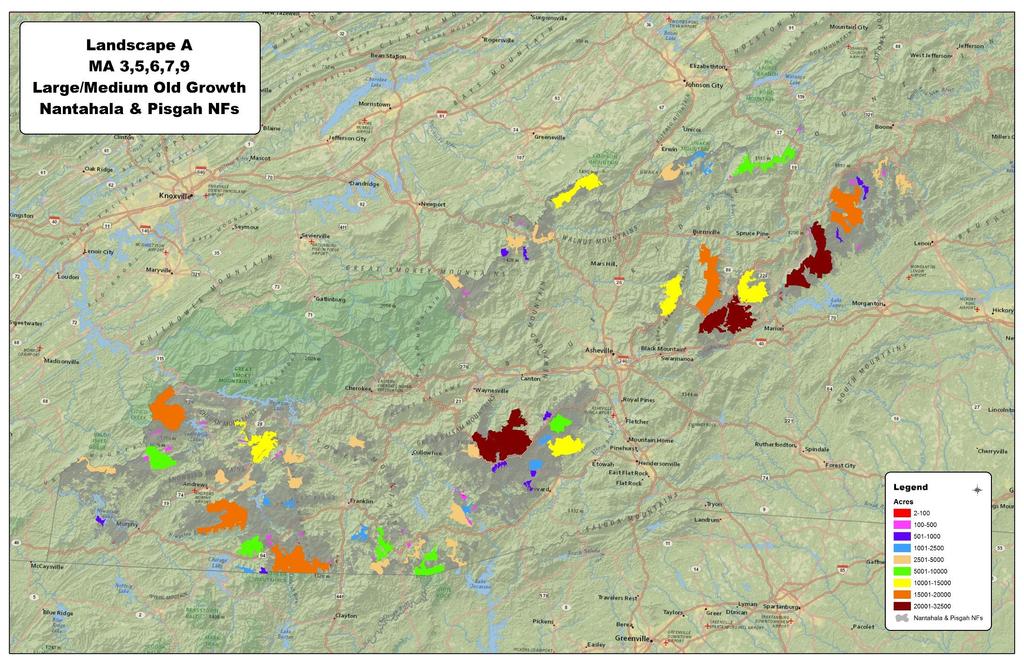
27 18 County area, about 4.8 million acres, surrounding Nantahala Pisgah NFs Has spatial variability Large enough to be statistically robust for larger landscape 27
28 Current vegetation condition process: Nantahala/Pisgah NFs Spatial Data Layers Ecozones Stand Age (FSVeg) Early succession from fire (Imagery) Canopy cover (LiDAR) RULES From BpS Models, (type, age, canopy) = existing s-class map Age/Structural Classes Young Mid Closed Mid Open Late Closed Late Open OG Closed OG Open Age (years) Landscape % = existing S-class distribution 28


 minus EXISTING")

29 STRUCTURAL DIVERSITY: having a mix of seral stages and forest conditions present, in appropriate amounts, to ensure long-term habitat diversity and productivity ESTIMATED DEPARTURE equals DESIRED CONDITION (PNV) minus EXISTING CONDITION (FSVeg) Below low end of range = deficit Above high end of range = surplus 29


30 The Planning Directives state: If past conditions relative to the natural range of variation are not appropriate, practical, possible, or desirable approaches The ID Team should design plan components based on a general scientific and ecological understanding of the conditions that would sustain key ecosystem characteristics and sustain at-risk species using factors such as: representativeness, redundancy, habitat associations of particular species, disturbance dynamics, observed conditions in reference 30
31 31


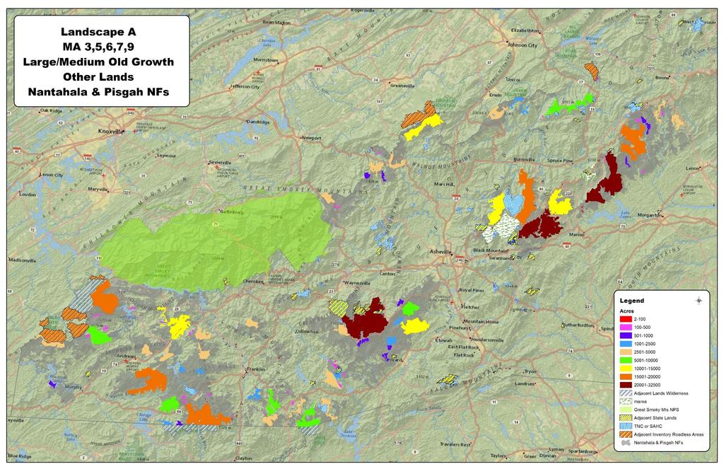
32 109 Patches 56 Nantahala NF 53 Pisgah NF Range 2-32,500 acres 36 Patches > 2500 acres 19 Patches > 5000 acres 19 Patches represent 75% of Landscape A 32


33 All 11 Ecozones represented Cove, Mesic Oak, Dry Oak all within 1% Greatest variability Dry- Mesic Oak (6% vs 10%) Shortleaf Pine, Spruce-Fir, Northern Hardwoods, Pine Oak/Heath vary by 2-3% Steeper Slopes Landscape A (16% vs 11%) High elevation types greater representation, Low elevation types less representation 33
34 34
35 NRV can provide perspective from historical conditions NRV provides an understanding of processes that drive ecosystem change Models make logical sense compared to each other, varies by ecozone Landscape Patch A does provide for larger patches where a mosaic of natural disturbance can occur Landscape Patch A does provide representation in ecozones Landscape Patch A does incorporate species and unique habitat diversity 35

class")


36 I survived the (s)class Wars on the Nantahala & Pisgah 36
Assessment of Landscape Scale Forest Structure and Ecological Departure in Western North Carolina Josh Kelly
 Assessment of Landscape Scale Forest Structure and Ecological Departure in Western North Carolina Josh Kelly Outline of Presentation Overview of Maps, Models, and Metrics ecap methodology sensu Low et
Cooper Creek ECS Ecological Departure Analysis
 Cooper Creek ECS Ecological Analysis Methods: - LIDAR derived Canopy height and canopy density data obtained from Luis Miguel Verissimo of Michigan Tech university - LIDAR derived Canopy Height/Density
An Assessment of Potential Active Restoration in Departed Forest Ecosystems. Marissa Ponder 3/31/2014
 Restoration Needs Analysis in Nantahala and Pisgah National Forests An Assessment of Potential Active Restoration in Departed Forest Ecosystems Marissa Ponder marissa.ponder@gmail.com 3/31/2014 ABSTRACT
Mapping forest structure along the southern Blue Ridge Parkway from LiDAR
 Mapping forest structure along the southern Blue Ridge Parkway from LiDAR Steven P Norman (US Forest Service) Jitendra Kumar (Oak Ridge National Lab.) William W Hargrove (US Forest Service) Forrest Hoffman
"all-lands" data set fire and resource management
 Management Applications of LANDFIRE BPS Models in California National Forests Hugh Safford USFS Regional Ecologist, Pacific Southwest Region and Dept of Environmental Science & Policy, UC-Davis Presented
Part II: Introducing DRAFT Forestwide Plan Components. Nantahala and Pisgah National Forests
 Part II: Introducing DRAFT Forestwide Plan Components Nantahala and Pisgah National Forests Feb. 2016 The Role of Forestwide Direction Today we will further break this idea down. Forestwide direction +
Classification of Forest Dominate Types Using an Integrated Landsat and Ecological Model
 Classification of Forest Dominate Types Using an Integrated Landsat and Ecological Model Southern Region Existing Vegetation Mapping Pilot Project Test Supported By Region 8 Engineering/GeoSpatial 3 Year
Red Pine Management Guide A handbook to red pine management in the North Central Region
 Red Pine Management Guide A handbook to red pine management in the North Central Region This guide is also available online at: http://ncrs.fs.fed.us/fmg/nfgm/rp A cooperative project of: North Central
Forecasting the Benefits of Conservation Strategies for Land Managers
 Forecasting the Benefits of Conservation Strategies for Land Managers Pretend You re the Managers of a Great Basin Landscape You Need Answers to These Questions Raft River Mountains, UT. Credit: Elaine
Characteristics of Forest Landscapes Throughout the World
 Characteristics of Forest Landscapes Throughout the World Approaches to interpreting landscapes in a region Basic determinants of landscape pattern Geophysical template Biota disturbances Physical template
Ecomath for the North Zone of Cherokee National Forest: A Randomized Approach to Determining Forest-Wide Fire Priorities Based on Ecological Factors
 Ecomath for the North Zone of Cherokee National Forest: A Randomized Approach to Determining Forest-Wide Fire Priorities Based on Ecological Factors Josh Kelly, Public Lands Biologist MountainTrue josh@mountaintrue.org
Intermountain Adaptation Partnership. Pat Behrens, USFS Intermountain Region
 Pat Behrens, USFS Intermountain Region Direct effects altered vegetation growth, mortality, and regeneration Indirect effects through altered disturbance and interactions with altered ecosystem processes
Fire History in the Colorado Rockies
 Fire History in the Colorado Rockies Brief overview of fire regimes in different forest ecosystem types Relationship of wildfire activity to climate variability Effects of fire exclusion and fire suppression
The Monongahela National Forest
 The Monongahela National Forest ~ 1 million acres High elevation Location of headwater streams for millions in the East Rain shadow effect The Allegheny Front Sedimentary geology and acidic environments
File Code: 1950 Date: December 7, Dear Friend of the Forest:
 United States Department of Agriculture Forest Service Chattahoochee-Oconee National Forests Oconee Ranger District 1199 Madison Road Eatonton, GA 31024 (706) 485-3180 File Code: 1950 Date: December 7,
Fontana Project Scoping Record August 2013
 Fontana Project Scoping Record August 2013 The Cheoah Ranger District, Nantahala National Forest, is conducting an interdisciplinary analysis of a proposed project, called the Fontana Project, in Graham
Summary of 2012 Fire Effects Monitoring for the Southern Blue Ridge Fire Learning Network 1. Peter Bates 2 December 21, 2012
 Summary of 212 Fire Effects Monitoring for the Southern Blue Ridge Fire Learning Network 1 Peter Bates 2 December 21, 212 Introduction: Forest Stewards, Inc. entered into a contract with The Nature Conservancy
Using LiDAR to Analyze Vegetation Structure and Ecological Depature in the Upper Warwoman Watershed, Georgia
 Using LiDAR to Analyze Vegetation Structure and Ecological Depature in the Upper Warwoman Watershed, Georgia Josh Kelly Western North Carolina Alliance July 1, 2014 Abstract Ecological restoration has
Rapid Assessment Reference Condition Model
 R0ms Rapid Assessment Reference Condition Model The Rapid Assessment is a component of the LANDFIRE project. Reference condition models for the Rapid Assessment were created through a series of expert
Welcome, and Randy s biographical information Received BS/MS at Northern Arizona University in Flagstaff. Scientific specialties span spatial scales,
 Welcome, and Randy s biographical information Received BS/MS at Northern Arizona University in Flagstaff. Scientific specialties span spatial scales, ranging from community genetics to mycorrhizal ecology
Bioe 515. Disturbance and Landscape Dynamics
 Bioe 515 Disturbance and Landscape Dynamics The Rocky Mountains, Lander's Peak, 1863 Albert Bierstadt (American, 1830 1902) 1895 Natural Disturbance? 1980 Fire Exclusion? Disturbance Cannot be Ignored
Climate Change Considerations in Land Management Plan Revisions January 20, 2010
 Climate Change Considerations in Land Management Plan Revisions January 20, 2010 Introduction Forest Service Chief Tom Tidwell has recognized that climate change is already altering our Nation s forests
(Draft) Addendum to 5-year Management Plan Mohican-Memorial State Forest
 Addendum to 5-year Management Plan Mohican-Memorial State Forest") (Draft) Addendum to 5-year Management Plan Mohican-Memorial State Forest Forest Description Mohican- Memorial State Forest (Mohican SF) is located in southern Ashland County, midway between Columbus and
(Draft) Addendum to 5-year Management Plan Mohican-Memorial State Forest Forest Description Mohican- Memorial State Forest (Mohican SF) is located in southern Ashland County, midway between Columbus and
Adapting to Climate Change in the Northeast: Experiences from the Field. Climate Projections for Forests: A Quick Summary
 Adapting to Climate Change in the Northeast: Experiences from the Field NE SAF Annual Meeting, Nashua, NH 26 March 2014 Small Urban Mid coast Maine Large industrial Irving Woodlands Small woodlot Allen
Adapting to Climate Change in the Northeast: Experiences from the Field
 Adapting to Climate Change in the Northeast: Experiences from the Field NE SAF Annual Meeting, Nashua, NH 26 March 2014 Small Urban Mid-coast Maine Large industrial Irving Woodlands Small woodlot Allen
Western Oregon Forest Ecology. Michael Ahr, Forest Conservationist
 Western Oregon Forest Ecology Michael Ahr, Forest Conservationist Outline Geology Forest Types Common NW Tree Species Successional Stand Types Brief History of Forest Management Effects on NW Ecosystems
Rapid Assessment Reference Condition Model
 R2SFPI Rapid Assessment Reference Condition Model The Rapid Assessment is a component of the LANDFIRE project. Reference condition models for the Rapid Assessment were created through a series of expert
Why can t we just put all the fires out? Craig Goodell Fire Ecologist BLM OR/WA USFS PNW/AK
 Why can t we just put all the fires out? Craig Goodell Fire Ecologist BLM OR/WA USFS PNW/AK Ecosystem: An array of organisms and their physical environment, all of which interact through a one-way flow
SKIBO PROJECT SCOPING REPORT Laurentian Ranger District, Superior National Forest
 SKIBO PROJECT SCOPING REPORT Laurentian Ranger District, Superior National Forest I. Introduction The Laurentian Ranger District of the Superior National Forest is proposing management activities within
Fire Regime Condition Class and Associated Data for Fire and Fuels Planning: Methods and Applications
 Fire Regime Condition Class and Associated Data for Fire and Fuels Planning: Methods and Applications Wendel J. Hann 1 and Diane J. Strohm 2 Abstract A pilot project was conducted in the Trout West watersheds
3.28 RESEARCH NATURAL AREAS
 3.28 RESEARCH NATURAL AREAS Introduction Research Natural Areas (RNAs) are areas designated, in perpetuity, for non-manipulative research and educational purposes, as well as to help maintain ecological
Mixed Conifer Forests An Overview
 Mixed Conifer Forests An Overview Thomas Spies PNW Research Station December 4, 2013 Pendleton, OR "Ecosystems are not only more complex than we think, but more complex than we can think. ---Frank Egler
Appendix J. Biophysical Settings in the North Zone of the Cherokee National Forest
 Appendix J. Biophysical Settings in the North Zone of the Cherokee National Forest Biophysical Settings in the North Zone of the Cherokee National Forest Steven A. Simon, Ecological Mapping and Fire Ecology
Region 8 Southern Region George Washington and Jefferson National Forest Clinch Ranger District
 United States Department of Agriculture Service Region 8 Southern Region George Washington and Jefferson National Clinch Ranger District 1700 Park Avenue SW Norton, VA 24273-1618 (276) 679-8370 (276) 679-8374
Forest Ecology (Forest Distribution, Forest Change, and Forest Mgt)
") Forest Ecology (Forest Distribution, Forest Change, and Forest Mgt) Ryan DeSantis University of California Cooperative Extension What is a natural landscape? 1990 Swift River Valley (Western MA) Forest
Forest Ecology (Forest Distribution, Forest Change, and Forest Mgt) Ryan DeSantis University of California Cooperative Extension What is a natural landscape? 1990 Swift River Valley (Western MA) Forest
Chapter 40a. Ch. 52 An Introduction to Ecology and the Biosphere
 Chapter 40a Ch. 52 An Introduction to Ecology and the Biosphere Ecology: the scientific study of the interactions between organisms and the environment The ecological study of species involves biotic and
Potential Effects of Climate Change on Mixed Severity Fire Regimes of the Western U.S.
 Potential Effects of Climate Change on Mixed Severity Fire Regimes of the Western U.S. Jessica E. Halofsky David L. Peterson Pacific Wildland Fire Sciences Lab Seattle, WA Climate controls ecosystem processes
Ecological Restoration on the Klamath National Forest
 Ecological Restoration on the Klamath National Forest Dan Blessing Natural Resources Staff Officer Uncles Complex Klamath National Forest 08/17/2006 09:00 Objectives Policy overview What does it look like?
File Code: 1900 Date: June 14, Dear Interested Parties,
 Logo Department Name Agency Organization Organization Address Information United States Forest National Forests in North Carolina 632 Manor Road Department of Service Appalachian Ranger District Mars Hill,
Potential Natural Vegetation Group (PNVG) General Information
 General Information") R6OAHI Rapid Assessment Reference Condition Model The Rapid Assessment is a component of the LANDFIRE project. Reference condition models for the Rapid Assessment were created through a series of expert
R6OAHI Rapid Assessment Reference Condition Model The Rapid Assessment is a component of the LANDFIRE project. Reference condition models for the Rapid Assessment were created through a series of expert
Fire Initiatives & Strategic Planning
 Fire Initiatives & Strategic Planning Intermountain West Rangelands & Mojave Desert Presentation Sky Islands Fire Goals Learning Network Explain the choice of priority landscapes Demonstrate effective
*Tell the Forest Service about how the Wesser Bald area appears natural.
 Wesser Bald 6,642 acres The Wesser Bald area is located in Swain and Macon Counties on the Nantahala Ranger District of the Nantahala National Forest. NC1365 and a powerline corridor separate the Wesser
Appendix 5A Priority Landscapes GIS Analysis Methodology
 Appendix 5A Priority Landscapes GIS Analysis Methodology Overview This appendix describes the methodology used for Pennsylvania s Priority Landscapes GIS Analysis. The figure below is a conceptual diagram
DRAFT Grassland/Prairie/Savanna in the East and West Gulf Coastal Plain (EWGCP)
") DRAFT Grassland/Prairie/Savanna in the East and West Gulf Coastal Plain (EWGCP) This Assessment has not yet been peer reviewed. From the Executive Summary of the 2016 State of the GCPO PHOTOS, CITATION,
DRAFT Grassland/Prairie/Savanna in the East and West Gulf Coastal Plain (EWGCP) This Assessment has not yet been peer reviewed. From the Executive Summary of the 2016 State of the GCPO PHOTOS, CITATION,
General Information. Reviewers Miles Hemstrom Steve Acker
 R#DFHEdy Rapid Assessment Reference Condition Model The Rapid Assessment is a component of the LANDFIRE project. Reference condition models for the Rapid Assessment were created through a series of expert
UNIT LESSON PLAN RX-310, INTRODUCTION TO FIRE EFFECTS. 2. Identify how fire and other disturbances function within and across ecosystems
 RX 310, INTRODUCTION TO FIRE EFFECTS COURSE OBJECTIVES: 1. Students will demonstrate an understanding of fire as an ecological process using the concepts of fire regimes and first order fire effects at
Rapid Assessment Reference Condition Model
 R9SFSP Rapid Assessment Reference Condition Model The Rapid Assessment is a component of the LANDFIRE project. Reference condition models for the Rapid Assessment were created through a series of expert
Prince William Forest Park Case Study. Regan Smyth and Don Faber-Langendoen
 Prince William Forest Park Case Study Regan Smyth and Don Faber-Langendoen Prince William Park NPS vegetation map (associations) provides true picture Located in zone of overlap Shows challenges of mapping
Rocky Mountain Landscape Simulator
 Rocky Mountain Landscape Simulator GIS Database Cover Age Elevation Etc. Wildlife Habitat Suitability Models Initial Condition T1 T2 T3 FRAGSTATS Analysis Disturbance Scenarios Disturbance Processes Anthro
Rogue Basin Ecological Integrity Assessment and Climate Change Management Interactions
 Rogue Basin Ecological Integrity Assessment and Climate Change Management Interactions Jimmy Kagan OSU PSU UO Ecological Integrity Measures (by area) Land management status Landscape features Habitat characteristics
I am posting this letter, along with maps on the National Forests in North Carolina website, at:
 United States Forest National Forests in North Carolina 90 Sloan Rd Department of Service Nantahala National Forest Franklin, NC 28734-9064 Agriculture Nantahala Ranger District 828-524-6441 Dear Forest
THE SAN DIEGO DECLARATION ON CLIMATE CHANGE AND FIRE MANAGEMENT
 THE SAN DIEGO DECLARATION ON CLIMATE CHANGE AND FIRE MANAGEMENT THE ASSOCIATION FOR FIRE ECOLOGY Presented at THIRD INTERNATIONAL FIRE ECOLOGY AND MANAGEMENT CONGRESS 1, 2 November 13-17, 2006 PREAMBLE
Ecological Zones on the George Washington National Forest First Approximation Mapping
 January 2011 Ecological Zones on the George Washington National Forest First Approximation Mapping Simon, Steven A. Acknowledgements Funding provided by Challenge Cost-Share Agreement 07-CS-11080821 between
Ecological Zone mapping in the South Mountains and New River Headwaters Landscapes
 Ecological Zone mapping in the South Mountains and New River Headwaters Landscapes by Steve Simon Excerpted as-is from a report to the Southern Blue Ridge Fire Learning Network Landscape EVALUATING FIRE
Forensic Forestry Reading the Land
 Principles of Forest Ecology and Management or Forensic Forestry Reading the Land Jonathan Kays University of Maryland Extension Where Do We Start? Think Like A Plant Act Like A Plant Thinking and Acting
Rapid Assessment Reference Condition Model
 R6MBOA Rapid Assessment Reference Condition Model The Rapid Assessment is a component of the LANDFIRE project. Reference condition models for the Rapid Assessment were created through a series of expert
Status and Trends in Forest Habitat Types of the Boreal Hardwood Transition
 Status and Trends in Forest Habitat Types of the Boreal Hardwood Transition Mark D. Nelson U.S. Forest Service Northern Research Station 17 April 2018 Ashland, MN 1 Boreal Hardwood Transition = Bird Conservation
Appendix J. Forest Plan Amendments. Salvage Recovery Project
 Forest Plan Amendments Salvage Recovery Project APPENDIX J Lynx and Old Growth Forest Plan Amendments CHANGES BETWEEN DRAFT EIS AND FINAL EIS Changes in Appendix J between the Draft and Final EIS include:
SILVICULTURAL PRESCRIPTION PROCESS
 SILVICULTURAL PRESCRIPTION PROCESS CHRISTOPHER HOPFINGER USACE RIVERS PROJECT ST. LOUIS DISTRICT FORESTER Christopher.hopfinger@usace.army.mil DEFINITIONS SILVICULTURAL EXAMINATIONS Gathering of resource
Effect of forest management on water yields & other ecosystem services in Sierra Nevada forests UCB/UC Merced/UCANR project
 Effect of forest management on water yields & other ecosystem services in Sierra Nevada forests UCB/UC Merced/UCANR project Some motivating points Water is the highest-value ecosystem service associated
Evaluation of proposed ski lease area expansion on Mt. Sunapee 11/23/2004
 New Hampshire Natural Heritage Bureau DRED Division of Forests & Lands PO Box 1856 172 Pembroke Road, Concord, NH 03302-1856 (603) 271-3623 visit our web site at www.dred.state.nh.us/forlands/formgt/nhiweb
Quantification of understory fuels in Superior National Forest using LiDAR Data
 2017-2018 Webinar Series February 15, 2018 Quantification of understory fuels in Superior National Forest using LiDAR Data Jeff Irwin USGS Earth Resources Observation and Science Center Audio will start
LANDFIRE Biophysical Setting Model
 DRAFT Appendix H. LANDFIRE BpS Model Allegheny-Cumberland Dry Oak Forest And Woodland LANDFIRE Biophysical Setting Model Biophysical Setting 5712170 Allegheny-Cumberland Dry Oak Forest and Woodland General
EFFECTS OF WILDFIRES AND LIMING OF PINE-OAK-HEATH COMMUNITIES IN THE LINVILLE GORGE WILDERNESS, WESTERN NORTH CAROLINA
 EFFECTS OF WILDFIRES AND LIMING OF PINE-OAK-HEATH COMMUNITIES IN THE LINVILLE GORGE WILDERNESS, WESTERN NORTH CAROLINA Katherine J. Elliott, James M. Vose, Jennifer D. Knoepp, and William Jackson Research
Wildlife Conservation Society Climate Adaptation Fund 2014 Restoring Oak Resilience at the Table Rocks, Rogue River Basin, Oregon FACT SHEET
 Wildlife Conservation Society Climate Adaptation Fund 2014 Restoring Oak Resilience at the Table Rocks, Rogue River Basin, Oregon FACT SHEET Project Overview Oak ecosystems in the Pacific Northwest exist
Modeling tools for examining how climate change & management influence wildfire activity & effects
 Modeling tools for examining how climate change & management influence wildfire activity & effects Erin Hanan December 2018 Great Basin Climate Forum Frequency of large, severe wildfires is increasing
Fire Resilience in Moist Mixed Conifer Forests. Penelope Morgan Dept. Forest, Rangeland, and Fire Sciences University of Idaho
 Fire Resilience in Moist Mixed Conifer Forests Penelope Morgan Dept. Forest, Rangeland, and Fire Sciences University of Idaho pmorgan@uidaho.edu We live in a fire environment School Fire, Photo by Leigh
Wildlife Conservation Strategy
 Wildlife Conservation Strategy Boise National Forest What is the Wildlife Conservation Strategy? The Boise National Forest is developing a Wildlife Conservation Strategy (WCS) in accordance with its Land
Nez Perce National Forest Moose Creek Ranger District
 United States Department of Agriculture Forest Service Nez Perce National Forest Moose Creek Ranger District 831 Selway Road Kooskia, ID 83539 208 926-4258 TTY 208 926-7725 File Code: 1950 Date: Dec 30,
2.5. Accuracy Testing
 Remote Sens. 2016, 8, 542 8 of 19 to quantify due to difficulties in measuring tree height in the field. We assume that each CHM has an uncertainty of less than 1 m, and changes in canopy height between
The Management of the Yale School Forests
 The Management of the Yale School Forests Yale School Forests 3 States - 7 Properties 10,880 Acres Urban to Rural YMF: Largest 7,840 acres Crowell Ravine: Smallest 75 acres Conservation Easements: Yale-Toumey
TEMPERATE FORESTS Ed Jensen, College of Forestry, OSU. Temperate Deciduous Forests
 TEMPERATE FORESTS Ed Jensen, College of Forestry, OSU Temperate Deciduous Forests TEMPERATE DECIDUOUS FORESTS Primarily northern hemisphere (but not exclusively) Bordered on the north by the boreal forest;
Anne Hairston-Strang MD DNR Forest Service September 7, 2017
 Anne Hairston-Strang MD DNR Forest Service September 7, 2017 Improving Forest-related BMPs Riparian Forest Buffers Consider drainage flow context and Farm Plan Address concentrated flows with companion
OptFuels Vegetation and Fuels Inputs
 OptFuels Vegetation and Fuels Inputs Vegetation and Fuels Overview Spatial Data Inputs for OptFuels Modeling Stand and Fuelbed Dynamics Regeneration Modeling Disturbance Updating (Angora, Past Treatments)
Rapid Assessment Reference Condition Model
 R8HEWP Rapid Assessment Reference Condition Model The Rapid Assessment is a component of the LANDFIRE project. Reference condition models for the Rapid Assessment were created through a series of expert
MAPPING FIRE REGIME CONDITION CLASS: A METHOD FOR WATERSHED AND PROJECT SCALE ANALYSIS
 MAPPING FIRE REGIME CONDITION CLASS: A METHOD FOR WATERSHED AND PROJECT SCALE ANALYSIS Wendel J. Hann 3005 East Camino del Bosque, Silver City, NM 88061 ABSTRACT Fire regime and associated condition class
APPENDIX C: TIMBER ANALYSES
 GEORGE WASHINGTON NATIONAL FOREST APPENDIX C TIMBER ANALYSES APPENDIX C: TIMBER ANALYSES INTRODUCTION This appendix describes the analysis of lands suitable and not suitable for timber production, the
Rio Grande National Forest Update
 Rio Grande National Forest Update Wildlife Movement Workshop: Connectivity in the Upper Rio Grande Watershed December 2016 1 2 Forest Background: 1.8 Million Acres encompassing the headwaters for Rio Grande
Chapter 11 B. Case study: Grouse Management at the Monongahela National Forest, West Virginia
 Chapter 11 B. Case study: Grouse Management at the Monongahela National Forest, West Virginia Gary M. Foster, West Virginia Division of Natural Resources, P.O. Box 99, Farmington, WV 26571 gfoster@dnr.state.wv.us
Whitebark pine (Pa) - Pinus albicaulis
 - Pinus albicaulis") Whitebark pine (Pa) - Pinus albicaulis Tree Species > Whitebark pine Page Index Distribution Range and Amplitiudes Tolerances and Damaging Agents Silvical Characteristics Genetics and Notes BC Distribution
Whitebark pine (Pa) - Pinus albicaulis Tree Species > Whitebark pine Page Index Distribution Range and Amplitiudes Tolerances and Damaging Agents Silvical Characteristics Genetics and Notes BC Distribution
Theme General projections Trend Category Data confidence Climatology Air temperature
 PHYSICAL EFFECTS ENVIRONMENTAL CHEMISTRY & POLLUTANTS Theme General projections Trend Category Data confidence Climatology Air temperature Precipitation Drought Wind Ice storms Water temperature Water
Black cottonwood (Act) - Populus trichocarpa
 - Populus trichocarpa") Black cottonwood (Act) - Populus trichocarpa Tree Species > Black cottonwood Page Index Distribution Range and Amplitiudes Tolerances and Damaging Agents Silvical Characteristics Genetics and Notes BC
Black cottonwood (Act) - Populus trichocarpa Tree Species > Black cottonwood Page Index Distribution Range and Amplitiudes Tolerances and Damaging Agents Silvical Characteristics Genetics and Notes BC
Twins Project Scoping Report
 Twins Project Scoping Report Table of Contents Page I. Introduction 1 II. Purpose of and Need for Action 1 A. Landscape Ecosystem/Management Indicator 4 Habitat B. Spatial Patterns 6 C. Additional Wildlife
Monitoring and Climate Change. Dave Cleland
 Monitoring and Climate Change Dave Cleland Presentation Outline National perspective on status and needs of climate change monitoring Brief review of emerging monitoring programs Short term approach to
Prioritization of Old-Growth Forest Conservation on the Pisgah National Forest
 Prioritization of Old-Growth Forest Conservation on the Pisgah National Forest by Jonathan Shaffer Date: Approved: Dr. Dean Urban, Advisor Master s project submitted in partial fulfillment of the requirements
Climate Change and the Boundary Waters
 Climate Change and the Boundary Waters Leslie Brandt Wolf Ridge Environmental Learning Center March 20, 2013 It s getting warmer Winter (Dec-Feb) Spring (Mar-May) Summer (Jun-Aug) Fall (Sep-Nov) www.climatewizard.org
Silvicultural practices in the restoration of degraded ecosystems
 Silvicultural practices in the restoration of degraded ecosystems Current conditions reflect site history and physical environment Altered fire regimes, including exclusion Forest management, including
Fire and Biodiversity in British Columbia Ze ev Gedalof, Climate & Ecosystem Dynamics Research Lab, University of Guelph
 Fire and Biodiversity in British Columbia Ze ev Gedalof, Climate & Ecosystem Dynamics Research Lab, University of Guelph The Concept of the Fire Regime Nearly the entire vegetation landscape of British
Rapid Assessment Reference Condition Model
 R8TMPP Rapid Assessment Reference Condition Model The Rapid Assessment is a component of the LANDFIRE project. Reference condition models for the Rapid Assessment were created through a series of expert
CLIMATE CHANGE IMPLICATIONS FOR ILLINOIS FOREST MANAGEMENT. September 29, 2017 Leslie Brandt Northern Institute of Applied Climate Science
 CLIMATE CHANGE IMPLICATIONS FOR ILLINOIS FOREST MANAGEMENT September 29, 2017 Leslie Brandt Northern Institute of Applied Climate Science Northern Institute of Applied Climate Science Climate Carbon Provides
Mechanisms of succession and regeneration
 Mechanisms of succession and regeneration Outline: Mechanisms of succession and vegetation dynamics. Synthetic concepts and simple models of forest dynamics Overview of the modern conceptual framework
Fire & Fuels Management
 Overview Fire & Fuels Management Southern California Adaptation Implementation Plan During a two- day workshop in January 2016, southern California resource managers and regional stakeholders discussed
Wildlife Management Concepts
 The Maryland Envirothon Wildlife Management Concepts Before an individual can evaluate wildlife habitat and make management recommendations, some basic concepts about habitat and its relation to different
Emerging Restoration Approaches for Disturbed Mojave Desert Shrublands and the Search for Suitable Native Plant Materials
 Emerging Restoration Approaches for Disturbed Mojave Desert Shrublands and the Search for Suitable Native Plant Materials Lesley A. DeFalco USGS, Western Ecological Research Center Henderson, Nevada Conference
Restoring The Delta: Partnerships For Sustainable
 Lower Mississippi Valley Largescale Watershed Project ANNUAL REPORT FY 2001 Restoring The Delta: Partnerships For Sustainable Restoration In the Lower Mississippi Alluvial Valley I. Partnership Overview
Colorado Front Range Fire Study Questions Conventional Wisdom about Fire Regimes
 Colorado Front Range Fire Study Questions Conventional Wisdom about Fire Regimes Nine large fires have occurred on the Colorado Front Range since the turn of the century, beginning with the 2002 Hayman
Fire in California s North Coast An ecological and social process
 Fire in California s North Coast An ecological and social process Yana Valachovic Forest Advisor & County Director UC Cooperative Extension, Humboldt/Del Norte Outline Role of fire in North Coast ecosystems
An Analysis of Fuels Reduction Treatment Effectiveness During and After the 2009 Siskiyou Fire
 An Analysis of Fuels Reduction Treatment Effectiveness During and After the 2009 Siskiyou Fire Chris Chambers Forest Resource Specialist Ashland Fire & Rescue This report reflects the findings of the author
Primarily compiled by: The Tennessee Chapter of The Nature Conservancy Katherine G. Medlock
 Cherokee National Forest Landscape Restoration Initiative Steering Committee Recommendations to the Forest Service for the North Zone (Watauga and Unaka Districts) of the Cherokee National Forest February
Appendix A: Vegetation Treatment Descriptions and Unit Specific Design Criteria
 Appendix A: Vegetation Treatment Descriptions and Unit Specific Design Criteria The table below describes the Kabetogama Project proposed vegetation treatments associated with Alternative 2. The treatment