Joshua J. Picotte Dr. Kevin Robertson
|
|
|
- Gloria Jenkins
- 6 years ago
- Views:
Transcription


1 Validation of National Burn Severity Mapping Project Techniques Within the Apalachicola National Forest Joshua J. Picotte Dr. Kevin Robertson


2 Project Overview Background Project Questions Results Problems Conclusions
 Burn Severity-ecosystem ecosystem")


3 Background-Burn Burn Severity and Joint Fires Science Program (JFSP) Burn Severity-ecosystem ecosystem change and dl landscape change System developed in 1996 by Carl lk Key and dn Nate Benson Started in the Western United dst States t Initial Fires Assessed-1994 Glacier National Park Fires Needs more work in East JFSP was formed in 1998 to provide support for fuel and fire management programs Key and Benson 1995 Key and Benson 1995
4 Background-Composite Burn Index (CBI) and Normalized Burn Ratio (NBR) NBR-Remote Remote sensing of fb burn severity Landsat bands R 4 and R 7 NBR = (R 4 -R 7 )/ (R 4 +R 7 ) dnbr=nbr prefire-nbr postfire CBI-Ground measure of burn severity 30 m plot CBI should validate NBR values
5 Background-deltaNormalized deltanormalized Burn Ratio (dnbr) dnbr: Change in reflectance between pre-fire (1 year pre-fire) and post-fire NBR values dnbr=nbrd prefire -NBR postfire 30m 30m 30m Weighted dnbr = Average of plot center and corners (N=5) Severity Unburned Low Low-Moderate Moderate-High High dnbr


6 Background-Composite Burn Index (CBI) Burn Index: Unburned 3-Severe Burn Five Strata 4-5 Ratings Factors Averaged CBI Score Average of Five Strata
7 Background-Apalachicola National Forest (ANF) Gulf of Mexico 2006 Dormant dnbr Unburned Low Severity Low-Moderate Severity Moderate-High Severity High Severity ² 0 6,858 13,716 27,432 Meters


8 Background-Habitats Within ANF A. Sandhill Pineland Turkey Oak Wiregrass Bracken Fern Long-Leaf Leaf Pine B. Flatwood Pineland Palmetto Long-Leaf/Slash Leaf/Slash Pine C. Depression Swamp Cypress Titi Pond Pine A. B. C.
9 Project Questions 1. Does this system adequately describe burn severity with the South East ecosystems? 2. How long after a fire can burn perimeters be remotely sensed? 3. Are there differences in the effectiveness of using CBI and dnbr to categorize burn severity in the three community types of the ANF? 4. What are the appropriate ranges dnbr for given burn severity categories? 5. What problems arise in assessing burn severity?


10 Results-Sandhill Burn Severity ² Meters Severity Acres Unburned Area 15 Low Low-Moderate Moderate-High Percent Fire 10 High Total Total Burned dnbr


11 Results-Flatwood Burn Severity 0 8,001 16,002 32,004 Meters ² Wet Flatwoods, Initial Assessment Severity Acres 12 Unburned Low Low-Moderate Moderate-High High Total Total Burned Percent Fire Area dnbr
12 Results-Correlation Between CBI 2.5 Overall and dnbr 2.5 Sandhill 2 2 CBI CBI dnbr Weighted dnbr Weighted Flatwoods R 2 P>Fr CBI Overall Sandhills Flatwoods < dnbr Weighted
13 Results-Correlations between CBI and dnbr Within Substrates Substrates Vegetation < 1m 1m < Vegetation < 5m Subcanopy Trees Upper Canopy Trees Overall R P>Fr <0.001 < Sandhills Flatwoods R 2 P>Fr R 2 P>Fr Substrates Substrates Vegetation < 1m Vegetation < 1m <.001 1m < Vegetation < 5m m < Vegetation < 5m <.001 Subcanopy Trees Subcanopy Trees <.001 Upper Canopy Trees Upper Canopy Trees <.001


14 Burn Severity Change Detection- Water ² Meters ² Meters 2006 Dormant dnbr Unburned Low Severity Low-Moderate Severity Moderate-High Severity High Severity Lakes and Ponds Actual Pond Boundary


15 Problematic detection of Low Burn Severity A Dormant dnbr Unburned Low Severity Low-Moderate Severity Moderate-High Severity High Severity! 30m Plots B. C. Plot CBI dnbr A B. C ² ,020 Meters
16 Conclusions Successful in high fire frequency communities Extrapolation to other communities within the East Useful system for burn monitoring i Sense perimeter months following the burn Season of remote-sensing (dnbr) may be limited Useful in assessing the success of burn management plans


17 Acknowledgements Nate Benson Jason Drake Leigh Lentile Caroline Noble Joe Noble Don Ohlen Kathy Marois David Printiss Greg Titus Eugene Watkins
Mapping burn severity in heterogeneous landscapes with a relativized version of the delta Normalized Burn Ratio (dnbr)
") Mapping burn severity in heterogeneous landscapes with a relativized version of the delta Normalized Burn Ratio (dnbr) Jay D. Miller USDA Forest Service 3237 Peacekeeper Way McClellan, CA 95652 Email:
Mapping burn severity in heterogeneous landscapes with a relativized version of the delta Normalized Burn Ratio (dnbr) Jay D. Miller USDA Forest Service 3237 Peacekeeper Way McClellan, CA 95652 Email:
Remote Sensing ISSN
 Remote Sens. 2011, 3, 1680-1690; doi:10.3390/rs3081680 Article OPEN ACCESS Remote Sensing ISSN 2072-4292 www.mdpi.com/journal/remotesensing Timing Constraints on Remote Sensing of Wildland Fire Burned
Remote Sensing for Fire Management
 Remote Sensing for Fire Management FOR 435/535: Remote Sensing for Fire Management 5. Severity A Source of Confusion Field Measures Remote Sensing Measures FOR 435: A Source of Confusion The terms fire
Monitoring Trends in Burn Severity (MTBS) Project Overview
 Project Overview") Monitoring Trends in Burn Severity (MTBS) Project Overview Adrian Grell US Forest Service Remote Sensing Applications Center Webinar for the Northern Rockies Fire Science Network February 6, 2013 Consistently
Monitoring Trends in Burn Severity (MTBS) Project Overview Adrian Grell US Forest Service Remote Sensing Applications Center Webinar for the Northern Rockies Fire Science Network February 6, 2013 Consistently
ACCURACY OF REMOTE SENSING WILDLAND FIRE BURNED AREA IN SOUTHEASTERN U.S. COASTAL PLAIN HABITATS
 ACCURACY OF REMOTE SENSING WILDLAND FIRE BURNED AREA IN SOUTHEASTERN U.S. COASTAL PLAIN HABITATS Joshua J. Picotte and Kevin M. Robertson 1 Tall Timbers Research Station, 13093 Henry Beadel Drive, Tallahassee,
12. Landscape Scale Strategy for Restoring the Longleaf Pine Ecosystem on the Osceola National Forest
 Accelerating Longleaf Pine Restoration in Northeast Florida, Landscape Strategy- Page 1 12. Landscape Scale Strategy for Restoring the Longleaf Pine Ecosystem on the Osceola National Forest 1. Executive
Analysis of Vegetation Mortality and Prior Landscape Condition, 2002 Biscuit Fire Complex. Kirsten Harma and Peter Morrison
 Analysis of Vegetation Mortality and Prior Landscape Condition, 2002 Biscuit Fire Complex Kirsten Harma and Peter Morrison Pacific Biodiversity Institute February 14, 2003 Introduction The Biscuit Fire
Wildfires in the Western Boreal:
 Wildfires in the Western Boreal: Chicken or Egg? Boreal Mixedwoods 2012 Conference June 18, 2012 Edmonton, Alberta David Andison Bandaloop Landscape Ecosystem Services Wildfire Event = The general area
Remote Measurements of Active Fire Behavior and Post-Fire Effects
 Remote Measurements of Active Fire Behavior and Post-Fire Effects Alistair Smith (and many many others ) Remote Sensing: A very Brief Overview ~ 5 million years B.C. : Humans Begin to Understand their
Using Imagery and LiDAR for cost effective mapping and analysis for timber and biomass inventories
 Using Imagery and LiDAR for cost effective mapping and analysis for timber and biomass inventories Mark Meade: CTO Photo Science Mark Milligan: President LandMark Systems May 2011 Presentation Outline
Silvicultural practices in the restoration of degraded ecosystems
 Silvicultural practices in the restoration of degraded ecosystems Current conditions reflect site history and physical environment Altered fire regimes, including exclusion Forest management, including
Ann F. Johnson and Amy Jenkins. September Florida Natural Areas Inventory. Gary R. Knight, Program Director
 A Survey for Federally Listed Plant Species, Invasive Exotic Plant Species, and High Quality Natural Communities on the Beasley Tract, Year 2, Apalachicola National Forest, Florida by Ann F. Johnson and
MODELLING BURN SEVERITY FOR THE 2003 NSW/ACT WILDFIRES USING LANDSAT IMAGERY
 MODELLING BURN SEVERITY FOR THE 2003 NSW/ACT WILDFIRES USING LANDSAT IMAGERY T.W. Barrett A A Eco Logical Australia Pty Ltd Abstract In summer 2003, south-eastern Australia experienced one of the most
Landscape-Scale Postfire Vegetative Condition Monitoring Using Multi- temporal Landsat Imagery on the Cerro Grande Fire
 Landscape-Scale Postfire Vegetative Condition Monitoring Using Multi- temporal Landsat Imagery on the Cerro Grande Fire RS 2006 : April 27, 2006 Salt Lake City, UT Jess T. Clark Remote Sensing Applications
Carpenter House (Site 447)
") Carpenter House (Site 447) The Carpenter House (Hollywood North Beach Addition/Site 447) is located on North Surf Road, east of North State Road A1A between Cody Street and Greene Street in the City of
Carpenter House (Site 447) The Carpenter House (Hollywood North Beach Addition/Site 447) is located on North Surf Road, east of North State Road A1A between Cody Street and Greene Street in the City of
Biophysical Indicators of Longleaf Pine Sandhill Change. Ryan R. Jensen Department of Geography, Geology, and Anthropology
 Biophysical Indicators of Longleaf Pine Sandhill Change Ryan R. Jensen Department of Geography, Geology, and Anthropology Sandhills Species Long-leaf pine Turkey oak Wiregrass Extremely rich herbaceous
Section 4. Terrestrial Habitats
 Section 4. Terrestrial Habitats Components of Reports... 1226 Definition ranking Key factors Indicators of condition Conservation actions Monitoring Terrestrial Habitat Reports... 1231 Caves, Mines, Sinkholes,
Remote sensing for prediction of 1-year post-fire ecosystem condition
 CSIRO PUBLISHING International Journal of Wildland Fire 2009, 18, 594 608 www.publish.csiro.au/journals/ijwf Remote sensing for prediction of 1-year post-fire ecosystem condition Leigh B. Lentile A,D,,
CFEOR Groundcover Restoration Workshop Summary
 CFEOR Groundcover Restoration Workshop Summary Location: NWFMWD - Sand Hill Lakes Mitigation Bank (SHLMB), Greenhead Florida Date: Presented November 18, 2010 at 10:00 a.m. at the FWC Check Station Presenters:
Components of reports Terrestrial habitat reports
 Section 4. Terrestrial Habitats Terrestrial Habitats Components of reports... 1189 Definition Ranking Key factors Indicators of condition Conservation actions Monitoring Terrestrial habitat reports...
Peninsular Florida Landscape Conservation Cooperative. Priority Resources
 Peninsular Florida Landscape Conservation Cooperative Priority Resources Draft Priority Resources Hardwood Forested Uplands High Pine & Scrub Pine Flatwoods & Dry Prairie Freshwater Forested Wetlands Freshwater
Evaluation of linear spectral unmixing and DNBR for predicting postfire recovery in a North American ponderosa pine forest
 International Journal of Remote Sensing Vol. 28, No. 22, 20 November 2007, 5159 5166 Letter Evaluation of linear spectral unmixing and DNBR for predicting postfire recovery in a North American ponderosa
SW-71 BOYD HILL NATURE PRESERVE MITIGATION PLAN
 SW-71 BOYD HILL NATURE PRESERVE MITIGATION PLAN BACKGROUND INFORMATION Project SWIM? Aquatic Control? Exotic Control? Mitigation Bank? Type No No Yes No Mitigation Wetland and upland enhancement Type Landowner
Variable Method Source
 Appendix S1 Appendix S1: Table S1 Plot variables Variable Method Source COVERS % shrub cover ocular estimate of shrub cover % forb cover ocular estimate of forbs % coarse woody debris % live overhead canopy
Places of interest as you travel to the SESAF Annual Conference at the Sandestin Hilton.
 Places of interest as you travel to the SESAF Annual Conference at the Sandestin Hilton. Topsail Hill Preserve State Park is right next door to the Sanddestin Hilton. The park features pristine beaches,
VOLUSIA COUNTY WILDLAND/URBAN INTERFACE WILDFIRE HAZARD ASSESSMENT GUIDE
 VOLUSIA COUNTY WILDLAND/URBAN INTERFACE WILDFIRE HAZARD ASSESSMENT GUIDE The Volusia County Wildland/Urban Interface Wildfire Hazard Assessment Guide is a compilation of work by The Nature Conservancy
APPLICATION OF REMOTE SENSING DATA FOR THE ASSESSMENT OF THE UJUK MOUNTAIN BOREAL FORESTS (THE TYVA REPUBLIC, RUSSIA)
") Khulermaa B. Kuular Tuvinian Institute for Exploration of Natural Resources of the Siberian Branch RAS, Internatsionalnaya 117a, Kyzyl, 667007, Russia. Tel. (394) 2266218, e-mail: khbk@list.ru APPLICATION
Khulermaa B. Kuular Tuvinian Institute for Exploration of Natural Resources of the Siberian Branch RAS, Internatsionalnaya 117a, Kyzyl, 667007, Russia. Tel. (394) 2266218, e-mail: khbk@list.ru APPLICATION
Managing Lowcountry Forests for Wildlife
 Managing Lowcountry Forests for Wildlife Prepared by William H. Conner, Professor of Forestry, Clemson University; Karey Waldrop, Consulting Forester, Walterboro, S.C.; and Robert Franklin, Extension Forester,
TITLE: Post-mountain pine beetle lodgepole pine forests: Assessing fire behavior and fire effects in the recently burned Pole Creek Fire area on the
 TITLE: Post-mountain pine beetle lodgepole pine forests: Assessing fire behavior and fire effects in the recently burned Pole Creek Fire area on the Sisters Ranger District, Deschutes National Forest.
Research Projects. General List of Contents. 3.1 List of Priority Research Areas 3.2 Projects Lists 3.3 Project Reports
 Research Projects General List of Contents 3.1 List of Priority Research Areas 3.2 Projects Lists 3.3 Project Reports All files are available to members at http://www.sfrc.ufl.edu/cfeor/login/index.html
Tracking Restoration Success
 Tracking Restoration Success A Presentation on Duette Preserve Environmental Monitoring Program Parks & Natural Resources Department Environmental Protection Division 1112 Manatee Avenue West, Suite 203
Hectares No. of farmers % No. of fields % < 1 ha to 2 ha to 3 ha
 Biodiversity report Ghana / Cocoa / Biodiversity Query Information Project Ghana / Cocoa / Biodiversity Query Results Hectares No. of farmers % No. of fields % < 1 ha 432 65.43 67 62.22 1 to 2 ha 2278
Regional Ecosystem Analysis Puget Sound Metropolitan Area
 Final Report: 7/25/98 Regional Ecosystem Analysis Puget Sound Metropolitan Area Calculating the Value of Nature Report Contents 2 Project Overview and Major Findings 3 Regional Level Analysis 4 Neighborhood
Objective Based Vegetation Management (OBVM) Program Overview. Division of Habitat and Species Conservation Wildlife and Habitat Management Section
 Program Overview. Division of Habitat and Species Conservation Wildlife and Habitat Management Section") Objective Based Vegetation Management (OBVM) Program Overview Division of Habitat and Species Conservation Wildlife and Habitat Management Section Objective Based Vegetation Management (OBVM) Program Overview
Objective Based Vegetation Management (OBVM) Program Overview Division of Habitat and Species Conservation Wildlife and Habitat Management Section Objective Based Vegetation Management (OBVM) Program Overview
FOR 426 Fire Management and Ecology
 Fire history methods by Penny Morgan Natural archives of fire history data Dated fire scars in tree rings: yr and season Time-since-fire maps reconstructed from ages of trees, usually from even-aged stands
Mechanical fuels reduction treatments effects on fire behavior, fuel loads, and forest ecology
 Mechanical fuels reduction treatments effects on fire behavior, fuel loads, and forest ecology Osceola National Forest Sept. 8 th, 11 Sponsors: Conserved Forest Ecosystems Outreach and Research (CFEOR);
CCRRBP Collier County, Florida
 0 300 600 1,200 Feet SUBJECT PROPERTY FLUCCS MAPPING 833 411, PINE FLATWOODS, PINE FLATWOODS (1-24% EXOTICS) 411E3 411E2, PINE FLATWOODS (25-49% EXOTICS) 411E3, PINE FLATWOODS (50-74% EXOTICS) 428, CABBAGE
Longleaf Pine Maintenance Condition Class Definitions
 America s Longleaf Restoration Initiative Longleaf Partnership Council Longleaf Pine Maintenance Condition Class Definitions A Guide to Assess Optimal Forest Habitat Conditions for Associated Plant and
Kevin L. Erwin CE PWS Kevin L. Erwin Consulting Ecologist, Inc Bayside Parkway Ft. Myers, Florida USA
 Kevin L. Erwin CE PWS Kevin L. Erwin Consulting Ecologist, Inc. 2077 Bayside Parkway Ft. Myers, Florida 33901 USA The Lee County DR/GR: Implications for future restoration and management Estero Bay Watershed
MONITORING TRENDS AND BURN SEVERITY (MTBS): MONITORING WILDFIRE ACTIVITY FOR THE PAST QUARTER CENTURY USING LANDSAT DATA
: MONITORING WILDFIRE ACTIVITY FOR THE PAST QUARTER CENTURY USING LANDSAT DATA") MONITORING TRENDS AND BURN SEVERITY (MTBS): MONITORING WILDFIRE ACTIVITY FOR THE PAST QUARTER CENTURY USING LANDSAT DATA Mark Finco, Brad Quayle, Yuan Zhang, Jennifer Lecker, Kevin A. Megown, and C. Kenneth
MONITORING TRENDS AND BURN SEVERITY (MTBS): MONITORING WILDFIRE ACTIVITY FOR THE PAST QUARTER CENTURY USING LANDSAT DATA Mark Finco, Brad Quayle, Yuan Zhang, Jennifer Lecker, Kevin A. Megown, and C. Kenneth
Summary of Management Recommendations
 Location and Description This property is owned by Anthony Day, 14426 NW 83 rd Lane, Alachua, FL 32615. The property is located in Section 18, Township 1 North, Range 6 East, in eastern Jefferson County,
2018 Arkansas State Wildlife Grant Pre-proposal
 2018 Arkansas State Wildlife Grant Pre-proposal EXPANDING PINE FLATWOODS HABITAT RESTORATION AT LONGVIEW SALINE NATURAL AREA TO BENEFIT SPECIES OF GREATEST CONSERVATION NEED Project Summary High priority
ERA Management Plan-Walton Marsh Pine Barrens
 ERA Management Plan-Walton Marsh Pine Barrens Administrative Information: Walton Marsh Pine Barrens (EO ID 6486) EO Number 6 Cadillac Management Unit (Compartment 127 Stands 421, 422, 424, 417,420) Compartment
Appendix I. Potential Adverse Change to Wetland Function Methodology and Results
 Appendix I Potential Adverse Change to Wetland Function Methodology and Results Technical Memorandum North Florida Regional Water Supply Plan Potential Adverse Change to Wetland Function January 3, 2017
1. GENERAL DESCRIPTION OF LAND USE / COVER TYPES (SEE GENERAL DESCRIPTIONS ON PAGE 7) A 2. ADJACENT LANDS & EASEMENTS 3. FAMILY AGRICULTURAL LEGACY
 A 2. ADJACENT LANDS & EASEMENTS 3. FAMILY AGRICULTURAL LEGACY") CONSERVATION EASEMENT PROJECT: COUNTY: NAME OF LANDOWNER: CELL/OFFICE PHONE: NAME OF FARM / SITE MANAGER: CELL/OFFICE PHONE: GENERAL DESCRIPTION OF LAND USE / COVER TYPES (SEE GENERAL DESCRIPTIONS ON PAGE
CONSERVATION EASEMENT PROJECT: COUNTY: NAME OF LANDOWNER: CELL/OFFICE PHONE: NAME OF FARM / SITE MANAGER: CELL/OFFICE PHONE: GENERAL DESCRIPTION OF LAND USE / COVER TYPES (SEE GENERAL DESCRIPTIONS ON PAGE
University of Florida Conservation Area Land Management Plan Bat House Woods
 University of Florida Conservation Area Land Management Plan Bat House Woods Introduction Bat House Woods is the unofficial name for the 8.5 acre wooded area adjacent to Physical Plant greenhouses and
A long time ago, in a forest far far away
 A long time ago, in a forest far far away For managing ecosystems Sierra Nevada mixed conifer forest North boundary = Feather River South Boundary = Tehachapi Pass 15.6 million acres 50% federal 50% private
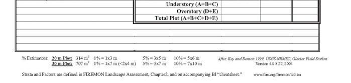
FIREMON Introduction
 THE AUTHORS Duncan C. Lutes is a Research Forester with Systems for Environmental Management, stationed at the USDA Forest Service, Rocky Mountain Research Station, Fire Sciences Lab, P.O. Box 8089, Missoula,
c Name a Name b Scrubby Flatwoods 82, Scrubby Flatwoods Pine Rockland 16, Pine Rockland 1330
 c Name a Name b 1000 1000000 1 Terrestrial - - - 1100 1100000 11 Hardwood Forested Uplands - - - 1110 1110000 111 Upland Hardwood Forest 273,406 1100000 Hardwood Forested Uplands 1111 1111000 1111 Dry
CLICK HERE TO KNOW MORE
 CLICK HERE TO KNOW MORE The UP-SRA Yield Estimation System for Sugarcane (YESS) Project A.C. Blanco a,b*, A.B. Baloloy b, M.A.G. Manalili b, M.A.L.S. Rasco b, M.E.R. Tagle b, B.M.M.S. Gana b, R.R.C. Sta.
Fires in Previously Burned Areas: Fire Severity and Vegetation Interactions in Yosemite National Park
 Fires in Previously Burned Areas: Fire Severity and Vegetation Interactions in Yosemite National Park Kent van Wagtendonk, Yosemite National Park, PO Box 700, El Portal, CA 95318; kent_van_ wagtendonk@nps.gov
Vegetation Survey Report:
 Vegetation Survey Report: Feasibility of Red-cockaded Woodpecker Reintroduction into Pine Flatwoods Communities at Jonathan Dickinson State Park Preliminary Study April 2011 Project by: Katie O Gara Palm
INVESTIGATING RELATIONSHIPS BETWEEN FIRE SEVERITY, HABITAT TYPE, & LONG-TERM POST-FIRE RECOVERY OF THE 2007 WITCH CREEK FIRE
 Witch Fire October 2007 by Adam Johnson INVESTIGATING RELATIONSHIPS BETWEEN FIRE SEVERITY, HABITAT TYPE, & LONG-TERM POST-FIRE RECOVERY OF THE 2007 WITCH CREEK FIRE MGIS CANDIDATE: JONATHAN LEE ADVISOR:
Recent hydrologic change in a rainfalldriven. Everglades swamp. Shawn E. Clem. Michael J. Duever Natural Ecosystems
 Recent hydrologic change in a rainfalldriven Western Everglades swamp Shawn E. Clem Western Everglades Research Center Corkscrew Swamp Sanctuary sclem@audubon.org Shawn E. Clem Michael J. Duever Natural
Brooksville Ridge Working Group 2015 Annual Meeting March 24, 2015 Bass Conservation Center, Webster, FL
 Brooksville Ridge Working Group 2015 Annual Meeting March 24, 2015 Bass Conservation Center, Webster, FL Twenty-seven people representing 8 different agencies including USFWS, FFWCC, FFS, SWFWMD, FDEP,
Field validation of Burned Area Reflectance Classification (BARC) products for post fire assessment
 products for post fire assessment") University of Nebraska - Lincoln DigitalCommons@University of Nebraska - Lincoln USDA Forest Service / UNL Faculty Publications U.S. Department of Agriculture: Forest Service -- National Agroforestry Center
University of Nebraska - Lincoln DigitalCommons@University of Nebraska - Lincoln USDA Forest Service / UNL Faculty Publications U.S. Department of Agriculture: Forest Service -- National Agroforestry Center
Where we re going today: Start integrating previous lecture information with the effects of fire as a disturbance factor in forested ecosystems Revisi
 Fire Regimes and Pyrodiversity ESPM 134 Spring 2008 Rick Everett Where we re going today: Start integrating previous lecture information with the effects of fire as a disturbance factor in forested ecosystems
Hillsborough County s E.L.A.P.P Program
 Hillsborough County s E.L.A.P.P Program What is E.L.A.P.P? Environmental Lands Acquisition and Protection Program History of E.L.A.P.P. - Voter-approved program initiated in 1987; extended in 1990 and
California Tahoe Conservancy Monitoring Plan
 California Tahoe Conservancy Monitoring Plan Acknowledgements University of California Cooperative Extension Expertise and time contributed Susie Kocher Richard Harris Gary Nakamura Mike De Lasaux United
Stream Water Quality Concerns Linger Long After the Smoke Clears Learning from Front Range Wildfires
 Stream Water Quality Concerns Linger Long After the Smoke Clears Learning from Front Range Wildfires Chuck Rhoades, U.S. Forest Service, Rocky Mountain Research Station, Susan Miller, Freelance Science
Summary of Field Data Collection Ordway- Swisher Biological Station (OSBS) Sept. 30, Oct. 1, 2 and 3; 2016
 Sept. 30, Oct. 1, 2 and 3; 2016") Summary of Field Data Collection Ordway- Swisher Biological Station (OSBS) Sept. 30, Oct. 1, 2 and 3; 2016 Professor Paul Gader, Computer and Information Sciences and Engineering Engineering School of
Summary of Field Data Collection Ordway- Swisher Biological Station (OSBS) Sept. 30, Oct. 1, 2 and 3; 2016 Professor Paul Gader, Computer and Information Sciences and Engineering Engineering School of
A New Metric for Quantifying Burn Severity: The Relativized Burn Ratio
 University of Nebraska - Lincoln DigitalCommons@University of Nebraska - Lincoln USDA Forest Service / UNL Faculty Publications U.S. Department of Agriculture: Forest Service -- National Agroforestry Center
Management Approaches for Rare Ecological Communities of the Pinelands: Preserving the Open-Canopy Vegetation Types
 Management Approaches for Rare Ecological Communities of the Pinelands: Preserving the Open-Canopy Vegetation Types by Andrew G. Windisch Office of Natural Lands Management NJDEP Pinelands Science-Policy
Responsible Forest Management IS Wildlife Management
 FOREST WILDLIFE MANAGEMENT IN NORTH CAROLINA Daniel Ray Forest Stewardship Biologist NC Wildlife Resources Commission Forest Stewardship Values Timber or Wildlife What about the other forest resources?
Opportunities and challenges for monitoring tropical deforestation and forest degradation in dynamic landscapes using Sentinel-2!
 Sentinel-2 For Science Workshop 20-22 May, 2014 ESA-ESRIN Frascati Opportunities and challenges for monitoring tropical deforestation and forest degradation in dynamic landscapes using Sentinel-2 Dirk
A program of the WSMD within the ANR. Determines the condition of Vermont s wetlands
 A program of the WSMD within the ANR A work in progress Links wetland impact(s) to: current condition and water quality the community structure of the flora water quality sampling Determines the condition
Overview of America s Longleaf Restoration Initiative and the Longleaf Partnership Council
 Overview of America s Longleaf Restoration Initiative and the Longleaf Partnership Council Vernon Compton The Longleaf Alliance Gulf Coastal Plain Ecosystem Partnership October 25, 2013 1 Longleaf Historical
Low-intensity fire burning on the forest floor. High-intensity crown fire
 Forest Fires: Answers to 12 Common Questions 1. Is wildfire bad for forests? No. Some forests need fire to be healthy, but it has to be the type of fire that the forest evolved with. Low-intensity fire
Pine Flatwood Habitat Management through Feral Hog Control To Benefit Species of Greatest Conservation Need
 2015 Arkansas State Wildlife Grant Pre-proposals Pine Flatwood Habitat Management through Feral Hog Control To Benefit Species of Greatest Conservation Need Project Summary Ecological damage to high priority
2015 Wisconsin Envirothon KEY Forestry Exam
 2015 Wisconsin Envirothon KEY Forestry Exam Answers that are correct but differ strongly from answer key must be initialized by Station Captain as an approved answer prior to delivery to score stewards.
Silas Little Experimental Forest Network
 United States Department of Agriculture Service Silas Little Experimental Northern Research Station Experimental Network NRS-INF-19-12 Silas Little Experimental The Silas Little Experimental (SLEF) is
Dear Friend of the Ocala National Forest:
 United States Department of Agriculture Forest Service National Forests in Florida Ocala National Forest Seminole Ranger District Lake George Ranger District 40929 State Road 19 17147 East Highway 40 Umatilla,
Succession in the Forest
 Curriculum Connection Grade 7 Science: Unit A: Interactions & Ecosystems (STS & Knowledge Outcomes 1, 3) Science 20: Unit D: Changes in Living Systems (20-D1.2k, 20-D1.3k) Biology 30: Unit D: Population
Rapid Assessment Reference Condition Model
 R9SFSP Rapid Assessment Reference Condition Model The Rapid Assessment is a component of the LANDFIRE project. Reference condition models for the Rapid Assessment were created through a series of expert
Can shrub removal or fire restore amphibian habitat in fire-suppressed pine flatwoods wetlands?
 Can shrub removal or fire restore amphibian habitat in fire-suppressed pine flatwoods wetlands? Kelly Jones Thomas A. Gorman Department of Fish and Wildlife Conservation, Virginia Tech Carola A. Haas Department
Idaho Panhandle National Forests
 United States Department of Agriculture Forest Service Idaho Panhandle National Forests St. Joe Ranger District 222 S. 7 th St. Suite 1 St. Maries, ID 83861 (208) 245-2531 File Code: 1950 Date: January
Naomi Hansen. Todd: Rothwell, Rebecca (ECY) Monday, October 02, :12 PM Todd Boulanger La Center Riverside Estates wetlands
 Monday, October 02, :12 PM Todd Boulanger La Center Riverside Estates wetlands") Naomi Hansen From: Sent: To: Subject: Rothwell, Rebecca (ECY) Monday, October 2, 27 4:2 PM Todd Boulanger La Center Riverside Estates wetlands Todd: I have briefly reviewed the Castle
Naomi Hansen From: Sent: To: Subject: Rothwell, Rebecca (ECY) Monday, October 2, 27 4:2 PM Todd Boulanger La Center Riverside Estates wetlands Todd: I have briefly reviewed the Castle
Plan for a demo plot of new restoration techniques in NATL s pineland
 Plan for a demo plot of new restoration techniques in NATL s pineland Thomas Walker and Peter Frederick June 2012 Executive summary On 30 April 2012, seven persons experienced in the restoration of longleaf
Effects of Seasonal Fire Applications on Northern Bobwhite Brood Habitat and Hunting Success
 National Quail Symposium Proceedings Volume 4 Article 12 2 Effects of Seasonal Fire Applications on Northern Bobwhite Brood Habitat and Hunting Success Leonard A. Brennan Jeffrey M. Lee Eric L. Staller
Supplement of Daily burned area and carbon emissions from boreal fires in Alaska
 Supplement of Biogeosciences, 12, 3579 3601, 2015 http://www.biogeosciences.net/12/3579/2015/ doi:10.5194/bg-12-3579-2015-supplement Author(s) 2015. CC Attribution 3.0 License. Supplement of Daily burned
Restoring The North Shore Forest. Welcome!
 Restoring The North Shore Forest Welcome! A bit about this evening History and current condition of North Shore Vegetation Info on North Shore Forest Collaborative How you can help make a difference on
private lands partnerships
 A guide to private lands partnerships to conserve Florida wildlife Mark A. Trainor, Rogue Eye Photography David Moynahan Landowner Assistance Program Partnerships with private landowners to conserve Florida
Wildfire Damage Assessment for the West Mims Fire By: Chip Bates Forest Health Coordinator, Georgia Forestry Commission
 Wildfire Damage Assessment for the West Mims Fire By: Chip Bates Forest Health Coordinator, Georgia Forestry Commission Background: On April 6, 2017, a lightning-caused wildfire began approximately seven
Kevin Robertson Tall Timbers. Y. Ping Hsieh Florida A&M University. Glynnis Bugna Florida A&M University
 Kevin Robertson Tall Timbers Y. Ping Hsieh Florida A&M University Glynnis Bugna Florida A&M University H 2 O C x H y O z + 2O 2 CO 2 CO PM NO, NO 2 VOCs (CH 4, PAHs) PM 2.5 Emission Factor (EF) = PM 2.5
Dan Hipes, Chief Scientist
 Gopher Tortoise Survey at selected State Forests in Northeastern Florida: Ralph E. Simmons State Forest, Cary State Forest, Etoniah Creek State Forest, Belmore State Forest, Blue Springs Longleaf tract
Teacher s Guide. Interactive Green Swamp Watershed Excursion. View excursions at: WaterMatters.org/Education/Teacher-Resources
 Teacher s Guide View excursions at: WaterMatters.org/Education/Teacher-Resources Lesson Time: One block or class period (approximately 50 minutes) Grades: 9 12 Objective: Using context clues and relevant
Environmental Assessment
 United States Department of Agriculture Forest Service October 2012 Environmental Assessment Isolated Wetlands Restoration Apalachicola and Wakulla Ranger Districts, Apalachicola National Forest Liberty,
EXHIBIT A. FY Management Accomplishment Summary for Okaloacoochee Slough State Forest
 EXHIBIT A 2001-2011 Management Accomplishment Summary for Okaloacoochee Slough State Forest PROGRAM ACTIVITY 01/02 02/03 03/04 04/05 05/06 06/07 07/08 08/09 09/10 10/11 11/12 TOTAL Reforestation/ Restoration
Sandhills Pointing Breeds Club. Future Training Ground Development Plan Presentation May 2010
 Sandhills Pointing Breeds Club Future Training Ground Development Plan Presentation May 2010 Future Training Ground Development Plan Goals Goal: Establish an uneven aged stand of native Longleaf Pine trees
Hurricane Ike Impacts On Southeast Texas Wildland Fuels October 16 th 2008
 Hurricane Ike Impacts On Southeast Texas Wildland Fuels October 16 th 2008 Hurricane Ike made landfall near Galveston Texas as a category 2 hurricane during the early morning hours of September 13 th and
WETLANDS AND OPEN WATERS Compensatory Mitigation Definitions of Factors
 Adverse effects as used in this section of the SOP means any adverse ecological effect on wetlands or areas of open water. Those effects, or impacts, include filling, excavating, flooding, draining, clearing,
Friends of the Apalachicola National Forest Fact Sheet No. 1, v. 1
 Friends of the Apalachicola National Forest Fact Sheet No. 1, v. 1 An Introduction to the History, Ecology, and Management of the Apalachicola National Forest History Friends of the Apalachicola National
Proposed Action. for the. North 40 Scrub Management Project
 United States Department of Agriculture Forest Service Proposed Action for the North 40 Scrub Management Project National Forests in Florida, Ocala National Forest February 2016 For More Information Contact:
MODULE 5: ECOLOGICAL IMPACTS
 MODULE 5: ECOLOGICAL IMPACTS Purpose This module describes measures for ecological restoration and rehabilitation efforts. The module is primarily focused on fire hazard reduction and its ecological effects.
Huron-Manistee National Forests Mio Ranger District 107 McKinley Road Mio, MI 48647
 United States Department of Agriculture Forest Service Huron-Manistee National Forests Mio Ranger District 107 McKinley Road Mio, MI 48647 989-826-3252 (Voice) 989-826-6073 (Fax) Dial 711 for relay service
Assessment of Depressional Wetland Characteristics Influencing On-site and LiDAR Delineation Methods
 UNIVERSITY OF FLORIDA Assessment of Depressional Wetland Characteristics Influencing On-site and LiDAR Delineation Methods Sean R. Rochette Spring 2013 Introduction Wetland protection started within the
Subject Property GULF OF MEXICO. Cope Family Property Location Map Acres (approximately) Pasco County Environmental Lands
 Pasco County Environmental Lands") GULF OF MEXICO COPE FAMILY PROPERTY Location Map 652.516 Acres (approximately) 0 2 4 6 Conservation Linkages Public Lands Miles PASCO COUNTY GIS 03.07.12 JMH The data contained herein is not reflected
GULF OF MEXICO COPE FAMILY PROPERTY Location Map 652.516 Acres (approximately) 0 2 4 6 Conservation Linkages Public Lands Miles PASCO COUNTY GIS 03.07.12 JMH The data contained herein is not reflected
ECOLOGY: EFFECTS OF FIRE ON VEGETATION
 ECOLOGY: EFFECTS OF FIRE ON VEGETATION Steve Acker Northwest Oregon Ecology Program, US Forest Service General concepts 2017 fires in McKenzie watershed Effects on individual organisms: 1) damage 2) top-kill