2015 PROCEDURES GREATER BALTIMORE EXPOSED SOIL = POLLUTION SURVEY
|
|
|
- Aleesha Montgomery
- 6 years ago
- Views:
Transcription
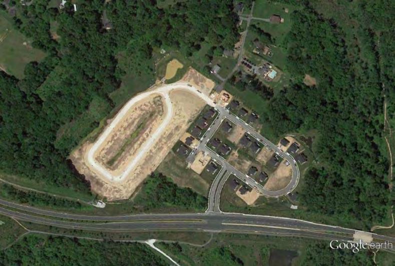
1 2015 PROCEDURES GREATER BALTIMORE EXPOSED SOIL = POLLUTION SURVEY The purpose of the Greater Baltimore Exposed Soil = Pollution (ES=P) Survey is to support Baltimore City and the five surrounding counties - Anne Arundel, Baltimore, Carroll, Harford and Howard - in winning increased use of erosion control measures on construction sites. Generally construction sites in these six jurisdictions make fair to good use of perimeter controls like black silt fence and ponds, but these measures only keep a third to half of the soil eroded on the site from becoming offsite mud pollution. This is why State law requires the application of straw mulch, grass and other erosion control measures once the site reaches rough grade and mass earth-moving ends. By greatly reducing soil erosion these stabilization measures slash offsite mud pollution by 90% to 99%. And it is only through stabilization of soil erosion that sediment losses can be reduced to the point where offsite pollution is prevented. Hence the phrase Exposed Soil = Pollution. Whenever you see exposed soil on a site then pollution is likely to result come the next major storm. Further background, including the damages caused by sediment and State legal requirements for stabilization, see the Greater Baltimore Survey 2014 report posted at: ceds.org/esp/es=preport.pdf With regard to stabilization and minimizing mud pollution, there are four phases to the development of most sites. First, site development begins with clearing just the site perimeter where silt fence, ponds and other control measures are installed. Once installation is complete the contractor has three days to get exposed soils on the perimeter stabilized with mulch or other measures. These soils must also be seeded with grass and a dense (95% coverage) growth should appear within four- to eightweeks during the growing season (March - October). Mulch must be replaced whenever underlying soil becomes visible. Second, the interior of the site is cleared of vegetation, existing buildings, etc. Third, earth-moving equipment (bulldozers, graders, etc.) cut and fill until relatively level areas are created. Of course these level areas are where building will occur. This point is known as rough grade. When building foundations appear or roads-parking lots are under construction, then that part of the site is at rough grade and all exposed soil must be stabilized within seven days. The fourth phase is final stabilization when remaining erodible soils are smoothed then permanently landscaped. Several illustrations follow these procedures. The illustrations give examples of all four phases plus the other information requested on the survey form. SURVEY PROCEDURES: 1. If you live or work in the Greater Baltimore area, then please keep an eye out for active construction sites. Sites can be anywhere but are usually concentrated along major roads. Sites also tend to congregate in a given area so check out Google Earth and other aerial photos to see where sites were a year or two ago. You may well find new sites in those areas. Note the name and location of each site then add it our database at: ceds.org/sites 2. In late May we ll schedule three survey dates for each of the six jurisdictions. We ll base the dates upon the preference you and others from your jurisdiction selected when you registered for the survey. We ll send you an asking you to sign up for one or more surveys. We ll Page 1 of 4
2 keep taking names until we have five people signed up for a survey. Preference will be given to those who have not previously participated in a survey. 3. On the day of the survey we ll meet at a central location such as a park and ride lot. Of course you ll receive an letting you know where and when to meet your survey team. You will receive a clipboard with Survey Forms, a blue pen (always use blue), a list of sites giving the ID for each, and a copy of these procedures. 4. The first construction we visit will be a simple one. There we will walk you through the following procedures for completing the ES=P Survey Form. As with all sites we visit we ll park on a public area where we can get the best view of the site. We need not see the entire site, just a representative portion. 5. At each site you ll be asked to complete a survey form using the blue pen provided. You ll find a sample form at the end of these procedures. The team leader will provide the Site ID which you ll print on your form along with your first and last name and the date (e.g ). The team leader will also ask each participant for their answer to each question on the form. If the numbers ranged widely then each team member will explain how they arrived at their answer. We ll then seek to reach agreement on a number. But you will be free to enter another number if you disagree with the team. 6. First you ll be asked to define the Site or the originally disturbed area. Of course this is the area where vegetation or existing buildings were cleared. This is usually easy to define by looking for the edge of recently cleared forest, the outermost perimeter silt fence, etc. The originally disturbed area will then be designated the Site. See the first illustration following these instructions. 7. Next we ll ask each team member to estimate what percentage of the Site is nonerodible because it is covered by buildings, paved road or parking lots, a paved sidewalk, permanently stabilized, etc. See the second illustration following these instructions. 8. The remaining percentage of the Site is then the erodible area and consists of: a. areas blanketed by vegetation or exposed soil; b. exposed soil covered partially or completely with straw mulch or gras; or c. it could be a road bed or parking lot bed covered with stone to prevent erosion. All these areas are considered erodible because they are or could become susceptible to erosion if vegetation is cleared, mulch blows away, grass dies, or stone washes away. 9. Now, of the erodible area estimate the percentage which is at rough grade as indicated by the presence of buildings, building foundations, roads-road beds or parking lots-parking lot beds. Again, construction of these features can only begin when a portion or all of a site reaches rough grade. So, if they are present then that portion of the site is at rough grade. See the third illustration following these instructions. Page 2 of 4
3 10. On large sites the entirety may be cleared then left inactive while construction begins on a very small portion. The inactive area must be stabilized with at least straw mulch if it will be weeks before earth-moving will again take place in that area. The survey form lists the following indicators that portions of a site have been inactive long enough to trigger the need for stabilization: a. Earth-moving equipment (bulldozers, graders, etc.) no longer present; b. Earth-moving equipment present, but you saw the site a month or more ago and the equipment has not moved and site grading appears the same; and/or c. Earth-moving equipment is present but there is at least sparse vegetation growing throughout the area indicating its been a long time since earth-moving occurred. 11. Based on the factors given in step 10, estimate what percentage of the erodible area is inactive and thus at the stabilization point. 12. Next, compute the total percentage of the erodible area at rough grade or inactive which requires stabilization. 13. Finally, of the portion of the site which requires stabilization (areas at rough grade plus inactive) what percentage: a. Is fully exposed soil (zero mulch, grass, stone, etc); b. Has some mulch, grass, stone, etc.; but underlying soils still visible; and c. Underlying soil is completely covered by mulch, grass, stone, etc. The answers to a, b and c must total 100%. 14. On many residential projects you ll find numerous lots where construction is complete and the adjoining area permanently stabilized. Interspersed with these lots are those where construction is ongoing with erodible areas remaining. Coming up with an average answer to Question #13 for each of the three percentages can be challenging. But the table on the back of this form will ease this task. As you drive through a representative portion of the site, focus on the lots where construction is ongoing and permanent stabilization has not occurred. For each of these incomplete lots note the appropriate percentage on the table. Once all developing lots have been surveyed, total the percentages and divide by the number of lots to get an average. On other sites you ll find few lots but large variations as you drive construction roads. As you travel down a road take in a view and estimate the Question #13 percentages. Take in the next view and make another notation. Continue until you ve looked at either the entire site or a representative portion. Finish by computing the average for the three percentages. 15. Add any comments you wish at the bottom of the form. Page 3 of 4
4 16. The Team Leader will collect your forms at the end of the survey. Later your forms will be scanned and ed back to you. 17. When all the surveys are completed we ll compile a draft report and request your comments on the draft. We d like to list you as one of the volunteers who participated in the survey, but it s OK to be anonymous too. Just make certain we know this is your wish. The 2014 repoort can be downloaded at: ceds.org/esp/es=preport.pdf If you have any questions contact Richard Klein at or Rklein@ceds.org. For further detail on ES=P visit: ceds.org/esp Page 4 of 4
5 ES=P: GREATER BALTIMORE SURVEY 2015 FORM 1. Site ID: Your Name: Date: 2. Based on what you can see from adjoining public areas, of the originally disturbed area what percentage has been rendered nonerodible because it is covered with buildings, building foundations, completed streets, completed parking lots, etc: % 3. Of the erodible area - that which is still susceptible to soil erosion - what portion is at rough grade as indicated by the presence of buildings, building foundations, roads-road beds or parking lots-parking lot beds: % 4. Are there other portions of the erodible area which you believe have been idle long enough that they should be stabilized too, as indicated by any of the factors checked below: G Earth-moving equipment (bulldozers, graders, etc.) no longer present; G Earth-moving equipment present, but you saw the site a month or more ago and the equipment has not moved and site grading appears the same; G Earth-moving equipment is present but there is at least sparse vegetation growing throughout the area indicating its been a long time since earth-moving occurred; or G Other: Based upon the factors checked above, what additional percentage of the erodible area is inactive and thus at the stabilization point: % What is the total percentage of the erodible area at rough grade or inactive requiring stabilization (3 + 4 =): % 5. Of the portion of the site which is at rough grade or inactive, what percentage: a. Is fully exposed soil (zero mulch, grass, stone, etc.): % b. Has some mulch, grass, stone, etc.; but underlying soils still visible:... % c. Underlying soil is completely covered by mulch, grass, stone, etc.:..... % COMMENTS: 5a + 5b + 5c Must Total: 100%
6 SOME SOME FULLY MULCH FULLY MULCH LOT EXPOSED GRASS COMPLETELY LOT EXPOSED GRASS COMPLETELY VIEW SOIL STONE STABILIZED VIEW SOIL STONE STABILIZED AVERAGE AVERAGE


7


8 EXAMPLES OF ERODIBLE & NONERODIBLE PORTIONS OF A CONSTRUCTION SITE ERODIBLE AREAS Bare soil or areas stabilized but could begin eroding if stabilization isn t maintained. Fully exposed soil between stone pile and grass Some grass and mulch but underlying soil still visible 95% or better grass cover Mulch completely obscures soil Road bed stabilized with stone Parking lot stabilized with stone NONERODIBLE AREAS Building footer Paved street Paved parking lot Remnant concrete & other nonerodible surfaces Partially-Complete buildings Completed building


 a 95% grass cover should appear")
9 WHEN HAS A SITE REACHED ROUGH GRADE? 1 Site Prior To Disturbance 4 Remainder of Site Cleared 2 Perimeter Swath Cleared 5 Earth-Moving Brings Site To Rough Grade 3 Perimeter Controls Installed & Stabilized 6 Rough Grade Reached - All Soil Stabilized Site At Rough Grade Full Stabilization Required At Rough Grade Site is definitely at rough grade when building foundations appear or road bed construction begins. At that point all exposed soils must be stabilized with mulch. Mulch must completely blanket soil. More mulch must be applied when underlying soil becomes visible. During the growing season (March-October) a 95% grass cover should appear within 4- to 6-weeks from when seeding occurs. If after 8 weeks grass cover is less than 95% then reseeding is required.

10 HOW CONSTRUCTION SITE STABILIZATION IS REQUIRED TO EVOLVE Swath Berm With 95% Grass Sediment Trap Site Prior To Clearance; Red Arrows Show Direction of Runoff Flow (Downhill) Initially Clear Swath for Earth Berm, Silt Fence, Trap & Other Perimeter Controls Once Controls Are In Place Mulch & Seed Perimeter Then Clear Site Interior North East South Interior Has Been Cleared: Nonerodible Areas (Building + Lower-Left Parking) = 30% of site; Of The Pervious Areas 90% is Exposed Soil 50% of Site Erodible; North, East & South Areas Must be Stabilized With Mulch & Grass WHY IS IT IMPORTANT TO DETERMINE THE PERCENT OF A SITE THAT S ERODIBLE & NONERODIBLE? Areas of the site occupied by buildings, streets, parking lots and other impervious surfaces (those which do not allow rain to soak into underlying soils) are no longer a source of eroded soil. The remaining pervious areas would be the only source of soil erosion and mud pollution. Therefore it is these areas where we d like you to focus your attention and estimate percent that s exposed soil, partially stabilized and fully stabilized.


 of the")


11 PERIMETER CONTROLS & PERIMETER STABILIZATION Perimeter Silt Fence Rows Silt Fence & Earth Berm Perimeter Sediment Trap Perimeter Earth Berm With 95% Grass Cover When the perimeter controls were installed & stabilized the contractor was then allowed to clear the interior (upper portion) of the site. Here you see perimeter stabilization with dense mulch plus grass approaching 95% coverage. Good Stabilization Straw mulch completely blankets underlying soil from view. Poor Stabilization Soil still visible through the sparse grass and mulch. About 30% Vegetative Cover About 75% Vegetative Cover About 95% Vegetative Cover
Town of Fortville Utility Street Standards
 Town of Fortville Utility Street Standards SECTION 02101 - TEMPORARY EROSION AND DUST CONTROL PART 1 - GENERAL 1.1 DESCRIPTION A. Temporary Erosion and Dust Control measures must meet the current Town
Erosion and Sediment Pollution Control Guidelines for Residential Lots with soil disturbance of less than 1 acre (see exceptions)
") Adams Co. Conservation District 670 Old Harrisburg Road, Suite 201 Gettysburg, PA 17325 Telephone: 334-0636 Fax: 337-0730 www.adamscounty.us Erosion and Sediment Pollution Control Guidelines for Residential
Adams Co. Conservation District 670 Old Harrisburg Road, Suite 201 Gettysburg, PA 17325 Telephone: 334-0636 Fax: 337-0730 www.adamscounty.us Erosion and Sediment Pollution Control Guidelines for Residential
Construction Best Management Practices Handbook BEST MANAGEMENT PRACTICES
 Construction Best Management Practices Handbook www.montereysea.org BEST MANAGEMENT PRACTICES 26 www.montereysea.org Construction Best Management Practices Handbook VEHICLE TRACKING AND DUST CONTROL IN
Temporary Erosion and Sediment Control (TESC) Report and Stormwater Pollution Prevention Plan For Construction Activities
 Report and Stormwater Pollution Prevention Plan For Construction Activities") Development Services 1775 12 th Ave. NW P.O. Box 1307 Issaquah, WA 98027 425-837-3100 issaquahwa.gov Temporary Erosion and Sediment Control (TESC) Report and Stormwater Pollution Prevention Plan For Construction
Development Services 1775 12 th Ave. NW P.O. Box 1307 Issaquah, WA 98027 425-837-3100 issaquahwa.gov Temporary Erosion and Sediment Control (TESC) Report and Stormwater Pollution Prevention Plan For Construction
NOTTINGHAM RIDGE PLANNED UNIT DEVELOPMENT CONSEQUENCES OF ENVIRONMENTAL SITE DESIGN WAIVERS & POOR EROSION CONTROL ENFORCEMENT
 NOTTINGHAM RIDGE PLANNED UNIT DEVELOPMENT CONSEQUENCES OF ENVIRONMENTAL SITE DESIGN WAIVERS & POOR EROSION CONTROL ENFORCEMENT The Nottingham Ridge Planned Unit Development is a massive 83-acre proposed
Unit E: Basic Principles of Soil Science. Lesson 7: Understanding Soil Erosion and Management Practices
 Unit E: Basic Principles of Soil Science Lesson 7: Understanding Soil Erosion and Management Practices 1 Important Terms Accelerated erosion Conservation tillage Cover crops Diversion ditches Geologic
Recommended Resources: The following resources may be useful in teaching this lesson:
 Unit E: Basic Principles of Soil Science Lesson 7: Understanding Soil Erosion and Management Practices Student Learning Objectives: Instruction in this lesson should result in students achieving the following
Water Pollution Control for Work in Sensitive Areas
 Water Pollution Control for Work in Sensitive Areas 10-1. WATER POLLUTION CONTROL The Contractor is advised that failure to fully comply with the provisions of this Section, and all requirements listed
SACHSE EROSION CONTROL GUIDELINES
 SACHSE EROSION CONTROL GUIDELINES Section I. Definitions The following words, terms, and phrases, when used in this guideline, shall have the meanings ascribed to them in this Section, except where the
5.0 SURFACE WATER CONTROL MEASURES
 5.0 SURFACE WATER CONTROL MEASURES After performing the analysis summarized above, Burns & McDonnell civil engineers, construction personnel, and environmental personnel walked both Newgate/Phelps Road
CHAPTER 2 EROSION CONTROL
 CHAPTER 2 EROSION CONTROL 2.1 EROSION AND EROSION CONTROL Understanding Erosion Erosion occurs when soil particles are detached from the land surface and carried downslope by moving water. Figure 2.1-1
901 - TEMPORARY EROSION AND POLLUTION CONTROL SECTION 901 TEMPORARY EROSION AND POLLUTION CONTROL
 SECTION 901 TEMPORARY EROSION AND POLLUTION CONTROL 901.1 DESCRIPTION Install, maintain and remove temporary erosion and pollution control devices as required during the construction of the project. BID
Town of Essex, Vermont January, 2017 Standard Specifications For Construction CHAPTER 3 EROSION AND SEDIMENT CONTROL
 CHAPTER 3 EROSION AND SEDIMENT CONTROL CHAPTER 3 EROSION AND SEDIMENT CONTROL Section 300 General Summary All projects constructed within the Town of Essex shall be constructed in strict accordance with
DIVISION VII SOIL EROSION AND SEDIMENTATION CONTROL
 DIVISION VII SOIL EROSION AND SEDIMENTATION CONTROL 1. General la. Purpose VII-1 1B. Necessity of Grading Permit... VII-1 1C. Additional Requirements... VII-2 1D. Responsibility of Permittee... VII-2 2.
Understanding Stormwater Pollution Prevention Plans (SWPPPs) (SWPPPS)
 (SWPPPS)") Understanding Stormwater Pollution Prevention Plans (SWPPPs) (SWPPPS) Definitions SWPPP: Storm Water Pollution Prevention Plan BMP: Best Management Practice(s) to control pollution IDNR: Iowa Department
Understanding Stormwater Pollution Prevention Plans (SWPPPs) (SWPPPS) Definitions SWPPP: Storm Water Pollution Prevention Plan BMP: Best Management Practice(s) to control pollution IDNR: Iowa Department
Construction Site Erosion Control and Phase II of the Stormwater Permit Program
 Construction Site Erosion Control and Phase II of the Stormwater Permit Program Robert Pitt Department of Civil, Construction, and Environmental Engineering University of Alabama Tuscaloosa, AL In Georgia,
Review of State and Federal Stormwater Regulations November 2007
 Review of State and Federal Stormwater Regulations November 2007 By: James T. Spaulding, PE, CPESC Joseph M. Ducharme, Jr., PE TTG ENVIRONMENTAL CONSULTANTS, LLC 27 LOCKE ROAD, CONCORD, NH 03301-5301 TELEPHONE:
The effects of pollution. What is stormwater runoff? Why is stormwater runoff a problem?
 What is stormwater runoff? Stormwater runoff occurs when precipitation from rain or snowmelt flows over the ground. Impervious surfaces like driveways, sidewalks, and streets prevent stormwater from naturally
Erosion and Sediment Control Plan for a Timber Harvesting Operation
 3930-FM-WM0155 Rev. 7/2004 Erosion and Sediment Control Plan for a Timber Harvesting Operation 1. GENERAL INFORMATION A. Location Municipality B. Timber sale area = acres Date County C. Landowner Name
B. Install storm drain inlet protection to prevent clogging of the stormsewer and sediment loads to downstream stormwater facilities or waterbodies.
 The language provided in these specifications is meant to serve as a reminder and provide a generic example of the type of language that should be provided in final construction documents. This language
Storm Drain Inlet Protection
 Categories EC Erosion Control SE Sediment Control TC Tracking Control WE Wind Erosion Control Non-Stormwater NS Management Control Waste Management and WM Materials Pollution Control Legend: Primary Category
PART 1 GENERAL REQUIREMENTS
 PART 1 GENERAL REQUIREMENTS Contract Closeout Plan 110 Arrow diagram for project close-out...3 Erosion Control 121 Straw bale barrier... 5 122 Silt fence... 7 123 Diversion dike... 9 124 Inlet protection...
CHAPTER 8 EROSION AND SEDIMENT CONTROL PLAN REQUIREMENTS
 CHAPTER 8 EROSION AND SEDIMENT CONTROL PLAN REQUIREMENTS 8.1 INTRODUCTION To minimize the detrimental effects of erosion and sedimentation, Henrico County requires that those individuals responsible for
Erosion & Sedimentation Control Policy
 Issue Date 10/22/2010 Page 1 of 8 Erosion & Sedimentation Control Policy Introduction: Soil erosion is the removal of soil by water, wind, ice or gravity and sediment deposition occurs when the rate of
Understanding Soil Erosion and Management Practices
 Lesson C6 8 Understanding Soil Erosion and Management Practices Unit C. Plant and Soil Science Problem Area 6. Basic Principles of Soil Science Lesson 8. Understanding Soil Erosion and Management Practices
Erosion and Sedimentation Pollution Control (ESPC) Plan Narrative
 Plan Narrative") Model Poultry Burial E&S Plan (7-2-15) 1. GENERAL INFORMATION Name of project Name of person responsible Erosion and Sedimentation Pollution Control (ESPC) Plan Narrative Address Phone number Municipality
Model Poultry Burial E&S Plan (7-2-15) 1. GENERAL INFORMATION Name of project Name of person responsible Erosion and Sedimentation Pollution Control (ESPC) Plan Narrative Address Phone number Municipality
Roscommon County Soil Erosion and Sedimentation Control (SESC) Program Guide
 Program Guide") Roscommon County SESC Program 500 Lake Street Roscommon, Michigan 48653 Phone: 989-275-8323 Fax: 989-275-8640 Roscommon County Soil Erosion and Sedimentation Control (SESC) Program Guide INCLUDED ATTACHMENTS
Roscommon County SESC Program 500 Lake Street Roscommon, Michigan 48653 Phone: 989-275-8323 Fax: 989-275-8640 Roscommon County Soil Erosion and Sedimentation Control (SESC) Program Guide INCLUDED ATTACHMENTS
Elements of the Storm Water Management Plan. Storm Water Pollution Prevention Plan (SWPPP)
") Elements of the Storm Water Management Plan Storm Water Pollution Prevention Plan (SWPPP) Small Construction Site Storm Water Management Rodney Hendrick Water Quality Specialist LSU Ag Center Plan Requirements
Elements of the Storm Water Management Plan Storm Water Pollution Prevention Plan (SWPPP) Small Construction Site Storm Water Management Rodney Hendrick Water Quality Specialist LSU Ag Center Plan Requirements
Installation and Maintenance of Erosion Control BMPs
 Installation and Maintenance of Erosion Control BMPs Or Common BMPs Applications Specifications Installation Problems Maintenance Utility Design Professionals Clarifications, proactive problem solving
The Good, The Bad, and The Ugly
 Overview The Good, The Bad, and The Ugly Stormwater Regulations for the Construction Industry Seminar March 20, 2012 Wendy Terlizzi Arizona Department of Transportation Office of Environmental Services
Orange County Fertilizer Application Education Course for Citizens
 Orange County Fertilizer Application Education Course for Citizens Thanks for taking the time to learn how to keep Central Florida beautiful while protecting our water quality! Why is Orange County Requiring
Outline of Presentation. Inspecting Construction Site BMPs. Inspector. Back to Basics. Erosion Control. Erosion Control
 Inspecting Construction Site BMPs Kristin Kerr EOA, Inc. Outline of Presentation Back to Basics Erosion and Sediment Control Good Site Non-Stormwater Run-on and Run-off Control Construction Inspection
SITE DESIGN ENGINEER'S STATEMENT:
 SITE DESIGN ENGINEER'S STATEMENT: THESE DETAILED PLANS AND SPECIFICATIONS WERE PREPARED UNDER MY DIRECTION AND SUPERVISION. SAID PLANS AND SPECIFICATIONS HAVE BEEN PREPARED ACCORDING TO THE CRITERIA ESTABLISHED
11 Ways to Avoid Storm Water Fines. No Exceptions!
 11 Ways to Avoid Storm Water Fines Do not start until you have gone over this with a SWPPP Rep. No Exceptions! 1. Contact Mark Atwood at 801-319-1331 or Jake Pettersson at 801-709-4463. 2. Submit a Notice
NEW CASTLE CONSERVATION DISTRICT. through. (Name of Municipality) PLAN REVIEW APPLICATION DRAINAGE, STORMWATER MANAGEMENT, EROSION & SEDIMENT CONTROL
 PLAN REVIEW APPLICATION DRAINAGE, STORMWATER MANAGEMENT, EROSION & SEDIMENT CONTROL") NEW CASTLE CONSERVATION DISTRICT through (Name of Municipality) PLAN REVIEW APPLICATION DRAINAGE, STORMWATER MANAGEMENT, EROSION & SEDIMENT CONTROL Office use only: Received by Municipality: Received by
NEW CASTLE CONSERVATION DISTRICT through (Name of Municipality) PLAN REVIEW APPLICATION DRAINAGE, STORMWATER MANAGEMENT, EROSION & SEDIMENT CONTROL Office use only: Received by Municipality: Received by
CHAPTER 7 - INFRASTRUCTURE INSPECTION AND ACCEPTANCE... 2
 CHAPTER 7 - INFRASTRUCTURE INSPECTION AND ACCEPTANCE... 2 7.1. GENERAL.... 2 7.1.1. Inspection Restriction Dates.... 2 7.1.2. Complete Improvements.... 2 7.1.3. Public Improvements.... 2 7.1.4. Warranty
UMD Storm Water Program Construction Requirements. Greg Archer, MBA Environmental Compliance Specialist
 UMD Storm Water Program Construction Requirements Greg Archer, MBA Environmental Compliance Specialist Phase 2 Regulatory Overview Dec. 1999 EPA issues Phase 2 Federal Register Municipalities (MS4) from
Planning & Building Department. Requirements for Erosion and Sediment Control
 Planning & Building Department 455 County Center, 2nd Floor Redwood City, California 94063 Tel: 540/863-4161/Fax: 650/363-4849 Mail Drop PLN122 plngbldg@smcgov.org http://planning.smcgov.org Requirements
StormwaterWise Landscapes: Pervious Surfaces Specifications
 StormwaterWise Landscapes: Pervious Surfaces Specifications Purpose & Benefits Stormwater runoff reduction High pollutant removal Control localized drainage problems Attractive alternative for walkways
WELCOME TO THE CONSTRUCTION STORMWATER PERMIT WEBINAR
 WELCOME TO THE CONSTRUCTION STORMWATER PERMIT WEBINAR All the documents shown today are in the MN Stormwater Manual on the page titled 2018 Construction Stormwater Permit Public Notice and Public Informational
Small Site Stormwater Quality Permit Application
 Small Site Stormwater Quality Permit Application PUBLIC WORKS ADMINISTRATION BUILDING (PWA) STORMWATER DIVISION 2525 WEST FIRST STREET LOVELAND, CO 80537 GENERAL INFORMATION (970) 962-2772 www.cityofloveland.org/stormwater
DIVISION 31 EARTHWORK 2006 Edition, Published January 1, 2006; Division Revision Date: January 31, 2012
 2006 Edition, Published January 1, 2006; Division Revision Date: January 31, 2012 PART FIVE DOCUMENTS FOR SITE AND INFRASTRUCTURE 31 00 00. EARTHWORK 31 10 00. SITE CLEARING.1 STRUCTURE REMOVAL: Include
At least 2 feet above the seasonal high water table Overflow path or structure provided
 General Conditions Map of proposed subwatershed to each subbasin, including total area and CN Design Flow or Design Volume to each STF, as appropriate Operation and Maintenance instructions for each STF
Erosion, Erosion, Everywhere
 Erosion, Erosion, Everywhere Main Objectives 1.Capable of describing the magnitude of accelerated soil erosion in the past and at the present. 2.Comprehend the mechanics and the factors influencing water
901 STORMWATER POLLUTION MANAGEMENT SECTION 901 STORMWATER POLLUTION MANAGEMENT
 SECTION 901 STORMWATER POLLUTION MANAGEMENT 901.1 DESCRIPTION Design, implement, inspect and maintain appropriate best management practices to minimize or eliminate erosion, sediment and other pollutants
JEFFERSON COUNTY STORM WATER MANAGEMENT
 JEFFERSON COUNTY STORM WATER MANAGEMENT B-210 Courthouse, Birmingham, Alabama 35203 Telephone: (205) 325-8741 Erosion and Sedimentation Control Measures for Commercial Projects (Plans Requirements) -All
INSPECTION, MAINTENANCE AND HOUSEKEEPING PLAN
 INSPECTION, MAINTENANCE AND HOUSEKEEPING PLAN Bates College 55 & 65 Campus Avenue Housing Lewiston, Maine Introduction The following plan outlines the anticipated inspection and maintenance procedures
CITY OF MIDDLETOWN, OHIO EROSION AND SEDIMENT CONTROL RULES & REGULATIONS
 CITY OF MIDDLETOWN, OHIO EROSION AND SEDIMENT CONTROL RULES & REGULATIONS July 2009 TABLE OF CONTENTS CHAPTER Chapter 1: Purpose... 2 Chapter 2: Definitions...2-4 Chapter 3: Disclaimer of Liability....4
Straw Bale Barrier. Parallel to a roadway to keep sediment off paved areas
 Categories EC Erosion Control SE Sediment Control TC Tracking Control WE Wind Erosion Control Non-Stormwater NS Management Control Waste Management and WM Materials Pollution Control Legend: Primary Objective
Module 4 Regulatory requirements for Land Disturbing Activities
 Module 4 Regulatory requirements for Land Disturbing Activities MODULE 4 REGULATORY REQUIREMENTS FOR A LDA Module 4a Overview MODULE 4A REGULATORY REQUIREMENTS FOR A LDA ESC Regulations Overview 1990 First
Chapter 12 Erosion and Sediment Control
 Chapter 12 Erosion and Sediment Control U30012.DOC 03/05/10 Chapter 12 Erosion and Sediment Control Table of Contents Section Topic Page 12.1 Introduction 12-1 12.1.1 General 12-1 12.1.1.1 Exemptions 12-2
PRELIMINARY DEVELOPMENT PLAN INFORMATION
 PRELIMINARY DEVELOPMENT PLAN INFORMATION SITE AREA =.0 AC. (,8,8 S.F.) BUILDING FOOTPRINT =,8 S.F. PAVEMENT/PARKING AREA = 0,98 S.F. BUILDING COVERAGE OF SITE = % SITE IMPROVEMENT PLAN NOTES. ALL UTILITY
Construction Application for Permit (CAP) Instructions
 Instructions") Construction Application for Permit (CAP) Instructions A CAP is required to be completed and submitted to the Wayne Soil & Water Conservation District (SWCD) office for non-farm, earth-disturbing activities
Construction Application for Permit (CAP) Instructions A CAP is required to be completed and submitted to the Wayne Soil & Water Conservation District (SWCD) office for non-farm, earth-disturbing activities
SECTION TRENCHING & BACKFILLING
 SECTION 02225 - TRENCHING & BACKFILLING 1.0 GENERAL 1.1 Work included in this Section includes trenching and backfilling for underground pipelines and related structures only. 1.2 Reference Specifications
E. STORMWATER MANAGEMENT
 E. STORMWATER MANAGEMENT 1. Existing Conditions The Project Site is located within the Lower Hudson Watershed. According to the New York State Department of Environmental Conservation (NYSDEC), Lower Hudson
Lansing Generating Station Project No Closure Plan for Existing CCR Revision: 1 TABLE OF CONTENTS
 Surface Impoundment Page No. i TABLE OF CONTENTS 1. INTRODUCTION... 1 2. PROPOSED CCR IMPOUNDMENT CLOSURE PROCEDURE... 2 3. PROPOSED COVER SYSTEM... 2 4. ESTIMATED MAXIMUM INVENTORY OF CCR... 3 5. ESTIMATED
Erosion Control for Home Builders
 Erosion Control for Home Builders By controlling erosion, home builders help keep our lakes and streams clean. Eroding construction sites are a leading cause of water quality problems in Wisconsin. For
Welcome to our meeting tonight regarding the Luckey Formerly Utilized Sites Remedial Action Program Site cleanup.
 1 Welcome to our meeting tonight regarding the Luckey Formerly Utilized Sites Remedial Action Program Site cleanup. From 1949 to 1958 the Luckey Site was operated as a beryllium production facility under
Ensuring Full ESD Implementation Richard Klein
 Ensuring Full ESD Implementation Richard Klein In this last of our four presentations we ll describe approaches for increasing the likelihood that ESD will be fully implemented on each site. Of course
PRELIMINARY DRAINAGE REPORT NEWCASTLE FIRE STATION OLD STATE HIGHWAY
 PRELIMINARY DRAINAGE REPORT FOR THE NEWCASTLE FIRE STATION OLD STATE HIGHWAY PREPARED FOR THE NEWCASTLE FIRE PROTECTION DISTRICT JULY 2014 BY ROSEVILLE DESIGN GROUP, INC. ROSEVILLE DESIGN GROUP, Inc Established
Department of the Army Permit Application
 Department of the Army Permit Application DA File Number U.S. Army Corps of Engineers Honolulu District Date Received by CEPOH-RO Send Completed Application to: Honolulu District, U.S. Army Corps of Engineers
HARVEST PARK/ZIEGLER MIXED USE LOT 2 CITY OF FORT COLLINS, CO
 EROSION CONTROL REPORT / STORMWATER MANAGEMENT PLAN FOR HARVEST PARK/ZIEGLER MIXED USE LOT 2 CITY OF FORT COLLINS, CO Prepared by: Interwest Consulting Group 1218 West Ash, Suite C Windsor, Colorado 80550
WATERSHED AUDITS Auditing Stormwater Best Management Practices (BMPs) This Presentation Posted At ceds.org/audit
 This Presentation Posted At ceds.org/audit") WATERSHED AUDITS Auditing Stormwater Best Management Practices (BMPs) This Presentation Posted At ceds.org/audit 1 No Need To Take Notes Download these publication at: ceds.org/audit Why You Are Critical
WATERSHED AUDITS Auditing Stormwater Best Management Practices (BMPs) This Presentation Posted At ceds.org/audit 1 No Need To Take Notes Download these publication at: ceds.org/audit Why You Are Critical
Straw Bale Barrier. - Along the face and at grade breaks of exposed and erodible slopes to shorten slope length and spread runoff as sheet flow
 Straw Bale Barrier SE-9 Objectives EC Erosion Control SE Sediment Control TR Tracking Control WE Wind Erosion Control Non-Stormwater NS Management Control Waste Management and WM Materials Pollution Control
REQUEST FOR CONSTRUCTION BIDS May 23, 2017
 REQUEST FOR CONSTRUCTION BIDS May 23, 2017 Cambridge Greenway Trail / Railroad Bridge Replacement Flood Mitigation Project 1.0 Project Background A former railroad bridge that currently carries the Cambridge
Highway Drainage 1- Storm Frequency and Runoff 1.1- Runoff Determination
 Highway Drainage Proper drainage is a very important consideration in design of a highway. Inadequate drainage facilities can lead to premature deterioration of the highway and the development of adverse
Alto Tunnel Study. Weekly Progress Report February 10, 2017
 Alto Tunnel Study Weekly Progress Report February 10, 2017 Report 1/Rev. No. 1 February 13, 2017 Table of Contents 1.0 Project Activities... 2 1.1 Underhill Site Drilling Progress... 3 1.2 Underhill Site
SAMPLE. Slab On Ground Construction. Carpentry - Residential Construction. Product Code: 5597
 Slab On Ground Construction Carpentry - Residential Construction Product Code: 5597 Publishing details: Second Edition 2012 TAFE NSW Training and Education Support, Industry Skills Unit Orange and Granville
PART 3 - STANDARDS FOR SEWERAGE FACILITIES DESIGN OF STORM SEWERS
 PART 3 - STANDARDS FOR SEWERAGE FACILITIES 3.3 - DESIGN OF STORM SEWERS 3.301 Design of Storm Sewers A. General Information B. Investigations and Surveys C. Special Projects 3.302 Design Criteria for Storm
Stabilized Construction Entrance/Exit TC-1
 Categories EC Erosion Control SE Sediment Control TC Tracking Control WE Wind Erosion Control Non-Stormwater NS Management Control WM Waste Management and Materials Pollution Control Legend: Primary Objective
BMP 6.4.4: Infiltration Trench
 BMP 6.4.4: Infiltration Trench An Infiltration Trench is a leaky pipe in a stone filled trench with a level bottom. An Infiltration Trench may be used as part of a larger storm sewer system, such as a
Storm Drain Inlet Protection for Construction Sites (1060)
") Storm Drain Inlet Protection for Construction Sites (1060) Wisconsin Department of Natural Resources Conservation Practice Standard I. Definition A temporary device installed in or around a storm drain
Storm Drain Inlet Protection for Construction Sites (1060) Wisconsin Department of Natural Resources Conservation Practice Standard I. Definition A temporary device installed in or around a storm drain
Nevada Contractors Field Guide for Construction Site BMPs
 Nevada BMP Field Guide 2013 Update Nevada Contractors Field Guide for Construction Site BMPs This document has been approved by the Nevada Division of Environmental Protection (NDEP) and reflects best
15-MM & 16-MA NOI and SWPPP Overview
 Maryland Department of the Environment 15-MM & 16-MA NOI and SWPPP Overview General Permit for Mineral Mines, Concrete and Asphalt Plants (15MM / NPDES MDG49) and General Permit for Marinas (16MA / NPDES
TOWN OF OCEAN RIDGE CONSTRUCTION SITE MANAGEMENT HANDBOOK
 TOWN OF OCEAN RIDGE CONSTRUCTION SITE MANAGEMENT HANDBOOK I, swear (affirm) that I have read the Town of Ocean Ridge s Construction Site Management Handbook in its entirety and do hereby agree to comply
CITY UTILITIES DESIGN STANDARDS MANUAL
 CITY UTILITIES DESIGN STANDARDS MANUAL () September 2017 Page Chapter 1 Acronyms and Definitions 1.01 Purpose 1 1.02 Acronyms 1 1.03 Definitions 3 Chapter 2 Introduction 2.01 Purpose 1 2.02 Applicability
Appendix I OFFICE OF THE MORGAN COUNTY SURVEYOR STORMWATER DESIGN MANUAL 7/1/2008
 Appendix I OFFICE OF THE MORGAN COUNTY SURVEYOR This Page Left Intentionally Blank OFFICE OF THE MORGAN COUNTY SURVEYOR APPENDIX I PAGE 1 Appendix II OFFICE OF THE MORGAN COUNTY SURVEYOR This Page Left
4.8. Subsurface Infiltration
 4.8. Subsurface Infiltration Subsurface infiltration systems are designed to provide temporary below grade storage infiltration of stormwater as it infiltrates into the ground. Dry wells, infiltration
TORCH LAKE TOWNSHIP WATER QUALITY ACTION PLAN
 TORCH LAKE TOWNSHIP WATER QUALITY ACTION PLAN Elk-River-Chain-of-Lakes Gaps Analysis Project The Watershed Center Grand Traverse Bay Tip of the Mitt Watershed Council Michigan Department of Natural Resources
WYOMING DEPARTMENT OF TRANSPORTATION. Pollution Controls and Best Management Practices for Storm Water During Construction FIELD GUIDE
 WYOMING DEPARTMENT OF TRANSPORTATION Pollution Controls and Best Management Practices for Storm Water During Construction FIELD GUIDE USE OF THIS FIELD GUIDE This WYDOT Pocket Field Guide has been designed
KDOT TEMPORARY EROSION - CONTROL MANUAL
 KDOT TEMPORARY EROSION - CONTROL MANUAL A Guide for the Design, Installation, Inspection, and Maintenance of Temporary Erosion-Control Measures in Kansas January 2007 PURPOSE & USE OF THE MANUAL PURPOSE
Background / Regulatory Requirements
 Chapter 2 Background / Regulatory Requirements This Chapter summarizes the impacts of development on stormwater quality and quantity and explains the postconstruction stormwater control requirements for
Table of Contents. Attachments Attachment A Photos Attachment B Site Map. Pages 3 of 9
 Table of Contents 1.0 Introduction...4 2.0 Description of Landfill...4 3.0 Review of Available Information...5 4.0 Inspection...5 4.1 Changes in Geometry since Last Inspection...5 4.2 Volume...5 4.3 Definitions
Paraprofessional Training Session 1
 Paraprofessional Training Session 1 Part 2: Stormwater Basics November 26, 2012 Rutgers University, Cook Campus Christopher C. Obropta, Ph.D., P.E. Extension Specialist in Water Resources Associate Professor
When it Rains it Pours
 Lesson Summary: Students will understand how water is absorbed into the ground. They will also be able to explain the difference between pervious and impervious surfaces. Students will also learn about
HYDROLOGIC CONSIDERATIONS. 22 nd Annual Nonpoint Source Pollution Conference Saratoga Springs, NY
 LOW IMPACT DEVELOPMENT HYDROLOGIC CONSIDERATIONS 22 nd Annual Nonpoint Source Pollution Conference Saratoga Springs, NY May 18, 2011 PRESENTATION AGENDA Introduction Definitions Discuss Impacts to Hydrologic
VILLAGE OF BELLAIRE WATER QUALITY ACTION PLAN
 VILLAGE OF BELLAIRE WATER QUALITY ACTION PLAN Elk-River-Chain-of-Lakes Gaps Analysis Project The Watershed Center Grand Traverse Bay Tip of the Mitt Watershed Council Michigan Department of Natural Resources
FieldDoc.org User Guide For 2017 NFWF Chesapeake Bay Stewardship Fund Applicants. Background 2. Step 1: Register for a FieldDoc account 3
 FieldDoc.org User Guide For 2017 NFWF Chesapeake Bay Stewardship Fund Applicants Table of Contents (click to go to page) Background 2 Step 1: Register for a FieldDoc account 3 Step 2: Create the Project
EROSION & SEDIMENT CONTROL/STORMWATER CERTIFICATION: (Rev ) SP1 G180
 SP1 G180") EROSION & SEDIMENT CONTROL/STORMWATER CERTIFICATION: 1-16-07 (Rev 1-15-08) SP1 G180 General Schedule and conduct construction activities in a manner that will minimize soil erosion and the resulting sedimentation
EROSION & SEDIMENT CONTROL/STORMWATER CERTIFICATION: 1-16-07 (Rev 1-15-08) SP1 G180 General Schedule and conduct construction activities in a manner that will minimize soil erosion and the resulting sedimentation
WOODFORD COUNTY, ILLINOIS EROSION, SEDIMENT AND STORM WATER CONTROL ORDINANCE
 WOODFORD COUNTY, ILLINOIS EROSION, SEDIMENT AND STORM WATER CONTROL ORDINANCE Adopted: April 9, 1996 Effective: April 15, 1996 Revised: December 19, 2006 Amended: February 18, 2014 1 WOODFORD COUNTY, ILLINOIS
MADISON COUNTY BUILDING PERMIT APPLICATION FORM
 Madison County Government Planning and Development Department Matt Brandmeyer, AICP - Administrator Madison County Planning Administration Building 157 N. Main Street Suite 254 Edwardsville, IL 62025-1964
Wetland Permit Application
 DAVID J. KLOTZLE WETLAND INSPECTOR, PHILIPSTOWN, NY 238 Main Street Cold Spring, NY 10516 (914) 736-7132 Wetland Permit Application MEMO TO APPLICANT 1. Use this form to apply for a Wetlands Permit as
You re the Solution to Water Pollution!
 You re the Solution to Water Pollution! Storm Drains Did you know that stormdrains deliver surface water run-off directly to the nearest pond or creek, and eventually to the Bay? Major Pollutants: Soil
FACT SHEET GENERAL KPDES PERMIT FOR STORM WATER POINT SOURCE DISCHARGES CONSTRUCTION ACTIVITIES
 FACT SHEET GENERAL KPDES PERMIT FOR STORM WATER POINT SOURCE DISCHARGES CONSTRUCTION ACTIVITIES 1. COVERAGE UNDER THIS GENERAL PERMIT Area of Coverage: This permit covers all areas of the Commonwealth
Soil Erosion and Sediment Control
 PDHonline Course C188 (3 PDH) Soil Erosion and Sediment Control Instructor: John Poullain, PE 2012 PDH Online PDH Center 5272 Meadow Estates Drive Fairfax, VA 22030-6658 Phone & Fax: 703-988-0088 www.pdhonline.org
City of Bozeman. Construction Site Management Program
 City of Bozeman Construction Site Management Program Best Management Practice (BMP) Manual for Construction Sites Version 6 June 30, 2017 Blank Page 2 Section 1 - Overview Table of Contents Manual Introduction
Best Practices for Building High-Performance Resource Roads. Road Drainage. Developed by: The Roads and Infrastructure Group
 Best Practices for Building High-Performance Resource Roads Road Drainage Developed by: The Roads and Infrastructure Group THIS GUIDE IS INTENDED FOR EQUIPMENT OPERATORS CONSTRUCTION CONTRACTORS FIELD
GRASS-LINED CHANNEL (acre) CODE 840
 CODE 840") NATURAL RESOURCES CONSERVATION SERVICE ILLINOIS URBAN MANUAL PRACTICE STANDARD GRASS-LINED CHANNEL (acre) CODE 840 (Source: NC Erosion and Sediment Control Field Manual) DEFINITION A natural or constructed
NATURAL RESOURCES CONSERVATION SERVICE ILLINOIS URBAN MANUAL PRACTICE STANDARD GRASS-LINED CHANNEL (acre) CODE 840 (Source: NC Erosion and Sediment Control Field Manual) DEFINITION A natural or constructed
July 7, Jason Barnes, Facilities and ESH Manager Facilities and ESH manager Baxter Healthcare Corporation Mountain Home, AR 72653
 July 7, 2015 Jason Barnes, Facilities and ESH Manager Facilities and ESH manager Baxter Healthcare Corporation Mountain Home, AR 72653 RE: Baxter Healthcare-Mt. Home Inspection (Baxter Co) AFIN: 03-00002
Richland County Department of Public Works Engineering (Land Development) Division
 Division") Richland County Department of Public Works Engineering (Land Development) Division Commercial Projects What is a Commercial Project? Projects that are not related to residential single family homes and/or
Richland County Department of Public Works Engineering (Land Development) Division Commercial Projects What is a Commercial Project? Projects that are not related to residential single family homes and/or