Fire Regimes and Vegetation
|
|
|
- Lily Hopkins
- 6 years ago
- Views:
Transcription


1 Fire Regimes and Vegetation in the Greater Blue Mountains World Heritage Area Dr EM Tasker & Dr KA Hammill Fire Ecology Unit Scientific Services Division NSW OEH Photo: Ian Brown 1

2 Greater Blue Mountains World Heritage Area 1.03 million hectares Eight conservation reserves (Blue Mountains NP, Gardens of Stone NP, Kanangra-Boyd NP, Nattai NP, Thirlmere Lakes NP, Wollemi NP, Yengo NP & Jenolan Karst Conservation Reserve) Almost 250 km north-south from the edge of the Hunter Valley to the Southern Highlands near Mittagong Photo: Neil Stone/NPWS
3 Why study fire in the Blue Mountains World Heritage Area? 3

4 Highly fire-prone: frequent and big fires Since 1970 major bushfire seasons in 1978, 80, 81, 83, 85, 94, 98, 2002, 03, 07 Photo: Nigel Holland/NPWS 4

5 Fire records kept by the National Parks & Wildlife Service since 1970 Grose Valley, Nov 2006 Photo: Neil Stone/NPWS 5

6 People and assets embedded within a highly flammable landscape 6
 and Blue Mountains Pine (Pherosphaera")
7 High conservation value One of three most diverse areas of sclerophyll vegetation on Earth 114 species found nowhere else 100 species of eucalypts 400+ species of vertebrates Rare Gondwanan species, such as Wollemi Pine (Wollemia nobilis) and Blue Mountains Pine (Pherosphaera fitzgeraldii) 7

8 Climate change Recent modeling predictions: More high-extreme FFDI days Earlier start to the fire season Potentially more frequent fires of high intensity 8
 Regional signatures of future fire weather over eastern Australia xxx = Little change in fire weather SE")
9 E.g. Clarke et al. (2011) Regional signatures of future fire weather over eastern Australia xxx = Little change in fire weather SE NSW Predicted no. of 40+ FFDI days per month = Little change = Strong increase = Strong increase 9
10 Our Project: Fire regime analysis for the GBMWHA Combined fire perimeter maps from NPWS records & analysed the patterns Compiled a single vegetation map for the WHA Combined vegetation and fire frequency maps, compared this with biodiversity fire thresholds Prepared fire severity maps for all major bushfires in last 20 years (5 seasons) 10
11 What is a fire history useful for? Fire frequency, severity and time since fire affect: - fuel loads and fuel accumulation rates - vegetation structure and (above ground) composition, hence longer-term fuel patterns - fire behaviour of subsequent bushfires - erosion potential - soil nutrients and soil carbon - fauna 11
12 Time Since Last Fire 12

13 Major bush fire seasons past two decades

14 Time Since Last Fire 14

15 Number of Fires : 0 fires 18% 1 fire 26% 2 fires 29% 3 fires 20% 4 fires 5% 5 fires 1% 6 fires 1% 7 fires 1% 15

16 Vegetation 590 mapped floristic communities Eight broad vegetation types: DSF 85% WSF 9% Grassy Woodlands 2% Heathlands 2% Rainforest 1.5% Wetlands & swamps <1% 16
17 Vegetation fire frequency thresholds Recommended fire intervals (years) MINIMUM MAXIMUM Wet sclerophyll forests (shrubby) 25* 60 Wet sclerophyll forests (grassy) 10* 50 Dry sclerophyll forests (shrubby) 7 30 Dry sclerophyll forests (shrub/grass) 5 50 Heathlands 7 30 Freshwater wetlands, swamps 6 35 Forested wetlands 7 35 Grassy woodlands 5 40 Rainforests Fire should be avoided From Kenny, Sutherland, Tasker & Bradstock (2004) *Crown fire should be avoided in the lower end of the interval range 17

18
19 How are MIN and MAX fire intervals set? MINIMUM interval determined by the slowest-maturing species that are killed by fire and depend on seed to regenerate = maximum time to maturity of species sensitive to frequent fire MAXIMUM interval is determined by the shortest-lived of the species that need fire to germinate, flower or release seed = minimum time to extinction for species sensitive to infrequent fire This is determined for each broad vegetation formation (i.e. rainforest, WSF, DSF ) using knowledge about the species that occur in each 19
20 How do we apply the thresholds? GIS calculation of actual fire frequency from mapped fires for all parks Overlay with a vegetation map GIS comparison of fire frequency against minimum and maximum thresholds per vegetation type Generates a map of too frequently burnt, within threshold and long unburnt areas 20

21 Fire frequency thresholds CATEGORY % of GBMWHA Long Unburnt 20% Within Threshold 56% Within Threshold but 20% Vulnerable Too Frequently Burnt 4% Long Unburnt One or more fire intervals longer than longest suggested interval Within Threshold but Vulnerable One recent fire interval shorter than suggested shortest interval Too Frequently Burnt Fire intervals repeatedly shorter than suggested shortest interval 21

22 Fire Severity Govetts Creek from Banks Walls,
23 Fire intensity Amount of heat energy released by a fire Fire severity The loss of (or change in) organic matter aboveand below-ground resulting from the fire Can be used post-fire to estimate intensity 23
24 High intensity fire loss of biomass immediate mortality of plants, animals recovery for some species for others germination rates of soil seedbanks or nutrient levels tree fall production of tree hollows fuel accumulation erosion potential 24

25 Photo: Ian Brown
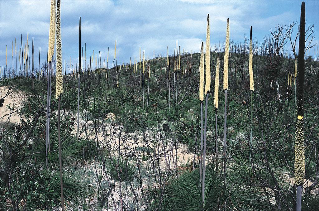
26 Grass-trees


27 Obtain satellite images Landsat SPOT Pre- and post-fire images preferable, close in time to the fire preferable 27
 visible red & near infra-red bands (Landsat & SPOT) NBR (Normalised Burn Ratio) near infra-red & far infra-red bands (Landsat only).")
28 Ratio between wavelengths shows greenness Change in ratio pre-/post-fire shows change 2007 fire, SPOT NDVI, Lawsons Long Alley Fire, burnt areas dark in image, lower values in histogram NDVI (Normalised Difference Vegetation Index) visible red & near infra-red bands (Landsat & SPOT) NBR (Normalised Burn Ratio) near infra-red & far infra-red bands (Landsat only). Can penetrate light smoke/cloud. 28

29 Field assessment of severity LOW HIGH EXTREME GPS the locations of field points with known severities 29
30 30

31 or aerial photo assessment for older fires 31

32 Landsat single post-fire image Post-fire in the Grose Valley 32

33 Landsat pre- post-comparison 33


34 Landsat pre- post-comparison (+ single post-fire SPOT) Low canopy unburnt High complete scorch 34
35 Landsat single post-fire image 35
36 Landsat single post-fire image 36
37 Comparison of Methods (1) LANDSAT Cheaper (~$1,700) Available retrospectively 185 x 185 km scenes Multiple infra-red bands penetrate smoke (NBR) Lower resolution (30m) Less frequent (16 days) SPOT More expensive ($2,500+) Imagery not archived 60 x 60 km scenes Cannot penetrate smoke Better resolution (10m) Frequent capture (2-3 days) NDVI = ratio of visible red and near infra-red bands NBR = ratio of near infra-red and far infra-red bands 37
38 Comparison of Methods (2) PRE-/POST-COMPARISON Less sensitive to vegetation type Less sensitive to date of image capture SINGLE POST-FIRE IMAGE Confounded by differences in vegetation Must be supplemented with a good vegetation map More sensitive to date of image capture 38
39
40 Fire History now being used for: Fuel accumulation rate modelling Soil carbon modelling Testing impacts of repeated high-intensity fires on plant diversity & sensitive vegetation types Testing impacts of varying fire frequencies on plant diversity 40
41 Summary One of the longest comprehensive fire histories available in Australia Being used by multiple research projects to test ideas about fuels, repeated fire impacts, climate change and biodiversity Being used by fire managers for planning 41

42 Acknowledgments NPWS Blue Mountains Region staff, especially Saskia Hayes, Glenn Meade and Jacqueline Reid Dept of Environment, Water, Heritage & Arts, Dept of Agriculture, Fisheries & Forestry World Heritage Management Program Blue Gum forest, Grose Valley soon after Nov 2006 fire 42
The Invisible Mosaic: Fire Regimes in One of NSW's Most Iconic Conservation Areas
 The Invisible Mosaic: Fire Regimes in One of NSW's Most Iconic Conservation Areas KATE HAMMILL 1,2, LIZ TASKER 1 & CLIVE BARKER 1 1 NSW Office of Environment and Heritage (OEH) and NSW National Parks and
Sydney fires caused by people and nature
 University of Wollongong Research Online Faculty of Science, Medicine and Health - Papers Faculty of Science, Medicine and Health 2013 Sydney fires caused by people and nature Ross Bradstock University
Lecture 3.4: Fire effects on vegetation
 Lecture 3.4: Fire effects on vegetation First-order fire effects Occur during or immediately after a fire Localized to the burned area Some examples of 1 st order fire effects: Burned or scorched foliage
Low-intensity fire burning on the forest floor. High-intensity crown fire
 Forest Fires: Answers to 12 Common Questions 1. Is wildfire bad for forests? No. Some forests need fire to be healthy, but it has to be the type of fire that the forest evolved with. Low-intensity fire
Innovation in Restoration
 Innovation in Restoration 2030 and beyond Why Innovation in Restoration? How Big is the Restoration Challenge? Globally, two billion hectares of degraded and deforested land could benefit from restoration.
Site Preparation: The First Step to Regeneration
 Site Preparation: The First Step to Regeneration People have been clearing land for agricultural purposes for centuries. They recognized early that weeds, brush, and stones had to be removed if crops were
FIRE AND FUEL MAPPING SHOALWATER BAY TRAINING AREA. Brian Tunstall, Neil Powell and Alan Marks
 FIRE AND FUEL MAPPING SHOALWATER BAY TRAINING AREA Brian Tunstall, Neil Powell and Alan Marks Technical Report 10/98 March 1998 FIRE AND FUEL MAPPING SHOALWATER BAY TRAINING AREA Brian Tunstall 1, Neil
Pea Ridge Battlefield Prescribed Burning. Introduction. Prescribed burns involve the burning of controlled areas as a means of improving ecology and
 Jocee Norton Bethany Hollis Macey Brooks Rebecca Krein Empacts Project Cecil 4/15/14 Pea Ridge Battlefield Prescribed Burning Introduction Prescribed burns involve the burning of controlled areas as a
Mapping the Cheatgrass-Caused Departure From Historical Natural Fire Regimes in the Great Basin, USA
 Mapping the Cheatgrass-Caused Departure From Historical Natural Fire Regimes in the Great Basin, USA James P. Menakis 1, Dianne Osborne 2, and Melanie Miller 3 Abstract Cheatgrass (Bromus tectorum) is
New Mexico Forest Restoration Principles
 New Mexico Forest Restoration Principles Preamble These principles were collaboratively developed by a team of dedicated professionals representing industry, conservation organizations, land management
Program. Understanding Risk. Northern Fire Mapping: Developing robust fire extent and severity mapping products for the tropical savannas
 Program Project Title Project Leaders Lead End User Researcher Understanding Risk Northern Fire Mapping: Developing robust fire extent and severity mapping products for the tropical savannas Prof. Jeremy
Biophysical Indicators of Longleaf Pine Sandhill Change. Ryan R. Jensen Department of Geography, Geology, and Anthropology
 Biophysical Indicators of Longleaf Pine Sandhill Change Ryan R. Jensen Department of Geography, Geology, and Anthropology Sandhills Species Long-leaf pine Turkey oak Wiregrass Extremely rich herbaceous
Forest types: Plantation vs natural, and softwood vs hardwood. Geography. Activity information. Background
 : Plantation vs natural, and softwood vs hardwood Geography G Practical Lesson Activity information Level: Junior secondary school Years 7 10 Duration: Preparation: Materials: Summary: Approximately 3
Work Plan EAS Components
 October 27, 2010 Work Plan EAS Components Completed Tasks: Organization, Background Investigation and Comparison of Review Criteria (B1) Ecological Assessments and Database Compilation (B2) Data Evaluation
Modeling and remote sensing link soil water storage effects to forest LAI
 Modeling and remote sensing link soil water storage effects to forest LAI Richard Waring 1 & Auro Almeida 2 1 College of Forestry Oregon State University Corvallis, Oregon, U.S.A. 2 CSIRO Sustainable Ecosystems
Fire and Biodiversity: The Effects and Effectiveness of Fire Management
 Fire and Biodiversity: The Effects and Effectiveness of Fire Management Proceedings of the Conference held 8-9 October 1994, Footscray, Melbourne Biodiversity Series, Paper No. 8 Biodiversity Unit 17 ASSET
Mapping burn severity in heterogeneous landscapes with a relativized version of the delta Normalized Burn Ratio (dnbr)
") Mapping burn severity in heterogeneous landscapes with a relativized version of the delta Normalized Burn Ratio (dnbr) Jay D. Miller USDA Forest Service 3237 Peacekeeper Way McClellan, CA 95652 Email:
Mapping burn severity in heterogeneous landscapes with a relativized version of the delta Normalized Burn Ratio (dnbr) Jay D. Miller USDA Forest Service 3237 Peacekeeper Way McClellan, CA 95652 Email:
ARTE RIVER PUGGAREE ROAD
 INVESTIGATION REPORT DETECTION OF EAST GIPPSLAND GALAXIAS (Galaxias aequipinnis) ARTE RIVER PUGGAREE ROAD VicForests' Logging Coupes: 833-512-0019, 833-512-0024 and 833-512-0025 Abstract This investigation
Fire Regimes and Pyrodiversity
 ESPM 134 Scott Stephens Fire Regimes and Pyrodiversity 1) Fire regimes consist of 5 components: - A measurement of fire frequency such as the mean fire return interval or median fire return interval. Fire
Red Pine Management Guide A handbook to red pine management in the North Central Region
 Red Pine Management Guide A handbook to red pine management in the North Central Region This guide is also available online at: http://ncrs.fs.fed.us/fmg/nfgm/rp A cooperative project of: North Central
AIMS pilot project. Monitoring the rehabilitation of degraded landscapes from Food Assistance for Assets programmes with satellite imagery
 Fighting Hunger Worldwide AIMS pilot project Monitoring the rehabilitation of degraded landscapes from Food Assistance for Assets programmes with satellite imagery September 2017 BEFORE road construction
Forensic Forestry Reading the Land
 Principles of Forest Ecology and Management or Forensic Forestry Reading the Land Jonathan Kays University of Maryland Extension Where Do We Start? Think Like A Plant Act Like A Plant Thinking and Acting
MODULE : ECOLOGY
 MODULE 021131: ECOLOGY Learning Objectives: Lecture 1? Ecology covers a hierarchy of levels of organisation, from individual to biosphere? There are distinctive (emergent) properties of ecological systems
Fire & Characteristics of Wildfire
 Fire & Characteristics of Wildfire Curriculum Links: Grade 7 Physical Science--Heat and Temperature (HT) Objectives In this lesson students will develop an operational definition of wildfires. They will
Chapter 13 Private Native Forestry: River Red Gum
 Chapter 13 Private Native Forestry: River Red Gum Mike Thompson State Forests NSW, Deniliquin Introduction Private native forestry in the Riverina mainly relates to River Red Gum (floodplain forests) box
Remote sensing as a tool to detect and quantify vegetation properties in tropical forest-savanna transitions Edward Mitchard (University of Edinburgh)
") Remote sensing as a tool to detect and quantify vegetation properties in tropical forest-savanna transitions Edward Mitchard (University of Edinburgh) Presentation to Geography EUBAP 10 th Oct 2008 Supervisor:
Remote sensing as a tool to detect and quantify vegetation properties in tropical forest-savanna transitions Edward Mitchard (University of Edinburgh) Presentation to Geography EUBAP 10 th Oct 2008 Supervisor:
8/5/2011. Lesson Overview. Disturbance/Fragmentation. Shifting Mosaic. Number one cause of biodiversity loss. Types of disturbance. - Scale, frequency
 Lesson Overview Disturbances Fragmentation Types Measuring Corridors Effects Texas Example 1 Shifting Mosaic Landscape a shifting mosaic. - Made up of patches in different phases of successional development.
ARTE RIVER PUGGAREE ROAD
 INVESTIGATION REPORT DETECTION OF UNDESCRIBED EAST GIPPSLAND SPINY CRAYFISH (Euastacus sp.) ARTE RIVER PUGGAREE ROAD VicForests' Logging Coupes: 833-512-0019, 833-512-0024 and 833-512-0025 Abstract This
FOREST COVER MAPPING AND GROWING STOCK ESTIMATION OF INDIA S FORESTS
 FOREST COVER MAPPING AND GROWING STOCK ESTIMATION OF INDIA S FORESTS GOFC-GOLD Workshop On Reducing Emissions from Deforestations 17-19 April 2007 in Santa Cruz, Bolivia Devendra PANDEY Forest Survey of
New Jersey Forest Stewardship Program Spatial Analysis Project Map Products And Data Layers Descriptions
 New Jersey Forest Stewardship Program Spatial Analysis Project 2007 Map Products And Data Layers Descriptions 01/07 NJ Forest Stewardship Program (FSP) Spatial Analysis Project (SAP) Methodology Project
Land Management (Native Vegetation) Code 2017 under the
 Code 2017 under the") New South Wales Land Management (Native Vegetation) Code 2017 under the Local Land Services Act 2013 I, the Minister for Primary Industries, make the following Land Management (Native Vegetation) Code
New South Wales Land Management (Native Vegetation) Code 2017 under the Local Land Services Act 2013 I, the Minister for Primary Industries, make the following Land Management (Native Vegetation) Code
PeatRus project. Restoring Peatlands in Russia - for fire prevention and climate change mitigation
 PeatRus project Restoring Peatlands in Russia - for fire prevention and climate change mitigation Forest-peat fires 2010 9 August, 2010 Moscow, August 01, 2010 +36 C Gaps Inventory of peatlands Satellite
Land Use/Land Cover Change Research and Management in Vietnam
 NASA-LCLUC Science Team Joint Meeting with MAIRS, GOFCGOLD and SEA START on LC/LU Change Processes in Monsoon Asia Region Jan.12-17, 2009 Land Use/Land Cover Change Research and Management in Vietnam By:
Introducing the Moors for the Future Pilot, Peak District National Park
 Introducing the Moors for the Future Pilot, Peak District National Park Winner of The Copernicus Masters Sustainable Living Challenge 2016 Gail Millin-Chalabi Ioanna Tantanasi Adam Johnston Team based
Wildfires Mitigation Strategy and Incentives in Northern and Central Australia: Dr. Jeremy Russell-Smith
 30 August 13 th May 2015 Wildfires Mitigation Strategy and Incentives in Northern and Central Australia: Dr. Jeremy Russell-Smith Christopher Johns Research Analyst Northern Australia Research Programme
California Agriculture
 California Agriculture Volume 61, Number 1 2007 Page 16 Exclosure size affects young blue oak seedling growth Ralph L. Phillips Edward R. Atwill Neil K. McDougald Doug McCreary Copyright c 2007 by Regents
WESTERN SYDNEY PARKLANDS
 WESTERN SYDNEY PARKLANDS The Western Sydney Parklands Biodiversity Strategy 2012-2020 Prepared by the Western Sydney Parklands Trust. Crown copyright 2013 Western Sydney Parklands Trust Level 7, 10 Valentine
Ecology of Pacific Madrone. Glenn Ahrens Oregon State University Extension Forestry and Natural Resources Hardwood Silviculture Cooperative
 Ecology of Pacific Madrone Glenn Ahrens Oregon State University Extension Forestry and Natural Resources Hardwood Silviculture Cooperative Background 30 years of Research and Extension at Oregon State
Rock/ soil type and altitude differences.
 How does climate affect an ecosystem? The Earth s climate depends on energy from the sun. It affects growing conditions for vegetation and affects the location and characteristics of large scale eco-systems.
3/1/18 USING RADAR FOR WETLAND MAPPING IMPORTANCE OF SOIL MOISTURE TRADITIONAL METHODS TO MEASURE SOIL MOISTURE. Feel method Electrical resistance
 3/1/18 USING RADAR FOR WETLAND MAPPING SOIL MOISTURE AND WETLAND CLASSIFICATION Slides modified from a presentation by Charlotte Gabrielsen for this class. Southeast Arizona: Winter wet period From C.
1. The impacts of development and settlement intensification on biodiversity and Aboriginal cultural heritage;
 Your reference Our reference: DOC13/40624 Contact: Liz Mazzer (02) 68835325 Date 8 th August 2013 General Manager Lithgow City Council PO Box 19 Lithgow NSW 2790 Attention: Ms Sherilyn Hanrahan, Strategic
The Role of Fire and Fuels Management in Chaparral Restoration
 The Role of Fire and Fuels Management in Chaparral Restoration Alexandra D. Syphard Conservation Biology Institute Tess Brennan and Jon E. Keeley USGS Western Ecological Research Center USFS Chaparral
The Forest Changescape: a view from above
 The Forest Changescape: a view from above Daniel J. Hayes ORNL Environmental Science Division SAMSI - Program on Mathematical and Statistical Ecology (ECOL) Workshop Wednesday, 20 August 2014 Research
Rare Beauty: Volunteers Monitor Swamp Pink
 Rare Beauty: Volunteers Monitor Swamp Pink Citizens United, a local watershed organization in southern New Jersey, works in cooperation with the federal government to protect a rare species, swamp pink.
Introduction. Property Boundary and Survey Evidence
 Introduction The Peacham Town Forest is approximately 190 acres of land located in the Northwest corner of the town, close to the town line with Cabot. The tract is the former Ike Peck farm and was acquired
VICTORIA S NATIVE VEGETATION MANAGEMENT A FRAMEWORK FOR ACTION
 VICTORIA S NATIVE VEGETATION MANAGEMENT A FRAMEWORK FOR ACTION CONTENTS 1. INTRODUCTION... 7 2. NATIVE VEGETATION MANAGEMENT POLICY CONTEXT... 9 3. A VISION FOR VICTORIA S NATIVE VEGETATION... 12 4. PRINCIPLES
Earth Observation for Sustainable Development of Forests (EOSD) - A National Project
 - A National Project") Earth Observation for Sustainable Development of Forests (EOSD) - A National Project D. G. Goodenough 1,5, A. S. Bhogal 1, A. Dyk 1, R. Fournier 2, R. J. Hall 3, J. Iisaka 1, D. Leckie 1, J. E. Luther
Earth Observation for Sustainable Development of Forests (EOSD) - A National Project D. G. Goodenough 1,5, A. S. Bhogal 1, A. Dyk 1, R. Fournier 2, R. J. Hall 3, J. Iisaka 1, D. Leckie 1, J. E. Luther
A Remote Sensing Based Urban Tree Inventory for the Mississippi State University Campus
 A Remote Sensing Based Urban Tree Inventory for the Mississippi State University Campus W. H. Cooke III a and S.G. Lambert b a Geosciences Department, GeoResources Institute, Mississippi State University,
The Risk to the Tasmanian Wilderness World Heritage Area from Fires Associated with Forestry Operations
 The Risk to the Tasmanian Wilderness World Heritage Area from Fires Associated with Forestry Operations Clipping from The Age (Melbourne), 8 ch 1989: This fire, from escaped regeneration burns in ch 1989,
Using fire in spotted gum - ironbark forests for production and biodiversity outcomes
 Queensland the Smart State Using fire in spotted gum - ironbark forests for production and biodiversity outcomes Guidelines for landholders March 007 Contributors Dr Valerie Debuse, DPI&F Dr Tom Lewis,
Developing forestry practices. Managing for Timber and Wildlife Diversity NATIONAL WILD TURKEY FEDERATION PRE-HARVEST PLANNING:
 Managing for Timber and Wildlife Diversity by Joe McGlincy NWTF WILDLIFE BULLETIN NO.15 RON BRENNEMAN NATIONAL WILD TURKEY FEDERATION Developing forestry practices that could potentially benefit all wildlife
Using global datasets for biomass and forest area estimation: Miombo forests in Tanzania
 Using global datasets for biomass and forest area estimation: Miombo forests in Tanzania Erik Næsset, Terje Gobakken, Hans Ole Ørka (NMBU, Norway) 2111 2005 Objectives Quantify and compare precision of
Chapter 14. Forest Fragmentation and Biodiversity
 Chapter 14 Forest Fragmentation and Biodiversity PLATE 14-1 This landscape mosaic in Ireland illustrates both fragmentation of forest as well as how narrow hedgerows provide natural corridors to connect
Proposed Wildlife Habitat Restoration Project At Walking Iron Wildlife Area August 6, 2015
 Proposed Wildlife Habitat Restoration Project At Walking Iron Wildlife Area August 6, 2015 Walking Iron County Wildlife Area is 898 acres situated in the Town of Mazomanie between Walking Iron County Park
Church forests in Ethiopia
 Church forests in Ethiopia The conservation value of church forests is linked to historical deforestation patterns Raf Aerts Division Forest, Nature and Landscape Department Earth and Environmental Sciences
Research Projects. General List of Contents. 3.1 List of Priority Research Areas 3.2 Projects Lists 3.3 Project Reports
 Research Projects General List of Contents 3.1 List of Priority Research Areas 3.2 Projects Lists 3.3 Project Reports All files are available to members at http://www.sfrc.ufl.edu/cfeor/login/index.html
SW-71 BOYD HILL NATURE PRESERVE MITIGATION PLAN
 SW-71 BOYD HILL NATURE PRESERVE MITIGATION PLAN BACKGROUND INFORMATION Project SWIM? Aquatic Control? Exotic Control? Mitigation Bank? Type No No Yes No Mitigation Wetland and upland enhancement Type Landowner
Catchment Management Plan. An overview of Hunter Water s plan for our catchments. Catchment Management Plan An Overview 1
 Management Plan An overview of Hunter Water s plan for our catchments Management Plan An Overview 1 Introduction A safe AND RELIABLE water supply begins in our catchments. The quality of the water stored
for Wildland Fire GOFC-GOLD Fire IT Workshop October 2011 Stresa, Italy
 The Global Early Warning System for Wildland Fire 1 GOFC-GOLD Fire IT Workshop 18-19 October 2011 Stresa, Italy Presentation Outline 1. Fire danger and early warning 2. Overview of the Global EWS 3. Recent
Timber harvesting in native State forests
 OCTOBER 2008 PRIMEFACT 693 Timber harvesting in native State forests Forest Management There are approximately 2 million hectares of native State forests in NSW. In managing these areas, Forests NSW aims
Impact of Land Use and Land Cover Changes on Ecosystem Services in Southwest China
 Impact of Land Use and Land Cover Changes on Ecosystem Services in Southwest China Presented by HU Huabin OUTLINE Introduction Methods Results Discussion Ecosystem services refer to the conditions and
9/2/2009. I. Mediterranean Climates
 Fire Ecology of Southern California: A Natural or Anthropogenic Disturbance Regime? By Dr. Shawna Dark California State University, Northridge Fire Ecology of Southern California I. Mediterranean Climates
Silviculture Lab 5: Pine Silviculture & Natural Regen Page 1 of 6
 Silviculture Lab 5: Pine Silviculture & Natural Regen Page 1 of 6 Learning Objective: Following this lab students will describe the importance of field observations to the silvicultural prescription writing
Practice Plan for Sparta Mountain Wildlife Management Area (WMA) Stand 33: Restore Old Growth
 Stand 33: Restore Old Growth") Practice Plan for Sparta Mountain Wildlife Management Area (WMA) Stand 33: Restore Old Growth This practice plan addresses a general activity provided for in year 2017-2018 of the management schedule within
Practice Plan for Sparta Mountain Wildlife Management Area (WMA) Stand 33: Restore Old Growth This practice plan addresses a general activity provided for in year 2017-2018 of the management schedule within
Gary Morgan AFSM. Principal Consultant Global Wildland Fire Management Services, Australia
 Gary Morgan AFSM Principal Consultant Global Wildland Fire Management Services, Australia Gary.Morgan.Aust@gmail.com Area burnt 2002 / 2003 AUSTRALIA Total Population 24 million Land Mass 7,692,024 km²
BCI Criterion 4.2. Smallholders. Conversion Risk Assessment Procedure. Version 0.1
 BCI Criterion 4.2 Conversion Risk Assessment Procedure Smallholders Version 0.1 Identification Name of producer: Name of Production Unit: Location (administrative unit, province/state and country): Area
Forest Changes and Biomass Estimation
 Forest Changes and Biomass Estimation Project Title: Comparative Studies on Carbon Dynamics in Disturbed Forest Ecosystems: Eastern Russia and Northeastern China Supported by NASA Carbon Cycle Science
Fire Resilience in Moist Mixed Conifer Forests. Penelope Morgan Dept. Forest, Rangeland, and Fire Sciences University of Idaho
 Fire Resilience in Moist Mixed Conifer Forests Penelope Morgan Dept. Forest, Rangeland, and Fire Sciences University of Idaho pmorgan@uidaho.edu We live in a fire environment School Fire, Photo by Leigh
Use of Earth Observation Data for Water Resources Management by the Nile Basin Initiative. - Tigernet Project
 Use of Earth Observation Data for Water Resources Management by the Nile Basin Initiative. - Tigernet Project By Milly Mbuliro GIS/ Remote Sensing Specialist Nile Basin Initiative Secretariat 25-27 March,
North Black Reroute Habitat Assessment for Cardamine pratensis
 North Black Reroute Habitat Assessment for Cardamine pratensis North Black River Reroute Description The North Black River reroute was identified by Minnesota Power and Department of Natural Resources
Landsat 5 & 7 Band Combinations
 Landsat 5 & 7 Band Combinations By James W. Quinn Landsat 5 (TM sensor) Wavelength (micrometers) Resolution (meters) Band 1 0.45-0.52 30 Band 2 0.52-0.60
Remote Sensing (C) Team Name: Student Name(s):
 Team Name: Student Name(s):") Team Name: Student Name(s): Remote Sensing (C) Nebraska Science Olympiad Regional Competition Henry Doorly Zoo Saturday, February 27 th 2010 96 points total Please answer all questions with complete sentences
Team Name: Student Name(s): Remote Sensing (C) Nebraska Science Olympiad Regional Competition Henry Doorly Zoo Saturday, February 27 th 2010 96 points total Please answer all questions with complete sentences
E8 Forest Management Plan
 E8 Forest Management Plan Alberta Sustainable Resource Development in cooperation with Foothills Forest Products Forestry Division Foothills Forest Area Hinton, Alberta 1 2 TABLE OF CONTENTS 1.0 Introduction...11
State of resources reporting
 Ministry of Natural Resources State of resources reporting October 2010 The State of Forest Carbon in Ontario Ontario s managed forests have the potential to remove carbon dioxide, a greenhouse gas, from
Forest change detection and monitoring using passive and active remote sensing data (RS4FOR project)
") Forest change detection and monitoring using passive and active remote sensing data (RS4FOR project) Katarzyna Staszyńska, Ewa Grabska, Anna Zielonka, Katarzyna Ostapowicz Institute of Geography and Spatial
Forest change detection and monitoring using passive and active remote sensing data (RS4FOR project) Katarzyna Staszyńska, Ewa Grabska, Anna Zielonka, Katarzyna Ostapowicz Institute of Geography and Spatial
Research and Conservation Opportunities Arising from a High Resolution LiDAR Mission for the Long Point Biosphere Reserve and Surrounding Region
 Research and Conservation Opportunities Arising from a High Resolution LiDAR Mission for the Long Point Biosphere Reserve and Surrounding Region Dr. Stewart J. Sweeney, Environmental Management Branch,
FOREST FIRE. Saurabh Pandey UPSC Faculty
 FOREST FIRE Saurabh Pandey UPSC Faculty Ques. Identify the correct statement/s about Forest fire. 1. It can be caused by anthropogenic reasons only. 2. Himalayan region is least vulnerable to forest fire.
Natural Systems Planning Primer
 Natural Systems Planning Primer Lise.Guevremont@ottawa.ca Amy.Macpherson@ottawa.ca Land Use and Natural Systems Unit Planning and Growth Management November 2015 1 Welcome Policy Framework Development
INVESTIGATION REPORT. RARE AND THREATENED FLORA SPECIES DETECTION SLENDER TREE-FERN (Cyathea cunninghamii) BALD MOUNTAIN TRACK
 BALD MOUNTAIN TRACK") INVESTIGATION REPORT RARE AND THREATENED FLORA SPECIES DETECTION SLENDER TREE-FERN (Cyathea cunninghamii) BALD MOUNTAIN TRACK VicForests' Logging Coupe: 830-508-0008 Abstract This investigation report
INVESTIGATION REPORT RARE AND THREATENED FLORA SPECIES DETECTION SLENDER TREE-FERN (Cyathea cunninghamii) BALD MOUNTAIN TRACK VicForests' Logging Coupe: 830-508-0008 Abstract This investigation report
CHANGES IN LAND COVER IN FRENCH GUYANA BETWEEN 1990 AND 2012
 D E L I N V E N TA I R E FORESTIER JULY 2015 = 35 CHANGES IN LAND COVER IN FRENCH GUYANA BETWEEN 1990 AND 2012 The Kyoto Protocol signatory countries are committed, depending on each individual case, to
Assessment and mapping of GRASSLAND ecosystems condition and their services in Bulgaria, Contr. Д-33-90/
 1 General typology of grassland ecosystems We consider Grassland ecosystem as a natural or seminatural vegetation type. It could be part of farm holdings like pastures, meadows, uncultivated lands, etc.
Relationship to E Flows
 Relationship to E Flows Riparian Areas Influences groundwater/surface water relationships Provides filters to improve water quality Provides habitat for diverse flora and fauna Relationship to E Flows
Fire & Fuels Management
 Overview Fire & Fuels Management Southern California Adaptation Implementation Plan During a two- day workshop in January 2016, southern California resource managers and regional stakeholders discussed
New M5. Appendix T. Environmental Impact Statement. Biodiversity Offset Strategy
 New M5 Environmental Impact Statement Biodiversity Offset Strategy Appendix T November 2015 DOCUMENT TRACKING Item Project Name Project Number Project Manager Detail WestConnex - the New M5 Environmental
Reforestation in grassland areas of Uchindile, Kilombero, Tanzania & Mapanda, Mufindi, Tanzania
 Reforestation in grassland areas of Uchindile, Kilombero, Tanzania & Mapanda, Mufindi, Tanzania Biodiversity Monitoring Results 2 nd September 2012 to 31 st December 2013 18 th August 2014 Version 1 1
Satellite Earth Observation
 Satellite Earth Observation Services for Ecosystem valuation Prof Nick Veck Head of the CEO s Office Satellite Applications Catapult 17 March 2017 Outline Introduction to Earth observation and ecosystem
Louisiana-Pacific Canada Ltd.
 Louisiana-Pacific Canada Ltd. TFL 55 Forest Stewardship Plan 2007-2011 November 14, 2006 Note: extension granted to January 26, 2018 Table of Contents 1.0 DEFINITIONS AND INTERPRETATION... 1 2.0 TERM...
Old growth forest and large old trees in coupe (Nextpatch) Tennyson forest block, East Gippsland
 Tennyson forest block, East Gippsland") Old growth forest and large old trees in coupe 889-506-0023 (Nextpatch) Tennyson forest block, East Gippsland Prepared by GECO for Minister Lily D Ambrosio and Department of Environment Land Water and
Old growth forest and large old trees in coupe 889-506-0023 (Nextpatch) Tennyson forest block, East Gippsland Prepared by GECO for Minister Lily D Ambrosio and Department of Environment Land Water and
Lab 8. Photointerpretation of (Ontario Boreal) Tree Species
 Tree Species") Lab 8 Photointerpretation of (Ontario Boreal) Tree Species Tomislav Sapic GIS Technologist Faculty of Natural Resources Management Lakehead University Suggested Approach to Learning Photo- Interpreting
Lab 8 Photointerpretation of (Ontario Boreal) Tree Species Tomislav Sapic GIS Technologist Faculty of Natural Resources Management Lakehead University Suggested Approach to Learning Photo- Interpreting
Structure of Presentation
 17th Session of the ICC on the RESAP for Sustainable Development Bangkok, Thailand 26-28 November 2013 Sahas Man Shrestha Director General, Department of Forest Research and Survey Ministry of Forests
The list of SGCN identified in the 2005 Kansas Comprehensive Wildlife Conservation Plan was revised according to the following decisions:
 Chapter 2 METHODS Photo Travis Taggart Overview This revision involved an evaluation and revision of the list of SGCN and habitats developed for the 2005 Kansas Comprehensive Wildlife Conservation Plan,
Past Meets the Present: Using Old Burns in Fire Management
 Past Meets the Present: Using Old Burns in Fire Management Using previous burned areas in fire management has long been an important part of the strategies and tactics used by fire crews. However, with
REPORT ON WARM TEMPERATE RAINFOREST BREACH MARTINS CREEK
 REPORT ON WARM TEMPERATE RAINFOREST BREACH MARTINS CREEK WARM TEMPERATE RAINFOREST EVC#32 Abstract: This vegetation community is listed as Rare in Victoria and is subject to certain legislative provisions
Status of climate change adaptation in agriculture sector for Lao PDR.
 Status of climate change adaptation in agriculture sector for Lao PDR. 1 st Rhine-Mekong Symposium Climate change and its influence on water and related sectors 8-9 May 2014, Koblenz, Germany Vanxay, DDMCC
30 Years of Tree Canopy Cover Change in Unincorporated and Incorporated Areas of Orange County,
 30 Years of Tree Canopy Cover Change in Unincorporated and Incorporated Areas of Orange County, 1986-2016 Final Report to Orange County July 2017 Authors Dr. Shawn Landry, USF Water Institute, University
Defining and Evaluating Ecosystem Recovery. Jeanne Chambers USDA Forest Service Rocky Mountain Research Station Reno
 Defining and Evaluating Ecosystem Recovery Jeanne Chambers USDA Forest Service Rocky Mountain Research Station Reno Components of Ecosystem Recovery Eliminate invasive or reduce abundance to acceptable
Indonesia Burning The Impact of Fire on Tropical Peatlands : Focus on Central Kalimantan
 Indonesia Burning The Impact of Fire on Tropical Peatlands : Focus on Central Kalimantan A collaborative research programme: *Sue Page, Univ. of Leicester, UK *Jack Rieley, Univ. of Nottingham, UK *Florian
P ARISH OF EAST B ATON ROUGE, L OUISIANA BREC S TRATEGIC P LAN
 CHAPTER 9 CULTURAL, HISTORICAL AND NATURAL RESOURCE MANAGEMENT PLAN INTRODUCTION This chapter is a digest version of a Natural Resource, Cultural and Historical Document authored by BREC Staff over the
2. LITERATURE SURVEY
 30 2. LITERATURE SURVEY 2.1 OVER VIEW Remote Sensing, Global Positioning System, and Geographical Information System technologies have becoming very useful tools in number of applications by providing