MWC Report Card Citizen Science
|
|
|
- Primrose Kelley
- 5 years ago
- Views:
Transcription


1 MWC Report Card Citizen Science Muskoka Stewardship Conference April 27, 2013 Judi Brouse Director of Watershed Programs

2 Why Monitor What we don t measure we can t manage
3 What are people asking? How are lakes changing? Is my lake is healthy? Can I swim in my lake? Can I use the lake water for drinking? Are we losing wetlands? What is the impact of climate change? What is the impact of invasive species? What is the impact of development?
4 Indicators Algae (number of blooms/year) Clarity (Secchi) Phosphorus Benthic community Calcium levels Invasive species Road density Change in development

5 Issues We don t have a lot of data We don t have programs in place to gather the data Senior levels of government resources are being cut


6 Opportunities Citizen science Eyes on the lake With training can be very effective

7 Lake Partner Program A volunteer-based, water-quality monitoring program Focuses on the health of Ontario's inland lakes Volunteers collect phosphorus samples and record water clarity
8 Contact Information Mailing Address: Dorset Environmental Science Centre Box 39, Dorset, ON P0A 1E0 Phone number: (in Ontario) Website:


9 Invasive Species Website:


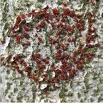
10 Zebra Mussels Rainbow Smelt Spiny Water Flea Giant Hogweed

11 Shoreline Surveys


12

13 Lot Usage Average number of people each day at a shoreline residence both seasonal and permanent

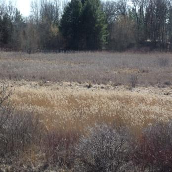
14 Wetlands


15 Wetland Types Wetland Types Swamp Marsh Bog/Fen Beaver Pond

16 Disturbance Residential Commercial/ Industrial Road Estimate of size of disturbance Filling
17 Wetland Grades Subwatershed Name Subwatershed Area (ha) Wetland Area (ha) % Wetlands 1 % Wetland Loss (ha) Wetland Loss (ha) Moon River watershed Gibson Lake watershed Lake Muskoka watershed Lakes Rosseau and Joseph watershed Cardwell Lake watershed 35,148 5, ,894 3, ,853 3, ,308 3, ,
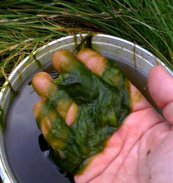

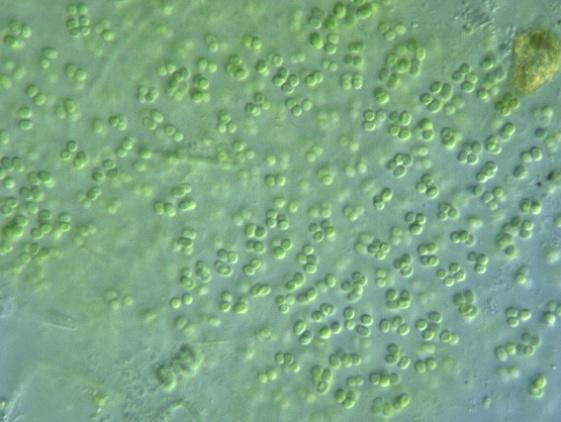
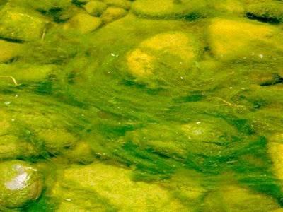
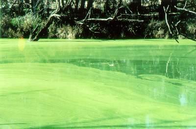
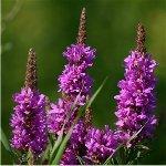
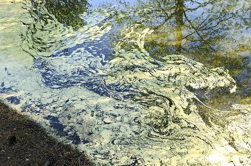
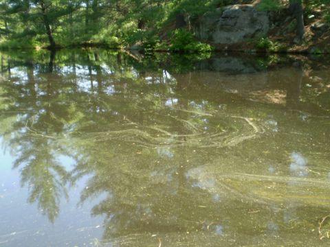
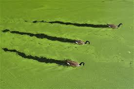
18 Algal Monitoring

 Can citizen")
19 Algal Bloom Monitoring Call the Spills Action Centre MOE-TIPS ( ) Can citizen scientists help?

20 Pollen

21 Pondweed

22 Algal Monitoring Training Algae identification Reporting format Coordination with MOE Database development
23 What Do We Monitor? How are lakes changing? CWN project Is my lake healthy? This is an undefined question Can I swim in my lake? Yes, extensive monitoring Can I use the lake water for drinking? Yes, with treatment
24 What Do We Monitor? Are we losing wetlands? Insufficient data What is the impact of climate change? CWN project, DESC work, MWC analysis What is the impact of invasive species? Insufficient data What is the impact of development? Insufficient data
25 What Can You Monitor Province-wide Individuals and Associations Lake Partner Program Website: Invasive Species Website:
26 What Can You Monitor District of Muskoka - Associations Shoreline Surveys rwillison@muskoka.on.ca Lot Usage rwillison@muskoka.on.ca
27 What Can You Monitor Muskoka Watershed Council Individuals and Associations Wetlands Algal Blooms


28 Muskoka Watershed Report Card Help us monitor and report on the health of our Watersheds
Ontario s Cottage Country Lakes. Long-term Trends in Water Quality from the Lake Partner Program
 Ontario s Cottage Country Lakes Long-term Trends in Water Quality from the Lake Partner Program Anna DeSellas and Andrew Paterson Dorset Environmental Science Centre, MOECC 1 November 22, 2017 Latornell
LAKE PARTNER PROGRAM. Report Card 2015
 LAKE PARTNER PROGRAM Report Card 2015 Contents 1 What This Report Tells You 2 Ontario s Lakes 3 What is the Lake Partner Program? 5 Total Phosphorus 8 Calcium 10 Water Clarity 12 Moving Forward What You
B ig E ast R iver. Stewardship Works! S ubwatershed. Grades. Land Water Wetlands Biodiversity. Not Stressed Not Stressed Not Stressed Vulnerable
 s B ig E ast R iver Land Water Wetlands Biodiversity S ubwatershed T he Big East River Subwatershed is 64,699 hectares in area. Major lakes in the subwatershed include Bella Lake (3.45 km2) and Rebecca
H ollow R iver. Stewardship Works! S ubwatershed. Grades. Land Water Wetlands Biodiversity. Not Stressed Not Stressed Not Stressed Vulnerable
 s H ollow R iver Land Water Wetlands Biodiversity S ubwatershed T he Hollow River Subwatershed is 40,863 hectares in size and lies predominantly in the Township of Algonquin Highlands in Haliburton County.
Table of Contents. LAND Large Natural Areas Size of Natural Areas Interior Forest Summary of Large Natural Areas...
 1 Table of Contents INTRODUCTION... 5 Goal... 5 Objective... 6 Muskoka Watershed... 8 The Muskoka River Watershed (2EB)... 10 The Black River-Lake Simcoe Watershed (2EC)... 11 Watershed Use... 12 Quaternary
STATE OF THE LAKE Environment Report 2012 MISSISSIPPI LAKE
 STATE OF THE LAKE Environment Report 2012 MISSISSIPPI LAKE MISSISSIPPI LAKE WHY WATERSHED WATCH? A lake monitoring program of the Mississippi Valley Conservation Authority Mississippi Valley Conservation
International Lake of the Woods Basin Water Quality Plan of Study Your comments are invited! November 12 - December 11, 2014
 International Lake of the Woods Basin Water Quality Plan of Study Your comments are invited! November 12 - December 11, 2014 With a drainage basin of nearly 70,000 km 2 (27,000 mi 2 ) straddling the borders
State of the Lake Environment Report December Big Gull Lake
 State of the Lake Environment Report December 2004 Big Gull Lake Big Gull Lake Big Gull Lake is located in the Townships of Central and North Frontenac. Big Gull Lake is at an elevation of 253 metres above
Otonabee Region WATERSHED
 Otonabee Region WATERSHED Report Card 2018 Otonabee Conservation has prepared this report card as a summary of the state of your forests, wetlands, and water resources using data from 2012 to 2016. WHERE
The Lake Partner Program
 The Lake Partner Program Anna DeSellas Scientist, Inland Lakes Monitoring & Lake Partner Program Coordinator Dorset Environmental Science Centre 1 Phosphorus and water quality Phosphorus: A nutrient that
STATE OF THE LAKE Environment Report 2012 JOES LAKE
 STATE OF THE LAKE Environment Report 2012 JOES LAKE JOES LAKE WHY WATERSHED WATCH? A lake monitoring program of the Mississippi Valley Conservation Authority Mississippi Valley Conservation Authority (MVCA)
State of the Lake Environment Report December Mackavoy Lake
 State of the Lake Environment Report December 2003 Mackavoy Lake Mackavoy Lake Mackavoy Lake is located in the Township of Addington Highlands. Mackavoy Lake is a headwater lake of the Mississippi River
Neil Hutchinson Hutchinson Environmental Sciences Ltd. Bracebridge ON Eastern Ontario Lake Links Workshop October 29, 2011
 Neil Hutchinson Hutchinson Environmental Sciences Ltd. Bracebridge ON Eastern Ontario Lake Links Workshop October 29, 2011 Why Manage Lakes? Why Plan for Lake Development? Why Set Development Capacities?
STATE OF THE LAKE Environment Report 2012 CLAYTON LAKE
 STATE OF THE LAKE Environment Report 2012 CLAYTON LAKE CLAYTON LAKE WHY WATERSHED WATCH? A lake monitoring program of the Mississippi Valley Conservation Authority Mississippi Valley Conservation Authority
State of the Lake Environment Report December Clayton Lake
 State of the Lake Environment Report December 2002 Clayton Lake Clayton Lake Clayton Lake is situated in the Townships of Lanark Highlands and Mississippi Mills in Lanark County. Clayton Lake is at an
Lakeshore Capacity July, 2018
 WLPP INFORMATION BULLETIN Lakeshore Capacity July, 2018 This WLPP Bulletin provides information on the concept and approach used to define, calculate and assess lakeshore capacity. In addition, the Bulletin
STATE OF THE LAKE Environment Report 2009 BUCKSHOT LAKE
 STATE OF THE LAKE Environment Report 2009 BUCKSHOT LAKE WHY WATERSHED WATCH? A lake monitoring program of the Mississippi Valley Conservation Authority Mississippi Valley Conservation Authority (MVCA)
STATE OF THE LAKE Environment Report 2013 MACKAVOY LAKE
 STATE OF THE LAKE Environment Report 2013 MACKAVOY LAKE MACKAVOY LAKE WHY WATERSHED WATCH? A lake monitoring program of the Mississippi Valley Conservation Authority Mississippi Valley Conservation Authority
Protecting the Water Quality of Ontario s Inland Lakes
 Protecting the Water Quality of Ontario s Inland Lakes Evaluating impacts of shoreline development Victor Castro Ontario Ministry of the Environment Eastern Region Summary of Presentation! Overview of
Lakeshore Capacity July, 2018
 WLPP INFORMATION BULLETIN Lakeshore Capacity July, 2018 This WLPP Bulletin provides information on the concept and approach used to define, calculate and assess lakeshore capacity. In addition, the Bulletin
Hadlock Pond, Washington Co., Lake Hadlock Association, Inc.
 Hadlock Pond, Washington Co., Lake Hadlock Association, Inc. Lake Characteristics Watershed Characteristics Surface Area (ac/ha) Max Depth (ft/m) Mean Depth (ft/m) Retention Time (years) Water Class Dam
GREEN. algae PROGRAM. Musk ka Stewardship Conference. all about. Friday May 12. Port Carling Community Centre
 50 Shades of GREEN algae all about Musk ka Stewardship Conference PROGRAM Friday May 12 Port Carling Community Centre 2017 OUR SCHEDULE OUR SPEAKERS Keynote Speaker: Dr. Charles Trick University of Western
BUSINESS PLAN: Kettle Creek Conservation Authority
 BUSINESS PLAN: Kettle Creek Conservation Authority How does this service contribute to the results identified in the City of London Strategic Plan? A strong economy A vibrant and diverse community A green
Conservation Authority Watershed Report Cards and the Chesapeake Bay Experience. December 2, 2013 SOSMART
 Conservation Authority Watershed Report Cards and the Chesapeake Bay Experience December 2, 2013 SOSMART Overview of Conservation Authority Watershed Report Cards Series launched March 18, 2013 to celebrate
WATERSHED. Maitland Valley. Report Card 201
 Maitland Valley WATERSHED Report Card 201 The Maitland Valley Conservation Authority has prepared this report card as a summary on the state of our forests, wetlands, surface water, and ground water resources.
STATE OF THE LAKE Environment Report 2013 KASHWAKAMAK LAKE
 STATE OF THE LAKE Environment Report 2013 KASHWAKAMAK LAKE KASHWAKAMAK LAKE WHY WATERSHED WATCH? A lake monitoring program of the Mississippi Valley Conservation Authority Mississippi Valley Conservation
Business Plan: Kettle Creek Conservation Authority
 Business Plan: Kettle Creek Conservation Authority How does this service contribute to the results identified in the City of London Strategic Plan? A Green and Growing City A Sustainable Infrastructure
Long-term Water Quality Trend Analysis on Black Lake Thanks to Volunteer Monitoring Efforts
 Long-term Water Quality Trend Analysis on Black Lake Thanks to Volunteer Monitoring Efforts The Tip of the Mitt Watershed Council has been involved with water quality monitoring since our inception in
Red Rock Lake: A Path Forward
 University of Minnesota Morris Digital Well University of Minnesota Morris Digital Well Center for Small Towns 6-2016 Red Rock Lake: A Path Forward Colette Millard Student - University of Minnesota, Morris
Aquatic Plants in Lake Simcoe
 Aquatic Plants in Lake Simcoe LSRCA Board of Directors October 28, 2016 Brian Ginn Limnologist, Certified Lake Manager Member of Conservation Ontario Aquatic Plants - Plants growing above / below / floating
Restoring and protecting the Ribbon of Life through collaborative community partnerships in under serviced areas.
 Restoring and protecting the Ribbon of Life through collaborative community partnerships in under serviced areas. Speaker: Debbie Balika, HBASc. B.Ed., M.Sc. Science Advisor, Coalition of Haliburton Property
State of the Lake Environment Report Black Lake
 State of the Lake Environment Report 2011 Black Lake Black Lake Why Watershed Watch? The Ribbon of Life is the shallow waters and first 10 metres of shore land around our lakes where the land meets the
Mississippi Valley Conservation. State of the Lake Environment Report White Lake. 'Watch
 Mississippi Valley Conservation State of the Lake Environment Report 2007 White Lake 'Watch "THE RIBBON OF LIFE" Where the Land Meets the Water Water quality is affected by many things: erosion and runoff
Hubbard County Water Quality and You Celebrating 20 Years of Water Quality Testing in Hubbard County!
 Hubbard County Water Quality and You Celebrating 20 Years of Water Quality Testing in Hubbard County! A Collaborative Effort by: Citizen Volunteers Hubbard County Coalition of Lake Associations (HC COLA)
Ploof s Creek South. Johannes Creek. Grand Lake, Ploof s Creek South, Johannes Creek. Introduction
 524 4th Street South Sauk Centre, MN 56378 320.352.2231 Grand Lake, Ploof s Creek South, Johannes Creek Introduction Since the 2012 monitoring season, the Grand Lake Improvement District (Grand LID) and
Dorset Environmental. DESC Site Supervisor
 Dorset Environmental Science Centre (DESC) Keith Somers Keith Somers DESC Site Supervisor DESC A Brief History established ~1975 to develop Lakeshore Capacity Model monitoring nutrients, algae & zooplankton
VADNAIS LAKE AREA WATER MANAGEMENT ORGANIZATION Sustainable Lake Management Plan Charley Lake, Ramsey County, MN
 VADNAIS LAKE AREA WATER MANAGEMENT ORGANIZATION Sustainable Lake Management Plan Charley Lake, Ramsey County, MN Prepared by Kristine Jenson, Tyler Thompson, and Dawn Tanner December 2018 VADNAIS LAKE
The Alliance for the Great Lakes
 The Alliance for the Great Lakes Presentation to the 5th National Conference on Ecosystem Restoration Governance Challenges to Algal Blooms in the Great Lakes Lyman Welch August 2, 2013 A Community that
Volunteers Keeping A Watchful Eye on the Health of Maine Lakes and Ponds for 39 Years!
 Volunteers Keeping A Watchful Eye on the Health of Maine Lakes and Ponds for 39 Years! VLMP is the Largest Collector and Provider of Lake Data in the State of Maine 2009 608 volunteers collected water
Water Quality Monitoring for Lake Erie and the Great Lakes Nutrient Initiative (GLNI)
") Water Quality Monitoring for Lake Erie and the Great Lakes Nutrient Initiative (GLNI) 2011-2016 Water Quality Monitoring and Surveillance Division Alice Dove, Sean Backus, Vi Richardson Issues Facing the
Water Quality Monitoring for Lake Erie and the Great Lakes Nutrient Initiative (GLNI) 2011-2016 Water Quality Monitoring and Surveillance Division Alice Dove, Sean Backus, Vi Richardson Issues Facing the
BLACKSTONE LAKE WATER QUALITY TESTING 2016
 BLACKSTONE LAKE WATER QUALITY TESTING 2016 Conducted by Digby and Valerie Sale BLACKSTONE LAKE COTTAGERS ASSOCIATION BLACKSTONE LAKE WATER QUALITY TESTING 2016 The Blackstone Lake Cottagers Association
Water Quality Sampling Presentation Ministry of the Environment. Presented by Dana Cruikshank Surface Water Specialist October 2009
 Water Quality Sampling Presentation Ministry of the Environment Presented by Dana Cruikshank Surface Water Specialist October 2009 1 5W s of Water Quality Sampling WHY WHAT WHERE WHEN WHO Sampling is an
Water and Watersheds. Data Maps Action
 Water and Watersheds Data Maps Action What is the Wildlife Action Plan? Restore rare wildlife and habitats. Keep common species common. 2015 Revision: Partners in Conservation Science 2015 Revision Data
Reducing Nutrient Contributions from urban and rural residential sources
 Help Protect our Rivers and Lakes Proposed approaches to Reducing Nutrient Contributions from urban and rural residential sources Fertilizer application Household cleaning products Background document
Cannon River One Watershed, One Plan. POLICY COMMITTEE MEETING January 10, 2018 Rice County Government Center Faribault, MN
 Cannon River One, One Plan POLICY COMMITTEE MEETING January 10, 2018 Rice County Government Center Faribault, MN TASK Task 1. Aggregate Existing Physical & Spatial Data 1A. Create project maps 1B. Meeting
Nutrient Issues in Lake Ontario. Lisa Trevisan Ontario Ministry of the Environment and Climate Change
 Nutrient Issues in Lake Ontario Lisa Trevisan Ontario Ministry of the Environment and Climate Change March 26, 2015 Outline Lake Ontario facts and figures Nutrient stressors in Lake Ontario Cyanobacteria
STATE OF THE LAKE Environment Report 2015 MISSISSAGAGON LAKE
 STATE OF THE LAKE Environment Report 2015 MISSISSAGAGON LAKE MISSISSAGAGON LAKE WHY WATERSHED WATCH? A lake monitoring program of the Mississippi Valley Conservation Mississippi Valley Conservation (MVC)
STATE OF THE LAKE Environment Report 2014 CONSTANCE LAKE
 STATE OF THE LAKE Environment Report 2014 CONSTANCE LAKE CONSTANCE LAKE WHY WATERSHED WATCH? A lake monitoring program of the Mississippi Valley Conservation Authority Mississippi Valley Conservation Authority
Visualizing and Quantifying Sources of Nutrients in the Agriculturally Dependent Muskrat River Watershed
 Visualizing and Quantifying Sources of Nutrients in the Agriculturally Dependent Muskrat River Watershed Funding for the WAMQI project was provided through Growing Forward 2, a federalprovincial-territorial
MINISTER S ANNUAL REPORT ON LAKE SIMCOE
 MINISTER S ANNUAL REPORT ON LAKE SIMCOE 2011 2012 Prepared by: The Government of Ontario January 2013 Cover photos credit: Ontario Tourism Marketing Partnership Corporation. For more information or to
Atlasof Biodiversity
 Atlasof Biodiversity Second Edition Atlasof Biodiversity Second Edition First published in 1997, the Chicago Wilderness Atlas of Biodiversity provides an introduction to our region s natural treasures.
CUMULATIVE EFFECTS ASSESSMENT AND MONITORING IN THE MUSKOKA WATERSHED
 CUMULATIVE EFFECTS ASSESSMENT AND MONITORING IN THE MUSKOKA WATERSHED CATHERINE EIMERS, TRENT UNIVERSITY Research conducted 212-215 CUMULATIVE EFFECTS ASSESSMENT AND MONITORING IN THE MUSKOKA WATERSHED
8 LITTLE CROSBY LAKE RESULTS
 8 LITTLE CROSBY LAKE RESULTS 8.1 LITTLE CROSBY LAKE BACKGROUND Figure 8-1: View of the south shoreline of. is 8 acres with an average depth of 7 ft and a maximum depth of 34 ft. Little Crosby Lake is a
JORDAN LAKE MANAGEMENT6 PLAN PT 2--REVISED 8/10/13 Page 19 ITEM GOALS and ACTION ITEMS WHO WHEN
 JORDAN LAKE MANAGEMENT6 PLAN PT 2--REVISED 8/10/13 Page 19 EDUCATION Goal A: Educate community and public about lake management concerns. 1. Establish community events to encourage & educate the community
Watershed Management Planning and Terms of Reference Workshop
 Watershed Management Planning and Terms of Reference Workshop Jay S. White, M.Sc., P.Biol. and Amanda Cooper, B.Sc. Aquality Environmental Consulting Ltd. February 20, 2014 Overview of Presentation Watershed
White Lake 2017 Water Quality Report
 Introduction Watersheds Canada believes that every person has the right to access clean and healthy lakes and rivers in Canada. We work to keep these precious places naturally clean and healthy for people
Lake Mitchell. Citizen Volunteer Water Monitoring on. Lake Facts and Figures
 Citizen Volunteer Water Monitoring on Lake Mitchell Lake Facts and Figures Lake Mitchell is located in east-central Alabama between Coosa and Chilton counties, and is one of several reservoirs on the Coosa
JORDAN LAKE MANAGEMENT6 PLAN PT 2--REVISED 8/16/14 Page 19 ITEM GOALS and ACTION ITEMS WHO WHEN
 JORDAN LAKE MANAGEMENT6 PLAN PT 2--REVISED 8/16/14 Page 19 EDUCATION Goal A: Educate community and public about lake management concerns. 1. Establish community events to encourage & educate the community
ADDRESSING CLIMATE CHANGE ADAPTATION IN EASTERN ONTARIO APRIL 15, 2013
 ADDRESSING CLIMATE CHANGE ADAPTATION IN EASTERN ONTARIO APRIL 15, 2013 IPCC DEFINITION UNFCCC DEFINITION Climate change in Intergovernmental Panel on Climate Change (IPCC) usage refers to a change in the
THE ROLE OF CONSERVATION AUTHORITIES IN THE MANAGEMENT OF LAKES AND RIVERS IN THE KAWARTHA S. State of the Lakes Workshop October 27, 2008
 THE ROLE OF CONSERVATION AUTHORITIES IN THE MANAGEMENT OF LAKES AND RIVERS IN THE KAWARTHA S State of the Lakes Workshop October 27, 2008 Conservation Authority Jurisdiction Conservation Authority Mandate
Central Assiniboine and Lower Souris River Watershed. Public Consultation What you told us. June 2010
 Central Assiniboine and Lower Souris River Watershed Public Consultation What you told us June 2010 Table of Contents Introduction... 5 Methods... 5 Results of Public Consultation... 6 Individual Watershed
Eastman Lake Town of Irondequoit Monroe County
 Eastman Lake Town of Irondequoit Monroe County Lake Characteristics Watershed Characteristics LCI Participation Surface area (ac/ha) 9 / 8 Max depth (ft/m) 9 / Mean depth (ft/m) 4 / Retention time (years)
Lime Lake Lime Lake District Town of Cuba Cattaraugus County
 Lime Lake Lime Lake District Town of Cuba Cattaraugus County Lake Characteristics Watershed Characteristics Surface area (ac/ha) 14 / 2 Max depth (ft/m) 3 / 11 Mean depth (ft/m) 18 / Retention time (years)
Oakland County Healthy Lakes Initiative
 Oakland County Healthy Lakes Initiative A partnership with the Cooperative Lakes Monitoring Program Training Day May 5, 2018 Today s Agenda! 9:00-10:15 Welcome! Transparency (Secchi Disk) Spring/Summer
The Finger Lakes Water Hub
 1 The Finger Lakes Water Hub Aimee Clinkhammer May 6, 2017 Cayuga Lake Watershed Network Meeting 2 Presentation Outline History and Establishment Staff Goals and Priorities Ongoing Activities Approach
Credit Valley Conservation (CVC) Board of Directors. Chief Administrative Officer (CAO) Watershed Knowledge. Watershed Management
 Board of Directors. Chief Administrative Officer (CAO) Watershed Knowledge. Watershed Management") Credit Valley Conservation (CVC) Board of Directors Chief Administrative Officer (CAO) CVC Foundation Human Resources Corporate Watershed Knowledge Watershed Watershed Transformation Planning and Development
Credit Valley Conservation (CVC) Board of Directors Chief Administrative Officer (CAO) CVC Foundation Human Resources Corporate Watershed Knowledge Watershed Watershed Transformation Planning and Development
CLMP+ Report on Fleming Lake (Aitkin County)
") CLMP+ Report on Fleming Lake (Aitkin County) Lake ID# -5-5-6 CLMP+ Data Summary July 7 Authors Shannon Martin Contributors/acknowledgements Terry Dahlberg Sandy Dahlberg Pam Anderson For questions regarding
CLMP+ Report on Fleming Lake (Aitkin County) Lake ID# -5-5-6 CLMP+ Data Summary July 7 Authors Shannon Martin Contributors/acknowledgements Terry Dahlberg Sandy Dahlberg Pam Anderson For questions regarding
McDill Pond. Final Results Portage County Lake Study. University of Wisconsin-Stevens Point, Portage County Staff and Citizens.
 McDill Pond Final Results Portage County Lake Study University of Wisconsin-Stevens Point, Portage County Staff and Citizens April 5, 2005 What can you learn from this study? You can learn a wealth of
VILLAGE OF BELLAIRE WATER QUALITY ACTION PLAN
 VILLAGE OF BELLAIRE WATER QUALITY ACTION PLAN Elk-River-Chain-of-Lakes Gaps Analysis Project The Watershed Center Grand Traverse Bay Tip of the Mitt Watershed Council Michigan Department of Natural Resources
A Farmland Water Management and Drainage Collaborative Strategy to Reduce Phosphorus Loss in the Thames River Basin
 A Farmland Water Management and Drainage Collaborative Strategy to Reduce Phosphorus Loss in the Thames River Basin A.D. Latornell Conservation Symposium Nottawasaga Inn, Alliston, Ontario November 17,
DISTRICT OF MUSKOKA RECREATIONAL WATER QUALITY MODEL REVIEW TOWNSHIP OF MUSKOKA LAKES JUNE 16, 2016
 DISTRICT OF MUSKOKA RECREATIONAL WATER QUALITY MODEL REVIEW TOWNSHIP OF MUSKOKA LAKES JUNE 16, 2016 RECREATIONAL WATER QUALITY MODEL REVIEW PRESENTATION FLOW INTRODUCTION AND CONTEXT MODEL REVIEW: KEY
Watershed Watch Report 2015 GRINDSTONE LAKE
 Watershed Watch Report 2015 GRINDSTONE LAKE GRINDSTONE LAKE WHY WATERSHED WATCH? A lake monitoring program of the Mississippi Valley Conservation Authority Mississippi Valley Conservation Authority (MVCA)
MILTON TOWNSHIP WATER QUALITY ACTION PLAN
 MILTON TOWNSHIP WATER QUALITY ACTION PLAN Elk-River-Chain-of-Lakes Gaps Analysis Project The Watershed Center Grand Traverse Bay Tip of the Mitt Watershed Council Michigan Department of Natural Resources
District of Muskoka Planning and Economic Development Department. Lake of Bays Association Executive Committee
 Date: November 10, 2017 To: From: C.C. District of Muskoka Planning and Economic Development Department Lake of Bays Association Executive Committee Lake of Bays Association Board of Directors Township
Lake George. A Blueprint for Protection
 Lake George A Blueprint for Protection THE 1 As described in the State of the Lake, Lake George now faces three fundamental threats (see facing page): invasive species; rising salt levels; and declining
Community Action Programs for the Environment
 Community Action Programs for the Environment We want to help protect endangered fish on our reserve from the effects of water pollution. Our school wants to share our cool ideas about sustainability with
LAKE ONTARIO WATERS: NEW CONCERNS REQUIRE A NEW PLAN. Presented by NYSDEC on behalf of The Lake Ontario Partnership February 13, 2019
 LAKE ONTARIO WATERS: NEW CONCERNS REQUIRE A NEW PLAN Presented by NYSDEC on behalf of The Lake Ontario Partnership February 13, 2019 Agenda Lake Overview Great Lakes Water Quality Agreement About the Lake
Shorelines and. Chapter 6. Natural Heritage
 Shorelines and Chapter 6 Natural Heritage Context Natural heritage refers generally to terrestrial, wetland and aquatic features (e.g., woodlands, wetlands, and streams) and their functions (e.g., wildlife
Electric Power Generation
 MWC Position Paper on Electric Power Generation 2015 Update Background Last Power Generation Position Paper February 2009 Much has changed since then Ontario Green Energy and Green Economy Act, May 2009
Potato Lake 2010 Project Results and APM Plan. Saturday May 28, 2011 Dave Blumer, Jake Macholl SEH Lake Scientists
 Potato Lake 2010 Project Results and APM Plan Saturday May 28, 2011 Dave Blumer, Jake Macholl SEH Lake Scientists Lake and Aquatic Plant Management Planning Goal: To maintain or improve the overall condition
Findings of the IJC Nearshore Workshops
 Findings of the IJC Nearshore Workshops By John E. Gannon Great Lakes Regional Office International Joint Commission Windsor, Ontario For Loadings from Landscapes and Coastal Effects Workshop Toledo, OH
CLMP+ Report on Grass Lake (Anoka County) Lake ID# CLMP+ Data Summary
 Lake ID# CLMP+ Data Summary") CLMP+ Report on Grass Lake (Anoka County) Lake ID# 02-0113-00 2012-2013 CLMP+ Data Summary October 2014 Authors Shannon Martin, MPCA Editing and graphic design Public Information Office Staff The (MPCA)
CLMP+ Report on Grass Lake (Anoka County) Lake ID# 02-0113-00 2012-2013 CLMP+ Data Summary October 2014 Authors Shannon Martin, MPCA Editing and graphic design Public Information Office Staff The (MPCA)
CLOCA Rural & Agricultural Guide to Permits
 CLOCA Rural & Agricultural Guide to Permits Regulation of Development, Interference with Wetlands and Alterations to Shoreline and Watercourses, Ontario Regulation 42/06 April 2014 Table of contents Introduction...
Lake & Watershed Resource Management Associates P O Box 65; Turner, ME
 Lake & Watershed Resource Management Associates P O Box 65; Turner, ME 207-336-2980 LWRMA @megalink.net 2009 Baseline Water Quality Monitoring and Assessment of McCurdy Pond At the request of the Pemaquid
OUR MISSION: To preserve, protect, and restore Delaware s Inland Bays the water that flows into them and the watershed around them.
 OUR MISSION: To preserve, protect, and restore Delaware s Inland Bays the water that flows into them and the watershed around them. OUR In 1988, the Delaware Inland Bays were declared an estuary of national
2012 Toward Safe Harbours Report Card
 2012 Toward Safe Harbours Report Card HamiltonHarbour.ca 2012 Toward Safe Harbours Report Card The Bay Area Restoration Council s 2012 Toward Safe Harbours Report Card is an assessment of the progress
Love the tank you re with Huron-Kinloss Community Septic Inspections
 Love the tank you re with Huron-Kinloss Community Septic Inspections 2011 LATORNELL CONFERENCE STEWARDSHIP AND SOCIAL MARKETING NOVEMBER 17, 2011 The Township of Huron-Kinloss The Township of Huron-Kinloss
LCI Lake Water Quality Summary
 LCI Lake Water Quality Summary General Information Lake Name: Location: Basin: Size: Lake Origins: Major Tributaries: Lake Tributary to?: Water Quality Classification: Shandelee Lake Town of Callicoon,
Eutrophication, water clarity, and divergent responses to variation in lake level
 Eutrophication, water clarity, and divergent responses to variation in lake level Peter Lisi post doctoral scientist UW Center for Limnology pjlisi@uw.edu Catherine Hein Wisconsin DNR PJL6 PJL7 Distance
A Successful Lake Management Program for Lake Mitchell PROFESSIONAL ENGINEERS AND SCIENTISTS SPECIALIZING IN WATER RESOURCES
 A Successful Lake Management Program for Lake Mitchell PROFESSIONAL ENGINEERS AND SCIENTISTS SPECIALIZING IN WATER RESOURCES Tonight s Agenda 1. General Review of FYRA Engineering and Qualifications 2.
Appendix A: CSLAP 2010 Lake Water Quality Summary: Song Lake
 Appendix A: CSLAP 2010 Lake Water Quality Summary: Song Lake General Lake Information Location County Basin Size Lake Origins Watershed Area Retention Time Mean Depth Sounding Depth Public Access? Major
Amherst Mill Pond. Final Results Portage County Lake Study. University of Wisconsin-Stevens Point, Portage County Staff and Citizens.
 Amherst Mill Pond Final Results Portage County Lake Study University of Wisconsin-Stevens Point, Portage County Staff and Citizens March 31, 2005 What can you learn from this study? You can learn a wealth
Revised Lake Networking Group Water Quality Monitoring Survey October 2016
 Revised Lake Networking Group Water Quality Monitoring Survey October 2016 At the Sept. 30, 2016 Lake Networking Group meeting it was decided to try to gather information about water quality testing currently
Nutrient Management Strategy for the International Red River Watershed. Collaborating Across Jurisdictions to Improve Water Quality
 Nutrient Management Strategy for the International Red River Watershed Collaborating Across Jurisdictions to Improve Water Quality Algal Blooms Across the international Red River watershed and in Lake
TORCH LAKE TOWNSHIP WATER QUALITY ACTION PLAN
 TORCH LAKE TOWNSHIP WATER QUALITY ACTION PLAN Elk-River-Chain-of-Lakes Gaps Analysis Project The Watershed Center Grand Traverse Bay Tip of the Mitt Watershed Council Michigan Department of Natural Resources
3. Encourage our four townships to recognize the Lake Plan watershed philosophy in promoting lakeshore-specific legislation (policies and by-laws).
.") HOW ARE OUR LAKES DOING? A SUMMARY OF KEY MEASUREMENTS Clear, Ston(e)y and White Lake Plan E. coli levels are reassuringly low, predominantly under 20 E. coli/100ml. Sporadic elevated readings are attributed
HOW ARE OUR LAKES DOING? A SUMMARY OF KEY MEASUREMENTS Clear, Ston(e)y and White Lake Plan E. coli levels are reassuringly low, predominantly under 20 E. coli/100ml. Sporadic elevated readings are attributed
Lake & Watershed Resource Management Associates P O Box 65; Turner, ME
 Lake & Watershed Resource Management Associates P O Box 65; Turner, ME 207-336-2980 LWRMA@megalink.net 2008 Baseline Water Quality Monitoring and Assessment of Pemaquid and Biscay Ponds At the request
Welcome. Thank you for joining us!
 Welcome. Thank you for joining us! Watershed Restoration and Protection Strategy (WRAPS) Study Implementation Workshop June 24, 2014 Lower Mississippi River Watershed Management Organization Tonight s
APPENDIX B LAKESHORE CAPACITY ASSESSMENT RESOURCES. May 2010
 APPENDIX B LAKESHORE CAPACITY ASSESSMENT RESOURCES May 2010 Ministry of the Environment Environmental Sciences & Standards Division Environmental Monitoring & Reporting Branch 125 Resources Road Toronto,
SECTION III. HUC-10 SUBWATERSHEDS
 B. SOUTH FORK - EAU CLAIRE RIVER i. Overview The South Fork of the Eau WATERSHED OVERVIEW (LC16) Claire River watershed is the largest HUC-10 within the BASIC INFO Eau Claire River Watershed Watershed