McDill Pond. Final Results Portage County Lake Study. University of Wisconsin-Stevens Point, Portage County Staff and Citizens.
|
|
|
- Rosalind Cook
- 5 years ago
- Views:
Transcription

. Explore and choose implementation tools to achieve your goals.")
1 McDill Pond Final Results Portage County Lake Study University of Wisconsin-Stevens Point, Portage County Staff and Citizens April 5, 2005 What can you learn from this study? You can learn a wealth of valuable information about: Critical habitat that fish, wildlife, and plants depend on Water quality and quantity of your lake The current diagnosis of your lake good news and bad news What can you DO in your community? You can share this information with the other people who care about your lake and then plan together for the future. Develop consensus about the local goals and objectives for your lake. Identify available resources (people, expertise, time, funding). Explore and choose implementation tools to achieve your goals. Develop an action plan to achieve your lake goals. Implement your plan. Evaluate the results and then revise your goals and plans. 1
2 2

3 McDill Pond ~ Location McDill Pond In Stevens Point, just north of intersection of Business 51 and County Road HH Water flow Mcdill Pond was created by a dam on the Plover River It is 261 acres with a maximum depth of 20 feet due to dredging in 2002 Water enters McDill Pond primarily from the Plover River, with some runoff, groundwater, and precipitation Water exits the lake to the Plover River and to groundwater 3

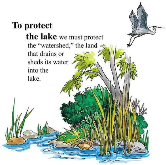
4 McDill Pond ~ Land Use in the Surface Watershed Surface Watershed: The land area where water runs off the surface of the land and drains toward the lake. McDill Pond Land Use McDill Pond 4
5 Page intentionally blank 5
6 McDill Pond ~ Taking a closer look (Within 1,000 feet of the lake) 1938 Air Photo 1968 Air Photo 2000 Ortho Photo Noted Features 1000 Foot Line Stevens Point Whiting boundary 1 4 Points of Interest 1. The blue line represents the Stevens Point-Whiting boundary. 2. The area surrounding McDill Pond has been extensively developed with residential subdivisions since the 1960 s. 3. Parkland. 4. Commercial development along Church Street (US Business 51). 5. Commercial, light industrial, and apartment development along Patch Street. 6
7 McDill Pond ~ Taking a closer look (Within 1,000 feet of the lake) Changes from 1960 to Number of docks Impervious Surface (acres) Residential (acres) Open Fields (acres) Forest (acres) Percent Land Cover within 1000 Foot Buffer 70% 60% 5% 15% 61% % 46% 44% 0% 40% 33% 13% 0% 30% 3% 9% 19% 20% 6% 13% 13% 10% 6% 6% 7% 0% Commercial Residential Parks Forest Open Field Streets 7


8 McDill Pond ~ Water Quality Total Phosphorus In more than 80% of Wisconsin s lakes, phosphorus is the key nutrient affecting aquatic plant and algae growth. Once in a lake system, phosphorus levels are difficult to reduce, so limiting phosphorus input is key. Phosphorus at levels above 30 parts per billion (ppb) can lead to nuisance aquatic plant growth and accelerate a lake s change from oligotrophic to eutrophic. Sources of phosphorus include septic systems, detergents, animal waste, farmland and storm sewer runoff, soil erosion, and fertilizers for lawns, gardens, and agriculture. Oligotrophic Lakes Common uses: Swimming Skiing Boating Vegetation of oligotrophic lakes: Very little vegetation Mesotrophic Lakes Common uses: Boating Fishing Vegetation of mesotrophic lakes: Increased vegetation Occasional algal blooms Eutrophic Lakes Common uses: Fishing Wildlife watching Vegetation of eutrophic lakes: Lots of aquatic plants Frequent algal blooms Winter fish kills can occur Portage County Lake Study Preliminary Results April
9 McDill Pond ~ Water Quality Average Total Phosphorus Levels Concentration (ppb) Eutrophic Mesotrophic Oligotrophic McDill Pond Historic Average Average The graph to the left shows total phosphorus levels measured when the pond was well mixed during spring and fall months. Phosphorus levels in McDill Pond during are slightly higher than historic levels. Average total phosphorus concentration for Portage County impoundments is 35 ppb. The concentration in McDill pond is less than this average. McDill Pond is generally mixed due to the constant flow of the Plover River through it. Water Clarity Water clarity (Secchi disc depth) is an indicator of water quality. The two main components affecting water clarity are materials dissolved in the water and materials suspended in the water. Water clarity can indicate overall water quality, especially the amount of algae and suspended sediment present. 0 M cdill Pond Depth from surface (ft) May June July 2002/2003 Average August Sept. The water clarity in McDill Pond is considered good. The average Secchi depth for similar ponds in the region is 5 feet. McDill Pond usually has slightly better clarity than this. During the growing seasons, the water clarity of McDill Pond was the best during the month of June and the worst during May. These fluctuations throughout the summer are normal as algae populations and sedimentation increase and decrease. 9


10 2002 Amphibian Distribution at Portage County Lakes This summary provides preliminary information on the amphibian species present and their distribution at the twenty-nine Portage County lakes. Surveys were conducted from April August 2002, the typical breeding period of the frogs and salamanders found in the county. Twelve frog species have been documented in Wisconsin, nine of which currently inhabit Portage County: American toad, chorus frog, spring peeper, eastern gray treefrog, Cope s gray treefrog, green frog, pickerel frog, northern leopard frog, and wood frog. Historically, Blanchard s cricket frog inhabited Portage County but is believed to now exist only in southeastern Wisconsin. Of all species believed to inhabit Portage County, only the pickerel frog was not found during the spring and summer of The pickerel frog has been listed as a species of special concern in Wisconsin. No new species to Portage County were recorded in Seven salamander species have been documented in Wisconsin, all of which currently inhabit Portage County: blue-spotted salamander, spotted salamander, tiger salamander, central newt, mudpuppy, northern redback salamander and four-toed salamander. The four-toed salamander is listed as a species of special concern in Wisconsin. Large sections of continuous natural shoreline on lakes are ideal habitats for frog and salamander populations. Natural areas with large amounts of submergent, emergent and floating-leaf vegetation provide protection for amphibians. Many species also use the vegetation for attachment of eggs during the breeding season. Green frogs, bullfrogs, pickerel frogs and leopard frogs depend on the shoreline area throughout the year. In contrast, American toads, spring peepers, tree frogs, wood frogs and chorus frogs depend on the shoreline area in the spring for breeding and then move to other areas for the rest of the year. Undisturbed areas of shoreline that are also connected to large natural upland areas provide ideal habitat for many amphibian species because they lessen frogs exposure to predators. Many frog and salamander species migrate to the lakes in the spring to breed and spend the summer months foraging in the uplands. Many amphibian species will also over winter in the uplands. Chorus Frog Spring Peeper Eastern Gray Treefrog Northern Leopard Frog Wood Frog Green Frog Cope s Gray Treefrog American Toad Blue-spotted Salamander Northern Redback Salamander 10

11 McDill Pond ~ Frogs and Turtles McDill Pond Number of frog species: 5 Frog species observed: spring peeper, northern leopard frog, green frog, American toad, gray treefrog Location of primary habitat: several areas on the north and south sides of the pond Key features of habitat: protected areas of marsh with large amounts of submergent, emergent and floating-leaf vegetation as well as downed trees Map Key Red outlined areas = primary frog habitat Good news Several frog species present, a number of large sections of natural shoreline exist Bad news High level of shoreline development Number of turtle species: 2 Turtle species observed: painted turtle, snapping turtle, there are also historic records of the endangered spiny soft-shell turtle and wood turtle 11
12 McDill Pond ~ Aquatic Plants Aquatic plant surveys were conducted in each lake. More detailed information is available in the final report. Aquatic Plant Survey There are 65 species of aquatic or wetland vascular plants that have been found in McDill Pond or on the wet areas of the shore. This value is above average for Portage County lakes. The increase in the abundance of curlyleaf pondweed and the recent arrival of Eurasian milfoil threaten the quality and diversity of the native aquatic plants of McDill Pond. Although much of the shoreline consists of houses and lots, with considerable lawn areas, some areas of native vegetation have been left. Especially notable for diverse mostly native vegetation is the area in the vicinity of Koziczkowski Park and the new Godfrey-Maybelle Erickson Natural Area. Invasive Exotic Aquatic Plants Invasive species displace native species, disrupt ecosystems, and affect citizen s livelihoods and quality of life. They hamper boating, swimming, fishing, and other water recreation, and take an economic toll on commercial, agricultural and aquatic resources. (Wisconsin DNR) Aquatic plants surveys revealed that some of the lakes in the study have invasive aquatic plants present. Eurasian milfoil (Myriophyllum spicatum) was present in Bear Lake Lake Emily Lake Joanis Jordan Pond McDill Pond Springville Pond Thomas Lake Curly leaf pondweed (Potomogetan crispis) was identified in Spring Lake Amherst Millpond Contact the Portage County Land Conservation Department for additional information. 12
13 McDill Pond ~ What can you do to help? A lake is a magnificent water resource. The quality of its water is a reflection of what happens on the land that surrounds it. Lake Users: Run boat engines efficiently. Observe no/low wake zones. Refuel away from water. Dispose of trash properly Project support provided by: Wisconsin DNR Lake Protection grants UW-Stevens Point Portage County Portage County Citizens Study Contacts: Portage County: Steven Bradley at Land Owners: Control soil erosion from fields. Keep livestock out of lakes and streams. Control manure runoff. Carefully manage nutrients and pesticides. Learn to identify and watch for invasive aquatic plants. Home Owners: Leave natural vegetation buffers in place or replace them if they have been removed. Eliminate the use of fertilizer or use low/no phosphorus fertilizer. Eliminate or minimize us of pesticides. Clean up after pets. Learn to identify and watch for invasive aquatic plants. UW- Stevens Point: Nancy Turyk at
 Planning Assistance Lynn Markham Mike Hansen Reptiles and Amphibians/Near Shore Habitat Dr.")
14 McDill Pond ~ Primary Researchers Algae Dr. Bob Bell Aquatic Plants Dr. Robert Freckmann Birds Dr. Tim Ginnett Brad Bulin (Graduate Student) Fish Dr. Ron Crunkilton Land Use Coverages/Watersheds Steve Bradley (Portage County Conservationist) Planning Assistance Lynn Markham Mike Hansen Reptiles and Amphibians/Near Shore Habitat Dr. Erik Wild Rori Paloski (Graduate Student) Water Quality/Watersheds Becky Cook Dr. Paul McGinley Dr. Byron Shaw Dick Stephens Nancy Turyk Near Shore Summary Dr. Glenn Bowles Special thanks to UWSP undergraduate and graduate students and local citizens for their assistance! 14
Amherst Mill Pond. Final Results Portage County Lake Study. University of Wisconsin-Stevens Point, Portage County Staff and Citizens.
 Amherst Mill Pond Final Results Portage County Lake Study University of Wisconsin-Stevens Point, Portage County Staff and Citizens March 31, 2005 What can you learn from this study? You can learn a wealth
Springville Pond. Final Results Portage County Lake Study. April 12, University of Wisconsin-Stevens Point Portage County Staff and Citizens
 Springville Pond Final Results Portage County Lake Study April 12, 2005 University of Wisconsin-Stevens Point Portage County Staff and Citizens What can you learn from this study? You can learn a wealth
Helen Lake. Final Results Portage County Lake Study. April 5, University of Wisconsin-Stevens Point, Portage County Staff and Citizens
 Helen Lake Final Results Portage County Lake Study University of Wisconsin-Stevens Point, Portage County Staff and Citizens April 5, 2005 What can you learn from this study? You can learn a wealth of valuable
Sunset Lake. Final Results Portage County Lake Study. April 12, University of Wisconsin-Stevens Point, Portage County Staff and Citizens
 Sunset Lake Final Results Portage County Lake Study April 12, 2005 University of Wisconsin-Stevens Point, Portage County Staff and Citizens What can you learn from this study? You can learn a wealth of
Tree Lake. Final Results Portage County Lake Study. University of Wisconsin-Stevens Point Portage County Staff and Citizens.
 Tree Lake Final Results Portage County Lake Study University of Wisconsin-Stevens Point Portage County Staff and Citizens April 12, 2005 What can you learn from this study? You can learn a wealth of valuable
Spring Lake. Final Results Portage County Lake Study. University of Wisconsin-Stevens Point Portage County Staff and Citizens.
 Spring Lake Final Results Portage County Lake Study University of Wisconsin-Stevens Point Portage County Staff and Citizens April 7, 2005 What can you learn from this study? You can learn a wealth of valuable
Lime Lake. Final Results Portage County Lake Study. University of Wisconsin-Stevens Point, Portage County Staff and Citizens.
 Lime Lake Final Results Portage County Lake Study University of Wisconsin-Stevens Point, Portage County Staff and Citizens March 31, 2005 What can you learn from this study? You can learn a wealth of valuable
Wolf Lake. Final Results Portage County Lake Study. April 12, University of Wisconsin-Stevens Point, Portage County Staff and Citizens
 Wolf Lake Final Results Portage County Lake Study University of Wisconsin-Stevens Point, Portage County Staff and Citizens April 12, 25 What can you learn from this study? You can learn a wealth of valuable
Jacqueline Lake. Final Results Portage County Lake Study. University of Wisconsin-Stevens Point, Portage County Staff and Citizens.
 Jacqueline Lake Final Results Portage County Lake Study University of Wisconsin-Stevens Point, Portage County Staff and Citizens April 5, 2005 What can you learn from this study? You can learn a wealth
Fountain Lake. Final Results Portage County Lake Study. April 5, University of Wisconsin-Stevens Point Portage County Staff and Citizens
 Fountain Lake Final Results Portage County Lake Study April 5, 2005 University of Wisconsin-Stevens Point Portage County Staff and Citizens What can you learn from this study? You can learn a wealth of
Healthy Lakes have value to a community for a number of reasons. They provide a
 Rice Lake Eastern Marathon County Lake Study Preliminary Results 2010-2012 University of Wisconsin-Stevens Point and Marathon County Staff and Citizens Healthy Lakes have value to a community for a number
Healthy lakes add value to our communities. They provide a place to relax and recreate,
 Lost Lake Eastern Marathon County Lake Study Final Study Results 2013 University of Wisconsin-Stevens Point and Marathon County Staff and Citizens Healthy lakes add value to our communities. They provide
Water Quality in Mayflower Lake. N. Turyk Water Resource Scientist UW-Stevens Point
 Water Quality in Mayflower Lake N. Turyk Water Resource Scientist UW-Stevens Point Tonight s discussion Water movement Water quality Zoning/Build-outs in the Watersheds Recommendations and Considerations
Summary Report University of Wisconsin-Stevens Point and Waushara County Staff and Citizens
 Summary Report 2013 University of Wisconsin-Stevens Point and Waushara County Staff and Citizens Round Lake Location WAUSHARA COUNTY LAKES STUDY 1 Pine (Springwater) 18 W. Branch Mill Pond 2 Twin 19 Porters
Healthy lakes add value to our communities. They provide a place to relax and recreate,
 Lilly Lake Eastern Marathon County Lake Study Final Study Results 2013 University of Wisconsin-Stevens Point and Marathon County Staff and Citizens Healthy lakes add value to our communities. They provide
DEVELOPING COMMUNITY WIDE SCIENCE-BASED LAKE STEWARDSHIP
 DEVELOPING COMMUNITY WIDE SCIENCE-BASED LAKE STEWARDSHIP 2010 Lake Leaders Kemp Field Station N. Turyk, Univ. Wisconsin-Stevens Point S. Bradley, Portage County B. Sorge, Wisconsin Dept. Natural Resources
Big Chetac and the Red Cedar River Watershed. Dan Zerr University of Wisconsin-Extension Natural Resource Educator
 Big Chetac and the Red Cedar River Watershed Dan Zerr University of Wisconsin-Extension Natural Resource Educator The Water Cycle An area that all drains to a particular stream, river, lake, or ocean.
Healthy lakes add value to our communities. They provide a place to relax and recreate,
 Pike Lake Eastern Marathon County Lake Study Final Study Results 2013 University of Wisconsin-Stevens Point and Marathon County Staff and Citizens Healthy lakes add value to our communities. They provide
2016 Data Report for Iron Lake, Iron County
 Michigan Lakes Ours to Protect Data Report for Iron Lake, Iron County.1397 N,.533 W The CLMP is brought to you by: 1 About this report: This report is a summary of the data that have been collected through
2018 Data Report for Pickerel Lake, Kalkaska County
 Michigan Lakes Ours to Protect 2018 Data Report for Pickerel Lake, Kalkaska County Site ID: 400035 44.800559 N, 84.97667 W The CLMP is brought to you by: 1 About this report: This report is a summary of
2016 Data Report for Magician Lake, Cass County
 Michigan Lakes Ours to Protect 216 Data Report for Magician Lake, Cass County Site ID: 1465 42.649 N, 86.179 W The CLMP is brought to you by: 1 About this report: This report is a summary of the data that
Healthy lakes add value to a community. They provide a place to relax and
 Mission Lake Eastern Marathon County Lake Study Final Study Results 2013 University of Wisconsin-Stevens Point and Marathon County Staff and Citizens Healthy lakes add value to a community. They provide
2018 Data Report for. Crystal Lake, Montcalm County
 Michigan Lakes Ours to Protect 218 Data Report for Crystal Lake, Montcalm County Site ID: 5915 43.25584 N, 84.93362 W The CLMP is brought to you by: 1 About this report: This report is a summary of the
2016 Data Report for Bruin Lake, Washtenaw County
 Michigan Lakes Ours to Protect 1 Data Report for Bruin Lake, Washtenaw County Site ID: 8575.189788 N, 8.39387 W The CLMP is brought to you by: 1 About this report: This report is a summary of the data
2017 Data Report for Portage Lake, Washtenaw County
 Michigan Lakes Ours to Protect 2017 Data Report for Portage Lake, Washtenaw County Site ID: 810248 42.420559 N, 83.921392 W The CLMP is brought to you by: 1 About this report: This report is a summary
JORDAN LAKE MANAGEMENT6 PLAN PT 2--REVISED 8/16/14 Page 19 ITEM GOALS and ACTION ITEMS WHO WHEN
 JORDAN LAKE MANAGEMENT6 PLAN PT 2--REVISED 8/16/14 Page 19 EDUCATION Goal A: Educate community and public about lake management concerns. 1. Establish community events to encourage & educate the community
JORDAN LAKE MANAGEMENT6 PLAN PT 2--REVISED 8/10/13 Page 19 ITEM GOALS and ACTION ITEMS WHO WHEN
 JORDAN LAKE MANAGEMENT6 PLAN PT 2--REVISED 8/10/13 Page 19 EDUCATION Goal A: Educate community and public about lake management concerns. 1. Establish community events to encourage & educate the community
2015 Data Report for South Torch Lake, Antrim County
 Michigan Lakes Ours to Protect 2015 Data Report for South Torch Lake, Antrim County Site ID: 050240 44.91590 N, 85.30280 W The CLMP is brought to you by: About this report: This report is a summary of
2016 Data Report for Barlow Lake, Barry County
 Michigan Lakes Ours to Protect 216 Data Report for Barlow Lake, Barry County Site ID: 8176 42.67559 N, 85.5242 W The CLMP is brought to you by: 1 About this report: This report is a summary of the data
2017 Data Report for Rogers Pond, Mecosta County
 Michigan Lakes Ours to Protect 2017 Data Report for 43.6175478 N, 85.4718313 W The CLMP is brought to you by: 1 About this report: This report is a summary of the data that have been collected through
2017 Data Report for Painter Lake, Cass County
 Michigan Lakes Ours to Protect 217 Data Report for Painter Lake, Cass County Site ID: 1418 41.81667 N, 85.99194 W The CLMP is brought to you by: 1 About this report: This report is a summary of the data
2017 Data Report for Earl Lake, Livingston County
 Michigan Lakes Ours to Protect 217 Data Report for Earl Lake, Livingston County Site ID: 755 2.191 N, 3.95 W The CLMP is brought to you by: 1 About this report: This report is a summary of the data that
2017 Data Report for Silver Lake, Van Buren County
 Michigan Lakes Ours to Protect 2017 Data Report for Silver Lake, Van Buren County Site ID: 800534 42.3891 N, 86.0599 W The CLMP is brought to you by: 1 About this report: This report is a summary of the
2017 Data Report for Loon Lake, Iosco County
 Michigan Lakes Ours to Protect 2017 Data Report for Loon Lake, Iosco County Site ID: 350078 The CLMP is brought to you by: 1 About this report: This report is a summary of the data that have been collected
Water Quality in Rice and Pike Lakes. Ryan Haney Water Resource Specialist Center for Watershed Science and Education UW Stevens Point
 Water Quality in Rice and Pike Lakes Ryan Haney Water Resource Specialist Center for Watershed Science and Education UW Stevens Point Tonight s discussion How do we measure water quality? How is the water
2017 Data Report for Hoags Lake, Mason County
 Michigan Lakes Ours to Protect 17 Data Report for Hoags Lake, Mason County.171 N,.19575 W The CLMP is brought to you by: 1 About this report: This report is a summary of the data that have been collected
2017 Data Report for Shingle Lake, Clare County
 Michigan Lakes Ours to Protect 217 Data Report for Shingle Lake, Clare County Site ID: 1818 43.96359 N, 84.95282 W The CLMP is brought to you by: 1 About this report: This report is a summary of the data
2017 Data Report for Pleasant Lake, Wexford County
 Michigan Lakes Ours to Protect 2017 Data Report for Pleasant Lake, Wexford County Site ID: 830183 44.3 N, 85.4775 W The CLMP is brought to you by: 1 About this report: This report is a summary of the data
2017 Data Report for Oxbow Lake, Oakland County
 Michigan Lakes Ours to Protect 2017 Data Report for Oxbow Lake, Oakland County Site ID: 630666 42.64167 N, 83.477226 W The CLMP is brought to you by: 1 About this report: This report is a summary of the
2017 Data Report for Big Maggie Lake, Iron County
 Michigan Lakes Ours to Protect 2017 Data Report for Big Maggie Lake, Iron County Site ID: 360173 46.01 N, 88.4626 W The CLMP is brought to you by: 1 About this report: This report is a summary of the data
2017 Data Report for Arbutus Lake, Grand Traverse County
 Michigan Lakes Ours to Protect 217 Data Report for Arbutus Lake, Grand Traverse County Site ID: 2819 44.65917 N, 85.519726 W The CLMP is brought to you by: 1 About this report: This report is a summary
2014 Data Report for Higgins Lake, Roscommon County North Basin
 214 Data Report for Higgins Lake, Roscommon County North Basin Michigan Lakes Ours to Protect The CLMP is brought to you by: About this report: This report is a summary of the data that have been collected
2017 Data Report for Fern Lake, Grand Traverse County
 Michigan Lakes Ours to Protect 2017 Data Report for Site ID: 280438 44.73475 N, 85.73409 W The CLMP is brought to you by: 1 About this report: This report is a summary of the data that have been collected
2017 Data Report for Deer Lake, Alger County
 Michigan Lakes Ours to Protect 2017 Data Report for Deer Lake, Alger County Site ID: 020127 46.48016 N, 86.98277 W The CLMP is brought to you by: 1 About this report: This report is a summary of the data
Lake Voorheis, Oakland County
 214 Data Report for Lake Voorheis, Oakland County Michigan Lakes Ours to Protect The CLMP is brought to you by: About this report: This report is a summary of the data that have been collected through
2016 Data Report for Klinger Lake, St. Joseph County
 Michigan Lakes Ours to Protect 216 Data Report for Klinger Lake, St. Joseph County Site ID: 75136 41.82781 N, 85.543893 W The CLMP is brought to you by: 1 About this report: This report is a summary of
2017 Data Report for Duck Lake, Muskegon County
 Michigan Lakes Ours to Protect 217 Data Report for Duck Lake, Muskegon County Site ID: 61778 43.33785 N, 86.39258 W The CLMP is brought to you by: 1 About this report: This report is a summary of the data
2017 Data Report for Lake Independence, Marquette County
 Michigan Lakes Ours to Protect 217 Data Report for Lake Independence, Marquette County Site ID: 2149 46.88337 N, 87.711393 W The CLMP is brought to you by: 1 About this report: This report is a summary
2017 Data Report for Lake Tahoe, Oceana County
 Michigan Lakes Ours to Protect 17 Data Report for Lake Tahoe, Oceana County Site ID: 33 3.1 N,.3 W The CLMP is brought to you by: 1 About this report: This report is a summary of the data that have been
2017 Data Report for Little Paw Paw Lake, Berrien County
 Michigan Lakes Ours to Protect 2017 Data Report for Site ID: 110765 42.21899 N, 86.29072 W The CLMP is brought to you by: 1 About this report: This report is a summary of the data that have been collected
2014 Data Report for Freska Lake, Kent County
 214 Data Report for Freska Lake, Kent County Michigan Lakes Ours to Protect The CLMP is brought to you by: About this report: This report is a summary of the data that have been collected through the Cooperative
Portage County Lake Planning Process
 Portage County Lake Planning Process Lake Leaders Kemp Field Station September 2010 Jen McNelly and Nancy Turyk Center for Watershed Science and Education UW-Stevens Point Types of Planning Emotional Crisis
2017 Data Report for Perch Lake, Iron County
 Michigan Lakes Ours to Protect 217 Data Report for Perch Lake, Iron County Site ID: 3646 46.361392 N, 88.658338 W The CLMP is brought to you by: 1 About this report: This report is a summary of the data
2017 Data Report for Klinger Lake, St. Joseph County
 Michigan Lakes Ours to Protect 217 Data Report for Klinger Lake, St. Joseph County Site ID: 75136 41.82781 N, 85.543893 W The CLMP is brought to you by: 1 About this report: This report is a summary of
2018 Data Report for. Lotus Lake, Oakland County
 Michigan Lakes Ours to Protect 218 Data Report for Lotus Lake, Oakland County 42.6941 N, 83.4244 W The CLMP is brought to you by: 1 About this report: This report is a summary of the data that have been
2017 Data Report for Spider Lake, Grand Traverse County
 Michigan Lakes Ours to Protect 217 Data Report for Spider Lake, Grand Traverse County Site ID: 28395 44.675987 N, 85.49947 W The CLMP is brought to you by: 1 About this report: This report is a summary
Torch Lake (South), Antrim County
, Antrim County") 2014 Data Report for Torch Lake (South), Antrim County Michigan Lakes Ours to Protect The CLMP is brought to you by: About this report: This report is a summary of the data that have been collected through
2014 Data Report for Torch Lake (South), Antrim County Michigan Lakes Ours to Protect The CLMP is brought to you by: About this report: This report is a summary of the data that have been collected through
2014 Data Report for Clark Lake, Jackson County
 2014 Data Report for Clark Lake, Jackson County Michigan Lakes Ours to Protect The CLMP is brought to you by: About this report: This report is a summary of the data that have been collected through the
Welcome. Thank you for joining us! Lower Mississippi River Watershed Management Organization
 Welcome. Thank you for joining us! Lower Mississippi River Watershed Management Organization Lower Mississippi River Watershed Management Organization Watershed Restoration and Protection (WRAP) Study
Mayflower Lake Management Planning Committee UWSP Center for Watershed Science and Education Marathon County Wisconsin Department of Natural
 Mayflower Lake Management Planning Committee UWSP Center for Watershed Science and Education Marathon County Wisconsin Department of Natural Resources Reduces conflicts Addresses problems Allows for proactive
2017 Data Report for Ottawa Lake, Iron County
 Michigan Lakes Ours to Protect 2017 Data Report for Site ID: 360033 46.08484 N, 88.76419 W The CLMP is brought to you by: 1 About this report: This report is a summary of the data that have been collected
Choosing Management Strategies for Portage County Lakes
 Choosing Management Strategies for Portage County Lakes Once you ve set goals for the condition of your lake through the lake management planning process, you ll want to choose the strategies most likely
Choosing Management Strategies for Portage County Lakes
 Choosing Management Strategies for Portage County Lakes Once you ve set goals for the condition of your lake through the lake management planning process, you ll want to choose the strategies most likely
2014 Data Report for Lake Chemung, Livingston County
 2014 Data Report for Lake Chemung, Livingston County Michigan Lakes Ours to Protect The CLMP is brought to you by: About this report: This report is a summary of the data that have been collected through
BLACK OTTER LAKE DISTRICT
 BLACK OTTER LAKE DISTRICT Storm water Action Plan Action Plan submitted for UW-Madison Course 272630 JDD001 #41967 Great Lakes Water Stewardship Institute 2012 Hortonville Area School District Hortonville
Northern Chain of Lakes
 Northern Chain of Lakes Presented by Pat Conrad and Joe Pallardy on behalf of the Brown s Creek Watershed District Board of Managers w a t e r I e c o l o g y I c o m m u n i t y Lake by Lake Analysis
Resource Conservation Opportunities and Management Guidelines
 Resource Conservation Opportunities and Management Guidelines The general ecosystem integrity of lakes is dependent on preserving natural habitat components and the processes that sustain them. These include
B ig E ast R iver. Stewardship Works! S ubwatershed. Grades. Land Water Wetlands Biodiversity. Not Stressed Not Stressed Not Stressed Vulnerable
 s B ig E ast R iver Land Water Wetlands Biodiversity S ubwatershed T he Big East River Subwatershed is 64,699 hectares in area. Major lakes in the subwatershed include Bella Lake (3.45 km2) and Rebecca
H ollow R iver. Stewardship Works! S ubwatershed. Grades. Land Water Wetlands Biodiversity. Not Stressed Not Stressed Not Stressed Vulnerable
 s H ollow R iver Land Water Wetlands Biodiversity S ubwatershed T he Hollow River Subwatershed is 40,863 hectares in size and lies predominantly in the Township of Algonquin Highlands in Haliburton County.
Hubbard County Water Quality and You Celebrating 20 Years of Water Quality Testing in Hubbard County!
 Hubbard County Water Quality and You Celebrating 20 Years of Water Quality Testing in Hubbard County! A Collaborative Effort by: Citizen Volunteers Hubbard County Coalition of Lake Associations (HC COLA)
McDill Pond. *Terms in bold, see glossary pp McDill Pond from Portage County Lake Study Final Report June
 McDill Pond Introduction McDill Pond is a 261 acre hard water impoundment, located in the Village of Whiting, near Stevens Point. McDill Pond has a long history, dating back to 1853 when the original dam
Big Chetac Lake Getting Rid of the Green Phase 3. Nutrient Budget and Management Data Analysis Report
 Big Chetac Lake Getting Rid of the Green Phase 3 Nutrient Budget and Management Data Analysis Report Prepared for: Big Chetac Chain Lake Association and Wisconsin Department of Natural Resources Prepared
Hadlock Pond, Washington Co., Lake Hadlock Association, Inc.
 Hadlock Pond, Washington Co., Lake Hadlock Association, Inc. Lake Characteristics Watershed Characteristics Surface Area (ac/ha) Max Depth (ft/m) Mean Depth (ft/m) Retention Time (years) Water Class Dam
Wakefield Lake TMDL Public Meeting 3/17/2014. Jen Koehler, PE Barr Engineering
 Wakefield Lake TMDL Public Meeting 3/17/2014 Jen Koehler, PE Barr Engineering Outline Project Contacts Introduction to Wakefield Lake Thoughts/Questions/Concerns About TMDL Studies Lake Water Quality and
Natural Shoreline Landscapes on Michigan Inland Lakes
 Natural Shoreline Landscapes on Michigan Inland Lakes Excerpts from Chapters 2 and 3 Session topics Characteristics of natural and altered shorelines Lakes, shorelines, habitat and water quality Considerations
From My Backyard to Our Bay It s the 911 for the Chesapeake Bay
 From My Backyard to Our Bay Reporting Problems on Our Bay, Rivers, and Streams We can all be the eyes and ears of our local waterways. Maryland has established the Chesapeake Bay Safety and Environmental
Freshwater Ecosystems
 Freshwater Ecosystems The types of organisms in an aquatic ecosystem are mainly determined by the water s salinity. As a result, aquatic ecosystems are divided into freshwater and marine ecosystems. Freshwater
PIGEON LAKE PROTECTION & REHABILATATION DISTRICT PUBLIC MEETING---JANUARY 23, PM CLINTONVILLE, SENIOR HIGH AUDITORIUM WELCOME
 Pigeon Lake Protection and Rehabilitation District 50-10TH St. Clintonville, WI. 54929 www.pigeonlake.org PIGEON LAKE PROTECTION & REHABILATATION DISTRICT PUBLIC MEETING---JANUARY 23, 2014---6 PM CLINTONVILLE,
2018 Data Report for. Park Lake, Clinton County
 Michigan Lakes Ours to Protect 218 Data Report for Park Lake, Clinton County Site ID: 1999 42.7897 N, 84.4311 W The CLMP is brought to you by: 1 About this report: This report is a summary of the data
CLMP+ Report on Fleming Lake (Aitkin County)
") CLMP+ Report on Fleming Lake (Aitkin County) Lake ID# -5-5-6 CLMP+ Data Summary July 7 Authors Shannon Martin Contributors/acknowledgements Terry Dahlberg Sandy Dahlberg Pam Anderson For questions regarding
CLMP+ Report on Fleming Lake (Aitkin County) Lake ID# -5-5-6 CLMP+ Data Summary July 7 Authors Shannon Martin Contributors/acknowledgements Terry Dahlberg Sandy Dahlberg Pam Anderson For questions regarding
Potato Lake 2010 Project Results and APM Plan. Saturday May 28, 2011 Dave Blumer, Jake Macholl SEH Lake Scientists
 Potato Lake 2010 Project Results and APM Plan Saturday May 28, 2011 Dave Blumer, Jake Macholl SEH Lake Scientists Lake and Aquatic Plant Management Planning Goal: To maintain or improve the overall condition
CLMP+ Report on Grass Lake (Anoka County) Lake ID# CLMP+ Data Summary
 Lake ID# CLMP+ Data Summary") CLMP+ Report on Grass Lake (Anoka County) Lake ID# 02-0113-00 2012-2013 CLMP+ Data Summary October 2014 Authors Shannon Martin, MPCA Editing and graphic design Public Information Office Staff The (MPCA)
CLMP+ Report on Grass Lake (Anoka County) Lake ID# 02-0113-00 2012-2013 CLMP+ Data Summary October 2014 Authors Shannon Martin, MPCA Editing and graphic design Public Information Office Staff The (MPCA)
2015 Update. Boelter Lake/Wetland Management Plan Portage County, Wisconsin
 2015 Update Boelter Lake/Wetland Management Plan Portage County, Wisconsin Boelter Lake/Wetland Management Planning Committee Created: May 13, 2011 Revised: November 2014 Prepared by UW-Stevens Point Center
Shoreland zoning history
 Shoreland zoning history The Wisconsin Constitution, adopted in 1848, says navigable waters are common highways and forever free This led to The waters of WI belong to the people of WI which is the basis
Modeling What s the Use? Paul McGinley Center for Watershed Science & Education UW Stevens Point
 Modeling What s the Use? Paul McGinley Center for Watershed Science & Education UW Stevens Point Lake Leaders 2014 What s a model One definition: A mathematical description to help visualize something
Volunteers Keeping A Watchful Eye on the Health of Maine Lakes and Ponds for 39 Years!
 Volunteers Keeping A Watchful Eye on the Health of Maine Lakes and Ponds for 39 Years! VLMP is the Largest Collector and Provider of Lake Data in the State of Maine 2009 608 volunteers collected water
Beaver. Mink. Golden Mouse
 Wetlands are areas like swamps and marshes that are filled with water for most of the year. They are home to unique animals and plants that depend upon the wetland to survive. Beaver Mink Golden Mouse
Osher Course. What Lies Beneath the Inland Bays?
 Osher Course What Lies Beneath the Inland Bays? Objectives for Course Describe the Delaware Inland Bays and their tributaries Illustrate the ecology and importance of estuaries Demonstrate the threats
Fish Ecology and Management Workshop. Fisheries management options
 Fish Ecology and Management Workshop Fisheries management options Management Options to Enhance Fishing (Lake Assn.) Stocking Artificial Structures Vegetation Control Natural shoreline Other considerations
Amnicon & Dowling Lakes Aquatic Plant Management Planning Project
 Amnicon & Dowling Lakes Aquatic Plant Management Planning Project Project Background Aquatic Invasive Species Education, Prevention and Planning Grant Application Submitted to WDNR in August 2011 Awarded
Portage Lake CASS COUNTY
 Portage Lake 11-0204-00 CASS COUNTY Summary Portage Lake is located near Bena, MN in Cass County. It covers 1,539 acres, which places it in the upper 10% of lakes in Minnesota in terms of size. Portage
State of the Lake Environment Report December Mackavoy Lake
 State of the Lake Environment Report December 2003 Mackavoy Lake Mackavoy Lake Mackavoy Lake is located in the Township of Addington Highlands. Mackavoy Lake is a headwater lake of the Mississippi River
Otonabee Region WATERSHED
 Otonabee Region WATERSHED Report Card 2018 Otonabee Conservation has prepared this report card as a summary of the state of your forests, wetlands, and water resources using data from 2012 to 2016. WHERE
Clam Lakes (Lower & Upper), Burnett County Four-Phased Lake Management Planning Project Description
, Burnett County Four-Phased Lake Management Planning Project Description") 1 Clam Lakes (Lower & Upper), Burnett County Four-Phased Lake Management Planning Project Description Lake and Watershed Characteristics The Clam Lakes are a combined 1544 acres with Upper Clam Lake essentially
1 Clam Lakes (Lower & Upper), Burnett County Four-Phased Lake Management Planning Project Description Lake and Watershed Characteristics The Clam Lakes are a combined 1544 acres with Upper Clam Lake essentially
Environmental Services
 Environmental Services 14 River Water Quality Summary for the Twin Cities Metropolitan Area This document is a summary of the 14 water quality of major rivers in the Twin Cities metropolitan area (metro
Lake Water Quality Myths and Misconceptions. Jana Tondu & Vanessa Swarbrick Limnologist s with Alberta Environment and Parks
 Lake Water Quality Myths and Misconceptions Jana Tondu & Vanessa Swarbrick Limnologist s with Alberta Environment and Parks Facts about Alberta Lakes Lake levels fluctuate in response to climate Many of
Portage Lake Hubbard County
 Prepared in cooperation with the Minnesota Department of Natural Resources Minnesota Lake ID: 9- Area: acres Watershed Area: 6,7 acres Ecoregion: Northern Lakes and Forests (NLF) Portage Lake Hubbard County
Envirothon Aquatics. Mike Archer, NE Dept. of Environmental Quality. Katie Pekarek, Nebraska Extension Jeff Blaser, Nebraska Game and Parks
 Envirothon Aquatics Mike Archer, NE Dept. of Environmental Quality Katie Pekarek, Nebraska Extension Jeff Blaser, Nebraska Game and Parks Lake Watersheds Watershed = area contributing water to pond Surface
EUTROPHICATION. Student Lab Workbook
 EUTROPHICATION Student Lab Workbook THE SCIENTIFIC METHOD 1. Research Background literature research about a topic of interest 2. Identification of a problem Determine a problem (with regards to the topic)
SECTION 10: WETLANDS PROTECTION
 SECTION 10: WETLANDS PROTECTION 10-1 INTENT AND PURPOSE A. Intent 1. The City finds that wetlands serve a variety of beneficial functions. Wetlands maintain water quality, reduce flooding and erosion,