Sand Transport Paths in the Mojave Desert
|
|
|
- Charleen Craig
- 5 years ago
- Views:
Transcription
1 Sand Transport Paths in the Mojave Desert Lack of Monitoring Stations, Soil Analyses, and the Outdated Rule Put Communities and the Environment at Risk Sierra Club Desert Committee Meeting February 11, 2018 Pat Flanagan Member Morongo Basin MAC Board Member MBCA Technical Advisory Committee Mojave Desert AQMD

2 USGS - Assessing the geology and geography of large-footprint energy installations in the Mojave Desert, CA and NV About 48% of the entire area is less than 5% slope, and 8.3% is less than 1% slope, the favored slope category for large footprint energy installations. For the lowest-slope category, deposits underlying about 98% of the area are either mixed eolianalluvial origin or are fine-grained alluvial deposits, and thus are susceptible to eolian dust and sand transport, especially after disturbance David R. Bedford and David M. Miller. USGS Poster 2012

3 From my House Looking north across fine-grained alluvial deposits to the 29 Palms Marine Base. Notice The fine-grained deposits form sand ramps on the Bullion Mountains

4 Same Location Different Day Fine-grained eolian dust obscures the Marine Base. Source of the dust is Johnson Valley OHV area via NW winds. The local vegetated area is not the dust producer.

5 Picture location previous 2 slides Clark s Pass Sand Transport Path A Linear Dune you can drive almost to Blythe

6 Data Basin Map of Sand and Dune Systems to support the DRECP The Green Circle - Us Clark s Pass Sand Transport Path

7 WITHIN the Green Circle Dust sources include 3 solar facilities (350 acres), Copper Mountain College, Coyote Dry Lake, dirt roads and where vegetation has been removed. Active Sand Sources red circles Emerson Dry Lake Lucerne Dry Lake OUTSIDE the green circle Dust flows through the pass from Lucerne Valley and Johnson Valley OHV area, also active sources. Newberry Springs Daggett Triangle is targeted with 2 Solar PV projects on 5,333 acres of private lands. Sand Transport Paths in the Mojave Desert, Southwestern United States. J.R. Zimbelman, S.H. Williams, V.P. Tchakerian. In Desert Aeolian Processes. Edited by J.R. Tchakerian

8 The Green Circle on Google Earth Dale Dry Lake Active Sand Source Active Sand Source

. The 2 year baseline for PM 10 is from Victorville.")
9 Inside the Green Circle Sand Sheet Cascade Solar Joshua Tree Basin west side of Copper Mtn. Both Solar Projects were approved for construction on sand sheets. County projects rely on AQMD approved Dust Control Plans based on Fugitive Dust Rule (1996). The 2 year baseline for PM 10 is from Victorville. Lear Avenue Solar on east side of Copper Mtn. Sand Sheet

10 Dust rising off Cascade Solar in the Joshua Basin 3/28/ MW, 150 acre facility went online in 4/2014 What was the site like before disturbance?


11 Joshua Tree Solar Project Site Big Galleta Grass What stabilizes the Site? It is Neither Rare nor Endangered Its Value is its Function

12 The plant community is strongly dominated by perennial grasses. Big galleta is the dominant species; big galleta is a highly drought tolerant C4 grass that occurs on a range of soil types, but is dominant only on sandy soils where soil moisture is most readily available. Big galleta colonizes and stabilizes semi-stabilized eolian habitats with rhizomatous growth, and dominance by big galleta on these habitats is an indicator of eolian stability.


13 HIGH WINDS AFFECT VISIBILITY, 15-CAR CRASH INJURES 28 IN LUCERNE VALLEY By Z107.7 News, on March 29th, 2016 Blowing dust and sand driven by winds of up to 50 miles per hour buffeted our Morongo Basin yesterday. High winds made driving a struggle. To our immediate north, a pile up involving more than 15 cars in Lucerne Valley on Monday left 28 people injured and Barstow Road/Highway 247 at rabbit Spring Road. Photos: Z107.7 online newscast

14 USDA SCS Soil Survey of San Bernardino County California Mojave River Area

 2.")
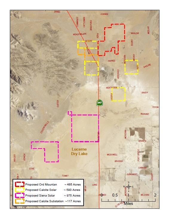
15 Analysis of Soil Map Units Ord Mountain Solar Energy and Substation Project 1.Map all soils within the USDA RCD Soil Survey Boundary. (Map to left) 2. Analyze the 77 Soil Map Units (Types) for Hazard of Blowing Soil (mostly dust) and Hazard of Water Erosion

16 3. Map all areas with the Hazard of Blowing Soil 4. Locate Ord Mountain Solar Site 5. Locate MDAQMD PM 10 dust monitoring Stations

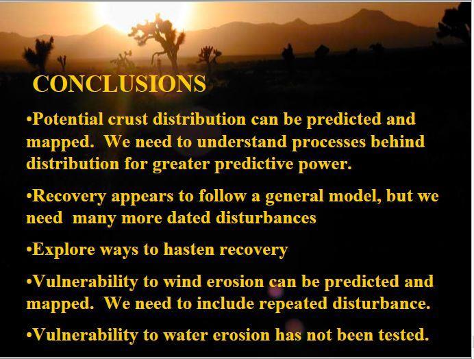
17 Ord Mountain Solar Energy and Substation Project Showing USDA RCD Soil Classifications Cross hatching indicates Hazard of Blowing Soils 131 Helendale loamy sand, 0-2% slope Available water capacity is low or moderate. Runoff is medium, and the hazard of soil blowing is high. Effective rooting depth is 60 inches or more. This unit is suited to irrigated crops The unit is limited by the hazard of soil blowing, high water intake rate, low or moderate available capacity, and low fertility. Analysis: USDA SCS Soil Survey of San Bernardino County California Mojave River Area Also on line at USDA Web Soil Survey

18

19 Color Code Pale red = DRECP DFA in the CSA 29 (County Service Area) Yellow = DRECP Undesignated Areas Light Orange = DRECP Future Assessment Areas Dark Red = Proposed Solar PV Projects 5,666 acres


20 What keeps the soil down on the ground? Ord Mtn. Solar Site Saltbush Scrub Plant Community It is Neither Rare Nor Endangered Function is its value Alkali Soils
21

22

23

24 % time per month that a Threshold Friction Velocity (TFV)* is exceeded SMSP = Soda Mountain Solar Project The proposed site is on the edge of a sand transport path. According to USGS Month SMSP site Month SMSP site January 30-40% July 60-70% February 40-50% August 50-60% March 60-70% September 50-60% April 60-70% October 40-50% Map 70-80% November 30-40% June 70-80% December 30-40% A soil survey would alert for fugitive dust in high winds during construction and the years of operation. A realistic amount of water use could also be calculated. The baseline monitoring for PM 10 was Victorville, approximately 90 miles to the west as the crow flies, but not as the wind blows..
25
26 Vulnerability to wind erosion can be predicted and mapped. We need to include repeated disturbances. We are operating in the unknown but with scientific data we have the potential to plan where we are going. Current Conditions data poor MDPA- Mojave Desert Planning Area -The MDPA is in nonattainment for PM10 and PM 2.5 -The MDPA lacks monitoring stations to collect ambient fugitive dust data east of Victorville. -The Mojave Desert Planning Area relies on Victorville for the required 2 years of baseline emissions data. - Solar projects are approved and built without adequate dust controls to our, and the environment s, detriment. Current Planning without data - The MDAQMD Federal PM 10 Attainment Plan and Rule Fugitive Dust Control are outdated. The categories and controls reflect construction conditions of the 1990s. - Soil units (types) and susceptibility to the hazard of blowing soil are not included in Planning Area calculations. Soils are generalized to reflect urban area conditions. - The baseline emissions for fugitive dust do not reflect current Planning Area conditions. - Project approved Control Plans, in coordination with S.B. County, lack monitoring protocols and enforcement.
27 Get Data The current level of individual project disturbance is without precedence. There is no historical data to guide monitoring and mitigation standards and practices. Update Rules and develop monitoring protocols. Require developers complete a soil survey and unit (type) analysis for County CUP and for AQMD approved Dust Control Plan. AQMD and County must acquire soils reference files/maps. Locate SLAM monitoring stations in communities with large-footprint energy installations (to be defined) to monitor for fugitive dust. This is important for understanding health effects and water use. All data is publically available. Require installation of meteorological and air monitoring stations on private lands and federal DFAs when Solar Energy project applications are accepted. This should be a condition of application. They must remain in place for the life of the project and beyond to assess conditions during construction, operation, decommissioning, and beyond.


28
29 UPDATE Federal Register February 2, 2018 Notice of Intent To Amend the California Desert Conservation Area, Bakersfield, and Bishop Resource Management Plans and Prepare Associated Environmental Impact Statements or Environmental Assessments Executive Order 13783, Promoting Energy Independence and Economic Growth, which directs all Federal agencies to review all actions that could potentially burden the development or use of domestically produced energy resources. In recognition of these goals and direction, BLM seeks comment on the potential impacts that land use designations contained in the amended RMPs will have on commercial-scale renewable energy projects, including wind, solar and geothermal. In particular, the BLM seeks comment on the Areas of Critical Environmental Concern that were designated, including where private lands lie within the external boundaries of such designations, as well as comments on increasing opportunities for increased renewable energy development, recreational and off-highway vehicle (OHV) access, mining access, and grazing.
30 The Voice of the Unions Will be Heard U.S. solar industry lost nearly 10,000 jobs in 2017 Reuters Nicola Green February 7, 2018 The U.S. solar industry lost nearly 10,000 jobs last year, led by steep losses in mature markets like California and Massachusetts where installation growth has slowed, according to a new report published on Wednesday.
31 HISTORY Renewable Energy and Conservation Element (RECE) Resolution No Adopted by the SB BOS on August 8, 2017 And amending the County General Plan with the addition of a REC Element The REC Element is amended to eliminate Section 4.10 and its subsections, and to remove reference to section 5.2, and elsewhere in the document, to the 10 MW or greater criteria for utility scale projects and refer those two issues back to the Planning Commission for further study. So, the County adopted RE Goal 4: The County will establish a new era of sustainable energy production and consumption in the context of sound resource conservation and renewable energy development practices that reduce greenhouse gases and dependency on fossil fuels. RE Objective 4.1: The County will continue its efforts to meet or exceed State Greenhouse Gas reduction goals, by encouraging renewable energy development that will be compatible with the natural environment and the integrity of unincorporated communities. (Red indicates addition to April 2017 draft)
32 But, the BOS also directed that the following Policy be sent back to the Planning Commission for further study. The BOS will adopt the Findings as recommended by the Planning Commission. RE Policy 4.10: Prohibit utility-oriented RE project development on sites that would create adverse impacts on the quality of life or economic development opportunities in existing unincorporated communities. RE : Prohibit development of utility-oriented RE projects in the Rural Living land use districts throughout the County. RE : Prohibit development of utility-oriented RE projects within the boundaries of existing community plans, which at the time of adoption of this Element are the Bloomington, Muscoy, Bear Valley, Crest Forest, Hilltop, Lake Arrowhead, Lytle Creek, Oak Glen, Homestead Valley, Joshua Tree, Lucerne Valley, Morongo Valley, Oak Hills and Phelan/Pinon Hills Community Plans. RE : Establish exclusion areas in the Development Code regulations for renewable energy development, beginning with the prohibitions in Policies and and provide for additional exclusion areas, such as new community plan areas, to be designated by amendment to the Development Code.
33 RE Policy 5.2: Large utility-scale RE generation projects 10 megawatts or more on private land in the unincorporated County will be limited to the site-types below, in addition to meeting criteria established herein and in the Development Code in the unincorporated County: i. Private lands adjacent to the federal Development Focus Areas supported by the Board of Supervisors that meet siting criteria and development standards ix. Sites within or adjacent to electric transmission and utility distribution corridors

34 NOW 6 months ago the BOS requested that Policy 4.10 be brought to the PC for further study. Still waiting. When LUS staff is asked directly when Policy 4.10 will appear on the PC agenda, the answer is routinely a couple of months. The last request of staff was at the MWA Board Meeting on February 1, While we have been waiting projects are appearing on the LUS Renewable Energy Projects list that we will have to research, comment on, and possibly live with Lucerne Valley has 3 projects with a substation = 2,817 acres straddling Hwy 247 plus projects on State Lands = 2,850. Total 5,666 acres of Proposed Solar Projects. Newberry Springs has 2 proposed projects = 5,533 acres. Meanwhile, on February 2, 2018 the Federal Register announces that the Federal Agencies will be review all actions that could potentially burden the development or use of domestically produced energy resources in the DRECP.
 access, mining access, and")
35 In particular, the BLM seeks comment on the Areas of Critical Environmental Concern that were designated, including where private lands lie within the external boundaries of such designations, as well as comments on increasing opportunities for increased renewable energy development, recreational and off-highway vehicle (OHV) access, mining access, and grazing.
36

37

38
39


40 Newberry Springs Proposed Solar Projects = 5,533 acres Cady Mtns. Sand Source Linear Dunes
41 ACTION TIME 1. Sign the petition The petition urges the S.B. Board of Supervisors to insist that Policy 4.10 and RE , , be sent to the Planning Commission as they stand for review and passage thus allowing the BOS to adopt the measure for the General Plan. This suite of policies is essential in prohibiting utility scale renewable energy projects under the County s jurisdiction that would create adverse impacts on our unincorporated communities quality of live, or economic development. The petition also requests that the BOS submit a comment during the DRECP scoping period that reflects the values of their constituents that the Department of Interior s 2016 DRECP LUPA Record of Decision should stand as is. 2. Attend a Scoping Meeting to have your position heard There is a 45 day scoping on the DRECP which ends on March 22, 2018 The public is encouraged to provide input on how land designations identified as part of the DERECP process might affect development of solar, wind or other renewable energy resources. The comments will be used to help set the parameters, or scope of the review of the land use plans.
P.O. Box 24, Joshua Tree CA July 24, 2017
 P.O. Box 24, Joshua Tree CA 92254 www.mbconseervation.org July 24, 2017 Ms. Linda Mawby County of San Bernardino Land Use Services Department, Planning Division 385 North Arrowhead Avenue, First Floor
AGRICULTURAL LAND AND PRODUCTION
 IV.12 AGRICULTURAL LAND AND PRODUCTION The analysis in this chapter addresses potential impacts to agricultural resources from adoption and implementation of the Desert Renewable Energy Conservation Plan
Executive Summary for the Record of Decision
 for the Record of Decision for the Record of Decision for the Land Use Plan Amendment to the California Desert Conservation Plan, Bishop Resource Management Plan, and Bakersfield Resource Management Plan
DRECP DESERT RENEWABLE ENERGY CONSERVATION PLAN
 DRECP DESERT RENEWABLE ENERGY CONSERVATION PLAN PROPOSED LAND USE PLAN AMENDMENT AND FINAL ENVIRONMENTAL IMPACT STATEMENT Executive Summary October 2015 2 DRECP PROPOSED LUPA AND FINAL EIS TABLE OF CONTENTS
RECORD OF DECISION INTRODUCTION
 United States Department of the Interior Bureau of Land Management California Desert District Office 22835 Calle San Juan De Los Lagos Moreno Valley, CA 92553 RECORD OF DECISION Supplemental Environmental
Section 3.9 Land Use and Planning ENVIRONMENTAL SETTING
 Section 3.9 Land Use and Planning This section evaluates the existing land use setting and potential land use and planning impacts that may result from construction and/or operation of the proposed project.
DRAFT October 26, 2011
 5. PLAN INTEGRATION This section summarizes previous presentations provided to stakeholders regarding the form of the Natural Community Conservation Plan/Habitat Conservation Plan (NCCP/HCP) and provides
(1) The proposed commercial solar energy generation facility is either
 The proposed commercial solar energy generation facility is either") (2) The design and siting of these facilities shall avoid the placement of turbines on or immediately adjacent to the upwind side of ridge crests; (3) The design may include other design features to minimize
(2) The design and siting of these facilities shall avoid the placement of turbines on or immediately adjacent to the upwind side of ridge crests; (3) The design may include other design features to minimize
Preliminary Conservation Strategy - Overview
 Preliminary Conservation Strategy - Overview Desert Renewable Energy Conservation Plan Stakeholder Meeting November 9, 2011 PCS Overview Document structure Brief review of content previously reviewed with
Parish s Alkali Grass (Puccinellia parishii)
") Parish s Alkali Grass (Puccinellia parishii) Legal Status [Species photo to come] Taxonomy State: S1 1 California Rare Plant Rank: 1B.1 2 Federal: Bureau of Land Management Sensitive Critical Habitat:
Parish s Alkali Grass (Puccinellia parishii) Legal Status [Species photo to come] Taxonomy State: S1 1 California Rare Plant Rank: 1B.1 2 Federal: Bureau of Land Management Sensitive Critical Habitat:
Typical Impacts Common to All Action Alternatives
 IV.17 WILD HORSES AND BURROS This chapter analyzes potential impacts on wild horse and burro herd areas and herd management areas (s) from implementing the Desert Renewable Energy Conservation Plan (DRECP)
MINERAL RESOURCES. Approach to Impact Analysis
 IV.15 MINERAL RESOURCES This chapter analyzes how implementation of the Desert Renewable Energy Conservation Plan (DRECP) Bureau of Land Management (BLM) Land Use Plan Amendment (LUPA) alternatives could
V. CONSULTATION, COORDINATION, AND PUBLIC PARTICIPATION
 V. CONSULTATION, COORDINATION, AND PUBLIC PARTICIPATION This section describes the actions taken by BLM to ensure full participation by the public, tribal governments, and other agencies in the development
MBCA address the Air Quality/Fugitive Dust, Valley Fever, Avian Mortality and the Lake Effect issues and Linkage designs.
 P.O. Box 24 Joshua Tree, CA 92252 www.mbconservation.org December 11, 2017 To: Bureau of Land Management Palm Springs South Coast Field Office 1201 Bird Center Drive Palm Springs, California 92262 Email
4.10 MINERAL RESOURCES
 4.10 MINERAL RESOURCES SCOPE AND METHODOLOGY This section examines the City s predominant mineral resource, aggregate, and the current mining operations in place to extract aggregate. Reclamation and reuse
VEGETATIVE, WATER, FISH AND WILDLIFE RESOURCES POLICIES
 VEGETATIVE, WATER, FISH AND WILDLIFE RESOURCES POLICIES The County will: GOALS AND OBJECTIVES 1.1 Conserve, Enhance, Protect, Maintain and Manage Vegetative, Water, Fish and Wildlife Resources Promote
San Gabriel Mountains National Monument Need to Change Analysis June 2015
 San Gabriel Mountains National Monument San Gabriel Mountains National Monument Need to Change Analysis June 2015 I. Background Throughout this document for consistency, the term Monument will be used
Chapter 6 Alternatives
 6 invisible_toc_marker 6.1 Introduction Chapter 6 Alternatives As described in Chapter 2 of this Supplemental EIR (SEIR), an EIR was previously certified for the Alta Oak Creek Mojave (AOCM) Project. Two
Subject: NPS Concerns with Concentrating Solar Power Projects on BLM Lands in Southern Nevada
 Jon Jarvis Sent by: Karen To: amy_leuders@blm.gov Washington cc: maryjo_rugwell@blm.gov, Cicely Muldoon/PINN/NPS@NPS, Mietek Kolipinski/OAKLAND/NPS@NPS, William K Dickinson/LAME/NPS@NPS, Sue Husari/OAKLAND/NPS@NPS,
4.7 Livestock Grazing
 This section of the Draft Plan Amendment, Draft Environmental Impact Statement/Environmental Impact Report (Draft EIS/EIR) addresses potential impacts of the Alta East Wind Project (AEWP) on livestock
4.2 Agriculture and Forestry Resources
 The purpose of this Section is to identify existing agriculture and forest resources within the Project area, analyze potential agriculture and forest resources associated with the development of the proposed
Riparian Vegetation Protections. Heritage Tree Protection
 PLACER Protections in place: Oak Tree Retention/ Replacement Requirements General Plan Language Specific Voluntary Rural Design require preservation of native trees and groves through replacement and dedication
U.S. Geological Survey minute series Lone Pine, CA topographic quadrangle. Denver, CO.
 3.6 LAND USE AND PLANNING As a result of the Initial Study, the Great Basin Unified Air Pollution Control District (District) determined that 2008 Owens Valley PM 10 Planning Area Demonstration of Attainment
April 2003 RTPA BACM Submittal
 OVERVIEW OF REGIONAL TRANSPORTATION PLANNING AGENCY PROCESS TO IDENTIFY AND IMPLEMENT BEST AVAILABLE CONTROL MEASURES IN SUPPORT OF THE PM-10 ATTAINMENT PLAN FOR THE SAN JOAQUIN VALLEY The San Joaquin
Bureau of Land Management. Public Scoping Meeting
 Bureau of Land Management Public Scoping Meeting April 2010 NOTICE OF INTENT Federal Register / Vol. 74, No. 102 / Friday, May 29, 2009 / Notices DEPARTMENT OF THE INTERIOR Bureau of Land Management [NM-114438;
Morongo Valley, Yucca Valley, Joshua Tree, Twentynine Palms, Homestead Valley, Pioneertown
 California Energy Commission DOCKETED 09-RENEW EO-1 TN # 68566 NOV. 19 2012 Morongo Valley, Yucca Valley, Joshua Tree, Twentynine Palms, Homestead Valley, Pioneertown November 14, 2012 TO: California Energy
AN ORDINANCE OF THE COUNTY OF SAN BERNARDINO, STATE OF CALIFORNIA, ADDING ARTICLE 5 TO CHAPTER 6 OF DIVISION
 ORDINANCE NO. AN ORDINANCE OF THE COUNTY OF SAN BERNARDINO, STATE OF CALIFORNIA, ADDING ARTICLE TO CHAPTER OF DIVISION OF TITLE OF THE SAN BERNARDINO COUNTY CODE RELATING TO GROUNDWATER MANAGEMENT IN THE
Decision Notice and Finding of No Significant Impact
 Decision Notice and Finding of No Significant Impact Gold Lake Bog Research Natural Area Boundary Adjustment and Nonsignificant Forest Plan Amendment #53 USDA Forest Service Middle Fork Ranger District,
FINDING OF NO SIGNIFICANT IMPACT OWL CREEK GRAVEL PIT EXPANSION U.S. FOREST SERVICE
 FINDING OF NO SIGNIFICANT IMPACT OWL CREEK GRAVEL PIT EXPANSION U.S. FOREST SERVICE OURAY RANGER DISTRICT OURAY COUNTY, COLORADO BACKGROUND The Owl Creek Gravel Pit, also known as the Spruce Ridge Pit,
Lake Creek Watershed Management Plan Public Meeting. Arrowhead Lake May 3, :00 PM
 Lake Creek Watershed Management Plan Public Meeting Arrowhead Lake May 3, 2018 6:00 PM Agenda I. Welcome and Introductions II. III. IV. Watershed Basics Overview of Lake Creek Watershed Elements of a Successful
Regarding: Joshua Tree Solar Farm Initial Study (Study) - Project No. P /CUP
 - Project No. P /CUP") March 14, 2016 P.O. Box 24 Joshua Tree, California 92254 www.mbconservation.org Mr. John Oquendo, Senior Planner County of San Bernardino Land Use Services Department, Planning Division 15900 Smoke Tree
March 14, 2016 P.O. Box 24 Joshua Tree, California 92254 www.mbconservation.org Mr. John Oquendo, Senior Planner County of San Bernardino Land Use Services Department, Planning Division 15900 Smoke Tree
Dear Interested Agencies, State and Local Governments, Tribes, and Public:
 United States Department of Agriculture Forest Service Cleveland National Forest SO 10845 Rancho Bernardo Rd. Suite 200 San Diego, CA 92127-2107 (858) 673-6180 (858) 673-6192 FAX (800) 735-2922 CRS File
Conservation and Renewable Energy Development in California. Jim Kenna, May 18, 2012 U.S. Bureau of Land Management
 Conservation and Renewable Energy Development in California Jim Kenna, May 18, 2012 U.S. Bureau of Land Management Touch on Three Subjects Policy Framework and Direction Implementation Action Overview
PROJECT HIGHLIGHTS,
 PROJECT HIGHLIGHTS, 2012-003 935 linear feet of fence encompassing livestock pond 1 water tank, 2 water troughs, 3800 linear feet pipeline Project: 2012-003 Watershed: Tomales Bay, East Shore Practices:
High Desert Corridor Draft EIS/EIR Public Hearings
 High Desert Corridor Draft EIS/EIR Public Hearings Agenda > Registration/Open House (6pm 6:30pm) > Draft EIS/EIR Presentation (6:30pm 7pm) > Public Comment (7pm 8:30pm) Purpose of Today s Hearing > Provide
SOURCE WATER ASSESSMENT SUMMARY BROCHURE
 SOURCE WATER ASSESSMENT SUMMARY BROCHURE STAYTON WATER SUPPLY PWS # 4100843 WHAT IS A SOURCE WATER ASSESSMENT? The Source Water Assessment was recently completed by the Department of Environmental Quality
Recommended Resources: The following resources may be useful in teaching this lesson:
 Unit E: Basic Principles of Soil Science Lesson 7: Understanding Soil Erosion and Management Practices Student Learning Objectives: Instruction in this lesson should result in students achieving the following
DECISION NOTICE FINDING OF NO SIGNIFICANT IMPACT (FONSI)
") DECISION NOTICE AND FINDING OF NO SIGNIFICANT IMPACT (FONSI) FOR CASA LOMA RECREATION RESIDENCE PERMIT RENEWAL U.S. FOREST SERVICE CIBOLA NATIONAL FOREST SANDIA RANGER DISTRICT BERNALILLO COUNTY, NEW MEXICO
DECISION NOTICE AND FINDING OF NO SIGNIFICANT IMPACT (FONSI) FOR CASA LOMA RECREATION RESIDENCE PERMIT RENEWAL U.S. FOREST SERVICE CIBOLA NATIONAL FOREST SANDIA RANGER DISTRICT BERNALILLO COUNTY, NEW MEXICO
FACT SHEET: BLM, USFS Greater Sage-Grouse Conservation Effort
 EMBARGOED UNTIL SEPTEMBER 22, 2015 @ 12:00PM ET FACT SHEET: BLM, USFS Greater Sage-Grouse Conservation Effort Overview Effective conservation of the greater sage-grouse and its habitat requires a collaborative,
Record of Decision Darroughs Hot Springs Geothermal Leasing Project
 Record of Decision Darroughs Hot Springs Geothermal Leasing Project Background USDA Forest Service Humboldt-Toiyabe National Forest Tonopah Ranger District Nye County, Nevada The production, transmission,
CHAPTER 3.0 INTRODUCTION TO THE ENVIRONMENTAL ANALYSIS AND ASSUMPTIONS USED
 CHAPTER 3.0 INTRODUCTION TO THE ENVIRONMENTAL ANALYSIS The following is an introduction to the environmental impacts analysis and general assumptions used in the project specific and cumulative analyses.
Desert Renewable Energy Conservation Plan Proposed Land Use Plan Amendment and Final Environmental Impact Statement
 Desert Renewable Energy Conservation Plan Proposed Land Use Plan Amendment and Final Environmental Impact Statement Volume I: Background and Planning Process Prepared by: U.S. Bureau of Land Management
Planning for Renewable Energy. Tammy Seale, Principal PMC November 19, 2014
 Planning for Renewable Energy Tammy Seale, Principal PMC November 19, 2014 Overview 1. Introduction 2. Regulatory Framework 3. Local RE Planning 4. Examples 5. Resources Introduction Planning for renewable
NOTICE OF PREPARATION OF AN ENVIRONMENTAL IMPACT REPORT
 Date: September 18, 2017 NOTICE OF PREPARATION OF AN ENVIRONMENTAL IMPACT REPORT To: Agencies and Interested Parties Lead Agency: Sacramento Municipal Utility District 6201 S Street, MS H201 Sacramento,
Adjudication Background and the Watermaster. ABC s of Water Jeffrey Ruesch November 15, 2016
 Adjudication Background and the Watermaster ABC s of Water Jeffrey Ruesch November 15, 2016 The MWA Mission N MWA Boundary Manage the region s water resources for the common benefit to assure stability
Regional Water Quality Control Board
 Regional Water Quality Control Board Region 7 Policy Priorities California Regional Water Quality Control Board - Colorado River Basin Jose L. Angel, Interim Executive Officer, P.E. CA Regional Water Boards
Dr. Dorothy Robyn Deputy Under Secretary of Defense (Installations and Environment) Before the Senate Committee on Energy and Natural Resources
 Before the Senate Committee on Energy and Natural Resources") HOLD UNTIL RELEASED BY THE COMMITTEE Statement of Dr. Dorothy Robyn Deputy Under Secretary of Defense (Installations and Environment) Before the Senate Committee on Energy and Natural Resources S. 2921,
HOLD UNTIL RELEASED BY THE COMMITTEE Statement of Dr. Dorothy Robyn Deputy Under Secretary of Defense (Installations and Environment) Before the Senate Committee on Energy and Natural Resources S. 2921,
Desert Cymopterus (Cymopterus deserticola)
") Desert Cymopterus (Cymopterus deserticola) Legal Status State: None California Rare Plant Rank: 1B.2 1 Federal: Bureau of Land Management Sensitive Critical Habitat: N/A Recovery Planning: N/A Photo courtesy
Desert Cymopterus (Cymopterus deserticola) Legal Status State: None California Rare Plant Rank: 1B.2 1 Federal: Bureau of Land Management Sensitive Critical Habitat: N/A Recovery Planning: N/A Photo courtesy
Draft Decision Memo OHV Trails 22 and 42 Reroute Project
 Draft Decision Memo OHV Trails 22 and 42 Reroute Project USDA Forest Service McKenzie River Ranger District Willamette National Forest Linn County, OR T13S, R7E, Sections 25 and 34 Willamette Meridian
SECTION 4.0 ALTERNATIVES
 SECTION 4.0 ALTERNATIVES 4.1 CEQA REQUIREMENTS The key requirements under the California Environmental Quality Act (CEQA) to identify and evaluate alternatives in an Environmental Impact Report (EIR) are
From: Chuck Bell, Pres. Lucerne Valley Economic Development Association P. O. Box 193 Lucerne Valley, CA 92356
 To: Board of Supervisors Linda.Mawby@LUS.sbcounty.gov From: Chuck Bell, Pres. Lucerne Valley Economic Development Association 760 964 3118 chuckb@sisp.net P. O. Box 193 Lucerne Valley, CA 92356 Date: 10/30/18
Water Planning and Economic Development
 Water Planning and Economic Development High Desert Water Summit Science: The Key to Managing Water in a Changing World Bob Page Principal Management Analyst April 8, 2015 Countywide Vision Page 2 We envision
APPENDIX I LESA MODELS
 APPENDIX I LESA MODELS LESA ASSESSMENT SEVILLE 4 SOLAR PROJECT HORIZONTAL SINGLE-AXIS TRACKING ARRAY (T16S, R12E, S25, SBB&M) IMPERIAL COUNTY, CALIFORNIA July 2017 EMA Report No. 2375-01 Prepared for:
NOTICE OF PREPARATION
 State of California The Natural Resources Agency DEPARTMENT OF PARKS AND RECREATION NOTICE OF PREPARATION Preparation of an Environmental Impact Report and Environmental Impact Statement for the Ocotillo
Section 7 Environmental Constraints
 Section 7 Environmental Constraints i Yakima Valley Metropolitan and Regional Transportation Plan Public Comment DRAFT 1/27/2016 Environmental Constraints Analysis A programmatic-level review of potential
Twomile Ecological Restoration Project Air Quality Report Anna Payne, Mi-Wok District Fuels Specialists August 2011
 Twomile Ecological Restoration Project Air Quality Report Anna Payne, Mi-Wok District Fuels Specialists August 2011 The National Environmental Policy Act (NEPA), the Federal Clean Air Act, and California
A G E N D A. REGULAR MEETING JUNE 13, :00 p.m.
 A G E N D A KERN COUNTY PLANNING COMMISSION Chambers of the Board of Supervisors Kern County Administrative Center 1115 Truxtun Avenue, Bakersfield, California REGULAR MEETING JUNE 13, 2013-7:00 p.m. All
Notice of Preparation for the Copeland Creek Stormwater Detention Basin (CIP Project )
") Copeland Creek Stormwater Detention Basin (CIP Project 2006-04) Date: December 20, 2017 To: Public Agencies and Interested Persons From: Mary Grace Pawson, Director of Development Services, City of Rohnert
Copeland Creek Stormwater Detention Basin (CIP Project 2006-04) Date: December 20, 2017 To: Public Agencies and Interested Persons From: Mary Grace Pawson, Director of Development Services, City of Rohnert
Appendix G Soils Characterization Report
 Appendix G Soils Characterization Report Draft Environmental Impact Report Beacon Photovoltaic Project July 2012 AECOM (805)388-3775 tel 1220 Avenida Acaso (805)388-3577 fax Camarillo, CA 93012 Memorandum
SUMMARY OF MAJOR POLICY IMPLEMENTATION TOPICS From 2016 COUNTY Comprehensive Plan
 SUMMARY OF MAJOR POLICY IMPLEMENTATION TOPICS From 2016 COUNTY Comprehensive Plan A checkmark means that implementing code amendments have been drafted or are in progress as of November 1, 2016. Evaluate
Urban Ecosystem Analysis Roanoke, Virginia
 June 2002 Urban Ecosystem Analysis Roanoke, Virginia Calculating the Value of Nature Report Contents 2-3 Project Overview 4 Major Findings 5 Roanoke Area Green Data Layer 6 Tree Canopy Loss Over Time 7
Galiuro Exploration Drilling Project
 Galiuro Exploration Drilling Project Range and Noxious Weeds Report Prepared by: Gwen Dominguez Range Staff for: Safford Ranger District Coronado National Forest Date September 2, 2016 Forest Plan/Policy
HAZARD DESCRIPTION... 1 LOCATION AND HISTORICAL...
 W I L D F I R E HAZARD DESCRIPTION... 1 LOCATION AND HISTORICAL... 1 SIGNIFICANT PAST EVENTS... 1 EXTENT... 2 PREVIOUS OCCURRENCES... 6 PROBABILITY OF FUTURE EVENTS... 7 VULNERABILITY AND IMPACT... 7 HAZARD
Unit E: Basic Principles of Soil Science. Lesson 7: Understanding Soil Erosion and Management Practices
 Unit E: Basic Principles of Soil Science Lesson 7: Understanding Soil Erosion and Management Practices 1 Important Terms Accelerated erosion Conservation tillage Cover crops Diversion ditches Geologic
Lake Fire Restoration and Hazardous Tree Removal. Project Proposed Action and Scoping Document
 United States Department of Agriculture Forest Service November 2016 Lake Fire Restoration and Hazardous Tree Removal Heather McRae Project Proposed Action and Scoping Document USDA Forest Service Shasta-Trinity
SOURCE WATER ASSESSMENT SUMMARY BROCHURE
 SOURCE WATER ASSESSMENT SUMMARY BROCHURE CITY OF ROGUE PWS # 4100712 WHAT IS A SOURCE WATER ASSESSMENT? The Source Water Assessment was recently completed by the Department of Environmental Quality (DEQ)
SOURCE WATER ASSESSMENT SUMMARY BROCHURE
 SOURCE WATER ASSESSMENT SUMMARY BROCHURE CITY OF OAKLAND PWS # 4100581 WHAT IS A SOURCE WATER ASSESSMENT? The Source Water Assessment was recently completed by the Department of Environmental Quality (DEQ)
4.11 NOISE ENVIRONMENTAL SETTING Characteristics of Noise
 4.11 NOISE This section of the Draft EIR presents an analysis of the proposed project s effect on the existing environment with respect to the generation of noise. Information presented in the setting
Community Wildfire Protection Plan Development Process for Santa Barbara County
 Community Wildfire Protection Plan Development Process for Santa Barbara County The purpose of a Community Wildfire Protection Plan (CWPP) is to identify and prioritize areas for hazardous fuel reduction
CCSD#1 Stormwater Standards
 SECTION 6 EROSION CONTROL STANDARDS 6.1 INTRODUCTION The policies of this section shall apply during construction and until permanent measures are in place following construction as described herein, unless
Overview of Local Facilities. Integrated Resource Planning Advisory Committee
 Overview of Local Facilities Integrated Resource Planning Advisory Committee City of Henderson Utility Services System Overview 2 CITY OF HENDERSON Department of Utility Services The Department of Utility
Lorelei H. Oviatt, Director, AICP Kern County Planning and Community Development Department
 Lorelei H. Oviatt, Director, AICP Kern County Planning and Community Development Department Sept. 16, 2013, Lost Hills Recreation Building, Lost Hills Park, Highway 46, Lost Hills, CA 1. To Introduce the
MINUTES OF MEETING EAST COUNTY BOARD OF ZONING ADJUSTMENTS JANUARY 13, 2011 (APPROVED FEBRUARY 22, 2011) FIELD TRIP: 9:00 a.m.
 FIELD TRIP: 9:00 a.m.") MINUTES OF MEETING JANUARY 13, 2011 (APPROVED FEBRUARY 22, 2011) The meeting was held at the hour of 1:30 p.m. in the City of Pleasanton Council Chambers, 200 Old Bernal Avenue, Pleasanton. FIELD TRIP:
MINUTES OF MEETING JANUARY 13, 2011 (APPROVED FEBRUARY 22, 2011) The meeting was held at the hour of 1:30 p.m. in the City of Pleasanton Council Chambers, 200 Old Bernal Avenue, Pleasanton. FIELD TRIP:
LONG TERM (OPERATION) IMPACTS AND POTENTIAL MITIGATION
 IMPACTS AND POTENTIAL MITIGATION") 4.5 Gases that trap heat in the atmosphere are referred to as greenhouse gases (GHGs) because, like a greenhouse, they capture heat radiated from the earth. The accumulation of GHGs is a driving force
4.5 Gases that trap heat in the atmosphere are referred to as greenhouse gases (GHGs) because, like a greenhouse, they capture heat radiated from the earth. The accumulation of GHGs is a driving force
PRINCE GEORGE NATURAL AREAS AND THE EFFECTS OF CLIMATE CHANGE: CASE STUDY
 PRINCE GEORGE NATURAL AREAS AND THE EFFECTS OF CLIMATE CHANGE: CASE STUDY Natural Areas in Prince George The City of Prince George is dominated by natural, undeveloped areas within city limits and in adjacent
Landscape-Level Mitigation
 Landscape-Level Mitigation From Greenprints to RAMP: A multiple benefit approach Liz O Donoghue, The Nature Conservancy July 15, 2014 The Problem Population increase Infrastructure development Increased
APPENDIX H ENVIRONMENTAL MITIGATION ACCESS2040 APPENDIX X ENVIRONMENTAL MITIGATION 1
 APPENDIX H ENVIRONMENTAL MITIGATION ACCESS2040 APPENDIX X ENVIRONMENTAL MITIGATION 1 Transportation in the Community Natural and Cultural Resources Federal Surface Transportation Legislation (currently
Mojave Scrub. Conservation Profile 3,120,000 ha ([,706,000 ac] 11% of state. Key Bird-Habitat Attributes. Hab-12-1
![Mojave Scrub. Conservation Profile 3,120,000 ha ([,706,000 ac] 11% of state. Key Bird-Habitat Attributes. Hab-12-1](/thumbs/95/124666979.jpg "Mojave Scrub. Conservation Profile 3,120,000 ha ([,706,000 ac] 11% of state. Key Bird-Habitat Attributes. Hab-12-1") habitat in Esmeralda County. Photo by Elisabeth Ammon. Key Bird-Habitat Attributes Stand Structure Ideal Scale for Conservation Action Distance to Riparian/Spring Habitats and Ephemeral Washes Presence
habitat in Esmeralda County. Photo by Elisabeth Ammon. Key Bird-Habitat Attributes Stand Structure Ideal Scale for Conservation Action Distance to Riparian/Spring Habitats and Ephemeral Washes Presence
California Wind Energy Association
 California Wind Energy Association March 22, 2018 Jerome E. Perez California State Director Bureau of Land Management 2800 Cottage Way, Room W-1623 Sacramento, CA 95825 Via email to BLM_CA_DRECP@blm.gov
Sections:
 DIVISION 15: NATURAL RESOURCES REGULATIONS CHAPTER 9-1500 NATURAL RESOURCES REGULATIONS: INTENT AND ORGANIZATION 9-1500.1 Title and Intent. 9-1500.2 Organization. 9-1500.1 TFlZE AND INTENT. Division 15
Section 4.13 Population and Housing Introduction
 Section 4.13 Population and Housing 4.13.1 Introduction This section addresses potential impacts of the Project on population, housing, and employment in the Project area; and provides an overview of current
BLM LANDS AND REALTY LAND USE AUTHORIZATIONS AND LAND TENURE
 III.13 BLM LANDS AND REALTY LAND USE AUTHORIZATIONS AND LAND TENURE A Bureau of Land Management (BLM) land use authorization permits an applicant to use a specific piece of public land for a certain project.
Clarks Fork of the Yellowstone Comprehensive River Management Plan
 Clarks Fork of the Yellowstone Comprehensive River Management Plan Background The Clarks Fork of the Yellowstone River is located on the Shoshone National Forest, approximately 30 miles north-northwest
ANCR INDIVIDUAL RESPONSES SUMMARY: 2/11/04 WATER RESOURCES GOALS AND OBJECTIVES
 ANCR INDIVIDUAL RESPONSES SUMMARY: 2/11/04 WATER RESOURCES GOALS AND OBJECTIVES Goal 1: Protect the health and safety of the Dane County population. a. Prevent development that may have an adverse effect
Description of Proposed Project
 Description of Proposed Project Introduction The County of Inyo (County) is proposing to update its General Plan to include policies for solar energy development within the County. The proposed Renewable
Draft Environmental Impact Report
 Revised Draft Environmental Impact Report San Francisquito Creek Flood Protection, Ecosystem Restoration, and Recreation Project Upstream of Highway 101 This notice announces that a Draft Environmental
4.2.3 Regulatory Setting
 4.2.3 Regulatory Setting Federal State Farmland Protection Policy Act (7 U.S.C. Section 4201) The purpose of the Farmland Protection Policy Act (FPPA) is to minimize the extent to which federal programs
Bureau of Land Management. Public Scoping Meeting
 Bureau of Land Management Public Scoping Meeting June/July 2009 FINAL 6/22/09 1 NOTICE OF INTENT Federal Register / Vol. 74, No. 102 / Friday, May 29, 2009 / Notices DEPARTMENT OF THE INTERIOR Bureau of
Reading Project Noxious Weed Risk Assessment Hat Creek Ranger District Lassen National Forest April 3, 2013
 Reading Project Noxious Weed Risk Assessment Hat Creek Ranger District Lassen National Forest April 3, 2013 Prepared By: /s/ Tim Kellison Date: 05-31-2013 Tim Kellison Assistant Forest Botanist Reviewed
CITY OF HOYT LAKES, MINNESOTA SOURCE WATER ASSESSMENT
 CITY OF HOYT LAKES, MINNESOTA SOURCE WATER ASSESSMENT November 2002 Public Water Supplier ID 1690028 Facility Contact: Minnesota Department of Health Contact: Mr. Floyd Nelson, Supervisor Ms. Beth Kluthe
Treatment/Project Area: Blanco Basin
 Treatment/Project Area: Blanco Basin rev. 4/15/11 Geographic Area - Bounded on north by watershed divide between Rito Blanco and Rio Blanco (Blue Mtn and Winter Hills make up western half of divide), the
Chapter 9.37 Soil Erosion and Dust Control
 Chapter 9.37 Soil Erosion and Dust Control Sections: 9.37.010- Purpose 9.37.020- Applicability 9.37.030- Exempt Activities 9.37.040 Soil Erosion, Sediment and Dust Control Plans 9.37.050- Wind-Borne Soil
Regulation II Rule 201 Prohibitions, General Requirements and Burn Day Determinations
 Regulation II Rule 201 Prohibitions, General Requirements and Burn Day Determinations This Rule replaced Rule 201 General Prohibitions and Exemptions for Selected Open Burning. The current version was
4.11 AGRICULTURAL RESOURCES INTRODUCTION ENVIRONMENTAL SETTING. Regional. Project Site Setting
 4.11 AGRICULTURAL RESOURCES 4.11.1 INTRODUCTION This section addresses the potential for the Proposed Project to impact the agricultural resources in and around the Proposed Project location. Following
APPENDIX E. LESA Models
 APPENDIX E LESA Models LESA ASSESSMENT CALEXICO SOLAR FARM I PHASE A PROJECT AREA CALEXICO SOLAR FARM I PHASE A PROJECT (SW/4 Section 13, S/2 Section 14, S/2 NE/4 Section 15, NW/4 Section 15, T17S, R13E,
Public Rock Collection
 Public Rock Collection Eagle-Holy Cross Ranger District, White River national Forest Eagle County, Colorado T7S, R80W, Section 18 & T6S, R84W, Section 16 Comments Welcome The Eagle-Holy Cross Ranger District
Notice of Availability of the Bog Creek Road Project Draft Environmental Impact
 This document is scheduled to be published in the Federal Register on 06/01/2018 and available online at https://federalregister.gov/d/2018-11766, and on FDsys.gov 9111-14 DEPARTMENT OF HOMELAND SECURITY
MANZANITA LAKE PLANNING UNIT Willow Creek Watershed
 Existing Conditions & Uses Overview Area surrounding a small afterbay and creeks with ethnobotanical resources and valuable habitat 472 acres in Madera County; 337 acres outside the FERC boundary and 135
3-13 Other Required Findings and Regulatory Compliance
 Affected Environment and Environmental Consequences 3-13 Other Required Findings and Regulatory Compliance 3-13.1 Short-term Uses and Long-term Productivity NEPA requires consideration of the relationship
Ponds. Pond A water impoundment made by excavating a pit, or constructing a dam or an embankment.
 POND SITE SELECTION AND CONSTRUCTION Uses, Planning, & Design David Krietemeyer Area Engineer USDA-NRCS June 20, 2008 Uses Considerations for Location of Commonly Used Terms Pond A water impoundment made