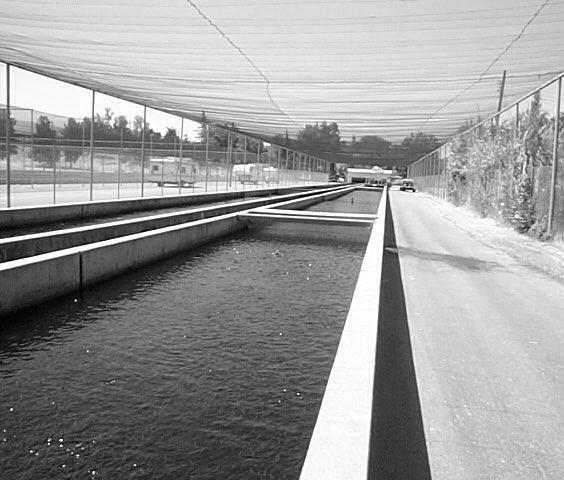
Ponds. Pond A water impoundment made by excavating a pit, or constructing a dam or an embankment.
|
|
|
- Josephine Craig
- 6 years ago
- Views:
Transcription


1 POND SITE SELECTION AND CONSTRUCTION Uses, Planning, & Design David Krietemeyer Area Engineer USDA-NRCS June 20, 2008 Uses Considerations for Location of Commonly Used Terms Pond A water impoundment made by excavating a pit, or constructing a dam or an embankment. Two Types of : Excavated Embankment Livestock Water Supply Irrigation Fish Production Landscape Appearance Uses Fire Protection Recreation Waterfowl and Other Wildlife Sediment Capture Livestock Water Supply Irrigation 1
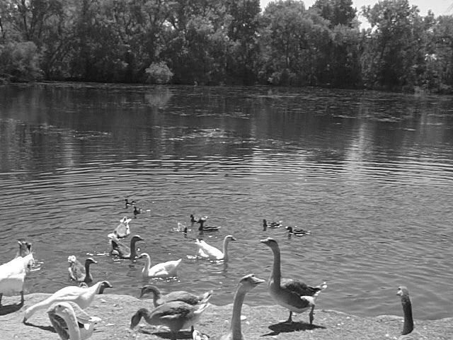

2 Fish Production Landscape Appearance Fire Protection Waterfowl and Other Wildlife Recreation Sediment Capture 2


3 Considerations for Location of Considerations for Location of Economics Uses Largest water storage volume that can be obtained with least amount of earthfill. Are the locations suitable for the intended use? Watershed Runoff Is the drainage area adequate to maintain the water level of the pond, yet not so large as to cause excessive overflow? Watershed Boundary Considerations for Location of Topography Soils Look for the largest volume of water stored per cubic yard of soil moved. Proximity to source material needed to construct the dam. Considerations for Location of Geology Depth to impervious layer. Ability of foundation to withstand load of the fill in the dam. Potential for seepage through foundation and abutments. Considerations for Location of Estimated Minimum Pond Depth: *Requirements vary by state Northern California Northern Coast Sierra Mountains Central Valley Central & Southern Coast Desert


4 Considerations for Location of Considerations for Location of Water Rights Are water rights available? Is the water in the watershed fully allocated? Emergency and recreational vehicle access. If pond were to over-flow, consideration must be made to the surrounding area and downstream areas. Information on water rights can be found at: Dam failure hazard. Commonly Used Terms Rock Riprap Face of Dam and Emergency Spillway Principle Spillway: A pipe or vegetated outlet channel to carry daily flows safely past earth embankments. May also serve as an emergency spillway where space is limited. Emergency Spillway: A rock, concrete, or vegetated outlet channel to carry flood flows safely past earth embankments. Commonly Used Terms Trickle tube: A small pipe to allow water to pass through the dam, and protect the vegetation in the earth spillway against saturation. Drainpipe: Allows drainage of pond without having to remove fill, use a siphon, pump or other devices. Water-Supply Pipe: Used to fill orchard sprayers, stockwater troughs and to pump water for irrigation. Usually in addition to the trickle tube. Drainpipe Headworks 4


5 Average Annual Rainfall For Design Storm Rainfall amounts and expected frequency Hydrologic groupings of soils Runoff curve numbers Peak discharge rate Estimate volume of storm runoff Topography Acquire enough survey data to plan the dam, spillway, and other features. Watershed Area From USGS Quad Sheet. Watershed Slope From USGS Quad Sheet. Stability of Dam Downstream channel stability Stability of side slopes of the dam Stability of spillway(s) Proximity to active faults Composition of Dam Optimum soil for dam should be a mixture of coarse and fine textured soils Volume of soil available Recommended 3:1 Slope on Upstream Side of Dam Recommended 2:1 Slope on Downstream Side of Dam Slope should be flat enough to be stable, yet steep enough to minimize amount of fill required. Slope will attenuate erosion by wave action from the pond. The combined upstream and downstream side slopes of embankments shall not be less than 5 horizontal to 1 vertical. All slopes must be designed to be stable, even if flatter side slopes are required. Type of Soil in Pond Area Soil should have a high enough clay content to prevent seepage. Hazard Class of the Dam Used to quantify hazard potential in the event of failure. Depth Required For Intended Uses 5


6 Emergency Spillway Location Topography Soil Discharge Flow Rate Velocity Stable outlet Minimum Spillway Capacity Table-4 from Page 7 of NRCS Conservation Practice #378: Drainage Minimum Area Effective Height of Dam Storage Frequency Duration ac ft ac-ft yr hr 20 or less 20 or less < or less >20 < >20 20 or less < All others Criteria for State Size Dam Over 25 feet high and 15 or more acre feet of storage. Over 6 feet high and 50 or more acre feet of storage. Other Considerations County Ordinances Local Ordinances Permits County Grading Permit Fish and Game Permit Regional Water Quality Control Board Clean Water Act Water Rights Army Corps of Engineers Clean Water Act Permits References Pond Conservation Practice Standard #378 Section IV of USDA-NRCS Field Office Technical Guide Available at: Questions - Planning, Design, Construction Agricultural Handbook #590 of USDA-NRCS Available at: quality/common/ponds.pdf 6

7 POND MANAGEMENT Maintenance, Repairing & Renovating David Krietemeyer Area Engineer USDA-NRCS Maintenance, Repairing & Renovating Maintenance of Maintenance of Dams References Examples Questions June 20, 2008 Maintaining the Pond Importance of Maintaining Vegetation Erosion control Climate control Wildlife habitat Maintaining the Pond Protecting Emergency Spillway Against Erosion Apply seed or sod and fertilization for proper vegetation. Use mulch on slopes that are difficult to vegetate. Irrigate to insure proper germination and growth. Maintaining the Dam Pipes Through the Dam Trickle tube Drainpipe Water-Supply Pipes Maintaining the Dam Trees Keep trees off and away from dam to prevent seepage through roots. Rodents Rodents that burrow through the dam will create holes that allow seepage. 7


8 Example of Trees on Dam Example of Trees on Dam Example of Dam Breach Wet Area on Face of Dam Example of Rock Riprap Movement in Spillway Example of Headcutting of Emergency Spillway 8
9 Example of Poor Riprap Rodent Damage Depends on Extent of Damage Minor: Fill with Bentonite,, Fresh Concrete, or other similar material. Major: Excavate area to at least 3 3 below damaged area at 1:1 or flatter slope and compact soil back into place. Questions? 9
Ponds: planning, design, and construction
 Ponds: planning, design, and construction Ponds for many purposes: Fish Production Recreation Water Supply Esthetics Wildlife Habitat Natural ponds: Formed in natural depressions in the landscape Not man-made
Suggested Stormwater Management Practices For Individual House Lots
 Suggested Stormwater Management Practices For Individual House Lots These practices are necessary to satisfy the water quantity and water quality criteria of the Rappahannock Stormwater Ordinance. These
TEMPORARY STREAM DIVERSION
 ILLINOIS URBAN MANUAL PRACTICE STANDARD TEMPORARY STREAM DIVERSION (ft,) CODE 976 (Source: Aukland Regional Council Stream Facts) DEFINITION A temporary channel or pipe used to convey stream flow around
GRASS-LINED CHANNEL (acre) CODE 840
 CODE 840") NATURAL RESOURCES CONSERVATION SERVICE ILLINOIS URBAN MANUAL PRACTICE STANDARD GRASS-LINED CHANNEL (acre) CODE 840 (Source: NC Erosion and Sediment Control Field Manual) DEFINITION A natural or constructed
NATURAL RESOURCES CONSERVATION SERVICE ILLINOIS URBAN MANUAL PRACTICE STANDARD GRASS-LINED CHANNEL (acre) CODE 840 (Source: NC Erosion and Sediment Control Field Manual) DEFINITION A natural or constructed
Design of Stormwater Wetlands
 Hydraulic & Hydrologic Stormwater Engineering Design of Stormwater Wetlands Jon Hathaway, EI Extension Associate NCSU Bio. And Ag. Engineering 6 Step Process 1. Watershed Analysis (Runoff Volume and Peak
378 - POND NATURAL RESOURCES CONSERVATION SERVICE CONSERVATION PRACTICE SPECIFICATION I. SCOPE
 378-1 NATURAL RESOURCES CONSERVATION SERVICE CONSERVATION PRACTICE SPECIFICATION 378 - POND I. SCOPE The work shall consist of constructing an earthfill embankment and appurtenances to the lines, grades,
BLOCKING AND FILLING SURFACE DRAINAGE DITCHES
 MINNESOTA WETLAND RESTORATION GUIDE BLOCKING AND FILLING SURFACE DRAINAGE DITCHES TECHNICAL GUIDANCE DOCUMENT Document No.: WRG 4A-1 Publication Date: 10/14/2015 Table of Contents Introduction Application
POND CONSTRUCTION. Woodland Steward Series
 POND CONSTRUCTION Woodland Steward Series BOB TWOMEY DISTRICT CONSERVATIONIST USDA NATURAL RESOURCES CONSERVATION SERVICE COURSE OUTLINE DEFINITION OF A POND OR LAKE TYPES OF PONDS GEOLOGIC CONSIDERATIONS
SC-01 Surface Outlet and Baffle Sediment Basin
 Greenville County Technical Specification for: SC-01 Surface Outlet and Baffle Sediment Basin 1.0 Surface Outlet and Baffle Sediment Basin This Specification contains requirements for the design and construction
2-16 EROSION, SEDIMENT & STORM WATER CONTROL REGULATIONS APPENDIX B1
 2-16 EROSION, SEDIMENT & STORM WATER CONTROL REGULATIONS APPENDIX B1 There are three ways to accomplish urban soil erosion and sedimentation control: Allow erosion to take place and then control sediment
Typical Local Erosion Control Requirements (Storm Water Management Authority, Inc.)
") Module 2: Selection of Controls and Site Planning for Construction Site Erosion Prevention Robert Pitt Department of Civil, Construction, and Environmental Engineering University of Alabama Tuscaloosa,
Module 2: Selection of Controls and Site Planning for Construction Site Erosion Prevention Robert Pitt Department of Civil, Construction, and Environmental Engineering University of Alabama Tuscaloosa,
Lyon Creek Cedar Way Stormwater Detention Dam Operation and Maintenance Manual
 Lyon Creek Cedar Way Stormwater Detention Dam Operation and Maintenance Manual Prepared by: Mike Shaw Stormwater Program Manager City of Mountlake Terrace January 2010 Section I General Information This
Standards for Soil Erosion and Sediment Control in New Jersey May 2012 STANDARD FOR SLOPE PROTECTION STRUCTURES. Definition
 STANDARD FOR SLOPE PROTECTION STRUCTURES Definition Structures to safely conduct surface runoff from the top of a slope to the bottom of the slope. Purpose The purpose of this practice is to convey storm
Information for File # PRH
 Information for File # 2016-02602-PRH Applicant Corps Contact Tom Morley Paul Hauser Address 152 Baker Drive, Redwood Falls, MN 56283 E-Mail Paul.R.Hauser@usace.army.mil Phone 651-290-5357 Primary County
DESIGN GRADING AND EROSION CONTROL A. Slope Criteria
 Section 5. DESIGN GRADING AND EROSION CONTROL A. Slope Criteria Earthen slopes shall conform to the following: Maximum slope should not be steeper than 6:1 (horizontal to vertical) unless protected from
INFLOW DESIGN FLOOD CONTROL SYSTEM PLAN PLANT BARRY ASH POND ALABAMA POWER COMPANY
 INFLOW DESIGN FLOOD CONTROL SYSTEM PLAN PLANT BARRY ASH POND ALABAMA POWER COMPANY Section 257.82 of EPA s regulations requires the owner or operator of an existing or new CCR surface impoundment or any
4. Present Activities and Roles
 4. Present Activities and Roles The present missions, authorities, activities and roles of the various agencies involved with flood protection, floodplain management and flood-damage reduction are identified
Standards for Soil Erosion and Sediment Control in New Jersey May 2012 STANDARD FOR GRASSED WATERWAYS. Definition. Purpose
 STANDARD FOR GRASSED WATERWAYS Definition A natural or constructed watercourse shaped or graded in earth materials and stabilized with suitable vegetation for the safe conveyance of runoff water. Purpose
Supplemental Watershed Plan Agreement No. 10 for Neshaminy Creek Watershed Core Creek Dam (PA-620) Bucks County, Pennsylvania
 Bucks County, Pennsylvania") Supplemental Watershed Plan Agreement No. 10 for Neshaminy Creek Watershed Core Creek Dam (PA-620) Bucks County, Pennsylvania Project Authorization USDA's Small Watershed Program is carried out under the
Supplemental Watershed Plan Agreement No. 10 for Neshaminy Creek Watershed Core Creek Dam (PA-620) Bucks County, Pennsylvania Project Authorization USDA's Small Watershed Program is carried out under the
WASTE TREATMENT LAGOON
 359-1 NATURAL RESOURCES CONSERVATION SERVICE CONSERVATION PRACTICE STANDARD WASTE TREATMENT LAGOON (No.) CODE 359 DEFINITION A waste treatment impoundment made by constructing an embankment and/or excavating
INFLOW DESIGN FLOOD CONTROL SYSTEM PLAN PLANT GREENE COUNTY ASH POND ALABMA POWER COMPANY
 INFLOW DESIGN FLOOD CONTROL SYSTEM PLAN PLANT GREENE COUNTY ASH POND ALABMA POWER COMPANY Section 257.82 of EPA s regulations requires the owner or operator of an existing or new CCR surface impoundment
A Tale of Two Dams and a dry river. November 1, 2011 Planning, Resources and Technology Committee Mojave Water Agency
 A Tale of Two Dams and a dry river November 1, 2011 Planning, Resources and Technology Committee Mojave Water Agency The Mojave River Headwaters San Bernardino Mountains Terminus (mouth) Soda Lake (Baker,
Earth Dikes and Drainage Swales
 Categories EC Erosion Control SE Sediment Control TC Tracking Control WE Wind Erosion Control Non-Stormwater NS Management Control Waste Management and WM Materials Pollution Control Legend: Primary Objective
4. Ponds and infiltration BMPs can achieve 60 to 100% removal efficiencies for sediment.
 Landscape BMPs For the purposes of this project, preventive measures have been categorized into two categories: landscape BMPs and source prevention BMPs. Landscape BMPs includes both vegetative practices
INITIAL RUN-ON AND RUN-OFF CONTROL PLAN 40 C.F.R. PART 257
 INITIAL RUN-ON AND RUN-OFF CONTROL PLAN 40 C.F.R. PART 257.81 HUFFAKER ROAD (PLANT HAMMOND) PRIVATE INDUSTRIAL LANDFILL (HUFFAKER ROAD LANDFILL) GEORGIA POWER COMPANY EPA s Disposal of Coal Combustion
Project Information. Pursuant to Section 404 of the Clean Water Act (33 U.S. Code 1344), notice is hereby given that
, notice is hereby given that") US ARMY Corps Of Engineers Little Rock District JOINT PUBLIC NOTICE CORPS OF ENGINEERS STATE OF MISSOURI Application Number: SWL 2013-00260 Date: April 15, 2014 Comments Due: May 6, 2014 TO WHOM IT MAY
US ARMY Corps Of Engineers Little Rock District JOINT PUBLIC NOTICE CORPS OF ENGINEERS STATE OF MISSOURI Application Number: SWL 2013-00260 Date: April 15, 2014 Comments Due: May 6, 2014 TO WHOM IT MAY
INFLOW DESIGN FLOOD CONTROL SYSTEM PLAN 40 C.F.R. PART PLANT YATES ASH POND 3 (AP-3) GEORGIA POWER COMPANY
 GEORGIA POWER COMPANY") INFLOW DESIGN FLOOD CONTROL SYSTEM PLAN 40 C.F.R. PART 257.82 PLANT YATES ASH POND 3 (AP-3) GEORGIA POWER COMPANY EPA s Disposal of Coal Combustion Residuals from Electric Utilities Final Rule (40 C.F.R.
INFLOW DESIGN FLOOD CONTROL SYSTEM PLAN 40 C.F.R. PART 257.82 PLANT YATES ASH POND 3 (AP-3) GEORGIA POWER COMPANY EPA s Disposal of Coal Combustion Residuals from Electric Utilities Final Rule (40 C.F.R.
Diversion Dikes. Fe=0.95
 2.2 Diversion Dike Erosion Control Description: A diversion dike is a compacted soil mound, which redirects runoff to a desired location. The dike is typically stabilized with natural grass for low velocities
McElroy s Run Impoundment Structural Stability Assessment Report
 Allegheny Energy Supply Company, LLC A FirstEnergy Company Pleasants Power Station Pleasants County, West Virginia October 2016 Prepared for: Allegheny Energy Supply Company, LLC A FirstEnergy Company
Ponds Planning, Design, Construction
 United States Department of Agriculture Natural Resources Conservation Service Ponds Planning, Design, Construction Agriculture Handbook Number 590 Estimating storm runoff The amount of precipitation,
INFLOW DESIGN FLOOD CONTROL SYSTEM PLAN 40 C.F.R. Part PLANT MCINTOSH ASH POND 1 GEORGIA POWER COMPANY
 INFLOW DESIGN FLOOD CONTROL SYSTEM PLAN 40 C.F.R. Part 257.82 PLANT MCINTOSH ASH POND 1 GEORGIA POWER COMPANY EPA s Disposal of Coal Combustion Residuals from Electric Utilities Final Rule (40 C.F.R. Part
INFLOW DESIGN FLOOD CONTROL SYSTEM PLAN PLANT GASTON GYPSUM POND ALABAMA POWER COMPANY
 INFLOW DESIGN FLOOD CONTROL SYSTEM PLAN PLANT GASTON GYPSUM POND ALABAMA POWER COMPANY Section 257.82 of EPA s regulations requires the owner or operator of an existing or new CCR surface impoundment or
NEW CASTLE CONSERVATION DISTRICT. through. (Name of Municipality) PLAN REVIEW APPLICATION DRAINAGE, STORMWATER MANAGEMENT, EROSION & SEDIMENT CONTROL
 PLAN REVIEW APPLICATION DRAINAGE, STORMWATER MANAGEMENT, EROSION & SEDIMENT CONTROL") NEW CASTLE CONSERVATION DISTRICT through (Name of Municipality) PLAN REVIEW APPLICATION DRAINAGE, STORMWATER MANAGEMENT, EROSION & SEDIMENT CONTROL Office use only: Received by Municipality: Received by
NEW CASTLE CONSERVATION DISTRICT through (Name of Municipality) PLAN REVIEW APPLICATION DRAINAGE, STORMWATER MANAGEMENT, EROSION & SEDIMENT CONTROL Office use only: Received by Municipality: Received by
NATURAL RESOURCES CONSERVATION SERVICE CONSERVATION PRACTICE STANDARD. POND (No.) CODE 378
 CODE 378") NATURAL RESOURCES CONSERVATION SERVICE CONSERVATION PRACTICE STANDARD POND (No.) CODE 378 DEFINITION A water impoundment made by constructing a dam or an embankment or by excavating a pit or dugout. In
NATURAL RESOURCES CONSERVATION SERVICE CONSERVATION PRACTICE STANDARD POND (No.) CODE 378 DEFINITION A water impoundment made by constructing a dam or an embankment or by excavating a pit or dugout. In
INFLOW DESIGN FLOOD CONTROL SYSTEM PLAN 40 C.F.R. PART PLANT YATES ASH POND B (AP-B ) GEORGIA POWER COMPANY
 GEORGIA POWER COMPANY") INFLOW DESIGN FLOOD CONTROL SYSTEM PLAN 40 C.F.R. PART 257.82 PLANT YATES ASH POND B (AP-B ) GEORGIA POWER COMPANY EPA s Disposal of Coal Combustion Residuals from Electric Utilities Final Rule (40 C.F.R.
INFLOW DESIGN FLOOD CONTROL SYSTEM PLAN 40 C.F.R. PART 257.82 PLANT YATES ASH POND B (AP-B ) GEORGIA POWER COMPANY EPA s Disposal of Coal Combustion Residuals from Electric Utilities Final Rule (40 C.F.R.
4.12. Detention Basins
 4.12. Detention Basins Detention Basins can be a cost effective method to provide temporary storage, conveyance, and treatment of runoff when used within the context of Low Impact Development (LID) strategies.
CONSTRUCTION PLAN CHECKLIST
 CONSTRUCTION PLAN CHECKLIST The design engineer is responsible for ensuring that plans submitted for city review are in accordance with this checklist. It is requested that the executed checklist be submitted
Maine s Land Use Regulations and Erosion Control Techniques
 Maine s Land Use Regulations and Erosion Control Techniques Protecting Maine s Air, Land and Water Colin Clark 441-7419 colin.a.clark@maine.gov Tom Gilbert 441-8031 thomas.gilbert@maine.gov Jim Rodrigue
Highway Drainage 1- Storm Frequency and Runoff 1.1- Runoff Determination
 Highway Drainage Proper drainage is a very important consideration in design of a highway. Inadequate drainage facilities can lead to premature deterioration of the highway and the development of adverse
4. PURPOSE AND NEED FOR ACTION
 4. PURPOSE AND NEED FOR ACTION The project will provide improved access to the existing 9 foot diameter pressure conduit for the USAFA for maintaining sediment and debris loading at the outlet works of
Sediment Basin. Fe= (Depends on soil type)
") 3.9 Sediment Control Description: A sediment basin is an embankment with a controlled outlet that detains stormwater runoff, resulting in the settling of suspended sediment. The basin provides treatment
3.9 Sediment Control Description: A sediment basin is an embankment with a controlled outlet that detains stormwater runoff, resulting in the settling of suspended sediment. The basin provides treatment
Manual for Erosion and Sediment Control Updates
 Manual for Erosion and Sediment Control Updates Chapter 1 - The Erosion and Sedimentation Act of 1975 Minor revisions were made to content Existing pictures were replaced with new ones Chapter 2 Sediment
4.4.6 Underground Detention
 4.4.6 Underground Detention Limited Application Water Quality BMP Description: Detention storage located in underground pipe systems or vaults designed to provide water quantity control through detention
APPENDIX A EARTHEN EMBANKMENT. VERSION 1.0 March 1, 2011
 APPENDIX A EARTHEN EMBANKMENT VERSION 1.0 March 1, 2011 SECTION A-1: DESCRIPTION OF PRACTICE An earthen embankment is a raised impounding structure made from compacted soil. The embankment is the feature
RETENTION BASIN EXAMPLE
 -7 Given: Total Tributary Area = 7.5 ac o Tributary Area within Existing R/W = 5.8 ac o Tributary Area, Impervious, Outside of R/W = 0.0 ac o Tributary Area, Pervious, Outside of R/W = 1.7 ac o Tributary
1.2 REGULATORY REQUIREMENTS
 Table 1.1. Soil textural classes and general terminology used in soil descriptions (Source: US Environmental Protection Agency 1977). Name Texture Basic soil textural common class names Sandy soils Coarse
Larimer County Land Use Code Section 5.8: Rural Land Use Process
 Larimer County Land Use Code Section 5.8: Rural Land Use Process 5.8.6 PRINCIPLES D. Development Standards 3. Engineering Standards and Guidelines for Roads and Drainage The following Standards and Guidelines
CCR Rule Operating Criteria Closure Plan
 CCR Rule Operating Criteria 257.102 Closure Plan FGD Pond 2 Jim Bridger Plant Point of Rocks, Wyoming PREPARED FOR PacifiCorp 1407 West North Temple Salt Lake City, UT 84116 (801) 521-0376 Fax (801) 220-4748
Stormwater Erosion Control & Post-Construction Plans (Stormwater Quality Plans)
") Stormwater Erosion Control & Post-Construction Plans (Stormwater Quality Plans) Allen County Stormwater Plan Submittal Checklist The following items must be provided when applying for an Allen County Stormwater
Stormwater Erosion Control & Post-Construction Plans (Stormwater Quality Plans) Allen County Stormwater Plan Submittal Checklist The following items must be provided when applying for an Allen County Stormwater
POST CLOSURE PLAN. CFR (d) GERS East and West Bottom Ash Ponds. Pirkey Power Plant Hallsville, Texas. October, 2016
 GERS East and West Bottom Ash Ponds. Pirkey Power Plant Hallsville, Texas. October, 2016") POST CLOSURE PLAN CFR 257.104(d) East and West Bottom Ash Ponds Pirkey Power Plant Hallsville, Texas October, 2016 Prepared for: Southwest Electric Power Company Pirkey Power Plant Hallsville, Texas Prepared
POST CLOSURE PLAN CFR 257.104(d) East and West Bottom Ash Ponds Pirkey Power Plant Hallsville, Texas October, 2016 Prepared for: Southwest Electric Power Company Pirkey Power Plant Hallsville, Texas Prepared
Index. outlet protection Rev. 12/93
 6 Index outlet protection level spreader outlet stabilization structure 6.40.1 6.41.1 Rev. 12/93 Practice Standards and Specifications 6.40 level spreader Definition Purpose Conditions Where Practice Applies
Volume 2, Chapter 10 - Storage
 Volume 2, Chapter 10 - Storage Users Guidance: If a UDFCD Section number in this chapter is skipped: It was adopted as is; please refer to that Section in the corresponding UDFCD Manual, Volume, Chapter
NATURAL RESOURCES CONSERVATION SERVICE CONSERVATION PRACTICE STANDARD POND CODE 378 (NO.)
") CPS 378-1 NATURAL RESOURCES CONSERVATION SERVICE CONSERVATION PRACTICE STANDARD POND CODE 378 (NO.) DEFINITION A pond is a water impoundment made by constructing an embankment, by excavating a dugout,
CPS 378-1 NATURAL RESOURCES CONSERVATION SERVICE CONSERVATION PRACTICE STANDARD POND CODE 378 (NO.) DEFINITION A pond is a water impoundment made by constructing an embankment, by excavating a dugout,
APPENDIX III Hydrologic and Hydraulic Evaluations
 APPENDI III Hydrologic and Hydraulic Evaluations Hydrologic and Hydraulic Analysis Related to Compliance Requirements South Fly Ash Pond, Boiler Slag Pond and Clearwater Pond Kyger Creek Power Plant, Gallia
Module 3 and Module 4 Watershed Analysis and RUSLE Calculation. Noboru Togawa. Presented to: Dr. Pitt Construction Site Erosion Control
 Module 3 and Module 4 Watershed Analysis and RUSLE Calculation by Presented to: Dr. Pitt Construction Site Erosion Control Department of Civil, Construction, and Environmental Engineering The University
The Construction General Permit and Erosion Prevention and Sedimentation Control
 The Construction General Permit and Erosion Prevention and Sedimentation Control Presented at the Tennessee Gas Association Conference April 23, 2008 More than thirty years ago, two-third of the nation's
Technical Memorandum
 Tucson Office 3031 West Ina Road Tucson, AZ 85741 Tel 520.297.7723 Fax 520.297.7724 www.tetratech.com Technical Memorandum To: Kathy Arnold From: Greg Hemmen, P.E. Company: Rosemont Copper Company Date:
LINED WATERWAY OR OUTLET (Feet) Code 468
 Code 468") LINED WATERWAY OR OUTLET (Feet) Code 468 Natural Resources Conservation Service Conservation Practice Standard I. Definition A waterway or outlet having an erosion-resistant lining of concrete, stone,
LINED WATERWAY OR OUTLET (Feet) Code 468 Natural Resources Conservation Service Conservation Practice Standard I. Definition A waterway or outlet having an erosion-resistant lining of concrete, stone,
Manure Storage for Environmental Management Systems
 WiMStor01 MStor Manure Storage for Environmental Management Systems Key: 1)Low Risk 2)Low-Moderate Risk 3)Moderate-High Risk 4)High Risk Location of Manure Storage Are the manure storage facilities in
CCR Rule Annual Inspection Report 2
 Inspection Description An ARCADIS team performed the Trimble County Gypsum Storage Pond (GSP) 2015 annual inspection by a qualified professional engineer. The overall goal of the inspection was to ensure
STORM DRAINAGE DESIGN MANUAL
 Appendix I STORM DRAINAGE DESIGN MANUAL by: SUNGATE DESIGN GROUP, P.A. GEN ERAL DESIGN STAN DARDS AN D POLICIES 1. STREET AND LOCAL DRAINAGE Discharge estimates for specified design storms shall be calculated
Chapter 6 Erosion & Stormwater Study Team
 Chapter 6 Erosion & Stormwater Study Team Objective How do we stabilize the Las Vegas Wash environment to most effectively reduce erosion and enhance wetlands? Introduction The Las Vegas Wash (Wash) has
SECTION EROSION CONTROLS
 SECTION 31 25 13 EROSION CONTROLS PART 1 GENERAL 1.1 SUMMARY A. Section Includes installing, maintaining and removing: 1. Silt Fence. 2. Temporary Construction Entrances. 3. Diversion Channels. 4. Sediment
ROLES AND RESPONSIBILITIES Small Pond Approval. SWM MD-378 Pond Checklist Training 10/17/07. Exemptions EMBANKMENT HEIGHT. Height of Dam Weir Wall
 SWM MD-378 Pond Checklist Training 10/17/07 Ken Wolfe Warren Johnson USDA, NRCS Frederick, Maryland ROLES AND RESPONSIBILITIES Small Pond Approval MDE, WMA, Dam Safety Division Authority (COMAR 26.17.04.03)
TEMPORARY SEDIMENT TRAP CODE
 ILLINOIS URBAN MANUAL PRACTICE STANDARD TEMPORARY SEDIMENT TRAP CODE 960 Source: DEFINITION A small temporary stormwater storage structure designed to trap sediment. PURPOSE The purpose of this practice
COWLITZ COUNTY DEPARTMENT OF BUILDING AND PLANNING
 COWLITZ COUNTY DEPARTMENT OF BUILDING AND PLANNING GENERAL GRADING REQUIREMENTS GRADING STANDARDS Unless otherwise recommended in a soils engineering or engineering geology report, approved by the County,
Redevelopment Introduction
 Redevelopment 11 11.1 Introduction Design standards for new development sites have been established in previous chapters of this document. Redevelopment sites, however, often present unique challenges
LAKE COUNTY HYDROLOGY DESIGN STANDARDS
 LAKE COUNTY HYDROLOGY DESIGN STANDARDS Lake County Department of Public Works Water Resources Division 255 N. Forbes Street Lakeport, CA 95453 (707)263-2341 Adopted June 22, 1999 These Standards provide
INFLOW DESIGN FLOOD CONTROL SYSTEM PLAN 40 C.F.R. PART PLANT DANIEL ASH POND B MISSISSIPPI POWER COMPANY
 INFLOW DESIGN FLOOD CONTROL SYSTEM PLAN 40 C.F.R. PART 257.82 PLANT DANIEL ASH POND B MISSISSIPPI POWER COMPANY EPA s Disposal of Coal Combustion Residuals from Electric Utilities Final Rule (40 C.F.R.
Phase II: Proposed (regulated) Impervious in disturbed area (ac) Long Lake Existing Impervious in disturbed area (ac)
 Impervious in disturbed area (ac) Long Lake Existing Impervious in disturbed area (ac)") Permit Application No.: 17-181 Rules: Erosion Control, Wetland Protection, and Waterbody Crossings & Structures Applicant: Hennepin County Received: 4/27/17 Project: CSAH 112 Phase II Complete: 9/5/17
Permit Application No.: 17-181 Rules: Erosion Control, Wetland Protection, and Waterbody Crossings & Structures Applicant: Hennepin County Received: 4/27/17 Project: CSAH 112 Phase II Complete: 9/5/17
POST CLOSURE PLAN. CFR (d) Pond 1. Clinch Power Plant Russell County, West Virginia. November Prepared for: Appalachian Power Company
 Pond 1. Clinch Power Plant Russell County, West Virginia. November Prepared for: Appalachian Power Company") POST CLOSURE PLAN CFR 257.104(d) Pond 1 Clinch Power Plant Russell County, West Virginia November 2016 Prepared for: Appalachian Power Company Prepared by: Amec Foster Wheeler Environment & Infrastructure,
POST CLOSURE PLAN CFR 257.104(d) Pond 1 Clinch Power Plant Russell County, West Virginia November 2016 Prepared for: Appalachian Power Company Prepared by: Amec Foster Wheeler Environment & Infrastructure,
Instructions for Notice of Ground Disturbance Form:
 Instructions for Notice of Ground Disturbance Form: Prior to beginning any ground disturbance activity or finalizing your storm water plan, submit a completed 2 page Notice of Ground Disturbance Form to
Washoe County PLAN SUBMITTAL
 Washoe County PLAN SUBMITTAL Grading Residential and Commercial Washoe County Permits Plus Zone 1001 East Ninth Street PO Box 11130 Reno, NV 89520-0027 GRADING PERMIT SUBMITTAL GUIDELINES The following
INFLOW DESIGN FLOOD CONTROL SYSTEM PLAN 40 C.F.R. PART PLANT BOWEN ASH POND 1 (AP-1) GEORGIA POWER COMPANY
 GEORGIA POWER COMPANY") INFLOW DESIGN FLOOD CONTROL SYSTEM PLAN 40 C.F.R. PART 257.82 PLANT BOWEN ASH POND 1 (AP-1) GEORGIA POWER COMPANY EPA s Disposal of Coal Combustion Residuals from Electric Utilities Final Rule (40 C.F.R.
INFLOW DESIGN FLOOD CONTROL SYSTEM PLAN 40 C.F.R. PART 257.82 PLANT BOWEN ASH POND 1 (AP-1) GEORGIA POWER COMPANY EPA s Disposal of Coal Combustion Residuals from Electric Utilities Final Rule (40 C.F.R.
Storm Water Permitting Requirements for Construction Activities. John Mathews Storm Water Program Manager Division of Surface Water
 Storm Water Permitting Requirements for Construction Activities John Mathews Storm Water Program Manager Division of Surface Water Why Permit Storm Water? Impacts During Construction Not an issue until
Stormwater Local Design Manual For Houston County, Georgia
 Stormwater Local Design Manual For Houston County, Georgia Adopted November 15, 2005 TABLE OF CONTENTS 1. FORWARD... 1 2. GENERAL LEVEL OF SERVICE STANDARDS... 2 2.1. DETENTION REQUIREMENTS... 2 2.1.1.
3.3 Acceptable Downstream Conditions
 iswm TM Criteria Manual - = Not typically used or able to meet design criterion. 1 = The application and performance of proprietary commercial devices and systems must be provided by the manufacturer and
POST CLOSURE PLAN. CFR (d) GERS Fly Ash Pond. Big Sandy Plant Louisa, Kentucky. October, 2016
 GERS Fly Ash Pond. Big Sandy Plant Louisa, Kentucky. October, 2016") POST CLOSURE PLAN CFR 257.104(d) Fly Ash Pond Big Sandy Plant Louisa, Kentucky October, 2016 Prepared for : Kentucky Power Big Sandy Plant Louisa, Kentucky Prepared by: American Electric Power Service
POST CLOSURE PLAN CFR 257.104(d) Fly Ash Pond Big Sandy Plant Louisa, Kentucky October, 2016 Prepared for : Kentucky Power Big Sandy Plant Louisa, Kentucky Prepared by: American Electric Power Service
APPENDIX A. Hydraulic Investigations: Cascade Mall at Burlington
 APPENDIX A m SUMMARY REPORT FOR E.I.S. Hydraulic Investigations: Cascade Mall at Burlington July 12, 1982 John E. Norman, P.E. 14779 Northeast 32nd, #A201 Bellevue, WA 98007 (206) 882-1767 92 General A
HISTORY OF CONSTRUCTION 40 CFR (c)(1)(i) (xii) PLANT HAMMOND ASH POND (AP 2) GEEORGIA POWER COMPANY
(1)(i) (xii) PLANT HAMMOND ASH POND (AP 2) GEEORGIA POWER COMPANY") HISTORY OF CONSTRUCTION 40 CFR 257.73(c)(1)(i) (xii) PLANT HAMMOND ASH POND (AP 2) GEEORGIA POWER COMPANY (i) Site Name and Ownership Information: Site Name: Plant Hammond Site Location: Site Address:
HISTORY OF CONSTRUCTION 40 CFR 257.73(c)(1)(i) (xii) PLANT HAMMOND ASH POND (AP 2) GEEORGIA POWER COMPANY (i) Site Name and Ownership Information: Site Name: Plant Hammond Site Location: Site Address:
Warner Robins Stormwater Local Design Manual
 Warner Robins Stormwater Local Design Manual Prepared for Houston County City of Warner Robins City of Perry City of Centerville May 17, 2005 Version 4 (As presented with adopted Stormwater Ordinance)
Jacobi, Toombs, and Lanz, Inc.
 Area 5: Blackiston Mill Road at Dead Man's Hollow Flooding Assessment Jacobi, Toombs, and Lanz, Inc. This document summarizes an assessment of drainage and flooding concerns and provides recommendations
MODEL Stormwater Local Design Manual. City of Centerville
 MODEL Stormwater Local Design Manual City of Centerville Adopted December 6, 2005 TABLE OF CONTENTS 1. FORWARD... 1 2. GENERAL LEVEL OF SERVICE STANDARDS... 1 2.1. DETENTION REQUIREMENTS... 1 2.1.1. Discharge
PART 3 - STANDARDS FOR SEWERAGE FACILITIES DESIGN OF STORM SEWERS
 PART 3 - STANDARDS FOR SEWERAGE FACILITIES 3.3 - DESIGN OF STORM SEWERS 3.301 Design of Storm Sewers A. General Information B. Investigations and Surveys C. Special Projects 3.302 Design Criteria for Storm
AMERICAN ELECTRIC POWER (SWEPCO)
") 2016 DAM & DIKE INSPECTION REPORT ASH PONDS GERS-16-163 WELSH POWER PLANT AMERICAN ELECTRIC POWER (SWEPCO) CASON, TEXAS NATIONAL INVENTORY NO. TX4357 PREPARED BY GEOTECHNICAL ENGINEERING AEP SERVICE CORPORATION
2016 DAM & DIKE INSPECTION REPORT ASH PONDS GERS-16-163 WELSH POWER PLANT AMERICAN ELECTRIC POWER (SWEPCO) CASON, TEXAS NATIONAL INVENTORY NO. TX4357 PREPARED BY GEOTECHNICAL ENGINEERING AEP SERVICE CORPORATION
STORMWATER MANAGEMENT PLAN CONTENTS CHECKLIST Stormwater Management Plan Contents. SWMP Page # or Reference Location Yes/No
 STORMWATER MANAGEMENT PLAN CONTENTS CHECKLIST Stormwater Management Plan Contents Site Description A description of construction activity. The proposed sequence for major activities. Estimates of the total
CE 585. Construction Site Erosion Control. The University of Alabama. Tuscaloosa, AL. New Chevrolet and Cadillac Dealership.
 CE 585 Construction Site Erosion Control The University of Alabama Tuscaloosa, AL New Chevrolet and Cadillac Dealership Jasper, AL Andrew Kennedy July 10, 2007 0 Table of Contents 1. Introduction.. 1 2.
Storm Water Pollution Prevention Plan (SWP3) Checklist
 Checklist") . Summit Soil and Water Conservation District Storm Water Pollution Prevention Plan (SWP3) Checklist Modified from the Ohio EPA SWP3 Checklist (Revised January 2017) SITE NAME: REVIEWER: DATE RECEIVED:
. Summit Soil and Water Conservation District Storm Water Pollution Prevention Plan (SWP3) Checklist Modified from the Ohio EPA SWP3 Checklist (Revised January 2017) SITE NAME: REVIEWER: DATE RECEIVED:
How Climate Change Impacts Urban Runoff and Water Quality Design
 How Climate Change Impacts Urban Runoff and Water Quality Design by J. C. Hayes, C. Privette, III and S. J. Klaine AWRA Conference Anchorage, AK May 4-7, 2009 Presentation Outline Introduction: Why manage
Detention Pond Design Considering Varying Design Storms. Receiving Water Effects of Water Pollutant Discharges
 Detention Pond Design Considering Varying Design Storms Land Development Results in Increased Peak Flow Rates and Runoff Volumes Developed area Robert Pitt Department of Civil, Construction and Environmental
Extended Detention Basin Design
 Extended Detention Basin Design 1 Extended Detention 2 Ohio Department of Transportation 1 Extended Detention Basin L&D Vol. 2 Section 1117.3 Provides quality and quantity treatment 3 Extended Detention
Volume II: Hazard Annex Dam Failure
 Volume II: Hazard Annex Dam Failure Causes and Characteristics of Dam Failure Dam Characteristics Dams are impervious structures that block the flow of water in a river or stream, capturing water behind
Dawson County Public Works 25 Justice Way, Suite 2232, Dawsonville, GA (706) x 42228
 x 42228") Dawson County Public Works 25 Justice Way, Suite 2232, Dawsonville, GA 30534 (706) 344-3500 x 42228 DAWSON COUNTY STORM WATER REVIEW CHECKLIST Project Name: Property Address: Engineer: Fax #/Email: Date:
Dawson County Public Works 25 Justice Way, Suite 2232, Dawsonville, GA 30534 (706) 344-3500 x 42228 DAWSON COUNTY STORM WATER REVIEW CHECKLIST Project Name: Property Address: Engineer: Fax #/Email: Date:
Bowling Green, Kentucky Stormwater Best Management Practices (BMPs) Sediment Management Practices (SMPs) Activity: Temporary Inlet Protection (TIP)
 Sediment Management Practices (SMPs) Activity: Temporary Inlet Protection (TIP)") Bowling Green, Kentucky Stormwater Best Management Practices (BMPs) Sediment Management Practices (SMPs) Activity: Temporary Inlet Protection (TIP) SMP-11 PLANNING CONSIDERATIONS: Design Life: 1 yr Acreage
Bowling Green, Kentucky Stormwater Best Management Practices (BMPs) Sediment Management Practices (SMPs) Activity: Temporary Inlet Protection (TIP) SMP-11 PLANNING CONSIDERATIONS: Design Life: 1 yr Acreage
Environmental Management Chapter ALABAMA DEPARTMENT OF ENVIRONMENTAL MANAGEMENT WATER DIVISION - WATER QUALITY PROGRAM ADMINISTRATIVE CODE
 Environmental Management Chapter 335-6-9 ALABAMA DEPARTMENT OF ENVIRONMENTAL MANAGEMENT WATER DIVISION - WATER QUALITY PROGRAM ADMINISTRATIVE CODE CHAPTER 335-6-9 SURFACE MINING RULES TABLE OF CONTENTS
APPENDIX 4 ARROYO MODELING
 APPENDIX 4 ARROYO MODELING The existing HEC-HMS model can serve as a baseline for further development and analysis of major arroyos in the city. The model would need to be updated and expanded to consider
Dry Swale Wet Swale Grass Channel Dry Well Permeable Pavement Bioretention DESIGN ELEMENTS
 FACILITY ID: DATE: / / ASSESSED BY: NAME: ADDRESS: PHOTO IDS: SECTION 1- BACKGROUND INFORMATION (GIS) BMP TYPE : Dry Detention Pond Extended Detention Pond Wet Pond Filter (specify: ) Infiltration (specify:
Travers Reservoir Rehabilitation Project Irrigation Technical Conference Lethbridge, AB June 2, 2010
 Travers Reservoir Rehabilitation Project 2010 Irrigation Technical Conference Lethbridge, AB June 2, 2010 Location Plan Western Irrigation District Headworks CALGARY Eastern Irrigation District Headworks
ACTIVITY: Wet Detention Basin ST 02
 Pond surface Outlet Forebay Littoral zone Targeted Constituents Significant Benefit Partial Benefit Low or Unknown Benefit Sediment Heavy Metals Floatable Materials Oxygen Demanding Substances Nutrients
MINNEHAHA CREEK WATERSHED DISTRICT BOARD OF MANAGERS REVISIONS PURSUANT TO MINNESOTA STATUTES 103D.341. Adopted April 24, 2014 Effective June 6, 2014
 MINNEHAHA CREEK WATERSHED DISTRICT BOARD OF MANAGERS REVISIONS PURSUANT TO MINNESOTA STATUTES 103D.341 Adopted April 24, 2014 Effective June 6, 2014 EROSION CONTROL RULE 1. POLICY. It is the policy of