The National Polar-orbiting orbiting Operational Environmental Satellite System (NPOESS) Sensor Suite
|
|
|
- Douglas Morrison
- 6 years ago
- Views:
Transcription
1 International TOVS Study Conference -15 The National Polar-orbiting orbiting Operational Environmental Satellite System (NPOESS) Sensor Suite Hal J. Bloom, NOAA-NPOESS Payload Division Chief *National Polar-orbiting orbiting Operational Environmental Satellite System


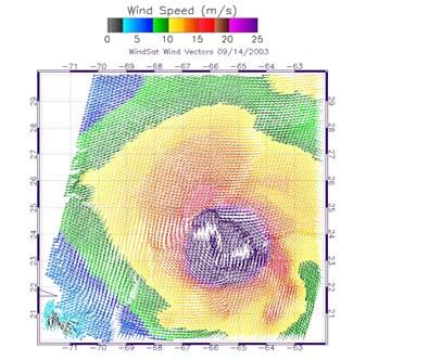
2 NPOESS Still Brings Phenomenal New Capabilities to Users Soundings-CrIMSS Urban details Littoral details Snow NPOESS VIIRS [MODIS Sim.] 9+ VIS/NIR bands 12 IR bands Wind Speed-MIS Dust cloud over sand Contrail Smoke plume Clouds Yemen Oil Tanker Attack: 10/06/02 Snow Low clouds Ozone-OMPS True color Tanker Smoke Plume High clouds
3 NPOESS/NPP Data Products and date rate capability still sized for growth Raw Data Records (RDRs) Similar to Level 1A for CEOS/NASA. ~ 150 giga bytes per day (similar to Terra or Aqua). Sensor Data Records (SDRs) Similar to CEOS/NASA Level 1B Environmental Data Records (EDRs) Similar to CEOS/NASA Level 2. NPP Provides 25 of 55 NPOESS EDRs. 12 Mbps 3 Mbps VIIRS CrIS/ATMS OMPS MIS SEM MARGIN ERBS MARGIN MARGIN MARGIN Flight on NPP Flight on NPOESS

4 International TOVS Study Conference -15 *National Polar-orbiting orbiting Operational Environmental Satellite System
5 1330 CONFIGURATION for NPOESS C1 Still provides Soundings, Imagery, Surface, Space Environment, and Climate monitoring Capability HRD ANTENNA +Y S/C CRIS ATMS ADCS-Tx SEM VIIRS Not available For C1 OMPS No Limb +X S/C S-BAND (NADIR) 0.47m 2 (5.1ft 2 ) SARSAT-Tx Unused Real Estate CERES LRD ANTENNA 1.0m 2 (10.7ft 2 ) SAR/ADCS-Rx SMD ANTENNA 0.25m X 0.25m STOWED CONFIGURATION
6 1730 CONFIGURATION HRD ANTENNA CRIS ATMS ADCS-Tx VIIRS +Y S/C 0.42m 2 (4.5ft 2 ) Dish size TBD +X S/C S-BAND (NADIR) MIS TSIS ALTIMETER SURVIVABILITY SMD ANTENNA Unused Real Estate SARSAT-Tx LRD ANTENNA SAR/ADCS-Rx 0.25m X 0.25m STOWED CONFIGURATION
7 Reliance on METOP allows us to Remove the 2130 Plane 0.60m m 2 HRD ANTENNA SESS HORUS VIIRS +Y S/C (6.5ft 2 ) (4.6ft 2 ) APS +X S/C S-BAND (NADIR) 0.56m 2 (6.1ft 2 ) CMIS SARSAT-Tx 0.19m 2 (2.0ft 2 ) Unused Real Estate LRD ANTENNA 1.0m 2 (10.7ft 2 ) SURVIVABILITY SAR/ADCS-Rx SMD ANTENNA 0.25m X 0.25m STOWED CONFIGURATION


8 Payload Overview (1 of 2) VIIRS CrIS Purpose: Land, ocean, atmospheric parameters at high temporal resolution Precursors: AVHRR, OLS, MODIS, SeaWiFS Developer: Raytheon Approach: Multi-spectral scanning radiometer, 3000 km swath width TRL: 6.5 Purpose: Temperature and moisture profiles at high temporal resolution Precursors: HIRS, AIRS, IASI Developer: ITT Approach: Michelson interferometer, 2300 km swath width. Co-registered with ATMS TRL: 6.5


9 NPP Overview - Instruments (2 of 2) ATMS OMPS Purpose: Temperature and moisture profiles at high temporal resolution Precursors: AMSU, MHS Developer: Northrop Grumman Approach: Scanning passive microwave radiometer, 2300 km swath width. Co-registered with CrIS. TRL: 6.5 Purpose: Monitors total column, vertical ozone profile Precursors: TOMS, SBUV, GOME, OSIRIS, SCHIAMACHY, OMI Developer: Ball Approach: Nadir and limb push broom CCD spectrometers, 2600 km swath width TRL: 6.5


10 Payload Overview- 3 NPP instrument in various stages of Test CrIS Entering TVAC Testing VIIRS EDU Finished TVAC ATMS Delivered to S/C OMPS FU1 Finished TVAC


11 VIIRS EDU finished TVAC and in Data Analysis phase


12 VIIRS Flight Hardware making good progress


13 CrIS Is integrated and has gone through Bench, EMI and in TVAC Testing


14 CrIS is meeting performance with low NEdN LW Diag Mode For Spec FOV 1 FOV 3 FOV 4 FOV 5 FOV 6 FOV 7 FOV 8 FOV 9 spec Wavenumber Measured EDU3 Data


15 OMPS in Acceptance Testing and ahead of schedule

 85.")
 84.")


16 OMPS In test data analysis phase NP, 20 deg C, iaz(l&r) ia z(l& R ) Amb #1 Amb #2 Amb #3a Amb #3b Amb #4a Amb #4b (-35C NP) (-35C NP)


17 ATMS is delivered and integrated on the NPP Spacecraft

 & spectral irradiance (SIM) TIM measures total solar irradiance SIM measures spectral irradiance 200 to 2000")

18 NPOESS Retains the growth and accommodation potential to bring Leveraged Sensor back Radar Altimeter (ALT) Measures range to ocean surface with a radar at 13.5 GHz Corrects for ionosphere with 5.3 GHz radar Corrects for atmosphere with CMIS water vapor measurements Precise orbit determination with GPS Total Solar Irradiance Sensor (TSIS) Two sensors for total irradiance (TIM) & spectral irradiance (SIM) TIM measures total solar irradiance SIM measures spectral irradiance 200 to 2000 nm Pointing platform and sensor suite to be provided by CU LASP Aerosol Polarimetry Sensor (APS) Aerosol characterizations of size, single scattering albedo, aerosol refractive index, aerosol phase function Multispectral (broad, 0.4 to 2.25 μm) Multiangular (175 angles) Polarization (all states) Additional Space Environment Sensor Suite (SESS) UV disk imager (BATC), and thermal plasma sensors


19 NPOESS Studying a Capable Microwave Imager for Implementation on NPOESS C2 ( 1730) Exploring the concept based on Heritage Designs and planned systems The expectation is to meet heritage performance while meeting key performance parameters Produce a system that is available for 2 nd NPOESS launch How to handle Soundings? Radiometric Calibration Horizontal Cell Size Polarization Imagery Slant Path Weighting Function Heritage Application X-Track Conical
20 Summary Post NPOESS Restructure Still brings enhanced capability for NPOESS and NPP NPP still provides an opportunity for early NPOESS data utilization and sensor risk reduction All four NPP sensors are either in test or post test analysis phase Preparations are being made for PFM and or EDU accommodation on the NPP spacecraft for early risk reduction testing There is no redesign of the NPP or NPOESS spacecrafts: thus allowing accommodation of de-manifested sensors NPOESS is actively studying conical microwave concepts to fly post NPOESS C1
Remote Sensing of CO from AIRS AIRS typically sees 82% of the globe each day
 Remote Sensing of CO from AIRS 14 AIRS typically sees 82% of the globe each day From McMillan, et. al., AIRS Science Team Meeting, Spring, 2004 Addressing Aerosol / CO Interactions Sub-Saharan biomass
The Three Laws of Climate Change. Accuracy, Accuracy, Accuracy
 The Three Laws of Climate Change Accuracy, Accuracy, Accuracy WCRP Climate Sensitivity Grand Challenge Workshop March 23-28, 2014 Bruce Wielicki NASA Langley Research Center 1 OBS: Reducing Uncertainty
APPLICATIONS USING THE ATMOSPHERIC DATA OF THE PACE MISSION
 APPLICATIONS USING THE ATMOSPHERIC DATA OF THE PACE MISSION Ali H. Omar (NASA) Maria Tzortziou (CCNY), Woody Turner (NASA) Groups/Subgroups: Atmospheric Correction, Applications, Atmospheric by-products
NOAA s Satellite Services Program Environmental Satellite Processing Center (ESPC)
") NOAA s Satellite Services Program Environmental Satellite Processing Center (ESPC) Brian Hughes, ESPC Operations Manager/Physical Scientist 2007 McIDAS Users Group Meeting October 16-18, 2007 Madison,
NOAA s Satellite Services Program Environmental Satellite Processing Center (ESPC) Brian Hughes, ESPC Operations Manager/Physical Scientist 2007 McIDAS Users Group Meeting October 16-18, 2007 Madison,
IASI AND IASI NG, MERLIN, MICROCARB FOR CH 4 AND CO 2 OBS. IN THE TROPOSPHERE
 CEOS-ACC- Séoul, October 14th, 2016 IASI AND IASI NG, MERLIN, MICROCARB FOR CH 4 AND CO 2 OBS. IN THE TROPOSPHERE Prepared by C. DENIEL, CNES, France (carole.deniel@cnes.fr) With contributions from C.
OMI on board of EOS-Aura OMI TES MLS HIRDLS
 OMI on board of EOS-Aura OMI TES MLS HIRDLS 21 Ozone Monitoring Instrument OMI UV and VIS backscatter instrument (270-500 nm) Wide swath telescope yields daily global maps (2600 km) Urban scale resolution
GeoCarb. PI: Berrien OU (Leadership, science analysis)
") PI: Berrien Moore @ OU (Leadership, science analysis) Partner Institutions: Lockheed-Martin (instrument) CSU (Algorithms) NASA Ames (Validation) GeoCarb A NASA Earth-Ventures mission, awarded in Dec 2016,
PI: Berrien Moore @ OU (Leadership, science analysis) Partner Institutions: Lockheed-Martin (instrument) CSU (Algorithms) NASA Ames (Validation) GeoCarb A NASA Earth-Ventures mission, awarded in Dec 2016,
Trace Gas Performance of Sentinel 4 UVN on Meteosat Third Generation
 Trace Gas Performance of Sentinel 4 UVN on Meteosat Third Generation Heinrich Bovensmann, S. Noël, K. Bramstedt, P. Liebing, A. Richter, V. Rozanov, M. Vountas, J. P. Burrows University of Bremen, Germany
Remotely-Sensed Fire Danger Rating System to Support Forest/Land Fire Management in Indonesia
 Remotely-Sensed Fire Danger Rating System to Support Forest/Land Fire Management in Indonesia Orbita Roswintiarti Indonesian National Institute of Aeronautics and Space (LAPAN) SE Asia Regional Research
Global Greenhouse Gas Observation by Satellite
 Global Greenhouse Gas Observation by Satellite Greenhouse gases Observing SATellite Figure 1. Overview of GOSAT ( JAXA) The Greenhouse Gases Observing Satellite (GOSAT) will be the world s first satellite
Land surface albedo and downwelling shortwave radiation from MSG: Retrieval, validation and impact assessment in NWP and LSM models
 Land surface albedo and downwelling shortwave radiation from MSG: Retrieval, validation and impact assessment in NWP and LSM models Jean-Louis ROUJEAN, Dominique CARRER, Xavier CEAMANOS, Olivier HAUTECOEUR,
Air pollution monitoring based on remote sensing and simultaneous ground PM 10 and PM2.5 measurements: the WebAir-2 project
 Air pollution monitoring based on remote sensing and simultaneous ground PM 10 and PM2.5 measurements: the WebAir-2 project Hadjimitsis D. G. 1 *, Agapiou A. 1, Themistokleous K. 1, Achilleos C. 1, Nisantzi
LAND AND WATER - EARTH OBSERVATION INFORMATICS FSP
 Earth Observation for Water Resources Management Arnold Dekker,Juan P Guerschman, Randall Donohue, Tom Van Niel, Luigi Renzullo,, Tim Malthus, Tim McVicar and Albert Van Dijk LAND AND WATER - EARTH OBSERVATION
Earth Explorer 8 Candidate
 Earth Explorer 8 Candidate Hartmut Bösch University of Leicester CarbonSat Earth Explorer 8 Mission Advisory Group Heinrich Bovensmann, IUP, University of Bremen, Bremen, D (Chair) Hartmut Bösch, University
Overview of Material Challenges for Earth Observation missions.
 Overview of Material Challenges for Earth Observation missions. Marco VERNA, Marc Van EESBEEK, Jason WILLIAMSON (ESA-ESTEC, The Netherlands) Potential Issues (1) Stability CTE effects of adhesives, coatings
Long Term Observations of Earth s Upper Atmosphere
 Long Term Observations of Earth s Upper Atmosphere SME UARS Aura EnviSat TIMED Nimbus VII Marty Mlynczak NASA Langley Research Center SORCE 11/20/2015 Sun-Climate Symposium 2015 1 Outline The golden age
Role and importance of Satellite data in the implementation of the COMIFAC Convergence Plan
 Plenary Meeting of the Congo Basin Forest Partnership (CBFP) Palais des Congrès, Yaoundé. Cameroon 11-12 November, 2009 Role and importance of Satellite data in the implementation of the COMIFAC Convergence
2001/20. AMS/Industry/Government Graduate Fellowships. Bulletin of the American Meteorological Society
 2001/20 02 AMS/Industry/Government Graduate Fellowships 3041 ITT Industries Aerospace/Communications Division IBM NOAA s Office of Global Programs (supporting two fellowships) DOE Atmospheric Radiation
Midtropospheric CO 2 Concentration derived from infrared and microwave sounders. Application to the TOVS, AIRS/AMSU, and IASI/AMSU instruments.
 ITSC XVI Angra dos Reis, 7-13 May 2008 Midtropospheric CO 2 Concentration derived from infrared and microwave sounders. Application to the TOVS, AIRS/AMSU, and IASI/AMSU instruments. Cyril Crevoisier,
Global Warming: What is the role of aerosol?
 Global Warming: What is the role of aerosol? Barbara Wyslouzil, Sept. 10 2007 Outline Aerosols 101 The greenhouse effect Global temperature records The global warming problem How do aerosols play a role
Chris Barnet NOAA/NESDIS/STAR (the office formally known as ORA)
") Operational atmospheric trace gas products from AIRS, IASI, CrIS Chris Barnet NOAA/NESDIS/STAR (the office formally known as ORA) University of Maryland, Baltimore County (Adjunct Professor) AIRS Science
Operational atmospheric trace gas products from AIRS, IASI, CrIS Chris Barnet NOAA/NESDIS/STAR (the office formally known as ORA) University of Maryland, Baltimore County (Adjunct Professor) AIRS Science
Unmanned Aerial Vehicle (UAV)-Based Remote Sensing for Crop Phenotyping
-Based Remote Sensing for Crop Phenotyping") Unmanned Aerial Vehicle (UAV)-Based Remote Sensing for Crop Phenotyping Sanaz Shafian 1, Nithya Rajan 1, Yeyin Shi 2, John Valasek 3 & Jeff Olsenholler 4 1 Dept. of Soil and Crop Sciences; 2 Dept. of Biological
Unmanned Aerial Vehicle (UAV)-Based Remote Sensing for Crop Phenotyping Sanaz Shafian 1, Nithya Rajan 1, Yeyin Shi 2, John Valasek 3 & Jeff Olsenholler 4 1 Dept. of Soil and Crop Sciences; 2 Dept. of Biological
Dawn of Satellite Lidar in Oceanography
 Dawn of Satellite Lidar in Oceanography Passive Ocean Color Measurements atmosphere dominates measured signal and correction is challenging ocean component of signal dominated by upper ½ optical depth
Suborbital Measurement Program Using the MEOS Spectrometer (MEOSuB)
") Suborbital Measurement Program Using the MEOS Spectrometer (MEOSuB) J.J. Sloan, R. V. Kruzelecky, K. Strong and J. Lin Workshop on Suborbital Platforms and Nanosatellites Canadian Space Agency, Saint-Hubert,
Suborbital Measurement Program Using the MEOS Spectrometer (MEOSuB) J.J. Sloan, R. V. Kruzelecky, K. Strong and J. Lin Workshop on Suborbital Platforms and Nanosatellites Canadian Space Agency, Saint-Hubert,
Developing the Operational Cal/Val components for NPOESS SST at NESDIS
 1) Define a VIIRS Proxy Data Stream 2) Define the required in situ data stream 3) Tuning for of Cal/Val algorithms and LUTS (Vicarious calibration and SDR Developing the Operational Cal/Val components
Using Paid Twitter Promotions to Amplify Owned Media
 Using Paid Twitter Promotions to Amplify Owned Media Stephanie L. Schierholz April 8, 2014 Copyright 2014 Raytheon Company. All rights reserved. Customer Success Is Our Mission is a registered trademark
MONITORING AIR POLLUTION AT GLOBAL SCALE USING IASI THERMAL INFRARED INSTRUMENT
 MONITORING AIR POLLUTION AT GLOBAL SCALE USING IASI THERMAL INFRARED INSTRUMENT S. Bauduin 1, L. Clarisse 1, C. Clerbaux 1,2, D. Hurtmans 1 and P-F. Coheur 1 1 Spectroscopie de l Atmosphère, Service de
Greenhouse Gas Measurements from Space. Chris O Dell Colorado State University
 Greenhouse Gas Measurements from Space Chris O Dell Colorado State University 1 Climate Forcings & Feedbacks Forcings Greenhouse Gases Aerosols Volcanic Eruptions Solar Forcing Temperature Change Feedbacks
Application of Gliders for Near-Real Time METOC Data Collection Capability for Battlespace Characterization
 DISTRIBUTION STATEMENT A: Approved for public release; distribution is unlimited. Application of Gliders for Near-Real Time METOC Data Collection Capability for Battlespace Characterization Charles Trees
ESA Programmes Earth Observation Navigation
 05 March 2007 SSOM Engelberg Lectures R. Hartmann / Eumetsat, Meteosat-8, 28-Jun-2004, VIS+IR ESA Programmes Earth Observation Navigation Urs Frei Swiss Space Office (SSO) SSOM Engelberg Lectures, 05 March
HYDROLOGY AND WATER RESOURCES REMOTE SENSING IN SOIL AND WATER RESOURCE MANAGEMENT
 Ninth International Water Technology Conference, IWTC9 2005, Sharm El-Sheikh, Egypt 689 HYDROLOGY AND WATER RESOURCES REMOTE SENSING IN SOIL AND WATER RESOURCE MANAGEMENT Behrooz Sari Sarraf*, S. Reza
The potential of MTG-IRS and S4-TIR to detect high pollution events at urban and regional scales
 Final Report Delivered to Eumetsat/ESA in December 2008 The Slightly potential modified of MTG-IRS on January and 2009 S4-TIR to detect pollution events November 2008 Cathy Clerbaux et Pierre Coheur Contract
Best Practices for Achieving User Readiness for New Meteorological Satellites. Reference User Readiness Project
 W O R L D M E T E O R O L O G I C A L O R G A N I Z A T I O N Best Practices for Achieving User Readiness for New Meteorological Satellites Reference User Readiness Project WMO Space Programme March 2016
NASA s Next Generation Earth-Observing Satellites; Opportunities for Global Change Research and Applications
 NASA s Next Generation Earth-Observing Satellites; Opportunities for Global Change Research and Applications By John Dwyer, USGS, EROS for NASA s Applied Sciences Program L. DeWayne Cecil Chief Scientist
ECVS IN THE STRATOSPHERE
 METEOROLOGY ECVS IN THE STRATOSPHERE O 3, H 2 O, AEROSOL, N 2 O, CH 4, CFCS, HCFCS, HFCS, SF 6, PFCS, AND TEMPERATURE Michaela I. Hegglin, University of Reading UK GCOS COMPOSITION ECVs EXTEND INTO THE
Composition and Energy AOSC 200 Tim Canty
 Composition and Energy AOSC 200 Tim Canty Class Web Site: http://www.atmos.umd.edu/~tcanty/aosc200 Topics for today: Atmospheric composition cont. Energy transfer Lecture 03 Sept 5 2017 1 Today s Weather
Global air quality monitoring from space
 I. De Smedt, BIRA Global air quality monitoring from space Michel Van Roozendael SCIAMACHY book Royal Belgian Institute for Space Aeronomy (BIRA-IASB) Content Introduction AQ from space what can be seen?
Mapping Forest Crown Cover, Canopy Height, and Biomass in the Southwestern US with MISR
 Mapping Forest Crown Cover, Canopy Height, and Biomass in the Southwestern US with MISR Mark Chopping, Lihong Su, Libertad Urena (Montclair State University), Gretchen Moisen (USFS); Andrea Laliberte,
& The Global Climate Observing System GCOS. by Carolin Richter, WMO, GCOS, 8 Dec 2017
 & The Global Climate Observing System GCOS by Carolin Richter, WMO, GCOS, 8 Dec 2017 How to compare best the coordination of a Global Observig System for Climate? Expectations in 2002-2006: Chairman Atmospheric
SOIL MOISTURE RETRIEVAL FROM OPTICAL AND THERMAL SPACEBORNE REMOTE SENSING
 Comm. Appl. Biol. Sci, Ghent University, 70/2, 2005 1 SOIL MOISTURE RETRIEVAL FROM OPTICAL AND THERMAL SPACEBORNE REMOTE SENSING W.W. VERSTRAETEN 1,2 ; F. VEROUSTRAETE 2 ; J. FEYEN 1 1 Laboratory of Soil
ATM S 211 Final Examination June 4, 2007
 ATM S 211 Final Examination June 4, 2007 Name This examination consists of a total of 100 points. In each of the first two sections, you have a choice of which questions to answer. Please note that you
NOAA OCEAN COLOR ACTIVITIES
 NOAA OCEAN COLOR ACTIVITIES Menghua Wang & NOAA Ocean Color Team NOAA/NESDIS Center for Satellite Applications and Research (STAR) E/RA3, 5830 University Research Ct. College Park, MD 20740, USA IOCS Meeting,
Enel is about to launch a global Call for startups to select innovative projects in the field of the Renewable Energies.
 CALL FOR START - UP Enel is about to launch a global Call for startups to select innovative projects in the field of the Renewable Energies. Applications are accepted from any country and can be submitted
Remote sensing technology contributes towards food security of Bangladesh
 American Journal of Remote Sensing 2013; 1(3): 67-71 Published online June 20, 2013 (http://www.sciencepublishinggroup.com/j/ajrs) doi: 10.11648/j.ajrs.20130103.12 Remote sensing technology contributes
The Chemistry of Climate Change. Reading: Chapter 8 Environmental Chemistry, G. W. vanloon. S. J. Duffy
 The Chemistry of Climate Change Reading: Chapter 8 Environmental Chemistry, G. W. vanloon. S. J. Duffy The Science of Global Climate There's a lot of differing data, but as far as I can gather, over the
Marty Mlynczak NASA Langley Research Center Linda Hunt Science Systems and Applications, Inc. & The SABER Science Team
 Influence of solar variability on the structure, composition, and energy balance of the atmosphere from 2002 to 2014 The perspective from the mesosphere and thermosphere Marty Mlynczak NASA Langley Research
Zugspitze Solar FTIR: NDSC Primary-Status Instrument cm-1 resolution (OPD = 486 cm) Bruker IFS120HR FT-spectrometer
 Bruker IFS120HR FT-spectrometer") Zugspitze Solar FTIR: NDSC Primary-Status Instrument 0.00186 cm-1 resolution (OPD = 486 cm) Bruker IFS120HR FT-spectrometer SFIT1.09e/2.38 FASCATM 2.03 raytracing SCIAMACHY Validation by FTIR at Zugspitze:
Zugspitze Solar FTIR: NDSC Primary-Status Instrument 0.00186 cm-1 resolution (OPD = 486 cm) Bruker IFS120HR FT-spectrometer SFIT1.09e/2.38 FASCATM 2.03 raytracing SCIAMACHY Validation by FTIR at Zugspitze:
The role of Remote Sensing in Irrigation Monitoring and Management. Mutlu Ozdogan
 The role of Remote Sensing in Irrigation Monitoring and Management Mutlu Ozdogan Outline Why do we care about irrigation? Remote sensing for irrigated agriculture What are the needs of irrigators? Future
Hydrology: Soil moisture, Rainfall, and Evapotranspiration. Tarendra Lakhankar NOAA-CREST Center, The City University of New York
 Hydrology: Soil moisture, Rainfall, and Evapotranspiration Tarendra Lakhankar NOAA-CREST Center, The City University of New York Overview Hydrology Rainfall Soil moisture Evapotranspiration Experiments
SSL Payload Orbital Delivery System (PODS) FedEx to GTO/GEO
 FedEx to GTO/GEO") SSL Payload Orbital Delivery System (PODS) FedEx to GTO/GEO June 11th, 2014 For more information, contact: Al Tadros, SSL Email: alfred.tadros@sslmda.com Tel: (650) 714-0439 Cost-Effective, Frequent, Quick
SSL Payload Orbital Delivery System (PODS) FedEx to GTO/GEO June 11th, 2014 For more information, contact: Al Tadros, SSL Email: alfred.tadros@sslmda.com Tel: (650) 714-0439 Cost-Effective, Frequent, Quick
Effects of Urban Surfaces and White Roofs on Global and Regional Climate
 Effects of Urban Surfaces and White Roofs on Global and Regional Climate MarkZ.Jacobson,JohnE.TenHoeve Dept, of Civil and Environmental Engineering, Stanford University, Stanford, CA USA Correspondenceto:M.Z.Jacobson(jacobson@stanford.edu)
Measuring Ocean Color: The Basics
 Measuring Ocean Color: The Basics Radiation of energy from the Sun and the Earth s surface. Recall from previous lectures that the Sun (6000 K), radiates energy in three portions of the energy spectrum:
Atmosphere, the Water Cycle and Climate Change
 Atmosphere, the Water Cycle and Climate Change OCN 623 Chemical Oceanography 16 April 2013 (Based on previous lectures by Barry Huebert) 2013 F.J. Sansone 1. The water cycle Outline 2. Climate and climate-change
TerraSAR-X Applications Guide
 TerraSAR-X Applications Guide Extract: Change Detection and Monitoring: Forestry April 2015 Airbus Defence and Space Geo-Intelligence Programme Line Change Detection and Monitoring: Forestry Issue Anthropogenic
The Boeing Company, Network & Space Systems 702SP (small platform) Product line, ABS/Eutelsat
 Product line, ABS/Eutelsat") I. Program Overview Organization Name/Program Name: Program Leader Name/ Position/Contact information E-mail, Phone Program Category Program Background: What is this program all about? (No more than one
I. Program Overview Organization Name/Program Name: Program Leader Name/ Position/Contact information E-mail, Phone Program Category Program Background: What is this program all about? (No more than one
The Noah-MP Land Surface Model. Michael Barlage Research Applications Laboratory National Center for Atmospheric Research
 The Noah-MP Land Surface Model Michael Barlage Research Applications Laboratory National Center for Atmospheric Research 1 2 Conceptual Land Surface Processes Precipitation Transpiration Canopy Water Evaporation
MSL Technical and Replan Status
 MSL Technical and Replan Status Richard Cook Integrated Spacecraft Cruise Stage Cruise Stage Status Completed Deliveries Primary structure Attitude Control Sensors (Star scanner, sun sensor, etc) Propulsion
Detecting Change in the Global Ocean Biosphere using SeaWiFS Satellite Ocean Color Observations
 Detecting Change in the Global Ocean Biosphere using SeaWiFS Satellite Ocean Color Observations Part 2: Confronting Bio-Optical Complexity David Siegel Earth Research Institute, UC Santa Barbara david.siegel@ucsb.edu
Satellite Based Crop Monitoring and Estimation System for Food Security Application in Bangladesh
 Satellite Based Crop Monitoring and Estimation System for Food Security Application in Bangladesh Dr. Hafizur Rahman Head, Agriculture Division Bangladesh Space Research and Remote Sensing Organization
AQAST NOAA/NESDIS Liaison Highlights and Planning for Lake Michigan Ozone Study (LMOS) 2017
 2017") AQAST NOAA/NESDIS Liaison Highlights and Planning for Lake Michigan Ozone Study (LMOS) 2017 Brad Pierce, NOAA/NESDIS 2016 Midwest and Central States Air Quality Workshop, June 21-23, 2016, St. Louis, MO
AQAST NOAA/NESDIS Liaison Highlights and Planning for Lake Michigan Ozone Study (LMOS) 2017 Brad Pierce, NOAA/NESDIS 2016 Midwest and Central States Air Quality Workshop, June 21-23, 2016, St. Louis, MO
ГЕОЛОГИЯ МЕСТОРОЖДЕНИЙ ПОЛЕЗНЫХ ИСКОПАЕМЫХ
 LE HUNG TRINH (Le Quy Don Technical University) APPLICATION OF REMOTE SENSING TECHNIQUE TO DETECT AND MAP IRON OXIDE, CLAY MINERALS, AND FERROUS MINERALS IN THAI NGUYEN PROVINCE (VIETNAM) This article
Climate: Earth s Dynamic Equilibrium
 Climate: Earth s Dynamic Equilibrium review session CCIU April 30, 2016 High-school standard HS-ESS2-4 focuses on the role energy flows play in Earth s climate HS-ESS2-4 Use a model to describe how variations
DMC 22m Sensors for Supertemporal Land Cover Monitoring. Gary Holmes DMC International Imaging Ltd June 2014
 DMC 22m Sensors for Supertemporal Land Cover Monitoring Gary Holmes DMC International Imaging Ltd June 2014 DMC 2 nd Generation Satellites UK-DMC2 and Deimos-1 launched 29 th July 2009 650km swath width
Issues include coverage gaps, delays, measurement continuity and consistency, data format and QC, political restrictions
 Satellite-based Estimates of Groundwater Depletion, Ph.D. Chief, Hydrological Sciences Laboratory NASA Goddard Space Flight Center Greenbelt, MD Groundwater Monitoring Inadequacy of Surface Observations
China s Earth Observation and Earth Science Development
 0254-6124/2014/34(5)-721 12 Chin. J. Space Sci. Ξ ΛΠΠ Guo Huadong, Ma Jianwen, Xiao Han, Lu Feng, Liang Dong, Bi Haiyun, Wang Fangjian. 2012 2014 China s Earth observation and Earth science development.
Numerical Modeling of Thermal Bar Evolution in Lake Ontario using the EFDC Model Rumana Reaz Arifin
 Numerical Modeling of Thermal Bar Evolution in Lake Ontario using the EFDC Model Rumana Reaz Arifin 14 th Great Lakes Beach Association Conference November 14, 2014 Layout Introduction EFDC Lake Ontario
UNAVCO - Network Operations Group Documentation
 Documentation!"# Total Pages: 9 Last Modified: Abstract The communication frequency of an Iridium antenna is in the band of 1610 to 1626.5 MHz. Unavco Inc. uses iridium communications links to download
Chapter 11: Atmosphere
 To get you thinking This is our atmosphere. All life on Earth exists within this tiny protective blanket. Why is the atmosphere important to us? What do you think it does for us? Chapter 11: Atmosphere
Surrey Satellite Technology US LLC
 Surrey Satellite Technology US LLC Surrey Satellite Technology US & Hosted Payload Programs June 2015 Brent Abbott babbott@sst-us.com 602-284-7997 ABOUT SURREY SATELLITE TECHNOLOGY 6/8/2015 Surrey Satellite
NDIA Systems Engineering Conference 2013 M&S Applied to Improved Test Planning & Analysis Methods in the DT & OT Execution Phase
 Joe Murphy Analytical Graphics, Inc. jmurphy@agi.com 610 457 5002 NDIA Systems Engineering Conference 2013 M&S Applied to Improved Test Planning & Analysis Methods in the DT & OT Execution Phase Oct 30,
Center for Innovative Technology (CIT) In conjunction with our partners Smart City Works, LLC and TechNexus (the SCITI Program)
 In conjunction with our partners Smart City Works, LLC and TechNexus (the SCITI Program)") Center for Innovative Technology (CIT) In conjunction with our partners Smart City Works, LLC and TechNexus (the SCITI Program) Requests Innovators with capabilities in the following area Technical Specification:
Center for Innovative Technology (CIT) In conjunction with our partners Smart City Works, LLC and TechNexus (the SCITI Program) Requests Innovators with capabilities in the following area Technical Specification:
TROPOSPHERIC AEROSOL PROGRAM - TAP
 THE DEPARTMENT OF ENERGY'S TROPOSPHERIC AEROSOL PROGRAM - TAP AN EXAMINATION OF AEROSOL PROCESSES AND PROPERTIES RG99060050.3 American Geophysical Union, Fall Meeting, San Francisco, December 12-17, 1999
Global Framework for Climate Services (GFCS)
") WMO World Meteorological Organization Working together in weather, climate and water Global Framework for Climate Services (GFCS) --Challenges and Opportunities to the SPACE Community Wenjian ZHANG Director,
WMO World Meteorological Organization Working together in weather, climate and water Global Framework for Climate Services (GFCS) --Challenges and Opportunities to the SPACE Community Wenjian ZHANG Director,
Small Satellite Rideshares on Commercial Resupply Missions to the International Space Station
 SSC12-V-2 Small Satellite Rideshares on Commercial Resupply Missions to the International Space Station Joshua R. Robinson and Daniel W. Kwon Orbital Sciences Corporation 45101 Warp Drive Dulles, VA 20166
Global Warming and the Hydrological Cycle
 Global Warming and the Hydrological Cycle Climate Change Projections Wet regions will become wetter Dry regions will become drier Precipitation will occur less frequently Precipitation will be more intense
High-level Introduction to MTG Ground Segment
 High-level Introduction to MTG Ground Segment Workshop on NWC Applications using MTG-IRS Fausto Roveda MTG Data Processing System Facility Manager 1 Summary of the Presentation Ground Segment Overview
1 st Meeting. SOLLAB Flux and Temperature Measurement Group
 1 st Meeting. SOLLAB Flux and Temperature Measurement Group J. Ballestrín CIEMAT-Plataforma Solar de Almería (SPAIN) Central receiver Heliostat field CAMERA / TARGET METHOD: Indirect Heat Flux Measurement
INFLUX (The Indianapolis Flux Experiment)
") INFLUX (The Indianapolis Flux Experiment) A top-down/bottom-up greenhouse gas quantification experiment in the city of Indianapolis Paul Shepson, Purdue University Kenneth Davis, Natasha Miles and Scott
INFLUX (The Indianapolis Flux Experiment) A top-down/bottom-up greenhouse gas quantification experiment in the city of Indianapolis Paul Shepson, Purdue University Kenneth Davis, Natasha Miles and Scott
State of the Program: NASA Ocean Biology & Biogeochemistry
 State of the Program: NASA Ocean Biology & Biogeochemistry Paula Bontempi and Laura Lorenzoni NASA Headquarters NASA Ocean Color Research Team Meeting 18 May 2017 Announcements Speakers would like to post
Complex Satellite Monitoring of Coastal Water Areas
 31 st International Symposium on Remote Sensing of Environment, June 20-24, 2005, Saint Petersburg, Russian Federation Complex Satellite Monitoring of Coastal Water Areas V.Bondur Scientific Center of
Atomic Oxygen-Resistant, Static-Dissipative, Pinhole-Free Coatings for Spacecraft
 Physical Sciences Inc. VG10-109 Atomic Oxygen-Resistant, Static-Dissipative, Pinhole-Free Coatings for Spacecraft Michelle T. Schulberg, Robert H. Krech, Frederick S. Lauten Physical Sciences Inc. Roy
Successful Cost Estimation with T1 Equivalents
 Successful Cost Estimation with T1 Equivalents Georg Reinbold ICEAA International Training Symposium Bristol, October 2016 ESA Cost Engineering Section About 10 Cost Engineers Cost database CEDRE ESA projects
The Earth s Global Energy Balance
 The Earth s Global Energy Balance Electromagnetic Radiation Insolation over the Globe World Latitude Zones Composition of the Atmosphere Sensible Heat and Latent Heat Transfer The Global Energy System
S3-A MWR Cyclic Performance Report. Cycle No Start date: 30/01/2017. End date: 26/02/2017
 PREPARATION AND OPERATIONS OF THE MISSION PERFORMANCE CENTRE (MPC) FOR THE COPERNICUS SENTINEL-3 MISSION Start date: 30/01/2017 End date: 26/02/2017 Contract: 4000111836/14/I-LG Customer: ESA Document
A Global Root-Zone Soil Moisture Analysis Using Simulated L-band Brightness Temperature in Preparation for the Hydros Satellite Mission
 1126 J O U R N A L O F H Y D R O M E T E O R O L O G Y VOLUME 7 A Global Root-Zone Soil Moisture Analysis Using Simulated L-band Brightness Temperature in Preparation for the Hydros Satellite Mission G.
Competence related to the use of Remotely Sensed Earth Observation Data on Board Vessels
 STANDARD FOR CERTIFICATION No. 3.327 Competence related to the use of Remotely Sensed Earth Observation Data on Board Vessels APRIL 2013 The electronic pdf version of this document found through http://www.dnv.com
Atlas V Secondary Payload Carriers 2006
 Atlas V Secondary Payload Carriers 2006 EELV Secondary Payload Accommodations CubeSat Workshop April 10, 2008 Jake Szatkowski, PhD. ULA, Denver CO USA gerard.p.szatkowski@lmco.com 1 SP Issues Primary payload
Satellite remote sensing of changes in NO x emissions over China during
 Article Atmospheric Science doi: 10.1007/s11434-012-5015-4 Satellite remote sensing of changes in NO x emissions over China during 1996 2010 ZHANG Qiang 1*, GENG GuanNan 1,2, WANG SiWen 2, RICHTER Andreas
Space Environmental Hazards For Space and Launch Systems
 Space Environmental Hazards For Space and Launch Systems Dr. Joseph E. Mazur The Aerospace Corporation Presentation to the 2012 FAA Commercial Space Transportation Conference Physical Sciences Laboratory
Scoping & Concept of Operations (ConOps) Module
 Module") Scoping & Concept of Operations (ConOps) Module Space Systems Engineering, version 1.0 Space Systems Engineering: Scoping & ConOps Module Module Purpose: Scoping & ConOps To understand the importance of
Scoping & Concept of Operations (ConOps) Module Space Systems Engineering, version 1.0 Space Systems Engineering: Scoping & ConOps Module Module Purpose: Scoping & ConOps To understand the importance of
MTFF Operational Design Features
 The Space Congress Proceedings 1987 (24th) Space - The Challenge, The Commitment Apr 1st, 8:00 AM MTFF Operational Design Features H. Friedrich MTFF Study Manager MBB/ERNO, Bremen/W. Germany A. J. Thirkettle
The EUMETSAT Satellite Application Facility on Land Surface Analysis (LSA SAF) Continuous Development 2 Phase
 Continuous Development 2 Phase") The EUMETSAT Satellite Application Facility on Land Surface Analysis (LSA SAF) Continuous Development 2 Phase Jean-Louis Roujean and many co-authors METEO FRANCE / Toulouse jean-louis.roujean@meteo.fr
The EUMETSAT Satellite Application Facility on Land Surface Analysis (LSA SAF) Continuous Development 2 Phase Jean-Louis Roujean and many co-authors METEO FRANCE / Toulouse jean-louis.roujean@meteo.fr
Secondary Launch Services and Payload Hosting Aboard the Falcon and Dragon Product Lines
 Secondary Launch Services and Payload Hosting Aboard the Falcon and Dragon Product Lines Dustin Doud, Brian Bjelde, Christian Melbostad, Lauren Dreyer Space Exploration Technologies Corp. 1 Rocket Road,
Air Transportation: Emissions and Effects
 Air Transportation: Emissions and Effects Joyce E. Penner University of Michigan Report Co-ordinator: IPCC Special Report on Aviation and the Global Atmosphere Presentation to the First Regional Symposium
Earth energy budget and balance
 Earth energy budget and balance 31% total reflection (3% clouds. 8% surface) 69% absorption( 0% clouds, 49% surface) Reflection is frequency dependent but will be treated as average value for visible light
Using Satellite Observations to Constrain Carbon Flux Estimates
 Using Satellite Observations to Constrain Carbon Flux Estimates Shaun Quegan (University of Sheffield) Centre for Terrestrial Carbon Dynamics & National Centre for Earth Observation Lecture content The
VTOL UAV for Maritime ISR Role
 VTOL UAV for Page -1 The Maritime Arena Challenge Peace keeping / LIC scenarios: Over the Horizon ISR missions Low risk / LCC operation HIC / War time: Missile Threat - Standoff range Surface Warfare Littoral
CID Survey Report. Satellite Imagery and Associated Services used by the JRC. Current status and future needs
 EUROPEAN COMMISSION DIRECTORATE GENERAL JRC JOINT RESEARCH CENTRE ISPRA Institute for the Protection and Security of the Citizen Agriculture and Fisheries Unit JRC IPSC/G/C/PAR/pha D(7)(78) / JRC Scientific
MTS Resilience: enavigation Best Practices
 MTS Resilience: enavigation Best Practices Transforming the Marine Transportation System: A Vision for R&D TRB Conference 2C Panel: Safety and Security Bahar Barami, Ph.D. Senior Economist Volpe Center,