Remote Sensing and GIS for Forestry Interventions for Ganga (ForGanga) Implementing Institute Forest Research Institute, Dehradun
|
|
|
- Arthur Martin
- 6 years ago
- Views:
Transcription

1 Remote Sensing and GIS for Forestry Interventions for Ganga (ForGanga) Implementing Institute Forest Research Institute, Dehradun


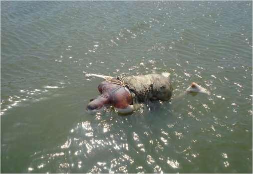
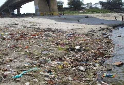
2 Ganga: Glimpse of Few Issues


3 Ganga: Glimpse of Few Issues


4 Objectives of the ForGanga DPR Identify appropriate forestry interventions for Ganga rejuvenation that are consistent with stakeholders concerns Suggest implementation plan through a blend of riparian forestry interventions and catchment area treatment Anant Van: Manintaining vegetation cover across the stretch of river Ganga and its tributaries Aviral Dhara: Maintaining minimum ecological flow

5 IV tiers of Filters I. II. III. IV. Micro-organisams and water hyacinths
6 DPR Preparation Stages Concept note submitted to NMCG: 29 th Oct, 2014 Project approved by NMCG : 16 th Feb, 2015 Draft Report Submitted: Feb, 2016 Final Report Submission: March, 2016 (DPR for Phase I) States identified for the Phase I Uttarakhand Uttar Pradesh Bihar Jharkhand West Bengal

7 DPR Preparation Stage: Phase I

8 DPR Preparation Stage: Phase I Development of interactive dynamic webpage

9 DPR Preparation Stage: Phase I Development of interactive dynamic webpage
10 DPR Preparation Stage: Phase I State level Consultations for the States of Uttarakhand Uttar Pradesh Bihar Jharkhand West Bengal Followed By National Level Consultations

11 Forest Cover Status in the Project Area Forest Cover (ISFR, FSI)

12 Geographical Area For Prioritisation Geographical Area (Km 2 ) UK : UP : Bihar : Jharkhand : WB : 88752
13 Actions identified for ForGanga Treatment of Ganga catchment by forestry intervention Treatment of riparian area by different tiers of filters Development of artificial wetlands for treatment of wastewater Biodiversity conservation in Eco sensitive zones of river catchment Development of ecotourism and livelihood opportunities Monitoring plan to review progress of each of the above activities Required information: 1. Identification of critical areas for implementation of each of the above action plan. 2. Identification of local potential native species (by FRI and SFDs) 3. Identification of point and non point sources of water pollution (SPCBs)
14 Few Issues raised in State Consultation Meet Land availability : Agriculture and Encroachment in riverside Silt deposition which effects river flow and cause frequent flooding Fluctuating and meandering river course and thus leave vast areas inundated/water logged for longer periods of time Shifting of river course: The main river course has shifted towards North Brick Kilns results wastelands: A serious need of restoration through Forestry interventions Sand Mining: Need for evaluation of sand mining limits Pollution
15 Few Issues raised in State Consultation Meet Problems associated with adequate capacity and functioning of Sewage Treatment Plants (STPs) Loss of Biodiversity: Aquatic biodiversity needs systematic monitoring Zooplanktons found infested with cancerous growth (Herniation) due to deterioration of water quality Ground water depletion: Due to improvised irrigation/agriculture practices and lack of rain water harvesting systems Unplanned river embankments and flood management Human Interferences of Ganga : How to neutralise Natural Wetlands: are under conflict of protection and ecotourism Different Ghats along the Bank: Highly populated
16 Suggestions Received During Meet Formation of Forest Management Group (FMG) and Riparian Zone Management Group (RMG) FMG: Its role Identification of priority areas for forestry interventions Identification of Species to be planted How to associate community actively Dealing with critical issues of proposed forestry interventions RMG: Its role Identification of priority areas of riparian zone treatment Managing activities which are deteriorating riparian zones Intervention through applicable riparian zone treatment models Riparian zone treatment through biological filters, microbes, plants Construction of artificial wetlands
17 Feedback During National Meet Restoration of wasteland resulted from Brick Kilns along the dead river courses by plantation of grass and suitable plant species Soil quality testing for selecting desired plant species for identified areas The area exposed due to meandering of Ganga towards North should be declared as reserved and restricted area and it should be used only for afforestation Construction of artificial wetland for wastewater treatment and green scape. Development and management of natural wetlands since they are interconnected with Ganga Implementation of Horti- forestry, Agro forestry Models in identified areas Creation of Natural embankment by Bamboo and other suitable species which are good soil binder to check erosion. FRI will facilitate in suggesting species. Creation of check dams, contour bands to check erosion for enhancement of percolation rate Eco- sensitive Zone identification and its management Banning fishing in spawning season and capacity building of fishermen Establishment of riverside parkland, electric crematorium, incinerator for solid waste treatment, bambosetum, arboratum, woodland Plan for managing symbolic immersion of idols and Puja wastes and mass awareness for Ganga rejuvenation
18 Suggested Strategies Treatment of banks of the river by site specific models by delineating actual sites of treatment considering its size, drainage, soil type, public demand, etc. Deciding appropriate width of Aquatic Zone, Riparian Zone, Influence Zone Detail plan to deal with various legal and policy issues of: Encroachment of river beds/ banks Frequent fluctuation of river course Uncontrolled sand mining Presence of brick kilns along river banks and at times along waterlines Excessive fishing and unplanned fishing Steps for habitat improvement for biodiversity conservation with introduction of those mega species which have dwindled sharply like Turtles and Tortoises, Water lizards, Otters, Gharials, Muggars etc. Restoration and conservation of natural wetlands Decentralized artificial wetlands Monitoring plans to review progress of implementation works Developing essential GIS layers and integration of available layers developed by various agencies

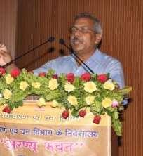
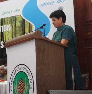
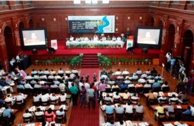
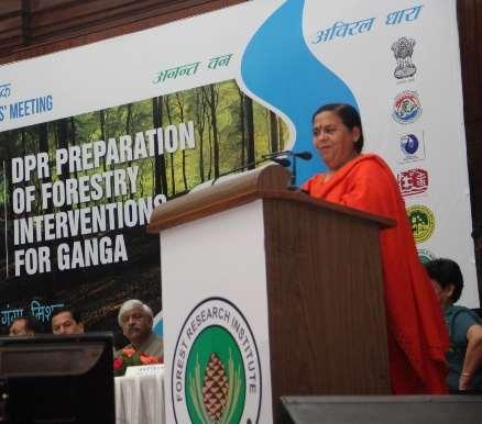
19 Moments Of Consultation Meet

20 DPR Preparation Stage Data from State DPR Database creation Information Gathering & Consolidation Integration, Gap analysis & Exploration Harmonization & Decision Support System Prioritization of sites Designing Intervention Model Costing norms DPR preparation Geo-Spatial modeling & Site prioritization Data management

21 DPR Preparation Stage Database Management Module

22 Riverscape under ForGanga Uttarakhand, 450 km, 11 tributaries Uttar Pradesh, 1000 km, 3 tributaries Bihar, 405 km, 4 tributaries Jharkhand, 40 km, 5 tributaries West Bengal, 520 km, 7 tributaries
23 RS/GIS works involved Delineation of areas for forestry intervention Delineation of riparian zone Delineation of areas for developing artificial wetlands Delineation of Eco sensitive zones of catchment area GIS layers used: Stream network and catchment boundary Digital Elevation Maps Slope and Aspect map of the terrain Soil category map Forest type and forest density map Land use category maps Soil erosion map
24 RS/GIS works involved Delineation of catchment area DEM Drainage network Catchment Area Land use pattern in catchment area LULC Map Agriculture Riparian zone Forests Wastelands/Others Developing criteria to prioritize area for intervention Development and use of GIS layers for prioritizing sites Weightage to each criteria GIS Tools Map of priority zones State consultation meets 1. Area for forestry intervention 2. Area for developing riparian zone 3. Area for developing artificial wetland 4. Eco sensitive zones


25 Land Use and Land Cover Forest Type RS/GIS works involved Forest Cover Soil Type Soil Depth Soil ph Soil Erosion Elevation Slope Aspect
26 RS/GIS works involved


27 GEO- SPATIAL MODELING RS/GIS works involved High Km 2 20% Low Km 2 47% Medium Km 2 33%
28 Nodal Institutes of Consultation NRAA Project Forest Survey of India (FSI), Dehradun Botanical Survey of India (BSI), Dehradun Wild life Institute of India (WII), Dehradun Indian Institute of Remote Sensing (IIRS), Dehradun Watershed Directorate of Uttarakhand, Dehradun Wadia Institute of Himalayan Geology (WIHG), Dehradun Indian Institute of Soil and Water Conservation (IISWC), Dehradun
29 Acknowledgments MoWR, R D & G R NMCG MINISTRY OF AYUSH MoEF & CC SFDs of 5 Participating States NYKS All other Individuals for their essential inputs and feedback Special thanks to IIRS, FSI and IISWC for their technical inputs ECO TASK FORCE ITBP NATIONAL/ STATE LEVEL SCIENTIFIC INSTITUTES

30 Your gracious presence is solicited during 3-7 April, 2017 at FRI
31 Thanks Forest Informatics Division Forest Research Institute PO: New Forest, Dehradun
Namami Gange Programme
 Namami Gange Programme National Mission for Clean Ganga -> Implementation wing of National Ganga River Basin Authority (NGRBA). Registered society originally formed by Ministry of Environment, Forests
GOVERNMENT OF INDIA MINISTRY OF WATER RESOURCES, RIVER DEVELOPMENT & GANGA REJUVENATION LOK SABHA UNSTARRED QUESTION NO. 801 ANSWERED ON
 GOVERNMENT OF INDIA MINISTRY OF WATER RESOURCES, RIVER DEVELOPMENT & GANGA REJUVENATION LOK SABHA UNSTARRED QUESTION NO. 801 ANSWERED ON 21.07.2016 801. SHRI DUSHYANT SINGH SHRIMATI MEENAKASHI LEKHI NAMAMI
Hybrid-Annuity based Public Private Partnership (PPP) model for creation of sewage treatment infrastructure
 model for creation of sewage treatment infrastructure") Hybrid-Annuity based Public Private Partnership (PPP) model for creation of sewage treatment infrastructure 24 th February 2016 Namami Gange Programme NATIONAL MISSION FOR CLEAN GANGA MINISTRY OF WATER
Hybrid-Annuity based Public Private Partnership (PPP) model for creation of sewage treatment infrastructure 24 th February 2016 Namami Gange Programme NATIONAL MISSION FOR CLEAN GANGA MINISTRY OF WATER
REMOTE SENSING AND GIS FOR INTEGRATED LAND MANAGEMENT: CASE OF INDIA
 REMOTE SENSING AND GIS FOR INTEGRATED LAND MANAGEMENT: CASE OF INDIA R.B.Singh and Dilip Kumar Department of Geography Delhi School of Economics University of Delhi Delhi-110007, India E-mail:rbsgeo@hotmail.com
CATCHMENT AREA TREATMENT PLAN
 CATCHMENT AREA TREATMENT PLAN 1 NEED FOR CATCHMENT AREA TREATMENT It is a wellestablished fact that reservoirs formed by dams on rivers are subjected to sedimentation. The process of sedimentation embodies
12 TH WORLD LAKE CONFERENCE
 12 TH WORLD LAKE CONFERENCE 28 th October-2 nd November, 2007 Status of Lake Conservation & Management of lakes in India 31 st October, 2007 DISTRIBUTION OF LAKES India has relatively very few Natural
Water and Watersheds. Data Maps Action
 Water and Watersheds Data Maps Action What is the Wildlife Action Plan? Restore rare wildlife and habitats. Keep common species common. 2015 Revision: Partners in Conservation Science 2015 Revision Data
Natural Flood Management. Measures & Multiple Benefits. Steve Rose (JBA)
") Natural Flood Management Measures & Multiple Benefits Steve Rose (JBA) Definitions Natural Flood Management - NFM (SEPA): A range of techniques that aim to reduce flooding by working with natural features
Natural Flood Management Measures & Multiple Benefits Steve Rose (JBA) Definitions Natural Flood Management - NFM (SEPA): A range of techniques that aim to reduce flooding by working with natural features
Engaging Community for Sustainable Actions for Conserving Habitat of Ganges River Dolphin in Ganga River Basin
 Engaging Community for Sustainable Actions for Conserving Habitat of Ganges River Dolphin in Ganga River Basin * Preeti R. Kanaujia, Mohd. Saquib Khan and Vidya Bhooshan Singh Centre for Environment Education,
THE 3R S FOR CLEAN WATER - SAVING INDIA S RIVERS: INDIAN EXPERIENCES
 THE 3R S FOR CLEAN WATER - SAVING INDIA S RIVERS: INDIAN EXPERIENCES NATIONAL MISSION FOR CLEAN GANGA MINISTRY OF WATER RESOURCES, RIVER DEVELOPMENT & GANGA REJUVENATION Central Water Commission India
Integrated Coastal Zone Management Project Republic of India
 Integrated Coastal Zone Management Project Republic of India Restoration and conservation of mangroves, coral reefs transplantation along the coastline of Gujarat and Orissa regions Abstract The ICZM project
VISION DOCUMENT FOR 12TH FIVE YEAR PLAN
 National Afforestation & Eco-development Board, Ministry of Environment & Forests, Government of India VISION DOCUMENT FOR 12TH FIVE YEAR PLAN RCNAEB, BHOPAL Indian Institute of Forest Management, Bhopal
LAKE RESTORATION, ISSUES & APPLICATION THE CASE OF BANGALORE
 LAKE RESTORATION, ISSUES & APPLICATION THE CASE OF BANGALORE Rajshekhar Rao Asst. professor M.S. Ramaiah Institute of Technology Bangalore INTRODUCTION Associated Values of Lakes and their importance Lakes
Climate Change Impact and Adaptation in South Asia
 Regional Conference Climate Change: Challenges and Opportunities for South Asia Climate Change Impact and Adaptation in South Asia Ajaya Dixit Nepal Water Conservation Foundation/ISET-N Ministry of Environment
KYNSHI-I HEP (270 MW), MEGHALAYA
, MEGHALAYA") ANNEXURE-IV PROPOSED TERMS OF REFERENCE FOR EIA/EMP FOR KYNSHI (270 MW) HYDROELECTRIC PROJECT IN MEGHALAYA AS PER THE MODEL TERMS OF REFERENCE ISSUED BY MOEF & CC FOR NORTH-EAST PROJECTS I. SALIENT FEATURES
ANNEXURE-IV PROPOSED TERMS OF REFERENCE FOR EIA/EMP FOR KYNSHI (270 MW) HYDROELECTRIC PROJECT IN MEGHALAYA AS PER THE MODEL TERMS OF REFERENCE ISSUED BY MOEF & CC FOR NORTH-EAST PROJECTS I. SALIENT FEATURES
Warwickshire Avon Catchment Partnership
 Warwickshire Avon Catchment Partnership Working in Partnership Gina Rowe Living Landscapes Manager Tim Precious Wetland Project Officer Warwickshire Wildlife Trust Creating a Living Landscape www.warwickshirewildlifetrust.org.uk
NREGA / Watershed Development; Implications for Green Jobs and Climate Change. Prof. Ravindranath Indian Institute of Science Bangalore
 NREGA / Watershed Development; Implications for Green Jobs and Climate Change Prof. Ravindranath Indian Institute of Science Bangalore What is the issue Can Employment Generation, Rural Development, Agricultural
ANALYSIS OF SOIL EROSION PATTERN DUE TO HUMAN INTERVENTION IN THE WATERSHEDS OF TUNGABHADRA SUB-BASIN
 International Journal of Civil, Structural, Environmental and Infrastructure Engineering Research and Development (IJCSEIERD) ISSN: 2249-6866 Vol.2, Issue 1 Mar 2012 9-19 TJPRC Pvt. Ltd., ANALYSIS OF SOIL
CATEGORY a protection of the natural environment, its ecosystems and biodiversity.
 29. ENVIRONMENTAL DEVELOPMENT PERMIT AREA CATEGORY a protection of the natural environment, its ecosystems and biodiversity. The requirement to obtain an environmental development permit is cited in Section
West Virginia Watershed Assessment Pilot Project Outline & Assessment Methodology March 2012
 Introduction The West Virginia Watershed Assessment Pilot Project was developed to define the methodology and identify the information and tools necessary to meet the project objectives stated below. The
TABLE OF CONTENTS 5.0 FOREST MANAGEMENT PLANNING...
 TABLE OF CONTENTS 5.0 FOREST MANAGEMENT PLANNING... 1 5.1 Planning Framework... 1 5.1.1 Sustainable Forest Management Planning... 1 5.1.2 Five-Year Operating Plan... 1 5.1.3 Annual Operating Plans... 3
Prioritizing restoration activities for salmonid habitat within a watershed
 Prioritizing restoration activities for salmonid habitat within a watershed Author: Lisa Lackey Co-author: Laurel Marcus Abstract Maacama Creek, a tributary of the Russian River has 45 miles of tributary
Forest Cover and Forest Area
 Forest Cover and Forest Area Chapter 3 FOREST COVER AND FOREST AREA The term 'Forest Area' (or recorded forest area) generally refers to all the geographic areas recorded as forest in government records.
FACTSHEET INTRODUCTION. help rebalance the water cycle, mitigate the effects of climate change and improve human health and livelihoods.
 1 FACTSHEET INTRODUCTION World Water Day, on 22 March every year, is about focusing attention on the importance of water. This year s theme, Nature for Water, explores nature-based solutions (NBS) to the
Externally Aided Projects
 Externally Aided s The Externally Aided s (EAP) Division deals with the appraisals, approvals and moniring of Forestry s being implemented in the States with assistance from external donors. These projects
TAC CHARRETTE WORKBOOK Ecosystem Management and Sustainable Forestry Practices
 For Discussion Purposes TAC CHARRETTE WORKBOOK Ecosystem Management and Sustainable Forestry Practices NEW JERSEY HIGHLANDS COUNCIL March 28, 2006 1 Overview of RMP Goals and Structure NEW JERSEY HIGHLANDS
TOPICS (Environment Issues-I)
") TOPICS (Environment Issues-I) This booklet consist of the following topics: Chapter 1: Biodiversity Types of Biodiversity Genetic Diversity Species Diversity Ecosystem Diversity Functional Diversity Value
TOPICS (Environment Issues-I) This booklet consist of the following topics: Chapter 1: Biodiversity Types of Biodiversity Genetic Diversity Species Diversity Ecosystem Diversity Functional Diversity Value
CHESAPEAKE BAY COMPREHENSIVE WATER RESOURCES AND RESTORATION PLAN. Habitat GIT Meeting 9 May 2017
 CHESAPEAKE BAY COMPREHENSIVE WATER RESOURCES AND 255 255 255 237 237 237 0 0 0 217 217 217 163 163 163 200 200 200 131 132 122 239 65 53 80 119 27 RESTORATION PLAN 110 135 120 252 174.59 112 92 56 62 102
Identifying and Appraising Adaptation Projects Experiences of NABARD
 Identifying and Appraising Adaptation Projects Experiences of NABARD National Bank For Agriculture And Rural Development, INDIA ABOUT NABARD Development Finance Institution owned by Government of India
Yangtze Programme Newsletter
 MOU Singed to Protect Aquatic Organisms in Yangtze River A cooperation framework between WWF and the Management Committee of Changjiang River Fishery Resources of the Ministry of Agriculture was signed
Module 2 Measurement and Processing of Hydrologic Data
 Module 2 Measurement and Processing of Hydrologic Data 2.1 Introduction 2.1.1 Methods of Collection of Hydrologic Data 2.2 Classification of Hydrologic Data 2.2.1 Time-Oriented Data 2.2.2 Space-Oriented
OCEANS AND AQUATIC ECOSYSTEMS- Vol. I - Geographic Information Systems Applied to the Analysis of Riparian Buffer Zones and Lakes - Norio Tanaka
 GEOGRAPHIC INFORMATION SYSTEMS APPLIED TO THE ANALYSIS OF RIPARIAN BUFFER ZONES AND LAKES Norio Tanaka Saitama University, Saitama, Japan Keywords: GIS, remote sensing, riparian buffer zone, aquatic macrophytes,
Maitland Valley WATERSHED
 Maitland Valley WATERSHED Report Card 2018 Maitland Conservation has prepared this report card as a summary of the state of your forests, wetlands, and water resources. WHERE ARE WE? We are one of 36 Conservation
Deatiled Project Report Vamanapuram IWMP 1
 METHODOLOGY Watershed Development Strategy Watershed is a geo-hydrological and biological unit draining through a common point called outlet. It is a dynamic system of living and non-living things. It
Headwater Drainage Feature Assessment:
 Prepared for: Jim Dougan, MSc Principal & Senior Ecologist DOUGAN & ASSOCIATES Ecological Consulting & Design 77 Wyndham Street South, Guelph, ON, N1E 5R3, Headwater Drainage Feature Assessment: In Support
Milne Bay Corridor Planning A systematic conservation planning approach to opportunity cost trade-offs
 Milne Bay Corridor Planning A systematic conservation planning approach to opportunity cost trade-offs Presented at Melanesia CBC Management Team Meeting, Jayapura, Indonesia 12 September 2005 Corridor
Draft National Forest Policy (NFP), 2018
, 2018") https://currentaffairsonly.com Draft National Forest Policy (NFP), 2018 Current Affairs ONLY https //currentaffairsonly.com/ Index 1. Context... 2 2. Introduction... 2 3. National Forest Policy... 3 4.
https://currentaffairsonly.com Draft National Forest Policy (NFP), 2018 Current Affairs ONLY https //currentaffairsonly.com/ Index 1. Context... 2 2. Introduction... 2 3. National Forest Policy... 3 4.
Working together To improve our water environment Glazert Water
 Working together To improve our water environment Glazert Water Potential options for river restoration and natural flood management in the Glazert catchment Draft summary report 1.0 Introduction 1 Report
13 th World Lake Conference
 13 th World Lake Conference Wuhan, China 1-55 November 2009 Ecosystem Approach to Lake Management 4 November 2009 Takehiro NAKAMURA Director UNEP International Environmental Technology Centre (IETC) 1
Forests render numerous goods and services and help
 30 Conserving forests and biodiversity 6 Forests render numerous goods and services and help maintain the earth s life-support systems. They conserve soil, maintain the water cycle, control floods and
Gray s Creek. Gray s Creek
 Gray s Creek 1 Grades F + Forest Conditions B Wetland Conditions C - Surface Water Quality This Watershed Report Card outlines the environmental information for the Gray s Creek watershed as of 2017. The
WV WATERSHED ASSESSMENT PILOT PROJECT. Gauley River Kent Mason
 WV WATERSHED ASSESSMENT PILOT PROJECT Gauley River Kent Mason Expert Workshop #2, Round 2 Capitol Conference Center, Charleston. January 8 & 9, 2013 Workshop Outline Day 1 Project Background & Methodology
GOVERNMENT OF INDIA MINISTRY OF RURAL DEVELOPMENT DEPARTMENT OF LAND RESOURCES LOK SABHA STARRED QUESTION NO. 70 TO BE ANSWERED ON
 GOVERNMENT OF INDIA MINISTRY OF RURAL DEVELOPMENT DEPARTMENT OF LAND RESOURCES LOK SABHA STARRED QUESTION NO. 70 TO BE ANSWERED ON 20.07.2017 Development of Wasteland *70. SHRI KUNWAR PUSHPENDRA SINGH
New Approaches to Watershed Modelling Using STELLA. WeSMART Conference, December 11, 2014 Heather Cray & Michael McTavish
 New Approaches to Watershed Modelling Using STELLA WeSMART Conference, December 11, 2014 Heather Cray & Michael McTavish Ecosystem Modelling What are models and ecosystem models? Broadly, a model is a
India. 1. REDD-plus activities
 India Views on implementing COP decisions on Reducing emissions from deforestation and forest degradation in developing countries; and the role of conservation, sustainable management of forests and enhancement
Prioritizing Local Action. Strengthening the Resilience of the Taunton River Watershed
 Prioritizing Local Action Strengthening the Resilience of the Taunton River Watershed No Really, We re Here to Help 6/12/14 Healthy and Resilient Taunton Watershed Project EPA s Healthy Watershed Program
Presentation Outline
 Approximation of Discharge Volumes During Precipitation Events for a Portland, Oregon Stormwater System Class Project Presentation Van McKay, James Manzione PSU Geography 592 March 16, 2009 Presentation
Soil and Water Conservation/ Watershed Management
 Vandna B.Tech., 6 th Semester Department of Civil Engineering JNGEC Sundernagar, Mandi (H.P.) 175018 ABSTRACT The watershed is a geographical area through which water flows in the form of streams, rivers,
Springshed Management Training Curriculum 2016 The Springs Initiative
 Springshed Management Training Curriculum 2016 The Springs Initiative SESSION TITLE: BMPs for Protection, Restoration & Recharge SECTION: Application of Knowledge MODULE: BMPs for Recharge, Restoration,
India State of Forest Report 2009 EXECUTIVE SUMMARY. Forest Survey of India, Dehradun Ministry of Environment & Forests, Government of India
 India State of Forest Report 2009 EXECUTIVE SUMMARY Forest Survey of India, Dehradun Ministry of Environment & Forests, Government of India Fig.1: Forest Cover Map of India of 2007 India State of Forest
Dang Thi Tuoi Biodiversity Conservation Agency (BCA) Ministry of Natural Resources and Environment of Vietnam (MONRE)
 Ministry of Natural Resources and Environment of Vietnam (MONRE)") Dang Thi Tuoi Biodiversity Conservation Agency (BCA) Ministry of Natural Resources and Environment of Vietnam (MONRE) Main Contents: 1. Roles of biodiversity in Vietnam 2. Threats to biodiversity in Vietnam
Dang Thi Tuoi Biodiversity Conservation Agency (BCA) Ministry of Natural Resources and Environment of Vietnam (MONRE) Main Contents: 1. Roles of biodiversity in Vietnam 2. Threats to biodiversity in Vietnam
What is an ecosystem?
 What is an ecosystem? An ecosystem is generally defined as a community of organisms living in a particular environment and the physical elements in that environment with which they interact. (http://www.enviroliteracy.org/category.php/3.html)
Case study 6. Chelmer Valley Local Nature Reserve
 Case study 6. Chelmer Valley Local Nature Reserve Author: Trevor Bond Main driver: Habitat improvement Project stage: Completed spring 2016 Photo 1: River Chelmer, Chelmer Valley Local Nature Reserve (source:
Government of India R F D. (Results-Framework Document) for. Ministry of Environment and Forests ( )
 for. Ministry of Environment and Forests ( )") Government of India R F D (Results-Framework Document) for Ministry of Environment and Forests (2013-2014) Page : 2 of 39 Results-Framework Document (RFD) for Ministry of Environment and Forests-(2013-2014)
Government of India R F D (Results-Framework Document) for Ministry of Environment and Forests (2013-2014) Page : 2 of 39 Results-Framework Document (RFD) for Ministry of Environment and Forests-(2013-2014)
USING HYDROSCAPES TO MAXIMIZE THE BENEFITS OF RIPARIAN CORRIDOR RESTORATION FOR MULTIPLE RIVER ECOSYSTEM SERVICES
 REFORM International Conference on River and Stream Restoration Novel Approaches to Assess and Rehabilitate Modified Rivers TEMPLATE FOR EXTENDED SUMMARY USING HYDROSCAPES TO MAXIMIZE THE BENEFITS OF RIPARIAN
Thematic Presentation. Climate Change Impacts on Water cycle and. Ecosystems
 Thematic Presentation Climate Change Impacts on Water cycle and Ecosystems Overview Climatic change will strongly impacts surface and groundwater Quantity Seasonality Quality (aquatic ecosystems and potential
September 2016 ID Competency Statement Type
 September 06 Ensures that the impact assessment scope, criteria and conditions (geographic, environmental, economic, social, and cultural) are defined adequately. Develops a project management plan for
Use of a distributed catchment model to assess hydrologic modifications in the Upper Ganges Basin
 River Basin Management VI 177 Use of a distributed catchment model to assess hydrologic modifications in the Upper Ganges Basin L. Bharati 1, V. Smakhtin 2, P. Jayakody 2, N. Kaushal 3 & P. Gurung 1 1
India-EU Water Partnership (IEWP) Workplan
 Workplan") 11/2017 India-EU Water Partnership (IEWP) Workplan 2017 2020 PRIORITY AREAS PR 1 Sustainable development of river basins, water governance PR 1A Pilot RBMP to be developed in a new (small) basin (Tapi),
11/2017 India-EU Water Partnership (IEWP) Workplan 2017 2020 PRIORITY AREAS PR 1 Sustainable development of river basins, water governance PR 1A Pilot RBMP to be developed in a new (small) basin (Tapi),
Sustainable Watershed Management in Ganga river basin Using SWAT Model PRESENTED BY
 Sustainable Watershed Management in Ganga river basin Using SWAT Model PRESENTED BY Dr N K Tiwary, Professor, Water and Land Management Institute, Patna, Bihar, India Sristi Singh, B.Tech, Computer Science
Promoting PES in the Danube Basin
 Promoting PES in the Danube Basin Fostering PES projects in CEE and NIS Training Seminar, December 7-9 2006, Isle of Vilm Yanka Kazakova WWF Danube Carpathian Programme The Danube The most international
Prepared by Christchurch City Council, P.O. Box 73013, Christchurch. Submission by Avon-Ōtākaro Network, 9 Stable Way, Christchurch 8051
 Christchurch City Council Christchurch October 2013 Submission to the Draft South New Brighton Reserves Management Plan, 2013 Draft South New Brighton Reserves Development Plan, 2013 For Bligh s Garden,
Management of haors, baors, and beels in Bangladesh: Lesson for Lake Basin management. Tapas Ranjan Chakraborty Center for Natural Resource Studies
 Management of haors, baors, and beels in Bangladesh: Lesson for Lake Basin management Tapas Ranjan Chakraborty Center for Natural Resource Studies Haor Baor Beel Beels are scattered over the country Agriculture
2 Stakeholder Analysis
 Module 1 (L1-L3) Introduction and Basic Concepts Concept of watershed, introduction to watershed management, different stakeholders and their relative importance, watershed management policies and decision
DAILY QUIZ JULY-2018 ENERGY & ENVIRONMENT
 www.iesgeneralstudies.com ENERGY & ENVIRONMENT JULY 2018 DAILY QUIZ JULY-2018 ENERGY & ENVIRONMENT All rights are reserved. No part of this document may be reproduced for Commercial or any other purpose
Component 1: Building Climate Resilience of Watersheds in Mountain Eco-Regions
 Component 1: Building Climate Resilience of Watersheds in Mountain Eco-Regions Rationale The Project will support the implementation of the Strategic Program for Climate Resilience (SPCR) which has been
Forest Resources. Unit III Population & Natural Resources
 Forest Resources Unit III Population & Natural Resources Topics Forest resources Forest resources-indian Scenario Functions of forests Importance of forests Ecological and Economical Importance Types of
For PROPOSED IT PARK. By M/s.Balewadi Tech Park Pvt.Ltd. Submitted to State Environment Expert Appraisal Committee III, Maharashtra
 Draft Terms of References (ToR) (Based on the model TOR given in Environmental Impact Assessment Guidance Manual for building construction projects by MoEF & CC) For PROPOSED IT PARK By M/s.Balewadi Tech
Te Mania Sub-Catchment Action Plan
 Te Mania Sub-Catchment Action Plan 2012 The Te Mania Sub-Catchment Action Plan is one of a series produced for the sub-catchments surrounding the Tauranga Harbour. The aim of this action plan is to provide
DOORNVALLEI EXT 5 & 6
 DOORNVALLEI EXT 5 & 6 Proposed township establishment on portion 107 the farm Doornkloof 391 JR Sewer Pipe Crossings - Sesmylspruit Construction Method Statement April 2016 Revision 3 PREPARED FOR: PREPARED
phosphorus in catchments
 Managing 11 phosphorus in catchments Phosphorus is an essential component of all plants and animals, and is a natural part of the rocks that comprise the earth s crust. While phosphorus is a natural and
New Jersey Forest Stewardship Program Spatial Analysis Project Map Products And Data Layers Descriptions
 New Jersey Forest Stewardship Program Spatial Analysis Project 2007 Map Products And Data Layers Descriptions 01/07 NJ Forest Stewardship Program (FSP) Spatial Analysis Project (SAP) Methodology Project
Namami Gange: Status Update
 Namami Gange: Status Update (15 th March 2016) Ministry of Water Resources, River Development & Ganga Rejuvenation Namami Gange Primary Focus on Ganga Cleaning Namami Gange an umbrella programme approved
EROSION HAZARD MAPPING FOR MICRO-WATERSHED PRIORITIZATION USING REMOTE SENSING AND GIS TECHNIQUES
 EROSION HAZARD MAPPING FOR MICRO-WATERSHED PRIORITIZATION USING REMOTE SENSING AND GIS TECHNIQUES Dilip G. Durbude*, B. Venkatesh Hard Rock Regional Centre, National Institute of Hydrology, Hanuman Nagar,
India s Readiness for REDD+
 INDIA@COP22 India s Readiness for REDD+ Dr. T.P. Singh Sustainable Lifestyle = Positive Climate Action www.indiaatcop22.org Forests Cover in India Class Area (sq km) % of geo area Very Dense Forest 85,904
ILBM (Integrated Lake Basin Management )
") ILBM (Integrated Lake Basin Management ) -Presented at the Nepal National Seminar on ILBM for the Sustainability of Himalayan Lakes- Katmandu, Nepal March 26, 2010 Masahisa Nakamura Chairman ILEC Scientific
ILBM (Integrated Lake Basin Management ) -Presented at the Nepal National Seminar on ILBM for the Sustainability of Himalayan Lakes- Katmandu, Nepal March 26, 2010 Masahisa Nakamura Chairman ILEC Scientific
Sustainable management of ecosystem services for wetland management, aquaculture development and climate change adaptation in the Mekong Delta
 Sustainable management of ecosystem services for wetland management, aquaculture development and climate change adaptation in the Mekong Delta Håkan Berg hakan.berg@natgeo.su.se Associate Professor Department
Appendix E : Guidelines for Riparian Buffer Areas
 Appendix E : Guidelines for Riparian Buffer Areas This document should be read in conjunction with the CRCA Planning Policy. 1.0 PURPOSE The purpose of this document is to summarize the recommendations
ECO -TOURISM IN THE HIMALAYAS : A RECREATIONAL WAY TO ECONOMIC, ENVIRONMENTAL AND SOCIAL BENEFITS IN INDIA
 ECO -TOURISM IN THE HIMALAYAS : A RECREATIONAL WAY TO ECONOMIC, ENVIRONMENTAL AND SOCIAL BENEFITS IN INDIA Dr. S. K. Sharma Environmental Education Department, Carman Residential and Day School, Dehradun
The Blueprint and Council Conclusions:
 The Blueprint and Council Conclusions: Essential to address the challenges that threaten the water ecosystems and their services on which society depends Proposed solutions include assessment of the costs
Integrated Watershed Management and Sedimentation
 Journal of Environmental Protection, 2016, 7, 490-494 Published Online March 2016 in SciRes. http://www.scirp.org/journal/jep http://dx.doi.org/10.4236/jep.2016.74043 Integrated Watershed Management and
Overview of land cover & change
 Note The results presented here are based on a change analysis of 44 land cover types mapped consistently on a 1:1. scale across Europe over the decade 199-2 - see Corine land cover programme for details.
Integrated Water Resource Management in Refugee Hosting Catchments
 Integrated Water Resource Management in Refugee Hosting Catchments Dr. Callist Tindimugaya Commissioner, Water Resources Planning and Regulation Ministry of Water and Environment 1 Introduction- water
Yangtze River Economic Zone and Adaptation to Climate Change
 Water and Climate : meetings of the great rivers of the world International Summit Yangtze River Economic Zone and Adaptation to Climate Change CHEN Jin Changjiang River Scientific Research Institute (CRSRI)
R. Srinivasan, J.H. Jacobs, J.W. Stuth, J. Angerer, R. Kaithio and N. Clarke
 Impacts of reforestation policy and agro-forestry technology on the environment and food security in the Upper Tana river basin of Kenya R. Srinivasan, J.H. Jacobs, J.W. Stuth, J. Angerer, R. Kaithio and
Managing Our Ecosystems
 Managing Our Ecosystems Managing Our Ecosystems Pranab Mukhopadhyay Goa University South Asian Network for Development and Environmental Economics Kathmandu, Nepal Session 12: ECONOMIC INSTRUMENTS FOR
Integrated landscape approach
 Integrated landscape approach Terry Sunderland Ani Adiwinata Nawir Capacity-building workshop for South East Asia on ecosystem conservation and restoration to support achievement of the Aichi Biodiversity
Nancy L. Young, Forester USAID/USDA Natural Resources Conservation Service
 Forest Management Nancy L. Young, Forester USAID/USDA Natural Resources Conservation Service Material translated by: Mohammadullah Karimi, Training & Liaison Officer Afghan Conservation Corps Managing
GOVERNMENT OF INDIA MINISTRY OF ENVIRONMENT, FOREST AND CLIMATE CHANGE LOK SABHA UNSTARRED QUESTION NO.2282 TO BE ANSWERED ON
 GOVERNMENT OF INDIA MINISTRY OF ENVIRONMENT, FOREST AND CLIMATE CHANGE LOK SABHA UNSTARRED QUESTION NO.2282 TO BE ANSWERED ON 29.11.2016 Common Effluent Treatment Plants 2282. DR. C.GOPALAKRISHNAN: PROF.
Integrating Knowledge for Decision-making in the Pantanal Wetland Area. Celso Marcatto and Rob Jongman
 Integrating Knowledge for Decision-making in the Pantanal Wetland Area Celso Marcatto and Rob Jongman The Pantanal Pantanal Savannah wetland of 320.000km 2 Situated in Brazil, Bolivia and Paraguay The
Restoration of Ecosystem Functions at a (new) Danube Side Channel (Bavaria/Germany) The Crux of too much or too little Water
 Danube Side Channel (Bavaria/Germany) The Crux of too much or too little Water") Restoration of Ecosystem Functions at a (new) Danube Side Channel (Bavaria/Germany) The Crux of too much or too little Water Bernd Cyffka, Peter Fischer, Barbara Stammel, Petra Lang, Martin Kuba & Marion
Restoration of Ecosystem Functions at a (new) Danube Side Channel (Bavaria/Germany) The Crux of too much or too little Water Bernd Cyffka, Peter Fischer, Barbara Stammel, Petra Lang, Martin Kuba & Marion
Using GIS to Plan, Implement and Monitor Sustainable Land Use at Project Level
 Using GIS to Plan, Implement and Monitor Sustainable Land Use at Project Level Tiny Luiten 1. Introduction This paper describes the application of a Geographical Information System (GIS) in a rural integrated
REDD Plus is a financial incentive mechanism for reducing emissions from deforestation and forest degradation, plus signifying positive elements of
 Dr. J V Sharma IFS REDD Plus is a financial incentive mechanism for reducing emissions from deforestation and forest degradation, plus signifying positive elements of conservation, SFM, and enhancing carbon
Use of Space-based Systems for Water Resources Management In India
 49 th Session of UN-COPUOS (7-16 June 2006) Agenda Item 12: Space and Water Use of Space-based Systems for Water Resources Management In India Presentation by Dr. K. Radhakrishnan Indian Delegation . we
Sustainable Natural Environment Fish Habitat
 Town of Huntsville Official Plan Review - POLICY BACKGROUND PAPER Sustainable Natural Environment Fish Habitat BACKGROUND: Lakes, rivers, streams, ponds and many wetlands provide fish habitat. Intermittent
Competition for Water Demands, Management conflicts and Inter- related Issues in MalwathuOya Basin of Sri Lanka
 Competition for Water Demands, Management conflicts and Inter- related Issues in MalwathuOya Basin of Sri Lanka Eng S M D L K De Alwis Resident Engineer, Nachchaduwa NARBO 4 th Training Programme 9 th
Forest-PLUS Progress Update. Consultation on Climate Change, REDD+ and Forest-PLUS Hoshangabad, Madhya Pardesh February 12, 2015
 Forest-PLUS Progress Update Consultation on Climate Change, REDD+ and Forest-PLUS Hoshangabad, Madhya Pardesh February 12, 2015 DEVELOP AN ECOSYSTEM APPROACH TO FOREST MANAGEMENT YIELDING CLIMATE CHANGE,
Rapid Reconnaissance Survey
 Rapid Reconnaissance Survey Soil is one of the most important natural resources vital for the sustenance of mankind. The growing demand for food, fuel and fiber for huge population of the country without
ROUNDTABLE MEETING ON SUSTAINABLE PALM OIL. RSPO Guidance for the Management and rehabilitation of Riparian Reserves Holly Barclay
 ROUNDTABLE MEETING ON SUSTAINABLE PALM OIL RSPO Guidance for the Management and rehabilitation of Riparian Reserves Holly Barclay Riparian reserves (also called riparian buffer zones ) = strips of natural
Javier Mateo-Sagasta, International Water Management Institute, Sri Lanka
 Javier Mateo-Sagasta, International Water Management Institute, Sri Lanka This article is the first in a special series looking at water quality issues in the River Ganga (also known as the Ganges). The