Opportunities for UAS as Smart Inspectors in Environmental Monitoring Applications
|
|
|
- Gervais Martin
- 6 years ago
- Views:
Transcription
1 Opportunities for UAS as Smart Inspectors in Environmental Monitoring Applications Lammert Kooistra 1, Juha Suomalainen 1, Niels Anders 2, Jappe Franke 3, Harm Bartholomeus 1, Saskia Keesstra 2 and Sander Mücher 3 1: GRS - Wageningen University 2: SLM Wageningen University 3: Alterra, Wageningen, The Netherlands
2 Contents The Unmanned Aerial Remote Sensing WUR Organization and people Platforms and sensors Environmental Monitoring Applications Agriculture and precision farming Habitat mapping and monitoring Coastal applications Outlook New applications and sensor NL Regulations Towards an UAS network
3 Scale requirements for monitoring Time decade Up-/Down- Scaling year quarter month Drought monitoring Biodiversity Climate change Land use week Climate change: carbon accounting (national government) Invasive species day hour Agricultural parcel: precision agriculture (farmer) Nature reserve: nature management (nature service) River catchments: flood protection (river & water board) Nature reserves: fire protection (forest service) local regional state/country continental global Structural monitoring service Event monitoring service Space


4 Developments in sensing technology Time decade Up-/Down- Scaling year quarter month week day hour local regional state/country continental global Space


5 Relevance of UAS for science: flexibility Close data availability gaps Use the complete EM spectrum Increase spatial detail Courtesy: IMST


6 Unmanned Aerial Remote Sensing Facility Objectives: Platform for dedicated and highquality experiments Calibration facilities and disseminating processing procedures to the UAS user community Test use in a broad range of applications like habitat monitoring, precision agriculture and land degradation assessment

7 Remote Sensing Science: UAS in a chain backward engineering


8 Hyperspectral Mapping Concept Aerialtronics Altura AT8 Programmable autonomous flight 2kg payload 5-10 min flight time Pushbroom spectrometer nm FWHM 9nm 20 lines/s Consumer RGB camera GPS/Inertia navigation System Accuracy: 4m / 0.25

9 Overview of processing chain Datacube Radiometric Processing Photo Radiometric Processing Photo Geometric Processing Datacube Geometric Processing High Resolution RGB Orthomosaic Digital Surface Model Georectified Hyperspectral Datacube

10 Result Experimental Field Dronten


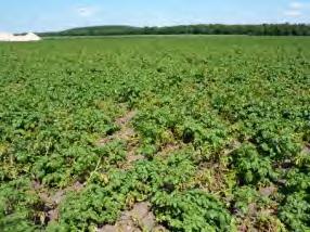


11 Agriculture and precision farming 31 mei 11 juni 23 juni 5 juli 14 juli 19 aug 6 sept Optimal start Adjustment over the season Sensor observation


12 Potential at start: soil organic matter status

13 Mapping soil erosion status

14 Landslide displacement


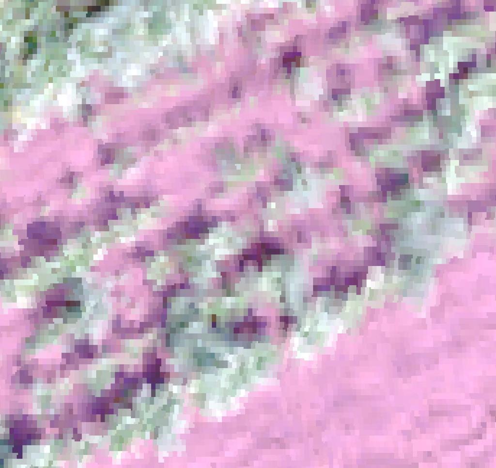
15 Over growing season: crop monitoring Flight at 100m altitude Pixel size Orthophoto 0.018m Hyperspectral 0.500m June 6 June 14 July 5 July 17
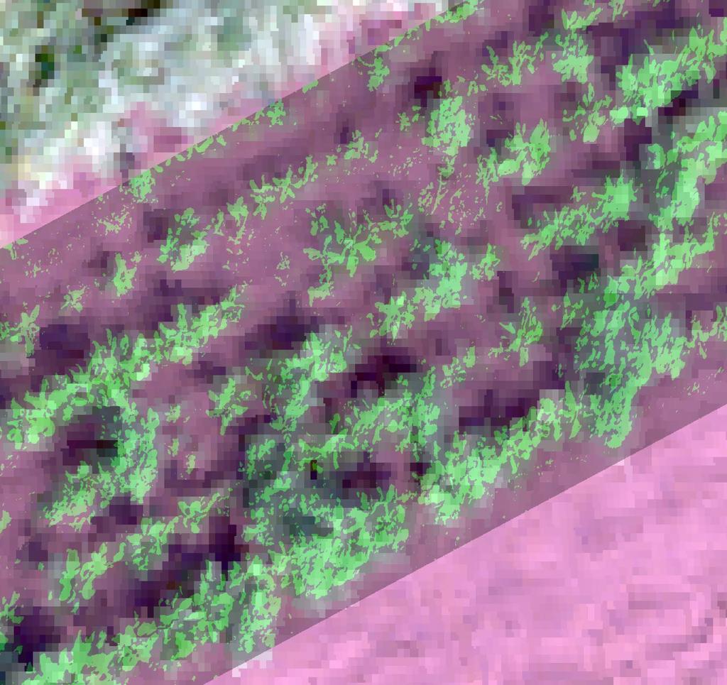
16 Over growing season: crop monitoring Chl re = (780/710)-1

17 Over growing season: crop monitoring June 14 July 5


18 Identification of sugarbeet in potato Msc thesis Thomas Koot in cooperation with Farming Systems WUR Jan Willem Hofstee

19
20
21


22 Habitat mapping and monitoring Forest cuts


23 Monitoring Deforestation Wekeromse Zand Google Earth Jappe Franke, Juha Suomalainen Philip Wenting


24 3D Model


25 Coral reef mapping island of Bonaire
26 Outlook WUR From mapping to monitoring Consistent signal in time (spatially and spectrally) Efficient processing chains -> real-time products Link UAS products with science fields and applications Integration with satellite and ground based sensors New UAS domains: forestry and thermal NL Regulations and towards Certification BNUC-S: Basic National UAS Certificate Small Aircraft Operations Manual Theory Ground Course and Flight Examination ILT project exemption + TUG

27 UAS in research and business: how to meet? Research <-> Commercial <-> End-users Exchange/flow of knowledge Sharing of protocols/best practices required Sharing and exchange of facilities regulatory frameworks Research Network Smart Inspectors (smartinspectors.net) IMST LWK NRW WUR Alterra RSRW BLGG HSRW sceme.de Terrasphere

28 Thank you for your attention

29 Current UAS networks Research oriented projects: Bioscope, Fieldcopter, Smart Inspectors and many more (limited duration) Regulation oriented platforms: national and EU Sector organized platforms: e.g., DARPAS in NL Scientific conferences and workshops: Workshop on UAV-based Remote Sensing Methods for Monitoring Vegetation, Sept. 9th - 10th, 2013, Uni Cologne UAS event Eindhoven and Odense in 2013 UAV-g conference 4-6 Sept at Rostock University UAS session, EGU2014 conference, Vienna
30 Position of UAS networks Public/policy: RPAS regulation Regulation oriented platforms Who or what??? Sector platforms: e.g., DARPAS-NL Research: Innovations and solutions Research oriented projects Business/users: Products and services Conferences and workshops
ESA UNCLASSIFIED - For Official Use
 ESA UNCLASSIFIED - For Official Use OPPORTUNITIES OF UAV BASED SENSING FOR VEGETATION LAND PRODUCT VALIDATION Benjamin Brede 1, Juha Suomalainen 2, Peter Roosjen 1, Helge Aasen 3, Lammert Kooistra 1, Harm
New technologies for large scale phenotyping at the Wageningen UR Phenomics Innovation and Demonstration Centre
 New technologies for large scale phenotyping at the Wageningen UR Phenomics Innovation and Demonstration Centre Gerrit Polder, Wageningen UR, Greenhouse Horticulture Rick van de Zedde, Wageningen UR, Food
Unmanned Aerial Systems
 2016 Southern Consultants Meeting Unmanned Aerial Systems How UAV s Are Helping Us Become More Profitable and Better Stewards of the Land Christian Brodbeck February 25, 2016 Information drives agriculture
Unmanned Aerial Vehicle (UAV)-Based Remote Sensing for Crop Phenotyping
-Based Remote Sensing for Crop Phenotyping") Unmanned Aerial Vehicle (UAV)-Based Remote Sensing for Crop Phenotyping Sanaz Shafian 1, Nithya Rajan 1, Yeyin Shi 2, John Valasek 3 & Jeff Olsenholler 4 1 Dept. of Soil and Crop Sciences; 2 Dept. of Biological
Unmanned Aerial Vehicle (UAV)-Based Remote Sensing for Crop Phenotyping Sanaz Shafian 1, Nithya Rajan 1, Yeyin Shi 2, John Valasek 3 & Jeff Olsenholler 4 1 Dept. of Soil and Crop Sciences; 2 Dept. of Biological
Integrating remote-, close range- and in-situ sensing for highfrequency observation of crop status to support precision agriculture
 Sensing a Changing World 2012 Integrating remote-, close range- and in-situ sensing for highfrequency observation of crop status to support precision agriculture Lammert Kooistra 1 *, Eskender Beza 1,
Research with UASs in the Eel River Watershed
 Research with UASs in the Eel River Watershed Jim Graham Eel River Forum June 8 th, 2016 Photo by Chris Muhl Terminology Drones: Military UAV: Unmanned Aerial Vehicle UAS Unmanned Aerial System Preferred
Remote Sensing Uses in Agriculture at NASS
 Remote Sensing Uses in Agriculture at NASS United States Department of Agriculture (USDA) National Agriculture Statistics Service (NASS) Research and Development Division Geospatial Information Branch
Potential for Using Unmanned Aerial Vehicles (UAV) in an On-Site Inspection
 in an On-Site Inspection") Potential for Using Unmanned Aerial Vehicles (UAV) in an On-Site Inspection Dr James Palmer AWE plc, UK CTBTO Science and Technology Conference 2015 T3.2-06 What is an Unmanned Aerial Vehicle? Different
Potential for Using Unmanned Aerial Vehicles (UAV) in an On-Site Inspection Dr James Palmer AWE plc, UK CTBTO Science and Technology Conference 2015 T3.2-06 What is an Unmanned Aerial Vehicle? Different
DRONES EN TOEPASSINGEN
 17/11/2017 DRONES EN TOEPASSINGEN PREBES 16TH NOV 2017, BOOM WWW.VITO.BE KOEN MEULEMAN 1 UAV/UAS, DRONES NO! RPAS (REMOTELY PILOTED AIRCRAFT SYSTEMS, EVEN AN AIRCRAFT ICAO, 28/08/2012 An aircraft (wing
REMOTE SENSING FOR SOIL SCIENCE. Remote Sensing (GRS-20306)
") REMOTE SENSING FOR SOIL SCIENCE Remote Sensing (GRS-20306) Outline Soils RS & soils How to derive soil information from (remote) sensing data Instructions for the Exercise Why is soil so important? Vital
REMOTE SENSING FOR SOIL SCIENCE Remote Sensing (GRS-20306) Outline Soils RS & soils How to derive soil information from (remote) sensing data Instructions for the Exercise Why is soil so important? Vital
11. Precision Agriculture
 Precision agriculture for crop production can be defined as a management system that: is information- and technology-based is site-specific uses one or more of the following sources of data for optimum
Precision Agriculture Methods & Cranberry Crop Monitoring with Drones
 Precision Agriculture Methods & Cranberry Crop Monitoring with Drones Presented by: Mike Morellato, M.Sc., GISP Owner, Crop Sensors Remote Sensing and Agriculture Longer history than many realize.of identifying,
Low Cost Aerial Mapping Alternatives for Natural Disasters in the Caribbean
 Low Cost Aerial Mapping Alternatives for Natural Disasters in the Caribbean Raid Al-Tahir, Marcus Arthur, and Dexter Davis The University of the West Indies, Trinidad and Tobago Presentation Outline: The
Use of EO for integrated Coastal Zone Management [ICZM]
![Use of EO for integrated Coastal Zone Management [ICZM]](/thumbs/78/78380350.jpg "Use of EO for integrated Coastal Zone Management [ICZM]") Use of EO for integrated Coastal Zone Management [ICZM] Prof. George Zalidis Aristotle University of Thessaloniki, School of Agriculture Director of the Laboratory of Applied Soil Science Director of the
Use of EO for integrated Coastal Zone Management [ICZM] Prof. George Zalidis Aristotle University of Thessaloniki, School of Agriculture Director of the Laboratory of Applied Soil Science Director of the
3D Reconstruction Optimization Using Imagery Captured By Unmanned Aerial Vehicles
 3D Reconstruction Optimization Using Imagery Captured By Unmanned Aerial Vehicles Abby Bassie, Sean Meacham, David Young, Gray Turnage, and Robert J. Moorhead Geosystems Research Institute, Mississippi
Development and Applications of Unmanned Aerial Vehicles: Challenges and Opportunities
 Development and Applications of Unmanned Aerial Vehicles: Challenges and Opportunities Yanbo Huang Research Ag Engineer, Lead Scientist, USDA-ARS Adjunct Professor, Texas A&M University, Mississippi State
CARPIVIA project support for Working group objectives
 CARPIVIA project support for Working group objectives Saskia Werners, Wageningen UR, David Nieuwenhuis, Grontmij Session Objective: Linking working group objectives with Carpivia progress; Get feedback
Expert Meeting on Crop Monitoring for Improved Food Security, 17 February 2014, Vientiane, Lao PDR. By: Scientific Context
 Satellite Based Crop Monitoring & Estimation System for Food Security Application in Bangladesh Expert Meeting on Crop Monitoring for Improved Food Security, 17 February 2014, Vientiane, Lao PDR By: Bangladesh
Summary of the socio-economic impact of Copernicus in the EU
 Summary of the socio-economic impact of Copernicus in the EU ESA Since the entry into service of Copernicus first satellite, Sentinel-1A, in 2014, the impacts of the programme are witnessed beyond the
Airship-based LiDAR and multi-sensor forest monitoring
 Airship-based LiDAR and multi-sensor forest monitoring S. Esposito, P. Fallavollita, M. Balsi, R. Tognetti, M. Marchetti COST WORKSHOP Green Engineering Camp ( GEC) Plitvice Lakes National Park, Croatia
Soil Moisture Mapping
 Soil Moisture Mapping with UAS an Advanced UAS for Environmental Monitoring info@blackswifttech.com Figure 1: The Black Swift Technologies S2TM and its soil moisture monitoring payload. Introduction ter
Inside Smart Environment
 Inside Smart Environment Drones R2 is a company doing business in the development of unmanned systems US (Unmanned Systems), both air UAV (Unmanned Aerial Vehicle), as underwater ROV (Remote Operated Vehicle)
Generating Actionable Insights in the Field. Agriculture Webinar Series
 Generating Actionable Insights in the Field Agriculture Webinar Series Meet Our Panelists Ian Smith Milan Dobrota Matthew Barre Business Development DroneDeploy Founder & CEO Agremo Director of Strategic
Precision Agriculture. for Smart Farming solutions
 Precision Agriculture for Smart Farming solutions What is Precision Agriculture? An integrated agricultural management system incorporating several advanced technologies The technological tools often include
USDA Use of Small Unmanned Aircraft Systems (suas)
") USDA Use of Small Unmanned Aircraft Systems (suas) E. Raymond Hunt, Jr. USDA-ARS Hydrology and Remote Sensing Lab. Beltsville Agricultural Research Center Beltsville, Maryland Cultivation of soil, applications
USDA Use of Small Unmanned Aircraft Systems (suas) E. Raymond Hunt, Jr. USDA-ARS Hydrology and Remote Sensing Lab. Beltsville Agricultural Research Center Beltsville, Maryland Cultivation of soil, applications
From Boom to Bust to Destiny A Potential Flight Path for Commercial UAV Markets. Robin Higgons. Qi3 Ltd
 A Potential Flight Path for Commercial UAV Markets Robin Higgons Qi3 Ltd 1 Setting the Scene Range of UAV Types Category Sub Category Long Range HALE (High Altitude Long Endurance) MALE (Mid Altitude Long
UNMANNED AERIAL VEHICLE SYSTEMS
 UNMANNED AERIAL VEHICLE SYSTEMS UNMANNED AERIAL VEHICLE SYSTEMS INTRODUCTION UAV SYSTEMS APPLICATIONS LEGISLATION SAFETY CONSIDERATIONS HOW TO SELECT A COMPETENT SUPPLIER OF UAV SERVICES Q&A One of Europe's
Spatial variation within agricultural fields and site-specific crop management
 Spatial variation within agricultural fields and site-specific crop management Use of mobile maps and satellite information in PA Corné Kempenaar Geospatial world forum, seminar on mobile mapping, Amsterdam,
UAS In Agriculture A USDA NIFA Perspective; Appropriate Science, Possibilities, and Current Limitations
 UAS In Agriculture A USDA NIFA Perspective; Appropriate Science, Possibilities, and Current Limitations Steven J. Thomson, Ph.D National Program Leader Background Faculty member at Virginia Tech for seven
Assessing a river floodplain status using airborne imaging spectrometer data and ground validation the HyEco 04 project
 Assessing a river floodplain status using airborne imaging spectrometer data and ground validation the HyEco 04 project L. Kooistra, O. Batelaan, J. Clevers, K. Sykora, L. Bertels, J. Bogaert, J. Holtland,
DIGITAL AGRICULTURE. Harold van Es TECHNOLOGY INNOVATION IN COMPLEX PRODUCTION ENVIRONMENTS. Cornell University
 DIGITAL AGRICULTURE TECHNOLOGY INNOVATION IN COMPLEX PRODUCTION ENVIRONMENTS Harold van Es Cornell University CHALLENGES WITH AGRICULTURE Feed a global population of 10B by 2050 with diminishing land and
CAN LOW COST, CONSUMER UAV'S MAP USEFUL AGRONOMIC CHARACTERISTICS?
 Wilson, J.A., 2017. Can low cost, consumer UAV s map useful agronomic characteristics? In: Science and policy: nutrient management challenges for the next generation. (Eds L. D. Currie and M. J. Hedley).
UAV assessment to support EU policies
 UAV assessment to support EU policies Elena Roglia Max Craglia www.jrc.ec.europa.eu Serving society Stimulating innovation Supporting legislation Sistema di Monitoraggio Avanzato del Territorio SMAT SMAT
From Applied Research to Application - Remote Sensing Products for Waterway Management
 From Applied Research to Application - Remote Sensing Products for Waterway Management Herbert Brockmann H. Brockmann, PhoWo 2017, Stuttgart 1 Agenda Introduction Relevant products Selected potential applications
Drones in Forestry: Regulations, Applications, and Considerations SESAF Conference Darian Yawn Paul Shepard
 Drones in Forestry: Regulations, Applications, and Considerations 2018 SESAF Conference Darian Yawn Paul Shepard About LMSS Forest Technology Solutions Provider Sales, Training, and Support Project Consulting,
FSBPA Chip Baumberger, Project Scientist Dustin Myers, UAV Coordinator Brent Gore, GIS Coordinator
 FSBPA 2018 Practical applications of drones (UAVs) for aerial mapping of beach and nearshore habitats & comparison to full-scale manned aircraft using GIS-based hardbottom classification Chip Baumberger,
Flying High. Typical methods
 1 Flying High MicroUAV (Unmanned Air Vehicles) Applications for Public Works APWA National Congress San Antonio, Texas September 2007 Mike Harrell, P.E. Senior Engineer mharrell@ara.com www.ara.com (p)
SMAT Project. Sistema di Monitoraggio Avanzato del Territorio (Advanced. Environment Monitoring System) May 13 th 2009
 May 13 th 2009") SMAT Project Sistema di Monitoraggio Avanzato del Territorio (Advanced Environment Monitoring System) May 13 th 2009 SMAT Project SMAT-F1 is a research project funded by the Regione Piemonte (Italy), managed
SMAT Project Sistema di Monitoraggio Avanzato del Territorio (Advanced Environment Monitoring System) May 13 th 2009 SMAT Project SMAT-F1 is a research project funded by the Regione Piemonte (Italy), managed
Unmanned Aerial Vehicles in Municipality Level 3D Topographic Data Production in Urban Areas
 Unmanned Aerial Vehicles in Municipality Level 3D Topographic Data Production in Urban Areas Olli NEVALAINEN, Tomi ROSNELL, Teemu HAKALA, Eija HONKAVAARA, Roope NÄSI, Kimmo NURMINEN, Finland Key words:
Farming from Space: Current and future opportunities for remote sensing to boost productivity for grain growers
 Farming from Space: Current and future opportunities for remote sensing to boost productivity for grain growers Hamlyn G Jones Division of Plant Sciences and University of Dundee, UK School of Plant Biology
Classification of arable land using multitemporal
 Mr. Anser Mehmood Classification of arable land using multitemporal TerraSAR-X data Duration of the Thesis: 6 months Completion: April 2013 Tutor: Dipl.- Geogr. René Pasternak Examiner: Prof. Dr.-Ing.
The potential of remote sensing in the Agribusiness
 The potential of remote sensing in the Agribusiness Ruben Van De Vijver, Koen Mertens, Peter Lootens, David Nuyttens, Jürgen Vangeyte ICAReS Innovations in remote sensing July 14, 2017 Eastgate Conference
Drones and Its Applications Manzul Kumar Hazarika, Ph.D.
 Drones and Its Applications Manzul Kumar Hazarika, Ph.D. Director (Project Operations), Geoinformatics Center Asian Institute of Technology (AIT) Thailand manzul@ait.asia This learning material was not
Saving Money with Precision Agriculture
 Saving Money with Precision Agriculture Mark Carter, MBA Delaware County ANR February 22, 2018 Photo from Hay and Forage Growers Today s farm operation requires incredible amounts of cash flow with marginal
Drones Use in Forestry: Regulations, Applications, Considerations
 Drones Use in Forestry: Regulations, Applications, Considerations Regulations What is a Drone? Small unmanned aircraft system aka UAV, UAS, suas. Weight is greater than 0.5 lbs. and less than 55 lbs. including
GPS & Drone Workshops
 GPS & Drone Workshops Rutgers University Inn, New Brunswick December 11-12, 2017 Presented by Discovery Management Group, LLC Co-sponsored by the Center for Remote Sensing & Spatial Analysis, Rutgers University
Outline of seminar. The business case for operating a UAS
 Outline of seminar The business case for operating a UAS Process and what to include in a business case Demonstration project Issues we considered in selecting the type of UAS CASA certification and ongoing
Precision agriculture: PPP&P What is needed?
 Precision agriculture: PPP&P What is needed? Corné Kempenaar et al NSO workshop AgriEO, 4-5July 2017, The Hague, NL Precision Agriculture / Farming Precision agriculture is a farm management concept based
Drone Basics 101 Technology, Regulations and Project Examples. Tom Gehrdes & Alton Whittle
 Drone Basics 101 Technology, Regulations and Project Examples Tom Gehrdes & Alton Whittle What are UAVs? Unmanned Aerial Vehicles (UAVs) are remotely operated aircraft that fly without the possibility
Hyperspectral information for vegetation monitoring
 Hyperspectral information for vegetation monitoring Gaia Vaglio Laurin DIBAF Università della Tuscia, CMCC Activities supported by the EU H2020 BACI grant #640176 Italian Space Agency, Rome, 1-3 March
Potential of UAV for field sensing!! Advanced Remote Sensing
 Potential of UAV for field sensing!! Advanced Remote Sensing HONDA Kiyoshi Int l Digital Earth Applied Science Research Center (IDEAS) Chubu University hondak@isc.chubu.ac.jp UAV ( Unmanned Aerial Vehicle
Unmanned Aircraft Systems (UAS) Capabilities and Expertise. Applications of UAS in the Water Resource Industry
 Capabilities and Expertise. Applications of UAS in the Water Resource Industry") Unmanned Aircraft Systems (UAS) Capabilities and Expertise Applications of UAS in the Water Resource Industry Alonso Morales Commercial UAS Pilot Joint Unmanned Systems Management Services March 23rd,
Unmanned Aircraft Systems (UAS) Capabilities and Expertise Applications of UAS in the Water Resource Industry Alonso Morales Commercial UAS Pilot Joint Unmanned Systems Management Services March 23rd,
Using multi-temporal ALOS PALSAR to investigate flood dynamics in semi-arid wetlands: Murray Darling Basin, Australia.
 Using multi-temporal ALOS PALSAR to investigate flood dynamics in semi-arid wetlands: Murray Darling Basin, Australia. Rachel Melrose, Anthony Milne Horizon Geoscience Consulting and University of New
$ / maximum area Imagery $10-20 No limit $<1-3. $ / minimum area
 Technical Note Forest Industry Applications of UAVs 20 July 2017 Authors: Dr Grant Pearse *, Dr Michael Watt. * Corresponding author: grant.pearse@scionresearch.com Summary A recent project at Scion explored
Unmanned Aerial Vehicle (UAV) Inspection, survey, mapping, modelling & analysis
 Inspection, survey, mapping, modelling & analysis") Unmanned Aerial Vehicle (UAV) Inspection, survey, mapping, modelling & analysis Opus have utilised our own UAV fleet since 2007. They are one of a range of technologies used to enhance our core services.
Unmanned Aerial Vehicle (UAV) Inspection, survey, mapping, modelling & analysis Opus have utilised our own UAV fleet since 2007. They are one of a range of technologies used to enhance our core services.
Land Cover Land Use Change Research in Korea
 Land Cover Land Use Change Research in Korea (Land Monitoring Research Project) 2009. 1. 13 Kyu-Sung Lee Inha University Land Monitoring Research Center (LMRC) Incheon, KOREA NASA LCLUC Science Meeting,
Reinhard Blasi EGNOS and Galileo in Agriculture. European GNSS Agency Market Development
 Reinhard Blasi EGNOS and Galileo in Agriculture European GNSS Agency Market Development Agenda 2 European GNSS Agency GSA EGNOS and Galileo in Agriculture Main Applications in Precision Agriculture Differences
Real-time surveillance just got lighter
 Real-time surveillance just got lighter The most important thing we build is trust AVIATOR UAV 200 Enhanced satcom connectivity for tactical UAVs Photo: Andrew Shiva The world s smallest, lightest Inmarsat
UAV USER NEEDS REPORT EXECUTIVE SUMMARY. We know where.
 UAV USER NEEDS REPORT EXECUTIVE SUMMARY We know where. FrontierSI profiled 56 UAV applications across 12 industries. We have included a few examples from the report in this summary. MINING: REHABILITATION
Use of Sentinel 2 for agricultural operational applications at farm level - Talking Fields
 Use of Sentinel 2 for agricultural operational applications at farm level - Talking Fields Dr. Heike Bach Vista - Remote Sensing in Geosciences GmbH VISTA 2016 www.vista-geo.de No. 1 Vista Remote Sensing
Use of Unmanned Aerial Vehicles (UAVs) in Impact Assessment. IAIA, Florence, Italy, April 2015
 in Impact Assessment. IAIA, Florence, Italy, April 2015") Use of Unmanned Aerial Vehicles (UAVs) in Impact Assessment IAIA, Florence, Italy, April 2015 EIA Context EIA is essentially a predictive process that informs decision making Institutionalisation: 191
Use of Unmanned Aerial Vehicles (UAVs) in Impact Assessment IAIA, Florence, Italy, April 2015 EIA Context EIA is essentially a predictive process that informs decision making Institutionalisation: 191
Precision agriculture and more. Corné Kempenaar, WPR Agro Systems Research Symposium Food for Future, Wageningen, June 22, 2018
 Precision agriculture 2.0... and more Corné Kempenaar, WPR Agro Systems Research Symposium Food for Future, Wageningen, June 22, 2018 2 Right time Right place Right input Right amount Precision Agriculture
Jacksonville District Surveying and Mapping Branch UAS Program
 Jacksonville District Surveying and Mapping Branch UAS Program INFORMATION BRIEF Travis Barnett 17 March 2017 Jacksonville District UAS team US Army Corps of Engineers USACE Mission Mission: Deliver vital
UAVs 4 STEM. Using recreational drones for learning. March 22, 2016 Presenters: LuAnn Dahlman, NOAA Dan Zalles, SRI
 UAVs 4 STEM Using recreational drones for learning E Federation of Earth Science Information Partners (ESIP) adsf Education Committee March 22, 2016 Presenters: LuAnn Dahlman, NOAA Dan Zalles, SRI Earth
10/25/2017. How Technological Advances are Impacting Risks on the Farm. Along with New Technology Come New Risks
 How Technological Advances are Impacting Risks on the Farm Presented By: Cheryl L. Koch CPCU, CIC, ARM, AAI, AAM, AIM, AIS, ARP, API, AINS, ACSR, AFIS Agency Management Resource Group #IRMI2017 Along with
Remote Sensing in Precision Agriculture
 Remote Sensing in Precision Agriculture D. J. Mulla Professor and Larson Chair for Soil & Water Resources Director Precision Ag Center Dept. Soil, Water, & Climate Univ. Minnesota Challenges Facing Agriculture
Outline Applicability of Rotary UAV for Vegetable Crop Investigation. Overview. Crop Investigations III. UAV Experimentation.
 ⅩⅩⅤFIG Congress Engaging the Challenges, Enhancing the Revelance 16-21 June 2014, MALAYSIA Applicability of Rotary UAV for Vegetable Crop Investigation Insu Lee, Jihun Kang, Kil Jae Lee, Myong Kun Lee
Introduction -session Mark Noort Latin America Geospatial Forum, Mexico City, 2014
 G-tech for agriculture Introduction -session Mark Noort Latin America Geospatial Forum, Mexico City, 2014 Scope In relation to crop farming and livestock farming, the term agriculture may be defined as:
Land Surface Monitoring from the Moon
 Land Surface Monitoring from the Moon Jack Mustard, Brown University Workshop on Science Associated with Lunar Exploration Architecture Unique Perspective of Lunar Observation Platform Low Earth Orbit:
Application of remote sensing technique for rice precision farming
 Application of remote sensing technique for rice precision farming Teoh Chin Chuang (DR) Chan Chee Wan (DR) Abu Hassan Daud Malaysian Agricultural Research and Development Institute (MARDI) Background:
Accenture Aerial Monitoring Solution. For Electric Utilities and Oil & Gas companies
 Accenture Aerial Monitoring Solution For Electric Utilities and Oil & Gas companies Accenture Aerial Monitoring Solution for asset intensive companies Companies which have a large asset base and operate
Unmanned Aerial Photography Aerial Analysis Solutions Project Management Condition Assessment Asset Management Concrete Testing & Consulting
 Unmanned Aerial Photography Aerial Analysis Solutions Project Management Condition Assessment Asset Management Concrete Testing & Consulting Protective Coating Inspection SYMBIOSIS AUSTRALIA OVERVIEW Supporting
Barge Design Solutions Areas of Service:
 CycloMedia provides Professional Grade 360 degree Street Level Imagery with GIS accuracy for asset inventory, visualizing grade and condition of assets and updating the existing geo-database within a city
Modeling Cropping Systems Strategies to Optimize Yield, Water and Nutrients
 Modeling Cropping Systems Strategies to Optimize Yield, Water and Nutrients Bruno Basso Department of Geological Sciences and W.K. Kellogg Biological Station 2012 World Food Supply 5.5 billion gross tonnes;
Real-time surveillance just got lighter
 Real-time surveillance just got lighter The most important thing we build is trust AVIATOR UAV 200 Enhanced satcom connectivity for tactical UAVs Photo: Andrew Shiva. Intergrator is produced by Insitu
Management. civilian. Perrotis. Keywords: UAV
 Management Zones delineation in olive grove g using an Unmanned Aerial Vehicle (UAV) Athanasios Gertsis 1, Christos Vasilikiotis 1 and Konstantinos Zoukidis 1 1 Department of Environmental Systems Management,
Sensors And Image Processing
 Sensors And Image Processing Craig Poling Chief Technology Officer Sentek Systems craigpoling@senteksystems.com (952) 500-3533 Sentek Systems, LLC Sensors For High-Throughput Phenotyping 1 / 32 Platforms
Drone technology has skyrocketed over the past decade driving costs down and the
 I. ABSTRACT Drone technology has skyrocketed over the past decade driving costs down and the number of potential applications up, one being agricultural crop monitoring. Normalized Difference Vegetation
Unmanned Aerial Vehicles (UAVs) for Remote Sensing and Environmental Monitoring. Research Project: Msc Wildlife and Conservation Management, USW
 for Remote Sensing and Environmental Monitoring. Research Project: Msc Wildlife and Conservation Management, USW") Unmanned Aerial Vehicles (UAVs) for Remote Sensing and Environmental Monitoring Abigail L Sanders (15081400) Research Project: Msc Wildlife and Conservation Management, USW Invasive Rhododendron Monitoring
Unmanned Aerial Vehicles (UAVs) for Remote Sensing and Environmental Monitoring Abigail L Sanders (15081400) Research Project: Msc Wildlife and Conservation Management, USW Invasive Rhododendron Monitoring
Earth Observation & Mapping
 Coastal bathymetry from Wordview-2 satellite data 2012 Thomas Heege EOMAP Germany Magnus Wettle EOMAP Asia Pacific Dave Benson DigitalGlobe London David Chritchley Proteus Abu Dhabi Susanne Lehner German
AERIAL INSPECTIONS USING UNMANNED AERIAL VEHICLES
 AERIAL INSPECTIONS USING UNMANNED AERIAL VEHICLES MICHAEL A. PEREZ, WESLEY C. ZECH, PH.D., WESLEY N. DONALD, PH.D. MRN/SWANA MID-ATLANTIC A N N UA L C ONFERENCE ELLICOTT CITY, MD JUNE 22, 2016 Research
ACTIVITY LIST. Integrated Drought Management in Central and Eastern Europe 1. BASIC INFORMATION. Number of Activity: 5.5
 Integrated Drought Management in Central and Eastern Europe ACTIVITY LIST 1. BASIC INFORMATION Number of Activity: 5.5 Title of the activity: Policy oriented study on remote sensing agricultural drought
Fixed-Wing Survey Drone. Students:
 Fixed-Wing Survey Drone Functional Description and System Block Diagram Students: Ben Gorgan Danielle Johnson Faculty Advisor: Dr. Joseph A. Driscoll Date: October 1, 2013 Introduction This project will
Term Project December 5, 2006 EES 5053: Remote Sensing, Earth and Environmental Science, UTSA
 Term Project December 5, 2006 EES 5053: Remote Sensing, Earth and Environmental Science, UTSA Applying Remote Sensing Techniques to Identify Early Crop Infestation: A Review Abstract: Meaghan Metzler In
MULTI-SOURCE SPECTRAL APPROACH FOR EARLY WATER-STRESS DETECTION IN ACTUAL FIELD IRRIGATED CROPS
 Department of Geography and Environmental Studies MULTI-SOURCE SPECTRAL APPROACH FOR EARLY WATER-STRESS DETECTION IN ACTUAL FIELD IRRIGATED CROPS Maria Polinova 1, Thomas Jarmer 2, Anna Brook 1 1 Spectroscopy
UAS for California Water Resources Summit Food and Agriculture Perspective
 UAS for California Water Resources Summit Food and Agriculture Perspective Robert Schmidt, Director Executive Office OITS & Agency Information Officer 1. My Story 2. Agriculture Context 3. Use Cases My
DETERMINATION OF THE FOREST CANOPY COVER USING A LOW- COST COMMERCIAL DRONE IN A TURKEY OAK AND DURMAST OAK STAND IN THE ZARAND MOUNTAINS, ROMANIA
 DETERMINATION OF THE FOREST CANOPY COVER USING A LOW- COST COMMERCIAL DRONE IN A TURKEY OAK AND DURMAST OAK STAND IN THE ZARAND MOUNTAINS, ROMANIA 12 T. P. BANU 1, G. F. BORLEA 1, C. BANU 1 1 Banat s University
Agricultural Aerial Services
 Agricultural Aerial Services Satellite Imagery Satellite LOW Imagery RESOLUTION IMAGE LOW RESOLUTION IMAGE Satellite Imagery LOW RESOLUTION IMAGE High Resolution Imagery High Resolution SUPERIOR Imagery
Aerial Thermal and Visual Inspection of Electric Lines with an Unmanned Aerial System Brandon Rench, CP
 2018 Aerial Thermal and Visual Inspection of Electric Lines with an Unmanned Aerial System Brandon EXECUTIVE SUMMARY Our client has 770 miles of electric Distribution and Transmission lines which provide
Unmanned Aerial Systems (UAS) Desk and Derrick Club of Dallas May 3 rd, 2018
 Desk and Derrick Club of Dallas May 3 rd, 2018") Unmanned Aerial Systems (UAS) Desk and Derrick Club of Dallas May 3 rd, 2018 Table of Contents Introduction to UASs Current Market Projections Oil and Gas Adoption FAA & Regulations Oil and Gas Applications
Unmanned Aerial Systems (UAS) Desk and Derrick Club of Dallas May 3 rd, 2018 Table of Contents Introduction to UASs Current Market Projections Oil and Gas Adoption FAA & Regulations Oil and Gas Applications
Use of UAVs for ecosystem monitoring. Genova, July 20 th 2016
 Use of UAVs for ecosystem monitoring Genova, July 20 th 2016 Roberto Colella colella@ba.issia.cnr.it Unmanned Aerial Vehicle An Unmanned Aerial Vehicle (UAV) is an aircraft without a human pilot onboard.
DSS 500 with In-FlightOrtho Maximize Your Productivity!
 DSS 500 with In-FlightOrtho Maximize Your Productivity! : DSS 500 maximizes efficiency and productivity in aerial mapping with in-air georeferenced orthophoto production. capture everything. precisely.
Drones and Their Role in Agriculture. Mike Buschermohle Precision Ag Specialist UT Extension
 Drones and Their Role in Agriculture Mike Buschermohle Precision Ag Specialist UT Extension Current FAA Regulatory Environment Public UASs can fly under a Certificate of Authorization (COA). Government
Curriculum Development on the Management of Tropical Peatland Market Survey
 New Educational Tools for sustainable Management of Peatlands in the Humid Tropics/ PEATWISE Curriculum Development on the Management of Tropical Peatland Market Survey University of Malaysia, Sarawak,
Satellite Remote Sensing of Algal Blooms in the southcentral USA:
 Satellite Remote Sensing of Algal Blooms in the southcentral USA: Landsat 8 based algal and turbidity indices in the Grand Lake watershed Abu Mansaray, Doctoral Candidate Environmental Science Graduate
SHALOM: SPACEBORNE HYPERSPECTRAL APPLICATIVE LAND AND OCEAN MISSION: A JOINT PROJECT OF ASI-ISA AN UPDTAE FOR 2014
 SHALOM: SPACEBORNE HYPERSPECTRAL APPLICATIVE LAND AND OCEAN MISSION: A JOINT PROJECT OF ASI-ISA AN UPDTAE FOR 2014 Eyal Ben Dor Tel Aviv University Avia Kafri Israel Space Agency (ISA) Giancarlo Varacalli
VISualize2012: Climate Change and Environmental Monitoring
 VISualize2012: Climate Change and Environmental Monitoring ESTIMATION OF ABOVE GROUND BIOMASS IN RESTORED JUVENILE MANGROVE STANDS: EVALUATION OF SPECTRAL AND IMAGE DOMAIN OPERATORS UTILIZING AIRBORNE
Sowing the seeds. for a better future
 Sowing the seeds for a better future ` Information about crops season by season Key Solutions Land Management System GIS is a catalyst to agricultural developments and a beneficial tool to the farming
Open Working Group, February 2014: Australia, the Netherlands, United Kingdom Constituency Statement. Oceans and Seas, Forests and Biodiversity
 Open Working Group, February 2014: Australia, the Netherlands, United Kingdom Constituency Statement Oceans and Seas, Forests and Biodiversity Healthy ecosystems, biological diversity (biodiversity) and
DMC 22m Sensors for Supertemporal Land Cover Monitoring. Gary Holmes DMC International Imaging Ltd June 2014
 DMC 22m Sensors for Supertemporal Land Cover Monitoring Gary Holmes DMC International Imaging Ltd June 2014 DMC 2 nd Generation Satellites UK-DMC2 and Deimos-1 launched 29 th July 2009 650km swath width