Lord Associates, Inc. Environmental Consulting & Licensed Site Professional Services
|
|
|
- Brenda Lynch
- 6 years ago
- Views:
Transcription
1 Lord Associates, Inc. Environmental Consulting & Licensed Site Professional Services 1506 Providence Highway - Suite 30 Norwood, MA Voice: Fax: PHASE I-ENVIRONMENTAL SITE ASSESSMENT 2049 Dorchester Avenue Boston, Massachusetts Prepared for: Mr. Alex Ennis Affirmative Investments, Inc. 33 Union Street Boston, Massachusetts Prepared by: Lord Associates, Inc Providence Highway, Suite 30 Norwood, Massachusetts Project # 2197 December 18, 2014
2 Lord Associates, Inc. Environmental Consulting & Licensed Site Professional Services December 18, Providence Highway - Suite 30 Norwood, MA Voice: Fax: Mr. Alex Ennis Affirmative Investments, Inc. 33 Union Street Boston, Massachusetts RE: Phase I Environmental Site Assessment 2049 Dorchester Avenue Boston, Massachusetts Dear Mr. Ennis: Lord Associates, Inc. has completed a Phase I Environmental Site Assessment of the referenced property (the Site ). Environmental investigations were completed with consideration to standard industry practice, the ASTM E-1527 site assessment standard entitled Standard Practice for Environmental Site Assessments: Phase I Environmental Site Assessment Process, applicable regulations as defined by Chapter 21E of the Massachusetts General Laws, and the Massachusetts Contingency Plan (MCP, 310 CMR ). The purpose of this assessment was to identify Recognized Environmental Conditions as defined in ASTM E , and to determine if additional investigation is warranted. This assessment has not identified any Recognized Environmental Condition (REC) in connection with the property 2049 Dorchester Avenue in Boston, Massachusetts. Please refer to the attached report for specific details and findings of our assessment. We appreciate the opportunity to have provided our professional environmental consulting and analytical services. Sincerely, LORD ASSOCIATES, INC. Ralph Tella, CHMM, LSP President Andrea J. Lang Project Manager Enc.: Phase I ESA
3 TABLE OF CONTENTS 1.0 INTRODUCTION PURPOSE SIGNIFICANT ASSUMPTIONS SPECIAL TERMS AND CONDITIONS SCOPE OF SERVICES SITE DESCRIPTION SITE LOCATION AND PARCEL LEGAL DESCRIPTION SITE AND VICINITY GENERAL CHARACTERISTICS CURRENT PROPERTY USE DESCRIPTION OF IMPROVEMENTS Wastewater Water Supply Wells Heating/Cooling System Solid Waste Disposal Storage Tanks Transformers, Hydraulic Equipment and Other Potential Evidence of the Potential Use of Polychlorinated Biphenyls CURRENT USES OF ADJOINING PROPERTIES USER PROVIDED INFORMATION USER QUESTIONNAIRE TITLE RECORDS ENVIRONMENTAL LIENS, ACTIVITY AND USE LIMITATIONS SPECIALIZED KNOWLEDGE COMMONLY KNOWN OR REASONABLY ASCERTAINABLE INFORMATION VALUATION REDUCTION FOR ENVIRONMENTAL ISSUES OWNER, MAINTENANCE SUPERVISOR, AND OCCUPANT INFORMATION REASON FOR PERFORMING PHASE I STUDY RECORDS REVIEWS MUNICIPAL OFFICES Assessor s Office Health Department Building Department Water Department Conservation Commission Clerk s Office Fire Prevention SANBORN/HISTORICAL MAP REVIEW HISTORICAL AERIAL PHOTOGRAPH REVIEW RADIUS SEARCH FOR PROPERTIES OF ENVIRONMENTAL CONCERN MASSACHUSETTS DEPARTMENT OF ENVIRONMENTAL PROTECTION REVIEW PREVIOUS REPORTS PHYSICAL SETTING SOURCES HISTORICAL USE INFORMATION SITE RECONNAISSANCE METHODOLOGY AND LIMITING CONDITIONS INTERIOR INSPECTION EXTERIOR INSPECTION INTERVIEWS... 12
4 8.0 SUMMARY OF FINDINGS AND CONCLUSION FINDINGS CONCLUSIONS RESTRICTIVE CONDITIONS LIMITATIONS & DEVIATIONS SIGNIFICANCE OF DATA GAPS LIMITATIONS SIGNATURES AND ENVIRONMENTAL PROFESSIONAL STATEMENT APPENDIX A FIGURES AND PHOTOGRAPHS APPENDIX B DATABASE REPORT APPENDIX C MUNICIPAL INFORMATION
5 Phase I Environmental Site Assessment 2049 Dorchester Avenue, Boston, Massachusetts December 18, INTRODUCTION 1.1 Purpose Lord Associates, Inc. (LAI) has completed a Phase I Environmental Site Assessment for 2049 Dorchester Avenue Boston, Massachusetts, Suffolk County (the Site ). The purpose of this assessment was to identify Recognized Environmental Conditions as defined in ASTM standard E (the Standard), and to determine if additional investigation is warranted. Recognized Environmental Conditions are defined as the presence or likely presence of any hazardous substances or petroleum products on the property under conditions that indicate an existing release, or a material threat of a release of any hazardous substances or petroleum products into structures on the property or into the ground, groundwater, or surface water of the property. The term Recognized Environmental Conditions is not intended to include de minimis conditions which generally do not present a material risk of harm to public health or the environment, and that generally would not be the subject of a notification and/or enforcement action if brought to the attention of appropriate governmental agencies. The Phase I consisted of a Site reconnaissance and an assessment of the Site and surrounding properties for visual and/or olfactory evidence of the use, storage, and/or release of oil and/or hazardous material. The Phase I also included a review of federal, state, and local agency files regarding the history of the Site and surrounding area relative to the use, storage and/or release of oil and/or hazardous material. Please note that an investigation for the presence of mold, asbestos and PCBs in building materials, lead-based paint, indoor air quality, or regulatory compliance is beyond the scope of work described by ASTM E , therefore LAI did not explore those conditions. 1.2 Significant Assumptions Factual information regarding operations, conditions, and other data provided by the Client, site contacts, third parties, and governmental agencies are assumed to be correct and complete. 1.3 Special Terms and Conditions The Phase I ESA was conducted by LAI on behalf of the client consistent with the agreed upon Scope of Work and LAI Standard Terms and Conditions. No other special terms and conditions were established in connection with these services. Lord Associates, Inc. 1
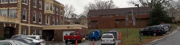
6 Phase I Environmental Site Assessment 2049 Dorchester Avenue, Boston, Massachusetts December 18, SCOPE OF SERVICES This assessment was performed following standard industry practice and with consideration to the ASTM E site assessment standard entitled Standard Practice for Environmental Site Assessments: Phase I Environmental Site Assessment Process. The investigation included completion of the following tasks: 1. A field investigation was performed including a visual surficial inspection of the Site and abutting properties; and 2. The following agencies were contacted to inquire of past ownership, complaints, or violations concerning environmental issues at the Site and vicinity. The Massachusetts Department of Environmental Protection (MADEP) The Boston Tax Assessor s Office The Boston Town Clerk s Office The Boston Health Department The Boston Building Department The Boston Water Department The Boston Conservation Commission The Boston Fire Prevention Office Environmental Risk Information Services (ERIS) Sanborn Fire Insurance Maps 3.0 SITE DESCRIPTION 3.1 Site Location and Parcel Legal Description Information provided indicates that the Site consists of a two lots totaling approximately 6.24 acres of land located on the northwest corner of Dorchester Avenue and Gallivan Boulevard in Boston, Massachusetts. A Site Location Map is included as Figure 1. The Site is designated as Assessor s Parcel ID and with the Boston Tax Assessor s Office. Assessor s records indicates that an additional address of 2061 Dorchester Avenue is associated with the Site. A Plot Plan is included as Figure 2 and a Site Plan depicting pertinent Site features is included as Figure 3. Information provided indicates the Site longitude and latitude are approximately west and north, respectively. Universal Transverse Mercatur (UTM) coordinates are approximately 4,682,987 meters north by 329,579 meters east. 3.2 Site and Vicinity General Characteristics The Site is located on the northwest corner of Dorchester Avenue and Gallivan Boulevard in Boston, Massachusetts. The Site is occupied by one three-story nursing home building constructed on-slab. The building has a foot print of approximately 76,000 square. Information provided by the Boston Inspectional Services Department indicates the Lord Associates, Inc. 2
7 Phase I Environmental Site Assessment 2049 Dorchester Avenue, Boston, Massachusetts December 18, 2014 original portion of the building was constructed in Additions to the building were constructed in 1960, 1982 and The building is situated centrally at the Site. The building is surrounded by grass and walkways on all sides. A driveway extends from Dorchester Avenue to the front of the building. A paved parking area exists on the northeast corner of the property. 3.3 Current Property Use The Site property is occupied by The Boston Home, which consists of a three-story nursing home building with 58 resident rooms. 3.4 Description of Improvements The Site is improved with three-story nursing home. The building comprises roughly 30% of the total surface area of the Site. The building is situated centrally at the Site. The building is surrounded by grass and walkways on all sides. A driveway extends from Dorchester Avenue to the front of the building. A paved parking area exists on the northeast corner of the property. There are no pits, ponds, lagoons or surface water bodies located at the Site. A detailed Site description is presented in Section Wastewater Wastewater generated on-site is discharged to the municipal sewer. No information pertaining to storm water handling and/or management was encountered during this assessment. No oil/water separators or storm drains were observed in the buildings. Floor drains were observed in the boiler room located on the southern portion of the building Water Supply Water is supplied by the City of Boston; the connection date was not available through files reviewed Wells No potable, irrigation, injection, dry, groundwater monitoring or abandoned wells were observed or identified from the interviews or records reviewed Heating/Cooling System Heat for the building is provided by forced hot water from natural gas fired boilers. AC in the building is provided by roof top HVAC units and a central chiller. Hot water is provided by a natural gas-fired water heaters. Lord Associates, Inc. 3
8 Phase I Environmental Site Assessment 2049 Dorchester Avenue, Boston, Massachusetts December 18, Solid Waste Disposal One solid waste compacter was observed on the north side of the building. Solid waste is disposed of by a contacted waste hauler. There were no areas of solid waste disposal, mounds or depressions, or areas apparently filled or graded by non-natural causes suggesting solid waste disposal observed Storage Tanks No evidence of current underground fuel oil tanks (USTs) or aboveground fuel oil tanks (AST) were identified during the inspection. No evidence of USTs or ASTs was reviewed at the Boston Fire Department. Building department records indicated that permits and plans dated August 1955, were reviewed for a proposed built-in-place oil storage tank containing 5,000-gallons of No. 2 fuel oil and 10,000-gallons of No. 6 fuel oil in a portion of the existing coal bunker off the lower floor boiler room of the boiler room and laundry building. A Board of Appeals letter dated October 1955, determined whether the vaulted tanks would be installed; the BOA decision was not in the file Transformers, Hydraulic Equipment and Other Potential Evidence of the Potential Use of Polychlorinated Biphenyls Polychlorinated Biphenyls (PCBs) can be found in hydraulic-oil filled electrical equipment (such as motors and pumps), capacitors or transformers, building materials and fluorescent light ballasts manufactured prior to July 2, LAI observed fluorescent light fixtures throughout the Site. The age of the fixtures could not be determined. However, it is not likely that the light ballasts were manufactured prior to 1979, as the average life span for the fluorescent fixtures is less than 15 years. Additionally, any light ballast manufactured after 1979 must be labeled No PCB. Note that electric light ballasts that contained PCBs had less than 1.5 ounces of PCB. The reportable quantity requiring notification to the Massachusetts Department of Environmental Protection of a release is one pound. Therefore the risk presented by PCBcontaining ballasts is relatively low. Sampling for building materials is beyond the scope of ASTM E The Site building is supplied with secondary electrical service from one pad mounted electrical transformer observed on the south side of the building. The transformer is owned by the public utility; the PCB content is unknown. This equipment appeared to be in good condition with no evidence of leaks. One hydraulic compactor was observed on the north side of the Site building. The hydraulic reservoir for the compactor equipment was observed above the concrete floors; no evidence of leaks or staining from the equipment was observed. Sampling for building materials is beyond the scope of ASTM E Lord Associates, Inc. 4
9 Phase I Environmental Site Assessment 2049 Dorchester Avenue, Boston, Massachusetts December 18, 2014 Five hydraulic elevators were observed in the building. The hydraulic reservoirs for the elevators equipment were observed above the concrete floors; no evidence of leaks the equipment was observed in the elevator equipment rooms. Sampling for building materials is beyond the scope of ASTM E No other evidence of the potential use of polychlorinated biphenyls (PCBs) was observed on the Site during the inspections. 3.5 Current Uses of Adjoining Properties Residential properties surround the Site. No bulk fuel storage was observed on adjacent properties. The table below summarizes current abutting land usage. Table 1 Area Land Usage Usage Residential homes Residential homes Residential homes Residential homes Orientation North South East West 4.0 USER PROVIDED INFORMATION A summary of user provided information is provided below. 4.1 User Questionnaire A User Questionnaire was provided to the user (Client) to assist the user and LAI in gathering information from the user that may be material to identifying RECs. LAI did not receive a response to the User Questionnaire that was provided to the user. Furthermore, the user did not provide any of the information requested in the questionnaire and required by Section 6 of the ASTM Standard E The lack of or inability to obtain this information represents a data gap. However, based on the findings of this report, the absence of this information is not considered a significant data gap. 4.2 Title Records LAI did not review the property title. 4.3 Environmental Liens, Activity and Use Limitations The owner has no knowledge of environmental liens, and the agency check revealed no listing for an Activity and Use Limitation in connection with the Site. Lord Associates, Inc. 5
10 Phase I Environmental Site Assessment 2049 Dorchester Avenue, Boston, Massachusetts December 18, Specialized Knowledge No specialized knowledge of Recognized Environmental Conditions was provided to LAI by the owner or client. 4.5 Commonly Known or Reasonably Ascertainable Information No commonly known or reasonably ascertainable information regarding Recognized Environmental Conditions was provided to LAI by the owner or client. 4.6 Valuation Reduction for Environmental Issues No information regarding the sale price of the Site in comparison to the expected value of the property was provided to LAI by the owner or client. 4.7 Owner, Maintenance Supervisor, and Occupant Information According to the Boston Assessor s Office, the current owner of the property is The Boston Home for Incurables. LAI conducted an interview with Mr. Steven Moran, Facility Director. Mr. Moran provided information regarding the history of the Site and operations at the Site. Mr. Moran indicated that the original building was constructed in 1927 with additions to the building in 1960, 1982 and A major renovation of the 1927 portion of the building occurred in Reason for Performing Phase I Study A Phase I ESA is being conducted in connection with the renovation of the building at the property. 5.0 RECORDS REVIEWS A review of federal, state and local regulatory agency files was conducted in accordance with ASTM E standards to identify the use, generation, storage, treatment, disposal and/or release of oil and/or hazardous materials that may potentially impact the Site. 5.1 Municipal Offices Assessor s Office Lord Associates, Inc. visited the municipal Assessor s Office to review historical ownership information for the Site. This data was reviewed for the purposes of land use determination and should not be relied upon as a complete chain-of-title. The following Lord Associates, Inc. 6
11 Phase I Environmental Site Assessment 2049 Dorchester Avenue, Boston, Massachusetts December 18, 2014 table offers a summary of ownership information obtained at the assessor s office for the Site. Table 2 Chain of Title Grantee Date of Acquisition Book/Page Boston Home for Incurables 11/6/ / Health Department LAI made inquiries at the municipal Board of Health (BOH). No environmentally significant information was identified Inspectional Services Department A review of files was requested at the municipal Inspectional Services Department to obtain information on historical building alterations. General building permits for the Site were on file, but they did not reveal any information or condition that could impact the environmental integrity of the Site. Permits indicated that the original portion of the building was constructed in 1927, replacing an existing building. Additions to the building were constructed in 1960, 1982 and Plans and permits for a major renovation of the building were on file and dated April Permits for the demolition of a shed was dated 1931, the stables in 1943, a barn in 1950 and the Nurse s Home in In addition, permits and plans dated August 1955, were reviewed for the proposed built-in-place oil storage tank containing 5,000-gallons of No. 2 fuel oil and 10,000-gallons of No. 6 fuel oil in a portion of the existing coal bunker off the lower floor boiler room of the boiler room and laundry building. A Board of Appeals letter dated October 1955, determined whether the vaulted tanks would be installed; the BOA decision was not in the file. According to Mr. Steven Moran the boiler room and laundry building was demolished in 1992; a permit for demolition of that building was not available in the file Water Department Water is supplied by the municipal Water Department; the connection date was not available Conservation Commission A review of files was requested at the municipal Conservation Commission regarding environmental violations. No records were available for the Site Clerk s Office A review of files was requested at the municipal Clerk s Office regarding environmental violations. No records were available for the Site. Lord Associates, Inc. 7
12 Phase I Environmental Site Assessment 2049 Dorchester Avenue, Boston, Massachusetts December 18, Fire Prevention LAI requested a review of information regarding the storage of hazardous materials at the Site from the municipal Fire Prevention Office. According to the Fire Department records no current or historical fuel storage occurred at the Site. 5.2 Sanborn/Historical Map Review Sanborn Fire Insurance Maps were reviewed for the Site and vicinity. Sanborn Maps usually show property use and underground commercial fuel storage for the purposes of insurance companies. The following Sanborn Maps were available for the Site. Table 3 Sanborn Maps Aerial Site Description Year 1908 The Site is depicted with The Boston Home for Incurables, as a small two and a half and three story structure located on the northeast corner of the property. A morgue attached to a shed and a hand laundry building are located to the west of the main nursing home building. A proposed street runs east and west through the central portion of the Site The 1931 Sanborn Map differs from the previous Map in that: a larger building similar in shape to the 1927 portion of the current building is depicted and a welding plant and laundry building is depicted near the laundry building from the 1908 Map. The proposed street is no longer depicted The 1947 Sanborn Map differs from the previous Map in that: The shed and morgue are no longer depicted. Area Description Direction Description North South East West North South East West North South Vacant land Residential Residential Vacant land Vacant land Residential Residential Residential Residential Residential East West Residential Residential 5.3 Historical Aerial Photograph Review Aerial photographs from 1938, 1955, 1969, 1971, 1978, 1995, 1996, 2001 and 2005 were reviewed through the Historic Aerials website ( and a current 2013 aerial photograph was reviewed from Google Earth. The following table summarizes the aerial photographs review. Lord Associates, Inc. 8
13 Phase I Environmental Site Assessment 2049 Dorchester Avenue, Boston, Massachusetts December 18, 2014 Table 4 Aerial Photographs Aerial Year Site Description The Site appears with four buildings located to the north and central portions of the Site with driveways connecting them. The largest building is located centrally. The Site appears with two buildings located to the north and central portions of the Site. Direction North South East West North South East Area Description Description Residential Residential Residential Residential Residential Residential Residential The central building appears with additions to the northwest and south. The north building no longer appears. West North South East Residential Residential Residential Residential The current building appears centrally at the Site with an addition to the west. Paved parking and driveways appear on the east side of the Site. The Site appears developed similar to the current configuration. West North South East West Residential Residential Residential Residential Residential 5.4 Radius Search for Properties of Environmental Concern A radius search was conducted of federal and state-listed sites of potential environmental concern as outlined in ASTM E-1527 guidelines. The search was performed using software developed by Environmental Risk Information Service (ERIS) report. The Site is not listed on any of the databases. Listed sites identified within the designated ASTM search radii are summarized in the following table. The ERIS report is included in Appendix B. Lord Associates, Inc. 9
14 Phase I Environmental Site Assessment 2049 Dorchester Avenue, Boston, Massachusetts December 18, 2014 Table 5 Properties of Potential Environmental Concern NPL (1 mi.) RCRIS TSDF (1 mi.) CERCLIS (0.5 mi.) Landfill (0.5 mi.) STATE SITES (0.50 mi.) NI NI NI NI No Location Aid 21 Mercier Ave 0.17 mi NE Elev Diff= /RAO Sunoco Station 976 Washington St 0.18 mi SW Elev Diff= /RAO /RAONR No Location Aid 883 Washington St 0.20 mi W Elev Diff= /RAO LUST & SPILLS (0.25 mile) Woodrow Wilson School 18 Croftland Ave 0.15 mi. NW Elev Diff= /RAO No Location Aid 970 Washington St 0.17 mi SW Elev Diff= /RAO ERNS (Site/ Abutter RCRIS (Site/ Abutter NI NI NI UST (Site/ Abutter 7 Additional Sites Notes: N=north, S=south, W=west, E=east Elev. Diff: = Difference in elevation from Site in feet NPL = National Priorities List RCRIS = Resource Conservation and Recovery Information System TSDF = Treatment Storage & Disposal Facilities ERNS = Environmental Response Notification System NI = None Identified NFA LSP Opinion of No Further Action RAO = Closed in accordance with MADEP Regulations TierII = Listed with MADEP due to oil or hazardous material in soil/groundwater (not closed) DPS = Downgradient Property Status (contamination is from an upgradient source) UST = Underground Storage Tank F = Final AUL = Activity and Use Limitation 5.5 Massachusetts Department of Environmental Protection Review Site-specific files were not reviewed at the Massachusetts Department of Environmental Protection (MADEP) since sites identified in the ERIS report have been closed-out by the MADEP or the identified properties are located topographically and/or hydraulically downgradient from the Site. The identified properties, therefore, are not suspected to pose a material threat of harm to the Site. 5.6 Previous Reports No previous reports were made available through sources cited in this assessment. 5.7 Physical Setting Sources Lord Associates, Inc. 10
15 Phase I Environmental Site Assessment 2049 Dorchester Avenue, Boston, Massachusetts December 18, 2014 LAI reviewed information provided by the United States Geological Survey (USGS) in connection with physiographic conditions, soil and bedrock types. LAI also reviewed the MassGIS Resource Map for the area, and located natural resources during the Site Reconnaissance. According to the USGS Boston South Quadrangle Topographical Map, the elevation of the Site is approximately 60 feet above mean sea level. Topography of the Site vicinity is sloped down to the east. The direction of groundwater flow in the vicinity is estimated to the east. No water bodies are located on the Site. The Neponset River is located approximately 3,000 to the east of the Site. Review of the MassGIS Bureau of Waste Site Cleanup Priority Resources Maps published by the MADEP, indicated the Site is not located in a potential aquifer area. Review of the National Wetlands Inventory from the U.S fish and Wildlife Service, indicated that no wetlands are located the Site or adjacent properties. The Soil Survey of Suffolk County indicates that soil in the vicinity of the Site is classified as Canton-Urban land complex, soils are described as a well-drained, fine, sandy loam with a three to 15 percent slope. 5.8 Historical Use Information Research regarding historical land usage of the Site and surrounding properties was conducted using data obtained from historical maps, parties familiar with the Site, and municipal officials. Based on information gathered through the course of this assessment, the following history of the Site has been prepared: Historical information indicates that The Boston Home has occupied the Site since approximately The current building was constructed in approximately Additions to the building were constructed in 1960, 1982 and 1992 with a smaller addition to the 1927 portion of the building constructed in 2001 during a major renovation. Prior to the current Site improvements the Site was developed with four separate buildings, three of which were subsequently demolished. In addition, a residential home was previously located at the Site and utilized as the main nursing home building from approximately 1881 until SITE RECONNAISSANCE 6.1 Methodology and Limiting Conditions On November 24, 2014, LAI personnel conducted on-site inspections, which consisted of a visual examination of the Site and portions of adjacent properties and interviews with Site personnel. Areas were examined for surficial indications of releases of oil and/or hazardous materials (OHM). LAI was accompanied by Mr. Steven Moran, Facility Director during the inspection. A Site Plan depicting significant features observed is included as Figure 3 and photographs are included in Appendix A of this report. Lord Associates, Inc. 11
16 Phase I Environmental Site Assessment 2049 Dorchester Avenue, Boston, Massachusetts December 18, Interior Inspection The Site property is occupied by The Boston Home, which consists of a three-story nursing home building with 58 resident rooms. The ground floor is occupied by staff offices, a kitchen and resident recreation rooms. The first and second floors are occupied by resident rooms, dining areas and nursing stations. Five hydraulic elevators were observed in the building. The hydraulic reservoirs for the elevators equipment were observed above the concrete floors; no evidence of leaks the equipment was observed in the elevator equipment rooms. Heat for the building is provided by forced hot water from natural gas fired boilers. AC in the building is provided by roof top HVAC units and a central chiller. Hot water is provided by a natural gas-fired water heaters. Floor drains were observed in the boiler room located on the southern portion of the building. No evidence of a significant surface release of OHM was observed through the course of our inspection. LAI inspected the roof. 6.3 Exterior Inspection The Site is occupied by one three-story nursing home building constructed on-slab. The building has a foot print of approximately 76,000 square. The building is situated centrally at the Site. The building is surrounded by grass and walkways on all sides. A driveway extends from Dorchester Avenue to the front of the building. A paved parking area exists on the northeast corner of the property. The Site building is supplied with secondary electrical service from one pad mounted electrical transformer observed on the south side of the building. A natural gas-fired emergency generator and a chiller were observed on the south side of the building. One solid waste compacter was observed on the north side of the building. There were no areas of solid waste disposal, mounds or depressions, or areas apparently filled or graded by non-natural causes suggesting solid waste disposal observed. There are no pits, ponds, lagoons or surface water bodies located at the Site. 7.0 INTERVIEWS LAI interviewed the Site owner s representative in connection with property conditions and the potential for Recognized Environmental Conditions. Mr. Steven Moran, Facility Director accompanied our personnel during the inspection. She was interviewed and questioned of any knowledge regarding environmental conditions or releases at the Site. 8.0 SUMMARY OF FINDINGS AND CONCLUSION 8.1 Findings Lord Associates, Inc. 12
17 Lord Associates, Inc. 13 Phase I Environmental Site Assessment 2049 Dorchester Avenue, Boston, Massachusetts December 18, 2014 Lord Associates, Inc. has completed a Phase I Environmental Site Assessment of the Site. This assessment was performed with consideration to standard industry practice and the ASTM E site assessment standard entitled Standard Practice for Environmental Site Assessments: Phase I Environmental Site Assessment Process. Our findings are presented below: 1. Information provided indicates that the Site consists of a two lots totaling approximately 6.24 acres of land located on the northwest corner of Dorchester Avenue and Gallivan Boulevard in Boston, Massachusetts. The Site is designated as Assessor s Parcel ID and with the Boston Tax Assessor s Office. Assessor s records indicates that an additional address of 2061 Dorchester Avenue is associated with the Site. 2. The Site property is occupied by The Boston Home, which consists of a three-story nursing home building with 58 resident rooms. The building is situated centrally at the Site. The building is surrounded by grass and walkways on all sides. A driveway extends from Dorchester Avenue to the front of the building. A paved parking area exists on the northeast corner of the property. There are no pits, ponds, lagoons or surface water bodies located at the Site. 3. Lord Associates, Inc. conducted an inspection of the Site consisting of a visual examination of the Site, immediate surrounding features, and abutting properties. The Site is connected to municipal water and sewer systems. Heat for the building is provided by forced hot water from natural gas fired boilers. AC in the building is provided by roof top HVAC units and a central chiller. Hot water is provided by a natural gas-fired water heaters. 4. Municipal file reviews were performed. No evidence of a release of OHM was identified during the assessment. According to the Fire Department records no current or historical USTs or ASTs were located at the Site. Records reviewed at the Inspectional Services Department indicate that two build-in-place fuel oil ASTs were possibly constructed at the Site; however the building that possibly housed the ASTs has been demolished. 5. Historical information indicates that The Boston Home has occupied the Site since approximately The current building was constructed in approximately Additions to the building were constructed in 1960, 1982 and 1992 with a smaller addition to the 1927 portion of the building constructed in 2001 during a major renovation. Prior to the current Site improvements the Site was developed with four separate buildings, three of which were subsequently demolished. In addition, a residential home was previously located at the Site and utilized as the main nursing home building from approximately 1881 until The Site was not listed on any of the databases searched. Several state sites were identified in the radius search of waste sites in the vicinity. Based on the information in the database, the location, distance, and/or cleanup activities, it is our opinion that properties listed in the vicinity will not adversely impact the Site.
18 Phase I Environmental Site Assessment 2049 Dorchester Avenue, Boston, Massachusetts December 18, Conclusions This assessment has not identified any Recognized Environmental Conditions (RECs) in connection with the property 2049 Dorchester Avenue in Boston, Massachusetts. Any exceptions to, or deletions from, ASTM Practice E1527 are described in Section 9 of this report. Please note that an investigation for the presence of mold, asbestos and PCBs in building materials, lead-based paint, indoor air quality, or regulatory compliance is beyond the scope of work described by ASTM E , therefore LAI did not explore those conditions. 9.0 RESTRICTIVE CONDITIONS 9.1 Limitations & Deviations LAI recognizes the following limitations and/or deviations from the Standard with respect to this Phase I Environmental Site Assessment: LAI did not interview past owners of the Site; LAI did not interview owners of neighboring property; LAI did not review Title Records for the Site; and LAI did not conduct an evaluation of the purchase price of the Site compared to the fair market value. 9.2 Significance of Data Gaps As described above, the deviations from the Standard constitute data gaps. However, it is our opinion that these data gaps do not raise reasonable concerns that would affect the ability to identify conditions indicative of a release or threatened release or Recognized Environmental Conditions (RECs) based upon other information collected during the course of the Phase I Environmental Site Assessment. Although the past owner and owners of neighboring property were not interviewed, site and surrounding area history does not indicate prior use involving oil and/or hazardous materials. In Massachusetts, all environmental liens and Activity and Use Limitations are identified on the MADEP sites database, which has been searched. Based on Site History, there is no reasonable indication that property value has been affected due to environmental concerns LIMITATIONS No warranty, whether expressed or implied, is given with respect to this report or any opinions expressed herein. It is expressly understood that this report and the opinions Lord Associates, Inc. 14
19 Phase I Environmental Site Assessment 2049 Dorchester Avenue, Boston, Massachusetts December 18, 2014 expressed herein are based upon Site conditions, as they existed only at the time of assessment. Nothing in this report constitutes a legal opinion or legal service, and should not be relied upon as such. The data reported and the findings, observations, and opinions expressed in the report are limited by the Scope of Work. The Scope of Work was performed based on budgetary, time, and other constraints imposed by the Client, and the agencies and persons reviewed. In preparing this report, Lord Associates, Inc. has relied upon and presumed accurate certain information about the Site and adjacent properties provided by governmental agencies, the client and others identified in the report. Except as otherwise stated in the report, Lord Associates, Inc. has not attempted to verify the accuracy or completeness of any such information. This report has been prepared on behalf of and for the exclusive use of the client, and those immediate entities involved with the proximate financing of this project, solely for use in the environmental evaluation of the Site. Any reuse or reliance on this report by any other third party shall be done only with the written consent of LAI SIGNATURES AND ENVIRONMENTAL PROFESSIONAL STATEMENT LAI declares that, to the best of our professional knowledge and belief, we meet the definition of Environmental Professional as defined in of 40 CFR 312. LAI has the specific qualifications based on education, training, and experience to assess a property of the nature, history, and setting of the subject property. LAI has developed and performed the all appropriate inquiries in conformance with the standards and practices set forth in 40 CFR Part 312. This report is dated this December 18, 2014 and is signed by individuals who are duly authorized to do so. Ralph Tella, CHMM, LSP President Andrea J. Lang Project Manager Lord Associates, Inc. 15
20 APPENDIX A
 255-5554 USGS TOPOGRAPHIC MAPS BOSTON SOUTH")
21 1/2 MILE RADIUS 500 FT. RADIUS LORD ASSOCIATES, INC. REFERENCE: FIGURE 1: LOCATION MAP 1506 Providence Highway, Suite 30 Norwood, MA (781) USGS TOPOGRAPHIC MAPS BOSTON SOUTH QUADRANGLE CONTOUR INTERVAL: 3 METERS NORTH 2049 DORCHESTER AVENUE BOSTON, MASSACHUSETTS
 255-5554 EXCERPT OF")
22 LORD ASSOCIATES, INC. REFERENCE: FIGURE 2: PLAT PLAN 1506 Providence Highway, Suite 30 Norwood, MA (781) EXCERPT OF BOSTON ASSESSORS PARCEL ID NORTH 2049 DORCHESTER AVENUE BOSTON, MASSACHUSETTS
23 Residential properties Paved Parking SITE C Driveway Dorchester Avenue Residential Properties Residential Properties E Ch T Gallivan Blvd Residential Properties LORD ASSOCIATES, INC Providence Highway, Suite 30 Norwood, MA (781) REFERENCE: SCALE: NTS DRAWN BY: AJL DATE: 12/13/2014 C-Compacter E-Emergency generator T-Transformer Ch-Chiller NORTH FIGURE 3: SITE PLAN 2049 DORCHESTER AVENUE BOSTON, MASSACHUSETTS
24 Residential properties Paved Parking SITE C Driveway Dorchester Avenue Residential Properties Residential Properties E Ch T Gallivan Blvd Residential Properties LORD ASSOCIATES, INC Providence Highway, Suite 30 Norwood, MA (781) REFERENCE: SCALE: NTS DRAWN BY: AJL DATE: 12/13/2014 C-Compacter E-Emergency generator T-Transformer Ch-Chiller NORTH FIGURE 3: SITE PLAN 2049 DORCHESTER AVENUE BOSTON, MASSACHUSETTS

 255-5554 GOOGLE MAPS NORTH")
25 LORD ASSOCIATES, INC. REFERENCE: FIGURE 4: AERIAL MAP 1506 Providence Highway, Suite 30 Norwood, MA (781) GOOGLE MAPS NORTH 2049 DORCHESTER AVENUE BOSTON, MASSACHUSETTS
 255-5554 REFERENCE: MASSACHUSETTS GIS DEP PRIORITY RESOURCES MAP")
26 SITE LORD ASSOCIATES, INC Providence Highway, Suite 30 Norwood, MA (781) REFERENCE: MASSACHUSETTS GIS DEP PRIORITY RESOURCES MAP NORTH FIGURE 5: PRIORITY RESOURCES 2049 DORCHESTER AVENUE BOSTON, MASSACHUSETTS

27 1506 Providence Highway, Suite 30 Norwood, MA (781) REFERENCE: US FISH AND WILDLIFE SERVICE NATIONAL WETLANDS FIGURE 6: WETLANDS MAP NORTH LORD ASSOCIATES, INC DORCHESTER AVENUE BOSTON, MASSACHUSETTS
28 SITE LORD ASSOCIATES, INC. REFERENCE: 1908 SANBORN MAP 1506 Providence Highway, Suite 30 Norwood, MA (781) ERIS NORTH 2049 DORCHESTER AVENUE BOSTON, MASSACHUSETTS
29 SITE LORD ASSOCIATES, INC. REFERENCE: 1931 SANBORN MAP 1506 Providence Highway, Suite 30 Norwood, MA (781) ERIS NORTH 2049 DORCHESTER AVENUE BOSTON, MASSACHUSETTS
30 SITE LORD ASSOCIATES, INC. REFERENCE: 1947 SANBORN MAP 1506 Providence Highway, Suite 30 Norwood, MA (781) ERIS NORTH 2049 DORCHESTER AVENUE BOSTON, MASSACHUSETTS


31 Lord Associates, Inc. PHOTOGRAPHIC RECORD Project #: 2185 Photo #1: East side of Site, facing west. Photo #2: South side of Site Photo #3: North side of Site, facing east Photo #4: West side of the building, facing south


32 Lord Associates, Inc. PHOTOGRAPHIC RECORD Project #: 2185 Photo #5: Interior Photo #6: Water heaters Photo #7: Boilers Photo #8: Elevator equipment
33 APPENDIX B

34 Project Property: The Boston Home 2049 Dorchester Ave Boston MA P.O. Number: 2197 Report Type: Order #: Requested by: Database Report + Fire Insurance Maps Lord Associates, Inc. November 28, 2014
35 h-table of Contents of Contents Table of Contents...1 Executive Summary...2 Executive Summary: Report Summary...3 Executive Summary: Site Report Summary - Project Property...5 Executive Summary: Site Report Summary - Surrounding Properties...6 Executive Summary: Summary by Data Source...13 Map...22 Aerial...25 Detail Report...26 Unplottable Summary Unplottable Report Appendix: Database Descriptions Definitions Notice: IMPORTANT LIMITATIONS and YOUR LIABILITY Reliance on information in Report: This report DOES NOT replace a full Phase I Environmental Site Assessment but is solely intended to be used as a database review of environmental records. License for use of information in Report: No page of this report can be used without this cover page, this notice and the project property identifier. The information in Report(s) may not be modified or re-sold. Your Liability for misuse: Using this Service and/or its reports in a manner contrary to this Notice or your agreement will be in breach of copyright and contract and ERIS may obtain damages for such mis-use, including damages caused to third parties, and gives ERIS the right to terminate your account, rescind your license to any previous reports and to bar you from future use of the Service. No warranty of Accuracy or Liability for ERIS: The information contained in this report has been produced by EcoLog Environmental Risk Information Services Ltd ("ERIS") using various sources of information, including information provided by Federal and State government departments. The report applies only to the address and up to the date specified on the cover of this report, and any alterations or deviation from this description will require a new report. This report and the data contained herein does not purport to be and does not constitute a guarantee of the accuracy of the information contained herein and does not constitute a legal opinion nor medical advice. Although ERIS has endeavored to present you with information that is accurate, EcoLog ERIS disclaims, any and all liability for any errors, omissions, or inaccuracies in such information and data, whether attributable to inadvertence, negligence or otherwise, and for any consequences arising therefrom. Liability on the part of EcoLog ERIS is limited to the monetary value paid for this report. Trademark and Copyright: You may not use the ERIS trademarks or attribute any work to ERIS other than as outlined above. This Service and Report(s) are protected by copyright owned by EcoLog ERIS Ltd. Copyright in data used in the Service or Report(s) (the "Data") is owned by EcoLog ERIS or its licensors. The Service, Report(s) and Data may not be copied or reproduced in whole or in any substantial part without prior written consent of EcoLog ERIS. 1 erisinfo.com EcoLog ERIS Ltd. Order #:
36 h-executive Summary Property Information: Project Property: The Boston Home 2049 Dorchester Ave Boston MA P.O. Number: 2197 Coordinates: Elevation: Latitude: Longitude: UTM Northing: 4,682, UTM Easting: 329, UTM Zone: UTM Zone 19T 60 FT Order Information: Order No.: Date Requested: 28/11/2014 Requested by: Lord Associates, Inc. Report Type: Database Report + Fire Insurance Maps Ancillary Products: Fire Insurance Maps US Fire Insurance Maps 2 erisinfo.com EcoLog ERIS Ltd. Order #:
37 h-executive Summary: Report Report Summary Database Searched Search Radius Standard Environmental Records Project Property Within 0.12mi 0.12mi to 0.25mi 0.25mi to 0.50mi 0.50mi to 1.00mi Total Federal rr-npl-aa NPL Y rr-proposed NPL-aa NPL Y rr-delisted NPL-aa NPL Y rr-cerclis-aa CERCLIS Y rr-cerclis NFRAP-aa Y rr-cerclis LIENS-aa LIENS Y PO rr-rcra CORRACTS-aa Y rr-rcra TSD-aa TSD Y rr-rcra GEN-aa GEN Y rr-rcra GEN-aa NON GEN Y rr-fed ENG-aa FED ENG Y rr-fed INST-aa FED INST Y rr-erns TO 1986-aa 1982 TO 1986 Y PO rr-erns TO 1989-aa 1987 TO 1989 Y PO rr-erns-aa ERNS Y PO rr-fed BROWNFIELDS-aa FED Y State rr-swf/lf-aa SWF/LF Y rr-lust-aa LUST Y rr-lst-aa LST Y rr-his LUST-aa HIS LUST Y rr-last-aa LAST Y rr-his LAST-aa HIS LAST Y rr-ust-aa UST Y rr-ast-aa AST Y rr-aul-aa AUL Y rr-brownfields-aa Y rr-release-aa RELEASE Y erisinfo.com EcoLog ERIS Ltd. Order #:
38 Database Searched Search Radius Project Property Within 0.12mi 0.12mi to 0.25mi 0.25mi to 0.50mi 0.50mi to 1.00mi Tribal No Tribal standard environmental record sources available for this State. Total County No County standard environmental record sources available for this State. Additional Environmental Records Federal rr-finds/frs-aa FINDS/FRS Y PO rr-tris-aa TRIS Y PO rr-hmirs-aa HMIRS Y rr-ncdl-aa NCDL Y PO rr-odi-aa ODI Y rr-iodi-aa IODI Y State rr-his SPILLS-aa Y HIS SPILLS 0 Tribal No Tribal additional environmental record sources available for this State. County No County additional environmental record sources available for this State. Total: * PO Property Only * 'Property and adjoining properties' database search radii are set at 0.25 miles. 4 erisinfo.com EcoLog ERIS Ltd. Order #:
39 h-executive Summary: Site Site Report Report Summary - Project - Project Property Property Map Key DB Company/Site Name Address Dir/Dist mi Elev diff ft Page Number No records found in the selected databases for the project property. 5 erisinfo.com EcoLog ERIS Ltd. Order #:
40 h-executive Summary: Site Site Report Report Summary - Surrounding - Properties Map Key DB Company/Site Name Address Dir/Dist mi Elev Diff ft Page Number m1d 1 m1d 1 m2d 2 LST dd-lst aa LUST dd-lust aa dd-release aa WOODROW WILSON SCHOOL WOODROW WILSON SCHOOL NO LOCATION AID 18 CROFTLAND AVE BOSTON Site No: Release Type: RAO 18 CROFTLAND AVE RTN: Current RAO 21 MERCIER AVE WNW/ p a 26 WNW/ p a 26 NNE/ p a 27 m3d 3 AUL dd-aul aa NO LOCATION AID 970 WASHINGTON ST WSW/ p a 30 m3d 3 m3d 3 m4d 4 m5d 5 LST dd-lst aa LUST dd-lust aa UST dd-ust aa RCRA NON GEN dd-rcra NON GEN aa NO LOCATION AID NO LOCATION AID STOP & GAS INC EASTOVER TRANSPORTATION CO 970 WASHINGTON ST BOSTON Site No: Release Type: RAO 970 WASHINGTON ST RTN: Current RAO 970 WASHINGTON ST WSW/ p a 32 WSW/ p a 32 WSW/ p a 34 Facility ID: Tank ID / 1 - Removed, 2 - Removed, 3 - Removed, 4 - Removed, 5 - In Use, 6 - In Use 919 WASHINGTON ST WSW/ p a BOSTON MA m6d 6 RCRA NON GEN dd-rcra NON GEN aa BANNER PUBLICATIONS INC 925 WASHINGTON ST BOSTON MA WSW/ p a 37 m7d 7 m7d 7 m7d 7 HIS LUST dd-his LUST aa HIS LUST dd-his LUST aa dd-release aa SUNOCO STATION SUNOCO GAS STATION SUNOCO STATION 976 WASHINGTON ST BOSTON MA Spill ID: N Case Closed: YES 976 WASHINGTON ST BOSTON MA Spill ID: N Case Closed: YES 976 WASHINGTON ST SW/ p a 39 SW/ p a 39 SW/ p a 40 6 erisinfo.com EcoLog ERIS Ltd. Order #:
41 Map Key DB Company/Site Name Address Dir/Dist mi Elev Diff ft Page Number m7d 7 dd-release aa INTERSECT WITH GALLIVAN BLVD 976 WASHINGTON ST SW/ p a 44 m7d 7 RCRA GEN dd-rcra GEN aa SUNOCO WASHINGTON ST SW/ p a 46 m8d 8 m9d 9 UST dd-ust aa RCRA GEN dd-rcra GEN aa SUNOCO # CARNEY HOSPITAL 976 WASHINGTON ST SW/ p a 48 Facility ID: 874 Tank ID / 1 - In Use, 2 - In Use, 3 - In Use 2100 DORCHESTER AVE S/ p a BOSTON MA m9d 9 m10d UST dd-ust aa dd-release aa CARITAS CARNEY HOSPITAL NO LOCATION AID 2100 DORCHESTER AVE BOSTON MA Facility ID: Tank ID / 1 - In Use, 2 - In Use 883 WASHINGTON ST S/ p a 51 W/ p a 52 m11d AUL dd-aul aa NO LOCATION AID 2175 DORCHESTER AVE S/ p a 53 m11d dd-release aa NO LOCATION AID 2175 DORCHESTER AVE S/ p a 55 m12d dd-release aa 75 BAILEY STREET 75 BAILEY STREET NNE/ p a 57 m13d m14d LUST dd-lust aa dd-release aa NEMCH 1 C DUTCH TREAT DONUT WASHINGTON ST BOSTON MA RTN: Current WCSPRM 1931 DORCHESTER AVE NW/ p a 58 NNE/ p a 59 m15d m15d LST dd-lst aa dd-release aa YMCA YMCA 776 WASHINGTON ST BOSTON Site No: Release Type: RAO 776 WASHINGTON ST NW/ p a 61 NW/ p a 61 m16d LAST dd-last aa RESIDENTIALPROPERTY 6 CODMAN HILL AVE WSW/ p a 62 7 erisinfo.com EcoLog ERIS Ltd. Order #:
42 Map Key DB Company/Site Name Address Dir/Dist mi Elev Diff ft Page Number m17d 200 ASHMONT STREET RTN: Current RAO 1900 DORCHESTER AVE NNE/ p a 64 m18d dd-release aa ASHMONT AUTO BODY 551 TALBOT AVE NNE/ p a 66 m19d m20d m20d m20d m20d m21d m21d m22d m22d m22d m22d LST dd-lst aa LST dd-lst aa LST dd-lst aa LUST dd-lust aa LUST dd-lust aa HIS LUST dd-his LUST aa LUST dd-lust aa HIS LUST dd-his LUST aa HIS LUST dd-his LUST aa LST dd-lst aa LUST dd-lust aa NO LOCATION AID ENGINE 18 ENGINE 18 ENGINE 18 ENGINE 18 BELOW-GRND TANK OVERFILL PROPERTY MOBIL GAS STATION MOBIL STA GALLIVAN BLVD MOBIL STA GALLIVAN BLVD 735 AND 739 WASHINGTON ST BOSTON Site No: Release Type: RTN CLOSED 1884 DORCHESTER AVE BOSTON Site No: Release Type: RAO 1884 DORCHESTER AVE BOSTON Site No: Release Type: RAO 1884 DORCHESTER AVE RTN: Current RAO 1884 DORCHESTER AVE RTN: Current RAO 288 MINOT ST BY FREDERIKA ST BOSTON MA Spill ID: N Case Closed: YES 288 MINOT ST RTN: Current RAO 10 GRANITE AVE BOSTON MA Spill ID: N Case Closed: YES 10 GRANITE AVE BOSTON MA Spill ID: N Case Closed: YES 10 GRANITE AVE BOSTON Site No: Release Type: RAO 10 GRANITE AVE RTN: Current RAO NNW/ p a 66 NNE/ p a 67 NNE/ p a 67 NNE/ p a 68 NNE/ p a 70 ENE/ p a 72 ENE/ p a 73 SSW/ p a 74 SSW/ p a 75 SSW/ p a 75 SSW/ p a 76 8 erisinfo.com EcoLog ERIS Ltd. Order #:
43 Map Key DB Company/Site Name Address Dir/Dist mi Elev Diff ft Page Number m23d m23d m24d m24d m24d LST dd-lst aa LUST dd-lust aa LST dd-lst aa LUST dd-lust aa dd-release aa STORE 24 STORE 24 DUNBAR ST DUNBAR ST DUNBAR ST 1886 DORCHESTER AVE BOSTON Site No: Release Type: RAO 1886 DORCHESTER AVE RTN: Current RAO 719 WASHINGTON ST BOSTON Site No: Release Type: RTN CLOSED 719 WASHINGTON ST RTN: Current RAONR 719 WASHINGTON ST NNE/ p a 79 NNE/ p a 79 NNW/ p a 80 NNW/ p a 80 NNW/ p a 82 m24d dd-release aa GASOLINE STATION FMR 719 WASHINGTON ST NNW/ p a 83 m25d m25d m26d LST dd-lst aa LUST dd-lust aa dd-release aa RICHMOND ST RICHMOND ST MEDWAY ST 1100 WASHINGTON ST BOSTON Site No: Release Type: RAO 1100 WASHINGTON ST RTN: Current RAO 1190 ADAMS ST SSW/ p a 85 SSW/ p a 85 S/ p a 87 m26d dd-release aa NEW CONTAMINENTS IN CREOSOTE PRESERVED 1190 ADAMS ST S/ p a 89 m27d dd-release aa AT 83 EAST BERKELEY ST PROPERTY WASHINGTON ST BOSTON MA SSW/ p a 90 m28d dd-release aa NO LOCATION AID 70 MILTON AVE WNW/ p a 91 m29d dd-release aa FABREEKA MILLS COMPLEX 7 MEDWAY ST 1190 ADAMS ST S/ p a 93 m30d dd-release aa NO LOCATION AID 15 BANTON ST NNE/ p a 94 9 erisinfo.com EcoLog ERIS Ltd. Order #:
44 Map Key DB Company/Site Name Address Dir/Dist mi Elev Diff ft Page Number m31d dd-release aa NO LOCATION AID 515 GALLIVAN BLVD ENE/ p a 95 m32d dd-release aa NO LOCATION AID 50 RIVER ST MATTAPAN MA SSW/ p a 96 m33d dd-release aa CODMAN SQUARE HEALTH CENTER 635 WASHINGTON ST NNW/ p a 98 m34d dd-release aa NO LOCATION AID 2 ADAMS ST MILTON MA S/ p a 100 m35d dd-release aa CONCRETE SUMP 140 GRANITE AVE ESE/ p a 101 m35d dd-release aa NO LOCATION AID 140 GRANITE AVE ESE/ p a 102 m36d dd-release aa NO LOCATION AID 1767 DORCHESTER AVE NNE/ p a 105 m37d dd-release aa T EQUIPMENT CORPORATION 170 GRANITE AVE ESE/ p a 107 m38d dd-release aa GREAT HALL OF CODMAN SQ 6 NORFOLK ST NNW/ p a 108 m39d dd-release aa SEMONT ST 1742 DORCHESTER AVE NNE/ p a 109 m40d dd-release aa NO LOCATION AID 75 RIVER ST MATTAPAN MA SSW/ p a 110 m40d dd-release aa STAR LITE CLEANERS 75 RIVER STREET MATTAPAN MA SSW/ p a 114 m41d dd-release aa CORNER FERNDALE ST 109 NORFOLK ST NW/ p a 116 m42d dd-release aa HOOD ICE CREAM CO 44 WHARF ST MILTON MA S/ p a erisinfo.com EcoLog ERIS Ltd. Order #:
45 Map Key DB Company/Site Name Address Dir/Dist mi Elev Diff ft Page Number m43d dd-release aa COMMERCIAL PROPERTY 90 RIVER ST MATTAPAN MA SSW/ p a 118 m44d dd-release aa NO LOCATION AID 12 SOUTHERN AVE NNW/ p a 119 m45d dd-release aa OFF WASHINGTON ST 36 MOULTRIE ST NNW/ p a 121 m46d dd-release aa MILLENNIUM PLACE HAYWARD PLACE 580 WASHINGTON ST BOSTON MA NNW/ p a 122 m47d dd-release aa NO LOCATION AID 18 WOODROW AVE NW/ p a 125 m48d dd-release aa NO LOCATION AID 24 PIERCE AVE ENE/ p a 126 m49d dd-release aa HENDRIES INC 131 ELLIOT ST MILTON MA SSW/ p a 127 m50d dd-release aa NO LOCATION AID 24 SHARP ST N/ p a 128 m51d dd-release aa NO LOCATION AID 131 TO 141 ELIOT ST MILTON MA SSW/ p a 129 m52d dd-release aa 442 INC AUTO SERVICES 1707 DORCHESTER AVE BOSTON MA NNE/ p a 130 m53d dd-release aa TALBOT AVE-SPENCER ST INTERSCTN 270 TALBOT AVE DORCHESTER CENTER MA NNW/ p a 132 m54d dd-release aa PARCEL WHITFIELD ST NNW/ p a 133 m55d dd-release aa AT MARY MOORE BEATY CIRCLE 212 RIVER STREET MATTAPAN MA SW/ p a 135 m56d dd-release aa NO LOCATION AID 36 JONES AVE WNW/ p a erisinfo.com EcoLog ERIS Ltd. Order #:
46 Map Key DB Company/Site Name Address Dir/Dist mi Elev Diff ft Page Number m57d dd-release aa 872 MORTON STREET 872 MORTON ST MATTAPAN MA W/ p a 137 m58d dd-release aa INTERSECTION MILLET ST 91 WHEATLAND AVE NNW/ p a 138 m59d dd-release aa HESS STATION GALLIVAN BLVD ENE/ p a erisinfo.com EcoLog ERIS Ltd. Order #:
47 h-executive Summary: Summary by by Data Data Source Source Standard Federal RCRA GEN - RCRA Generator List A search of the RCRA GEN database, dated Feb 11, 2014 has found that there are 2 RCRA GEN site(s) within approximately 0.25 miles of the project property. Equal/Higher Elevation Address Direction Distance mi Map Key Lower Elevation Address Direction Distance mi Map Key SUNOCO WASHINGTON ST SW 0.18 m a 7 CARNEY HOSPITAL 2100 DORCHESTER AVE BOSTON MA S 0.20 m a 9 RCRA NON GEN - RCRA Non-Generators A search of the RCRA NON GEN database, dated Feb 11, 2014 has found that there are 2 RCRA NON GEN site(s) within approximately 0.25 miles of the project property. Equal/Higher Elevation Address Direction Distance mi Map Key EASTOVER TRANSPORTATION CO 919 WASHINGTON ST BOSTON MA WSW 0.17 m a 5 BANNER PUBLICATIONS INC 925 WASHINGTON ST BOSTON MA WSW 0.18 m a 6 Lower Elevation Address Direction Distance mi Map Key State HIS LUST - Historic Leaking Underground Storage Tanks that occurred prior to October 1st 1993 A search of the HIS LUST database, dated Prior to Oct 1, 1993 has found that there are 5 HIS LUST site(s) within approximately 0.50 miles of the project property. Equal/Higher Elevation Address Direction Distance mi Map Key Lower Elevation Address Direction Distance mi Map Key SUNOCO STATION 976 WASHINGTON ST BOSTON MA SW 0.18 m a 7 13 erisinfo.com EcoLog ERIS Ltd. Order #:
48 Equal/Higher Elevation Address Direction Distance mi Map Key Spill ID: N Case Closed: YES SUNOCO GAS STATION BELOW-GRND TANK OVERFILL MOBIL GAS STATION 976 WASHINGTON ST BOSTON MA Spill ID: N Case Closed: YES 288 MINOT ST BY FREDERIKA ST BOSTON MA Spill ID: N Case Closed: YES 10 GRANITE AVE BOSTON MA Spill ID: N Case Closed: YES 10 GRANITE AVE BOSTON MA Spill ID: N Case Closed: YES SW 0.18 m a 7 ENE 0.43 m a SSW 0.43 m a SSW 0.43 m a AUL - Sites with Activity and Use Limitations A search of the AUL database, dated Sep 5, 2014 has found that there are 2 AUL site(s) within approximately 0.50 miles of the project property. Equal/Higher Elevation Address Direction Distance mi Map Key NO LOCATION AID 970 WASHINGTON ST WSW 0.17 m a 3 Lower Elevation Address Direction Distance mi Map Key NO LOCATION AID 2175 DORCHESTER AVE S 0.30 m a LAST - Leaking Aboveground Storage Tanks (LAST) A search of the LAST database, dated Sep 5, 2014 has found that there are 1 LAST site(s) within approximately 0.50 miles of the project property. Equal/Higher Elevation Address Direction Distance mi Map Key RESIDENTIALPROPERTY 6 CODMAN HILL AVE RTN: Current RAO WSW 0.40 m a Lower Elevation Address Direction Distance mi Map Key 14 erisinfo.com EcoLog ERIS Ltd. Order #:
49 LST - Leaking Storage Tanks (LST) A search of the LST database, dated Mar 6, 2014 has found that there are 10 LST site(s) within approximately 0.50 miles of the project property. Equal/Higher Elevation Address Direction Distance mi Map Key WOODROW WILSON SCHOOL 18 CROFTLAND AVE BOSTON Site No: Release Type: RAO WNW 0.15 m a 1 NO LOCATION AID YMCA NO LOCATION AID ENGINE 18 ENGINE 18 STORE 24 DUNBAR ST 970 WASHINGTON ST BOSTON Site No: Release Type: RAO 776 WASHINGTON ST BOSTON Site No: Release Type: RAO 735 AND 739 WASHINGTON ST BOSTON Site No: Release Type: RTN CLOSED 1884 DORCHESTER AVE BOSTON Site No: Release Type: RAO 1884 DORCHESTER AVE BOSTON Site No: Release Type: RAO 1886 DORCHESTER AVE BOSTON Site No: Release Type: RAO 719 WASHINGTON ST BOSTON Site No: Release Type: RTN CLOSED WSW 0.17 m a 3 NW 0.38 m a NNW 0.42 m a NNE 0.42 m a NNE 0.42 m a NNE 0.44 m a NNW 0.46 m a Lower Elevation Address Direction Distance mi Map Key MOBIL STA GALLIVAN BLVD 10 GRANITE AVE BOSTON Site No: Release Type: RAO SSW 0.43 m a 15 erisinfo.com EcoLog ERIS Ltd. Order #:
50 Equal/Higher Elevation Address Direction Distance mi Map Key RICHMOND ST 1100 WASHINGTON ST BOSTON Site No: Release Type: RAO LUST - Leaking Underground Storage Tanks (LUST) SSW 0.48 m a A search of the LUST database, dated Sep 5, 2014 has found that there are 10 LUST site(s) within approximately 0.50 miles of the project property. Equal/Higher Elevation Address Direction Distance mi Map Key WOODROW WILSON SCHOOL 18 CROFTLAND AVE RTN: Current RAO WNW 0.15 m a 1 NO LOCATION AID NEMCH 1 C ENGINE 18 ENGINE 18 STORE 24 DUNBAR ST 970 WASHINGTON ST RTN: Current RAO WASHINGTON ST BOSTON MA RTN: Current WCSPRM 1884 DORCHESTER AVE RTN: Current RAO 1884 DORCHESTER AVE RTN: Current RAO 1886 DORCHESTER AVE RTN: Current RAO 719 WASHINGTON ST RTN: Current RAONR WSW 0.17 m a 3 NW 0.30 m a NNE 0.42 m a NNE 0.42 m a NNE 0.44 m a NNW 0.46 m a Lower Elevation Address Direction Distance mi Map Key PROPERTY 288 MINOT ST RTN: Current RAO ENE 0.43 m a 16 erisinfo.com EcoLog ERIS Ltd. Order #:
51 Equal/Higher Elevation Address Direction Distance mi Map Key MOBIL STA GALLIVAN BLVD 10 GRANITE AVE RTN: Current RAO SSW 0.43 m a RICHMOND ST 1100 WASHINGTON ST RTN: Current RAO SSW 0.48 m a RELEASE - Waste Site Cleanup Notifications/Reportable Releases A search of the RELEASE database, dated Sep 5, 2014 has found that there are 49 RELEASE site(s) within approximately 1.00 miles of the project property. Equal/Higher Elevation Address Direction Distance mi Map Key NO LOCATION AID 883 WASHINGTON ST W 0.20 m a 75 BAILEY STREET 75 BAILEY STREET NNE 0.30 m a DUTCH TREAT DONUT 1931 DORCHESTER AVE NNE 0.33 m a YMCA 776 WASHINGTON ST NW ASHMONT STREET 1900 DORCHESTER AVE NNE 0.41 m a ASHMONT AUTO BODY 551 TALBOT AVE NNE 0.42 m a DUNBAR ST 719 WASHINGTON ST NNW 0.46 m a GASOLINE STATION FMR 719 WASHINGTON ST NNW 0.46 m a NO LOCATION AID 70 MILTON AVE WNW 0.57 m a 17 erisinfo.com EcoLog ERIS Ltd. Order #:
52 Equal/Higher Elevation Address Direction Distance mi Map Key CODMAN SQUARE HEALTH CENTER 635 WASHINGTON ST NNW 0.66 m a GREAT HALL OF CODMAN SQ 6 NORFOLK ST NNW 0.71 m a CORNER FERNDALE ST 109 NORFOLK ST NW 0.73 m a NO LOCATION AID 12 SOUTHERN AVE NNW 0.76 m a OFF WASHINGTON ST 36 MOULTRIE ST NNW 0.76 m a MILLENNIUM PLACE HAYWARD PLACE 580 WASHINGTON ST BOSTON MA NNW 0.79 m a NO LOCATION AID 18 WOODROW AVE NW 0.81 m a NO LOCATION AID 24 PIERCE AVE ENE 0.84 m a NO LOCATION AID 24 SHARP ST N 0.84 m a TALBOT AVE-SPENCER ST INTERSCTN 270 TALBOT AVE DORCHESTER CENTER MA NNW 0.88 m a PARCEL WHITFIELD ST NNW 0.89 m a 872 MORTON STREET 872 MORTON ST MATTAPAN MA W 0.93 m a INTERSECTION MILLET ST 91 WHEATLAND AVE NNW 0.98 m a 18 erisinfo.com EcoLog ERIS Ltd. Order #:
53 Equal/Higher Elevation Address Direction Distance mi Map Key Lower Elevation Address Direction Distance mi Map Key NO LOCATION AID 21 MERCIER AVE NNE 0.17 m a 2 SUNOCO STATION 976 WASHINGTON ST SW 0.18 m a 7 INTERSECT WITH GALLIVAN BLVD 976 WASHINGTON ST SW 0.18 m a 7 NO LOCATION AID 2175 DORCHESTER AVE S 0.30 m a MEDWAY ST 1190 ADAMS ST S 0.57 m a NEW CONTAMINENTS IN CREOSOTE PRESERVED 1190 ADAMS ST S 0.57 m a AT 83 EAST BERKELEY ST PROPERTY WASHINGTON ST BOSTON MA SSW 0.57 m a FABREEKA MILLS COMPLEX 7 MEDWAY ST 1190 ADAMS ST S 0.58 m a NO LOCATION AID 15 BANTON ST NNE 0.58 m a NO LOCATION AID 515 GALLIVAN BLVD ENE 0.63 m a NO LOCATION AID 50 RIVER ST MATTAPAN MA SSW 0.66 m a NO LOCATION AID 2 ADAMS ST MILTON MA S 0.67 m a 19 erisinfo.com EcoLog ERIS Ltd. Order #:
54 Equal/Higher Elevation Address Direction Distance mi Map Key CONCRETE SUMP 140 GRANITE AVE ESE 0.67 m a NO LOCATION AID 140 GRANITE AVE ESE 0.67 m a NO LOCATION AID 1767 DORCHESTER AVE NNE 0.69 m a T EQUIPMENT CORPORATION 170 GRANITE AVE ESE 0.70 m a SEMONT ST 1742 DORCHESTER AVE NNE 0.72 m a NO LOCATION AID 75 RIVER ST MATTAPAN MA SSW 0.72 m a STAR LITE CLEANERS 75 RIVER STREET MATTAPAN MA SSW 0.72 m a HOOD ICE CREAM CO 44 WHARF ST MILTON MA S 0.74 m a COMMERCIAL PROPERTY 90 RIVER ST MATTAPAN MA SSW 0.75 m a HENDRIES INC 131 ELLIOT ST MILTON MA SSW 0.84 m a NO LOCATION AID 131 TO 141 ELIOT ST MILTON MA SSW 0.86 m a 442 INC AUTO SERVICES 1707 DORCHESTER AVE BOSTON MA NNE 0.87 m a AT MARY MOORE BEATY CIRCLE 212 RIVER STREET MATTAPAN MA SW 0.90 m a 20 erisinfo.com EcoLog ERIS Ltd. Order #:
55 Equal/Higher Elevation Address Direction Distance mi Map Key NO LOCATION AID 36 JONES AVE WNW 0.93 m a HESS STATION GALLIVAN BLVD ENE 0.99 m a UST - Underground Storage Tanks (UST) A search of the UST database, dated Jul 2013 has found that there are 3 UST site(s) within approximately 0.25 miles of the project property. Equal/Higher Elevation Address Direction Distance mi Map Key STOP & GAS INC 970 WASHINGTON ST WSW 0.17 m a 4 Facility ID: Tank ID / 1 - Removed, 2 - Removed, 3 - Removed, 4 - Removed, 5 - In Use, 6 - In Use Lower Elevation Address Direction Distance mi Map Key SUNOCO # WASHINGTON ST Facility ID: 874 Tank ID / 1 - In Use, 2 - In Use, 3 - In Use SW 0.19 m a 8 CARITAS CARNEY HOSPITAL 2100 DORCHESTER AVE BOSTON MA S 0.20 m a 9 Facility ID: Tank ID / 1 - In Use, 2 - In Use 21 erisinfo.com EcoLog ERIS Ltd. Order #:
56 71 5'W 71 4'30"W 71 4'W 71 3'30"W 71 3'W 42 17'30"N 47 m47c 58 m58c m54c m53c m41c 54 m46c m45c 44 m38c 38 m33c 33 m44c m50c 30 m30c m39c m36c 52 m52c 42 17'30"N 42 17'N 57 m57c 56 m56c 28 m28c 16 m16c m24c(4) 24 (4) 19 m19c m15c(2) 15 (2) 13 m13c m1c(2) m10c 10 m5cm3c(3) 3 (3) 6 m6c m7c(5) 7 (5) 1 (2) 5 m8c 8 ^_ m14c m12c 12 m2c m9c(2) 9 (2) 2 m23c(2) 23 (2) m18c m20c(4) 20 (4) m17c m21c(2) 21 (2) 31 m31c m35c(2) 35 (2) m37c m48c m59c I-93 S 42 17'N 42 16'30"N m22c(4) 22 (4) m25c(2) 25 (2) m11c(2) 11 (2) 42 16'30"N 55 m55c N epon set R iv e r m43cm40c(2) 40 (2) m51c m49c 32 m32c 27 m27c 34 m34c m26c(2) 26 (2) m29c 42 m42c 29 Nepon set Rive r 42 16'N Miles Unquity Br o ok 1:18200 I-93 N 42 16'N Map : 1 Mile Radius Order No: Address: 2049 Dorchester Ave, Boston, MA, ^_ Project Property Major Highways Rails Indian Reserve Land Buffer Outline Major Highways Ramps County Boundary Historic Fill Eris Sites with Higher Elevation Major Roads State Boundary State Brownfield Sites ") Eris Sites with Same Elevation Major Roads Ramps 500 Year Flood Zone State Brownfield Areas ( Eris Sites with Lower Elevation Eris Sites with Unknown Elevation Secondary Roads Secondary Roads Ramps 100 Year Flood Zone National Priority List Sites State Superfund Areas:Dept. of Defense State Superfund Areas:NPL Local Roads and Ramps National Wetland Water Quality Assurance Revolving Fund Areas Source: 2012 ESRI Ecolog ERIS Ltd
57 Edson St m41c Whitman St 41 Peacevale Rd 71 4'30"W Wentworth St Torrey St Dunbar Ave m24c(4) 24 (4) 19 m19c Welles Ave Walton St Grace St Harley St Roslin St Mellen St Ocean St 71 4'W Alban St Talbot Ave 30 m30c Tilman St m18c m17c m23c(2) 23 (2) Ashmont Park m20c(4) 20 (4) Dracut St Wren th a m St Rundel Park Bruce St Ashmont St 71 3'30"W Wilcox Rd Florida St Elm er Rd Bateswell Rd Burgoyne St Sedalia Rd 42 17'N 42 16'30"N 28 m28c Evans St Rockwell St Maxwell St Selden St Fairmount St Wilmington Ave Arm andine St Druid St Manchester St Idaho St Vera St Clearwat e r Dr Cedar St Milton Ave Morton St Stockton St m16c Oakridge St Ellison Ave Sanford St Monson St Mora St Temple St Nevada St Pleasant Hill Av e m15c(2) 15 (2) m13c m10c Driscoll Dr Old Morton St Ogd en S t Fendale Ave Clancy Rd Pa c kard A ve m22c(4) 22 (4) m6c m25c(2) 25 (2) Burt St m1c(2) m5c m7c(5) 7 (5) m8c Washington St m27c Owencroft Rd m4c Bailey St Fuller St Alicia Rd O'Conne Mercier Ave Valley Rd l e Rd R u gda S aint G regory S Avondale St Adirondack Pl Regan Rd l l Barna Rd Rd ^_ m11c(2) 11 (2) t m9c(2) 9 (2) m2c Ra n ge R d m12c Dorchester Ave Patterson St Adam s St m14c Becket St Richmond St Butler St Beale St Van Winkle St Hutchinson St Magdala St Bushnell St Hur o n Cir Radford Ln Gallivan Blvd Huntoon St Rich v iew St Carruth St Weyanoke St Hillsdale St Rangeley St Beaumont St F airfax St Shenandoah St Arbella RdSunset Ln Miles Map : 0.5 Mile Radius 16 Order No: Address: 2049 Dorchester Ave, Boston, MA, (2) Carm ela Ln Mellish Rd Ir ena Rd m21c(2) 21 (2) Ve r dun St Fellsway St Westm oreland St Frederika St 1:9100 Minot St Ely Rd Milwood St Milton St Granville St 42 17'N 42 16'30"N ^_ Project Property Major Highways Rails Indian Reserve Land Buffer Outline Major Highways Ramps County Boundary Historic Fill Eris Sites with Higher Elevation Major Roads State Boundary State Brownfield Sites ") Eris Sites with Same Elevation Major Roads Ramps 500 Year Flood Zone State Brownfield Areas ( Eris Sites with Lower Elevation Eris Sites with Unknown Elevation Secondary Roads Secondary Roads Ramps 100 Year Flood Zone National Priority List Sites State Superfund Areas:Dept. of Defense State Superfund Areas:NPL Local Roads and Ramps National Wetland Water Quality Assurance Revolving Fund Areas Source: 2012 ESRI Ecolog ERIS Ltd
 m1c(2) Alicia Rd Mercier Ave Galty Ave Regan Rd Barna Rd Range Rd Bos t on Home Pa rk ing & De ^_ 2 m2c liver ies Dorchester Ave Becket St Van Winkle St Magdala St Hur o n Cir")
58 71 4'W Burt St Bailey St Cler mont St Rock well St Atherstone St Radford Ln 42 17'N Stockton St 13 m13c Fuller St Beale St 42 17'N Mora St Fairmount St O g den St Coolidge Rd 10 m10c Croftland Ave Washington St 1 (2) m1c(2) Alicia Rd Mercier Ave Galty Ave Regan Rd Barna Rd Range Rd Bos t on Home Pa rk ing & De ^_ 2 m2c liver ies Dorchester Ave Becket St Van Winkle St Magdala St Hur o n Cir Gallivan Blvd Bushnell St Codman Hill Ave Owencroft Rd Hutchinson St Fendale Ave m5c 6 m6c 5 4 m4c Stone Ter Brookvale St Patterson St Driscoll Dr m7c(5) 7 (5) 8 m8c Clancy Rd O'Connell Rd Valley Rd m9c(2) 9 (2) R i ch view S t Miles R ugdale R d 1:4600 Map : 0.25 Mile Radius Order No: Address: 2049 Dorchester Ave, Boston, MA, ^_ Project Property Major Highways Rails Indian Reserve Land Buffer Outline Major Highways Ramps County Boundary Historic Fill Eris Sites with Higher Elevation Major Roads State Boundary State Brownfield Sites ") Eris Sites with Same Elevation Major Roads Ramps 500 Year Flood Zone State Brownfield Areas ( Eris Sites with Lower Elevation Eris Sites with Unknown Elevation Secondary Roads Secondary Roads Ramps 100 Year Flood Zone National Priority List Sites State Superfund Areas:Dept. of Defense State Superfund Areas:NPL Local Roads and Ramps National Wetland Water Quality Assurance Revolving Fund Areas Source: 2012 ESRI Ecolog ERIS Ltd
PHASE I ENVIRONMENTAL SITE ASSESSMENT 123 MAIN STREET SAN DIEGO, CALIFORNIA. September 15, 2002
 2847 Barnard Street San Diego California 92110 Phone 619.501.0185 Mobile 619.203.9774 Fax 619.501.9843 hoveyenv@cox.net Final Report PHASE I ENVIRONMENTAL SITE ASSESSMENT 123 MAIN STREET SAN DIEGO, CALIFORNIA
PHASE I ENVIRONMENTAL SITE ASSESSMENT
 PHASE I ENVIRONMENTAL SITE ASSESSMENT Commercial and Light Industrial Development Area North of Prairie Street Between Corbin and Shirley Avenues Northridge, California AES Project No. 02-225 June 13,
Phase I Environmental Site Assessment
 Phase I Environmental Site Assessment 97204 Prepared for: Multnomah County 401 NE Dixon Avenue, Suite 274 97227 TABLE OF CONTENTS 1.0 EXECUTIVE SUMMARY... 1 2.0 PROPERTY AND REPORT INFORMATION... 3 2.1
Chapter 11: Hazardous Materials A. INTRODUCTION
 Chapter 11: Hazardous Materials A. INTRODUCTION This chapter relies on the analysis from the Fresh Kills Park Final Generic Environmental Impact Statement (FGEIS) and summarizes the conclusions drawn from
Kaaterskill Associates Surveyors, Architects and Engineers
 Kaaterskill Associates Surveyors, Architects and Engineers PO Box 1020 Cairo, NY 12413 Phone (518) 622-9667 Fax (518) 622-9047 www.keaeng.com contactus@keaeng.com September 16, 2013 GCSW Watershed Assistance
IV.ENVIRONMENTAL IMPACT ANALYSIS H. HAZARDOUS MATERIALS
 IV.ENVIRONMENTAL IMPACT ANALYSIS H. HAZARDOUS MATERIALS This section summarizes a Phase I Environmental Site Assessment (ESA) Report prepared for parcels located at 11703, 11707 and 11715 San Vicente Boulevard
Kaaterskill Associates
 Kaaterskill Associates Surveyors, Architects and Engineers PO Box 1020 Cairo, NY 12413 Phone (518) 622-9667 Fax (518) 622-9047 www.keaeng.com contactus@keaeng.com January 15, 2014 Michelle Yost GCSW Watershed
Environmental Site Assessment for Lenders April EPA All Appropriate Inquiry and. ASTM Phase I Environmental Site Assessment
 Environmental Site Assessment for Lenders April 2017 EPA All Appropriate Inquiry and ASTM Phase I Environmental Site Assessment 1 CONTENT 1. CERCLA Liability & AAI 2. Typical Contaminants Encountered 3.
REPORT OF PHASE I ENVIRONMENTAL SITE ASSESSMENT. Sarasota Tennis Club 3600 Torrey Pines Boulevard Sarasota (Sarasota County) Florida
 Florida") REPORT OF PHASE I ENVIRONMENTAL SITE ASSESSMENT Sarasota Tennis Club 3600 Torrey Pines Boulevard Sarasota (Sarasota County) Florida Prepared for: Mr. Bill Jarema Englewood Bank & Trust 1100 S. McCall Road
REPORT OF PHASE I ENVIRONMENTAL SITE ASSESSMENT Sarasota Tennis Club 3600 Torrey Pines Boulevard Sarasota (Sarasota County) Florida Prepared for: Mr. Bill Jarema Englewood Bank & Trust 1100 S. McCall Road
FORM 4340 ENVIRONMENTAL QUESTIONNAIRE
 FORM 4340 ENVIRONMENTAL QUESTIONNAIRE ENVIRONMENTAL QUESTIONNAIRE Persons to be Questioned The following questions should be asked of the current owner of the property any commercial occupant of the property
PHASE I ENVIRONMENTAL SITE ASSESSMENT REPORT
 PHASE I ENVIRONMENTAL SITE ASSESSMENT REPORT Miscellaneous Property Group Various Properties South Burlington, Vermont 05403 October 14, 2011 Prepared for: Stantec Consulting Inc. 55 Green Mountain Drive
APPENDIX M: Hazardous Waste Technical Report
 APPENDIX M: Hazardous Waste Technical Report M.1 Existing Conditions A hazardous waste review was conducted to provide preliminary information regarding the potential presence of any hazardous substances
Memorandum. Rian Amiton; City of Brockton Planning Department. John McRobbie and Thomas Biolsi; TRC Environmental Corporation
 TRC Wannalancit Mills 650 Suffolk Street Lowell, Massachusetts 01854 Main 978.970.5600 Fax 978.453.1995 Memorandum To: From: Subject: Rian Amiton; City of Brockton Planning Department John McRobbie and
Phase I Environmental Site Assessment
 Heights Plant Farm 2521 N Durham Drive Houston, TX 77008 October 29, 2015 Prepared for: Prosperity Bank 2310 Yale Street Houston, TX 77008 Prepared by: Your Environmental Business Partners 10101 Harwin
Appendix C Chapter 1 Initial Site Assessment Worksheet
 Appendix C Chapter 1 Initial Site Assessment Worksheet Contents Section 1 Overview...1-2...1-3 C-1-1 Section 1 Overview Section 1 Overview Disclaimer The following worksheet is an example and provides
WILLOW ST AND GOLDEN AVENUE WILLOW ST AND GOLDEN AVENUE LONG BEACH, CA. Inquiry Number: December 2, 2009
 Inquiry Number: December 2, 2009 EDR Site Report 440 Wheelers Farms Road Milford, CT 06461 Toll Free: 800.352.0050 www.edrnet.com TABLE OF CONTENTS TM The EDR-Site Report is a comprehensive presentation
Prepared By: VERTEX Environmental Services, Inc. 400 Libbey Parkway Weymouth, MA May 18, Prepared For:
 Phase I Environmental Site Assessment 7 th Street Station 1100 Southwest 7 th Street Corvallis, Oregon 97333 VERTEX Project No. 18683 VERTEX Prepared By: VERTEX Environmental Services, Inc. 400 Libbey
Realistic Bomber Training Initiative APPENDIX D. Federal and State Environmental Database Search
 APPENDIX D Federal and State Environmental Database Search Environmental Databases Federal Databases Last Updated TX Last Updated NM Search Radius (mi) NPL, National Priority List (Superfund Sites) 09/97
LOWER DUNGENESS RIVER SECTION 544 ECOSYSTEM RESTORATION
 LOWER DUNGENESS RIVER SECTION 544 ECOSYSTEM RESTORATION APPENDIX F HAZARDOUS, TOXIC AND RADIOACTIVE WASTE DRAFT Detailed Project Report and Environmental Assessment DUNGENESS RIVER ECOSYSTEM RESTORATION
PHASE I ENVIRONMENTAL SITE ASSESSMENT REPORT
 PHASE I ENVIRONMENTAL SITE ASSESSMENT REPORT AIP #74 Various Properties South Burlington, Vermont 05403 October 14, 2011 Prepared for: Stantec Consulting Inc. 55 Green Mountain Drive South Burlington,
patersongroup Phase I - Environmental Site Assessment Vacant Land, Strandherd Drive at Kennevale Drive Ottawa, Ontario Prepared For Regional Group
 Geotechnical Engineering patersongroup Environmental Engineering Hydrogeology Geological Engineering Materials Testing Building Science Vacant Land, Strandherd Drive at Kennevale Drive Ottawa, Ontario
IV. ENVIRONMENTAL IMPACT ANALYSIS M. HAZARDS AND HAZARDOUS MATERIALS 1. ENVIRONMENTAL SITE ASSESSMENT
 IV. ENVIRONMENTAL IMPACT ANALYSIS M. HAZARDS AND HAZARDOUS MATERIALS 1. ENVIRONMENTAL SITE ASSESSMENT A Phase I Environmental Site Assessment (Phase I ESA) for the proposed project was prepared by Gradient
PHASE I ENVIRONMENTAL SITE ASSESSMENT REPORT
 PHASE I ENVIRONMENTAL SITE ASSESSMENT REPORT AIP #87 Various Properties South Burlington, Vermont 05403 October 14, 2011 Prepared for: Stantec Consulting Inc. 55 Green Mountain Drive South Burlington,
PERMANENT SOLUTION STATEMENT. Hydraulic Oil Release 68 Hopkinton Road Westborough, Massachusetts
 PERMANENT SOLUTION STATEMENT Hydraulic Oil Release 68 Hopkinton Road Westborough, Massachusetts Release Tracking Number: 2-19324 CHES Job No.: 1402479917 TABLE OF CONTENTS INTRODUCTION... 1 SITE SETTING...
Environmental Assessment. Appendix G Hazardous Materials Technical Report
 Environmental Assessment Appendix G Hazardous Materials Technical Report Hazardous Materials and Waste Sites Summary Technical Memorandum Kansas City Streetcar Main Street Extension December 20, 2018 DRAFT
Spill Prevention Control and Countermeasures Plan Former Raytheon Facility 430 Boston Post Road Wayland, Massachusetts
 SPCC PLAN Raytheon Company Spill Prevention Control and Countermeasures Plan Former Raytheon Facility 430 Boston Post Road Wayland, Massachusetts 6 November 2002 143.65 Environmental Resources Management
patersongroup Phase I Environmental Site Assessment Vacant, Undeveloped Land 1021 Thomas Spratt Place Ottawa, Ontario Prepared For
 Geotechnical Engineering patersongroup Environmental Engineering Hydrogeology Geological Engineering Materials Testing Building Science Phase I Environmental Site Assessment Vacant, Undeveloped Land 1021
PHASE I ENVIRONMENTAL SITE ASSESSMENT
 PHASE I ENVIRONMENTAL SITE ASSESSMENT PROPOSED CROSSROADS INDUSTRIAL PARK SECTION 14, T27N, R32W JOPLIN, MISSOURI Prepared for: Joplin Industrial Development Authority 32 E. 4 th Street Joplin, MO 6481
ENVIRONMENTAL SITE ASSESSMENT QUESTIONNAIRE
 100 Broadway Road, Dracut, MA 01826 ENVIRONMENTAL SITE ASSESSMENT QUESTIONNAIRE TO BE COMPLETED BY THE APPLICANT ADDRESS: 1a. Is the property used for an industrial use? 1b. Is any adjoining property used
This report updates a Phase I-Environmental Site Assessment report prepared by Paterson, dated March 2008, as detailed below.
 Consulting Engineers October 13, 2016 Bassi Construction 2575 Del Zotto Avenue Ottawa, Ontario K1T 3V7 Attention: Subject: Phase I - Environmental Site Assessment Update Residential and Vacant Property
APPENDIX F ASTM USER QUESTIONNAIRE
 APPENDIX F ASTM USER QUESTIONNAIRE Project No. 366158 December 16, 2016 2009 and 2011 Addison Street, Berkeley, CA 94704 Mark Morrisette December 5, 2016 Unknown Unknown property engineering controlsinstitutional
EXECUTIVE SUMMARY. The following is our conclusions of the environmental issues at the Site based on our investigations:
 EXECUTIVE SUMMARY Engineers, Inc. (), on behalf of the Town of East Lyme, Connecticut performed a Phase II Environmental Site Assessment (Phase II ESA) on the property located at 224 Main Street (the Site
PHASE I ENVIRONMENTAL SITE ASSESSMENT REPORT 23-ACRE PONKAN ROAD PARCEL 3515 AND 3081 W PONKAN ROAD APOPKA, FLORIDA ECS PROJECT NO.
 PHASE I ENVIRONMENTAL SITE ASSESSMENT REPORT 23-ACRE PONKAN ROAD PARCEL 3515 AND 381 W PONKAN ROAD APOPKA, FLORIDA ECS PROJECT NO. 24-321 FOR ROCHELLE HOLDINGS APRIL 23, 29 April 23, 29 Ms. Amber Mowrey
APPENDIX A TRANSACTION SCREEN QUESTIONNAIRE
 APPENDIX A TRANSACTION SCREEN QUESTIONNAIRE Instructions: Interview the owner of the property (or a knowledgeable representative). If the owner is the only major occupant of the property, skip over the
PHASE I ENVIRONMENTAL SITE ASSESSMENT. 10 Vacant lots undeveloped Sheridan Road & W 17 th Street Zion, Illinois. ETS Project No.
 PHASE I ENVIRONMENTAL SITE ASSESSMENT 10 Vacant lots undeveloped Sheridan Road & W 17 th Street Zion, Illinois ETS Project No. 14-0203A Prepared for: Mr. Erik Julson Heartland Bank & Trust 4456 Wolf Road
PHASE I ENVIRONMENTAL SITE ASSESSMENT of
 PHASE I ENVIRONMENTAL SITE ASSESSMENT of Sample Care Center 217 Palm Beach Lakes Palm Beach, Palm Beach County, FL 3349 Field Work Conducted and Report Prepared in Accordance with ASTM E15275 Report Date:
5.14 CONTAMINATED MATERIALS
 5.14 CONTAMINATED MATERIALS 5.14.1 Introduction Contaminated materials are toxic or potentially harmful substances that may be present in soil, groundwater, and building materials. Contaminated materials
PHASE I ENVIRONMENTAL SITE ASSESSMENT REPORT TOWER OAKS ESA PRESERVE PARKWAY ROCKVILLE, MONTGOMERY COUNTY, MARYLAND ECS PROJECT NO.
 PHASE I ENVIRONMENTAL SITE ASSESSMENT REPORT TOWER OAKS ESA PRESERVE PARKWAY ROCKVILLE, MONTGOMERY COUNTY, MARYLAND ECS PROJECT NO. 13-6634-A FOR EYA NOVEMBER 24, 214 November 24, 214 Mr. Jason Sereno
Johanna Heywood, PE, PG
 Johanna Heywood, PE, PG MEMPHIS BROWNFIELD WORKSHOP, SEPTEMBER 10, 2014 Past use of the site Chemicals used on-site Surrounding property usage Does not generally confirm or delineate contaminated areas
D2 Project Environmental Remediation Briefing August 21, 2018
 D2 Project Environmental Remediation Briefing August 21, 2018 The Union Square Revitalization Project (USQ) is a 2.4 million square foot transit-oriented, mixed use project that is transforming Union Square,
PHASE I ENVIRONMENTAL SITE ASSESSMENT
 PHASE I ENVIRONMENTAL SITE ASSESSMENT Iowa Falls Industrial Park Located along 14 th Avenue between CN & UP rail lines Iowa Falls, Iowa 5126 Prepared For: JEO Consulting Group, Inc. 11717 Burt Street,
PHASE I ENVIRONMENTAL SITE ASSESSMENT. conducted on
 PHASE I ENVIRONMENTAL SITE ASSESSMENT conducted on Post Publishing, Inc. Property Property ID# ATL09-1523-WBC-B.1 St. Petersburg Pinellas County, Florida October 27, 2009 Prepared for and Certified to:
Prepared for Florida State University Facilities Planning& Construction By Environmental Health & Safety Tallahassee, Fl
 SITE ASSESSMENT CHECKLIST FOR DEMOLITION AND RENOVATION PROJECTS INSERT BUILDING NAME FSU BUILDING NUMBER XXX CAMPUS OF FLORIDA STATE UNIVERSITY TALLAHASSEE, FLORIDA Prepared for Florida State University
The information provided in this form is for: Initial Release Notification Supplemental Notification
 HAZARDOUS SUBSTANCE RELEASE NOTIFICATION FORM Mail to: Maryland Department of the Environment Land Restoration Program 1800 Washington Blvd, Suite #625 Baltimore, MD 21230-1719 PART I -- PROPERTY INFORMATION
Phase I and Phase II Environmental Site Assessments
 Phase I and Phase II Environmental Site Assessments Society of Women Environmental Professionals Capital Chapter Ira Walton Environmental Director United Environmental Services, Inc. May 1, 2018 Who Needs
PREPARED FOR: PREPARED BY: Aerostar Environmental Services, Inc St. Johns Industrial Parkway North Jacksonville, Florida (904)
") PHASE I ENVIRONMENTAL SITE ASSESSMENT COMPANY CANAL LOUISIANA STREET WESTWEGO, JEFFERSON PARRISH, LOUISIANA CONTRACT NUMBER: W912P8-07-D-0057 TASK ORDER NUMBER: 0004 PREPARED FOR: United States Army Corps
PHASE I ENVIRONMENTAL SITE ASSESSMENT COMPANY CANAL LOUISIANA STREET WESTWEGO, JEFFERSON PARRISH, LOUISIANA CONTRACT NUMBER: W912P8-07-D-0057 TASK ORDER NUMBER: 0004 PREPARED FOR: United States Army Corps
Chapter 13: Hazardous Materials A. INTRODUCTION Appendix D-5
 Chapter 13: Hazardous Materials A. INTRODUCTION This chapter assesses the potential for increased exposure to environmental contamination or hazardous materials as a result of the Proposed Action both
Technical Memorandum. Blum Junk Yard Properties. Assessment of Environmental Risk Related to Demolition of Properties at 411 and 501 E.
 Technical Memorandum Blum Junk Yard Properties Assessment of Environmental Risk Related to Demolition of Properties at 411 and 501 E. 15 th Street 9/16/15 40140060.13 Prepared For: Steven Sampson Brown
PHASE I ENVIRONMENTAL SITE ASSESSMENT. Block Island Power Company Ocean Avenue Assessor's Plat 17, Lots 35, 36, 37 & 40 New Shoreham, Rhode Island
 172 Armistice Boulevard Pawtucket, RI 286 PHASE I ENVIRONMENTAL SITE ASSESSMENT Block Island Power Company Ocean Avenue Assessor's Plat 17, Lots 35, 36, 37 & 4 New Shoreham, Rhode Island Prepared for:
REQUEST FOR QUOTATIONS (RFQ)
") REQUEST FOR QUOTATIONS (RFQ) Phase 1 Environmental Site Assessment (ESA) 1216 Martin Luther King Jr Way, Tacoma WA Page 1 RFQ AT A GLANCE: ADDRESS: PROJECT DESCRIPTION: 1214 Martin Luther King Jr. Way,
REQUEST FOR QUOTATIONS (RFQ) Phase 1 Environmental Site Assessment (ESA) 1216 Martin Luther King Jr Way, Tacoma WA Page 1 RFQ AT A GLANCE: ADDRESS: PROJECT DESCRIPTION: 1214 Martin Luther King Jr. Way,
Remediation Approach. W-3839 July 6, 2009
 W-3839 July 6, 2009 Scott Alfonse City of New Bedford Department of Environmental Stewardship 133 William Street, Room 304 New Bedford, MA 02740 Re: Opinion of Probable Remediation Costs Former Polymerine
Immediate Response Action (IRA) Status Report
 Status Report") Immediate Response Action (IRA) Status Report Site: The Wakefield Corporation, Wakefield, MA RTN 3-31274 Prepared For: The Wakefield Corporation, Wakefield, MA 01880 Prepared by: 51 Portsmouth Avenue,
Immediate Response Action (IRA) Status Report Site: The Wakefield Corporation, Wakefield, MA RTN 3-31274 Prepared For: The Wakefield Corporation, Wakefield, MA 01880 Prepared by: 51 Portsmouth Avenue,
Phase I Environmental Site Assessment 960 Washington Street City of Buffalo, Erie County, New York
 Phase I Environmental Site Assessment City of Buffalo, Erie County, New York Prepared For: State University Construction Fund 353 Broadway Albany, New York 12246 and UB Foundation Services, Inc. P.O. Box
Appendix E. Phase I Environmental Site Assessment
 Appendix E Phase I Environmental Site Assessment This page intentionally left blank. Phase I Environmental Site Assessment Wasilla Main Street Rehabilitation Wasilla, Alaska February 2012 Submitted To:
New York State Department of Environmental Conservation August Receive Site Fact Sheets by . See "For More Information" to Learn How.
 New York State Department of Environmental Conservation August 2013 FACT SHEET Environmental Restoration Program Receive Site Fact Sheets by Email. See "For More Information" to Learn How. Site Name: 1201
Environmental Baseline Surveys
 Environmental Baseline Surveys Negotiating the EBS Process WHY AN EBS? What regulations mandate an EBS? Comprehensive Environmental Response, Compensation, and Liability Act (1980) 40 CFR Part 373 requires
ENVIRONMENTAL BASELINE STUDY ANYWHERE
 ENVIRONMENTAL BASELINE STUDY ANYWHERE Location: Site coordinates Area name: Official name or nick name Issued by: Organisation/unit that issue the EBS Surveyor: Organisation/unit that perform the EBS Date:
PHASE I ENVIRONMENTAL SITE ASSESSMENT
 PHASE I ENVIRONMENTAL SITE ASSESSMENT 11 Garden Street, Whitby, Ontario SUBMITTED TO: ABC Land Holdings Ltd. Suite 202, 1513 Dundas Street, Whitby, Ontario SUBMITTED BY: GAEA Technologies Ltd. 202, 1614
SITE SUMMARY REPORT City of Albemarle Dump NONCD Stanly County
 SITE SUMMARY REPORT City of Albemarle Dump NONCD 0000751 Stanly County Senate Bill 1492 State of North Carolina State Contract N06009S Schnabel Project No. 06210002.20 November 23, 2009 Prepared for: North
Niagara College Greenhouse Nursery 135 Taylor Road, Niagara-on-the-Lake, Ontario Phase I Environmental Site Assessment
 Niagara College Greenhouse Nursery 135 Taylor Road, Niagara-on-the-Lake, Ontario Phase I Environmental Site Assessment Prepared by: Sunmola Abeeb Environmental Management & Assessment, Niagara College
BASIS OF REVIEW SITE PLAN REVIEW
 Sheila Page, Town Planner Town of Ashland 101 Main Street Ashland, Massachusetts 01721 Re: 0 Tri Street - Peer Review Dear Ms. Page and Members of the Board: Professional Services Corporation, PC (PSC)
patersongroup Phase I - Environmental Site Assessment 450 Churchill Avenue North Ottawa, Ontario Prepared For Kitchissippi United Church March 8, 2010
 Geotechnical Engineering patersongroup Environmental Engineering Hydrogeology Geological Engineering Materials Testing 450 Churchill Avenue North Building Science Prepared For Kitchissippi United Church
Section 3.11: Hazardous Materials
 Section 3.11: Hazardous Materials Section 3.11 Hazardous Materials 3.11 HAZARDOUS MATERIALS 3.11.1 Introduction to Analysis This section provides information regarding known contaminated sites and general
A-8: Hazardous, Toxic and Radioactive Waste Analysis. Environmental Site Assessment: Phase I
 A-8: Hazardous, Toxic and Radioactive Waste Analysis Environmental Site Assessment: Phase I JCER HTRW Appendix 1.0 Introduction In order to complete a feasibility level HTRW evaluation for the Jefferson
EXECUTIVE SUMMARY APPENDICIES. Appendix A RMR Process Flowchart. Appendix B RMR Review Form. Appendix C Remote Environmental Property Form
 EXECUTIVE SUMMARY This manual outlines the process and provides guidance for conducting a Regulated Materials Review (RMR) for Ohio Department of Transportation (ODOT) and Local Public Agency (LPA) projects.
Chapter 6 Regulations and Requirements
 Chapter 6 Regulations and Requirements The information in this chapter is provided to help you comply with other Tacoma and Washington State regulations, which may apply to your project, industry or business
Source Water Assessment Program (SWAP) Report for Rowe Elementary School
 Report for Rowe Elementary School") Source Water Assessment Program (SWAP) Report for Rowe Elementary School What is SWAP? The Source Water Assessment Program (SWAP), established under the federal Safe Drinking Water Act, requires every
Source Water Assessment Program (SWAP) Report for Rowe Elementary School What is SWAP? The Source Water Assessment Program (SWAP), established under the federal Safe Drinking Water Act, requires every
REPORT ON PHASE I ENVIRONMENTAL SITE ASSESSMENT 1358 COKER STREET OSGOODE WARD, GREELY CITY OF OTTAWA, ONTARIO. Submitted to:
 Civil Geotechnical Structural Environmental Industrial Health & Safety 215 Sanders Street, Unit 1 (613) 860-0923 P.O. Box 189 Kemptville, Ontario K0G 1J0 FAX: (613) 258-0475 REPORT ON PHASE I ENVIRONMENTAL
Title 26 DEPARTMENT OF THE ENVIRONMENT Subtitle 14 Hazardous Substances Response Plan. Notice of Proposed Action
 Title 26 DEPARTMENT OF THE ENVIRONMENT Subtitle 14 Hazardous Substances Response Plan Notice of Proposed Action The Secretary of the Environment proposes: Under COMAR 26.14.02 Investigating, Evaluating,
 Gabbs Airport June 2, 2009 Gabbs, Nevada Project No. 302890001 Photograph 1: View of site from eastern site boundary, facing west. Photograph 2: View of eastern adjoining undeveloped property, facing east
PHASE I ENVIRONMENTAL SITE ASSESSMENT
 October 14, 211 San Francisco HQ PHASE I ENVIRONMENTAL SITE ASSESSMENT Atlanta Chicago Property Identification: North Platte, NE SM#766 61 East Francis Street North Platte, Lincoln County, NE 6911 AEI
HAZARDOUS SUBSTANCE RELEASE OR INDICATION OF A RELEASE NOTIFICATION FORM
 HAZARDOUS SUBSTANCE RELEASE OR INDICATION OF A RELEASE NOTIFICATION FORM Mail to: Maryland Department of the Environment Land Restoration Program 1800 Washington Blvd, Suite #625 Baltimore, MD 21230-1719
PHASE ONE ENVIRONMENTAL SITE ASSESSMENT. Approximate One-Acre Lot of Land 5611 State Highway 359 Laredo, Texas. GETI Project No.
 PHASE ONE ENVIRONMENTAL SITE ASSESSMENT Approximate One-Acre Lot of Land 5611 State Highway 359 Laredo, Texas GETI Project No. 17-DE6098 Prepared For: 7B DEVELOPMENT Lubbock, Texas Prepared by: GEOSCIENCE
[] Brochure, picture, drawing, etc., of the use to be conducted (if applicable).
![[] Brochure, picture, drawing, etc., of the use to be conducted (if applicable).](/thumbs/82/86605750.jpg "[] Brochure, picture, drawing, etc., of the use to be conducted (if applicable).") TEMPORARY USE PERMIT APPLICATION ACCOUNT # 4232 Temporary Use Permit procedures are contained in Section 83.030705 of the Yucaipa Development Code. Temporary Use Permits shall be first issued for a period
TEMPORARY USE PERMIT APPLICATION ACCOUNT # 4232 Temporary Use Permit procedures are contained in Section 83.030705 of the Yucaipa Development Code. Temporary Use Permits shall be first issued for a period
ABBREVIATED PHASE I ENVIRONMENTAL SITE ASSESSMENT. January 2010
 ABBREVIATED PHASE I ENVIRONMENTAL SITE ASSESSMENT January 2010 ABBREVIATED PHASE I ENVIRONMENTAL SITE ASSESSMENT NORTHERN ACCESS TO THE U-MED DISTRICT ANCHORAGE, ALASKA DOT&PF Project No. 51838 Prepared
ANALYSIS OF BROWNFIELD CLEANUP ALTERNATIVES
 ANALYSIS OF BROWNFIELD CLEANUP ALTERNATIVES Preliminary Evaluation for Wells & Son Metal Recycling aka Cardinal Grain Property 607 South Chauncey Street Columbia City, Indiana 46725 1.0 INTRODUCTION This
patersongroup Phase I - Environmental Site Assessment 73 Harvey Street Ottawa, Ontario Prepared For Delbrook Homes Inc.
 Geotechnical Engineering patersongroup Environmental Engineering Hydrogeology Geological Engineering Materials Testing Building Science 73 Harvey Street Prepared For Delbrook Homes Inc. Paterson Group
Application for Gas Exploration and Production
 1800 Washington Blvd. Suite 655 Baltimore Maryland 21230 Application for Gas Exploration and Production This application is to be used to obtain a permit to Drill and Operate a well, within the State for
ALABAMA DEPARTMENT OF ENVIRONMENTAL MANAGEMENT (ADEM) NOTICE OF INTENT NPDES GENERAL PERMIT NUMBER ALG360000
 NOTICE OF INTENT NPDES GENERAL PERMIT NUMBER ALG360000") ALABAMA DEPARTMENT OF ENVIRONMENTAL MANAGEMENT (ADEM) NOTICE OF INTENT NPDES GENERAL PERMIT NUMBER ALG360000 Instructions: This form should be used to submit a Notice of Intent for coverage under NPDES
ALABAMA DEPARTMENT OF ENVIRONMENTAL MANAGEMENT (ADEM) NOTICE OF INTENT NPDES GENERAL PERMIT NUMBER ALG360000 Instructions: This form should be used to submit a Notice of Intent for coverage under NPDES
PHASE I ENVIRONMENTAL SITE ASSESSMENT Macosko Foundry 187 Chance Pond Road Franklin, New Hampshire NHDES Site #
 Type of Submittal (Check One-Most Applicable) Waste Management Division PO Box 95, 29 Hazen Drive Concord, NH 332 Work Scope Reimbursement Request UST Facility Report AST Facility Report Emergency/Initial
August 30, 2011 Phase I Environmental Site Assessment: 25 W. Lake Street Former Aldi Store Oak Park, IL
 E. Cooney Associates, Inc. 359 E. Webster Ave. Elmhurst, IL 60126 P: 630-834-0754 F: 630-834-1528 www.ecooney.com August 30, 2011 Phase I Environmental Site Assessment: 25 W. Lake Street Former Aldi Store
I-85 Widening Project Cherokee County, South Carolina. Phase I Environmental Site Assessment
 I-85 Widening Project Cherokee County, South Carolina Phase I Environmental Site Assessment September 14, 215 ARM Project #16-314-15 Prepared For: HDR ICA 51 Huger Street Columbia, SC 2921 121 1 st STREET
CHAPTER 10 NATURAL GROUNDWATER AND AQUIFER RECHARGE ELEMENT
 CHAPTER 10 NATURAL GROUNDWATER AND AQUIFER RECHARGE ELEMENT Page 1 of 7 G:\Comp\Adopted Comprehensive Plans\15. Cylce 16-2 and 16-3\Elements not changed\ Groundwater & Aquifer A. OVERVIEW CHAPTER 10 NATURAL
IMMEDIATE RESPONSE ACTIONS MASSDEP RTN
 Former Revere Copper Products, Inc. New Bedford, Massachusetts Request for Determination of Applicability May 2017 IMMEDIATE RESPONSE ACTIONS MASSDEP RTN 4-26614 Request for Determination of Applicability
Phase I Environmental Site Assessment
 Phase I Environmental Site Assessment Wallowa Forest Products 75100 Lower Diamond Lane Wallowa, Oregon for Oregon Department of Environmental Quality May 17, 2011 15055 SW Sequoia Parkway, Suite 140 Portland,
Title 26 DEPARTMENT OF THE ENVIRONMENT Subtitle 04 REGULATION OF WATER SUPPLY, SEWAGE DISPOSAL, AND SOLID WASTE
 Title 26 DEPARTMENT OF THE ENVIRONMENT Subtitle 04 REGULATION OF WATER SUPPLY, SEWAGE DISPOSAL, AND SOLID WASTE Chapter 03 Water Supply and Sewerage Systems in the Sub division of Land in Maryland Authority:
1. Please type or print. A separate Transmittal Form must be completed for each permit application. 2. Make your check payable to the Commonwealth of
 1. Please type or print. A separate Transmittal Form must be completed for each permit application. 2. Make your check payable to the Commonwealth of Massachusetts and mail it with a copy of this form
SECTION RISK-BASED ASSESSMENT AND CORRECTIVE ACTION FOR NON-UST PETROLEUM RELEASES
 SECTION.0500 - RISK-BASED ASSESSMENT AND CORRECTIVE ACTION FOR NON-UST PETROLEUM RELEASES 15A NCAC 02L.0501 PURPOSE AND SCOPE (a) The purpose of this Section is to establish procedures for risk-based assessment
November 26, Carlson Associates, Inc. P.O. Box 247 Eastlake, Colorado Attention: Mr. Scott Carlson
 November 26, 2013 Carlson Associates, Inc. P.O. Box 247 Eastlake, Colorado 80614 Attention: Mr. Scott Carlson Mr. Carlson: Project Number E13620.E1 Attached is the Phase I Environmental Site Assessment
Crete Civic Center and City Beach Property
 REMEDIATION SOLUTIONS ENVIRONMENTAL CONSULTING Phase I Environmental Site Assessment For DRILLING APPLICATIONS Crete Civic Center and City Beach Property Beach Road Plattsburgh, New York March 11, 215
HAZARDOUS SUBSTANCES REPORTING FORM FOR SITE PLAN REVIEW
 CITY OF FARMINGTON HILLS Planning Office 248-871-2540 HAZARDOUS SUBSTANCES REPORTING FORM FOR SITE PLAN REVIEW Site Plan #: Note: This form should be completed and submitted to the Planning Office as part
PHASE I ENVIRONMENTAL SITE ASSESSMENT Washington Avenue Houston, Harris County, Texas 77007
 PHASE I ENVIRONMENTAL SITE ASSESSMENT 2520 Washington Avenue Houston, Harris County, Texas 77007 Report No. 20010096 February 10, 2010 PHASE I ENVIRONMENTAL SITE ASSESSMENT Of: 2520 Washington Avenue Houston,
One-Mile Radius Environmental Record Search (Hazards)
") Appendix F One-Mile Radius Environmental Record Search (Hazards) Rec-Check The New Standard for ASTM Radius Searches (One Mile Environmental Records Search, Exceeds ASTM 1527/1528) Prepared by: ERS Environmental
Appendix F One-Mile Radius Environmental Record Search (Hazards) Rec-Check The New Standard for ASTM Radius Searches (One Mile Environmental Records Search, Exceeds ASTM 1527/1528) Prepared by: ERS Environmental
Project Background. Project Purpose
 August 21, 2015 Ms. Suzanne Wynn Project Manager Gainesville Community Redevelopment Agency 802 NW 5th Avenue, Suite 200 Gainesville, Florida 32601 Re: Order of Magnitude Estimates for Environmental Assessment/Remediation
SECTION X. Northwest Tennessee Regional Harbor
 Memphis District SECTION X Northwest Tennessee Regional Harbor HAZARDOUS, TOXIC, RADIOACTIVE WASTE SURVEY April 2004 TABLE OF CONTENTS Introduction 1 Historical File Review 2 Federal Databases 3 Inquiry
Engineers and. Limited Asbestos and Lead Containing Materials Evaluation 273 D Street & 244 Athens Street Boston, Massachusetts
 GZA GeoEnvironmental, Inc. Engineers and Scientists April 4, 2013 File No. 01.0171487.10 Mr. Jonathan Wright Caritas Communities Inc. 25 Braintree Hill Office Park, Suite 206 Braintree, MA 02184 249 Vanderbilt
APPLICATION FOR A PERMIT TO CONSTRUCT A WATER WELL IN THE LOWER PLATTE NORTH NATURAL RESOURCES DISTRICT
 APPLICATION FOR A PERMIT TO CONSTRUCT A WATER WELL IN THE LOWER PLATTE NORTH NATURAL RESOURCES DISTRICT DNR & NRD USE ONLY Permit No. Date Approved/Denied NRD Representative Permit Type: New, Replacement
August 28, 2018 File: PE2122-LET.01
 patersongroup August 28, 2018 File: PE2122-LET.01 Minto Communities 200-180 Kent Street Ottawa, Ontario K1P 0B6 Attention: Mr. Kevin Harper Consulting Engineers 154 Colonnade Road South Ottawa, Ontario
DECISION DOCUMENT. Kent Avenue Station Site Voluntary Cleanup Program Brooklyn, Kings County Site No. V00732 October 2013
 DECISION DOCUMENT Kent Avenue Station Site Voluntary Cleanup Program Brooklyn, Kings County Site No. V00732 October 2013 Prepared by Division of Environmental Remediation New York State Department of Environmental
Environmental Hazard Evaluations
 Environmental Hazard Evaluations Item Type text; Proceedings Authors Ricci, Edward D. Publisher Arizona-Nevada Academy of Science Journal Hydrology and Water Resources in Arizona and the Southwest Rights