A FOSS Web Mapping Solution for Disparate Precision Agriculture Data
|
|
|
- Berenice Kelley
- 6 years ago
- Views:
Transcription

1 A FOSS Web Mapping Solution for Disparate Precision Agriculture Data Angelo Podagrosi Penn State University - World Campus, MGIS FOSS4G, Boston August 18, 2017 Objective of Project Address challenges of visualizing disparate data produced by precision agriculture operations Develop on-line mapping environment Free and open source technologies Support independent farmer in their decision-making and analysis process 1) Ingest diverse precision agriculture-related data 2) Visualize spatially the ingested data Source: Author 3) Generate reports and visualizations 1


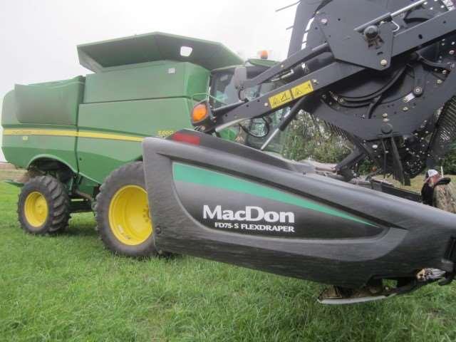


2 9/1/2017 Precision Agriculture Background Technology Enabled by highly-accurate position information Auto-steering equipment Variable-rate technology (planting, treatments) Yield monitors Soil samples Benefits of precision agriculture Source: John Deere; Source: Author Source: Source: Author Project Precision Agriculture Data Processing Desktop Application Impact & Future Work Precision Agriculture Data Challenges Data inconsistencies and complexity Collected using different vendor machinery Data formats and access Source: Author Source: Source: Source: Author Project Precision Agriculture Data Processing Desktop Application Impact & Future Work 2


3 Precision Agriculture Data Challenges Vendor viewers, portals, static reports Challenges analyzing relationship between data Source: Author & Source: Author & Source: Author & Source: olutions/information_management/information_management.page Source: Data Processing: Scripting & Database Original data: sources and formats Processing: consistent data fields, importing raw data Creating empty tables Populating empty tables with raw data Psycopg2 Source:


")


4 Schema Final tables Data Processing: Database Populate final tables Spatially-enabled (points and swaths) Source: Connection to PostGIS Utilize SQL Views GeoServer Sources: 4


5 Desktop Application Desktop Application 5


6 Web Mapping Application - Preparation Styling of layers - YSLD Web services Creation of tiles Sources: HTML sample OpenLayers3 jquery UI JavaScript samples Mockup created using Balsamiq - balsamiq.com Sources: 6


7 Video Demo (Flash required) 7


8 8
9 9
10 10

11 11


12 Project Impact Prototype application to visualize disparate data by farmer Begin to visualize and understand relationships between variables Ability to connect producers, consultants, local dealers Open source-based web mapping and visualization application for disparate data No software licensing concerns Database prepared for continued analysis Future Work & Analysis Generate custom reports, tables, visualizations Analyze change in yields Sample Yield Table Generated by User Analyze relationships Soil Seed Yield Sources: Corn Seeding Rate Recommendations Source: Different methods to serve data to web map 12

.")


. London: Springer.")
.")
, 61 69. http://doi.org/10.1016/j.protcy.2013.11.")


13 Selected References Daberkow, S. G., & McBride, W. D. (2003). Farm and operator characteristics affecting the awareness and adoption of precision agriculture technologies in the US. Precision Agriculture, 4(2), Erickson, B., & Widmar, D. A. (2015). Precision Agricultural Services Dealership Survey Results, 2015; sponsored by CropLife magazine and Purdue s Center for Food and Agricultural Business. Retrieved from Nash, E., Korduan, P., & Bill, R. (2009). Applications of Open Geospatial web services in precision agriculture: A review. Precision Agriculture, 10(6), Oliver, M. A. (2013). Precision agriculture and geostatistics. (M. A. Oliver, Ed.). London: Springer. Retrieved from Pierpaoli, E., Carli, G., Pignatti, E., & Canavari, M. (2013). Drivers of Precision Agriculture Technologies Adoption: A Literature Review. Procedia Technology, 8(Haicta), Schimmelpfennig, D., & Ebel, R. (2011). On the doorstep of the information age : recent adoption of precision agriculture / David Schimmelpfennig, Robert Ebel. Usda, (80), 31. Retrieved from Usery, E. L., Bosch, D. D., Finn, M. P., Wells, T., Pocknee, S., & Kvien, C. (2009). GIS in Precision Agriculture and Watershed Management. In M. Madden (Ed.), Manual of Geographic Information Systems (pp ). Bethesda, MD: ASPRS. Source: Author Misc. Resources Packt Publishing Brackets text editor Manning Publishing Lucid Chart 13


14 Questions Angelo Podagrosi Source: Author 14
Canadian Journal of Plant Science. Adoption of Precision Agriculture Technologies in Ontario Crop Production
 Adoption of Precision Agriculture Technologies in Ontario Crop Production Journal: Manuscript ID CJPS-2017-0342.R4 Manuscript Type: Short Communication Date Submitted by the Author: 17-May-2018 Complete
Agricultural Outlook Forum 1999 Presented: Tuesday February 23, 1999 PRECISION AGRICULTURE: AN INFORMATION REVOLUTION IN AGRICULTURE
 Agricultural Outlook Forum 1999 Presented: Tuesday February 23, 1999 PRECISION AGRICULTURE: AN INFORMATION REVOLUTION IN AGRICULTURE Pierre C. Robert Professor and Director Precision Agriculture Center.
Adoption and Use of Yield Monitor Technology for U.S. Crop Production
 Adoption and Use of Yield Monitor Technology for U.S. Crop Production by Terry Griffin and Bruce Erickson Precision agriculture technology has been on the market for nearly twenty years. Global Positioning
Logan Welker Creative component August 25, 2014
 Logan Welker Creative component August 25, 2014 -My Background -Introduction -Materials and Methods -Data Analysis -Results -Discussion -Conclusion -Questions Raised in Northwest Ohio - Van Wert, Ohio
Awareness and adoption of precision agriculture in the Cukurova region of Turkey
 Agronomy Research 14(4), 1307 1320, 2016 Awareness and adoption of precision agriculture in the Cukurova region of Turkey M. Keskin * and Y.E. Sekerli 1 Department of Biosystems Engineering, Faculty of
2013 PRECISION AGRICULTRAL SERVICES DEALERSHIP SURVEY RESULTS. Dept. of Agricultural Economics, Purdue University West Lafayette, Indiana
 2013 PRECISION AGRICULTRAL SERVICES DEALERSHIP SURVEY RESULTS SPONSORED BY CROPLIFE MAGAZINE AND THE CENTER FOR FOOD AND AGRICULTURAL BUSINESS by Jacqueline K. Holland, Dr. Bruce Erickson, and David A.
DESIGN AND IMPLEMENTATION OF ONTOLOGY BASED ON SEMANTIC ANALYSIS FOR GIS APPLICATION
 DESIGN AND IMPLEMENTATION OF ONTOLOGY BASED ON SEMANTIC ANALYSIS FOR GIS APPLICATION Dr. S.S Mantha 1, Mrs. Madhuri Rao 2, Ms. Naina Saita 3 1 Chairman AICTE, Professor, CAD/CAM, Robotics, VJTI, Mumbai,
Yield Monitors in Potato Production. Precision Ag
 Yield Monitors in Potato Production Precision Ag ARABLE LAND ACROSS THE WORLD courtesy US Geological Survey. THE CHALLENGE With 9.5 billion people living on the earth by 2050, we will require an estimated
Tuesday 16 th November Sachindra Singh Senior Geospatial Systems Architect ICT for Development Section Geoscience Division, Pacific Community
 THE QGIS ECOSYSTEM Tuesday 16 th November 2015 Sachindra Singh Senior Geospatial Systems Architect ICT for Development Section Geoscience Division, Pacific Community Background QGIS (formerly Quantum GIS)
Projected PA Adoption 1998
 Projected PA Adoption 1998 Jess Lowenberg-DeBoer International Programs in Agriculture Purdue University lowenbej@purdue.edu Source: Lowenberg-DeBoer, SAE, 1998 Presented at the 9 th European Conference
PRECISION AGRICULTURE ROI STUDY REPORT EXCERPTS JULY 2012
 PRECISION AGRICULTURE ROI STUDY REPORT EXCERPTS JULY 2012 Most respondents are located in the heart of the Corn Belt Iowa, Illinois, Indiana, Minnesota 2 The majority of respondents are between 50 and
2006 PRECISION AGRICULTURAL SERVICES DEALERSHIP SURVEY RESULTS
 2006 PRECISION AGRICULTURAL SERVICES DEALERSHIP SURVEY RESULTS SPONSORED BY CROPLIFE MAGAZINE AND CENTER FOR FOOD AND AGRICULTURAL BUSINESS by Dr. Linda D. Whipker* and Dr. Jay T. Akridge Staff Paper #
ArcGIS Workflow Manager Advanced Workflows and Concepts
 Esri International User Conference San Diego, California Technical Workshops July 26, 2012 ArcGIS Workflow Manager Advanced Workflows and Concepts Raghavendra Sunku Kevin Bedel Session Topics ArcGIS Workflow
April Oracle Spatial User Conference
 April 29, 2010 Hyatt Regency Phoenix Phoenix, Arizona USA David Lapp Spatial and BI Specialist Oracle Public Sector Jayant Sharma Technical Director Integration of Oracle Spatial and MapViewer with Oracle
GNU FDL Lizenz
 Introduction to Geoportal Management using Mapbender Orchestrating the Geospatial Concert a FOSS and OGC compliant Geoportal Software FOSS4G Workshop Arnulf Christl arnulf@osgeo.org http://www.wheregroup.com
2005 PRECISION AGRICULTURAL SERVICES DEALERSHIP SURVEY RESULTS
 2005 PRECISION AGRICULTURAL SERVICES DEALERSHIP SURVEY RESULTS SPONSORED BY CROPLIFE MAGAZINE AND CENTER FOR FOOD AND AGRICULTURAL BUSINESS by Dr. Linda D. Whipker* and Dr. Jay T. Akridge Staff Paper #
2007 PRECISION AGRICULTURAL SERVICES DEALERSHIP SURVEY RESULTS. Dept. of Agricultural Economics. Purdue University
 2007 PRECISION AGRICULTURAL SERVICES DEALERSHIP SURVEY RESULTS by Dr. Linda D. Whipker* and Dr. Jay T. Akridge Working Paper #07-13 September 2007 Dept. of Agricultural Economics Purdue University Sponsored
SAHA INSTITUTE OF NUCLEAR PHYSICS Sector-I, Block-AF, BIDHANNAGAR, KOLKATA
 SAHA INSTITUTE OF NUCLEAR PHYSICS Sector-I, Block-AF, BIDHANNAGAR, KOLKATA 700 064 (Aided Institution under Dept. of Atomic Energy, Govt. of India) Phone: 2337-5345-49 (5 lines), FAX: 091-33-2337-4637,
ArcGIS Workflow Manager Advanced Workflows and Concepts
 2013 Esri International User Conference July 8 12, 2013 San Diego, California Technical Workshop ArcGIS Workflow Manager Advanced Workflows and Concepts Kevin Bedel Nishi Mishra Esri UC2013. Technical
Your Complete Guide to Choosing a CRM/365 Portal Solution
 Your Complete Guide to Choosing a CRM/365 Portal Solution Investigating any technology solution for your business can be overwhelming. How do you know if you are asking the right questions and getting
Reducing Farm Field Runoff Application: A Systematic Tool for Analyzing Resources
 Reducing Farm Field Runoff Application: A Systematic Tool for Analyzing Resources David Healy and Michael Winchell 2016 Esri User Conference: Mapping the Future of Agriculture Session June 29, 2016 1 Overview
ADOPTION OF PRECISION AGRICULTURE TECHNOLOGIES IN DEVELOPED AND DEVELOPING COUNTRIES
 ADOPTION OF PRECISION AGRICULTURE TECHNOLOGIES IN DEVELOPED AND DEVELOPING COUNTRIES Sait M. Say 1,*, Muharrem Keskin 2, Mustafa Sehri 1, Yunus Emre Sekerli 2 1 Department of Agricultural Machinery and
Your Complete Guide to Choosing a CRM Portal Solution
 Your Complete Guide to Choosing a CRM Portal Solution Investigating any technology solution for your business can be overwhelming. How do you know if you are asking the right questions and getting the
From data to display Data loading, quality control and workflow management
 From data to display Data loading, quality control and workflow management Kiyoshi Yamashita Kristen Waldvogel Esri Software Components Production Mapping Data Review Feature Manager Workflow Management
ArcGIS Workflow Manager:
 ArcGIS Workflow Manager: Advanced Topics Kevin Bedel & Nishi Mishra Session Topics Overview Configure & Design Notify & Relate Integrate & Analyze Overview What is ArcGIS Workflow Manager? Configure &
Designing a better SDI
 Designing a better SDI Sebastian Benthall UC Berkeley School of Information Rolando Peñate OpenGeo FOSS4G 2011 in Denver, Colorado What is GeoNode? GeoNode is a spatial data infrastructure It focuses on
Double production by 2050
 Feeding the growing population Double production by 2050 1 Feeding the growing population Seeing Through the Cloud of Precision Agriculture By John Fulton Farm Smart Agricultural Conference, University
Dynamic Image Processing for Landuse Analysis & Precision Agriculture. Hari Yeruva, GISP
 Dynamic Image Processing for Landuse Analysis & Precision Agriculture Hari Yeruva, GISP CONCEPT OF PRECISION AGRICULTURE Farming by the Square Foot Traditional Mgt. Precision Mgt. 1-10+ Acres 0.1-0.001
#Data2Knowledge w/ Operations Center and 3 rd Party APIs
 #Data2Knowledge w/ Operations Center and 3 rd Party APIs Kaye McLagan - Premier Equipment Ltd. Dennis Jansen- John Deere Canada ULC Farm Smart January 2017 Our Goal Today Information Knowledge Why Do YOU
ArcGIS Workflow Manager: Advanced Topics. Kevin Bedel & Nishi Mishra
 ArcGIS Workflow Manager: Advanced Topics Kevin Bedel & Nishi Mishra Session Topics Overview Configure & Design Notify & Relate Integrate & Analyze Overview What is ArcGIS Workflow Manager? Configure &
TACCIMO. A Climate Change Tool for Forest Managers. Jennifer Moore Myers USDA Forest Service Eastern Forest Environmental Threat Assessment Center
 TACCIMO A Climate Change Tool for Forest Managers Jennifer Moore Myers USDA Forest Service Eastern Forest Environmental Threat Assessment Center 2011 ESRI FedUC www.forestthreats.org/taccimotool Template
Commercial Price List Effective November 3, 2014
 OpenGeo Suite Support + Plus Professional Platform Strategic 1 Year Subscription Price $8,000 $16,000 $45,000 $98,000 3 Year Subscription Price (discounted) $21,600 $43,200 $121,500 $264,000 +Subscriptions
Recent Innovations & Roadmap
 Recent Innovations & Roadmap Kevin Quinn, Vice President of Product Management Simplifying Data Access and Data Prep Simplifying User Experience and Workflow Collaboration 1 How Future Development Plans
Online Monitoring System for Mapping Assets in Gram Panchayat
 Online Monitoring System for Mapping Assets in Gram Panchayat T.Karthik Masters in Computer Science and Technology, VR Siddhartha Engineering College, Vijayawada, Andhra Pradesh, India Dr.A.Srisaila Assistant
A Wed-based Spatial Decision Support System for Potomac Basin Consumptive Water-use. Jan Ducnuigeen Advisor: Patrick Reed
 A Wed-based Spatial Decision Support System for Potomac Basin Consumptive Water-use Jan Ducnuigeen Advisor: Patrick Reed Background: The Potomac River & What is consumptive water use? Goals and Objectives:
Oracle Communications Marketing and Advertising. New Features. Platform Upgrade to Oracle WebLogic 11g. Siebel Marketing Integration
 Oracle Communications Marketing and Advertising Release Notes Release 5.1 E22971-01 May 2011 This document lists the new features and known issues associated with the 5.1 release of Oracle Communications
Successful Farming Brand Document
 Successful Farming Brand Document 2018-2019 Table of Contents Who is Successful Farming? Who does Successful Farming reach? How does Successful Farming reach them? How does Successful Farming know what
Integrating Analytic Talent for Intelligence Analysis. David Attaway John Fry
 Integrating Analytic Talent for Intelligence Analysis David Attaway John Fry Location, Mapping and GIS Are Becoming Essential A Fundamental Language for Understanding and Managing Our World Providing
Progress of Visualization tools for EMS and Control Room Data
 Progress of Visualization tools for EMS and Control Room Data Dayna Aronson Scott Stapels Enterprise Solution Architecture Control Room Visualization Difficult Data Integration Energy Markets Evolution
Responding To A Changing
 COVER STORY Precision Ag Survey 13th Annual Responding To A Changing Market As precision agriculture moves into another year, the challenges and opportunities continue to shift. BY DR. JAY AKRIDGE AND
2016 Agricultural & Applied Economics Association Annual Outlook Survey Highlights James Mintert, David Widmar & Marissa Richardson
 September, 2016 2016 Agricultural & Applied Economics Association Annual Outlook Survey Highlights James Mintert, David Widmar & Marissa Richardson Since the late 1970s an annual survey of agricultural
Campus Enterprise GIS
 Campus Enterprise GIS Cross Platform Supported: Enterprise GIS Initiative: Webmapping Making the Case for Enterprise GIS at UMD Esri Resources Available to UMD Webmapping for Information Access Demonstration:
Indian Res. J. Ext. Edu. 12 (3), September, Maize AGRIdaksh: A Farmer Friendly Device
, September, Maize AGRIdaksh: A Farmer Friendly Device") Indian Res. J. Ext. Edu. 12 (3), September, 2012 13 Maize AGRIdaksh: A Farmer Friendly Device V.K. Yadav 1, Sudeep Marwaha 2, Sangit Kumar 3, P. Kumar 4, Jyoti Kaul 5, C.M. Parihar 6 and P. Supriya 7 1.
Indian Res. J. Ext. Edu. 12 (3), September, 2012 13 Maize AGRIdaksh: A Farmer Friendly Device V.K. Yadav 1, Sudeep Marwaha 2, Sangit Kumar 3, P. Kumar 4, Jyoti Kaul 5, C.M. Parihar 6 and P. Supriya 7 1.
SalonBook. make appointments wherever, whenever. Salons still use paper and pencil systems to manage schedules
 SalonBook make appointments wherever, whenever Salons still use paper and pencil systems to manage schedules Customers need to find time in their busy days to find a salon and book an appointment over
ArcGIS Workflow Manager: Advanced Workflows and Concepts. Kevin Bedel & Nishi Mishra
 ArcGIS Workflow Manager: Advanced Workflows and Concepts Kevin Bedel & Nishi Mishra Session Topics Overview Configure & Design Notify & Relationships Integrate & Geoprocess Overview ArcGIS Workflow Manager
Trimble Field IQ and Serial Rate Application Options
 Trimble Field IQ and Serial Rate Application Options Do you have a basic Trimble steering system in the cab of your sprayer, or NH3 application tractor? Have a monitor not being used during the time you
FINANCIAL ADVISOR WEBSITE PROGRAM
 { Premium and Basic Websites Website Enhancement Service Digital Brochure Personalized Flipbooks Package and Pricing Options FINANCIAL ADVISOR WEBSITE PROGRAM With the Morgan Stanley website program, we
2003 Precision Agricultural Services Dealership Survey Results Staff Paper No. 3-10
 2003 Precision Agricultural Services Dealership Survey Results Staff Paper No. 3-10 Sponsored by Crop Life Magazine and Center for Food and Agricultural Business Purdue University June 2003 Dr. Linda D.
Remote Sensing Uses in Agriculture at NASS
 Remote Sensing Uses in Agriculture at NASS United States Department of Agriculture (USDA) National Agriculture Statistics Service (NASS) Research and Development Division Geospatial Information Branch
Mark Online, a Full Scale GIS-based Danish Farm Management Information System
 Available online at www.fooddynamics.org Int. J. Food System Dynamics 5 (4), 2014, 190-195 Mark Online, a Full Scale GIS-based Danish Farm Management Information System Jens Bligaard * Knowledge Centre
Successful Farming Brand Document
 Successful Farming Brand Document 2017-2018 Table of Contents 1. Who is Successful Farming? 2. Who does Successful Farming reach? 3. How does Successful Farming reach them? 4. How does Successful Farming
Deborah Lickness Manager, IP Market Transactions John Deere Intellectual Property Connection A Division Of John Deere Shared Services, Inc.
 This presentation is available to LES members from the LES website for the private use of the members and attendees and should not otherwise be reproduced, displayed, forwarded, distributed, or shared
ArcGIS Data Reviewer: Integrating Data Quality Control into Web Applications. Shankar Chandrasekaran
 ArcGIS Data Reviewer: Integrating Data Quality Control into Web Applications Shankar Chandrasekaran Agenda What is ArcGIS Data Reviewer? Automated Review Semi-Automated Review Analyzing & Reporting Data
SOUTH DAKOTA BOARD OF REGENTS. Budget and Finance ******************************************************************************
 SOUTH DAKOTA BOARD OF REGENTS Budget and Finance AGENDA ITEM: 7 W DATE: December 6-8, 2016 ****************************************************************************** SUBJECT: South Dakota State University
NGA Demo Descriptions Tech Showcase West 2016
 NGA Demo Descriptions Tech Showcase West 2016 1. GEOINT Solutions Marketplace (GSM) The GSM team will be on hand to discuss how the Enterprise Innovation Office finds disruptive technologies and integrates
Precision Business Planning Solutions
 Precision Business Planning Solutions Ernie Chappell President & C.E.O. Dave Muth Vice President Agronomic Planning & Sustainability Our Vision Enhance Farmers Ability to - Increase profitability - Increase
Analyzing Data with Power BI (20778)
") Analyzing Data with Power BI (20778) Duration: 3 Days Live Course Delivery Price: $1795 MOC On-Demand Price: $895 Discounts: We offer multiple discount options. Click here for more info. Delivery Options:
Analyzing Data with Power BI (20778) Duration: 3 Days Live Course Delivery Price: $1795 MOC On-Demand Price: $895 Discounts: We offer multiple discount options. Click here for more info. Delivery Options:
Establishing Data Fusion Center Baseline Technology Capabilities. Paul Christin ESRI David Stampfli Microsoft
 Establishing Data Fusion Center Baseline Technology Capabilities Paul Christin ESRI David Stampfli Microsoft Problem The asymmetrical threat of organized crime, gangs, drug cartels and terrorist organizations
Sage ERP MAS. Everything you want to know about Sage ERP MAS Intelligence. What is Sage ERP MAS Intelligence? benefits
 Sage ERP MAS Everything you want to know about Sage ERP MAS Intelligence What is Sage ERP MAS Intelligence? Sage ERP MAS Intelligence (or Intelligence) empowers managers to quickly and easily obtain operations
Managing Your Work with ArcGIS Workflow Manager. Tope Bello
 Managing Your Work with ArcGIS Workflow Manager Tope Bello Objectives of this Workshop Understand the business problems that ArcGIS Workflow Manager solves Present the ArcGIS Workflow Manager framework
An Esri White Paper October 2010 Esri Production Mapping: Meeting the Needs of Water and Wastewater Utilities
 An Esri White Paper October 2010 Esri Production Mapping: Meeting the Needs of Water and Wastewater Utilities Esri, 380 New York St., Redlands, CA 92373-8100 USA TEL 909-793-2853 FAX 909-793-5953 E-MAIL
DATA COLLECTION ON PRECISION FARMING - BACKGROUND NOTE - - November 2018
 DATA COLLECTION ON PRECISION FARMING - BACKGROUND NOTE - - November 2018 The project Data collection on Precision Farming is carried out by the following partners: - Comité des organisations professionnelles
Esri Managed Cloud Services: An Introduction. Alec Walker
 Esri Managed Cloud Services: An Introduction Alec Walker Key Takeaways How to Identify Organizational Strategy & Priorities Esri s Cloud Offerings There s more than ArcGIS Online A Few Words on Esri Managed
E-AGRI VIEWERS FOR ANALYSIS AND VISUALISATION OF WEATHER AND CROP INDICATORS
 Crop Monitoring as an E-agricultural tool in Developing Countries E-AGRI VIEWERS FOR ANALYSIS AND VISUALISATION OF WEATHER AND CROP INDICATORS Reference: E-AGRI_D26.1_E-AgriViewers_D1.0 Author(s): Allard
2016 PI System T&D Users Group Meeting
 2016 PI System T&D Users Group Meeting Unlocking Grid Analytics using AF, Maps and Rosetta Stones Using OSISoft tools to manage the Power Grid Dayna Aronson Scott Stapels Enterprise Solution Architecture
Current and future research for producing agricultural statistics using remote sensing and GIS technologies at Statistics Canada
 Current and future research for producing agricultural statistics using remote sensing and GIS technologies at Statistics Canada www.statcan.gc.ca Telling Canada s story in numbers Remote Sensing and Geospatial
April Oracle Spatial User Conference
 Oracle Spatial User Conference Ron Little Oshawa PUCN Geoff Cameron - AGSI An Innovative and Open Approach to Utilities Network Management at Oshawa PUC Agenda OPUCN Geospatial History Approach Process
DATABIO: ADVANCED VISUALISATION OF BIG DATA FOR AGRICULTURE
 This project has received funding from the European Union s Horizon 2020 research and innovation programme under grant agreement No 732064 This project is part of BDV PPP DATABIO: ADVANCED VISUALISATION
Midpeninsula Regional Open Space District
 Midpeninsula Regional Open Space District DATA ANALYST I/II DEFINITION Under general supervision (Data Analyst I) or direction (Data Analyst II), performs technical tasks related to the configuration,
Advancing the Digital Transformation
 Advancing the Digital Transformation /////////// Capital Markets Day London, December 5, 2018 Mike Stern Head of The Climate Corporation and Digital Farming Disclaimer Cautionary Statements Regarding Forward-Looking
ArcGIS Workflow Manager An Introduction
 Esri International User Conference San Diego, California Technical Workshops July 24, 2012 ArcGIS Workflow Manager An Introduction Kevin Bedel Nishi Mishra Session Topics Introduction to ArcGIS Workflow
How to Get Started with Tableau & Sample Dashboards
 How to Get Started with Tableau & Sample Dashboards April 5, 2018 1:45 PM 2:45 PM Conference Sponsors: The Office of the Chancellor, Budget & Financial Administration / Human Resources, the Office of the
The OSGeo Foundation. Quality Software & Community Network. Geospatial World Forum 2012 Amsterdam, Nederlands. Arnulf Christl President
 The OSGeo Foundation Quality Software & Community Network Arnulf Christl President Amsterdam, Nederlands Arnulf Christl Geospatial Systems Architect at metaspatial. President of OSGeo OGC Architecture
Data Insights. with Power BI and SSRS Look at More A THInc.IT Conference. Kevin Carter February 22, 2018.
 Data Insights with Power BI and SSRS Speaker Kevin Carter kevin.carter@thincit.com 2018 Look at More A THInc.IT Conference February 22, 2018 Meet the Speaker Kevin Carter Director, THInc.IT Business Intelligence
A Bioenergy Mapping & Modelling Tool as Applied in Ireland
 A Bioenergy Mapping & Modelling Tool as Applied in Ireland Girvin S. 1, Ó Riain G. 1, and Wilson M. 2 1 Compass Informatics Ltd., Block 8, Blackrock Business Park, Carysfort Avenue, Blackrock, Co. Dublin,
Digital Transformation in the ag Industry Paris, June 18th Elmar Groiss, Head of Information Management BASF Crop Protection
 Digital Transformation in the ag Industry Paris, June 18th 2014 Elmar Groiss, Head of Information Management BASF Crop Protection 1 Average wheat yield Germany 1850-2012 to / hectare 9 8 7 6 5 4 3 2 1
Zoning and Land Use (ZoLa): One Stop Shop for Zoning Information
: One Stop Shop for Zoning Information") Abstract Zoning and Land Use (ZoLa): One Stop Shop for Zoning Information Uttam Bera, Project Manager, PMP New York City Department of City Planning The Zoning and Land Use application (ZoLa) provides
Abstract Zoning and Land Use (ZoLa): One Stop Shop for Zoning Information Uttam Bera, Project Manager, PMP New York City Department of City Planning The Zoning and Land Use application (ZoLa) provides
Unit A: General Agricultural Machinery. Lesson 2: History of Production Agriculture
 Unit A: General Agricultural Machinery Lesson 2: History of Production Agriculture 1 Terms Baler Civilization Combine Drill Geographic information system (GIS) Global position system (GPS) Grain truck
Reimagining what s possible in legal review
 QUIN-C Powerful processing, review and analysis capabilities in a flexible HTML5 UI Reimagining what s possible in legal review Imagine that your digital investigation technology could be as fast and flexible
Building dedicated 1/15/1982
 Building dedicated 1/15/1982 West Lafayette, Indiana on the campus of Purdue University Conservation Planning evaluate land management alternatives to reduce soil erosion to acceptable levels. Resource
To provide timely, accurate, and useful statistics in service to U.S. agriculture
 NASS MISSION: To provide timely, accurate, and useful statistics in service to U.S. agriculture What does NASS do? Administer USDA s Statistical Estimating Program Conduct the 5-year Census of Agriculture
Intelligence Visualized for Efficient Crop Management. Automated Data Capture
 Intelligence Visualized for Efficient Crop Management Automated Data Capture 2015 AgStudio Vendor Showcase July 28, 2015 MapShots Product Family AgStudio desktop solutions AgStudio Select web solutions
SAP Visual Intelligence Executive Summary
 SAP Visual Intelligence Executive Summary Safe Harbor Statement The information in this presentation is confidential and proprietary to SAP and may not be disclosed without the permission of SAP. This
Process-driven Architecture for Workflow Automation in a GIS context A Tensing USA, LLC White Paper
 Process-driven Architecture for Workflow Automation in a GIS context A Tensing USA, LLC White Paper Authored By: Jeff Puuri, Senior GIS Consultant November, 2016 Abstract Business Process Modeling & Notation
Evaluating the Impact of NRCS Programs: New Measures and Improved Communication
 Evaluating the Impact of NRCS Programs: New Measures and Improved Communication Overview of the Cooperative Agreement Project Robert Shuchman, Nancy French, Colin Brooks, Tyler Erickson May 2008 Evaluating
ENERGY PRICE CHANGES, CROPPING PATTERNS, AND ENERGY USE IN AGRICULTURE: EMPIRICAL ASSESSMENT
 ENERGY PRICE CHANGES, CROPPING PATTERNS, AND ENERGY USE IN AGRICULTURE: EMPIRICAL ASSESSMENT Lyubov A. Kurkalova, North Carolina A&T State University* Stephen M. Randall, City of Greensboro Silvia Secchi,
Esri Technical Roadmap. Chris Hansen
 Esri Technical Roadmap Chris Hansen Platform Capabilities Mapping Smart Mapping Vector Tiles Mapping Temporal Patterns Charting Mobile Map Packages 3D Earth Urban and Landscape Models - 3D Object Layers
Selecting the Right Reporting Tool
 Selecting the Right Reporting Tool Crystal Reports and Web Intelligence Michelle Ng Solution Engineer, OEM June 17 th, 2009 Introduction WHO AM I Michelle Ng Solution Engineer, OEM Working with Crystal
ArcGIS as an Image Management Platform for Agriculture Applications
 ArcGIS as an Image Management Platform for Agriculture Applications BADRI LOKANATHAN ACCENTURE 2018 ESRI SOUTHEAST USER CONFERENCE MAY 2018 DO YOU KNOW? Q1. According to recent U.S. census data, which
Document Capture Solution
 Document Capture Solution Introduction About the product Nashua Limited is not only a leading distributor of digital office automation and document output solutions in Southern Africa, but is also a leading
Recognizing the Impact of Technological Advances in Agricultural Mechanics
 Lesson A1 4 Recognizing the Impact of Technological Advances in Agricultural Mechanics Unit A. Mechanical Systems and Technology Problem Area 1. Introduction to Agricultural Mechanics and Technology Systems
Precision Agriculture. John Nowatzki Extension Ag Machine Systems Specialist
 Precision Agriculture John Nowatzki Extension Ag Machine Systems Specialist Precision Agriculture GPS Guidance and Auto-steer Section Control on Sprayers Row Control on Planters and Seeders Yield Monitoring
Open source GIS: Frontlines and bottom lines
 Open source GIS: Frontlines and bottom lines Martina Doolan, Data Manager, West Midlands Fire Service Tim Needham, Software Architect, West Midlands Fire Service Executive Summary In recent years, West
SIGNATURE OF COUNTY ADMINISTRATOR OR CHIEF ADMINISTRATIVE OFFICER
 APPLICATION FORM All applications must include the following information. Separate applications must be submitted for each eligible program. Deadline: June 1, 2016. Please include this application form
 3 4 5 6 7 8 Managing the Power Grid using Maps, Real-time Data and Rosetta Stones Using ESRI technology and real-time data to visualize and manage the Power Grid Presented by Dayna Aronson Dayna Aronson
Crop Farm Sort
 Farm Business Management Program Database - 2017 Financial Summary by Gross Farm Income & Crop Acres Corn & Soybean Enterprise Data Selected Precision Technology and Tillage Data April, 2018 Average Dollars
Outline of Presentation
 2017 Crop Outlook David Widmar, Sr. Research Associate, Center for Commercial Agriculture Chris Hurt, Professor, Department of Agricultural Economics 2017 Crop Outlook Webinar July 3, 2017 Outline of Presentation
PLM100 Life-Cycle Data Management: Overview
 Life-Cycle Data Management: Overview SAP PLM Course Version: 98 Course Duration: 5 Day(s) Publication Date: 2014 Publication Time: Copyright Copyright SAP AG. All rights reserved. No part of this publication
Climate Change, Mitigation, and Adaptation in Corn-based Cropping Systems Coordinated Agricultural Project
 Climate Change, Mitigation, and Adaptation in Corn-based Cropping Systems Coordinated Agricultural Project Lois Wright Morton, Project Director Iowa State University SARE Carbon, Energy, & Climate September