Chapter 3: Agricultural Development and Intensification in Tonle Sap - An Opportunity for Poverty Alleviation?
|
|
|
- Lenard Rich
- 6 years ago
- Views:
Transcription

1
2


3 Table of content Acknowledgement Foreword Synthesis Chapter 1: Change of Hydrology and Fishery Impacts in the Tonle Sap Chapter 2: Sedimentation in the Tonle Sap Lake - Assessing the Risks Chapter 3: Agricultural Development and Intensification in Tonle Sap - An Opportunity for Poverty Alleviation? Chapter 4: How far does the net spread? A Literature Review of Tonle Sap Fish Trade and its role in poverty alleviation Chapter 5: Entitlements and the Community Fishery in the Tonle Sap: Is the Fishing Lot System Still an Option for the Fisheries Management? Chapter 6: A Moving Target - Migration to and from Tonle Sap and Its Impact on Rural Livelihoods Authors Sumernet Partners
4 Acknowledgement Authors from across the Mekong region who form part of the Sustainable Mekong Research Network (Sumernet) have drafted this monograph. The editors acknowledge and thank these authors for all their hard work to ensure its completion. We also wish to express our gratitude to H.E. Kol Vathana and Mr. Pech Sokhem liaising with related authorities in Cambodia to enable this work to be placed in the Cambodian policy arena. We also wish to express our sincerest thanks to the Senior Minister of Ministry of Environment of The Royal Government of Cambodia, H.E. Dr. Mok Moreth, for his kind and considered contribution to the Foreword. We would like to express our appreciation for the assistance provided by Ms. Sabrina Shaw and Mr. Andrew Scarvell, the copy editors, and to Ms. Dararat Weerapong, our communications coordinator, for her unyielding commitment to ensure the document was completed and with style, and to Ms. Tatirose Vijitpan and Ms. Gasara Kaewharn for their assistance in preparing the manuscript. Also thanks to Roengchai Kongmuang, a professional photographer who took the wonderful photographs included in this publication. Finally, the development and establishment of the Sumernet network has been made possible through financial support provided by the Swedish International Development Cooperation Agency (Sida). However, Sida was not involved in the design of the network and does not necessarily support the views expressed in this publication. Matthew Chadwick Muanpong Juntopas Mak Sithirith Editors 22 August Tonle Sap: Environmental Changes, Development Policies and Implications for Local Livelihoods
5 Foreword The Tonle Sap Lake, known also as the Great Lake, lies in the central plains of Cambodia. It is known for many things, its exceptional water regime with huge changes in the lake s water level and water volume between different seasons; its unique reverse flow acting as a store for the Mekong during the flood season and then providing it water as the flood recedes; for its productivity, reported to be one of the most productive fisheries resources in the world, and for its social characteristics and diversity with floating and stilted villages. It is also increasingly a place where attention is focussed because of the potential threats to it: from developments upstream such as dams and irrigation schemes, which pose a threat to its water supply or at least the balance of its hydrological regime which has made it a unique socio-ecological system; the potential of increasing sedimentation from these activities; from the possible overuse of its aquatic resources and from the clearing of its flooded forests for agricultural development. Added to this, we are increasingly aware and concerned as to the potential impacts of climate change for the region. The Royal Government of Cambodia shares these concerns and is striving to ensure that its national development does not occur at the cost of its unique environment. In view of its national importance it is not surprising that the Tonle Sap is at the focus of the efforts by The Royal Government of Cambodia to alleviate poverty, Thus, this publication which reviews the literature on a number of key issues is timely. I also wholeheartedly support the development of a project and process, the Sustainable Mekong Research Network or Sumernet that seeks not only to clarify issues on sustainable development but to do so from a regional perspective. Tonle Sap is not only a great Cambodian resource but a regional one and part of a regional ecosystem which provides all of us, including our neighbours, with services on which we depend in our daily lives. So, it is with pleasure that I provide a Foreward to this book. I must congratulate the authors and the Sumernet network for their hard work and look forward with interest to the future collaborative work this regional community of environment scientists, advocates, and policy makers undertake on the regional challenges in the management and utilisation of common natural resources. (Dr. Mok Mareth) Senior Minister Ministry of Environment The Royal Government of Cambodia 5

6 Synthesis This chapter draws together the previous chapters, placing the Tonle Sap Lake and its ecological links in the wider context of Cambodian and Mekong region development. Drawing the threads together, it will touch upon some of the deeper management issues and needs relating to the lake s ecology, products and services. Subsequently, it will highlight the findings in terms of baseline knowledge derived from the literature review, and possible contributions towards forming a healthier development path where environmental, economic and social objectives are in balance. The topics presented in this literature review were selected because they are among the most contentious issues in the development debate regarding Cambodia and the Mekong region. The aim is to analyse and clarify the state of knowledge on these development issues and contribute to a more informed discussion and decision on the likely implications of the current development path. This review also seeks to identify knowledge gaps for future investigation, in order to better inform policy development. The importance of Tonle Sap at multiple levels In discussing sustainable development in Cambodia and the Mekong region, it is important to understand the socio-ecological importance of Tonle Sap Lake at multiple levels: local, national, basin-wide and regional. At each level, decisions are made based upon specific ecological features and functions of the lake, and shaped by the prevailing socio-political environment. The development opportunities and the objectives within and between levels are often incompatible as they apply to different aspects of the Mekong and Tonle Sap Lake. For example: Expansion of agriculture impacts other forms of land and water uses (e.g. clearing the flooded forest for farmland), and increased use of pesticides in intensive agriculture, puts fisheries resources at risk. Dam developments locally, nationally and regionally have potentially serious implications for inland fisheries, affecting the local peoples surrounding the dam site as well as many others up and downstream. Sustainable development issues for Tonle Sap are very complex because they deal with impacts across multiple sectors, regions and stakeholders. Advantages to one sector can represent risks to another sector, with different groups of stakeholders gaining or losing. Analysis requires the development of a deep and broad understanding of the intricate social, political economic and ecological cross-linkages locally, nationally and regionally. The ecological importance of Tonle Sap The Tonle Sap Lake is an environmental asset, not only for Cambodia but for the region. It is often referred to as the heart of the Mekong because it breathes in and out with the rise and fall of the Mekong floods an analogy which is further reflected in that this process is an essential part of the ecosystem s life-cycle. 6 Tonle Sap: Environmental Changes, Development Policies and Implications for Local Livelihoods
7 When the volumes of water coming downstream from the Mekong increase, the waters collect in the Tonle Sap via the Tonle Sap River and increase the lakes size four-fold. When water levels in the Mekong fall, the lake diminishes and the area provides a varied range of environmental services for Cambodia and the Mekong. This includes acting as a reservoir to preventing severe flooding elsewhere. The Lake is a unique aquatic habitat of great biological diversity, supporting important genetic resources for the region and an immensely productive inland fishing resource for the region. The Tonle Sap system also provides fish stocks from which fish species migrate both upstream and downstream. The lower fish migration route, between Tonle Sap and Vietnam Mekong Delta, is of particular importance because it provides for vital food security and the livelihoods of many millions of people. Fisheries from the Tonle Sap provide supplies of fish not only to Cambodia, but also to neighbouring Mekong countries. This is of great nutritional, economic, social and cultural importance. Fish provide 68-75% of the animal protein in the average Cambodians diet, even higher for communities surrounding the Lake. It generates employment and income both inside and outside Cambodia via regional and international value chains from Tonle Sap s farm gate to markets in Thailand, Vietnam, other Asian countries, Europe and North America. The total economic value of fisheries, including multiplier effects such as employment generation, has not yet been studied. Values widely quoted from the Mekong River Commission (MRC) are based solely on farm gate prices, resulting in an undervaluation of the Mekong fisheries and Tonle Sap in the policy arena. The fisheries trade, its associated value chains and potential for alleviating poverty in the region have only recently attracted the interest of researchers. However, further work needs to be done to get a clearer picture of the Lake s sustainable yields, and how to more equitably distribute the benefits. The Tonle Sap system and its importance to Cambodia Over 86% of Cambodia lies within the Mekong basin. Tonle Sap is undoubtedly of critical importance to Cambodia, in terms of both current benefits and resources available for future development. These include: 1) Fisheries resources for food security and a social safety net. 2) Large potential water resources for expanding irrigated agriculture. 3) Navigation, domestic water transport and tourism. 4) Potential for hydropower development. The last point on energy development is of particular importance to Cambodia as less than 20% of Cambodian households have access to electricity. Those who do have access pay per-unit costs amongst the highest in the Asia, as existing power plants uses imported fuel. Rice and fish are the main sources of food and income security for the rural poor in Cambodia. Agriculture generates 30% of GDP and engages 76% of the employed population. Cambodia is fish-rich country, and average fish consumption per capital is the highest in the Mekong region. Fish represent 75% of protein intake, and this relatively cheap protein is very important for the mass poor who make up 1/3 of the population. Inland fisheries play a very important role, and provide a safety net when all else fails. Rice is Cambodia s stable food, and most rice grown is rainfall-dependant. Currently, irrigation covers only 10% of Cambodia s planted areas. However, under the national development plan, about 300,000 ha more is targeted for irrigation to address poverty and increase food security. The intrinsic value of Tonle Sap lies beyond the utilitarian values normally quoted in sectoral development work. It includes the communities traditional and cultural links with fishing, craftsmanship, unique indigenous knowledge about fish-ecology, folklore, and inter-regional relationships. For Cambodia, Tonle Sap is beyond ecology and products - its greatness is as legendary as the great Angkor empire itself, which it fed and watered. Its story is one of the national identity and pride. Development issues and baseline knowledge Much literature exists on Tonle Sap, especially in relation to its rich resources, the plight of its people, and its economic potential for development. This literature analysis attempts to establish a baseline of knowledge on six key issues 7
8 pertaining to sustainable development in and around Tonle Sap, highlighting issues and knowledge gaps in relation to future policy development. The six topics are: Sedimentation in Tonle Sap. Hydrological change and its impact on fisheries in Tonle Sap. Entitlements and the community fisheries in the Tonle Sap - is the fishing lot system still an option for inland fisheries management? Fish trade and its roles in poverty alleviation. Migration to Tonle Sap region: A viable means of diversifying rural poor livelihoods. Agricultural development and intensification in Tonle Sap - An opportunity for poverty alleviation. Change in hydrological regime and threats to fisheries resources There are many threats to Tonle Sap and the Mekong region s fisheries resources. As highlighted by the papers on hydrological change and sedimentations, some studies suggest that food security, income generation and national revenue are threatened by overfishing and loss of habitats (e.g. the flooded forests). It is often argued that threats stem from changes to the hydrology regime, many of which originate outside Cambodia. Continuing developments will influence hydrology of the Mekong and Tonle Sap. These changes may impact the magnitude of flooding, timing and duration of floods. In particular, dam operations within Cambodia and upstream influence water flows in both the dry and wet seasons, impacting on the flood pulse, the Lake s associated ecosystems, and the size and quality of fish habitats. These impacts are likely to reduce fish productivity and ecosystem productivity. For example, delays in the onset of floods delay the arrival of oxygen-rich waters threaten the survival of eggs and larvae. Trends in climate change, impacts and adaptation strategies need to be better understood in terms of their potential impact on the hydrological regime. The Mekong River Commission (MRC) has started to explore this, but a greater effort is needed. Quantifying and understanding the scale of environmental impacts is important, as well as identifying the social impacts on Cambodian livelihoods and other stakeholders in the Mekong region. More research is needed in order to understand the issues, inform dialogue processes and produce positive development planning. Sedimentation Some authors argue that sedimentation in Tonle Sap is significant and increasing as a result of upstream activities such as deforestation and gem mining. However, overall analysis of this literature concludes that the current rate of sediment accumulation within the Lake is low and does not appear to be a threat. Nonetheless, many studies point out that sedimentation could be a localised problem, especially near Chhnoc Trou where the Tonle Sap River enters the Lake. This could pose a threat to navigation between the capital and regional centres to the north and west of the country, and may exacerbate flooding along the Tonle Sap River. Entitlements and community fisheries Many authors argue that the current concessions arrangements, or fishing lots system, is not an effective way to ensure fisheries sustainability, generation of national revenue or socially equitable distribution of the Lake s natural resource benefits. Several studies highlight this, noting that monitoring by the authorities is ineffective. In addition, the opaque nature of the bidding system provides an opportunity for corruption, reducing total benefits derived from the fisheries resources and jeopardising future food security. Key points to highlight here are: Community fisheries, a relatively recent phenomenon in Cambodia, exist where community organisations manage areas for their own fisheries based on established rules. The new approach aims to be more socially equitable in providing fair access to fishing ground for community members, while preserving the resource base. The literature generally favours the shift from the lot system to community management of the resources. However, failure to address outstanding community fisheries management issues threatens its success. Many authors also warn of the need for effective mentoring and evaluation of processes. 8 Tonle Sap: Environmental Changes, Development Policies and Implications for Local Livelihoods
9 Poverty alleviation Some of the chapters have included analysis of their subject areas from a poverty reduction perspective, elements of which are summarised below. Fish trade Chapter 5 addresses fish trade issues and explores the extent of fish traded from the Tonle Sap to Thailand, Vietnam and Laos. The analysis highlights the paucity of data on volumes traded. Some studies cite figures around 50,000 tons a year, while others suggest more than double this figure, partly because of under-reporting by small traders. Fish trade from Tonle Sap, and by implication elsewhere in Cambodia, offers an opportunity for increased income generation for those around the Lake and a means to reduce poverty. However, for the poor to achieve such gains, policy-makers will need to consider a number of facilitative factors including: Knowledge and resources to develop value additive processes such as improved post-harvest processing. Improved access to external markets. Tax reforms. Transparent yet simple micro credit facilities. The Lake s carrying capacity. The analysis in Chapter 5 highlights that, despite recent advances in monitoring, further improvement is still needed. Agriculture intensification in Tonle Sap Chapter 3 addresses agricultural intensification within the context of improving food security and poverty alleviation. Agriculture is seen as a means to contribute to addressing poverty in the basin. However, there are significant constraints that need to be addressed such as low soil quality, the viability of landholdings fragmented into uneconomically small household parcels and limited irrigation coverage. Overcoming these issues will require investments in infrastructure to store water resources and a management regime that is locally appropriate. In addition, without consolidation of farming enterprises it is questionable whether farming systems will be capable of anything more than subsistence farming. The creation of alternative job opportunities to reduce the number of farmers locked into agriculture is raised as one means of establishing larger, more economically viable farm units. The development of irrigation infrastructure, along with the rehabilitation of existing non-functional systems, is seen as a priority. Further exploitation of groundwater resources and on-farm storage structures could allow for diversification from the current rice based cropping systems towards other cash crops. However, due to the capital, operational and maintenance costs associated with these developments, it is argued that their impact on poverty alleviation will be confined to relatively few farmer households. Conclusion The challenge before the Cambodian government in their management and development of Tonle Sap is to achieve the intricate balance of economic, social and environmental sustainability. Fisheries management through community organisations can offer some promise for food security and poverty reduction, provided that ecological functions of Tonle Sap is maintained. However, maintenance of the Lake s hydrology is largely beyond Cambodia s control and will be determined by the actions of those upstream. Through ecological and hydrological functions, Tonle Sap Lake serves peoples both nationally and regionally, and the resources need to be managed and shared with key stakeholders and other actors included. Opportunities for poverty alleviation exist through agricultural development and intensification around Tonle Sap, but only if there are fundamental changes to land tenure arrangements and a shift in agricultural production from subsistence-oriented rice systems to cash crops. The implications of climate change also need to be recognised and further researched. There is already evidence that neighbouring nations, especially Vietnam, will be impacted significantly by rising sea levels. However, temperature and rainfall pattern changes are also predicted and these need to be explored further. 9
10 Chapter 1 Change of Hydrology and Fishery Impacts in the Tonle Sap Chayanis Krittasudthacheewa 1 and Chusit Apirumanekul 2 Abstract Introduction: Geographical location and issues relevant to sustainable development Key issues for investigation Current state of knowledge Understanding the hydrology and fishery in the Tonle Sap Lake Tonle Sap Lake and its hydrological regime The Flood Pulse and fishery in the Tonle Sap Lake Impact of relevant development on the change of hydrology and fishery Impact of water resources development on the Tonle Sap Lake hydrology Impact of land use change on the Tonle Sap Lake hydrology Impact of change in hydrological regime on fisheries Impact of Climate Change on the hydrology and fishery in the Tonle Sap Conclusions Pending issues and research gaps Policy linkages 28 References 29 1 Stockholm Environment Institute, Bangkok, Thailand. chayanis.k@sei.se 2 Mekong River Commission, Vientiane, Lao PDR. chusit@mrcmekong.org 10 Change of Hydrology and Fishery Impacts in the Tonle Sap
11 Abstract The flood pulse system together with large floodplains, high sedimentation and nutrient fluxes from the Mekong River makes the Tonle Sap Lake one of the most productive freshwater ecosystems in the world. This paper analyses the Tonle Sap hydrology and its links to fisheries as well as the impact of upstream development and climate change on hydrology and fishery in the Tonle Sap. Most of the studies of the hydrological functionalities of Tonle Sap Lake have been based on incomplete information. Some data is available from the mid 1950s to the present but there are many gaps, especially during the civil war from the mid 1970s until 1985 when all stations in Cambodia were abandoned. No detailed hydro-meteorological information is available from China. However, recent studies have shown that Tonle Sap Lake acts as a natural reservoir for the Lower Mekong Basin by regulating the floods downstream from Phnom Penh during the wet season and is an important supplement to the dry season flow in the Mekong Delta in Vietnam. The inflows to Tonle Sap Lake are from 4 main sources; from the Mekong via Tonle Sap River, 51%, from the Mekong via overland flow, 5%, from the 13 tributaries, 31%, and precipitation, 13%, respectively. Around 88% of the total outflow discharges to the Mekong whilst 12% evaporates directly from the Lake. There is a concern that the upstream water resource developments in the Mekong River Basin will lead to significant impacts, e.g. change of water flow, trapping of sediments and nutrients in reservoir, bank and bed erosion. These continuing developments will have an increasing influence on flood regime, timing and duration of floods in the Lower Mekong Basin and Tonle Sap Lake. The changes will have not only hydrological effects but may also have negative impacts on fishery productivity of the Tonle Sap Lake and floodplain ecosystem. However, some arguments on positive impacts of upstream dam constructions have been put forward, e.g. attenuation of the flood peak in the wet season and water provision in the dry season. Under the scenario of CO 2 doubling from the present level, shifts in rainfall distribution and other seasonal patterns, including changes in temperature and other climate parameters, have been suggested by recent studies. The Mekong region will experience a drier and longer dry season, and a wetter and shorter rainy season at some specific locations, e.g. in the Lowland basin (Cambodia and Vietnam), while rainfall will be significantly lower over the wet season in the Lancang basin in the upper part of the Mekong River Basin. These could have impacts on water-related issues, i.e. water supply during wet and dry seasons which influences dam operational strategy. This would also affect the hydrological regime and ecosystem in downstream countries, especially in the Tonle Sap Lake, which has direct influences on people s livelihood. Understanding the impacts of climate change may lead to a sustainable adaptation strategy that could decrease the vulnerability and risk of the people in the Mekong River Basin. Despite the extreme importance of the Tonle Sap Lake for Cambodia and the region, neither the Lake s exceptional hydrology nor the driving forces behind high aquatic production are yet fully understood and analysed. Further investigations are suggested to assess the quantitative impacts from the upstream development and climate change to the hydrological regime, ecosystem and fishery in the Tonle Sap. 11
12 1. Introduction: Geographical location and issues relevant to sustainable development Tonle Sap Lake, also known as the Great Lake or simply Tonle Sap, is situated in the central plains of Cambodia and is of considerable significance for Cambodians. Tonle Sap Lake along with the Tonle Sap River forms a unique hydrological regime as well as a diverse aquatic ecological system. The Lake functions as a natural flood water reservoir for the Mekong system as a whole and therefore is an important source of water for the Mekong Delta during the dry season (Kummu et al., 2005). In addition, Tonle Sap is regarded as an invaluable natural resource that plays a vital role in providing the livelihood for the people living around it, as well as for the nation as a whole. It is estimated that almost half of Cambodia s population benefits directly or indirectly from the Lake s resource. Tonle Sap Lake is linked to the Mekong by the Tonle Sap River. The hydrological regime of the Lake is largely influenced by the hydrological fluctuation of the Mekong (Sithirith, 2005). The variation of water volume in the Lake is caused by a hydrological phenomenon of the Mekong River related to monsoon rainfall. The Lake is fed throughout the year by the Mekong River, its tributaries around the Lake and by direct rainfall on its surface (Fuji et al., 2003; Morishita et al., 2004; Sithirith, 2005). In the wet season (May to September), intense rainfall and snow melting in highland Tibet in China causes the water level in the Mekong River to rise quickly and the hydrological gradient produced by the rise results in floodwaters flowing into Tonle Sap Lake through the Tonle Sap River. In the dry season (October to April) the decline in runoff causes the water level in the Mekong to drop, and this leads to a reverse flow from Tonle Sap Lake to the River, establishing the Lake s unique ecosystem. The periodic flooding that carries sediment-rich water from the Mekong River to the Lake, combined with the area s high productivities and biodiversity are the main resources for national and local development. The Tonle Sap ecosystem is one of the most productive inland waters and one of the most fish-abundant lakes in the world where flooded forests and shrubs offer shelter and breeding grounds for fish and other aquatic animals (Bonheur, 2001; Roberts, 2001; Kummu et al., 2005; Matsui et al., 2005). The economic significance of fish resources provided by the Lake is large, representing 60% of Cambodianís total inland fisheries (Matsui et al., 2005). However, the natural productivity of the floodplains is widely feared to be under threat from potential changes to the hydrologic cycle and flood pulse, and with it the habitats and species with which it is inextricably linked. These threats are perceived to be mainly from built structures, including dams and irrigation schemes, which modify the hydrology of the system (Baran et al., 2007a). Rapid economic growth in the upper countries of the Mekong Basin has resulted in an increased demand for energy and hydropower production and other water resource development such as irrigation and flood mitigation schemes. This water development infrastructure could significantly affect water resources, hydrological regime, fisheries and livelihood downstream. The change in hydrological regime and its downstream effects have been very contentious issues between upstream and downstream countries and among development actors in the Mekong Region. One example of such a development is the hydropower dam construction in Yunnan Province of China. Dam proponents argue that besides the generation of renewable energy, the dams offer means of flood control, more assured dry-season flows, increasing navigation options, a reduction of saline intrusion in the Vietnam delta and provision of irrigation opportunities for downstream countries. On the other hand, opponents of dams argue that they have a far greater negative impact than the benefits they bring, for example trapped nutrient-rich sediment, change of the flood pulsing system, reduced flood peak and an increase in dry season flow. Much of the debate raises the fear of changes of hydrological regime and its fisheries impacts downstream, especially in Cambodia. The grave concern is in its potential impact on ecological systems and the productivity of the Tonle Sap, as this consequently has a great influence on the livelihood of the mass of people around Tonle Sap Lake. Globally the climate is changing but its impact is unlikely to be discernible over a short period of time. However, over a generation, the impacts could be clearer, especially on water-related issues. The impacts of climate change in all or parts of the Mekong River Basin have recently been explored (Chinvanno, 2004; World Bank, 2006; Snidvongs, 2006; Hoanh et al., 2006). Chinvanno shows that the preliminary result of climate change impacts is on changes in rainfall and seasonal patterns over the Lower Mekong Basin. In the lowlands, such as the Cambodian floodplain and the Mekong Delta, the dry season will be dryer and longer, whilst the rainy season will be shorter and wetter (Chinvanno, 2004). This change of climate and its impacts on hydro regime will certainly affect fisheries in Tonle Sap Lake, and the pattern and extent will need further studies to clarify. 12 Change of Hydrology and Fishery Impacts in the Tonle Sap
13 There remain differing opinions on the impacts on the downstream reaches of water resource development schemes in the upper parts of the Mekong River Basin. The objective of this paper is to review and analyse existing literature exploring the causes and impacts of hydrological and fishery changes in Tonle Sap Lake. This analysis will include the presentation of key findings and where possible, argue for or against views expressed in the literature. The paper will also highlight the areas for future research and the areas where we could influence policy on development in the Mekong. 2. Key issues for investigation There is a general lack of data on Cambodia including hydrological data for the Great Lake-Mekong floodplains. In the early 1960s, a study was carried out by the French Commission (Fuji et al., 2003; MRC-TSLV, 2004; Sithirith, 2005) where the water level and discharge were measured only in order to investigate water balance and sedimentation (in almost all the tributaries of the Lake). Thereafter, hydrometric network activities deteriorated, although some gauging stations on tributaries continued to be in operation until the early 1970s (Sithirith, 2005). From the mid 1970s until 1985, all stations were abandoned. During this time, the nature of the hydrological regime in some tributaries was altered through water policies adopted during the period, and these were not based on an adequate assessment of the potential consequences of their adoption (MRC-WUP-JICA, 2004; Sithirith, 2005). There remains a need for up-to-date, comprehensive data and to develop from it a thorough understanding of the complex hydrology, including flow distribution and duration, in the river-lake-floodplain complex system today (MRC-TSLV, 2004). Major difficulties in establishing a comprehensive analysis of the hydraulic conditions of the Tonle Sap Lake included poor accessibility, inadequate reference of topographic data and the lack of continuously accurate water level and discharge information (MRC-TSLV, 2004). In addition, no detailed hydro-meteorological information is available from China. At present the only information available from China is the hydro-meteorological data in the wet season at Jinhong and Manan stations located at the border between China and Lao PDR (available at the Mekong River Commission - MRC). Most of the studies and analysis of the hydrological roles of Tonle Sap Lake and the Cambodian floodplains have been based on existing, incomplete information available from the mid-1950s to the present. The Tonle Sap Lake ecosystem as a source of rich biodiversity and food is predominantly driven by the monsoon floods of the Mekong River. This pulsing system together with large floodplains, high sedimentation and nutrient fluxes from the Mekong River makes the Lake one of the most productive freshwater ecosystems in the world. Understanding the flood mechanisms and hydrological roles of the Cambodian floodplains and Tonle Sap Lake is essential for integrated water resource management, and flood mitigation and management as well as for sustainable basin-wide planning, and national and regional policy making. This paper seeks to understand through the review and analysis of existing literature, the following: State of understanding of the Tonle Sap hydrology and its links to fisheries in the area; Impact of water resources development and land use changes within the basin on the hydrology and fishery in the Tonle Sap; and Likely impact of climate change on the hydrology and fishery in the Tonle Sap. 3. Current state of knowledge 3.1 Understanding the hydrology and fishery in the Tonle Sap Lake Tonle Sap Lake and its hydrological regime The Tonle Sap River connects Tonle Sap Lake to the Mekong River which it joins at Chaktomuk junction near Phnom Penh. The water flow from the Mekong River to Tonle Sap Lake occurs during the flood season (June - October), when the rising water in the Mekong forces the Tonle Sap River to change its flow backwards into Tonle Sap Lake. The incoming water causes massive flooding that extends over a vast floodplain, covering forests, shrub land and rice fields. The Lake acts as a natural reservoir for the Lower Mekong Basin by regulating the floods downstream from Phnom Penh during the wet season and makes an important supplement to the dry season flow to the Mekong Delta in Vietnam. From December to February, the Lake provides approximately 50% of the total inflow to the delta (Fuji et al., 2003; Morishita et al., 2004). 13
14 In the wet season, the Lake increases 6 fold in area coverage, and 10 fold in depth when compared with the dry season; from an area of 2,500-3,000 km 2 to 10,000-16,000 km 2 (Fuji et al., 2003; MRC, 2003) and a depth of less than one metre to 9-10 metres during the peak of the flood season (Keskinen, 2003). Similarly, the water volume of the Lake increases over 60 fold, from about 1.3 km 3 up to km 3 depending on the flood intensity (Kummu et al., 2006). As a result, the size of the Lake also expands from 160 km long and 35 km wide, to 250 km long and 100 km wide (Keskinen, 2003). The bottom of the Lake lies approximately m above the mean sea level (AMSL). Hence during the year the surface of the Lake varies between 1.3 and 10.3 m AMSL (MRC-WUP-FIN, 2003). There are four main sources of inflow to the Tonle Sap Lake: from the Mekong via the Tonle Sap River, 51%, from the Mekong via overland flow, 5%, from the 13 tributaries, 31%, and from precipitation, 13% (MRC-WUP-FIN, 2003). Around 88% of the total outflow discharges to the Mekong whilst 12% evaporates directly from the Lake. The average annual outflow during was 78.6 km 3, varying from 43.5 km 3 in 1998 to km 3 in 2000 (Kummu et al., 2006 and MRC-WUP-FIN, 2007). Figure 1 shows the Tonle Sap water balance. Sithirith (2005) also investigated the flow contribution to Tonle Sap Lake. Thirteen rivers in the watershed discharge water into the Lake. It is estimated that 38% of water in the Tonle Sap originates from the Tonle Sap watershed areas and 62% comes from the Mekong River. Since this study did not take into account the contribution of precipitation directly fallen on the Lake, the percentages of water contributions from the Tonle Sap watershed and from the Mekong River are slightly different from the figures suggested by the other two studies cited above. Figure 1: Tonle Sap Water Balance in yearly average (unit in km 3 ) (Source: MRC-WUP-FIN, 2003) According to the statistical flood analysis by MRC-WUP-FIN (2007), the timing of the peak flood in Tonle Sap Lake is very regular (normally in October). But the start and end dates of the flood vary a lot depending on the mainstream flood and local rainfall in the Tonle Sap tributaries. Figure 2 shows the Tonle Sap water balance. The flood starts on average on the 23 rd of June, peaking on the 7 th of October and ends on the 3 rd of March. The start of the flood is determined by the date when the water level exceeds the flood level (2.5 m) and ends on a date when the water level falls below this flood level again. The rate of water level change in Tonle Sap Lake is highest during July being around 8 cm/day, whilst the most rapid water level decline rate occurs during December reaching 6 cm/day (MRC-WUP-FIN, 2007). 14 Change of Hydrology and Fishery Impacts in the Tonle Sap

15 Figure 2: Summary of the flood timing, start and dates; and flood peak date in the Tonle Sap Lake (Source: MRC-WUP-FIN, 2007) Since 2000, several modelling projects have been implemented to explore the hydrological roles of the Cambodian floodplains and the Great Lake. These projects have been undertaken under the Water Utilization Program (WUP) of the MRC The modelling includes: modelling of the Flow Regime and Water Quality of the Tonle Sap Project (WUP-FIN) in 2003; Hydro-Meteorological Monitoring for Water Quantity Rules in the Mekong River Basin Project (WUP-JICA) in 2004; Consolidation of Hydro-Meteorological Data and Multi-Functional Hydrologic Roles of Tonle Sap Lake and its Vicinities Project (MRC-TSLV) in 2004; and most recently the Hydrological, Environmental and Socio-Economic Modelling Tools for the Lower Mekong Basin Impact Assessment Project (WUP-FIN) in MRC-WUP-JICA (2004) and MRC-TSLV (2004) employed the MIKE-11 as the hydro-hydraulic modelling system to assist in studying the dynamics of recurrent flood events and the hydrological functionalities of the Cambodian floodplains and the Tonle Sap Lake during 1998 to Assessments were also made of the effects on the Cambodian floodplain hydrology from road network construction with high embankments. The effects investigated were in terms of the storage and release of water from wet season to dry season in the Tonle Sap Lake. Water balance of the Lake was computed to determine the contribution of the various hydrological factors at play. In terms of flood retention, the retention volume in each zone (Figure 3) was estimated for the 2002 and 2003 wet season and is tabulated in Table 1 (Morishita et al., 2004). Figure 3: Zones divided over the Cambodian floodplains (Fuji et al., 2003; MRC-WUP-JICA, 2004; MRC-TSLV, 2004; Morishita et al., 2004) (Source : MRC-TSLV, 2004) 15
16 Table 1 summarises the inflow and outflow volumes and their differences (or retention volumes), from the middle of July to the middle of November (wet season). It indicates clear differences of floodwater retention function between Zone 1 (the Great Lake) and others. Until the middle of November, floodwater entering Zone 2 to Zone 5 was almost emptied into the downstream reaches. On the other hand, more than 50 % of the impounded water in the Great Lake also remains. This implies that apart from the predominant role of the floodplains and the Great Lake in flood detention function, a secondary role is floodwater conveyance to the downstream reaches via the floodplains (Fuji et al., 2003; Morishita et al., 2004). Table 1: Water balance in the Cambodian floodplain zones in the wet season (unit in million m 3 ) (Source : Morishita et al., 2004) Based on the discharge measurement in 2002, the flood-retarding functions of the Cambodian floodplains have been determined in terms of flood discharge attenuation through a combination of the flow through the entrances of the bypass channel and over-bank flooding along both banks of the Mekong River (Fuji et al., 2003; Morishita et al., 2004). During the flood rising period, flows in the main channel downstream of Kompong Cham were reduced by the floodplain overflows. It was found that a volume of 60 billion m3 of channel water flowed onto the floodplain between Kompong Cham and Chrui Changvar during the 2002 flood season (equivalent to a 25% reduction). A volume of 24.5 billion m 3 (40%) flowed into the right bank of the Mekong floodplain between Kompong Cham and Chrui Changvar (zone 2) and 35.5 billion m 3 (60%) flowed into the left bank of the Mekong floodplain between Kompong Cham and the Vietnam border (zone 5). About half of the outflow volume (13.3 billion m 3 ) in zone 2 flowed into the Tonle Sap River between Phnom Penh Port and Prek Kdam and the rest went out directly to the Tonle Sap Lake (Fuji et al., 2003; Morishita et al., 2004). For flood protection of Phnom Penh where the Chaktomuk junction is located, it is therefore important to understand the Mekong flows that are diverted via the floodplain areas at the time when Tonle Sap Lake is close to being at its maximum capacity (Fuji et al., 2003). After the peak flood season, the flow direction of the Tonle Sap changes towards the Mekong River. Starting in late September to early October until early May, the normal flow from Tonle Sap Lake to the Mekong river heads downward in accordance with the hydraulic balance between the Lake level and the water level at Chaktomuk junction. During the flood recession period (November to January), the Tonle Sap Great Lake system contributes more flow on a daily basis at Chaktomuk junction at Phnom Penh than the Mekong mainstream contributes. The flow contribution rate of the Tonle Sap is estimated at 40-60% from November to March and 20-40% in April The Flood Pulse and fishery in the Tonle Sap Lake The Flood Pulse In the last two decades, the flood pulse concept has been widely accepted as the key factor for highly productive floodplains. On floodplains, the fluctuation of water levels over time is the principal factor that causes the biota to adapt and produce characteristic community structures (Junk, 1997). The ecosystems that experience fluctuations between terrestrial and aquatic conditions are called pulsing ecosystems, and fall within the domain of the concept of a flood pulse (Kummu et al., 2006). Junk s flood pulse concept has been widely accepted as describing highly productive floodplain environments and the ecology of pulsing systems. This information can be applied in basins with similar characteristics, such as the lower Amazon, which experiences large water level variation and one flood pulse per year (Lamberts, 2001; Sarkkula et al., 2004; Kummu et al., 2006). In areas that oscillate between terrestrial and aquatic states, floodplain plants and animals use the available nutrients during their active growth phase and transfer some of them into the less active phase, fuelling an internal nutrient and energy cycle within the floodplain (Junk, 1997; Junk et al., 1989). 16 Change of Hydrology and Fishery Impacts in the Tonle Sap
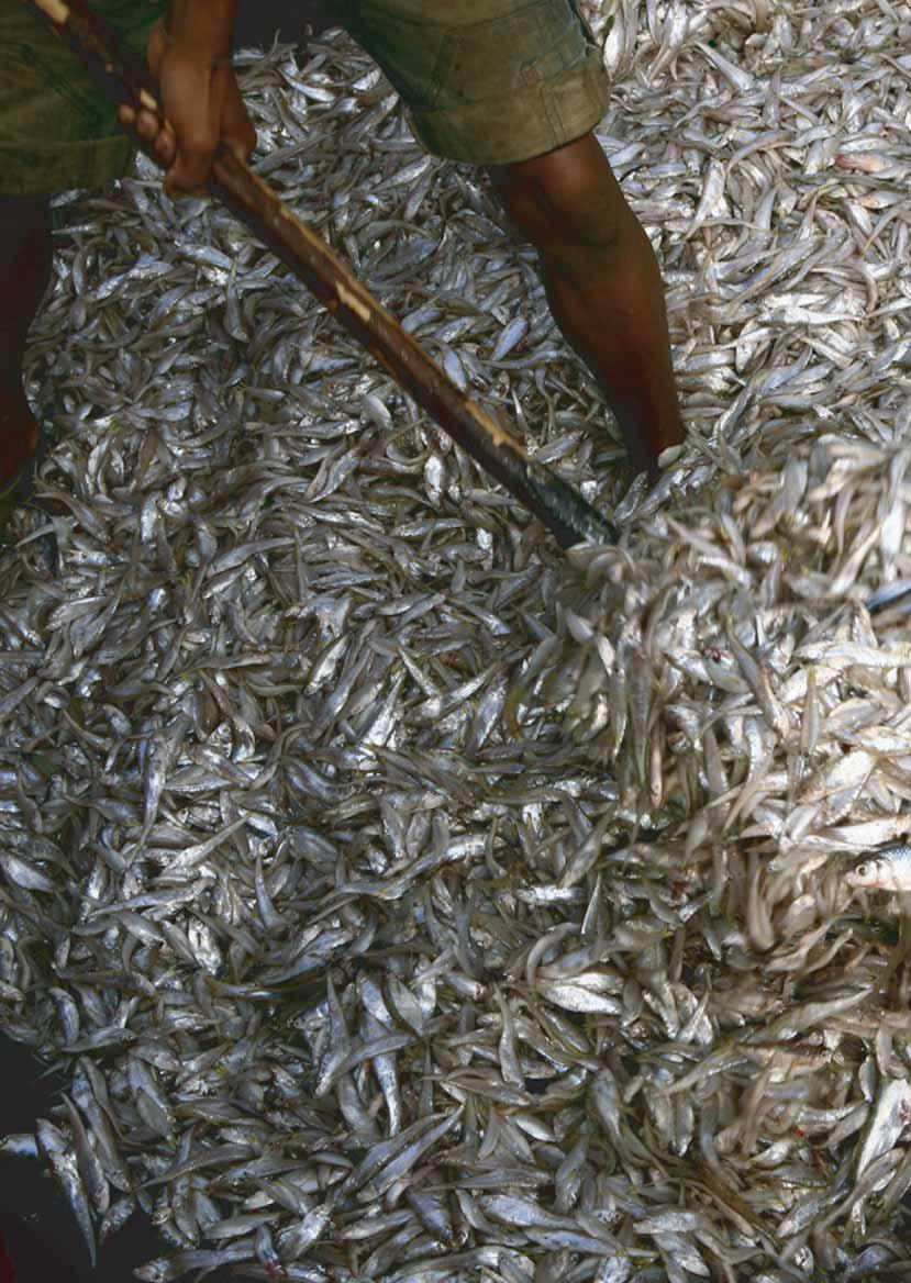
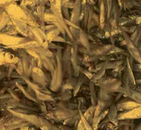
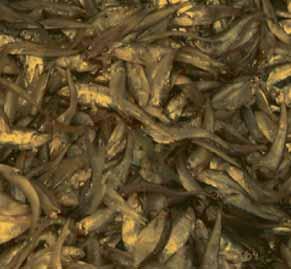
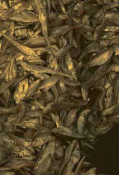
17 According to Junk s concept (1997), aquatic organisms can directly use biomass produced during the terrestrial phase. For example, some fish feed on the fruit of the floodplain forest, detritus and terrestrial invertebrates. Bacteria, aquatic algae and macrophytes take up the nutrients released from decomposing terrestrial organic materials (Kummu et al., 2006). Organisms living during the terrestrial phase make uses of the stranded aquatic material and of the nutrients released by them during decomposition. This nutrient cycle in the form of an exchange of energy and nutrients between the two phases by different groups of organisms is the principal reason for the high productivity of most floodplain systems (Kummu et al., 2006). The fishery in the Tonle Sap Lake Cambodia s inland fisheries are one of the most abundant in the world, the fourth largest production overall after China, India and Bangladesh (Baran et al., 2007a). Specifically, Tonle Sap Lake is among the most productive freshwater ecosystems. Flooded forests and shrubs offer excellent shelter and breeding grounds for fish and other aquatic animals (Bonheur, 2001). Almost two-third of Cambodia s catch, conservatively estimated at 400,000 tons annually, comes from the Tonle Sap watershed and in terms of value, the overall fishing sector accounts for % of gross domestic product (GDP). The value of the fish catch from Tonle Sap Lake is estimated at US$233 million a year (Baran et al., 2007a). The statistics of catch per fisher over time in the Tonle Sap area and estimated annual inland fish catch in the Tonle Sap and in Cambodia are provided in Table 2. From the 1940s to 1990s, the overall fish catch in the Tonle Sap has increased from almost 125,000 tons/year to 230,000 tons/year. Since the number of fishing communities in the 1990s was more than 3 times the figure for the 1940s, the catch per fisher per year was decreased almost 50% (from 347 kg/person/year to 192 kg/person/year). Table 2: Catch per fisher over time in the Tonle Sap area and estimated annual inland fish catch in the Tonle Sap and in Cambodia (Source : ADB, 2005) Migration of different fish species and other aquatic animals between the Tonle Sap Lake and the Mekong River is extensive and diverse. During the inflow, there is mostly a passive migration of eggs, fry and fish to the Tonle Sap Lake and its floodplains. When the floods recede and the Tonle Sap River flows again back to the Mekong River, water levels on the submerged lands start dropping, signalling to most fish species that it is time to migrate to deeper water in the Lake or tributaries (lateral migration). Many species, so-called white fish, will then undertake longer (longitudinal) migration from the Lake or tributaries to the Mekong River, probably moving upstream and staying in deep pools for the dry season (Thuok et al., 1999; Van Zalinge et al., 2003). Numerous species, mainly so-called black fish stay in the Lake (Lamberts, 2001) and undertake a relatively short migration between flooded areas in the rainy season and permanent water bodies in the dry season (Van Zalinge et al., 2003). Fish species with longitudinal migrations begin to spawn in the Mekong River at the beginning of the rainy season (May-July). Important spawning areas are located in the Mekong and tributaries in Kratie, Stung Treng and Ratanakiri provinces. Fish eggs and fry are carried by the currents and swept into the flood plain areas that are being inundated (Thuok et al., 1999). 17
18 Observations of the bag net (Dai) fishery for migrating fish in the Tonle Sap River during 1995 to 2000 indicate that year-to-year variations in maximum Mekong River flood levels and related Tonle Sap floodplain inundation strongly affect the yield of this fishery, which is dominated by short-lived species (Van Zalinge et al., 2003). The Van Zalinge et al. (2003) study was concerned with the effect of the variations in the height of the flood level on the fish yield and on the average size of some major species. In this period ( ), the Dai fishery catch corresponds with the recorded maximum flood levels in the Great Lake. Sarkkula et al. (2003 and 2004) hypothesised that the sediments carried by the Mekong waters to the Tonle Sap Lake bring in the essential nutrients that feed the Lakeís food webs. Likewise, the higher the flood, the more sediments and nutrients are brought into the Lake. In Tonle Sap Lake, the higher the water level, the higher the fish productivity. Thus, the trend of decreased water discharge into the Lake raises the concern of a decline in fishery productivity (Sithirith, 2005). Both annual fish catches (fishing lots and Dai fishery) displayed a decline during and the fish catch in reached the lowest level in history, raising public awareness about fisheries (Sithirith, 2005). The declining trend in the low water level year seems to be clear and the decrease in availability of natural resources and rapid population growth is an unsustainable combination that is likely to decrease the level of livelihood yet further (Keskinen, 2006). However, villagers around Tonle Sap Lake (Kampong Pradam, Pream Kreang and Pou) claim that the height of the flood in the Lake only influences fish catch to a point. If the flood depth is 3-4 metres, the fish catch is high whilst if the water rises up to six metres, the fish catch will decrease (Heinonen, 2006). The record of Dai catch and peak water levels in the Tonle Sap from 1995 to 2005 is illustrated in Figure 4. Catches from the Tonle Sap Dai fishery soared to more than 16,000 tonnes in , almost three times the seasonís haul and the highest since systematic records began. The record catch from the fishery, which targets a small cyprinid species, accompanied higher water levels in the Tonle Sap. Hortle et al. (2005) pointed out that this may also reflect a reduction in illegal fishing. Figure 4: Relationship between peak water level and the fish catch of Dai or Bag net fishery in the Tonle Sap River during (Source: Hortle et al., 2005) 3.2 Impact of relevant development on the change of hydrology and fishery Impact of water resources development on the Tonle Sap Lake hydrology Rapid economic growth especially in countries in the Upper Mekong Basin has increased the pressure to increase hydropower production and for other development plans. The flow volume of the Mekong River and its tributaries has been modified by changes in precipitation patterns and development activities, such as the construction of dams for hydropower, the improvement of river navigation and the diversion of river water for irrigation, industrial development and human settlements. The construction of dams for hydropower development in the region has also altered the flow regime in the basin (GIWA, 2006). 18 Change of Hydrology and Fishery Impacts in the Tonle Sap
19 These upstream developments may have significant impacts on the downstream countries, such as Cambodia and Vietnam. The Cambodian floodplains and the Mekong Delta receive over 90% of the available water resources and 95% of the total suspended sediment flux from upstream countries (Kummu et al., 2004b). Therefore, this part of the basin is directly dependent on the conditions of the Mekong and any upstream changes would dramatically affect the downstream hydrological regime and livelihood. Mekong upstream water resource developments, like dam construction and irrigation development, may affect downstream countries. Trapping of sediments in upstream reservoirs leads to a reduction of nutrients for downstream ecosystems and consequently a reduction in the productivity of the Tonle Sap system. In addition, unbalanced sediment concentration in downstream countries can lead to increased bank and bed erosion (Kummu et al., 2004b). China plans to build eight cascade hydropower dams on the mainstream of the Mekong River in the Upper Mekong Basin (known as the Lancang Jiang in China). These hydropower dams, occasionally referred as the Mekong Cascade, are located in Yunnan Province. The first dam, Manwan Dam, was officially completed in 1996, but its reservoir was filled earlier in the dry season. Construction of the second dam, Dachaoshan Dam, started in 1996 and was completed in Construction of the third dam, Xiaowan Dam with a height of 292 m and reservoir length of 169 km, began in 2001 and is expected to be completed in The remaining five dams are in their planning stages (IRN, 2002b). Figure 5 shows the locations of existing and proposed dams in the Mekong River Basin. The total storage of the constructed and projected reservoirs in the eight cascade dam would be over 40 km 3, while the total annual discharge from the Upper Mekong Basin on the Chinese border is 73.6 km 3 (Kummu et al., 2004b). Thus, the cascade of reservoirs would be able to store more than half of the annual discharge of the Upper Mekong Basin (Kummu et al., 2004b). By 2020, up to 15 hydro-electric dams will be constructed along the Lancang River with a total installed capacity of 25,605 MW (Xu and Moller, 2004). At present there are many seasonal storage facilities in the Lower Mekong Basin. Total storage capacity of existing large reservoirs amounts to approximately 12.1 billion m3 (MRC- WUP-JICA, 2004). Figure 5: Locations of dam in the Mekong River Basin (Source: IRN, 2007) 19
20 The hydropower potential in Yunnan is unquestionable especially at a time when there is a global need to reduce reliance on carbon-based energy production but there remains major concern about the negative impacts of the dams on the Lower Mekong Basin. Many have discussed and explored these issues (Mogg, 1997; Roberts, 2001; Whiting, 2001; China Daily, 2002; Hawiset, 2002a and 2002b; Richardson, 2002; Kummu and Varis, 2007; Kummu et al., 2004b; Xu and Moller, 2004; Salidjanova; 2007). Major concerns relate to: increasing flow fluctuation downstream, increasing average downstream dry-season flows, decreasing wet-season flows, shifting of the flooding period, decreasing flux of nutritious sediments crucial for fisheries and agriculture production, and geomorphological changes such as bank erosion and bed degradation due to sediment trapping. Proponents argue that besides hydropower generation the dams offer flood control, more assured dry-season flows, increasing navigation options, reduction of salinity intrusion and provision of irrigation opportunities for downstream countries (Plinston and He, 2000; Hori, 2000). Other positive impacts offered in the schemes defence include attenuation of flooding in the wet season by storing the water in upstream reaches and releasing it when needed in dry season for irrigation and navigation purposes which would benefit downstream countries (Hawiset, 2002a and 2002b; Richardson, 2002). The two completed dams (Manwan and Dachaoshan dams) were relatively small and had no noticeable impacts on the Mekong s level (MRC-WUP-JICA, 2004). Although these projects are provided with large reservoirs for hydropower generation, they are operated under the mode of run-of-river (maintaining the inflow to be equal to outflow) without seasonal regulation. However, the third ongoing dam construction at Xiaowan (4,200 MW) over the Lancang River with a storage capacity of 11,500 million m3 for seasonal flow regulation, is expected to increase dry season flow by around 555 m 3 /s. Further, after completion of all the cascade projects, the low flow is expected to increase by around 1,230 m 3 /s (MRC-WUP-FIN, 2004). Chapman (1996) reported that when Xiaowan is completed in about 2010 the mean dry season flow at the Yunnan-Lao PDR border will increase by 40% and by 170% when the Nuozhadu dam is added to the system. The International Rivers Network (IRN) also analysed the run-of-river cascade dams in the Lower Mekong and found that the six dams and reservoirs recommended by China are on comparable scale to the Bonneville Dam on the Columbia River in the US Northwest and such massive dams cannot be considered run-of-river projects (Lawrence et al., 2007). Increasing dry season and decreasing wet season flow can be seen as helping to overcome water shortage during the dry season and contributing towards flood mitigation during the wet season (Kummu et al., 2004b). As already summarised, there is concern about the negative impacts of the dams. The filling of any reservoir with water requires extended diversions of river flows into the reservoir, diminishing the flows that reach downstream areas, and in the case of big or multiple dams, this can irreversibly change the ecosystem and water table downstream (Salidjanova, 2007). For example, unusual dry conditions in downstream reaches were observed in 1992 and this was perceived by many to be caused by the operation of Manwan dam probably when the dam was closed to fill its reservoir (Nguyen, 2003; Pearce, 2004; Salidjanova, 2007). As the hydrology of the local rivers is distinct from the Mekong mainstream, any long-termed decrease in mainstream Mekong discharge, which may now be inevitable given the unilateral decision to undertake the program of large mainstream dam construction of China, will result in the contribution to local catchment runoff increasing as a percentage of the total water supply to Tonle Sap Lake to possibly 40-50% from its current level of 25 ñ 38% (ADB, DOF and FAO, 2003). On average, the operation of the Manwan dam has significantly increased the discharge at Chiang Saen (the most upstream gauge station in the Lower Mekong River) because of the release of water from the dam during the dry season. The completion of the Xiaowan dam would increase the average river flow to the Lower Mekong River by 40% (Nguyen, 2003). However, the impacts of the construction and operation of the Manwan dam on the hydrological condition at Chiang Saen have not been observed at downstream locations (Nguyen, 2003). At Pakse, long-term average wet season discharge may be decreased by 12% due to large and small dam construction in the tributary rivers since the mid 1960s (ADB, DOF and FAO, 2003). One counter argument is that the total impounded mass of water is estimated to be approximately four percent of total annual Mekong flow, about half of this is live storage, and a fraction of that is consumed for irrigation or lost through evapotranspiration. Thus, the decline in total Mekong discharge to the Tonle Sap Lake may only be around one percent (ADB, DOF and FAO, 2003). However, Adamson (2006) raised awareness by an analysis of data trends. His evaluation looks at the annual rainfall at Vientiane from the 1920s until 2005 and shows that caution in trend analysis is required when apparent trends are detected in hydro-meteorological time series data. Such processes almost always have multi decadal periodicities embedded within them and it is easy to confuse these with systematic trends when only a part of such long period cycles is evident in the sample used for analysis. For example, during the 1950 to 2005 period it might be justified to conclude there was a decrease in annual rainfall, particularly after the late 1960s. However, if the longer period of 20 Change of Hydrology and Fishery Impacts in the Tonle Sap
21 record, from 1923 to the present date is considered, the conclusion of a decreasing trend becomes much more difficult to support (Adamson, 2006). Towards the end of the dry season, low flow would almost double from the natural discharge should regulation in Yunnan involve a 20% reallocation of flow from the wet to the dry season. Even given the lower figure of 10%, flows at the end of the dry season still indicate an increase of 45%. While the upstream storages are refilling during the early wet season, flow in July could fall by as much as 40% and the month of peak discharge move back from August to September (Adamson, 2001). However, the impacts of the large Chinese dams are diminished by the contributions of tributaries joining the Mekong from Laos which are less affected by either irrigation or dams moving downstream. Adamson (2001), MRC-WUP (2004) and MRC-BDP (2005) reported that the impacts of regulation might progressively decay downstream. As most of the lower Mekong system flow is generated within Lao PDR and Thailand during the wet season, this means that the refilling of large storages upstream of Chiang Saen will not result in such a large reduction in downstream flows, at least once the major left bank tributaries have entered the mainstream in Lao PDR (Adamson, 2001). MRC-BDP (2005) developed different scenarios for water resource developments in the Lower Mekong Basin to investigate the impacts of development based on particular modelling systems, such as irrigation scenario with development of irrigation and the water supply sector, and a high development scenario involving Chinese dam construction and irrigation. The high development scenario includes completion of the hydropower sector in the Upper Mekong (Manwan, Dachaoshan, Xiaowan and Nuozhadu) and reservoirs in the lower Mekong countries (Nam Ngum, Nam Theun, Se Kong and Se San tributaries), in addition to irrigation and water supply developments. It was found that the wet season flows are noticeably reduced and the dry season flows are prominently increased. These changes are quite dramatic in the upstream stations and the changes decreased for stations downstream (MRC-BDP, 2005). Hydrological regime change of the Cambodian floodplains and the Tonle Sap Lake varies seasonally depending on the upstream flow condition and monsoon rainfalls. Tonle Sap flow reversal is dependent on water level and flow condition in the wet season at Kratie (MRC-WUP, 2004). The mean annual wet season volumes at Kratie were reduced up to 7% for the high development scenario. This resulted in a reduction of 11% in Tonle Sap flow reversal volumes (4,300 million m 3 ) corresponding to a drop by 0.37 m in lake level and maximum flooded area was decreased by 3.4% (430 km 2 ) (MRC-WUP, 2004). Water stored in the wet season serves to elevate the minimum dry season flow by about 0.6 m at Kratie through the storage and routing effects. Compared to the wet season impact, this dry season change at Kratie is much greater, revealing the importance of water contributions from the Upper Mekong River snow and glacial melt water to the dry season flow in the Lower Mekong Basin (MRC-BDP, 2005). However, the greatest threat to the dams sustainability of (Lancang) hydropower generation comes from progressive reduction in storage capacity due to sedimentation inflows to the reservoirs (Plinston and He, 2000). Because much of the in-coming sediment load is deposited in the reservoirs and bed-load transport is blocked by the dam, reservoir outflows are relatively clean and sediment-hungry and this process may pose the threat of downstream erosion (Roberts, 2001; Kummu et al., 2004b) Impact of land use change on the Tonle Sap Lake hydrology Change of land use and flood pulsing systems could influence both hydrological regime and ecosystem productivity. The current and planned dam construction and water diversion schemes along the Mekong River and its tributaries, together with the flood control schemes in the Mekong Delta, are likely to substantially modify the annual floods and dry season flow levels in the future (MRC, 2003). Even though floods are essential for the Tonle Sap Lake, they can also have adverse impacts on crop productions and ecosystems if the water remains too long or rises too fast (Heinonen et al., 2006). Observations of local residents around Tonle Sap Lake (Kampong Pradam and Peam Kreang) suggest that that loss of forest cover in the uplands and mountains could be one of the reasons behind the higher floods (Heinonen et al., 2006). During the last two years, the study Deforestation does not cause widespread flooding was launched. As early as 1920s, the conventional view has been that forests prevent floods by acting as a giant sponge, soaking up water during heavy rains. In reality, forests tend to be rather extravagant users of water which is contradictory to earlier thinking (FAO, 2003). A new report from a UN agency and a forest research group released in 2005 (FAO and CIFOR, 2005) finds there is no scientific evidence linking large scale flooding to deforestation. The study by FAO and CIFOR (2005) shows that the frequency and extent of major floods has not changed over the last century despite significant reductions in forest cover, and challenges the conventional belief that forest loss causes floods. Contrary to popular belief, forests have only a limited influence on major downstream flooding, especially large-scale events. It is correct that on a local scale forests and forest soils are 21
22 capable of reducing runoff, generally as the result of enhanced infiltration and storage capacities. But this holds true only for small-scale rainfall events, which are not responsible for severe flooding in downstream areas. Instead, the main factors influencing major flooding given a large rainfall event are the geomorphology of the area and preceding rainfall (FAO and CIFOR, 2005) Impact of change in hydrological regime on fisheries The Tonle Sap ecosystem is believed to be one of the most productive inland waters and one of the most fish-abundant lakes in the world. Tonle Sap is a crucially important source of food and livelihood in Cambodia. Any disturbance to the ecosystem may have disastrous impacts on the livelihoods of the whole country. Upstream developments on the Mekong such as dam construction have already led to significant trapping of sediments and nutrients (Kummu and Varis, 2007). This would mean a dramatic reduction of net sedimentation in the Tonle Sap and consequently, in the supply of sediment bound nutrients to its floodplain for maintaining its biological production. It is hypothesised that sediments carried out by the Mekong waters to the Tonle Sap Lake bring in the essential nutrients that feed into the Lakeís food webs (Sarkkula et al., 2003; MRC-WUP-FIN, 2003; Sarkkula et al., 2004). The higher the flood the more sediments and nutrients are imported (MRC-WUP-FIN, 2003; Van Zalinge et al., 2003; Kummu et al., 2005). Significant change in the flood regime may influence the productivity of the ecosystem, e.g. as influences on reduced fish catches and thus, people around the Lake and the whole of Cambodia (Kummu et al., 2005). Hydropower development changes the natural flood pulse and the flood hydrograph, directly undermining the productivity of the system by reducing the inundated habitats, delaying the onset of flooding and shortening its duration (growth period for aquatic organisms), all having negative impact on fisheries productivity (Baran et al., 2007b; MRC-WUP-FIN, 2007). The flood would be delayed by up to days and its duration would be 1-2 weeks shorter depending upon the location and altitude (Baran et al., 2007b). Fish and other aquatic species are adapted to the sediment-rich and turbid conditions of the Mekong. Possible changes to this nourishing environment due to upstream development would affect feeding and spawning conditions and perhaps lead to declining biodiversity and productivity (Blake, 2001). The suspended sediment coming from China is very fertile (Blake, 2001; Roberts, 2001; IRN, 2002b; Kummu et al., 2004b; Kummu and Varis, 2007). The Manwan dam was finished in 1993 and it has had severe impacts on the sediment flux downstream in the Lower Mekong Basin, where the measured suspended sediment rates have halved from 69 to 35 million tons/year (Kummu and Varis, 2007). This could represent the most obvious impact of the extensive damming of tributaries and the mainstream on the downstream. It can be seen that the dam trapping scenario would mean dramatic reduction of the net sedimentation in Tonle Sap and consequently, in the supply of sediment bound nutrients to its floodplains for maintaining its biological productivity (Sarkkula et al., 2003; Kummu et al., 2004b; Kummu et al., 2006; Baran et al., 2007b). If the whole cascade of dams were built in Yunnan, it would theoretically trap 94-98% of the suspended sediment load from China (Kummu et al., 2004b). Built structures such as dams, irrigation schemes and roads all have numerous economic benefits but their impacts on water flow which in turn affect seasonally-submerged habitats and fish-migration routes, may also lead to negative hydrological, environmental and social side effects (Baran et al., 2007a). Likewise, water resource developments in the Mekong Basin pose a risk for the sustainability of the Lower Mekong Basin fisheries by changing hydrological and sediment transport patterns (Sarkkula et al., 2004). A study on upstream dam scenarios using hydrological modelling, shows that with their storage of 55 km 3 and 140 km 3, the dams could reduce inflow to the Lake by 10-25% in dry years and the annual flood could also be delayed for about a month and come to an end about 2 weeks earlier than normal. Thus, the height of the floodwater and the surface area covered would also significantly decline (Baran et al., 2007a). Goodman (2004) concluded that Chinaís network of dams would be likely to lead to lower water level in the river, less flooding of the Tonle Sap, less transfer of nutrient-rich sediment and a degraded fishery. According to hydrological modelling (Baran et al., 2007a), upstream damming would increase discharge in the dry season, which would then expand the surface area of the Lake by between 300 and 900 km 2 (Kummu and Sarkkula, 2008). These rising water levels would result in the Tonle Sap flooded forest area being permanently inundated in the dry season and ultimately dying. This would correspond to the destruction of a crucial breeding and feeding habitat for numerous fish species (Baran et al., 2007b; MRC-WUP-FIN, 2007). Tonle Sap irrigation schemes so far have had a limited impact on water flows and water quality. However, cumulative effect of these reservoirs could become significant (Baran et al., 2007a). 22 Change of Hydrology and Fishery Impacts in the Tonle Sap
23 Wet season storage in the new dams also impacts on the commencement of the wet season through reduction in the rising period. Often the first flood peak is heavily influenced, whilst the second and any later peaks are less affected as the dams are by then full and often spilling. Delays in the commencement of the wet season or changes to water level give cause for concern that this phenomenon may possibly interfere with the condition for longitudinal migration of white fish species (MRC-WUP, 2004; Baran et al., 2007a). The duration of the flood is an important parameter influencing the size of the fish stock. A short flood does not leave enough time for fish to take advantage of the resources available in the floodplain; subsequently fish do not grow optimally and the overall stock biomass is reduced. Conversely, a longer flood is beneficial to fish biomass (Kurien et al., 2006). A slowly rising river water level leads to interruption and/or delay of spawning migration of many migrating fish species (Junk et al., 2003) In addition, upstream damming would also threaten fisheries by adversely affecting water quality. Drops in the amount of oxygen in the water and changes in drift patterns could have a negative impact on fish eggs, larvae and juveniles (Baran et al., 2007a). In addition, delays in the onset of the flood will result in delays in the arrival of oxygen-rich waters. Dissolved oxygen levels in Tonle Sap water generally decline during the dry season, until the inflow of oxygen-rich water at the beginning of the flood season. While fish may swim to more oxygenated waters, eggs and larvae are unable to move and may be adversely affected if the arrival of the flood is delayed. Flow changes may also have an impact on the drift of fish larvae and juveniles, which usually end up on the northern and eastern shores of the Lake (Baran et al., 2007b). Synchronisation in the arrival of the first floods and the spawning process may be crucial. The filling of hydropower storage will cause delays and diminution of flooding. It may disrupt this cycle and lead to a decrease in recruitment and a decline of the migratory fish stocks, especially of the longitudinal migrants. This is very important as longitudinal migratory fish constitute about 63% of the total catch taken in the Tonle Sap area (Thuok et al., 1999). The physical presence of dams would block normal migration routes of hundreds of fish species leading to a drop in fish stocks and catches which could have devastating consequences for livelihoods (Lawrence et al., 2007; Baran et al., 2007a and 2007b). The dams block the natural biodiversity corridor of the river, which may seriously disturb fish, especially those that migrate, as well as the habitats of other aquatic species. The reduced sediment and nutrient deposition will reduce natural soil fertility and hence lower yields in rice fields which may necessitate an increased adoption of artificial fertilisers, lowering the economic viability of the area (Blake, 2001). In addition, Baran et al. (2007b) assessed localised influences of specific types of built structures on the level of the Tonle Sap Basin. The influence of road development in floodplains was examined and it was found that the location and design of roads is a key factor in determining their impact on fish habitat and migration. The scientific literature points to habitat fragmentation as a frequent negative impact of road construction on fisheries (Baran et al., 2007a). Another threat to the Tonle Sap ecosystem is local development and increasing pressure because of the fast growing population on its natural resources. For example the area of the flooded forest in the vicinity of the Tonle Sap Lake is decreasing because of illegal logging and increasing demand of wood for fishing gear, boats and fire wood. The forest is crucially important for the Tonle Sap system forming a shelter for the floodplain and providing suitable conditions for fish to breed (Kummu et al., 2005). The flooded forest may encounter another threat if dam regulation in the Mekong mainstream and tributaries increases the dry season flow as predicted by Adamson (2001). This would mean that the average dry season water level in the Lake would rise from 1.57 m to 1.81 m above the mean sea level (DHI, 2004). If the Lake level rises as predicted, part of the flooded forest would remain inundated throughout the year which could destroy that part of it (Kummu et al., 2005). The increased fluctuation of water level and discharge regime of the rivers around the Lake carries many implications for fish adapting to this changing environment. The increased drought for a long period of time could pose a threat for fish habitats especially to black fish, with deep water pools becoming shallow or silted in most rivers, and it could lead to over-fishing in the rivers. The rapid increase in water level and flow in rainy seasons sometimes wipes out fish habitats, for example the destruction of forests along the river bank and river bank erosion. In such a changing environments, it is difficult for aquatic animals to adapt and there is potential risk for an increased exploitation (Sithirith, 2005). In addition to dam construction, China is blasting rapids for a planned shipping channel from the upper reaches to the lower reaches of the Mekong (IRN, 2002a). The Upper Mekong Navigation Improvement Project plans to free the Mekong to allow large ship navigation. Blasting of rapids for a planned shipping channel on the Upper Mekong River threatens to undermine people s livelihoods and destroy the complex river ecosystem. The destruction and blasting of rapids, shoals and scattered reefs may have widespread ecological impacts along the Mekong. Rapids and reefs comprise some of the most productive riverine habitats serving as vital breeding grounds for fish and other forms of 23
24 aquatic life, including plants such as Mekong seaweed (kai). Blasting the rapids and reefs could jeopardise the survival of rare species such as the Mekong giant catfish. The reefs also play an important role in producing oxygen, reducing pollution and aiding in decomposition of vegetation. The project could affect fisheries by destroying spawning grounds for fish that live in Cambodia and Vietnam but migrate upriver to lay their eggs (IRN, 2002a). 3.3 Impact of Climate Change on the hydrology and fishery in the Tonle Sap Changes in temperature, precipitation, soil moisture and sea level could have adverse effects on ecological systems (EPA, 1999; ILEC, 2005; WorldFish Center, 2006). The effect of extreme hydrologic and climatic events on river-floodplain systems has been stressed, but has been little studied. The IPCC (2001) indicates that planet Earth will suffer considerable climate changes during the next century, which will be, to a considerable extent, the result of man-made increases in greenhouse gases, such as carbon dioxide and methane. A global average temperature increase of 1.4 to C is predicted. Nearly all land masses, mainly those at northern high latitudes during the cold season, will warm more rapidly than the global average. Global mean sea level is projected to rise by 0.09 to 0.88 m because of temperature-related expansion of the water and melting of the glaciers of the northern Polar Regions and high mountains. Changes in precipitation will occur in most regions - rainfall will increase in some regions and drought will increase in others. The strongest impact will be felt in northern sub-polar regions (permafrost regions), high mountains, coastal areas, deserts and savannas, where water is already a limiting factor. The problem is further complicated by the overall decline in the water supply of the Mekong River, caused by adverse human interference and climate change. While the exact origins of the Mekong have not been identified, it is known that its source lies somewhere in the mountains of Tibet. Every spring, when the ice melts, the resulting water flows into the river, replenishing it. With Asia becoming hotter and drier as a consequence of climate change, the glaciers that provide Mekong s water may diminish with time, supplying less and less water with each consequent year. Such decline in water supply at the source, exacerbated by excessive demands imposed on the Mekong s flow by filling of dam basins, may lead to severe deterioration of the Tonle Sap and its biosphere (Salidjanova, 2007). Under the climate change scenario of CO 2 doubling (from 350 ppm nowadays to 700 ppm in the future), preliminary predictions of the effects of climate change in the Mekong River Basin were obtained from a simulation. The study by Chinvanno (2004) shows that the northern region of the Mekong Basin, particularly Yunnan, will have significantly less annual rainfall in the future, probably by 20%, and elsewhere will experience seasonal shifting and change in rainfall distribution over a year. However, the change in regional precipitation will vary from year to year under the influence of climate variability (Snidvongs, 2006). The results of his simulation show a trend of increasing precipitation throughout the region in the future, especially in Lao PDR and the Mekong Delta in Vietnam. Chinvanno (2004) suggests that there will be significant change and shift in the pattern of rainfall all over the region. The Mekong region will experience a drier and longer dry season. Some parts of the Basin will experience a shift in seasonal patterns including change in rainfall distribution and rainfall amount. For instance, in Lowland parts (covering Cambodia and Vietnam) the dry season will be drier and longer, while the rainy season will be shorter and wetter. The higher precipitation, with the length of the rainy season remaining unchanged, may lead to higher flood risk in the future, which may also increase in magnitude as well as frequency. With longer summers and shorter winters in the Mekong River Basin, this phenomenon may have an impact on the ecosystem (Snidvongs, 2006). In terms of water supply and water storage, the Upper Mekong especially in Yunnan will be subject to a significant reduction in the annual supply of water (Chinvanno, 2004). The rainfall in the dry season will not be much reduced since rain rate during the dry season will be the same as at present. However, irrigation systems may suffer from a water shortage, as the rainfall during the rainy season will be reduced by about 20%. Hence, improvements in infrastructure and water policy in the region will put additional stress on downstream ecosystems by this hydrological regime. Climate change may affect fisheries and aquaculture directly by influencing fish stocks and the global supply of fish for consumption, or indirectly by influencing fish prices or the cost of goods and services required by fishers and fish farmers. Ways in which climate change may directly affect production from fisheries and aquaculture are: change in sea surface temperature; El Nino-Southern Oscillation (ENSO); rising sea level; higher inland water temperatures; changes in precipitation and water availability; increase in frequency and/or intensity of storms; and drought. As mentioned before, mean sea level is predicted to rise between approximately 10 and 90 cm during this century. Rising sea level could lead to salinity intrusion problems in the Mekong Delta which may be detrimental to freshwater 24 Change of Hydrology and Fishery Impacts in the Tonle Sap
25 fisheries and aquaculture in the lower reaches of the Lower Mekong Basin. Along with the negative consequences, however, there will be benefits in the form of increased areas of brackish water for the culture of such high-value species as shrimp and mud crab. Increasing seasonal and inter-annual variability in precipitation resulting in extreme flood and drought is likely to be the most significant driver of change in inland aquaculture and fisheries (WorldFish Center, 2006). In addition, individual animal species would have different capacities to respond to changes in climate due to differences in competitive abilities, migration rates, in response to disturbance and in other ways. Many species might be able to migrate providing that continuous natural ecosystems, relatively undisturbed, are available. The seasonal shift and change in precipitation pattern may have a strong impact on the timing of flooding and hydrological regime. Changes in timing and seasonal events during the annual cycle would have strong negative impacts for many species, especially the migratory ones. Various species of fish that migrate through these areas and use wetland as a seasonal habitat may find the wetland in these areas uninhabitable or not able to provide the shelter or the food web that they need for that period of their life cycle. Species with narrow tolerance to environmental variability would be the most vulnerable and threatened by climate change (Chinvanno, 2004). Although at the global scale over the last century, climate change had been observed, at the scale of the Mekong Basin, there has been no clear indication that any local and regional climate and hydrology might have significant impacts. Throughout history, climate variability, such as ENSO, and local factors, like land use change and water resource management schemes have dominated the water and wetland resource in the Mekong rather than CO 2 driven climate change. 4. Conclusions Upstream water resource developments in the Mekong River Basin may have led to significant impacts, e.g. change of water flow, trapping of sediments and nutrients in reservoir, bank and bed erosion etc. These continuing developments will have an increasing influence on flood regime, timing and duration of flood in the Lower Mekong Basin and the Tonle Sap Great Lake. The changes will be not only hydrological issues but may have negative impacts on the productivity of the Tonle Sap Lake and floodplain ecosystem. However, there are some arguments for positive impacts of upstream dam construction that have been raised, e.g. attenuation of flood peak in the wet season and provision of water in the dry season. The following issues are summarised from the literature review on the effects of upstream development, e.g. dam construction and irrigation scheme development. Reduced flood water level in the wet season and increased flood water level in the dry season lead to changes of water flow in wet and dry seasons. Increasing the edge of the Lake in dry season could cause the decline of the flooded forests in the Tonle Sap Lake if they are permanently submerged. This would impact on the flood pulsing ecosystem of the Tonle Sap, by reducing fishery shelters, and it would affect the Tonle Sap ecosystem productivity. Also, reducing water level and flooded area in wet season could influence fishery migration. Delays in the onset of the flood will result in delays in the arrival of oxygen-rich waters. While fish may swim to more oxygenated waters, eggs and larvae unable to move may be adversely affected if the arrival of the flood is delayed. Also, delayed flooding period and a retarding of the time of reversed flow into and out of the Tonle Sap Lake via the Tonle Sap River and the Mekong River would affect the period and route of fish migration including period of fish growth. Reduced supply of sediments and nutrient to the Lake and floodplain system give lower sedimentation flow into the Tonle Sap Lake which would affect the flood pulse system including nutrient sources for biological production. Loss of sediments in flood water would result in a loss of natural soil fertility (hence a loss of rice production or higher production costs due to increased use of fertilisers). It could also lead to increased erosion along the Mekong s banks and possibly to a lower survival rate for fish eggs, their buoyancy being reduced. This would affect the ecosystem productivity of Tonle Sap Lake. So far there is limited information from the Tonle Sap system on the quantity and quality of food available in different parts and different phases of the ecosystem. All in all, there is a need to improve our understanding of the Tonle Sap ecosystem productivity and its vulnerability. One of the biggest challenges for Cambodia and other Mekong Basin countries in the near future is how to manage water resources and socio-economic developments without compromising the sustainability of important ecosystems and natural resources upon which millions of people rely, especially in Cambodia. 25
26 Trends in global climate and their impact are not clear over a short period. Impacts from climate change, e.g. increase in severe flood and drought events, drier and longer dry season and wetter rainy season, could become noticeable particularly in water constraint situations. These phenomena affect the hydrological regime in the Lower Mekong Basin, especially the ecosystem in Tonle Sap Lake which directly influences the livelihood of people. Understanding the impacts of climate change may lead to a sustainable adaptation strategy that could decrease the vulnerability and risk of the people in the Mekong River Basin. The climate change issue is global and long-term. It involves complex interaction between climatic, social, environmental, economic, technological, institutional, and political processes and has significant international and intergenerational implications in the context of equity and sustainable development. The magnitude and even direction of the aggregated climate change impact at global scale varies with climate projections of different General Circulation Model (GCM) groups. Under the scenario of CO 2 doubling from present levels, preliminary results show shifts in rainfall distribution and seasonal patterns including changes in temperature and other climate parameters, e.g. number of dry and wet days and wind pattern. The regional climate model simulation shows that the Mekong region will experience drier and longer dry season, and wetter and shorter rainy season at some specific locations, e.g. in the Lowland basin (Cambodia and Vietnam), while rainfall will be significantly lower over the wet season in the Lancang basin in the upper part of the Lower Mekong Basin. These impacts of climate change could have impacts on water-related issues in the Mekong River Basin, i.e. water supply during wet and dry season which influences the dam operational strategy and this would affect the hydrological regime and ecosystem in downstream countries. 5. Pending issues and research gaps Despite the extreme importance of the Tonle Sap Lake for Cambodia and the region, neither the Lake s exceptional hydrology nor the driving forces behind high aquatic production are yet fully understood and analysed. There has been relatively little scientific research into the nature of Tonle Sap Lake. The main limitation for understanding the behaviour and mechanisms of the Tonle Sap Lake system is a lack of resources and information. Most of the investigations on the hydrological regime of the Lake and the interaction between the Lake and the Mekong River have been based on existing information available from the middle of the 1990s, which are inadequate to fully understand the complex system of Tonle Sap Lake. Studies on flooding mechanisms and hydrological functionalities over the Cambodian floodplains, including flow contribution to the Tonle Sap (by WUP-JICA and TSLV from MRC), were based on observed discharge measurements, satellite imagery analysis and model simulation. To enhance and improve future studies hydrological data observation and collection would need to be continued, to ensure the timeliness, sufficiency and reliability of the data necessary for understanding the physical processes of the hydrological system of the Tonle Sap. Research on the effects of land use changes and upstream development schemes on downstream flooding regime are usually conducted in relatively small catchment areas, e.g. normally below 1,000 km 2 (FAO and CIFOR, 2005). In a large scale international river basin such as the Mekong, the macro-geographical scale means that significant local impacts on hydrological regime become spatially imperceptible. For example, the hydrological changes due to hydropower schemes in tributaries tend to be attenuated when the regulated flows enter the mainstream (Adamson, 2006). Likewise, the flooding effects tend to be averaged out across the different sub-basins as storms pass over (FAO and CIFOR, 2005). Therefore the study of regional-scale river basins with holistic approaches should be inaugurated in the Mekong River Basin so that the complicated linkages between different components can be described. This is essential to obtain sustainable development in this region. In addition, the impacts of development scenarios in the upstream region on the ecosystem and fisheries in the Tonle Sap Lake, especially on people s livelihoods, are poorly comprehended. The status and dynamics of biological productivity within the Lake have not been well studied compared with the study of the hydrological and limnological processes in the Tonle Sap. Only the concept of flood pulse is well identified in the Tonle Sap ecosystem. More investigation on the ecosystem is necessary to explain ecosystem productivity in the Lake. Climate change affects not only the hydrological regime in the Lower Mekong Basin accounting for flood pulsing systems, but also aquatic ecosystems and fishery productivity. Fisheries and aquaculture would potentially be harmed by the secondary effects of global warming, e.g. shifts of seasonal and inter annual rainfall pattern influencing water level and river flow, increasing trends of extreme flood and drought events etc. Climate change and variability, specifically rainfall and temperature, aggravates the adverse impacts of water resource development schemes. Water resources are also some of the most difficult to manage owing to the influence of factors 26 Change of Hydrology and Fishery Impacts in the Tonle Sap
27 such as climate that are beyond the direct influence of management. Further, water is also highly influenced by land use and land use practices that in many watersheds are often impossible to limit, and even more so to prohibit. Thus, a study to identify alternative management strategies to cope with the impacts of climate change on water and its uses and on water resources management is important. The research areas and topics related to policy needs are summarised in Table 3. Table 3: Proposed research areas and topics related to the policy needs 27
28 6. Policy linkages An integrated approach to international river basin management is crucially important. This approach assembles water resource and land use management, including warning dissemination in the upper land, with land use planning, preparedness and emergency management in the lower land. When planning infrastructure development, wherever possible the national-level decision makers should avoid significant changes in water flows, especially those affecting seasonal flooding or the breaking of natural connectivity between water bodies and floodplains around the Tonle Sap. The determination of ecological impacts on development should be made at the planning stage so that mitigation measures can be taken. Taking the community into account for infrastructure development by clarifying who will benefit, and how, should be ensured. The role of local institutions and differences in household assets should also be considered. Linkage of infrastructure planning to the decentralized institutions for rural development and natural resource management, e.g. commune, district and provincial councils, is also important (Baran et al., 2007a). At the regional level, a mediation and coordination between upper and lower countries should be established to facilitate dialogue and resolution of transboundary issues on land management and land use planning, infrastructure development and cross-border emergency management. It also requires that upper catchment areas be considered as part of the solution and not as the source of the problem. Involvement of all stakeholders and affected downstream parties at the local and regional levels should be included when planning infrastructure development to avoid upcoming disputes and problems. In addition to considering the impact on hydrological change, planning of upstream water developments should take into account possible ecological and environmental consequences of the changes in the downstream countries. Climate change affects not only the hydrological regime in the Lower Mekong Basin accounting for flood pulsing system, but also aquatic ecosystems and their fishery productivity. Thus, alternative management strategies to cope with the impacts of climate change on water and its uses and on water resources management should be sought. Strengthening the capacity building of communities in understanding the effects of climate change impact, adaptation and vulnerability in communities in the Lower Mekong Basin should be supported. There is a need for bottom-up assessment and planning to address vulnerability and enhance adaptive livelihood at the local and national level. Adaptation to climate change and variability encounters the challenge that the climate is driven by complex global processes but adaptations have to be implemented at the local level to tackle the impacts of climate change on daily life. Participation of local actors is a prerequisite for broadly supported local adaptation. In addition, attempts to apply and interpret current knowledge from research to decision making level are extensively required so that policy makers can implement the appropriate projects corresponding to state-of-the-art knowledge. Scientist and policy makers should involve stakeholders in their scientific approaches and adaptation policy development. Encouragement of the Mekong member countries to share and exchange information throughout the Mekong region should be advocated. Lack of data is the main reason for limited knowledge in this Lower Mekong Basin. Information sharing could lead to better understanding of the complex physical processes of the Mekong River including the Tonle Sap Lake, floodplains and the Mekong Delta which is necessary to reach the aim of sustainable development. 28 Change of Hydrology and Fishery Impacts in the Tonle Sap
29 References Adamson, P. (2001). The potential impacts of hydropower developments in Yunnan on the hydrology of the Lower Mekong. International Water Power and Dam Construction, March. Adamson, P. (2006). An Evaluation of Landuse and Climate Change on the Recent Historical Regime of the Mekong, Final Report, Integrated Basin Flow Management. Mekong River Commission, Vientiane, Lao PDR. Adamson, P. and Apirumanekul, C. (2007). Annual Mekong Flood Report Mekong River Commission, Vientiane, Lao PDR. ADB. (2005). The Tonle Sap and Its Fisheries. The Tonle Sap Initiative: Future Solutions Now. ADB, FAO and Cambodian Department of Fisheries. (2003). Tonle Sap Environmental Management Project; Technical Assistance Improving the Regulatory and Management Framework for Inland Fisheries, Mid-Term Report, Phnom Penh, Cambodia. Baran, E., Jantunen, T., Hort, S. and Chheng, P. (2005). Building BayFish-Tonle Sap, a Model of the Tonle Sap Fish Resource. ADB/WorldFish Center project Technical Assistance for capacity building of IFReDI. WorldFish Center and Inland Fisheries Research and Development Institute, Department of Fisheries, Phnom Penh, Cambodia: 50. Baran, E., Sophort, S., Kura, Y. and Ratner, B. (2007a). Infrastructure and Tonle Sap fisheries: How to balance infrastructure development and fisheries livelihoods? The Challenge Facing Decision-Makers in Cambodia. Policy Brief. Baran, E., Starr, P. and Kura, Y. (2007b). Influence of Built Structures on Tonle Sap Fisheries. Synthesis Report. The Cambodia National Mekong Committee and the WorldFish Center. Blake, D. (2001). Proposed Mekong dam scheme in China threatens millions in downstream countries. World River Review, 16(3): 4-5. Bonheur, N. (2001). Tonle Sap Ecosystem and Value. Technical Coordination Unit for Tonle Sap, Ministry of Environment, Phnom Penh, Cambodia. Chapman, E. C. and He, D. (1996). Downstream Implications of China s Dams on the Lancang Jiang (Upper Mekong) and their Potential Significance for Greater Regional Cooperation Basin-Wide. Monash Asia Institute, Australia. China Daily. (2002). Xiaowan Dam, a Reservoir for Progress, 16 September, Available online at [Accessed on 2 June 2007]. Chinvanno, S. (2004). Information for Sustainable Development in Light of Climate Change in Mekong River Basin. Southeast Asia START Regional Center, Bangkok, Thailand, Available online at A77_SUPPAKORN_CHINAVANNO.pdf, [Accessed on 10 June 2007]. DHI. (2004). Study on Natural Reverse Flow in the Tonle Sap River. DHI Water and Environment, prepared for Mekong River Commission Secretariat. EPA. (1999). Climate Change and Cold Water Fish: Is Trout Fishing an Endangered Sport? Environmental Protection Agency, May. FAO. (2003). State of the World s Forests. Food and Agriculture Organization of the United Nations, Rome, Italy. FAO and CIFOR. (2005). Forests and floods: Drowning in fiction or thriving on facts? Center for International Forestry Research and Food and Agriculture Organization of United Nations. Fuji, H., Garsdal, H., Ward, P., Ishii, M., Morishita, K. and Boivin, T. (2003). Hydrological Roles of the Cambodian Floodplain of the Mekong River. International Journal of River Basin Management, 1(3): GIWA. (2006). Global International Waters Assessment Mekong River - GIWA Regional assessment 55. University of Kalmar on behalf of United Nations Environment Programme, Available online at [Accessed on 10 June 2007]. 29
30 Goodman, P. S. (2004). Manipulating the Mekong. Washington Post, 30 December. Hawiset, P. (2002a). Mekong River Commission s Middleman Role Attacked. November 16, Available online at geocities.com/vlado_stastny/, [Accessed on 15 June 2007]. Hawiset, P. (2002b). Damming the Consequences. November 20, Available online at [Accessed on 24 June 2007]. Heinonen, U. (2006). Environmental Impact on Migration in Cambodia: Water-related Migration from the Tonle Sap Lake Region. International Journal of Water Resources Development, 22(3): Hoanh, C.T., Adamson, P., Souvannabouth, P., Chhit, K. and Jirayoot, K. (2006). Integrated Basin Flow Management Specialist Report (IBFM 3): using DSF to Analyze Impacts of Climate Change on Mekong River. Mekong River Commission, Vientiane, Lao PDR. Hori, H. (2000). The Mekong: Environment and Development. United Nations University Press. Hortle, K., Ngor, P., Hem, R. and Lieng, S. (2005). Catch and Culture: Tonle Sap yields record haul. Mekong River Commission, Vientiane, Lao PDR. International Lake Environment Committee (ILEC). (2005). Managing Lakes and their Basins for Sustainable Use: A Report for Lake Basin Managers and Stakeholders. International Lake Environment Committee Foundation, Kusatsu, Japan, Available online at [Accessed on 2 June 2007]. IPCC. (2001). Summary for Policymakers. Third Assessment Report of Working Group I of the Intergovernmental Panel on Climatic Change. IRN. (2002a). Navigation Project Threatens Livelihoods, Ecosystem. International Rivers Network, Briefing Paper 2. IRN. (2002b). China s Upper Mekong Dams Endanger Millions Downstream. International Rivers Network, Briefing Paper 3, Available online at [Accessed on 24 June 2007]. IRN. (2007). A Dam Rush on the Mekong? World Rivers Review, 22(2). Junk, W. J. (1997). The Central Amazon Floodplain, Berlin: Springer. Junk, W. J., Bayley, P. B. and Sparks, R.E. (1989). The flood pulse concept in river-floodplain systems. In: Dodge, D.P. (Ed.). Proceedings of the International Large River Symposium, Canadian Special Publication of Fisheries and Aquatic Sciences, 106. Junk, W.J. and Wantzen, K.M. (2003). The Flood Pulse Concept: New Aspects, Approaches and Application - An Update. In: Welcomme, R.L. and Petr, T. (Eds.). Proceedings of the Second International Symposium on the Management of Large Rivers for Fisheries, Volume II. Food and Agriculture Organization of the United Nations and Mekong River Commission, Phnom Penh, Cambodia. RAP Publication. Keskinen, M. (2003). Socio-economic Survey of the Tonle Sap Lake, Master s Thesis. Water Resources Laboratory, Helsinki University of Technology, Finland. Keskinen, M. (2006). The Lake with Floating Villages: Socio-economic Analysis of the Tonle Sap Lake. International Journal of Water Resources Development, 22(3): Kummu, M., Sarkkula, J. and Varis, O. (2004a). Sedimentation and Mekong Upstream Development: Impacts to the Lower Mekong Basin. 2 nd IAG Yangtze Fluvial Conference, Shanghai, China. Kummu, M., Koponen, J. and Sarkkula, J. (2004b). Upstream Impacts on Lower Mekong Floodplains: Tonle Sap Case Study. In: Proceedings of the International Conference on Advances in Integrated Mekong River Management, Vientiane, Lao PDR, October 2004: Kummu, M., Koponen, J. and Sarkkula, J. (2005). Modelling sediment transportation in Tonle Sap Lake for Impact Assessment. In: Kachitvichyanukul, V., Purintrapiban, U. and Utayopas, P. (Eds.). Proceeding of the 2005 International Conference on Simulation & Modelling, Bangkok, Thailand, Available online at [Accessed on 4 June 2007]. 30 Change of Hydrology and Fishery Impacts in the Tonle Sap
31 Kummu, M., Sarkkula, J., Koponen, J. and Nikula, J. (2006). Ecosystem Management of Tonle Sap Lake: An Integrated Modelling Approach. International Journal of Water Resources Development, 22(3): Kummu, M. and Varis, O. (2007). Sediment-related impacts due to upstream reservoir trapping, the Lower Mekong River. Geomorphology, 85(3-4): Kummu, M. and Sarkkula, J. (2008). Impact of the Mekong river flow alteration on the Tonle Sap flood pulse. Ambio, 37(3): in print. Kurien, J., Baran, E. and Nam, S. (2006). Factors that drive Cambodia s inland fish catch: What role can community fisheries play? Inland Fisheries Research and Development Institute, Phnom Penh, Cambodia. Lamberts, D. (2001). Tonle Sap Fisheries: A Case Study on Floodplain Gillnet Fisheries in Siem Reap, Cambodia. Food and Agriculture Organization of the United Nations, Bangkok, Thailand. RAP Publication. Lamberts, D. (2006). The Tonle Sap Lake as a Productive Ecosystem. International Journal of Water Resources Development, 22(3): Lawrence, S. and Middleton, C. (2007). Mainstream Dams Threaten the Mother of all Rivers. World Rivers Review, 22(2): 6-9. Matsui, S., Keskinen, M., Sokhem, P. and Nakamura, M. (2005). Tonle Sap: Experience and Lessons Learned Brief (Lake Basin Management Initiative). International Water Learning Exchange and Resource Network, Available online at publications/ll/laketonlesap_2005.pdf, [Accessed on 4 June 2007]. Mogg, R. (1997). China s Challenge. International Water Power and Dam Construction, November. Morishita, K., Garsdal, H. and Manusthiparom, C. (2004). Hydrological functions of the Great Lake and Cambodian floodplains. In: Proceedings of the International Conference on Advances in Integrated Mekong River Management, Vientiane, Lao PDR, October 2004: MRC. (2003). State of the Basin report. The Mekong River Commission, Phnom Penh, Cambodia. MRC/WUP-FIN. (2003). Modelling Tonle Sap for Environmental Impact Assessment and Management Support, Final Report, MRCS/WUP-FIN Project. The Mekong River Commission, Phnom Penh, Cambodia. MRC/WUP. (2004). Water Utilisation Program Start-up Project - Integrated Basin Flow Management Report No.2 - Revision 2. The Mekong River Commission, Vientiane, Lao PDR. MRC/WUP-JICA. (2004). The Study on Hydro-Meteorological Monitoring for Water Quantity Rules in Mekong River Basin, Final Report, Volume III Summary. The Mekong River Commission, Vientiane, Lao PDR. MRC/TSLV. (2004). Consolidation of Hydro-Meteorological Data and Multi-Functional Hydrologic Roles of Tonle Sap Lake and its Vicinities. Phase III (Basin-wide), Final Report. The Mekong River Commission, Vientiane, Lao PDR. MRC/BDP. (2005). The MRC Basin Development Plan. Scenario for Strategic Planning. BDP Library Volume 4. Revised November The Mekong River Commission, Vientiane, Lao PDR. MRC/WUP-FIN. (2007). Hydrological, Environmental and Socio-Economic Modelling Tools for the Lower Mekong Basin Impact Assessment, Final Report - Part 2: Research findings and recommendations. Version 21 September WUP-FIN Phase 2. The Mekong River Commission, Vientiane, Lao PDR. Nguyen, Q. M. (2003). Hydrologic Impacts of China s Upper Mekong Dams on the Lower Mekong River, Available online at [Accessed on 2 June 2007]. Pearce, F. (2004). Chinese dams blamed for Mekong s bizarre flow. New Scientist, 25 March, Available online at [Accessed on 2 June 2007]. Penny, D. (2002). Sedimentation Rates in the Tonle Sap, Cambodia. Report to the Mekong River Commission. Penny, D., Cook, G. and Sok, S.I. (2005). Long-term rates of sediment accumulation in the Tonle Sap, Cambodia: a threat to ecosystem health. Journal of Paleolimnology, 33(1): Plinston, D. and He, D. (2000). Water resources and hydropower in the Lancang River Basin. Report of ADB TA 3139: PRC - Policies and Strategies for Sustainable Development of the Lancang River Basin, Landcare Research New Zealand Ltd. 31
32 Richardson, M. (2002). Managing a river/ 6 countries to meet: Sharing the Mekong: an Asian challenge. The International Herald Tribune, 30 October, Available online at [Accessed on 3 June 2007]. Roberts, T. (2001). Downstream Ecological Implications of Chinaís Lancang Hydropower and Mekong Navigation Project. International Rivers Network. Salidjanova, N. (2007). Chinese Damming of Mekong and Negative Repercussion for Tonle Sap. ICE Case Studies, Number 218, May. Sarkkula, J., Kiirikki, M., Koponen, J. and Kummu, M. (2003). Ecosystem processes of the Tonle Sap Lake, Ecotone II - 1 workshop, Phnom Penh/Siem Reap, Cambodia. Sarkkula, J., Baran, E., Chheng, P., Keskinen, M., Joponen, J. and Kummu, M. (2004). Tonle Sap Pulsing System and Fisheries Productivity. SIL XXIX International Congress of Limnology, Lahti, Finland. Sithirith, M. (2005). The Hydro-Dynamics of the Tonle Sap Lake, Cambodia. Fisheries Action Coalition Team. Snidvongs, A. (2006). Vulnerability to Climate Change Related Water Resource Changes and Extreme Hydrological Events in Southeast Asia. A Final Report Submitted to Assessments of Impacts and Adaptations to Climate Change (AIACC), Project No. AS 07. Snidvongs, A., Choowaew, S. and Chinvanno, S. (2003). Background paper: Impact of climate change on water and wetland resources in Mekong River Basin: directions for preparedness and action. Regional Centre Report No 12. Southeast Asia START, Bangkok, Thailand. Sverdrup-Jensen, S. (2002). Fisheries in the Lower Mekong Bain: Status and perspectives. MRC Technical Paper No.6. The Mekong River Commission, Phnom Penh, Cambodia. Thuok, N., Van Zalinge, N., Degen, P., Seang Tana, T. and Nuov., S. (1999). Taken for granted, yet increasingly at risk. Project for Management of Freshwater Capture Fisheries of Cambodia. Project document. The Mekong River Commission, Phnom Penh, Cambodia. Tsukawaki, S. (1997). Lithological features of cored sediments from the northern part of Lake Tonle Sap, Cambodia, The International Conference on Stratigraphy and Tectonic Evolution of Southeast Asia and the South Pacific, Bangkok, Thailand August Xu, A. and Moller, D. (2004). Hydropower Development Plan Set for Lancang River, Available online at /Dec/82505.htm, [Accessed on 4 June 2007]. Van Zalinge, N., Thuok, N., Tana, T.S. and Loeung, D. (2000). Where there is water, there is fish? Cambodian fisheries issues in a Mekong River Basin perspective: In: Ahmed, M. and Hirsch, P. (Eds.). Common property in the Mekong: issues of sustainability and subsistence. ICLARM Studies and Reviews 26. Van Zalinge, N., Loeung, D., Pengbun, N., Sarkkula, J., and Koponen, J. (2003). Mekong flood level and Tonle Sap fish catches, The Second International Symposium on the Management of Large Rivers for Fisheries, Phnom Penh, Cambodia. Vorosmarty, C.J. (2002). Global water assessment and potential contributions from Earth Systems Science. Aquatic Sciences, 64: Whiting, D. (2001). China dams could help Laos fight floods. Reuters News Service, 7 August. WorldFish Center. (2006). The threat to fisheries and aquaculture from climate change. Policy Brief. 32 Change of Hydrology and Fishery Impacts in the Tonle Sap

33 Chapter 2 Sedimentation in the Tonle Sap Lake - Assessing the Risks Sok Saing Im 1, Sokhem Pech 2, and Chayanis Krittasudthacheewa 3 Abstract Introduction: Geographical location and issues relevant to sustainable development Key issues for investigation Current knowledge of sedimentation in the Tonle Sap Current knowledge on sediment loads in the Tonle Sap Lake Debate over sources of Tonle Sap sedimentation Deforestation and erosion in the Tonle Sap catchments Role of the Tonle Sap River in Lake sedimentation and re-deposition Impacts of water resources development on Tonle Sap Lake sedimentation Impacts of hydropower dams Impacts of sand mining and bed degradation on Tonle Sap sedimentation Biological availability and importance of sediments for productivity in the Tonle Sap Lake Pending issues and research gaps Conclusions and policy recommendations 49 References 50 1 Freelance consultant, Phnom Penh, Cambodia. saing_im@online.com.kh 2 Hatfield Consultant Group, Vancouver, Canada. pechsokhem@yahoo.co.uk, spech@hatfieldgroup.com 3 Stockholm Environment Institute, Bangkok, Thailand. chayanis.k@sei.se 33
34 Abstract There is a concern that the productivity and existence of the Tonle Sap Lake is threatened by excessive sediment transport caused by upstream deforestation and gem mining, land conversion, improper irrigation development, and possibly over-fishing. However, more intensive investigations confirm the contribution of sediment to the ecosystem, as well as its importance to fish/food chain and agricultural soil in the Tonle Sap Basin. There have been few attempts to accurately measure the rate of sedimentation in the Lake; the literature abounds with conflicting rates of infilling due to sedimentation. The different views about sedimentation in Tonle Sap Basin are important to understand. The present paper draws together available research data and findings in order to identify the state of knowledge on the current situation with respect to sedimentation. The paper delves into the impacts of water resources development and other relevant factors influencing sedimentation, as well as examines the biological availability of sediments flowing into the Lake and importance of sedimentation for productivity in the Tonle Sap. Based on existing literature and its supporting scientific evidence, it is clear that the current rate of sediment accumulation within the Lake is low and does not appear to be accelerating. However, even though the overall net sedimentation within the Tonle Sap is not an immediate problem, there are many local problems associated with high sedimentation and erosion rates in the area. Most of the villages around the Lake are located by the tributaries and the situation there is completely different from the average within the Lake proper. This issue merits further investigation. Strengthened effort is required to continue to ensure the validity of the research findings to date as well as to ensure that accurate information is transferred to the policy making process. Therefore, the challenge is to bring accurate and timely information to decision makers, local people living in and around the Lake, and international organizations. Studies of the measured and possible future changes in sediment transport due to water resources development started only very recently. They indicate that the upstream dams would sharply reduce the net inputs of sediment in Tonle Sap and consequently, the supply of sediment bound nutrients to the floodplain for maintaining biological productivity. Further, the high hydropower development scenarios model simulation in the upper Mekong shows that the surface area of the Lake s permanent water body will expand by between 300 and 900 km 2 in the dry season in an average year. There is a concern about the potential impacts of this dry season increase on those types of flooded forests located along the Tonle Sap that cannot tolerate permanent flooding. As a result, there is a need to investigate and quantify the impact of those changes on sedimentation rates, flow velocity and the sediment re-flushing capacity in Tonle Sap system. From the present study, it is interesting that the traditional concept of eutrophication was found to be unsuitable to describe the situation in the Tonle Sap. The naturally high primary production is effectively channelled to the food web culminating with remarkably high fish production. The biological productivity is derived from sediments in the waters of the Lake as well rivers and their border areas. The sediments contain the nutrients needed by phytoplankton. However, phytoplankton blooms do not occur in the Lake because of intensive grazing by zooplankton and fish. The significance of sediment in the productivity of the Tonle Sap ecosystem floodplain needs closer consideration and future research to clarify its role in the sustainable management of the Tonle Sap more precisely. 34 Sedimentation in the Tonle Sap Lake - Assessing the Risks
.")
35 1. Introduction Geographical location and issues relevant to sustainable development The Tonle Sap Lake in Cambodia is the largest permanent freshwater body in Southeast Asia (Figure 1). The Cambodian floodplains, including Tonle Sap and the Tonle Sap River, contain the most extensive wetland habitats in the Mekong system (Pech and Sunada, 2006). The Lake links to the Mekong River via the 147 km long Tonle Sap River, (Chaktomuk Project Management Unit and DHI Water and Environment, 2002) joining at Phnom Penh as the Mekong makes its final journey before emptying into the South China Sea (Shaochuang, 2003). Figure 1: Tonle Sap proper or permanent water body and floodplains (Source: WUP-FIN, 2007) In Cambodia, the Tonle Sap Basin covers an area of approximately 85,786 km 2 or roughly 43% of the country s total land area (Kummu et al., 2008). It covers 8 provinces and one municipality. More than 4.5 million people live within the Tonle Sap Basin, while about 1.2 million Cambodians in approximately 160 communes live in the floodplain of the Lake. The Basin population growth is estimated to be between 2.5% and 4.8% annually the highest in the Mekong region (Pech and Sunada, 2006). Population pressure on the Lake concentrates on areas of high opportunities for employment and access to resources such as Kampong Luong fish landing port (Krakor district of Pursat province) and the Chong Khneas tourist port (Siem Reap). Tonle Sap has mixed flow and drainage where the flow reverses and its water body changes considerably depending on the seasonable flow pattern and flood pulse of the Mekong River. It has a remarkable link with the Mekong hydrologically, biologically and morphologically. Approximately 55% of its annual inflow comes from the Mekong and the Tonle Sap also absorbs around 20% of the Mekong s floodwater, and releases the flow back into the Mekong system during the dry season (WUP-FIN, 2003a). Some 7 million tons of sediment is transported from the Mekong River into the Tonle Sap Basin (WUP-FIN, 2006; Kummu et al., 2008). The Tonle Sap is of great ecological, economic and social significance to the whole Mekong region, specifically to Cambodia. The Tonle Sap represents a complex set of inter-linkages and inter-dependencies. Competition and conflict over resources are intensive, and there is growing national and international concern over its long-term sustainability (Pech and Sunada, 2006). At the Mekong regional level, Tonle Sap Lake provides the last refuge for some of Asia s most globally significant biodiversity (MRCS/UNDP, 1998). The flooded areas of Tonle Sap provide seasonal breeding and nursery grounds for fish that migrate to the Mekong River and beyond. It also serves as an important navigation route and natural flood attenuation for the Mekong Delta in Cambodia and Vietnam. At the country level, the Tonle Sap supplies fish, which is the main source of animal protein for much of the population of Cambodia, and the fertile land around Tonle Sap has great agricultural production potential for Cambodia. 35
36 Today, the Tonle Sap is an ecosystem considered to be under threat. The GIWA/UNEP (2004) argued that the productivity and existence of the Lake is threatened by excessive sediment transport caused by upstream deforestation and gem mining, land conversion, and improper irrigation development. Intensive investigation on this issue has recently been launched by the Finnish Environmental Institute. The study outlines the importance of sedimentation to the ecosystem, as well as to the fish/food chain and productivity of soil in the basin (WUP-FIN, 2003a). Apart from the Finnish studies, there have been relatively few attempts to accurately measure the rate of sedimentation in the Lake. The scant literature that does exist provides a somewhat confusing and contradictory picture of the sedimentation rates (Penny et al., 2005). It is important to clarify the reasons behind these differing views about the sedimentation in Tonle Sap Basin. This is to avoid misinterpretation of threats to the Lake and to provide better guidance for future development and management of these fragile resources. The purpose of this paper is to review and analyse literature written on this issue and try to identify the current state of knowledge in relation to sedimentation in the Tonle Sap. The paper also draws conclusions from various studies on the impacts of sedimentation on water resources development (such as hydropower dams). Finally, the research aims to identify biological impacts of sedimentation, such as fish productivity and biodiversity in the area. It is expected that the findings of this research may assist in determining future research on sedimentation in the Tonle Sap that may enhance decision making on development in Tonle Sap and Cambodia that is environmentally sound and socially desirable. 2. Key issues for investigation There is a relative dearth of research on sedimentation in general and limited primary data on the Tonle Sap Basin. Consequently, there remains a limited understanding of the ecosystem dynamics (Kummu et al., 2008). Few limnological and sedimentological studies have been carried out in the Tonle Sap and the adjacent river systems in Cambodia (Carbonnel and Guiscafré, 1965; Carbonnel, 1972; Tsukawaki, 1997; Penny, 2004; WUP-FIN, 2003a; WUP-FIN, 2007). For these reasons, the current extent of primary data on sedimentation in the Mekong Basin and Tonle Sap is far from satisfactory especially in quantifying the sediment load. There are currently two major databases on suspended sediments available to the public. The first is the MRC hydrological database (HYMOS) which includes suspended sediment concentrations (SSC) data from 1962 until Measurements are based on the depth integrated method, with varying sampling frequency. These are supported by 14 stations in the Mekong mainstream and 46 in the tributaries, all within Thailand or Lao PDR territory. A major gap exists in the SSC data between the mid 1970s and 1985, because of the unstable political situation in the Mekong area. No data are available from stations in China. The second database is the MRC Water Quality Monitoring Network (WQMN) database. This database includes total suspended sediment (TSS) data from 1985 until The TSS is sampled just below the water surface once per month. These databases are supported by 18 stations in the Mekong mainstream and 37 stations in Mekong tributaries in all four Lower Mekong Basin (LMB) countries. There also appears to be no reliable data on bed loads in the Mekong Basin (Kummu et al., 2008). Consequently, it is possible that the magnitude of sedimentation can be significantly underestimated. This is because much of the sediment is coarse grit or sand that is carried as bed load rather than in suspension, especially during floods (Plinston and Daming, 2000). This failure to account for a key element of sediment transport means that resource development and impacts cannot adequately provide sustainability tests to quantify the relationship between development and impacts, and to support consideration and integration of multiple stresses and magnitude and multiple risk/degree of vulnerabilities. A further data limitation on sedimentation is that there are no reliable data available from China. There is also limited information on the geomorphology in LMB and Tonle Sap. The estimated sediment flux is based mainly on surface TSS concentration calculations and thus the real suspended sediment flux may be higher. The effect of the many dams on bed load transport, which is likely to be significant as the reservoirs trap the sediment, is also poorly understood (Kummu et al., 2008). It is clear that more research is required to accurately predict the total sediment flux in the Mekong. The importance of bed loads in the Mekong River was raised by the US Bureau of Reclamation as long ago as 1973, especially in relation to the transport of material close to the river bed (the un-measured load). Bed material samples were collected for computing the total load at Luang Prabang, Chiang Khan and Wat Sop and a fourth place of importance for the Pa Mong hydropower project. Bed material samples were taken with USBM 54 sampler, and total load determinations were made by the application of bed load and total load equations. For the actual reach the computations gave the result that the un-measured load might be just over 14% of the suspended load, equal to 12% of 36 Sedimentation in the Tonle Sap Lake - Assessing the Risks
37 the total load. This figure seems reasonable, considering the river environment conditions in the actual area. However, it cannot be considered representative for other parts of the river and further investigation is needed. The determination of the quantitative rate of bed load transport is one of the most difficult problems in river hydraulics. Bed load transport can be determined by field measurements, theoretical computations (using different bed load formulae), or different indirect methods. All methods have limitations. However, as bed load transport is essential for the solution of many problems, for instance river (hydrological and morphological) migration process, river traffic ability, delta evolution, and reservoir sedimentation, some attempt at estimation of bed load is essential (Hardern and Sunberg, 1992). 3. Current knowledge of sedimentation in the Tonle Sap To date, no unequivocal data exist regarding the recent rates of sediment deposition within the Lake, and there has been no systematic attempt to measure the level of sedimentation that has occurred in the past (Penny, 2002). However, for the past decade research has been conducted by several organisations and projects which have improved our understanding about the ecological process of the Tonle Sap. Sedimentation is considered to play an important role in shaping the present and future ecology of the Tonle Sap. Some groups are increasingly adamant that the Tonle Sap is gradually infilling, with dramatic implications for the ecology and human activities around the Lake. Others maintain that there is no immediate threat posed by sedimentation (Bonheur, 2006). Without sound scientific information to resolve these uncertainties, it is impossible to develop environmentally realistic management strategies (Kummu et al., 2008). 3.1 Current knowledge on sediment loads in the Tonle Sap Lake Estimates of the rates of sedimentation of the Tonle Sap vary widely from an extreme of 4 cm per year (Csavas, Kaosa-ard et al., 1990; Gartrel, 1997), to a more usual 0.3 to 0.5 mm/year (Carbonnel and Guiscafré, 1965) to as low as 0.1 mm/year (Penny et al., 2005). The Land and Water Development Division of FAO provides a good example of the frustration generated by such uncertainty stating that: In the recent past, sedimentation of Lake Tonle Sap has given cause for concern. In the absence of reliable data on hydrology and sediments in this area, many scenarios have been developed. The most pessimistic ones forecast a drying up of the Lake in a ten-year period, while other studies estimate that the Lake would take 600 years to dry up (FAO, 1999 quoted in Penny, 2002). The first and most extreme view which suggests that the Tonle Sap may dry up can be found in a number of publication and reports with some estimates reported to be as high as 40 mm/year (Gartrell 1997; Kaosa-ard et al., 1995). It is also often claimed by local people and some national experts that increasing sediment yields from the upper catchment area are rapidly infilling the Lake (Sithirith, 2006). These fears are apparently borne out by the observations of local people living at the Lake edge who report that some areas are becoming shallower (Heinonen, 2006). Such information has been cited and has resulted in the claims gaining some currency in the media and subsequently has fuelled concerns over the health of the Tonle Sap (DPA, 1999; Heywood, 1994; Sluiter 1993), without referencing or substantiation. Penny (2002) stated that in the 1960 s the bottom of the Lake rose two centimetres every year, by 1990 this rate had increased to four centimetres (Penny, 2002). These above statistics appeared two years later, in a Thailand Development Research Institute Report (Kaosa-ard et al., 1995). More recently, Bonheur and Lane (2002:36-37) claim that siltation is increasing and siltation and sedimentation are also increasing due to the degradation of upland forests. Csavas et al. (1994) studied the fisheries in the Lake and outlined a critical situation in which the rate of siltation was in the range of 20 to 40 mm per year, although it did not specify a location (Csavas et al., 1994:35). They also claimed that increased siltation in the southeast of the Tonle Sap, much of which is due to the input through the Tonle Sap River, in the future may result in separation of a section of the Great Lake and formation of two bodies in the dry season (Csavas et al., 1994:35). The report also puts forward that the northwest end of the Lake had narrowed by 5 kilometres, from 40 km to about 35 km although the period over which this happened was unclear (Csavas et al., 1994). The Office de Recherche et Scientifique d Outre-Mer (ORSTOM/BCEOM) (1993) referred to a number of pseudo scientific publication in 1990 claiming that the Tonle Sap would silt up quickly over the next decade due to the high rate of sedimentation and caused by deforestation around the Tonle Sap catchment. However, some 17 years later the Tonle Sap proper remains largely unchanged. Finally NEDECO, MIDASs and CNMC (1997) argued that, even if the sedimentation rate has more than tripled to 1 mm per year since the early 1960s, the current dry season area of the Lake would last another 1,000 to 1,500 years. The debate surrounding sedimentation in the Tonle Sap is clearly inconclusive and, at worst, misleading. Penny et al. (2005) maintain that some of these claims in the literature are based on a misinterpretation of exploratory work by 37
38 Carbonnel (1972) and Carbonnel and Guiscafré (1965). It was mainly due to the gross misinterpretation of the assumed sedimentation rate distribution over the whole Tonle Sap floodplains of 0.4 mm per year by Carbonnel during work undertaken between 1962 and Many estimates of the modern rate of sedimentation are based on the work of Carbonnel and Guiscafré (1965) and Carbonnel (1972). They carried out the most extensive sedimentation study in Lithological analysis of core sediments was based on 19 drilling holes evenly distributed across the Tonle Sap proper (Figure 2). The rate of sediment load to the Tonle Sap was estimated at mm/year (Carbonnel, 1963). Based on the radiocarbon age, Carbonnel estimated the age of the Tonle Sap s bed to be about 5,720 Carbon-14 years Before Present (BP). He argued that the material brought by the Mekong in the high water period is negligible in the Tonle Sap proper and consequently does in no way modify the accumulation rate in the Tonle Sap proper. All alluvial matters transported by the Mekong as it flows up towards the Tonle Sap settle in the region between Kampong Chhnang and Chhnok Trou (ORSTOM/ BCEOM, 1993). A modern rate of sedimentation was also calculated from estimates of sediment loads to the Lake during the study period ( ). The authors maintained that it was 0.15 mm/year higher than the long-term rate, which suggested that the sedimentation rate of the Great Lake has tended to increase since the setting-up of the present depositing conditions (Carbonnel and Guiscafré, 1965: 358). However, a more recent investigation and modelling by Sarkkula and his team show that the above assumption cannot be proven (Kummu et al., 2008). Figure 2: Map of the Tonle Sap Lake, showing the two primary lacustrine basins, and coring sites relative to the dry seasonlake level. Core sites are taken from Penny (2005) (closed circles), Carbonnel and Guiscafre (1965) (open circles), and Tsukawaki (2002) (open squares). Two sediment core samples were undertaken by Tsukawaki and his team (Tsukawaki, 1997). (Source: Penny, 2005) Tsukawaki and team studied the sedimentation history of the Tonle Sap as part of the Tonle Sap 96- Project which involved cooperation between Kanazawa University of Japan and the Cambodian Ministry of Industry, Mines and Energy (Tsukawaki, 1997). They obtained two sediment core samples from the northern part of the Lake about 10 km south of Phnom Krom village (Siem Reap Province). Radiocarbon ages of the sediments in the cores, both about one meter long were determined. The radiocarbon age of the sediments from layers cm and cm below the 38 Sedimentation in the Tonle Sap Lake - Assessing the Risks
39 Lake floor was about 5,000 and 6,500 years, respectively. These results suggest the sedimentation rates in the northern part of the Tonle Sap Lake were in the range of 0.5 to 1.2 mm/year between 6,500 to 5,000 BP. According to the Tsukawaki team, the sedimentation rates have declined over time, from a maximum rate of 1.2 mm/year between 6,070 and 5, C years BP to less than 0.1 mm/year from 5, C years BP to the present (Tsukawaki, 1997:238). The results of Penny s (2002) field investigation show that at all sites sedimentation rates were lower than 1.0 mm/ year over the past 3,500 to 4,000 years. Sites 1 and 2 demonstrate a declining trend in sediment accumulation rates, while rates at Site 3 have changed by less than mm/year over this period. These sediment accumulation rates (Figure 3) presented here are lower than those put forward by Garbonnel and Guiscafré and much lower than the unsubstantiated reports of 20 and 40 mm/year as discussed earlier. They are, however, in keeping with the findings of Tsukawaki (1997) in the northern Tonle Sap. Figure 3: Estimated sedimentation rates of the northern part of the Tonle Sap Lake based on the radiocarbon ages of sediments of Mildenhall, 1996 and Tsukawaki et al., 1997 (Source: Penny, 2002:66) The radiocarbon analysis results on net sedimentation in the Lake proper presented by Tsukawaki et al. (1997) were also confirmed by Penny s results (2002). The net sedimentation rates found by Penny are about 0.15 mm/year over the last 5,000 years (central and northern part). NEDECO, MIDAS and CNMC (1998) suggested that as all processes influencing the existence, shape and depth of the Tonle Sap proper are geologically slow it is unlikely there will be a noticeable change in the next 100 to 150 years. Forty years after the Carbonnel and Guiscafre study, Sarkkula and his team in MRC Water Utilization Programme conducted a thorough field investigation in, and modelling exercise of the Tonle Sap. The study indicated that average flux of suspended sediments into the Tonle Sap from the Mekong River and the tributaries of the Tonle Sap is 9 million tons. The outflow from the Lake is only 1.6 million tons. Thus, more than 80% of the sediments the system receives from the Mekong River and the Tonle Sap s tributaries remain in the Tonle Sap Basin. The authors maintain that the Tonle Sap proper (Figure 1) is not filling up with sediments. Net sedimentation in the Tonle Sap proper has been about 0.1 mm over last 5,000 years, and thus is presently practically zero. Settling and re-suspension seem to be in balance as concluded by Tsukawaki (1997) (WUP-FIN, 2003b:89). The flow velocity simulated model MIKE 11 results by Chaktomuk Project Management Unit and DHI Water and Environment (2002) show a sustained high velocity flow that occurs in the Tonle Sap when it is releasing the water from the Great Lake, confirming its ability to flush out whatever sediments are deposited in the previous phase of flow. The fact that the sediment deposited in the Tonle Sap is washed away fully during the emptying of the Lake is also apparent from the results of the MIKE 21 C morphological model and the 3 bathymetric surveys carried out during 2000 by the Chaktomuk Project Management Unit and the DHI Water and Environment (2002). The main sedimentation areas in the Tonle Sap are in the flooded areas in the vicinity of Tonle Sap River and the flooded forests and fields in the vicinity of the dry season lake shore and tributaries. The vegetation in this area both traps 39
40 sediments and also has a sheltering effect reducing wind velocities. Such calm physical conditions facilitate net sedimentation and decrease aeration (WUP-FIN, 2003a). Recent long-term sedimentation studies by Tsukawaki et al. (1997), Tsukawaki et al. (2002), Penny et al. (2005), and Sarkkula and his team (WUP-FIN, 2003a; Kummu et al., 2008) show that net sedimentation within the Tonle Sap proper has been in the range of mm/year since around 5,500 years BP (Tsukawaki, 1997; Penny, 2002; Penny et al., 2005). This means an accumulation of only m of sediment in the Lake over that whole time period. Natural levees have been formed in these areas over the last thousands of years, as a result of this uneven distribution of sedimentation. Sedimentation does not cover the Lake evenly but instead is concentrated around the inflow points and as bank sedimentation. The highest sedimentation rates in the Lake proper are in the northern Boeung Chmar part of the Lake, the delta of the Tonle Sap and the western part of the Lake. In some places on the floodplain the simulated net sedimentation rates exceed 1.0 mm annually but, in most places, the annual sedimentation rate is between 0.2 mm and 0.4 mm (Kummu et al., 2008). These data support the results, indicating conclusively that the rate of sediment accumulation within the Lake is relatively low and that there is no threat of the Lake filling up with sediment in the short and medium term. Thus, despite the alarm raised by certain authors, the Lake is nowhere near in danger of losing its storage (Chaktomuk Project Management Unit and DHI Water and Environment, 2002). Rather, it appears that limited amounts of sediments brought by the flood waters seem to reach the middle and upper parts of the wetland typically used for floating rice and flood recession rice farming. This phenomenon may be one explanation for the low productivity of floating and recession rice fields with sediment providing little additional nutrient value (WUP-FIN, 2003b). Locally in villages around the Lake located by the tributaries, there are claims of high sedimentation and erosion rates (Lamberts et al., 2006); it may well be that in such localised areas there is more sedimentation. However, in the literature it appears there is little evidence to substantiate claims that the Lake is filling in. The yearly sedimentation cycle of the Tonle Sap is characterized by high sediment input during the flood period, sedimentation into the floodplain during the rise of the flood and outflow of the water (and sediment) into the Mekong during the receding flood. 3.2 Debate over sources of Tonle Sap sedimentation The Office de la Recherche Scientifique et Technique d Outre-Mer (ORSTOM) team argued that the contribution to the Tonle Sap sediment due to rivers in the catchment and due to flood flows from the Mekong water are not known either in absolute or relative terms (ORSTOM, 1993). A study prepared by Harden and Sundborg (1992) for the Mekong Secretariat showed that the sediment discharge at Kratie was around 200 million tons/year (125 mcm/ year), which is equivalent to 0.2 mm/year erosion from the catchment. It is deposited throughout the Cambodian floodplains,vietnam delta and river mouths. The annual variation in the sedimentation rate between 1960 to 1990 in the Mekong at Pakse, Lao PDR (just upstream from Cambodia) was high (by about four times) ranging from 81 to 330 million tons (NEDECO, MIDAS and CNMC, 1998). The NEDECO, MIDAS and CNMC work (1998) maintained that only 1.9 million tons/year of sediment entering from the Tonle Sap catchments equivalent to mm/year erosion was from the Tonle Sap catchment, which is less than 10% of the rate of the Mekong Basin. They explained that the lower rate was mainly due to the relatively flat topography of the Tonle Sap catchment areas, in particular the small slopes in the rivers and tributaries. According to Carbonnel and his team, the total amount of suspended sediments in was about 4.6 million tons/ year, where the contribution from the Lake s catchment and the Mekong River is estimated at 1.9 million tons and 2.7 million tons respectively. Based on most recent measurements taken at Prek Kdam on the Tonle Sap River during (MRC database) and suspended sediment measurements from tributaries during , Sarkkula and the WUP-FIN team suggested that the average suspended sediment flux into the Tonle Sap from the Mekong and the tributaries of the Lake is 7 million tons/year and 2 million tons/year, respectively (Kummu et al., 2005). The annual variation is significant. It is basically correlated with the level of Mekong River discharge and rainfall in the Tonle Sap catchment (Kummu et al., 2008). It shows that the suspended sediment flux from the Mekong River during the flood season dominates the sediment transportation dynamics of the Tonle Sap floodplain. In almost all studies therefore there is agreement that the Mekong River is responsible for the majority of the sediment delivered to the Tonle Sap. The outflow flux from the Lake is only 1.6 million tons/year. Thus, more than 80% of the sediment the system receives from the Mekong River and the tributaries is stored in the Tonle Sap and its floodplain. Figure 4 shows the monthly average suspended sediment fluxes and concentrations ( ) of Prek Kdam. 40 Sedimentation in the Tonle Sap Lake - Assessing the Risks
 Both the investigation results of Carbonnel and WUP-FIN (40 years apart) show the dominant role of sediment influx from the Mekong system through the Tonle Sap River into the Tonle Sap and")
 may give rise to an overestimate of suspended sediment flux that actually reach the Tonle Sap")
41 Figure 4: Seasonal sediment and flow influx and out flux from Tonle Sap at Prek Kdam station (Source: Kummu et al., 2005) Both the investigation results of Carbonnel and WUP-FIN (40 years apart) show the dominant role of sediment influx from the Mekong system through the Tonle Sap River into the Tonle Sap and its floodplain. However, the computation of influx based on the sediment concentrations measured at Prek Kdam (Figure 5) may give rise to an overestimate of suspended sediment flux that actually reach the Tonle Sap and its floodplain. The value can be considered to be the absolute maximum because the sediment concentration declines from Chaktomuk; thus the actual average concentrations would be much lower than those measured at Prek Kdam (Chaktomuk Project Management Unit and DHI Water and Environment, 2002). The role of sediments in the Tonle Sap ecosystem and its productivity is not yet entirely understood. While sedimentation in the Lake proper appears to be relatively low, the rate of deposition in the floodplain vegetation is much higher. Further investigation is required to better quantify the actual sediment rate. Figure 5: Location map of Prek Kdam (Source: WUP-FIN, 2007) 41
.")


42 3.3 Deforestation and erosion in the Tonle Sap catchments To date, there is no clear-cut information in the Mekong Basin as to whether intensive deforestation in the region, especially in Lao PDR, Myanmar, and Thailand, has increased erosion and suspended sediment fluxes to the mainstream and the Tonle Sap (NEDCO, MIDAS and CNMC, 1998). The same relatively poor state of knowledge exists regarding the cause-effect relationship of deforestation in the Tonle Sap catchment and floodplain on erosion and sedimentation in the Tonle Sap Basin. Bonheur (2006) cautioned about the current perception of low sediment accumulation in the Lake, and feared that deforestation in the Tonle Sap watershed, together with the continued encroaching on flooded forest and building of dykes for storing water for irrigation and fishery, would accelerate the accumulation rate in the Tonle Sap. He suggested that destruction of the flooded forest surrounding the rim of the Lake would set into motion hard-to-predict erosive effects and changes physical conditions affecting net sedimentation. However, little was provided in terms of an explanation for the development of such a scenario. The Tonle Sap inundated forest is said to have been reduced from one million hectares to 614,000 hectares (39%) by the late 1960s. The Mekong Secretariat (1991) maps show 361,700 hectares of flooded forest and 157,200 hectares of degraded forest and associated vegetation types, suggesting 518,900 hectares remained at this point of time (nearly a 50% reduction). Figure 6 illustrates the inundation and forest cover in the Tonle Sap Basin in The degradation of the inundated forest and watersheds associated with the Tonle Sap clearly appears to be a major problem. Recently, an additional 11,500 ha of flooded forests have been converted into flood water retention reservoirs within the Lake floodplains for irrigation and fishery (personal communication from the Fishery Administration, Land Management Section, 2007). It is not clear how much this practice will have impacts on sedimentation rates and erosion from within the catchment. It is likely that the sediment brought into to the Lake from its own catchment, where mining and other erosion-prone activities are taking place, is likely to pose a greater threat to the storage capacity of the Lake than the sediments flowing in from the Mekong (Chaktomuk Project Management Unit and DHI Water and Environment, 2002). Figure 6: Inundation and forest cover in Tonle Sap Lake Basin in 1997 (Source: MRC, 2005) The floodplain vegetation of the Tonle Sap serves numerous functions. It determines the habitats and the spatial structure, and hence the substrate surface area, of the floodplain, both during the dry and the wet seasons. It is also a major primary producer in the ecosystem and determines the terrestrial primary products input into the aquatic phase. 42 Sedimentation in the Tonle Sap Lake - Assessing the Risks
43 It is also believed to serve as a nutrient pump in the flood pulse ecosystem by bringing into the nutrient cycles the nutrients associated with the inflowing sediments deposited in the fringes of the Lake. The vegetation also determines to a large extent local variation in limnological conditions associated with the flood pulse. Importantly, it also contributes directly and indirectly to the livelihoods of the local population (Lamberts et al., 2006). The ORSTOM team observed that the deforestation in the upper Mekong has led to the increased sediment concentration in the flood water of the Mekong River measured at Pakse (NEDECO, MIDAS and CNMC, 1998), but deforestation in the Tonle Sap catchment does not have a significant effect on sediment transport rates in the rivers discharging to the Tonle Sap (ORSTOM, 1993). This conclusion needs to be investigated further to monitor the impacts of the prevailing land use and vegetation cover changes due to human activities and due to hydrological changes as a result of flow regulation. 3.4 Role of the Tonle Sap River in Lake sedimentation and re-deposition The 147 kilometres of the Tonle Sap River connect the Chaktomuk to the outlet of the Lake. The river takes a meandering path from Chaktomuk to become a more braided pattern in its northern half. The Tonle Sap River has extensive flood plains on both banks that are inundated annually during flood season. Its bed material is much finer than that of the Mekong River, comprising mainly silt and fine sand (Chaktomuk Project Management Unit and DHI Water and Environment, 2002). Relatively small change in the Tonle Sap River channels have been found compared to the 1965 topographic maps, given relatively heavy sediment loads (NEDECO, MIDAS and CNMC, 1998). Two locations at both ends of the Tonle Sap River are considered to be problematic from a morphological change point of view, namely the Chhnoc Trou (the deltaic area where the Tonle Sap River and Lake meet) and at the Chaktomuk areas (where the Tonle Sap River joins the Mekong and Bassac River). During the rising floods, flow velocities tend to be lower in the Tonle Sap than in the Mekong River. Thus, there is significant deposition in the first few kilometres of the Tonle Sap (Chaktomuk Project Management Unit and DHI Water and Environment, 2002). All the sediment contained in the water flowing from the catchment from overland spills on the Mekong Right Bank and from the Tonle Sap River would be deposited in the Lake. The sediments that are deposited on the lower reaches of the Tonle Sap are likely to be flushed out later in the flood cycle. Penny et al. (2005) put forward that, while sedimentation in the Tonle Sap Basin proper is unlikely to threaten the short or medium term viability of the Lake, the changes in channel morphology at Chhnoc Trou where the Tonle Sap River joins the Lake must be monitored carefully. Restriction or closure of these channels due to progressive accretion of the Tonle Sap River delta would threaten navigation transport between the capital and regional centres to the north and west of the country, and exacerbate flooding along the Tonle Sap River and around Phnom Penh. Critically, the same areas that are the focus of sedimentation are also the most important in terms of habitat for migratory fish species, and thus these areas have significance for the conservation of biodiversity in general, and endangered and rare species in particular (Penny et al., 2005; Sithirith, 2006). EDECO, MIDAS and CNMC (1998) maintain that problem in this stretch of the river is not sedimentation, but rather concern over its year round navigability for larger craft in the dry season. This clearly shows another perception; in fact, during the pre-war period, this area was regularly dredged for navigation due to siltation. It proposed a study be undertaken focusing on the costs and benefits of inland navigation through channel improvement which may raise fears that the Lake might run dry if the drainage is becoming too big and too fast. As far as the water depth situation in Chhnoc Trou is concerned, there are many channels there connecting the Tonle Sap River with the Tonle Sap Lake. The depth is between 40 and 60 cm during the low flow period (MRC/FINIDA, 1998). The investigation confirmed that the depth seems to remain fairly constant whilst others such as Chou Ta Kuan (1312), 4 ORSTOM/BCEOM (1993), and NEDECO, MIDAS and CNMC (1998) suggest there is fluctuation. Kummu maintains that the Chhnoc Trou section is extremely dynamic and the channel is shifting left or right constantly. Hence, it is quite unlikely that it would be dried up in the short or medium term (Kummu, personal communication, 24 May 2007). The area of Chaktomuk (Quatre Bras) which marks the confluence of the Mekong with the Tonle Sap and the Bassac Rivers is even more dynamic. The confluence is slowly moving downstream due to alluvial erosion and deposition. It was not clear if there is a danger that the Tonle Sap inflow area could become silted up. Such a process would likely have severe consequences for the Tonle Sap by restricting water inflow from the Mekong, and would also interfere with fish migration. 4 Chou Ta-Kuan spent a year in Cambodia from 1296 to 1297 as part of a Chinese diplomatic mission sent by Timur khan. Chou wrote his account sometime before 1312 entitled The Customs of Cambodia. In this account, he wrote about his travel across the Great Lake as only navigable by small vessels in dry season with a water depth of about 0.5 to 1.5 m. 43
44 Other than the change of alignment at Chaktomuk and the formation of a delta at the upstream end on the Lake, the Tonle Sap has remained quite stable over a long period. Chaktomuk Project Management Unit and DHI Water and Environment (2002) through intensive field survey and modelling found that except for the increase in length and a slight narrowing of the final kilometre, the Tonle Sap River has not changed character in the last 40 years. The west bank of the river has been fixed by a solid embankment on the waterfront of the City of Phnom Penh for approximately the last 40 years. More importantly, the valve function of the junction, i.e. the distribution of water and sediment transport, appears to have been very stable suggesting that the junction has not affected the overall morphology of the Mekong River (Chaktomuk Project Management Unit and DHI Water and Environment, 2002). The volumes involved in filling and emptying of the Great Lake are so great that there seems to be little likelihood that either of the two ends of the Tonle Sap River would be blocked by sediment build up. 4. Impacts of water resources development on Tonle Sap Lake sedimentation 4.1 Impacts of hydropower dams The effect of changing land-use and global warming on the hydrograph are difficult to predict without appropriate tools and knowledge base as experienced in the Tonle Sap Basin. Nevertheless, it is judged that the combined effect of storage development, changing precipitation patterns due to global warming and changing land-use will result in increased flood discharges and changes in morphological processes. This may impact on the seasonal distribution of flows downstream, as well as impacting on sediment supplies (Baran et al., 2007). A series of hydropower dams are at different stages of development on the Mekong River mainstreams in Yunnan, Lao PDR (river run off above Khone Falls) and Cambodia (at Sambor, Kratie). The two operating reservoirs at Manwan and Dachaoshan in Yunnan, China are already believed to be trapping a significant amount of sediment and without Xioawan (currently at the planning stage), the two schemes will be closed in the coming decades (Plinston and Daming, 1999.). All development here may lead to changes in hydrology, geomorphology, and biological productivity in the lower basin. The hydropower potential of the Lancang River is unquestionable, and it is likely the dams would have some positive impacts downstream (Plinston and Daming, 1999; MRC, 2003). However, serious concerns have been expressed about the negative impacts of the dams on the lower basin and the river (MRC, 2004; World Bank, 2005). The capabilities of Cambodia and other key regional players, such as the Mekong River Commission to qualify and quantify the sediment trapping by reservoirs on the Mekong mainstream and its impacts on erosion and sedimentation in the Tonle Sap are limited by a lack of data. The study on the possible impacts of the Lancang Cascade in the Mekong has concentrated so far on the hydrological effects. However, the possible changes in sediment transportation due to the sediment trapping in the reservoirs are also important, and along with the hydrologic changes may have large impacts on downstream ecosystems. The preliminary assessment of the hydrological impacts from upper Mekong dams was carried out by the MRC (Adamson, 2001; Halcrow, 2004; and World Bank, 2005). Most of these studies looked at the changes in flow and water level due to dam construction and operation, but not at resulting morphological changes. Studies to assess possible future changes in sediment transport due to the sediment trapping in reservoirs have been started only very recently (Kummu et al., 2008; Lu and Siew, 2006). Sedimentation presents two main challenges to dam development in the Mekong Basin. Firstly, there is the issue of sustainability, functionality and economic return. Hydropower generation is limited in the dry season from the rapid reduction in storage capacity due to sediment inflows; during the wet season, sediment entering the intakes to the turbines, reducing flood attenuation capacity. Secondly, there is the concern over downstream impacts, for example, sediment trapping and river bank erosion (WCD, 2000). Plinston and Daming (1999) note that although China supplies only 16 % of the long-term average annual flow in the Mekong (as measured at its outlet to the South China Sea), over 50 % of the estimated million tons per year of sediment load carried in the lower Mekong comes from China. Dams and reservoirs trap much of this sediment. It is expected, for example, that the dead storage of the Manwan reservoir (662 million cubic metres) will be filled within years (Plinston and Daming, 1999). This rate of siltation is startling and three times faster than was expected by the designers. Plinston and Daming also point to a significant underestimation of the magnitude of sedimentation, since much of the sediment is coarse grit or sand that is carried as bed load rather than in 44 Sedimentation in the Tonle Sap Lake - Assessing the Risks
45 suspension. This process normally takes place during floods, and its measurement is extremely difficult (Plinston and Daming 2000). Once the Lancang cascade development and those in Lao PDR are completed, sediment entering the lower Mekong is likely to be greatly decreased because of the storage effect of the reservoirs. (Figure 7). Scientists and planners admit that they still do not know exactly what the impacts will be on the lower Mekong and the Tonle Sap (Daming and Lehui, 2002). Kummu and Varis conducted an empirical analysis of suspended sediment data from seven stations along the Mekong River downstream to compare the suspended sediment fluxes before and after the Manwan Dam, relying on existing (relatively limited) hydrological and total suspended sediment data maintained by the MRC (Kummu and Varis, 2007). Figure 7: Profile of the Lancang cascade of dams plotted with the location, height, head, and average theoretical trapping efficiency of each reservoir (Source: Kummu and Varis, 2007) The change in the sediment load in the Mekong upstream of Cambodia seems to be relatively fast since most of the sediment appears to be stored in the channel, either on the bed or as insets against rock-cuts and banks (Gupta and Liew, 2007). The biggest change is at Chiang Saen, where the suspended sediment flux dropped by 56%. The monthly average TSS flux and concentration at Chiang Saen and Pakse are presented before and after The reduction in the TSS flux and concentration is clear. The greater difference in the TSS concentration between pre- and post-dam periods occurred in August and January in Pakse and October and June in Chiang Saen. At Chiang Saen, 86% of the total sediment flux occurred during the flood (July-October), whilst in Pakse the same figure was 93%. Daming argues that the source of sediment mainly comes from watersheds downstream of China, increasing erosion due to climate changes and land-use and cover changes, especially deforestation, to compensate for the loss due to dam trapping (Daming, personal communication, 2007). However, it is clear that the impacts would be much greater if the cumulative effects from all existing and potential dams are considered. The most recent and more detailed study by the WUP-FIN team (2005) maintains that dams upstream would sharply reduce the net inputs of sediment in Tonle Sap and, consequently, the supply of sediment bound nutrients to its floodplain for maintaining its biological productivity. While the study provides some preliminary trapped sediment percentages as well as important background information for developing sediment study and modelling, further investigation and information collection is required so that the impacts - cumulative and individual can be quantified. Another concern for the Tonle Sap sustainability relates to the changes in dry season inundated areas. The model simulation by the WUP-FIN team (2005) of high hydropower development scenarios in the upper Mekong shows that the surface area of the Lake s permanent water body will expand by between 300 and 900 km 2 (i.e., a 15 to 45% 45
46 increase) in the dry season in an average year (Baran et al., 2007). While their concern was primarily in relation to the potential impacts of this dry season increase on those types of flooded forest located along the Tonle Sap Lake that cannot tolerate permanent flooded conditions, it may also be necessary to investigate and quantify the impact of that change on sedimentation rate and flow velocity and sediment re-flushing capacity in the Tonle Sap system. The concern for the downstream impacts for the Lower Mekong Basin and the Tonle Sap Basin from that massive plan is compounded further by the lack of a truly Mekong institution for negotiating cooperative development, and commonly accepted knowledge base and tools for impact assessment and monitoring. China and Myanmar are not members of the Mekong River Commission. While they are active members of the Greater Mekong Sub-region (GMS), the focus has been more on the development of infrastructure and cross border trade rather than Mekong Basin management. Better approaches, guidelines and conventions for carrying out cumulative impact prediction need to be devised. To avoid misunderstandings on what is meant by cumulative impacts, a more rigorous definition and methodology needs to be formulated. Cumulative impacts may be generally defined as those arising from interactions between two or more projects (existing or planned) as either additive or qualitative transformation effects. As the number of development projects in an area increases, the incidence and importance of cumulative impacts also increases, sometimes dramatically. Failure to properly assess cumulative impacts can potentially lead to severe negative environmental alterations and events. As reservoirs are developed over the next 20 years and onwards, the impact of sedimentation is expected to further worsen. 4.2 Impacts of sand mining and bed degradation on Tonle Sap sedimentation Some bed degradation is likely to occur in the Mekong River system due to the increasing level of sand mining. Sand is an important resource from the Mekong River. It is used for construction purposes in particular for making concrete and materials for landfill near floodplain areas (Chaktomuk Project Management Unit and DHI Water and Environment, 2002). Continued sand mining will give rise to erosion of river bed and banks, which may become a problem in the near future in terms of stability of river banks and existing structures in the river. If sand extraction is allowed to increase uncontrolled, the impact may be felt downstream. There is only a very preliminary study on this issue in the Chaktomuk Project from 2000 to 2002 (Chaktomuk Project Management Unit and DHI Water and Environment, 2002). Hence, it is safe to say that there is no in-depth research to determine how the increase in sand mining may affect the sedimentation rate in the Tonle Sap. 5. Biological availability and importance of sediments for productivity in the Tonle Sap Lake The effects of variations in the height of the flood on fish yield and average size of some major species were studied in light of indicators and processes affecting the productivity of the Lake, such as sedimentation and floodplain dissolved oxygen conditions. Based on the situation in other flood pulse ecosystems, the sediments carried by the Mekong waters to the Tonle Sap are thought to bring in the bulk of the nutrients that fuel the ecosystem s productivity (WUP-FIN, 2003a; WUP-FIN, 2003b). Sediment-bound phosphorus is assumed to become available for phytoplankton via the macrophyte floodplain vegetation, which serves as a nutrient pump. The nutrients metabolized in higher plants during the terrestrial phase are released to the water by the decomposition of plant material during the rising water period (Furch and Junk, 1997). The high net sedimentation areas in the north-west, central and south-east parts of the Tonle Sap correspond to high fisheries production areas. Therefore, it is generally assumed that there is a correspondence between effective sedimentation, primary production and enhanced fish growth and, consequently, that sediment load changes will result in major changes in fish production. The studies undertaken on this issue found that the traditional concept of eutrophication does not necessarily fit to the Tonle Sap. The naturally high primary production is effectively channelled to the food web resulting in remarkably high fish production. Biological productivity is derived from the sediments in the waters of the Lake, rivers and especially their border areas. The sediments contain nutrients needed by phytoplankton. However, phytoplankton blooms do not occur in the Lake because of intensive grazing by zooplankton and fish (WUP-FIN, 2003a). The nutrient cycling between different organisms in the floodplain is very intensive, and is the principal reason for the high productivity of most floodplain systems (Junk, 1997:10). The significance of sediment in the productivity of the Tonle Sap ecosystem floodplain needs closer consideration. Future research should clarify its role so that critical issues for Lake management can be defined more precisely. 46 Sedimentation in the Tonle Sap Lake - Assessing the Risks

47 6. Pending issues and research gaps The study by WUP-FIN and the MRC about the sedimentation in the Tonle Sap largely discredits the work of Carbonnel and Guiscafre (1963) and concludes that the Lake is not in danger of infilling in the short or medium term. Unsubstantiated statements based only on anecdotal evidence in specific locations are unfounded. The WUP-FIN/MRC study not only indicates the relatively low rate of sedimentation over 5,500 years, but also illustrates that the net sedimentation and erosion is insignificant if not next to zero. Nevertheless, it should also be kept in mind that the Mekong Region is under greater pressure to develop than at any time in its history. The information about the sedimentation in Tonle Sap generated by so-called scientific research has yet to reach a consensus. Moreover, recent scientific evidence runs counter to anecdotal evidence in local communities in the Tonle Sap region. Therefore, evidence that indicates zero sedimentation rates in the Lake increases the scepticism among community people living around the Tonle Sap about the role of scientific information and the actuality and accuracy of the data collected. This is an important gap in perception that needs to be overcome in order to meet future challenges that are likely to result with the wave of current development as well as dams. A number of participants in the Mekong Stakeholder s Dialogue in 2006 argued that a central weakness of science policy in the Mekong region is the inability to make current scientific research socially relevant to the local communities (Pech and Ito, 2006). The involvement of policymakers and other potential users in the research early in the process and, importantly, at the stage at which problems are identified and research methods defined is considered to be crucial to make research relevant to policy (Pech, 2004). There is also a need to express research results in language that is easy to comprehend and targeted for the relevant policymakers and stakeholders. Moreover, it is vital for civil society actors to not only have access to the information generated, but to be able to provide input to the process. Transparency and participation ensure that the research questions are appropriately framed and undertaken with the knowledge and input of the local communities. This is particularly important as development expands in the Tonle Sap region, with consequent shifting impacts on the river basin. The research result confirming that the Tonle Sap proper is not going to dry up assists efforts to place the Tonle Sap sustainability in the regional and national decision making equation. Further effort is required to continue to validate this finding and feed-in scientific data into the policy making process. In this respect, there are two key challenges that need to be addressed: (1) how to ensure continuous monitoring based on sound scientific enquiry and data analysis to enable sustainability in the Tonle Sap Basin; and (2) how to bring this information to local people living in the vicinity of the Lake, national decision makers and regional and international organisations. The sediment dynamics of the Tonle Sap system are still relatively poorly understood and the knowledge that does exist still remains in the hands of researchers rather than the policy community. As has been illustrated in this paper, research 47
48 Based on the results of the current investigation, a proposal to prioritise future research by issue and key players is put forward in Table 1 below. Table 1: Proposed prioritised research themes and key players 48 Sedimentation in the Tonle Sap Lake - Assessing the Risks
49 is needed to enhance understanding in the following areas: (1) the biological availability of the sediment coming into the Tonle Sap from the Mekong River and its tributaries and the importance of sediment for the productivity of the Lake; (2) the nature and extent of localised problems of erosion and sedimentation; (3) the consequences of structures (roads, dams, etc.) on the hydrology, morphology and ecology of the Tonle Sap and surrounding wetlands; and (4) the potential impacts of climatic change on the Tonle Sap Basin ecosystem equilibrium. These issues are components of a dynamic research agenda required to be undertaken in order to provide a longer term understanding of the Tonle Sap ecosystem. 7. Conclusions and policy recommendations The Tonle Sap is one of the World s natural resources heritages accredited by UNESCO; it should thus be managed in a sustainable way. A broad based and participatory management of this shared natural resource is required to maintain the complex equilibrium of the ecosystem. Over the past decade, the Royal Government of Cambodia with the assistance of developers, donors, and non-governmental organisations has developed and implemented a set of strategies and projects to relieve pressure on the Great Lake s precious resources. New laws on fisheries and water resources have recently been ratified with the aim of contributing to sustainable resource management in the Tonle Sap area. Cambodia is also actively engaged in the Mekong River Commission at the regional level; it is essential to broaden the membership in the MRC to include China and Myanmar. In the mean time, strengthening collaborative research between national, regional and international institutes is the best way to further improve and develop understanding among scientists and policy makers in order to devise integrated management projects with the participation of local communities. It is now clear that the two lake basins that make up the Tonle Sap proper are in no danger of infilling in the short or medium term. While sedimentation in the Basin proper should not threaten the short or medium term viability of the Lake, changes in channel morphology where the Tonle Sap River joins the Tonle Sap must be monitored closely. Furthermore, concerns have emerged related to the potential impacts of rising water levels and expanding flooded areas of the Tonle Sap proper as a result of dam operations upstream, including risk of ecosystem imbalance due to a reduction in the sediment load from upstream. Finding a sustainable path forward for development in the Tonle Sap Basin requires thoughtful and continuous research based on accurate and reliable data gathering exercises conducted a transparent and participatory manner. As noted above, there is a sense of urgency for closer and constant monitoring of the underlying sedimentation conditions in the Tonle Sap Basin. Strengthened efforts are required to continue to validate the conclusions in the recent studies that reveal that sedimentation is unlikely to lead to the drying up of the Tonle Sap in the near future. It is this type of scientific data that needs to be transferred to the policy making process to ensure appropriate policies are put in place. A more direct approach is required in order to obtain solid information with respect to sediment trapping at points in the Tonle Sap River and Lake. Accurate and timely provision of this type of information would permit an accurate annual sediment budget for the Tonle Sap that would allow Tonle Sap Basin managers to determine if current sediment rates have diverged significantly from the natural variability of the system. In this manner, local managers would be in a better position to ensure the sustainability of the Tonle Sap Basin. Though the risk of lake infilling is not foreseen in the short or medium term, the risk of ecological change due to possible increases and expansion of the current water level and dry season flooded areas of the Lake proper appears to be a threat. The result may be less sediment supply to ensure biodiversity sustainability. This short supply of rich silt could not only affect the ecological balance of the Tonle Sap Basin, but extend to the whole Mekong Delta region, with the potential to impact directly on subsistence farmers who depend on this silt as a source of free fertiliser for their land and fish stocks. 49
50 References Adamson, P. (2001). Hydrological perspectives of the Lower Mekong, International Water Power and Dam Construction: 17, Available online at [Accessed on 23 May 2004]. Baran, E., Starr, P. and Kura, Y. (2007). Influence of built structures on Tonle Sap fisheries, Cambodian National Mekong Committee and the WorldFish Center, Phnom Penh, Cambodia: 44. Bonheur, N. (2006). Sedimentation and the Tonle Sap Ecology, Tonle Sap Biosphere Reserve Bulletin, 2. Bonheur, N. and Lane, B. (2002). Natural resources management for human security in Cambodia s Biosphere Reserve, Environmental Science and Policy, 5: Carbonnel, J. P. and Guiscafré, J. (1965). Grand Lac du Cambodge: sedimentologie et hydrologie , Museum National d Histoire Naturelle de Paris, Paris, France. Carbonnel, J. P. (1972). Le Quaternaire Cambodgien structure et stratigraphie, Office de la Recherche Scientifique et Technique Outre-Mer (ORSTOM), Paris, France. Chaktomuk Project Management Unit and DHI Water and Environment. (2002). Chaktomuk Area Environment, Hydraulics and Morphology Phase 1, Final Report, Mekong River Commission Secretariat, Phnom Penh, Cambodia. Csavas et al. (1994). Cambodia-Rehabilitation and development needs of the fisheries sector, FAO fisheries circular, No FAO. Rome, Italy. DPA. (1999). A great lake is ailing, The Age, 16 June: 12. Gartrell, A. (1997). Resource Management in the Cambodian Mekong Basin, Asia Research Centre, Murdoch University: 41. Gupta, A. and Liew, S.C. (2007). The Mekong from satellite imagery: A quick look at a large river, Geomorphology, 85 (3-4): Halcrow Group Ltd. (2004). Development of Basin Modelling Package and Knowledge Base (WUP-A), DSF 650 Technical Reference Report Appendix A 1-6, Halcrow Group Limited for Mekong River Commission Secretariat, Phnom Penh, Cambodia. Heinonen, U. (2006). Migration and water-related rural push: The socioeconomic driving forces in the Tonle Sap Lake Region, International Journal of Water Resources Development, 22(3): Heywood, D. (1994). Reversal of fortune (the seasonal flooding of Cambodia s Tonle Sap, or Great Lake), Geogr. Mag., 66: Junk, W. J. (1997). General aspects of floodplain ecology with special reference to Amazonian floodplains. In: W.J, Junk (Ed.). The Central Amazon Floodplain. Ecological Studies, 126: Kaosa-ard, M., Pednekar, S.S., Christensen, S.R., Aksornwong, K. and Rala, A.B. (1995). Natural resource management in mainland Southeast Asia, Natural Resources and Environment Program, Thailand Development Research Institute, Bangkok, Thailand. Kummu, M., Koponen, J. and Sarkkula, J. (2005). Modelling Sediment Transportation in Tonle Sap Lake for Impact Assessment. In: Kachitvichyanukul, V., Purintrapiban, U. and Utayopas, P. (Eds.). Proceedings of the 2005 International Conference on Simulation & Modeling. Kummu, M. and Varis, O. (2007). Sediment-related impacts due to upstream reservoir trapping, the Lower Mekong River, Geomorphology, 85: Kummu, M., Penny, D., Sarkkula, J. and Koponen, J. (2008). Sediment - Curse or Blessing for Tonle Sap Lake?, Ambio, 37 (3): in print. Lamberts, D., Keskinen, M., Koponen, J., Kummu, M., Richey, J., Sarkkula, J., Say, S., Pech, S. and Varis, O. (2006). Mekong River Basin Development and Tonle Sap Lake Productivity: Current Knowledge and Future Challenges, Proceedings of the Second International Symposium on Sustainable Development in the Mekong River Basin: Lu, X. X. and Siew, R. Y. (2006). Water discharge and sediment flux changes over the past decades in the Lower Mekong River: possible impacts of the Chinese dams, Hydrology and Earth System Sciences, 10: 181ñ Sedimentation in the Tonle Sap Lake - Assessing the Risks
51 MRC. (2005). GIS and Data Management Team, Technical Support Division, Mekong River Commission Secretariat, Vientiane, Lao PDR. NEDECO, MIDAS and CNMC. (1997). Natural Resources-Based Development Strategy for the Tonle Sap Area, Cambodia, Final Inception Report, Mekong River Commission Secretariat/UNDP: NEDECO, MIDAS and CNMC. (1998). Natural Resources-Based Development Strategy for the Tonle Sap Area, Cambodia, Final Report, Mekong River Commission Secretariat/UNDP, 1: 7, 8, 14. ORSTOM/ BCEOM. (1993). Development Plan for Tonle Sap and Chaktomuk, prepared for the Mekong River Commission. Pech, S. and Sunada, K. (2006). The Governance of the Tonle Sap Lake, Cambodia: Integration of Local, National and International Levels, International Journal of Water Resources Development, 22(3): Pech, S. (2004). Statement of the Chair, The 1 st Mekong Local Stakeholders Forum, 27 October 2004, Vientiane, Lao PDR. Pech, S. and Ito, S. (2006). Resolution of the 2 nd Mekong Local Stakeholders Forum for assessment and further promotion of Future Opportunities for Knowledge Generation and Utilization in Mekong Region, 21 October 2006, Dusit Island Resort Hotel, Chiang Rai, Thailand. Penny, D. (2002). Sedimentation rates in the Tonle Sap, Cambodia, School of Earth, Environmental and Geographical Sciences, University of Edinburgh, Scotland. Penny, D. (2006). The Holocene history and development of the Tonle Sap, Cambodia, Quaternary Science Reviews, 25: Penny, D., Cook, D. and Saing Im, S., (2005). Long-term rates of sediment accumulation in the Tonle Sap, Cambodia: a threat to ecosystem health?, Journal of Paleolimnology, 33(1): Plinston, D. and Daming, H. (2000). Water Resources and Hydropower in the Lancang River Basin, Chapter 4 to the Report of ADB TA 3139: PRC - Policies and Strategies for Sustainable Development of the Lancang River Basin, Lancare Research New Zealand Ltd.: Shaochuang, L. (2003). The Discovery of the Source of the Mekong through the Field Investigation and the Analysis of the Satellite Imagery, Institute of Remote Sensing Applications, Chinese Academy of Sciences, Beijing, China. Sithirith, M. (2007). Sedimentation and Siltation in the Tonle Sap Lake: Is this the Politics of the Sedimentation for the Tonle Sap, Working Paper, Fisheries Action Coalition Team, Cambodia. Sluiter, L. (1993). The Mekong currency: lives and times of a river, International Books, Utrecht, the Netherlands. Tsukawaki, S. (1997). Lithological features of cored sediments from the northern part of Lake Tonle Sap, Cambodia, The International Conference of Stratigraphy and Tectonic Evolution of Southeast Asia and the South Pacific, Bangkok, Thailand: UNEP/GIWA. (2004). Global International Waters Assessment: Mekong River - GIWA Regional Assessment 55, Draft Report, University of Kalmar for United Nations Environment Programme. World Bank. (2004). Mekong Regional Water Resources Assistance Strategy - Modelled Observations on Development Scenarios in the Lower Mekong Basin, World Bank, Vientiane, Lao PDR. WUP-FIN. (2003a). Modelling Tonle Sap for Environmental Impact Assessment and Management Support, Final Report, Finnish Environmental Institute and EIA Ltd., Helsinki, Finland. WUP-FIN. (2003b). Tonle Sap Development Scenario Impacts and Guidelines, MRCS / WUP-FIN Report, prepared for Mekong River Commission Secretariat. WUP-FIN Phase 2. (2006). Annex A - Summary of Hydrology and Sediment Issues in the Mekong, Inception Report, Hydrological, Environmental and Socio-Economic Modelling Tools for the Lower Mekong Basin Impact Assessment, SYKE, prepared for Mekong River Commission Secretariat. WUP-FIN Phase 2. (2007). Hydrological, Environmental and Socio-Economic Modelling Tools for the Lower Mekong Basin Impact Assessment, Draft Model Report, SYKE, prepared for Mekong River Commission Secretariat. 51

52 Chapter 3 Agricultural Development and Intensification in Tonle Sap - An Opportunity for Poverty Alleviation? Andrew Noble 1 and Seng Vang 2 Abstract 1. Introduction Background Setting the Scene: Tonle Sap Biosphere Reserve Core zones Buffer zone Transition zone The lowlands The uplands The Great Lake under Threat Poverty, migration and landlessness Agriculture Deforestation of uplands Land clearing in flooded forests Water resources Pollution Potential Role of Agriculture for Poverty Reduction in the Basin Land Resources and Land Use Agricultural Productivity Rice Production Systems Improving Agricultural Productivity in the Basin Research Gaps and Policy Recommendations 70 References 73 1 International Water Management Institute, Penang, Malaysia. a.noble@cgiar.org 52 2 Cambodian Agricultural Research and Development Institute, Phnom Penh, Cambodia. vseng@cardi.org.kh Agricultural Development and Intensification in Tonle Sap - An Opportunity for Poverty Alleviation?
53 Abstract The Tonle Sap Basin is a unique resource for the people of Cambodia. The biodiversity and inherent resources of the basin are the basis of the livelihoods for over 2.6 million inhabitants. However, these resources that include fisheries and land are under threat through over exploitation. High population growth and annual migration to the lake during the dry season contribute to over exploitation of fisheries and increase the probability of conflict between different stakeholders. Fundamental to addressing these issues is the creation of off-farm job opportunities; diversification and intensification of current agricultural production systems; transparent enforcement of the rule of law; and the creation of financial instruments that would allow farmers access to credit. It is suggested that the current average size of farming units in the basin and the focus on rice cultivation limits the ability of these enterprises to deliver sustainable improvements in livelihoods. An imperative in enhancing farm output is the ability to undertake dry season cropping. Consequently the sustainable development of water resources that includes both on-farm surface storage capacity and groundwater utilisation is an imperative to achieve poverty alleviation through agriculture. A fundamental prerequisite in the development of a sustainable agricultural sector in the basin is the creation of job opportunities beyond the farm gate to accommodate the ever growing young population and diversification of farming enterprises. 53
54 1. Introduction 1.1 Background Over the next two decades, the Mekong Basin will undergo significant social, economic and environmental change. This rapid change will be driven by a complex interplay of demographic, economic, technological and social drivers as well as external factors that include the influence of globalization and climate change (MRC-BDP, 2006). By 2025, the population of the Mekong Basin is predicted to reach approximately 120 million, up from 73 million people in 2001 (Kristensen, 2001). Associated with these changes will be demands for food, water and energy to fuel economic growth, industrialization and urbanization, all of which will significantly influence natural resources in the Basin. The challenges facing communities and leaders in the Mekong is balancing growth and development within the context of sustainability. With an approximate runoff of 475 km 3 per annum; estimated withdrawals of 60,000 million m 3 per annum; extreme seasonality in flows with dry season shortages; and a high dependence by the most vulnerable communities on protein derived from the largest inland fishery in the world (MRC, 2003), the significance and potential role of water resources to future development is clearly evident. The importance of water resources and its role in future development is aptly exemplified within the Tonle Sap (Great Lake) of Cambodia. The Lake s interconnectivity to the Mekong River and unique role that it plays in regulating floods generates high biodiversity of fish, reptiles, birds, mammals and aquatic vegetation. In recognition of the Lake s importance, a royal decree designated the Tonle Sap as a multiple-use area in 1993 and its global significance to biodiversity conservation led to the declaration of the Lake and its wetlands as the Tonle Sap Biosphere Reserve (TSBR) in 1997 under the Man and the Biosphere Program of the United Nations Educational, Scientific, and Cultural Organisation (UNESCO). The Tonle Sap Lake is one of the largest freshwater lakes in Southeast Asia. The basin has a catchment area of 85,000 km 2, of which 80,000 km 2 lie in Cambodia and the remaining 5,000 km 2 falls within Thailand. It extends over 44% of Cambodia s total land area, including the Tonle Sap Lake, and includes all or part of 8 of Cambodia s 24 provinces. Based on 1998 data, it is home to 32% of Cambodia s total population, or about 3.6 million people (ADB, 2003a). The Lake is characterized by the annual flow of water from the Mekong into the Basin during the wet season, which changes the Lake s water level from approximately 1 m to 8-9 m. Consequently, the Lake s area increases from 2,500 km 2 to about 10,000 km 2, with the volume of water varying from 1.3 billion m 3 to 70 billion m 3 respectively (UNDP-GEF, 2002). Nearly half of Cambodia s population depends on the Lake s resources with about one million dependent on fisheries for their livelihoods leaving approximately 2.6 million dependent on land based resources. This chapter broadly places in perspective the threats that face the Basin as it moves along a trajectory of growth by firstly demarcating areas within the Basin that constitute distinct management units. A specific focus on agricultural development as a means of addressing poverty in the basin forms the basis of the remaining sections of the chapter. The paper investigates biophysical resources as they pertain to agriculture and current production systems. Their impact on the basin is discussed in section 3. The final section offers concluding remarks and possible options for sustainable agricultural development in the basin. 1.2 Setting the Scene: Tonle Sap Biosphere Reserve The Tonle Sap Biosphere Reserve (TSBR) covers the Lake itself and a significant part of the floodplain. Within the TSBR, three zones have been identified: core zones, the buffer zone and the transition zone. The other two zones include the lowland areas of the basin that extend beyond the buffer zone to the foothills of the upper watershed; and the uplands that form the watersheds of the Basin Core zones The three core zones are Prek Toal (21,342 ha), Boeng Chhmar (14,560 ha) and Stung Sen (14,560 ha). These zones were established because of their importance for bird colonies (Prek Toal), bird feeding areas (Boeng Chhmar) and unique gallery forests (Stung Sen) that dominate these zones. Boeng Chhmar has also been designated as a Ramsar site under the Ramsar Convention on Wetlands, which was ratified by the Government of Cambodia in These are secure protected sites for conserving biodiversity, monitoring minimally disturbed ecosystems, and undertaking research and other low-impact uses. 54 Agricultural Development and Intensification in Tonle Sap - An Opportunity for Poverty Alleviation?
55 1.2.2 Buffer zone This is a zone that surrounds or adjoins the core areas and is used for cooperative activities compatible with sound ecological practices, including environmental education, recreation, ecotourism, and applied and basic research. The Tonle Sap Biosphere Reserve s buffer zone is an area of approximately 540,000 hectares that surrounds the core areas up to the outer limit of the flooded forest (ADB, 2005a) Transition zone This is an area in which existing stakeholders work together in a variety of economic and other activities to manage and develop sustainably the Reserve s natural resources. The transition zone has an area of about 900,000 hectares and lies between the outer boundary of the buffer zone and Highways No. 5 and No. 6 (ADB, 2005a) The lowlands The lowland areas of the Tonle Sap Basin are the flat, low-lying areas that extend beyond the buffer zone to the foothills of the upper watersheds in the Basin. Although there is no precise boundary between the lowland and the buffer zone, livelihood activities are based predominantly on a single, wet season rice crop, whereas those zones in the buffer zone are more closely aligned to fishing and related activities (e.g. fish processing, boat building, employment in fish lots) and the harvesting of non-timber forest products (ADB, 2005b) The uplands This is the region that extends from the foothills of the lowlands to the upper watersheds that form in part the boundary that demarcates the entire basin. The uplands are dominated by the Cardeman and Elephant Mountain ranges on the western and south western boundary of the basin and the Dangrek Mountains of the north adjoining the Korat Plateau of Thailand. These mountain ranges contain significant biodiversity and the remaining forest habitats, especially in the north, rank among the largest expanse of this forest type left in the region. 2. The Great Lake under Threat Despite the inherent richness of the Lake, there are threats that are current and will in the future challenge the functionality of this unique ecosystem. At greatest threat in this tragedy of the commons is the once abundant fisheries of the Lake that provides up to 75% of all animal protein for rural Cambodians (FACT, 2001). Tarr (2003) suggests that threats to the Tonle Sap revolve around the problem of elite enclosure of the resource base and partial denial of access to poor fishers. Herein lies one of the fundamental drivers of over exploitation of natural resources in the basin - poverty and landlessness. Against a backdrop of ineffectual or non-existent enforcement of a functional legislative framework governing the management of resources in the basin, rapid and uncontrolled development challenges the Lake s sustainability. The major drivers that threaten Tonle Sap resource sustainability are identified in two broad categories; firstly, over exploitation of this common resources is caused by poverty, landlessness and thus in-migration to the Lake area, and secondly, the increasing expansion of agriculture in the Tonle Sap Basin. 2.1 Poverty, migration and landlessness Poverty in Cambodia is overwhelmingly rural, with poverty headcounts ranging from a low of 10-15% in Phnom Penh to 40-60% of households in the provinces adjoining the Lake. In selected areas of the basin, such as in Pailin province, poverty peaks at 80% (ADB, 2005a). With the national population growth of over 2.5% per annum since 1990, including the return of an estimated 350,000 landless people from refugee camps, pressure to the Lake s resources is further stretched. In addition, the composition of the country s population comprises a large share of youth (42% under the age of 14) suggesting the need to generate an additional 300,000 new jobs annually to absorb this excess capacity (Tarr, 2003). Tonle Sap is the best known common resource to the poor, the landless and the unemployed. The pattern of migration in the basin includes seasonal migration from rural to urban areas to supplement agricultural income; internal migration between rural areas (57% of all internal migration), migration from rural to urban areas, particularly to Phnom Penh; and international migration, primarily to Thailand. This movement reflects growing under-employment and landlessness in these rural areas. Hence, promoting development in rural areas and better natural resource management are crucial to addressing this issue (Heinonen, 2006). There will inevitably be a pull, particularly for youth, towards the large urbanized centres as individual aspirations move beyond the farm gate. 55
56 Land and land use are central to many of the natural resource conflicts that occur in the basin. The lack of secure land tenure in the upland reaches of the basin causes migration to the Lake (CNMC, 2007). In this respect, people migrate seasonally to fish once the wet season crops are harvested as there are few alternative livelihood options for communities to undertake in the dry season due primarily to a lack of water resources. The fact that dry season cropping is restricted to a limited number of functional irrigation schemes in the basin is a further impetus for this seasonal migration to occur. Landlessness is a significant issue that affects the rural poor and is estimated to affect 12% of the poorer sectors of the community in the Tonle Sap Basin. The drivers of landlessness are varied and include pressure associated with rapid population growth and the desire to evade recurring floods and droughts in lowland areas. Within the TSBR, lack of access to community fishing ground and agriculture exacerbate the over exploitation of the Lake s resources. For the reasons mentioned above, dry season encroachment into flooded forests of the TSBR is increasing. In order to protect these areas, it has been suggested that usufruct rights may be granted in areas designated as public land (owned by the State), thereby securing areas for community use. Two options have been proposed. Firstly, State-owned land that falls outside the TSBR could be distributed to landless poor living on the Lake, which would ease pressure on the Lake s resources significantly (CNMC, 2007). Secondly, enabling community participation in forest management by applying the Forestry Act sub-decree on community forestry to flooded forest. However, a fundamental problem is the inconsistent application of the Land Law for titling in areas of high land value allowing public State-owned land to enter into private possession and other forms of land theft (CNMC, 2007). 2.2 Agriculture Deforestation of uplands The watersheds surrounding the Tonle Sap are increasingly threatened from the pressures of unsustainable land management. In 1965, forests were estimated to cover 73% of Cambodia s land area. Recent estimates suggest that figure is now less than 60% and continues to decline. Logging rates in Cambodia are among the highest in the region. The rapid pace of deforestation in Cambodia has outstripped reforestation efforts. The forest is one of the most important sources of national revenue while, at the same time, constituting a vital source for rural livelihoods. This is particularly critical as rural dwellers comprise nearly 80% of Cambodians. The over exploitation of forest resources, driven by demand for high quality timber in the region will have negative long-term impacts, the consequences of which are clearly evident in neighbouring Northeast Thailand (i.e. secondary salinisation, soil fertility decline). A failure to effectively manage forests will inevitably result in accelerated degradation of land resources, increase sediment to the Lake and associated river systems and declining agricultural production. This may subsequently have social bearing such as worsening rural poverty. The importance of the upper catchments and the functionality of these ecosystems are brought into perspective if one considers that 30% of the water in the Lake has its origin from rivers within the basin (Baran et al., 2007). A reduction in water yield and quality associated with land clearing and inappropriate agricultural practices could have negative implications for fisheries of Tonle Sap. There is clear evidence suggesting siltation in the rivers that discharge into the Lake has already occurred with negative impacts on flow regimes and water quality (Kristensen, 2001). It is widely recognized that poor governance, corruption and ill-gain are the main causes of deforestation in Cambodia. A major part of deforested land has been leased to influential people with speculation motives for production of crops often not undertaken by traditional small holders (e.g. plantation rubber, cashew nuts, pepper). These allocations are not based on any economic or social justification (ACIC, 2006). In addition, timber and shrubs from forest are also harvested for fuel and cleared to make way for rice production (Global Witness, 1996) Land clearing in flooded forests One of the most significant threats to Tonle Sap s fishery comes from habitat destruction. Flooded forest forms important shelters and spawning grounds for fish. Once cleared, and wetlands drained to make way for rice production, the ability of fisheries to thrive and grow is threatened (Kristensen, 2001). The extent of land clearing in the TSBR quantifies the impact on aquatic ecology. Forest cover in the TSBR has been reduced from 80% in 1965 to approximately 40% at present, and with the greatest loss occurring since 1990 (CNMC, 2007). The causes for flooded forest decline include making way for agricultural production, firewood, charcoal production and wood for fish traps and tools. 56 Agricultural Development and Intensification in Tonle Sap - An Opportunity for Poverty Alleviation?

57 During the Pol Pot era, extensive areas of these forests were converted into slash and burn farming systems. As a result of land clearing the once pristine primary flooded forest is now dominated by secondary re-growth. The importance of these flooded forests to the Lake lies in their ability to trap sediment deposited during the annual floods; protect the shoreline from erosion; provide breeding grounds for fishes, birds and other wildlife; and contribute to the essential needs of communities that inhabit the Lake. The cultivation of dry season rice, lotus plantations, mung bean, and vegetables dominate these cleared areas. Conflicts between stakeholders over land use often occur because of inadequate land use policy or integrated management. In addition, the clearing of these forests for agriculture has contributed to infestations of weedy species such as water hyacinth and Mimosa pigra (CNMC, 2007). It is important to note that these areas that are inundated for periods of the year are often subject to alternate ownership. During the wet season when the area is flooded, fisher folk exploit the resource and once the water recedes the dried area becomes the domain of agrarian communities growing crops in the dry season. This dualistic ownership encourages people to try to maximize individual benefits by over exploiting the resources, knowing that the resource will be transferred to another owner Water resources Under its National Strategic Development Plan for 2006 to 2010, the government of Cambodia is placing greater emphasis on enhancing physical infrastructure particularly in rural areas (TWGAW, 2007). One of the priorities is enhancement of irrigation facilities that includes the rehabilitation or rebuilding of existing irrigation and drainage systems, expanding water storage capacity, developing groundwater resources, promoting water harvesting technologies and strengthening water-user groups. The primary use of water in the Tonle Sap Basin is for agriculture with local farmer communities being the main user group. Irrigation systems, though limited in size, provide additional water for local farmer communities. These schemes are located mostly outside of the annual flood zone of the TSBR. Over large areas within the flood zone, water is trapped in impoundments during the flood, and then used for dry season rice production, affecting community access, animal foraging, and fish and bird habitats. Flows into riparian wetlands adjacent to the Lake are often diverted for agricultural use. Conflicts arise between small-scale farmers and fishing lot managers, who drain water from streams to harvest the fish, whereas farmers want to retain water to provide a steady supply for their crops (CNMC, 2007). 57
58 The consequences of the construction of dams, dikes and irrigation schemes are perturbations in the hydrology of the Basin that has negative impacts on seasonally-submerged habitats and fish-migration routes (Baran et al., 2007). These structures oppose the outflows of water whereas embankments, polders and levees prevent inflows. The ecological consequences of changes in flood regimes has direct impacts on the viability of flooded forests, changed inflows of sediments, lower oxygen levels and changes in the drift of fish larvae and juvenile fish (Baran et al., 2007). Decisions in the management of water resources within the Basin will invariably have positive as well as negative trade-offs. From a poverty alleviation perspective, water resources development in the Basin could better provide water for farming communities to offset the shortages in the dry season Pollution Inefficient water use by farmers in irrigation projects can result in large flows of tail water into receiving waters that may have significant quantities of pesticides and nutrients. This can coincide with low flows in receiving waters, particularly during the dry season, leading to threats to fish stocks in rivers and estuaries. A survey of rivers, reservoirs and wetlands of the Lower Mekong Basin (in particular Thailand) revealed that all fish sampled had pesticide residues in their flesh (Kristensen, 2001). Such pesticide pollution may especially occur with fish raised in paddy fields, which can create a severe hazard both to the fish stocks and to the consumer. Diffuse pollution associated with pesticide and fertilizer use is difficult to identify as well as quantify, which makes the management of this source extremely difficult. A consequence of the introduction of high yielding rice varieties is their dependence on high inputs namely fertilizer and pesticides to achieve their full potential. It has been argued that the promotion of these rice varieties may eliminate the traditional production of fish, and other aquatic animals for food and income from the fields (Kristensen, 2001). Therefore, integrated pest management has been suggested as a feasible solution to addressing this problem as well as changes in rice cultivation techniques (Kristensen, 2001). Even though Cambodia has banned the use of certain pesticides through the Sub-decree on Standards and Management of Agricultural Materials of 1998, the use of these banned materials is still very common (McKenney and Tola, 2002). A study undertaken in six provinces around the Lake indicates that a high level of trade in banned pesticides continues regardless of the Sub-decree (Yang Saing, 2001). Further, Mary et al. (2001) estimate, from a study of two villages in Takeow province, that banned pesticides represented about 15-30% of those applied during the wet season and 35-50% of those applied in the dry season. The consequence of human settlement, agricultural expansion, and infrastructure development is fish habitat fragmentation. Tonle Sap Lake is now increasingly surrounded by an agricultural belt, national roads and human habitation that effectively isolate components of the ecosystem. Natural migration corridors for aquatic animals between the Lake and the upland systems have been reduced making access to the Lake nearly impossible. 3. Potential Role of Agriculture for Poverty Reduction in the Basin To begin discussing the potential role of agriculture in addressing poverty in the basin, this section offers an assessment of the current status of agriculture that specifically focuses on the resource base and rice production. This will be presented along with the different rice cropping systems in the basin. By reviewing some of the important limitations associated with increasing the productivity of agriculture, a picture of the challenges facing this sector in addressing poverty will be better articulated. 3.1 Land Resources and Land Use The total land area of the five provinces adjacent to the Great Lake is 5,123,388 ha with the most prevalent soil groups being Acrisols covering approximately 43% of the total land area (Table 1). The Cambisols are interspersed with Leptosols together follow the Acrisols in terms of extent (Figure 1). Other soil groups such as Gleysols, Luvisols, Arenosols, and Plinthosols are also present in the basin. Soils in the northern and eastern part of the basin are dominated by Acrisols. In the southern and western parts several soils occur with comparable proportions. Gleysols surround the Lake in the eastern and western parts of the basin. 58 Agricultural Development and Intensification in Tonle Sap - An Opportunity for Poverty Alleviation?
.")
59 Table 1: Area of the major soil types in the five provinces surrounding the Tonle Sap Lake of Cambodia. Presented data are extracted from map shown in Figure 1 (Source: MRC, 2002). Figure 1: Major soil types of the five provinces surrounding the Tonle Sap Lake of Cambodia. Soil types are described by the soil classification system of FAO. (Source: MRC, 2002). The major land use in the basin is agriculture, with the remaining land natural shrubs and forest with intermediate areas of grassland (Figure 2). Agricultural lands and shrub lands are mostly concentrated around the Lake whereas forest lands extend from agricultural lands to the provincial boundary in the southwest and northeast of the basin. The most prevalent agricultural land use is rainfed lowland paddy. Areas (Gleysols) flooded by lake water in the wet season are used for recession and deepwater rice. In the upland areas of the far western part of the basin where soils are more fertile (Cambisols - fertile soil) crops such as maize, soybean, mung bean and peanut are commonly grown. Some of these crops are also grown after the rice is harvested in the rice-based lowland fields. However, these are for household consumption or to supply small local markets. The current move towards urbanization could strongly influence future land use patterns, especially in Siem Reap province, north of the Basin. 59
. They are very low in organic carbon, total N, Colwell extractable P, exchangeable cations, and effective cation exchange capacity (ECEC).")
60 Figure 2: Land use map of the five provinces surrounding the Tonle Sap Lake of Cambodia (Source: JICAS, 2004) The most dominant soils in the Basin are acidic in nature with ph values below 5.20 (Table 2). They are very low in organic carbon, total N, Colwell extractable P, exchangeable cations, and effective cation exchange capacity (ECEC). Generally, these soils show decreased subsoil ph values to as low as 4.1 indicating a possible problem with subsoil acidity for some sensitive crops but not rice (Hin et al., 2007). The main mineral of these soils is quartz. The land capability class for field crops of these soils falls within low to fair due to low soil water storage, high leaching and subsoil acidity (Bell et al., 2007). Details of crop productivity on agricultural lands in the basin are discussed in the following sections. 60 Agricultural Development and Intensification in Tonle Sap - An Opportunity for Poverty Alleviation?
61 Table 2: Properties of surface layers of Acrisols and Arenosols The name in parenthesis follows the Cambodian Agronomic Soil Classification system (White et al., 1997). (Source: Hin et al., 2007, Soil and Water Sciences Division, 2007, unpublished data). 3.2 Agricultural Productivity Cambodian agriculture sector contributes an estimated 31.1% to GDP and employs 71% of the workforce (NIS, 2004), but its contribution to world trade is insignificant (0.0091%) when compared to its neighbour Thailand (1.97%) (Lim, 2006). The sector, however, is still the predominant source of income and rural livelihoods for a major portion of the population with rice production being the major crop grown throughout the country. It is of note that the contribution of other sectors to the economy of the country is growing. In 2006, whilst GDP grew by 10.4%, this increase was due to a 4.4% increase in agricultural production; 23.3% increase in tourism; 20% increase in garment exports; and 15.7% increase in construction (Naron, 2007); indicating the declining role of agriculture and an increasing contribution from non-agricultural sectors. At the national level, growth in the agricultural sector has undoubtedly contributed to greater food security and poverty reduction amongst agrarian households. This growth in agricultural output since 1994 has been largely attributed to national economic reform, as well as an increased emphasis on exports of agricultural products, notably rubber, livestock, maize soybeans and paddy (ACIC, 2006). The productivity of the agricultural sector is still low, both in terms of labour (approximately US$170/worker) and in terms of land (US$518/ha) (ACIC, 2006). As the majority of the population is dependent on agriculture for its livelihood and given that most of this population is made up of smallholder farmers with less than 2 ha per household, one can assume that the low productivity of agriculture is a major contributing factor to continued endemic rural poverty (ACIC, 2006). In a survey to assess opportunities in enhancing the value chain of rice based cropping systems undertaken in several provinces of Cambodia, a wide range in rice cropping area per household was observed (Table 3). 61
 Three of these provinces, Kampong Speu, Battanbang and Kampong Thom, fall within the Tonle Sap Basin, the latter two having the smallest land holding available for agricultural")
62 Table 3: Average land holdings of respondents in a survey conducted on value chain enhancement. (Source: ACIC, 2006) Three of these provinces, Kampong Speu, Battanbang and Kampong Thom, fall within the Tonle Sap Basin, the latter two having the smallest land holding available for agricultural cropping (ACIC, 2006). However, mean farm size may not present an entirely clear picture of the distribution of land size devoted to rice production. Using the database generated by SIELA on communes within the five provinces that fringe the Lake, the distribution of rice growing areas suggests that 35.5% and 42.7% of a total of 585,812 families surveyed have mean rice land holdings of 0.62 and 1.49 ha respectively (Figure 3). Less than 10% of families in the survey have rice land holdings greater than 2.01 ha. Figure 3: Distribution of land for rice production in the five provinces that surround the Tonle Sap Lake (Siem Reap, Kompong Thom, Kompong Chnnang, Pursat, Battambang, and Bantay Meanchaey). Data in parenthesis represent mean land in ha/family based on data collected from a survey of 344 communes undertaken in (Source: SEILA database) An assessment of rice land holdings per family on a provincial basis shows similar trends with approximately 50% of families having holdings of between 1.01 and 2.00 ha (Table 4). It is interesting to note that in the provinces of Kampong Chhnang, Kampong Thom and Pursat over 30% of the population have rice land holdings of less than 1.00 ha clearly showing differences in the distribution of family land devoted to rice production between provinces (Table 4). Whilst these data show the distribution of rice growing land sizes, it is important to note that fragmentation of land is a major issue with respect to management of the farming enterprise. Data collected from a range of surveys have shown that fragmentation has increased from around 1.37 parcels per household 1999 to around 2.5 parcels in 2002, this being ascribed to households adjusting to changes in economic circumstances (ACIC, 2006). From a practical perspective, fragmentation has a significant impact on farming efficiency and would contribute to lower levels of productivity. 62 Agricultural Development and Intensification in Tonle Sap - An Opportunity for Poverty Alleviation?
63 Table 4: Distribution of rice growing area on a per family basis for the five provinces that surround the Tonle Sap Lake (Source: adapted from UNDP, 2005) 3.3 Rice Production Systems Cambodia has a rich history in rice cultivation. Four rice ecosystems have been identified, namely rain-fed upland rice, rain-fed lowland rice, deep-water or floating rice and dry-season rice. It is interesting to note that early Chinese travellers to the Ankorian Kingdom reported seeing rice at different stages of cultivation in the same area - they saw rice being harvested and rice being transplanted. Their conclusion was that, through irrigation, the same plot of land was yielding two rice crops, which led them to believe that the Angkor civilization had mastered the art of irrigation. Indeed the extensive canal networks were deemed as evidence of their ability to manage water resources for all year round rice production. However, it has been argued that what the Chinese actually saw was two different rice ecosystems side by side and that the great canal network may have supplied the cities with drinking water rather than irrigating the fields (Sattaur, 1992). Average yields of rice are well below those of neighbouring Vietnam and are starting to approach yields commonly attained in Thailand (Figure 4). This would suggest significant potential yield gains that could be achieved under favourable conditions. There are several factors that contribute to these low yields that are largely related to inputs, water and the inherent biophysical attributes of soils that dominate the region that make enhancing productivity a challenge to land managers and policy makers. Increasing rice production is identified as essential in Cambodia as a means of alleviating poverty and enhancing agricultural exports. Through increased irrigation and higher inputs (i.e. fertilizers) in combination with the introduction of higher yielding rice varieties, it is argued that Cambodia could emulate that of its neighbours. However, it is important to analyze the approaches that both Thailand and Vietnam have taken in increasing rice productivity. In the case of Vietnam the focus has been on the introduction of high-yielding, fertilizer-responsive modern varieties and a significant expansion in irrigation area (McKenney and Tola, 2002). Approximately 60% of the rice cultivation area is irrigated, allowing for intensive rice production of 2 and sometimes 3 crops a year in the fertile delta region (Bui, 2000), with yields averaging 4 tons ha -1. In contrast, the focus in Thailand has been on the cultivation of traditional and ëimprovedí local varieties that are seen as high quality rice varieties that command a greater price advantage in the market (McKenney and Tola, 2002). 63
64 Figure 4: Average rice grain yields in Cambodia, Thailand and Vietnam (Source: FAOSTATS) Rainfed lowland rice (RLR): According to O Brien (1999) 86% of the total rice cropping area in Cambodia is rainfed lowland rice, only 8% is dry season rice, 4% is floating rice and 2% is upland rice. A single crop of rainfed lowland rice is the most abundant cultivation system which is characterized by bunded non-homogeneous rice fields that are almost entirely dependent on rainfall and surface runoff. Dry season and irrigated rice production is limited to areas close to rivers, a diversity of functional and no-functional irrigation schemes and managed flood plains. Floating rice is grown in low-lying depressions that accumulate floodwater and is further divided based on depth and duration of water retention (Nesbitt, 1996). Rainfed production of rice in the uplands is characterized by non-bunded fields and is predominantly associated with shifting agriculture. RLR is the predominant form of rice cultivation in the Tonle Sap Basin. While largely dependent on rainfall, a small proportion of RLR receives supplementary irrigation. RLR is generally classified into early, medium, and late-maturing varieties and their establishment is contingent on topography, soil types and expected water levels (McKenney and Tola, 2002). Farmers routinely divide their fields into upper, middle and lower levels with the more early maturing, drought tolerant varieties being established in the upper portion of their fields. Later maturing varieties are established at lower levels in the field where the silt content and standing water are highest (McKenny and Tola, 2002). Deep water rice (DWR): DWR was commonly grown around the Lake. However, under the Khmer Rouge the cultivation of DWR was forbidden, perhaps because deep-water varieties could not achieve the target of 3 tons ha -1 (Sattuar, 1992). Further, it is probable that farmers have moved away from DWR because of the high risk involved in its production associated with a lack of hydraulic control. In 1989, it was estimated that 410,000 ha was under DWR cultivation throughout the country; however, in recent years, this has fallen to about 80,000 ha. Around the Tonle Sap Lake, only a few thousand hectares remain (approximately 29,000 ha which are found in Kompong Thom Province). A consequence of the ill conceived policies of the Khmer Rouge has been a drastic decline in the number of DWR varieties; the loss of indigenous knowledge in the growing and selection of varieties for different conditions; and a market for this type of rice (Mareth et al., 2001). A positive attribute of DWR that has significant implications for the poor, is that the species requires low inputs; limited labor that is generally provided by the family; yields large amounts of straw which can be used as fodder for livestock during the dry season; and the flooded fields provide a wealth of other edible products such as fish, frogs, prawns, snails and vegetables. In this way, DWR contributes substantially to the livelihoods of the farming families in flood areas where other agricultural practices would not be possible. Apart from the important role that DWR plays in food security, and its agro-biodiversity significance, DWR also assists in conserving a number of endangered bird species (e.g. the Bengal florican) which nest within the landscape of mosaic grass, scrub, and fallow fields found in DWR growing areas in Kompong Thom (eastern shore of the Tonle Sap). Several of these birds do not occur or breed in the flooded forests around the Tonle Sap; therefore DWR ecosystems are essential for their conservation (Mareth et al., 2001). 64 Agricultural Development and Intensification in Tonle Sap - An Opportunity for Poverty Alleviation?
65 Upland rice: This cultivation is established in the rolling hills and mountainous areas, contributing about 2% of the cultivated rice area in (McKenney and Tola, 2002). Its dependence on rainfall restricts cultivation to the wet season and is usually harvested at the end of the wet season. In most upland fields, mixed cropping (chamkar) is practiced that includes maize, soybean, mung bean, peanut, cassava, gourds, sweet potato and vegetables. Within upland rice production systems a further distinction is made between permanent and shifting cultivation systems. Shifting cultivation involves clearing forest to plant rice and other crops for 2-5 years before rotating/moving to another area (Javier, 1997). In most cases farmers clear areas that were previously cultivated but have been left fallow for several years. Consequently, forest cleared for shifting cultivation of upland rice is usually secondary forest regrowth. Permanent cultivation of upland rice involves growing rice in the same area close to the homestead. This practice is more common among ethnic Khmer than ethnic minorities (McKenney and Tola, 2002). Dry season rice: This kind of production can be broadly divided into two categories. Recession rice is planted in areas where the floods rise too rapidly for the establishment of deepwater rice. Recession areas, which maybe around lakes and rivers or behind small dams, are generally not suited for wet season cultivation due to the depth of water (McKenney and Tola, 2002). As these waters recede, rice cultivation is initiated and occurs between October and the end of December. With the short duration of the flood recession, these areas are predominantly sown to early maturing rice varieties with harvesting occurring in January and February (Pillot et al., 2000). Dry season rice yields tend to be higher than wet season rice due to improved control of water resources, more modern and high input varieties and higher levels of solar radiation. With greater control over water management that significantly reduces the risks of growing the crop, farmers are more predisposed to increase their investment in the crop through great inputs of fertilizer (Javier, 1997). The second form of dry season rice production is fully or partially irrigated second rice crop that follows the rainfed lowland crop. There are plans to substantially increase the area under dry season rice through the development of irrigation infrastructure. Currently, dry season irrigated rice production occupies a minor area of the basin and benefits the wealthiest farmers that have access to and resources for irrigation (Varis et al., 2006). It is estimated that the present wet season and irrigated area in the Tonle Sap Basin is 40,000 ha (MRCS/UNDP, 1998). The recent and large investments by the government of Cambodia in irrigation infrastructure rehabilitation/construction are seen as an imperative in addressing poverty. Area under cultivation and yield levels in the Basin: When considering that rice as the major crop grown by households in the basin and where a window of opportunity exists to improve the production of these systems, it is pertinent to assess current rice production levels in the basin and compare these to that of similar agroecological environments. This would allow a preliminary assessment of the potential increases in yield anticipated through improved agronomic practices. Firstly, it is necessary to assess the current area and yield levels being attained in the basin. Wet season rice production is the prominent form of rice growing with an area exceeding 700,000 ha in the provinces surrounding the Lake (Table 5). In contrast, the total area of dry season production is limited to an estimated 62,000 ha (Table 5). The province of Kampong Chhnang has a total of 26% of the total area devoted to dry season rice which far exceeds other provinces in the Basin that total less than 7% (Table 5). The largest area under rice cultivation is in Battambang (207,000 ha), whilst Pursat (94,000 ha) has the least (Table 5). Table 5: Area of wet and dry season rice cropped in the five provinces surrounding the Tonle Sap Lake in Values in parenthesis are the percentage area of each type of rice production on a provincial basis. (Source: modified from SEILLA database) 65
66 Wet and dry season rice yields were calculated using the data from the SEILA database (UNDP, 2005). Whilst the mean wet and dry season yields for the basin are 1.40 and 1.80 tons ha-1 respectively, there is a considerable range in yields. Over 55% of farmers in the basin are achieving mean yields of 1.43 tons ha -1 from wet season rice, whilst less than 8% of farmers are achieving mean yields of 2.47 tons ha-1 (Figure 5). Approximately 32% of the population sampled is achieving mean yields of 0.77 tons ha-1. There is a distinct shift in the distribution of rice yields in the dry season that includes both recession and irrigated rice crops. Approximately 45% and 24% of farmers are achieving mean yields of 1.61 and 2.55 tons ha-1 respectively, clearly showing the impact of greater water control on yields (Figure 5). The biophysical attributes and climatic regime of the Tonle Sap Basin is very similar to that of Northeast Thailand. The soils of the non-flooded areas of the Basin are dominated by light textured sands with low organic matter content; limited nutrient supplying and buffering capacity; low water holding capacity and significant structural problems that limit their potential as high yielding rice soils. It is of note that although there appears a dominance of sandy textured soils in upland topographies they are poorly described and not currently extensively used for agriculture (Seng et al., 2005). Figure 5: Distribution of rice yields for wet (n=336) and dry (n=137) season rice for the five provinces that surround the Tonle Sap Lake. Data in parenthesis are the mean rice yields tons/ha -1 in each category for families on a commune basis surveyed in Note dry season rice represents recession and irrigated rice. (Source: SEILA database) Most of the soils in Cambodia are deficient in nitrogen (N) and phosphorus (P) with some being deficient in potassium (K) (Javier, 1997). It has been estimated that approximately 50% of the current area under rice production have low potential for improving yields, whilst 30% of the cultivated areas are considered to have high potential for yield improvements (McKenney and Tola, 2002). These biophysical attributes are similar to soils that dominate the Northeast of Thailand. Hence one of the fundamental constraints to rice productivity increases is the inherent fertility of these soils. National wet season rice yields for Cambodia and Northeast Thailand are effectively mirror images (Figure 6). Up until 2004, the yields of rice in Cambodia were similar to those of Northeast Thailand. The sudden increase in yields in 2005 may in part be attributed to increased use of inputs, new introduced varieties and increased irrigation. Indeed, the Cambodian Government s agricultural strategy clearly articulates a case for improving rice production levels that aligns with the Vietnamese approach - i.e. the introduction of high yielding rice varieties, increasing the irrigated area, expanding the overall production area and double-cropping where conditions permit. 66 Agricultural Development and Intensification in Tonle Sap - An Opportunity for Poverty Alleviation?
67 Figure 6: Plot of wet season rice production in Northeast Thailand and Cambodian national average and irrigated rice production in Northeast Thailand (Source: LDD Statistics, Bangkok and FAOSTAT) Whilst the Vietnamese model has been highly successful due in part to the better quality of soils that the industry is dependent upon, it is too early to assess this strategy within the Cambodian context based on soils that have distinctly lower production potentials. Certainly, there are dramatic improvements in productivity associated with irrigation which would appear to show significant promise. Further insights into the productivity gains can be gleaned by comparing the changes in productivity gains associated with improved technologies in rice production between the fertile Central Plain of Thailand and the Northeast for both wet and dry season rice production (Figure 7a&b). The productivity of the Central Plains is clearly superior to the Northeast due to the superior quality of rice growing soils (i.e. Vertisols versus Acrisol); the yield gains with improved technologies are clearly evident in the former region (Figure 7a). In contrast, yield gains in wet season rice in the Northeast are extremely modest with yields increasing from 1.5 tons/ha -1 in to 2.0 tons/ha -1 between (Figure 7a). Dry season productivity levels in the Northeast have remained static over the period (Figure 7b). The relative poor yield improvement in the Northeast may in part be due to the strategy that has been adopted namely, a focus on traditional and improved local rice varieties emphasizing quality. However, it is suggested that the quality of soils that dominate the region have a significant role to play in low yield levels. If these results are extrapolated to Cambodian where biophysical constraints are the dominant impediment to achieving yield levels of Vietnam, it is suggested that yield levels for wet and dry season rice production will fall between those of the Northeast and Central growing regions of Thailand i.e. 2.7 and 3.5 tons ha -1 for wet and dry season rice. Clearly, there are substantial improvements in productivity to be made in the basin. This is based on the previously alluded to mean yields of 1.40 and 1.80 tons ha -1 for wet and dry season rice respectively. 3.4 Improving Agricultural Productivity in the Basin The focus of the Cambodian Government in enhancing agricultural productivity is through increasing the yields in rice based cropping systems. Whilst the previous discussion clearly indicates that there are significant gains to be made in rice productivity levels, even on these low quality soils, it is argued that a fundamental impediment to enhancing livelihoods and income generation at the household level is the size of the farming unit. At current production levels, farmers may just grow enough rice for household consumption with possibly a limited surplus that can be sold into the market (ACIC, 2007). Intensification of rice production systems through irrigation, sound nutrient and pest management along with high yielding varieties, estimated gross income increases from US$77/ha to $249/ha, based on an overly optimistic yield of 5 tons ha -1 (ACIC, 2007). Clearly, the growing of rice under current production levels represents low value addition, particularly in the context of limited farm size and lack of mechanisation. Little disposable income is generated that would allow households to move up the development ladder (Sachs, 2005). 67


68 Figure 7: Average rice grain yields over five year periods for wet (a) and dry (b) season rice for two growing regions of Thailand (Source: LDD Bangkok) Within the Cambodian context of limited farm size, it is questionable whether increasing wet season rice productivity will significantly enhance the livelihoods of farmers in the basin. Hence, there is a need to investigate alternative options, such as diversification/intensification of the farming enterprise; growing of high value crops; and creation of job opportunities beyond the farm gate that would facilitate land consolidation into larger economically viable farming units. A key to improving the productivity of the agricultural sector in the basin is the provision of water for either supplemental or full irrigation. An assessment of the current number of irrigation schemes within the five provinces that surround the basin and their command area is presented in Table 6. A total of 686 schemes have been identified in the five provinces; however, it should be noted that this number may not reflect the functionality of the schemes. In , an extensive study of the potential for rehabilitating irrigation systems identified 841 irrigation systems in Cambodia, of which only 176 (21%) were reportedly fully functional, 550 (65%) were partially operational, and Agricultural Development and Intensification in Tonle Sap - An Opportunity for Poverty Alleviation?
69 (14%) were not operational (Halcrow, 1994). This study covered 14 provinces and excluded areas of less than 10 ha (Halcrow, 1994). The difference between the relatively high number of schemes identified in the Provincial Department of Water Resources and Meteorology (PDOWRAM) inventory compared to the total number of schemes identified in the Halcrow report is difficult to reconcile. It could be argued that under the category of small (S) ( 200 ha) schemes, there is a very large number of schemes that are less than 10 ha in extent. This clearly indicates the need for a comprehensive assessment of irrigation infrastructure that includes schemes of less than 10 ha, in order to establish a more precise assessment of irrigation potential in the Basin. Table 6: Total number of irrigation schemes, size classification and area under production during the wet and dry seasons for the five provinces bordering the Tonle Sap Lake (Source: Provincial Department of Water Resources and Meteorology (PDOWRAM), 2007) * Schemes have been delineated on size command area; Small (S) 200 ha; Medium (M) 200-5,000 ha; and Large (L) 5,000 ha. The area cropped in the wet and dry season within these schemes varies between provinces (Table 6). In Siem Reap Province, the dry season production area exceeds the wet season area over all scheme categories in contrast to all the other provinces with the exception of Kampong Chhang, in which there is a slightly higher area under dry season crops in the category of small schemes (Table 6). The situation is most severe in Battambang and Kampong Thom Provinces where only 14% and 2 % respectively of the total command area is cropped in the dry season (Table 6). This is probably a reflection of the inability of the schemes to provide and deliver water to the command area that is commensurate with the design of the scheme and the needs of farmers. In addition, it is argued that wet season cropping is predominantly dependent on rainfall with little dependence on irrigation. These data also highlight the need for the provision of adequate water resources for crop production in the dry season in order to increase the productivity of farming systems and in the case of the basin, to limit seasonal migration to the Lake. A concerted effort is being made by the Government and donor organisation to rehabilitate irrigation infrastructure as a mean of enhancing productivity and more importantly providing water for dry season cropping in areas where this is feasible. For example, the northwest irrigation sector project of the ADB to be completed in 2010 at a cost of US$18 million, will focus on Pursat, Battambang, Banteay Meanchey and Siem Reap Provinces. The project includes the development/rehabilitation of 10 to 12 medium scale (< 3,000 ha) irrigation and/or water management sub-projects (i.e. river diversions, reservoir upgrading, flood control dikes and flood spreading infrastructure) (ADB, 2003b). Whilst having a strong focus on hardware, the project also contains components that address the long-term sustainability of irrigation systems through irrigation management transfer (IMT), with farmers being ultimately responsible for the operation and maintenance of components of the systems. Similar initiatives by a range of donors and various government agencies are being undertaken throughout the country. It is argued that investment in the rehabilitation and development of irrigation infrastructure will address chronic poverty within the Basin. However, the impact on poverty may be rather low. Taking the example of the northwest districts and assuming the average parcel of land owned by farmers is 1 ha within these rehabilitated/developed schemes, less than 3,000 farmer households would benefit out of an estimated 2.6 million farmers in the Basin. 69
70 It may be more appropriate, under the current circumstances, to focus on individual on-farm storage structures such as the digging of farm ponds that could store excess rainfall in the wet season for supplemental irrigation and full irrigation in the dry season, as well as multiple uses that may include aquaculture. Important insights into the role of farm ponds in intensifying and diversifying farming systems can be drawn from Northeast Thailand. With the emergence of farmer based organisations in the 1980 s, several farmer based networks promoted adjustments to farming practices that included the construction of a farm pond and crop diversification and intensification (Chamrusphant, 2001). Investment in the construction of ponds was often arranged through a revolving fund, managed by farmer groups, and entailed loans that are repayable within 12 months (Penning de Vries et al., 2007). These modern farmers often comprise 2-3 ha of cultivated land and on average 50% of the area is devoted to rice and 10-15% to vegetables (Goto and Koike, 1997). Goto and Koike found that one to two crops of rice are produced with yields of between tons ha -1, of which only 10% is consumed domestically. With respect to vegetable production, four to five crops per year are cultivated and generally sold to middle men that yield incomes of between US$1,430 and $2,860 per annum. Pond water is used to irrigate vegetables, flowering plants and fruit trees. In addition, some farmers produce and sell fish from their ponds. The development of on-farm water storage capacity can significantly increase farm productivity through diversification and intensification along with reduced exposure to risk, these being fundamental ingredients to improving livelihoods at the household level. In a comparative study of integrated farming systems (IFS) that had farm ponds as a component with commercial farming systems (CFS) in Northeast Thailand, Tipraqsa et al., (2007) clearly demonstrated the multifuctionality of IFS; the latter outperformed conventional rice farming systems with respect to food security, environmental, economic and social functions. The mean size of IFS and CFS farms in the study was 3.8 and 2.7 ha respectively and the total output from IFS (US$3,480 per farm annum) was significantly higher than CFS (US$2,006 per farm per annum). Yields of rice, vegetable and perennial crops were significantly greater for the IFS (rice: 2,783 kg ha -1 for IFS and 2,500 kg ha -1 for CFS; vegetables: 6,617 kg ha -1 for IFS and 2,223 kg ha -1 for CFS; and fruits: 1,893 kg ha -1 for IFS and 30 kg ha -1 for CFS). It could be argued that higher total output on the IFS farms was related to the greater average size. Multivariate regression analysis demonstrated that farm size played a limited role in the enhanced output and that the level of integration on IFS was the most important factor contributing to the performance of these farms. The findings from this study support the notion that diversification and integration of resources on farms is feasible in both economic and ecological terms. The study also demonstrated that integrated farming does not, however, diminish the need for external inputs. High start-up costs might constrain farmers from switching to integrated farming and from exploiting the benefits of resource integration. The use of tube-wells for irrigating rice is a possible option in increasing the irrigated area in the Basin. In studies undertaken in the southern provinces of Cambodia, outputs from tube-wells range between litres per minute and the overall cost of installation using inexpensive Chinese manufactured pumping units ranged between US$ depending on the depth of the well (Rickman and Sinath, 2004). The study found that total recharge of wells occurred within 25 km of the Bassac River. However, the authors cautioned that problems may occur if more farmers used tube-wells or some farmers used deep-well pumps. Deep-well pumps could drop the aquifer level below 5 m, which for current centrifugal pumps located on the surface is the maximum pumping depth. Clearly, there are opportunities in assessing the potential for groundwater abstraction in the Basin. This will however, require a regulatory framework to be in place to avoid permanent draw down of aquifers and overall exploitation of this resource. 4. Research Gaps and Policy Recommendations As Cambodia moves rapidly along the path of economic development, the challenge of distributing the fruits of this growth in an equitable manner will tax the resolve of decision makers in their efforts to address endemic poverty. The Tonle Sap Basin is a microcosm of the challenges for decisions makers and offers an opportunity to assess alternative approaches to poverty alleviation. The issue of equity and transparency is overriding in this process of improving rural livelihoods. To date, the inefficiency and lack of enforcement of a functional legislative framework governing the management of resources has resulted in uncontrolled development in the basin which threatens the integrity of this unique ecosystem. There is clearly a need for an authoritative body that will be responsible for the overall planning and development of the basin in an integrated manner and be given legal and enforcement powers to ensure that sustainable development occurs with a focus on poverty alleviation. As reflected in the title of this chapter, we have posed the question whether agriculture development and intensification in the Tonle Sap Basin will contribute significantly to poverty alleviation. We are of the opinion that agriculture will contribute to addressing poverty in the basin. However, there are significant constraints that need to be addressed for 70 Agricultural Development and Intensification in Tonle Sap - An Opportunity for Poverty Alleviation?
71 this to occur. A key constraint to developing viable farming units in the basin is the poor biophysical attributes of the resource base. Low soil quality is a fundamental constraint to enhancing rice yields along with the availability of water for dry season cropping. In order to address these constraints higher investments in infrastructure to store or access water resources along with inputs are required, which are invariably beyond the means of the majority of farmers in the basin. Moreover, without significant increases and consolidation of farming enterprises, it is questionable whether current farming systems will be anything more than subsistence farming systems. It is argued that the creation of job opportunities that draw a portion of the current farmer population out of agriculture would facilitate the establishment of larger economically viable farming units. Hence, one of the key areas in development is the creation of off-farm job opportunities. Recently discovered exploitable oil and gas deposits may offer such opportunities in the near future. With any form of intensification and diversification of agriculture in the basin the potential exists for negative externalities to develop that would compromise the integrity this unique ecosystem. Higher agricultural inputs, enhanced water storage and/or accessing groundwater for dry season cropping and intensification and diversification of agricultural enterprises all potentially could contribute to further degradation of the ecosystem. As highlighted in section 2 significant threats have already been identified that are contributing to degradation and hence care needs to be taken to minimize the impact of future agricultural development in the basin. This will necessitate significant changes in the way current agriculture is conducted. Cambodian agriculture is mostly dependent on draft animals and manpower whilst at same time there is a significant efflux of manpower from the agricultural to the industrial sector. This may suggest that in time agriculture, which accounts for about 35% of the GDP, will experience labour shortages in the near future. The main GDP sectors which are competing with agriculture for manpower are industrial (30% of GDP) and services (35% of GDP). This will invariably result in further mechanization of the sector as labour becomes scarce. Intensification and diversification of farming enterprises will require careful planning and implementation. The development of small to medium irrigation infrastructure along with the rehabilitation of current none functional systems is a component of poverty alleviation in the basin. However, due to the capital, operational and maintenance costs associated with these systems, it is argued that their impact on poverty alleviation will be confined to a relatively few farmer households. Drawing upon experiences in Northeast Thailand, integrated farming systems may offer opportunities for enhancing income generation with limited negative impacts on environment. The attributes of relatively low external inputs (i.e. fertilisers) would limit negative offsite impacts with respect to pollution of water resources. A key attribute of these systems is the development of on-farm water storage capacity that have clear multiple functions that range from household water supply; the irrigation of crops; to the culture of aquatic species. These systems appear to be robust in that that they provide an opportunity for year round farm activities, reducing the need to migrate in the off-season, along with independence and flexibility in farmer decisions. There is a need to assess these systems from a basin context and their potential impact on livelihoods and the hydrology of the basin. In Cambodia, there is still a need to thoroughly assess the land resources of the basin, especially in the upland areas where agricultural intensification and diversification may show some promise. When considering land resource assessment it is imperative that it be undertaken in parallel with agro-industry analysis to determine value adding opportunities, infrastructure requirements and markets. In addition, it is essential to integrate local knowledge on well adapted traditional land use arrangements and agro-forestry models. Land capability and land suitability assessments should be undertaken at least at district level so that they will provide useful and accurate information for land use and development planning with respect to existing socio-economic conditions of the farmers. Moreover, land use and development planning should be coupled with the Royal Government of Cambodia s policy on social and economic land concession to ensure sustainable land use and development in the basin. Surface and subsoil acidity (Al toxicity) together with the low status of native nutrients (N, P, K) are likely to be a significant limiting factor for field crops on most soils in the basin, especially on sandy soils (Acrisols). Alkalinity (Calcareous soils) is also a limiting factor for field crops from the centre of Battambang province (Banan district) towards north western border with Thailand. Therefore, land resource assessment including land capability and land suitability assessments together with application of appropriate advanced farming technologies (fertilisation, varieties, and agrochemicals) would enhance productivity and allow for crop intensification and diversification in the basin. However, this is a need to ensure that these advance technologies are matched with the skills of the operator in order to avoid negative off-site impacts. 71
72 The water regime is a key limiting factor in most areas of the five provinces of the Tonle Sap Basin. The monsoonal rainfall pattern and the erratic distribution during the wet season subject the provinces to drought and at times submergence. Water storage capacity of the soil would have a large bearing on the regulation of water availability to crops especially during periods of little or no rainfall. Water supply may be quite different for field crops other than rice on the same soils. Deep sands (Acrisols) are generally considered unsuitable or of low productivity for paddy rice because water is not retained in the shallow root zone of rice and a plough pan does not readily form to retain water. Whereas paddy rice is very shallow rooted crops and cannot exploit water stored deeper in the soil profiles, this may not be a limitation for field crops with deep root systems which can extract water from depth within the soil profile. However, for field crops the dense subsoil may impede root penetration so that the available stored water is very low, making these crops very prone to either waterlogging following intense rain, or drought following a period without rain. Plough pans that form in paddy fields may exacerbate the problem of soil water storage. Therefore, growing field crops in paddy fields during the early wet season may be particularly prone to water shortages. Subsoil Al may also impede root growth and act as a limiting factor root access to stored subsoil water. Flood and irrigation control systems should be in place to manage water supplies so that optimum crop production can be satisfactorily achieved. The prevalence and availability of groundwater resources to supply irrigation water for agriculture is an untapped resource that would contribute to agricultural intensification and diversification in the basin, but cautions should be taken to ensure sustainable utilisation of the country s groundwater resource. This is best achieved through appropriate policies and enforcement of them. Apart from the prevalence of biophysical resources of the basin, research is needed that would focus on the development of innovative technologies that are based on available knowledge so that they can easily adopted by users, especially farmers through an efficient extension system. On the other hand, research also needs to be undertaken to understand current global advancement in scientific knowledge in order to back up research strategies leading to the development and utilisation of innovative technology for sustainable agricultural production in the basin. Thus, it is concluded that opportunities for poverty alleviation exist through agricultural development and intensification in the Tonle Sap Basin. Efficient utilisation of land and water resources in a sustainable manner is the main factor which will drive changes in agricultural production in the basin from subsistence-oriented to market-oriented systems, and hence increased farmer incomes and livelihoods. However, a holistic approach should be implemented to ensure that change will happen without negative impacts to the resource base. These should include institutional capacity building and management support for agriculture and water resources; food security support; agricultural and agri-business (value-chain) support, water resources, irrigation and land management support; and agricultural and water resources research, education and extension support. In addition, creative financial instruments are required that will allow access to investment and credit by farmers that would allow these changes to occur. Without this support it will be impossible to achieve sustainable utilisation of resources in the Basin. 72 Agricultural Development and Intensification in Tonle Sap - An Opportunity for Poverty Alleviation?
73 References ADB. (2003a). Technical Assistance to the Kingdom of Cambodia for Preparing the Tonle Sap Sustainable Livelihoods Project. Manila, the Philippines. ADB. (2003b). Report and Recommendation of the President to the Board of Directors on a Proposed Loan to the Kingdom of Cambodia for the Northwest Irrigation Sector Project. RRP: CAM Manila, the Philippines. ADB. (2005a). Tonle Sap Basin Strategy. Manila, the Philippines. ADB. (2005b). Technical Assistance Kingdom of Cambodia: Preparing the Tonle Sap Lowland Stabilization Project. Manila, the Philippines. ACIC. (2006). Diagnostic Study, Phase 1 of Design, Agricultural Program, Cambodia, Program Concept Document Final Report. Prepared for AusAID by Agrifood Consulting International. Bethesda, Maryland, the United States. Baran, E., Starr, P., and Kura, Y. (2007). Influence of Built Structures on Tonle Sap Fisheries. Cambodia National Mekong Committee and WorldFish Center. Phnom Penh, Cambodia: 44. Bell, R.W., Seng, V., Schoknecht, N., Hin, S., Vance, W., and White, P. F. (2007). Land Capability Classification for Non-Rice Crops in Soils of the Sandy Terrain of Tram Kak District, Takeo Province. CARDI Soil and Water Science Technical Note No. 9. Bui, B. B. (2000). Bridging the Rice Yield Gap in Vietnam, in: Papdemetriou, M.K., Dent, F.J. and Herath, E.M. (Eds.). Bridging the Rice Yield Gap in the Asia-Pacific Region. FAO: Bangkok, Thailand. Chamrusphant, V. (2001). The people of the Korat Basin and their empowerment, in: Natural Resource Management Issues in the Korat Basin of N.E. Thailand: an Overview. Kam, S.P., Hoanh, C.T., Trbuil, G., and Hardy, B. (Eds.), Limited Proceedings No. 7. IRRI; the Philippines: CNMC. (2007). Policy and Strategy for the Tonle Sap Biosphere Reserve. Tonle Sap Cambodia National Mekong Committee (Biosphere Reserve Secretariat), Phnom Penh, Cambodia, Available online at Final_Policy_working_paper.pdf, [Accessed on 2 June 2007]. FACT. (2001). Feast or Famine? Solutions to Cambodia s fisheries conflicts. Fisheries Action Coalition Team (FACT) and Environmental Justice Foundation. Phnom Penh, Cambodia: 41, Available online at feast_or_famine.pdf, [Accessed on 5 June 2007]. Global Witness. (1996). Corruption, War and Forest Policy: The unsustainable exploitation of Cambodia s forests. Global Witness. London, the United Kingdom. Goto, J. and Koike, M. (1997). Ten farmer interview cases study in Khon Kaen 1996, in: JIRCAS publication. Bangkok, Thailand: Halcrow and Partners Ltd. (1994). Irrigation Rehabilitation Study in Cambodia: Inventory and Analyses of Existing Systems, Main Report, volume 1. Mekong Secretariat, Phnom Penh, Cambodia. Heinonen, U. (2006). Environmental Impact on Migration in Cambodia: Water-related Migration from the Tonle Sap Lake Region. International Journal of Water Resources Development, 22(3): Hin, S., Schoknecht, N., Vance, W., Bell, R.W. and Seng, V. (2007). Soil and Landscapes of Sandy Terrain in Tram Kak district, Takeo province, Kingdom of Cambodia. CARDI Soil and Water Science Technical Note no. 7. Javier, E. L. (1997). Rice ecosystems and varieties, in: Nesbitt, H.J. (Ed.) Rice Production in Cambodia, Cambodia-IRRI-Australia Project, Phnom Penh, Cambodia. JICA. (2004). Land Use of Cambodia. Japanese International Cooperation Agency, Phnom Penh, Cambodia. Kristensen, J. (2001). Food Security and Development in the Lower Mekong River Basin: A Challenge for the Mekong River Commission. Asia and Pacific Forum on Poverty: Reforming Policies and Institutions for Poverty Reduction, 5-9 February ADB, Manila, the Philippines. 73
74 Lim, V. (2006). Cambodiaís Agricultural Development, Available online at [Accessed on 3 June 2007]. Mareth, M., Bonheur, N., and Lane, B. D. (2001). Biodiversity Conservation and Social Justice in the Tonle Sap Watershed: The Tonle Sap Biosphere Reserve. International Conference on Biodiversity and Society, May 2001, Columbia University Earth Institute. Mary, C., Vann, K. and Sun, V. (2001). A Survey on Environmental and Health Effects of Agrochemical Use in Rice Production in Takeo Province, Cambodia. EEPSEA, Singapore. McKenney, B. and Tola, P. (2002). Natural Resources and Rural Livelihoods in Cambodia: A Baseline Assessment. Working Paper 23. Cambodia Development Resource Institute, Phnom Penh, Cambodia. MRC. (2002). Soils of the Lower Mekong River Basin (LRIAD Project), Mekong River Commission, Phnom Penh, Cambodia. MRC. (2003). State of the Basin report: Mekong River Commission, Phnom Penh, Cambodia: 300. MRC-BDP. (2006). The BDP planning process. BDP Library volume 1. Mekong River Commission, Basin Development Plan. May 2005, revised February 2006, Mekong River Commission, Phnom Penh, Cambodia. MRCS/UNDP. (1998). Natural Resources Based Development Strategy for the Tonle Sap Area, Cambodia. Mekong River Commission Secretariat / United Nations Development Programme, Phnom Penh, Cambodia. Naron, H. C. (2007). Cambodiaís Macroeconomic Developments in 2006, Available online at /Naron-Macroeconomic%20Developments%20 in% eng.doc, [Accessed on 2 June 2007]. NIS. (2004). Cambodia Socio-Economic Survey: Summary Subject Matter Report. National Institute of Statistics, Ministry of Planning, Phnom Penh, Cambodia. Nesbitt, H.J. (1996). Rice Production in Cambodia. University Press, Phnom Penh, Cambodia. O Brien, N. (1999). Environment: Concepts and issues - a focus on Cambodia. UNDP/ETAP Reference Guidebook, Ministry of Environment, Phnom Penh, Cambodia. Penning de Vries, F.W.T., Ruaysoongnern, S., and Wong Bhumiwatana, S. (2007). The optimal size of farm ponds in N.E. Thailand with respect to farming style and multiple uses of water and under various biophysical and socio-economic conditions, Proceedings of the Management of Tropical Sandy Soils for Sustainable Agriculture. 27 November - 2 December 2005, Khon Kaen, Thailand: Pillot, D., Fusillier, C., Pouliquen, A., Morel, N. and Yang Siang, K. (2000). Scenarios for the rural sector of Cambodia and the agricultural education system: Part 2 - Farming systems in Cambodia and their evolution. Ministry of Agriculture, Forestry and Fisheries, Phnom Penh, Cambodia. Rickman, J.F. and Sinath, P. (2004). The development of tube-well systems in Cambodia. In: Seng, V., Craswell, E., Fukai, S. and Fisher, K. (Eds.). Water in Agriculture. Proceedings of a CARDI International Conference: Research on water in agriculture production in Asia for the 21 st Century. ACIAR Proceedings No. 116: Sachs, J.M. (2005). The End of Poverty: We can make it happen in our time. the United States: Penguin. Sattaur, O. (1992). Raising rice in Cambodia s ruins: Pol Pot s regime and its aftermath have devastated the once bountiful paddy fields of Cambodia. As the refugees return, what will they find? New Scientist Print Edition. 6 June Seng, V., Bell. R.W., White, P. F., Schoknecht, N., Hin, S., and Vance, W. (2005). Sandy soils of Cambodia. Proceedings of the Management of Tropical Sandy Soils for Sustainable Agriculture: A holistic approach to sustainable development of problem soils in the tropics. FAO Regional Office, Bangkok, Thailand: Tarr, C.M. (2003). Fishing lots and people in Cambodia. Available online at 13_chou.PDF, [Accessed on 2 June 2007]. Tipraqsa, P., Craswell, E.T., Noble, A.D. and Schmidt-Vogt, D. (2007). Resource integration for multiple benefits: Multifunctionality of integrated farming systems in Northeast Thailand. Agricultural Systems, 94 (3): Agricultural Development and Intensification in Tonle Sap - An Opportunity for Poverty Alleviation?
75 TWGAW (Technical Working Group on Agriculture and Water). (2007). Strategy for Agriculture and Water Phnom Penh, Cambodia, Available online at for%20 Agriculture%20 and%20water% pdf, [Accessed on 4 June 2007]. White, P. F., Oberthür, T. and Pheav, S. (1997). The Soils Used for Rice Production in Cambodia: a Manual for their Identification and Management. International Rice Research Institute, Manila, the Philippines. Yang Saing, K. (2001). Pesticide use in Tonle Sap region. CEDAC, Phnom Penh, Cambodia. UNDP. (2005). The SEILA Commune Database CD-ROM. United Nations Development Programme and SEILA Programme, Phnom Penh, Cambodia. UNDP-GEF Portfolio Search Results. (2002). Integrated Resource Management and Development in the Tonle Sap region. March Varis, O., Kummu, M., Keskinen, M., Sarkkula, J., Koponen, J., Heinonen, U. and Makkonen, K. (2006). Tonle Sap Lake, Cambodia: Natures affluence meets human poverty, Available online at Olli_Varis_TonleSap_ study.pdf, [Accessed on 2 June 2007]. 75

76 Chapter 4 How Far Does the Net Spread? A Literature Review of Tonle Sap Fish Trade, and its Role in Poverty Alleviation Pen Raingsey 1 and Matthew Chadwick 2 Abstract Introduction Inland Fish Production Fish Stocks Freshwater species diversity Domestic and International Export Markets Domestic Fisheries Trade Fisheries Exports The Importance of Fisheries to Livelihoods Governance of Fisheries Resources and the Fish Trade Fisheries Policy Reform The Fisheries Supply Chain Fishers Traders Wholesalers Role of women in the fish trade Fisheries Credit: Lifting people out or keeping them in poverty? Fisheries Distribution Network Post-Harvest Value Addition Fisheries and Poverty Alleviation in Cambodia and the Tonle Sap Area Opportunities of the Fisheries Trade to Alleviate Poverty Improving Market Share Improving Policies and Institutions for Better Governance Supporting Community Management Enhancing Post-Harvest Development Policy Linkages and Recommendations 94 References 96 1 NGO Forum on Cambodia, Phnom Penh, Cambodia. raingseypen@yahoo.com 2 Stockholm Environment Institute, Bangkok, Thailand. matthew.chadwick@sei.se 76 How Far Does the Net Spread? A Literature Review of Tonle Sap Fish Trade, and its Role in Poverty Alleviation
77 Abstract The inland fisheries of Cambodia are reported among the most productive in the world (Yim and McKenney, 2003a; Sour and Viseth, 2003; Navy et al., 2006). A single hectare of floodplain produces about 230 kg of fish (Baran et al., 2007). They include extensive freshwater fisheries within floodplains, river and lakes, rice field and aquaculture (ADB, 2004).The largest of these are Great Lake and the Tonle Sap River and Mekong River, where more than one million people depend on the fisheries for employment, income and food. The Cambodian Department of Fisheries (DoF) characterizes freshwater capture fisheries as contributing more to national food security and the economy than in any other country in the world. Inland fisheries produce is conservatively estimated at between 290, ,000 tonnes, with between two-thirds (Baran et al., 2007) and three quarters (ADB, 2004) reportedly coming from Tonle Sap. Thailand is the largest importer of freshwater fish from Cambodia although there remains great uncertainty as to the extent of exports from Cambodian fisheries. Some leading authorities (Freiderich, 2000; MOC, 2001) cite 50,000 tons and up to 100,000 tons exported each year. Yim and McKenney (2003a) maintain this is an unreliable estimate due to underreporting especially of the small traders. There has also been a gradual transition in the actual products exported from Cambodia to its neighbours in the last ten years. After the Paris Peace Agreement and Cambodian general election in 1993, the ease of accessing Thai markets increased and with it the demand for fish commodities, both inland and marine. The export to Vietnam is more focused and dominated by swamp eel (Monopterus albus), bronze featherback (Noptoterus noptoterus), giant snakehead, and trash fish for fish feed (for catfish culture in the delta) and fish sauce manufacture. Exports to outside the Mekong remain relatively small but offer good potentials provided that infrastructure and the skill base can be established, and maintained to ensure quality standards. Ferdouse (2000) undertook one of the earliest assessments of the potential of the trading of Cambodian fisheries on the international market whilst Yim and McKenney (2003a; 2003b) explored the exportation of fish to Thailand and the significance of the domestic fish market. Both studies paid attention to the market structure, distribution and financing of the industry and demonstrated the crucial role credit plays in the system. The vertical relationships of this system ensure that fishers can only sell to their trader and creditor, and traders only sell to their exporter/creditor. This provides stability in the supply of fish for export, but it also limits the ability of people at the production end of the system, to lift themselves out of poverty. Some such as Seang Tana and Todd (2002) and Yim and McKenney (2003a and 2003b) emphasize the importance of this stability to the sector whilst others (FACT, 2001; Raingsey, 2007) suggest that it reduces the opportunities for fishers. Indeed, more recently, the role of fisheries in poverty eradication has been more extensively investigated (FAO, 2005; DoF, 2006; Samsen and Chanboreth, 2006; Leang, 2006). Yim and McKenney (2003a) concluded that the fees, formal and especially informal, may potentially absorb a high proportion of total earnings. The Ministry of Economy and Finance (MEF) collects a 10% export tax on all fish exports, and incidentally is the only country in the region to levy an export tax on fish products (Ministry of Commerce, 2001). Export taxes, together with a weak institutional and policy framework further reduces the opportunities this rich resource base could provide the poor. However, recent developments in community fisheries offer new possibilities, provided appropriate and effective policy and institutional support structures for such management system can be developed in a timely manner. 77
78 1. Introduction The inland fisheries of Cambodia, and especially around Tonle Sap Lake, are reported to be one of the most productive in the world (Sour and Viseth, 2003; Yim and McKenney; 2003a; Navy et al., 2006). A single hectare of floodplain can produce up to 230 kilos of fish (Baran et al., 2007). The Cambodian Department of Fisheries (DoF) suggests that freshwater capture fisheries, including extensive freshwater fisheries within floodplains, rivers and lakes, rice field fisheries and aquaculture, contribute more to national food security and economy than in any other country in the world (ADB, 2004). Around Tonle Sap Lake it is reported that more than one million people depend significantly on the fisheries for employment, income and food security (Yim and McKenney, 2003a). However, despite this assertion as to its importance there remains uncertainty in regards to fish trade. Figures relating to the actual size of the industry have varied greatly through time and even recent estimates appear to be uncertain. One of the aims of this paper is to explore this variation and uncertainty. The governance of the fish trade in Cambodia has also changed markedly through time. Much literature focuses on this issue, which is of little surprise given the importance of fisheries to the livelihoods of the population and its national economic significance (Gum, 2000). Thus the paper will also explore this changing governance structure and its effectiveness in its current state. The production of fish is of course just one aspect of Cambodian fisheries; fresh fish traded directly, and fish frozen or preserved, processed and then traded, both domestically and internationally, are all important. This chapter aims to explore the value of the trade of fish in various forms; where it occurs, how it is governed and the distribution of benefits. The chapter will also assess the involvement of women in fish processing and their engagement fish trade along market chain, as these are sectors heavily employed by women. All of this in turn will lead to the wider discussion of the current and potential role of the fish trade in Cambodia as a mechanism for poverty alleviation. 2. Inland Fish Production Each year the Tonle Sap and its tributaries experience great seasonal and spatial variation associated with the southwest monsoon waters from June to October. Rising water levels in the Mekong cause the Tonle Sap River to reverse its flow, causing the flooding of huge forest areas and grasslands. The flooding covers approximately 500,000 ha, and expands water surface area from around 300,000 ha in the dry season to 800,000 ha in the wet season (Degan et al., 2000). It is this natural phenomenon that is responsible for the remarkable diversity and productivity of the Tonle Sap. The floodwaters provide an abundant supply of food resources, in varied habitats, and provide shelter for fish. Fish migration occurs in sequence with the flooding cycles. The medium-sized and larger fish generally undertake longitudinal migration up and downstream of the Mekong River into Laos and Vietnam, whilst the small fish usually migrate locally seeking out deeper water levels as the flood recedes. Most fish species typically begin to spawn when the flood level starts to rise. Fish eggs and fry are then swept into the floodplains that are being inundated where they develop, are caught, or return back to the Lake (Van Zalinge et al., 1998). The history of fisheries in the Tonle Sap dates back more than 1,000 years (Figure 1) to the Angkorian Empire 1 and much of the rise and success of the empire is attributed to the fact it had abundant natural resources on which to draw (Zurbrügg, 2004). The Cambodian fisheries industry as it exists today owes its origins to the French Protectorate period, beginning in 1864, through the introduction of the frequently criticized fishing lot system as well as licensing procedures (Tana and Todd, 2002). 1 The Angkorian period may be defined as the period from 802 A.D., when the Khmer Hindu monarch Jayavarman II declared himself the universal monarch and god-king of Cambodia, until 1431 A.D., when Thai invaders sacked the Khmer capital, causing its population to migrate south to the area of Phnom Penh. 78 How Far Does the Net Spread? A Literature Review of Tonle Sap Fish Trade, and its Role in Poverty Alleviation

79 Matthew Chadwick, 2006 Figure 1: Wall carving at Angkor Wat depicting the fish trading 2.1 Fish Stocks Estimates of the status of fish stocks vary considerably in Cambodia, most being made by the drawing of information from a combination of government and non-government research projects. Some of the earliest figures put production at about 120,000 tonnes which rose to just less than 140,000 tonnes in Production was not recorded during the Khmer Rouge period. Freshwater fish production figures officially recorded in the period show a significant reduction compared with that from the pre-khmer Rouge period and then from 1999 onwards show a three-fold increase (Figure 2). Figure 2: Fisheries Productivity Statistics (Source: DoF, 2006) Explanations for the reduction are few. However, the increase can be explained by the alterations made to the data collection methods carried out since 1999 by the Mekong River Commission (MRC) Management of Freshwater Capture Fisheries of Cambodia project. From this point onwards the data for inland fisheries production is derived from three sources, the original source of the fishing lots, middle-scale fishers (commercial units operating outside the lot system) and also small-scale or family fishing and family rice field fishing (Figure 3). By 2005 small-scale fishing had risen, according to official statistics, to 324,000 tonnes although many question the accuracy of the figure and view the DoF figures as an underestimate. This is because this official data collection relies on one source, the fishers logbooks. Logbooks are the main reference but often, according to surveillance officers, the logbooks are left empty. This is because fishing lot owners and other commercial enterprises want to hide the true production from the fisheries administration. Based on low production figures, fishing lot concessionaries, in 79
80 association with intermediaries acting on their behalf, can make a claim for fee reductions. For example, the Food and Agriculture Organisation (FAO) estimated the figure for 2005 to be 412,700 tonnes (FAO, 2006). Gum (2000) highlighted annual variability in catches and statistical sampling error as other reasons for the wide range in estimates. Figure 3: Fisheries statistics by scale of fishing, (Source: DoF, 2006) It is generally accepted that approximately 80% of inland production comes from Tonle Sap Lake, equivalent to approximately 60% of the total annual commercial fisheries production in Cambodia (Ahmed, 1998). Given a likely figure based on most estimates of around 300,000 to 400,000 tonnes per year, this represents a significant level of production. Thailand, by comparison, had a fish production of approximately half this amount in Thai fishers and farmers cultivate (raising fish) almost the same amount of fish as they capture from the wild (MAC, 2004). However, despite this both the cultivation and capture fisheries still do not represent sufficient production to meet Thai domestic fish demand and Thailand imports its remaining fish primarily from Cambodia. Thailand is in fact the largest importer of fish from Cambodia, totalling between 35,000 or 45,000 tonnes, if marine fisheries are included. However, this should not be considered a reliable estimate, due to underreporting (Yim and McKenney, 2003b). Baran et al., (2007) reported that in 2006 the Inland Fisheries Research and Development Institute of the Fisheries Administration estimated the value of fisheries and other aquatic resources of Tonle Sap to be US$233 million a year. This is based on figures for the incomes of approximately 210,000 households dependent on aquatic resources in Kampong Chhnang, Siem Reap, Battambang, Pursat and Kampong Thom (Baran et al., 2007). There remains uncertainty over the long term future of fish stocks in the Tonle Sap. However, despite the paucity of fisheries statistics, there is growing evidence that overfishing and widespread use of stock-damaging fishing practices and destruction of fisheries habitat by both commercial fishers and local communities is occurring (Gum, 2000). 2.2 Freshwater species diversity The freshwater fisheries of Cambodia are as abundant as they are diverse. About 500 species have been identified for the Mekong system in Cambodia, including the Tonle Sap ecosystem (FishBase, 2004; MRC, 2004) but the actual number is certainly higher. (Rainboth, 1996; Bonheur and Lane, 2002). Lamberts (2001) points out that the data collected from fishery operations tends to underestimate the number of species considerably because of the uncertainty about most field identifications. He goes on to point out that species identifications based on local names of fish species are not very useful in this respect since they usually cover more than one, and often many, biological species. Furthermore, the lack of a practical, comprehensive fish species identification guide, for use in the field by local data collectors, contributes to this uncertainty (Lamberts, 2001). 3. Domestic and International Export Markets 3.1 Domestic Fisheries Trade Little information is available regarding fish consumption in Cambodia or outside its borders. Domestic markets represent the bulk of the fisheries trade in Cambodia. In 2005, the DoF estimated total fish production in Cambodia (including aquaculture) at approximately 420,000 tonnes. Of this total, about 56,000 tonnes was exported (DoF, 2006). 80 How Far Does the Net Spread? A Literature Review of Tonle Sap Fish Trade, and its Role in Poverty Alleviation
81 The majority of the fisheries products are derived from inland fisheries and the domestic market networks that are well established, including several locations at which fishers can sell directly to consumers around the Great Lake and along the rivers. However, the larger urban markets are accessed via a typical market chain comprising fishers selling to wholesalers or their collectors who collect quantities of fish and then transport it to the major wholesale markets in urban areas. Whilst there is a marked preference in taste for fresh freshwater fish by the Cambodian population, large quantities of freshwater fish and marine fish are processed for human and animal consumption. Most of the processed products are consumed domestically, although a fish of higher quality, and higher value products are exported to South-East Asia countries. The main processed products are frozen marine finfish and shrimp, squid, octopus, and beche-de-mer or sea-worm (FAO, 1993). FAO (1990) reported that about 60% of total fish production exported was fresh, 18% fermented, 13% sold dried, 5% smoked, 2% fish sauce, and 2% of other derived products. 3.2 Fisheries Exports Export figures are uncertain, and are complicated by the large amount of informal trade (ADB, 2004). The value of live and processed fish exports was estimated by the Ministry of Commerce to be more than US$10 million in 1998 (ADB, 2004). This included the export of 30, ,000 tonnes of freshwater and marine fish, which represented about 25% of the total fish catch at that time. It also estimated that half of the total was exported illegally (ADB, 2004). However, in 2005 the DoF figures suggest this has reduced to 15% although the DoF figures take no account of illegal trading. There remains some uncertainty about the value of fish products exported. Chardararot (2003) reported a decline in the value of fish products exported from 18.5 million to 12.9 million from year 2000 to The Water Resources Institute and FAO refer to sources suggesting that between 1996 and 1998 exports of fish and fish products amounted to $21.85 million (WRI/FAO, 2000). Thus, the values estimated vary wildly and rarely correspond to the same period. Despite such discrepancy there appears to be a general belief that the export of fish and fish products has been growing (Figure 4) in response to increasing international demand, and the resultant price increases (DoF, 2006). Consequently, in recent years the Cambodian fisheries sector has been targeted as a promising sector for export promotion, and this is taking place within the context of broader regional and international trade agreements. While the estimates of exports may vary greatly, the destinations and their relative importance appear clearer. Approximately 75% of exports are delivered to Thailand with the bulk of the remainder (approximately 20%) going to Vietnam (ADB, 2004; Seng, 2006). The volume of exports to international markets is poorly understood although more recently there have been greater efforts to make more comprehensive estimates. Figure 4: Cambodian Fisheries exports, (Source: DoF, 2006) 81
82 Products other than fish are exported to other countries outside the Mekong Region including Singapore, Malaysia, Hong Kong, China, Taiwan, Japan, as well as the USA and Australia (Table 1). Table 1: Imports of Fishery Products from Cambodia to Selected Markets (Source: INFOFISH and National statistics) Cambodia fish and fish products are not allowed to be imported into the European Union (EU) markets. In 1997, the European Commission (EC) directives for fish products and live shellfish were established. The directives require sanitary conditions and procedures to be followed by both EC member states and third countries with the aim of protecting the health of European consumers. Since then, all third countries intending to export products to the EU must be authorised by the EC and be included in two lists of commission decisions 97/296/EC (EIC, 2005). Cambodia is not on either list and Cambodian fish and fish products have been banned since For Cambodia to meet these required conditions, it will be necessary to establish and amend existing legislation. Furthermore, the existing laboratory capacity does not meet EU requirements and would have to be upgraded. In addition, since 2004, the EU has banned the import of tuna and swordfish from a number of countries, including Cambodia. The reason given for this is that Cambodia often fails to respect international conservation rules (EIC, 2005). Other factors thought to be hindering gains from value-added exports include limited exporter experience, limited storage and processing facilities and underdeveloped marketing capability. Most of the benefits resulting from value added transformation accrue to Thailand and Vietnam, which undertakes processing and packaging in very controlled conditions, exporting to Asia, Europe and the United States. A point seldom highlighted is the fact that Cambodia is also an importer of fish. Fish had never been imported until 1979, primarily because local fish were more than enough to meet local demand (Leang, 2006). However since 1979, as tastes and demands changed, certain types of fish have been imported from Vietnam, Thailand, and even China, especially during the 1990s, primarily through Vietnam. There is little reliable data on fish imports. However, Samsen and Chanboreth (2006) provide figures from the DoF suggesting that in the year ,000 tonnes of fish were imported. There are two main reasons for this. The first is that prices for some imported fish are lower than locally produced fish (Leang, 2006). They report that the price of fish imported from Thailand is sometimes 50% lower than the price of domestic fish. Many people choose to buy pangasius fish from Thailand, at about $0.25/kg, compared to a price of $0.6 a kilo for domestically produced fish. The second reason is that high demand in some areas and the market meets the demand through the importation of fish from neighbouring countries (Leang, 2006). 4. The Importance of Fisheries to Livelihoods Approximately 80% of Cambodians live in rural areas, (NDP, 2007) relying on agriculture (primarily rainfed rice, fisheries and other common property resources such as non-timber forest products) for subsistence (Ahmed et al., 1998; Degen et al., 2000; Tana and Todd, 2002). Along with rice, fish is the most important dietary intake of Cambodians, accounting for approximately 75% of animal protein consumption (Nao and Ly, 1997; FACT, 2001). 82 How Far Does the Net Spread? A Literature Review of Tonle Sap Fish Trade, and its Role in Poverty Alleviation
83 In 1996, the MRC and the DoF 2 undertook probably the largest socio-economic survey of fisheries in Cambodia, covering 83 communes in 51 districts (Sjorslev, 2001). The study found that the average per capita consumption of fresh fish was 43.5 kg. In addition, each person also consumes about 14 kg of processed fish (fish paste, fermented fish, salt-dried and smoked fish). The fresh fish equivalent of this processed fish 27.5 kg. Including all forms of fish, overall Cambodians from fish- dependent communes, consume the equivalent of 76 kg of fresh fish each year (Ahmed, 1998). 5. Governance of Fisheries Resources and the Fish Trade Management of the fisheries industry goes back more than 140 years. The industry was the first to be exploited in the generation of national revenue (Tana and Todd, 2002). The basic fisheries law in Cambodia, known as the Fiat Law on Fisheries Management and Administration, was established in This Law divides inland fisheries into four groups. The first concerns large, demarcated, concessionary fishing grounds, known as fishing lots, comprising sections of the Tonle Sap, streams and flooded forest. These areas are auctioned biannually, and the successful bidders have the rights to commercially fish the lots for two fishing seasons. The law allows small-scale subsistent fishers access to the lots at any time, although, in reality, guards protect the areas and people are restricted (Tana and Todd, 2002). Much has been written in the Cambodian media about conflicts and even violence which have arisen when subsistence fishers sought to exercise this right (Sithirith, 2000). These lots until October 2000 occupied over 900,000 ha of the most productive fishing areas in Cambodia. As a result of fishing lots, communities traditionally dependent on fishing have been marginalised because of the reduction in areas of true open access. The second group comprises open water bodies (the river and the Lake), designated as open access fishing grounds, which are licensed to middle-scale fishers and non-licensed small-scale family fishers. These include the temporarily-flooding wetland margin allocated for non-licensed small-scale family fishers. More recently there have been moves which should favour smaller-scale fishers, as 56% of the former fishing lots were released for community management in October There are now more than 330 designated areas for community fisheries. Providing a sense of ownership and self-regulation are the main benefits of community fisheries. However, these community fishing lots were released prior to the implementation of a regulatory or management structure, supportive funding, or training to support them. These lots have become de facto open access areas (ADB, 2002). However, the ADB (2004) itself stated that these are not evident in Cambodia, since the system of resource management does not provide incentives to act responsibly. The ADB suggest there is little sense of ownership, and attribute this to the fact that the community fishing committees were created by government decree in a top down fashion instead of a participatory process which would have reflected stakeholder interests (ADB, 2002). Concession holders now still fully exploit fish resources in these areas, although they do provide some measure of protection from poaching and large-scale destruction of flooded forests (Van Zalinge et al., 1998). The open access nature of newly designated community fisheries areas available to mid-scale enterprises and family fisheries, all lead to over-fishing, exacerbated by a growing population dependent on natural resource extraction. Sustainability of inland fisheries resources is often at the centre of the development debate. Many (Vuthy et al., 1999; Gum, 2000; Degen et al., 2000) highlight the primary purpose of the fishing lot system as revenue generation rather than the sustainable management of inland fisheries resources. As part of the process of maximising revenue, the widespread use of illegal fishing gear and fishing practices has been reported. Degan et al. (2000) highlighted as evidence that fisheries conflicts were increasing in the late 1990s the increase in the number of complaints of violence from 168 cases in 1998 to 356 cases in 1999 in the five study provinces. However, this could be related to an improved method of reporting, or an increased willingness of people to report such conflicts rather than an increase in violence itself. While, of course being a potentially positive sign in terms of provision of resources for the poor, some suggest that the fishing lots released to community management were all but exhausted at this time (FACT, 2005; Rosien, 2006). There remains little evidence to substantiate this and if indeed it is the case, it is more likely to be a consequence of unsustainable fisheries practices rather than anything else. Some argue that the system gives the concessionaries a strong economic incentive to maintain the productivity of the lots through the protection of fish habitats from destructive uses such as the clearing of flooded forests for timber or agriculture (ADB/Worldfish/DoF, 2006). The report also highlights the fact that the fishing lot system does generate a resource rent through the semi-annual auctions that is, at least in part, utilized by society. Van Zalinge and Thouk (1999), cited in Gum (2000), point to the fact that local consumption is moving towards smaller, low-value fish at the expense of larger, high-value fish, an indication that more expensive fish are now sold 2 under the Management of Freshwater Capture Fisheries of Cambodia Project 3 Primarily with the support of the ADB Tonle Sap Environment Management Project (TSEMP) 83
84 rather than eaten or that smaller fish are caught. Recently, Oxfam Australia provided anecdotal evidence that the latter was the case, confirming that fishers were reporting that they were catching fewer big fish than previously (Rosien, 2006). The third group of fisheries identified by law is that of fish sanctuaries, usually located in deeper water areas where fishing of all types is prohibited to ensure conservation. The last group of areas protected as wildlife sanctuaries designated as a protected site under the Ramsar Convention. These are often well-defined but poorly enforced areas and parts of them overlap with the active fishing lots. Regulation of the inland fisheries includes restriction on the period in which commercial fishing can take place. The close season is between 30 May to 1 October for the Northern region near Phnom Penh, and 31 June to 1 November from this region south. The law also strongly prohibits all kinds of illegal fishing techniques such as the use of very strong lights, electricity and muro-ami 4 (Ly, 1990). It prohibits fishing during the close season. The law also prohibits the cutting of trees in mangroves and inundated forest areas and has created its own fisheries inspectors to monitor fishing activities in coastal areas. However, as FAO (2006) identify, there are several things the law does not specify. These include no provision for limiting fish catches or fishing efforts, and the review goes on to conclude that In effect, the basic fisheries law of Cambodia does not cover what is presently the most important fisheries issue - namely, the need to address overfishing (FAO, 2006, p.19). It is generally recognized that the law is passive and implementation is limited. The challenges have to do with insufficient co-ordination between the DoF and the Department of Veterinary and Animal Production under the Ministry of Agriculture, Forestry and Fisheries. Criticism also concerns the lack of laws and regulations regarding aquatic animal health and quarantining (Thouk, et al., 2001). Degen et al. (2000) and Tana and Todd (2002) both provide interesting insights into fishing lot collusion and corruption. Degen et al. (2000) observed that the institutional framework governing fisheries was characterised by a high level of corruption and weak law enforcement. The work, involving interviews with fishing lot concessionaries, found all felt that fishing lots were profitable and represented little risk of losing investment as long as the fishing lot remained productive. Consequently, competition for the leases was intensive, resulting in many instances of collusion before and during the auction process. 5.1 Fisheries Policy Reform Community fisheries are a new structural concept in Cambodian fisheries policy. The aim of the policy is to provide smaller scale fisheries access to fishing grounds and, at the same time, to cater for the conservation of fish resources, fish marketing, and inspection and enforcement at the local level. Furthermore, the community fisheries concept has now established a system of fisheries co-management in Cambodia. This is where government authorities facilitate the formation by local resource users, into a committee, and collaborate with them in managing the fisheries in a clearly defined geographical area. As of 2005, some 400 fisheries organisations have been established throughout the country, and it appears likely that in future more lot areas will be converted to community fisheries. However, without the sub-decree on community fisheries management which only came into effect in June 2005, many of the community fisheries organisations had not been properly implemented. There is a lack of necessary by-laws, management plans and effective collaboration with local authorities on law enforcement. Also, capacity building support between the DoF and the provincial fisheries offices has been limited and cannot meet the needs of these new organisations. Despite this disappointing start, research and community fisheries have shown positive impacts on the livelihoods of most of the local fishing communities involved. These impacts include the regulated access to local fishing grounds and fish resources, enforcement of rules and regulations, and the avoidance and eventual resolution of conflict between user and user groups at the local level. However, the extent to which inland fish resources in Cambodia can be developed in this way to bring about similar positive impacts in terms of livelihoods and poverty alleviation and to do so in a sustainable manner remains to be seen. 4 Muro-ami or kayakas is a Japanese-inspired fishing technique that once devastated the fragile marine life of the country. The procedure comprises groups of swimmers particularly children harnessed to a waiting net, loaded down with scarelines like coconut leaves or plastic streamers attached to it at 1 meter intervals to create the illusion of a wall and dragged across the ocean floor as it slowly traps in on the fish. Through vigorous smashing of the reef, fish are forced to come out of their corals. 84 How Far Does the Net Spread? A Literature Review of Tonle Sap Fish Trade, and its Role in Poverty Alleviation
85 6. The Fisheries Supply Chain Many have documented the fish supply and marketing chain (Tana and Todd, 2002; Yim and McKenney, 2003a, 2003b; DoF, 2005). It is complex in practice involving many intermediaries. On the supply side, fish are provided by commercial or large-scale fisheries, medium-scale fisheries, small-scale or family fisheries including rice field fishers and illegal fishers as well as fish farms. These fish are then purchased by traders/distributors, processors, wholesalers, distributors and exporters, who in turn sell the fish and fish products on to retail markets in Cambodia or internationally. The typical market structure therefore includes fishers, traders, wholesalers, exporters and retailers (Figure 5). Figure 5: Generalised Market Structure for Fish Traded from Tonle Sap (Source: Yim and McKenney, 2003b) Tana and Todd (2002) provide a rather more detailed outline and account of the fisheries supply chain depicting transactions of product flow between stakeholders (red), monetary transactions undertaken by money lenders (blue), and product availability and price information (green) as shown in Figure 6. Figure 6: Fisheries supply chain (Source: Tana and Todd 2002) The Cambodia Development Resource Institute (CDRI) has also produced a series of papers about domestic and international fish trade. The reports give a detailed insight into the domestic and international fish markets, from the Tonle Sap to Phnom Penh (Yim and McKenney, 2003a) and from the Tonle Sap for export to international consumers (Yim and McKenney, 2003b). Yim and McKenney (2003a, 2003b) highlight how informal credit and financing arrangements play a fundamental role in fish trade and export. Credit is provided down the chain with exporters providing credit to traders and traders in turn 85
86 providing credit to fishers. Cambodia Development Research Institute studies found that nearly all fishers and traders interviewed were dependent on credit to support their businesses and activities. However, exporters were found to only occasionally borrow from formal institutions or private money lenders. These vertical relationships based on credit ensure that fisher only sell to the trader who is also their creditor, at a discounted rate, essentially an implicit interest rate in the loan. In turn these traders only sell to their exporter who is also their creditor. This implicit rate is extremely hard to determine given the daily fluctuations in fish prices. The following are key actors in the fish supply chain. 6.1 Fishers Yim and McKenney (2003a) also describe how given that almost all fishers and traders are borrowing at any one time, it becomes extremely difficult to determine a normal market price for non-borrowers. Most fish traded domestically are supplied by the many fishers using small and medium scale fishing gears. These fishers operate throughout the year regardless of whether the season is open or closed (Yim and McKenney, 2003b). The exact form and activities that the fishers undertake varies; some simply provide fish, others supply sufficient plastic containers with ice immediately after catching them. Some fishers sort their fish by species and size while others simply sell mixed fish. When catches are small (less than 20 kg), fishers usually sell to traders or collectors at the fishing grounds (i.e. from boat to boat). Prices are set through negotiation, with fishers relying on knowledge from the previous day and word-of-mouth information. Larger catches usually involve fishers transporting the fish to wholesalers or exporters. 6.2 Traders Most traders operate on a small-scale and also operate throughout the year. The nature of their activities and scale also varies but they usually they have a boat, plastic containers and a source of ice. They collect kg of fish a day, on average, although the amount varies considerably (Yim and McKenney, 2003b). Many traders sort their fish in preparation to sell to wholesalers and exporters. This is often done at the lake shore by hired women and children, or in the case of smaller traders, family members. Traders are usually in contact with wholesalers or exporters by mobile telephone to get information on fish quantities required and also prices. Most traders have loans with exporters for boats, engines, containers and as collateral to extend loans to fishers. Yim and McKenney (2003b) reported traders with loans varying from a few hundred dollars to up to US$10, Wholesalers Private wholesalers purchase fish from the traders, store and aggregate them in containers and sell larger amounts to the domestic market or exporters. Most wholesalers own their own shop and landing sites (sometimes floating) and operate all year round. Some specialise in certain fish but most deal with any species. Wholesalers deal with exports in provincial towns. 6.4 Role of women in the fish trade Kusakabe et al. (2005) undertook one of the few studies focusing on the role of women in the fish trade. The study found that along the fish trade chain, women concentrated on small-scale trading, whereas men were involved much more in transportation. They concluded there were three reasons for this. Firstly, women dominate the domestic retail trade, and small-scale export is seen as an extension of such a role. The study also concluded that women normally have access to limited capital and therefore any trade they undertake is likely to be at a small-scale. Secondly, women generally have fewer connections with government officers and fish lot owners and therefore their trade is linked with small household-level enterprises. The third reason outlined by the study suggests small-scale trade is considered unsuitable for men. According to women traders, small-scale traders need to be more subservient to the other actors. The study also observes that during the time that traders were dependent on the military and transport, it was often better if the women undertook the business and negotiated with soldiers. It was easier, in fact, to ask for their help. Such gender segregation of the fish trade, while providing a niche market for women, makes them vulnerable in a number of ways. Firstly, women small-scale border traders have difficulty securing fish supply. Because women fish trader do not have capital to extend credit, fish supplies are controlled by the exporters who can offer credit to the fishers. Small-scale trade is also limited, because there is little money to invest in ice, and therefore fish need to be sold as soon as possible. Considering the fluctuation in fish values, small-scale traders are more vulnerable to price fluctuations than others; there is little cushioning from the large changes. Furthermore, even though they share similar problems, traders are scattered geographically, making it difficult for them to act in a united way. The study concluded that they are better linked vertically (with exporters and traders in Thailand) than horizontally (with other small-scale 86 How Far Does the Net Spread? A Literature Review of Tonle Sap Fish Trade, and its Role in Poverty Alleviation
 and deal with common problems.")
87 traders). This weak horizontal link makes it even more difficult for them to develop a sense of fellowship (e.g. form an Association of Fish Trader in Cambodia - for example) and deal with common problems. The current management of the fish chain works to strengthen gender inequalities by maintaining the social and gender relations of all the actors involved. Small-scale traders need access to fish storage places in order to cushion themselves against the large temporal fluctuations of fish prices (Kusakabe et al., 2005). The report also stated that that in order to improve the situation for women, small-scale traders in the border area, there was a need to review the tariff regime of the Board of Trade. It needed to be more realistic and practical. The situation of female small-scale traders in the border area could also be improved by reviewing the tariff regime of the border trade so as to make it more realistic and practical to establish clear procedures for fee payments (Kusakabe et al., 2005). 6.5 Fisheries Credit: Lifting people out or keeping them in poverty? Yim and McKenney (2003b) argue that with affordable credit system and better storage arrangement there will be more stability in the supply of fish for export. They also recognize that such an opaque credit system makes it almost impossible for fishers and traders to shop around when they are seeking a loan. Tana and Todd (2002) draw a similar conclusion stating that when the fisher receives a low price for their highly perishable product, middlemen and lenders are criticized for high interest rates, and unfair tactics. However, when evaluated from the vantage point of risk practices... at least it can be said a workable system has evolved (Tana and Todd, 2003, p. 111). Not all share their view. FACT (2004) view the weak bargaining position of Cambodian fishers in the supply chain as problematic and cite the fact that up to 76% of the final price is cashed in by traders and retailers (Yim and McKenney, 2003b). In turn, this forces fishers to take loans from traders in time of need, or to have enough capital to ensure the maintenance of boats. This limits the fishers from exploring other possibilities of accessing higher prices at market. The interest is often collected in the form of lower prices for the fish provided by the fishers, or the provision of a certain percentage of the catch for free. Having entered into an agreement with traders for credit, the price for the fish is typically 20% lower than on the open market. It is true that traders are more flexible than formal institutions in providing loans, and there is also the added advantage that they have frequent contact with fishers. However, this flexibility has its price. There appears some uncertainty as to the form and level of interest paid. Yim and McKenney (2003b) suggest the interest is between % of the original loan. FACT argue that this, coupled with the fact the fishers have imperfect information on actual prices, results in their exploitation by traders. It is a classic case of what is known, by economists, as information asymmetry, which distorts the market. 87
88 Bush and Minh (2005) also explored the fish trade specifically in relation to food and income security. The study points out that market access is defined as the ability to benefit from social relationships and institutions, controlling participation in trade. In particular, access is in the form of social capital which comprises trust, rules, norms and sanctions used to establish and maintain participation in trade. Despite often being grouped together as middlemen, the traders, collectors and wholesalers that facilitate trade, comprise a very diverse range of individuals who negotiate their position in response to prevailing social and environmental conditions. The Cambodian Post-Harvest Fisheries Livelihood Project (CPHFLP) also concluded that formal and informal credit services are particularly important to the fisheries sector (CPHFLP, 2006). A study by Navy (2004) found that about 50% of households in fishing communes in eight provinces were involved in some sort of microcredit. The study observed that the capital for fishers came from three sources; formal credit (40-70%), informal credit (15-20%), and own capital (10-40%), with loans in the order of US$10 to US$1,000 (Navy, 2004). The study also found that approximately 80% to 90% of fish processors surveyed had borrowed money from informal credit providers. The money was borrowed in order to purchase fish to process and then was paid back after the processed products were sold. Fish traders provided informal credit to fish collectors, and also took out informal credit from moneylenders. Traders then lent money to fishers directly so that they could buy fishing gear, for the catch. The CPHFLP study found reported interest rates as high as 10% per month, especially where other forms credit were difficult to obtain. Where micro-credit providers are present, moneylenders commonly charge 5% per month. ACLEDA Bank, the most common source of formal credit, and other micro-finance institutions usually charge about 3% per month. The study also sought to explore guidelines for improving access to micro-finance by poor fishing, processing and trading communities. It found that a number of factors which explained the limitations of the existing micro-finance systems. These included factors such as corruption, occasionally found in some village committee members, lack of trust by the local towards NGOs, and the leaders of village banks lack of bookkeeping and management experience. It also highlighted a number of external factors, including natural disasters and marketing problems, as well as impact constraints such as defaults on existing loans. In addition, interviews conducted with the micro-finance institutions identified the reasons why it is difficult to expand their operations into fishing. These included: fishers normally lack permanent address, a view that the natural resource base was declining, and a lack of transportation and communication, as well as little satisfactory action for monitoring and evaluating on loans (CPHFLP, 2006). The report concluded that the lending to individuals should be focused on entrepreneurs who have the capacity to reimburse loans. In addition to conventional banking, where the emphasis is on the existence of physical collateral, the use of a ladder approach to loan size is recommended (small ones at the beginning and then larger ones if repayment of the smaller ones is successful). It also suggested that interest rates should be higher, to reflect the higher transaction costs of a small loan. One area highlighted for attention was group-based lending approaches especially given the remoteness of fishing settlements. These include the formation of self-help groups by the poorest and solidarity savings (CPHFLP, 2006). Further research is needed on the workings of the informal credit and financing system to assess its positive and negative features, opportunities for improvement, and the potential for more micro-finance institutions to play an increasing role in future lending to fishers and traders. 6.6 Fisheries Distribution Network Exporters shipping to Thailand were found to purchase direct from traders, not wholesalers and then store before transporting across the border. Previously Thai distributors would come to Cambodia but after violent conflict in the late 1990s the process changed and Cambodians began to transport it across the border. In 2002, DoF acknowledged that approximately 20 companies were licensed to export from Cambodia (Yim and McKenney, 2003b). However, at that time two companies dominated. These are the Kampuchea Fish Import Export Company (KAMFIMEX) and the Civil Development Construction Company (CDCO). Tana and Todd (2003) provide an excellent insight into KAMFIMEX, its rise and subsequent collapse. KAMFIMEX was a state-owned enterprise managed by the Ministry of Agriculture, Forestry and Fisheries. It was established to collect fish from fisheries solidarity groups and state fishing enterprises (Tana and Todd, 2002). It was the sole licensed exporter of fish products, and all fish destined for export had to be sold to KAMFIMEX. In 1990 KAMFIMEX was officially established to manage marketing, distribution and export fishery products through agents stationed at landing sites, provincial and border offices (Yim and McKenney, 2003b). Throughout the early 1990s, fish trading was carried out in Ra market in Poipet border town (Sisophone province), Cambodia. However, in 1994, due to the continuing civil war, it became increasingly difficult to continue trading with Cambodia. With the coup d etat in Cambodia in 1997, the market was completely shifted to Thai side in Aranyaprathet district, Prachinburi Province (Kusakabe et al., 2005). 88 How Far Does the Net Spread? A Literature Review of Tonle Sap Fish Trade, and its Role in Poverty Alleviation
89 The control of KAMFIMEX continued until Internal conflict led some managers to leave the company and establish the separate import- export business; the Civil Development Construction Company (CDCO). At the same time, the amount of fish going through Poipet and KAMFIMEX was decreasing. Prior to CDCO, other unlicensed exporters were beginning to alter their export routes to other informal border openings to avoid paying the higher fees to KAMFIMEX. When CDCO was established, it enlisted these unlicensed exporters to secure fish to trade on their behalf. With the establishment of CDCO, unlicensed exporters started working with it and many simply stopped paying fees to KAMFIMEX. At the same time, a growing number of checkpoints and agents were collecting fees from fish traders. Yim and McKenney study in 2003 identified 27 different tax payments fish traders may make in the process of getting fish from the landing site of Kampong Chhnang to the market in Thailand (These payments were made to 15 institutions in 16 locations). The study concluded that 69% of the potential profit went into these fees, and exporters were able to cash in only 31% of what they were supposed to be earning. Of the payments, just over 17% was in customs duties, nearly 10% went to KAMFIMEX, and the rest of the payments were unofficial. The substantial and frequent payments involved in transporting fish to Thailand led to the establishment of more transport agents contracted by exporters. These transport agentsí task was to manage these payments. This added yet another layer of costs into the chain. The traders became increasingly frustrated by the system and in 2001 small-scale transporters and traders came together and demonstrated against the fees charged especially by KAMFIMEX (Kusakabe et al., 2005). They demanded free trade of fish exports, and state support for the stabilisation of prices and markets. These demands were finally met by the state in 2004, providing an historic victory for small traders and transporters. As a result, payments now, in terms of transport in Cambodia, are much less than before, and KAMFIMEX has all but disappeared. Unfortunately, the same is not true in Thailand. Indeed, the Kusakabe et al. (2005) suggests Thai customs charges are now even stricter, with exporters stating that payments, today, on the Thai side, are the largest of all the costs involved in fish export. 7. Post-Harvest Value Addition Value-adding is broadly defined as post-harvest activities that increase the value of the fish. It includes the knowledge, skills and investment needed to make products. Processing involves a range of basic but effective preservation techniques. These include sun drying, salt drying, smoking and steaming. In addition, there is significant processing by traditional means such as producing fermented fish and fish sauce. These traditional processing methods absorb high volumes of small inland and trash marine fish. Increasingly there seems to be a shift from traditional to more mechanised modern processing technologies (Thuok et al., 2001). However, relatively little data exists as to the extent of these. Thuok et al. (2001) identified three scales of processing: small scale, medium scale, and large scale. Small-scale is focusing on products such as fish paste, fermented fish, fish sauce, sun and salt-dried fish, smoked fish and steamed fish. This is an activity done at household level primarily for family consumption. Middle-scale operations are usually headed by households employing additional labour from relatives and neighbours or hired help. These groups convert fresh fish to sun-dried and salt-dried, smoked and fermented, and fish paste. The majority of sun-dried fish is exported to Vietnam. The latter utilises larger scale facilities and these are usually undertaken by villages or groups, by fishing lots where approximately 40 to 60 labourers, most of them women, are employed in each processing enterprise during the peak season of fish catch, from January-June. Up to a thousand tonnes of salt-dried fish and fish paste are produced annually from around the Tonle Sap Lake by middle and large-scale fish enterprises (Thuok et al., 2001). The value of fisheries production in Cambodia is also largely unknown. The ADB reported a suggested value at landing of between 150 to 200 million US dollars and a retail value of $500 million (ADB, 2004), whilst others suggest it ranges from $250-$300 million, a figure roughly equivalent to 8 to 10% of the total national GDP of Cambodia (Nam and Thuok, 1999; Thouk et al., 2001) whilst the IMF (2003) estimated the contribution to GDP in 2001 to be 12%. 8. Fisheries and Poverty Alleviation in Cambodia and the Tonle Sap Area Cambodia is currently ranked 130 th (131 in 2005) in the human development index (HDI), indicating the extent of its poverty (MOP/UNDP, 2007). Poverty is widespread with 36% of the Cambodian population living below the poverty line. Perhaps even more striking is the fact that nearly 80% of the population live below the US$2/day level (World Bank, 2005). Poverty in Cambodia has largely resulted in high population growth, inadequate opportunities, low capabilities, insecurity, exclusion and vulnerability (CSD, 2002). Although more than 70% of Cambodia s population 89
90 are employed in agricultural production, between 12% - 15% of them have no agricultural land (RGC, 2002). Consequently, common property resources are of great importance at a time when access to these resources is still constrained. Although the country is undergoing considerable industrial growth, primarily in the garment and construction sectors, the suggestion is that the benefits from this are eluding the rural poor. Low levels of education and health are important factors which limit the capacity of the poor to improve their conditions. The high costs that the poor pay for service delivery in these areas further reduces their finances, and indebtedness is widespread and increasing (CFDO-IMM, 2005). Roads, schools and health clinics are in limited supply and often difficult to access. Poverty is unevenly distributed in the country (depending on the aspect of poverty being considered) (Table 2). Table 2: Regional variations in poverty indicators (Source: CFDO-IMM, 2005) The Tonle Sap fares badly within Cambodia in relation to most poverty related indicators. It has the highest percentage of population below the poverty line, the lowest HDI and the lowest gender-related HDI. Recent figures for 2005 show some shift in the focus of poverty, nationally, (Table 3) with the mountainous and plateau areas having the lowest HDI, although the Lake area still has the worst human poverty index of any region of the country. Table 3: Regional variations in poverty indicators (Source: MOP/UNDP, 2007) According to the World Bank (2006), the number of poor in the Tonle Sap region accounted for 37% of the country s total. This translates as 1.8 million people. A deeper analysis of the incidence of poverty by the ADB in 2005 under their Tonle Sap Initiative stated that half of the villages in Tonle Sap were estimated to have between 40 and 60% of people living below the poverty line. Rate of school age children not completing primary education was the highest in the Tonle Sap region, and lowest in adult literacy rate. This situation is worse in rural fishing communes rather than aggregate figures for an entire province. Of course, it may be in part, and indicator that lake is pulling factor of the poor to the region, a growth pole for the poor because it offers rich common property resources, when they have little else is available to them. Unfortunately, there is insufficient demographic data to determine the extent of such an influence, if it exists at all. 90 How Far Does the Net Spread? A Literature Review of Tonle Sap Fish Trade, and its Role in Poverty Alleviation
91 In terms of health indicators, access to clean drinking water and sanitation is extremely limited around Tonle Sap. Rural dwellers in these provinces still utilise water from Tonle Sap Lake and surrounding inlets. Access to electricity is also minimal with only around 10% and the majority still using kerosene lamps and firewood for cooking (MOP/ UNDP, 2007). Exact job figures created by the sector remained difficult to estimate. Between , the labour force increased by 64%, that is over 6% / year, from 4.9 million to 7.5 million. The increase was matched by an economic growth over the same period, and overall increase in labour productivity by some 12% (Sida, 2006). However, a more detailed analysis over time and across sectors and population groups conveys a more mixed message. During the early 1990s growth failed to keep up with the pace of increase of the labour force, resulting in an overall fall in productivity of approximately 5% between 1993/94 and 1996 (Sida, 2006). Furthermore, this growth was concentrated around Phnom Penh and largely confined to the service sector, primarily by hotels and restaurants and financial and real estate services. Sectors where this marginal employment was created were out of reach for the poor. Thus, agriculture, which provided the main source of livelihood for three - quarters of the population, was forced to serve as an employment buffer, absorbing a disproportionate share of the increase in the labour force. Indeed, it would seem that the agricultural labour force not only increased in absolute terms, but also in relative terms, from 75 to 78% of the labour force during this period (Sida, 2006). Seasonal migration, especially during the main fishing season, is acknowledged but virtually no data exists on the extent of this. This in-migration is from agricultural areas around Tonle Sap and also from Vietnam. The World Bank (2006) suggested that fisheries accounted for 4.8% of the total of 7.4 million employed, which equates to 356,000 people. This number is close to an estimate by Cambodia in its statistical Yearbook 2005, which put the employment figure in fisheries at 360,000. However, this does not account for those involved in part-time temporary and subsistence fishing and those involved in fishing in rice fields. The estimate, by the Ministry of Agriculture, Forestry and Fisheries (2005) suggests the total employed in this sector to be nearer 575,000. Therefore, it is safe to say that approximately 360,000 people in 2004 were primarily engaged in the sector and it was widely accepted that the sector provided benefits to millions of Cambodians. The commonly quoted figure is that at least 2 million people benefit from this sector and its related activities. Even though the fishery resources of the Tonle Sap ranked first in the world in terms of their productivity and fourth in terms of their total catch (ADB, 2003) the average incomes of the people in the area remain low. The annual per capita income per fishing household is approximately US$110, lower than the non-fishing household (US$180). The income level was even lower when compared to the national average of US$215 in 1998 (Samsen and Chanboreth, 2006). Low incomes are often attributed to the fact most fish production are being mainly used for household consumption at the family level. Samsen and Chanboreth (2006) maintain that the low wage rate of workers in trading companies is a result of the dominance of an informal small trader system which generally provides little job security, and a weak negotiating position. They asserted that fishers low incomes are in part as a result of the limited amount of fish exports and the large number of low skilled labourers. Low incomes were also caused partly by the high cost of trading due to high transportation costs and informal fees. 9. Opportunities of the Fisheries Trade to Alleviate Poverty The Tonle Sap is, as outlined above, a major centre of poverty in Cambodia. The question remains, does the fisheries sector offer an effective means by which to gradually lift the people currently reliant on the natural resources of the Lake, out of poverty? 9.1 Improving Market Share With approximately 40-50,000 tonnes of fresh fish being shipped to external markets, direct fish sales generate relatively little foreign exchange. The DoF estimated the value of annual fish exports at US$ million every year, accounting for about 1% of total national exports (DoF, 2007). However, it is believed that the value of fish exports is actually higher than this, some estimate double, as fish are traded through informal channels. The relatively low figure suggests there is considerable scope for development if post-harvest practices can be improved. Currently, Cambodia is unable to trade fish with the EU, a barrier which if removed, could provide a new lucrative market. The value-added element of the fishery sector was estimated at US$ 416 million in 2001 (Samsen and Chanboreth, 2006). This compares to a figure in 1998 of between US$ million (Tana and Todd, 2002). Data from the World Bank and the Economic Institute of Cambodia, provide estimates of the value added by fisheries (at 2000 constant prices), the share of GDP of fisheries (at 2000 constant prices) and the Real Output Growth Rate (ROGP) of 91
92 fisheries (Table 4). The share of GDP by fisheries accounts for roughly 10% over this period. The ROGP of fisheries shows some fluctuation, estimated at 5.9% in 2001, down to 0.6% and 1.7% in 2002 and 2003 respectively, but then resurging in 2005 to nearly 12% (Samsen and Chanboreth, 2006). The government earned an additional US$2 million in the year from the fisheries sector from commercial and fishing lot auctions and penalty fees from illegal fishing activities. Table 4: The Performance of the Fisheries Sector, (Samsen and Chanboreth, 2006) As the DoF pointed out, markets, when they work, can be efficient mechanisms for the exchange of goods and services, the coordination of buyers and sellers and the allocation of resources in an economy. Markets provide the main linkages between the growth in the wider economy and the lives of the poor. The way markets function can determine the rate and pattern of growth. This consequently is linked to the speed and extent of poverty reduction. However, they do not necessarily work in favour of the poor and not all opportunities can necessarily be taken by them. Samsen and Chanboreth (2006) pointed out many factors which can distort market forces and mean that they either do not benefit the poor or actively work against them. In remote rural areas the market for new products and services is of limited numbers of buyers and sellers. This may restrict choices about who to sell to and how much to sell for, and make the market susceptible to domination by individuals with power and influence. High risk and costs of participating in markets may restrict opportunities, particularly for the poor. In other cases, social or economic barriers may mean that the poor, or specific groups such as ethnic or religious minorities, are excluded. For the market to work for the poor, it must provide access to opportunities to build and acquire assets (DoF, 2006). 9.2 Improving Policies and Institutions for Better Governance The Cambodian Government has established a fisheries policy, which the National Assembly has recently enacted. The fisheries law aims at improving fisheries conservation and management. It is envisaged that the new law will encourage the integration of fisheries management with rural development by extending responsibilities for fisheries management to fishers and fishing communities. The inland fisheries sector strategy envisages the achievement of economic growth in Cambodia and the reduction of poverty among the rural population. To do this it needs to prevent inland fisheries depletion, reduce unofficial payments to authorities through anti-corruption legislation. The strategy also aims to upgrade fishing infrastructure, to adopt modern processing and improve biotechnology techniques to increase supply (via aquaculture), and to widen product diversification both for domestic consumption and export. It also aims to strengthen quality standards for fish and fish products through the establishment of a modern, sophisticated laboratory system to ensure conformity with safety and sanitation requirements over the domestic market and export. In 2001, the Government of Cambodia issued decree number 24, exempting fishing fees for middle scale fishers, to help alleviate financial pressures on middle-scale fishing enterprises. Opportunities to extend this exemption to fishers and workers operating at a small-scale should now be considered. 9.3 Supporting Community Management In the context of poverty reduction and equity, the fisheries policy reform that has taken place offers great hope for an opportunity to spread the benefits across a much larger group of people. The previous fisheries management regime was focused on large benefits for a relatively few. The recent reforms designed to increase the number of people benefiting from fisheries resources, thus in line with the country s poverty reduction strategy. However, the open access nature of the fishing space allows more people to enter the fishery industry. Some have resorted to unsustainable and illegal fishing practices; early benefits have come under great pressure. This is happening so quickly that the legislative and institutional reforms have not been able to keep the reforms under scrutiny and monitor their 92 How Far Does the Net Spread? A Literature Review of Tonle Sap Fish Trade, and its Role in Poverty Alleviation
93 social and environmental effects. As a result, people are frequently confused about what they can and cannot do under the current management and regulatory regime. This has led also to increased use of illegal fishing and as well as given rise to competition and conflicts between fishers. The draft law on fishing communities has been finalised, and currently about 375 fishing communities have been established, with members of 100,000 families. However, much still needs to be done as the groups are weak in real operation; due to lack of member participation, guideline for practice and they have limited or non-existent resources for the management and monitoring of group activities. There is a wide range of literature on the subject which debates over what might be needed to bring about successful community fisheries. Looking further afield, the examples of joint community management of other common property resources, all previously openly accessible, such as joint community forestry, and community forestry programmes in Himachal Pradesh, India and Nepal, respectively, offer incentives to evolve and make progress in further establishing an effective and robust framework for fisheries production, processing, marketing, exporting and trading while still protecting the environmental bases of the resource. A programme with this aim must be linked to poverty alleviation and livelihood improvement to ensure the early participation and commitment of those most intimately involved in the industry. A further option in relation to community marketing is the scheme whereby fishers increase their profit by selling fish on the market by themselves (Raingsey, 2007). Previously this was not possible because of economies of scale but with the establishment of community fisheries (CF) in 2001 and their legal recognition in 2005, the first essential step has been taken to establish an institution that could lead to cooperation among fishers. During field investigations by the local non-government organisation, the Fisheries Action Coalition Team (FACT) communities were consulted about their interest in this concept. The study showed those involved in CF had already discussed similar plans. In addition, a clear preference emerged in all the communities interviewed of the priorities of the community. The first priority was to finance protection of their fishing grounds from illegal fishing activities. The second priority was to jointly provide capital to the very poor in their community. 9.4 Enhancing Post-Harvest Development Relatively little work has been done on the poverty context of post harvest fisheries in Cambodia. However, given the importance of fisheries to the livelihoods of a very large number of the Cambodian people, its importance can be inferred from an understanding of rural poverty. The fishery policy focuses on enhancing socio-economic development. The objective of the policy is to diversify the basis of rural life. It is to improve market access, finances, and the quality of the fish products. Fish processing is important in enhancing post harvest economic development. Improvements in the post-handling of the catch and processing of fish products could see a reduction in the fish spoilage rate, which currently is 50% (Zurbrügg et al., 2004). Furthermore, modern fish processing, such as freezing, and fish ball production is still largely underdeveloped due to the lack of an enabling environment to encourage local entrepreneurship and foreign investment. Much venture capital is discouraged by the prospects of over-harvesting, unclear legislation, poor infrastructure and concerns over corruption. The DoF has also formulated a post-harvest fishery policy framework. It has also identified policies to support the sector with pilot schemes in identified areas. It has also sought to build capacity on a limited scale of government staff to respond to the needs of the sector. However, still much needs to be done and the fish processing industry in Cambodia remains in its infancy by comparison with that of neighbouring countries. Furthermore, production is generally not export-focused but rather concentrated on local consumption. In terms of expanding market share, whilst the existence of fish imports suggests there is some room for expansion domestically, the focus is on expanding the export market and increasing sales to existing neighbouring countries. The processing and trade of fish is mainly an activity carried out by the rural poor, and women play a key role in this. Although there are some large- and medium-scale fish processing operations in Cambodia, the majority of the fish are handled, transported, sold by the rural poor, either as a substitute activity or for small-scale local income generation. Ahmed et al. (1998) found that 24% of households surveyed were involved in the processing of fish in some way. Major processing areas were headed by women, of which many are widows. This is thought to be primarily because processing and petty trading can be combined with child-minding. In a survey carried out by the provincial fisheries office in Battambang Province, in 1996, of the 112 market sellers in the 11 main markets in the province, all of the sellers were women, and 50% were the sole household income earner, although most were operating on a very low 93
94 income. Another study, by Gum (2000) noted that women carry out 90% of official fish processing activity (Nandeesha, 1994). At the coastal and inland landing sites, and the main wholesale market in Phnom Penh, the poor workers tend to be graded porters and general labourers. The expansion of coastal post-harvest activities in recent years has been a major attraction for people moving to that area from other parts of Cambodia. However, these migrants leave behind much of their social organisation, their safety nets and their patronage systems which have to be rebuilt and doing so can be difficult. A study by DoF staff revealed a high level of vulnerability of the poor and concluded that circumstances were generally worsening. For many, the environment they live in is insecure and high levels of conflict are reported. Domestic violence is also common. Many families have large numbers of children which can assist in increasing the household income but place a high financial burden on families in terms of food, education and health. Fish processing has the potential to be considerably improved, addressing the demands of both the domestic and export markets. This could involve a reduction in both physical and value losses, product development for domestic and export markets, and for import replacement. Particular emphasis could be placed on improved handling of fish, better processing technologies, storage, reduced use of chemicals in processing, improved packaging, and enhancing of the hygiene of processing and trading facilities. Improved domestic quality assurance procedures offer the opportunity to both improve domestic food security, and opportunities for expansion of direct exports to foreign markets, instead of passing through adjacent countries. The streamlining of institutional arrangements, regulations and inspections of fish processing and trade activities would considerably enhance both the profitability of operations and also the quality of the products being moved. A better understanding of regional supply and demand for low-value species could enhance policy and support for an import-export strategy, focusing on improving the foreign exchange balance while ensuring domestic food security. Likewise, in attempts to engage the poor with domestic and international markets, through improved credit and micro-finance provision, improved market knowledge, in-house network capacity, streamlined administration, a pro-policy environment and improved communication infrastructure, would create greater opportunities for improved employment and income. Much of this will take a great deal of time to implement, however. 10. Policy Linkages and Recommendations In the last two years there has been considerable effort to improve information around fish stocks and exports. Despite this, and a general feeling that the figures now being estimated are of the right order of magnitude, continued efforts to try and find ways to record fish stocks and fish catch better, and particularly to gain a better understanding of the extent of the illegal trading of fish and fish products, is still required. For example, there is virtually no information on the extent of temporary migration from elsewhere in Cambodia and Vietnam to Tonle Sap region during peak fishing periods. A comprehensive and more accurate source of data on all stages of the trade in fish is urgently required if practical and implementable plans can be devised to improve the system, particularly for the benefit of the low-income groups. Much information is generated around issues of micro-finance, fishing, processing and trading, and post-harvest technologies. Again, despite encouraging progress in relation to financing, there continues to be a number of limitations to existing financial arrangements. These are both institutional factors, such as corruption amongst village committee members, the lack of trust in NGOs, and the limited capacity of village banks in bookkeeping, as already mentioned. There is also the age-old constraint of the borrowers capacity and willingness to repay loans. This is particularly an issue where the loans provided to borrowers are linked in some way to bilateral agencies. The poor infrastructure, especially around Tonle Sap, also hinders development. The use of base lending approaches appears to offer an opportunity. There is evidence that advances with the ACLEDA Bank drawing on the lessons of others such as Grameen Bank appear to be effective and needs to be up scaled. The ability of Cambodia to increase its market share in international markets, including the EU, is dependent on it resolving issues relating to inadequate facilities in virology, bacteriology, parasitology and histology. There is also a general lack of chemical materials to be used for analysis (Thouk et al., 2001). Cambodia must also develop the human resource capacity required to ensure that the standards set by the EU can be met and can be maintained. 94 How Far Does the Net Spread? A Literature Review of Tonle Sap Fish Trade, and its Role in Poverty Alleviation
95 The Government of Cambodia has also sought, in recent years, to resolve many of the issues highlighted in previous work, regarding the Fisheries Law, and the increasing attention paid to community fisheries does appear to offer potential improvements through fisheries of the poor, specifically those living on and around TLS. Other encouraging signs include the fact that the ADB has placed such a prominent role for its work in Cambodia in the Tonle Sap and many wait eagerly to see how successful these efforts are. However, the task is truly enormous. In relation to almost any human development indicators, the Tonle Sap lags behind most other areas of Cambodia and Cambodia behind much of the rest of the world. Issues impacting on human health, such as limited water supply and sanitation, and limited health care facilities, potentially threaten any developments that occur in the fisheries sector. This is a major infrastructure issue and as an interim measure, research on alternative, innovative solutions to providing better water and sanitation in such a testing environment also needs to be explored. 95
96 References ADB. (2003). Proposed Technical Assistance for the Participatory Poverty Assessment of the Tonle Sap. Asian Development Bank, Manila, the Philippines. ADB. (2004). Cambodia: Country Environmental Analysis. Asian Development Bank, Manila, the Philippines. ADB. (2006). Tonle Sap Sustainable Livelihood Project. Asian Development Bank, Manila, the Philippines. Ahmed, M., Hap, N., Ly, V. and Tiongco, M. (1998). Socio-economic Assessment of the Freshwater Capture Fisheries of Cambodia - Report on Household Survey. Mekong River Commission, Phnom Penh, Cambodia. Baran, E., Jantunen, T. and Chong, C.K. (2005). Values of Inland Fisheries in the Mekong River Basin. In: Neiland A.E. (Ed.). River fisheries evaluation: a global synthesis and critical review with particular reference to developing countries. Report for the Comprehensive Assessment on Water Management in Agriculture, International Water Management Institute, Colombo, Sri Lanka. Baran, E., Starr, P. and Kura, Y. (2007). Influence of built structures on Tonle Sap fisheries. Cambodia National Mekong Committee and the Worldfish Center, Phnom Penh, Cambodia. Baran, E., Jantunen, T., and Chong, C.K. (2005). Values of Inland Fisheries in the Mekong River Basin. In: Neiland, A.E. (Ed.). River fisheries evaluation: a global synthesis and critical review with particular reference to developing countries. Report for the Comprehensive Assessment on Water Management in Agriculture, International Water Management Institute, Colombo, Sri Lanka. Chardarat, K. (2003). Flash Report on the Cambodian. Cambodia Development Resource Institute, Phnom Penh, Cambodia. CPHFLP. (2004). Post-Harvest Fisheries and Poverty in Cambodia. Cambodia Post-Harvest Fisheries Livelihoods Project, Department of Fisheries, Phnom Penh, Cambodia. CPHFLP. (2005). Cambodia: Post-Harvest Fisheries Overview. Cambodia Post-Harvest Fisheries Livelihoods Project, Department of Fisheries, Phnom Penh, Cambodia. CPHFLP. (2006). Making Fisheries Market Work for the Poor in Cambodia. Cambodia Post-Harvest Fisheries Livelihoods Project, Department of Fisheries, Phnom Penh, Cambodia. CSD. (2002). National Poverty Reduction Strategy Council for Social Development, Phnom Penh, Cambodia. Degan, P., Van Acker, F., Van Zalinge, N., Thuok, N. and Ly, V. (2000). Taken for granted: Conflicts over Cambodia s Freshwater fish resources. 8 th Biennial Conference of the International Association for the Study of Common Property (IASCP), 31 May - 4 June 2000, Bloomington, Indiana, the United States. DoF. (2001). Trade, Marketing and Processing of Fisheries and Fisheries Product Review. Agriculture Productivity Improvement Project (APIP), Technical Paper No. 6, Department of Fisheries, Phnom Penh, Cambodia. DoF. (2006). Fisheries Statistics. Department of Fisheries, Phnom Penh, Cambodia. DoF. (2005). Fisheries Development in Cambodia. Department of Fisheries, Phnom Penh, Cambodia. EIC. (2005). Cambodia s Challenges in International Trade: Evidences of Non-tariff Barriers to Exports. Economic Institute of Cambodia, Phnom Penh, Cambodia. FACT. (2001). Feast or famine? Solutions to Cambodia s Fisheries Conflicts. Fisheries Action Coalition Team, Phnom Penh, Cambodia. FAO. (1993). Report of the Expert Consultation on utilisation and conservation of aquatic genetic resources. Grottaferrata, Italy, 9-13 November Food and Agricultural Organisation, Rome, Italy. FAO. (2002). The State of the World Fisheries and Aquaculture. Food and Agricultural Organisation, Rome, Italy. Ferdouse, F. (2000). The potential of Cambodian fishery products in the international market. INFOFISH/FAO, Rome, Italy. 96 How Far Does the Net Spread? A Literature Review of Tonle Sap Fish Trade, and its Role in Poverty Alleviation
97 Freiderich, H. (2000). The Biodiversity of the Wetlands in the Lower Mekong Basin. Paper submitted to the World Commission on Dams, World Commission on Damsís East/South East Asia Regional Consultation, February 2000, Hanoi, Vietnam. Available online at [Accessed on 24 June 2007]. Gregory, R. (1997). Ricefield Fisheries Handbook. Cambodia-IRRI-Australia Project, Phnom Penh, Cambodia. Gum, W. (2000). Inland aquatic resources and livelihoods in Cambodia: a guide to the literature, legislation, institutional framework and recommendations. Consultancy report for Oxfam GB and the NGO Forum on Cambodia. Oxfam, Phnom Penh, Cambodia. Kusakabe, K., Sereyvath, P., Suntornratana, U., and Sriputinibondh, N. (2005). Women in fish border trade: The case of fish trade between Cambodia and Thailand. Paper presented at the Conference on Trans-Border Issues in the Greater Mekong Subregion, 30 June - 2 July 2005, Ubonatchathani, Thailand. Lamberts, D. (2001). Tonle Sap Fisheries: A case study on floodplain gill net fisheries. Asia-Pacific Fishery Commission, FAO, Bangkok, Thailand. Leang, I.K. (2006). The Importation of Fish and into Cambodia. Working Paper 6, Department of Fisheries, Phnom Penh, Cambodia. Lim, V. (2006). Microfinance as a Tool for Poverty Reduction in Cambodia. Economic Review, 3 (1): 1-3, Available online at [Accessed on 24 June 2007]. MRC. (2004). An Introduction to Cambodia s Inland Fisheries. Mekong Development Series No. 4, Mekong River Commission, Vientiane, Lao PDR. MOC. (2001). Integration and Competiveness Study. Ministry of Commerce, Phnom Penh, Cambodia. Nam, S. and Thouk, N. (1999). Aquaculture Sector Review ( ) and the Aquaculture Development Plan ( ). Department of Fisheries, Phnom Penh, Cambodia. Nandeesha, M.C. (1994). Aquaculture in Cambodia. INFOFISH International, 2: Navy, H. (2004). The Role of Formal and Informal Credit in the Fish Marketing Chain, Cambodia: A Case Study in Pursat, Kandal, Phnom Penh and Kampot Provinces. Nodal Study 13, Cambodia Post-Harvest Fisheries Livelihoods Project, Department of Fisheries, Phnom Penh, Cambodia. Peacock, N. (2004). Trade Issues Background Paper: The Impact of Dumping on Trade in Fisheries Products. FAO, Rome, Italy. Pettitt, B. and Sim, B. (2002). Conflict, Governance and Livelihoods: The Challenge of Community Fisheries in Tonle Sap, Cambodia. Oxfam America, Phnom Penh, Cambodia. Rainboth, W.J. (1996). Fishes of the Cambodian Mekong. Food and Agricultural Organisation, Rome, Italy. Raingsey, P. (2007). Fighting Poverty in Community Fisheries through an Increase in Bargaining Power. Fisheries Action Coalition Team, Phnom Penh, Cambodia. Rosien, J. (2006). Can the Asian development Bank save the Tonle Sap from poverty?: An analysis of the Asian Development Bank s operations in the Tonle Sap Basin. Oxfam Australia, Phnom Penh, Cambodia. Samsen, N. and Chanboreth, E. (2006). Trade and Poverty Linked: The Case of the Cambodian Fisheries Sector - Draft Report. CUTS International and the Institute of Cambodia, Phnom Penh, Cambodia. Seng, K. (2006). Fish Export and the Livelihood of the Poor. Working Paper 11, Department of Fisheries, Phnom Penh, Cambodia. Seang Tana, H. E. and Todd, B. H. (2002). The Inland and Marine Fisheries Trade of Cambodia. Oxfam America, Phnom Penh, Cambodia. Seang Tana, T. (1992). An Overview of Fish Marketing in Cambodia. Department of Fisheries, Phnom Penh, Cambodia. Sida. (2006). Employment and Growth in Cambodia - An Integrated Economic Analysis. Country Economic Report , Swedish International Development Cooperation Agency, Stockholm, Sweden. 97
98 Sithirith, M. (2000). Fishing for lives: complex and struggles between communities and fishing lots in Kampong Chhnang Province. The NGO Forum on Cambodia, Phnom Penh, Cambodia. Sjorslev, J. (2001). Assessment of consumption of fish and aquatic animals in the Lower Mekong Basin. Mekong Development Series, Mekong River Commission, Phnom Penh, Cambodia. Sour, K. and Viseth, H. (2004). Fisheries and Aquaculture in Cambodia s Wetland Environment. In: Torell, M., Salamanca, A. M. and Ratner, B. D. (Eds.).Wetlands Management in Cambodia: Socioeconomic, Ecological, and Policy Perspective, WorldFish Center, Penang, Malaysia. Thuok, N., Nam, S. and Sereyvath, T.S. (2001). Cambodia s Fish Processing and Marketing and Distribution of Fish and Fishery Products, Focusing on Market Opportunities and Export Potentials. Department of Fisheries, Phnom Penh, Cambodia. MOP/UNDP. (2007). Cambodian Human Development Report Ministry of Planning and UNDP-Cambodia, Phnom Penh, Cambodia. Van Zalinge, N., Thuok, N., and Tana, T.S. (1998). Where there is water, there is fish? Fisheries issues in the Lower Mekong Basin from a Cambodian Perspective. Presented at the 7 th Conference of the International Association for the Study of Common Property (IASCP), June 1998, Vancouver, Canada. World Bank. (2006). Cambodia: Halving Poverty by 2015? Poverty Assessment Word Bank, Washington DC, the United States. Yim, C. and McKenney, B. (2003a). Domestic Fish Trade: A case study of Fish Marketing from the Great Lake to Phnom Penh. Cambodia Development Resource Institute, Working paper 29. Nov. 2003, Available online at [Accessed on 24 June 2007]. Yim, C. and McKenney, B. (2003b). Fish Exports from the Great Lake to Thailand: An Analysis of Trade Constraints, Governance and the Climate for Growth. Domestic Fish Trade: A case study of Fish Marketing from the Great Lake to Phnom Penh. Cambodia Development Resource Institute, Working paper 27. Oct. 2003, Available online at [Accessed on 24 June 2007]. Zurbrügg, A. (2004). Where there is Water, There is Fish: An Analysis and Critical Assessment of Cambodia s Tonle Sap Fisheries. Master s thesis, University of New South Wales, Melbourne, Australia. 98 How Far Does the Net Spread? A Literature Review of Tonle Sap Fish Trade, and its Role in Poverty Alleviation

99 Chapter 5 Entitlements and the Community Fishery in the Tonle Sap: Is the Fishing Lot System Still an Option for the Fisheries Management? Mak Sithirith 1 and Vikrom Mathur 2 Abstract Introduction The Fishing Lot System The Evolution of Fishing Lots Fishing Lot Management Auctioned Fishing Lots Research Fishing Lots Leaseholders Fishing Lot Fees Is the Fishing Lot System Still a Viable Option for Fisheries Management in Tonle Sap An Overview of Research on Fisheries Management in Tonle Sap Research on Fish Catch Statistics Benefits of the Fishing Lot System Fishing Lot Conflicts Community Fisheries in Tonle Sap Co-Management in Fisheries The Current Status of Community Fisheries in the Tonle Sap Conclusions and Research Recommendations 117 References Fisheries Action Coalition Team, Phnom Penh, Cambodia. maksithirith@yahoo.com 2 Stockholm Environment Institute, Stockholm, Sweden. vikrom.mathur@sei.se 99
100 Abstract The Tonle Sap Lake (Tonle Sap) is the largest freshwater lake in Southeast Asia and an extremely productive fisheries area. It accounts for about 50-60% of the total inland fisheries production in Cambodia and often described as the heart and soul of Cambodia. The lake region is home to almost one third of the population, and provides more than 75% of total protein intake for Cambodians. Tonle Sap s fisheries are of vital economic importance to Cambodia and the potential wealth generation is tremendous. However, many of the villagers in the Tonle Sap region live in poverty (ADB, 2005). The fisheries management system called fishing lots has existed since the 19 th Century, but its modern form was established during 1908 in the French colonial period. A key reason was to facilitate collection of tax revenues. This has increasingly raised important questions about the system s appropriateness for fisheries management given multiple objectives involved, and tensions exist between the stakeholders. The solutions are not simple. Increased access to this wealth of fisheries by local communities may be desirable, but the existing system of commercial fisheries is seen by many as critical for the national economy and foreign exchange earnings. Sustainability at a time of increasing exploitation of the Lake s resources is also an important factor. Research suggests that a hybrid approach may give better outcomes. There is also the concern that Cambodian inland fisheries management has become increasingly politicised, exposed to corruption, and that most of the benefits flow to a relative few middle-players and large operators rather than the communities. This is a common outcome for management systems based on concessions to private individuals or groups. The adoption of the fisheries lots system to provide rights allocations to community groups holds promise, but questions remain regarding whether this promise can be practically delivered. This paper provides an overview of the fisheries management system, its historical development and evolution, and an analysis of available literature, with a focus on access and entitlement issues. This will include reviewing the different perspectives and concerns represented. Key questions are whether the existing system is viable and what alternatives might be available. 100 Entitlements and the Community Fishery in the Tonle Sap: Is the Fishing Lot System Still an Option for the Fisheries Management?
101 1. Introduction The Tonle Sap Lake (Tonle Sap) is the largest freshwater lake in Southeast Asia and covers an area varying between 250,000 and 300,000 ha in the dry season, with an average depth of less than two metres, (Somony and Schmidt, 2004) and million ha in the rainy season, with a maximum depth of eight to more than ten metres (CNMC and NEDECO, 1998; ADB, FAO and DoF, 2003; MRC, 2003). Due to its geographical location within the Mekong Basin, the hydrology of the Lake is influenced by the Mekong River. The Tonle Sap is an extremely productive fisheries area. The inland fish production of the Lake is estimated at around 230,000 tons a year, accounting for about 50-60% of the total inland fisheries production in Cambodia (Van Zalinge et al., 1999). Fisheries production is important to the national economy as well as the rural household economy. It provides more than 75% of the total protein intake for the Cambodian population (Van Zalinge et al., 2000; Baran, 2004). However, the significance of the Tonle Sap goes far beyond its fisheries productivity. It is often described as the heart and soul of the country. It is home to just less than a third of the population of the country, about 3.6 million people. About 1.2 million people live in the Tonle Sap floodplain and derive their livelihoods from the natural resources of the area. A total of 25% of these people live in floating communities around the Lake (Keskinen, 2003; CNMC and NEDECO, 1998). In the French colonial period the richness of the Tonle Sap fisheries almost inevitably led to the establishment of a management system, in the form of fishing lots, primarily as a means of revenue generation. This system has been maintained ever since Although the Lake is rich in fisheries resources, 38% of the population live below the poverty line and moreover, 70-80% of population in many villages in the Tonle Sap region live in poverty (ADB, 2005). Conflicts over access to fisheries resources between small and large-scale fishers have made the management of the Lake s fisheries especially complex. The issue of fisheries management and fishing lots is a polarized one, with many perspectives. On the one hand, community based local NGOs and international environmental agencies have generally argued against the fishing lots in favour of increased access for local communities. On the other hand, the fishing lot owners, industrial lobbyists and, to a large extent, the national government see the existing system of commercial fisheries as critical for the national economy and foreign trade. This paper attempts to find a balance between the two perspectives, through research that has proposed hybrid, co-management and community management systems for fisheries. This research will provide an analysis of literature on the existing system of fisheries management in Tonle Sap, in terms of access and entitlement issues in the Tonle Sap. The analysis will give an historical overview and argue that the system of fishing lots for commercial fisheries is in conflict with the rights and needs of local communities. The chapter reviews and analyses: 1) literature written in favour of commercial fishing lots, 2) literature based on the conflicts between the fishing lot owners and local fishing communities; and 3) literature that discusses alternatives to the current inland fisheries management. However, in general, this paper will consider the answers to some key questions, such as whether the fishing lot system is still an option for inland fisheries management in the Tonle Sap, and whether community management of fishing lots is possible. 2. The Fishing Lot System The management of inland fisheries in Cambodia and Tonle Sap is based on the categorization of fishing operations into family-scale, middle-scale and commercial-scale ventures. The commercial-scale fishing operations are managed through a fishing lot system (Thouk and Van Zalinge, 1999; Van Zalinge et al., 2000; Degen and Thouk, 2000). This system was established during the French Protectorate regime, although public information about each fishing lot is limited. (Van Zalinge et al., 2000). Degen and Thouk (2000) suggest that the fishing lot system was first established in However, they point out that the fishing lot system was not new, but was based on the so-called traditional system of revenue collection existing since the pre-colonial period, and then modified and simplified by the colonial administration. Many fisheries experts have written extensively about the fisheries and fishing lots in Cambodia (Seang Tana and Todd, 2002; Thouk and Sina, 1977). 101
102 Research on the subject of fishing lots indicates that the largest lots are found in the Tonle Sap but does not explain the reason for their different sizes. These range from 20 km 2 to 350 km 2 and include lake areas, river areas and inundated forest. Vuthy et al. (2000) quoting Degen (1999) suggested that fishing lots have existed for more than a century and covered an area of around 10,000 km 2. By 1998, fishing lots covered approximately 8,529 km 2 of the most productive fishing areas in the country, in terms of fish yield and fish habitat (Degen and Thouk, 2000; Gum, 2000). The inundated forest is spread over the majority of the fishing lot area around the Lake and is generally well protected. Two major types of fishing lots are classified in the fisheries management of Cambodia, namely the fishing lot and the Dai lot. The Dai or bag net lot system is a fixed riverine position, where large nets are allowed to capture large quantities of migrating small white fish, whereas fishing lots are found in lakes. There are several types of Dai lot: Dai, Dai Trey Linh, and Prawn Dai. Many of these are located along the Tonle Sap River and Mekong River. Other types of fishing lots are the sand bank fishing lots, which are found in the upper Mekong of the Kampong Cham and Kratie provinces, and riverine and lacustrine fishing lots which are located around the Great Lake and the major flood plains of the Mekong and Bassac river system (Fiat Law, 1987; ADB, FAO and DoF, 2003). The fishing lot often seen around the Tonle Sap is very large and encompasses large tracks of floodplain. The riverine and lacustrine fishing lots in Cambodia are very important and thus form a critical target for improving the actual fishery management system (Vuthy et al., 2000). However, detailed information about individual fishing lots is not available. 2.1 The Evolution of Fishing Lots The history of the fishing lot system can be traced back to the reign of King Norodom ( ) and his successors. Degen and Thouk (2000) provide a detailed account about the evolution of the pre-colonial system of fishing lots through to the colonial system. They illustrate that under King Norodom, revenue from the fishing sector was collected through the selling of user rights to fishing areas. Investors and Chinese traders purchased these fishing concessions from the King and subleased them to fishers, often earning twice the amount paid to the Royal Treasury. Fishing concessions would then be subleased multiple times, making it possible for several middlemen to earn relatively high returns for little risk and effort (Darboux et al., 1906 and Pétillot, 1911 in Degen and Nao, 2000; Bruce and Tola, 2002). The establishment of the French Protectorate in Cambodia did not significantly change the pre-existing approach to fisheries exploitation. Fisheries laws and regulations were formalised and published by the colonial administration in 1908, but the purpose of these Royal ordinances was to generate revenue for the colonial administration, not to change existing patterns of fisheries exploitation (Degen and Nao, 2000; Bruce and Tola, 2002). Over the succeeding decades, no major changes occurred in the concession and subleasing system of fisheries management until the rise of the Democratic Kampuchea regime under Pol Pot. During this period, fishing activity was quite limited. Only a few designated fishing units harvested and processed fish. For the most part, fisheries resources were neglected in favour of agricultural development that involved the widespread clearing of flooded forests and wetlands (Degen et al., 2000). After the overthrowal of the Democratic Kampuchea regime in 1979, collective fishing was encouraged until the late 1980s. During this period, Cambodia s fisheries were managed through a system of solidarity groups called krom samaki. In practice, fisheries access was open to all in many places and the collective aspects of the system ignored, except for the delivery of specified quotas of fish products to civil servants and the military (Degen et al., 2000). A fishing concession system was reintroduced in the late 1980s, similar to what had existed for more than a century prior to the rise of the Democratic Kampuchea regime. This system remains the primary approach to managing fisheries. The government s main motivation for a return to the concession system in the late 1980s appears to have been the need to raise revenue (Degen et al., 2000). Degen and Thouk (1998) define a fishing lot as a geographically defined river location (dai), stretch of river, river beach or temporarily flooded land which may or may not include the flood forest areas. Degen and Thouk (1998) estimate that the fishing lots in 1998 covered 8, km 2 (Degen and Thouk, 1998; Baran, 2004). The number of fishing lots were reduced dramatically between 1980 and 2000 from 307 in to 248 in 1997 (Table 1). Thouk et al., (1998) observes that in 1998, only 164 fishing lots remained. Prior to 2000, Degen et al. (2000) listed 136 fishing lots, of which 57 were in the Tonle Sap. Prior to fisheries reform in 2000, Bruce and Tola (2002) noted that there were 135 fishing lots all over Cambodia, covering about 100,000 ha. However, there was not much information about the evolution of fishing lot numbers in the Tonle Sap between 1980 and Entitlements and the Community Fishery in the Tonle Sap: Is the Fishing Lot System Still an Option for the Fisheries Management?
103 Table 1: The total number of fishing lots by years (Source: Degen and Thouk, 2000; Barn, 2004) After 2000, the total number of commercial fishing lots in Cambodia was reduced from 135 to 82. However, in Tonle Sap there were 56 fishing lots, located in six provinces, before In 2000, the Royal Government of Cambodia reformed the fisheries sectors and fishing lot management. Large areas of commercial fishing lots were withdrawn in part or in whole for local people s use. After 2001, only 38 commercial fishing lots remained (Table 2). Table 2: The reduction of fishing lot area in 2001 for local people s use (Source: DoF, Sub-decrees of the fishing lot released for local people s use) Total fishing lot area around the Tonle Sap had been reduced, from 507,731 ha to 271,127 between 2000 and This reduction represents 47% of the total fishing lot area in the Tonle Sap. Moreover, the reduction in fishing lot area had occurred long before Degen et al. (2000), Van Zalinge et al. (2000) and DoF (2001) all show that in 1919, the fishing lot areas covered 603,880 ha in the Tonle Sap. However, by 1940, this fell to only 444,970 ha. Throughout the 1990s, several fishing lots were abolished and in 1998 the fishing areas were reduced to 390,000 ha (Van Zalinge et al., 2000). From 1998 and 2000 the fishing lot areas increased again to 507,371 ha and then dropped to nearly half between 1998 and 2000 (Table 3). 103
104 Table 3: Changes in area of fishing lots in Tonle Sap (Source: ADF, FAO and DoF, 2003) Following the changes of the fisheries sector and the reduction in fishing lots the government has continued its reforms. The Fisheries Development Action Plan ( ) sets out further cuts and the General Fisheries Plan for Tonle Sap (2004) suggests the transfer of some fishing lots to a fish sanctuary. 2.2 Fishing Lot Management Traditionally, fishing lots are awarded through a competitive, public bidding system for a period of two consecutive years, with the auction fee payable for each of the two fishing seasons (Vuthy et al., 1999). The owner of each lot has the exclusive right to harvest fish from the lot following specific guidelines (the burden book ) for each lot. These guidelines describe the open season, the payment schedule, permissible fishing tackle, the boundaries, the main geographic features and the designated public fishing areas for each lot (Degen and Thuok, 1998). After 1997, the fishing lots were divided into two types; auctioned fishing lots and research fishing lots. Management of these respective fishing lots was slightly different, but the exploitation of fisheries resources within these lots was entirely similar (Thomson and Somony, 2003; Gum, 2000; Bruce and Tola, 2002) Auctioned Fishing Lots Swift (1997) and Degen and Thouk (2000) indicate that most of the fishing lot owners ran their fishing lots for two or even more concession periods. They cite an example from fishing lot 13 in Kandal province in which the owner operated the lot since 1985 and were still the lessees at the times they conducted the research. They found that although the legal framework suggested a two-year bidding practice, new bidders found it difficult to compete with old bidders given their experiences of dealing with patron-clients, knowledge of the fishing lots, and the ownership of fishing equipment. These were considered advantages which were then used to reduce transaction costs, such as the cost of acquiring information, negotiating contracts and enforcing them. Therefore, these can be seen as a form of corruption, as the new bidder could not compete with the old bidder Research Fishing Lots The research fishing lot is a new management strategy of the inland capture fisheries. The purpose is to improve the management of the fishing lot by undertaking research on fish catch assessment, fishing operations, and the socio-economic condition of fishing communities residing inside or nearby the fishing lot. Allocation of research fishing lots is subject to the payment of a fee (article 16). The procedure governing the determination of that fee is not transparent and has reportedly led to irregularities (ADB, FAO and DoF, 2003). 104 Entitlements and the Community Fishery in the Tonle Sap: Is the Fishing Lot System Still an Option for the Fisheries Management?
105 The research fishing lot idea emerged in 1997, with seven fishing lots set aside for the research. Some 73 of the most valuable lacustrine and riverine fishing lots became research fishing lots and the period declared under research status has been extended to 4-6 years. Although the premise of this system was based on the need for research, habitat protection and improvement, in reality these lots were simply operated as commercial ventures (ADB, FAO and DoF, 2003; Baran, 2004). Controversy surrounded the secret allocation of these lots because there was no bidding process and contracts were signed directly between the lot owner and the DoF (ADB, FAO and DoF, 2003). As the names of the lot owners were not made publicly available, speculation arose that allocation was on the basis of personal connections (ADB, FAO and DoF, 2003). The absence of a competitive bidding process led to corruption as potential owners paid amounts over and above the specified price to ensure that the deal proceeded. Such problems were recognized by Prime Minister Hun Sen, who stated that the system had created very bad feeling and that the research lots should be open to public bidding (FACT and EJF, 2001). Some conditions were added recently to the contracts between the Department of Fisheries and research lot owners, such as rehabilitating canals, replanting flooded forest, demarcating fishing lot boundaries, and allowing the researcher free access to all relevant information. In practice, however, the fishing lot owners willingness to collaborate and provide information has been lacking (ADB, FAO and DoF, 2003). The reliability of the data collected is poor and so far the results of the research contribute little to any reformulation of policies on fisheries management (ADB, FAO and DoF, 2003). Table 4: Legal Categories of the Freshwater Capture Fisheries Leaseholders Fishing lot owners, having won exclusive rights to the lot by bidding successfully, divide the fishing lots into small areas and lease them out to fishing operators known as fence and pen lots leaseholders. Many leaseholders practice a total harvest approach to fish production within their lots, using a variety of illegal and unsustainable fishing methods and practices (including very small fence-slat gap size, small-mesh net, which, sweeping fenced areas and pools can catch very small fish. (Vuthy et al., 1999). The DoF has the potential to play a significant role in the management of development and improvement fishing lots as compared to auction lots. However, at present, the role of the DoF in development and improvement lots is more or less limited to catch data collection. Greater involvement of the DoF in lots operation and enforcement of rules could increase the application of sustainable harvesting practices The general ownership structure of the fishing lot is shown in Figure 1. The chief of the fishing lot shares capital, responsibility and the benefits with the co-sharers. In most cases, the lot owner leases out some parts of the fishing grounds to the leaseholders by signing contracts on a yearly basis. In some cases the leaseholder sub-leases out some parts of the fishing grounds to sub-leaseholders. 105
106 Figure 1: General ownership structure and fishing right arrangement of a fishing lot (Source: Vuthy et al., 1999) In addition, the lot owners and leaseholders may sell fishing rights to individual fishers or groups of fishers, under certain conditions, after the end of main fishing operations. The main fishing rights arrangements include: a fee per boat, a fee for certain fishing grounds, a fee for certain fishing gear, sharing of fish catch for certain fishing grounds or certain fishing gear. In some cases, the lot owners offer some part of the fishing lot to the military in exchange for protection services (Vuthy et al., 1999). For example, fishing lot No. 6, of Kampong Thom province, has three co-shareholders Fishing Lot Fees Van Zalinge et al. (2000) estimate that the monetary value of Cambodia s freshwater fish catch at landing sites ranges between US$ million, excluding fish production for subsistence purposes. A recent estimate of all freshwater fish production, including subsistence fishing, suggests a value of about US$300 million (Jensen, 2000 in Degen et al., 2000). In comparison, the total monetary value of paddy rice in Cambodia is roughly US$ million. The Fisheries Action Coalition Team (FACT) and EJF (2001) suggested that in 2000 the Department of Fisheries received about US$3 million from the fishing lots. Part of the shortfall between the amount that is received and the amount that should be collected is attributed to murky financial transactions and gross under-reporting of the catch. The prevalence of informal deals in order to secure rights to a fishing lot has been identified; this implies that the official price paid is artificially low, enabling lot owners to pay both the formal and informal price. The FACT report also quoted an example indicating that the fees generated by lot owners were five times higher than the formal payments made for the fishing lot. The profits accrued from research lots clearly represent the substantial amounts of revenue that go to private individuals rather than to the government and the national economy (FACT, 2001). Prices to acquire research lots varied considerably, but some were reported to be as high as US$93,000, reflecting their relatively high commercial value. 106 Entitlements and the Community Fishery in the Tonle Sap: Is the Fishing Lot System Still an Option for the Fisheries Management?
107 3. Is the Fishing Lot System Still a Viable Option for Fisheries Management in Tonle Sap 3.1 An Overview of Research on Fisheries Management in Tonle Sap Much of the research previously carried out in the Tonle Sap was done to support commercial fisheries, including data collection, and to establish the economic valuation of fisheries. The focus of most of these studies was on fishing lots and their fishing catches. Given the importance of fisheries, this research and literature has been dominated and influenced by fisheries scientists whose observations of the Lake are based on the monetary value of fish. They include a range of technical studies on the physical environment, such as hydrology, sedimentation and water quality, but little attention has been given to the human dimension. The emergence of research on the human influence in community fisheries and its conflicts can be seen in Gum (2000) who reviewed the fisheries sector in the late 1990s, during the time of serious fishing conflicts. This showed that the conflicts were the result of institutional policies influenced by research carried out by scientists in favour of fishing lots, who ignored problems in fisheries management. A second group of studies emerged, which started to explore conflicts between fishing lot owners and local fishing communities, including the effect of humans on fisheries management issues. These researchers explain the conflict between the fishing lots and fishing communities as the outcome of a lack of effective integration of subsistence fisheries issues into the overall fisheries management. They suggest that the fishing conflict could be resolved by reforming the fisheries institutions and polices, as well as their management systems, to enable sustainable fishing to take place. More recently, new initiatives and research have emerged outside the fisheries sector to consider Tonle Sap from a social dimension, involving a community-based resource management. This third group of scientists view the Lake as an important ecosystem that requires management involving the participation of local community. This research will review this in more detail. 3.2 Research on Fish Catch Statistics Research produced by the first group of scientists acknowledges the Tonle Sap as rich in fisheries resources (Csavas et al., 1994; Thouk and Van Zalinge, 1999; Thouk and Sina, 1997). In emphasizing this, Thouk and Van Zalinge (1999), in their article Challenges in managing Cambodia s Inland Fisheries, indicate that large floodplain areas in the Tonle Sap had been managed under the fishing lot system for more than one hundred years since its inception during the French Protectorate. The paper illustrates that fishing lots are the only system for fisheries management in the Tonle Sap, but questions the capacity raised by the fish catch data provided by the fishing lot system in terms of whether it is the only system for its fisheries management. Based on the fish catch data from the Department of Fisheries, which were based on the fish catch from fishing lots from , the inland fish catch was estimated in the range of 50,000 to 75,000 tons per year. Many researchers and scientists found these figures unrealistic and problematic because they were estimated on the basis of fish catch data from the fishing lots alone. In addition, statistics only reflect fish production for the 13 provinces (including Phnom Penh) where the DoF has licensing and leasing systems. No data was collected in Cambodia s other 11 provinces (Ahmed et al., 1998; Van Zalinge et al., 2000). Van Zalinge et al. (2000) criticised about the fish catch from both the entire inland fisheries and the Tonle Sap, and questioned the data from the fishing lots. They pointed out that weak and inappropriate data collection systems had resulted in the significant under-reporting of catches from commercial fishing lots, as reported statistics are typically based on planned figures rather than a representative sample of actual catches. Table 5 provides an estimate of the inland fish catch. The Tonle Sap contributes about 60% of the total. 107
108 Table 5: The inland fisheries production (Source: Van Zalinge et al., 2000) Many scientists including Van Zalinge et al. (2000) believed that the total fish catch from the Tonle Sap should have been higher, and developed a new method to estimate it between 1994 and This new estimate indicates that the inland fish catch was 290, ,000 tons a year. Van Zalinge et al. (2000) combined data from a number of studies on fish catch and consumption across large-scale, medium-scale, small-scale fisheries, and rice field fisheries. Sources for this data included catch assessment surveys by the Project for the Management of the Freshwater Capture Fisheries of Cambodia (MRC/DoF/Danida), socio-economic household surveys carried out by Ahmed et al. (1998), and rice field fisheries research by Gregory (1997). Van Zalinge et al. (1999) estimated that the fish yield from the Tonle Sap was about 230,000 tons a year. Based on this estimate, Degen et al. (2000) and Baran (2004) concluded that Cambodia s inland fisheries ranked fourth among the world s highest yielding fisheries, after China, India and Bangladesh. However, Bruce and Tola (2002) reviewed the fisheries sectors and question this estimate. They suggested that all fish catch estimates for Tonle Sap, as well as Cambodia s inland fish catch estimates were indicative only and not precise. They concluded that many fisheries scientists did not question these fish catch estimates when there was no real consensus about fish catch statistics for the Tonle Sap. 3.3 Benefits of the Fishing Lot System Van Zalinge et al. (1998), in their review of fisheries issues in the lower Mekong Basin, noted that the main management issue for inland fisheries was the open access nature of the middle scale and family scale fisheries, their social incompatibility with the lot system and the destruction of the inundated forest for rice production and other uses. They observed that open access fisheries invariably led to over-fishing, especially in times of economic depression. Fishing requires little capital investment and access is theoretically free (except in fishing lots). They observed that with an increasing population, and few employment alternatives, combined with improvements in security and access to the Great Lake, over-fishing in this area was inevitable. Fishing lots, however, provide some protection of fish stocks through exclusion of poachers and prevention of large-scale loss of inundated forest. In contrast, inundated forest areas outside fishing lots are subject to cutting, burning and conversion into agriculture land. This represents a loss of biodiversity and a decline in economic value of the land, as these areas are often of marginal value to agriculture. They noted that conflicts over natural resources existed between local fishing communities and lot owners, who employ armed guards to prevent poaching and forest cutting. This is exacerbated by the inability of the DoF to control fishing practices and access to fisheries, except through the privatization of these tasks via the lot system. Van Zalinge et al. (2000) in an article Where there is water, there is fish, discussed fisheries management and the contribution of fisheries to food security and national economy. They argued that in order to make fisheries contribute to food security and the national economy, the fishing lot remained the government s main instrument for extracting a resource rent from fisheries. Van Zalinge et al. (2000) used the historical fact of fishing lots to illustrate the importance of the fishing lot system for Cambodia s inland fisheries management. He highlighted the fact that that fishing lots have existed for more than a century in Cambodia s inland fisheries and also in Thailand s. Due to the geographical characteristics of Cambodia s inland fisheries, at present only Cambodia still maintains the fishing lot system (Van Zalinge et al., 2000). They also argued for the protection and expansion of the fishing lots in the Tonle Sap Lake. 108 Entitlements and the Community Fishery in the Tonle Sap: Is the Fishing Lot System Still an Option for the Fisheries Management?
109 Degen and Thouk (2000) studied the historical, cultural and legal perspectives of the fishing lot system in Cambodia. They found that the fishing lot system was based on the traditional system of revenue collection prevalent since pre-colonial times, modified and simplified by the colonial administration. Degen and Thouk (2000) suggested not the abolition of the existing fishing lot system, but its use as a starting point from which to develop and improve management options. They argue that the existing lot system is not ineffective or inefficient, but allows for abuse on the patron side of the relationship. The capacity of fishers should also be strengthened so that they could negotiate with their patron. They suggested community-based, co-management fisheries as an alternative to the current system to allow for the participation of communities through the delegation of power and responsibility to local authorities. Degen and Thouk (1998) confirmed that the present freshwater capture fisheries management system of Cambodia was thought to be one of the most developed and sophisticated systems of fisheries regulation in the world. However, the authors also acknowledged that this claim is questionable due to increasing conflicts between fishers, resulting from weaknesses in the system. FACT (2001) also points out that the current fishing lot system contributes to the escalating fishing conflict throughout the country. This conflict is partly caused by poor management of the fishing lots. Van Zalinge and Degen supported the existence of fishing lots in the Tonle Sap. Based on recommendations made in Van Zalinge et al., (2000), fishing lot areas had been increased by the DoF to 507,731 ha (a 73 increase) between 1998 and The expansion of fishing lot areas led to fishing conflicts between lot owners and the fishing communities around the Lake. Degen and Thouk (2000) suggested that population pressure meant that conflict between the fishing lot and the people was unavoidable, and therefore the fishing lot system should be used as a starting point to improve fisheries management. However, the escalation of conflict caused by the expansion of fishing lots led to the fishing lot release in 2001 by the Prime Minister. In 2001, 236,592 ha of commercials fishing lot areas were released although they are thought not to be the same areas that were leased in Fishing Lot Conflicts Sectoral issues include the inability of the DoF to manage the fisheries resources due to a lack of scientific information to support rational fisheries management policies; discrepancies in fisheries law implementation in different provinces; interference in law enforcement and administration from other institutions, such as the navy, police, military etc.; lack of co-operation with other stakeholders; a lack of community participation in the conservation and management of fisheries resources; and a shortage of skilled technical staff (55% of DoF staff are classified as unskilled). These deficiencies have resulted in declining fisheries resources. These have been brought about by threats such as the degradation of the inundated forest by conversion to agriculture land, overexploitation, leading to the extinction of some fish species, and the indiscriminate collection of fish fry for aquaculture, which damages natural stock recruitment. Inter-sectoral conflicts include: increasing population in fishing areas, resulting in more resource-use conflicts (fisheries, forest and water use); infrastructural development (roads and ports) increasing water traffic which disturbs fish sanctuaries; upstream developments (dams, roads, hydroelectricity) blocking fish migration routes and affecting flood regimes; deforestation, causing siltation of the Great Lake; and agricultural, industrial and urban run-off, decreasing water quality. Degen and Thuok (1998) discuss the role of the fishing lot system in fisheries management. They observe that the relationship between local people and fishing lots is characterized by tension, threats, conflicts, negotiation and commercial partnerships, through sub-leasing. In addition, they note that the existing management system is based on an ancient client-patronage system that does not prevent abuses by the dominant side of the relationship. Conflicts between lot operators and local people arise over basic issues of resource use. Local people see themselves primarily as farmers, and the practice of clearing inundated forest for agricultural land is widespread. Many local people see no benefit in protecting inundated forest, as the fish produced in these areas belong to the fishing lot and therefore represents a resource that they cannot utilize. The DoF however, focuses on the revenue generated from the fishing industry rather than resolving these basic conflicts. Thuok and Song (1999) note the most productive fishing grounds around villages are leased to private interests for exclusive exploitation to generate revenue for the state. However, the growth of local populations has resulted in increasingly serious and even fatal conflicts over fisheries resource use and management. Local fishers complain that the available fishing grounds are increasingly limited, due to a combination of the increasing population and the expansion of fishing lot boundaries. The most productive fishing grounds are inside fishing lots, unlike the open-access areas, and as a consequence people have to pay to access areas where they are able to catch sufficient fish. Lot operators threaten people entering the lot to poach, collect firewood, or simply to travel from one village to another, crossing the lot boundary. 109
110 Seilert and Lamberts (2000), in a review of the fisheries sector of Cambodia note that the existing data on fisheries is fragmentary and in most cases based on estimates. However, while the total catch is relatively stable, there are strong indications that some fish stocks are overfished. That is, the total catch composition is moving towards smaller, low-value fish at the expense of larger, high-value fish, indicating degradation of the fishery. They also note strong indications of vital habitat loss, in particular the inundated forest around the Great Lake and along the Mekong River. In addition, they note reports of socio-economic problems in some fishing lots, especially in relation to the boundaries of, and access to, open access fishing grounds. They concluded that the conflict between open access fisheries and the fishing lot system is the most important management issue facing the DoF. Furthermore, they noted that institutionally, the management of fisheries in Cambodia is constrained by the diverging management objectives of the regulating officials and a lack of capacity within the DoF at present. This situation is compounded by a general underestimate of the importance and potential of the inland fisheries of Cambodia. Gum (1998) provides an analysis of the main management issues for the twelve fishing lots in Battambang Province, based on interviews with community members, local authorities, fishing lot operators and available documentation. Conflicts are widespread and common between local communities, the fishing lot operators and the local authorities responsible for their management. He observes that fishing areas outside of the lots are officially open access but in reality are often expropriated by local authorities and leased to business interests. Local villagers complain that lot operators do not obey fishing regulations and use illegal fishing gear and practices such as electric fishing, nets with small mesh sizes, pumping dry creeks and pools, fishing during the close season etc. In addition, Provincial Office of Fisheries (PoF) staff, police, military, village and commune chiefs do not enforce regulations. Due to declining fish catches and decreasing access to fishing areas, many people resort to poaching in the fishing lots and exploiting the inundated forest resources to earn a sufficient living. This has included harvesting of wildlife (in particular water birds), forest cutting, for firewood, and forest clearing for agriculture. Local authorities complain that they have few resources and insufficient salaries. Therefore there is little incentive to carry out their duties. Lot operators report that they cannot catch enough fish to pay their annual concession fee. Armed groups control significant sections of their fishing areas and small fishers are forced to pay protection money, often to a number of different groups. In addition, villagers poach inside the lots and continue to degrade or remove the inundated forest (fish habitat and breeding areas) through firewood collection and to convert it to agricultural land. These issues are compounded by seasonal inward migration to the inundated forest areas from upland areas within the province or from neighbouring Siem Reap Province during the dry season (the main fishing season) to fish, cut firewood and grow field crops (chamcar). These seasonal migrants are often farming families who migrate down to the inundated forest after their wet season rice has been harvested. However, this basis for management is hampered by a lack of trust between villagers and local authorities, a lack of incentives for local authorities to perform their duties, a lack of regulation or transparency in the allocation and exploitation of inundated forest resources (fish, forest, wood, wildlife etc.), and interference from armed groups. There are many villages located within the fishing lots, and not surprisingly conflicts are common between villagers and lot owners over community access to fishing areas within lots. In addition, people are often prevented from travelling through lots even during the close season, and are at times required to pay a fee. Villagers also claim that lot owners prevent people from digging ponds on their own land for family use or irrigation, and small, low-value fish are often discarded rather than sold to local villagers (Gum, 2000). Villagers also claim that fisheries regulations are enforced selectively in favour of the lot owners, and local authorities involved in the collection of fines do not wear appropriate identification (Gum, 2000). In addition, the boundaries of the lots are not demarcated, with lot owners claiming that the boundaries of the lot extend to the whole area flooded at the peak of wet season. In many villages bordering the inundated forest zone, the seasonal flood regime prevents wet season agriculture and during the dry season the lot owner denies access to water for agriculture and areas to fish (Sithirith, 2000; Gum, 2000). The main conflicts have occurred in lots No. 7 and 8. Surprisingly, the owner of lot No. 8 is reported to have paid 203 million riels (US$53,421) for the lot in 1999 compared to 73 million (US$19,210) for the previous concession period (1997). The previous owner of both lots No. 7 and No. 8 are reported to have made losses (Gum, 1998). A local commune chief has noted that there are 58 lakes in lot No. 8. : 31 traditionally used by the lot owner and 27 traditionally used by the local people. All of these fishing areas have now been expropriated by the current lot owner (Sithirith, 2000; Gum, 2000). This situation in Battambang is typical of many recent conflicts between lot operators and local communities. During the years of the civil war ( ), military units based in the inundated forest zone supported themselves through the expropriation and sale of fishing rights to fishers within lots or by providing protection to fishing lot operators. These activities gradually decreased as the military units were demobilized or reassigned to different locations. The current alleged expansions of fishing lots in many cases are due to the reclamation of many of these areas formerly under military control. The exclusion of local fishers is most likely due to the increased numbers of local fishers and the exceptionally high prices paid for fishing lots that were particularly prone to military expropriations. Here, 110 Entitlements and the Community Fishery in the Tonle Sap: Is the Fishing Lot System Still an Option for the Fisheries Management?

111 prospective lot owners were under the impression (often mistakenly) that all areas previously expropriated by military units belonged to the lot. This explains the recent nature of many of the documented conflicts, as well as the dramatic increase in the auction price of certain fishing lots from 1997 to Lot No. 8 in Battambang Province is a good example. Thuok and Song (1999) report on fishing conflicts between local communities and the operators of lot No. 6 in Siem Reap Province. This lot is the largest and most productive in the province, with a concession price of 180 million riels (US$47,400) in The lot owner employs a security force of 48 armed guards whose rights to carry arms is recognized by the provincial military division. The lot is divided into nine areas and sub-leased to nine separate operators. The boundary of this lot has been extended up to the houses of people living in four nearby villages and also includes traditional public-access fishing areas. The lot operators restrict the movement of local people and have gradually expropriated all of the most productive fishing grounds. People now have to pay to fish in areas that have traditionally been open access. In addition, the lot guards often threaten local people approaching the boundary of the lot and there have been reports of serious injuries inflicted on people entering the lot to poach, collect firewood or simply to travel between villages. Swift (1997) conducted case studies in Takeo and Kompong Chhnang provinces. In the villages studied, communities are surrounded by fishing lots that severely restrict their access to fishing areas. Local communities were found to derive almost no benefit from fishing lot management in Kompong Chhnang but in Takeo Province, people with resources could buy small fishing areas under the protection of the lot owner. The main source of conflict between local communities and lot owners in both provinces was found to be conflicting resource needs for agriculture (the local communities) versus fishing (lot operators). In Takeo, there was little remaining inundated forest, whereas in Kompong Chhnang the local people perceived no benefit in protecting the remaining forest. The local people here were excluded from using fishing areas in the forest and if they could, they would clear the forest for agricultural land. The lot owners appear to be protecting the inundated forest in Kompong Chhnang, but conflicts with local communities regarding forest clearing and cutting is ongoing. Swift (1999) conducted more detailed research in one village, completely surrounded by fishing lots in Kompong Chhnang Province. The main conflict between the lot operators and the local communities revolved around agriculture versus fishing, with communities defending their agricultural interests. Most of the conflicts with the lot owners were said to have occurred in the last four to five years under the current owners who have owned the lots for three consecutive terms. Villagers complained that the lot owners prohibited further clearing of inundated forest, destroyed irrigation structures, prohibited the use of water pumped from ponds in the lot and prohibited the clearing of regenerating inundated forest. Local people viewed forest land as belonging to them and often were less aware of its 111
112 value as a fisheries resource. Lot owners and PoF staff however, regarded the inundated forest as an important fisheries resource that belonged to the state. Kato (1999) also noted fishing conflicts in a study of landlessness in Takeo Province. The village studied is located within a fishing lot and not surprisingly, the management of the fishing lot has a significant impact on the lives of the landless villagers. These villagers claim that during the 1960s, the relationship between the lot owners and villagers was good. The owners were more easy-going, fish were plentiful and there were enough public fishing areas. However, presently, fish catches have declined dramatically, partly due to the conversion of inundated forest to agriculture land during the 1980s and the use of illegal, destructive fishing gear such as electricity and fine mesh nets as well as fishing during the closed (spawning) season. The effects on the livelihoods of local fishers caused by decreased fish stocks are compounded by the loss of access to public fishing areas through the expansion of the fishing lot boundaries and increased exclusion of local fishers by armed guards. Lot operators have threatened people for fishing in front of their houses. People carrying fishing gear when crossing fishing lots run the risk of having their gear confiscated. People are forced to travel great distances to fish in public access areas outside fishing lots. This body of research suggests that the fishing lot system in Cambodia is part of the current problem. Its continuation could potentially increase the conflict. It suggests that the fishing lot system may no longer be viable for the Cambodian inland fisheries, and that the Royal Government of Cambodia might need to re-examine the system and modify it in order to adjust to changes in the population, socio-economic development and the environment. 4. Community Fisheries in Tonle Sap In Cambodia, community involvement in fisheries management is relatively recent. Some researchers indicate that the establishment of Community Fisheries (CFs) began in 1999 (Thomson and Somony, 2003). Although the country is rich in aquatic resources, and has a renowned commercial fishery industry based on private fishing concessions, local people did not become organized for the purpose of fishery management until the mid-1990s under the facilitation of rural development projects and non-government organizations (NGOs). The first attempts at community fisheries management addressed specific issues related to access and use of certain locations within open access fishing areas. The management interventions in these community-managed areas varied widely, some focused on conservation and sustainable use, while others aimed at increasing overall access and equitable benefits for the resource users. In 2000 the Prime Minister declared that about half of the fisheries area be turned over to communities for management. This led the establishment of the Community Fisheries Development Office (CFDO), within the Department of Fisheries. The CFDO is to support the development of Community Fisheries organizations (CFs). These developments have led to the rushed establishment of community-managed areas in many provinces. A large number of CF organizations have also been started by the Provincial Fisheries. The number of community fisheries estimated by Meusch and Yin (2003) all over Cambodia in 2003 was about 264. Meusch and Yin (2003) noted that these community fisheries fell into two main types: firstly, those started by projects or NGOs before the fisheries reform, and secondly, those started by projects or NGOs, the CFDO, and Provincial Fisheries Offices as a result of the fisheries reform. Meusch and Yin (2003) pointed out that many organizations set up community fisheries in their own way, and often with limited experience. Although they mainly provided a mechanism for local people to get involved in decision making, these community fisheries represented a wide range of ad hoc organizations functioning in different ways. As Meusch and Yin explained, these community fisheries differed from each other in the following ways: Developed/supported/facilitated by a large number of organizations in an uncoordinated manner. Different methods and incentives to organize the groups Different goals and objectives for management Different interpretations of the role of community management Few, if any, were started by the community itself. As a result of the wide range of initiatives by different organizations there was a lot of confusion and uncertainty about the role that the Community Fisheries organizations were to have in the management of fisheries resources. This situation resulted from a number of perceptions which include: 112 Entitlements and the Community Fishery in the Tonle Sap: Is the Fishing Lot System Still an Option for the Fisheries Management?
113 Community fisheries (CFs) were organized and function like the fishing co-operatives that existed during the communist regime (i.e. fishing together for shared benefits). CFs were operated like previous fishing lots, but with control and management in the community. CFs primarily functioned to control illegal fishing, and consisted of patrol units able to enforce the law and order of the fishing ground. CFs were corrupted and colluded in illegal fishing. CFs only included family scale gears and would not allow larger scale harvests. CFs would not be able exclude fishers from outside. These inaccurate perceptions resulted from the fact that there was currently little experience in Community Fishery management, no clear legal mandate for Community Fisheries, no standardization or harmonization of efforts to establish Community Fisheries, or the local capacity to manage fishery resources and environments. Somony (2001) studied the people s perception about community fisheries, in fishing lot No. 3 and 6 in Siem Reap, and 3 and 5 in Battambang. However, he was not the only one who struggled to understand the new approach to Community Fisheries. He indicated that people in his study areas were equally confused. In fact, Community Fisheries translate into Khmer as Sahakum Nessat meaning community-owned and managed fisheries in a particular area. He added that the community was only one stakeholder alongside other stakeholders. In fact, the government also has responsibility for the sustainable use and management of the fisheries resources. (In his research, he called this community co-management of fisheries rather than Community Fisheries ). According to Somony, the community co-management of fisheries translates in Khmer as sahakrupkrong nessat daiymean kachoul rum pi sahakum. Based on his translation, the actual Khmer expression means co-management of fisheries with participation from community Following this, he indicated that it is not Community Fisheries but it is community co-management of fisheries. The structure and regulations of the Community Fisheries are not totally created and determined by the community alone, but also by the Government, an arrangement he calls co-management. According to Somony (2001), people perceived that becoming a member of a Community Fishery meant they could only fish with small-scale fishing gear and those who were not members could fish with larger gear. He also highlighted that some fisheries officials were confused by the idea that when the Community Fisheries were established, they would have no work with the fisheries. He agreed that Community Fisheries would be run by local people, but argued that it would not be local people alone who managed the Community Fishery, but the Department of Fisheries would also have a stake. Some researchers came to the conclusion that the community management of fisheries was not a viable option. Wayne Gum was the first to highlight the role of community management of the fishing lot. However, he was convinced through his research in Battambang that communities were not capable of managing the fishing lots. Wayne Gum (1998) in an article entitled Natural Resource Management in the Tonle Sap Biosphere Reserve in Battambang Province studied the option of community management of the fishing lot. He pointed out that there was no community organization or village association that could be used to promote the community management of fishing. He took cases from various studies to illustrate the weak community organization. One example by Edward (1998) showed that, in Siem Reap Province, the effort to promote community fish culture in a large pond failed mainly due to social factors. He pointed out that villagers preferred to work within traditional family units rather than with the community. Gum (1998) also interviewed villagers in the study area in Pre Chase commune in Battambang and the results shown that community management of fishing lots would lead to conflict among the community members. At the same time, it was difficult to see how the community could stop non-community members from entering their fishing lot and thereby avoid overfishing. Before the fishery reform, Van Zalinge et al. (2000) saw the community as a threat to fishing lot management, indicating that the community encroached on fishing lot areas using destructive techniques such as electric fishing. This perspective created suspicion and hostility between the fishing lot owners and local community. Van Zalinge et al. (2000) noted that the government did not have the capacity to control fishing practices or access to fisheries. He indicated that only the privatization of the fishing lots could protect the fisheries resources. However, he acknowledged that solutions may be found through a greater involvement of fishing communities in the management and operation of the fishing lots in combination with a redefinition and expansion of the fishing lot boundaries to include more floodplain habitat. Community participation in the lot management is not simple and there is some doubt about the existence of adequate social structure for the successful implementation of such management arrangements in the targeted communities. 113
114 Degen and Thouk (2000) discussed the participation of villagers in the exploitation of fishing lots. They pointed out that the fishing lot owners did not relate to villages as a whole but to individuals in the village as sub-leasers and fishing operators who acquire certain fishing rights. There was no organized structure at the village level to participate in the fishing lot management. Even in the case where villages were located within the fishing lots, there was no involvement of villagers in the management of the fishing lot. Instead, villagers were said to poach from the fishing lots and carry out illegal fishing activities. Often, the fishing lot owners clashed with villagers living adjacent to the fishing lots and they hired armed forces to protect the lots. In their conclusion, Degen and Thouk emphasized that the overall framework of cultural, economic and political processes of Cambodia limits the options for sustainable management of fisheries (Degen and Thouk, 2000 p.59). They saw community participation as impractical in the context of the complex relationships of patron-client system within fishing communities. They suggested that the community-based management that worked elsewhere could not be replicated in Cambodia. They also saw the improving fisheries management as a purely fisheries science which could be addressed by starting from the fishing lot system alone. Therefore they recommended that the fishing lot should be continued and used as a starting point for improving fisheries management. Somony (2001), in his article about people s perceptions of Community Fisheries after the fisheries reform, developed similar arguments to Gum (1998). He pointed out that when the government released the fishing lot areas for local people s use in the form of Community Fisheries, local people referred to this as the solidarity fishing group (krom samaki). This is a reference to the collective management of fishing areas under the previous Communist regime. He then described community concerns about collective work and its negative effective on people. Krom samaki were formed with volunteer families working and fishing collectively. This is where the state provided money to purchase fishing equipment and other operation cost materials. Fish catch was divided equally amongst members. However, it limited people s initiative and ability to do work well and each one had no incentive to take care of the collective goods. Irregularity and corruption were common. Consequently, this kind of operation produced poor results for the state. Furthermore, there was poor management, high fuel costs, fluctuations in the value of the riel (Cambodian currency) and no access to foreign markets. The past failures of krom samaki discouraged local fishers from taking part in the community co-management of fisheries today. In some cases, rich fishers capitalized on peoples fears and implied that collective work would lead to the same results as krom samaki. This was the case in fishing lot 3, Battambang Province, and fishing lot 3 in Siem Reap Province. It has been difficult for the DoF, PoF and relevant NGOs to try to promote the establishment of co-managed fisheries. 4.1 Co-Management in Fisheries What is the definition of co-management? Literature found in relation to this have not many views. Somnony (2001) called the Community Fishery in the Tonle Sap co-management. Phounsavath, Hartmann, Thouk and Logarta in 1999 posed the question Are State-User Relations Conducive to Fisheries Co-management in the Lower Mekong Basin?. Given its vagueness, Phounsavath et al. (1999) suggested that co-management is a formalized and replicable process of sharing of authority and responsibility between government and organized group of stakeholders with identical or complementary roles and decision-making. Meusch and Yin (2003) suggest that the type of co-management that is most appropriate depends on the capacities of the partners involved and the relationship between the various partners and the resource. Logistics often make it difficult for governments to play an active role in the day-to-day management at the local level, and in some cases local users have a long history of traditional management as part of their livelihood strategy. 114 Entitlements and the Community Fishery in the Tonle Sap: Is the Fishing Lot System Still an Option for the Fisheries Management?
115 Figure 2: The range of management arrangements possible for co-management Meusch and Yin note that in order to participate meaningfully, decision-making needs to be conducted at the community level. The scope for decision-making needs to be clearly defined, and within the overall scope of fisheries management. Without clarity on the division of responsibility between stakeholders, the system becomes confused and ineffective. The Sub-Decree on Community Fisheries (passed in 2005) allows Community Fisheries to make management plans, set aside conservation zones, and aid in enforcement, but they do not have full, independent enforcement powers. Further, the formation of many of these CFs is driven by external and consequently faces being dependent and unsustainable. Empowerment is therefore vitally important. Sithirith et al. (2005) in a study on decentralization and natural resource management in Cambodia studied community fishery in Anlong Raing commune and found that the bylaws for the community needed to be approved by the Fisheries Administration. The fishing gear used by the community members are to be in line with the family-scale regulation and approved by the Fisheries Administration. Sithirith pointed out that Community Fisheries are still made centrally. He further notes that the politics of the Sub-Decree on Community Fisheries called this co-management, but in fact is a top-down consultative approach between government and community. In addition to the above, the community fisheries were organized around the unproductive fishing areas carved out of the commercial fishing lots. The productive fishing areas still remain within the fishing lots. This can be seen through the government statement that the released lots included only the smaller ones - with values estimated at less than 30 million riels (about US$ 7,700 each) - and not the most productive ones (NGO Forum statement, 2004). When the Community Fisheries were first being formed, many lot owners were hostile to the idea; and many people complained about areas being fished out before they were handed over to the public. Also, villagers have reported that lot owners would confiscate gear and prevent local villagers from fishing in or even near lots, even when legally entitled to do so. 4.2 The Current Status of Community Fisheries in the Tonle Sap Bruce and Tola (2002) in baseline assessment of natural resources and rural livelihoods study estimate that before year 2000, there were about 110 Community Fisheries all over Cambodia, of which 42 were around the Tonle Sap. After 2000, there were 162 community fisheries, established all over the country. 115
116 Thomson and Somony (2003) also reviewed the Community Fisheries in the Tonle Sap. They estimated that in 2003, there were 96 Community Fisheries around Tonle Sap established following the abolishment of several fishing lots (not include Community Fisheries in Bantey Meanchey). The community fisheries were formed by different agencies; those in Siem Reap by FAO, Kampong Thom, by the GTZ 1, and Kampong Chhnang by CNMC (the Cambodia National Mekong Committee). The rest of the communities were established by NGOs and local government. The STEAM report (2003) indicated that in January 2003, the total number of Community Fisheries in the Tonle Sap was estimated at about 97, and projected to reach 115 in the future (Stream et al., 2003). In 2007, Hawkes conducted the baseline assessment for Community Fisheries for the Asian Development Bank s Tonle Sap Environmental Management Project (TSEMP). He estimated around Tonle Sap there were approximately 175 Community Fisheries. There are a large number of Community Fisheries in the Tonle Sap, but there is a concern about their quality. They were assessed from the perspectives of boundaries, bylaws, and management plans (Hawkes, 2005). The assessment revealed that the boundaries and mapping of Community Fisheries in Kampong Chhnang, Pursat and Battambang remained to be done. It was estimated that only three quarters of all CFs had bylaws and one quarter had bylaws and accepted by the provincial governors. Some 64% of Community Fisheries in Siem Reap had management plans, but only 7% were accepted by the DoF. About 45% and 39% of Community Fisheries of Kampong Thom and in Battambang had a management plan respectively. The assessment missed out large numbers of NGOs who have established and supported communities around the Lake (Hawkes, 2005). Table 6 also provides an indicative figure of the community fisheries in the Tonle Sap under the TSEMP. Although many CFs have been established, the MAFF has not yet approved and recognized legally all the Community Fisheries. Therefore they still face many problems in terms of enforcing their community areas. Table 6: The number of Community Fisheries by province in the Tonle Sap and their characteristics Delaney (2006) studied the Community Fisheries in Kandal and Kampong Chhnang, observing that the power of Community Fisheries in the studied areas is inadequate and ownership is lacking. The Community Fishery population often face confrontation and revenge by individuals. There is not enough support for Community Fishery members and this discourages them to act further in support of the Community Fisheries concept. 1 GTZ is a German supported international cooperation enterprise for sustainable development with worldwide operations 116 Entitlements and the Community Fishery in the Tonle Sap: Is the Fishing Lot System Still an Option for the Fisheries Management?
117 Another study by the Cambodian Center for Study and Development in Agriculture (CEDAC) and the Japanese Volunteer Center (JVC) in Kampong Chhnang (former fish lot 8) reveal that NGOs play important roles in supporting the establishment of Community Fisheries. They also have built and provide input in terms of human and financial resources to the Community Fisheries development. However, the study documented some challenges they faced, especially the lack of power in stopping illegal fishing within the Community Fishery areas, and the fact that most of the Community Fisheries activities have to be in line with the fisheries laws and policies that emanate from higher level of administration. In Pursat, Sopheap et al. (2004) conducted a case study on the Anlong Raing Community Fishery, in Krakor District of Pursat Province. This study highlighted the difficulties villagers faced before the reform of fisheries and Community Fisheries. It also compared the pre- and post-community Fishery situations and concluded that livelihoods have been improved. In another case study on Anlong Raing Community Fishery, Sithirith et al. (2005) argued that the Community Fishery comprised a form of decentralized management of natural resources, but these natural resources were degraded. The productive fishing areas still remain within the fishing lots. He argued that the Community Fishery in Anlong Raing did not have sufficient power or ownership. The Community Fisheries members could not arrest illegal trespassers but only report the case to the fisheries officials. The fisheries officials delayed travelling to the community and when they arrived the offenders had already escaped. In summary, Community Fisheries are established around the Tonle Sap, but communities still do not have clear roles, rights and responsibilities with regard to their fisheries. The power to manage Community Fisheries remains solely with the Fisheries Administration. Currently, decision-making for the management of the community fisheries areas rests predominately with the Fisheries Administration. 5. Conclusions and Research Recommendations There is a general view amongst researchers that Cambodian inland fisheries management during the 1990s intensified poverty and brought gains only to a small subset of influential politicians and bureaucrats, (Tarr, 2002; Degen, 2000; Kurien, Nam, and Onn, 2006). The location of the lots, the presence of communities within their territory and the very productive nature of these systems made them breeding grounds not only for fish but also for social conflict (Kurien, Nam, and Onn, 2006). Lot owners often subleased sections to quickly regain the money they paid to the government; they also made huge investments into their trapping systems, thus they often used private guards with weapons to protect their investments. During this time, approximately 80 percent of the entire dry season lakeshore of the Great Lake was under the control of 18 fishing lots (Evans, 2002; Kurien, Nam, and Onn, 2006). 117
118 The fishing lot system in the Tonle Sap has been used for inland fisheries management and has evolved along with changes in the population, environment, and economy. However, it carries along with it, colonial hegemony in its systems, management structure, institutional arrangements, and fisheries policies, which have caused conflict between fishing communities living around the Lake and the commercial fishing lot owners. Despite this change, the fishing lot system is still considered important means for fisheries management of Cambodia. This system can be improved, however, with some modifications in order to address changes and bring into balance social, cultural, economic and environmental considerations. Such changes in the fishing lot system must be subjected to further investigation. The new system of research fishing lots attracted criticism regarding the lack of transparency in their allocation, including allegations of collusion and corruption. Despite current criticism of research fishing lots, the Government continues to convert more auctioned fishing lots into research lots. This raises questions for future research. It is a significant component of the fishing system and should be subject to more study. Current fisheries research has been dominated purely by fisheries issues and there has been a lack of integration of fisheries with other dimensions. There is a need for fisheries scientists to integrate social issues into their analyses. The bias of fisheries experts in past research led to the recommendation of expansion of the commercial fishing areas around the Tonle Sap floodplain. This expansion resulted in widespread fishing conflict all over the Tonle Sap which later led to fisheries reform and the reduction of fishing lot areas. Following the reduction of the commercial fishing lot areas, the Community Fisheries have been established to manage the released areas. However, Community Fisheries have suffered slow progress due to the fact that, first, the released areas were actually former community areas, but taken back to enlarge the fishing lots, and secondly, the areas that were released for Community Fisheries were unproductive fishing areas, making it difficult for the community to manage. Community Fishery could provide an alternative approach for and contribute to inland fisheries management. However, the current management system for Community Fisheries needs to be improved in order for communities to be able to manage fisheries within their areas. Current Community Fisheries management has been still heavily from central government. It is feared that this may not improve resource management. There is a need to investigate Community Fisheries management in the Tonle Sap further. Community Fisheries still have unclear roles and responsibilities and not yet accepted by governments. This is in spite of support given by the ADB and RGC and implemented by the FAO. There is also a concern on poor cooperation between the Community Fishery committees and the members. The Community Fisheries members have been viewed as reluctant to defend their resources weak roles and responsibilities and lack of ownership. 118 Entitlements and the Community Fishery in the Tonle Sap: Is the Fishing Lot System Still an Option for the Fisheries Management?
119 References Ahmed, M., Navy, H., Vuthy, L. and Tiongo, M. (1998). Socio-economic assessment of freshwater capture fisheries in Cambodia: Report on a household survey. MRC, Phnom Penh, Cambodia. ADB. (2005). The Tonle Sap Basin Strategy. Asian Development Bank, Manila, the Philippines. ADB. (2000). Protection and Management of Critical Wetland in the Lower Mekong Basin. Interim Report: Pollution and Waste Management around Tonle Sap, Cambodia, May-June Asian Development Bank, Manila, the Philippines. ADB, FAO and DoF. (2003). General Fisheries Plan for the Management and Protection of the Tonle Sap. Tonle Sap Environmental Management Project. Department of Fisheries, Phnom Penh, Cambodia. ADB, FAO and DoF. (2003). General Fisheries Plan for the Management and Protection of the Tonle Sap. Section 5: Review of Fisheries Management System for Inland Fisheries. Department of Fisheries, Phnom Penh, Cambodia. Baran, E. (2004). Cambodian Inland Fisheries: Facts, figures and context. Final Report. WorldFish Center and Inland Fisheries Research and Development Institute, Phnom Penh, Cambodia. Bruce, M., and Tola, P. (2002). Natural Resources and Rural Livelihoods in Cambodia. Cambodia Development Resource Institute (CDRI), Working Paper 23, Phnom Penh, Cambodia. Cambodia National Mekong Committee (CNMC) and NEDECO. (1998). Natural resource-based Development Strategy for the Tonle Sap Area, Cambodia. Final Report Volume 2, Part B: Sectoral studies, MRC/UNDP, Phnom Penh, Cambodia. Csavas, I. et al. (1994). Cambodia-Rehabilitation and development needs of the fisheries sector, FAO fisheries circular, No FAO. Rome, Italy. Delaney, A.E. (2006). Community fisheries, networks and federations: Taking stock of community-based natural resource management in Cambodia. IASCP Biennial Meeting, June 2006, Bali, Indonesia. Degen, P. and Nao, T. (2000). Historical, cultural and legal perspectives on the fishing lot system in Cambodia: In: Ahmed, M. and Hirsch, P. (Eds.) Common Property in the Mekong issues of sustainability and subsistence. ICLAM Studies and Reviews: Degen, P., Nao, T., Van Zalinge, N., Touch, T.S., and Nouv, S. (2000). Taken for Granted: Conflicts over Cambodia s Freshwater Fish Resources. DoF/MRC DANIDA, Phnom Penh, Cambodia. Degen, P. and Nao, T. (1998). Inland fishery management in Cambodia: Is the concept of community-based management appropriate for fishing lots? DoF/MRC-DANIDA, Phnom Penh, Cambodia. DoF. (2003). Review of Fisheries Management System for Inland Fisheries. Paper prepared for the General Fisheries Plan for the Management and Protection of the Tonle Sap, Section 5, Department of Fisheries, Phnom Penh, Cambodia. FACT. (2001). Feast or Famine? The Solution to Fisheries Conflict in Cambodia. Environmental Justice Foundation. London, UK. Gregory, R. (1997). Rice field fisheries handbook. Cambodia IRRI Australia Project, Phnom Penh, Cambodia. Gum, W. (2000). Inland aquatic resources and livelihoods in Cambodia: A guide to the literature, legislation, institutional framework and recommendation. Oxfam Great Britain, Phnom Penh, Cambodia. Gum, W. (1998). Natural resource management in the Tonle Sap Biosphere Reserve in Battambang Province. Consultancy report for the European Commission Support Program to the Environmental Sector in Cambodia (SPEC), Phnom Penh, Cambodia. Hawkes, C. (2006). Cambodia: Tonle Sap environmental management-tonle Sap community fisheries baseline assessment: Status Report ADB/DoF, Phnom Penh, Cambodia. Kato, E. (1999). Where has all the land gone? Land rights and access in Cambodia, volume 1, Case Studies, Oxfam Great Britain, Phnom Penh, Cambodia. 119
120 Keskinen, M. (2003). The great diversity of livelihoods? Socio-economic survey of the Tonle Sap Lake. WUP-FIN Socio-economic studies on Tonle Sap 8, MRCS/WUP-FIN, Phnom Penh, Cambodia. Mekong River Commission (MRC). (2004). State of the Basin Report. Mekong River Commission, Phnom Penh, Cambodia. Meusch, E. and Dara, Y. (2003). Review of community fisheries in Tonle Sap. Section 3, Appendix B. Tonle Sap Environmental Management Project. ADB, FAO and DoF, Phnom Penh, Cambodia. Phounsavath, S., Hartmann, W., Thouk, N., Degen, P. and Logarta, M. (1999). Are state-user relations conducive to fisheries co-management in the Lower Mekong Basin? MRC/FIU Technical Symposium, December 1999, Phnom Penh, Cambodia. Seilert, H. and Lamberts, D. (2000). The fisheries sector in Cambodia. A discussion paper. FAO, Rome, Italy. Sithirith, M., Honey, H. and Raingsey, P. (2005). Decentralization and natural resource management in Cambodia: Implications of the decentralization process to date. A case study in Pursat Province. Fisheries Action Coalition Team (FACT). Phnom Penh, Cambodia. Sithirith, M. (2000). The fishing conflict in Battambang. NGO Forum on Cambodia, Phnom Penh, Cambodia. Somony, T. and Schmidt, U. (2004). Aquatic Resource Management: Tonle Sap Great Lake, Cambodia. Department of Fisheries, Phnom Penh, Cambodia. DoF. (2003). Supporting the planning of a community fisheries monitoring and evaluation database. Phnom Penh, Cambodia. Swift, P. (1999). Long-term case study of the fishery setting in Phlong village, Kampong Chhnang Province. DoF/MRC-Danida, Phnom Penh, Cambodia. Swift, P. (1997). Developing a research framework for the fishing lot system in Cambodia. Two preliminary case studies on fishing lot in Takeo and Kampong Chhnang Province. DoF/MRC-Danida, Phnom Penh, Cambodia. Tana, T.S. and Todd, B. (2002). The Inland and Marine Fisheries Trade of Cambodia. Oxfam America, Phnom Penh, Cambodia. Thomson, D. and Somony, T. (2003). Review of fisheries management system for inland fisheries. Tonle Sap Environmental Management Project (TSEMP). DoF, FAO and ADB, Phnom Penh, Cambodia. Thouk, N. and Van Zalinge, N. (2000). Challenging in managing Cambodia s inland fisheries. How can we meet? DoF/MRC- FCFMC, Phnom Penh, Cambodia. Thouk, N. and Van Zalinge, N. (1999). The present status of Cambodia s fisheries and management implications. DoF/MRC- DANIDA, Phnom Penh, Cambodia. Thouk, N. and Sina, L. (1997). Review of the fisheries sector in Cambodia. MRC/DoF, Phnom Penh, Cambodia. Thuok, N. and Song, S.L. (1999). Report on field survey work of fishing lot No.6, Kampong Khleang commune, Sotr Nikum District, Siem Reap Province. DoF/GCP/CMB/002/Bel. Participatory management of the natural resources in the Tonle Sap region, FAO Siem Reap, Cambodia, May. Van Zalinge, N., Nao, T., Touch, S.T. and Deap, L. (2000). Where there is water, there is fish? Cambodian fisheries issues in a Mekong River basin perspectives. In: M. Ahmed and P. Hirsch (Eds.). Common Property in the Mekong issues of sustainability and subsistence. ICLAM Studies and Reviews: Van Zalinge, N., Nao, T. and Touch, S.T. (1998). Where there is water, there is fish? Fisheries issues in the Lower Mekong Basin from a Cambodia perspective. Paper presented at the 7 th Conference of the International Association for the study of common property June 1998, Vancouver, Canada. Vuthy, L.,et al. (1999). The management of the freshwater capture fisheries in Cambodia: Legal principles and field implementation. Paper written for the MRC/FIC Technical Symposium, December 1999, Phnom Penh, Cambodia. 120 Entitlements and the Community Fishery in the Tonle Sap: Is the Fishing Lot System Still an Option for the Fisheries Management?

121 Chapter 6 A Moving Target - Migration to and from Tonle Sap and Its Impact on Rural Livelihoods Elnora de la Rosa 1, Matthew Chadwick 2, and Chom Theavy 3 Abstract Introduction Key Issues for Investigation Role of Tonle Sap Migration in Poverty Reduction and Sustainable Development Drivers of Migration to and from Tonle Sap Net Value of Inter-Regional Migration Exploitation and Abuse Current State of Knowledge Key Migration Data Available National Policies Related to Migration Long-Term Population Changes and Migratory Influences Food and Income Security Migration as a Safety Net Environmental Change Migration Between Rural and Urban Regions International Migration Immigration Tonle Sap Resources and Competition for These Resources: Fishing Rights and Access to Fisheries Social and Cultural Aspects: The Human Dimension Conclusions Pending Issues/ Further Research Policy Linkages 135 References Stockholm Environment Institute, Bangkok, Thailand. elnora.delarosa@sei.se 2 Stockholm Environment Institute, Bangkok, Thailand. matthew.chadwick@sei.se 3 Fisheries Action Coalition Team, Phnom Penh, Cambodia. theavychhom@yahoo.com 121
122 Abstract The aim of this paper is to review recent literature written on Cambodia Migration and establish baseline knowledge on the topic. These would cover many facets of migration in Cambodia, including its impacts on livelihoods in rural communities, with specific focus on the Tonle Sap Region. It aims to identify key issues for policy considerations, as well as identify research gaps where further data would enhance decision making relating to migration. A literature review was undertaken in many aspects of migration in Cambodia. The Issues covered include the extent of migration nationally and internationally, and the nature of migration internally and to other neighbouring countries. The review also includes an examination of the roles of migration within the region; the benefits and costs associated with migration; the gender dimensions of migration; socio-economic developmental and environmental impacts. The review also explores policies impacting on migration. Migration to and from the Tonle Sap Lake area occurs at all times of the year depending on the type of livelihood activities a household is engaged in. Key issues are who really moves, why and the numbers involved. The existing literature has conflicting views. Unravelling the true nature of migration must involve a deeper understanding of the fundamental reasons why people move. Once we know this, we are much better equipped to understand the true impacts of migration in the region. There is a need for a greater understanding of the potential impacts of migration on environmentally sustainable development in the Tonle Sap area. Immigration to Tonle Sap is often cited as a leading cause of unsustainable lake use. However, the linkages between migration and environmental change are complex and poorly understood. Much of the evidence is anecdotal, and different stakeholders will have different points of view. Migration can be viewed as a threat to the Lake s resources and ecosystem. At the same time, it could be viewed from perspectives of poverty - that is, when poor people attempt to secure their livelihood by seeking food and employment from the national commonwealth of Tonle Sap. The question is whether the Lake s carrying capacity can meet all these needs at various levels. In considering sustainable development, the task for development planners is to find a balance in managing this commonwealth that meet national economic progress, equity, and environmentally lasting. This paper concludes by making recommendations for future migration research and policy development that would contribute to more sustainable development of Tonle Sap region. A key point is that policies should not focus only on the impact of immigration on the Lake, but also on the benefits the lake resources can realistically offer to local populations. 122 A Moving Target - Migration to and from Tonle Sap and its Impact on Rural Livelihoods
123 1. Introduction Migration involves the movement of people either domestically or internationally. People move primarily in search of better employment or other opportunities to augment the financial capital of the family. Most studies on Cambodian migration focus on international migration, especially labour migration, and this has been the policy focus in recent years. However, the number of people moving within the country is more than those migrating abroad (Skeldon, 2003). Despite the lack of understanding about Cambodian internal migration, most migration studies make recommendations to control or reduce international and inter-regional migration (e.g. addressing issues on illegal and/or undocumented migrants). However, internal migration should perhaps be regarded as a normal aspect of rural community s strategy in diversifying livelihood supports from common rivers and the Tonle Sap Lake. This suggests that policy makers should not just look to ways of restricting these movements, but protect and support migrants such provision of basic services so as to not push them into deeper poverty. Key issues are who migrates and why, the numbers of people involved and its impacts. The existing literature has conflicting views. Cyclical and seasonal migration to and from Tonle Sap Lake area occurs all year round, but the nature of the migration varies depending upon the type of livelihood activities a household engaged in, as well as other pressures. Some farmers migrate to Tonle Sap during the dry season when farming activities are less pressing. However, during the open fishing season (October to May) people from upland districts move to the Lake come either to fish or buy fish for value added processing. Overall, migration in Cambodia is poorly studied, including the Tonle Sap Region. Researchers and policy-makers should not only focus on the impacts of immigration on the Lake, but also on the level of benefits provided and, in particular, the economic security the lake s resources can realistically and sustainably offer to these populations. Migration, poverty, common property resources and sustainable social and economic development are inextricably linked. The many threats to Tonle Sap s natural resources and ecosystems include changes in hydrological regime; sedimentation; deforestation; and over-harvesting of fisheries stemming from population and other pressures. Migration is often cited as leading cause of unsustainable Lake usage, but there needs to be a better understanding of migration as a normal activity within the Lake s cycle before policy-makers, NGOs and environmental groups make recommendation for intervention which may ultimately be detrimental to people s livelihoods and sustainable development. 2. Key Issues for Investigation 2.1 Role of Tonle Sap migration in Poverty Reduction and Sustainable Development Contrary to the perception of migration for survival, most studies of migration in non-disaster situations demonstrate that it is not the poorest that move but those with access to some resources. This is because migration always involves some transportation and relocation costs (Skeldon, 2002). The poorest of the poor seldom have the financial capacity to migrate, especially if entire family is involved. Zhang et al. (2006) further adds that social networks also induce people to move. Social networks are important assets for lowering the risks and costs of migration and thus positively influence migration decisions and behaviours. Skeldon (2002) emphasises that where migration is essentially circular in nature, it is likely to provide support to the communities of origin by bringing back their income, acquired skills and knowledge. Cyclical migration is a system linking origins and destinations in which not only people and skills flow, but also money and goods. One positive impact of migration is that it can broaden the resource base of an individual or household by providing an alternative source of income during lean farming or fishing periods. 2.2 Drivers of Migration to and from Tonle Sap Tacoli and Okali (2001) outline three aspects of migration which are significantly important: (a) the factors related to global changes in production and trade, (b) the opportunities and constraints specific to different groups (for example women and men, youth and elders), and (c) the contribution of migrants to the origin and destination communities. 123
124 There are different types of migration and their impact profiles can be very different. The duration of migration may be short or long-term, and migratory patterns may be seasonal, circular or permanent. Migration may be inter-continental, international or domestic (internal) migration. Internal migration may be further broken down into numerous forms, usually between rural areas and rural and urban areas. Often, Tonle Sap migration can be characterised as internal, rural-rural migration, although significant migration from/ to Thailand and Vietnam and metropolitan centres is also clearly evident. Another important distinction is voluntary versus forced migration. Forced migration refers to displacement caused by natural or human disasters such as flood or drought, famine or life-threatening epidemics, resettlement due to dams, and refugee movement due to conflict or oppression. It may also refer to migration due to adverse environmental impacts, although this may be more difficult to identify this as a cause in individual cases. 2.3 Net Value of Inter-Regional Migration In most studies, male household members are more likely to migrate. The absence of men gives added responsibility to women to run the households, which has both negative and positive effects. One positive effect is that it elevates women s status and self-esteem. However, it also burdens them with extra responsibilities in addition to traditional roles such as taking care of the family. This can be of serious concerns is if household livelihood activities are labour-intensive and male members are absent. One reason why people migrate is the hope that there will be better paying jobs and new opportunities in other areas, and perhaps that the migrants will eventually return home with improved skill sets and more money. However, this is by no means certain. The review of labour migration in Cambodia by Maltoni (2006) highlighted that Cambodian migrant workers are employed almost exclusively in low-skilled jobs. Thus, returning migrants often have only limited improvements in their skills and, in cases of illnesses or accidents, they become more of a burden than asset to their families (Maltoni, 2006). When migrants spend longer periods away from home, emigration may eventually cause family to separate and weaken the social and economic fabric of the community. Generally, those who migrated are the more innovative, educated and dynamic members of the community. Therefore, their long-term emigration can mean a net loss of skills and capabilities in addition to the loss of labour and social impacts. 2.4 Exploitation and Abuse There is also a need to be aware of the potential negative humanitarian impacts of migration i.e. exploitation of women and children. Women tend to be more vulnerable to abuse and exploitation due to gender-based discrimination and their generally lower skill level and overall awareness. For example, in % of men from rural areas were illiterate compared with 38% of women, and few women are able to attend vocational training (NIS, 2005a). Derks et al. (2006) and Pearson (2005) emphasise gender-related differences with regard to human trafficking, while arguing that almost all categories of migrant workers are regularly subject to abusive, exploitative and discriminatory treatment. However, for Cambodian female migrants, the dangers, vulnerabilities, violations and consequences of trafficking and exploitation are far greater than for men due to the unequal gender relations and social and economic power at every stage of the migration process. 3. Current state of knowledge 3.1 Key Migration data available There is an increasing trend of internal and external migration within Cambodia as presented in Figure 1. The NGO Committee on Convention on the Elimination of All Forms of Discrimination against Women (CEDAW) and the Cambodian Committee of Women (CAMBOW) (2006) revealed that migration within Cambodia has been increasing, partly because of wage differentials between the urban and rural areas. 124 A Moving Target - Migration to and from Tonle Sap and its Impact on Rural Livelihoods
125 Figure 1: Population movement in the years, , and , CSES 2004 Internal migration accounts for the majority of migration in Cambodia, with almost 62% occurring within the same province and 34.5% migrating to another province (Table 1). Table 1: Distribution of migrants by previous residence, Cambodia, 2004 (Source: NIS, 2004) Notably, rural to rural migration accounts for almost 70% of total migration while rural to urban is close to 14% (Table 2). However, this may understate rural-rural migration as provincial headquarter towns are categorised as urban areas. Contrary to predictions from other migration studies, there is no significant difference in the flow of migration between men and women. Table 2: Percentage of migrants in each migration stream to total internal migrants, Cambodia, 2004 (Source: NIS, 2005b) According to the 2004 migration report of CSES, nationally just over 70% of Cambodians have never left their village (see Figure 2). Data for the Tonle Sap region showed a similar result, with almost 75% of people never having left their village. 125
126 Figure 2: Percentages within zone of population always living in the same village since birth, CSES 2004 (Source: NIS, 2005b) However, there is a significant difference in terms of the percentage of the population remaining in the same village, those who have a higher level of education being more likely to move out. Notably, people with primary or higher levels education are significantly more likely to have migrated, with this probability increasing as education levels increase (Table 3). Table 3: Percentage of population always living in the current village by education and sex (Source: NIS, 2005b) Population movement has increased over the last 25 years, from 4% in the period 1989 to 1993 to 11% in 1999 to Gender differences are minor (NIS, 2005b). In terms of international migration, CSES 2004 included a question whether respondent ever lived abroad for work. This question was considered significant because remittances from persons working abroad have an impact on the Cambodian economy. The results showed that men were slightly more likely to migrate abroad for work. Reports of international agencies dealing with migration tend to be at the macro level, including those of the International Labour of Migration (Maltoni, 2006), and the Asian Migration Centre and Mekong Migration Network (AMC and MMN, 2005). Cambodia both sends and receives migrant labour. Thailand is a primary destination for Cambodian emigrants, while the primary source of immigrants is Vietnam. 126 A Moving Target - Migration to and from Tonle Sap and its Impact on Rural Livelihoods
 provides one of the more comprehensive reviews of the relative infancy of policies and legislation on international and internal migration in")
127 Figure 3: Labour migration flow in Cambodia, 2004 (Source: AMC and MMN, 2005) 3.2 National policies related to migration Lee (2007) provides one of the more comprehensive reviews of the relative infancy of policies and legislation on international and internal migration in Cambodia. At the international and regional level, Cambodia has ratified the key United Nations human rights treaties that are relevant to women, this includes civil and political rights; economic, social and cultural rights; racial discrimination; and discrimination against women. However, while Cambodia is a signatory, it has not yet ratified the 1990 United Nations Convention on the Protection of the Rights of All Migrant Workers and Members of Their Families (Lee, 2007). Although Cambodia has several international agreements relating to migration of Cambodian workers (e.g. a labour export agreement with Malaysia, and MOUs with Malaysia, Republic of Korea and Thailand for employment of workers and elimination of trafficking in women and children), The Royal Government of Cambodia has not yet properly established a legitimate system whereby formal Certificates of Identity can be issued to workers. This means that legal migration channels are largely unavailable to ordinary Cambodia workers, and therefore unofficial migration channels dominate. A key legislative tool for the management of international labour migration in Cambodia is Sub-Decree 57 of May The Sub-Decree aims to regulate the sending of Cambodian migrant workers abroad. However, it is an out-dated policy that does not manifest the dynamics of migration at the present time. The provisions in the Sub-Decree are not explicit in the protection of migrant workers, especially females. Lee (2007) notes the importance of Sub-Decree 57 as the only national policy on migration, but views that it is a reflection of the current inefficacy of the labour migration system in Cambodia (p.13). 127
128 Table 4: Strengths and weaknesses of the Cambodian policies on migration (Source: Report on National Workshop on the implementation of MOU between the Royal Government of Cambodia and Thailand on cooperation in the employment of workers June 2004 in Phnom Penh as cited in a paper presented in a Regional Policy Meeting on trans-border migration in the GMS, 6-8 February 2006 at the Mekong Institute, Khon Kaen, Thailand.) 3.3 Long-Term Population Changes and Migratory Influences Due to the lack of data on migration to Tonle Sap region, there is a poor understanding of how migration affects net population numbers. The most densely populated province in Tonle Sap is Kampong Chhnang, with a population density of 99 persons per km 2. This represents a remarkable 30% increase from the 1998 census. Unfortunately, the report does not provide an explanation for such a high increase and no other studies provide comprehensive insights into the dynamics of natural birth, division and expansion of families, immigration or differences in data collection methodology. A report by the Asian Development Bank (ADB, 2004) suggests that the population in Tonle Sap is continuously growing primarily due to a high birth rate (the total fertility rate in the region is 5.8%) but does not fully explore the link between fertility rates and migration figures. Haapala (2003) identifies the root causes of population increases as the high birth rate and immigration. However, this contrasts with the views of others (Keskinen, 2003) who state that fertility, and not immigration, is the root cause. 128 A Moving Target - Migration to and from Tonle Sap and its Impact on Rural Livelihoods
129 3.4 Food and Income Security Migrant remittances back to their families may increase the household s financial resource base. However, remittances are difficult to measure, especially because not all amounts are sent through formal channels like banks. Some portions of the remittances are sent through friends or relatives and these are difficult to monitor. The utilisation of remittances, and the impacts they have on the origin areas, are more important to note than the actual amounts. One view is that remittances tend to be used for consumption rather than investment, but this may be irrelevant if one considers that households will look at total income when making choices between consumption and savings or investment. Often families use remittances to pay for home-building or for children s education, both valid developmental investments. Skeldon (2002) raises the issue of the impact of remittances on inequality. He argues that remittances tend to flow back to wealthier families, aggravating or maybe reinforcing existing inequalities given that those who move tend to be from the wealthier families. However, this is still a contestable issue. Not only do returning migrants contribute new knowledge and skills, but also open up employment opportunities for other community members (Takoli and Okali, 2001). On the other hand, Buntha (2005) reveals that migration does not necessarily improve the well-being of poor fishing households. Income earned from working elsewhere is often barely enough to support the basic needs of the family. 3.5 Migration as a Safety Net People migrate to and from Tonle Sap at different times of the year, and for different reasons. To date there has been no detailed study on seasonal migration to Tonle Sap. However, it is known that seasonal migration to Tonle Sap area occurs particularly during the peak of fish catch from January to March when a significant number of people migrate from the upland areas to the Lake to fish and process fish, and return back to their villages at the beginning of agricultural season (McKenney and Tola, 2002; Keskinen, 2003). Buntha (2005) found that farmers often migrate to Tonle Sap Lake during the dry season, when they have less farming work to do. Generally this migration would be poorer farmers who would do fish processing for household consumption, and sell some for additional income. However, during the dry season fishing is restricted in protected areas as defined in the Fisheries Law, open fishing ground are dried up. However, other people temporarily migrate to the Lake during the open season to work as fishing labourers. The lack of secure land tenure in upland areas is partly behind the seasonal migration into Tonle Sap Lake, where people do fishing after their rainfed crops are harvested (CNMC, 2007). Also the lack of freshwater supply in upland communities during the periods of scarce rainfall and the difficulty in distributing water to where it is needed encourages seasonal and long-term migration into the Lake. People also migrate to Tonle Sap during the dry season for foraging and hunting (CNMC, 2007). There is also significant seasonal migration of Vietnamese ethnic people to the Lake, but this is poorly studied. As with upland Khmer, during the open season migration of Vietnamese is at its highest also to fish or buy fish for fish processing into fish paste locally called prahoc. Vietnamese are also known to trade rice for Trey Riel (Henicorhynchus sp.), a small cyprinid, and this represents a key component of seasonal food security for poor Vietnamese rice farmers (Stream, 2002). Buntha (2005) highlighted the competition from this influx of Vietnamese migrants and reports this influx is seen locally by Cambodians to be one of the primary causes for reduced fishing yields. Migration forms part of local people s livelihood strategies and occurs in response to a number of drivers (Figure 4). One of the better investigated elements of migration is when it is used as a coping strategy to deal with extreme and temporary shocks or stresses and reduce risks. While this could be considered forced migration, to some extent it may also be a more commonly accepted as a normal coping strategy for a region that commonly experiences such shocks. 129
130 Figure 4: Reasons behind population movement in the years, , and and , CSES 2004 (Source: NIS, 2005b) Sedara et al. (2002) highlights that landless and small farmers in Battambang Province (the Southern part of Tonle Sap lakeshore) migrate mostly between the sowing and harvesting of wet season rice. This is when the local demand for labour is low and thus many people face food shortages. The landless migrate locally for work as daily wagers, traders and transport workers in the vicinity of the village. Although most of the internal migration in Cambodia takes place between the rural areas, population movement also occurs from rural to urban areas (Haapala, 2003; USAID, 2006). During the five year periods ( Census, WUP-FIN) one to three percent of Tonle Sap population have migrated to key destinations such as Phnom Penh, Koh Kong, Poi Pet, Krong Pailin, Battambang, Siem Reap, and Banteay Meanchey (Haapala, 2003). One of the reasons for migration to urban areas is to search for employment because of limited opportunities in the rural areas. 3.6 Environmental Change To date, migration in and around Tonle Sap has not been widely studied (both out-migration and in-migration). The WUP-FIN project, undertaken from , has undertaken some of the most in-depth analysis of migration in Tonle Sap. Heinonen (2006), which explores water-related migration from the Tonle Sap Lake Region, suggests that there was a small (1%) net loss of population from the area driven by water quality and quantity constraints. However, the result draws heavily on data with a relatively short time span (1996 and the 1998 census) pays only little attention to the seasonal nature of migration. Migrants may be forced to move because of deteriorating conditions in their home areas such as declining crop yield, while the arrival of migrants in host areas can place pressure on land and on ecosystem resources. This can include disruptions of traditional land use patterns and ways of managing natural resources (Douglas, 2006 and Winkels and Adger, 2002). Population growth and internal migration can also lead to increased soil erosion and land degradation problems (Bilsbarrow, 1992). Increasing numbers of farmers, whose lands can no longer support their families needs, are moving in search of larger and more fertile land. Acharya (2003a); Rosien, 2006; Noble and Vang (2008) all reveal that Cambodian household farmland areas are becoming smaller because of increased population, which includes both natural increases and immigration. In terms of Tonle Sap, this exerts increasing pressure on the Lake s natural resources and often results in conflicts between the different users of those resources. 130 A Moving Target - Migration to and from Tonle Sap and its Impact on Rural Livelihoods
131 Coping strategies vary, but migration forms a key part of many attempts to minimise impacts of environmental changes. For example, affected households in Kampong Thom Province (north shore of Tonle Sap) are choosing to find wage labour in the rubber plantations and in diversified cropping farms in the neighbouring province of Kampong Cham where crops like sesame, peanuts and soybean are grown. Elsewhere in Tonle Sap Region, like Siem Reap and Battambang, flood affected households have the option of migrating temporarily to do wage labour near or on Thai border. Participants in the ADB survey revealed that migration in this context is not a satisfactory long-term solution, but rather a coping strategy to meet immediate livelihood needs. 3.7 Migration between Rural and Urban Regions Haapala (2003) explored urban migration flows from the villages around Tonle Sap, concluding that urban pull is not the principal factor behind net migration but rather rural push. However, the study also suggests that once the decision is made to move, the larger cities do offer more opportunity to find work in garment industries, construction sites, as tuk-tuk drivers or in small-scale trading. Haapala (2003) concludes that problems in rural areas may intensify in the future, and notes that these difficult circumstances may force people to move. Buntha (2005) writes that some Tonle Sap families are finding that their income is becoming irregular and inadequate. Key rural push factors include: decreasing rice yields; low fish catches; floods; droughts; reduced water quality and declining natural resources. Many farmers view that they do not have any option to meet immediate family needs, except to send their children to cities/towns to seek work, even to Thailand. The growing numbers of urban poor is creating a humanitarian crisis. Sotharith (2006) claims that urban poverty in Phnom Penh is increasing primarily because of immigration from rural areas. This view is supported by observing the growing number of squatters, estimated to be about 20 percent of the city s population of 1.1 million. The study also conforms with Haapala s (2003) findings that rural push factors are behind immigration more than urban pull, especially considering limited rural employment opportunities and problems such as declining fish catch, low farm productivity and landlessness. 3.8 International Migration Emigration International migration in the region appears to be facilitated by greater regional economic development integration (ADB, 2004; Chan and Sarthi, 2002). Most commonly, Cambodians migrate to Thailand and Malaysia (USAID, 2006; ADB, 2004; AMC and MMN, 2005; Chan and Sarthi, 2002). Based on a registration of migrants in 2004, nearly 180,000 Cambodians were registered in Thailand and approximately 11,000 Cambodians in Malaysia (AMC and MMN, 2005). However, the unofficial numbers of migrants are estimated to be much higher than reflected in these official figures. There is also a significant level of day-labour migration taking place, particularly to neighbouring Thailand and Vietnam. For example, the occurrence of external labour migration is evident in the border province of Battambang where jobs across the border with Thailand have become the primary source of income for many households (AMC and MMN, 2005). Thailand is accessible to Cambodians in several ways, including social networks, familiarity with labour markets and ease and access of transportation (AMC and MMN, 2005; Sophal and Acharya, 2002; Haapala, 2003). These social networks also provide an emotional and psychological support for the young women, most of who are separated from their families for the first time (Maltoni, 2006). There are three main official checkpoints along the Thai-Cambodian border, but there are an estimated 320 unofficial entry points by land or sea, many of which have few to no border guards. The porosity of the Thai-Cambodian border acts as an incentive for cross border migration (AMC and MMN, 2005). The development of links to more remote areas, through the development of more efficient transport infrastructure, means that the sphere of influence for this is increasing (ADB, 2004). Some villagers living near the border make daily crossings for work, while others acquire a 24-hour visa and simply overstay. 131
.")
132 3.9 Immigration Vietnamese are the largest group of immigrants in Cambodia, mostly from the provinces of An Giang, Tay Ninh, Kien Giang, Dong Thap near the border with Cambodia (AMC and MMN, 2005). The reported figure of 150,000 in 2004 accounts for the registered migrants only and is unlikely to reflect the true extent numbers, especially seasonal migrants (AMC and MMN, 2005). Other studies covering unofficial migration by Vietnamese include: Derks et al. (2006); Maltoni (2006); and Piper (2002). AMC and MMN (2005) note Cambodians face competition from Vietnamese permanent and seasonal immigrants, who are generally more skilled than Cambodians. This competition is often cited as a problem by local people, but there is a paucity of data on the scale of this migration Tonle Sap resources and competition for these resources: Fishing Rights and Access to Fisheries The Asian Development Bank (ADB) notes that heavy investments in transport infrastructure in Tonle Sap area may stimulate migration, and that this may have an adverse impact on the environment (ADB, 2004). Improved access to fishing areas and the flooded forest may lead to cropped areas being expanded and increased pollution. In Cambodia, the Vietnamese have a reputation for being more skilful in fishing than Khmer fishers, and for employing the most up-to-date techniques. Some destructive fishing gear is believed to be imported and employed by Vietnamese. For example, many Cambodians claim that electric fishing, the catching of juvenile fish, seine netting and poisoning of birds were first practiced by Vietnamese (Bonheur and Lane, 2001). Long-term residents seem to be becoming increasingly aware of the need to use fisheries resources sustainably, but seasonal fishers would not have the same incentives to do. They therefore may ignore fisheries rules and regulations. Evans et al. (2004) and the ADB (2004) also highlight that Vietnamese fishers tend to fish for long hours and obtain larger catches, which is a source of tension with the Khmer fishing community. Further, Vietnamese fishers often have more capital, and consequently use larger-scale fishing gear, allowing them to out-compete Khmer fishers. They conclude that these non-khmer communities are an important part of the management picture around the Tonle Sap and therefore need to be integrated into discussions to establish and maintain more sustainable fishery systems. While casual or anecdotal evidence against Vietnamese fishers in Tonle Sap should be treated with caution, it does highlight the need for successful environmental awareness campaigns regarding Tonle Sap to target not only ethnic Khmer, but also Vietnamese and other seasonal migrant groups. 132 A Moving Target - Migration to and from Tonle Sap and its Impact on Rural Livelihoods
133 3.11 Social and Cultural Aspects: The Human Dimension Exploitation of women and children There are concerns that female migrants in Cambodia are being channelled into low-paying and low-skilled sector jobs, with the principal form of work being the area of domestic service and sex work. An estimated 85% of garment factory workers are women from rural villages (World Bank, 2006). The demand for female workers in the garment sector has led to increasing migration of young women from the rural areas to Phnom Penh and other urban areas. In addition, the World Bank (2006) highlighted the vulnerability of children, citing Friends/Mith Samlanh (a local NGO working for street children) who reported that about 1,200 children were living in the streets of Phnom Penh in 2001, and that the number appeared to be increasing by about 20% each year due partly to migration from rural areas. There also appears to be some migration from Cambodia to Vietnam for the purpose of begging. Beggars are often children or mothers with children who travel alone, or with a chaperone (usually a relative or village elder), mostly to Ho Chi Minh City. Children stay in Vietnam for three to four months before returning to Cambodia to give their earnings to their families. It may be possible for a child to earn between US$ 13 to US$ 45 per month from begging. Children often return to Cambodia more than once, and their siblings sometimes go back with them to Vietnam (Interview conducted by IOM, 2004). Division of Labour in Rural Communities Migration affects the traditional division of labour for tasks between women and girls, men and boys, in agriculture, fisheries, coastal areas, upland areas, and forests. Further analysis is needed on how gender roles are changing in response to migration, and the growing number of female-headed households. There is some debate over whether female headed households generally experience greater poverty than male-headed households (CSES, 2004; USAID, 2006). However, other studies suggest that differences do exist and that certain types of female-headed households suffer particular economic disadvantages. For example, households headed by war widows especially those with young children and no adults in the household are regarded as particularly vulnerable. They are more likely to suffer from food insecurity. More often than not, financial problems force many widowed military families to move in with relatives or migrate to urban areas after the death of the soldier-provider (UNIFEM et al., 2004). Sophal and Acharya (2002) reveal that in villages and households where male labour is not available, labour has to be hired. Other than fertilisers, pesticides and rents, all other items are labour-related. Labour related activities (including land preparation, transplanting, harvesting and threshing) account for 40-79% in wet season rice production and 13-56% in a dry season rice production (Sophal and Acharya, 2002). Households that lack family-related male labour are less able to utilise their lands effectively and risk losing them. 4. Conclusions Migration, both domestic and international is an integral part of development in Tonle Sap, especially in light of the rapid regional integration in the Mekong region. Migration is already a part of people s lives. However, migration to and from Tonle Sap is still not widely studied. Most of the migration studies undertaken in Cambodia focus on international migration despite internal migration accounting for most of migration in Cambodia. To date there has been no comprehensive investigation of internal migration flows. Seasonal migration and circular migration are mentioned in many studies but again, no in-depth study has been done on. This includes the subject of seasonal migration by Vietnamese migrants which remains a controversial issue. There is lack of data and information on internal and seasonal migration, even in national statistics. Migration data and information in the national censuses and surveys focus on permanent migration only, thus fail to capture all facets of migration including seasonal and circular migration. Also, the high incidence of illegal migration contributes to the irrelevance of data that is available. 133
134 The potential benefits gained from migration vary, and detailed study of different types of migration is needed. For the poor, migration is a coping or adaptive strategy to survive. However, such migration does not necessarily alleviate poverty. There are multiple and competing demands on the Tonle Sap resources form a variety of users. Migration seems to add to this competition. The work of the ADB and WUP-FIN projects in recent years has provided an insight into the extent of migration in the areas but much more is required if policies are to be developed and implemented that lead to sustainable management and avoid conflict. For example, a lot of studies have suggested that non-khmer communities (like the Vietnamese seasonal migrants) play a significant role in the management of Tonle Sap. The extent of their involvement needs to be determined and they need to be engaged more and integrated into the discussions for better management and sustainable development of Tonle Sap Lake. As migration within the Mekong countries continues to accelerate, a better understanding of the implications of such movements needs to be established: the scale of temporary, and circular migration; the extent and impact of remittances; the impacts on the social fabric of recipient and providing communities; and extent and impacts to changes in gender roles. Although gender issues are considered in a number of studies, further analysis on how gender roles are changing in response to market forces, and migration needs to be considered. Since Cambodia has ratified the UN Convention against Discrimination of Women, an assessment of Cambodia s progress in implementing the convention and its accountability locally and with the international community is suggested. 5. Pending Issues/ Further Research The analysis of the literature here may be considered comprehensive, rather than exhaustive. The review has identified areas of very limited knowledge in relation to migration in and around Tonle Sap and Cambodia more generally. These include the need for further research on: The potential benefits gained from migration in the region vary, and detailed study of benefits and costs, together with the different types of migration. Seasonal migration to the Tonle Sap area, including migration from Vietnam, deserves focused study. This subject, and concerns over the pressures it places on the fisheries resources, is often referred to yet little research has even taken place on its pattern or true extent. There is a need to understand the underlying causes of this migration, and its implications for the Cambodian economy and sustainable development. The role of remittances from both domestic and regional and international migrants needs further study. There is little knowledge on the scale of money sent back to the rural sector, how it is transforming local communities and the pattern of impacts. This could also extend to a more detailed cost-benefit analysis of remittances at household level (e.g. how remittances have helped improve households well-being). The dynamics of circular migration including the stages of pre-migration, return and reintegration incorporating both internal and international (but largely regional) migration. Circular migration is mentioned but still poorly studied. The role and forms of informal social networks in recruitment and migration process. How gender roles are changing in response to factors such as the growing number of female-headed households as well as households with absent male members. The impacts of migration in the institutional make-up of the community specifically in terms of skills transfer and/or loss. 134 A Moving Target - Migration to and from Tonle Sap and its Impact on Rural Livelihoods
135 6. Policy Linkages Population movement, both internal and international is an integral part of development. Migration may not be able to eradicate all types of poverty, and may even exacerbate certain problems. Maximising migratory benefits and minimising its harmful effects remains a challenge. Policy makers should recognise the importance of migration, and appreciate the potential and actual contribution of migrants to sustainable development and poverty reduction both in host and home areas. Policies should not concentrate on migrants themselves, but rather on ensuring that migration becomes a choice and not the only option. Several policies, laws and regulations and programmes of work on the sustainable development of Tonle Sap Lake and its resources have been, or are being created. The challenges that remain are that much of this formulation is done with insufficient information on migration issues which are likely to have a significant impact on their outcomes. There are three key challenges policy makers face in designing policies to influence migration. The first are policies that influence migration directly and which seek to avoid congestion in urban centres. The second challenge is to address issues of protection and vulnerability of migrants, for example, protecting migrants from abuse and exploitation. This includes providing support and protection for more exposed and vulnerable migrants, especially young women (Skeldon, 2003). The third key challenge is to design and formulate migration policies that facilitate migrants while emphasising protection of the environment. In making these recommendations, it is also important for the reader to bear in mind that NGOs and aid agencies are often the most important instruments by which to achieve positive change. For example the IOM, in its review of the labour migration dynamics in Cambodia, highlights the importance of NGOs in the monitoring and reporting on migration in Cambodia and outlines the roles of key stakeholders nationally and internationally (Maltoni, 2006). 135
136 References Acharya, S. (2003a). Migration patterns in Cambodia - Causes and Consequences. Paper prepared for the Ad Hoc Expert Group Meeting on Migration and Development August Bangkok, Thailand, Available online at psis/meetings/migrationaug2003/cambodia.pdf, [Accessed on 25 June 2007]. Acharya, S. (2003b). Labour Migration in the Transitional Economies of South-East Asia. Working Paper on Migration and Urbanization. CDRI, UNESCAP. ADB. (2004). Tonle Sap Sustainable Livelihoods (Phase 1), TA CAM-4197, Final Report. September. Asian Migrant Centre (AMC) and Mekong Migration Network (MMN). (2005). Resource Book: Migration in the Greater Mekong Sub region. 2 nd edition. Mekong Migration Network. November. Asian Migrant Centre (AMC) and Mekong Migration Network (MMN). (2002). Migration Needs, Issues and Responses in the Greater Mekong Sub region: A Resource Book. Asian Migrant Centre. September. Bilsborrow, R.E. (1992). Population growth, internal migration, and environmental degradation in rural areas of developing countries. European Journal of Population, 8(2): Bonheur, N. and Lane, B. D. (2001). Biodiversity Conservation and Social Justice in the Tonle Sap Watershed: The Tonle Sap Biosphere Reserve. International Conference on Biodiversity and Society. Columbia University. Earth Institute. UNESCO, May 2001, Available online at [Accessed on 4 July 2007]. Buntha, N. (2005). People Migration and Mobility in Post-harvest Fisheries Sector, Koh Kong, Kandal and Kampong Chhnang Provinces. Masters Thesis. Royal University of Agriculture. June. (in Khmer) Cambodia National Mekong Committee (CNMC). (2007). Tonle Sap Environmental Management Project Component One: Policy and Strategy for The Tonle Sap Biosphere Reserve. ADB Loan No 1939-CAM (SF). Tonle Sap Biosphere Reserve Secretariat. Revised version. January, Available online at [Accessed on 25 June 2007]. Derks, A., Henke, R. and Vanna, L. (2006). Review of a Decade of Research on Trafficking in Persons, Cambodia. The Asia Foundation in collaboration with the Center for Advanced Study. May. Deshingkar, P. (2006). Internal Migration, Poverty and Development in Asia. Institute of Development Studies (IDS) and Overseas Development Institute (ODI). Paper prepared for the conference Asia 2015: Promoting Growth, Ending Poverty. 6-7 March London, UK. Douglas, I. (2006). The Local Drivers of Land Degradation in South-East Asia. Journal of the Institute of Australian Geographers, 44 (2): GMS-EOC. (n.d.). Cambodia: A Biodiversity Hotspot. GMS Environment Operation Center, Available online at [Accessed on 21 May 2007]. Haapala, U. (2003). Where do you go? -Migration and Urbanisation in Cambodia, WUP-FIN Socio-economic Studies on Tonle Sap 9, MRCS/WUP-FIN, Phnom Penh, Cambodia. Heinonen, U. (2006). Environmental Impact on Migration in Cambodia: Water-Related Migration from the Tonle Sap Lake Region. International Journal of Water Resources Development, 22 (3): International Organization for Migration (IOM). (2004). Needs Assessment and Situational Analysis of Migration and Trafficking from Svay Rieng Province, Cambodia to Vietnam for Begging. The Long-Term Recovery and Re-integration Assistance to Trafficked Women and Children Project funded by U.S. Department of State, Bureau of Population, Refugees, and Migration (IOM), Phnom Penh, Cambodia. Keskinen, M. (2003). The Great Diversity of Livelihoods? - Socio-economic Survey of the Tonle Sap Lake, WUP-FIN Socioeconomic Studies on Tonle Sap 8. MRCS/WUP-FIN. Phnom Penh, Cambodia. 136 A Moving Target - Migration to and from Tonle Sap and its Impact on Rural Livelihoods
137 Lee, C. C. (2007). Female Labour Migration in Cambodia. ActionAid International. Phnom Penh, Cambodia. Maltoni, B. (2006). Review of Labor Migration Dynamics in Cambodia. International Organization for Migration (IOM). September. Phnom Penh, Cambodia. Marschke, M. J. and Berkes, F. (2006). Exploring Strategies that Build Livelihood Resilience: a case from Cambodia. Ecology and Society 11(1): 42, Available online at [Accessed on 25 June 2007]. McKenney, B. and Tola, P. (2002). Natural Resources and Rural Livelihoods in Cambodia: A Baseline Assessment. Working Paper 2. Cambodia Development Resource Institute. June. Phnom Penh, Cambodia. National Institute of Statistics (NIS). (2005a). Spatial Distribution and Migratory Movements. Cambodia Inter-Censal Population Survey (CIPS) Analysis of CIPS Results. Report 5. National Institute of Statistics, Ministry of Planning, July. Phnom Penh, Cambodia. National Institute of Statistics (NIS). (2005b). Migration, Summary subject matter report for the Cambodia Socio-Economic Survey (CSES) 2004, Trends in migration from 1989 to 2004 established from the set of intermittent CSES survey in the period National Institute of Statistics, Phnom Penh, in cooperation with Statistics Sweden. National Institute of Statistics. (2004). Cambodia Inter-Censal Population Survey 2004: General Report. Ministry of Planning. Phnom Penh, Cambodia. NGO Committee on Convention on the Elimination of all Forms of Discrimination Against Women (CEDAW) and the Cambodian Committee of Women (CAMBOW). (2006). Report on Elimination of all forms of Discrimination against Women in Cambodia. Joint Coalition Shadow Report for the CEDAW Committee. Submitted for 34 th CEDAW Session. Pearson, E. (2005). The Mekong Challenge. Human Trafficking: Redefining Demand. International Labour Organization. Bangkok, Thailand. Piper, N. (2004). Gender and Migration Policies in Southeast and East Asia: Legal Protection and Sociocultural Empowerment of Unskilled Migrant Women. Singapore Journal of Tropical Geography, 25 (2): Blackwell Publishing. Piper, N. (2002). Gender and Migration Policies in Southeast Asia - Preliminary Observations from the Mekong Region. Paper presented at the IUSSP Conference Southeast Asia s Population in a Changing Asian Context, June 2002, Siam City Hotel, Bangkok, Thailand. Rosien, J. (2006). Can the Asian Development Bank save the Tonle Sap from poverty?: An analysis of the Asian Development Bank s operations in the Tonle Sap Basin, Available online at [Accessed on 25 June 2007]. Sedara, K., Sophal, C. and Acharya, S. (2002). Land, Rural Livelihoods and Food Security in Cambodia: A Perspective from Field Reconnaissance. Working Paper 24. Cambodia Development Resource Institute. Phnom Penh, Cambodia. Skeldon, R. (2003). Migration and Migration Policy in Asia: A Synthesis of Selected Cases. Paper presented at the Regional Conference on Migration, Pro-Poor Policy Choices in Asia June 2003, Dhaka, Bangladesh. Skeldon, R. (2002). Migration and Poverty. Asia-Pacific Population Journal. 17 (4). Sophal, S. and Acharya, S. (2002). Facing the Challenge of Rural Livelihoods: A Perspective from Nine Villages in Cambodia. Working Paper 25. Cambodia Development Resource Institute. Phnom Penh, Cambodia. Sotharith, C. (2006). Urban Poverty and Social Safety Net in Cambodia. Cambodian Institute for Cooperation and Peace (CICP). Working Paper No.10. STREAM. (2002). Cambodia Country Strategy Paper, Available online at [Accessed on 24 June 2007]. Tacoli, C. and Okali, D. (2001). The Links Between Migration, Globalisation, and Sustainable Development. International Institute for Environment and Development (IIED). Tarr, C. M. (2003). Fishing lots and people in Cambodia. In: Kaosa-ard, M. and Dore, J. (Eds.). Social Challenges of the Mekong Region. Chiang Mai University Press, Chiang Mai, Thailand. 137
138 UNIFEM, World Bank, ADB, UNDP and DFID/UK. (2004). A Fair Share for Women: Cambodia Gender Assessment. Phnom Penh, Cambodia. USAID. (2006). Gender Analysis and Assessment. USAID/CAMBODIA. Volume I: Gender Analysis. United States Agency for International Development & DevTech Systems, Inc. Final Draft. Winkels, A. and Adger, W.N. (2002). Sustainable Livelihoods and Migration in Vietnam: the Importance of Social Capital as Access to Resources. Paper presented at the International Symposium Sustaining Food Security and Managing Natural Resources in Southeast Asia - Challenges for the 21st Century January 2002, Chiang Mai, Thailand: World Bank. (2006). Managing Risk and Vulnerability in Cambodia. An Assessment and Strategy for Social Protection. Office of the Regional Vice Pres. World Bank. Wrap-up Report (n.d.). National Forum on the Tonle Sap Initiative by H.E Tao Seng Hour, Senior Minister, Vice-Chairman of the Council for Agricultural and Rural Development. 5-6 March 2007, Intercontinental Hotel, Phnom Penh, Cambodia, Available online at [Accessed on 24 June 2007]. Zhang, H. X., Kelly, P. M., Locke, C., Winkels, A. and Adger, W. N. (2006). Migration in a Transitional Economy: Beyond the Planned and Spontaneous Dichotomy in Vietnam. Geoforum, 37 (4): , Available online at geoforum, [Accessed on 24 June 2007]. 138 A Moving Target - Migration to and from Tonle Sap and its Impact on Rural Livelihoods
139 Authors Dr. Andrew D. Noble Dr. Andrew D. Noble is Head of IWMI-SEA and Principal Research Scientist with a strong background in agronomy and soil science. Prior to joining IWMI in 2002, he was a Principal research Scientist with CSIRO Land and Water based in Townsville, far north Queensland, Australia, where he worked in both the wet and semi-arid tropics on issues associated with land degradation including soil acidification and the potential role of clay based materials in rehabilitating degraded soils. He has held Lecturing positions ( ) at the University of KwaZulu Natal South Africa and Project Leader and Principal Research Scientist with the Institute for Commercial Forestry Research ( ) working in the area of commercial plantation forestry. He has over 108 peer reviewed journal articles and book chapters and over 100 conference proceedings. He has supervised several MSc and PhD thesis and is on the editorial board of several international journals. Dr. Chayanis Krittasudthacheewa Dr. Chayanis Krittasudthacheewa, a Thai, has more than 10 years of academic and professional experience in developing countries in Southeast Asia. Chayanis currently works for the SEI since September 2006 and is the Deputy Director of the Asia Centre. She specialises in the field of hydrology, water resources engineering and management, hydro-climatic prediction, as well as modelling related to hydrology and water resources at a regional scale. She is working for the Mekong Basin Focal Project in assessing the water poverty and developing the WEAP ( Water Evaluation And Planning system) for the Mekong basin-wide scenarios. She is leading the Institutional Programme Support (IPS) WEAP Project with an aim to develop the relevant capacities of WEAP in SEI Asia Centre and in Asia and involved in other three projects, namely, IPS Phnom Penh Water Relations, the Connectivity of Population to Waste Water Treatment, and the Bayesian Methods for Poverty and Livelihood Analysis. She holds a Ph.D. in Hydrology and Water Resources Engineering from the University of Tokyo, Japan. Her dissertation on Integrated Water Resources Management in Thailand with Hydro-climatic Prediction won two outstanding awards from the Japan International Cooperation Agency (JICA) and the University of Tokyo in Prior to joining the SEI, she worked as a Programme Officer and Operational Hydrologist at the MRC, Vientiane where she focused on managing the hydro-meteorological database, formulating and managing several projects relevant to water resources monitoring and data collection activities and undertaking various hydro-meteorological analyses as required by the MRC programmes. Apart from that, Chayanis used to work as a water resources engineer in a number of consulting firms (Dhara Consultants, PAL Consultants and ASPAC Consultants) and as a research assistant in Asian Institute of Technology, an international academic institute in Bangkok. Ms. Chhom Theavy Since 2006 Chhom Theavy has held the position of Field Coordinator of Fisheries Action Coalition Team (FACT) based in Sihanouk Ville, Cambodia. In 2004 she obtained Bachelor of Environmental Sciences, majoring in Environmental Sciences, from the Royal University of Phnom Penh. During , she had held the position of Researcher, based in Phnom Penh, which was responsible for producing FACT s quarterly Fisher Voice Magazine. She had also participated in formal training in a wide variety of areas including English as a Second Language, computer skills, conducting field research, report writing, project management certification, and gender and leadership training. 139
140 Over the course of her career she has gained experience in project management and research, particularly in the Tonle Sap Lake and Coastal area. This has encompassed a wide range of experience including designing research action plans, field research, participation in stakeholder meetings, data gathering from local communities, and questionnaire writing. Dr. Chusit Apirumanekul Since 2005 Dr. Chusit Apirumanekul has worked at the Regional Flood Mitigation and Management Centre under Mekong River Commission (MRC), in Phnom Penh, Cambodia as Flood Forecast Expert. Then he moved to MRC Secretariat, in Vientiane, Lao PDR in 2007 where he currently holds the position of Operational Hydrologist. After completing a Bachelor of Engineering at Chulalongkorn University, Thailand, and a Master of Engineering at the Asian Institute of Technology, Thailand, in 2005 he obtained his Doctorate degree from the Institute of Industrial Science at the University of Tokyo, Japan, with his dissertation Application of Spatial and Temporal Downscaling of Monthly Gridded Rainfall to Daily Rainfall by Multifractal to Statistical Extreme Events. His most recent research has included in participating in Capacity Building for Planning and Implementation of Flood Preparedness Programs at Provincial and District Levels in The Lower Mekong Basin (Phase II) ; Project Managing the Development of 2005 and 2006 Annual Flood Report for the MRC; and, Flood Mapping in Kok basin in Northern Thailand, He has published literature relating to hydrology in highly urbanised areas such as Bangkok and Dhaka, and also on flood forecasting and modeling of rainfall and drainage patterns. Ms. Elnora M. de la Rosa A Research Associate at SEI, Elnora is mostly involved in project and research activities within the Risk, Livelihoods and Vulnerability Programme and Water and Sanitation Programme with focus in the Greater Mekong Subregion. Past professional experience include (among others); a) networking and coordination of NGO development activities in the GMS, and b) managing community development projects and capacity or institution building activities in the Philippines (i.e. the Rural Livelihood Generation Programme and the Integrated Rural Financing Programme). She holds a masters degree on Human Settlements Development in the field of Rural and Regional Development Planning from the Asian Institute of Technology in Thailand and an undergraduate degree in Agriculture major in Agricultural Economics from Visayas State University (formerly called Visayas State College of Agriculture) in the Philippines. Her research interests include community development and participation, environmental assessment, vulnerability analysis, migration, microfinance and social and economic issues related to water and sanitation. Mr. Mak Sithirith Mr. Mak Sithirith is a founder and Executive Director of Fisheries Action Coalition Team (FACT) since its first established in He graduated from the Royal University of Agriculture, Cambodia before he earned his Masters Degree, with a major in Regional and Rural Development and Planning from Asian Institute of Technology (AIT), Thailand. Before initiating to establish FACT, he worked as an Environmental Programme Coordinator with NGO Forum in Cambodia, and his work was broadly recognized as a potential emerging leader in the field of natural resource management, especially in the area of fishery issues around the Tonle Sap Lake in Cambodia. Currently he is undertaking his PhD at the National University of Singapore, Department of Geography and his research is focused on the Tonle Sap. 140
141 Dr. Matthew Chadwick Dr. Matthew Chadwick joined SEI in 2002 from the Centre for Water Policy and Development at the University of Leeds in the UK. Prior to this, he worked for Environmental Resources Management Limited and the Overseas Development Administration (now DFID). He was seconded from SEI in York to the Centre in Asia in 2005 and took over the role of Centre Director in mid His research work focuses at the nexus between natural resources management and sustainable livelihoods. His recent work has concentrated on water resource issues, primarily in Asia including exploring water-constraints on the poor in the Mekong; and vulnerabilities and coping strategies to extreme events. He is increasingly involved in climate change related research in the Mekong region, and has a strong interest in the role of business social responsibility in relation to climate change and sustainable development. Mr. Pen Raingsey Since July 2007 Mr. Pen Raingsey has been working with Oxfam Australia in the position of Research Coordinator, and responsible for the Mondulkiri Expansion Project. Prior to joining Oxfam, from 2003 he was a Project Officer of the Programme for Tonle Sap Watch at the Fisheries Action Coalition Team (FACT), in Phnom Penh, Cambodia. His role at FACT included supporting local organizations in both the Mekong and Tonle Sap areas, and empowering community leaders and organisations to lobby for their rights and livelihoods. Moreover, Mr. Raingsey acted as a member of NGOs Working Group on Fisheries Issues and Watchdog of the ADB s loan in Tonle Sap. In 2004, he received his bachelor s degree in Business Administration, with a major on accounting, from the National University of Management, Cambodia. During his study, he also obtained the position of Research Team Leader at the Research Unit on Water Sanitation and Poverty Programme. The main purpose of this programme was to catalyse increases in agricultural water productivity at local, system, catchment, sub-basin and basin scales as a means to poverty reduction and improving food security, health and environmental security. He took the lead on looking at water poverty i.e. the links of water constraints to livelihoods especially of poor households. He is currently completing a Master s degree on Integrated Management of Agricultural and Rural Development, from the Royal University of Agriculture, Cambodia. Mr. Sokhem Pech Mr. Sokhem Pech has over 25 years experience as an expert practitioner in environmental law and hydro-diplomacy. He has worked at a senior management level within intergovernmental river basin organisations, and provided technical inputs with respect to negotiated multilateral water management agreements, institutional capacity development, and establishing sustainable policies within river basins. His expertise and experience include; water law; water and natural resources management; institutional and organizational development; regional policy formulation and hydro-diplomacy; multi-stakeholder dialogue and consultation; water resources strategic assessment; water dispute management; and development of inter-country data and informationsharing mechanisms. He has completed numerous research and collaborative projects with river and watershed authorities to improve trans-boundary environmental governance, and overcome conflicts arising from the narrow pursuit of national or corporate interests. Mr. Pech has provided consultancy services in the areas of evaluation and monitoring of government and international institutions. These include assessments of the financial viability and institutional capacity of river basin organizations and governmental agencies, and training/capacity development to improve management of natural resources in ways consistent with relevant international conventions and national laws, policies, objectives and goals. He has international project experience in Vietnam, Cambodia, Laos, Thailand, China, Japan, Myanmar, Russia, France, Canada and the USA. 141
142 Mr. Sok Saing Im Mr. Sok Saing Im is a hydraulic engineer with more than 35 years of experience in the Mekong region, Mozambique and the Sahel region. During the last 15 years he has been actively engaged in the Mekong River Commission (MRC) and its Secretariat, as senior hydrologist and since his retirement at the end of 2003 as freelance consultant. In these capacities he has managed 5 different projects related to hydrology and environmental issues and has closely collaborated with other MRC programmes. Moreover, for many years, he was member of MRC s senior management team and has thus contributed to coordination among MRC s programmes internally as well as collaboration with other programmes, such as ADB s GMS initiative. Also through his extensive travel in the lower Mekong countries as well as Lancang and participation in visits (including the Helsinki Commission, HELCOM) and Murry Darling River Commission, he has acquired a sound understanding of the policies of the countries and the programmes that are intended to address the development challenges. For more than one and half year he is deeply involved with the long term basin development planning for Cambodia in Integrated Water Resource Development and Management involving all sectors dealing with water and related resources development and management coordinated by the Cambodia national Mekong Committee (CNMC) and lastly his focus was on the rehabilitation of irrigation schemes in the Tonle Sap catchment under the ADB and AFD T.A. funds to MOWRAM and floods management issues in Cambodia. Dr. Vang Seng Dr. Vang Seng currently holds the position of Head of the Division of Soil and Water Sciences at the Cambodian Agricultural Research and Development Institute (CARDI), where he also holds the title of Associate Research Scientist of CARDI. He leads a number of research projects which focus on land resource assessment, land suitability classification, soil fertility improvement and plant nutrition for rice and field crops in the lowland and upland farming systems of Cambodia. After completing a Bachelor of Science degree in Agriculture (Honours) at Chamcar Daung Technical Institute of Agriculture, Phnom Penh, in 2001 he obtained his Doctorate degree, majoring in Soil Fertility and Plant Nutrition, at Murdoch University, Perth, Western Australia. From , he served as a staff representative and member of CARDI s Board of Directors. He has also participated in training in various fields He is a widely published author on research themes such as agriculture and water, crop diversification, and rice production systems; and includes a strong focus on the Cambodian region. His most recent co-authored publications include research on A New Soil Group for the Cambodian Agronomic Soil Classification and Effect of lime and flooding on phosphorus availability and rice growth on two acidic lowland soils. Mr. Vikrom Mathur Mr. Vikrom Mathur holds a masters degree on Environmental Engineering and Sustainable Infrastructure from Royal Institute of Technology, Sweden and an undergraduate degree on Chemical Engineering with minor in Environmental Engineering from McGill University, Canada. His wide range of work experience with a focus on Southeast Asia include environmental assessment and management; regional planning on development of the strategic environmental framework; research implementation and coordinating and networking. He has been working with SEI for 11 years and is now mostly involved in project and research activities within Vulnerability Risk Institutions. Currently he is undertaking his Ph.D. at Oxford University and work for SEI. 142
143

144
TONLE SAP PULSING SYSTEM AND FISHERIES PRODUCTIVITY
 Reference: Sarkkula J., Baran E., Chheng P., Keskinen M., Koponen J., Kummu M. 2004 Tonle Sap Pulsing System and fisheries productivity. Contribution to the XXIX e International Congress of Limnology (SIL
THE FIRST MEKONG RIVER COMMISSION SUMMIT Hua Hin, Thailand
 THE FIRST MEKONG RIVER COMMISSION SUMMIT Hua Hin, Thailand Excellencies, Ladies and Gentlemen, Development Partners Group Statement 5 April 2010 The Development Partners congratulate the Heads of the Governments
HYDROPOWER DEVELOPMENT IN THE MEKONG BASIN
 HYDROPOWER DEVELOPMENT IN THE MEKONG BASIN Perspective of a Canadian Private Environmental Consulting Company Grant Bruce, M.Sc., PChem 3rd Annual Symposium of NSERC HydroNet Montréal, Quebec April 9th
From Upstream to Downstream:
 From Upstream to Downstream: Integrating Climate Change Considerations into Basin Wide Planning for the Mekong River Jeremy Bird Chief Executive Officer Mekong River Commission 1 Outline Basin context
MEKONG RIVER COMMISSION
 MEKONG RIVER COMMISSION THE COUNCIL STUDY Key Findings from the Study on Sustainable Management and Development of the Mekong River Basin, including Impacts of Mainstream Hydropower Projects Version 0.3
Tonle Sap now and in the future?
 Tonle Sap now and in the future? POLICY BRIEF of the Exploring Tonle Sap Futures study Water Policy & DBevelopment ublications Aalto University rief Exploring Tonle P Sap Futures (30.08.2013) Page 1 /
Impacts of climate change and development on Mekong flow regimes: First assessment 2009
 MRC Management Information Booklet Series No. 4 Impacts of climate change and development on Mekong flow regimes: First assessment 2009 February 2011 Meeting the needs, keeping the balance Introduction
Comments on CNR s report for the Government of Laos on the Xayaburi Dam June 2012
 Comments on CNR s report for the Government of Laos on the Xayaburi Dam June 2012 In April 2011, the four governments of the Mekong River Commission (MRC) Cambodia, Laos, Thailand, and Vietnam met to discuss
SUMMARY 2013 EDITION
 SUMMARY 2013 EDITION RSAT Joint Initiative on Rapid Basin-wide Hydropower Sustainability Assessment Tool PART 1: OVERVIEW OF THE RSAT The RSAT is designed as an integrative tool to assess hydropower development
TRANSBOUNDARY DIALOGUE
 Joint Actions, Joint Solutions TRANSBOUNDARY DIALOGUE under Mekong Integrated Water Resources Management Project Joint Actions, Joint Solutions Mekong Basin China Transboundary Projects Xe Bang Hieng and
The First Mekong River Commission Summit 2010
 15th Anniversary 5 April 1995 5 April 2010 The First Mekong River Commission Summit 2010 The Mekong Basin as a source of economic prosperity The water resources of the 795,000 square kilometer Mekong Basin
WELCOME TO. The First General Meeting Network of Asian River Basin Organisation
 WELCOME TO The First General Meeting Network of Asian River Basin Organisation Prepared by : Dr. THENG TARA Director Department of Water Resource Management Batu, East Java,Indonesia, 24-26 February 2004
Presentation Transboundary water cooperation in Mekong Countries, key issues, challenges and intervention to address
 Regional Workshop on Transboundary Water Cooperation in the context of the SDGs in South Asia and beyond Pokhara, Nepal 23-24 May 2017 Presentation Transboundary water cooperation in Mekong Countries,
A landscape approach to assess impacts of hydrological changes to vegetation communities of the Tonle Sap Floodplain
 A landscape approach to assess impacts of hydrological changes to vegetation communities of the Tonle Sap Floodplain M.E. Arias 1, T.A. Cochrane 1, B. Caruso 1, T. Killeen 2, and M. Kummu 3 1 Department
The Living Mekong Programme Goal :
 The Living Mekong Programme Goal : The biological integrity of the Mekong basin is maintained and natural resources are managed sustainably for the benefit of local communities, national states, and the
The Role of the Mekong River Commission (MRC) in Conflict Management. SATIT PHIROMCHAI Mekong River Commission Secretariat
 in Conflict Management. SATIT PHIROMCHAI Mekong River Commission Secretariat") The Role of the Mekong River Commission (MRC) in Conflict Management SATIT PHIROMCHAI Mekong River Commission Secretariat Outline of the Presentation 1. Background information 2. Challenges 3. Regional
The Role of the Mekong River Commission (MRC) in Conflict Management SATIT PHIROMCHAI Mekong River Commission Secretariat Outline of the Presentation 1. Background information 2. Challenges 3. Regional
NATIONAL INDICATIVE PLAN
 Viet Nam National Mekong Committee NATIONAL INDICATIVE PLAN TO IMPLEMENT THE IWRM-BASED BASIN DEVELOPMENT STRATEGY OF THE MEKONG RIVER COMMISSION Hanoi, August 2012 CONTENT Foreword Executive Summary Glossary
MRC Council Study - Results of Irrigation and Agriculture Land Use Thematic Areas
 The MRC Regional Stakeholder Forum 14 th 15 th December 2017 Vientiane, Lao PDR MRC Council Study - Results of Irrigation and Agriculture Land Use Thematic Areas Agriculture and Irrigation Team Jorma K.
The Flow of the Mekong
 MRC Management Information booklet series No. 2 The Flow of the Mekong November 2009 Meeting the needs, keeping the balance INTRODUCTION Integrated basin flow management (IBFM) is designed to provide information
Key features and development challenges for the Mekong River Basin
 Key features and development challenges for the Mekong River Basin Olivier Cogels Chief Executive Officer Mekong River Commission Secretariat Danish Water Forum 1 March 2007 World s s 10 th longest river
A landscape approach to assess impacts of hydrological changes to vegetation communities of the Tonle Sap Floodplain. Draft
 A landscape approach to assess impacts of hydrological changes to vegetation communities of the Tonle Sap Floodplain M.E. Arias 1, T.A. Cochrane 1, B. Caruso 1, T. Killeen 2, and M. Kummu 3 1 Department
Economic, Environmental and Social Impacts of Hydropower Development in the Lower Mekong Basin
 Economic, Environmental and Social Impacts of Hydropower Development in the Lower Mekong Basin Apisom Intralawan, David Wood and Richard Frankel Mae Fah Luang University, Chiang Rai Presentation prepared
Overview of the Social Impact Monitoring and Vulnerability Assessment (SIMVA) : Introduction, Approach, Indicators
 : Introduction, Approach, Indicators") Overview of the Social Impact Monitoring and Vulnerability Assessment (SIMVA) : Introduction, Approach, Indicators The 2 nd MRC-Ecosystem Study Commission for International Rivers (ESCIR) Symposium Ho
Overview of the Social Impact Monitoring and Vulnerability Assessment (SIMVA) : Introduction, Approach, Indicators The 2 nd MRC-Ecosystem Study Commission for International Rivers (ESCIR) Symposium Ho
ACTION PLAN TOWARD EFFECTIVE FLOOD HAZARD MAPPING IN CAMBODIA
 CONCLUDING REPORT On ACTION PLAN TOWARD EFFECTIVE FLOOD HAZARD MAPPING IN CAMBODIA Prepared by: HORN SOVANNA Chief Office of Hydrology Works Department of Hydrology and River Works (DHRW) Ministry of Water
SECTOR ASSESSMENT (SUMMARY): AGRICULTURE AND NATURAL RESOURCES 1
: AGRICULTURE AND NATURAL RESOURCES 1") Country Partnership Strategy: Cambodia, 2011 2013 SECTOR ASSESSMENT (SUMMARY): AGRICULTURE AND NATURAL RESOURCES 1 A. Sector Performance, Problems, and Opportunities 1. The agriculture sector is a key
Country Partnership Strategy: Cambodia, 2011 2013 SECTOR ASSESSMENT (SUMMARY): AGRICULTURE AND NATURAL RESOURCES 1 A. Sector Performance, Problems, and Opportunities 1. The agriculture sector is a key
Climate change impacts, vulnerability and adaptation in drought severity in the Lower Mekong Basin
 Climate change impacts, vulnerability and adaptation in drought severity in the Lower Mekong Basin Mr. Hour Ix Programme Coordinator MRC Drought Management Programme Outline Drought impacts and vulnerability
Key messages. Fish: Nutritious and delicious. The Mekong River: FEEDING SOUTHEAST ASIA. Defining Food Security
 Suthep Kritsanavarin The Mekong River: FEEDING SOUTHEAST ASIA Carl Middleton Ph.D. Key messages The Mekong region s rich river resources are central to regional food security, nutrition and economies,
Mekong Climate Change and Adaptation Initiative and the Mekong River Commission
 The real threat: climate change impacts in Lower Mekong Basin Mekong Climate Change and Adaptation Initiative and the Mekong River Commission By Jeremy Bird Chief Executive Officer Mekong River Commission
Technical Review of Pak Beng Hydropower Project Water Quality, Aquatic Ecology and Fisheries
 Technical Review of Pak Beng Hydropower Project Water Quality, Aquatic Ecology and Fisheries The 2 nd Regional Stakeholder Forum The Pak Beng Hydropower Project 5 th May 2017 Vientiane, Lao PDR 1 Outline
Information and Knowledge Management Programme - Modelling Component
 Information and Knowledge Management Programme - Modelling Component 1. The Council Study Hydrologic Assessment Discipline Team led by the Information and Knowledge Management Programme (IKMP) is responsible
MRC ASSESSMENTS ON FLOODS, DROUGHTS AND CLIMATE CHANGE
 MRC ASSESSMENTS ON FLOODS, DROUGHTS AND CLIMATE CHANGE Initial study and BWAs of CC impacts Oudomsack Philavong, MRCS Advisor Cong Nguyen Dinh, Climate Change Adaptation Specialist, MRCS CONTENTS Introduction
South-East Asia Flood Risk Reduction Forum
 UNITED NATIONS ECONOMIC AND SOCIAL COMMISSION FOR ASIA AND THE PACIFIC South-East Asia Flood Risk Reduction Forum 20 February 2012, Bangkok, Thailand By: TES Sopharith Senior Hydrologist Department of
The Environmental and Economic Impacts of the Nam Theun 2 Hydroelectric Project on Communities Living in the Xe Bang Fai River Basin 16 March 2004
 TERRA 409 Soi Rohitsuk, Pracharajbampen Road Huay Kwang, Bangkok 10320 Thailand Tel: (66) 02 691 0718/19/20; Fax: (66) 02 691 0714; e-mail terraper@ksc.net.th The Environmental and Economic Impacts of
Broad aims of the SEA. SEA SUMMARY OVERVIEW REGIONAL MITIGATION ASSESSMENT WORKSHOP Ho Chi Minh City June The context for the SEA
 Broad aims of the SEA SEA SUMMARY OVERVIEW REGIONAL MITIGATION ASSESSMENT WORKSHOP Ho Chi Minh City 8-9 June 00 To improve the sustainability of development decisions including to help avoid or minimise
Mekong Climate Change and Adaptation Initiative of the Mekong River Commission
 Mekong Climate Change and Adaptation Initiative of the Mekong River Commission H. E. Mr. Kol Vathana Mekong River Commission; Deputy Secretary General Cambodia National Mekong Committee Mekong is one of
A Risky Climate for Southern African Hydro: Assessing hydrological risks and consequences for Zambezi River Basin dams
 A Risky Climate for Southern African Hydro: Assessing hydrological risks and consequences for Zambezi River Basin dams Executive summary Africa is highly vulnerable to the impacts of climate change. Numerous
Draft Concept Note Agriculture and Irrigation Programme (AIP) ( )
 ( )") Draft Concept Note Agriculture and Irrigation Programme (AIP) (2011-2015) 16 September 2010 1. Background 1.1. Agriculture sector in the LMB Agriculture provides livelihoods for 60 percent of the Mekong
Draft Concept Note Agriculture and Irrigation Programme (AIP) (2011-2015) 16 September 2010 1. Background 1.1. Agriculture sector in the LMB Agriculture provides livelihoods for 60 percent of the Mekong
Some aspects of the sediment transit on the Mekong river in relation with hydropower development
 Some aspects of the sediment transit on the Mekong river in relation with hydropower development Daniel Loudière Société Hydrotechnique de France A presentation in three parts - the situation when starting
Chiang Mai University. June 14, 2008
 Chiang Mai University June 14, 2008 1 Presentation today Current water status Impact of climate change Current water issues Flooding Water allocation Water pollution Recommendation 2 Water Status Asia
MRC's role in relation to planning and implementation of mainstream dams and its strategic assessment framework
 MRC's role in relation to planning and implementation of mainstream dams and its strategic assessment framework Jeremy Bird, Chief Executive Officer MRC Secretariat 1 Average flow in Kratie 1960-2004 Flow
Identifying and Valuing the Benefits: the Experience of Mekong River Basin
 Identifying and Valuing the Benefits: the Experience of Mekong River Basin Dr. Anoulak Kittikhoun, Coordinator Basin Development Plan (BDP) Programme Mekong River Commission (MRC) Secretariat 1 1 Start
MEKONG RIVER COMMISSION
 Attachment to Agenda E REPORT ON THE HYDROLOGICAL CONDITIONS IN THE LOWER MEKONG BASIN FROM 15 th JANUARY TO 31 st JULY, 2011 FOR THE 16 th DIALOGUE MEETING By Khem Sothea MEKONG RIVER COMMISSION 1 Table
RIVER SEDIMENTS AND COASTAL FISH PRODUCTION: WHAT ABOUT THE MEKONG?
 people Ÿ science Ÿ environment Ÿ partners! RIVER SEDIMENTS AND COASTAL FISH PRODUCTION: WHAT ABOUT THE MEKONG? Eric BARAN Eric GUERIN Project A Climate Resilient Mekong: Maintaining the Flows that Nourish
PROMOTING A FAIR BALANCE ON MEKONG S SHARED WATER. Te Navuth (Mr.) Secretary General, Cambodia National Mekong Committee
 Secretary General, Cambodia National Mekong Committee") PROMOTING A FAIR BALANCE ON MEKONG S SHARED WATER Te Navuth (Mr.) Secretary General, Cambodia National Mekong Committee Presentation Outlines 1. Mekong River Basin 2. The 1995 Mekong Agreement 3. Basin
PROMOTING A FAIR BALANCE ON MEKONG S SHARED WATER Te Navuth (Mr.) Secretary General, Cambodia National Mekong Committee Presentation Outlines 1. Mekong River Basin 2. The 1995 Mekong Agreement 3. Basin
Transboundary Cooperation Workshop # January 2010, Vientiane. Sharing of Benefits in Transboundary Water Resources Management
 Transboundary Cooperation Workshop # 3 20-22 January 2010, Vientiane. Sharing of Benefits in Transboundary Water Resources Management Responses form civil society on stakeholder views on benefit and cost
Water for Food and the Environment in the Lower Mekong Region
 INTERNATIONAL WATER CONFERENCE Hanoi, Vietnam, October 14-16, 2002 Water for Food and the Environment in the Lower Mekong Region By: Dr. Apichart Anukularmphai Water for Food and the Environment in the
Potential Impacts of Climate Change on Food Security in the Lower Mekong Basin. Mekong ARCC
 Potential Impacts of Climate Change on Food Security in the Lower Mekong Basin Keith Forbes, DAI AIARD Annual Conference June 3-4, 2013 Feeding the Future in a Changing Climate Mekong ARCC CONTEXT Stems
Associated Event : SDG 6 on Water and Sanitation
 Associated Event : SDG 6 on Water and Sanitation Ir. (Dr.) Keizrul bin Abdullah Chairperson, Network of Asian River Basin Organizations (NARBO) The Role of River Basin Organizations (RBOs) in Fostering
The LMB Sustainable Hydropower Development Strategy. Regional Power Trade Coordination Committee 24 Nay Pyi Taw, 20 June 2018
 The LMB Sustainable Hydropower Development Strategy Regional Power Trade Coordination Committee 24 Nay Pyi Taw, 20 June 2018 The Lower Mekong Basin Most of Cambodia Most of Lao PDR North-East Thailand
Geopolitical benefits of transboundary water cooperation. The Mekong River Basin Case
 Geopolitical benefits of transboundary water cooperation The Mekong River Basin Case Dr Anoulak Kittikhoun Coordinator, Basin Development Plan (BDP) Mekong River Commission Secretariat Mekong - Top 10
Joint Environmental Monitoring (JEM)
") The 5 th Regional Stakeholder Forum Basin Planning and Environmental Management 20-21 September 2018 Landmark Hotel, Vientiane, Lao PDR Joint Environmental Monitoring (JEM) Contents of Presentation Background
The 5 th Regional Stakeholder Forum Basin Planning and Environmental Management 20-21 September 2018 Landmark Hotel, Vientiane, Lao PDR Joint Environmental Monitoring (JEM) Contents of Presentation Background
GEO-DRI Drought Monitoring Workshop, May 10-11, 2010, Winnipeg, Manitoba Drought in Southeast Asia
 GEO-DRI Drought Monitoring Workshop, May 10-11, 2010, Winnipeg, Manitoba Drought in Southeast Asia Orn-uma Polpanich Stockholm Environment Institute Asia Bangkok, Thailand Southeast Asia Is located on
ICEM and MRC - SEA of hydropower on mainstream Mekong River 1
 1 1. PURPOSE OF THE SEA 2. WHAT IS AN SEA? 3. SEA SYSTEMS IN THE REGION 4. THE PLAN THE SEA IS ASSESSING 5. THE SEA APPROACH 6. INITIAL REVIEW OF KEY ISSUES Jeremy Carew-Reid, Team Leader MRC SEA of hydropower
The Council Study. Sustainable Management and Development of the Mekong River Including Impacts of Mainstream Hydropower Projects
 The Council Study Sustainable Management and Development of the Mekong River Including Impacts of Mainstream Hydropower Projects Henry Manguerra, Ph.D., P.E. Study Coordinator, MRCS 4 th BDP Forum on the
Water Issues in Asia with special reference to the Greater Mekong Region and Thailand
 Water Issues in Asia with special reference to the Greater Mekong Region and Thailand Mingsarn Kaosa-ard Social Research Institute Chiang Mai University June 14, 2008 1 Presentation today Current water
Mekong River Basin Water Resources Assessment: Impacts of Climate Change
 Mekong River Basin Water Resources Assessment: Impacts of Climate Change Judy Eastham, Freddie Mpelasoka, Mohammed Mainuddin, Catherine Ticehurst, Peter Dyce, Geoff Hodgson, Riasat Ali and Mac Kirby. August
5. HYDROLOGICAL CONDITIONS IN THE MEKONG DELTA. 5.1 Key International Monitoring Stations in the Mekong Delta
 5. HYDROLOGICAL CONDITIONS IN THE MEKONG DELTA 5.1 Key International Monitoring Stations in the Mekong Delta 5.1.1 International Monitoring Stations from Phnom Penh to the Mekong Delta The Mekong River
Ministry of Environment Cambodia
 CLIMATE CHANGE AND WATER RESOURCES CAMBODIA HUMAN DEVELOPMENT REPORT 2011 Ministry of Environment Cambodia CLIMATE CHANGE AND WATER RESOURCES CAMBODIA HUMAN DEVELOPMENT REPORT 2011 Ministry of Environment
The Nam Theun 2 Resettlement Plan and Viability of Proposed Livelihood Options for Displaced Villagers
 The Nam Theun 2 Resettlement Plan and Viability of Proposed Livelihood Options for Displaced Villagers Compiled by International Rivers Network 1 1 1847 Berkeley Way, Berkeley CA 94703, USA. Email: info@irn.org,
The ADB/ World Bank/ MRC Mekong Water Resources Assistance Strategy (MWRAS): Justifying large water infrastructure with transboundary impacts
: Justifying large water infrastructure with transboundary impacts") The ADB/ World Bank/ MRC Mekong Water Resources Assistance Strategy (MWRAS): Justifying large water infrastructure with transboundary impacts IRN Carl Middleton International Rivers Network Aim and outline
The ADB/ World Bank/ MRC Mekong Water Resources Assistance Strategy (MWRAS): Justifying large water infrastructure with transboundary impacts IRN Carl Middleton International Rivers Network Aim and outline
Federal Democratic Republic of Ethiopia STATE PARTY REPORT IN RESPONSE TO THE WORLD HERITAGE COMMITTEE DECISION WHC 34 COM 7B.44
 Federal Democratic Republic of Ethiopia STATE PARTY REPORT IN RESPONSE TO THE WORLD HERITAGE COMMITTEE DECISION WHC 34 COM 7B.44 FOR SUBMISSION BY 1 FEBRUARY 2012 2 Pages TABLE OF CONTENTS 2 WHC DECISION
IWRM best practices in the 4-Ps Pilot Basin - towards Integrated River Basin Management
 i KINGDOM OF CAMBODIA Nation Religion King IWRM best practices in the 4-Ps Pilot Basin - towards Integrated River Basin Management contributed to International Conference on WATERSHED MANAGEMENT: "From
Climate Change Risk Assessment: Concept & approaches
 Climate Change Risk Assessment: Concept & approaches Suppakorn Chinvanno Southeast Asia START Regional Center Topics Introduction to Climate and change Common misconception in climate change risk assessment
Conference on New Thinking on Water Governance 2-3 July 2009 Lee Kuan Yew School of Public Policy National University of Singapore
 Conference on New Thinking on Water Governance 2-3 July 2009 Lee Kuan Yew School of Public Policy National University of Singapore National Presentation: Establishment of Local River Basin Organization
The state of the world s land and water resources: A summary
 The state of the world s land and water resources: A summary Jean- Marc Faurès and Chris White Food and Agriculture Organisation, Italy and Australian National University, Australia Discussion Paper 1106
Food, Water, Energy Security Tradeoffs: 3-S River Basin and Tonle Sap
 The Nexus Realities Visioning Day: Food, Water, Energy Security Tradeoffs: 3-S River Basin and Tonle Sap By T. Farrell, T. Piman, T. Cochrane and M. Arias IUCN Nexus conference, March 2014 Hydropower and
Water Resources Management in Cambodia
 Water Resources Management in Cambodia Prepared by : SAO SAMPHOIS CHHUN BUNNARITH Ministry of Water Resources and Meteorology June 2004 Contents General Information Water Resources Policies Institutional
Langcan Mekong Cooperation and the Future of the Mekong River Introduction
 Remarks by Ambassador Pou Sothirak Langcan Mekong Cooperation and the Future of the Mekong River Executive Director of the Cambodian Institute for Cooperation and Peace At the 31 st Asia-Pacific Roundtable
Sustainable Development 6 and Ecosystem Services
 Sustainable Development 6 and Ecosystem Services 6 28 On Target for People and Planet: Setting and Achieving Water-related Sustainable Development Goals Sustainable Development and Ecosystem Services Lead
Guidelines and Recommendations for Mitigation of Hydrological and Flow Impacts Kees Sloff and Jenny Pronker
 Mekong River Commission Office of the Secretariat in Vientiane 184 Fa Ngoum Road, Ban Sithane Neua, P.O. Box 6101, Vientiane, Lao PDR Tel: (856-21) 263 263 Fax: (856-21) 263 264 mrcs@mrcmekong.org Office
SCOPING AND PLANNING OF THE ASSESSMENT OF BASIN-WIDE DEVELOPMENT SCENARIOS
 Mekong River Commission Basin Development Plan Programme, Phase 2 Assessment of basin-wide development scenarios Technical Note 1 SCOPING AND PLANNING OF THE ASSESSMENT OF BASIN-WIDE DEVELOPMENT SCENARIOS
MEKONG SITE VISIT TO LAOS FIRST TWO MAINSTREAM DAM PROJECTS. Letters from the EXECUTIVE SUMMARY OF THE SECOND LETTERS FROM THE MEKONG ISSUE BRIEF
 Letters from the MEKONG SITE VISIT TO LAOS FIRST TWO MAINSTREAM DAM PROJECTS EXECUTIVE SUMMARY OF THE SECOND LETTERS FROM THE MEKONG ISSUE BRIEF by Richard Cronin and Courtney Weatherby JANUARY 2015 1
State of the Environment
 - 91 - State of the Environment Attachment 5 Environmental Sustainability in Cambodia 1. Cambodia's economy depends heavily on agriculture, fisheries, and natural resources. The agricultural sector accounts
Cumulative Impact Assessment Key Findings Report
 Mekong River Commission Office of the Secretariat in Vientiane 184 Fa Ngoum Road, Ban Sithane Neua, P.O. Box 6101, Vientiane, Lao PDR Tel: (856 21) 263 263 Fax: (856 21) 263 264 mrcs@mrcmekong.org Office
Lower Mekong Basin Existing environment and development needs
 Human and Natural Environmental Impact for the Mekong River, Edited by S. Haruyama, pp. 25 42. c TERRAPUB, Tokyo, 2011. Lower Mekong Basin Existing environment and development needs Minoru Kamoto 1 and
INTEGRATING WATER AND CLIMATE DIPLOMACY IN THE MEKONG RIVER BASIN
 POLICY BRIEF INTEGRATING WATER AND CLIMATE DIPLOMACY IN THE MEKONG RIVER BASIN SABINE BLUMSTEIN, JUNE 2017 The Mekong River in Southeast Asia is an important source of life for people living within the
2.4.0 CLIMATE CHANGE, EXPOSURE & RISK. Contents of Set : Guide 2.4.1: Activity : Activity : Activity 3 IN THIS SET YOU WILL:
 2.4.0 SERIES 2 Understanding Vulnerability & Risk CLIMATE CHANGE, EXPOSURE & RISK Contents of Set 2.4.0: Guide 2.4.1: Activity 1 2.4.2: Activity 2 2.4.3: Activity 3 One component of vulnerability to climate
Impacts of mainstream dams on fisheries and mitigation options - Current status of knowledge
 Mekong Fisheries Impacts of mainstream dams on fisheries and mitigation options - Current status of knowledge Chris Barlow Fisheries Programme Mekong River Commission Three parts to this presentation 1.
Negotiating Flows in the Mekong
 Negotiating Flows in the Mekong Kate Lazarus Vientiane, Lao PDR 7 December 2012 1 Key messages Negotiating water flows essential part of river basin management in the Mekong Region E-flows can be an important
1. Background Provisioning Regulating: Cultural:
 IN PARTNERSHIP WITH EXECUTIVE SUMMARY The Myanmar hydropower sector, in the early stages of development, has the opportunity to develop sustainably by balancing electricity generation with environmental
Lecture 1 Integrated water resources management and wetlands
 Wetlands and Poverty Reduction Project (WPRP) Training module on Wetlands and Water Resources Management Lecture 1 Integrated water resources management and wetlands 1 Water resources and use The hydrological
Integrating Environmental Impacts into Water Allocation Models of the Mekong River Basin. Future Research Directions
 Integrating Environmental Impacts into Water Allocation Models of the Mekong River Basin Future Research Directions Elizabeth Petersen * and Jeff Bennett ** The Mekong River flows through 6 countries,
Lancang Jiang To The Mekong Delta: Questions of Dams, Development Impact And Integrity
 Lancang Jiang To The Mekong Delta: Questions of Dams, Development Impact And Integrity Water is one of the world s most critical resources. With growing populations and competing needs, ensuring the supply
Laos Country Report on Environmental Management in the Lao PDR Mining Sector. International Conference A Greater Mekong?
 Lao People s Democratic Republic Peace Independence Democracy Unity Prosperity Laos Country Report on Environmental Management in the Lao PDR Mining Sector International Conference A Greater Mekong? Poverty,
Expanding irrigated agriculture in the floodplains of Cambodia. Prepared by Ponh Sachak for the 4 th Regional Stakeholder Forum
 Expanding irrigated agriculture in the floodplains of Cambodia Prepared by Ponh Sachak for the 4 th Regional Stakeholder Forum 20-22 November 2014 Content 1. Introduction 2. Water Resources in Cambodia
Yangtze River. Geomorphology, Hydrology, and the Three Gorges Dam. Chris Pavlovich, Lauren Ceckowski Brian Singer, Aveline Cruickshank
 Yangtze River Geomorphology, Hydrology, and the Three Gorges Dam Chris Pavlovich, Lauren Ceckowski Brian Singer, Aveline Cruickshank Yangtze River: Vital Stats Length: 3,915 mi (6,300 km) - third longest
Chapter 13 of Agenda 21
 Chapter 13 of Agenda 21 What is Agenda 21? Agenda 21 is the global plan of action that was adopted at the United Nations Conference on Environment and Development (UNCED) held in Rio de Janeiro, Brazil,
Economic Returns from Conserving Natural Forests in Sekong Province
 Economic Returns from Conserving Natural Forests in Sekong Province Among Asian countries, the Lao PDR is noted for its high forest cover (41.5%). However, this is currently decreasing at the rate of 100,000-200,000
Climate change adaptation from small and medium scale hydropower plants: A case study for Lao Cai province
 VNU Journal of Science, Earth Sciences 27 (2011) 32-38 Climate change adaptation from small and medium scale hydropower plants: A case study for Lao Cai province Tran Thuc* Vietnam Institute of Meteorology,
Mekong Water Dialogues
 Mekong Water Dialogues The Mekong Water Dialogues Can Tho, Viet Nam Ganesh Pangare Through the Mekong Water Dialogues, people from all strata of society have a chance to take part in making important decisions
Geography Advanced Unit 3: Contested Planet ADVANCE INFORMATION
 Edexcel GCE Geography Advanced Unit 3: Contested Planet ADVANCE INFORMATION June 2012 Paper Reference 6GE03/01 Information Candidates must not take this pre-released synoptic resources into the examination
General. Climate Change Impacts and Adaptation in Vietnam. General. General 9/9/2009
 Impacts and Adaptation in Vietnam Nguyen Lanh Institute of Strategy and Policy on Natural Resources and Environment Aug. 2009 Vietnam is amongst the countries with the potential to be the most severely
ICEM and MRC - SEA of hydropower on mainstream Mekong River 1
 1 1. PURPOSE OF THE SEA 2. WHAT IS AN SEA? 3. SEA SYSTEMS IN THE REGION 4. THE PLAN THE SEA IS ASSESSING 5. THE SEA APPROACH 6. INITIAL REVIEW OF KEY ISSUES Jeremy Carew-Reid, Team Leader MRC SEA of hydropower
Annex III. Report of the 1 st Planning Meeting for the Council Study
 Annex III Report of the 1 st Planning Meeting for the Council Study 1 st Planning Meeting for the Council Study 7-8 November 2013 OSV Report Background This is a synopsis report of the meeting held on
The Crisis Behind The Crisis? Forced Migration and its Consequence as a Result of Environmental Change and Natural Disaster in ASEAN
 The Crisis Behind The Crisis? Forced Migration and its Consequence as a Result of Environmental Change and Natural Disaster in ASEAN 15 th December 2011, at 9.00-17.30 hrs. Chumpot - Pantip conference
COUNTRY REPORT ENVIRONMENTAL IMPACT ASSESSMENT MAY 02 TO JUNE 02 YEAR 2000
 Page 1 of 8 KINGDOM OF CAMBODIA NATION RELIGION KING COUNTRY REPORT ON ENVIRONMENTAL IMPACT ASSESSMENT ON MAY 02 TO JUNE 02 YEAR 2000 Prepared by Srun Im Ministry of Environment # 48, Samdech Preah Sihanouk,
Xayaburi Hydropower Project
 The 5 th Regional Stakeholder Forum Basin Planning and Environmental Management 20-21 September 2018 Landmark Hotel, Vientiane, Lao PDR Review of the Design Changes made for the Xayaburi Hydropower Project
EFFECTS OF UPSTREAM HYDROPOWER DAMS AND WATER DIVERSION PROJECTS TO THE DROUGHT AND SALINE INTRUSION OF THE MEKONG RIVER DELTA IN VIETNAM
 EFFECTS OF UPSTREAM HYDROPOWER DAMS AND WATER DIVERSION PROJECTS TO THE DROUGHT AND SALINE INTRUSION OF THE MEKONG RIVER DELTA IN VIETNAM Le Anh Tuan Can Tho Univerity E mail: latuan@ctu.edu.vn The Mekong
Environmental and Social Impact Assessment for Rogun Hydro Power Plant
 Environmental and Social Impact Assessment for Rogun Hydro Power Plant Environmental and Social Impacts July 14-19, 2014 Content Project History Purpose and Scope The Project Area The Project The Project
Chapter 3: Fish Passage on Mainstream Dams
 MRC Preliminary Design Guidance (PDG) for Proposed Mainstream Dams in the LMB Chapter 3: Fish Passage on Mainstream Dams So Nam MRC Fisheries Programme Coordinator Fish and Hydropower Workshop Research