Assessing Natural Resource Impacts from the Enbridge Pipeline Spill into the Kalamazoo River
|
|
|
- Roland McGee
- 6 years ago
- Views:
Transcription
1 Assessing Natural Resource Impacts from the Enbridge Pipeline Spill into the Kalamazoo River Stephanie Millsap, Lisa Williams, and Joseph Haas - U.S. Fish & Wildlife Service Sharon Hanshue and Jay Wesley - Michigan Department of Natural Resources William Taft and Michael Walterhouse - Michigan Department of Environmental Quality Jessica Winter - National Oceanic and Atmospheric Administration R Todd Williamson - Match-E-Be-Nash- She-Wish Tribe of Pottawatomi Douglas Beltman, Allison Ebbets, and Kaylene Ritter - Stratus Consulting Donald E. Tillitt, Diana Papoulias, and Diane Nicks - U.S. Geological Survey Peter Badra - Michigan State University
2 Presentation Outline Natural Resource Damage Assessment overview Enbridge oil spill incident description Trustees data collection efforts


3 Oil Pollution Act Authorizes Natural Resource Damage Assessment OPA (33 U.S.C. 2701, et seq.) and NRD Regulations: 15 C.F.R. Part 990 The goal of OPA is to make the environment and the public whole for injuries to natural resources and services resulting from an oil spill into navigable waters and adjoining shorelines. -15 C.F.R


4 Trustees assess natural resource injuries on behalf of the public There are eight trustees for the Kalamazoo River Oil Spill


5 How NRDA Restores and Protects Trust Resources Trustees work with Response Agencies and Responsible Parties to: Ensure protection of trust resources during response; Identify and quantify lost resources/services; Implement projects to restore injured resources and their associated services to their baseline condition (primary restoration); and Implement additional projects to compensate the public for interim losses (compensatory restoration).
6 NRDA seeks to determine: What natural resources are/have been injured? What was the extent of the injury? Spatial extent Duration Severity How long will the injury take to recover? What types of restoration projects can address the injuries? i How much restoration is needed to compensate for the injuries over time?


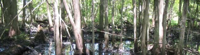
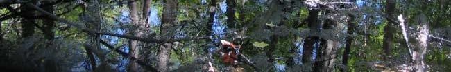
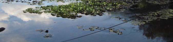
7 The Incident 30 underground pipeline ruptured on July 25, 2010 Approximately 1 million gallons of tar sands crude oil released Oil seeped through wetland soils into a creek tributary to the Kalamazoo River
8 The Material 2 products in pp pipeline at the time of the rupture: Starting a batch of Cold Lake Blend (77%) - 70% bitumen - 30% diluent (natural gas condensate) End of a batch of Western Canadian Select (23%)


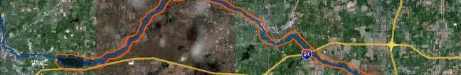

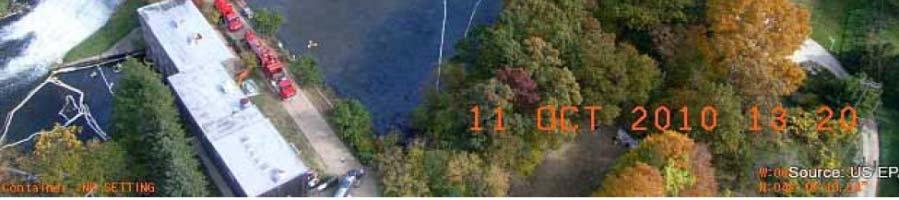
9 The Setting Ceresco Dam Battle Creek Morrow Dam Morrow Lake Marshall Source


10
11 Assessment Tasks Identify probable injuries What data are response agencies collecting that can be used for injury characterization? Coordinate with response agencies to share the data Identify data gaps, develop sampling plans What baseline data are available and how informative are they? Is it possible to conduct similar surveys post-spill?
12 Overview of NRDA Data Collected Extent of oiling in floodplain habitats Vegetation Erosion Fish Aquatic macroinvertebrates Mussels Chemistry y( (source oil, water, sediment, and biota) Wildlife Impacts to human uses
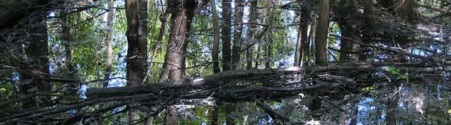
13 Objectives Floodplain Oiling Survey Identify and characterize extent and degree of oiling in the floodplains Characterize the general floodplain habitat types in the areas of the spilled oil Methods and Results Transects at 50m intervals 744 transects surveyed representing 23 river miles and associated floodplains 66% of transects were oiled to some extent Field observations provided to Response and data later used by Response


14 Rapid Vegetation Survey Identify types of vegetation present Identify rates of invasive plant species in order to compare over time Proactively raised concerns to Response Agencies based on field observations. Reviewing erosion control plans and evaluating monitoring results. Erosion


15 Fish Kill Surveys Conducted by state fishery biologists Followed previously published standard protocols No fish kills observed in spill area Fish Status And Trends Conducted by state fishery biologists Followed standard protocols 6 locations (2 upstream reference sites) Baseline data at two sites - including a long-term monitoring site
16 Fish data included: Fish Status and Trends Catch per effort and length Species identification Habitat data included: Conductivity, temperature, substrate, channel width and depth, velocity, bank and riparian condition, and large woody debris density Results Talmadge Creek fish community was reduced and habitat greatly diminished in Some recovery in Kalamazoo River: Some declines in fish community diversity and abundance at some sites. Ongoing cleanup activities require continued monitoring.


17 Fish Exposure and Health Data collected in cooperation with USGS 110 fish from 4 sampling locations (includes 1 upstream reference) Analyses include: Health assessment index Histopathology of gill, spleen, head kidney tissues Collected and archived bile samples for possible future analysis Differential analysis of blood smears (potential)
18 Aquatic Macroinvertebrate Survey State biologists followed pre-existing protocols to assess abundance and diversity 7 locations on Kalamazoo River and Talmadge Creek Included locations with past data Results In 2010, reduced diversity and abundance. In 2011, scores improved, but abundance was still impacted. Decreased vegetative cover exposed more of the stream channel to sunlight, altering community composition Ongoing cleanup work requires further monitoring.


19 Mussel Shell Survey Assessed physical condition of post-mortem mussel shells: Broken vs. crushed Degree of weathering, ranging from fresh dead to heavily worn 18 species documented Crushed and freshly dead shells found within spill area but not in reference area
20 Water Column Chemistry Analysis 90 samples at 8 locations Mussel tissue 12 composite samples at 4 locations Sediment 12 composite samples at 4 locations Co-located with mussel tissue samples
")
21 PAH Analytes Response generally analyzed for 16 priority it PAHs Alkylated PAHs are more abundant, persist for a longer time, and are sometimes more toxic than the parent PAHs NRDA PAH analyses included alkyl homologues Some analyses also included d heavy metals that are known to be elevated in the source oil (e.g. vanadium)


22 Wildlife Recovery Wildlife recovery and rehabilitation center recorded level of effort and geographic coverage of wildlife operations capture, treatment, and release of oiled animals Over 3,000 turtles, tl 170 birds, and 38 mammals were brought to the rehabilitation center, with survival rates to release of 97%, 84%, and 68%, respectively


23 Human Uses River closed to public access for nearly 2 years. Trustees are evaluating recreational use of the river to determine when it recovers to baseline conditions and estimate damages.
24 Key Features of Oil Sands Pipeline Spill for NRDA Heavy oil fate and transport New cleanup techniques Diluted bitumen toxicity

 526-4540")
25 Contact Information Jessica Winter NOAA Office of Response and Restoration 7600 Sand Point Way, Seattle, WA (206)
Responding to Natural Resource Damage Associated with the Enbridge Line 6b Oil Spill
 Responding to Natural Resource Damage Associated with the Enbridge Line 6b Oil Spill Jay K. Wesley Southern Lake Michigan Unit Manager Fisheries Division Michigan Department of Natural Resources Stephanie
[FWS R3 ES 2013 N194; FXHC FF03E00000] Notice of Availability of the Draft Damage Assessment and Restoration Plan and
![[FWS R3 ES 2013 N194; FXHC FF03E00000] Notice of Availability of the Draft Damage Assessment and Restoration Plan and](/thumbs/89/97772511.jpg "[FWS R3 ES 2013 N194; FXHC FF03E00000] Notice of Availability of the Draft Damage Assessment and Restoration Plan and") This document is scheduled to be published in the Federal Register on 06/12/2015 and available online at http://federalregister.gov/a/2015-14410, and on FDsys.gov Billing Code 4310 55 DEPARTMENT OF THE
This document is scheduled to be published in the Federal Register on 06/12/2015 and available online at http://federalregister.gov/a/2015-14410, and on FDsys.gov Billing Code 4310 55 DEPARTMENT OF THE
Natural Resource Damage Assessment and Restoration
 Natural Resource Damage Assessment and Restoration June 2016 NRDA Authorization CERCLA Clean Water Act Oil Pollution Act Provides Authority to Assess Resource Injury from Hazardous Substances (DOI rule)
Enbridge Line 6B Incident Public Update and Availability Session
 Enbridge Line 6B Incident Public Update and Availability Session October 14, 2010 (Day 81) Division A Oil coming out of culvert on Talmadge Creek on first day of spill, July 26, 2010. Exposed pipeline
Ceresco Dam Removal Project. Michigan Watershed Summit March 25, 2015 Luke Trumble, P.E., MDEQ-WRD Jay Wesley, MDNR-Fisheries
 Ceresco Dam Removal Project Michigan Watershed Summit March 25, 2015 Luke Trumble, P.E., MDEQ-WRD Jay Wesley, MDNR-Fisheries Outline Overview of Ceresco Dam History Public Process Funding Dam Removal Ecosystem
Mary Baker, PhD
 Mary Baker, PhD mary.baker@noaa.gov NOAA Organization 2 National Ocean Service Office of Response and Restoration Office of Coast Survey Office of National Geodetic Survey Center for Operational Oceanographic
Preassessment Data Report and Restoration Planning for the September, 2004 Mosaic Acidic Process Water Spill
 Preassessment Data Report and Restoration Planning for the September, 2004 Mosaic Acidic Process Water Spill Daniel Hahn NOAA, Damage Assessment Center Incident Review Archie Creek natural channel Release
Integration of the Great Lakes Restoration Initiative, Superfund Remediation, and Natural Resources Damages Restoration at an Area of Concern
 1 Integration of the Great Lakes Restoration Initiative, Superfund Remediation, and Natural Resources Damages Restoration at an Area of Concern Coordination, Missed Opportunities and Lessons Learned Great
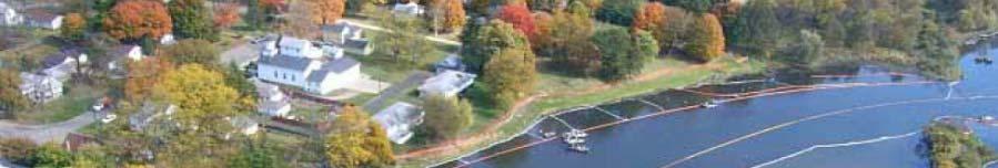
Enbridge Oil Spill. Kalamazoo. Marshall. Augusta Battle Creek. Galesburg Ceresco. Release Site. Morrow Lake
 Enbridge Oil Spill Augusta Galesburg Morrow Lake Release Site Area August 4, 2010 Area Area August 5, 4, 2010 Area August September 5, 20, 2010 2012 Area September 20, 2012 September 17, 2014 Talmadge
Oil Michigan. Spill Cleanup
 Oil Michigan Spill Cleanup Update by MDNRE During the early morning hours of Monday, July 26, 2010, residents along the Talmadge Creek near Marshall were awakened by a strong smell of petroleum. While
Deepwater Horizon Oil Spill: Draft Programmatic Damage Assessment and Restoration Plan and Draft Programmatic Environmental Impact Statement
 Deepwater Horizon Oil Spill: Draft Programmatic Damage Assessment and Restoration Plan and Draft Programmatic Environmental Impact Statement Abstract: In accordance with the Oil Pollution Act of 1990 (OPA)
Assessment Summary 2006
 Hudson River Natural Resource Damages Assessment Summary 2006 New York State Department of Environmental Conservation United States Department of the Interior National Oceanic & Atmospheric Administration
Presentation to SCAA
 Presentation to SCAA April 2016 Dave Westerholm NOAA topics of interest Key Staff Changes and Vacancies 2016 Training Tools DWH Research and Data How will it change NRDA and Response? Where do we go Answering
Hudson River Natural Resource Damage Assessment and Restoration
 Hudson River Natural Resource Damage Assessment and Restoration John G. Catena Northeast Regional Supervisor NOAA Restoration Center Gloucester, MA Presentation to CAG 12/11/12 Cleanup and Restoration
Anacostia River Sediment Project Overview- For a Cleaner Anacostia River. Remedial Investigation May 12, 2015 Dev Murali, PG, RPM
 Anacostia River Sediment Project Overview- For a Cleaner Anacostia River Remedial Investigation May 12, 2015 Dev Murali, PG, RPM State of the Anacostia River Contaminants: PAH s in Brown Bullhead * MacDonald
NOAA s s Response BP Deepwater Horizon Oil Spill. Robert Haddad Ph.D. National Ocean Service National Oceanic & Atmospheric Administration
 NOAA s s Response BP Deepwater Horizon Oil Spill Robert Haddad Ph.D. National Ocean Service National Oceanic & Atmospheric Administration May 13 ~206 million gallons LA light crude released at a depth
Meacham Creek Restoration Project
 Meacham Creek Restoration Project Meacham Creek Restoration Project Umatilla National Forest Walla Walla Ranger District Michael Rassbach, District Ranger Public Scoping Document Proposal Summary The Walla
Director National Pollution Funds Center February Tony Penn DEPUTY CHIEF, ASSESSMENT AND RESTORATION DIVISION, NOAA
 U.S. Department of Homeland Security United States Coast Guard MEMORANDUM Director National Pollution Funds Center U.S. Coast Guard Stop 7100 4200 Wilson Blvd, Suite 1000 Arlington, VA 20598-7100 Staff
NATURAL RESOURCE DAMAGES, MITIGATION BANKING, AND THE WATERSHED APPROACH
 NATURAL RESOURCE DAMAGES, MITIGATION BANKING, AND THE WATERSHED APPROACH March 2018 Contents Executive Summary... iii NATURAL RESOURCE DAMAGES, MITIGATION BANKING, AND THE WATERSHED APPROACH... 1 Goals
Ocklawaha River Restoration as Mitigation
 Ocklawaha River Restoration as Mitigation Dredging Will Further Harm the St. Johns Salinity = Farther Upstream Impacting Wetlands Damaging Submerged Grasses Further Stressing Trees Altering Dissolved Oxygen
TURKEY RIVER BOTTOMS DELTA AND BACKWATER COMPLEX
 TURKEY RIVER BOTTOMS DELTA AND BACKWATER COMPLEX HABITAT REHABILITATION AND ENHANCEMENT PROJECT CLAYTON COUNTY, IOWA AND GRANT COUNTY, WISCONSIN UPPER MISSISSIPPI RIVER RESTORATION ENVIRONMENTAL MANAGEMENT
Restoration in the Context of NRDA Claims STRATUS CONSULTING
 Restoration in the Context of NRDA Claims Overview Natural resource restoration Improvement or creation of natural resources Increase in tribal members interactions with natural resources Use of natural
Contacts: Erin Madden, Portland Harbor Natural Resource Trustee Council, (503) Julie Mentzer, Wildlands, (503)
 Julie Mentzer, Wildlands, (503)") FOR IMMEDIATE RELEASE: August 26, 2014 Contacts: Erin Madden, Portland Harbor Natural Resource Trustee Council, (503) 753-1310 Julie Mentzer, Wildlands, (503) 241-4895 HABITAT RESTORATION UNDERWAY IN PORTLAND
FOR IMMEDIATE RELEASE: August 26, 2014 Contacts: Erin Madden, Portland Harbor Natural Resource Trustee Council, (503) 753-1310 Julie Mentzer, Wildlands, (503) 241-4895 HABITAT RESTORATION UNDERWAY IN PORTLAND
W F293 no. T /04-6/07
 W 2800.7 F293 no. T-15-1 4/04-6/07 Grant Title: Development and Implementation of Fish and Wildlife Resources Impact Review Program Abstract: Many projects and activities in the State of Oklahoma have
Lower Passaic River Restoration Planning
 Lower Passaic River Restoration Planning 8 July 2010 Community Advisory Group Lisa Baron Peter Weppler Diana Kohtio Jeff Cusano Kate Mulvey Heather Morgan Tricia Aspinwall Amanda Switzer Lower Hudson River
PHYSICAL ENVIRONMENT MONITORING P LAN DRAFT
 Aquatic Effects Monitoring Plan PHYSICAL ENVIRONMENT MONITORING P LAN DRAFT October 2012 POINTE DU BOIS SPILLWAY REPLACEMENT PROJECT Physical Environment Monitoring Plan DRAFT Report Prepared for October
FINAL NE FLORIDA DARP/EA, JUNE 25, 2003 FINAL DAMAGE ASSESSMENT AND RESTORATION PLAN/ ENVIRONMENTAL ASSESSMENT. for 7 OIL SPILLS. in NORTHEAST FLORIDA
 FINAL N FLORIDA DARP/A, JUN 25, 2003 FINAL DAMAG ASSSSMNT AND RSTORATION PLAN/ NVIRONMNTAL ASSSSMNT for 7 OIL SPILLS in NORTHAST FLORIDA Florida Department of nvironmental Protection June 25, 2003 FINAL
Habitat Evaluation Scoring Method to Estimate Ecosystem Service Improvements from Restoration. Timothy Barber, Jennifer Lyndall, and Wendy Mahaney
 Habitat Evaluation Scoring Method to Estimate Ecosystem Service Improvements from Restoration Timothy Barber, Jennifer Lyndall, and Wendy Mahaney The Challenge Valuation of Ecosystem Services from Restoration
The F.O.R.C.E. The Future Of Redwood Creek Environment
 The F.O.R.C.E. The Future Of Redwood Creek Environment Robert Andersen Katelyn Csatari Achyuth Madabhushi Julie Swanson Overview Mission Statement Watershed Characterization Land and Water Use History
Ongoing and Completed Studies
 Attachment 2 Ongoing and Completed Studies 2014 Monitoring and Analysis Plan November 2013 Attachment 2 Ongoing and Completed Studies 1 Introduction In 2013, the small interdisciplinary study groups for
STATE OF THE BAY IN 2012
 9 10 11 STATE OF THE BAY IN 2012 Nitrogen &!Phosphorus Bay-wide nitrogen loads were similar to 2010, but phosphorus loads decreased. These loads are highly elated to river flows and stormwater runoff that
Natural Resource Damage Assessment & Restoration Program. Ronald McCormick, Ph.D BLM Washington DC
 Natural Resource Damage Assessment & Restoration Program Ronald McCormick, Ph.D BLM Washington DC The mission of the Natural Resource Damage Assessment and Restoration (NRDAR) Program is to restore natural
Executive Summary. S. Executive Summary
 S. Executive Summary The Tesoro Savage Petroleum Terminal LLC has submitted an Application for Site Certification to the Washington State Energy Facility Site Evaluation Council (EFSEC) to construct and
Resource Conservation Opportunities and Management Guidelines
 Resource Conservation Opportunities and Management Guidelines The general ecosystem integrity of lakes is dependent on preserving natural habitat components and the processes that sustain them. These include
Greg Baker National Ocean Service Natalie Cosentino-Manning National Marine Fisheries Service Damage Assessment Remediation and Restoration Program
 Ecosystem Services in the Context of Natural Resource Damage Assessment An Oil Spill Case Study Greg Baker National Ocean Service Natalie Cosentino-Manning National Marine Fisheries Service Damage Assessment
March Lead Agency: National Oceanic and Atmospheric Administration
 RECORD OF DECISION for the Deepwater Horizon Oil Spill: Final Programmatic Damage Assessment and Restoration Plan and Final Programmatic Environmental Impact Statement March 2016 Lead Agency: National
ELK RAPIDS TOWNSHIP WATER QUALITY ACTION PLAN
 ELK RAPIDS TOWNSHIP WATER QUALITY ACTION PLAN Elk-River-Chain-of-Lakes Gaps Analysis Project The Watershed Center Grand Traverse Bay Tip of the Mitt Watershed Council Michigan Department of Natural Resources
Tom Brosnan et al., NOAA OR&R, RAE Conference 12/15/16
 Tom Brosnan et al., NOAA OR&R, RAE Conference 12/15/16 Oil Pollution Act; 15 CFR 990 Who: Trustees Responsibilities: Determine amount of injury to natural resources and lost services from time of incident
EXECUTIVE SUMMARY DES PLAINES RIVER WATERSHED-BASED PLAN WHY A WATERSHED-BASED PLAN? WHAT IS A WATERSHED?
 Des Plaines River Watershed-Based Plan EXECUTIVE SUMMARY June 2018 EXECUTIVE SUMMARY DES PLAINES RIVER WATERSHED-BASED PLAN WHY A WATERSHED-BASED PLAN? Water is elemental to our lives. Plants and animals,
S.R. 4007, Section 14B PADEP Environmental Assessment Form. Enclosure C Description of Aquatic Habitat
 S.R. 4007, Section 14B PADEP Environmental Assessment Form Description of Aquatic Habitat Cresheim Creek is the only water resource that exists within the project area. No jurisdictional wetlands were
Statistical Considerations for Comparison to Background
 Statistical Considerations for Comparison to Background John W. Kern PhD. Kern Statistical Services, Inc. Sauk Rapids MN Factors Controlling Selection of Statistical Methods Objectives Baseline Comparisons
DECISION MEMO FOR CATEGORICAL EXCLUSION HOLY JIM CREEK CROSSING REPLACEMENT
 DECISION MEMO FOR CATEGORICAL EXCLUSION HOLY JIM CREEK CROSSING REPLACEMENT U.S.D.A. Forest Service Cleveland National Forest Trabuco Ranger District Orange County, California Background The current configuration
Little Bay Water Quality Report Card Spring 2014
 Little Bay Water Quality Report Card Spring 2014 Little Bay is a small, semi-enclosed estuary located in the heart of Rockport, Texas. Estuaries, where freshwater from rivers and streams mixes with salt
Fishing and Boating: Past, Present, and Restoration Thoughts
 Fishing and Boating: Past, Present, and Restoration Thoughts West Branch Susquehanna River Douglas Austen Pennsylvania Fish and Boat Commission West Branch Basin Stream Resources Miles Category 1,249
June 11, 2010 ~ 9:50 pm pipeline located in Red Butte Canyon ruptured. June 12, 2010 SLVHD was notified at 7:15 am oil was flowing in Red Butte
 June 11, 2010 ~ 9:50 pm pipeline located in Red Butte Canyon ruptured. June 12, 2010 SLVHD was notified at 7:15 am oil was flowing in Red Butte Creek. The SLC Fire Dept was on scene and had dispatched
Carp Creek 2013 Summary Report
 Monitoring Activity in the Carp River Watershed In 2012, Mississippi Valley Conservation Authority (MVCA) worked with Friends of the Carp River (FCR) on a preliminary assessment of the Carp River. This
Chehalis Basin Strategy Programmatic SEPA Draft EIS
 Chehalis Basin Strategy Programmatic SEPA Draft EIS History of Flooding I-5 closed in 1990, 1996, 2007, 2009 Five largest flood events occurred since 1986 2 History of Habitat Degradation Harvest has been
The Role of Economics in the Natural Resource Damage Assessment and Restoration (NRDAR) Process
 Process") The Role of Economics in the Natural Resource Damage Assessment and Restoration (NRDAR) Process August 2011 Kristin E. Skrabis, Ph.D. Resource Economist, Office of Policy Analysis US Department of the
The Role of Economics in the Natural Resource Damage Assessment and Restoration (NRDAR) Process August 2011 Kristin E. Skrabis, Ph.D. Resource Economist, Office of Policy Analysis US Department of the
September 2016 ID Competency Statement Type
 September 06 Ensures that the impact assessment scope, criteria and conditions (geographic, environmental, economic, social, and cultural) are defined adequately. Develops a project management plan for
Robert Haddad, Ph.D. April 26, 2016 SPPEED Conference Rice University, TX
 Robert Haddad, Ph.D. April 26, 2016 SPPEED Conference Rice University, TX We abuse land because we see it as a commodity belonging to us. When we see land as a community to which we belong, we may begin
Legal Issues in Valuing Tribal Natural Resource Damage Claims
 Economic Valuation of Ecosystem Services on American Indian Tribal Land: Legal Issues in Valuing Tribal Natural Resource Damage Claims Tom Blaser, Attorney U.S. Department of the Interior A Community on
Environmental Geography
 Environmental Geography Lecture 13 Water Pollution Lecture 13: Water Pollution I. Water Pollution A. Groundwater B. Surface Water C. Regulation II. Water Use in California 1 I. Water Pollution Types of
TORCH LAKE TOWNSHIP WATER QUALITY ACTION PLAN
 TORCH LAKE TOWNSHIP WATER QUALITY ACTION PLAN Elk-River-Chain-of-Lakes Gaps Analysis Project The Watershed Center Grand Traverse Bay Tip of the Mitt Watershed Council Michigan Department of Natural Resources
Evolution of Ecosystem Services through NRDA An Historical Perspective
 Evolution of Ecosystem Services through NRDA An Historical Perspective Thomas A. Campbell Pillsbury Winthrop Shaw Pittman, LLP Pillsbury Winthrop Shaw Pittman LLP Commonwealth of Puerto Rico, et al. v.
USGS Great Lakes Science Center Biological Research in the Great Lakes Basin
 USGS Great Lakes Science Center Biological Research in the Great Lakes Basin Jacqueline Savino, Deputy Director LEMN Conference April 30, 2008 U.S. Department of the Interior U.S. Geological Survey Co-authors
Site Selection and Design for Stream Mitigation
 Site Selection and Design for Stream Mitigation Will Harman, PG Stream Mechanics The Association of State Wetland Managers State/Tribal/Federal Coordination Meeting March 19-21, 2013 NCTC Our Relationship
Louisiana Trustee Implementation Group Draft Restoration Plan #1:
 Louisiana Trustee Implementation Group Draft Restoration Plan #1: Restoration of Wetlands, Coastal, and Nearshore Habitats; Habitat Projects on Federally Managed Lands; and Birds October 2016 Table of
Groundwater Natural Resource Damages Assessment: A New Restoration Tool for Massachusetts
 Groundwater Natural Resource Damages Assessment: A New Restoration Tool for Massachusetts Dale C. Young, Director Karen I. Pelto, Case Manager EEA NRD Assessment & Restoration Program April 7, 2009 MA
FACT PATTERN THE RESERVATION
 FACT PATTERN THE RESERVATION Great Lakes Tribal Reservation Surrounded by Big River National Forest Big River flows through Reservation and into Big Lake General Environmental Concerns Wild rice areas
S.R. 2027, Section 02B PADEP Environmental Assessment Form. Enclosure C Description of Aquatic Habitat
 S.R. 2027, Section 02B PADEP Environmental Assessment Form Description of Aquatic Habitat Water resources that exist within the project area include Hosensack Creek and two palustrine emergent (PEM) wetlands.
Survey of Bottom Substrate Composition and Fish Habitat Value at Nett Lake
 Survey of Bottom Substrate Composition and Fish Habitat Value at Nett Lake Prepared by: Frank G. Stone, U.S. Fish & Wildlife Service Ashland FRO May 2006 The objective of this project was to characterize
REQUEST FOR INFORMATION AND PROPOSALS Independent Risk Analysis for the Straits Pipelines PART I GENERAL INFORMATION
 REQUEST FOR INFORMATION AND PROPOSALS Independent Risk Analysis for the Straits Pipelines The Michigan Departments of Environmental Quality and Natural Resources, the Michigan Agency for Energy, and the
Ecological Considerations in Setting MFLs and Lake Regulation Targets for the Ocklawaha Chain of Lakes
 Ecological Considerations in Setting MFLs and Lake Regulation Targets for the Ocklawaha Chain of Lakes Rolland Fulton, Ph.D. Environmental Scientist VI Bureau of Environmental Sciences St. Johns River
SHORELINE INVENTORY AND RESTORATION PLANNING
 CHAPTER 3 SHORELINE INVENTORY AND RESTORATION PLANNING A. PURPOSE OF THE SHORELINE INVENTORY AND CHARACTERIZATION A first step in the comprehensive Master Program update process is development of a shoreline
Department of the Army Permit Application
 Department of the Army Permit Application DA File Number U.S. Army Corps of Engineers Honolulu District Date Received by CEPOH-RO Send Completed Application to: Honolulu District, U.S. Army Corps of Engineers
ENVIRONMENTAL eftec METHODS
 ENVIRONMENTAL eftec LIABILITY DIRECTIVE EQUIVALENCY Resource Decisions Athens, Greece 29-30 November 2016 METHODS European Commission, eftec, Abt Associates, Resource Decisions 1 Outline of the Session
Status of Water Quality in Ohio: The 2018 Integrated Report. April 25, 2018
 Status of Water Quality in Ohio: The 2018 Integrated Report April 25, 2018 Today s Topics Overview of the 2018 Integrated Report Purpose and requirements Assessment overview Differences from the 2016 Integrated
Water and Watersheds. Data Maps Action
 Water and Watersheds Data Maps Action What is the Wildlife Action Plan? Restore rare wildlife and habitats. Keep common species common. 2015 Revision: Partners in Conservation Science 2015 Revision Data
Meacham Creek Fish Habitat Enhancement: Application of the CTUIR River Vision
 Meacham Creek Fish Habitat Enhancement: Application of the CTUIR River Vision Future of Our Salmon A Vision of Restoration in the Columbia River Basin June 1, 2011 James Webster Confederated Tribes of
Watershed modeling for stream
 USGS GLRI Programs U.S. Department of the Interior U.S. Geological Survey USGS Gaging Stations Watershed modeling for stream ecosystem management Develop a scientific framework for water- withdrawal management
Pierce County Islands and the Head of Lake Pepin
 Pierce County Islands and the Head of Lake Pepin CAP Section 204 - Beneficial Use of Dredged Material Public Meeting and Open House St. James Hotel April 4, 2018 US Army Corps of Engineers 1 What this
NOAA s Restoration Efforts in Southern New England Coastal Mapping and Data Needs and Uses
 NOAA s Restoration Efforts in Southern New England Coastal Mapping and Data Needs and Uses Jim Turek, NOAA Restoration Center, Narragansett, RI James.G.Turek@noaa.gov www.habitat.noaa.gov/restoration August
Deepwater Horizon Oil Spill Draft Phase I Early Restoration Plan and Environmental Assessment
 Deepwater Horizon Oil Spill Draft Phase I Early Restoration Plan and Environmental Assessment Prepared by the Deepwater Horizon Natural Resource Trustees from State of Alabama State of Florida State of
Habitat Conservation and Fisheries
 Habitat Conservation and Fisheries Buck Sutter Director, Office of Habitat Conservation July 14, 2014 Habitat Mission Protect and restore coastal and marine habitat to support sustainable fisheries and
Risk assessment to salmon from an oil spill on BC s north and central coast
 (The risk analysis in this document was submitted by RCF as evidence to the JRP in 2011) Risk assessment to salmon from an oil spill on BC s north and central coast Background The proposed Enbridge Northern
FOCUSED FEASIBILITY STUDY FOR PASSAIC RIVER SEDIMENTS: IDENTIFYING OPPORTUNITIES FOR EARLY ACTION
 FOCUSED FEASIBILITY STUDY FOR PASSAIC RIVER SEDIMENTS: IDENTIFYING OPPORTUNITIES FOR EARLY ACTION Liam Bossi 1, Scott E. Thompson, PE 2, R. Bruce Fidler, PE 3, Daria Navon, PE 4, and Thalia Loor 5 ABSTRACT
Case Studies III: Skokomish River Ecosystem Restoration Washington State
 University of Massachusetts - Amherst ScholarWorks@UMass Amherst International Conference on Engineering and Ecohydrology for Fish Passage International Conference on Engineering and Ecohydrology for Fish
St. Joseph River Watershed 319 Project Technical Subcommittee November 3, 2003 Meeting Summary DRAFT
 St. Joseph River Watershed 319 Project Technical Subcommittee November 3, 2003 Meeting Summary DRAFT Attendees Sandra Nordmark, FOTSJR Steve Blumer, USGS Water Resources Division Todd Kesselring, Elkhart
SEATTLE CITY LIGHT: CLIMATE RESILIENCE AND ADAPTATION. Crystal Raymond, Climate Change Strategic Advisor Environment, land and Licensing
 SEATTLE CITY LIGHT: CLIMATE RESILIENCE AND ADAPTATION Crystal Raymond, Climate Change Strategic Advisor Environment, land and Licensing Resilience in the Energy Sector Reliability Resilience Adaptation
Funding Guidelines State Fiscal Year 2016
 State Fiscal Year 2016 Water Quality Financial Assistance Centennial Clean Water Program Clean Water Act Section 319 Program Stormwater Financial Assistance Program Washington State Water Pollution Control
TAMARACK CREEK STREAM AND WETLAND RESTORATION
 TAMARACK CREEK STREAM AND WETLAND RESTORATION Project Funding Request: $2,700,000 Organization: Contact Name: Alliance of Rouge Community (ARC) Brandy Siedlaczek Chairperson 46036 Michigan Avenue, Suite
US EPA s Contaminated Sediments Technical Advisory Group (CSTAG)
") US EPA s Contaminated Sediments Technical Advisory Group (CSTAG) Stephen Ells Sediment Team Leader Office of Superfund Remediation and Technology Innovation US EPA 1 CSTAG Background Established in Feb.
US EPA s Contaminated Sediments Technical Advisory Group (CSTAG) Stephen Ells Sediment Team Leader Office of Superfund Remediation and Technology Innovation US EPA 1 CSTAG Background Established in Feb.
3 Baseline and Existing Conditions
 1 2 3 4 5 6 7 8 9 10 11 12 13 14 3 Baseline and Existing Conditions The effective date of the VSP legislation is July 22, 2011. This is also the date chosen by the legislature as the applicable baseline
Case Studies II: Amethyst Brook Restoration Projection: Co-Evolution of a Project and a River with Two Dam Removals
 University of Massachusetts Amherst ScholarWorks@UMass Amherst International Conference on Engineering and Ecohydrology for Fish Passage International Conference on Engineering and Ecohydrology for Fish
Effects of the 1988 Wildfires on Stream Systems of Yellowstone National Park
 University of Wyoming National Park Service Research Center Annual Report Volume 16 16th Annual Report, 1992 Article 32 111992 Effects of the 1988 Wildfires on Stream Systems of Yellowstone National Park
Assessing ecological effects following environmental disasters, and data needs
 Assessing ecological effects following environmental disasters, and data needs Tracy Collier Science Director (until Thursday) Puget Sound Partnership Tacoma, WA USA Environmental Disasters Data Management
REGIONAL EXPERT ADVISORY WORKSHOP REPORT 01 MAR 2011 VIENTIANE, LAO PDR WETLANDS ECOSYSTEM SERVICES AND BIODIVERSITY AND CC
 Mekong Wetlands ecosystem services and biodiversity and Climate Change Peter-John Meynell, based on paper by Mark Bezuijen Outline Wetland Ecosystem services a means of valuing the importance of wetlands
Hudson Raritan Estuary Comprehensive Restoration Plan
 PUBLIC MEETING Meadowlands Environment Center June 3, 2010 Hudson Raritan Estuary Comprehensive Restoration Plan Lisa Baron Peter Weppler Jodi McDonald U.S. Army Corps of Engineers Acknowledgements Project
The Lower Watershed Ecosystem Services in Coastal Areas with a focus on the Courtenay River Floodplain
 The Lower Watershed Ecosystem Services in Coastal Areas with a focus on the Courtenay River Floodplain Jennifer Sutherst Estuary Coordinator and Staff Biologist Comox Valley Project Watershed Society Lower
Ohio Bioassessments - Applicatio
 Must be conducted if important aquatic ecological resources or sediments are impacted (or chemical of concern has no sediment benchmark value in the benchmark hierarchy) Must demonstrate compliance with
Upper Mississippi River Floodplain Restoration Priorities in Pools 1, 2, 3, Upper 4 and Lower Vermillion River
 Upper Mississippi River Floodplain Restoration Priorities in Pools 1, 2, 3, Upper 4 and Lower Vermillion River Minnesota Department of Natural Resources Interdivisional Meeting July 8, 2009 Lake City Area
Upper Mississippi River Restoration:
 Upper Mississippi River Restoration: Managing a Dual Purpose River for Fish and Wildlife Habitat Jeff Janvrin Wisconsin Dept. of Natural Resources Mississippi River Habitat Specialist Mud Lake HREP, Lower
Juncrock Timber Sale Draft Environmental Impact Statement. Appendix G Soils
 Juncrock Timber Sale Draft Environmental Impact Statement Appendix G Soils Soil Condition Monitoring on the Barlow Ranger District of the Mt. Hood National Forest 1999 The Barlow Ranger District conducts
Public Meeting February 1, 2018 Kalamazoo, Michigan. Kalamazoo Natural Resource Trustee Council
 Public Meeting February 1, 2018 Kalamazoo, Michigan Kalamazoo Natural Resource Trustee Council The purpose of NRDA is to make the public whole, beyond site cleanup NRDA is a process that the Trustees use
Red Clover/McReynolds Creek Restoration Project Monitoring Report Ryan Nupen fly fishing in project area June (Photo G.
 Red Clover/McReynolds Creek Restoration Project Monitoring Report 2010 Ryan Nupen fly fishing in project area June 2010. (Photo G. Martynn) Feather River Coordinated Resource Management Plumas Corporation
Fraser River Water Quality
 Richmond Environmental Project Guidebook Fraser River Water Quality Why You Should Care About This Issue The Fraser River is the largest river in British Columbia. The health of the Fraser River is important
awetlands aprairie aforests ahabitat for Fish, Game & Wildlife
 Rec. H1 priority land habitats pp. 63-67 Priority areas identified in integrated mapping assessing critical land habitat and threats to habitat pp.33-63 o Mapping is scalable for use in localized areas
Restoring Natural Resources after Oil Spills
 Restoring Natural Resources after Oil Spills Dan Doty -Washington Department of Fish and Wildlife Dale Davis -Washington Department of Ecology Rebecca Post - Washington Department of Ecology 2009 Puget
Role of Beaver in Riverine Management
 Role of Beaver in Riverine Management Marty E. Rye, P.E. Hydrologist Superior National Forest Superior Stream Symposium January 7, 2014 - UMD How do we think of beaver? As automatons or as individuals
Pacheco Reservoir Expansion
 California Water Commission Pacheco Reservoir Expansion Unique Opportunity for Fisheries Recovery, Flood Risk Reduction and Emergency Water Supply December 13, 2017 1 of 33 Project Partners Pacheco Pass