Past experience in Arkansas Sally Entrekin University of Central Arkansas
|
|
|
- Isabel Bates
- 6 years ago
- Views:
Transcription

1 Past experience in Arkansas Sally Entrekin University of Central Arkansas
2 Collaborators Funding through Arkansas Game and Fish Commission State Wildlife Grant # & University of Central Arkansas, Biology Sediment dynamics and invertebrates: S. Entrekin, N. Jensen, J. Kelso, A. Musto Fish: G. Adams, R. Adams, L. Stearman, J. Green University of Arkansas, Biology Nutrients and Metabolism: M. Evans-White, B. Austin Arkansas Water Resources Center, University of Arkansas Chemical Analysis: B. Haggard, L. Massey The Nature Conservancy GIS support: E. Inlander, C. Gallipeau US Fish and Wildlife Service Field support: L. Lewis, C. Davidson Brent Johnson and Elizabeth Hagenbuch
3 Presentation Outline Natural gas development in Arkansas Extent Pace Proximity to surface waters Approach to quantifying natural gas development Cumulative Effects GIS metrics Gradient analysis versus Before-After-Control-Impact Results from gradient analysis study Turbidity and sediment transport during storms Whole stream metabolism at baseflow Benthic macroinvertebrates at baseflow Trace elements and macroinvertebrates Results from Before-After-Control-Impact study Macroinvertebrates Fish community structure Summary Sedimentation Biological responses to sedimentation Challenges
4 Presentation Outline Natural gas development in Arkansas Extent Pace Proximity to surface waters Approach to quantifying natural gas development Cumulative Effects GIS metrics Gradient analysis versus Before-After-Control-Impact Results from gradient analysis study Turbidity and sediment transport during storms Whole stream metabolism at baseflow Benthic macroinvertebrates at baseflow Trace elements and macroinvertebrates Results from Before-After-Control-Impact study Macroinvertebrates Fish community structure Summary Sedimentation Biological responses to sedimentation Challenges

5 Over 20 shale basins in the U.S. Identified as one of the top 10 threats to global ecosystems (Sutherland et. al. 2010)
 > 4000 wells in 8000")
6 Natural gas wells in the Fayetteville Shale gas play (data from Oil and Gas Commission) > 4000 wells in 8000 km 2
7 Cumulative wells Gas well development continues to increase in the Fayetteville shale Total: 4842; Active 3796 Active Spud Plugged Year
8 100m 12% NHD Flowline Wells can be close to streams Fayetteville Shale, AR NHD Flow lines 300m 61% NHD Flowline Entrekin, Evans-White, Johnson, Hagenbuch, Frontiers in Ecology and the Environment, 2011

9 100m 12% NHD Flowline 32% Drainage Lines 300m 61% NHD Flowline 82% Drainage Lines Wells can be close to streams Fayetteville Shale, AR Modeled Flow lines

10 100m 5% NHD Flowline Wells can be close to streams Marcellus, PA NHD Flow lines 300m 70% NHD Flowline
11 100m 5% NHD Flowline 70% NHD Flowline 300m 70% NHD Flowline 100% NHD Flowline Wells can be close to streams Marcellus, PA Modeled Flow lines

12 Potential threats to surface water Water withdrawal Contamination Sediment
13 Presentation Outline Natural gas development in Arkansas Extent Pace Proximity to surface waters Approach to quantifying natural gas development Cumulative Effects GIS metrics Gradient analysis versus Before-After-Control-Impact Results from gradient analysis study Turbidity and sediment transport during storms Whole stream metabolism at baseflow Benthic macroinvertebrates at baseflow Trace elements and macroinvertebrates Results from Before-After-Control-Impact study Macroinvertebrates Fish community structure Summary Sedimentation Biological responses to sedimentation Challenges
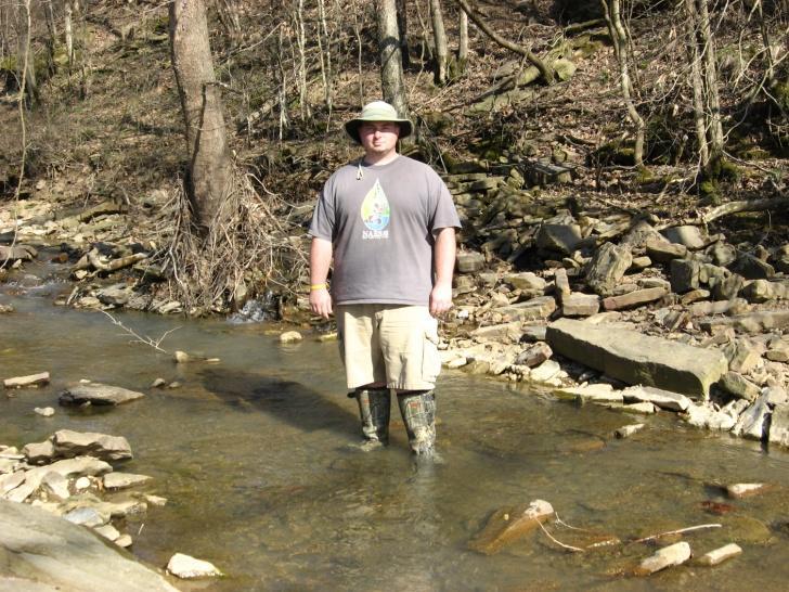
14 Goal: To assess potential cumulative effects of gas wells on surrounding stream drainages. Approach: Relate turbidity and suspended sediment concentration to surrounding land use in northcentral Arkansas. Gradient analysis with gas well activity as independent variables and turbidity, suspended sediments, metabolism, macroinvertebrate community metrics as dependent variables.

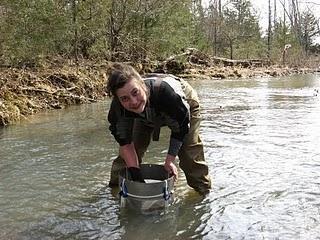
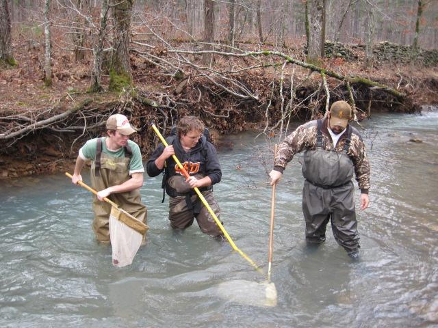
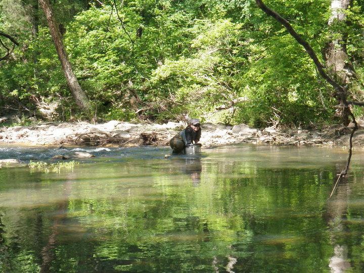
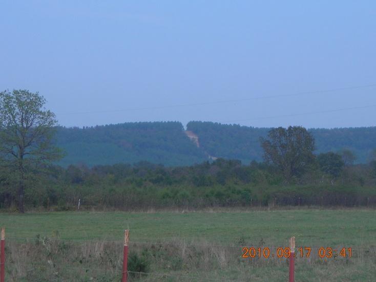
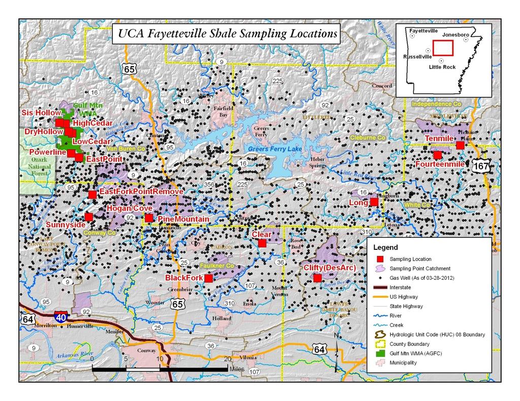
15 Study sites
16

17 Metrics used to characterize landscape in stream catchments Land use (%, Gorham and Tullis 2007) Pasture Forest Urban Crop Catchment geomorphology Size Slope Gas activity in each catchment Total gas wells Well density Pad density Well density prior to one year of sampling Rate of gas well activity Total flow length from pads Other features Road density Paved and unpaved
18 Well pads Total wells can predict number of gas pads June 2009 p=< R 2 =0.98 y= (total wells) wells per pad Y= X= A=.78 X= (x) Total wells
19 Total Gas Wells Metrics used to characterize landscape in stream catchments Land use (%, Gorham and Tullis 2007) Pasture Forest Urban Crop Catchment geomorphology Size Slope Gas activity in each catchment Total gas wells Well density Pad density Well density prior to one year of sampling Rate of gas well activity Total flow length from pads Other features Road density Paved and unpaved Year

20 Calculating Flow Length
21 Metrics used to characterize landscape in stream catchments Land use (%, Gorham and Tullis 2007) Pasture Forest Urban Crop Catchment geomorphology Size Slope Gas activity in each catchment Total gas wells Well density Pad density Well density prior to one year of sampling Rate of gas well activity Total flow length from pads Other features Road density Paved and unpaved
22 Presentation Outline Natural gas development in Arkansas Extent Pace Proximity to surface waters Approach to quantifying natural gas development Cumulative Effects GIS metrics Gradient analysis versus Before-After-Control-Impact Results from gradient analysis study Turbidity and sediment transport during storms Whole stream metabolism at baseflow Benthic macroinvertebrates at baseflow Trace elements and macroinvertebrates Results from Before-After-Control-Impact study Macroinvertebrates Fish community structure Summary Sedimentation Biological responses to sedimentation Challenges


23 Study site descriptions Well densities: 0.3 to 2.3 wells/km 2 Catchment size: 12 to 84 km 2 Land use: 39 to 72% forest 13 to 50% pasture Stream width: ~3 to 6 meters
24 Total sediment (Log 10 ) Turbidity generally predict total suspended sediment during storms p=< r 2 = Turbidity (Log 10 )
25 Mean daily discharge (m 3 s -1 ) Grab samples Sample dates Cadron Creek, Arkansas Siphon Samplers /1/08 2/1/09 4/1/09 6/1/09 8/1/09 10/1/09 12/1/09 2/1/10 4/1/10 6/1/10 8/1/10 10/1/10 12/1/10 2/1/11 4/1/11 6/1/11
 Turbidity increased with increasing well density 12 10 8 6 4 2 P=0.003 r=0.")
26 Turbidity (NTU) All flow values 40 NTU (ADEQ Reg 2, 2011) Biological effects at 5 NTUs (Evans-White et al. 2010) Turbidity increased with increasing well density P=0.003 r=0.91 April, Well density (#/hectare X 1000) Entrekin, Evans-White, Johnson, Hagenbuch, Frontiers in Ecology and the Environment, 2011
27 Axis 2 (31%) 4 PCA Illustrates catchment-level land uses across study sites in 2009 Unpaved roads (km 2 ) Sunnyside Well density 2 East Branch Point Remove 0-2 Total wells Recent wells Pipe crossings Flow length Hogan Clear Clifty Fourteenmile Pasture Black Fork Urban -4 Pine Mountain Catchment area Long Axis 1 (33%)
28 Turbidity (NTU) Turbidity was related to pasture and forest June 2009 n=9 p=0.07 R 2 = More forest More ponds Axis 1 (33%) Axis 2 (31%) Fewer wells More pasture
29 Turbidity (NTU) Turbidity was greater in catchments with higher well density February 2010 n=9 p=0.05 R 2 = Axis 2 (22%) Well density
30 Turbidity (NTU) Large watershed with a lot of gas wells drives relationship 300 May 24th 2010 n=9 250 p=0.01 R 2 = Axis 1 (34%) Flow length Area Total Well
31 Turbidity (NTU) Well density was the only variable related to turbidity February 2011 n=8 p=0.001 r= Well density (#/km 2 ) *No relationship with PCA axes
32 Autotrophic Responses Across A Well Gradient Chlorophyll a ( g/cm 2 ) Winter Total # Wells r 2 =0.79 p< Winter Total # Wells r 2 =0.57 p=0.01 Chl a responded positively or not at all (Spring 2010 & 2011). GPP responded positively or not at all (Winter 2010 & Spring 2011). GPP (gc/m 2 /d) Spring 2010 Winter 2011 Well Density (#/km 2 ) r 2 =0.46 p= Austin and Evans-White, unpublished Well Density (#/km 2 ) r 2 =0.83 p= No other land use or watershed characteristics explained variation Hypothesis: Positive responses due to nutrient or grazer patterns.
33 Gatherer density (#/m 2 ) Jensen and Entrekin, unpublished Scraper density (#/m 2 ) Macroinvertebrate response to gas well development Spring Spring r 2 =0.68 p= Inverse flow path length r 2 =0.62 P= Rate of gas well installation
34 Fine organic (mg/m 2 ) Shannon s diversity Gatherer density (#/m 2 ) Scraper density (#/m 2 ) Macroinvertebrate response to gas well development Spring Spring r 2 =0.68 p= Inverse flow path length r 2 =0.62 P= Rate of gas well installation Spring 2011 Spring r 2 =0.68 p= Inverse flow path length Jensen and Entrekin, unpublished r 2 =0.45 p= Inorganic matter (g/m 2 )
35 Presentation Outline Natural gas development in Arkansas Extent Pace Proximity to surface waters Approach to quantifying natural gas development Cumulative Effects GIS metrics Gradient analysis versus Before-After-Control-Impact Results from gradient analysis study Turbidity and sediment transport during storms Whole stream metabolism at baseflow Benthic macroinvertebrates at baseflow Trace elements and macroinvertebrates Results from Before-After-Control-Impact study Macroinvertebrates Fish community structure Summary Sedimentation Biological responses to sedimentation Challenges
36
37
38 BACI Design Fish FISH/M BEFORE W09 S10 W10 S11 W11 AFTER (HYPOTHESIZED) TIME Green, Stearman, G. Adams, R. Adams, unpublished Control Impact
39 Presentation Outline Natural gas development in Arkansas Extent Pace Proximity to surface waters Approach to quantifying natural gas development Cumulative Effects GIS metrics Gradient analysis versus Before-After-Control-Impact Results from gradient analysis study Turbidity and sediment transport during storms Whole stream metabolism at baseflow Benthic macroinvertebrates at baseflow Trace elements and macroinvertebrates Results from Before-After-Control-Impact study Macroinvertebrates Fish community structure Summary Sedimentation Biological responses to sedimentation Challenges
40 Take home points Episodic increases in turbidity and suspended sediment were related to gas activity at a landscape level Quantifiable catchment-scale effects on sediment and biota Winter and Spring Low intensity storms Effective metrics for summarizing gas activity Well density Flow path length of gas wells Rate of gas well activity Recent well density Biological response More chlorophyll a and faster GPP in streams with more wells and greater density Higher macroinvertebrate density in streams with greater well density Lower macroinvertebrate diversity in streams with more inorganic sediment
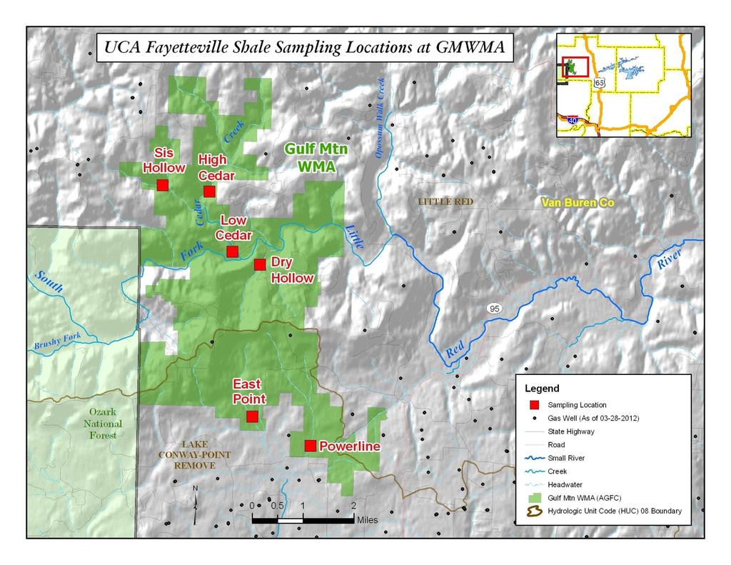
41 On-going research Best Management Practices comparison Gulf Mountain Wildlife Management Area Off Gulf Mountain high intensity development Off-Gulf Mountain low intensity development Long term data in high intensity gas well catchments South Fork Little River supports 2 endangered species Water quality Biological communities Ecosystem functions
42 Challenges Accessing updated landscape data Experimental design as activity is unpredictable Information on implemented Best Management Practices Accessing violations to inform data interpretation Lack of sophisticated monitoring stations Discharge Water quality
43 Investigator contacts Sally Entrekin 1, Michelle Evans-White 2, Brad Austin 2, Nicki Jensen 1, Julie Kelso 1, Adam Musto 1, Ethan Inland 3, Cory Gallipeau 3, Ginny Adams 1, Reid Adams 1, Jessie Green 1, Loren Stearman 1, Elisabeth Hagenbuch 4 Brian Haggard 5, Brent Johnson 6, Lindsey Lewis 7, Leslie Massey 5, 1 University of Central Arkansas, Department of Biology, Conway, AR University of Arkansas, Biological Sciences, Fayetteville, AR The Nature Conservancy, Fayetteville, AR Dynamac Corporation c/o US EPA, Cincinnati, OH Arkansas Water Resources Center, University of Arkansas, Fayetteville, AR U.S. Environmental Protection Agency, National Exposure Research Laboratory, Cincinnati, OH United State Fish and Wildlife Service, Conway, AR 72032
Exhibit A. Lindsey Lewis, United State Fish and Wildlife Service, Arkansas Field Office, Conway, AR Tele:
 Continuation: Assessing physical, chemical, and biological effects before, after, and during gas well construction in the main stem and tributaries of South Fork Little Red River on Gulf Mountain Wildlife
NATURAL GAS AND WATER QUALITY RISKS
 NATURAL GAS AND WATER QUALITY RISKS JESSIE J. GREEN AQUATIC ECOLOGIST ARKANSAS DEPARTMENT OF ENVIRONMENTAL QUALITY greenj@adeq.state.ar.us SCOPE OF TALK WHAT? UNCONVENTIONAL NATURAL GAS EXTRACTION WHERE?
July 2009 WATER QUALITY SAMPLING, ANALYSIS AND ANNUAL LOAD DETERMINATIONS FOR NUTRIENTS AND SOLIDS ON
 July 2009 WATER QUALITY SAMPLING, ANALYSIS AND ANNUAL LOAD DETERMINATIONS FOR NUTRIENTS AND SOLIDS ON THE BALLARD CREEK, 2008 LESLIE B. MASSEY, WADE CASH, AND BRIAN E. HAGGARD Submitted to Arkansas Natural
Marshall, Entrekin, Evans-White, Latta and Smith SWG pre-proposal 2012
 Project Title: Assessment of a riparian obligate songbird, the Louisiana Waterthrush, and its prey, aquatic macroinvertebrates, for contamination of streams by hydraulic fracturing on the South Fork Little
July 2009 WATER QUALITY SAMPLING, ANALYSIS AND ANNUAL LOAD DETERMINATIONS FOR THE ILLINOIS RIVER AT ARKANSAS HIGHWAY 59 BRIDGE, 2008
 July 29 WATER QUALITY SAMPLING, ANALYSIS AND ANNUAL LOAD DETERMINATIONS FOR THE ILLINOIS RIVER AT ARKANSAS HIGHWAY 59 BRIDGE, 28 LESLIE B. MASSEY, WADE CASH, AND BRIAN E. HAGGARD Submitted to Arkansas
Subwatershed Prioritization of the Lake Wister Watershed Using Baseflow Water Quality Monitoring Data
 Subwatershed Prioritization of the Lake Wister Watershed Using Baseflow Water Quality Monitoring Data Bradley J. Austin, Brina Smith, and Brian E. Haggard Eutrophication Process by which excess nutrients
ARKANSAS NUTRIENT CRITERIA DEVELOPMENT. EPA Region 6 Nutrient RTAG Dallas, Texas April 14, 2015
 ARKANSAS NUTRIENT CRITERIA DEVELOPMENT EPA Region 6 Nutrient RTAG Dallas, Texas April 14, 2015 CRITERIA DEVELOPMENT MILESTONES Assessment Methodology Beaver Lake Wadeable Streams Nutrient Trading-Act 335
Exploring the Environmental Effects of Shale Gas Development in the Chesapeake Bay Watershed
 Exploring the Environmental Effects of Shale Gas Development in the Chesapeake Bay Watershed A Workshop by the Chesapeake Bay Program s Scientific and Technical Advisory Committee April 11-12, 2012 Why
Patrick Center for Environmental Research
 Patrick Center for Environmental Research MISSION STATEMENT The Patrick Center for Environmental Research, established within the Academy of Natural Sciences in 1947, is a multidisciplinary group of scientists
Nutrients. Water Quality Planning Branch Water Division Arkansas Department of Environmental Quality
 Nutrients Water Quality Planning Branch Water Division Arkansas Department of Environmental Quality Water Quality & Biological Data Water Quality Standards & Criteria Assessment Permit Limitations Impairment
Agencies and Organizations Involved with Hot Springs Village Water Issues September, 2010
 Agencies and Organizations Involved with Hot Springs Village Water Issues September, 2010 PC&C - Arkansas Pollution Control and Ecology Commission PC&C is the environmental policy making body for Arkansas.
Application of Rapid Bioassessments in Phase I MS4 Permit Monitoring
 Application of Rapid Bioassessments in Phase I MS4 Permit Monitoring Presented by Cathy Matthews and Cody Whittenburg Code Compliance/Environmental October 2016 Presentation Objectives Review monitoring
MONITORING THE SUSTAINABLE MANAGEMENT OF NUTRIENTS ON C&H FARM IN BIG CREEK WATERSHED
 Big Creek Research & Extension Team Quarterly Report Big Creek Research and Extension Team University of Arkansas System Division of Agriculture Quarterly Report January 1 to March 31, 2018 MOITORIG THE
A Workshop by Chesapeake Bay Scientific and Technical Advisory Committee April 11-12, 2012
 A Workshop by Chesapeake Bay Scientific and Technical Advisory Committee April 11-12, 2012 Charles Abdalla (PSU) Brian Benham (VPI) Randy Chambers (College of William and Mary) Natalie Gardner (CRC) Kurt
How does sediment affect fish and macroinvertebrates?
 How does sediment affect fish and macroinvertebrates? How does sediment affect fish and macroinvertebrates? Suspended sediment (TSS): breathing, vision Sediment on streambed: egg development living space
2015 July ARKANSAS WATER RESOURCES CENTER PUBLICATION MSC375 FUNDED BY ARKANSAS GAME & FISH COMMISSION PROJECT RG12153
 ARKANSAS WATER RESOURCES CENTER PUBLICATION MSC375 FUNDED BY ARKANSAS GAME & FISH COMMISSION PROJECT RG12153 MONITORING WATER RESOURCES OF THE GULF MOUNTAIN WILDLIFE MANAGEMENT AREA TO EVALUATE POSSIBLE
Land Use, Water Quality, and
 Land Use, Water Quality, and Carbon in the Southern Appalachians Paul Bolstad 1, Ryan Kirk 1, Mark Riedel 2, James Vose 2, Dave Wear 2 3 Ted Gragson, 3 David Leigh, 3 Ned Gardiner, 4 Mark Scott 1 University
PROJECT TITLE: A BASELINE EVALUATION NECESSARY TO MONITOR THE LONG-TERM EFFECTS OF LAND USE CHANGES PLANNED FOR TWO ECOLOGICALLY SENSITIVE WATERSHEDS
 PROJECT TITLE: A BASELINE EVALUATION NECESSARY TO MONITOR THE LONG-TERM EFFECTS OF LAND USE CHANGES PLANNED FOR TWO ECOLOGICALLY SENSITIVE WATERSHEDS IN NORTHEASTERN ARKANSAS, THE SPRING AND STRAWBERRY
Arkansas Water Resources Center
 Arkansas Water Resources Center WATER QUALITY SAMPLING, ANALYSIS AND ANNUAL LOAD DETERMINATIONS FOR TSS, NITROGEN AND PHOSPHORUS IN THE BAYOU BARTHOLOMEW AT GARRETT BRIDGE, AR AND NEAR PORTLAND, AR Submitted
Project Title: Constructing a distributional map for winter stonefly species of greatest conservation need in Arkansas
 Project Title: Constructing a distributional map for winter stonefly species of greatest conservation need in Arkansas Project Summary: The overall project goal is to address the need to obtain baseline
Water Quality Monitoring for Selected Priority Watersheds in Arkansas, Upper Saline, Poteau and Strawberry Rivers
 University of Arkansas, Fayetteville ScholarWorks@UARK Technical Reports Arkansas Water Resources Center 12-1-2013 Water Quality Monitoring for Selected Priority Watersheds in Arkansas, Upper Saline, Poteau
WATER QUALITY AND WATERSHED CONDITIONS IN
 June 2010 WATER QUALITY AND WATERSHED CONDITIONS IN THE UPPER ILLINOIS RIVER WATERSHED Funded by Arkansas Natural Resources Commission and the Walton Family Foundation through the Illinois River Watershed
FATE AND MANAGEMENT OF PHOSPHORUS IN AGRICULTURAL SYSTEMS. Andrew Sharpley
 FATE AND MANAGEMENT OF PHOSPHORUS IN AGRICULTURAL SYSTEMS Andrew Sharpley Blue Waters, Green Pastures, and the Elephant in the Room Today s presentation Why are we here? Source & transport Risk management
2015 May ARKANSAS WATER RESOURCES CENTER PUBLICATION MSC373 FUNDED BY ARKANSAS NATURAL RESOURCES COMMISSION PROJECT
 FUNDED BY ARKANSAS NATURAL RESOURCES COMMISSION PROJECT 11-600 CONSTITUENT LOAD ESTIMATION IN THE LOWER OUACHITA SMACKOVER WATERSHED 2015 May Constituent Load Estimation in the Lower Ouachita Smackover
Water Quality and Ecological Assessment of Osage and Spring Creeks in the Illinois River Basin, Arkansas. Final Report. McGoodwin, Williams, and Yates
 Water Quality and Ecological Assessment of Osage and Spring Creeks in the Illinois River Basin, Arkansas Final Report McGoodwin, Williams, and Yates Prepared by: Center for Agricultural and Rural Sustainability
Prince George Small Streams Project Present
 Prince George Small Streams Project 1999 Present Introduction The management of small-stream riparian zones is particularly important because small streams are a prominent feature in watersheds. Their
The effects of a plug of alkaline water in an acid stressed watershed
 The effects of a plug of alkaline water in an acid stressed watershed Natalie Kruse, Amy Mackey Ohio University, Athens, Ohio, USA, krusen@ohio.edu Extended Abstract Alkaline addition is a common strategy
Analysis of Chlorophyll-a and other data collected in the Illinois River Watershed from
 Analysis of Chlorophyll-a and other data collected in the Illinois River Watershed from 1996-2003 By W.J. Andrews and D.N. Mott USGS Oklahoma Water Science Center For the Oklahoma Clean Lakes and Watersheds
Influence of Land Use, and its Change, on Streams and Rivers
 Influence of Land Use, and its Change, on Streams and Rivers Ways in which land use alteration modifies streams. (from JD Allan 2004, Annu. Rev. Ecol., Evol. and Syst.) Dominant types of land use change:
Stream Vulnerability to Widespread and Emergent Stressors: A Focus on Unconventional Oil and Gas
 RESEARCH ARTICLE Stream Vulnerability to Widespread and Emergent Stressors: A Focus on Unconventional Oil and Gas Sally A. Entrekin 1 *, Kelly O. Maloney 2, Katherine E. Kapo 3, Annika W. Walters 4, Michelle
Drinking Water from Forests and Grasslands
 United States Department of Agriculture Forest Service m Southern Research Station General Technical Report SRS-39 Drinking Water from Forests and Grasslands A Synthesis of the Scientific Literature George.
Water Quality Ecosystem Services in the Urban Environment
 Water Quality Ecosystem Services in the Urban Environment Dianna Hogan and JV Loperfido ACES 2010 December 7, 2010 U.S. Department of the Interior U.S. Geological Survey Water Quality Ecosystem Services
Lower Guadalupe River Instream Flow Study Update. March 24, 2016
 Lower Guadalupe River Instream Flow Study Update March 24, 2016 Identify/Engage Stakeholders & Orientation Meetings Jan. - Feb. 2013 Study Design Workgroup April - June 2013 June 2015 Collect Baseline
Buffers improve water quality
 Buffers improve water quality Recently, the MPCA had a request asking if we could see a difference in water quality in streams from sites where there are buffers compared to sites without buffers. We looked
Date of Report EPA Agreement Number Center Name and Institution of Center Director Identifier used by Center for Project Title of Project:
 Date of Report: March 31, 23 EPA Agreement Number: R-829511- Center Name and Institution of Center Director: Rocky Mountain regional Hazardous Substance Research Center, Colorado State University Identifier
BIOLOGICAL - ENVIRONMENTAL CLASSIFICATION (BEC) SYSTEM AND SUPPORTING FLOW BIOLOGY RELATIONSHIPS IN NORTH CAROLINA PROJECT UPDATE
 SYSTEM AND SUPPORTING FLOW BIOLOGY RELATIONSHIPS IN NORTH CAROLINA PROJECT UPDATE") BIOLOGICAL - ENVIRONMENTAL CLASSIFICATION (BEC) SYSTEM AND SUPPORTING FLOW BIOLOGY RELATIONSHIPS IN NORTH CAROLINA PROJECT UPDATE Conducted by: RTI and USGS Funded by: Environmental Defense Fund, NC DENR,
BIOLOGICAL - ENVIRONMENTAL CLASSIFICATION (BEC) SYSTEM AND SUPPORTING FLOW BIOLOGY RELATIONSHIPS IN NORTH CAROLINA PROJECT UPDATE Conducted by: RTI and USGS Funded by: Environmental Defense Fund, NC DENR,
Stillwater Creek Watershed Road Erosion Control Demo.llstration Water-~~ality Implicati.ons.
 Stillwater Creek Watershed Road Erosion Control Demo.llstration Water-~~ality Implicati.ons. EXHIBIT j 1 At the outset of this talk, I would like to acknowledge the sponsorship of this project and the
Water Quality indicators and How Human Activities Affect Water Quality
 Water Quality indicators and How Human Activities Affect Water Quality Name: Online Assignment: Period: Date: Purpose: to learn how to evaluate water quality and how pollution can make water unavailable
Hydroecological tool: enhancements and results. enhancements and results. Marci Meixler. Project partners: Sponsored by:
 Hydroecological tool: Marci Meixler Sponsored by: Project partners: Motivation Great Lakes Charter Annex establish uniform, regional protections for Great Lakes waters ensure that authority over the Lake
CROSBY BROOK RESTORATION STUDY BRATTLEBORO, VT
 Key Stakeholders: CROSBY BROOK RESTORATION STUDY BRATTLEBORO, VT Funded By: VT Dept. of Environmental Conservation VT Agency of Transportation (VTrans) Town of Brattleboro NEWEA Spring Meeting Omni Mt.
Stormwater Monitoring in Support of Lake Arcadia TMDL Development. Jason Murphy
 Stormwater Monitoring in Support of Lake Arcadia TMDL Development Jason Murphy Purpose Establish if Lake Arcadia is currently meeting its assigned beneficial uses Determine the extent of impairments to
U.S. Department of the Interior U.S. Geological Survey
 Evaluation of stream quality and relations between stream biological conditions and environmental variables in urbanizing watersheds of northeastern Kansas Teresa Rasmussen, U.S. Geological Survey, Lawrence,
WASA Quiz Review. Chapter 2
 WASA Quiz Review Chapter 2 Question#1 What is surface runoff? part of the water cycle that flows over land as surface water instead of being absorbed into groundwater or evaporating Question #2 What are
Arkansas Water Resources Center
 Arkansas Water Resources Center WATER QUALITY MONITORING OF MOORES CREEK ABOVE LINCOLN LAKE Submitted to the Arkansas Soil and Water Conservation Commission By M.A. Nelson L.W. Cash G.K. Trost Arkansas
Temporal Variability of Phosphorus Concentration in the stream to Squam Lake, New Hampshire during Storm Events
 Temporal Variability of Phosphorus Concentration in the stream to Squam Lake, New Hampshire during Storm Events Anju Shrestha, Dr. Mark B. Green & Dr. Joseph N. Boyer Plymouth State University Environmental
A landscape perspective of stream food webs: Exploring cumulative effects and defining biotic thresholds
 A landscape perspective of stream food webs: Exploring cumulative effects and defining biotic thresholds Objectives To better understand how stream food webs are embedded in their landscapes To quantify
Influence of Land Use, and its Change, on Streams and Rivers
 Influence of Land Use, and its Change, on Streams and Rivers Ways in which land use alteration modifies streams. (from JD Allan 2004, Annu. Rev. Ecol., Evol. and Syst.) Dominant types of land use change:
Re-plumbing Roadside Ditch Networks
 Re-plumbing Roadside Ditch Networks Ditches Improving management to reduce flooding, water pollution, and in-stream erosion and habitat degradation Rebecca Schneider Dept. Natural Resources Cornell University,
West Fork White River Watershed Conservation Map Summaries. Prepared for the Beaver Watershed Alliance. By the Watershed Conservation Resource Center
 West Fork White River Watershed Conservation Map Summaries Prepared for the Beaver Watershed Alliance By the Watershed Conservation Resource Center November 2014 The Watershed Conservation Resource Center
Research in the Illinois River Watershed at Oklahoma State University
 Research in the Illinois River Watershed at Oklahoma State University Garey A. Fox, Ph.D., P.E., D. WRE Professor and Buchanan Chair Interim Director, Oklahoma Water Resources Center Illinois River Watershed
Impact of Sedimentation on Biological Resources
 Impact of Sedimentation on Biological Resources A Sediment Issue White Paper Report prepared for the State of Kansas Donald G. Huggins, Robert C. Everhart, Andrew Dzialowski, Debra S. Baker, James Kriz
Arkansas Water Resources Center
 Arkansas Water Resources Center WATER QUALITY SAMPLING, ANALYSIS AND ANNUAL LOAD DETERMINATIONS FOR TSS, NITROGEN AND PHOSPHORUS AT THE WASHINGTON COUNTY ROAD 195 BRIDGE ON THE WEST FORK OF THE WHITE RIVER
Effects of Agricultural Land Retirement of the Minnesota River Basin
 Effects of Agricultural Land Retirement of the Minnesota River Basin Victoria Christensen and Kathy Lee USGS, Mounds View, MN Prepared in cooperation with the Minnesota Board of Water and Soil Resources
Lower Mission Creek Watershed Status Survey 2002
 Lower Mission Creek Watershed Status Survey 2002 Prepared For: Mosquito Creek Stewardship Society Prepared By: Fernando F. Junqueira, Ph.D. August 16, 2002 North Vancouver, August 16, 2002 ENVIRONMENTAL
Which Data Are Important And Why? Barry Tonning Tetra Tech
 Which Data Are Important And Why? Barry Tonning Tetra Tech Last week... In-stream monitoring parameters Chemical, physical, biological Including in-stream habitat parameters Bank area assessment Vegetation,
PA Bureau of Forestry. Water Monitoring i for Evaluation of Potential Effects of Shale-Gas Development on State Forest Lands. Presented by: Ryan Szuch
 PA Bureau of Forestry Water Monitoring i for Evaluation of Potential Effects of Shale-Gas Development on State Forest Lands Presented by: Ryan Szuch Outline Overview of PA s State Forest System Gas Development
Selena Medrano Water Quality Management Planning
 Selena Medrano Water Quality Management Planning Management Services Legal Fiscal Computer Public Outreach and Education Hazardous Waste Solid Waste Technical Services Mining Air Water Clean Water Act
Biodiversity Surveys of Spring Habitats within the Buffalo National River
 A pre proposal submitted to the Arkansas Game and Fish Commission 2009 State Wildlife Grant Program Biodiversity Surveys of Spring Habitats within the Buffalo National River Executive Summary: Aquatic
FINAL. TMDLs for Lead and Siltation/Turbidity for Big Creek near Sheridan, Arkansas. (HUC-reach ) Prepared for:
 Prepared for:") FINAL TMDLs for Lead and Siltation/Turbidity for Big Creek near Sheridan, Arkansas (HUC-reach 08040203-904) Prepared for: United States Environmental Protection Agency, Region 6 Water Quality Protection
FINAL TMDLs for Lead and Siltation/Turbidity for Big Creek near Sheridan, Arkansas (HUC-reach 08040203-904) Prepared for: United States Environmental Protection Agency, Region 6 Water Quality Protection
An Evaluation of Antes Creek. Antes Creek has a drainage area of square miles and is a tributary of the
 An Evaluation of Antes Creek Introduction Antes Creek has a drainage area of 55.75 square miles and is a tributary of the West Branch of the Susquehanna near Jersey Shore, PA. The purpose of this study
Modeling Fate and Effects of Multiple Stressors on a Use- Impaired River
 Society for Environmental Toxicology & Chemistry Salt Lake City, Utah, November 18, 2002 Modeling Fate and Effects of Multiple Stressors on a Use- Impaired River Abstract Modeling the Effects of Multiple
Introduction to stream assessment
 Why do stream assessment? Introduction to stream assessment Given the current condition of rivers and the heightened public interest in them, there is a significant need for the ability to determine the
Rapid expansion of natural gas development poses a threat to surface waters
 REVIEWS REVIEWS REVIEWS Rapid expansion of natural gas development poses a threat to surface waters 503 Sally Entrekin 1*, Michelle Evans-White 2, Brent Johnson 3, and Elisabeth Hagenbuch 4 Extraction
Water Quality Assessment and Objectives for the McKelvie Creek Community Watershed OVERVIEW REPORT
 ENVIRONMENTAL PROTECTION DIVISION WATER STEWARDSHIP DIVISION MINISTRY OF ENVIRONMENT Water Quality Assessment and Objectives for the McKelvie Creek Community Watershed OVERVIEW REPORT Prepared pursuant
Monitoring Stormwater Best Management Practices: Why Is It Important and What To Monitor
 Monitoring Stormwater Best Management Practices: Why Is It Important and What To Monitor Scott D. Struck, Ph.D. US EPA, Urban Watershed Management Branch New Jersey Water Monitoring Workshop 4/20/2006
Ecosystems and Biodiversity: overview of
 Ecosystems and Biodiversity: overview of mechanistic studies David Chandler, Walter Dodds, Mark Eberle, Michelle Evans-White, Keith Gido, David Hoeinghaus, Tony Joern, Angela Laws, Justin Murdock, Jesse
RECOMMENDED FRAMEWORK FOR EVALUATING ECOLOGICAL FLOWS IN THE STREAMS AND RIVERS OF NORTH CAROLINA
 RECOMMENDED FRAMEWORK FOR EVALUATING ECOLOGICAL FLOWS IN THE STREAMS AND RIVERS OF NORTH CAROLINA Conducted by: RTI and USGS Funded by: Environmental Defense Fund, NC DENR, and NC WRC COMPONENTS Flow Alteration
Ambient Water Quality Objectives For The Tributaries To Okanagan Lake Near Kelowna
 Water Quality Ambient Water Quality Objectives For The Tributaries To Okanagan Lake Near Kelowna Overview Report Water Management Branch Environment And Resource Division Ministry Of Environment, Lands
SECTION 1 FRESHWATER SYSTEMS UNIT 4: AQUATIC ECOLOGY
 SECTION 1 FRESHWATER SYSTEMS UNIT 4: AQUATIC ECOLOGY CENTRAL CASE STUDY: STARVING THE LOUISIANA COAST OF SEDIMENT LOUISIANA IS LOSING 25MI2 OF COASTAL WETLANDS ANNUALLY WETLANDS SUPPORT A DIVERSITY OF
Watershed Response to Water Storage. 8/1/2012 Paul Wymar Scientist Chippewa River Watershed Project
 Watershed Response to Water Storage 8/1/2012 Paul Wymar Scientist Chippewa River Watershed Project Chippewa River Watershed 1.3 Million Acres Largest tributary watershed in the Minnesota River Basin 7
CLMP+ Report on Grass Lake (Anoka County) Lake ID# CLMP+ Data Summary
 Lake ID# CLMP+ Data Summary") CLMP+ Report on Grass Lake (Anoka County) Lake ID# 02-0113-00 2012-2013 CLMP+ Data Summary October 2014 Authors Shannon Martin, MPCA Editing and graphic design Public Information Office Staff The (MPCA)
CLMP+ Report on Grass Lake (Anoka County) Lake ID# 02-0113-00 2012-2013 CLMP+ Data Summary October 2014 Authors Shannon Martin, MPCA Editing and graphic design Public Information Office Staff The (MPCA)
Nonpoint Source Pollution A Challenge to Control
 Nonpoint Source Pollution A Challenge to Control Connecticut Envirothon Aquatics Workshop January 14, 2017 Presented by Denise Savageau Conservation Director, Town of Greenwich Point Source Pollution is
April 11, Kimberly Prillhart Planning Director Resource management Agency County of Ventura 800 South Victoria Avenue Ventura, CA 93009
 April 11, 2012 Kimberly Prillhart Planning Director Resource management Agency County of Ventura 800 South Victoria Avenue Ventura, CA 93009 RE: April 12, 2012 Hearing on Mosler Rock- Ojai Quarry Reclamation
EFFECTS OF WATERSHED TOPOGRAPHY, SOILS, LAND USE, AND CLIMATE ON BASEFLOW HYDROLOGY IN HUMID REGIONS: A REVIEW
 PROGRESS IN PHYSICAL GEOGRAPHY EFFECTS OF WATERSHED TOPOGRAPHY, SOILS, LAND USE, AND CLIMATE ON BASEFLOW HYDROLOGY IN HUMID REGIONS: A REVIEW KATIE PRICE 2011 Presented by: Jordan Martin Article Overview
A Procedure for Developing Ecosystem Loading Limits (TMDLs) for Selenium in Watersheds Affected by Gold Mining in Northern Argentina
 for Selenium in Watersheds Affected by Gold Mining in Northern Argentina") A Procedure for Developing Ecosystem Loading Limits (TMDLs) for Selenium in Watersheds Affected by Gold Mining in Northern Argentina A. Dennis Lemly, Ph.D. United States Forest Service Southern Research
A Procedure for Developing Ecosystem Loading Limits (TMDLs) for Selenium in Watersheds Affected by Gold Mining in Northern Argentina A. Dennis Lemly, Ph.D. United States Forest Service Southern Research
Watershed Monitoring Programs in Fairfax County
 Watershed Monitoring Programs in Fairfax County Innovation and Collaboration in Stormwater and Ecosystem Assessments Department of Public Works and Environmental Services Working for You! A Fairfax County,
EVALUATING LOW IMPACT DEVELOPMENT BEST MANAGEMENT PRACTICES AS AN ALTERNATIVE TO TRADITIONAL URBAN STORMWATER MANAGEMENT
 EVALUATING LOW IMPACT DEVELOPMENT BEST MANAGEMENT PRACTICES AS AN ALTERNATIVE TO TRADITIONAL URBAN STORMWATER MANAGEMENT Brandon Holzbauer-Schweitzer Region 6 Stormwater Conference 10/05/2016 Introduction
Re: Request for proposal - TAES Water Conservation and Soil Management
 Temple, August 9, 2002 Re: Request for proposal - TAES Water Conservation and Soil Management Rosemary Payton Texas Water Resources Institute 1500 Research Parkway, Suite 240 2118 TAMU College Station,
Adjusting Fairfax BIBI scores to account for natural variability
 Adjusting Fairfax BIBI scores to account for natural variability JONATHAN WITT, ECOLOGIST FAIRFAX COUNTY STOMWATER PLANNING WATERSHED PLANNING AND ASSESSMENT BRANCH Goals: Thinking about natural variability
Ecological-Engineered. Engineered Stormwater Management: more than just urban landscaping
 Ecological-Engineered Engineered Stormwater Management: more than just urban landscaping Stacy Lewis Hutchinson 1, Reid Christianson 1, Tim Keane 2, and Lee Skablund 2 1 Biological & Agricultural Engineering
Managing Alberta s Forests: Lessons from Research Basins
 Managing Alberta s Forests: Lessons from Research Basins Marmot Creek Research Basin 50 th Anniversary Workshop March 21-22, 2013 John Diiwu Forest Management Branch Alberta Environment and Sustainable
Effects of Urbanization on Stream Ecosystems in the Lower Basin of the St. Johns River
 Effects of Urbanization on Stream Ecosystems in the Lower Basin of the St. Johns River Dean R. Dobberfuhl, Ph.D. Division of Environmental Sciences, St. Johns River Water Management District Collaborators
High-Volume Surface Water Monitoring for Characterization of Low PCB Levels 9131
 High-Volume Surface Water Monitoring for Characterization of Low PCB Levels 9131 W.L. Stewart, CHMM, and D.R. Baird, P.E. CDM P.O. Box 789, Piketon, OH 45661 ABSTRACT This paper will describe a high-volume
APPENDIX G METHODOLOGY FOR EVALUATING RETROFIT OPTIONS/RETROFIT STUDIES
 APPENDIX G METHODOLOGY FOR EVALUATING RETROFIT OPTIONS/RETROFIT STUDIES G.1 Introduction Retrofitting of existing infrastructure may be required to achieve water balance, water quantity, water quality,
Maryland s Baseline Stream Monitoring Efforts in the Marcellus Shale Region Involving Citizen Science
 Maryland s Baseline Stream Monitoring Efforts in the Marcellus Shale Region Involving Citizen Science Image or Graphic Tony Prochaska Maryland Department of Natural Resources June 6, 2015 1 Overview Importance
Palmer June /13/01
 7/3/ Day 4_Ecosystem Functions_intro + OM processes Ecosystem Function = Ecosystem or Ecological Processes Primary Production Whole Stream metabolism Organic matter processing (Decomposition and use of
Riparian Habitat Quality Assessment Following Stream Restoration
 Riparian Habitat Quality Assessment Following Stream Restoration Michele Goodfellow Earth and Environmental Sciences College of Science and Engineering University of West Florida Outline Importance Objectives
Urban Riparian & Stream Restoration Program: Management & Photo Monitoring. Texas Water Resource Institute
 Urban Riparian & Stream Restoration Program: Management & Photo Monitoring Texas Water Resource Institute Hindrances to Healthy / Functional Riparian Areas: Farming too close to the bank Mowing, spraying
Stormwater Runoff & Pesticides What Monitoring Done Elsewhere May Suggest for South Portland
 Stormwater Runoff & Pesticides What Monitoring Done Elsewhere May Suggest for South Portland South Portland City Council Workshop 8/8/16 Fred Dillon Stormwater Program Coordinator Stormwater 101 What stormwater
Surveys of the Nation s Waters
 Surveys of the Nation s Waters EPA and State Collaboration to Assess the Condition of the Nation s s Waters Darvene Adams, USEPA-Region 2 Presented at: NJ Water Monitoring Council Meeting May 30, 2007
Brown s Creek Impaired Biota TMDL Phase II
 PROJECT WORKPLAN TMDL Summary and Cover Sheet Project Name: Brown s Creek Impaired Biota TMDL Phase II Project and Budget Period: Project Sponsor: November 1, 2007 August 31, 2009 Project Representatives:
MONITORING THE SUSTAINABLE MANAGEMENT OF NUTRIENTS ON C&H FARM IN BIG CREEK WATERSHED
 Big Creek Research & Extension Team Quarterly Report Big Creek Research and Extension Team University of Arkansas System Division of Agriculture Quarterly Report July 1 to September 30, 2017 MOITORIG THE
Municipal Stormwater Management Plan Prepared For The Borough of Cape May Point By Van Note-Harvey Associates VNH File No.
 Municipal Stormwater Management Plan Prepared For The Borough of Cape May Point By Van Note-Harvey Associates 2005 VNH File No. 35317-210-21 Table of Contents Introduction... 3 Goals... 3 Storm water Discussion...
River Monitoring and Water Resource Terms
 River Monitoring and Water Resource Terms Baseflow: River discharge or flow composed of ground water drainage and delayed surface drainage. Baseflow is typically characterized as that portion of river
Appendix G Response to Public Comments
 Appendix G Response to Public Comments Comments were received from: (a) Oklahoma DEQ Staff (DEQ) (b) Jeff Everett, OGE Energy Corp. (OGE) (c) Derek Johnson, City of Oklahoma City (OKC) (d) Brian Lewis,
U.S. Geological Survey, Fort Collins, Colorado 80523, USA; 2 Texas
 1 2 Linking the Agricultural Landscape of the Midwest to Stream Health with Structural Equation Modeling. 3 4 AUTHORS Travis S. Schmidt 1*, Peter C. Van Metre 2, Daren M. Carlisle 3 5 6 7 1 tschmidt@usgs.gov,
4. What is Item A called? a. Eckman dredge b. Secchi disk c. Van Dorn sampler d. Ponar sampler
 Envirothon Questions for AQUATICS station April 24, 2013 1. Eutrophication often results in large fish kills. What is the major cause of these fish kills? a. Oxygen has been depleted due to the decay of
Arkansas Water Resources Center
 Arkansas Water Resources Center ILLINOIS RIVER 23 POLLUTANT LOADS AT ARKANSAS HIGHWAY 59 BRIDGE Submitted to the Arkansas Soil and Water Conservation Commission and the Arkansas-Oklahoma Arkansas River
Project Leaders (Univ. of Central Arkansas): Dr. Ginny Adams Associate Professor of Biology
: Dr. Ginny Adams Associate Professor of Biology") Project Title: Using Historical and Current Collections to Assess Stream Geomorphology, and Fish Assemblages in the Spring, Myatt, Eleven Point, and Current River Drainages. Project Summary: Arkansas ranks
Project Title: Using Historical and Current Collections to Assess Stream Geomorphology, and Fish Assemblages in the Spring, Myatt, Eleven Point, and Current River Drainages. Project Summary: Arkansas ranks
Choptank Monitoring Snapshot
 Choptank Monitoring Snapshot Cooperative Oxford Laboratory Parameters/Frequency Measured: At the water quality sites, physical (YSI) and chemical (nutrients) are measured seasonally (May, July, Sep).