V. DRAINAGE IMPROVEMENTS
|
|
|
- Verity Washington
- 6 years ago
- Views:
Transcription
1 V. DRAINAGE IMPROVEMENTS 5.1 Formulation of Drainage Improvements As indicated in Chapter 4, following the completion of the hydrologic analysis associated with future land use conditions, drainage improvements were identified and evaluated to mitigate the flooding problems identified within each drainage basin. The results of this initial planning effort generated improvements that exceed a total construction cost of $22 million. Given the magnitude of the cost estimate along with the potential increase associated with the construction of the improvements on the existing stormwater fees, it was determined that the formulation of drainage improvements would assume the construction of on-site detention ponds associated with future development within each basin. The on-site detention ponds assumed 100-year future condition flows were detained and released at the 10-year existing condition discharge rate (i.e., over-detention requirements). The exceptions to this detention criteria are: (a) the Ptarmigan Basin where release rates have been previously determined based on the capacity of the existing structures; and (b) the Jacoby Basin where the area upstream of the Greeley No. 2 Canal and west of WCR 15 is limited to 0.2 cfs/acre during the 100-year storm event. With the direction provided in meetings with the Town staff, drainage improvements were generated to mitigate the potential flooding assuming future land use conditions and overdetention in each drainage basin. The potential flooding problems were previously described in Chapter 4 for this hydrologic condition. This chapter presents the drainage improvements developed to mitigate these flooding problems. In general, several improvements were initially identified as potential solutions for the drainage problems discussed in Chapter 4. These improvements were also intended to meet master planning objectives associated with the undeveloped portions within each drainage basin. The following items were considered during the formulation of a comprehensive drainage plan. Construction of detention ponds. Installation, removal or replacement of structures at specific problem areas. Improvement or enlargement of major drainage channels. Acquisition of property/structures within specific flooding areas and relocation of homeowners and/or businesses. Floodproof structures in specific flooding areas, where appropriate. 5.1Anderson Consulting Engineers, Inc.
2 Construction of berms and spill structures to contain additional stormwater captured by the irrigation canals/ditches and control the release of excess stormwater. As previously indicated, over 90 percent of the watershed that contributes stormwater to the Town of Windsor is presently undeveloped and largely consists of land associated with agricultural, ranching, open space and floodplains. Within the Growth Management Boundary, flooding problems are predominantly associated with road crossings and limited channel capacity along the major drainageways, and limited on-site detention in developed areas. Due to the nature and location of the flooding problems, this master planning effort focused on providing alternatives that would significantly reduce the peak discharge in the major drainageways within each drainage basin. Flooding problems are created at several of the road crossings within the Growth Management Boundary that do not adequately convey the 100-year flood event without overtopping the roadway. Currently, the responsibility for improving some of the structures may rest with either the county or state highway officials. Given that these structures are located within the Growth Management Boundary, however, this master planning effort assumed replacement of the structures as development occurs within the basin. Furthermore, replacement of these structures assumes the stormwater runoff is conveyed to these locations as indicated by the existing topographic mapping. Where drainage channels do not presently exist, channel improvements may ultimately be necessary to ensure that these stormwater flows are conveyed to the location of the crossing structures. Several detention areas that presently exist behind roadway and railroad embankments do not meet existing drainage criteria. Nevertheless, these ponds may play an important role in reducing the 100-year peak discharge in the subbasins in which they are located. In addition, several irrigation reservoirs provide detention and/or retention benefits that reduce the stormwater runoff during major storm events. This master planning effort assumed that those ponds and reservoir, that provide effective detention during major storm events, will remain intact or will be replaced/incorporated into detention requirements associated with future development within each basin. The general approach taken to provide solutions to the existing drainage problems consisted of the major improvements indicated below. Where appropriate, crossing structures with limited capacity should be improved and enlarged to meet existing drainage criteria or criteria identified in the master plan. These improvements will reduce backwater elevations and roadway overtopping. Open channels should be improved and enlarged to reduce channel overbank flooding and mitigate potential channel erosion. 5.2Anderson Consulting Engineers, Inc.
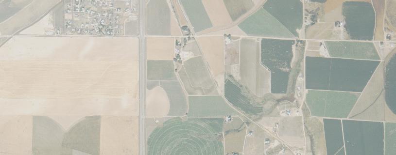
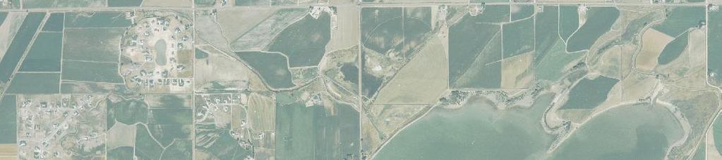
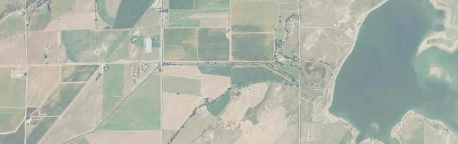
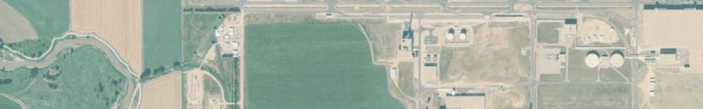
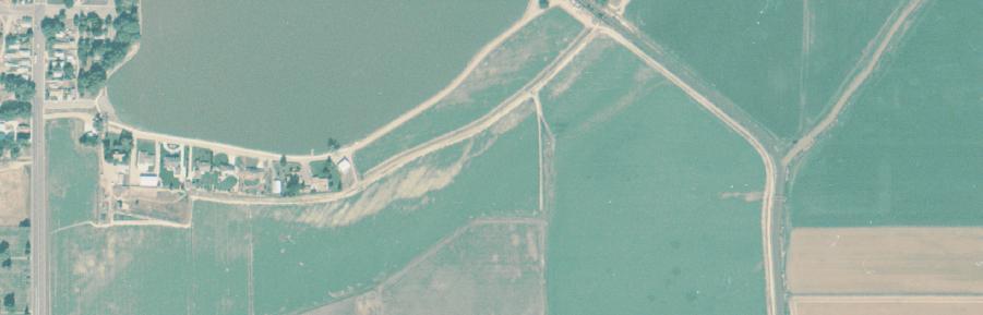
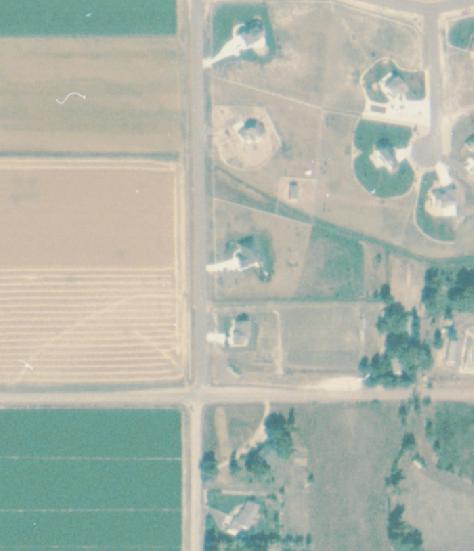
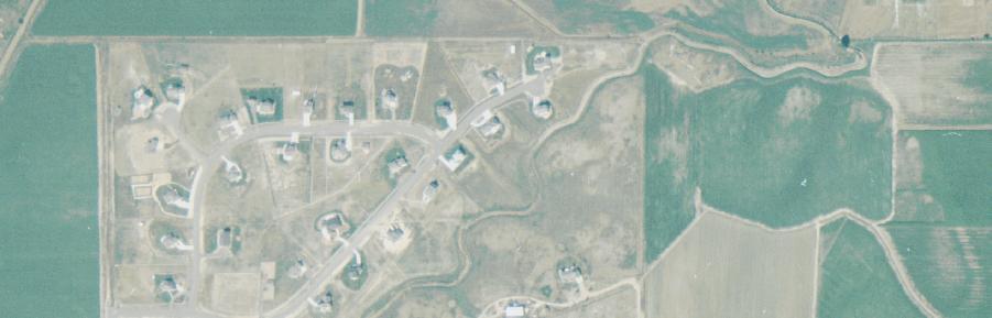
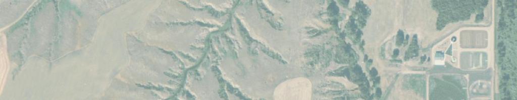
3 Regional detention ponds should be constructed where appropriate to reduce the peak discharges within a drainageway. On-site detention ponds should be constructed within the basins to limit the peak discharges in the drainageways, as well as the runoff from each subbasin, during the 100-year storm to the magnitude of the existing condition, 10-year storm event. Maintain or replace the existing roadway and railroad detention ponds where these facilities provide significant benefit during the major storm events. The releases from these structures should be limited to maximize the existing storage present at these locations. Construct spill structures and enlarge the canal section, where appropriate, along the irrigation canals/ditches to prevent flooding of adjacent properties. Divert the stormwater captured by the irrigation facilities to major outfall conveyance facilities or major drainageways. 5.2 Description of Drainage Improvements The improvements discussed in the previous section were initially evaluated and screened for applicability. A preferred list of improvements was identified and a comprehensive plan was developed that would address flooding problems along the major drainageway in each drainage basin within the Growth Management Boundary. In the paragraphs that follow, the preferred improvements are discussed. Unless otherwise stated, these improvements assume that on-site detention is provided to limit the releases for future developments to the 10-year existing condition levels. To facilitate the screening and evaluation of proposed improvements as well as the formulation of an implementation plan, each basin was evaluated on an individual basis, and if necessary, the major drainageway was divided into reaches as described below. Law Basin-Main Channel Reach L1: Cache la Poudre River to downstream of Eastman Park Drive Reach L2: Downstream of Eastman Park Drive to State Highway 392 Reach L3: State Highway 392 to WCR 70 Law Basin-West Tributary Reach L4: Colorado and Southern Railroad to State Highway 392 Reach L5: Kern Reservoir, WCR 19 to Greeley No. 2 Canal Reach L6: WCR 19 to State Highway Anderson Consulting Engineers, Inc.
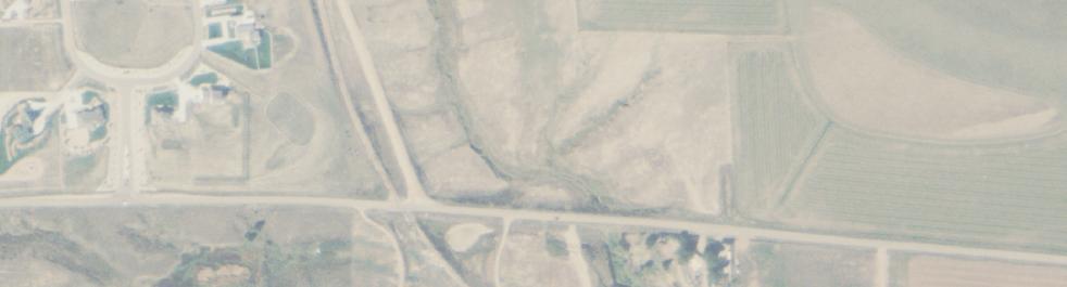
4 Windsor Basin Reach W1: Lower Basin-State Highway 392 to Eastman Park Drive Reach W2: Lower Basin-State Highway 392 to Eastman Park Drive Reach L5: Upper Basin, Kern Reservoir to Greeley No. 2 Canal High School Basin Reach H: State Highway 392 to Cache la Poudre River Jacoby Basin Reach J: Greeley No. 2 Canal to Cache la Poudre River Timnath Reservoir Basin Reach T: Cache la Poudre River to 1,400 feet Upstream of LCR 32 ½ Ptarmigan Basin Reach P: 500 feet south of LCR 30 to State Highway 392 Oklahoma Basin Reach O1: Cache la Poudre River to Great Western Railroad Reach O2: WCR 17 and WCR 60 South State Highway 257 Basin Reach S: Cache la Poudre River to State Highway 34 No drainage improvements have been identified within the River Ridge and Bluff Basins; consequently no reach delineations were necessary for these basins. The drainage improvement plans for each reach are referenced in Figure 5.1. Figures 5.2 to 5.16 present the conceptual plans associated with the improvements within each drainage basin Law Basin-Reach L1 The proposed improvements to Reach L1 are presented below and in Figure 5.2. Stormwater Channel (Sta to 72+00). Construct approximately 7,200 feet of channel improvements from the confluence of the Cache la Poudre River to approximately 1,200 south of Eastman Park Drive. The channel configuration includes a low flow channel along with an overbank area to convey flood flows. In addition, the 5.4Anderson Consulting Engineers, Inc.


5
6
7 channel incorporates a grass lining, total bottom width of 65 feet including a bottom width of 20 feet for the low flow channel, maximum top width varying from 110 to 125 feet, sideslopes of 4H:1V, channel slope of ft/ft, and design depth of approximately 5 feet. In conjunction with construction of the channel, a rock-lined transition structure into the Cache la Poudre River is required. To maintain a non-erosive channel slope, construction of three 3-foot grouted rock drop structures will be required. Whitney Ditch Crossing. Construction of a 60-inch inverted siphon is required to convey irrigation diversions in the Whitney Ditch under the new stormwater channel. The siphon is approximately 110 feet in length and includes concrete headwalls at both the inlet and outlet to the siphon. Bike Trail Crossing. Construction of the stormwater channel will required installation of a crossing for the existing bike trail along the Cache la Poudre River. The structure will convey the peak discharge associated with the future conditions 2-year storm event under the crossing. Events greater than the 2-year storm will be conveyed over the bike trail crossing. The structure consists of four 2 H x 4 W reinforced box culverts. Erosion protection will be provided along the embankments of the crossing to protect the trail during overtopping events between the 2-year and 100-year events Law Basin-Reach L2 The proposed improvements to Reach L2 focus on the new stormwater channel and crossing structures at Eastman Park Drive and the Colorado & Southern Railroad. Figure 5.3 presents the improvements in Reach L2. Stormwater Channel (Sta to ). Construct approximately 6,400 feet of channel improvements from approximately 1,200 south of Eastman Park Drive to a point along the north side of the Colorado & Southern Railroad. The channel improvements include a low flow channel along with an overbank area to convey flood flows. In addition, the channel incorporates a grass lining, bottom width ranging from 20 to 65 feet (high flow channel), maximum top width ranging from 90 to 120 feet, channel slope varying from ft/ft to ft/ft, sideslopes of 4H:1V, and a design depth of varying from 6 to 8 feet. Eastman Park Drive Crossing. Construct a new crossing consisting of a 6 H x 16 W reinforced concrete box culvert. Transitions from the existing channel to the culvert crossing are required along with placement of stabilization measures to control the potential erosion in the vicinity of the crossing. 5.7Anderson Consulting Engineers, Inc.

8
9 Colorado & Southern Railroad Crossing. Construct a new crossing consisting of three 72-inch diameter RCPs. Transitions from the existing channel to the culvert crossing are required along with placement of stabilization measures to control the potential erosion near the crossing. Construction costs associated with the crossing assume the RCPs will be bored under the tracks to facilitate railroad operations during construction. Stormwater Channel (Sta to ). Construct approximately 2,700 feet of channel improvements from the Colorado & Southern Railroad to State Highway 392. The channel should incorporate a grass lining, a bottom width of 17 feet, maximum top width of 90 feet, channel slope ranging from ft/ft to ft/ft, sideslopes of 4H:1V, and design depth of approximately 9 feet. A 2-foot drop structure and a 3-foot drop structure will be required along the new channel to maintain the non-erosive slope. State Highway 392 Crossing. Construct a new crossing consisting of two 4 H x 8 W reinforced concrete box culverts. The crossing will be approximately 250 feet in length and will convey stormwater flows from the Main Channel of the Law Basin under the Greeley No. 2 Canal and State Highway 392. Transitions from the new channels to the culvert crossing are required along with placement of stabilization measures to control the potential erosion in the vicinity of the crossing. Stormwater Channel (Sta to 8+50). Construct approximately 850 feet of stormwater channel along the south side of State Highway 392 from the outlet of the proposed State Highway 392 crossing structure to the Greeley No. 2 Canal. The channel incorporates a grass lining, a bottom width of 8 feet, maximum top width of 60 feet, channel slope of ft/ft, sideslopes of 4H:1V, and design depth of approximately 6 feet. A 3-foot drop structure and a 4-foot drop structure, respectively, will be required at the inlet and outlet to the channel. Improvements to Greeley No. 2 Canal. Modifications to the existing check structure on the Greeley No. 2 Canal and construction of a new side-channel weir downstream of State Highway 392 will be required to divert as much as 210 cfs of stormwater flow conveyed by the canal due to upstream improvements. The side-channel weir incorporates a bottom width of 30 feet and a depth of 2 feet Law Basin-Reach L3 Improvements in Reach L3 focused on the alleviation of flooding problems at the intersection of WCR 21 and State Highway 392. The specific improvements to Reach L3 are presented below and in Figure 5.4. Channel Improvements Sta to Approximately 2,000 feet of channel improvements upstream of S.H. 392 will be required to capture and convey stormwater runoff captured by the main drainage channel in the Law Basin. The channel improvements should incorporate a grass lining, bottom width of 20 feet, maximum top 5.9Anderson Consulting Engineers, Inc.


10
11 width of 50 feet, channel slope of ft/ft, sideslopes of 4H:1V, and design depth of 4 feet. At the upstream end of the channel improvements, approximately 600 feet of berming is required to capture the stormwater runoff and direct the flows into the proposed improvements. Greeley No. 2 Canal Improvements. Approximately 2,600 lineal feet of the south and west bank of the Greeley No. 2 Canal between WCR 19 and State Highway 392 will be elevated. A maximum of 1.5 feet of fill will be required to provide approximately 1 foot of freeboard to convey the design discharge of 800 cfs (600 cfs of irrigation flows plus 200 cfs of stormwater during the 100-year event) Law Basin-Reach L4 The proposed improvements to Reach L4 focus on the construction of new stormwater channels and the improvement of two existing crossing structures. Figure 5.5 presents the improvements for Reach L4. Channel Improvements (Sta to 50+00). Construct approximately 5,000 feet of the West Tributary Channel from the Colorado & Southern Railroad confluence with the Main Channel to State Highway 392. The channel should incorporate a grass lining, a bottom width of 10 feet, maximum top width of 55 feet, channel slope of ft/ft, sideslopes of 4H:1V, and design depth of approximately 5 feet. Consolidated Law Ditch Crossing. Construct a 36-inch diameter RCP, inverted siphon to convey Consolidated Law Ditch flows under the West Tributary stormwater channel improvements. The siphon will be approximately 100 feet in length. Great Western Railroad Crossing. The existing 48-inch diameter CMP will be replaced with a crossing structure consisting of five 36-inch diameter RCPs. Transitions from the proposed channel to the culvert crossing are required along with placement of stabilization measures to control the potential erosion in the vicinity of the crossing. The construction cost estimate assumes that the pipes will be bored under the tracks to facilitate railroad operations during construction. If construction will permit an open cut of the railroad tracks, a reinforced box culvert with an open area of approximately 40 square feet will be required. State Highway 392 Crossing. The existing 24-inch diameter CMP will be replaced with a crossing structure consisting of two 3 H x 6 W reinforced concrete box culverts. Transitions from the existing channel upstream and the proposed channel downstream to the culvert crossing are required along with placement of stabilization measures to control the potential erosion in the vicinity of the crossing. 5.11Anderson Consulting Engineers, Inc.
12
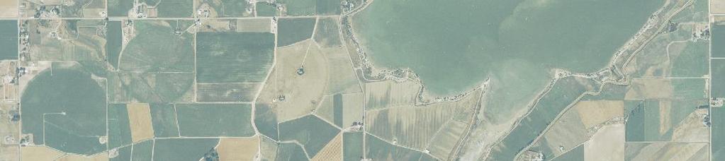
13 5.2.5 Law Basin-Reach L5 The proposed improvements to Reach L5 focus on the diversion of stormwater runoff into Kern Reservoir and the utilization of Kern Reservoir as a regional stormwater detention facility. The stormwater generated in both the Upper Windsor Basin and the West Tributary of the Law Basin will be captured and conveyed into Kern Reservoir. Modifications to the Greeley No. 2 Canal facilities are required to divert the stormwater into Kern Reservoir and convey the releases from the reservoir to the outfall channel improvements near State Highway 392. The proposed improvements encompass the West Tributary of the Law Basin as well as upper portion of the Windsor Basin. Figure 5.6 presents the improvements associated with Reach L5. Kern Reservoir Enlargement. The sediment accumulated in Kern Reservoir will be excavated to create additional storage for irrigation water. This will allow the reservoir to be operated at a lower elevation (operating levels: current = 4,795 msl, NAVD 1988; proposed = 4,793.0 ft, msl, NAVD 1988) thereby creating additional storage for stormwater runoff. The required flood storage is 718 acre-feet. Plug Existing Principal Spillway. The existing principal spillway presently controls the water surface in the reservoir at elevation 4,795.0 ft, msl, NAVD 1988 and releases as much as 60 cfs into the Lower Windsor Basin during the 100-year storm event. To prevent the stormwater releases into the Lower Windsor Basin during the 100-year event, it is recommended that the existing principal spillway be plugged. A new principal spillway can be incorporated into the new radial gate structure on the Greeley No. 2 Canal upstream of WCR 19. Emergency Spillway Improvements. As a result of the proposed improvements to the Kern Reservoir, requirements for dam safety as promulgated by the Office of the State Engineer will need to be reviewed. It is anticipated that the results of this investigation will require modifications to the existing emergency spillway. Greeley No. 2 Canal Improvements at Osterhaut Lake. The Greeley No. 2 Canal between the Colorado & Southern Railroad bridge and State Highway 257 (approximately 3,500 feet in length) will be enlarged to capture and convey stormwater emanating from the Upper Windsor Basin. The captured flows will be conveyed under State Highway 257 using the existing bridge and into Kern Reservoir using the existing inlet structure approximately 500 feet east of State Highway 257. The east bank of the canal will be elevated as much 5 feet and the canal cross section will need to enlarged. Channels necessary to convey stormwater runoff from the Upper Windsor Basin and transition into the Greeley No. 2 Canal will be required and are assumed to be provided during development of the property in the upper basin. 5.13Anderson Consulting Engineers, Inc.
14
15 Water Line Relocation. Currently, two raw water lines for the City of Greeley cross over the Greeley No. 2 Canal immediately downstream of the existing radial gates on the Kern Reservoir. As canal improvements are made to accommodate the capture and conveyance of stormwater in the basin, relocation of the raw water lines is anticipated. Extend Pedestrian Bridge. Currently, a pedestrian bridge spans the Kern Reservoir outlet immediately upstream of the existing radial gates. When canal improvements are made to accommodate stormwater releases from the reservoir; it is anticipated that the pedestrian bridge will be extended. Greeley No. 2 Canal/Kern Reservoir Outlet Improvements. To promote the capture and diversion of stormwater runoff from the West Tributary of the Law Basin into the Kern Reservoir, several improvements are necessary to the Greeley No. 2 Canal and the Kern Reservoir outlet canal. The banks of both canals will be raised a maximum of 5 feet. The banks should be elevated to contain and control the runoff from the future conditions 100-year storm event with out exceeding the elevation of the emergency spillway (4,797.0 ft, msl, NAVD 1988). The existing radial gates at the outlet will be relocated to Greeley No. 2 Canal in the vicinity of WCR 19. The existing measurement structure will also be relocated near WCR 19 Diversion of additional stormwater runoff from the Law Basin into Kern Reservoir will require coordination with the Office of the State Engineer to ensure all dam safety requirements are satisfied Law Basin-Reach L6 The proposed improvements to Reach L6 involve the diversion of stormwater runoff from the West Tributary of the Law Basin into Kern Reservoir, channel improvements to the Springer Ditch and installation of a crossing structure in State Highway 257. Figure 5.7 presents the improvements associated with Reach L6. Channel Improvements. Construct approximately 2,400 feet of stormwater channel along the south side of WCR 70 west of WCR 19 to the confluence with the Springer Ditch. The channel will capture stormwater runoff from the Law Basin, specifically the Windsor Ranch Subdivision and the watershed tributary to the subdivision, and convey the runoff to the Springer Ditch. The channel incorporates a grass lining, a bottom width of 14 feet, maximum top width of 45 feet, channel slope ranging from to ft/ft, sideslopes of 4H:1V, and design depth of approximately 4 feet. Springer Ditch Improvements (Sta to 46+00). Construct approximately 3,100 feet of improvements to the Springer Ditch from the confluence with the Greeley No. 2 Canal to State Highway 257. The improved channel should incorporate a grass lining, a bottom width of 15 feet, maximum top width of 65 feet, channel slope of ft/ft, sideslopes of 4H:1V, and design depth of approximately 10 feet. Consideration should be given to a low-flow channel capable of conveying the normal irrigation flows in the Springer Ditch. 5.15Anderson Consulting Engineers, Inc.

16
17 State Highway 257 Crossing. Construct a crossing structure consisting of a 3 H x 10 W reinforced concrete box culvert. The culvert is anticipated to be 40 feet in length and will convey stormwater flows generated west of State Highway 257 under the highway and into the Springer Ditch. Transitions from the new channels to the culvert crossing are required along with placement of stabilization measures to control the potential erosion in the vicinity of the crossing. Minor berming may be required west of State Highway 257 to direct shallow sheet flooding to the crossing Windsor Basin-Reach W1 The improvements recommended in eastern portion of the Lower Windsor Basin are intended to minimize localized street flooding through the optimization of existing and proposed detention facilities and installation of storm sewer and channel improvements. Where appropriate, floodproofing measures have been recommended to minimize the damages from local street flooding. These improvements are presented in Figure 5.8. Chimney Park Regional Detention Pond. To reduce peak flows in the lower Windsor Basin, a regional detention pond is proposed in the area east of Chimney Park. The proposed pond will incorporate a storage volume of 13 acre-feet and will require acquisition of 3 acres of land. Folkstone Park Regional Detention Pond. To further reduce peak flows in the lower Windsor Basin, improvements are required to the existing detention facility at Folkstone Park. The existing pond will be enlarged to provide an additional 17.5 acre-feet of capacity. The park is currently owned by the Town of Windsor and therefore no property acquisition is required. Chestnut Street Floodproofing Measures. Floodproofing measures are recommended for structures located along Chestnut Street. The exact number, location, and type of improvements should be determined following a detailed hydraulic study in this area. Channel Improvements (Sta to 6+50). Construct approximately 650 feet of stormwater channel between Chestnut Street and Garden Drive. The channel will capture stormwater runoff on Chestnut Street and the drainage basin to the north and convey the runoff into the Folkstone Park Detention Pond. Due to space limitations, the proposed channel should incorporate vertical sideslopes, a channel slope of ft/ft, bottom width of 17 feet, and a design depth of approximately 4.5 feet. Garden Drive Crossing. Construct a crossing structure consisting of a 4 H x 18 W reinforced concrete box culvert. The culvert is estimated to be 60 feet in length and will convey stormwater flows from north of Garden Drive under the road and into the Folkstone Park Detention Facility. Transitions from the new channel to the culvert crossing and from the culvert to the detention pond are required along with placement of stabilization measures to control the potential erosion in the vicinity of the crossing. 5.17Anderson Consulting Engineers, Inc.

18
19 Folkstone Park Detention Pond Outfall. Install 2,900 feet of 36-inch diameter RCP storm sewer. The storm sewer will serve as an outfall facility for the Folkstone Park Detention Pond. The outfall pipe will convey stormwater to the roadside ditch located north of Eastman Park Drive Windsor Basin-Reach W2 The improvements recommended in the western portion of the Lower Windsor Basin are intended to minimize the damages associated with localized street flooding through the installation of floodproofing measures. These improvements are presented in Figure 5.9. Oak Street Floodproofing Measures. Floodprofing measures are recommended for structures adjacent Oak Street between Third Street and Fourth Street. The exact number, location, and type of floodproofing measure should be determined following completion of a detailed hydraulic analysis. Locust Street Floodproofing Measures. Floodprofing measures are recommended for structures located between Locust Street and Oak Street directly east of Seventh Street. The exact number, location, and type of improvements should be determined following completion of a detailed hydraulic analysis. Elm Street Floodproofing Measures. Floodprofing measures are recommended for structures along Elm Street between Seventh Street and Eighth Street. The exact number, location, and type of improvements should be determined following completion of a detailed hydraulic analysis High School Basin Improvements in the High School Basin are intended to alleviate the potential flooding problems in the vicinity of Stone Mountain Drive. The specific improvements to the High School Basin are presented below and also on Figure th Street Channel Outfall. Construct an outfall channel from the Poudre Park Detention Pond to the Cache la Poudre River. The outfall channel is approximately 600 feet in length and incorporates a bottom width of 40 feet, depth of 5 feet, channel slope of ft/ft, grass-lined sideslopes of 3H:1V, and a stabilized transition into the Cache la Poudre River. 5.19Anderson Consulting Engineers, Inc.
20
21
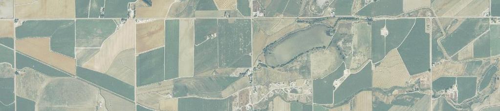
22 Whitney Ditch Siphon. A siphon will be installed under the outfall channel to convey irrigation diversions associated with the Whitney Ditch. The siphon will be approximately 60 feet in length and will consist of a 60-inch RCP with inlet and outlet transition structures. 10 th Street Channel - Downstream of Stone Mountain Drive. Improve approximately 700 lineal feet of channel between the Poudre Park Detention Pond and Stone Mountain Drive. The channel improvements include a grass lining, bottom width of 10 feet, maximum top width of 35 feet, channel slope of ft/ft, sideslopes of 3H:1V, and a design depth of approximately 4.0 feet. Stone Mountain Drive Crossing Improvements. Replace the existing triple-30 CMP crossing of Stone Mountain Drive with two 4 H x 9 W reinforced box culverts. Transitions from the existing channel to the culvert crossing are required along with placement of stabilization measures to control the potential erosion in the vicinity of the crossing. 10 th Street Conveyance Improvements. During large storm events, runoff is collected and conveyed in 10 th Street and ultimately the 10 th Street Stormwater Channel. To promote the safe conveyance of stormwater into the 10 th Street Channel, improvements are required at two locations. Improvements at the intersection of Palisade Mountain Drive and 10 th Street are recommended to divert stormwater flows on the east side of the street into the 10 th Street Channel. The improvement may include installation of a cross pan, localized lowering of the curbs/gutters and sidewalks, and construction of a swale from Palisade Mountain Drive to the outlet of the existing 48-inch diameter storm sewer. In addition, improvements are recommended at the end of the cul-de-sac where 10 th Street turns to the west (see Figure 5.10). A drainage easement should be preserved at this location to allow stormwater runoff which collects in the cul-de-sac to be conveyed to the 10 th Street Channel. The drainage improvements from the cul-de-sac may include construction of drainage swales, and lowering of street curbs/sidewalks Jacoby Basin Improvements in Jacoby Basin focused on the alleviation of flooding problems at WCR 68 ½, the Greeley No. 2 Canal, and at State Highway 392. The specific improvements to Jacoby Basin are presented below and also on Figure WCR 15 Storm Sewer. Construct approximately 1,300 feet of 60-inch diameter, RCP storm sewer along the west side of WCR 15. The storm sewer will transition into the existing 60-inch RCP storm sewer at State Highway 392 and terminate on the north side of the Greeley No. 2 Canal. A 60-inch RCP siphon will be required near the Greeley No. 2 Canal to convey stormwater runoff beneath the canal facilities. 5.22Anderson Consulting Engineers, Inc.
23
24 Limiting Stormwater Releases from Subbasins J11 and J12. It is recommended that future development (those parcels platted and approved for construction after June 1, 2000) north of the Greeley No. 2 Canal and west of WCR 15 limit the release of stormwater to approximately 0.2 cfs/acre. This recommended improvement will ensure that the capacity of the existing 72-inch diameter storm sewer is not exceeded Timnath Reservoir Basin Improvements in the Timnath Reservoir Basin are intended to mitigate the potential flooding problems at LCR 32½ and the Greeley No. 2 Canal through the construction of a regional drainage channel, improved crossing structure and siphon/wasteway structure on the Greeley No. 2 Canal. The specific improvements in this basin are presented below and on Figure Channel Improvements. Construct approximately 6,000 feet of channel improvements from the Cache la Poudre River to the Timnath Reservoir Outlet Ditch located north of the Greeley No. 2 Canal. The channel configuration includes a compound channel, i.e., a low flow channel along with an overbank area to convey flood flows. In addition, the channel incorporates a grass lining, bottom width ranging from 35 to 40 feet, channel slope of approximately ft/ft, sideslopes of 4H:1V, and a design depth ranging from 5 to 6.5 feet. At the downstream end of the channel improvements, a transition into the Cache la Poudre River is required to convey flows safely and in a non-erosive manner to the river. In a similar manner, a transition structure will be required near the Timnath Reservoir Outlet Ditch to convey stormwater into the channel improvements. LCR 32½ Crossing Structure. Replace the existing 30-inch diameter CMP crossing of LCR 32½ with two 6 H x 10 W reinforced concrete box culverts. Transitions from the new channel to the culvert crossing are required along with placement of stabilization measures to control the potential erosion in the vicinity of the crossing. Greeley Number 2 Improvements. In order to safely convey stormwater from the Timnath Reservoir Basin through the facilities associated with the Greeley No. 2 Canal, the following improvements are required: (a) an inverted siphon to convey irrigation flows underneath the new stormwater channel, (b) a wasteway structure upstream of the inverted siphon, and (c) a headgate/diversion structure at the upstream end of the channel improvements. The inverted siphon will consist of two 6 H x 10 W reinforced concrete box culverts. The wasteway structure will spill stormwater flows captured by the canal, which cannot pass through the new siphon. The headgate/diversion structure is required to allow conveyance of irrigation flows in the Timnath Reservoir Outlet Ditch into the Greeley No. 2 Canal while diverting stormwater flows into the channel improvements. 5.24Anderson Consulting Engineers, Inc.

25
26 Ptarmigan Basin The improvements in the Ptarmigan Basin are intended to alleviate the potential flooding identified at two crossings (Subbasin P14 and Subbasin P09) of State Highway 392. The specific improvements to Ptarmigan Basin are presented below and in Figure LCR 5 Crossing Structure. Improve the existing 21-inch diameter steel pipe crossing LCR 5 north of State Highway 392. The improvements consist of: (a) enlarging the existing drainage channel located north of State Highway 392 to the inlet of the 21-inch steel pipe, (b) installation of improved inlet and outlet structures (headwalls/flared end sections/trash rack), and (c) removal of all sediment within, and adjacent to the existing crossing structure. State Highway 392 Crossing Structure. Improve the existing 24-inch diameter HDPE pipe crossing immediately east of LCR 5. The improvements consist of: (a) enlarging the existing drainage channel immediately south of the crossing, (b) constructing improvements to the existing drop inlet structures into the existing 18-inch diameter HDPE outfall pipe; (c) installing improved inlet and outlet structures (headwalls, flared end sections, trash rack, etc), and (d) removal of all sediment within, and adjacent to, the existing crossing structure. LCR 30 Detention Pond. To reduce the peak flows at the State Highway 392 crossing in Subbasin P14, a regional detention pond is proposed south of LCR 30 and east of I-25. The pond is located upstream of the existing Louden Ditch. The pond requires 8.6 acrefeet of storage, which will necessitate the acquisition of approximately 4 acres of land along with the construction of an outlet structure under the Louden Ditch. The outfall channel from the detention pond to State Highway 392 is assumed to be included in the construction associated with development of the property between LCR 30 and State Highway River Ridge Basin No flooding improvements in the River Ridge Basin are recommended assuming the enforcement of on-site over-detention within the basin. Special attention should be focused on potential channel stability problems within the main drainage channel as development occurs in the basin. 5.26Anderson Consulting Engineers, Inc.
27
28 Bluff Basin No flooding improvements in the Bluff Basin are recommended assuming the enforcement of on-site over-detention within the basin. Similar to the River Ridge Basin, special attention should be focused on erosional issues as develop occurs in the basin Oklahoma Basin-Reach O1 The improvements in Reach O1 involve the construction of an additional crossing structure at the Great Western Railroad. In addition to the existing 12 H x 9 W arch CMP, a 6 H x 10 W reinforced concrete box culvert is recommended. Erosion protection is also recommended for both structures. Localized channel work will be required to provide transitions from the existing channel to the improved culverts. These improvements are presented on Figure Oklahoma Basin-Reach O2 During the master planning effort, the longevity of the existing crossing structure at WCR was estimated to be less than 10 years due to the deterioration of the concrete box culvert. Furthermore, the inadvertent detention provided behind the road embankment provides significant reduction in the peak discharges during the major storm events. Consequently, the improvements in Reach O2 focused on: (a) replacement of the existing culvert at WCR 17; and (b) preservation of the existing detention area upstream of WCR 17. The specific improvements to Reach O2 are presented below and in Figure WCR 17 Crossing. This improvement involves the replacement of existing 8.5 H x 5.5 W reinforced box culvert which is in poor condition. The replacement structure recommended for this crossing should provide similar hydraulic characteristics as the existing culvert. Similar operational characteristics are required because this structure acts as the outlet control to the existing inadvertent/regional detention pond located on the upstream side of WCR 17. For the purposes of this master planning effort, an 8.5 H x 5.5 W RCB is recommended for this crossing. Regional Detention Pond. To insure continued reduction of peak flows within the major drainageway of the Oklahoma Basin, the inadvertent storage/regional detention pond upstream of WCR 17 should be purchased and preserved. At this location, approximately 235 acre-feet of storage are available which will necessitate the acquisition of approximately 18 acres of land. 5.28Anderson Consulting Engineers, Inc.
29

30
31 South State Highway 257 Basin The improvements identified for this basin are intended to reduce the potential overtopping of State Highway 257 during the 100-year flow event. The existing crossing structure consists of two 6 H x 10 W reinforced concrete box culverts with a capacity of 1,075 cfs prior to overtopping the roadway. Channel improvements along the west bank upstream of the crossing structure will increase the capacity of the existing structure to approximately 1,500 cfs prior to overtopping the roadway. The 100-year peak flow at this location is estimated to be 1,565 cfs. The recommended improvements consist of placing compacted fill along the west bank in the vicinity of the existing driveway access. The elevation of the compacted fill should not be less than 4,791 ft, msl. This improvement is presented on Figure Additional Considerations As indicated previously, road crossings of several tributaries to the major drainageways also exist. Several of these crossings lack the capacity to convey the peak discharge from the major storm events for existing conditions. In addition, several of the crossings were noted to be experiencing potential sediment and debris problems that would tend to reduce the conveyance capacity. As land development occurs within the basin, these crossing structures will require improvements to meet the existing drainage criteria. Improvements to these structures should consider the peak discharges conveyed through or over these crossings during the major storm event. In addition, the capacity and stability of downstream conveyance facilities should be considered. As stated previously, the drainage improvements described in this chapter pertain to the major drainageways within each drainage basin. As future development occurs in each basin, it is assumed that on-site drainage facilities will be provided to convey stormwater runoff to the improvements identified in the master plan. 5.3 Drainage Criteria It is assumed that land development within the growth management boundary will be governed by the guidelines and recommendations provided in this master planning document. The following information is presented to guide development within this area as well as areas contributing stormwater to the Town of Windsor. 5.31Anderson Consulting Engineers, Inc.


32
33 Land development in the drainage basins will be required to limit the stormwater runoff from the 100-year storm event to the magnitude of the existing condition 10- year storm event. Land development in the Ptarmigan Basin will be required to limit the stormwater runoff from the 100-year storm event for the area located south of State Highway 392 to the available capacity of existing facilities under State Highway 392. Land development in the Jacoby Basin, upstream of the Greeley No. 2 Canal and west of WCR 15, will be required to limit stormwater runoff from the 100-year storm event to 0.2 cfs/acre. Stormwater generated from the development of land in each subbasin will be conveyed in a safe and stable manner to the major drainageway. This statement implies that stormwater runoff will be conveyed in an appropriate outfall facility such as a channel, storm sewer, etc. All existing detention and retention areas that are effective in reducing the runoff generated during the major storm events, must remain intact or be replaced. 5.4 Cost Estimates Estimates of the costs were developed for the proposed improvements and provided the basis for the opinion of costs generated for the comprehensive plans for each basin. Data used to develop unit costs were obtained from bid tabulations, quotations from various suppliers and manufacturers, and information supplied by local contractors and the Town of Windsor Engineering Department. The unit pricing data compiled and used to generate the cost estimates is provided in the project notebook. The cost estimates for the comprehensive plans included the following categories: (a) general drainage infrastructure; and (b) engineering, permitting, legal, fiscal and administrative costs. General drainage infrastructure costs are defined as the costs associated with the labor and materials for the construction of drainage improvements. This item also includes acquisition of the drainage ROW/easements or land necessary for the construction and maintenance of the drainage improvements. A contingency of 35% was included in the estimate of construction costs to include those real and intangible items not directly accounted for in the unit pricing data and the costs associated with mobilization, utility relocation, etc. The final cost category was estimated to be approximately 20 percent of total construction costs. This category is intended to include professional engineering and construction services, labor required to obtain the necessary permits, and legal requirements. 5.33Anderson Consulting Engineers, Inc.
34 Administrative costs relate to the implementation of the construction plan by the various governmental agencies. The cost estimates for the comprehensive plans are presented in Tables 5.1 and 5.2. Table 5.1 presents the cost estimates generated for each improvement in each drainage basin. Table 5.2 provides a summary, by basin, of the total costs to construct the improvements. 5.5 Hydrologic Analysis Following the formulation and evaluation of the drainage improvements, the future condition hydrologic model (with over-detention) was modified to reflect the improvements identified for the comprehensive plans. Hydrologically, the plans reflect the reduction in peak discharges provided by the improved facilities. Discharge data assuming implementation of the comprehensive plans are presented in tabular form in Table 5.3. For illustrative purposes, Figure 5.17 presents the 100-year peak discharge data at several locations within the watershed based on the hydrologic model of future conditions with over-detention along with construction of the proposed improvements Anderson Consulting Engineers, Inc.
35 Reach- Item Table 5.1 Cost Estimates for Drainage Improvements with Over-Detention. Description Proposed Improvements/ General Drainage Infrastructure Property Acquisition Engineering, Permitting, Legal & Admin. Total Cost LAW BASIN L1-1 New Channel (Sta.0+00 to 72+00) $1,253,000 $209,000 $250,000 $1,712,000 L1-2 Bike Trail Crossing Structure $67,000 $0 $13,000 $80,000 L1-3 Whitney Ditch Siphon $38,000 $0 $7,000 $45,000 Reach L1 Subtotal $1,837,000 L2-1 New Channel (72+00 to ) $810,000 $152,000 $162,000 $1,124,000 L2-2 Eastman Park Crossing Structure $125,000 $0 $25,000 $150,000 L2-3 C&S Railroad Crossing Structure $130,000 $5,000 (1) $26,000 $161,000 L2-4 New Channel (Sta to ) $342,000 $59,000 $68,000 $469,000 L2-5 State Highway 392/Greeley No. 2 Crossing $477,000 $2,000 $95,000 $574,000 L2-6 New Channel (Sta to 8+50) $90,000 $14,000 $18,000 $122,000 L2-7 Check Structure and Wasteway $28,000 $2,000 $5,000 $35,000 Reach L2 Subtotal $2,635,000 L3-1 New Channel (Sta to ) $89,000 $28,000 $18,000 $135,000 L3-2 Greeley No. 2 Bank Improvements WCR19/State Highway 392 $8,300 $0 $1,700 $10,000 Reach L3 Subtotal $145,000 L4-1 New Channel (Sta to 50+00) $237,000 $74,000 $47,000 $358,000 L4-2 Consolidated Law Ditch Siphon $22,000 $0 $4,000 $26,000 L4-3 G.W. Railroad Crossing Structure $177,000 $5,000 (1) $35,000 $217,000 L4-4 State Highway 392 Crossing Structure $126,000 $0 $25,000 $151,000 Reach L4 Subtotal $752,000 L5-1 Kern Reservoir Excavation $3,027,000 $0 $606,000 $3,633,000 L5-2 Plug Existing Principal Spillway $7,000 $0 $2,000 $9,000 L5-3 Emergency Spillway Improvements $135,000 $0 $27,000 $162,000 L5-4 Greeley No. 2 Bank Improvements at Osterhaut Lake $148,000 $40,000 $29,000 $217,000 L5-5 Lower Water Lines $61,000 $0 $12,000 $73,000 L5-6 Extend Pedestrian Bridge $41,000 $5,000 $8,000 $54,000 L5-7 Greeley No. 2 Channel/Kern Reservoir Outlet Improvements $332,000 $22,000 $66,000 $420,000 Reach L5 Subtotal $4,568,000 L6-1 Windsor Ranch Channel $68,000 $30,000 $13,000 $111,000 L6-2 Springer Ditch Improvements $89,000 $46,000 $18,000 $153,000 L6-3 State Highway 257 Crossing Structure (Law Basin) $65,000 $10,000 $13,000 $88,000 Reach L6 Subtotal $352,000 Law Basin Total Cost $10,289, Anderson Consulting Engineers, Inc.
36 Reach- Item Table 5.1 Cost Estimates for Drainage Improvements with Over-Detention (continued). Description Proposed Improvements/ General Drainage Infrastructure Property Acquisition Engineering, Permitting, Legal & Admin. Total Cost WINDSOR BASIN W Storm Sewer $367,000 $0 $73,000 $440,000 W1-2 Folkstone Detention Pond Improvements $124,000 $0 $25,000 $149,000 W1-3 Garden Street Crossing Structure $138,000 $0 $28,000 $166,000 W1-4 New Channel (Sta to 6+50) $430,000 $13,000 $86,000 $529,000 W1-5 Chimney Park Detention Pond $175,000 $150,000 $35,000 $360,000 W1-6 1 st St. & Chestnut St. Floodproofing $81,000 $0 $16,000 $97,000 Reach W1 Subtotal $1,741,000 W2-1 7 th & Elm St. Floodproofing $202,000 $0 $41,000 $243,000 W2-2 3 rd St. & Oak St. Floodproofing $203,000 $0 $40,000 $243,000 Reach W2 Subtotal $486,000 Windsor Basin Total Cost $2,227,000 HIGH SCHOOL BASIN H-1 10 th Street Outfall Channel $61,000 $11,000 $12,000 $84,000 H-2 Whitney Ditch Siphon $31,000 $0 $6,000 $37,000 H-3 10 th Street Channel Improvements $30,000 $0 $6,000 $36,000 H-4 Stone Mountain Crossing Structure $148,000 $0 $30,000 $178,000 H-5 10 th Street Improvements $31,000 $0 $6,000 $37,000 High School Basin Total Cost $372,000 JACOBY BASIN J-1 WCR 15 Storm Sewer $385,000 $0 $77,000 $462,000 J-2 Over-Detention in Subbasins J11&J12 $0 $0 $0 $0 Jacoby Basin Total Cost $462,000 TIMNATH RESERVOIR BASIN T-1 Cache la Poudre Transition $108,000 $3,000 $22,000 $133,000 T-2 New Channel (Sta to 15+70) $228,000 $43,000 $46,000 $317,000 T-3 LCR 32 ½ Crossing Structure $102,000 $0 $20,000 $122,000 T-4 New Channel (Sta to 59+50) $322,000 $85,000 $64,000 $471,000 T-5 Greeley No. 2 Siphon, Wasteway, and Turnout $319,000 $0 $64,000 $383,000 Timnath Reservoir Basin Total Cost $1,426, Anderson Consulting Engineers, Inc.
37 Reach- Item Table 5.1 Cost Estimates for Drainage Improvements with Over-Detention (continued). Description Proposed Improvements/ General Drainage Infrastructure Property Acquisition Engineering, Permitting, Legal & Admin. Total Cost PTARMIGAN BASIN P-1 LCR 5 Culvert and Swale $11,000 $0 $2,000 $13,000 P-2 State Highway 392 Culvert and Swale $13,000 $0 $3,000 $16,000 P-3 LCR 30 Detention Pond $88,000 $40,000 $17,000 $145,000 Ptarmigan Basin Total Cost $174,000 RIVER RIDGE BASIN No Master Plan Improvements recommended for this basin. BLUFF BASIN No Master Plan Improvements recommended for this basin. OKLAHOMA BASIN O1-1 Enlargement of G.W. Railroad Crossing $136,000 $0 $27,000 $163,000 Reach O1 Subtotal $163,000 O2-1 Replacement of WCR 17 Crossing (2) $244,000 $0 $49,000 $293,000 O2-2 WCR 17 Detention Pond $0 $54,000 $5,000 $59,000 S-1 Reach O2 Subtotal $352,000 Oklahoma Basin Total Cost $515,000 SOUTH STATE HIGHWAY 257 BASIN Channel Improvements at State Highway 257 Crossing $10,000 $0 $2,000 $12,000 South State Highway 257 Basin Total Cost $12,000 (1) In railroad right-of-way, cost to obtain permits from railroad. (2) Possibly funded by Weld County during WCR17 improvements. 5.37Anderson Consulting Engineers, Inc.
38 Table 5.2 Summary of Basin Costs. Basin Total Cost of Improvements With Over-Detention Law Basin $10,289,000 Windsor Basin $2,227,000 High School Basin $372,000 Jacoby Basin $462,000 Timnath Reservoir Basin $1,426,000 Ptarmigan Basin $174,000 River Ridge Basin $0 Bluff Basin $0 Oklahoma Basin $515,000 South State Highway 257 Basin $12,000 Total Cost Drainage Improvements $15,477, Anderson Consulting Engineers, Inc.
III. INVENTORY OF EXISTING FACILITIES
 III. INVENTORY OF EXISTING FACILITIES Within the Growth Management Boundary, the existing storm drainage facilities are largely associated with development that has historically occurred in the ten drainage
TOWN OF WINDSOR MASTER DRAINAGE PLAN: 2017 UPDATE Volume I: Law Basin and Windsor Basin
 TOWN OF WINDSOR MASTER DRAINAGE PLAN: 2017 UPDATE Volume I: Law Basin and Windsor Basin 375 East Horsetooth Road, Bldg 5 - Fort Collins, CO 802525 - (970) 226-0120 September 2017 Town of Windsor 2017 Update
STORM DRAINAGE DESIGN MANUAL
 Appendix I STORM DRAINAGE DESIGN MANUAL by: SUNGATE DESIGN GROUP, P.A. GEN ERAL DESIGN STAN DARDS AN D POLICIES 1. STREET AND LOCAL DRAINAGE Discharge estimates for specified design storms shall be calculated
Chapter 11 Culverts and Bridges
 Chapter 11 Culverts and Bridges Contents 1.0 Introduction... 1 2.0 General Design... 1 2.1 Design Criteria... 1 2.2 Design Flows... 1 2.3 Permitting and Regulations... 1 2.4 Aesthetics and Safety... 2
CHECKLIST FOR STREETS, INLETS, AND STORM SEWER DESIGN
 CHECKLIST FOR STREETS, INLETS, I. STREET CLASSIFICATION AND DESIGN CRITERIA A. Determine drainage classification for the roadway section using Table 7-1 or Table 7-2. B. Determine the allowable flow depth
SECTION STORM DRAINAGE DESIGN, GRADING, AND WATER QUALITY TECHNICAL CRITERIA TABLE OF CONTENTS PAGE 402 STORM DRAINAGE DESIGN CRITERIA 400-1
 CITY OF THORNTON Standards and Specifications Revised: October 2012 SECTION 400 - STORM DRAINAGE DESIGN, GRADING, AND WATER QUALITY TECHNICAL CRITERIA TABLE OF CONTENTS PAGE 401 GENERAL PROVISIONS 400-1
Chapter 4. Drainage Report and Construction Drawing Submittal Requirements
 4.0 Introduction The requirements presented in this section shall be used to aid the design engineer or applicant in the preparation of drainage reports, drainage studies, and construction drawings for
SECTION 3 DRAINAGE. 3-1 General. 3-2 Drainage Ordinances and Legal Requirements
 SECTION 3 DRAINAGE 3-1 General All Drainage plans for proposed development shall be prepared by a Professional Engineer registered in Virginia, except as noted below. Further, their seal and signature
Chapter 11 Culverts and Bridges
 Chapter 11 Table of Contents 11-1 Introduction... 1 11-2 General Design... 1 11-2-1 Design Criteria... 1 11-2-2 Design Flows... 1 11-2-3 Permitting and Regulations... 2 11-2-4 Aesthetics and Safety...
Chapter 11 Culverts and Bridges
 Chapter 11 Table of Contents 11-1 Introduction... 1 11-2 General Design... 1 11-2-1 Design Criteria... 1 11-2-2 Design Flows... 1 11-2-3 Permitting and Regulations... 2 11-2-4 Aesthetics and Safety...
Contents. Drainage Analysis: Hunters Trace, Westpointe, and Hunters Creek
 Drainage Analysis: Hunters Trace, Westpointe, and Hunters Creek Contents SITE LOCATION / DESCRIPTION... 3 WESTPOINTE STORMWATER MANAGEMENT PLAN... 3 THE ENCLAVE AT WESTPOINTE DETENTION POND... 3 Table
Chapter 7. Street Drainage. 7.0 Introduction. 7.1 Function of Streets in the Drainage System. 7.2 Street Classification
 7. Introduction This chapter summarizes methods to evaluate runoff conveyance in various street cross sections and curb types in the Town of Castle Rock and identifies acceptable upper limits of street
CONSTRUCTION PLAN CHECKLIST
 CONSTRUCTION PLAN CHECKLIST The design engineer is responsible for ensuring that plans submitted for city review are in accordance with this checklist. It is requested that the executed checklist be submitted
Stormwater Erosion Control & Post-Construction Plans (Stormwater Quality Plans)
") Stormwater Erosion Control & Post-Construction Plans (Stormwater Quality Plans) Allen County Stormwater Plan Submittal Checklist The following items must be provided when applying for an Allen County Stormwater
Stormwater Erosion Control & Post-Construction Plans (Stormwater Quality Plans) Allen County Stormwater Plan Submittal Checklist The following items must be provided when applying for an Allen County Stormwater
Jacobi, Toombs, and Lanz, Inc.
 Area 5: Blackiston Mill Road at Dead Man's Hollow Flooding Assessment Jacobi, Toombs, and Lanz, Inc. This document summarizes an assessment of drainage and flooding concerns and provides recommendations
Fort Collins Amendments to the Urban Drainage and Flood Control District Criteria Manual
 Fort Collins Amendments to the Urban Drainage and Flood Control District Criteria Manual Fort Collins Amendments to the Urban Drainage and Flood Control District Criteria Manual, adopted by the City Council
Final Drainage Report
 Thornton Electric Substation Project Final Drainage Report December 14, 2016 DRAFT Prepared for: Xcel Energy, 1800 Larimer Street, Suite 400, Denver, Colorado 80202 Prepared by: 350 Indiana Street, Suite
Lyon Creek Cedar Way Stormwater Detention Dam Operation and Maintenance Manual
 Lyon Creek Cedar Way Stormwater Detention Dam Operation and Maintenance Manual Prepared by: Mike Shaw Stormwater Program Manager City of Mountlake Terrace January 2010 Section I General Information This
LARIMER COUNTY STORMWATER DESIGN STANDARDS (ADDENDUM TO THE URBAN STORM DRAINAGE CRITERIA MANUALS- VOLUMES 1, 2 AND 3)
") LARIMER COUNTY STORMWATER DESIGN STANDARDS (ADDENDUM TO THE URBAN STORM DRAINAGE CRITERIA MANUALS- VOLUMES 1, 2 AND 3) Larimer County Engineering Department 200 West Oak Street, Suite 3000 P.O. Box 1190
LARIMER COUNTY STORMWATER DESIGN STANDARDS (ADDENDUM TO THE URBAN STORM DRAINAGE CRITERIA MANUALS- VOLUMES 1, 2 AND 3) Larimer County Engineering Department 200 West Oak Street, Suite 3000 P.O. Box 1190
LDS Technical Guidance
 May 21, 2008 The following was provided to County staff as internal guidance for reviewers in applying the adequate outfall requirements of the Public Facilities Manual (PFM). A number of private sector
ZONING ORDINANCE FOR THE ZONED UNINCORPORATED AREAS ARTICLE 1500 OF PUTNAM COUNTY, WEST VIRGINIA Page 149 ARTICLE 1500 DRAINAGE AND STORM SEWERS
 OF PUTNAM COUNTY, WEST VIRGINIA Page 149 ARTICLE 1500 DRAINAGE AND STORM SEWERS 1500.01 GENERAL REQUIREMENTS 1500.02 NATURE OF STORM WATER FACILITIES 1500.03 DRAINAGE EASEMENTS 1500.04 STORM WATER MANAGEMENT
Engineering Report Preliminary Floodplain Study. Executive Summary
 Executive Summary Engineering Report Preliminary Floodplain Study The Federal Emergency Management Agency (FEMA) has updated the Flood Insurance Rate Maps (FIRM) for Finney County, including the City of
3.0 Planning and Submittal Requirements
 October 2003, Revised February 2005 Chapter 3.0, Planning and Submittal Requirements Page 1 3.0 Planning and Submittal Requirements 3.1 Drainage Studies and Drawings The City of Greenwood Village (Village)
Preliminary Drainage Study: Town of Hillsboro Pedestrian & Traffic Safety Project Traffic Calming Project UPC# 70587
 Preliminary Drainage Study: Town of Hillsboro Pedestrian & Traffic Safety Project Traffic Calming Project UPC# 70587 Introduction: The intent of this study was to perform a preliminary drainage study of
DRAFT. Technical Memorandum. Whitney Road Drainage & Safety Enhancements Phase III Hydraulic Update. Prepared For:
 DRAFT Technical Memorandum Whitney Road Drainage & Safety Enhancements Phase III Hydraulic Update Prepared For: Pinellas County Department of Environment and Infrastructure Division of Engineering and
Stormwater Local Design Manual For Houston County, Georgia
 Stormwater Local Design Manual For Houston County, Georgia Adopted November 15, 2005 TABLE OF CONTENTS 1. FORWARD... 1 2. GENERAL LEVEL OF SERVICE STANDARDS... 2 2.1. DETENTION REQUIREMENTS... 2 2.1.1.
STORM DRAINAGE DESIGN CRITERIA. Department of Engineering. Town of Windsor, Colorado
 STORM DRAINAGE DESIGN CRITERIA Department of Engineering Town of Windsor, Colorado Revised July 21, 2006 STORM DRAINAGE DESIGN CRITERIA TOWN OF WINDSOR, COLORADO TABLE OF CONTENTS SECTION 1 - DRAINAGE
PEARCE CREEK CONFINED DISPOSAL AREA MODIFICATION
 US Army Corps of Engineers Philadelphia District PEARCE CREEK CONFINED DISPOSAL AREA MODIFICATION CECIL COUNTY MARYLAND STORMWATER MANAGEMENT PLAN NARRATIVE INITIAL SUBMISSION JUNE 2014 1 PEARCE CREEK
3.3 Acceptable Downstream Conditions
 iswm TM Criteria Manual - = Not typically used or able to meet design criterion. 1 = The application and performance of proprietary commercial devices and systems must be provided by the manufacturer and
DRAINAGE REPORT. Project Name: PG&E Gas Operations Technical Training Center Winters, CA. Date: February 4, Prepared by: BKF Engineers
 DRAINAGE REPORT Project Name: PG&E Gas Operations Technical Training Center Winters, CA Date: February 4, 2015 Prepared by: BKF Engineers Client: Pacific Gas & Electric Company This report has been prepared
INITIAL RUN-ON AND RUN-OFF CONTROL PLAN 40 C.F.R. PART 257
 INITIAL RUN-ON AND RUN-OFF CONTROL PLAN 40 C.F.R. PART 257.81 HUFFAKER ROAD (PLANT HAMMOND) PRIVATE INDUSTRIAL LANDFILL (HUFFAKER ROAD LANDFILL) GEORGIA POWER COMPANY EPA s Disposal of Coal Combustion
Phase II: Proposed (regulated) Impervious in disturbed area (ac) Long Lake Existing Impervious in disturbed area (ac)
 Impervious in disturbed area (ac) Long Lake Existing Impervious in disturbed area (ac)") Permit Application No.: 17-181 Rules: Erosion Control, Wetland Protection, and Waterbody Crossings & Structures Applicant: Hennepin County Received: 4/27/17 Project: CSAH 112 Phase II Complete: 9/5/17
Permit Application No.: 17-181 Rules: Erosion Control, Wetland Protection, and Waterbody Crossings & Structures Applicant: Hennepin County Received: 4/27/17 Project: CSAH 112 Phase II Complete: 9/5/17
Warner Robins Stormwater Local Design Manual
 Warner Robins Stormwater Local Design Manual Prepared for Houston County City of Warner Robins City of Perry City of Centerville May 17, 2005 Version 4 (As presented with adopted Stormwater Ordinance)
MODEL Stormwater Local Design Manual. City of Centerville
 MODEL Stormwater Local Design Manual City of Centerville Adopted December 6, 2005 TABLE OF CONTENTS 1. FORWARD... 1 2. GENERAL LEVEL OF SERVICE STANDARDS... 1 2.1. DETENTION REQUIREMENTS... 1 2.1.1. Discharge
Example 1: Pond Design in a residential development (Water Quantity calculations for a Wet Pond and Wet Extended Detention Pond)
") Chapter 10 Design Examples Example 1: Pond Design in a residential development (Water Quantity calculations for a Wet Pond and Wet Extended Detention Pond) Example 2: Filter Design in a commercial development
Chapter 10 Design Examples Example 1: Pond Design in a residential development (Water Quantity calculations for a Wet Pond and Wet Extended Detention Pond) Example 2: Filter Design in a commercial development
Introduction to Storm Sewer Design
 A SunCam online continuing education course Introduction to Storm Sewer Design by David F. Carter Introduction Storm sewer systems are vital in collection and conveyance of stormwater from the upstream
DRAINAGE STUDY PHASE 2 REPORT HORRY COUNTY STORMWATER DEPARTMENT HIGHWAY 9 & 57 HORRY COUNTY, SC PREPARED FOR: APRIL 07, 2016 J
 DRAINAGE STUDY PHASE 2 REPORT FOR: HIGHWAY 9 & 57 HORRY COUNTY, SC PREPARED FOR: HORRY COUNTY STORMWATER DEPARTMENT APRIL 07, 2016 Prepared by: Savannah, GA Charleston, SC Myrtle Beach, SC Brunswick, GA
10.0 Storm Sewer Systems
 October 2003 Chapter 10.0, Storm Sewer Systems Page 1 10.0 Storm Sewer Systems 10.1 Introduction A storm sewer system consists of a system of inlets, pipes, manholes, junctions, cleanouts, outlets, and
Chapter 10. Conduit Outlet Structures Introduction General Layout Information
 10.0 Introduction This section addresses the design of culvert outlets, which are typically oriented in-line with the flow in a drainageway, and storm sewer outlets, which are typically oriented perpendicular
Traffic Impact Analysis (TIA) POLICY
 POLICY") Ascension Parish Planning Commission Traffic Impact Analysis (TIA) POLICY This policy establishes requirements for studies that provide information on traffic projected to be generated by all proposed
Ascension Parish Planning Commission Traffic Impact Analysis (TIA) POLICY This policy establishes requirements for studies that provide information on traffic projected to be generated by all proposed
CITY UTILITIES DESIGN STANDARDS MANUAL
 CITY UTILITIES DESIGN STANDARDS MANUAL Book 2 (SW) SW7 September 2017 SW7.01 Purpose The purpose of this Chapter is to establish a basis for inlet design utilizing City of Fort Wayne standard inlets and
1.0 Introduction Stormwater Quality Considerations Stormwater Volume Considerations Downstream Impacts...
 Chapter 13 Storage Contents 1.0 Introduction... 1 1.1 Stormwater Quality Considerations... 1 1.2 Stormwater Volume Considerations... 2 1.3 Downstream Impacts... 2 2.0 Detention Requirements... 2 2.1 General
Storm Water System Improvements
 IV Storm Water System Improvements A. General The purpose of this Section is to establish standard principles and practices for the design and construction of storm drainage facilities within the City
CITY OF JENKS EARTH CHANGE PERMIT APPLICATION
 CITY OF JENKS EARTH CHANGE PERMIT APPLICATION Any applicable State or Federal permits must be attached to this application or must be applied for with copies attached to this application if this permit
APPLICATION FOR HAZARD MITIGATION GRANT
 Project Number South Dakota Office of Emergency Management 118 W. Capitol Ave Pierre, SD 57501 605-773-3231 APPLICATION FOR HAZARD MITIGATION GRANT This application is for a Hazard Mitigation Grant under
Metropolitan St. Louis Sewer District Statement of Policy for Maintenance of Stormwater Sewer Systems
 Metropolitan St. Louis Sewer District Statement of Policy for Maintenance of Stormwater Sewer Systems 1.0 Introduction Adequate drainage in the Metropolitan St. Louis area is necessary to preserve and
California Department of Toxic Substances Control
 Prepared for: California Department of Toxic Substances Control Prepared by: March, 2017 Note: URS Corporation Americas (URS) is under contract with the California Department of Toxic Substances Control.
SC-01 Surface Outlet and Baffle Sediment Basin
 Greenville County Technical Specification for: SC-01 Surface Outlet and Baffle Sediment Basin 1.0 Surface Outlet and Baffle Sediment Basin This Specification contains requirements for the design and construction
To: From: Date: Subject: Sherwood Lakes Drainage Alternatives Analysis 1
 To: From: The City of Virginia Beach Lewis White and Rachael Johnson on behalf of WSP Date: June 6, 2017 Subject: s Drainage Alternatives Analysis This memorandum represents the summary of findings from
Submittal Requirements. Post Construction Verification Document Plan Requirements
 Submittal Requirements Post Construction Verification Document survey plan in accordance with the items of this Checklist Supporting calculations in accordance with the items of this Checklist A copy of
INITIAL RUN-ON AND RUN-OFF CONTROL PLAN 40 C.F.R. PART 257
 INITIAL RUN-ON AND RUN-OFF CONTROL PLAN 40 C.F.R. PART 257.81 PLANT BOWEN PRIVATE INDUSTRY SOLID WASTE DISPOSAL FACILITY (ASH LANDFILL) GEORGIA POWER COMPANY EPA s Disposal of Coal Combustion Residuals
DRAINAGE SUBMITTAL CHECKLIST
 Project Name: Firm Name: Map ID: Engineer: Address: City: State: Zip: Phone Number: Fax Number: Property Owner: Address: City: State: Zip: Reviewed By: Date Received: Date Accepted for Review: The following
GRADING, EROSION AND SEDIMENTATION CONTROL
 SECTION 500 GRADING, EROSION AND SEDIMENTATION CONTROL 501 Erosion and Sedimentation Control Plan All engineering plans for projects that propose to construct new, or modify existing drainage facilities,
SUBDIVISION CHECKLIST. Subdivision Name. Prior To Review. Preliminary plan approved by Planning Commission / Council as required.
 SUBDIVISION CHECKLIST Subdivision Name Account Number Review Engineer Prior To Review Preliminary plan approved by Planning Commission / Council as required. Review fee paid. Statement of Responsibility
Chapter 4. Drainage Report and Construction Drawing Submittal Requirements
 4.0 Introduction The requirements presented in this section shall be used to aid the design engineer or applicant in the preparation of drainage reports, drainage studies, and construction drawings for
DESIGN GRADING AND EROSION CONTROL A. Slope Criteria
 Section 5. DESIGN GRADING AND EROSION CONTROL A. Slope Criteria Earthen slopes shall conform to the following: Maximum slope should not be steeper than 6:1 (horizontal to vertical) unless protected from
CITY OF LEBANON CITY WIDE DRAINAGE EVALUATION EXECUTIVE SUMMARY
 CITY OF LEBANON CITY WIDE DRAINAGE EVALUATION EXECUTIVE SUMMARY Introduction Neel-Schaffer performed an engineering evaluation of drainage issues and flooding concerns within the City of Lebanon (City)
ARTICLE V: STORMWATER MANAGEMENT AND DRAINAGE SYSTEMS
 ARTICLE V: STORMWATER MANAGEMENT AND DRAINAGE SYSTEMS Section 501: Purpose An adequate drainage system including necessary ditches, pipes, culverts, drains, inlets, bridges, detention ponds, etc. shall
E. STORMWATER MANAGEMENT
 E. STORMWATER MANAGEMENT 1. Existing Conditions The Project Site is located within the Lower Hudson Watershed. According to the New York State Department of Environmental Conservation (NYSDEC), Lower Hudson
Whitfield-Dalton Stormwater Local Design Manual. Effective Date: January 1, 2017
 Stormwater Local Design Manual Effective Date: January 1, 2017 Table of Contents 1. FORWARD... 1 1.1. Meeting the Stormwater Management Requirements... 1 Pre-Design Phase... 1 Design Phase... 1 Construction
INFLOW DESIGN FLOOD CONTROL SYSTEM PLAN 40 C.F.R. PART PLANT YATES ASH POND 3 (AP-3) GEORGIA POWER COMPANY
 GEORGIA POWER COMPANY") INFLOW DESIGN FLOOD CONTROL SYSTEM PLAN 40 C.F.R. PART 257.82 PLANT YATES ASH POND 3 (AP-3) GEORGIA POWER COMPANY EPA s Disposal of Coal Combustion Residuals from Electric Utilities Final Rule (40 C.F.R.
INFLOW DESIGN FLOOD CONTROL SYSTEM PLAN 40 C.F.R. PART 257.82 PLANT YATES ASH POND 3 (AP-3) GEORGIA POWER COMPANY EPA s Disposal of Coal Combustion Residuals from Electric Utilities Final Rule (40 C.F.R.
Chapter 8. Inlets. 8.0 Introduction. 8.1 General
 . Introduction This chapter provides criteria and design guides for evaluating and designing storm sewer inlets in the City of Centennial. The review of all planning submittals will be based on the criteria
INFLOW DESIGN FLOOD CONTROL SYSTEM PLAN PLANT GASTON GYPSUM POND ALABAMA POWER COMPANY
 INFLOW DESIGN FLOOD CONTROL SYSTEM PLAN PLANT GASTON GYPSUM POND ALABAMA POWER COMPANY Section 257.82 of EPA s regulations requires the owner or operator of an existing or new CCR surface impoundment or
SECTION 2 DESIGN CRITERIA
 SECTION 2 DESIGN CRITERIA 2.1 GENERAL The following criteria will be utilized by the District Engineer, and/or a consultant, in the review of development plans for recommending approval of the proposed
Local Stormwater Design Manual. City of Fairburn
 APPENDIX D LOCAL STORMWATER DESIGN MANUAL Local Stormwater Design Manual City of Fairburn May 2008 TABLE OF CONTENTS 1. FORWARD... 1 2. GENERAL LEVEL OF SERVICE STANDARDS... 2 2.1. DETENTION REQUIREMENTS...
Location Drainage Study
 Location Drainage Study PROJECT ROUTE: LIMITS: MUNICIPALITY/COUNTY: JOB NUMBER: IL 47 at Burlington Road 750ft NW to 750ft SE of IL 47(Burlington), & 1000ft S to 1000ft N of Burlington (IL47) Kane County
RETENTION BASIN EXAMPLE
 -7 Given: Total Tributary Area = 7.5 ac o Tributary Area within Existing R/W = 5.8 ac o Tributary Area, Impervious, Outside of R/W = 0.0 ac o Tributary Area, Pervious, Outside of R/W = 1.7 ac o Tributary
PROJECT SCOPE OF WORK CITY OF TOWN AND COUNTRY STORMWATER PROGRAM
 PROJECT SCOPE OF WORK CITY OF TOWN AND COUNTRY STORMWATER PROGRAM Project Name: 194 Muir Woods Ln Project ID Number: 216-2 Problem: At 194 Muir Woods Lane, nearly two acres of watershed flow through the
Dawson County Public Works 25 Justice Way, Suite 2232, Dawsonville, GA (706) x 42228
 x 42228") Dawson County Public Works 25 Justice Way, Suite 2232, Dawsonville, GA 30534 (706) 344-3500 x 42228 DAWSON COUNTY STORM WATER REVIEW CHECKLIST Project Name: Property Address: Engineer: Fax #/Email: Date:
Dawson County Public Works 25 Justice Way, Suite 2232, Dawsonville, GA 30534 (706) 344-3500 x 42228 DAWSON COUNTY STORM WATER REVIEW CHECKLIST Project Name: Property Address: Engineer: Fax #/Email: Date:
CLAY STREET BRIDGE REPLACEMENT
 HYDROLOGY /HYDRAULICS REPORT. EL DORADO COUNTY CLAY STREET BRIDGE REPLACEMENT Prepared by: Joseph Domenichelli Domenichelli & Associates 1107 Investment Blvd., Suite 145 El Dorado Hills, California 95762
Red Rock Canyon Drainage Basin Design Plan
 l ', Red Rock Canyon Drainage Basin Design Plan April 1993 Prepared For: City of Rapid City Engineering Division ':.. L[.. J~,.q.?J ;. ------- FERBER ENGINEERING COMPANY - ----------------------------------------------------~------------
Stormwater Management Manual Revision History
 Stormwater Management Manual Revision History Manual Creation Date: January 30, 2007 12/12/2006 Water Quality for Post-Construction Standards and Criteria are established as part of the National Pollution
INITIAL INFLOW DESIGN FLOOD CONTROL SYSTEM PLAN PLANT MCMANUS ASH POND A (AP-1) 40 CFR
 40 CFR") INITIAL INFLOW DESIGN FLOOD CONTROL SYSTEM PLAN PLANT MCMANUS ASH POND A (AP-1) 40 CFR 257.82 EPA s Disposal of Coal Combustion Residuals from Electric Utilities Final Rule (40 C.F.R. Part 257 and Part
INITIAL INFLOW DESIGN FLOOD CONTROL SYSTEM PLAN PLANT MCMANUS ASH POND A (AP-1) 40 CFR 257.82 EPA s Disposal of Coal Combustion Residuals from Electric Utilities Final Rule (40 C.F.R. Part 257 and Part
NEW CASTLE CONSERVATION DISTRICT. through. (Name of Municipality) PLAN REVIEW APPLICATION DRAINAGE, STORMWATER MANAGEMENT, EROSION & SEDIMENT CONTROL
 PLAN REVIEW APPLICATION DRAINAGE, STORMWATER MANAGEMENT, EROSION & SEDIMENT CONTROL") NEW CASTLE CONSERVATION DISTRICT through (Name of Municipality) PLAN REVIEW APPLICATION DRAINAGE, STORMWATER MANAGEMENT, EROSION & SEDIMENT CONTROL Office use only: Received by Municipality: Received by
NEW CASTLE CONSERVATION DISTRICT through (Name of Municipality) PLAN REVIEW APPLICATION DRAINAGE, STORMWATER MANAGEMENT, EROSION & SEDIMENT CONTROL Office use only: Received by Municipality: Received by
PROJECT SCOPE OF WORK CITY OF TOWN AND COUNTRY STORMWATER PROGRAM
 PROJECT SCOPE OF WORK CITY OF TOWN AND COUNTRY STORMWATER PROGRAM Project Name: 1 Ridge Creek Rd Bank Stabilization Project ID Number: 21-11 Problem: The resident of 1 Ridge Creek Road has indicated continued
12 DRAINAGE General Administrative Requirements Standards
 12 DRAINAGE 12.1 General The Design-Builder shall conduct all Work necessary to meet the requirements associated with drainage, including culverts, bridge hydraulics, roadway ditches, and closed storm
PROJECT SCOPE OF WORK CITY OF TOWN AND COUNTRY STORMWATER PROGRAM
 PROJECT SCOPE OF WORK CITY OF TOWN AND COUNTRY STORMWATER PROGRAM Project Name: Essex Point Subdivision/Sellenriek Retention Project ID Number: 2-A Problem: The watershed above the Essex Point Subdivision
PROJECT SCOPE OF WORK CITY OF TOWN AND COUNTRY STORMWATER PROGRAM
 PROJECT SCOPE OF WORK CITY OF TOWN AND COUNTRY STORMWATER PROGRAM Project ID Number: 2- Problem: Storm runoff from the park flows overland through a gap in a berm and then into the neighboring subdivision
CITY UTILITIES DESIGN STANDARDS MANUAL
 CITY UTILITIES DESIGN STANDARDS MANUAL () September 2017 Page Chapter 1 Acronyms and Definitions 1.01 Purpose 1 1.02 Acronyms 1 1.03 Definitions 3 Chapter 2 Introduction 2.01 Purpose 1 2.02 Applicability
CUYAHOGA COUNTY ENGINEER
 CUYAHOGA COUNTY ENGINEER DRAINAGE MANUAL Supplement to O.D.O.T. LOCATION and DESIGN MANUAL, Volume 2, Drainage Design, Section 1000 and 1100 May 28, 2010 Revisions to the July 29, 2009 edition are noted
a. Title of Report Example: Final Hydrologic and Hydraulic Drainage Report For Tract #### (or Planning and Zoning Permit ##-###-###)
") CITY OF OXNARD ENGINEERING DIVISION REQUIRED FORMAT AND CONTENTS HYDROLOGIC AND HYDRAULIC DRAINAGE REPORTS This report will provide a basis for design of the drainage system for the subject project. The
CITY OF OXNARD ENGINEERING DIVISION REQUIRED FORMAT AND CONTENTS HYDROLOGIC AND HYDRAULIC DRAINAGE REPORTS This report will provide a basis for design of the drainage system for the subject project. The
4.4.6 Underground Detention
 4.4.6 Underground Detention Limited Application Water Quality BMP Description: Detention storage located in underground pipe systems or vaults designed to provide water quantity control through detention
STORM DRAINAGE DESIGN AND TECHNICAL CRITERIA MANUAL
 C ITY OF C OMMERCE C ITY Department of Public Works STORM DRAINAGE DESIGN AND TECHNICAL CRITERIA MANUAL 862 Rosemary Street Commerce City, Colorado 822 33-289-817 1989 TABLE OF CONTENTS PAGE CHAPTER 1
AS A COURTESY, PLEASE TURN OFF CELL PHONES AND PAGERS WHILE MEETING IS IN PROGRESS.
 Table of Contents Agenda 2 Wastewater Treatment Plant (WWTP) Hydraulic Capacity Update Staff Report 3 WWTP Capacity Outline 5 WWTP Capacity Charts 6 Drainage Concerns on Oak Hill Drive and Quail Drive
APPENDIX C INLETS. The application and types of storm drainage inlets are presented in detail in this Appendix.
 Storm Drainage 13-C-1 APPENDIX C INLETS 1.0 Introduction The application and types of storm drainage inlets are presented in detail in this Appendix. 2.0 Inlet Locations Inlets are required at locations
EROSION AND SEDIMENT CONTROL STANDARDS CITY OF OVERLAND PARK DRAFT
 A. Authority EROSION AND SEDIMENT CONTROL STANDARDS CITY OF OVERLAND PARK DRAFT 06.15.2005 As set forth in the Overland Park Municipal Code (OPMC), Chapter 16.200, the Director of Planning and Development
Southeast Policy Area Drainage Study
 Southeast Policy Area Drainage Study Prepared for City of Elk Grove January 2014 448-00-12-03 Table of Contents 1.0 Introduction... 1 2.0 Watershed Description... 1 3.0 Drainage Plan Concept... 1 4.0
TECHNICAL GUIDANCE and CASE STUDY for INEFFECTIVE FLOW and CONVEYANCE SHADOW AREAS
 Utilities electric stormwater wastewater water 700 Wood St. PO Box 580 Fort Collins, CO 80522 970.221.6700 970.221.6619 fax 970.224.6003 TDD utilities@fcgov.com fcgov.com/utilities TECHNICAL GUIDANCE and
acquiring, managing, and disposing of federal lands and facilities;
 2.2.1 HYDROLOGY AND FLOODPLAIN This section discusses and analyzes the surface hydrology and water quality characteristics of the project. The information provided in this section is based on the Preliminary
City of Katy Flood Protection Study (Meeting 3 of 3) October 23, 2017
 October 23, 2017") City of Katy Flood Protection Study (Meeting 3 of 3) October 23, 2017 Phasing of Meetings April Meeting May Meeting October Review of Tax Day Storm Event and Immediate Actions Taken By City Review of Coordination
City of Katy Flood Protection Study (Meeting 3 of 3) October 23, 2017 Phasing of Meetings April Meeting May Meeting October Review of Tax Day Storm Event and Immediate Actions Taken By City Review of Coordination
SECTION 12 STANDARDS FOR CONSTRUCTION PLANS AND SPECIFICATIONS
 SECTION 12 STANDARDS FOR CONSTRUCTION PLANS AND SPECIFICATIONS 12.1 The subdivider shall construct and install the improvements in accordance with the County's Standards for Construction Plans and Specifications
TABLE OF CONTENTS PART III - MINIMUM DESIGN STANDARDS Section 105 DRAINAGE SYSTEM DESIGN SPECIFICATIONS AND SCOPE 105.1
 TABLE OF CONTENTS PART III - MINIMUM DESIGN STANDARDS Section 105 DRAINAGE SYSTEM DESIGN SECTION TITLE PAGE 105.1. SPECIFICATIONS AND SCOPE 105.1 105.2. METHODS OF ANALYSIS 105.1 105.2.1. Rational Method
TABLE OF CONTENTS. 1.0 Background Watershed Description Hydrology - HEC-HMS Models Hydraulics - HEC-RAS Models...
 TABLE OF CONTENTS 1.0 Background... 1 2.0 Watershed Description... 1 3.0 Hydrology - HEC-HMS Models... 2 3.1 Hydrologic Approach... 2 3.2 Drainage Areas... 2 3.3 Curve Numbers... 2 3.4 Lag Times... 3 3.5
The City of North Las Vegas (CNLV) does not allow valley gutters to be constructed across streets with right-of-way widths of 80 feet or greater.
 does not allow valley gutters to be constructed across streets with right-of-way widths of 80 feet or greater.") Background The City of rth Las Vegas strives to provide the development community with adequate information to ensure the successful completion of any project in the City. To aid in the submittal of a
Background The City of rth Las Vegas strives to provide the development community with adequate information to ensure the successful completion of any project in the City. To aid in the submittal of a
6 STORMWATER IMPROVEMENTS
 6 STORMWATER IMPROVEMENTS 6.01 General Requirements a. In addition to the standards contained in this, the design of stormwater systems is also governed by several ordinances and regulations. (1) Projects
Extended Detention Basin Design
 Extended Detention Basin Design 1 Extended Detention 2 Ohio Department of Transportation 1 Extended Detention Basin L&D Vol. 2 Section 1117.3 Provides quality and quantity treatment 3 Extended Detention
2. DEFINITIONS. American Association of State Highway and Transportation Officials.
 2. DEFINITIONS 2.010 Definitions [See Amendment 2] In addition to words and terms that may be defined elsewhere in this manual, the following words and terms shall have the meanings defined below: AASHTO:
5/25/2017. Lumpkin Detention Basin Houston, Texas By Brian Whitney, P.E., CFM Victor Rendon. Lumpkin Basin. Lumpkin Road Overall Description
 Lumpkin Detention Basin Houston, Texas By Brian Whitney, P.E., CFM Victor Rendon TEXAS FLOODPLAIN MANAGEMENT ASSOCIATION April 27, 2017 PROJECT LOCATION PROJECT VICINITY MAP Lumpkin Road Overall Description
FIRM NAME DESIGNER: CHECKER: DATE: FPID #: DESCRIPTION: COUNTY: DRAINAGE DESIGN CHECKLIST. Designers Initials. Checkers Initials.
 I. Drainage Report A. Executive Summary - Brief Overview of Project Drainage Design B. Project Description 1. Existing Conditions 2. Proposed Project Conditions 3. Project Justification Narrative - Basin